Back to Don's Maps
The Crimean Peninsula - Sudak, the Clan fishing site
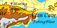
Go to the map of Journeys in Clan of the Cave Bear, including the location of the Clan fishing site on the the coast of the Crimean Peninsula.
Most of these photos are from Oleg Baranovsky, and are used by permission. He is a fine photographer, and his site is well worth visiting. Where Oleg is the photographer, the following copyright declaration applies:
Pictures copyright (c) 1996-2001 by Oleg Baranovsky, UA Zone Group
The photographs come from the web site: UA Zone Group
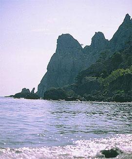 |
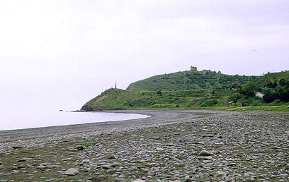
Novyj Svet. Cape Chikehn. This cape is just west of the entrance of the Clan River into the Black (Beran) Sea on the Crimean Peninsula.
|
|
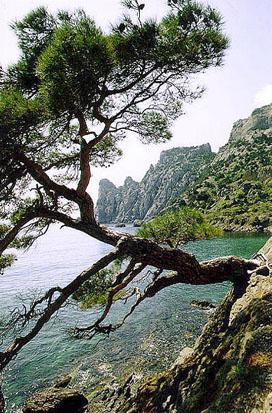
Pine tree, Novyj Svet. Just west of the entrance of the Clan River into the Black (Beran) Sea on the Crimean Peninsula. Cape Chikehn in the background.
|
 |
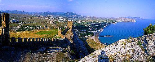
Panorama of Sudak on the Crimean Peninsula. Looking east. The 'Clan River' comes out just this side of the headland at the other end of the bay.
Sudak is a city on the shores of the Black Sea, 57 km from the Theodosia railway station. Population: 15,000.
Founded in the 3rd century. In early written sources it is referred to as the fortress of Sugdaea, a trading city on the Great Silk Road.
Around 1222, a detachment of about 25,000 Genghis Khan Mongol cavalry, as part of the Khwarizmian campaign, had crossed the Caucasus Mountains, had skirted the Caspian Sea, and had briefly invaded Europe.
After defeating the Georgians and the Cumans of the Caucasus, the small Mongol expedition advanced into the steppes of the Kuban. Combining rapid movement with guile, the Mongols again defeated the Cumans, captured Astrakhan, then crossed the Don River into Russia. Penetrating the Crimea, they stormed the Genoese fortress of Sudak on the southeastern coast, then turned north into what later became known as Ukraine.
The Venetian consulate was maintained here from 1287. At this time the Black Sea was called Sudak. The "Great Silk Road'' festival-market takes place here every summer.
Marco Polo and his brother passed through Sudak in 1260.
http://travel.kyiv.org/crimea/sudak/
on the server www.uazone.net
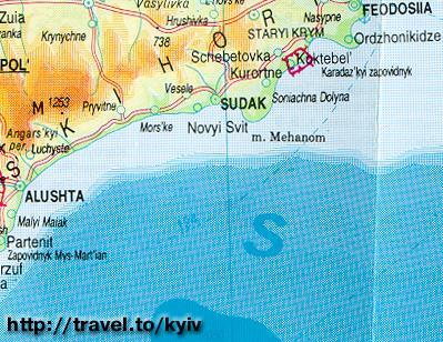 |
Map showing Sudak on the south coast of the Crimean Peninsula. Novyj Svet is spelled Novyi Svit on this map. The map is on a server operated by www.uazone.net. www.uazone.net seems to be a very well run organisation, with a lot of good information well presented and organised. http://travel.kyiv.org/crimea/map/crimea_33.htm on the server www.uazone.net |
 |
Tower Cape, (Bashennyj) a low cape west of Cape Chikehn http://travel.kyiv.org/crimea/map/crimea_33.htm on the server www.uazone.net |
|
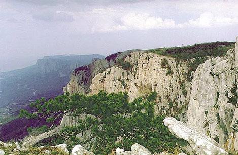
The mountains of the Crimean Peninsula. View From Baidaro-Castropolskaya Wall. |
 |
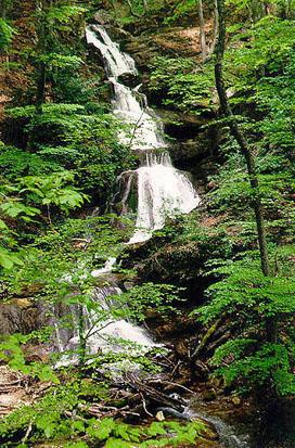 |
Khapkhal Gorge. Big Cascade Waterfall on the Crimean Peninsula.
|