Back to Don's Maps
 Bushwalking Index
 Bushwalking, Hiking and Tramping in New Zealand
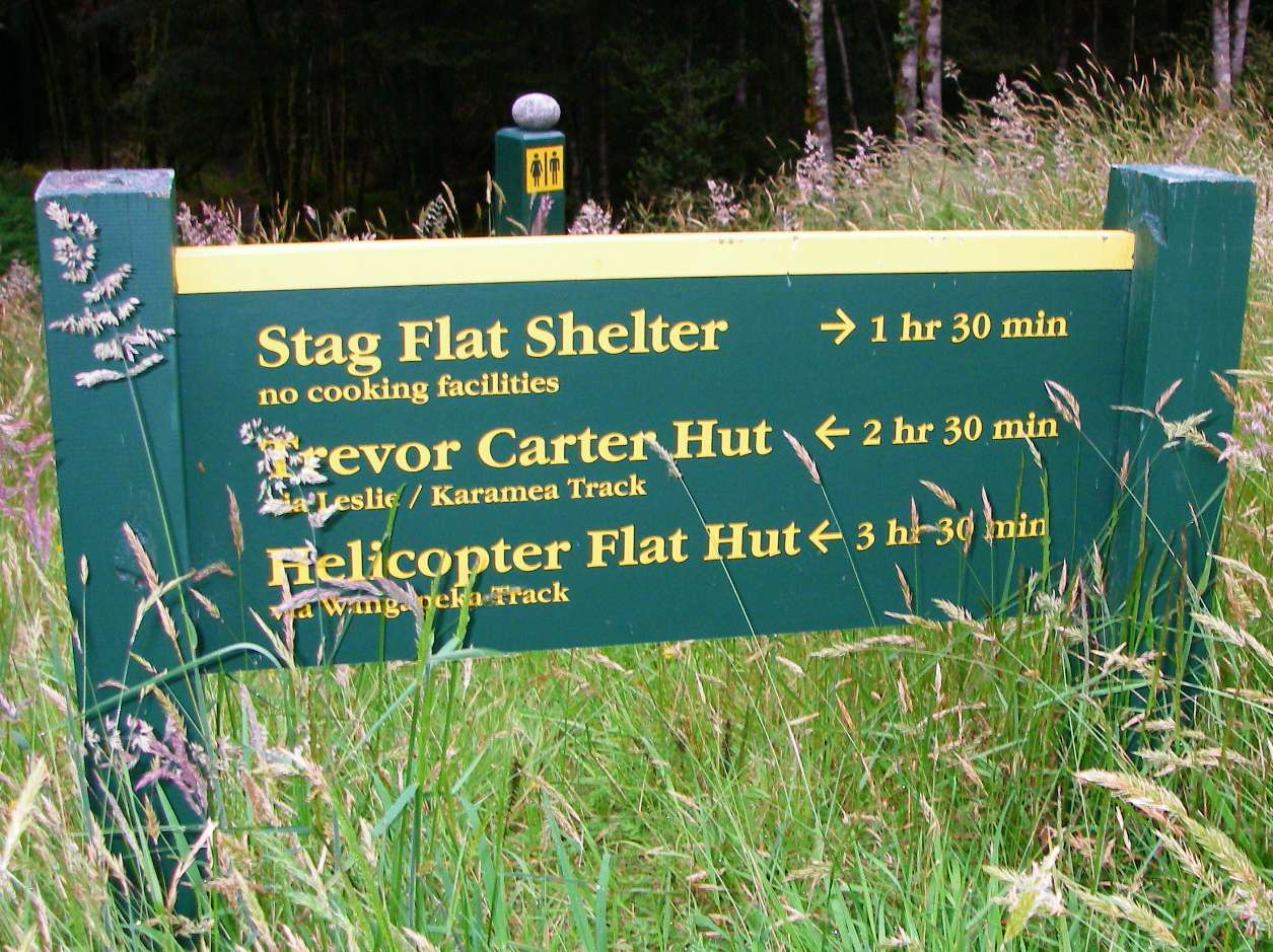
The Wangapeka Track in New Zealand
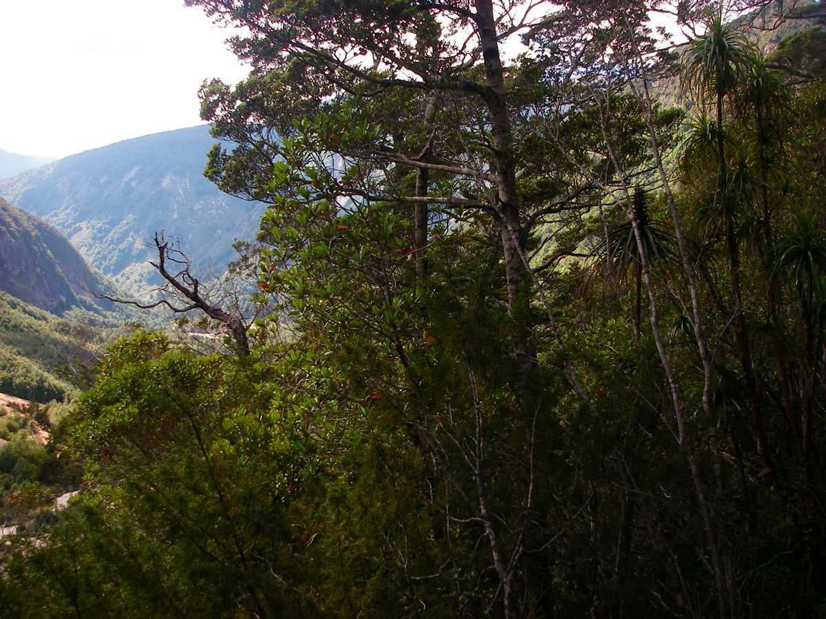
The Wangapeka track traverses the Southern Alps from the West coast to the eastern side of the mountains, passing through rainforest and alpine vegetation, as well as beautiful beech forests on the eastern side. It is a track for experienced, fit, self sufficient walkers. The huts rely on coal fires for warmth and cooking, and it is advisable to carry your own stove and fuel. There are many unbridged river and creek crossings, which may require a high level of experience to cross safely, or which may stop the walker entirely until conditions improve. You may well be the only person walking the track, and carrying a personal locator beacon is a wise precaution. Weather conditions can be extreme.

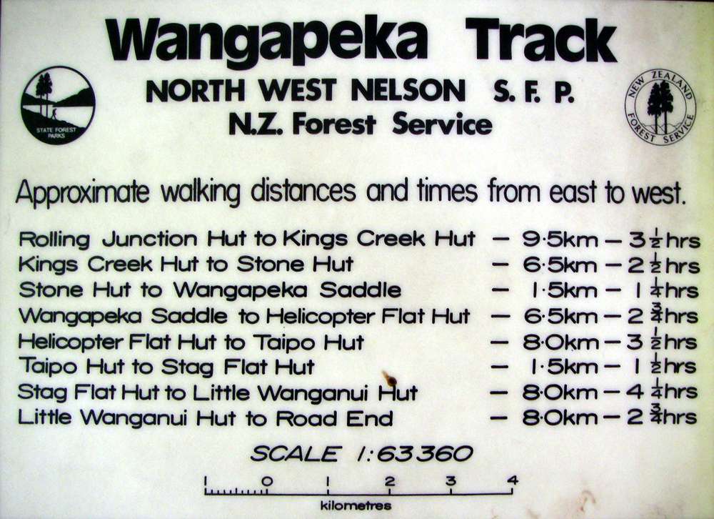
This is a very useful sketch map of the Wangapeka Track from the New Zealand Government site. The NZ Government has worked really hard to make it easy for tourists to find information, and to book travel and accommodation. I believe they have the best such system in the world.
Photo: http://www.doc.govt.nz
I had stayed at the excellent "The Last Resort" in Karamea after completing the Heaphy track, and they organised a car and driver at quite reasonable cost to get me to the start of the Wangapeka.
However, I had been sold an out of date guide book, which said that the high water track was a very long diversion, so I decided to try the ford. I got here just before 9 a.m. The water was higher and considerably faster flowing than I was comfortable with.
I was travelling from west to east, since I had just done the Heaphy, but apparently the normal way to do it is from east to west, and the track notes are usually written that way.
Photo: Don Hitchcock January 2007
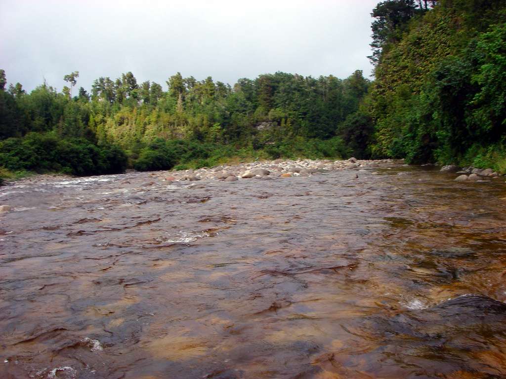
Things went well until I was nearly across, when I fell in the water, but I recovered with no dramas. I have an Optio waterproof digital camera, which is a comfort when something like that happens, as I keep it in my trousers pocket, on a tether or "moused" to my belt. It is so waterproof it has an underwater setting. I love it, it will take ultra closeups, down to one centimetre.
On the other side, I walked on, but found another ford, which looked more difficult. I decided to retrace my steps and take the high water track.
This photo was taken from half way across on the return journey. This time, I got back across the river with no incident. Crossing rivers like this is one of the chief ways that hikers are killed in New Zealand.
Photo: Don Hitchcock January 2007
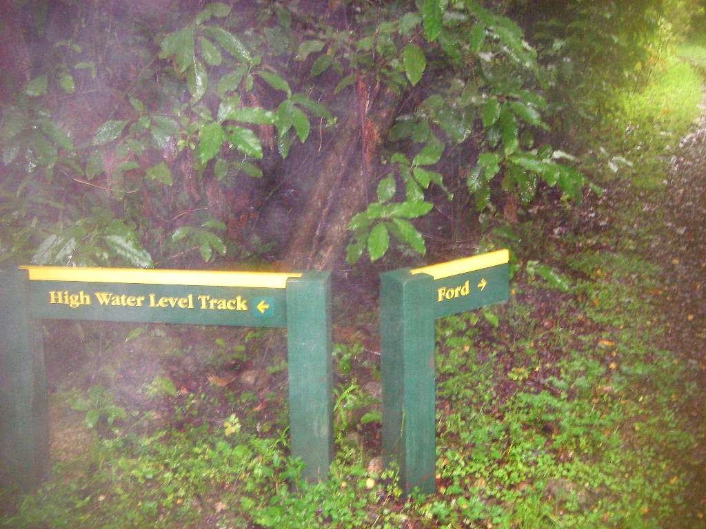
Back at the fork, I took the High Water Level Track. It was well made, short, and quite different to that shown in the old map I had.
Photo: Don Hitchcock January 2007
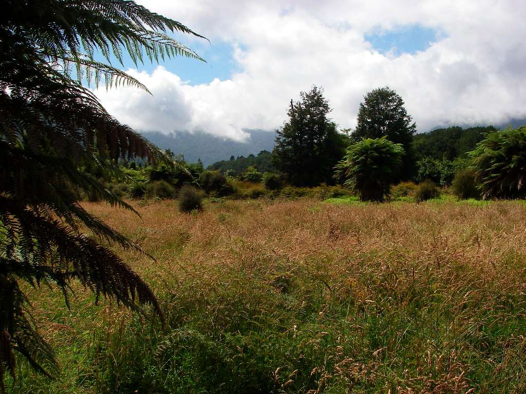
Further on, the track was level in the region of an old road, winding through low scrub, followed by this area which is known as Gilmore Clearing.
Photo: Don Hitchcock January 2007
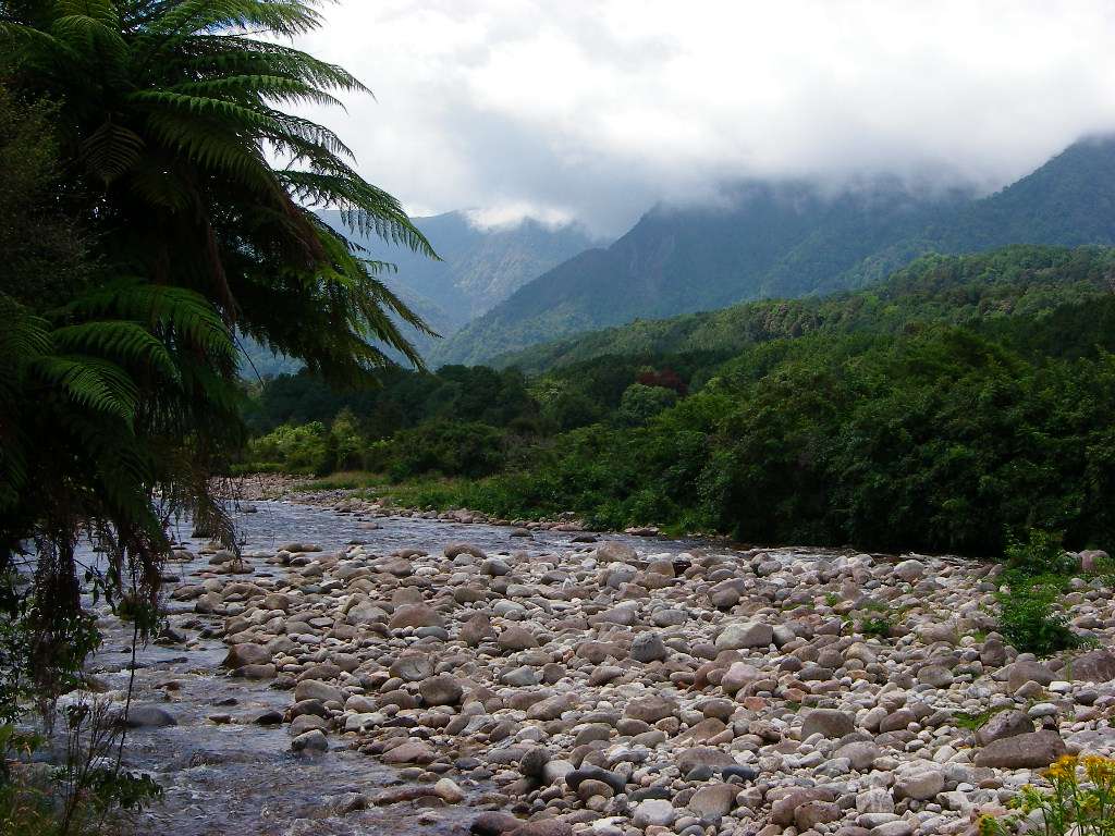
Eventually the track started following the Little Wanganui River again, staying on the true right bank of the river.
Photo: Don Hitchcock January 2007
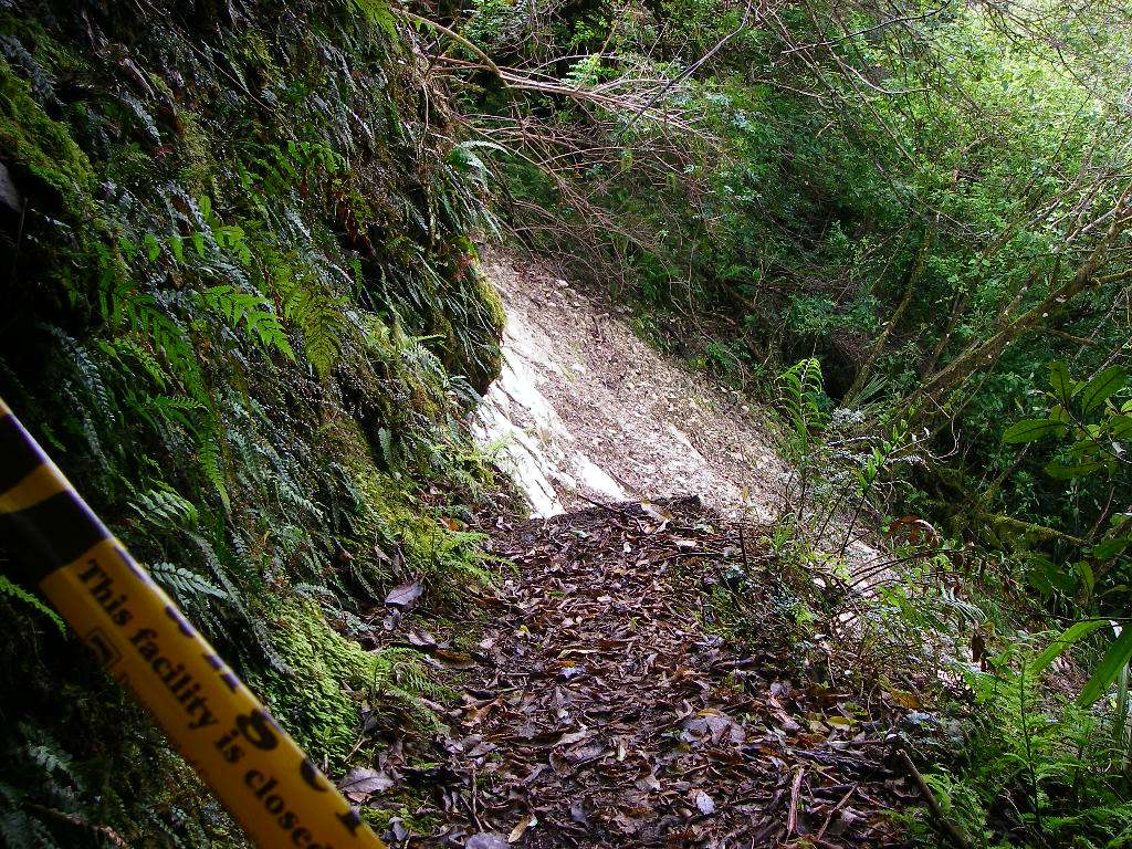
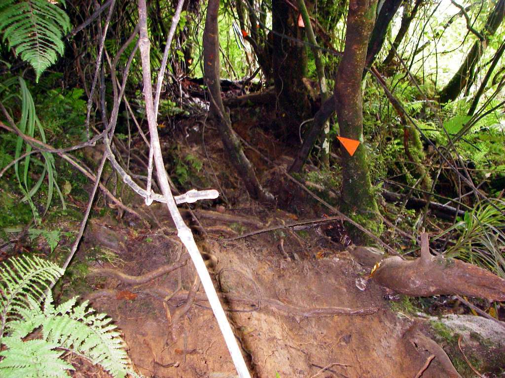
All was going well, the well made track was climbing beside the river below, when I came to this landslip, which had taken out part of the track.
Photo: Don Hitchcock January 2007

I decided it was time to consider my options, and have a cup of turkish coffee and some lunch. Things always look better on a full stomach.
Photo: Don Hitchcock January 2007

My only option was this one, and as the arrow indicates, it is straight up the muddy, slippery hillside. I began hauling myself up by means of trees and vines, and began to realise what the men on the Kokoda track must have gone through. This diversion took me just ten or fifteen minutes, they were on tracks like this for months.
Photo: Don Hitchcock January 2007
I was pleased when the track became not quite so vertical, and I finally reached the top, but the descent was almost as steep and slippery. I heard later that the track had been closed for repairs not long after I got through.
Photo: Don Hitchcock January 2007
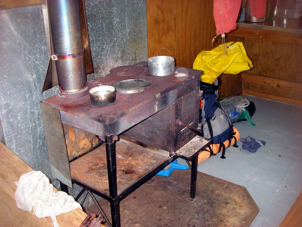
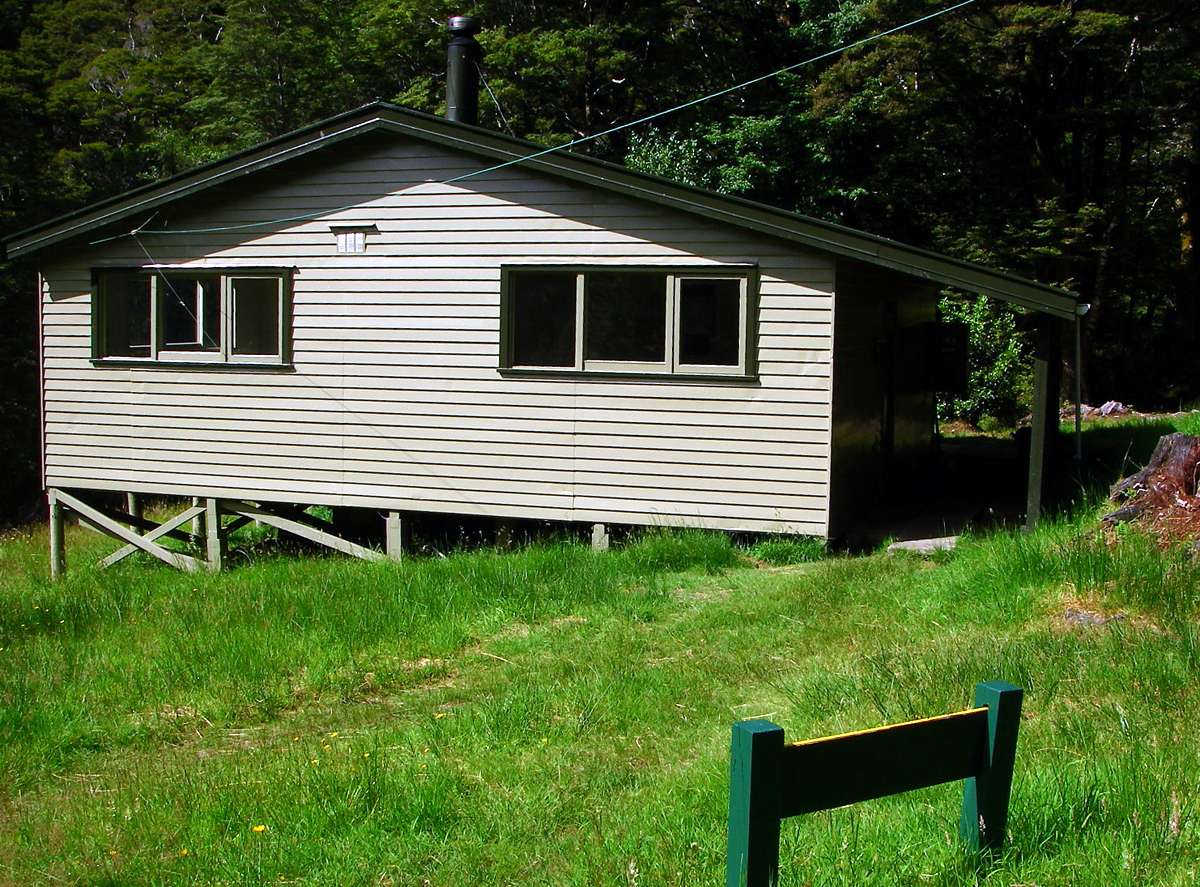
The rest of the trip to Belltown (Manunui) hut was uneventful. It was much more basic than I had become used to on the Heaphy track, with a coal stove and less room, but it was perfectly adequate, and I was glad of the shelter.
A couple of other trampers travelling in the reverse direction of the track welcomed me to the hut. They had a fire going, so the room was toasty, even though it was decidedly cool outside. I made some dinner, talked to the other trampers, and passed a pleasant night. Sometime in the early evening the rain began in earnest, and increased during the night. If you want to go tramping in New Zealand, you can't decide not to go when it is raining, you would never make any trips!
Photo: Don Hitchcock January 2007
Next morning I set off down the boardwalk outside the hut into pouring rain, my umbrella up, about 8:00 a.m.
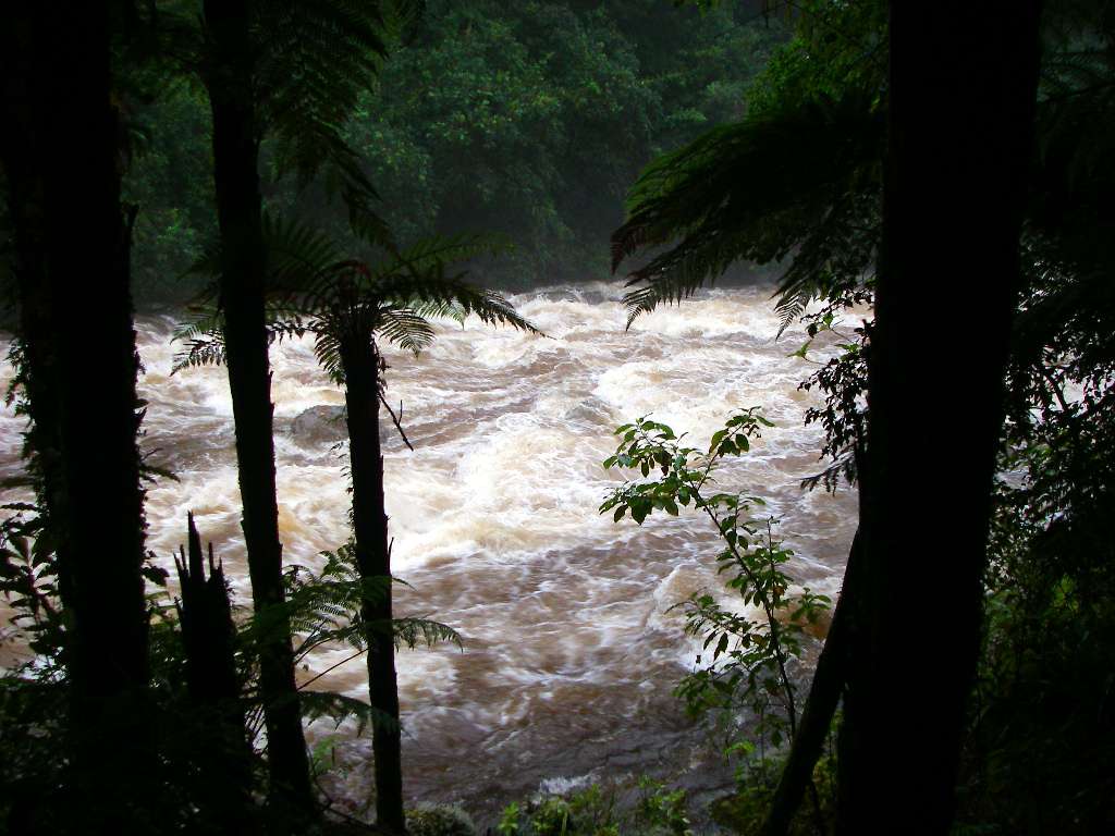
The river was much higher than it had been the evening before. This is common in NZ, rivers and side creeks can go up and down in a few hours, depending on the weather, and it is well to consider waiting out the weather if you must make a river crossing when the levels are high.
Photo: Don Hitchcock January 2007
I had bought a little pale blue umbrella in Karamea, I couldn't resist it when I saw that it was exactly the same colour as my pack, inner bag, ditty bags, home made silnylon raincoat, and gaiters. I make most of my own gear, including stoves, in order to get my pack as light as possible.
The umbrella worked well, though I had to repair it when I fell crossing a creek, and I used it throughout the remainder of the nine weeks tramping tour. I much prefer an umbrella to a raincoat on well made tracks such as you find in New Zealand. I found the air incredibly humid in NZ, and a raincoat by its very nature makes you almost as wet inside as out when you are doing more than strolling on a level track if humidity levels are high.
The only time I used my raincoat was for wind protection on the Travers Saddle in the Nelson Lakes area.
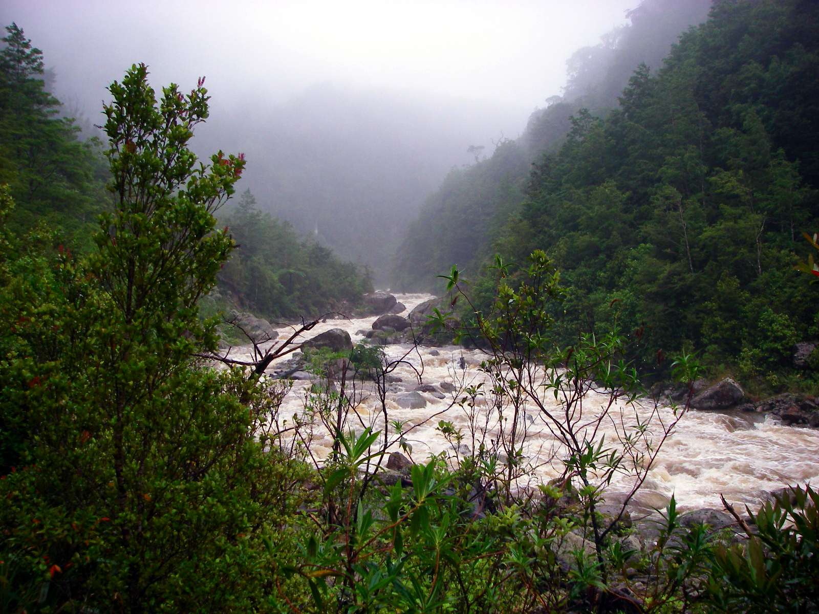
Despite the weather and the high river levels, this view of river and mountains was a beautiful sight. New Zealand has more beautiful scenery per square kilometre than any place I know.
Photo: Don Hitchcock January 2007
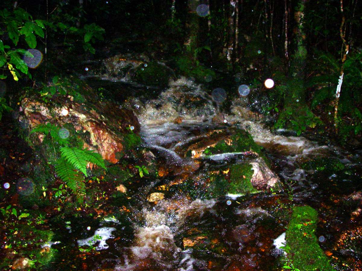
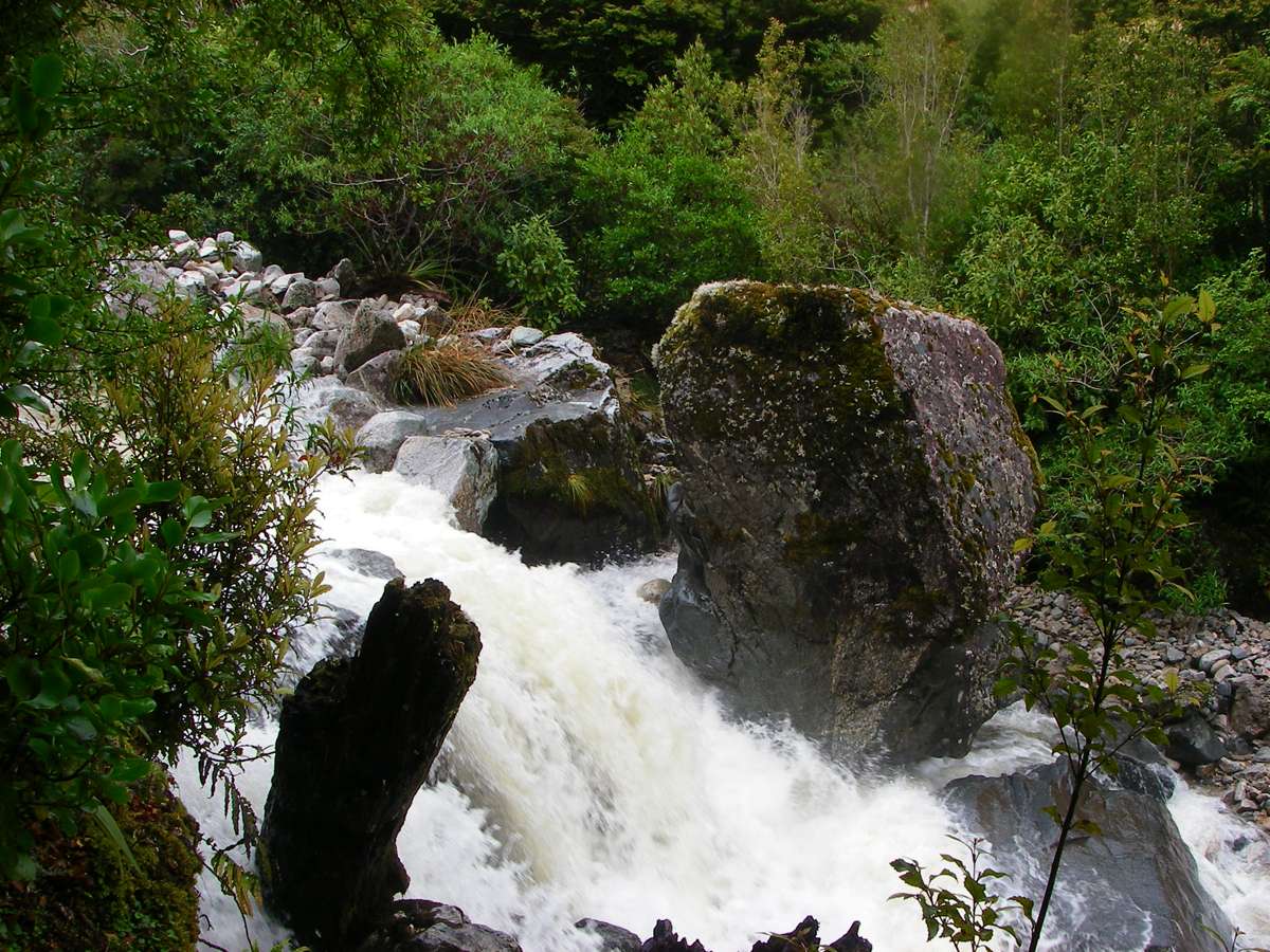
The rain came pelting down, then the track turned up the slope, and became a rushing torrent itself! I thought this was bad, but there was worse to come.
Photo: Don Hitchcock January 2007

Smith creek was tricky to cross, though I was glad of the fallen trees, undermined by a much greater flow of water at an earlier date. The trees were slippery, but offered good security when crossing the steep, fast flowing creek. It was still raining heavily.
Photo: Don Hitchcock January 2007

I was glad to cross McHarrie Creek safely. It was on a very steep slope, but there was not quite so much water, and provided you were careful, and made sure of the security of every footstep, there was no real danger. I crossed at a pool, out of the frame of this photo, which offered a reasonably flat bottom. It would have been a long and bumpy trip to the bottom, however, if I had lost my footing. The rain had eased, at least, by this point.
Photo: Don Hitchcock January 2007
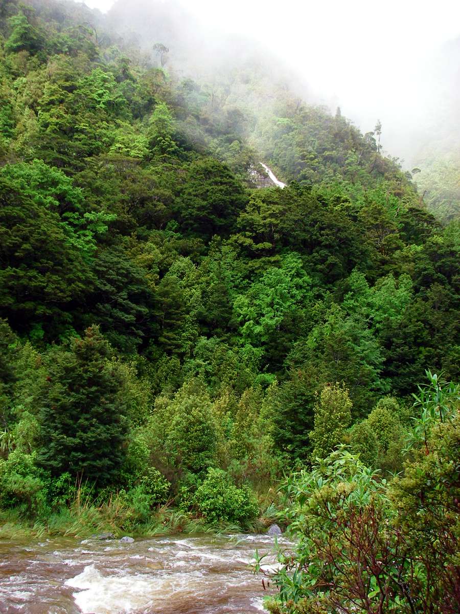
Left, looking downstream, right, looking upstream. At this point the track on the true right bank of the river was under water, and I had to haul myself up by the vegetation and rocks at the side against the very strong current, in water up to my waist at times. It was not a picnic. I have since learned that there is a high water track which bypasses this section of the track, between Smith Creek and Tangent Creek, but I must have missed it in the poor visibility and difficult conditions. From the description, it is a slow and difficult high water track in any case.
A large river/waterfall, probably Specimen Creek, can be seen on the slope in the background of the photo on the left.
Photo: Don Hitchcock January 2007
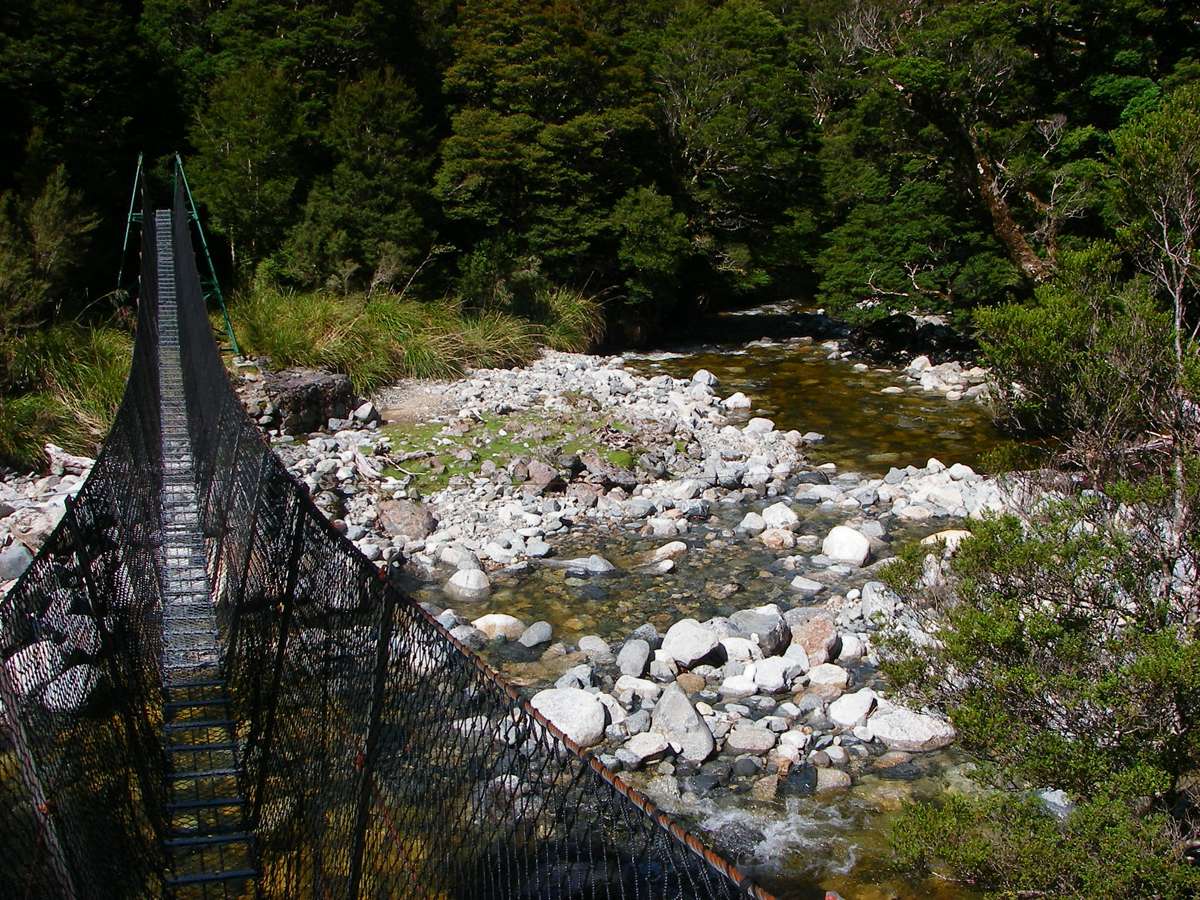
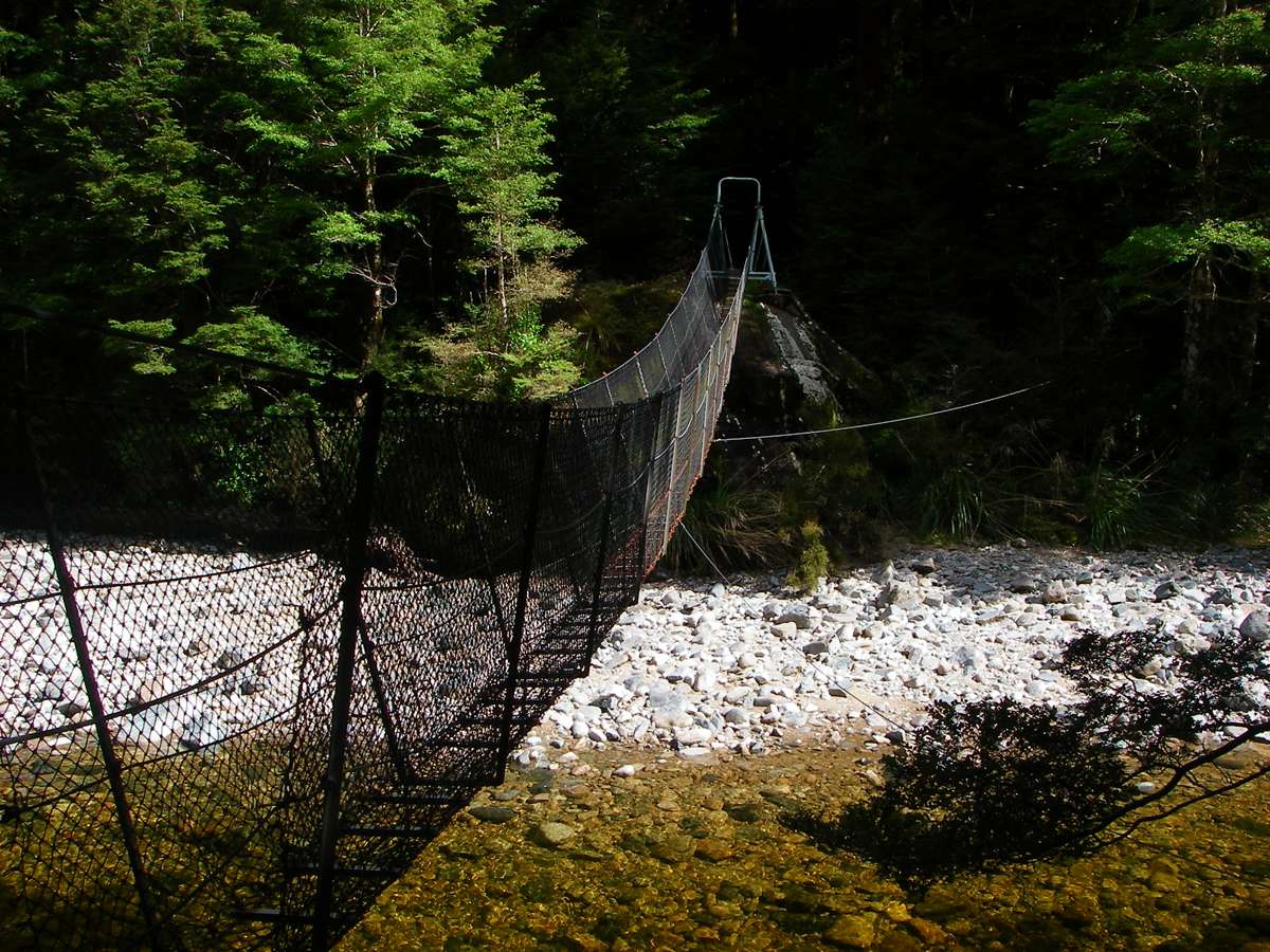
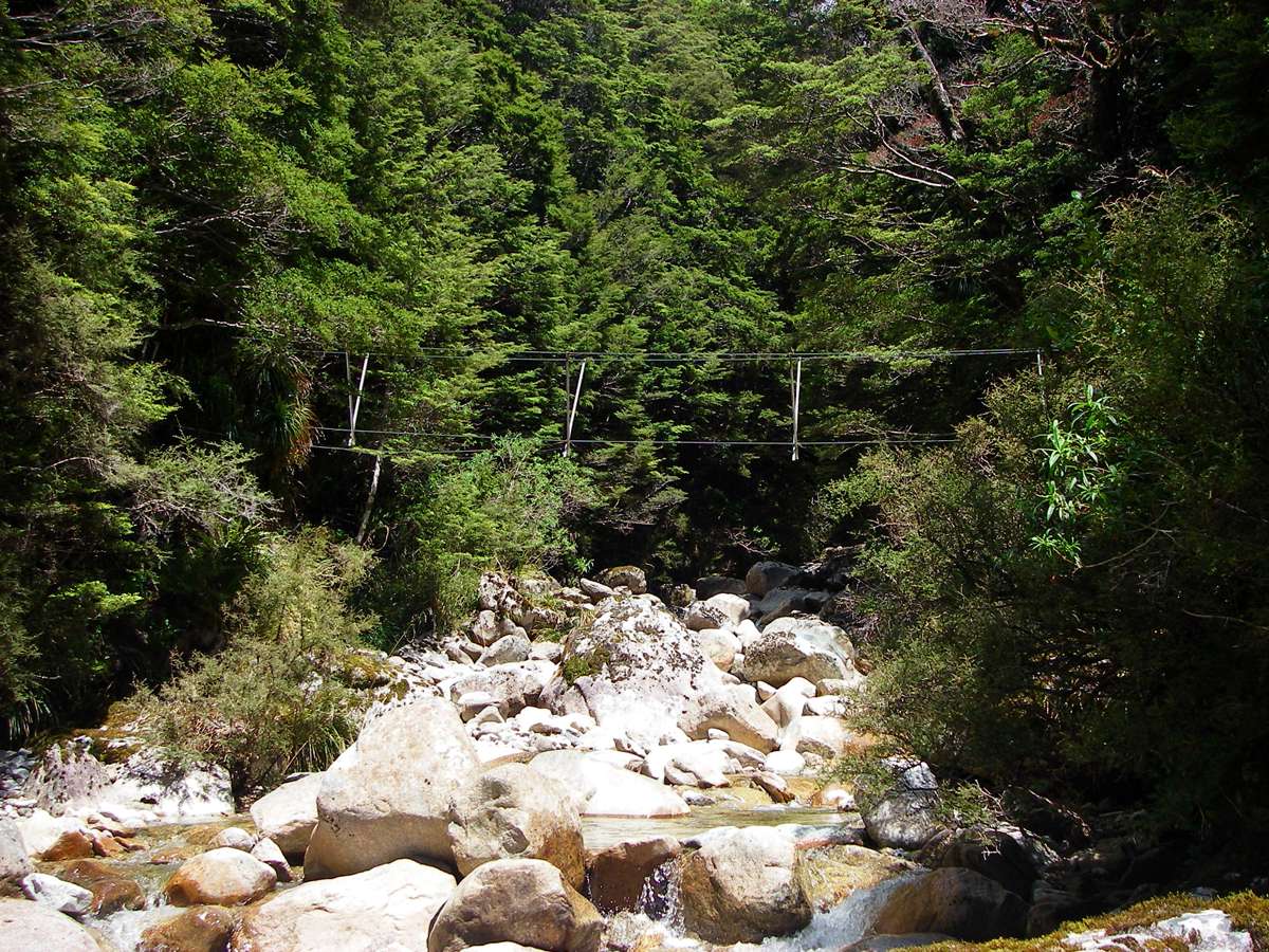
By 12 noon I was at Tangent Creek. I went upstream to the wire bridge crossing, from which this photo was taken. This was the last difficult creek crossing, and I was very glad of the bridge. Although it was not particularly stable, it was safe enough.
Photo: Don Hitchcock January 2007

This was the only spider I saw on the whole nine week hiking trip, though I saw a handful of spider webs. New Zealand has very few invertrbrates, and I missed them, at least as objects for photography. When I got home to Australia, I went on a two day bushwalk in dry sclerophyll forest, and was stung three times on separate occasions by bullants, and I was delighted that it was so! I have no idea why there is so little invertebrate and amphibian life in New Zealand. You would expect the marshy areas (and they have a lot of them!) to be alive with frogs, but it is not so. Though in some parts of NZ they do have sandflies!
A mate of mine in the defence forces was on an exercise in New Zealand, and he was told to lie down with his gun on watch in a patch of grassland. He expected to be eaten alive by ants while not being allowed to move while he was on watch, but for three hours not a thing moved. No ants, no grasshoppers, no birds, no butterflies, no flies, no spiders, no "enemy" soldiers, nothing.
Photo: Don Hitchcock January 2007
The track became very steep, on the way up to and past the Little Wanganui emergency shelter.
The emergency shelter is just that, with not room to swing a cat, and four very scungy bunk beds, two on either side of a very narrow passageway, not much longer than the beds. It had a bolt on the outside of the door, which would trap the occupants if it managed to work itself closed. I could see no emergency exit, just a very small window at the far end.
There was a little patch of sunshine, I had a late lunch and a welcome cup of strong black unsweetened turkish coffee, and pondered the walk.
I was concerned that I was not going as fast as the signs indicated I should be, but I could go no faster, and the weather was reasonable, and I was feeling good.
The sun disappeared again.
I packed up and pressed on.

Eventually, the track flattened out a bit, and I was able to take an interest in the vegetation instead of fighting my way across swollen side creeks and up very steep slopes.
This is Dracophyllum longifolium, with common names of Grass tree, Inanga or Inaka. I was glad to note also the presence of a couple of strands of spider web, though the spider was nowhere to be seen.
Photo: Don Hitchcock January 2007

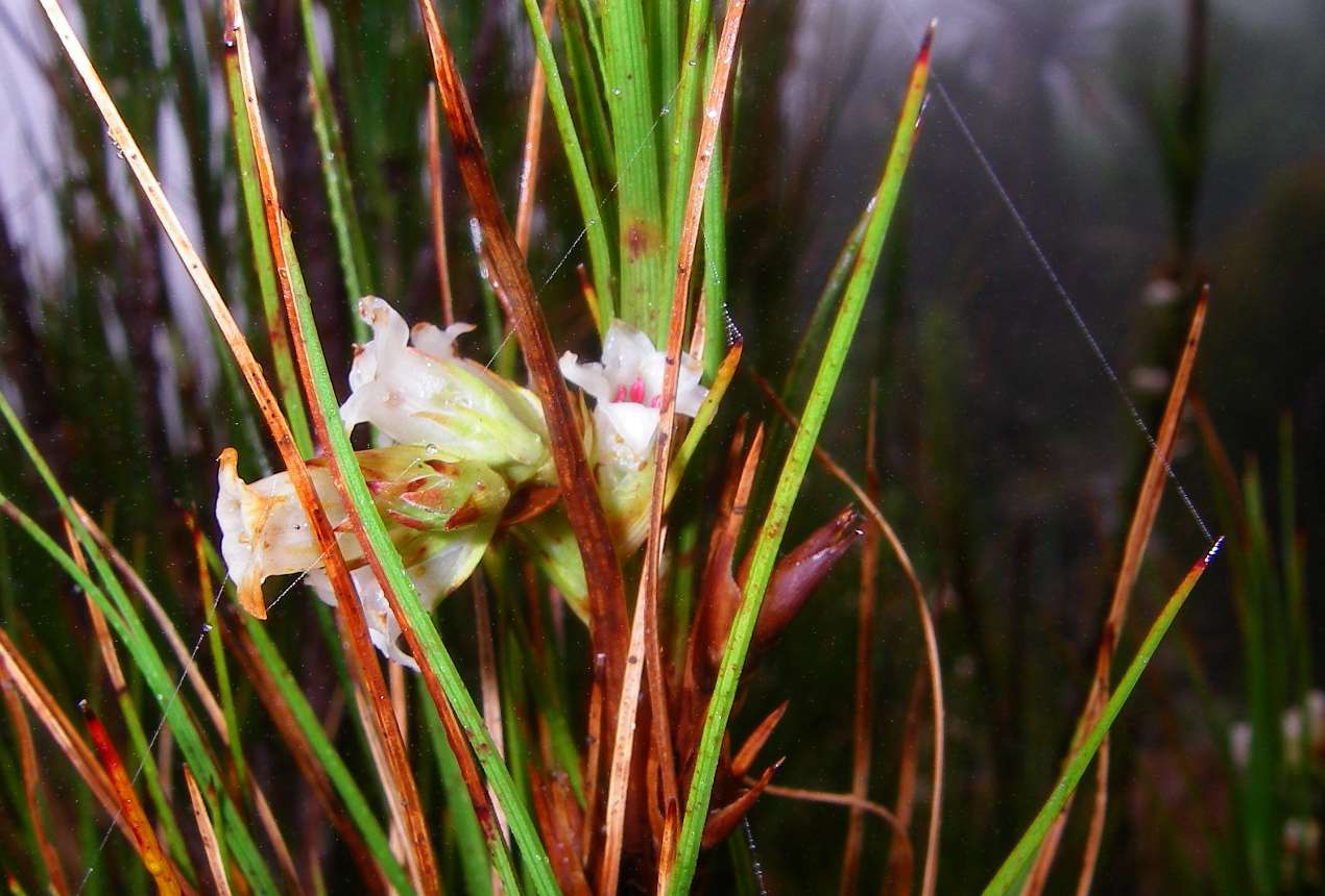
I found another Celmisia petiolata, a daisy which I had first seen on the Heaphy track.
Photo: Don Hitchcock January 2007
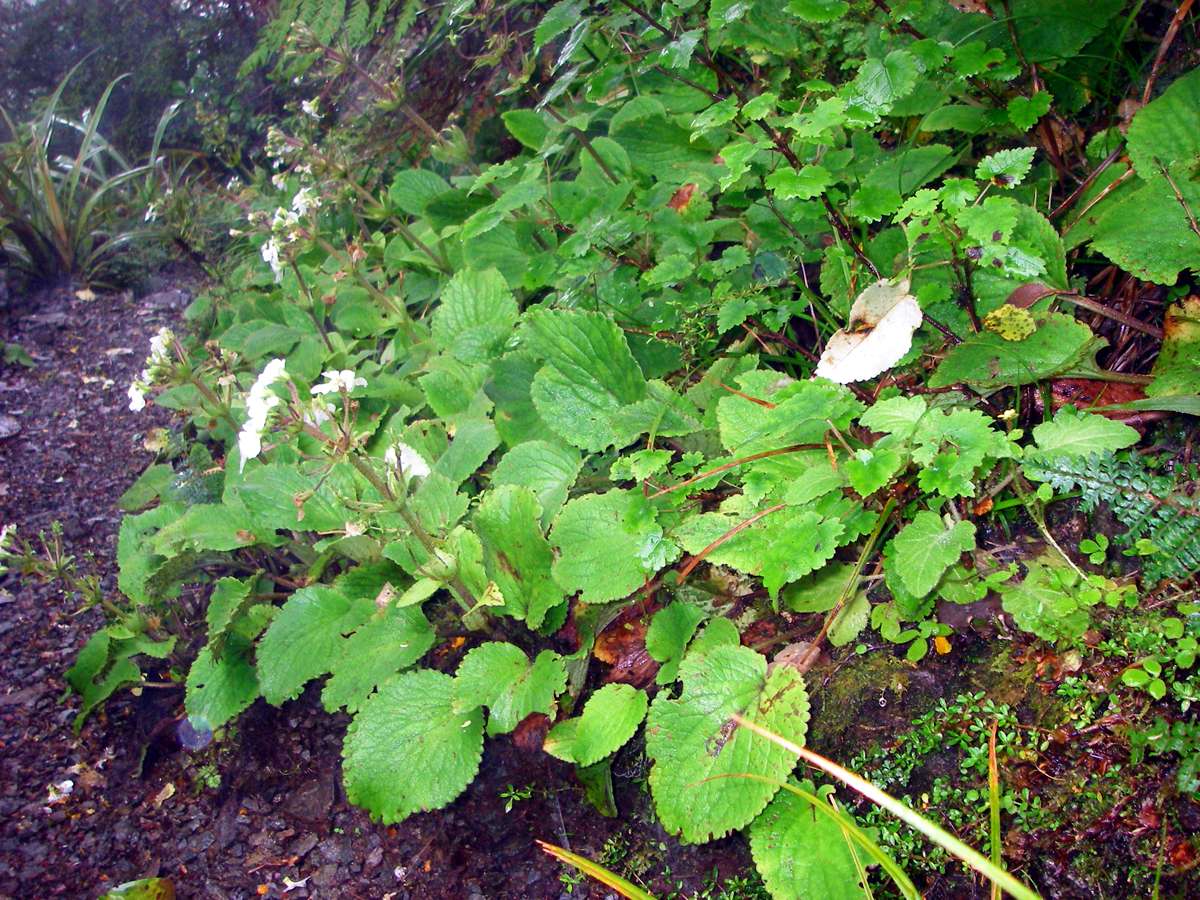
I could not work out what this plant was at the time. It looked rather like a garden escape, but it turns out to be Ourisia macrocarpa, the South Island Mountain Foxglove.
Photo: Don Hitchcock January 2007
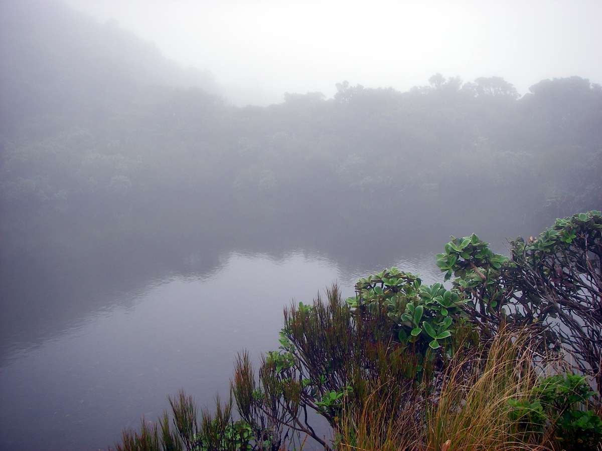
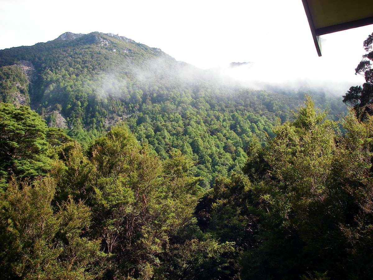
This is called Lower Saddle Lake, a beautiful spot, shrouded in mist.
I got here at 3 p.m. and boiled up some coffee. Things were looking decidedly better, and I was obviously going to have no trouble reaching Taipo hut in daylight.
Photo: Don Hitchcock January 2007
Near Little Wanganui Saddle.
Veronica (formerly Chionohebe and before that formerly Pygmea) sp.
This is a cushion plant which grows in sub-alpine to alpine environments, in exposed sites. I had first seen this on the Heaphy track.
Photo: Don Hitchcock January 2007
The track descended rapidly from Little Wanganui Saddle, but the times given for the various way points did not make much sense.
Pannikin Creek bridge, twenty minutes from Taipo hut.
It was obvious by this point that I was now in the rainshadow of the Southern Alps, and in a drier and warmer climate. The creeks were not so full, and there was more grass and other herbage typical of drier (but still moist) environments.
Photo: Don Hitchcock January 2007
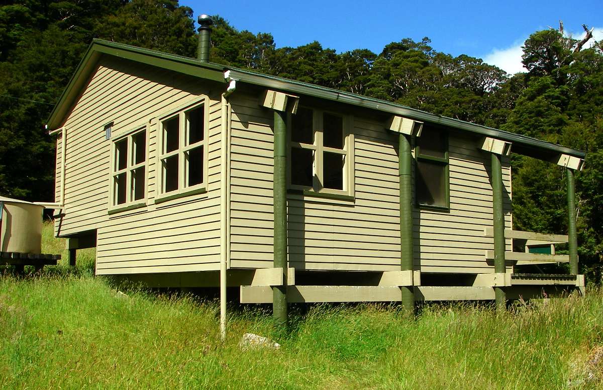
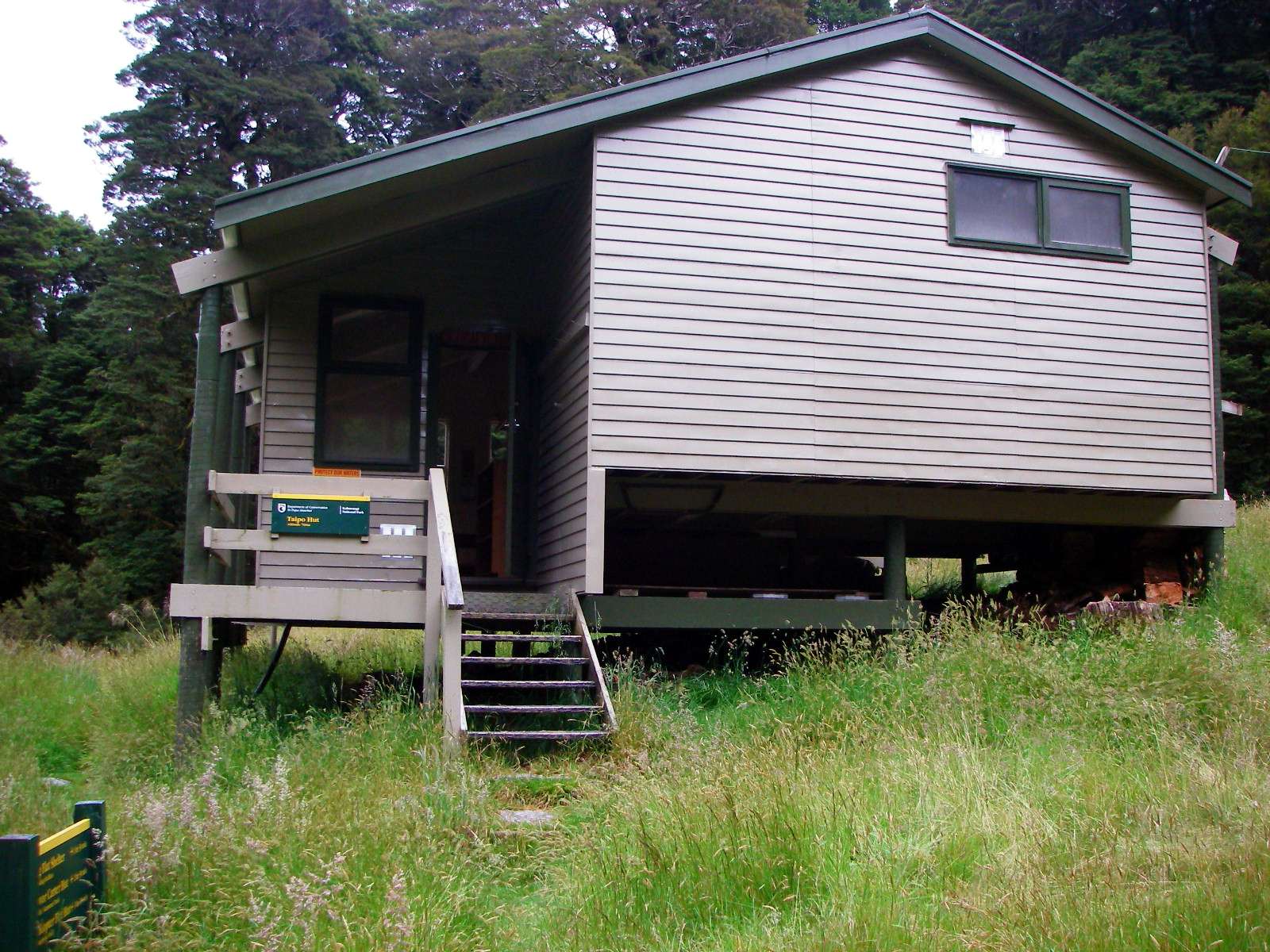
I was glad to get to Taipo hut just before 5 p.m. It took 1 and 3/4 hours to descend from the saddle to the hut. It is a well built, spacious place with 16 bunks, and I was the only guest for the night.
Photo: Don Hitchcock January 2007
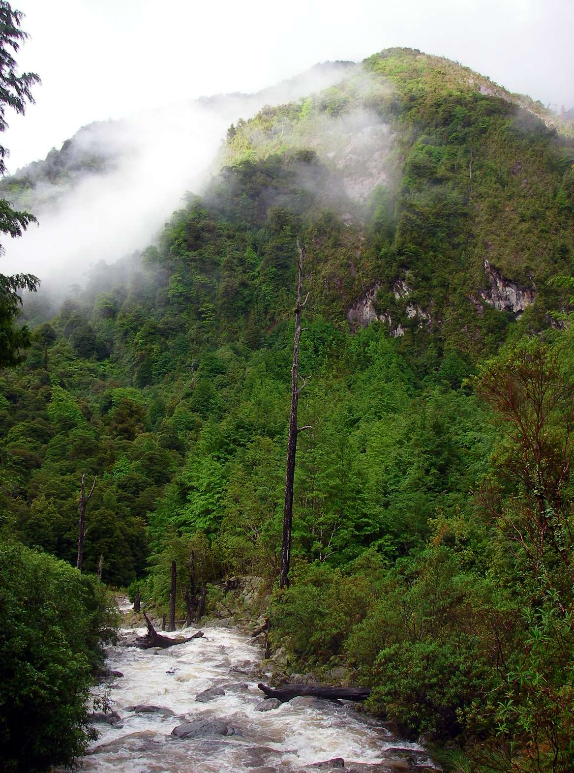
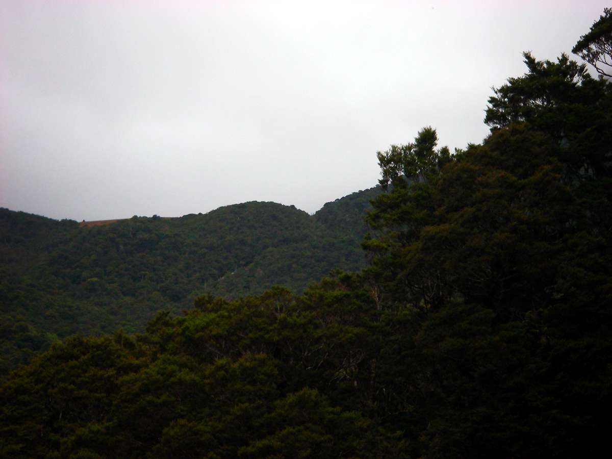
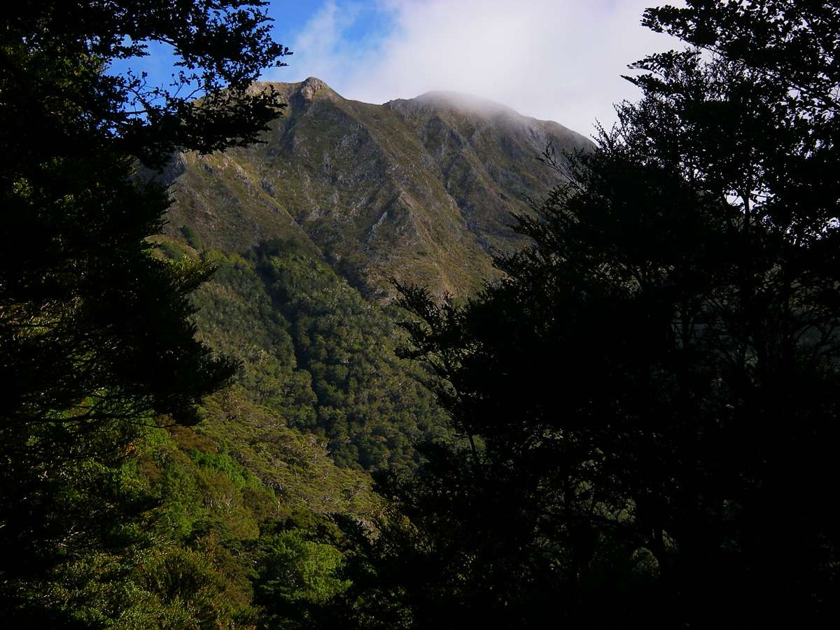
The view to the south is of Mt Allen (1532 m) to the left, with Mt Joyce (1477 m) obscured by cloud to the right.
Photo: Don Hitchcock January 2007
Next morning I went around photographing the environs.
Photo: Don Hitchcock January 2007
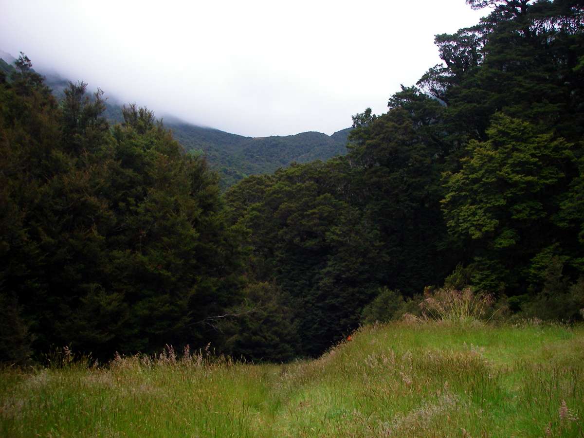
Looking back towards Little Wanganui Saddle from the hut.
Photo: Don Hitchcock January 2007


The toilet is a little down the hill, in the photo on the left, and in the right photo can be seen the wireless aerial for emergency radio contact, if you are carrying a Mountain Radio Service transceiver. This is a method of backcountry communication which allows remote walkers the opportunity to use the radio at predefined scheduled times to notify authorities of emergencies. Some systems allow the MRS to be used as a telephone, with pre-programmed numbers.
Photo: Don Hitchcock January 2007
I finally set off down the track to Helicopter Flat hut at 7:30 a.m.
Photo: Don Hitchcock January 2007
The track led off through rainforest, and I came across this brightly coloured toadstool.
Photo: Don Hitchcock January 2007
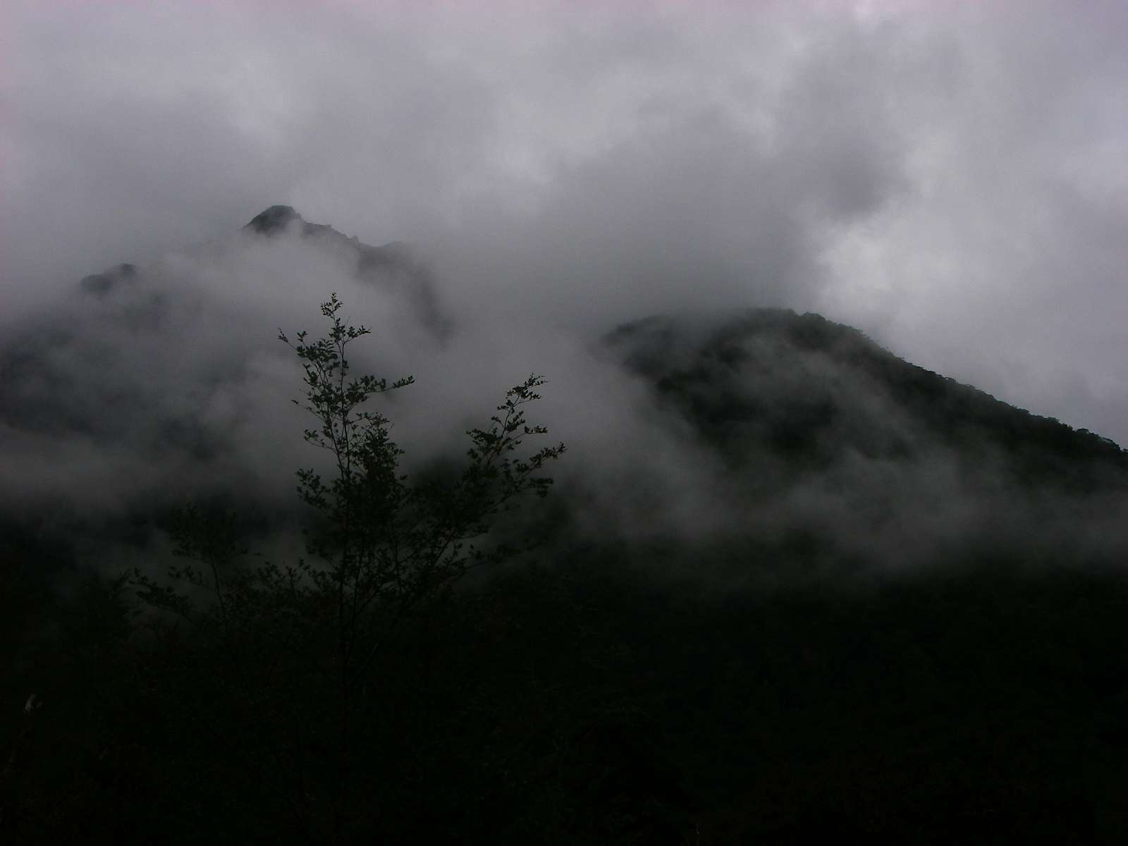
The day was dark, with heavy cloud. Forty minutes after the start, I caught this glimpse of Mt Allen to the left, and Mt Joyce to the right, poking up above the mists.
Photo: Don Hitchcock January 2007
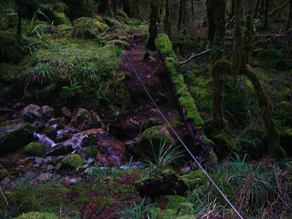
This creek crossing had a wire rope to hang onto when the creek was in spate.
Photo: Don Hitchcock January 2007
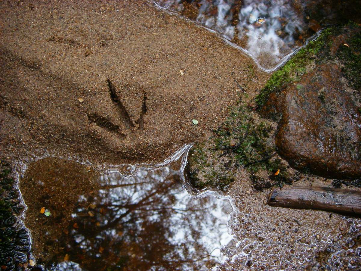
A bird track in the sand beside a creek.
Photo: Don Hitchcock January 2007
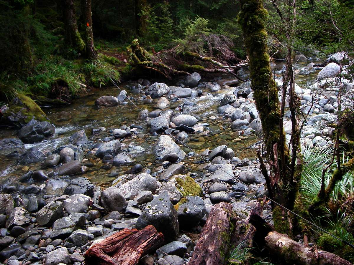
Another wire rope to help in crossing when water levels were high.
Photo: Don Hitchcock January 2007

A South Island Robin peeking around a tree. They were sometimes quite fearless.
Photo: Don Hitchcock January 2007
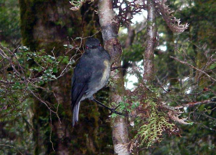
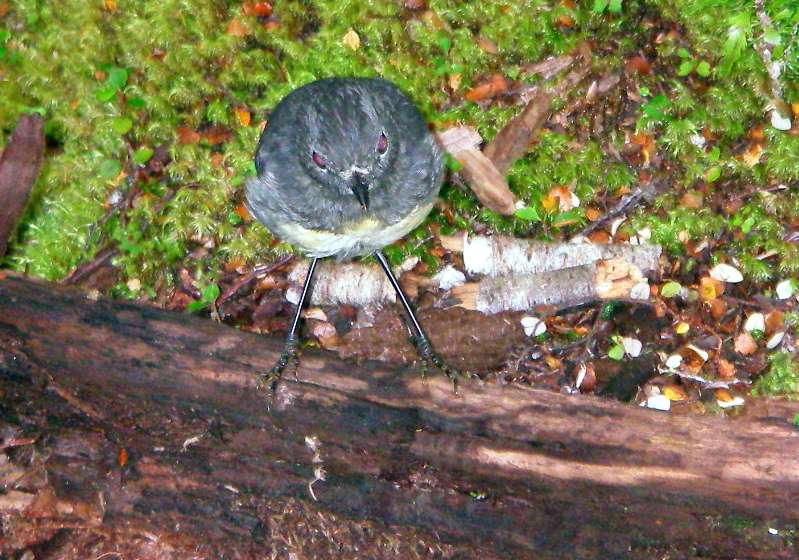
This one was happy to allow me to get reasonably close.
Photo: Don Hitchcock January 2007
Taipo River bridge. Crossing this means you leave the Taipo River, which soon joins the Karamea River, and climb to the headwaters of the Karamea River, cross over the Wangapeka saddle, and go down the Wangapeka River.
Photo: Don Hitchcock January 2007
The weather had improved considerably by this time, and I walked in perfect conditions from here to the end of the track.
The track climbs steeply, and skirts the slopes of Mount Dean. There are some great views over the Karamea River valley.
Photo: Don Hitchcock January 2007
The track has fallen away here, and there is a wire rope which you hang onto to get across the gap. It is worth giving it a pull to check it is firmly attached before venturing forth, it is a long way to the bottom.
Photo: Don Hitchcock January 2007
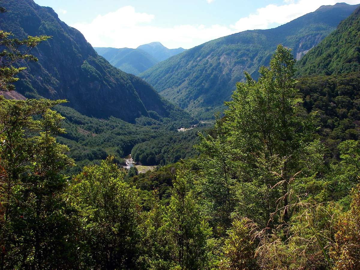
Another beautiful view down the Karamea valley.
Photo: Don Hitchcock January 2007
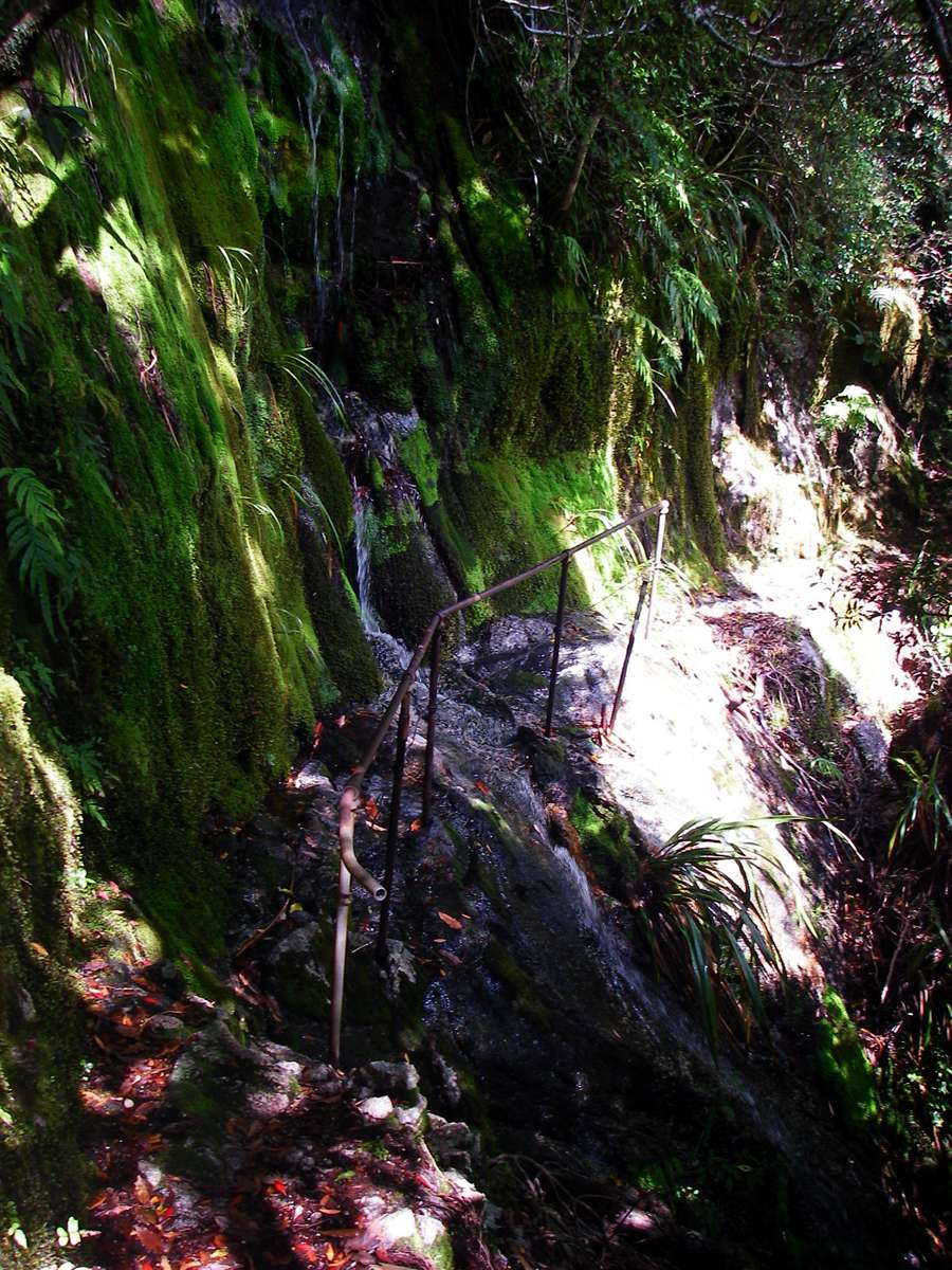
This pipe hand rail seems to have been there for some time.
Photo: Don Hitchcock January 2007
I got to Helicopter Flat Hut about 1 pm, had lunch and a coffee, and decided to continue to Stone hut. The times given here on a sign inside the hut bear little relation to the times it took me for the various routes. My times were almost invariably slower, even if meal times and coffee breaks were taken out. The hut logs tell the same story, on the whole, of strange times. One trip on the track signs was listed as a shorter time for the uphill journey than the downhill one! I jogged down that section in less than either of the times, but I would never have got up it in either of them.
On other walks, before and after this one, my times were equal to, or better than the published times, but on this trip I mentally added an hour or two to every sign which gave a time to the next way point. I found that most of the times given were very optimistic.
Photo: Don Hitchcock January 2007
At Waters Creek there was a three wire bridge, but I did not need to wobble across it, as there was not much water in the creek, and it was easily forded.
Photo: Don Hitchcock January 2007
The track follows the Karamea River, but there are a number of places where the track has fallen away into the river, and care must be taken.
Photo: Don Hitchcock January 2007
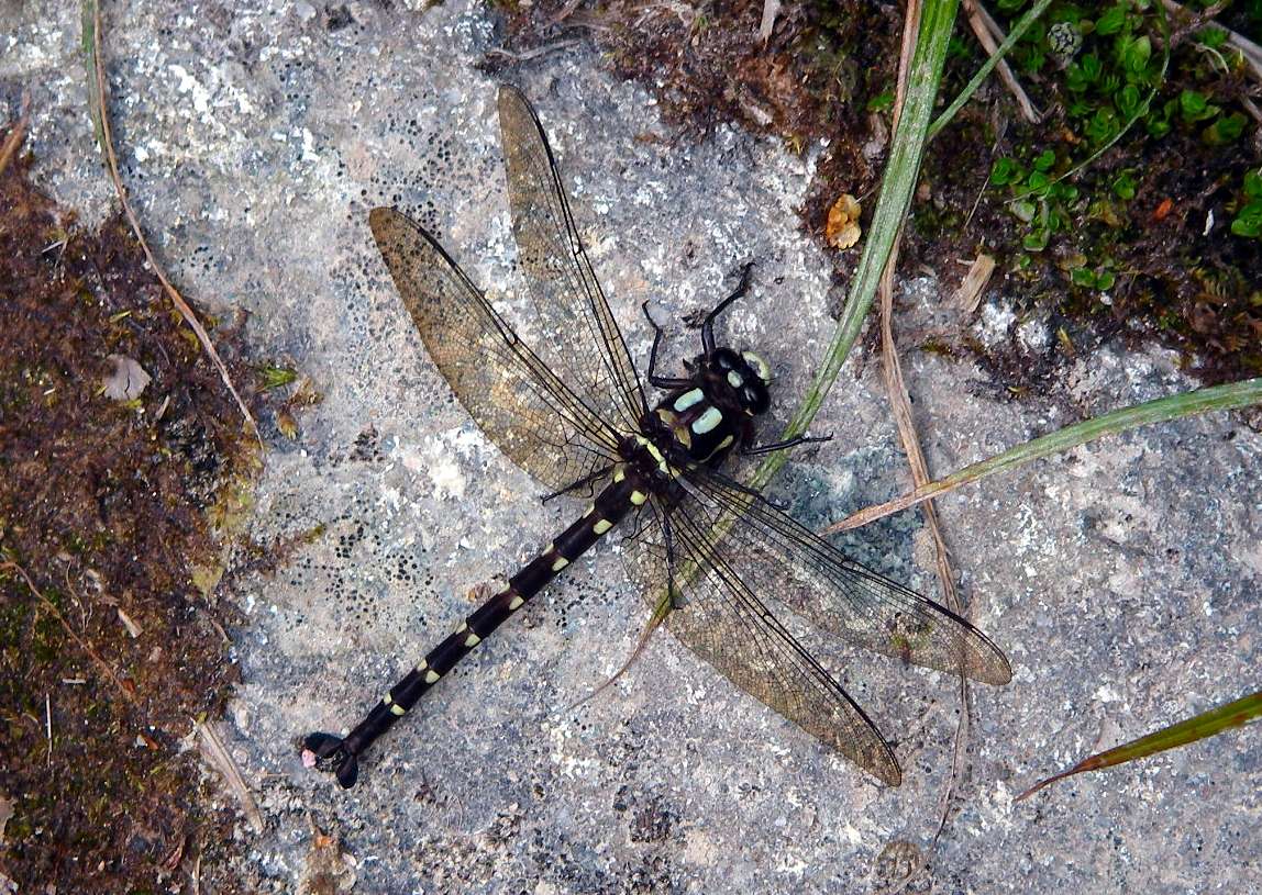
A large, beautiful dragonfly resting on the track. This is the bush giant dragonfly, Uropetala carovei, New Zealand's largest dragonfly, and has a body length of up to 86 cm, and a wingspan of 130 mm.
Photo: Don Hitchcock January 2007
From Wikipedia:
Uropetala carovei, or New Zealand bush giant dragonfly (Kapokapowai in the Māori language), is a giant dragonfly of the family Petaluridae, endemic to New Zealand. The Māori name means "water snatcher" alluding to the water dwelling larva, which, like all dragonflies, has a long extendable jaw that shoots out to snatch prey.
The yellow and black body can be up to 86 mm long, with a wingspan up to 130 mm, making it the largest dragonfly in New Zealand. Males have petal-shaped hind appendages. Its diet is smaller insects, including cicadas. They are preyed on in turn by rats, kingfishers and even wasps.
They are slow and noisy fliers.
The nymphs tunnel into the soft earth of a stream bank or seepage, where they occupy a chamber half-filled with water for about five years. They emerge at night to seek prey near the burrow entrance. They are sensitive to disturbance so are rarely observed.
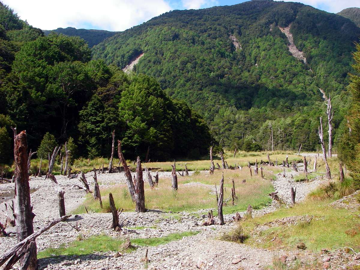
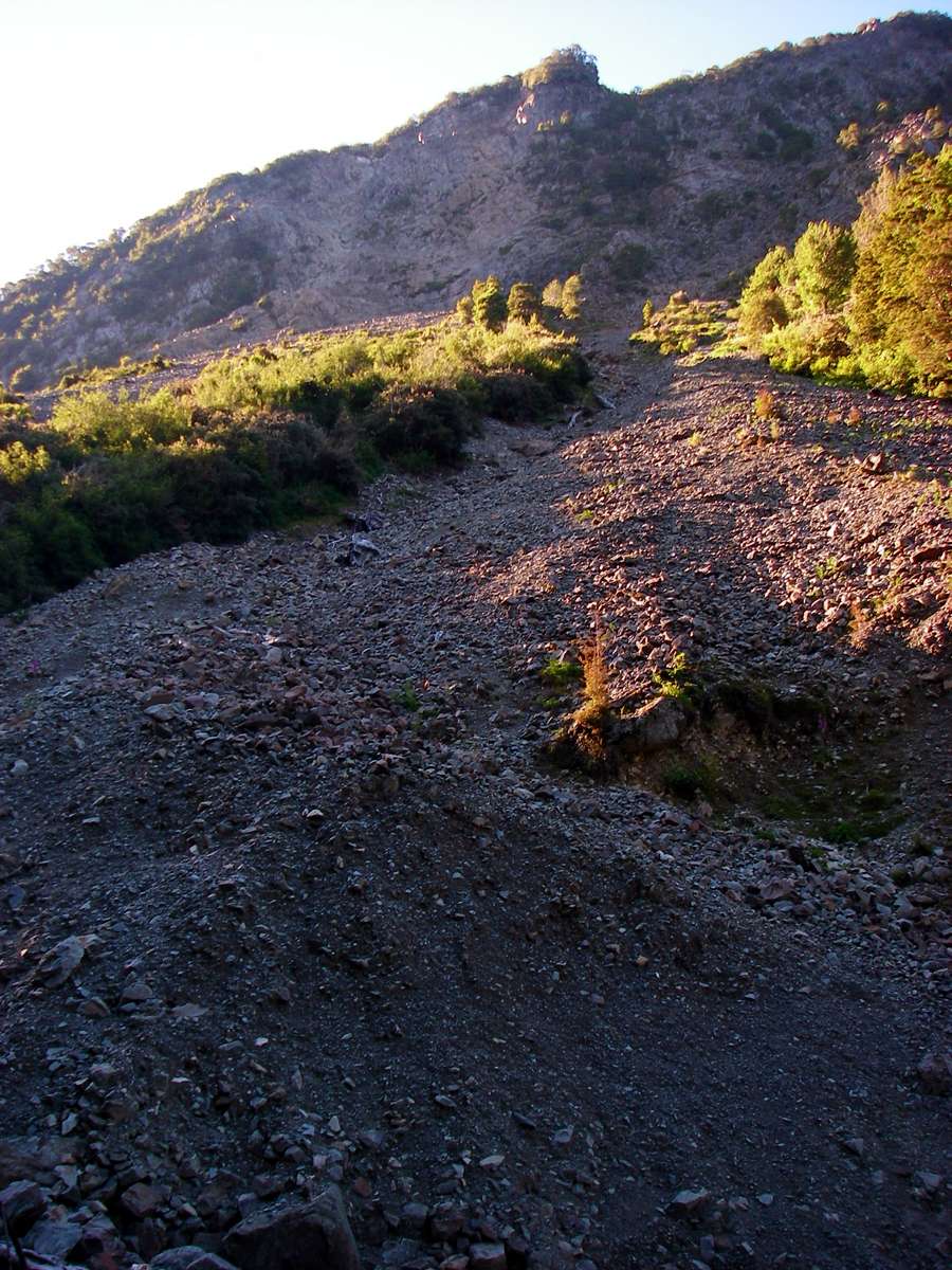
Nearly two hours after I got to Waters Creek, the track opened out to a large clearing.
I could not work out why these trees had died, except that there was a lot of gravel surrounding them.
Photo: Don Hitchcock January 2007

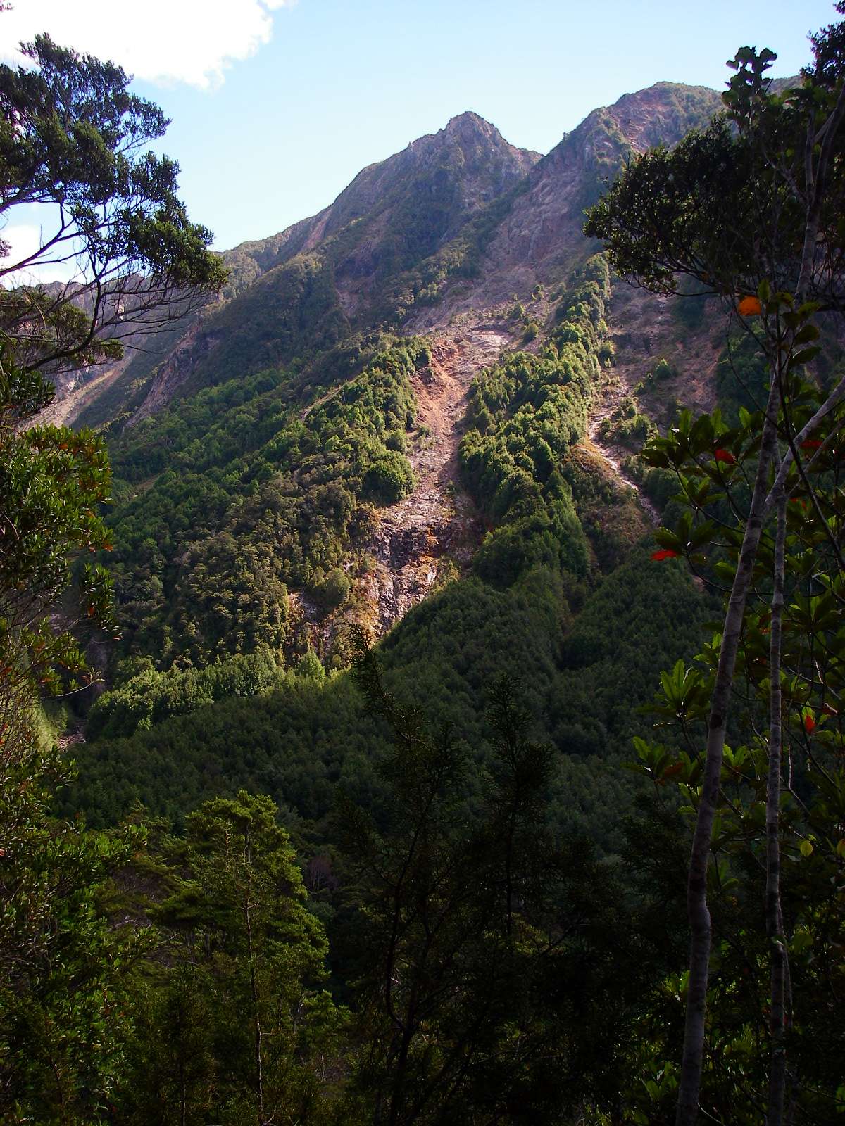
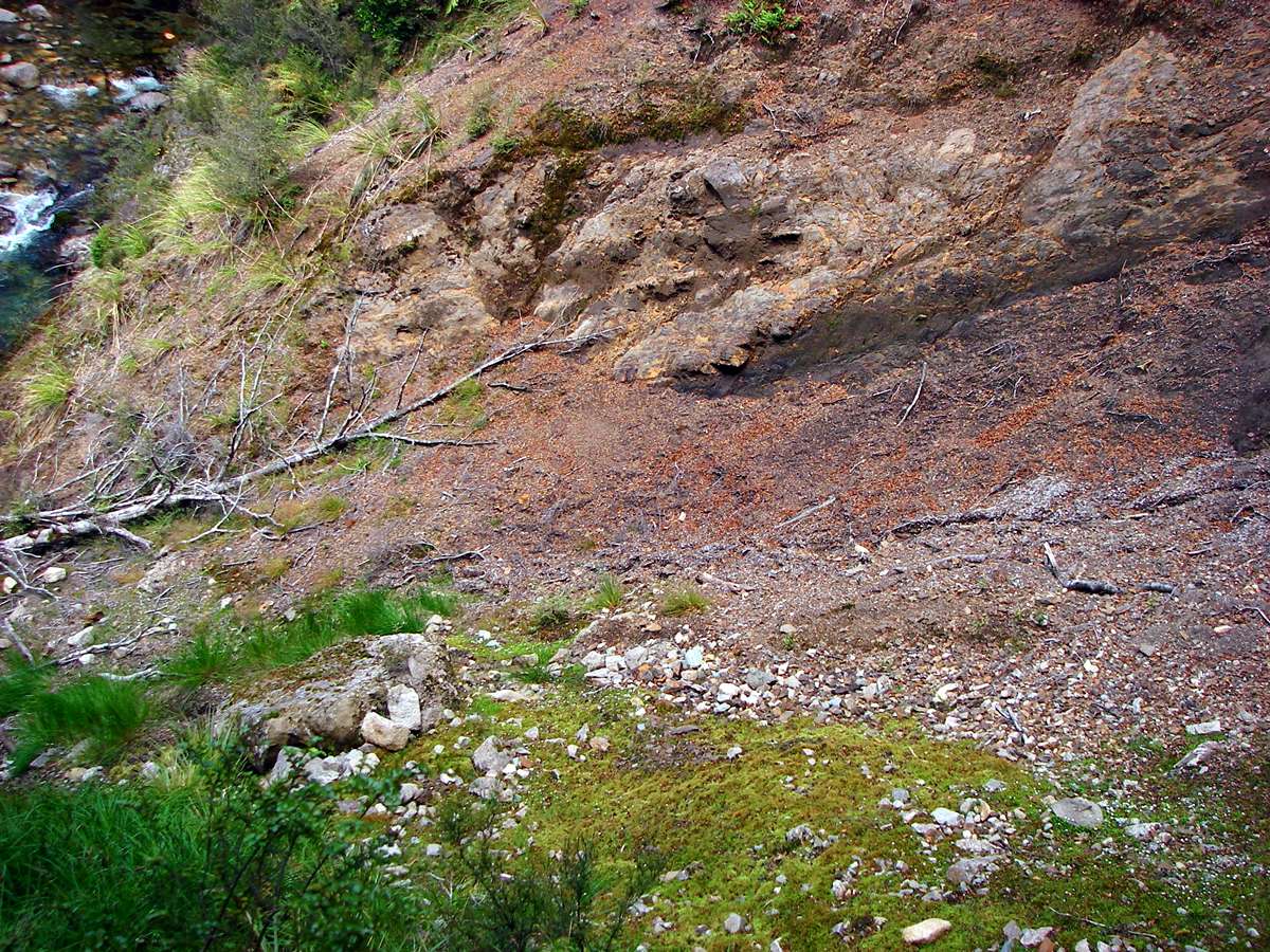
There has been a large land slip here, and the track takes a big diversion up above it. Care must be taken, the edge of the slip is undercut, and gives way periodically.
Photo: Don Hitchcock January 2007

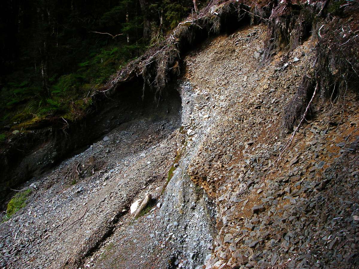
A view back down the steep track around the slip, and the top of the slip itself, showing the undercut top, which makes any approach dangerous.
Photo: Don Hitchcock January 2007
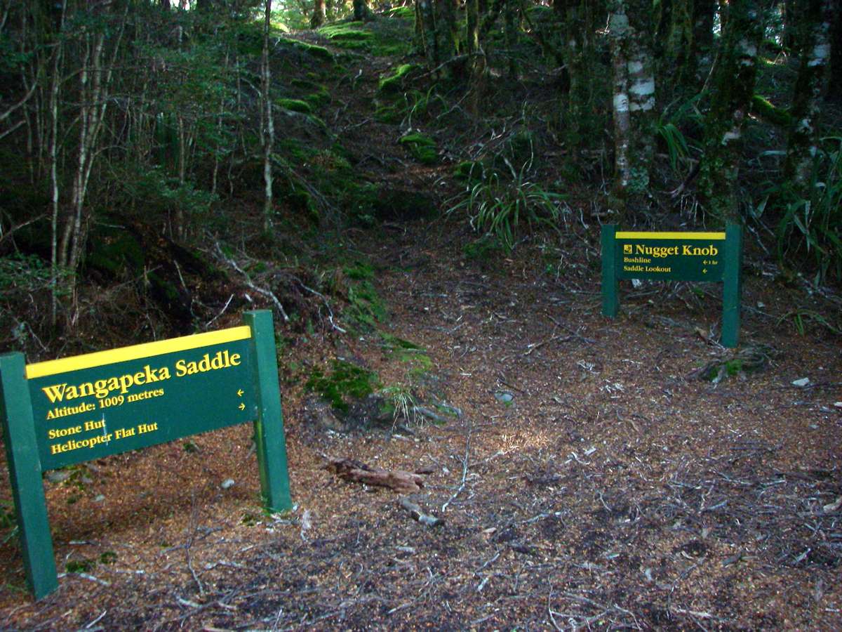
Wangapeka Saddle at 1009 m altitude is a quiet little glade, protected from the elements, and a good spot to rest before the descent. I got here about 6 p.m., and had been on the track since 7.30 a.m. It turned out to be less than an hour from this point to Stone hut.
Photo: Don Hitchcock January 2007
It is worthwhile taking the short track up to the lookout from Wangapeka Saddle, the view is not 180°, but what you can see is spectacular.
Photo: Don Hitchcock January 2007

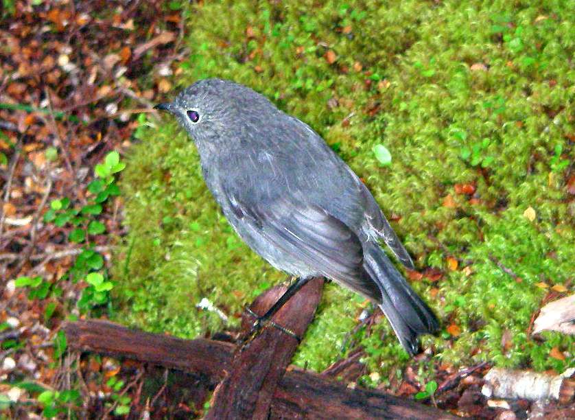
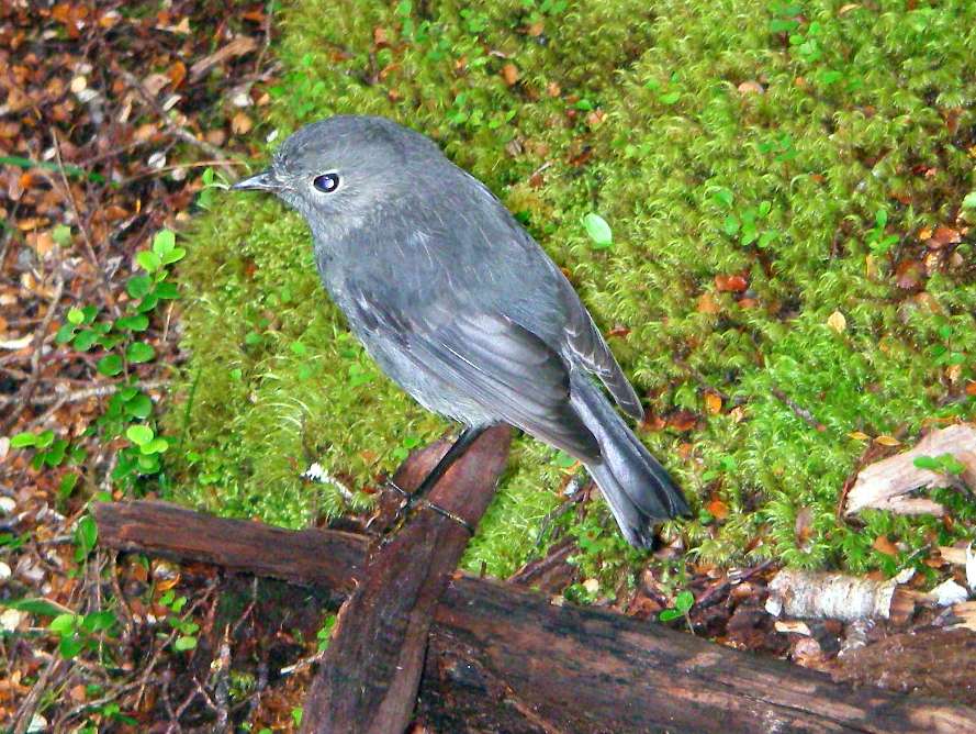
This plump little South Island Robin showed no fear of humans, and was investigating my shoes and gaiters, looking for insects.
Photo: Don Hitchcock January 2007
A land slip. Many are the result of the Murchison earthquake of 1929. It shook New Zealand from Auckland to Dunedin, and caused a large number of deaths. It was centred on the Lyell Range, just west of Murchison, in the north-west corner of the South Island.
Photo: Don Hitchcock January 2007

Ten minutes later, the track crosses this patch of large gravel. Stone hut was close by, and I reached it just after 7 p.m.
It had been a long day, nearly 12 hours, but it was good to be so far along the track. I would be able to walk out the next day.
Photo: Don Hitchcock January 2007
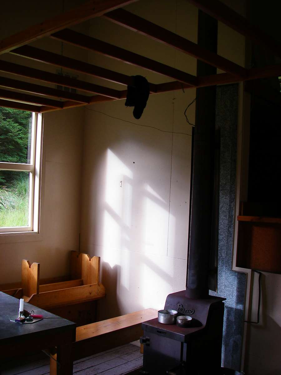
Once again I was the only guest at a hut. I had a good meal, and slept well. I felt much refreshed the next morning when I set off.
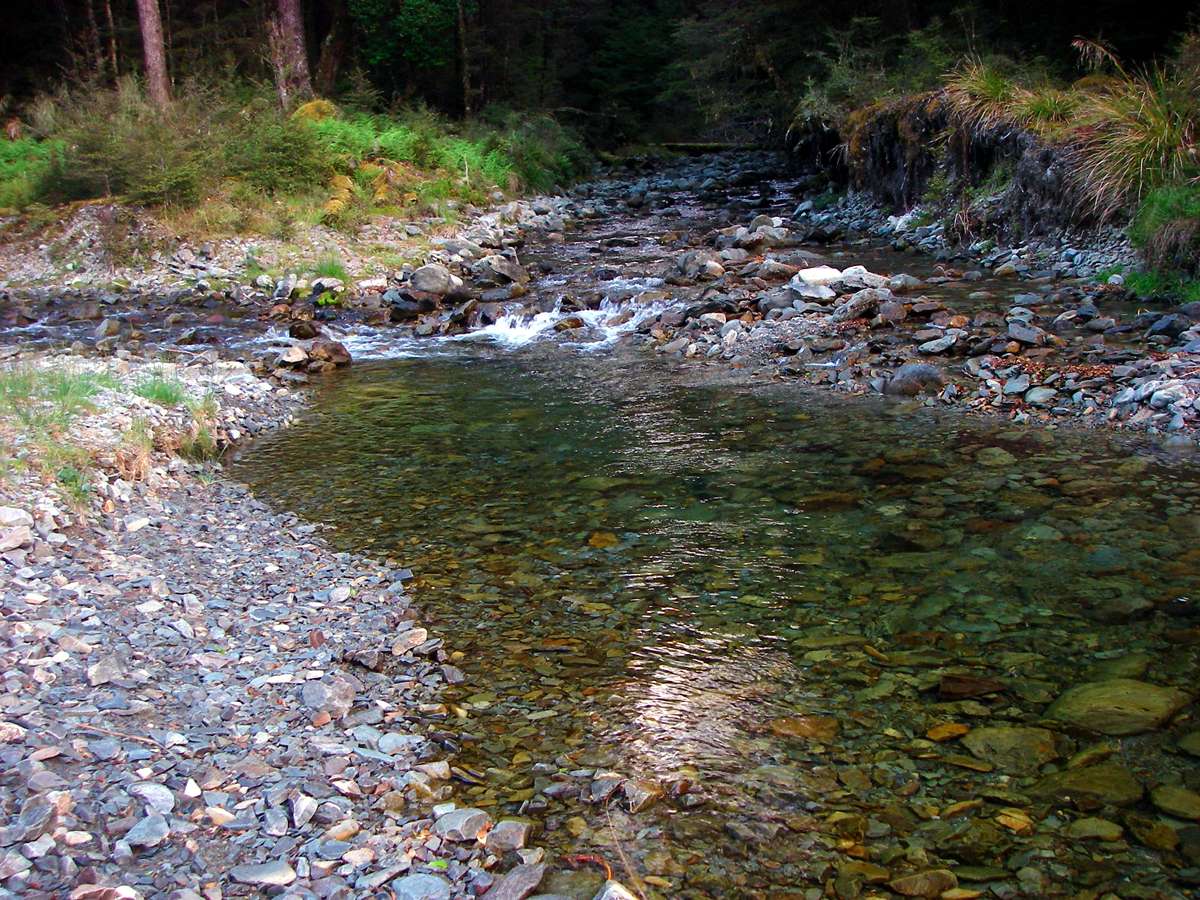
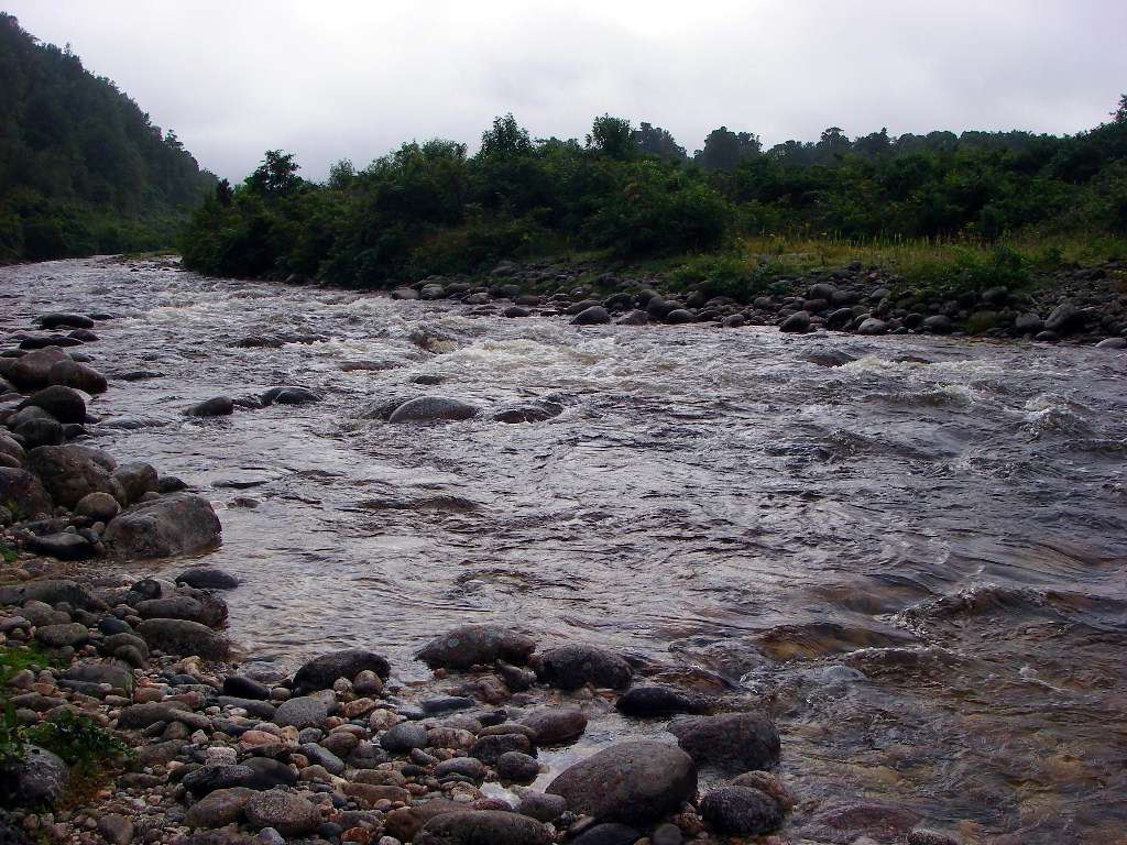
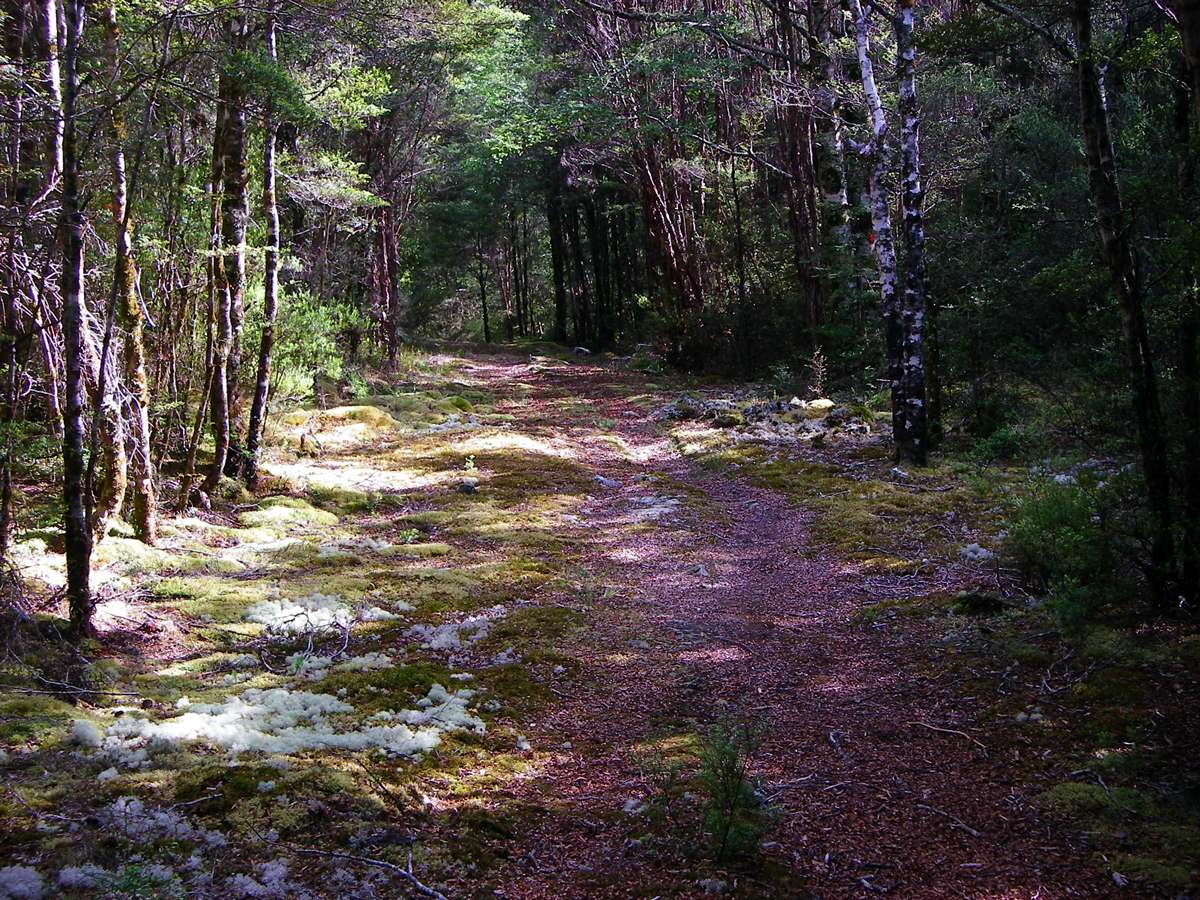
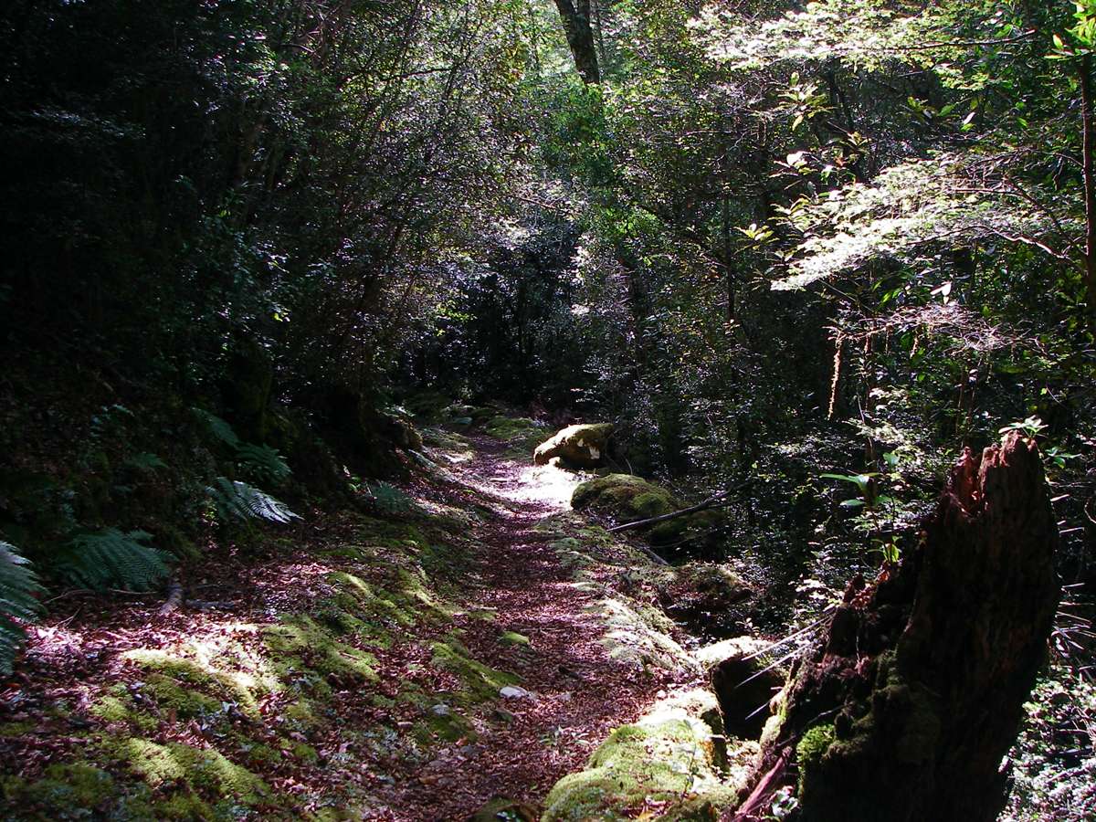
The Wangapeka River has possibly the cleanest water I have ever seen in the bush. It was great to be travelling in such a pristine environment. The track then entered a beautiful beech forest.
Photo: Don Hitchcock January 2007

This was a very interesting lichen in a very moist environment.
Photo: Don Hitchcock January 2007

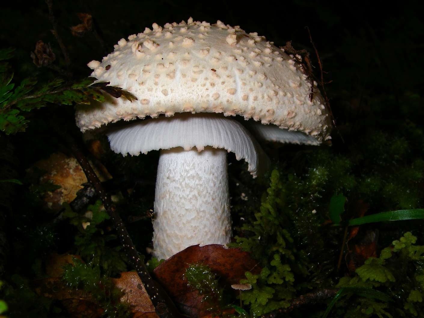
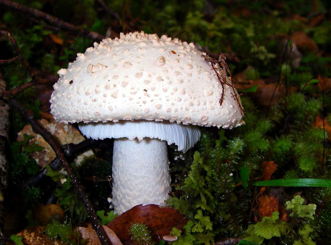
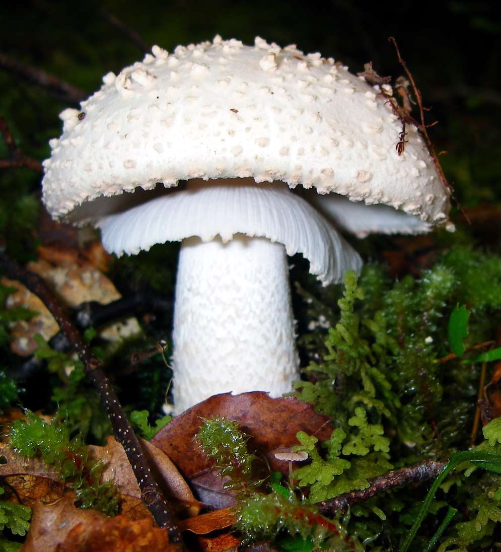
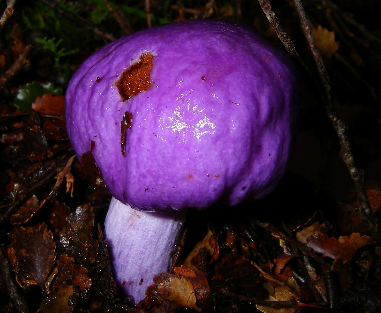
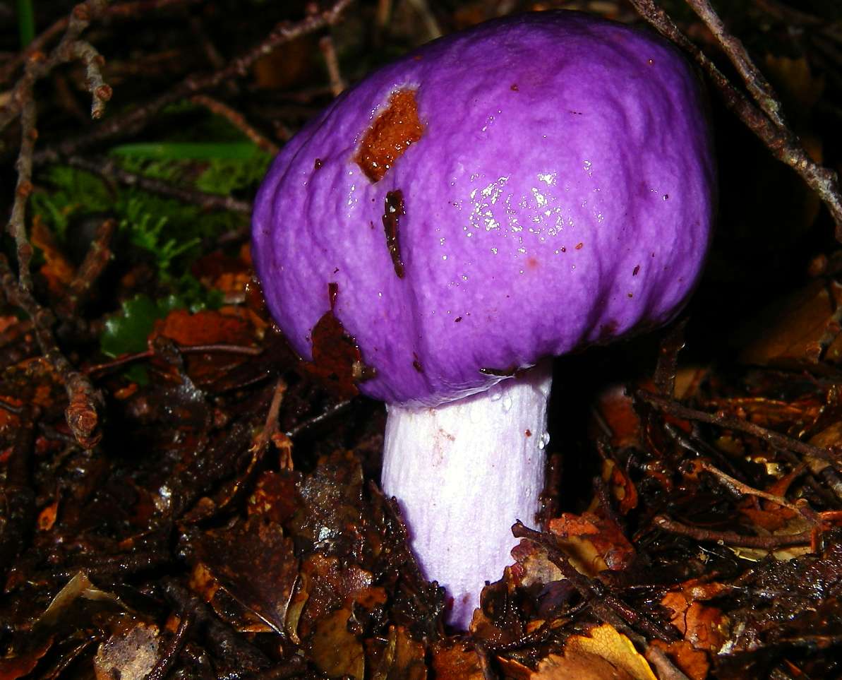
I spent some time getting good photos of this superb specimen of a mushroom on the dark floor of the beech forest.
Photo: Don Hitchcock January 2007

Just before the historical Cecil King's hut, this old sign shows where the north and south branches of the Wangapeka meet. The track continues on, as shown in the photo at right.
The vegetation is still beech forest, with lichens growing on the ground, indicating that conditions are often darker and wetter than shown on this glorious day.
Photo: Don Hitchcock January 2007
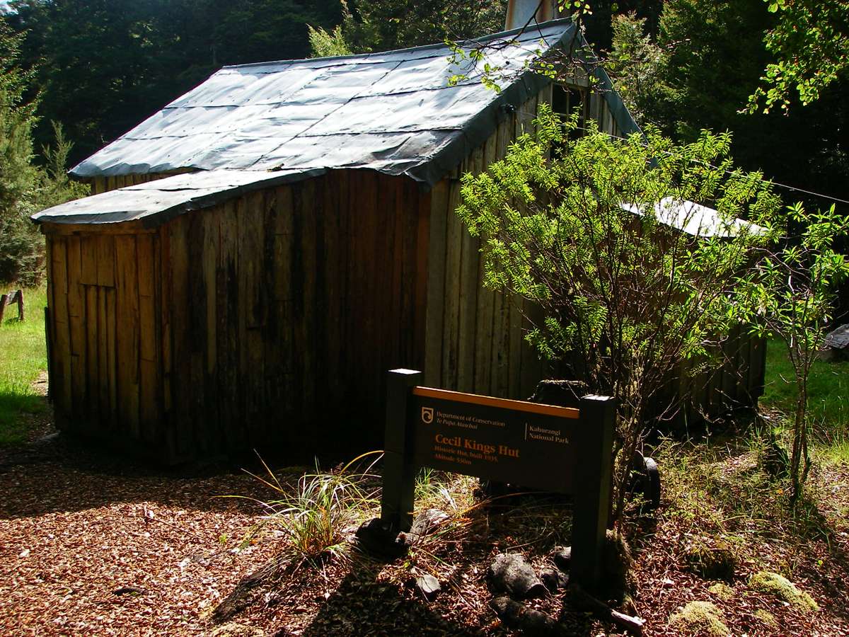
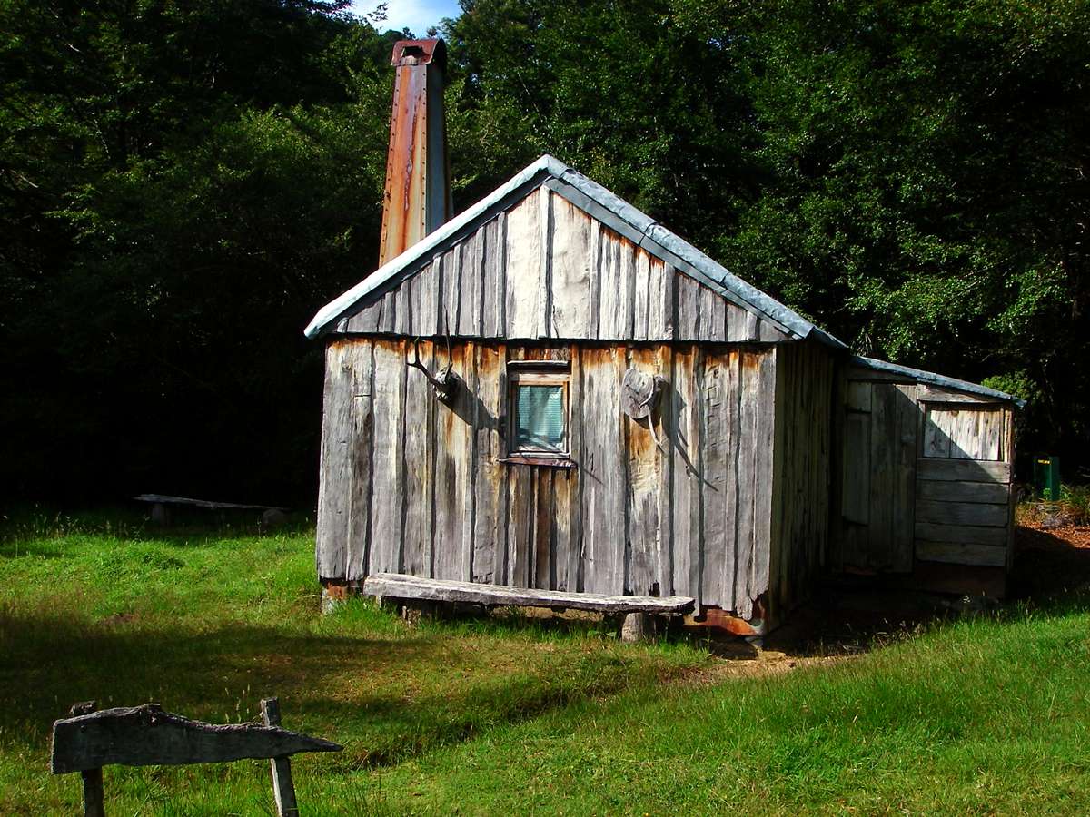
Cecil King's hut.
Photo: Don Hitchcock January 2007
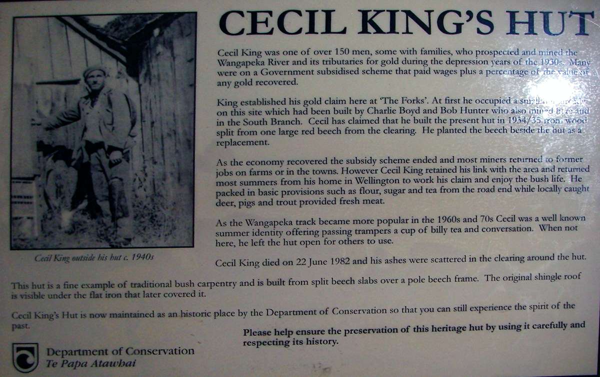
The sign put up by the Department of Conservation, Te Papa Atawhai, reads, in part:
Cecil King was one of over 150 men, some with families, who prospected and mined the Wangapeka River and its tributaries for gold during the depression years of the 1930s. Many were on a Government subsidised scheme that paid wages plus a percentage of the value of any gold recovered.
King established his gold claim here at 'The Forks'. (That is, where the north and south branches of the Wangapeka meet - Don)
At first he occupied a small hut already on this site which had been built by Charlie Boyd and Bob Hunter who also mined here and in the South Branch. Cecil has claimed that he built the present hut in 1934/1935 from wood split from one large red beech from the clearing. He planted the beech beside the hut as a replacement.
As the economy recovered the subsidy scheme ended and most miners returned to former jobs on farms or in the towns. However Cecil King retained his link with the area and returned most summers from his home in Wellington to work his claim and enjoy the bush life. He packed in basic provisions such as flour, sugar and tea from the road end while locally caught deer, pigs and trout provided fresh meat.
As the Wangapeka track became more popular in the 1950s and 70s Cecil was a well known summer identity offering passing trampers a cup of billy tea and conversation. When not here, he left the hut open for others to use.
Cecil King died on 22 June 1982 and his ashes were scattered in the clearing around the hut.
The hut is a fine example of traditional bush carpentry and is built from split beech slabs over a pole beech frame. The original shingle roof is visible under the flat iron that later covered it.
Cecil King's hut is now maintained as an historic place by the Department of Conservation so that you can still experience the spirit of the past.
Photo: Don Hitchcock January 2007
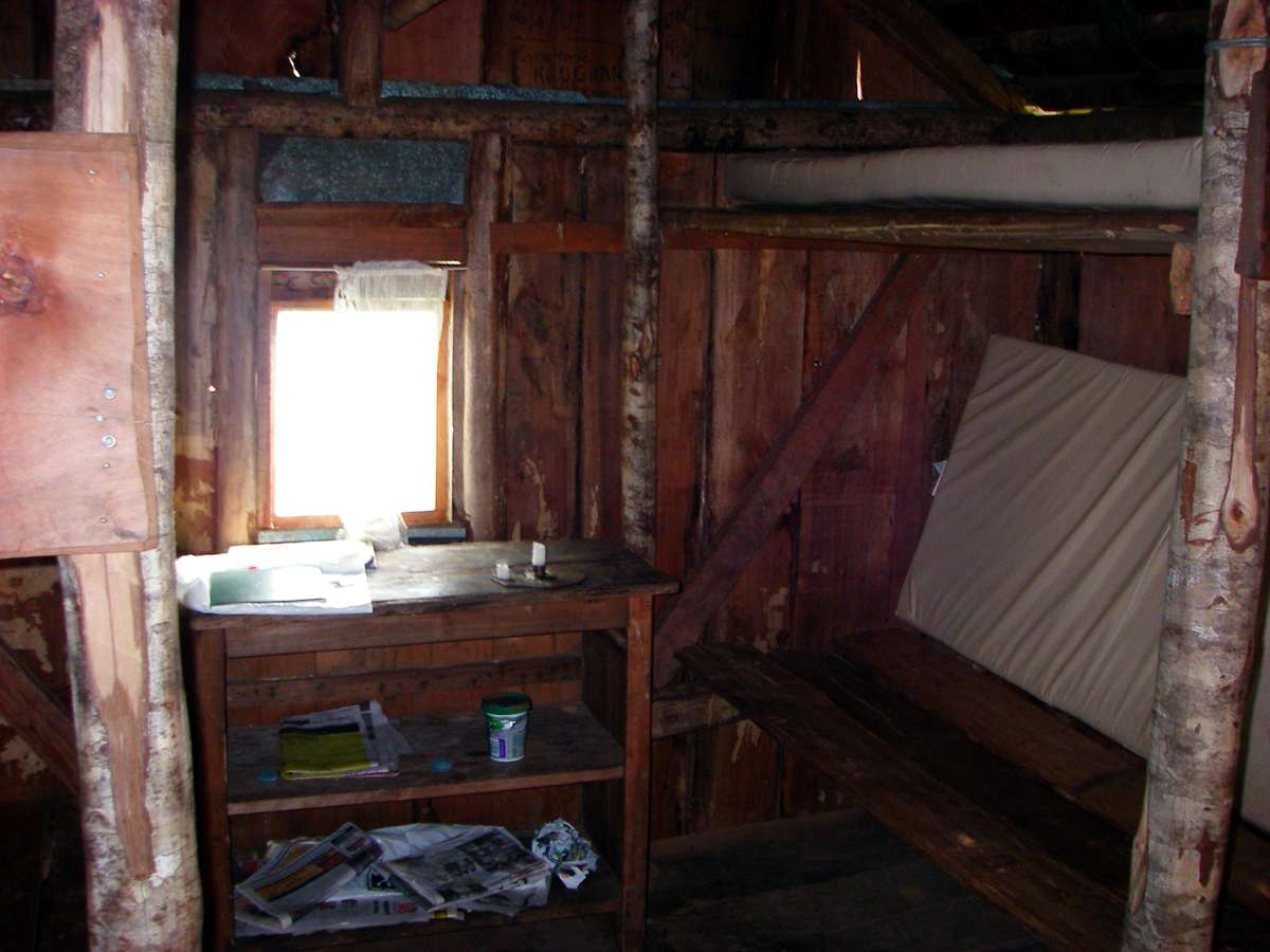
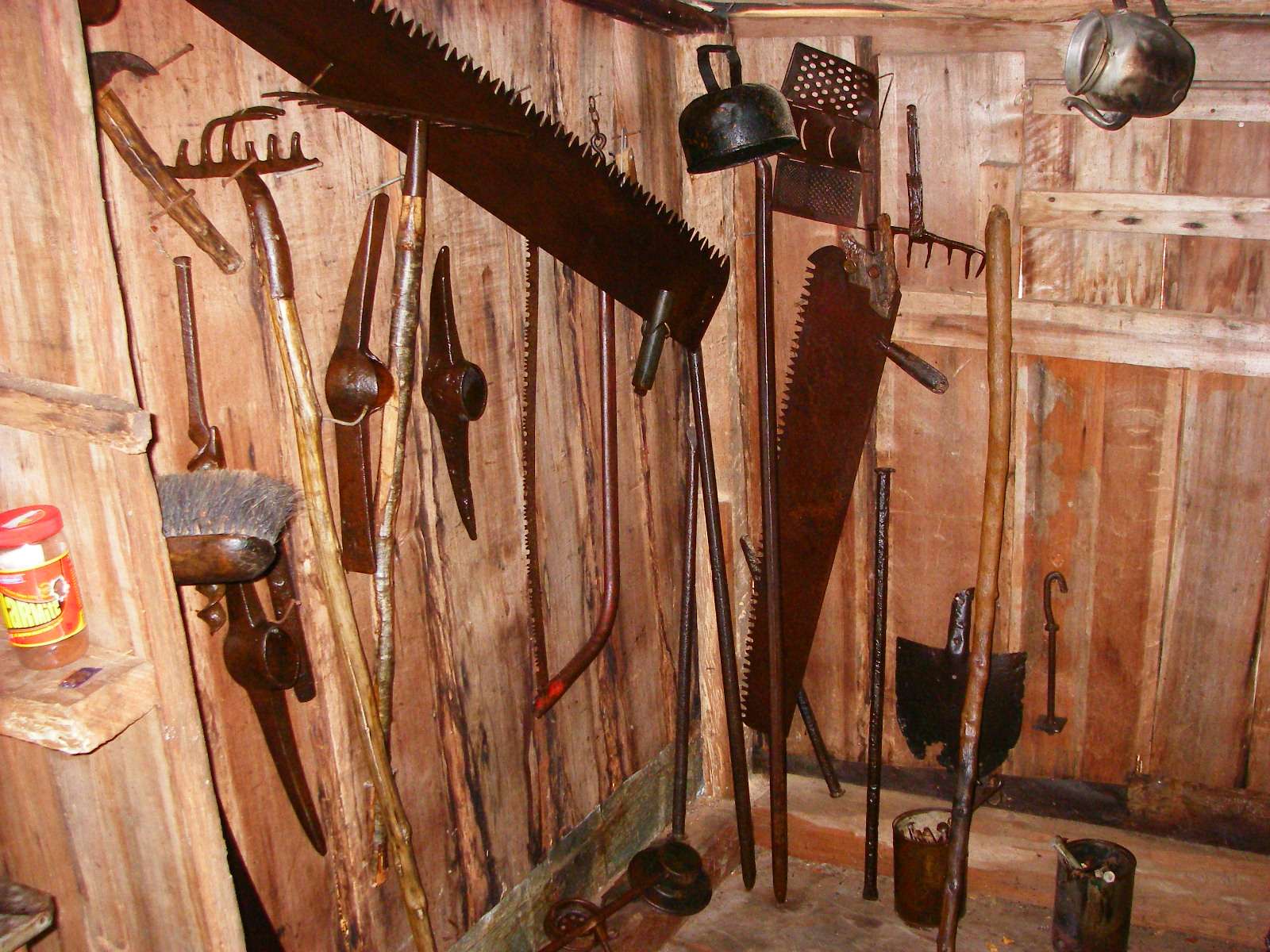
The hut is rarely used now that the new King's hut is open. The tools from yesteryear were interesting.
Photo: Don Hitchcock January 2007

The new King's hut is beautifully made, and is a credit to the DOC.
Photo: Don Hitchcock January 2007
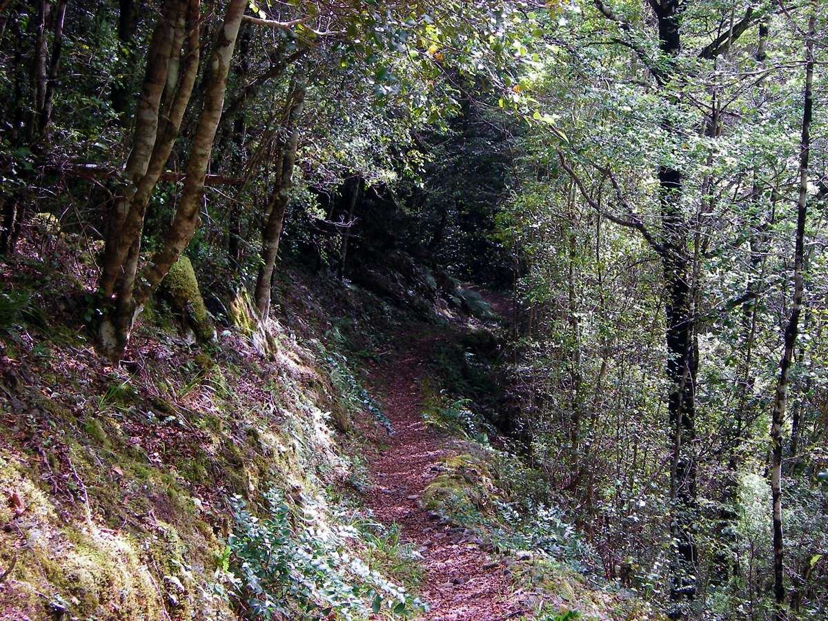
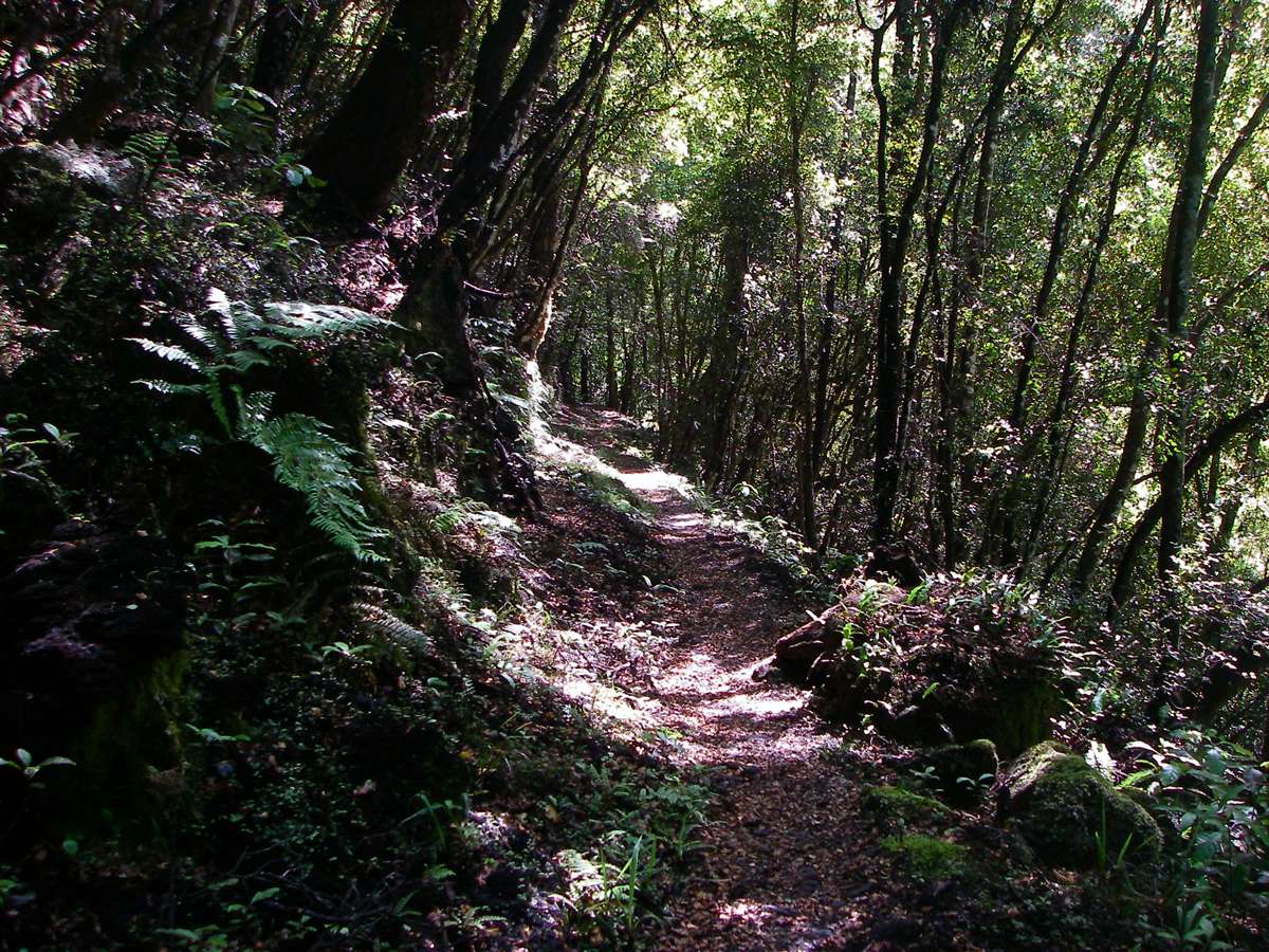
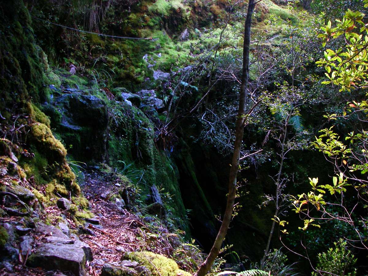
The track continues through beech forest on the banks of the Wangapeka, and is very well benched and maintained.
Photo: Don Hitchcock January 2007

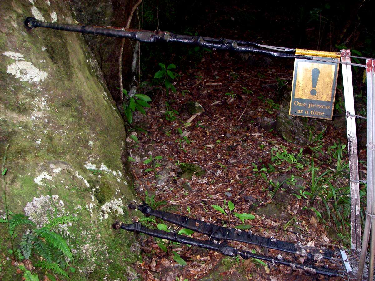
The wire bridge across the Wangapeka, crossing from the true left to the true right bank. As with all such bridges, only one person is allowed on the bridge at a time.
Photo: Don Hitchcock January 2007
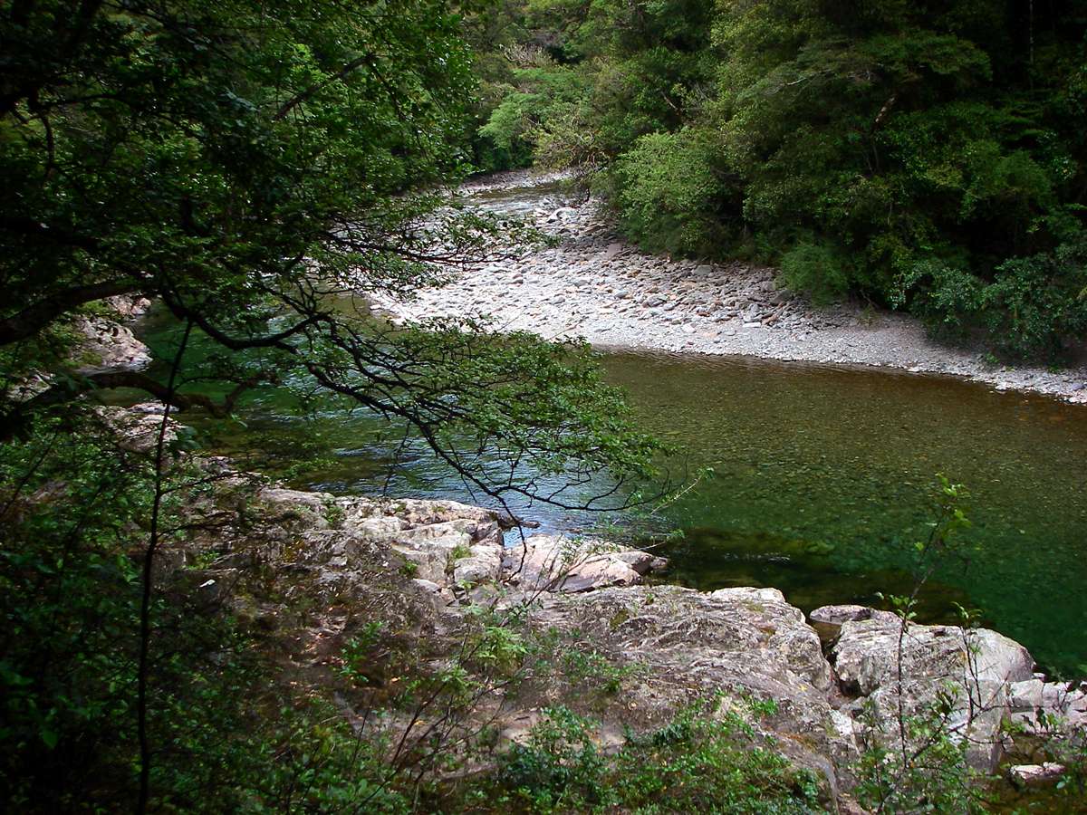
Every time I saw the Wangapeka, I was impressed anew by the clarity and purity of the water. There is no agriculture anywhere in its catchment, which means there is usually little or no sediment, except during floods.
Photo: Don Hitchcock January 2007

Little clear streams fringed with moss that enter the Wangapeka River are a delight to see, coming as I do from a land of drought.
Photo: Don Hitchcock January 2007

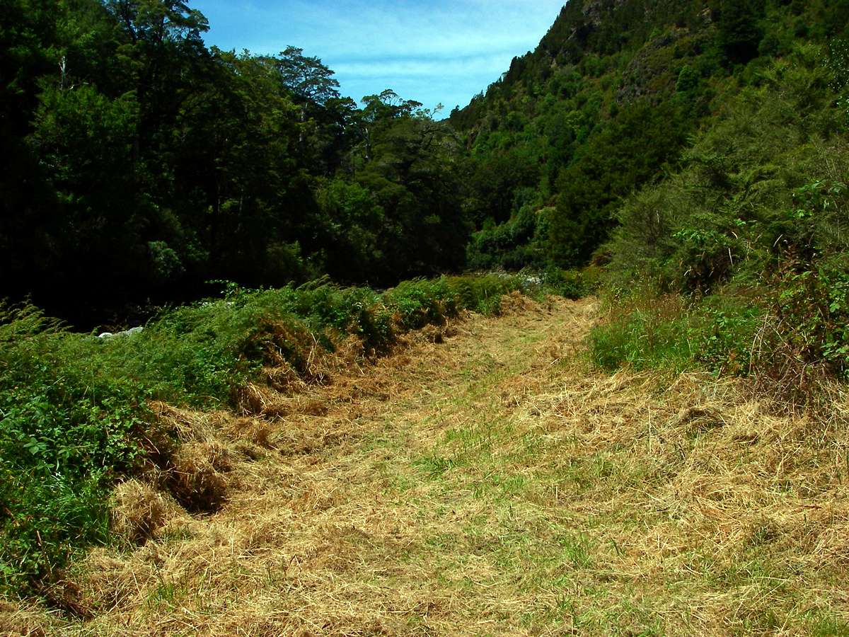
When I stepped onto this part of the track, I couldn't believe my eyes. The track had been whipper snippered! I took photo after photo of this unexpected phenomenon. I guess the track from the road to King's hut is well patronised, and rightly so, so it is worth their while for staff to make the track as passable as possible for large groups of people.
Photo: Don Hitchcock January 2007
Rock formations beside the track on a warm, sunny day.
Photo: Don Hitchcock January 2007
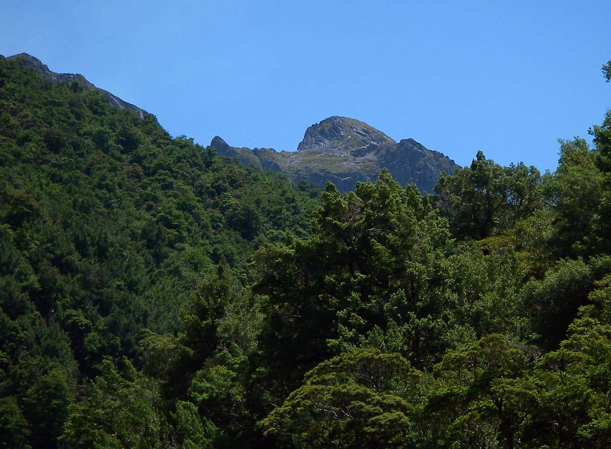
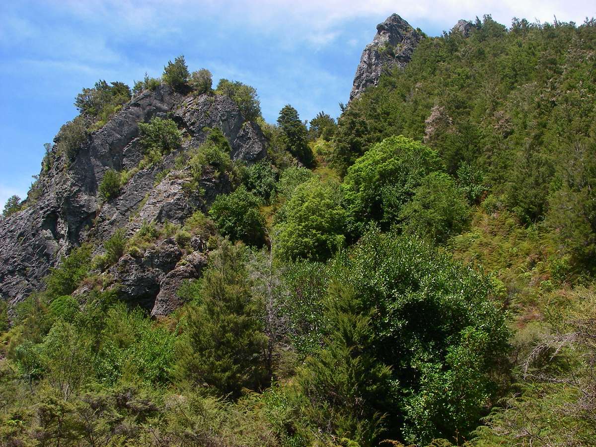
Patriarch Mountain (1701 m) poking its head up above the vegetation. There is a track up to Kiwi Saddle from which mountaineers can ascend the mountain, but I know nothing about the difficulty of the trip.
Photo: Don Hitchcock January 2007
The mown track continued.
Photo: Don Hitchcock January 2007
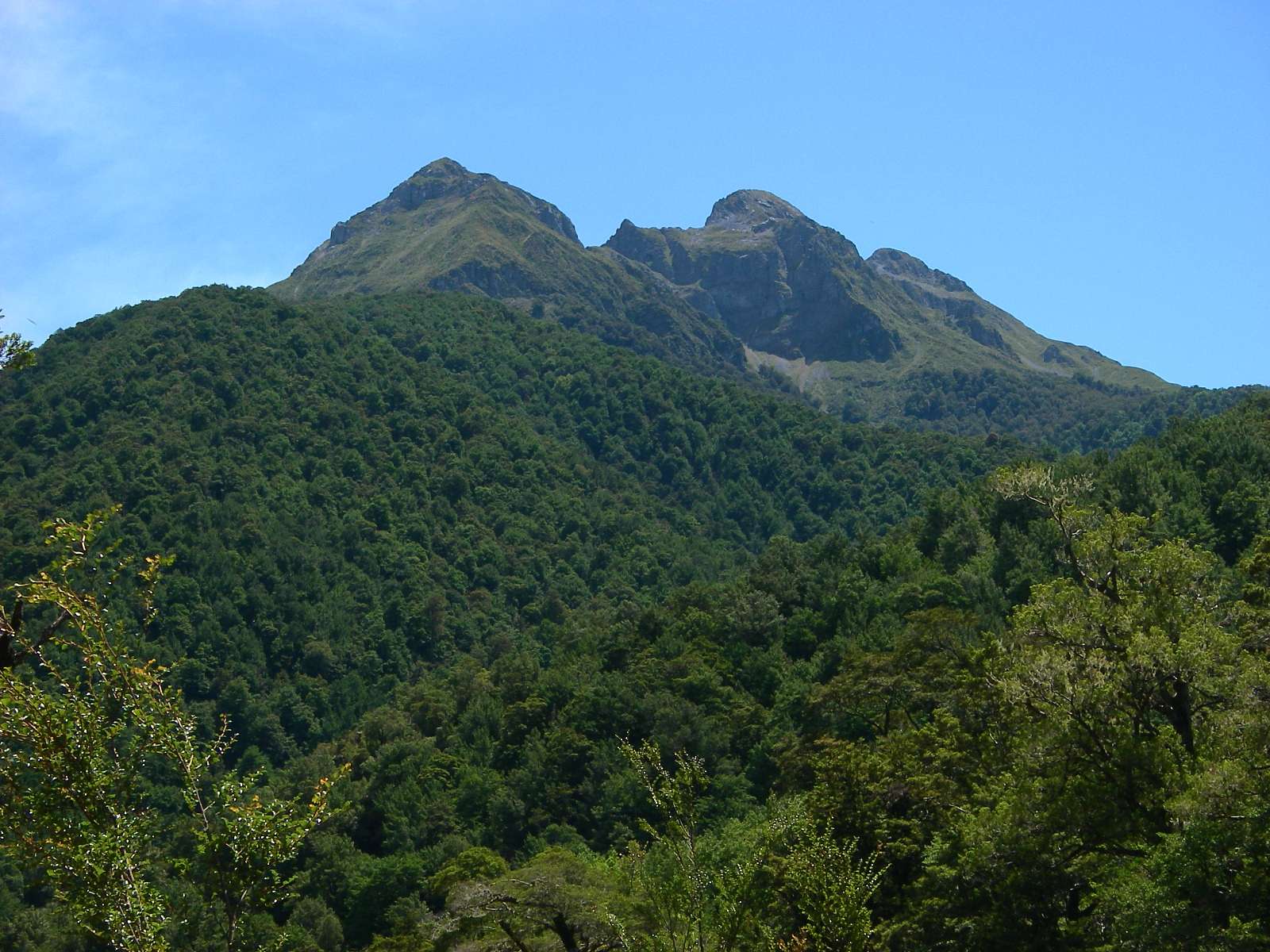
Patriarch Mountain is very impressive.
Photo: Don Hitchcock January 2007
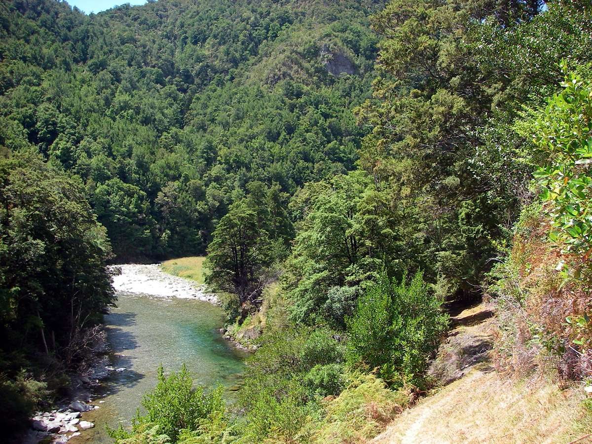
The track and river are idyllic. What a beautiful part of the world.
Photo: Don Hitchcock January 2007
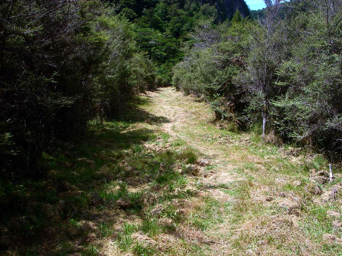
And more mown grass.....
Photo: Don Hitchcock January 2007
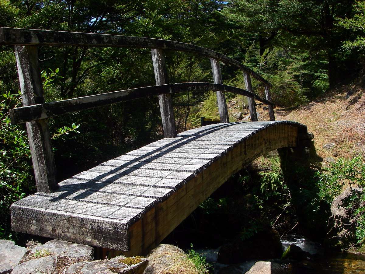
New Zealanders do bridges very well indeed. This bridge over Wright Creek, not far from the end of the track, is a superb piece of work. Simple, elegant, and strong. The engineers and workmen are to be congratulated.
Photo: Don Hitchcock January 2007
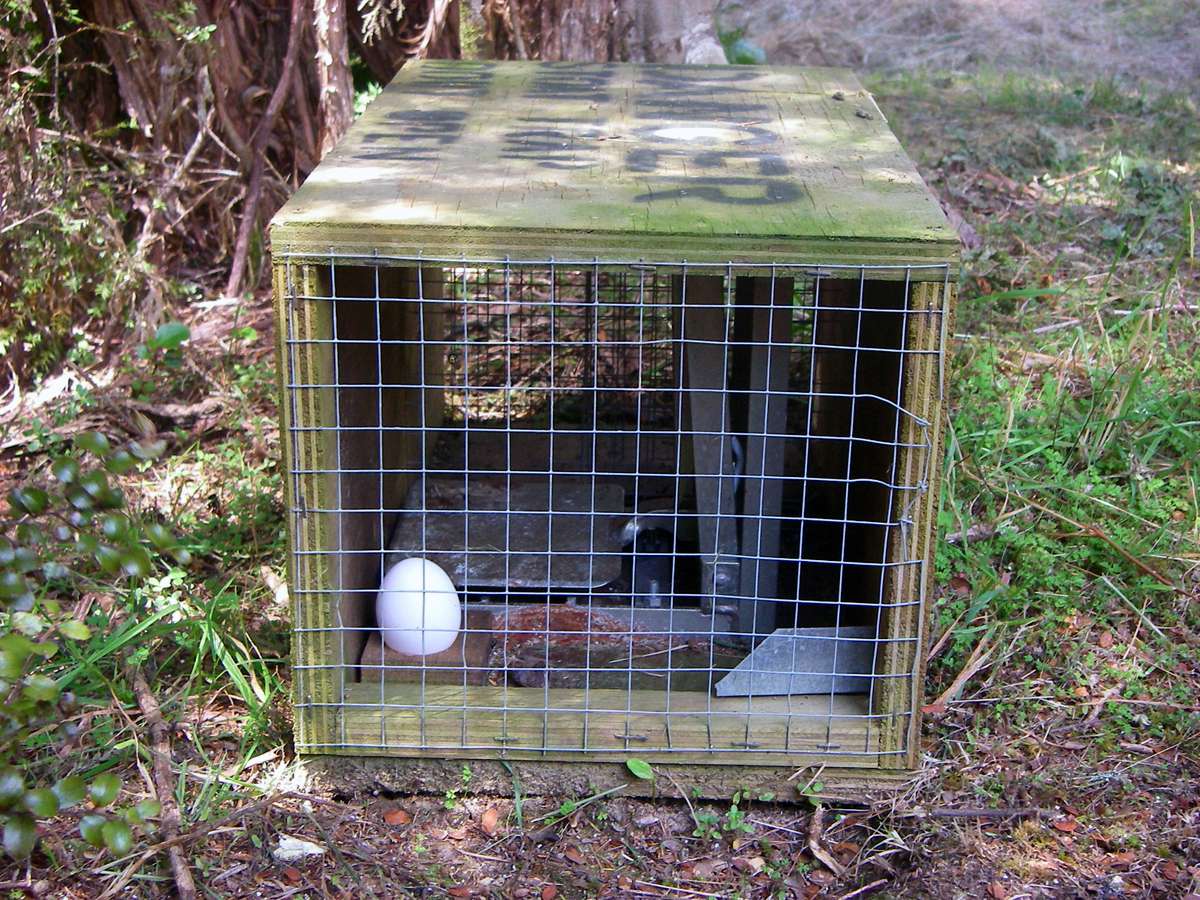
Stoat trap. New Zealand has a huge problem with feral animals.
Photo: Don Hitchcock January 2007
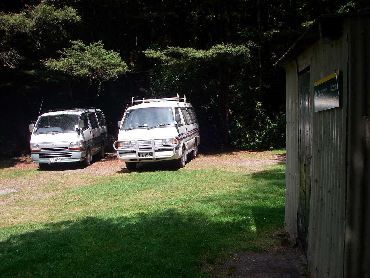
The end of the track. It had taken me four days, an average time since the track is listed as a three to five day trip. There is a guided tour advertised on the web which takes six days, but they cater for people with a lower level of fitness. They could not be expected to put in the 12 hour days I am happy with.
There is a four bunk hut here, and plenty of camping space. I rang from the free landline phone at the waiting area out on the road, for a car to pick me up and take me to the nearest pub, from which there was a bus service to Nelson the next day. From there I planned to do the the Travers - Sabine Circuit near Nelson Lakes.
Photo: Don Hitchcock January 2007

I left Stone Hut about 7 a.m., and got to the end of the track at 3:30 p.m., two and a half hours longer than the sign indicates.
Those not in the ranks of "Tiger Walkers" should allow extra time for the trip, especially if they are keen photographers like me. It can take ten minutes or more just to get the one photo you want of a flower or mushroom, and you need to allow time for lunch and rest breaks, and admiring the superb scenery. Leaving early is the secret to an enjoyable walk I find.
I've never been sorry to leave early, and often been sorry to leave late when others in the bushwalking party can't get their act together. In winter in Australia I am often packed up and ready, and have to wait for the light to get bright enough to start walking safely.
Photo: Don Hitchcock January 2007

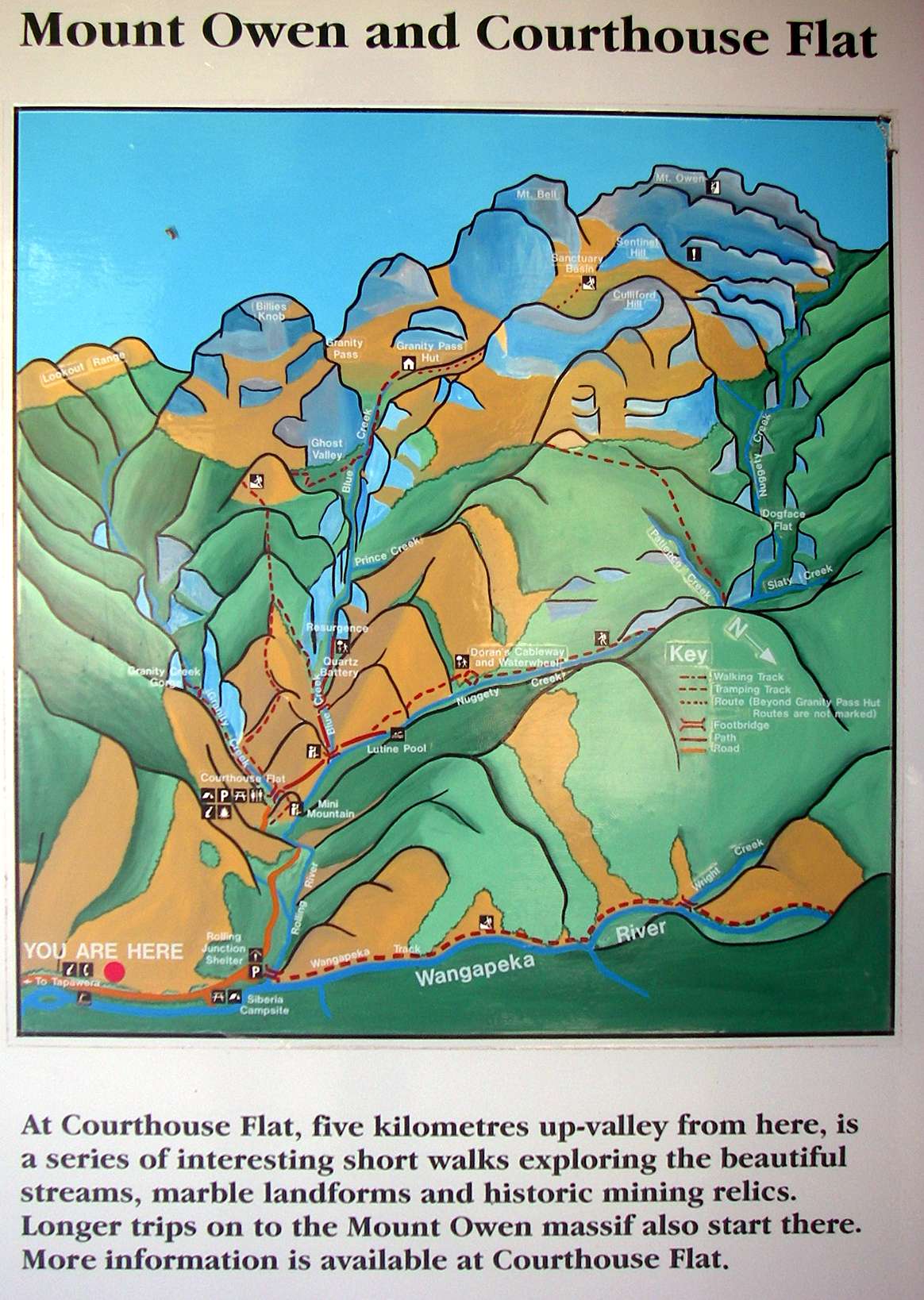
These three dimensional maps are a delight to see. The artists and map makers have done a great job.
Photo: Don Hitchcock January 2007
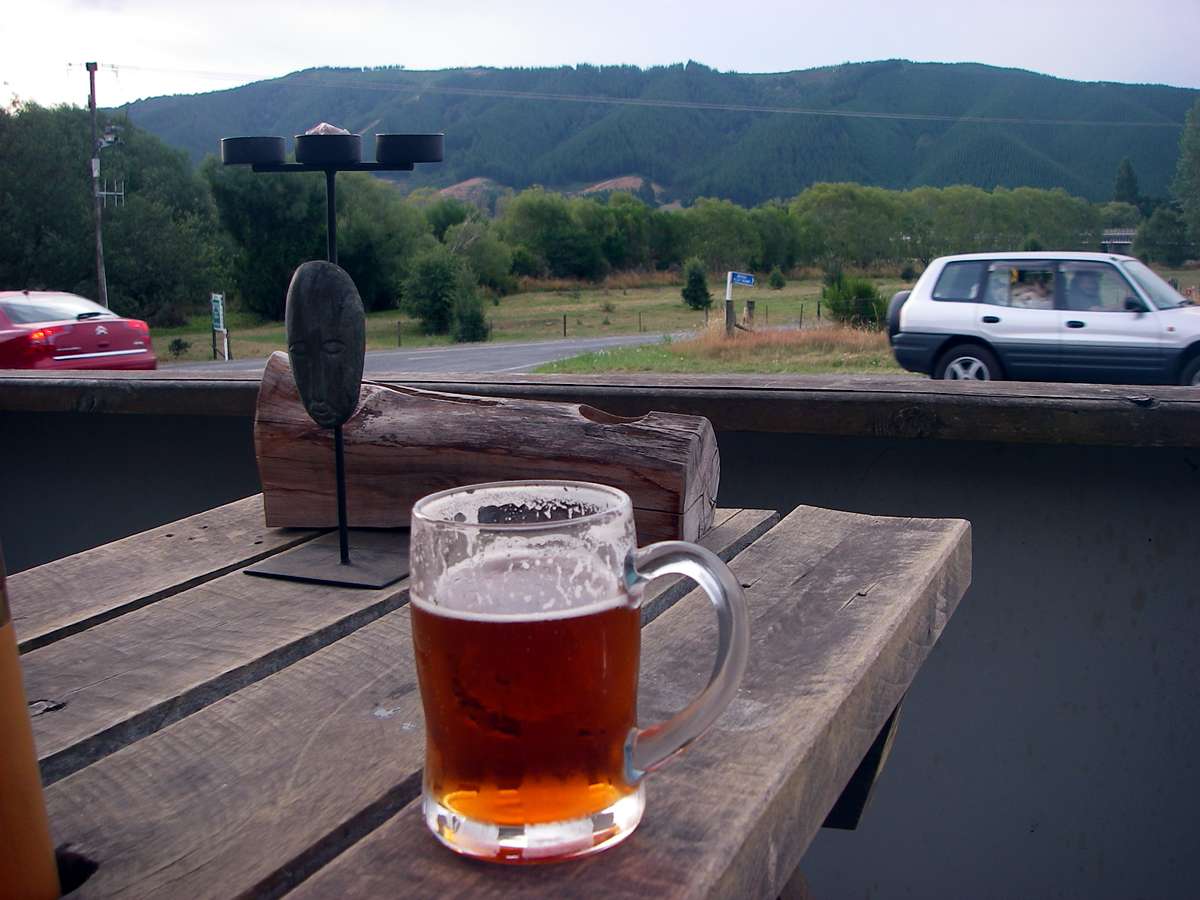

And the obligatory beer, fish and chips at the pub where I stayed the night, before catching the bus to Nelson, was very much appreciated.
Photo: Don Hitchcock January 2007
Bushwalking, Hiking and Tramping in New Zealand
Bushwalking Index