Back to Don's Maps
Reflection Rock and Roque Saint-Christophe
The Roque Saint Christophe is a cliff with five separate levels overlooking 900 metres of the Vezere valley. Its hundreds of natural rock shelters were inhabited from the ice ages until the Middle Ages, and the terraces could accommodate up to 1000 people. An impressive fortress and town were constructed on the different levels, and was one of the main bastions of defence during the Hundred Years War with the English. The English laid siege to it in 1401 and gained possession of it by starving the inhabitants out, only to lose possession themselves just five years later.
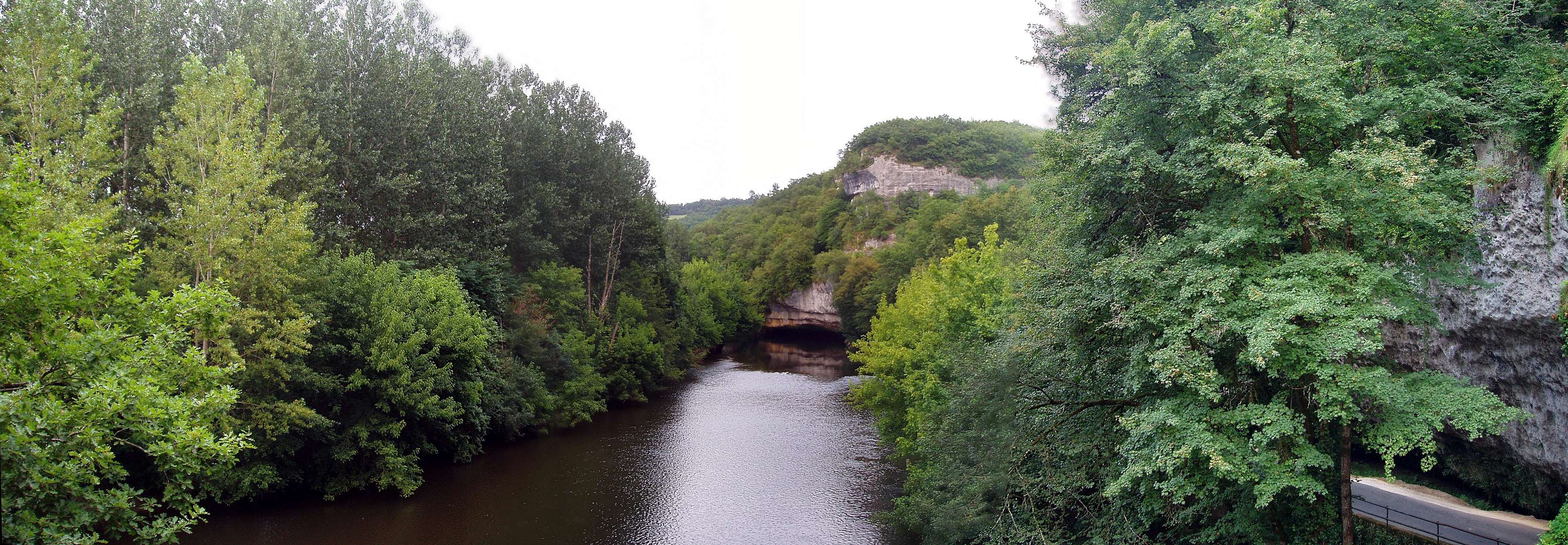
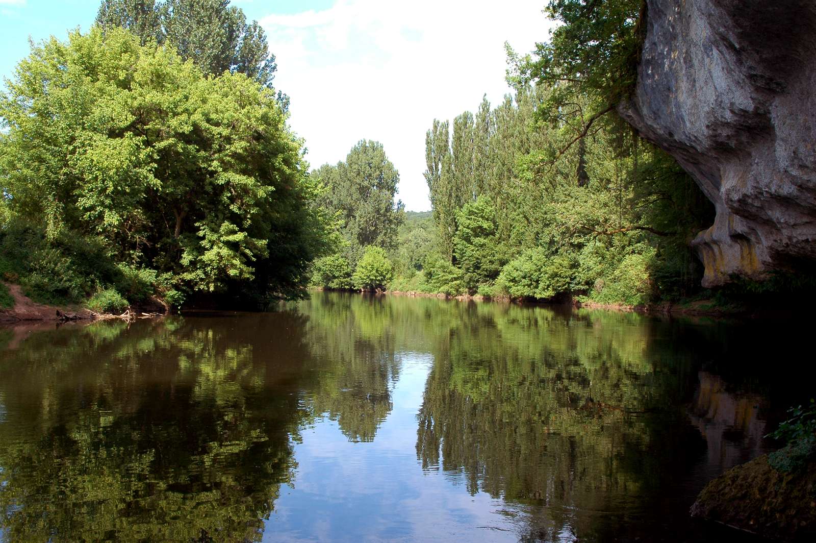
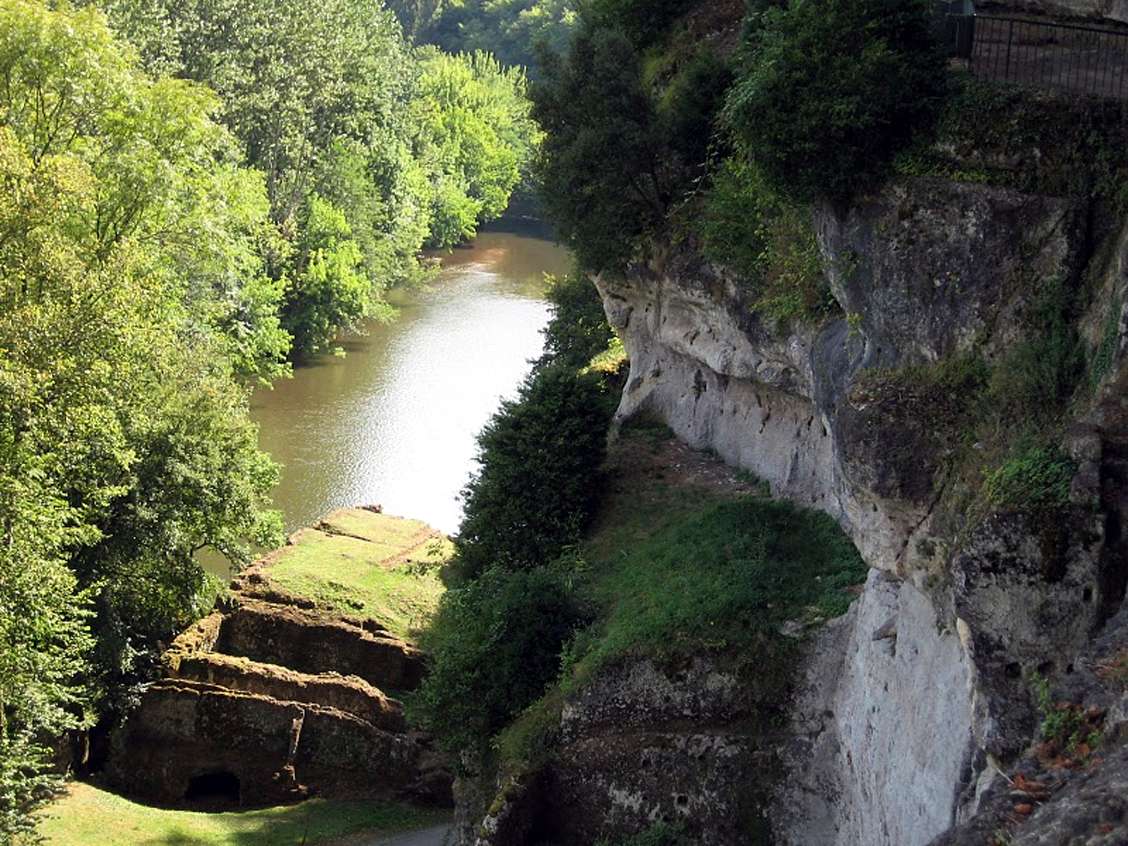
View upstream along the Vezere from Roque Saint Christophe to the place where the river undercuts the limestone cliff of the Roc Fouget, known to Jean Auel fans as 'Reflection Rock'.
As can be seen in this photo, the area of water under the rock is smooth and reflective, while the rest of the river surface is rough and non-reflective.
To get there you must drive past Roque Saint Christophe itself, around the picnic area in a flat area, part of the delta of a small creek coming down from the highlands above, and up the next steep part of the road. Park your car on a pulloff, and you can see the river directly below.
Photo: panoramio1415, from Panoramio, via Google Earth
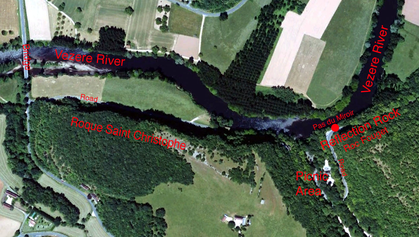
This aerial shot shows exactly where Reflection Rock, or Roc Fouget, is in relation to Roque Saint Christophe. Click the image to enlarge.
Photo: Google Earth
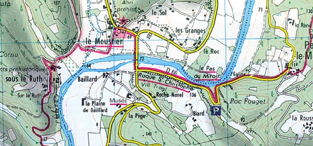
This map shows that the strait or reach or passage of the Vezere in front of Roc Fouget is known as 'le Pas du Miroir' or 'mirror passage'. It is narrow but deep, which means that in calm wind conditions, it acts as a mirror, and especially to someone on Roc Fouget or Reflection Rock.
Photo: IGN
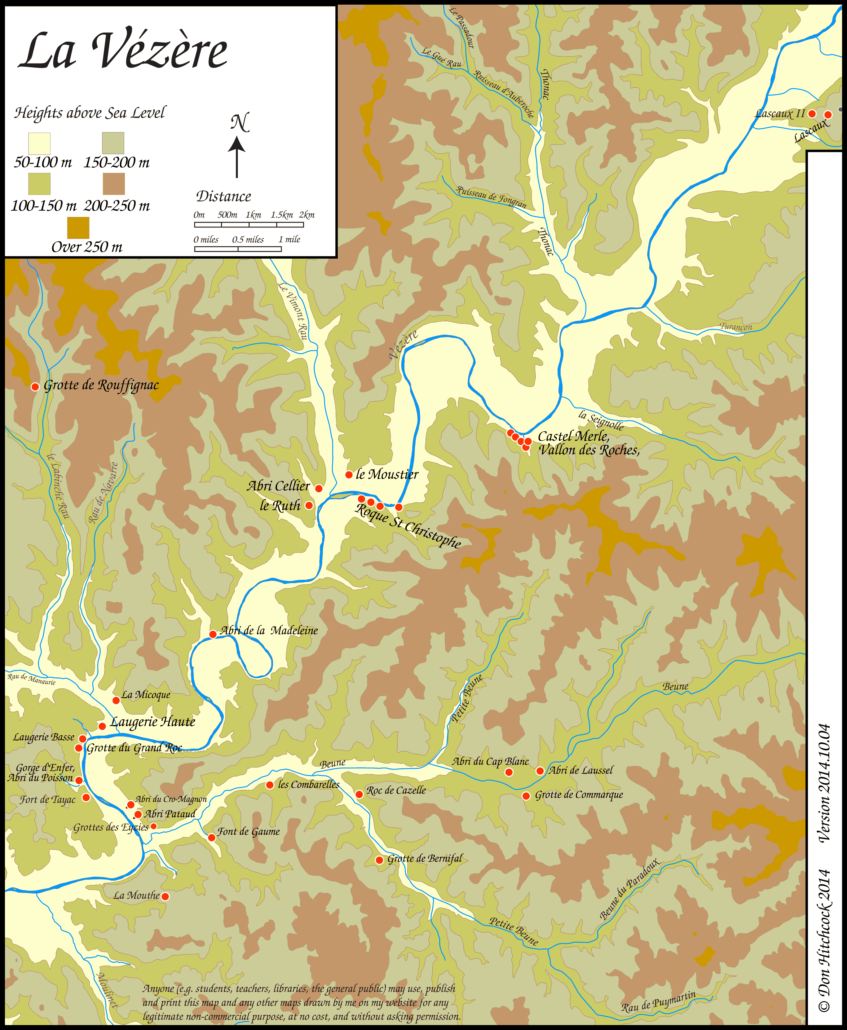
Map of sites in the Vézère Valley of France, including Roque Saint Christophe.
If you click on the map you will see a larger map with the ability to click on the marked sites and get further information.
Photo: Don Hitchcock
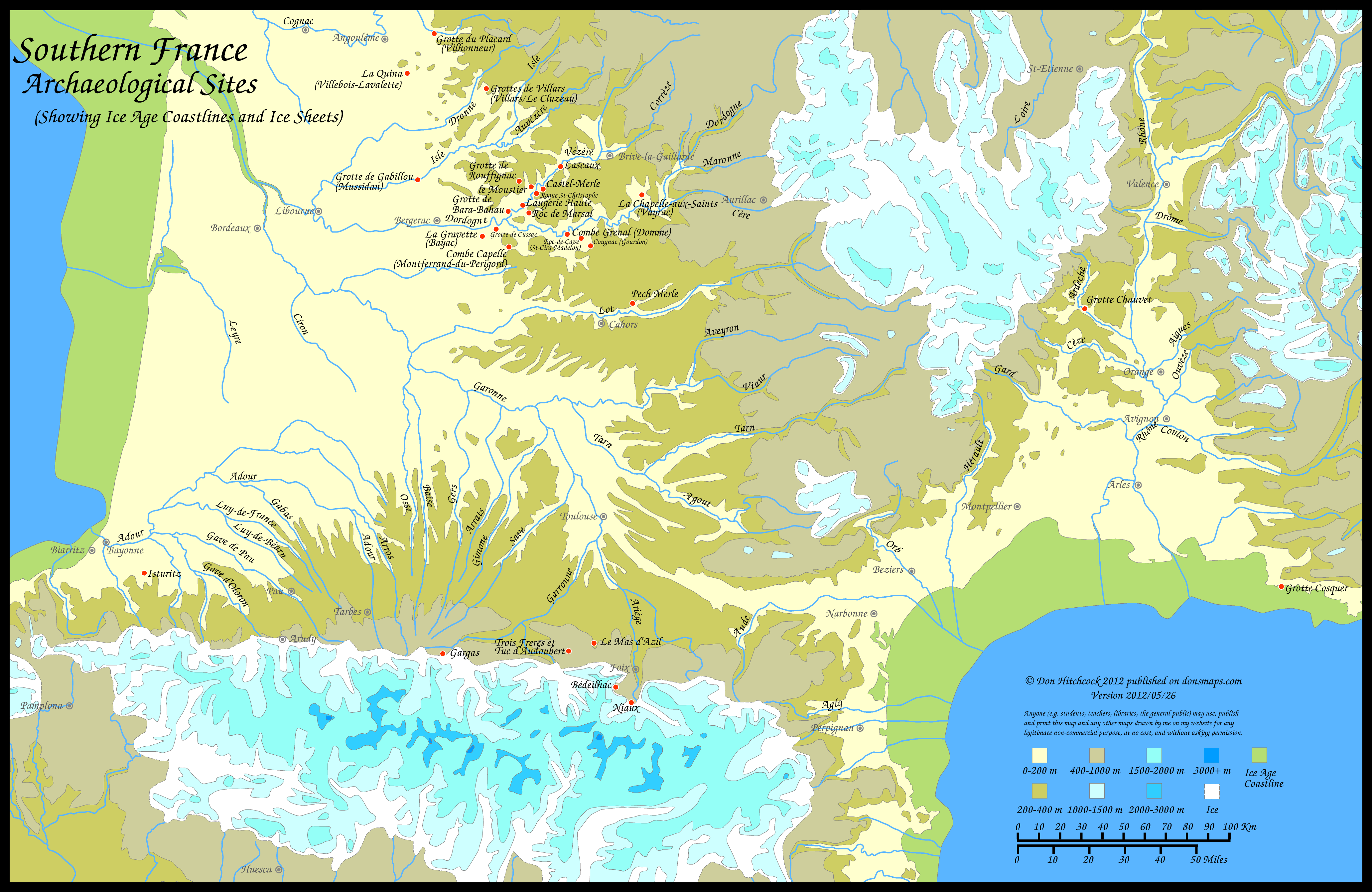
Note - Use this pdf file if you wish to print this map on a single sheet of paper.
Photo: Don Hitchcock version 2012/05/26


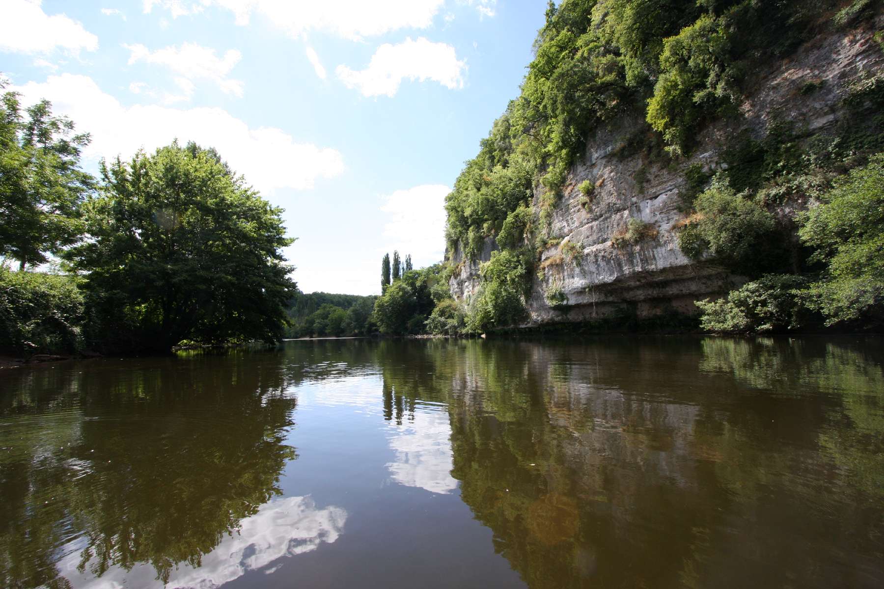
The view downriver towards Roque Saint Christophe from the lookout known to fans of Jean Auel's Earth's Children™ books as 'Reflection Rock', where the river comes directly underneath the cliff.
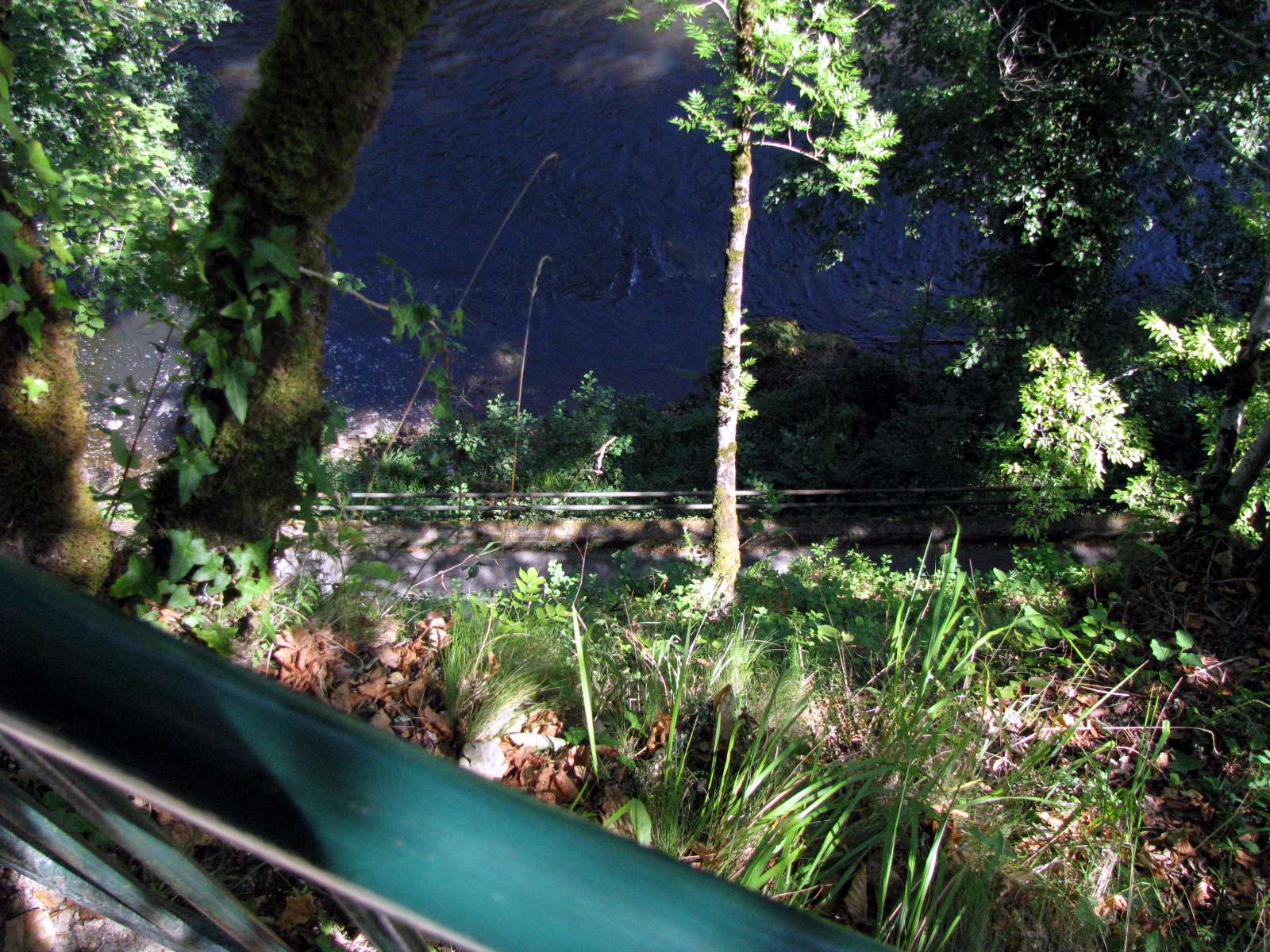
The rock wall forms the edge of the road, so care must be taken.
Photo: Don Hitchcock 2008
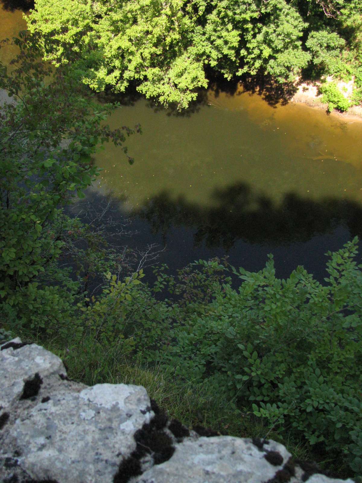
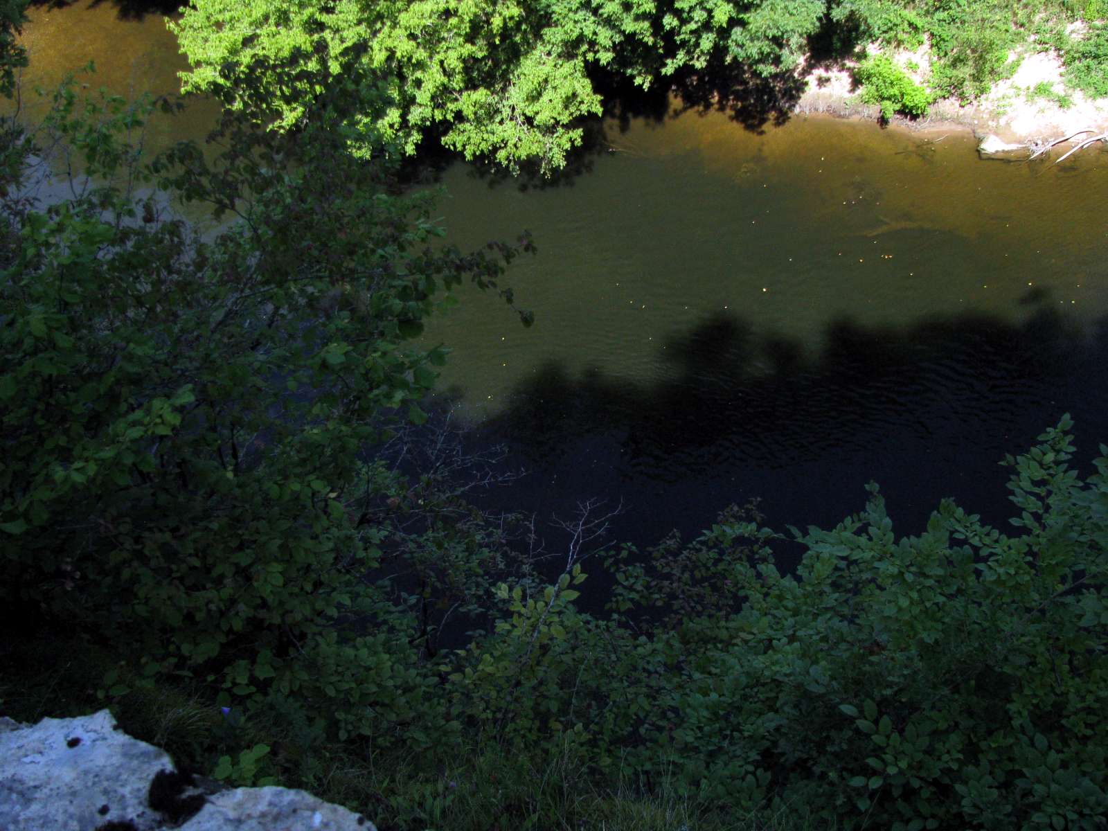
Looking down over the Vezere from Reflection Rock at le Pas du Miroir, a narrow but deep section of the Vezere which is like a mirror when wind conditions are calm.
Photo: Don Hitchcock 2008
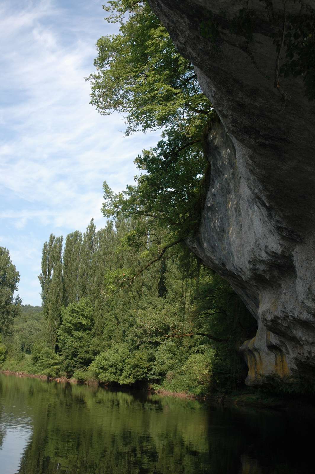
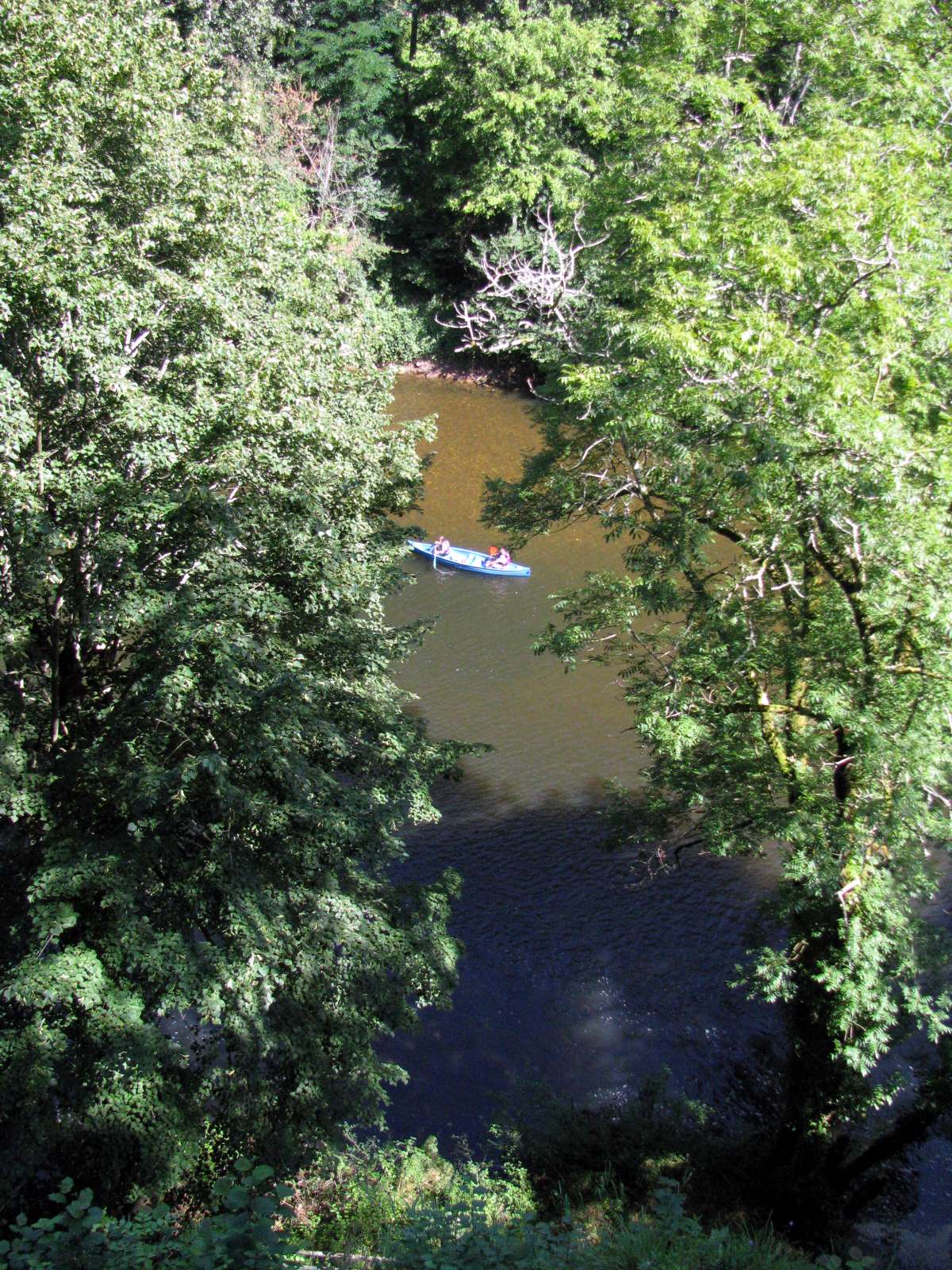
Probably the best way to see Reflection Rock is from a canoe. Here the undercut of the cliff can be clearly seen.
The reflections would be best in the very early morning, before a breeze springs up.
Photo: andleru, Panoramio, via Google Earth
This view of le Pas du Miroir and Reflection Rock, or Roc Fouget, gives a good idea of the narrowing of the river, and its turn towards the north at this point, looking upstream.
Photo: Les Moles, Panoramio, via Google Earth
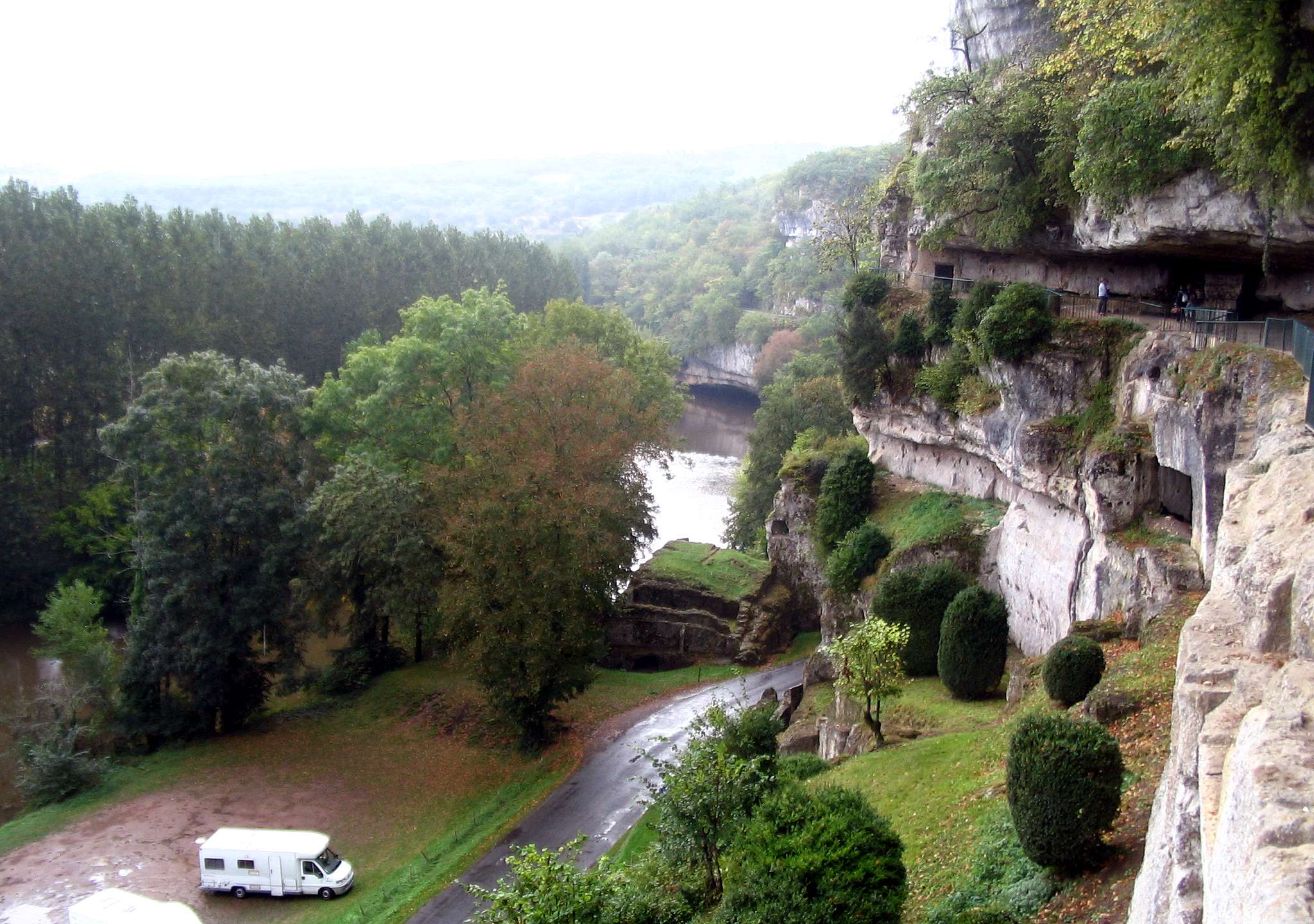
The view upriver towards "Reflection Rock" from Roque Saint Christophe to the point where the river comes directly underneath the cliff at Reflection Rock.
The motor homes parked here have stopped at this point because just ahead the road passes through a narrow one lane section of the road between two limestone walls.
Photo: yvr101, Panoramio via Google Earth
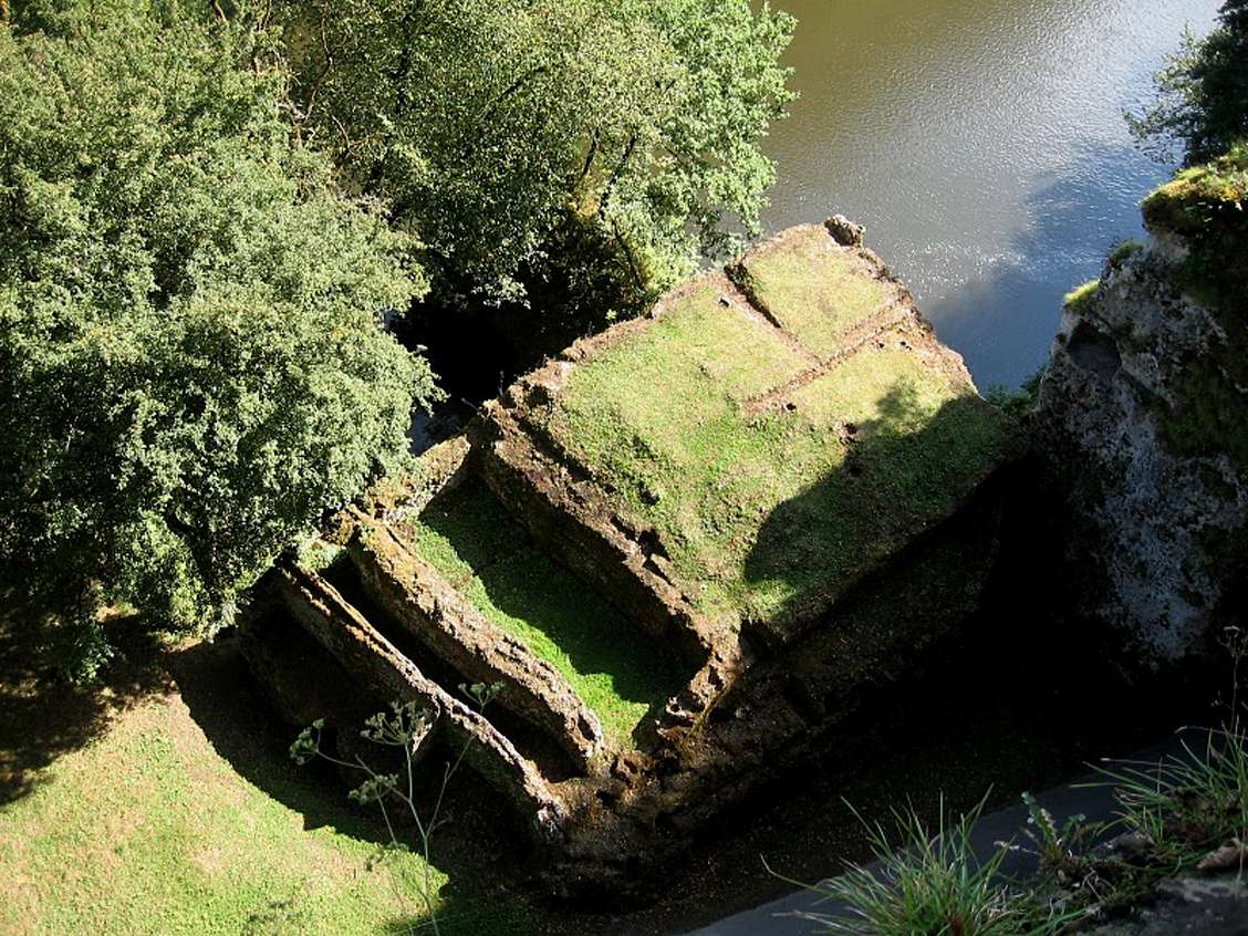
At this point we can see the remains of the foundations of a fort which faces both the river and the broad plain in front of the Roque Saint Christophe, giving warning of approach from both down and up river.
At the time the fort was manned, the tunnel through which the road passes would probably not have existed.
Photo: trus64, https://picasaweb.google.com/

A school excursion bus driver taking great care getting through the narrow passage!
Photo: http://ecolepigeon.unblog.fr/2008/03/
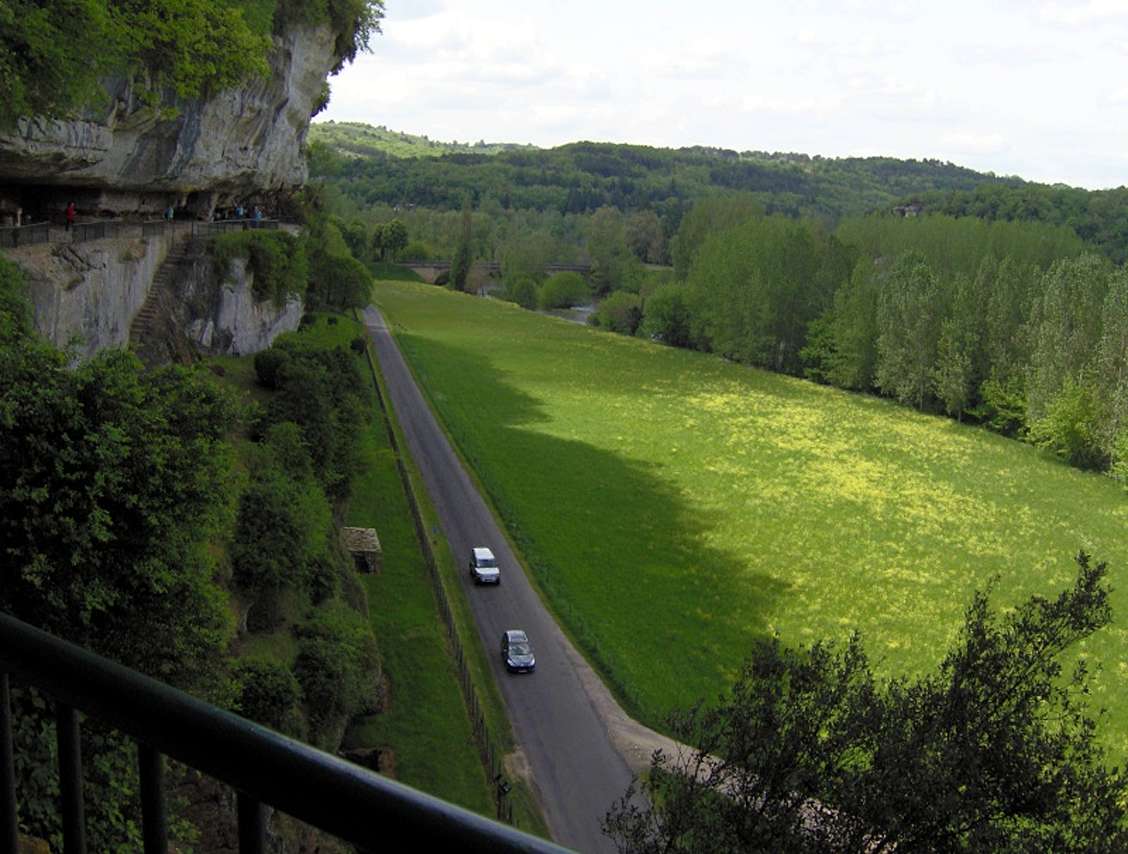
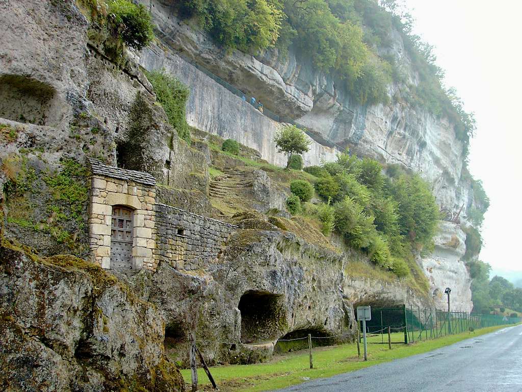
From Roque Saint Christophe, the river is mostly a long way from the cliff, with a broad flat grassed area between the two.
These photographs were taken one minute apart on the walk up to the main terrace of Roque Saint Christophe, the right hand image at the point where the river comes the closest to the cliff.
Photo: Don Hitchcock 2008
The broad river flat in front of the main part of Roque Saint-Christophe is very evident here, in this shot looking back towards the bridge over the Vezere.
Photo:
http://www.tout-sur-google-earth.com/
The cliffs offered an easy low-tech way to defend the inhabitants against intruders!
Photo: http://trucmmuche25.canalblog.com/
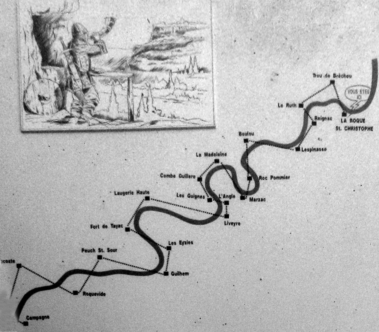
This is a diagram of the main system along the Vezere valley, on an information board at Roque Saint-Christophe.
As soon as enemy troops appeared at any point along the valley, the whole valley was alerted, and in many cases the side streams such as along the Beune and Petite Beune at Roc de Cazelle, and each settlement made preparations for defending their territory.
Photo: Don Hitchcock 2008

This is a diagram of the main system along the Vezere valley, on an information board at La Madeleine.
Over the total distance of 18 km between the village of Campagne and the fortress of La Roque St Christophe, were located 22 intermediate watchtowers in the cliffs, constantly manned, 1000 years ago.
The watchmen, often installed in small, cramped booths and holes cut in the cliffs, signalled up and down the valley of any approach along the river of prospective enemies. This system was rediscovered and an experiment was performed in 1963 by a team of 22 people who moved into these holes in the cliff to watch and listen. A message sent from Campagne (18 km downstream) arrived at Roque Saint-Christophe in less than 6 minutes, thanks to the signals relayed by hunting horns.
Photo: Don Hitchcock 2008

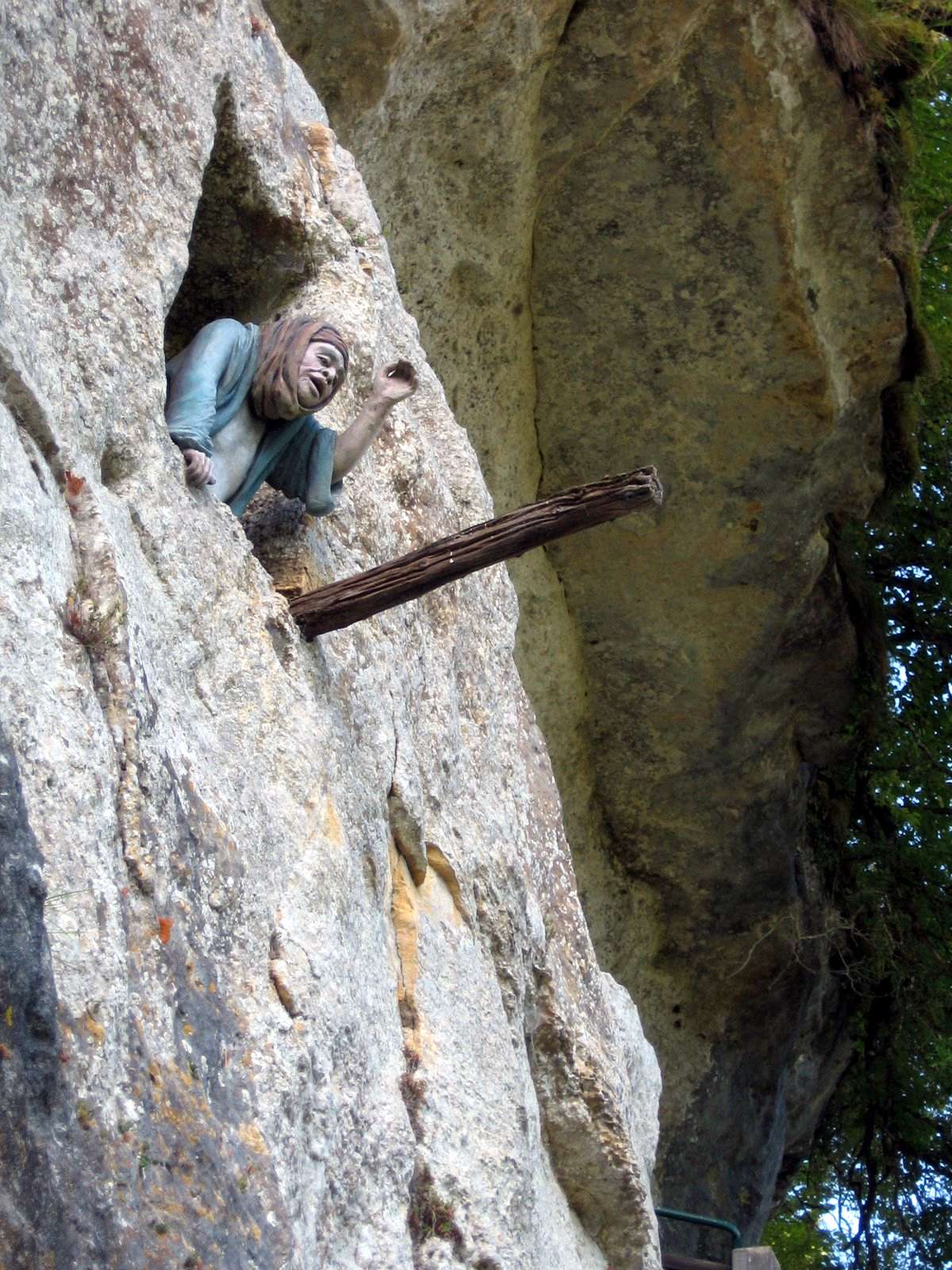
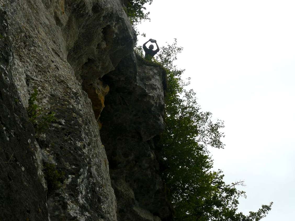
(left) The only access to this watchman's hole in the cliff was via this knotted rope.
Below the hole, we can see a channel dug in the cliff to provide a watershed for seepage from the cliff to be diverted to the roof of a building. The channel would have had shingles, slate or some other flat stone inserted to form a 'flashing' to the rest of the roof, to keep it watertight.
Photo: http://trucmmuche25.canalblog.com/
(right) Originally this watcher's hole in the wall would also have been accessed by a knotted rope tied to the beam projecting from the cliff.
Photo: trus64, https://picasaweb.google.com/
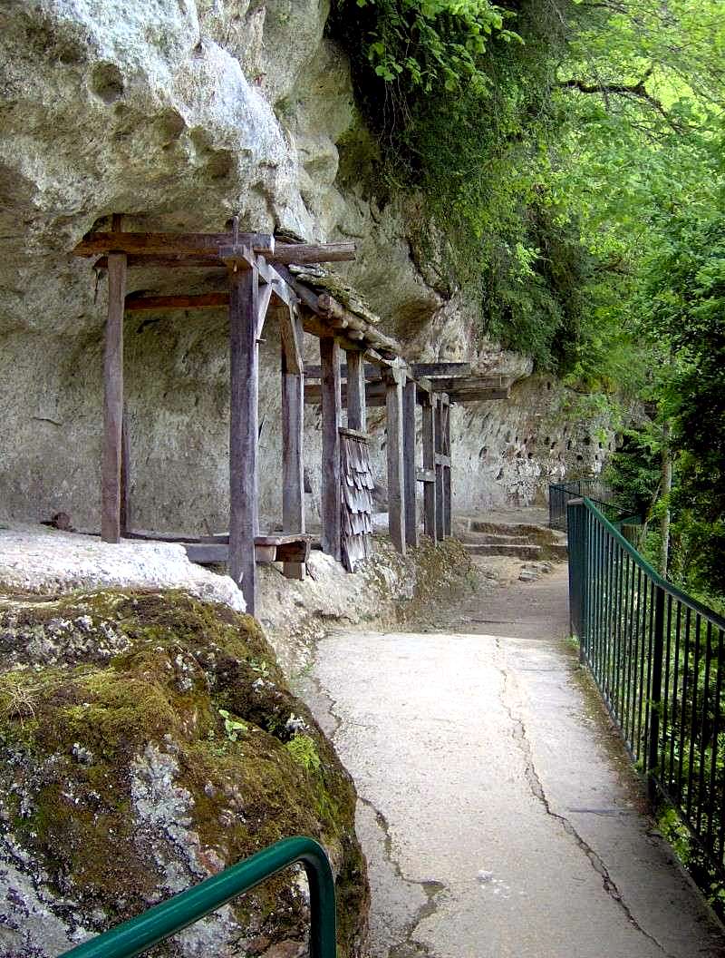
These small rooms along the entry path had no need for a back wall.
Photo:
http://www.tout-sur-google-earth.com/
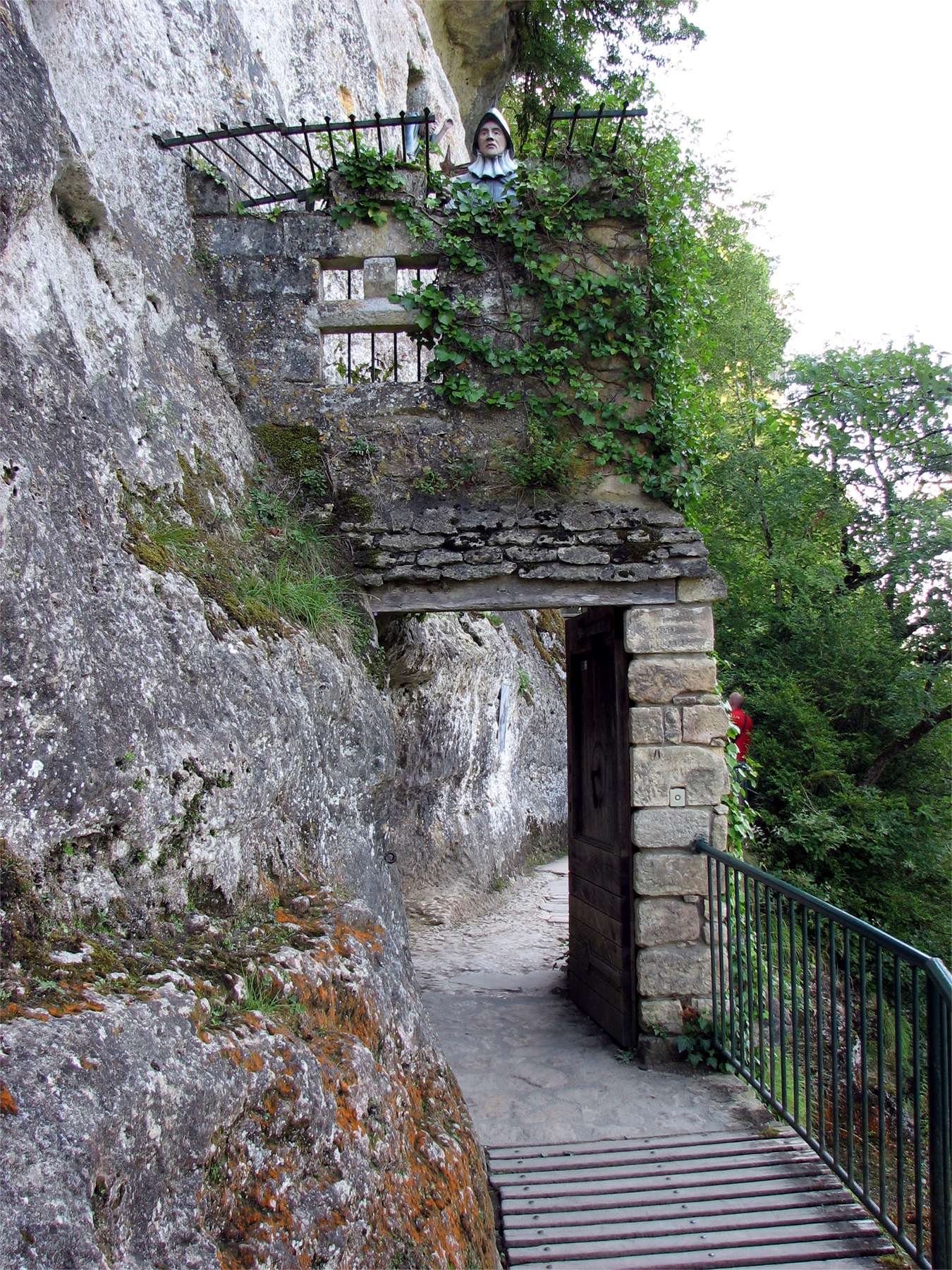
The narrow entry was guarded. The original entry was more massive than this one, with thicker base walls and drawbridges over deep pits both before and after this guard house.
Photo: Eric Desrentes, Panoramio via Google Earth.

About thirty metres further on from the guard house this former building appeared. The building method usually used was that the rock face behind became the rear wall of the house, into which holes were drilled for beams to be inserted, although in this case the room itself formed its own roof, and only a front wall would have been required.
Nearly 12 000 of these holes or 'putlogs' have been found on the site. The beams were supported at the front by vertical poles.
Higher up the wall, horizontal grooves corresponded to the edges of roofs that were for the most part made of flat stones called 'lauze'. These grooves channelled and drained off rainwater beating on the cliff onto the roof itself. The walls of the dwelling were originally made of cob and wood, but later on in the 15th and 16th centuries, the front of the buildings would have been of stone.
Photo: Don Hitchcock 2008
Text: Display board on site
Cob was made by mixing clay-based subsoil with straw and water using oxen to trample it. The earthen mixture was then ladled onto a stone foundation in courses and trodden onto the wall by workers in a process known as cobbing.
The construction would progress according to the time required for the prior course to dry. After drying, the walls would be trimmed and the next course built, with lintels for later openings such as doors and windows being placed as the wall takes shape.
The walls of a cob house were generally about 24 inches or 60 centimetres thick, and windows were correspondingly deep-set, giving the homes a characteristic internal appearance. The thick walls provided excellent thermal mass which was easy to keep warm in winter and cool in summer. Walls with a high thermal mass value act as a thermal buffer inside the home. The material has a long life span even in rainy climates, provided a tall foundation and large roof overhang are present.
Photo: Display board at Roque Saint Christophe
Text: Wikipedia.

Information or interpretation board at Roque Saint Christophe.
Photo: Don Hitchcock 2008

The Great Terrace of Roque Saint-Christophe
Photo: Oups79, 2006-01-25
Permission: Creative Commons Attribution - Share Alike 1.0 Generic licence.
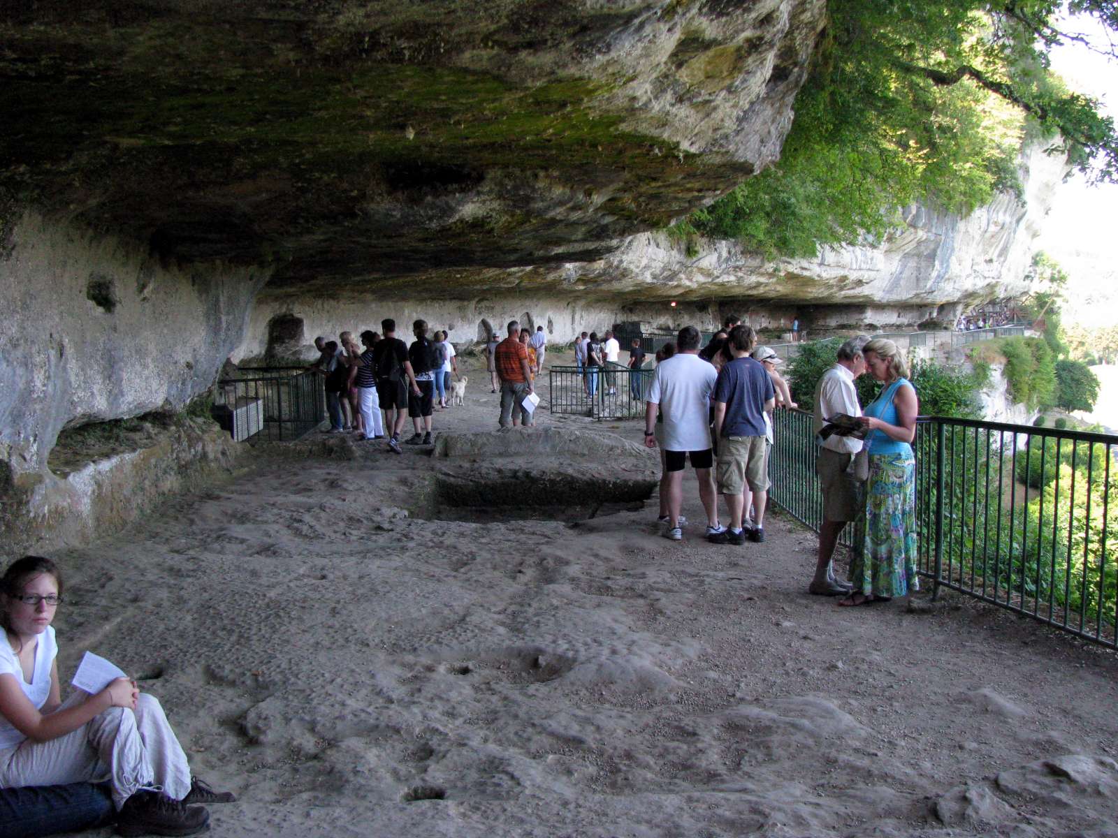
The Great Terrace at Roque Saint Christophe. Originally there would have been buildings all the way along this area, which is one of the largest such terraces in Europe.
Photo: Don Hitchcock 2008
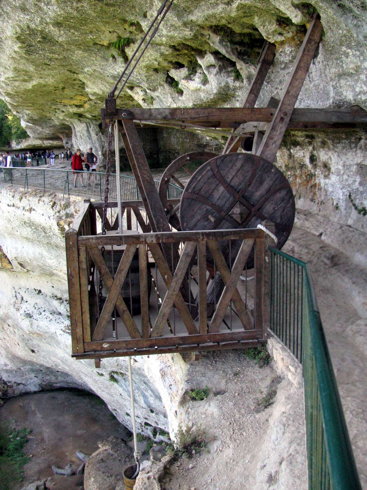
There are a series of these recreated windlasses along the Great Terrace. This one is operated by turning wooden handles let into the large wheel on the other side of the apparatus.
Photo: Don Hitchcock 2008
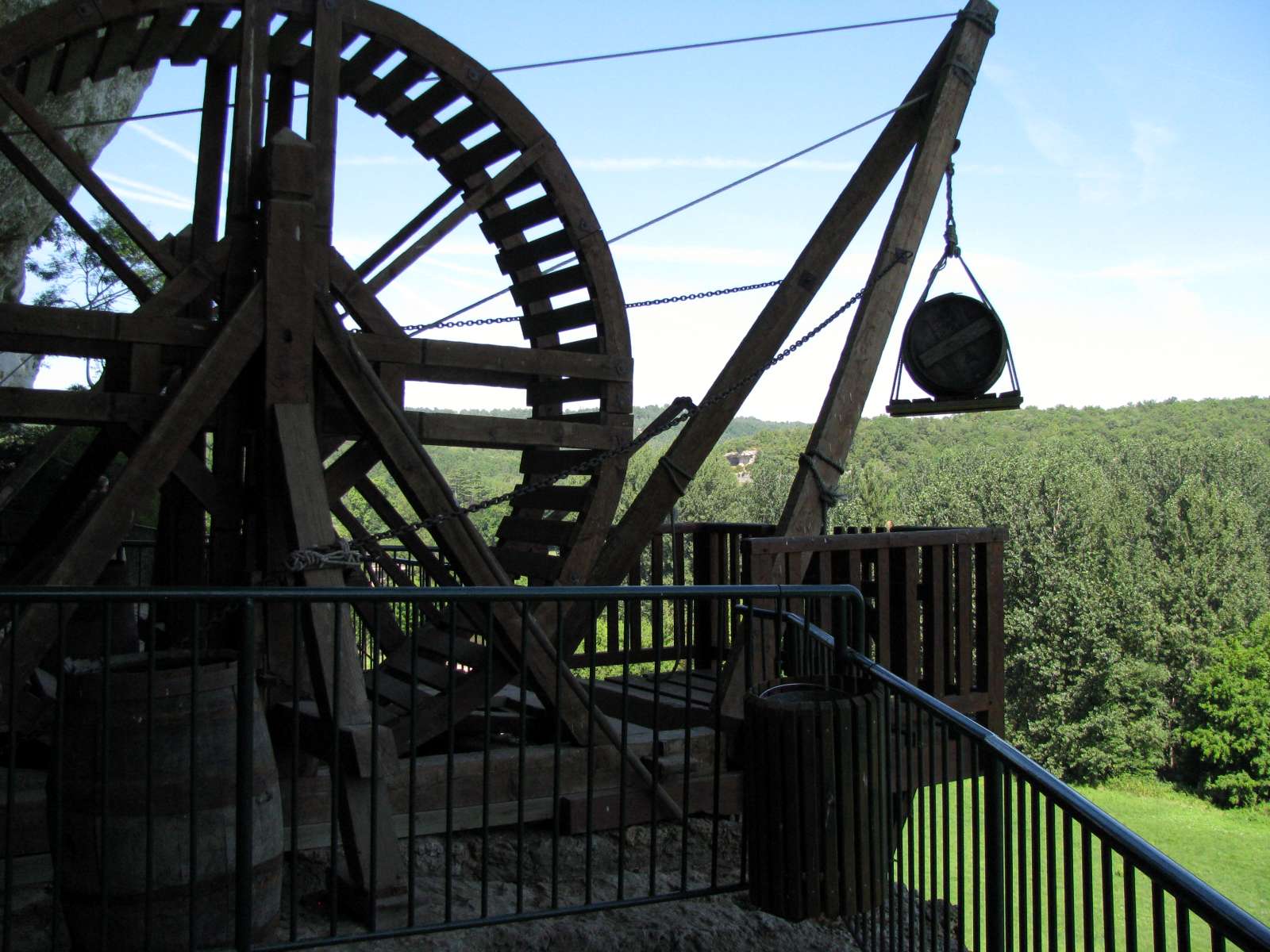
This large windlass is operated by one or two men walking inside the wheel to raise the load.
Photo: Don Hitchcock 2008
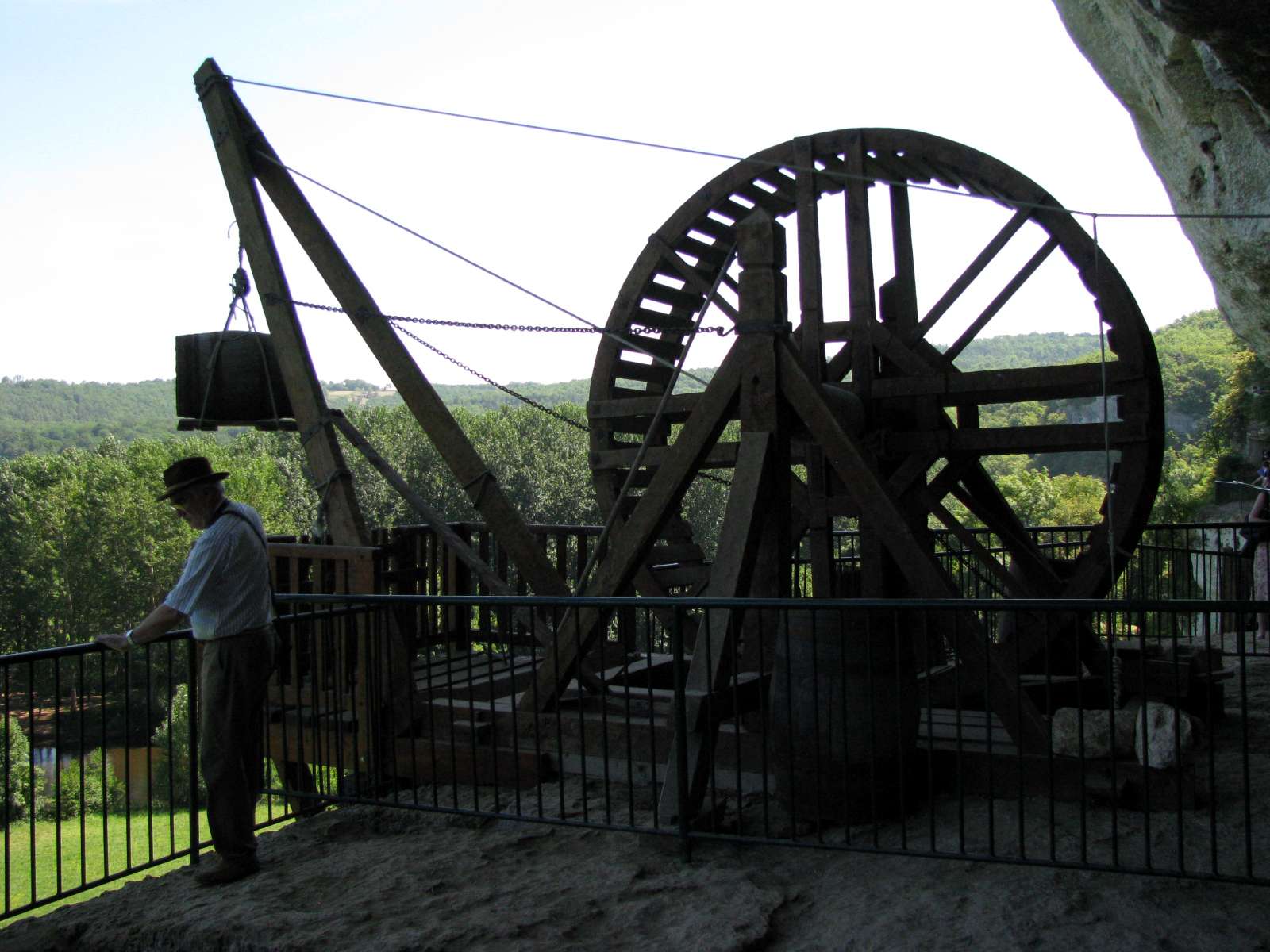
This smaller windlass could only have held one man inside to raise supplies.
Photo: Don Hitchcock 2008

A beam on an axle, used when the height which goods had to be lifted was relatively small. For higher lifts, some sort of windlass was needed, a more complicated and expensive solution.
Photo: http://www.genea24.com/Villages/Sarl/S_5/peyzac002.jpg
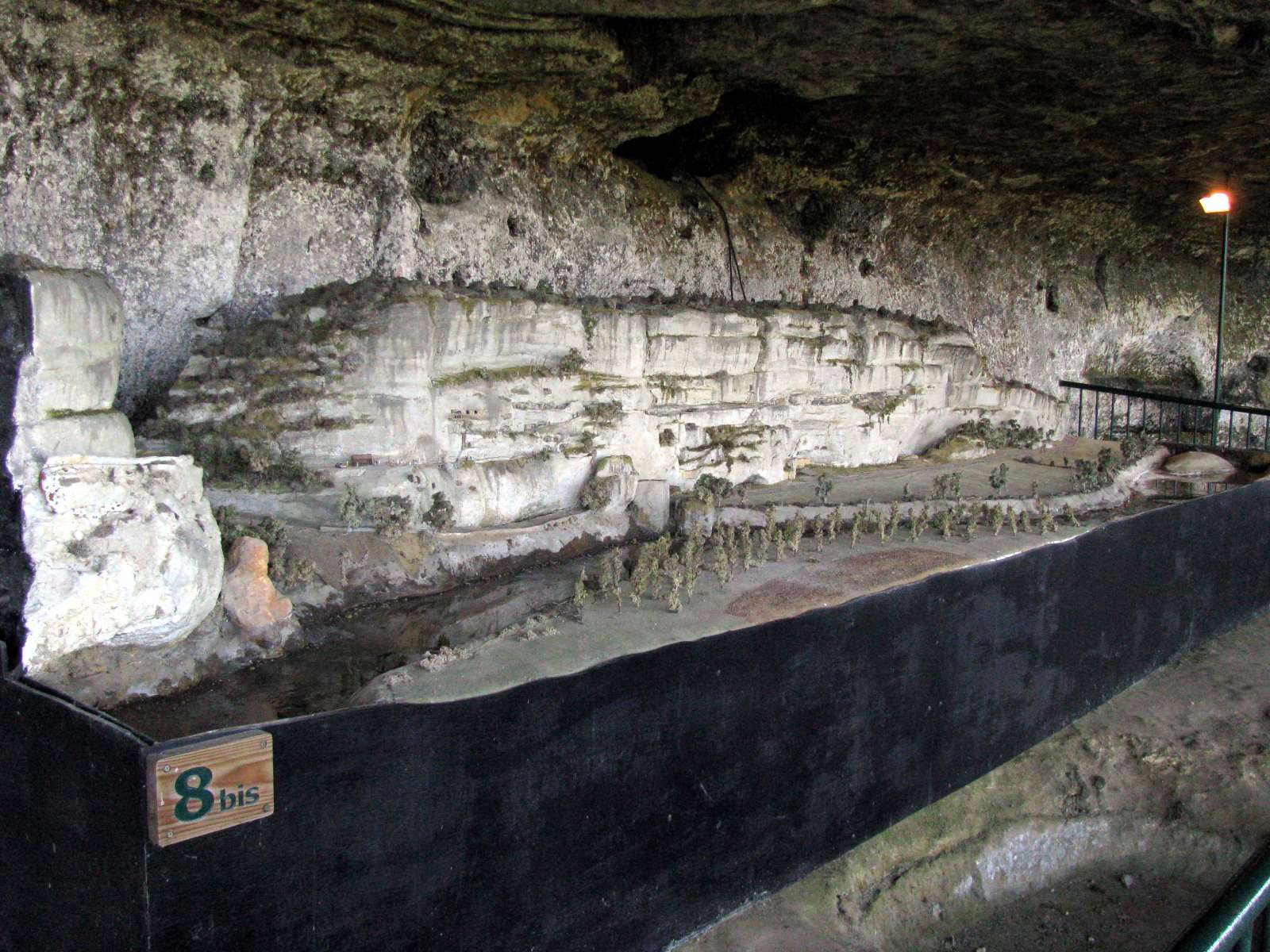
This is a model of the entire cliff of Roque Saint Christophe, showing the river and the grassed area in front of the cliff.
Photo: Don Hitchcock 2008
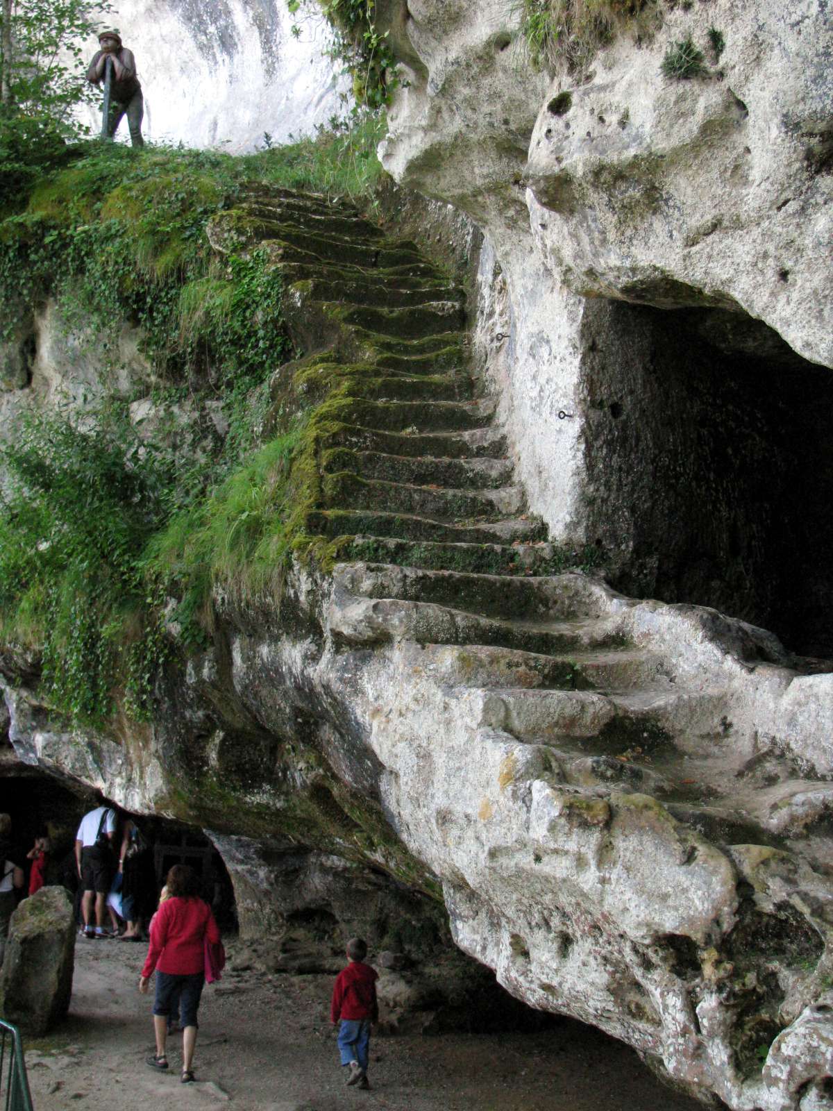
An old staircase cut into the limestone rock, leading to an upper level. Originally there would have been a wooden base to this staircase.
Photo: Don Hitchcock 2008
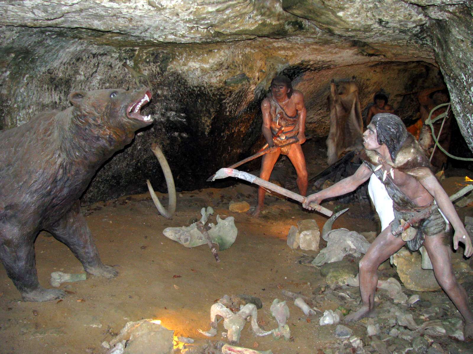
The original inhabitants would have, perhaps, had to drive out cavebears from the deeper caves when they first began to use the rock as habitation. This sort of scene is recreated in other caves too, but to me it always seems a little contrived. It makes a good display, but I wonder how authentic such a meeting might have been.
Photo: Don Hitchcock 2008
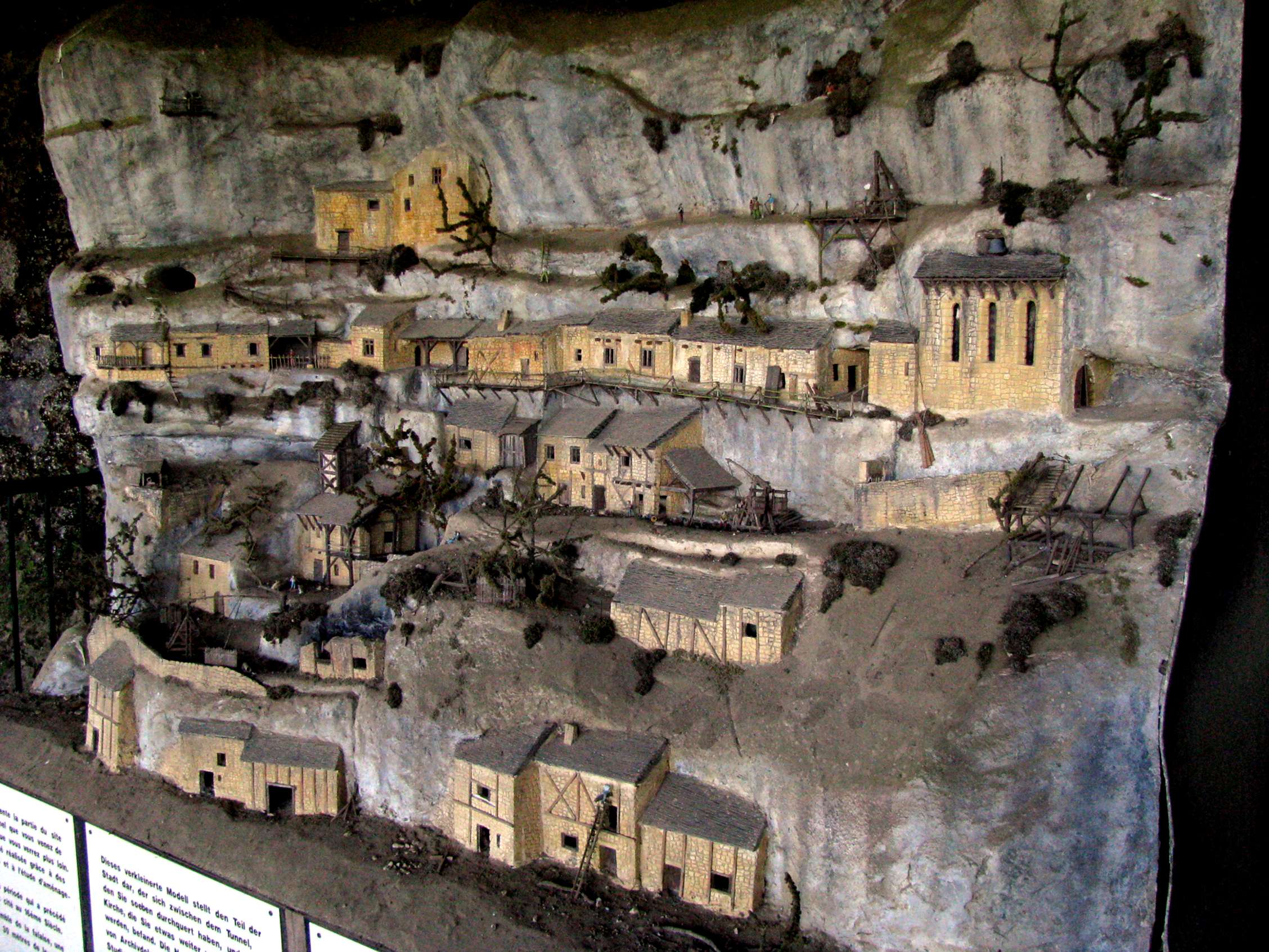
This is a model of what a small part of the cliff face looked like at the time it was inhabited by a thousand or more people. It corresponds to the period which preceded the destruction of the city in the 16th Century. To show the whole of the cliff would require a model about thirty metres long!
There were a series of ladders, walkways, steps and even cranes to allow access to all parts of the complex, with the cliff able to be well defended when necessary from invading forces.
Photo: Don Hitchcock 2008
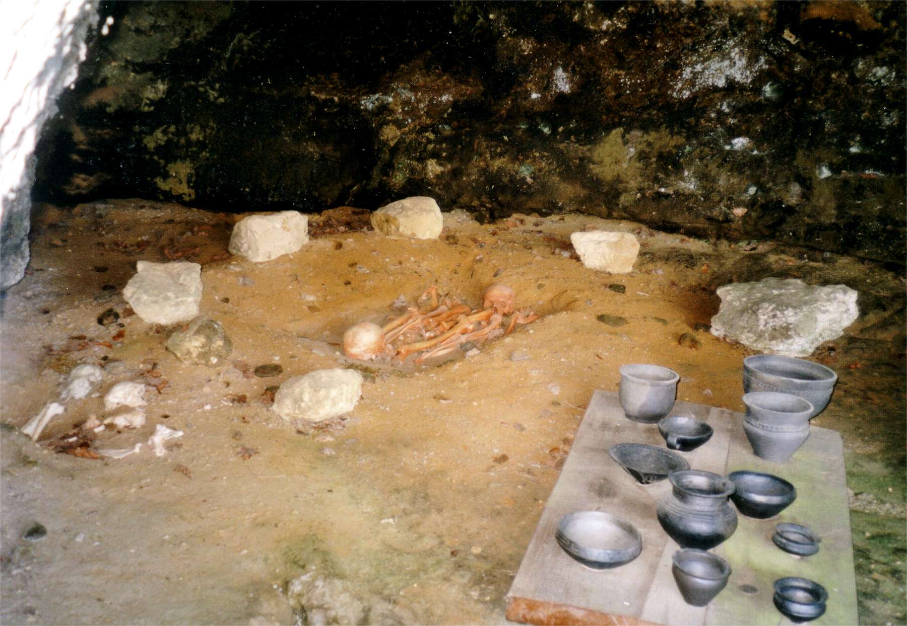
Double burial from the bronze age (facsimile) with some facscimiles of the pottery found near the burial, discovered by Denis Peyrony in 1912.
Photo: Traumrune, 2008-06-10
Permission: GNU Free Documentation License version 1.2

The remains of a church under the abri. The statue of Saint Christopher has had the limestone wall cut away to receive it.
Photo: TwoWings, 2007-08-21.
Permission: Public domain
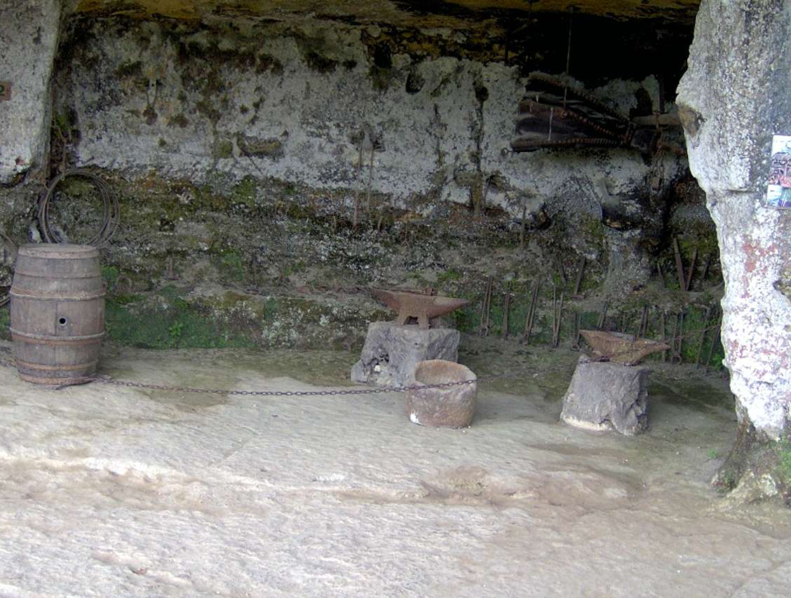
The blacksmith's shop, with anvils, where the forge was. The blacksmith was an important member of the community, who made many of the items used by the residents of the city.
Photo:
http://www.tout-sur-google-earth.com/

One of the many kitchens which would have existed in the city. Air for the central fireplace comes through the gaps in the stones from the back of the room.
Photo: Jessy Dou, 2010.08.08, http://www.flickr.com/

A house under a rock shelter.
Photo: Philip Lacombe, 2004-08-01
Permission: GNU Free Documentation license, Version 1.2


A strong box was once affixed to the wall here, presumably with important documents and valuable items.
Photo: (left) http://www.tout-sur-google-earth.com/
Photo: (right) trus64, https://picasaweb.google.com/
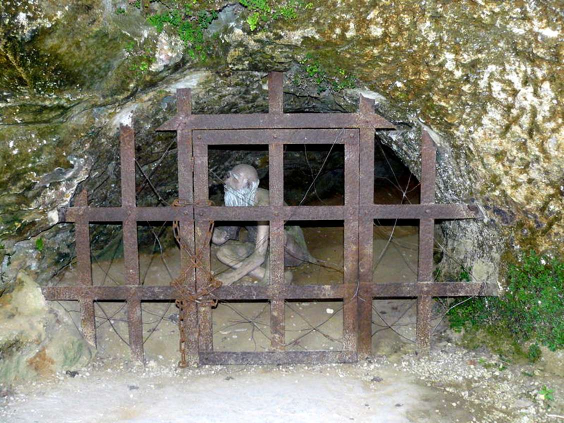
Those who displeased the lord of the city were placed in this dungeon.
Photo: http://trucmmuche25.canalblog.com/
The base of the rock still retains some indications of the way the entire cliff face was once built up with dwellings and fortifications.
Photo: croucrou, 10/07/2004
Permission: GNU Free Documentation License version 1.2
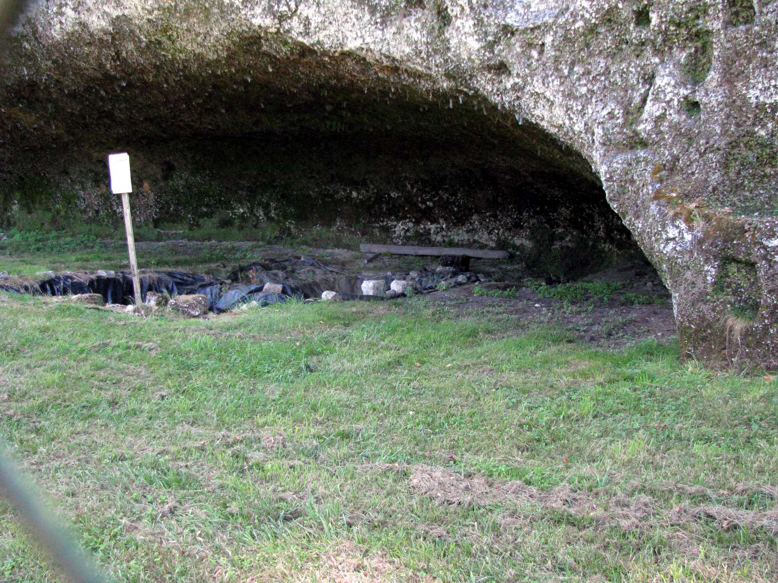
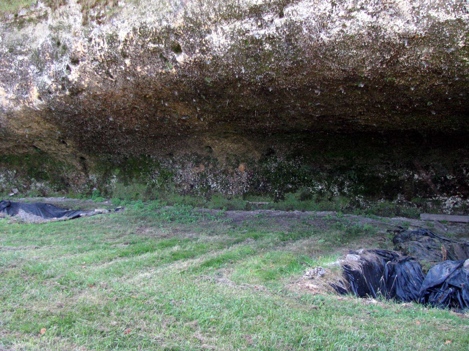
The base of the rock is still being investigated by archeologists, but I was unable to find out who was doing the excavations.
Photo: Don Hitchcock 2008
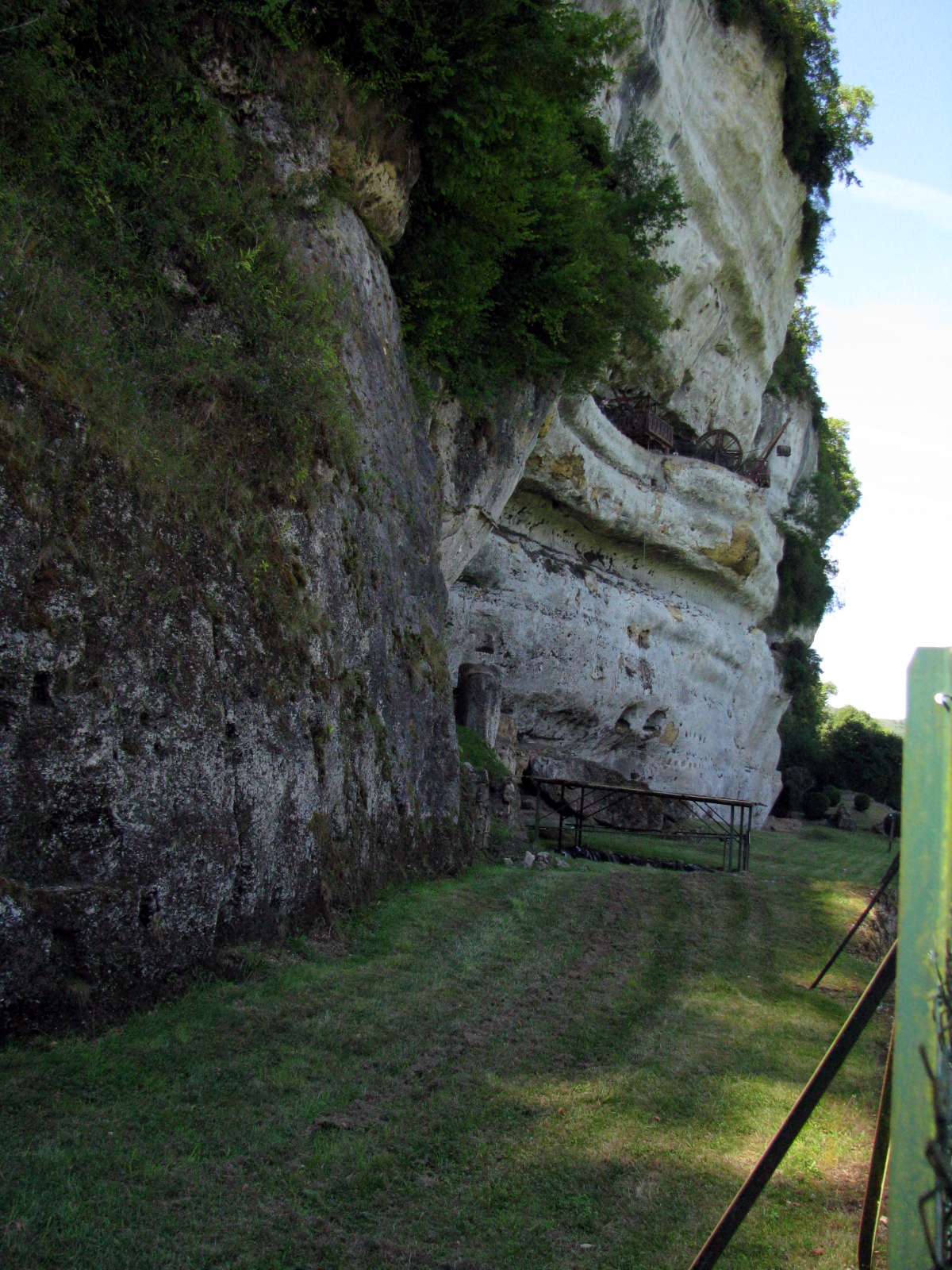
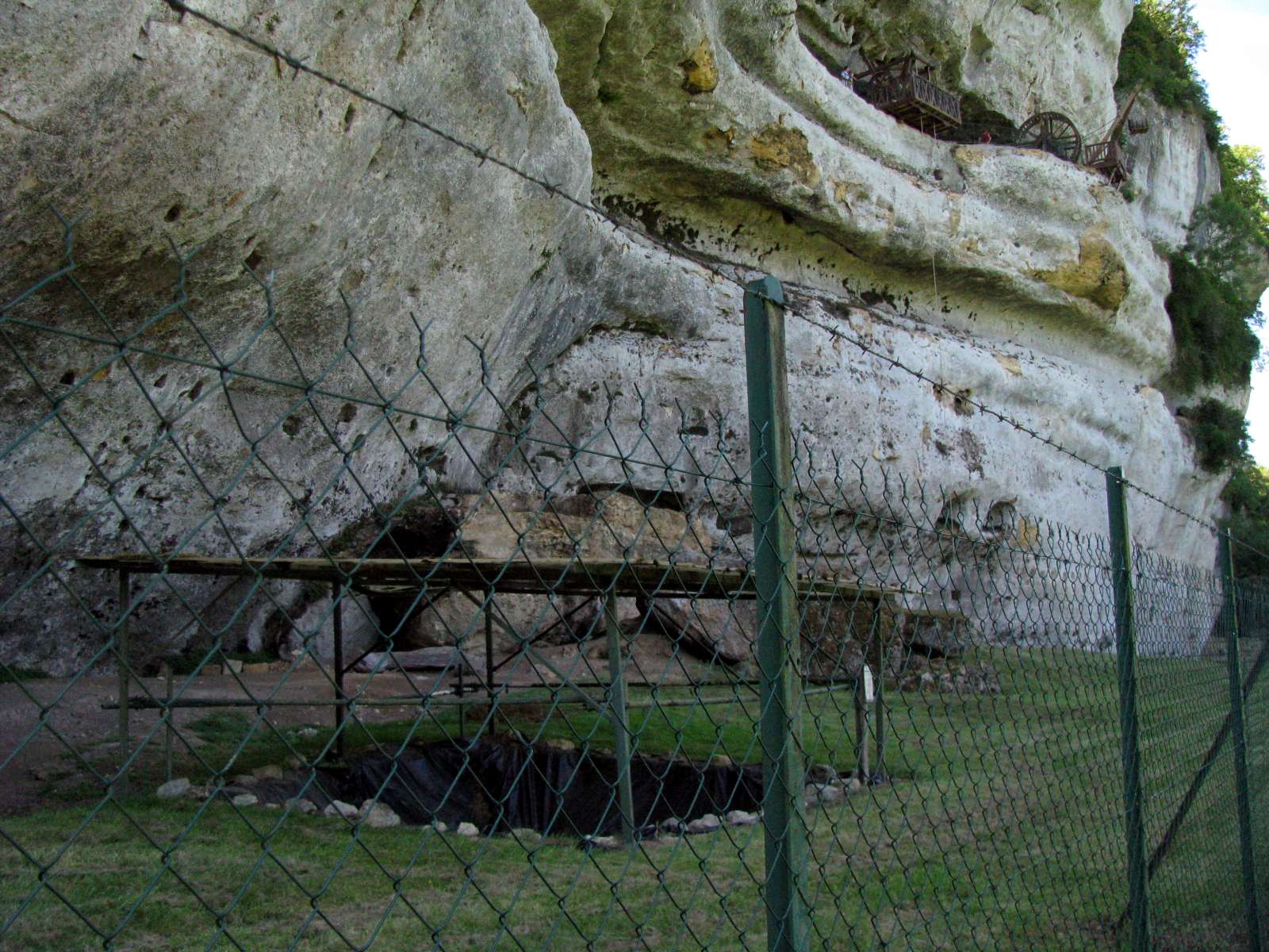
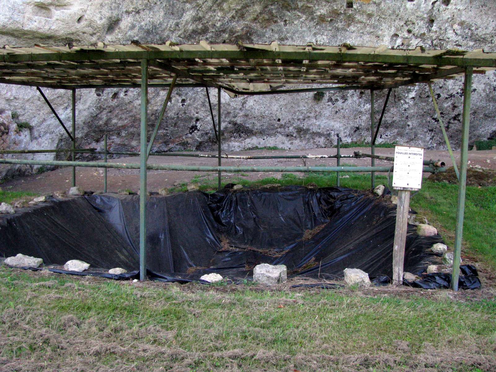

The cliff may well have had abris at the base of the cliff which have been filled in by sediment coming from the cliffs above, or from flooding of the Vezere across the obvious flood plain, now a beautiful grassed, flat area, however major discoveries are, as always, determined to some extent by chance.
This excavation is covered by a framework covered with a clear plastic roofing to provide protection from rain but plenty of light when the students and archeologists are doing active excavations.
Photo: Don Hitchcock 2008