Back to Don's Maps
 Bushwalking Index
 Access to Mihi Gorge and to Salisbury Waters below the junction with Mihi Creek
Click on the photos to see an enlarged version
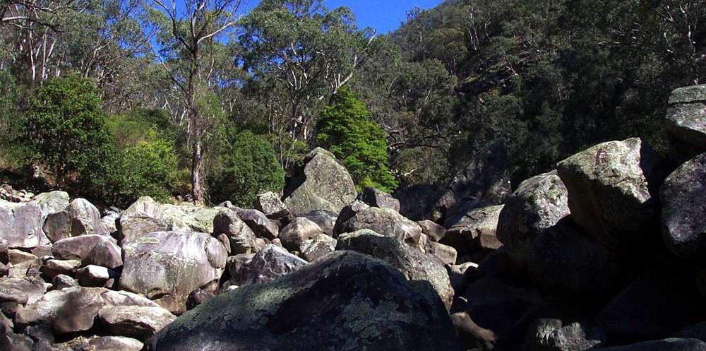
Mihi Gorge
Photo: Don Hitchcock September 2003
These photos and accompanying text are for the interest of armchair travellers only, and do not constitute comprehensive instructions for bushwalkers.
The trip to the Mihi Gorge is for very fit, very experienced and well prepared bushwalkers only. There is no maintained track once you reach Salisbury Waters, it is very strenuous, and bush craft, topographical maps and compass are required. If there is the possibility of needing to camp, sufficient appropriate equipment should be carried. Always carry a Personal Locator Beacon, and tell reliable people where you are going and how long your party will be away. Mobile phones do not work anywhere in the gorges for sure, and almost never even on top of the cliff line.
There are two main ways to access Mihi Gorge and Salisbury Waters below the junction with Mihi Creek, neither of which is without problems.
1. Follow the track from Dangars Falls to Salisbury Waters, and continue down Salisbury Waters - Not recommended
2. Drop down to Mihi Creek at or before the last lookout down Salisbury Waters when following the track.
1. Follow the track from Dangars Falls to Salisbury Waters, and continue down Salisbury Waters
None of these three possible routes is recommended
- Swim the "Long Pool" which you come to not far downstream from where the track meets Salisbury Waters.
- Take the "High Road" by heading up the true left gorge wall when you get to the "Long Pool".
- Take the "Space Walk" which is a narrow ledge above the rocks bordering the true left of the lagoon.
The second option is the High Road. Follow Salisbury Waters downstream from the track end to where rock blocks the side of the stream, on the true left of Long Pool. Move to your left up the gorge wall. It appears at first that all you have to do is get over a minor outcrop of rock, but you will be forced higher and higher on the gorge wall until you are dumped out at a high traverse on deep, unconsolidated, unstable soil and gravel at its "angle of rest", an exposed route and an unnerving experience for most bushwalkers. I've done it once, I don't want to do it again.
The third option is what I call The Space Walk. This is a narrow ledge of rock above rocks bordering Salisbury Waters, half way up the boss of rock which bars further progress down the stream.
Even guide books from thirty or forty years ago talk of this as a "difficult traverse". It is at the time of writing, 2011, in fair condition, but should be approached with great caution, and is suitable only for very experienced bushwalkers with a head for heights.
2. Drop down to Mihi Creek at or before the last lookout down Salisbury Waters when following the track.
These routes are in my opinion the best of a bad bunch. Great care must be taken.
The guide books talk about two possible routes:- Follow a creek down to the Mihi, about 800 metres above the junction with Salisbury Waters
- Follow the right hand ridge to the Mihi from the last lookout on a short side track, just before the final drop down to Salisbury Waters on the main track.
I am not sure which creek the guide books speak of. I went down a gully further down the track from the Sarum Lookout turnoff. It was very steep, and started to get steeper. I traversed to the nearby ridge on the left which was much easier to descend, but it eventually came to a steep drop off. I then traversed left again across a small gully to another ridge, which led fairly easily into the Mihi. The ridges on the true left of the Mihi all seem to finish with a steep entry to the creek bed. I cannot recommend this route, though it is certainly doable. It is a long route for a start.
The best route down so far as I can tell is to go to the last lookout on the Salisbury Waters track, on a side track just before the final drop down of the main track to Salisbury Waters.
There are two ridges, the one on the left goes straight down to the Mihi/Salisbury Waters junction, and is a good route except for the last fifty metres. For the last fifty metres there are two routes I know of going up, but I would not like to come down either of them.
Instead, it is better to take the ridge on the right, which eventually drops into the Mihi about 300 metres upstream from the junction with Salisbury Waters. It is steep at the top and at the bottom, but is not exposed at any point, if you follow the main ridge down. It is certainly possible to get "hung up" on some cliffs if you try to drop off the main ridge, but with normal care and common sense the route is quite feasible. The ridge curves to the left near the bottom. The last fifty metres are quite steep, and I found a way down through the branches of a fig tree. I had to sit down and put my feet on the next foothold twice, but that is about it so far as difficulty is concerned. The ridge is not for beginners, but otherwise is quite straightforward.
Bushwalking Index Anyone (e.g. students, libraries, government agencies such as tourist bureaus, the general public) may use, print and publish the photographs taken by me and presented on this bushwalking file for any legitimate non-commercial purpose, at no cost, and without asking permission. However a note such as "Photo: Don Hitchcock" somewhere in the document would be appreciated if it is to be published.