Back to Don's Maps
 Bushwalking Index
  The walk from Boundary Creek to Grassy Creek via Duffers Falls and the Haystack
 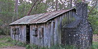 The walk from Grassy Creek to Mulligans Hut via O'Hara's Gap and the Tree Fern Fire Trail
 Mulligans Hut to Boundary Creek, World Heritage Walk, Gibraltar Range - Washpool National Park
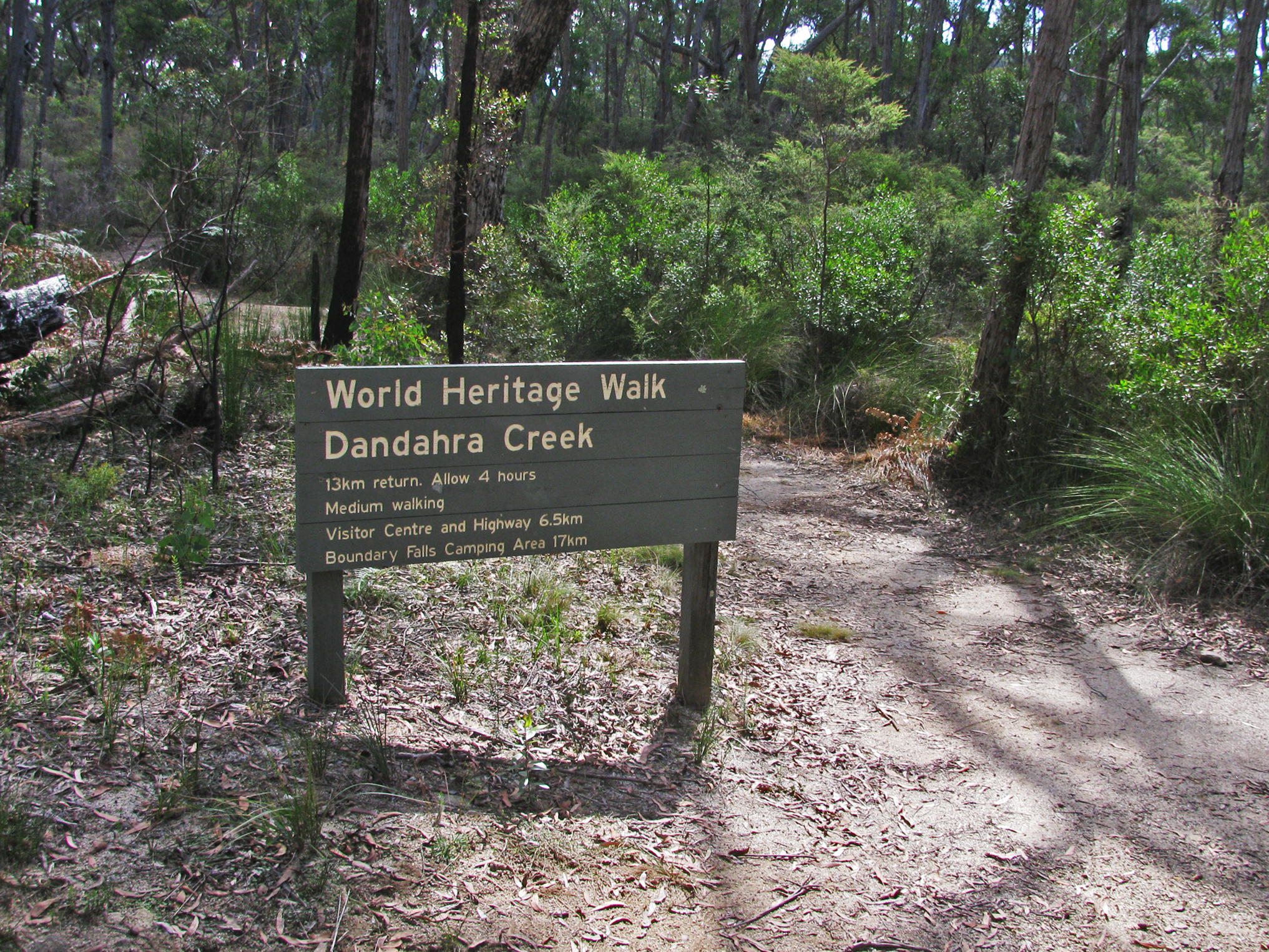
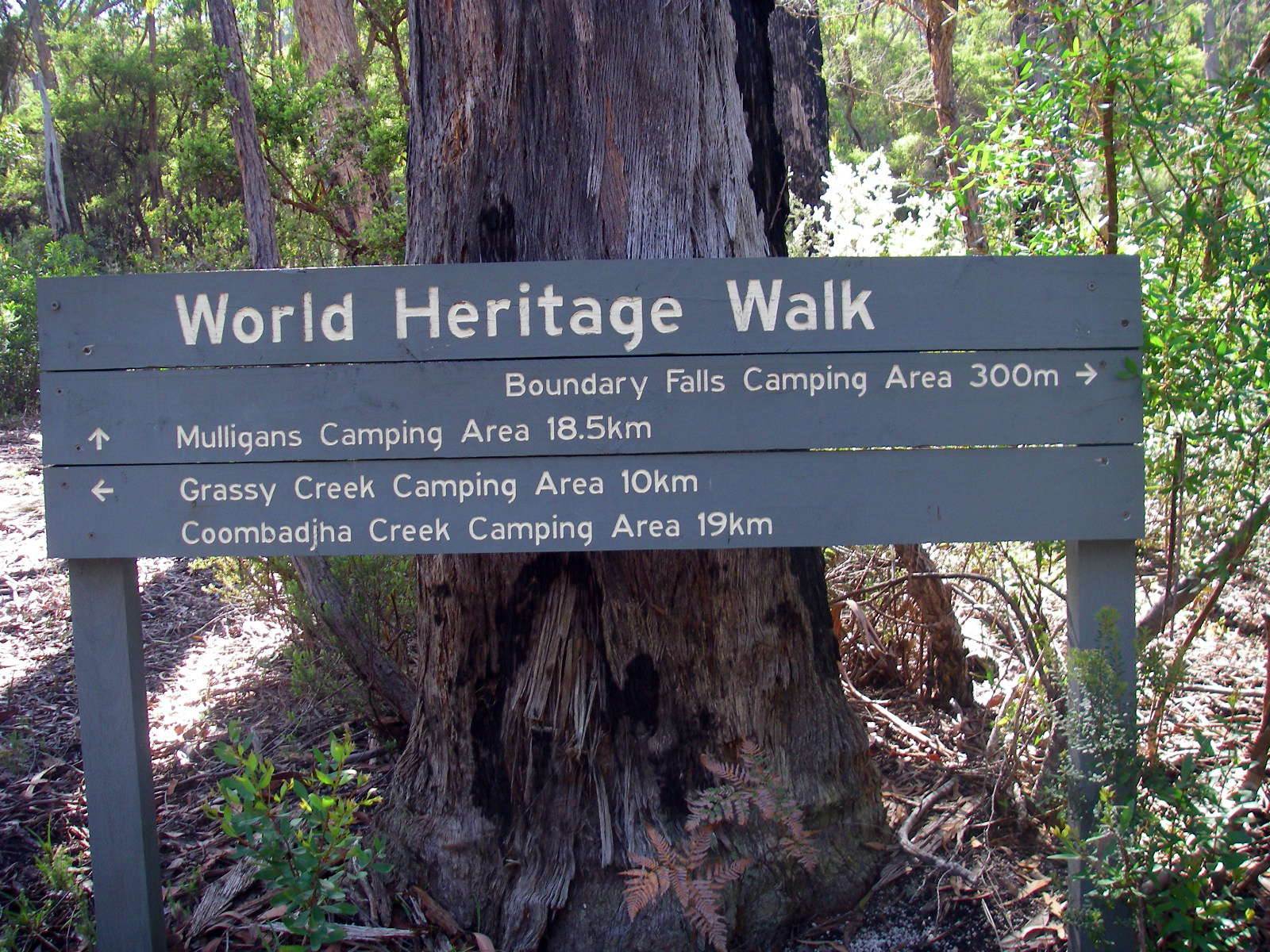
A one hundred kilometre network of walking tracks forms the Gibraltar - Washpool World Heritage Walk. The route links the Gibraltar Range and Washpool National Parks in rugged mountainous country, high above the Clarence Valley on the edge of the Northern Tablelands. Dramatic and diverse changes in the landscape are typical along the walk. Dry eucalypt sclerophyll forests, set amidst a broken collection of ridges and granite tors, surround a mosaic of sub-alpine swamps. In more dense country, lush rainforests safeguard the largest area of coachwood in the world. Within these ancient pockets of wilderness, waterfalls plummet from a lacework of streams and wild rivers. They offer refuge to a rich variety of wildlife including many rare and endangered species. In spring and summer the heathlands, swamps and open woodlands erupt in a colourful display of wildflowers.
Text above: 'A Walk on the Edge of Wilderness, The Gibraltar - Washpool World Heritage Walk', free booklet from NPWS.
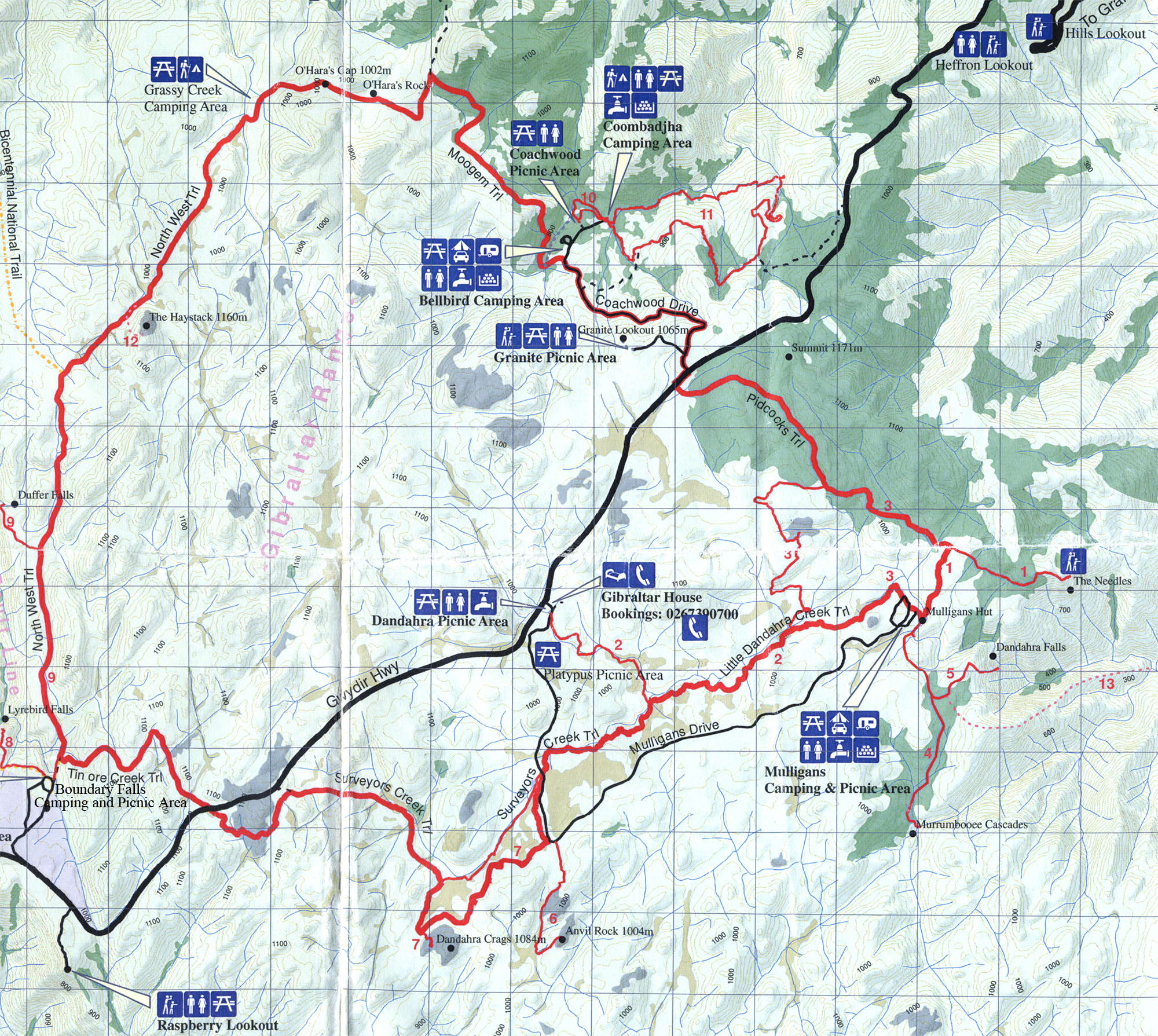
This is a great map from the National Parks and Wildlife Service (NPWS), showing the entire circuit. You can pick one up free from the Glen Innes NPWS office, as well as an excellent free booklet on the walks of the circuit, 'A Walk on the Edge of Wilderness, The Gibraltar - Washpool World Heritage Walk'. This booklet contains detailed track notes as well as flora and fauna lists.
I got the 1:25 000 topographic maps, but they are almost too detailed. I found this map to be all I needed to complete the entire circuit, and left the topo maps in the car. The track is very well signposted, with occasional 'You are here' maps on display boards.
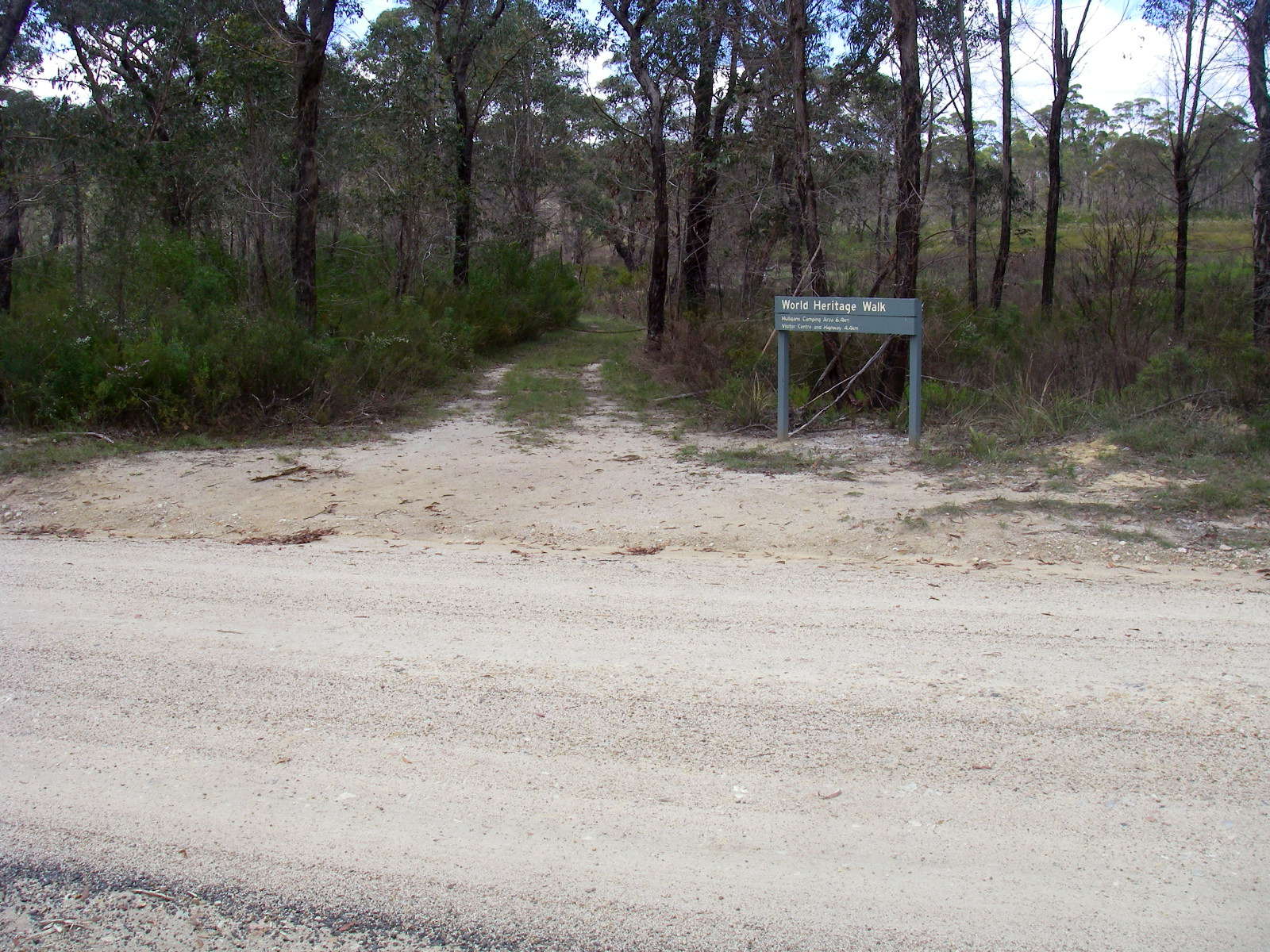
This whole World Heritage Walk has been superbly set up, it is a credit to all concerned. The complete circuit without side trips is about 60 km, and can be done in three days if you are fit and well prepared, though the track notes recommend five days to allow for extended side trips. The tracks are excellent.
Here is the map as a pdf, which should print on one page from the free program Adobe Reader:
Map as a pdf for printing
Photo: Free handout from NPWS.
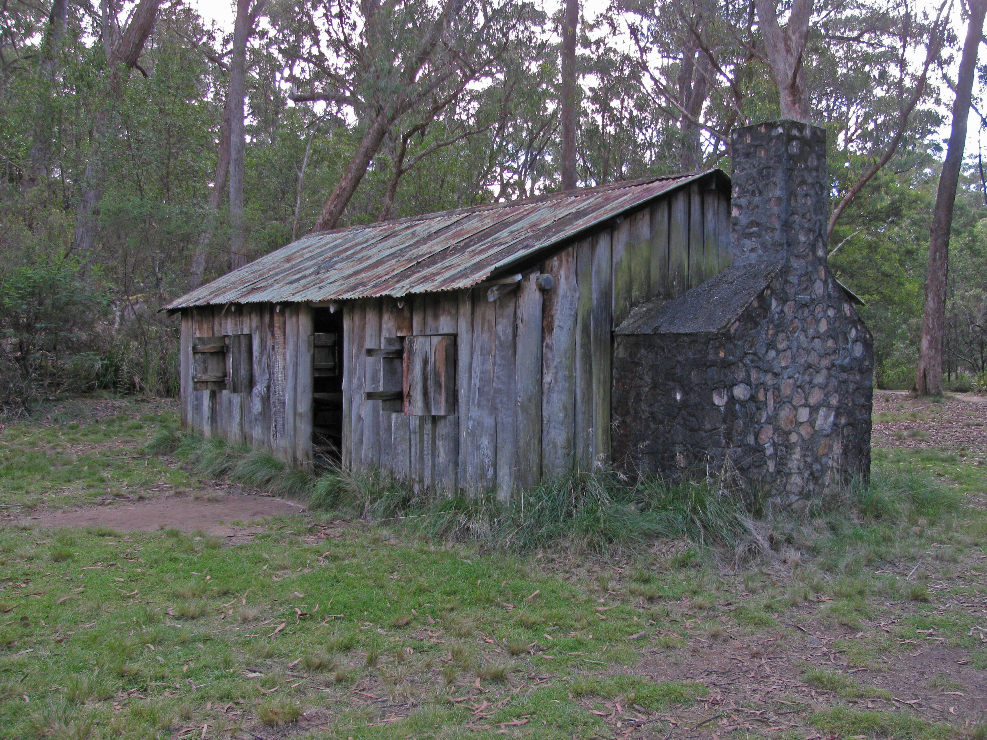
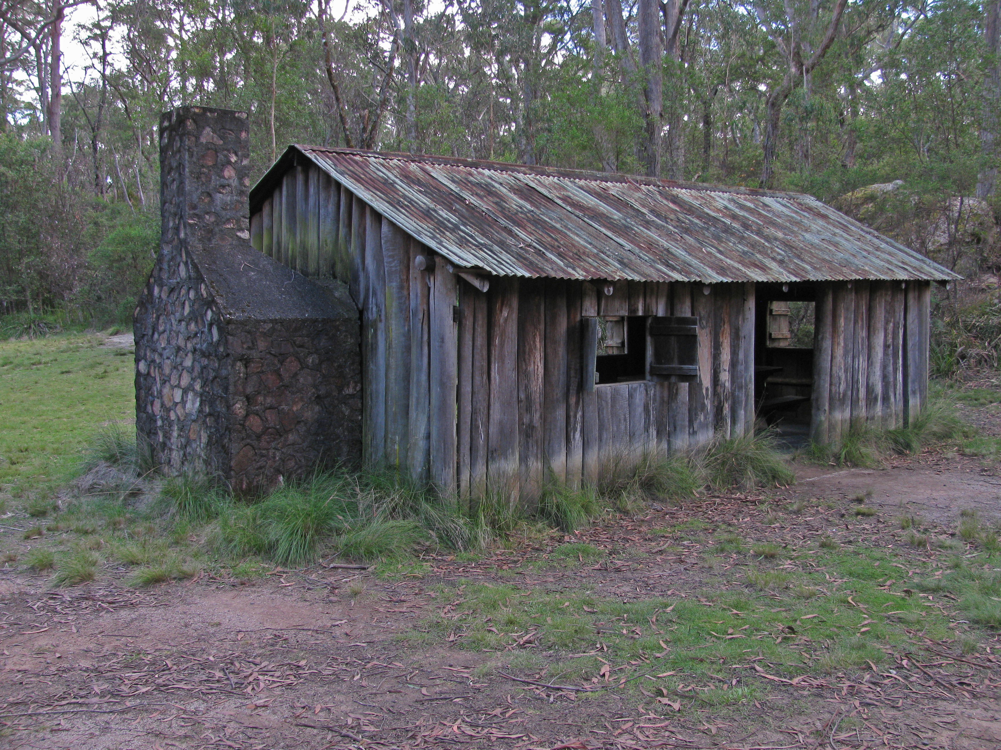
Mulligans Hut. This is a replica, built in the 1960s after the original was damaged in a bushfire, used as a daytime shelter for picnickers.
Photo: Don Hitchcock, April 2015
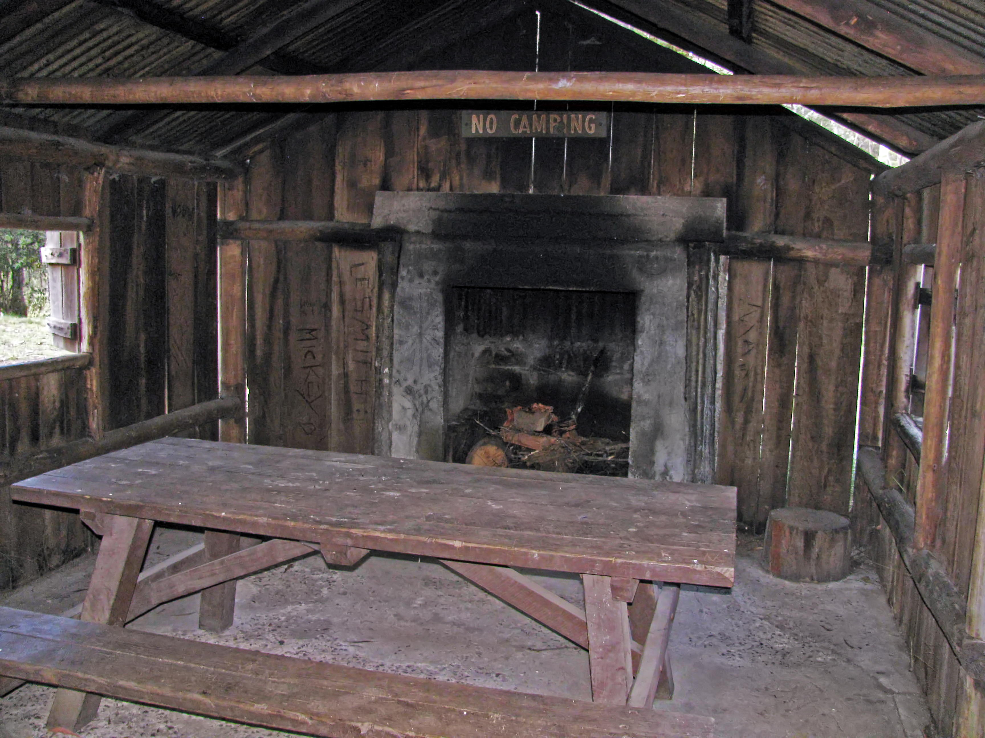
A stone fireplace was added to the original design. There is plenty of camping in this area.
The hut is located in Mulligans Hut Picnic Area next to Dandahra Creek, which is suitable for swimming.
Photo: Don Hitchcock, April 2015
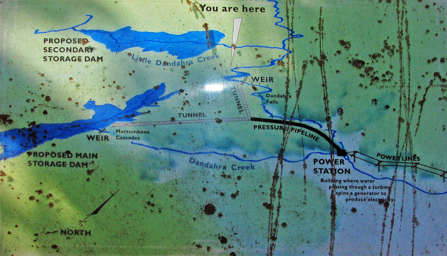
William Mulligan and the Dandahra Hydroelectric Scheme
This area is named after William Mulligan (1862 - 1953) who knew it well. Born of a local grazing family, he became a prominent citizen and mining engineer. He devoted his energy and vision to local development projects. He proposed a hydroelectric scheme for this area, but it was not built.
It was here that William Mulligan and partners proposed to dam the north and south arms of Dandahra Creek and send water 600 metres over the escarpment to a hydroelectric power station. To measure the water flow, they built two concrete weirs in the 1920s that you can see today.
In 1942 the partners approached the Minister for Mines for a loan to reopen a copper mine in the foothills below here at Cangai (pronounced Cang-ghee). They were not funded because the geologists and an independent engineer were not optimistic about the venture. As well, the necessary capital and equipment were not available during the war years. So when the partners' leases expired in 1952, the Dandahara Hydroelectric Scheme was not built.
William Mulligan built two slab-walled huts here, each with a bark roof and a dirt floor. A 1960s fire destroyed the smaller hut and damaged the other. The NPWS rebuilt the larger hut in 1968.
So the simple hut in front of you is where William Mulligan planned a grand hydroelectric scheme - a scheme that finally didn't happen.
Photo: Don Hitchcock, April 2015
Text and map: Notice Board at the site
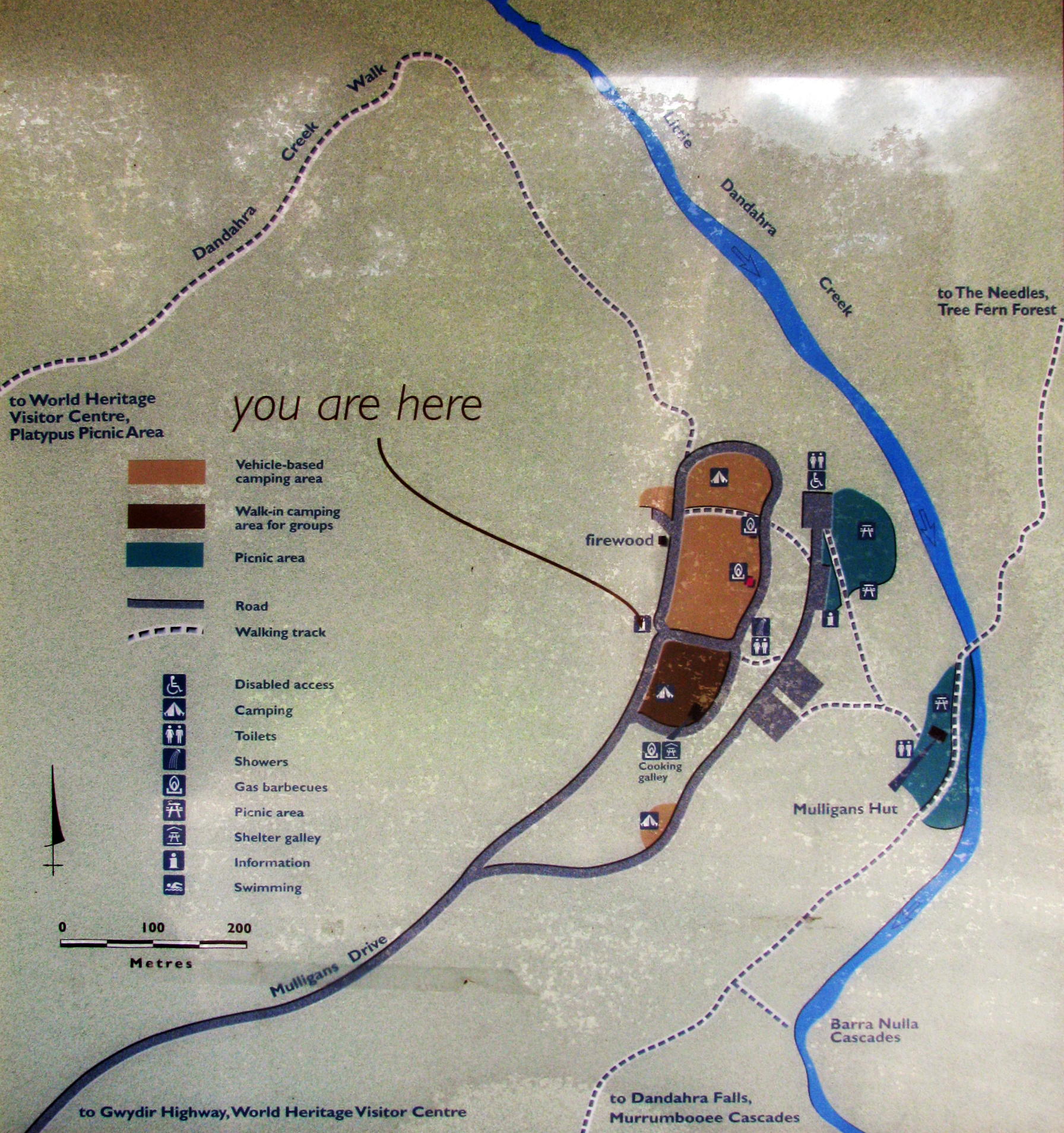
Map of the area.
Photo: Don Hitchcock, April 2015
Source: Notice Board at the site
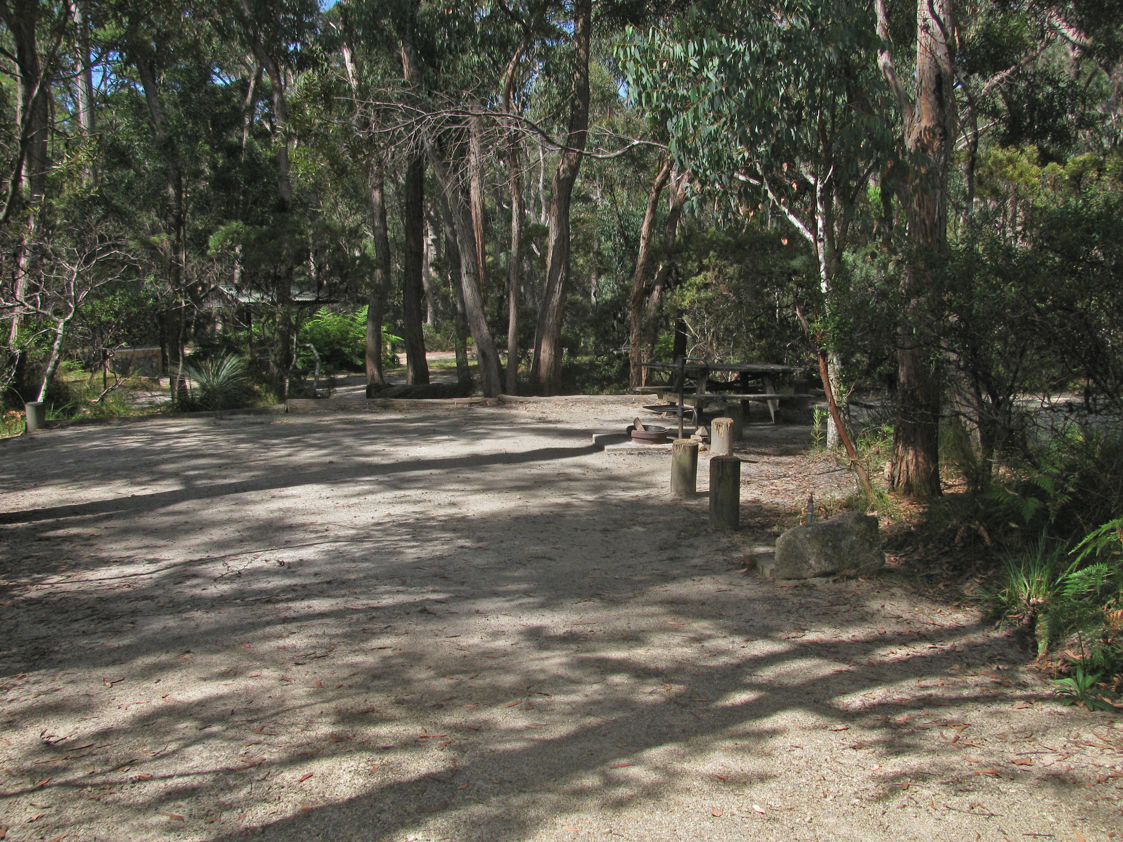
The area is well set up for car and caravan camping.
Photo: Don Hitchcock, April 2015
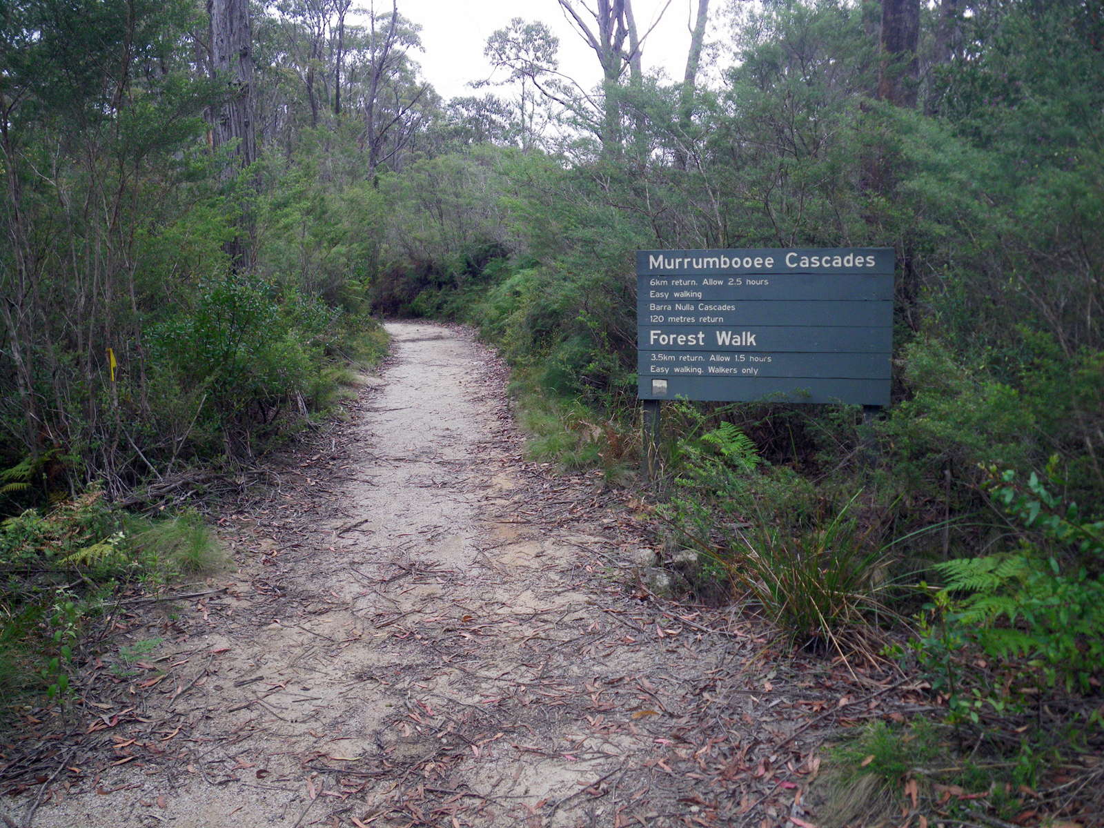
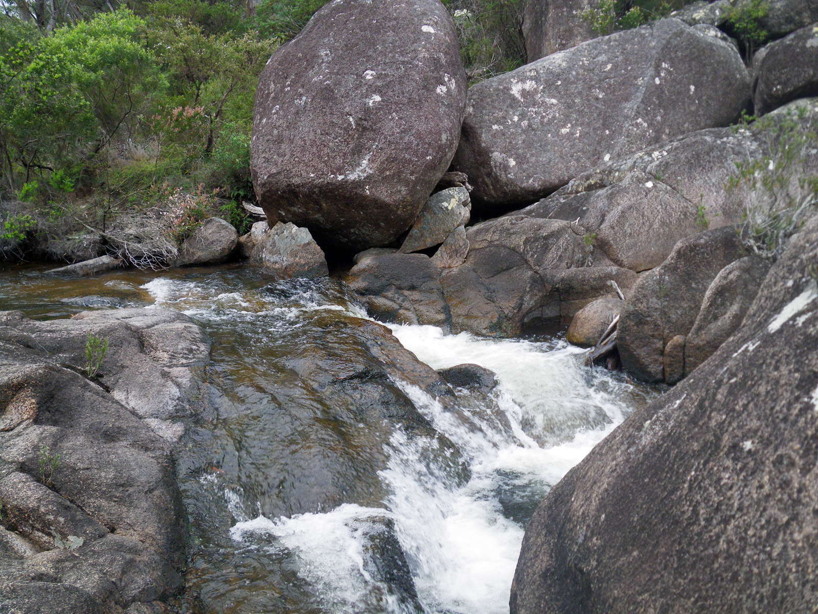
The Barra Nulla Cascades are not far down this track, which itself is not far from Mulligan's Hut above. The Cascades would be a good place to cool off on a hot day.
Photo: Don Hitchcock, November 2011
The start of the next section of track, the last leg towards Boundary Creek Campsite, on the edge of the Mulligans Hut Campgrounds.
Photo: Don Hitchcock, April 2015

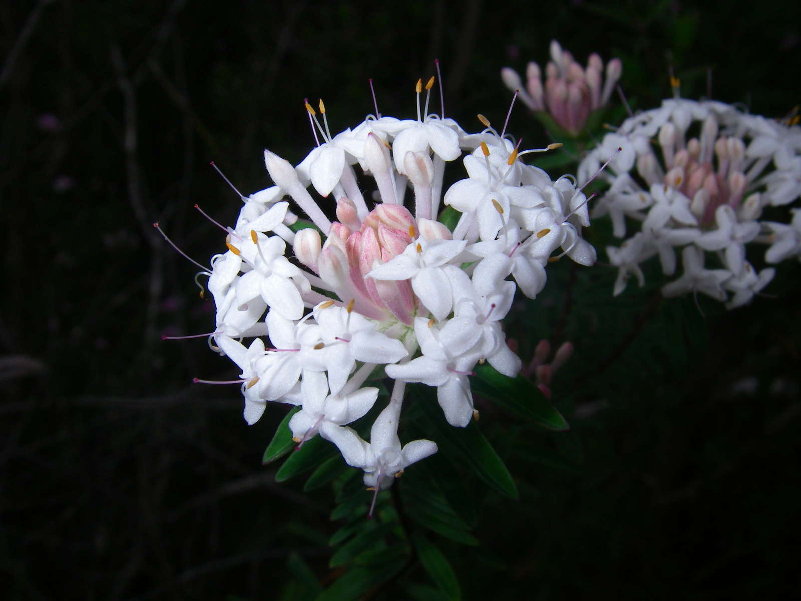
Hibbertia acicularis, Prickly Guinea Flower, a small, low shrub with stiff straight leaves with a sharp point, and bright acid yellow flowers. Flowers in Spring.
Photo: Don Hitchcock, November 2011
Text: Adapted from http://hawksnestherbarium.com.au/gallery/v/flowers/yellow/Hibbertia+acicularis/
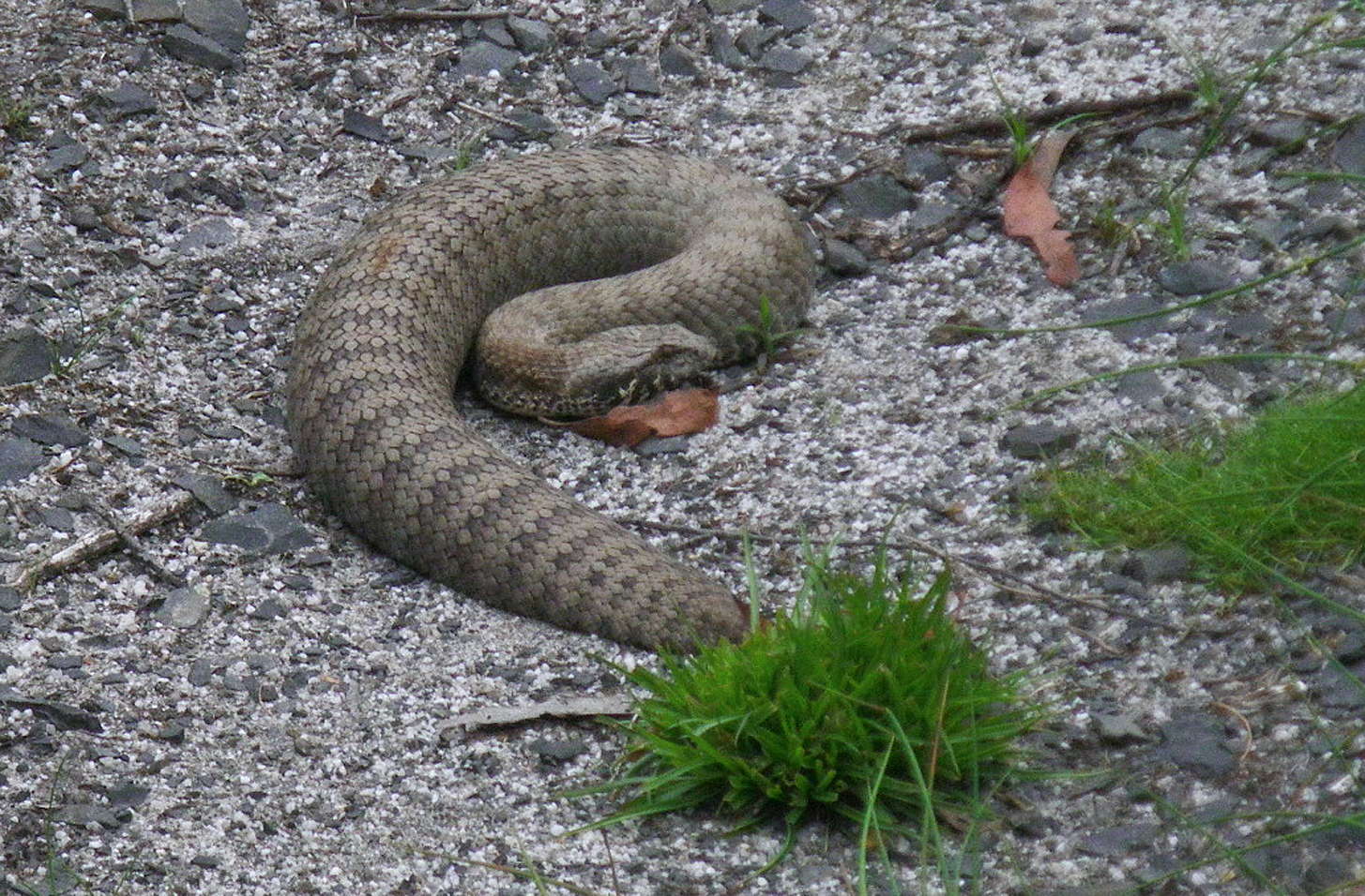
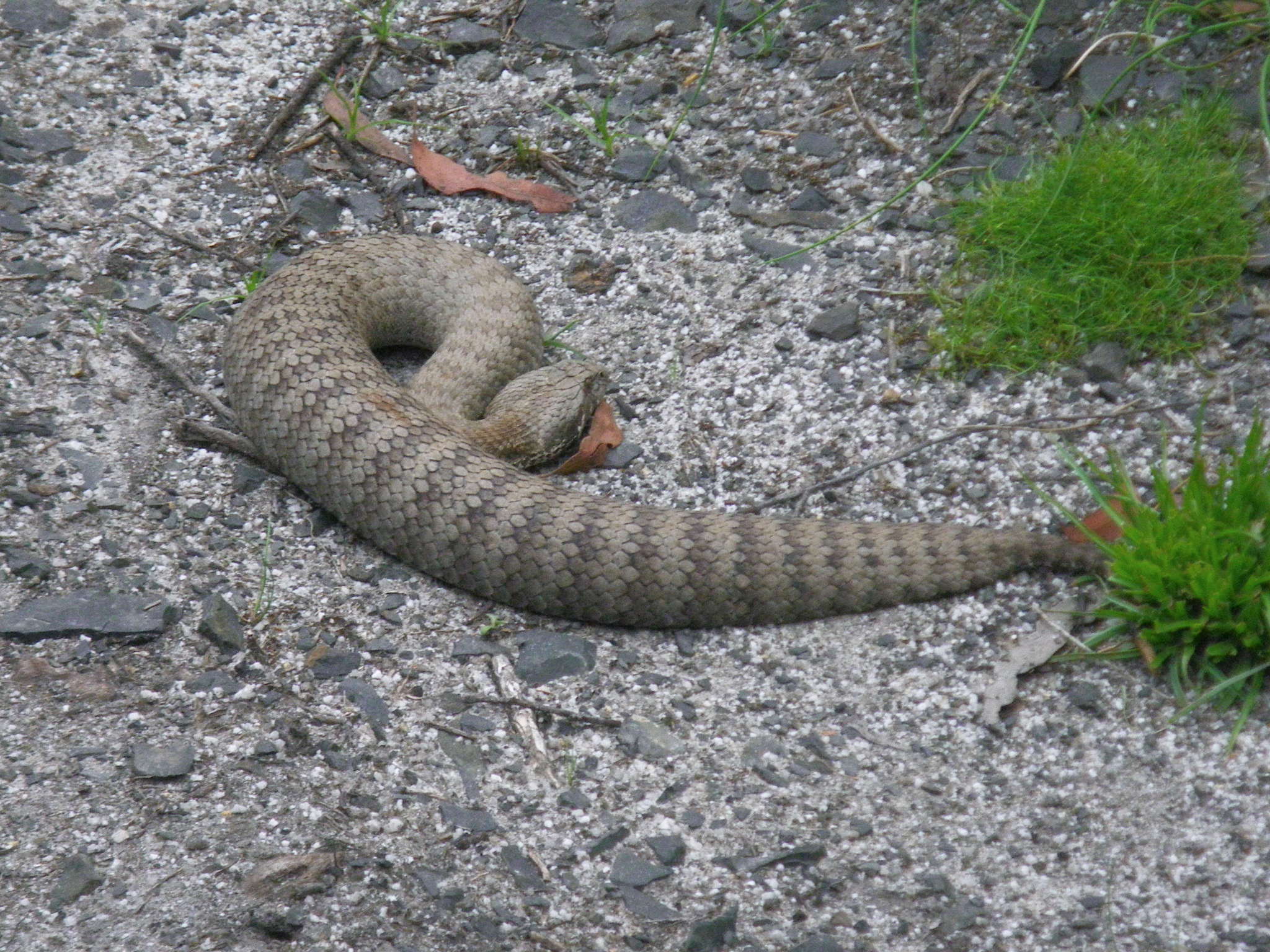
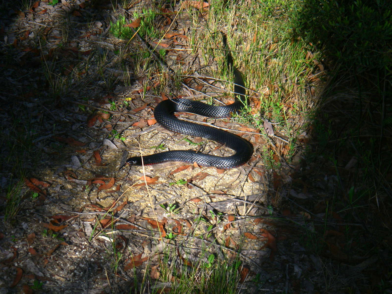
Death Adder, Acanthopis antarcticus, sunning itself on the Dandahra Creek Track.
There I was, walking along, minding my own business, headed towards Surveyors Creek, when I registered a movement on the track.
Then I saw the snake, and jumped back. The big fat snake with a tiny tail hidden here by grass (I wasn't about to ask it to pose for a better photo!) made no further movement after attracting my attention, and was not about to budge for me, so I had to circle around it off the track, trying to watch where I was putting my feet while keeping an eye on the snake at the same time.
It is one of the most venomous land snakes in Australia and the world, and is consistently listed in the top ten of the most deadly snakes.
Common Death Adders eat small mammals and birds as a primary diet. Unlike other snakes, the Common Death Adder lies in wait for its prey (often for many days) until a meal passes. It covers itself with leaves - making itself inconspicuous - and lies coiled in ambush, twitching its yellowish grub-like tail close to its head as a lure.
When an animal approaches to investigate the movement, the death adder quickly strikes, injecting its venom and then waits for the victim to die before eating it. This ambush hunting makes the death adder more of a threat to humans.
Unlike most snakes, Death Adders produce litters of live young. In the late summer, a female Death Adder will produce a litter of live babies, approximately 10 to 20, however over 30 young have been recorded in a single litter.
The Common Death Adder venom contains highly toxic neurotoxin which can cause paralysis. It can deliver the fastest strike among all venomous snakes recorded in Australia.
The last time I had seen a Death Adder was when I was a teenager in Brisbane, and was walking between holes on a golf course, and almost stepped on a nest of ten or fifteen small death adders. I did a Donald Duck or Wiley Coyote impersonation, the sort of thing where Donald walks off a cliff onto thin air, realises where he is, and walks carefully back again, still treading on thin air. I swear I spun around in mid air above the death adders and went back the way I came!
That's my memory of the encounter, and I'm sticking to it. The older I get, the better I used to be….
Photo: Don Hitchcock, November 2011
Text: Adapted from Wikipedia
Bridge across Little Dandahra Creek. This is part of a new side track through the Tree Fern Forest, which meets up with the Pidcocks Fire Trail.
Photo: Don Hitchcock, April 2015

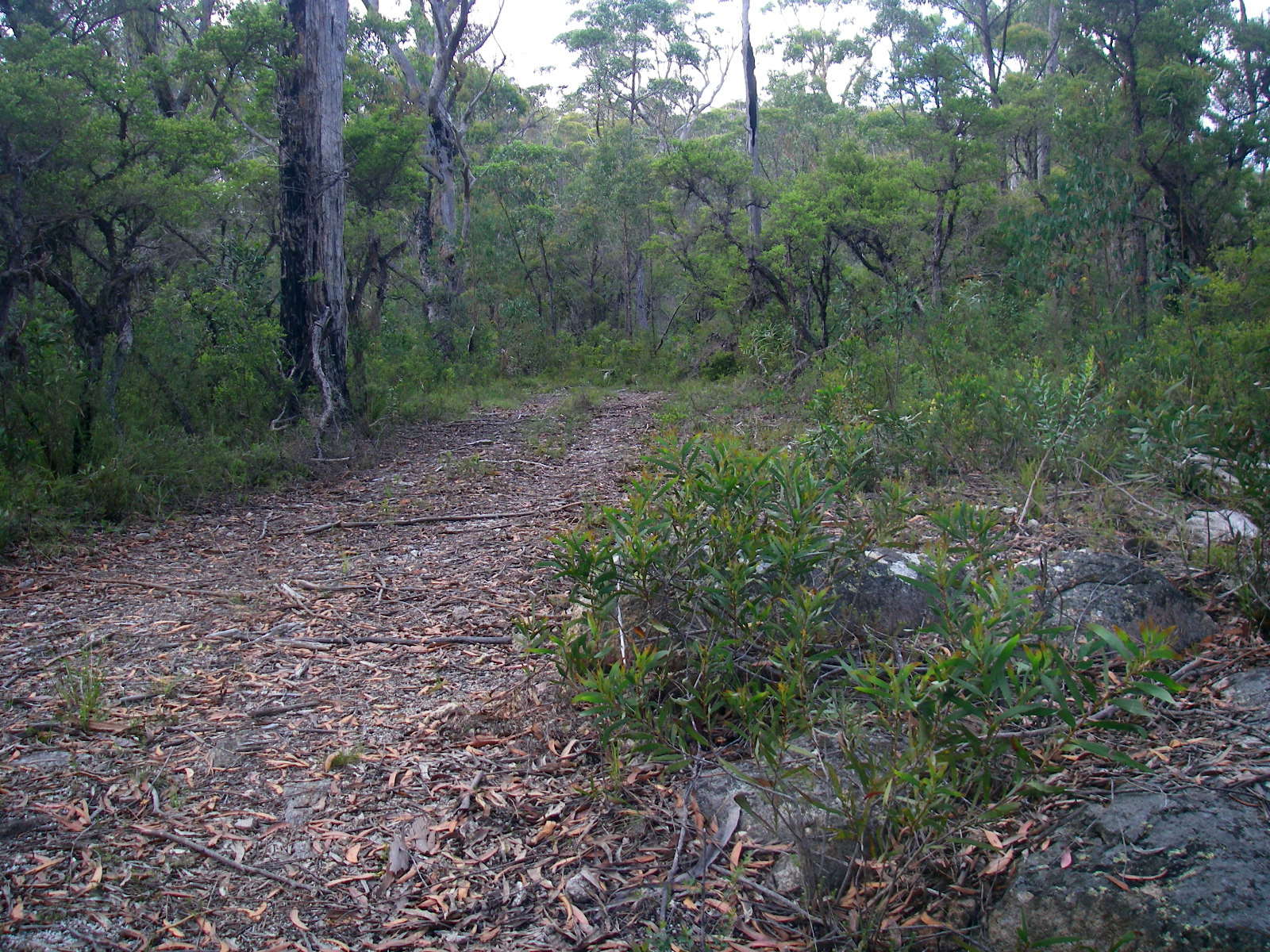
The track continues along the Dandahra Creek valley, though not always right beside the creek.
Photo: Don Hitchcock, November 2011
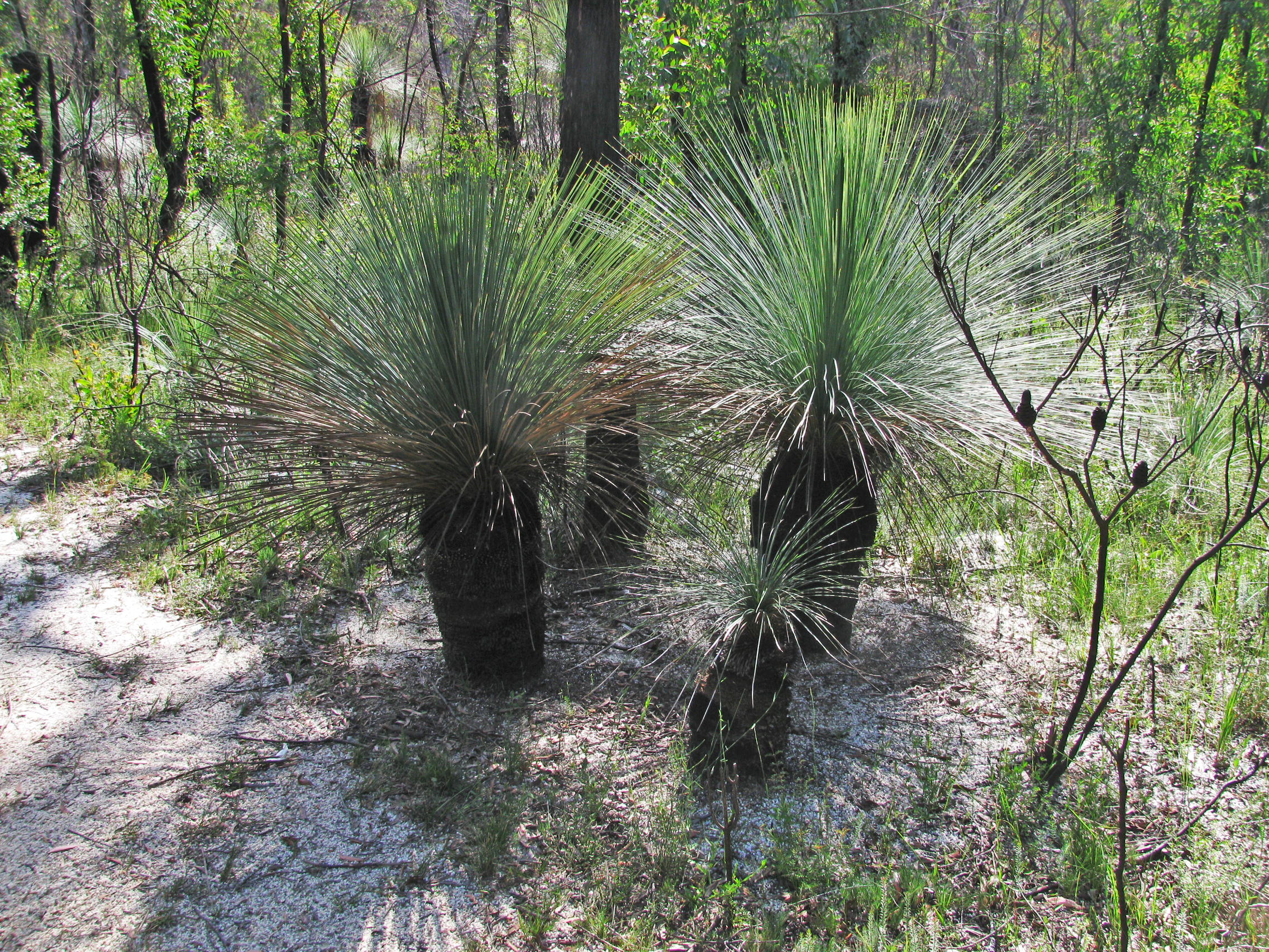
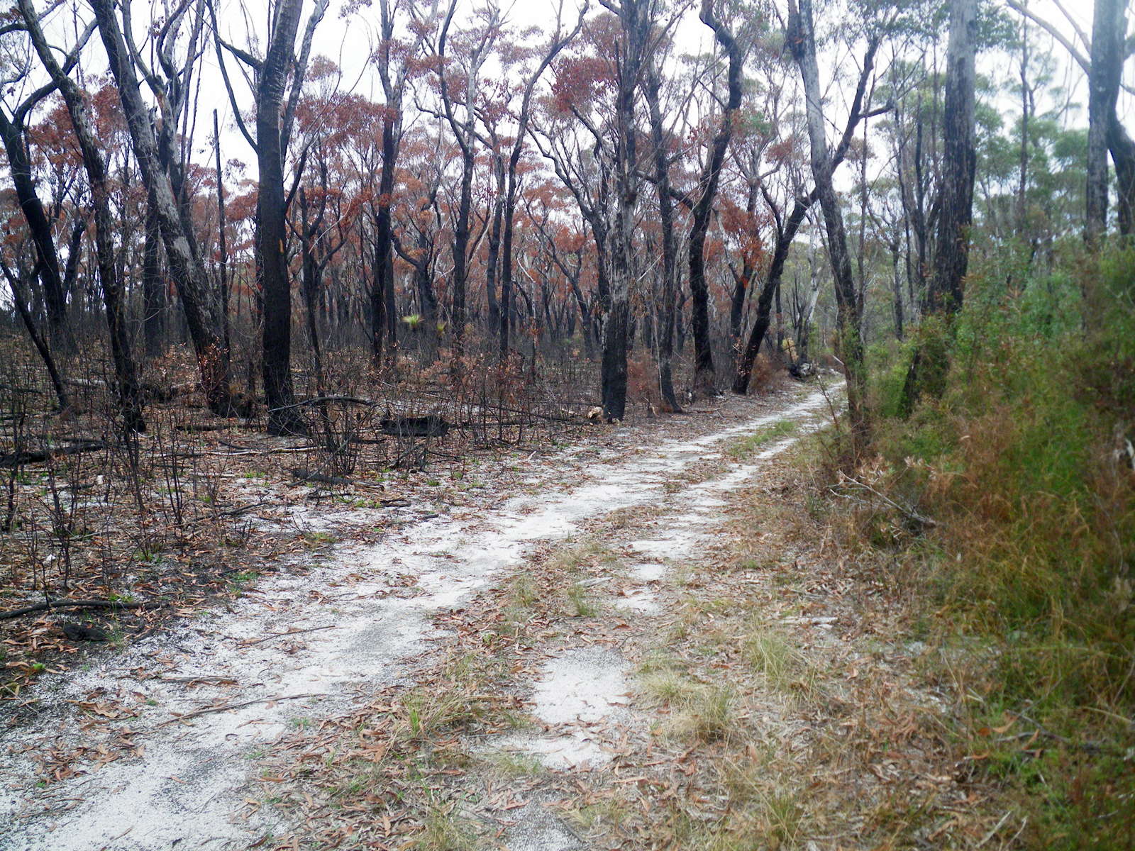
A group of beautiful grass trees, the trunks burnt black by a bushfire about eighteen months previously, but with lush new growth.
The whole area along the track from here to the highway was burnt in the fire, but is regenerating well.
Photo: Don Hitchcock, April 2015

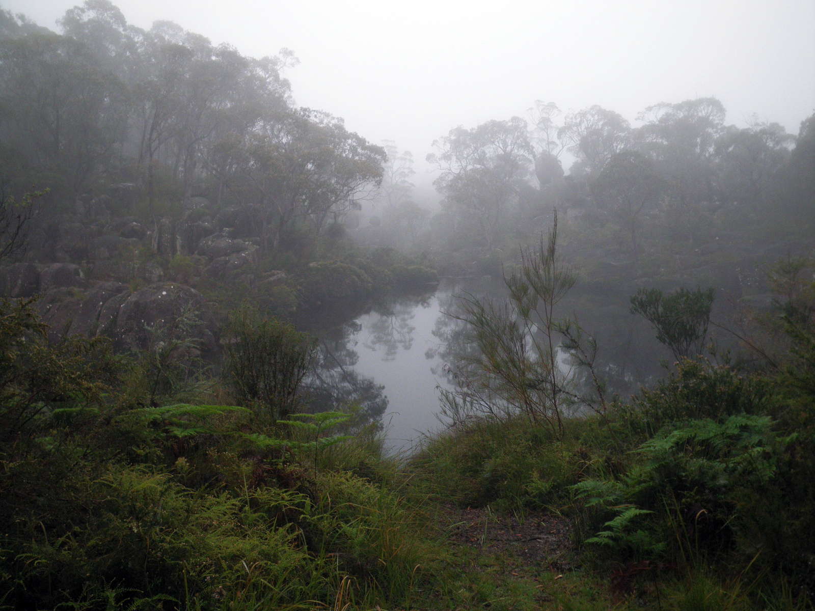
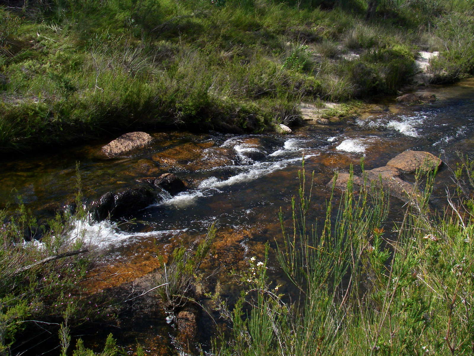
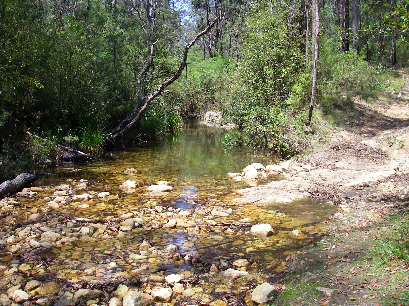
Little Dandahra Creek is a beautiful part of the world.
Large granite tors are sprinkled along its length like beads on a cord.
Photo: Don Hitchcock, November 2011
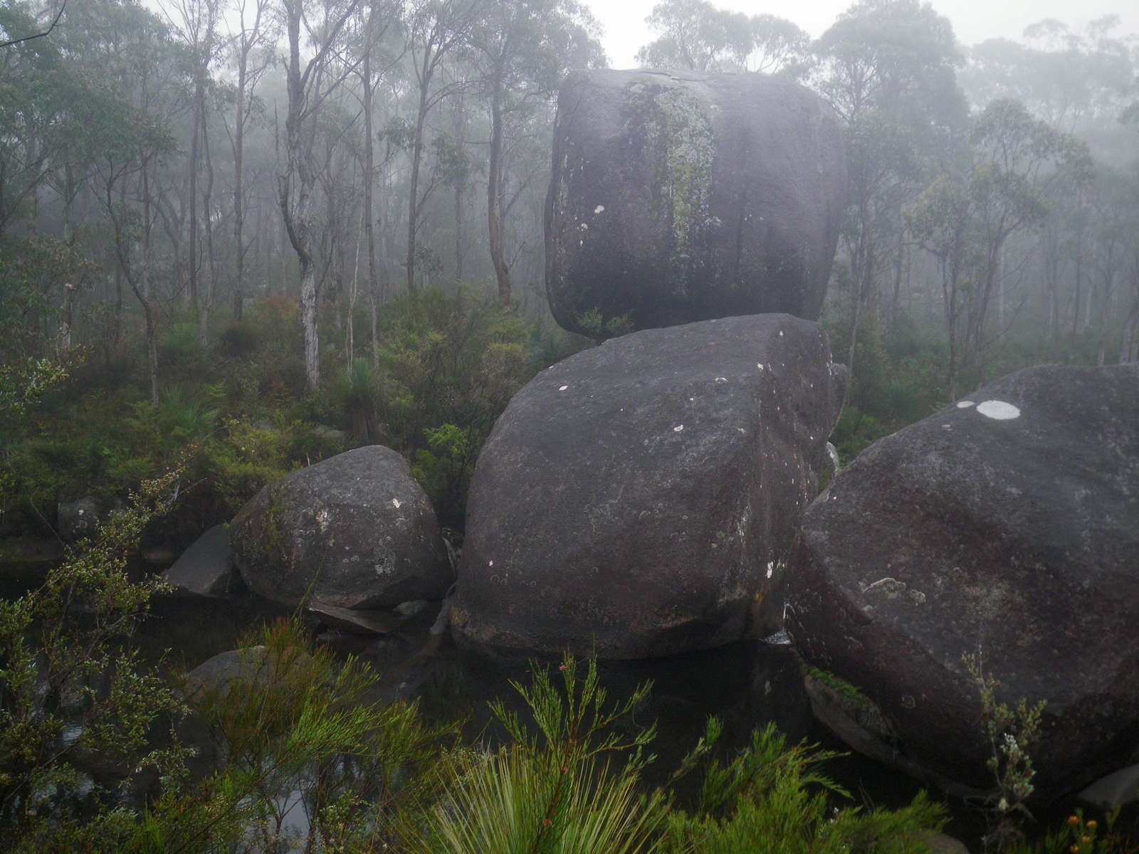
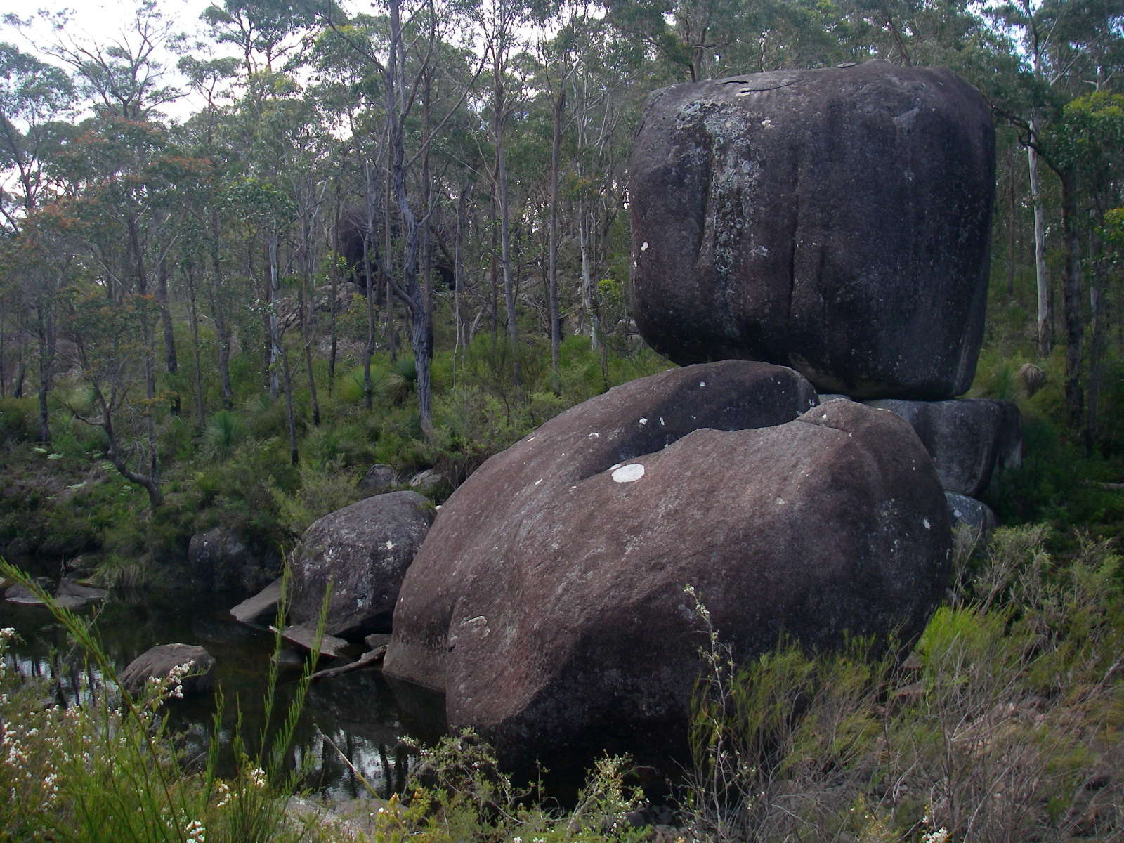
Some of the granite rocks are balanced precariously on others.
Photo: Don Hitchcock, November 2011
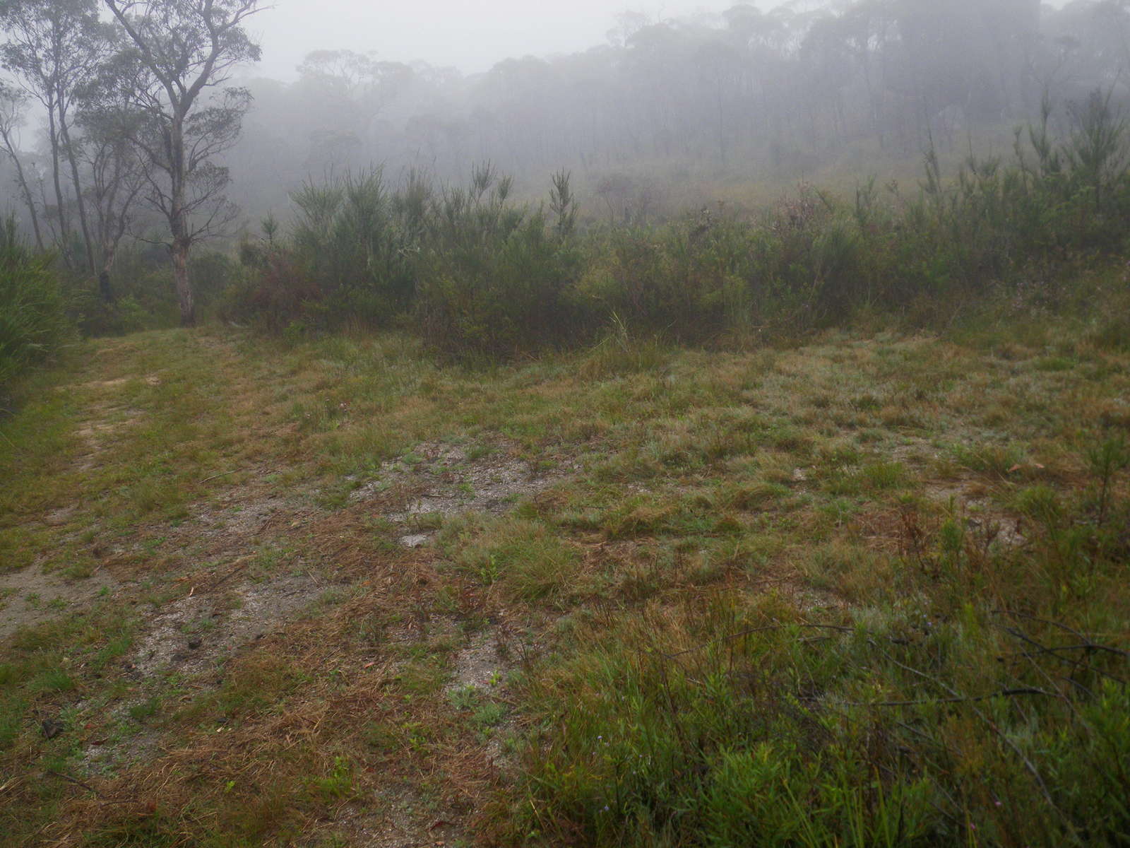
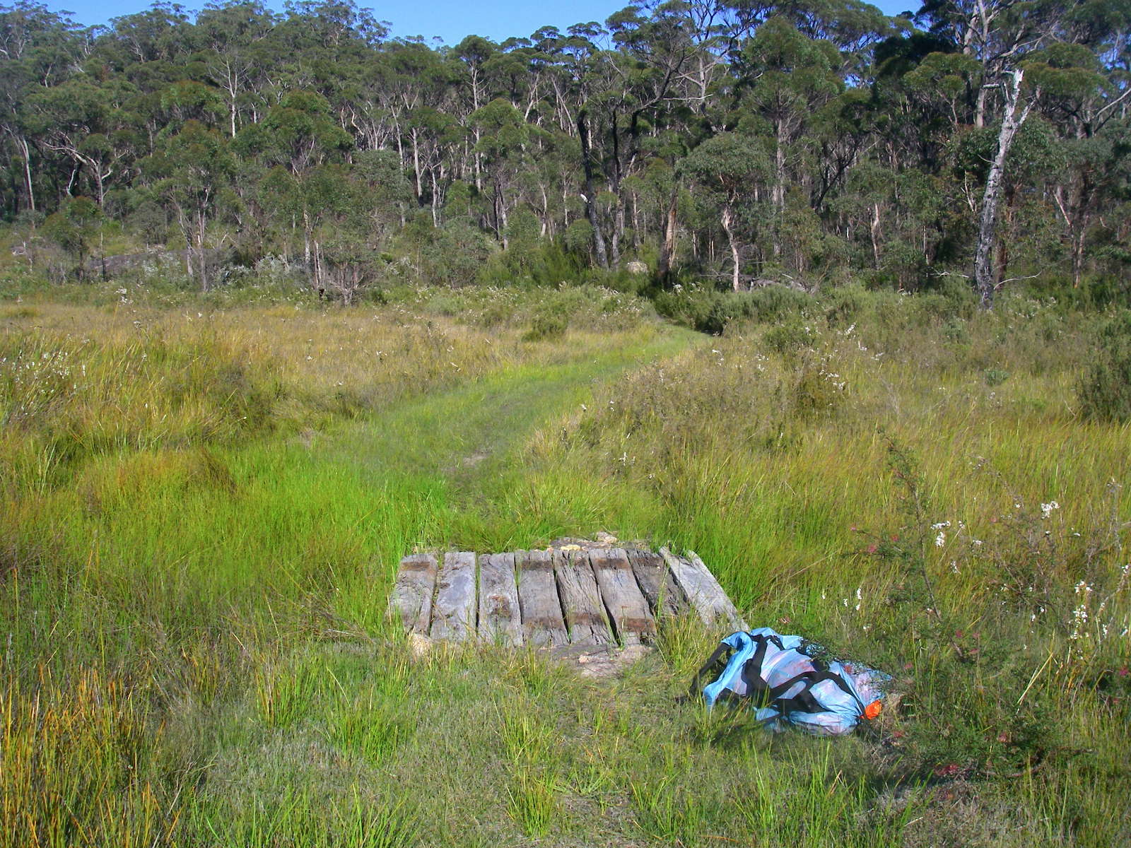
I couldn't work out why this large flat area had been mowed beside the track, but perhaps it was to set up a large tent for maintenance workers for shelter or overnight accommodation as needed when doing track work. The track is superbly maintained, and even kept mowed.
Photo: Don Hitchcock, November 2011
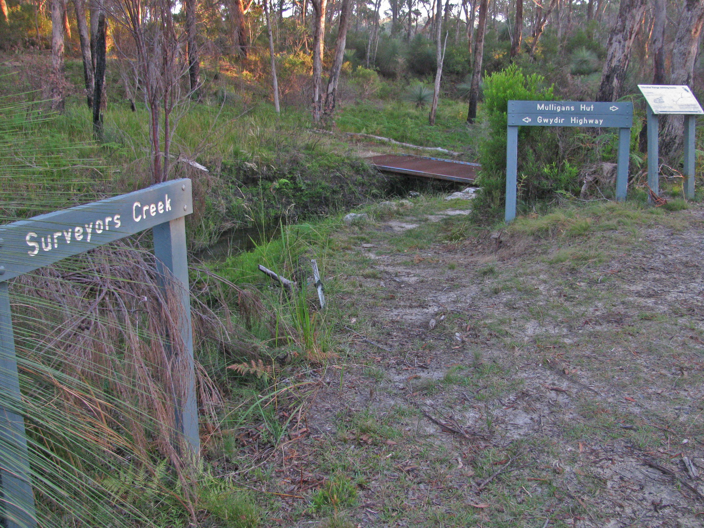
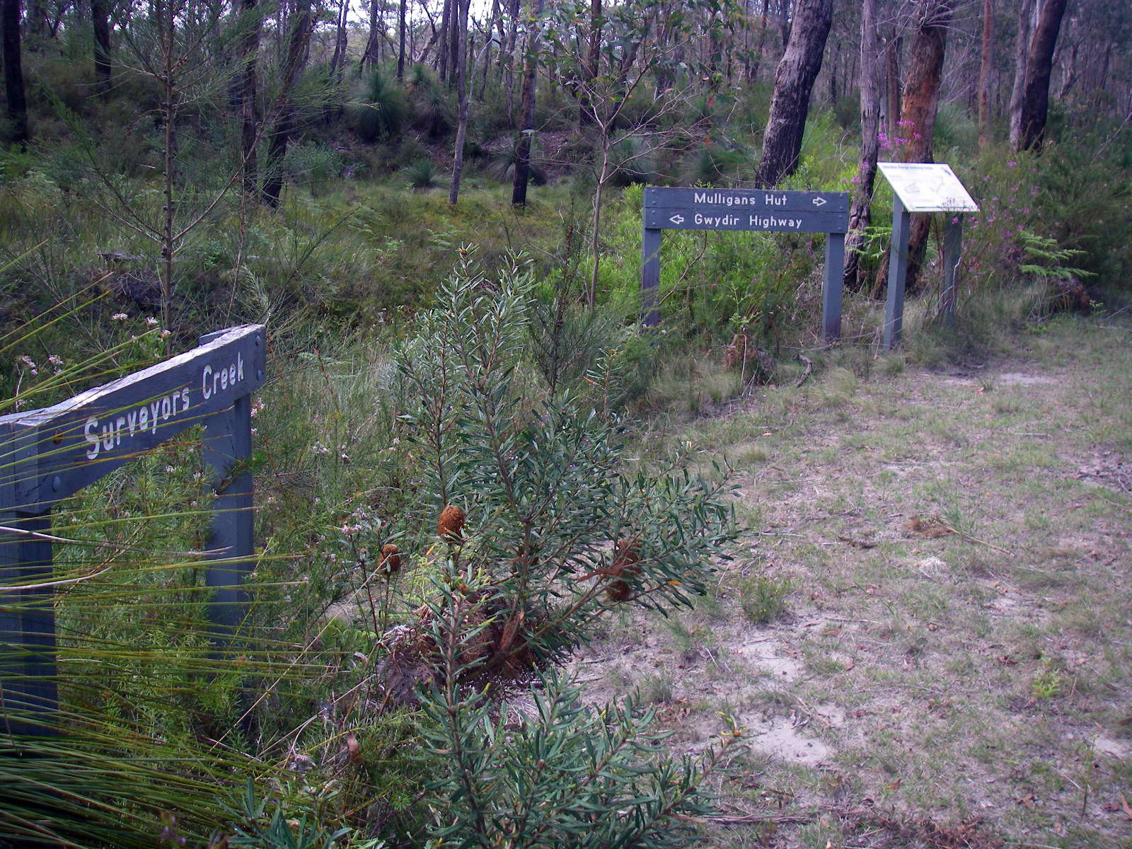
A few minutes later you arrive at this bridge across Surveyors Creek (which joins the Dandahra not far downstream) to make the track to Dandahra Picnic Area on the Gwydir Highway accessible.
Photo: Don Hitchcock, April 2015

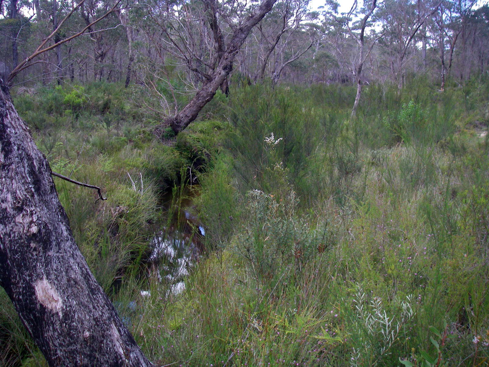
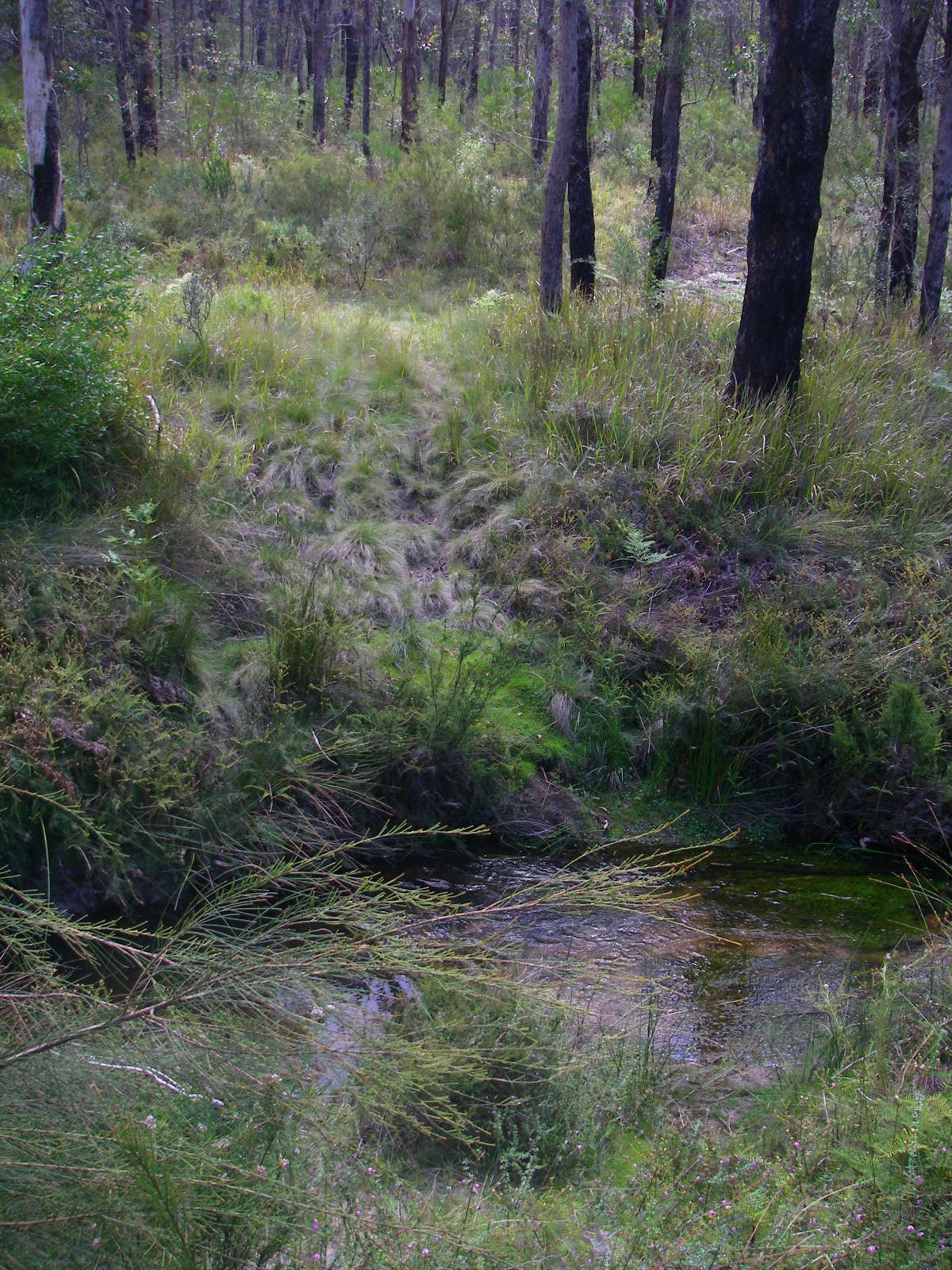
A few kilometres later you come out of the open forest and begin to traverse swampy ground, just before crossing the vehicular road to Mulligans Hut Campgrounds.
Photo: Don Hitchcock, April 2015
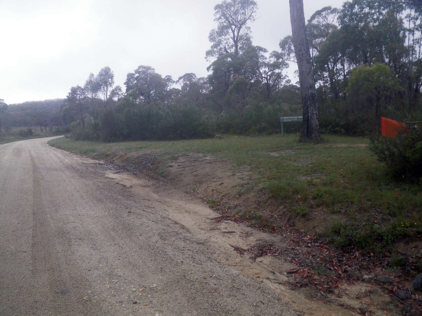
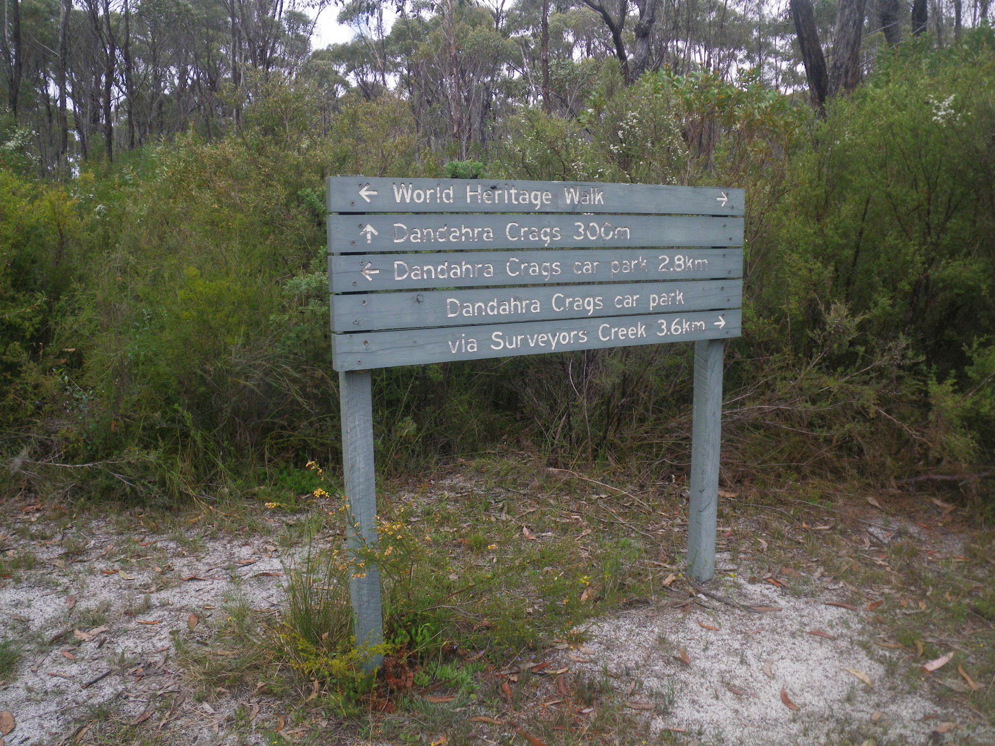
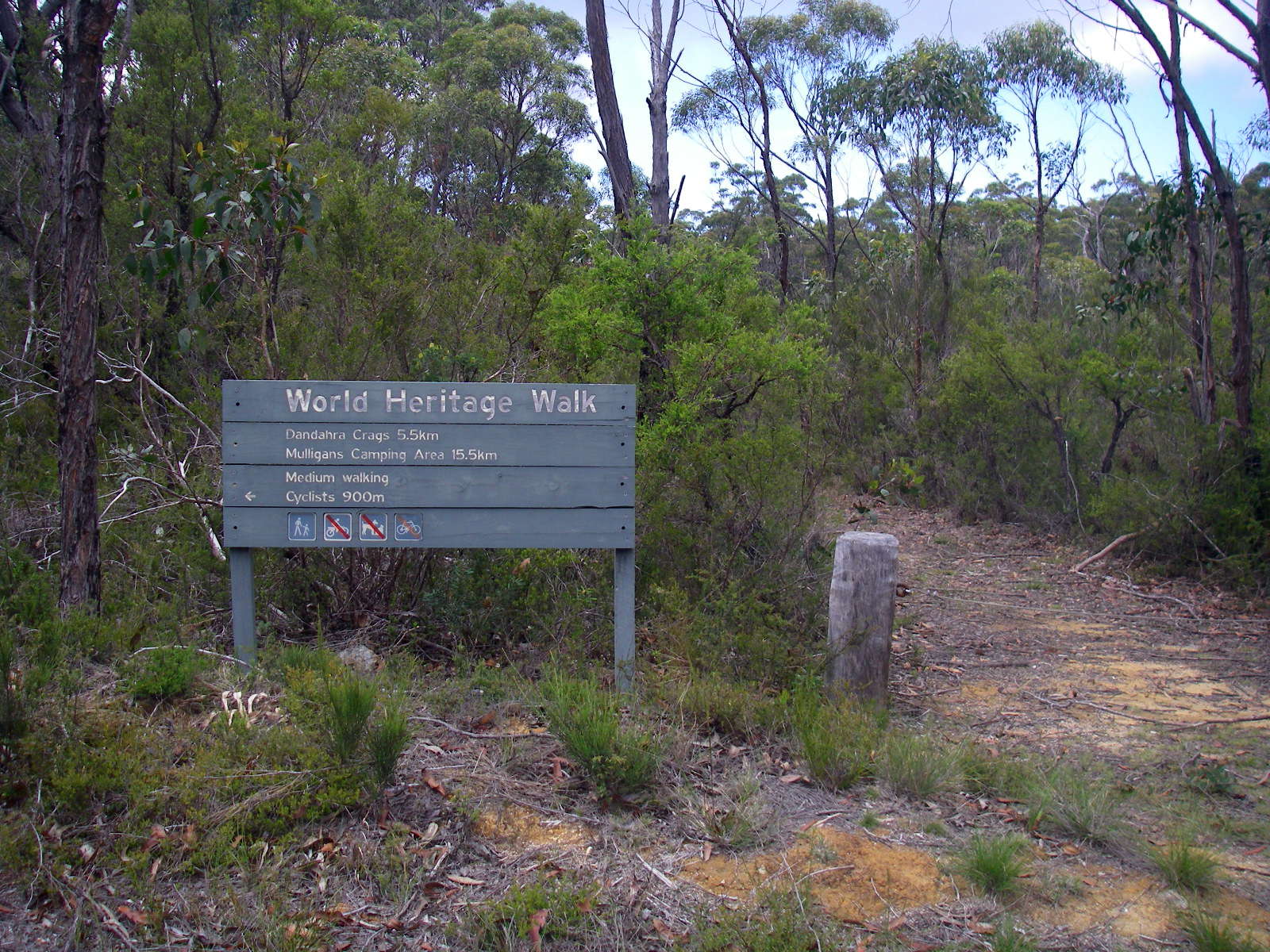
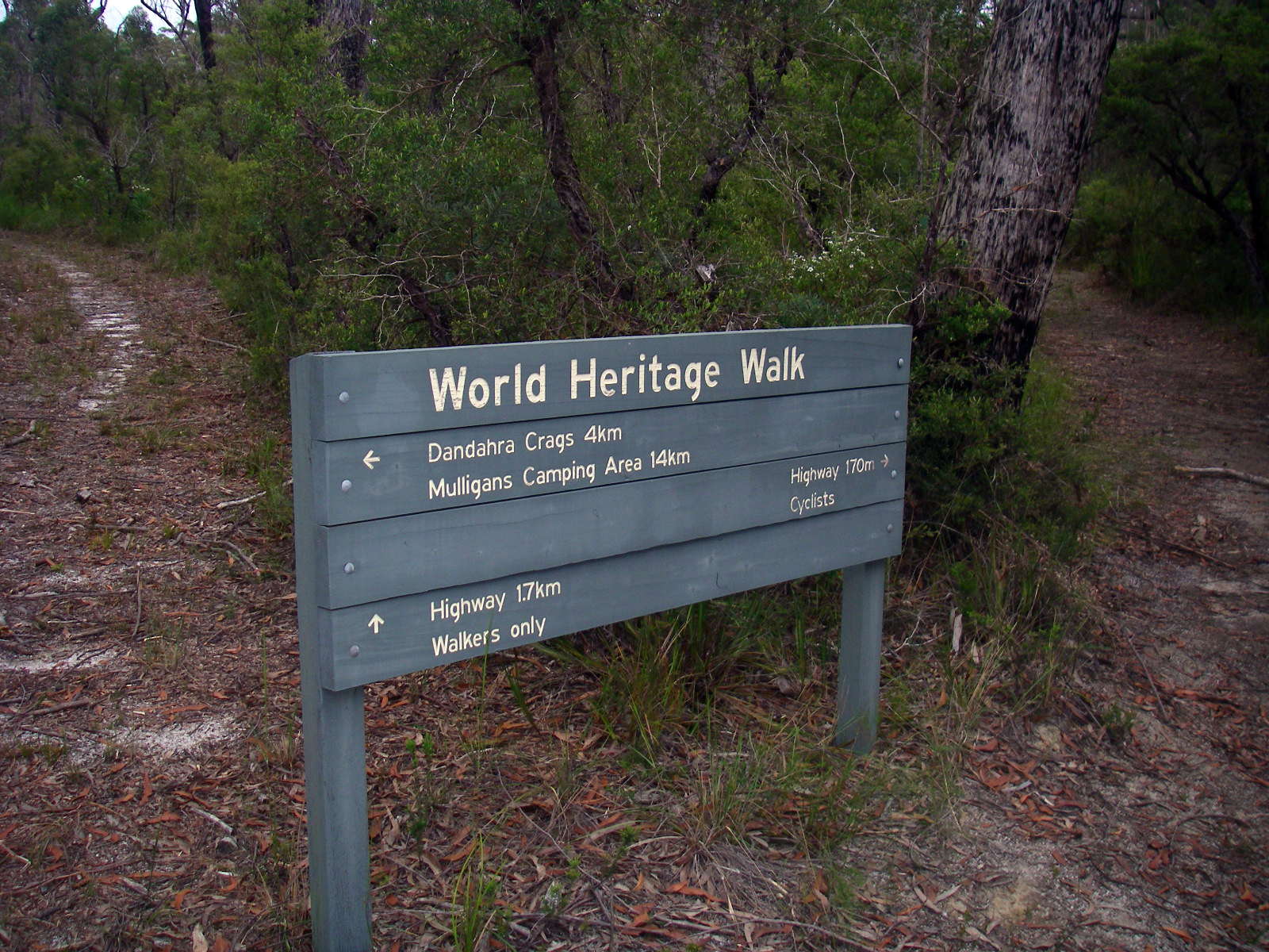
Here the track meets the vehicular road to Mulligans Hut, Mulligans Drive, and crosses it. There are two parallel tracks towards Boundary Creek at this point, but the Surveyors Creek track was closed where the orange plastic can be seen, and so I chose the slightly longer Dandahra Crags Track, accessed via the Dandahra Crags Car Park.
Photo: Don Hitchcock, November 2011
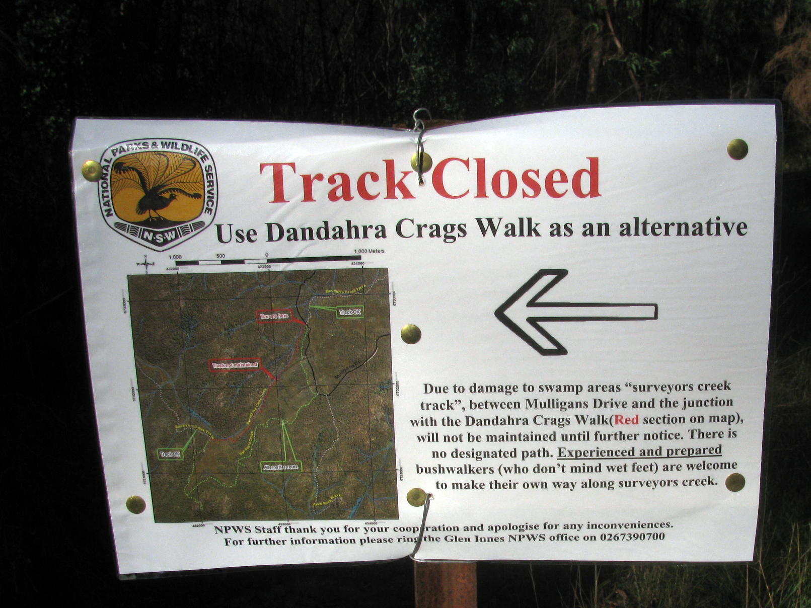
Surveyors Creek Track has been closed for some time, but this sign now indicates that it is open for those who are suitably prepared for the journey.
Photo: Don Hitchcock, April 2015

The track which has been cleared and mowed to Dandahra Crags Car Park, 800 metres away from the track junction, passes by a swampy area on the right.
Photo: Don Hitchcock, April 2015

This is the start of the Dandahra Crags Track, near the Dandahra Crags Car Park.
Photo: Don Hitchcock, November 2011
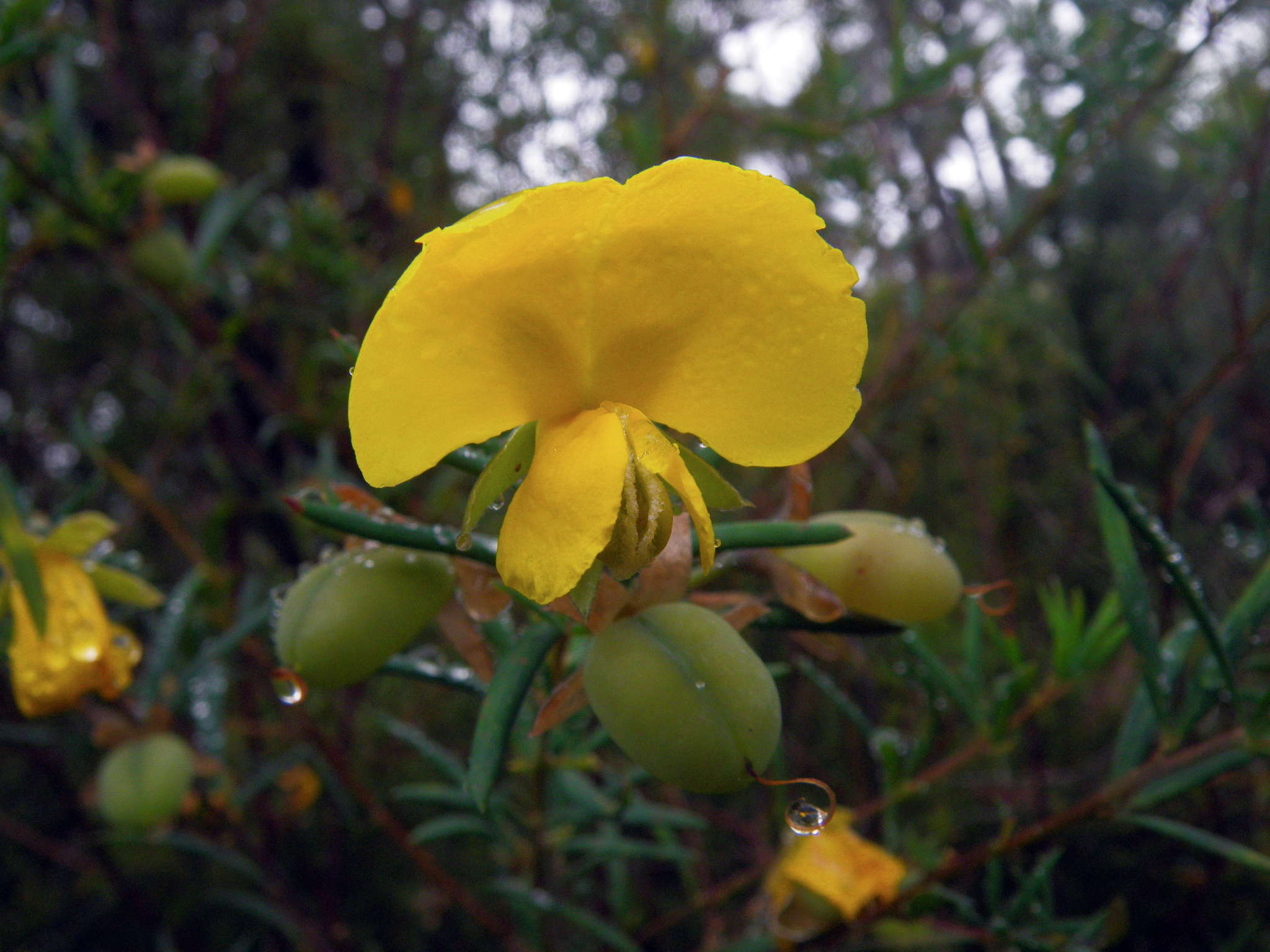
The Golden Glory Pea, Gompholobium latifolium
Photo: Don Hitchcock, November 2011
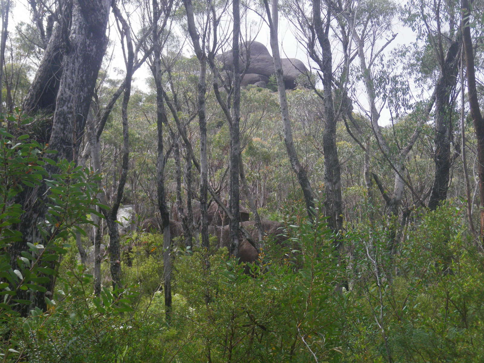
This is a side walk to Dandahra Crags, and it is worth going along the track a short distance to get a good view of the Crags.
Photo: Don Hitchcock, November 2011
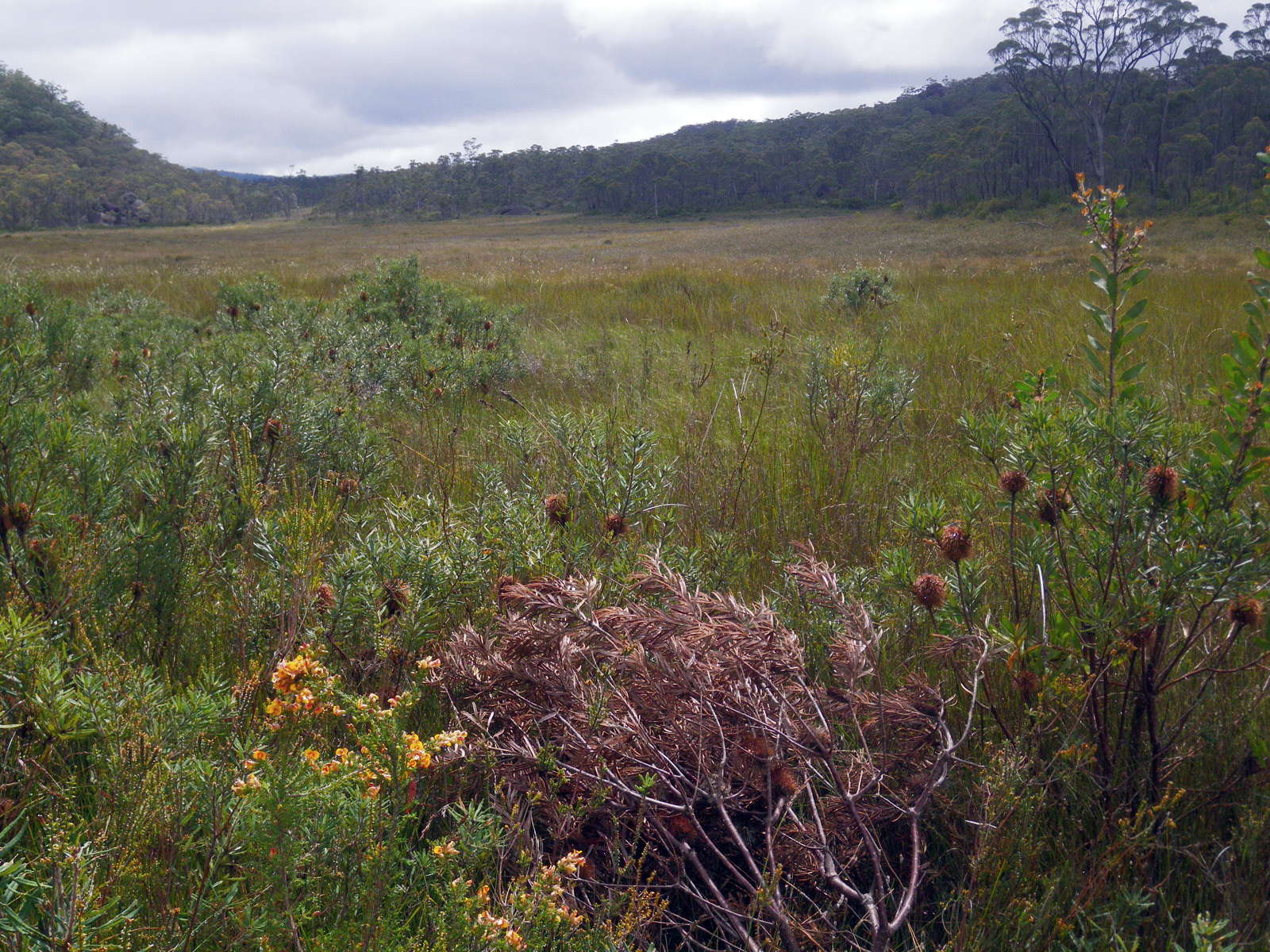
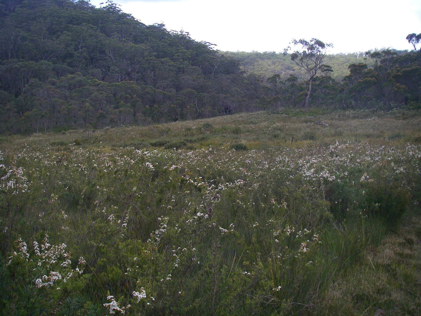
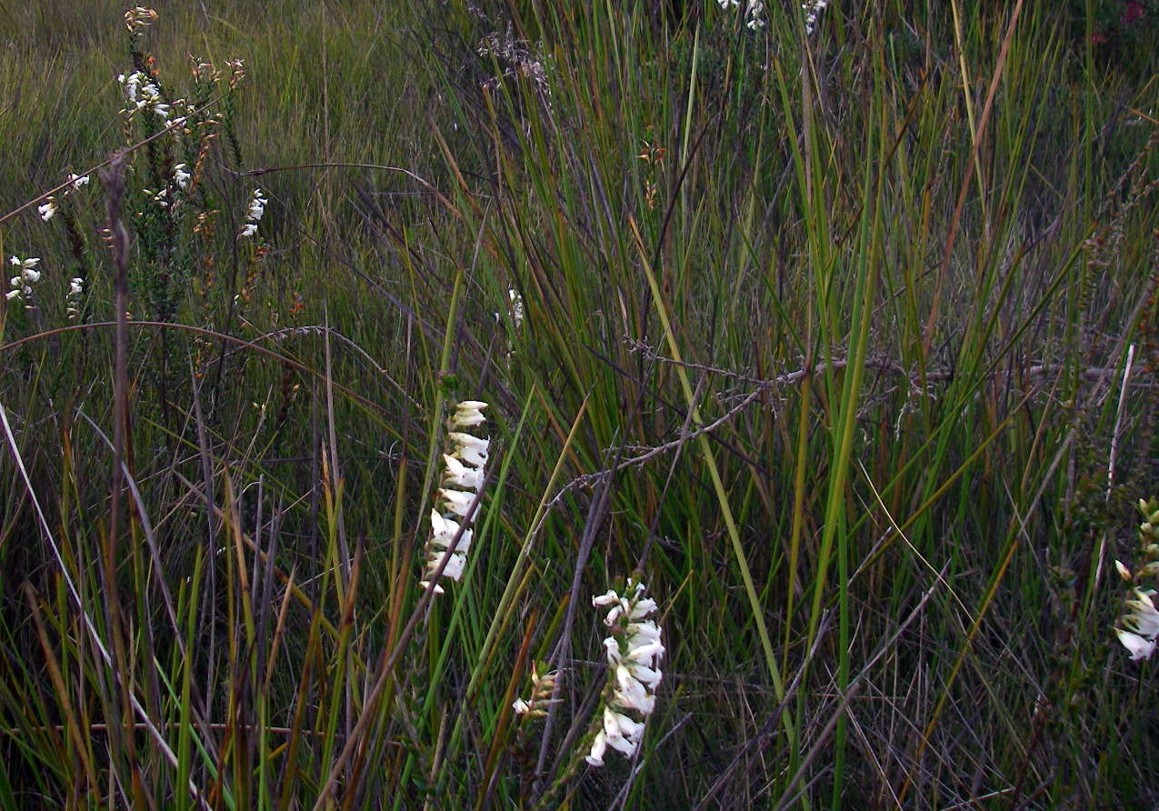
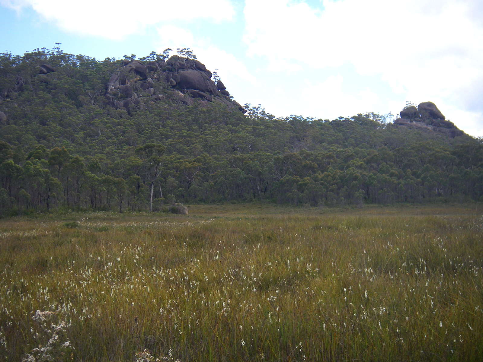
Looking down the long swamp between the two tracks. This swamp would be a mass of hundreds of thousands of Christmas Bells a few weeks after this photo was taken.
There are many swamps like this on the top of the Northern Tablelands, and I believe they are former snowfields left over from the last ice age, when snow and ice covered much of the higher parts of the area for most if not all the year, though so far as I know there was never any glaciation as such.
Photo: Don Hitchcock, November 2011
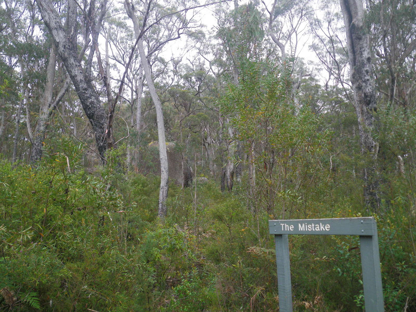

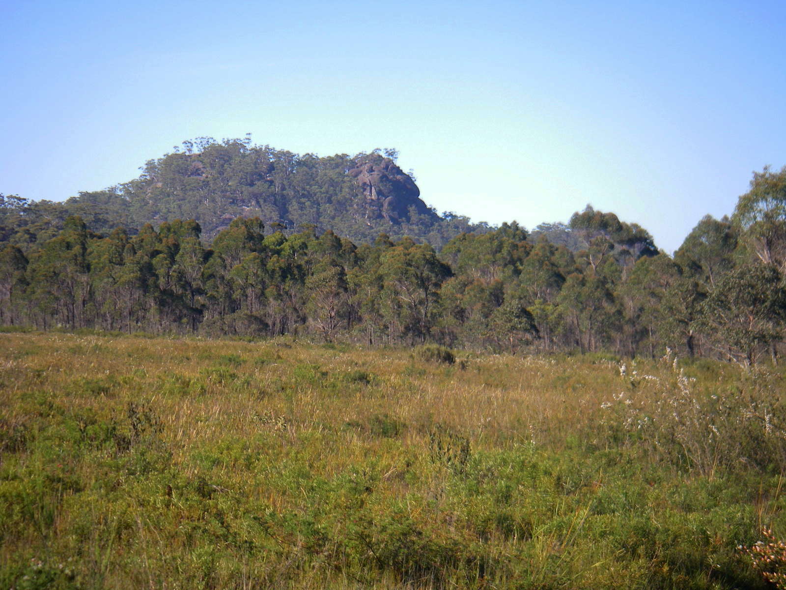
The Mistake (left) and Cardinals Cap (right).
Photo: Don Hitchcock, November 2011
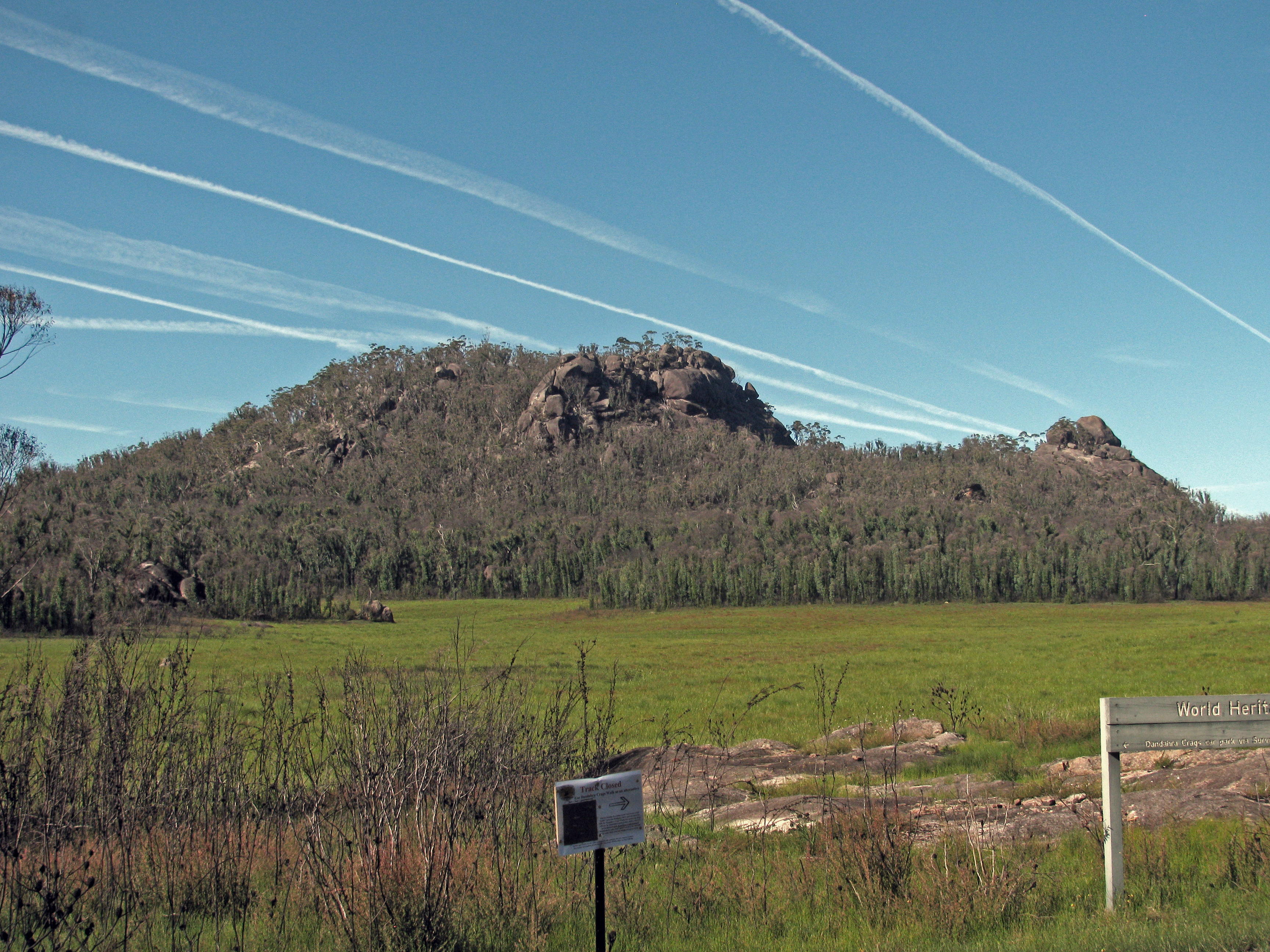
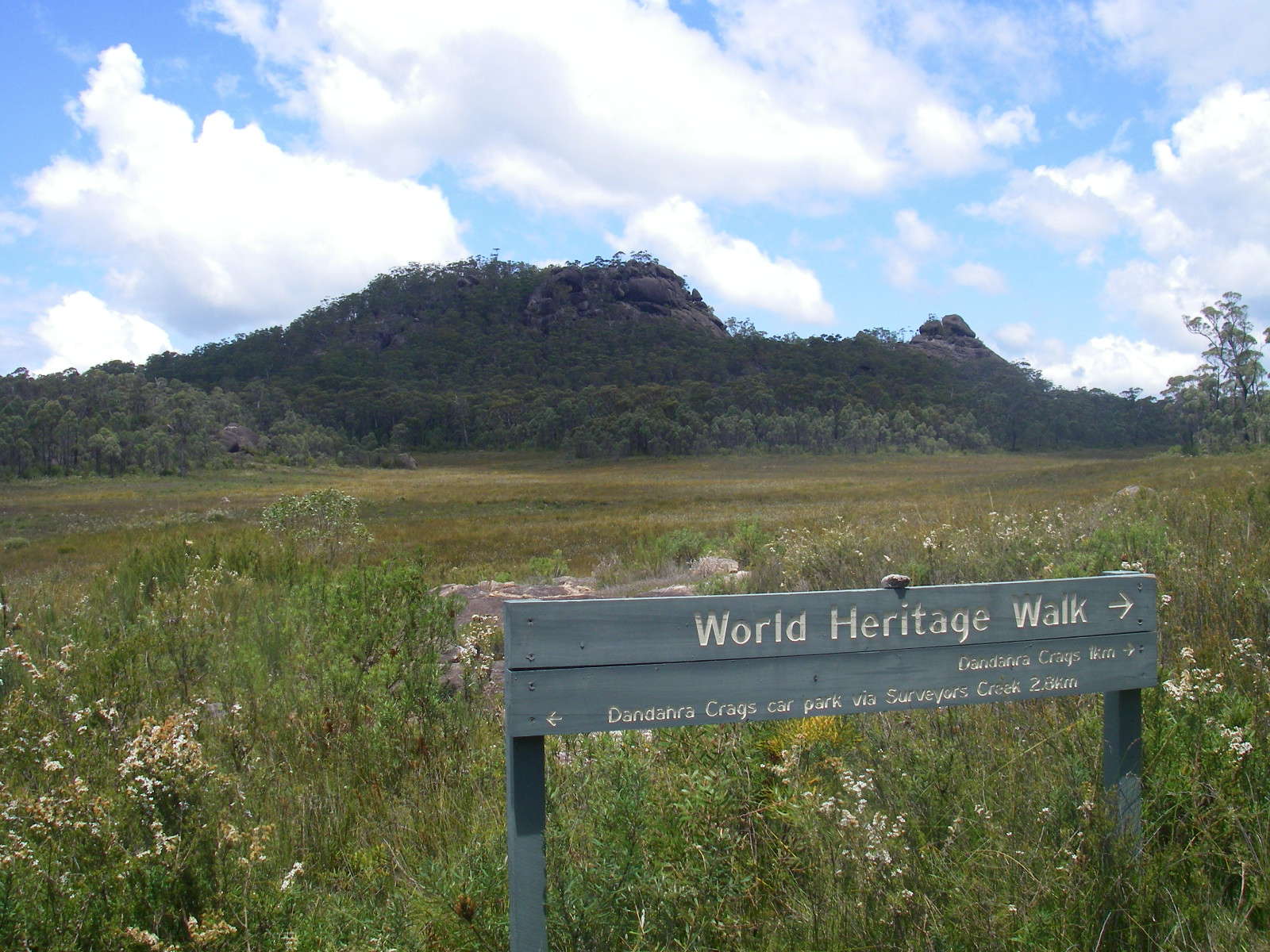
At the junction between the Dandahra Crags and Surveyors Creek tracks and the main track that leads to Boundary Creek, there is a good view of Dandahra Crags
Photo: Don Hitchcock, April 2015
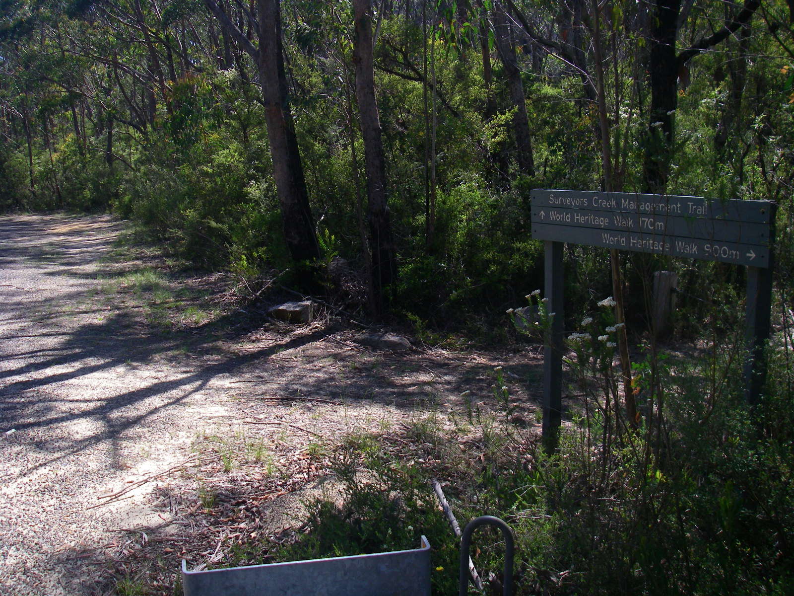
The western junction of Surveyors Creek Track and the Dandahra Crags Track.
Photo: Don Hitchcock, April 2015
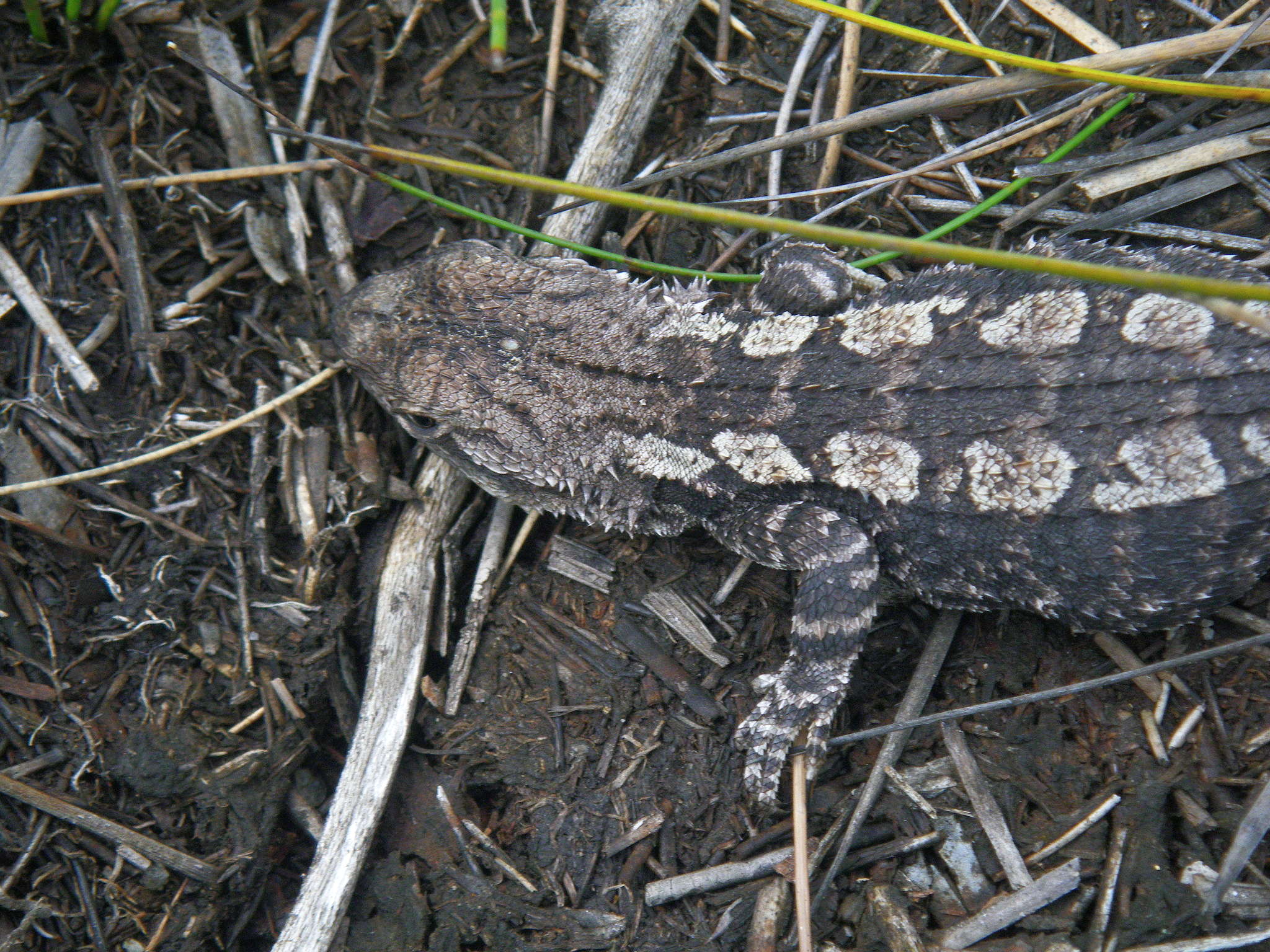
The Jacky Lizard, Amphibolurus muricatus, is pale grey to dark brown above. It has a series of large black angular patches along the middle of the back bordered by a pale grey stripe from neck to tail. The pale stripe may be broken into rounded rectangle shapes or diamond shapes. It is 10 cm long excluding the tail, and eats insects and other small invertebrates.
Photo: Don Hitchcock, November 2011
Text: Adapted from http://www.ozanimals.com/Reptile/Jacky-Lizard/Amphibolurus/muricatus.html
At this junction, you may take a short path to the highway, or continue to the left along a track with some superb waratahs and other flora.
Photo: Don Hitchcock, November 2011

The waratahs are superb.
Photo: Don Hitchcock, November 2011
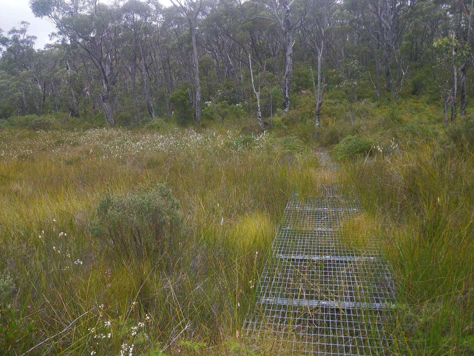
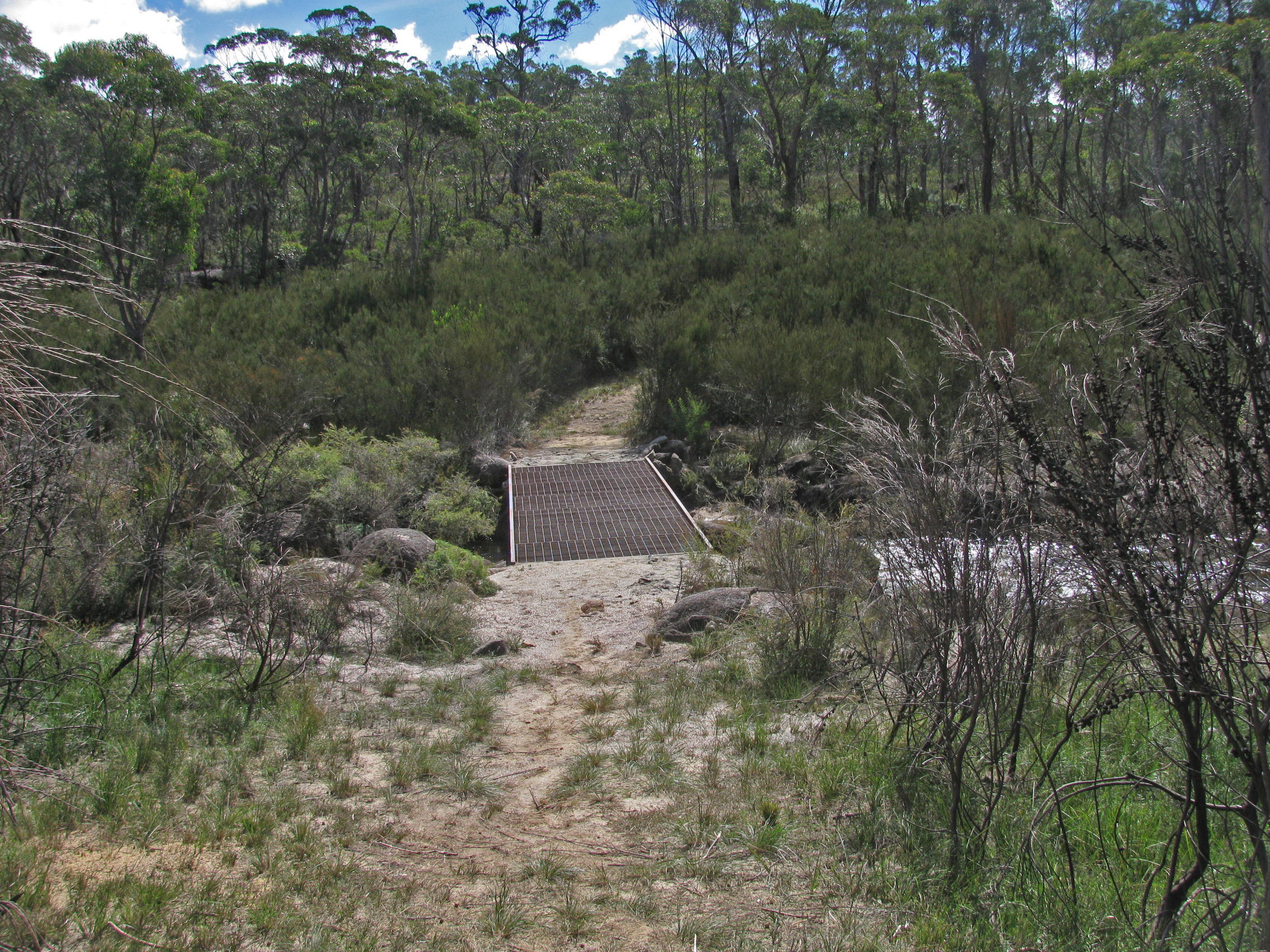
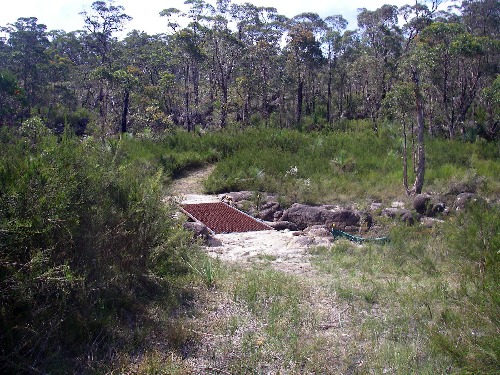
A steel mesh walkway has been put across this hanging swamp to both provide easy access and to protect the swamp itself.
Photo: Don Hitchcock, November 2011
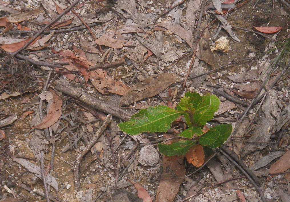
I was amazed to find Waratah seedlings coming up in the middle of the track!
Photo: Don Hitchcock, November 2011

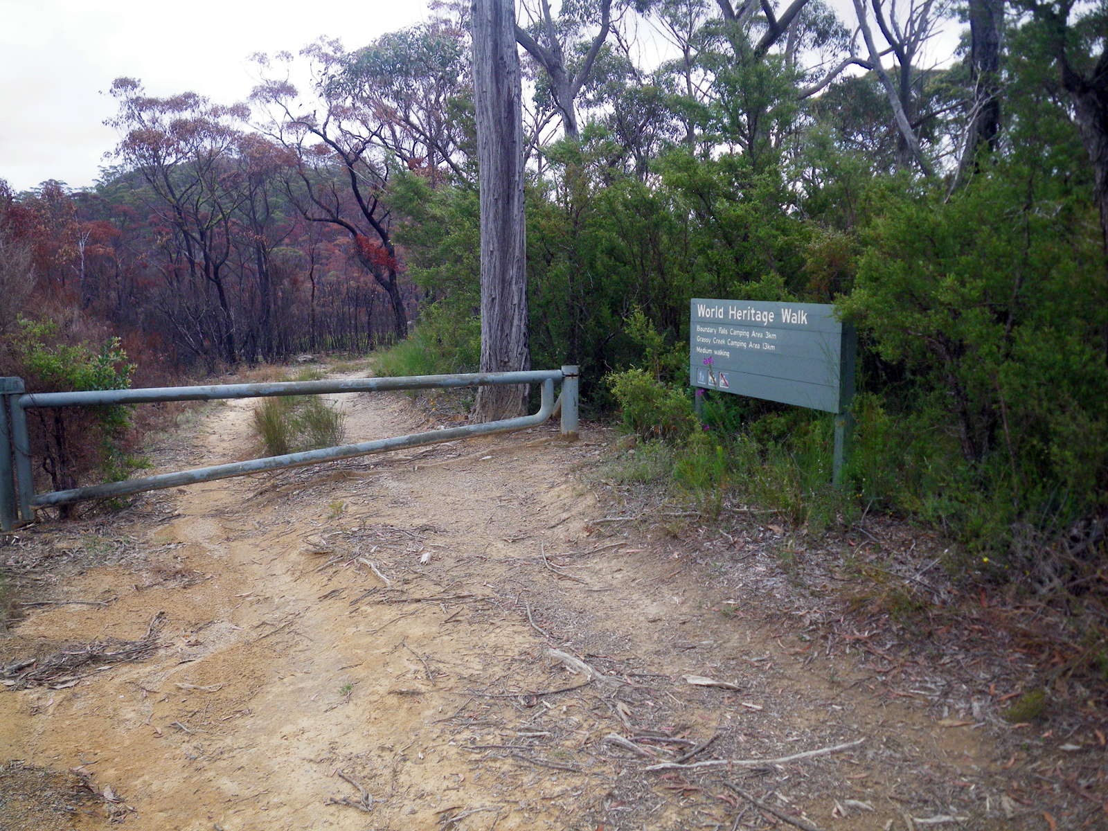
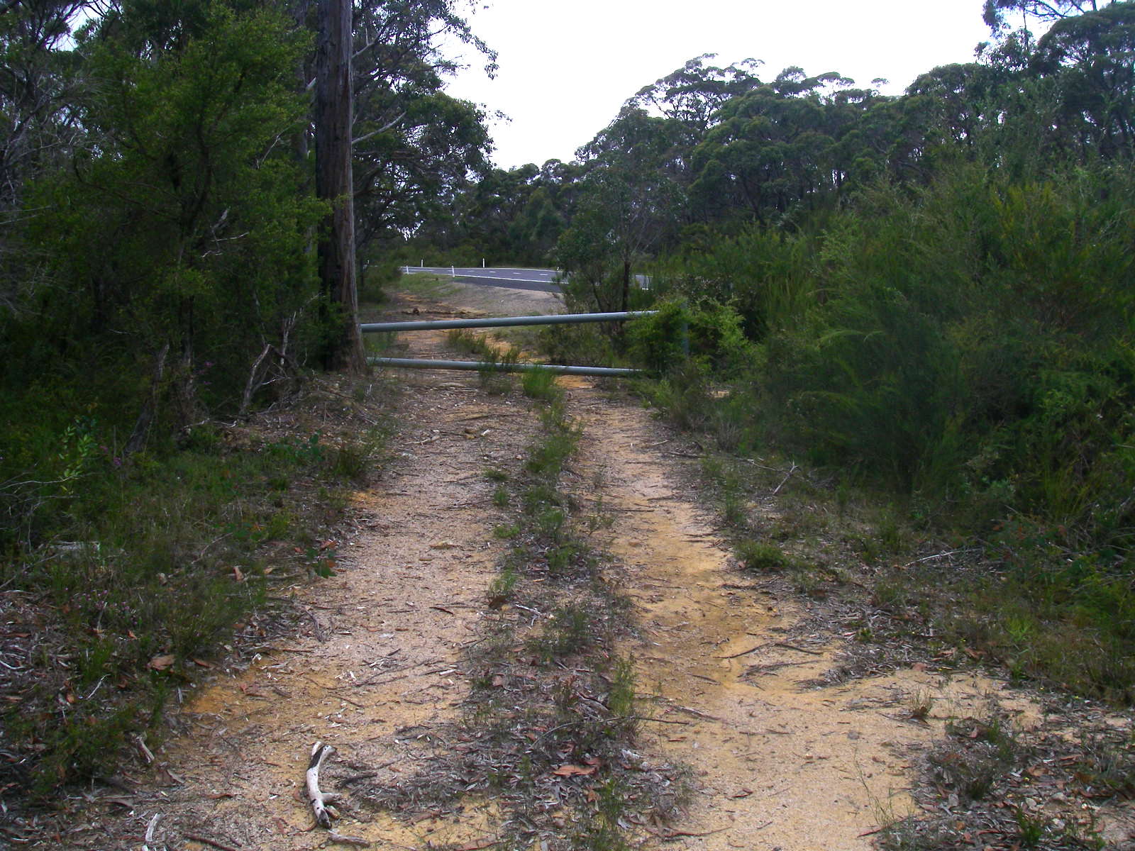
The end (or start) of the Surveyors Creek Track on the left, and the start of the track to Boundary Creek on the right, on the other side of the Gwydir Highway.
Photo: Don Hitchcock, November 2011
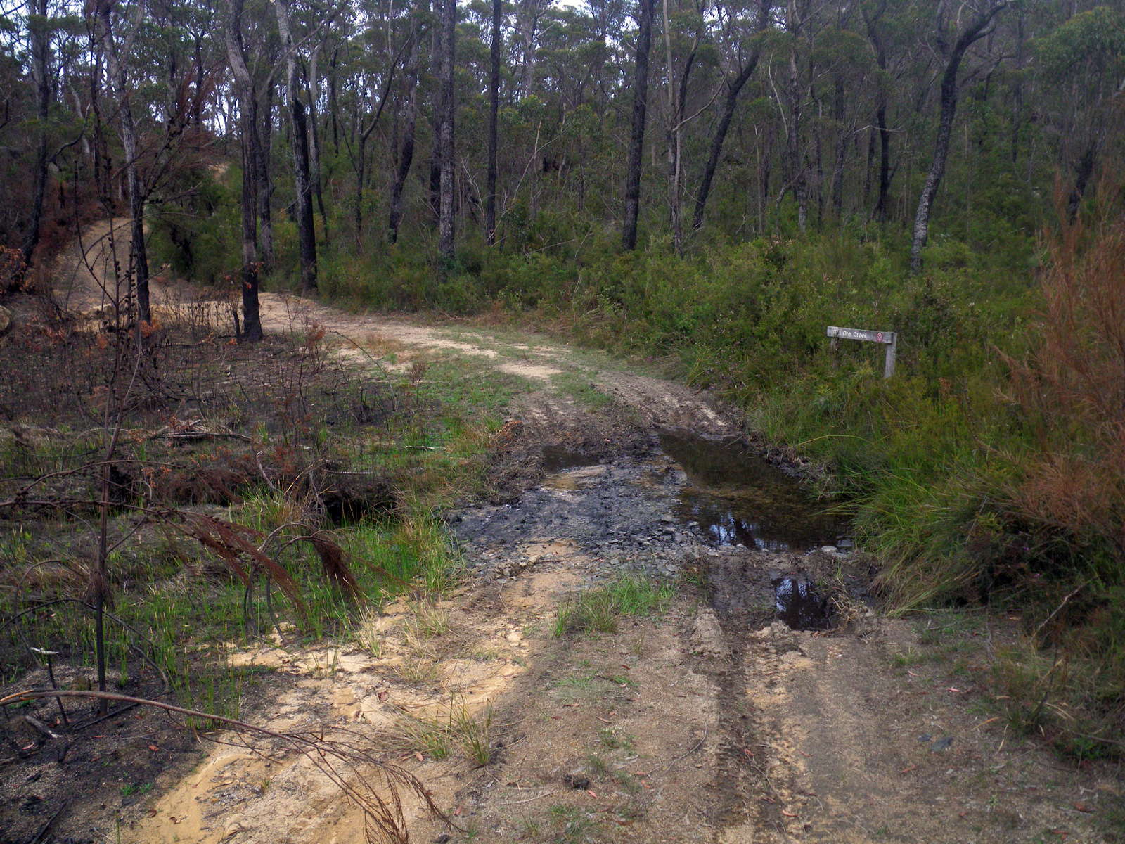
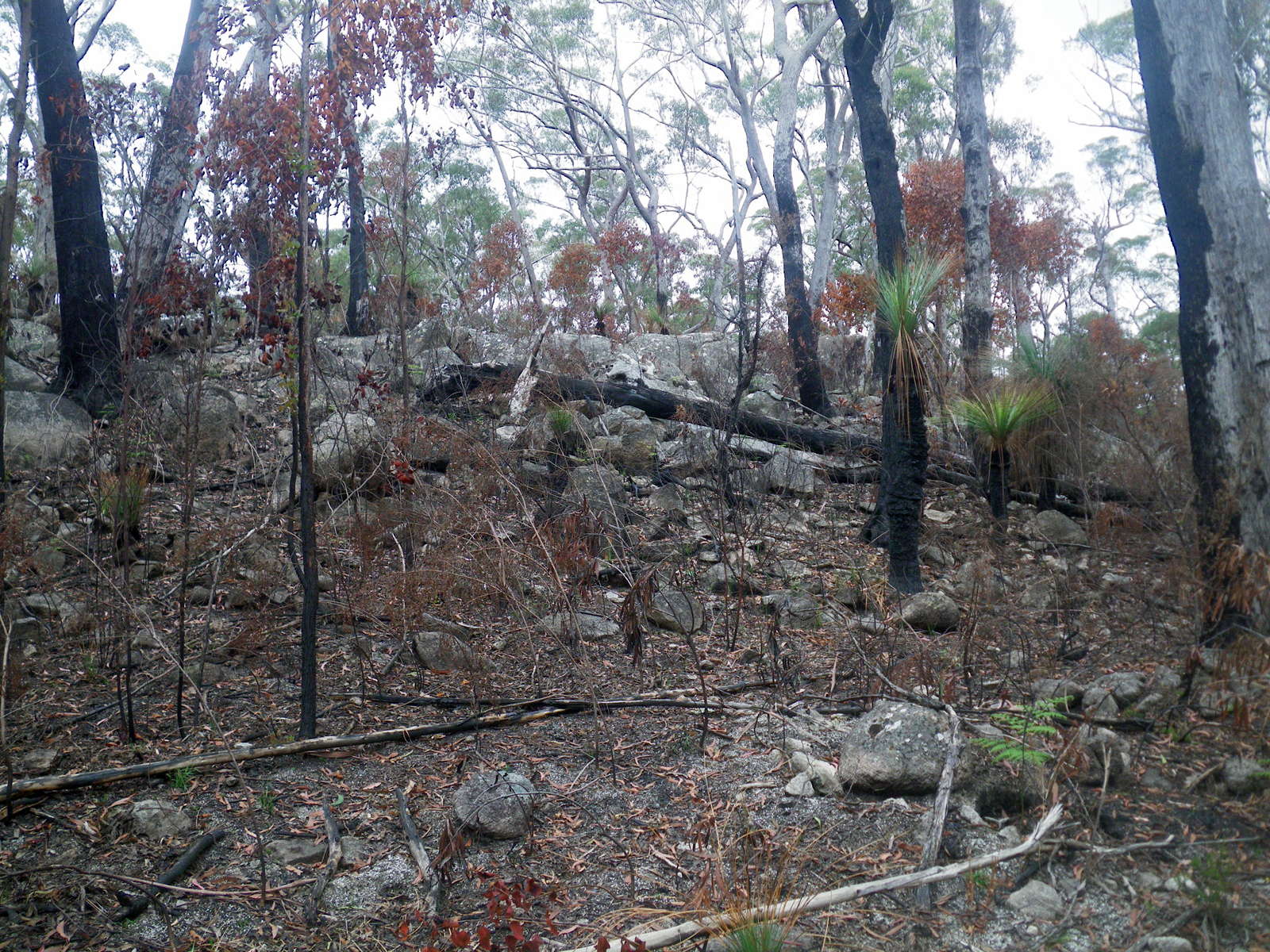
(left) Tin Ore Creek.
(right) A burnt out area on the left of the fire trail, which acted as a fire break. I don't know if this was a controlled burn or not.
Photo: Don Hitchcock, November 2011
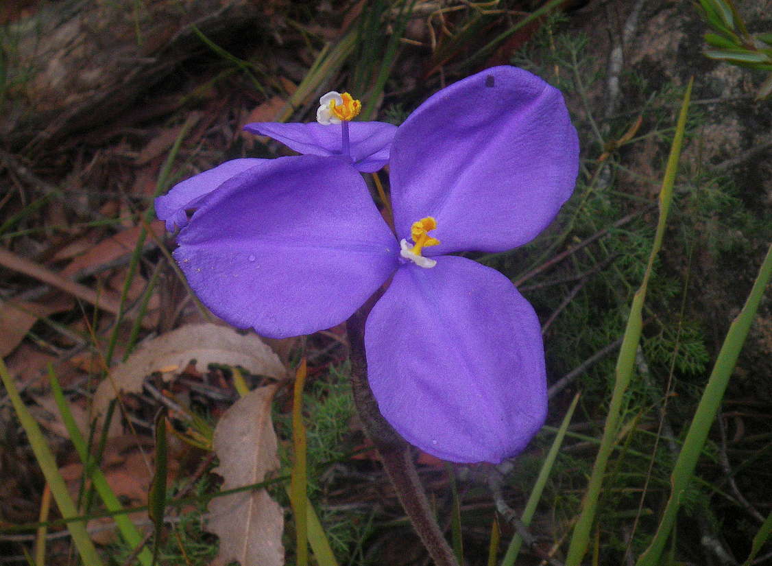

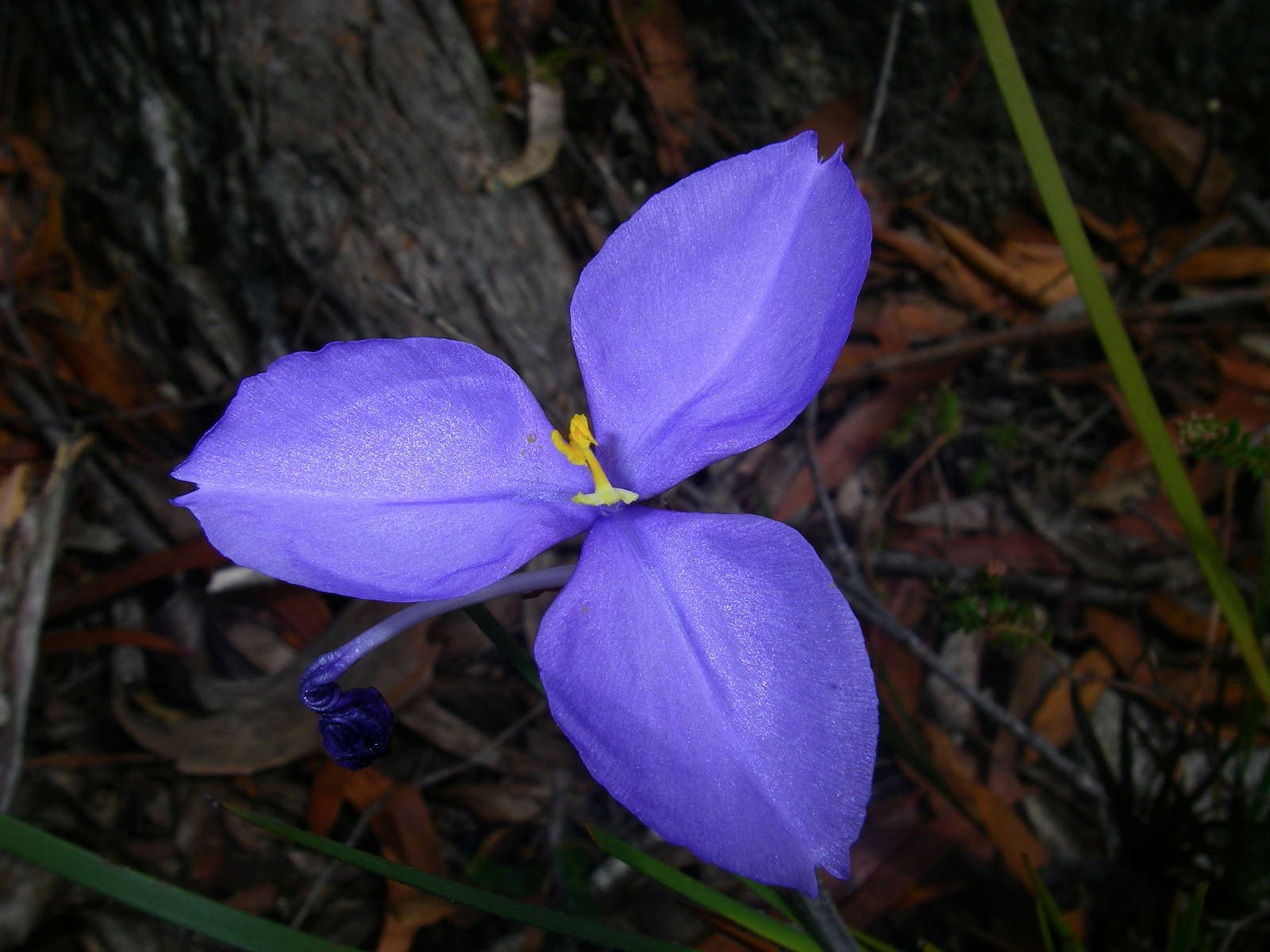
Patersonia glabrata, or Leafy Purple Flag.
There were many of them at this point on the track.
Photo: Don Hitchcock, November 2011
Some Grass Trees were starting to shoot again, they are almost immune to bush fires. Not long after this the heavens opened, and I was drenched on the way to the car when I delayed getting out my raincoat until it was bucketing down. I stripped off and changed into dry clothes in a shelter at Boundary Creek, and drove home. It was a great trip.
Photo: Don Hitchcock, November 2011
Trip via Surveyors Creek Trail to Mulligans Hut and return, 2009
The photos below are from my two day trip to Mulligans Hut and return in 2009. The part of the trail which parallels the Dandahra Crags Track was closed in 2011, and readers may be interested in the extra photos from this trip.

After leaving the car parked at Boundary Creek, I went in search of the Tin Ore Creek Trail up and over the ridge to the Gwydir Highway. Not far from the picnic area, I came across these 'match heads' or Comesperma ericinum.
Comesperma ericinum, commonly known as Heath Milkwort, pink matchheads or Pyramid Flower, is a slender shrub of the family Polygalaceae. It grows to between 1 and 1.5 metres high and branches out vertically. The leaves are 5 to 25 mm long and 1 to 4 mm wide. Purple, lilac-pink or white 'winged' flowers are produced in clusters at the end of the stems from October to January.
Photo: Don Hitchcock, November 2009
Text: Adapted from Wikipedia
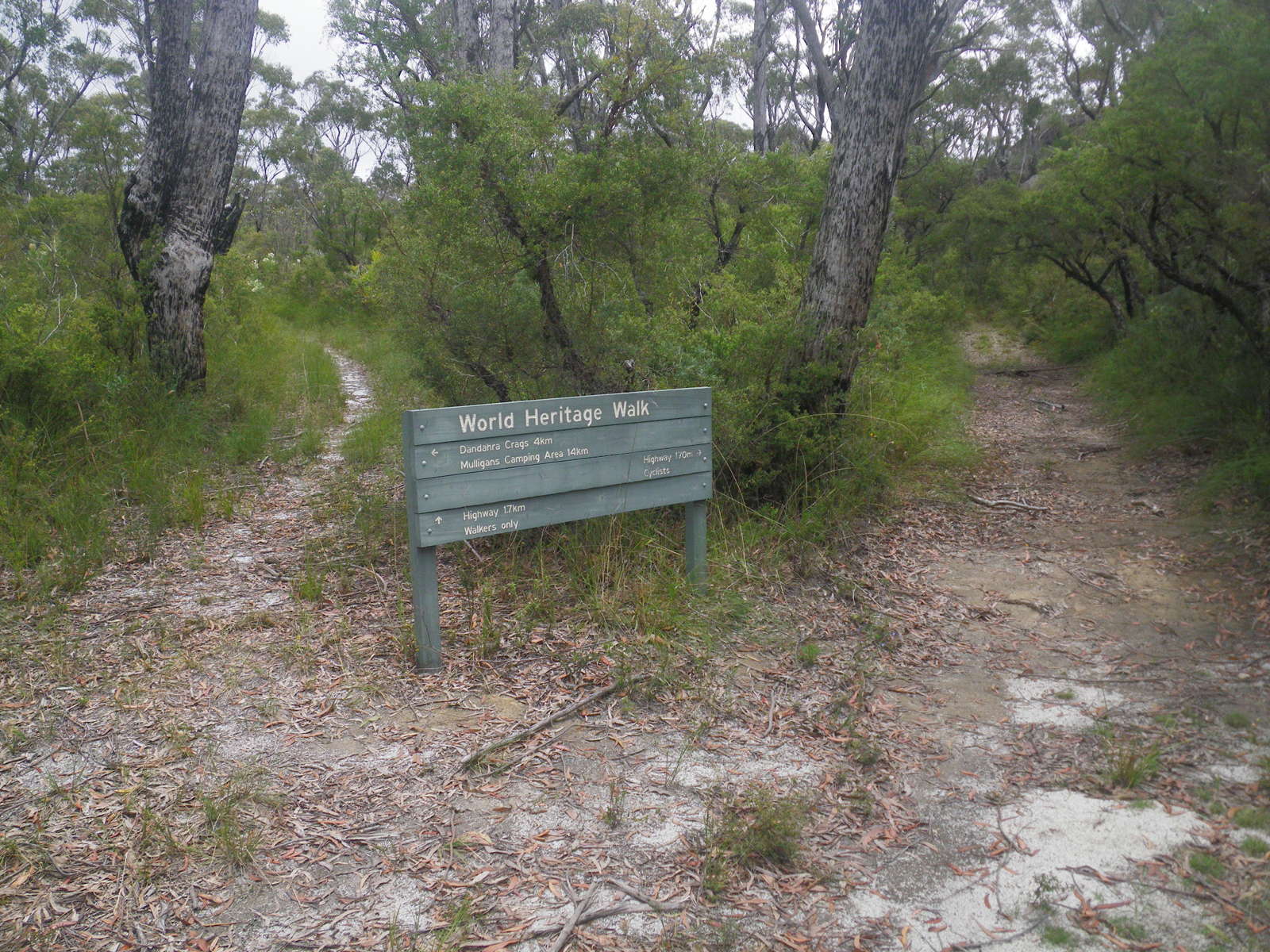
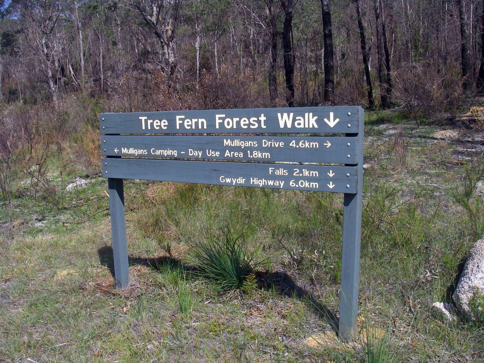
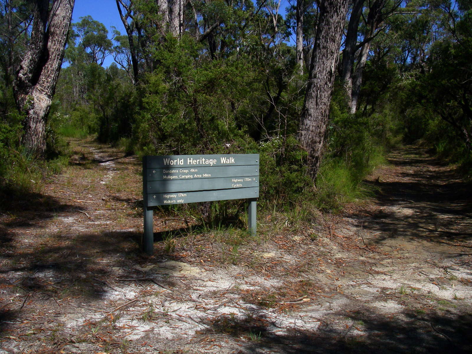
One of the great things about the circuit is the signage, which is very well done. It is hard to get lost on this trip!
This is the turn off to the Tin Ore Creek track which leads over the ridge to the Gwydir Highway, and thence to the Surveyors Creek Trail.
Photo: Don Hitchcock, November 2009

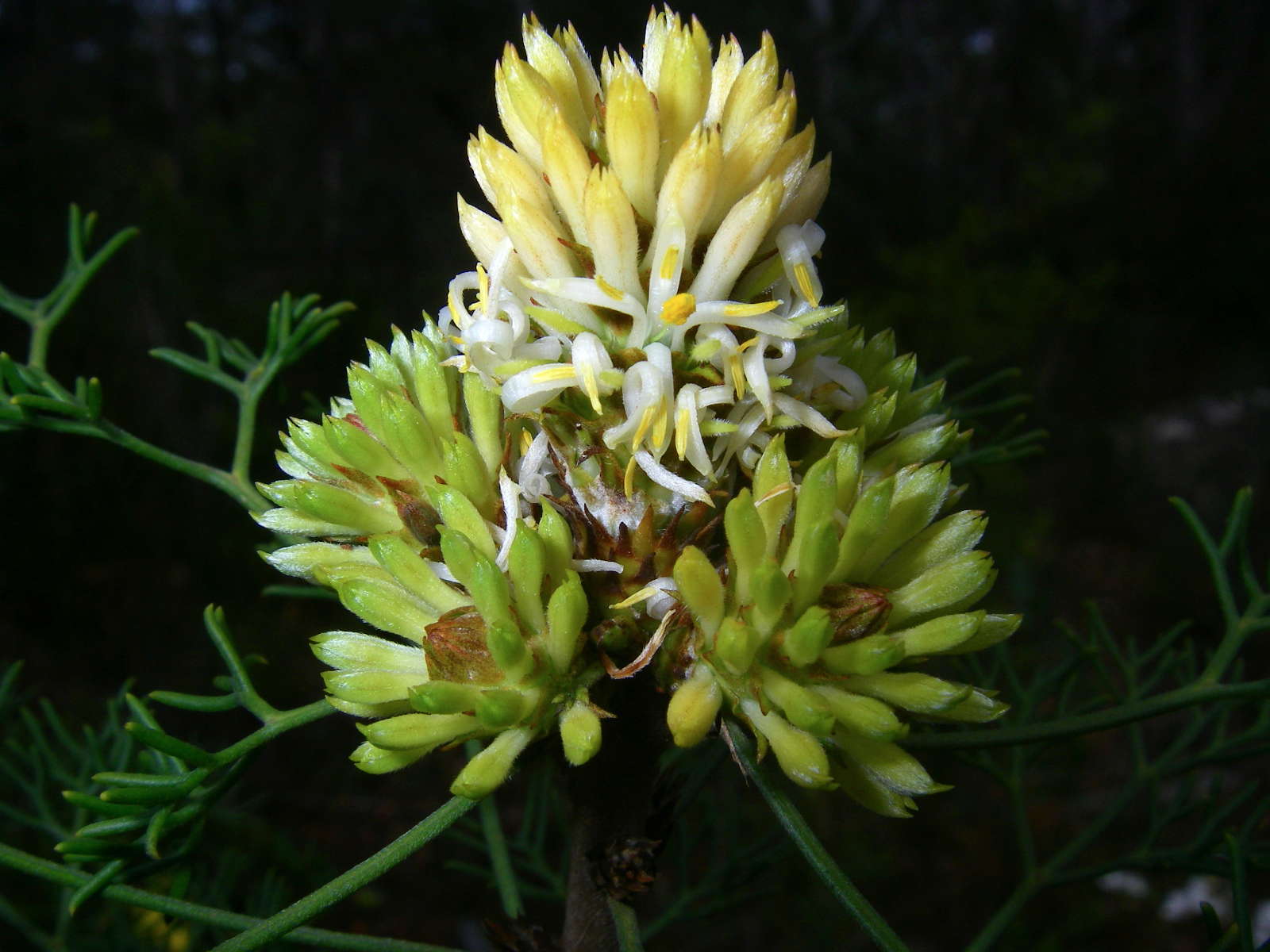
Petrophile canescens
This is one of the Conesticks, and is a shrub 0.5 - 1.2 m high, with the flowers on the end of the stalks. The cone shaped fruit are eaten by parrots.
Photo: Don Hitchcock, November 2009
The crest of the ridge, with the track now dipping down to meet Tin Ore Creek.
Photo: Don Hitchcock, November 2009
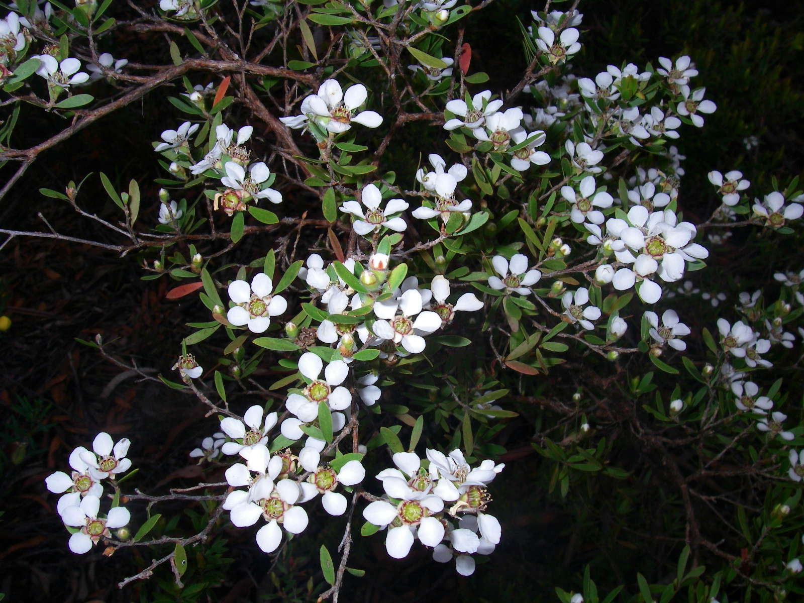
Leptospermum sp.
Photo: Don Hitchcock, November 2009
Another Petrophile canescens , this time with a number of flower heads arranged terminally on a stalk, with one floret completely open.
Photo: Don Hitchcock, November 2009
Patersonia glabrata, or Leafy Purple Flag
Photo: Don Hitchcock, November 2009
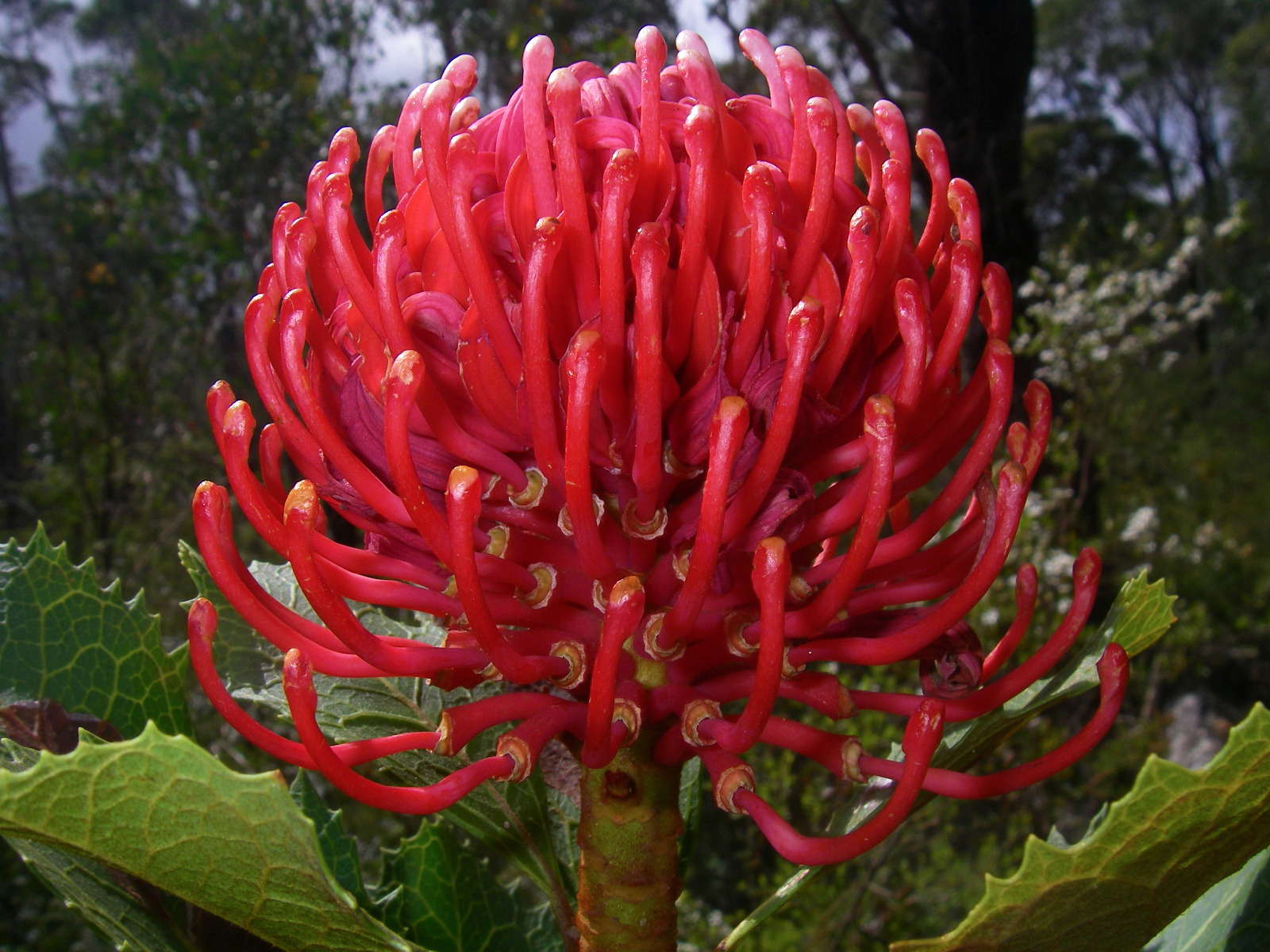

This Gibraltar Range Waratah (Telopea aspera) was spectacular. It was the only one on this section of the track. Note that it occurs on a single stem. The flowers last a long time, are large and have long stems, so they are ideal for the cut flower trade, though hybrids of the NSW and Victorian forms are now preferred for this purpose, since they are more reliable and produce more flowers per bush.
Telopea aspera is a large shrub in the Proteaceae family. It is endemic to the New England region in New South Wales in Australia. It was first described by botanists Peter Weston and Mike Crisp in 1995, separated from its close relative Telopea speciosissimaby its rough foliage and dryer habitat.
The Gibraltar Range Waratah is a large erect shrub up to 3 or 4 metres (10-13 ft) in height with one or more stems. It has dull green leaves which are alternate, and are more coarsely-toothed than its southern relative. The inflorescences, which appear in spring, are large and crimson coloured. They consist of a large domed flowerhead ringed by bracts. These are followed by large seed pods which eventually turn brown and split open revealing winged seeds inside.
Photo: Don Hitchcock, November 2009
Text: Adapted from Wikipedia
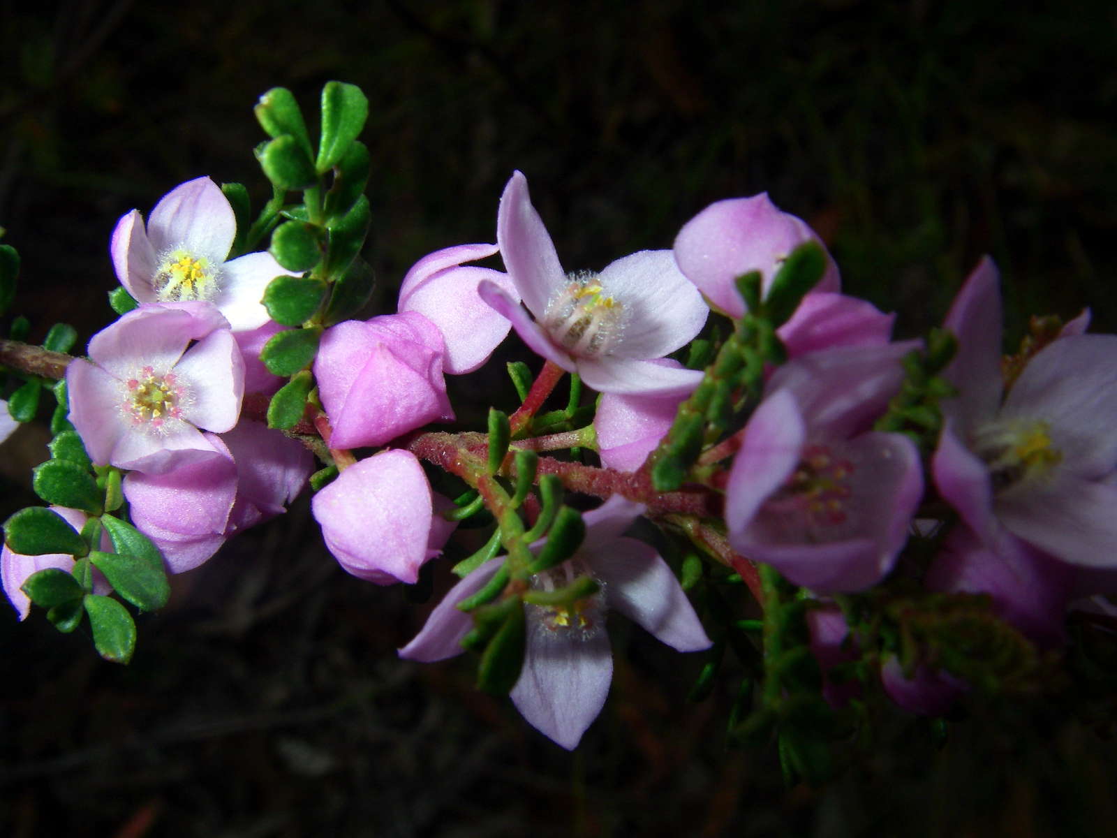
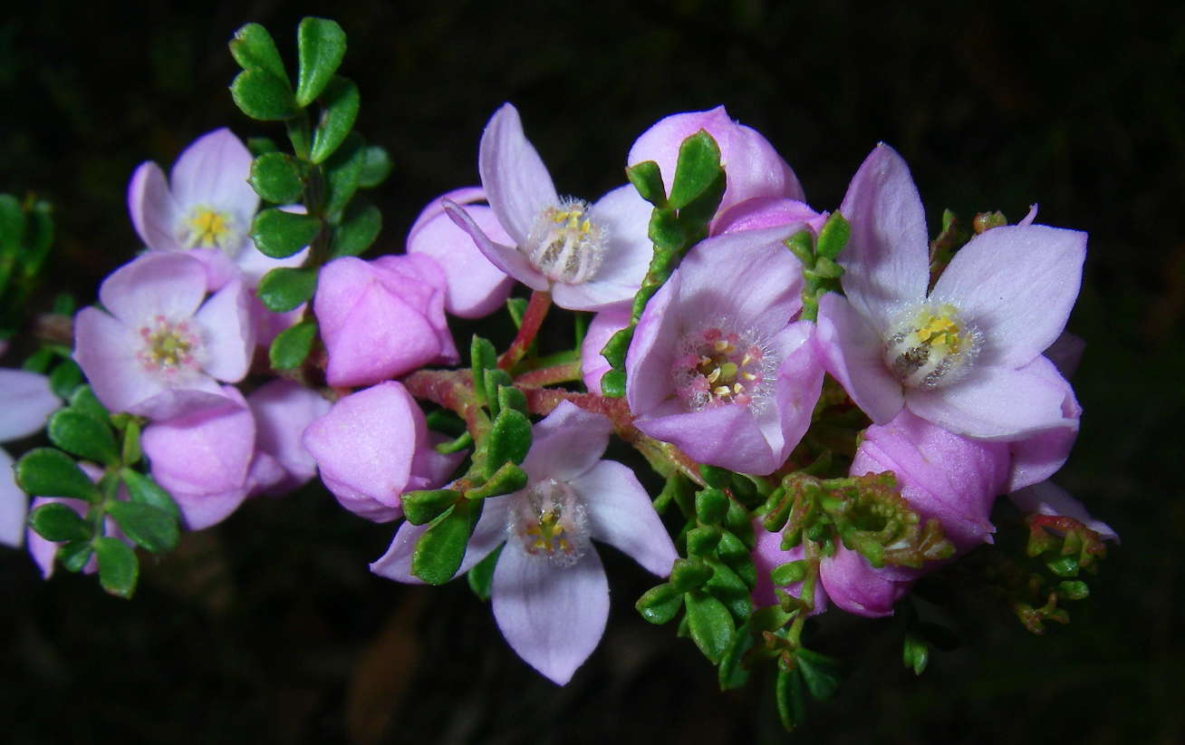
Boronia algida, commonly known as Alpine Boronia, has pale pink or white four-petalled flowers which appear between September and January.
Photo: Don Hitchcock, November 2009
Text: Adapted from Wikipedia

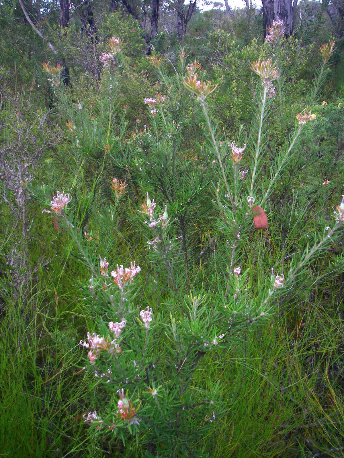
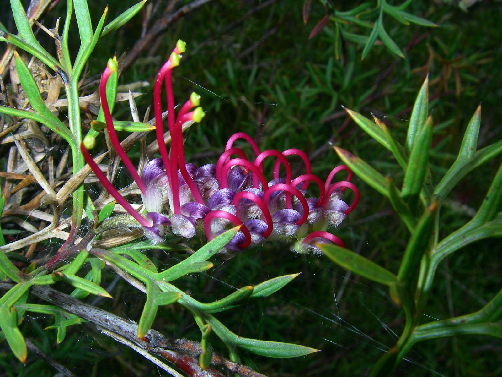
The Grey Spider Flower, Grevillea acerata, is closely related to Grevillea sphacelata and Grevillea buxifolia.
It is a rare species confined to Gibraltar Range National Park.
Photo: Don Hitchcock, November 2009
Text: Adapted from Wikipedia
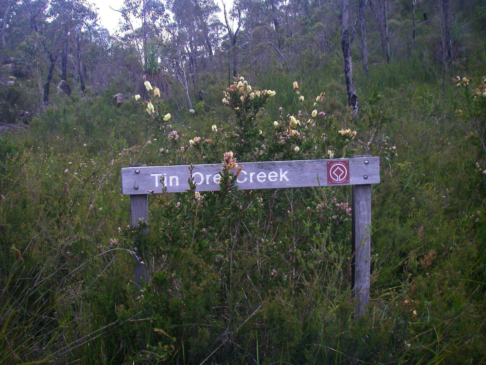 Tin Ore Creek. Signs of tin were found by the grazier O'Hara in 1867 in Grassy Creek. Tin mining continued in the area of the park until the 1930s.
Photo: Don Hitchcock, November 2009
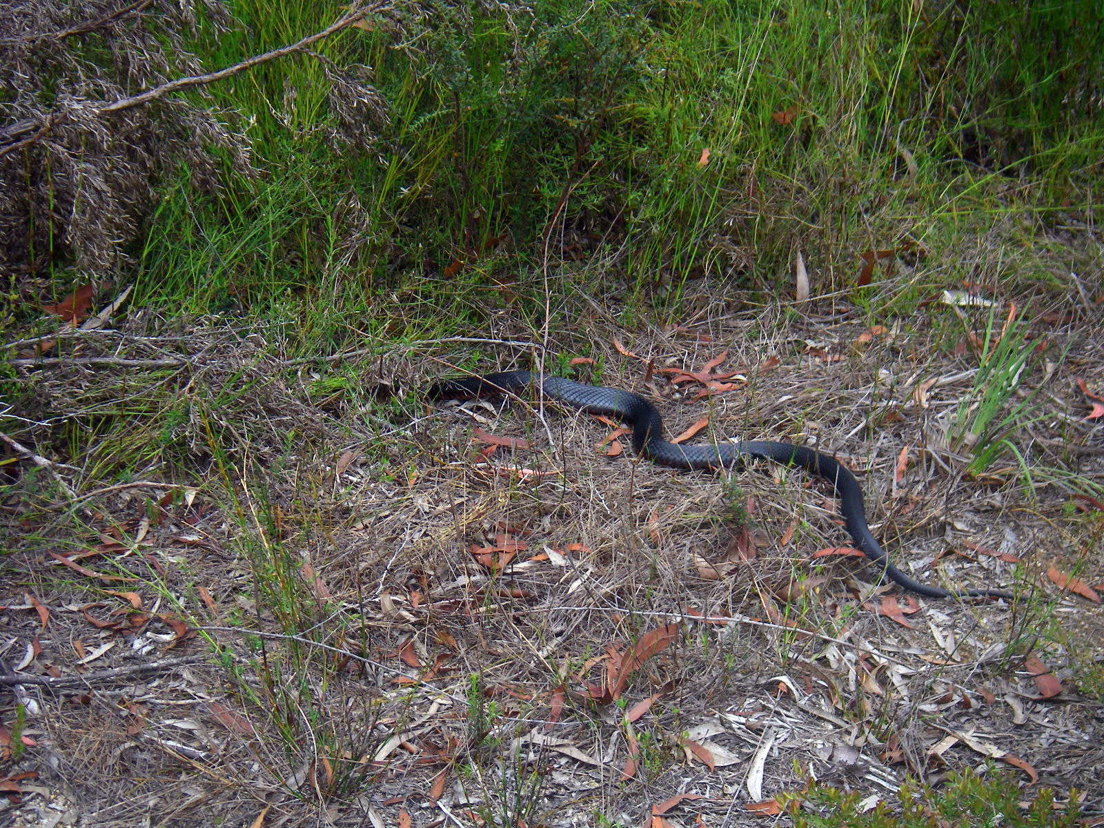
I came across this big glossy healthy red belly black snake just before the end of the track where it meets the Gwydir Highway. It quickly made itself scarce.
Photo: Don Hitchcock, November 2009

The end of the Tin Ore Creek Track.
Photo: Don Hitchcock, November 2009
The entrance to the Surveyors Creek Track, across the highway.
Photo: Don Hitchcock, November 2009


Creamy Kunzea, Kunzea bracteolata.
Kunzea is closely related to the genus Callistemon (the bottlebrushes) and also bears some similarity to Melaleuca and Leptospermum. There are about 40 species occurring in all states and territories. One species also occurs in New Zealand. They are small to medium woody shrubs and the majority occur naturally in south Western Australia.
Some of the main differences between Kunzea and its close relatives are:
The five sepals and petals are deciduous (persistent in Callistemon).
The stamens are longer than the petals (shorter in Leptospermum).
The stamens are free (united in five bundles in Melaleuca).
Seed is released from the ripe fruit annually (usually retained on the plant in the other three genera).
Photo: Don Hitchcock, November 2009
Text: http://anpsa.org.au/k-bax.html
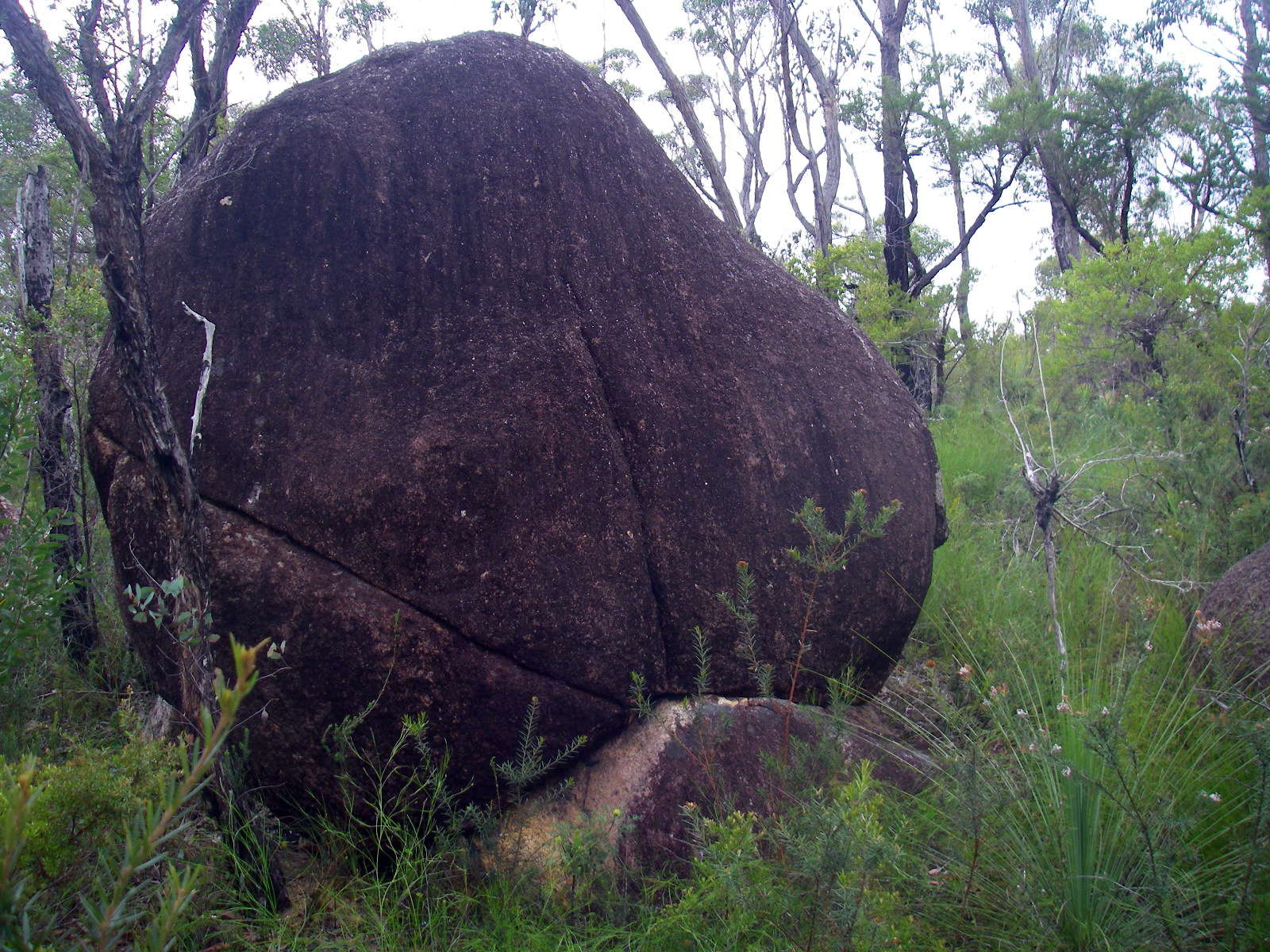
'Onion Skin Weathering' of the granite in this area produces large round tors like this one, often balancing apparently precariously on the bedrock beneath.
Photo: Don Hitchcock, November 2009

Hibbertia linearis, the Showy Guinea Flower.
Photo: Don Hitchcock, November 2009

The Patersonia glabrata were prolific in this area.
Photo: Don Hitchcock, November 2009
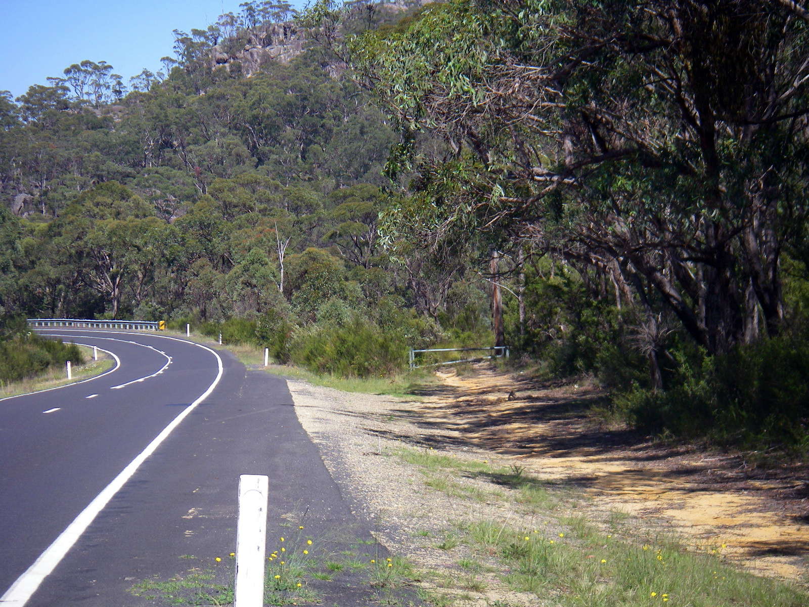
At this point you can take a shortcut back to the highway, which I did on the return journey. Cyclists can use this track.
Photo: Don Hitchcock, November 2009
One of the many hanging swamps in this area.
Photo: Don Hitchcock, November 2009
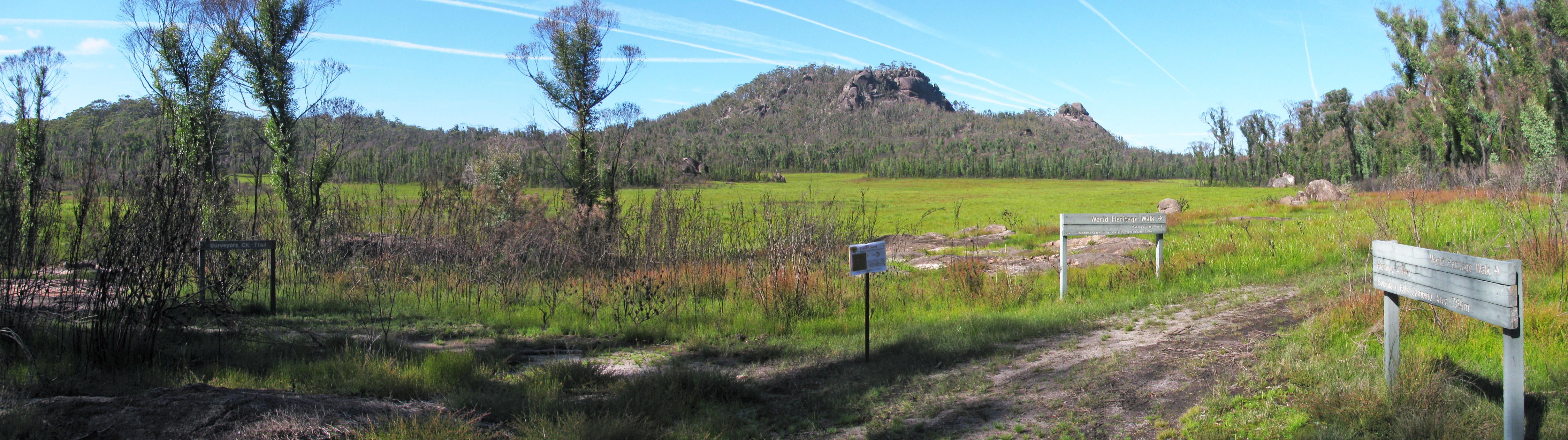
At this point you can choose to go the 'high' route past Dandahra Crags, or take the Surveyors Creek Trail, which I took in November 2009. There is a huge swamp between the two tracks, which has many Christmas Bells a little later in the season. The Surveyors Creek Trail was closed, presumably for maintenance, when I revisited the park in November 2011, so I had to take the Dandahra Crags Trail.
There are two sections to Surveyors Creek. The first section, with its source close to the highway, disappears into McClimonts Swamp near this point, then it reappears later as the second section of Surveyors Creek, exiting from the swamp halfway between here and the Mulligans Hut road, then it continues on until it empties into Little Dandahra Creek near the track which goes up to the Rangers Office and Dandahra Picnic Area on the Gwydir Highway.
Photo: Don Hitchcock, November 2009

Dandahra Crags across the swamp, on a zoomed shot.
Photo: Don Hitchcock, November 2009
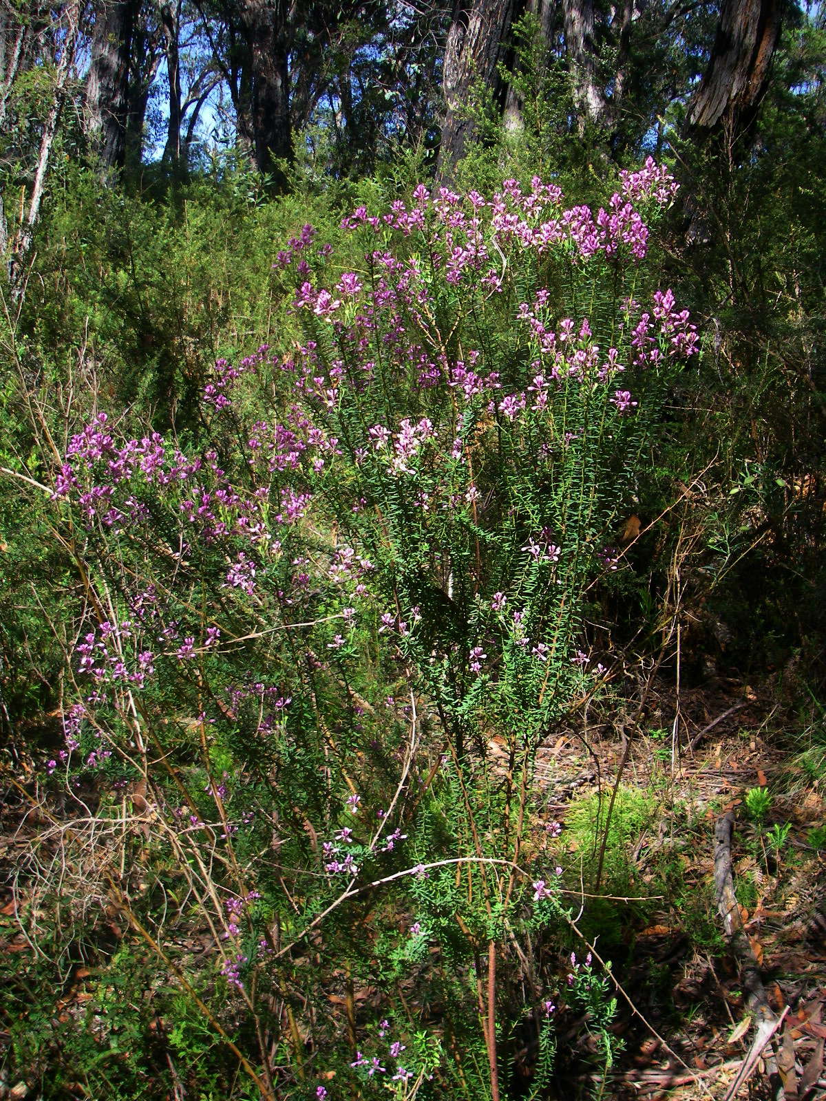
At the moment this is called Grevillea acanthifolia subsp. stenomera, but it probably should be returned to species rank. It is confined to the eastern edge of New England, where it usually grows around swamp margins on granite.
( It is a threatened species - Don )
Photo: Don Hitchcock, November 2009
Text: Pers. Comm, Ian Telford, Curator of the Herbarium, Botany Dept UNE, Armidale.
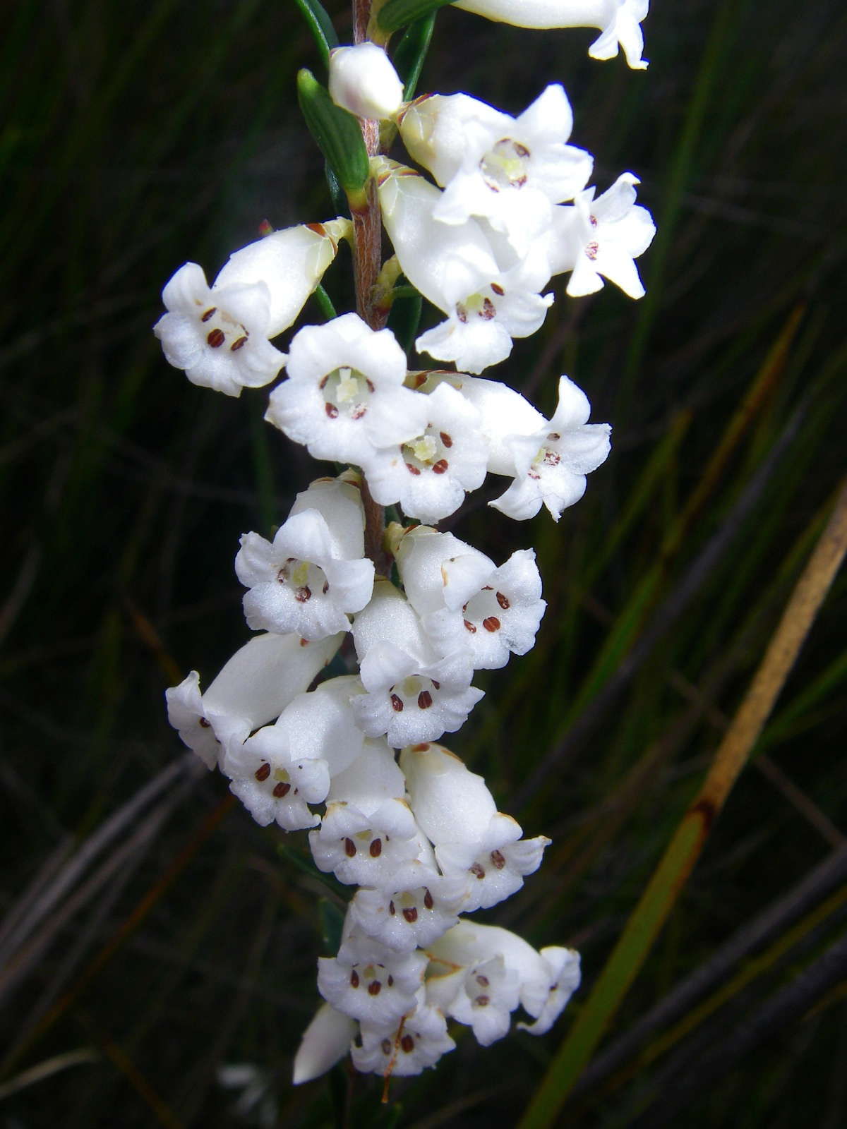
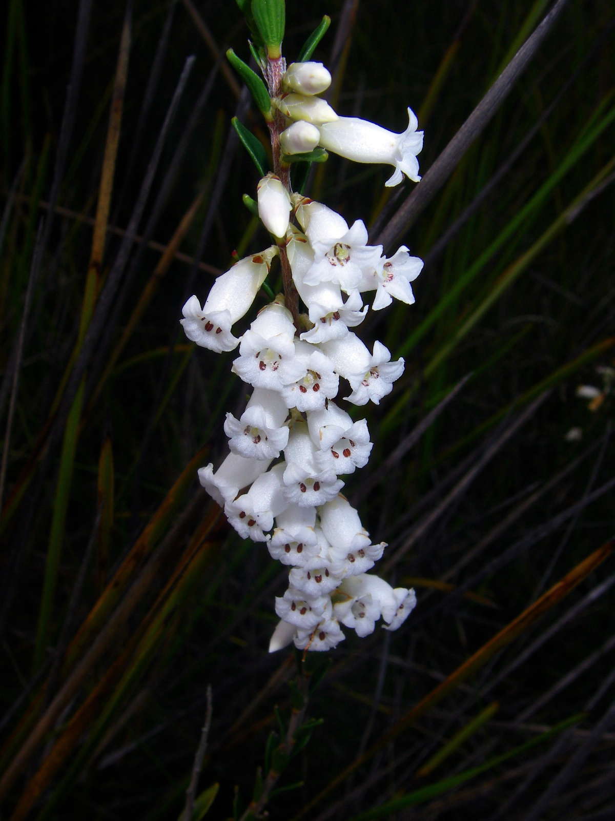
Blunt Leaf Heath, Epacris obtusifolia, is a common heath plant usually found in swampy conditions, as here.
Photo: Don Hitchcock, November 2009
At this time, it was one of the few flowering plants in McClimonts Swamp between the two tracks.
Photo: Don Hitchcock, November 2009
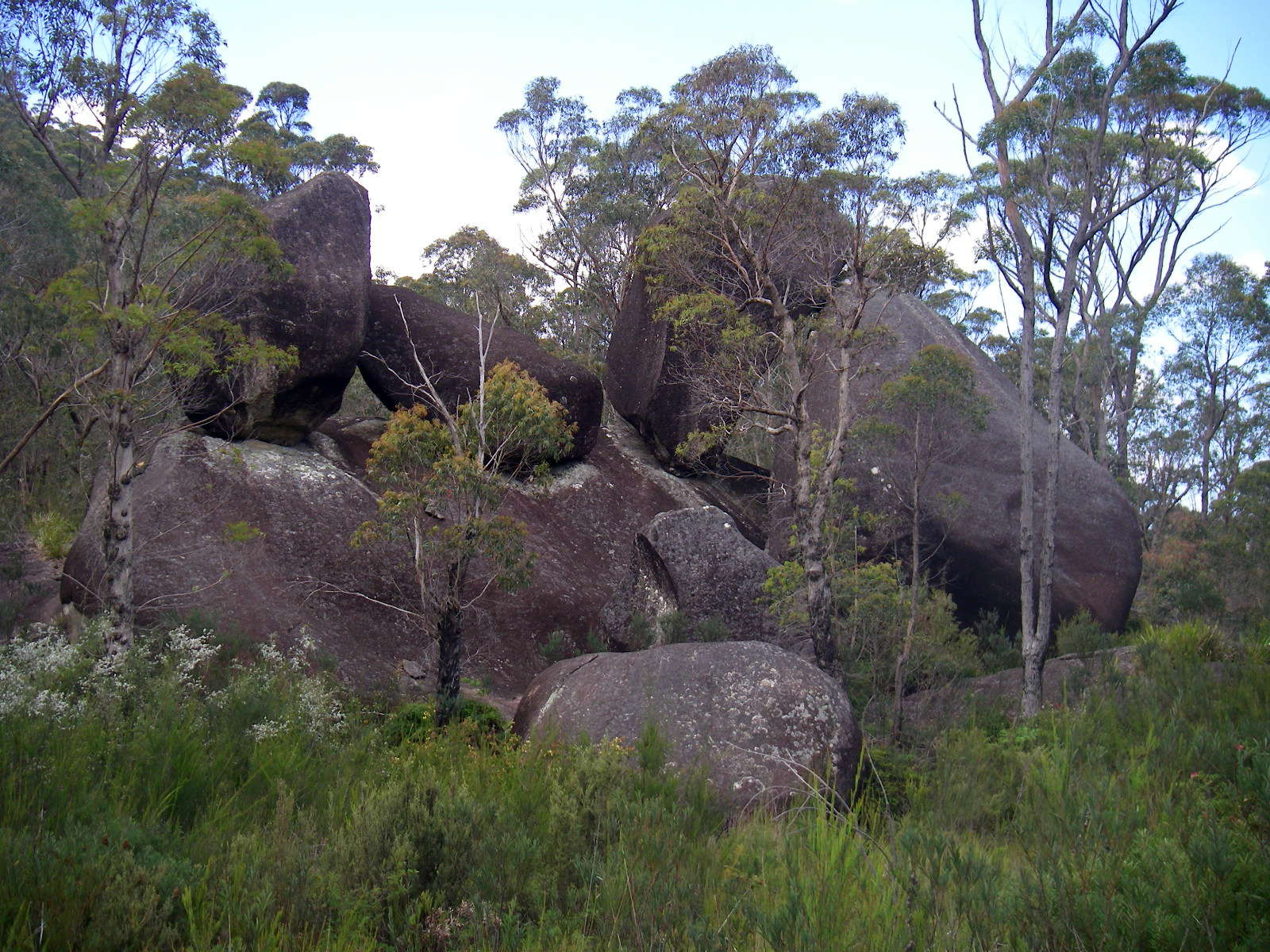
The granite weathers preferentially in the roughly rectangular jointing pattern, leading to rock piles like this.
Photo: Don Hitchcock, November 2009
The two tracks, one past Dandahra Crags and the other along Surveyors Creek, meet at the road, and a single track proceeds beside Surveyors Creek, and later Dandahra Creek, on the other side of the road to Mulligans Hut Camping Area.
Photo: Don Hitchcock, November 2009
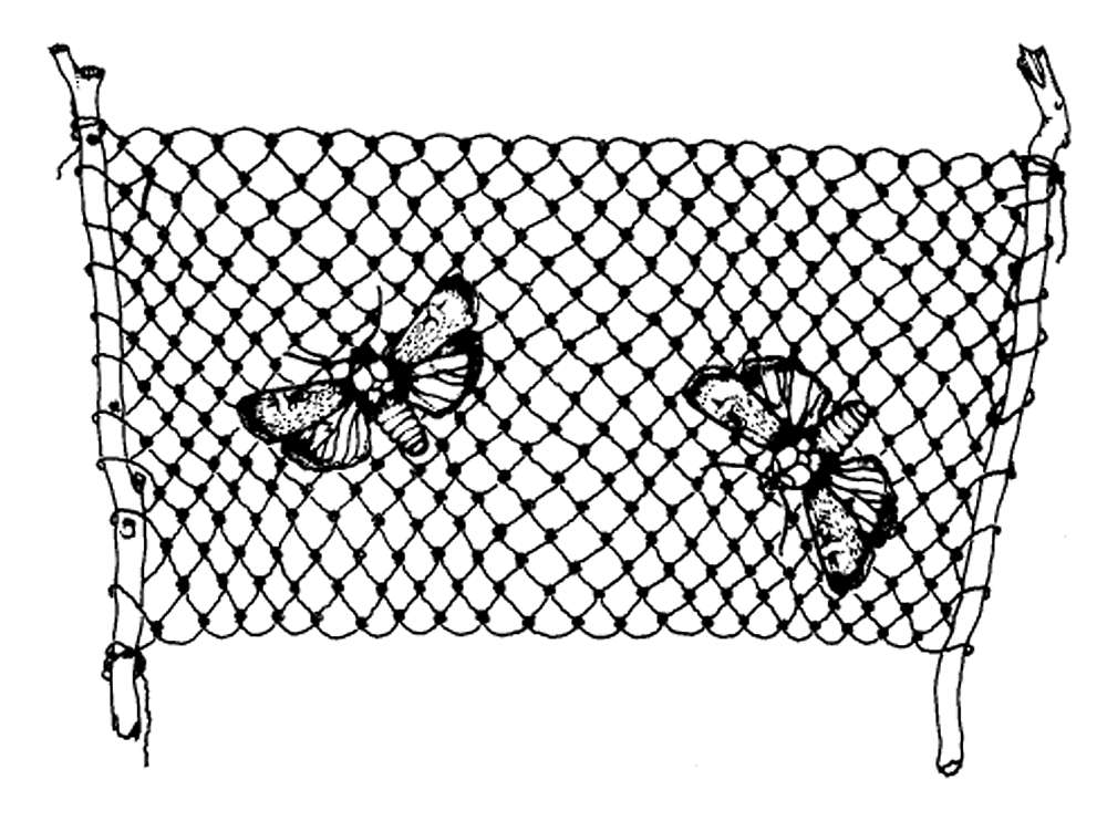
The Slender Rice Flower, Pimelea linifolia.
The bark can be processed into fine strong thread for catching Agrotis infusa, the Bogong moth. This is produced by a traditional method that involves wetting, drying, beating and rolling the material.
We know the bark of the Riceflower as 'Bushman's Bootlace', the green bark comes off in long tough strips, but here's how to make string:
Strip the bark, dry it, place in a stream for about one week, dry in sun, soften by chewing/beating with sticks and stones, roll on the thigh and spin into fine, strong thread.
During summer, people came to the high country to feast on thousands of Bogong moths. They caught them in strong, delicate string nets made from Pimelea bark.
'They had very fine meshes and were manufactured with great care, and being attached to a couple of poles they could be readily folded up when they had to be withdrawn from the crevices.' Helms 1895:594.
Photo: (left) Don Hitchcock, November 2009, (right) http://www.anbg.gov.au/aborig.s.e.aust/pimelea-linifolia.html
Text: Wikipedia, http://www.anbg.gov.au/aborig.s.e.aust/pimelea-linifolia.html
Surveyors Creek was just a small thread of water through the bush at this point, with two tributaries, one coming from McClimonts Swamp and the other from a one hundred metre high rise beside the swamp.
Photo: Don Hitchcock, November 2009
A bridge has now (2015) been built at this creek crossing. Surveyors Creek empties into Little Dandahra Creek a little way downstream from this point. The track goes up to the Rangers Office and Dandahra Picnic Area on the Gwydir Highway.
Photo: Don Hitchcock, November 2009
Another balancing rock, beside the stream which is at this point called Little Dandahra Creek.
Photo: Don Hitchcock, November 2009
These would be good swimming holes on a hot summer's day.
Photo: Don Hitchcock, November 2009
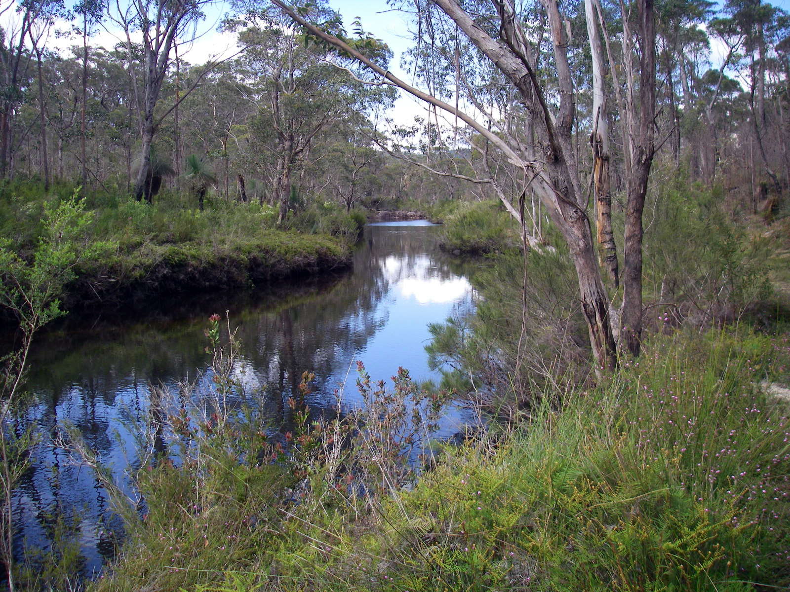
Little Dandahra Creek was quite a respectable stream by this time.
Photo: Don Hitchcock, November 2009
This bridge giving access to the Tree Fern Forest and the Tree Fern Fire Trail, or Pidcocks Trail, looked as though it had not long been put in.
Photo: Don Hitchcock, November 2009
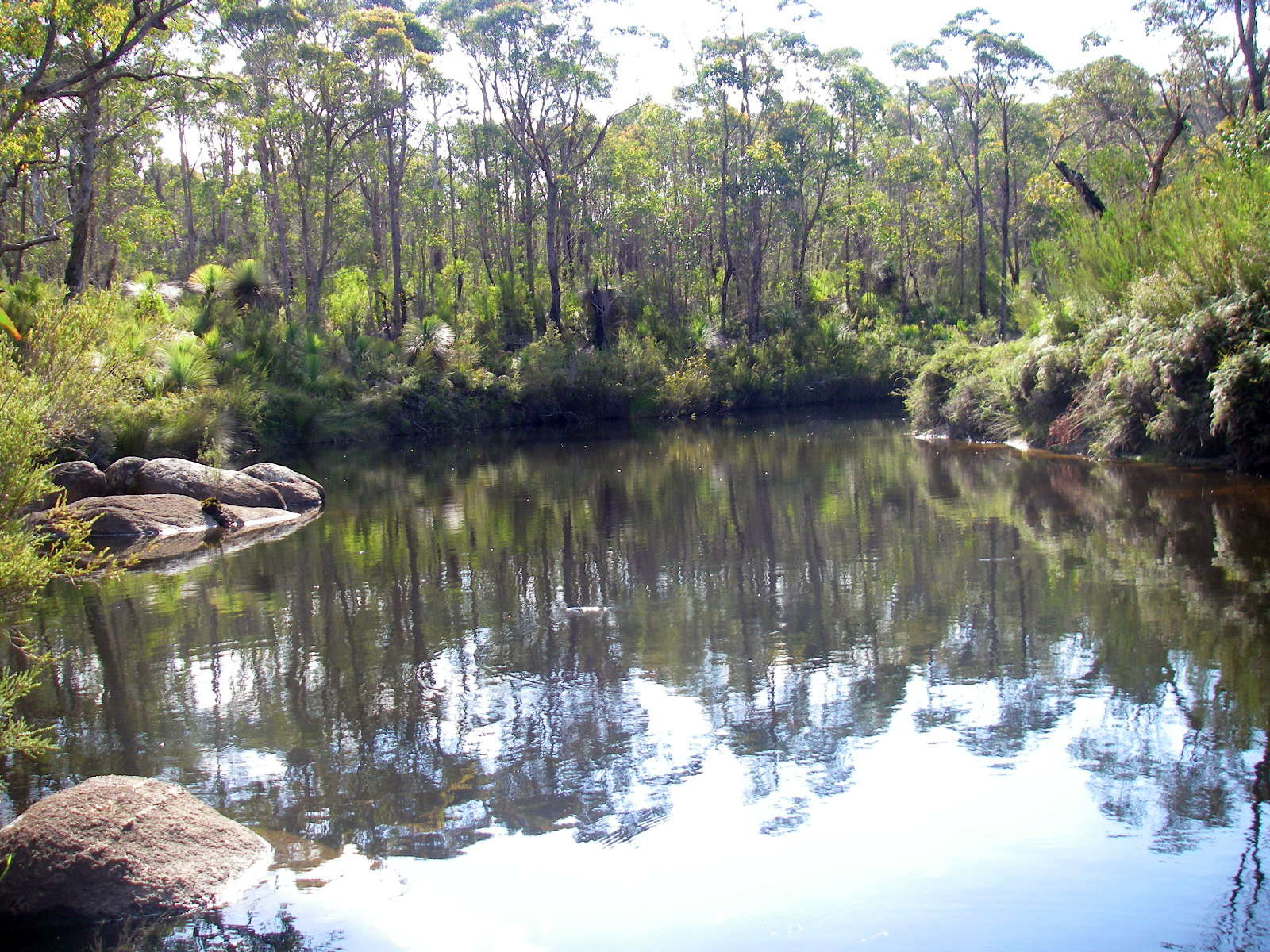
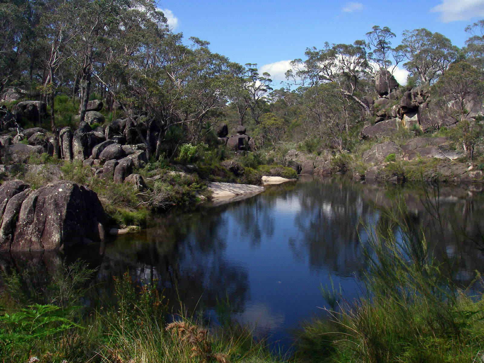
Another beautiful pool, with Mulligans Hut Camping area not far away.
Photo: Don Hitchcock, November 2009
Next day I headed back to Boundary Creek, and this is the first good view of Dandahra Crags from the track not far from the Dandahra Crags turn off.
Photo: Don Hitchcock, November 2009
Another beautiful red bellied black snake, in prime condition, at about eight in the morning, daylight saving time. Notice how it has flattened its body in a threat display.
The black lines like jagged tongues are just sticks on the ground!
Photo: Don Hitchcock, November 2009
Time for a cup of coffee. When I am on a bushwalk, it is always time for a coffee!
I love freshly brewed turkish coffee, and it is one of the joys of bushwalking by myself to have such a delicious drink whenever I feel like it.
I make all my own lightweight gear, from tents to packs to raincoats to sleeping bags to stoves. It is the only way that I can get the light pack weight that makes bushwalking easy and pleasant. Even on a four day walk, my pack is less than nine kilograms including food.
Photo: Don Hitchcock, November 2009
This time I took the cyclists track back to the highway.
Photo: Don Hitchcock, November 2009
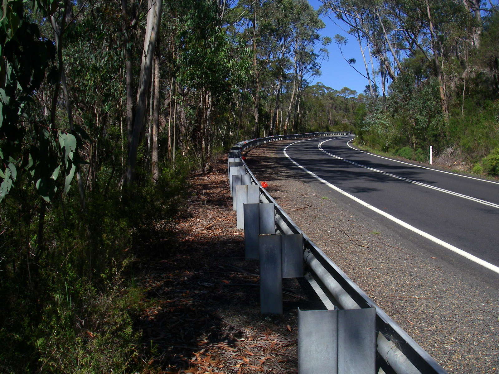
I walked as much as possible on the outside of the guard rails.
Photo: Don Hitchcock, November 2009

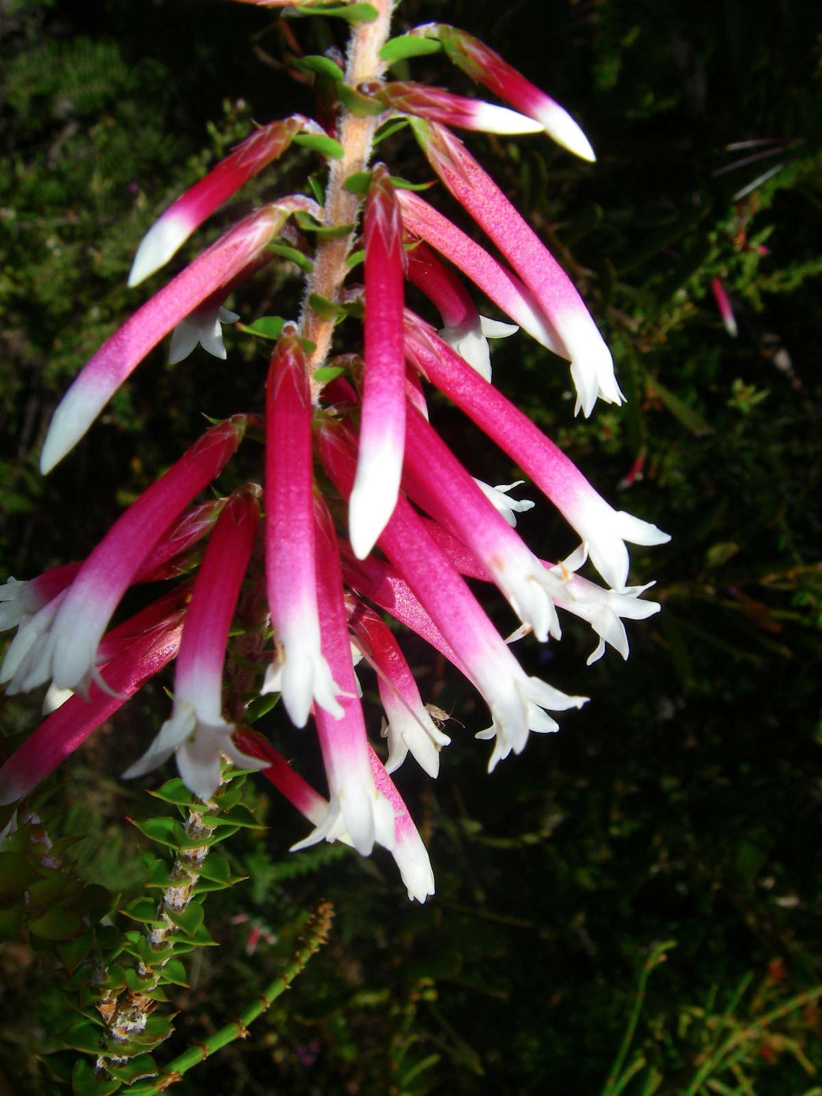
However I was delighted to spot this Epacris longiflora on the high side of the highway growing amongst rocks.
Photo: Don Hitchcock, November 2009
The entrance to the Tin Ore Trail, back to Boundary Creek.
Photo: Don Hitchcock, November 2009
And finally to Boundary Creek, and my car.
Another great trip.
Photo: Don Hitchcock, November 2009
Bushwalking Index
The walk from Boundary Creek to Grassy Creek via Duffers Falls and the Haystack
The walk from Grassy Creek to Mulligans Hut via O'Hara's Gap and the Tree Fern Fire Trail