Back to Don's Maps
Tools from the stone age of Germany
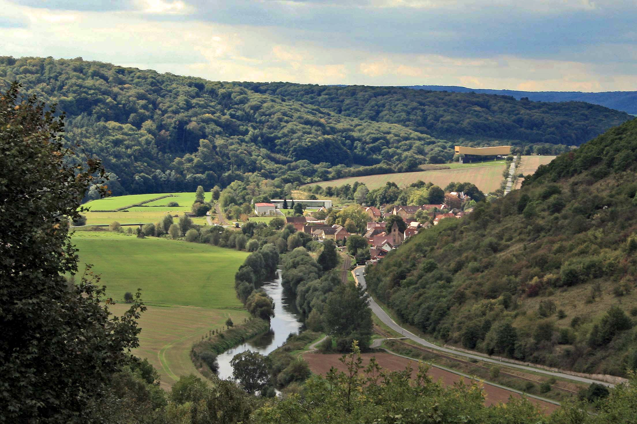
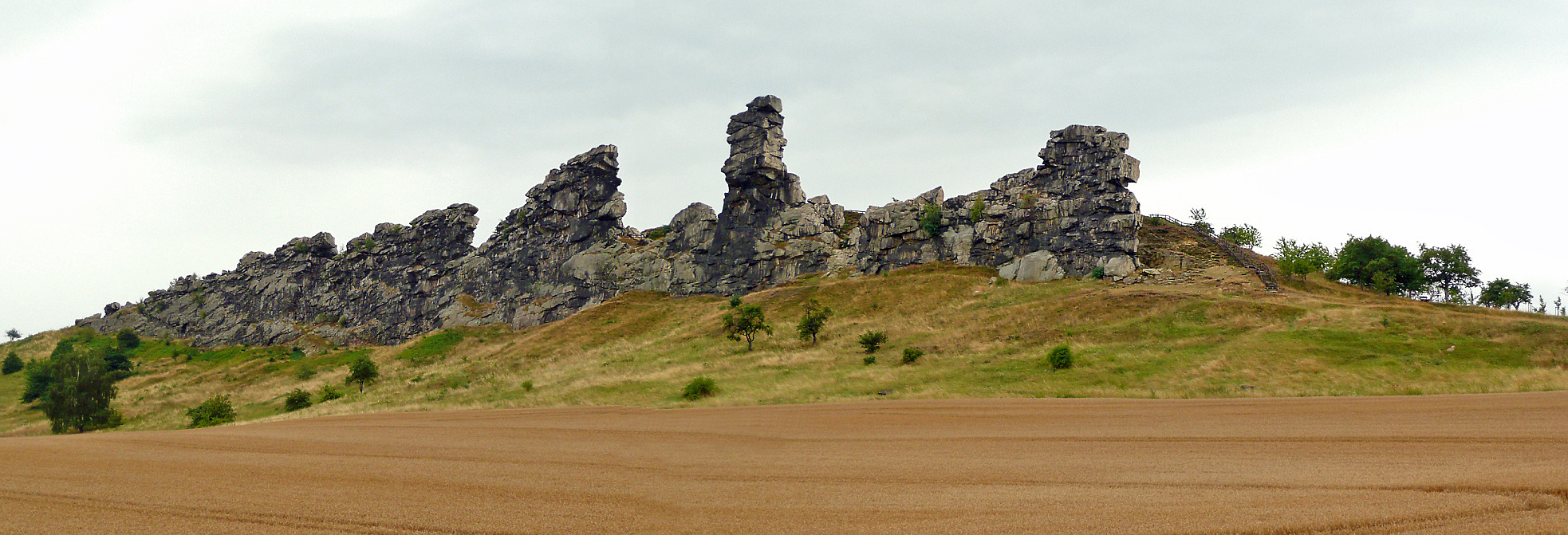
Memleben
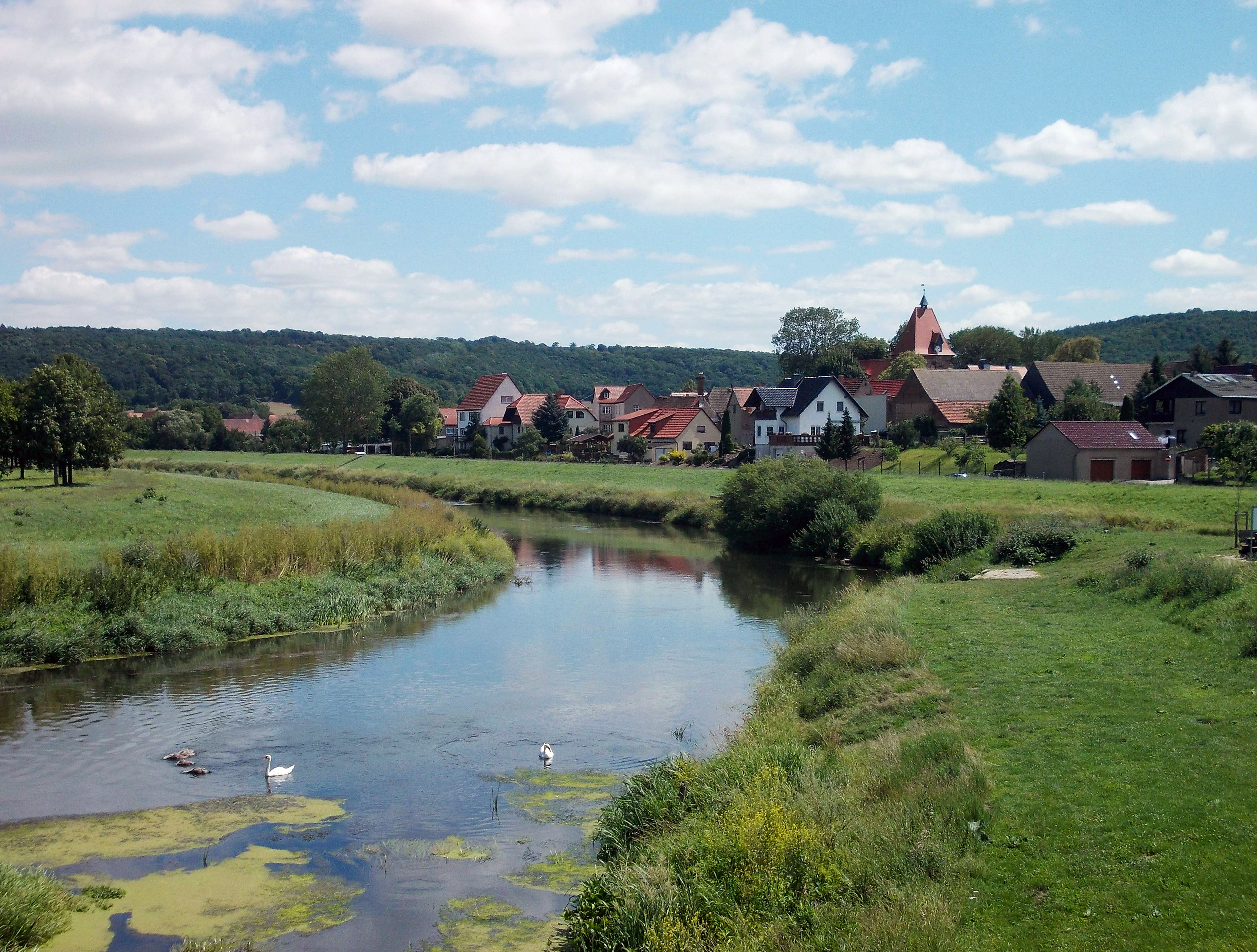
The village of Memleben on the Unstrut River
Photo: Jwaller
Permission: GNU Free Documentation License, Version 1.2 or any later version published by the Free Software Foundation
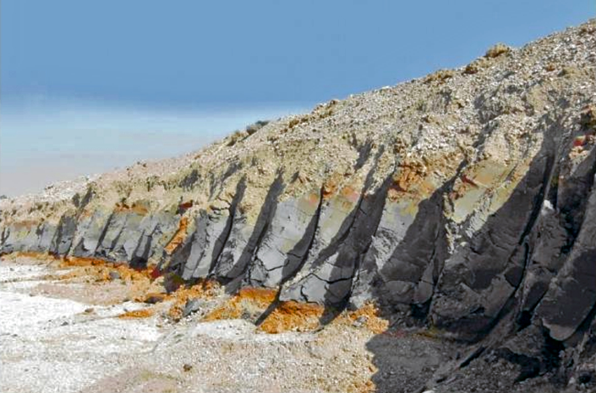
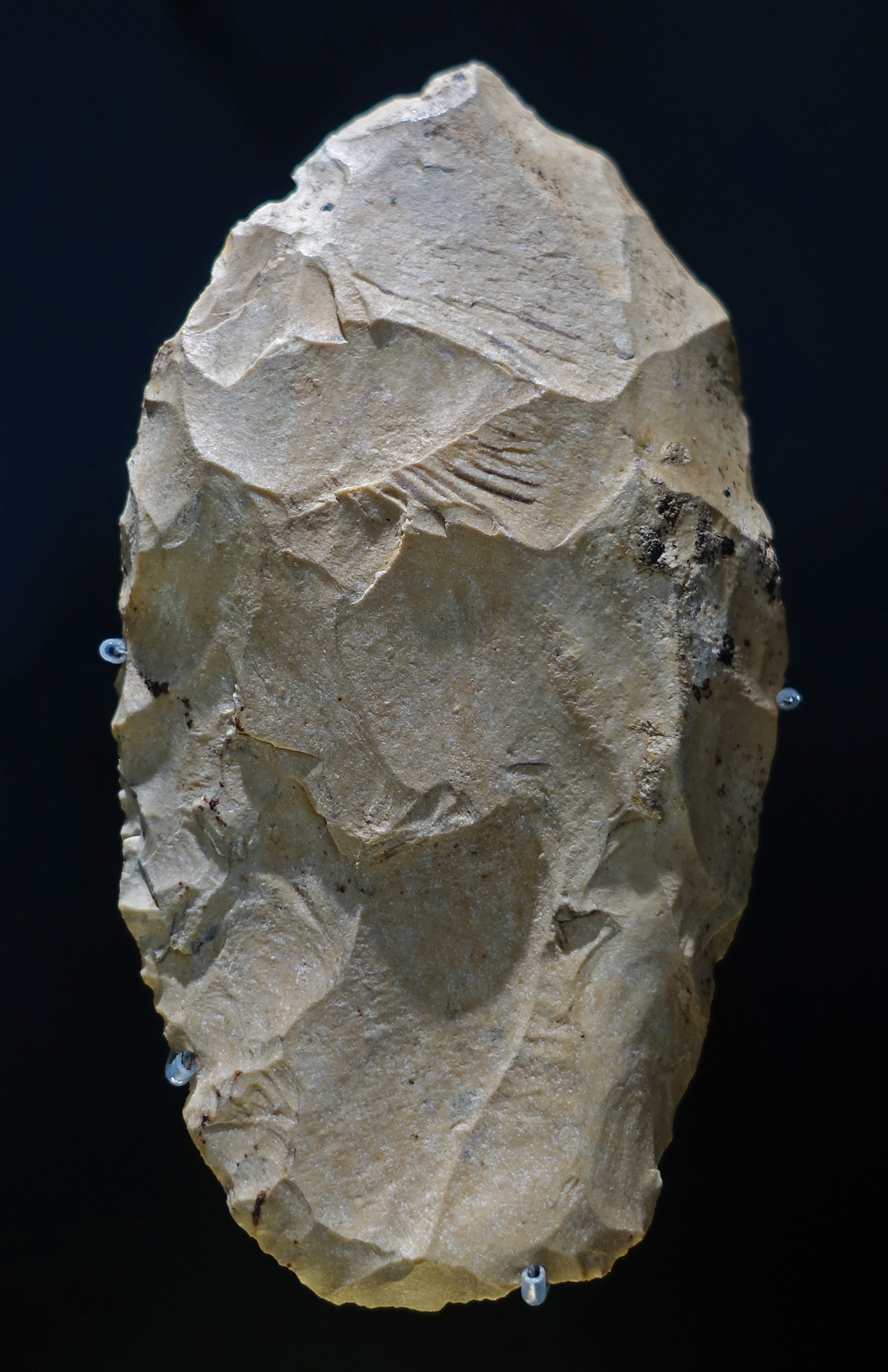
A gravel layer, approximately 1 m thick, was exposed over a length of 35 metres on a plateau on the southern side of the Unstrut valley. It was overlaying Early Pleistocene quartz gravels and covered by solifluction deposits several metres thick. Borings showed the interfingering of the gravel with gyttjas (a mud formed from the partial decay of peat ) and peats from a limnic ( fresh water lakes and ponds ) sequence containing pollen and plant remains of a mixed hornbeam-oak wood as well as fruits of Trapa natans (water caltrop) and Vitis sylvestris (Eurasian wild grape). Shells of Theodoxus serratiliniformis (small water snails with an operculum) and an interglacial mollusc fresh water fauna were found in the two types of deposits.Text above: Mania (1995)
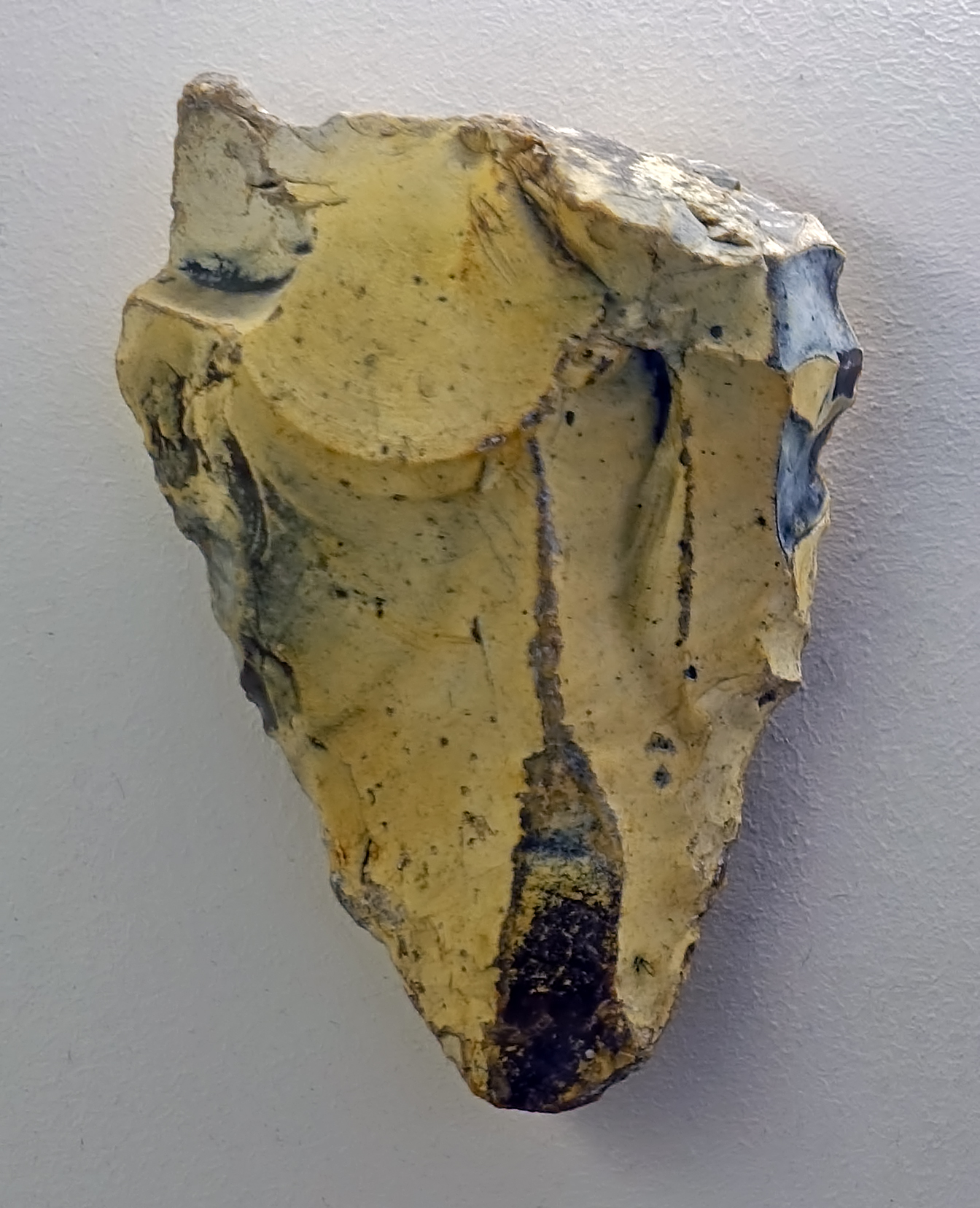
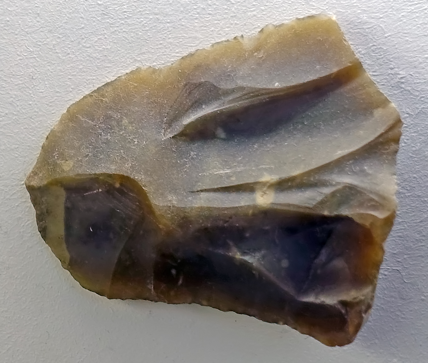
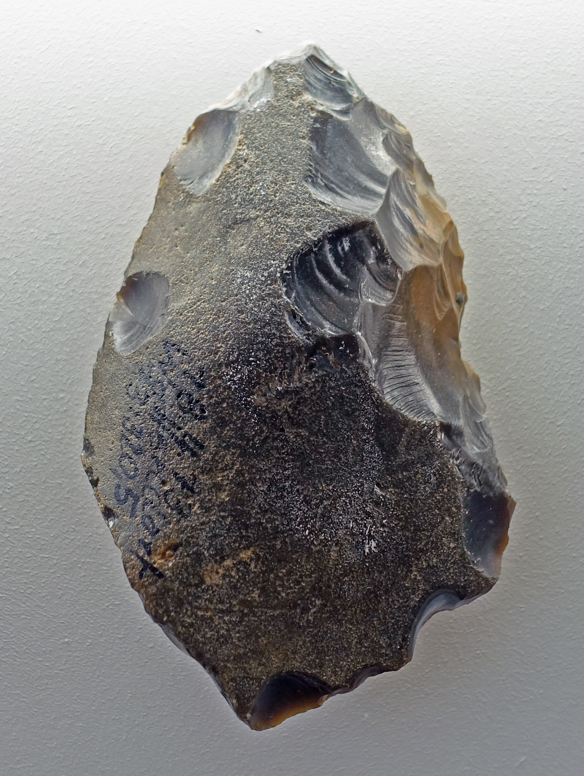
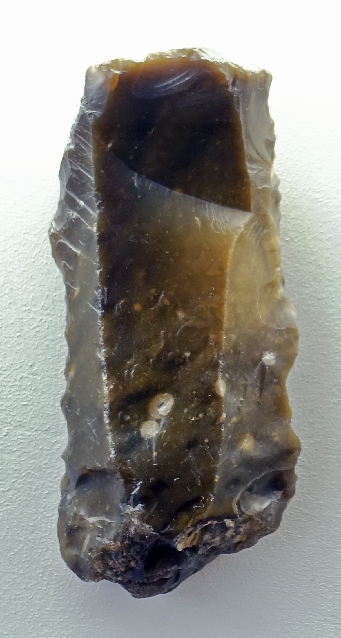
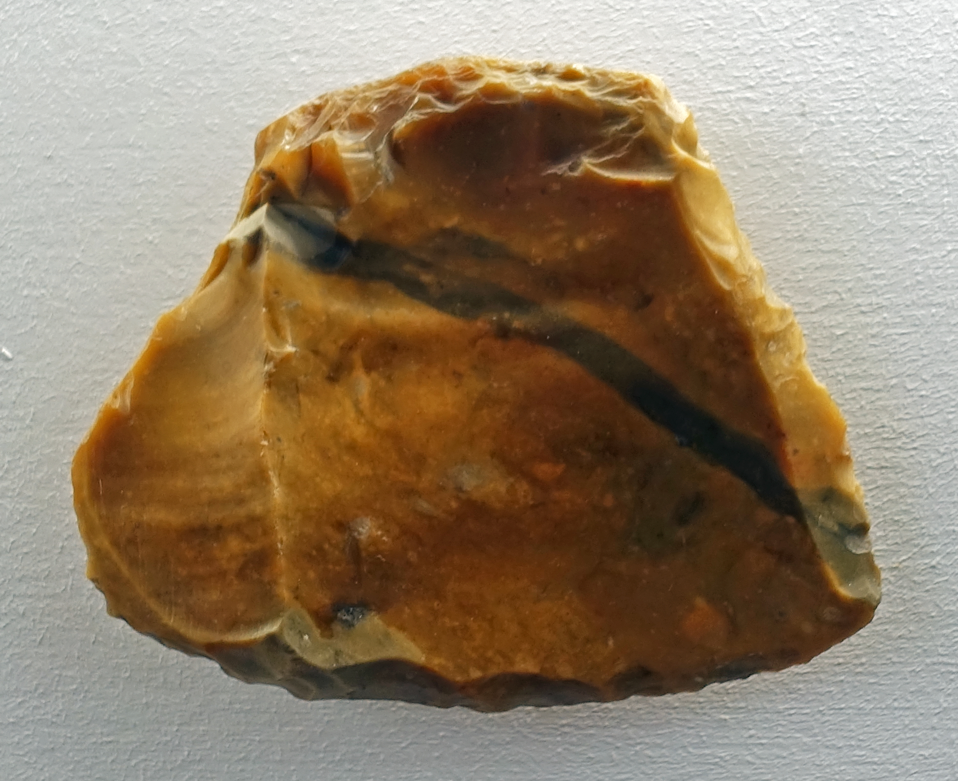
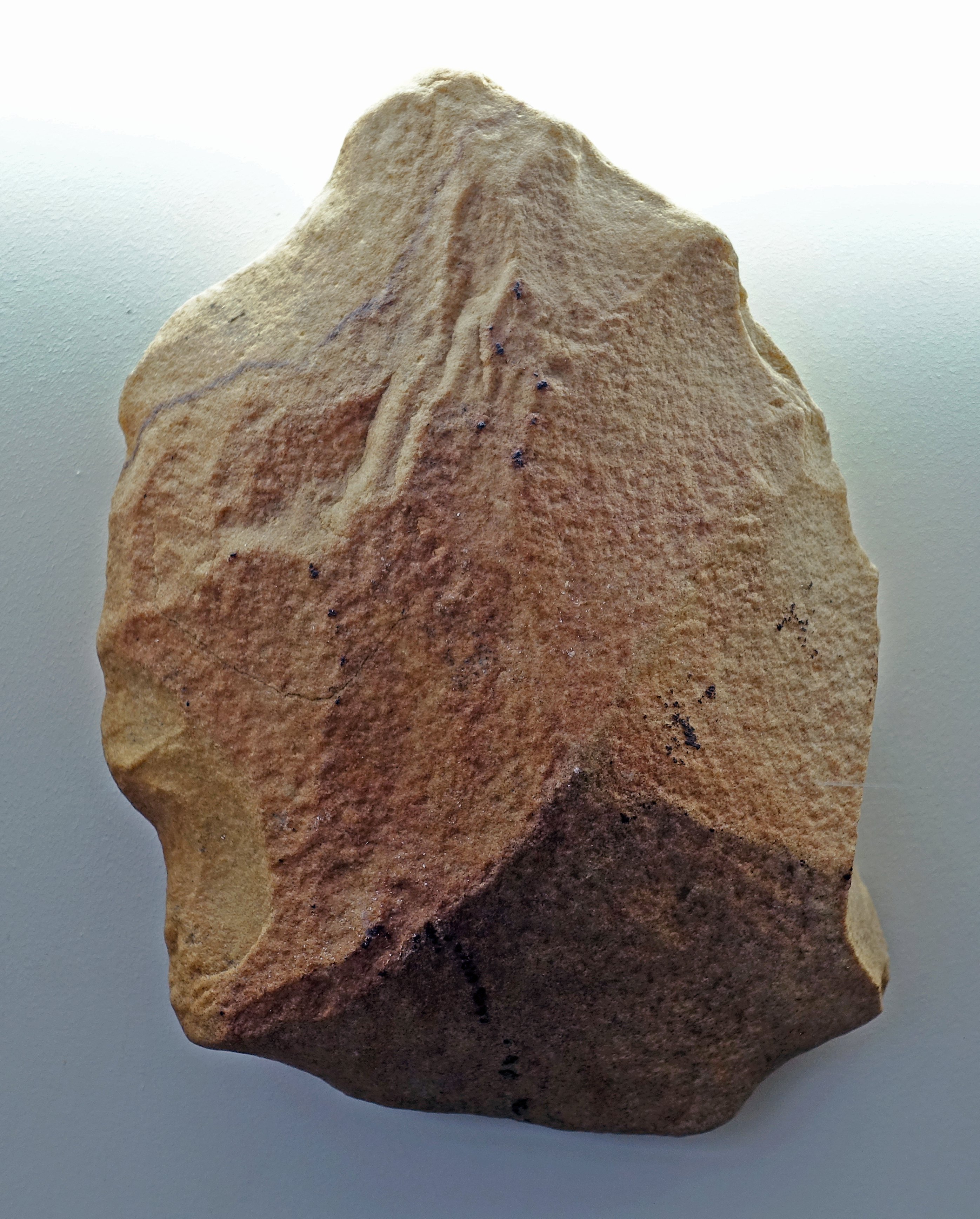
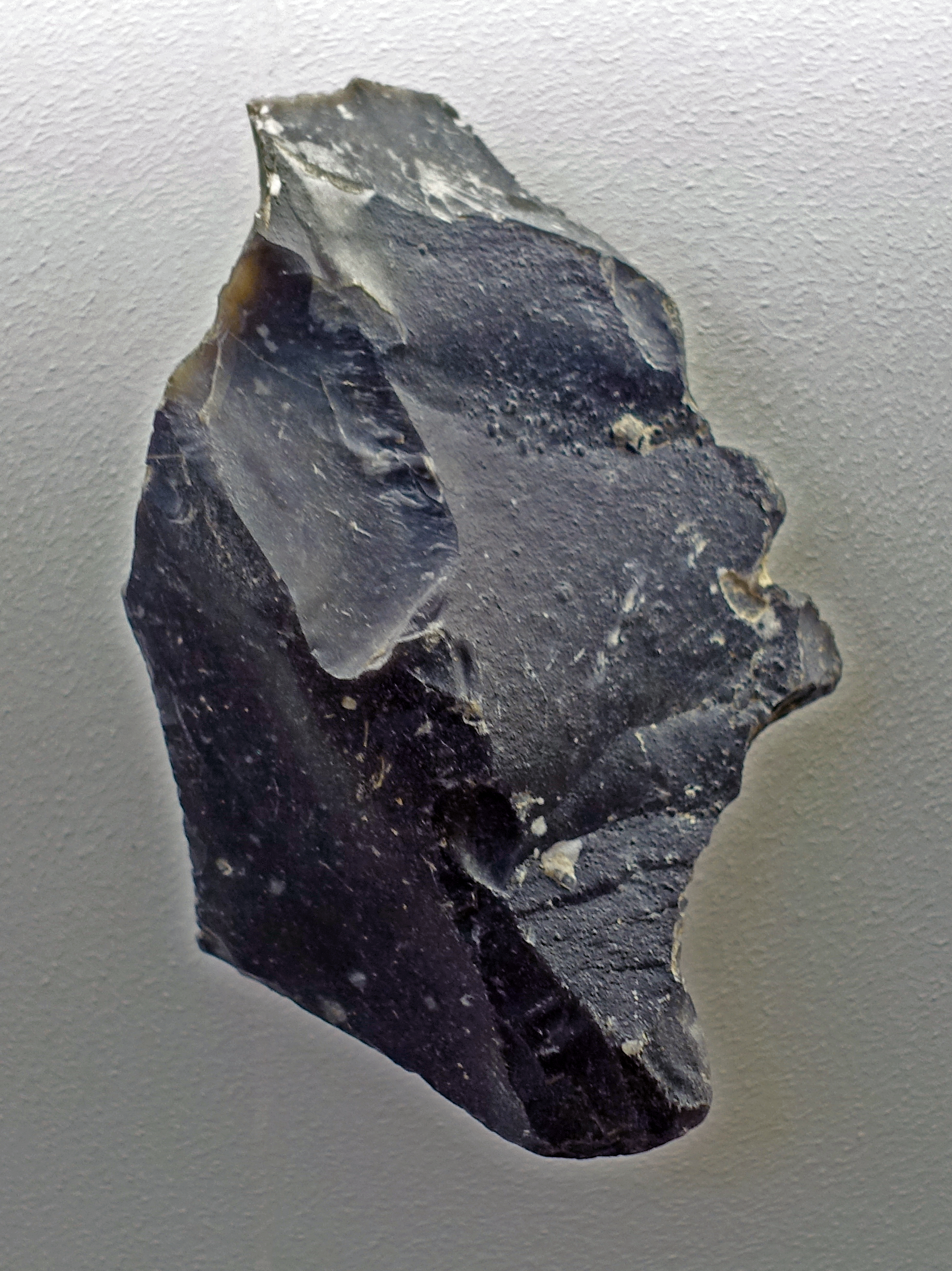
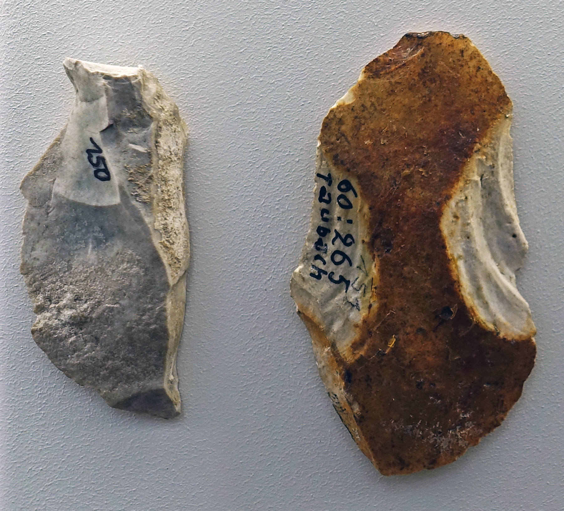
In total, 104 flint artefacts were recovered here by Mania and Cubuk in 1975. They closely resemble those of Wangen. Here, too, there are cores and flakes manufactured with a hammerstone, as well as tools. The flakes are relatively thick with flaking angles between 100-145°, and an average value of 123°. The artefacts are 25 to 108 mm long, with an average size of 52 mm. All cores are exhausted, and they display crudely prepared striking platforms, while the tools display a rough retouch. There are simple and double scrapers, a transversal scraper, and some denticulates and notched pieces.
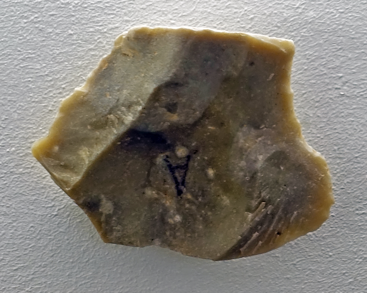
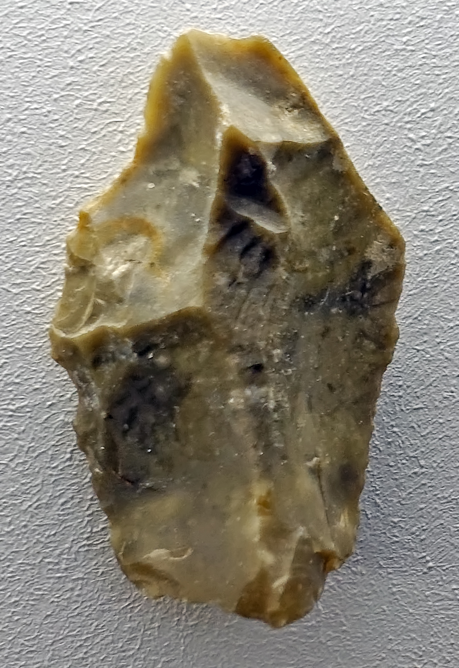
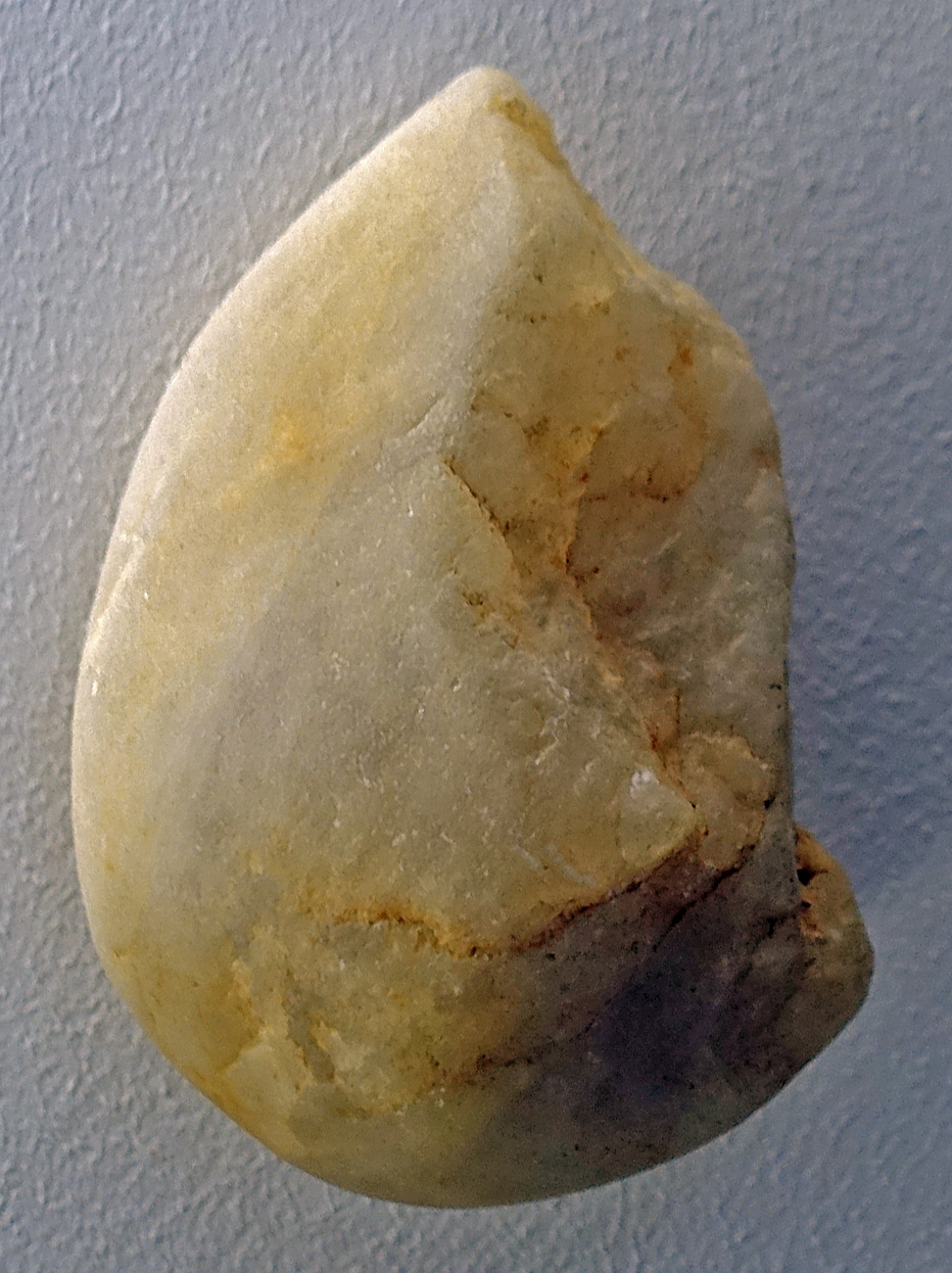
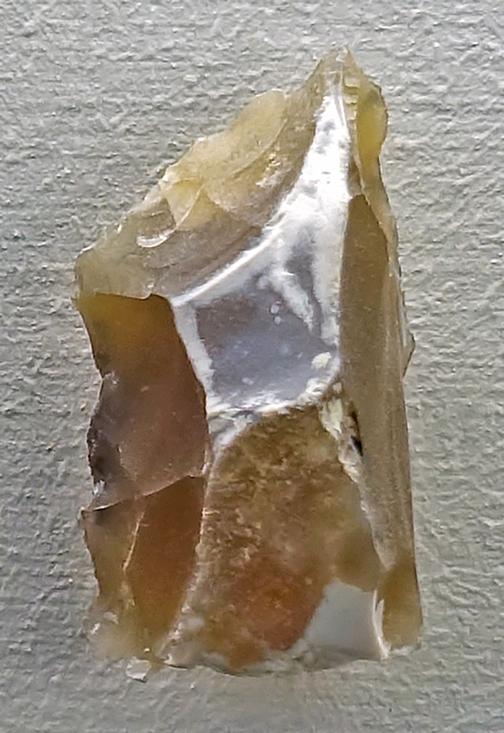
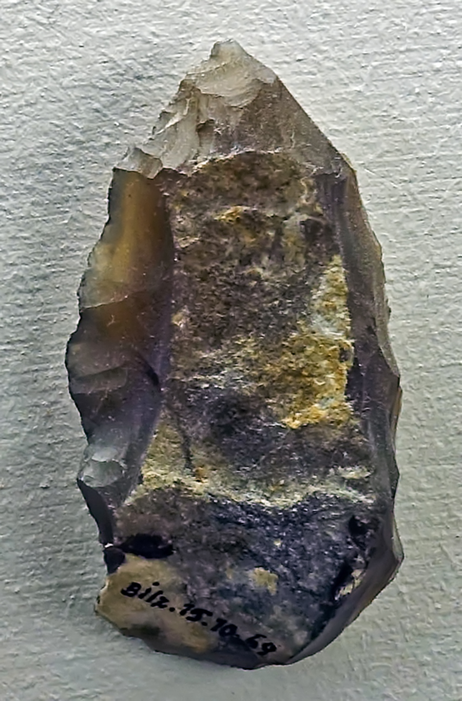
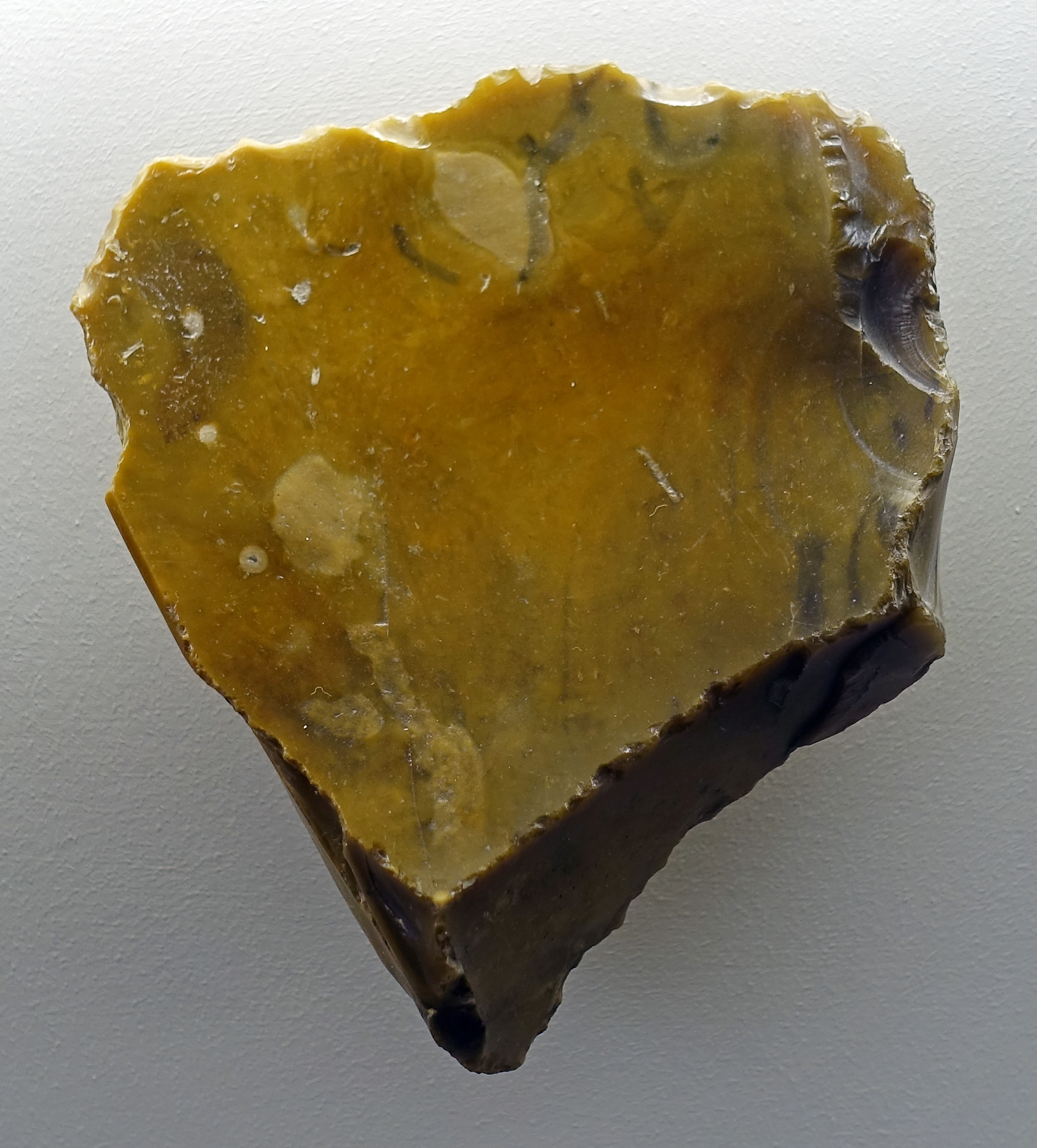
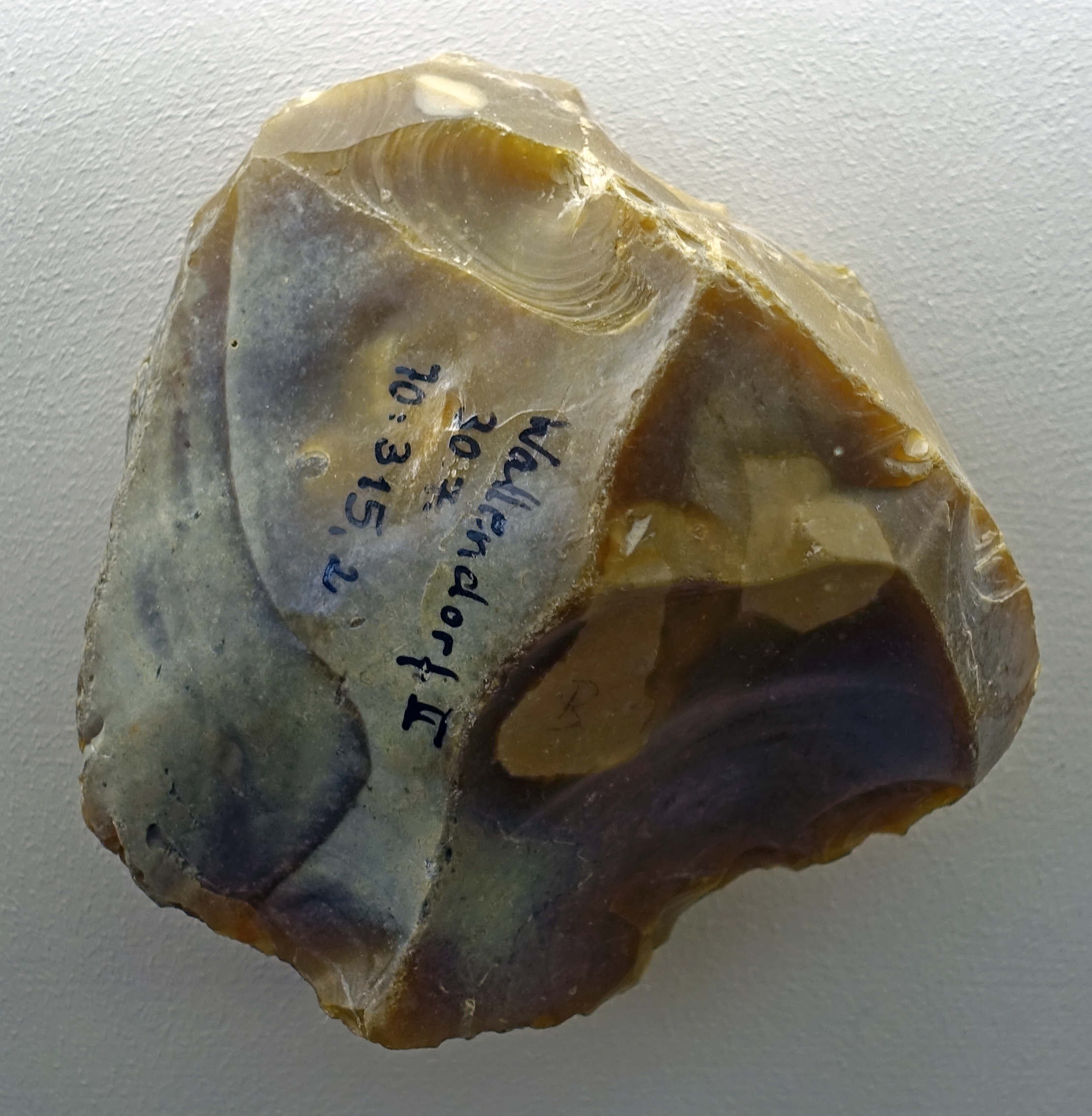
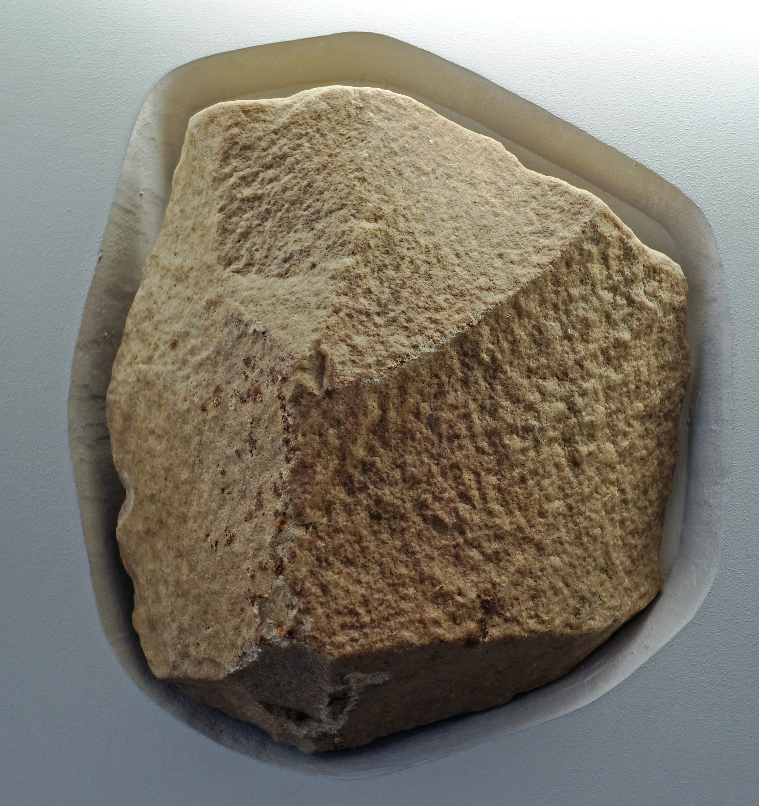
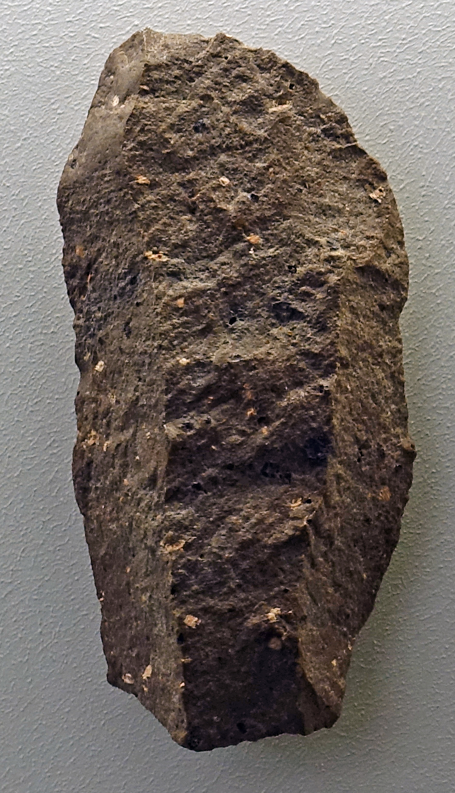
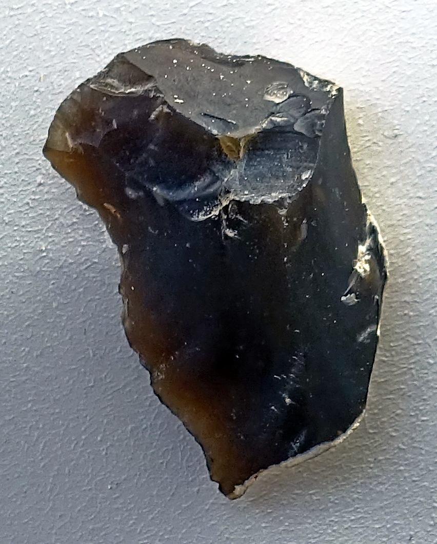
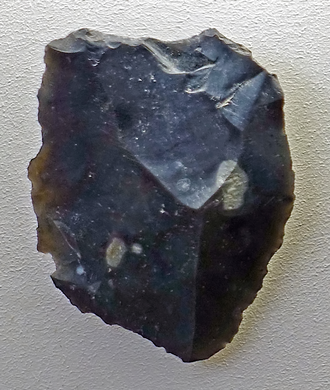
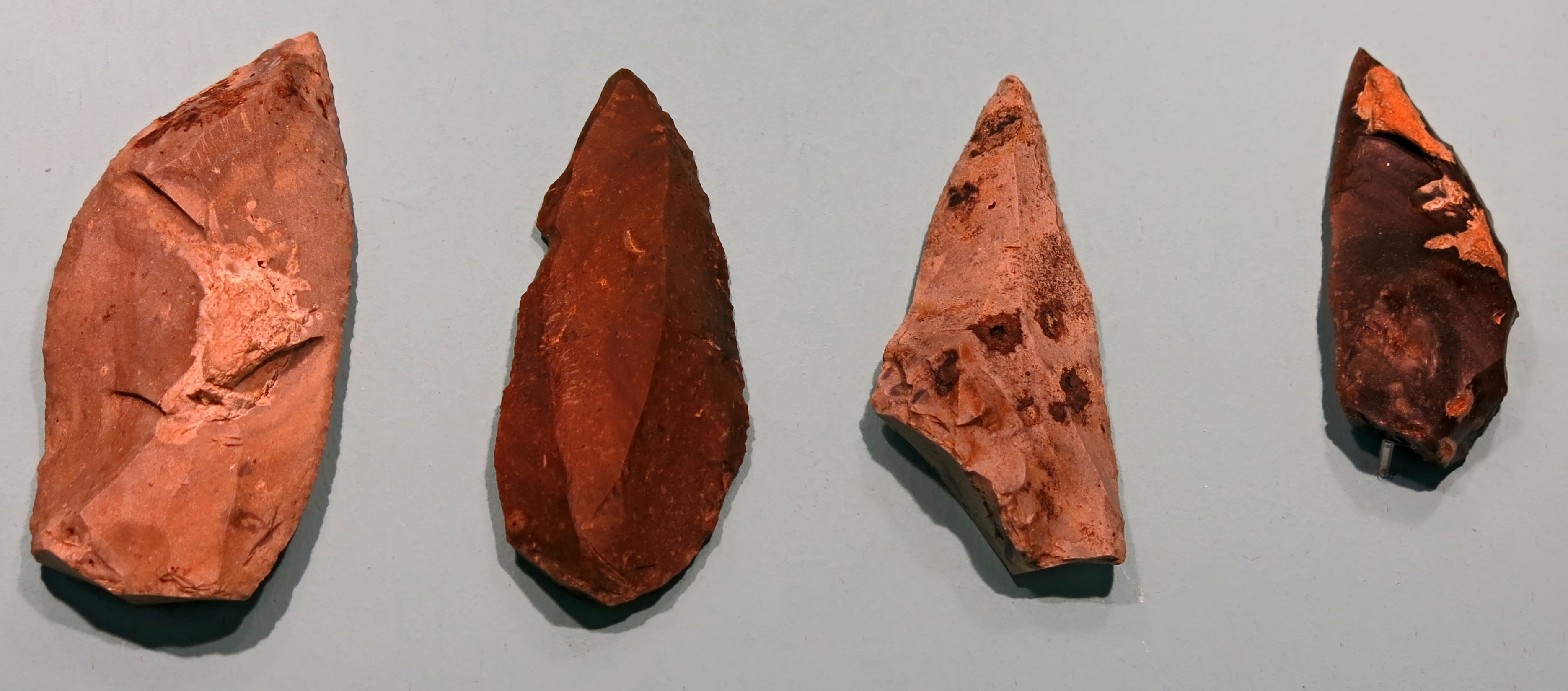
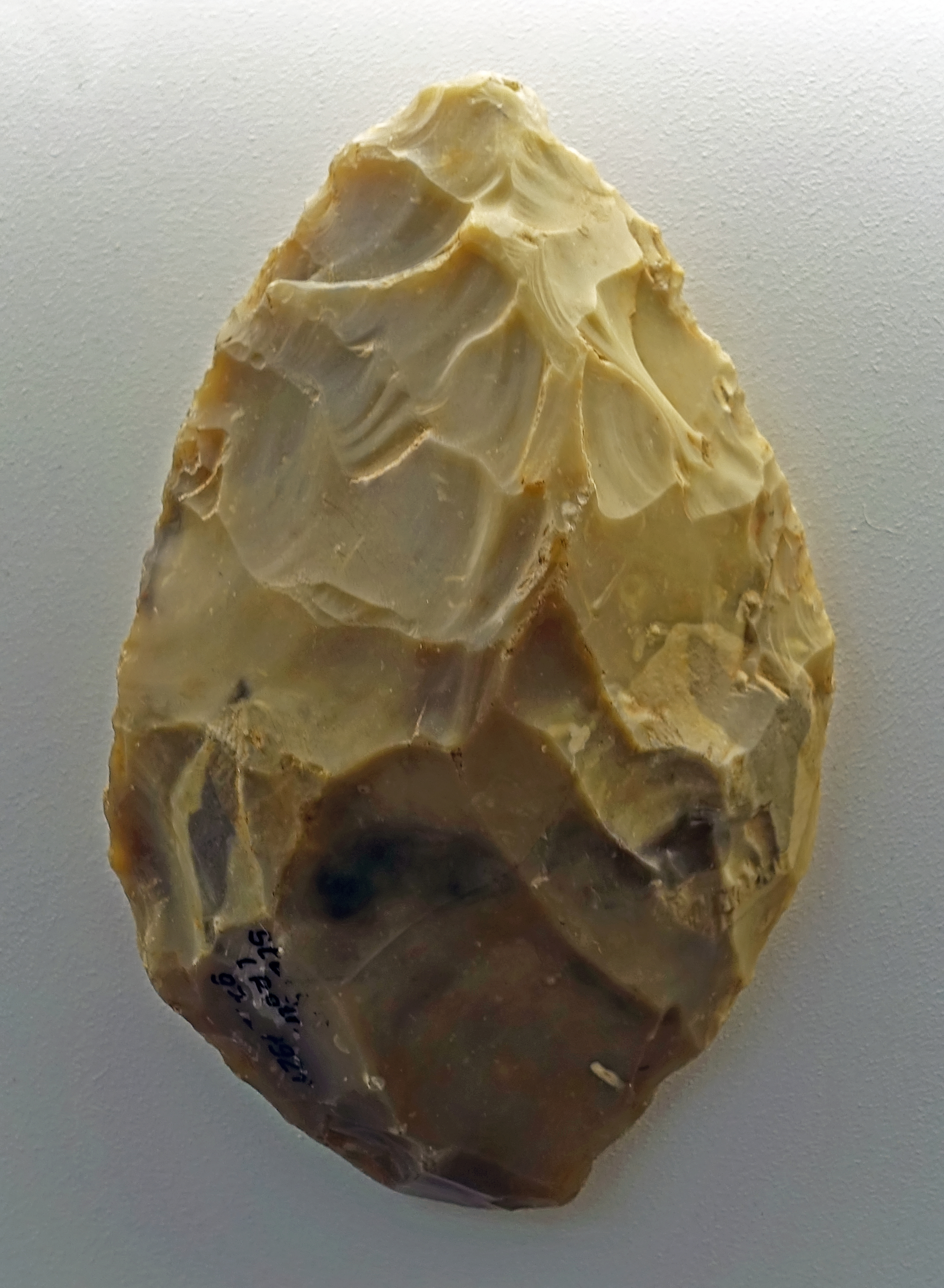
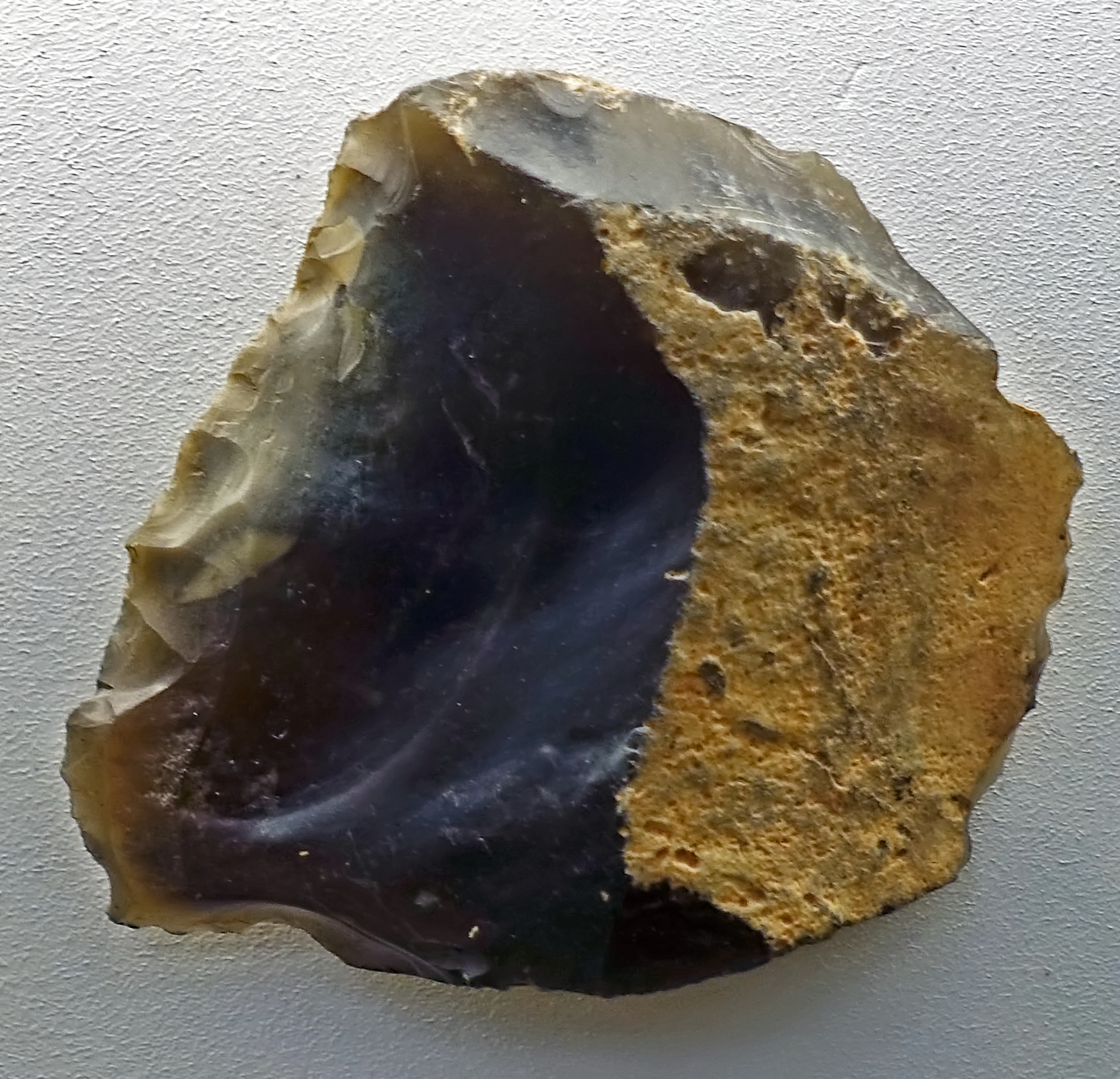
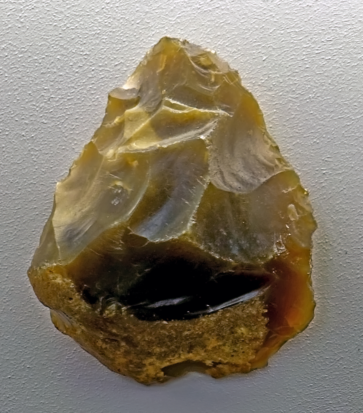
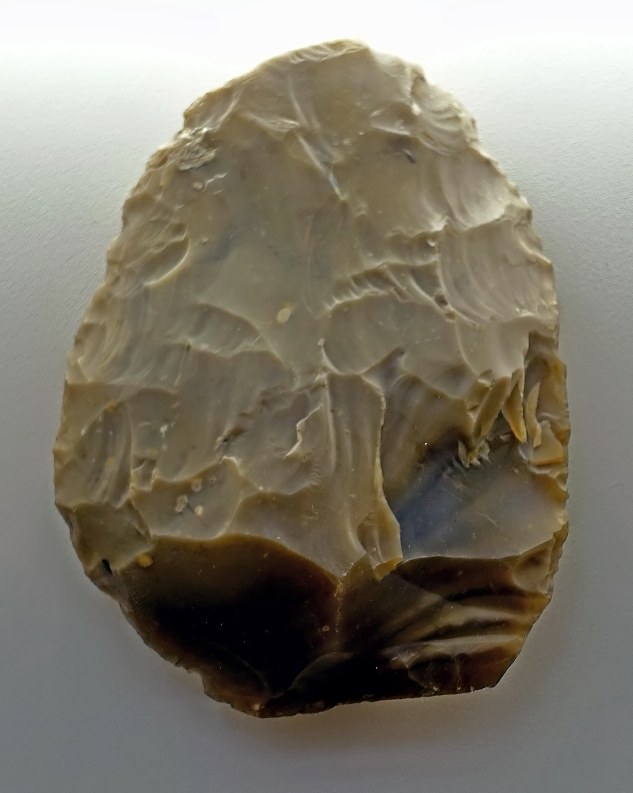
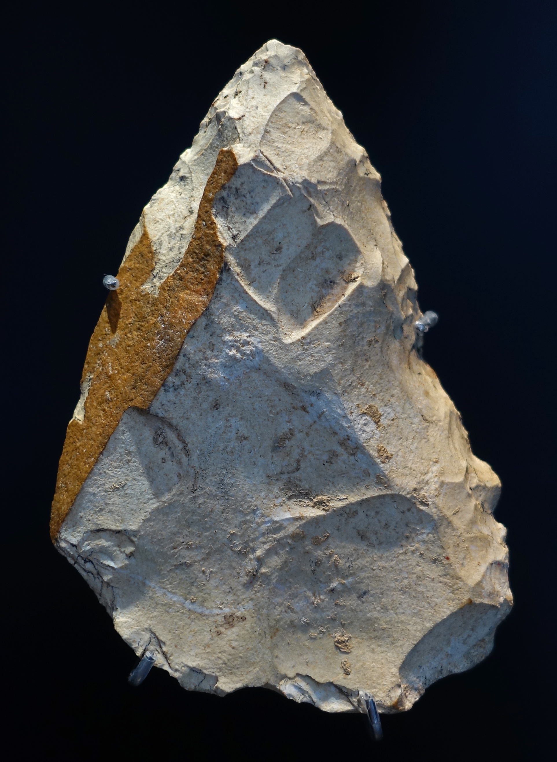
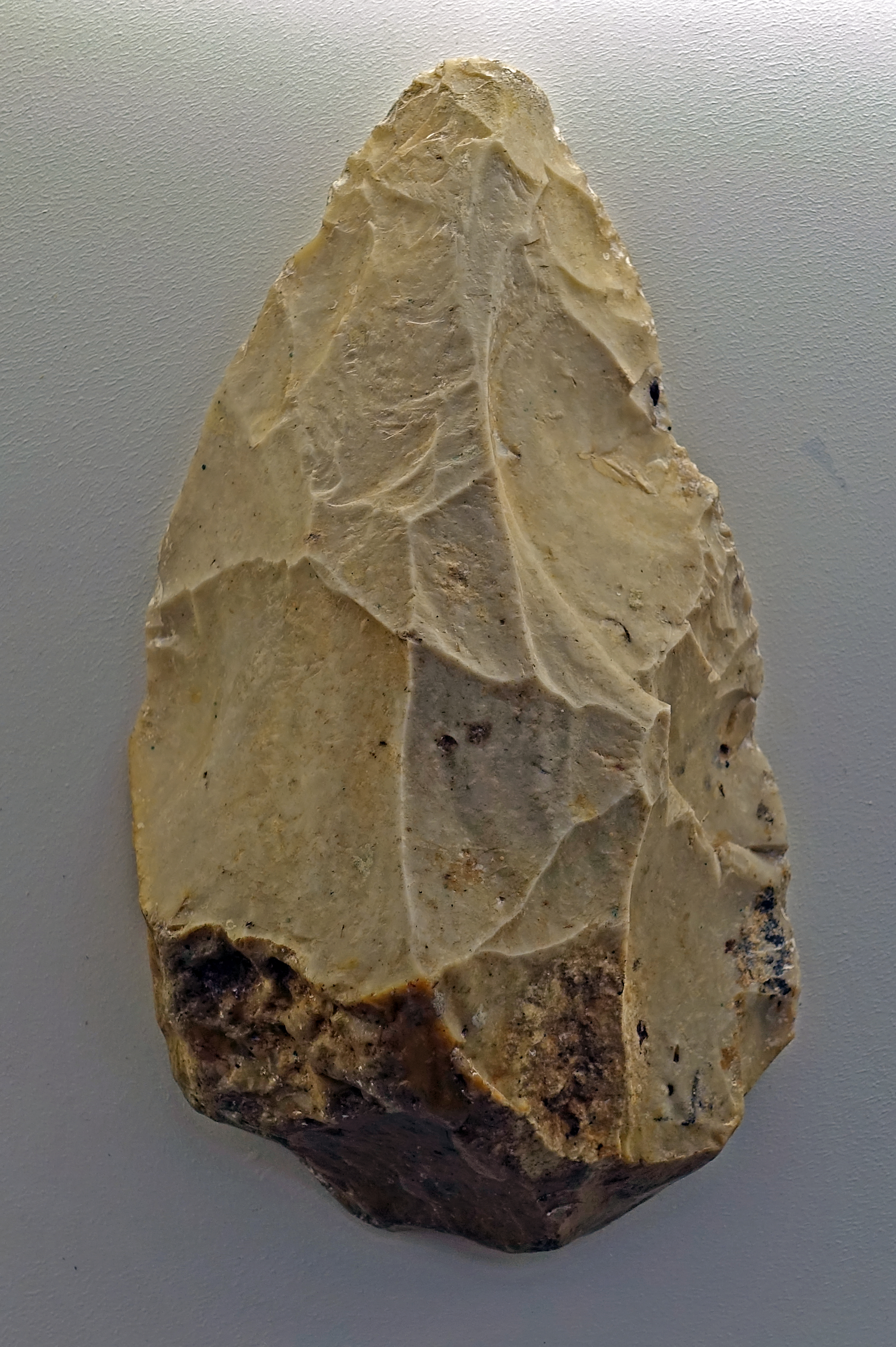
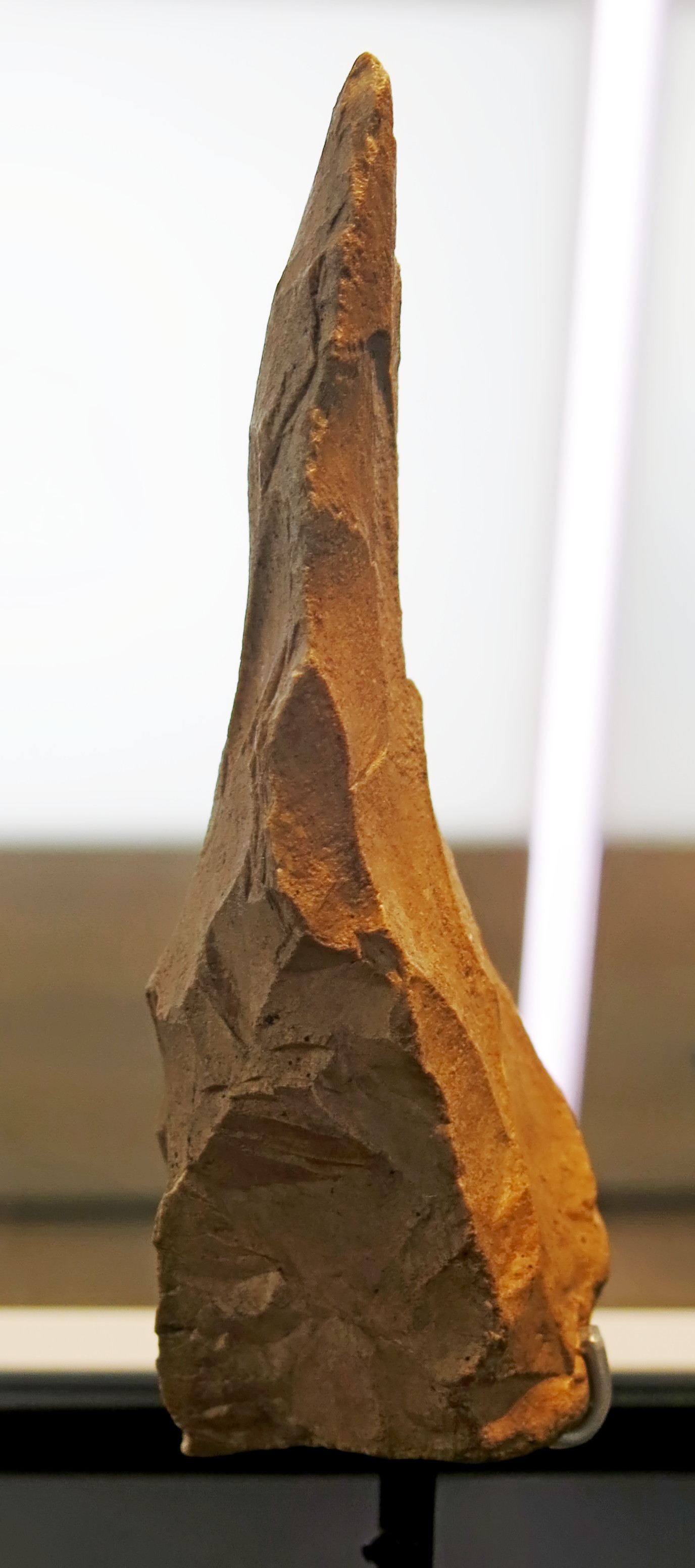
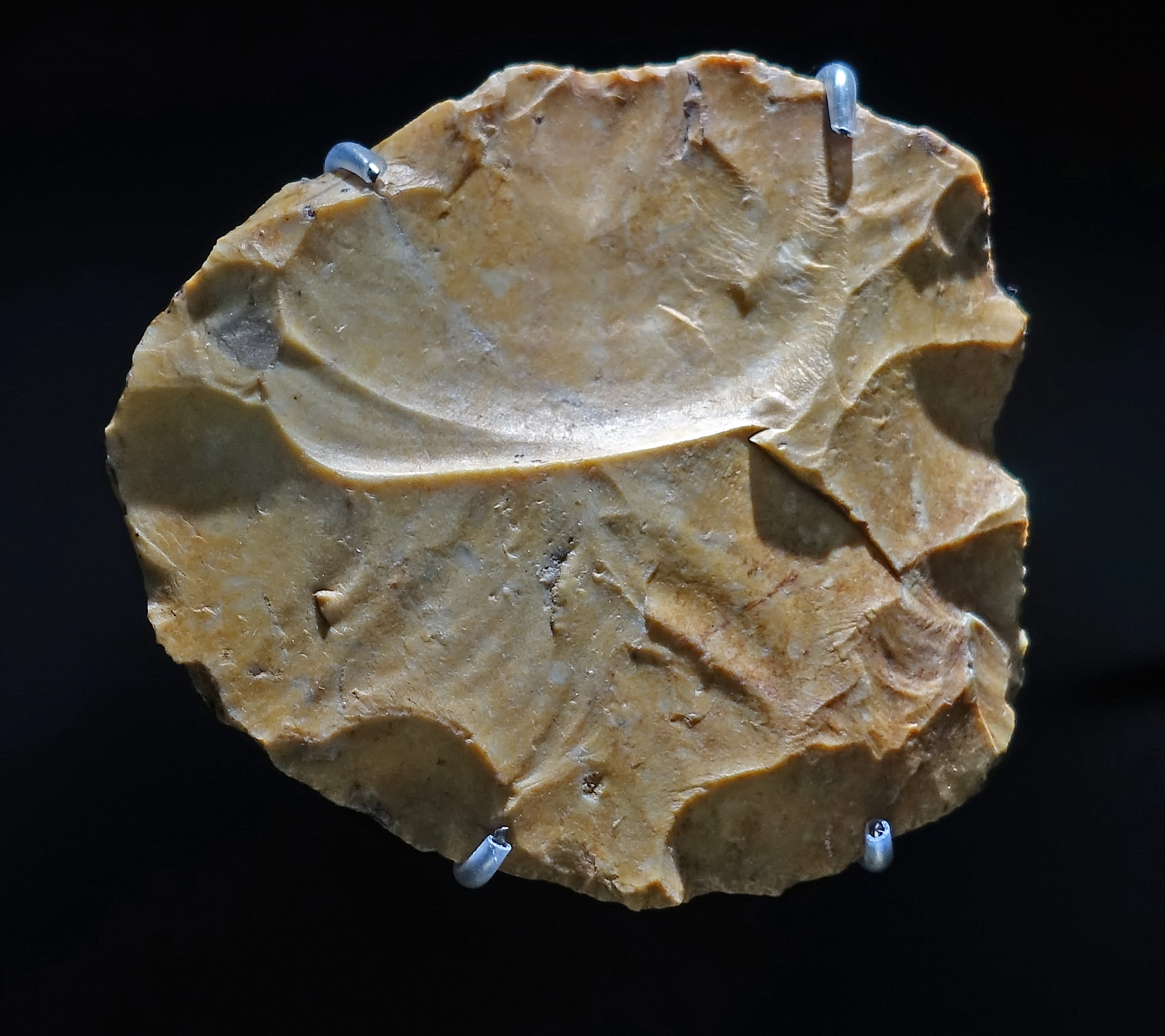
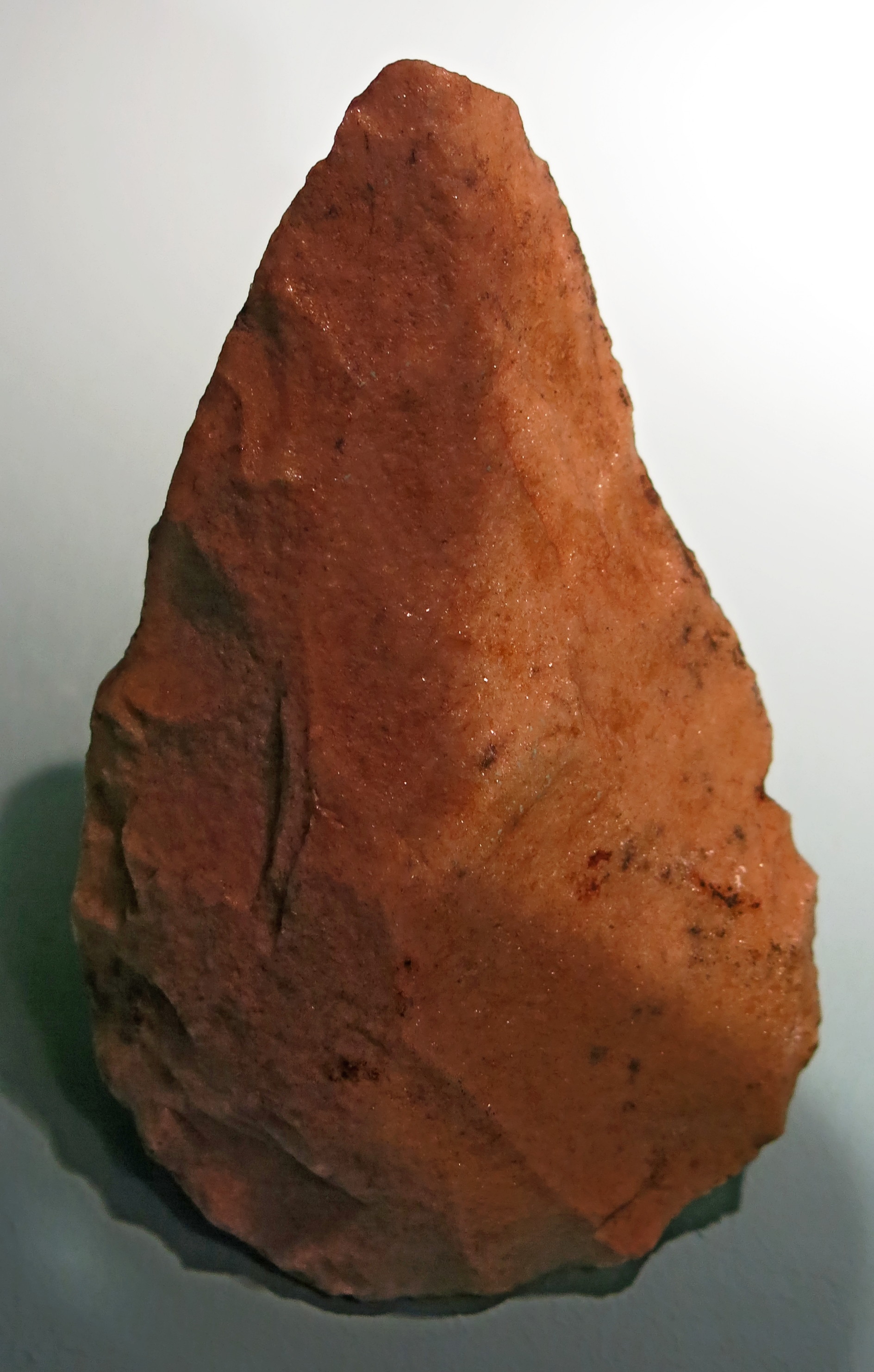
Abschläge, flakes, circa 500 000 BP.
From Memleben, on the Unstrut River, a few kilometres west of Wangen, and approximately 50 km SW of Halle.
Photo: Don Hitchcock 2018
Source and text: Halle Landesmuseum für Vorgeschichte, CC-BY-NC-SA @ State Museum of Prehistory Halle
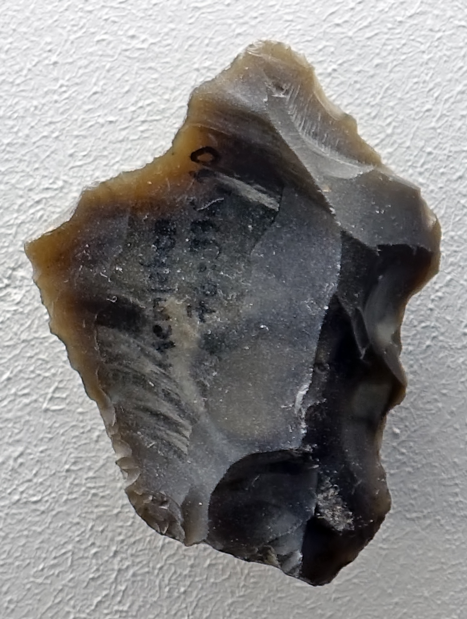
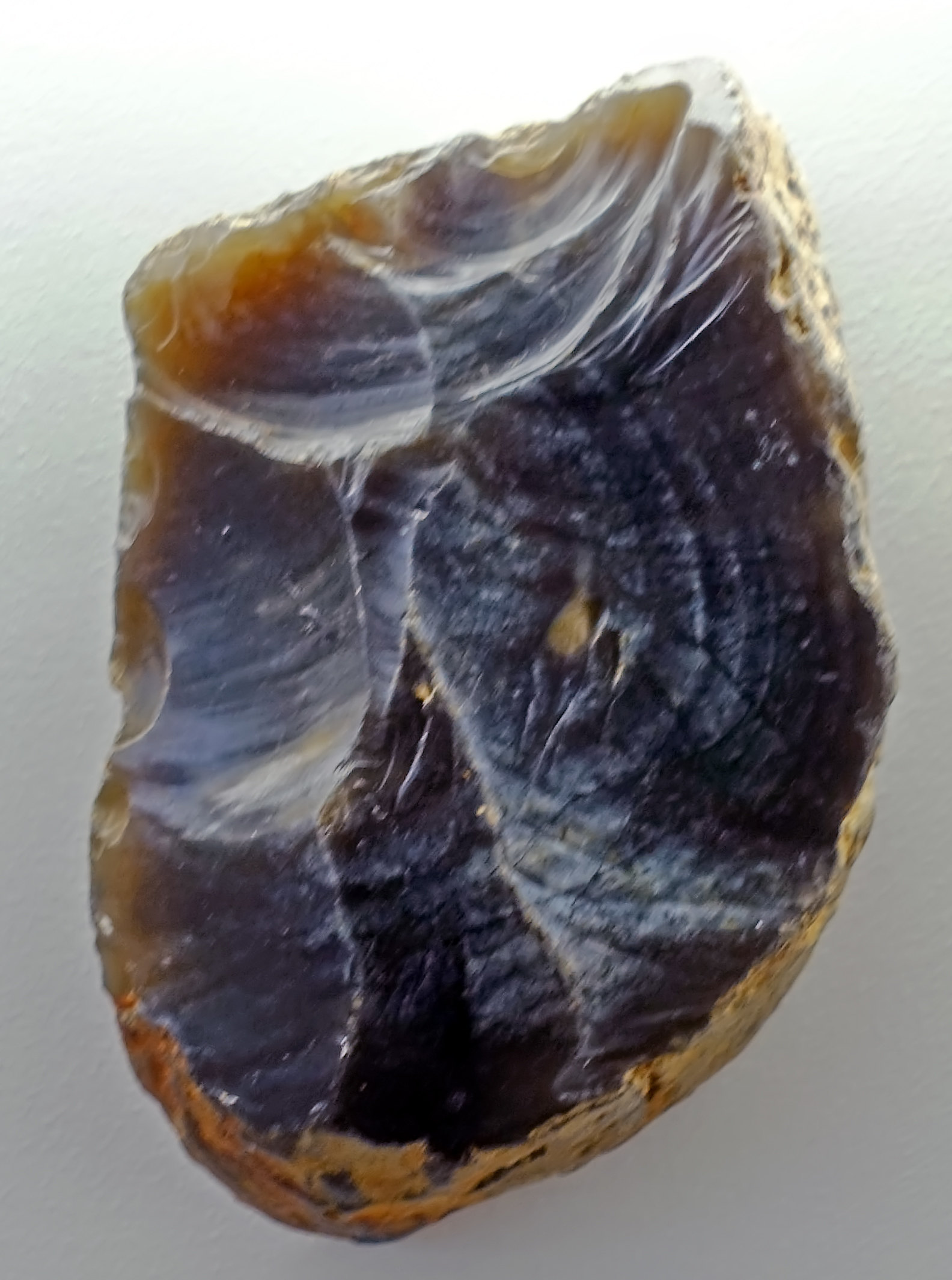
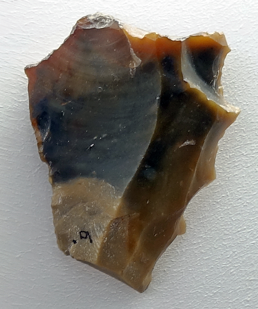
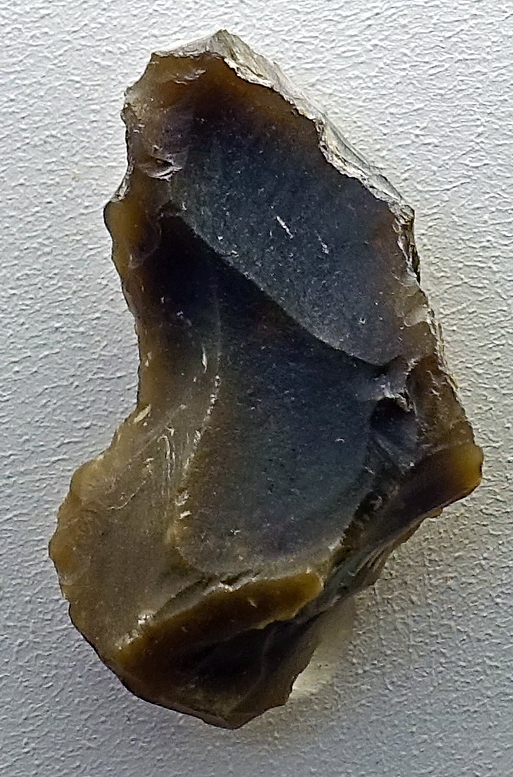
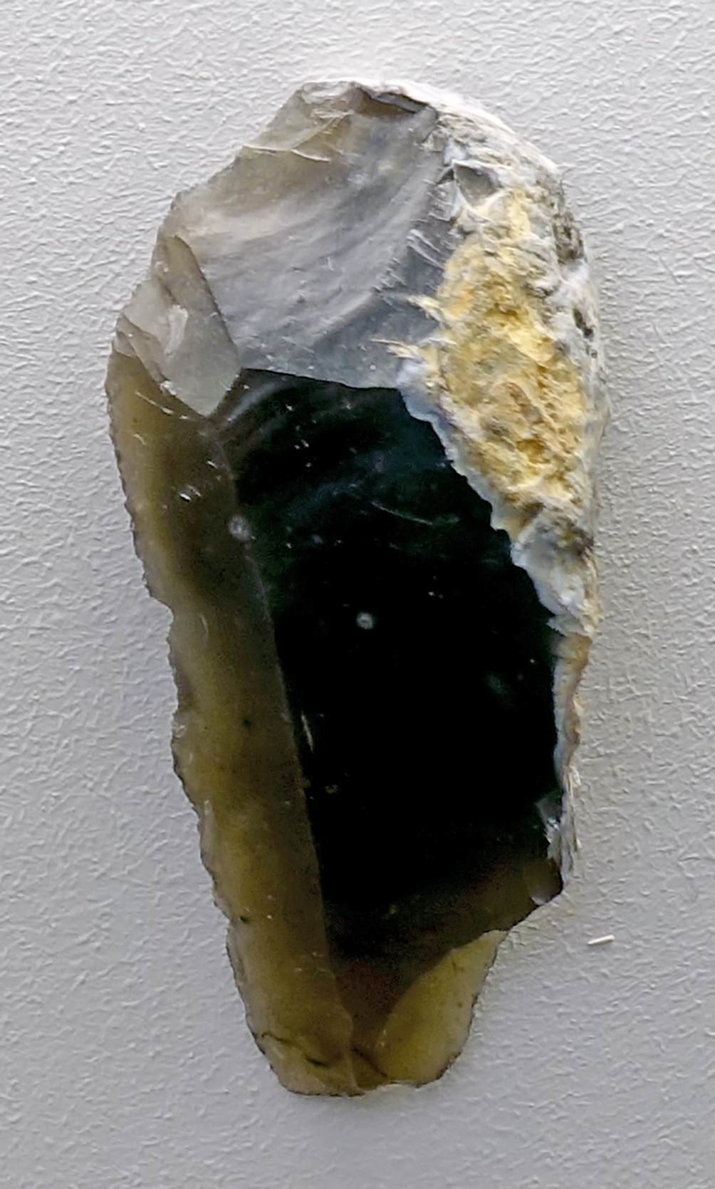
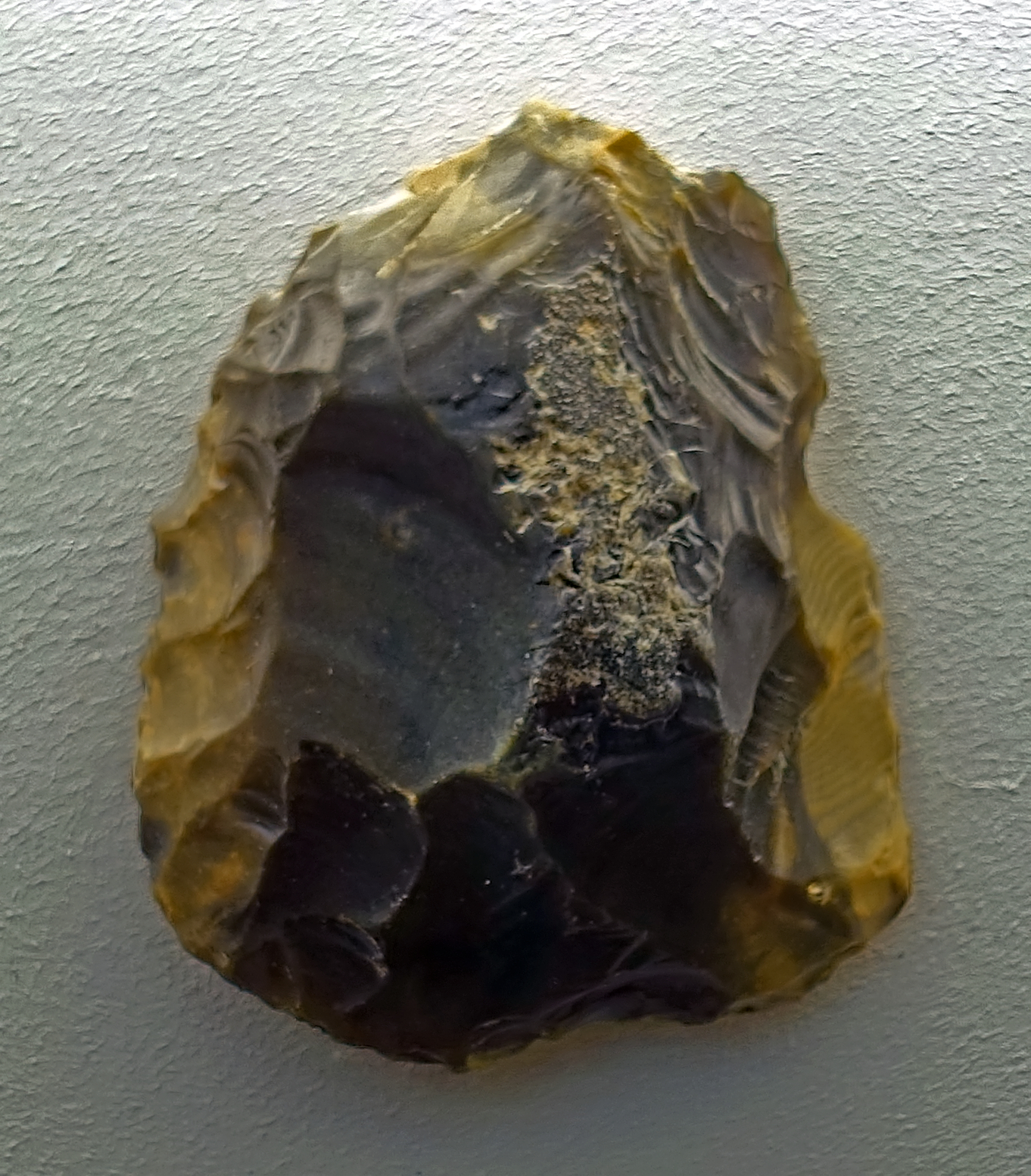
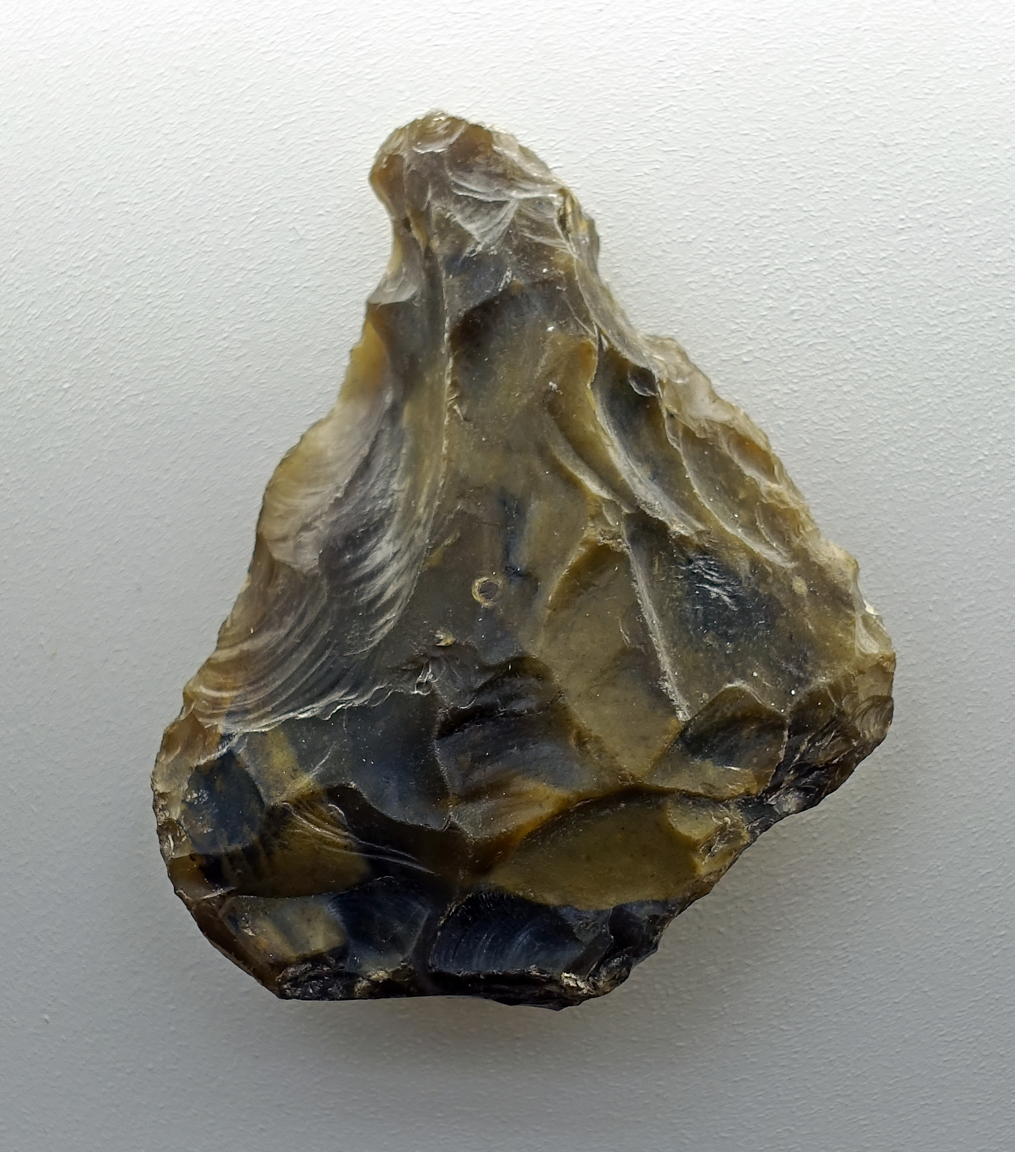
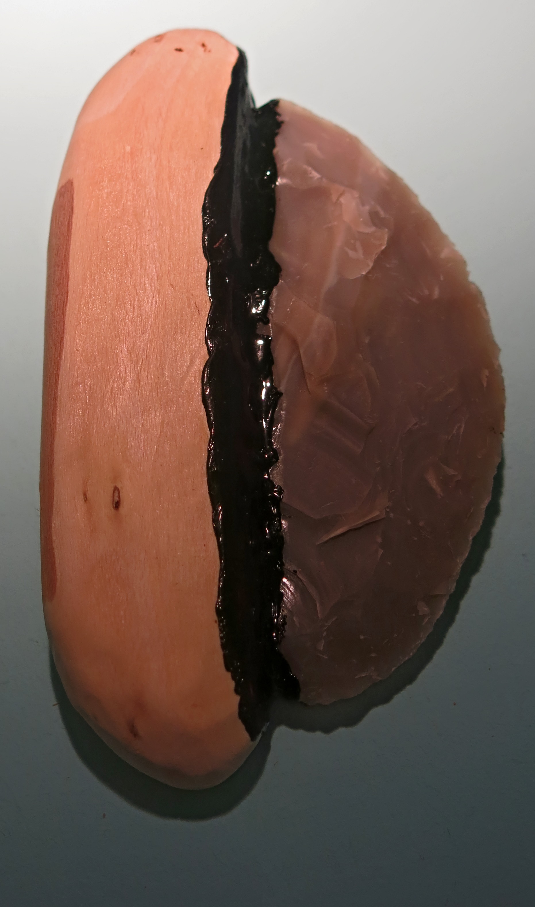
Abschläge, flakes, circa 500 000 BP.
From Memleben, on the Unstrut River, a few kilometres west of Wangen, and approximately 50 km SW of Halle.
Photo: Don Hitchcock 2018
Source and text: Halle Landesmuseum für Vorgeschichte, CC-BY-NC-SA @ State Museum of Prehistory Halle
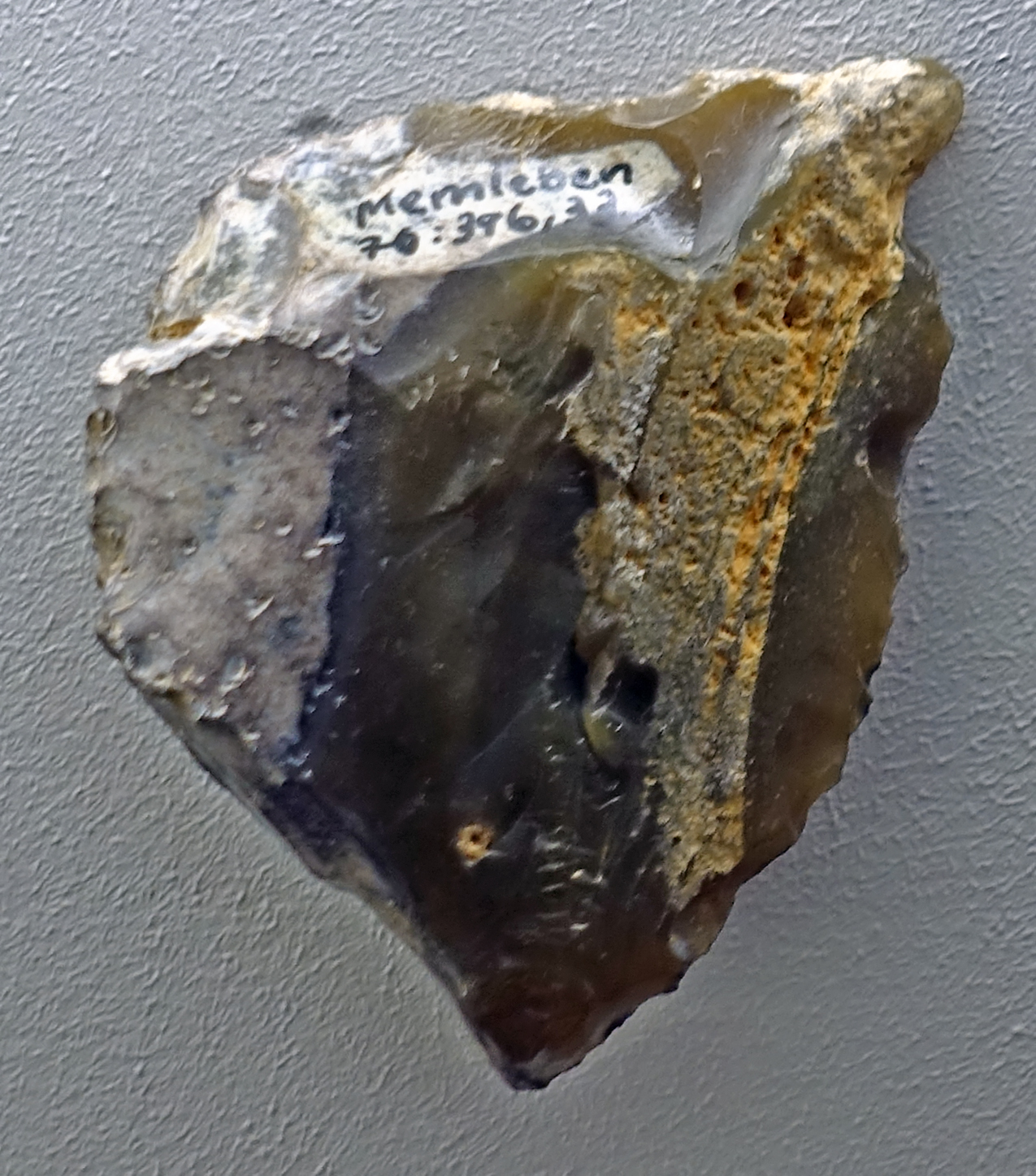
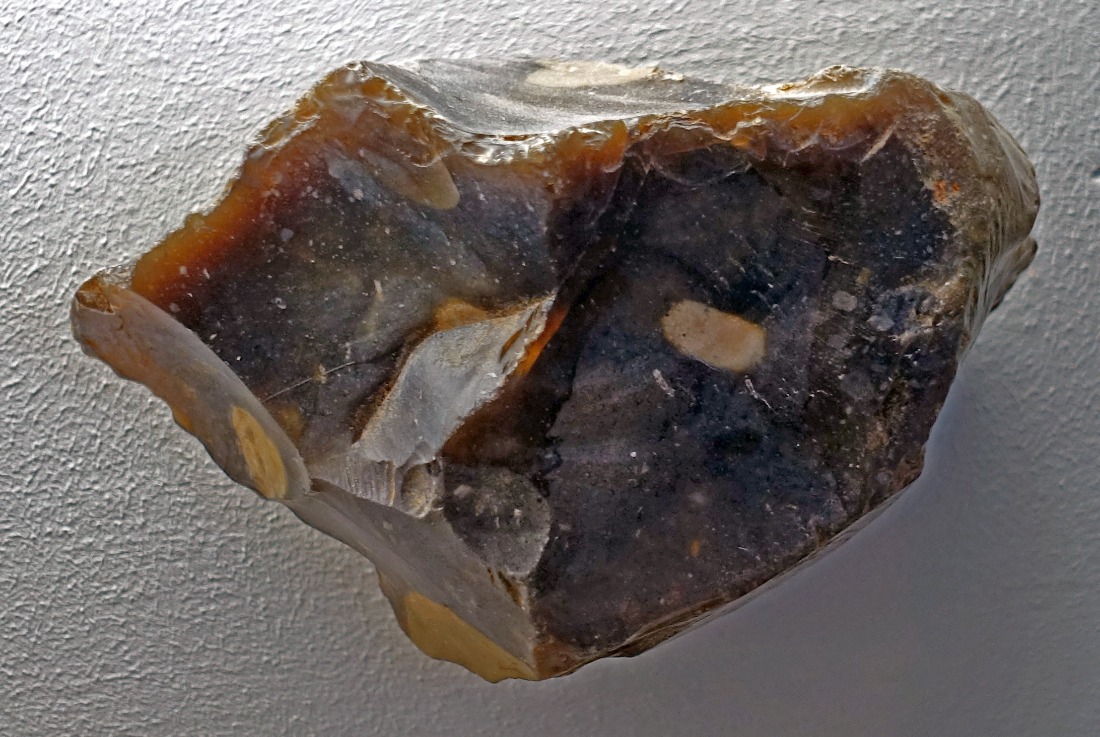
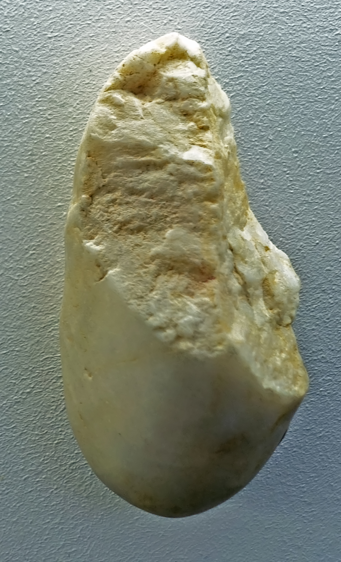
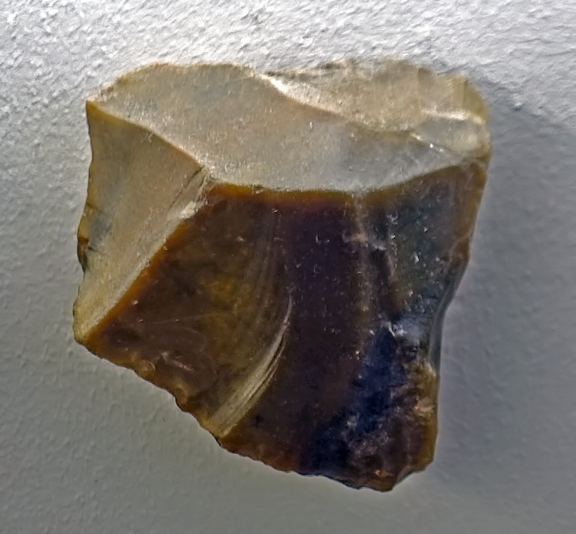
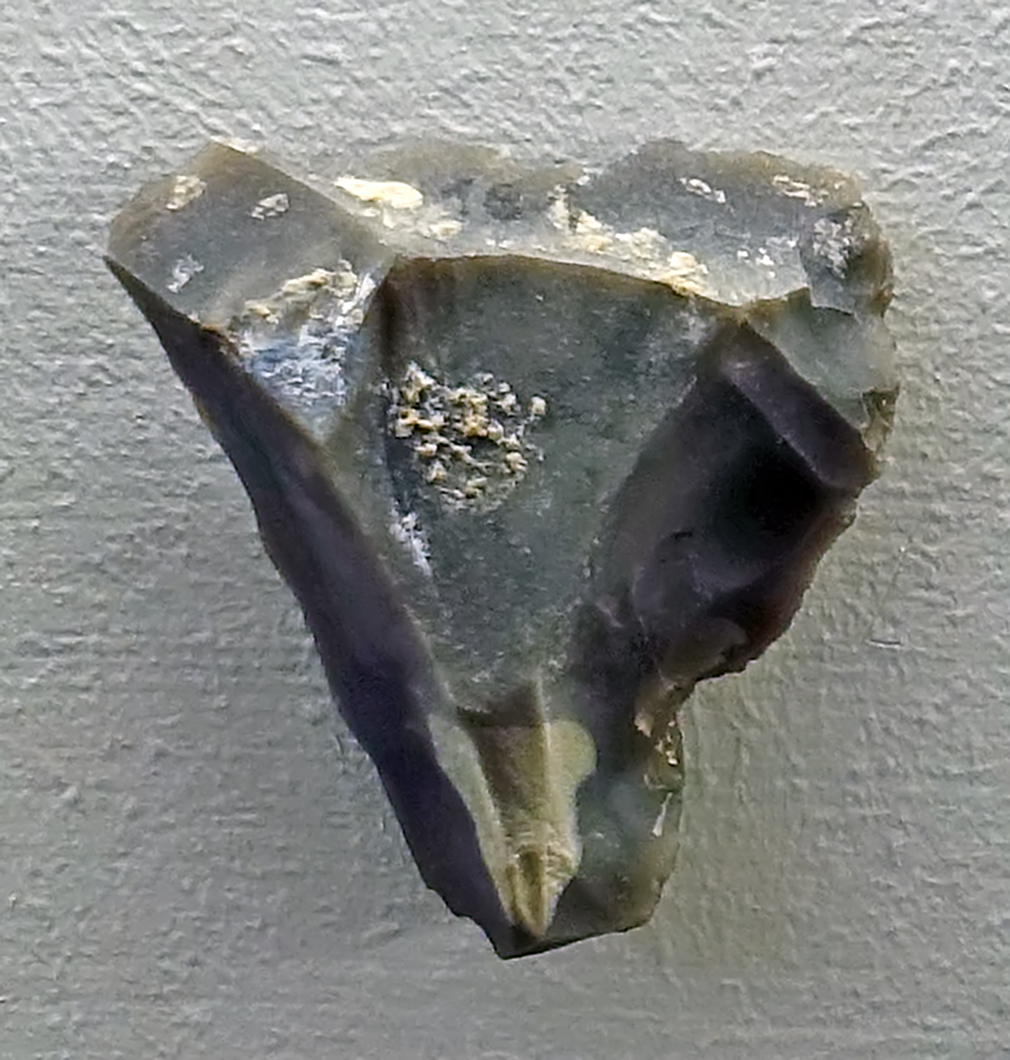
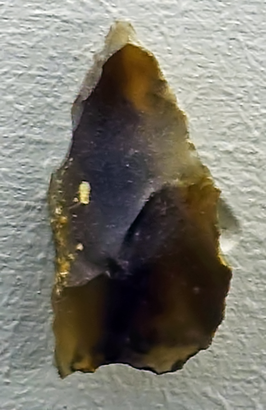
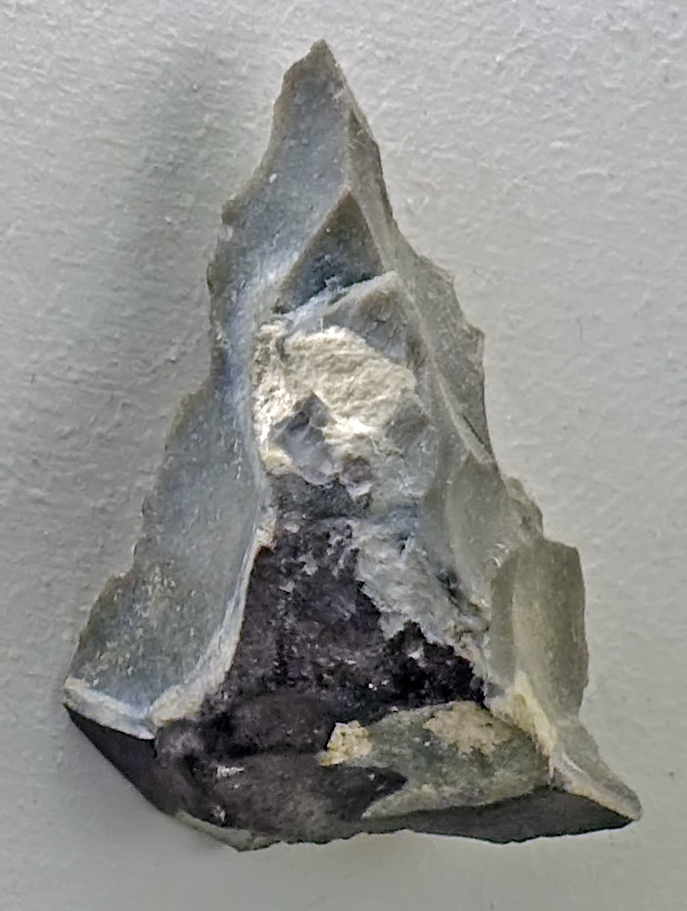
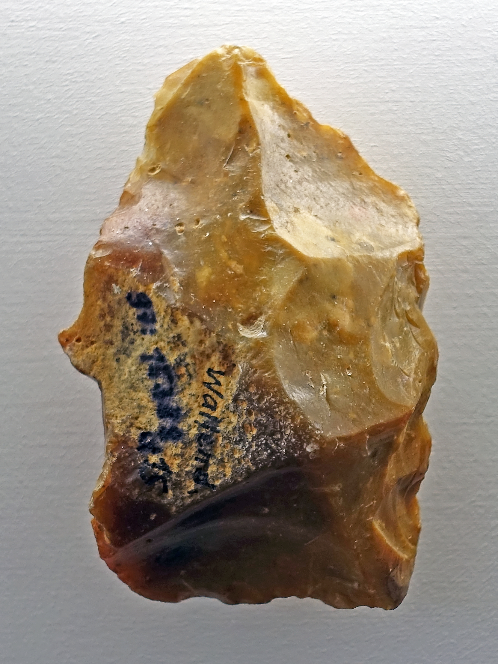
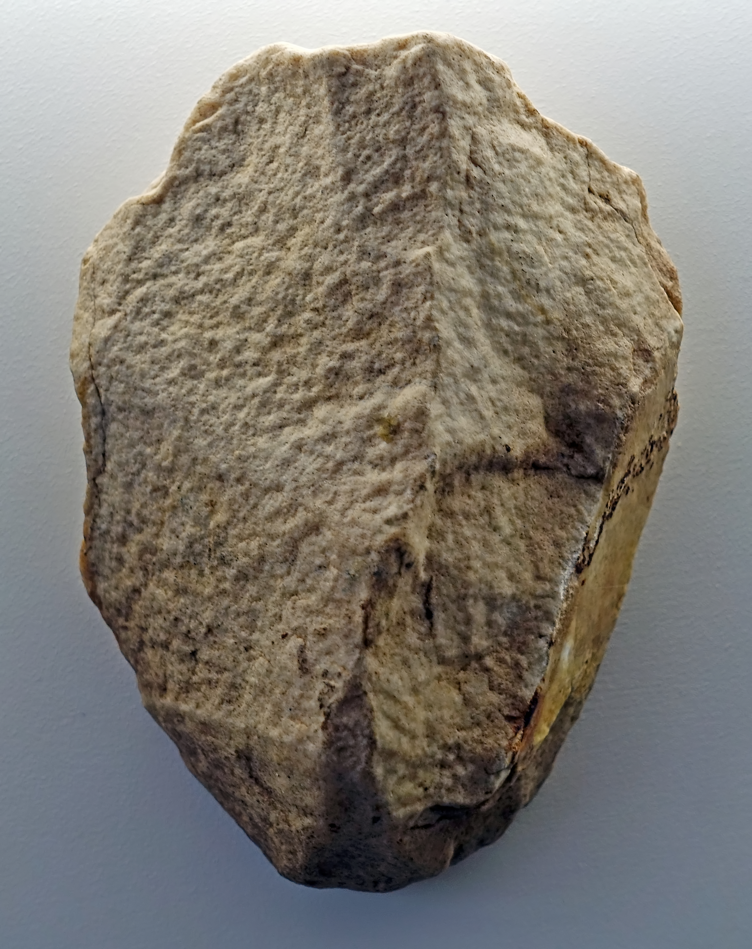
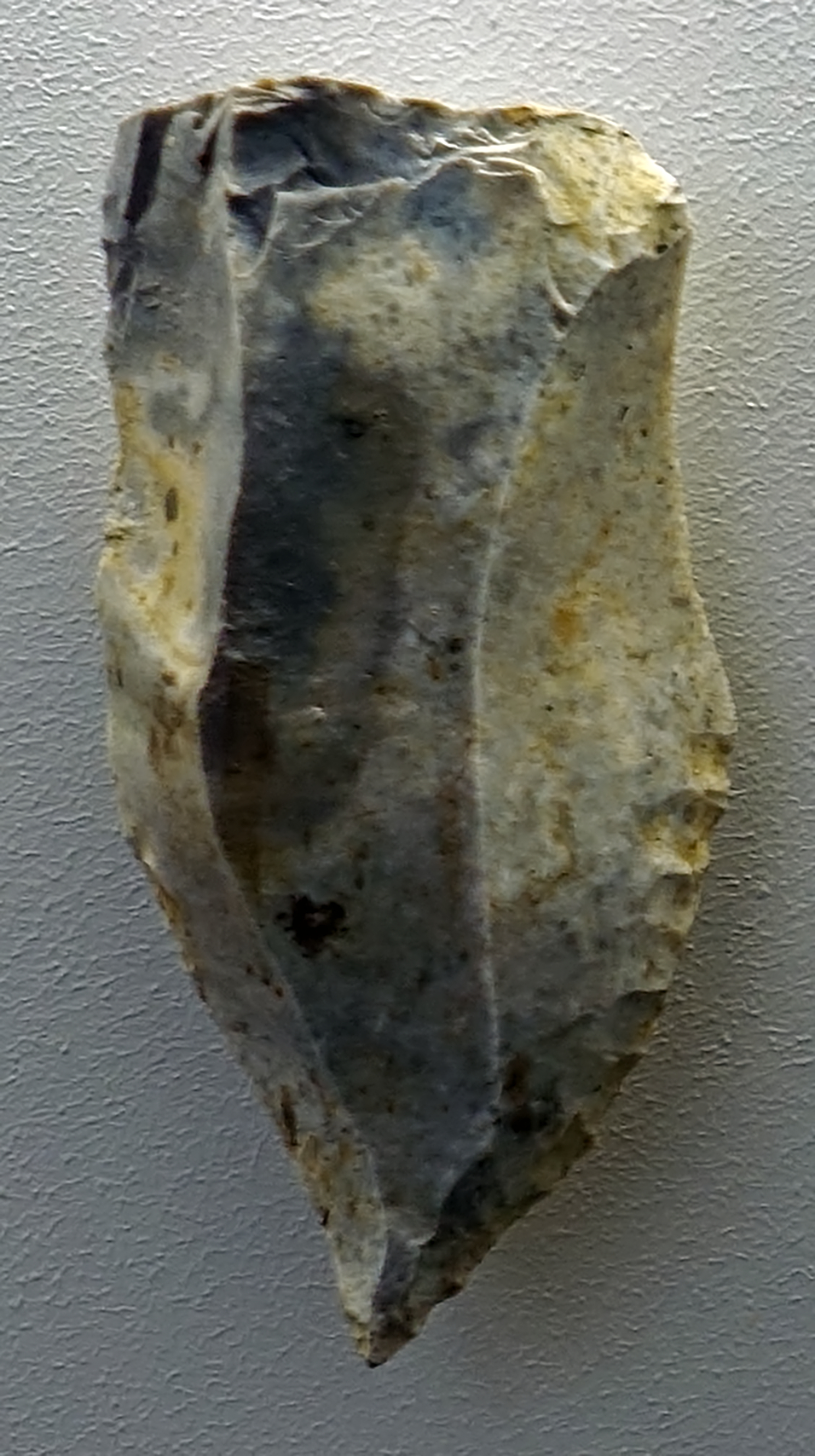
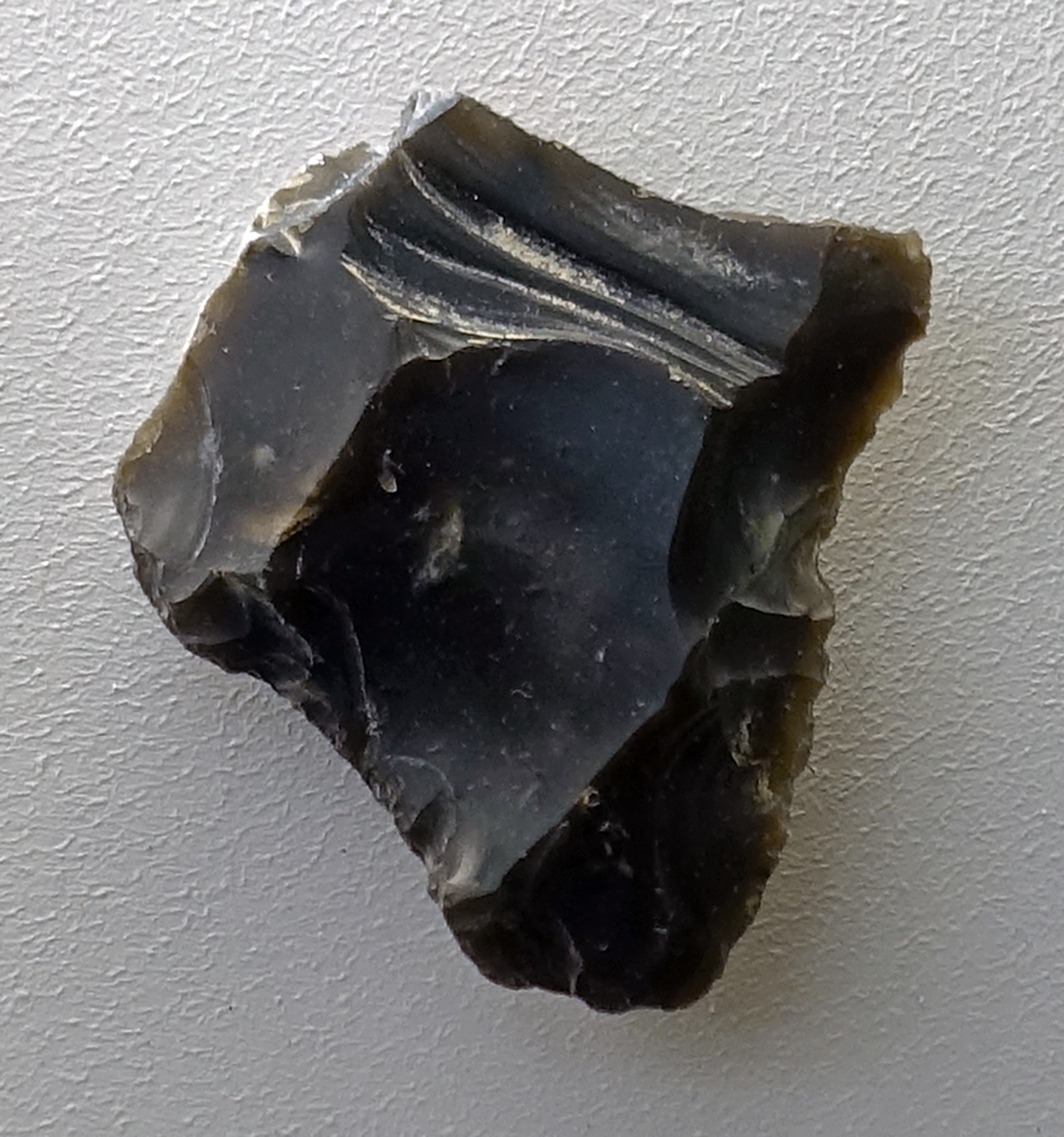
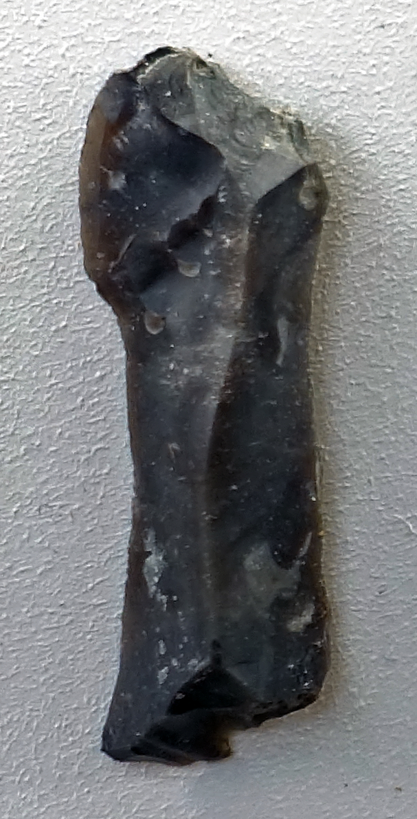
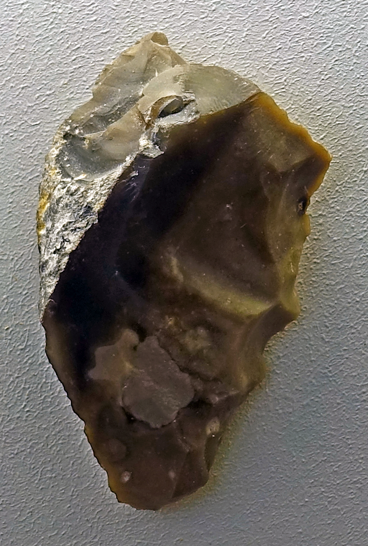
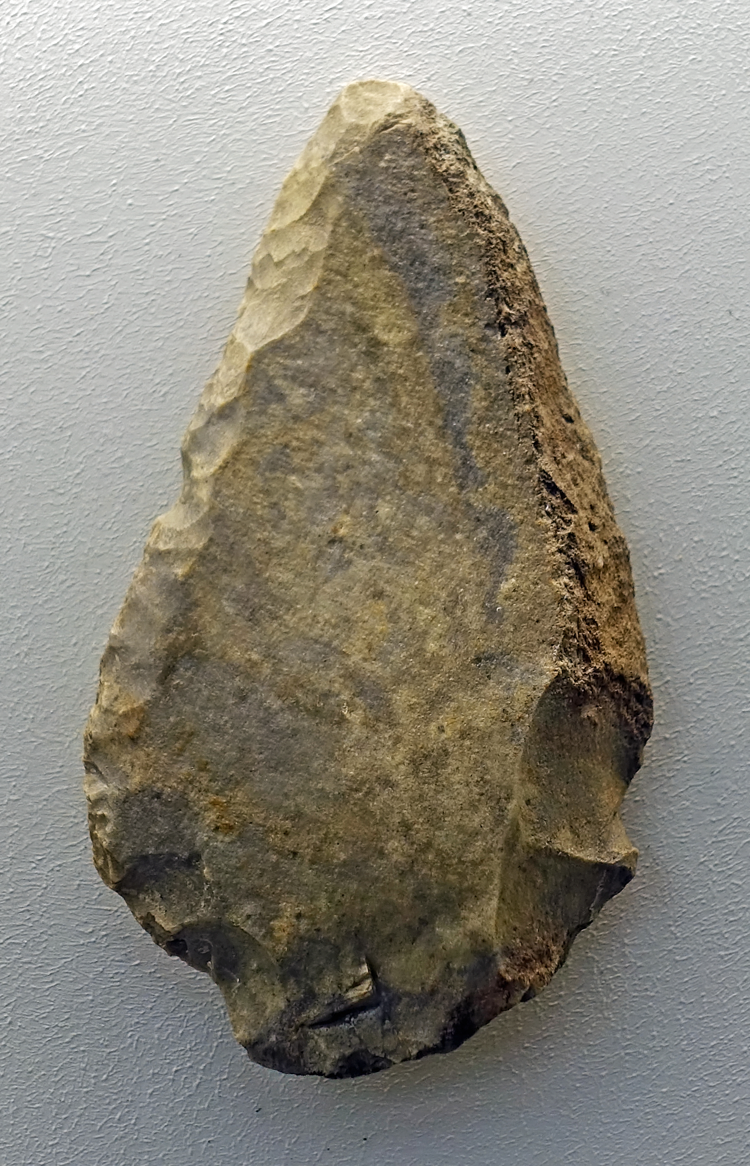
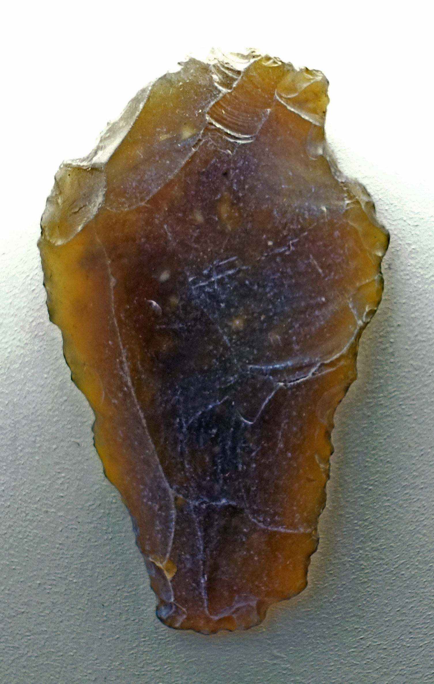
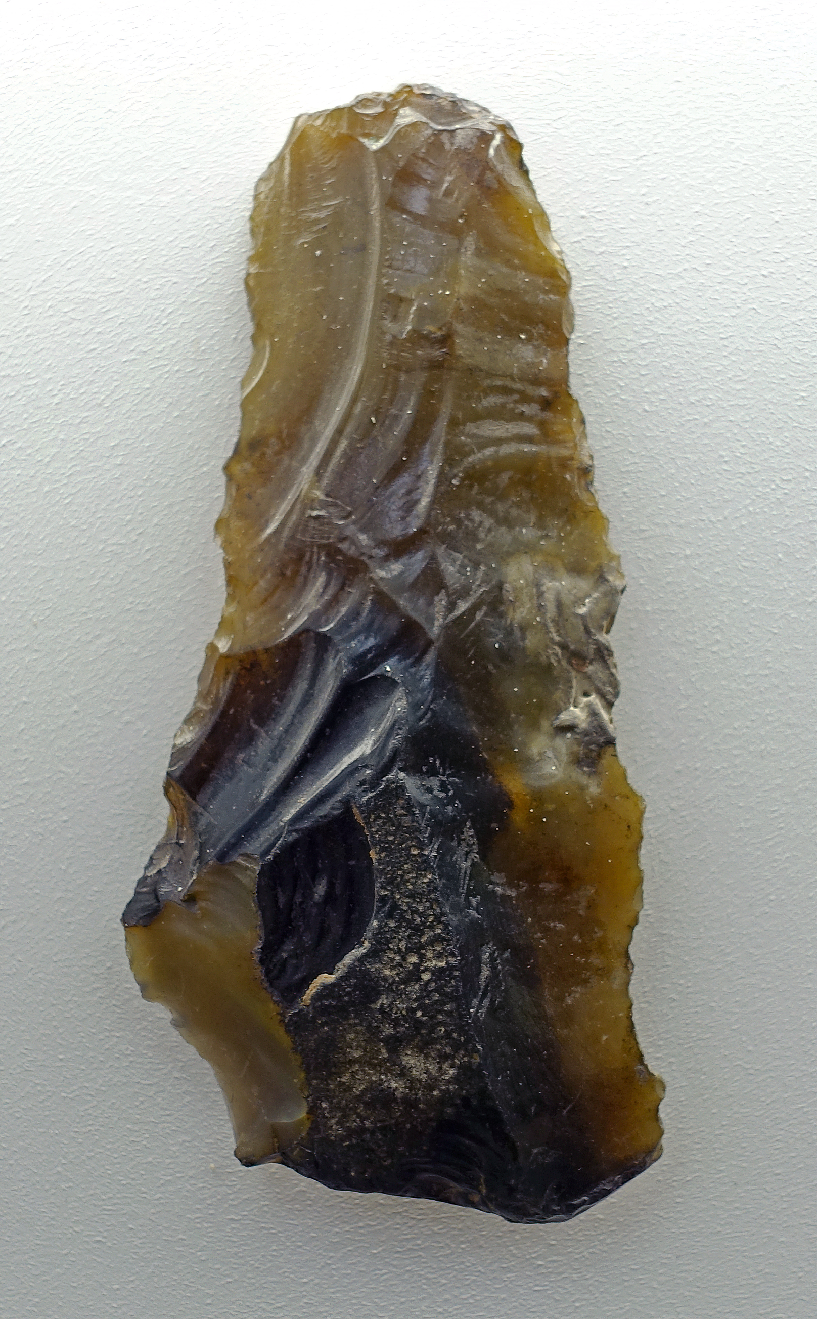
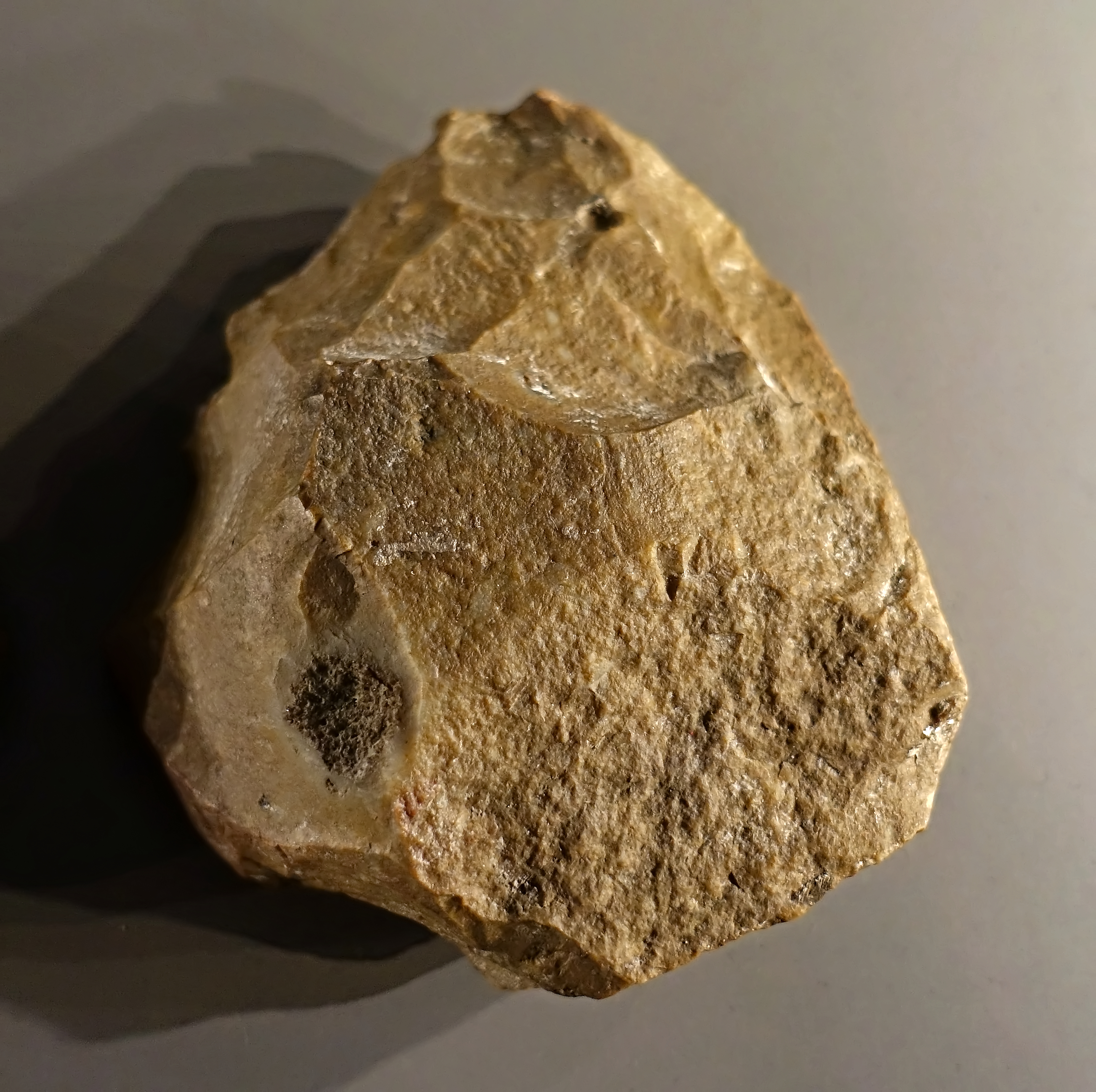
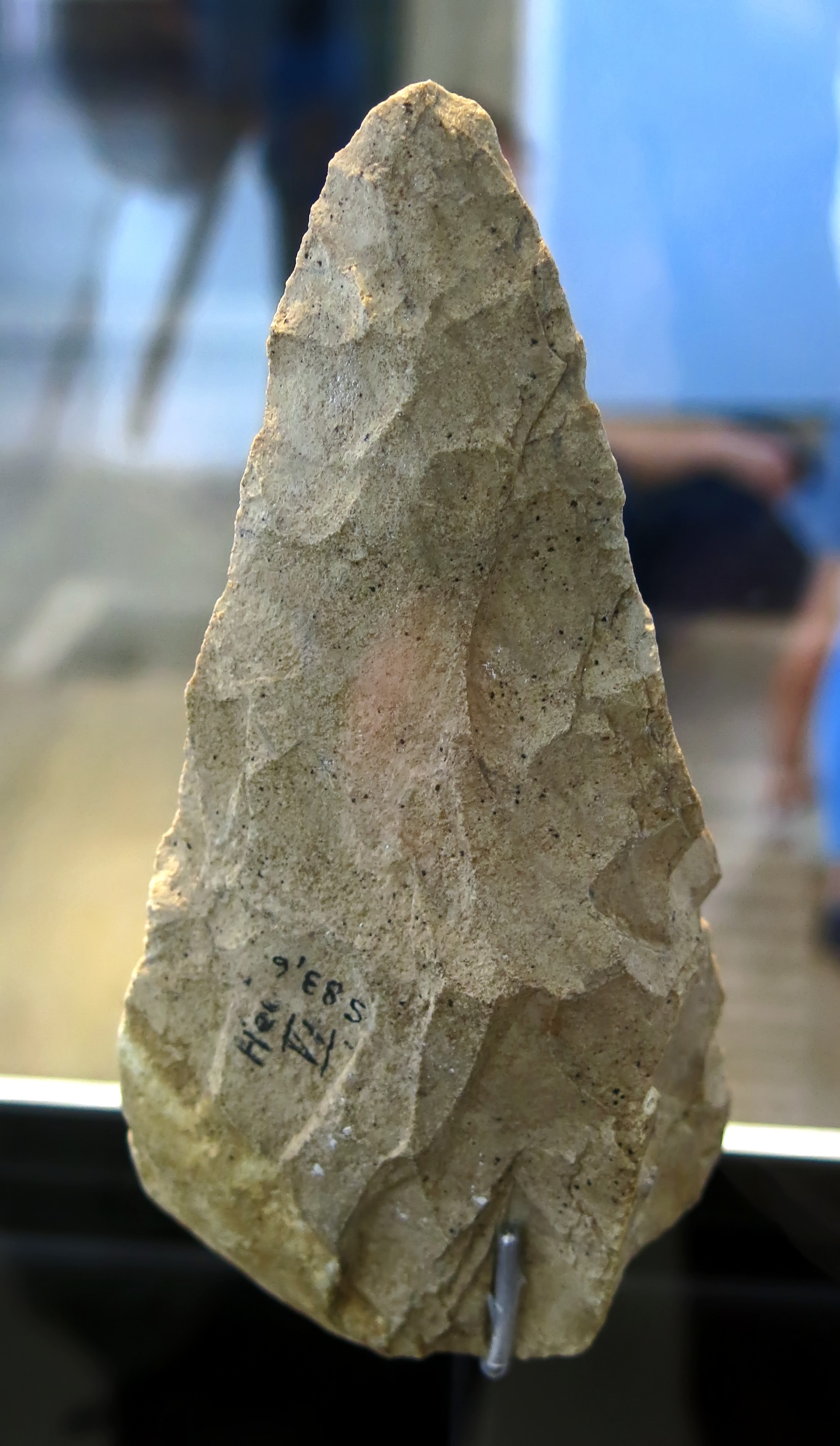
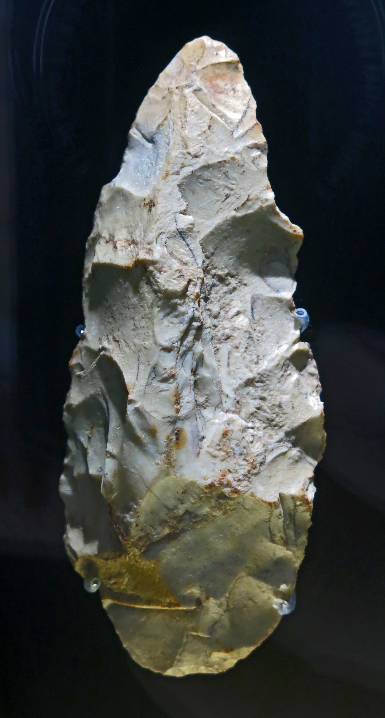
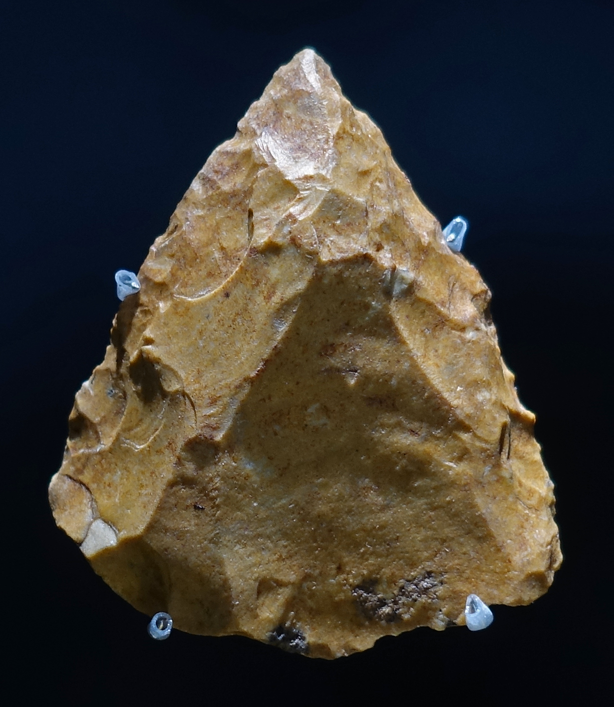
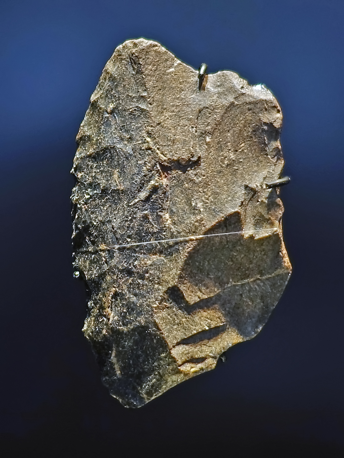
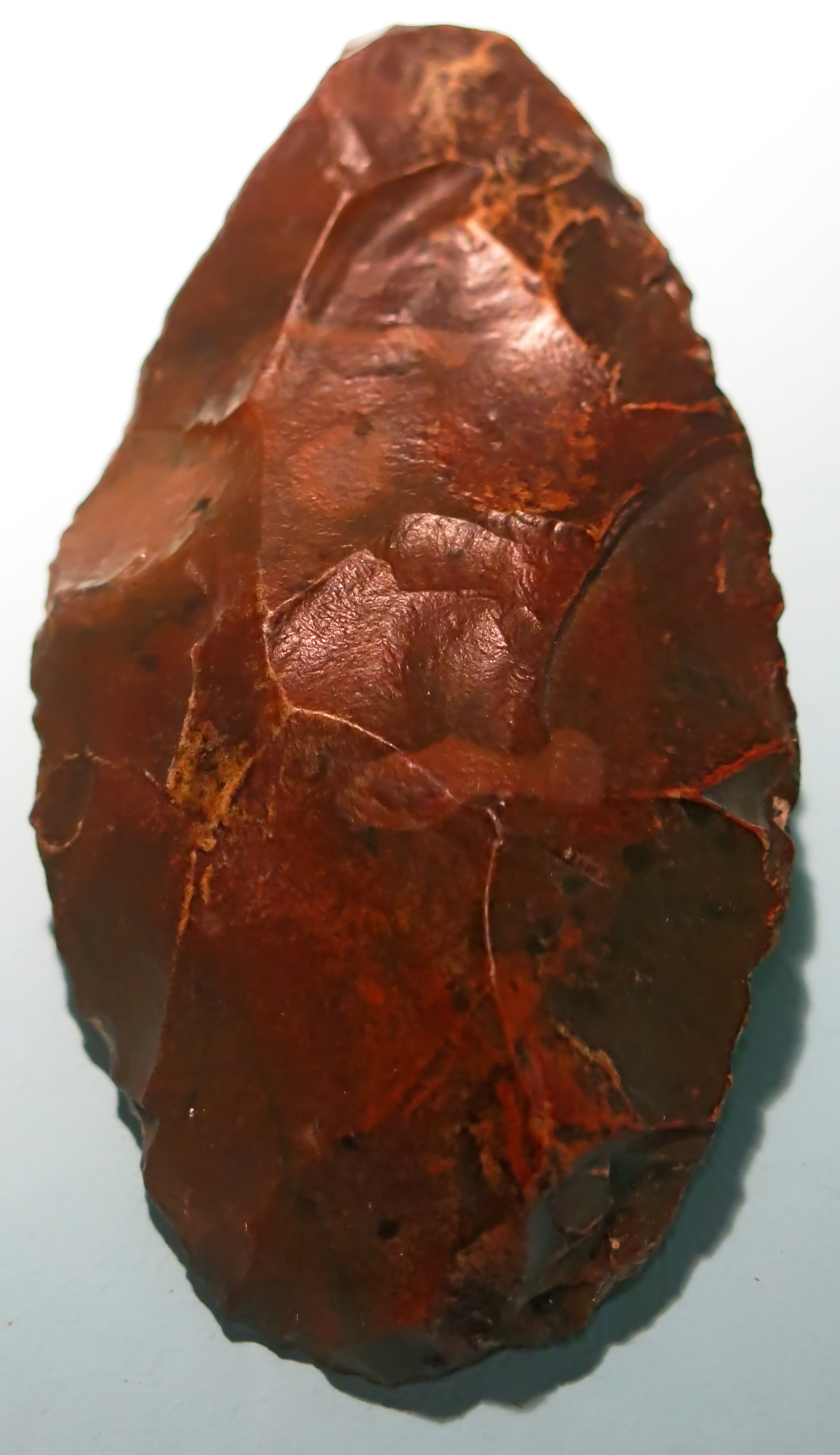
Abschlaggerät, tool on a flake, circa 500 000 BP.
From Memleben, on the Unstrut River, a few kilometres west of Wangen, and approximately 50 km SW of Halle.
Photo: Don Hitchcock 2018
Source and text: Halle Landesmuseum für Vorgeschichte, CC-BY-NC-SA @ State Museum of Prehistory Halle

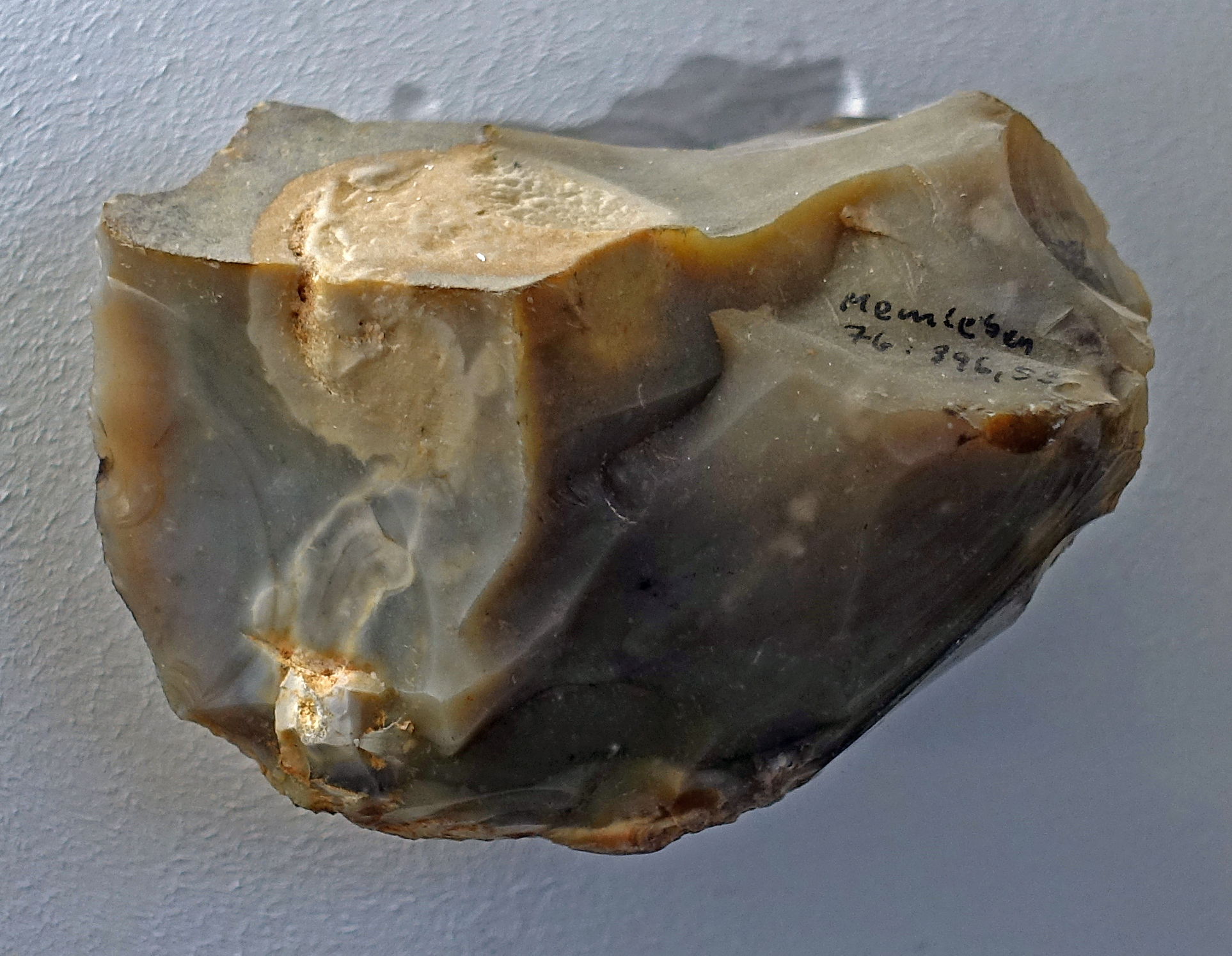
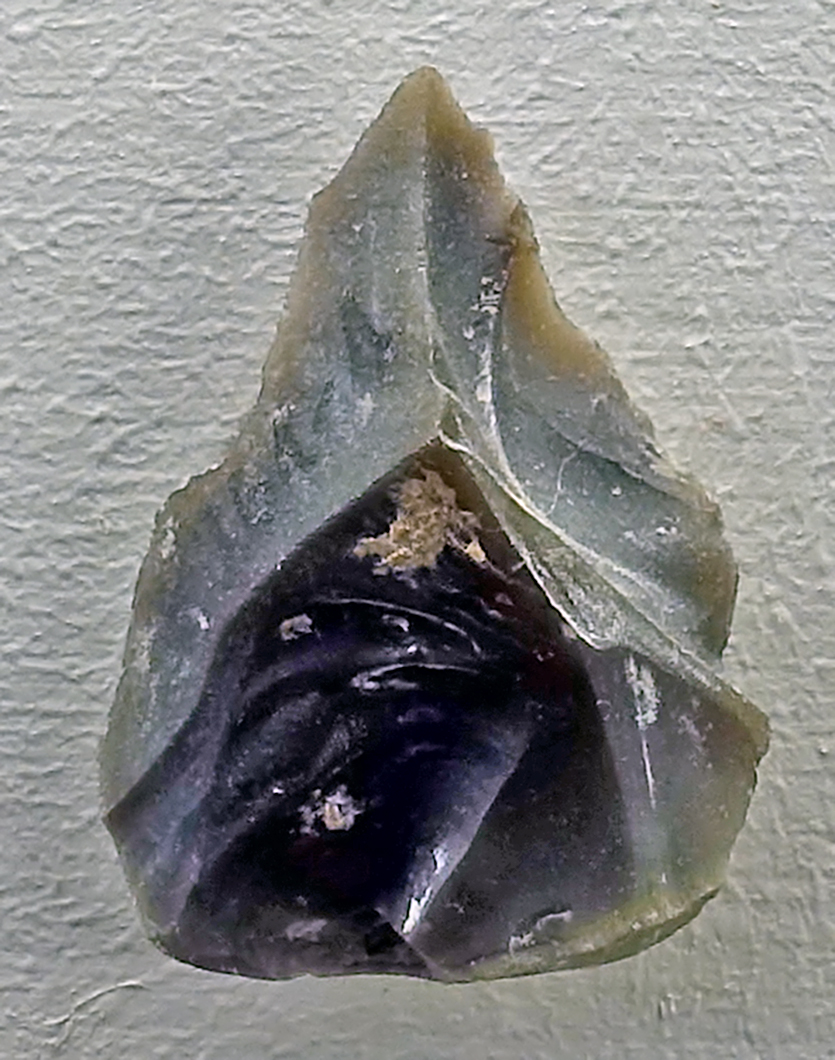
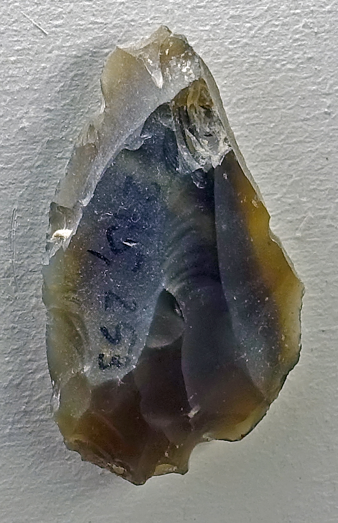
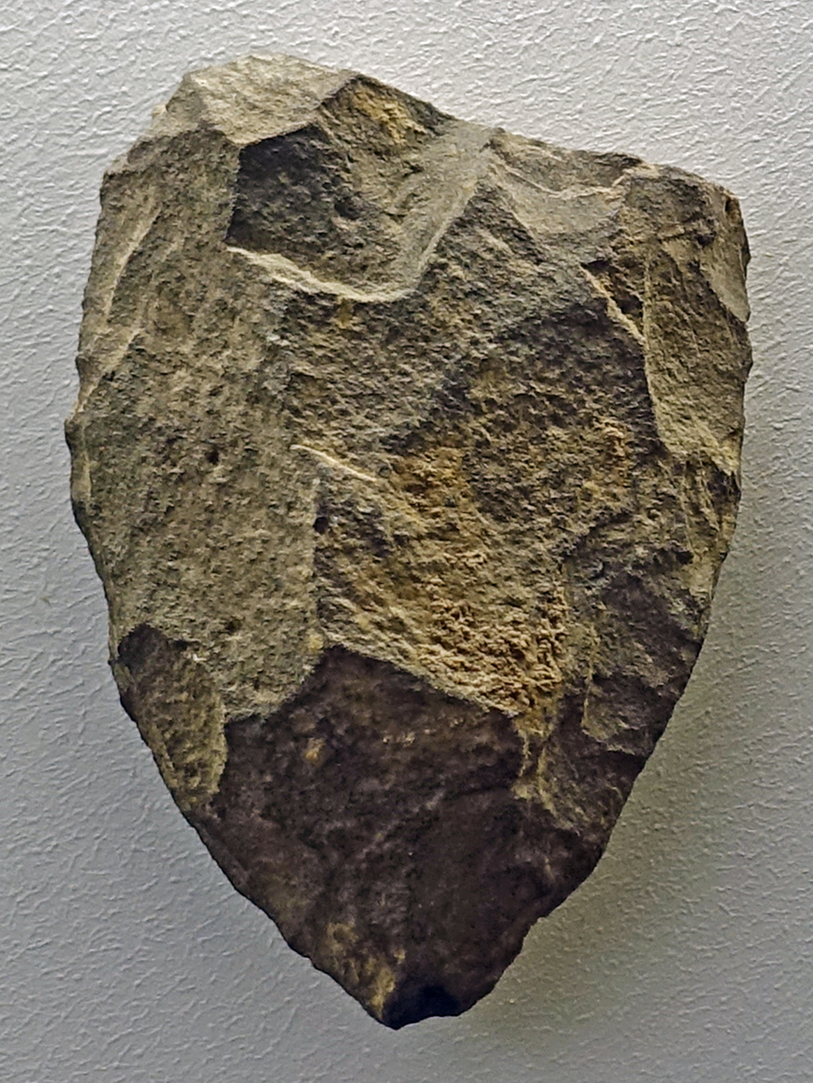
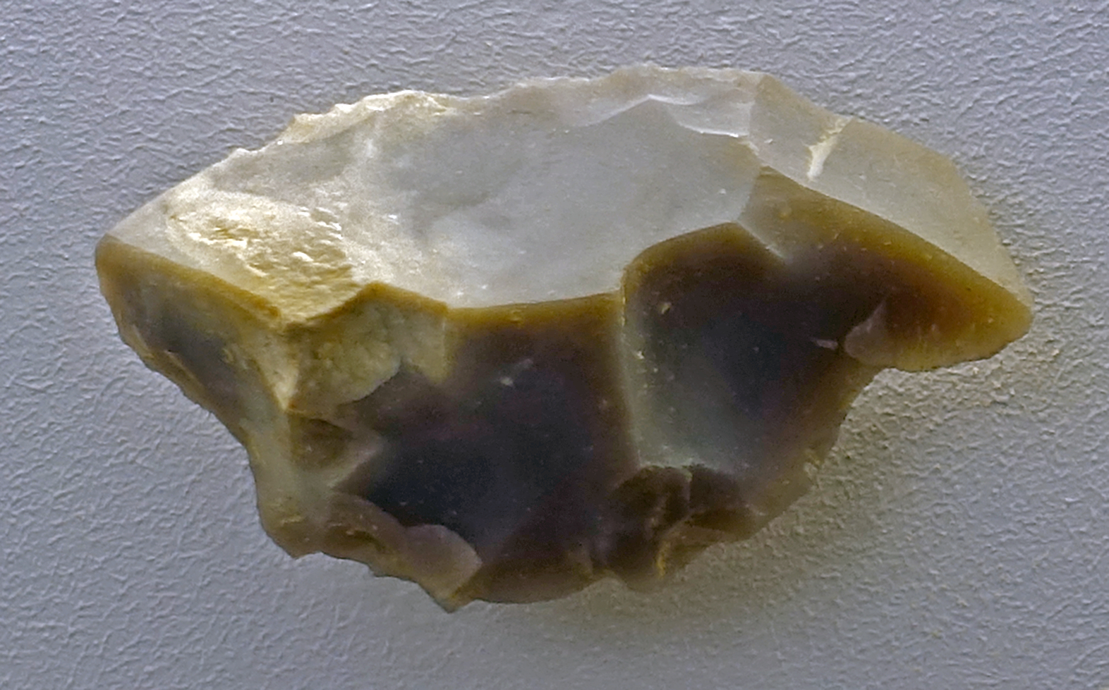
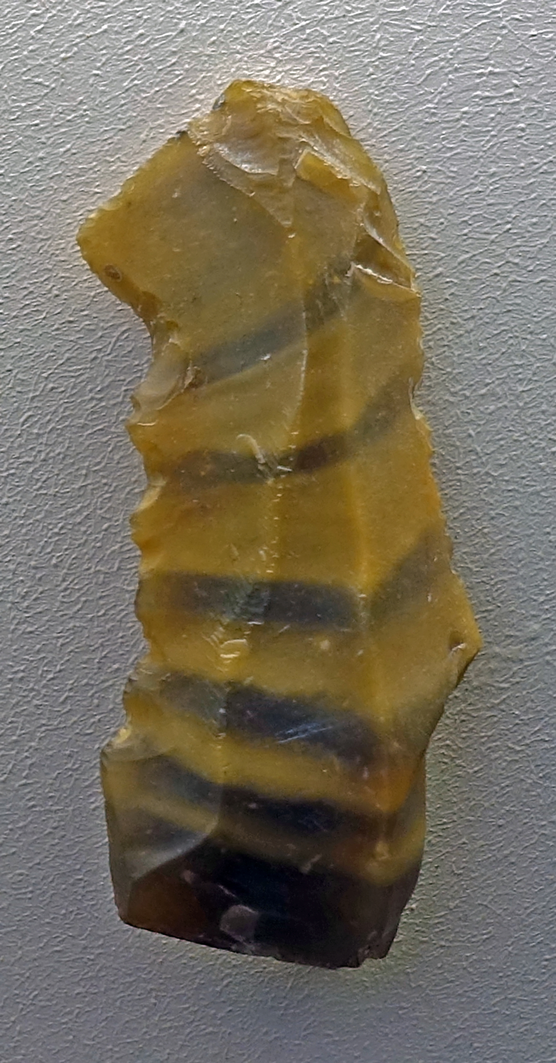
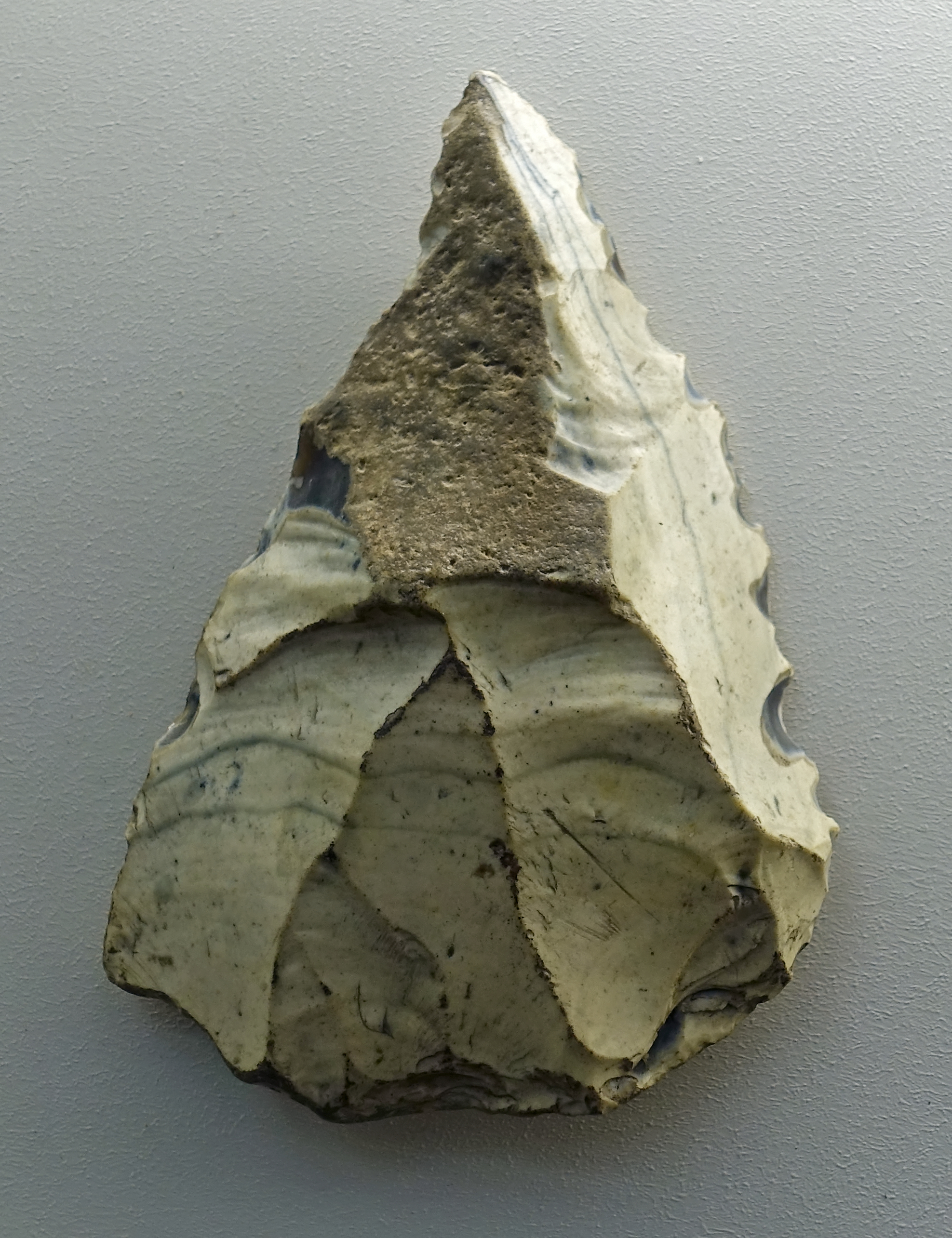
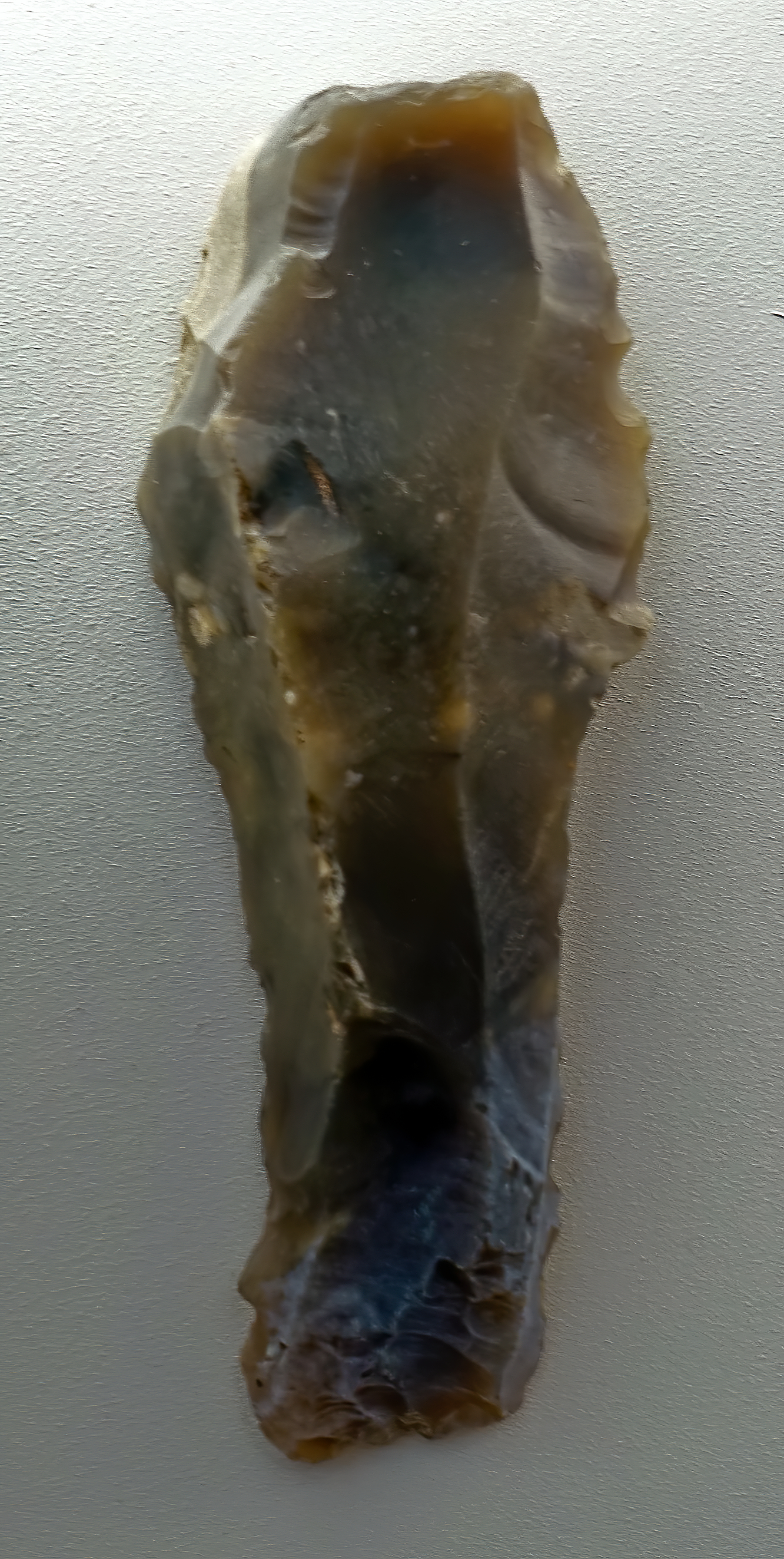
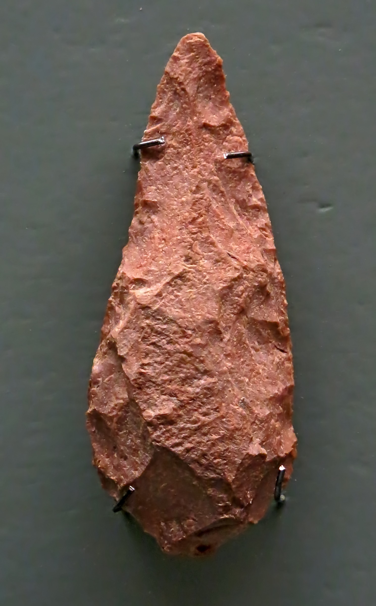
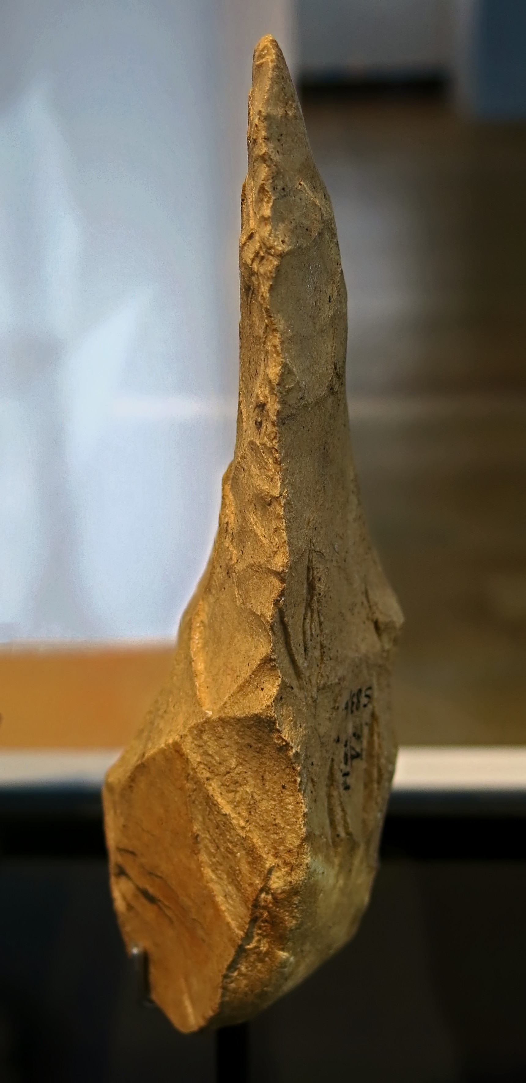
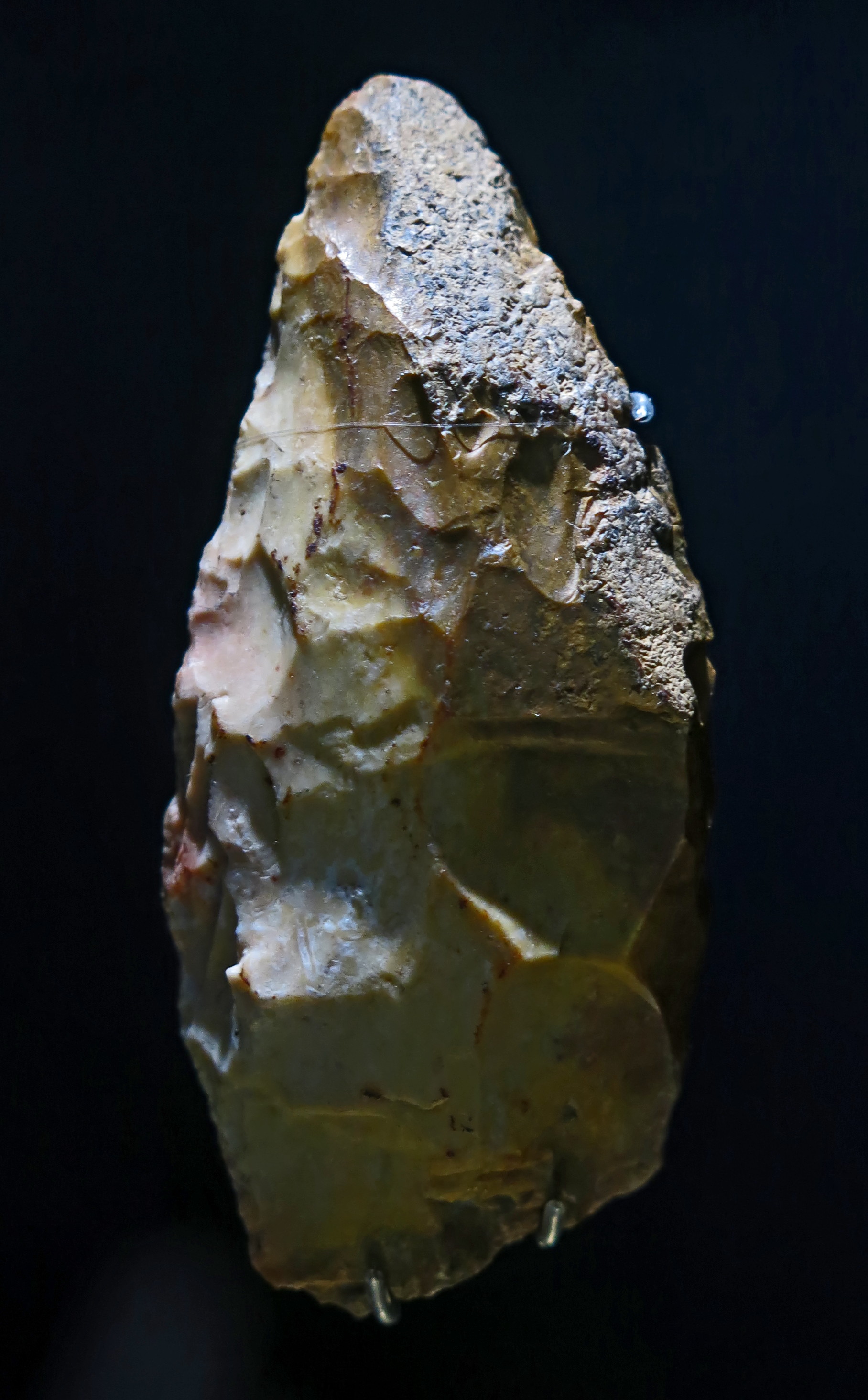
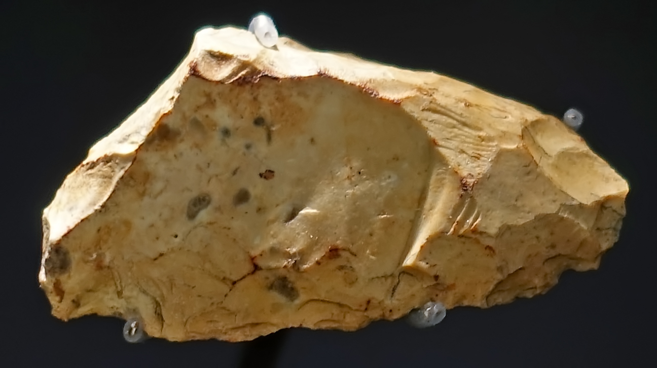
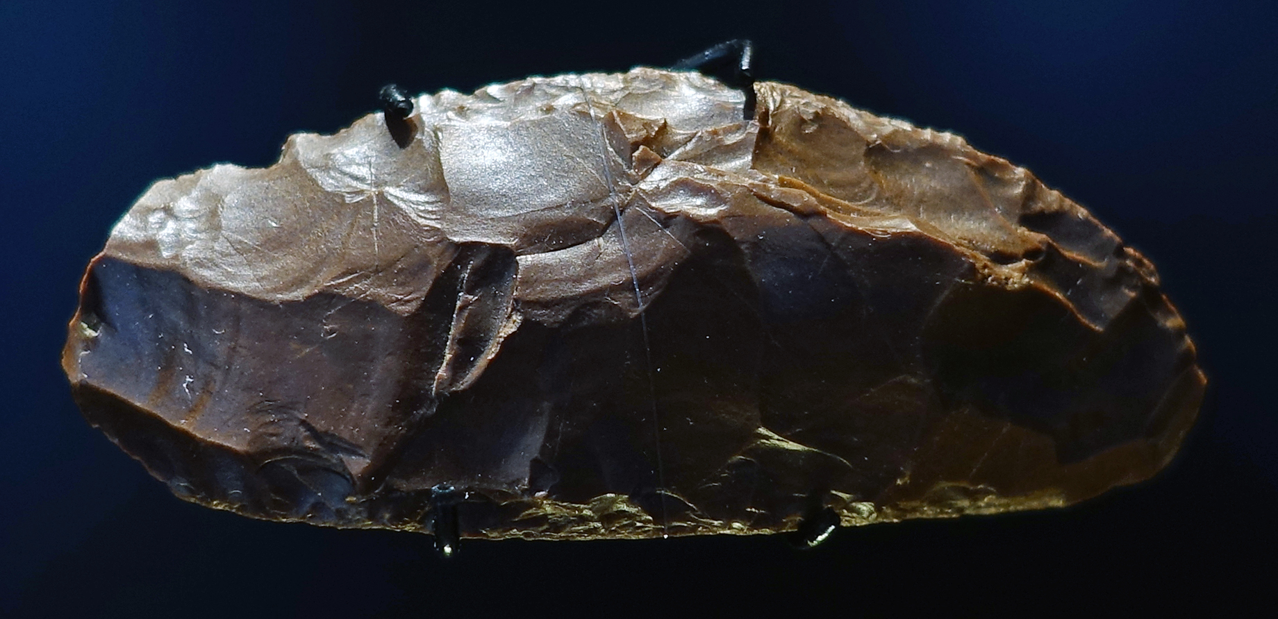
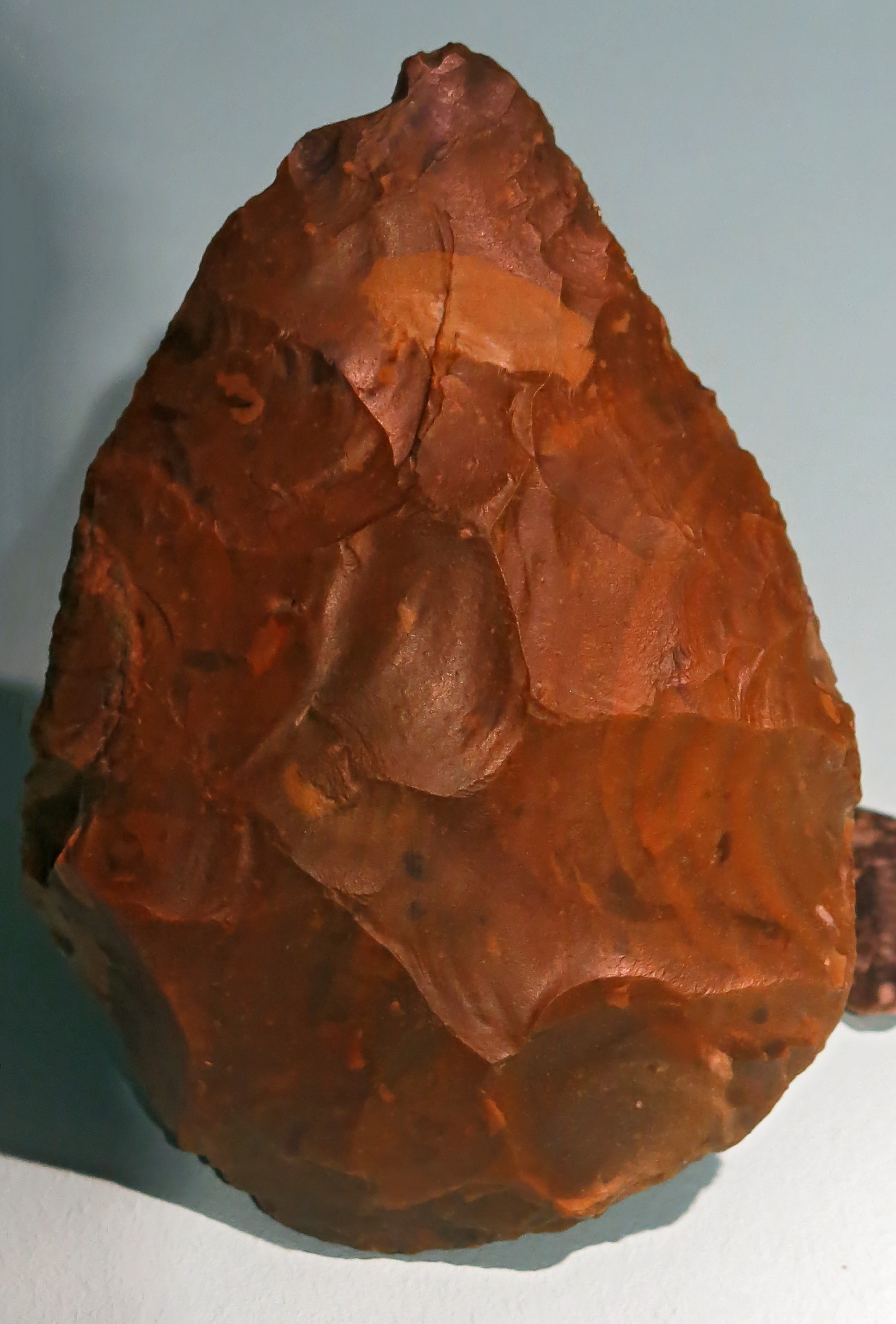
Schaber, scraper, circa 500 000 BP.
From Memleben, on the Unstrut River, a few kilometres west of Wangen, and approximately 50 km SW of Halle.
Photo: Don Hitchcock 2018
Source and text: Halle Landesmuseum für Vorgeschichte, CC-BY-NC-SA @ State Museum of Prehistory Halle
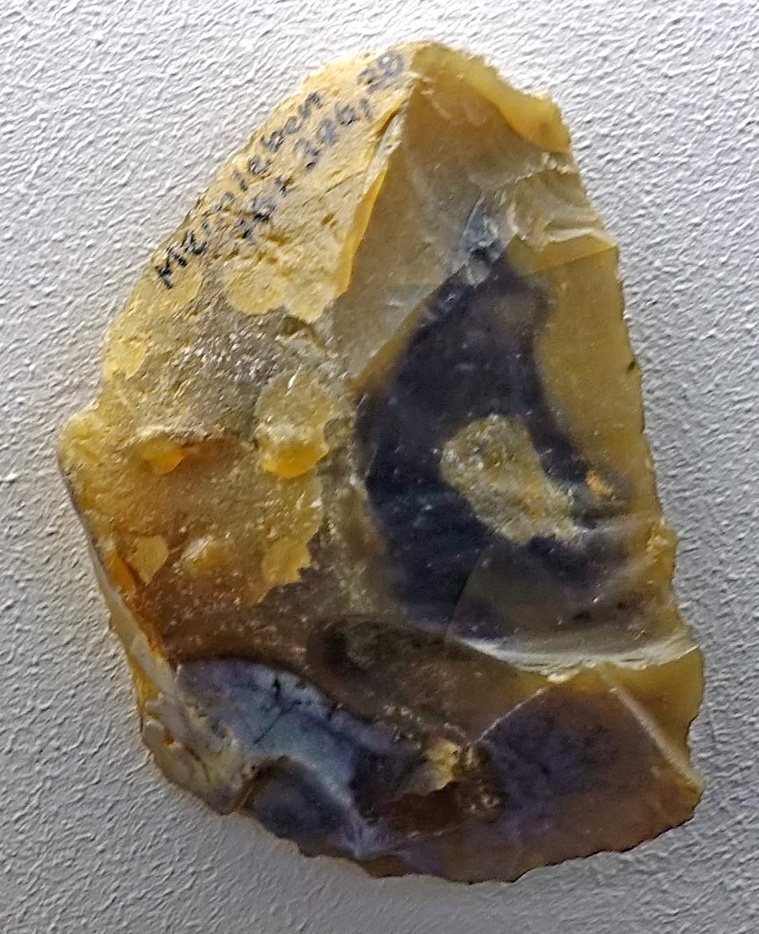
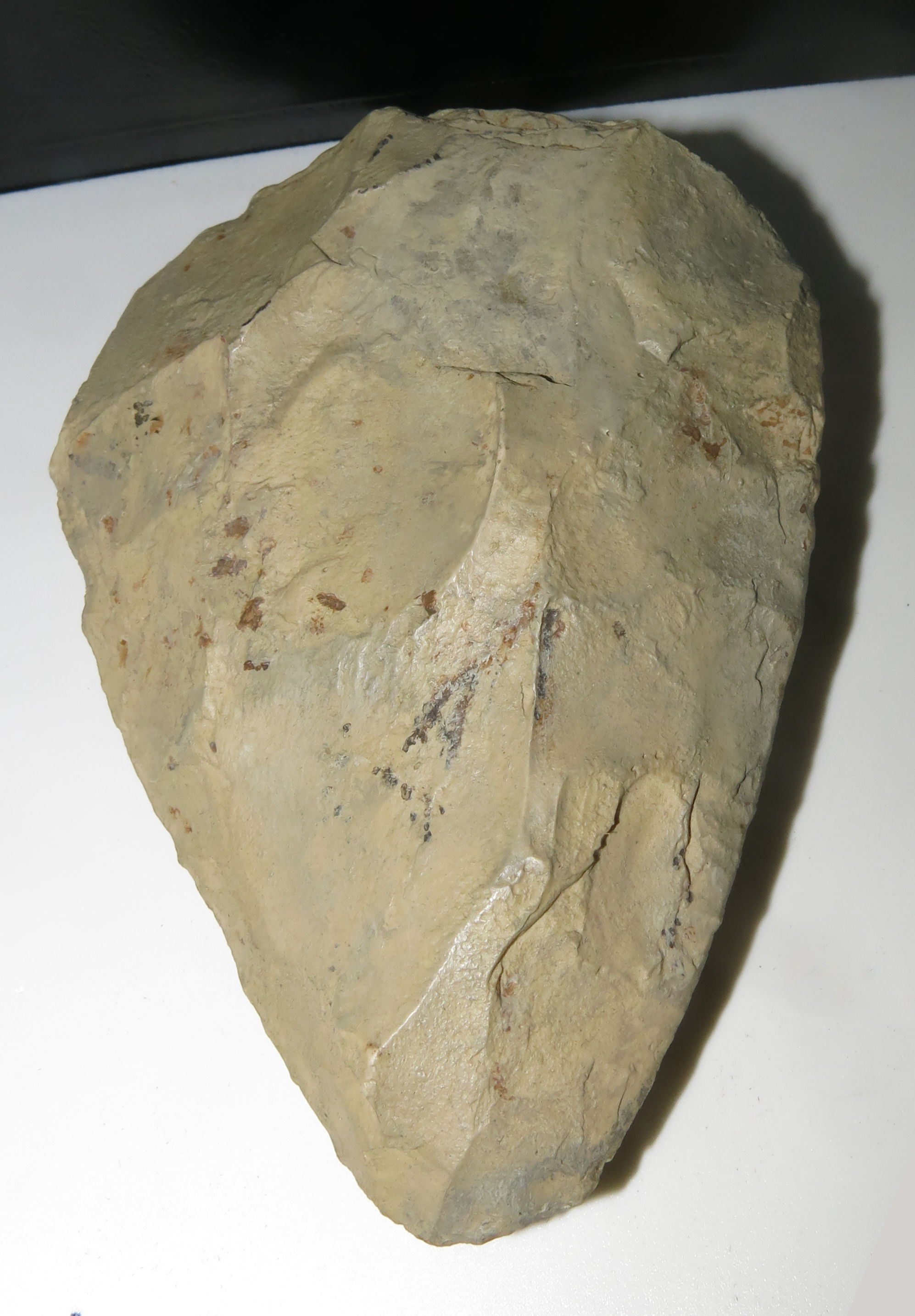
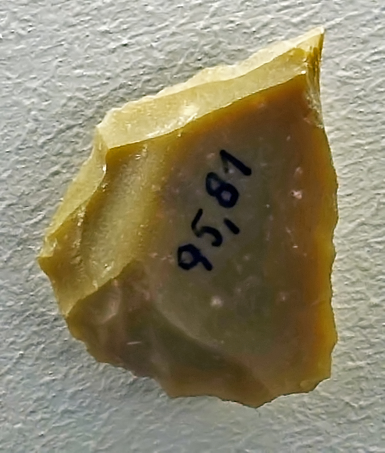
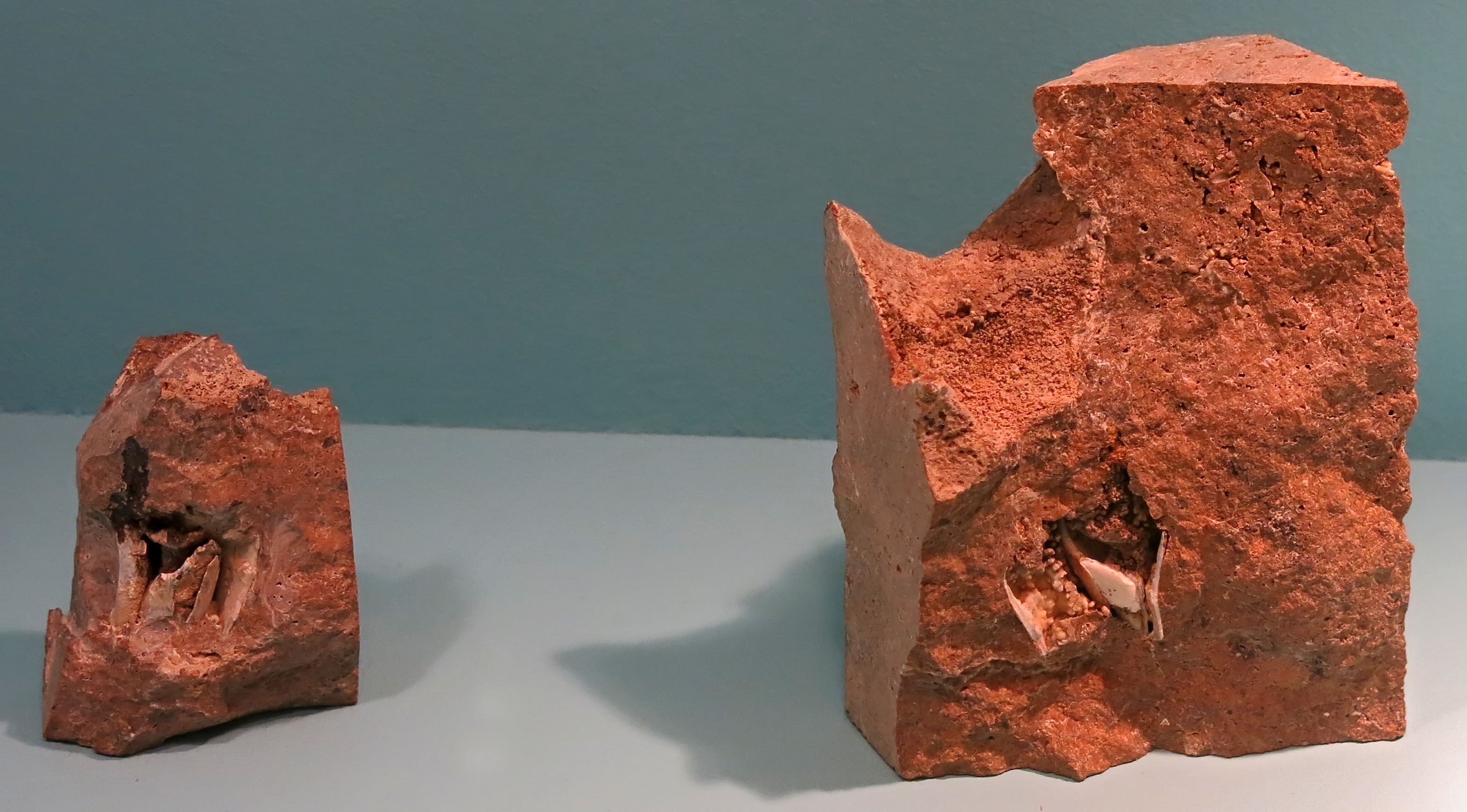
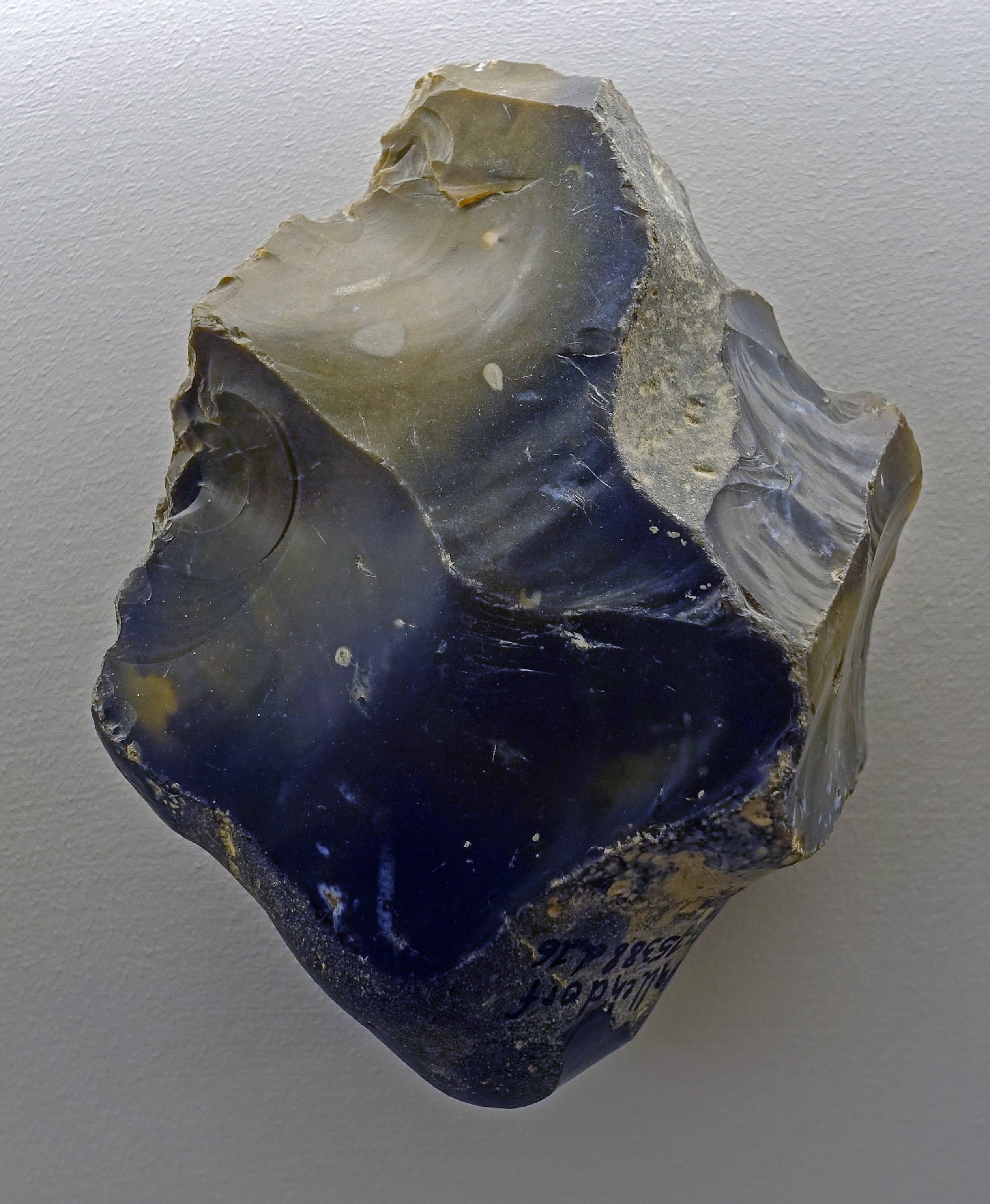
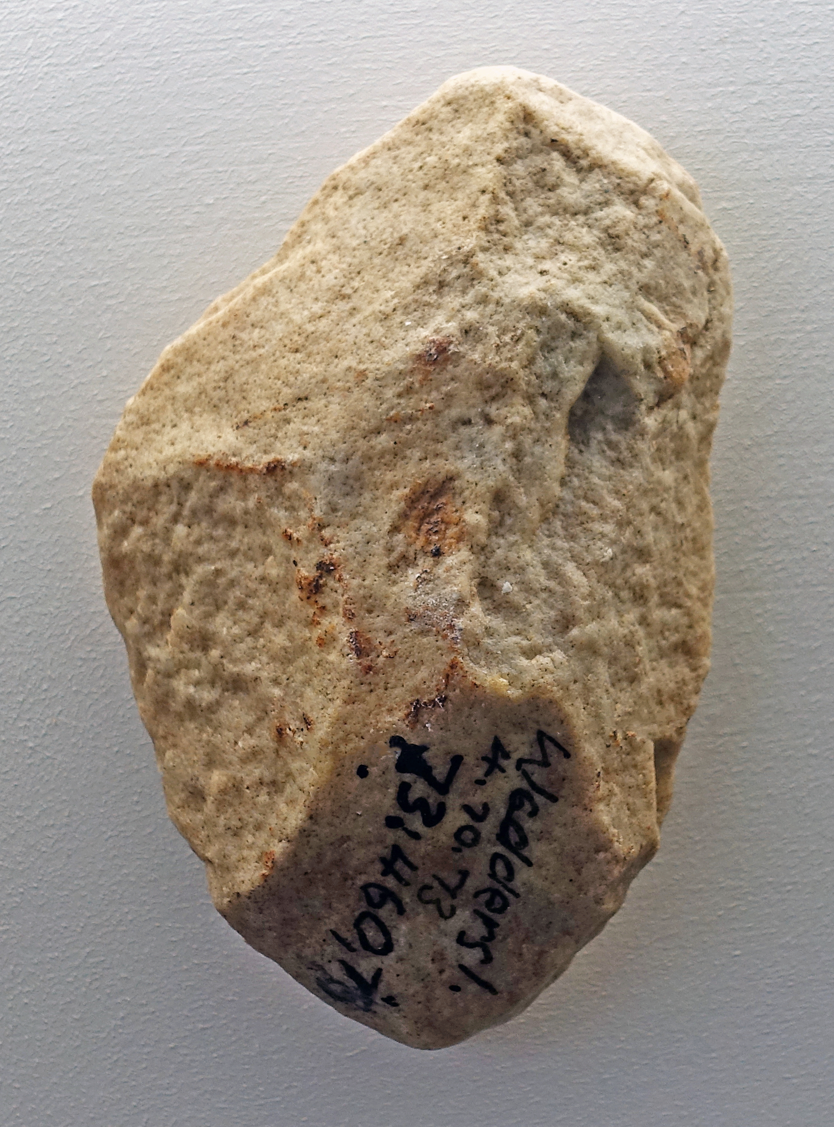
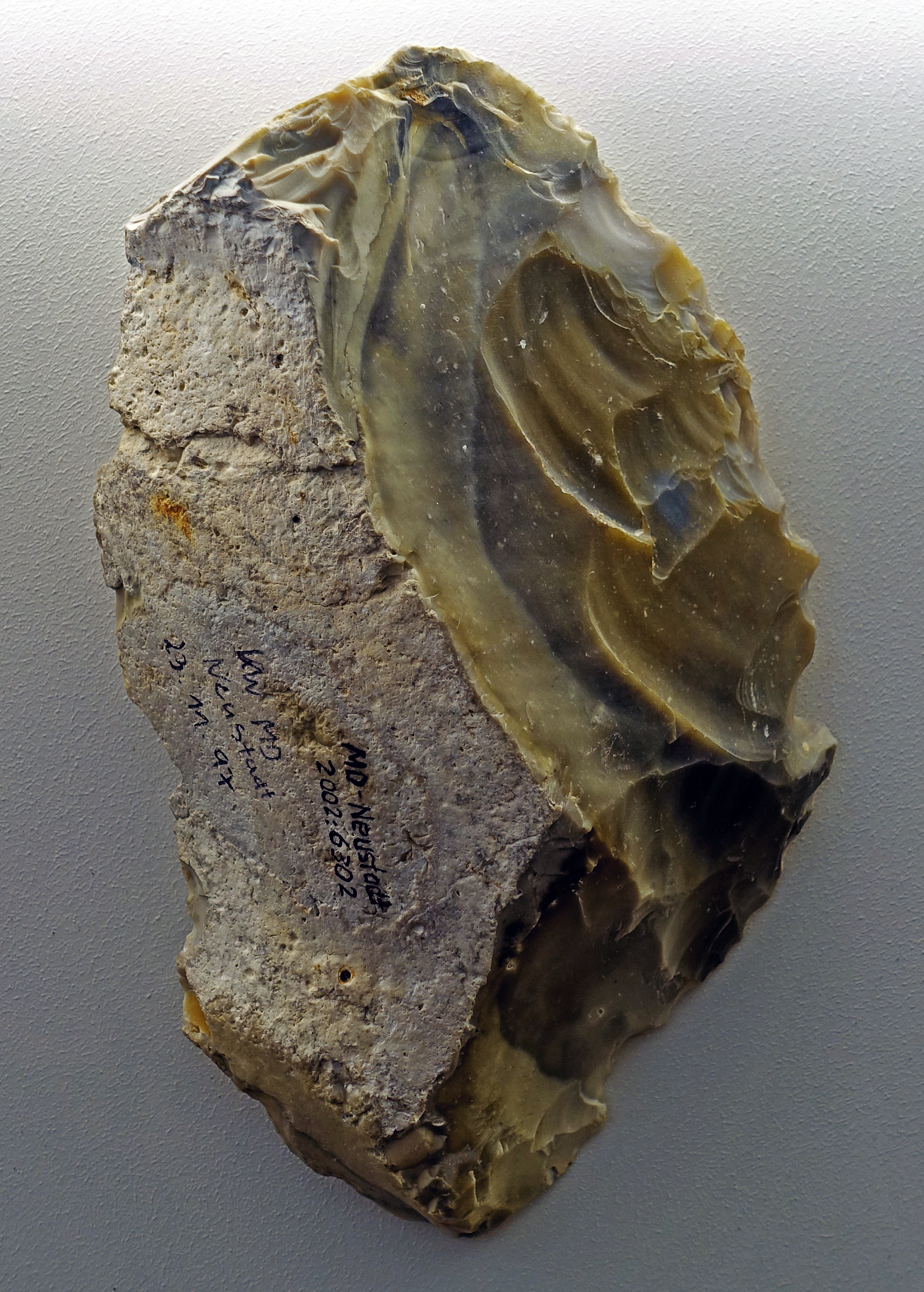
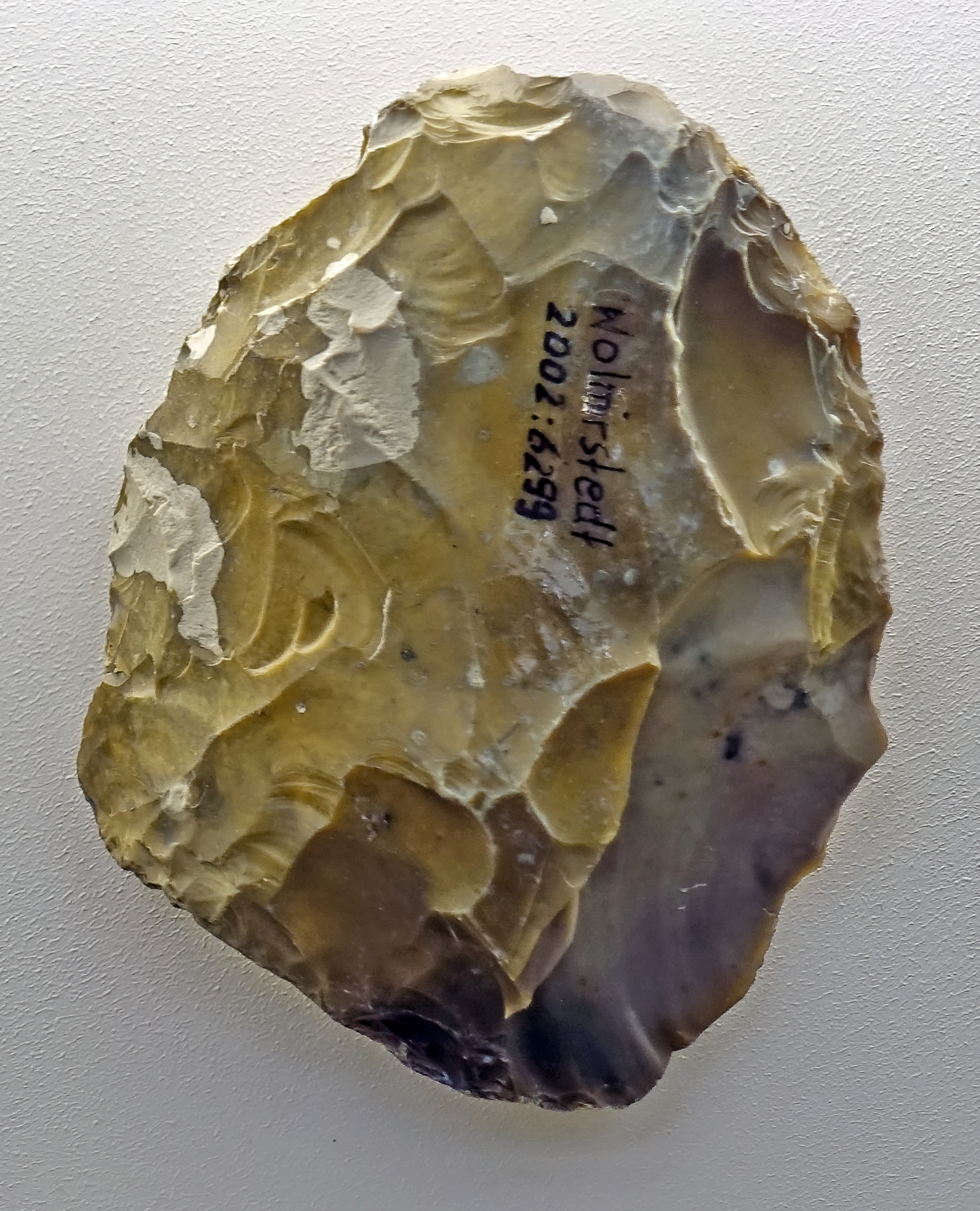
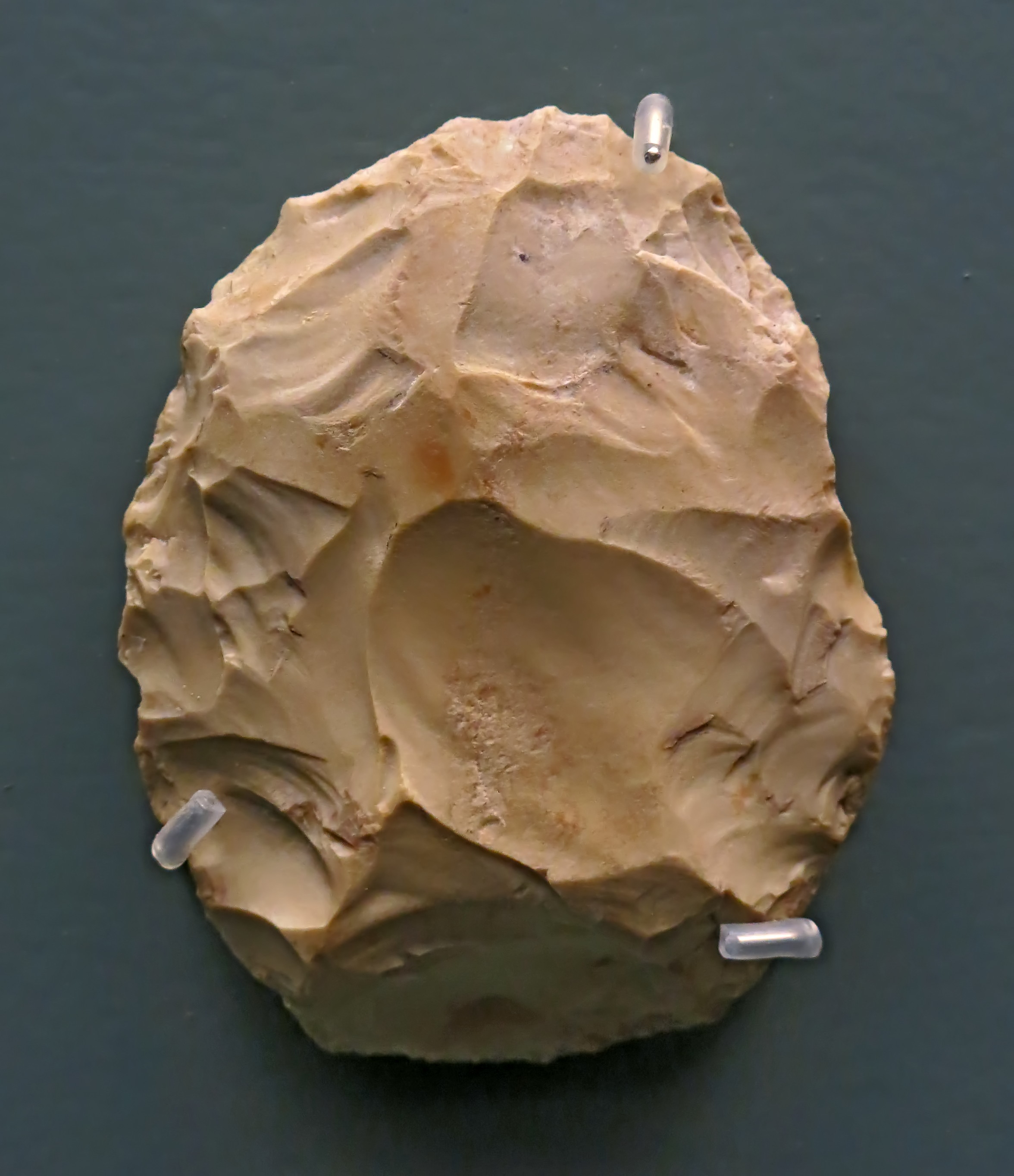
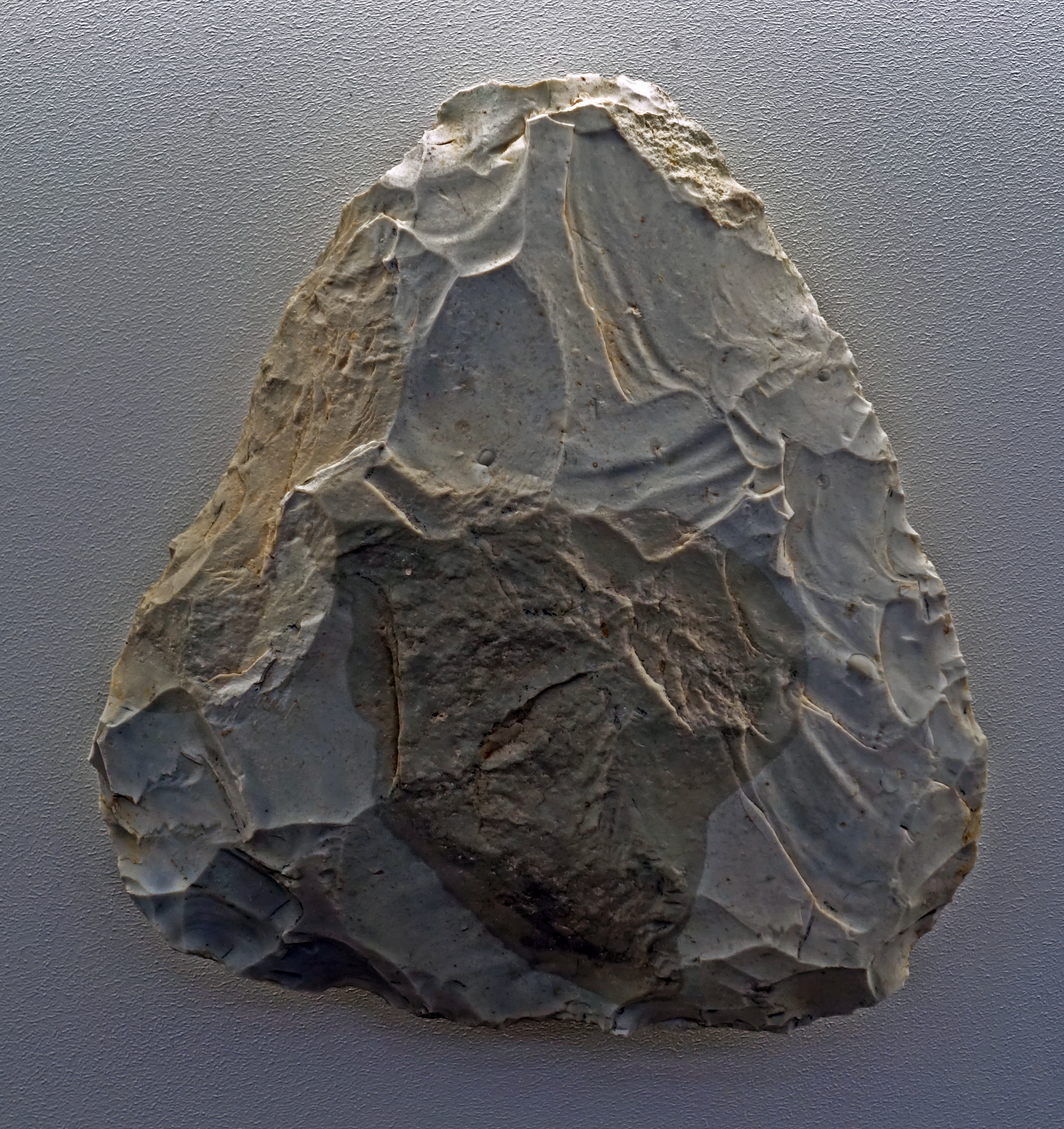
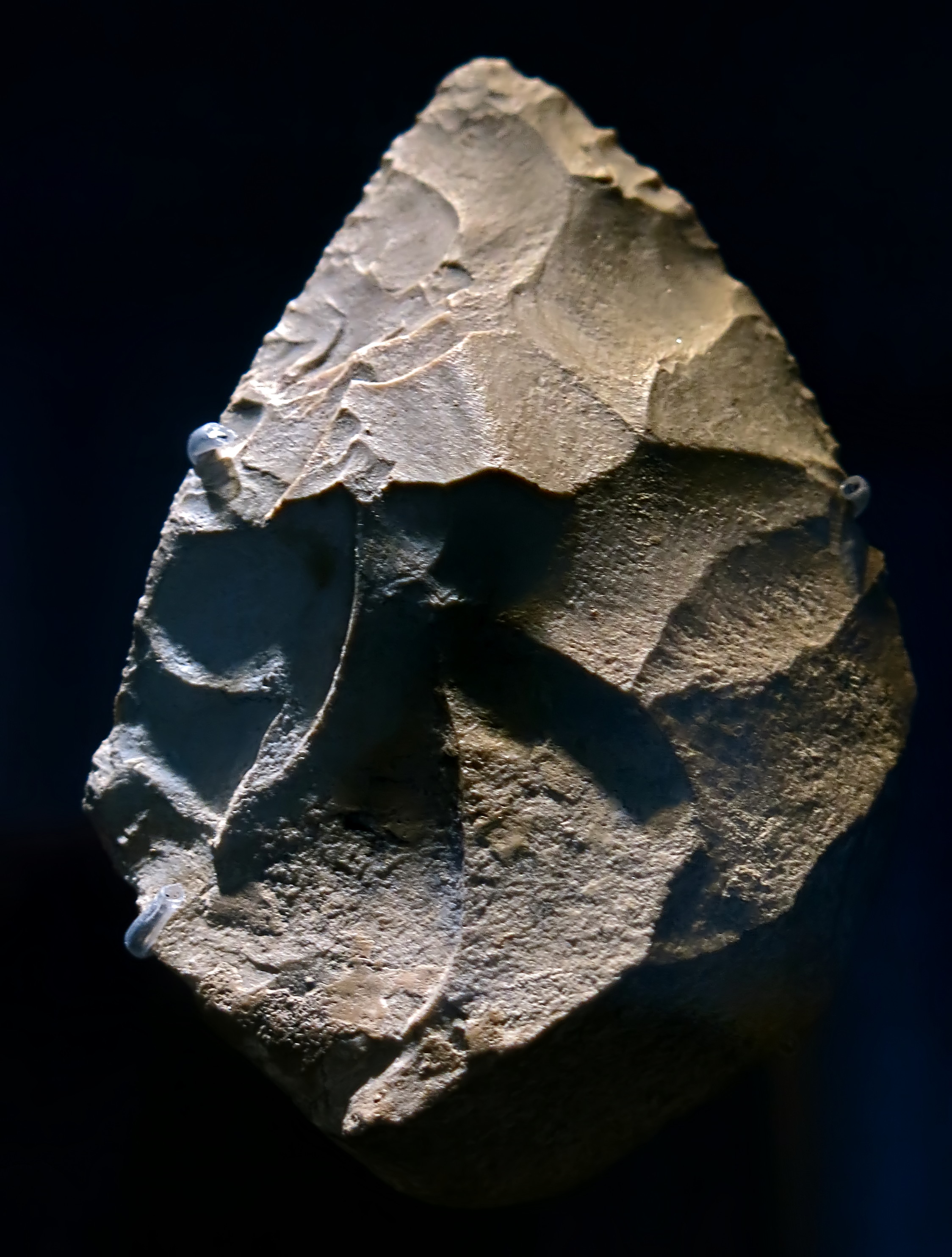
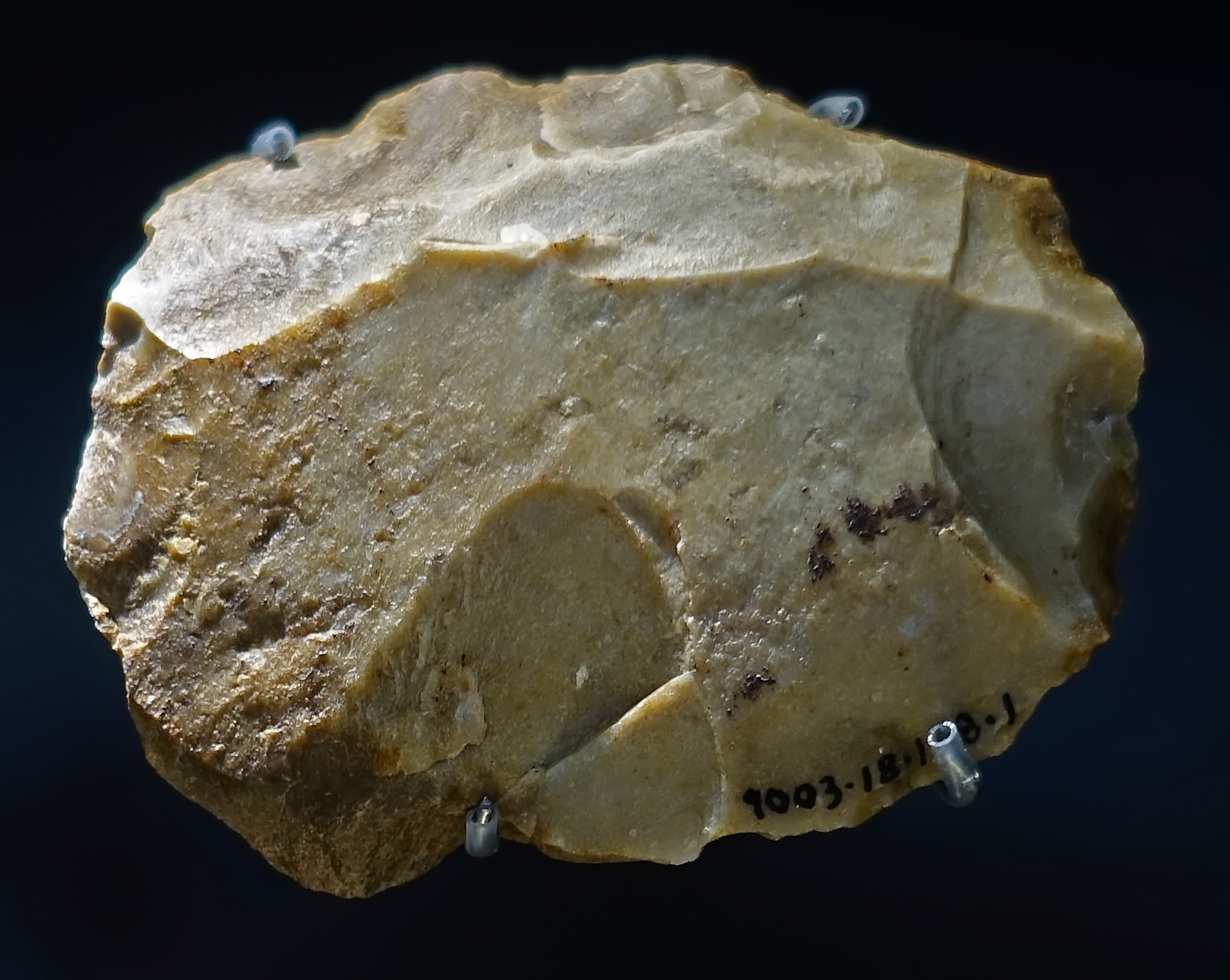
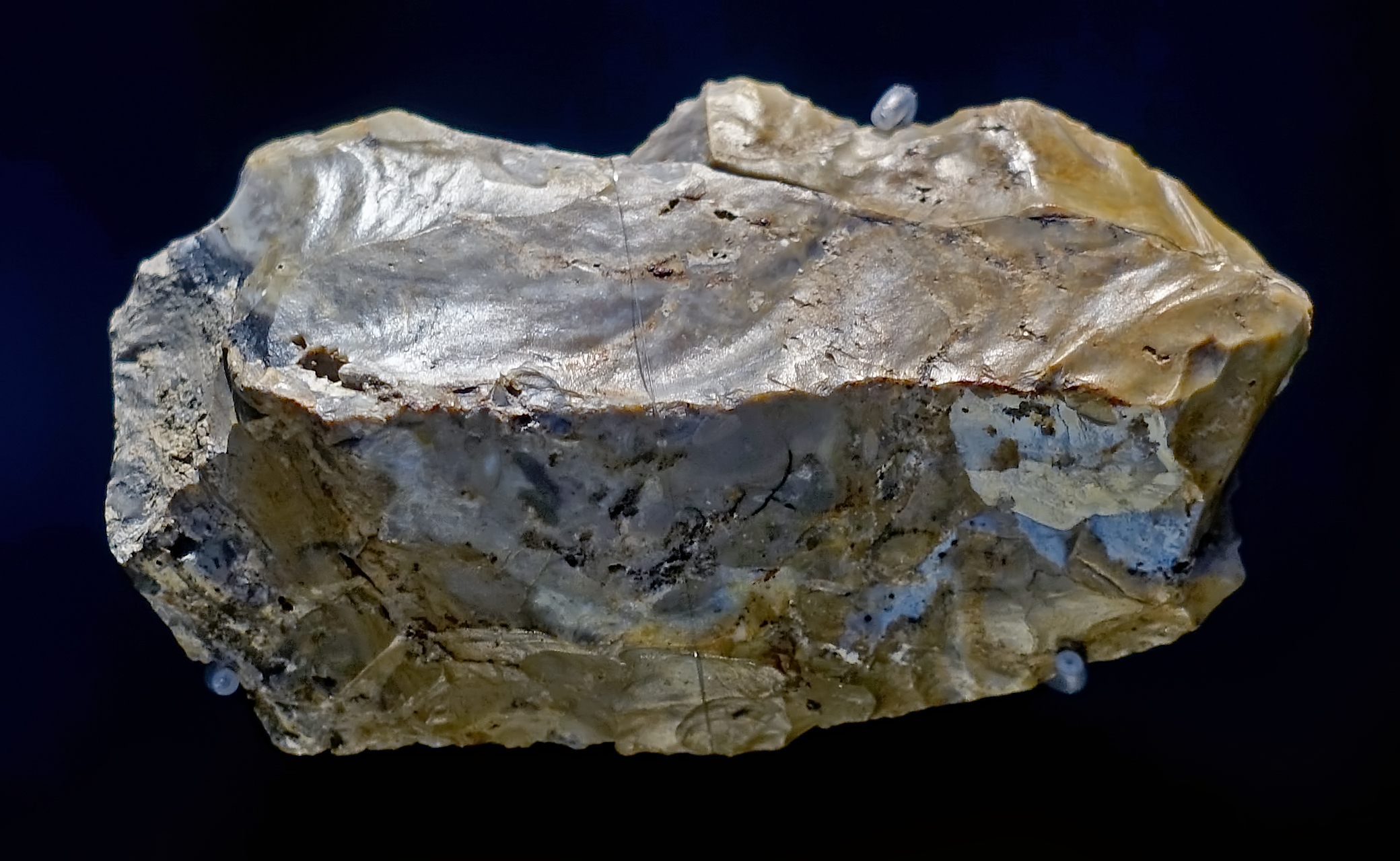
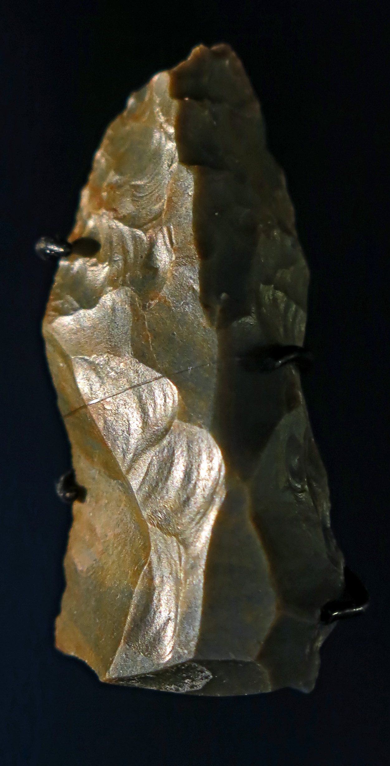
Kernstein, nucleus, core, circa 500 000 BP.
From Memleben, on the Unstrut River, a few kilometres west of Wangen, and approximately 50 km SW of Halle.
Photo: Don Hitchcock 2018
Source and text: Halle Landesmuseum für Vorgeschichte, CC-BY-NC-SA @ State Museum of Prehistory Halle
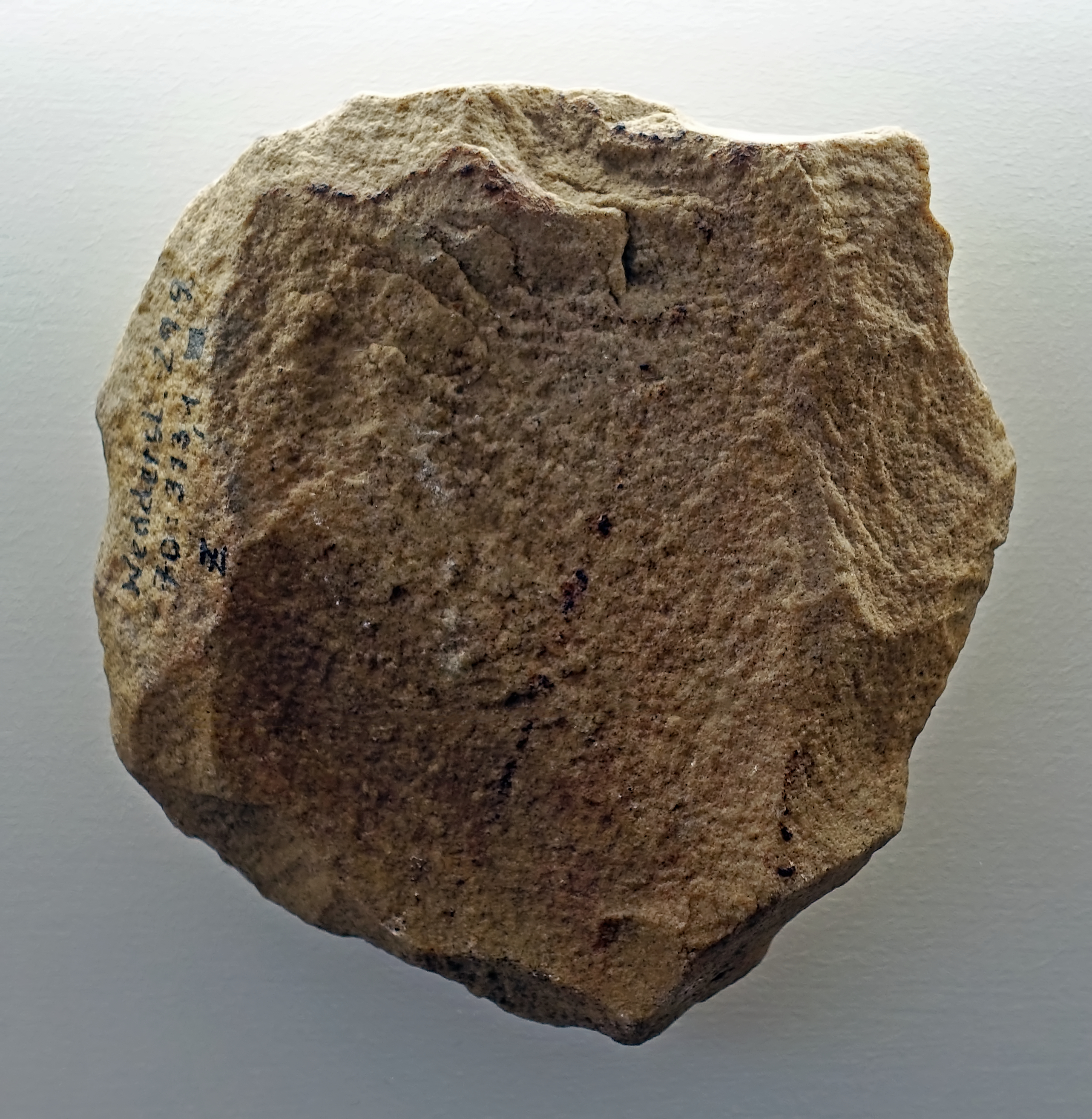
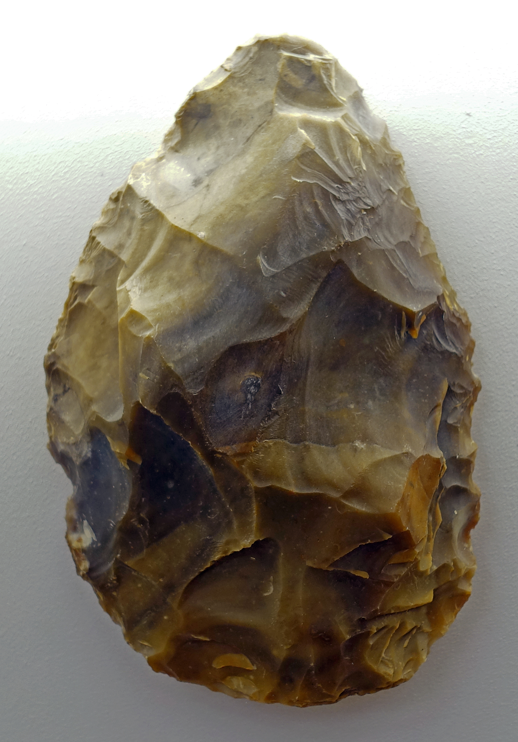
Kernstein, nucleus, core, circa 500 000 BP.
From Memleben, on the Unstrut River, a few kilometres west of Wangen, and approximately 50 km SW of Halle.
Photo: Don Hitchcock 2018
Source and text: Halle Landesmuseum für Vorgeschichte, CC-BY-NC-SA @ State Museum of Prehistory Halle
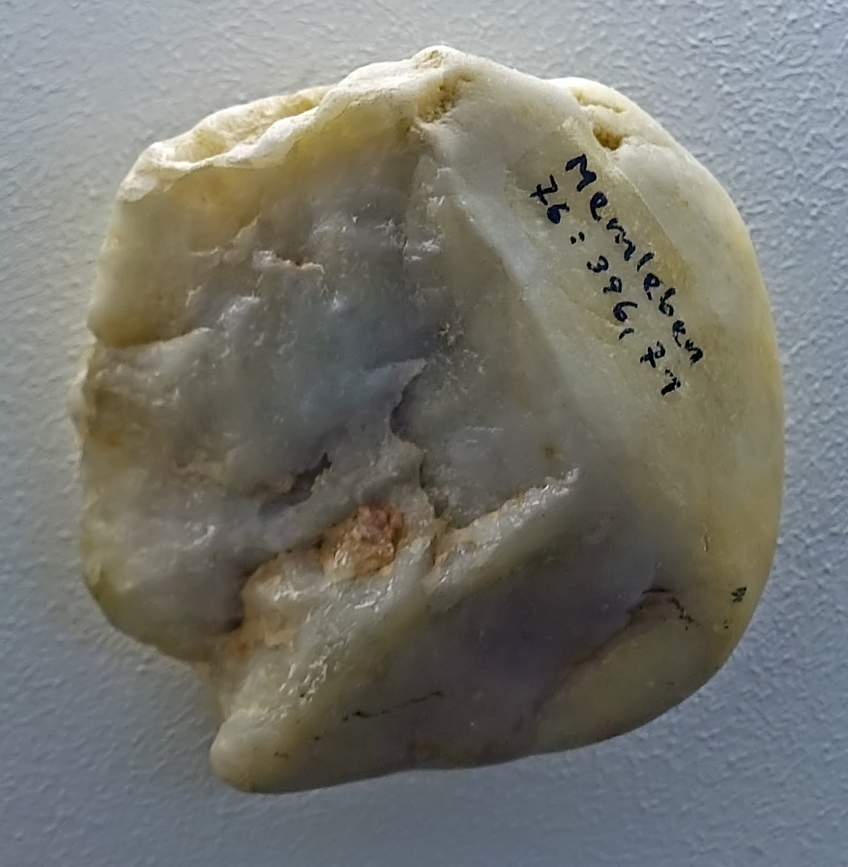
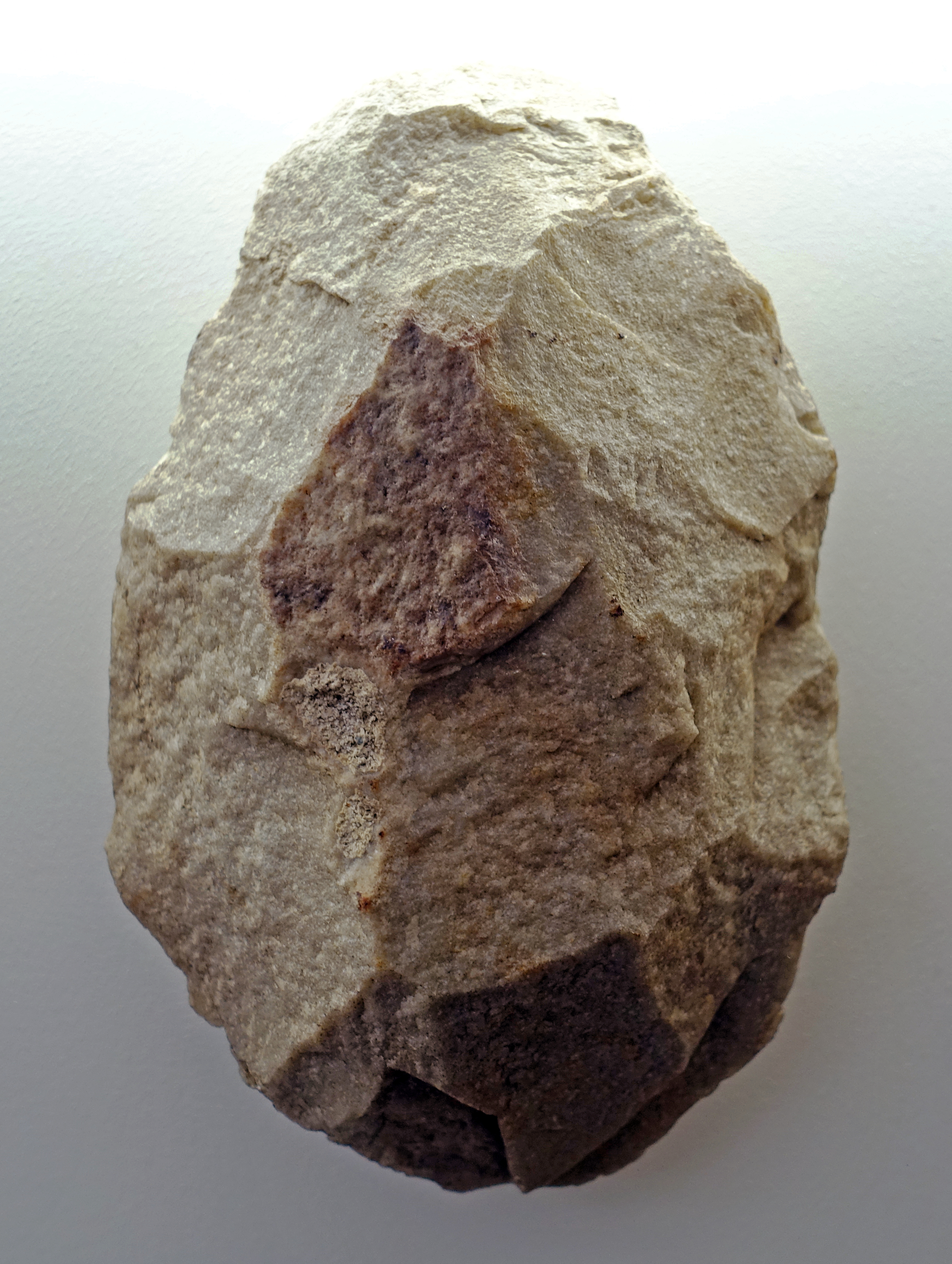
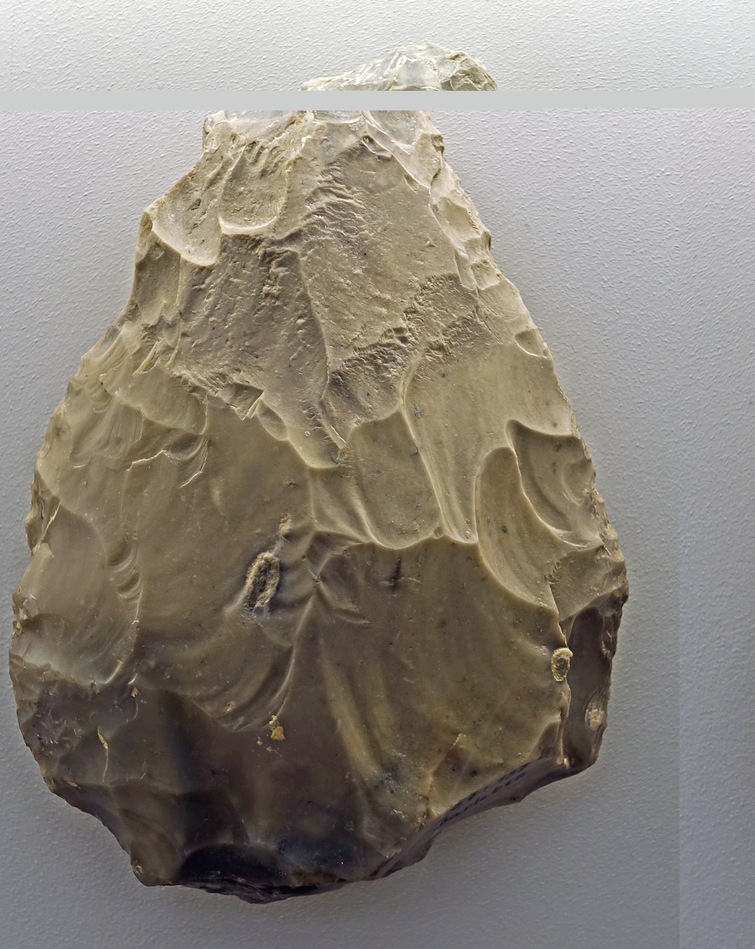
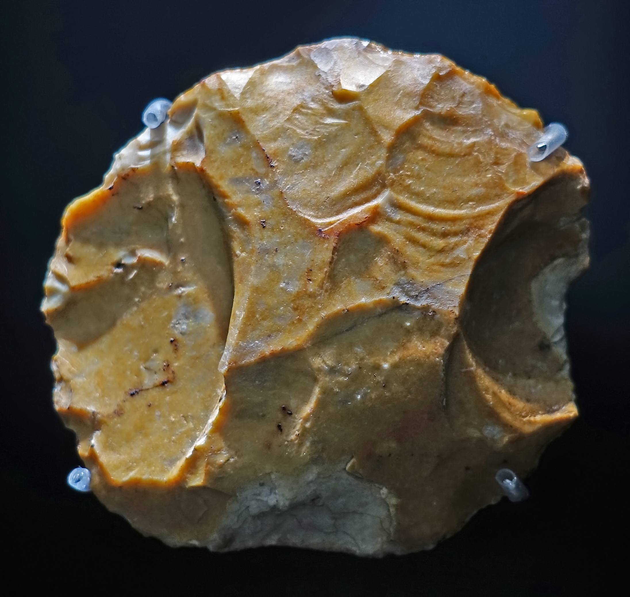
Kernsteine, cores, circa 500 000 BP.
From Memleben, on the Unstrut River, a few kilometres west of Wangen, and approximately 50 km SW of Halle.
( note that both these cores have been made from river pebbles, probably from glacial till deposits - Don )
Relics of a mollusk fauna were present in the form of numerous Unio shells.
The artefacts, mostly from flint, but also consisting of quartzite pebbles, can also be classified in the Clactonia after typological comparisons.
The Clactonian is the name given by archaeologists to an industry of European flint tool manufacture that dates to the early part of the interglacial period known as the Hoxnian, the Mindel-Riss or the Holstein stages (circa 400 000 years ago). Clactonian tools were made by Homo heidelbergensis.
It is named after 400 000-year-old finds made by Hazzledine Warren in a palaeochannel at Clacton-on-Sea in the English county of Essex in 1911. The artefacts found there included flint chopping tools, flint flakes and the tip of a worked wooden shaft along with the remains of a giant elephant and hippopotamus.
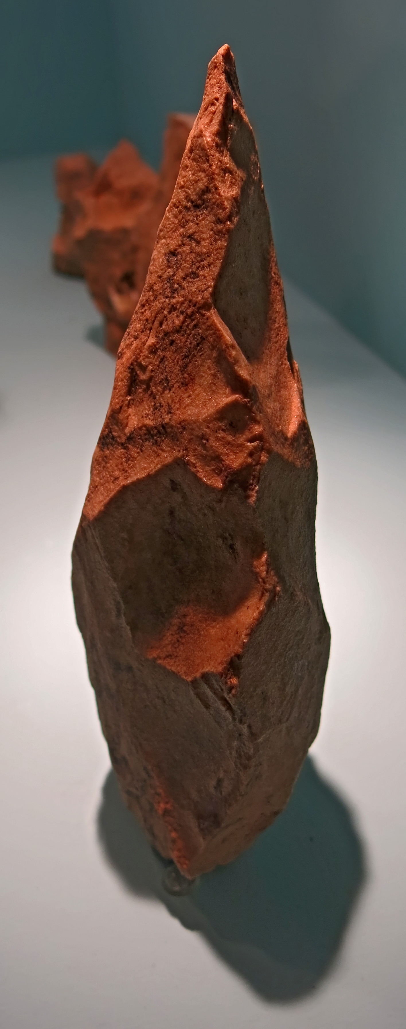
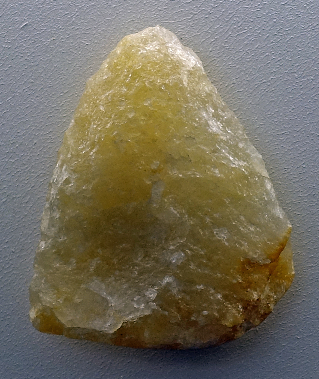
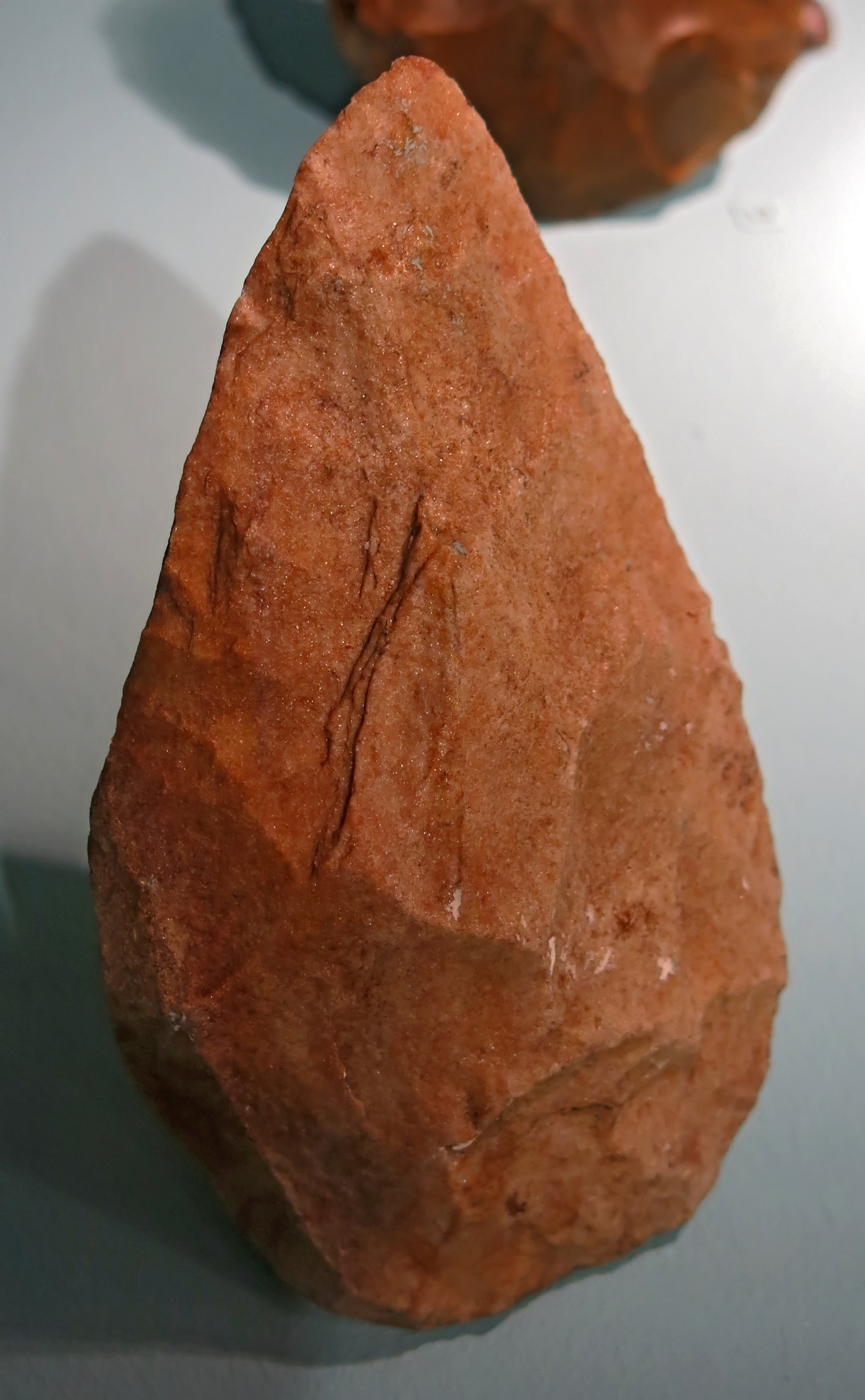
Right: L: 68 mm, W: 33 mm, river debris made of quartzite.
Photo: Don Hitchcock 2018
Source and text: Halle Landesmuseum für Vorgeschichte, https://st.museum-digital.de/, CC-BY-NC-SA @ State Museum of Prehistory Halle
Additional text: Wikipedia
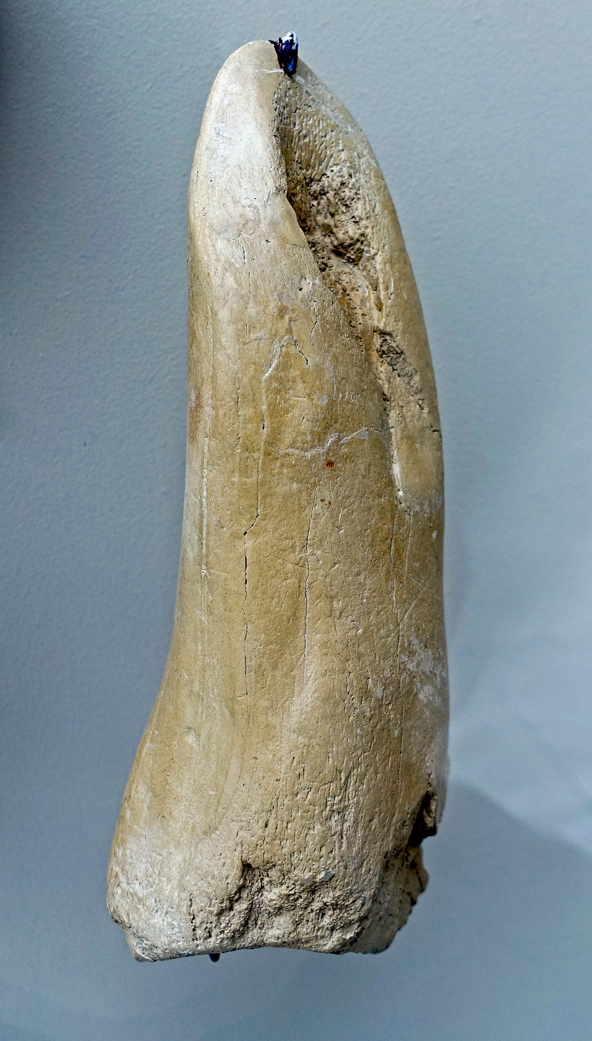
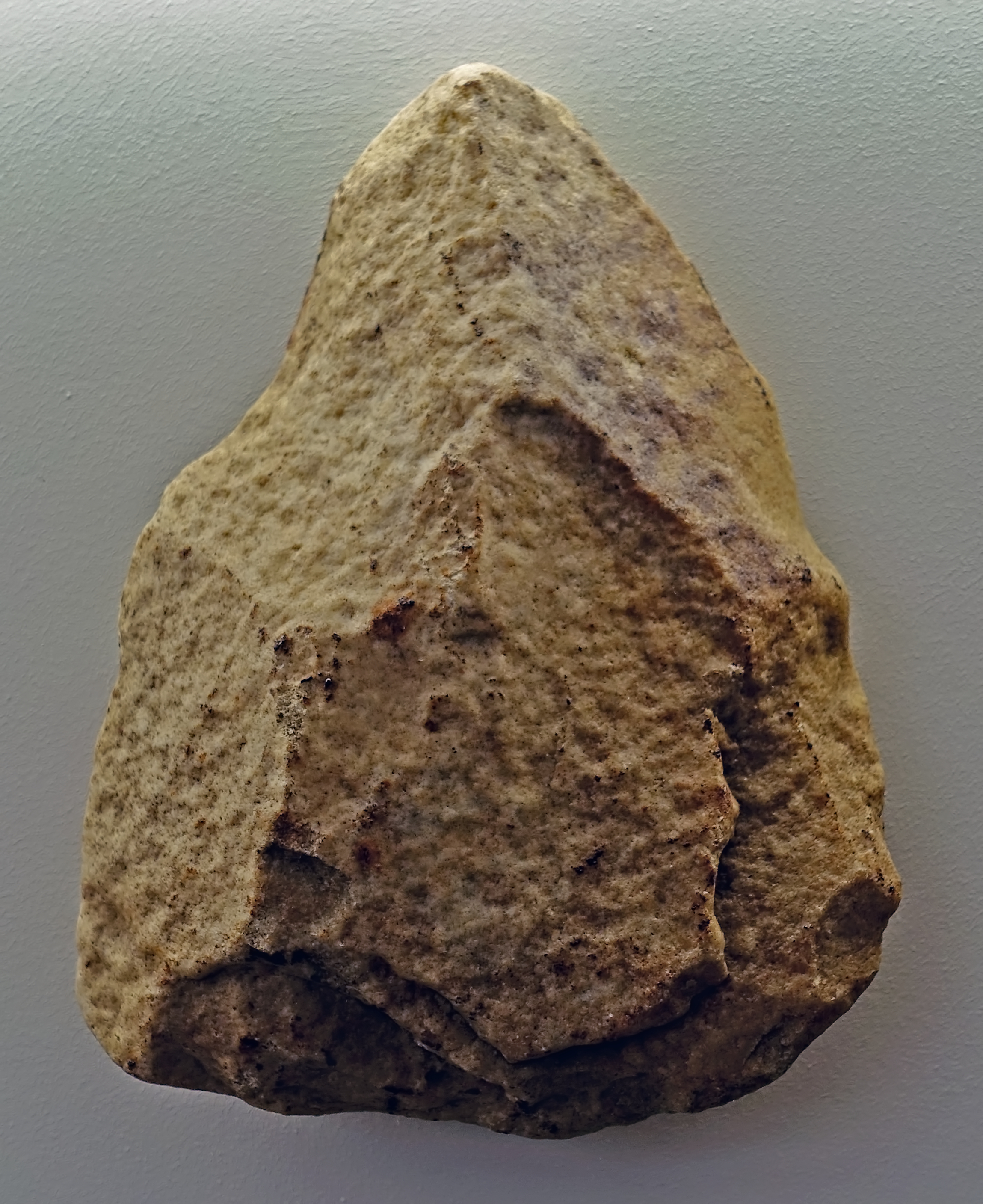
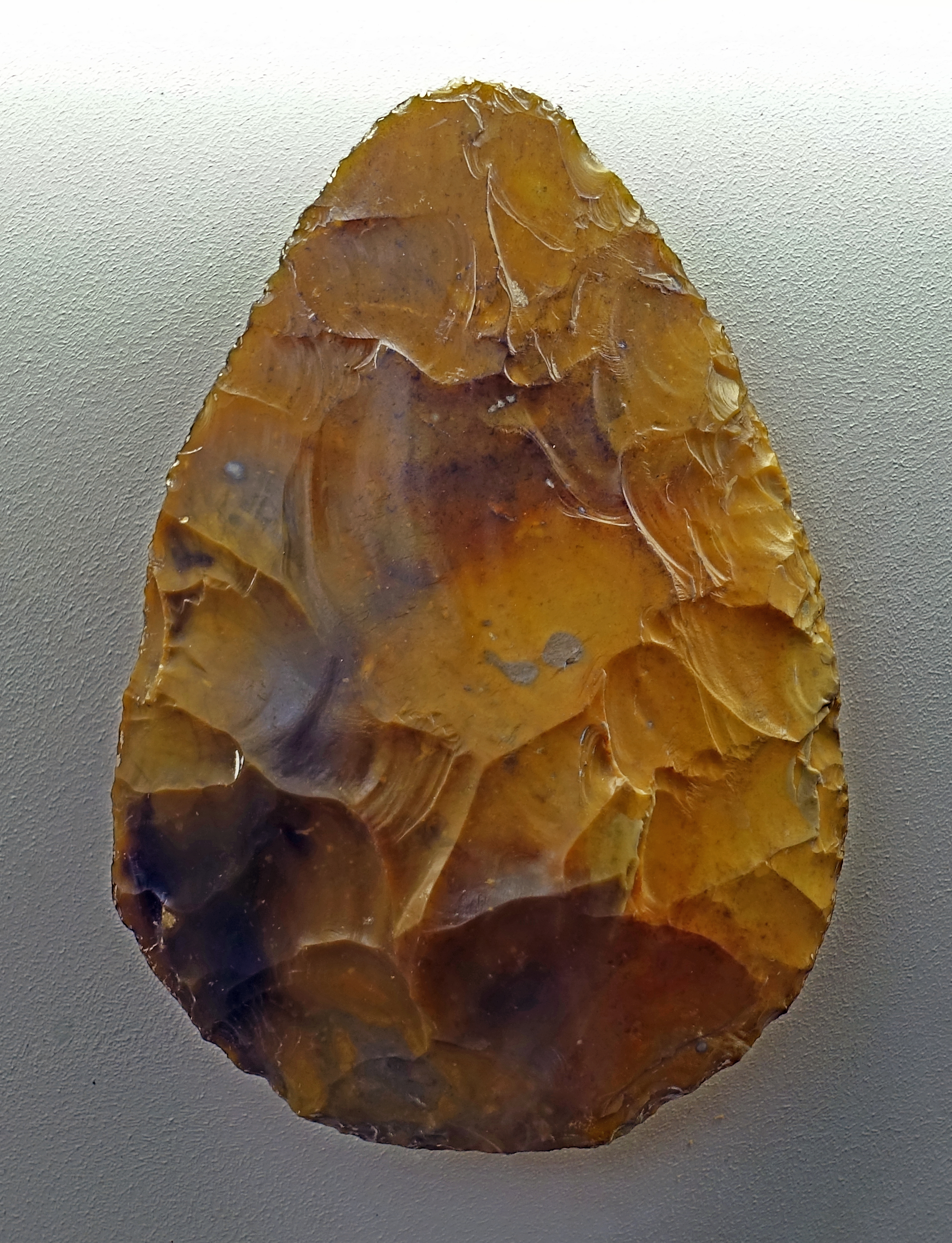
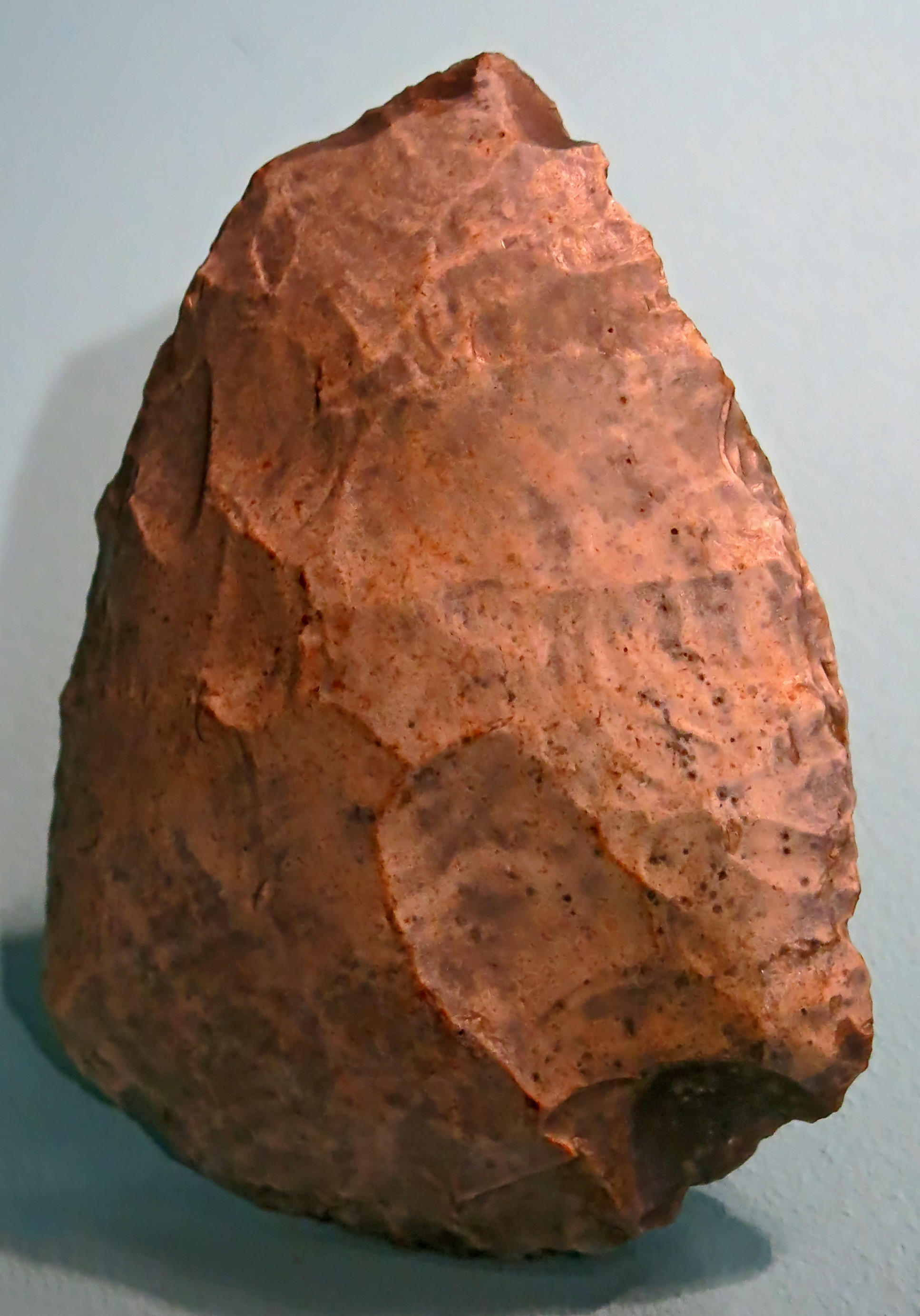
Kernstein, core, quartzite, circa 500 000 BP.
From Memleben, on the Unstrut River, a few kilometres west of Wangen, and approximately 50 km SW of Halle.
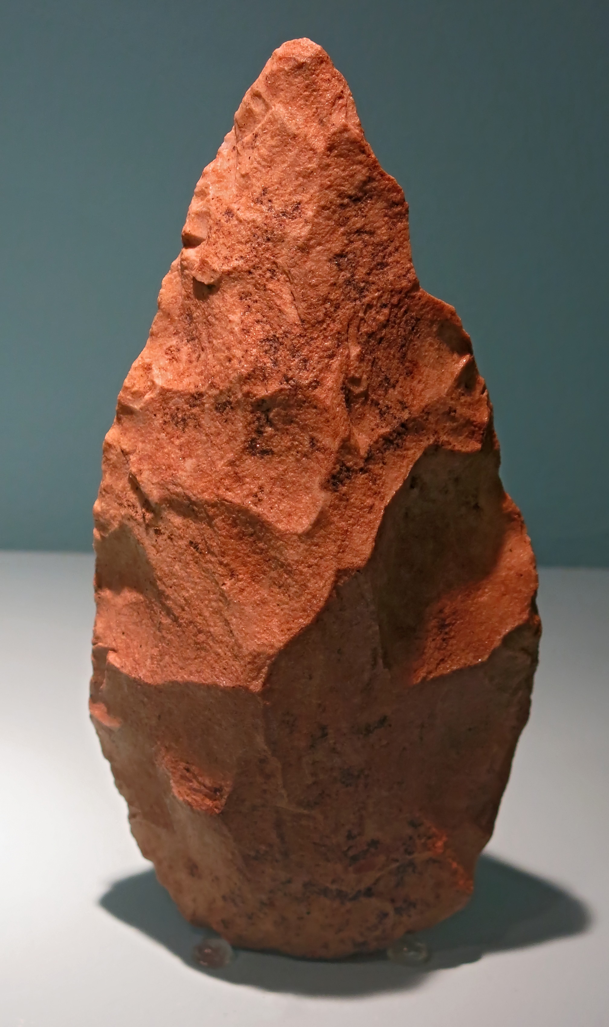
The oldest verifiable man-made stones from Saxony - Anhalt are around 500 000 years old.
This includes the quartzite core shown here, which was found in Memleben.
Length 45 mm, width 40 mm.
Photo: Don Hitchcock 2018
Source and text: Halle Landesmuseum für Vorgeschichte, https://st.museum-digital.de/, CC-BY-NC-SA @ State Museum of Prehistory Halle
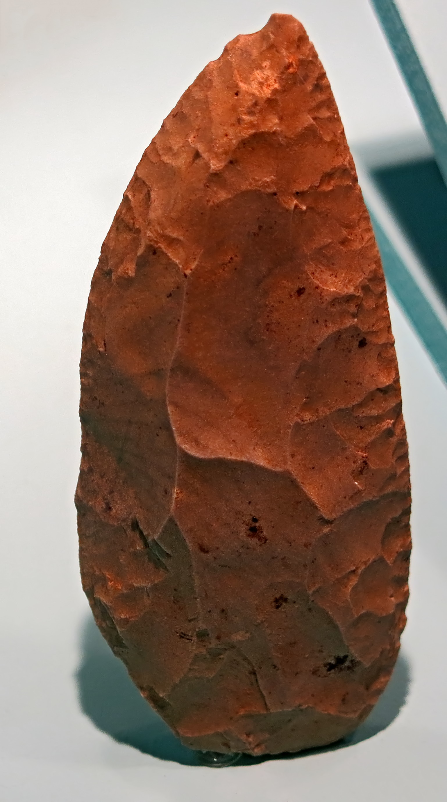
Quartzite Faustkeil, or handaxe, Acheulian, circa 500 000 BP.
Faustkeil = (literally) fist wedge, which translates as hand axe.
Hochdahl, Stadt Erkrath, Kreis Mettmann
Photo: Don Hitchcock 2015
Source: LVR-Landesmuseum Bonn, Germany
Scraper, 500 000 BP - 300 000 BP.
Scrapers were used primarily for preparing hides stripped from game, but may also have been used as knives.
From Ried, Bavaria, Germany.
Photo: Don Hitchcock 2015
Source: Facsimile, Monrepos Archäologisches Forschungszentrum und Museum, Neuwied, Germany
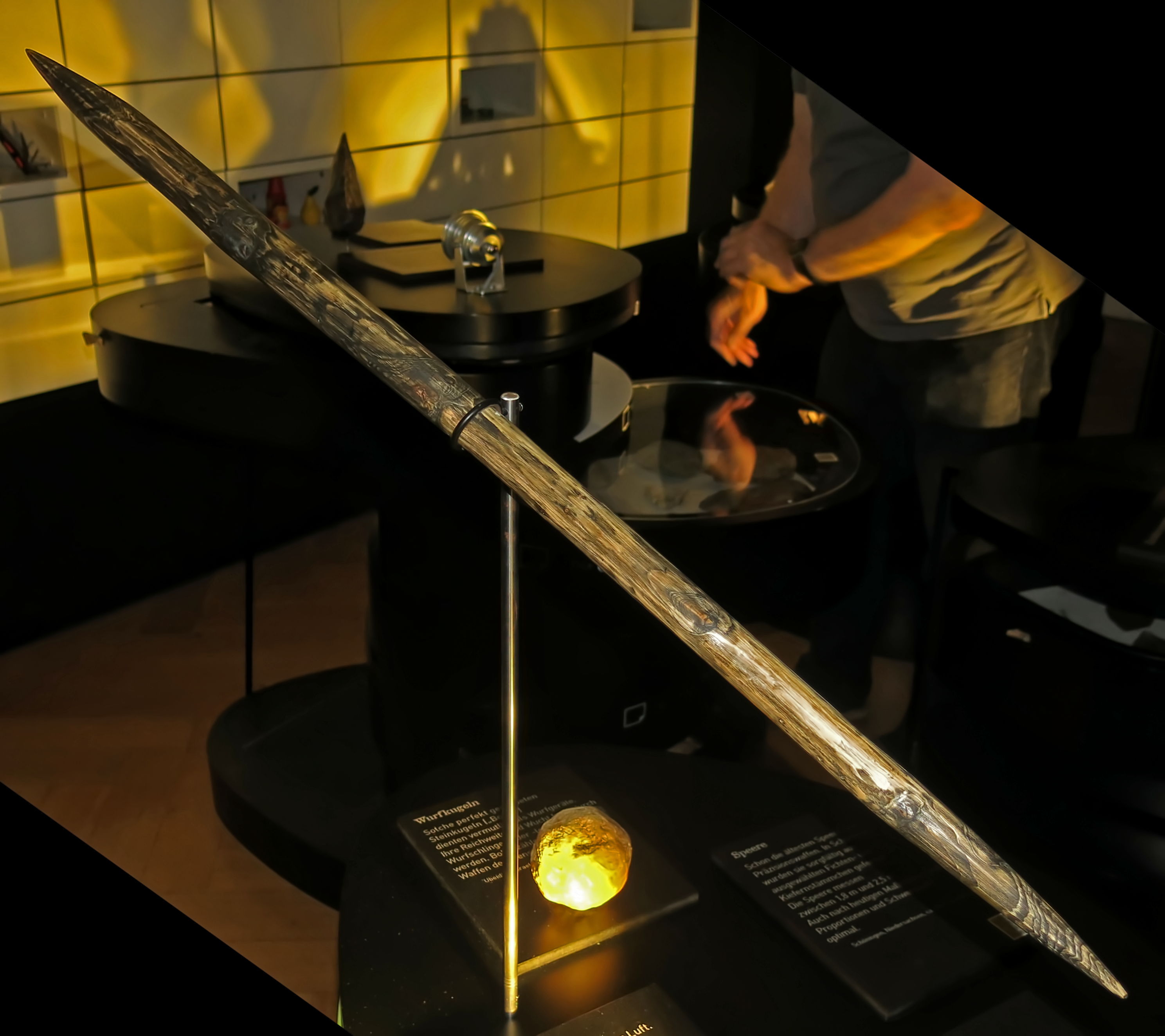
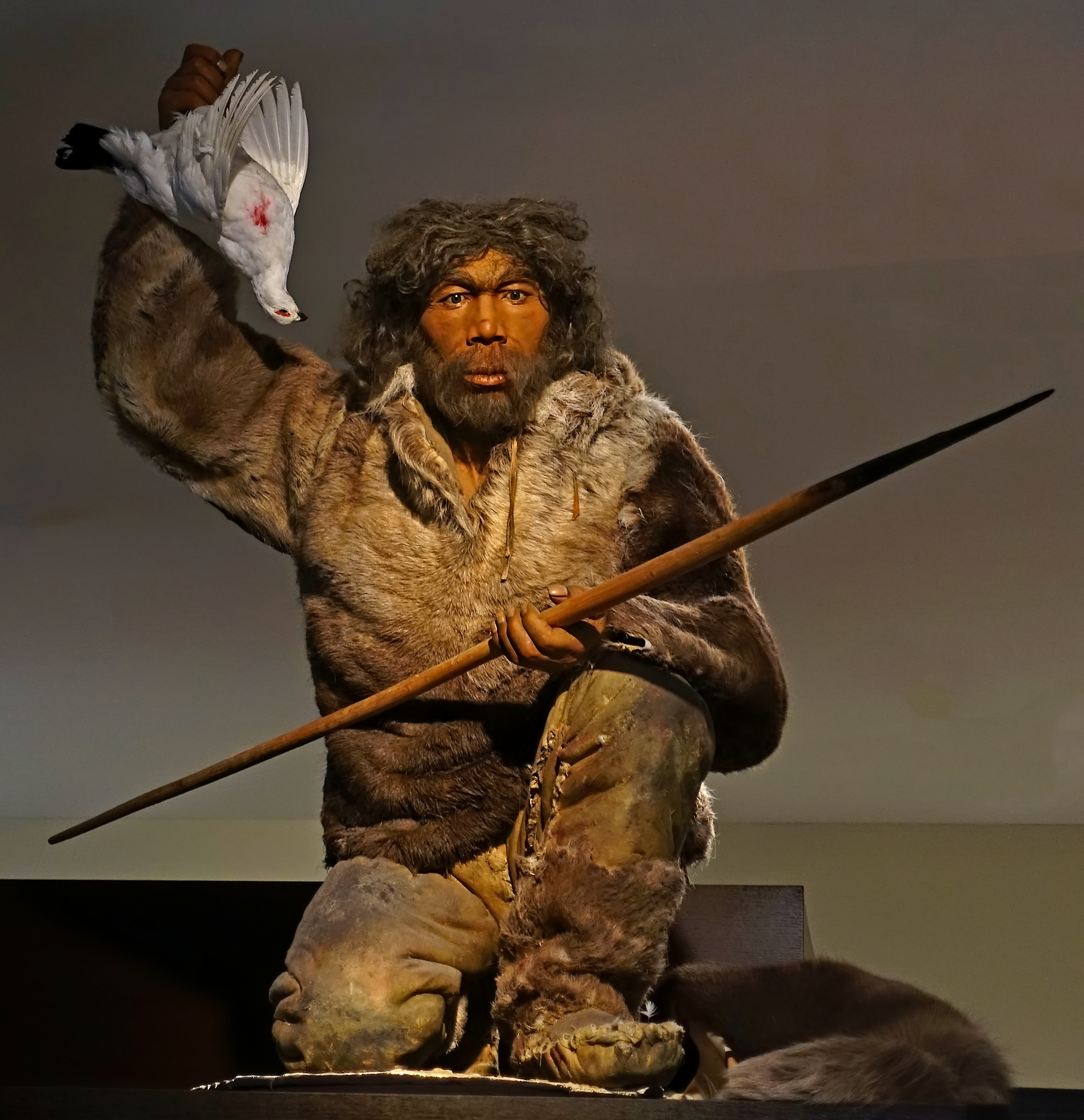
Throwing stick. These are designed to rotate in the air when thrown, and are used to bring down small animals.
Schöningen, Niedersachsen, Germany, ca 400 000 BP.
Schöningen is famous for the Schöningen Spears, four ancient wooden spears found in an opencast lignite (brown coal) mine near the town. This environment helped preserve the wooden spears, which otherwise would have long ago rotted away. The spears are about 400 000 years old, making them the world's oldest human-made wooden artefacts, as well as the oldest weapons, ever found.
Three of them were probably manufactured as projectile weapons, because the weight and tapered point is at the front of the spear making it fly straight in flight, similar to the design of a modern javelin. The fourth spear is shorter, with points at both ends and is thought to be a thrusting spear or a throwing stick. They were found in combination with the remains of about 20 wild horses, whose bones contain numerous butchery marks, including one pelvis that still had a spear sticking out of it. This is considered proof that early humans were active hunters with specialised tool kits.
Photo: Don Hitchcock 2015
Source and text: Facsimile, Monrepos Archäologisches Forschungszentrum und Museum, Neuwied, Germany
Additional text: Wikipedia
Wangen
The village of Wangen on the Unstrut River
Photo: Mirko Küster
Permission: Creative Commons Attribution-Share Alike 3.0 Unported license and the GNU Free Documentation License, Version 1.2 or any later version published by the Free Software Foundation
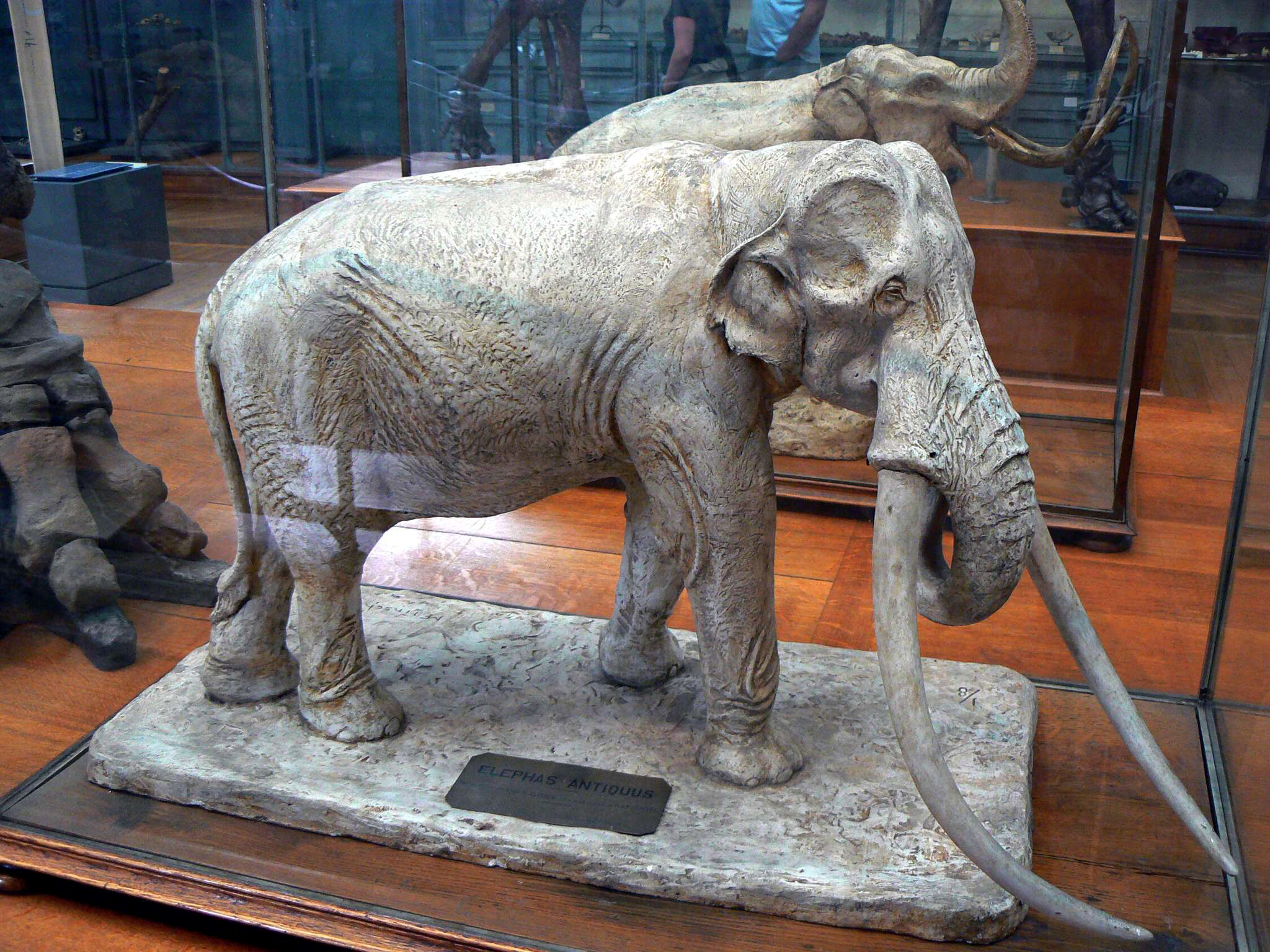
In the sandy gravels of the Wangen terrace a Palaeoloxodon antiquus fauna was found.
The Straight-tusked Elephant (Elephas (Palaeoloxodon) antiquus or Palaeoloxodon antiquus) is an extinct species of elephant closely related to the living Asian Elephant. It inhabited Europe during the Middle and Late Pleistocene (781 000 – 11 550 years before present). Some experts regard the smaller Asian species Elephas namadicus, as a variant or subspecies of this one.
The creature was 370 cm (12 ft) tall and had long, slightly upward-curving tusks. The legs of Elephas antiquus were slightly longer than those of modern elephants. It is suggested that this elephant had an 80 cm long tongue that could be projected a short distance from the mouth to grasp leaves and grasses. With this tongue along with a flexible trunk, straight-tusked elephants could graze or browse on Pleistocene foliage about 8 metres above the ground.
Straight-tusked elephants lived in small herds of about 5 to 15 individuals. They preferred warm conditions and flourished in the interglacial periods during the Ice Ages, spreading from continental Europe to Great Britain during the warmer periods. It is assumed that they preferred wooded environments. During colder periods the species migrated south. It became extinct in Britain by the beginning of the last ice age, about 115 000 years ago. Eventually it was replaced by the mammoth.
Photo: Taken at the Muséum national d'Histoire naturelle, Paris in August 2006 by 'LadyofHats'. The photographer has graciously released it into the public domain.
Sculptor: The sculptor appears to have signed as M.F. Linsch, and the sculpture is at 1/8 scale.
Text: Wikipedia
Faunal reference: Mania (1995)
The archaeological site of Wangen, 50 km south west of Halle, and now part of Nebra, has been dated by by Haidle and Pawlik (2010) to the Bilzingsleben I
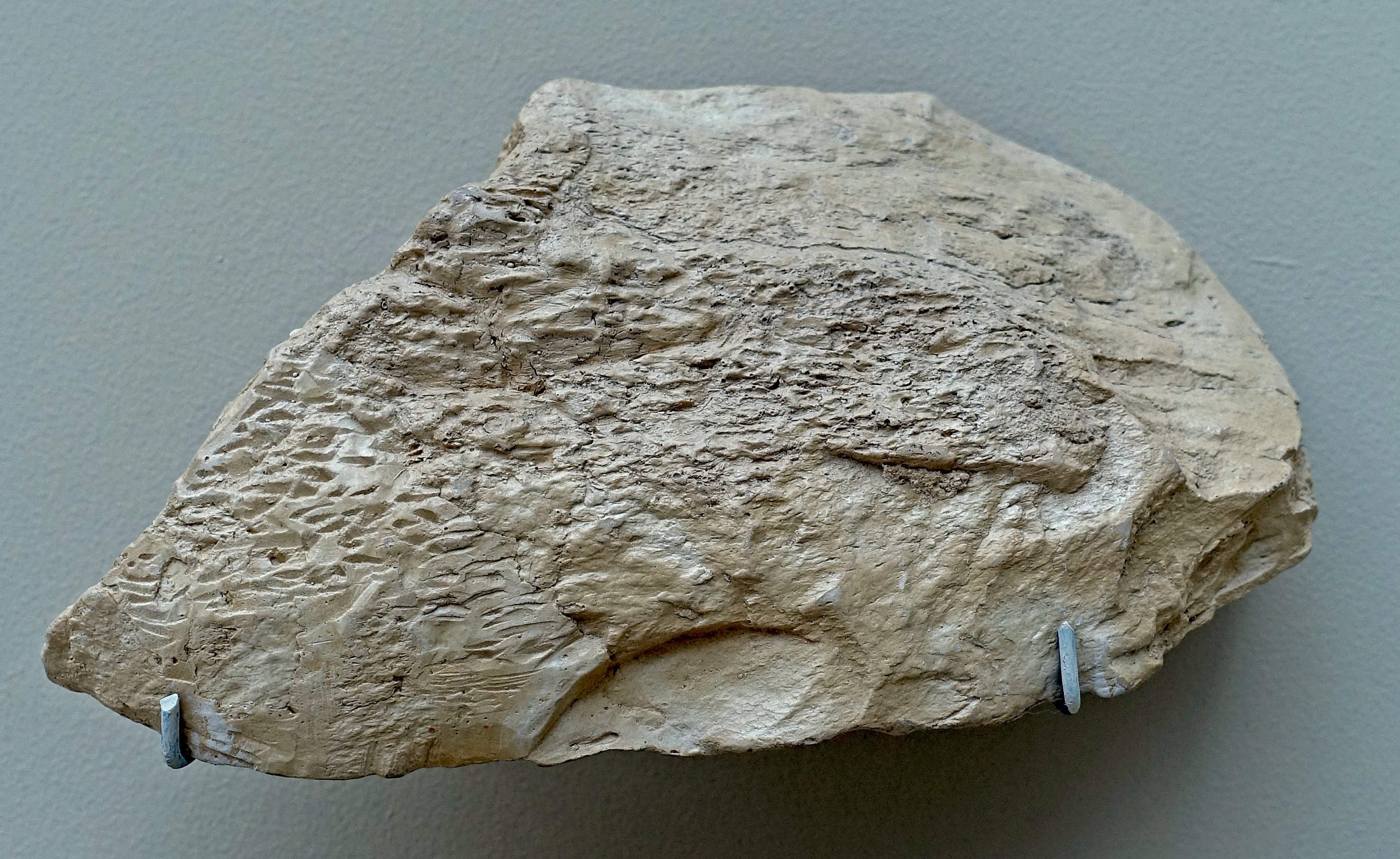
Schaber, scraper, circa 370 000 BP.
From Wangen, 50 km SW of Halle
Flint, length 65 mm, width 55 mm.
Photo: Don Hitchcock 2018
Source and text: Halle Landesmuseum für Vorgeschichte, https://nat.museum-digital.de/, CC-BY-NC-SA @ State Museum of Prehistory Halle
Abschlag, flake, circa 370 000 BP.
From Wangen, 50 km SW of Halle
Photo: Don Hitchcock 2018
Source and text: Halle Landesmuseum für Vorgeschichte, CC-BY-NC-SA @ State Museum of Prehistory Halle
Kernstein, core, circa 370 000 BP.
From Wangen, 50 km SW of Halle
Photo: Don Hitchcock 2018
Source and text: Halle Landesmuseum für Vorgeschichte, CC-BY-NC-SA @ State Museum of Prehistory Halle
Bilzingsleben
The oldest camp site of Central Germany
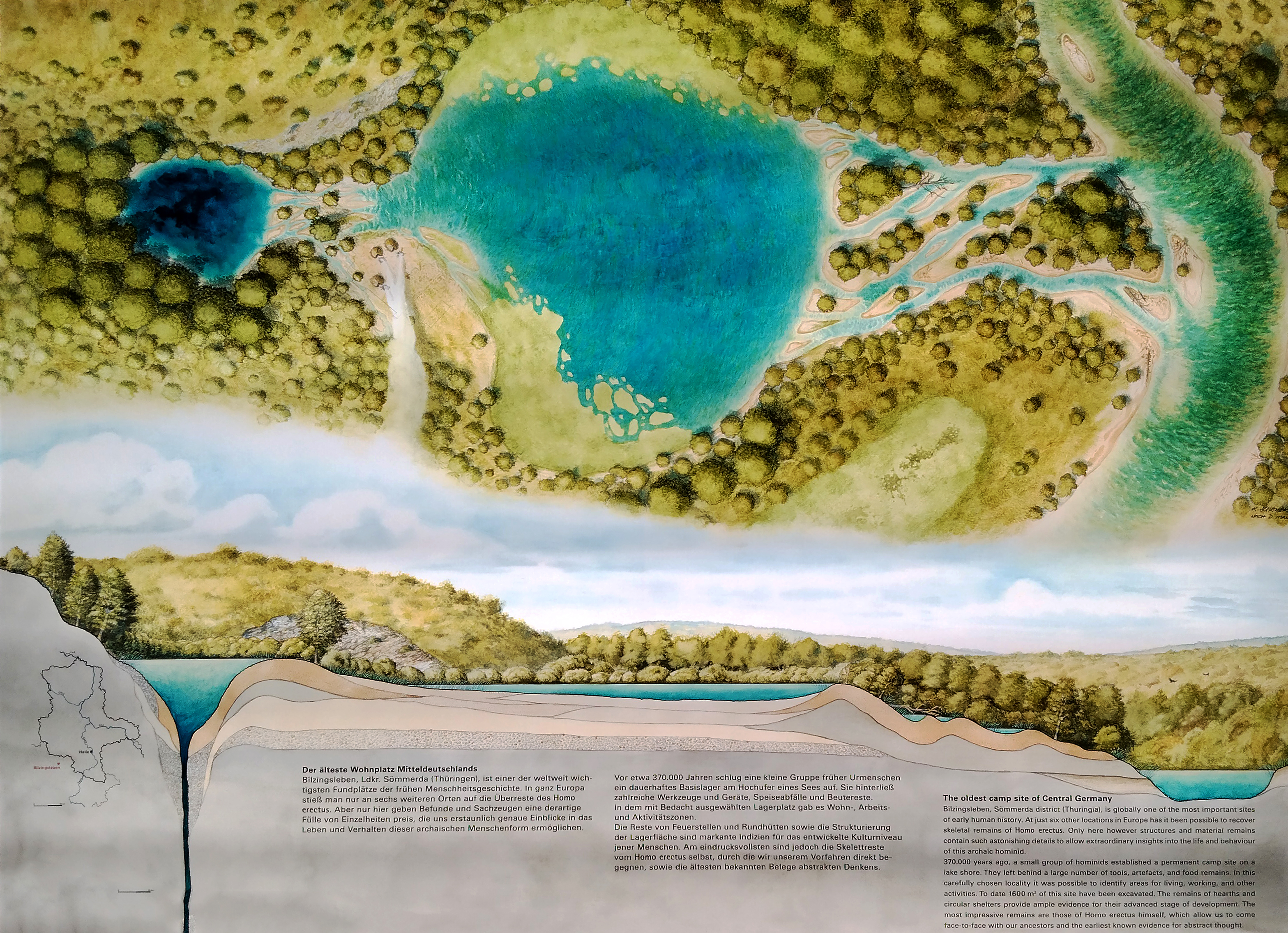
Bilzingsleben, Sömmerda district (Thuringia), is globally one of the most important sites of early human history. At just six other locations in Europe has it been possible to recover skeletal remains of Homo erectus. Only here, however, structures and material remains contain such astonishing details to allow extraordinary insights into the life and behaviour of this archaic hominid.
370 000 years ago, a small group of hominids established a permanent camp site on a lake shore. They left behind a large number of tools, artefacts, and food remains. In this carefully chosen locality it was possible to identify areas for living, working, and other activities. To date 1600 m2 of this site have been excavated. The remains of hearths and circular shelters provide ample evidence for their advanced stage of development. The most impressive remains are those of Homo erectus himself, which allow us to come face-to-face with our ancestors and the earliest known evidence for abstract thought.
Photo and text: Poster, Halle Landesmuseum für Vorgeschichte, CC-BY-NC-SA @ State Museum of Prehistory Halle
Rephotography: Courtesy Michael Hess
Bilzingsleben
( As always, click on the small map above to see the full size version - Don )
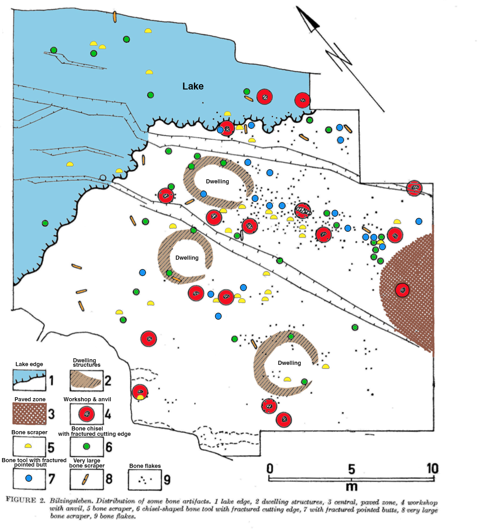
Map: Mania (1991)
Colourisation of the map by Don Hitchcock
Text below adapted from: Mania (1991)
The following facts can be noted:
In the inhabited marginal zone, there were three foundations of simple oval to circular dwelling structures of 3-4 metres in diameter situated in a distance of 1 and 4 metres of each other. They were characterised by larger, heavy bones of large mammals and plates and blocks of travertine and shell-bearing limestone peripherally set up on the structures and forming circles in a more or less diffuse way. In each case their entrances faced south.
In front of each structure towards the southwest, there was a hearth which can be identified by pebbles subjected to fire (fire-cracked, broken into pieces, chalky) and by remains of charcoal and charred wood occurring more or less frequently.
South of each dwelling structure, directly adjacent to them, there were two workshops with anvil stones in their centre, and pieces of stone and bones needed for the fashioning of tools, as well as manufacturing waste. Large tools were found on the periphery of the structures which may be explained as an expression of a principle of order: they were scraper and knife-like bone tools, antler cudgels, rod-like, calcified wood representing fragments of artefacts.
Two large bone artefacts with engravings laying between the workshops of two dwelling structures were discovered.
A third engraved bone artefact was found deposited in site of a workshop northwest behind the third structure; a fourth one was lying inside the workshop in front of the three dwelling structures. The area unearthed so far outside the section of the dwelling structures shows different zones discernible. Each of them is distinct from the others by the occurrence of certain find associations or of the same type of artefacts. They are also delimited from each other by the relative composition of the archaeological material (artefacts of stone, bone, antler, wood, artefact waste, raw-material, food remains, etc.).
Zone I comprises the whole diluvial fan. Numerous smashed bones and jaw remnants from hunted animals, flint artefacts, their manufacturing waste, and less frequently, also, some large objects such as antler artefacts, tusks or parts of them, bones of large mammals, large pebble tools, pebbles or wrecked pieces of various rocks are embedded in travertine sands up to 60 cm thick.
The rubbish (food garbage) represent dominant elements. So, this zone can be characterised as a garbage dump. This is also attested by a great quantity of small objects found (flint material excluded) less than 10 cm: their proportion being 88 %.
Larger objects come from certain activities executed on the sand banks or on particular shore sections near the water, such as antler artefacts, the bones of large mammals and tusks, being apparently the result of the processing of prey animals. Southwest of the dwelling structures, there was a brooklet trough as deep as 1 metre running from NW to SE and cutting the ancient loess surface.
Up to two-thirds of its depth was filled with the same rubbish as that found in the diluvial fan. In the vicinity of the brooklet trough, reaching as far as the dwelling structures, only a moderate scatter of small finds was discovered. This area seems to have been cleared up, the major part of the rubbish having been removed by Homo erectus.
Zone II extends along the shore line in a 2-3 metre wide band. It comprises even the shore slope which rises to a height of about 30-50 cm. There, in particular, large objects are abundant, with conspicuous large fragments or complete pieces of the ends of bones, pelvis and scapulae of large mammals. Moreover, large parts of rhinoceros and elephant lower jaws are common. With the same frequency, large blocks, pebbles and slabs of travertine and shell-bearing limestone occur, whereas those of quartzite and kristallin can be registered in a lesser abundancy.
Often, the soil is covered by objects forming an area similar to a pavement. Mostly on the shore escarpment, large skeletal fragments are scattered. It is notable that finds of numerous antler cudgels occur there, along to the shoreline. Some large bone tools equally occur repeatedly. The proportion of smaller objects less than 10 cm was reduced to 55 %. This zone is explained by us to have been a special activity zone on the shore with activities having to be carried out which necessitated water or its easy access. Partly, they are butchering or dismembering sites of the animals hunted, partly they represent particular workshops. On the opposite shore edge of the diluvial fan, a similar zone appeared, not so distinctly structured, however, since already situated in a peripherical way to the occupation zone. It is noticeable that a great abundance of antler tools were found there (Fig. 3).
Zone III: The area of dwelling structures situated behind the shoreline containing hearths and workshops can be recognized as a particular zone. This zone constitutes a 4-5 m wide, arc-shaped band (it was already described above). Zone IV: It is the so-called workshop zone.
It extends over the place in front of the dwelling structures running in a 4-6 metre wide band over the northeast part of the place as far as zone II situated on the shore. It includes numerous workshops with anvils. They consist of quartzite, travertine, of shell-bearing limestone slabs and served for the working of bones or for the manufacture of pebble or flint tools.
Another anvil was made of the tibia of an elephant propped laterally and used as chopping block for the working of wood. In accordance to it, there were numerous calcified wood remains and rod-like wood artefacts of a size of 250 cm scattered about in the neighbourhood. Probably, a fragment of a tusk lying beside it equally served as an anvil.
The finds in the workshop zone mainly consist of large bone fragments, mostly from elephants and rhinoceroses, the long bones of elephants predominantly having been used as raw-material for the manufacture of large bone tools. They were chopped, split and later worked the hammerstone on the anvils. Abundantly, the chips of waste, flakes, half-finished pieces and blanks from the compacta (compact bone, such as the shaft wall of a long bone) of elephant bones occur at these places. Moreover, there are pebbles and slabs of shell-bearing limestone and travertine as well as large pebble tools of quartzite and limestone.
the part of a bone made up of compact bone (as the shaft wall of a long bone) compacta.
At special places, bone tools are accumulated, this indicating that they were used there. One anvil of travertine served mainly for the detaching of antlers used to manufacture cudgels and mattocks. That is why many prongs, parts of crowns and splinters of shafts were scattered around the workshop. Objects less than 10 cm represent 70 % of all objects found in this zone (flint artefacts excluded). However, unlike the situation in the diluvial fan, where especially food garbage had accumulated, they consist of waste produced by the working of bones, antlers, ivory and stones. The archaeological composition of the workshops beside the dwelling structures is markedly similar to the find situation of this workshop zone. Equally, some workshops situated west and northwest behind the dwelling structures are similar to them.
Zone V: It is a zone situated almost centrally on the area in front of the dwelling structures at a distance of 5-8 metres from them. It was discovered on the surface covered by archaeological material. We have designated it with the name of 'central paved place', it was only partially uncovered, this part being of semicircular form and reaching a width of 7 metres.
In general, it constitutes a closely paved horizontal place predominantly consisting of small objects. Pieces less than 10 cm represent 83% of all objects found there and forming the pavement. 60% of them are stones, 38% are bones, splinters of bones, teeth, antler fragments and 2% are evidence of wood. They represent material which was hardly suitable for any use, tools are almost missing and the skeletal assemblage consists of insignificant refuse.
However, flat slabs, pieces detached from stones and even bones such as vertebrae from elephants and rhinoceroses were also part of the pavement. The rock material is alien. It is composed of 60 % of travertine pebbles, shell-bearing limestone pebbles and chips make up 25 %, and 15 % are quartzite, crystalline and flint pebbles as well as calcareous concretions. The travertine pebbles originate from weathered debris coming from an older travertine deposit lying in the neighbourhood, 200 metres from the living floor.
The wood remains which are also included in the pavement — mostly rod-like pieces — could be recognised as negative impressions on the loess surface. Wood structures were still determinable as impressions in the wood, hard parts of the wood were preserved in a calcified state, brownish to black organic matter could still be seen on the impressions.
The place was densely and simply paved, only in rare cases there were pieces overlying each other — they were covering about 75 % of the loess surface. The objects were pressed into the soft loess soil and their parts jutting from the surface were covered by a 1—2 cm thick layer of silty travertine sand. Thus, the pavement appeared to be a flat barn floor shaped place which, by virtue of the scanty presence of objects, stood out against its surroundings distinctly, especially against the workshop zones lying west, north and northeast.
The following conspicuous, though isolated objects were found on the pavement: in the midst of the presumed centre, there was a naturally dropped red deer prong lying on a shell-bearing limestone slab disintegrated by fire. This prong constitutes, by the way, the only completely preserved one to have been found on the entire site.
In the peripheral southern part, there was a larger travertine slab, in the western section, there appeared an anvil constituting a quartzite block distinctly jutting from the pavement. Bones were smashed on it, as was indicated by minute bone elements which had remained in the natural cavities on its surface. There were, however, neither chopping tools nor bone splinters. To the west, adjacent to the quartzite block, there was a bison frontal bone with both horn cores pressed into the loess soil. We consider it to be a finding of particular significance.
At a 50 cm distance from the anvil, a human parietal bone was unearthed. There was a further bone of a hominid lying at the northwest periphery of the pavement with its break surface matching with the first fragment. Apparently, both of them derive from a crushed skull. A left orbital fragment was found at the northeast periphery of the pavement.
About 5 metres away, a third parietal fragment was found. One canine tooth lay in the southern part of the pavement. Farther to the north and west, i. e. 1 — 3 metres outside the pavement, one premolar and two molars occurred. This finding is very conspicuous, too.
Zone VI: To the west and southwest of the pavement, a zone spreads which is delimited by the third dwelling structure in the southwest and by the brooklet trough. It is striking to see a considerable thinning of finds distributed there. Remarkably smaller objects occur. These are, however, similar to the central pavement, pressed into the ancient loess surface at several places, on areas of 1 to 2 m2.
Large pebble, bone and antler tools occur less frequently. Some other conspicuous finds are the tusk of a big boar (perhaps having served as a hunting trophy) and a thin flat shell-bearing limestone slab with polished surface bearing numerous scratches.
The most striking find, however, seems to be a 5 metre long straight alignment of medium-sized shell-bearing limestone and travertine pebbles deposited in regular distances of 25-30 cm from each other. It runs from SSW to NNE and is directed to the centre of the pavement, ending abruptly in front of its periphery.
180 cm long tusks of a forest elephant were lying at the two terminal parts of the alignment, belonging presumably to the same animal. Both of them were considerably crushed and therefore difficult to recover. Between this alignment and the third dwelling structure, some linear clusters of finds appeared, equally running towards the central pavement. They suggest small paths which had been due to bone and stone objects accumulated laterally by people walking there.
Thus, 40-60 cm wide zones remained devoid of any objects. There is a less conspicuous zone west and south-west behind the dwelling structures. There, some workshops were observed. The disposition of the zones related to special activity areas on the living floor is also discernible according to a quantitative and qualitative evaluation of their archaeological material.
The distribution of antler tools and their manufacturing waste indicate the zonal disposition of the occupation floor. Most frequently, they occur on the shore of the lake immediately in front of it at the basin edge. This situation is repeated at the opposite basin edge delimiting the diluvial fan. In the diluvial fan, mostly broken or worked down antler tools and countless antler rejects are found. They are less common on the place in front of the dwelling structures, in the area comprising the dwellings.
On the one hand, they were deposited along with other large tools on the periphery of the dwelling foundations, on the other hand, they appear within the workshop zone. Three antler tools appeared so far on the pavement.
From the density of distribution related to 1 m2 the following data are obtained:
The proportion of archaeological objects less than and greater than 10 cm was already mentioned above, and it equally shows differences, such as a high proportion of small objects from food refuse in zone 1 as well as of small objects from manufacturing waste in zone III, a very high proportion of smaller objects lying on the central pavement appropriate to the material employed there. But the proportion of large tools from pebbles, bones, antlers and ivory (flint excluded), related to the totality of the material allows the zones to be easily distinguished and characterised: In the activity zone on the shore (II), large tools were preferably used at work. They made up nearly 20% of the finds distributed on the shore, (> 10 cm).
In the workshop zone (IV), on the grounds; of abundant manufacturing waste, they only represent 11%. In the garbage dump of the diluvial fan, however, they reach only 1.5-2%. Similarly they occur rarely on the central pavement (V), as they were not employed there: 1—1.5%.
The mapping of different artefact types also demonstrates particular activity areas: With the help of bone flakes distributed at certain places, the workshops can be recognised where compact bone was fashioned in order to manufacture bone tools.
The workshops equally recognisable by wood remains and characteristic of wood working were already mentioned above. A special type of bone scraper appears almost exclusively in front of the entrances of the three dwelling structures. Special persons carried out particular works with them. Other bone tools, i.e. the type having a splintered and rounded cutting edge and splintered butts, are found on particular workshops in front of the dwelling structures.
The large 30-80 cm long plane-shapedi or scraper-shaped bone tools are mostly found on the shore or were deposited against the walls of the dwelling structures.
Once these investigations will have come to an end, it will be possible, as is already partially visible:, to attest quite specific activities and behaviour of the hominids on the occupation floor of Bilzingsleben.
Since these associations of artefacts and differentiations of zones are arranged without any zone or structural overlapping or disturbing the other, we are justified in concluding with the following statement: this site constitutes a long—lasting living-floor inhabited almost intermittently for a long time serving as a home base and not, as was previously supposed, as an occupation floor used for a short time, perhaps related to seasonal or traditional activities.
Text above adapted from: Mania (1991)
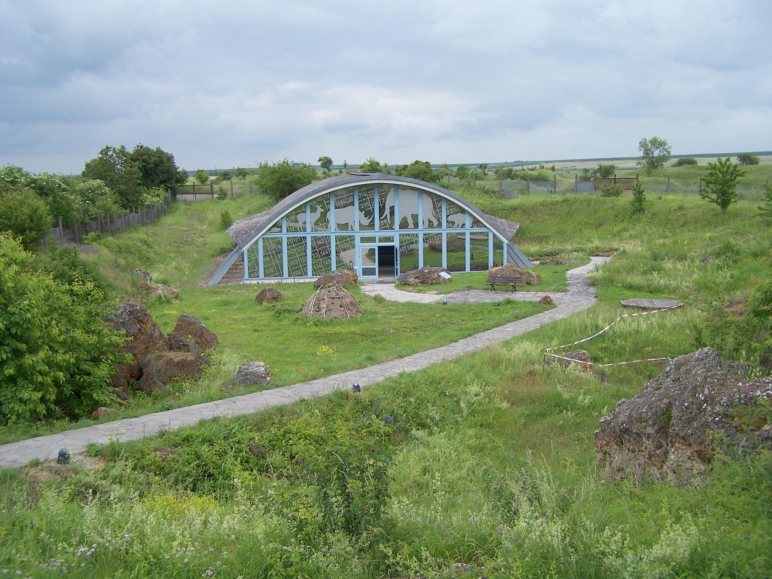
The archaeological site of Bilzingsleben
Photo: Metilsteiner
Permission: Creative Commons Attribution 3.0 Unported license
Bilzingsleben is located on the northern border of the Thuringian Basin. The Hercynian mountain building fault-line (Finne-Störung) is the cause for numerous springs in this area. The emerging spring waters in turn have dissolved the local calcareous rocks and formed the interglacial travertine deposits that cover the Bilzingsleben site. The 400 000 year long conservation is attributed to the travertine's remarkable resilience to erosional processes.Text above: Adapted from Wikipedia
The site itself was part of a fluvial terrace in Pleistocene, Central European river basin now situated 1.5 km (0.93 mi) south of the village of Bilzingsleben, Sömmerda district at 175 m (574.15 ft) above sea level in an old travertine quarry, called Steinrinne, where travertines have been quarried since early modern times and the material was used in the towns of the region, for example Kindelbrück's city wall.
Under the auspices of the Halle State Museum of Prehistory a systematic excavation was launched in 1971 that lasted until 1992 during which 1,600 m2 (17,222.26 sq ft) were documented and several human fossils were unearthed. Consequently administration of the site has been handed to the University of Jena.
The lithic industry is characterised by chopping tools of diminutive sizes. There are no true hand axes. The raw material is mainly flint, although quartzite, quartz and travertine have been used as well. There are numerous bone tools (hoes, scrapers, points and gougers). Some hoes are made of antler or ivory. Even wooden artefacts have been preserved.
In 1974 a piece of a human skull was identified among the finds. To date, 37 human bones and teeth have been found, mainly parts of the skull. They represent the remains of at least three individuals and have been classified as Homo erectus bilzingslebenensis by Emanuel Vlcek (Praha). The remains of the skulls show that they have been intentionally smashed postmortem, perhaps as part of a burial rite.
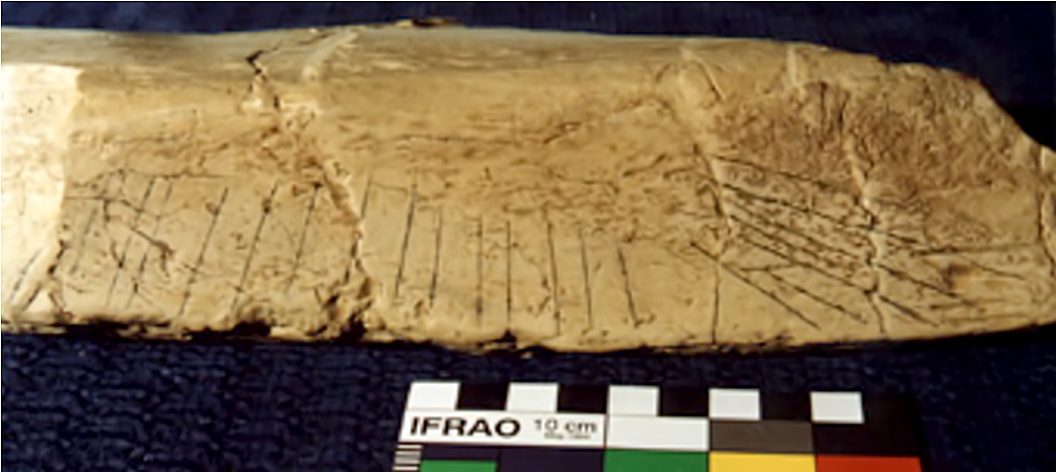
One bone fragment, an elephant tibia, has two groups of 7 and 14 incised parallel lines and might represent an early example of art. The regular spacing of the incisions, their subequal lengths and V-like cross-sections suggest they were created at the same time, with a single stone tool. The tibia dates to between 350 000 and 400 000 years ago.The interpretation as an early calendar is a possibility.
( This image may be of a facsimile - Don )
Photo: Bednarik (1995)
Text: adapted from Wikipedia
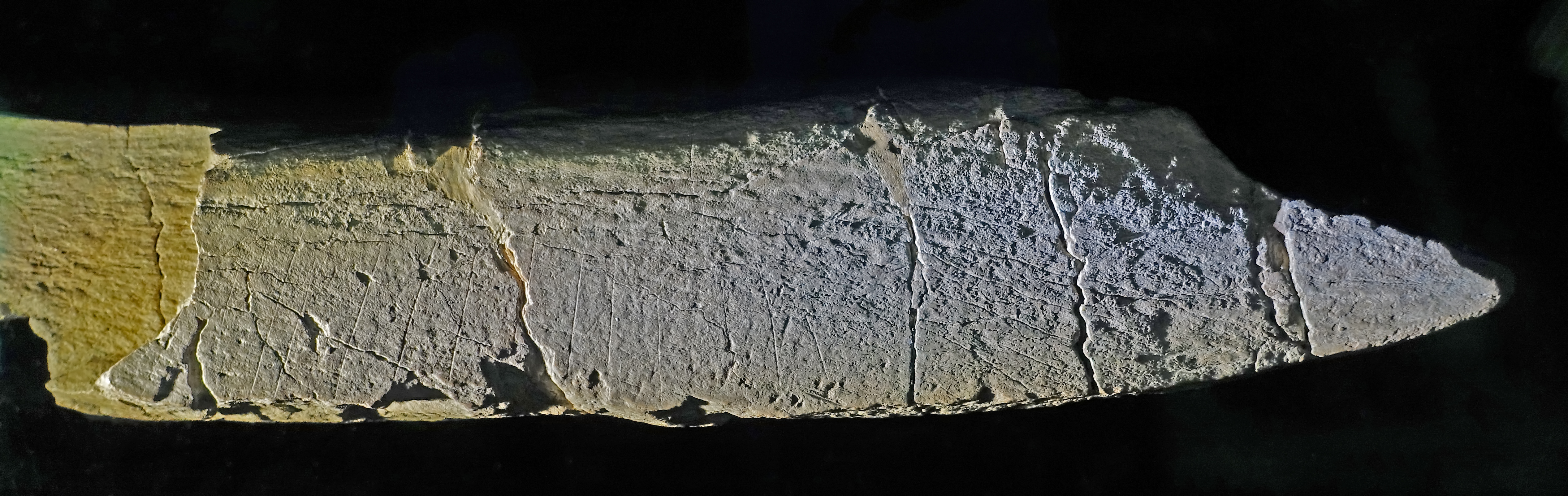
The oldest graphic-communicative signs in the world, 370 000 BP
Lines purposefully made on the tibia of an elephant by Homo erectus
Photo: Don Hitchcock 2018
Source and text: Original, Halle Landesmuseum für Vorgeschichte, CC-BY-NC-SA @ State Museum of Prehistory Halle
Signs of lifeText above: Halle Landesmuseum für Vorgeschichte, CC-BY-NC-SA @ State Museum of Prehistory Halle
Homo erectus 370 000 years ago was a thinking and conscious person, capable of mental and linguistic expression.
This is revealed by some inconspicuous fragments of animal bones with engravings from Bilzingsleben, which were clearly made by human hands with sharp tools.
The rhythmic arrangement of the lines precludes an interpretation as traces of working. Especially these two sequences of strokes on the tibia of an elephant are to be seen in their symmetric fanned out arrangement as an optical translation of a thought.
It is irrelevant whether they gave expression to a spontaneous joy of design or whether they had a concrete informational content.
They are the oldest graphic-communicative signs in the world.
The purposeful representation of mental ideas requires abstract thinking and thus requires - for the formulation of a thought - language.
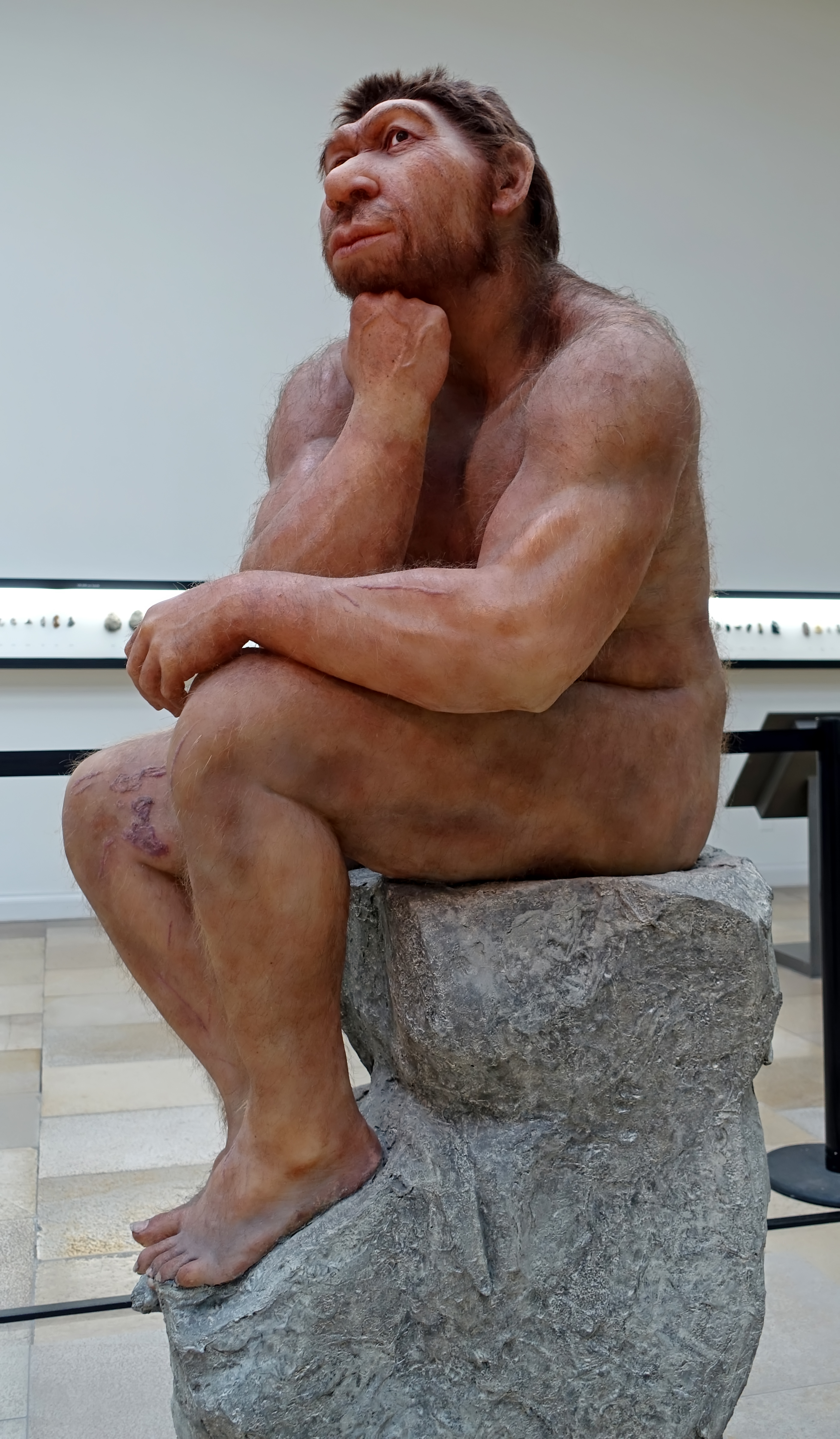
Homo erectus
Soft tissue reconstruction based on the skull reconstruction by G.J. Sawyer & I. Tattersall. They used the Zhoukoudian skull fragments XII, III, XIV/VI, X/I, X/II, the mandible fragments GI/II and the isolated teeth 2, 6, and 13.
Zhoukoudian, China, circa 780 000 BP - 600 000 BP.
Photo: Don Hitchcock 2015
Sculptor: Atelier Élisabeth Daynès, Paris
Source and text: Facsimile, Vienna Natural History Museum, Naturhistorisches Museum Wien
Skull Crushing
The fractures of the skull bones indicate a deliberate smashing after death. The remains of the two heads lay mostly separated from each other. Some fragments, however, were concentrated on a separate free surface, on which only a quartzite block was found, surrounded by the horn cones of a bison skull. In the surface of this anvil stone, which was scarred by impact marks, crushed bone particles were actually found.
The reason for the violent treatment of the skulls remains open.
Are these the traces of ritual behaviour? From much later times, we know of ceremonial reburials in which the skulls of the deceased were separated from the body and prepared in various ways.
Text above: Halle Landesmuseum für Vorgeschichte, CC-BY-NC-SA @ State Museum of Prehistory Halle
Abschlaggerät, tool on a flake, Reinsdorf interglacial, circa 370 000 BP.
From Bilzingsleben, 80 km WSW from Halle.
Photo: Don Hitchcock 2018
Source and text: Halle Landesmuseum für Vorgeschichte, CC-BY-NC-SA @ State Museum of Prehistory Halle
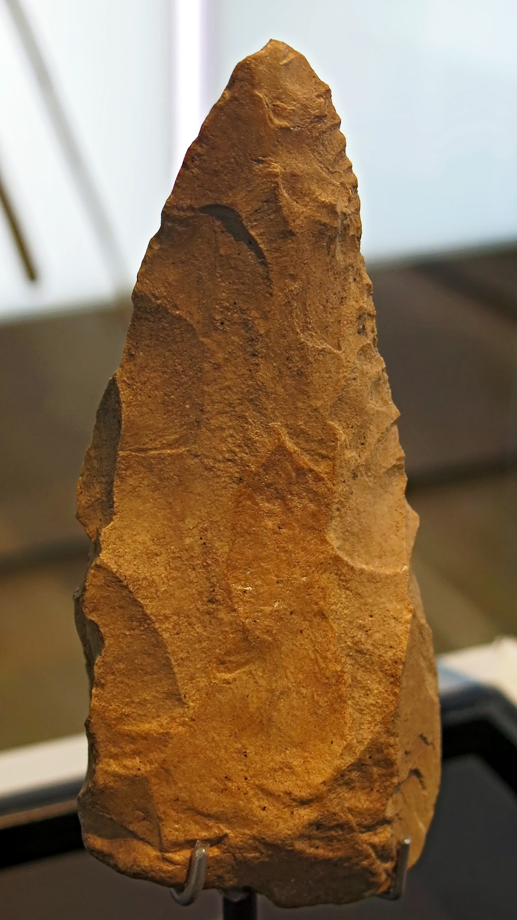
Spitze, point, Reinsdorf interglacial, circa 370 000 BP.
From Bilzingsleben, 80 km WSW from Halle.
Photo: Don Hitchcock 2018
Source and text: Halle Landesmuseum für Vorgeschichte, CC-BY-NC-SA @ State Museum of Prehistory Halle
Kerngerät, tool made from a core, Reinsdorf interglacial, circa 370 000 BP.
From Bilzingsleben, 80 km WSW from Halle.
Photo: Don Hitchcock 2018
Source and text: Halle Landesmuseum für Vorgeschichte, CC-BY-NC-SA @ State Museum of Prehistory Halle
Schaber, scraper, Reinsdorf interglacial, circa 370 000 BP.
From Bilzingsleben, 80 km WSW from Halle.
Photo: Don Hitchcock 2018
Source and text: Halle Landesmuseum für Vorgeschichte, CC-BY-NC-SA @ State Museum of Prehistory Halle
Schaber, scraper, Reinsdorf interglacial, circa 370 000 BP.
From Bilzingsleben, 80 km WSW from Halle.
Photo: Don Hitchcock 2018
Source and text: Halle Landesmuseum für Vorgeschichte, CC-BY-NC-SA @ State Museum of Prehistory Halle
Abschlagerät, tool on a flake, Reinsdorf interglacial, circa 370 000 BP.
From Bilzingsleben, 80 km WSW from Halle.
Photo: Don Hitchcock 2018
Source and text: Halle Landesmuseum für Vorgeschichte, CC-BY-NC-SA @ State Museum of Prehistory Halle
Spitze, point, Reinsdorf interglacial, circa 370 000 BP.
From Bilzingsleben, 80 km WSW from Halle.
Photo: Don Hitchcock 2018
Source and text: Halle Landesmuseum für Vorgeschichte, CC-BY-NC-SA @ State Museum of Prehistory Halle
Spitze, point, Reinsdorf interglacial, circa 370 000 BP.
From Bilzingsleben, 80 km WSW from Halle.
Photo: Don Hitchcock 2018
Source and text: Halle Landesmuseum für Vorgeschichte, CC-BY-NC-SA @ State Museum of Prehistory Halle
Simply modified bone or antler tool from Bilzingsleben, 80 km WSW from Halle.
Photo: Don Hitchcock 2018
Source and text: Halle Landesmuseum für Vorgeschichte, CC-BY-NC-SA @ State Museum of Prehistory Halle
Simply modified bone or antler tool from Bilzingsleben, 80 km WSW from Halle.
Photo: Don Hitchcock 2018
Source and text: Halle Landesmuseum für Vorgeschichte, CC-BY-NC-SA @ State Museum of Prehistory Halle
Quartz and quartzite tools in Travertine limestone, circa 330 000 BP - 310 000 BP.
The travertine was formed as the result of the solution and redeposition of existing limestone in a karst environment, and at least 25 well-identified stone tools have been found in the travertine, dating from the time of its formation 330 000 years ago, during a warm period of the middle Pleistocene.
Kartstein, Stadt Mechernich, Kreis Euskrichen
Photo: Don Hitchcock 2015
Source and text: LVR-Landesmuseum Bonn, Germany
Additional text: http://www.georallye.uni-bonn.de/kartstein_bei_satzvey
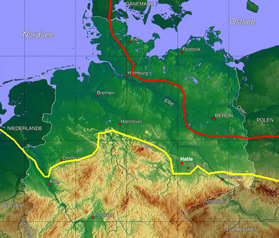
The Saale glaciation lasted from around 300 000 BP to 130 000 BP.
The yellow line marks the maximum extent (Drenthe stadium) of the Saale complex.
The red line shows the greatest extent of the younger Weichselian glaciation.
The maximum extent of the Saale continental ice sheet (Zeitz phase) reached to the west of the Saale River, probably along the line Lodersleben - Schmon - Steigra - Freyburg (Unstrut) and is marked by the Zeuchfeld sandur (glacial outwash plain) and other features.The yellow line marks the maximum extent (Drenthe stadium) of the Saale complex.
Photo: Christian Fischer
Permission: Creative Commons Attribution-Share Alike 3.0 Unported license
Addition: The location of Halle has been added to the map
Text: Sauer (2012)
Additional text: Wikipedia
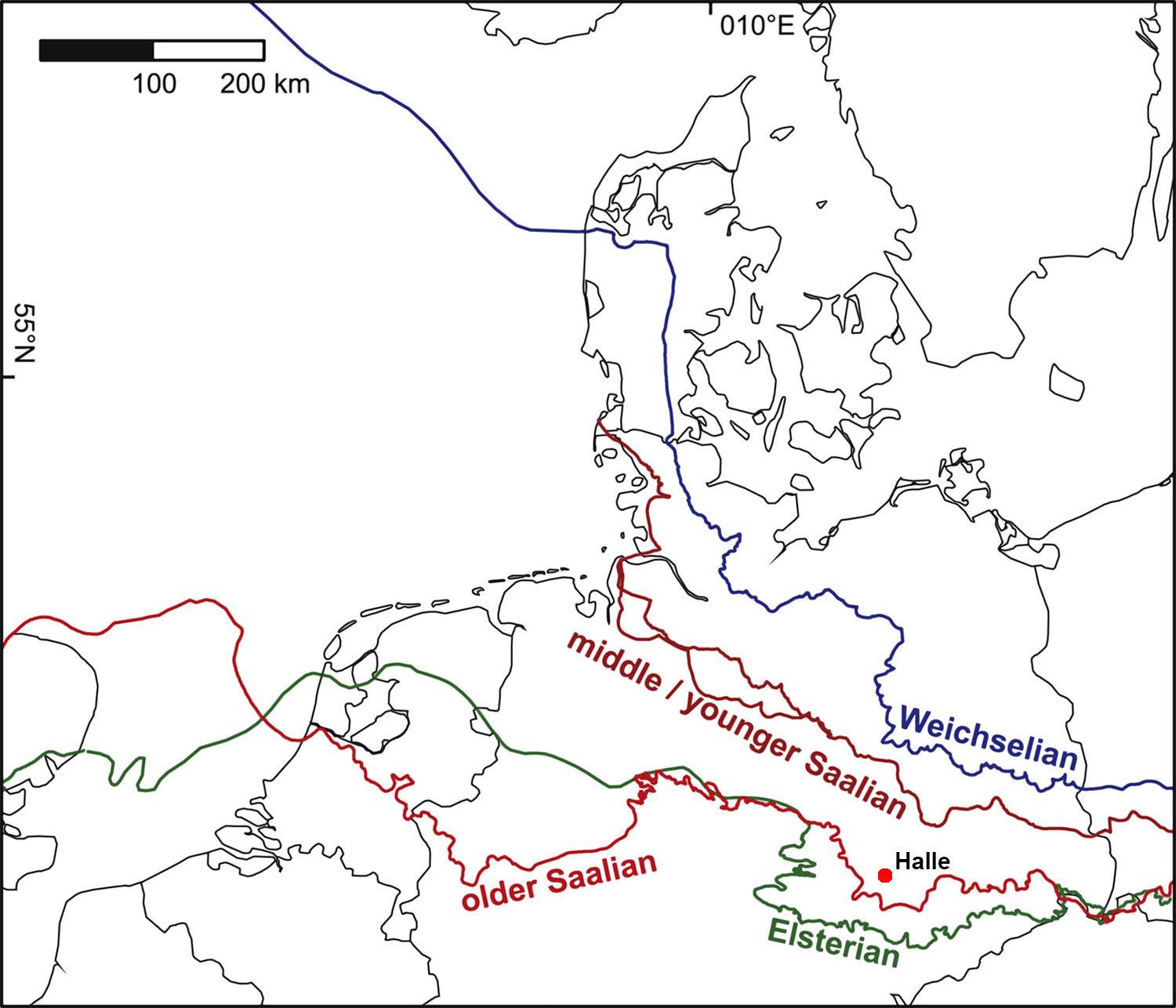
Overview map, showing the maximum extent of the Middle and Late Pleistocene ice advances.
Ice margins are based on Ehlers et al. (2011), Winsemann et al. (2011) and Moreau et al. (2012).
Addition: The location of Halle has been added to the map
( note the importance of the Southern edge of the Elsterian, or the Elster glaciation, which took place 500 000 – 300 000 years ago. It represents the farthest extent of what is known as 'Baltic flint', carried by glacial action from the north right across much of present Germany, providing an important lithic source for tools - Don )
Source: Lang et al. (2018)
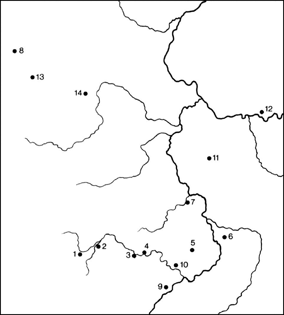
The middle Elbe-Saale-Region with important sites.
1: Bilzingsleben, 2: Sachsenburg, 3: Memleben, 4: Wangen, 5: Neumark-Süd, 6: Wallendorf, 7: Köchstedt, 8: Schöningen, 9: Lengefeld-Bad Kösen, 10: Freyburg, 11: Edderitz bei Köthen, 12: Klieken, 13: Osterode/Fallstein, 14: Schwanebeck/Huy.
Source: Mania (1995)
Wallendorf
Rehbach gravel pit, one of the Wallendorf/Schladebach gravel/sand pits near Merseburg.
The 5 - 12 metre thick deposits, known as 'Wallendorf gravels', lie on top of an erosion unconformity that separates the Upper and Lower Elsterian tills.
Photo: F. W. Junge
Permission: Creative Commons Attribution-Share Alike 3.0 Unported license, http://creativecommons.org/licenses/by-nc/3.0/
Source and text: Sauer (2012)
Wallendorf is in the district of Merseburg. The base of the so-called Wallendorf terrace located at the eastern edge of the Saale valley is approximately 10 m above the early Saale glacial level and is dated to the Fuhne glacial.
For the greater part, the gravel cover, with a thickness of 5 m, consists of material accumulated during a cold phase, as shown by the composition of its mollusc fauna and by frost structures in its upper part. The basal layers of the gravel contain mollusc associations of a cool temperate climate, and Palaeoloxodon remains. This indicates that the basal sandy gravels were deposited during the transition of the late interglacial to the early glacial. Artefacts found in this part of the section were, without any exception, manufactured from baltic flint, carried from the north as erratics by glaciation across much or Germany, the southern limit of the deposits being marked by the edge of the Elster Glaciation.
Approximately 1000 objects are present. The denudation residue of the Elsterian glacigenous sediments ( Baltic flint, deposited by glaciation - Don ) at the base of the gravel seems to have been the source of the raw material, as it contains a large number of large flint nodules. The artefacts might represent the remains of workshops once situated at the bottom of the valley.
Approximately 75% of the artefacts consist of flakes, 23% of cores and only 2% are tool pieces with retouch. Small preparation and retouch debris was not collected, so larger flakes dominate, with sizes between 35 and more than 100 mm, and an average value of approximately 60 to 70 mm. The cores reach sizes of more than 150 mm, but more than 80% are smaller than 85 mm, mostly exhausted exemplars.
Most flakes are short and thick, irregularly shaped with their cortex often not yet removed. They have large flaking angles (95° to 150°, average value 125°) and well pronounced bulbs of percussion. Levallois cores as well as prepared cores used for the production of blades also occur, as do flakes from such cores. Only a few flake tools are present, mostly scrapers. Some flakes have notched or denticulated edges. Some crudely flaked tools resemble roughouts of handaxes.
Text above: Mania (1995)
Schaber, scraper, 250 000 BP.
From Wallendorf, circa 20 km to the south south east of Halle.
Photo: Don Hitchcock 2018
Source and text: Halle Landesmuseum für Vorgeschichte, CC-BY-NC-SA @ State Museum of Prehistory Halle

Schaber, scraper, 250 000 BP.
From Wallendorf, circa 20 km to the south south east of Halle.
Photo: Don Hitchcock 2018
Source and text: Halle Landesmuseum für Vorgeschichte, CC-BY-NC-SA @ State Museum of Prehistory Halle
Klinge, blade, 250 000 BP.
From Wallendorf, circa 20 km to the south south east of Halle.
Length 85 mm, width 35 mm
Photo: Don Hitchcock 2018
Source and text: Halle Landesmuseum für Vorgeschichte, https://nat.museum-digital.de/, CC-BY-NC-SA @ State Museum of Prehistory Halle
Abschlag, flake, 250 000 BP.
From Wallendorf, circa 20 km to the south south east of Halle.
Photo: Don Hitchcock 2018
Source and text: Halle Landesmuseum für Vorgeschichte, CC-BY-NC-SA @ State Museum of Prehistory Halle
Abschläge, flakes, 250 000 BP.
From Wallendorf, circa 20 km to the south south east of Halle.
Right: Length 80 mm, width 55 mm
Photo: Don Hitchcock 2018
Source and text: Halle Landesmuseum für Vorgeschichte, CC-BY-NC-SA @ State Museum of Prehistory Halle
Faustkeile, hand axes, 250 000 BP.
From Wallendorf, circa 20 km to the south south east of Halle.
( note that these hand axes are strictly utilitarian pieces, with just enough knapping to turn them into useful tools. Not all handaxes are works of art - Don )
Right: Length 110 mm, width 88 mm.
Photo: Don Hitchcock 2018
Source and text: Halle Landesmuseum für Vorgeschichte, https://nat.museum-digital.de/, CC-BY-NC-SA @ State Museum of Prehistory Halle
Kernstein, core, 250 000 BP.
From Wallendorf, circa 20 km to the south south east of Halle.
Photo: Don Hitchcock 2018
Source and text: Halle Landesmuseum für Vorgeschichte, CC-BY-NC-SA @ State Museum of Prehistory Halle
Weddersleben
Teufelmauer, the Devil's Wall, at Weddersleben
Photo: Axel Hindemith
Permission: Public Domain
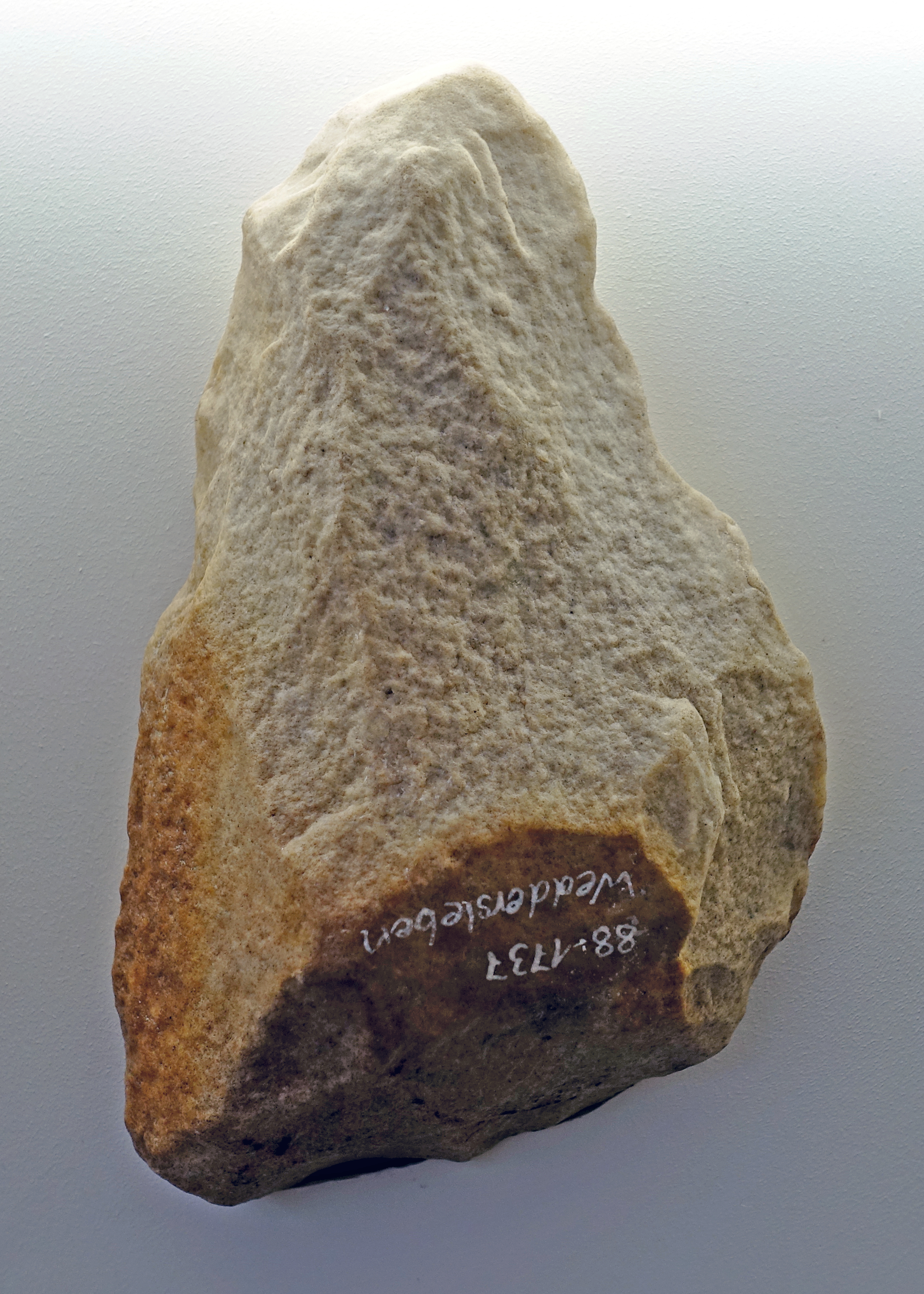
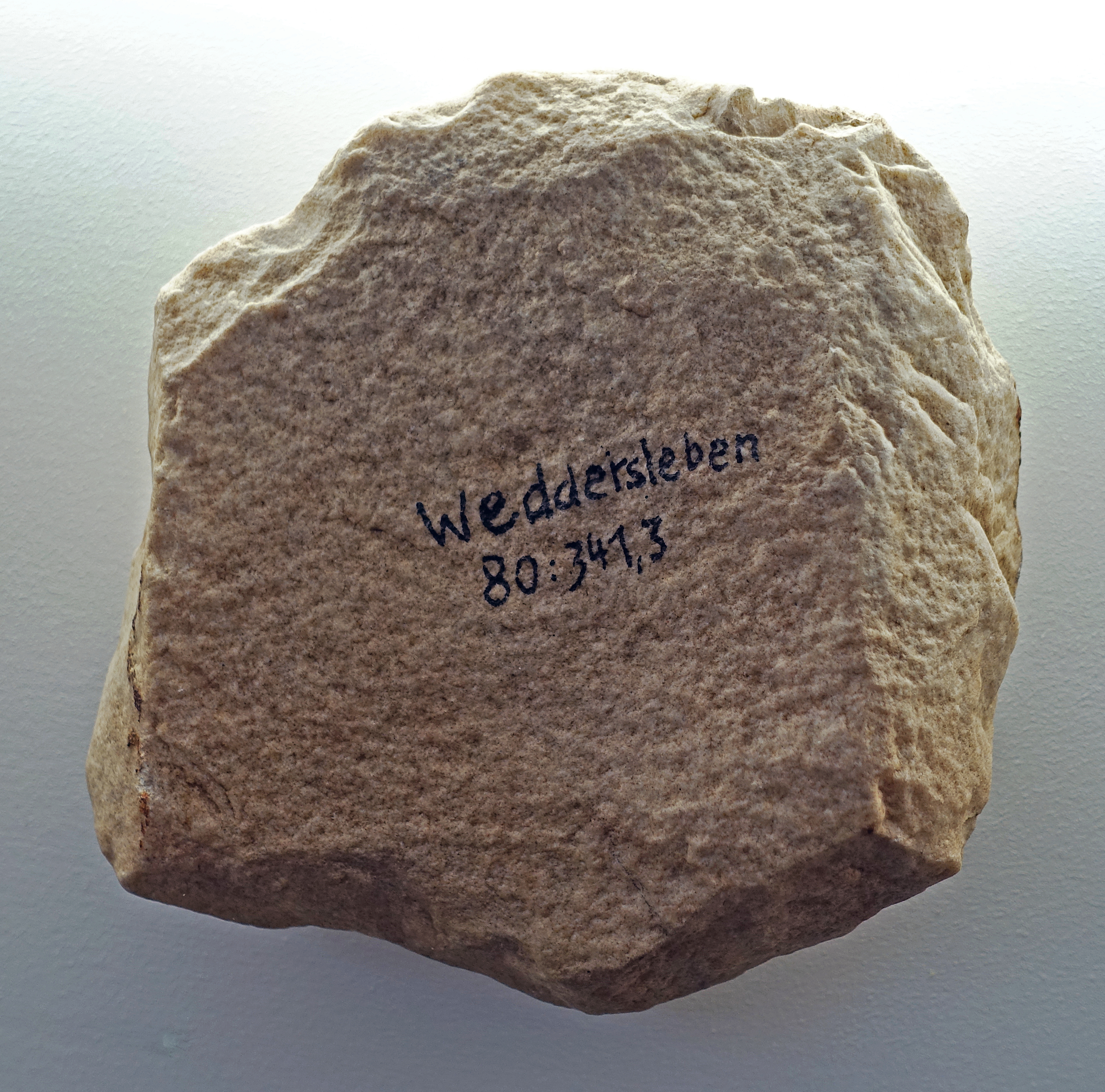
Spitze, point, 250 000 BP.
From Weddersleben, Quedlinburg, circa 80 km to the north west of Halle.
( the tools from Weddersleben are made from poor, coarse grained material, probably quartzite, but obviously that was all that was available, and the best was made of it - Don )
Photo: Don Hitchcock 2018
Source and text: Halle Landesmuseum für Vorgeschichte, CC-BY-NC-SA @ State Museum of Prehistory Halle
Faustkeil, hand axe, 250 000 BP.
From Weddersleben, Quedlinburg, circa 80 km to the north west of Halle.
Photo: Don Hitchcock 2018
Source and text: Halle Landesmuseum für Vorgeschichte, CC-BY-NC-SA @ State Museum of Prehistory Halle
Faustkeil, hand axe, 250 000 BP.
( this piece looked to me to have been made from 'rolled' material, or have been rolled (in a stream, for example) after manufacture. However the Halle Landesmuseum states that many of the pieces have been weathered by the wind, blowing sand across the surfaces, and eroding many instances of edge retouching - Don )
From Weddersleben, Quedlinburg, circa 80 km to the north west of Halle.
Photo: Don Hitchcock 2018
Source and text: Halle Landesmuseum für Vorgeschichte, CC-BY-NC-SA @ State Museum of Prehistory Halle
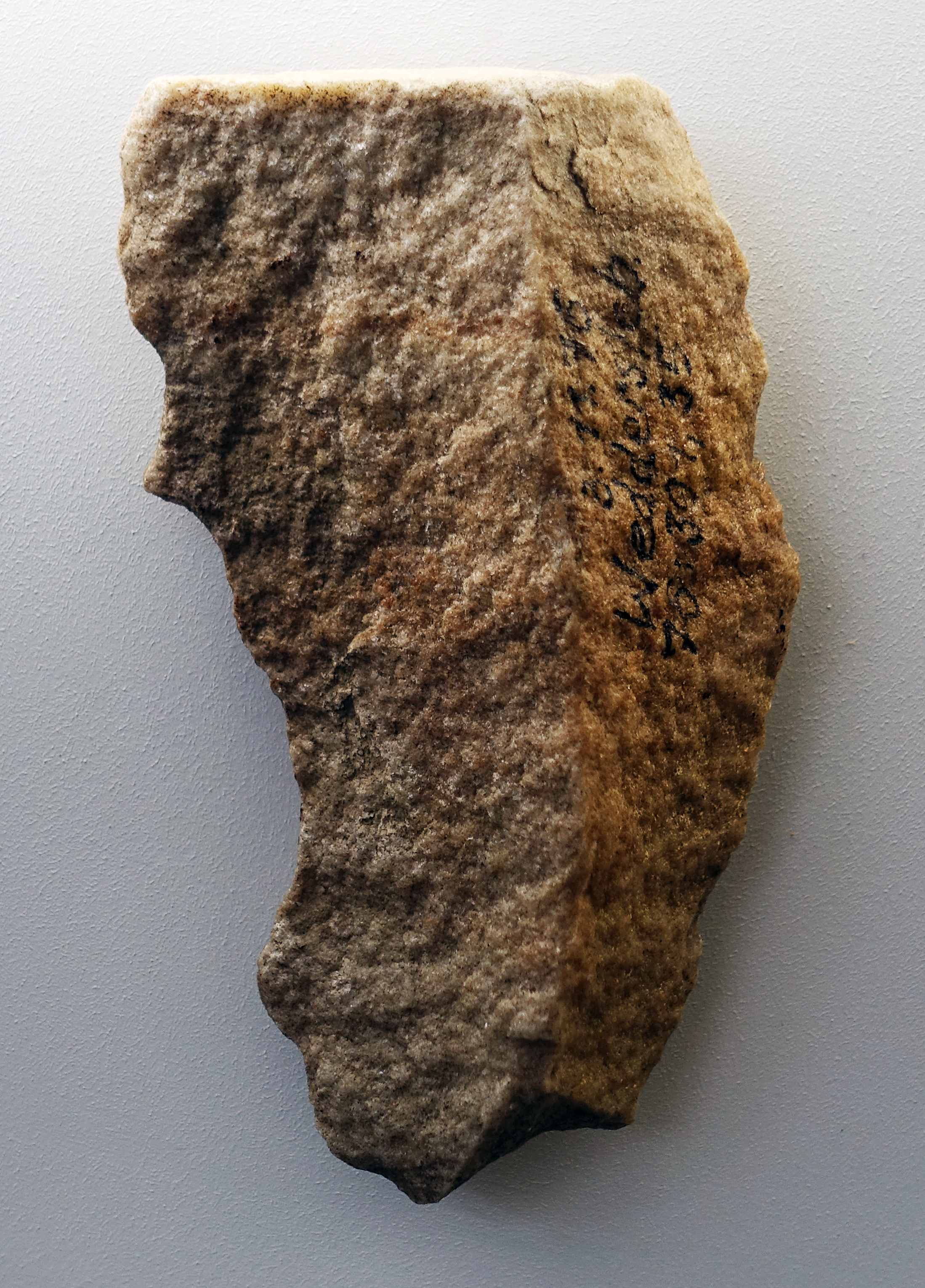
Faustkeil, hand axe, quartzite, 250 000 BP.
From Weddersleben, Quedlinburg, circa 80 km to the north west of Halle, at the location of the Teufelsmauer (the devil's wall). The area has provided an extensive palaeolithic inventory.
Most of the pieces are heavily surface-weathered (sometimes with 'wind grinding') and thus the traces of edge retouching are often not visible.
Dimensions: 151 mm x 93 mm.
Photo: Don Hitchcock 2018
Source and text: Halle Landesmuseum für Vorgeschichte, https://st.museum-digital.de/, CC-BY-NC-SA @ State Museum of Prehistory Halle
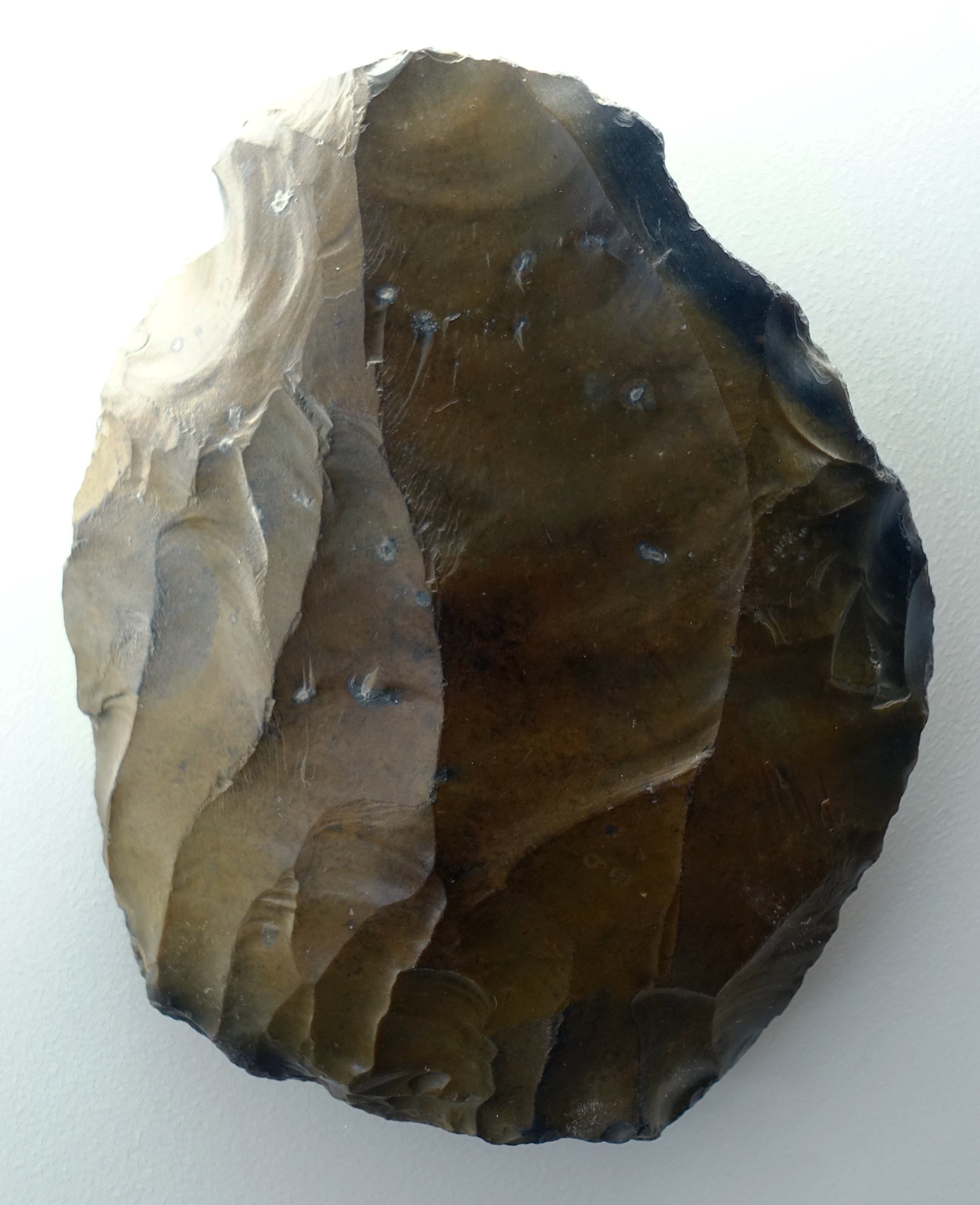
Klingen, blades, 250 000 BP.
From Weddersleben, Quedlinburg, circa 80 km to the north west of Halle.
Photo: Don Hitchcock 2018
Source and text: Halle Landesmuseum für Vorgeschichte, CC-BY-NC-SA @ State Museum of Prehistory Halle
Abschlag, flake, 250 000 BP.
From Weddersleben, Quedlinburg, circa 80 km to the north west of Halle.
Photo: Don Hitchcock 2018
Source and text: Halle Landesmuseum für Vorgeschichte, CC-BY-NC-SA @ State Museum of Prehistory Halle
Kerngerät, tool made from a core, 250 000 BP.
From Weddersleben, Quedlinburg, circa 80 km to the north west of Halle.
Photo: Don Hitchcock 2018
Source and text: Halle Landesmuseum für Vorgeschichte, CC-BY-NC-SA @ State Museum of Prehistory Halle
Abschlag, flake, 250 000 BP.
From Weddersleben, Quedlinburg, circa 80 km to the north west of Halle.
Photo: Don Hitchcock 2018
Source and text: Halle Landesmuseum für Vorgeschichte, CC-BY-NC-SA @ State Museum of Prehistory Halle
Kern, core, 250 000 BP.
From Weddersleben, Quedlinburg, circa 80 km to the north west of Halle.
Photo: Don Hitchcock 2018
Source and text: Halle Landesmuseum für Vorgeschichte, CC-BY-NC-SA @ State Museum of Prehistory Halle
Kern, core, 250 000 BP.
From Weddersleben, Quedlinburg, circa 80 km to the north west of Halle.
Photo: Don Hitchcock 2018
Source and text: Halle Landesmuseum für Vorgeschichte, CC-BY-NC-SA @ State Museum of Prehistory Halle

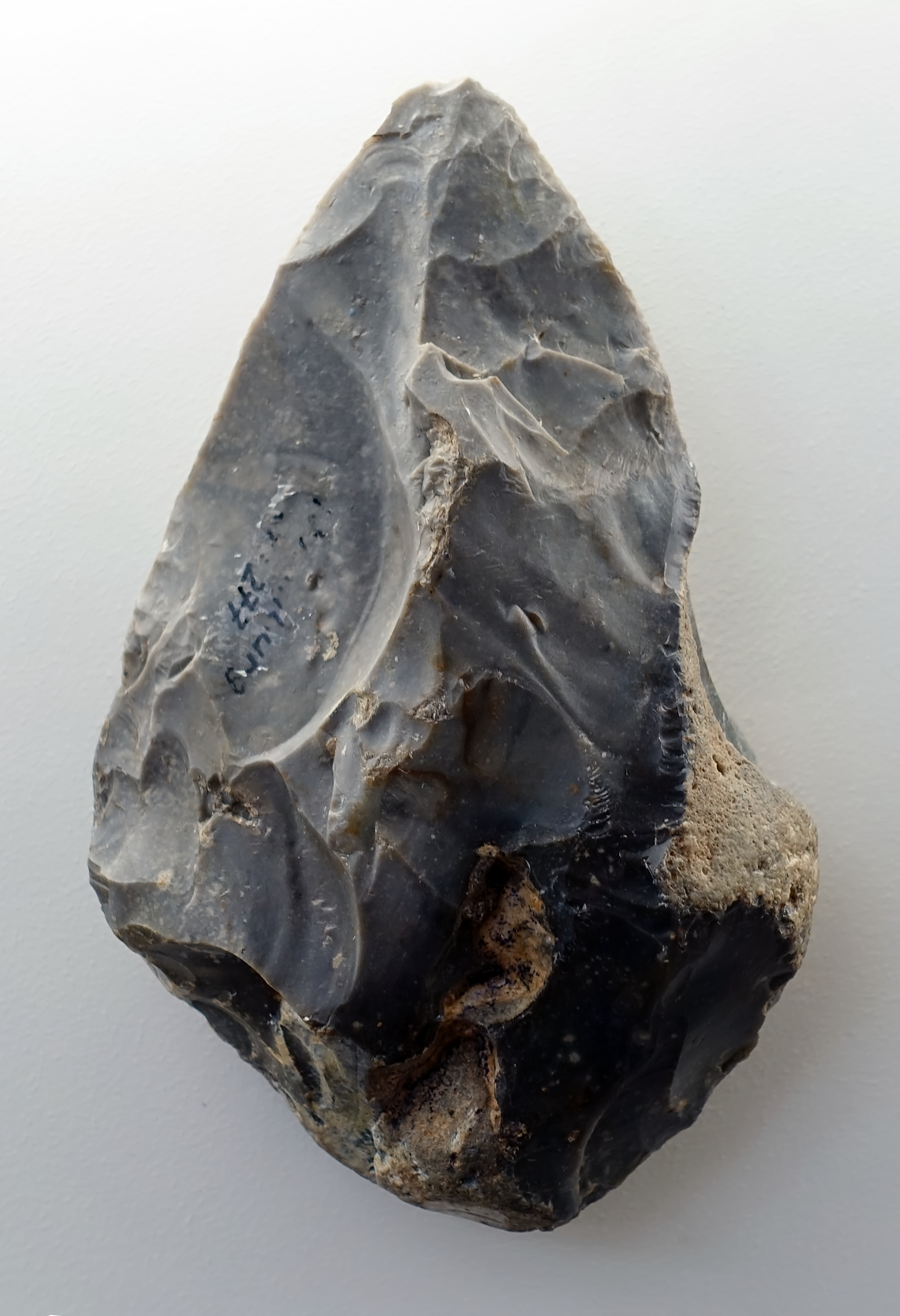
Abschläge, flakes, 250 000 BP.
From Bertingen, Ohrekreis, circa 130 km to the north of Halle.
( these appear to have been struck from a carefully prepared core, and retouched into points, possibly for use as spear heads - Don )
Photo: Don Hitchcock 2018
Source and text: Halle Landesmuseum für Vorgeschichte, CC-BY-NC-SA @ State Museum of Prehistory Halle
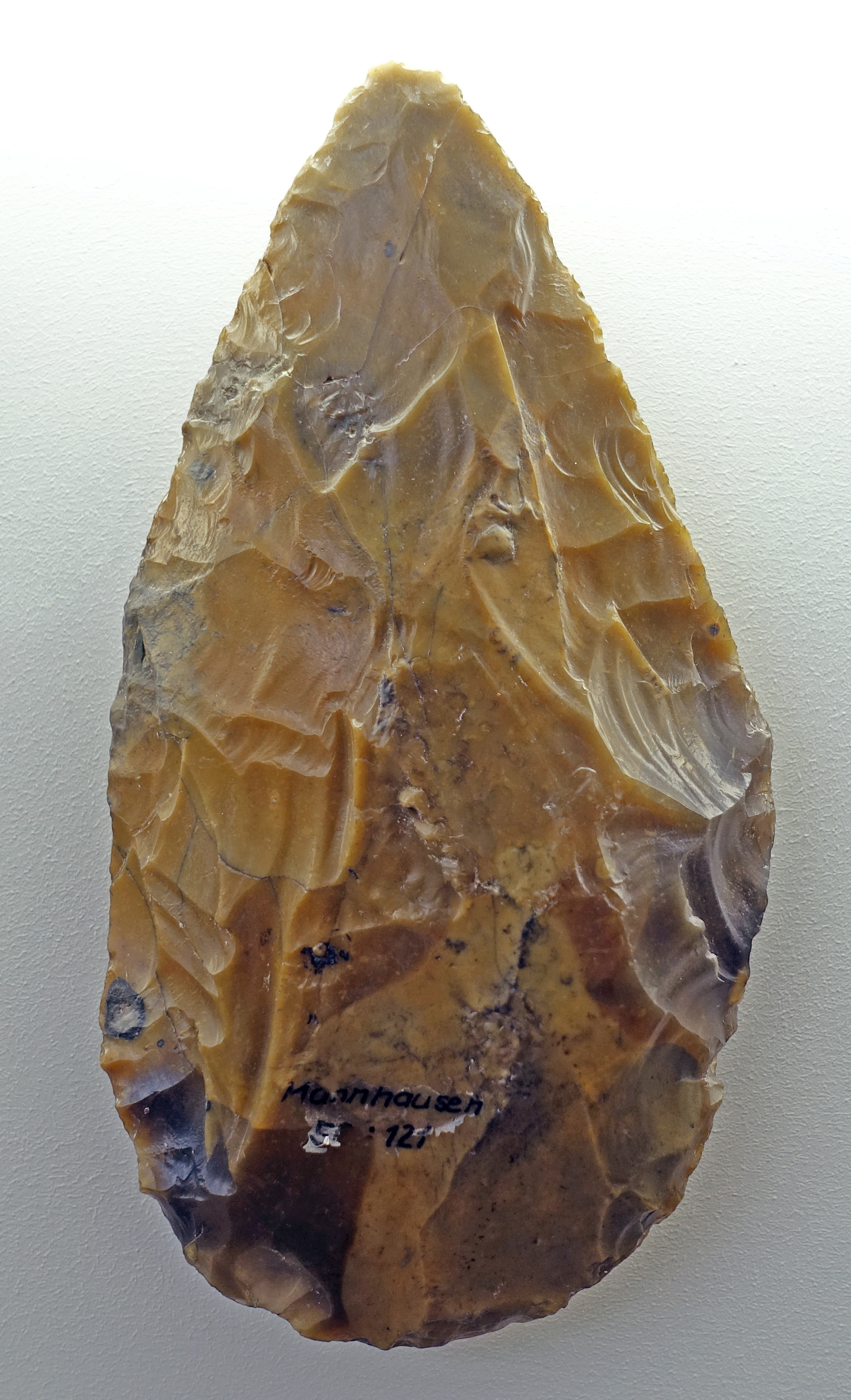
(left) Kernstein, core, 220 000 BP.
(right) Faustkeil, hand axe, 220 000 BP.
Both from Mannhausen, Ohrekreis, circa 130 km to the north west of Halle.
Photo: Don Hitchcock 2018
Source and text: Halle Landesmuseum für Vorgeschichte, CC-BY-NC-SA @ State Museum of Prehistory Halle
Faustkeil, hand axe, 220 000 BP.
From Naumburg, Burgenlandkreis, circa 50 km to the south of Halle.
Photo: Don Hitchcock 2018
Source and text: Halle Landesmuseum für Vorgeschichte, CC-BY-NC-SA @ State Museum of Prehistory Halle
Blade, 220 000 BP.
From Weimar-Ehringsdorf Thüringen, a Neanderthal site 100 km South West of Halle.
Photo: Don Hitchcock 2018
Source and text: Halle Landesmuseum für Vorgeschichte, CC-BY-NC-SA @ State Museum of Prehistory Halle
Point, 220 000 BP.
From Weimar-Ehringsdorf Thüringen, a Neanderthal site 100 km South West of Halle.
( This point appears to have been made from quartzite, or some similar material, which is incapable of being finely knapped, although the overall shape is as well finished as can be expected.
However there is also what appears to be the ubiquitous Neanderthal 'thumb depression' on this piece, although it is difficult to see its function in this case, unless it was used not as a spear head, but as a point for a purpose such as making holes in skins - Don )
Photo: Don Hitchcock 2018
Source and text: Halle Landesmuseum für Vorgeschichte, CC-BY-NC-SA @ State Museum of Prehistory Halle

Point, 220 000 BP.
From Weimar-Ehringsdorf Thüringen, a Neanderthal site 100 km South West of Halle.
( This point appears to have been made from good quality flint, and looks like a Levallois point, which has been retouched after being struck from the core. It is a fine piece, showing more symmetry, slenderness and fine detail than many such points - Don )
Photo: Don Hitchcock 2018
Source and text: Halle Landesmuseum für Vorgeschichte, CC-BY-NC-SA @ State Museum of Prehistory Halle
Point, 220 000 BP.
From Weimar-Ehringsdorf Thüringen, a Neanderthal site 100 km South West of Halle.
( This is a more typical levallois point, with little retouching except for what may have been sharpening after use - Don )
Photo: Don Hitchcock 2018
Source and text: Halle Landesmuseum für Vorgeschichte, CC-BY-NC-SA @ State Museum of Prehistory Halle
Scraper, 220 000 BP.
From Weimar-Ehringsdorf Thüringen, a Neanderthal site 100 km South West of Halle.
( apparently made from a flake - Don )
Photo: Don Hitchcock 2018
Source and text: Halle Landesmuseum für Vorgeschichte, CC-BY-NC-SA @ State Museum of Prehistory Halle
Tools made on flakes, 220 000 BP.
From Neumark-Nord bei Frankleben, 15 km South West of Halle.
Photo: Don Hitchcock 2018
Source and text: Halle Landesmuseum für Vorgeschichte, https://st.museum-digital.de/, CC-BY-NC-SA @ State Museum of Prehistory Halle
Abschlaggerät, tool on a flake, 220 000 BP.
From Neumark-Nord bei Frankleben, 15 km South West of Halle.
Some edges of this tool appear to have been retouched for use as scrapers.
Photo: Don Hitchcock 2018
Source and text: Halle Landesmuseum für Vorgeschichte, https://st.museum-digital.de/, CC-BY-NC-SA @ State Museum of Prehistory Halle
Abschlaggerät, tool on a flake, 220 000 BP.
From Neumark-Nord bei Frankleben, 15 km South West of Halle.
Photo: Don Hitchcock 2018
Source and text: Halle Landesmuseum für Vorgeschichte, https://st.museum-digital.de/, CC-BY-NC-SA @ State Museum of Prehistory Halle
https://st.museum-digital.de/index.php?t=objekt&oges=19005&cachesLoaded=true
Flake, 220 000 BP.
From Neumark-Nord bei Frankleben, 15 km South West of Halle.
Photo: Don Hitchcock 2018
Source and text: Halle Landesmuseum für Vorgeschichte, https://st.museum-digital.de/, CC-BY-NC-SA @ State Museum of Prehistory Halle
https://st.museum-digital.de/index.php?t=objekt&oges=19007&cachesLoaded=true
Tool made from a core, 220 000 BP.
A notched flint tool from the upper shore zone of the fossil lake deposits in the Neumark-Nord opencast mine.
Tools such as this were used for working round rods of wood or antler or ivory. Traces of their use occur as longitudinal grooves and scratches found, for example, on the wooden spears of Schöningen.
The presence of such devices at the lake near Neumark-Nord indicates that at least spears, and possibly throwing sticks, brought here for hunting, were resharpened or repaired, but also that new hunting weapons were made on the spot from suitable woods, since the wear and tear on such items was certainly very great.
Dimensions: length 47 mm,width 27 mm.
Photo: Don Hitchcock 2018
Source and text: Halle Landesmuseum für Vorgeschichte, https://st.museum-digital.de/, CC-BY-NC-SA @ State Museum of Prehistory Halle
https://st.museum-digital.de/index.php?t=objekt&oges=19007&cachesLoaded=true
Blade, 220 000 BP.
From Neumark-Nord bei Frankleben, 15 km South West of Halle.
A flint blade from the lower shore zone.
Blades were produced on demand and on site. First the hunters exploited the rich deposits of flintstone rubble on the higher bank . The cores came from the ground moraine and the meltwater sands that formed this higher bank. With the help of hammerstones, disc-shaped or elongated core stones were made from the debris to separate flakes from it.
The shape of the stones was predetermined by the core, especially by the elongated cores: the larger, long-oval or parallel-sided blade-shaped cuttings like the one shown here, which were found on the inner bank as slaughtering knives between the piles of bones or at the cutting places of large prey, originated from these stones.
Dimensions: Length 53 mm, width 20 mm.
Photo: Don Hitchcock 2018
Source and text: Halle Landesmuseum für Vorgeschichte, https://st.museum-digital.de/, CC-BY-NC-SA @ State Museum of Prehistory Halle
https://st.museum-digital.de/index.php?t=objekt&oges=19005&cachesLoaded=true
Blade, 220 000 BP.
A serrated band made of banded flint from the upper bank zone.
In the area of the rest areas there were also tools made from retouched flint chips, which were necessarily used here. Most of them are devices with saw-toothed edges and with pronounced, semicircular bays of 4 - 5cm width. Wood was processed with these devices .
Dimensions: Length 64 mm, width 25 mm.
From Neumark-Nord bei Frankleben, 15 km South West of Halle.
Photo: Don Hitchcock 2018
Source and text: Halle Landesmuseum für Vorgeschichte, https://st.museum-digital.de/, CC-BY-NC-SA @ State Museum of Prehistory Halle
https://st.museum-digital.de/index.php?t=objekt&oges=19006&cachesLoaded=true
Kernstein, core, 220 000 BP.
A flint core from the lower shore zone.
With the help of hammerstones, disc-shaped or elongated core stones were made from boulders in order to later separate flakes from them. Blades were produced as needed and on site. For this purpose the rich deposits of flints were exploited. They came from the ground moraine and meltwater sands, which formed the higher bank here.
Dimensions: Length 90 mm, width 45 mm.
From Neumark-Nord bei Frankleben, 15 km South West of Halle.
Photo: Don Hitchcock 2018
Source and text: Halle Landesmuseum für Vorgeschichte, https://st.museum-digital.de/, CC-BY-NC-SA @ State Museum of Prehistory Halle
https://st.museum-digital.de/index.php?t=objekt&oges=19004&cachesLoaded=true
Abschlag, flake, 220 000 BP.
From Neumark-Nord bei Frankleben, 15 km South West of Halle.
Photo: Don Hitchcock 2018
Source and text: Halle Landesmuseum für Vorgeschichte, https://st.museum-digital.de/, CC-BY-NC-SA @ State Museum of Prehistory Halle
https://st.museum-digital.de/index.php?t=objekt&oges=19005&cachesLoaded=true
Schaber, scraper, 220 000 BP.
From Neumark-Nord bei Frankleben, 15 km South West of Halle.
Photo: Don Hitchcock 2018
Source and text: Halle Landesmuseum für Vorgeschichte, https://st.museum-digital.de/, CC-BY-NC-SA @ State Museum of Prehistory Halle
https://st.museum-digital.de/index.php?t=objekt&oges=19005&cachesLoaded=true
Flint handaxe, 200 000 BP - 150 000 BP.
( This is a quite sophisticated tool for the time. Certainly it is fairly thick, but it is much longer than it is wide, unusual for a handaxe, and it has been beautifully finished with careful and skilled retouching on the faces and edges, in the style of a much later era. - Don )
Rheindahlen, Stadt Mönchengladbach
This site is right on the edge of the maximum extent of the Saale glaciation ice sheet.
Photo: Don Hitchcock 2015
Source and text: LVR-Landesmuseum Bonn, Germany
Flint spear tips, circa 200 000 BP - 150 000 BP.
Rheindahlen, Stadt Mönchengladbach.
This site is right on the edge of the maximum extent of the Saale glaciation ice sheet.
Photo: Don Hitchcock 2015
Source and text: LVR-Landesmuseum Bonn, Germany
Additional text: http://www.georallye.uni-bonn.de/kartstein_bei_satzvey
Faustkeil, hand axe, Gerwisch, near Magdeburg, 200 000 BP.
Length 126 mm.
( This is a superb piece. It is highly symmetrical, of a classic shape, and skilfully made - Don )
Gerwisch's beautifully crafted hand ax came to light in a concrete plant. The place of origin could only be determined by tracing the origin of the load of gravel it was found in. Stone tools are often found in the Middle Elbe region when digging gravel, since they are now in sediment layers below the groundwater table.
The hand axe from Gerwisch is of typical Acheulian Middle Palaeolithic type, and is about 200 000 years old.
Hand axes are among the oldest devices that people consciously work on and manufacture. Characteristic is the almond-shaped shape with a partially circumferential cutting edge. The design followed two main basic methods of manufacture.
In one method, a core was brought into the desired shape by careful flaking. In the other, the flakes thus made were further processed into tools.
Photo: Don Hitchcock 2018
Source and text: Halle Landesmuseum für Vorgeschichte, https://st.museum-digital.de/, CC-BY-NC-SA @ State Museum of Prehistory Halle
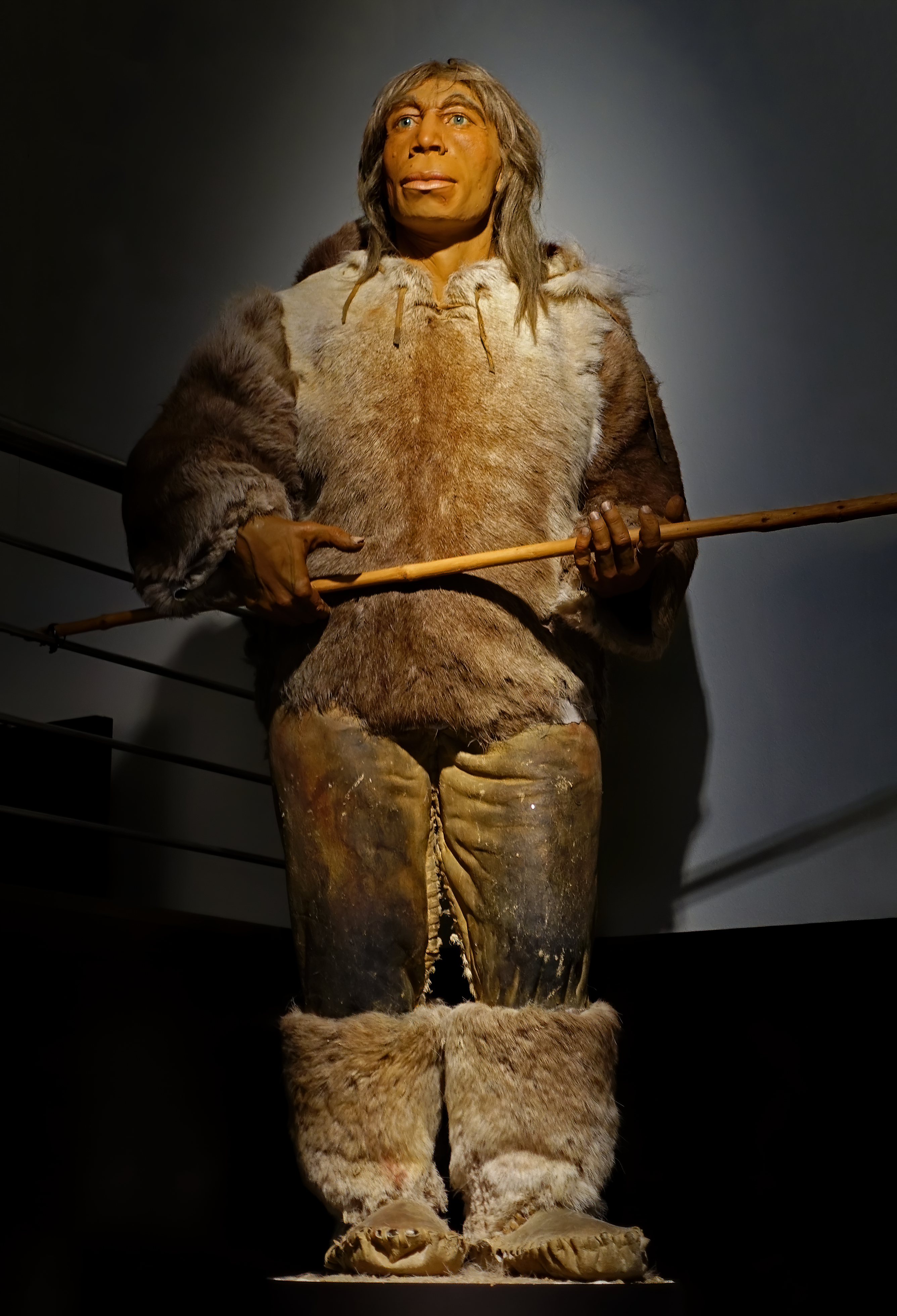
This sculpture of a prehistoric man is based on various bone finds of identical individuals from the time about 200 000 years ago.
The figure has been reconstructed according to the latest anthropological findings and criminal investigation methods. It depicts a person from the transitional period from Homo erectus to Homo sapiens neanderthalensis. This direct ancestor of the Neanderthal carried on the legacy of Homo erectus.
Artist: Unrecorded
Photo: Don Hitchcock 2018
Source and text: Halle Landesmuseum für Vorgeschichte, CC-BY-NC-SA @ State Museum of Prehistory Halle

Faustkeil, hand axe, Magdeburg Neustadt, 150 000 BP.
Photo: Don Hitchcock 2018
Source and text: Halle Landesmuseum für Vorgeschichte, https://st.museum-digital.de/, CC-BY-NC-SA @ State Museum of Prehistory Halle
Schaber, scraper, Magdeburg Neustadt, 150 000 BP.
Photo: Don Hitchcock 2018
Source and text: Halle Landesmuseum für Vorgeschichte, https://st.museum-digital.de/, CC-BY-NC-SA @ State Museum of Prehistory Halle
Faustkeil, hand axe, Steigra near Querfurt, 40 km South East of Halle, 150 000 BP.
This site is on the edge of the maximum extent of the Saale glaciation ice sheet, which is delineated by the locality sequence Lodersleben - Schmon - Steigra - Freyburg
Photo: Don Hitchcock 2018
Source and text: Halle Landesmuseum für Vorgeschichte, https://st.museum-digital.de/, CC-BY-NC-SA @ State Museum of Prehistory Halle
Breitschaber, wide scraper, Barby-Schönebeck, 70 km north of Halle, 150 000 BP.
( Schönebeck is a village near Barby - Querfurt - Don )
Photo: Don Hitchcock 2018
Source and text: Halle Landesmuseum für Vorgeschichte, https://st.museum-digital.de/, CC-BY-NC-SA @ State Museum of Prehistory Halle
Schaber, scraper, Halle-Kröllwitz, 150 000 BP.
( Kröllwitz is a suburb of Halle, just to the north west of the Halle CBD - Don )
Photo: Don Hitchcock 2018
Source and text: Halle Landesmuseum für Vorgeschichte, https://st.museum-digital.de/, CC-BY-NC-SA @ State Museum of Prehistory Halle
Spitze, point for a spear, Halle-Kanena, 150 000 BP.
( Kanena is a suburb of Halle, a couple of kilometres to the east of the Halle CBD - Don )
Photo: Don Hitchcock 2018
Source and text: Halle Landesmuseum für Vorgeschichte, https://st.museum-digital.de/, CC-BY-NC-SA @ State Museum of Prehistory Halle
Hundisburg
The Hundisburg Park Gravel Pit is one of the classic sites of the older Palaeolithic in Central Germany. About 100 flint artefacts were recovered here between 1904 and 1953, before excavation ceased after gravel mining was stopped. The hand axe recovered in 1921 is one of the first finds of its kind in Central Europe. For decades there were controversial discussions about the geological and cultural-historical classification of the site, but these could not be verified on the site.
Text above: http://www.lda-lsa.de/de/forschung/kooperationen/hundisburg_alte_und_neue_funde_und_das_aeltere_palaeolithikum_in_mitteleuropa/
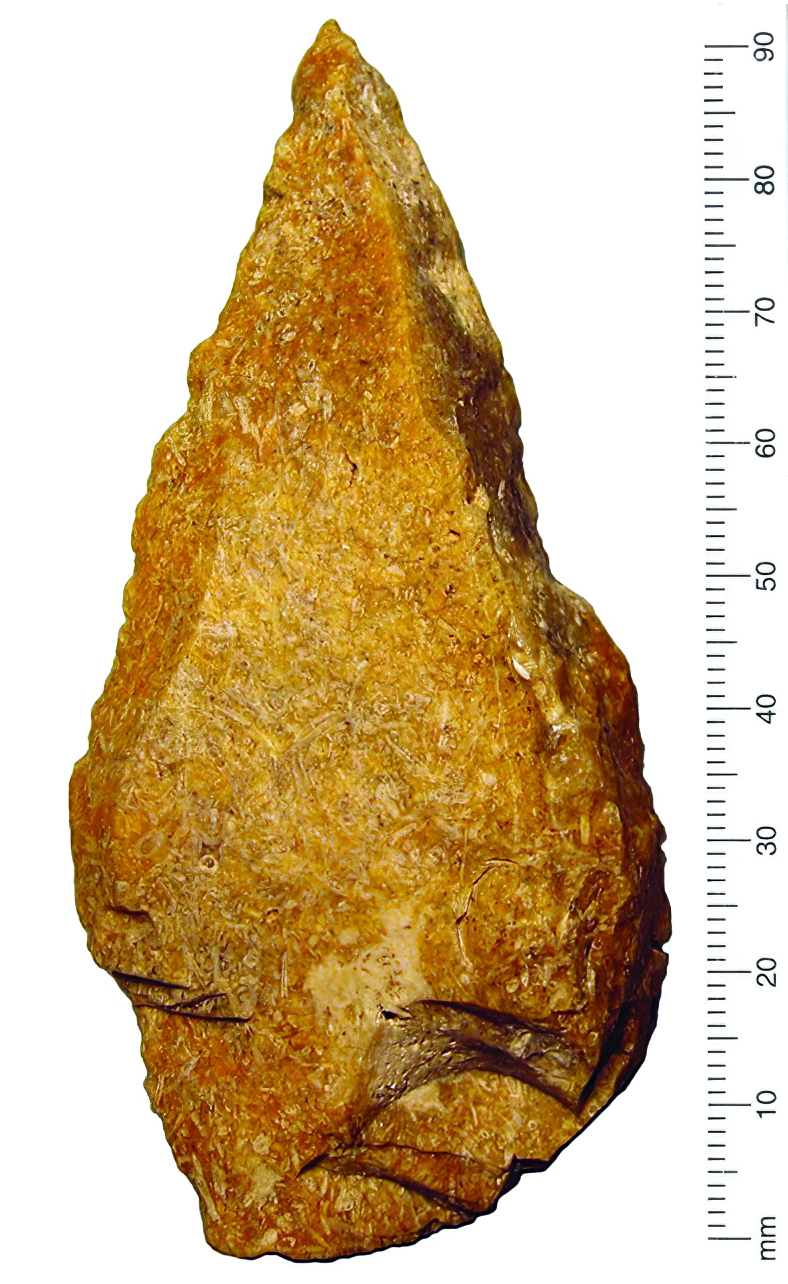
This point from Hundisburg was made of 'bryozoan' flint.
Flint is formed on sea floors, and sometimes has fossils, as this one has.
Bryozoan colonies can be branching or netlike.
Photo: http://www.lda-lsa.de/de/forschung/kooperationen/hundisburg_alte_und_neue_funde_und_das_aeltere_palaeolithikum_in_mitteleuropa/
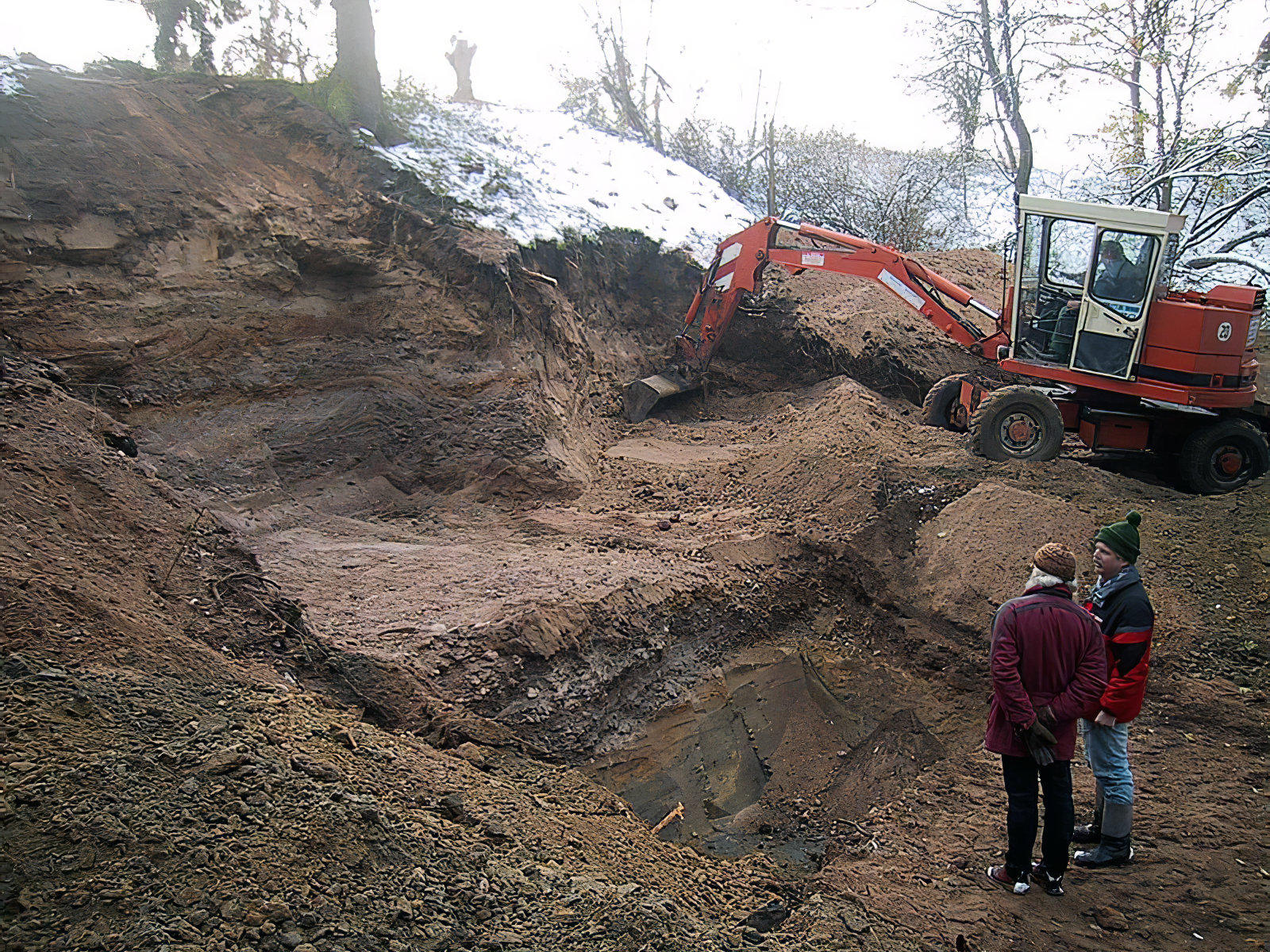
This image shows the start of the recent excavations in 2005 under the auspices of the Universität Tübingen.
Photo: S. Ertmer
Source and text: Ertmer (2010)
Proximal source: https://www.bautzen.de/presse/2017-500/
Further reading: Toepfer (1961)
Since the early digs, three exploratory excavations have been carried out. Thanks to the active help of volunteer ground monument conservators, an area of 42 m² has been investigated and the number of artefacts doubled to over 200. First results not only show that the site apparently belongs to an early period of the penultimate (Saale) Ice Age, but also yielded the surprising discovery of two matches in the sharp-edged stone artefacts, which speaks to a largely in situ knapping of these finds. In addition, excellently preserved faunal remains of ice-age large mammals complete the picture of the environment of that time.Text above: http://www.lda-lsa.de/de/forschung/kooperationen/hundisburg_alte_und_neue_funde_und_das_aeltere_palaeolithikum_in_mitteleuropa/
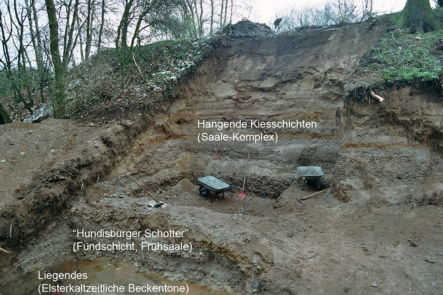
This excavation was very well executed, allowing the layers to be both revealed, and examined at depth.
Hangende Kiesschichten (Saale-Komplex) - Top layer of gravel from the Saale Complex.
Hundisburger Schotter (Fundschicht, Frühsaale) - Hundisburg gravel, the find layer, in the Early Saale beds.
Liegendes (Elsterkaltzeitliche Beckentone) - Underlying layers of mottled clay laid down during a cold climatic period.
Photo and labelling of strata: http://www.lda-lsa.de/de/forschung/kooperationen/hundisburg_alte_und_neue_funde_und_das_aeltere_palaeolithikum_in_mitteleuropa/
This investigation was supported and carried out by: Cooperation project Institute for Prehistory and Early History, Dept. of Prehistory and Quaternary Ecology of the Eberhard-Karls-University Tübingen / State Office for Geology and Mining Saxony Anhalt / Ernst-Moritz-Arndt-University Greifswald / Saxonian Academy of Sciences / Prof. Klaus-Dieter Meyer / State Office for Monument Preservation and Archeology Saxony-Anhalt
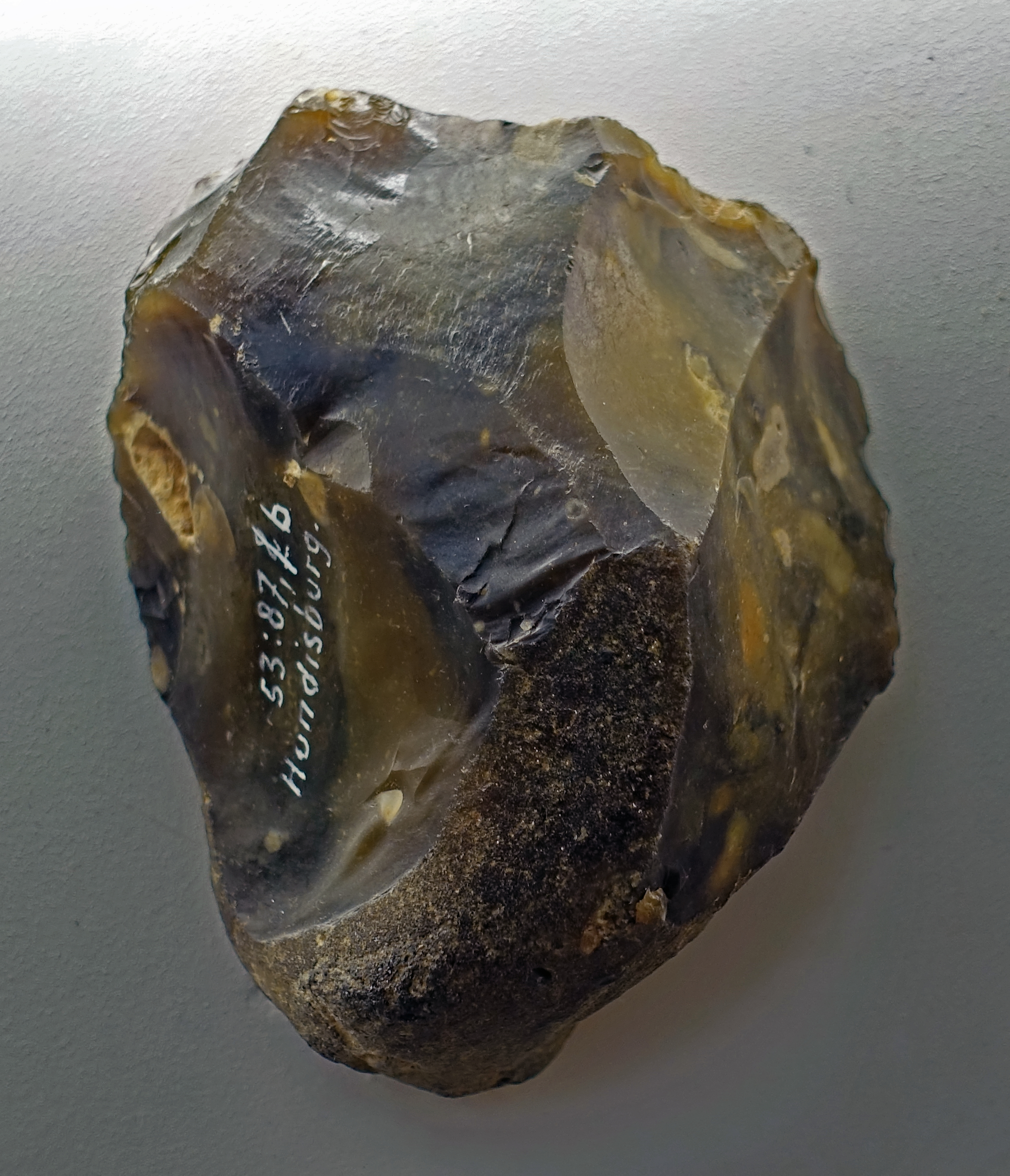
Abschlage, flake, from Hundisburg, 150 000 BP.
Photo: Don Hitchcock 2018
Source and text: Halle Landesmuseum für Vorgeschichte, https://st.museum-digital.de/, CC-BY-NC-SA @ State Museum of Prehistory Halle
Schaber, scraper, from Hundisburg, 150 000 BP.
Photo: Don Hitchcock 2018
Source and text: Halle Landesmuseum für Vorgeschichte, https://st.museum-digital.de/, CC-BY-NC-SA @ State Museum of Prehistory Halle
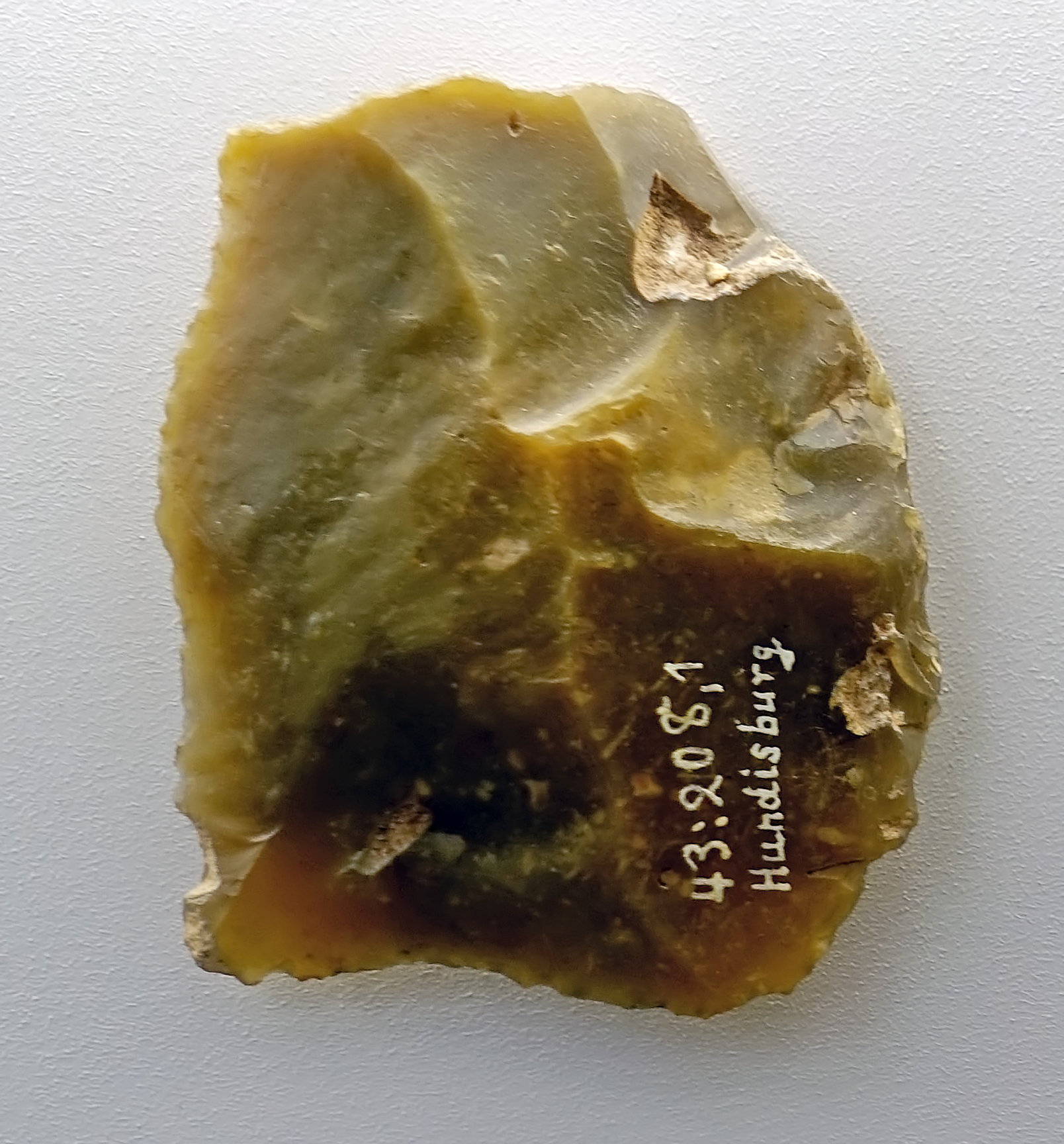
Schaber, scraper, from Hundisburg, 150 000 BP.
Among the tools, both scrapers and knives with a natural back are the most common.
Photo: Don Hitchcock 2018
Source and text: Halle Landesmuseum für Vorgeschichte, https://st.museum-digital.de/, CC-BY-NC-SA @ State Museum of Prehistory Halle
Additional text: Ertmer (2010b)
Klinge, blade, from Hundisburg, 150 000 BP.
Photo: Don Hitchcock 2018
Source and text: Halle Landesmuseum für Vorgeschichte, https://st.museum-digital.de/, CC-BY-NC-SA @ State Museum of Prehistory Halle
Kern, nucleus, core, from Hundisburg, 150 000 BP.
Of the few available cores, none corresponds to a Levallois core, but the use of this typical Middle Paleolithic form of core preparation is definitely proven by several classic flakes.
Photo: Don Hitchcock 2018
Source and text: Halle Landesmuseum für Vorgeschichte, https://st.museum-digital.de/, CC-BY-NC-SA @ State Museum of Prehistory Halle
Additional text: Ertmer (2010b)
Spitze, point, from Wolmirstedt, 125 000 BP.
( This point was probably used on a strong and relatively heavy thrusting spear - Don )
Photo: Don Hitchcock 2018
Source and text: Halle Landesmuseum für Vorgeschichte, https://st.museum-digital.de/, CC-BY-NC-SA @ State Museum of Prehistory Halle
Schaber, scraper, from Wolmirstedt, 125 000 BP.
Photo: Don Hitchcock 2018
Source and text: Halle Landesmuseum für Vorgeschichte, https://st.museum-digital.de/, CC-BY-NC-SA @ State Museum of Prehistory Halle
Faustkeil, hand axe, from Wolmirstedt, 125 000 BP.
Photo: Don Hitchcock 2018
Source and text: Halle Landesmuseum für Vorgeschichte, https://st.museum-digital.de/, CC-BY-NC-SA @ State Museum of Prehistory Halle
Hand axes, 125 000 BP.
(left) Faustkeil, hand axe, from Barleben I, length 105 mm, width 75 mm.
(right) Partial biface or Halbkeil from Barleben II, length 100 mm, width 75 mm.
These pieces have the characteristic almond shape, with a partially circumferential cutting edge, of tools from the gravel pits on the northern outskirts of Barleben, Ohrekreis, studied since the 1950s.
Photo: Don Hitchcock 2018
Source and text: Halle Landesmuseum für Vorgeschichte, https://st.museum-digital.de/, CC-BY-NC-SA @ State Museum of Prehistory Halle
Faustkeil, hand axe, from Barleben, 125 000 BP.
( This is identified as a Faustkeil, but it is a most unusual one. It is not symmetrical in the least, and one could be forgiven for thinking that it might be a type of scraper, in particular a grattoir à museau, or a nosed scraper, which are common in the Middle Aurignacian, much younger than this example - Don )
Photo: Don Hitchcock 2018
Source and text: Halle Landesmuseum für Vorgeschichte, https://st.museum-digital.de/, CC-BY-NC-SA @ State Museum of Prehistory Halle
Klinge, blade, from Barleben, 125 000 BP.
( This blade appears to have been adapted to form an all-purpose scraper, with steep retouch on one end and both sides. There is even what seems to be a notch for smoothing small diameter wooden/antler/ivory rods on the lower left - Don )
Photo: Don Hitchcock 2018
Source and text: Halle Landesmuseum für Vorgeschichte, https://st.museum-digital.de/, CC-BY-NC-SA @ State Museum of Prehistory Halle
Blades
Taubach (Weimar) Thuringen.
Circa 125 000 BP.
( note that these are correctly identified by the Halle Museum as blades. But they are not the blades of the Solutrean. They can be turned into useful tools, but they are only a step along the way to the elegant blades of later times. Each of these blades is different, requiring a lot of time and great skill to make them into a finished product, with different problems to solve for each piece, unlike the uniform and mass produced blades from many thousands of years later, which were very easily turned into a multitude of different tools with the minimum of effort and thought - Don )
Photo: Don Hitchcock 2018
Source and text: Halle Landesmuseum für Vorgeschichte, https://st.museum-digital.de/, CC-BY-NC-SA @ State Museum of Prehistory Halle


Legacies of the Neanderthals
These handaxes and flake tools are made to a large extent from chert coming from deposits in the area near Stuttgart.
Various stone tools from Heidenschmiede, Heidenheim, district Heidenheim, circa 120 000 BP - 50 000 BP.
(left) Point, radiolarite
(centre) Hand axe, Jurahornstein, Jurassic chert.
(right) Faustkeilblatt, flat or leaf hand axe, chert.
Circa 120 000 BP - 50 000 BP
Along the southwestern bulwark of the castle in Heidenheim, the rock face 35 metres above the valley floor forms a small overhang just large enough to create an 8 square metre abri, or rock shelter. Together with the open space in front of it, the cave has a usable area of some 30 square metres.
In spite of its small size, this so-called Heidenschmiede, or heathen's forge, rock shelter was a place our ancestors went to time and again. This may have been because of the splendid view across the wide, open valley of the Brenz River, which provided an excellent hunting ground.
Heidenheim is about 100 km to the east of Stuttgart.
Photo: Don Hitchcock 2015, 2018
Source and text: Landesmuseum Württemberg, Stuttgart
Gudenushöhle
Handaxe from Gudenushöhle, Lower Austria, 90 000 BP.
Photo: Don Hitchcock 2018
Source: Original, Natural History Museum Vienna, Naturhistorisches Museum Wien
This is a more detailed look at the artefacts from Gudenushöhle:
Gudenushöhle is a very important Neanderthal site situated 20 km northwest of the city of Krems, and has been dated to around 90 000 BP. The site is close to the River Danube. The cave is 22 m long with a width of 2 to 3 m. The archaeological deposit has yielded bones of numerous animals, including Woolly mammoth, Woolly rhinoceros, Aurochs, Chamois, Reindeer, and Red deer. Human artefacts include numerous flint implements beginning with the Mousterian (i.e. Neanderthals) of the Middle Palaeolithic. There is also an Upper Palaeolithic, Magdalenian, assemblage including an engraved reindeer bone, and a fragment of a bone flute dated to about 18 000 – 12 000 BP.
Jasper scraper on a flake from Frieburg. Mousterian, circa 80 000 BP.
Worked on both sides, this piece still stands in the long tradition of early handaxes, but is characterised by careful restoration of a flat surface. It may have been used as a scraper.
Note what may well be a purposeful large flake taken out for a thumb grip.
Similar tools are also known from other European sites and are referred to as the Mousterian culture after the French site of 'Le Moustier' (Dordogne / France). This culture was of Neanderthal origin.
Photo: Don Hitchcock 2015
Source and text: Badisches Landesmuseum Karlsruhe Germany
Micoquien quartzite hand axe from Bruchsal, district Karlsruhe, Middle Palaeolithic, circa 80 000 BP.
Despite its relatively young age, the tool belongs to the development series of the Palaeolithic hand axes. It belongs to the Neandertal stone industry described as the 'Micoquien' according to the reference to the site of La Micoque in France. Contrary to the often crude representation of the Neanderthals, their tools testify to enormous skill.
Photo: Don Hitchcock 2015
Catalog: lnv.-Nr. 2008/628
Source and text: Badisches Landesmuseum Karlsruhe Germany
This Keilmesser, or axe knife, from Wetterzeube shown here, from circa 80 000 BP, is a typical representative of the stone tools inventory of the early Middle Palaeolithic.
The find site belongs to the first phase of the Early Glacial of the Weichselian Cold Period (110 000 to 55 000 years before today) and is assigned to the group of the so-called wedge-knife groups of the Late Middle Palaeolithic.
Dimensions: 140 mm x 75 mm
Despite its relatively young age, the tool belongs to the development series of the Palaeolithic hand axes. It belongs to the Neandertal stone industry described as the 'Micoquien' according to the reference to the site of La Micoque in France. Contrary to the often crude representation of the Neanderthals, their tools testify to enormous skill.
Photo: Don Hitchcock 2018
Source and text: Halle Landesmuseum für Vorgeschichte, https://st.museum-digital.de/, CC-BY-NC-SA @ State Museum of Prehistory Halle
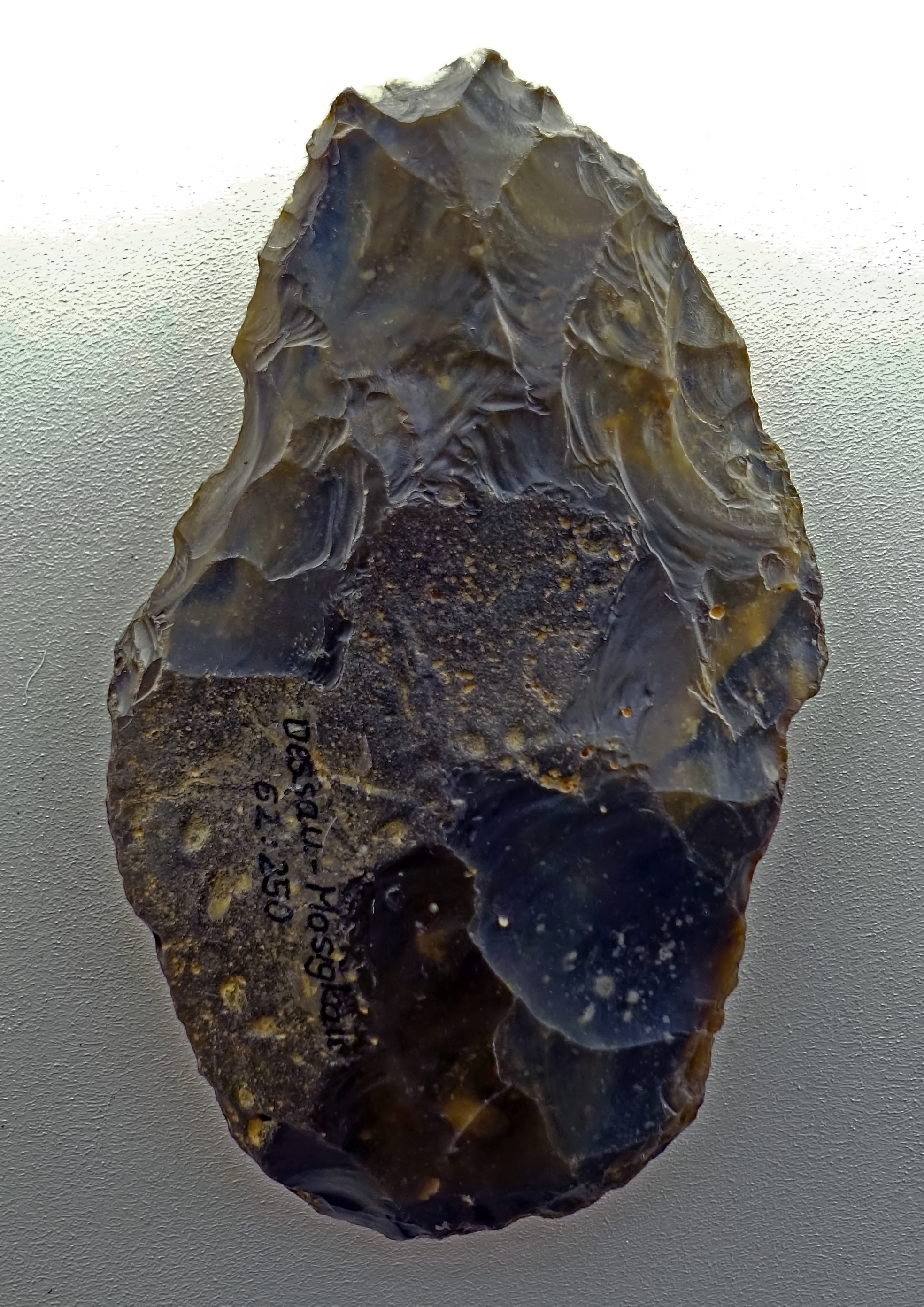
This Faustkeil, or hand axe, is from Dessau Mosigkau, and dates to circa 80 000 BP.
Photo: Don Hitchcock 2018
Source and text: Halle Landesmuseum für Vorgeschichte, CC-BY-NC-SA @ State Museum of Prehistory Halle
This Faustkeil, or hand axe, is from Westeregeln, and dates to circa 80 000 BP.
Photo: Don Hitchcock 2018
Source and text: Halle Landesmuseum für Vorgeschichte, CC-BY-NC-SA @ State Museum of Prehistory Halle
Neanderthals were master stone knappers. They possessed a sense of aesthetics and an intuition for the right material, as may be seen from their handaxes.
In Heidenschmiede there were numerous stone tools made from fresh water quartzite. This is a material very similar to flint, and outcrops only a few kilometres from the site.
Four views of a handaxe, freshwater quartzite, Heidenschmiede, Heidenheim, district Heidenheim.
Circa 70 000 BP - 50 000 BP
Length 148 mm, width 71 mm.
Photo: Don Hitchcock 2015
Source and text: Landesmuseum Württemberg, Stuttgart
These excellent models of the type specimen Neanderthal show the clothes likely to be worn in what was for much of the time very cold conditions. Neanderthals had a physique adapted to periglacial conditions, but furs would have been essential for survival. They must have been adept at curing, cutting, and sewing pelts for warm clothing and footwear.
Sculptor: Unknown
Photo: Don Hitchcock 2018
Source: LVR-Landesmuseum Bonn, Germany
Small handaxe, circa 70 000 BP - 50 000 BP.
Jurahornstein, Jurassic chert.
Heidenschmiede, Heidenheim, Kreis Heidenheim.
Photo: Don Hitchcock 2015
Source and text: Landesmuseum Württemberg, Stuttgart
Rich Booty
Around 1600 artefacts from Neanderthals have been recovered in Wittlingen so far. It is the only large open-air station in the Swabian Alb from this era. Tools were mainly made of flakes. All that remained at the site was production waste, which could not be used any further.
From previous observations at other locations, and from the study of original flint deposits nearby, there is evidence that completed tools were carried to the site, which were then used here in Wittlingen until they became useless. The original deposits of the material used for these artefacts lie 50 to 100 km from Wittlingen.
Two leaf points and a blade, circa 70 000 BP - 50 000 BP.
Artefacts struck from Wittlinger chert, Bad Urach, Wittlingen, Kreis Reutlingen, about 30 km south east of Stuttgart.
Photo: Don Hitchcock 2015, 2018
Source and text: Landesmuseum Württemberg, Stuttgart
On loan from the Archäologischen Landesmuseum Baden-Württemberg
Points, circa 70 000 BP - 50 000 BP.
Artefacts struck from Wittlinger chert, Bad Urach, Wittlingen, Kreis Reutlingen, about 30 km south east of Stuttgart.
Photo: Don Hitchcock 2018
Source and text: Landesmuseum Württemberg, Stuttgart
On loan from the Archäologischen Landesmuseum Baden-Württemberg
Two Levallois cores of Wittlinger Jurassic chert, Bad Urach, Wittlingen, Kreis Reutlingen.
Circa 70 000 BP - 50 000 BP
Photo: Don Hitchcock 2018
Source and text: Landesmuseum Württemberg, Stuttgart
On loan from the Archäologischen Landesmuseum Baden-Württemberg
Wide scraper in siliceous slate, from Bad Urach, Wittlingen, Kreis Reutlingen.
Circa 70 000 BP - 50 000 BP
Photo: Don Hitchcock 2018
Source and text: Landesmuseum Württemberg, Stuttgart
On loan from the Archäologischen Landesmuseum Baden-Württemberg
Scraper, Muschelkalkhornstein, Middle Triassic chert, from Bad Urach, Wittlingen, Kreis Reutlingen.
Circa 70 000 BP - 50 000 BP
Photo: Don Hitchcock 2018
Source and text: Landesmuseum Württemberg, Stuttgart
On loan from the Archäologischen Landesmuseum Baden-Württemberg
Scraper, red radiolarian chert, from Bad Urach, Wittlingen, Kreis Reutlingen.
Circa 70 000 BP - 50 000 BP
Photo: Don Hitchcock 2018
Source and text: Landesmuseum Württemberg, Stuttgart
On loan from the Archäologischen Landesmuseum Baden-Württemberg
Scraper, green radiolarian chert, from Bad Urach, Wittlingen, Kreis Reutlingen.
Circa 70 000 BP - 50 000 BP
Photo: Don Hitchcock 2015
Source and text: Landesmuseum Württemberg, Stuttgart
On loan from the Archäologischen Landesmuseum Baden-Württemberg
Residual core of Wittlinger Jurassic chert, Bad Urach, Wittlingen
Circa 70 000 BP - 50 000 BP
Photo: Don Hitchcock 2018
Source and text: Landesmuseum Württemberg, Stuttgart
On loan from the Archäologischen Landesmuseum Baden-Württemberg
Flint handaxe, circa 50 000 BP.
Dülken-Hausen, Kreis Viersen.
Photo: Don Hitchcock 2015
Source and text: LVR-Landesmuseum Bonn, Germany
Flint handaxes, circa 50 000 BP.
Erkrath, Kreis Mettman.
Photo: Don Hitchcock 2015
Source and text: LVR-Landesmuseum Bonn, Germany
Modern reconstruction of a leaf-shaped scraper attached with birch pitch to a wooden handle.
As used in the late Middle Palaeolithic, i.e. circa 50 000 BP.
Photo: Don Hitchcock 2015
Source and text: LVR-Landesmuseum Bonn, Germany
Leaf shaped scraper.
Flint, circa 50 000 BP.
Weeze, Kreis Kleve.
Photo: Don Hitchcock 2015
Source and text: LVR-Landesmuseum Bonn, Germany
Flint handaxe, circa 50 000 BP.
Elmpt, Gemeinde Niederkrüchten, Kreis Viersen.
Photo: Don Hitchcock 2015
Source and text: LVR-Landesmuseum Bonn, Germany
Königsaue Aschersleben-Staßfurt
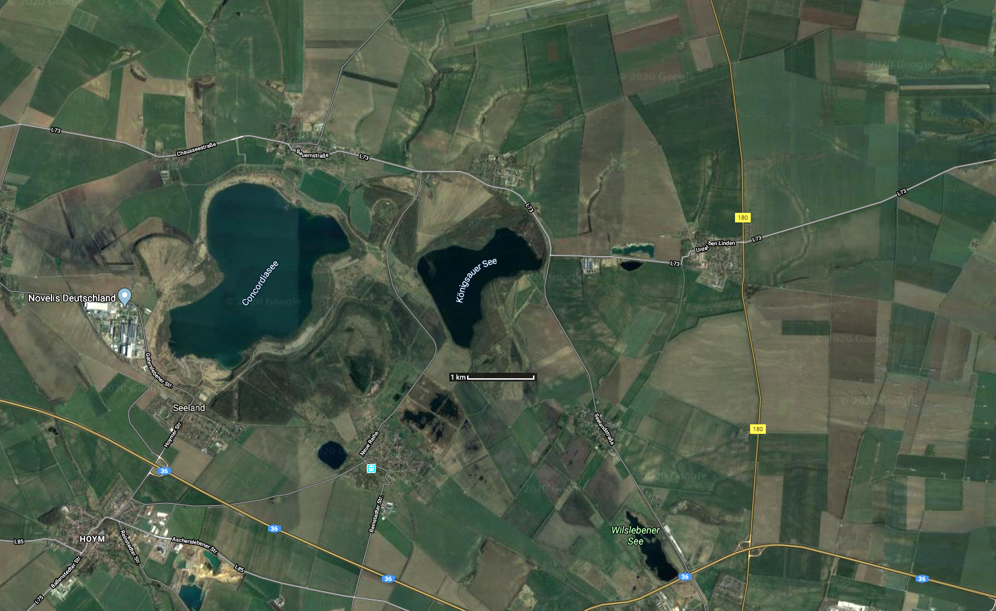
Königsaue Aschersleben-Staßfurt
The town of Königsaue in the district Aschersleben-Staßfurt, Saxony-Anhalt, Germany was destroyed in the course of opencast lignite mining in 1964. The inhabitants were resettled to the town of Neu-Königsaue, ca. 1 km north of the former location on the northern shore of Königsauer See as marked in this map. The buildings may be seen on the northern side of the road L73 in this map.
Königsaue is also a middle palaeolithic find spot. It dates to about 80 000 BP, the Eemian (Ipswichian) interglacial. The site most probably was a seasonal hunting camp at the shore of Aschersleben See (labelled Königsauer See on this map) that was completely drained at the beginning of the 18th century by an order of Friedrich II. It was discovered in 1963 by Dieter Mania during rescue excavations in the course of lignite mining (opencast mine Königsaue 1, 1918 – 1977) at a depth of 17 m.
Three settlement layers can be distinguished, separated by limnic (lake) sediments. The first layer (A) is dated to the beginning of the interstadial. The vegetation is still turning to boreal, an open steppe type habitat, the pollen assemblage dominated by grasses. Layer C coincides with the climatic optimum. Tree pollen rise to 70%, birch and pine dominate.
The shore sediments were deposited on a shallow beach terrace, which was located in a protected bay on the northern shore of Lake Aschersleben. The artefact complexes were given the names Königsaue А, В and C.
Circa 6 000 flints have been excavated, including a few bifacially worked knives (Keilmesser) and small pointed hand axes of Micoquien type (Faustkeilblätter). The bifacial tools are most common in layer A, while prepared cores are typical for layer B. Numerous unretouched blades and small debitage point to intense local tool production. The site may have been used as a base camp. In layer C bifacial tools again predominate. Layers A and C belong to the Micoquien, B to the Mousterian. Animal bones show that Mammoth, woolly haired rhino, horses, red deer and reindeer were hunted. Some pieces of worked wood have been preserved as well.
Photo: Google Maps
Text: Adapted from Wikipedia
Additional text: Mania (1975)
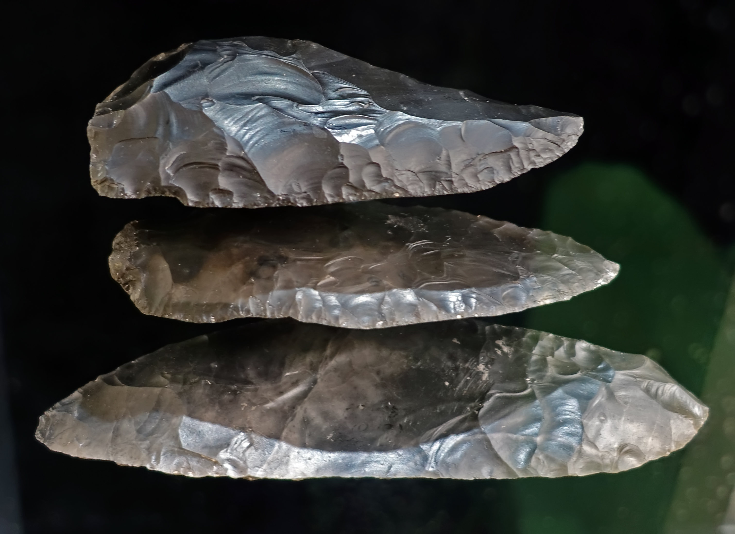
Königsaue
Outstanding tools, circa 80 000 BP.
Precision equipment -
Almost 6000 mostly simple stone tools of various kinds, for example scrapers and burins, were found at sites in Königsaue. Core stones, stone splinters and hammer stones testify that the tools were manufactured or reworked on site.
Flint available in the vicinity was mostly used as raw material. Outstanding are eleven Keilmesser, wedge knives, and six Faustkeilblätter, ( small pointed hand axes of the La Micoque type, a flatter version of the Acheulean hand axe, made during the Micoquian - Don ). These are good cutting tools, flat and very sharp-edged on all sides.
A set of two large Keilmesser, wedge knives, and a Faustkeilblatt, hand axe, were stacked on top of each other as shown in this image, and were probably once wrapped in organic material. Individual possessions were kept here.
Photo: Don Hitchcock 2018
Source and text: Halle Landesmuseum für Vorgeschichte, CC-BY-NC-SA @ State Museum of Prehistory Halle
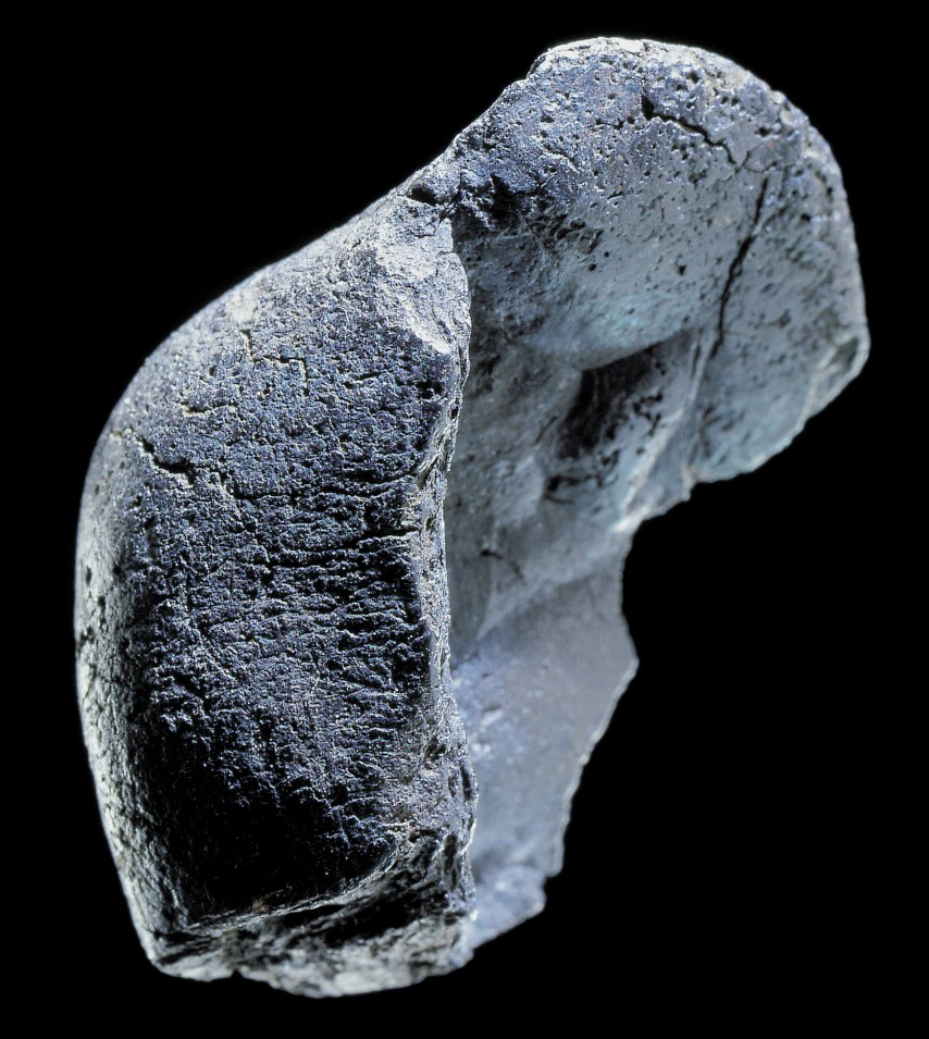
Birch tar/glue from Königsaue, layer A, bearing a Neanderthal thumbprint.
Middle Paleolithic (250 000 BP - 40 000 BP)
The 'resin' was clearly used as a glue for a wooden handle, into the prepared notch of which a flint knife of the type of a smaller Königsau wedge knife, retouched on both surfaces, was inserted.
The outer surface bears part of a fingerprint, as shown by indistinct papillary lines. This impression has a diameter of 10 mm. Assuming that a right-handed person pressed the
'resin' into the handle, the thumb of the right hand is likely to be the fingerprint.
Length 27 mm, width 20 mm, thickness 12 mm.
Photo (proximal source): aid-magazin.de/2023/06/13/neue-untersuchungen-zur-herstellung-von-birkenpech-durch-neandertaler/
Object from: Landesmuseum für Vorgeschichte Halle
Text: st.museum-digital.de/object/36058?navlang=en
Reference: Mania (2004)
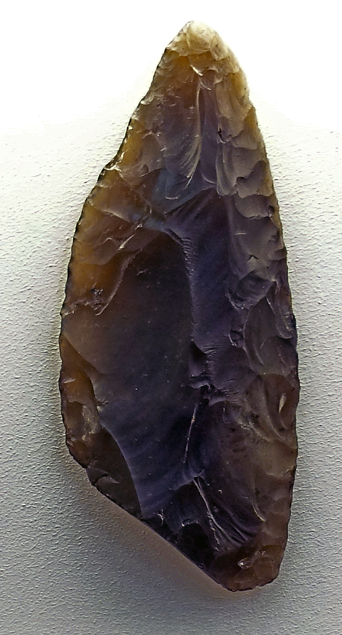
Königsaue A Aschersleben-Staßfurt
Keilmesser, circa 80 000 BP.
The bifacial Keilmesser is the type fossil of the late Middle Paleolithic Keilmessergruppen or Micoquian of central and eastern Europe.
Dimensions: 82 mm x 35 mm x 11 mm.
Keilmesser (wedge knives, axe knives), Faustkeilblätter (small pointed hand axes of the La Micoque type, a flatter version of the Acheulean hand axe, made during the Micoquian) and breite Blattspitzen (broad leaf points) are typical of Layer A.
Keil = wedge
Messer = knife
Faust = fist or hand
Blätter = leaf
Breite = broad
Spitzen = points
Faustkeil = (literally) fist wedge, which translates as hand axe.
Keilmesser = (literally) wedge knife, which translates as axe knife, that is, similar in some ways to a hand axe, but designed to be used as a knife.
The Keilmesser is the most represented in Layer A.
They are 55-160 mm long and asymmetrically shaped. The underside is flat, the upper side flat to convex. Both sides are completely retouched. One longitudinal edge has a straight, rarely slightly curved course and is carefully retouched to form a cutting edge on one side. The other longitudinal edge forms the back, which is typically bent in Königsauer knives.
The Keilmesser variant shown here is a slender elongated wedge-knife with a blunt-pointed handle end and a distinct but slightly curved back.
Photo: Don Hitchcock 2018
Source and text: Halle Landesmuseum für Vorgeschichte, https://nat.museum-digital.de/index.php?t=objekt&oges=61297&cachesLoaded=true, CC-BY-NC-SA @ State Museum of Prehistory Halle
Additional text: Weiss et al. (2018)
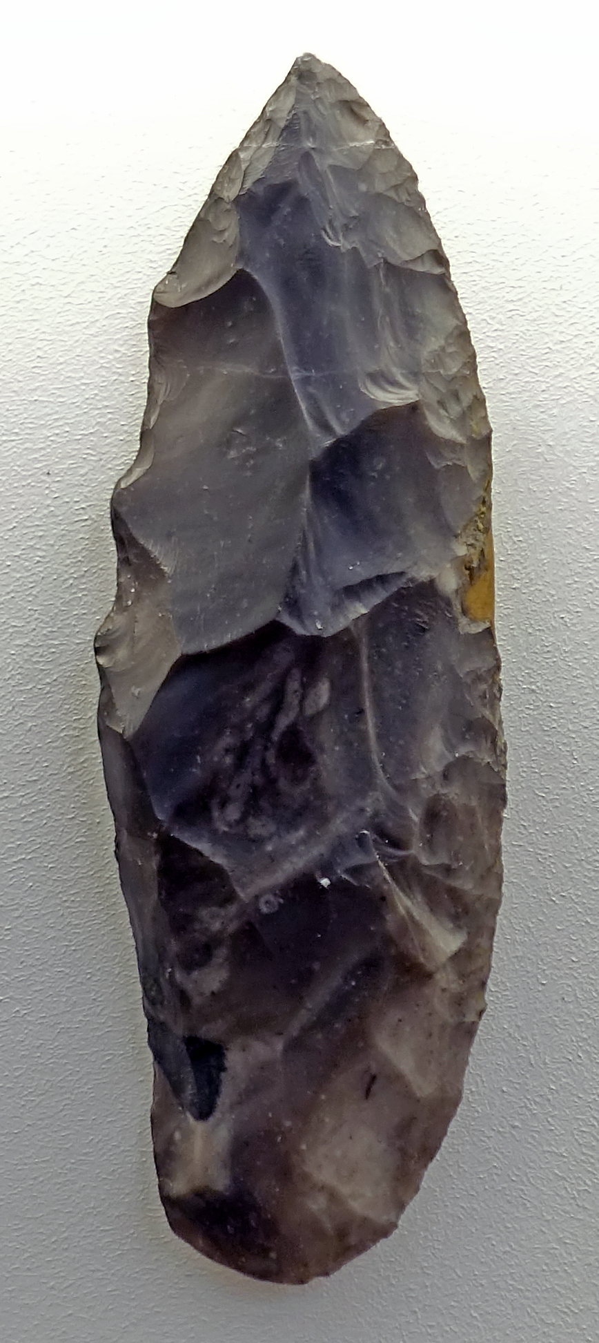
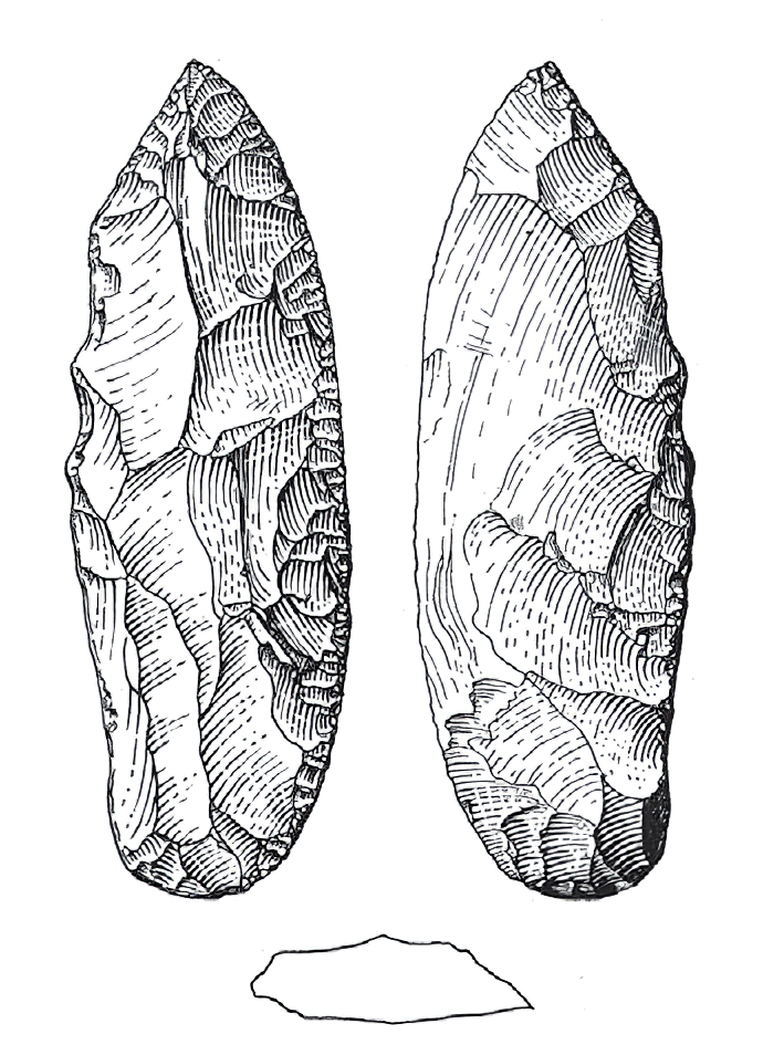
Königsaue A Aschersleben-Staßfurt
Keilmesser, circa 80 000 BP.
This is a Keilmesser from level A of Königsaue.
Photo: Don Hitchcock 2018
Source and text: Halle Landesmuseum für Vorgeschichte, CC-BY-NC-SA @ State Museum of Prehistory Halle
Drawing and text: Picin (2016)
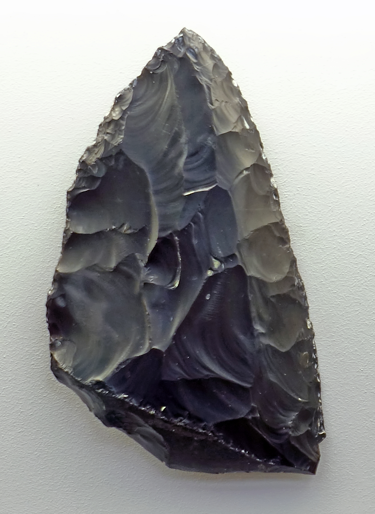

Königsaue A Aschersleben-Staßfurt
Keilmesser, circa 80 000 BP.
This is another Keilmesser from level A of Königsaue.
Photo: Don Hitchcock 2018
Source and text: Halle Landesmuseum für Vorgeschichte, CC-BY-NC-SA @ State Museum of Prehistory Halle
Drawing and text: Picin (2016)
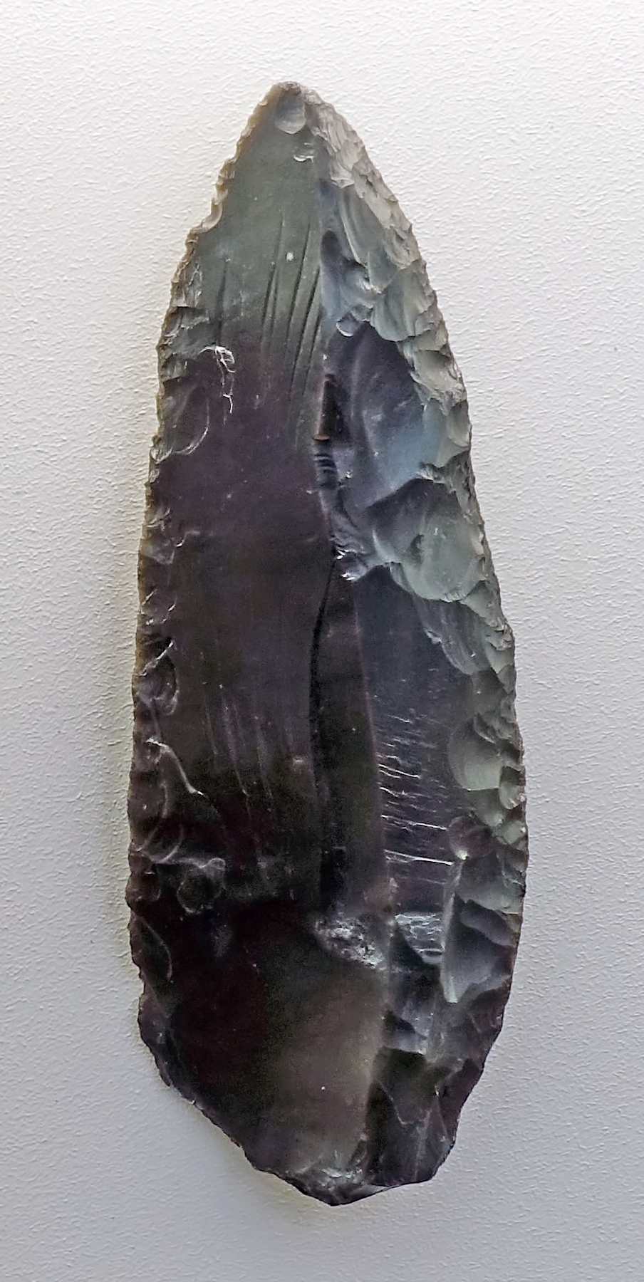
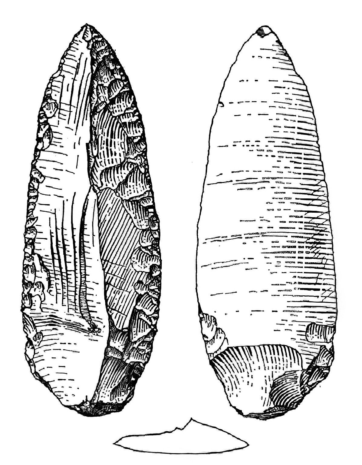
Königsaue A Aschersleben-Staßfurt
Mousterian point, Level A, circa 80 000 BP.
Photo: Don Hitchcock 2018
Source and text: Halle Landesmuseum für Vorgeschichte, CC-BY-NC-SA @ State Museum of Prehistory Halle
Drawing and text: Picin (2016)
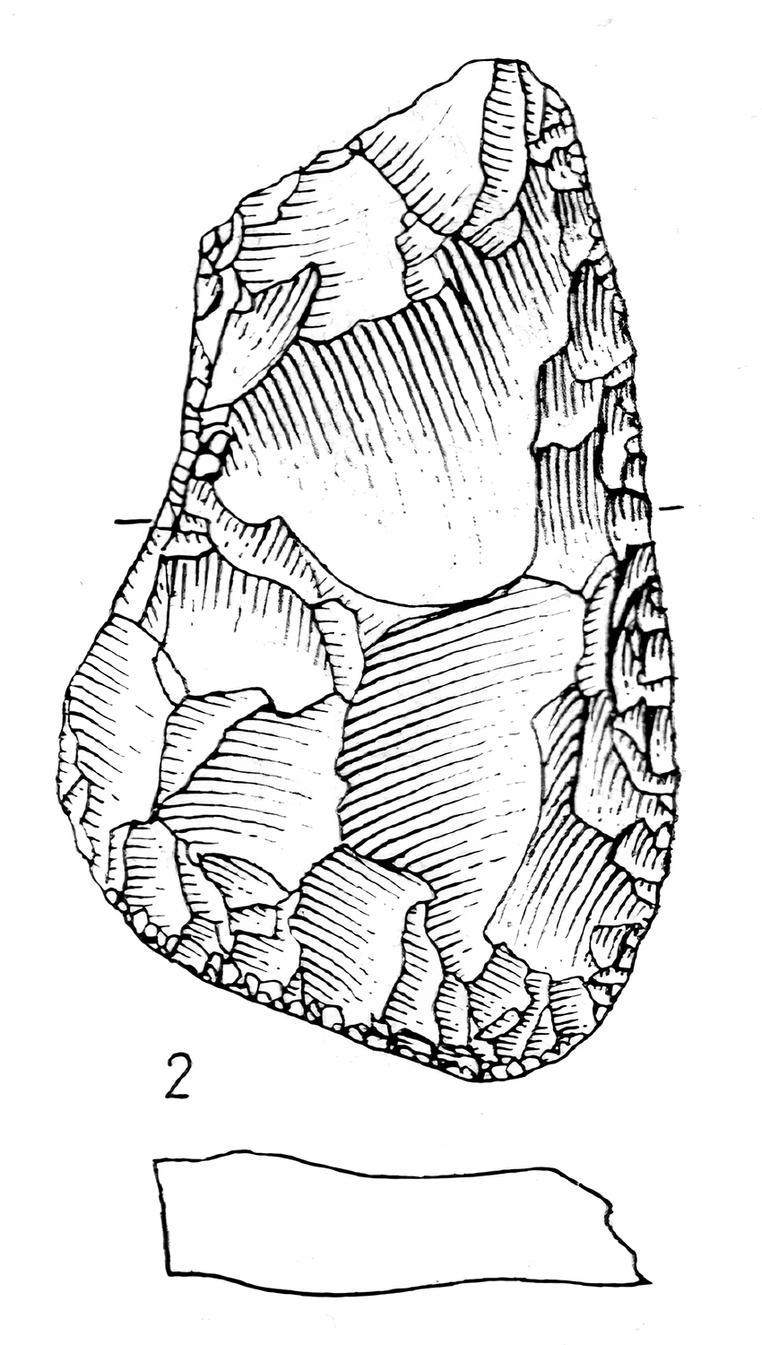
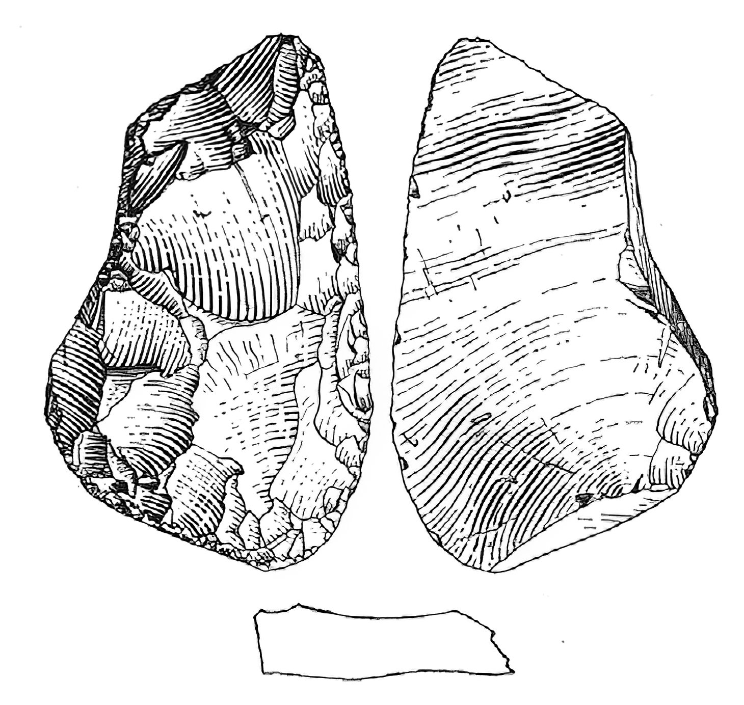
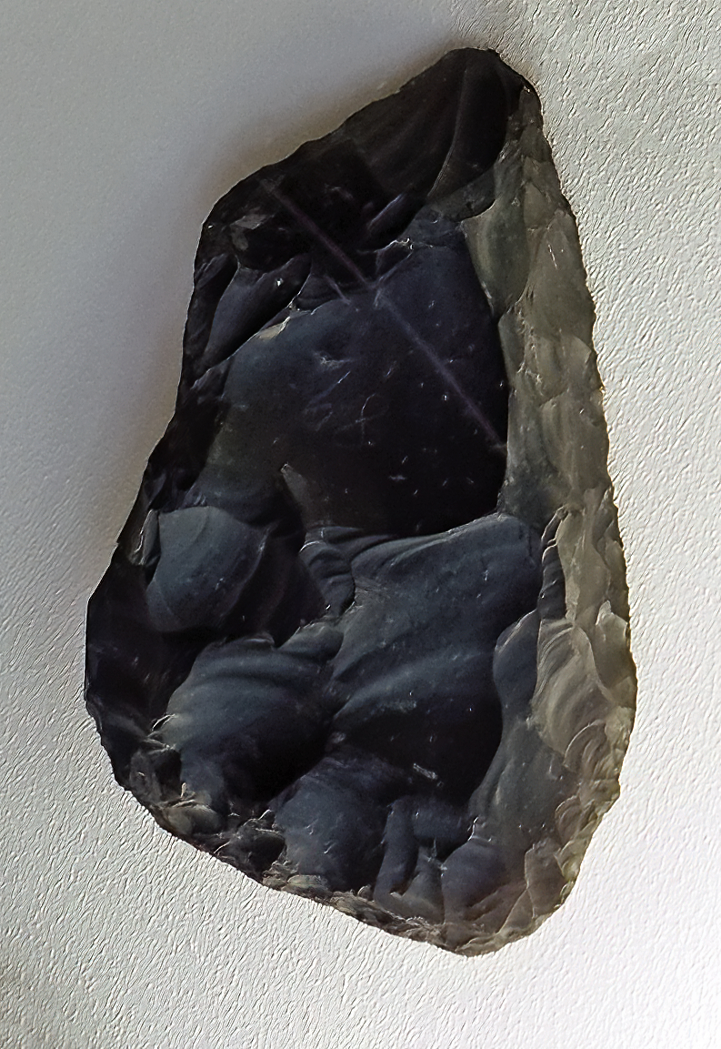
Königsaue A Aschersleben-Staßfurt
Scraper, Level A, circa 80 000 BP.
In Level A there are numerous ones sided retouched scrapers, mainly from flakes.
Photo: Don Hitchcock 2018
Source and text: Halle Landesmuseum für Vorgeschichte, CC-BY-NC-SA @ State Museum of Prehistory Halle
Drawing and additional text (left drawing): Mania (1975)
Drawing (right drawing showing reverse): Picin (2016)
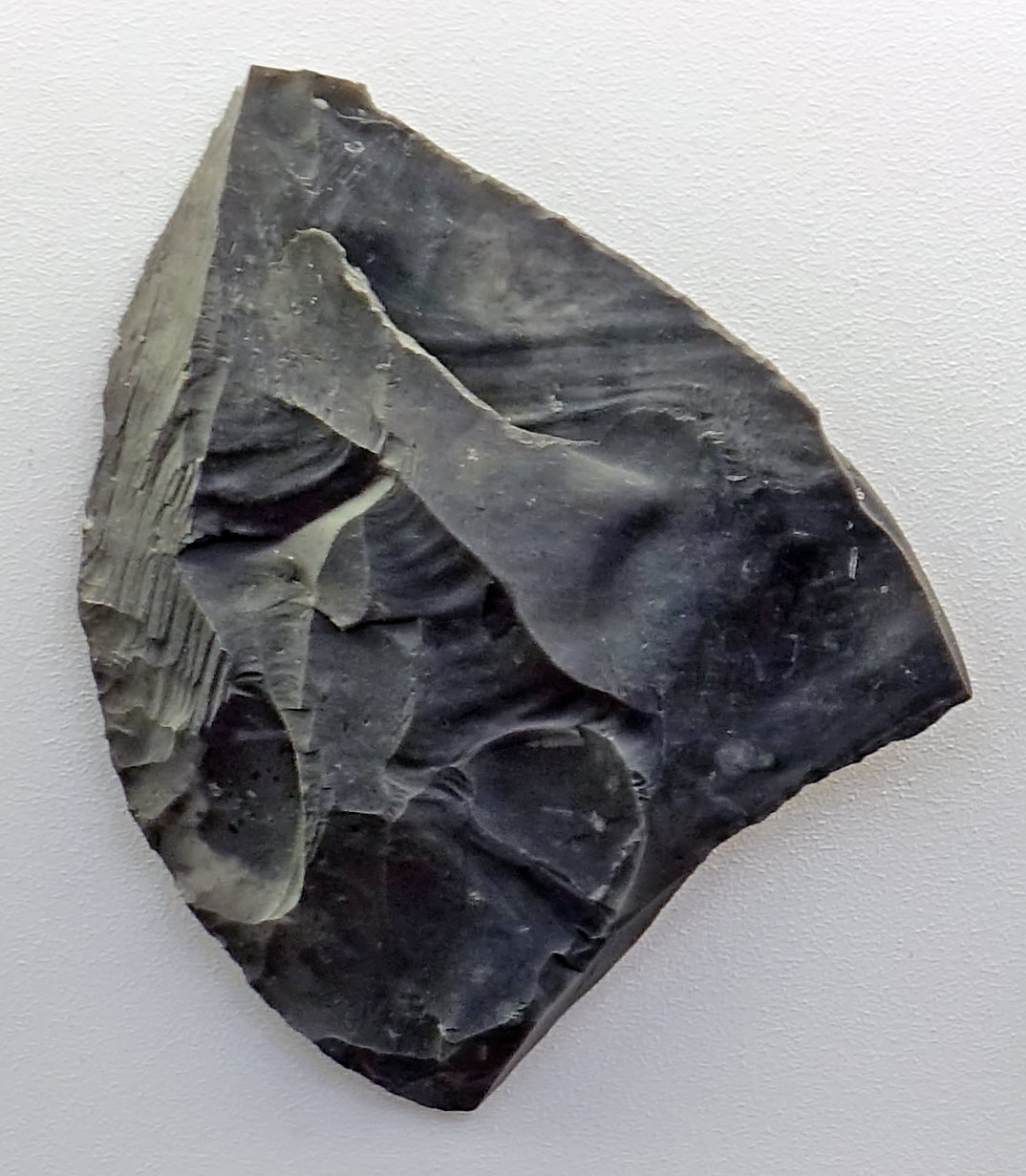
Königsaue A Aschersleben-Staßfurt
Scraper, Level A, circa 80 000 BP.
Photo: Don Hitchcock 2018
Source and text: Halle Landesmuseum für Vorgeschichte, CC-BY-NC-SA @ State Museum of Prehistory Halle
Drawing (right drawing showing reverse): Picin (2016)
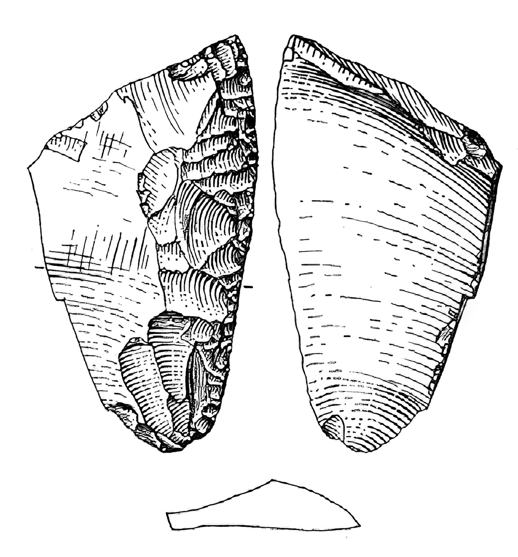
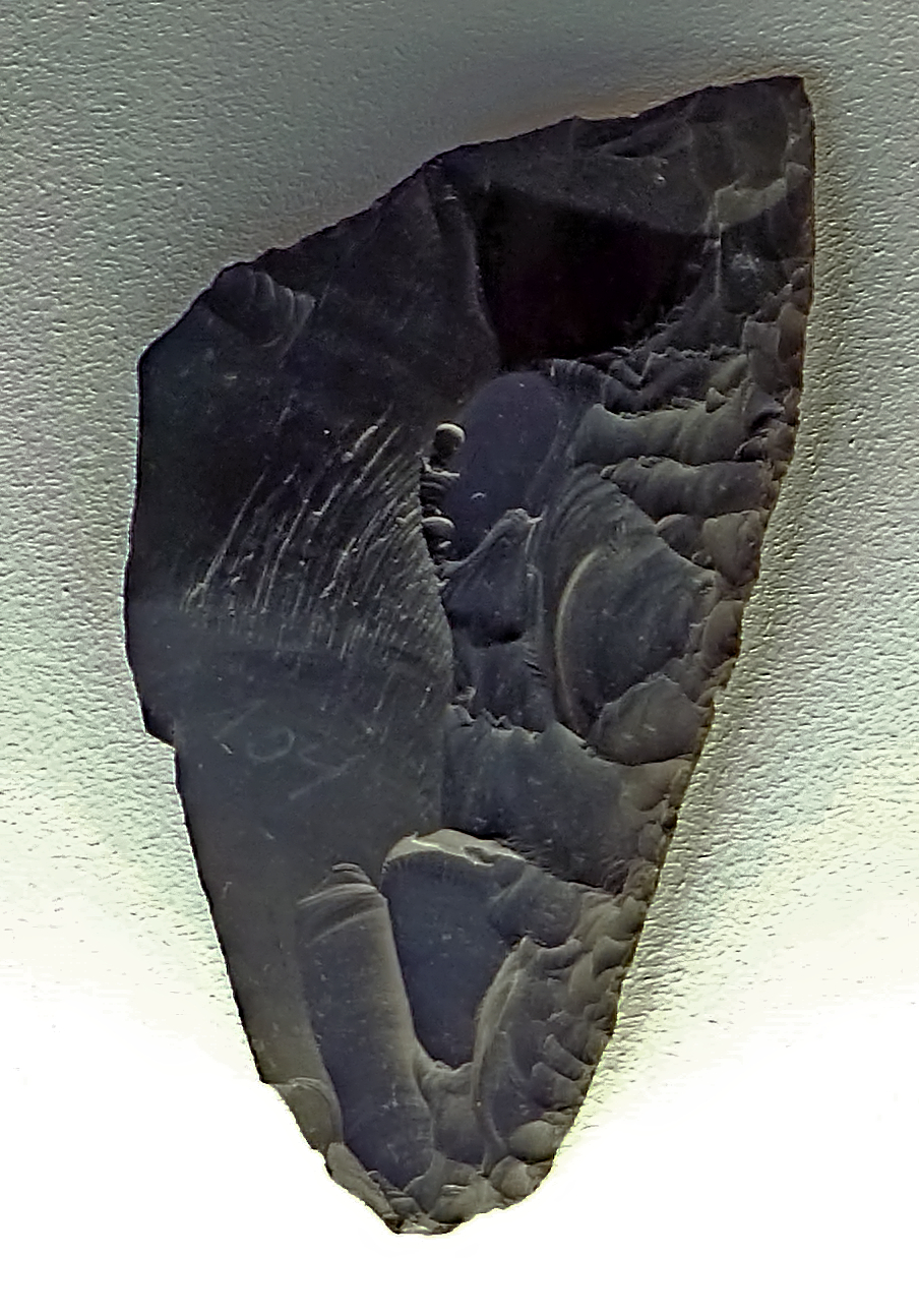
Königsaue A Aschersleben-Staßfurt
Demi-Quina scraper, Level A, circa 80 000 BP.
These peculiar tools are characterised by a scalar retouch affecting their working edges. Scalar retouch is a semi-abrupt form which fractures on the end of the removals in steps or scales. It is a more extreme form of scaled retouch and the depth and angle of the detachments imply the use of a dense or sturdy percussor.
Photo: Don Hitchcock 2018
Source and text: Halle Landesmuseum für Vorgeschichte, CC-BY-NC-SA @ State Museum of Prehistory Halle
Drawing and additional text: Picin (2016)
Additional text: http://rogergrace.webmate.me/SARC/tech/tech/scalarretouch.html, Zupancich (2015)
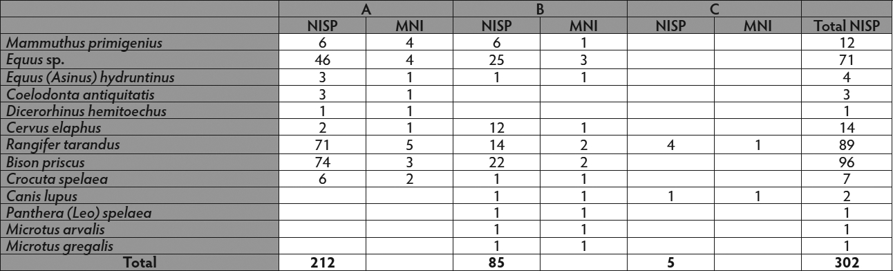
NISP of macro- and micromammals by layers from Königsaue (MNI = minimum number of individuals; NISP = number of identified
specimens).
Source and text: Picin (2016)
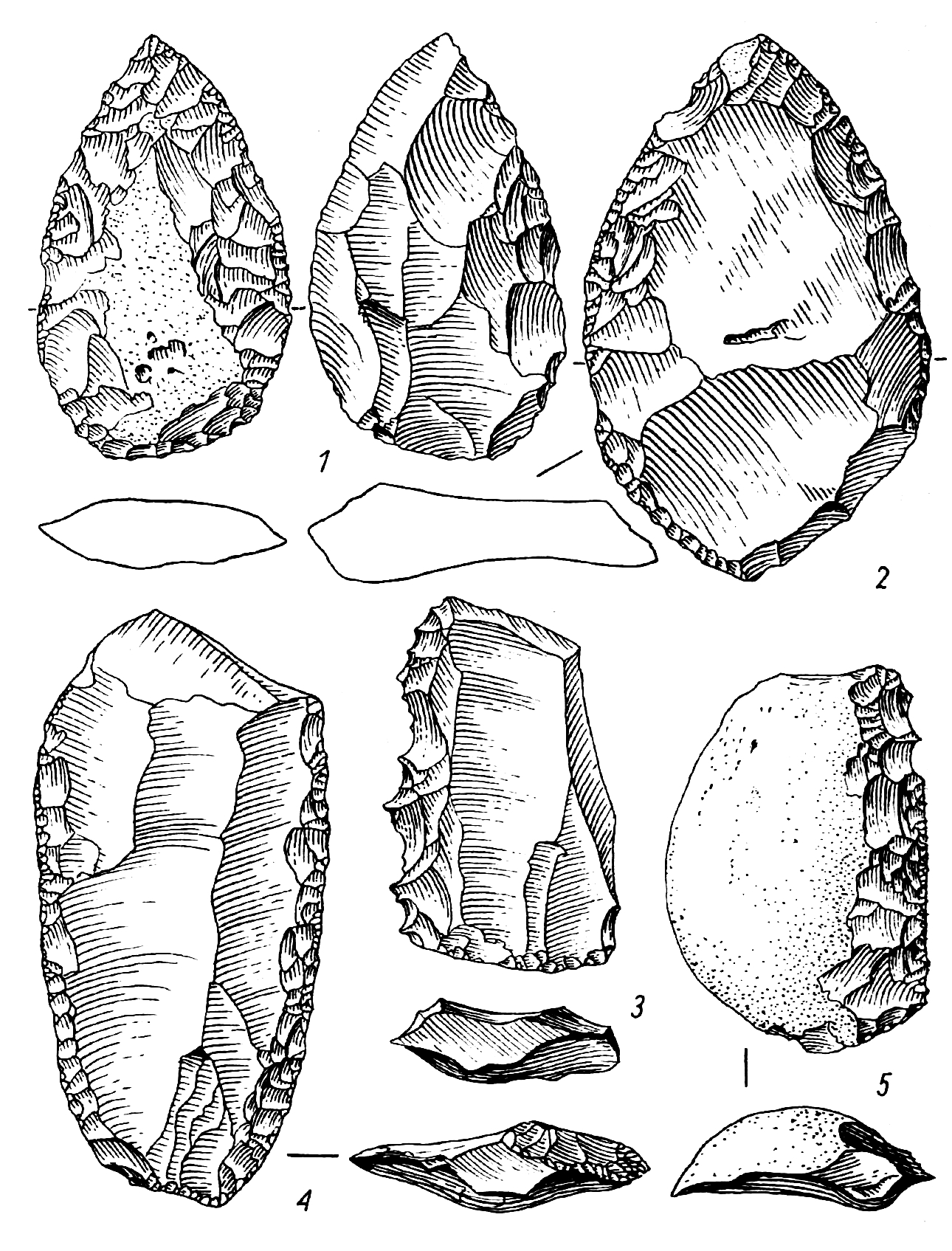
Königsaue B Aschersleben-Staßfurt
Figure 14.
Circa 80 000 BP.
Bifacial tools are uncharacteristic and rare. Only once was a small double-sided, surface retouched Faustkeilblatt found (Fig. 14, 1).
In general, Königsaue В stands out due to the poverty of retouched tools. Only single-sided edge-retouched single (Fig. 14, 5), double (Fig. 14, 4) and angle scrapers, denticulés (Fig. 14, 3), and more rarely double tips (Fig. 14, 2) are found. Knives with natural backs were repeatedly identified, which were confirmed in their role as knives from the traces of use on the sharp edges.
In contrast, irregular flakes or blades with signs of use are frequent. Retouching waste from bifacially processed tools such as those in Königsaue A were rarely observed. Small flakes and chipping occurred mostly during core preparation, and numerous quartzite hammer stones testify to the processing of cores at the site.
Drawing and text: Mania (1975)
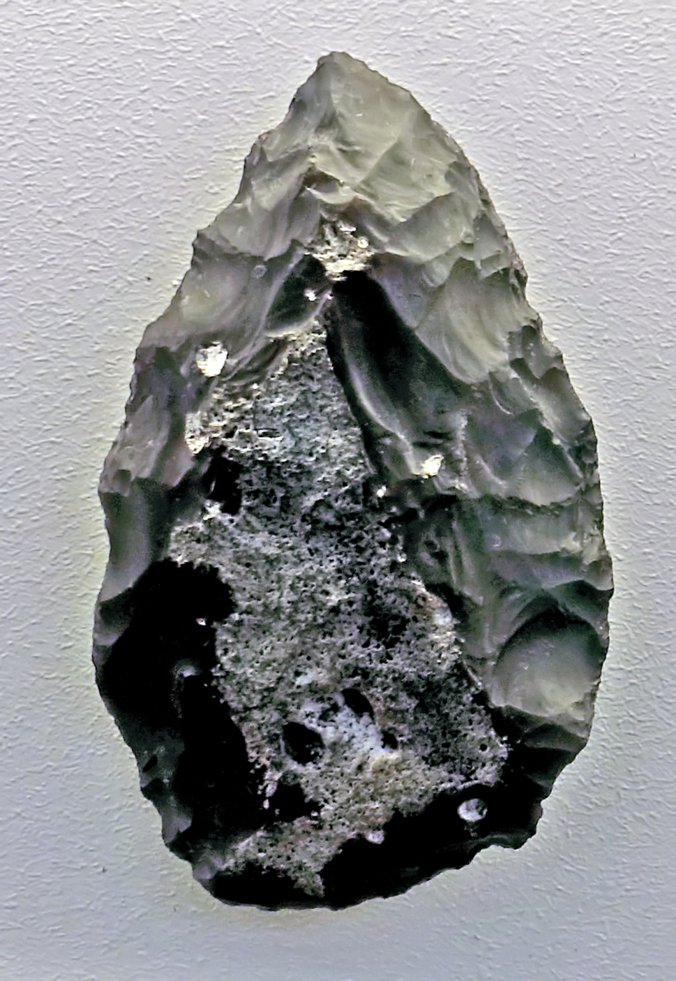
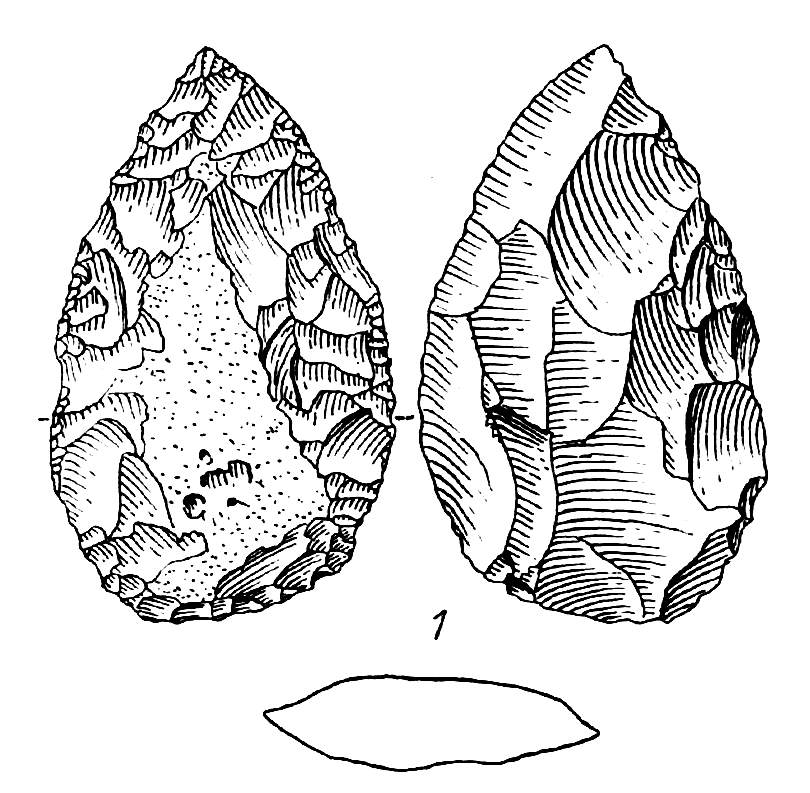
Königsaue B Aschersleben-Staßfurt
Circa 80 000 BP.
This is a Faustkeilblatt (a flatter version of the Acheulean hand axe, made during the Micoquian).
Dimensions: 57 mm x 35 mm
Photo: Don Hitchcock 2018
Source: Königsaue B, Halle Landesmuseum für Vorgeschichte, CC-BY-NC-SA @ State Museum of Prehistory Halle
Drawing and text: Fig. 14, 1: Mania (1975)
Petersberg
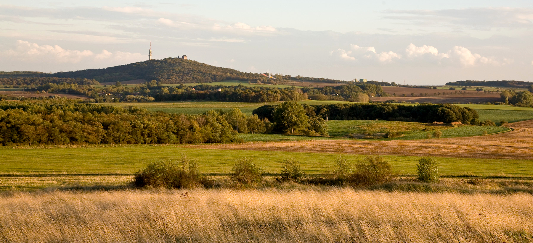
Petersberg mountain, Saalekreis, 10 km north of Halle, Germany.
This Middle Palaeolithic site was discovered when the wall foundations of the Collegiate Church and Monastery of St. Peter (visible on the top of the mountain in this photograph, click for a larger version) were uncovered in 1967 during restoration work at the 19th century church.
White patinated Middle Palaeolithic flint artefacts were found in undisturbed soil sections.
They were mainly located in narrow crevices and fissures of the porphyry, which was heavily exposed to frost weathering. They were covered by yellow loess, which was found between the porphyry blocks of the erosion surface.
Almost all artefacts are frost-cracked or shattered by frost wedging. They were thus exposed to a cold-arid climate with extreme frost weathering. It can be concluded from this, as well as from the covering by loess, that the artefacts were discarded on Petersberg mountain before the high glacial phase of the Weichselian glacial period.
Photo: Polarlys
Permission: Creative Commons Attribution-Share Alike 3.0 Unported license.
Text: After Mania (1975)
Location of Petersberg, Saalekreis, 10 km north of Halle, Germany.
Click to see the full size image.
Photo: Google Maps
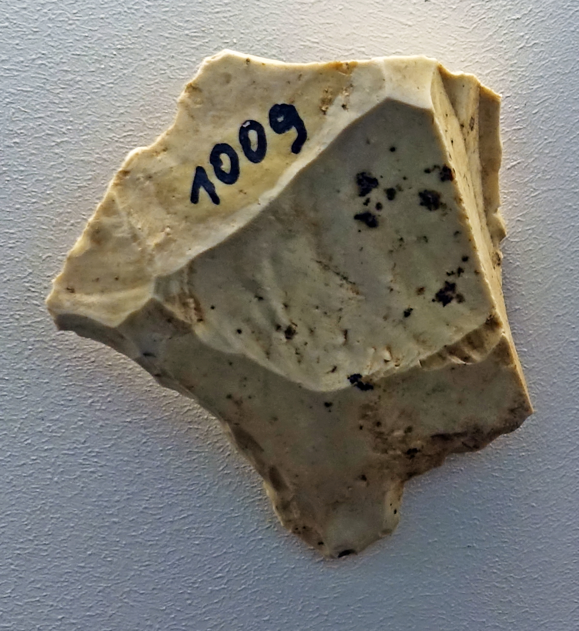
Petersberg
Circa 50 000 BP.
Core.
A large part of the finds are parallel-edged blades, which were obtained less from levallois cores than from core stones with an impact base. These core stones already resemble real blade cores rather than levallois cores.
Photo: Don Hitchcock 2018
Source: Petersfels, Halle Landesmuseum für Vorgeschichte, CC-BY-NC-SA @ State Museum of Prehistory Halle
Text: After Mania (1975)
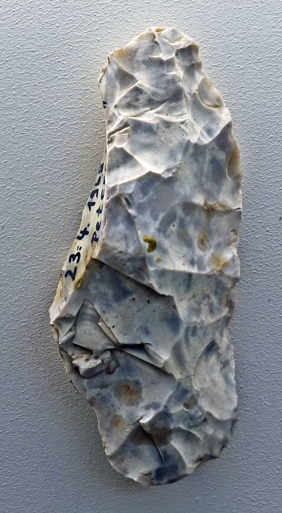

Petersberg
Circa 50 000 BP.
Narrow wedge-shaped knife with curved dorsal and flat ventral sides and a curved, broad back.
Photo: Don Hitchcock 2018
Source: Petersfels, Halle Landesmuseum für Vorgeschichte, CC-BY-NC-SA @ State Museum of Prehistory Halle
Text: After Mania (1975)
Drawing: After Mania (1975)
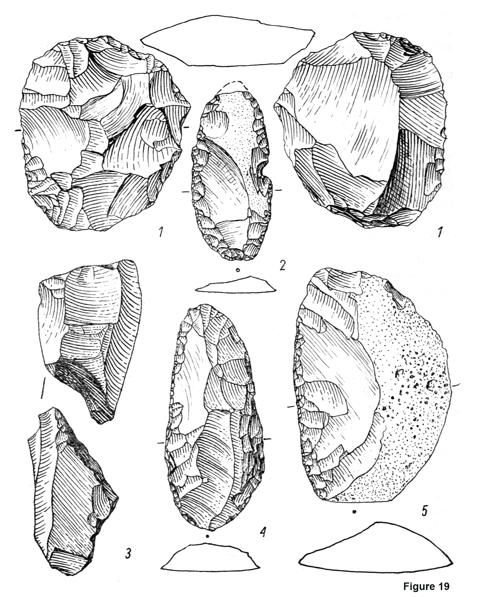

Petersberg, a Middle Palaeolithic site.
Figure 19 and Figure 20, Mania (1975)
The most common tools at Petersberg are single-sided retouched scrapers, such as single and double scrapers with convex or straight edges (Figure 19, numbers 2, 4, and 5) as well as convex and concave wide scrapers and pointed scrapers (Figure 20, 2).
Occasionally, bifacially surfaced retouched devices also occur. For example, there is one narrow wedge-shaped knife with curved dorsal and flat ventral sides and a curved, broad back (Fig. 20, 1). Thus it reminds one of the wedge-shaped knives of the Königsaue type.
Other pieces present as triangular wide blades (Fig. 20, 3), while several disc-shaped, surface worked discs must be considered discoid scrapers rather than levallois cores (Fig. 19, 1). The fact that a large part of the flakes originate from levallois cores is shown by their dorsal surfaces and faceted impact bases as well as some remnants of the levallois cores.
However, a large part of the finds are parallel-edged blades, which were obtained less from such disks than from core stones with an impact base (Fig. 19, 3). These core stones already resemble real blade cores rather than levallois cores.
Photo and text: after Mania (1975)
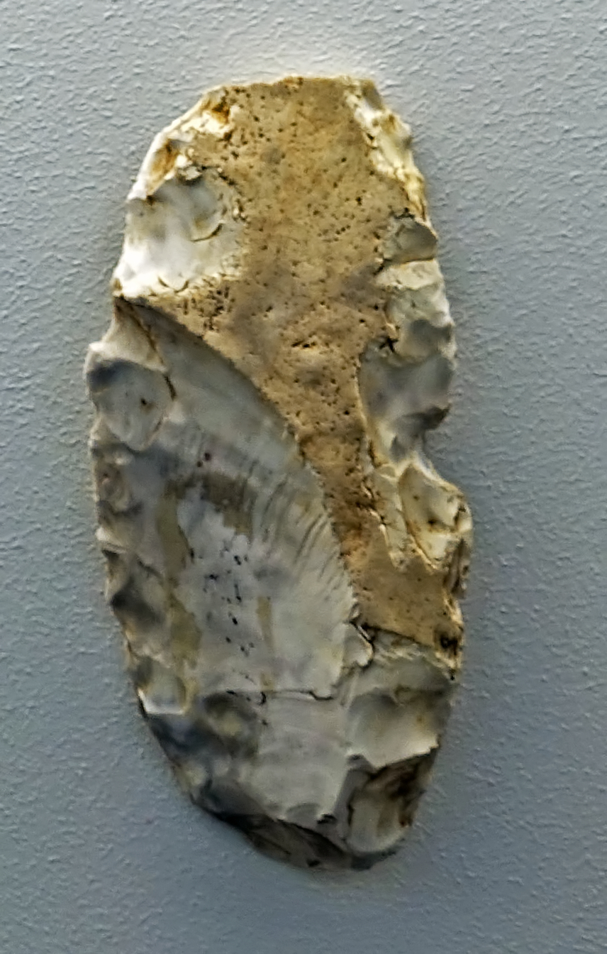
Petersberg
Circa 50 000 BP.
Single-sided retouched double scraper.
( this scraper has a notch knapped on one edge, possibly for smoothing a wooden or antler rod - Don )
Photo: Don Hitchcock 2018
Source: Petersfels, Halle Landesmuseum für Vorgeschichte, CC-BY-NC-SA @ State Museum of Prehistory Halle
Text: After Mania (1975)
Drawing: After Mania (1975)
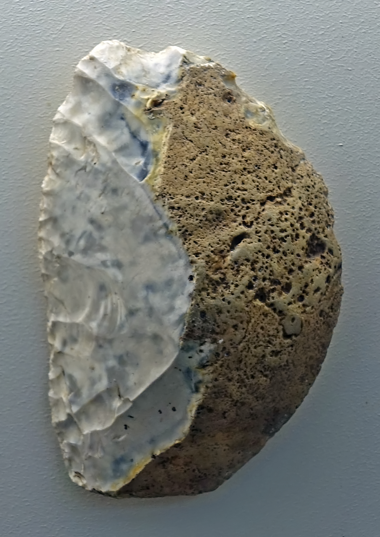
Petersberg
Circa 50 000 BP.
Single-sided retouched single scraper with a straight edge.
Photo: Don Hitchcock 2018
Source: Petersfels, Halle Landesmuseum für Vorgeschichte, CC-BY-NC-SA @ State Museum of Prehistory Halle
Text: After Mania (1975)
Drawing: After Mania (1975)
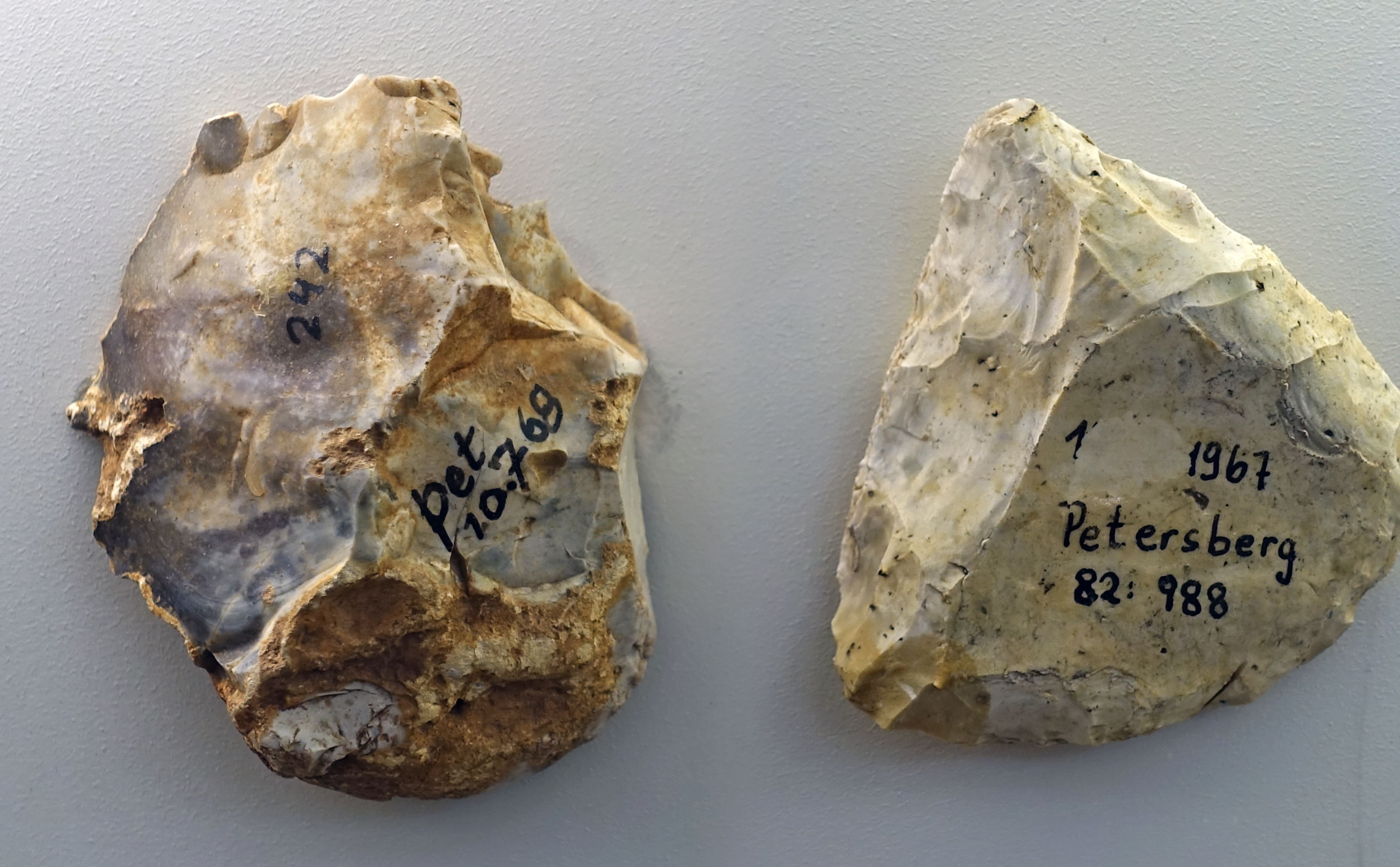
Petersberg
Circa 50 000 BP.
On the left, what is apparently the remains of a core.
On the right, a beautifully made straight scraper, which has soaked up a lot of skilled work and tender loving care to make the back of the tool fit easily and smoothly into the hand. It is part of the human condition that we often lavish time and effort on items which don't strictly need such attention. We like to do a good job, even if it is not, strictly speaking, necessary to do so.
Photo: Don Hitchcock 2018
Source: Petersfels, Halle Landesmuseum für Vorgeschichte, CC-BY-NC-SA @ State Museum of Prehistory Halle
Text: Don Hitchcock
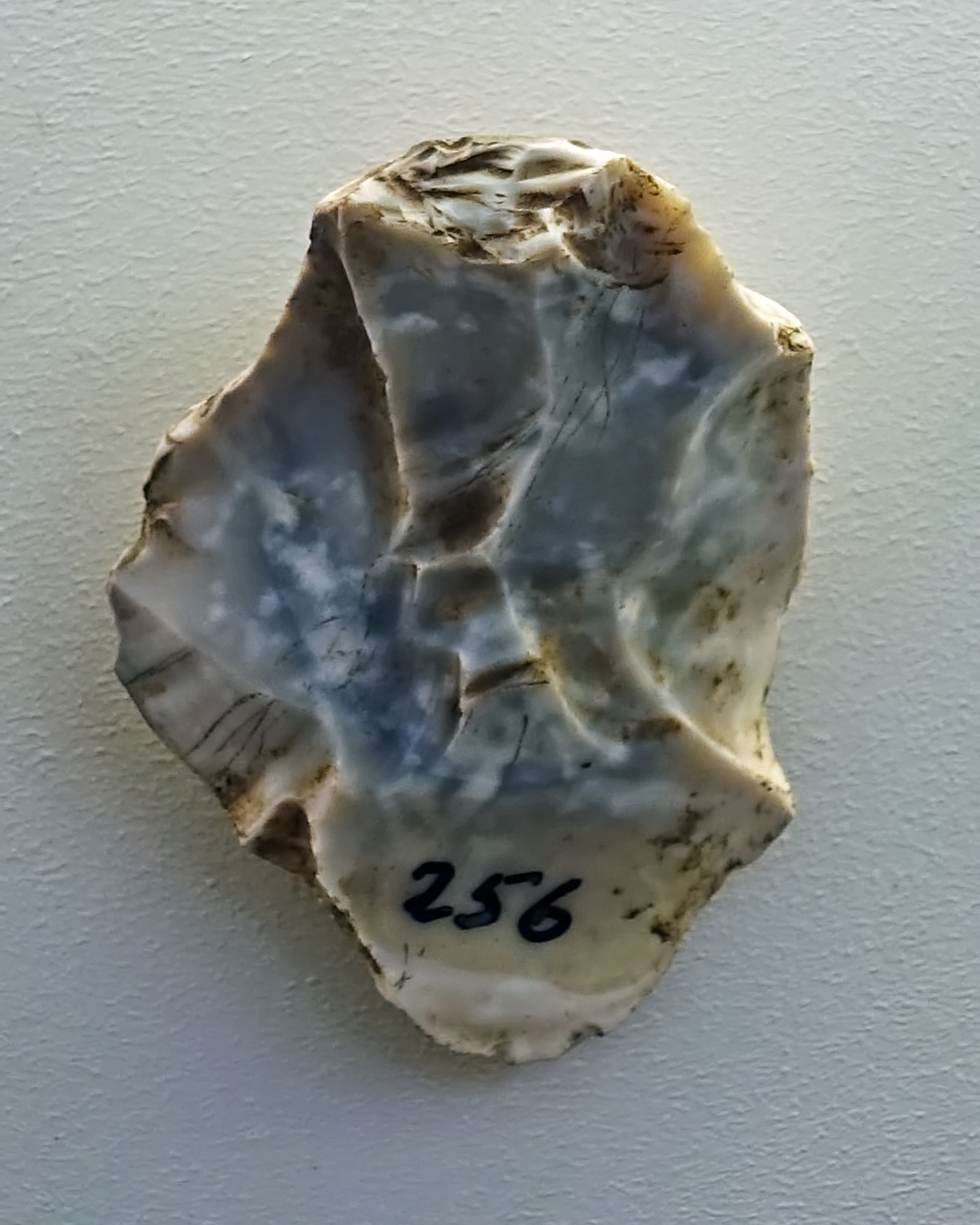
Petersberg
Circa 50 000 BP.
What remains of a core. Good flint was valuable, and cores were mined for tools until there was almost nothing left. Even then, cores of good flint were often pressed into service on an ad hoc basis, as small scrapers, for example.
Photo: Don Hitchcock 2018
Source: Petersfels, Halle Landesmuseum für Vorgeschichte, CC-BY-NC-SA @ State Museum of Prehistory Halle
Text: Don Hitchcock
Ilsenhöhle
Ilsenhöhle, a cave underneath Burg Ranis in Thuringia, Germany is important for the light it sheds on the transition from the Middle Palaeolithic, with Mousterian or Neanderthal tools, to the Upper Palaeolithic, beginning with the Aurignacian.
Above the cave is Ranis Castle, situated on a rock shelf. The cave opens on the south-east flank. The rock shelf reaches a height of about 400 m above sea level and rises more than 60 m above its surroundings.
The cave consists of an approximately 10 to 15 m wide, at least 8 to 10 m high vestibule, the abri-like arch of which is set back by collapse. The cave continues under the dolomite shelf diverging into two cleft-like cavities, each more than 10 m long (north and south cave). Both begin with a width of about 3 m, but taper quickly to less than 1 m in width.
A total of 250 m² of the cave and the forecourt were excavated without the sondages. The preliminary investigations were carried out by Dietrich von Breitenbuch who owned the Ranis castle, the subsequent excavations were carried out by the then State Institute for Prehistory Halle.
Like numerous other caves in the Bryozoan reefs of the Zechstein outcrop, the Ilsenhöhle is primarily due to caverns in the reef dolomite, which were filled with loosely caked reef sands and emptied by weathering and erosion processes. Additional weathering of the dolomite led to the expansion of the cavities, whereby the formation of vertical fissures also played a role. Over the past 120 000 years, the caves of the Ilsenhöhle have been filled with sediments from frost fracture.
Photo: Ansgar Koreng
Permission: CC BY 3.0 (DE), Creative Commons Attribution 3.0 Germany license
Location: 50° 39′ 45.18″ N, 11° 33′ 54.44″ E
Source and text: Wikipedia
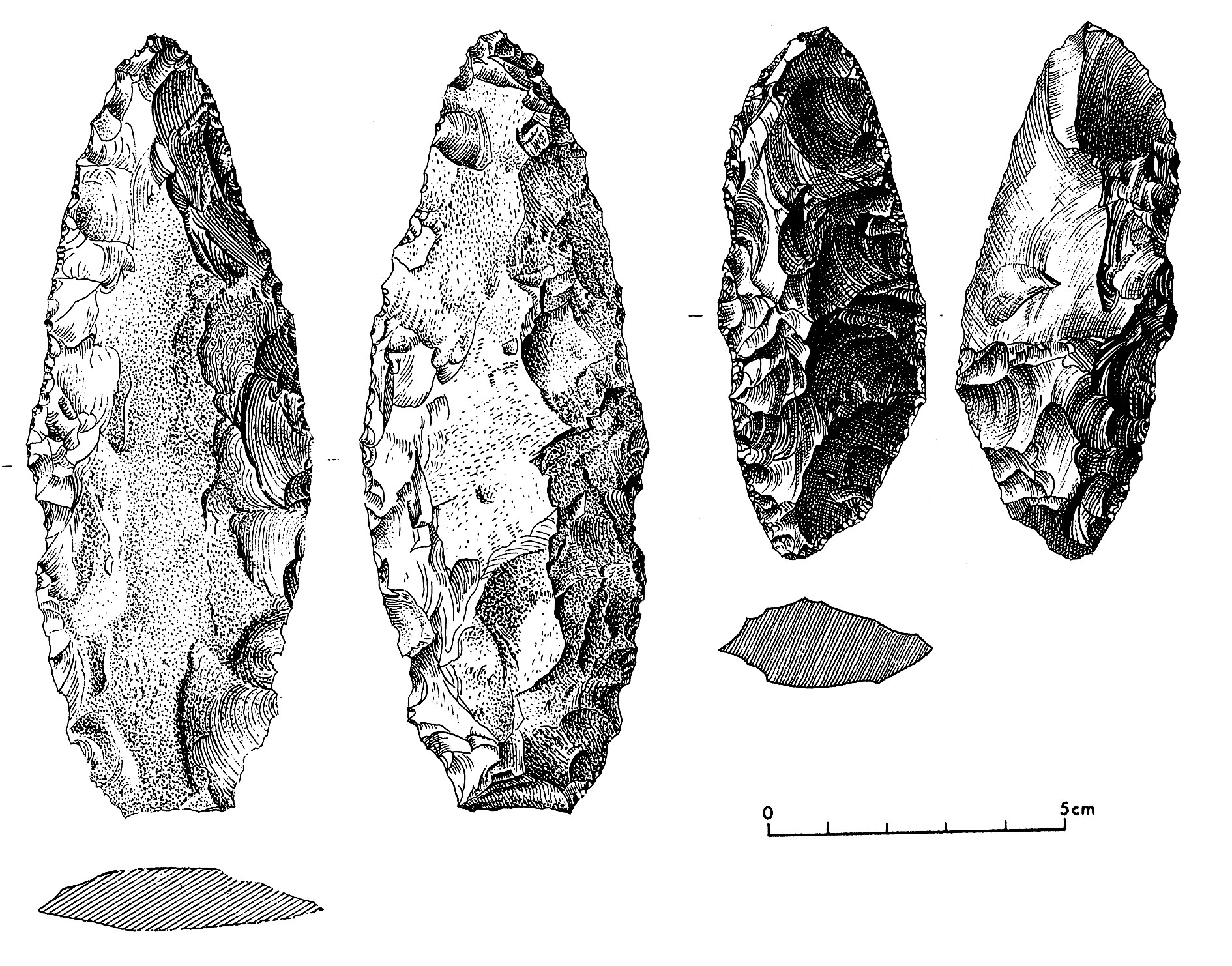
Ranis 1, Ilsenhöhle
Circa 50 000 BP.
Faustkeilblatt (a flatter version of the Acheulean hand axe, made during the Micoquian) and bifacial scraper from Ranis 1, the oldest layer at the Ilsenhöhle.
Photo: Hülle (2009)
Text: Richter (2009)
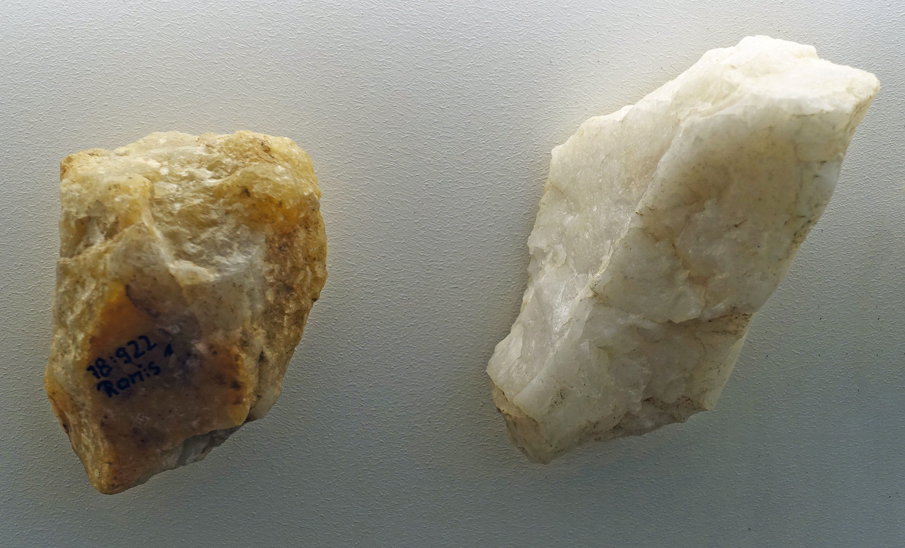
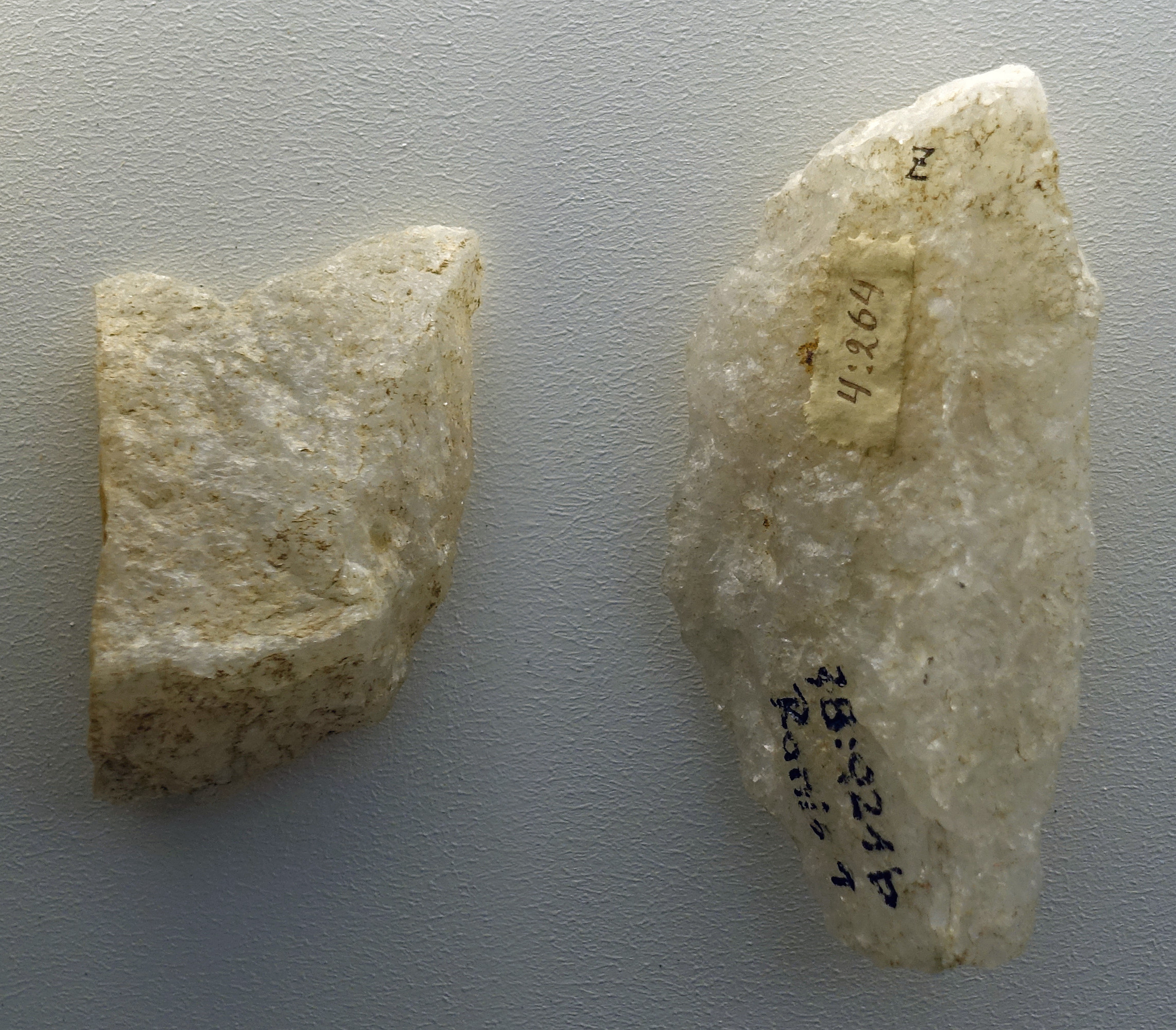
Ranis 1, Ilsenhöhle
Circa 50 000 BP.
These tools are of quartzite, identified as such by Mania (1975)
Photo: Don Hitchcock 2018
Source and text: Ilsen Cave near Ranis, Halle Landesmuseum für Vorgeschichte, https://st.museum-digital.de/, CC-BY-NC-SA @ State Museum of Prehistory Halle
Blattspitzen (leaf points, blade points) from Ilsenhöhle in the Ranis area, in the central East of Germany
The term leaf point or leaf tip has been used since around 1900 for symmetrical flint points from the Middle and Young Paleolithic with beech or willow leaf-like shapes. Leaf points represent a further development of the hand axe industries of the Old Palaeolithic (Acheulean). They are leaf-shaped, slender in longitudinal section, almost straight, more or less completely bifacial (both surfaces) and axially symmetrical with one or two points. Leaf tips, forming double edged points, were named after their shape, and are masterpieces of knapping. This design was widespread from Northwest to Eastern Europe 40 000 years ago.
According to current knowledge, these artfully crafted stone points were made by both Neanderthals and anatomically modern humans. Both types of people lived side by side at that time and had the same technical skills.
Leaf points were highly effective tips for projectiles and for use as knives due to their double-edged finish. They were particularly suitable for penetrating or cutting thick furs and skins, such as the winter coat of a cave bear.
Strikingly, leaf points have so far been found almost exclusively in caves and mostly not in groups of similar tools. Also in Ranis there are no traces that point to a storage place for these tools, nor are there any indications of the manufacture of these flint devices on site. It is reasonable to suspect that exceptional workpieces have been kept here for ritual purposes or as status objects.
Text above: Halle Landesmuseum für Vorgeschichte
Additional text: Wikipedia
Global distribution of blattspitzen (leaf point) cultures.
Illustration: after Marten Postma, http://www.archeoforum.nl/vondstbeschrijving/mpbladspitsJB/mpbladspitsJB.html
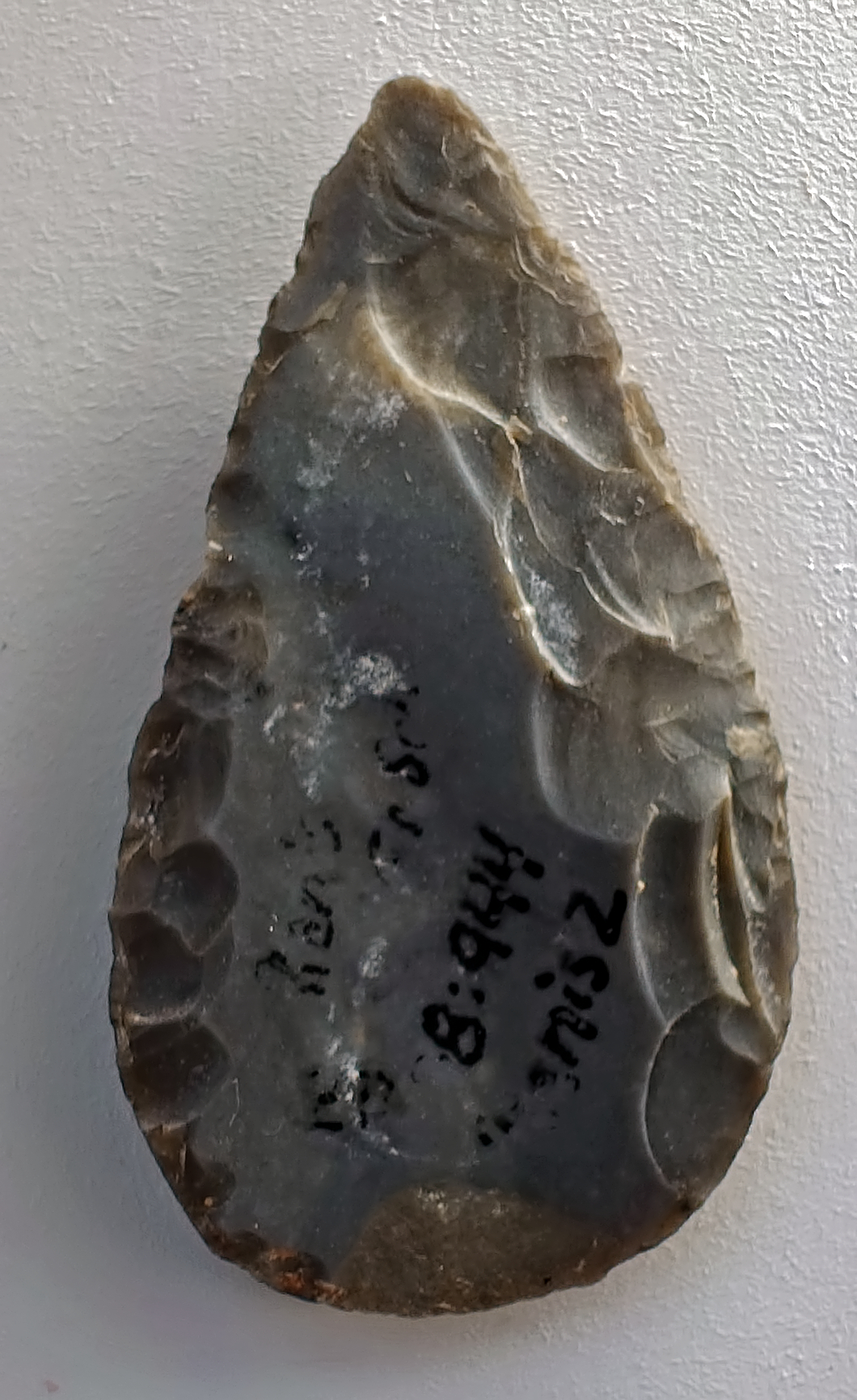
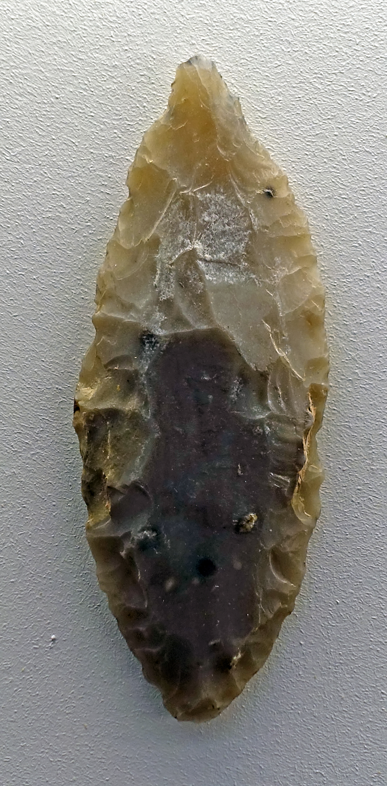
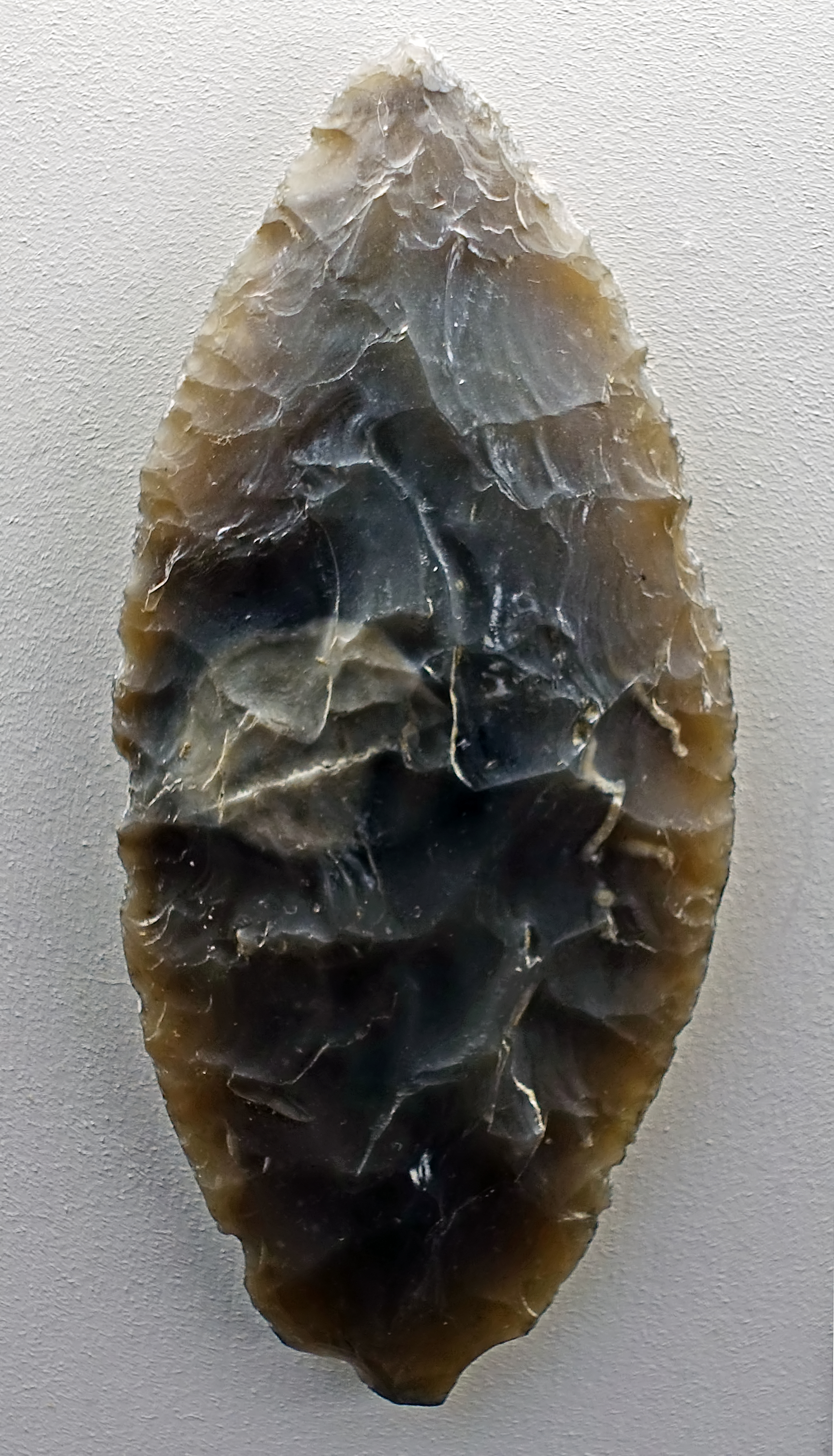
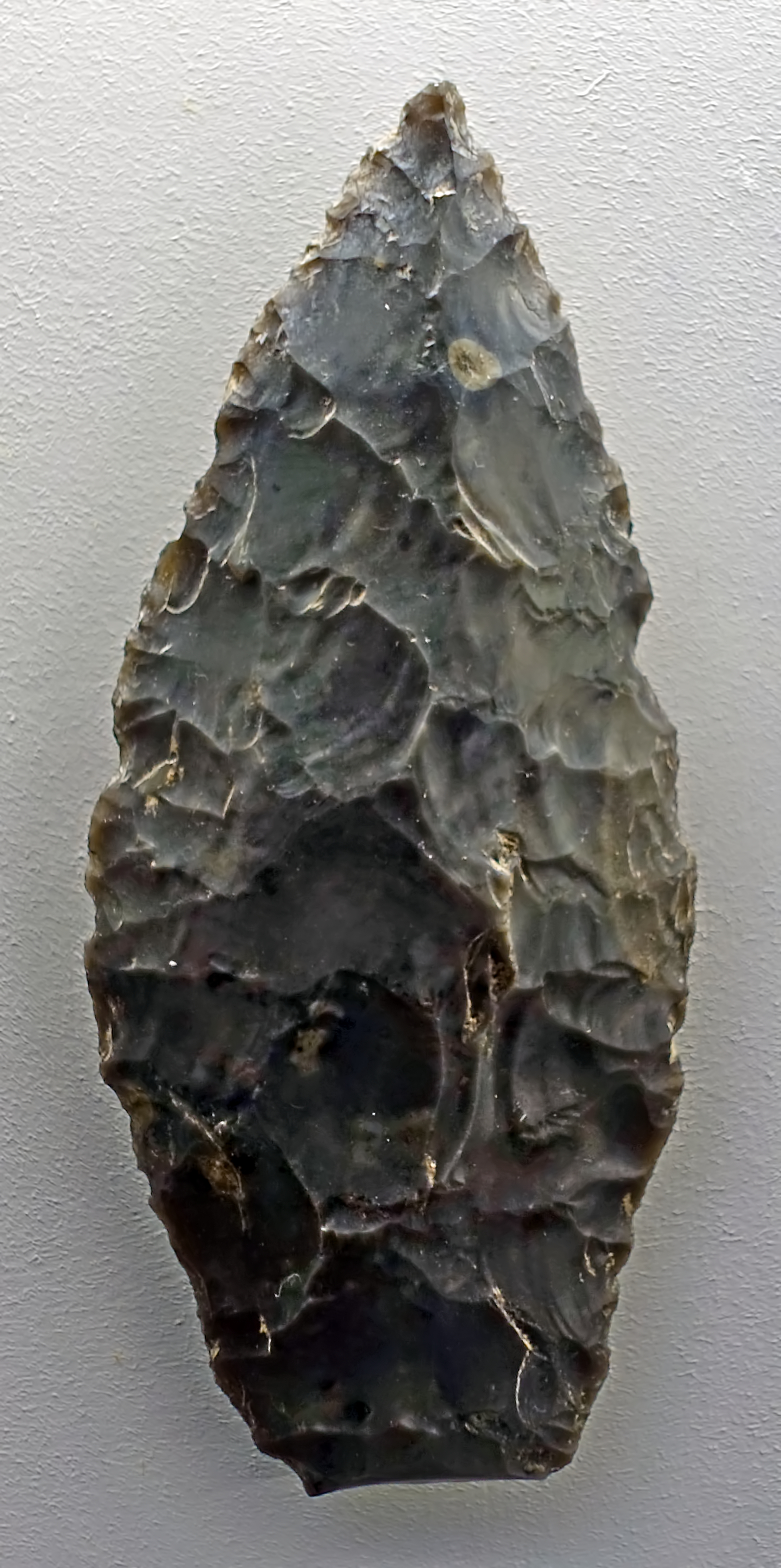
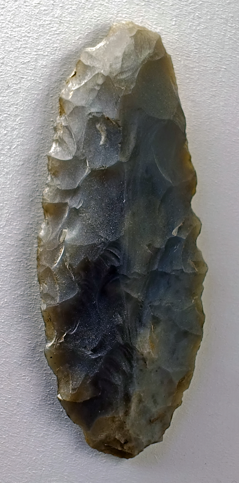

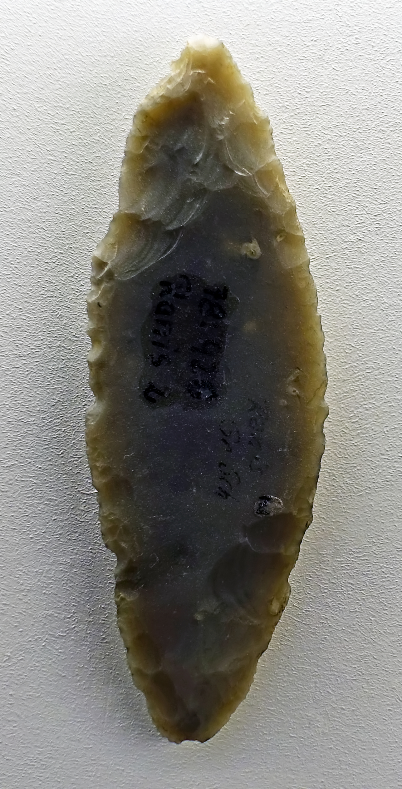
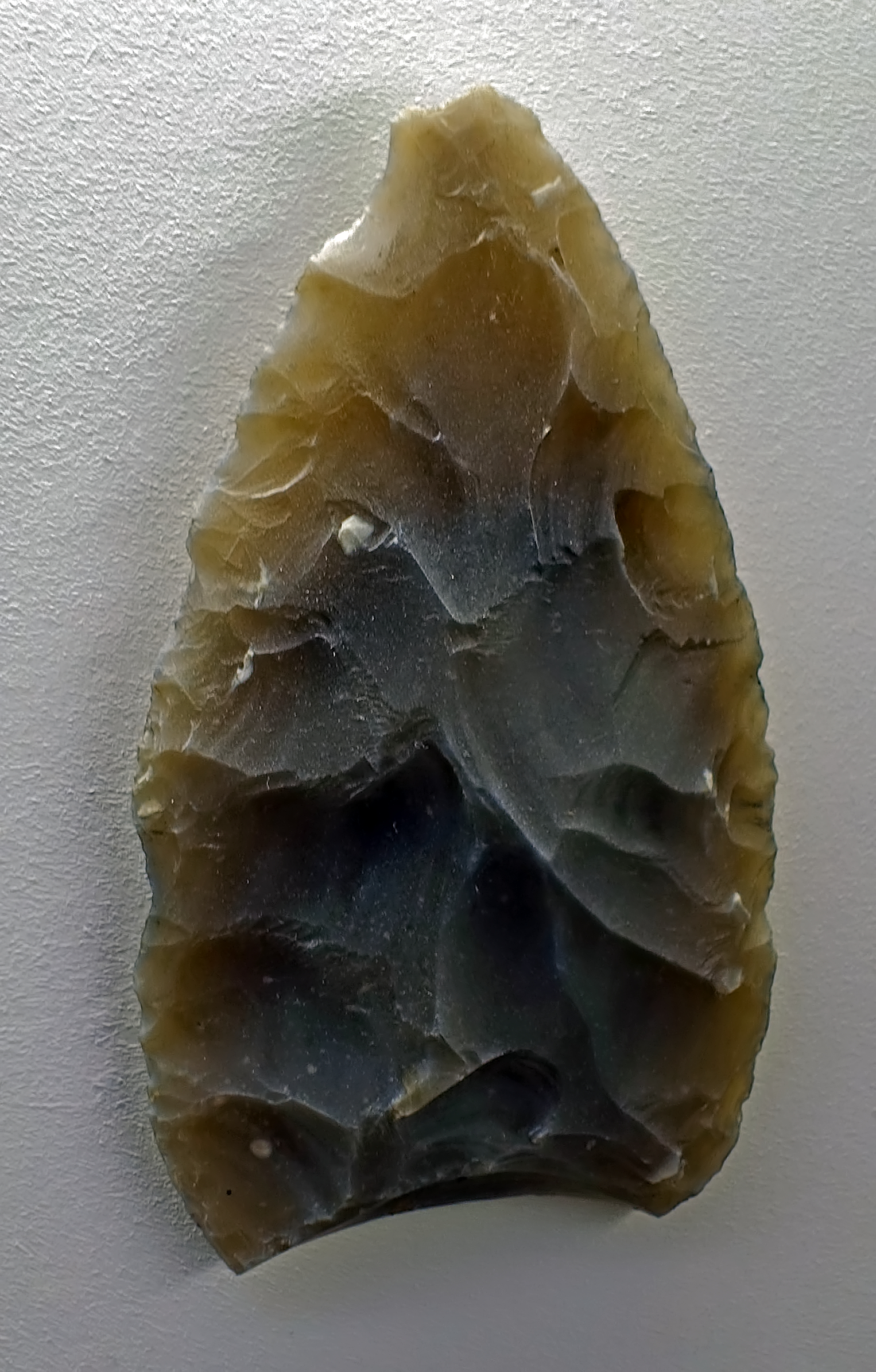
Ranis 2, Ilsenhöhle
Blattspitzen (leaf points) from Ilsenhöhle.
( It should be noted that Jerzmanowice points referred to elsewhere on this page are defined by Flas (2012) as leaf points made on blades by partial flat bifacial retouch. It is useful, however, to realise that most of the projectile points from Aurignacian sites were made of antler, bone and ivory, although I have not yet seen them recorded in the (Aurignacian) Ranis 3 layers - Don )
Circa 40 000 BP - 30 000 BP
Photo: Don Hitchcock 2018
Source and text: Ilsen Cave near Ranis, Halle Landesmuseum für Vorgeschichte, https://st.museum-digital.de/, CC-BY-NC-SA @ State Museum of Prehistory Halle
On loan from Reiss-Engelhorn-Museen Mannheim


Ranis 2, Ilsenhöhle
Blattspitze (leaf point, blade point) from Ilsenhöhle.
Circa 40 000 BP - 30 000 BP
Photo: Don Hitchcock 2018
Source and text: Ilsen Cave near Ranis, Halle Landesmuseum für Vorgeschichte, https://st.museum-digital.de/, CC-BY-NC-SA @ State Museum of Prehistory Halle
On loan from Reiss-Engelhorn-Museen Mannheim
Drawing: Richter (2009)

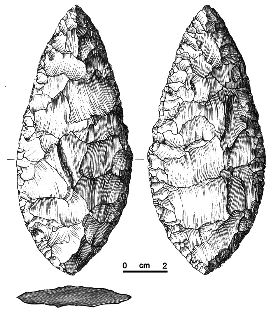
Ranis 2, Ilsenhöhle
Circa 40 000 BP - 30 000 BP
Altmühlian Blattspitze (from Horizon 2 of the Ilsenhöhle, Ranis, Germany).
This is a Mauern-type Blattspitze defined by the two pointed ends.
Photo (left): Don Hitchcock 2018
Source and text: Ilsen Cave near Ranis, Halle Landesmuseum für Vorgeschichte, https://st.museum-digital.de/, CC-BY-NC-SA @ State Museum of Prehistory Halle
On loan from Reiss-Engelhorn-Museen Mannheim
Drawing (right) and additional text: Zilhão (2014)
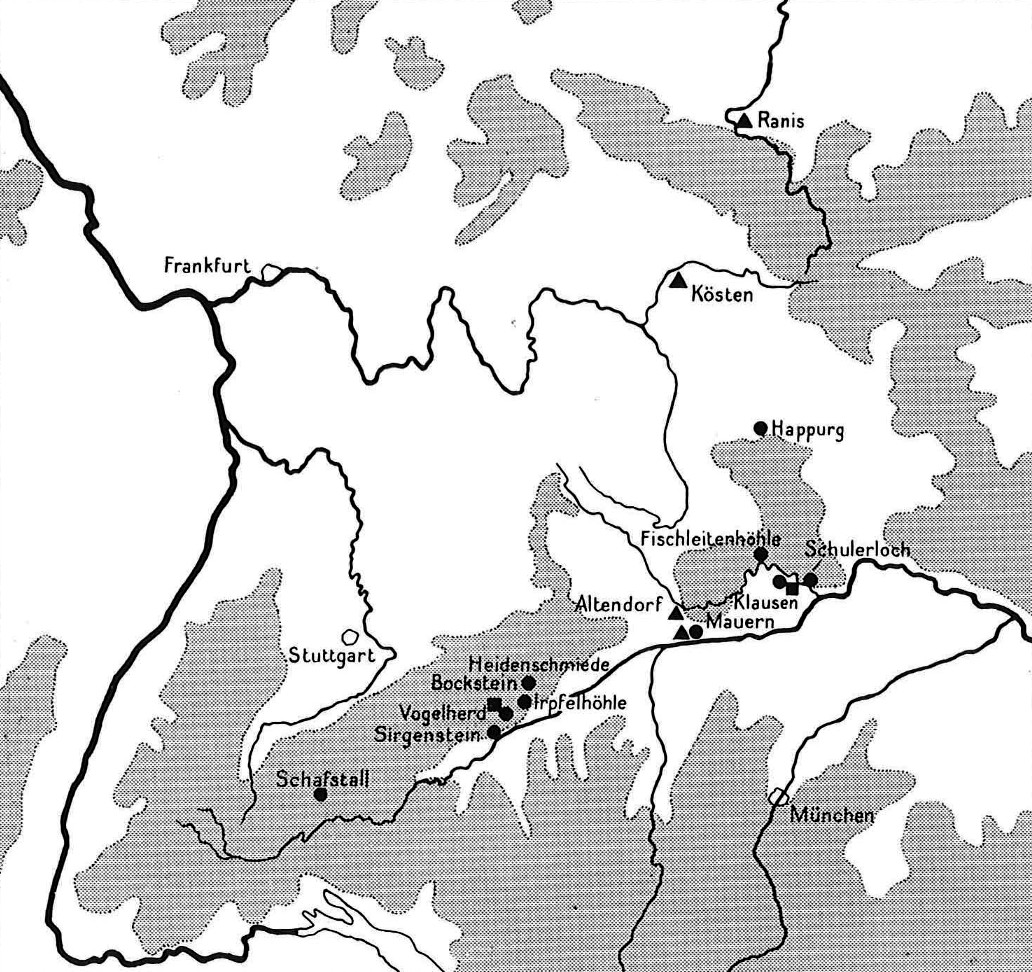
Map of important archaeological sites near Ranis.
Source: Bohmers (1951)
The importance of Blattspitzen
About 40 000 years ago, at the end of the Middle Palaeolithic, Europe was populated by the Neanderthals (Homo neanderthalensis). Werner Hülle was also on the trail of these last Neanderthals when he undertook excavations in the Ilsenhöhle under Burg Ranis (Ranis Castle) between 1932 and 1938. In addition to numerous animal bones, such as cave bears, cave hyenas and rhinos, the excavator was able to recover some large, leaf-shaped flint points, Blattspitzen, in the 'Ranis 2' culture layer. Originally attributed to modern humans (Homo sapiens), it is now largely agreed that these flint points were made by the last Neanderthals living in Europe - this tool culture is known in research as the English term 'Ranisian'. There are two hypotheses for their use today: The Blattspitzen could have been used as hunting weapons as tips of wooden spears or longer thrust lances. Glued into a wooden or bone handle, for example with pitch obtained from birch bark, their use as knives would also be conceivable.
The finds of the Neanderthal man from the 'Ranis 2' layer are overlaid in the Ilsen Cave by the 'Ranis 3' archaeological find layer, which contains stone tools that are highly likely to be attributed to modern humans. This epoch of human history, handed down in the cultural layers of the Ilsenhöhle - the living environment of the last Neanderthals and the first representatives of modern man - was of great scientific importance then as now. That is why archaeologists and researchers from various scientific disciplines of the Max-Planck-Institutes für Evolutionäre Anthropologie and the Thüringischen Landesamtes für Archäologie und Denkmalpflege have started a new excavation in the Ilsenhöhle under Burg Ranis in a cooperative project.
The blade point is therefore a leading exhibit in the Ice Age exhibition area for several reasons: It represents a shapely and technically sophisticated device concept from an important phase of change in the development of today's people 30 000 - 40 000 years ago. It symbolises the great scientific importance that is still attached to the finds from the Ilsen Cave and it is a testimony to the cultural exchange between Neanderthals and modern people during the history of European settlement.
Text above: Dr Tim Schüler & Dr Marcel Weiß
Source: http://www.museum-ranis.de/seite/303187/blick-in-die-eiszeit.html
Central Europe with Micoquian/M.M.O. sites and late Late Middle Palaeolithic Blattspitzen sites (except isolated surface finds).
The late Middle Paleolithic exclusively consists of MMO ('Mousterian with a Micoquian Option') assemblages conventionally also called Micoquian/Keilmessergruppen (bifacially worked knife group).
Photo and text: Richter (2009)
Additional text: Richter (2016)
One of the original sondages at Ilsenhöhle.
It was excavated between 1932 and 1938 by Werner M. Hülle. The finds from Layer X (Ranis 2) were given the name Ranisian and form one part of the Lincombian-Ranisian-Jerzmanowician (LRJ) transition period complex of northern Europe. Recent studies have shown that bifacial leaf points similar to those from Ranis and Jerzmanowice blade points can be assigned to the final Middle Paleolithic.
During the excavations under the direction of Werner Hülle, the forecourt was partly excavated. The vestibule and the two chambers inside the Ilsenhöhle were completely excavated. Hülle also excavated two sondages of about 4 x 4m. The area excavated in the cave covers about 40m x 18m. The excavation technique complies to the methods of the early 1930s, and was excavated with pick and shovel. Larger objects were unearthed with trowels. The sediment was not screened or sieved.
Werner Hülle differentiated between geological and archaeological horizons. He distinguished 12 geological and 5 archaeological horizons.
Photo and text: https://www.eva.mpg.de/evolution/field-projects/late-neandertals-and-early-modern-humans-in-western-europe.html
Additional text: https://www.nespos.org/pages/viewpage.action?pageId=29885302
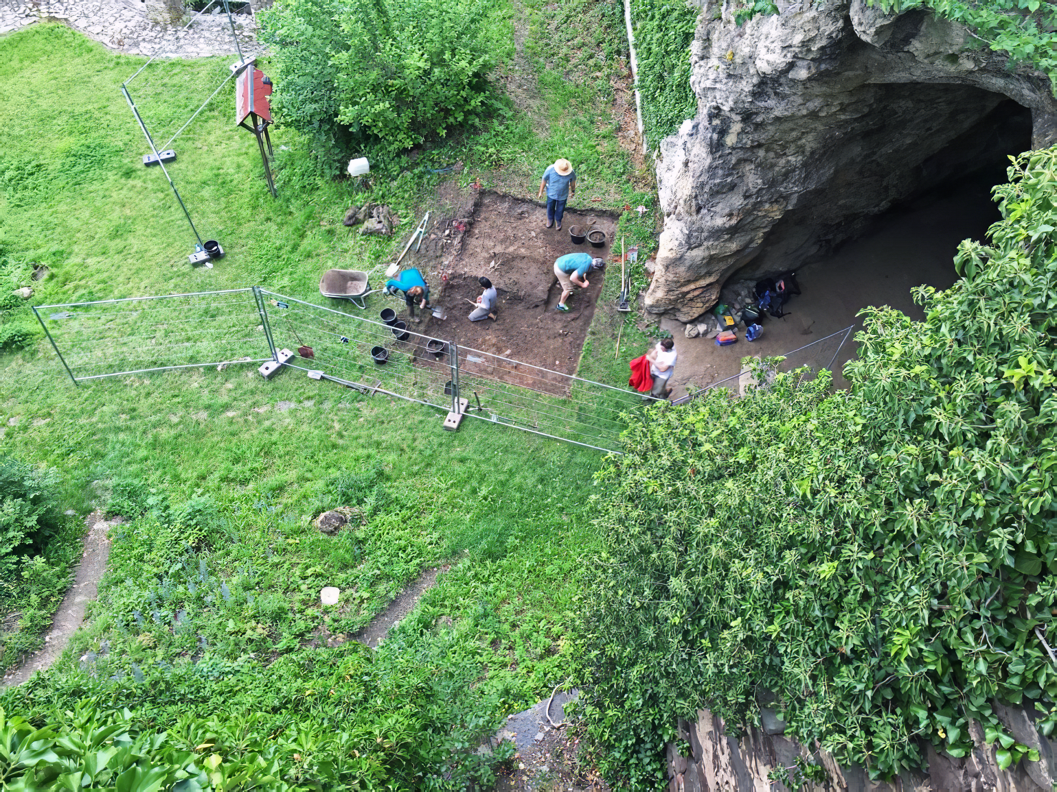
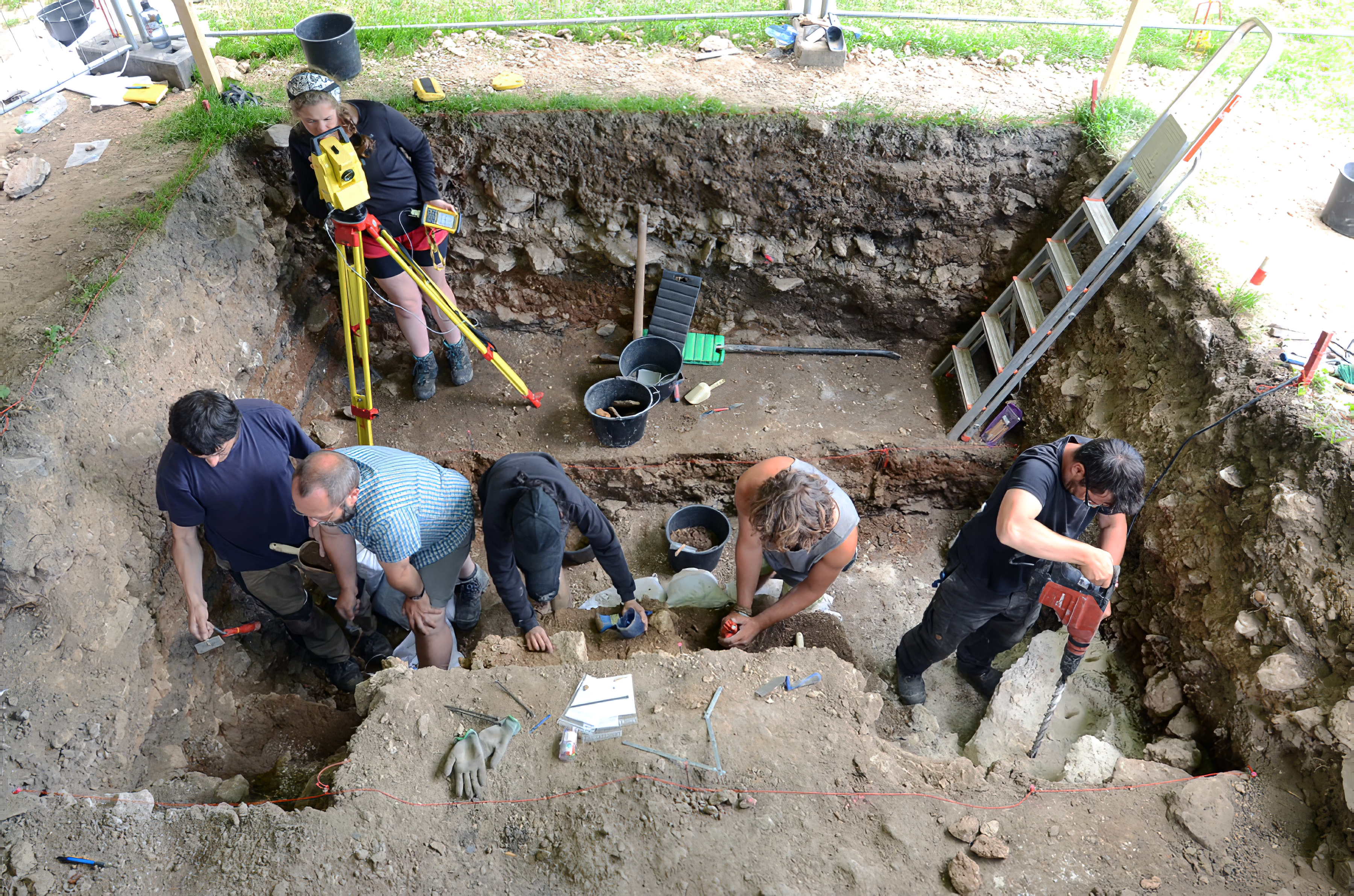
The 2016 campaign.
Text below from the site: http://www.museum-ranis.de/seite/308535/ilsenh%C3%B6hle.html
The Max Planck Institute for Evolutionary Anthropology Leipzig and the State Office for Monument and Archeology Thuringia, Weimar, started to carry out new excavations in the Ilsen Cave in summer 2016. Due to the importance of the site for the transition from the Neanderthals to modern humans, we would like to investigate the layer sequence under the Ilsen cave again with new questions and the most modern methods.
The first hurdle we had to overcome was finding a suitable place for our excavation. Since the sequence of layers under the Ilsen cave is very deep - up to 7m - and at the beginning it was not entirely clear where Werner Hülle had dug everywhere or where there are still remains of the original sediments, it was necessary to proceed in a planned and targeted manner. In autumn 2015, we therefore used the 'geoelectrics' method - which measures the electrical resistance of the soil - to examine the soil in and around the Ilsen cave in order to distinguish grown soil from the artificial fillings of the old excavations. The results gave first indications of where the most suitable place for a re-examination would be. In spring 2016, we carried out core drilling at selected locations in order to check the data obtained from the geoelectrics and to obtain information about the actual depth of the layer sequence. The drill is a hollow shape that makes it possible to extract, read out and interpret the drilled deposits.
Through the preliminary investigations, we were able to find a suitable place for our first excavation campaign in the Ilsen cave. Nevertheless - as long as we had not checked, it was not 100% clear whether we would find original deposits or not, despite the preliminary investigations. But our efforts were rewarded: after the first of seven busy weeks, we actually had the upper limit of the increased stratification under the Ilsen Cave. This enabled us to start systematic excavations and investigations as early as our first excavation campaign. However, due to the thickness of the deposits, we could not yet uncover the exciting layers of the last Neanderthals and the first modern people.
Photo and text: http://www.museum-ranis.de/seite/308535/ilsenh%C3%B6hle.html, Dr Tim Schüler supervising in the image on the right
Writers of the text: Jean-Jacques Hublin (Founder and Director, Dept of Human Evolution, Max-Planck-Gesellschaft), Shannon Mcpherron (Group Leader), Marcel Weiß (Research Staff), Tim Schüler, State Office for Monument Conservation in Weimar
Site: Ilsenhöhle under Burg Ranis
| Ranis stratigraphy | |||||
|---|---|---|---|---|---|
| Layer | Stage | Cultural Unit | Fauna | Number of stone artefacts |
Dating |
| I-II | - | Prehistoric to Medieval | OIS 1 | ||
| V-III | Ranis 5 | Late Palaeolithic | Pig, red deer, fox, rodents | 48 | OIS 2/1 |
| VI | Ranis 4 | Mixed Upper/Late Palaeolithic | Reindeer, horse, wooly rhino, cave bear, aurochs, musk ox, rodents etc. |
62 | Late OIS 2 |
| VIII-VII | Ranis 3 | Aurignacian with Middle Palaeolithic admixture | Cave bear, red deer, wooly rhino | 140 | OIS 3 |
| X-IX | Ranis 2 | Jerzmanovician | Cave bear, red deer, wooly rhino, cave hyena |
63 | OIS 3 |
| XI | Ranis 1 | Micoquian (?) | Cave bear, reindeer | 16 | ? |
| Stone Artefacts | ||
|---|---|---|
| Micoquian Ranis 1 |
Jerzmanovician Ranis 2 |
|
| Total artefacts | 16 | 63 |
| Subtotal tools | 2 | 63 |
| Flat handaxe Faustkeilblatt | 1 | - |
| Bifacial scraper | 1 | 6 |
| Jerzmanovice points | - | 24 |
| Leaf points | - | 19 |
| Scrapers etc. | - | 11 |
| Tools made on quartzite | - | 3 |
Useful bone
In the Ilsenhöhle and in front of it - under the former rock overhang - there were single awls of bone. These were tools for making and mending clothes. Perhaps in this particular case only worn pieces of clothing were mended.
Perhaps, however, a new garment was made for a particular situation, perhaps even - in view of the direct access to the earth's interior - for ritual purposes.
A long bone with two holes was at first interpreted as a flute. But the holes are - as with many other bones from this cave - due to animal bites or root growth. The distance between the holes would be too short for fingers to use anyway, just as the bone itself is not suitable for this function.
Text above: https://st.museum-digital.de/index.php?t=objekt&oges=36064, CC-BY-NC-SA @ State Museum of Prehistory Halle
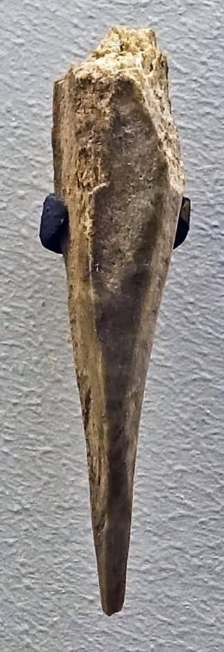
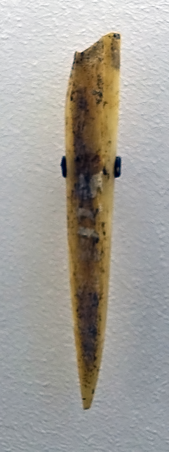
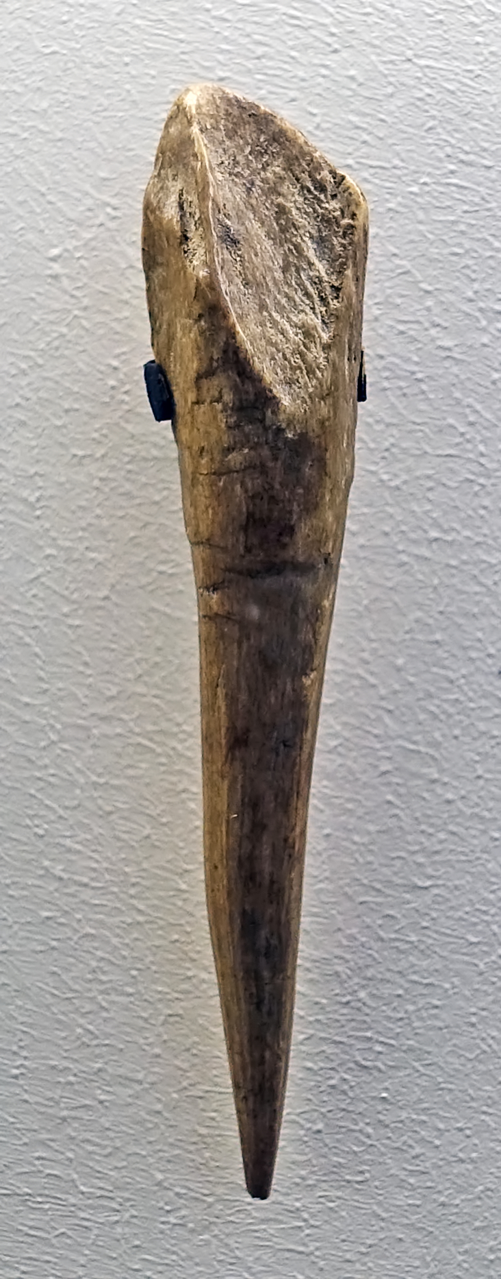
Ranis 2, Ilsenhöhle
Small bone awls, carefully sharpened and ground to a conical, smooth shape.
These artefacts are from Layer X (Ranis 2)
Circa 40 000 BP - 30 000 BP
Photo: Don Hitchcock 2018
Source and text: Ilsen Cave near Ranis, Halle Landesmuseum für Vorgeschichte, https://st.museum-digital.de/, CC-BY-NC-SA @ State Museum of Prehistory Halle
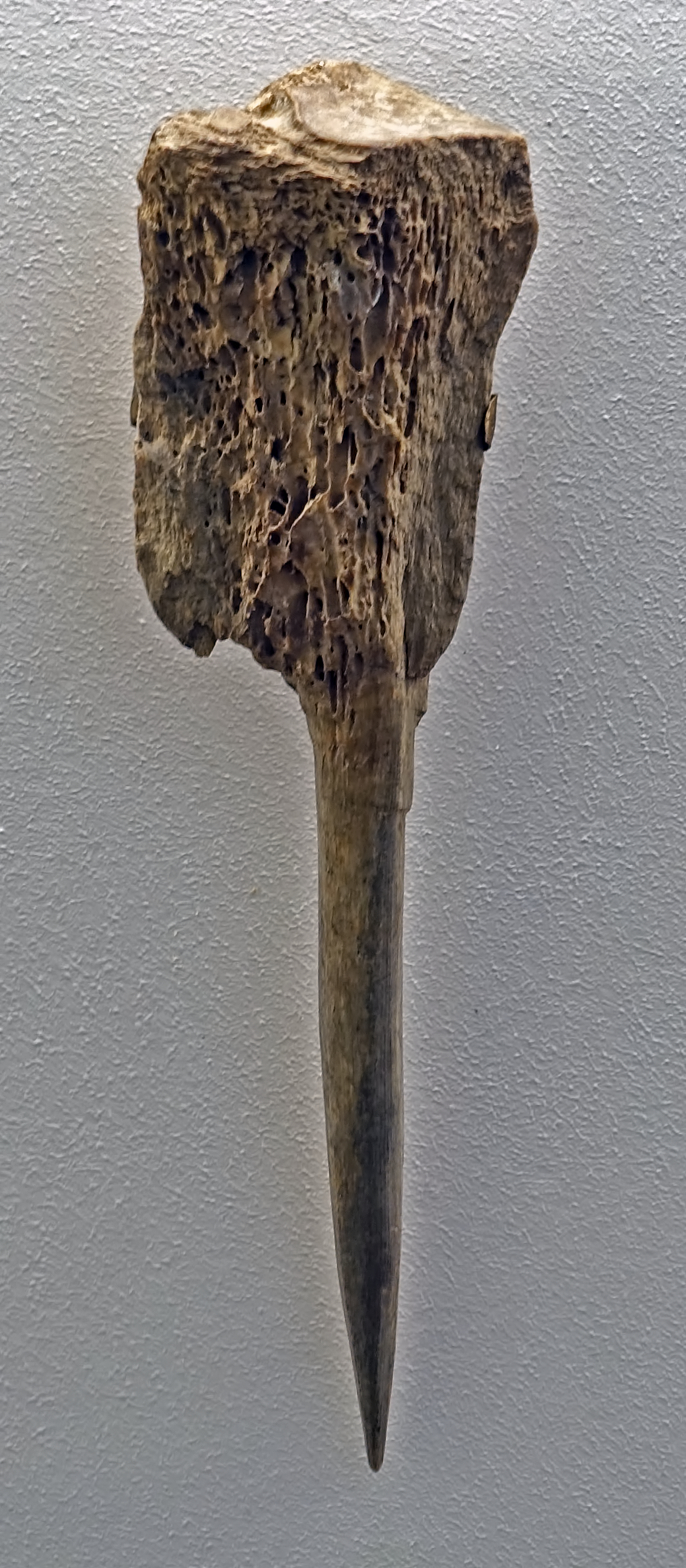
Ranis 2, Ilsenhöhle
This bone awl has been made with a handle for ease of use.
Photo: Don Hitchcock 2018
Source and text: Ilsen Cave near Ranis, Halle Landesmuseum für Vorgeschichte, https://st.museum-digital.de/, CC-BY-NC-SA @ State Museum of Prehistory Halle
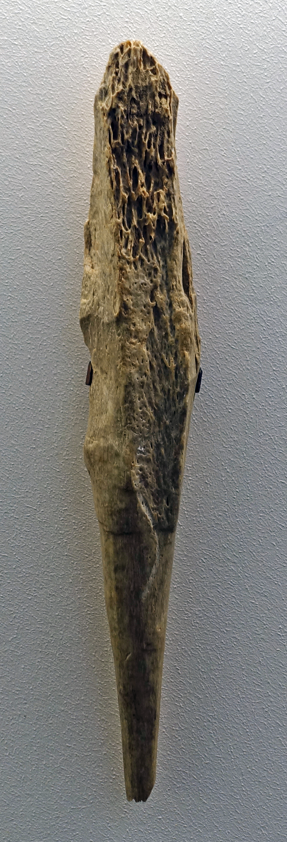
Ranis 2, Ilsenhöhle
Roughly prepared awl, lower third sharpened.
Photo: Don Hitchcock 2018
Source and text: Ilsen Cave near Ranis, Halle Landesmuseum für Vorgeschichte, CC-BY-NC-SA @ State Museum of Prehistory Halle
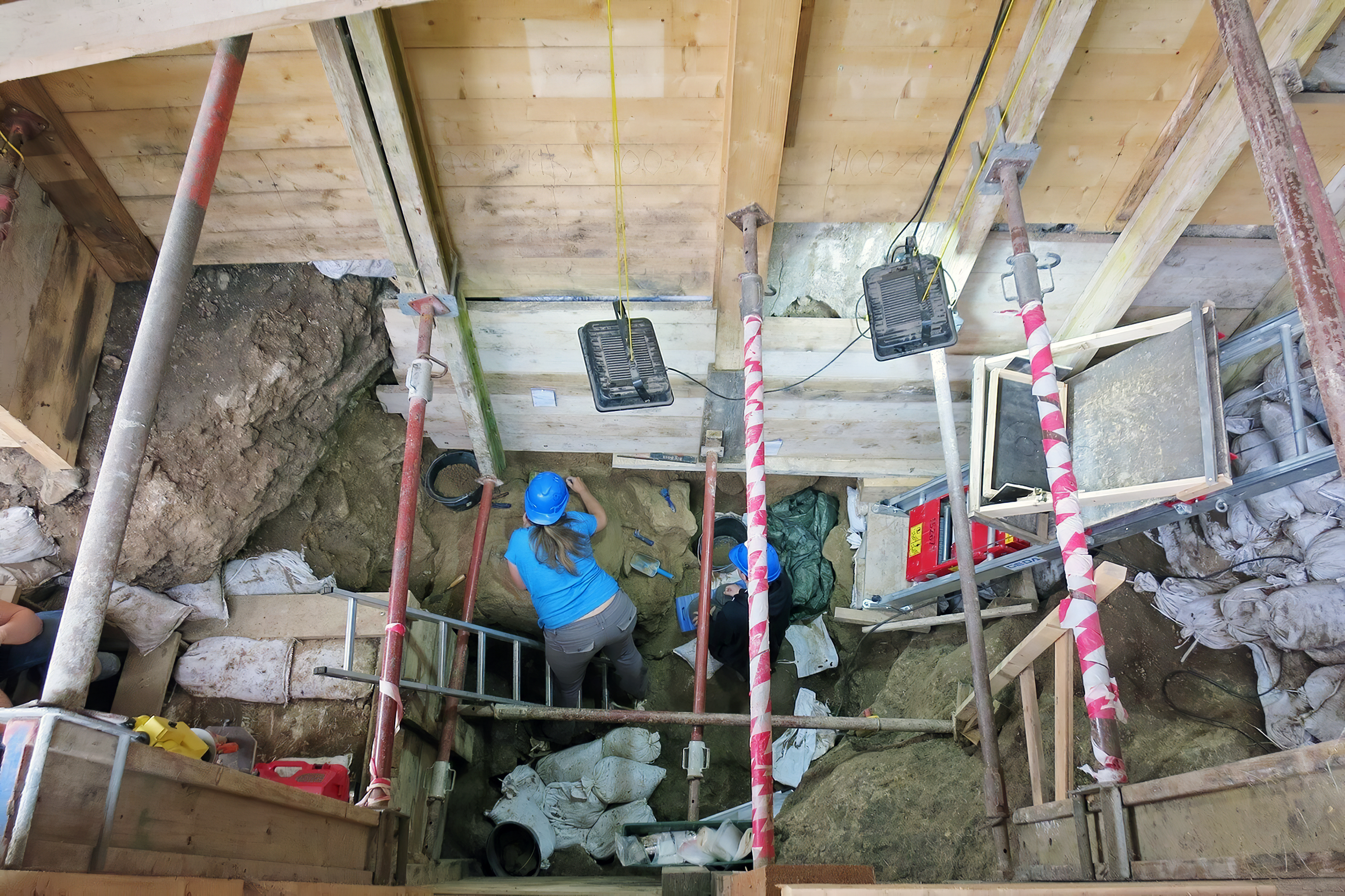
The 2019 campaign.
View of the excavations at a depth of five metres. Students carefully remove the layers of earth with spatulas and brushes.
Dr Tim Schüler from the Thuringian State Office for Monument Preservation and Archaeology heads the excavations.
Photo: Image rights: MDR / Stefanie Reinhardt
Text: https://www.mdr.de/thueringen/ost-thueringen/saale-orla/burg-ranis-ausgrabung-100.html
Source: https://www.mdr.de/thueringen/ost-thueringen/saale-orla/burg-ranis-ausgrabung-100.html
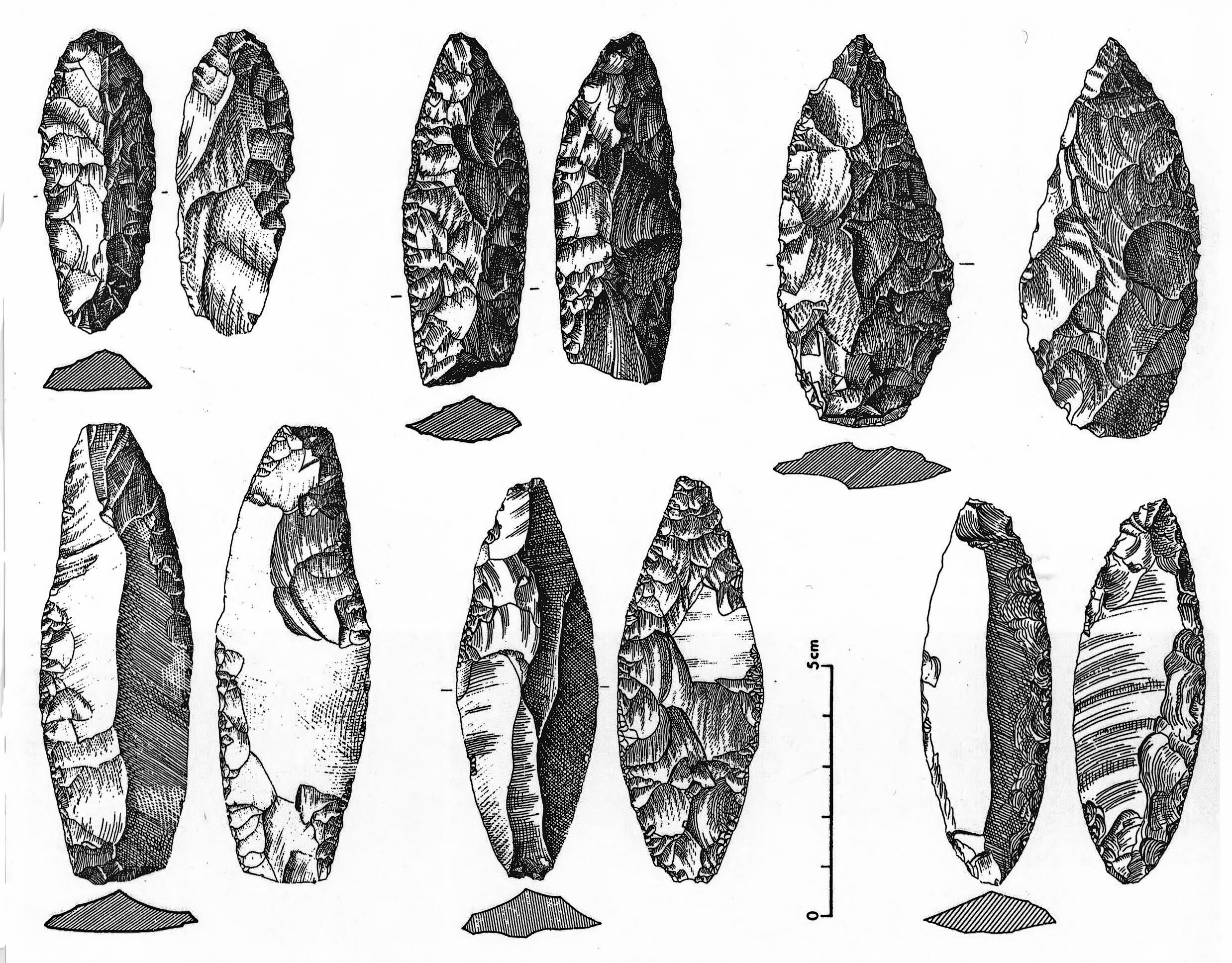
Ranis 2, Ilsenhöhle
Jerzmanovician assemblage.
1–3: leafpoints or bifacial scrapers.
4–6: Jerzmanovice points.
( These Jerzmanowice points were made on blades. It is only relatively recently that it was realised that blade technology was well attested in the industry of the Middle Palaeolithic, and was not first seen in the Upper Palaeolithic in sites populated by Anatomically Modern Humans, but was part of the toolkit for Neanderthals - Don )
Photo and text: (Hülle (1977) pl. 8, pl. 17, pl. 30, pl. 31), in: Richter (2009)
The development of blade technology in the Middle Palaeolithic
Delagnes (2000) writes:At the beginning of ( the 1900s ), blade production was identified alongside a flake production in some assemblages extending back to the penultimate glaciation, which were found in the Somme valley terraces in northern France. At the time, this seemed incompatible with the chrono-cultural frame that was being developed for Paleolithic industries (blade production was supposed to be an exclusive feature of the Upper Paleolithic ), so that for half a century the importance of such an association was largely disregarded.In addition, the tools found useful in the Mousterian industry had a long life even after Neanderthals had disappeared from Europe: Hoffecker (2009)notes:
It was only in the early 1970s, following the well-dated discoveries made at Rheindalhen in Germany and Seclin in northern France, that the existence of a blade production in a Mousterian context was really acknowledged. Since the 1980s, the increase in the number of Middle Paleolithic blade industries, especially in northern France, has given a new dimension to this phenomenon, owing to both the quality and the quantity of the artefacts recovered from these sites. At present, the main sites with Middle Palaeolithic levels yielding blade industries add up to a dozen. Within the context of the European Middle Palaeolithic, this production is characterised by its relative concentration in space and time.
Although stone blade technology is traditionally associated with Upper Palaeolithic industries, it became apparent many years ago that Middle Palaeolithic industries in various parts of Eurasia yield evidence of blade production. Blade manufacture is well documented in the Middle Palaeolithic of Europe and the Near East.
If Neanderthals produced at least some of the stone artefact forms found in Upper Palaeolithic assemblages, anatomically modern humans continued to manufacture and use many typical Middle Palaeolithic forms long after the transition. Production of side-scrapers, points, small bifaces, and other such forms continued into the Upper Palaeolithic and post-Palaeolithic industries. In North America, such artefacts are common in Palaeoindian sites, where they are often associated with the killing and butchering of large mammals. In Europe, Middle Palaeolithic tool types also are present in Upper Palaeolithic assemblages, but usually in low percentages, in the natural shelters of Western Europe. In the open-air sites (and some natural shelters) of Central and Eastern Europe, they are more common and often abundant.
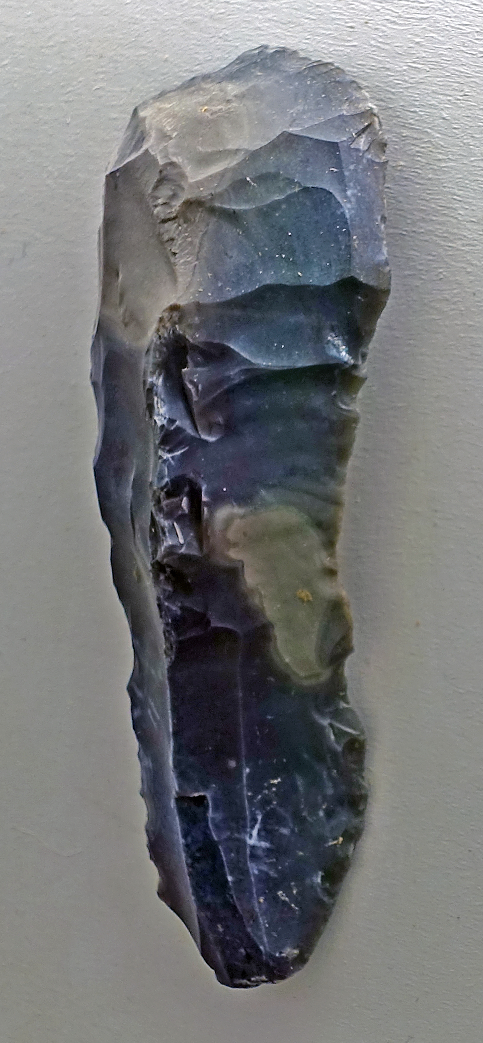
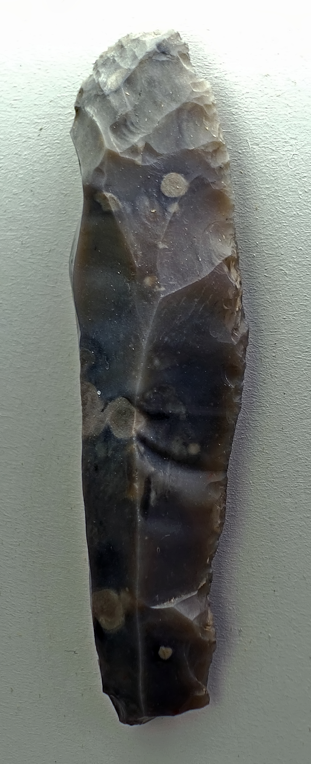
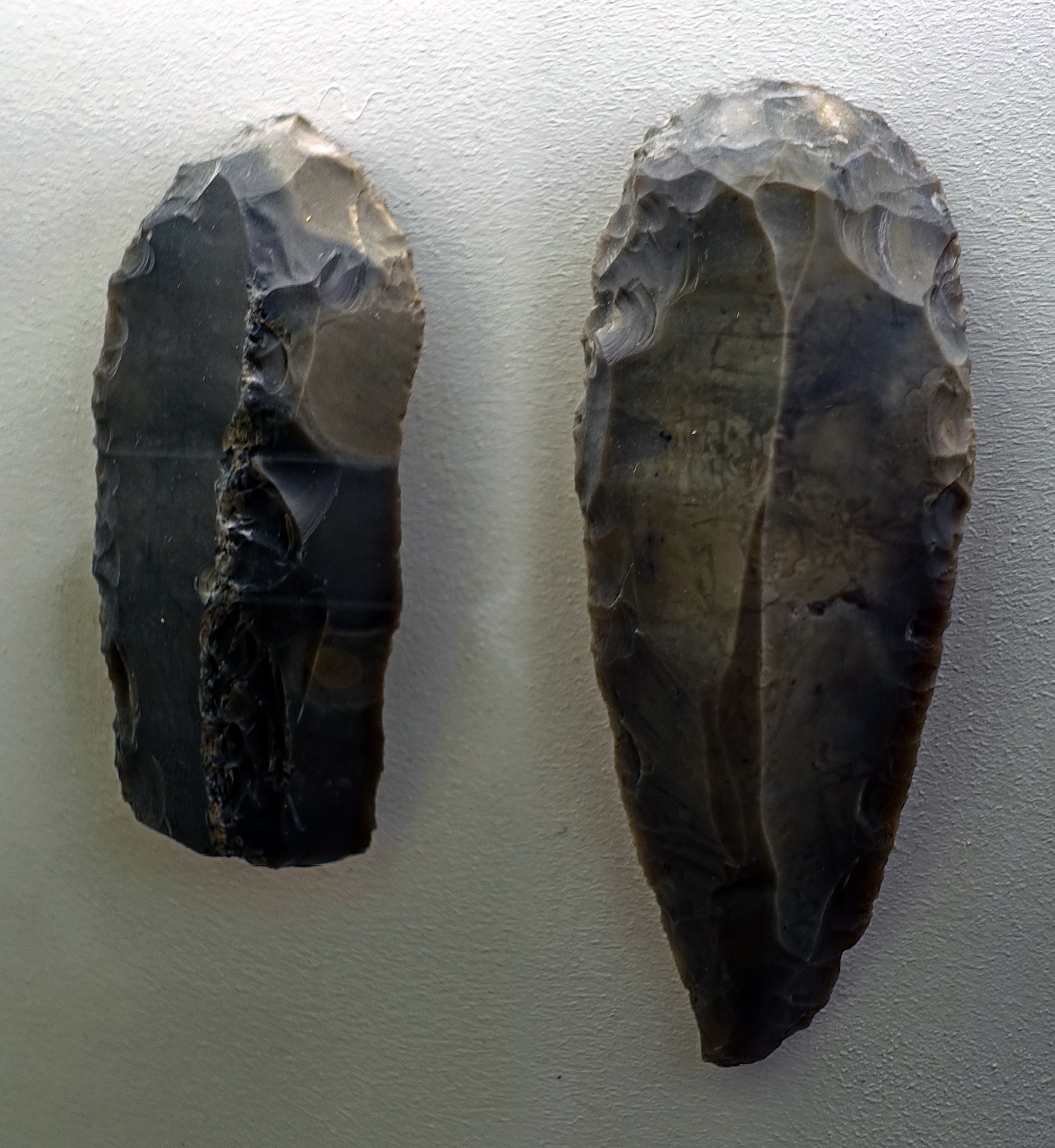
Ranis 3, Ilsenhöhle
Scrapers
Dating: Aurignacian with Middle Palaeolithic admixture.
Photo: Don Hitchcock 2018
Source and text: Ilsenhöhle near Ranis, Halle Landesmuseum für Vorgeschichte, CC-BY-NC-SA @ State Museum of Prehistory Halle
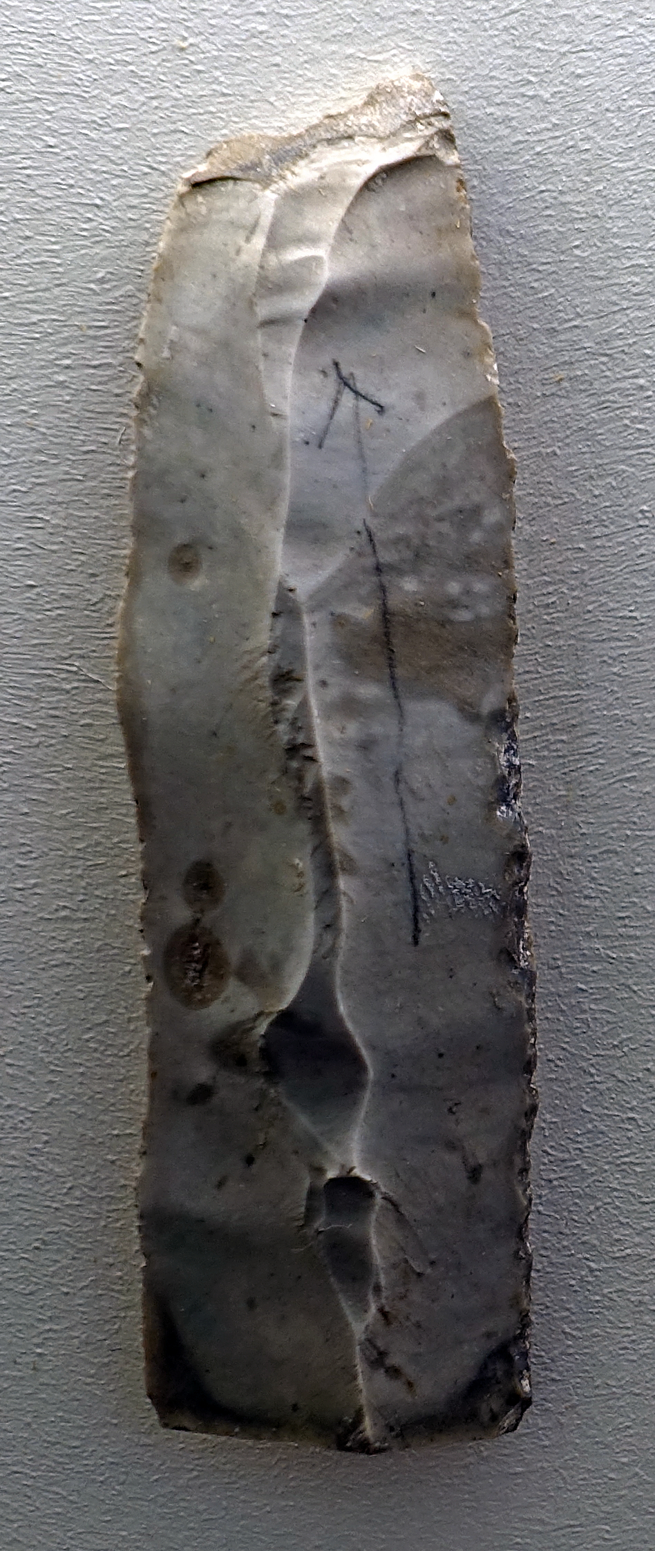
Ranis 3, Ilsenhöhle
Broken blade.
Dating: Aurignacian with Middle Palaeolithic admixture.
Photo: Don Hitchcock 2018
Source and text: Ilsenhöhle near Ranis, Halle Landesmuseum für Vorgeschichte, CC-BY-NC-SA @ State Museum of Prehistory Halle
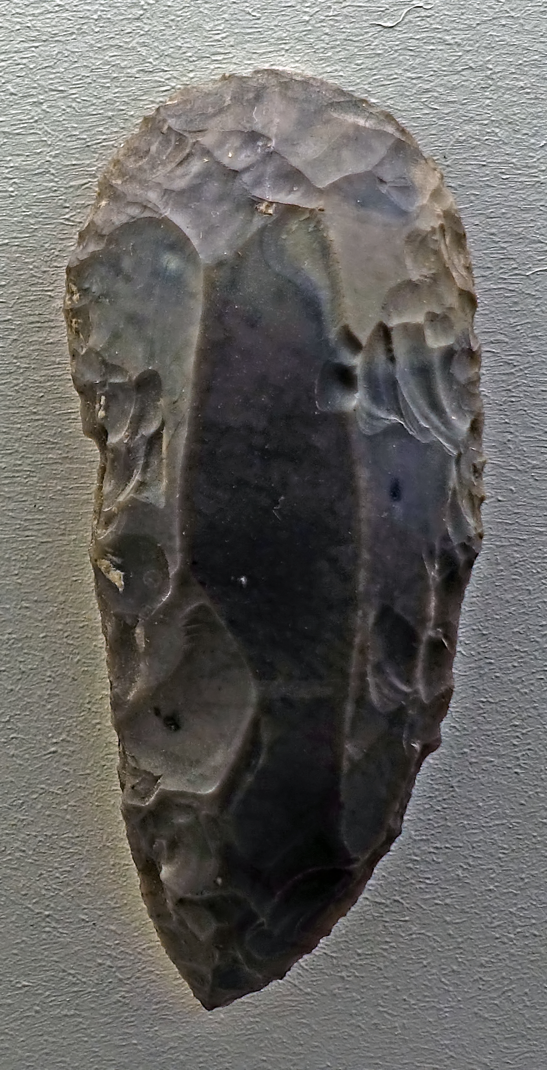
Ranis 3, Ilsenhöhle
Scraper.
Dating: Aurignacian with Middle Palaeolithic admixture.
Photo: Don Hitchcock 2018
Source and text: Ilsenhöhle near Ranis, Halle Landesmuseum für Vorgeschichte, CC-BY-NC-SA @ State Museum of Prehistory Halle
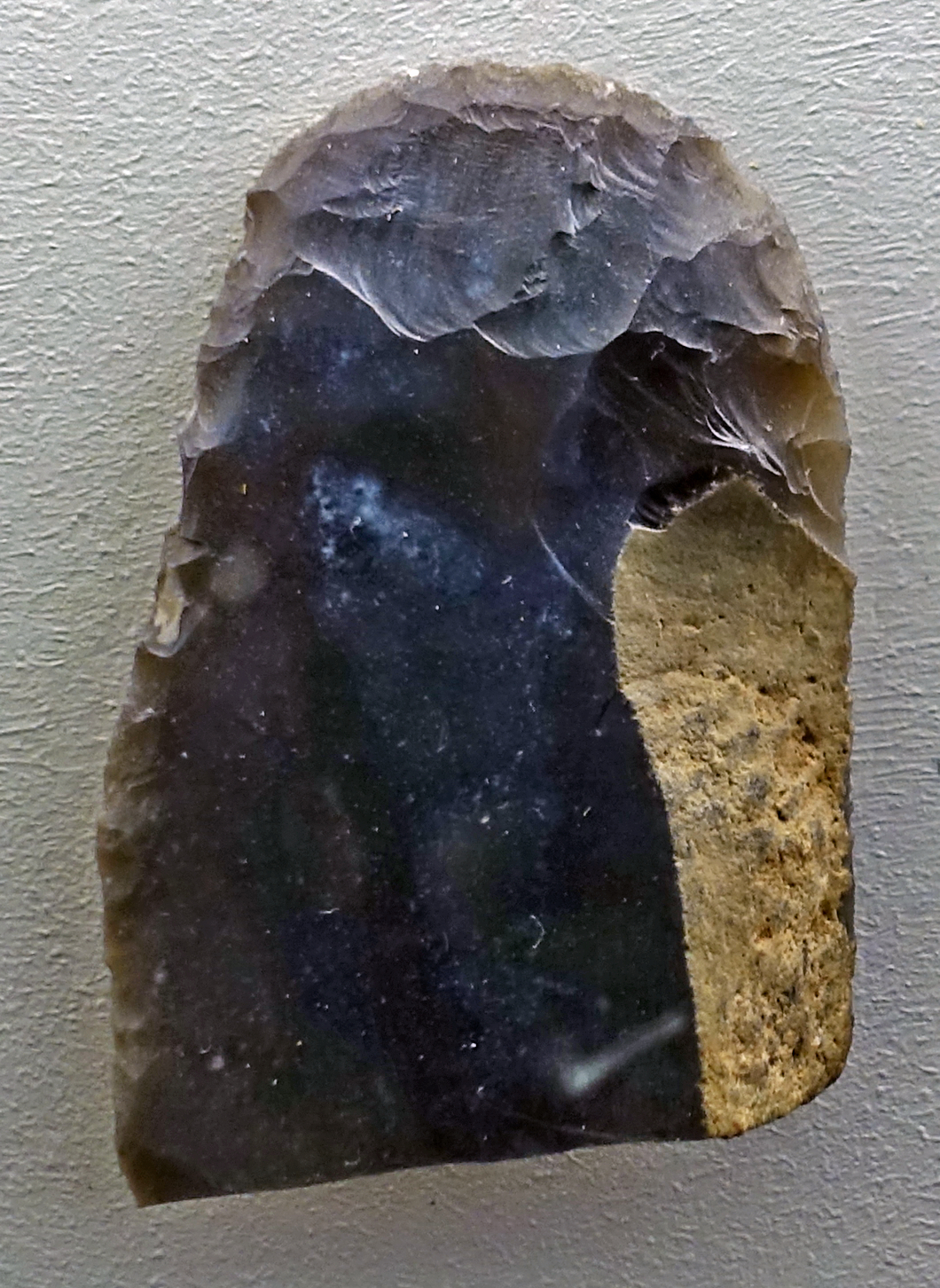
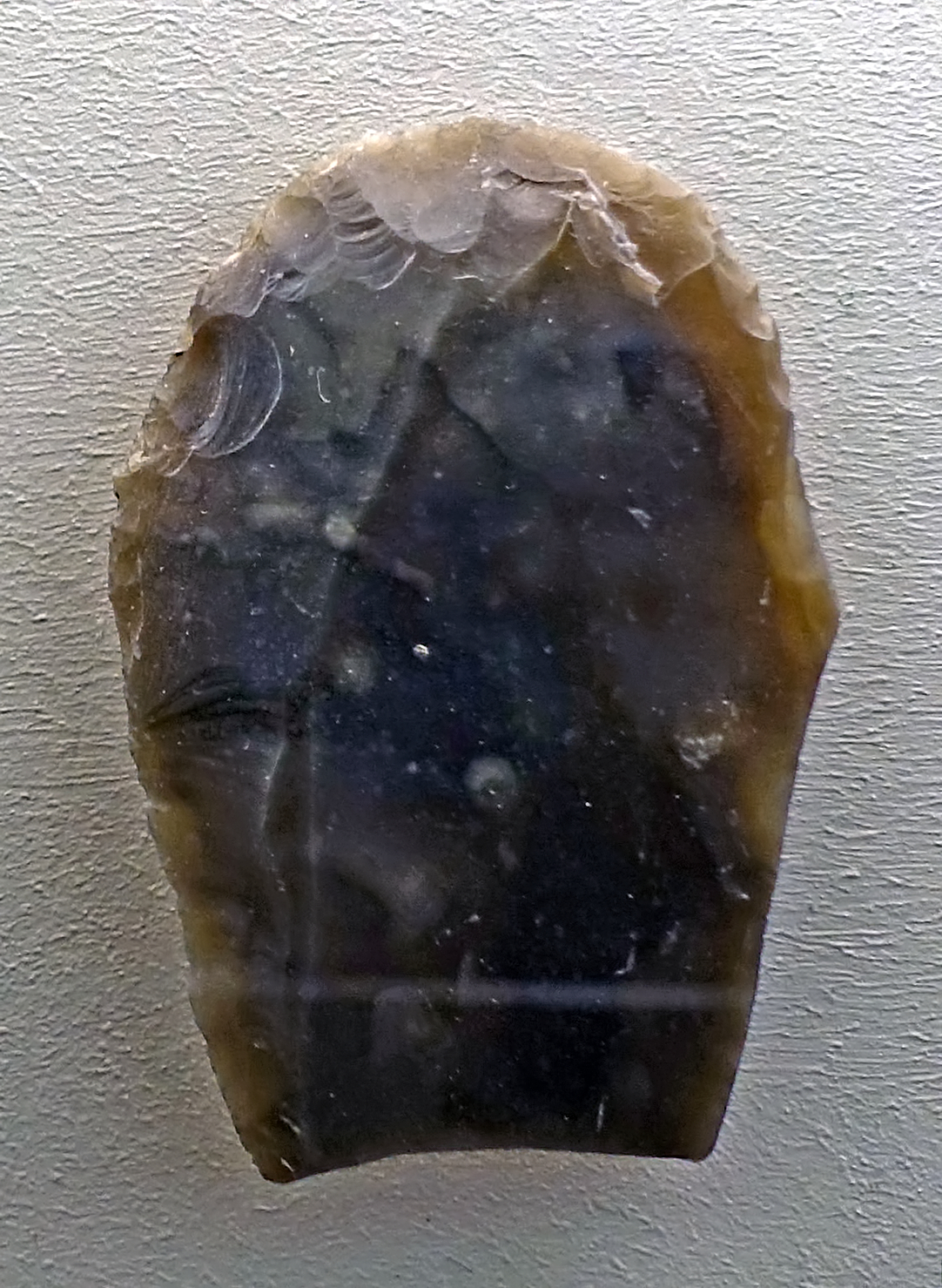
Ranis 3, Ilsenhöhle
Broken scrapers.
Scrapers often broke, since although flint takes a good edge, it is brittle.
Dating: Aurignacian with Middle Palaeolithic admixture.
Photo: Don Hitchcock 2018
Source and text: Ilsenhöhle near Ranis, Halle Landesmuseum für Vorgeschichte, CC-BY-NC-SA @ State Museum of Prehistory Halle
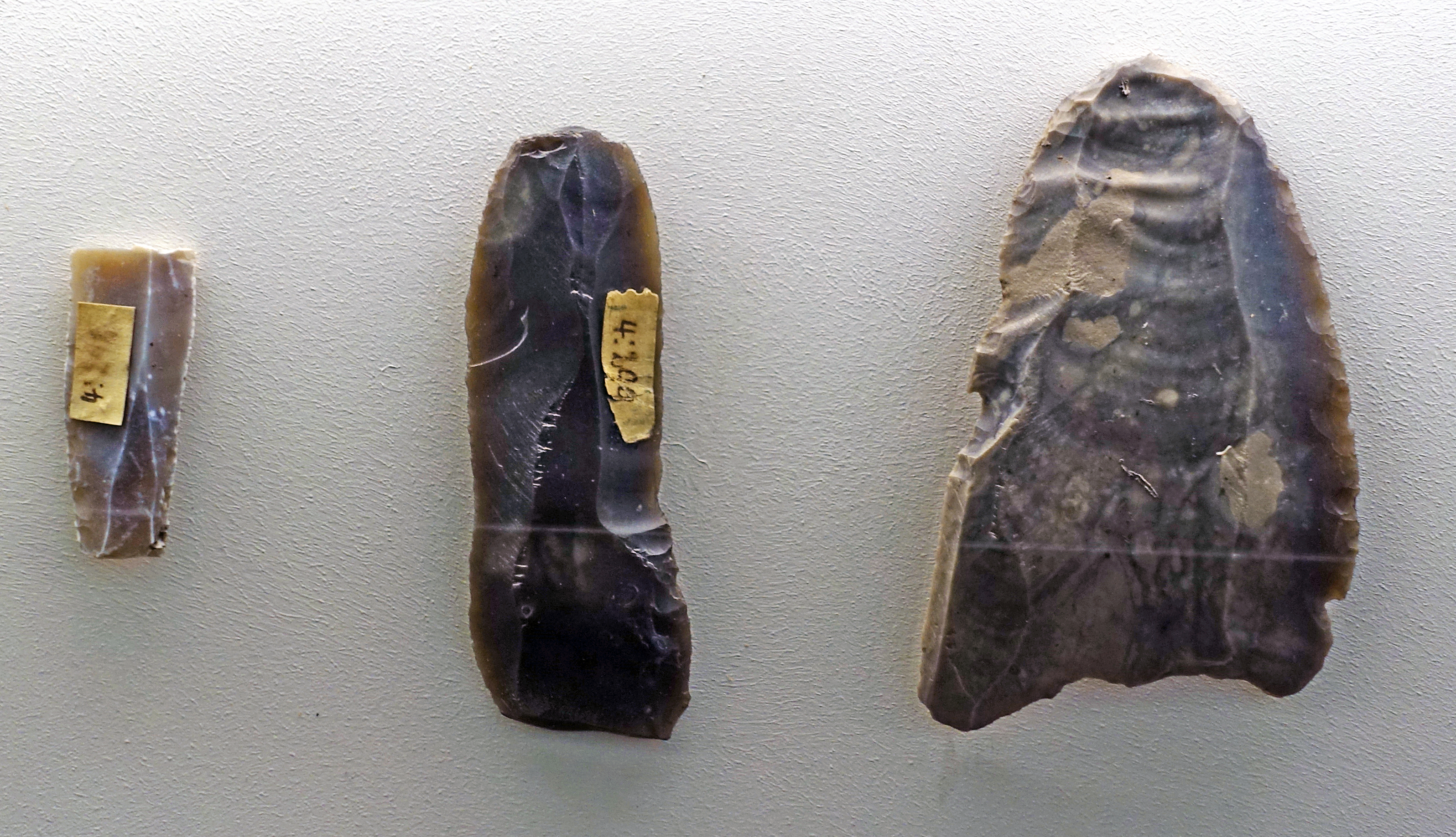
Ranis 3, Ilsenhöhle
Broken blades.
( The tool on the right has had a lot of work put into shaping it after the blade has been struck from the flint core. The break is not a clean one, since the flint used has a lot of inclusions - Don )
Dating: Aurignacian with Middle Palaeolithic admixture.
Photo: Don Hitchcock 2018
Source and text: Ilsenhöhle near Ranis, Halle Landesmuseum für Vorgeschichte, CC-BY-NC-SA @ State Museum of Prehistory Halle
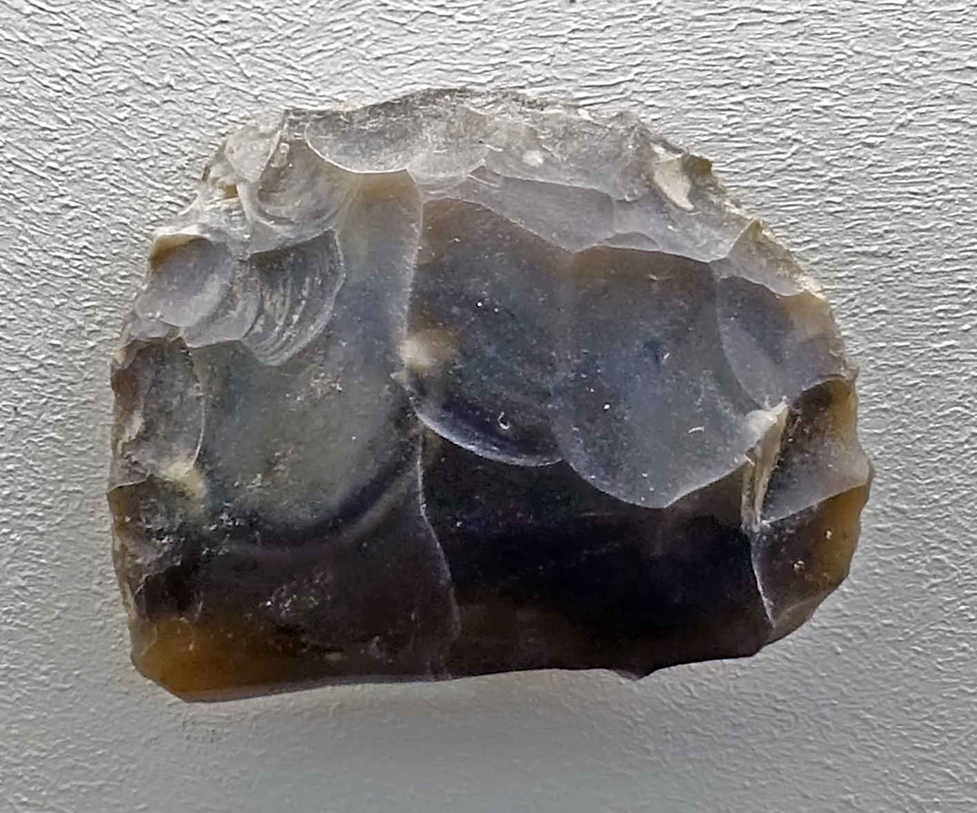
Ranis 3, Ilsenhöhle
Broken scraper.
Dating: Aurignacian with Middle Palaeolithic admixture.
Photo: Don Hitchcock 2018
Source and text: Ilsenhöhle near Ranis, Halle Landesmuseum für Vorgeschichte, CC-BY-NC-SA @ State Museum of Prehistory Halle
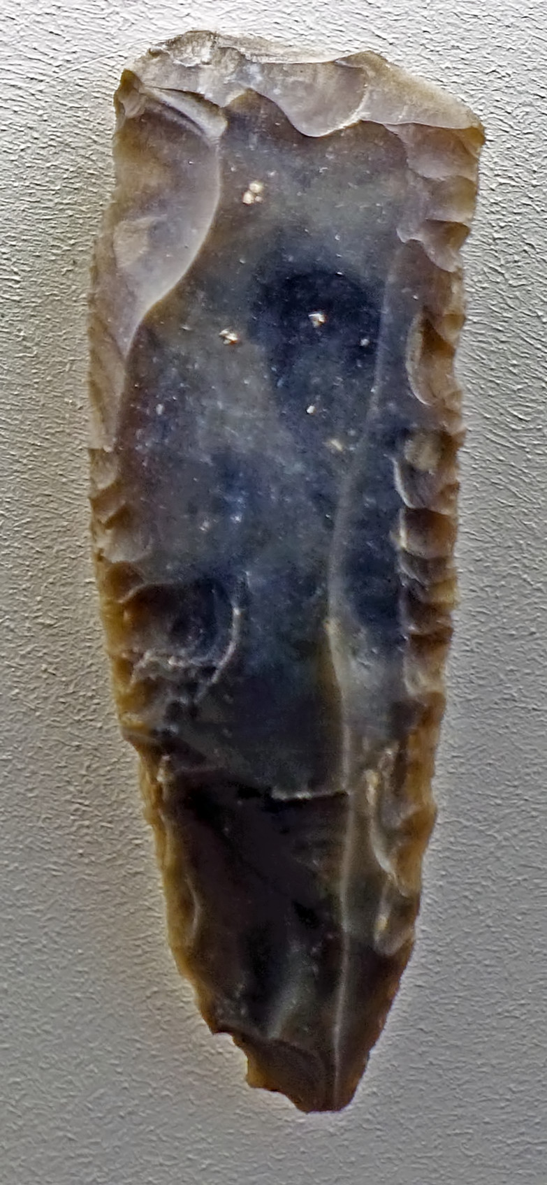
Ranis 3, Ilsenhöhle
Tool on a blade.
( apparently an endscraper, a grattoir, terminated with a fairly straight edge, with the sides steeply retouched so that it might be held in the hand - Don )
Dating: Aurignacian with Middle Palaeolithic admixture.
Photo: Don Hitchcock 2018
Source and text: Ilsenhöhle near Ranis, Halle Landesmuseum für Vorgeschichte, CC-BY-NC-SA @ State Museum of Prehistory Halle
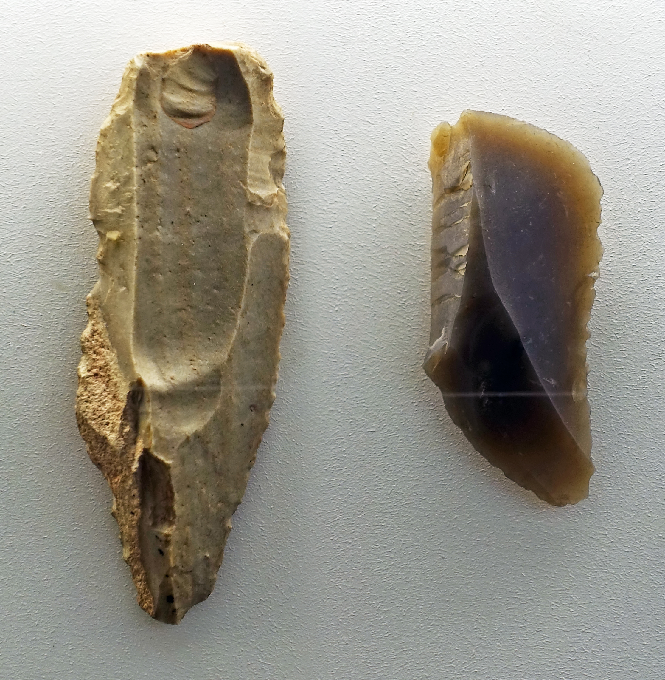
Ranis 3, Ilsenhöhle
Two Klingengerät, tools made on a blade.
( apparently finely notched sidescrapers - Don )
Dating: Aurignacian with Middle Palaeolithic admixture.
Photo: Don Hitchcock 2018
Source and text: Ilsenhöhle near Ranis, Halle Landesmuseum für Vorgeschichte, CC-BY-NC-SA @ State Museum of Prehistory Halle
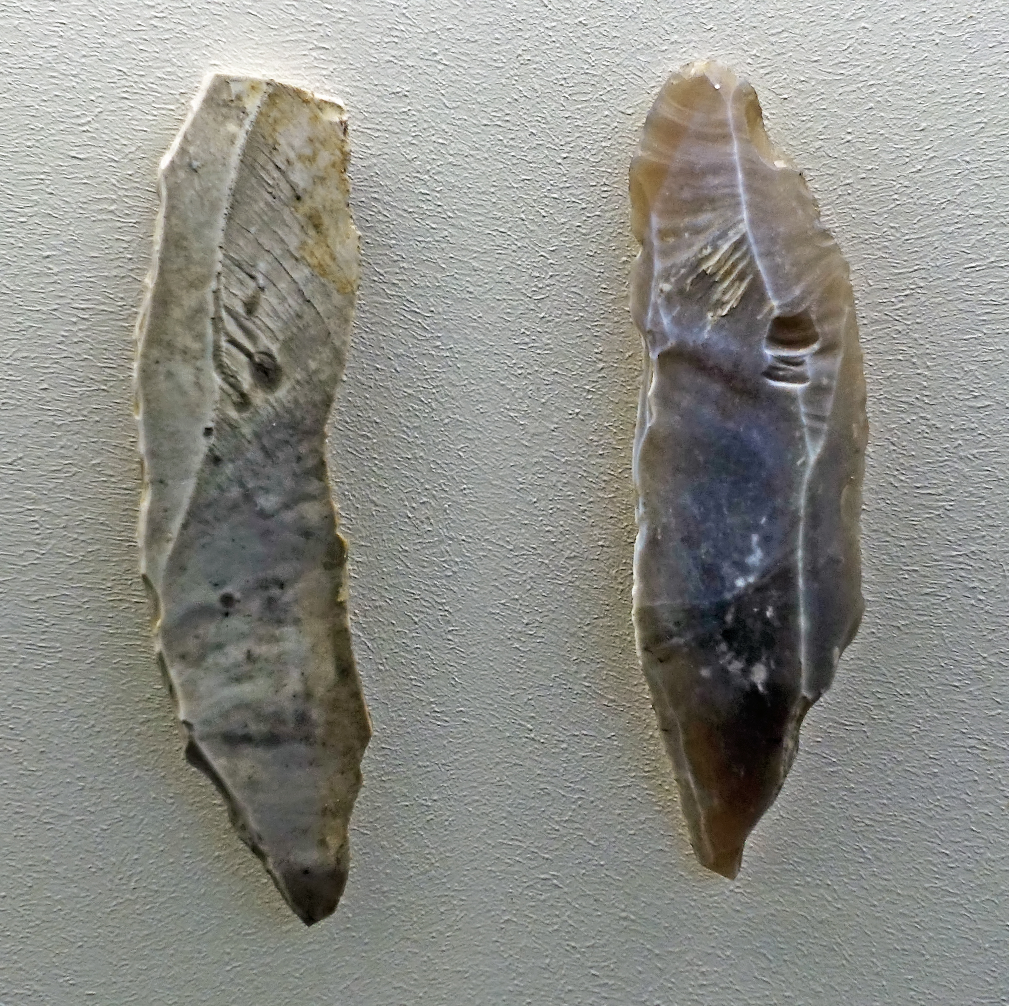
Ranis 3, Ilsenhöhle
Two Klingengerät, tools made on a blade.
( apparently sidescrapers - Don )
Dating: Aurignacian with Middle Palaeolithic admixture.
Photo: Don Hitchcock 2018
Source and text: Ilsenhöhle near Ranis, Halle Landesmuseum für Vorgeschichte, CC-BY-NC-SA @ State Museum of Prehistory Halle
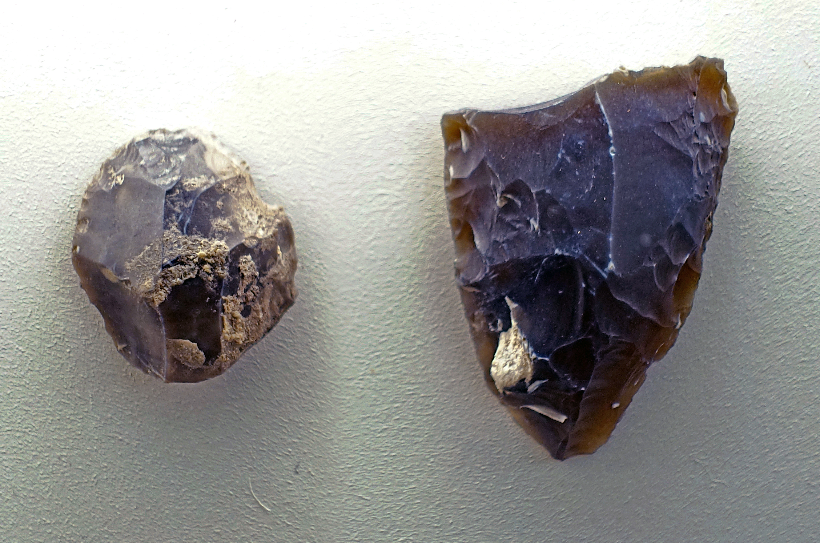
Ranis 3, Ilsenhöhle
(left) Kratzer, scraper
(right) Spitze (gebrochen), broken point
Dating: Aurignacian with Middle Palaeolithic admixture.
Photo: Don Hitchcock 2018
Source and text: Ilsenhöhle near Ranis, Halle Landesmuseum für Vorgeschichte, CC-BY-NC-SA @ State Museum of Prehistory Halle
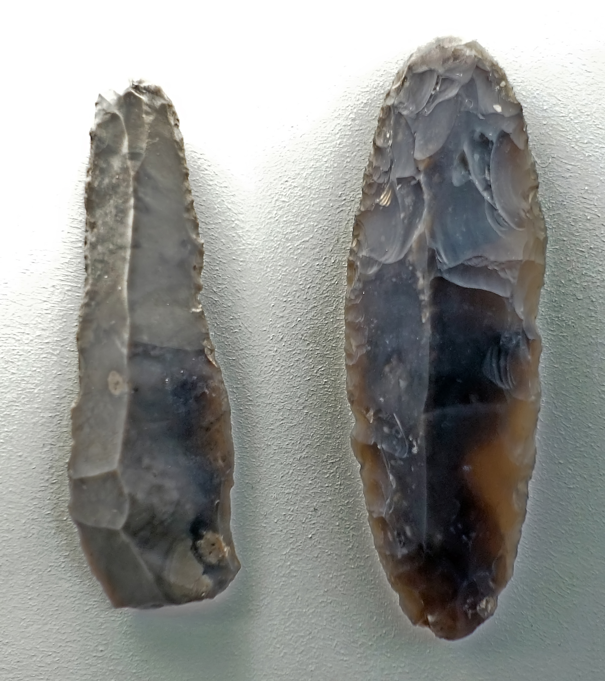
Ranis 3, Ilsenhöhle
(left) Klingengerät (gebrochen), broken tool, made on a blade.
(right) Doppelkratzer, double ended scraper, ( double ended grattoir, apparently also made on a blade - Don )
Dating: Aurignacian with Middle Palaeolithic admixture.
Photo: Don Hitchcock 2018
Source and text: Ilsenhöhle near Ranis, Halle Landesmuseum für Vorgeschichte, CC-BY-NC-SA @ State Museum of Prehistory Halle
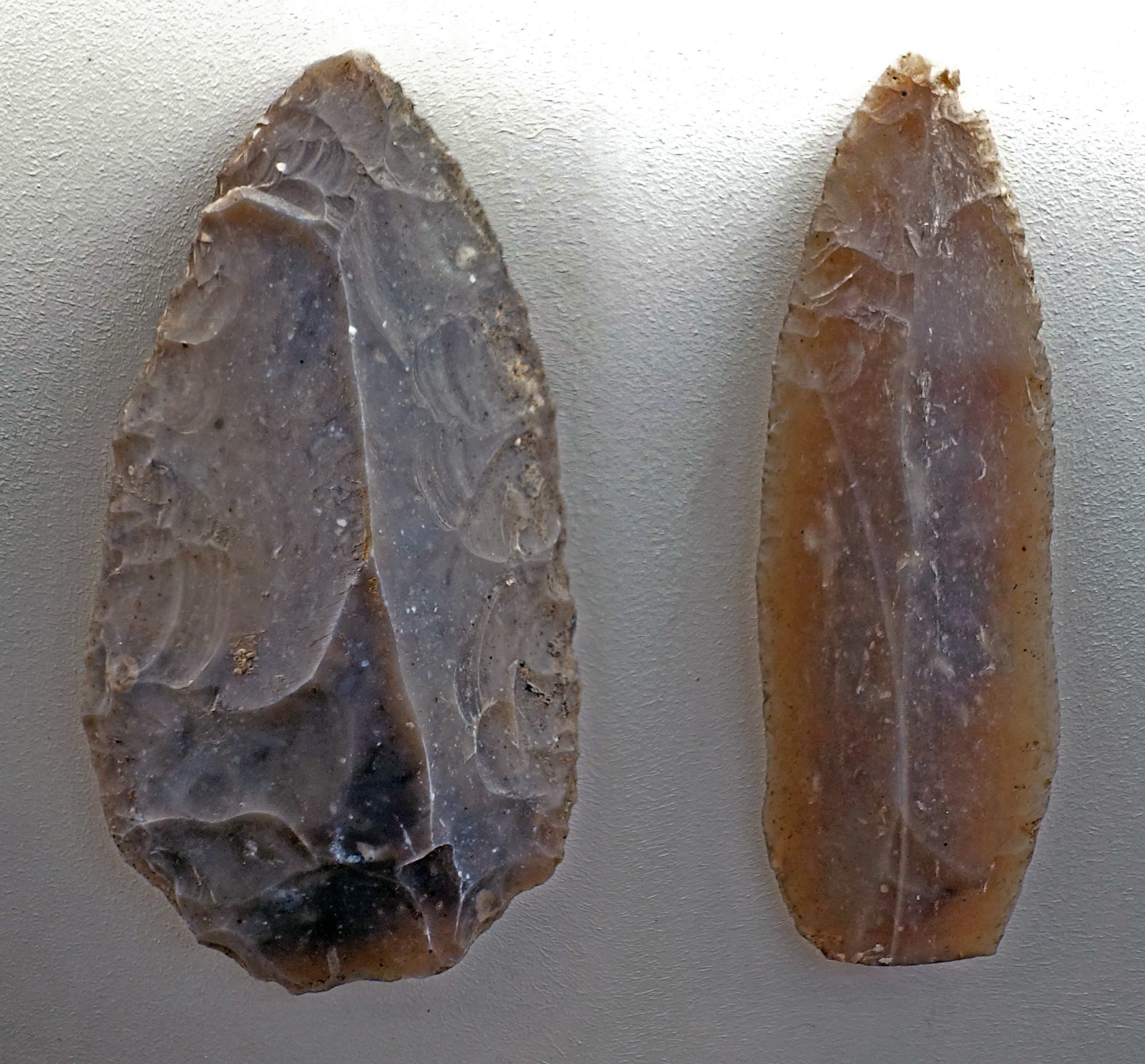
Ranis 3, Ilsenhöhle
(left) Spitze, point.
(right) Klinge, blade.
Dating: Aurignacian with Middle Palaeolithic admixture.
Photo: Don Hitchcock 2018
Source and text: Ilsenhöhle near Ranis, Halle Landesmuseum für Vorgeschichte, CC-BY-NC-SA @ State Museum of Prehistory Halle
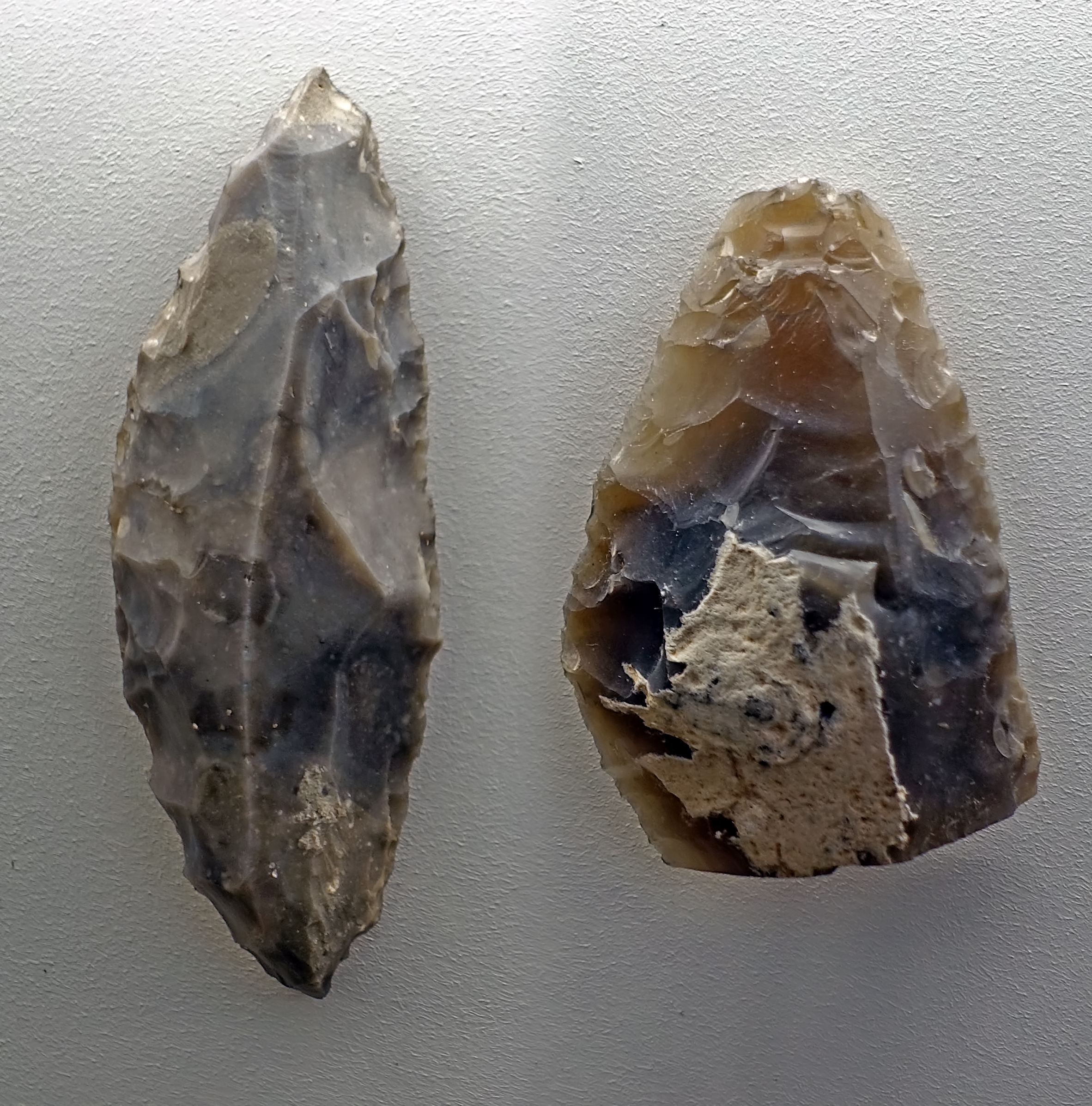
Ranis 3, Ilsenhöhle
(left) Spitze, point.
(right) Spitze (gebrochen), broken point.
Dating: Aurignacian with Middle Palaeolithic admixture.
Photo: Don Hitchcock 2018
Source and text: Ilsenhöhle near Ranis, Halle Landesmuseum für Vorgeschichte, CC-BY-NC-SA @ State Museum of Prehistory Halle
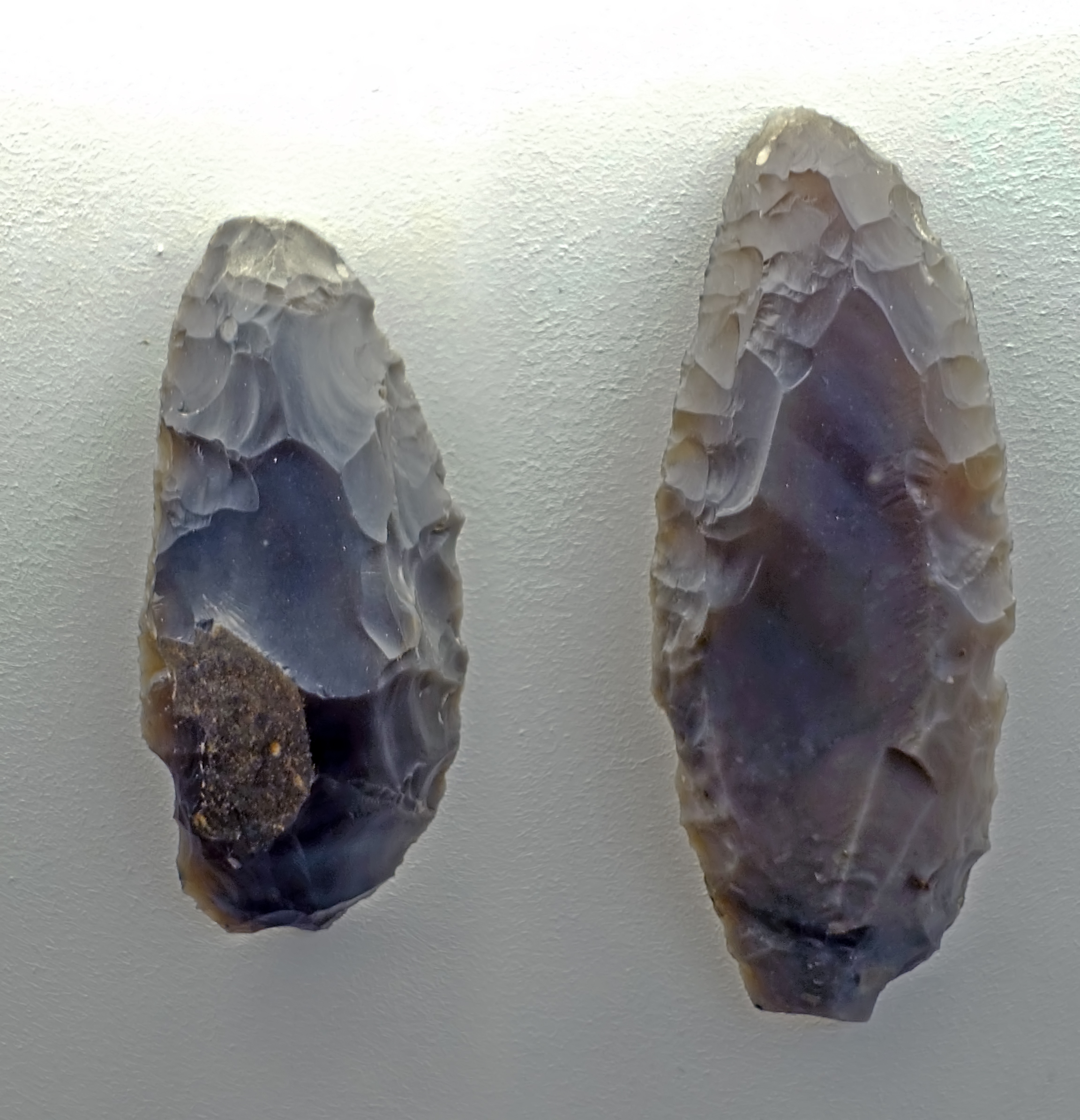
Ranis 3, Ilsenhöhle
(left) Spitze (gebrochen), broken point.
(right) Spitze, point.
Dating: Aurignacian with Middle Palaeolithic admixture.
Photo: Don Hitchcock 2018
Source and text: Ilsenhöhle near Ranis, Halle Landesmuseum für Vorgeschichte, CC-BY-NC-SA @ State Museum of Prehistory Halle
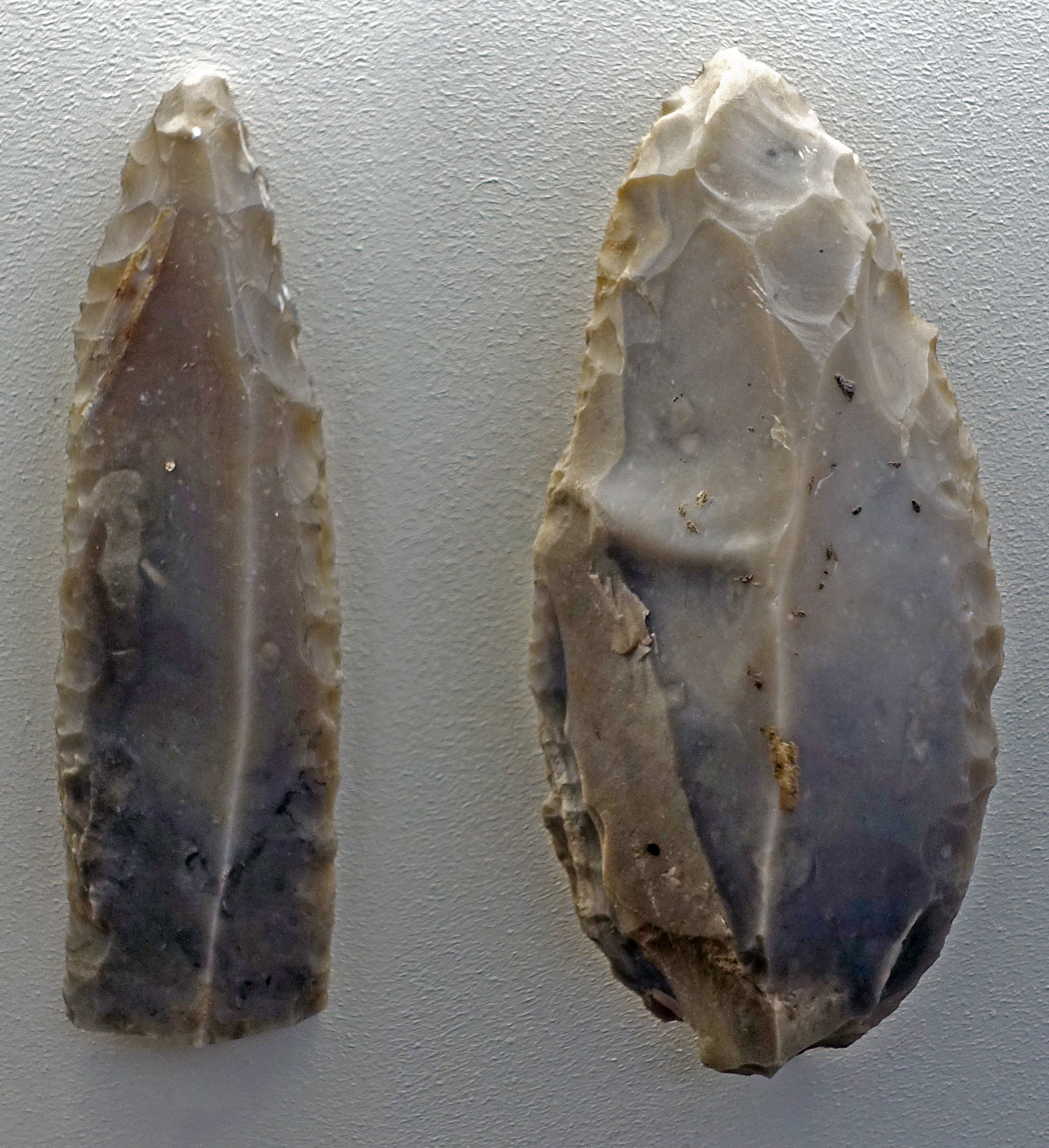
Ranis 3, Ilsenhöhle
(left) Spitze (gebrochen), broken point.
(right) Spitze, point.
Dating: Aurignacian with Middle Palaeolithic admixture.
Photo: Don Hitchcock 2018
Source and text: Ilsenhöhle near Ranis, Halle Landesmuseum für Vorgeschichte, CC-BY-NC-SA @ State Museum of Prehistory Halle
| Ilsenhöhle stratigraphy | |||
|---|---|---|---|
| Layer I | In this 'layer', up to 3 layers of medieval rubble may be distinguished. | ||
| Layer II | On silt, rich in fine debris, another humous surface horizon, 50 cm thick in total, was formed. | ||
| Layer III | Ranis 5 | Late Palaeolithic | Grey-brown layer, 20 to 40 cm thick, representing a humous, silty matrix with a finely divided surface horizon. |
| Layer IV | Ranis 5 | Late Palaeolithic | Grey-black- layer, 10 to 50 cm thick. |
| Layer V | Ranis 5 | Late Palaeolithic | This so-called 'rodent layer' is 10 to 20 cm thick, and lies like a blanket over all older layers. In depressions or on inclined surfaces it has a greater thickness. It consists of yellow-brown silt, which forms the matrix for a deposit of fine-grained rock debris and countless skeletal remains. The latter come from small to medium-sized mammals, especially small mammals, bats and other small vertebrates. They are mainly due to the depredations of birds of prey (owls), while the bat remains are mainly from those bats living in the cave. Larger skeletal remains have been torn apart ( hyenas? - Don ) and are present mostly as splinters. The upper part of the rodent layer becomes increasingly humous, and is therefore coloured grey. |
| Layer VI | Ranis 4 | Mixed Upper/Late Palaeolithic | This yellow layer is up to 300 cm thick and represents silt blown into the cave from outside. It is enriched with fine-grained frost-weathering debris and, in its upper levels, more and more blocks. ( Periglacial loess is derived from the deposits of braided rivers flowing from glaciated areas when they dry up in autumn and winter. The glacially ground flour-like silt and clay, often yellow in colour, is picked up by the wind, and large deposits of loess have been formed in many parts of Europe, Siberia, and China - Don ) |
| Layer VII | Ranis 3 | Aurignacian with Middle Palaeolithic admixture | This brown layer (150 to 200 cm thick) is a sandy, skeleton-rich loam. Apart from weathering debris, it contains blocks from the roof of the abri. After the Ranis 3 occupation the roof of the cave collapsed and probably the cave was abandoned for several thousands of years, see Richter (2009) |
| Layer VIII | Ranis 3 | Aurignacian with Middle Palaeolithic admixture | This dark layer, 10 - 30 cm thick, consists of a sandy clay with some humus, heavily interspersed with bone ash and bone charcoal. The deposit is dark grey-brown to black in colour, and is free of rock debris. |
| Layer IX | Ranis 2 | Jerzmanovician | A brown layer follows, also 30 cm thick on average. It consists of sandy loam, which is discoloured chocolate-brown by a weak loamification (weathering, soil formation). It occasionally contains individual boulders as well as smaller blocks. |
| Layer X | Ranis 2 | Jerzmanovician | Above Layer XI lies the so-called grey layer (up to 30 cm thick), a heavy sandy loam to loamy sand coloured by humus, which contains hardly any rock debris. It is partially interspersed with bone ash. |
| Layer XI | Ranis 1 | Micoquian (?) | The lower brown layer, up 100 cm thick, rests on weathered dolomite. It consists of a clayey-sandy loam and contains only a few fragments of rubble, with only occasional larger blocks. The sandy parts are due to the dolomite sands of the reef or the decay of the reef dolomite. |
Breitenbach
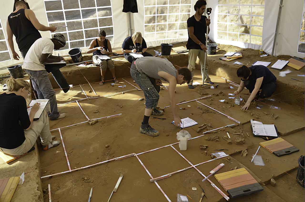
Documentation of the finds at Breitenbach by an international team of students
Photo: ©MONREPOS/Dr Olaf Jöris
Permission: Creative Commons Attribution-Share Alike 3.0 Unported license.
Text: http://www.sci-news.com/archaeology/article00624.html
During the 2012 season, archaeologists from the MONREPOS Archaeological Research Center and Museum for Human Behavioral Evolution led by Dr Olaf Jöris and Dr Tim Matthies investigated 70 m2 of the Breitenbach site.
Breitenbach is an open-air site, circa 30 000 BP
The open-air site of Breitenbach is one of the few Aurignacian open-air sites known from Central Europe – knowledge about modern human spatial behaviour and subsistence practices during the Aurignacian derives primarily from cave sites. The extent of the settlement is estimated between 8 000 and 10 000 square metres – this is very unusual for this period and foreshadows the large open-air settlements of the Gravettian known from eastern Europe.
Location
The village of Breitenbach is part of Wetterzeube municipality and is located approximately 6 km south of the town of Zeitz, about 78 km south of Halle.
The archaeological site near the old cutting mill ('Schneidemühle') is situated along the eastern bank of the river Aga, a small tributary of the White Elster river. The site is located on the slopes of a gentle promontory that, coming from a north-westerly direction peters out in a south-easterly direction.
Text above: Wikipedia
 Three small ivory fragments from Breitenbach, which are only between 14 mm and 18 mm in size seem to be very inconspicuous at first glance, but have been carefully worked and polished on the surface, and can be fitted effortlessly into completely preserved figures such as those known from the 'Hohle Fels' in the Swabian Alb. Breitenbach represents one of the northernmost sites of the Aurignacian.
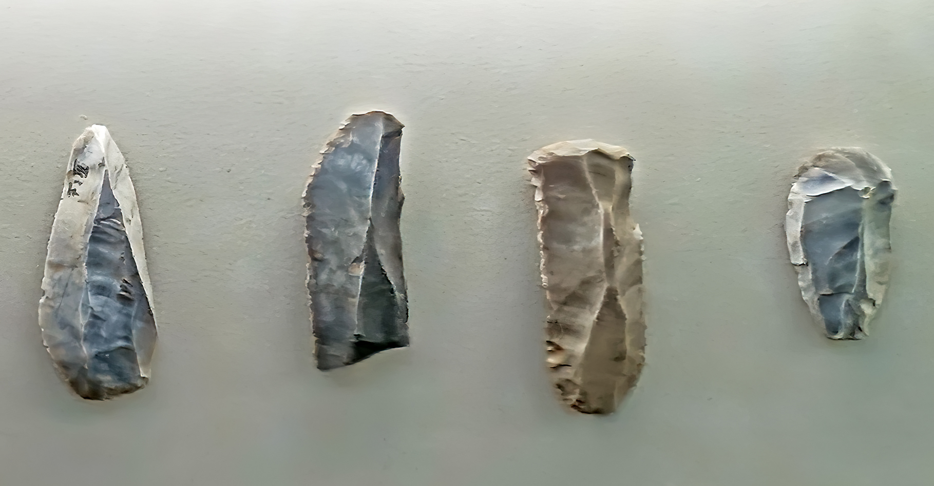
Breitenbach
Circa 30 000 BP
Von links nach rechts: Abschlag, Klinge, Kratzer, Kratzer.
From left to right: Flake, blade, scraper, scraper.
Photo: Don Hitchcock 2018
Source and text: Halle Landesmuseum für Vorgeschichte, CC-BY-NC-SA @ State Museum of Prehistory Halle
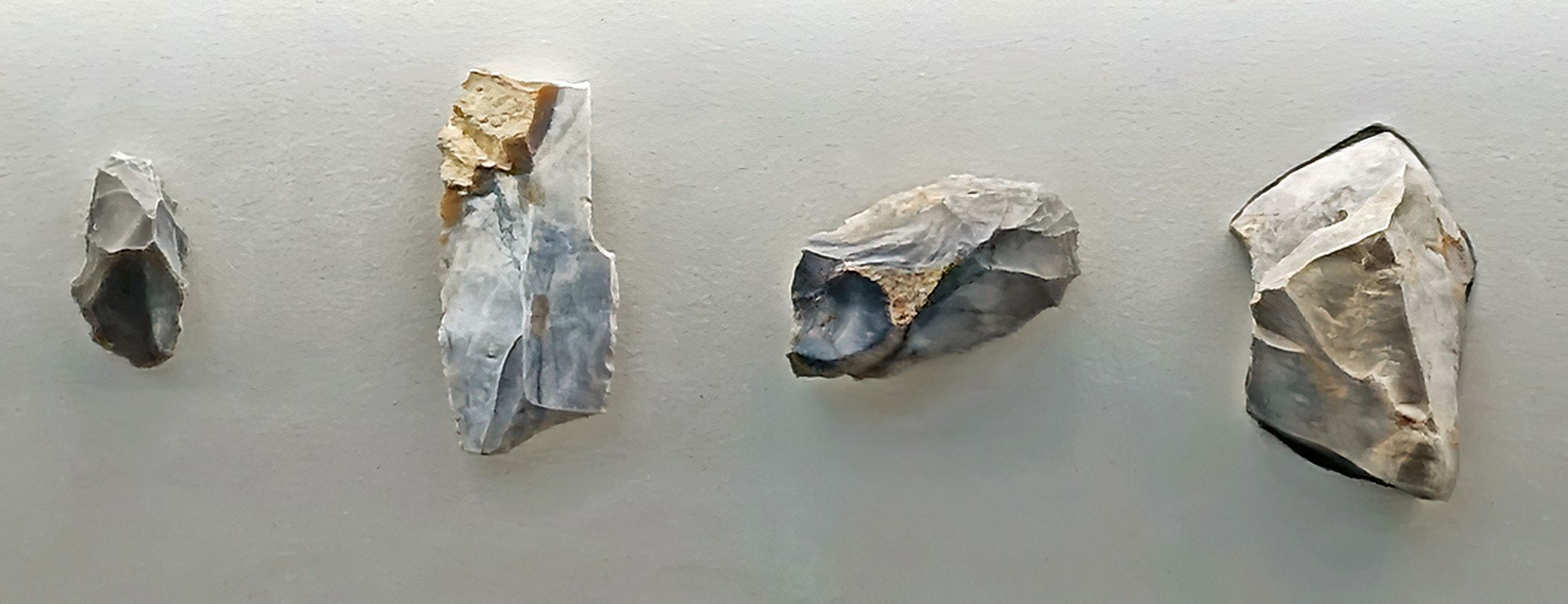
Breitenbach
Circa 30 000 BP
Von links nach rechts: Kern, Stichel, Kratzer, Kern.
From left to right: Core, burin, scraper, core.
Photo: Don Hitchcock 2018
Source and text: Halle Landesmuseum für Vorgeschichte, CC-BY-NC-SA @ State Museum of Prehistory Halle
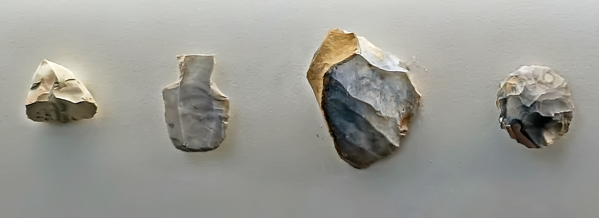
Breitenbach
Circa 30 000 BP
Von links nach rechts: Kern, Stichel, Kern, Kratzer.
From left to right: Core, (double ) burin, core, scraper.
Photo: Don Hitchcock 2018
Source and text: Halle Landesmuseum für Vorgeschichte, CC-BY-NC-SA @ State Museum of Prehistory Halle
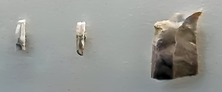
Breitenbach
Circa 30 000 BP
Von links nach rechts: Lamelle, Lamelle, Bohrer.
From left to right: Blade, blade, drill.
Photo: Don Hitchcock 2018
Source and text: Halle Landesmuseum für Vorgeschichte, CC-BY-NC-SA @ State Museum of Prehistory Halle
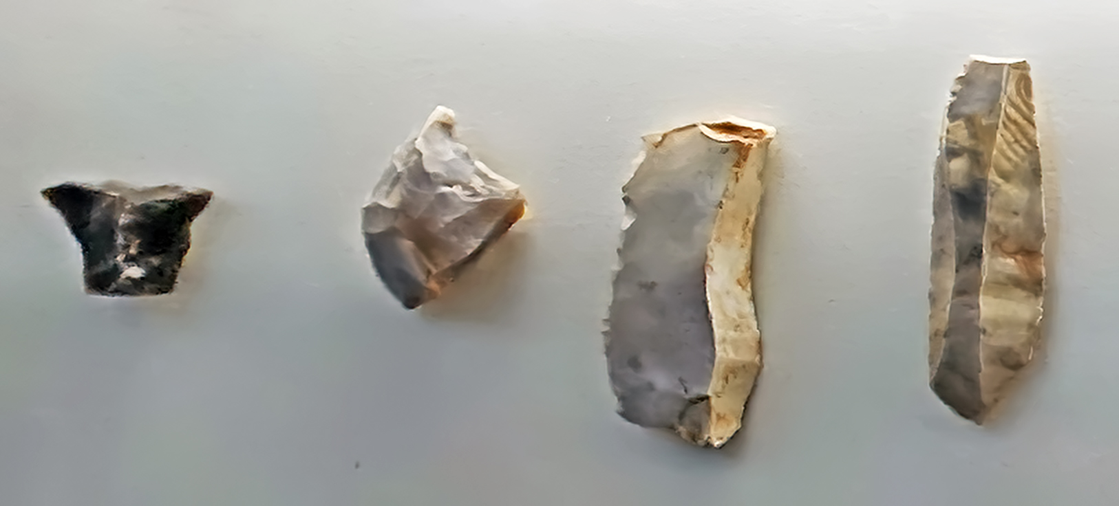
Breitenbach
Circa 30 000 BP
Von links nach rechts: Kratzer, Kern, Klinge, Klinge.
From left to right: Scraper, core, blade, blade.
Photo: Don Hitchcock 2018
Source and text: Halle Landesmuseum für Vorgeschichte, CC-BY-NC-SA @ State Museum of Prehistory Halle
Bilzingsleben-Simsensee
An upper Palaeolithic site, about 90 km ESE from Halle.
The site is Gravettian, according to Küßner und Terberger (2006)
The Gravettian is so far represented in Central Germany only by an important open-air site discovered by D. Mania, during excavations at the Old Palaeolithic site of Bilzingsleben on a nearby hill spur. The surface site, introduced under the name Bilzingsleben (Simsensee), has a diameter of about 150 m and contained about 1 200 artefacts at the time of its first publication. The number of finds has probably increased in the meantime; there are no organic finds.
According to Mania (1981) the inventory gives an impression of homogeneity. Among the retouched forms, pedunculate spear heads of the Font-Robert type can be singled out as a special feature, leaving no doubt as to their classification in the Middle Upper Palaeolithic. The range of tools from Bilzingsleben is dominated by burins (92 specimens), while scrapers are clearly less prominent with 18 specimens. With 20 handle points and just as many backed knives, potential projectile forms make up a considerable share.
Bilzingsleben and Salching seem to reflect the eastern limit of distribution of the Font-Robert points, which are traditionally assigned to the Perigordian V in France.
These climatic conditions sometimes lasted only few hundred years, or sometimes for several millennia. Accordingly, the landscape changed into steppes, tundras and arctic deserts.
The modern humans apparently invaded Europe during a warm phase of the last cold period. Temperatures, however, were still clearly cooler than today. Herb-rich grass plains with dwarf shrubs dominated the vegetation.
Gallery forests of birch and conifers lined the rivers. About 22000 years ago, this subarctic climate cooled down to a final cold maximum. From Scandinavia, glacier tongues pushed their way over a few millennia into what is now north-eastern Saxony-Anhalt. The enormous forces of the ice swept away forests and rock masses. The enormous forces of the ice tore away forests and rock masses. The regions adjoining the glaciers were reduced to polar forests. Humans and animals moved to more southern regions during this ice age.
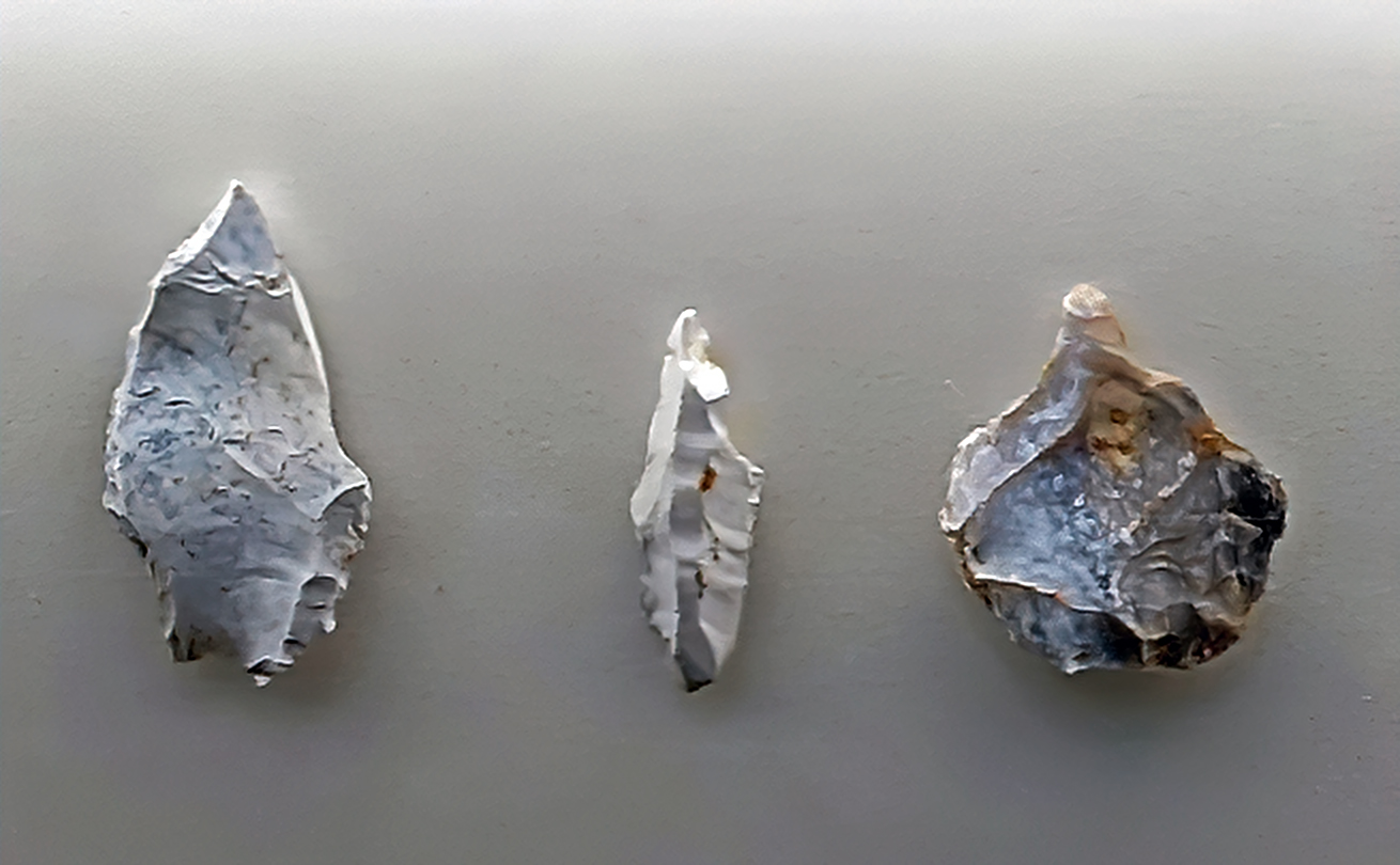
Bilzingsleben-Simsensee
Circa 24 000 BP
Von links nach rechts: Stichel, Stichel, Bohrer.
From left to right: Burin, burin, drill.
Photo: Don Hitchcock 2018
Source and text: Halle Landesmuseum für Vorgeschichte, CC-BY-NC-SA @ State Museum of Prehistory Halle
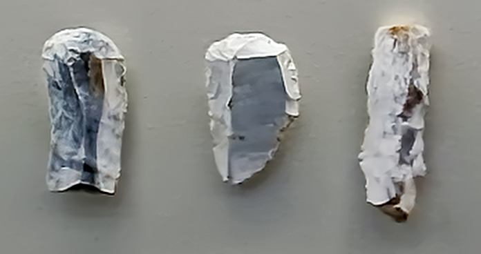
Bilzingsleben-Simsensee
Circa 24 000 BP
Von links nach rechts: Kratzer, Kratzer, Rückenmesser.
From left to right: Scraper, scraper, backed knife.
Photo: Don Hitchcock 2018
Source and text: Halle Landesmuseum für Vorgeschichte, CC-BY-NC-SA @ State Museum of Prehistory Halle
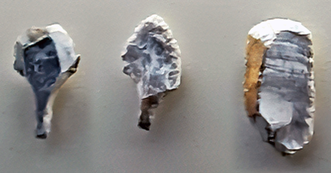
Bilzingsleben-Simsensee
Circa 24 000 BP
Von links nach rechts: Stielspitze, Stielspitze, Kratzer.
From left to right: Font Robert point (stemtip, tanged tool created on blade, shouldered point), Font Robert point, scraper.
Photo: Don Hitchcock 2018
Source and text: Halle Landesmuseum für Vorgeschichte, CC-BY-NC-SA @ State Museum of Prehistory Halle
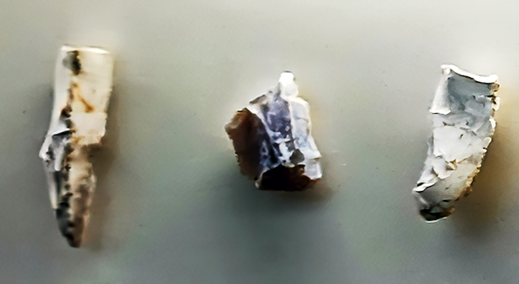
Bilzingsleben-Simsensee
Circa 24 000 BP
Von links nach rechts: Klingen, Stichel, Kerne.
From left to right: Blade, burin, core.
Photo: Don Hitchcock 2018
Source and text: Halle Landesmuseum für Vorgeschichte, CC-BY-NC-SA @ State Museum of Prehistory Halle
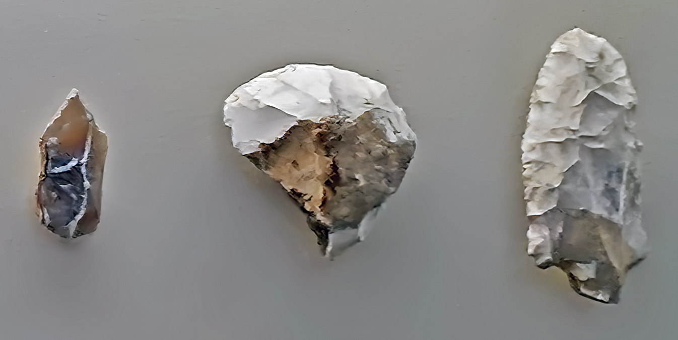
Bilzingsleben-Simsensee
Circa 20 000 BP
Von links nach rechts: Bohrer, Kratzer, Stielspitze (gebrochen).
From left to right: Drill, scraper, Font Robert point (stemtip, tanged tool created on blade, shouldered point), broken.
Photo: Don Hitchcock 2018
Source and text: Halle Landesmuseum für Vorgeschichte, CC-BY-NC-SA @ State Museum of Prehistory Halle
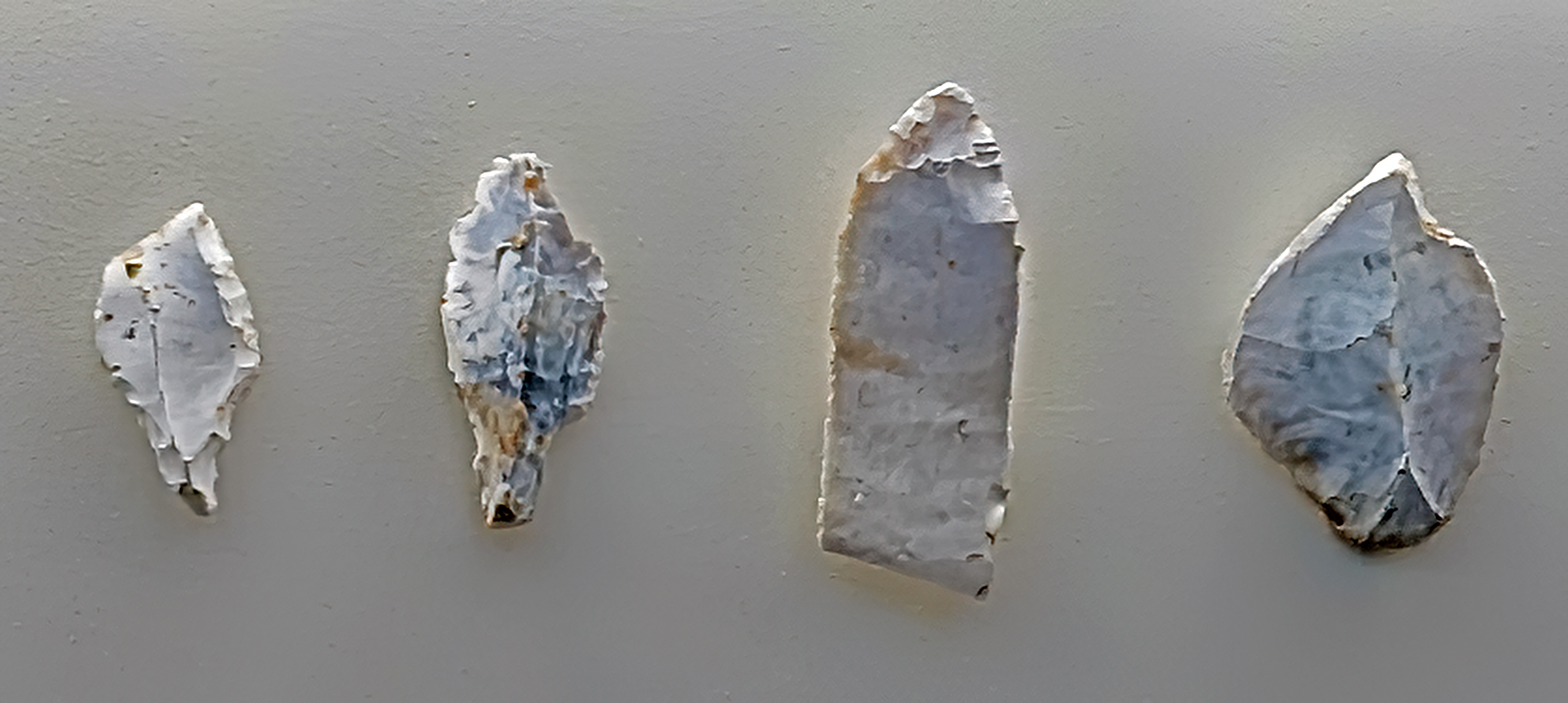
Bilzingsleben-Simsensee
Circa 20 000 BP
Von links nach rechts: Stielspitze, Stielspitze (gebrochen), Klingenspitze (gebrochen), Stichel.
From left to right: Font Robert point (stemtip, tanged tool created on blade, shouldered point), Font Robert point (broken), point on a blade (broken), burin.
Photo: Don Hitchcock 2018
Source and text: Halle Landesmuseum für Vorgeschichte, CC-BY-NC-SA @ State Museum of Prehistory Halle
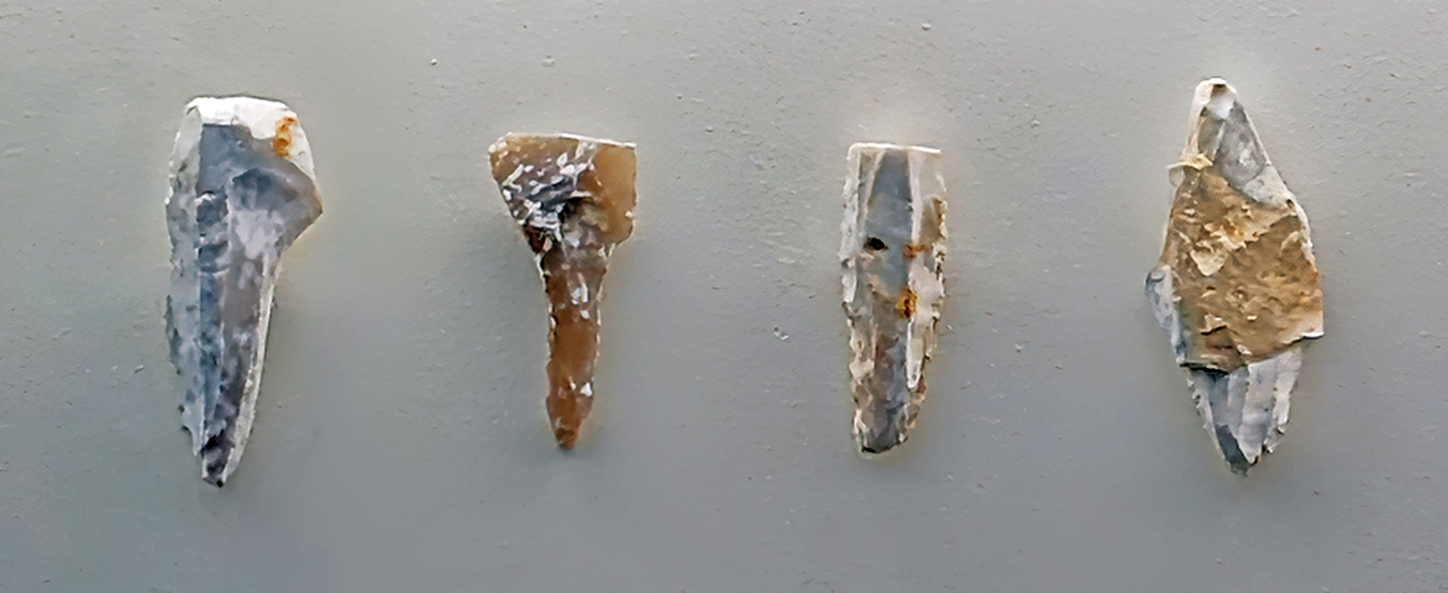
Bilzingsleben-Simsensee
Circa 20 000 BP
Von links nach rechts: Stichel, Stielspitze (gebrochen), Klinge, Stichel.
From left to right: Burin, Font Robert point (broken) (stemtip, tanged tool created on blade, shouldered point), blade, burin.
Photo: Don Hitchcock 2018
Source and text: Halle Landesmuseum für Vorgeschichte, CC-BY-NC-SA @ State Museum of Prehistory Halle
References
- Ackerl, I., 2009: History of Austria in dates : From prehistoric times to 1804, marixverlag , 20 Feb 2009 - History - 224 pages
- Bednarik, R., 1995: Concept-mediated marking in the Lower Palaeolothic, Current Anthropology, 36, p. 605-634.
- Bohmers A., 1951: Die Höhlen von Mauern. Teil I. Kulturgeschichte der Altsteinzeitlichen Besiedlung, Palaeohistoria 1 p. 1–107
- Delagnes A., 2000: Blade production during the Middle Paleolithic in Northwestern Europe, ACTA Anthropologica Sinica, Supplement to Volume 19, 2000, pp181-188
- Ehlers J. et al., 2011: Pleistocene glaciations of North Germany - new results, Developments in Quaternary Science, 15. Elsevier, Amsterdam, pp. 149-162.
- Ertmer S., 2010: Die Parkkiesgrube Hundisburg - ein klassischer Fundplatz der Altsteinzeit im Lichte neuer Ausgrabungen, Archäologie in Sachsen-Anhalt , SSonderband 13 · 2010
- Ertmer S., 2010b: https://uni-tuebingen.de/fakultaeten/mathematisch-naturwissenschaftliche-fakultaet/fachbereiche/geowissenschaften/arbeitsgruppen/urgeschichte-naturwissenschaftliche-archaeologie/forschungsbereich/aeltere-urgeschichte-quartaeroekologie/forschung/grabungen/deutschland/hundisburg/
- Flas D., 2012: Jerzmanowice points from Spy and the issue of the Lincombian-Ranisian- Jerzmanowician, Anthropologica et Praehistorica, January 2012, 123(1):217-230
- Haidle M., Pawlik A., 2010: The earliest settlement of Germany: Is there anything out there?, Quaternary International, 223-224 (2010) 143 - 153
- Hoffecker J., 2009: The spread of modern humans in Europe, Proc Natl Acad Sci USA, 2009 Sep 22; 106(38): 16040–16045
- Hülle W., 1977: Die Ilsenhöhle unter Burg Ranis / Thüringen, Fischer, 1977, ISBN-10: 343730254X, ISBN-13: 978-3437302541, 203 pp.
- Jahn M., 1951: Ein neues Altsteinzeitgerät aus Barleben, Jahresschrift für mitteldeutsche Vorgeschichte, 35 , S. 5 ff. - Halle 1951
- Küßner M., Terberger T., 2006: Die Fundstelle Gera-Zoitzberg und die Zeit zwischen Gravettien und Magdalenien in Mitteldeutschland, Alt-Thüringen, 39:69-119
- Lang J., Lauer T., Winsmann J., 2018: New age constraints for the Saalian glaciation in northern central Europe: Implications for the extent of ice sheets and related proglacial lake systems, Quat. Sci. Rev., 180: 240 - 259
- Mania D., 1975: Stratigraphie ökologie und Paläolithikum des Weichselfrüglazials im Mittleren Elbe-Saale-Gebiet, Światowit, 34, 81-138, 1975
- Mania D., 1981: Eine Fundstelle des Perigordien/Gravettien von Bilzingsleben (Kreis Artern, DDR). in: Prehistoire de Ia grande Plaine de I'Europe, Archaeologia lnterregionalis 1, 89-93. Krakau/ Warschau.
- Mania D., 1991: The zonal division of the lower palaeolithic open-air site Bilzingsleben, Anthropologie, XXIX/1-2
- Mania D., 1995: The earliest occupation of Europe: the Elbe- Saale region (Germany), in: Roebroeks W., van Kolfschoten T. (eds) The earliest occupation of Europe, Analecta Leidensia (Leiden) 1995, 85-101.
- Mania D., 2004: Königsaue - hunters at Lake Aschersleben 80,000 years ago, in: Meller, H. (ed.) Paleolithic and Mesolithic. Catalogs for the permanent exhibition in the State Museum of Prehistory Halle, Vol. 1 Halle (Saale), 175-196. Halle (Saale)
- Moreau J. et al., 2012: The glaciogenic unconformity of the southern North Sea, Glaciogenic Reservoirs, Geological Society of London, vol 368. Special Publication, pp. 99-110.
- Moreau, L., 2012: The Aurignacian of Breitenbach, status of flake production, Flakes not Blades, Wissenschaftliche Schriftendes Neanderthal Museums 5, Mettmann 2012
- Moreau, L., 2012b: Breitenbach-Schneidemühle, Germany: A major Aurignacian open air settlement in Central Europe, Eurasian Prehistory, 9(1-2): 51-75.
- Picin A., 2016: Short-term occupations at the lakeshore: a technological reassessment of the open–air site Königsaue (Germany), Quartär, Volume 63, pp 7-32, DOI: 10.7485/QU63_1
- Richter J., 2009: The role of leaf points in the Late Middle Palaeolithicof Germany, Praehistoria, 9-10 (2008-2009) 99-113
- Richter J., 2016: Leave at the height of the party: A critical review of the Middle Paleolithic in Western Central Europe from its beginnings to its rapid decline, Quaternary International, Volume 411, Part A, 8 August 2016, Pages 107-128, https://doi.org/10.1016/j.quaint.2016.01.018
- Sauer D., 2012: From the Northern Ice Shield to the Alpine Glaciations, Geozon Science Media, 2012
- Toepfer V., 1961: Die altpaläolithischen Feuersteinwerkzeuge von Hundisburg, Jahresschrift für mitteldeutsche Vorgeschichte, 45, 1961, 35−69.
-
Weber T., 2004: The 'Bagger Paläolithikum' in the Middle Elbe-Saale area, in Meller, H. (ed.), Paleolithic and Mesolithic , Catalogs for the permanent exhibition in the State Museum of Prehistory Halle Bd. 1 Halle (Saale), 113-118.
- Weiss M., Lauer T., Wimmer R., Cornel M. , 2018: The Variability of the Keilmesser-Concept: a Case Study from Central Germany, Journal of Paleolithic Archaeology, (2018) 1:202–246 https://doi.org/10.1007/s41982-018-0013-y
- Winsemann J. et al., 2011: Depositional architecture and palaeogeographic significance of Middle Pleistocene glaciolacustrine ice marginal deposits in northwestern Germany: a synoptic overview, E&G Quat. Sci. J. , 60, 212-235.
- Zilhão J., 2014: The Upper Palaeolithic of Europe, The Cambridge World Prehistory. Volume 3,West and Central Asia and Europe, Cambridge University Press, Editors: Colin Refrew, Paul Bahn
- Zupancich A. et al., 2015: On Quina and demi-Quina scraper handling: Preliminary results from the late Lower Paleolithic site of Qesem Cave, Israel, Quaternary International, (2015), http://dx.doi.org/10.1016/j.quaint.2015.10.101