Back to Don's Maps
 Back to Australian rock art and other Oz sites
 Mt Yarrowyck
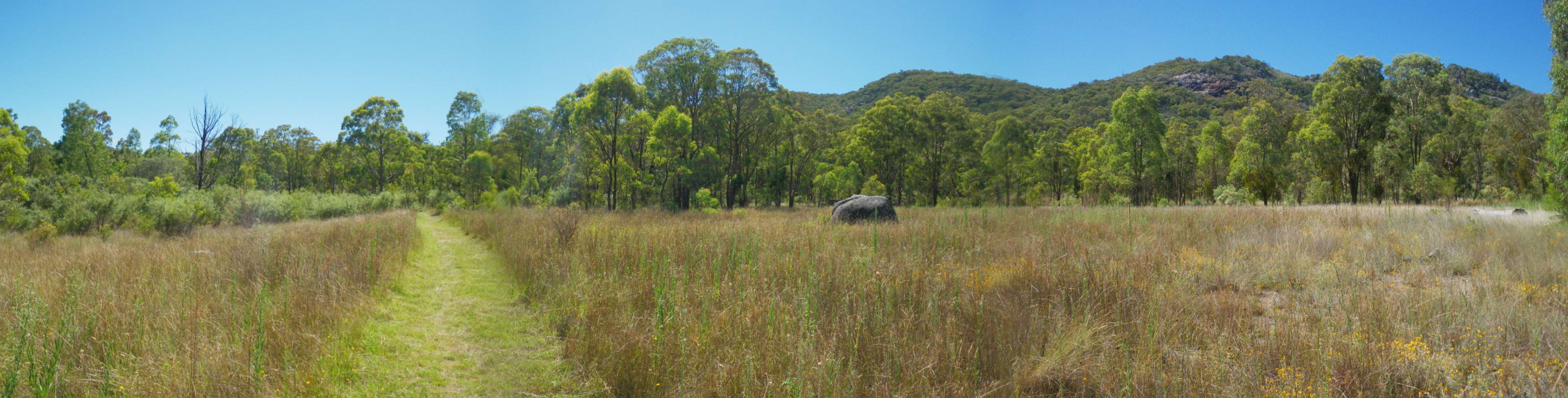
Photo: Don Hitchcock February 2011
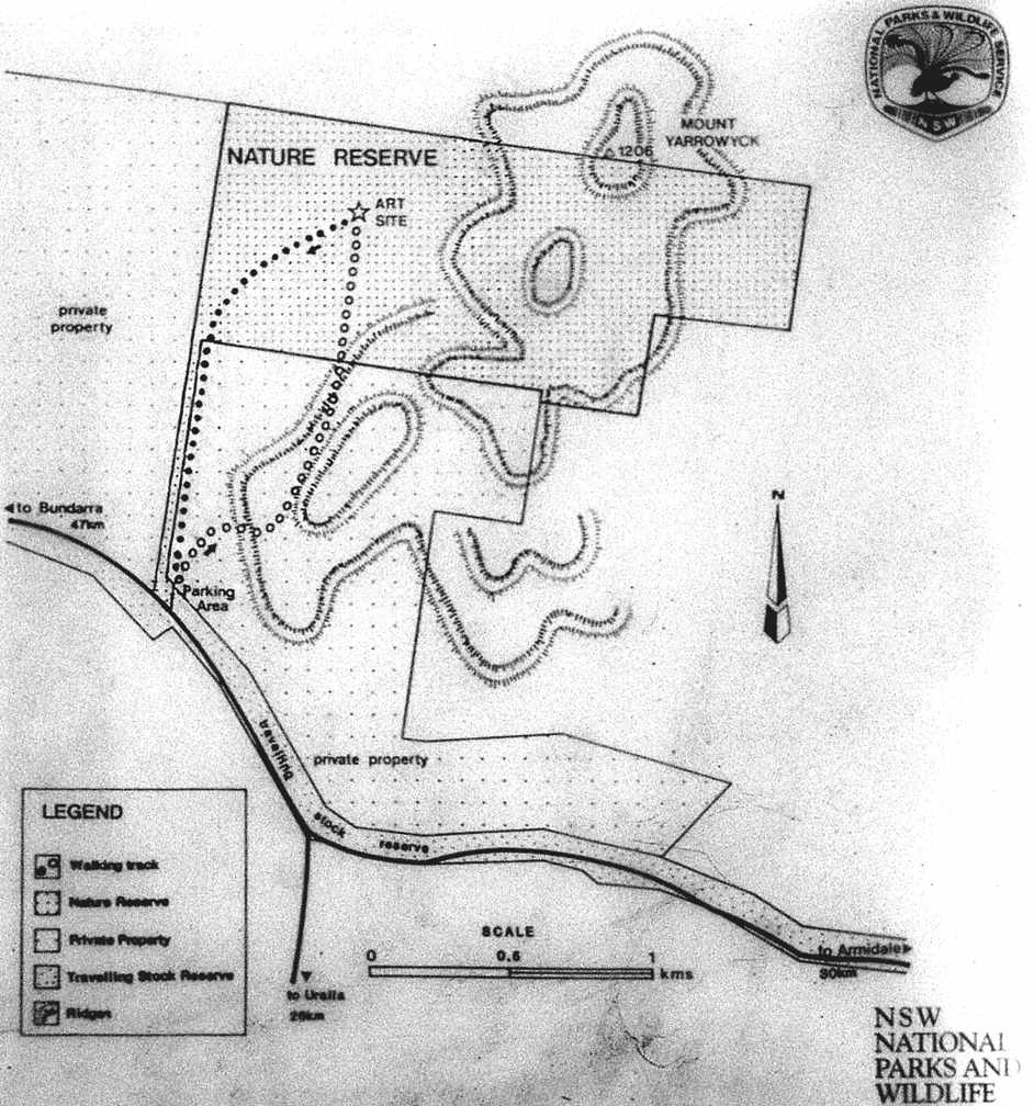
The Mount Yarrowyck Nature Reserve near the junction of the Armidale Road and Thunderbolts Way protects an Aboriginal cave painting site and much of the natural environment of Mount Yarrowyck. The reserve's Aboriginal cultural walk, a three kilometre return track, will take you along the granite slopes of the mountain to the cave painting site.
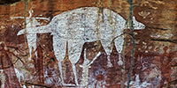
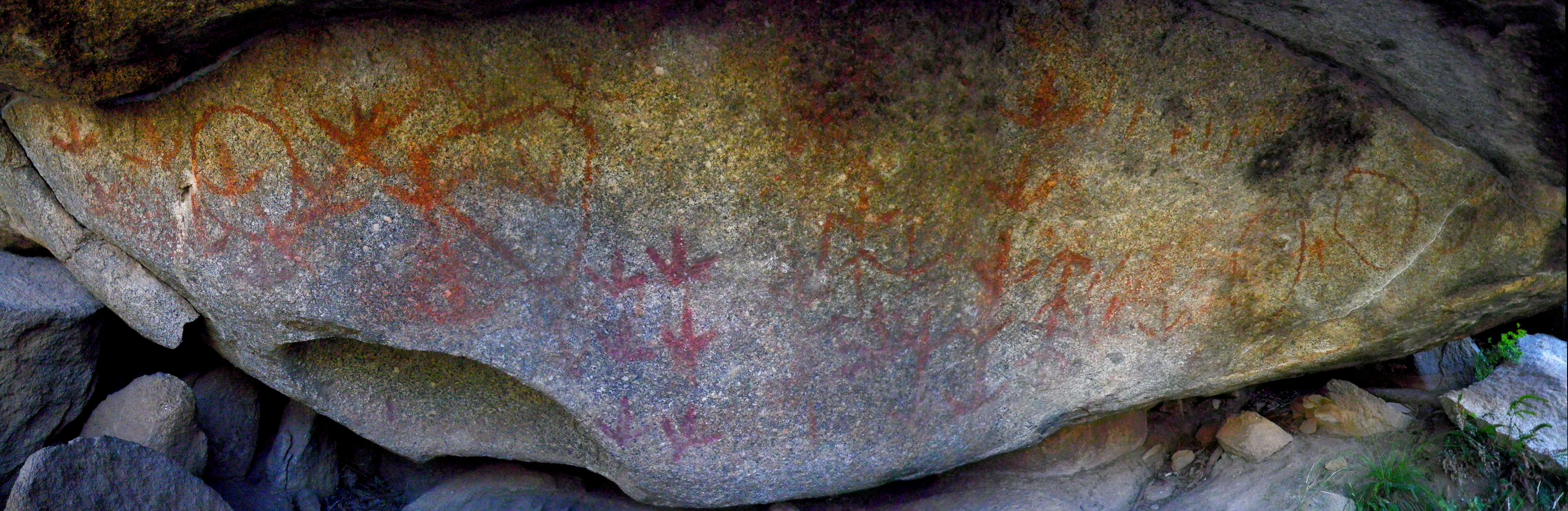
The paintings are probably several hundreds of years old. The tracks, circles, short lines and dots may remind you of birds' feet, people, lizards and even birds' eggs. However an Aboriginal elder, the late Victor Shepherd, was sure that the paintings were of a bird that fed on the ground. Ground birds were represented by their feet alone. He said the toes look too short and thick to be an emu. The paintings must be of the Plains Turkey, the Bustard.
Mt Yarrowyck is thirty five kilometres by road west of Armidale, NSW Australia, at 30° 27' 17" S 151° 22' 36" E.
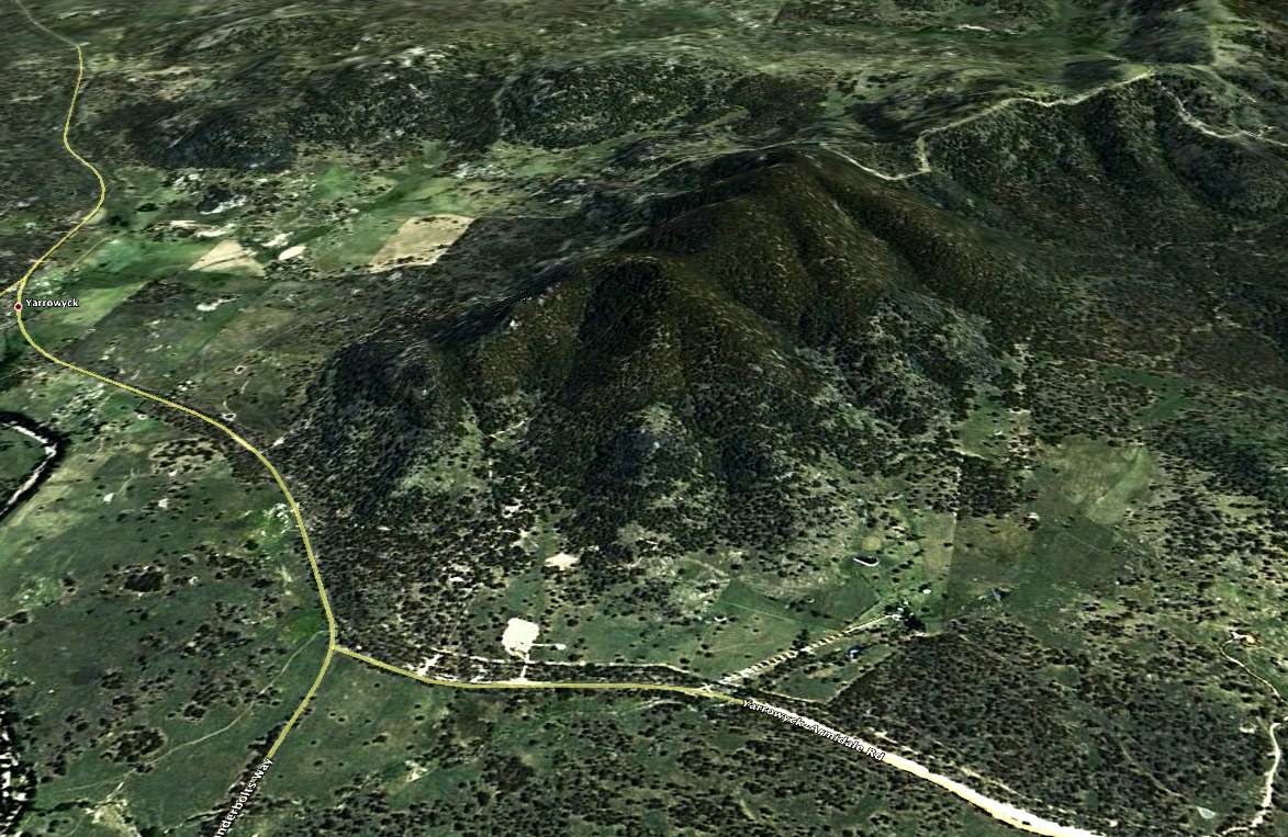
At the time of writing, 2011, Google Earth has the name Mount Yarrowyck nowhere near the correct location. They have it near the hobby farm belt of Invergowrie.
Mount Yarrowyck is the treed series of highlands shown in the centre of this image, which has been tilted to more clearly show the contours. The "Armidale- Yarrowyck Road" is never called that by locals, it is universally known as "the Bundarra Road", even after it reaches the T junction with the road from Uralla coming in on the left, marked here (and on sign posts on the road) as "Thunderbolts Way", and continues to the right on its way to Bundarra.
Photo: Google Earth 2011
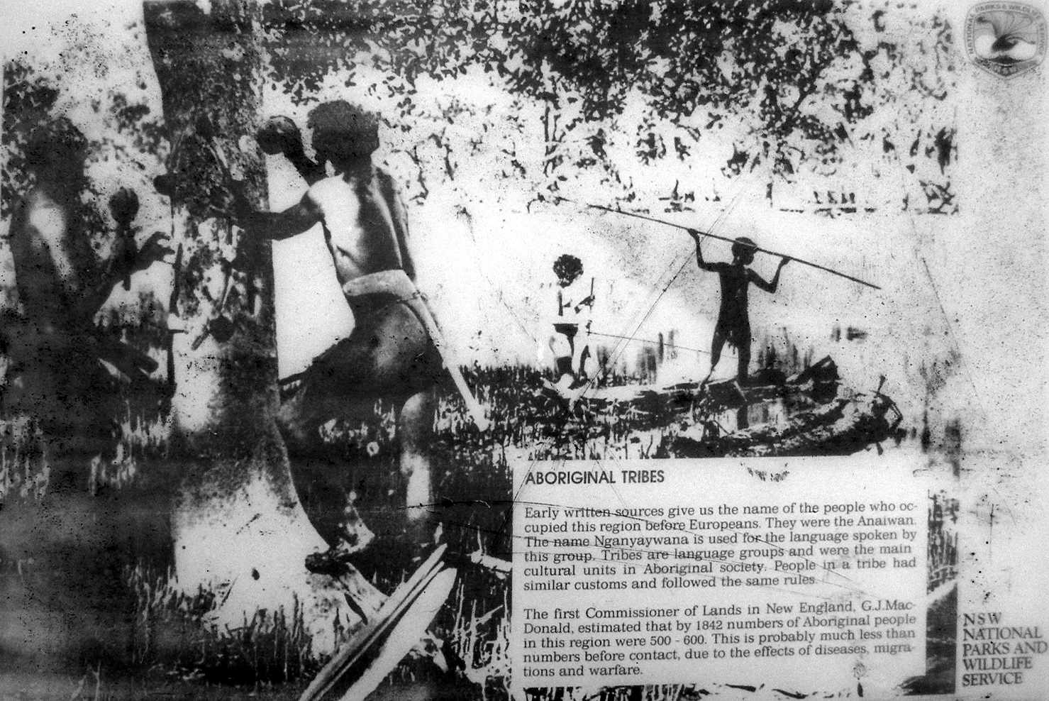
Early written sources give us the name of the people who occupied this region before Europeans. They were the Anaiwan. The name Nganyaywana is used for the language spoken by this group. Tribes are language groups and were the main cultural units in Aboriginal society. People in a tribe had similar customs and followed the same rules.
Photos: Don Hitchcock 2006
The first Commisioner of Lands in New England, G.J. MacDonald, estimated that by 1842 numbers of Aboriginal people in this region were 500 - 600. This is probably much less than the numbers before contact, due to the effects of diseases, migrations and warfare.
Text: NPWS

 From a sign at the rock art site:
These paintings are probably several hundreds of years old. The tracks, circles, short lines and dots may remind you of birds' feet, people, lizards and even birds' eggs. You may be right, you may be wrong. Unfortunately we will never know the true meaning of the site.
Photos: Don Hitchcock 2006
Text: NPWS
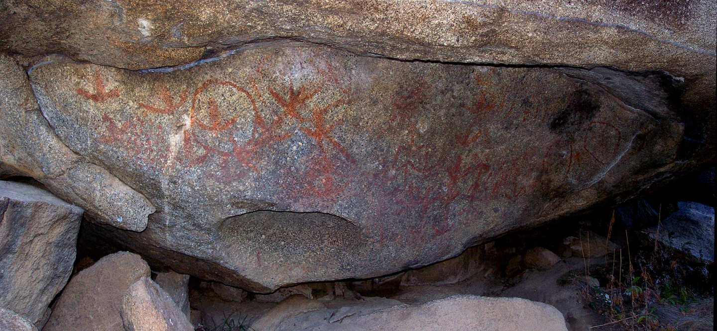
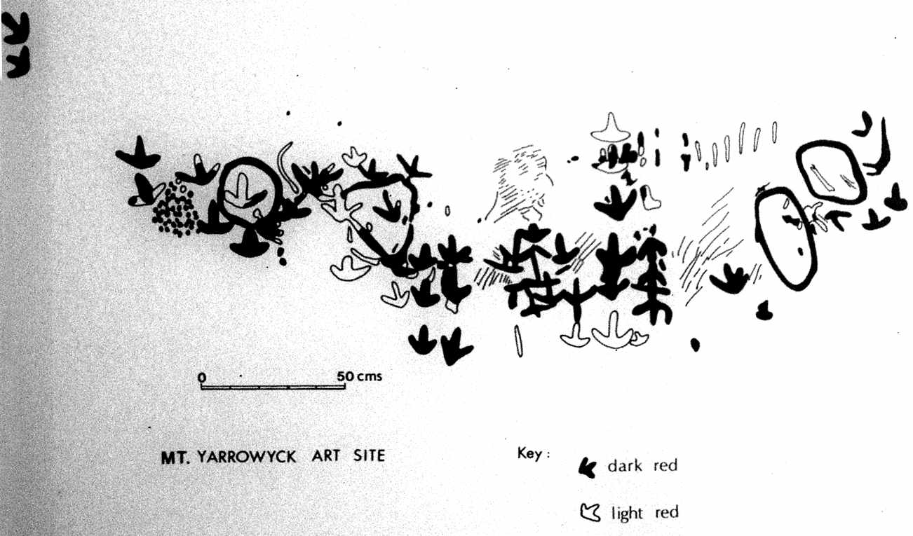
However an Aboriginal elder, the late Victor Shepherd, was sure that the paintings were of a bird that fed on the ground. Ground birds were represented by their feet alone. He said the toes look too short and thick to be an emu. The paintings must be of the Plains Turkey, the Bustard.
Photos: Don Hitchcock 2006
This site is typical of the New England Aboriginal style of little red figures on large granite boulders. The red ochre paint was made from powdered rock (ochre) mixed with water. Paint brushes were either sticks or fingers.
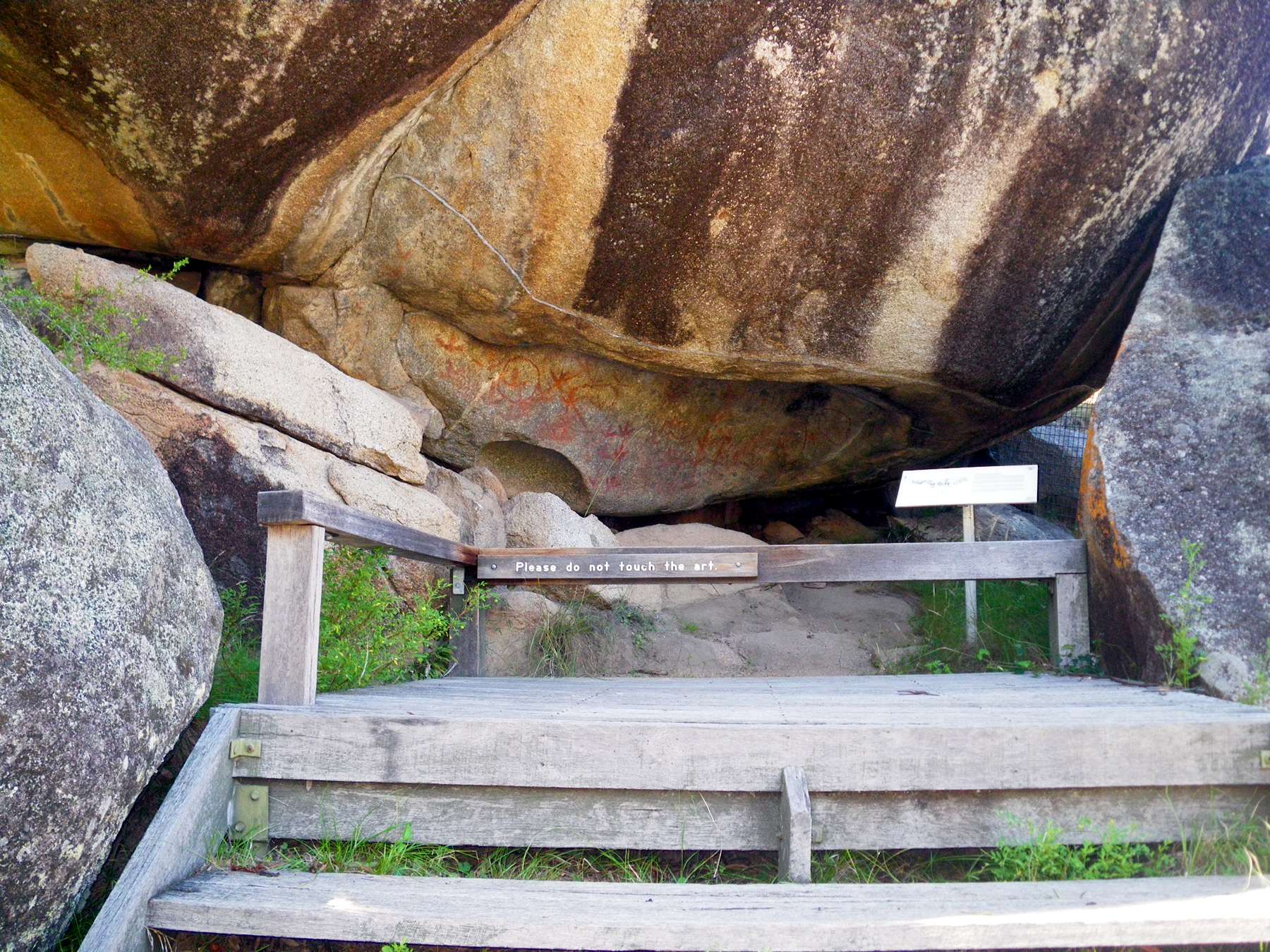
Another photo of the art. Click on the photo to see a larger version.
Photo: Don Hitchcock February 2011
Silicone drip lines have been placed above the art to divert any moisture. Every effort has been made to protect this site while allowing visitors to enjoy it. Please help by keeping behind the barrier at all times. Please do not touch the art.
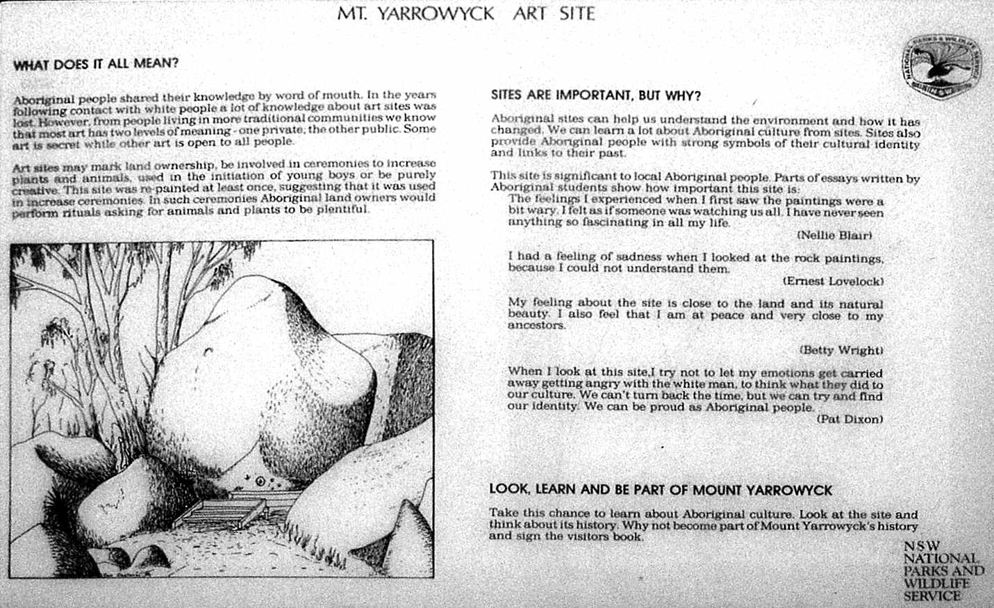
Aboriginal people shared their knowledge by word of mouth. In the years following contact with white people a lot of knowledge about art sites was lost. However, from people living ain more traditional communities we know that most art has two levels of meaning: one private, the other public. Some art is secret, while other art is open to all people.
Art sites may mark land ownership, be involved in ceremonies to increase plants and animals, used in the initiation of young boys or be purely creative. This site was repainted at least once, suggesting that it was used in increase ceremonies. In such ceremonies Aboriginal land owners would perform rituals asking for animals and plants to be plentiful.
A long time ago, so Aboriginal people say, the Sky Gods, Ancestral Heroes and Supernatural Beings, were at work. They travelled far and did great things. The land was changed and given shape. After their work was done, the spirits disappeared into the ground or up to the sky. The places they left became landmarks - the sacred sites of Aboriginal religion. Thus was the world created, all creatures given life and the laws established. This is the Dreamtime - Australia's beginning. Many Dreamtime sites - mountains, rocks, waterholes, and other features, are remembered today by Aboriginal people, particularly in areas with strong cultural heritage. Look above you, high on the hillside and you will see a group of large granite boulders. Perhaps they were once the Brothers or the Sisters in some ancient legend.
Text and diagrams: NPWS
Another view of the art site.
Photo: Don Hitchcock February 2011
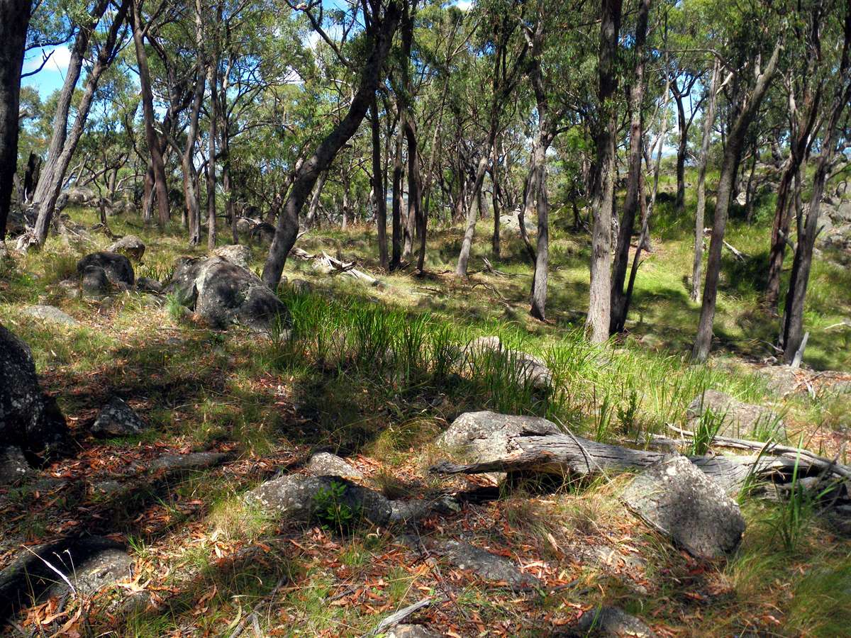
A walk around the Mount Yarrowyck area
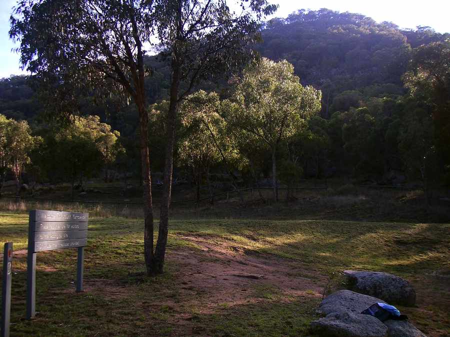
The turning circle and parking area is just off the Bundarra Road, just after the Bundarra Road from Armidale and the Bundarra road from Uralla meet, and before the turnoff to Kingston. Toilets and picnic facilities are available.
Photo: Don Hitchcock 2006
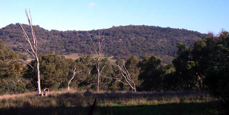
The peaks of Mount Yarrowyck look close, just a short scramble from the track, but they are nearly 400 metres in altitude above the surrounding plains. Mount Yarrowyck itself is at 1206 metres. There is no track, and the climb should only be attempted by experienced, fit and well prepared bushwalkers. Parts are quite steep and dangerous if you don't know what you are doing. At the time of writing, 2006, there is no mobile phone reception until you are almost at the top of the climb.
Photo: Don Hitchcock 2006
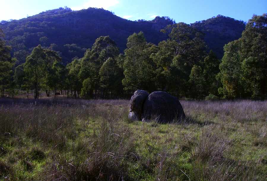
Isolated rocks such as these would almost certainly have figured in the tales told about the area in aboriginal times.
Photo: Don Hitchcock 2006
In 2006 after looking at the art site, I walked back down the track a short way, and followed a broad gully towards a saddle on Mount Yarrowyck.
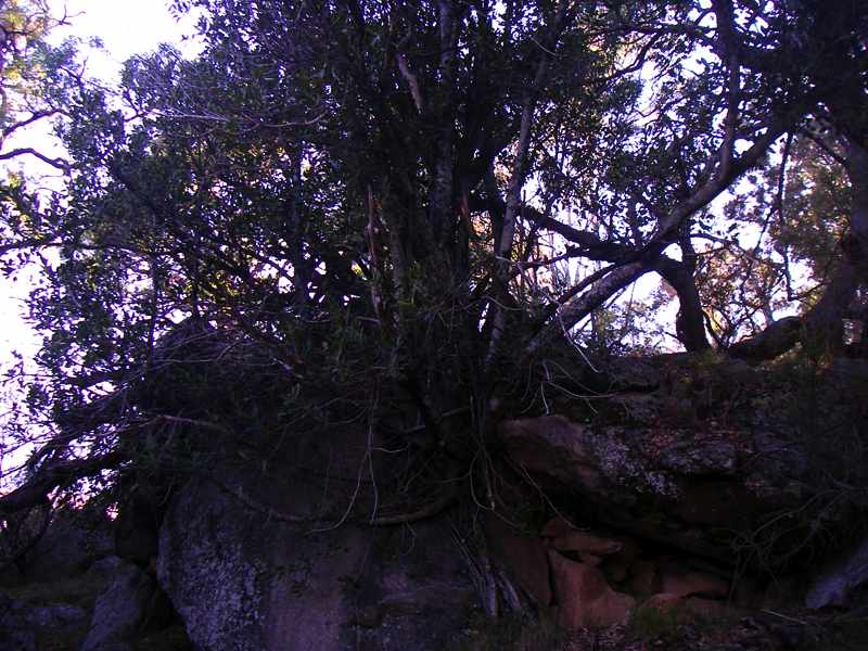
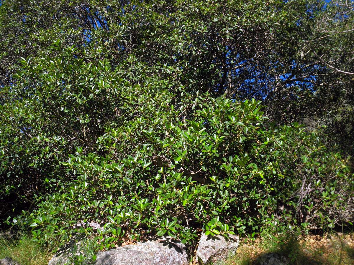
This Moreton Bay Fig was growing, as they seem to like to do, over the top of a rock, with roots reaching down to the ground. The seeds are dropped by birds, and the seeds sprout and send down roots to the ground. If the seed lands on a tree, the roots can surround and strangle the tree.
Photo: Don Hitchcock 2006

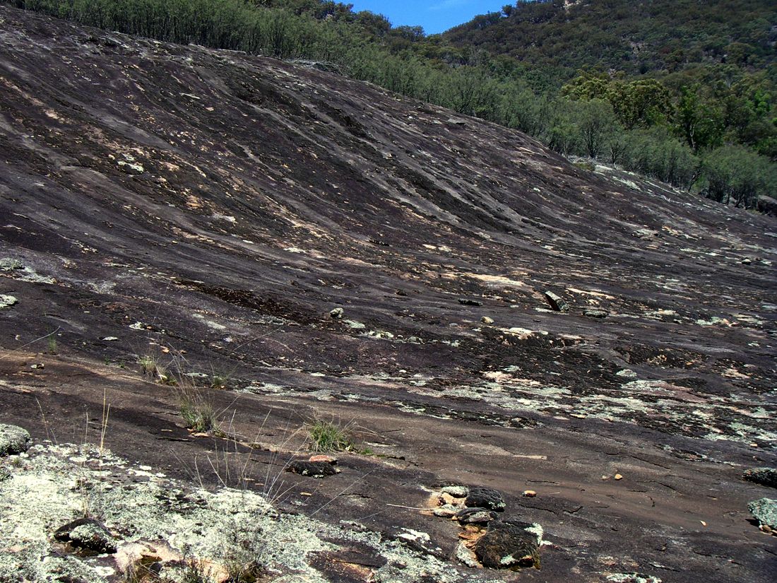
This granite pavement was covered with broken rocks split off, or spalled from the underlying granite batholith.
Photo: Don Hitchcock 2006
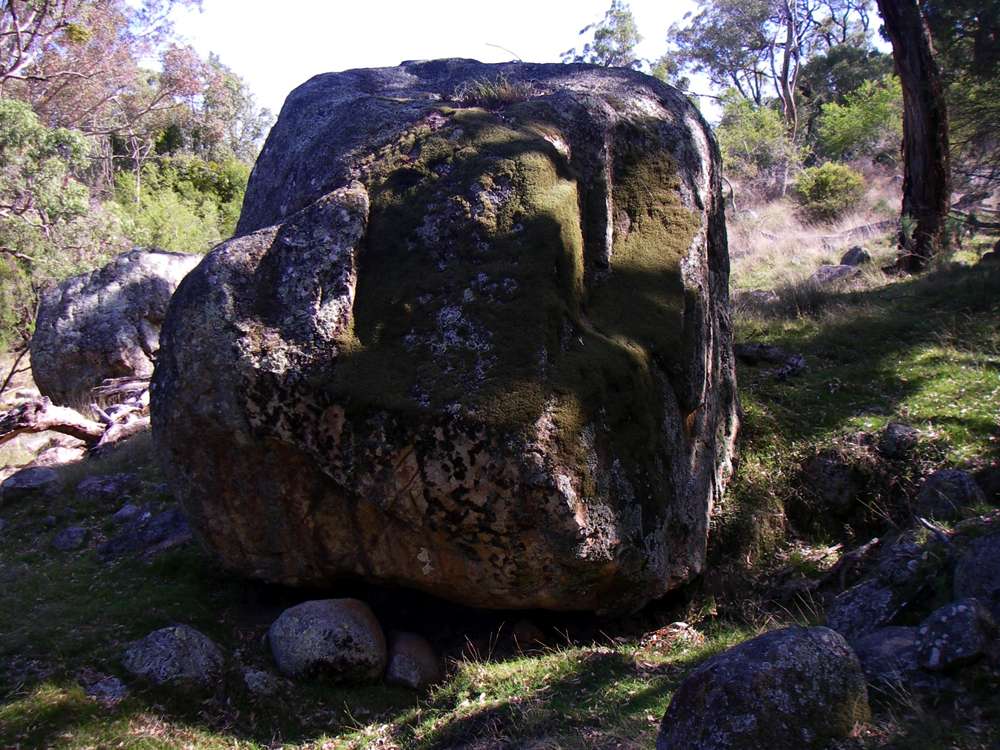
This rock is in a shaded area protected from extremes of heat and cold, so it has become colonised by moss, lichens and grass. It has not had much onion skin weathering or spalling which would have removed the growths seen here.
Photo: Don Hitchcock 2006
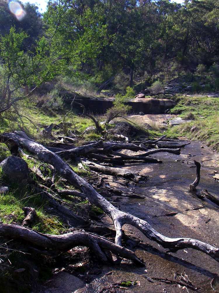
This gully appeared to offer an easy way up to a saddle on the mountain. As can be seen, occasional water after heavy rains keeps the granite rock somewhat clear of vegetation. The gully became more difficult further up, and instead of continuing, I went up the side of the mountain to a ridge which gave access to the top of the main ridge connecting the peaks.
Photo: Don Hitchcock 2006
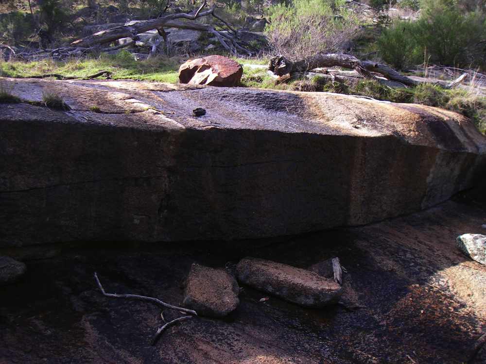
This huge rock across the gully is crossed by a trickle of water, which would not be running in drier times. The catchment is very small, and it is on the western side of the mountain, which receives less rain, and faces the setting sun, so it would be hotter and dryer.
Photo: Don Hitchcock 2006
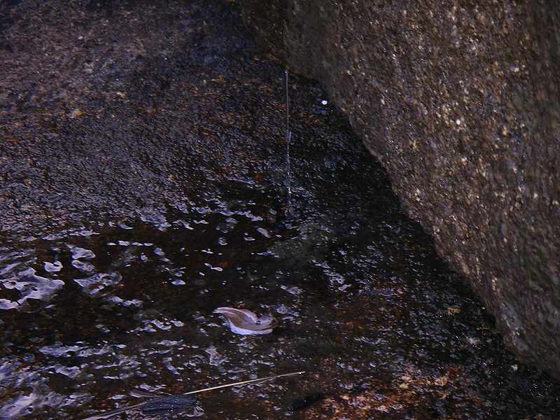
A close up of the water spilling over the rock above. I carried enough water for the day, so I didn't need to collect any of this water. There are some bushwalking trips I would have been very glad of it. At this point I had to move to the left up the side of the ridge in order to make progress, the gully became very rocky and difficult to navigate.
Photo: Don Hitchcock 2006
In 2011, after looking at the art site, I walked around the side of the rocks there and continued up the ridge. It is not very steep at this point, and fairly open walking.
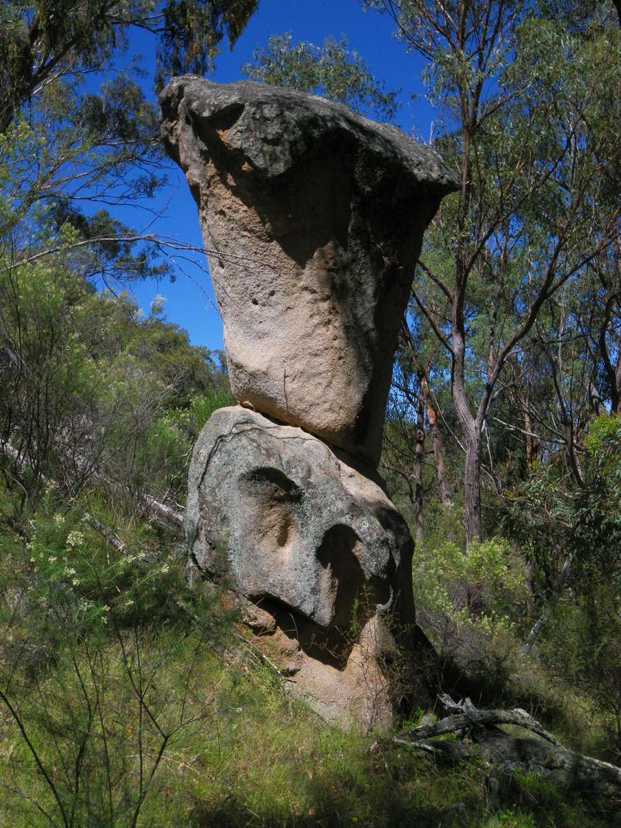
This monolith may well have formed part of the aboriginal story about this site.
Photo: Don Hitchcock February 2011
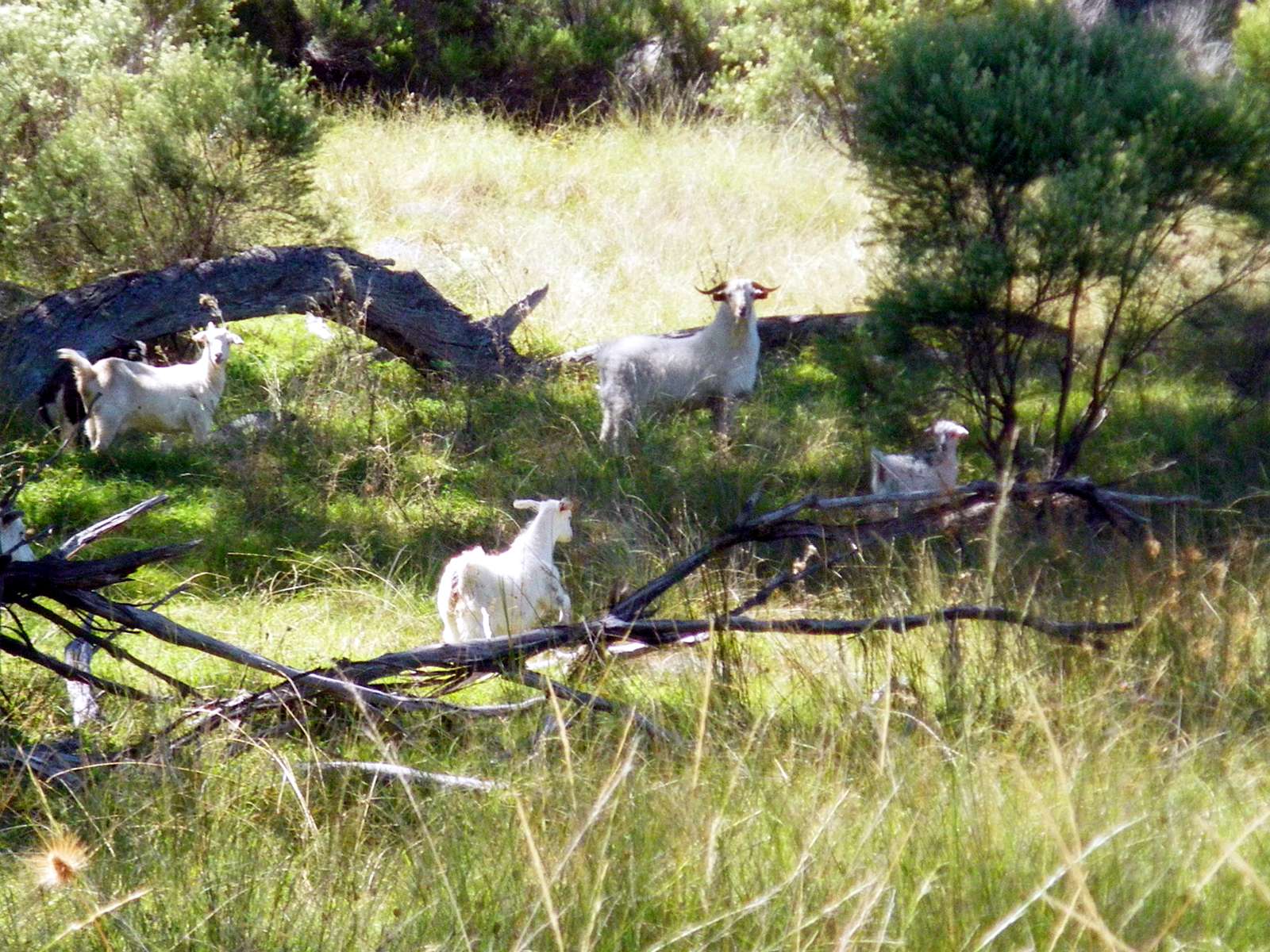
Feral goats are a big pest in Australia, and especially in the mountains and gorge country around Armidale.
Photo: Don Hitchcock February 2011
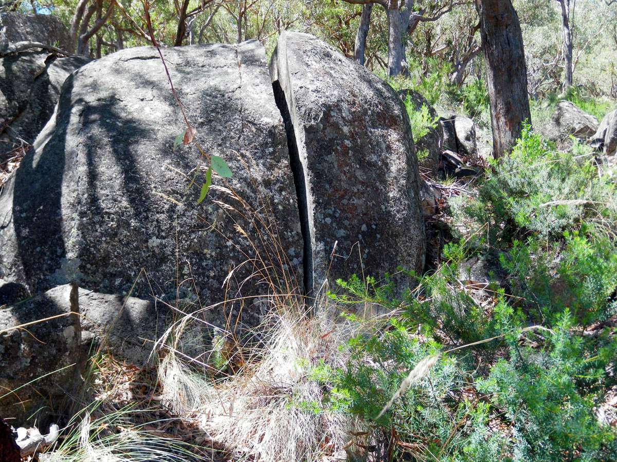
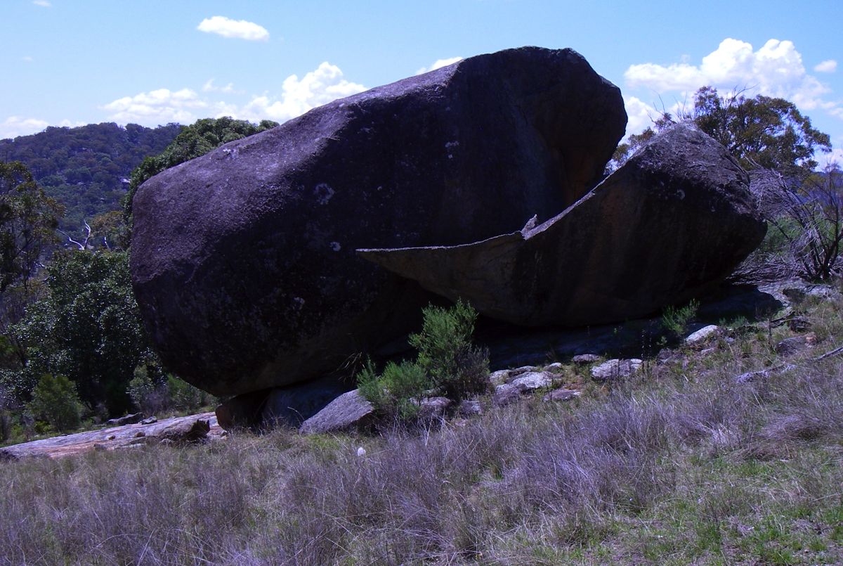
This large rock has split in two as the delayed result of release of pressure when the granite of which it is composed was exposed by weathering, or possibly as a result of frost action.
Photo: Don Hitchcock February 2011
I reached the top after dropping down into the gully at one point, meeting the route I had followed five years earlier, then back onto the ridge, and finally sidled back towards the saddle between the middle and southern peaks when I was high enough to do so easily.
The saddle is split into a number of smaller saddles by rocky rises.
Photo: Don Hitchcock February 2011
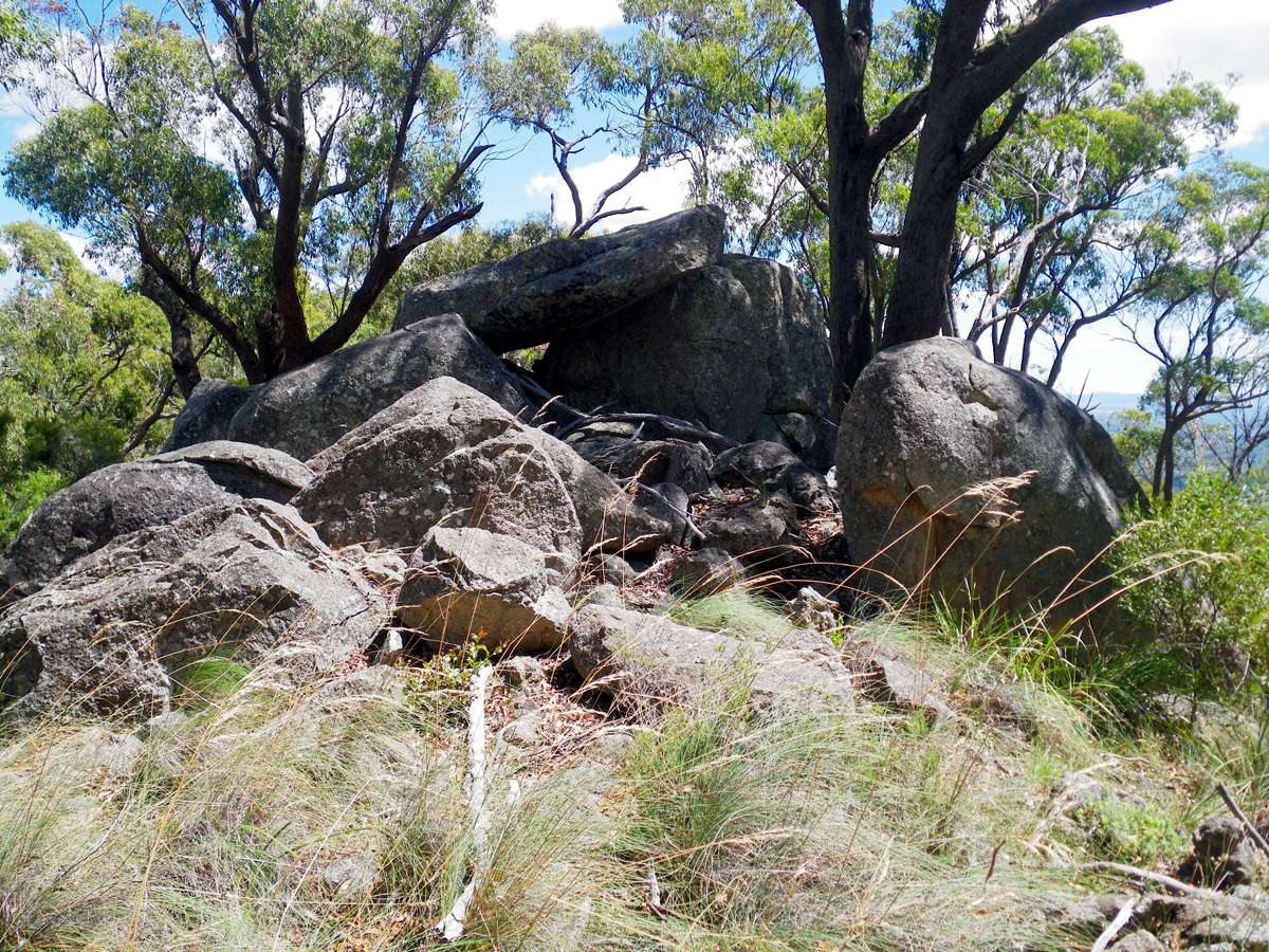
This group of rocks is one of the rises in the ridge connecting the central and southern peaks of Mount Yarrowyck.
Photo: Don Hitchcock February 2011
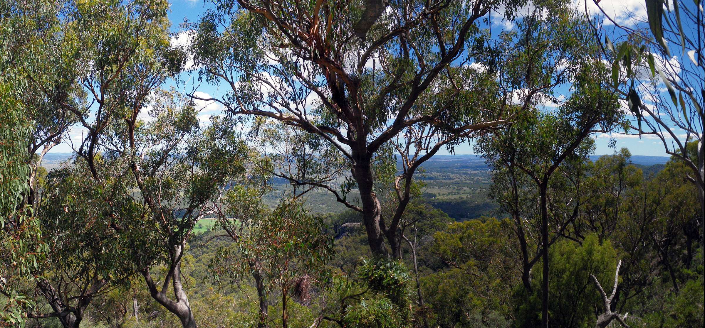
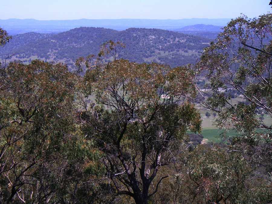
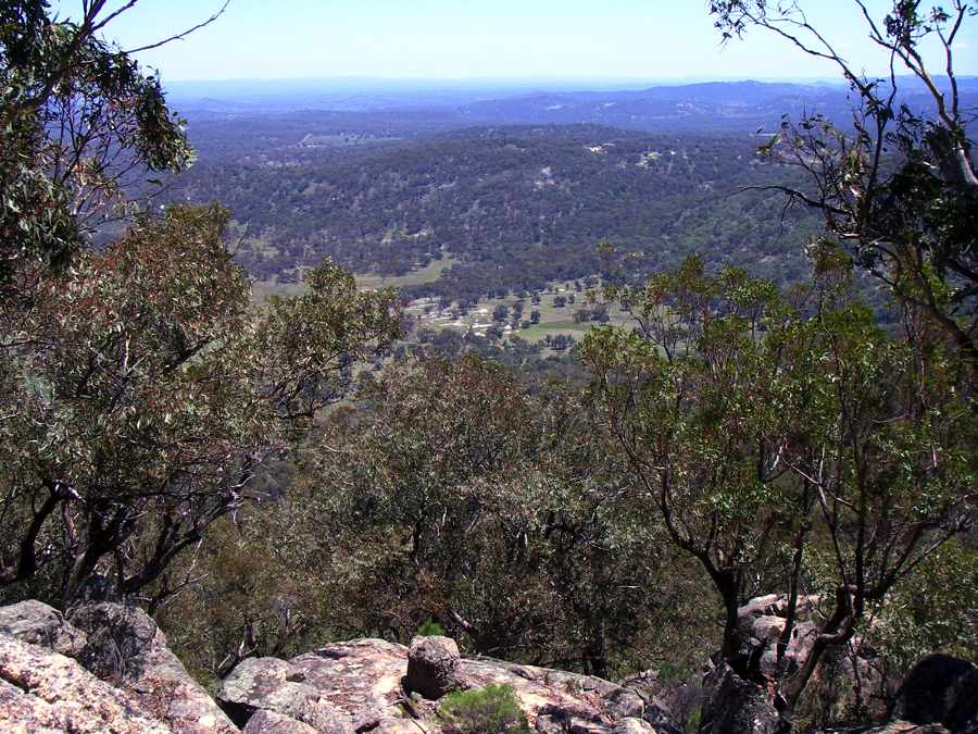
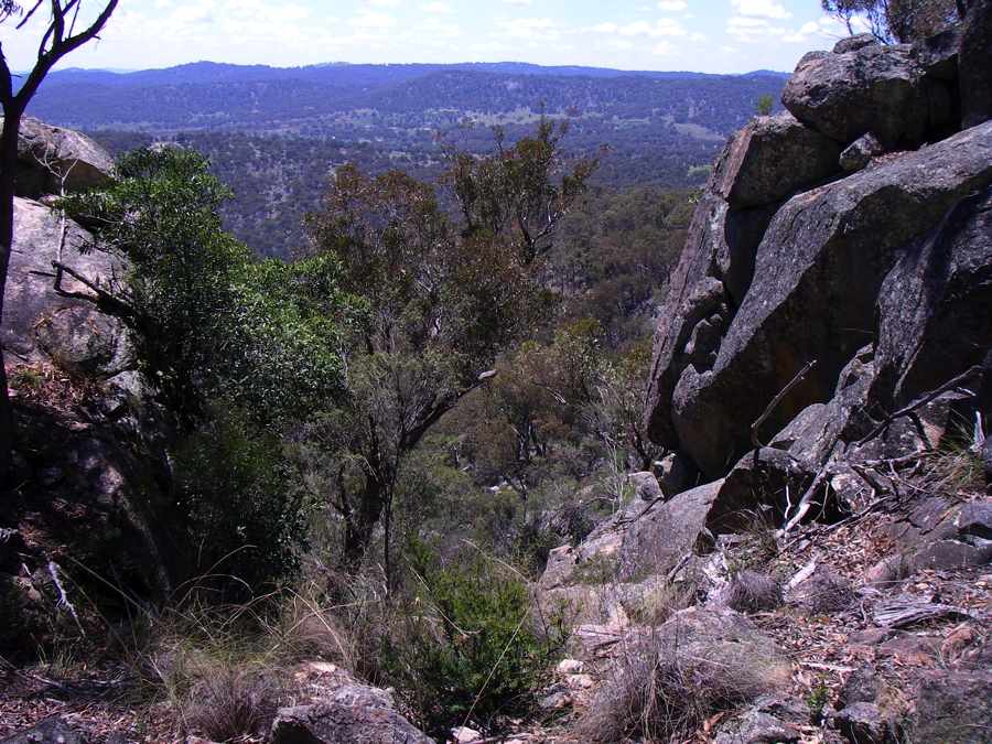
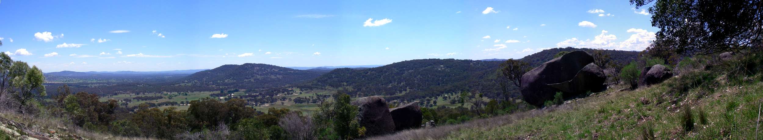
Mount Yarrowyck is an isolated set of peaks surrounded by comparatively flat plains. Because of the tree growth, it is difficult to get a view of the surrounding countryside. This panorama is from the southern peak.
Photo: Don Hitchcock February 2011
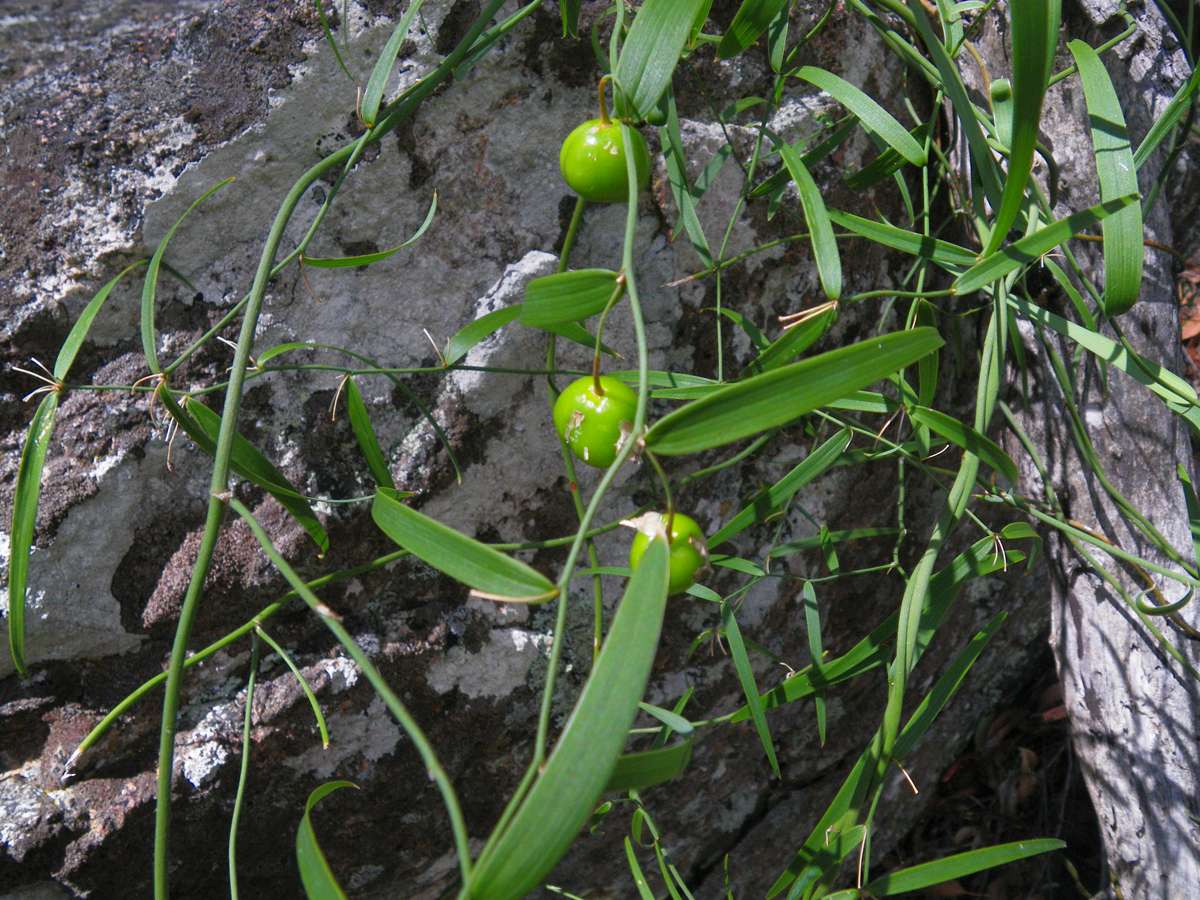
Eustrephus latifolius
Walking back along the ridge, I found these berries on a vine. The fruit will turn bright orange when ripe and split to release black seeds.
The genus is now included in the family Asparagaceae subfamily Lomandroideae in the new family classification.
Photo: Don Hitchcock February 2011
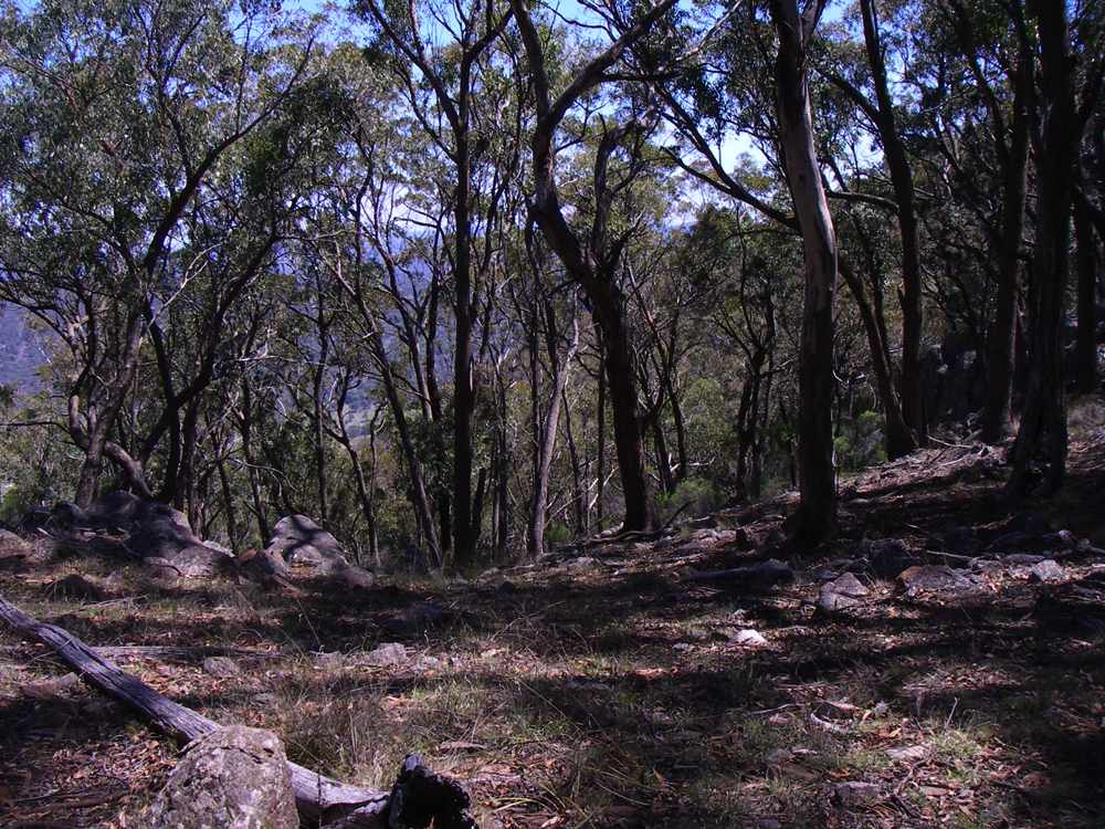
This is a view of one of the saddles between the peaks of Mount Yarrowyck. There are few places where a view of the surrounding countryside may be obtained from the top of Mount Yarrowyck. The top is heavily treed, but it would be a dangerous place in high winds, and there is evidence of a lot of trees having been blown over recently in some parts of the high tops.
It would be inadvisable to climb the mountain if there was a strong wind at the base of the climb, it would be a gale at altitude. Mount Yarrowyck is a very isolated peak, the only high ground a westerly wind would meet before Mount Yarrowyck would be the Drakensberg Ranges in South Africa.
Photo: Don Hitchcock 2006
This is a flake of granite spalling off a larger rock, creating the typical round "marble" shape seen in granite country, often leading to excellent examples of balancing rocks.
Photo: Don Hitchcock 2006
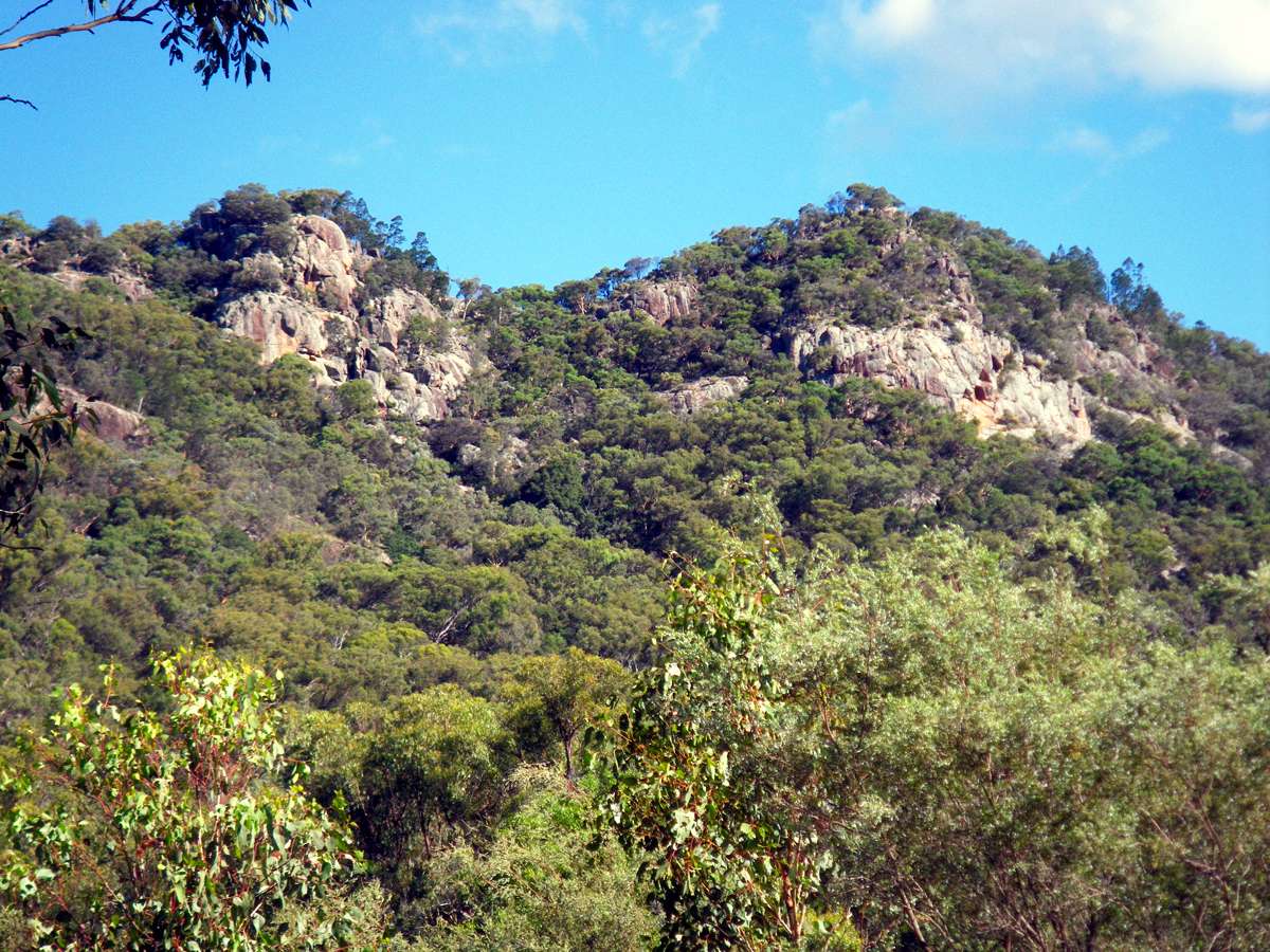
View over the countryside to the west, Granite mountain showing through the trees.
Photo: Don Hitchcock 2006
Another view down the slope towards Granite Mountain.
Photo: Don Hitchcock 2006
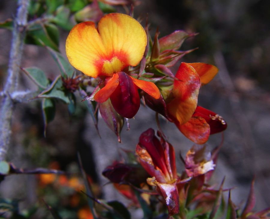
These pea flowers with spiky foliage were growing on the ridges connecting the peaks to the saddles on top of Mount Yarrowyck.
Photo: Don Hitchcock 2006
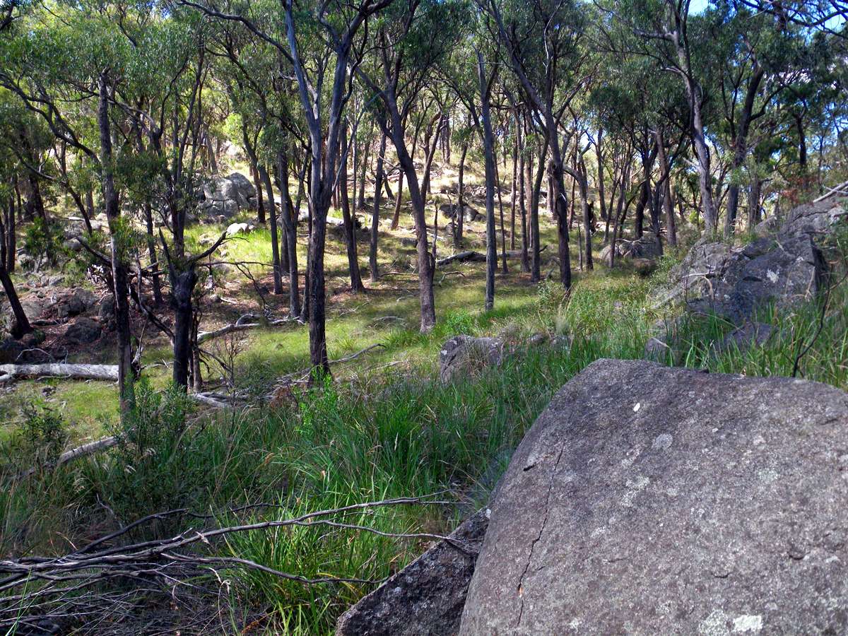

The saddle between middle peak and the northern peak. It is the most extensive flat area on the mountain, without significant tree branches on the ground. Other parts were a tangle of rocks and fallen trees.
Photo: Don Hitchcock (l) February 2011, (r) 2006
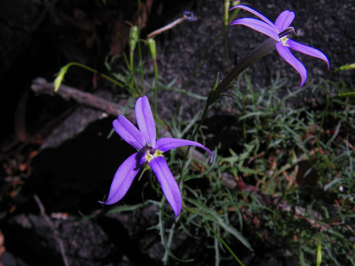
Isotoma axillaris
At the end of summer, there were few flowers about, but this one is exceptional. As in several plants in Campanulaceae subfamily Lobelioideae, the milky sap is poisonous and can be irritating.
A similar white-flowered species with narrower leaf segments, Isotoma anethifolia, occurs in the northern parts of the Northern Tablelands and the Stanthorpe-Wallangarra area in Southern Queensland.
Photo: Don Hitchcock February 2011
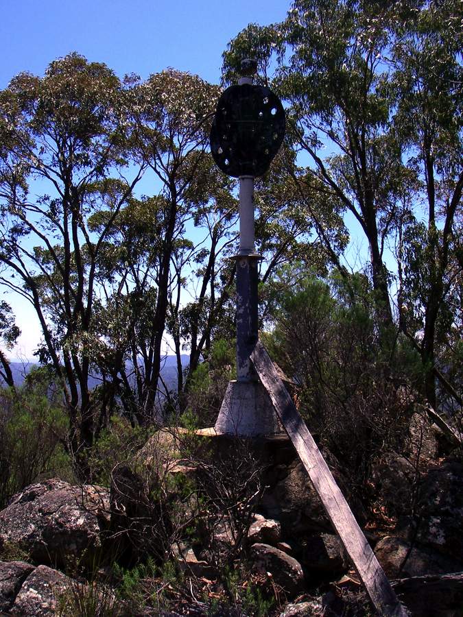
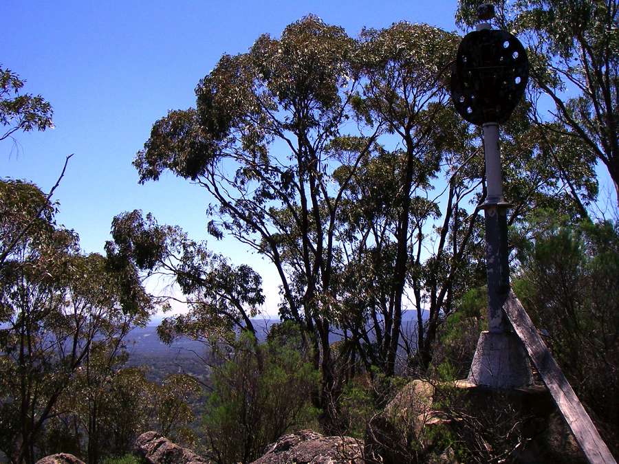
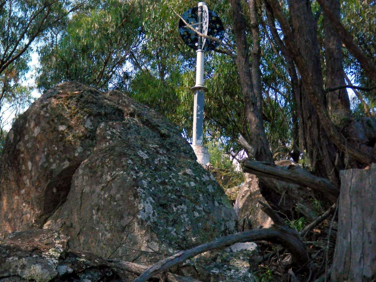
The highest point on Mount Yarrowyck. This is called a Trig (trigonometry) station, and used to be used for getting sights for surveyors from distant points. These are placed on the highest points, and were kept free of obscuring trees.
They are gradually falling into disrepair, and trees are growing up in some places around the Trig station, where previously they were kept cut down to allow viewing from any point. GPS is now used instead of taking sights and triangulating to find your position.
Photo: Don Hitchcock 2006
Five years after the above photos, the tree growth was considerable.
Photo: Don Hitchcock February 2011

This is the purple flag iris, a native australian plant. It grows in well drained positions amongst grass and plants with strap like leaves.
Photo: Don Hitchcock 2006
Some trees seem to be able to survive on rocky and inhospitable sites.
Photo: Don Hitchcock 2006
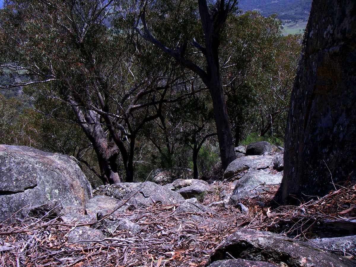
A gully leading down from the main ridge leading up to the main peak on Mount Yarrowyck.
Photo: Don Hitchcock 2006
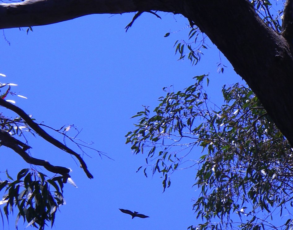
A wedge tailed eagle soaring on the updrafts from the large areas of exposed granite rock. They are a wonderful sight to see, and often soar on the thermals in pairs. They build a large nest of sticks in a tree every year, and often add to the same nest year after year until the nests become huge.
Photo: Don Hitchcock 2006
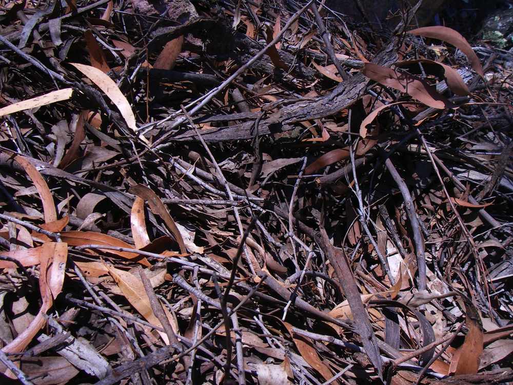
Eucalyptus (gum tree) leaf litter.
Many eucalypts actively encourage regular bushfires by dropping their bark every year. Because the bark burns so well in some species, they are known as candle barks. Even the leaves contain large quantities of eucalyptus oil, contained in glands that can be seen with the naked eye in the green leaves when you hold them up to the light.
This leaf and twig litter burns extremely well, and is sometimes carried in updrafts during bushfires some kilometres ahead of the fire front, and land on the ground creating spot fires which themselves spread, crossing both natural (e.g. rivers) and man made firebreaks such as roads or back burns.
Eventually, if no fire occurs, the litter breaks down contributing organic matter to the soil.
There are places on this ridge leading down from the highest peak where the granite rocks have channeled the leaf litter into gaps between rocks, creating litter buildup that is a metre or more deep.
Photo: Don Hitchcock 2006
Leaf litter collected by the rock surfaces and channeled into spaces between the rocks.

Kurrajong tree. Although the timber is too soft to use as wood for construction purposes, these trees can have up to one third of their branches cut off each year to provide fodder for sheep and cattle. The leaves are very nutritious.
In areas where this is often done, the trees get a "lollipop" appearance such as children create in their paintings, a trunk and a perfect circle of leaves and branches. Properties used to be advertised with, for example, "239 Kurrajong Trees" as an important selling point.

Kurrajong, with Granite Mountain in the background.
Panorama showing a large open area of grass in the foreground and a granite pavement further down, with rocks on top of the pavement shaped by the elements.
Photo: Don Hitchcock 2006
This rock was split in two by the action of frost and the release of pressure when the rock was exposed to the elements after being created and then cooled from molten granitic magma deep below the earth.
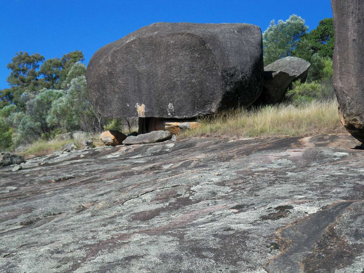
This photo of the same rock shows the way it is supported precariously on a small base.
Photo: Don Hitchcock February 2011
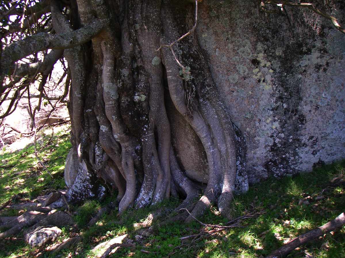
This Moreton Bay Fig has started life as a seed dropped by a bird on top of the rock,then it has sent down roots to the earth. When this happens on a tree branch, the tree is often strangled, leading to another commmon name, the "strangler fig".
This photo of a different fig shows the way it can form a dense canopy. Getting down the ridge was much harder in 2011 than 2006, there had been much growth, especially of Leptospermum, making it difficult to make progress.
Photo: Don Hitchcock February 2011
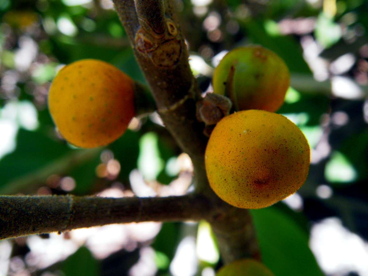
Fruit of the fig. When ripe, the figs turn a dark purple colour. They are not strongly flavoured, and are quite edible. At this stage, however, the fruits were hard and unappetising.
Photo: Don Hitchcock February 2011
Bare rock surface, with a monoculture of one species of Leptospermum behind it.
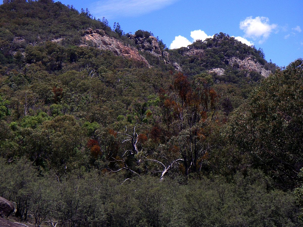
In the distance are rock faces much favoured by rock climbers, and in front of them a eucalyptus tree which has been colonised by many native mistletoe plants, which show as reddish foliage in the photo. They grow preferentially on the edges of forests, where there is plenty of light. These seeds are also carried by birds.
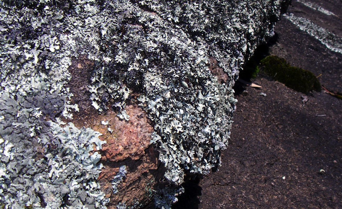
Where a rock surface does not weather or spall quickly, lichens such as this have the chance to become established on the surface of the granite.
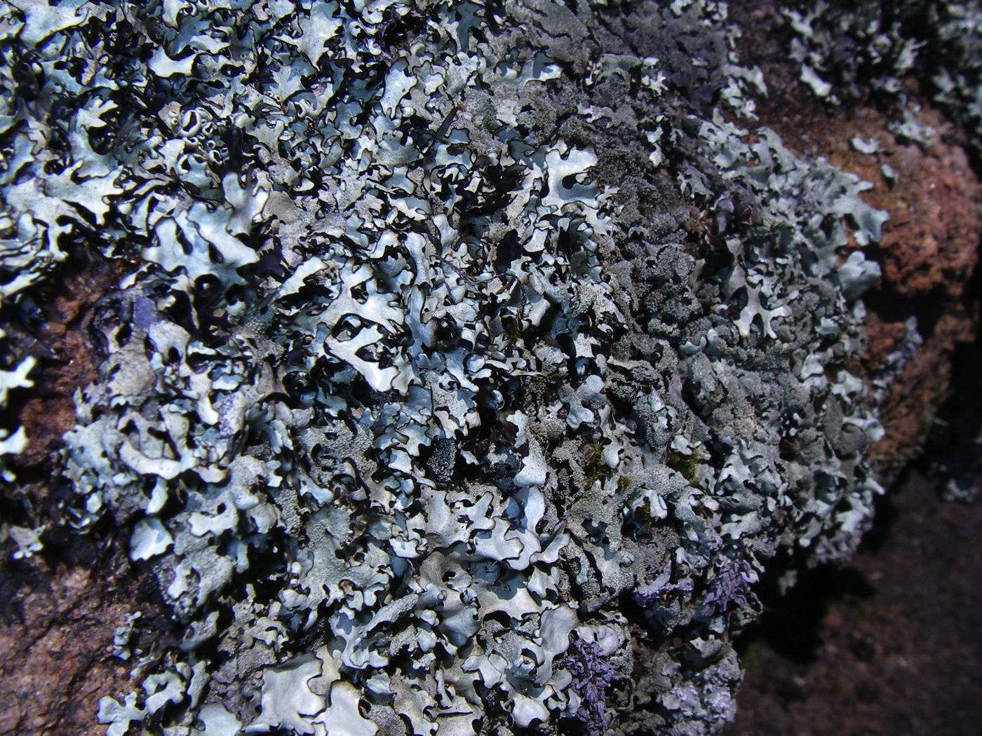
Close up of the lichen.
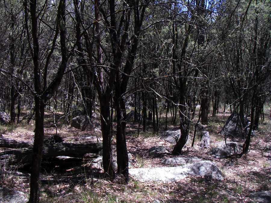
Forest of a single species of Leptospermum on the flat land below the slopes of Mount Yarrowyck. It was very difficult to force my way back to the track leading to the art site and thus to the parking area in 2011, the path had disappeared and there was a thick growth of Leptospermum. There is not as much interest in bushwalking in Armidale as there was in the 1960s and 1970s when there was an active university walking and rockclimbing club, and this has led to the disappearance of tracks kept open only by use.
Another view of the rock faces of Mount Yarrowyck sometimes used by rock climbers.
Photo: Don Hitchcock February 2011