Back to Don's Maps
 Back to Archaeological Sites
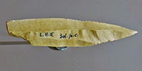 Tools from Laugerie Haute
Laugerie Haute
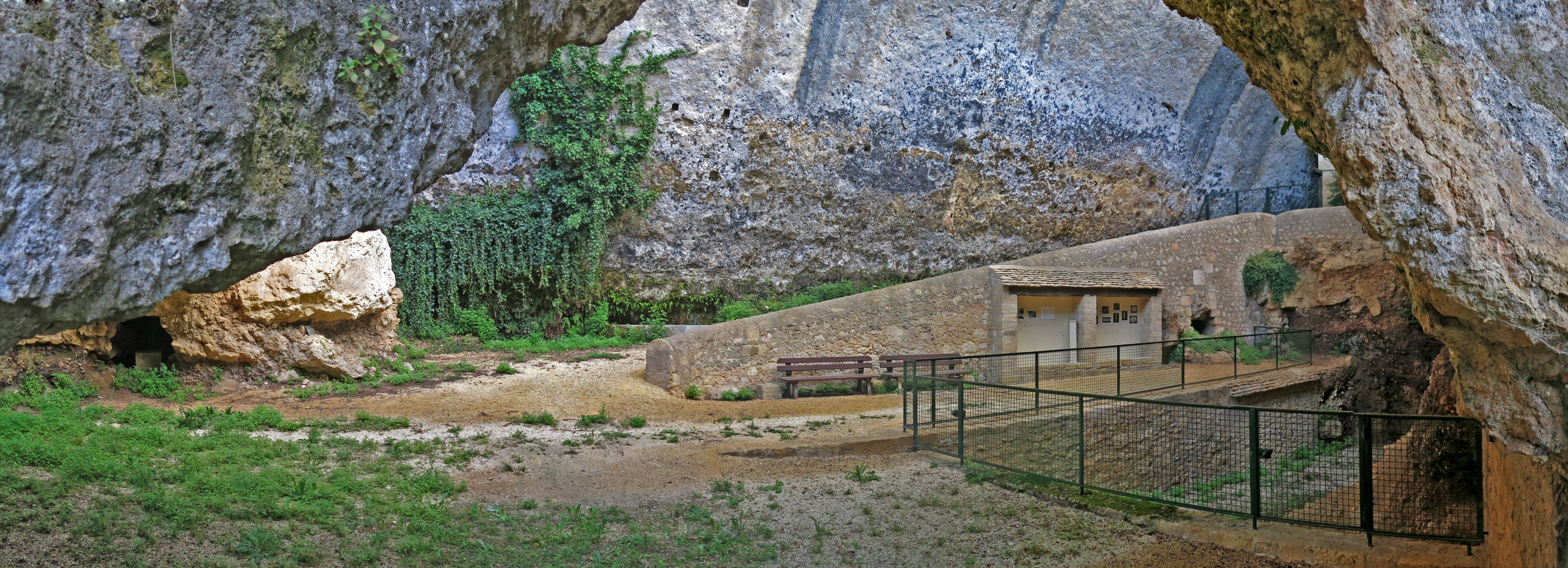
Laugerie Haute Ouest
Photo: Don Hitchcock 2014
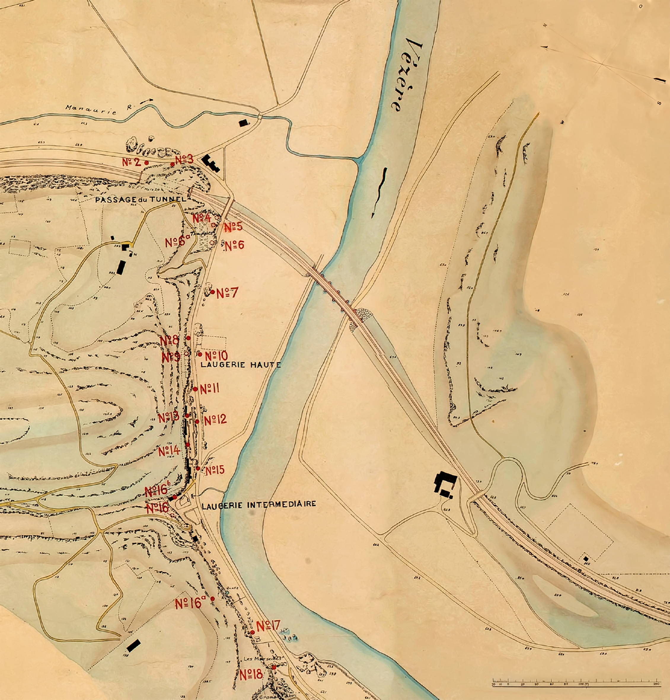
Detail of a map of Les Eyzies and environs, produced by Otto Hauser, zooming in on the Laugerie-Haute site complex, early 20th century .
Photo: Hauser 1908
Source: Roebroeks et al. (2009)
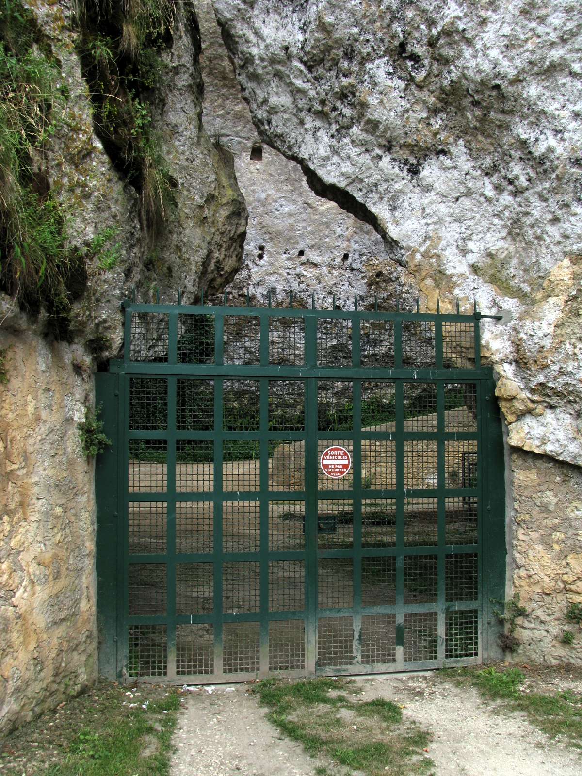
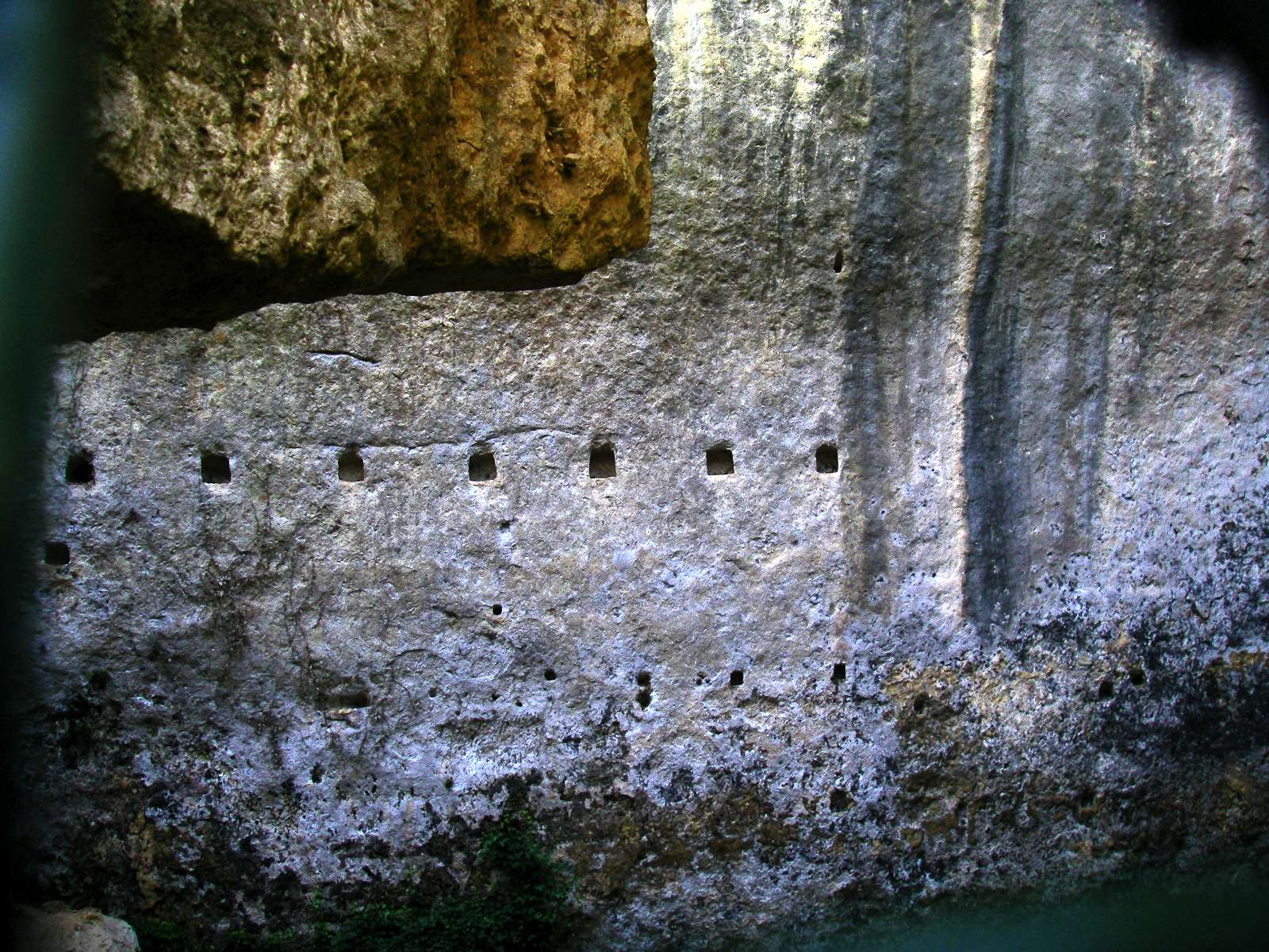
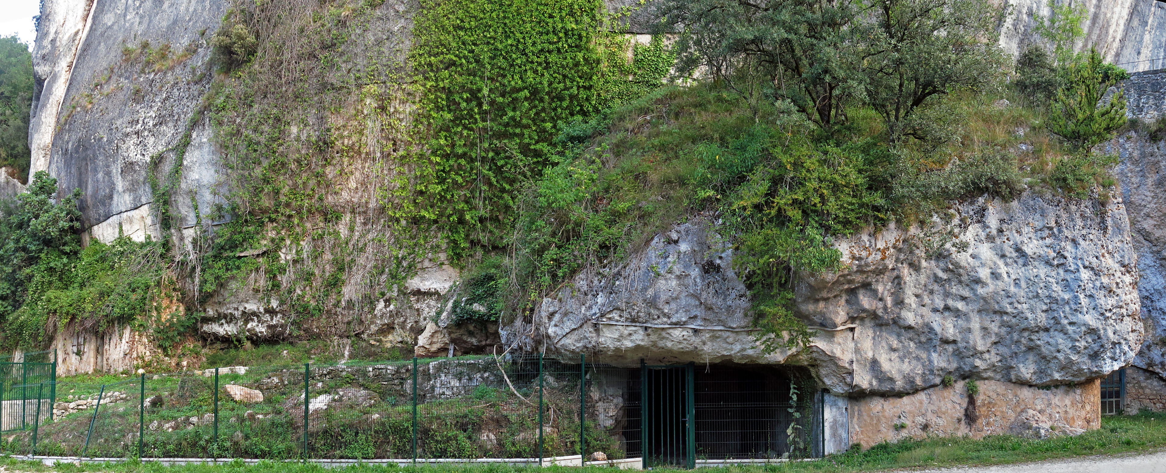
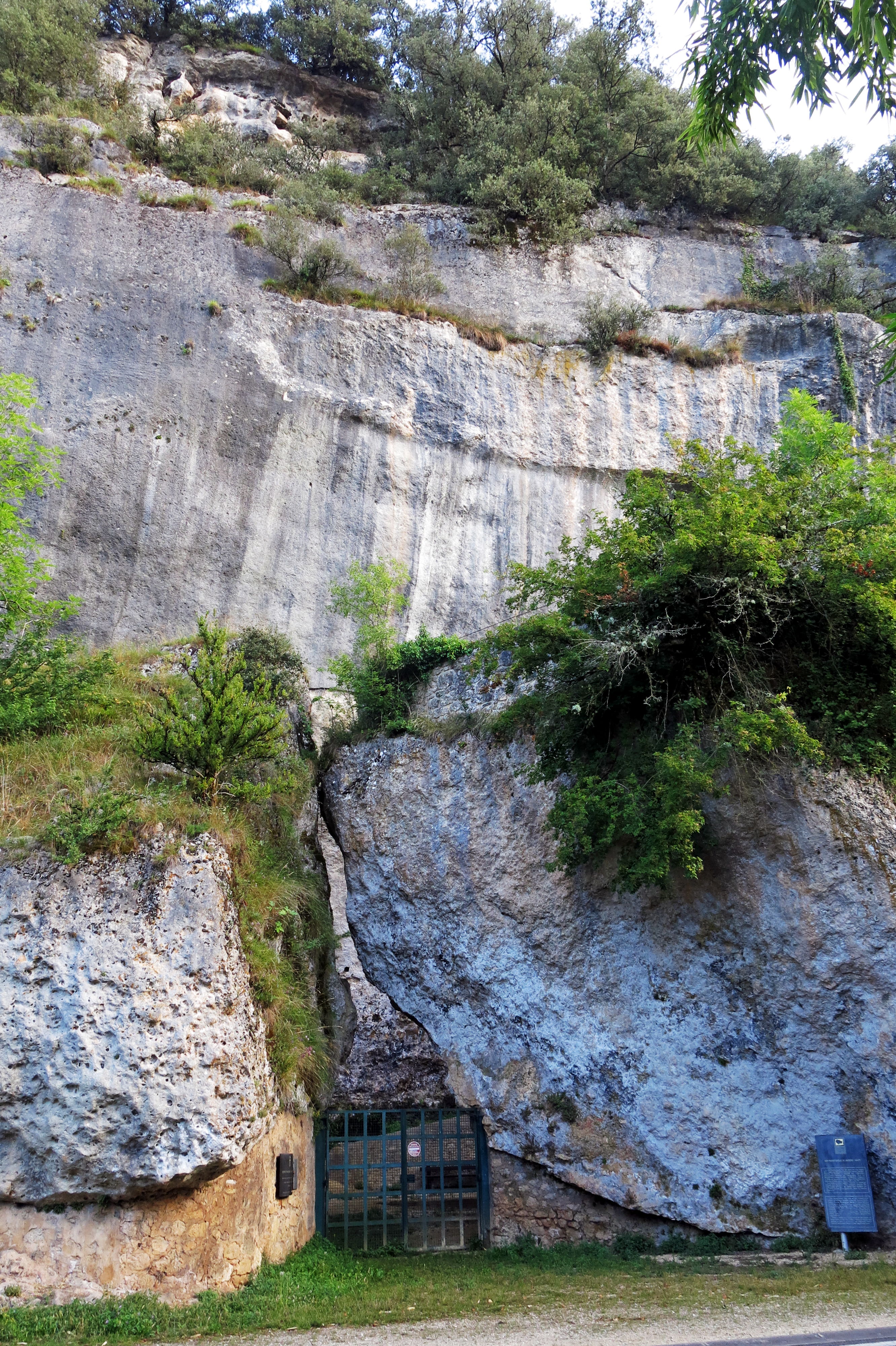
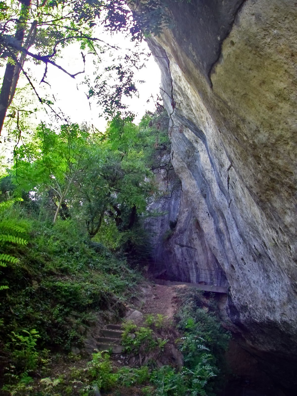
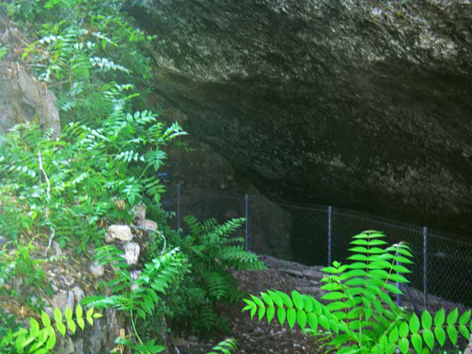
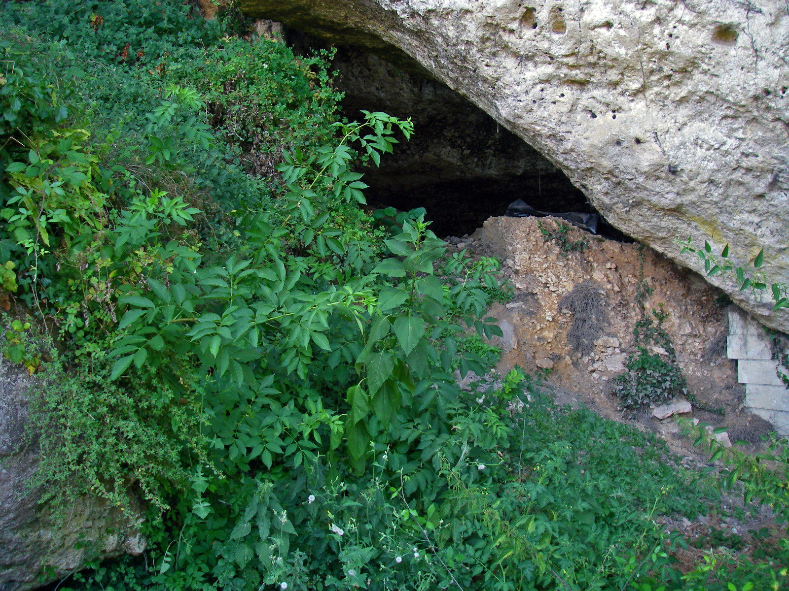
Peering through the gate, one can see the rear wall of the abri, with holes dug in the limestone for beams for a house, possibly in mediaeval times.
The site is only open to the public by appointment, often only once a week, by purchasing tickets from the Font de Gaume ticket office. I was lucky enough to get on a tour, but sadly no photographs were allowed inside the gate.
I find this policy difficult to understand. There is no rhyme or reason to the photograph / no photograph rule. In the case of Laugerie Basse, photographs are certainly allowed. Why yes at one site and no at a similar site next door, is beyond my comprehension. There was a very old sign from the 1940s on the wall forbidding photographs.
Perhaps because the Laugerie Basse site has been extremely well patronised by hundreds, perhaps thousands, of tourists each day, it was difficult to police a no photographs rule, so it was abandoned.
Another possibility is because of privacy. There is a house close by the dig dividing this Laugerie Haute West from Laugerie Haute East which uses the gate as their front gate, (the slope beside the cliff wall is a driveway) so perhaps that is the reason for the no photography rule. I understand that the house was once used by Peyrony, and that it has been for some time the home of the holder of the post of director of the Les Eyzies museum, Le Musée National de Préhistoire, Les Eyzies-de-Tayac. The house sits on undisturbed sediments from the shelter, a time capsule for future archaeologists.
Photo: Don Hitchcock 2008
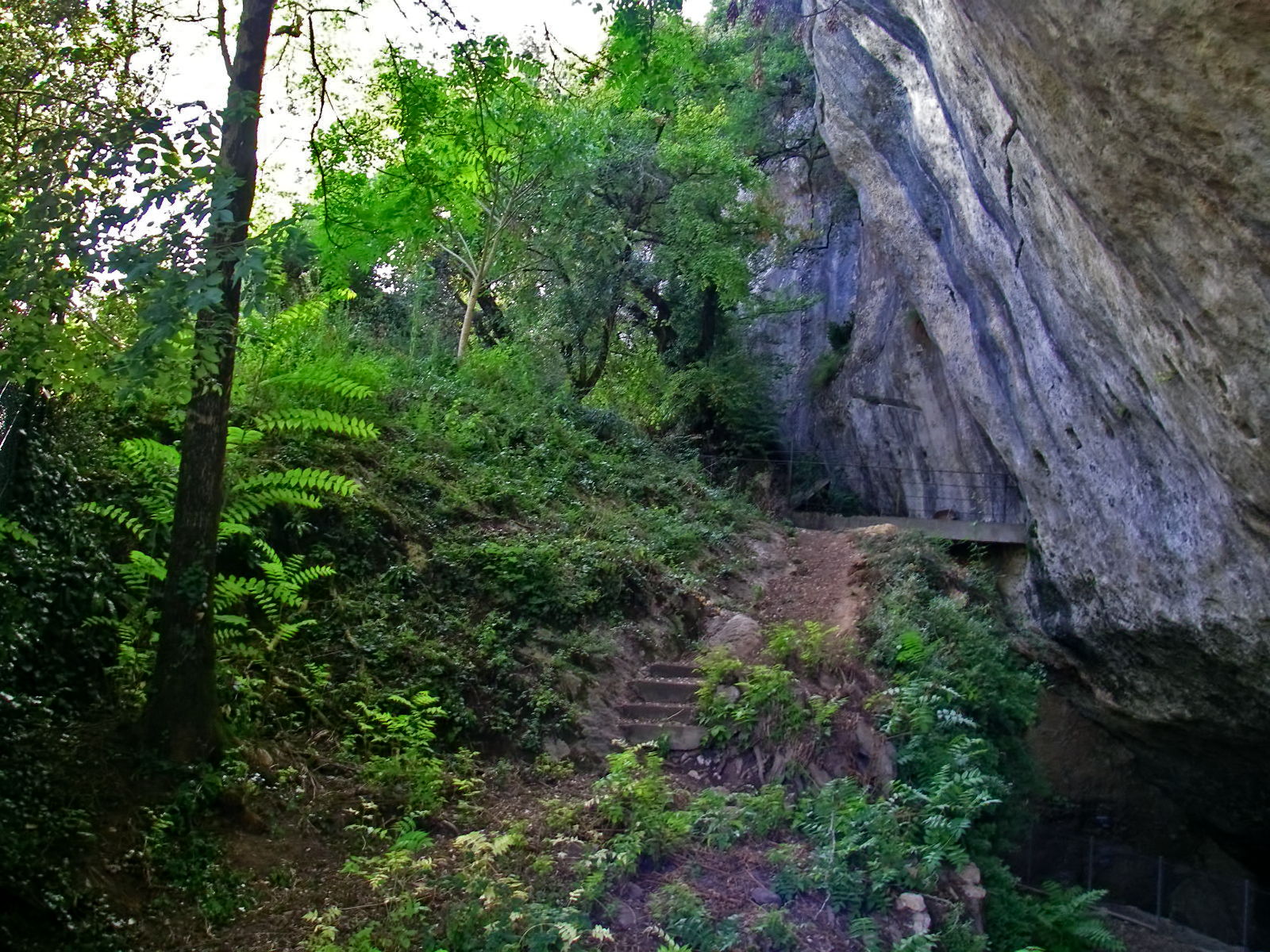
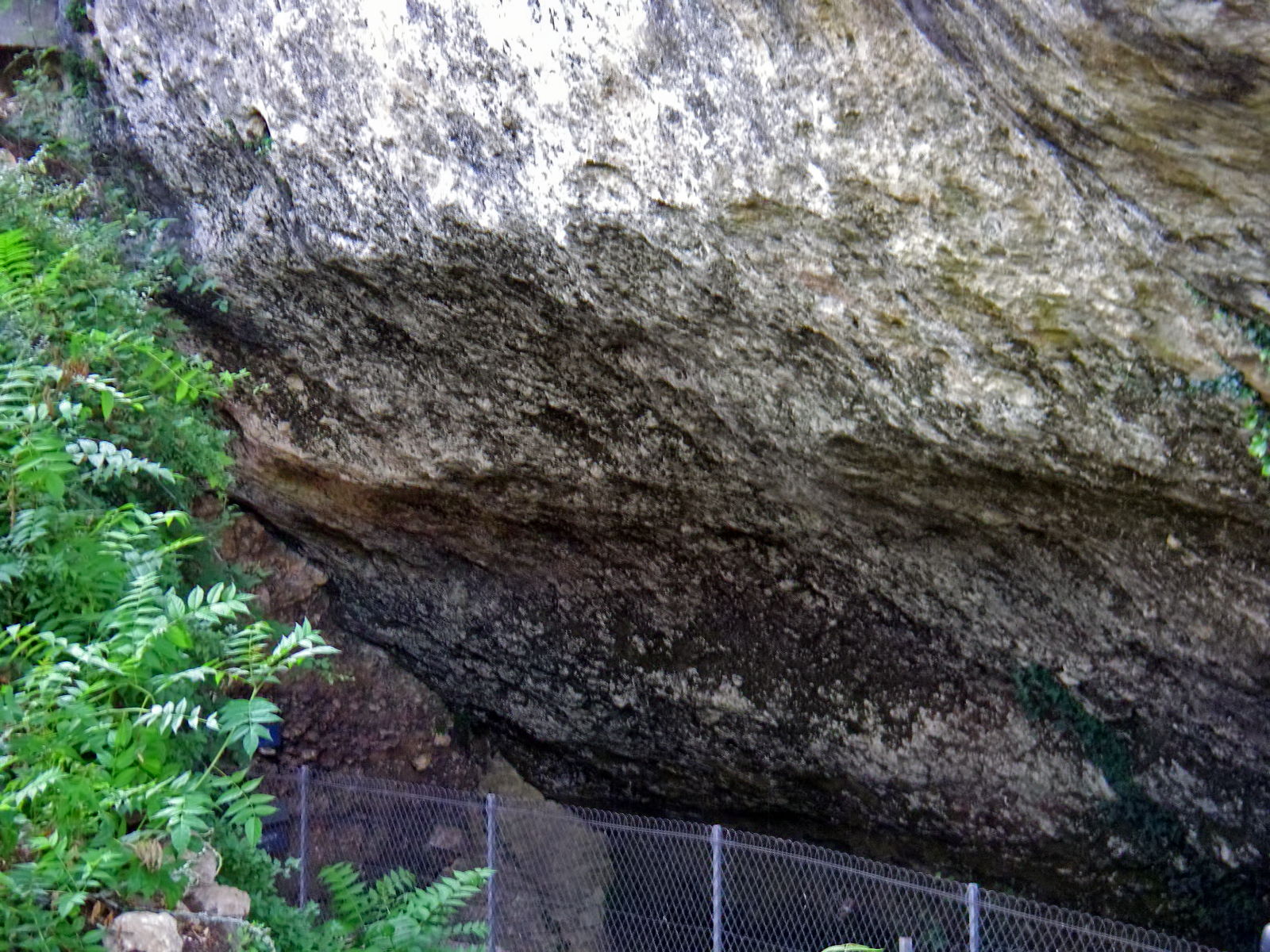
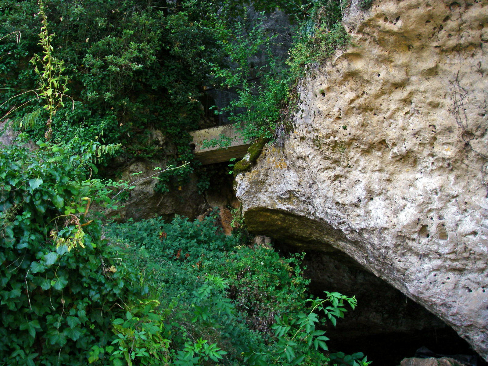
Here is a good photo of the inside, shot through the bars on the gate. My thanks to Marieke.
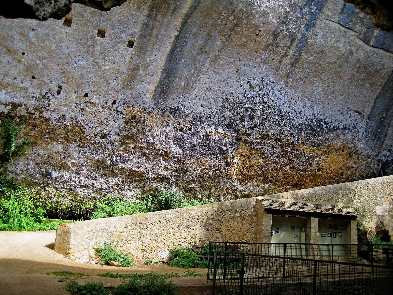
We can see clearly here the back of the shelter, the sloping driveway to a house on the right, and the viewing area of the other wall, in the right foreground. The other wall, a treasure trove of flint and other material excavated up to the base of one of the fallen rocks, faces the back of the shelter shown here, and is shown in the photo immediately below. In this photo we may see in the right foreground the safety fence which surrounds it.
Photo: Marieke 2009
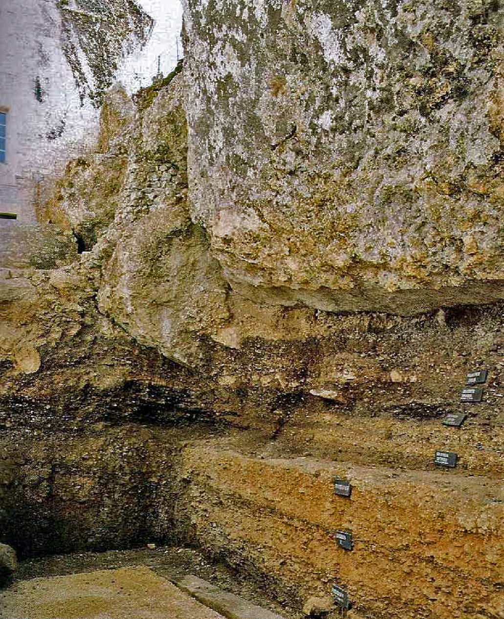
The stratigraphy of Laugerie Haute Ouest.
This sequence represents 15 000 years of human occupation preserved in a band several metres thick. The top layer identified here is a Magdalenian one. The rock that may be seen above these sediments has fallen after this date. This rock is the one that is located to the right while entering the site. It separates the site from the road that passes in front of it. The back abri wall is directly opposite this sequence.
My thanks to Peire and Anya for access to this resource.
Photo: Cleyet-Merle (1995)
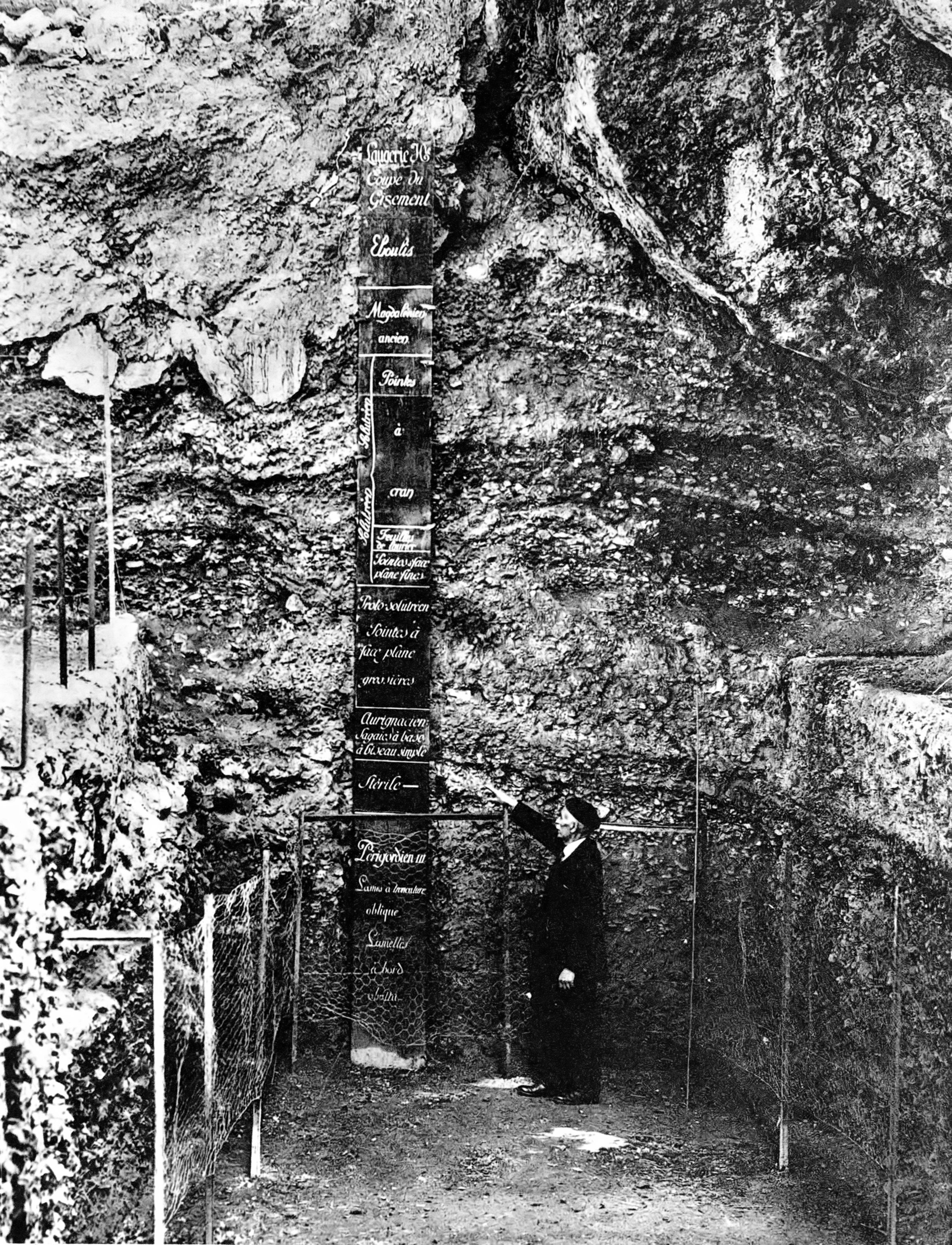
The stratigraphy of Laugerie Haute Ouest.
Presented here by the master himself, Denis Peyrony. His papers are a joy to translate, being clear, concise, and interesting. He must have been a wonderful person to know.
My thanks to James Harrod for access to this resource.
Photo: Phototypie G. Boüan, Paris
Source: Peyrony (1938)
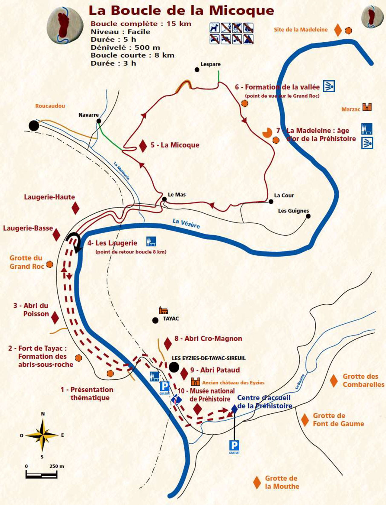
Map of Les Eyzies area, including Laugerie Haute.
Photo: Le Pôle International de la Préhistoire, brochure, www.pole-prehistoire.com/SITE/Tourisme/Chemins/plaquette_micoque.pdf
The sign reads:
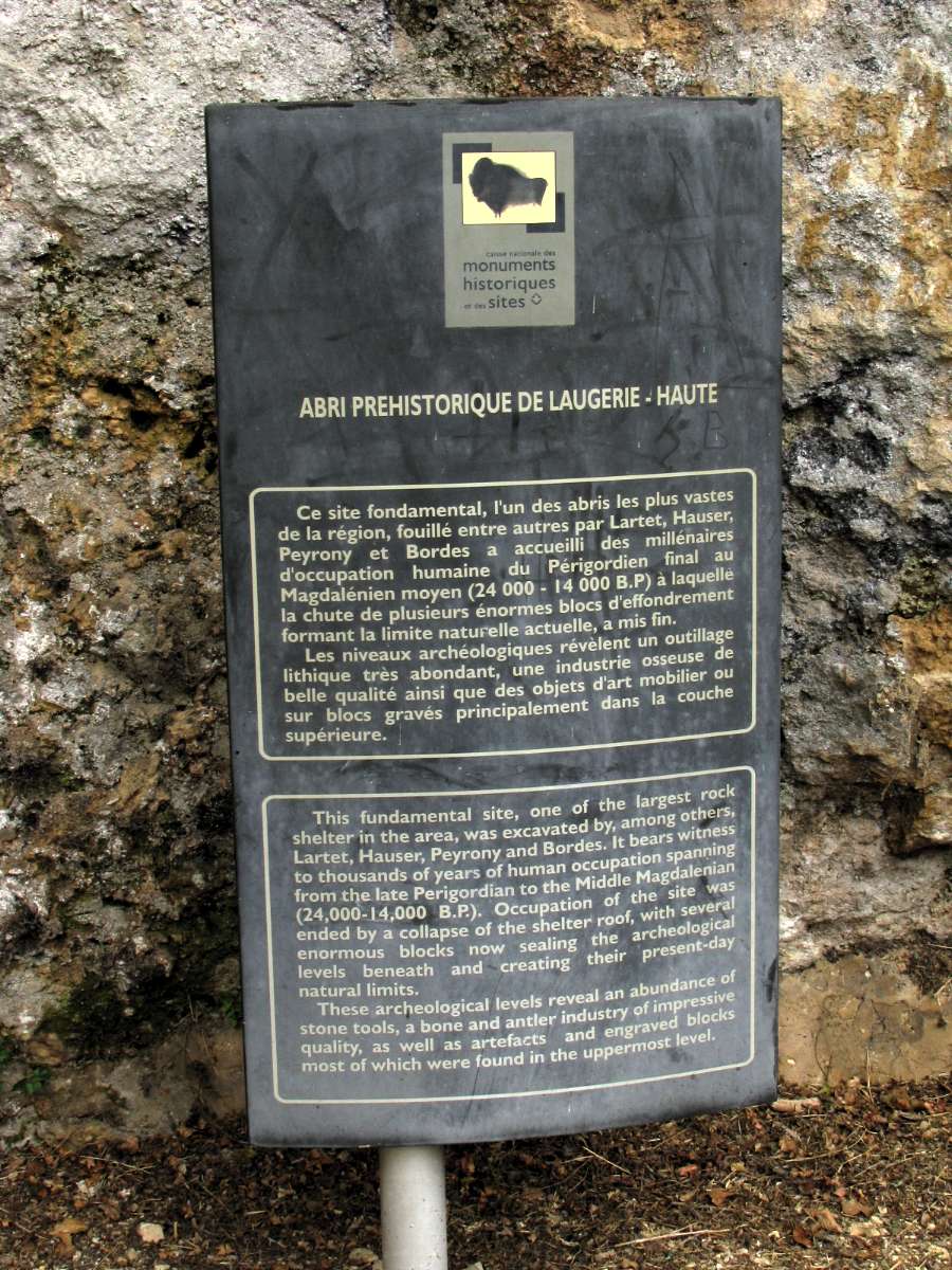
This fundamental site, one of the largest rock shelters in the area, was excavated by, among others, Lartet, Hauser, Peyrony and Bordes. It bears witness to thousands of years of human occupation spanning from the late Perigordian to the Middle Magdalenian (24 000 - 14 000 BP). Occupation of the site was ended by the collapse of the shelter roof, with several enormous blocks now sealing the archeological levels beneath and creating their present day limits.
These archeological levels reveal an abundance of stone tools, a bone and antler industry of impressive quality, as well as artefacts and engraved blocks most of which were found in the uppermost level.
Photo: Don Hitchcock 2008
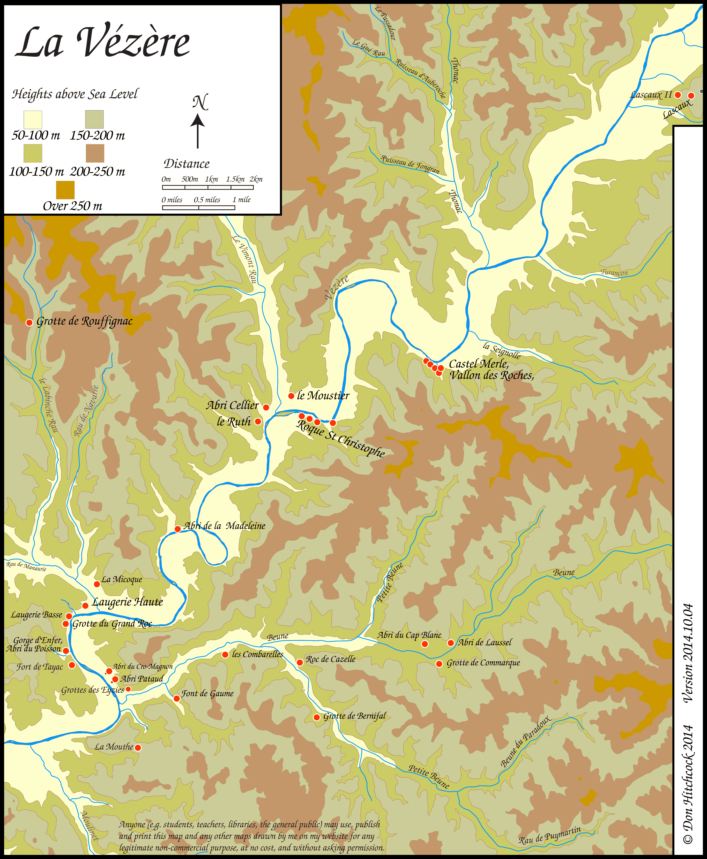
Map of sites in the Vézère Valley of France, including Laugerie Haute.
If you click on the map you will see a larger map with the ability to click on the marked sites and get further information.
Photo: Don Hitchcock
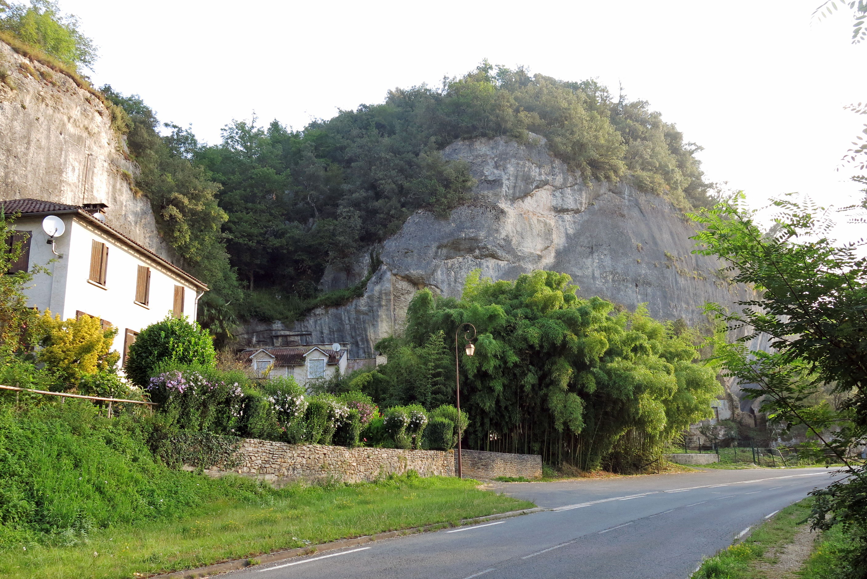
As we approach Laugerie Haute from downstream, we can see the end of the Laugerie Basse cliff on the left, the end of the cliff of Laugerie Haute directly in front, and the valley and small stream between them.
Bamboo is approaching the status of a weed in this area, as can be seen in the huge clump in the foreground beside the road.
Photo: Don Hitchcock 2014
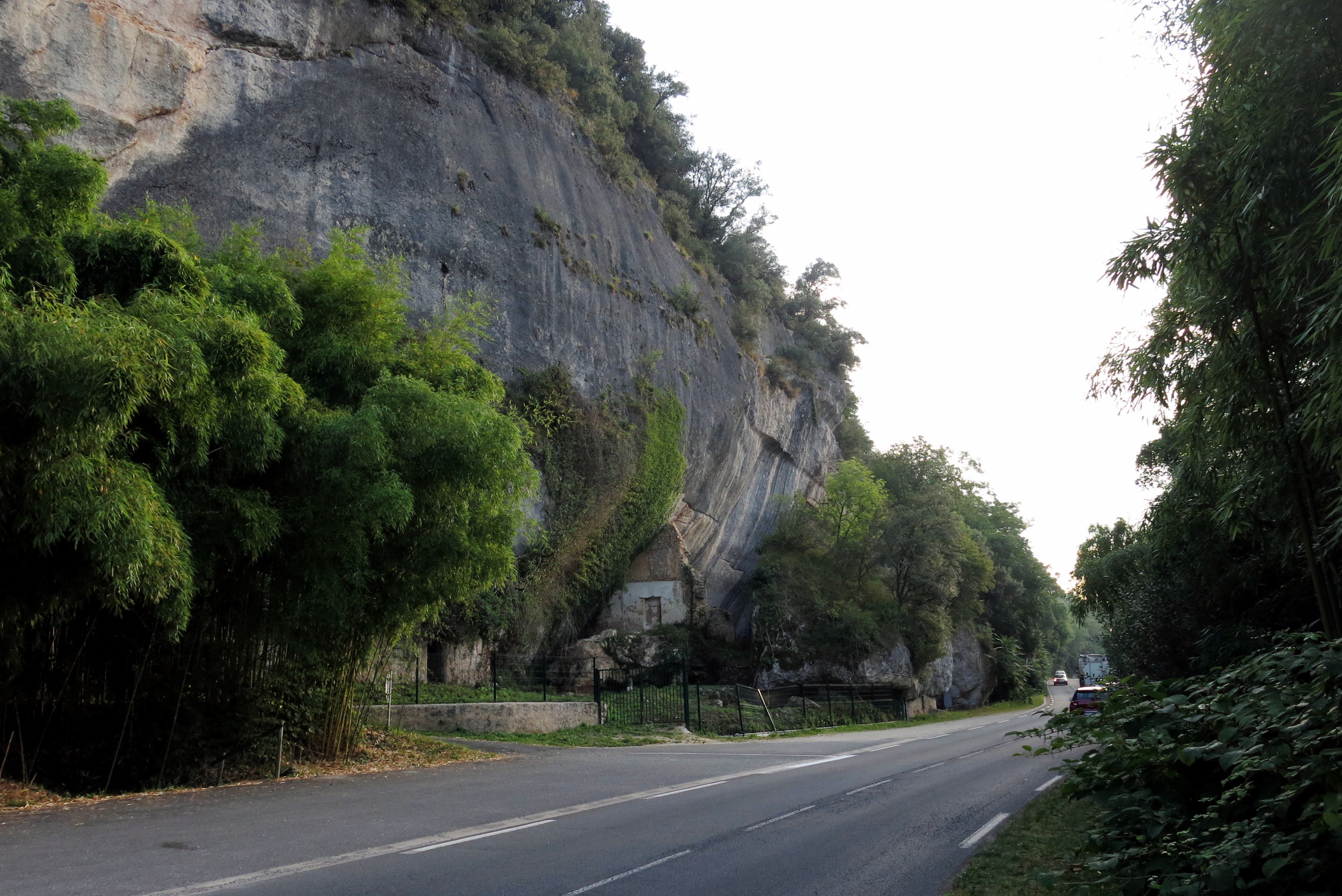
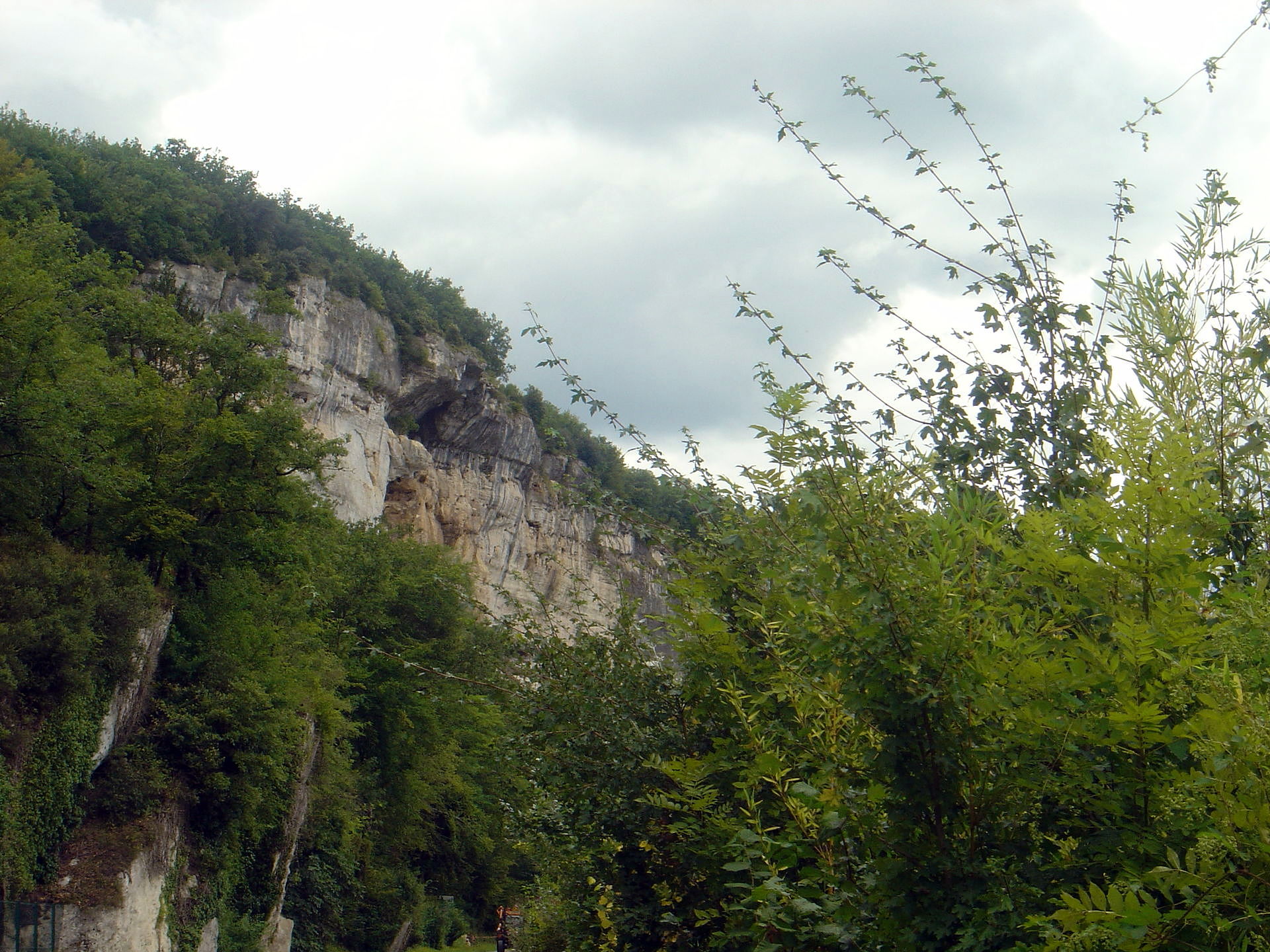
The abri of Laugerie Haute was beneath the rough scar on the cliff. Originally there was a shelf of rock jutting out at that height along a long section of the cliff, forming a series of 'eyebrows' which gave good protection to the inhabitants, further protected by the evident overhang of the smooth cliff itself beneath the scar.
The 'wall' beside the road is formed from the shelf of rock which protected the abri from the weather, and was brought down when ash from a volcanic eruption built up on the shelf, and brought it tumbling down once it became heavy with rain and runoff. There is a large gap between the cliff and the wall of fallen rock.
Photo: Don Hitchcock 2014
Panorama of Laugerie Haute West
Photo: Don Hitchcock 2014
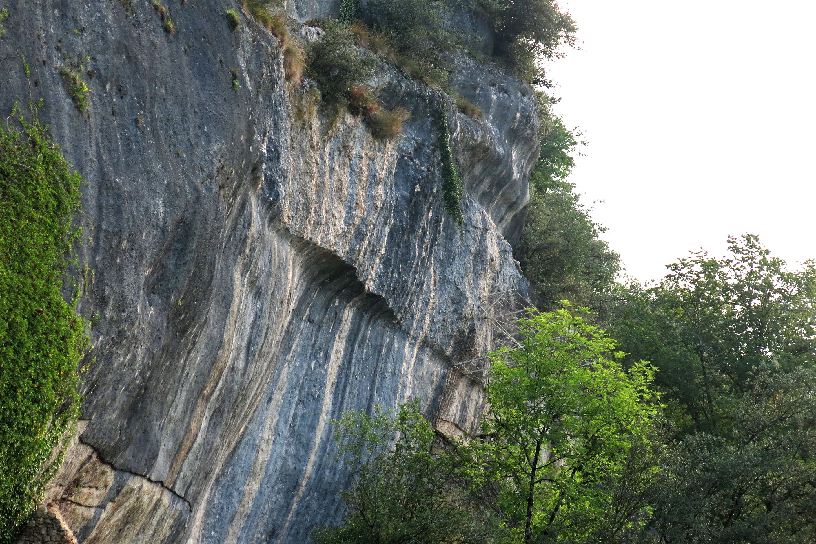
This is a close up of the scar where one of the projecting shelves which protected the inhabitants from snow and rain broke off.
Laugerie Haute faces south, so the situation was ideal for living. There was plenty of sunshine and light even in winter, yet the living site was protected from the worst of the weather. Those who lived there only needed to create living spaces using low stone walls and hide walls above them, for privacy and protection from wind, there was no need to make the structures waterproof, nor indeed for them to have a roof at all.
Photo: Don Hitchcock 2014
The far left hand side of Laugerie Haute, with the gate to Laugerie Haute Ouest just visible on the right, and the small valley between Laugerie Haute and Laugerie Basse on the left.
Photo: Don Hitchcock 2014
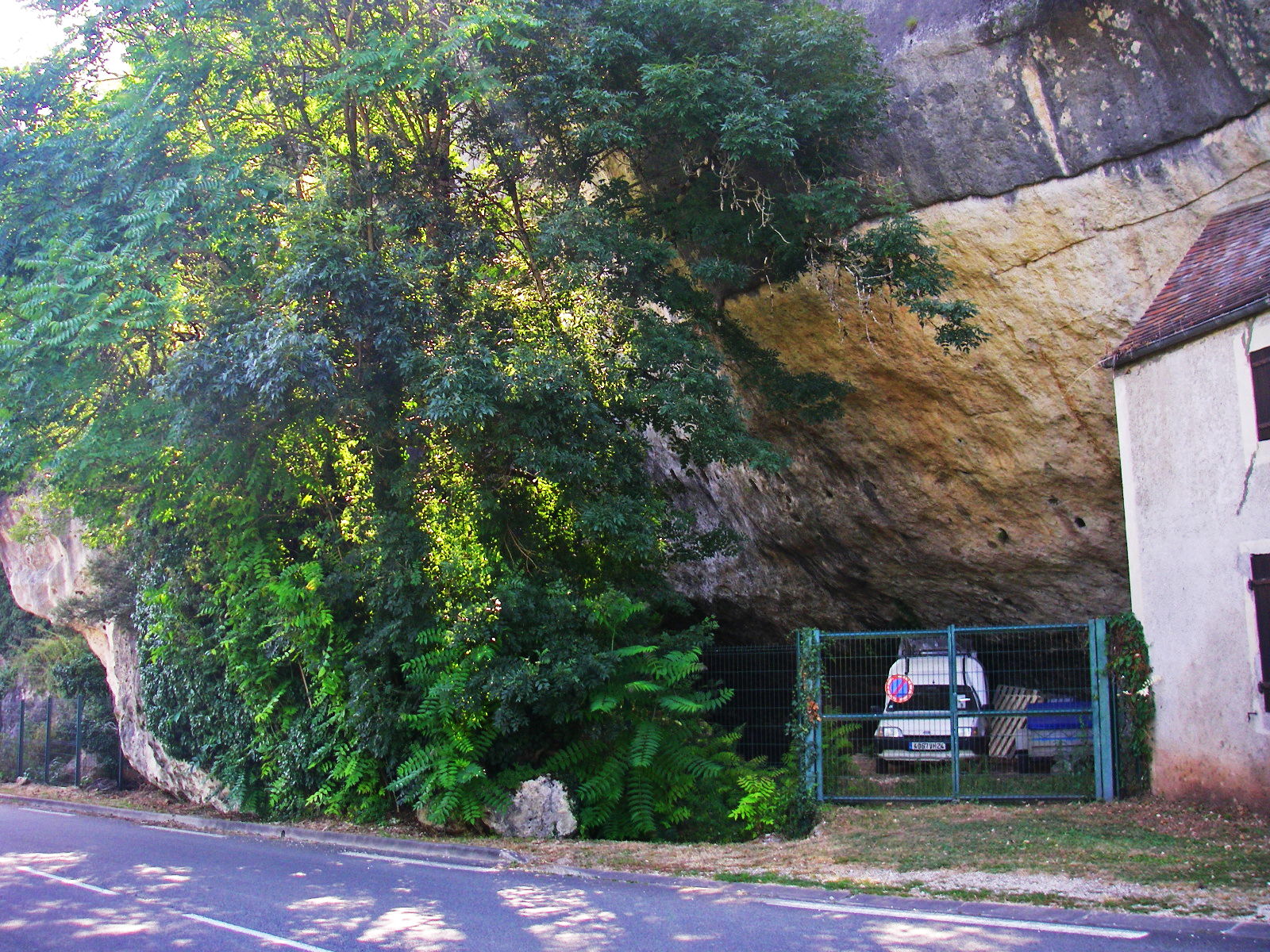
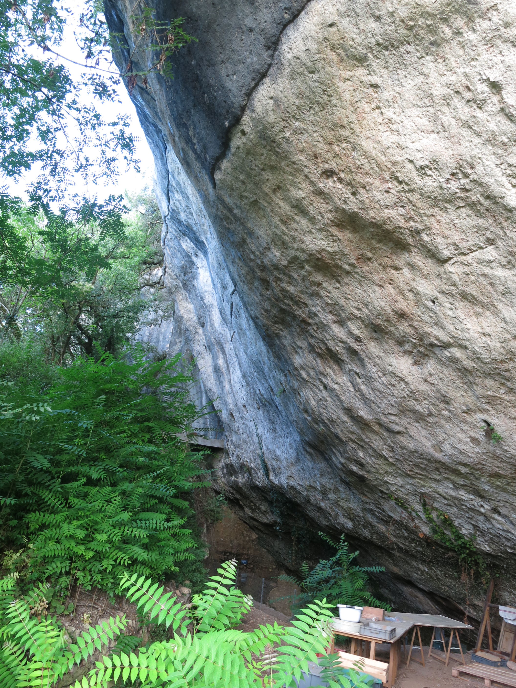
In the image above we may see that the area underneath one of the stone blocks previously forming the shelter, fallen in ancient times, has been excavated. It is now used for storage, and once formed the rear of a shed, as may be seen by the remaining lead sheeting which is commonly let into the limestone in situations like this, in order to form flashing for the roof of a structure which is constructed butting against the cliff. The shed was there in 2008, but had been demolished when I visited in 2014.
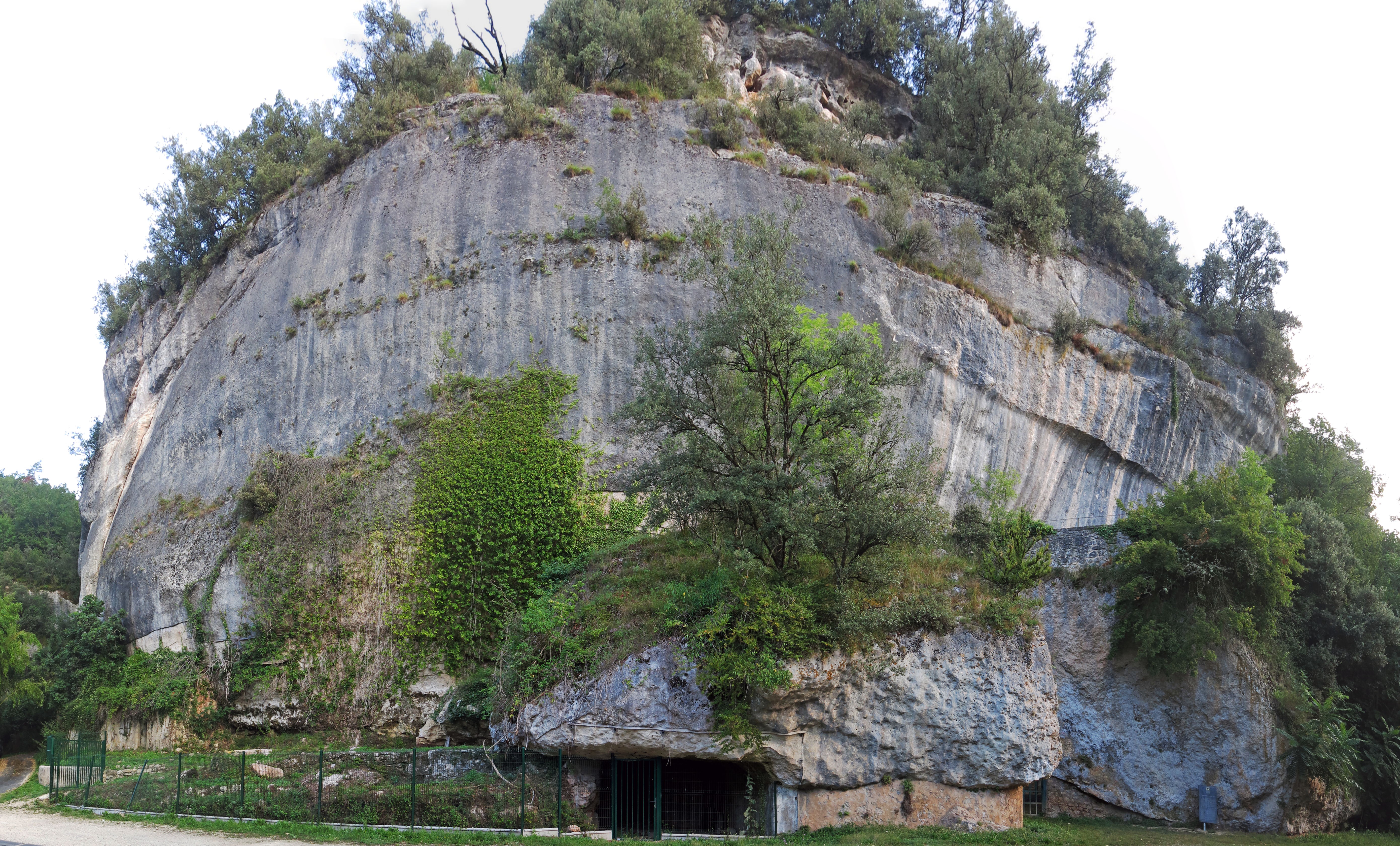
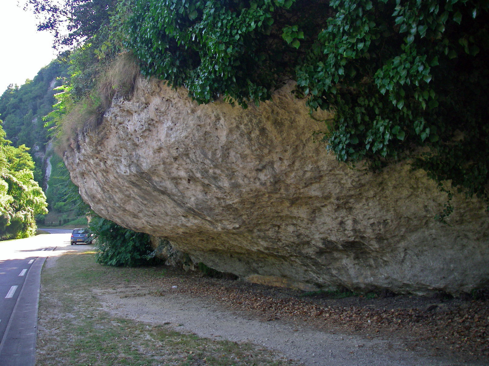
Laugerie Haute Ouest near the entrance gate, taken from across the road.
The two massive stone blocks on either side of the gate were once attached to the cliff above, at the large rough scars still visible today, and the overhang must have originally looked like gigantic eyebrows over the cliff below.
Some 14 000 years ago, there was a massive fall of volcanic ash in the area. The Puy de Dôme area is only 150 km away from the Les Eyzies area. See the Vernet et al. article below for some possibilities for the source of the volcanic ash.
This fall of ash built up many metres thick on top of the overhang above Laugerie Haute, and when the ash was soaked by rain (and runoff from the cliff), the whole thing gave way and crashed to the ground below. The sound must have been staggering, and woe betide anyone beneath. I can imagine someone sitting at the rear of the shelter, untouched by the catastrophic fall, and thanking their gods or good luck that they had escaped.
Photo: Don Hitchcock 2014
Some of the stones appear to have rotated as they fell, landing out a little from the cliff. The overhangs at l'abri des Marseilles at Laugerie Basse, not far away, fell much closer to the abri they formerly protected, although some then rolled as far as the Vézère River.
The two stones between which the gate has been placed have quite different surface textures. The one on the left looks much more weathered, the one on the right looks quite rough. I speculate that the one on the left is showing a face which was the edge of the overhang, while the one on the right is presenting to us the surface which broke off the wall 14 000 years ago.
The cause of the ash fall
The text below is from: Quaternary International, vol 47/48, 139-146 - Vernet et al., manuscrit, p.1 - Tephrostratigraphy of the last 160 ka in Western Limagne (France)
Late-Glacial and Holocene Tephra
For the period between 15 and 7 ka (Older Dryas to Atlantic), numerous volcanoes were active in the Chaîne des Puys and neighbouring areas. Strombolian phases built numerous cones and poured out long lava flows which disorganized the drainage pattern.Trachytic and trachyandesitic maar eruptions occured (Kilian, Nugère, Pariou, Pavin). Plinian eruptions were followed by trachytic plugs and dome erection (Puy-de-Dôme, Sarcouy, Chopine...). Tephra columns and plumes reached 20 km into the atmosphere and spread over wide areas aided by wind (GOER DE HERVE et al, 1991). Some volcanoes have been directly TL dated :
- Puy de Côme, 15900 ± 1500 and11600 ± 830 (GUERIN, 1983).
- Puy de Lassolas, 15700 ± 1700 (GUERIN, 1983).
- Puy de Tartaret, 13700 ± 1600 (PILLEYRE et al., 1992).
- Puy de Gorce, 13200 ± 1300 (GUERIN, 1983).
- Puy de Barme, 11900 ± 1200 (GUERIN, 1983).
- Puy de la Nugère lava flow, 10900 ± 1200 (GUERIN, 1983).
- Puy de Dôme, 10800 ± 1100, 9300 ± 1100 (FAIN et al. , 1986, 1991).
- Puy de Pariou lava flow, 8180 ± 810 (GUERIN, 1983).
- Puy de la Vache, 8100 ± 800 (HUXTABLE et al., 1978), 9150 ± 550 et 8820 ± 870 (GUERIN, 1983), 9130 ± 720 (MONTRET et al., 1992).
- Puy de Montchal,7560 ± 770 BP (GUERIN, 1983).
Laugerie Haute Est
This area beside the building provides scarce parking in the space created at its end.
Photo: Don Hitchcock 2008
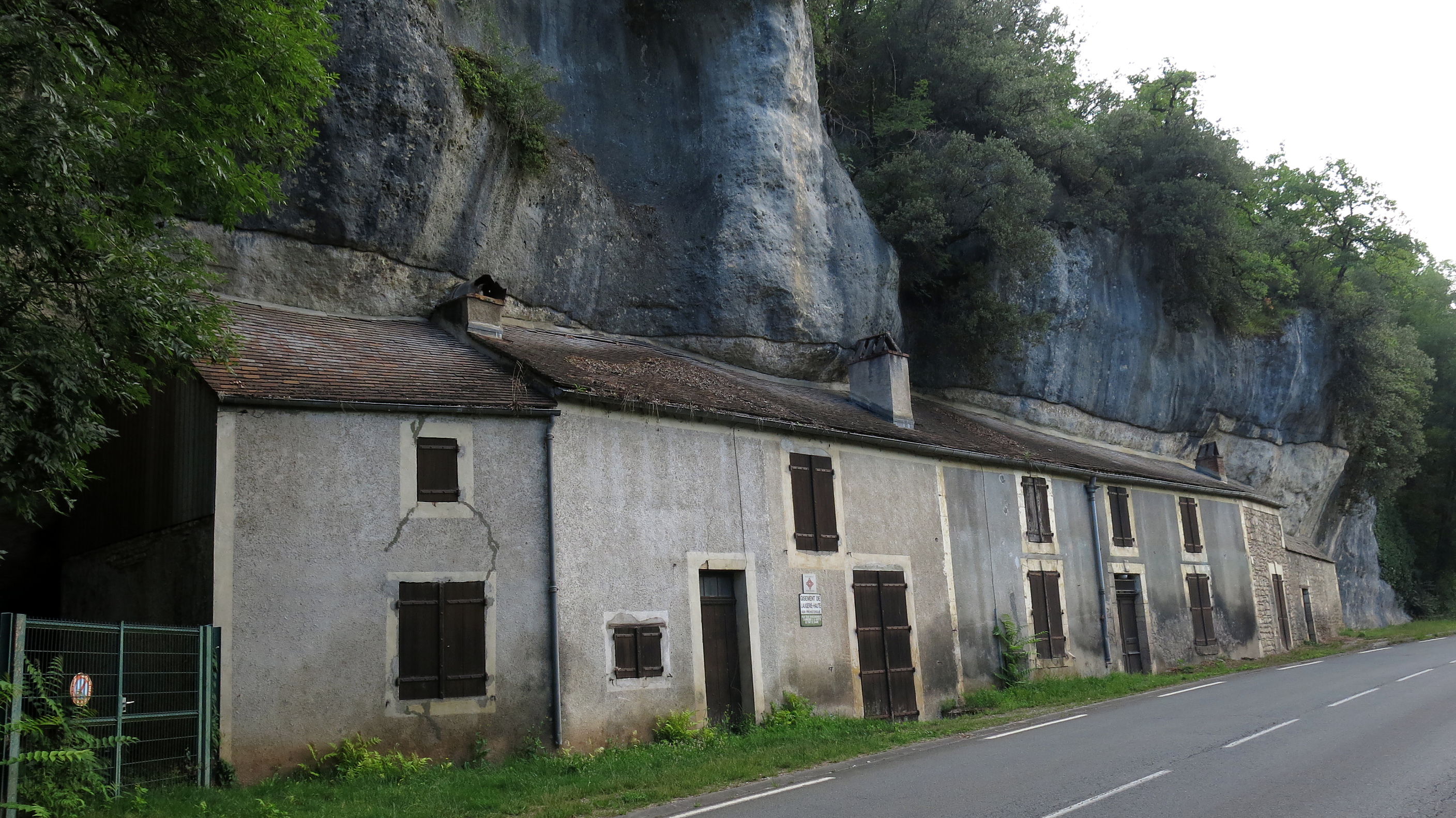
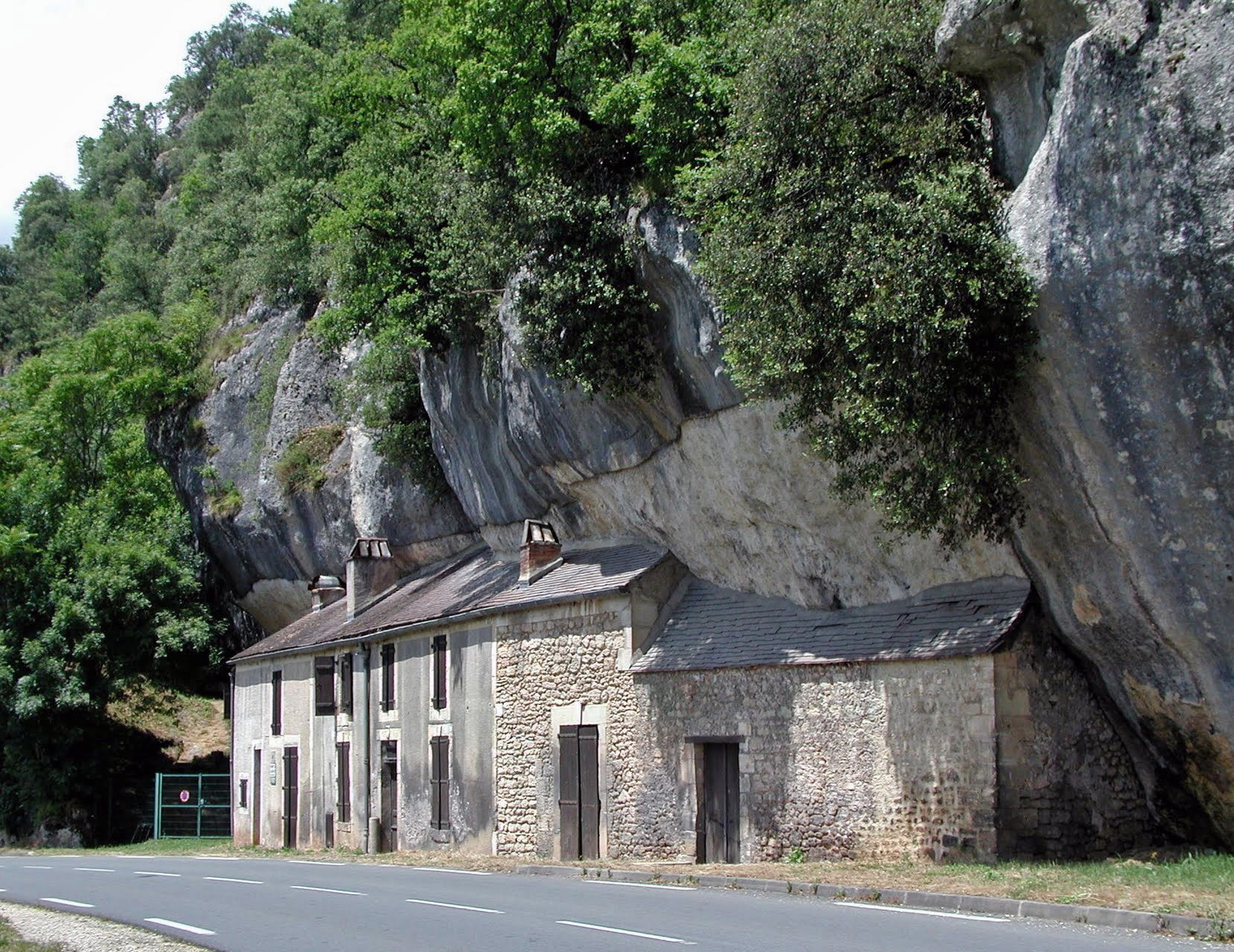
This long building is built against the huge rocks fallen from the cliff of Laugerie Haute.
The cortex or grey patina of the limestone has been removed from behind the whole of the building at the end of Laugerie Haute Est. This would have helped to create a drip line to shed rain and runoff water, which has been further improved, as is normal in these situations, by letting a long section of lead sheeting into the limestone.
Photo: Don Hitchcock 2014
This good photograph shows the extent and distance of the cliff line behind the rocks which form the back wall of the long building.
It shows that these massive rocks have also fallen from the cliff, and that the site exists on the other side of these massive rocks.
Photo: webstar-100
Source: Panoramio
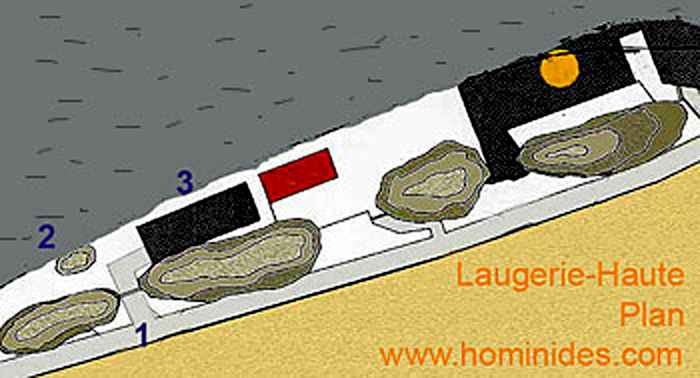
Plan of the site
This plan shows the extent of both Laugerie Haute Ouest and Est. Most of the site is hidden behind the massive boulders which have fallen from the cliff.
1 - entry to Laugerie Haute Ouest
2 - proto-chalcolithic (early copper age) bed
3 - the accessible stratigraphy (in black)
The "Château" Chapoulie is shown in red
L'abri du squelette, the abri where the skeleton was found, is shown in yellow
Photo: http://www.hominides.com/html/lieux/laugerie_haute_abri.htm
A discussion of the state of present researches into l'abri du Squelette at Laugerie-Haute follows:
L'abri du Squelette à Laugerie-Haute
The operation was to establish an assessment of the health of the site and to gather all mobile archaeological remains, including elements fallen to the ground of the human skeleton left in situ after the excavations of Maury, Blanc et Bourgon, in 1938, under one of the large collapsed blocks that seal the Pleistocene deposits of Laugerie-Haute. The few available publications show that there are at least three skeletons which were discovered in this block.
Although the records of the discovery are very brief, the condition of the skeletons and their number show that they were probably intentional deposits. The currently in-situ skeleton, which was discovered last, although being attributed to the Magdalenian at the time of discovery, has until now been considered Neolithic (Riquet, 1950).
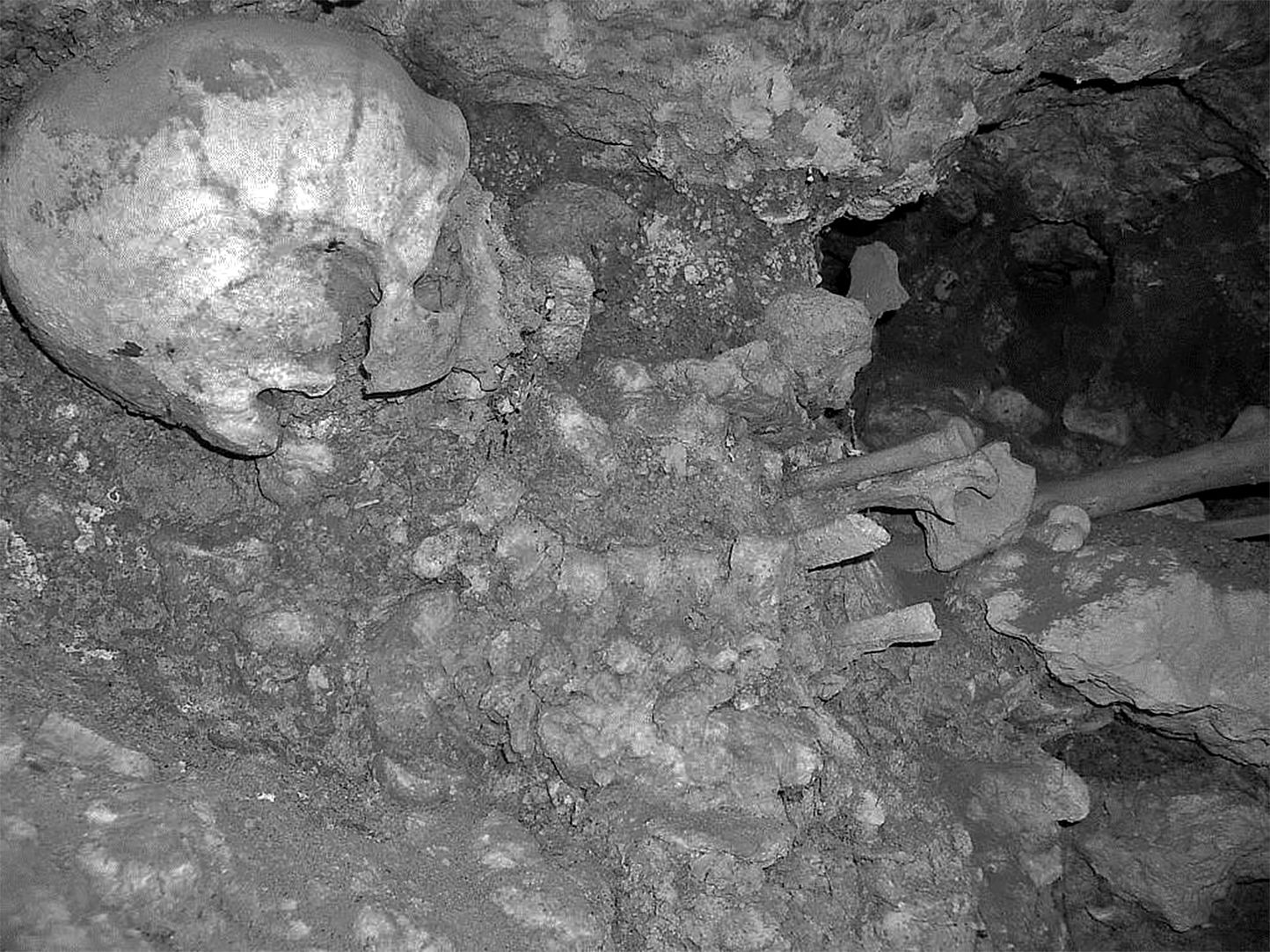
Skeleton from l'abri du Squelette à Laugerie-Haute
Photo: Chadelle (2016)
The results obtained (Beta - 333258) from a fragment of a damaged ulna allows us to date this ensemble as Mesolithic. The site was cleared of recent vegetation and protected by a metal fence but it is likely that it will not be desirable to leave the skeleton any longer in situ. The acquisition by a public authority in this part of the deposit of Laugerie Haute opens a new field of research for archaeologists, anthropologists and geologists.
Thus, observations on deposits sealed by the collapse of blocks are likely to reevaluate the findings of the latest geological study of Laugerie-Haute (Texier, 2009)
The massive cliffs of Laugerie Haute.
Photo: Satange 2007
Permission: Creative Commons Attribution-Share Alike 3.0 Unported license
This is the extreme eastern end of the Laugerie Haute rockfall. The road on the right of the image goes behind the rockfall to the higher land behind.
The 'long building' may be seen on the left of this photograph.
Photo: © https://www.google.com.au/maps/ July 2013
This shows the end of the massive limestone boulders with the removed grey cortex, and the start of the excavations of Laugerie Haute Est beneath the fallen boulders.
In the area shown in these two photographs, the area in front of and under the blocks has been excavated.
Photo: Don Hitchcock 2008
By 2014, this area at Laugerie Haute Est seemed to be again actively part of an archaeological investigation.
Note the high concrete footbridge in the background, which leads to the house in between Laugerie Haute Ouest and Est.
Photo: Don Hitchcock 2014
These photographs show an area which has been excavated, with a safety fence in front.
Photo: Don Hitchcock 2008
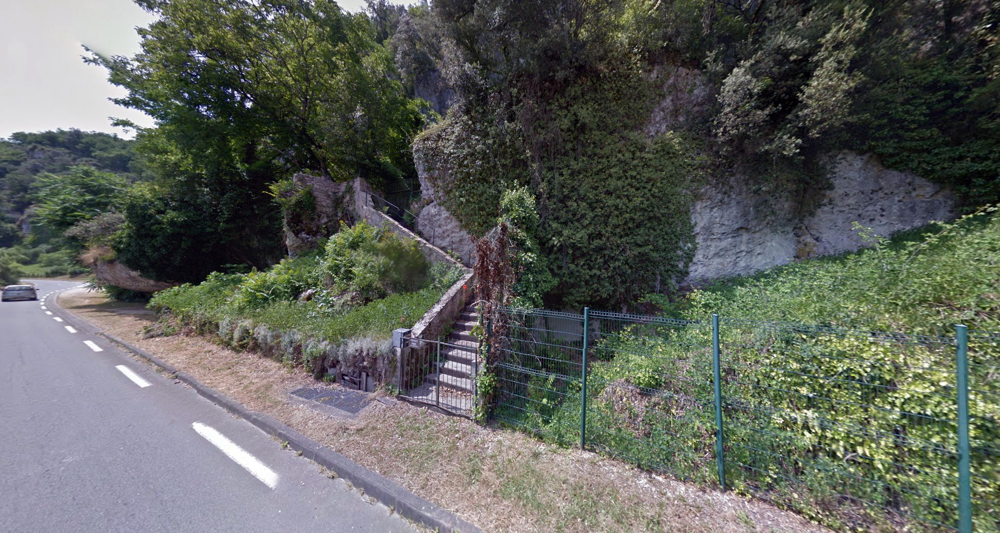
This is the staircase from the road leading to the bridge giving access for foot traffic to the Laugerie Haute Chateau Chapoulie between the two sites. The chateau was there, of course, long before the area's archaeological potential was realised, and sits on highly valuable deposits.
Photo: © Google street view, July 2013
Laugerie Haute Chateau Chapoulie.
Photo: http://www.lascaux-dordogne.com/fr/patrimoine-culturel/site-monument-site-archeologique/abri-prehistorique-de-laugerie-haute
Further to the west, looking back to the east at the bridge providing pedestrian access to the house at Laugerie Haute Est, we can see that in this region blocks have fallen, and the area appears to have been excavated behind them.
Photo: Don Hitchcock 2008
This is the last block to the west from Laugerie Haute Est before the gate, and thus lies in front of Laugerie Haute West.
Photo: Don Hitchcock 2008
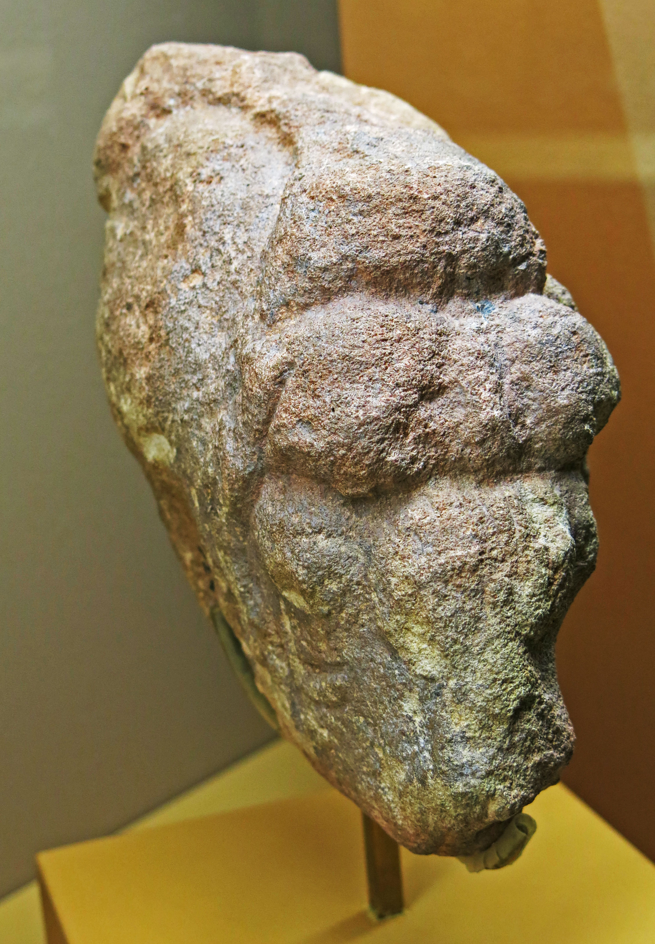
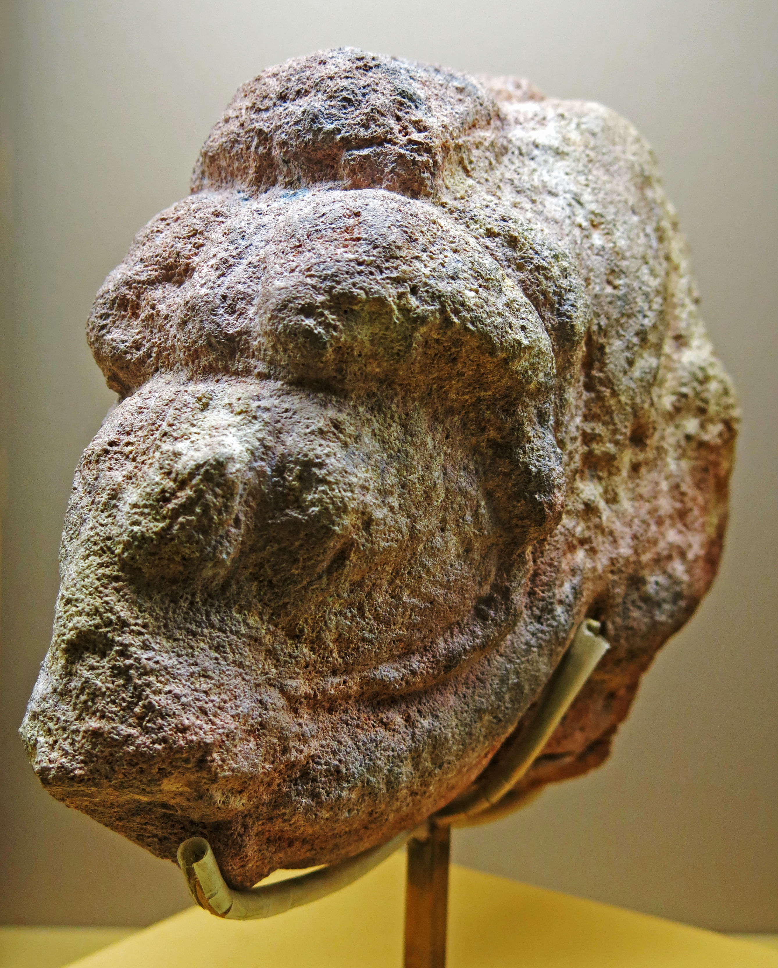
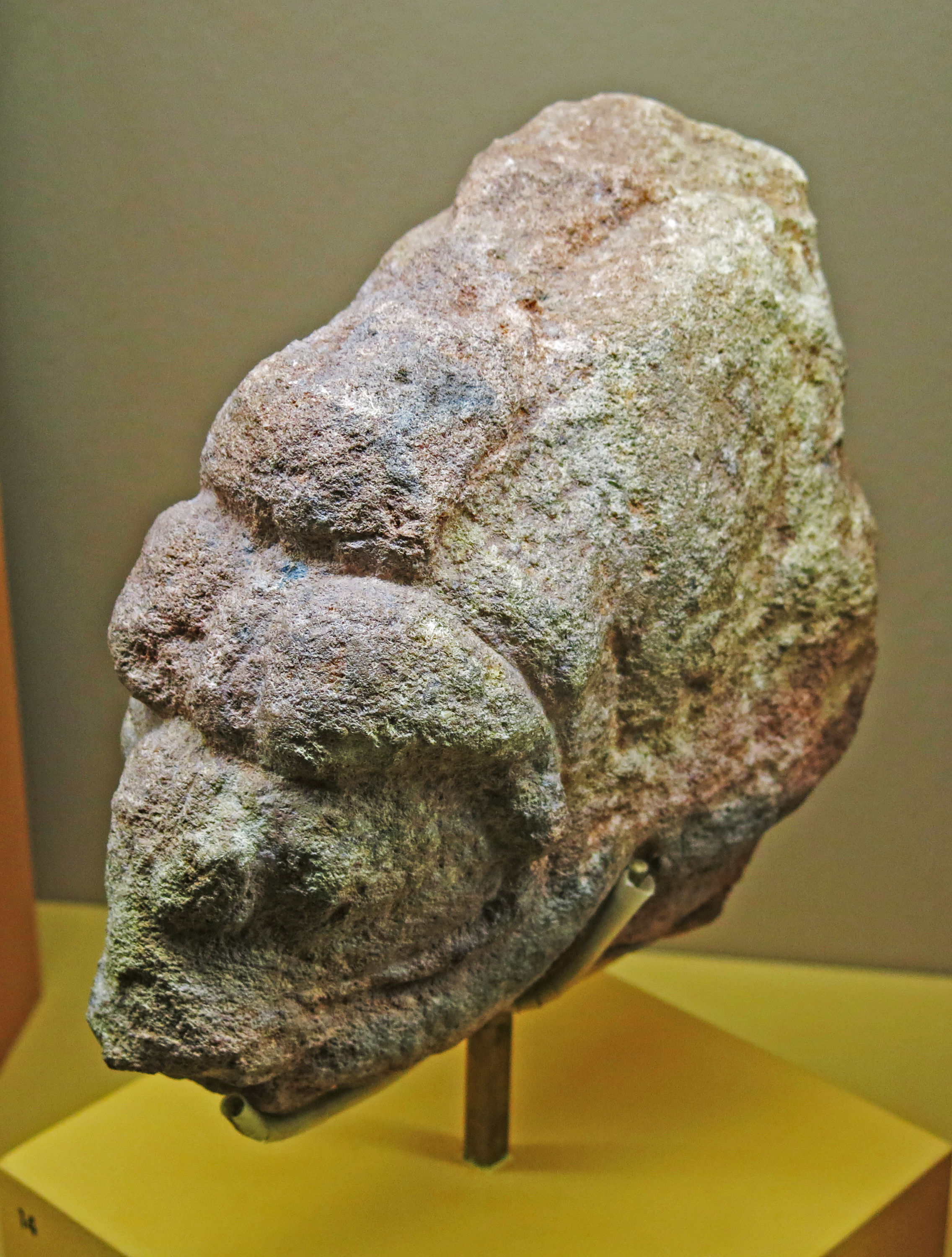
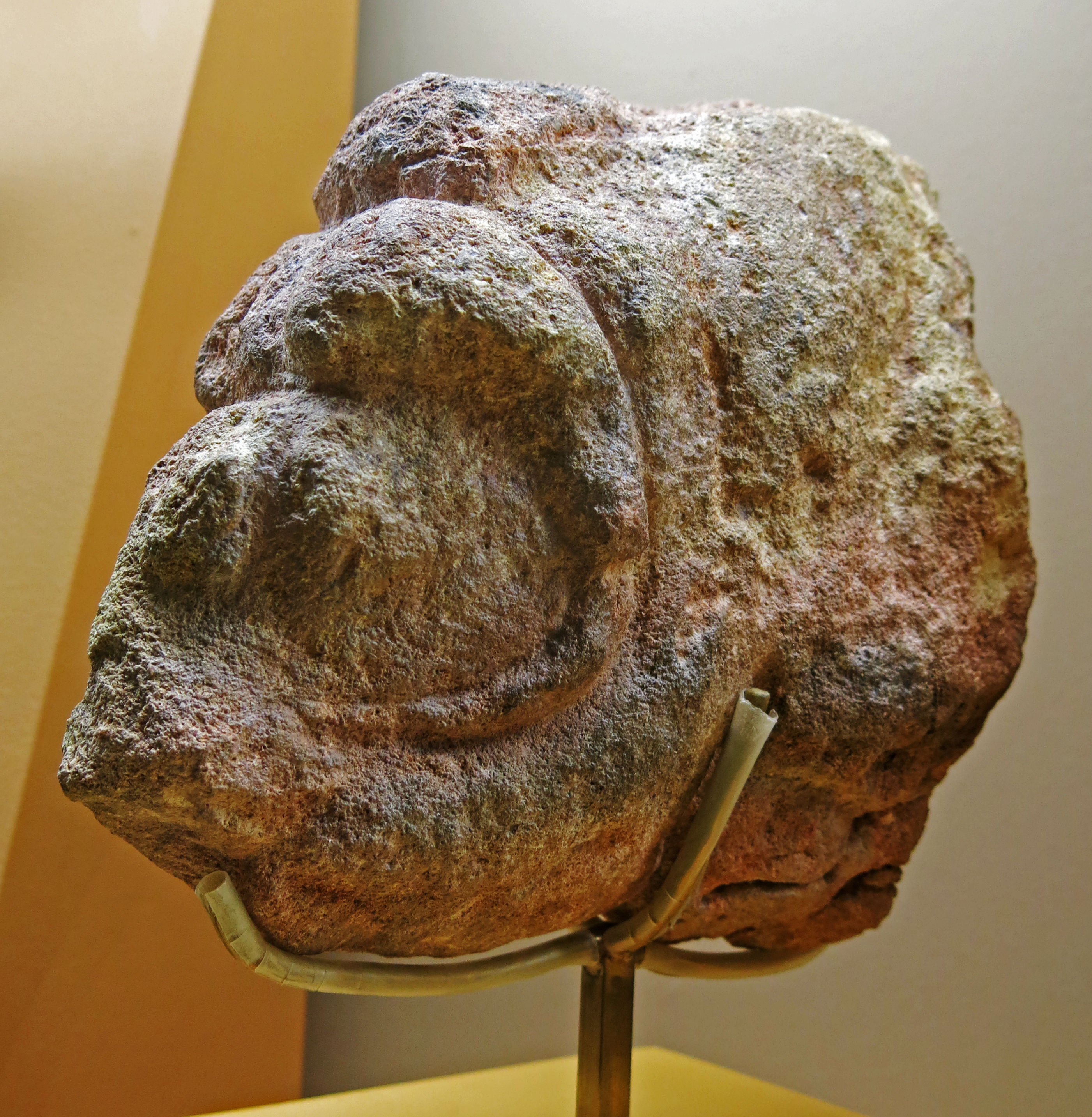
Sculpture of a Musk Ox from Laugerie Haute, discovered by Peyrony in 1925.
Photo: Don Hitchcock 2014
Source: Original, Musée d'Archeologie Nationale et Domaine, St-Germain-en-Laye
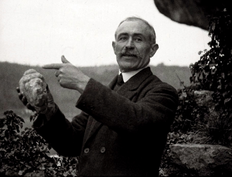
Denis Peyrony holding the sculpted musk ox from Laugerie-Haute.
Source: This is a still from a 1920s silent film shot by Joseph Mandement on 35mm stock, entitled 'L’art paléolithique dans les grottes des Pyrénées et de la Dordogne'.
It was shown on April 8, 1930 before the members of the French Prehistoric Society, and the film received an excellent reception from the scientists present.
Proximal source: journals.openedition.org/paleo/4058?lang=fr
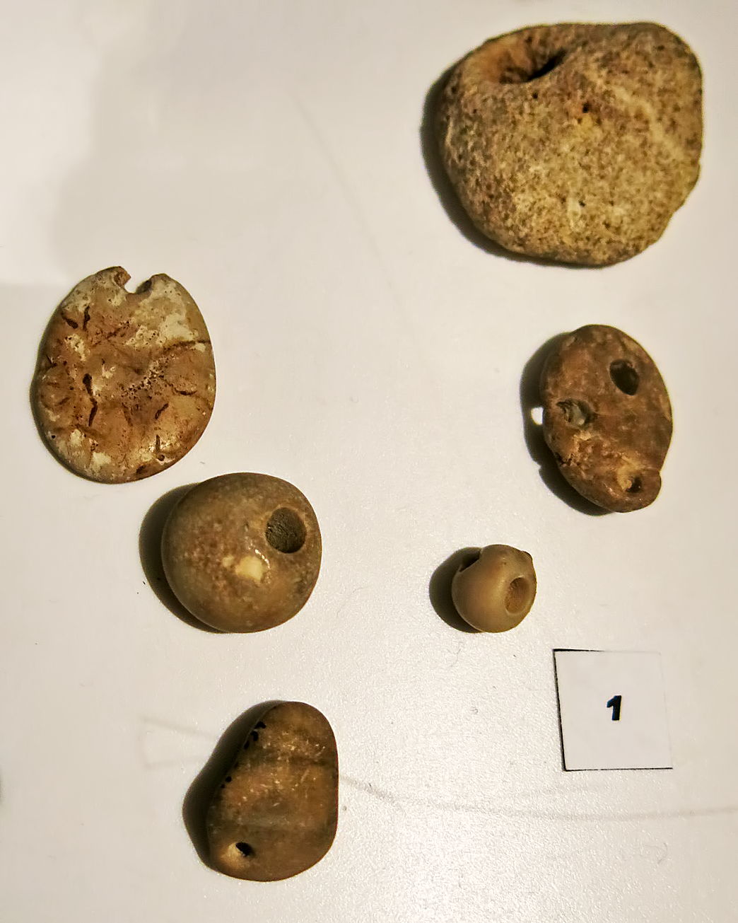
Pierced stone pebbles from Laugerie Basse and Laugerie Haute, presumably used as jewellery.
Age: Solutrean and Magdalenian.
Photo: Don Hitchcock 2015
Catalog: 61.3.651, 61.3.838, and 61.3.894
Source: Original, Musée d'Aquitaine à Bordeaux
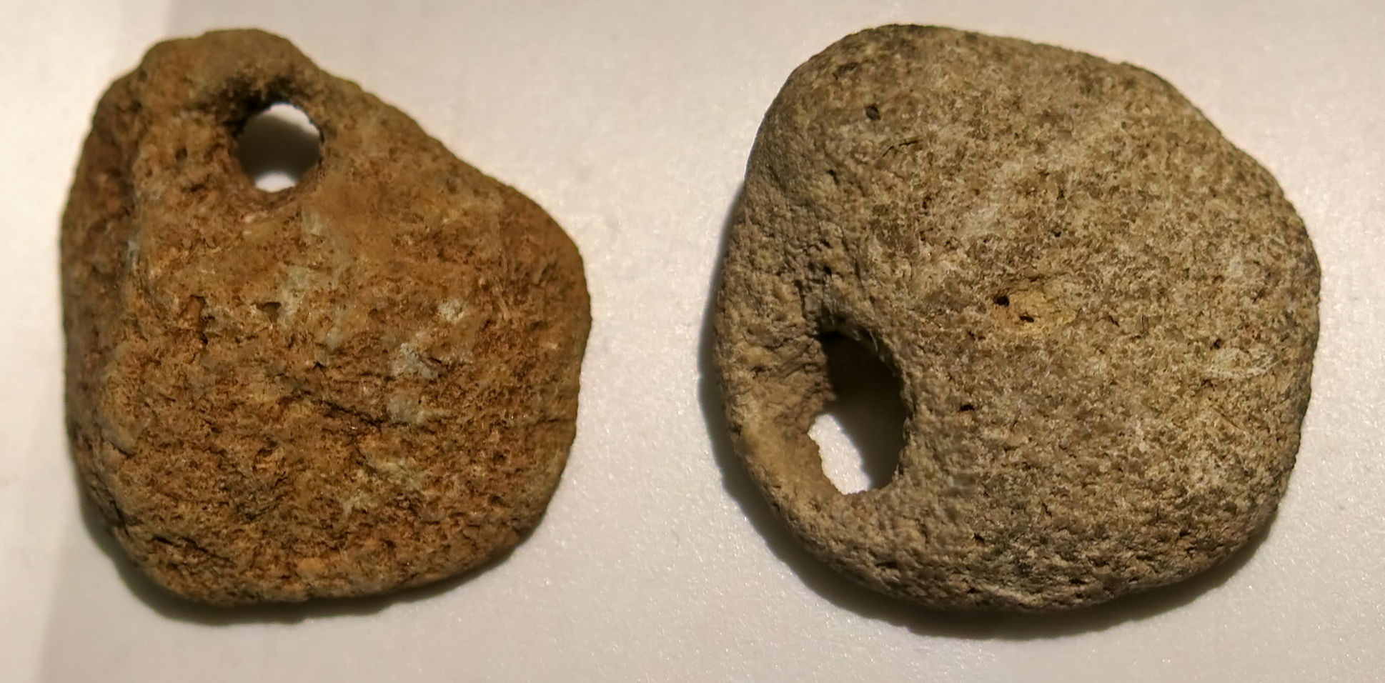
Pierced stone pebbles from Laugerie Basse and Laugerie Haute, presumably used as jewellery.
Age: Solutrean and Magdalenian.
Photo: Don Hitchcock 2015
Source: Original, Musée d'Aquitaine à Bordeaux
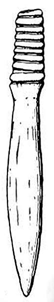
Ivory stopper, or bouchon d'outre, for a leather water bottle, from Laugerie Haute Est
This stopper has a rounded helix.
Photo and origin: Bordes (1959), Bordes (1978)
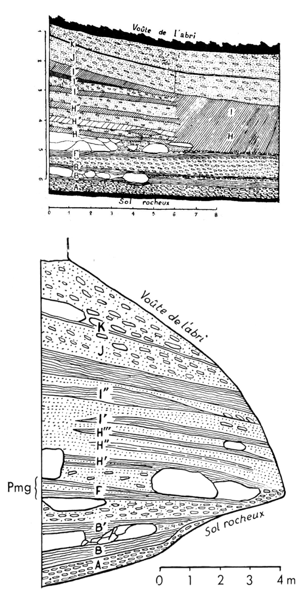
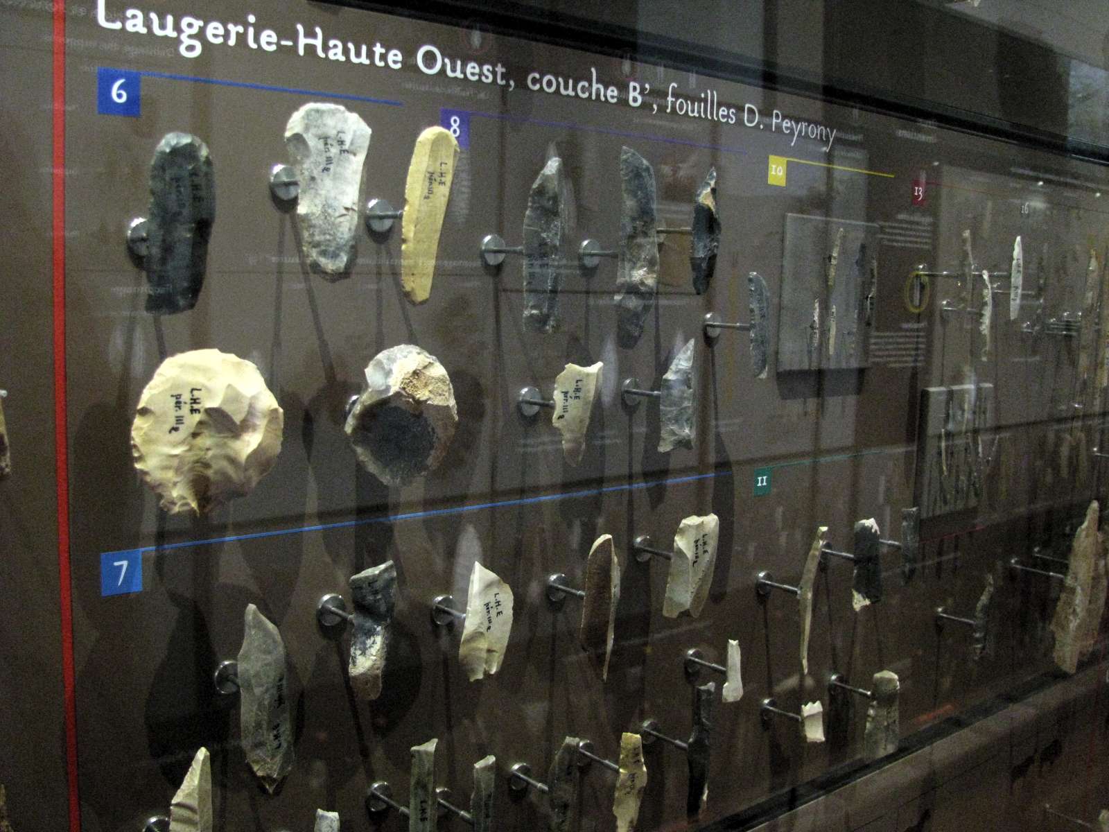
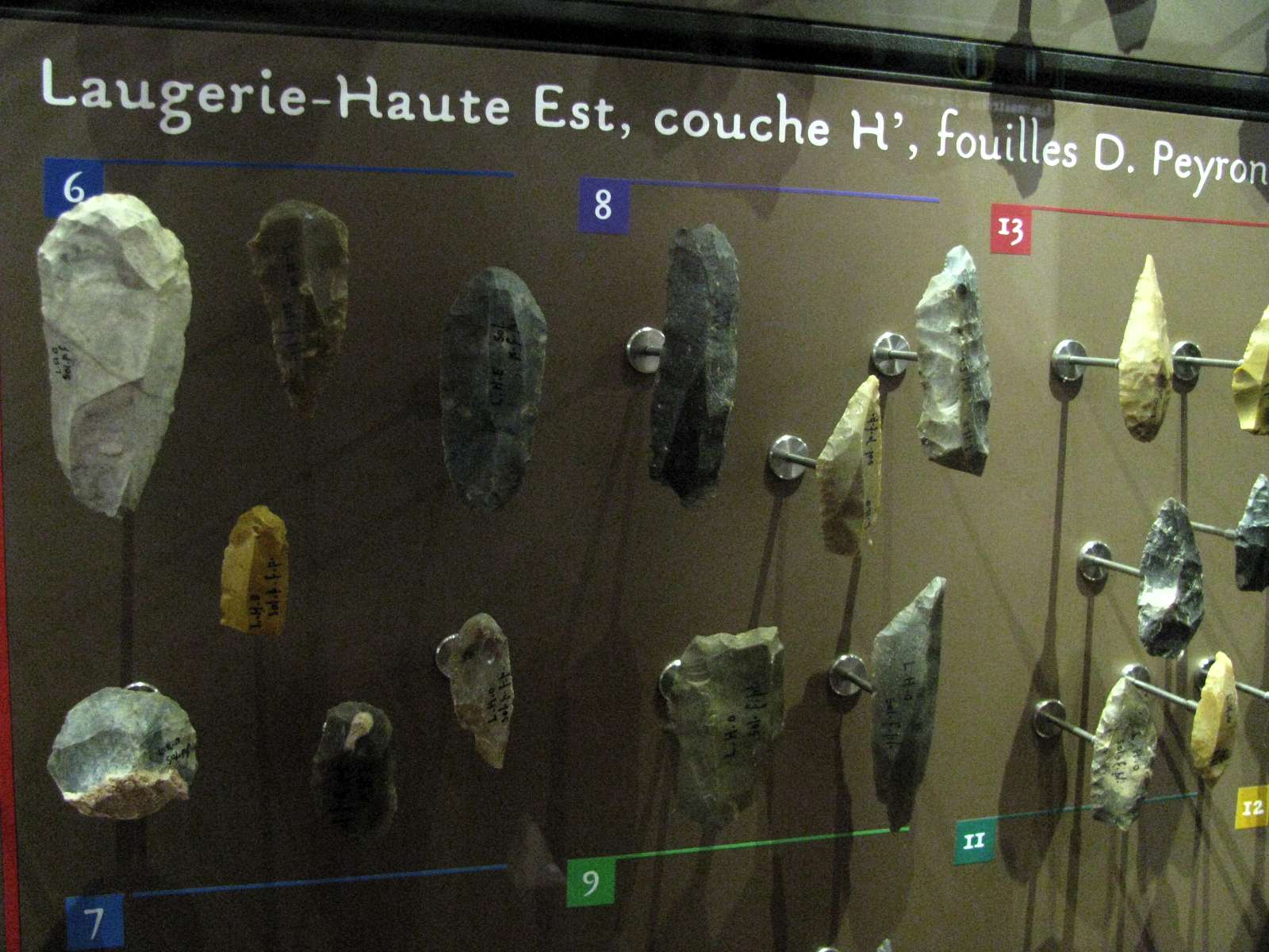
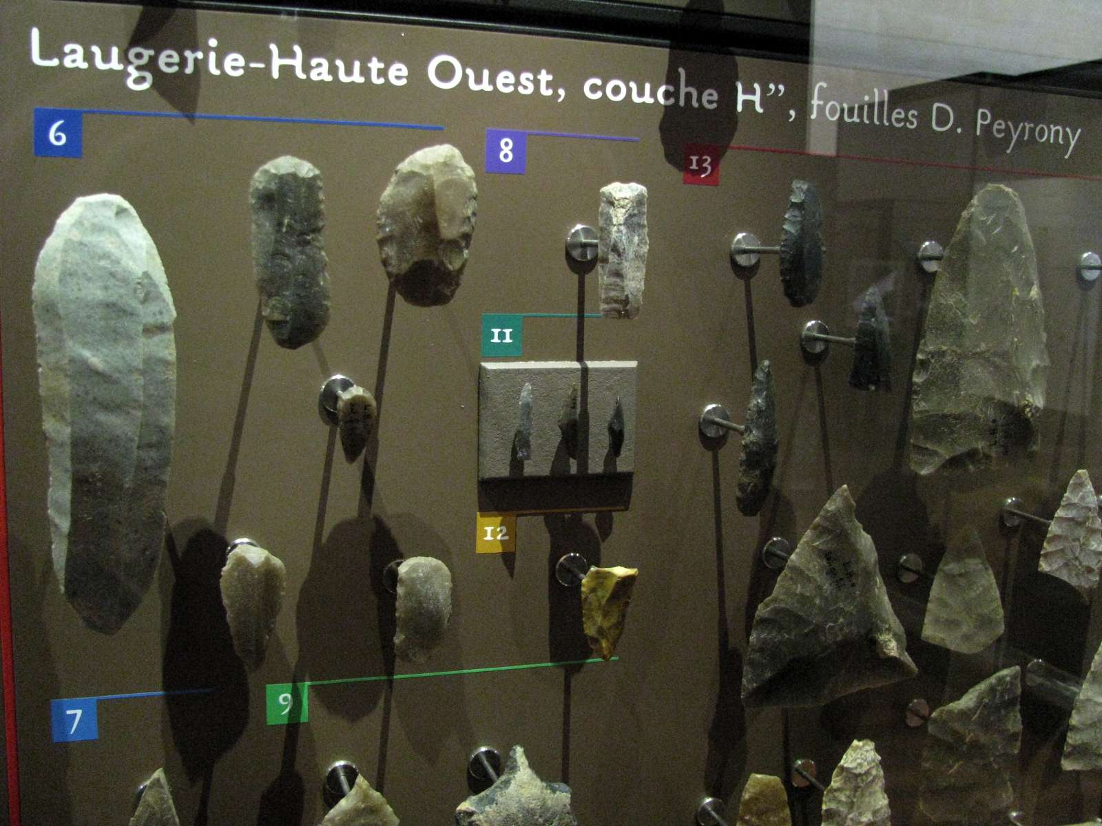
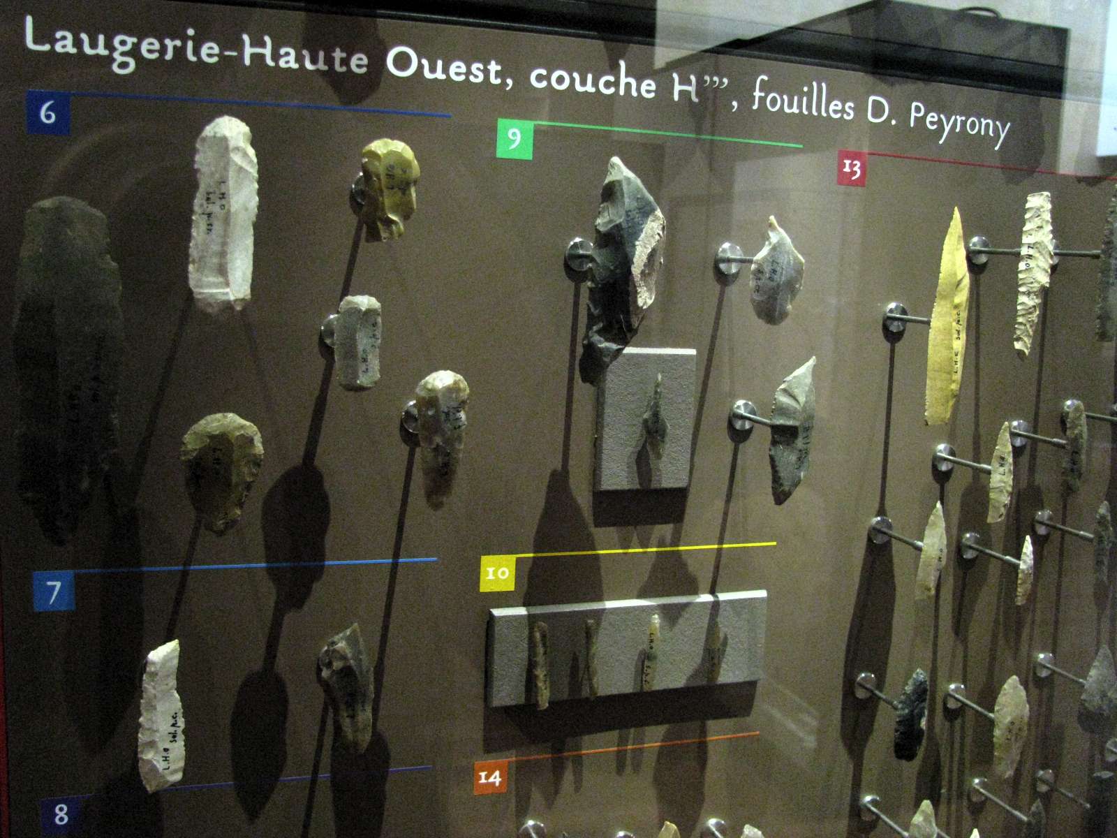
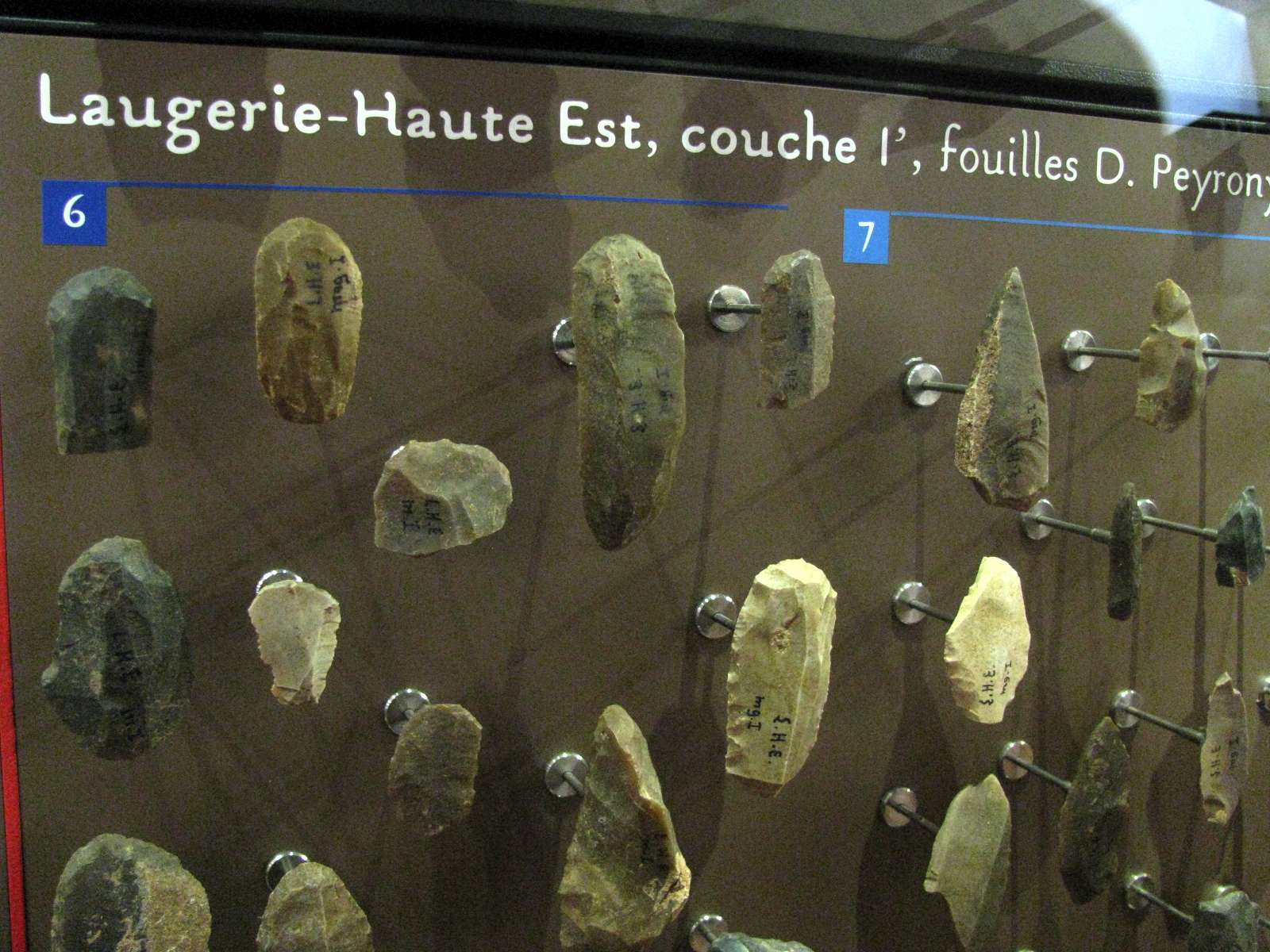
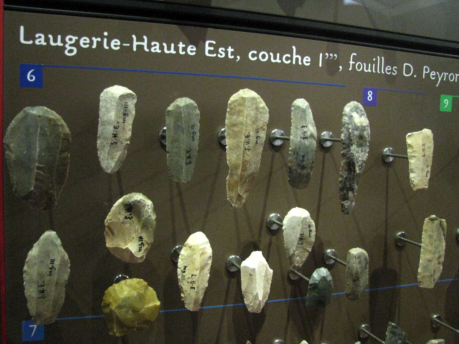
Laugerie-Haute West stratigraphy, according to D. & E. Peyrony.
B. Perigordian III. (image) (Note that this image is of tools from level B', shown on the lower diagram here - Don)
C. Sterile layer.
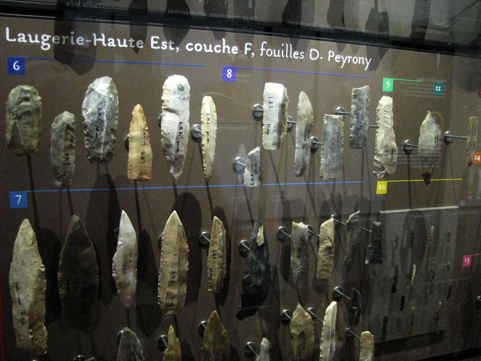
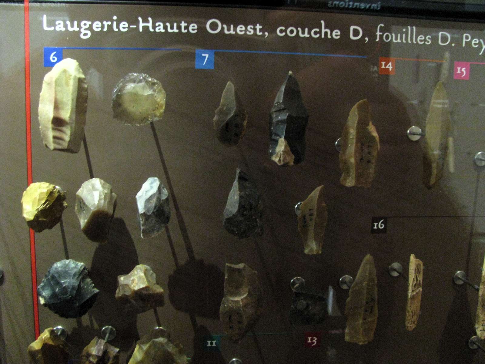
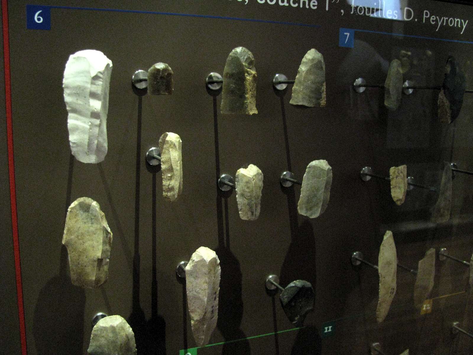
D. Aurignacian V. (image) (Note in particular the clear quartz tool between the numbers 6 and 7 at the top of the display - Don)
E. Grey earth and limestone rocks, more or less sterile.
G. Proto-Solutrean.
H'. Solutrean with points with a flat face.
H''. Solutrean laurel-leaf industry. (image)
H'''. Solutrean notched blades. (image)
I. Magdalenian, but without (the normally characteristic - Don) harpoons.
Photo and text: Peyrony (1938), in Bordes (1978) and Groenen (1994)
This is only a small section of the staggering array of stone tools from Laugerie Haute which were on display at Le Musée National de Préhistoire, Les Eyzies-de-Tayac.
Photo: Don Hitchcock 2008
Source: Originals on display at Le Musée National de Préhistoire, Les Eyzies-de-Tayac
(left) Stielspitze, Shouldered Point, Laugerie-Haute.
(right) Stielspitze, Shouldered Point, Vézère valley.
22 000 BP - 18 000 BP.
Photo: Don Hitchcock 2015
Source and text: Neanderthal Museum, Mettmann, near Düsseldorf, Germany
(left) On loan from the Institut für Ur- und Frühgeschichte Universität Tübingen
(right) On loan from the Löbbecke Museum, Düsseldorf.
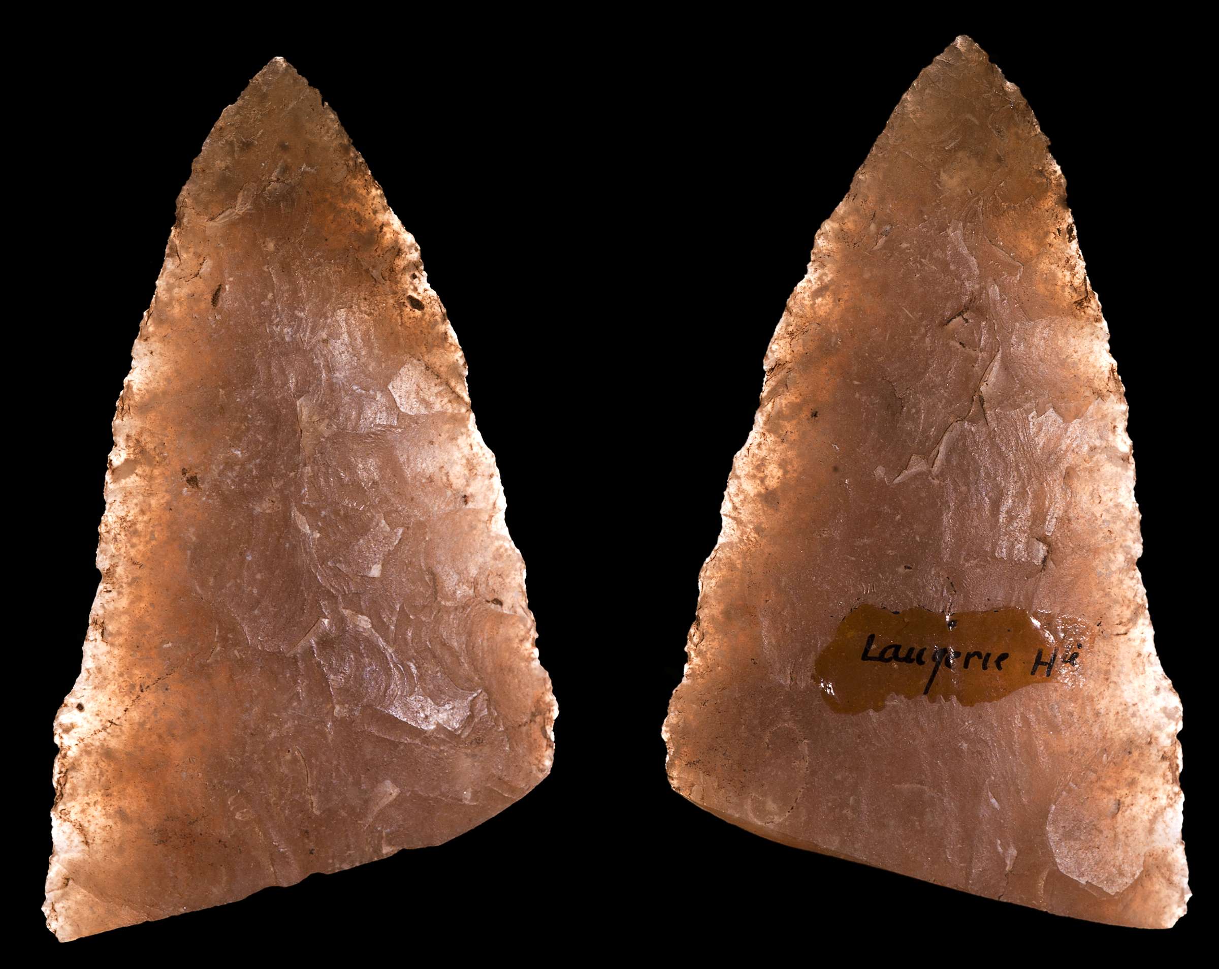
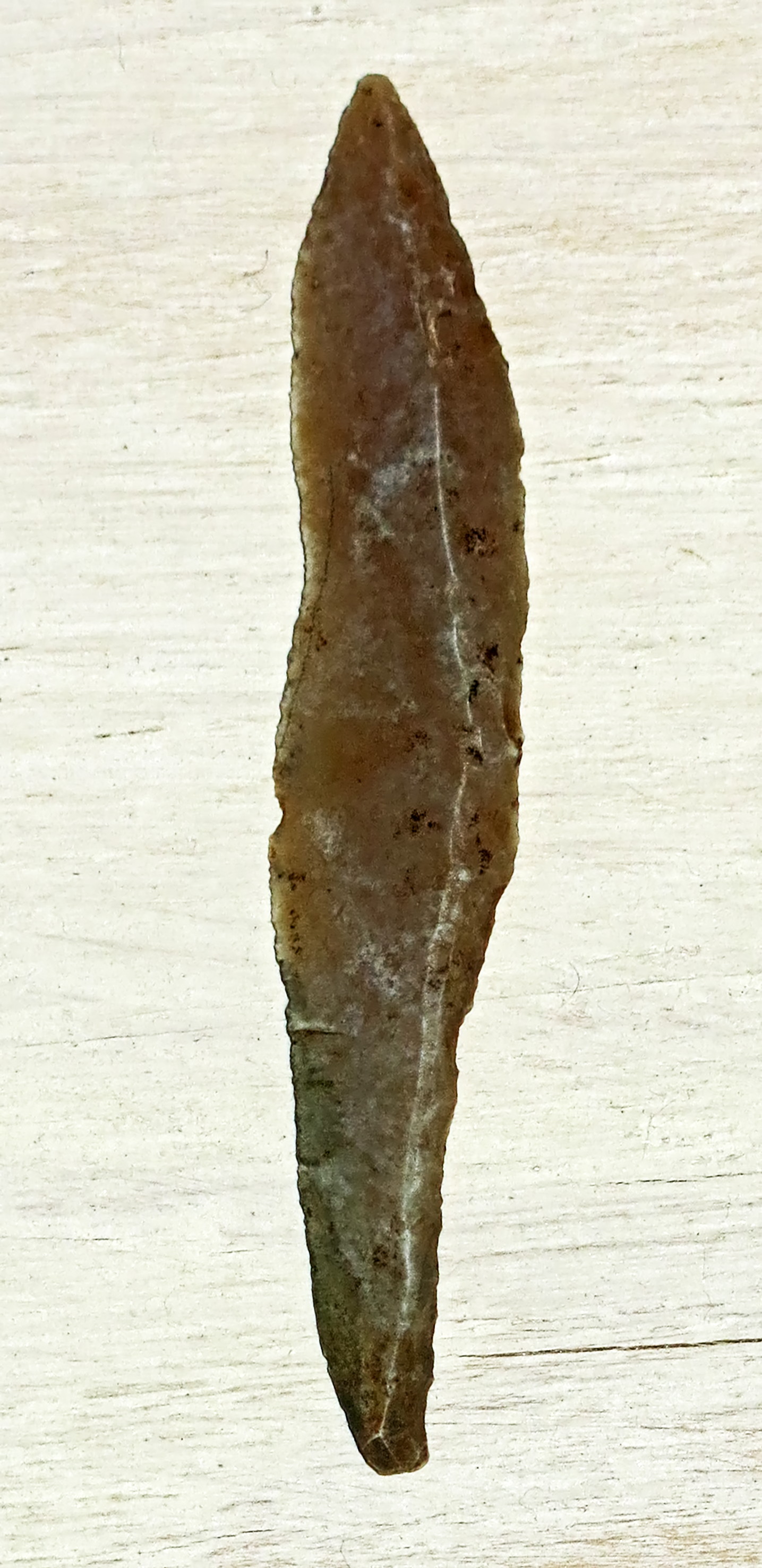
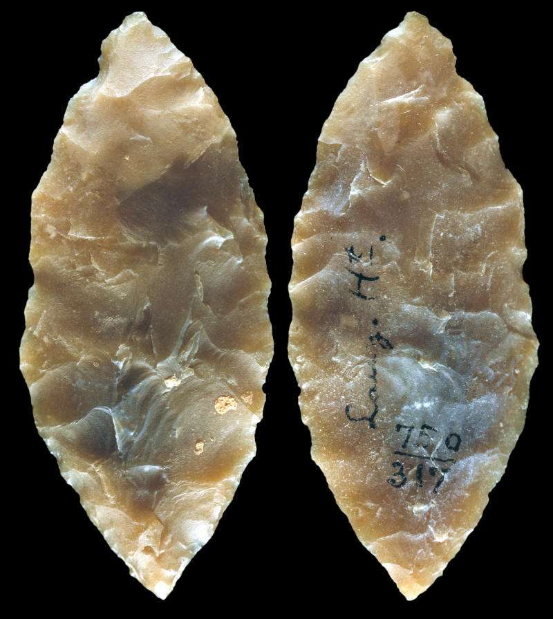
Fragment of a flint laurel-leaf knife from Laugerie Haute, different views of the same specimen.
Date: Solutrean, 22 000 - 17 000 BP
Medium: flint
Dimensions: 75 × 52 × 8 mm (3 × 2 × 0.3 in)
Current location: Muséum de Toulouse, Accession number MHNT PRE.2010.0.105.1
Findspot: Laugerie-Haute, les Eyzies-de-Tayac, Dordogne France. Former collection and excavations of Édouard Lartet 1863.
Date: 2010-09-21
Photo: Didier Descouens
Permission: licensed under the Creative Commons Attribution-Share Alike 3.0 Unported license.
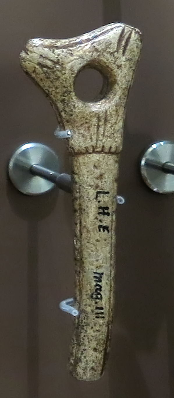
Pierced baton, Laugerie Haute East, Layer I''', excavations of D. Peyrony.
Photo: Don Hitchcock 2014
Source: Original, Le Musée National de Préhistoire, Les Eyzies-de-Tayac
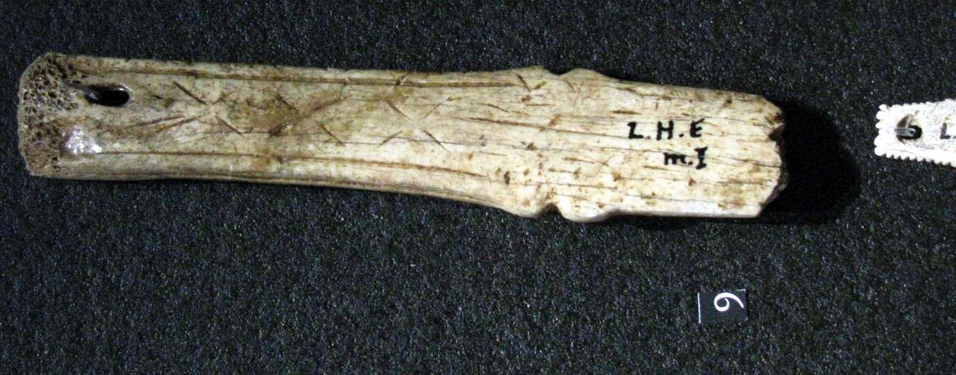
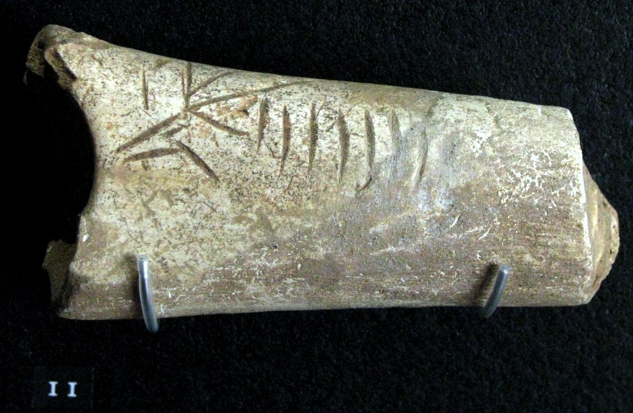
Engraved bone, Laugerie Haute East.
Photo: Don Hitchcock 2008
Source: Original on display at Le Musée National de Préhistoire, Les Eyzies-de-Tayac
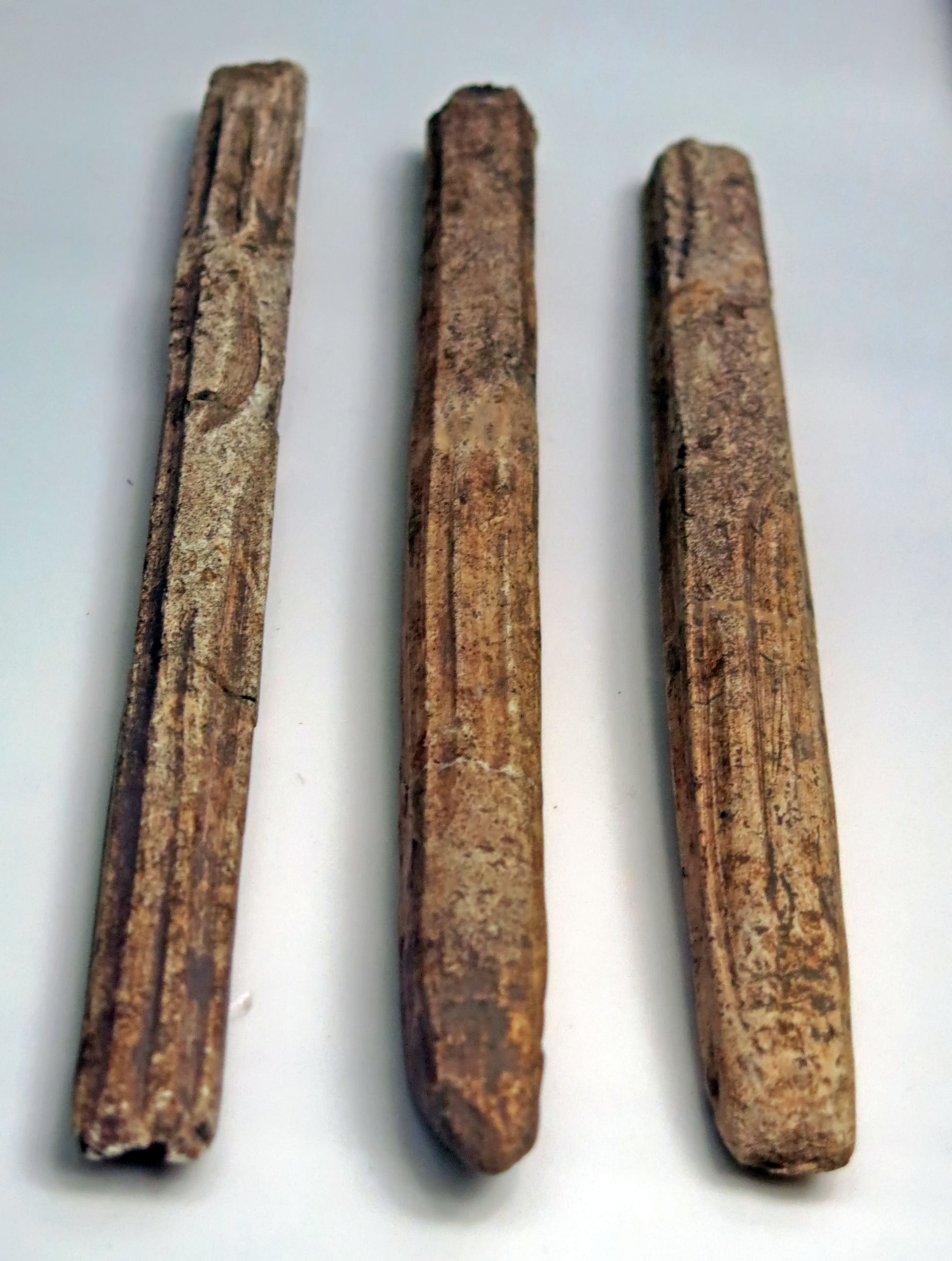
Ciseaux (literally translated, chisels) from Laugerie Haute. These may have been used as lissoirs (working hides), for flensing (removing the skin of game) or for splitting small pieces of wood.
(left) Ciseau, reindeer antler, length 208 mm, width 17 mm, thickness 13 mm.
(centre) Ciseau, reindeer antler, length 195 mm, width 20 mm, thickness 12 mm.
Photo: Don Hitchcock 2015
Catalog: (left) 61.3.56, (centre) 61.3.40
Source: Original, Musée d'Aquitaine à Bordeaux
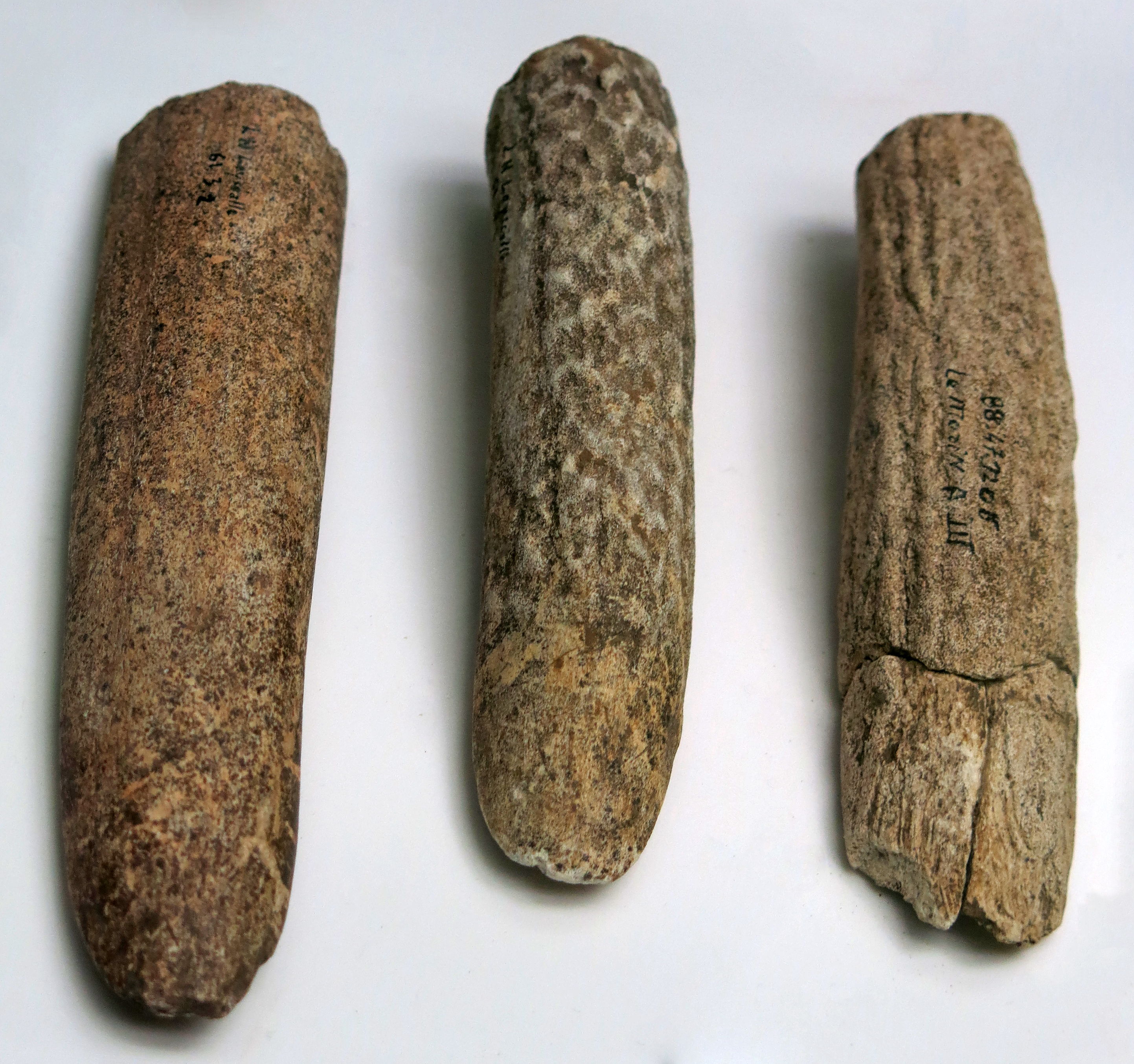
Ciseaux massifs (literally translated, massive chisels) from Laugerie Haute and le Morin. These may have been used as lissoirs (working hides), for flensing (removing the skin of game) or for splitting small pieces of wood.
(left) Ciseau, reindeer antler, length 135 mm, width 31 mm, thickness 17 mm, Laugerie Haute.
(centre) Ciseau, deer antler, length 118 mm, width 26 mm, thickness 21 mm, Laugerie Haute.
(right) Ciseau, le Morin, number 8 from level A III, page 91, Deffarge et al. (1974)
Photo: Don Hitchcock 2015
Catalog: (left) 61.3.42, (centre) 61.3.43, (right) 88.47.1206
Source: Original, Musée d'Aquitaine à Bordeaux
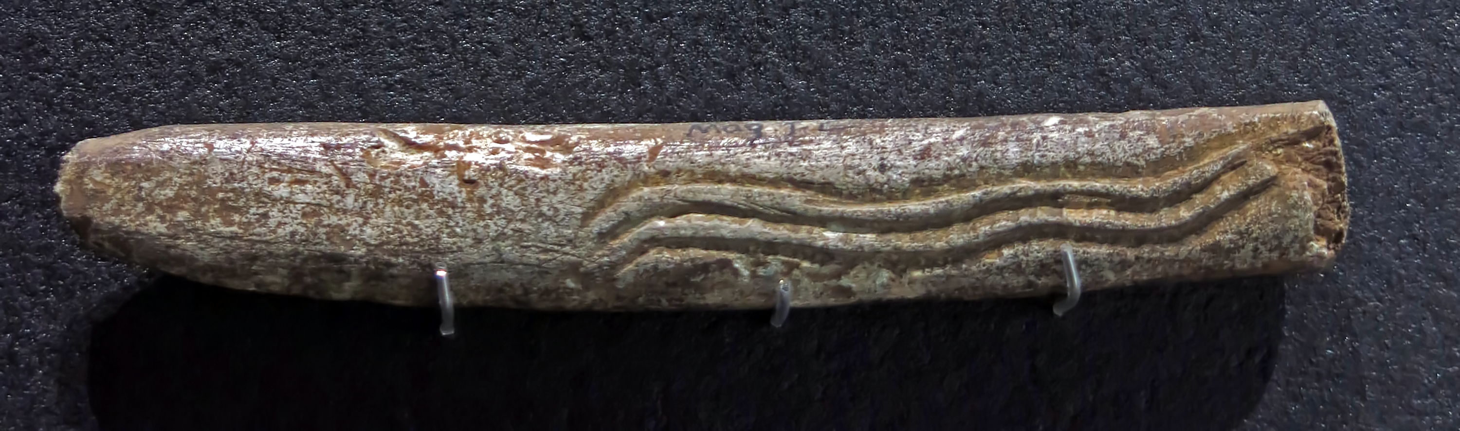
Engraved antler, Laugerie Haute East.
This was labelled as a ciseau, or chisel. It appears to have had a hard life, with the right end worn from hitting, and the point blunted. It may have been used for splitting small pieces of wood.
Photo: Don Hitchcock 2014
Source: Original on display at Le Musée National de Préhistoire, Les Eyzies-de-Tayac
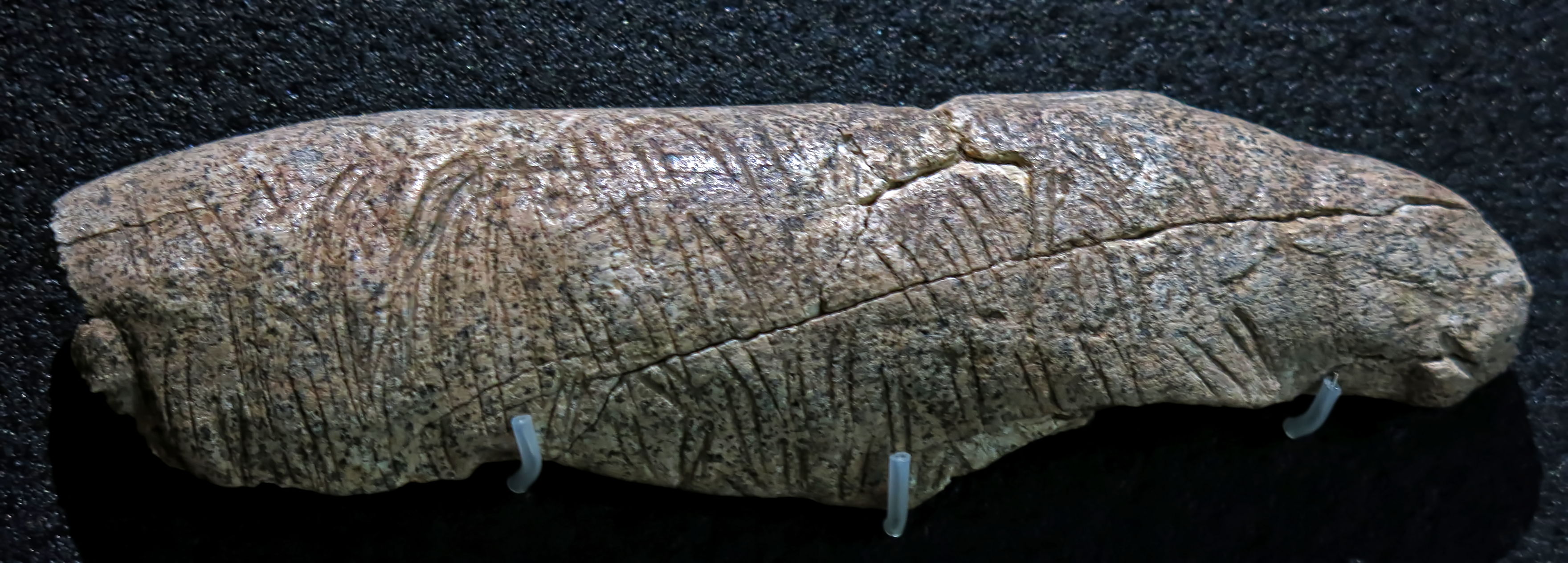
Shaped and decorated deer antler, Solutrean, Laugerie Haute West.
This piece is covered with small marks, giving the effect of an animal pelt. It is possible to imagine a feline or bear head on the right of this image, though it may be wishful thinking.
Normally, if it were an animal sculpture, the identification would be unequivocal, but in any case it is not obviously a tool.
Photo: Don Hitchcock 2014
Source: Original on display at Le Musée National de Préhistoire, Les Eyzies-de-Tayac
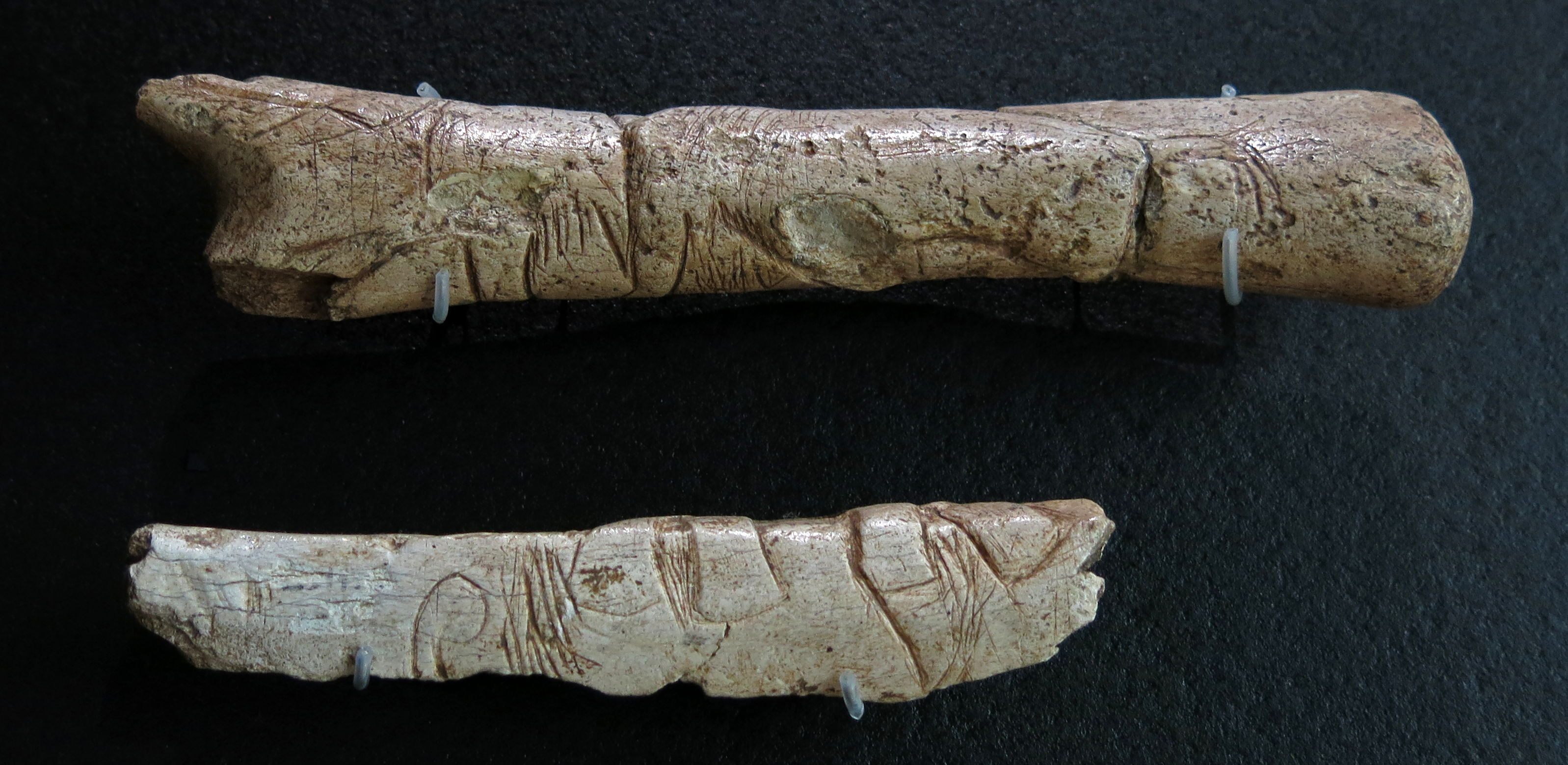
Pierced batons, Laugerie Haute East.
(above) Gravettian.
(below) Early Magdalenian.
Note that the upper baton shows two mammoths with heads pressed together, in ritual combat over mating rights.
Photo: Don Hitchcock 2014
Source: Original on display at Le Musée National de Préhistoire, Les Eyzies-de-Tayac

Harpoons with one or two rows of barbs, from Laugerie Haute, Laussel and from Le Morin.
Upper Magdalenian, in reindeer antler.
Top left: Harpoon with one row of barbs, Magdalenian V-VI, length 12 cm, Laugerie Haute, Catalog 61.3.54.
Right: Harpoon with one row of barbs, Magdalenian V, length 225 mm, Laussel, Catalog 61.3.55.
Photo: Don Hitchcock 2015
Catalog: 61.3.54, 61.3.55, 88.47.389, 88.47.395.
Source and text: Original, Musée d'Aquitaine à Bordeaux
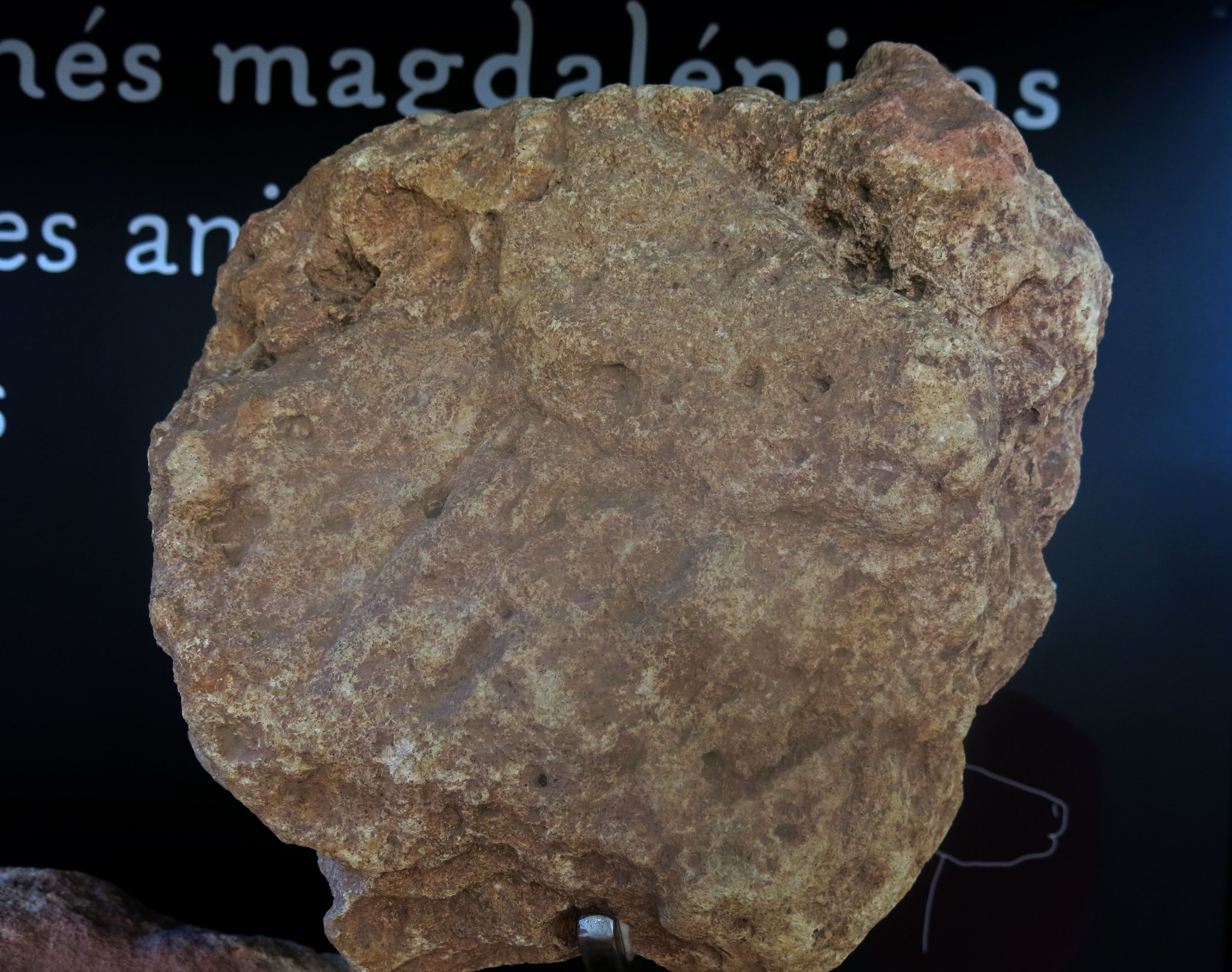
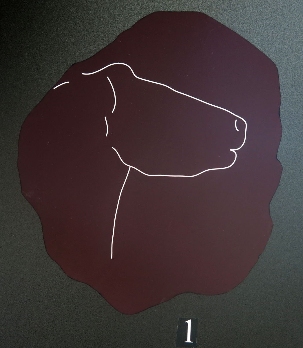
Laugerie Haute, Magdalenian engraving of a horse head.
Photo: Don Hitchcock 2014
Source: Original, display at Musée National de Préhistoire, Les Eyzies
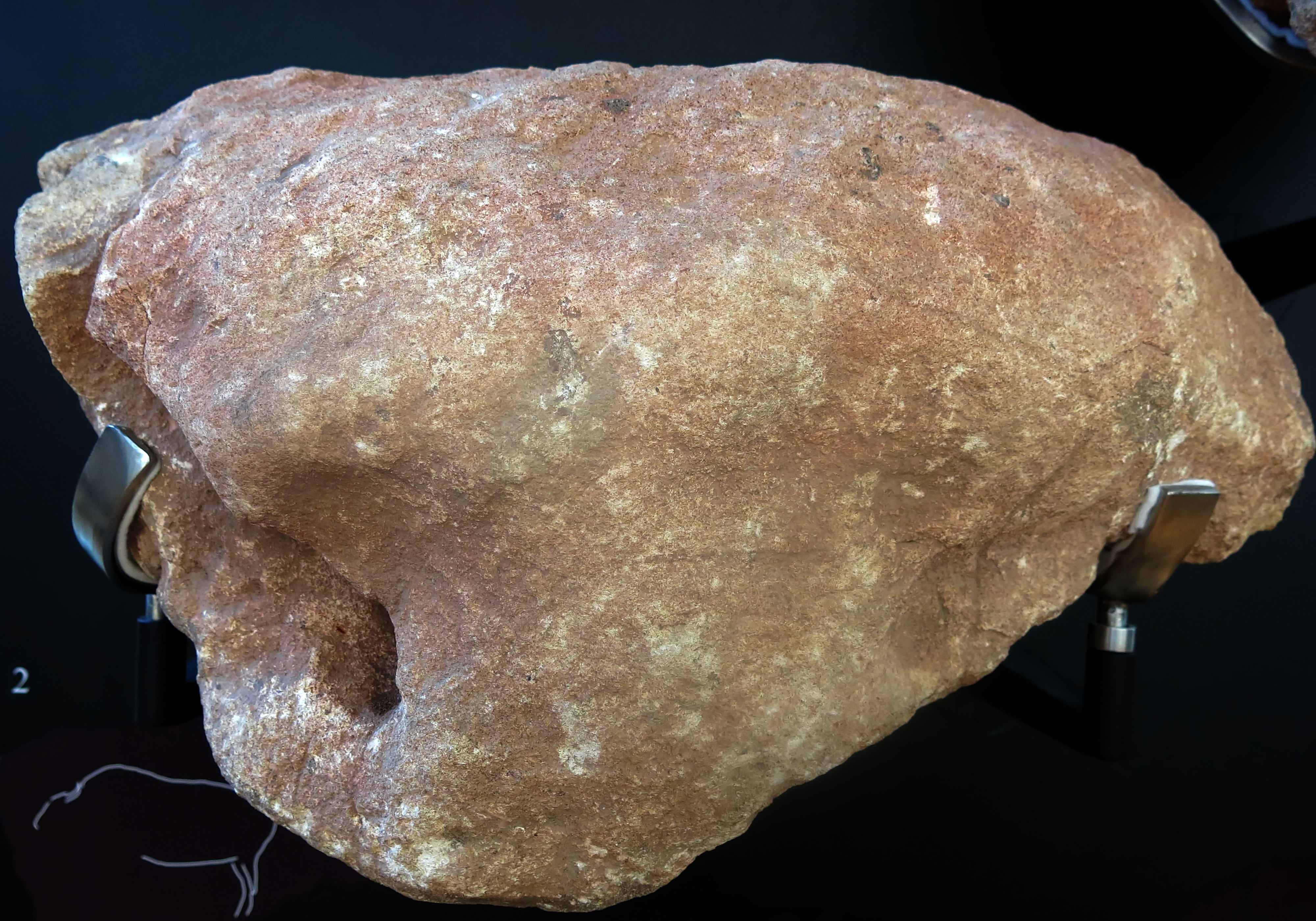
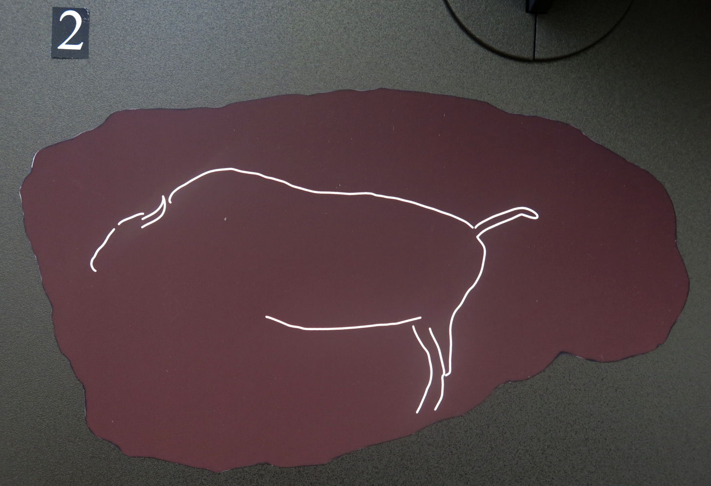
Laugerie Haute, Magdalenian engraving of a bison.
Photo: Don Hitchcock 2014
Source: Original, display at Musée National de Préhistoire, Les Eyzies
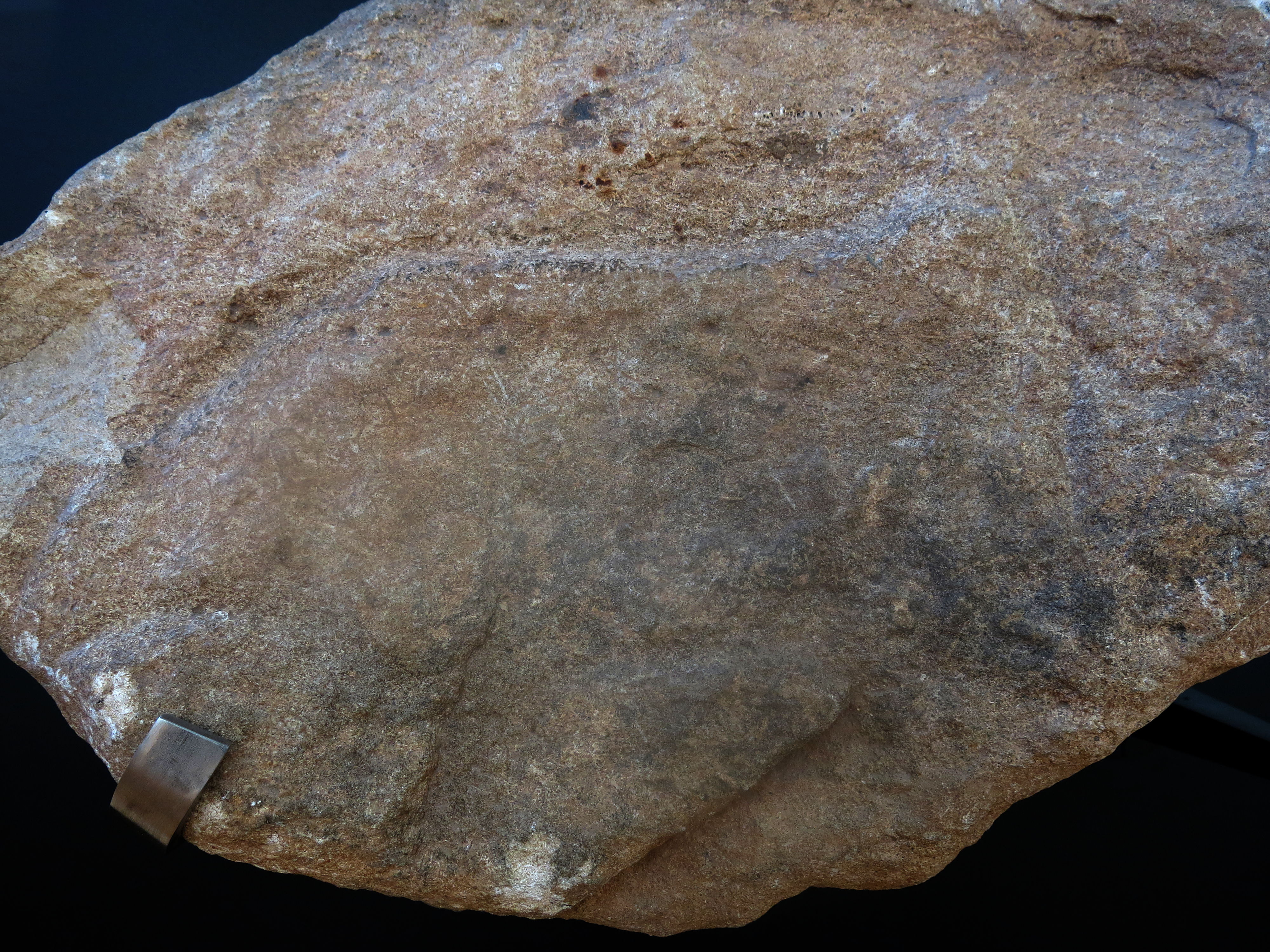
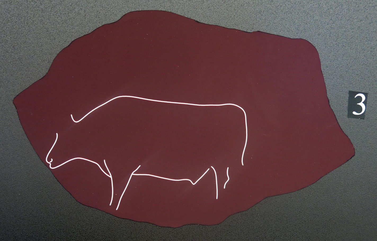
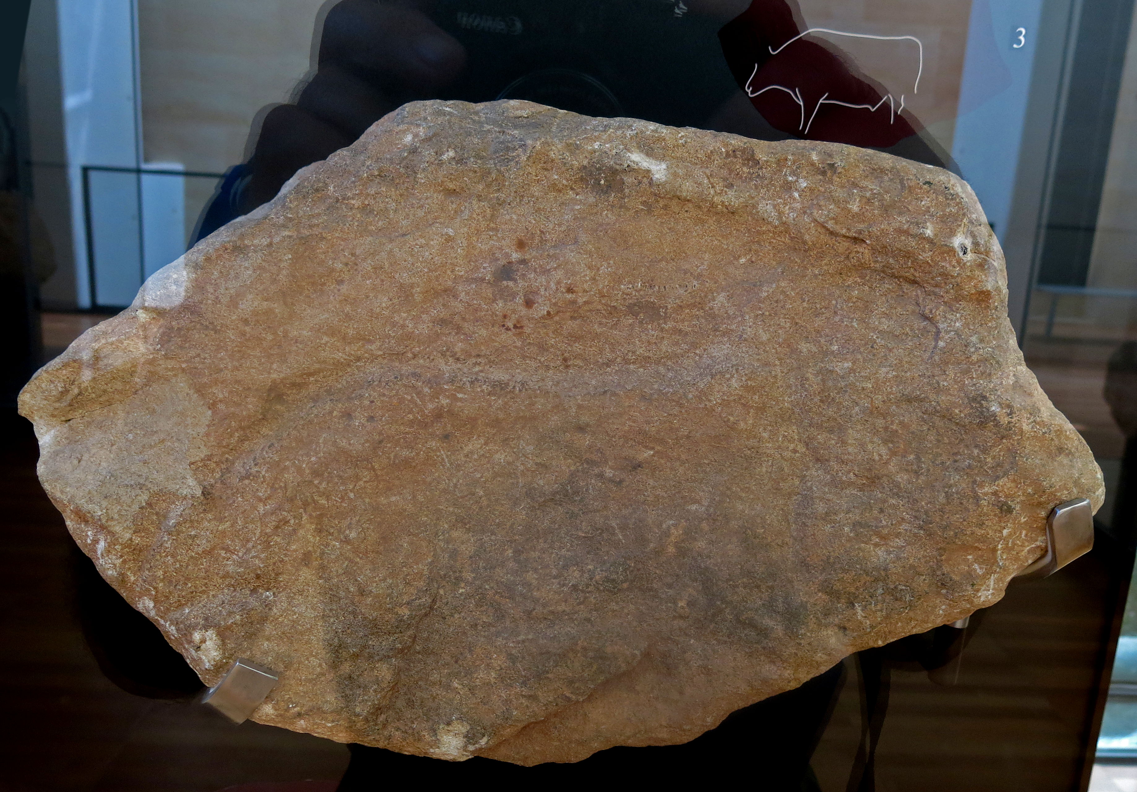
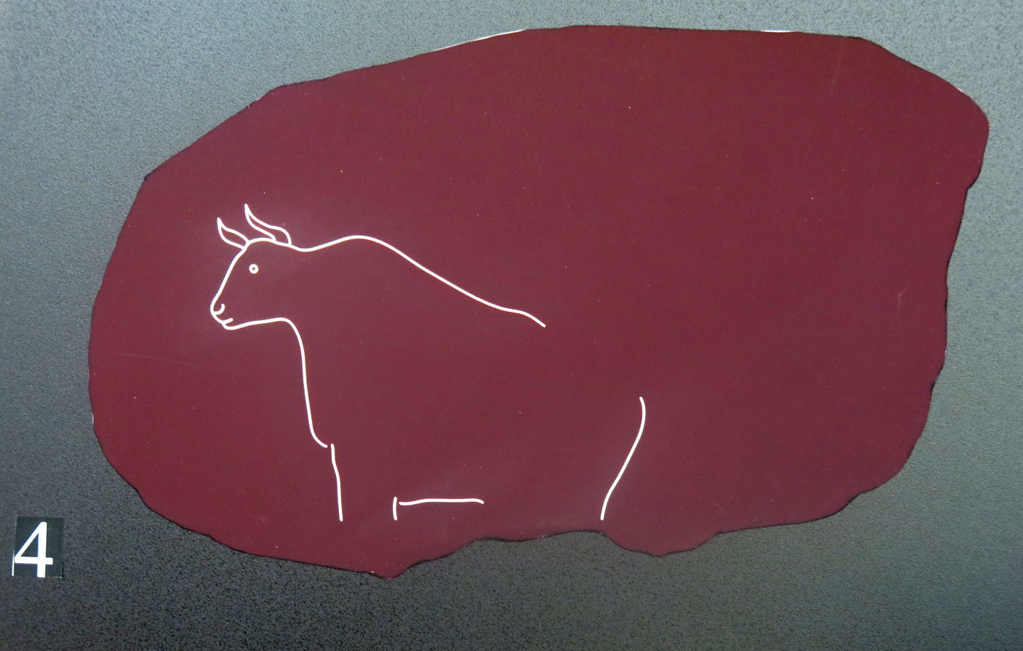
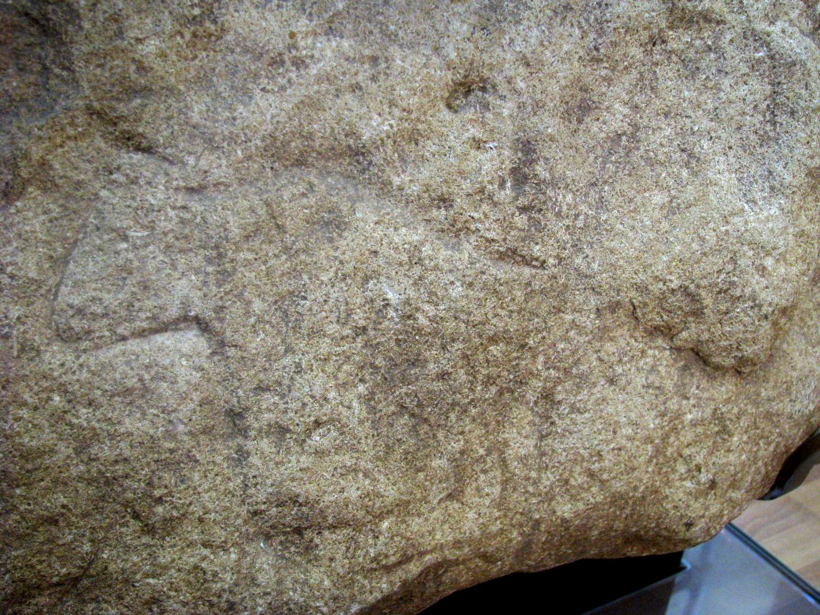
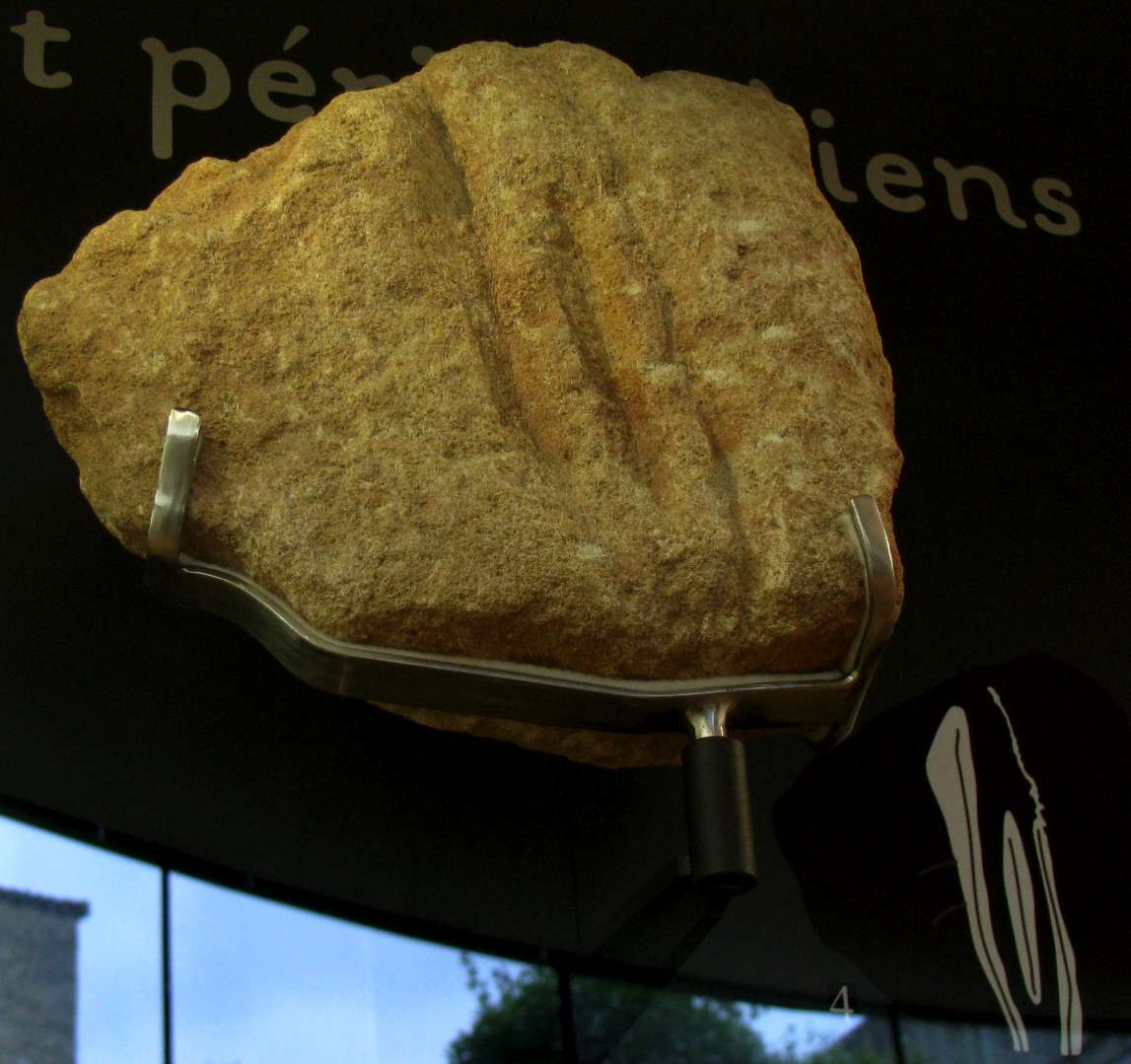
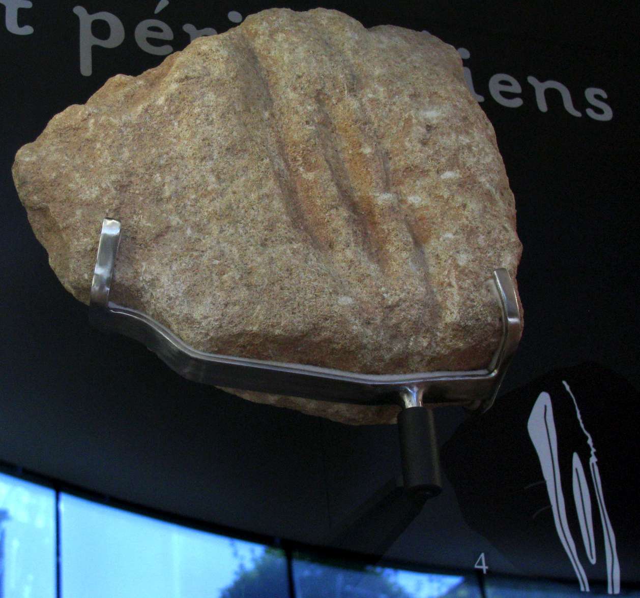
Laugerie Haute, close up of a Magdalenian engraving of an aurochs.
Photo: Don Hitchcock 2014
Source: Original, display at Musée National de Préhistoire, Les Eyzies

Laugerie Haute, Magdalenian engraving of an aurochs showing the complete block.
Photo: Don Hitchcock 2008, 2014
Source: Original, display at Musée National de Préhistoire, Les Eyzies
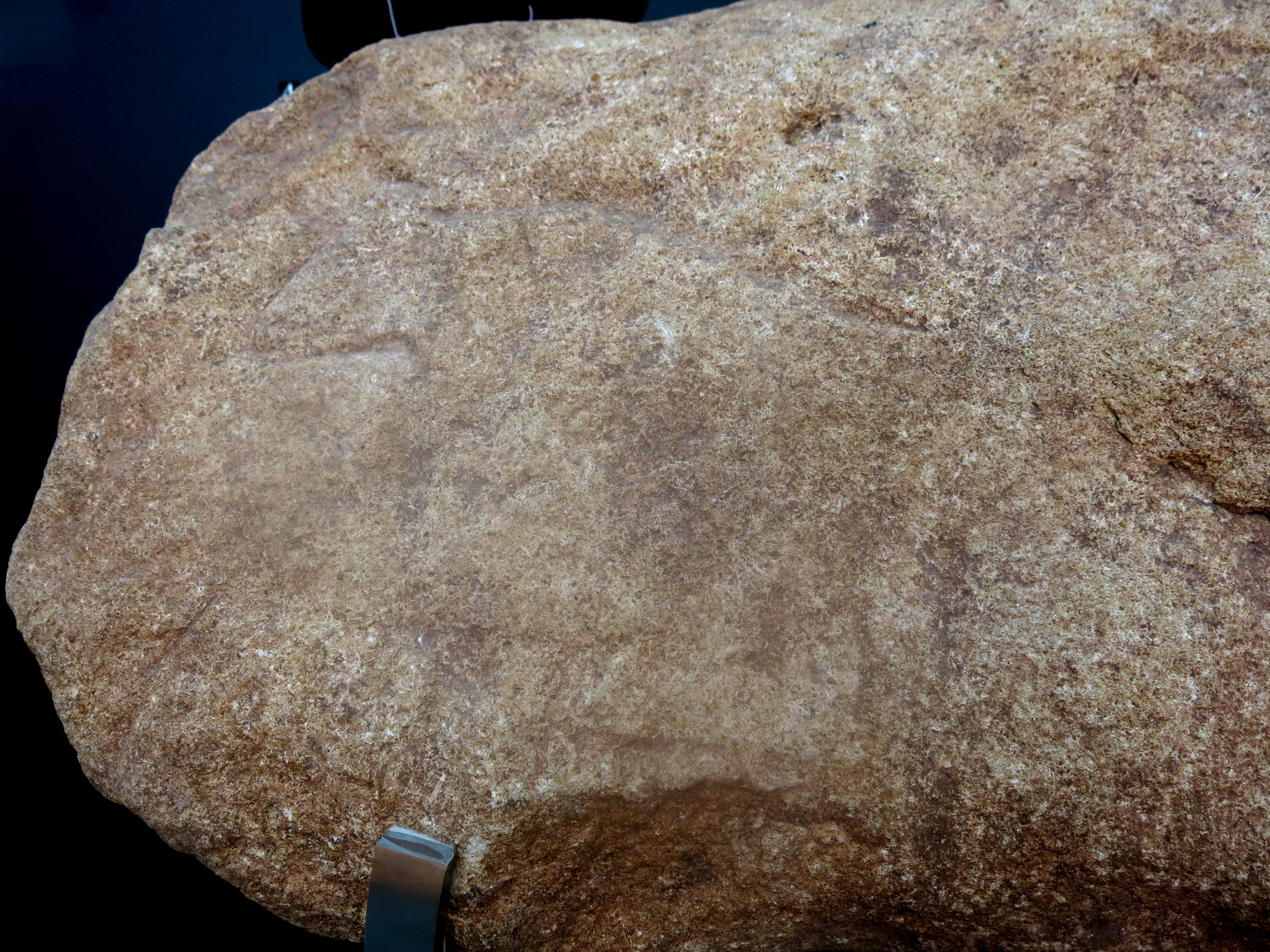
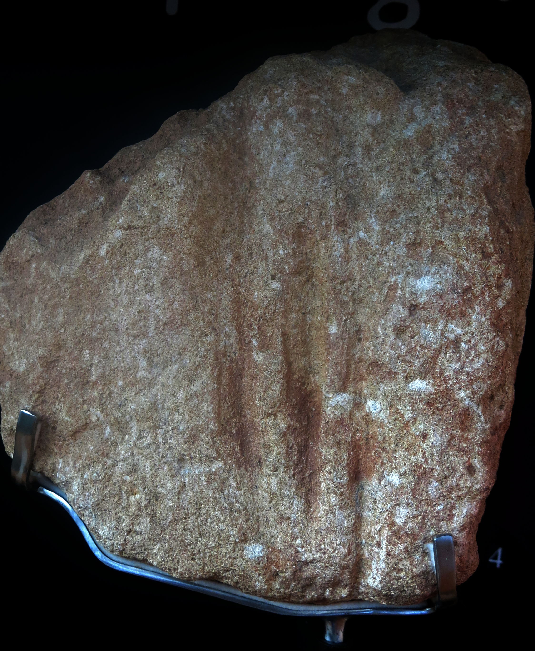
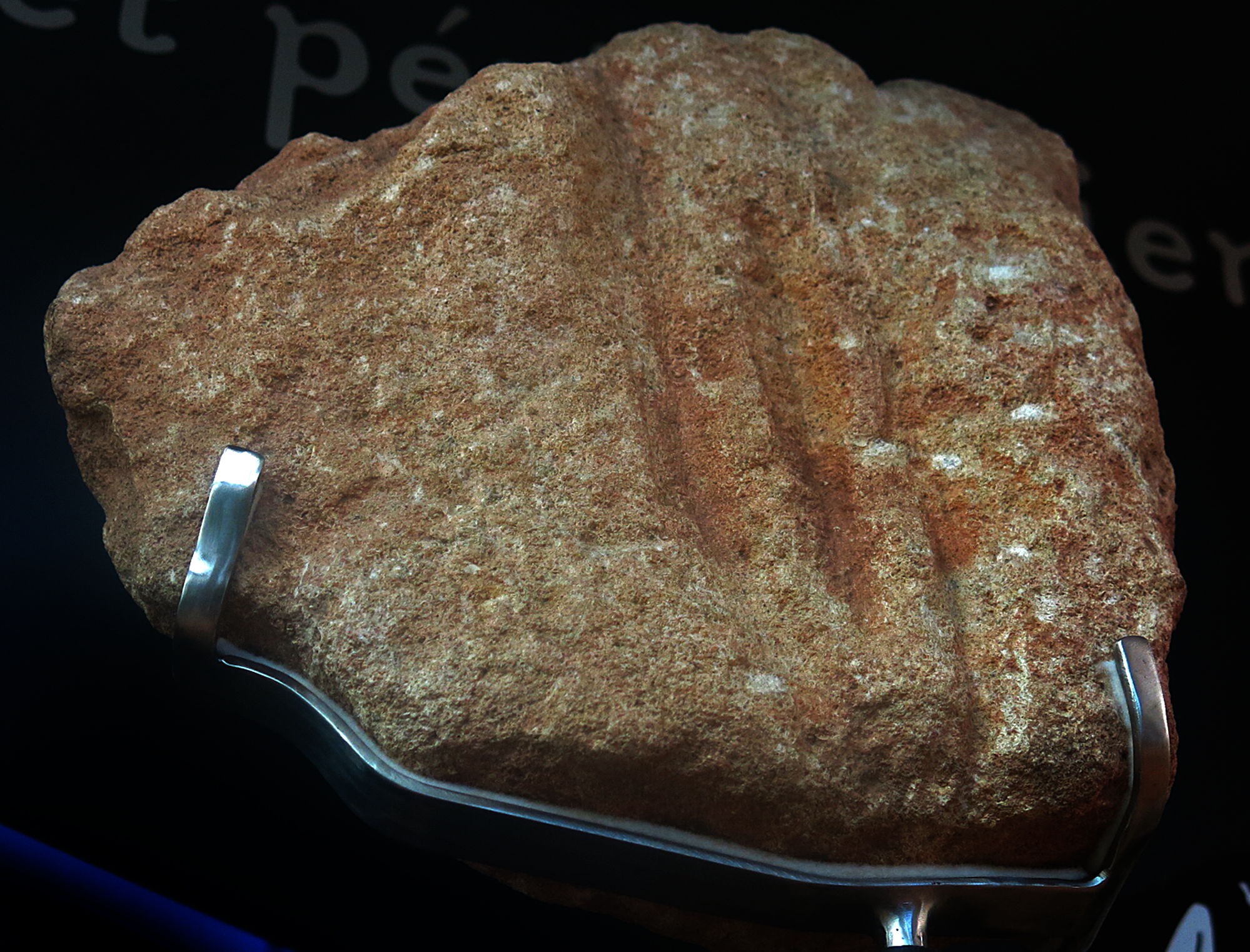
Laugerie Haute, Magdalenian, close up of an engraving of an aurochs.
Photo: Don Hitchcock 2014
Source: Original, display at Musée National de Préhistoire, Les Eyzies
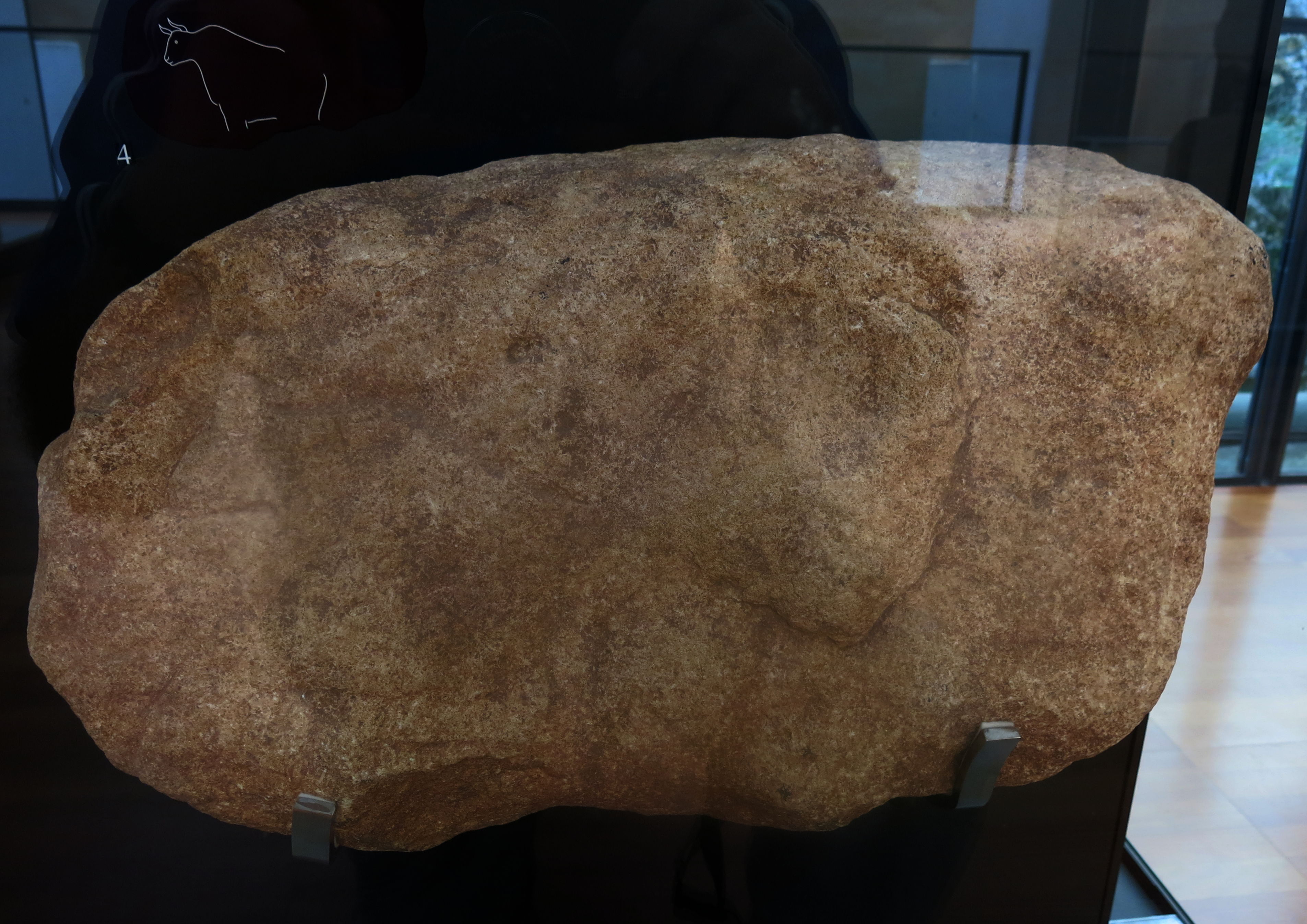
Laugerie Haute, Magdalenian, engraving of an aurochs showing a close up and the complete block.
Photo: Don Hitchcock 2008, 2014
Source: Original, display at Musée National de Préhistoire, Les Eyzies
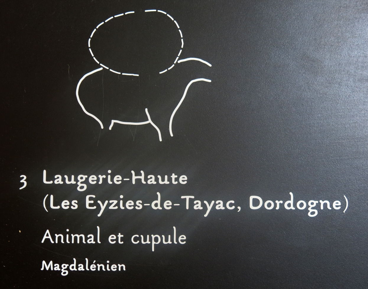
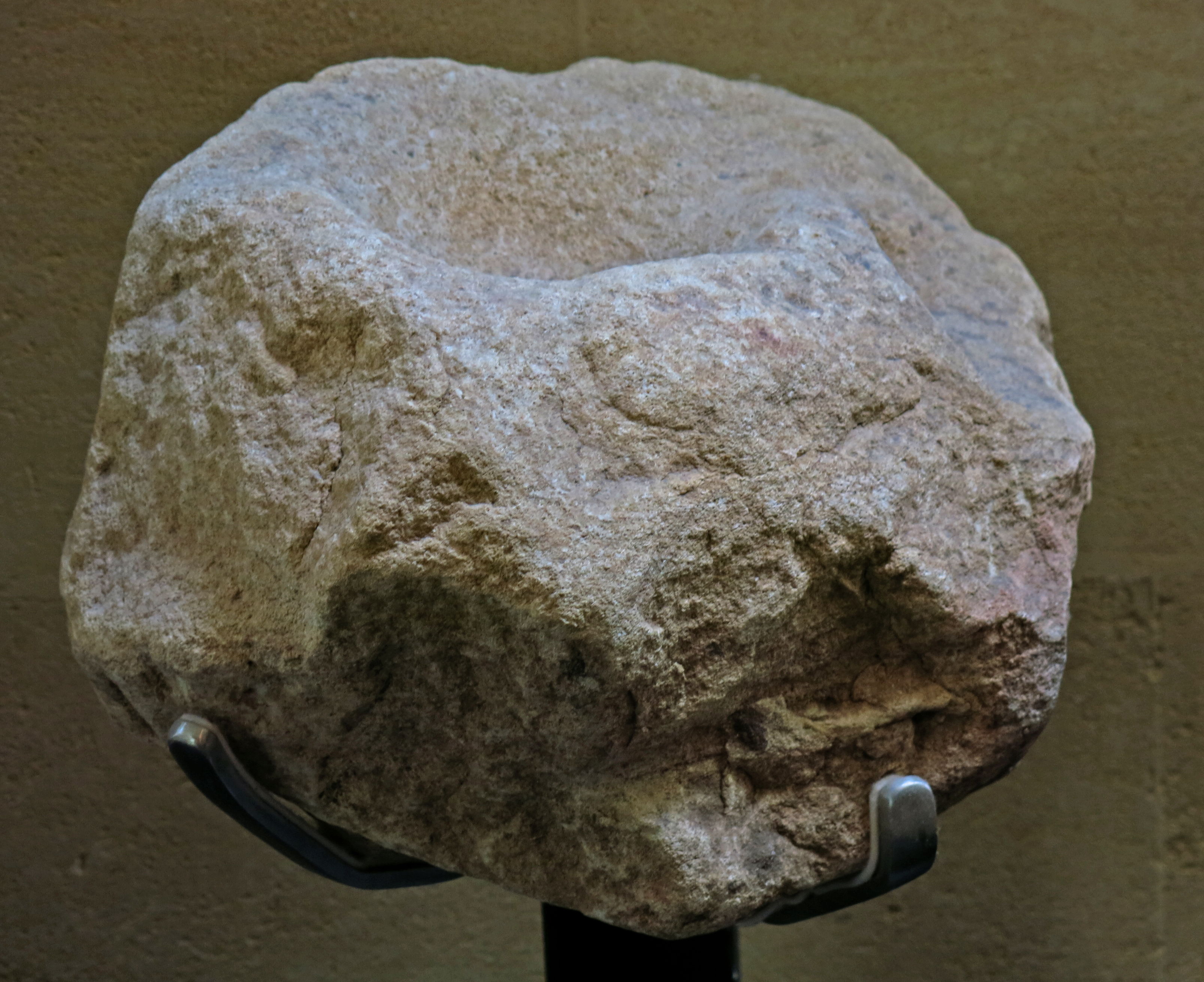
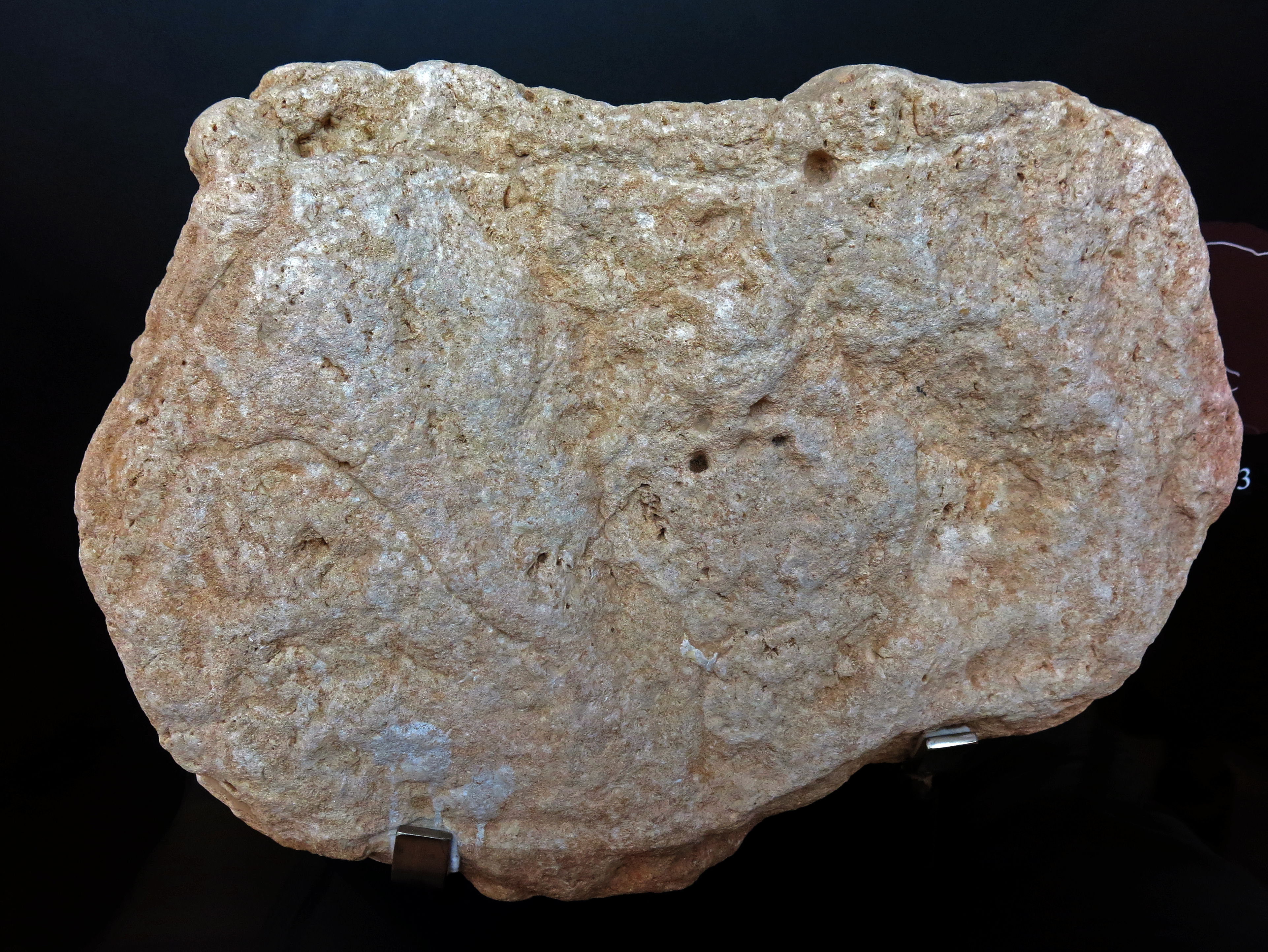
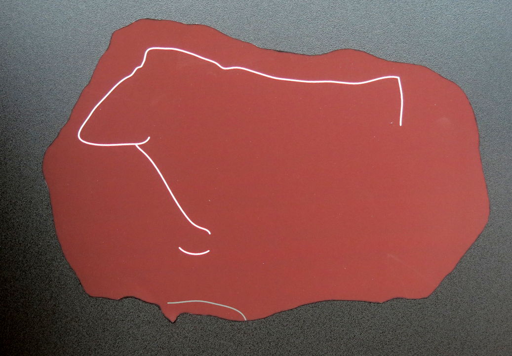
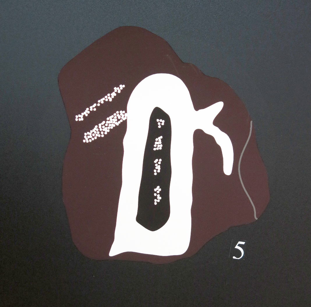
Laugerie Haute, Magdalenian, animal and cupule.
I am unable to distinguish the engraving (shown in the sketch) in these photos.
This seems to be one of those occasions where, as my professor of Geology a long time ago said, 'We need to use the eye of faith in this case'.
Photo: Don Hitchcock 2014
Source: Original, display at Musée National de Préhistoire, Les Eyzies
Laugerie Haute, Magdalenian, animal engraving.
Labelled as a horse.
Photo: Don Hitchcock 2014
Source: Original, display at Musée National de Préhistoire, Les Eyzies
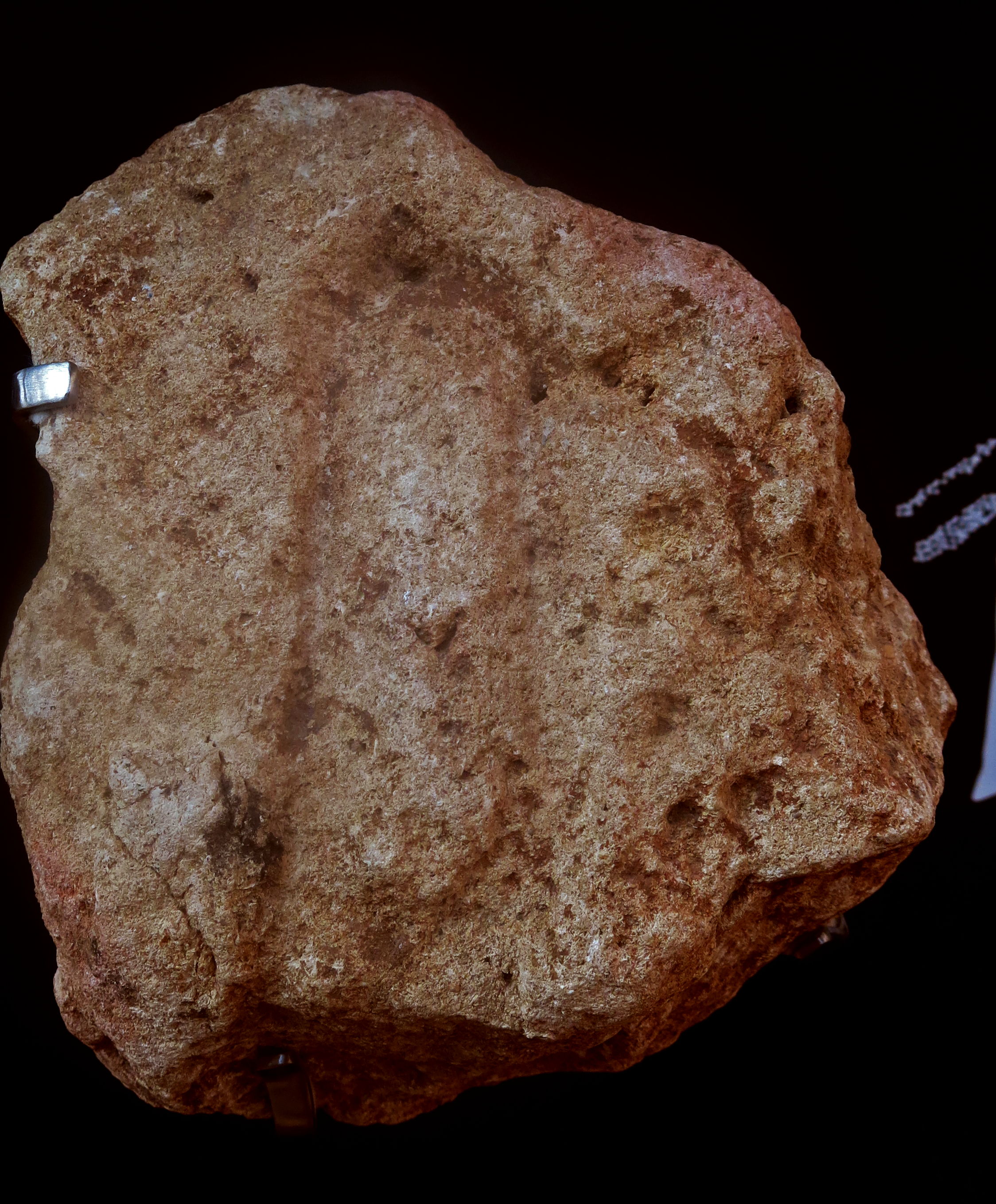
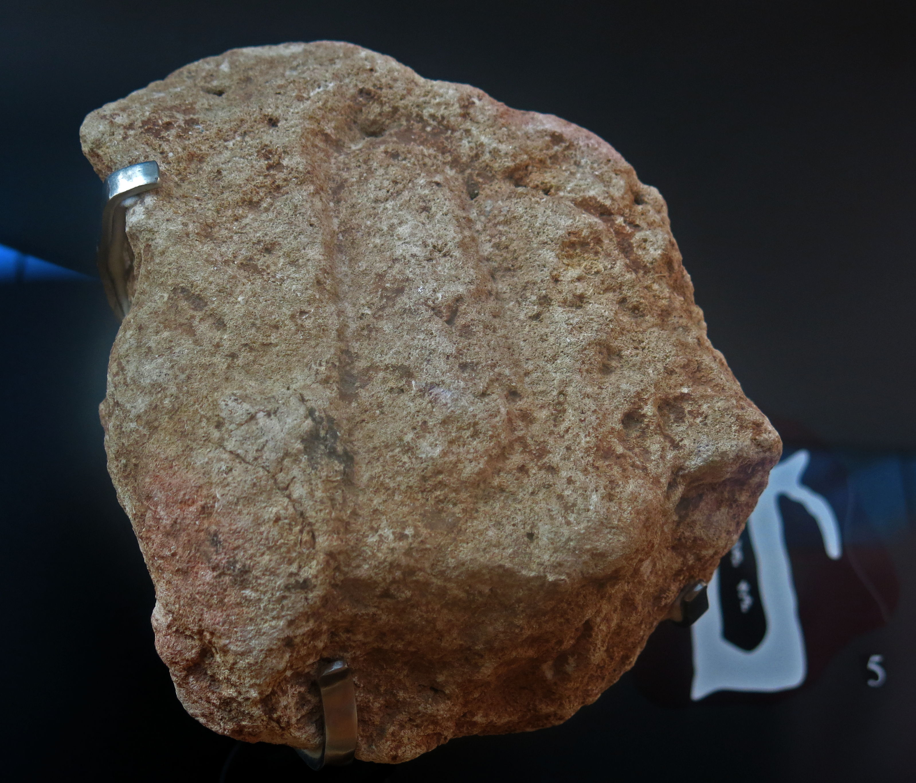
Laugerie Haute East, Perigordian engraving (vulva?).
Number 5 on the display.
Photo: Don Hitchcock 2014
Source: Original, display at Musée National de Préhistoire, Les Eyzies
Laugerie Haute East, Perigordian engraving (vulva?).
Number 5 on the display.
Photo: Don Hitchcock 2014
Source: Original, display at Musée National de Préhistoire, Les Eyzies
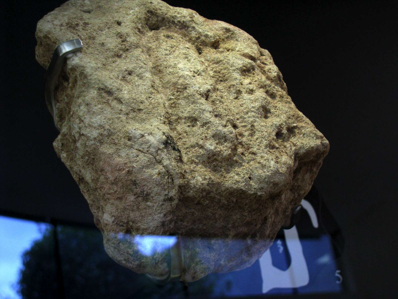
Laugerie Haute East, Perigordian engraving (vulva?).
Number 5 on the display.
Photo: Don Hitchcock 2008
Source: Original, display at Musée National de Préhistoire, Les Eyzies
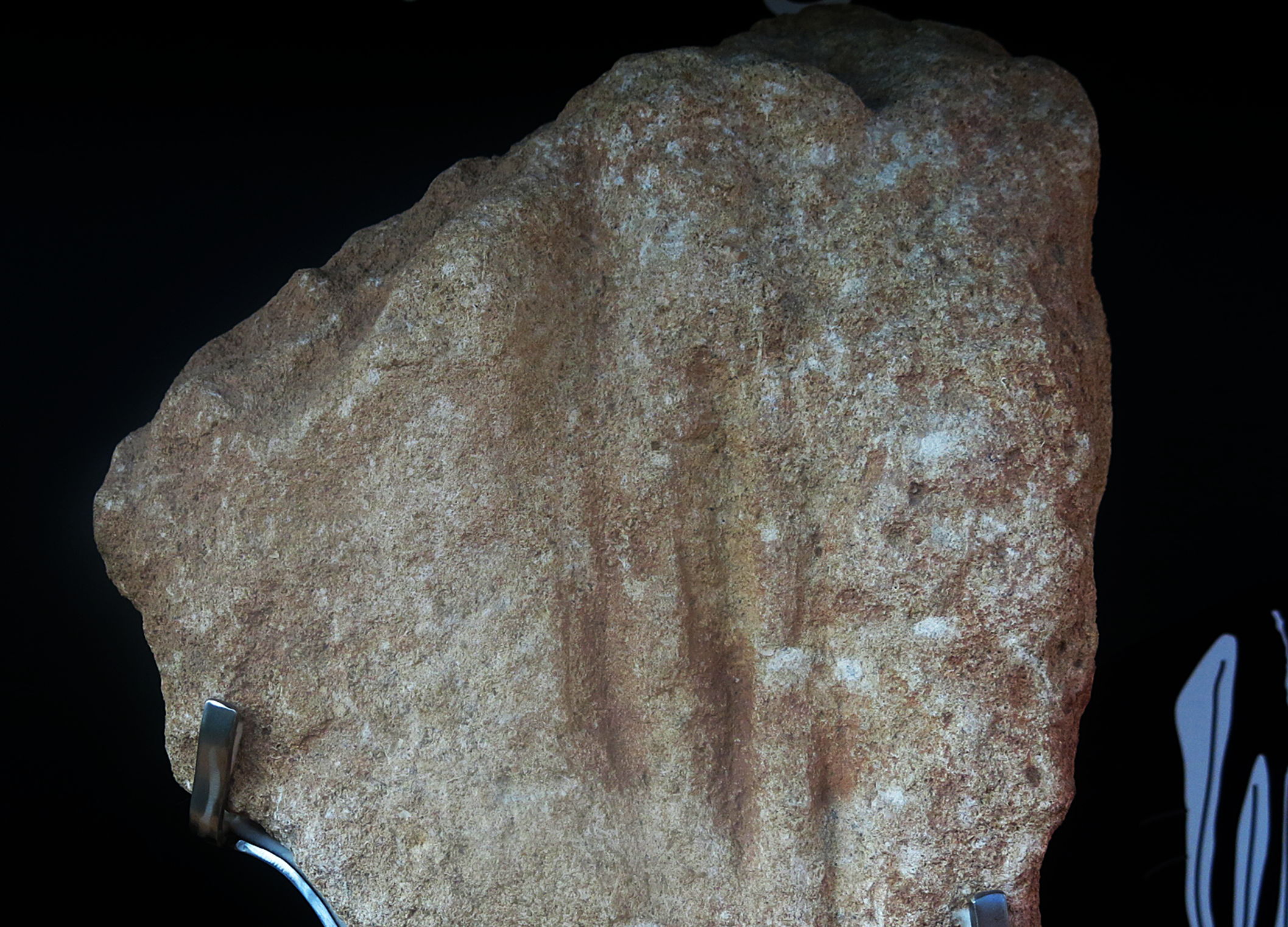
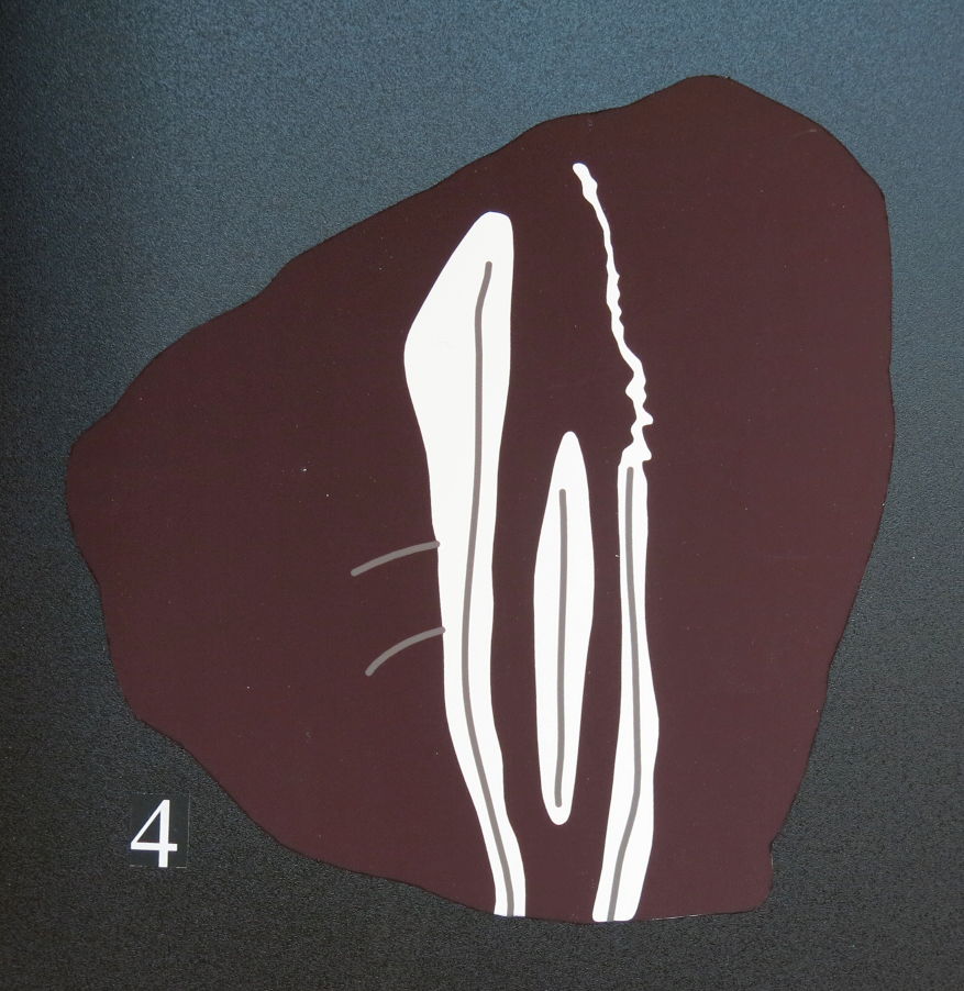
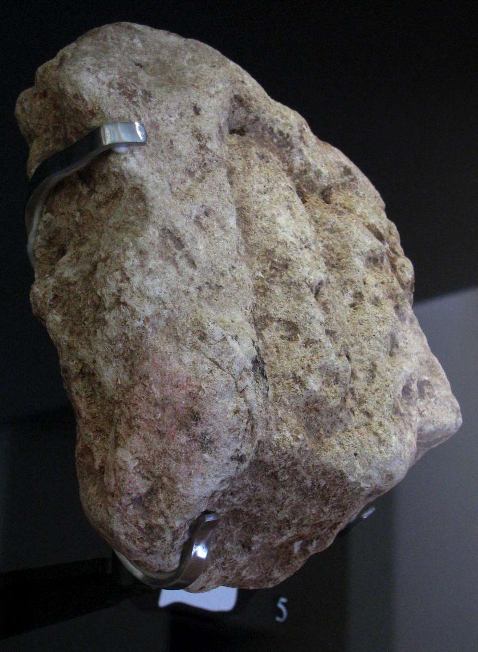
Laugerie Haute West, Perigordian engraving of a vulva.
Number 4 on the display.
Photo: Don Hitchcock 2014
Source: Original, display at Musée National de Préhistoire, Les Eyzies
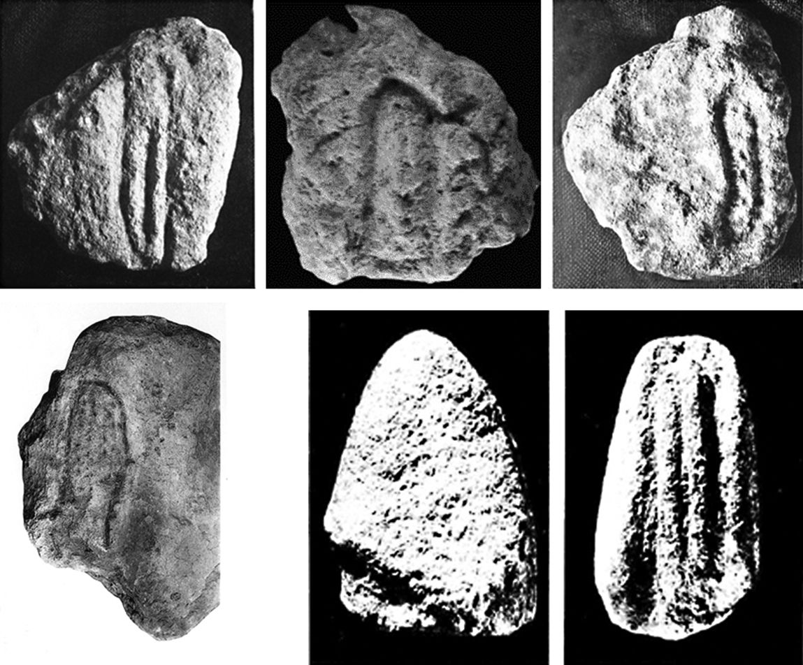
Laugerie-Haute and Laussel Gravettian phalli-vulvas
(top left) Laugerie Haute West Couch-B (source unknown)
(top centre) Laugerie-Haute East Couche-B (photo Don Hitchcock, donsmaps.com)
(top right) Laugerie-Haute East Couche-B (source unknown)
(bottom left) Laugerie Haute West-Couche B (after Peyrony & Peyrony 1938 )
(bottom centre) Laussel, glans penis block (after Duhard & Roussot 1988 : fig. 1)
(bottom right) Laussel, vulva-phallus block (after Duhard & Roussot 1988 : fig. 1)
Collage and text: James Harrod
Source: Unpublished MS, James Harrod
Laugerie Haute West, Perigordian engraving of a vulva.
Number 4 on the display.
Photo: Don Hitchcock 2008
Source: Original, display at Musée National de Préhistoire, Les Eyzies

Laugerie Haute West, Perigordian engraving of a vulva.
Number 4 on the display.
Photo: Don Hitchcock 2014
Source: Original, display at Musée National de Préhistoire, Les Eyzies
Laugerie Haute West, Perigordian engraving of a vulva.
Number 4 on the display.
Photo: Don Hitchcock 2014
Source: Original, display at Musée National de Préhistoire, Les Eyzies
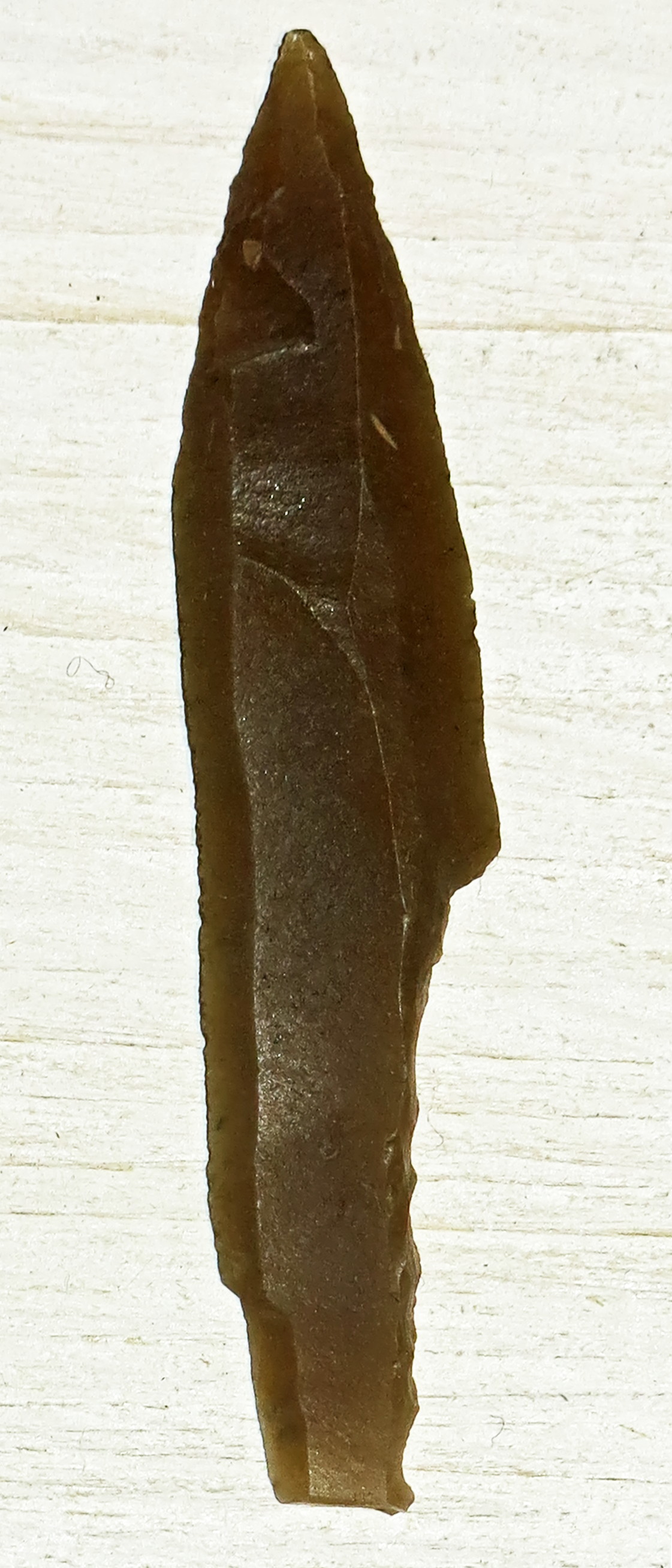
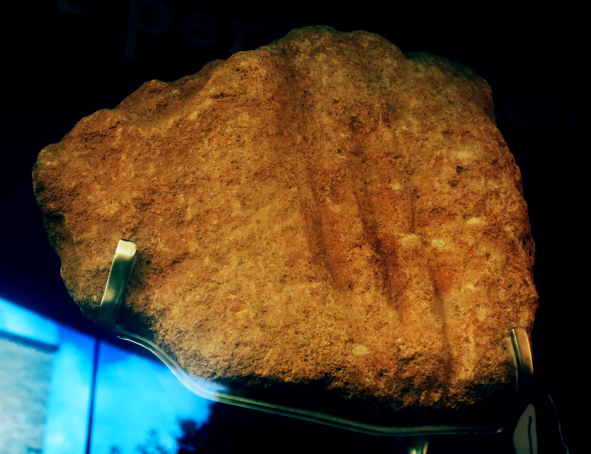
Solutrean Laurel Leaf Point
This small laurel-leaf point was found on the Laugerie Haute site. These small bifaces are believed to have been used as projectile points that once tipped the ends of spears or darts. They were probably thrown with the use of a spear thrower. This point is made of a semi-translucent honey colored chert and measures 6.5 cm long, 2.7 cm wide and .7 cm thick.
Photo: © Peter A. Bostrom, American Museum of Natural History Collection
Source, photo and text: http://www.lithiccastinglab.com/gallery-pages/2008januarysolutreanpage1.htm
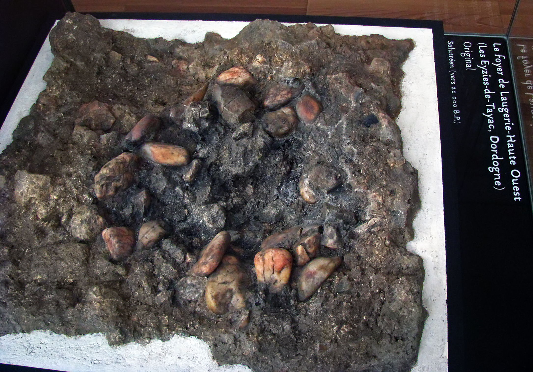
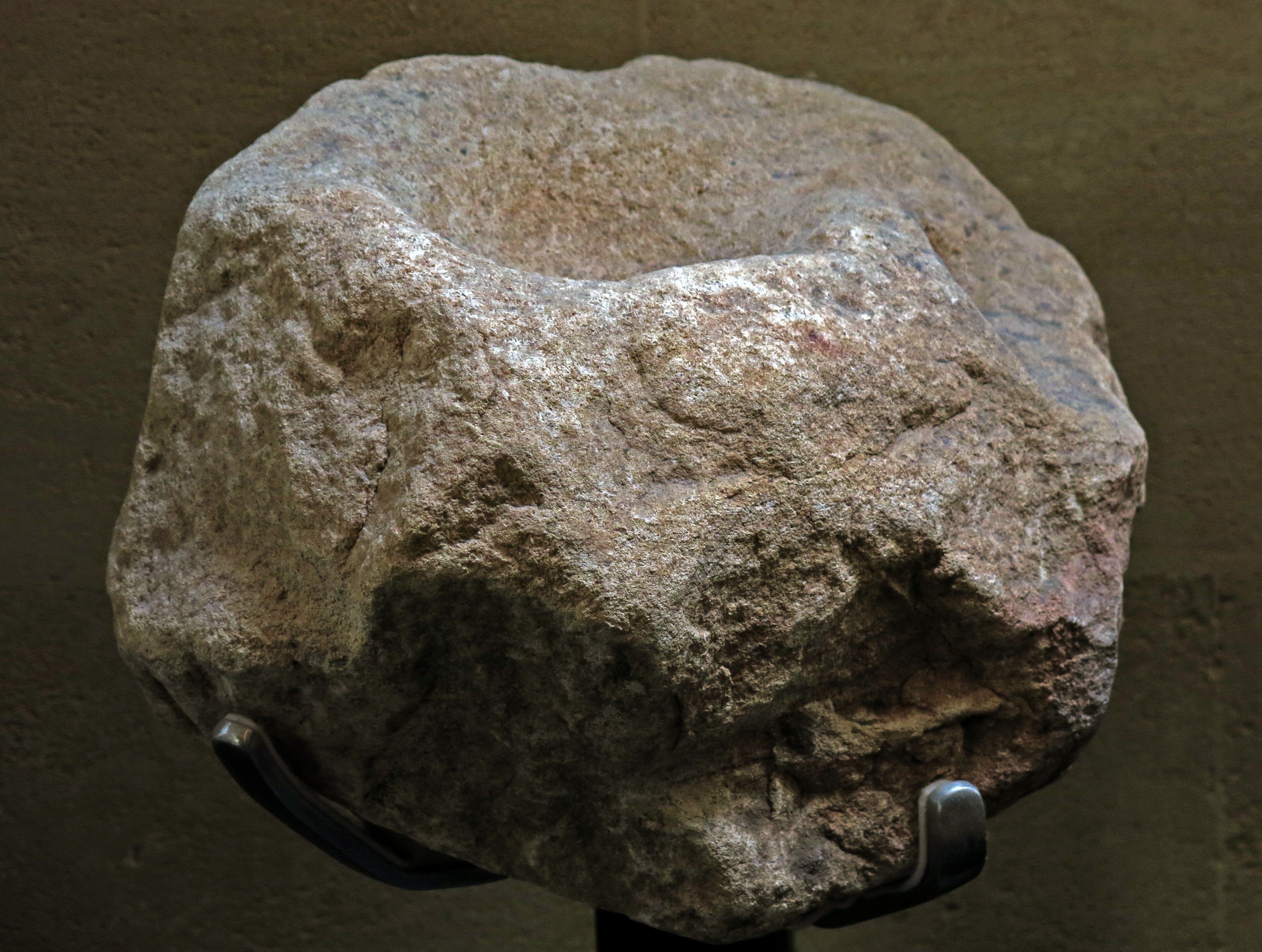
Fireplace at Laugerie-Haute Ouest , Solutrean (about 20 000 BP)
This is one of the original foyers, or fireplaces, at Laugerie Haute West. How wonderful that it was preserved in its entirety. The stones would have been heated in the fire to boil water for cooking meat, or for soups, either in waterproof wooden boxes or waterproof baskets, or hide bags, or a hide lined hole in the ground nearby. Stones such as these are often found cracked from immersion when hot into cold water.
Photo: Don Hitchcock 2008
Source: Original on display at Le Musée National de Préhistoire, Les Eyzies-de-Tayac
Laugerie Haute Est - Bâton percé - Magdalénien
Decorated pierced baton from Laugerie Haute Est.
Photo: Don Hitchcock 2008
Source: Original on display at Le Musée National de Préhistoire, Les Eyzies-de-Tayac
From Wikipedia:
To use the bâton percé as a spear thrower, a length of cord is attached to the spear, near the middle of the spear. Leather would be suitable for lighter spears, while sinew would be required for heavier spears. The addition of the cord turns the spear in to a large Swiss arrow. Using the spear thus equipped as a Swiss arrow resulted in a 43% increase in range, compared to a hand thrown spear.
The bâton percé is used by feeding the cord through the hole, and laying the cord along the length of the shaft. The bâton percé is held in the hand, with the solid end held in the hand near the pinkie, and the pierced end emerging from the other end of the fist. The loose end of the cord is grasped between thumb and forefinger, and the spear is laid along the bâton percé. The spear may be twisted up to one and a half turns, which serves to stabilize the spear during the throw. The bâton percé is held over the shoulder, and thrown overhand. The length of the bâton percé serves to increase the thrower's leverage, providing more speed, and the cord acts as it does in a Swiss arrow, extending the leverage further. Use of the bâton percé in this way results in a 127% increase in range over the same hand-thrown spear.
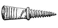
Spear straightener, pierced baton, Laugerie Haute.
Material: reindeer antler.
Photo: Don Hitchcock 2015
Catalog: 61.3.258
Source: Original, Musée d'Aquitaine à Bordeaux
Carved bone, Laugerie Haute
Solutrean/Magdalenian in age.
Photo: Don Hitchcock 2015
Catalog: 61.3.53
Source: Original, Musée d'Aquitaine à Bordeaux
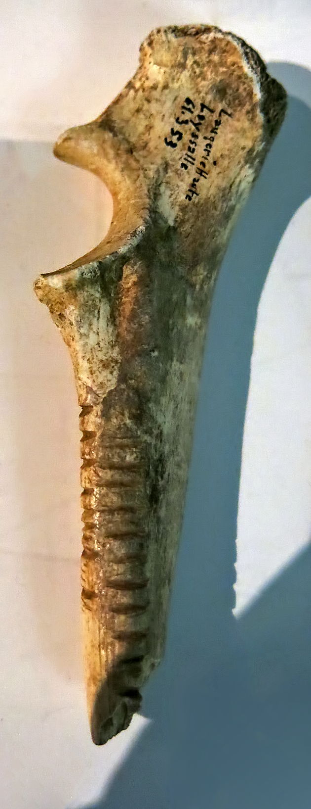
Musk Ox teeth.
Laugerie-Haute, Peyrony’s collections, Solutrean. Ovibos moschatus, 1a - first or second upper right molar ; 1b - third upper right molar (Laugerie-Haute Ouest). Scale (white line) 1cm
This third left upper molar was marked L.H.O sol.f.l (Peyrony's writing) so it was found in Solutrean deposits. It was not published as such by D. and E. Peyrony, having been wrongly attributed to deer or cattle. It was identified as a musk ox after 1989.
Photo: Ph. Jugie, MNP
Source and text: Castel et Madelaine (2006)
Remains of the Saïga Antelope are absent from the accounts of Delpech (1983) for the Solutrean Laugerie-Haute Est et Ouest from the excavations of F. Bordes. In contrast, in the material from the excavations of D. Peyrony Laugerie-Haute Ouest, six remains attributable to this species were isolated, Madelaine (1989), including an M3 Lower and an M2 Upper that are quite characteristic, but were identified wrongly as Ibex.
The presence of the saiga antelope in the Upper Solutrean from the south-west of France is now a known fact - Dujardin et Timula (2005).
For sites in the northern half of Aquitaine (Le Placard, Fourneau-du-Diable et Combe-Saunière), the Saïga is represented by relatively large numbers of remains. In sites in the south of Perigord and Quercy they are very rare (a single example at Jamblancs and Pech-de-la Boissiere). These isolated remnants are not sufficient evidence to demonstrate local hunting of Saïga - Castel et al. (2005)
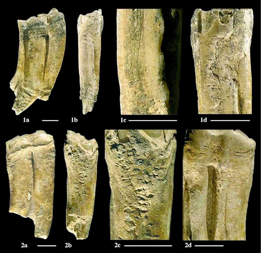
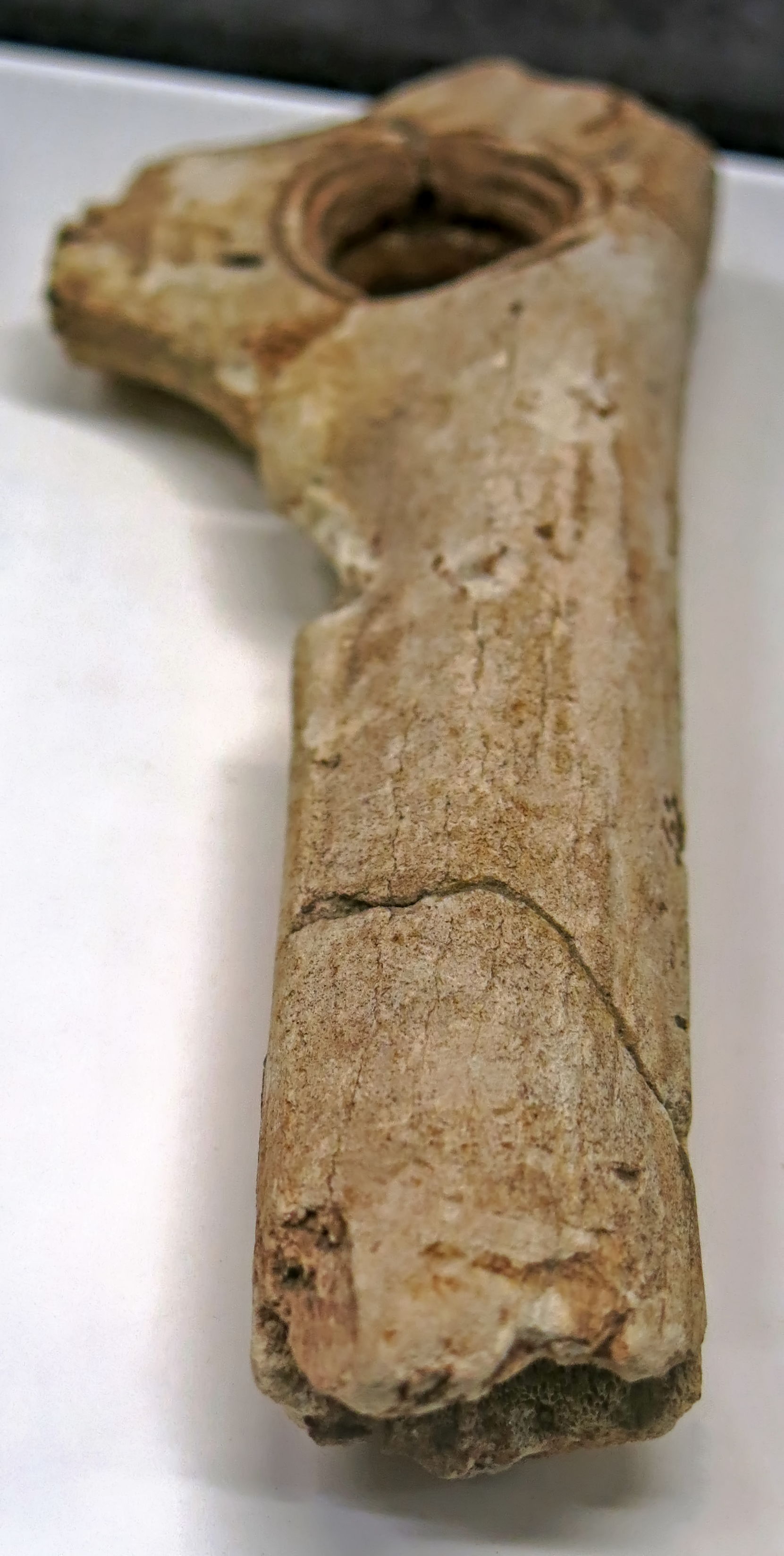
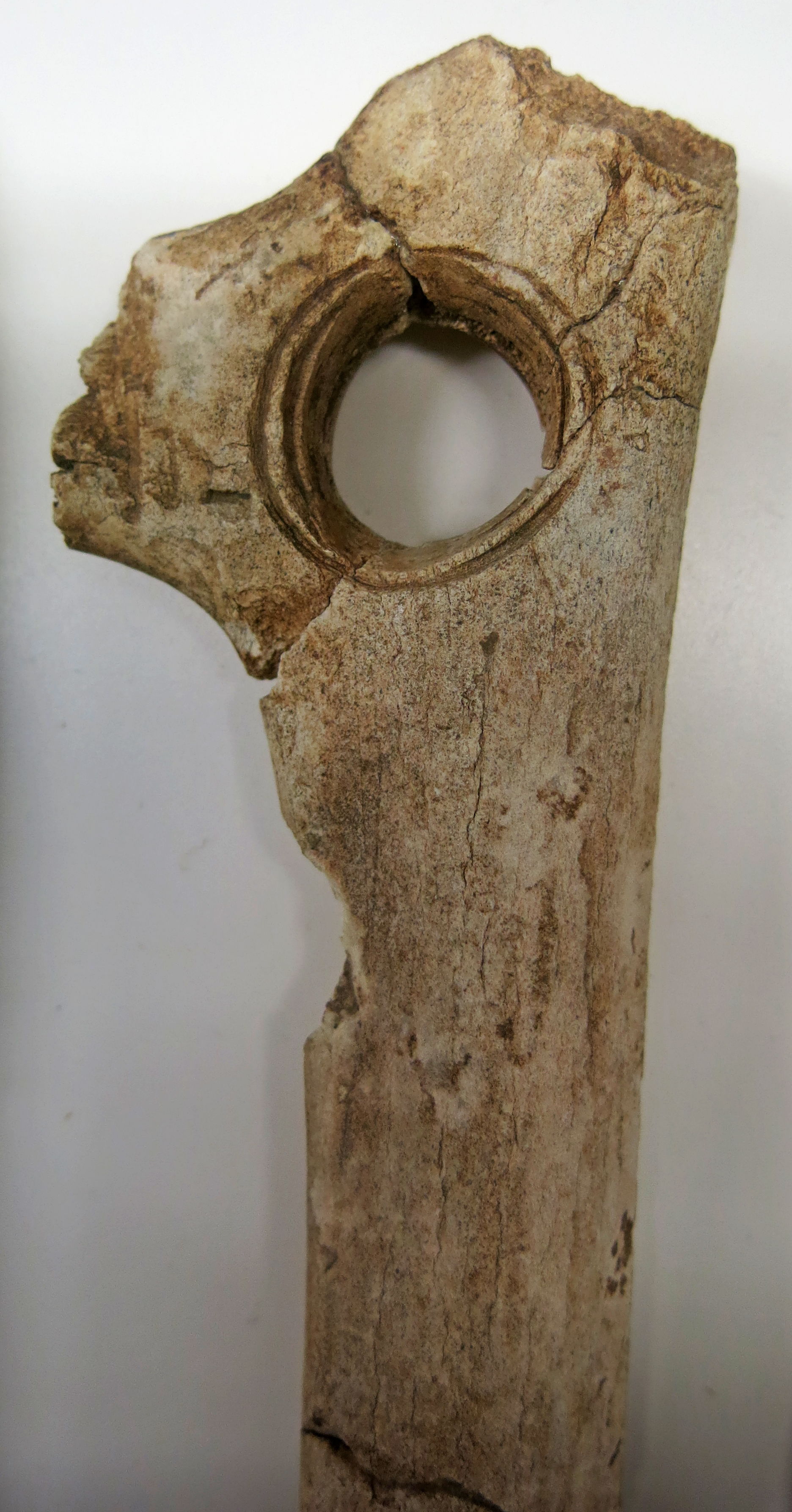
Horse teeth, used as retouchers in the making of flint tools.
1 - Laugerie-Haute Ouest, Peyrony’s collection, Solutrean. Equus caballus, third right lower molar ; 1a- external surface, 1b, c,d - close-up of the utilized zones on the mesial (anterior) surface. Scale (white line) 1cm
This is from Couche H" of Peyrony's excavations at Laugerie-Haute Ouest, Solutrean with typical laurel leaf blades.
2 - Laugerie-Haute Ouest, collection Peyrony, Solutréen. Equus caballus, first or second right lower molar ; 2a - external surface, 2b, c – close-up of the utilized zone on back (distal) surface, 2d - internal (lingual) view. Scale (white line) 1cm
This is from the Solutrean, but is not identified in any other way.
Photo: not attributed, but almost certainly Ph. Jugie, MNP
Source and text: Castel et Madelaine (2006)
Laugerie Haute is 180 meters long, 35 meters wide and nearly 5 metres deep. It is situated on the right bank of the Vezere, about 2 km from Les Eyzies. The site has yielded 42 levels of sediment, making it the "yardstick" for French Upper Paleolithic industry. The lowest levels date to the Perigordian (ca. 33,000-20,000 BCE), and occupation seems to have terminated around 14,000 BCE, during the Magdelenian period, at which time the nearby site of Laugerie-Basse becomes prominent. (this text from http://www.beloit.edu/~museum/logan/paleoexhibit/laugerie.htm )
Most of the stratigraphic data and related text here comes from an excellent book, 'Rock Shelters of the Perigord', Laville et al. (1980)Two kilometres upstream from Les Eyzies is the classic rock shelter of Laugerie-Haute, which occupies a great southward-facing line of cliffs that overlooks the right bank of the Vezere River. It is a vast station whose archaeological deposit at the time of its discovery attained a thickness up to 6 m over an area 180 m long and 35 m wide. It is also somewhat peculiar both in the manner in which it has been excavated and in its physical make up. With regard to the former, a large house sits on top of the central portion of the deposit. This portion remains unexcavated and consequently divides the site into two distinct sectors. The sector lying downstream toward Les Eyzies is called Laugerie-Haute Ouest, whereas the one lying upstream is Laugerie-Haute Est.
The lowest levels date to the Perigordian (ca. 33,000-20,000 BCE), and occupation seems to have terminated around 14,000 BCE, during the Magdelenian period, at which time the nearby site of Laugerie-Basse becomes prominent.
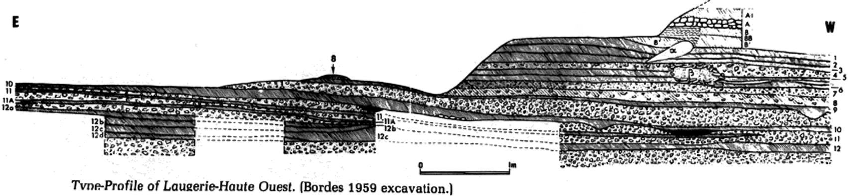
Laugerie Haute Ouest Cross Section
Photo: Laville et al. (1980)
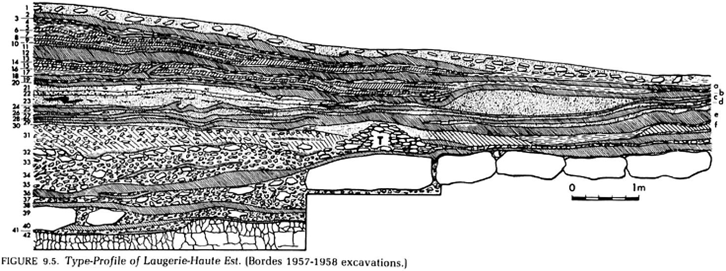
Laugerie Haute Est Cross Section
Photo: Laville et al. (1980)
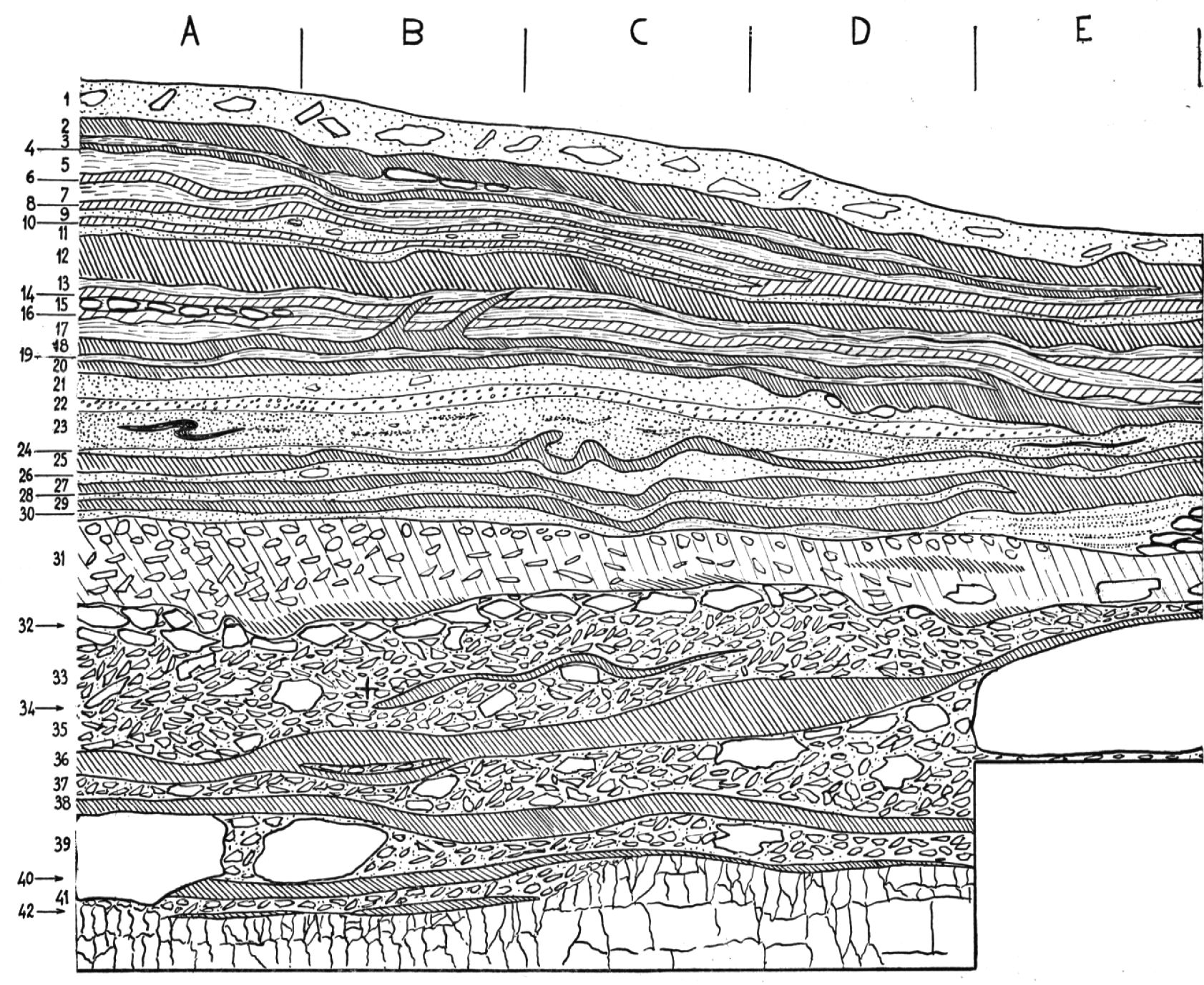
Laugerie Haute Est Cross Section
Photo: Bordes (1978)
| Layer | Common Name | Species | Number | Percentage |
|---|---|---|---|---|
| Layer 36 | Reindeer | Rangifer tarandus | 273 | 80.5% |
| Red Deer | Cervus elaphus | 33 | 9.7% | |
| Ibex | Capra sp. | 18 | 5.3% | |
| Chamois | Rupicapra rupicapra | 9 | 3% | |
| Large Bovids | 2 | 0.6% | ||
| Horse | Equus cabullus | 2 | 0.6% | |
| Hare | Lepus sp. | 2 | 0.6% |
| Layer | Common Name | Species | Number | Percentage |
|---|---|---|---|---|
| Layer 38 | Reindeer | Rangifer tarandus | 76 | 92% |
| Red Deer | Cervus elaphus | 5 | 6% | |
| Hare | Lepus sp. | 2 | 2% |
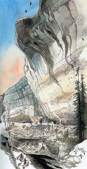
Laugerie Haute recreation
This evocative painting by Jack Unruh (unattributed, but signed by him) shows Laugerie-Haute before it collapsed.
It was a rock shelter used by Palaeolithic salmon fishers. Several groups probably came together for massive fishing harvests 18 000 years ago.
Note the stone weirs in the painting guiding the salmon to a pool for spearing, the people carrying strings of freshly caught salmon across the shallow pool, the scalers, cleaners and filleters seated beside the pool, the people carrying prepared fillets up the bank, and the racks of drying fish.
On the larger image you can also see that the racks are held up by tripods, each one of which is stabilised by a cord or stick attached to a pile of rocks below each tripod, since there was no soil to dig the tripods into on the rock shelf swept clean by spring floods. Children are playing a chasing game, and someone else is bringing in firewood for the fires under the rock shelter, where there are two types of shelter. In one case there are some sticks stuck in the ground forming a wind shelter, with one side open to the river, and in another case there is a lean to against the rock overhang covered in hides.
Sun drying of the fish would assure a plentiful winter food supply, and thousands of bones have been found in excavations in the area.
Photo: the painting is by Jack Unruh, in National Geographic, Vol 174, No 4, October 1988.
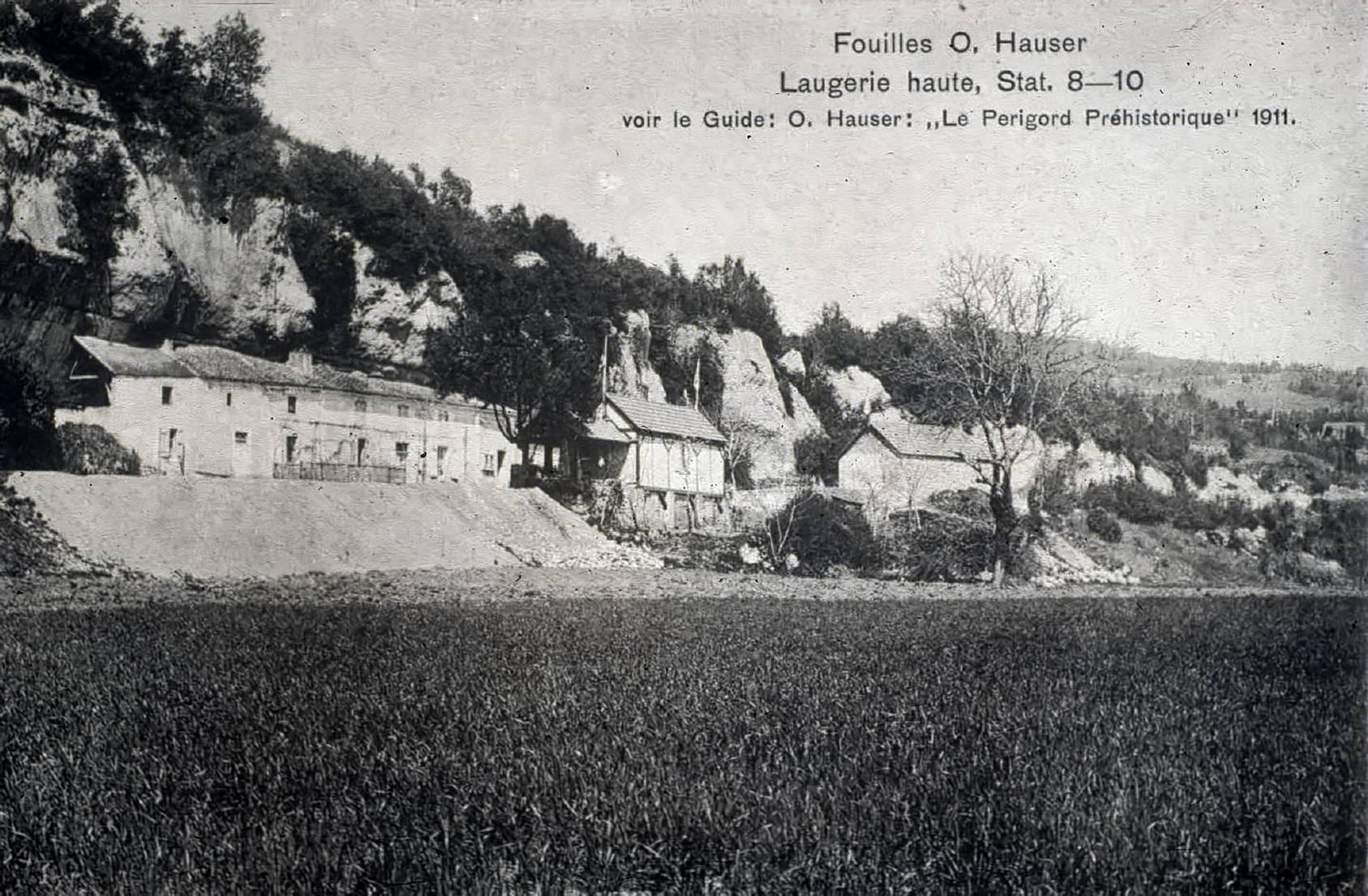
Early 20th century postcard of Laugerie-Haute, showing the location of Otto Hauser‘s excavations at the base of the cliff
Photo: Old postcard
Source: Roebroeks et al. (2009)
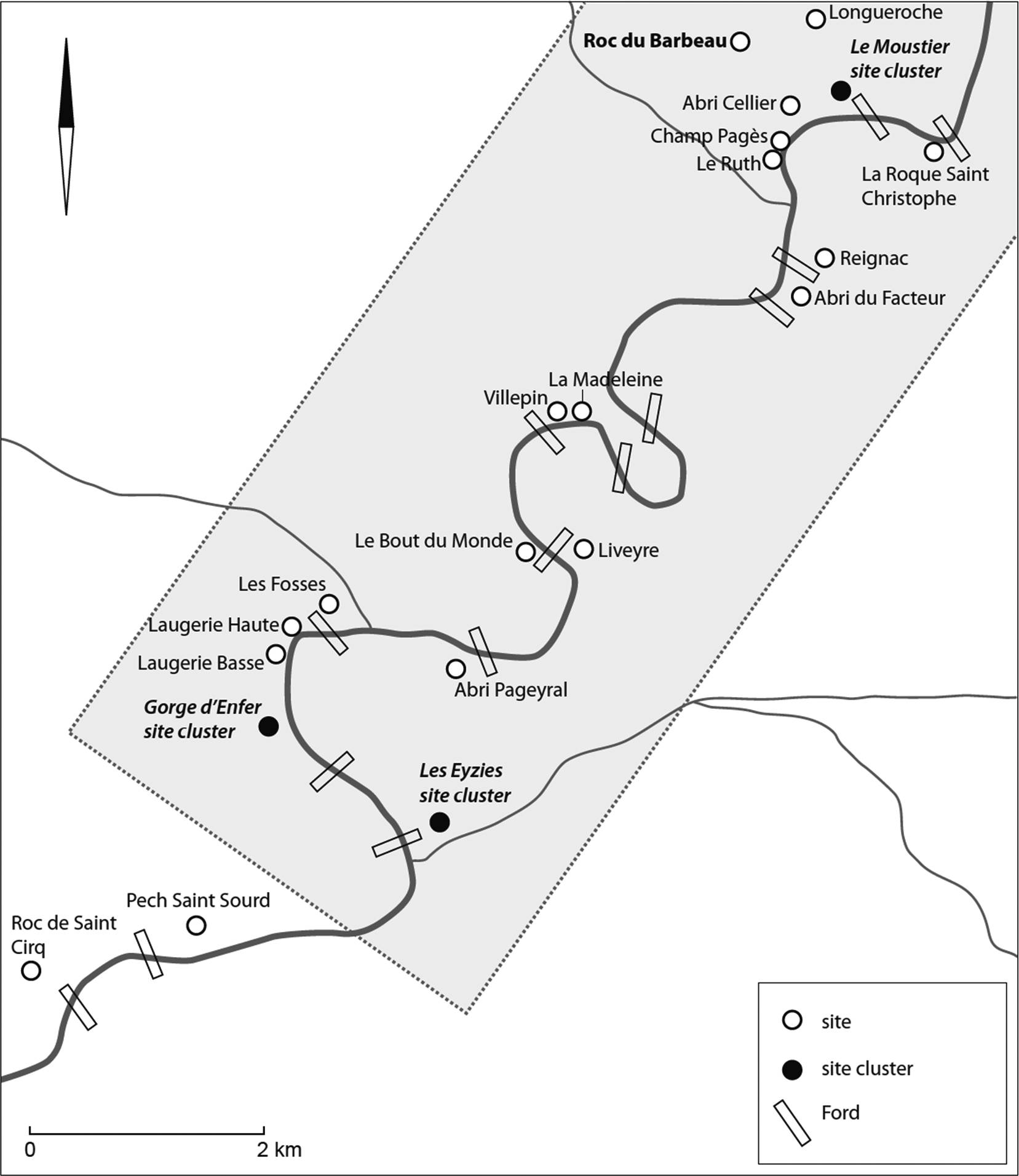
Location of the fords and the main Palaeolithic sites along the Vézère in this region.
The shaded rectangle indicates the part of the syncline in which the large rock shelters of the Périgord noir developed.
The complex of shelters at Les Eyzies corresponds to the sites of Cro Magnon, Pataud, Vignaud, the Abri du Chateau, Casserole, Chadourne, Grotte des Eyzies, Abri Audi, the complex of the Gorge d’Enfer to the sites of the Abri Lartet Christy, the Abri du Poisson, Abri Pasquet, Abri d’Oreille d’Enfer, the Grotte d’Abzac, and those of Le Moustier to the abri classique, the abri inférieur and the Trou du Bréchou.
Photo: Roebroeks et al. (2009)
One of the particularities of the Vézère valley resides in the spectacular high cliffs bordering its course in our study area. The river meanders between these falaises, and in order to move over the river plain one very often has to cross the river or make detours of several kilometres and master differences in height of more than 100 metres.
River crossings are however often facilitated by the presence of fords, as in the map above. Our working area is situated between two major structural features of tectonic origin, upstream the La Cassagne fault line, and downstream the Saint Cyprien fault, both running from the southeast to the northwest. Between these two features lies the Sarlat syncline, itself influenced by two synclines, the Montignac and the Pech de l’Azé.
Hence, we can assume that the majority of the fords are of tectonic-structural origin and were already present at their current position during the Pleistocene. Starting from this assumption, White (1985) already showed that a large number of Upper Palaeolithic sites were located close to these fords. If one enlarges the sample by taking sites from all periods into consideration, the pattern becomes even more striking. The correlation between the location of sites and fords is clear (fig. 2). For hunter-gatherers, such fords may have been very attractive: they facilitated the procurement of wood and lithic raw materials, allowed river crossings, made catching fish (e.g. during salmon runs) easy and constituted ideal hunting locations to intercept game animals during their crossing of the river.
Text above: Roebroeks et al. (2009)
References
- Bordes F., 1978: Le Protomagdalénien de Laugerie-Haute-Est (fouilles F. Bordes)Bulletin de la Société préhistorique française, tome 75, n°11-12, 1978. Études et Travaux. pp. 501-521.
- Castel J.-C., Chadelle J.-P. et Geneste J.-M., 2005: Nouvelle approche des territoires solutréens du Sud-Ouest de la France. In: J. Jaubert, M. Barbaza (dir), Territoires, déplacements, mobilité, échanges durant la Préhistoire, 126 e congrès du CTHS, Toulouse, 2001. Paris, Editions du CTHS. p. 279-294.
- Castel J.-C., et Madelaine S., 2006: Quelques éléments remarquables de la faune du Solutréen de Laugerie-Haute (Les-Eyzies-de-Tayac, Dordogne) In: http://paleo.revues.org/index258.html, Paleo, 18 | 2006
- Chadelle J.-P., 2016: L'abri du Squelette à Laugerie-Haute, https://www.academia.edu/24915012/Labri_du_Squelette_%C3%A0_Laugerie-Haute
- Cleyet-Merle J., 1995: La province préhistorique des Eyzies : 400 000 ans d'implantation humaine CNRS Editions, Paris, Caisse Nationale des Monuments Historiques et des Sites, 1995. - 126 p. : ill., bibliogr., index. - ( Patrimoine au Présent. - ISSN 1159-7836 ). - ISBN 2-271-05167-3 ; 2-85822-138-3.
- Deffarge R., Laurent P., de Sonneville-Bordes D., 1974: Ciseaux ou lissoirs magdaleniens, Bulletin de la Société Préhistorique Française. Comptes rendus des séances mensuelles , Year 1974 Volume 71 Issue 3 pp. 85-96
- Delluc B., Delluc G., 1982: Prehistoric Hunters, Hart Davis
- Delpech F., 1983: Les faunes du Paléolithique Supérieur dans le Sud-Ouest de la France, Paris : Editions du CNRS. Cahiers du Quaternaire, no. 6.
- Duhard J., Roussot A., 1988: Le gland pénien sculpté de Laussel (Dordogne), Bulletin de la Société préhistorique française 1988, tome 85, N. 2. pp. 41-44.
- Dujardin V. et Timula S., 2005: Relecture chronologique de sites paléolithiques et épipaléolithiques anciennement fouillés en Poitou-Charentes, Bulletin de la Société Préhistorique Française, 102-4, 771-788.
- Groenen Marc, 1994: Pour une histoire de la préhistoire, Éditions Jérôme Millon 1994
- Hauser O., 1908: Übersichtsplan der prähistorischen Fundstätten No. 1-41 und Font de Gaume in der Umgebung von Les Eyzies im Tale der Vézère. Aufgenommen und gezeichnet von April 1907 – Mai 1908 von Th. Baumgartner, Ingenieur u. Konkordatsgeometer Seebach-Zürich
- Lartet, E., Christy H.,1875: Reliquiae aquitanicae : being contributions to the archaeology and palaeontology of Pèrigord and the adjoining provinces of Southern France, London: Williams, 1875
- Laville H., Rigaud J., Sackett J., 1980: Rock Shelters of the Périgord, Academic Press, New York.
- Madelaine S., 1989: Contribution des anciennes fouilles à la connaissance des ongulés et de leurs milieux durant le Würm récent en Dordogne. Paléo, 1, 36-46.
- Peyrony, D. et E., 1938: Laugerie Haute près des Eyzies (Dordogne), Paris, Masson, 1938, pp 9-10 , Fig 2 (Archives de l'Institut de Paléontologie humaine, No 19)
- Riquet, R., 1950: Nouveaux squelettes préhistoriques de l'Ouest de la France, Bulletins et Mémoires de la Société d'anthropologie de Paris, , 1, 1-1-3, p. 152-174
- Roebroeks, W. et al., 2009: Watching The River Flow: A small-scale survey of the floodplain deposits in the Vézère valley, between Le Moustier and Les Eyzies (Dordogne, France), Analecta Praehistorica Leidensia, 41/2009
- Texier, J., 2009: Histoire géologique de sites préhistoriques classiques du Périgord : une vision actualisée. La Micoque, La grotte Vaufrey, La Ferrassie, L'abri Castanet, Le Flageolet, Laugerie-Haute, Collection Documents Préhistoriques n°25, Editions du CTHS, Paris, 193 p., ill.
- White, R., 1985: Upper Paleolithic Land Use in the Perigord: a topography approach to subsistence and settlement, BAR, International Series 253.
- Yelkrokoyade, 2009: Vue du village de Solutré-Pouilly - Saône et Loire (71), France, Wikimedea Commons. This file is licensed under the Creative Commons Attribution-Share Alike 1.0, 2.0, 2.5, 3.0 licenses.