Back to Don's Maps
 Bushwalking Index
 Bushwalking, Hiking and Tramping in New Zealand
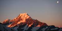
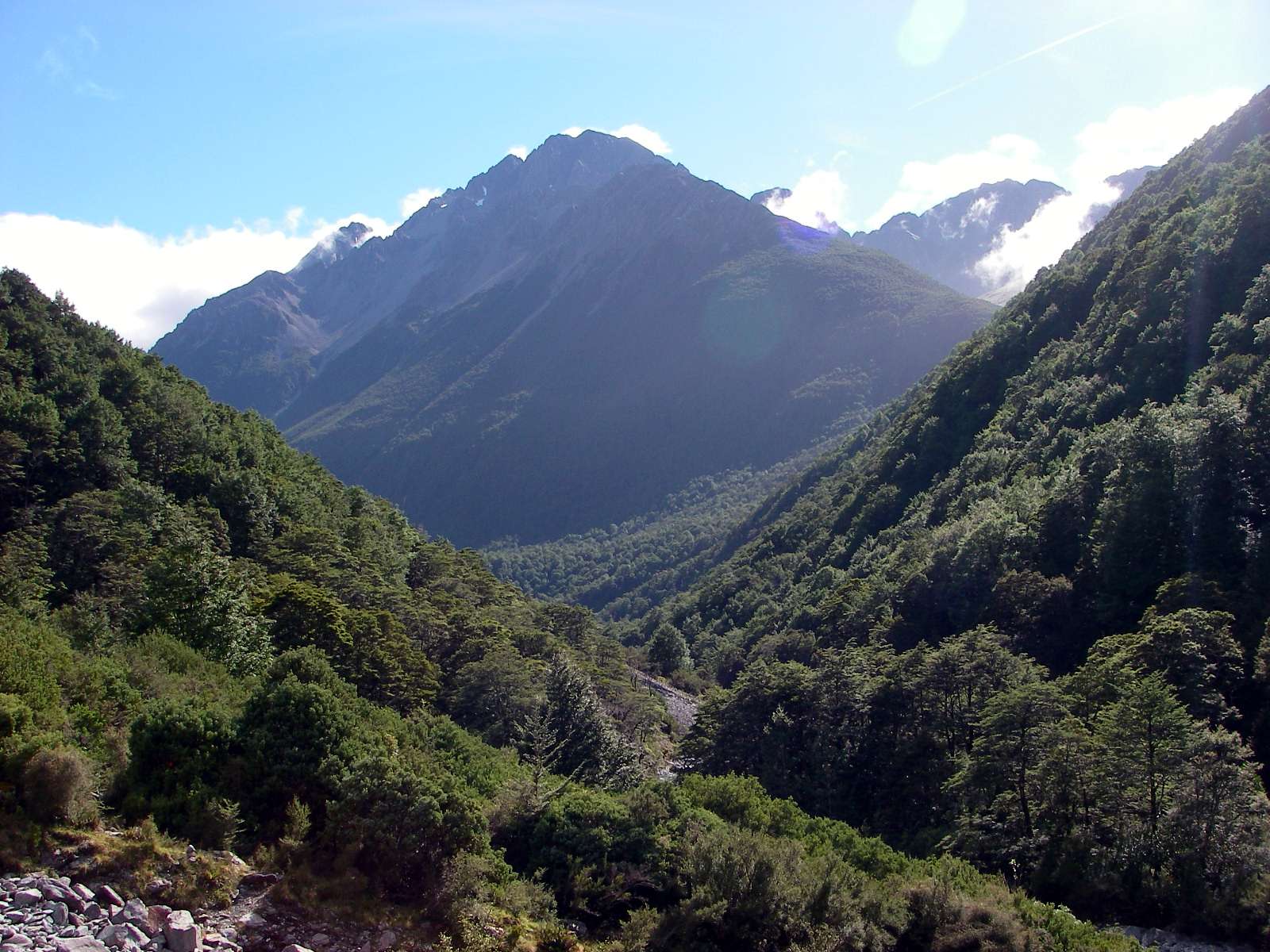
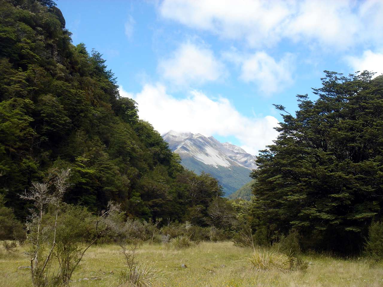
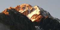 Day Four of the Travers Sabine Circuit in New Zealand - John Tait Hut to West Sabine Hut over the Travers Saddle. It is a steady climb to Upper Travers Hut, but the view of Mount Travers from the valley bottom is spectacular. Travers Falls is a beautiful little 20 metre high waterfall. From Upper Travers Hut the way leads up the Saddle, with some steep sections. There are many beautiful alpine plants such as Hebe, Celmisia, Gentiana, Helichrysum, Coprosma, vegetable sheep and New Zealand flax on the eastern side of the saddle. On the saddle itself there are some beautiful large tarns, but the area is exposed and often windy and cold. The track drops down into the East Branch of the Sabine, via a steep scree slope. The area is subject to avalanches after heavy snow.
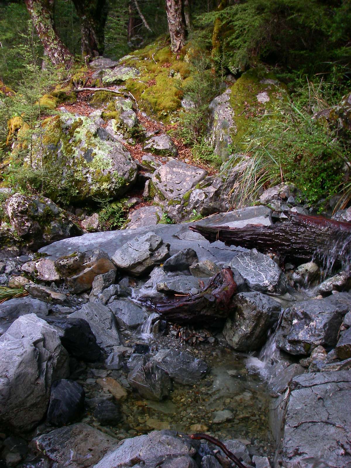
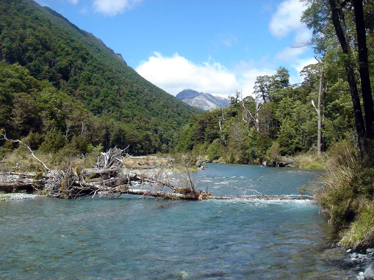
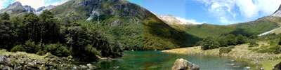 Day Five of the Travers Sabine Circuit in New Zealand - West Sabine Hut to Blue Lake. The West Sabine drains Lake Constance and Blue Lake, high in the catchment of the West Sabine. It joins the East Sabine at Sabine Forks, and the Sabine then flows into Lake Rotoroa, in the Nelson Lakes National Park. Apart from the upper reaches, which is open tussock and scrub, the river is set within unmodified beech forest. The West Sabine River is in a superb gorge, with many streams coursing down the flanks of the valley walls. After heavy rain, crossing sidestreams can be a very wet experience, and care must be taken.
 Day Six of the Travers Sabine Circuit in New Zealand - Blue Lake to Lake Rotoroa
The East and West Sabine rivers drain each side of the Mount Franklin massif, and the West Sabine drains Lake Constance and Blue Lake. They join at Sabine Forks, and the Sabine then flows into Lake Rotoroa, in the Nelson Lakes National Park. It is a beautiful stream bordered by beech forest, with lichens and fungi under the trees. A tramping track runs along the river and forms the western branch of the Travers-Sabine tramping circuit. It connects Lake Constance and Blue Lake with Lake Rotoroa and Lake Rotoiti. Three tramping huts are located in the Sabine Valley: Sabine Hut, West Sabine Hut, and Blue Lake Hut. Lake Rotoroa is fed by the D'Urville and Sabine Rivers. A track follows the north east side of the lake, and another track leads back via Speargrass Hut to St Arnaud. A water taxi can ferry trampers to and from the head of the lake. The lake has trout, and attracts recreational fishermen. The word Rotoroa is Māori for long lake.
Blue Lake, looking exquisite in the still morning air.
Photo: Don Hitchcock 2nd February 2007
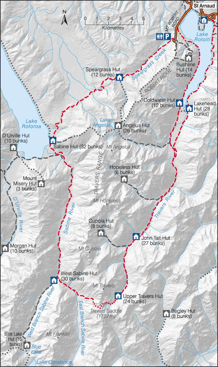
This is a very useful sketch map of the Travers Sabine Circuit in Nelson Lakes National Park from the New Zealand Government site. The NZ Government has worked really hard to make it easy for tourists to find information, and to book travel and accommodation. I believe they have the best such system in the world.
Photo: http://www.doc.govt.nz
A mist descended on the tops near Blue Lake as we set off.
Photo: Don Hitchcock, 2nd February 2007
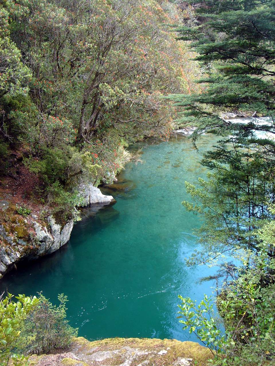
The West Sabine exiting from Blue Lake.
Photo: Don Hitchcock, 2nd February 2007
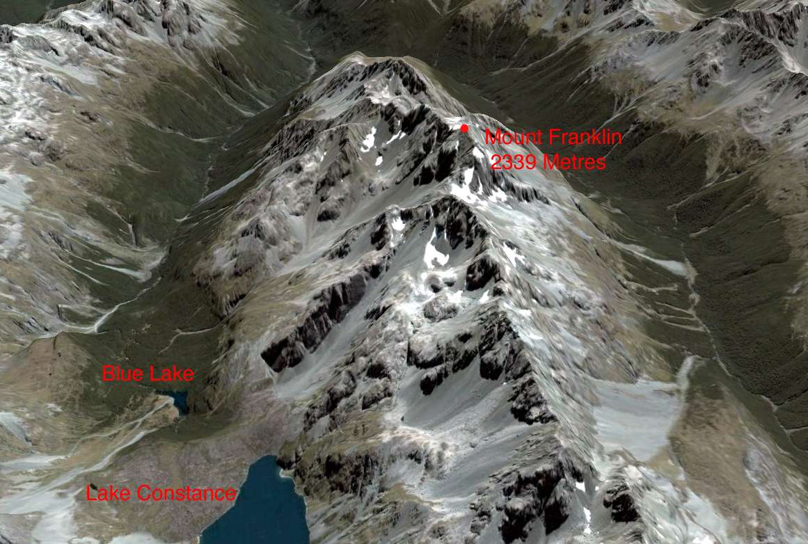
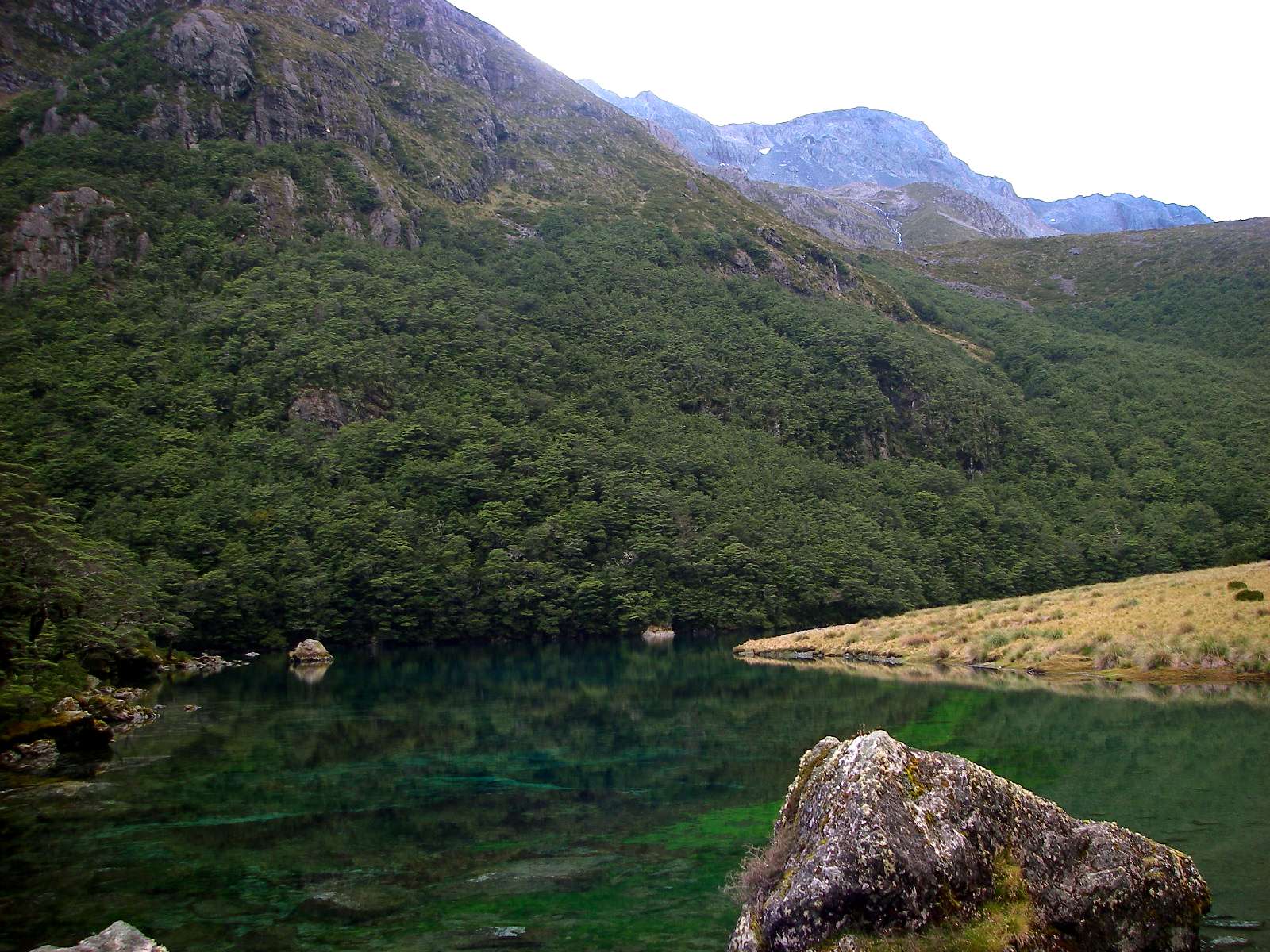
Mount Franklin, Lake Constance and Blue Lake.
Photo: adapted from Google Earth
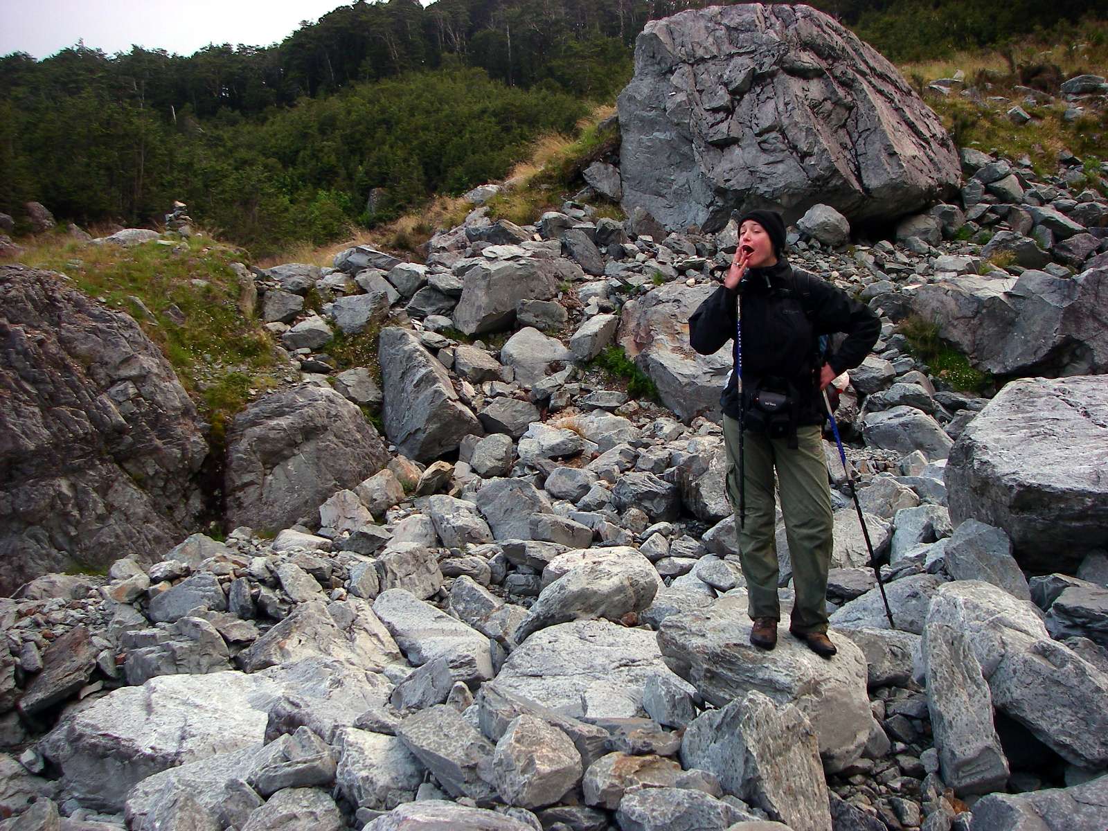
The side streams we had crossed with such difficulty the day before were now dry as a bone!
Photo: Don Hitchcock, 2nd February 2007
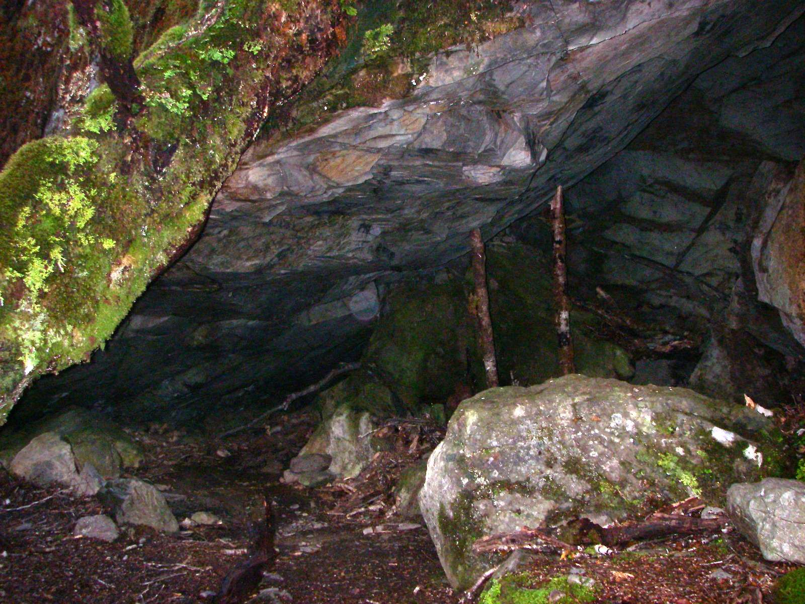
This is a natural bivvy under a rock, useful if the weather turned really bad, which had dry firewood and shelter for a couple of people.
Photo: Don Hitchcock, 2nd February 2007
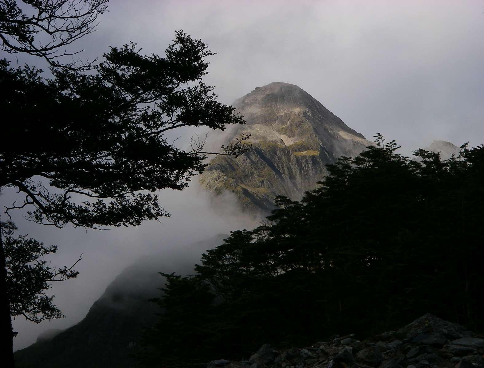
In the Land of Mordor where the Shadows lie...
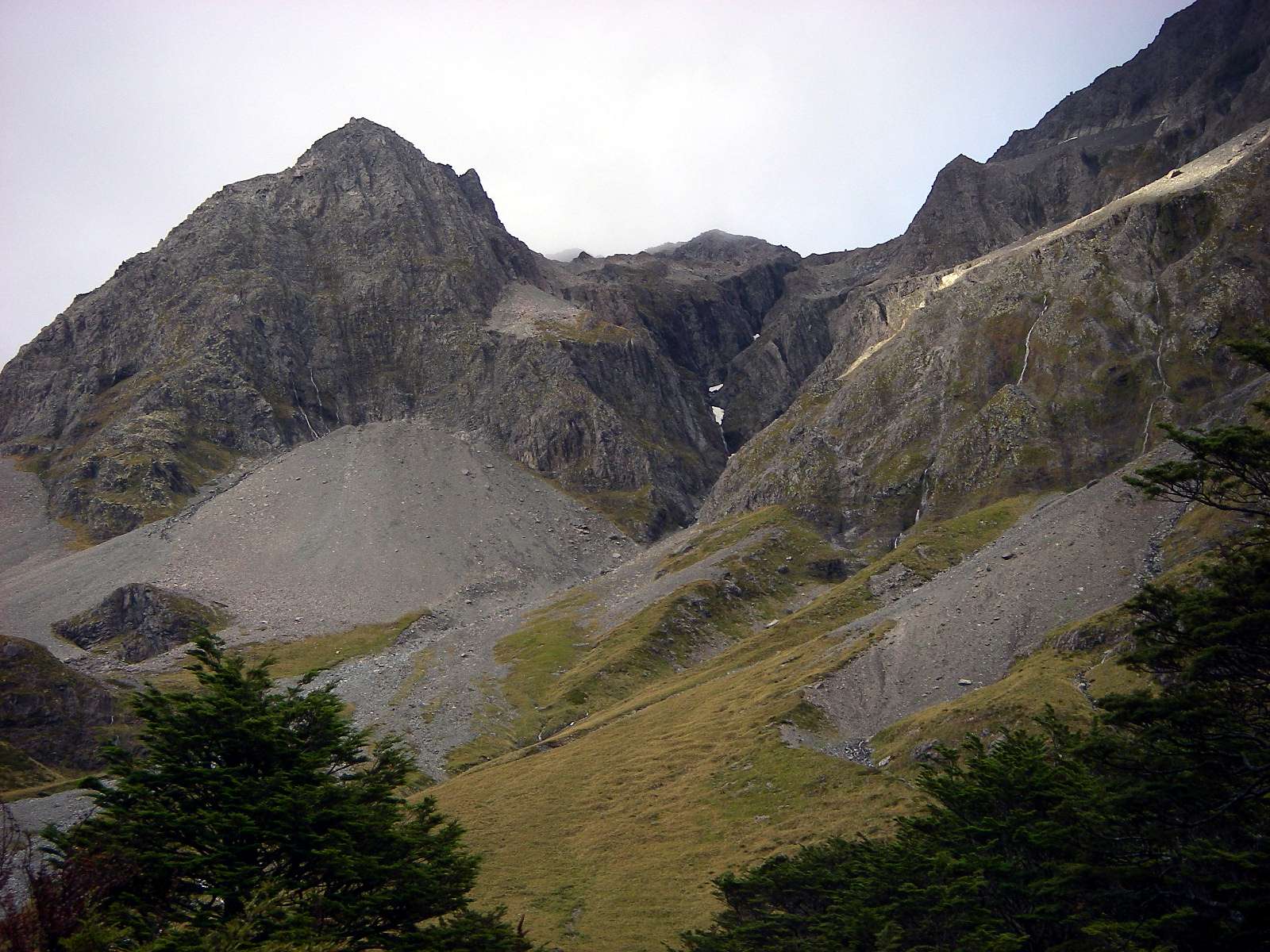
One of the peaks on the Mount Franklin massif.
Photo: Don Hitchcock, 2nd February 2007
Looking back down the track at a nearly dry creekbed that on the way up was very difficult to cross.
Photo: Don Hitchcock, 2nd February 2007
Approaching Sabine Forks, where the West Sabine we had been following joins the East Sabine, with Mount Travers on the skyline.
Photo: Don Hitchcock, 2nd February 2007
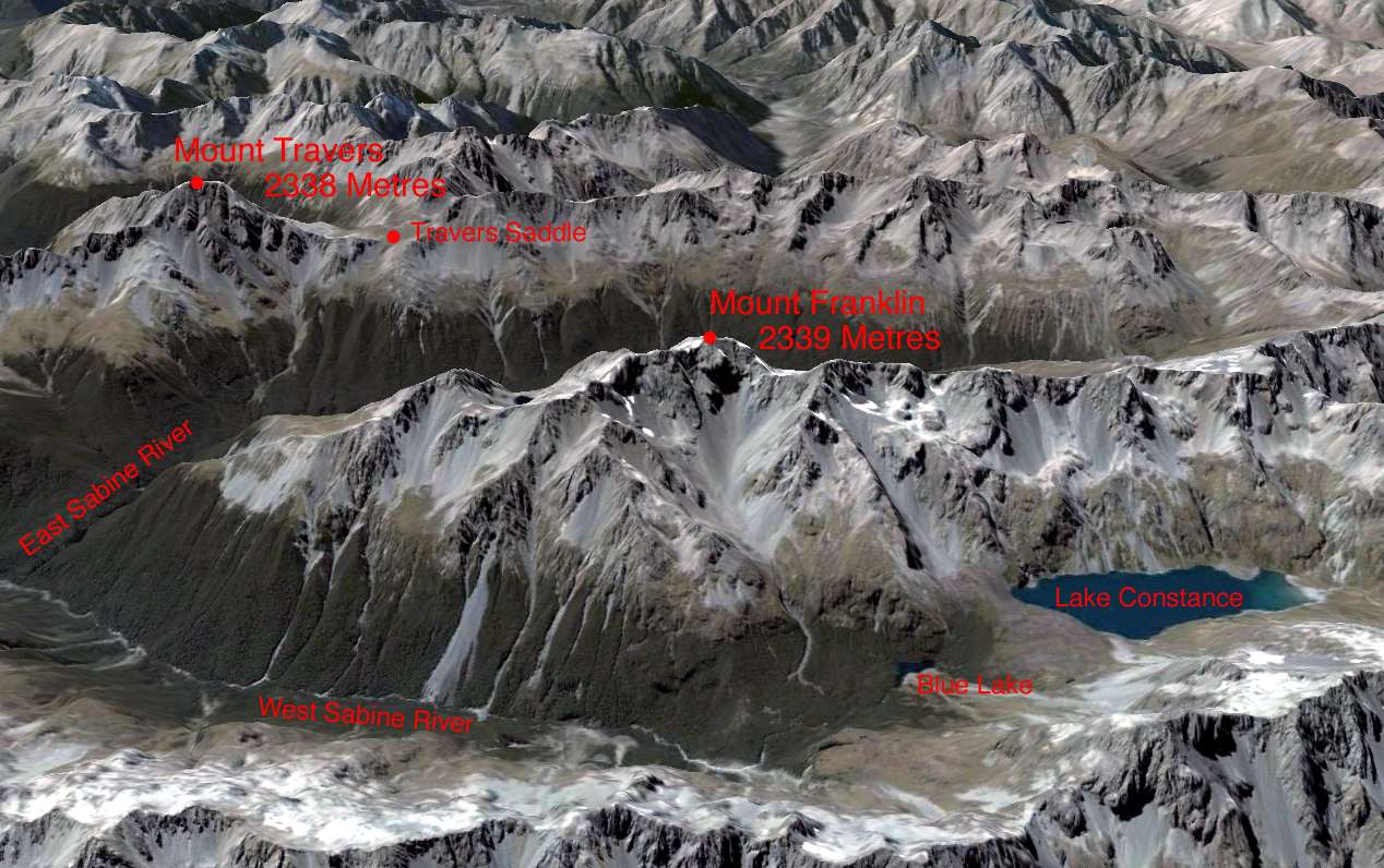
The extreme southern part of the circuit, showing Mount Franklin, Lake Constance, Blue Lake, the West and East Sabine, Travers Saddle, and Mount Travers.
This is magnificent country.
Photo: adapted from Google Earth
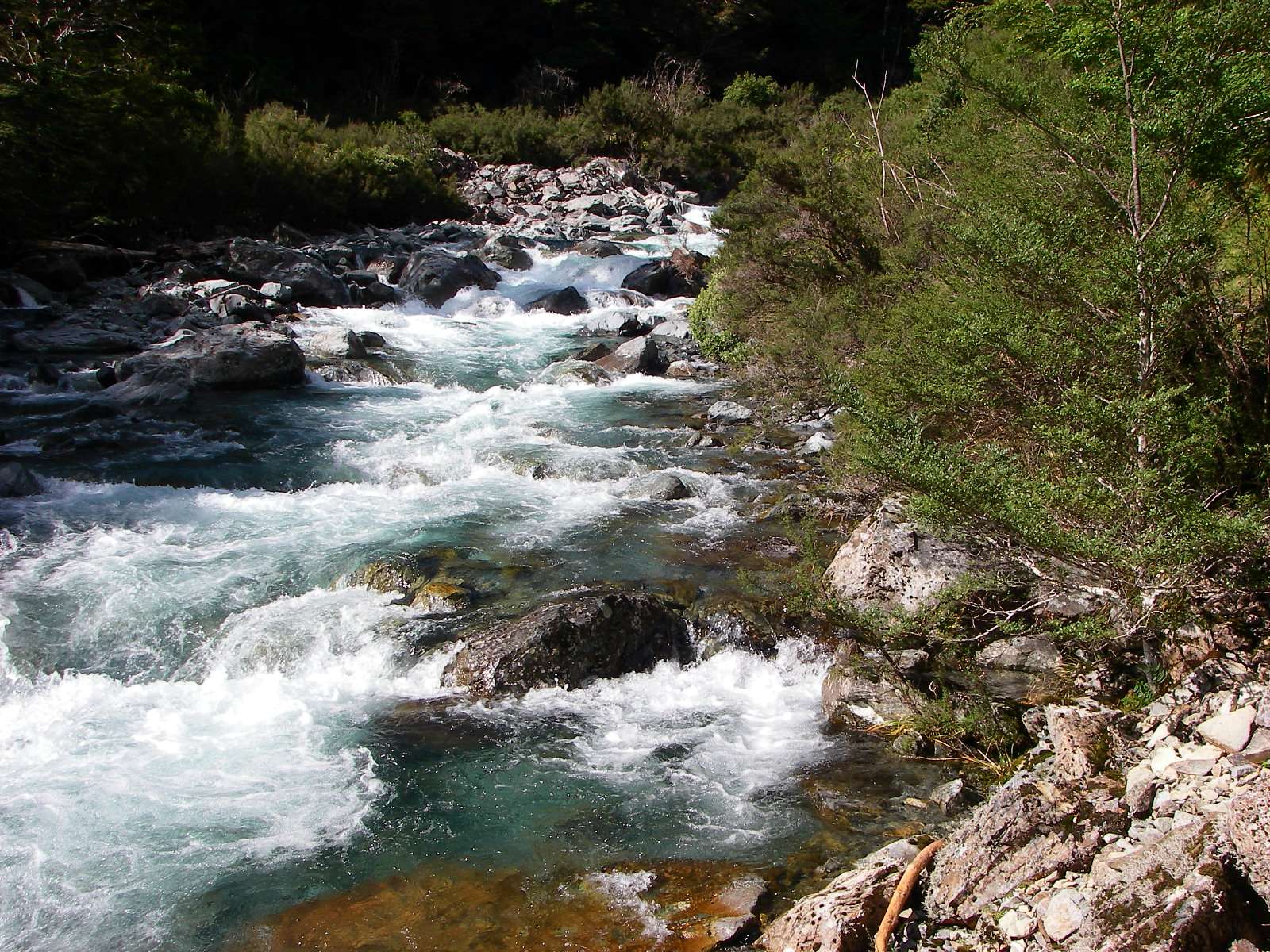
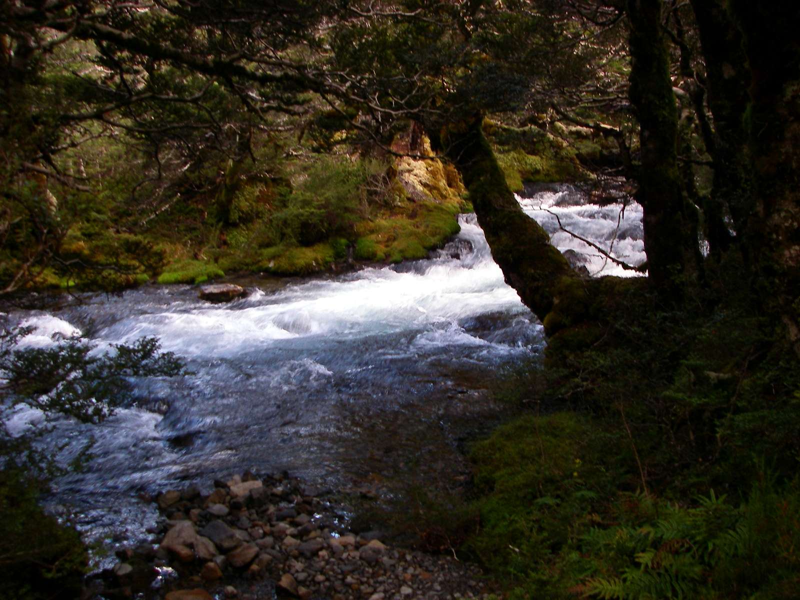
The track drops down again to the West Sabine here, a beautiful stream, and the track became reasonably level, with a soft carpet of beech leaves to walk on.
Photo: Don Hitchcock, 2nd February 2007
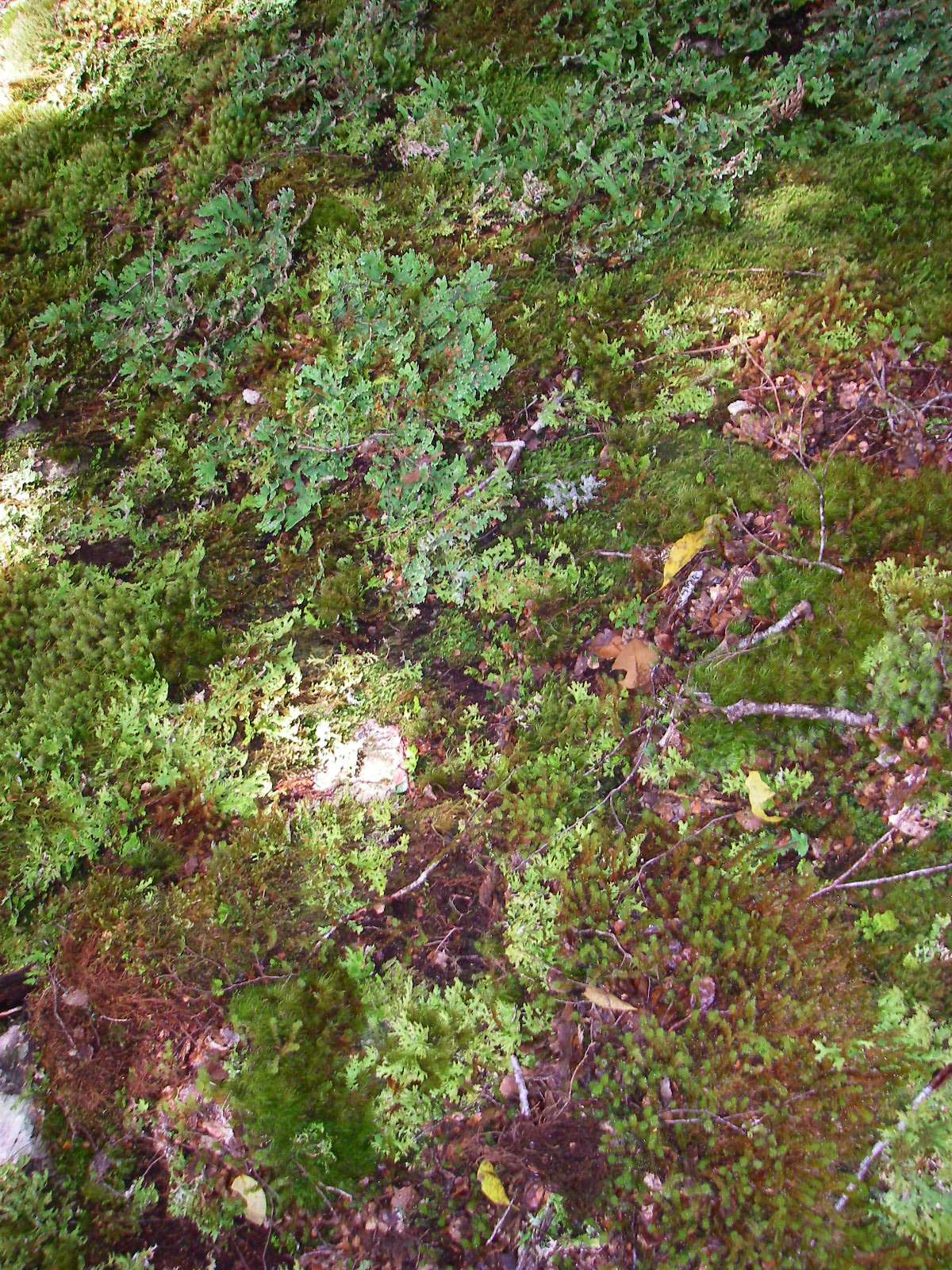
Deep in the shadows of the beech forest, lichens and mosses once again hold sway on the forest floor.
Photo: Don Hitchcock, 2nd February 2007
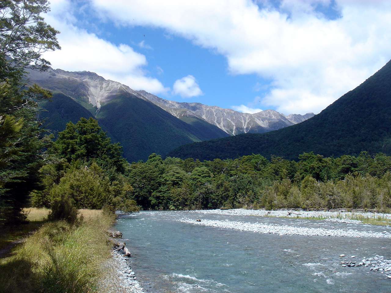
We had now passed Sabine Forks, and were leaving Mount Franklin and the deep gorges of the Sabine behind. The valley was starting to open up.
Photo: B., 2nd February 2007
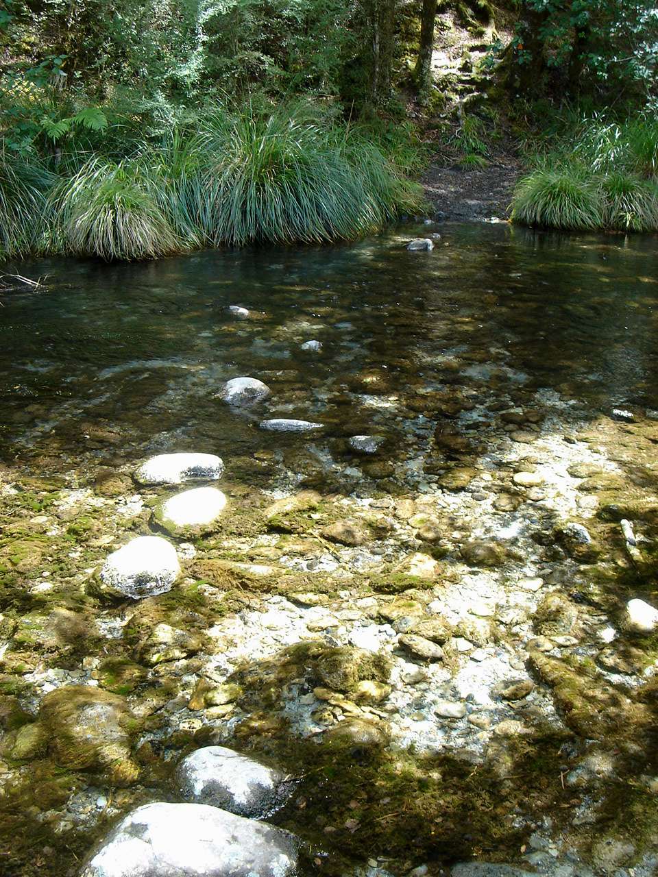
The Sabine was now much wider.
Photo: B., 2nd February 2007
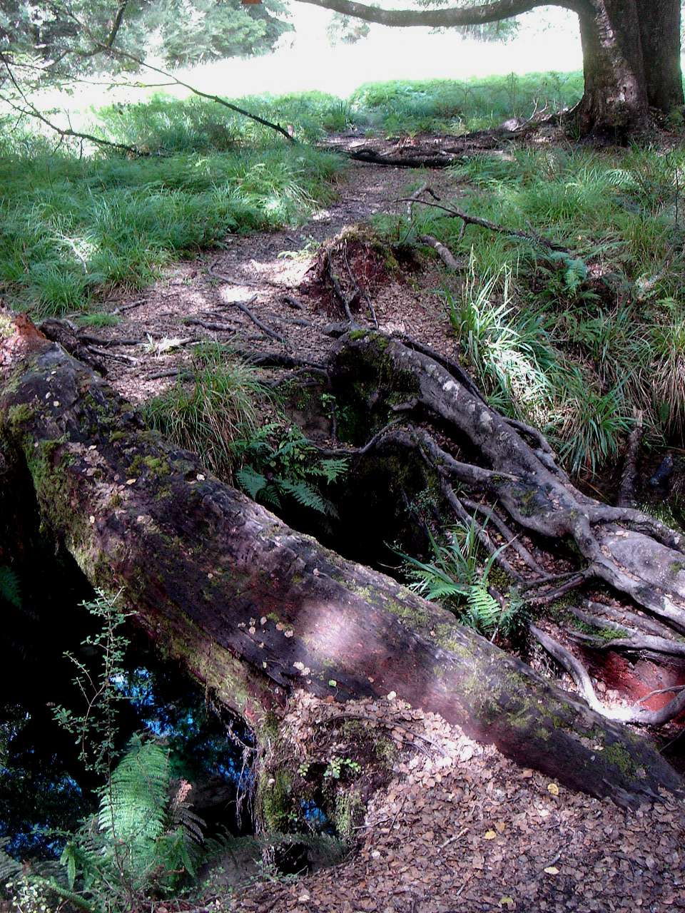
I was delighted to see this log bridge over a side stream, a reminder of times when the track was not so well maintained, and more like a wilderness where you cross streams with more difficulty.
Photo: B., 2nd February 2007
A small still pond, with the algae demonstrating the lack of a strong current.
Photo: B., 2nd February 2007
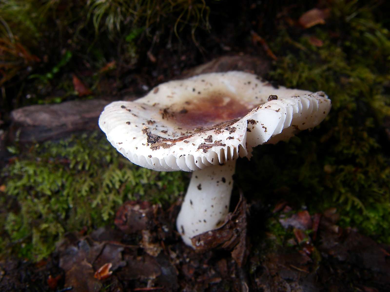
The moist, cool, dark environment was ideal for fungus growth.
Photo: Don Hitchcock, 2nd February 2007
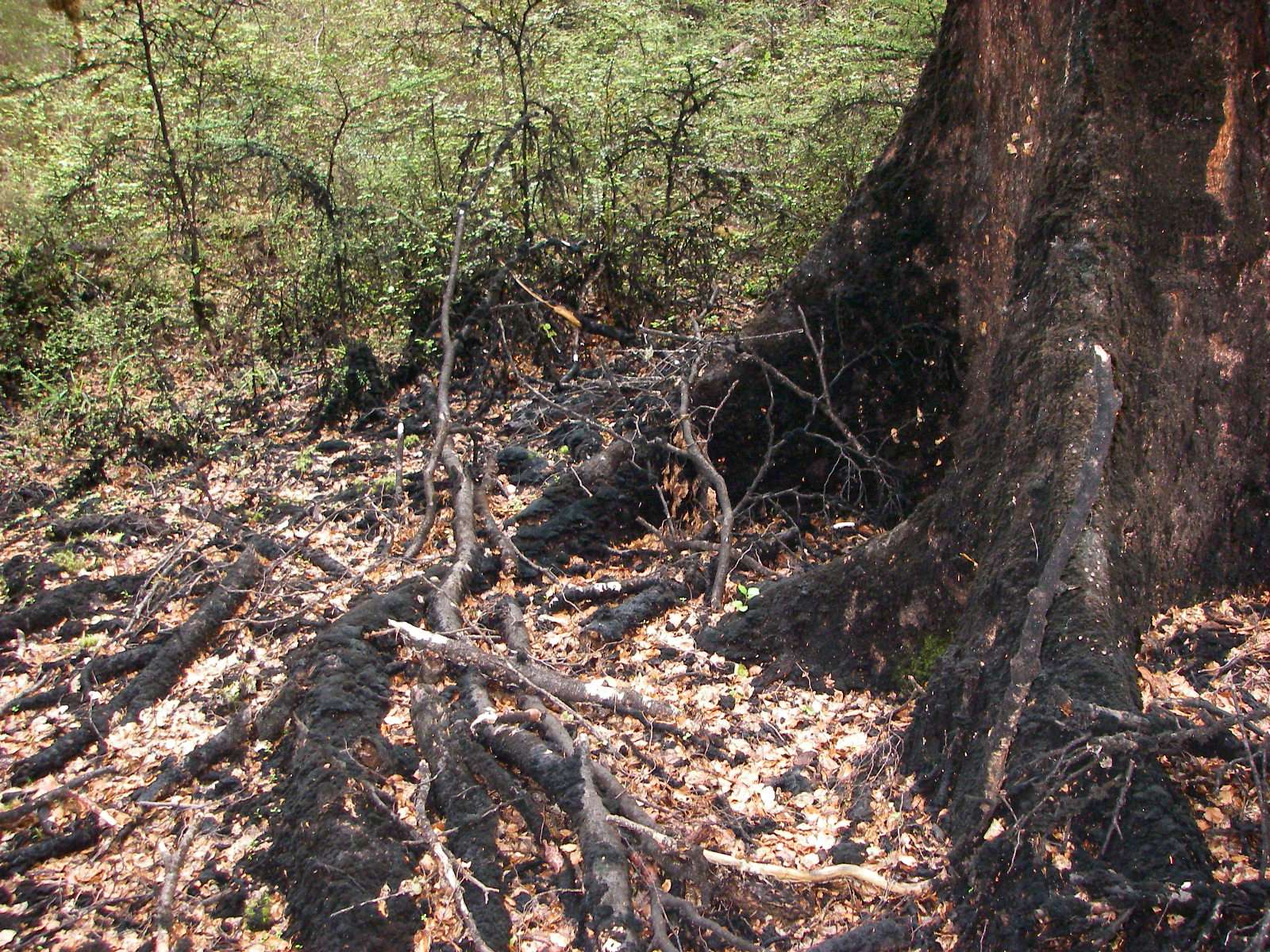
Black sooty mould, common in the Nelson Lakes National Park, covered most of the base of this beech tree, as well as the leaf litter around it.
Photo: Don Hitchcock, 2nd February 2007
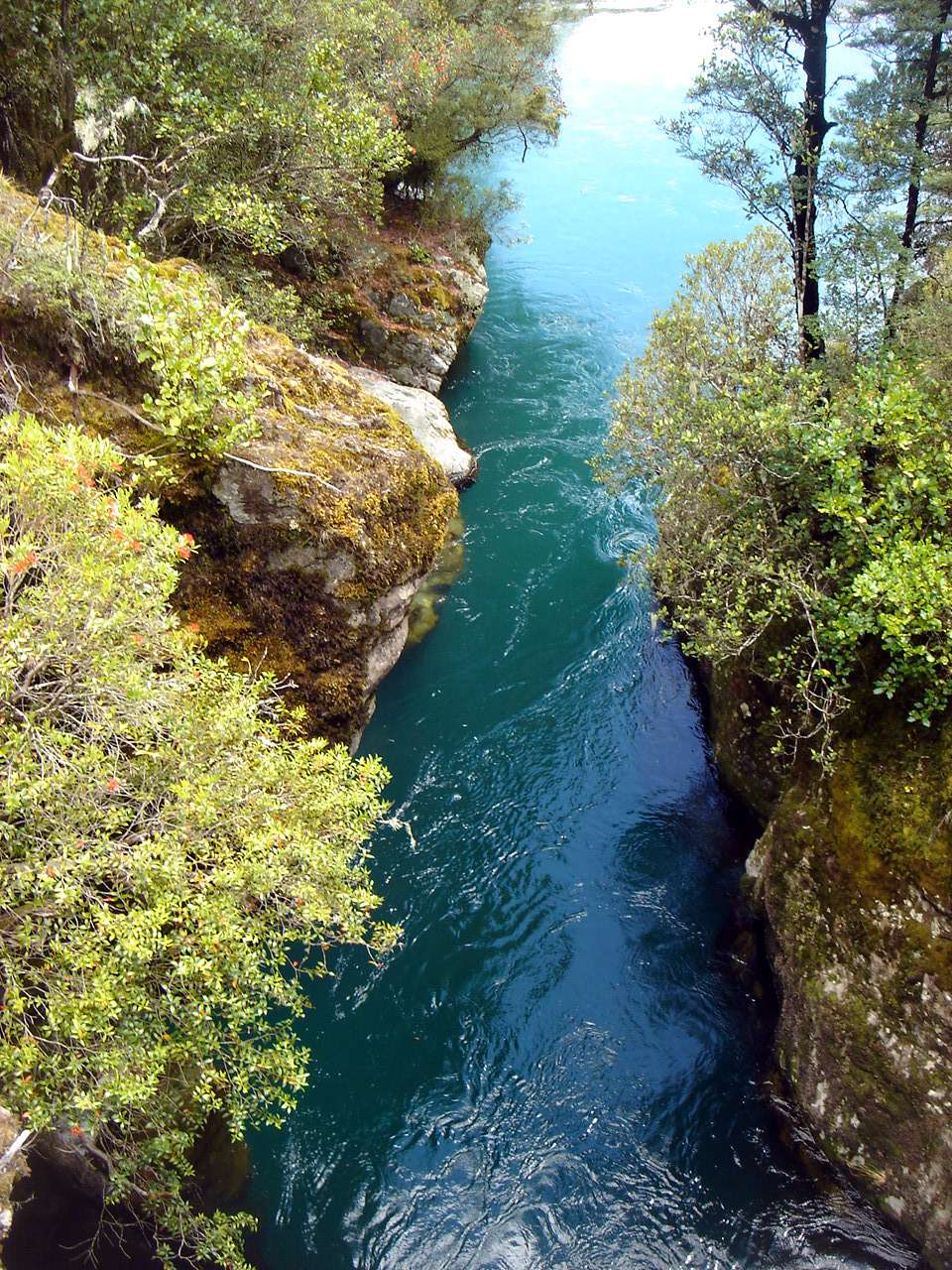
The Sabine passed through a narrow cleft in the rocks at this point.
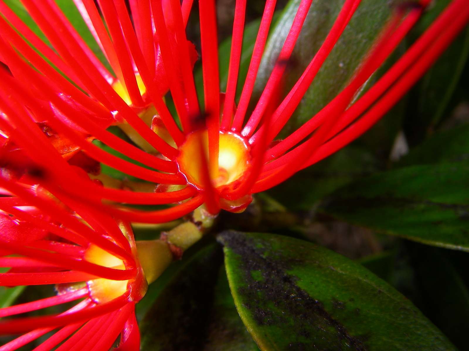
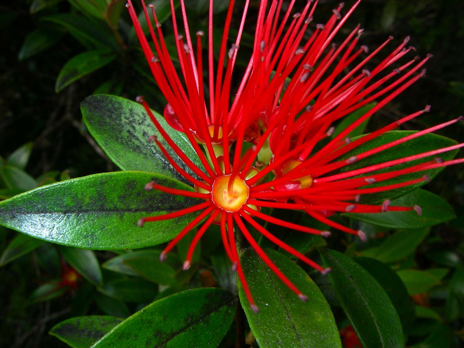
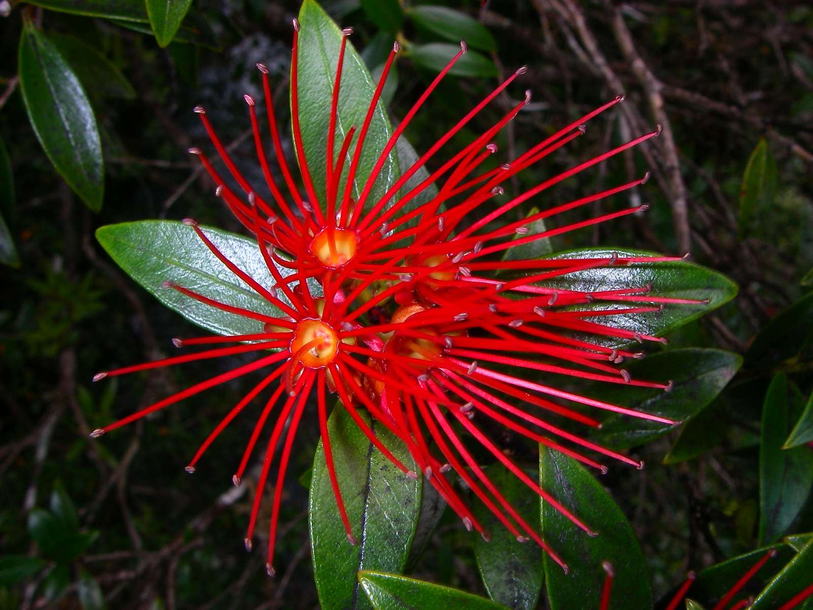
We were now at a much lower elevation, as evidenced by the red flowers of Pōhutukawa which are evident in the larger image obtained by clicking on the thumbnail at left.
Photo: B., 2nd February 2007
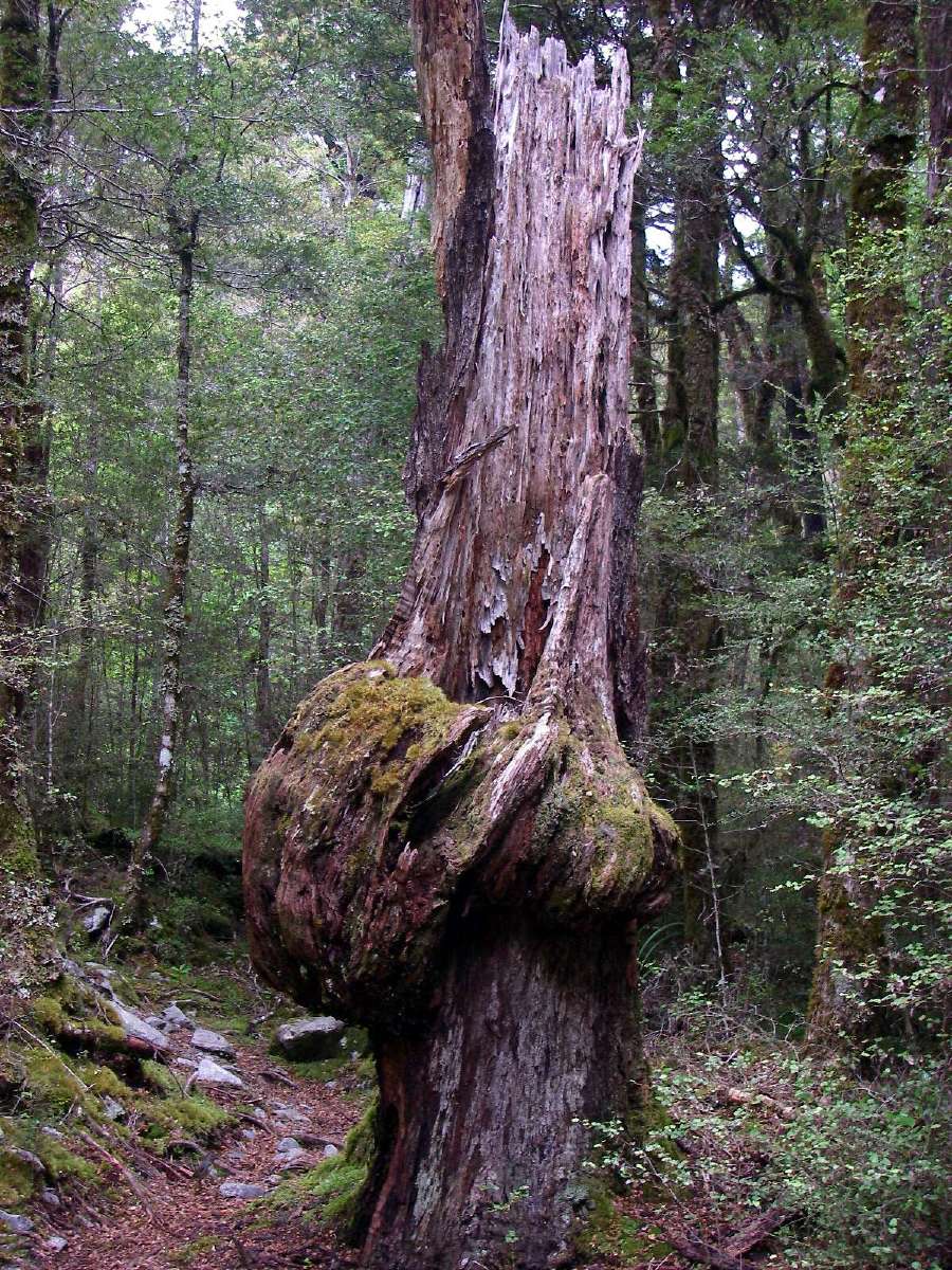
A forest giant felled by age or disease, gradually melting back into the forest floor.
Photo: Don Hitchcock, 2nd February 2007
The Sabine was now a much broader river as it neared Lake Rotoroa.
Photo: B., 2nd February 2007
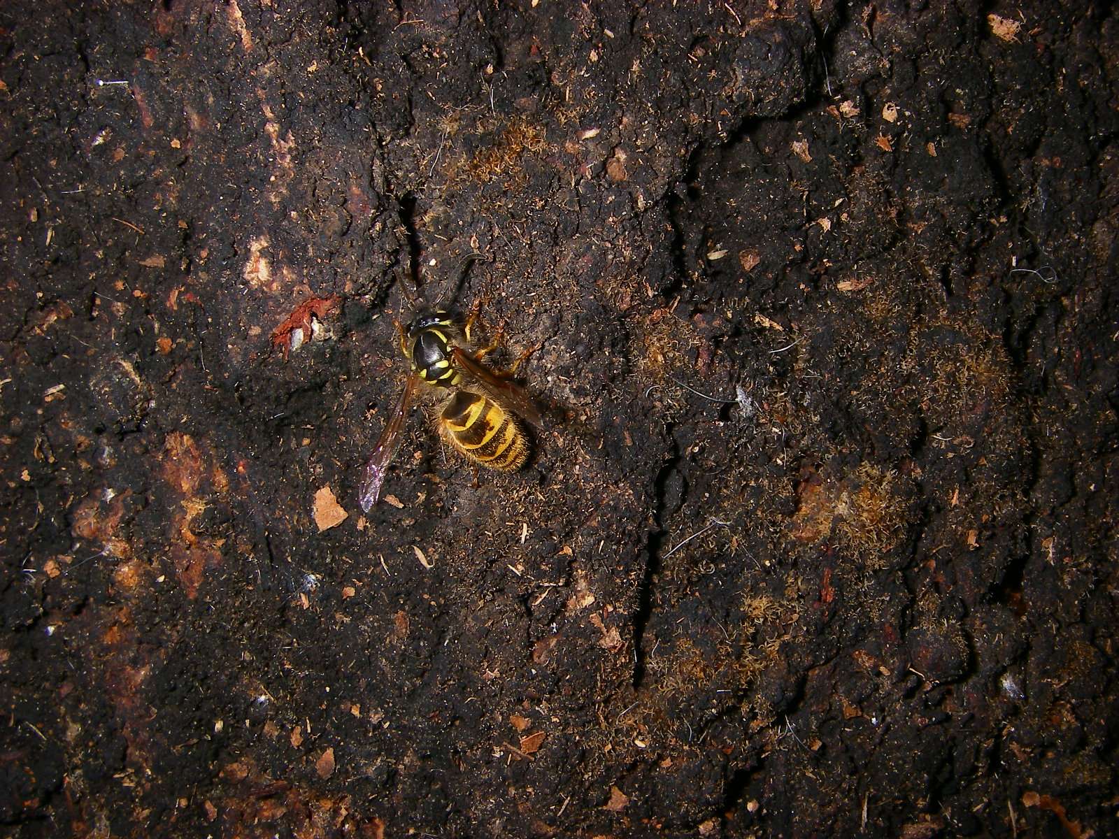
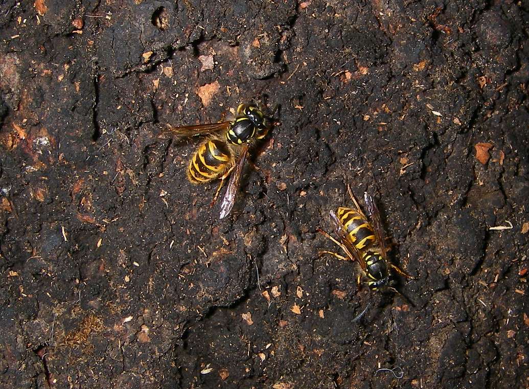
A little further on, this beech tree was covered with European Wasps, Vespula germanica, getting honeydew from the tree. The honeydew also supports the growth of the black sooty mould.
Getting the right combination of exposure and flash to show both the black fungus and the yellow wasps to advantage was very difficult.
Photo: Don Hitchcock, 2nd February 2007
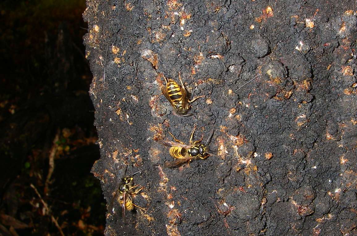
Two species of beech tree inhabited by two species of honeydew insect (the sooty beech scales) from the Margarodidae family produce New Zealand's largest single exported honey crop.
The beech trees are Black Beech (Nothofagus solandri) and Red Beech (N. fusca). The two insects are Ultracoelostoma assimile and U. brittini. U. brittini tends to inhabit the trunks and larger branches, while U. assimile is recorded as favouring the upper branches and twigs, thus U.brittini is the insect most likely to be encountered by the casual observer wandering in the beech forests.
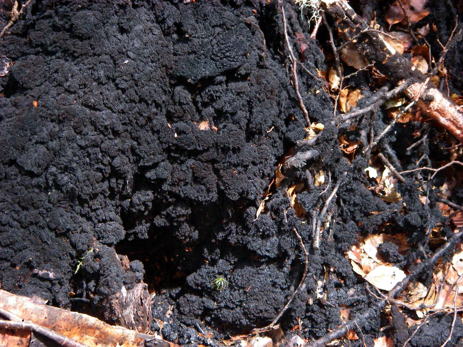
The black colour of trees and plants with a honeydew source is due to the growth of a black sooty mould (Capnodium fungus) on the surplus nectar exuding over the plant and sometimes even the ground. Particles of this fungus typically found in honeydew are referred to as "honeydew elements" and are used as a part of the identification as honeydew honey.
Photo: Don Hitchcock, 2nd February 2007
Text: Adapted from http://www.airborne.co.nz/hnydew.shtml
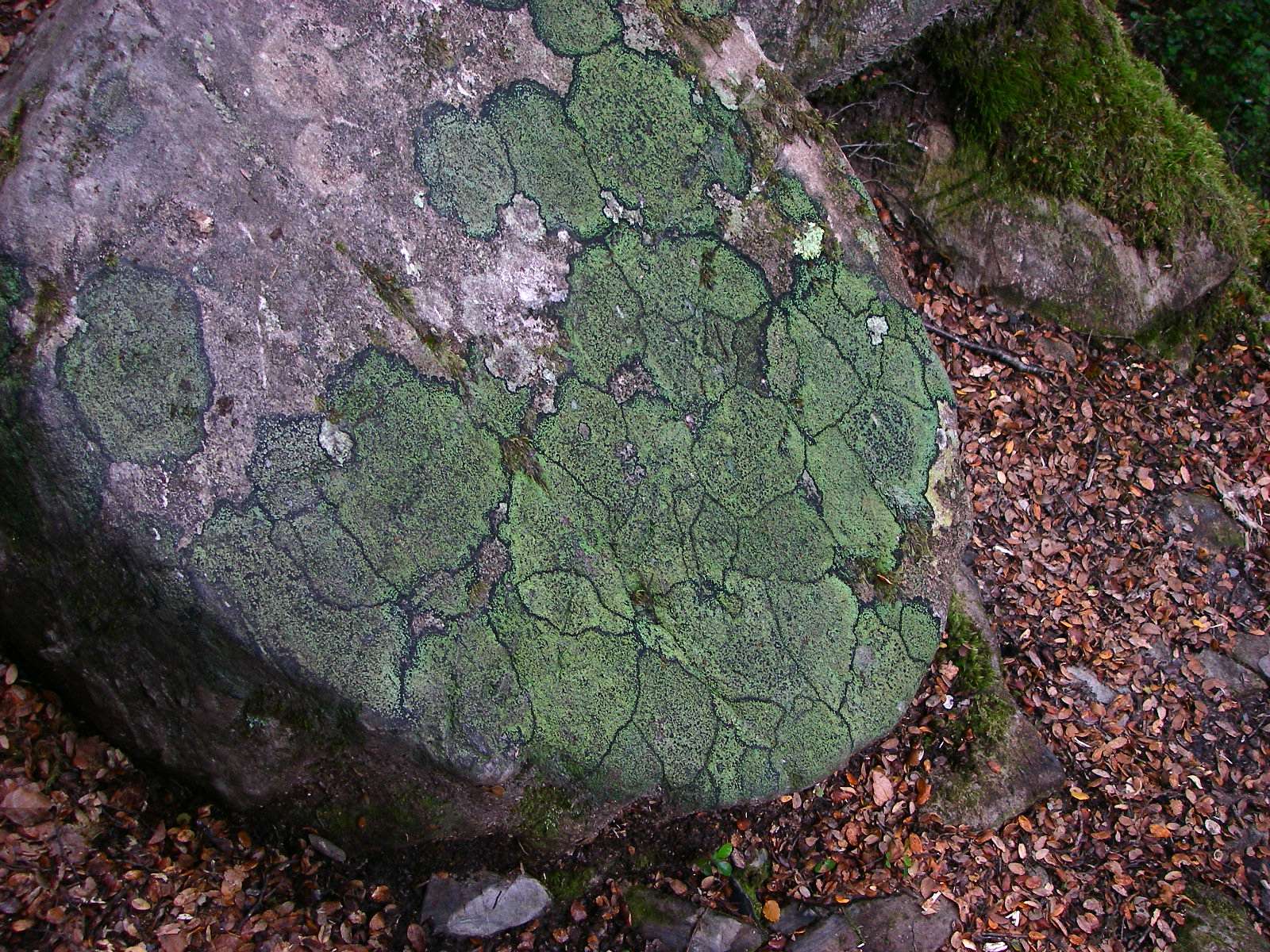
This is a striking and beautiful life form which I called the mosaic lichen. It occurs in several places in New Zealand. It appeared to me that rival colonies of lichen kept a narrow dark margin between them as they competed to cover the surface of a suitable rock.
Photo: Don Hitchcock, 2nd February 2007
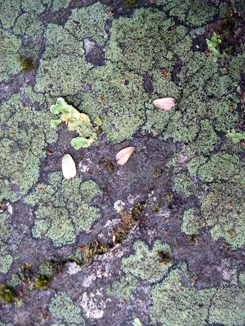
Here it is on the Cascade Track leading down to the Travers River from Lake Angelus, still in the Nelson Lakes National Park.
Photo: B., 30th January 2007
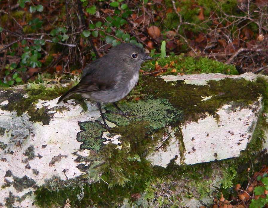
Female New Zealand Robin - left, on another example of mosaic lichen!
The New Zealand Robin or Toutouwai (Māori), Petroica australis, is a sparrow-sized bird found only in New Zealand, where it has the status of a protected endemic species.
The birds are sparsely distributed through South Island and Stewart Island/Rakiura, although the distribution is not continuous. The South Island Robin (Petroica australis australis), and the Stewart Island Robin (Petroica australis rakiura) are today accepted as subspecies.
The species is closely related to the North Island Robin (formerly Petroica australis longipes, now considered a distinct species), and also to the extremely rare Black Robin (Petroica traversi) of the Chatham Islands.
Photo: Don Hitchcock, 2nd February 2007
Text: Wikipedia
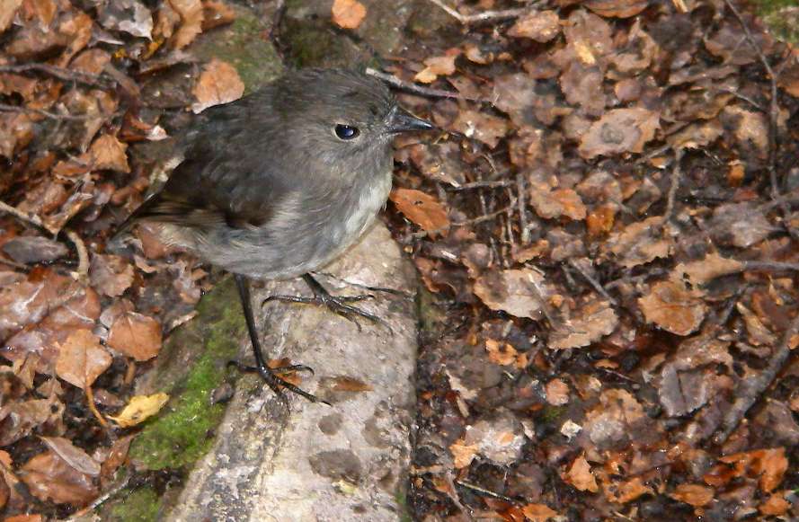
The male's plumage is a dark slate grey whereas the female is dark grey-brown. On both birds the throat and belly are considerably lighter, in the male a cream colour. It is this bright breast that gave the birds their name, in comparison with the bright breast of the European Robin.
The birds generally inhabit the forest fringe, and can often be found in the green belts of towns and cities.
Photo: Don Hitchcock, 2nd February 2007
Text: Wikipedia

Signage on the tracks is uniformly excellent.
At this point we were close to the head of Lake Rotoroa.
Photo: Don Hitchcock, 2nd February 2007
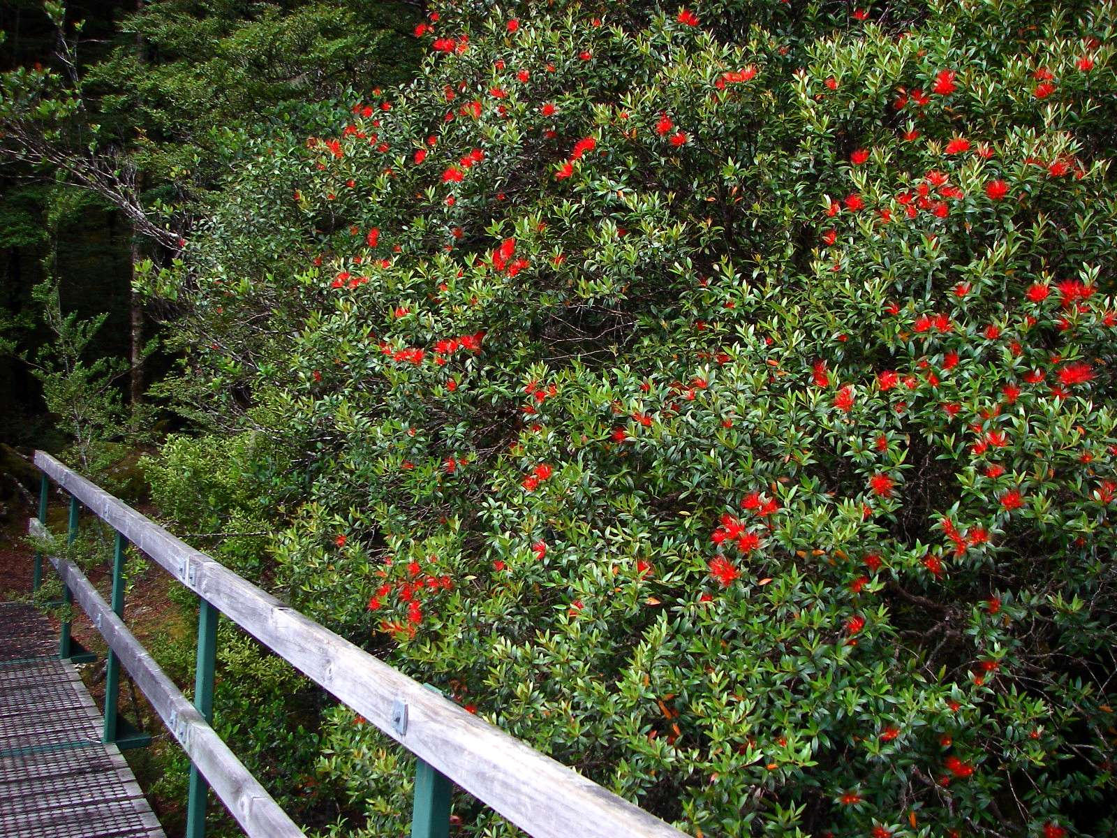
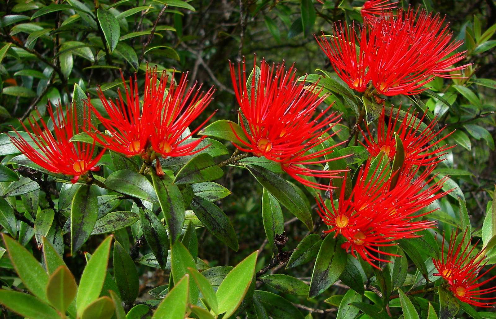
We came to a small creek, and beside the bridge was this magnificent Pōhutukawa, the New Zealand Christmas Tree.
The natural range of the Pōhutukawa is the coastal regions of the North Island of New Zealand, north of a line stretching from New Plymouth (39° S) to Gisborne (38° S), where it once formed a continuous coastal fringe. By the 1990s pastoral farming and introduced pests had reduced Pōhutukawa forests by over 90 per cent. It also occurs naturally on the shores of lakes in the Rotorua area.
Photo: Don Hitchcock, 2nd February 2007
Text: Wikipedia
Like its Hawaiian relative the ʻōhiʻa lehua (M. polymorpha), the Pōhutukawa has shown itself to be efficient in the colonisation of lava plains – notably on Rangitoto, a volcanic island in the Hauraki Gulf.
A giant Pōhutukawa at Te Araroa on the East Coast is reputed to be the largest in the country, with a height of 20 metres and a spread of 38 metres. The tree is renowned as a cliff-dweller, able to maintain a hold in precarious, near-vertical situations.
The Pōhutukawa grows up to 25 metres in height, with a dome-like spreading form. It usually grows as a multi-trunked spreading tree. Its trunks and branches are sometimes festooned with matted, fibrous aerial roots.
Photo: Don Hitchcock, 2nd February 2007
Text: Wikipedia
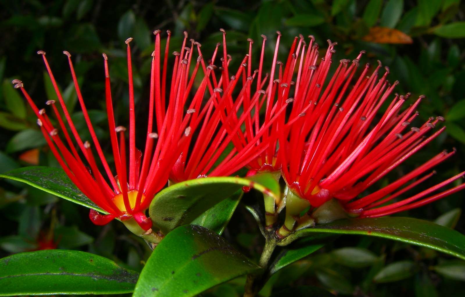
The oblong, leathery leaves are covered in dense white hairs underneath. The tree flowers from November to January with a peak in mid to late December, with brilliant crimson flowers covering the tree, hence the nickname New Zealand Christmas Tree. There is variation between individual trees in the timing of flowering, and in the shade and brightness of the flowers. In isolated populations genetic drift has resulted in local variation: many of the trees growing around the Rotorua lakes produce pink-shaded flowers, and the yellow-flowered cultivar "Aurea" descends from a pair discovered in 1940 on Mōtiti Island in the Bay of Plenty.
Photo: Don Hitchcock, 2nd February 2007
Text: Wikipedia
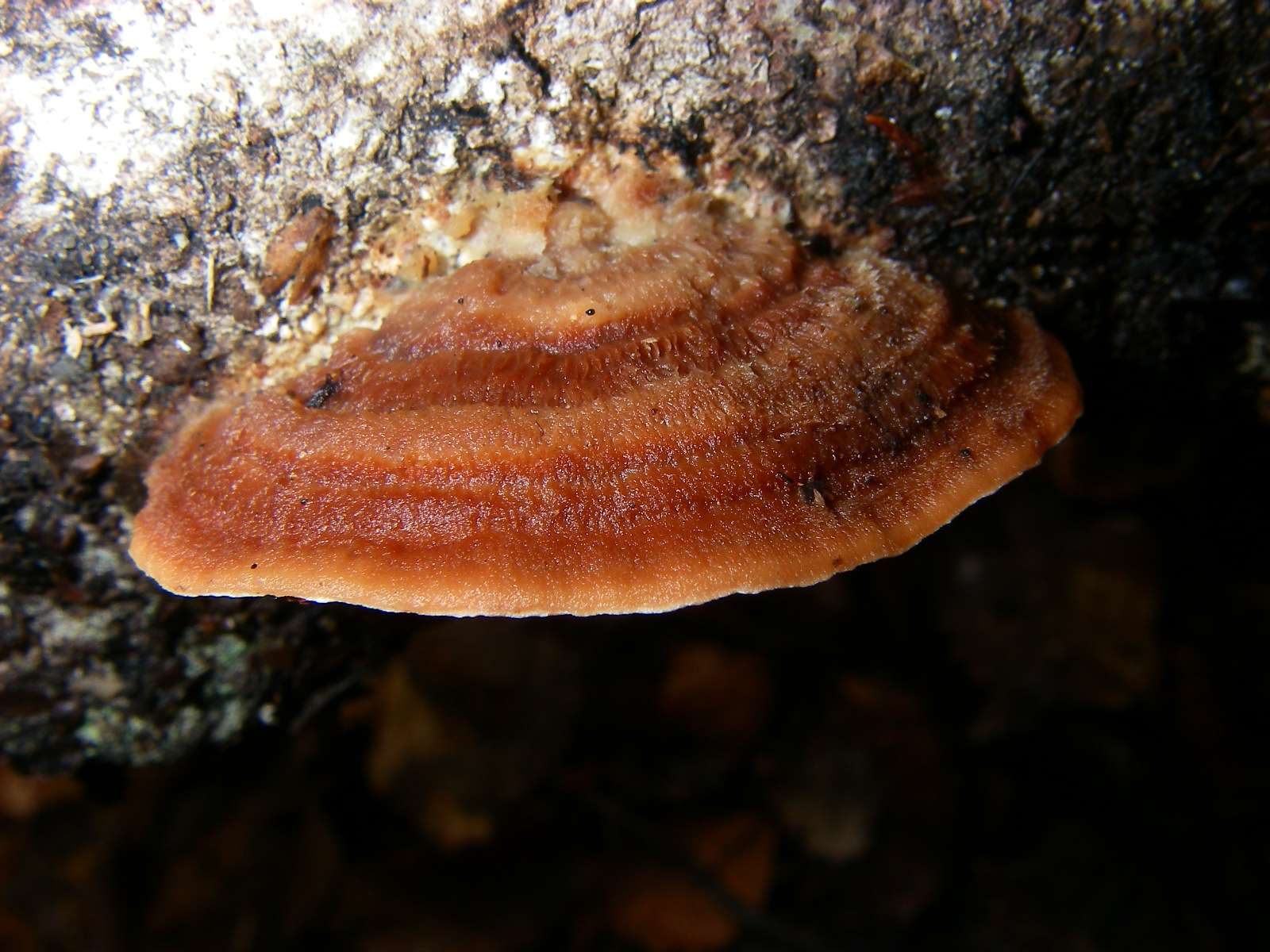
Bracket fungus.
Photo: Don Hitchcock, 2nd February 2007
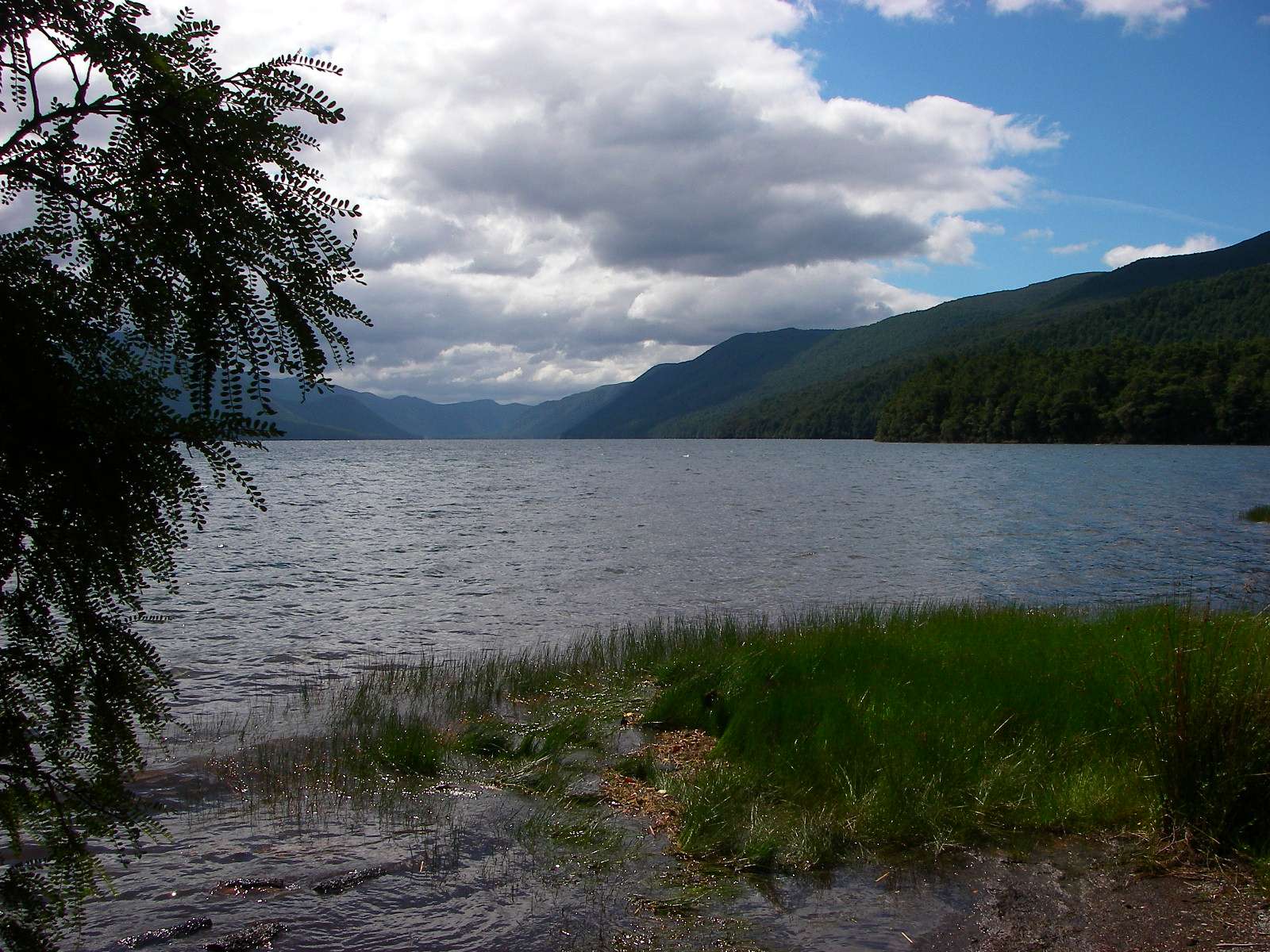
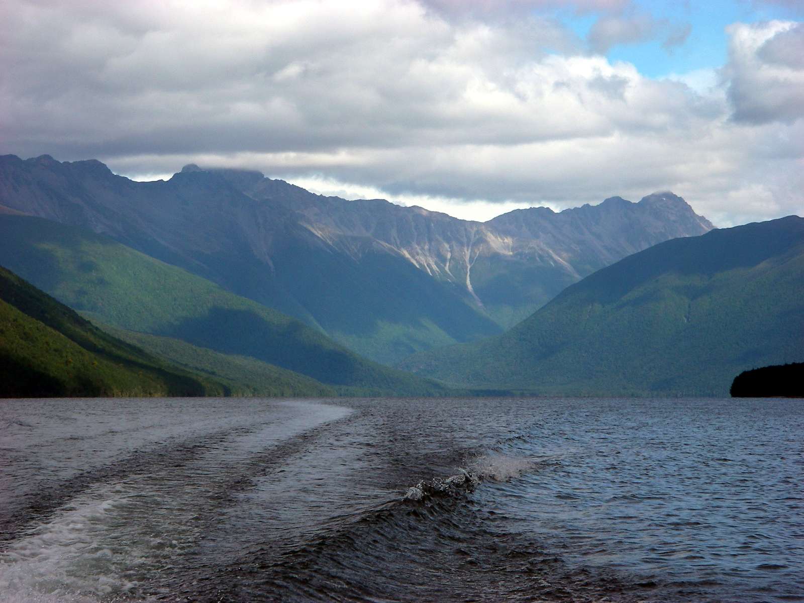
At Sabine Hut on Lake Rotoroa, which has a depth of 145 metres.
The sand flies were eating us alive, and we decided to take a boat out, rather than walk back to Lake Rotoiti along a track which offered little of interest so far as we could tell from the track notes. However the rates for a boat chartered at will were prohibitive, and the next scheduled crossing was not for some time.
Photo: (left) Don Hitchcock, 2nd February 2007, (right) B., 2nd February 2007
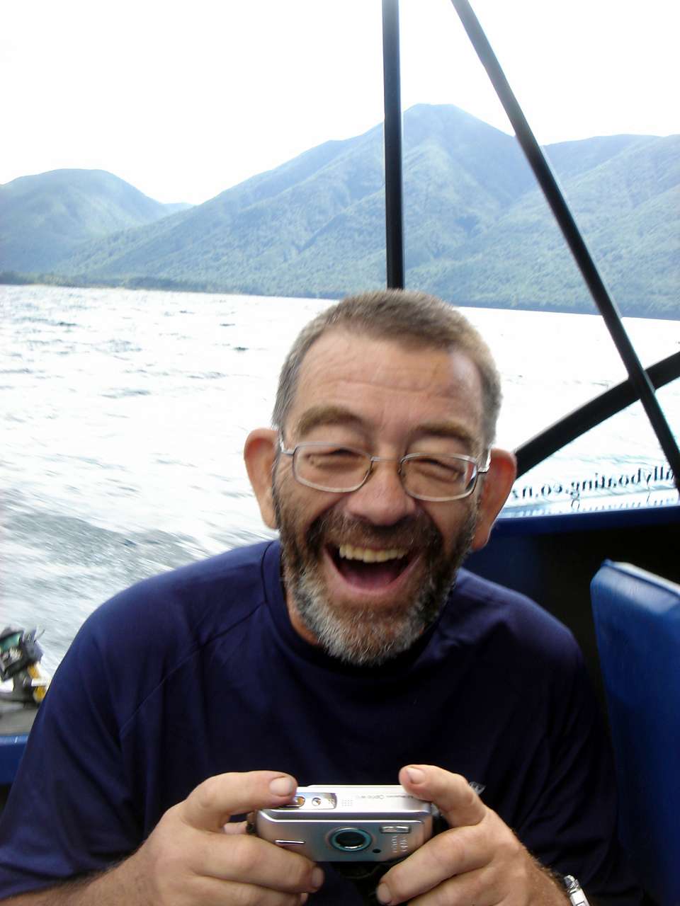
I noticed a boat pottering around the shore, and hailed it. Soon we were headed for the other end of the long lake, courtesy of some lovely people who had been doing a spot of fishing.
Photo: Don Hitchcock, 2nd February 2007
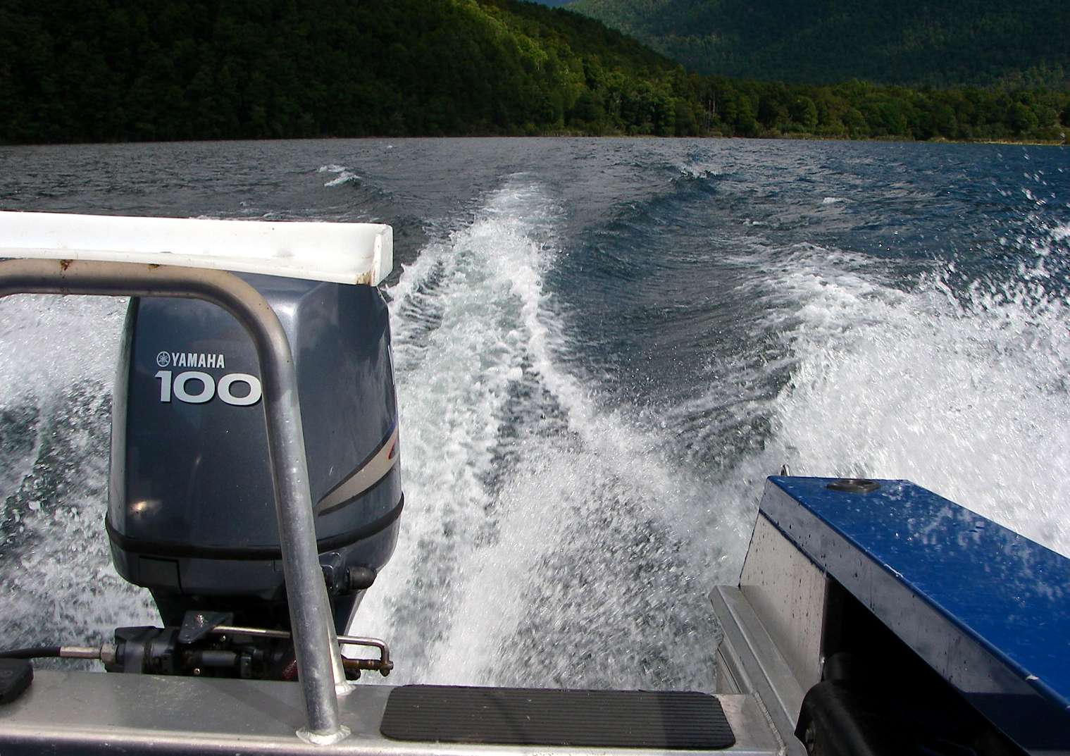
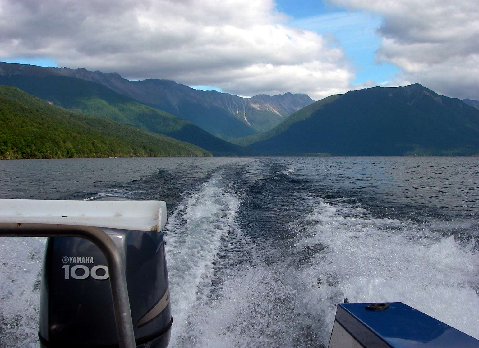
It was an exhilarating ride, not least because we had been at walking pace for a week or so.
Photo: (left) B., 2nd February 2007, (right) Don Hitchcock, 2nd February 2007
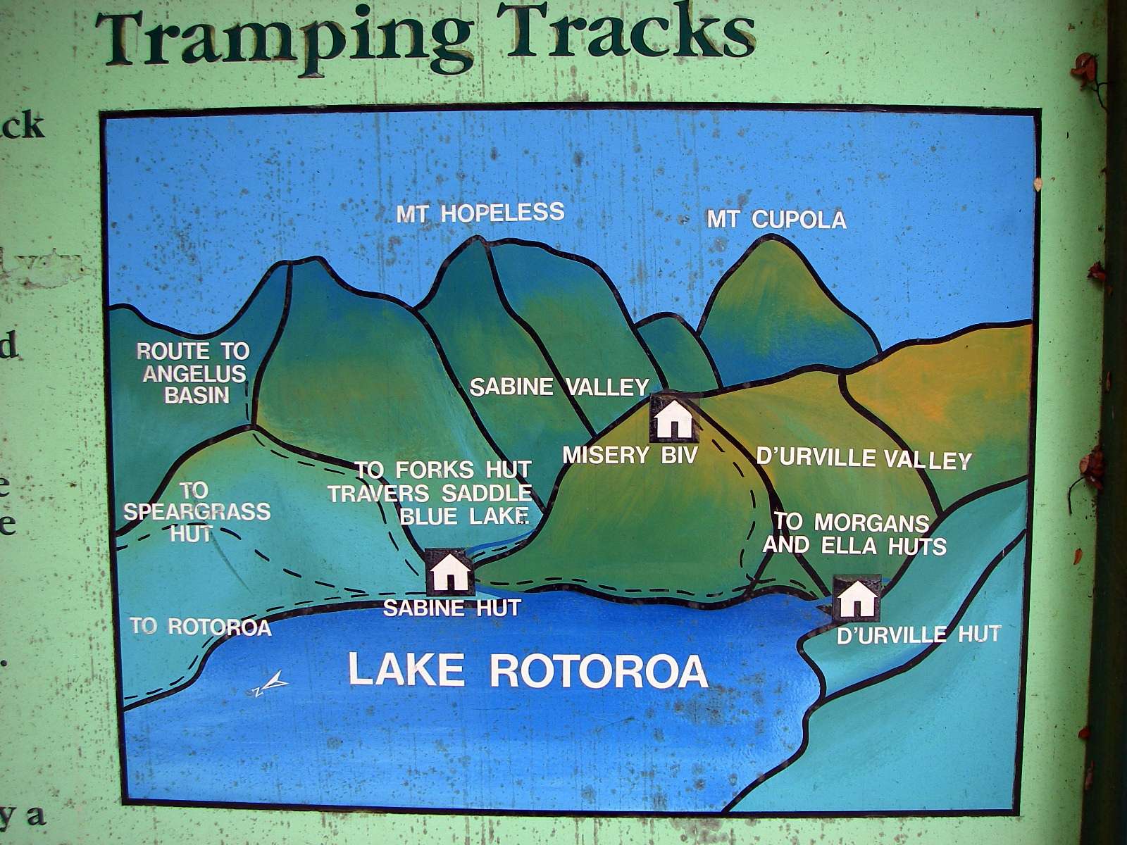
This display board was not up to the usual high standards of what I had come to expect of the signage in the park, it did not give a true picture of the tracks.
Photo: Don Hitchcock, 2nd February 2007
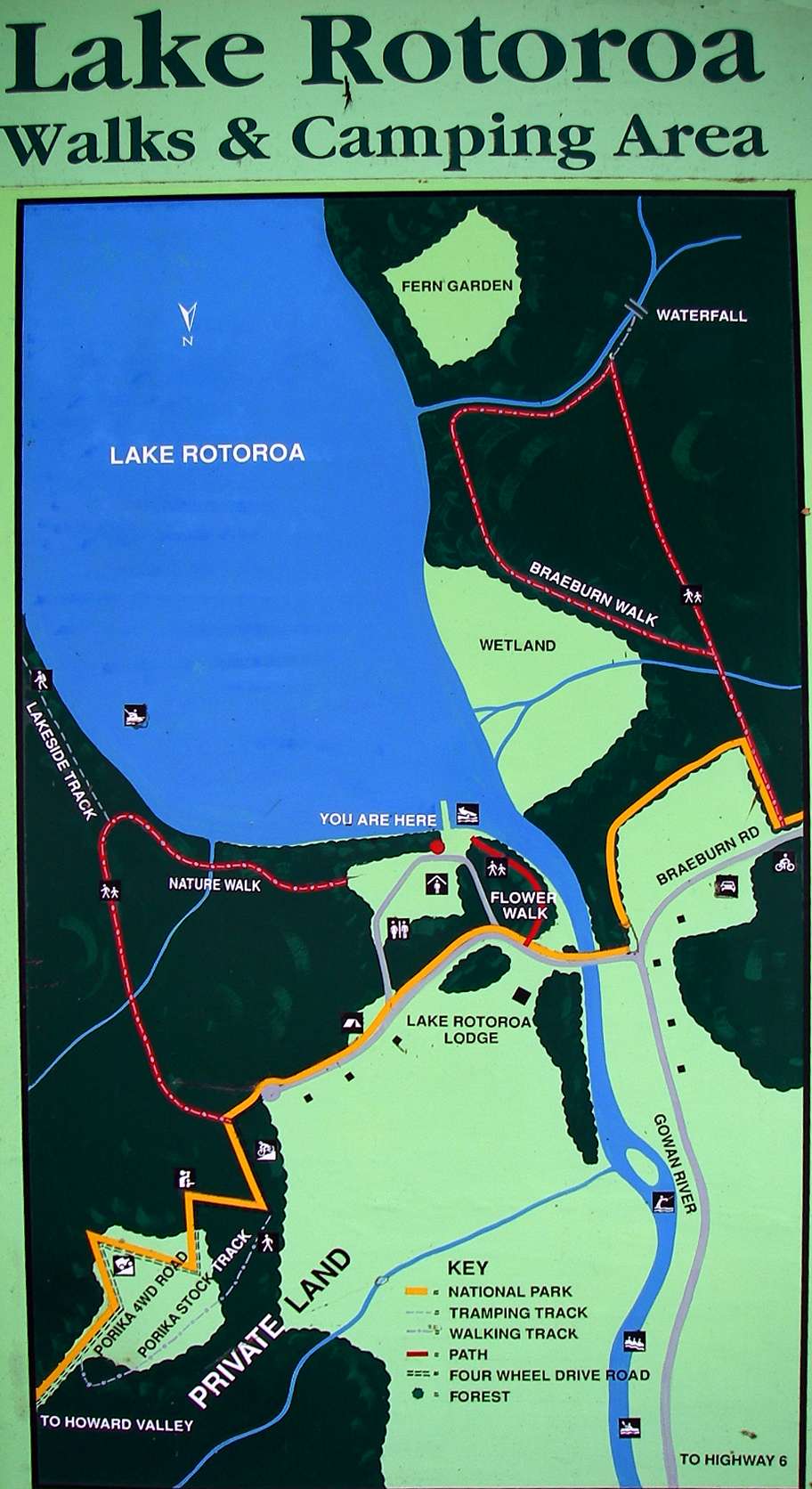
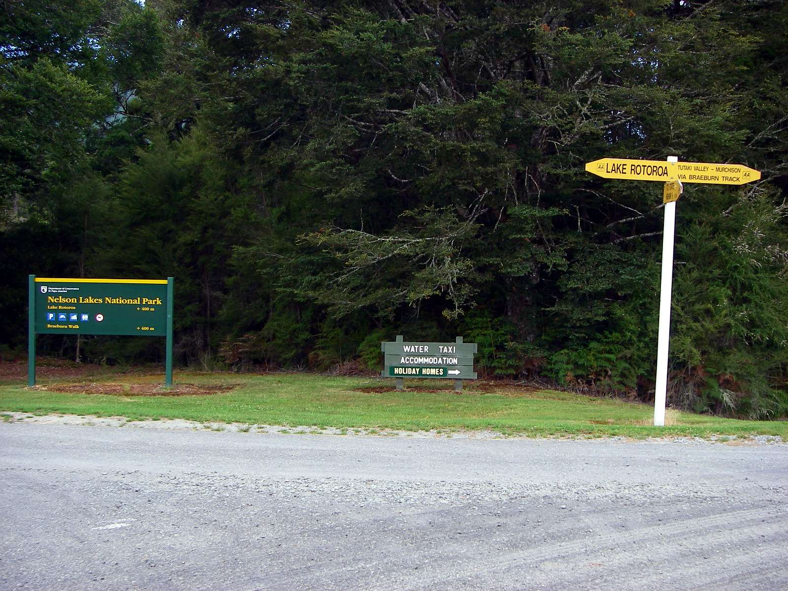
The signage for the local area was, however, excellent.
Photo: Don Hitchcock, 2nd February 2007
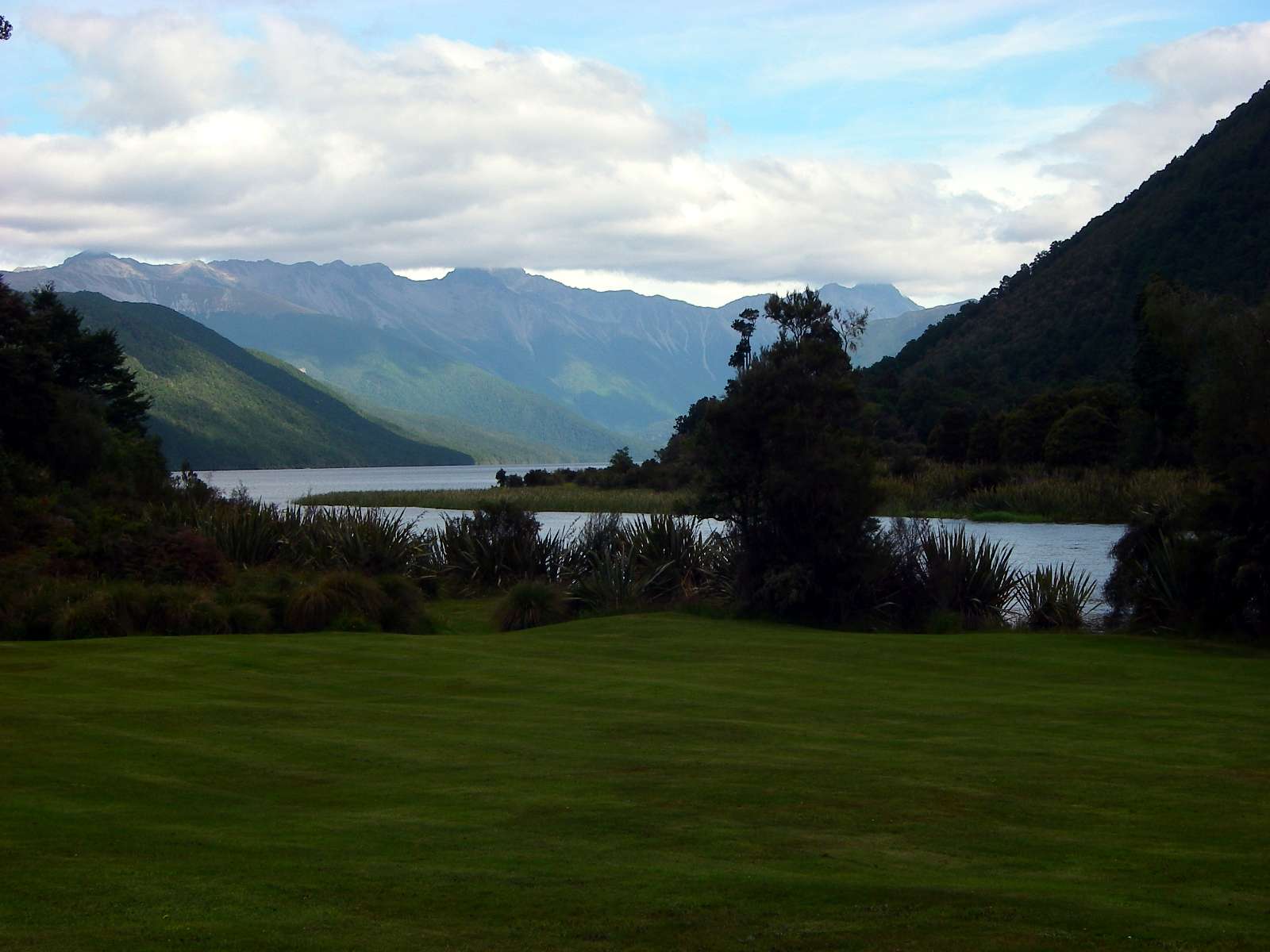
The landscaping beside the lake was superb. Our problem was now to get back to Saint Arnaud, a considerable distance away. There appeared to be no public transport.
Photo: Don Hitchcock, 2nd February 2007
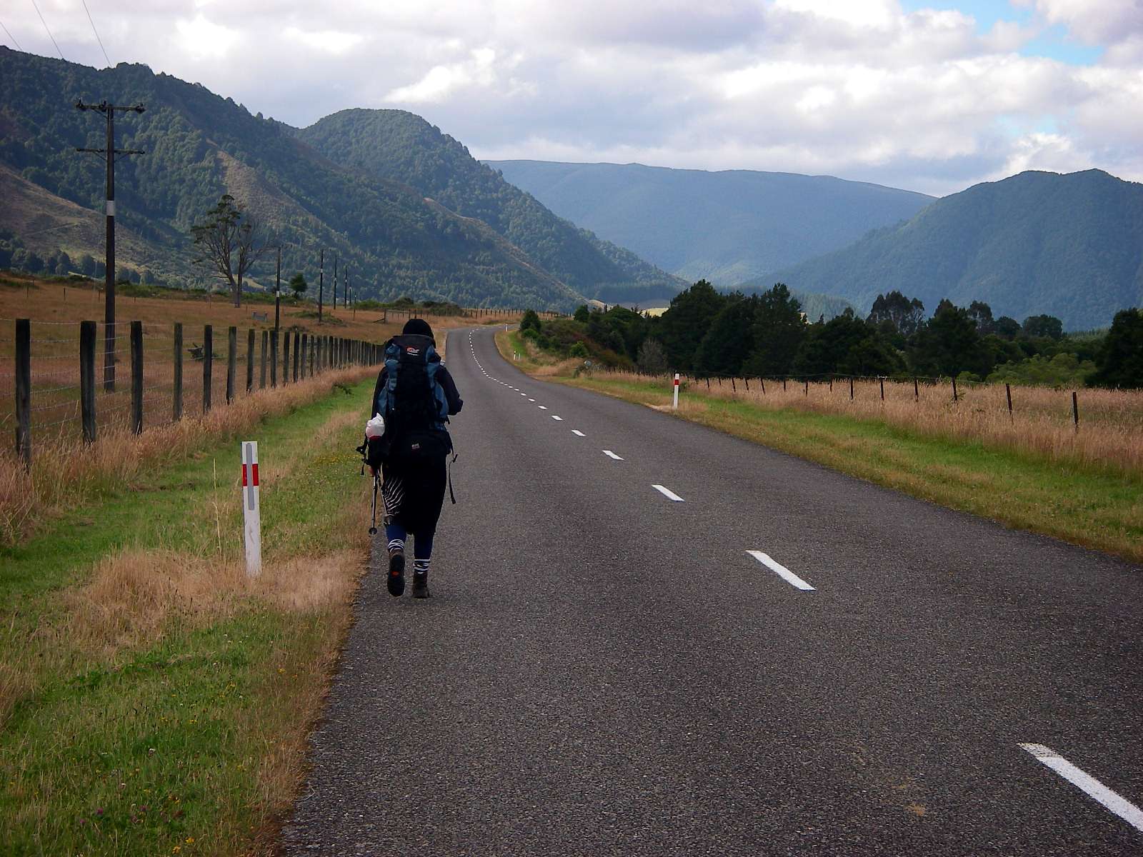
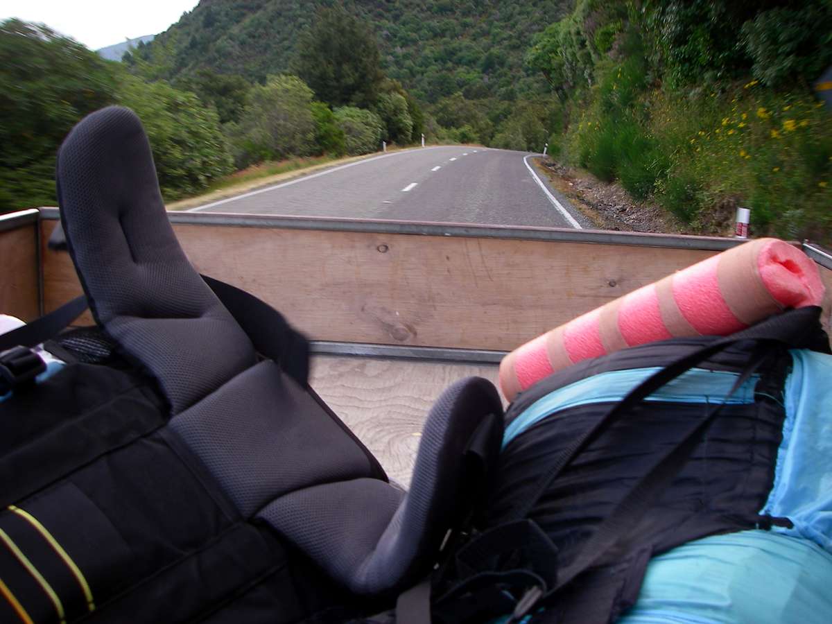
We walked for some time, but eventually got a couple of lifts, first to the main road, and then St Arnaud.
Photo: Don Hitchcock, 2nd February 2007
Bushwalking, Hiking and Tramping in New Zealand
Bushwalking Index