Back to Don's Maps
Le Ruth and Le Cellier in the Dordogne
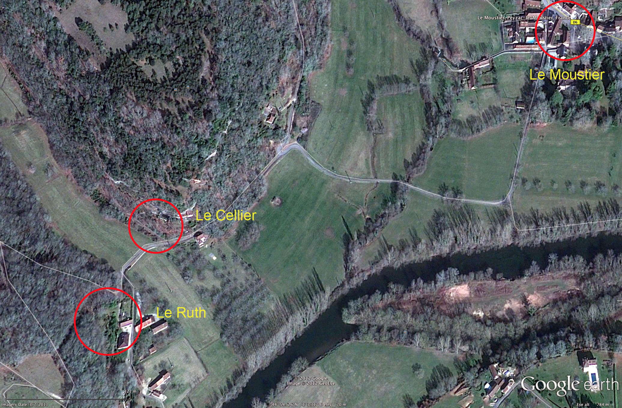
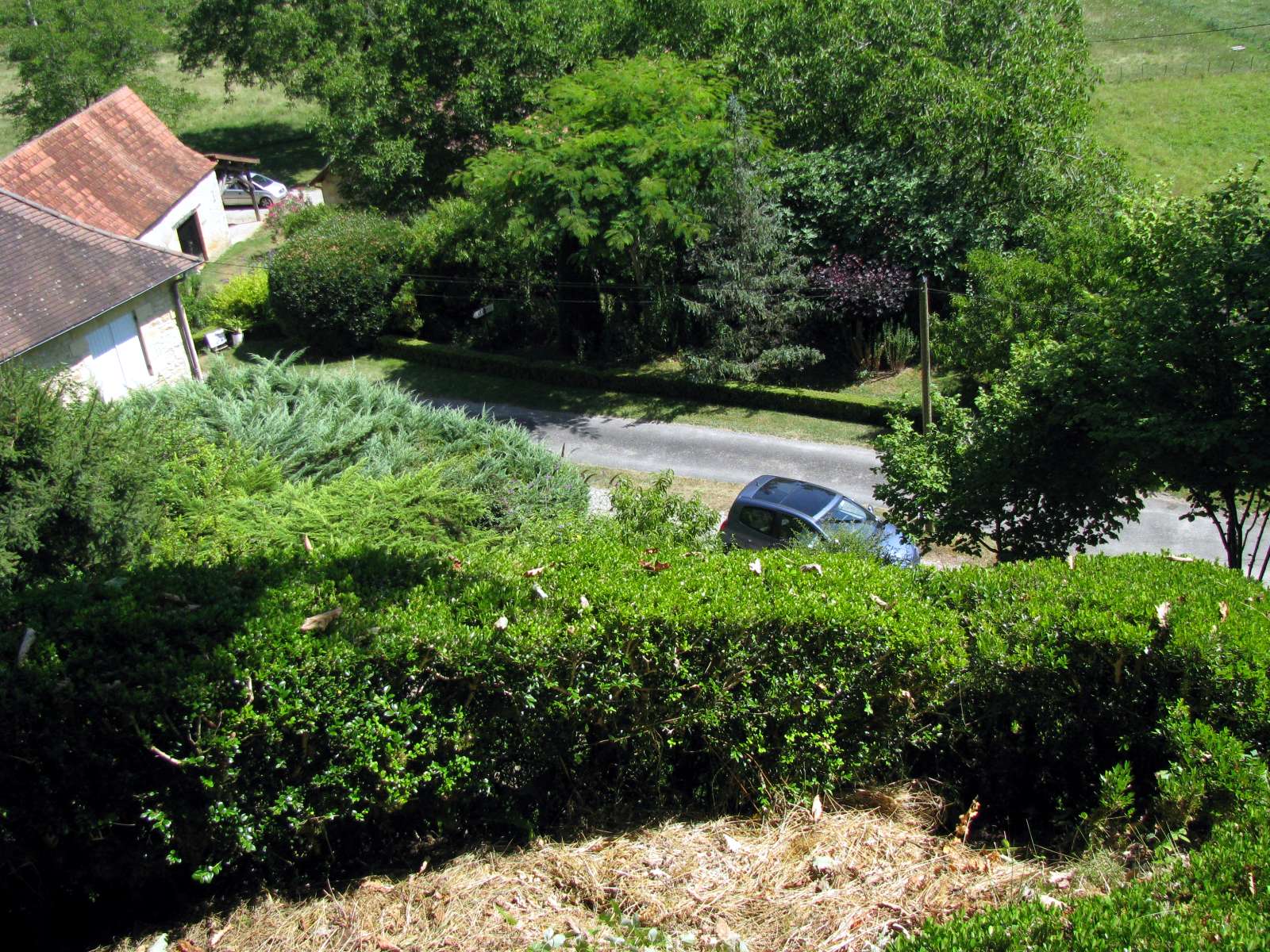
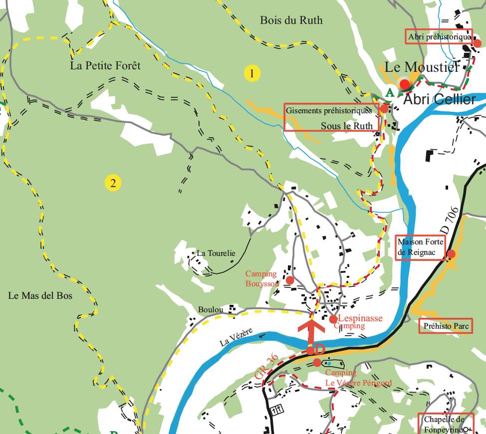
Le Ruth, Le Cellier, and Le Moustier. Note that Le Ruth and Le Cellier are only 100 metres apart, and are often treated as a unit by researchers.
Photo: adapted from Google Earth
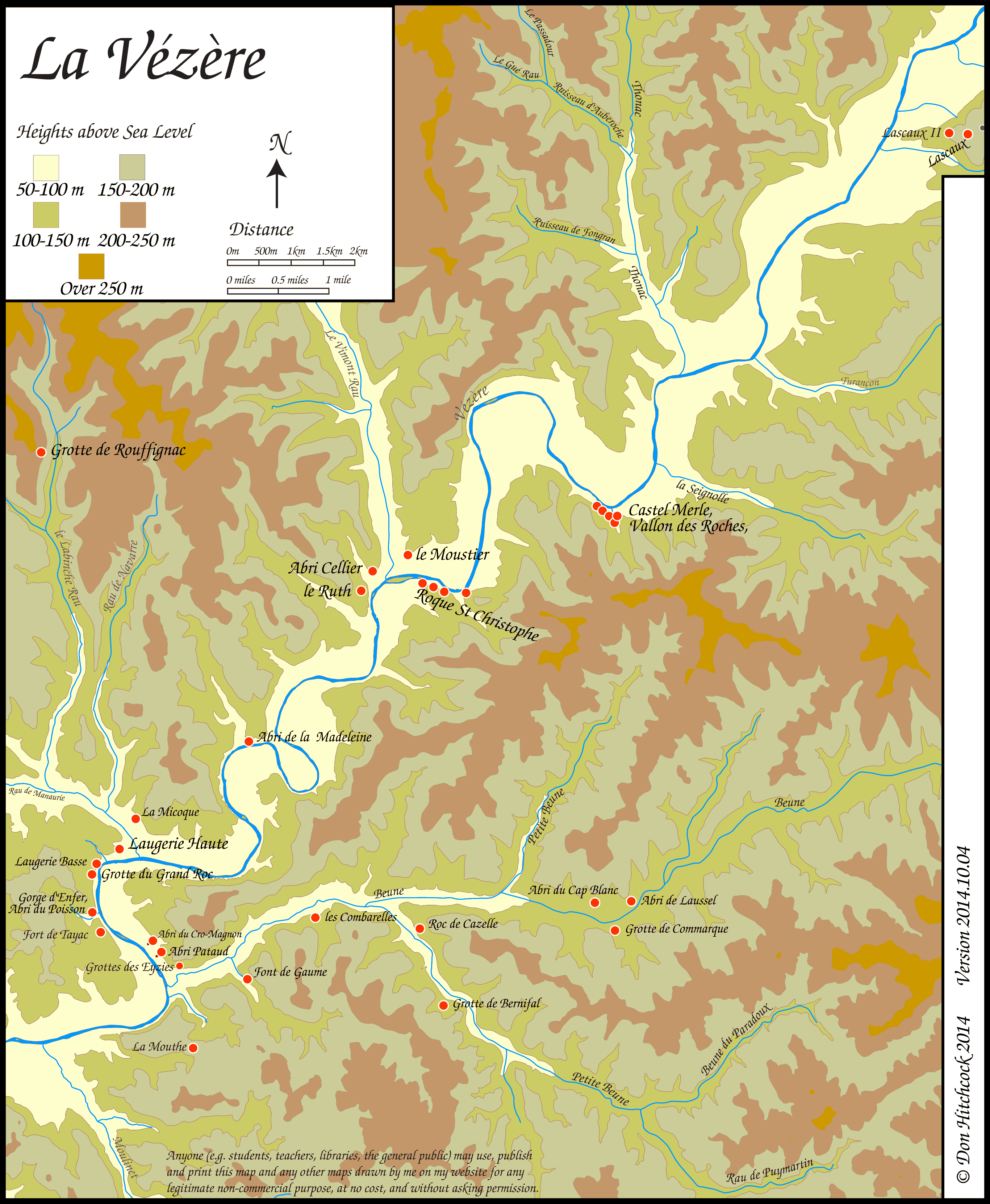
Map of sites in the Vézère Valley of France, including Le Ruth and Le Cellier.
If you click on the map you will see a larger map with the ability to click on the sites marked with a red dot and get further information.
Photo: Don Hitchcock
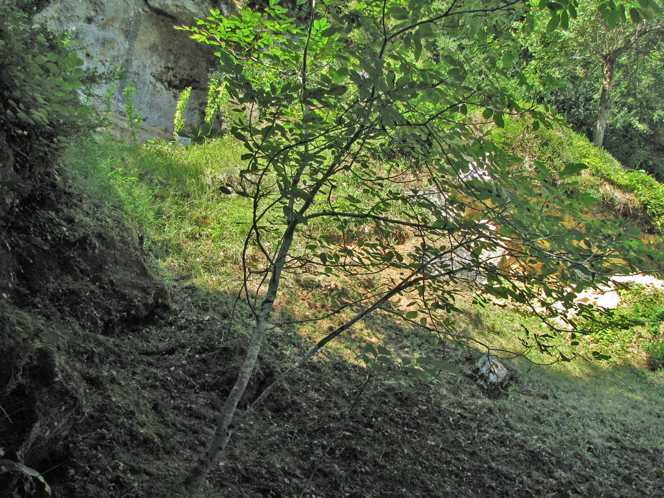
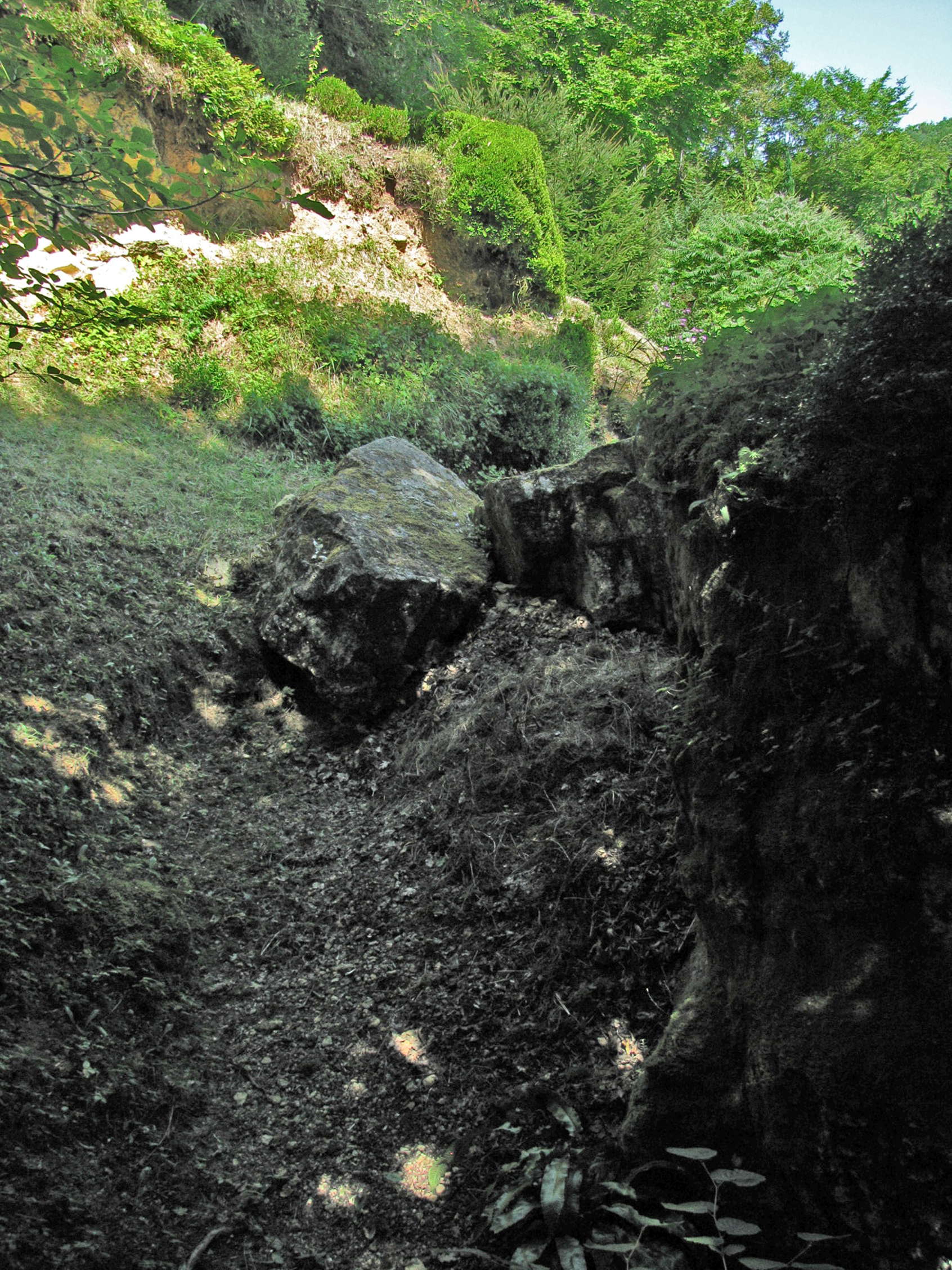
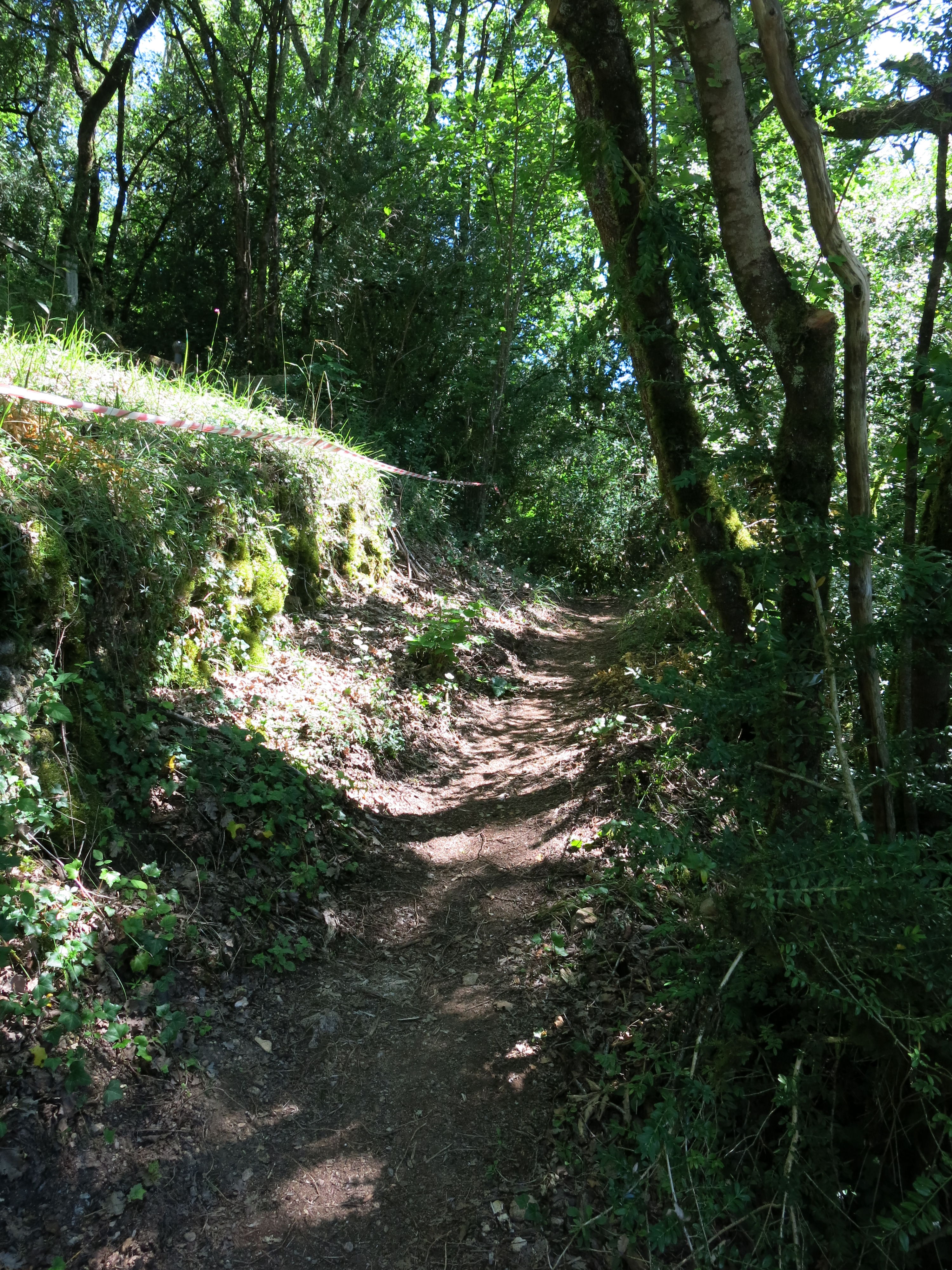
On the path up to l'abri Pagès du Ruth.
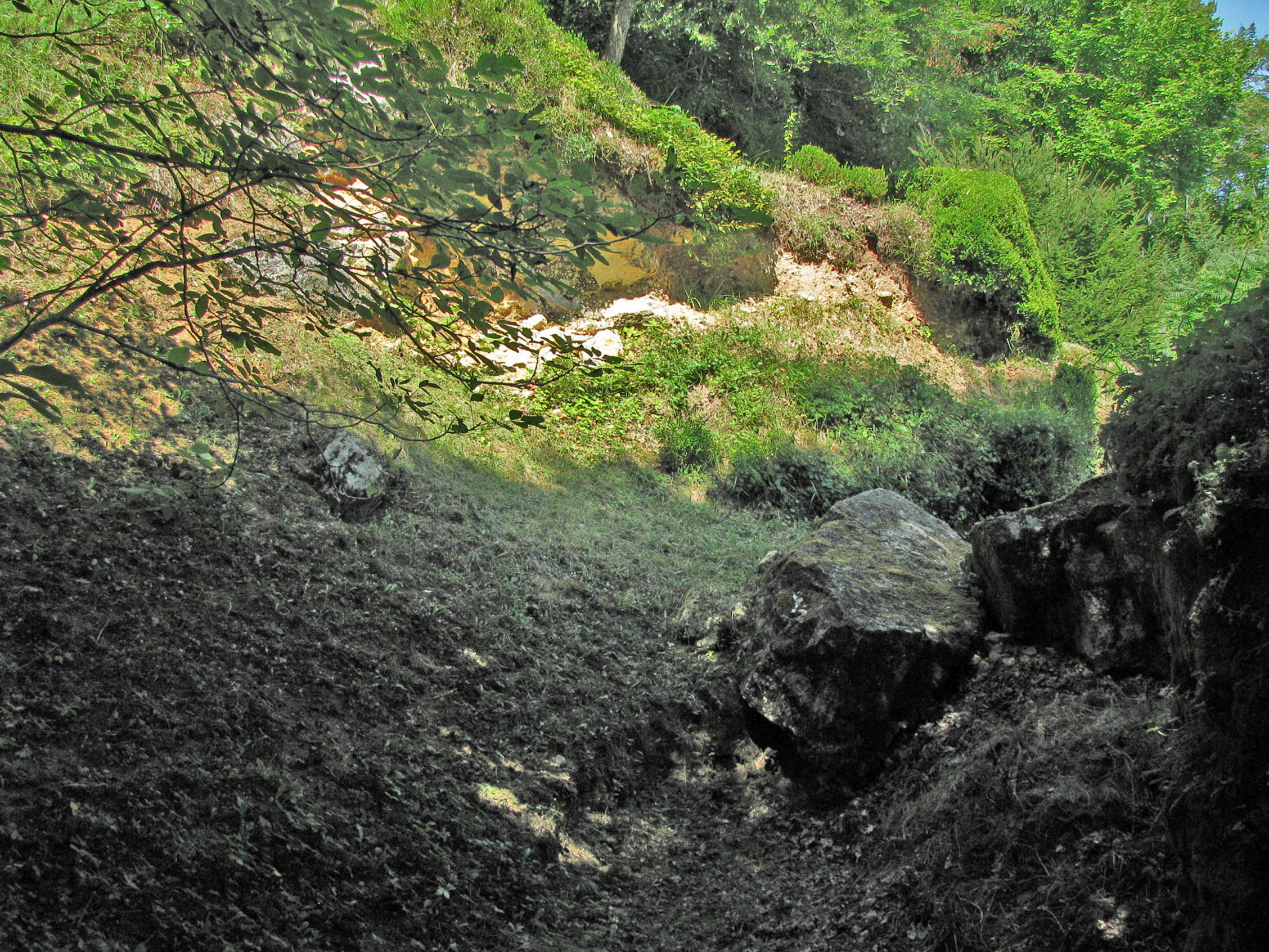
Trench left by Otto Hauser, just below L'abri Pagès du Ruth, the entrance to which can be seen on the top left of the photo on the left. He made no notes on his excavations, and sold everything he found to the highest bidder.
Photo: Don Hitchcock 2008
The distinguished archaeologist Randall White has stated that
'Otto Hauser was a very ambitious German-Swiss archaeologist who was forced to flee France at the outset of World War I under a cloud of accusations of espionage and artifact selling. He has traditionally been represented by French prehistorians as the single most destructive force in the history of French archaeology.'
Photo: Don Hitchcock 2008
Additional text: http://anthropology.as.nyu.edu/object/randallwhite.html
Le Ruth.
Trench left by Otto Hauser.
Photo: Don Hitchcock 2008
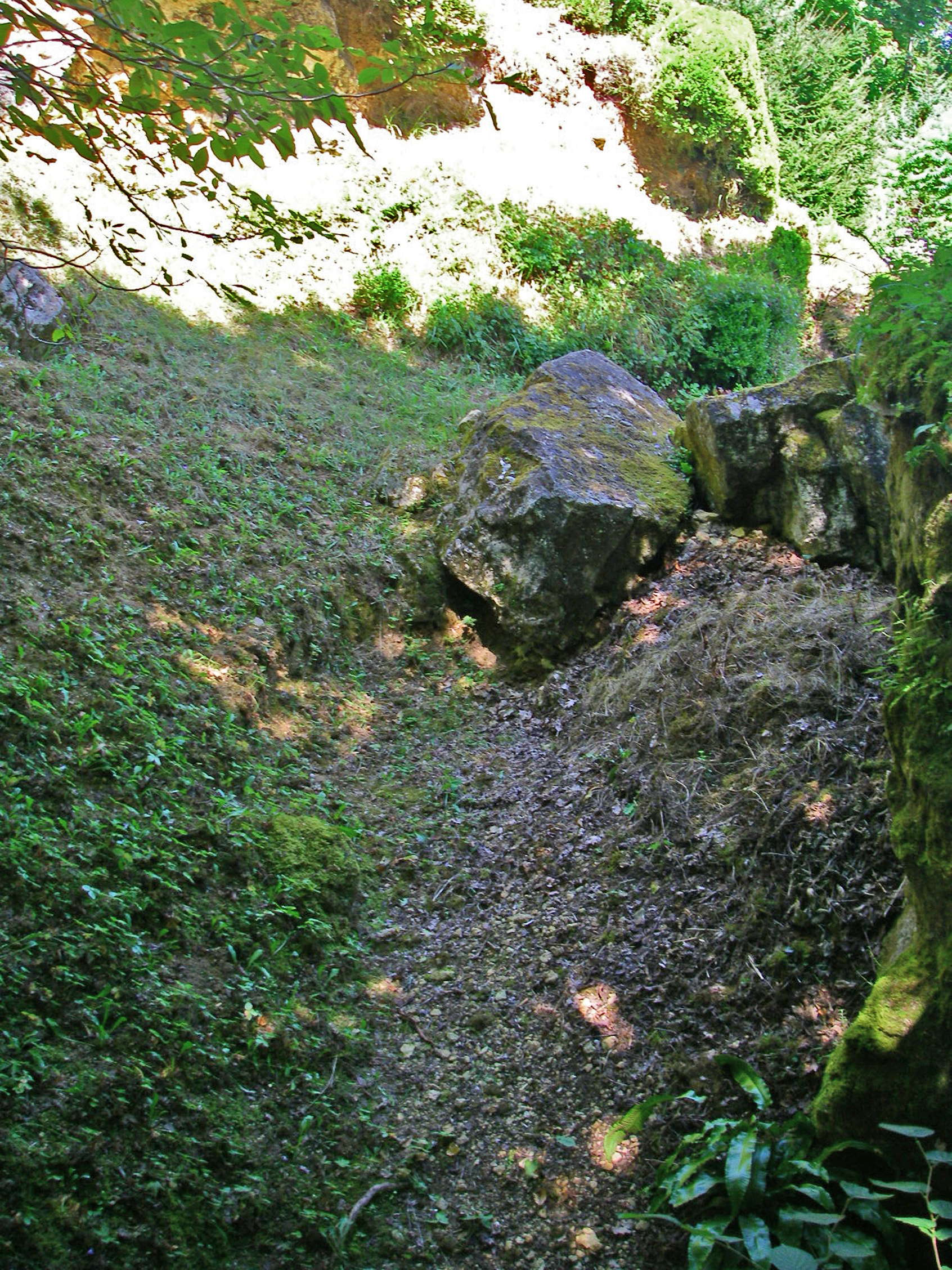
Le Ruth.
The path to l'abri Ruth is steep in parts.
Photo: Don Hitchcock 2014
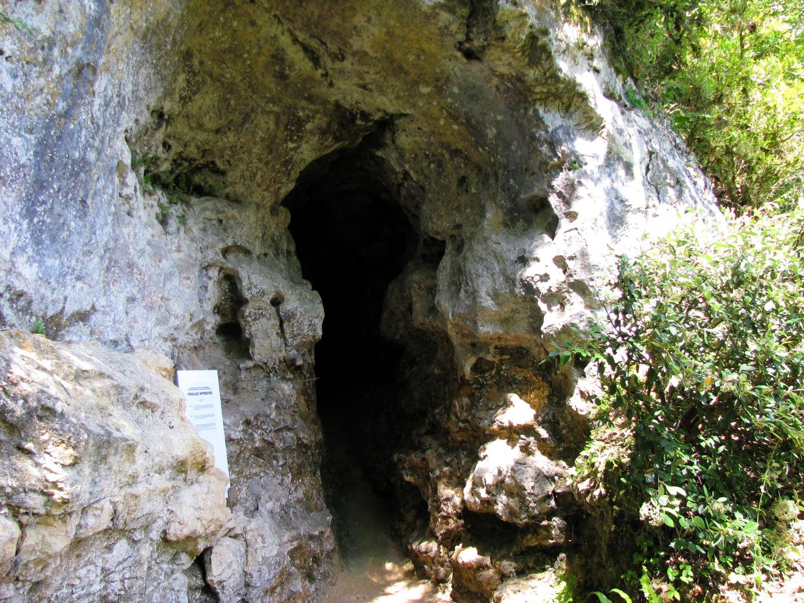
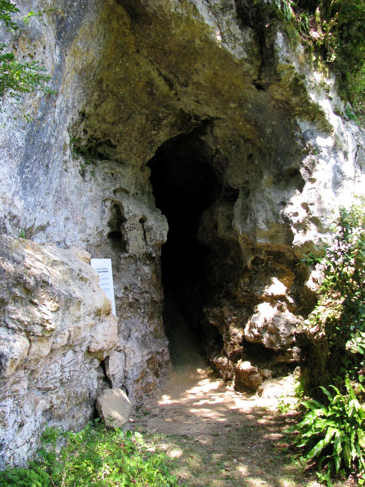
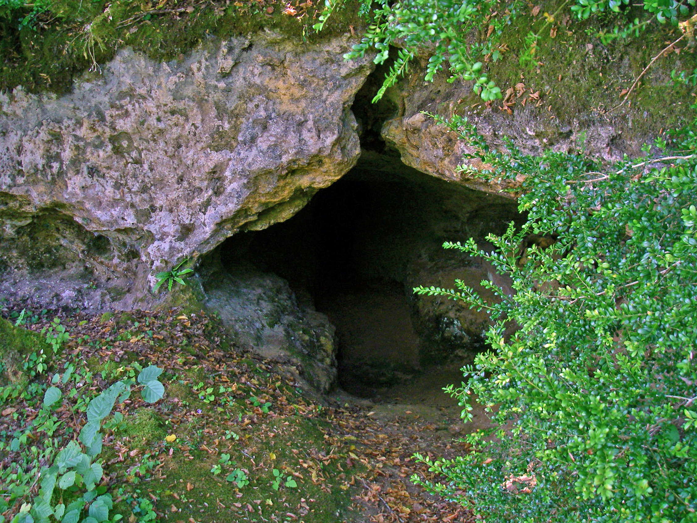
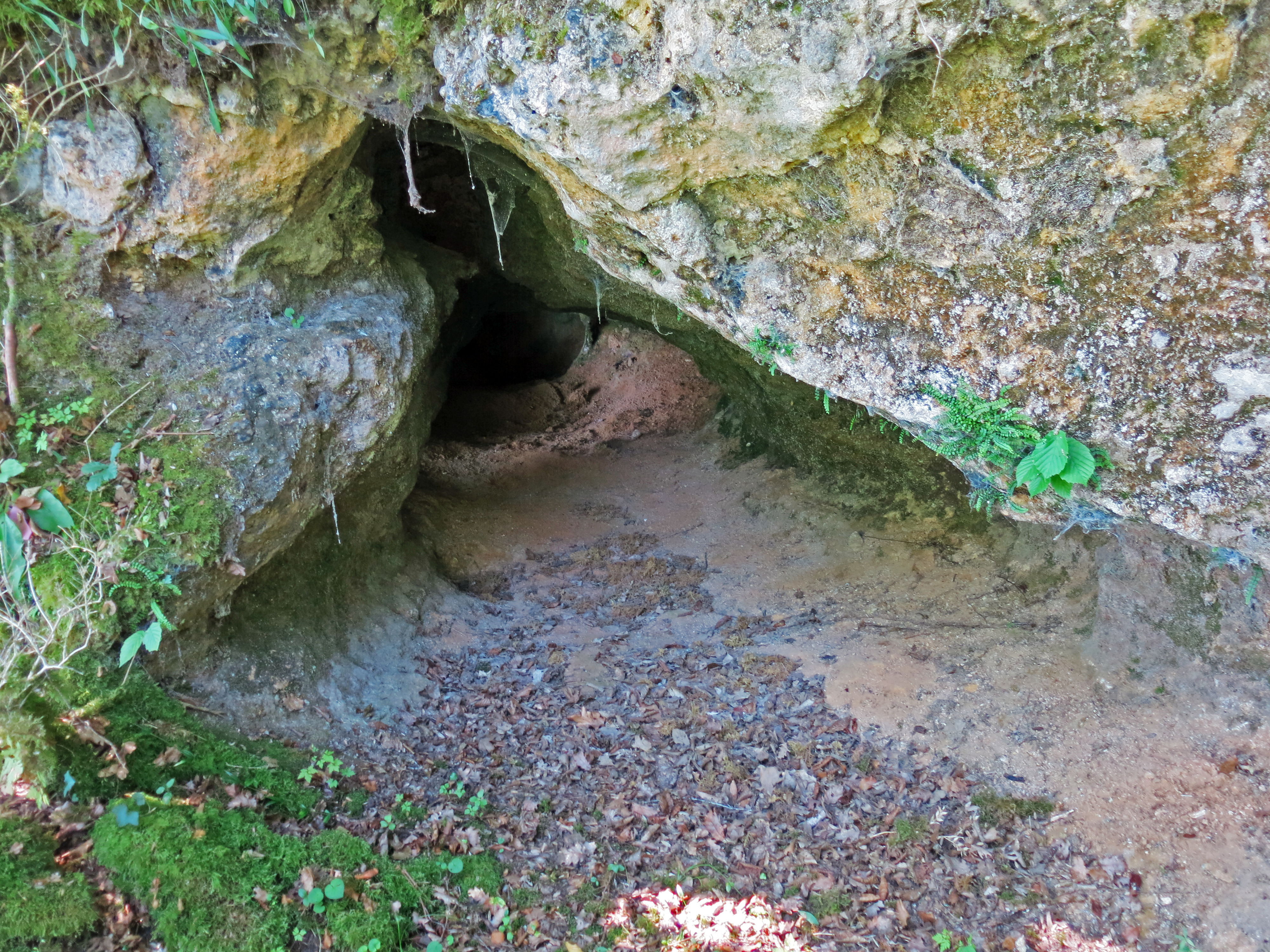
The cave at l'abri Ruth, also known as l'abri Pagès du Ruth.
Photo: Don Hitchcock 2008
L'abri Ruth, also known as l'abri Pagès du Ruth.
Photo: Don Hitchcock 2014
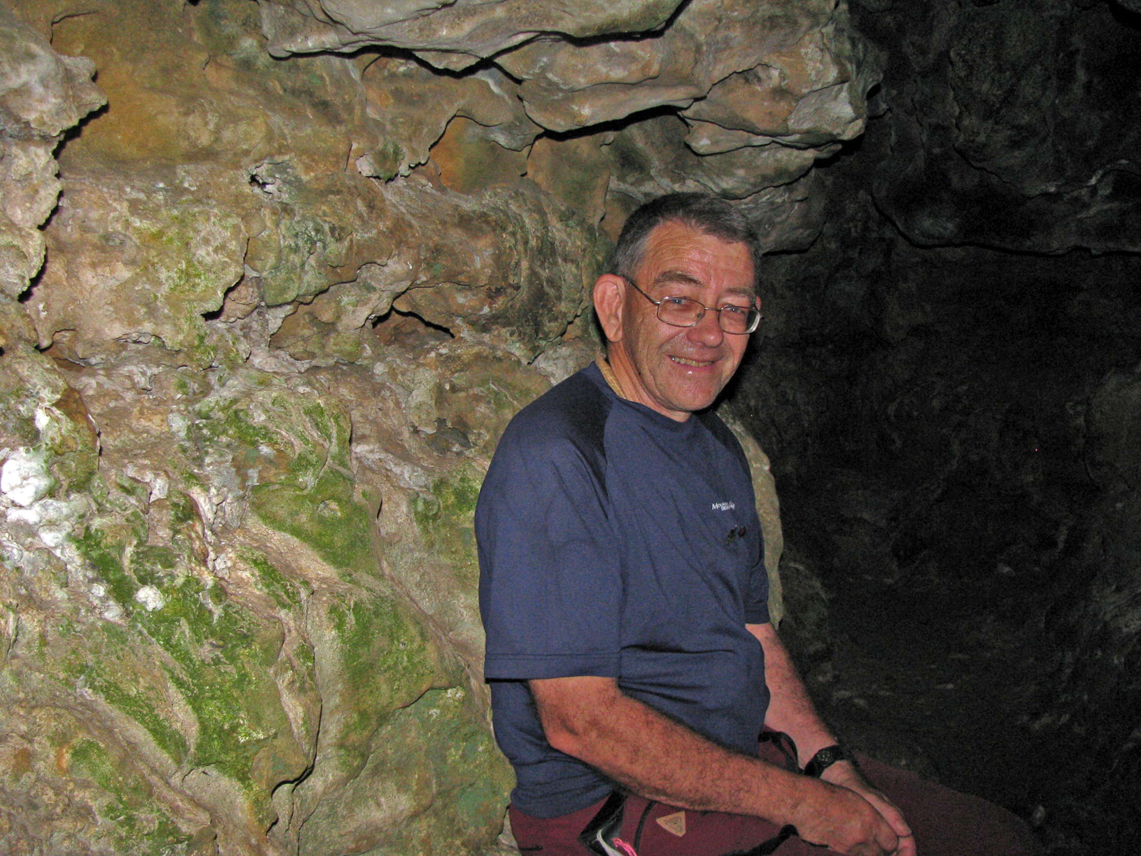
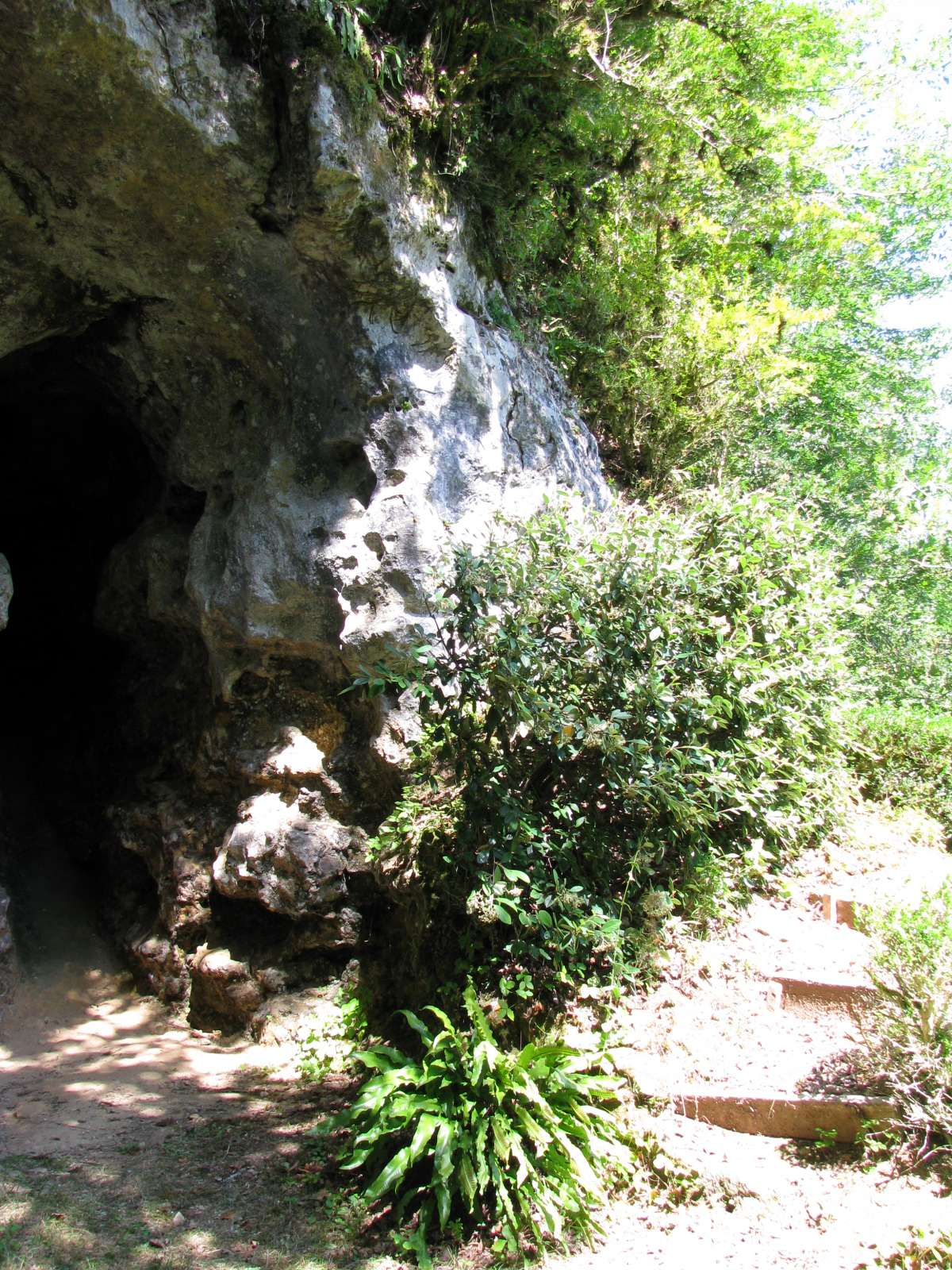
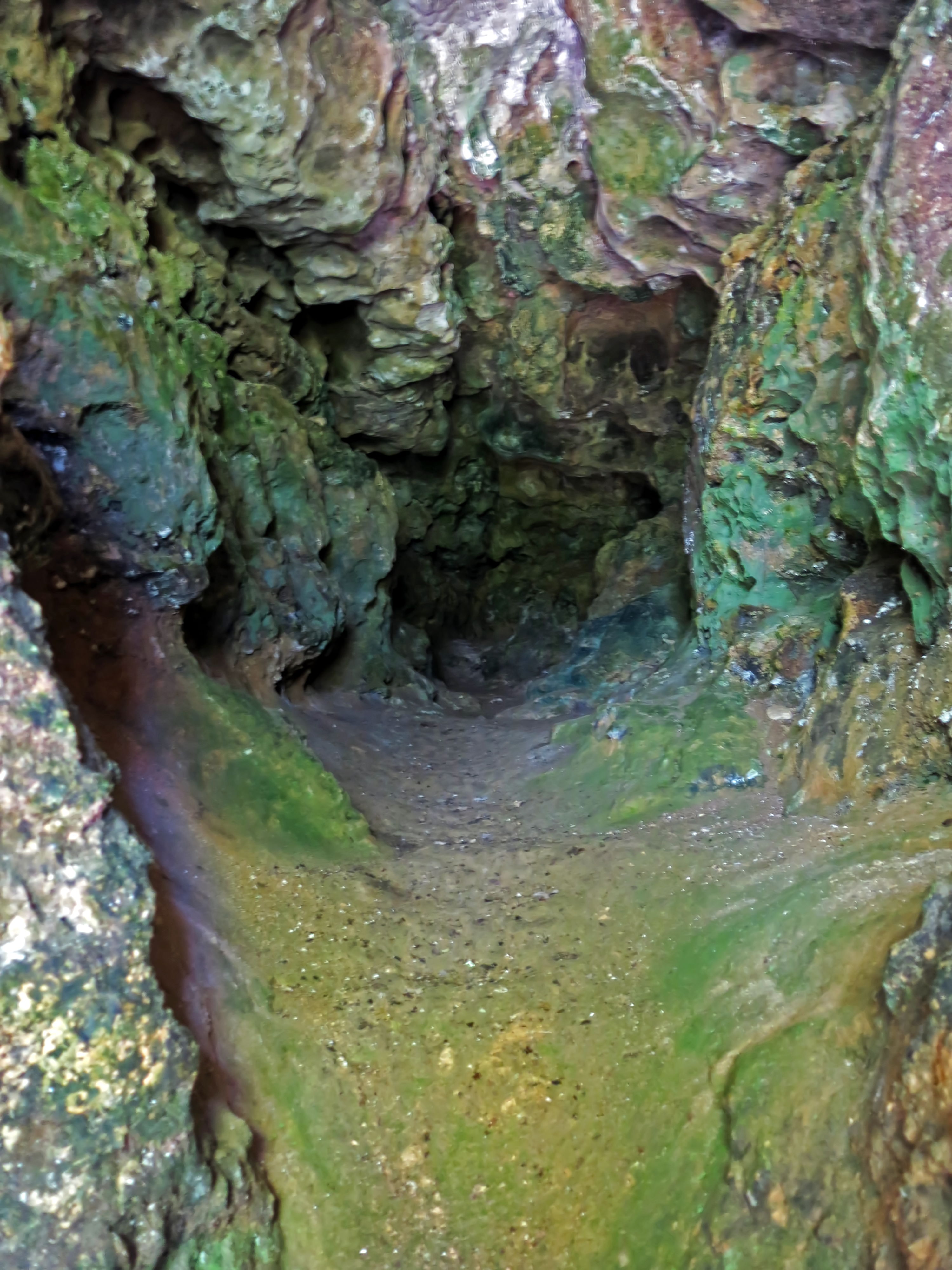
The cave at l'abri Pagès du Ruth.
The cave did not go far into the cliff. Right, me in the cave.
Photo: Don Hitchcock 2008
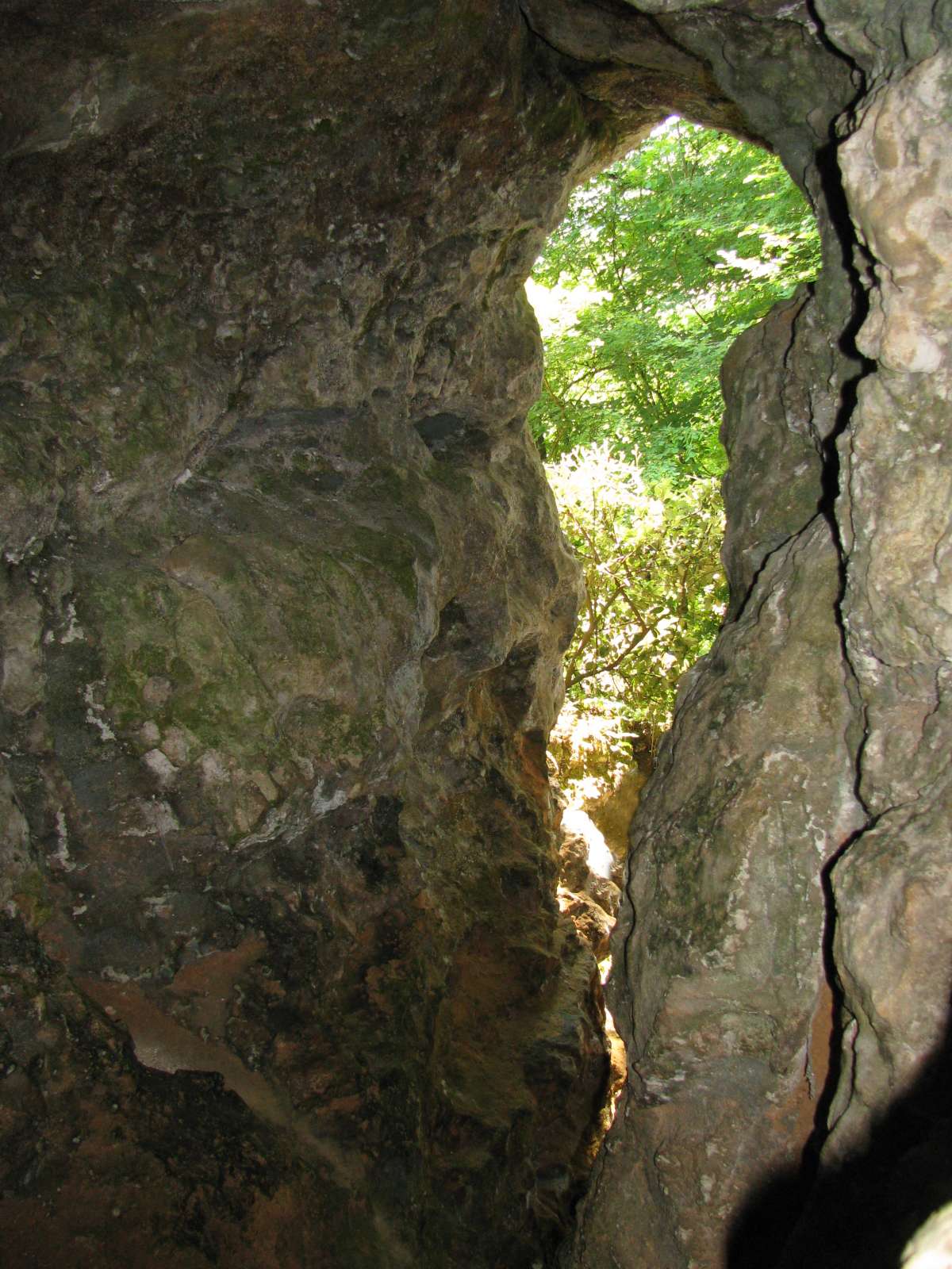
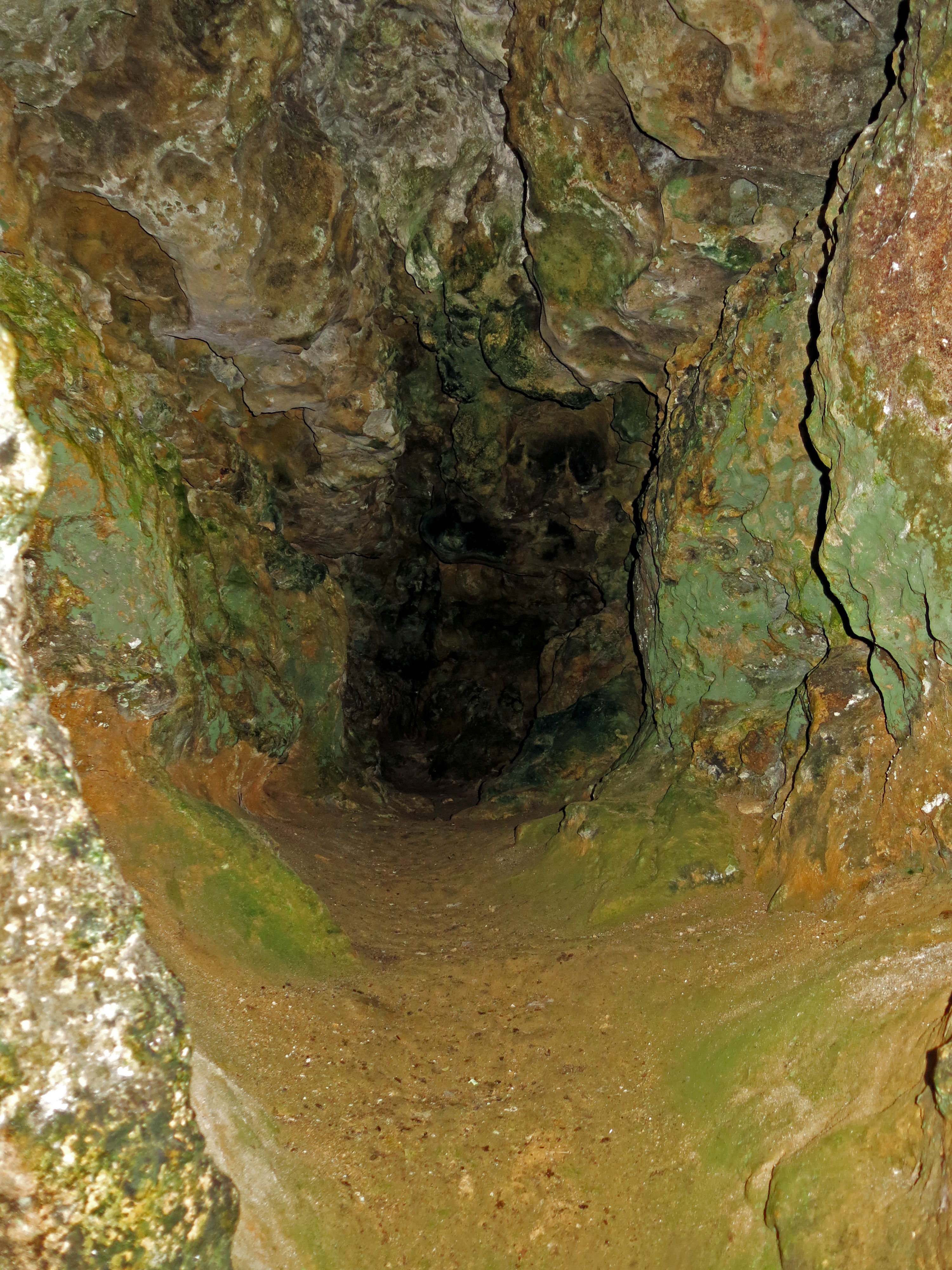
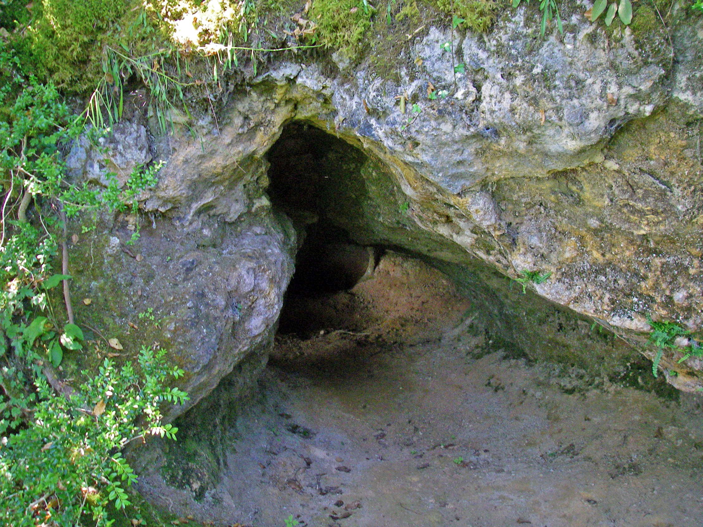
The cave at l'abri Ruth, also known as l'abri Pagès du Ruth, looking out from the cave.
The entrance was like a keyhole.
Photo: Don Hitchcock 2008
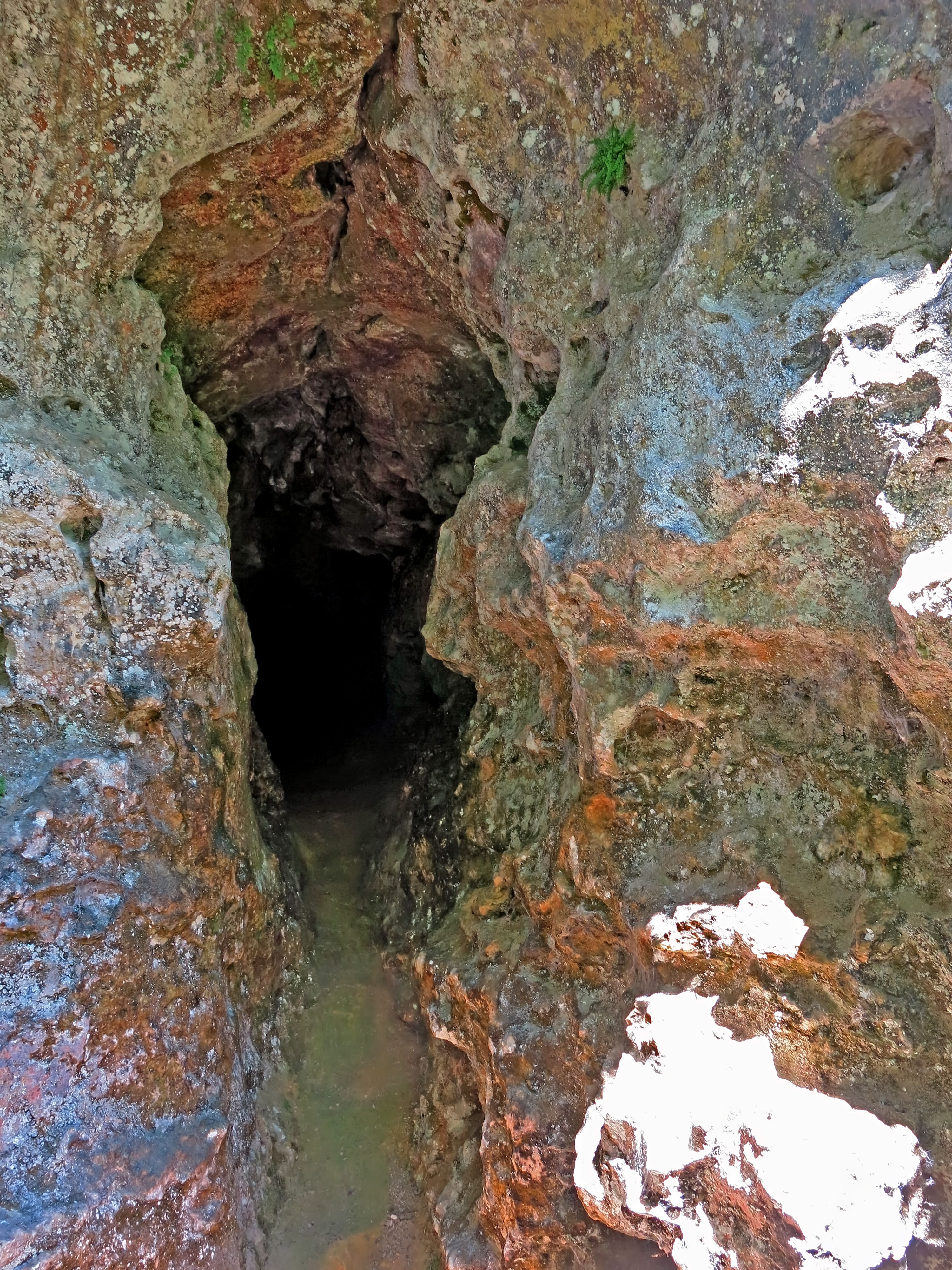
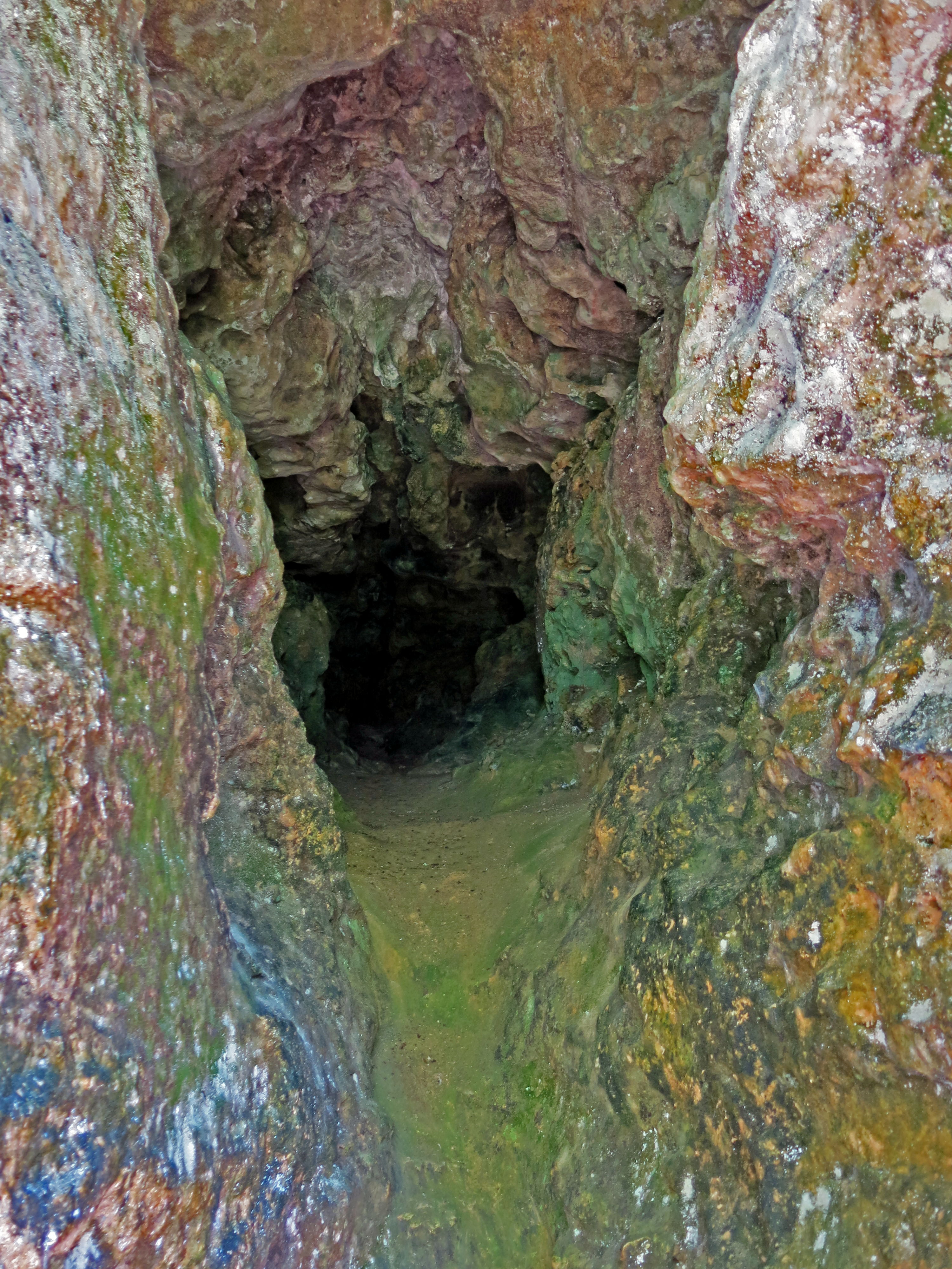
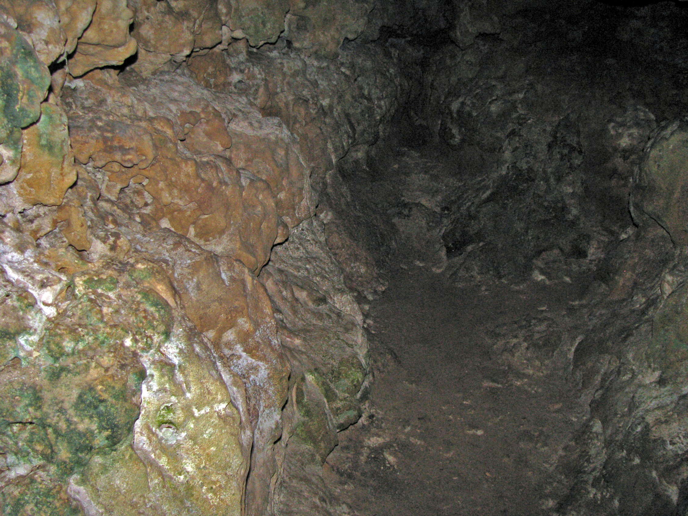
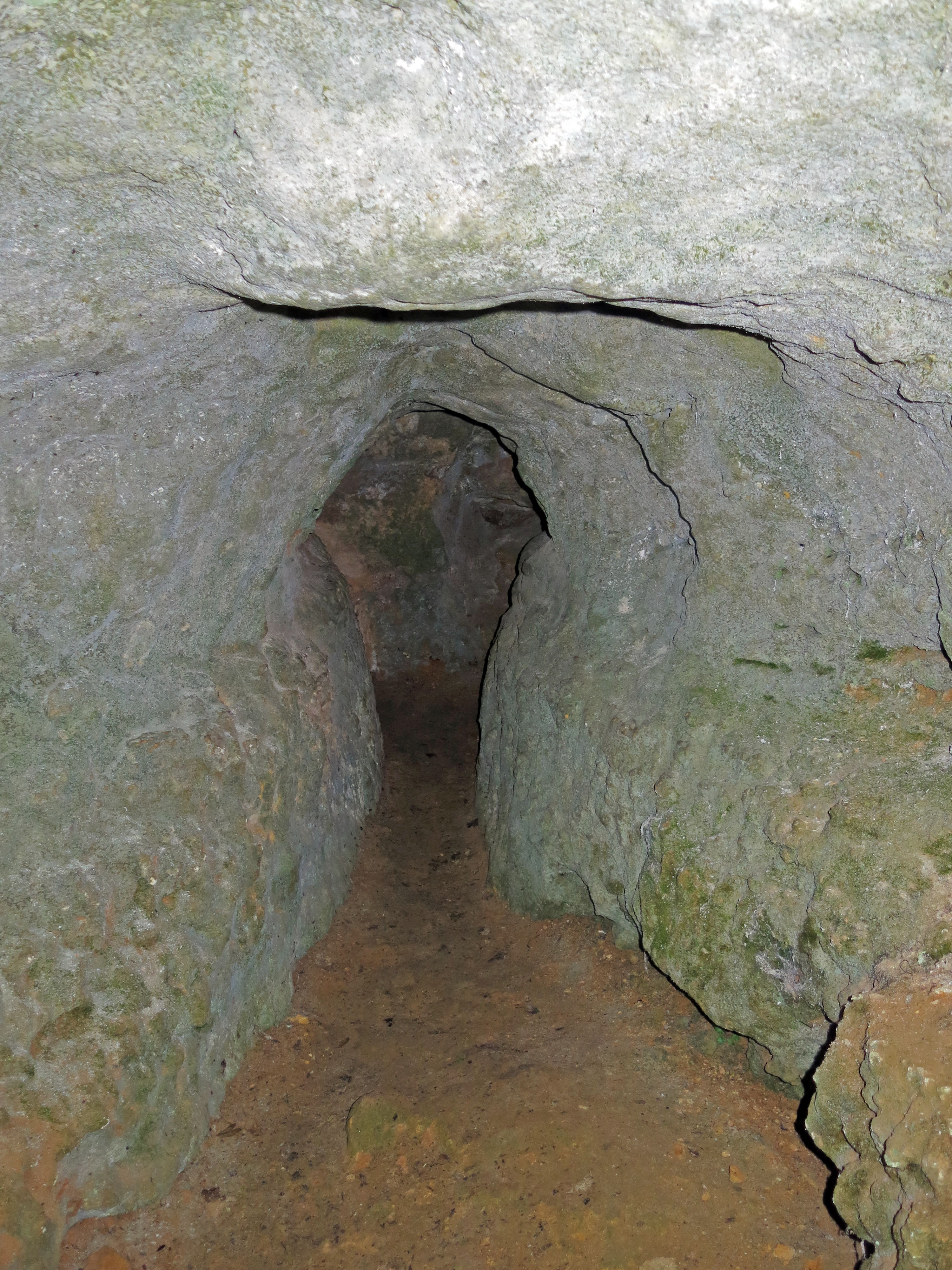
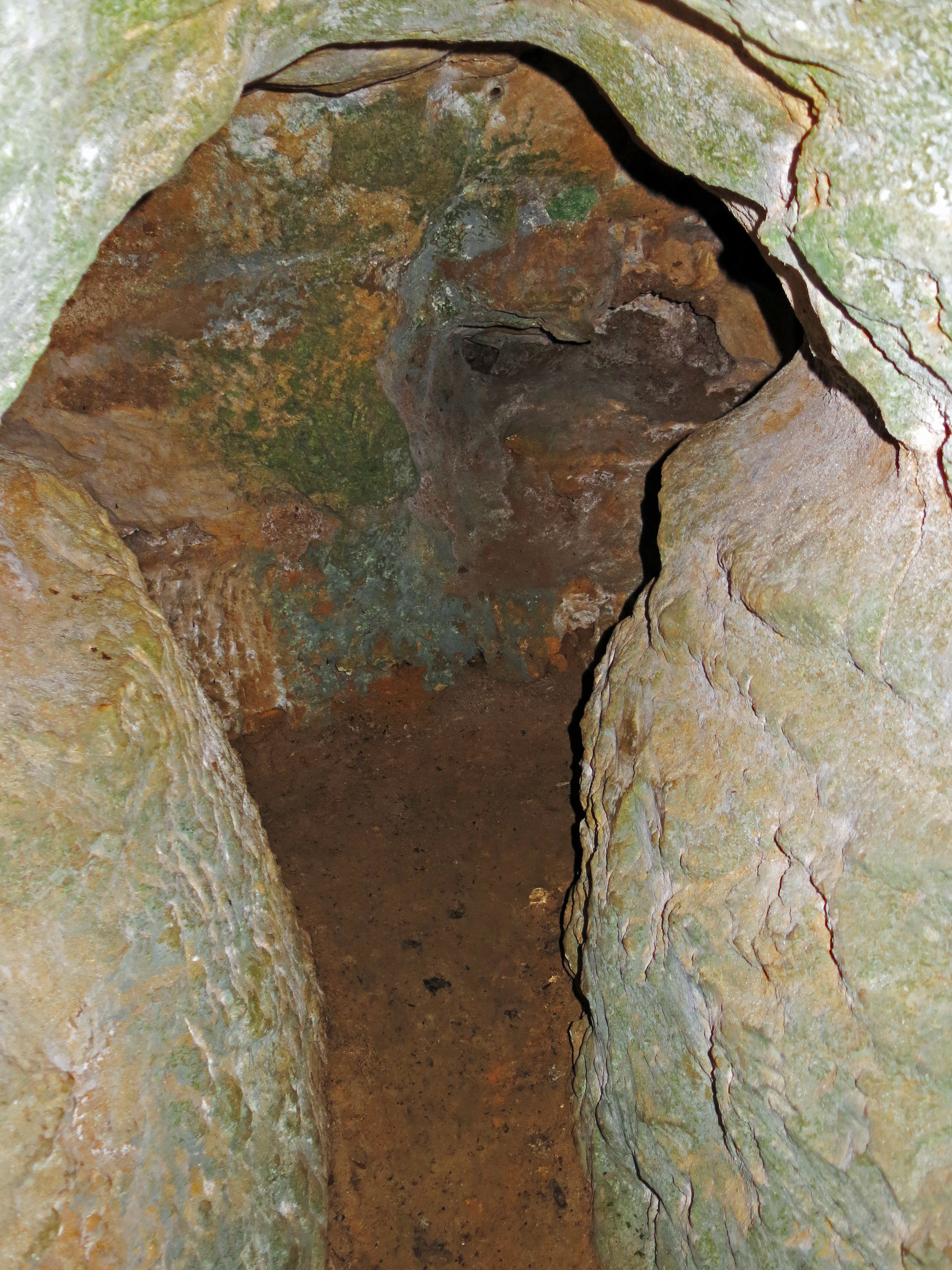
The cave is narrow, and the walls are colourful.
The photographs are in order, from front to back.
Photo: Don Hitchcock 2014
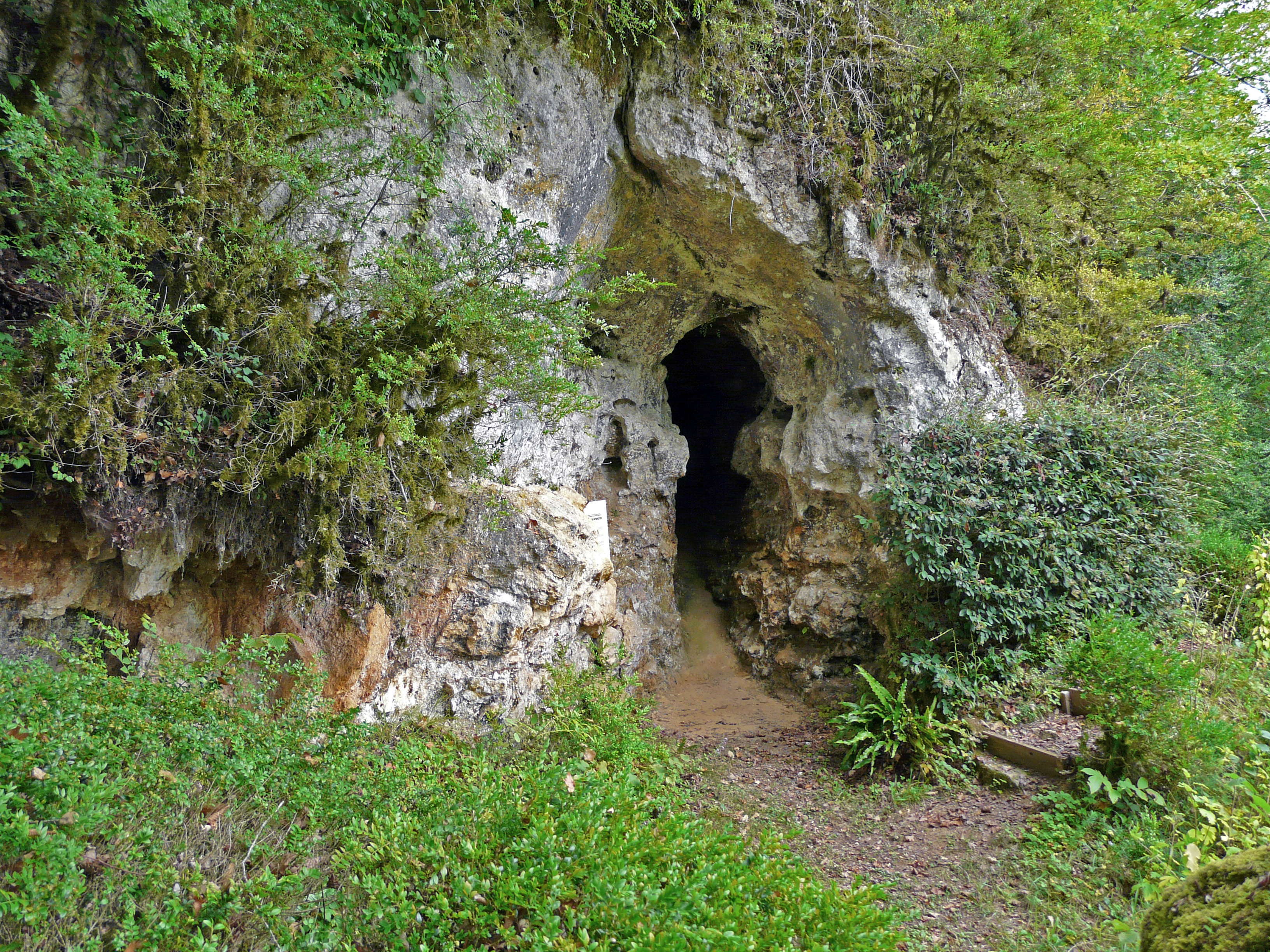
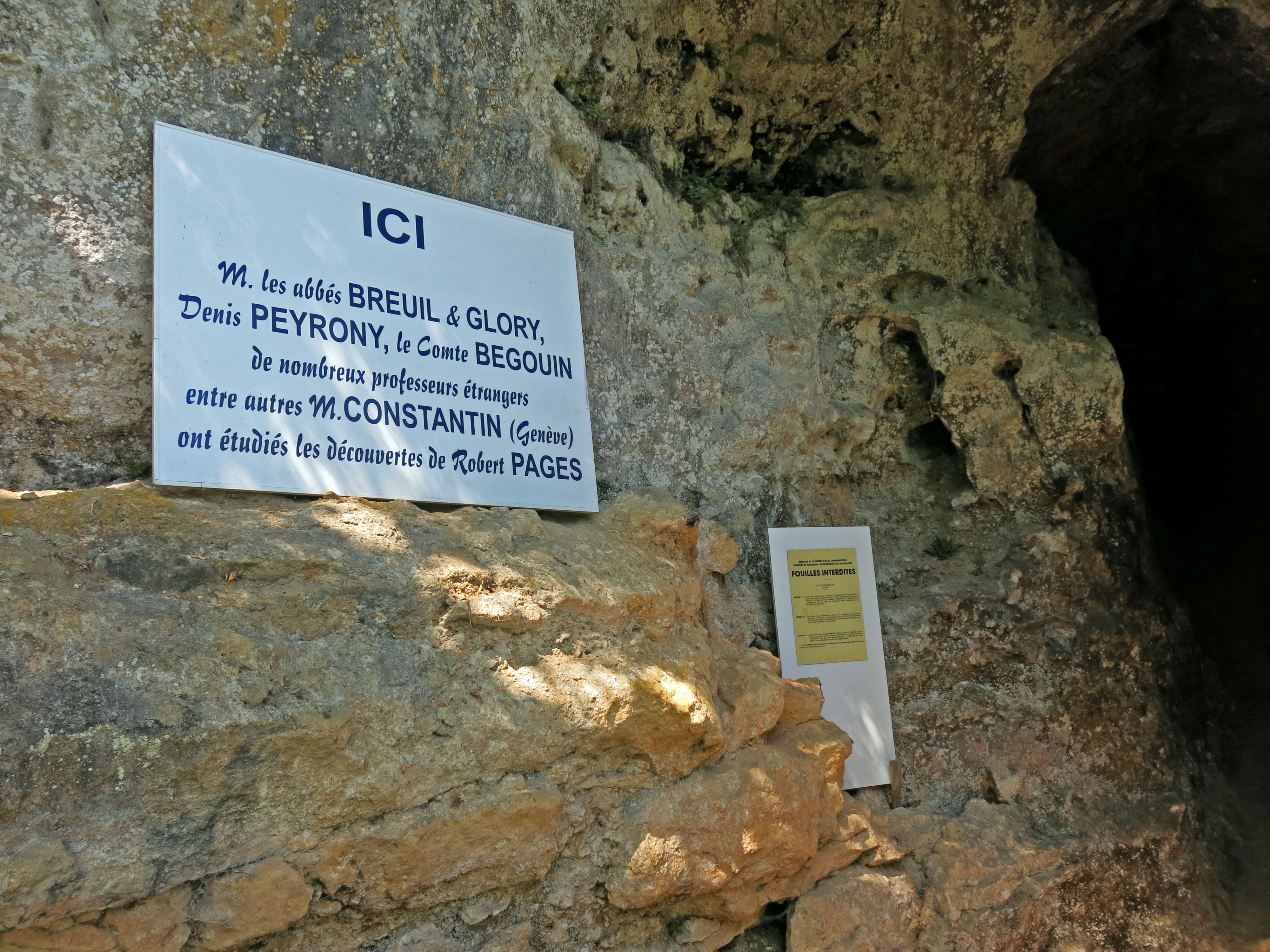
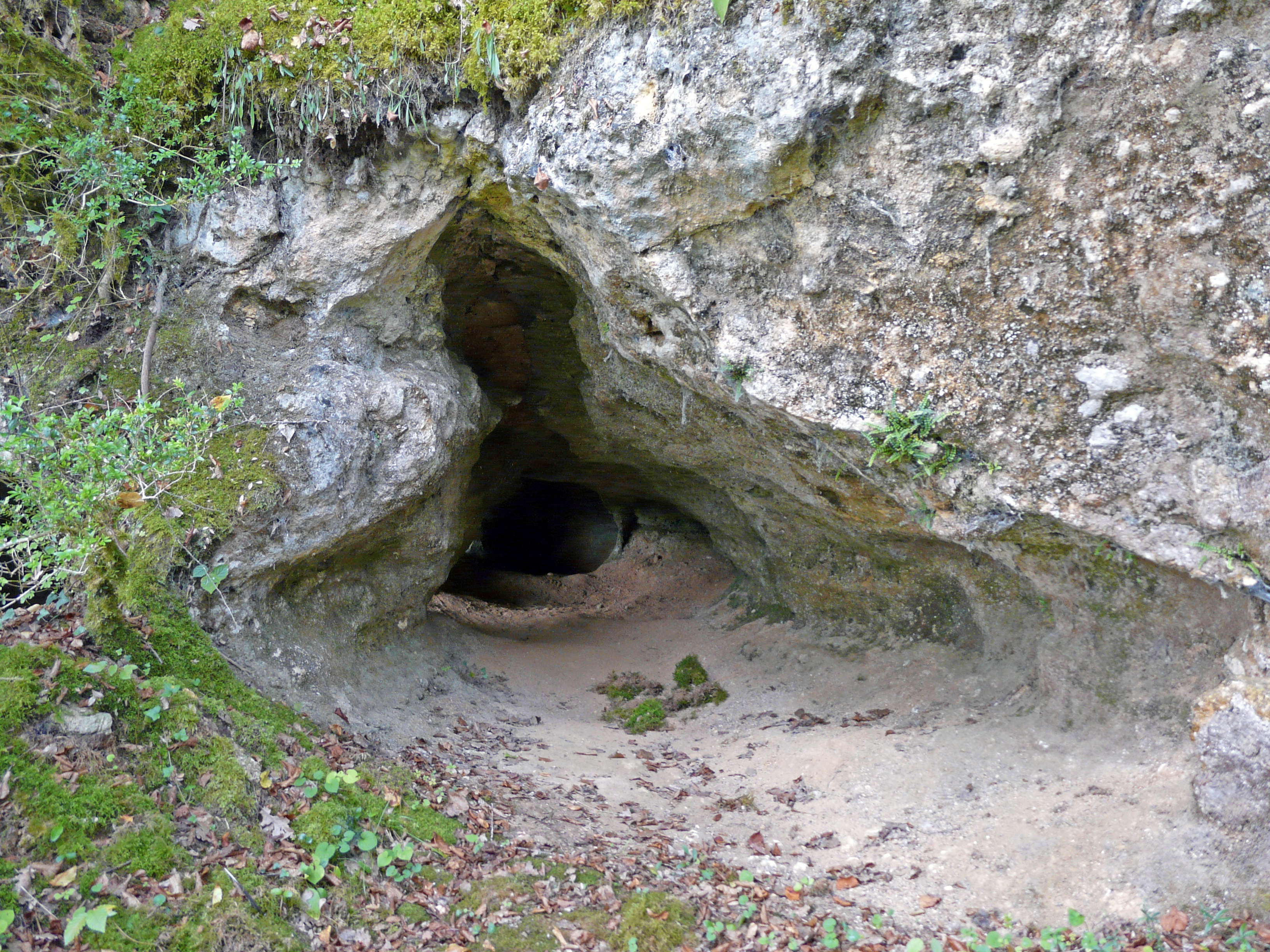
The entrance to the cave at l'abri Ruth, also known as l'abri Pagès du Ruth.
Photo: Père Igor
Permission: Licensed under the Creative Commons Attribution-Share Alike 3.0 Unported license
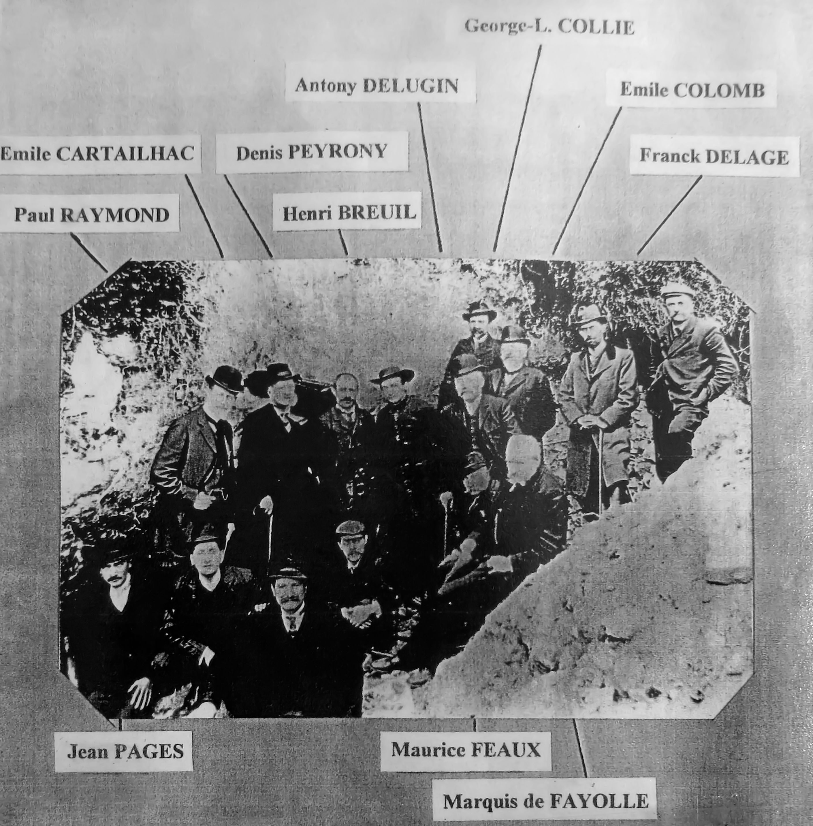
Group photo taken in 1908 in front of l'abri Pagès du Ruth, near le Moustier.
This photograph marks the end of the 'Battle of the Aurignacian'. Thanks to the excavations of D. Peyrony in the shelter and those of Dr. Lalanne at Laussel, H. Breuil was able to say that Aurignacian layers underly Solutrean layers, so they are older. In addition, it is here that D. Peyrony for the first time demonstrated the succession of the three classic levels of the Solutrean.
Members of the group are as shown here, including Jean Pagès, owner of the site, Paul Raymond, Emile Cartailhac, Denis Peyrony with his distinctive moustache, Abbé Henri Breuil in his flat brimmed hat, Antony Delugin, George-L. Collie, Emile Colomb, Franck Delage, Maurice Feaux, the Marquis de Fayolle, and P. Paris on the far right.
Photo: Courtesy of Monsieur Pagès, present owner of the site, and grandson of Jean Pagès
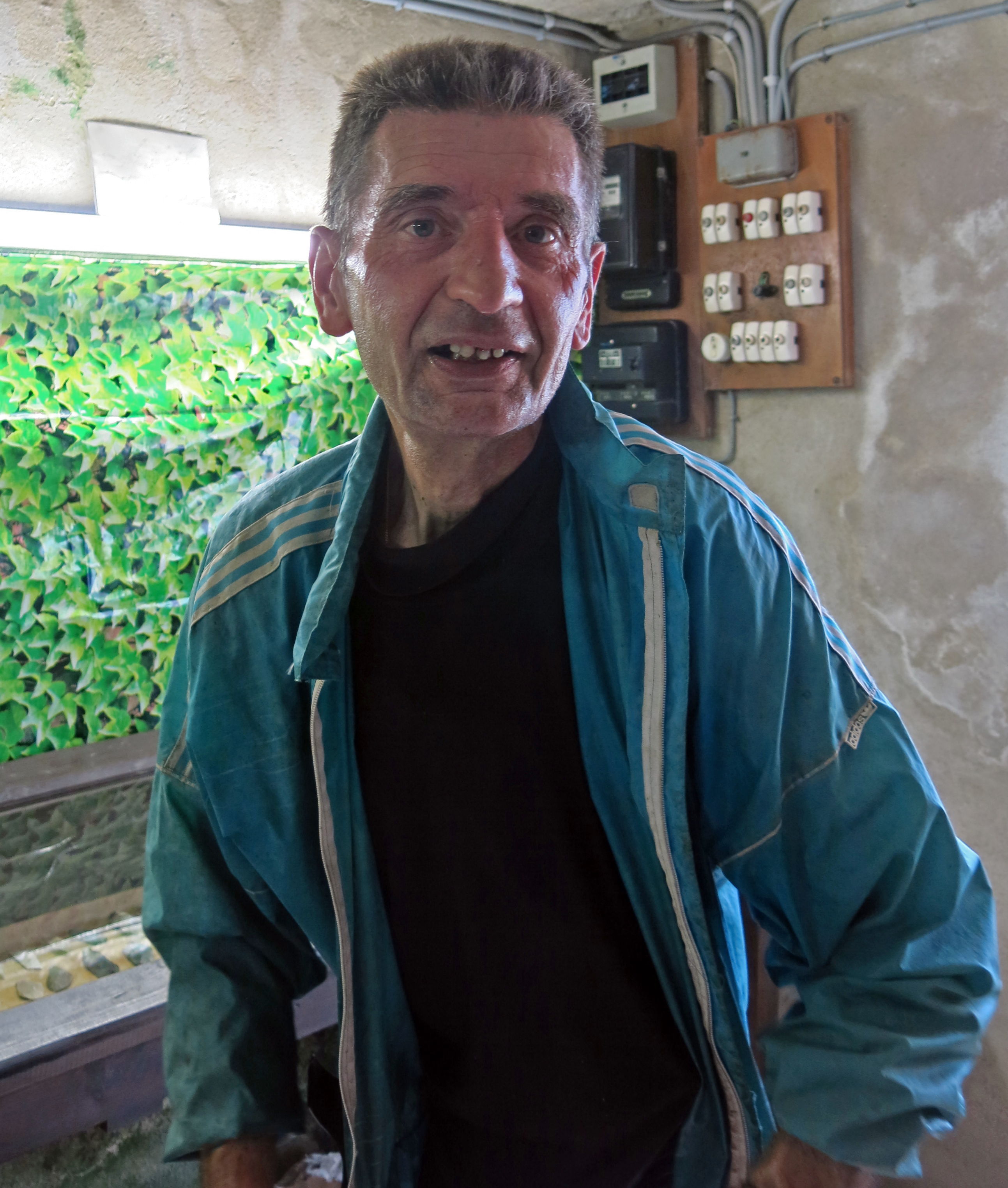
Monsieur Pagès, the proprietor of Sous le Ruth, the caretaker of both the Ruth site and the important Pagès collection of artefacts from le Ruth.
He is a fine gentleman, and was very kind to me during my visit. His warmth, intelligence and humanity shines out.
Photo: Don Hitchcock 2014
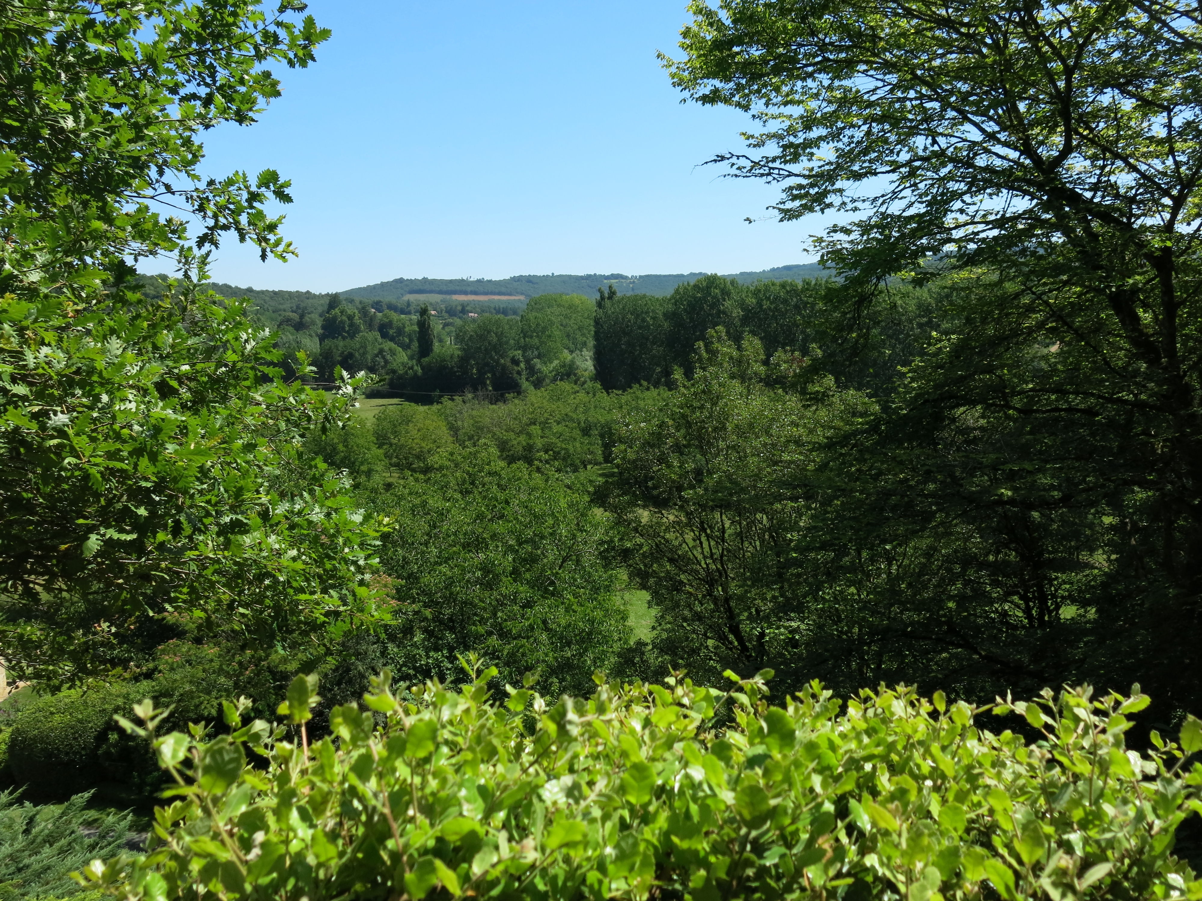
The view from le Ruth would have allowed the inhabitants to view game travelling up and down the valley.
There would have been much less vegetation blocking the view during the last ice age.
Photo: Don Hitchcock 2014
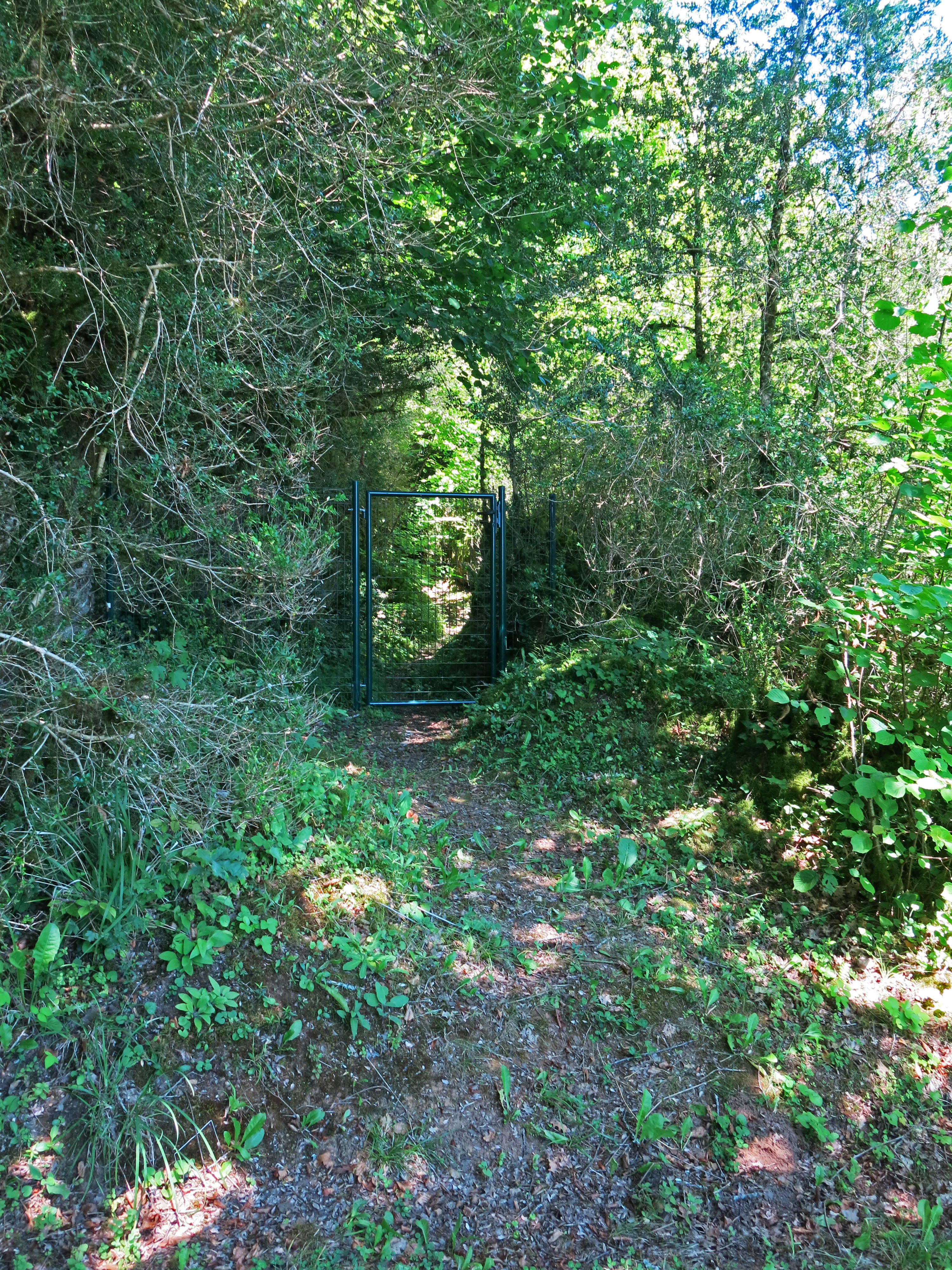
Since my previous visit in 2008, M. Pagès had put in fences and gates for security of the site.
Photo: Don Hitchcock 2014
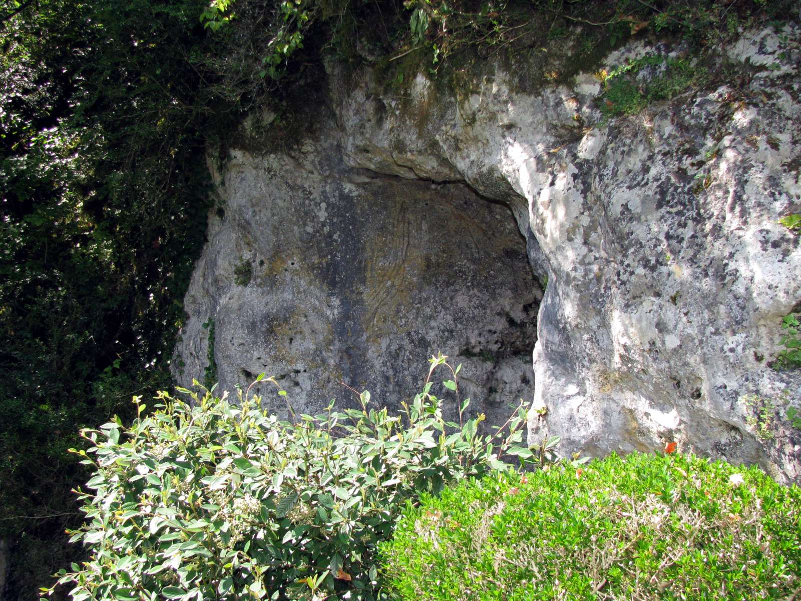
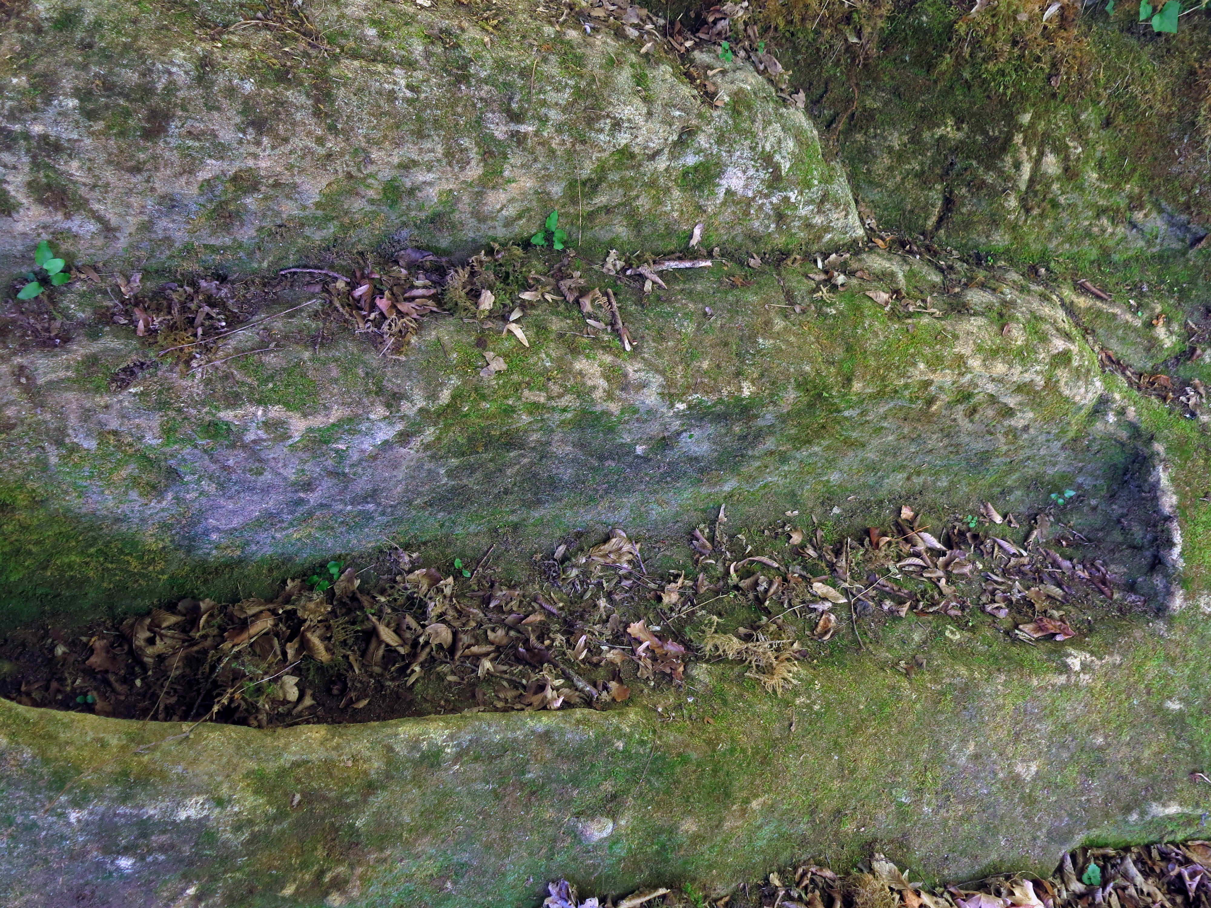
Further on, there was a depression in the limestone cliff.
Photo: Don Hitchcock 2008
The abri was well above the level of the house and road, on a steep slope. Parking was very limited.
Photo: Don Hitchcock 2008
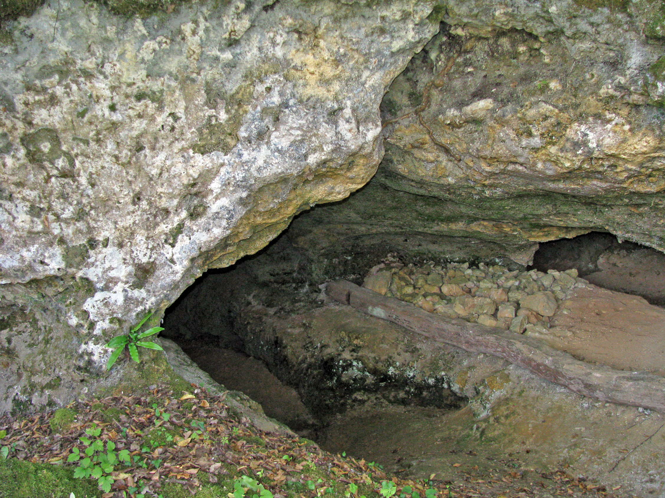
This cave may have been excavated by Peyrony or Hauser.
Photo: Don Hitchcock 2008, 2014
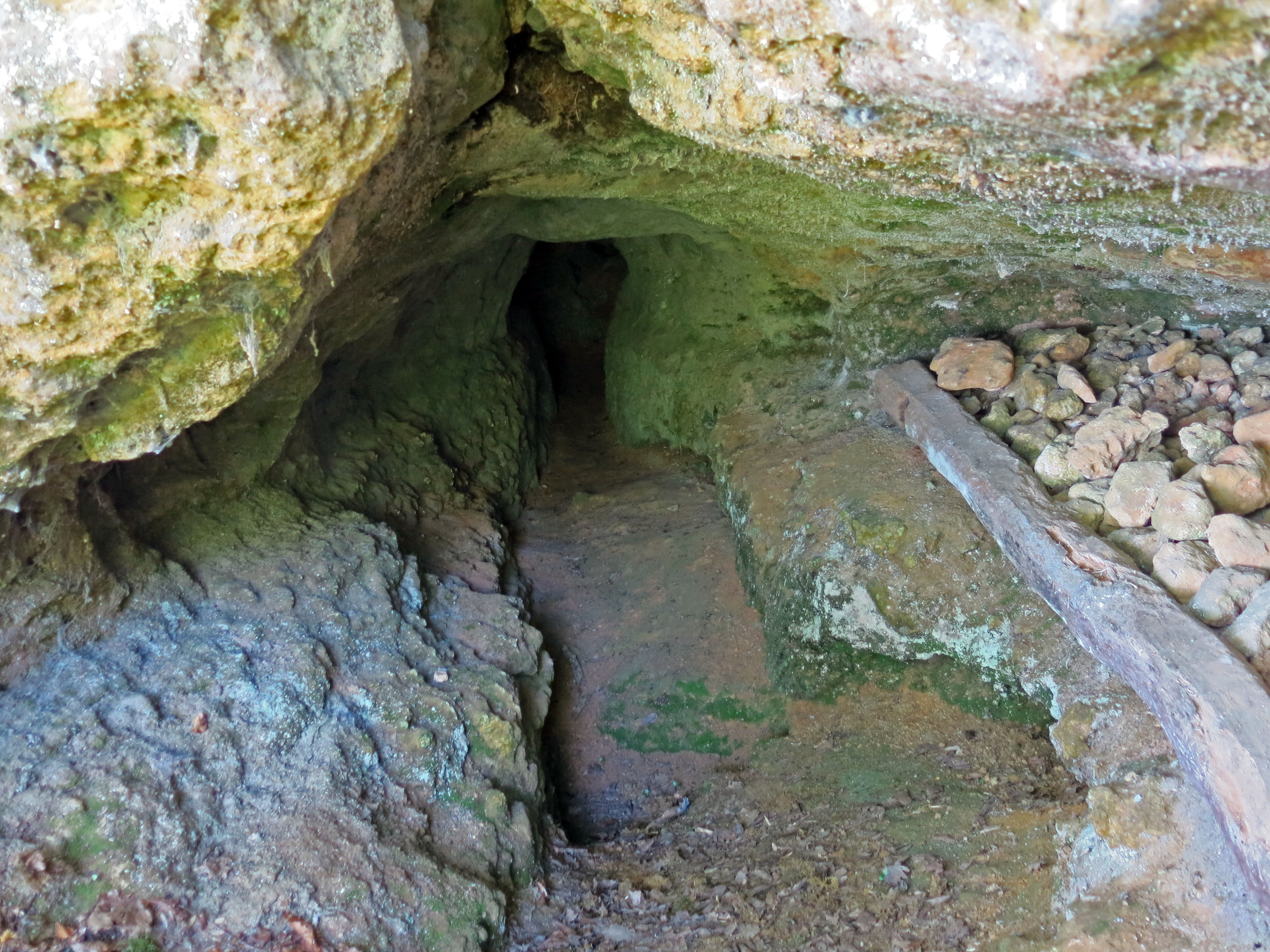
Interior of the small cave above.
Photo: Don Hitchcock 2014
A small cave, possibly excavated by Peyrony or Hauser.
Photo: Don Hitchcock 2008, 2014
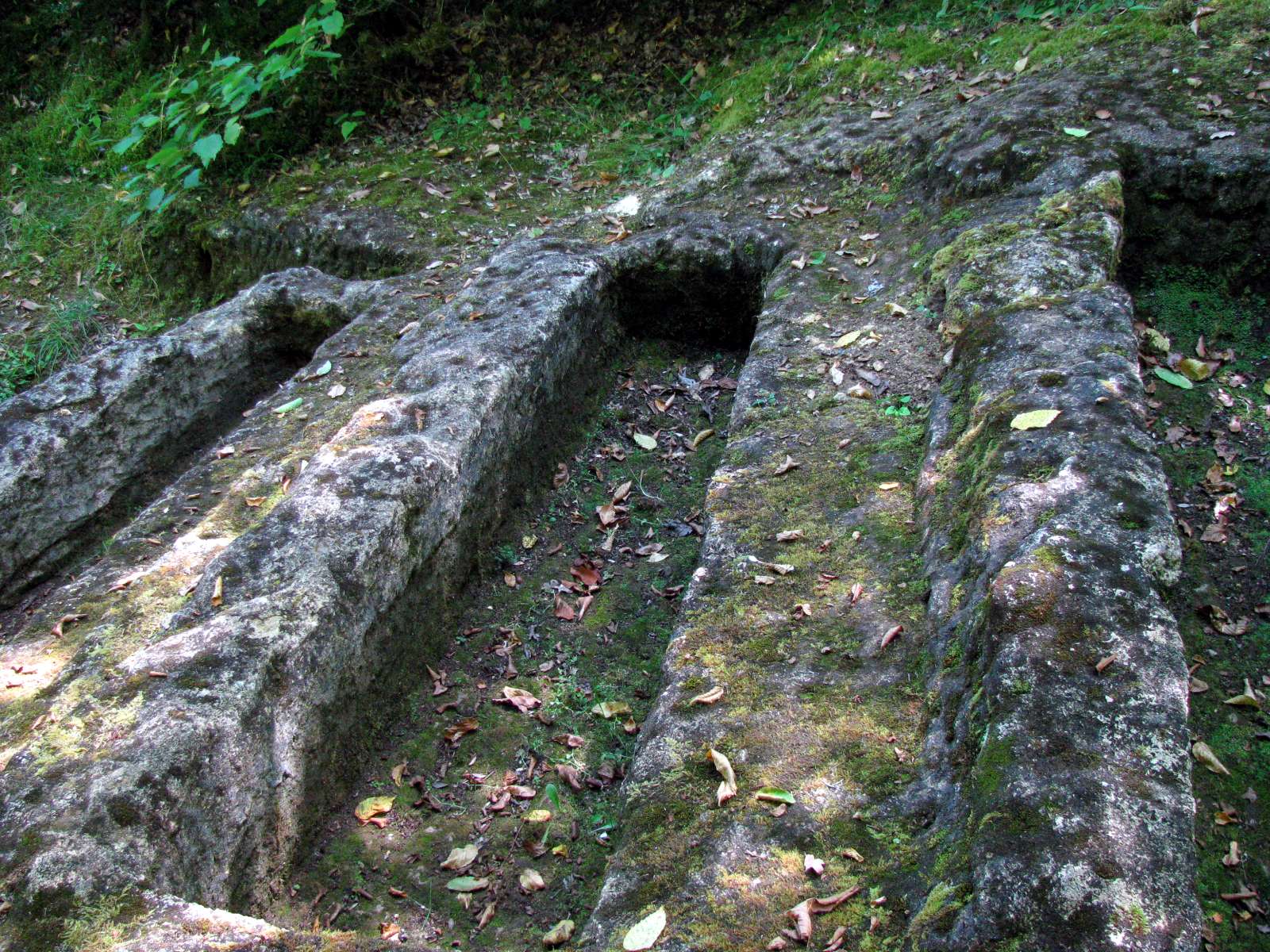
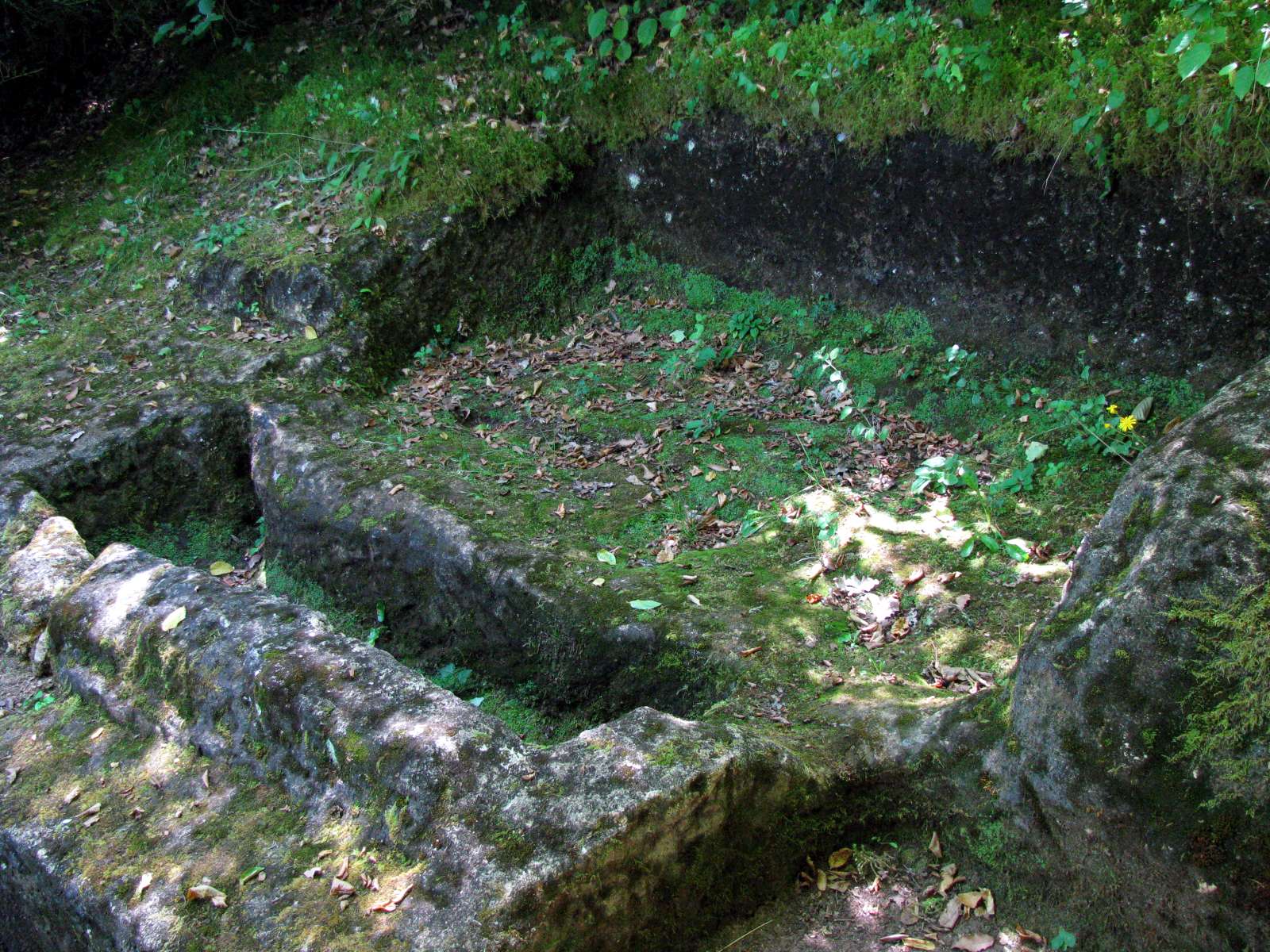
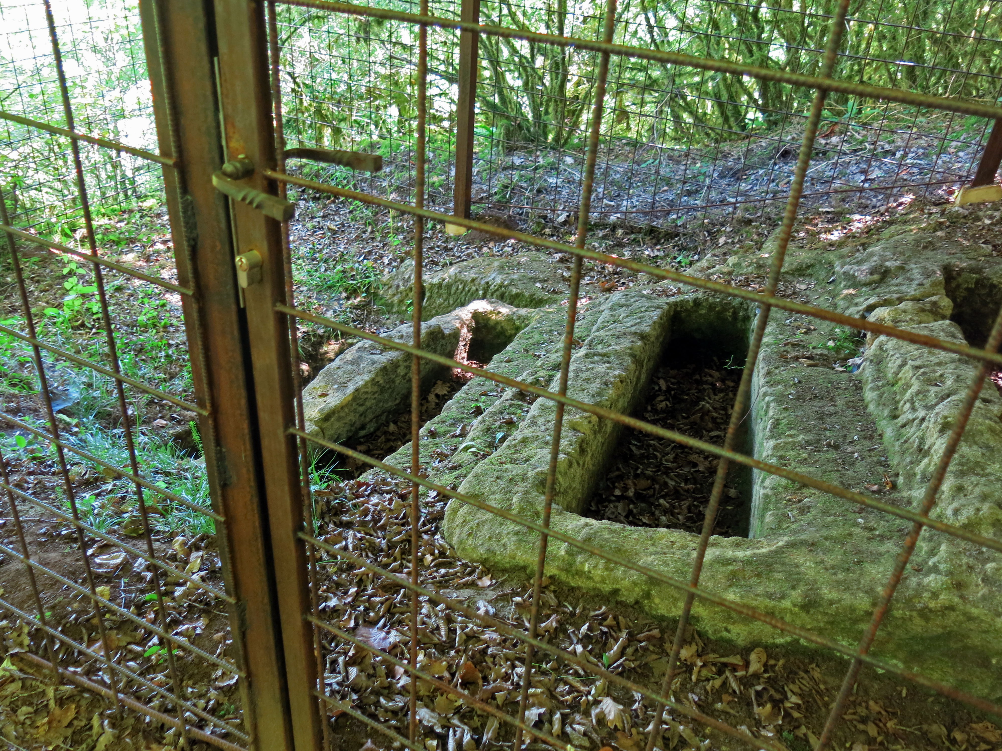
In the Middle Ages, a forester had had his small timber home high on the cliff. The forester and all his family were buried in graves he cut into the limestone.
Photo: Don Hitchcock 2008
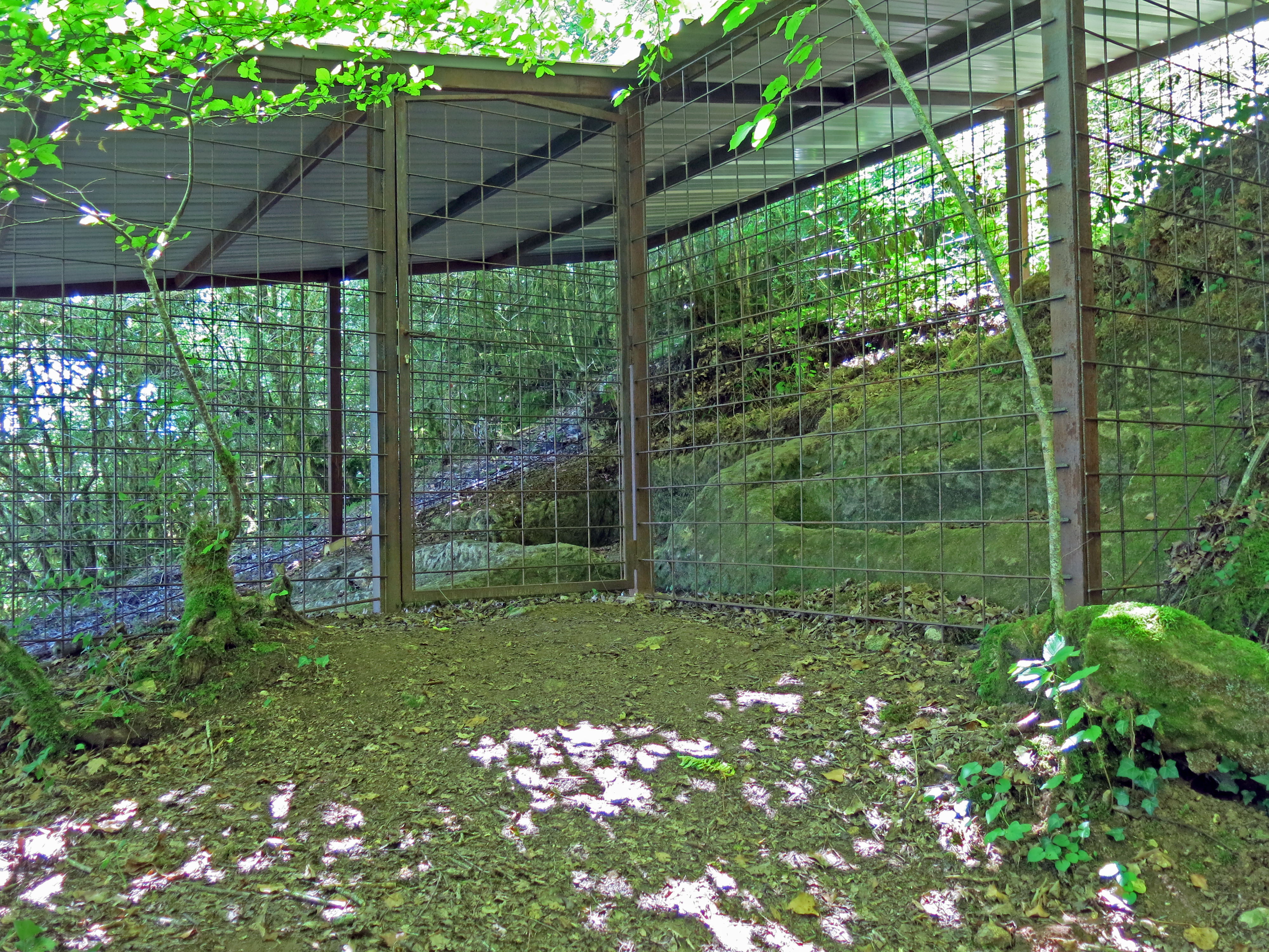
The area is now protected by a fence and a roof.
Photo: Don Hitchcock 2014
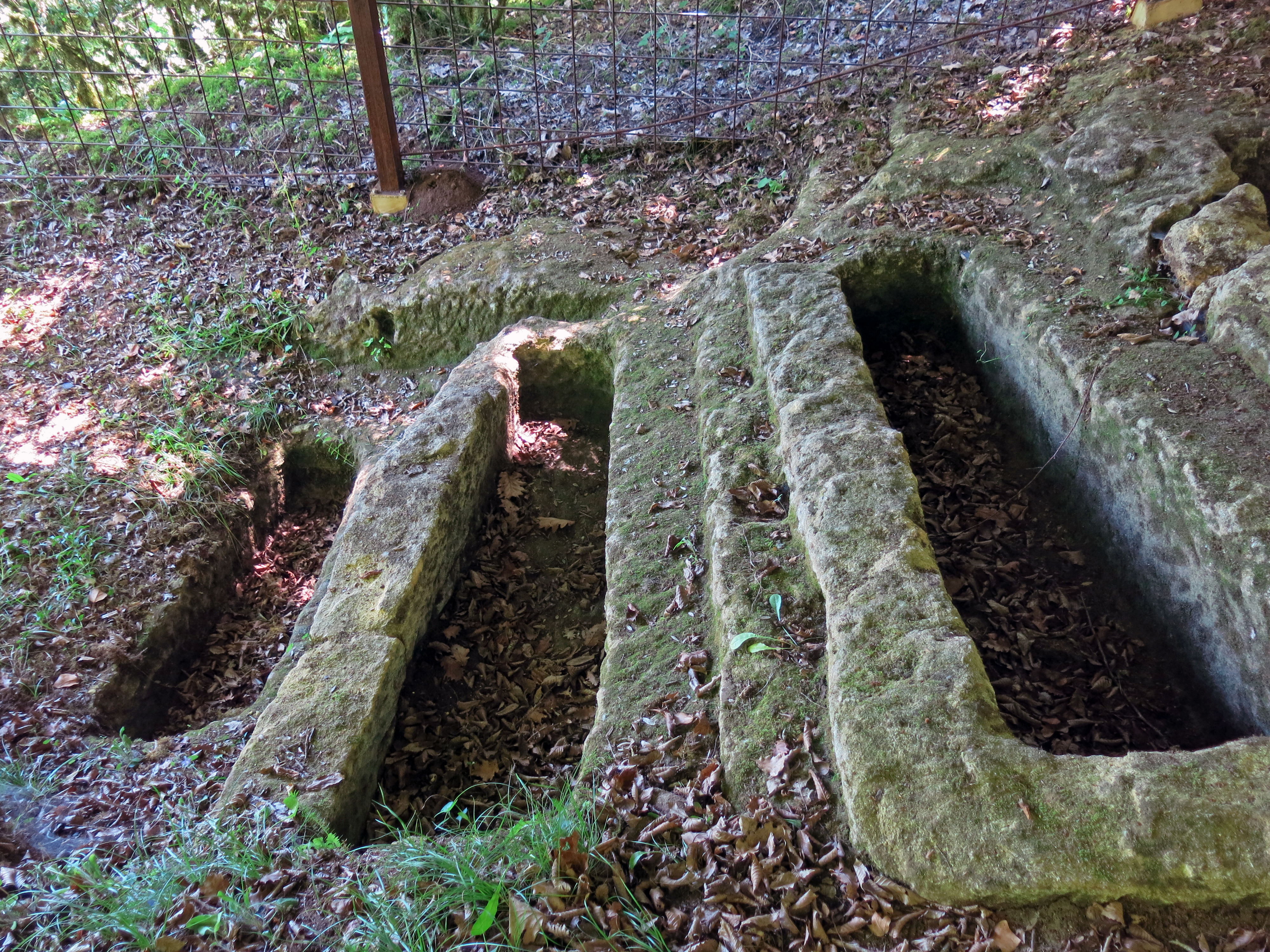
Originally there were stone lids on the coffins.
Photo: Don Hitchcock 2014
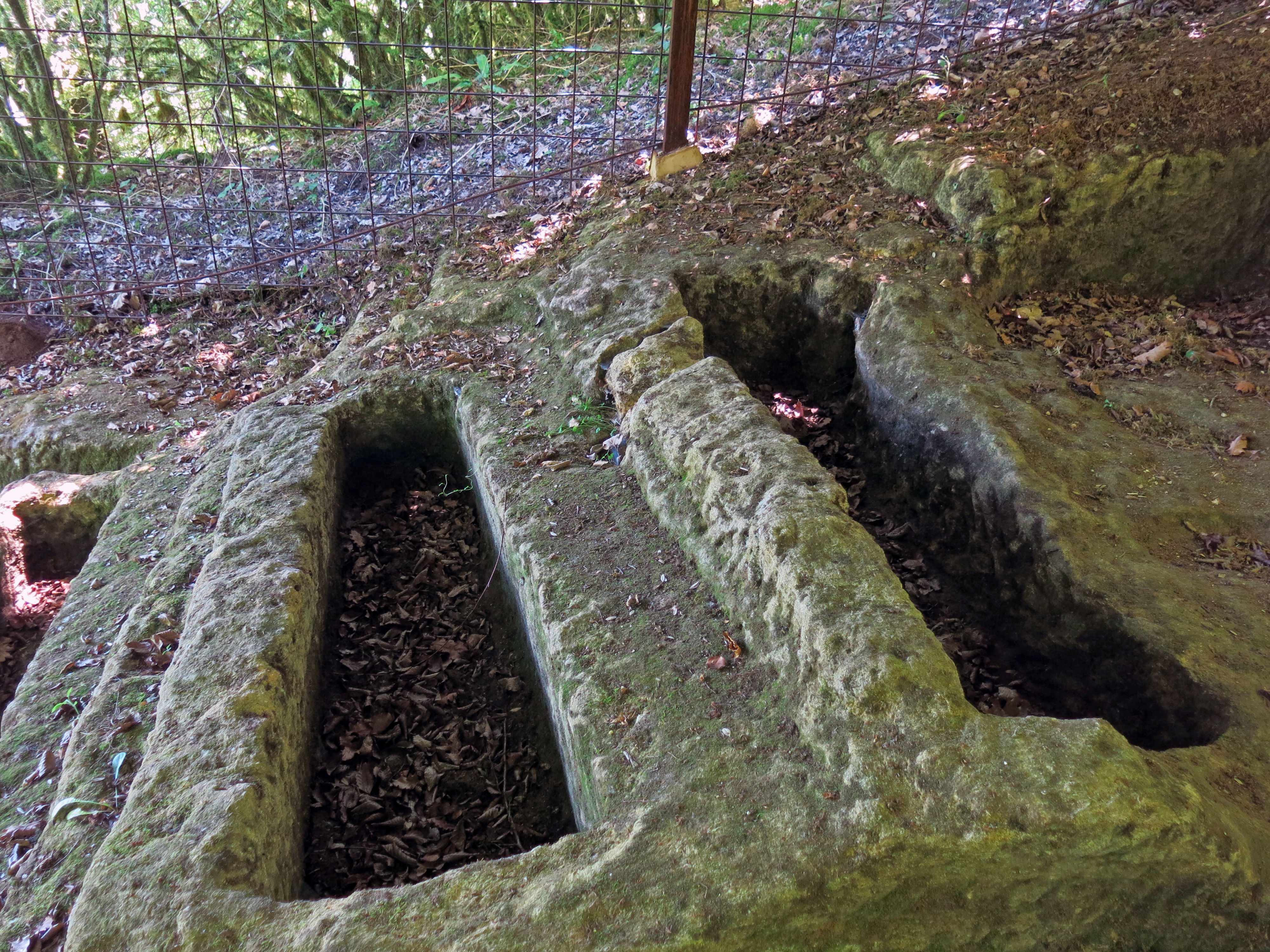
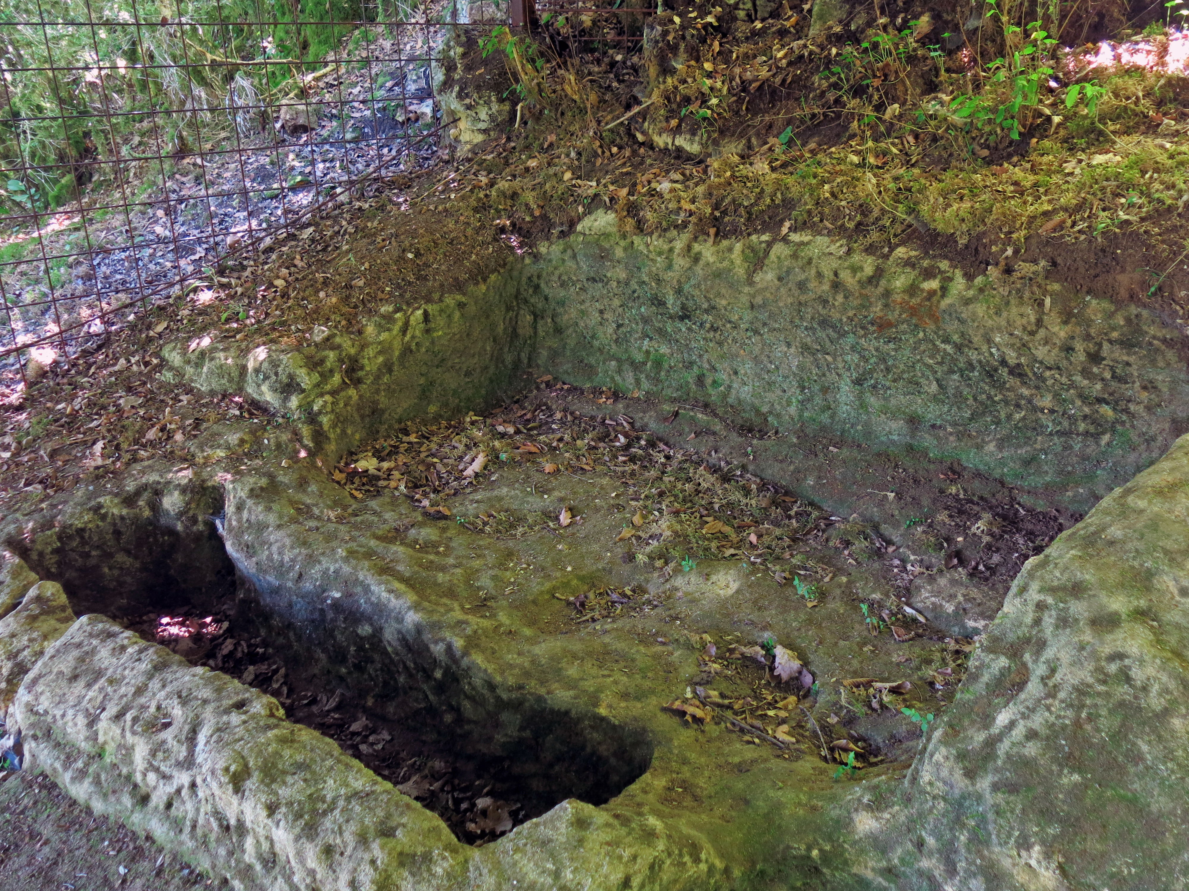
The graves must have taken a long time to cut into the stone.
The forester carved out his own grave, one can only imagine his thoughts at the time.
Photo: Don Hitchcock 2014
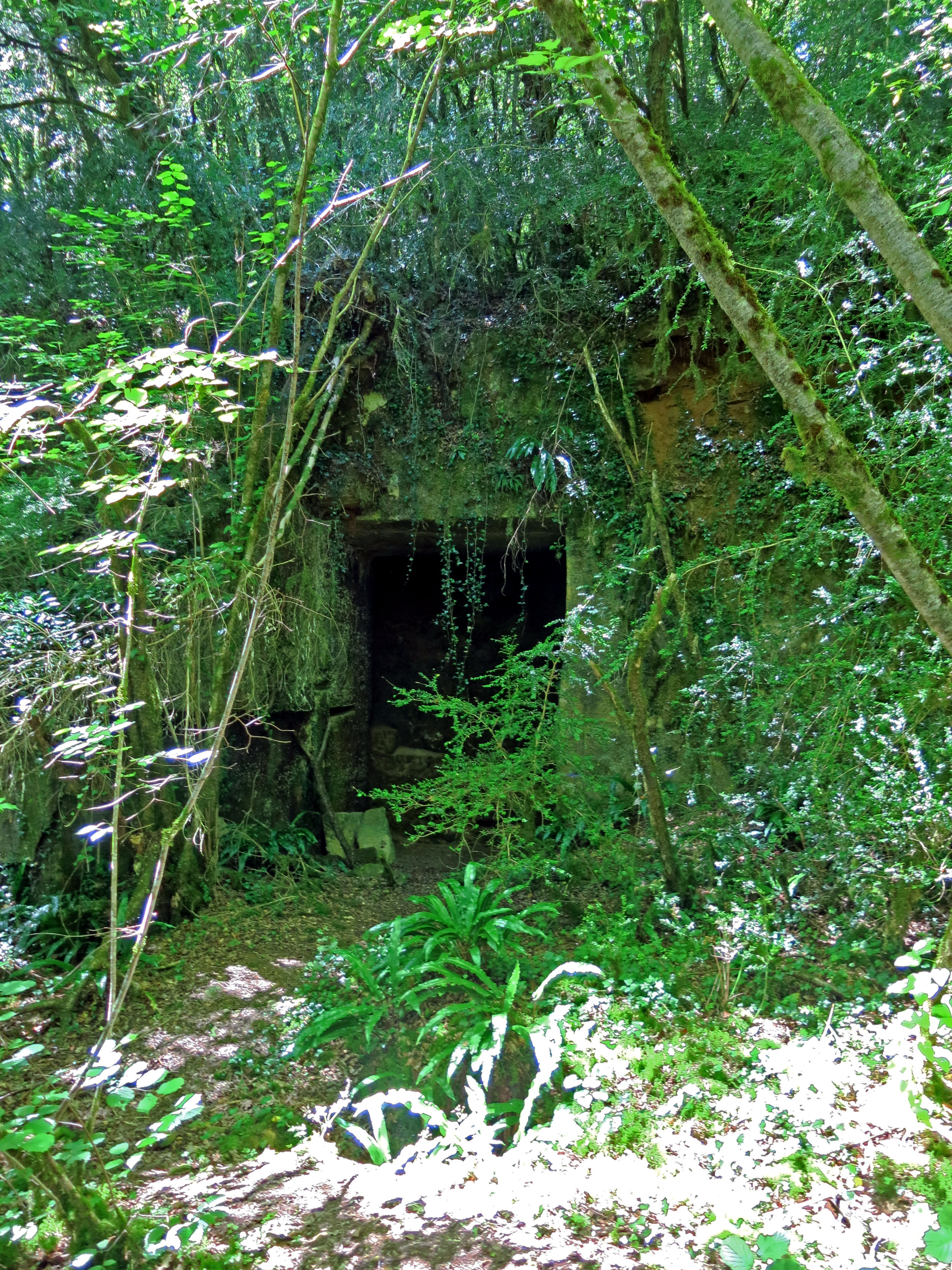
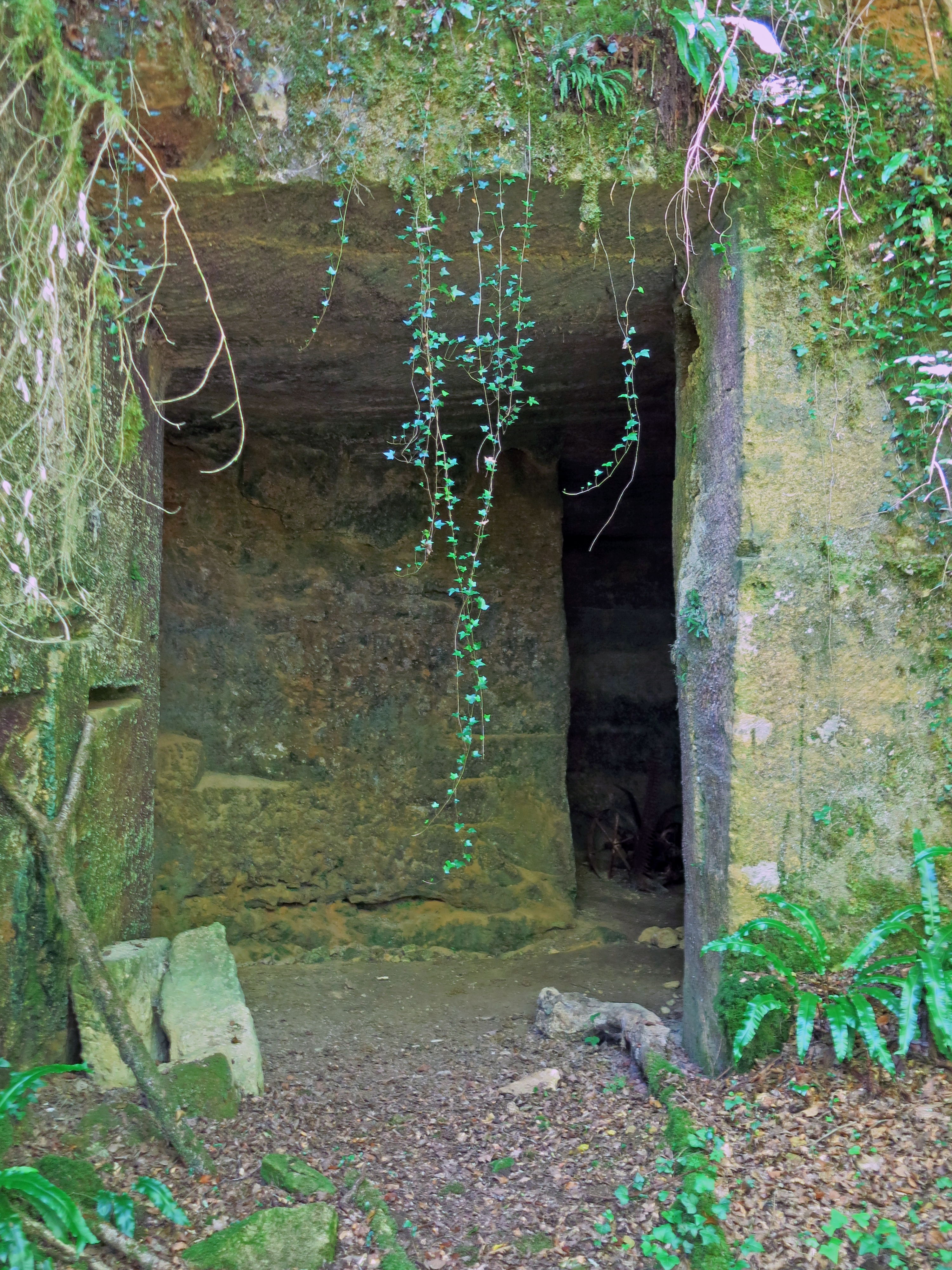
Further down the track which leads to the local main road, at one time there was a limestone quarry for building stone here, but the stone was of inferior quality, and the quarry was abandoned.
Photo: Don Hitchcock 2014
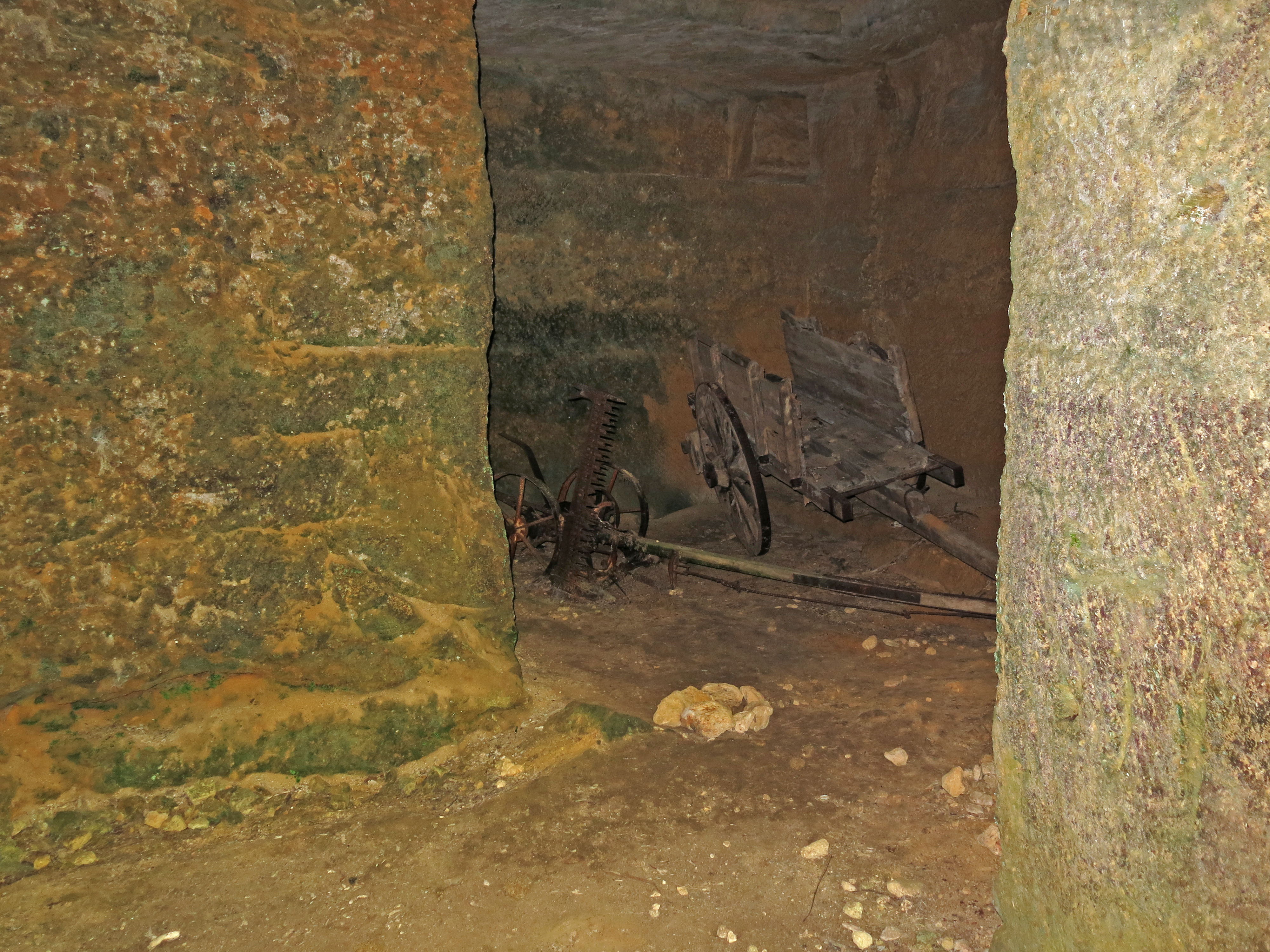
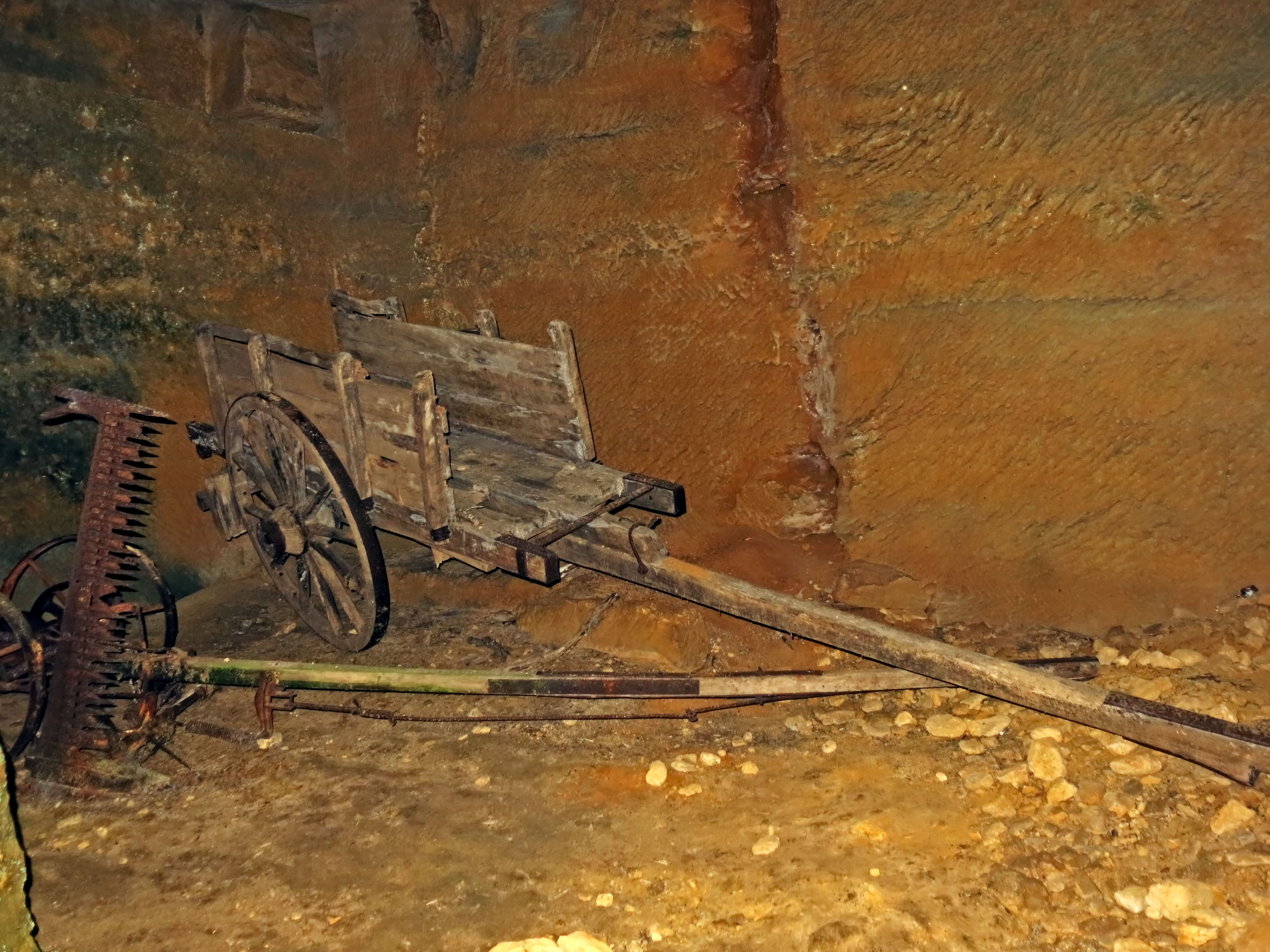
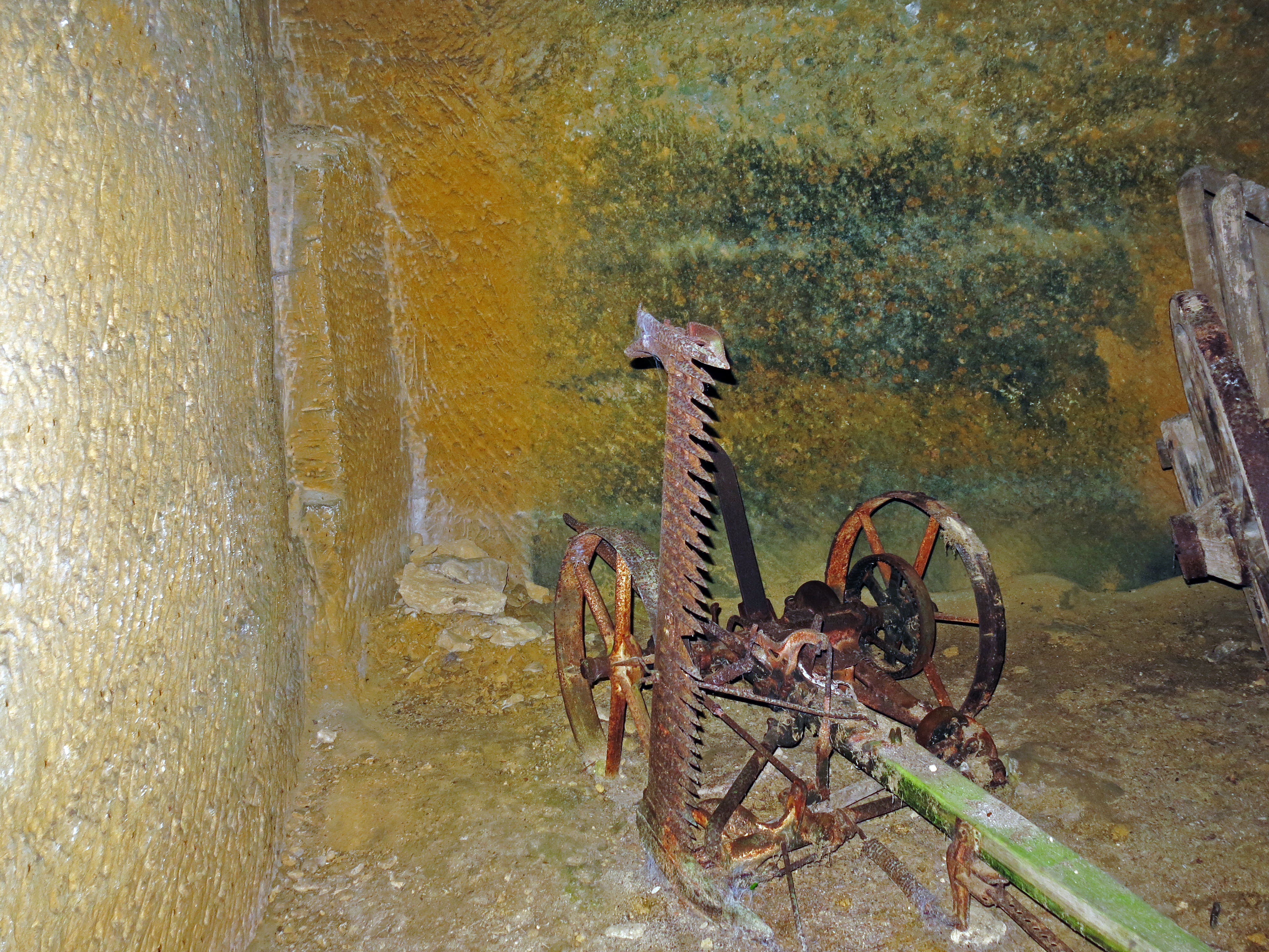
The outer rooms now contain old agricultural machinery.
Photo: Don Hitchcock 2014
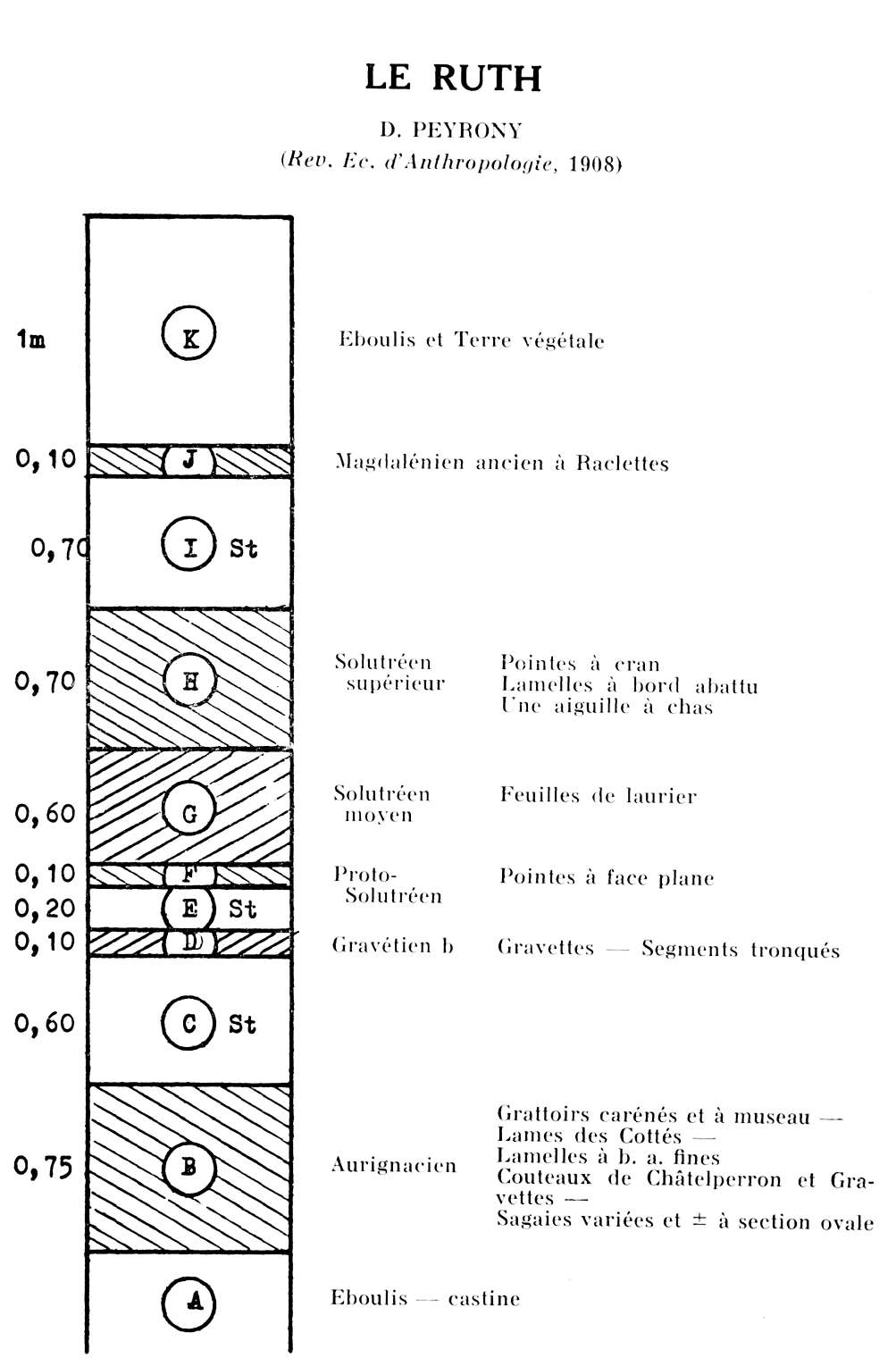
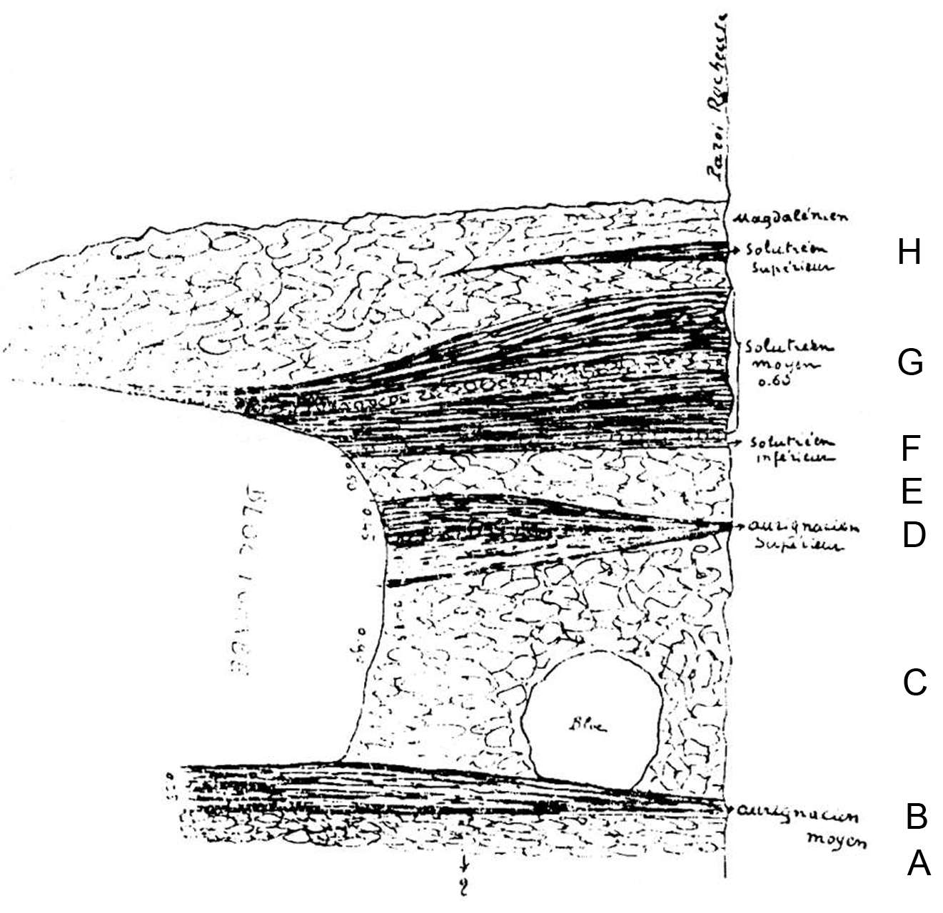
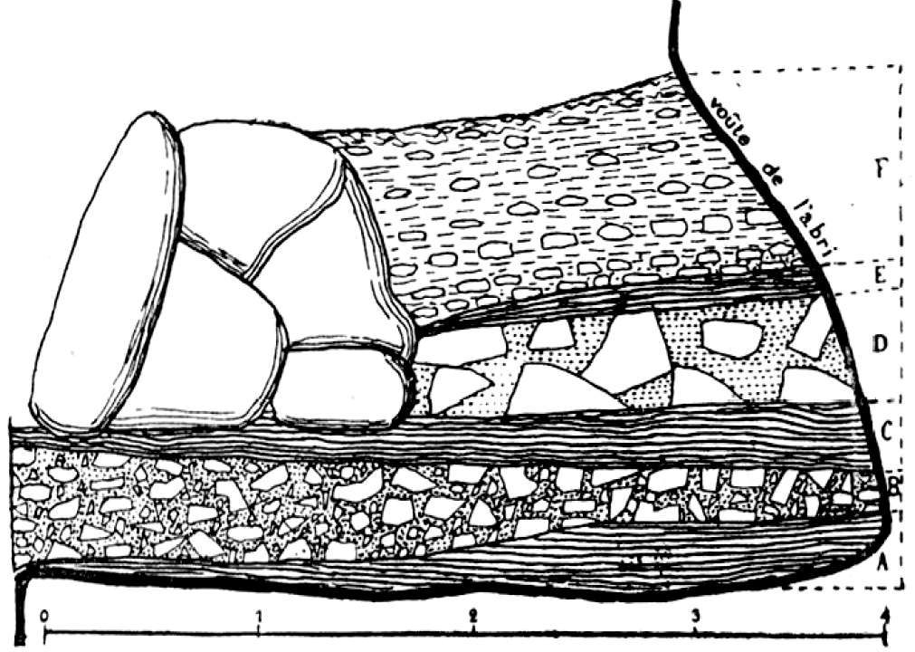
Stratigraphy of Le Ruth.
Note that Peyrony's diagram does not show any Mousterian deposits, although he refers to them as being present in his first surveys of the site at Abri Cellier.
Photo: Cheynier (1960)
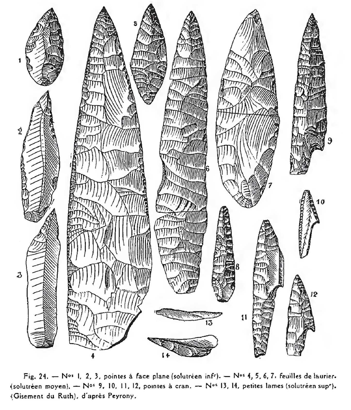
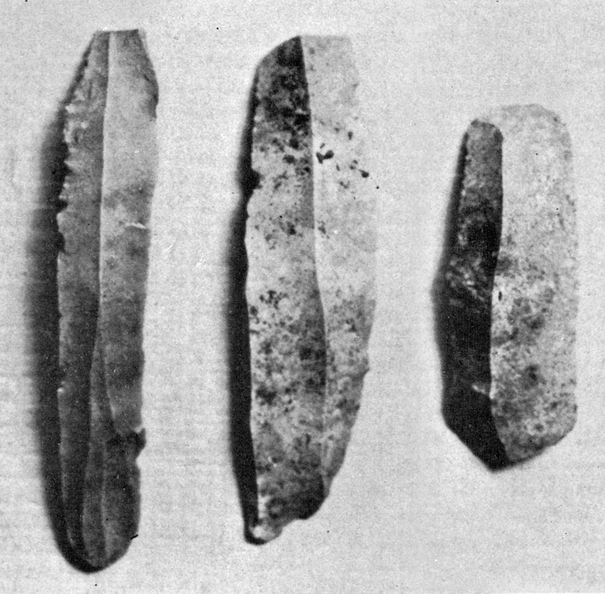
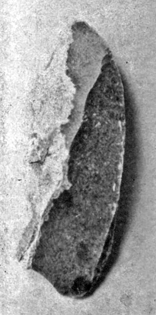
Flints from Le Ruth.
Nos 1, 2, 3 - points with one flat face, from the Lower Solutrean.
Nos 4, 5, 6, 7 - Laurel leaf points from the Middle Solutrean.
Nos 9, 10, 11, 12 Pointes à cran, shouldered points from the Upper Solutrean
Nos 13, 14 - small blades (Upper Solutrean)
Photo: Peyrony (1914)
( Note that there are two abris mentioned in the le Ruth complex - Abri Pagès and Abri Cellier. Abri Pagès is the cave at le Ruth above Sous le Ruth - Don )
Map showing the position of Sous le Ruth and Abri Cellier.
Photo: www.leseyzies.com/espace/fichier/34_tursacmasdelbos.pdf
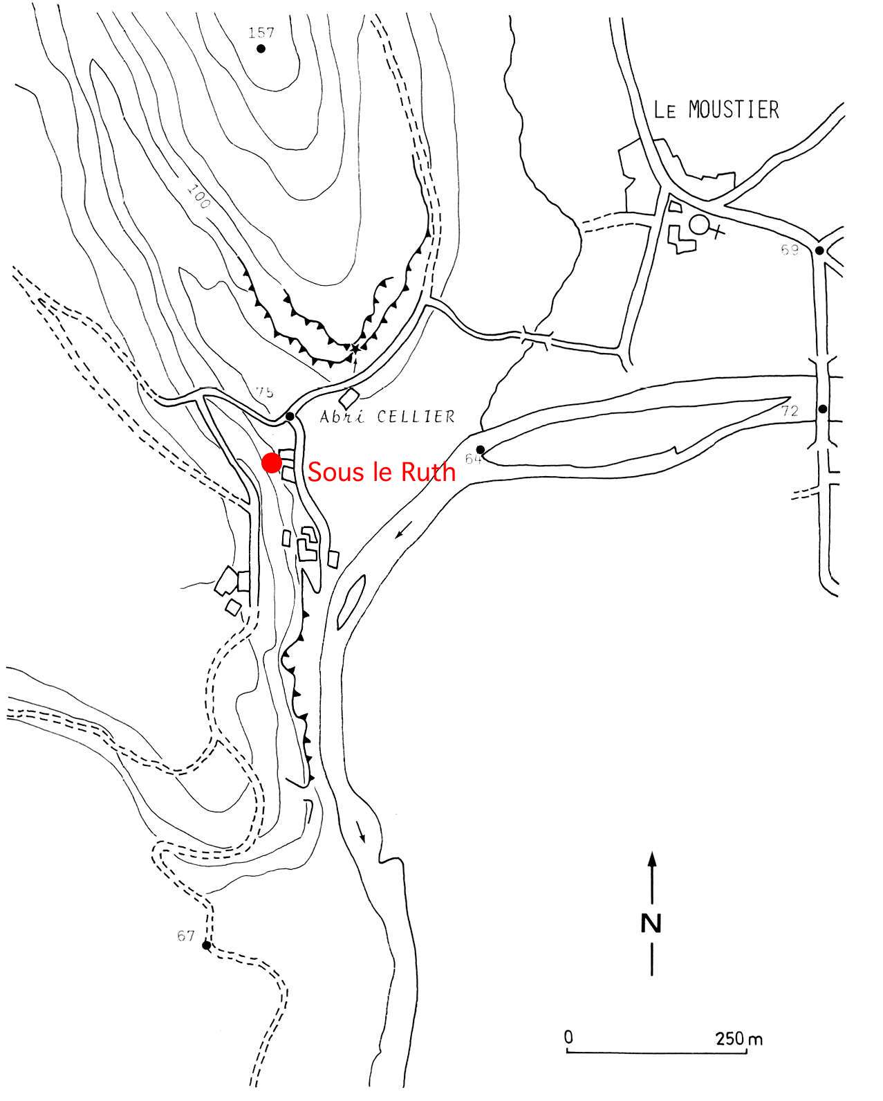
Map showing the position of Abri Cellier and Sous le Ruth
Photo: Delluc (1978)
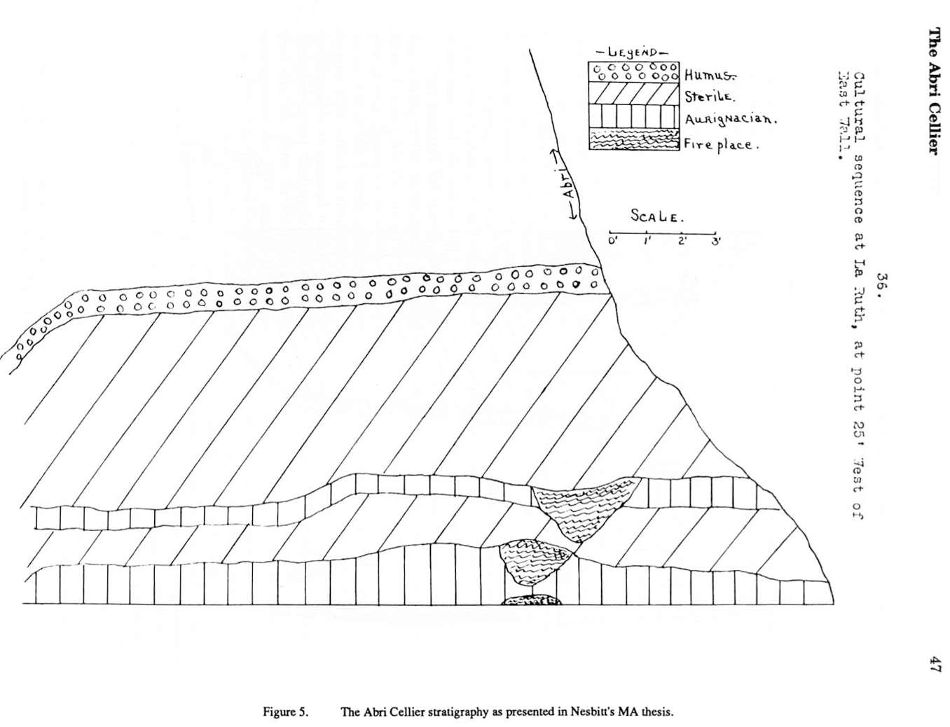
The Abri Cellier stratigraphy as presented in Nesbitt's MA thesis.
Photo: Nesbitt (1928)
L'industrie osseuse aurignacienne. Essai régional de classification : Poitou, Charente, Périgord (suite)
Christiane Leroy-Prost
Translation: Don Hitchcock
L'abri du Ruth, also called l'abri Pagès du Ruth
Situation.
Located on the right bank of the Vézère, 800 m downstream of le Moustier cave behind the houses forming the hamlet of Ruth (commune de Tursac), the station of the same name consists of a terrace and a cave.
Excavations.
The cave was emptied by a local archaeologist, Robert Pagès in 1907. Warned by a friend, D. Peyrony came on the scene to find that the material discovered by Pagès was Magdalenian and, deciding to participate in the dig, dug a trench perpendicular to the cave (Peyrony, 120, p. 156 ff.). He was allowed to take the next coupe.
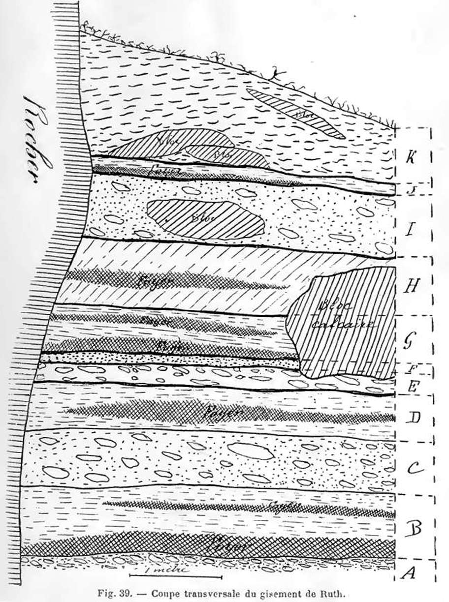
Stratigraphy of l'abri du Ruth
Cross hatched areas are fireplaces, diagonal hatched areas are large limestone blocks.
A. The floor of the terrace was formed of small scree and calcareous sand of a very pale yellow colour.
B. A brown layer, with black hearths, 75 cm thick, with a Middle Aurignacian lithic industry. It was formed of limestone debris, of earth and archaeological debris. Fauna comprised mostly (more than half) of reindeer, the rest divided between aurochs, horse, fox and deer.
C. An almost sterile layer of scree 60 cm thick.
D. A dirty grey layer, with a fairly large hearth, and an Upper Aurignacian industry of the La Gravette type, 60 cm thick. The same fauna, with less aurochs and horse.
E. A dirty yellow layer, almost sterile, 20 cm thick.
F. Another reddish yellow layer, with flat faced leaf points from the Lower Solutrean, 10 cm thick. Few faunal remains, but including reindeer, ibex, horse, aurochs and wolf.
G. A brownish layer, with two fireplaces and some magnificent laurel leaf flints from the Middle Solutrean, thickness 60 cm. Reindeer abundant, with wolf, fox, horse, aurochs, ibex, red deer.
H. Another brownish layer, with a hearth and a 'pointes à cran' industry, or shouldered points, from the Upper Solutrean, 70 cm thick. Identical fauna.
I. A sterile layer, 70 cm thick, containing boulders fallen from the roof.
J. A layer 10 cm thick with an early Magdalenian industry. Fauna composed almost entirely of reindeer. A small amount of aurochs and horse remains.
K. Finally at the top, scree and humic soil whose thickness varied between 50 cm at the front and 150 cm at the cliff line.
Near the cliff, all layers were more or less brown in colour because of the fireplaces situated there; the lithic industry there had little patina.
Further away from the cliff, hearths were almost non-existent and the flint was mixed with limestone scree. The artefacts here were covered with a thin whitish patina.
Photo and text: Peyrony (1909)
Translation: Don Hitchcock
Additional text, mostly with regard to the fauna, from a display at Sous le Ruth
Stratigraphic cross section of l'abri du Ruth drawn on 15.04.1908, after H. Breuil.
(There was no explanation of the diagram in the source. I will describe and label the layers from information in the diagram - Don )
A. At the base, scree continuing down for an unknown depth.
B. A Middle Aurignacian layer, 10 cm thick at the cliff, grading to 35 cm at a distance of 3 metres from the cliff.
C. Lying on this Middle Aurignacian layer is a layer of scree, which includes a large fallen limestone block almost 2 metres high, and a smaller 50 cm tall block resting on Layer B, surrounded by scree which is about 120 cm thick at the cliff line, and 90 cm thick where it abuts the large fallen limestone block.
D. Above this is an Upper Aurignacian layer, five cm thick at the cliff, and grading to 45 cm thick where it abuts the large fallen limestone block.
E. A sterile layer of scree, 35 cm thick at the cliff, grading to 15 cm thick at the large fallen limestone block.
F. A 5 cm thick layer from the Lower Solutrean.
G. A Middle Solutrean layer which begins to overtop the fallen limestone block, about 20 cm thick at the block, and 65 cm thick at the cliff.
H. A 20 cm thick (at the cliff line, 80 cm thick further out) sterile scree layer, interrupted near the cliff line at its middle by an Upper Solutrean layer 10 cm thick at the cliff line, grading to zero about 150 cm out from the cliff.
Photo: Breuil (1909) in Groenen (1994)
Text: Data extracted from the diagram by Don Hitchcock
Subsequently, excavations were undertaken by Prorock but unfortunately no results were published.
Collections
We studied two collections: one in the Musée des Antiquités nationales de Saint-Germain-en-Laye, consisting of the material collected by Peyrony and Pagès: Peyrony collection 1913 (No. 59562-566).
The other, kept at the National Museum of Prehistory in Les Eyzies and probably resulting from the Prorock excavations. In both cases we express the largest reservations in publishing the results.
In fact, we must remember that the layer B contained two superimposed hearths.
However, in his study of lithic material, Peyrony (1909) has described Aurignacian blades and La Gravette points as coming from the same layer B. The industries may have become mixed, and one should therefore be extremely careful. In addition, the series from the the Museum of Les Eyzies is of uncertain provenance because of the very ambiguous labelling of these objects. All these facts lead us therefore to include the bone industry of le Ruth as the only hope for drawing meaningful conclusions.
Study of bone tools.
The two sets of objects studied correspond in principle with the material collected in layer B. However, doubts remain regarding the set of artefacts from the Museum of Les Eyzies, which we will consider separately.
Collection of the Musée des Antiquités nationales.
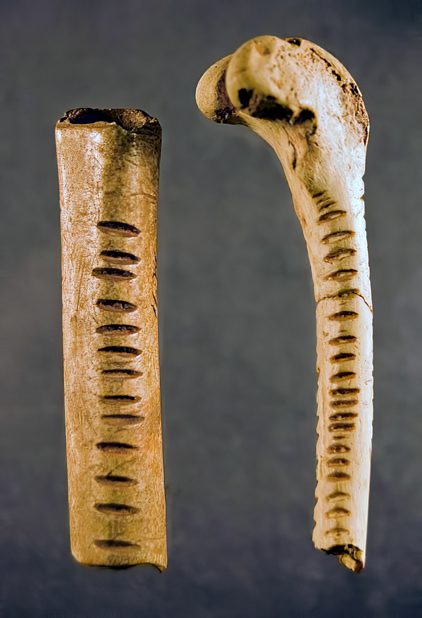
Points and awls - a double ended bone point has one extremity sharply bevelled while the other is thin without being bevelled. The middle section of the shaft is circular. It is very possible that the second bevel is under development as traces of scraping are still visible.
A mid-basal fragment of a triangular shaped object in reindeer antler, and whose edges converge suggests that it had been a point. The cross section is elliptical. The base is thinned and eroded. The upper surface has two grooves parallel to each other and to the axis of the piece.
An awl made from a diaphysis, the long bone of an animal, sawn longitudinally and with elliptical cross section has the head formed by carving of the epiphysis. Another awl or poinçon, from the same industry, whose tip is broken, is serrated obliquely.
Smoothers - one is a bone blade, thin, and narrow at the rounded apex, but broken at its base. The other, a larger piece of reindeer antler, of concavo-convex section presents an apex which is tapered, straight, and polished, and which would justify the name of smoother.
But the spongy tissue of the lower face, with a cavity dug too deeply to be accidental, casts doubt on this assessment. It could perhaps be a piece for lifting the skin during skinning (écorçoir)
Various tools - a strange object in the form of a fragment of antler literally ' squared'. The edges are sharp. One side is serrated obliquely.
Finally, a fragment of a bâton percé in reindeer antler completes the inventory of this restricted material.
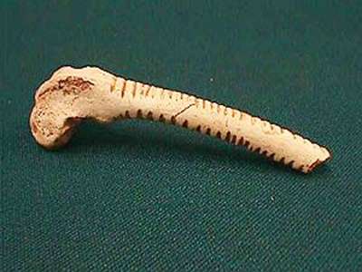
Collection of the Musée national de Préhistoire des Eyzies
Points - three in number, unfortunately none of which is entire. The most interesting, in bone, is entirely coated with ochre. It is triangular in shape. The cross sections are elliptical on the shaft and circular in the vicinity of the tip. It is also chipped, as well as the basal part of the object, without however overriding the piece's claim to being a work of art.
The other two of reindeer antler are also fragmentary. Both are quite thick and triangular in shape. Sections of the shafts are piano-convex. One is tapering towards the tip more than the other. The two bases are broken.
Smoothers - there are two. The first, very similar to the one held in Saint-Germain-en-Laye, is a narrow, thin blade of reindeer antler, with a plano-convex cross section, the apex being of rounded spongy antler. The upper surface is smooth. The spongy tissue of the lower face is scraped. The other is a thick baguette of reindeer antler. It is broken near its apex, which is of spongy material.
Compresseurs - There is only one, very ordinary, made on a wide and thick splinter with two separate compression points on opposite ends.
We emphasise the fact that the material from l'abri Pagès should be treated with caution. It is, further, a bit atypical and allows no satisfactory conclusion.
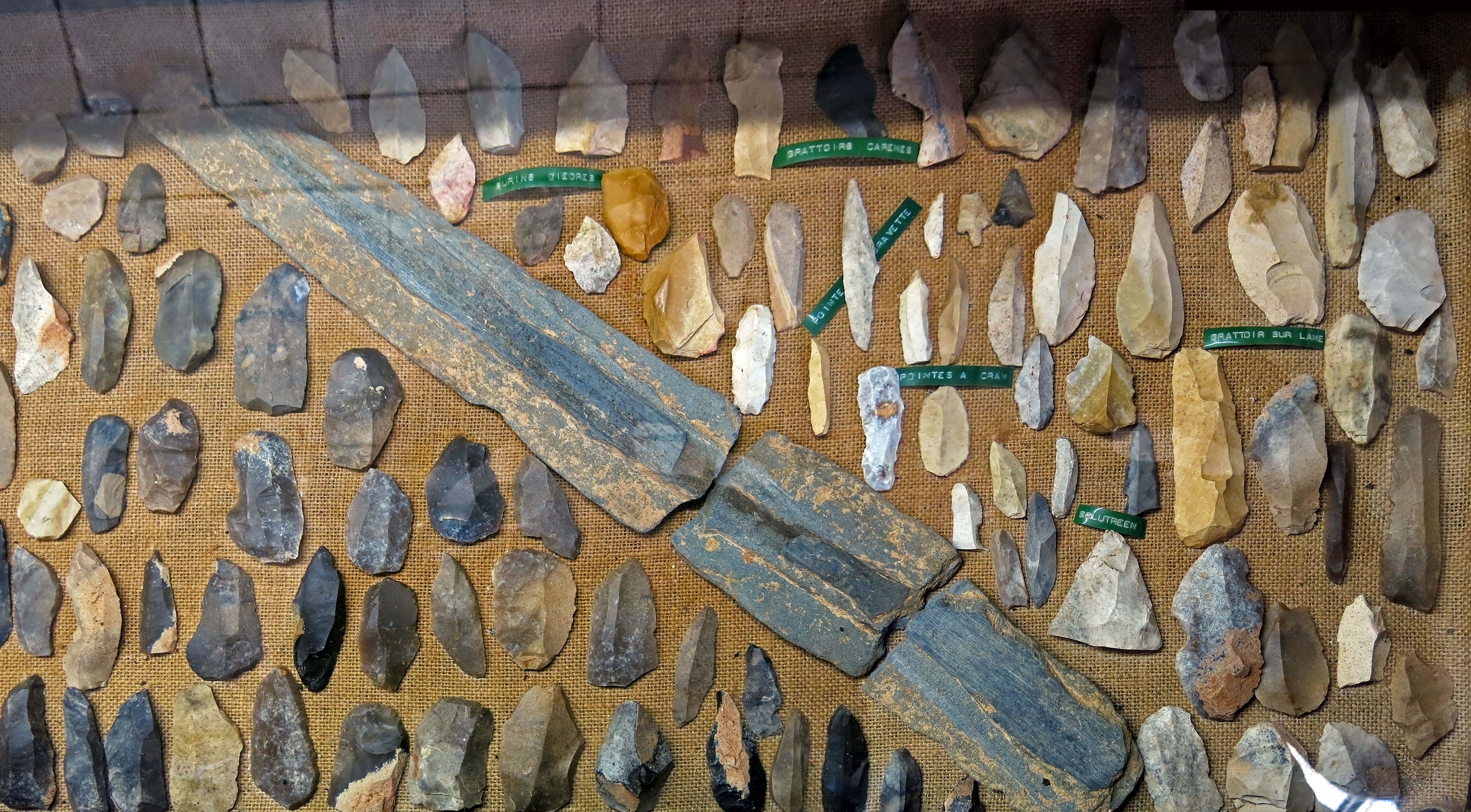
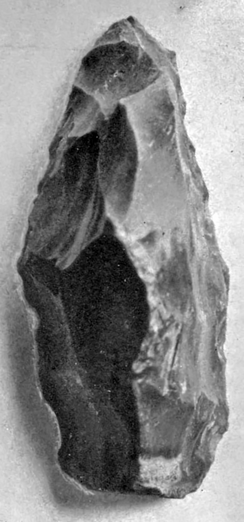
The Pagès Collection from le Ruth
It is the only good collection now remaining, with the rest of the tools and other artefacts scattered far and wide, and mostly inaccessible. It is thus an extremely valuable resource.
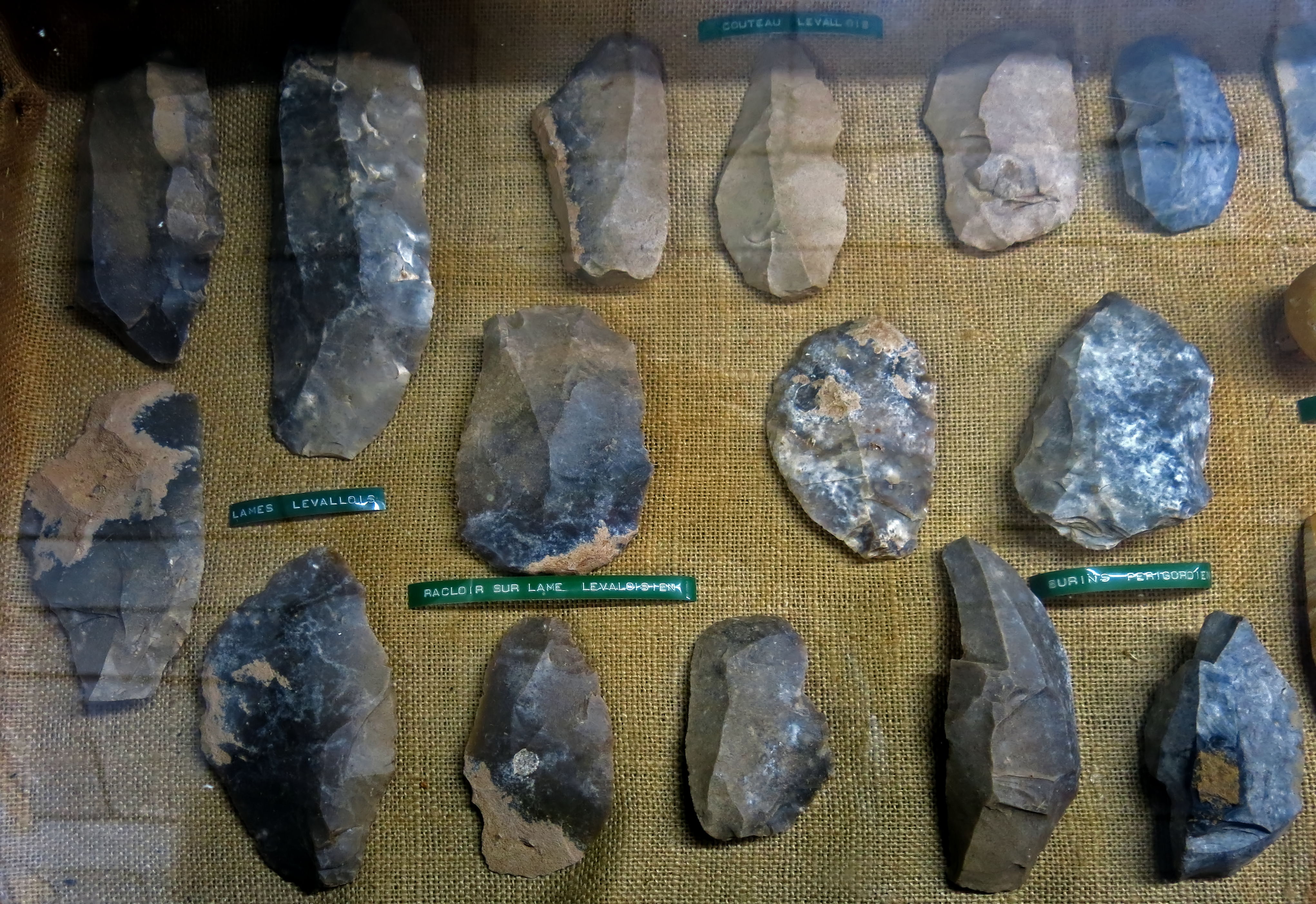
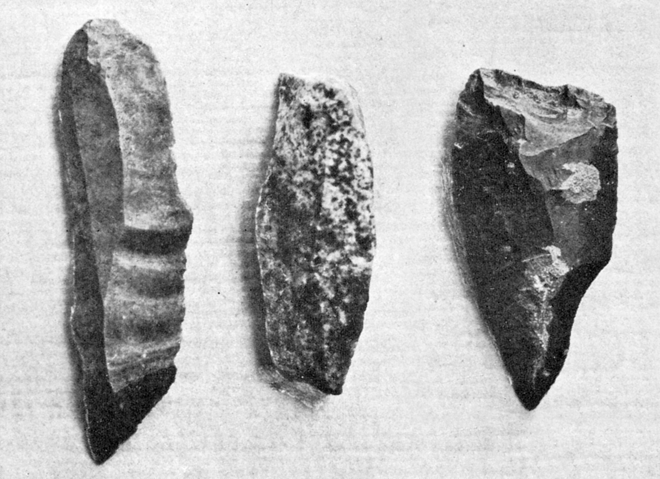
On the left, blades made using the Levallois technique, associated with the Mousterian and thus Neanderthals. The technique died out with the passing of the Neanderthals, about 40 000 BP.
At top right, Levallois blades modified to serve as knives. Typically one side was modified with an abrupt retouch to blunt the sharp edge. Two of these knives have a notch in the blade, perhaps so that they could also serve for scraping spear shafts smooth.
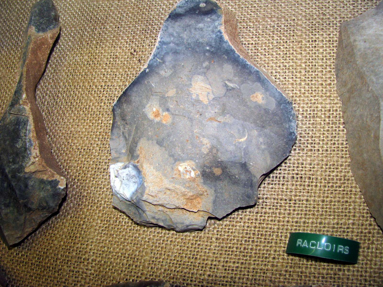
In the centre, three racloirs or side scrapers, again using the Levallois technique. Racloirs are typical tools of the Mousterian tradition.
On the right, burins or engravers, of the Périgordian tradition. It lasted from 35 000 BP to ca 20 000 BP. The earliest culture in the tradition is known as the Châtelperronian which produced denticulate tools and distinctive flint knives. It is argued that this was superseded by the Gravettian with its Font Robert points and Noailles burins. The tradition culminated in the proto-Magdalenian.
The burin second from the right looks like a beaked burin, characteristic of the Middle Aurignacian, about 29 000 BP. The burin on the right looks more like a simple double bevelled burin, a dihedral burin made on a blade by removing two chips from a truncated blade to form the bevel. It does, however, have the characteristic front spall, not vertical in this case, of the beaked burin.
Photo: Don Hitchcock 2014
Text: Adapted from Wikipedia
Source: Musée du Ruth, Sous le Ruth
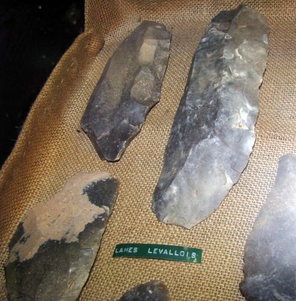
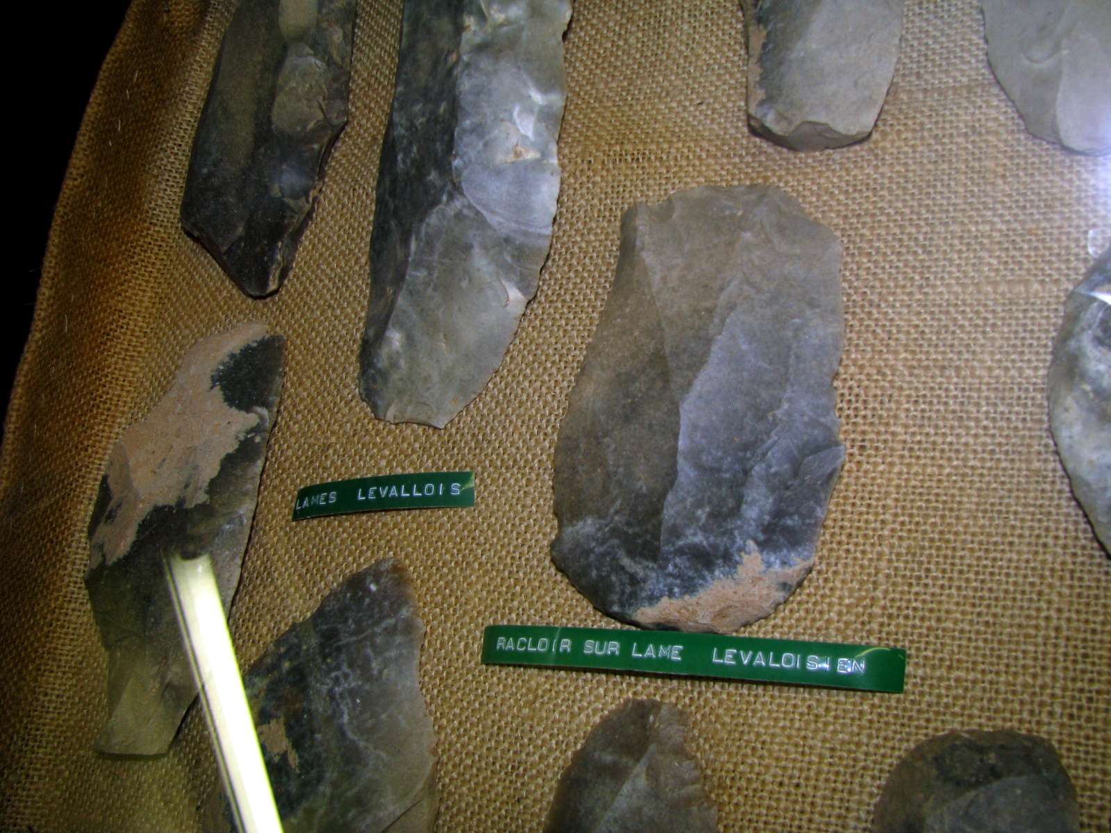
Levallois blades, and a racloir on a Levallois blade.
The Levallois technique is a name given by archaeologists to a distinctive type of stone knapping developed by humans during the Palaeolithic period.
It is named after nineteenth century finds of flint tools in the Levallois-Perret suburb of Paris in France. The technique was more sophisticated than earlier methods of lithic reduction, involving the striking of flakes from a prepared core. A striking platform is formed at one end and then the core's edges are trimmed by flaking off pieces around the outline of the intended flake.
This creates a domed shape on the side of the core, known as a tortoise core as the various scars and rounded form are reminiscent of a tortoise's shell. When the striking platform is finally hit, a flake separates from the core with a distinctive plano-convex profile and with all of its edges sharpened by the earlier trimming work.
This method provides much greater control over the size and shape of the final flake which would then be employed as a scraper or knife although the technique could also be adapted to produce projectile points known as Levallois points.
The technique is first found in the Lower Palaeolithic but is most commonly associated with the Neanderthal Mousterian industries of the Middle Palaeolithic. In the Levant, Levallois methods were also in use in the Upper Palaeolithic and later.
The distinctive forms of the flakes were originally thought to indicate a wide ranging Levallois culture but the wide geographical and temporal spread of the technique has rendered this interpretation obsolete.
Photo: Don Hitchcock 2008
Text: Adapted from Wikipedia
Source: Musée du Ruth, Sous le Ruth
Levallois technique animation for a blade (left) and a point (right).
Click on the images to expand and view the animation of how the techniques are performed.
Photo: Wikimedia commons, José-Manuel Benito Álvarez
Date: 3 January 2007
Permission: This file is licensed under the Creative Commons Attribution-Share Alike 2.5 Generic license
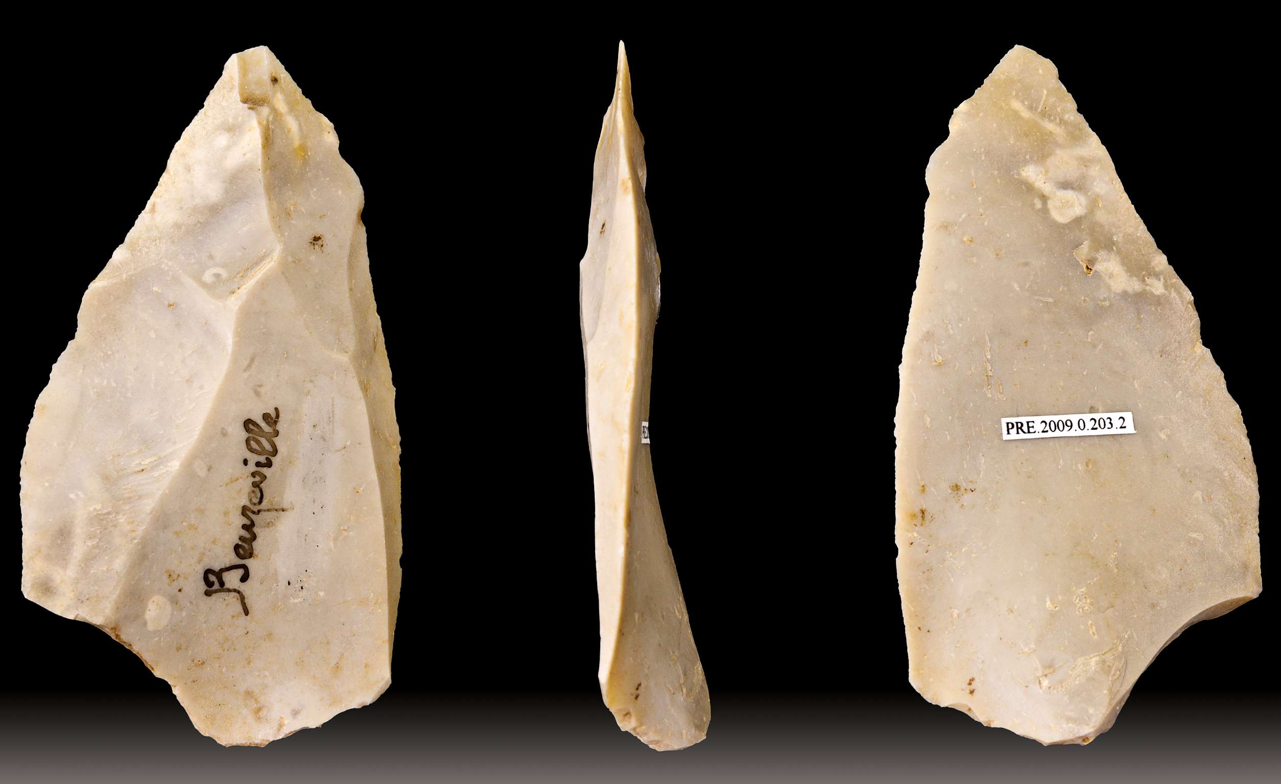
Levallois point - Different views of the same specimen, flint.
Dimensions 8.9 × 4.8 × 1.1 cm (3.50 × 1.89 × 0.43 in)
Current location: Muséum de Toulouse, France
Object history: Findspot: Beuzeville, Eure, France.
Source/Photographer: Didier Descouens, 4 October 2010
Permission: Licensing: I, the copyright holder of this work, hereby publish it under the following license:attribution share alike
This file is licensed under the Creative Commons Attribution-Share Alike 3.0 Unported license.
( Didier Descouens is one of this world's treasures. He is a superb photographer, makes his work freely available at high resolution, and has won numerous awards - Don )
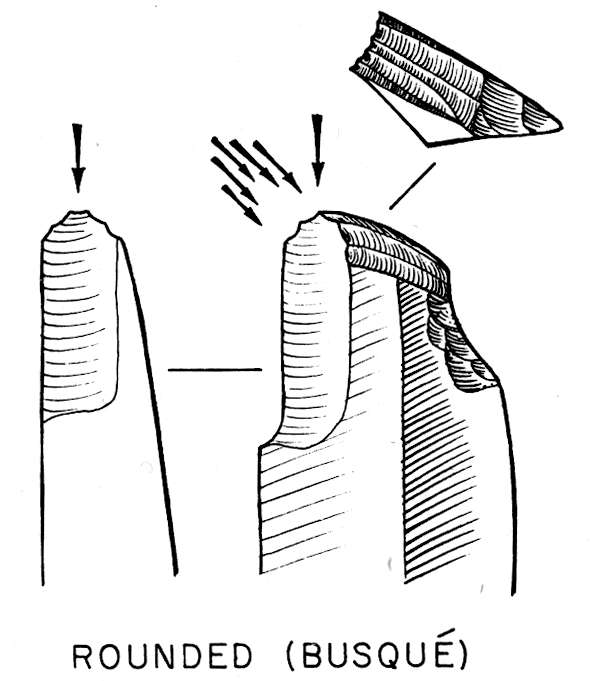
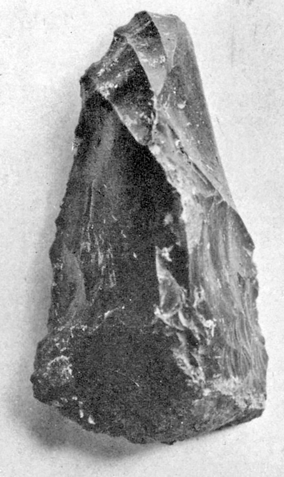
Burin busqué - the Beaked Burin
Three or more fairly regular spalls, often removed from a Spall Removal Surface (SRS) of dihedral type, approximate a semicircle. An edge of this shape is sometimes described as the "gouge" or "busqué" type.
(This is an excellent diagram of what I think of as a 'classic' beaked burin, as described by Burkitt (1925) . Note the front vertical spall, and the notch taken out of the rear of the burin to make sharpening easier, so that a spall comes off easily when retouching. - Don)
Photo and text: Movius et al (1968)
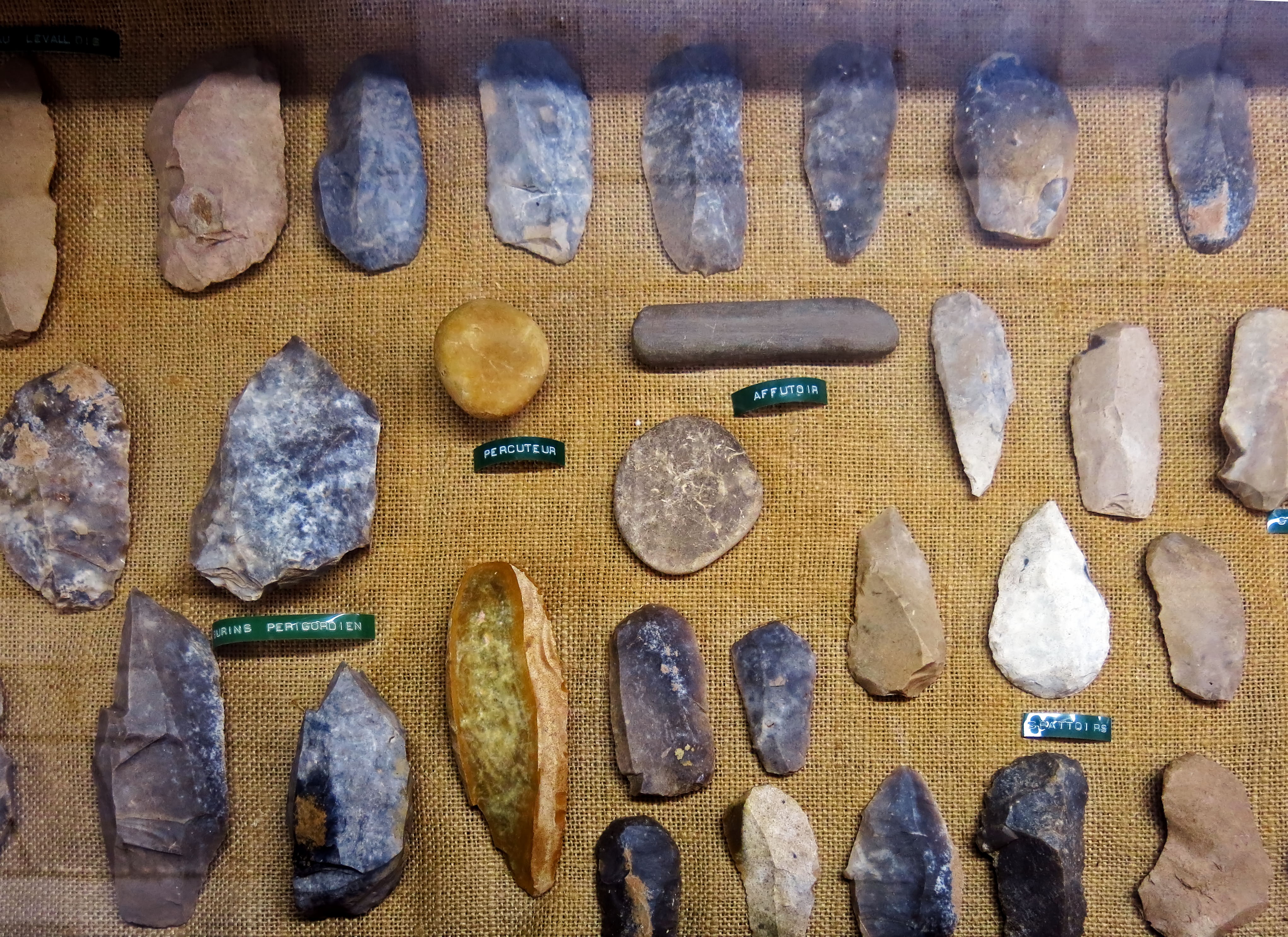
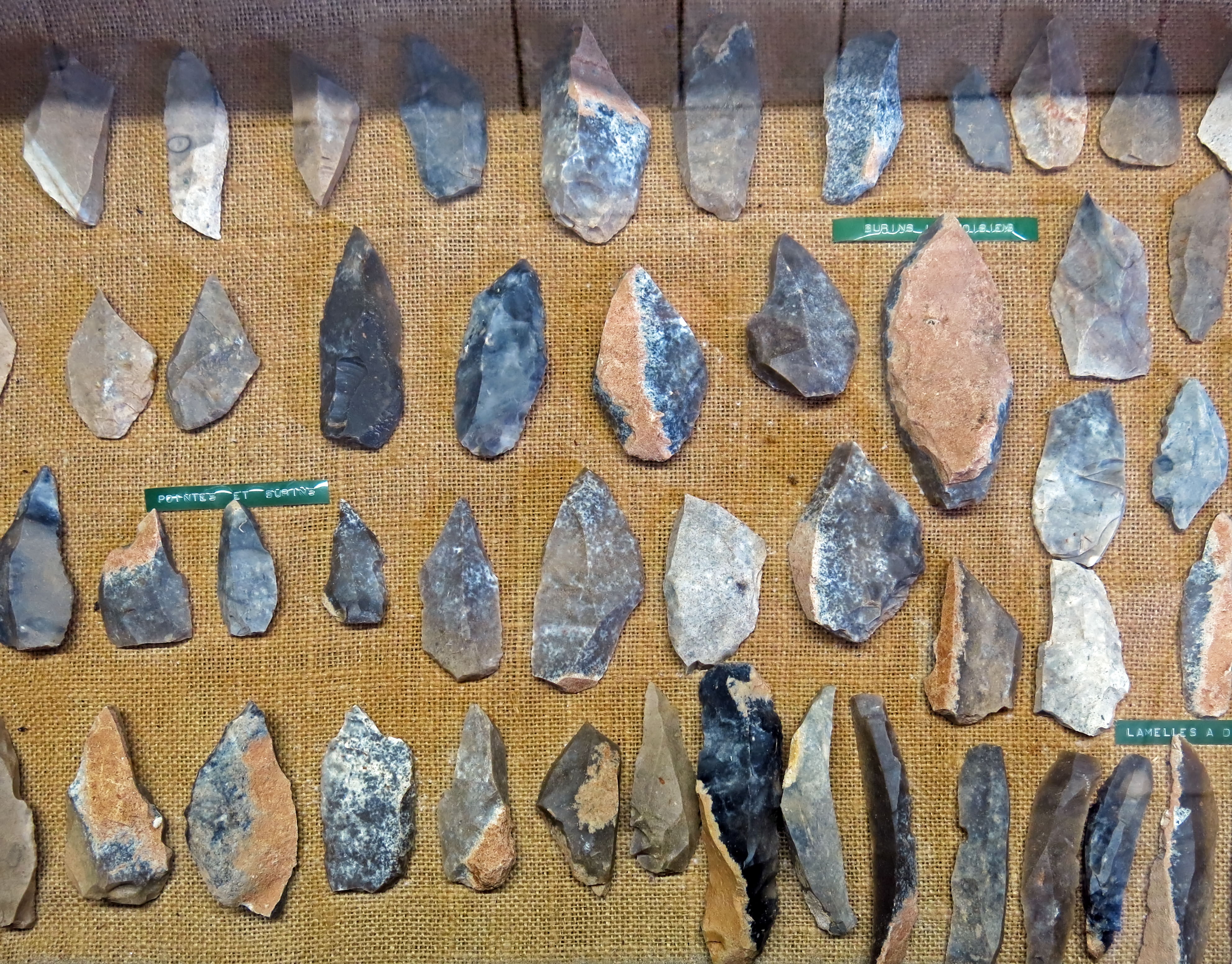
At the lower left, burins of the Périgordian tradition.
In the centre, a smooth pebble which has been used as a percuteur. Percuteurs are strikers or hammerstones, used to remove flakes from a flint core. Wood or bone are also used as strikers.
Beside it an affutoir, a smooth stone used for sharpening. This long one shows evidence of hard use. It is either Neolithic, when tools with ground edges made their appearance, or it was perhaps used to sharpen bone tools and spear points during the Palaeolithic. Another affutoir, oval in shape, is just below it.
On the right, grattoirs or scrapers, used to smooth wood and to scrape hides to clean and soften them in preparation for their use as clothing or as other leather goods. Grattoirs are typically created on the ends of blades.
Photo: Don Hitchcock 2014
Source: Musée du Ruth, Sous le Ruth
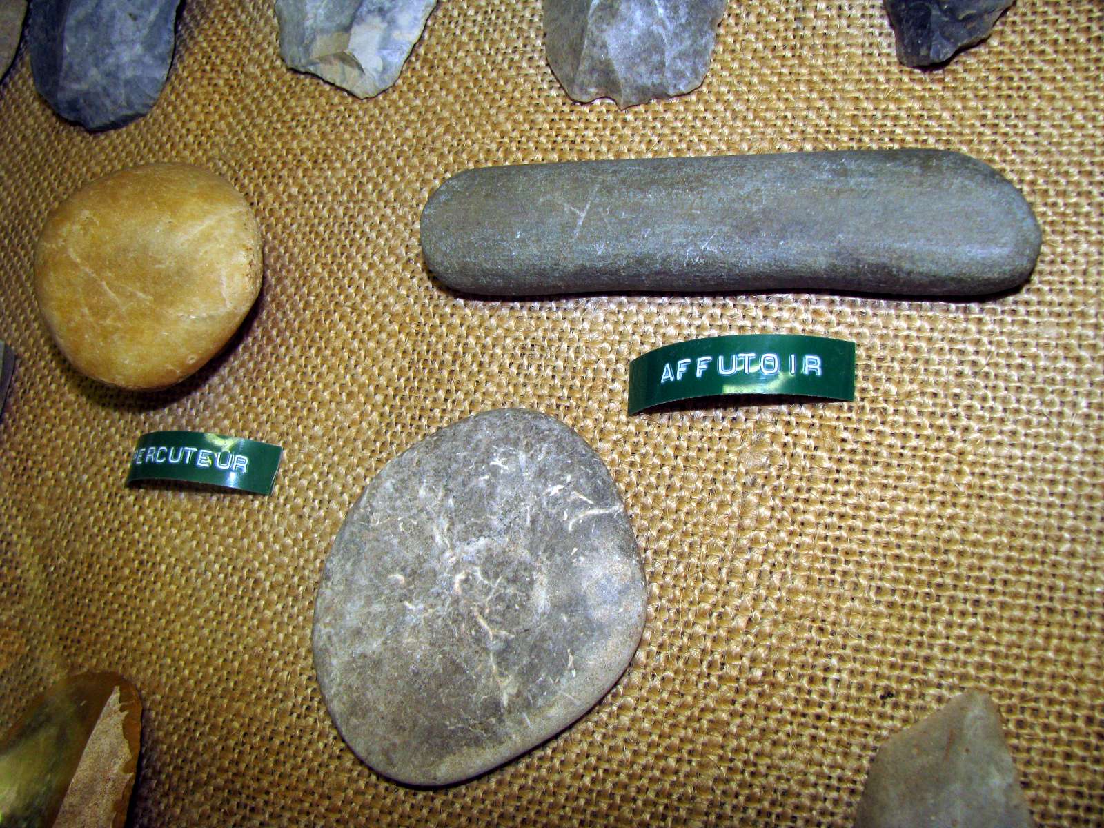
Closeup of the affutoirs and percuteur.
Photo: Don Hitchcock 2008
Source: Musée du Ruth, Sous le Ruth
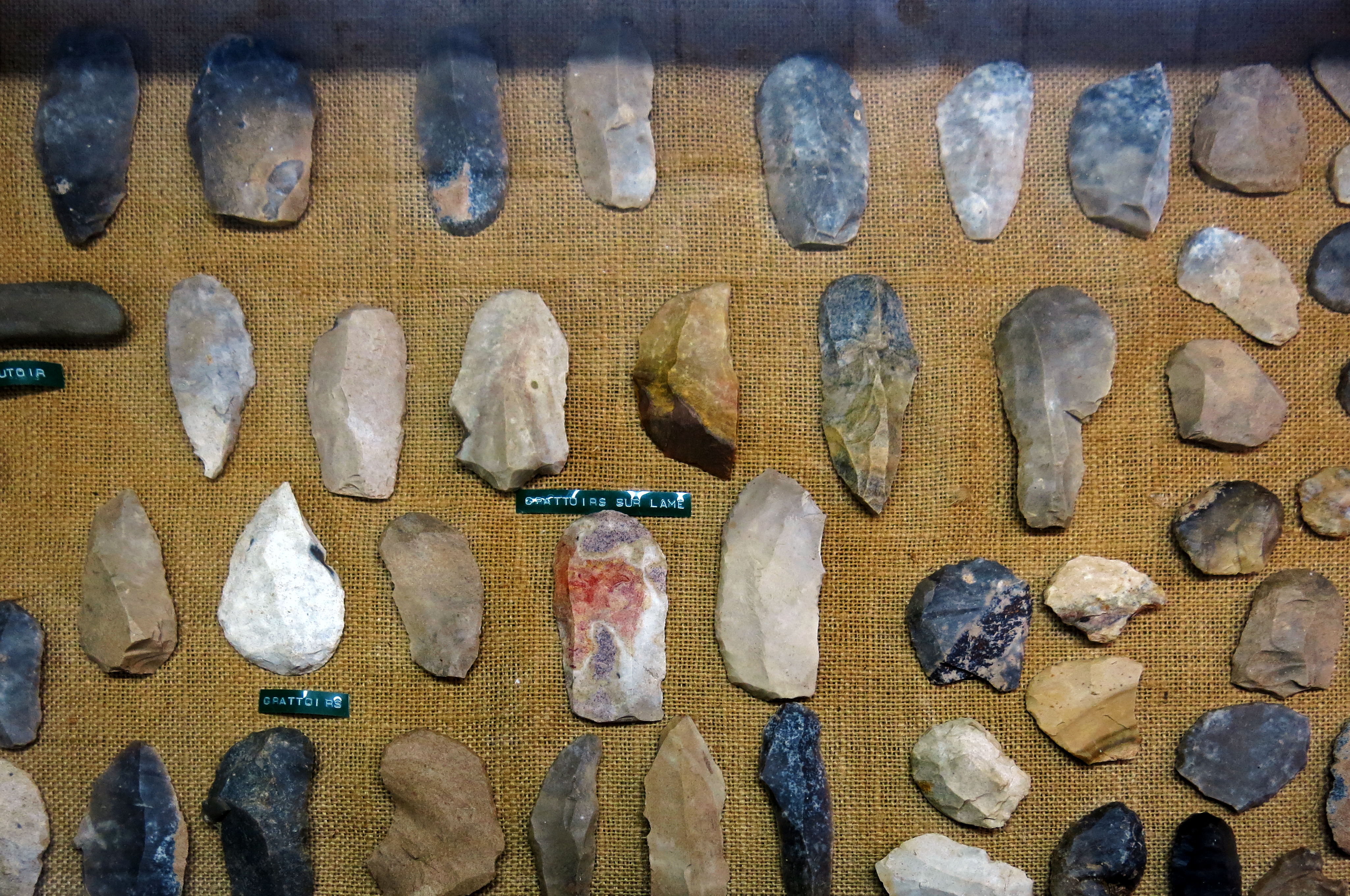
Most of the tools here are grattoirs (scrapers with the scraper at one end, not on the side) made either from flakes or from blades.
Note the beautiful multicoloured grattoir on a blade in the centre of this image.
Photo: Don Hitchcock 2014
Source: Musée du Ruth, Sous le Ruth
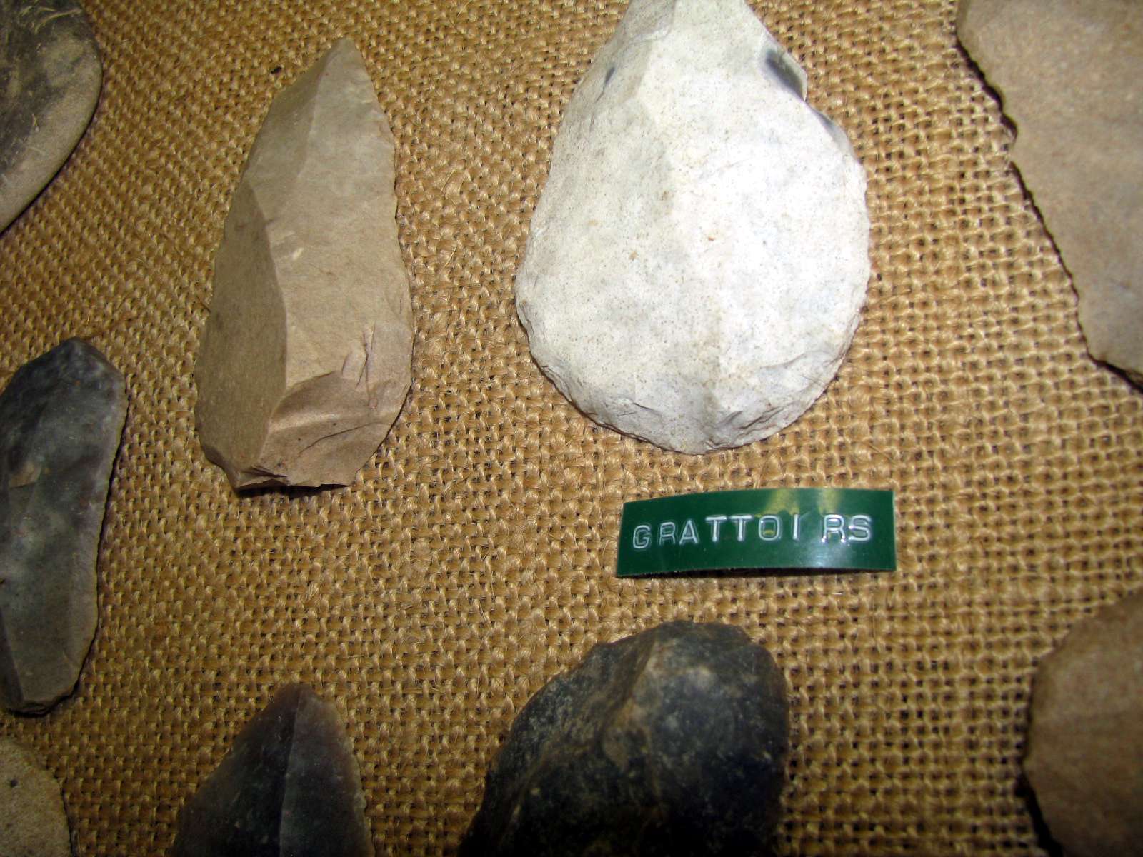
Grattoirs, end scrapers, made on a thick flake in this instance. The almost white grattoir has a point at the other end, see the photograph of the full tool in the general shot above.
It is unusual for most of the white cortex (?) of the original flint nodule to be left on the tool, the dark interior can be seen at the top right in this view.
Photo: Don Hitchcock 2008
Source: Musée du Ruth, Sous le Ruth
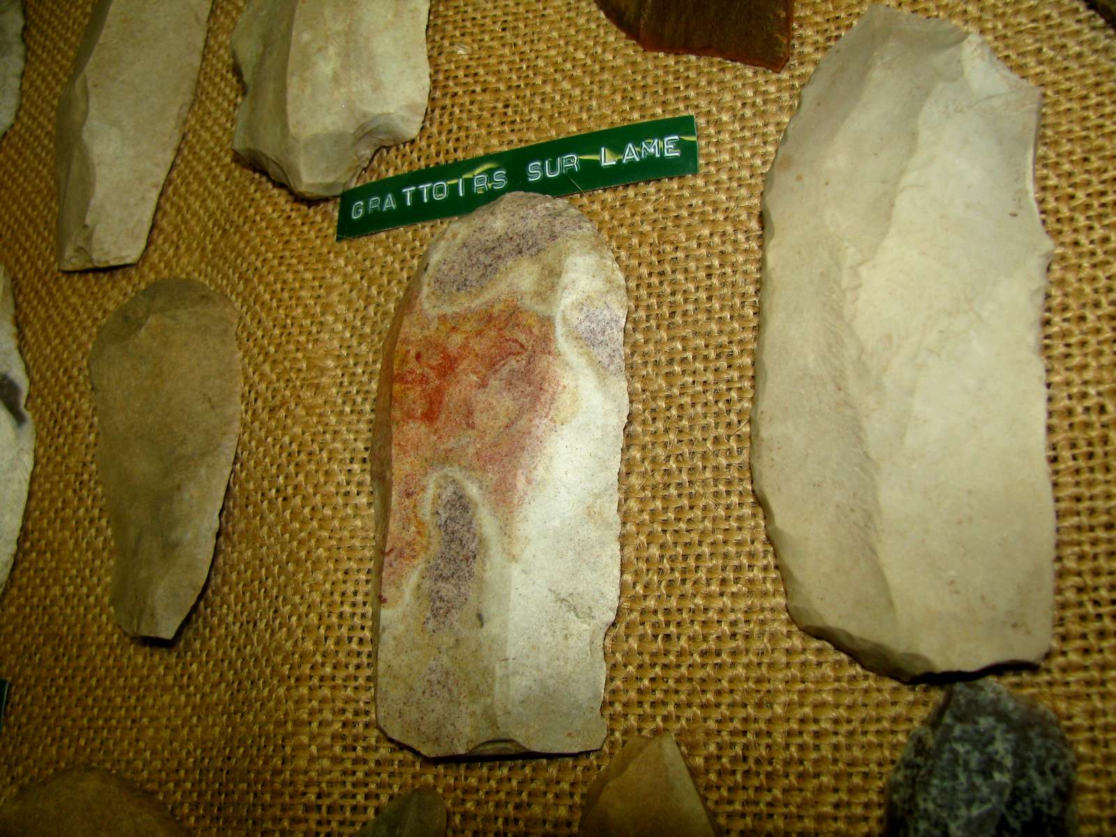
Grattoirs on a blade, including the multicoloured one in the general photograph above.
Grattoirs are flaked stone scrapers, usually Upper Paleolithic, retouched at the end and used probably for working wood or cleaning hides.
Text: Adapted from Wikipedia.
Photo: Don Hitchcock 2008
Source: Musée du Ruth, Sous le Ruth
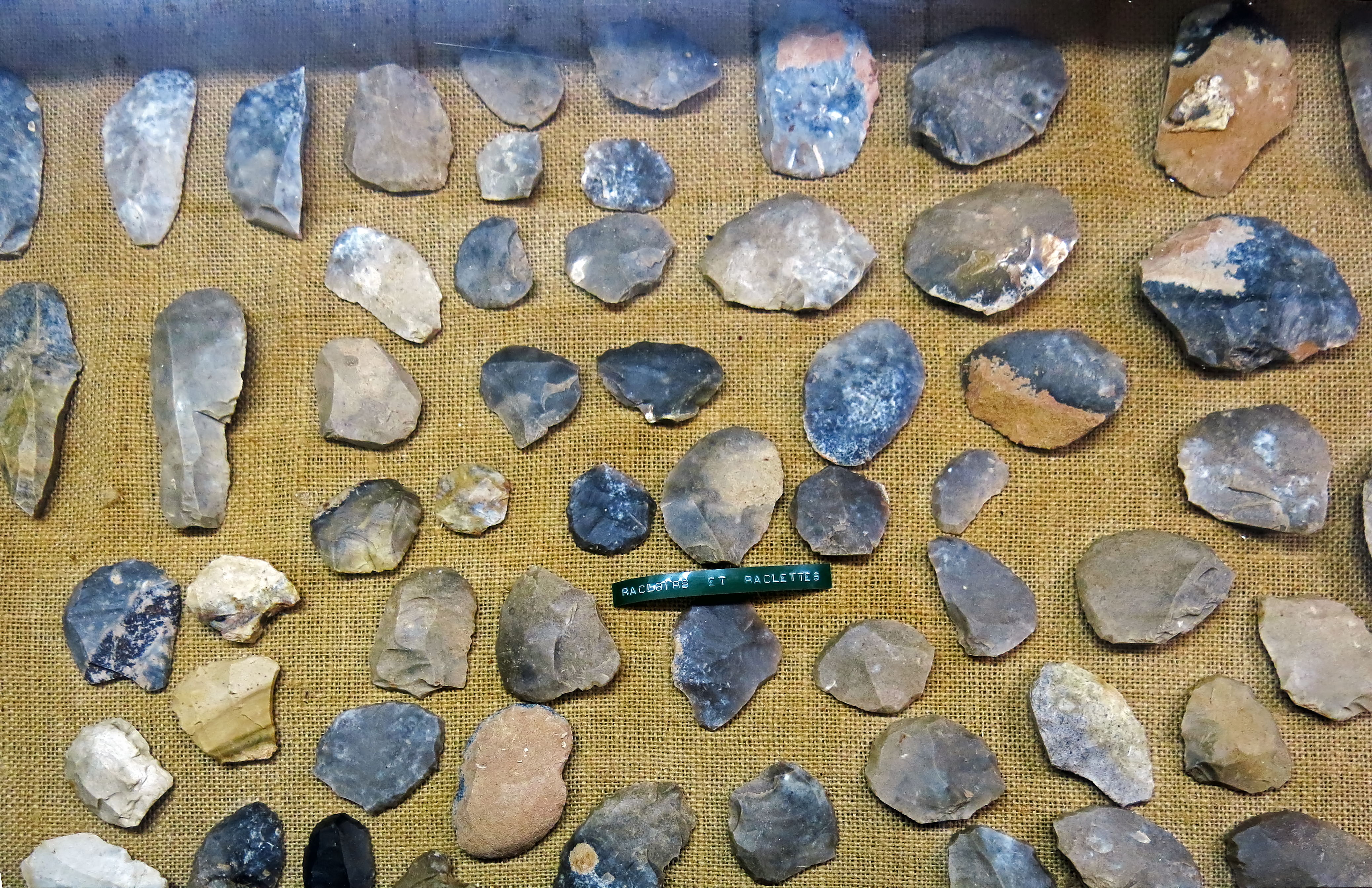
Apart from the grattoirs in the upper left of this image, the others are racloirs (side scrapers) or raclettes.
A racloir is a large side scraper created from a flint flake. As well as being used for scraping hides and bark, it may also have been used as a knife. Racloirs are most associated with the Neanderthal Mousterian industry.
Raclettes are often microliths, truncated blades used as scrapers from the upper Palaeolithic, and are notable for their particular form. They are blades or flakes whose edges have been sharply retouched until they are semicircular or shapeless. However, raclettes in larger sizes appear throughout the Stone Age.
Text: Adapted from Wikipedia.
Photo: Don Hitchcock 2014
Source: Musée du Ruth, Sous le Ruth
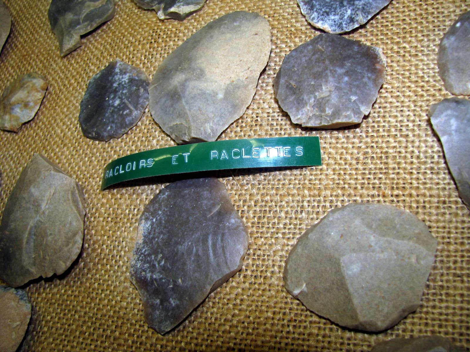
Close ups of racloirs and raclettes.
Photo: Don Hitchcock 2008
Source: Musée du Ruth, Sous le Ruth
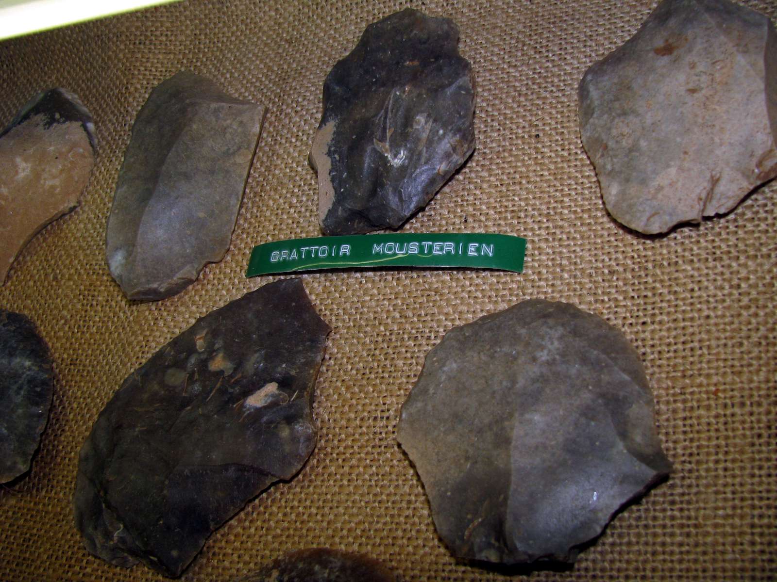
Mousterian grattoirs and racloirs made from flakes, with raclettes at the lower left of the image.
Photo: Don Hitchcock 2014
Source: Musée du Ruth, Sous le Ruth
Mousterian grattoirs, end scrapers made from a flake or blade, retouched at the end and probably used for working or cleaning hides.
A Mousterian racloir or side scraper at the lower left of the image.
Photo: Don Hitchcock 2008
Source: Musée du Ruth, Sous le Ruth
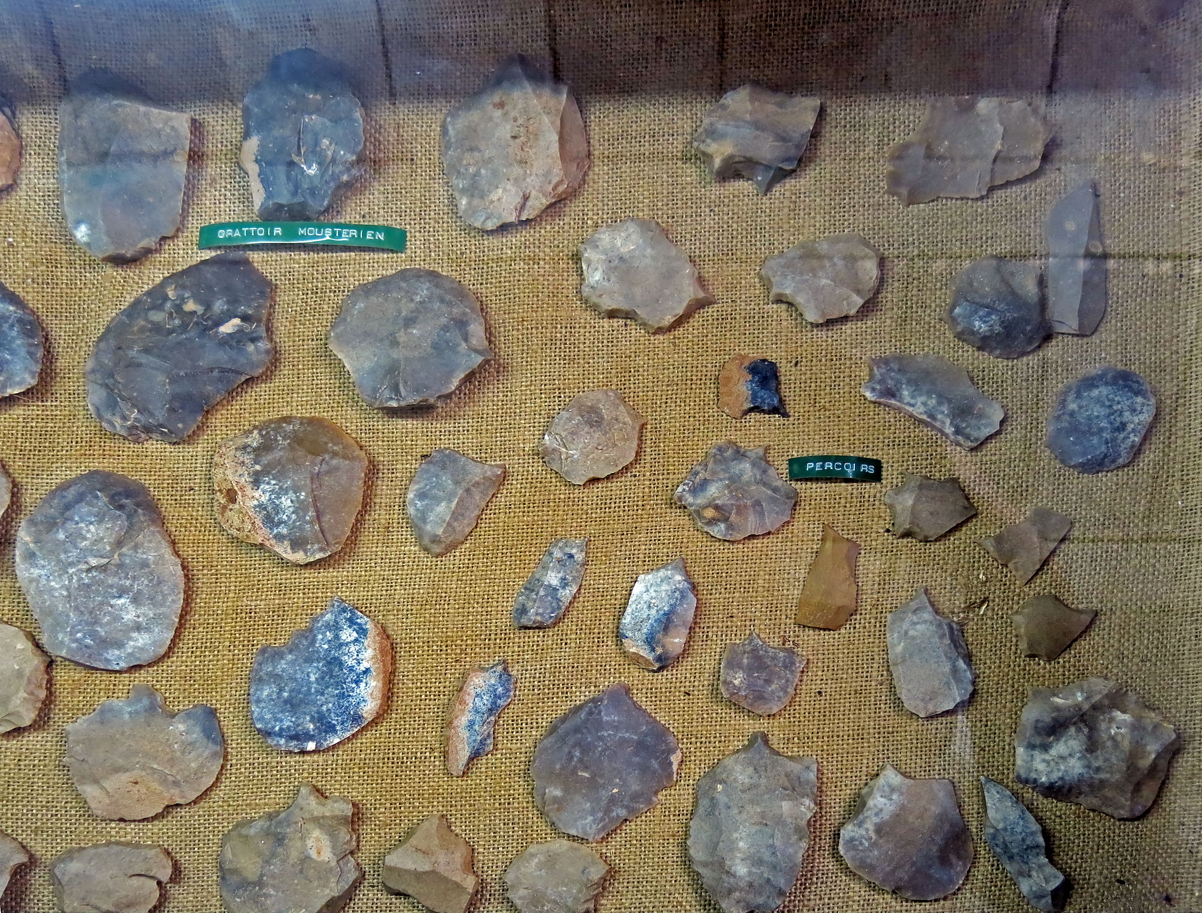
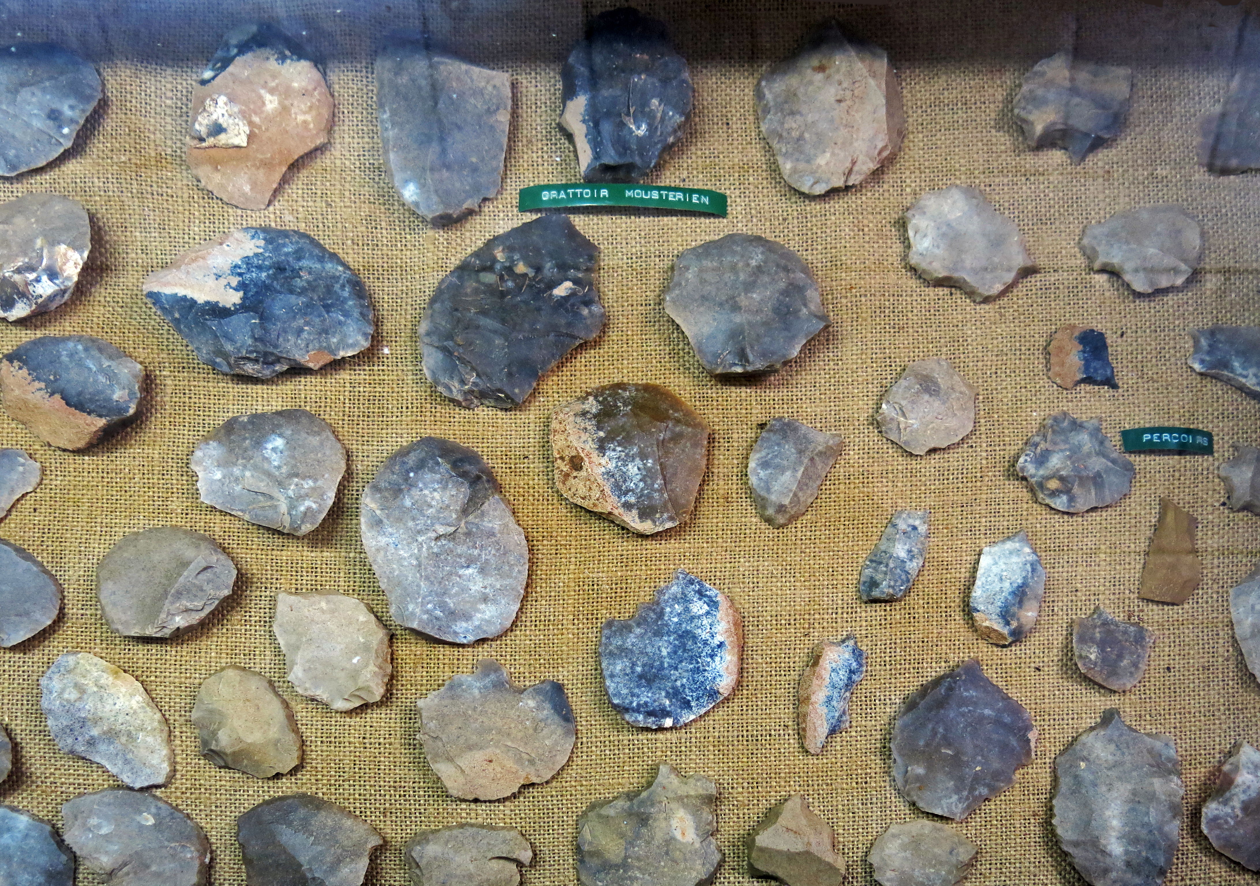
Mousterian grattoirs (end scrapers), and racloirs (side scrapers), left, used for preparing hides, and perçoirs, awls, used to make holes in leather for sewing skins together, right.
Photo: Don Hitchcock 2014
Source: Musée du Ruth, Sous le Ruth
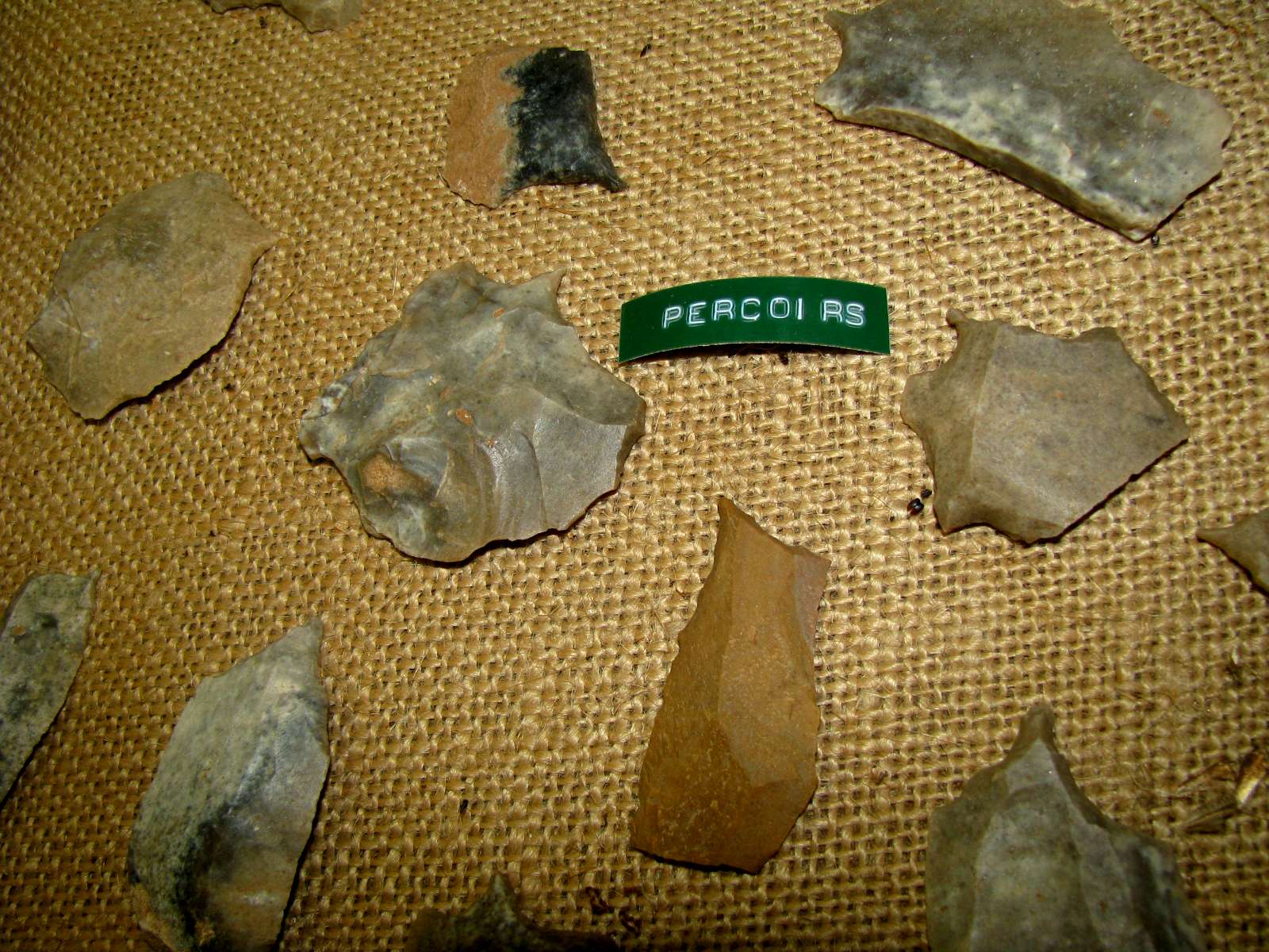
Perçoirs - Awls, used for punching holes in leather, a close up of some of the awls in the photograph above.
Photo: Don Hitchcock 2008
Source: Musée du Ruth, Sous le Ruth
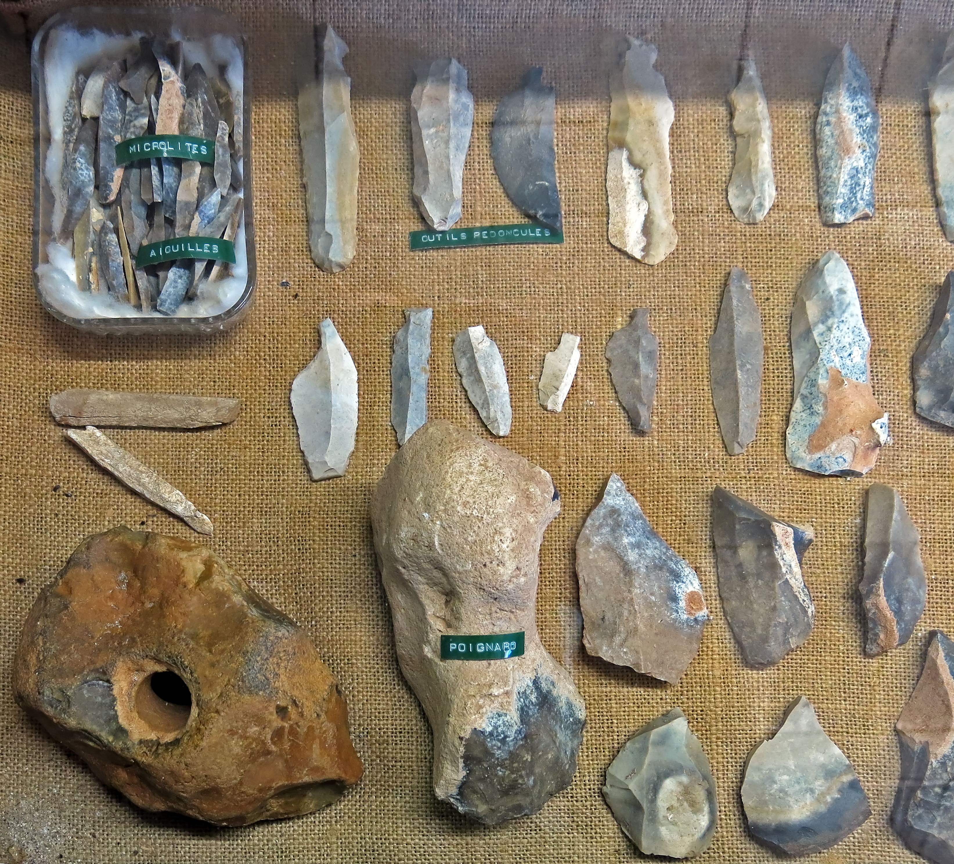
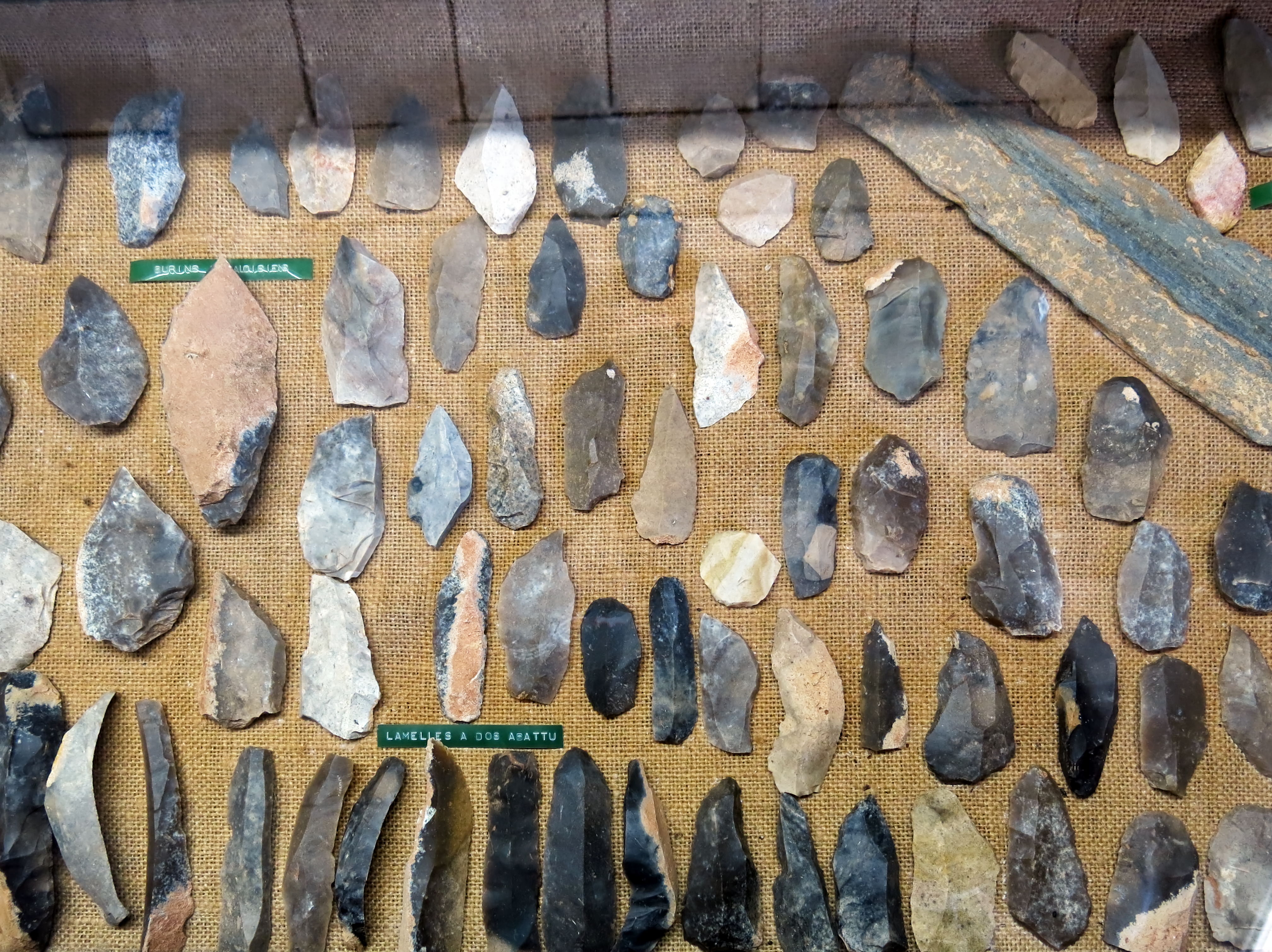
In the top left corner is a small container with microliths and needle shaped tools. In the top two rows are stalked tools, tools with peduncles.
At the lower right are burins made on flakes, presumably Mousterian.
On the left is an interesting object, a maul with a completely cylindrical hole. This is probably from the late Palaeolithic or the Neolithic, when efficient techniques for drilling such holes had been developed. The maul has a relatively sharp end which could have been used for breaking limestone or large bones, or splitting wood, and a flatter end which would have been useful for driving pegs into the ground.
Beside it is a large and elongated flint nodule, with one end shaped into what looks like an axe blade. It has been labelled as a poignard, or dagger, but it is much more likely to have been used for cutting down trees or splitting wood, with something like split willow bound around the natural 'waist' of the nodule, used to attach a long handle.
Photo: Don Hitchcock 2014
Source: Musée du Ruth, Sous le Ruth
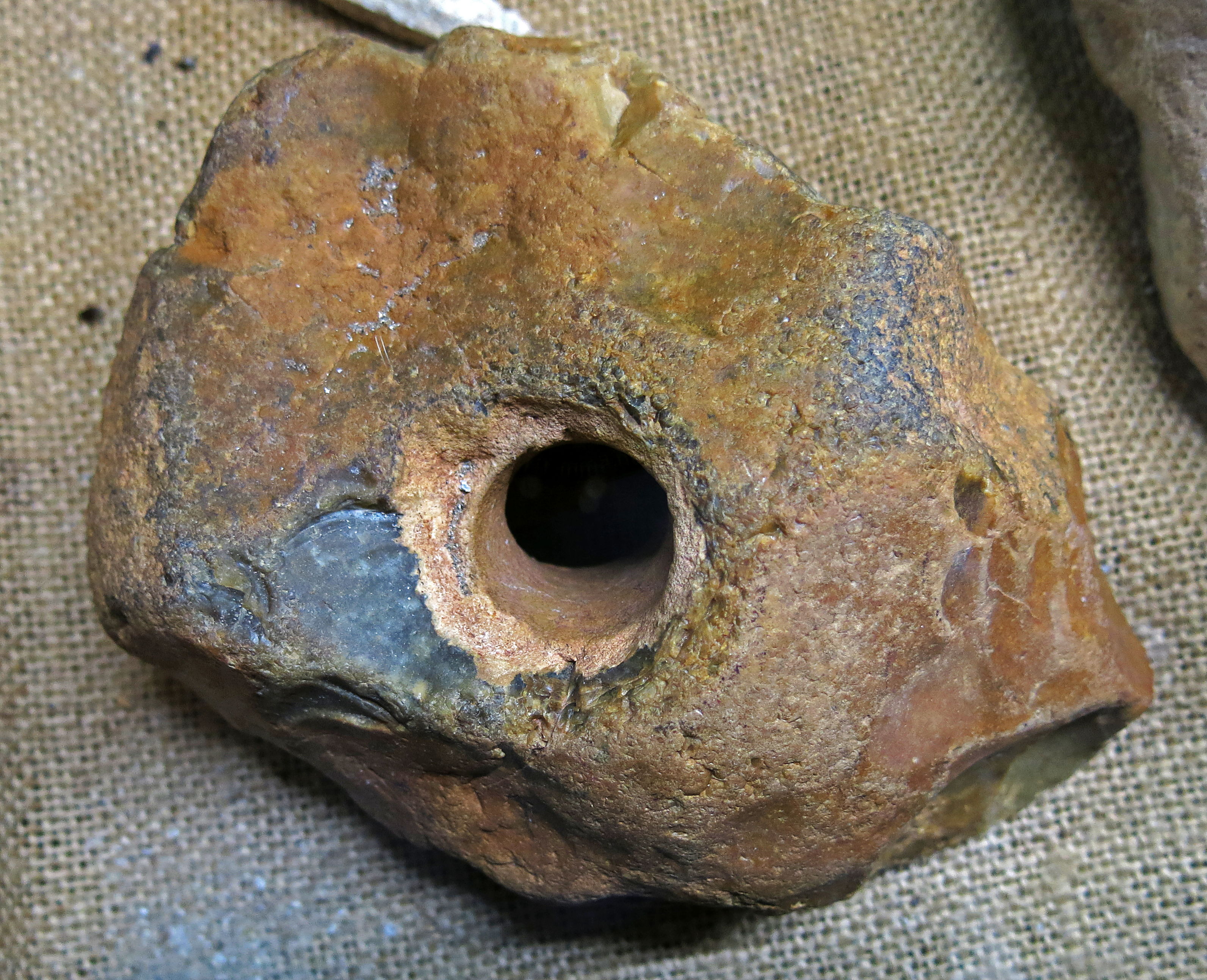
Close up of the maul, showing the perfectly formed cylindrical hole.
Photo: Don Hitchcock 2014
Source: Musée du Ruth, Sous le Ruth
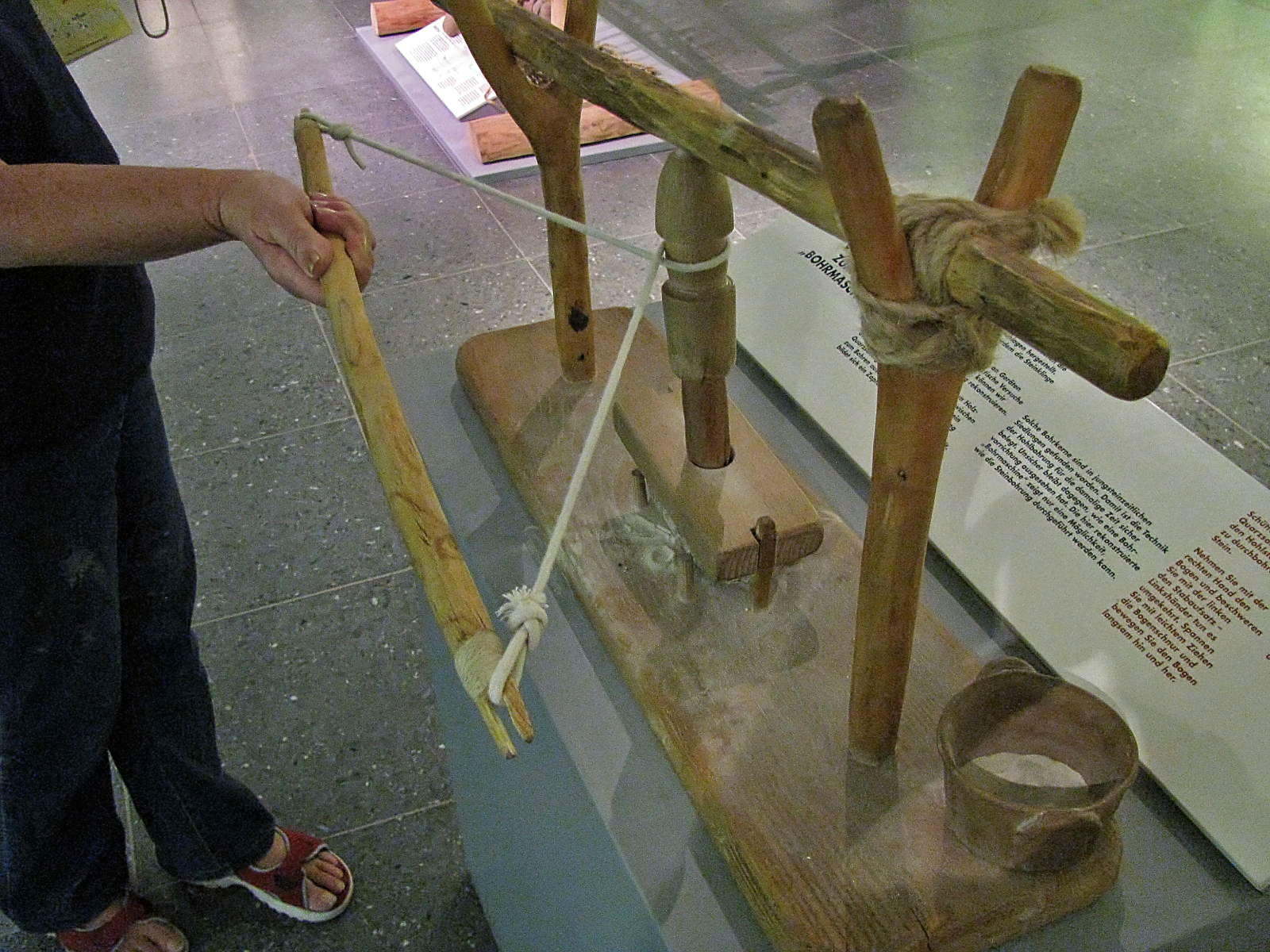
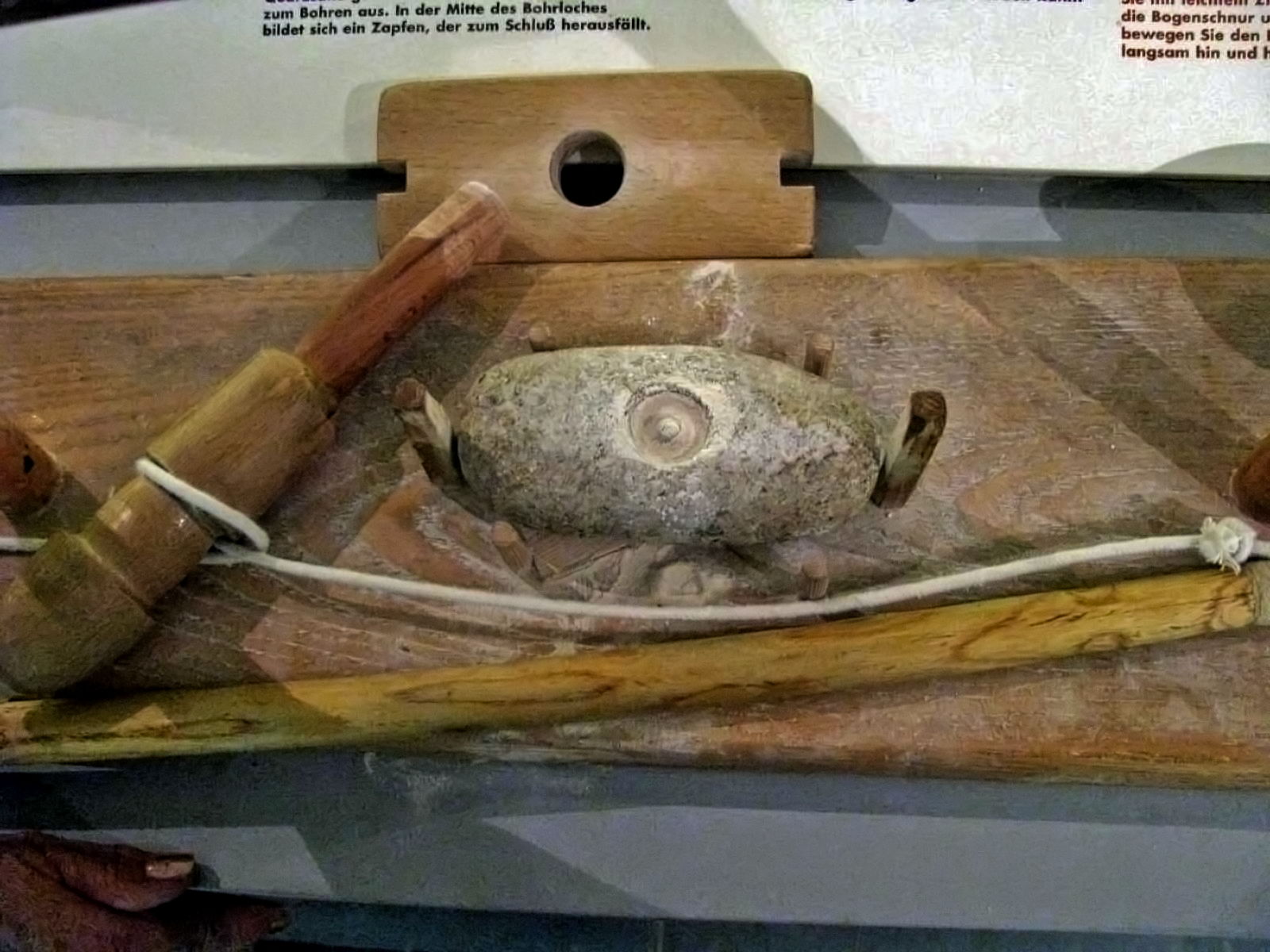
Hole boring machine, Neolithic.
This machine requires a hollow wooden tube, which is supplied by the Elder or Elderberry (Sambucus nigra ), which is a small tree which grows only a few metres tall and tends to grow in poor quality soil. The branches of the elder are hollow, filled with pith which is easily removed.
To make an axe, people either ground it to shape, or knapped the stone. to attach the handle they had to drill a hole. Thanks to the surviving traces of work on equipment and intermediate goods and by practical tests of experimental archeology, we can now reconstruct the technology of the stone drill.
A hollow elder wand was rotated by pulling a bow back and forth. When sand is added between the soft wooden tube and the stone, it adds friction to the drilling. In the middle of the drill hole a small cylinder forms, which falls out at the end when the hole is bored completely through the stone. Such cores have been found in Neolithic settlements. Thus, the technique of drilling with a hollow wand has been established. It remains uncertain, however, exactly what the drilling device looked like. The drill reconstructed here, shows only one way in which the drilling of the stone could have been performed.
The wooden beam which is located by the fork shown, has a stone on the far end out of frame which provides weight to bear on the rotating rod. Put some sand between the hollow rod and the rock to be drilled. Take the the bow in one hand and pull lightly on it to tighten the cord, then move the bow back and forth slowly.
The elder wand rotates and rubs the sand against the stone surface.
It takes between 10 and 20 hours, depending on the hardness of the stone, to drill the hole through the axe head.
Photo: Don Hitchcock 2008
Source and text: Badisches Landesmuseum Karlsruhe Germany
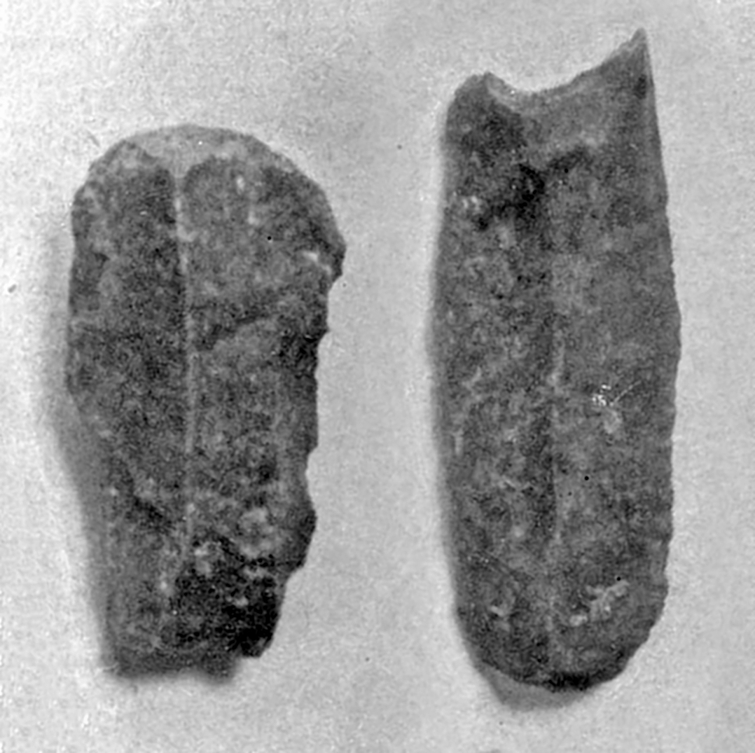
Tools with peduncles.
Photo: Don Hitchcock 2008
Source: Musée du Ruth, Sous le Ruth
Points and burins, mostly made on flakes, and thus most likely Mousterian.
Photo: Don Hitchcock 2014
Source: Musée du Ruth, Sous le Ruth
Points and Levalloisian burins, with a few blades at the lower right.
Levallois burins are typically made on a point, a triangular flake on which a burin spall has been detached from the distal (far) end, that is, in this case, at the point.
Photo: Don Hitchcock 2014
Source: Musée du Ruth, Sous le Ruth
Levalloisian burins, and blades with the back retouched so that it is blunted.
In this way the knife may be used without a handle, with the index finger on the blunted back edge to provide control and pressure.
Photo: Don Hitchcock 2014
Source: Musée du Ruth, Sous le Ruth
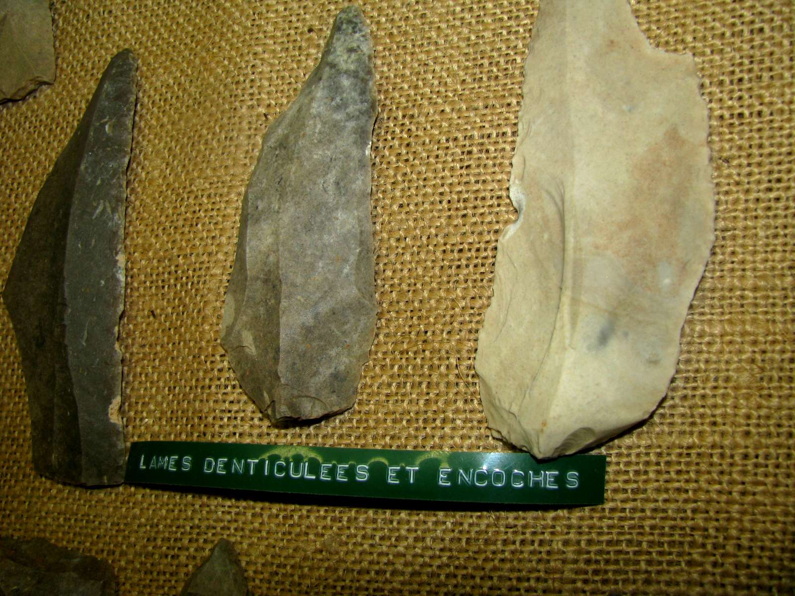
Denticulated (toothed to give a saw-like edge) and notched blades.
Photo: Don Hitchcock 2008
Source: Musée du Ruth, Sous le Ruth
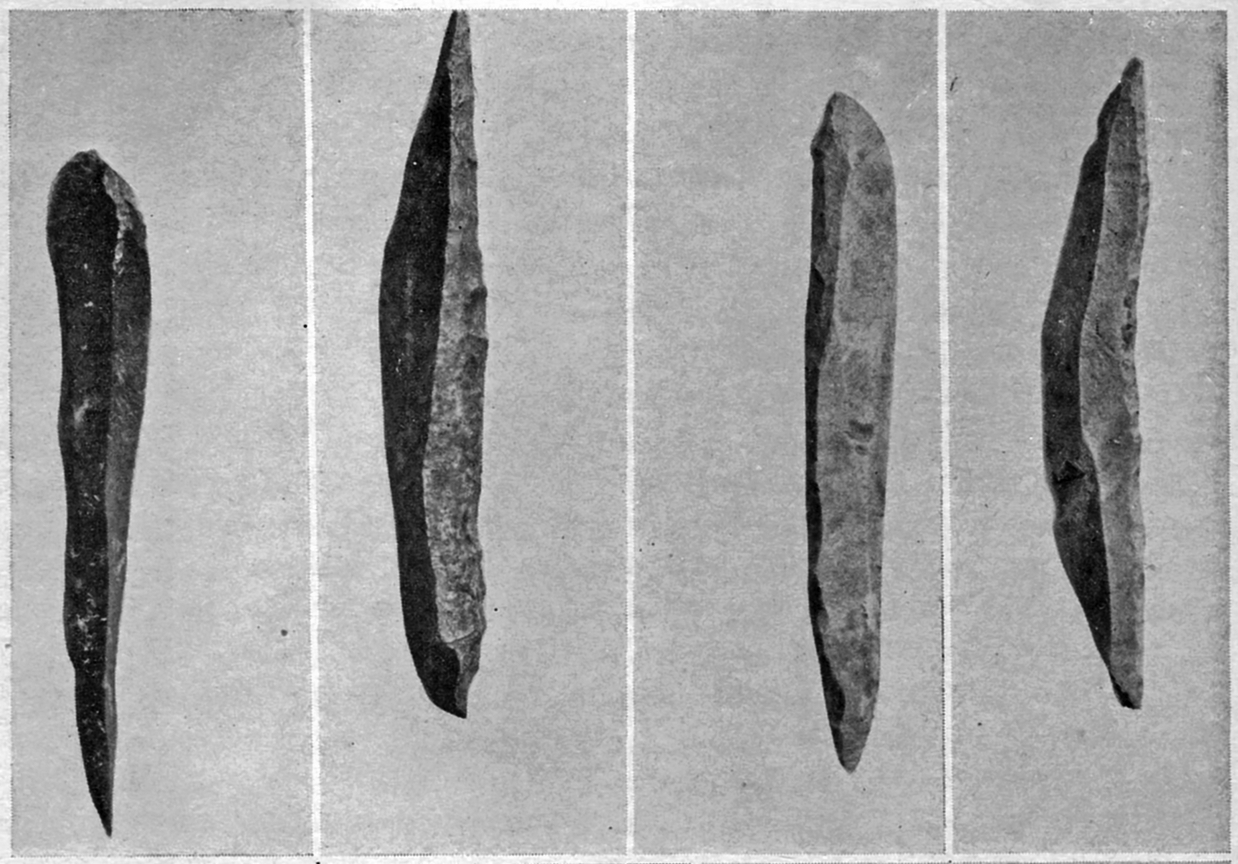
Dihedral burins, keeled grattoirs, gravette points, points à cran, grattoir on a blade, Solutrean points.
Running diagonally across the image is what appears to be either a fossil of a small tree or sapling, or perhaps the remains of a pole or spear. I would appreciate any further information on this piece.
Photo: Don Hitchcock 2014
Source: Musée du Ruth, Sous le Ruth
Abri Cellier
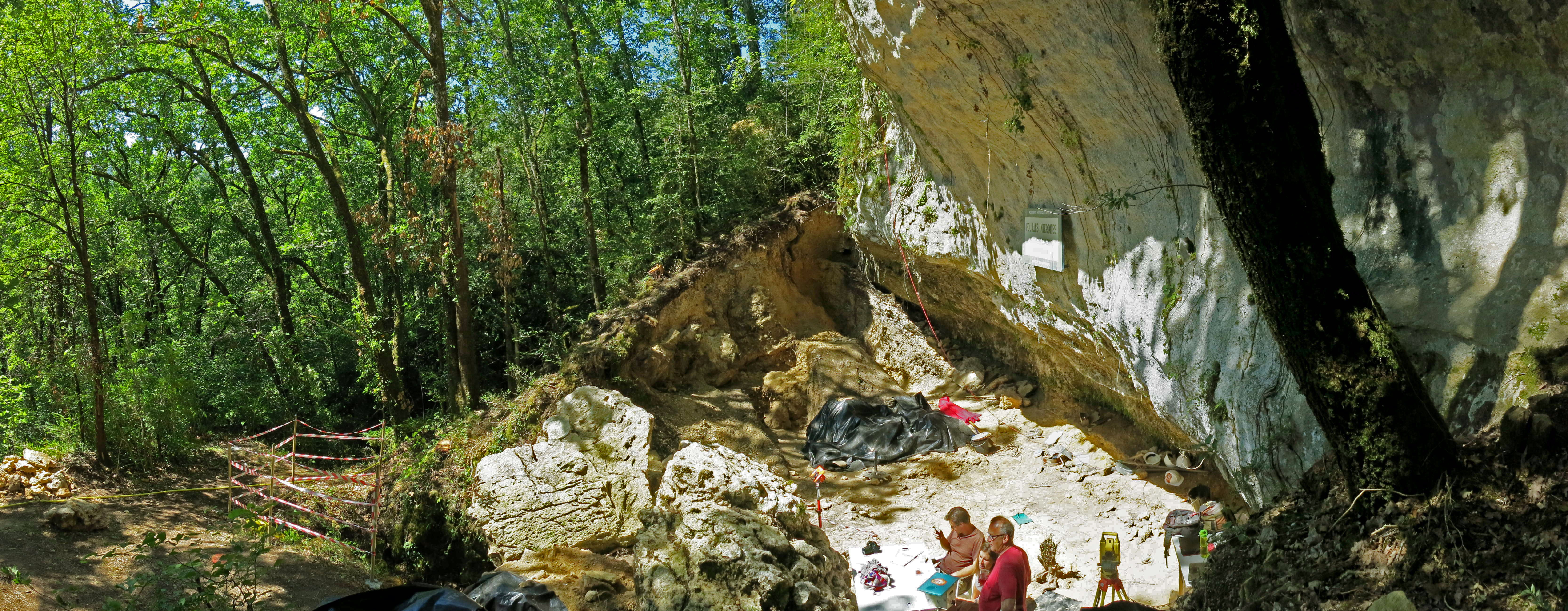
General view of the Abri Cellier excavation directed by Professor Randall White, who is Professor of Anthropology at New York University and one of the world’s leading specialists in the study of Palaeolithic art and personal adornment.
Photo: Don Hitchcock 2014
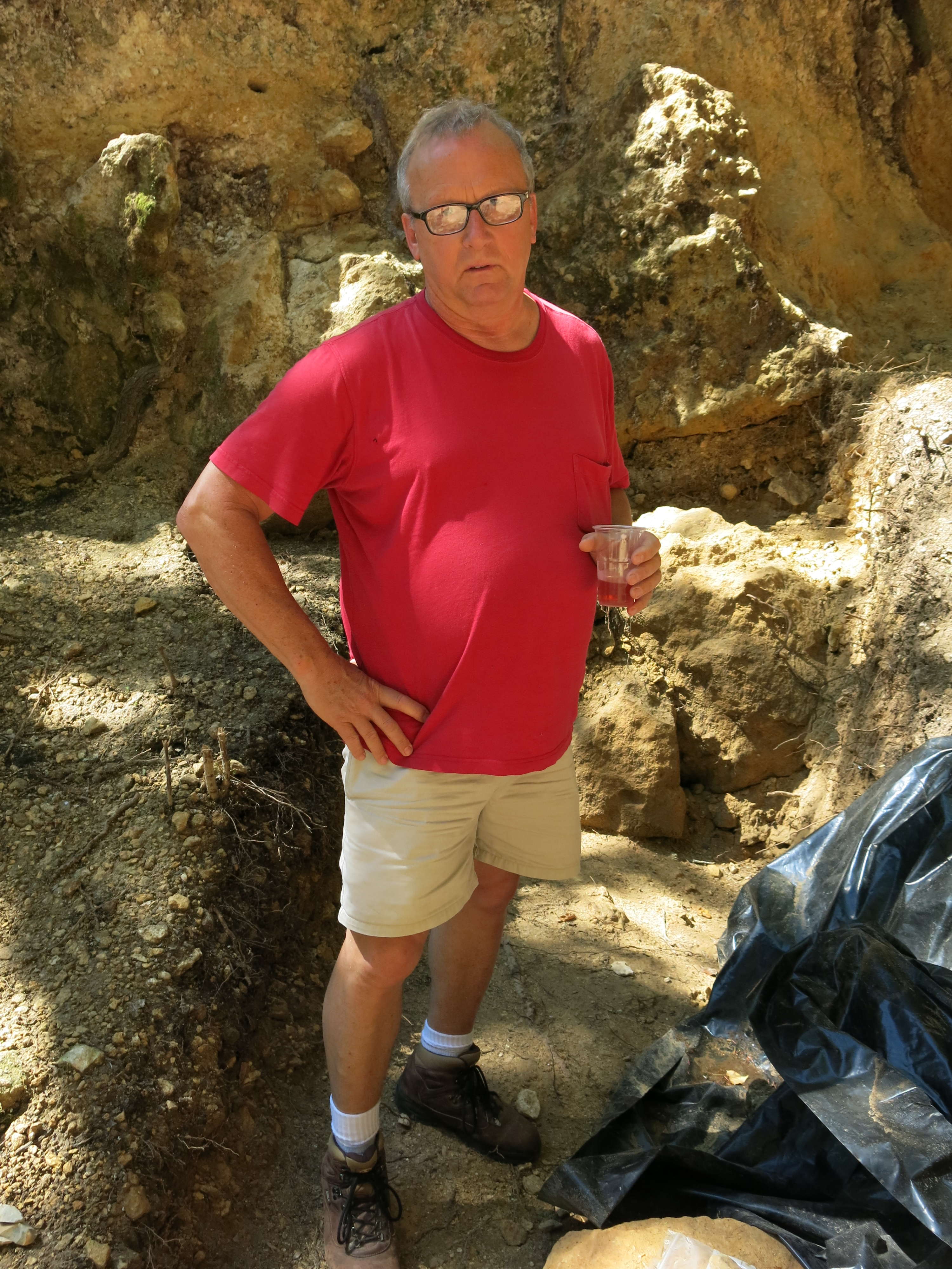
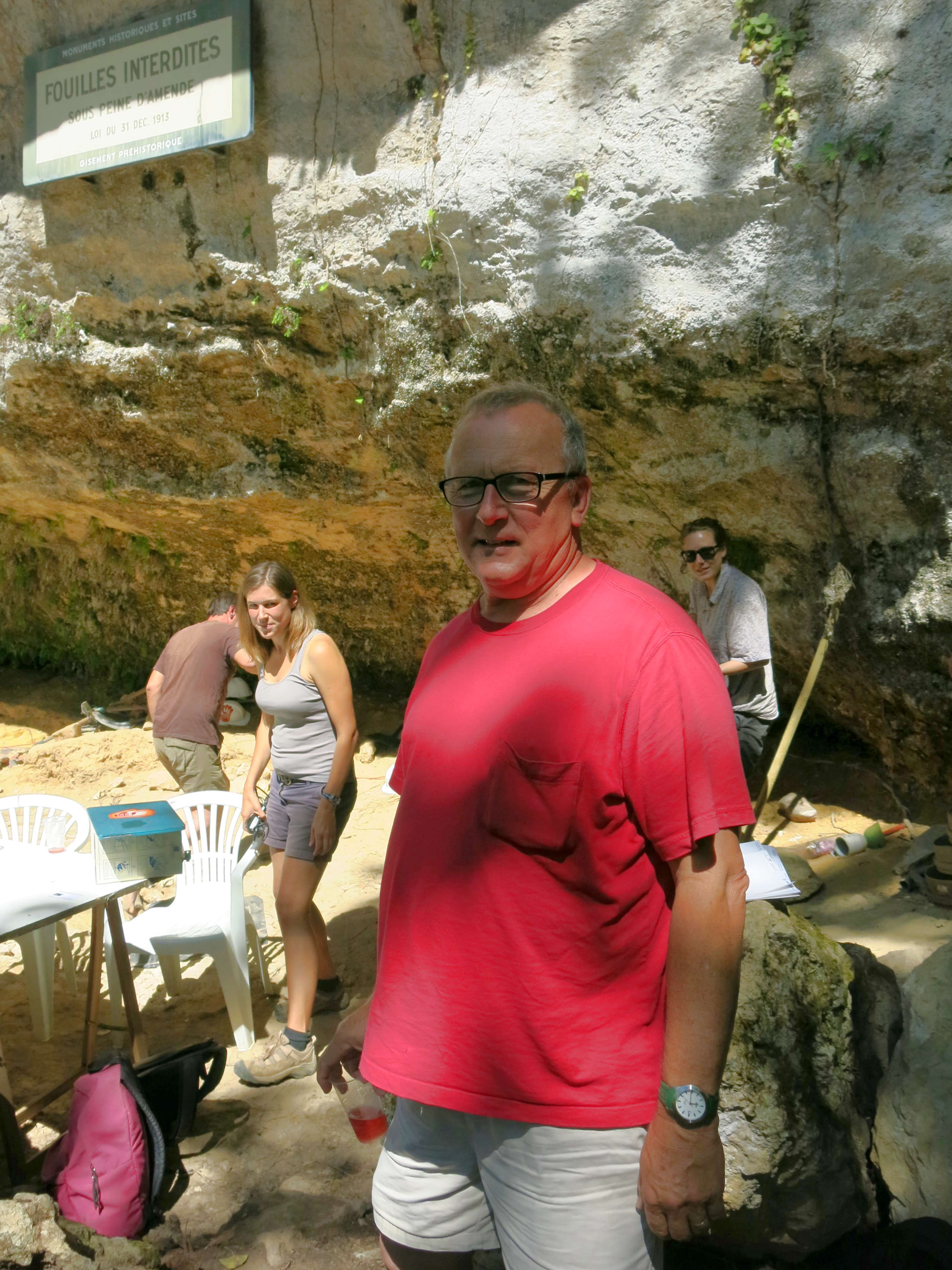
Professor White at the site.
Photo: Don Hitchcock 2014
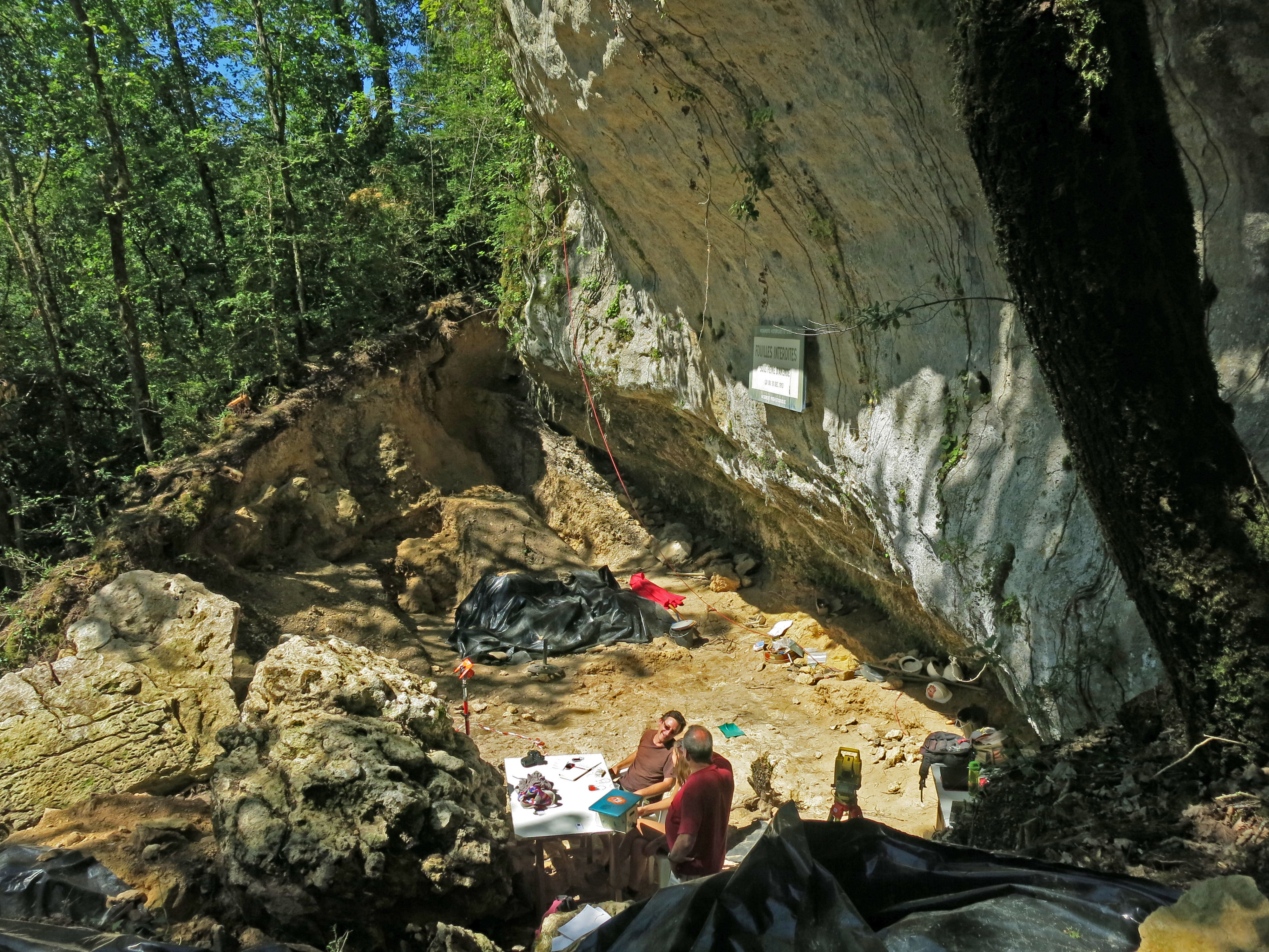
General view of the site.
Photo: Don Hitchcock 2014
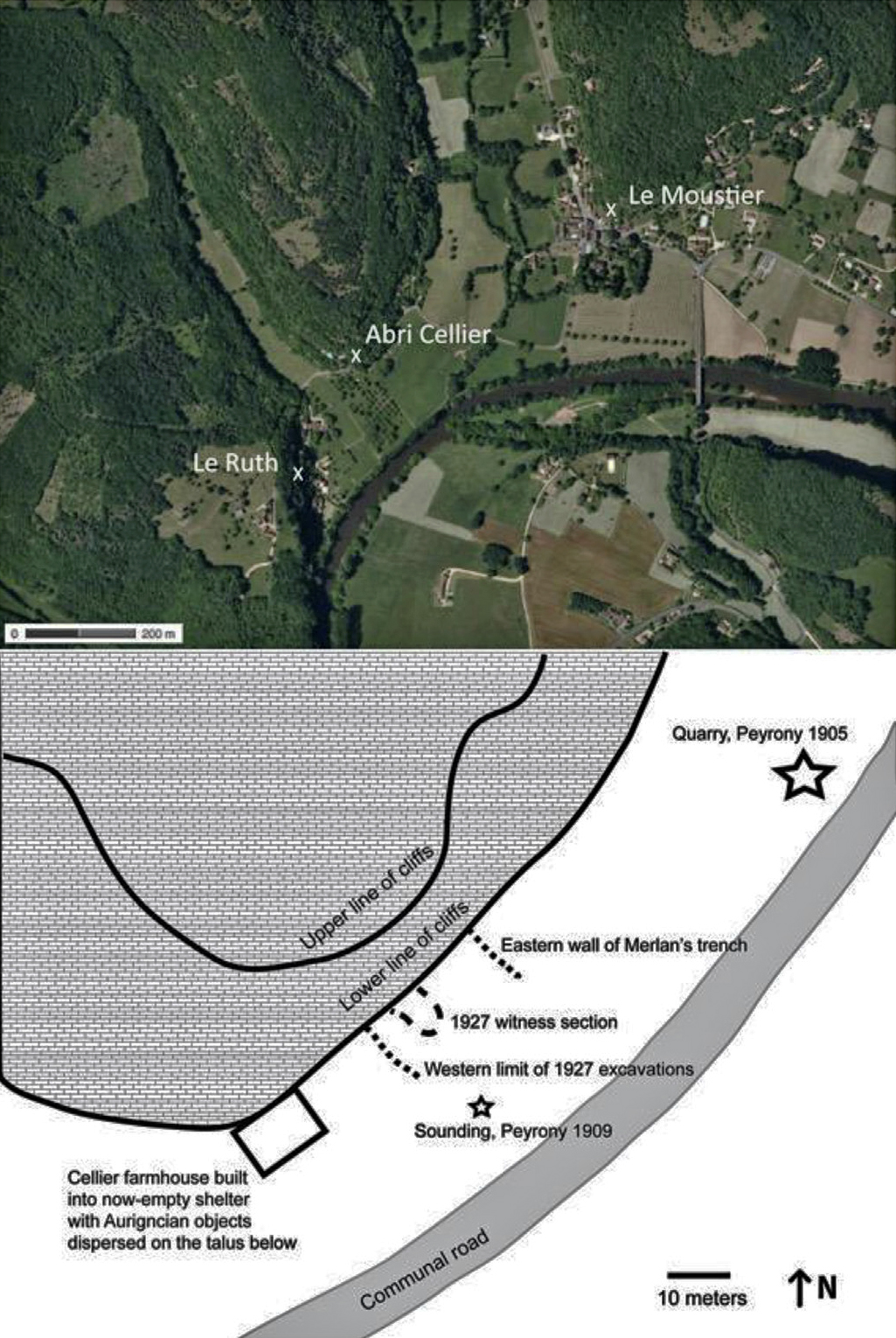
Google map and plan of Le Cellier.
Photo: White et al. (2017)
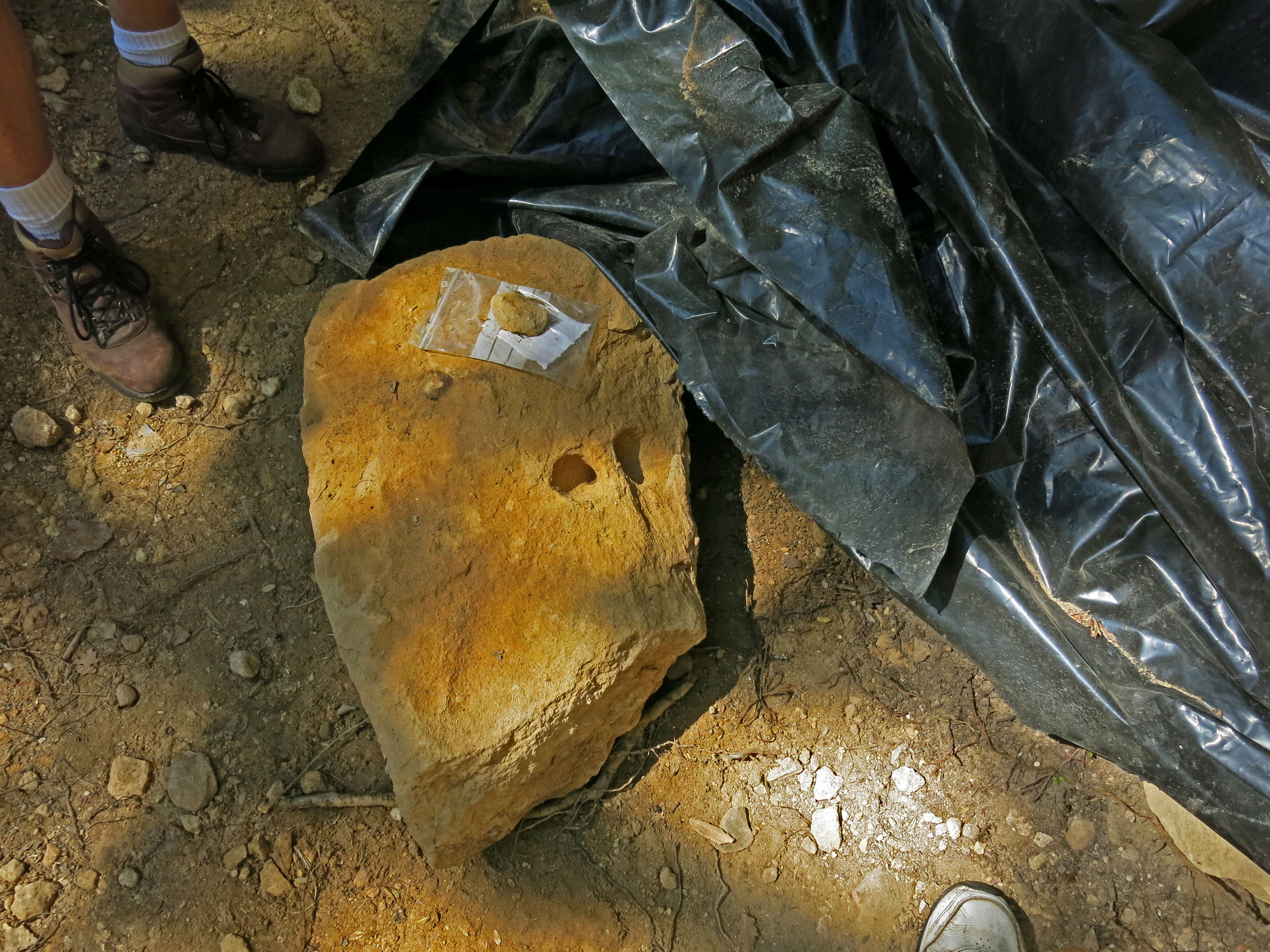
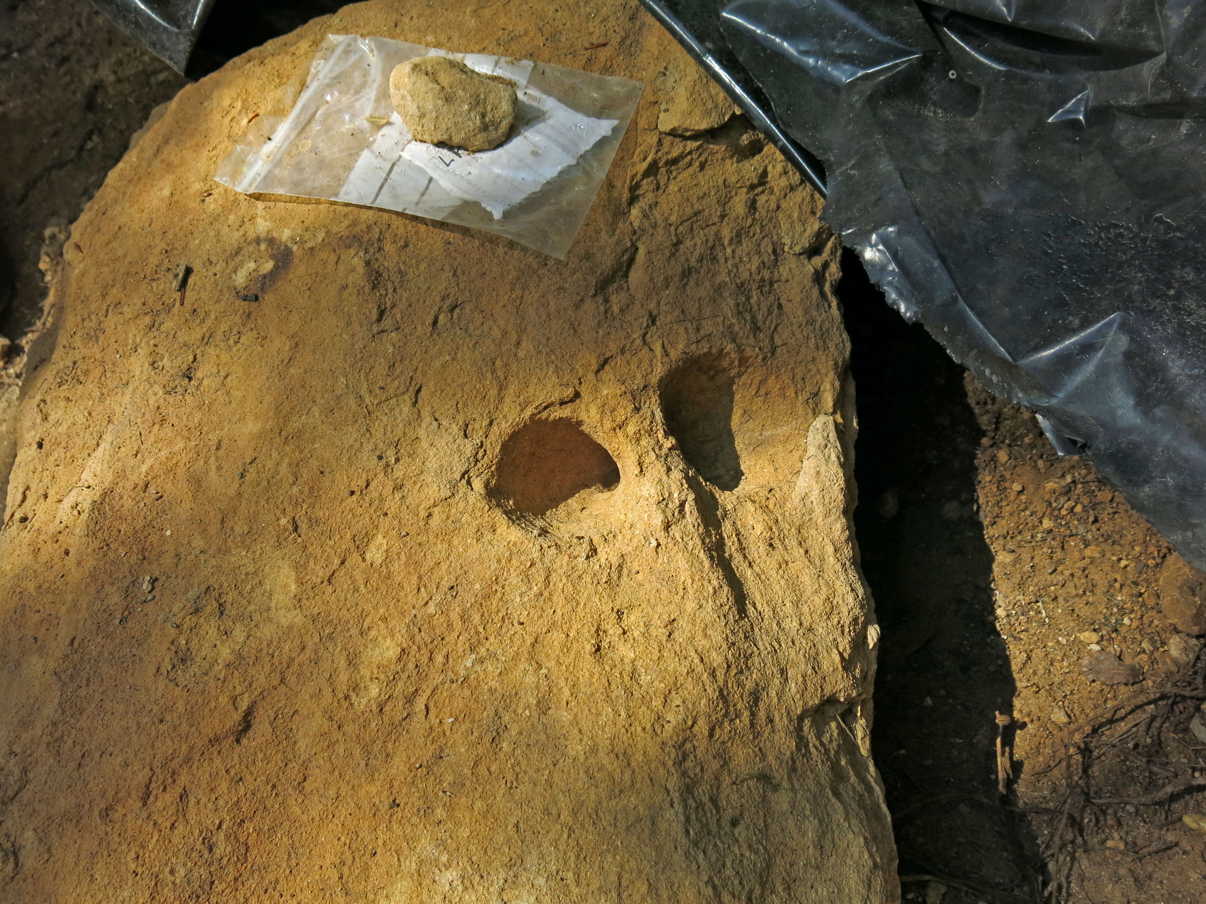
Pierre à Anneau at l'abri Cellier, found by Professor White.
Path from the road up to l'abri Cellier. The entry to the site is not marked in any way.
Photo: Don Hitchcock 2014
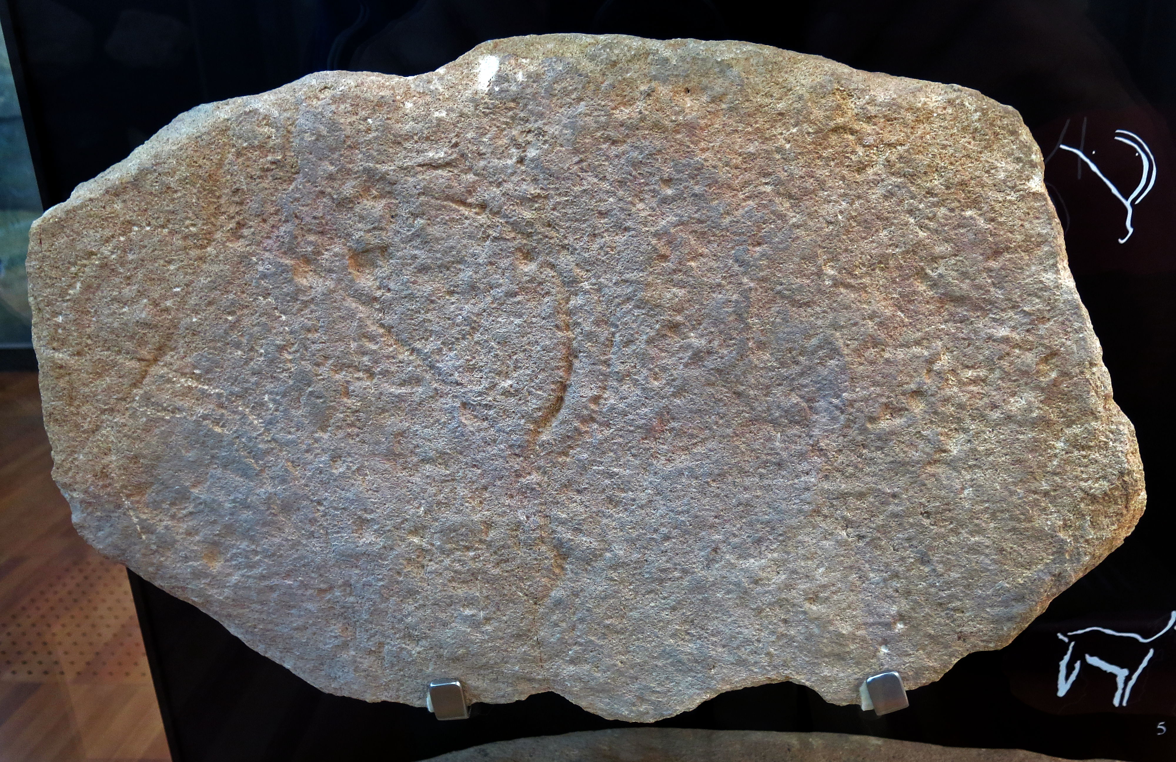
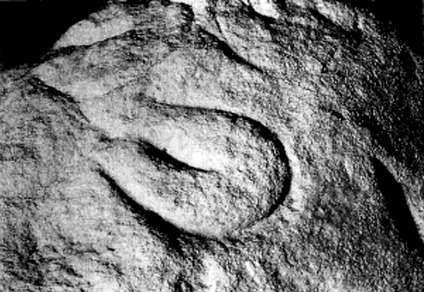
Engraving of an ibex head, l'abri Cellier.
Photo: Don Hitchcock 2014
Source: Original, Display at Musée National de Préhistoire, Les Eyzies
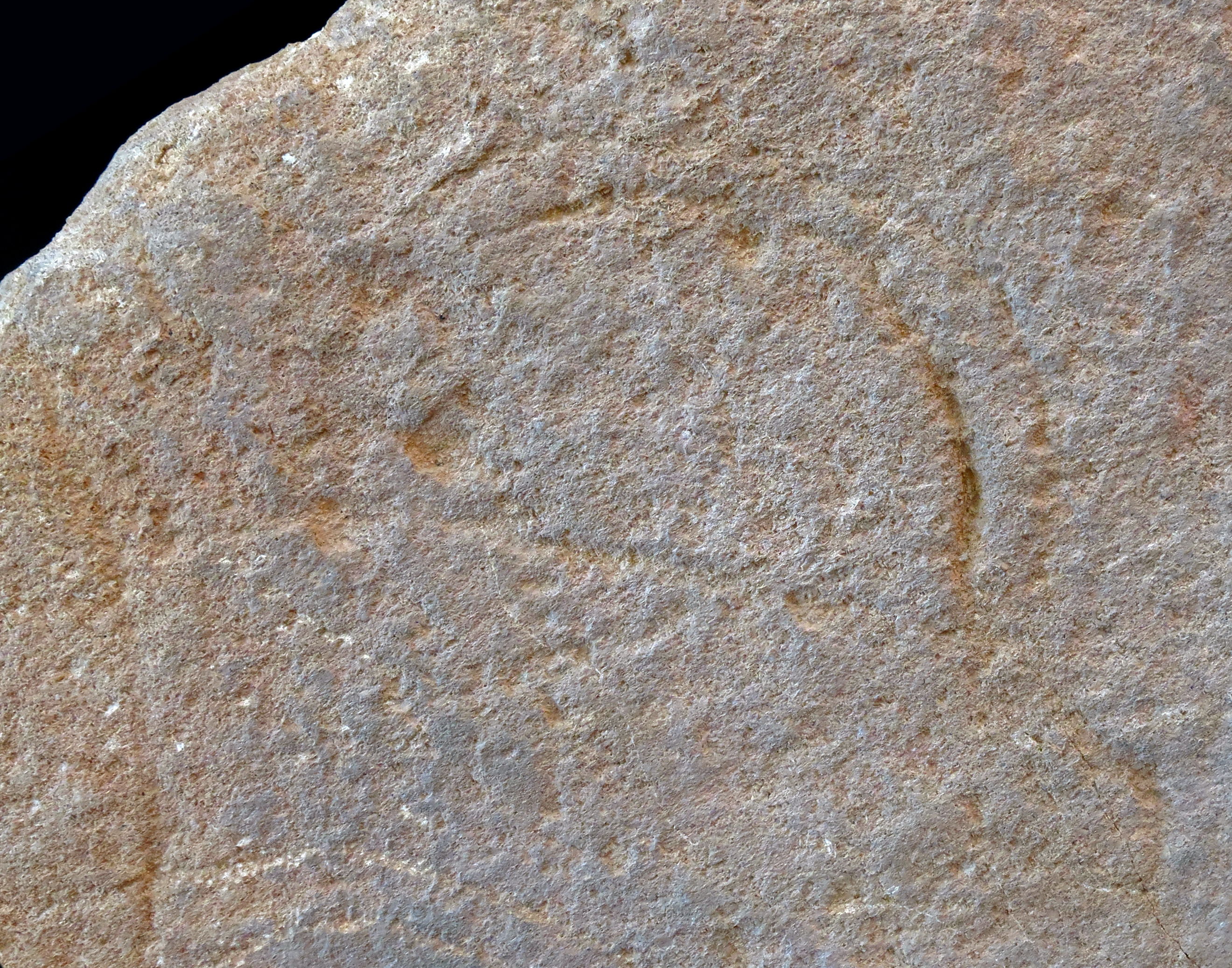
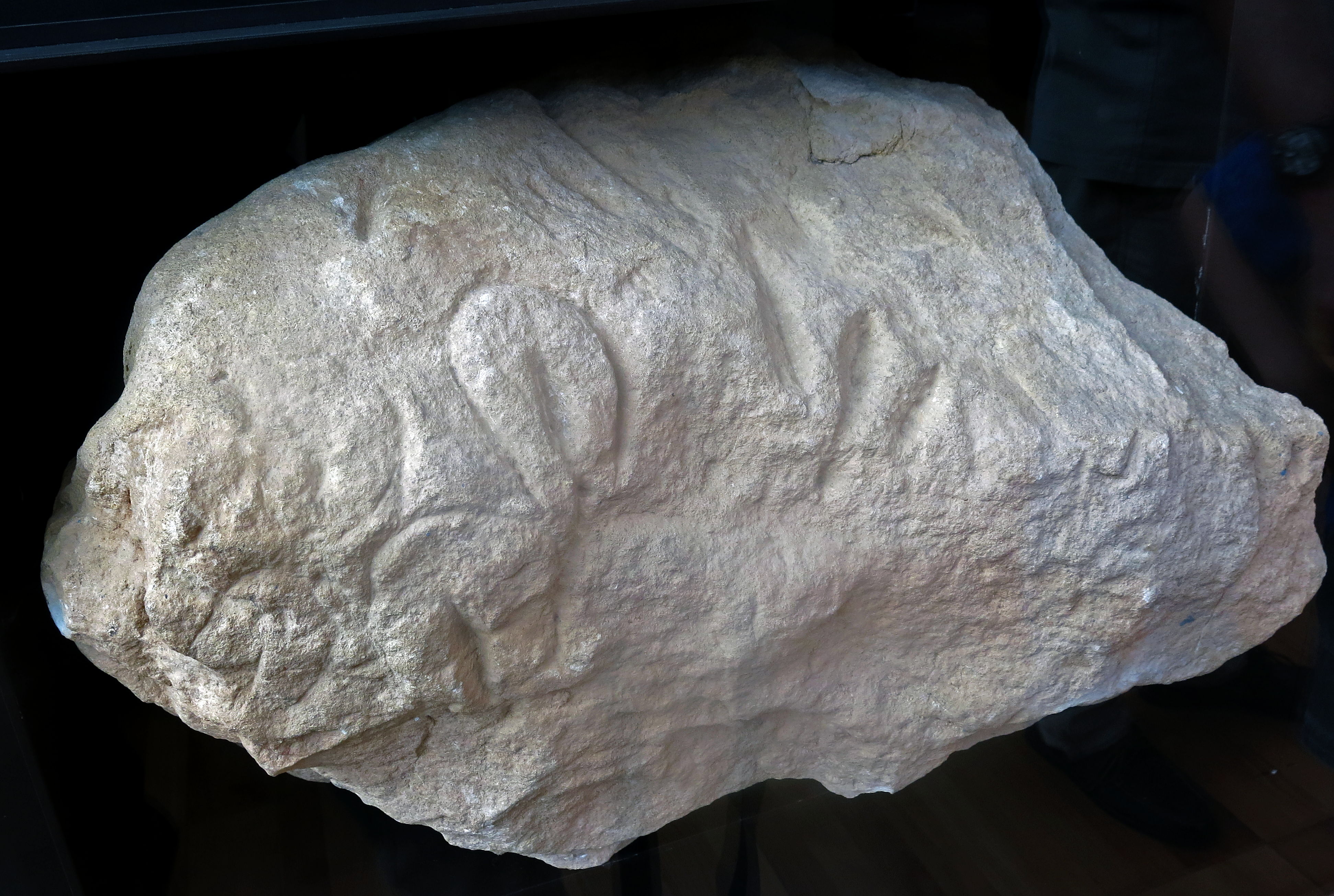
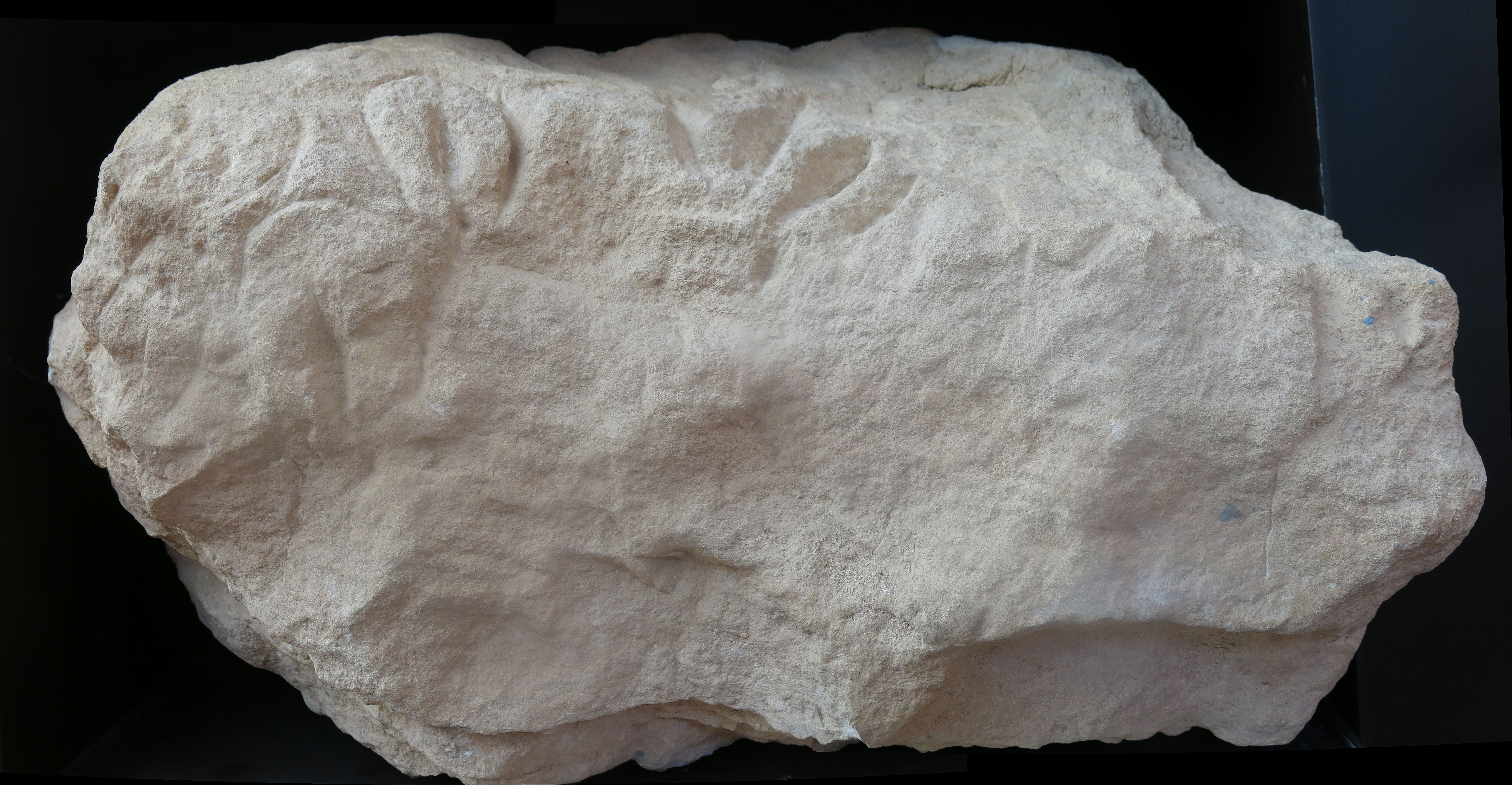
Close up of the engraving of an ibex head, l'abri Cellier.
Photo: Don Hitchcock 2014
Source: Original, Musée National de Préhistoire, Les Eyzies
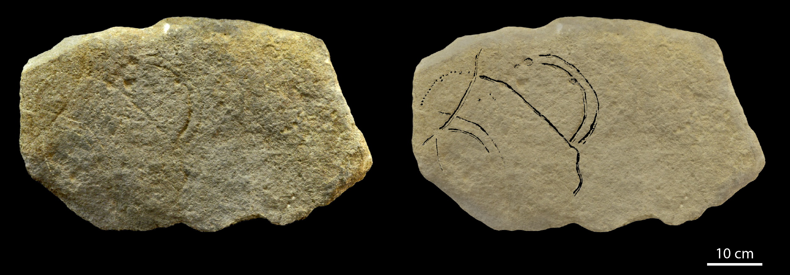
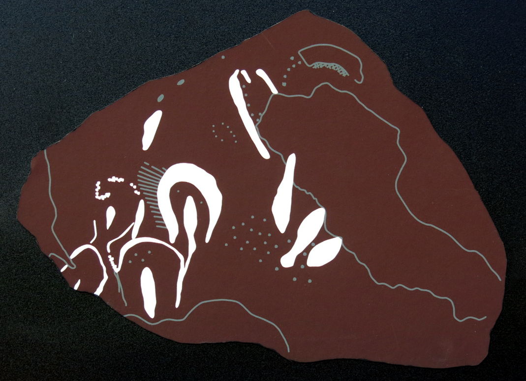
L'abri Cellier, Ibex.
Photo and drawing: Bourrillon and White (2015)
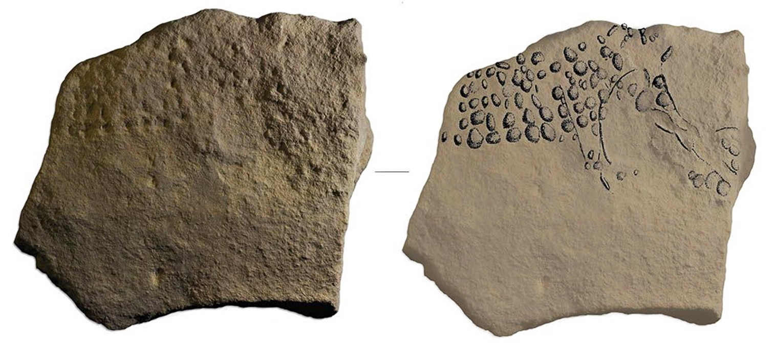
L'abri Cellier, image of a mammoth, from the Aurignacian.
It has been completed in a pointillist style using cupules.
Photo and drawing: R. Bourrillon
Source: https://www.smithsonianmag.com/
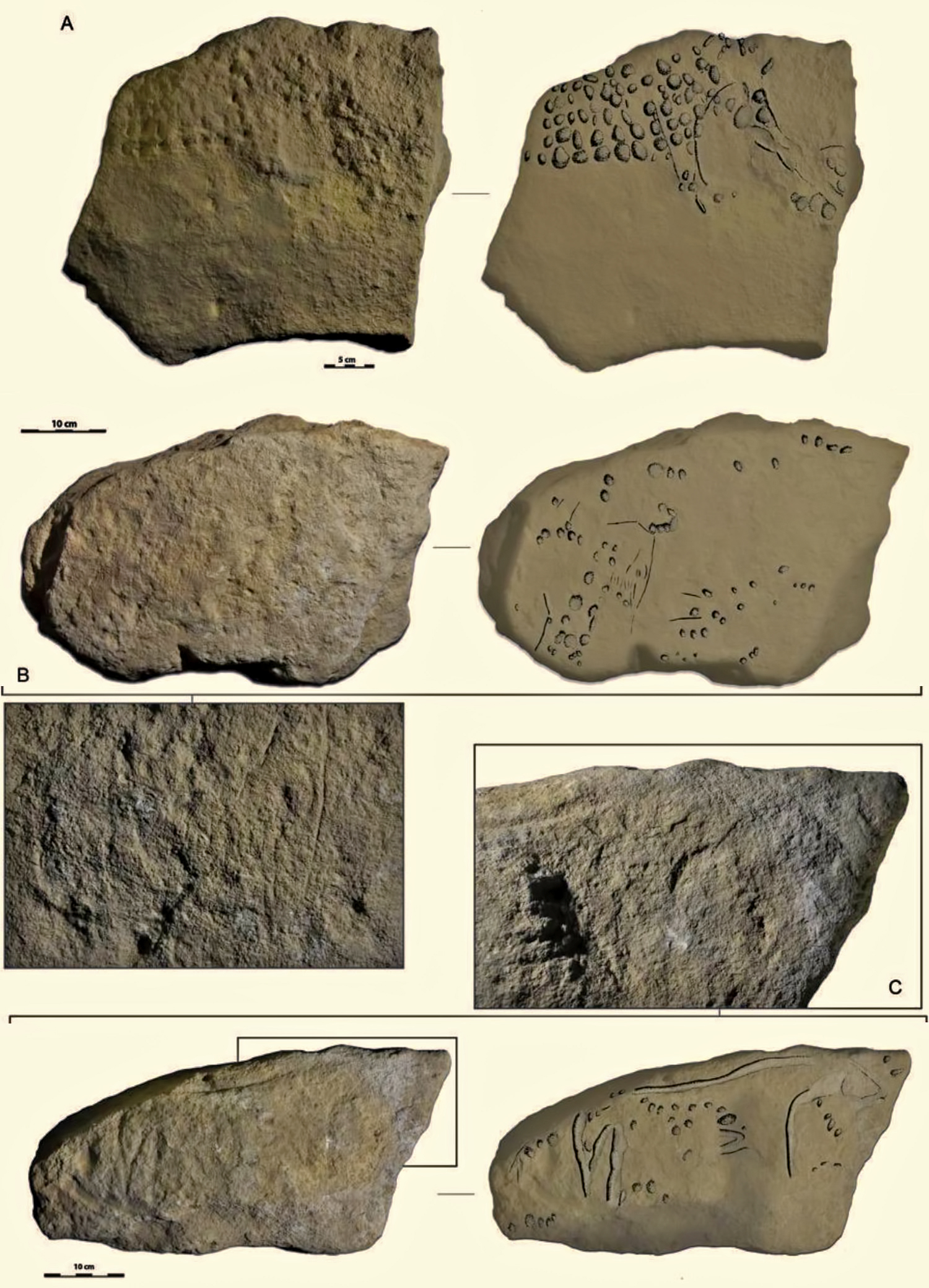
Three blocks from Abri Cellier with identifiable representations: mammoths (A and B) and a horse (C).
Image credit: Randall White et al, doi: 10.1016/j.quaint.2017.02.001.
Text and Source: http://www.sci-news.com/archaeology/pointillist-engravings-04652.html
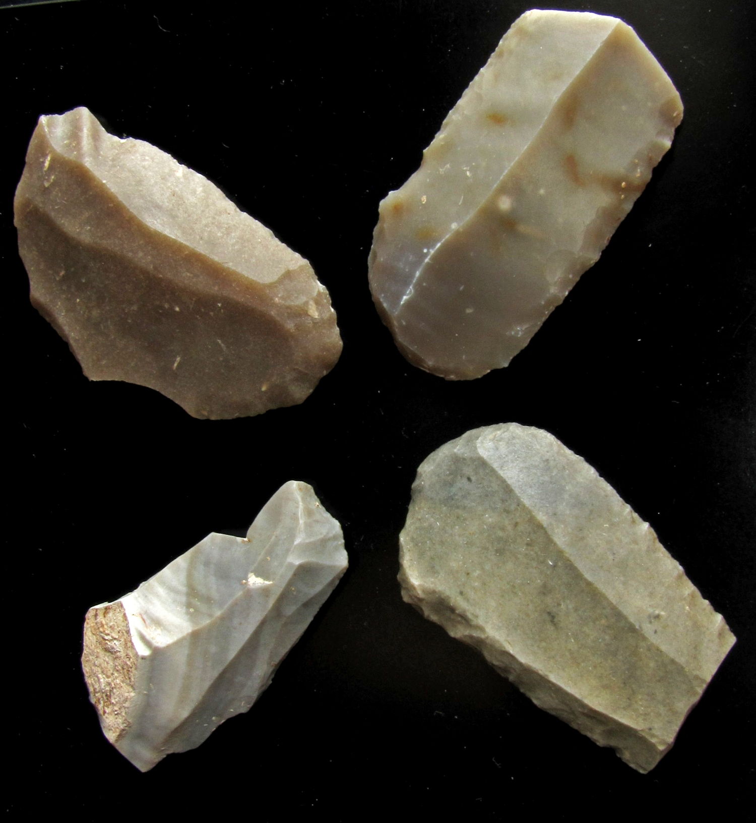
Aurignacian tools from a fine greenish flint, which is in the Vézère region selectively known from Abri Cellier in the commune of Tursac.
From the comprehensive website on the Palaeolithic by Katzman, Aggsbach's Paleolithic Blog.
Photo and text: © Katzman, http://www.aggsbach.de/2010/10/aurignacian-from-abri-cellierdordogne/
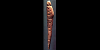
Counting sticks, or possibly for music as idiophones, found at Abri Cellier, circa 28 000 BP.
Photo: © Logan Museum of Anthropology, Beloit College
Permission: CC BY-NC-ND 4.0
Proximate Source: https://www.researchgate.net/publication/341218346_Type_and_Token_in_the_Prehistoric_Origins_of_Numbers
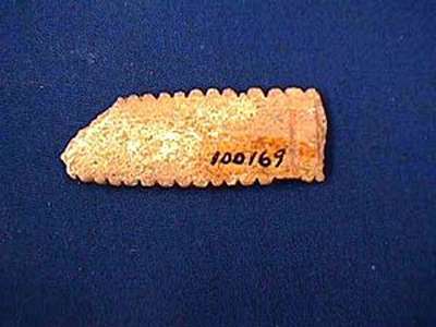
Decorated avian bone, 7.2 cm.
( This appears to be the same object as one of the 'counting sticks' above - Don )
Lower Aurignacian, ca. 24 000 BP, Abri Cellier
Photo and text: http://www.beloit.edu/logan_online/exhibitions/
virtual_exhibitions/before_history/europe/abri_cellier.php
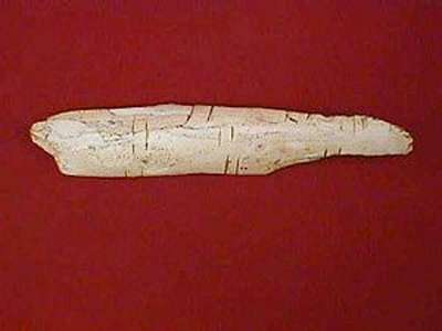
Example of the technique of basal
circumincising or rainurage, used to attach a cord or thong to the jewellery item.
Lower Aurignacian, ca. 24 000 BP, Abri Cellier
Wolf canine, 5.5 cm. This technique is unusual, most such items were pierced.
Photo: http://www.nyu.edu/gsas/dept/anthro/programs/csho/
Content/Facultycvandinfo/White/RWarticles/RW_2007_Human%20Revolution.pdf
This bone or ivory fragment, 51 mm in length, has been worked at one end and incised along its length. It has been suggested that the worked end is in fact a human head, as the contours are suggestive of a hairline.
( It is in fact a venus figure. See the link below - Don )
Lower Aurignacian, ca. 24 000 BP, Abri Cellier
Photo and text: http://www.beloit.edu/logan_online/exhibitions/virtual_exhibitions/before_history/europe/abri_cellier.php
Another interesting piece is this serrated rib bone. This is a fairly common type, also found at Abri Blanchard and other sites along the Vézère valley. This likely served as some sort of utilitarian knife, being only 3.9 cm in length.
( It may also be the remainder of a longer idiophone, with the serrations being rubbed by another bone to make a sound - Don )
Lower Aurignacian, ca. 24 000 BP, Abri Cellier
Photo and text: http://www.beloit.edu/logan_online/exhibitions/virtual_exhibitions/before_history/europe/abri_cellier.php
Decorated bone, 16.2 cm.
Lower Aurignacian, ca. 24 000 BP, Abri Cellier
Photo and text: http://www.beloit.edu/logan_online/exhibitions/virtual_exhibitions/before_history/europe/abri_cellier.php
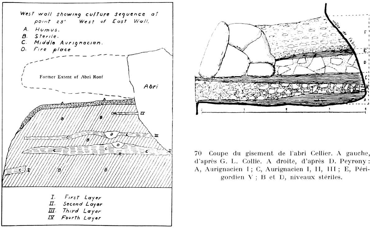
Abri Cellier stratigraphy.
Note that there are no Mousterian deposits shown, although Peyrony refers to them as being present in his first surveys of the site at Abri Cellier.
(Just as at Laugerie Haute and Laugerie Basse, the overhanging roof collapsed, possibly for the same reason - ash from a volcano piled up on top, then the weight of the wet ash with the next prolonged rain brought the roof crashing down - Don)
Photo: Delluc (1978)
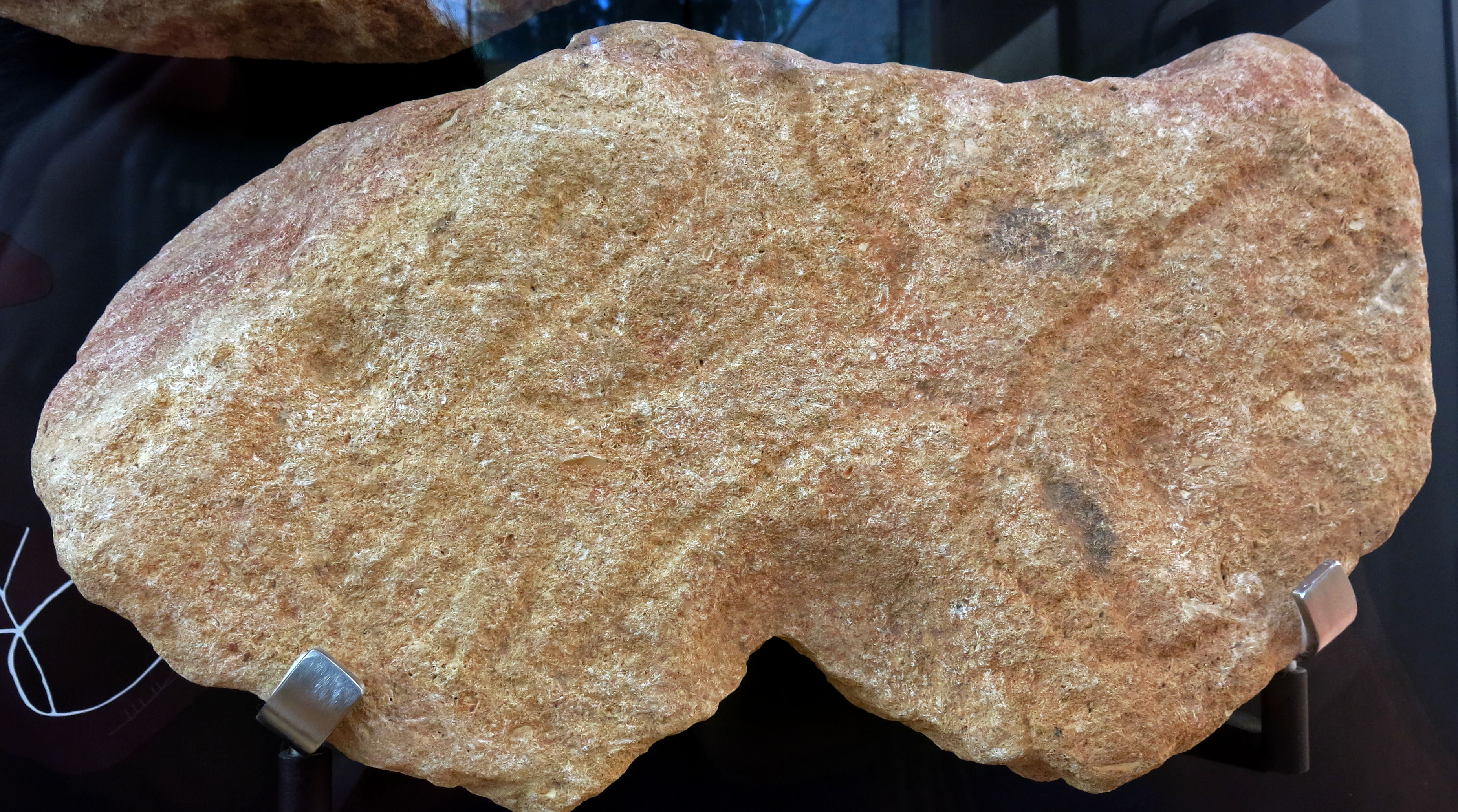
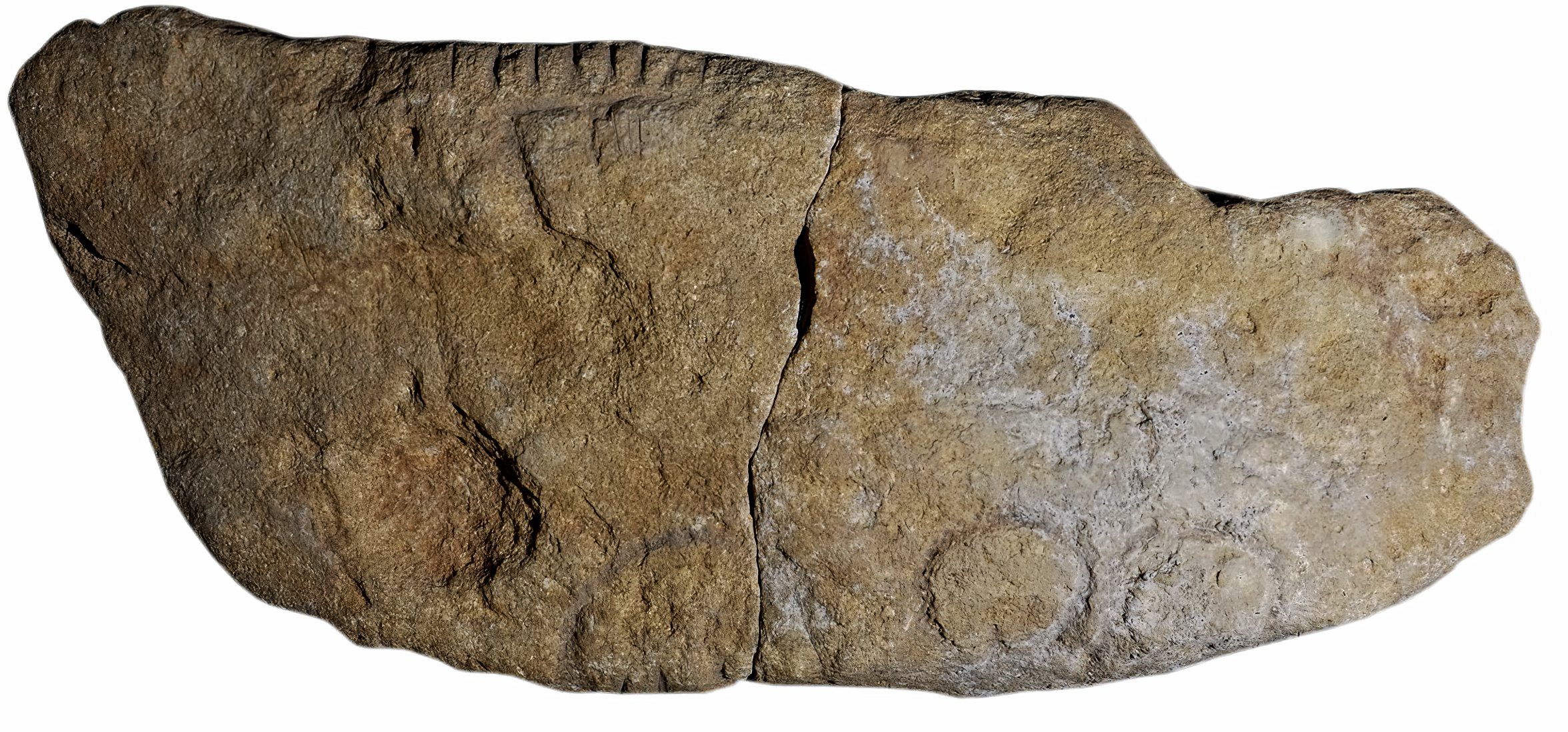
Representation of a vulva carved in a limestone block.
Aurignacian, Abri Cellier.
This is the same carving as that shown below (rotated about 130°) on what is known as Bloc 6, on display in the Musée National de Préhistoire, Les Eyzies.
Photo: Eshleman (2003)
Abri Cellier, Aurignacian vulvas
Photo: Don Hitchcock 2008
Source: Original, display at Musée National de Préhistoire, Les Eyzies
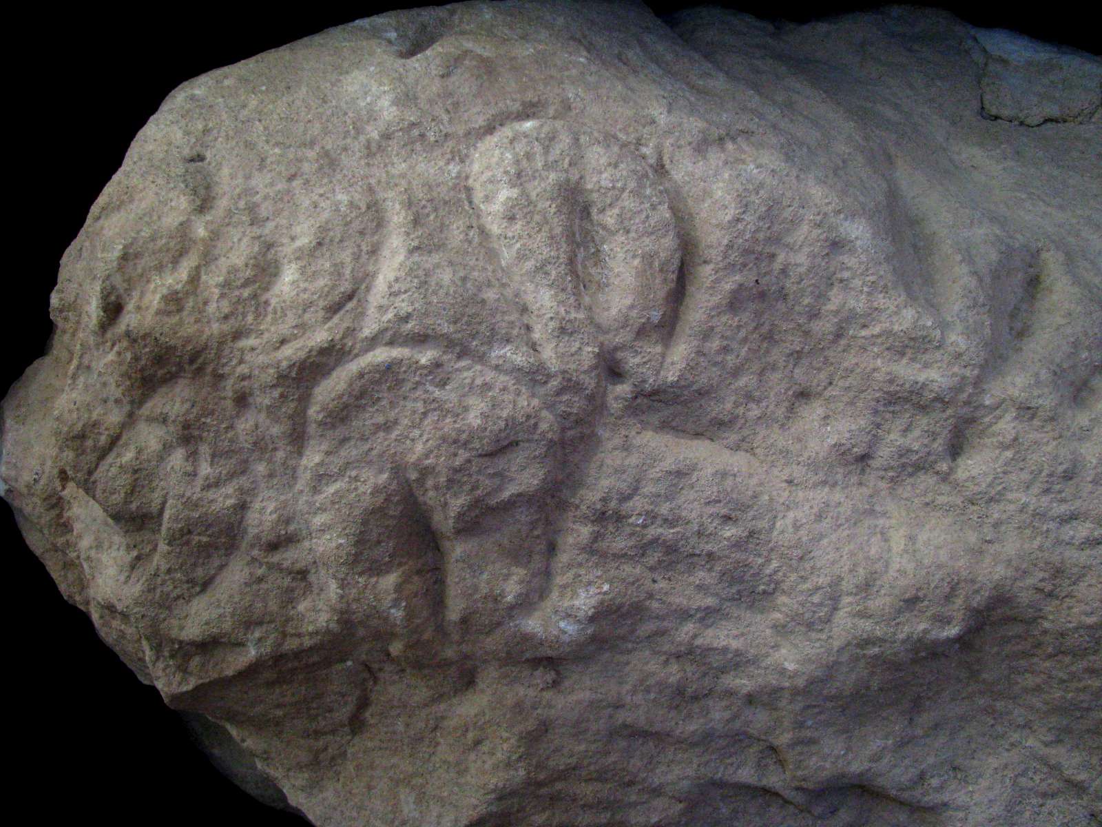
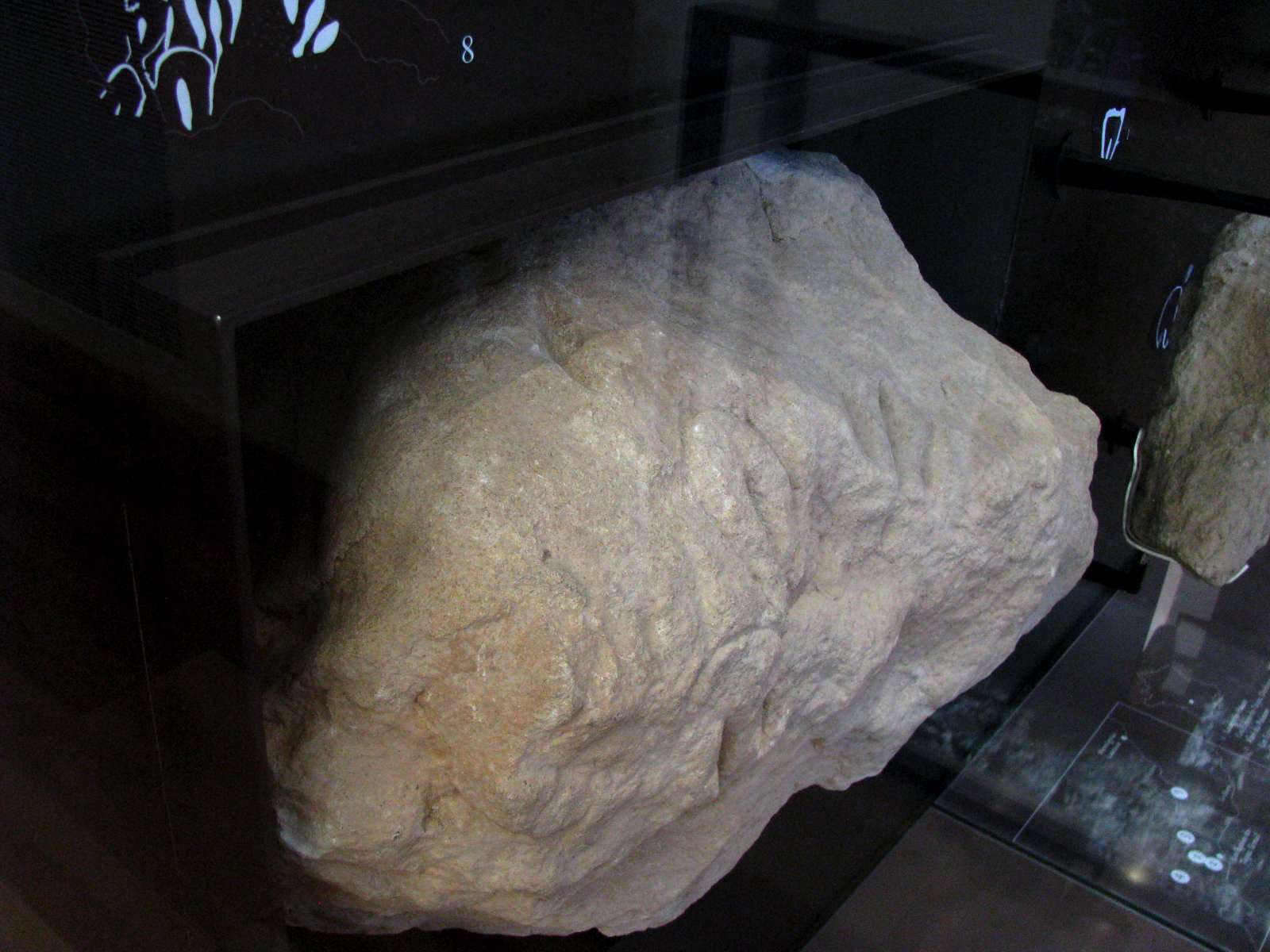
Photo: Don Hitchcock 2008
Source: Original, display at Musée National de Préhistoire, Les Eyzies
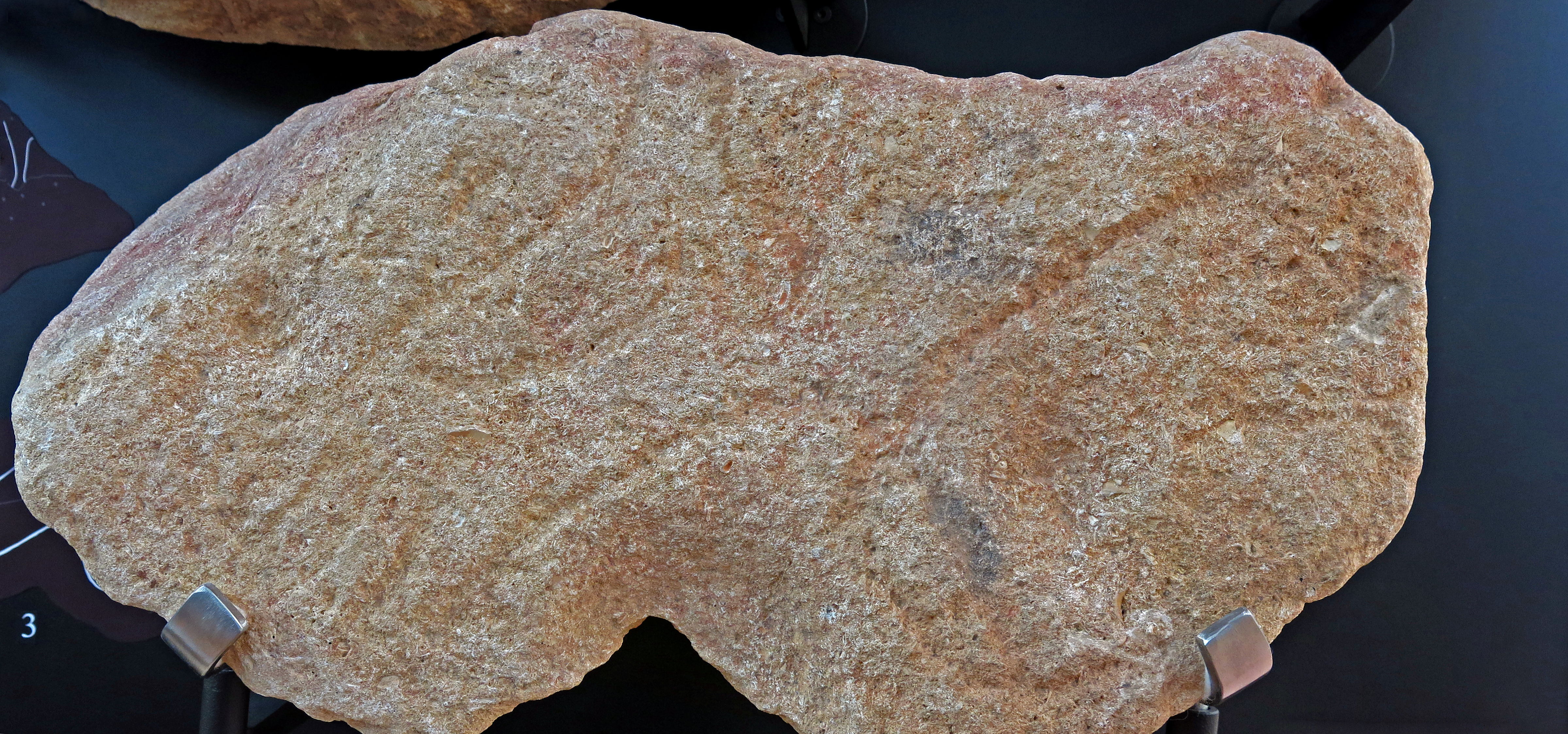
Abri Cellier, Aurignacian vulvas
Photo: Don Hitchcock 2014
Source: Original, display at Musée National de Préhistoire, Les Eyzies
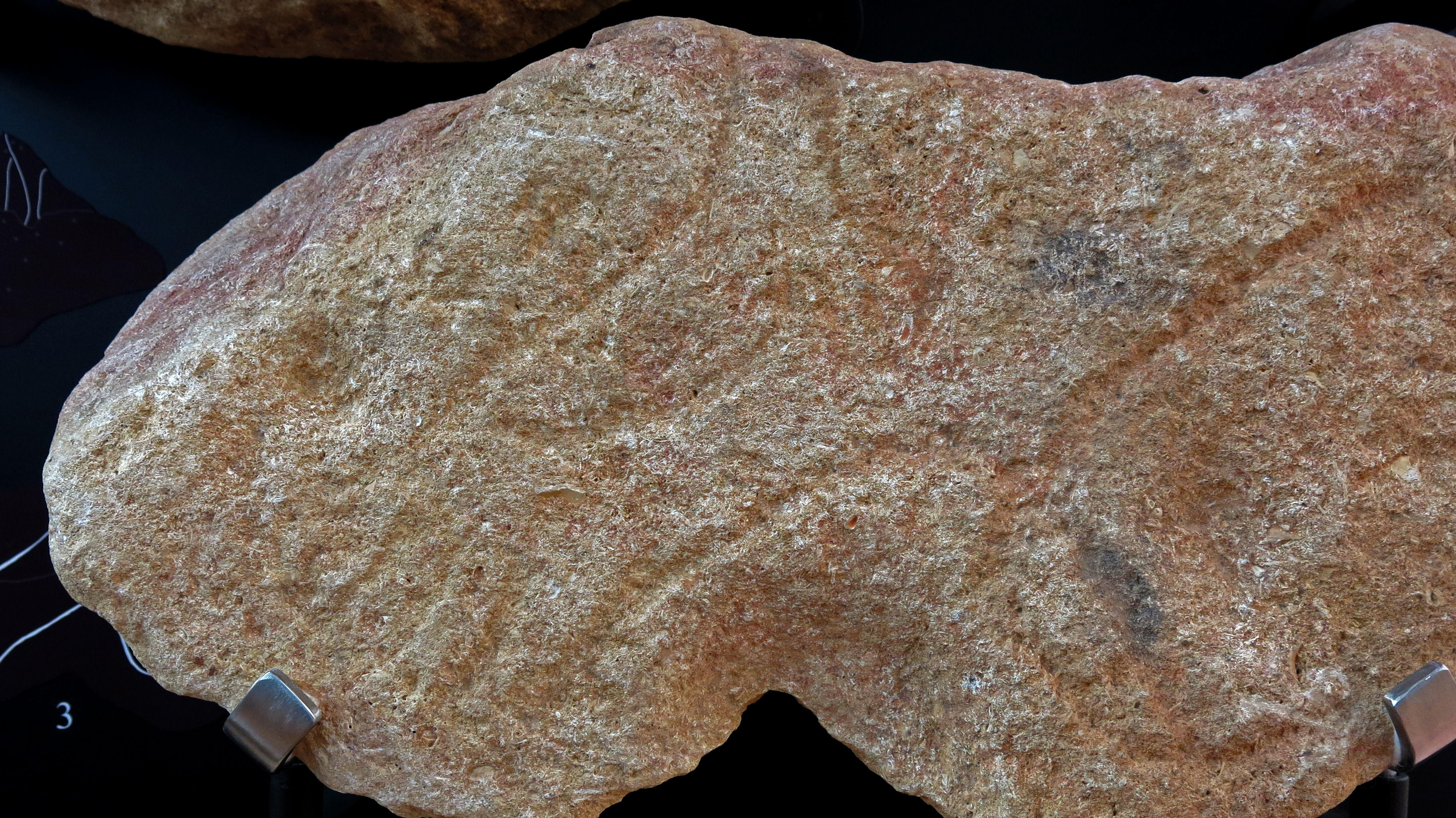
Abri Cellier, Aurignacian vulvas
Photo: Don Hitchcock 2014
Source: Original, display at Musée National de Préhistoire, Les Eyzies
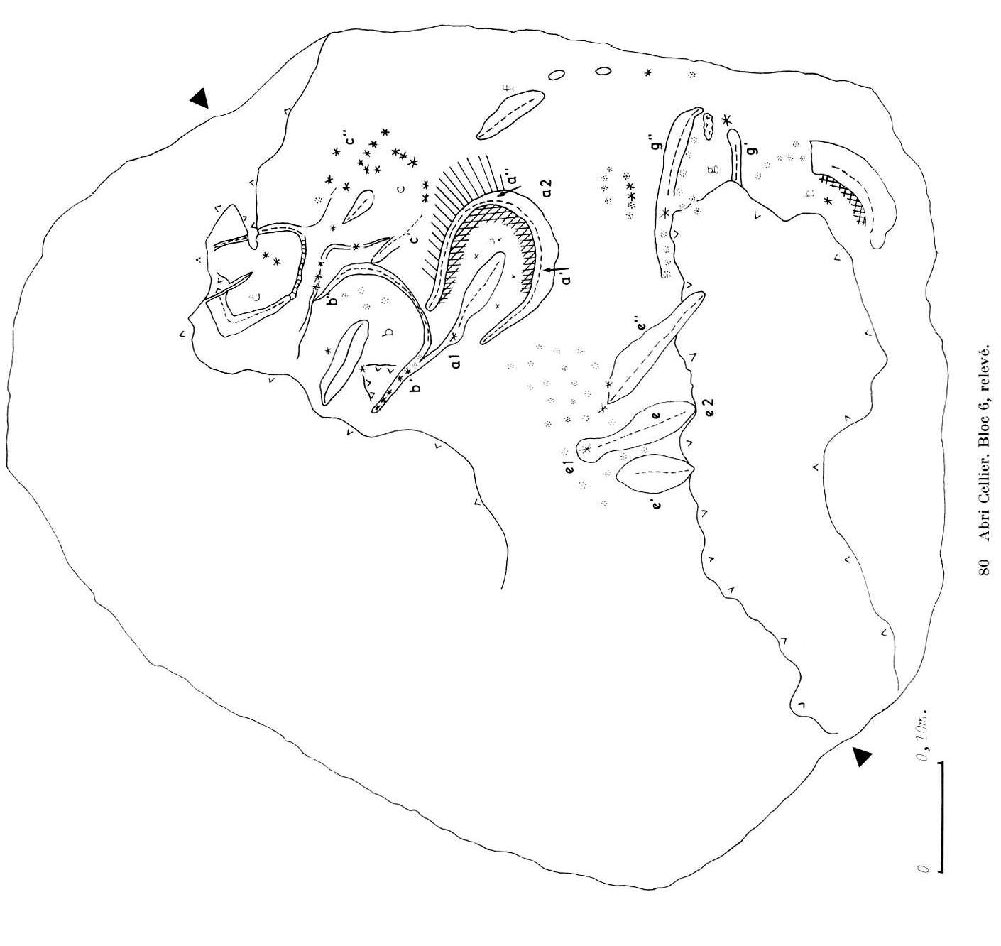
Abri Cellier, Aurignacian vulvas, Bloc 6.
Delineation of the carvings in the Bloc 6 above.
Photo: Delluc (1978)
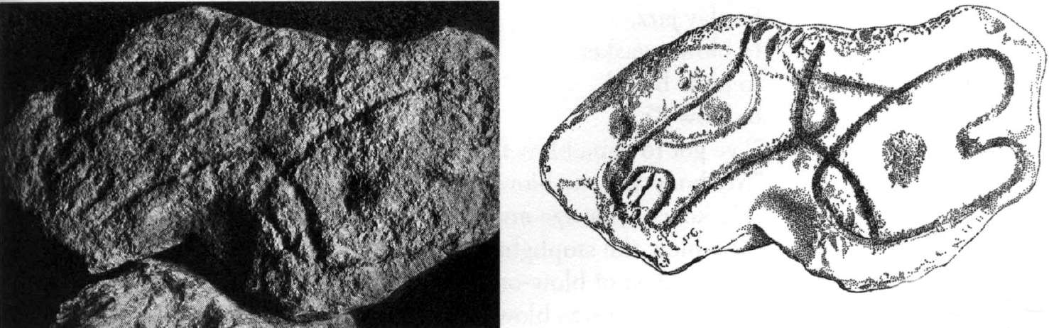
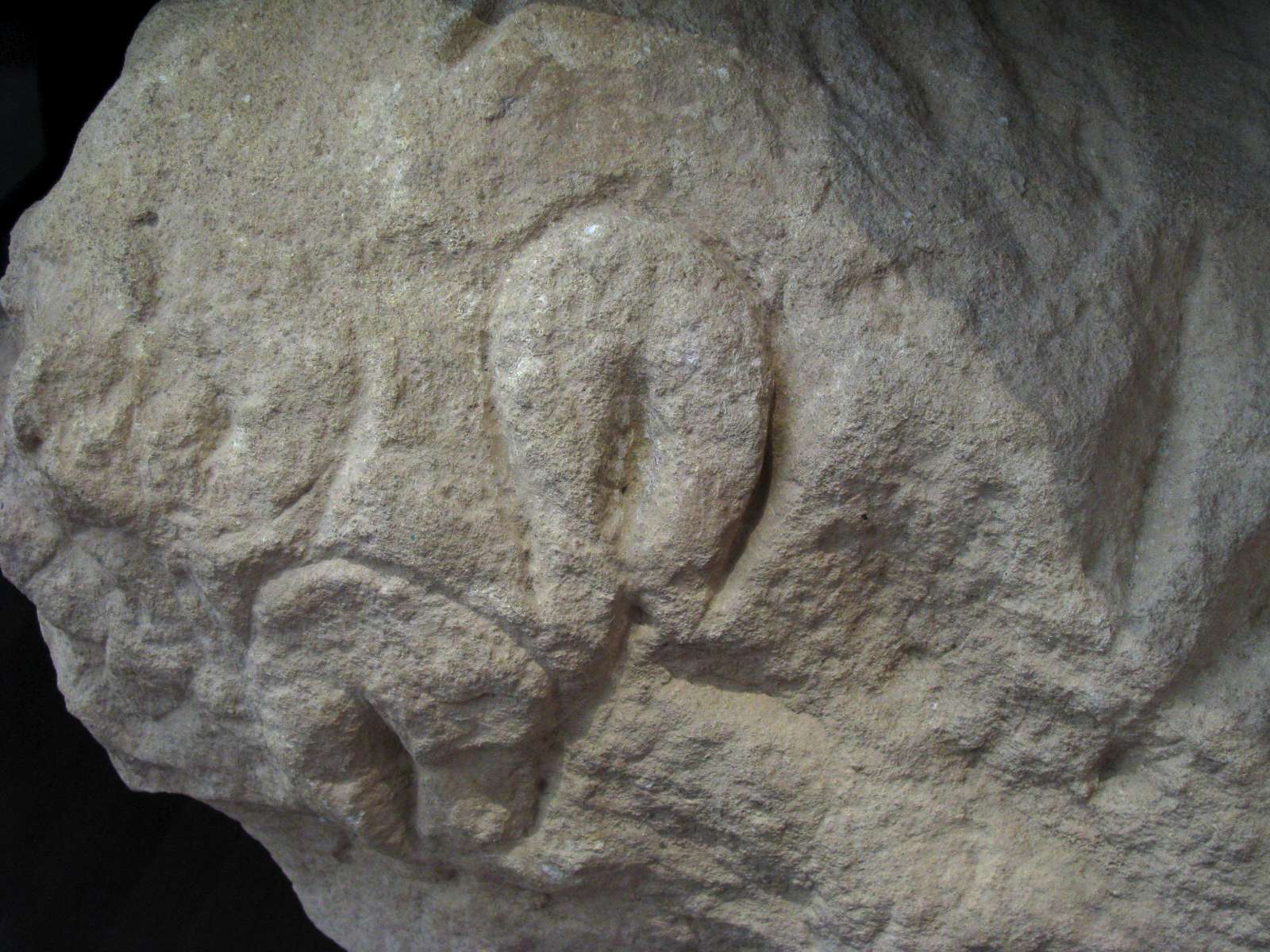
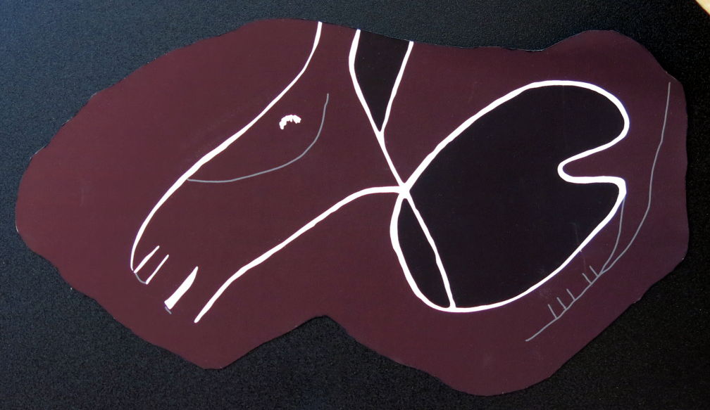
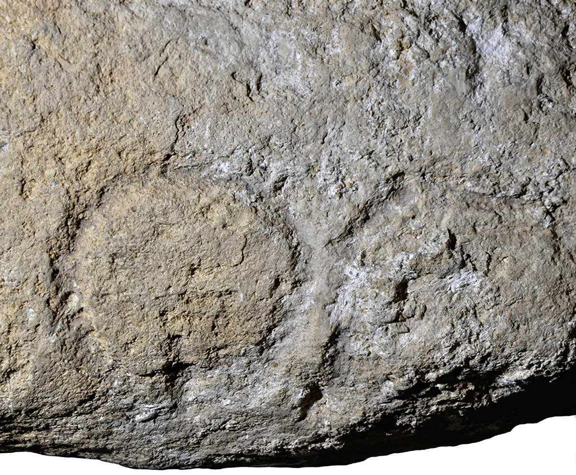
Abri Cellier, horse with a vulva engraved across the neck.
Photo: www.claytoneshleman.com/matrix.pdf
Abri Cellier, horse with a vulva engraved across the neck. This is known as bloc 2.
Above, the engravings on the stone. Below, the engravings highlighted.
Photo: Delluc (1978)
Drawing of the abri Cellier horse.
Photo: Don Hitchcock 2014
Source: Display at Musée National de Préhistoire, Les Eyzies
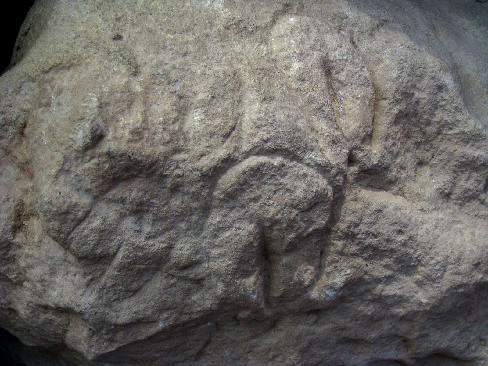
Abri Cellier, horse with a vulva engraved across the neck.
Photo: Don Hitchcock 2014
Source: Original, display at Musée National de Préhistoire, Les Eyzies
Abri Cellier, horse with a vulva engraved across the neck.
Photo: Don Hitchcock 2014
Source: Original, display at Musée National de Préhistoire, Les Eyzies
Abri Cellier, horse with a vulva engraved across the neck.
Photo: Don Hitchcock 2014
Source and text: Original, display at Musée National de Préhistoire, Les Eyzies
This bloc, like most of those of the Abri Cellier, was discovered by G. L. Collie in 1927. It was found on the surface of Layer II of Collie, Layer A of Peyrony, with the engraved face turned towards the bottom. For Peyrony, he remarked that it is a stone much less voluminous, carrying a bizarre design. The image appears to be the head of a horse, and on the right a vulva not well represented. These designs are united by a line which seems to indicate a real relation existed between the two.
The block is a thick piece of limestone, 11 cm average thickness, subhexagonal shape, the side faces vertical or slightly oblique. The base is horizontal. The engraved upper face (48 cm x 26 cm) presents two major accidents peripherals.
The top left edge is truncated by an oblique plane whose connection with the horizontal plane of the upper surface is blunt. This oblique plane is affected by burning. This is not an accident after Palaeolithic decoration. In the middle, the bottom edge is presented as an internal angle. The apex of this angle is close to the geometric center of a bowl with a flat bottom, one third has disappeared.
This bowl or large cup, tapered, was obtained by a narrow pick whose impacts are so regular and so close to each other, we can speak of modelling by pecking. This bowl is important as it has localized red marks on the back and sides. This coloration of the rock is absent in its immediate vicinity, but occurs also at the center of the face and along its upper edge, center and left. It may be seen also, in places, on the bottom and the side faces of the block. It evokes, above all, a color of limestone, light tan naturally, near a heat source. It is likely that this block was in the vicinity of a hearth.
The hypothesis that it was a lamp seems less acceptable, because the bowl does not have black marks. However we must note three small blackish spots. Two very diffuse, circular in shape, are located at two irregular pitted cups. The third, elongated, is located in the upper right quadrant, is black and more sustained.
Text above from Delluc (1978)
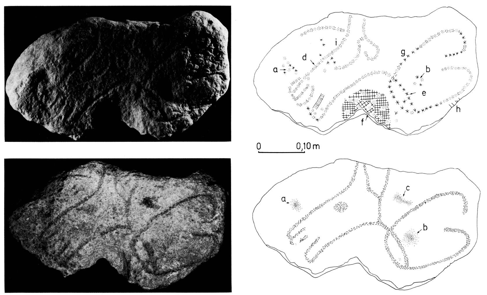
A flat stone, roughly rectangular, 54 cm by 25 cm (fig 5, No. 1) presents, on a longitudinal edge, three figures of which one (c) is a pubic triangle with softened angles, or maybe just an external genital organ (b and d) while (a) is located on the opposite side, more deformed, referring to the same subject. Behind this last, on the edge of the stone, we can see seven regular grooves. On the left a deep and very regular cupule (e) is in connection with these drawings.
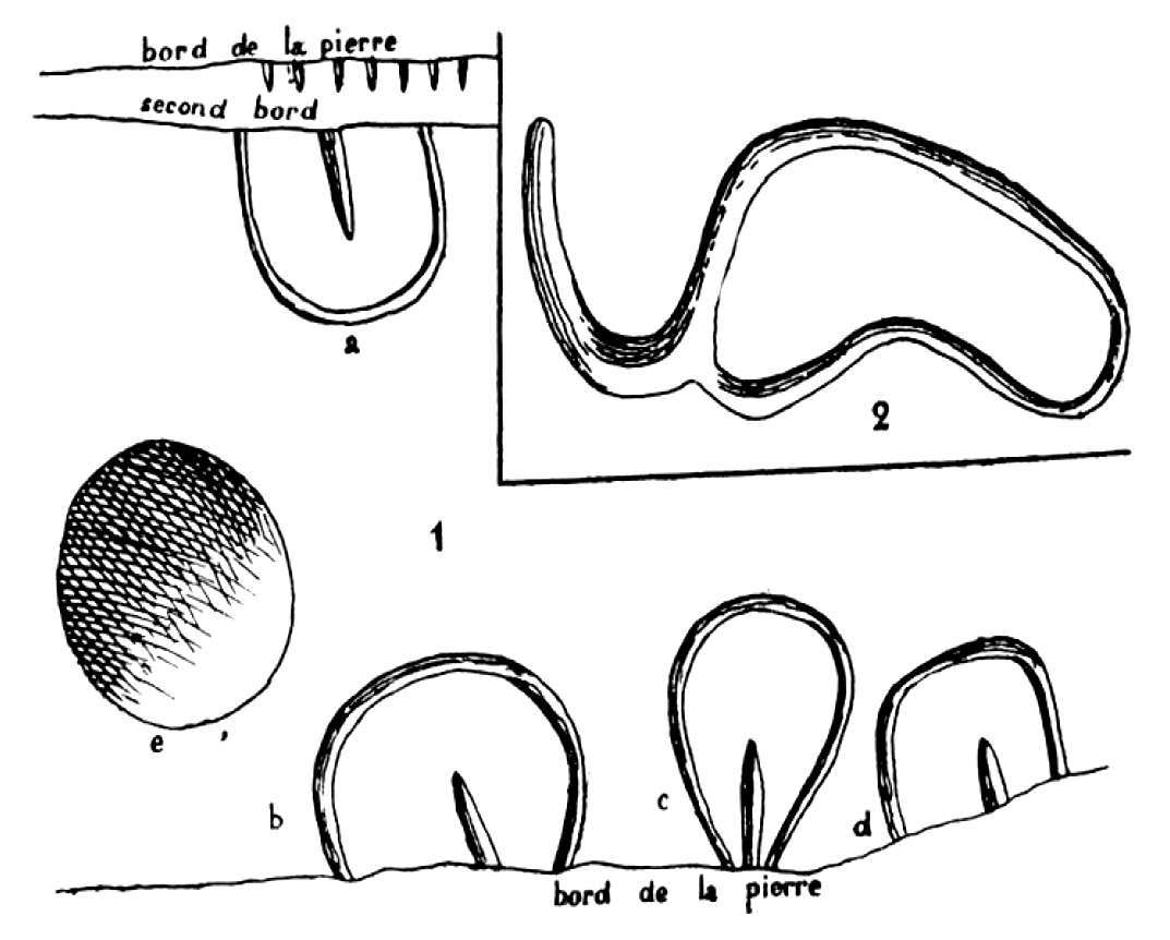
Figure 5
Abri Cellier - Vulvas, a cupule, and a penis.
Photo: Peyrony (1946)
Abri Cellier - Vulvas
Above: complete rock.
Left: close up.
Photo: Bourrillon and White (2015)
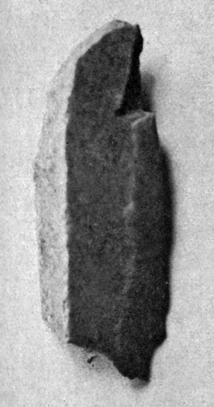
Burin Busqué from Abri Cellier.
Photo and text: Collie (1928)
(left) Double burins from Abri Cellier.
(right) Three 'Burins de Fortune' or makeshift burins, from Abri Cellier.
Photo and text: Collie (1928)
Knives (blades, lames) from Abri Cellier.
Photo and text: Collie (1928)
(left) Burin - End Scrapers (burin - grattoirs) from Abri Cellier.
(right) End Scrapers (grattoirs) from Abri Cellier.
Photo and text: Collie (1928)
Side Scraper (racloir) from Abri Cellier.
Photo and text: Collie (1928)
Keeled scrapers from Abri Cellier.
Photo and text: Collie (1928)
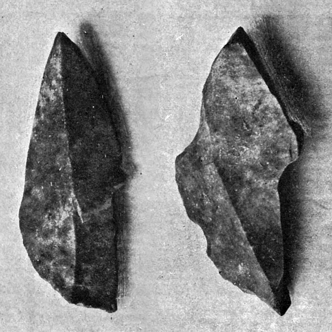
Gravette points from Abri Cellier.
The typical artefact of Gravettian industry, once considered diagnostic, is the small pointed blade with a straight blunt back. They are today known as the Gravette point, and were used to hunt big game. Gravettians used nets to hunt small game, as evidenced at sites in the Czech Republic.
Photo and text: Collie (1928)
Additional text: Wikipedia
The prehistoric site of Abri Cellier at Le Ruth, Commune Tursac, Dordogne.
Location: This shelter is a hollow in the line of rocks at the top of the slope of the right bank of the valley of the Vézère, between the valleys of Combe-de-Vergne one hand and Plazac on the other, approximately 300 metres as a crow flies from the village of le Moustier.
History of the excavations - For several years before, on the slope, we had observed the presence of many sizes of Aurignacian flints. A quarry on an open scree slope along the rural road from le Moustier to Ruth in this section of land uncovered many objects made of flint. Those at the base were related to those of the Mousterian and the upper third was Aurignacian in age.
In 1909, I made a survey trench midway between the rocks and the quarry. Almost at the surface, I found some Aurignacian pieces, but at three metres deep, I reached a brown layer, 5 to 10 cm. in thickness, containing a quite crude Mousterian industry, many discarded flakes, but few retouched pieces. This horizon appeared to extend on both sides of the slope.
On the eastern side, Lucas, then an assistant teacher at Les Eyzies, found tools from the same period, at the end of the line of rocks, near the house at that location.
In 1928, towards the west, Dr. Ami did some research at the same height, some 30 metres from the Faure house. In a shallow archaeological level, and over the whole area, he recovered Mousterian tools identical to the previous two deposits. This deposit appears to be on a rocky terrace, extending from one valley to the other, a length of about 120 metres.
More superficial excavations, made on the slope, against the bottom of the Cellier house, had revealed Aurignacian pieces everywhere, it seemed, of a deposit in place at the foot of the rocks under large boulders. A trench found archaeological layers at this point.
In 1927, Professor Collie, of the Logan Museum of Beloit (Wisconsin, USA) leased the area with the object of excavating. The deposit had been classified, the excavations there were authorised by the Administration des Beaux-Arts, subject to:
1 They are overseen by a qualified representative of the state.
2 There would be an important amount of residual deposits left under the shelter.
3 That all the pieces found were to be shown to the delegate of Fine Arts.
4 That a representative set of items would be deposited with the Prehistoric Museum Les Eyzies
5 That the art work, if any was found, would revert to the state.
The work began in 1927.
Stratigraphy - a trench perpendicular to the bottom of the shelter began to expose a portion of a rocky terrace which was on average 4 metres wide, ending in a slope, completely masked by the scree slope, leading to the second terrace, on which is the Mousterian deposit.
The cut, recorded in front of this witness, gave the following superposition:
Abri Cellier stratigraphy.
Photo: Peyrony (1946)
A - On the basement rock lay the first archaeological layer, of 40 cm maximum thickness.
B - 20 cm limestone scree.
C - a second archeological layer 30 cm thickness, which was noticed previously.
D - large boulders from the collapse of the vault of the shelter and behind that, scree of smaller dimensions.
E - then came a new archaeological horizon 10 cm thick at the rear, ending in a corner 2 metres further on.
F - The whole slope was covered with scree and topsoil.
This consisted mainly of small dry limestone boulders, coming from the crumbling of rocks because of frost action, mixed with earthy elements deposited by wind (we did not notice anywhere the reddish soil of the plateau laid down by small ephemeral streams as is seen in the Mousterian deposits). Coals, ashes, food waste and flint, bone and lithic industries, as well as engravings on stone, were excavated. The bed, a little compacted, but very friable, was easy to dig.
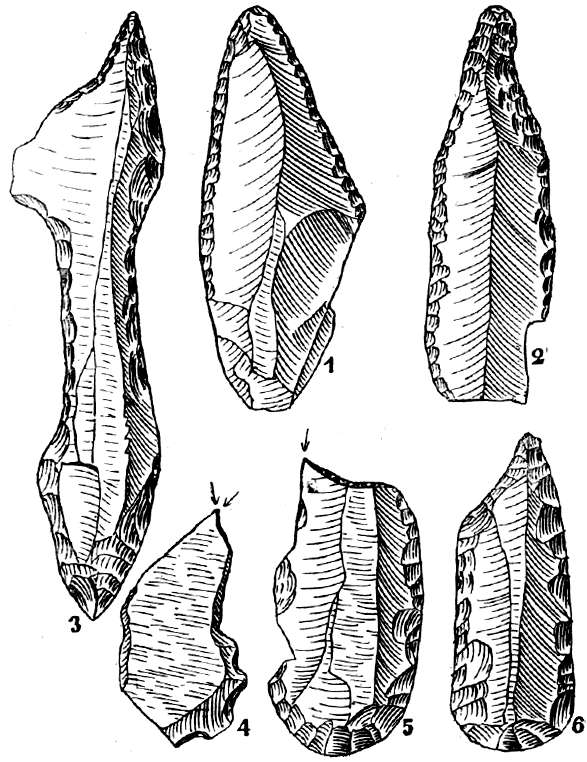
Figure 2
Abri Cellier - Lithic Industry of the lower layer.
Photo: Peyrony (1946)
Lithic Industry - This included large and beautiful blades retouched along the long margins (Fig. 2, No. 1) (knives) ended sometimes by a spike, (Fig. 2, No. 2) having sometimes two symmetrical lateral notches forming a waist in the blade. Some, like No. 3, Fig 2 having been completed at the ends by very well retouched points or spikes, are veritable weapons. Held at the waist, they were truly double daggers.
End scrapers on blades, single and double, sometimes ended in a point (fig 2 No. 6) or by a burin at one end (Fig. 2, No. 5) thick scrapers (carinated and nosed) a number of true burins (needle pointed burins) (fig 2, No. 4) and one dihedral angled (fig 2, No. 5), picks, many prismatic cores, some globular, hammer stones and some makeshift tools.
Figure 3
Abri Cellier - Bone Industry of the lower layer
Photo: Peyrony (1946)
Bone industry - Points with split bases were numerous and of all sizes (Fig. 3 Nos. 1 and 2). A lot of waste flakes or debitage from the manufacture of points was found. (Fig. 3, No. 8), the base of a large double bevelled spear (fig 3 No. 3), of awls made of bone flakes (Fig. 3 No. 6), of hooks (Fig. 3 No. 4), chisels with sharp edges and hammered heads, teeth with the roots perforated or with a groove for a cord, a pierced periwinkle.
This is the same artefact as Fig 3 No 9.
Example of the technique of basal
circumincising or rainurage, used to attach a cord or thong to the jewellery item.
Lower Aurignacian, ca. 24 000 BP, Abri Cellier
Wolf canine, 5.5 cm. This technique is unusual, most such items were pierced.
Photo: http://www.nyu.edu/gsas/dept/anthro/programs/
csho/Content/Facultycvandinfo/White/RWarticles/RW_2007_Human%20Revolution.pdf
The ensemble may be attributed to the first phase of the Aurignacian, which flourished throughout south-west France.
Works of art - stones were collected on the surface of this layer, their etched faces turned downward, which have been shown in the drawings here.
Figure 4
Abri Cellier - works of art.
Photo: Peyrony (1946)
1 - A block with a flattened surface, 55 cm by 31 cm, carries on the left side an animal head whose forehead and nose are formed by the natural edge of the stone, to which the artist has added a cupule for the eye and a large curved horn behind, deeply incised (Fig. 4, No. 1)
2 Another block, prepared in the same way, 57 cm by 32 cm, carries on the right a head like the previous design, deeply etched, reduced to a few essential lines: forehead, nose, line of the neck extended to the back and a large curved horn behind. (Fig. 4, No. 2)
From the left side, two curved lines substantially converge, (Fig. 4, No. 3), limited by damage to the stone, would have been part of an identical image, but which is now headless.
A wide groove cuts this last design and finishes on the other edge of the block.
These three drawings appear to relate to ibex, whose horns are very characteristic.
3 - A much smaller stone, has a flattened face, carrying a bizarre design. The left image appears to be an equine head and on the right, a vulva is poorly represented (Fig. 4, No. 4). These drawings are united by one line crossing both that seems to indicate that in the mind of the author, a close relationship exists between the two.
Abri Cellier, horse with a vulva engraved across the neck. This is known as bloc 2.
Above, the engravings on the stone. Below, the engravings highlighted.
Photo: Delluc (1978)
4 - A flat stone, roughly rectangular, 54 cm by 25 cm (fig 5, No. 1) presents, on a longitudinal edge, three figures of which one (c) is a pubic triangle with softened angles, or maybe just an external genital organ (b and d) while (a) is located on the opposite side, more deformed, referring to the same subject. Behind this last, on the edge of the stone, we can see seven regular grooves. On the left a deep and very regular cupule (e) is in connection with these drawings.
Figure 5
Abri Cellier - Vulvas, a cupule, and a penis.
Photo: Peyrony (1946)
This combination of images and various signs on the same stone certainly had meaning to the author, and a magical value that escapes us completely. We met comparable sets in the Aurignacian of La Ferrassie.
5 - On two big boulders, of which the parts emerging from the layer had been flattened , one can see many vulvas, some well modelled.
6 Finally, on a small stone, we see engraved with a wide and deep stroke, an image that can only be attributed to a male sexual organ (Fig 5, No. 2)
Wildlife - quite abundant faunal remains consisted mainly of reindeer.
This is followed, in descending order, by horses, cattle (aurochs and bison), ibex, red deer, chamois, roe deer (Capreolus capreolus) as well as rare specimens of wolf, ordinary fox and brown bear, as well as a lion canine tooth.
This layer was 20 cm deep at the back and 70 cm deep at the front. It was formed from dry limestone gravel and fine particles from the disintegration of the rock of the abri after its abandonment. It was completely sterile.
The soil appeared to have been somewhat levelled by the new occupants. The archaeological layer 30 cm thick at the front, tapering to the rear. A brown colouration to the sediments was observed in places, as well as fireplaces and and dry limestone deposits everywhere.
Lithic Industry - In this layer, the large and beautiful retouched blades and notched bottleneck blades were no longer found. The blades were smaller, with less marked retouching. Scrapers (grattoirs) were abundant, made on the tip of the blade, single and double, and were thick (carinated and muzzle types, with a predominance of the latter).
Burins (straight and angled, with a few busqués) were more numerous than in the basal layer, A. As for layer A, picks, awls, cores, hammers and makeshift tools completed the list of tools.
Bone Industry
The base layer has provided some points with bases with small slits and the upper layer, a few large diamond-shaped flattened points (Fig. 3, No. 5) and a biconical shape with an oval cross section (Fig. 3, No. 7). These last two characterise the Aurignacian II and III, independent of one another and the first facies, in the large gisement or archeological site of Ferrassie (1)
It was also gathered a few teeth pierced and a small band has perforated end arches.
This layer does not give works of art in the area excavated.
Wildlife - The remains of reindeer were abundant. Horses were more likely than in the lower layer. Cattle (Aurochs and Bison), ibex, red deer, chamois there were a few elements, as well as wolves and foxes.
As before, with the previous layer, there were large blocks from the collapse of the roof of the shelter. Between them and the cliff, there was a thickness of 50 cm of limestone scree, small and medium-sized, completely sterile.
Similar collapses were recorded in the same industrial horizon at Sergeac in the Abris Blanchard des Roches (1) and Castanet (2).
But, in contrast to these, where the collapse of the roof had been total, those of the Abri Cellier suffered only a partial collapse. Between the large boulders and rocks in the front and the back, there was a corridor which was later occupied by another tribe whose residence appears to have been of relatively short duration, the archaeological level was, at the area excavated, only 10 cm thick at the back, tapering to nothing about 2 metres towards the front of the shelter.
This was brown and rich. It yielded, amongst many tools, scrapers, usually short on the tips of blades, singles and double, rarely thick; many burins, especially on a corner, a few burin-grattoirs, awls, prismatic cores, hammer stones, many unfinished small blades, thin and narrow (Fig. 6, No. 6) and small blades made into burins.
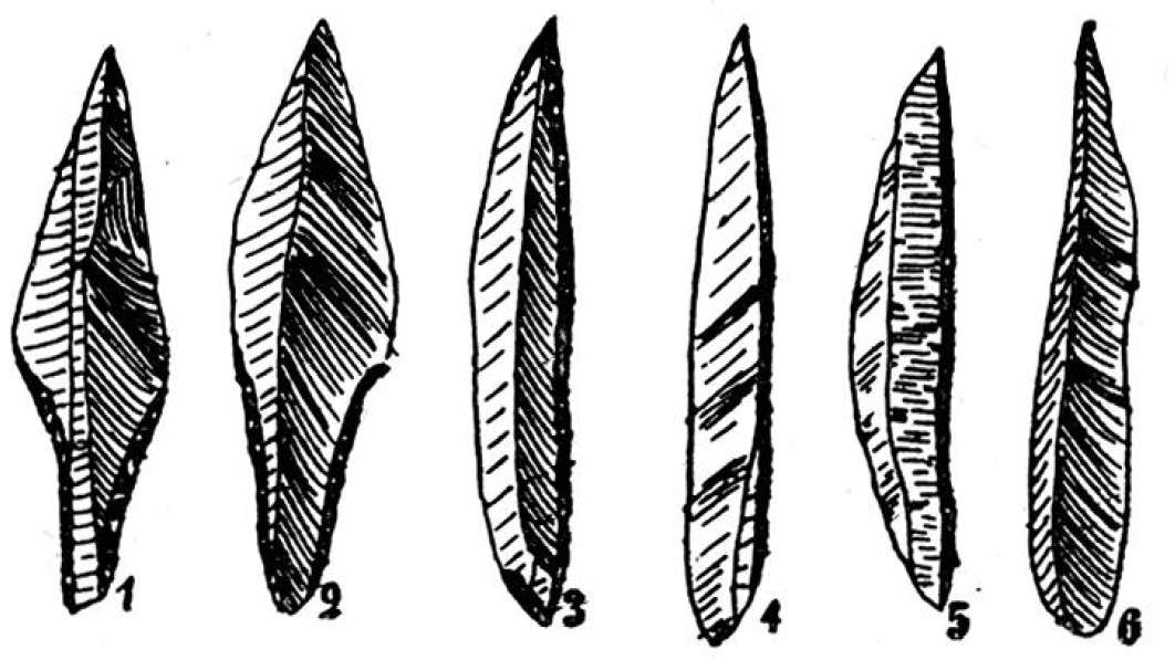
Figure 6
Abri Cellier - Perigordian 5
Photo: Peyrony (1946)
Very sharp tanged points (Fig. 6, No. 1 & 2) spikes (Fig. 6, No. 3 and 4) and blades (Fig. 6, No. 5) with a blunted edge, of medium and small size and Gravettian in type. These are from the Perigordian V (of the Font-Robert type). Pieces made of bone, or works of art, were not encountered.
Wildlife - The fauna includes the same animals as above, with a little more remains of horses.
From the study of the site and the industries, and the observations made, it is clear that:
1 - At the beginning of the occupation, two terraces formed an amphitheater on the slopes of Le Ruth: the largest, at mid-slope was settled by Mousterians/ The higher, less extensive , later served as a habitat for people of the Aurignacian and Perigordian.
2 The collapse of the abri, found at the second horizon of the Aurignacian, found also in the Abris Blanchard and Castanet, rested on an archeological layer of the same age, and at Laugerie Haute (1) on the Perigordian III, contemporaneous with the Aurignacian II. Occurring at the same time, they appear due to a common cause which could only have been an earthquake.
(Note, the likelihood is that the cause of the collapse was from a build up of volcanic ash on top of the abris, and when this ash became wet and very heavy after rain, the roofs collapsed - Don)
3 - Lithic industries and the bones from layers A and C are identical to those that have been found in the three Ferrassie lower Aurignacian layers, and those of the E layer are identical to those of the Ferrassie Perigordian V.
4 - The drawings discovered in the lower level show that art has made its debut, but with the most archaic designs.
All cave drawings described above belong to the first phase of Aurignacian art and therefore represent its infancy, at least in the south-west of France.
Animal figures, often semi-natural, half artificial, oversimplified, include only the head (Fig. 4, No. 4) sometimes only part of the head (Fig. 4, No. 1 and 2) but with the essential features needed to characterise the animal.
As well as these crude animal images, we found a significant number of more or less diagrammatic female genitals.
In the La Ferrassie Aurignacian, we have identified many of these drawings. Some of these representations of female genitals are distinctly triangular with none or few softened edges, others are more schematic, then some are simplified to the point that we could interpret them, if we had had a series of intermediaries.
In the Abri Cellier these drawings are nearly all deformed. Their number allows us to suppose that they played a major role in the daily lives of these people.
We know that in Europe a lot of Aurignacian and Perigordian deposits have produced feminine human statuettes, showing that our distant ancestors worshipped the female, mother of mankind and its nurse. But in Perigord, and particularly within the valley of the Vézère , human figures are very rare, but the pubic triangle occurs in all Aurignacian deposits. These designs seem to have had, in the eyes of these cave dwellers, the same magical value as the statuettes. They appear to have been indispensible in the completion and success of ceremonies related to human and animal procreation.
Is it not that the great mystery of life lies at the centre of this triangle? Is it not that this holds the place where the spirits do the work which gives birth to a new being?
Is it surprising that these primitive people, who did not perceive the relation of cause and effect, have attributed to it a supernatural origin, and therefore, this triangle, this trinity, became sacred in their eyes?
That is, it seems, we must seek the source of this naturalistic art: spiritual in its conception, symbolic in its implementation, magic in ceremony and incantations. Subsequently, one finds in all religions of Eurasia triangles/trinities which are more or less realistic, for which the symbol disappears gradually as science has come to explain the mystery of life, or perpetuated, but by losing their original meaning. It remains only the spiritual trinity, difficult to conceive in itself, that has been incorporated into religious dogma.
L'Aurignacien ancien en Périgord. Le problème du Protoaurignacien
Le Cellier (Commune de Tursac, Dordogne)
Pierre-Yves Demars, Demars (1992)
L'abri Cellier is found on a terrace facing south, on the right bank of the Vezere between Le Moustier and le Ruth. It was excavated in 1927 by G. L. Collie who described four archaeological levels attributed to the Middle Aurignacian using the schema of H. Breuil (Aurignacian in the strict sense).
A second excavation by D. Peyrony only discovered three archaeological levels (Peyrony, 1945). The industry of the layer A, the deepest, was attributed to the Aurignacian I, the intermediate level (layer C) to the Aurignacian II by D. Sonneville-Bordes (de Sonneville-Bordes,1960).
Finally, the industry of the upper level (layer E) belongs to the Gravettian with Font-Robert and Gravette points.
I analysed industry layers A and C in the Museum of Eyzies-de-Tayac. Only one layer, layer A, will be presented here.
Pointe de la Font-Robert
Photo: http://www.musee-prehistoire-eyzies.fr/homes/home_id24921_u1l2.htm

Tools from le Ruth, Aurignacian, 30 000 BP.
Photo: Don Hitchcock 2014
Source and text: Original, Københavns (Copenhagen) Museum, National Museum of Denmark
A layer
The industry is clearly dominated by scrapers (70.11%). In this category, thin scrapers (39.48%) are more numerous than thick scrapers (30.63%). The frequency of carinated scrapers (15.50%) and nosed scrapers, or grattoirs à museau (15.13%) are similar. Among chisels, we note that truncated burins (13.65%) are slightly more numerous than the dihedral burins (12.55%). There are a few carinated burins (4.43%) and some busqué or beaked burins (2.21%). Burins à un pan (bevelled chisels) are rather rare (3.69%).
Retouched blades (35.79%) are abundant and Aurignacian blades (13.65%), well represented. The frequency of awls (3.32%), like that of truncated pieces parts (2.95%) is low. In contrast, as noted by D. Sonneville-Bordes, Denticulate or notched pieces are abundant (11.81%).
There are 10 rabots or heavy 'push-plane' scrapers made on blocks or thick flakes, abruptly retouched, and no Dufour blades.
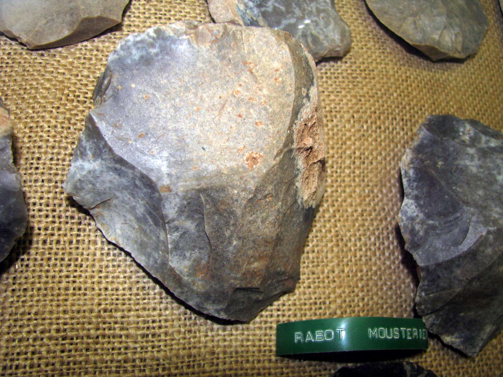
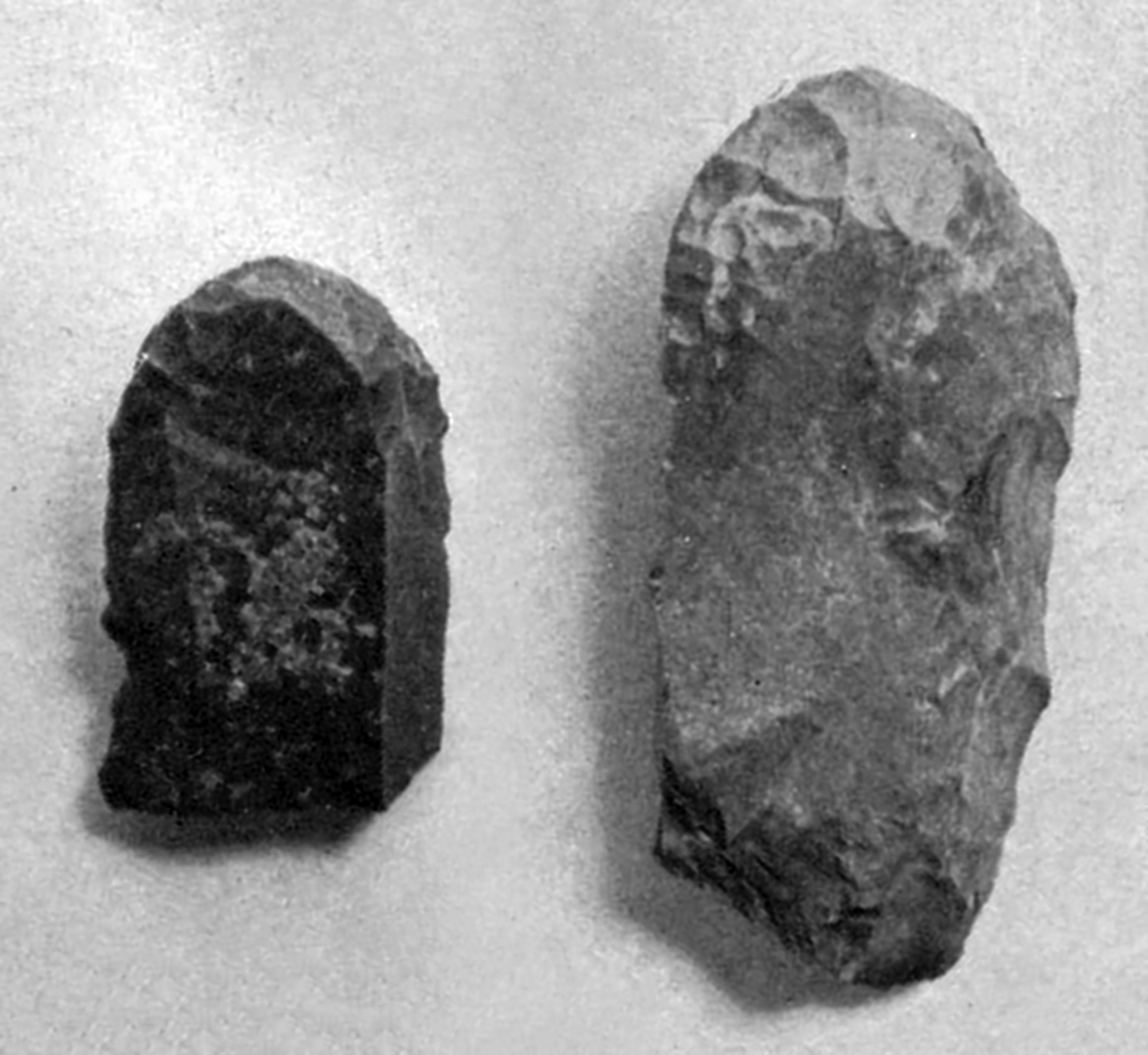
Mousterian Rabot from Le Ruth, in the display of the little museum run by the owner of the site, at Sous le Ruth.
Rabots are heavy 'push-plane' scrapers made on blocks or thick flakes, abruptly retouched.
Photo: Don Hitchcock 2008
The industry belonging to layer A was described by Peyrony as the Aurignacian I. This is demonstrated by the abundance of scrapers, especially thin blades and Aurignacian split-based spears or sagaies. In addition, the abundance of thick flake scrapers may be used to classify the industry as the Aurignacian, despite the frequency of dihedral burins being a little lower than truncated burins. However, the large number of denticulate or notched pieces is amazing. This is all the more surprising since the same is true for the industry of layer C.
References
- Bourrillon R., White R., 2015: Early Aurignacian Graphic Arts in the Vézère Valley: In Search of an Identity?, in White R., Bourrillon R. (eds.) with the collaboration of Bon F., Aurignacian Genius: Art, Technology and Society of the First Modern Humans in Europe, Proceedings of the International Symposium, April 08-10 2013, New York University, P@lethnology, 7, 118-137.
- Breuil, H., 1909: L'Aurignacien présolutréen. Epilogue d'une controverse, Revue préhistorique, IV, 1909, P275, fig. 4
- Burkitt M., 1925: Prehistory: a study of early cultures in Europe and the Mediterranean basin, Cambridge, Cambridge University Press. 1925, Second Edition.
- Cheynier, A., 1960: Place pour le Gravétien Bulletin de la Société préhistorique française, 1960, tome 57, N. 7-8. Travaux en retard. pp. 389-412.
- Collie, G., 1928: The Aurignacians and their culture, Issued January 1928 as Beloit College Bulletin, Vol. XXVI. No 2, printed by the Daily News Publishing Company
- Coolidge, F. and Overmann K., 2012: Numerosity, Abstraction, and the Emergence of Symbolic ThinkingCurrent Anthropology, Volume 53, Number 2, April 2012.
- Delage, F., 1949: Les gisements préhistoriques de Belcayre (Dordogne)Gallia, tome 7, fascicule 1, 1949. pp. 3-21; doi : https://doi.org/10.3406/galia.1949.2115 https://www.persee.fr/doc/galia_0016-4119_1949_num_7_1_2115
- Delluc, G.&B., 1978: Les manifestations graphiques aurignaciennes sur support rocheux des environs des Eyzies (Dordogne), Gallia préhistoire, Tome 21 fascicule 2, 1978. pp. 333-438.
- Delluc, G.&B., 1978 b: Les manifestations graphiques aurignaciennes sur support rocheux des environs des Eyzies (Dordogne), Gallia préhistoire, Tome 21 fascicule 1, 1978. pp. 213-332.
- Demars, P., 1992: L'Aurignacien ancien en Périgord. Le problème du Protoaurignacien, Paléo, N. 4,1992. pp. 101-122.
- Eshleman C., 2003: Juniper Fuse: Upper Paleolithic Imagination & the Construction of the Underworld, Wesleyan University Press 2003
- Groenen Marc, 1994: Pour une histoire de la préhistoire, Éditions Jérôme Millon 1994
- Leroy-Prost C., 1979: L'industrie osseuse aurignacienne. Essai régional de classification : Poitou, Charente, Périgord (suite)Gallia préhistoire, Tome 22 fascicule 1, 1979. pp. 205-370.
- Movius H.L. Jr, David N., Bricker H., Clay B., 1968: The analysis of certain major classes of upper palaeolithic tools: Stratigraphy, American School of Prehistoric Research, Peabody Museum, Harvard University, Cambridge, Massachusetts
- Nesbitt, P., 1928: A Study of the Aurignacian Site La Ruth (France), Master’s Thesis, University of Chicago.
- Peyrony, D., 1909: Station préhistorique du Ruth près le Moustier (Dordogne) Rev. de l'École d'Anthropol. XIX, 1909, P157, fig. 39
- Peyrony, D., 1914: Éléments de Préhistoire Ussel, Eboulet Frères Dépôt au Musée des Eyzies (Dordogne)
- Peyrony D., 1946: Périgord, Gallia, Tome 4, 1946. pp. 294-301.
- de Sonneville-Bordes, Mme, 1960: Le Paléolithique supérieur en Périgord. Imp. Delmas, Bordeaux, 1960, p. 70/
- White R., 1989b: Visual Thinking in the Ice Age, Scientific American July 1989, pp. 92 - 99
- White R. et al., 2017: Newly discovered Aurignacian engraved blocks from Abri Cellier: History, context and dating, Quaternary International xxx (2017) 1-27