Back to Don's Maps
 Bushwalking Index
  The walk from Boundary Creek to Grassy Creek via Duffers Falls and the Haystack
  The walk from Mulligans Hut to Boundary Creek via Surveyors Creek and Dandahra Crags
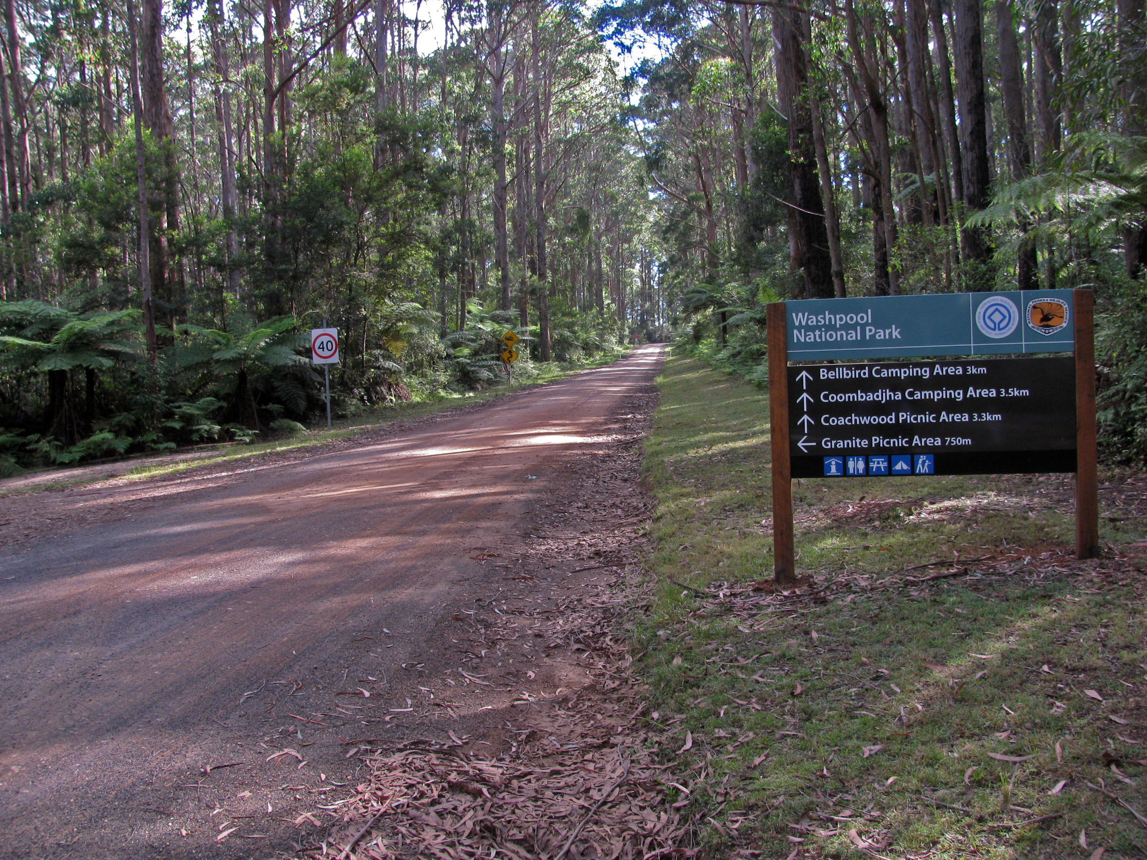
 Grassy Creek to Mulligans Hut, World Heritage Walk, Gibraltar Range - Washpool National Park
A one hundred kilometre network of walking tracks forms the Gibraltar - Washpool World Heritage Walk. The route links the Gibraltar Range and Washpool National Parks in rugged mountainous country, high above the Clarence Valley on the edge of the Northern Tablelands. Dramatic and diverse changes in the landscape are typical along the walk. Dry eucalypt sclerophyll forests, set amidst a broken collection of ridges and granite tors, surround a mosaic of sub-alpine swamps. In more dense country, lush rainforests safeguard the largest area of coachwood in the world. Within these ancient pockets of wilderness, waterfalls plummet from a lacework of streams and wild rivers. They offer refuge to a rich variety of wildlife including many rare and endangered species. In spring and summer the heathlands, swamps and open woodlands erupt in a colourful display of wildflowers.
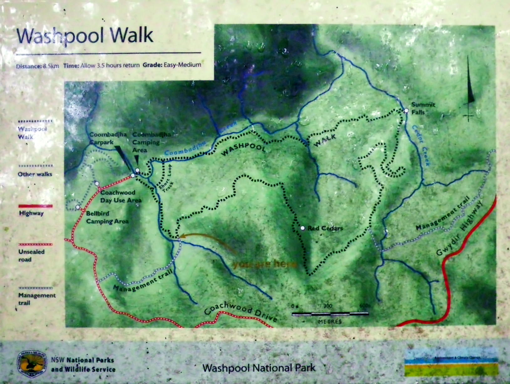
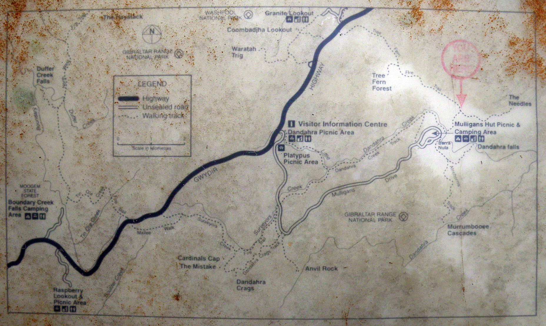
Text above: 'A Walk on the Edge of Wilderness, The Gibraltar - Washpool World Heritage Walk', free booklet from NPWS.
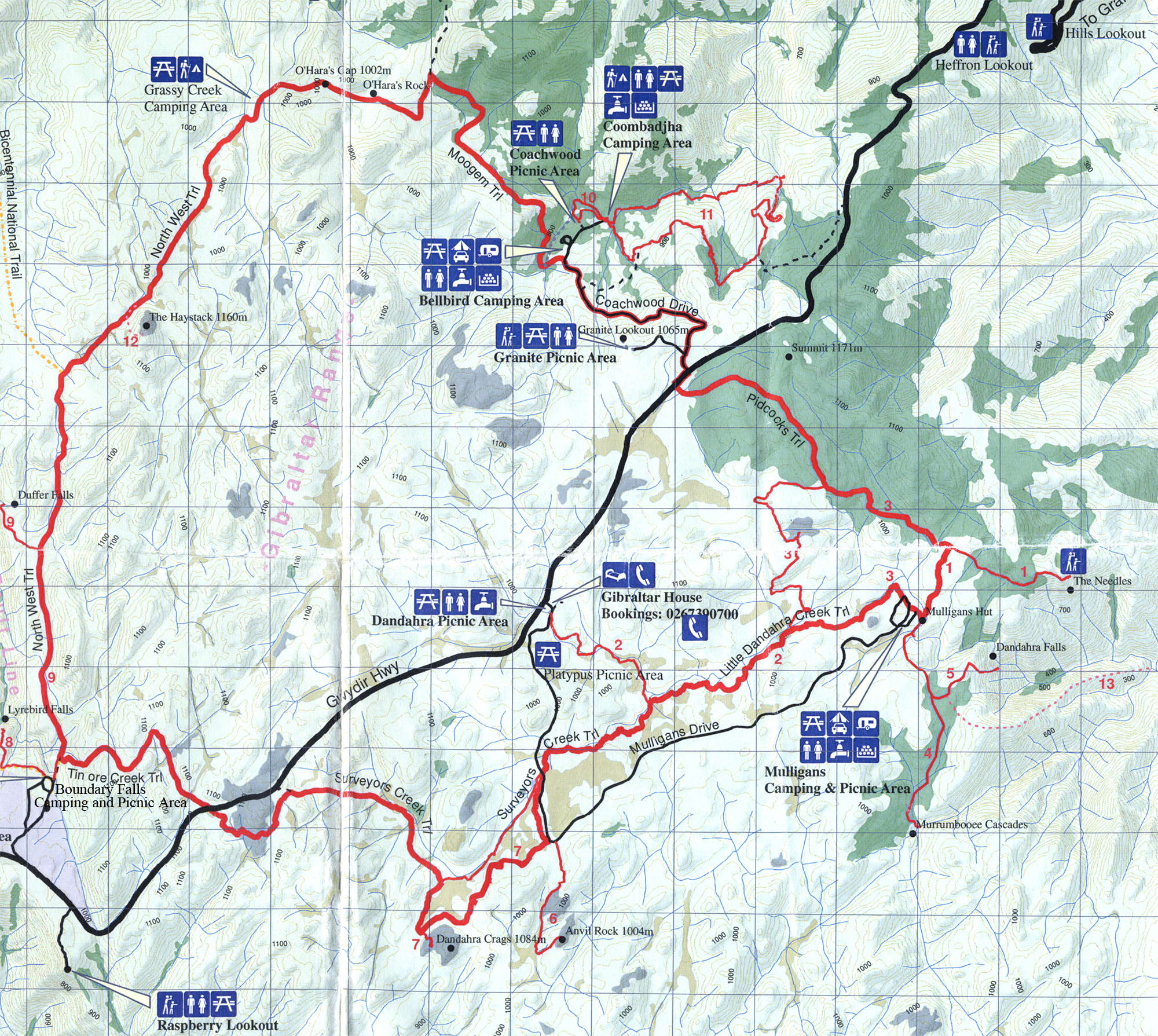
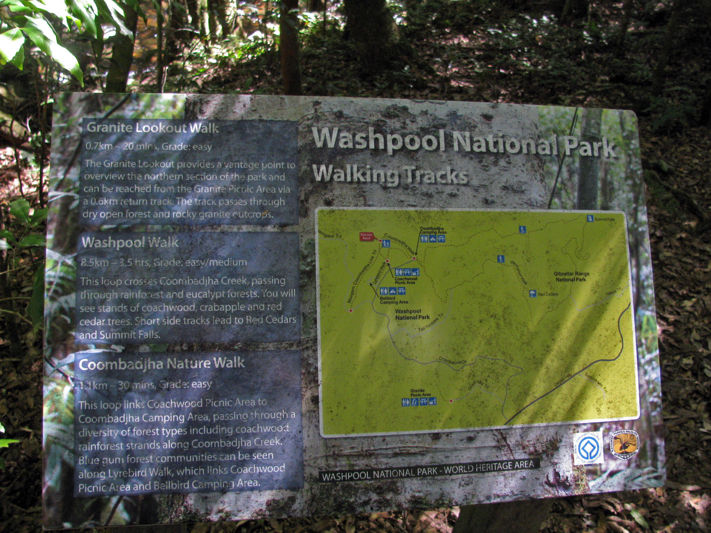
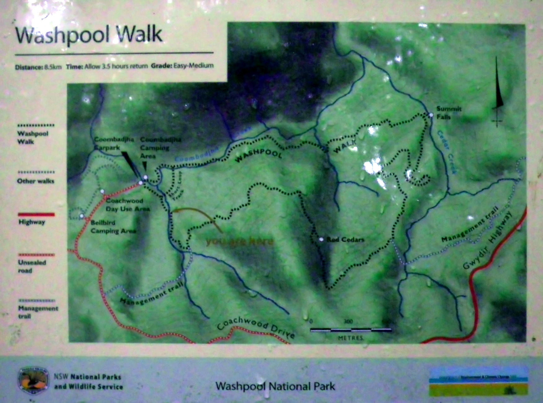
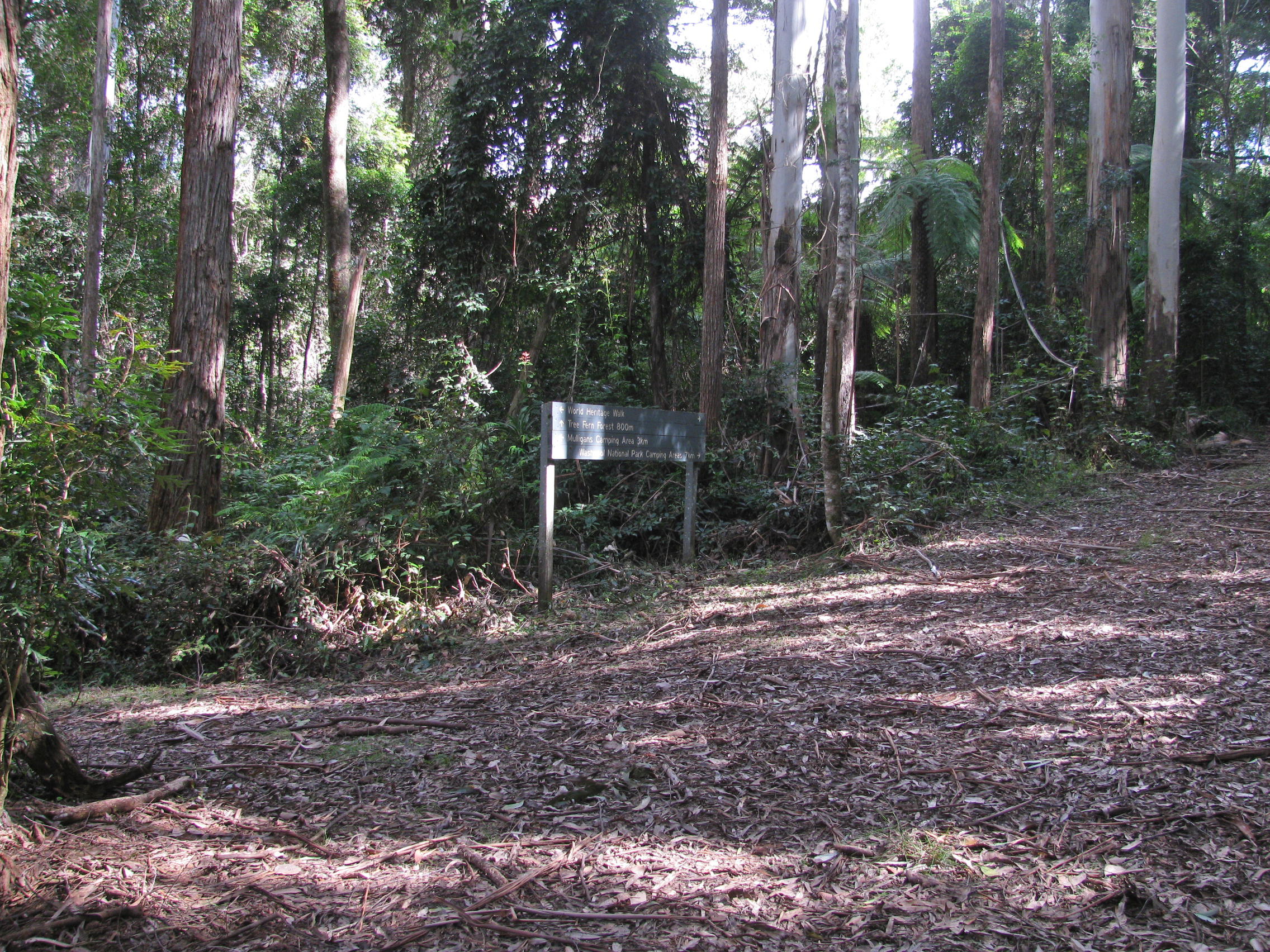
This is a great map from the National Parks and Wildlife Service (NPWS), showing the entire circuit. You can pick one up free from the Glen Innes NPWS office, as well as an excellent free booklet on the walks of the circuit, 'A Walk on the Edge of Wilderness, The Gibraltar - Washpool World Heritage Walk'. This booklet contains detailed track notes as well as flora and fauna lists.
I got the 1:25 000 topographic maps, but they are almost too detailed. I found this map to be all I needed to complete the entire circuit, and left the topo maps in the car. The track is very well signposted, with occasional 'You are here' maps on display boards.
This whole World Heritage Walk has been superbly set up, it is a credit to all concerned. The complete circuit without side trips is about 60 km, and can be done in three days if you are fit and well prepared, though the track notes recommend five days to allow for extended side trips. The tracks are excellent.
Here is the map as a pdf, which should print on one page from the free program Adobe Reader:
Map as a pdf for printing
Photo: Free handout from NPWS.
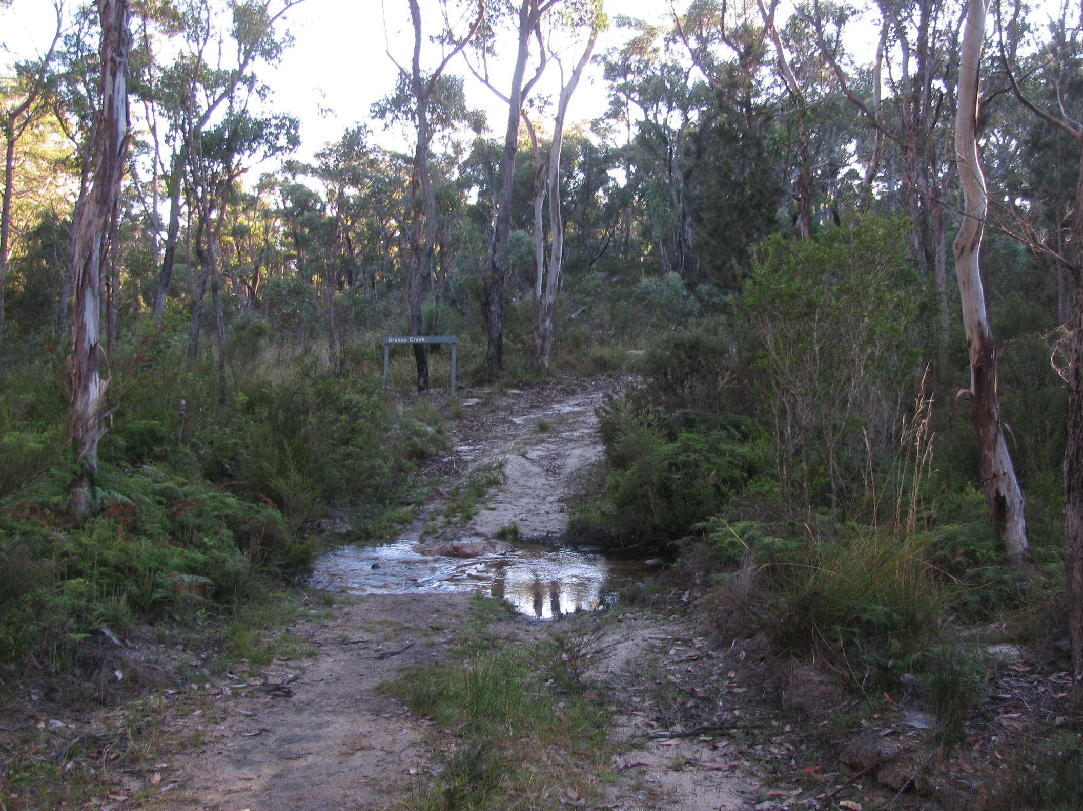
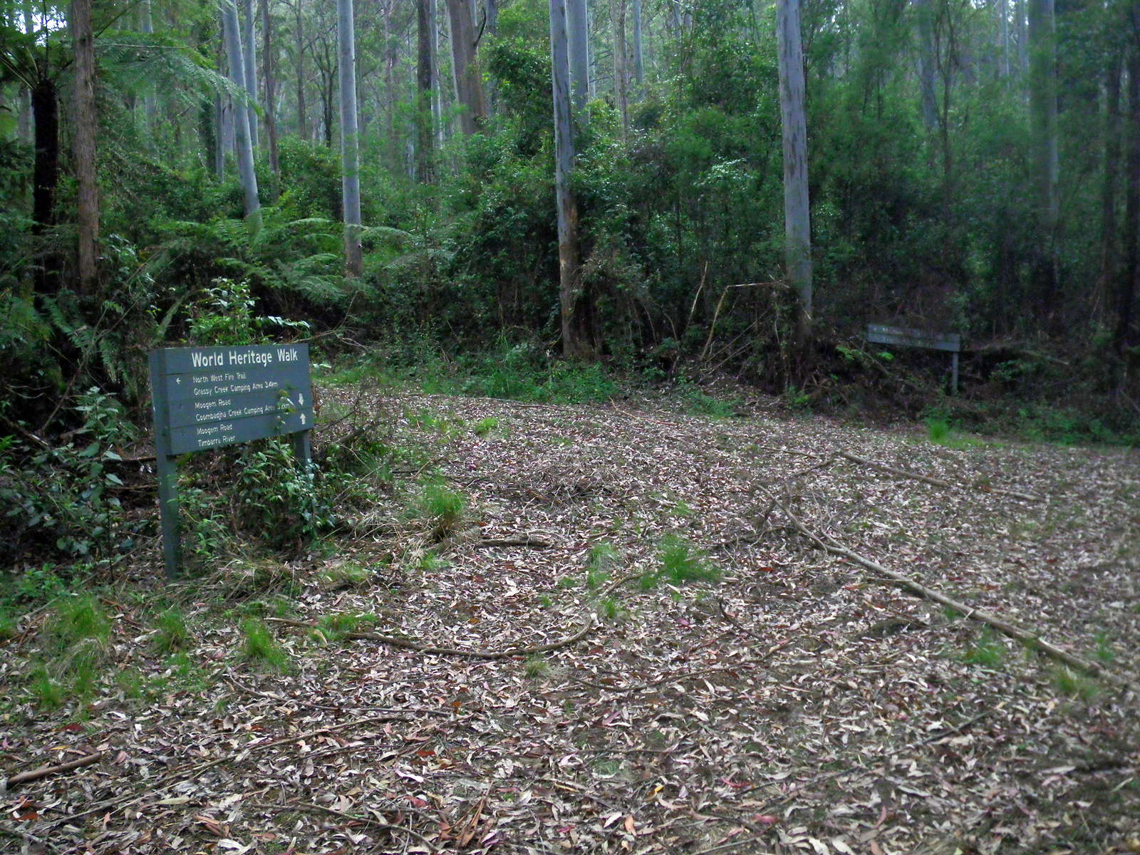
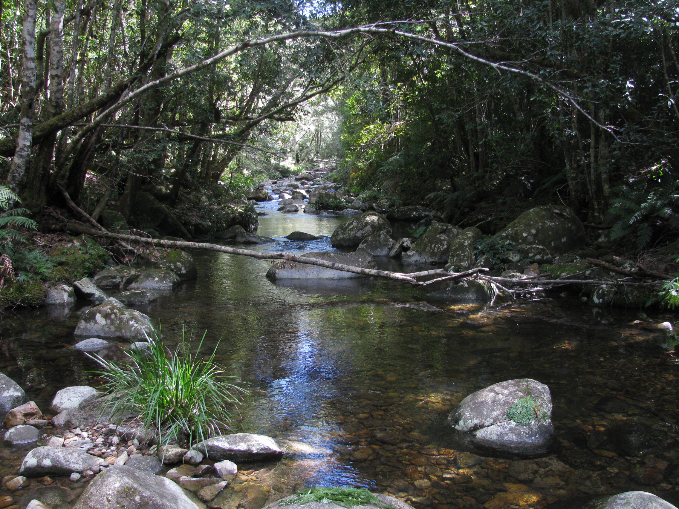
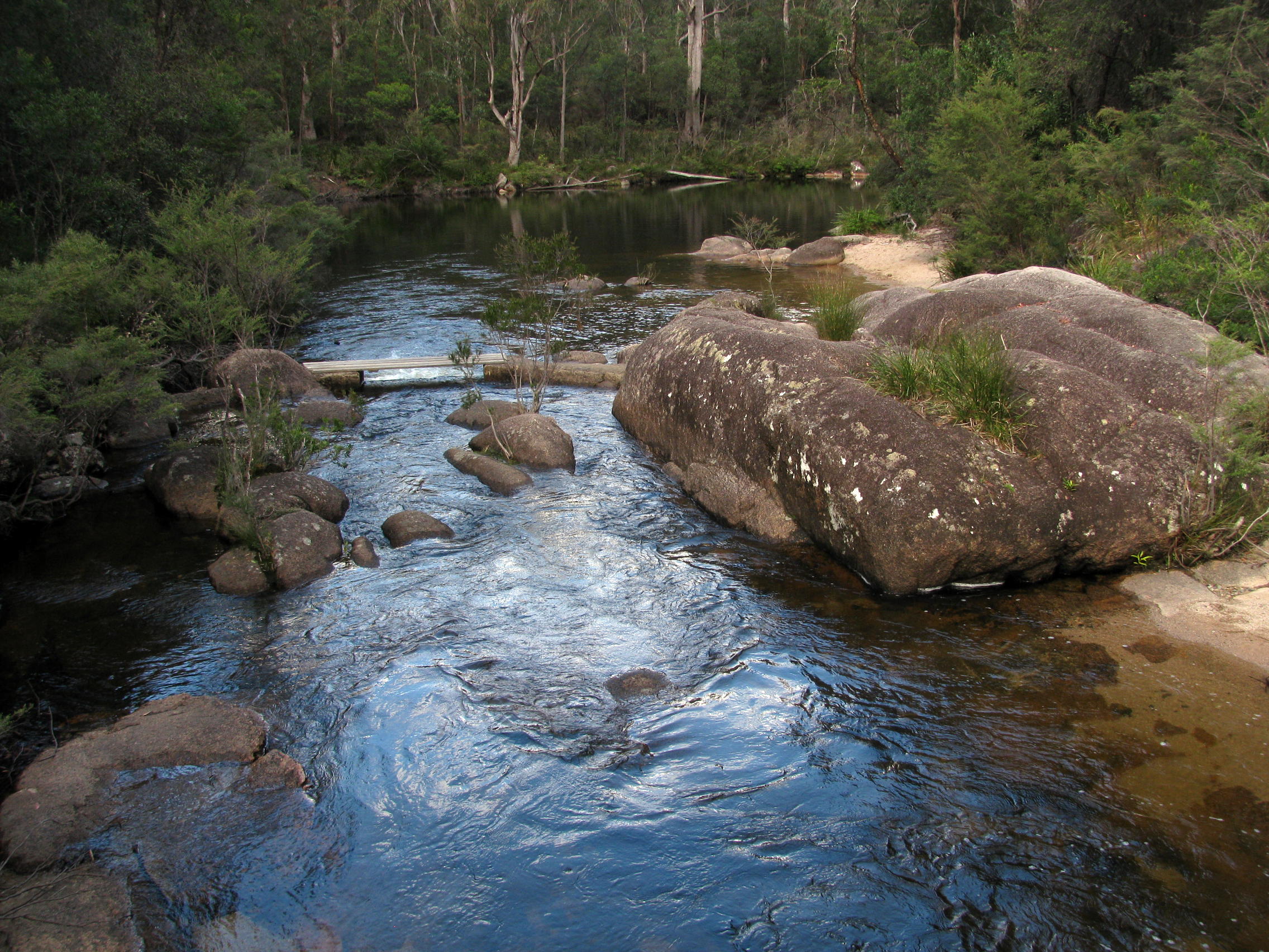
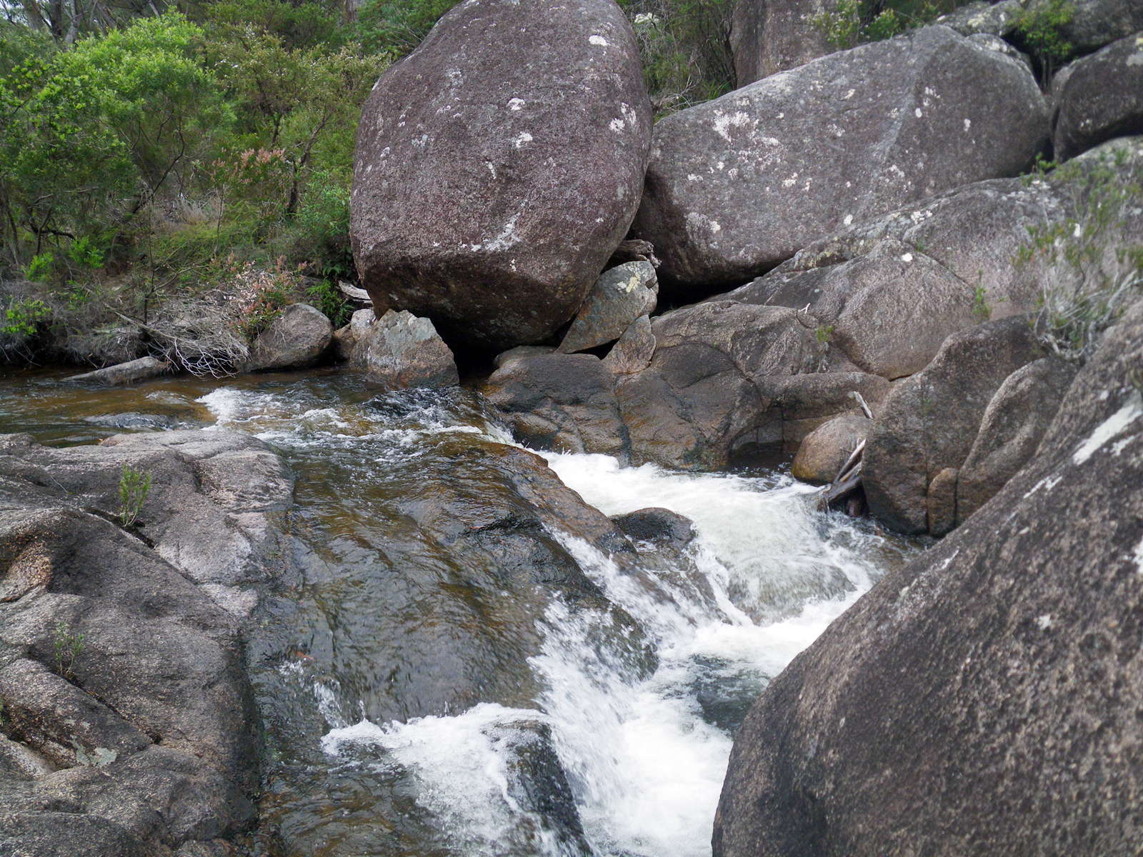
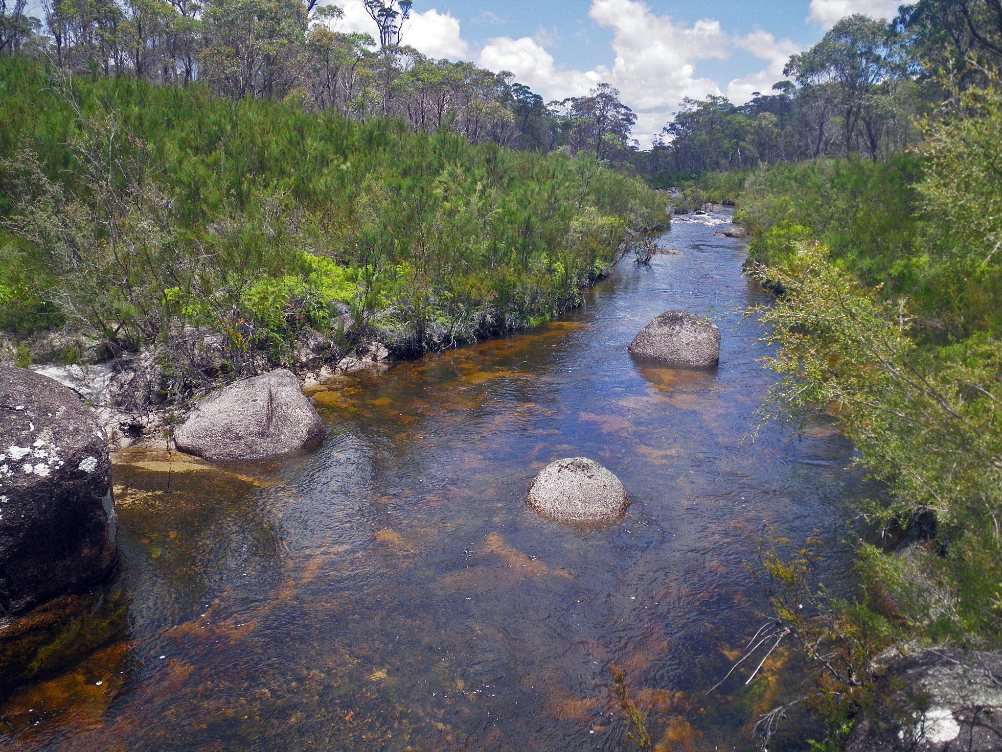
Grassy Creek, setting out at dawn, looking ahead to the track to O'Hara Pass and Mulligans Hut.
It is a beautiful little stream, and there are campsites nearby, as well as a picnic table.
Photo: Don Hitchcock, April 2015
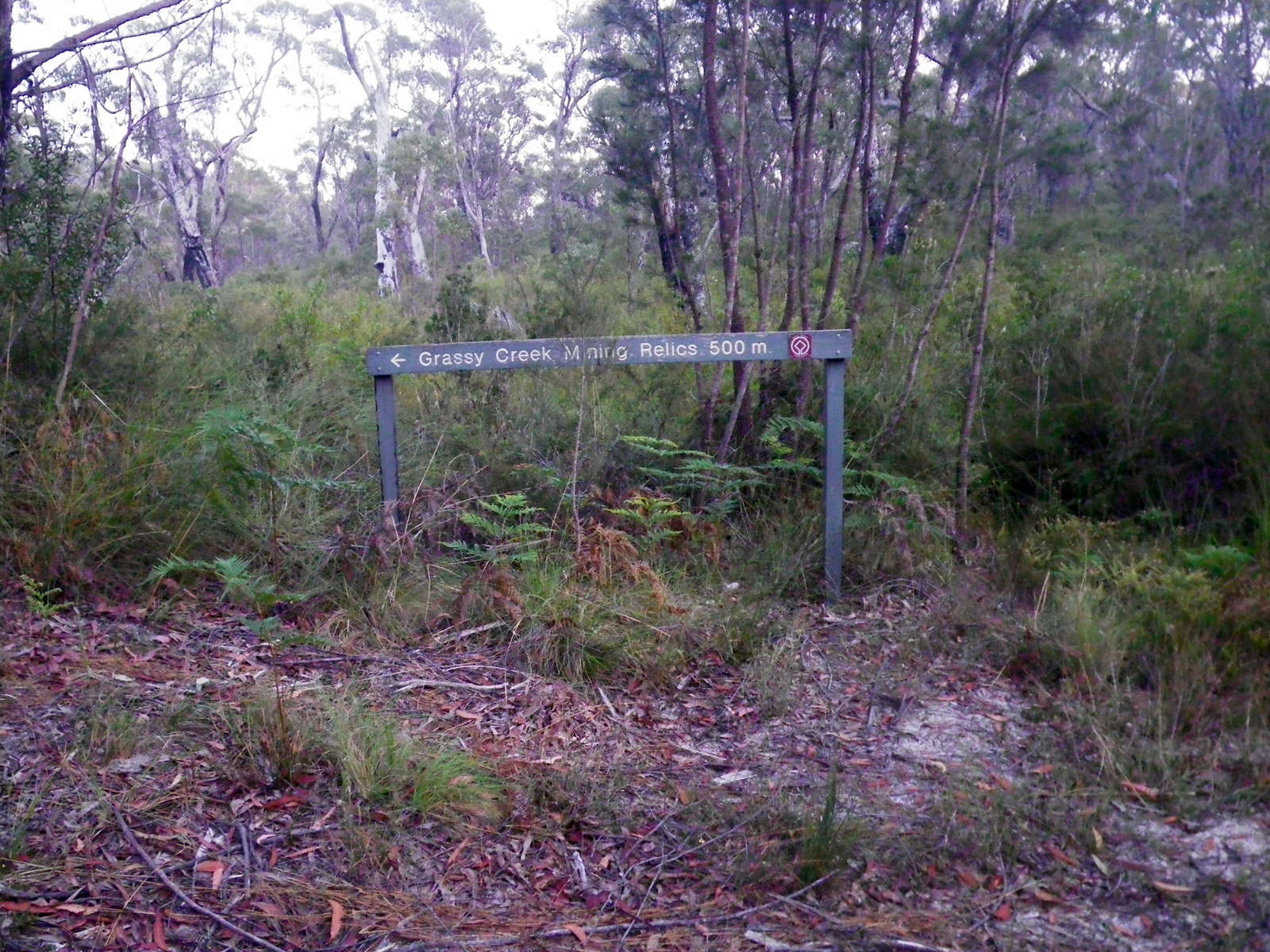
Grassy Creek Mining Relics track.
At the end of the track stay close to the fence line on the left to the top of the rise and walk down through the clearing. A boiler and the remains of a stamping battery of an unusual circular design used for crushing ore, are rust-covered reminders of bygone days. The date 1860 is clearly visible on the battery.
Photo: Don Hitchcock, November 2011
Text: 'A Walk on the Edge of Wilderness, The Gibraltar - Washpool World Heritage Walk', free booklet from NPWS.

The crest of O'Hara Pass, and the top of the Gibraltar Range, after climbing up from Grassy Creek, looking back down the track. This also marks the approximate boundary between Gibraltar Range National Park and Washpool National Park.
Photo: Don Hitchcock, November 2011
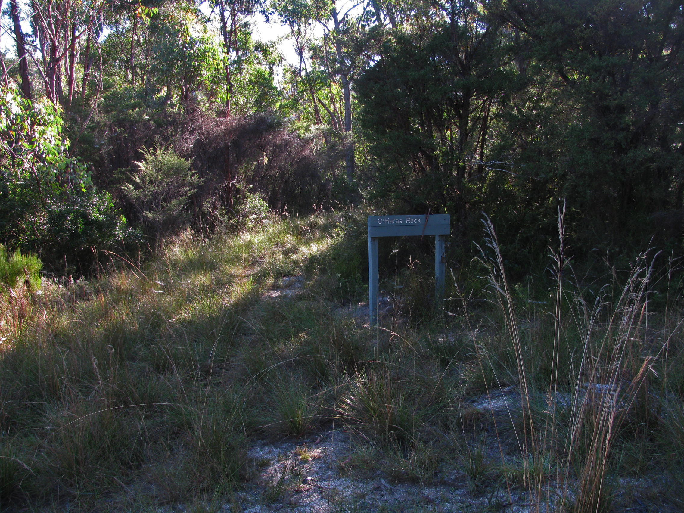
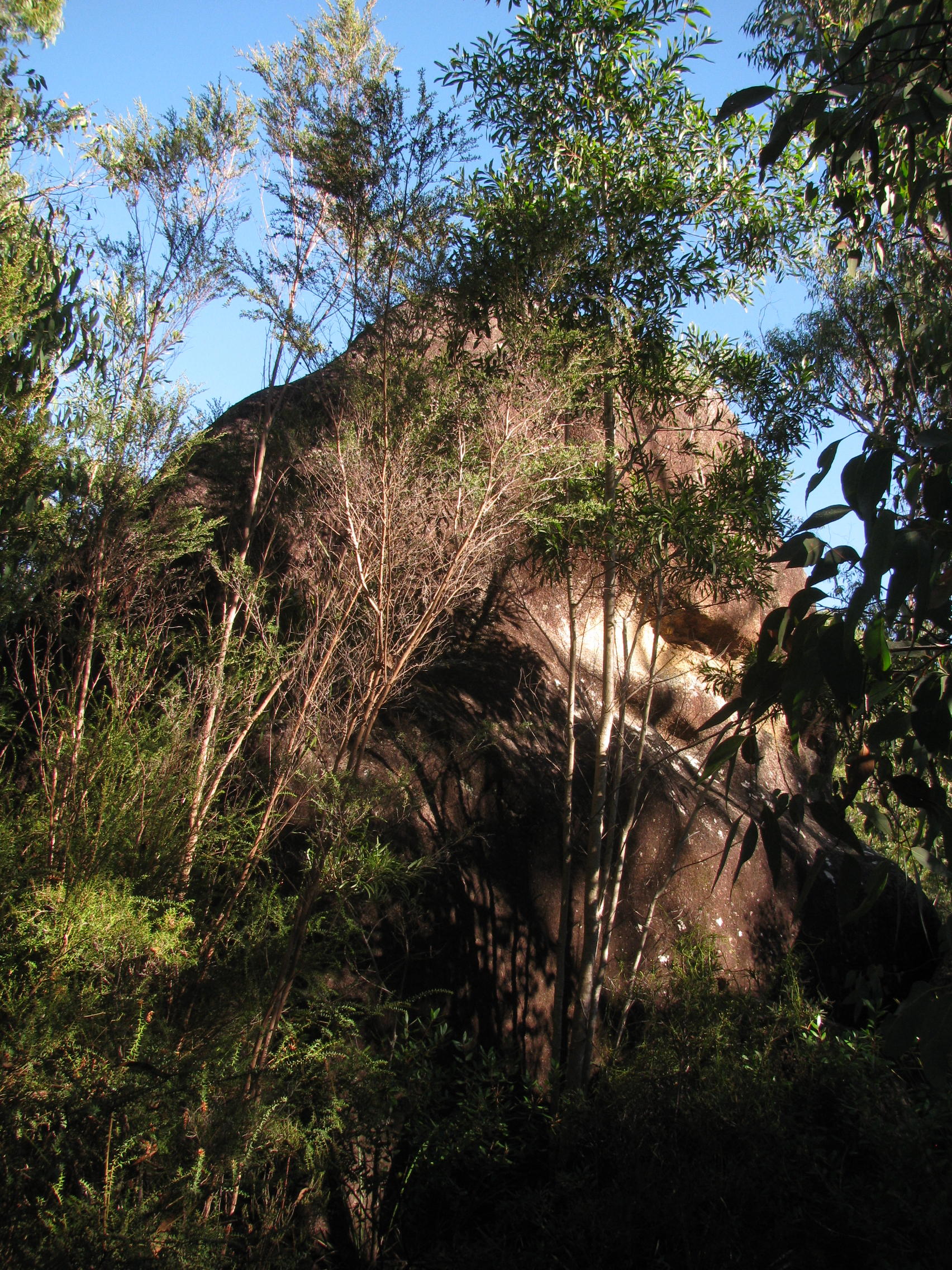
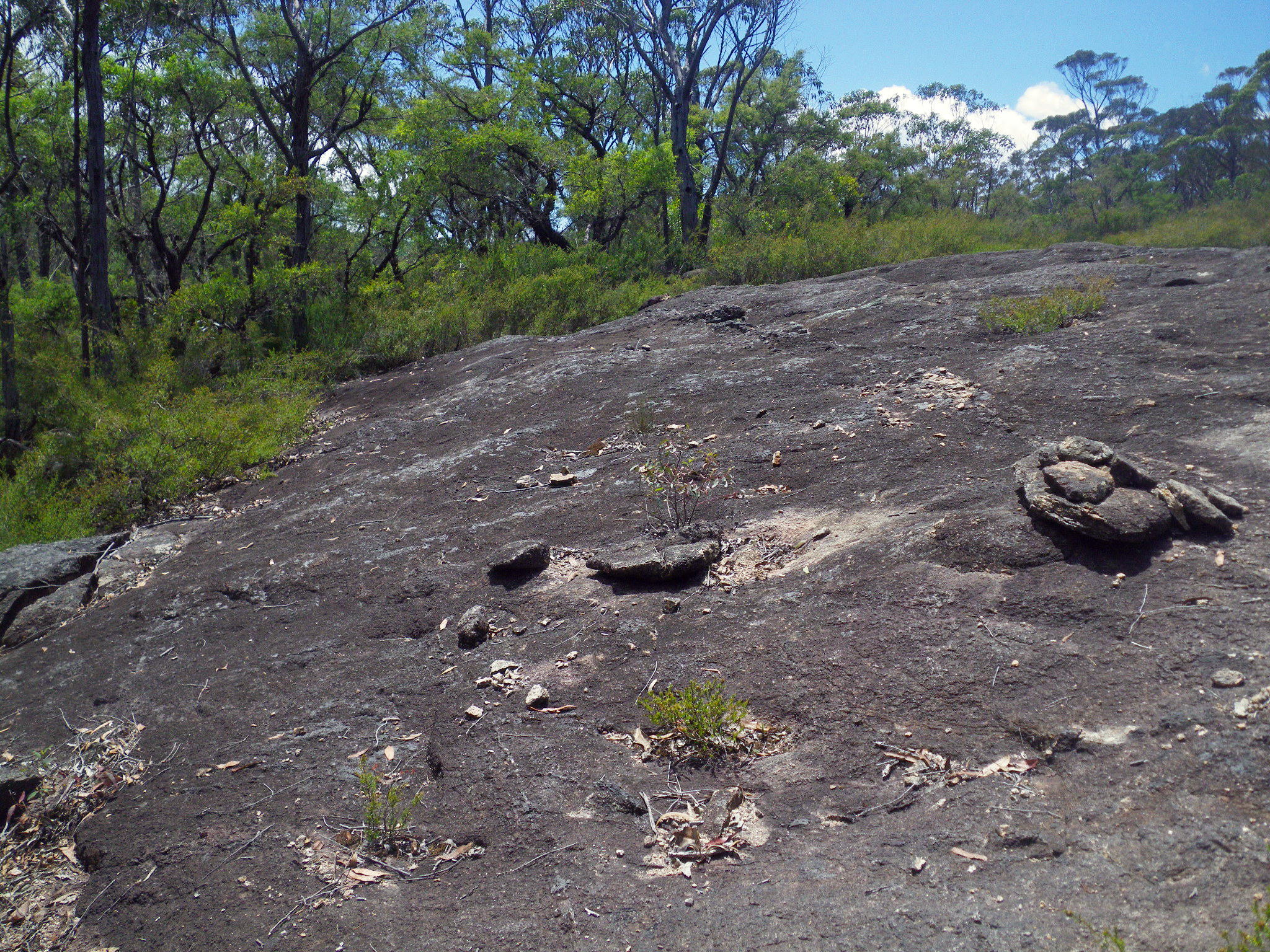
500 metres from the crest, O'Haras Rock, down a short side track on the left, marks the spot where O'Hara, a grazier, camped with his stock in 1873 when he tried to find a way over the Gibraltar Range to the Ramornie meatworks on the Orara River. He discovered signs of tin ore in the bed of Grassy Creek which subsequently led to mining operations being carried out in the area.
Photo: Don Hitchcock, April 2015
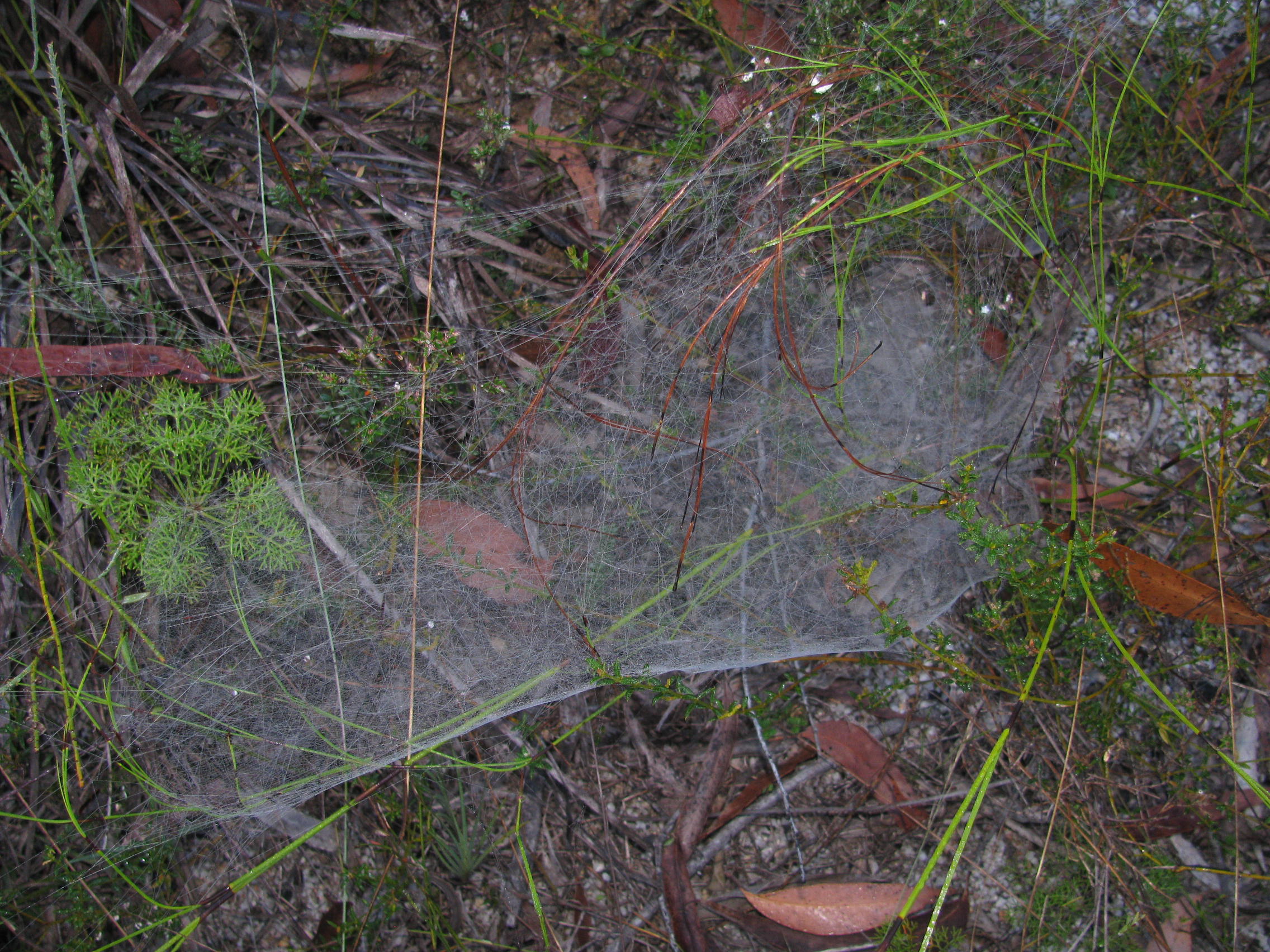
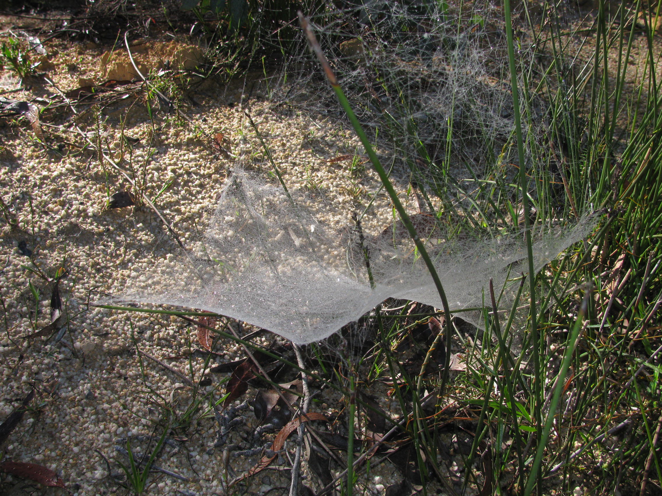
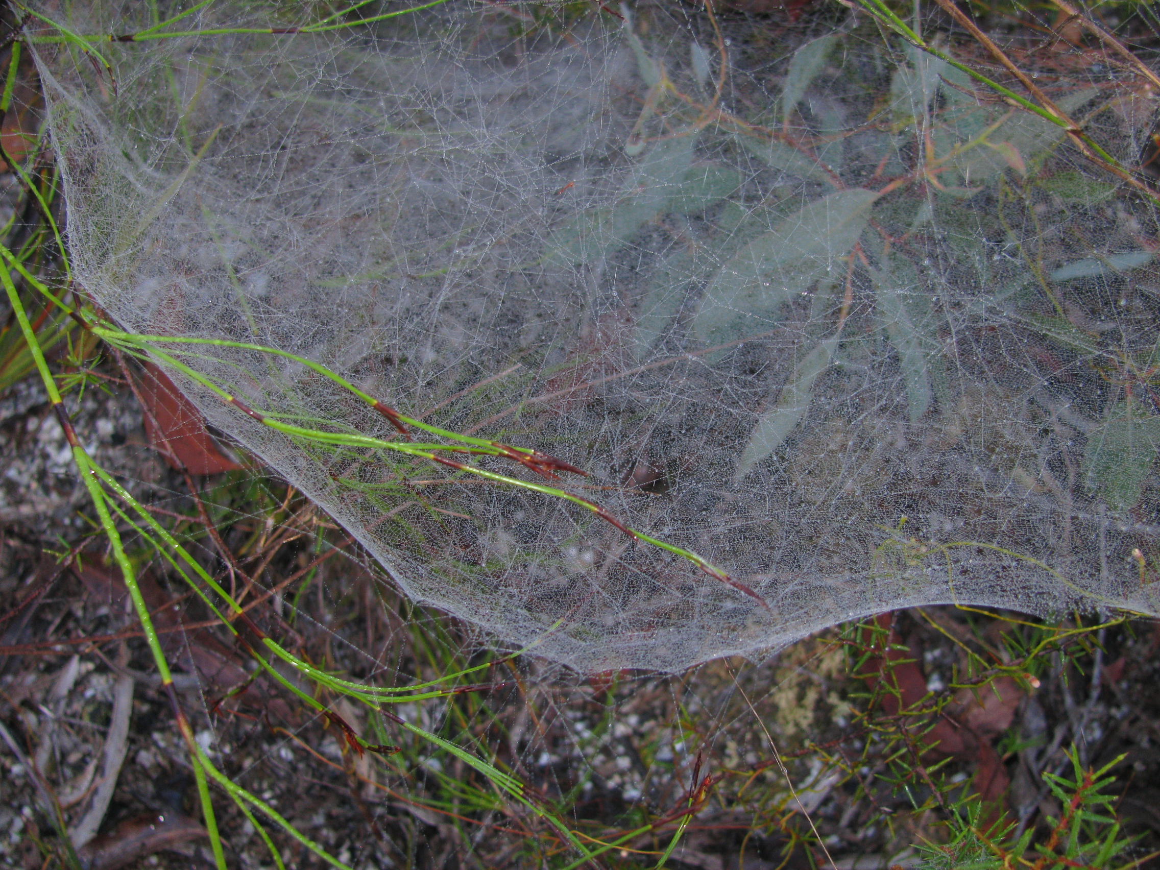
These are very interesting spiderwebs. From a distance, they look like little upside down parachutes, but up close it can be seen that they are quite three dimensional, albeit with one side that is very finely woven or spun.
Any insect that found its way in would have a lot of trouble getting out, it is like a maze inside.
Photo: Don Hitchcock, April 2015
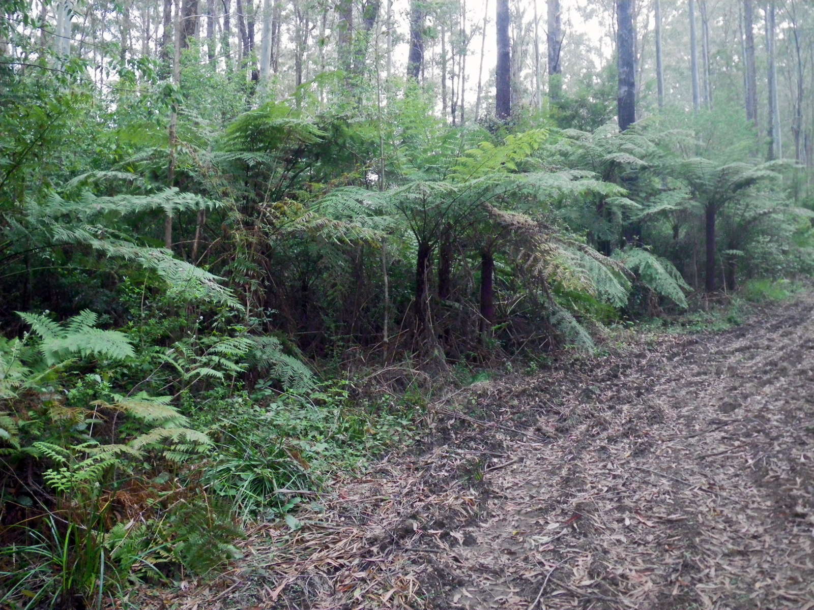
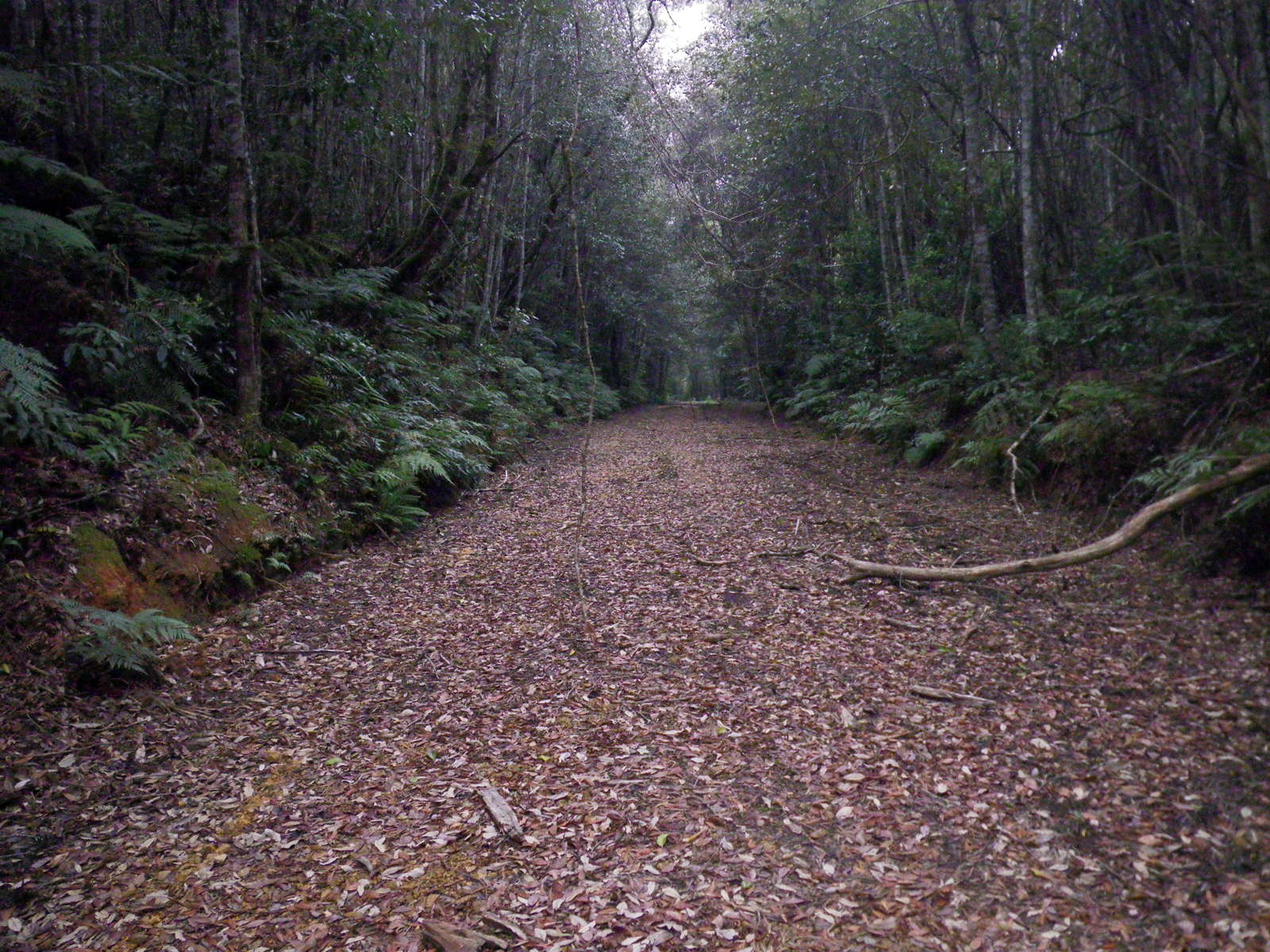
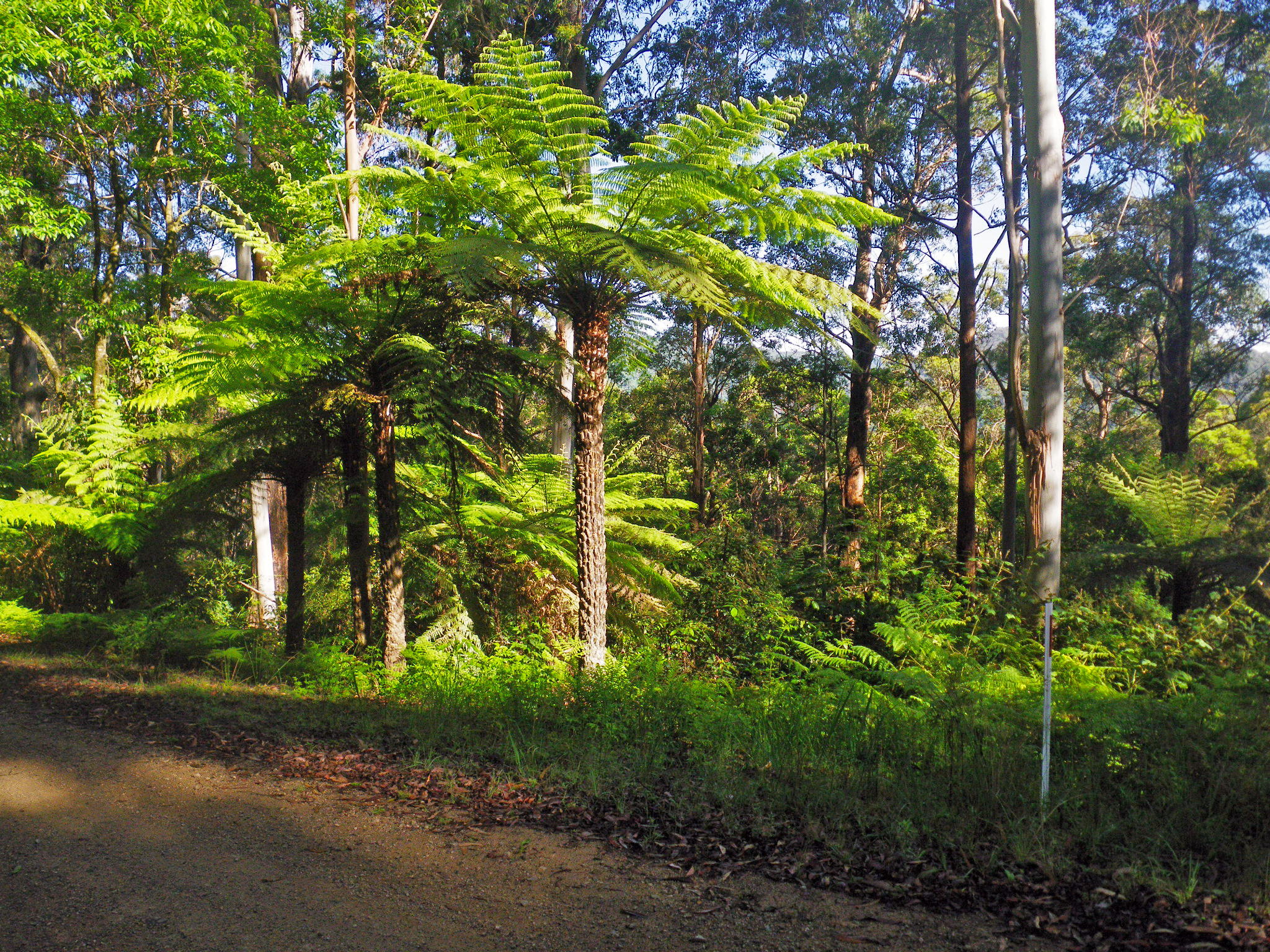
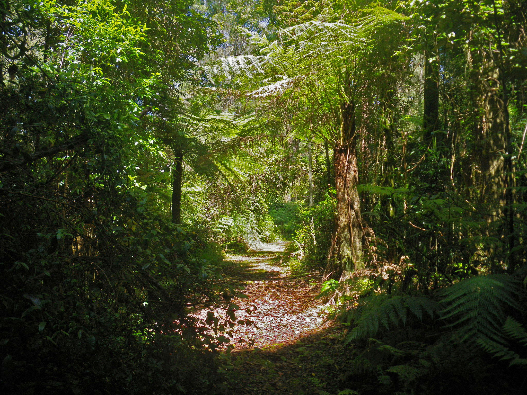
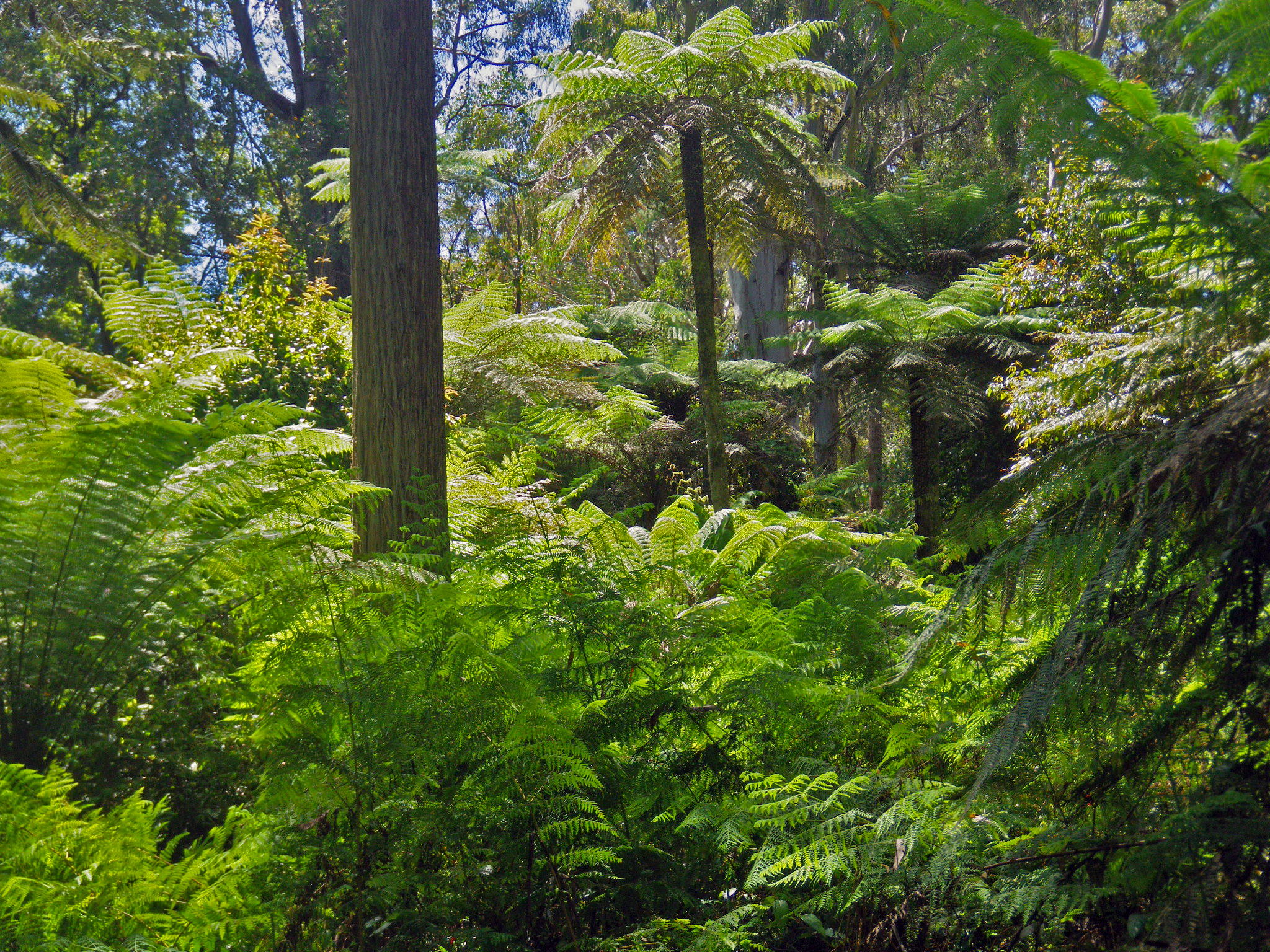
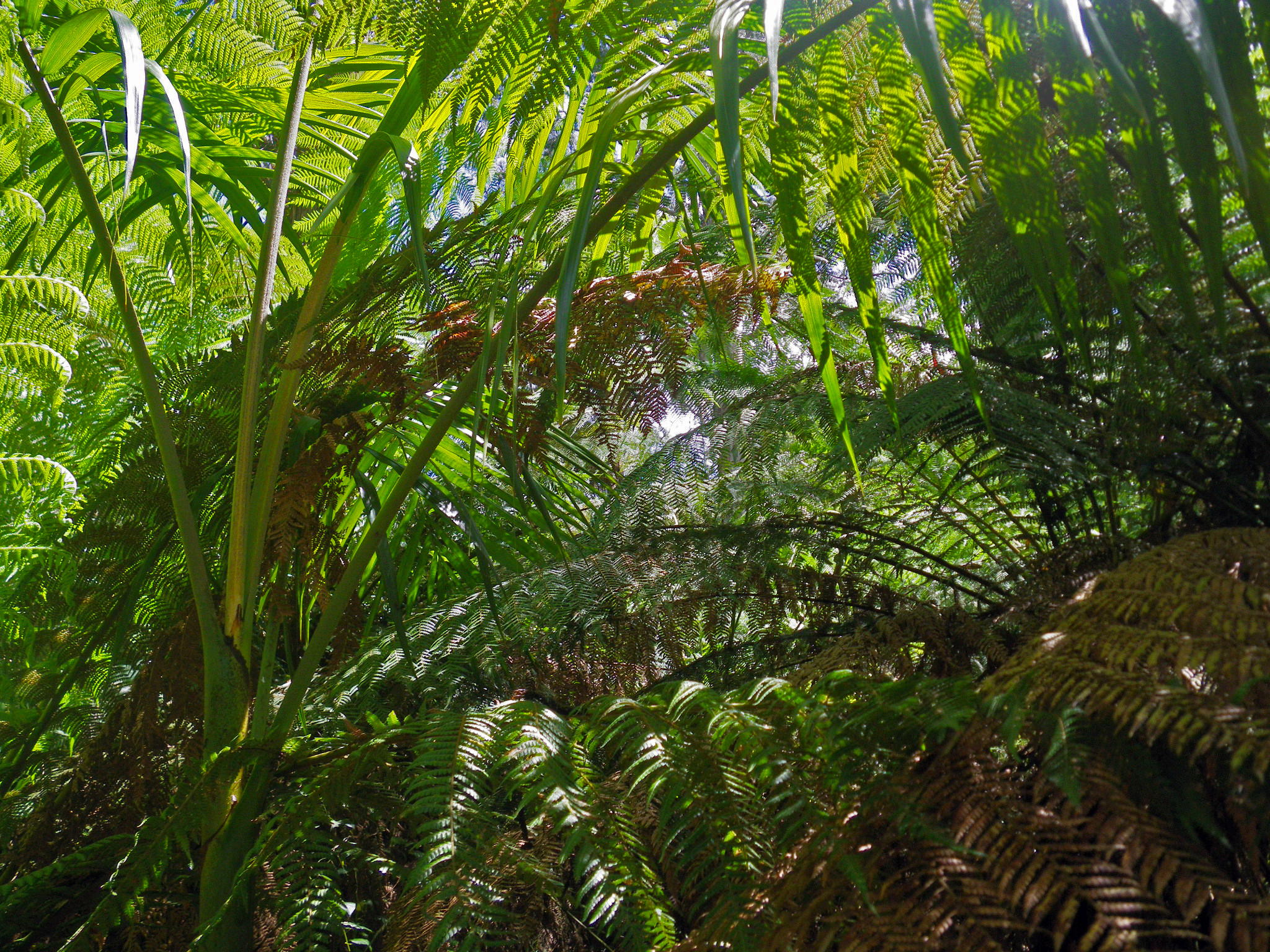
Twenty minutes later, the vegetation changes from dry sclerophyll bushland to wet sclerophyll with tree ferns, and the ground becomes moist underfoot.
Photo: Don Hitchcock, November 2011
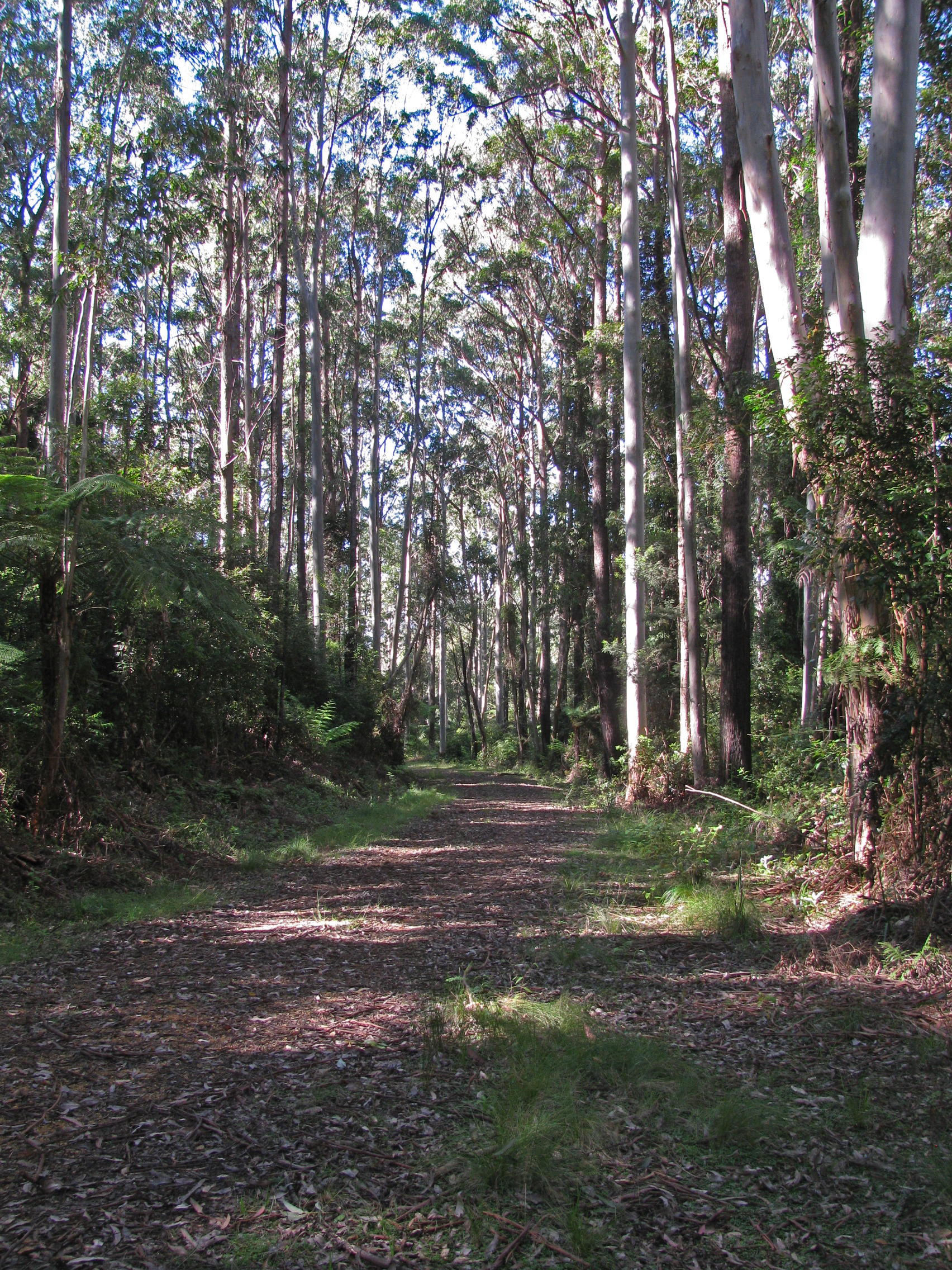
By the time you get to this junction with the Moogem Fire Trail, the first rainforest species are starting to appear.
Photo: Don Hitchcock, November 2011
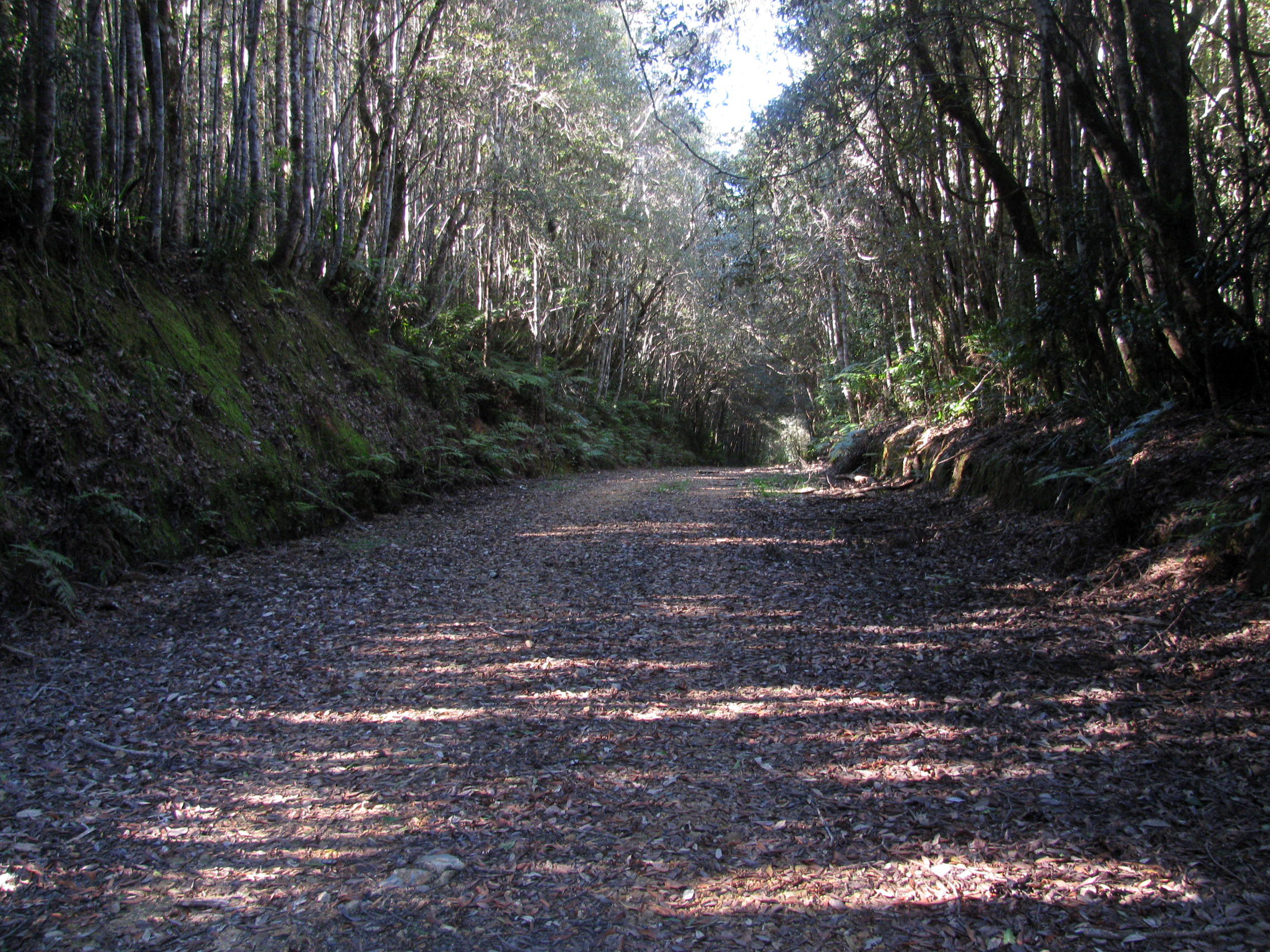
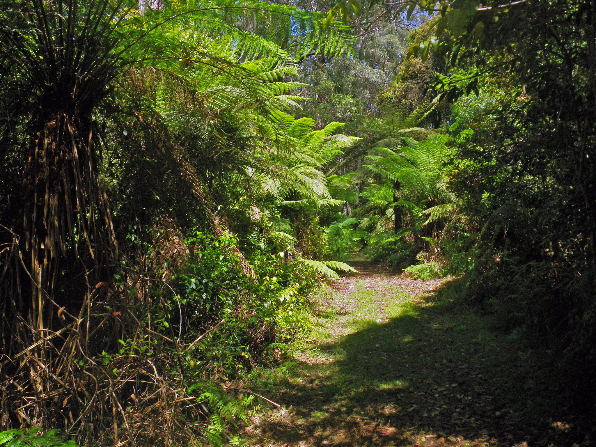
The Moogem Fire Trail becomes more like a bushwalker's super highway carved through thick rainforest, broad and level, and a delight to use, walking on a steadily descending incline.
I can make good time on a track like this - smooth, straight, and down hill!
As my father used to say of his old Vauxhall, "She's a Rolls-and-Can-Hardly - Rolls down one hill and can hardly get up the next!"
Photo: Don Hitchcock, November 2011
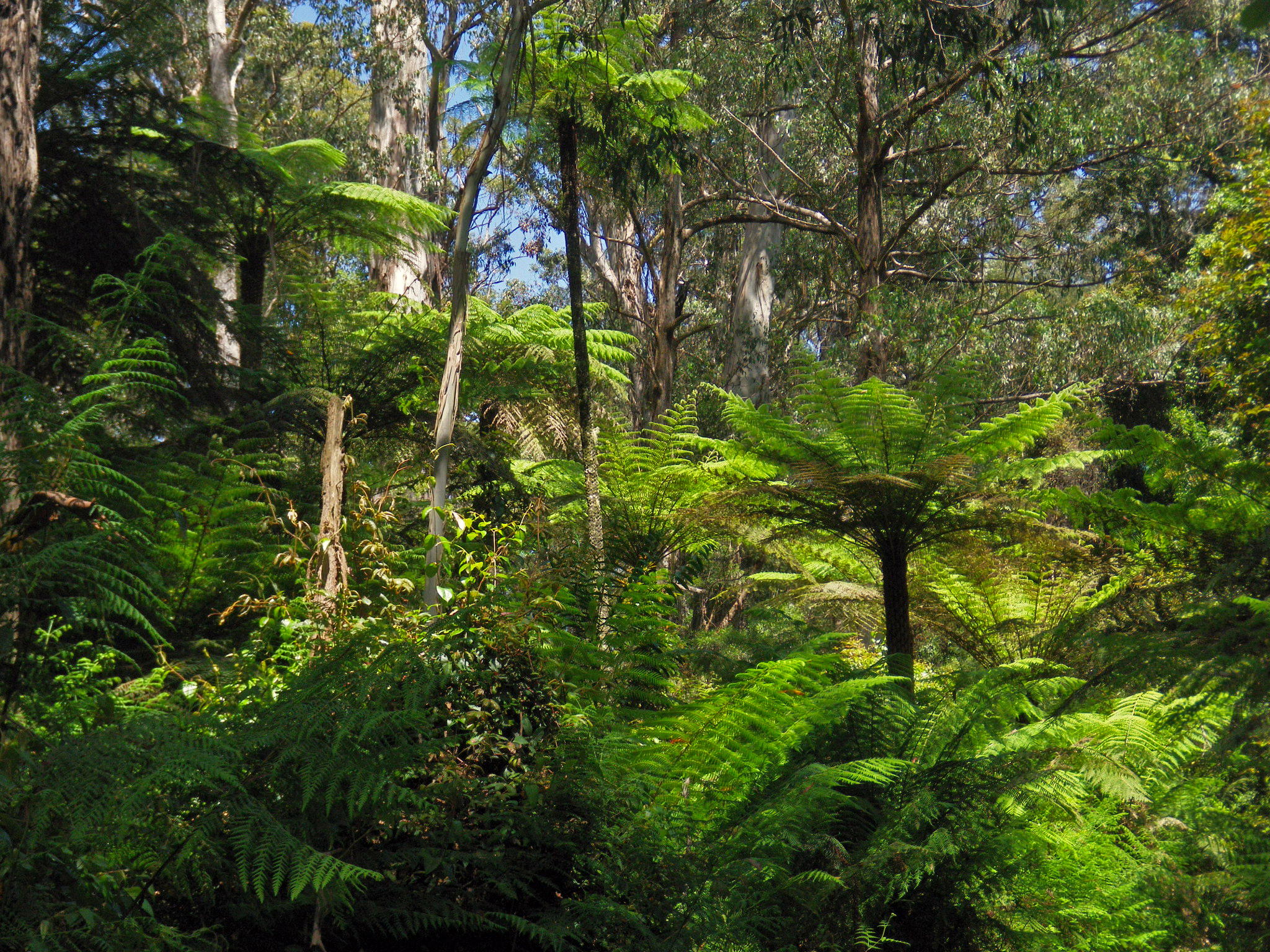
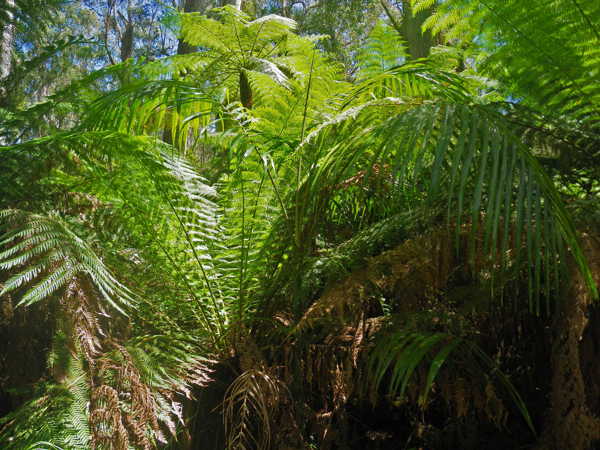
In parts of the walk down the hill, wet sclerophyll forest reappears.
Photo: Don Hitchcock, April 2015
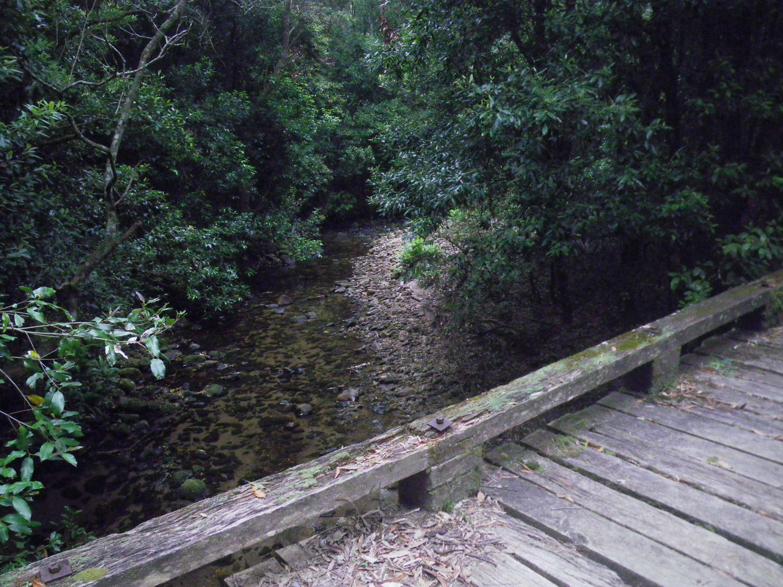
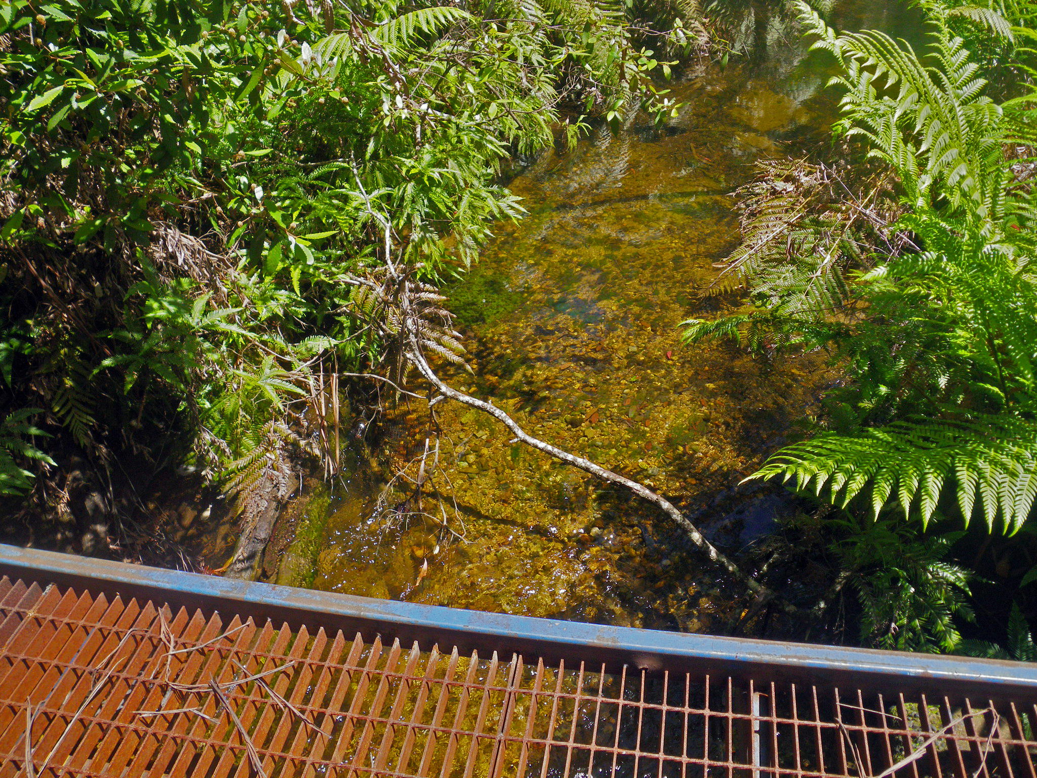
Finally the bridge over Coombadjha Creek is reached. If coming the other way, this is your last chance to fill up water bottles before Grassy Creek.
Photo: Don Hitchcock, April 2015, November 2011
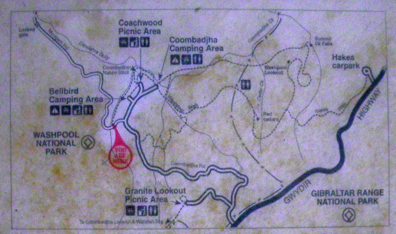
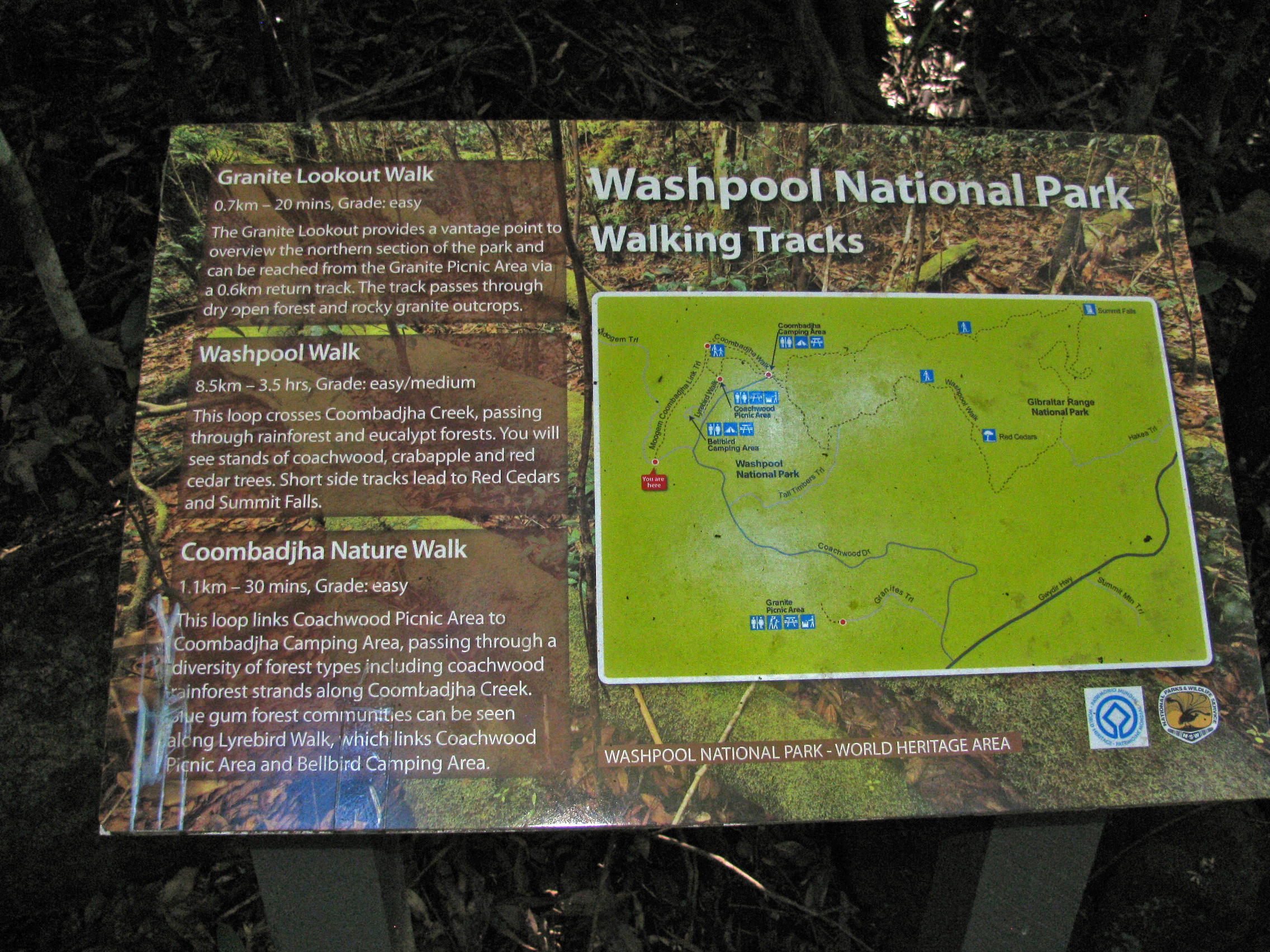
The 'You are Here' maps were good to have. Though this one is showing signs of age and a very wet position in the rainforest, it is still legible.
Photo: Don Hitchcock, November 2011
Looking back at the bridge from the Gwydir Highway side.
From here it is a steep and long uphill road bash to the Gwydir Highway, with the next leg of the walking track to Mulligans Hut a hundred metres or so down the highway towards Glen Innes, on the other side of the highway.
Photo: Don Hitchcock, November 2011
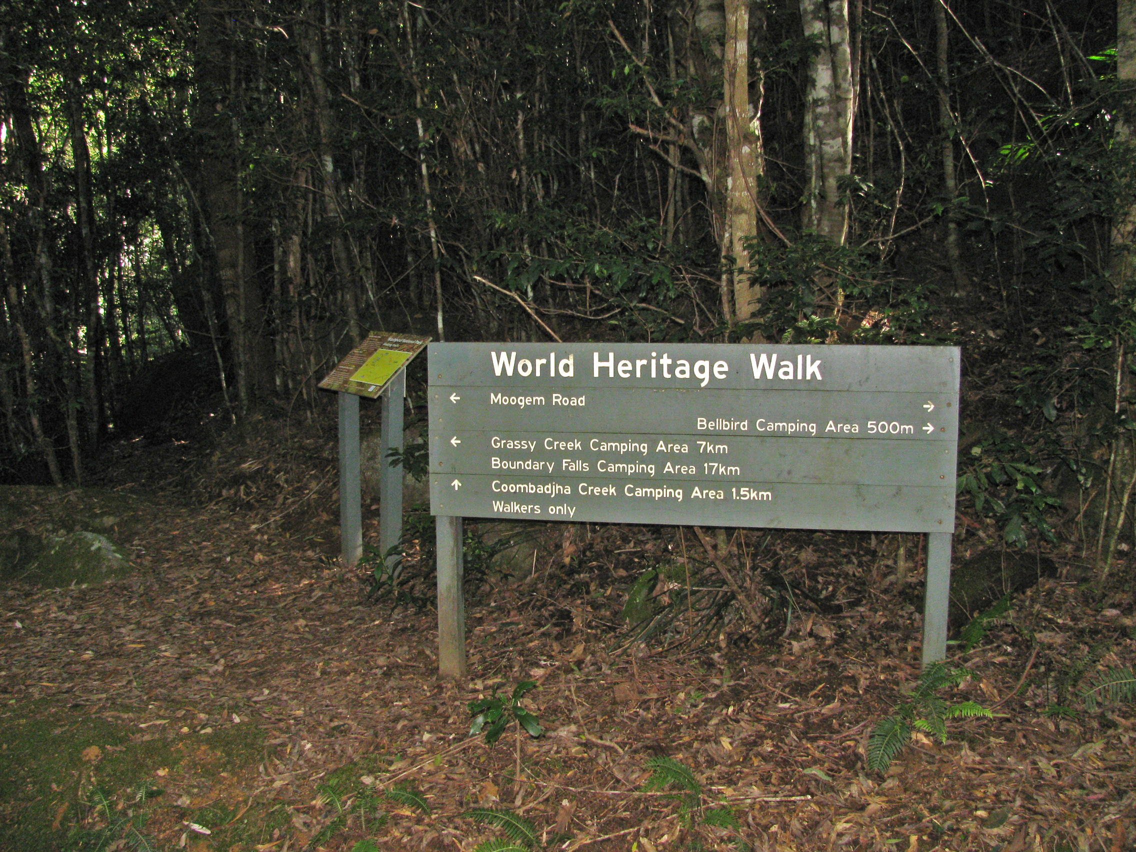
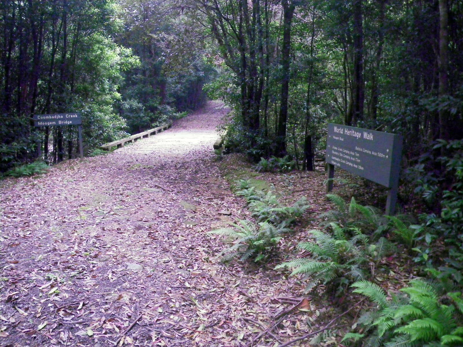
Signage was, as always on this heritage loop track, excellent.
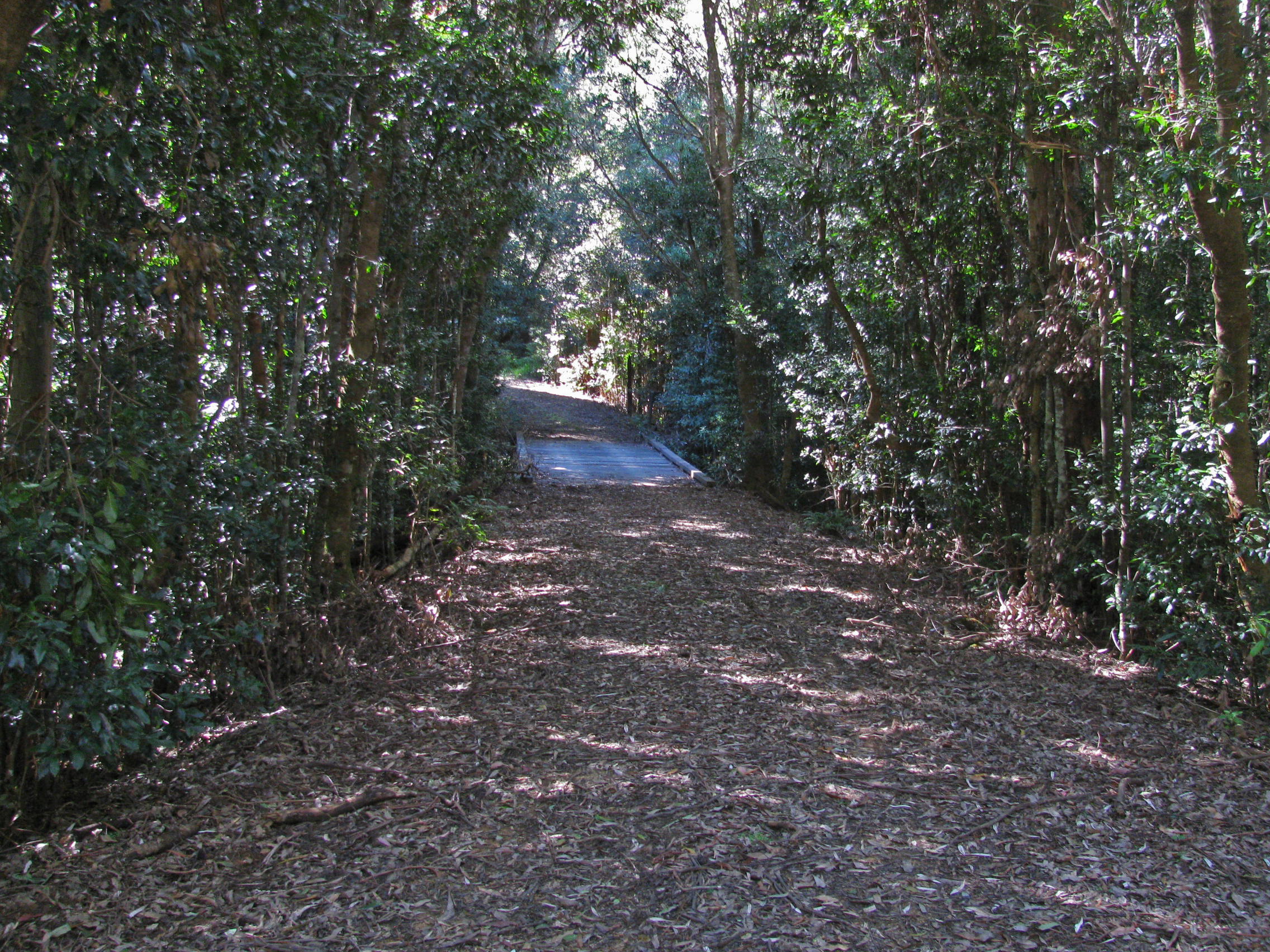
I took the track to Coombadjha Camping Area, which follows the course of Coombadjha Creek.
Photo: Don Hitchcock, April 2015
The vegetation was strictly rainforest beside the creek.
Photo: Don Hitchcock, April 2015
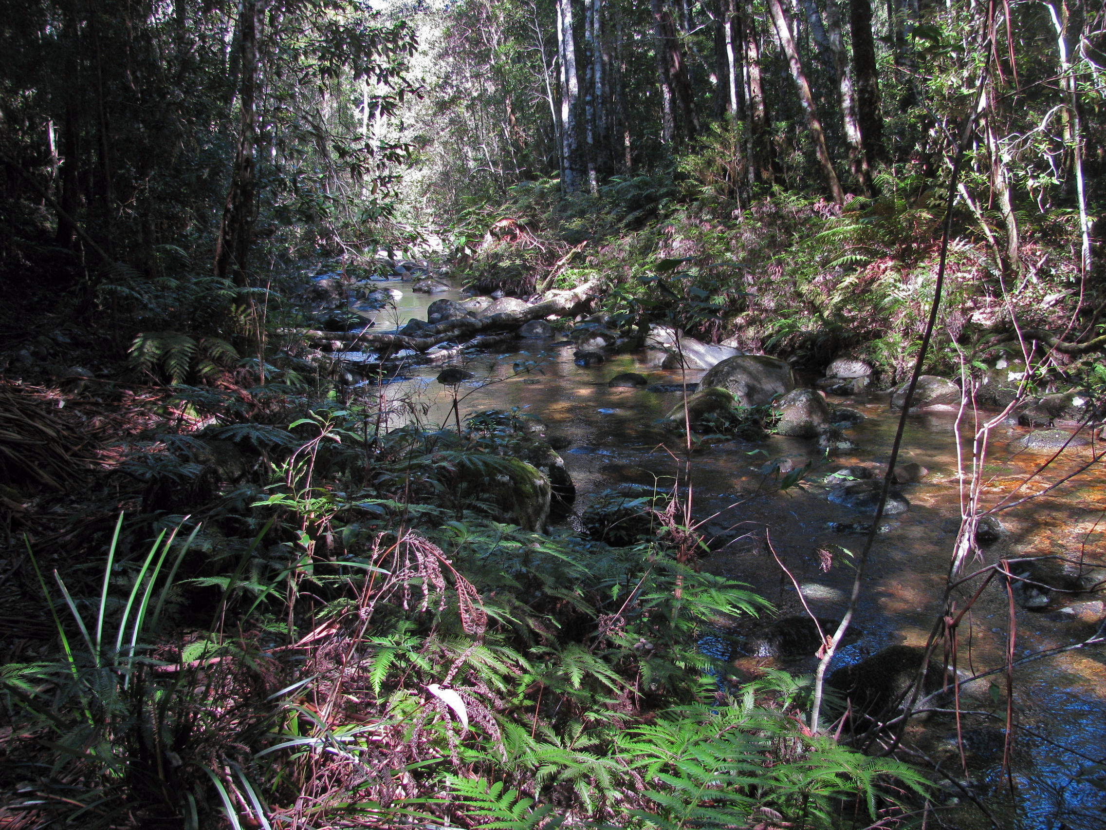
It had rained the previous weekend, and there was a lot of water in the creek.
Photo: Don Hitchcock, April 2015
This section of the track had a junction with what appeared to be a flatter, easier to negotiate alternative track from the campsite.
Photo: Don Hitchcock, April 2015
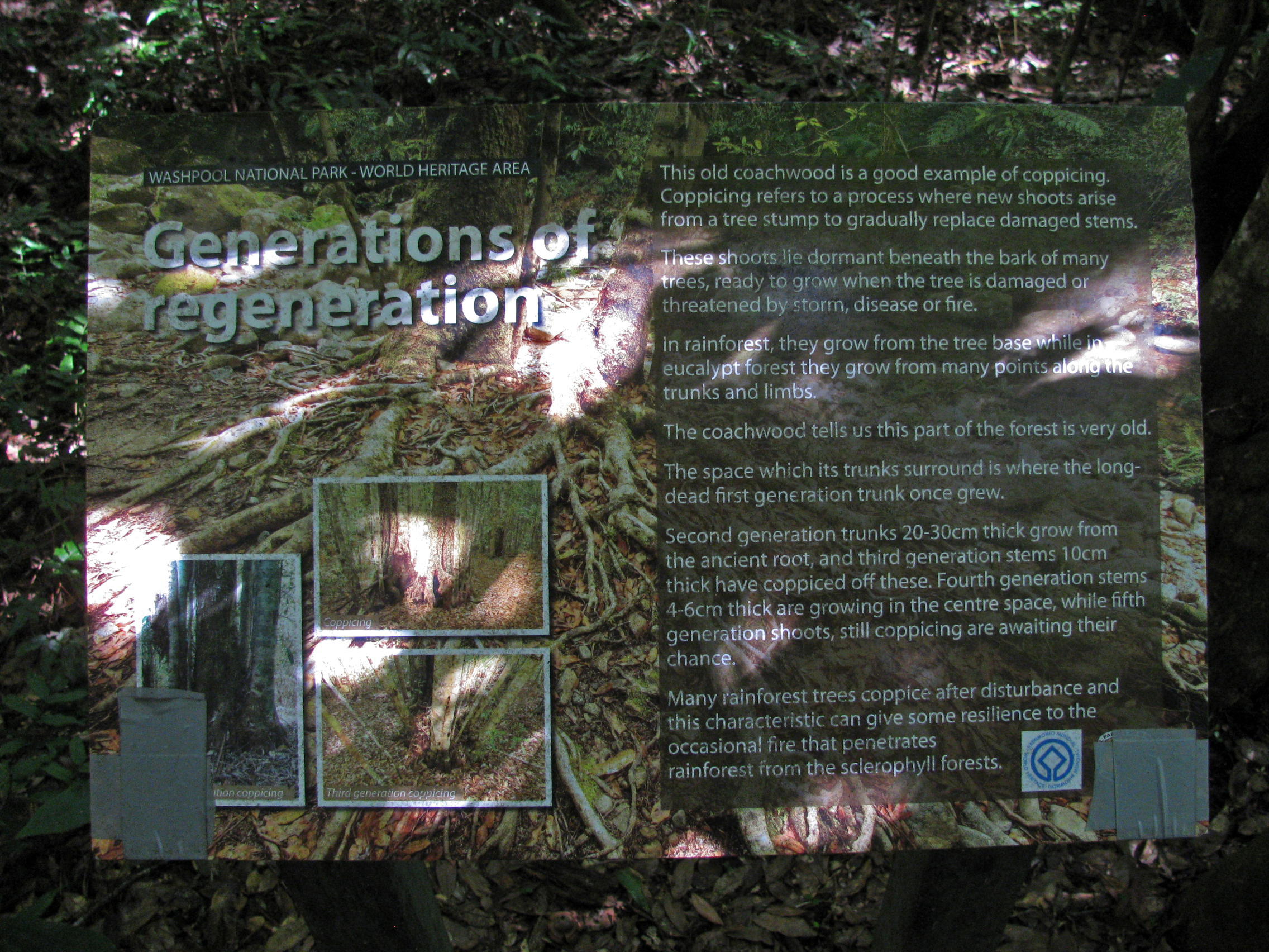
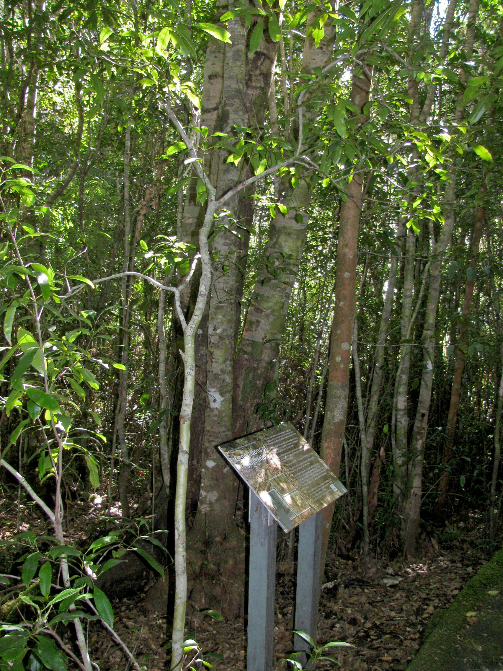
A coachwood tree at this point had coppiced (regrown with multiple stems) after being cut down.
Washpool National Park contains the largest area of coachwood (Ceratopetalum apetalum ) forest in Australia, and thus the world, since it only occurs here.
Photo: Don Hitchcock, April 2015
A lot of money had been invested in creating a functional and beautiful set of steps and a landing to inspect Coachwood Pool. The pool would make a wonderful swimming hole in summer.
Photo: Don Hitchcock, April 2015
Coachwood Pool, on the track between the bridge and the camp site at Coombadjha Camping Area.
Photo: Don Hitchcock, April 2015
There is a bridge from the track and the parking area to a beautiful grassed glade at Coombadjha Camping Area. The creek has good water.
Photo: Don Hitchcock, April 2015
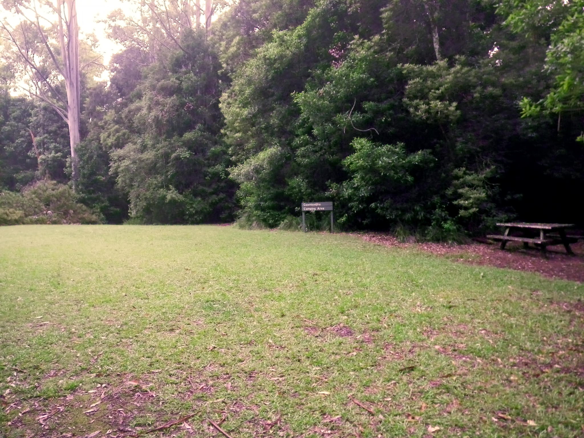
The glade appears to be mowed regularly, and is well maintained. There is a pit toilet at the car park on the other side of the creek
Photo: Don Hitchcock, January 2012
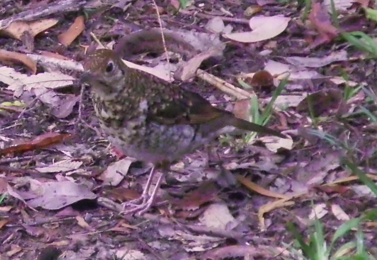
The Bassian Thrush, Zoothera lunulata is a secretive bird. Its plumage is mottled brown to olive-brown, heavily scalloped with black crescent-shaped bars on the back, rump and head. The paler underparts all have brown-black scalloping. It has a white eye-ring. In flight the Bassian Thrush shows a broad dark diagonal bar across the white underside of its wing.
I could not get very close to the bird, and had to rely on zoom to get this image.
Photo: Don Hitchcock, January 2012
Text: http://www.birdsinbackyards.net/species/Zoothera-lunulata
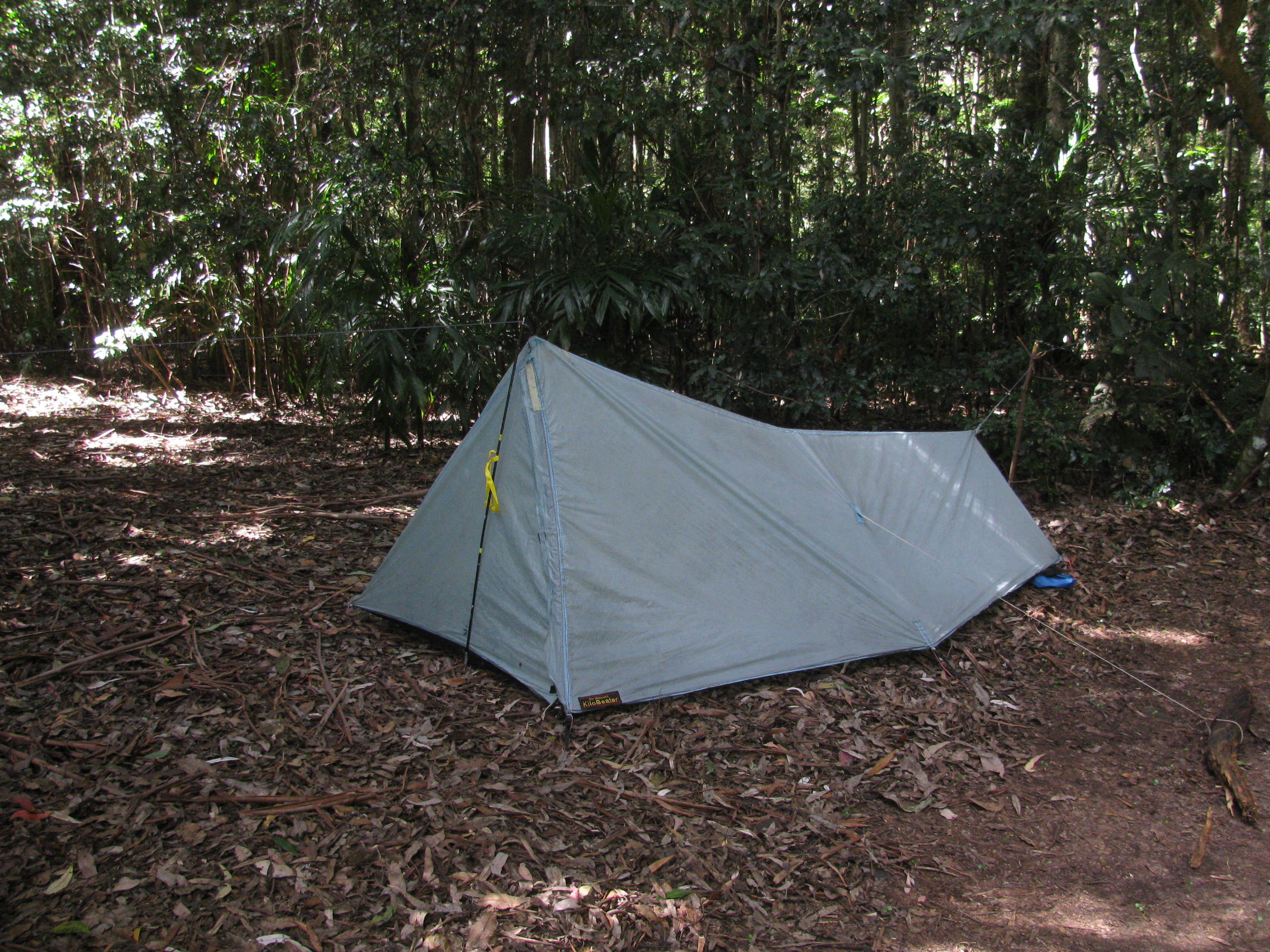
Each camping spot has an area swept of leaves, a fireplace and a table and chairs. Since I do not carry an air mattress, I set up my tent on the leaves of the forest floor. This works well for me.
My tent is ten years old, at least the canopy is. I have since improved it with a floor and insect netting. I believe it is now close to perfection, though the next step is to put in ventilation so that there is less condensation on the inside of the tent wall on cool nights.
The tent is very easy to put up and pull down, and packs away into an extremely small package. It can be put up so that it is dry inside even when it is raining during the set up process, is stable in strong winds, has plenty of room for a single camper, is insect proof, very light, easy to repair when necessary, and can be put up on almost any surface. I love using it.
Photo: Don Hitchcock, April 2015
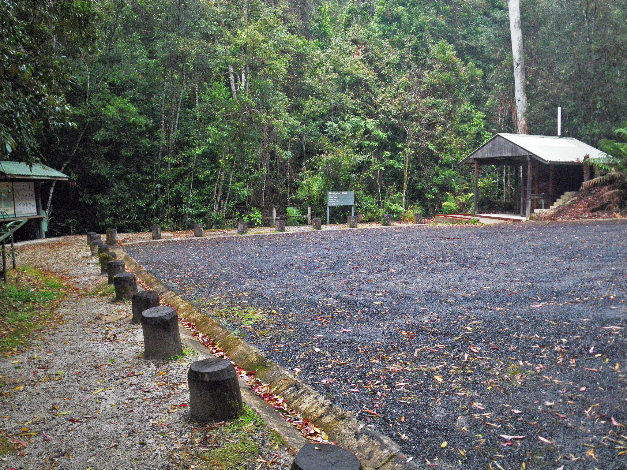
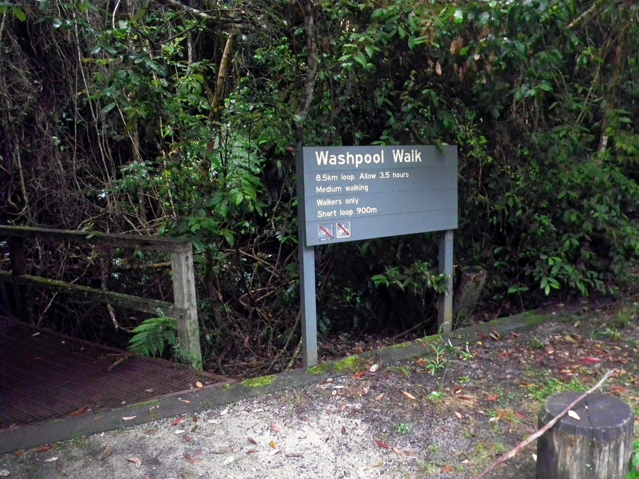
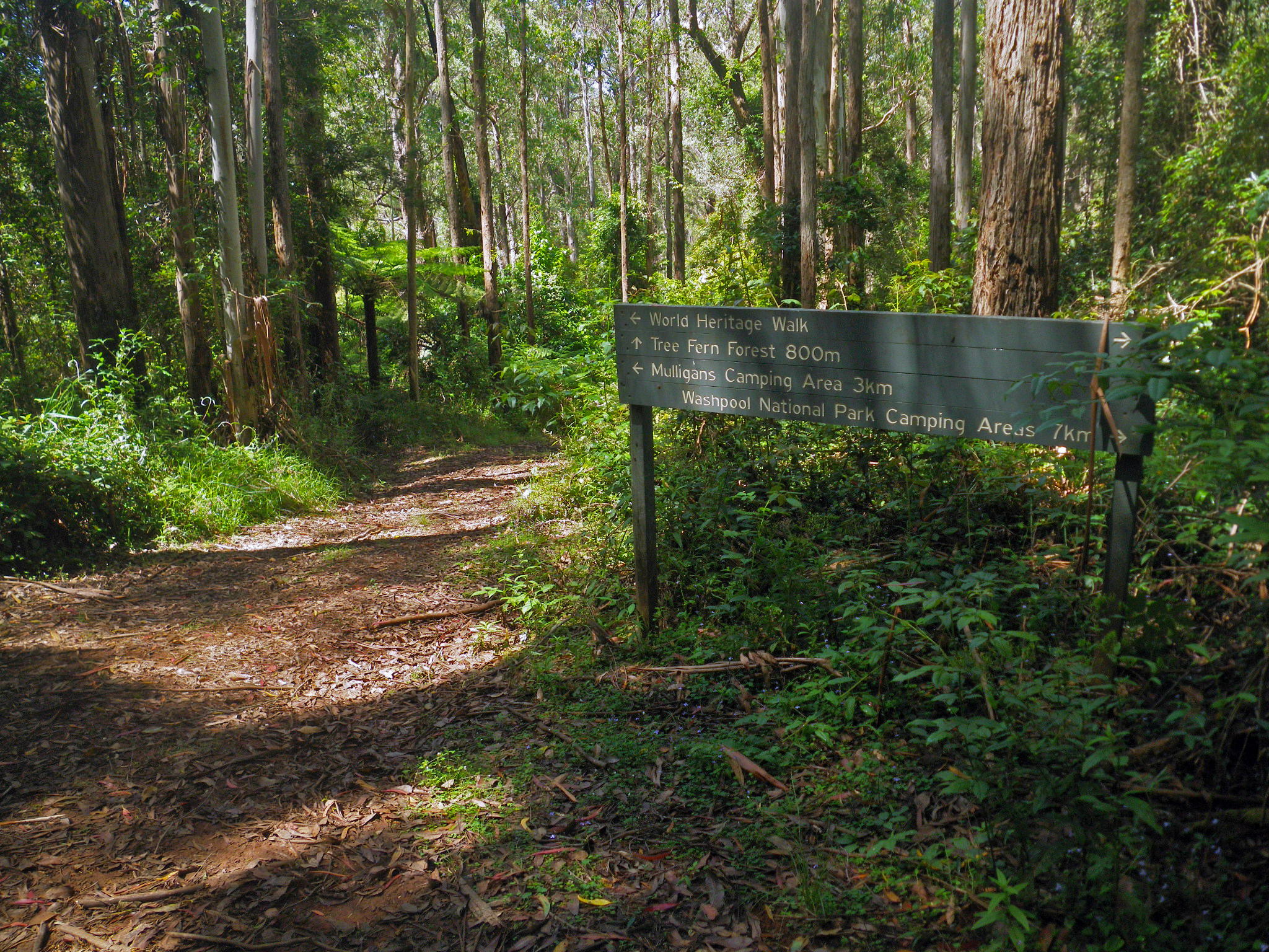
On the way up the hill, I decided to take an alternative route along part of the Washpool Walk instead of just roadbashing the entire way. This access point to the walk is at the carpark.
Photo: Don Hitchcock, October 2013, January 2012
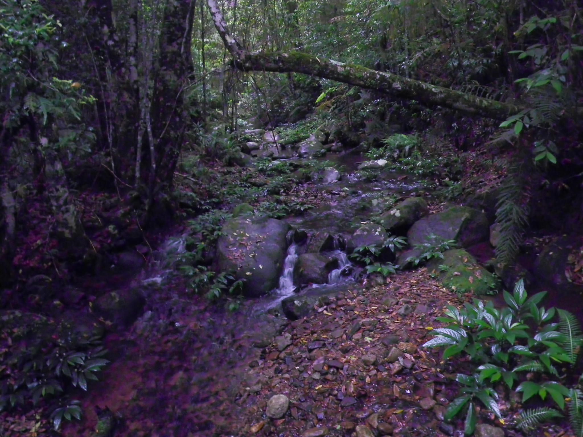
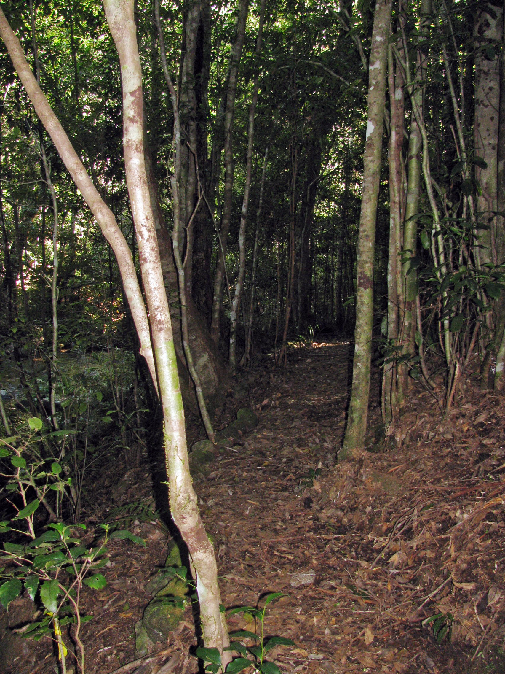
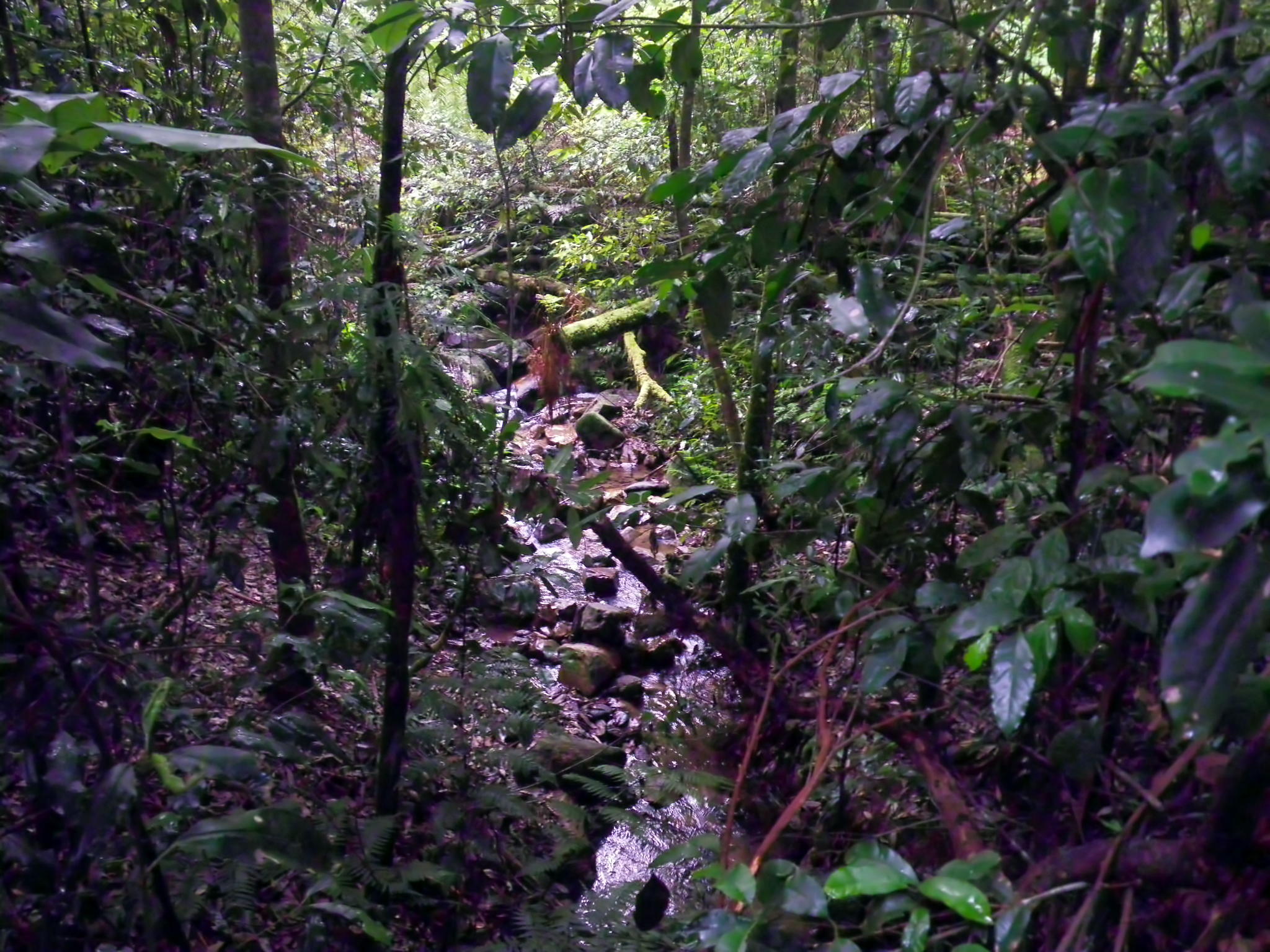
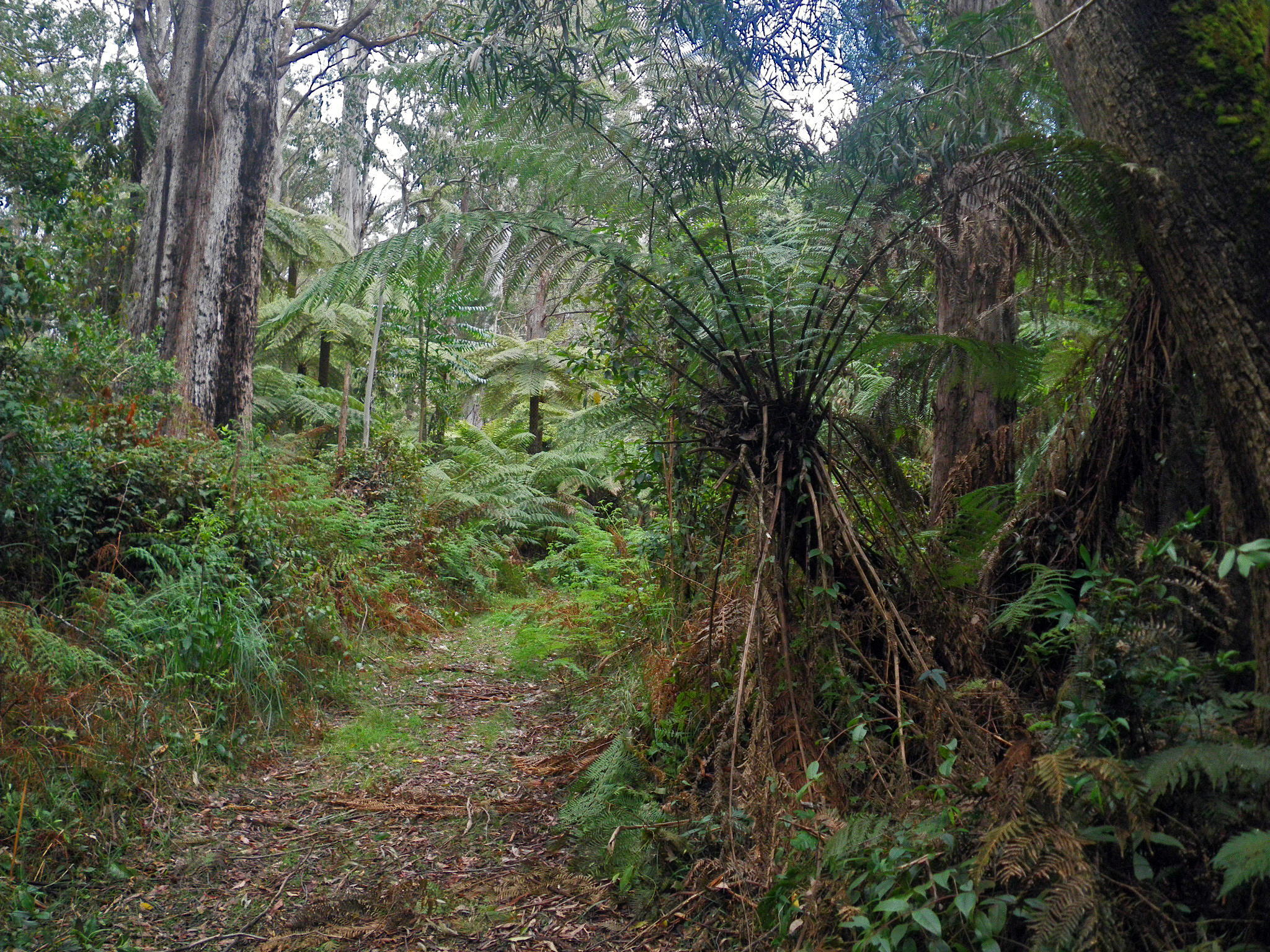
The way leads through rainforest, and is dark, moist and beautiful.
This is a tributary of Coombadjah Creek.
Photo: Don Hitchcock, January 2012
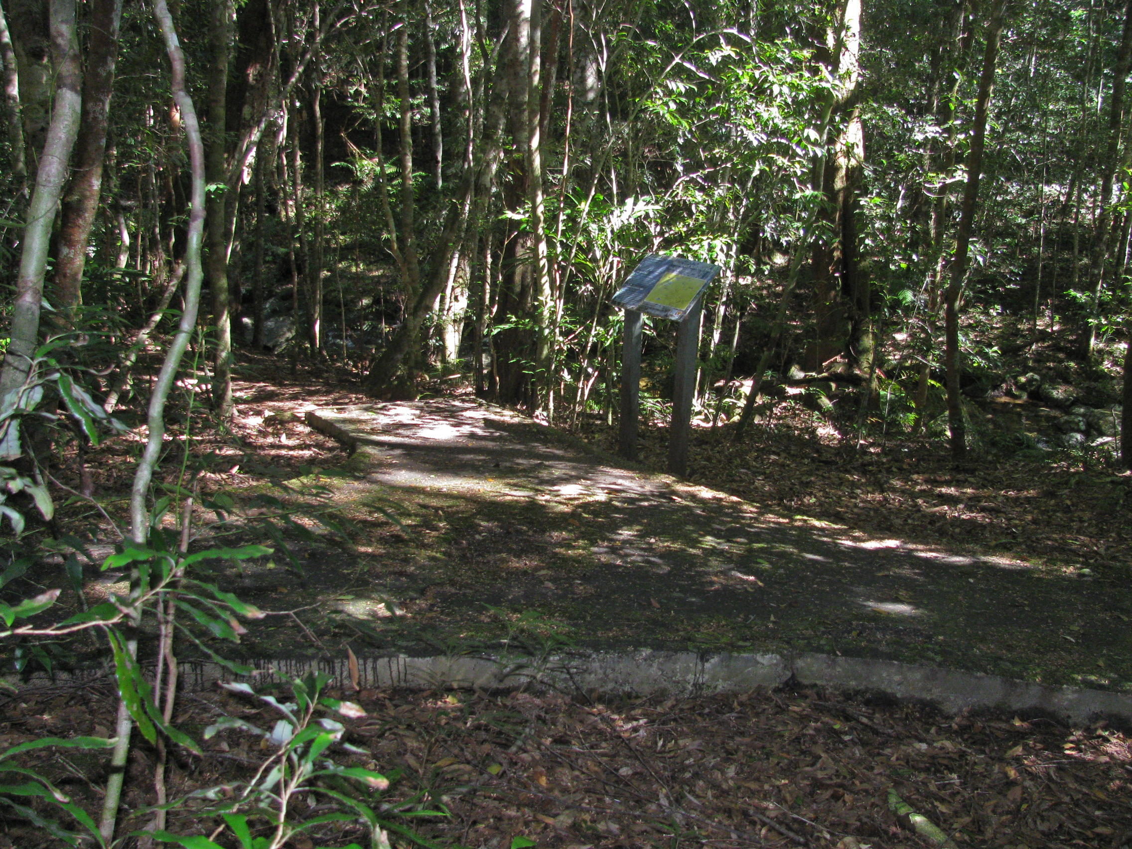
The notice boards were, as usual, very informative and useful.
I planned to turn off onto the management trail to meet Coachwood Drive for the walk up the hill.
Photo: Don Hitchcock, January 2012
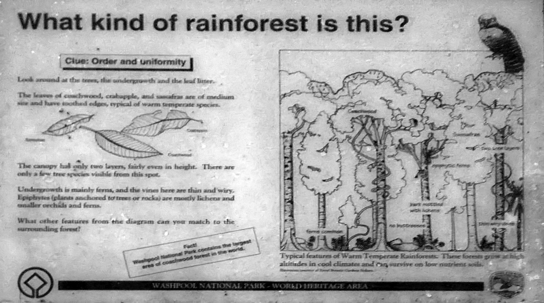
It is a warm temperate rainforest. Littering the floor are leaves of coachwood, crabapple and sassafras, which have leaves of medium size, and have toothed edges to shed water easily, and are typical of warm temperate rainforest species.
The canopy has only two layers, fairly even in height. Undergrowth is mainly ferns, and the vines in this area are thin and wiry. Epiphytes (plants anchored to trees or rocks, but not parasitic) are mostly lichens and smaller orchids and ferns.
These forests grow at high altitudes in cool climates, and can survive on low nutrient soils. The tree bark is mottled with lichens, and there are no buttresses at the bases of the trunks.
Photo: Don Hitchcock, January 2012
Text: NPWS noticeboard
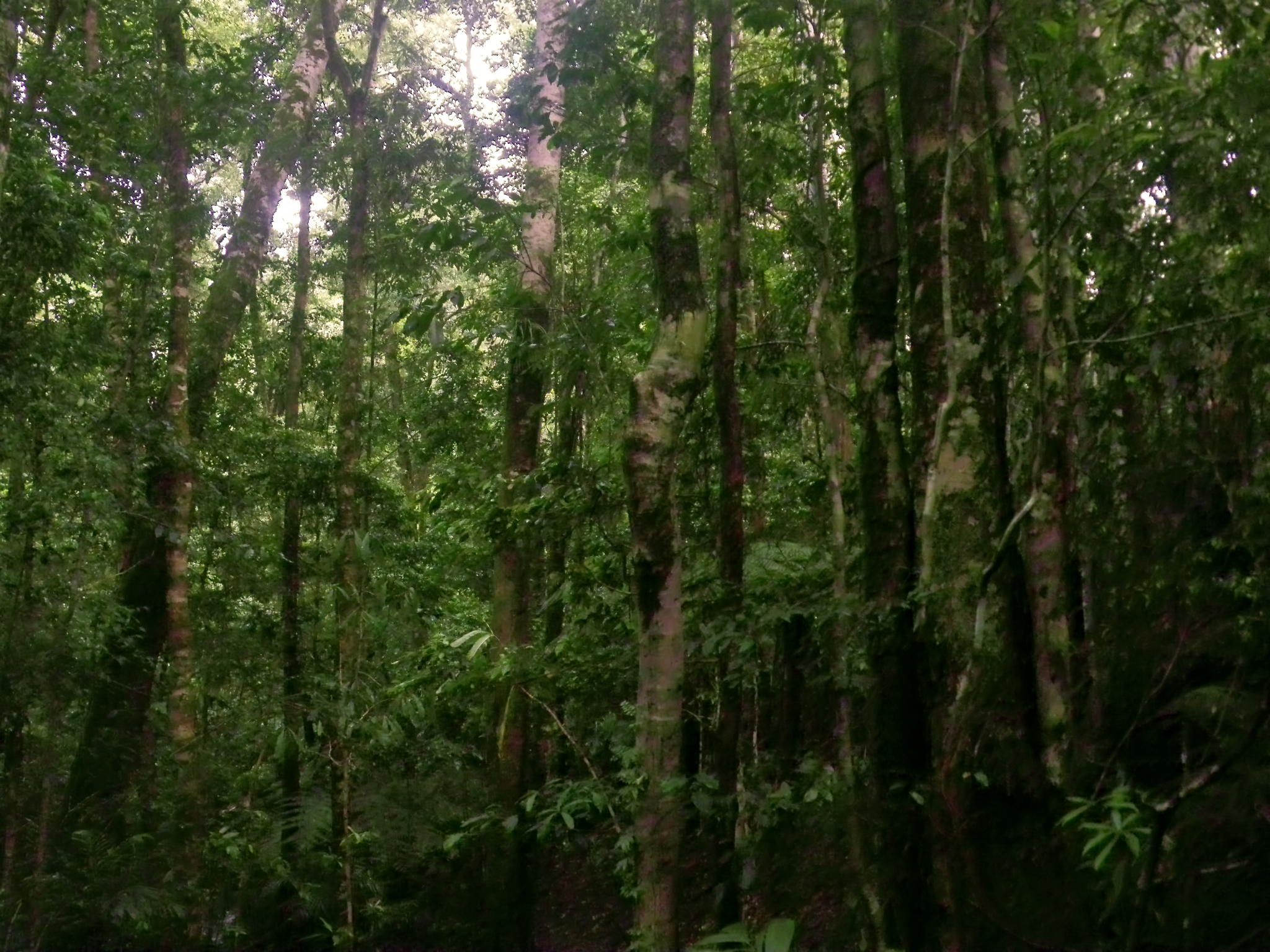
The coachwood forest was beautiful, with both coppiced and single trunks in the extensive stand.
Photo: Don Hitchcock, January 2012
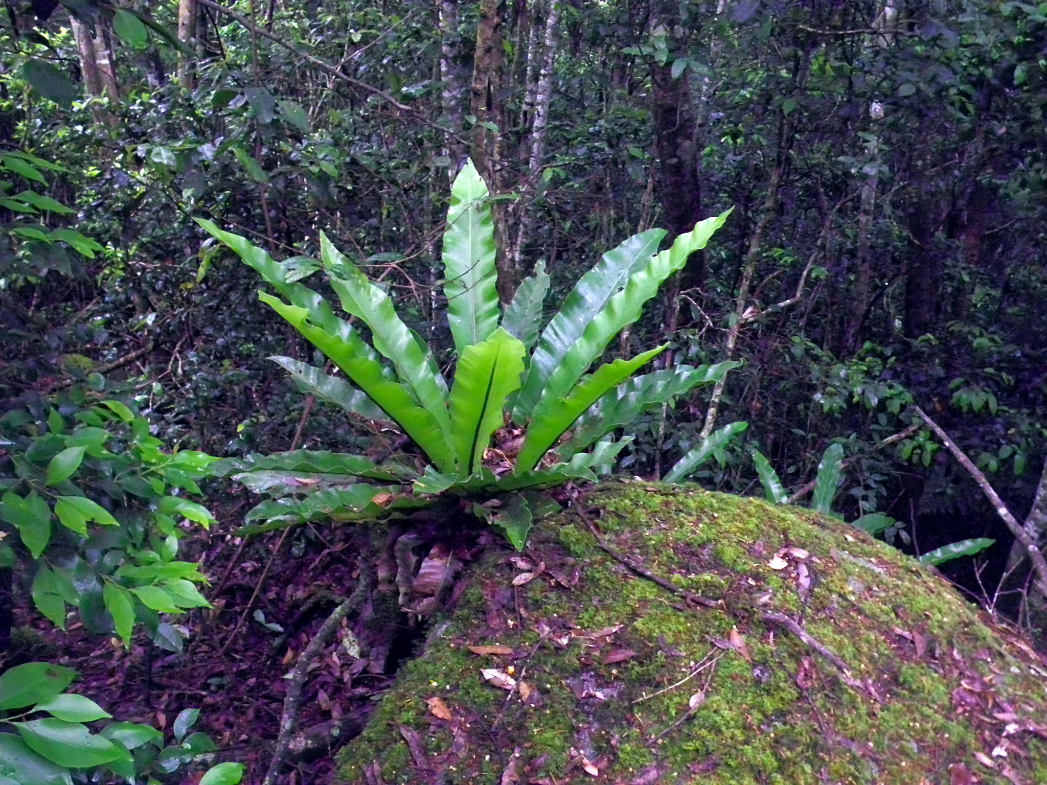
This 'Bird's Nest' fern was growing in a crevice on a large rock in the rainforest.
Photo: Don Hitchcock, January 2012
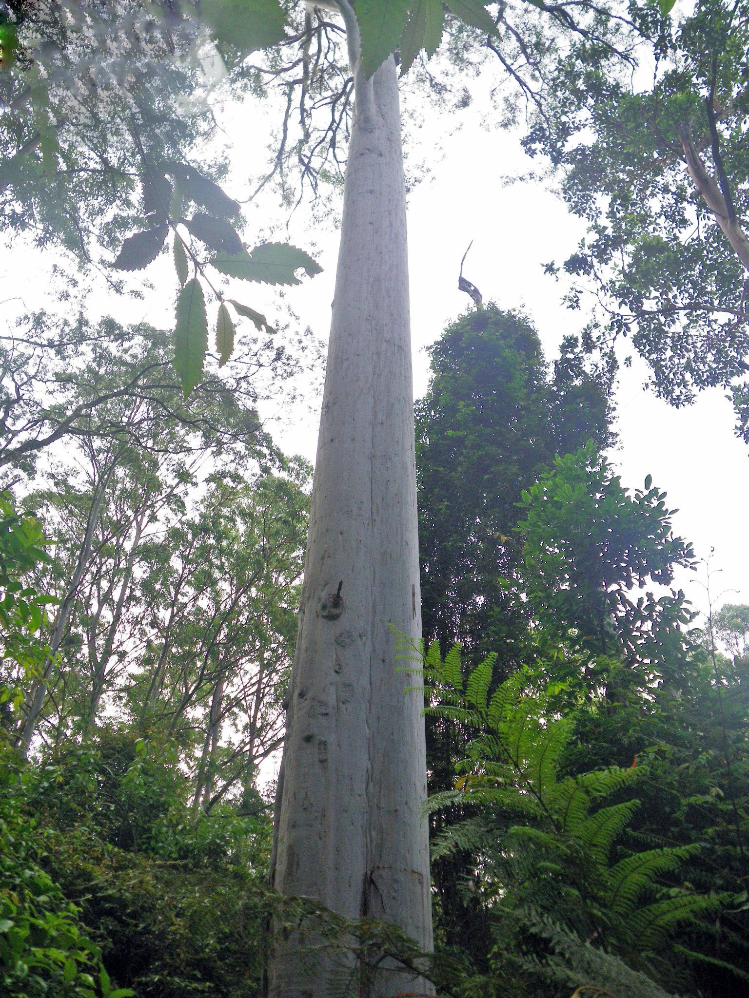
As I climbed the hill, wet sclerophyll forest replaced the rainforest, including tall white barked gum trees such as this one.
Photo: Don Hitchcock, January 2012
By this time I had reached the turnoff to the management trail, which led to Coachwood Drive, the access road for the area.
Photo: Don Hitchcock, January 2012
Five minutes later the management trail passes through another patch of rainforest, here flanking another tributary of Coombadjah Creek.
Photo: Don Hitchcock, January 2012
The vegetation soon reverts to the rainforest margin, wet sclerophyll type characterised by treeferns.
Photo: Don Hitchcock, January 2012
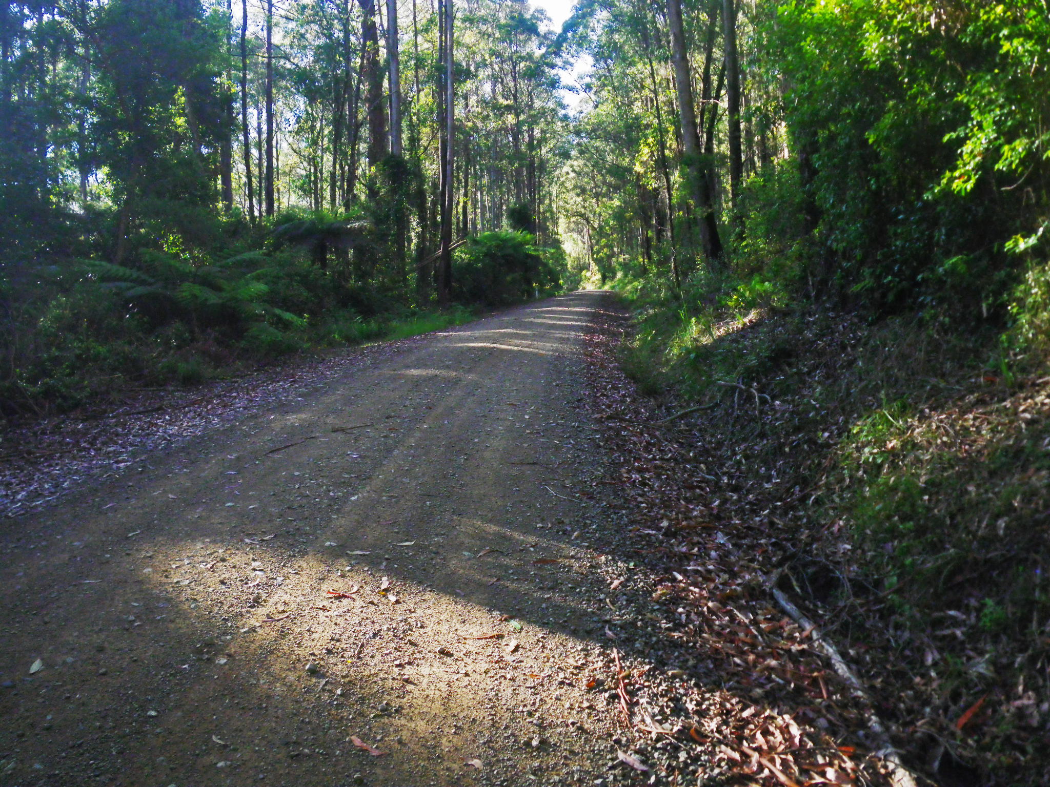
And finally the road, leading ever upward, appears.
Photo: Don Hitchcock, January 2012
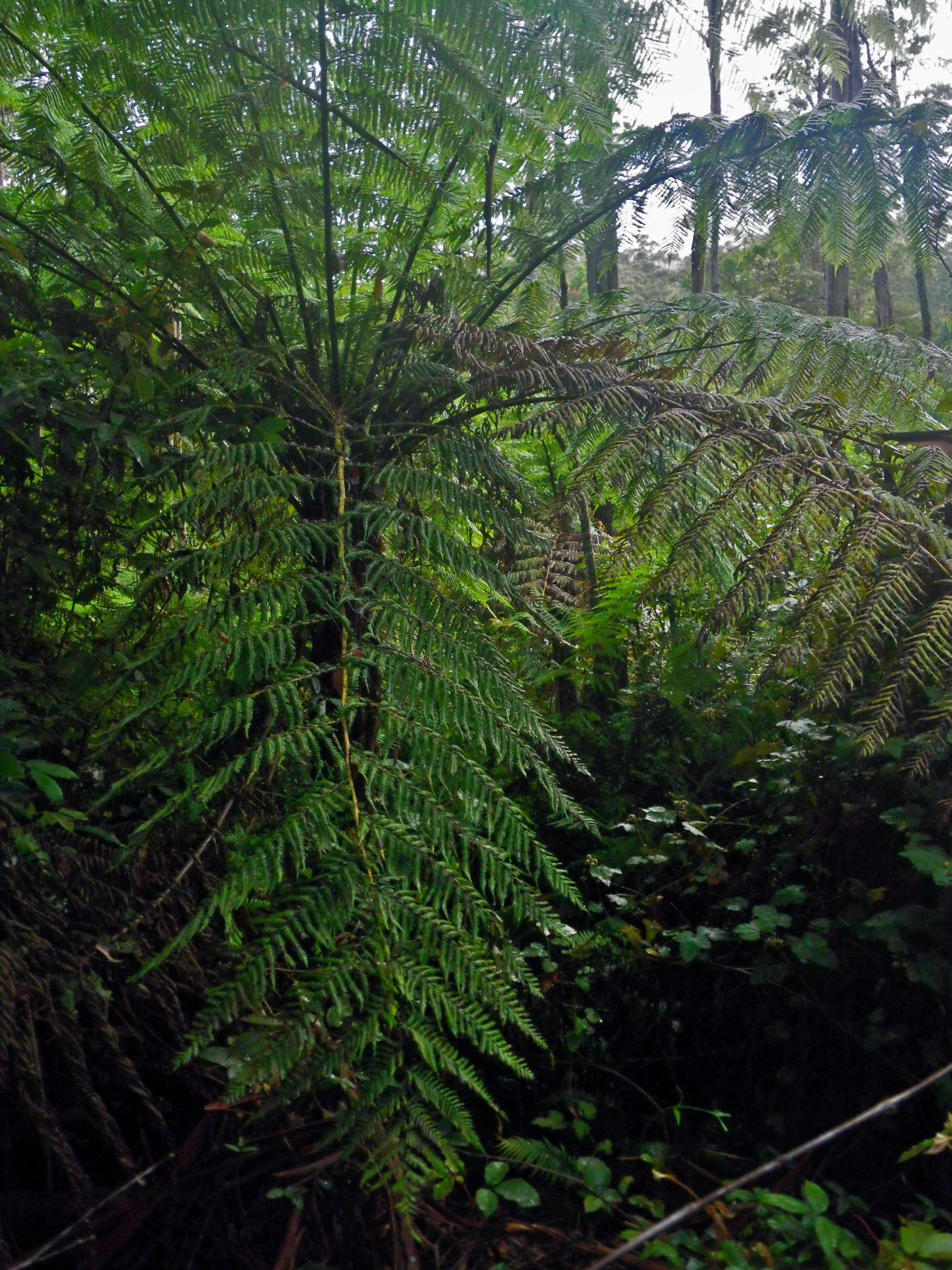
Mature treeferns flanked the road in places.
Photo: Don Hitchcock, January 2012
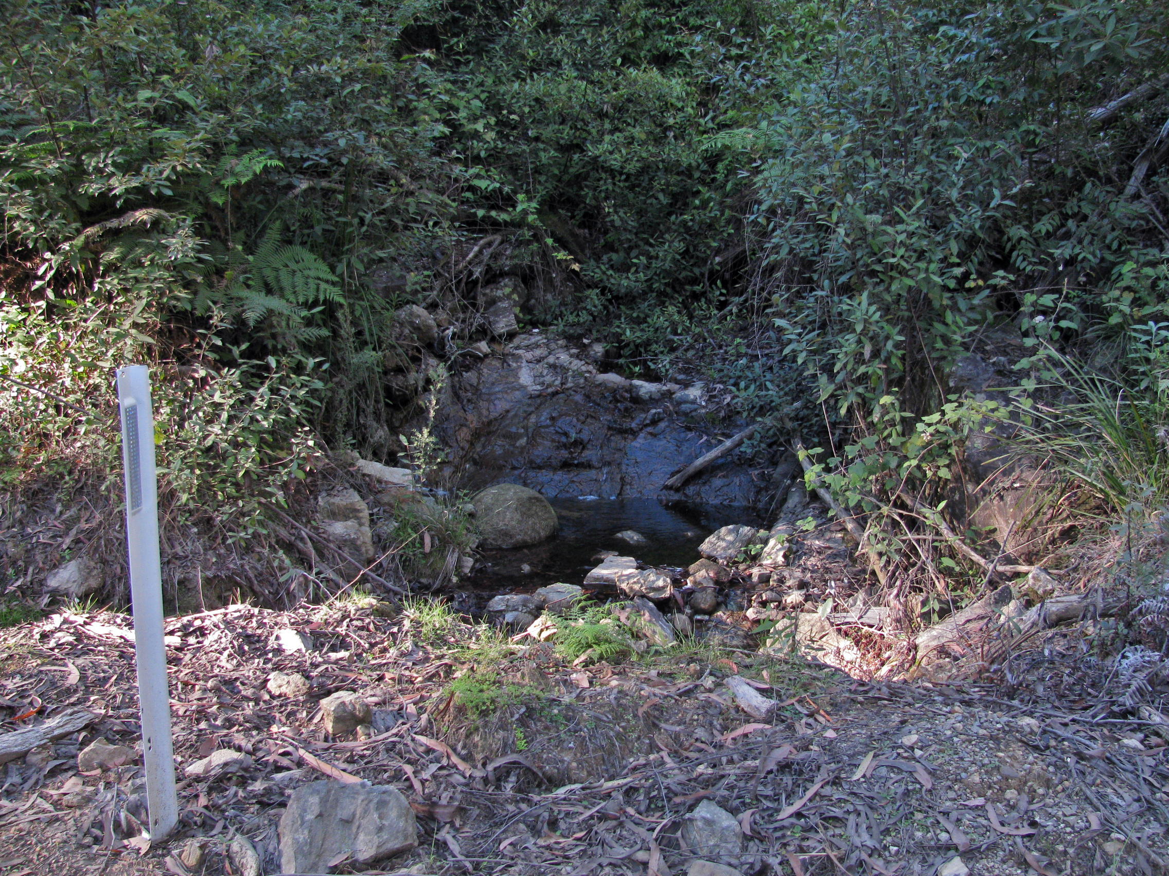
It is a 3.75 km road bash, uphill all the way, to the next section of the track. This is a water source about half way up.
Photo: Don Hitchcock, April 2015
At the top the road flattens out at last. This view looks back down the road, at the entry to the side road to the Granite Picnic area.
Photo: Don Hitchcock, April 2015
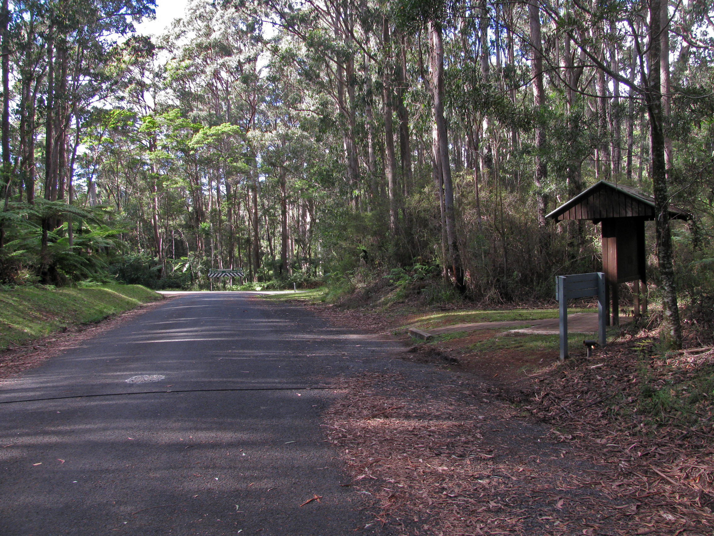
And finally the highway appears. The entry to the next section of the track starts about 100 metres down the road to the right in this image, but on the other side of the highway.
Photo: Don Hitchcock, April 2015
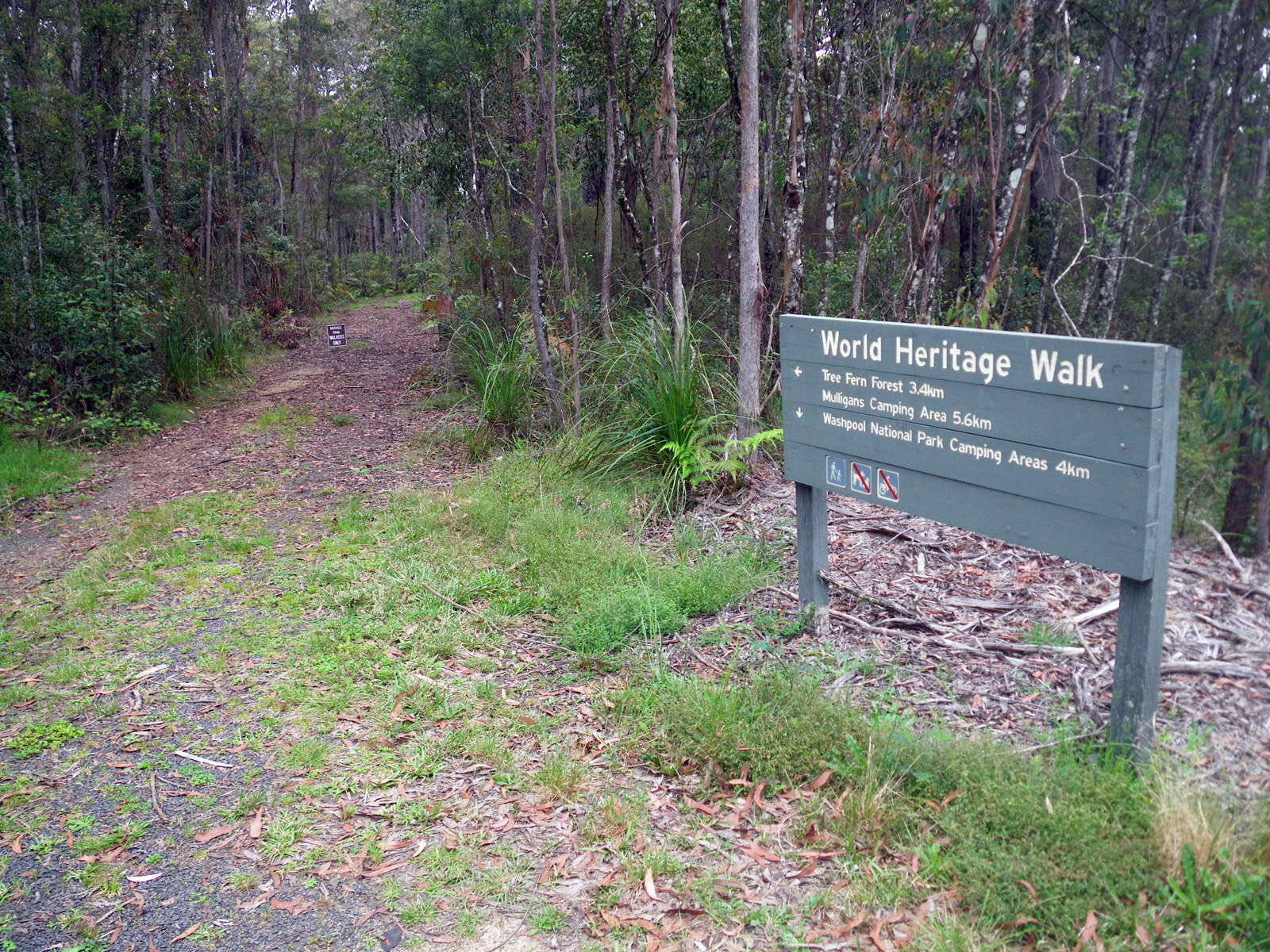
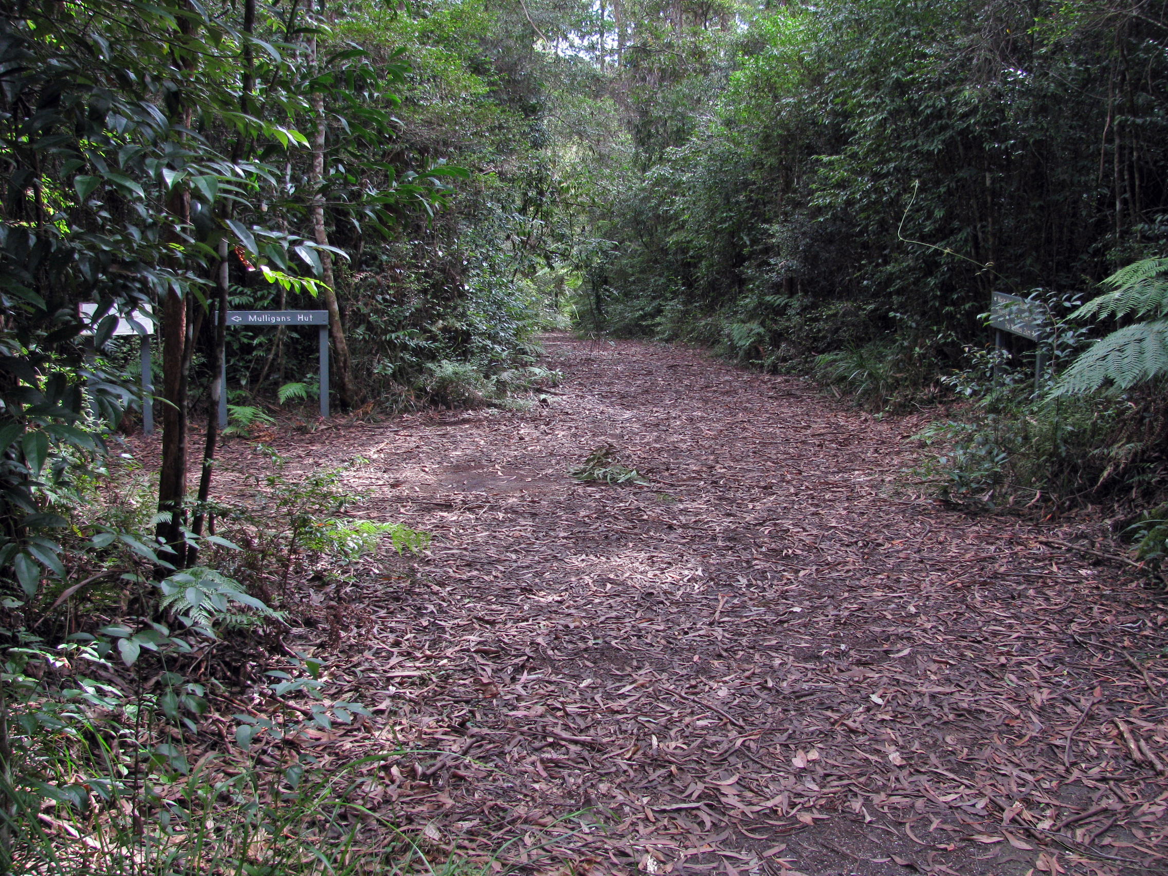
Entry to the next section of track, on the other side of the highway, variously called Tree Fern Fire Trail and Pidcocks Trail. It is a little bit uphill for a while, then there is a long downhill slope to Mulligans Hut.
Photo: Don Hitchcock, November 2011
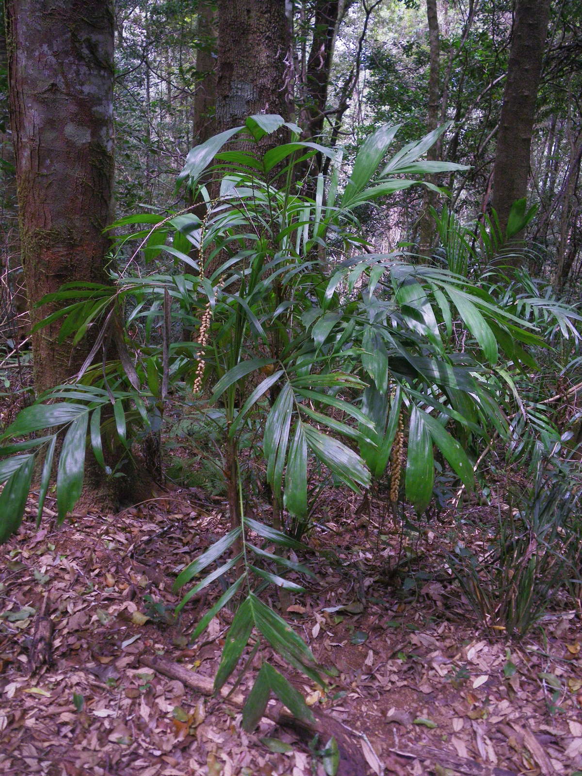
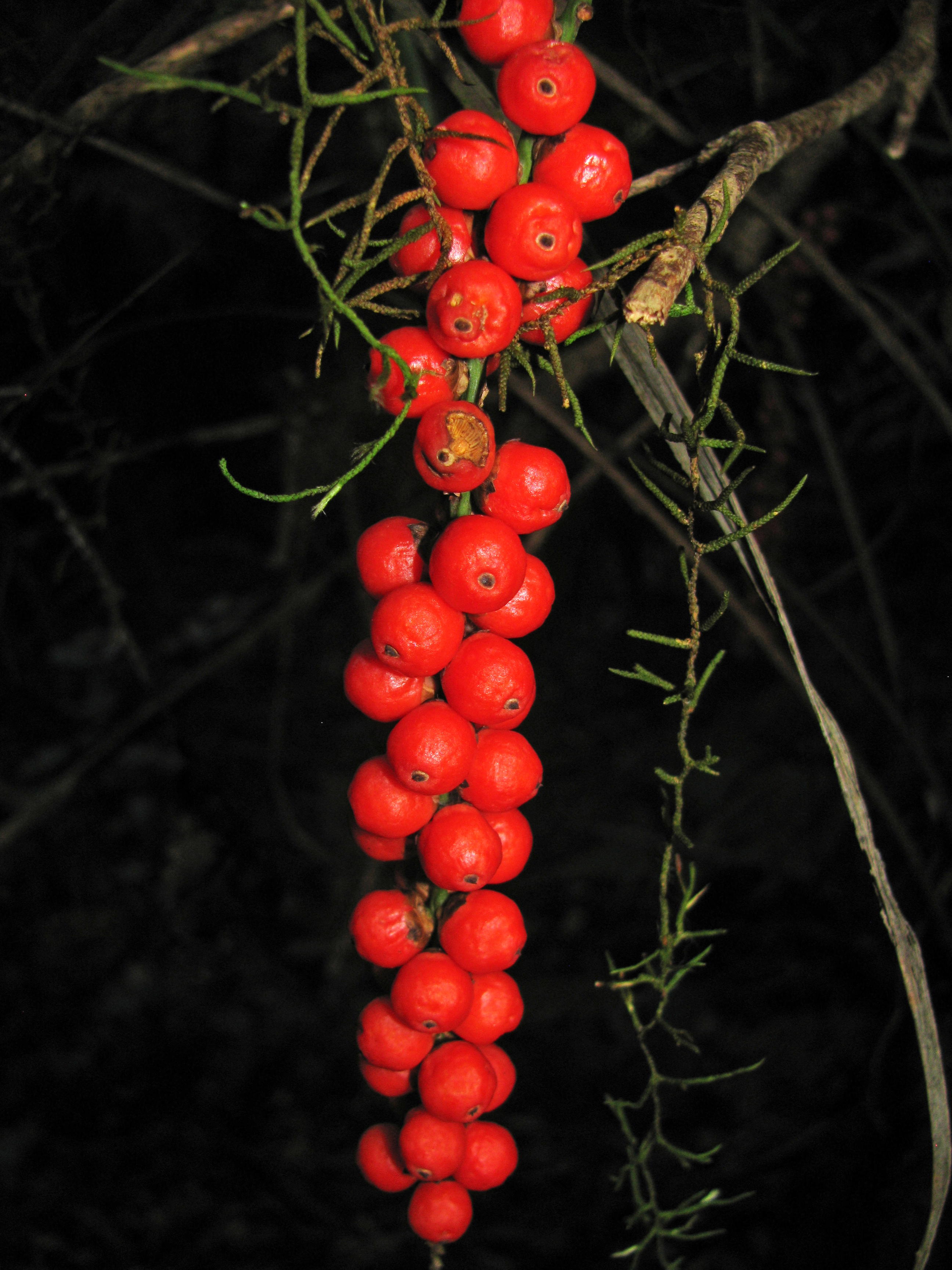
Walking Stick Palm, Linospadix monostachya, shown here with pale yellow immature fruit (or flowers?) that turn red when ripe, is a small palm growing in rainforest understorey in eastern Australia. It usually grows to 2 or 3 metres tall.
It occurs in very wet areas of the ranges, in rainforest at moderate altitudes up to 1200 metres. They grow as an understorey plant, and are usually found in dense shade, never receiving any direct sunlight. The microclimate in these positions is cool and humid due to the deep shade provided by the canopy.
Photo: Don Hitchcock, November 2011
Text: Adapted from Wikipedia and http://www.pacsoa.org.au/palms/Linospadix/monostachya.html
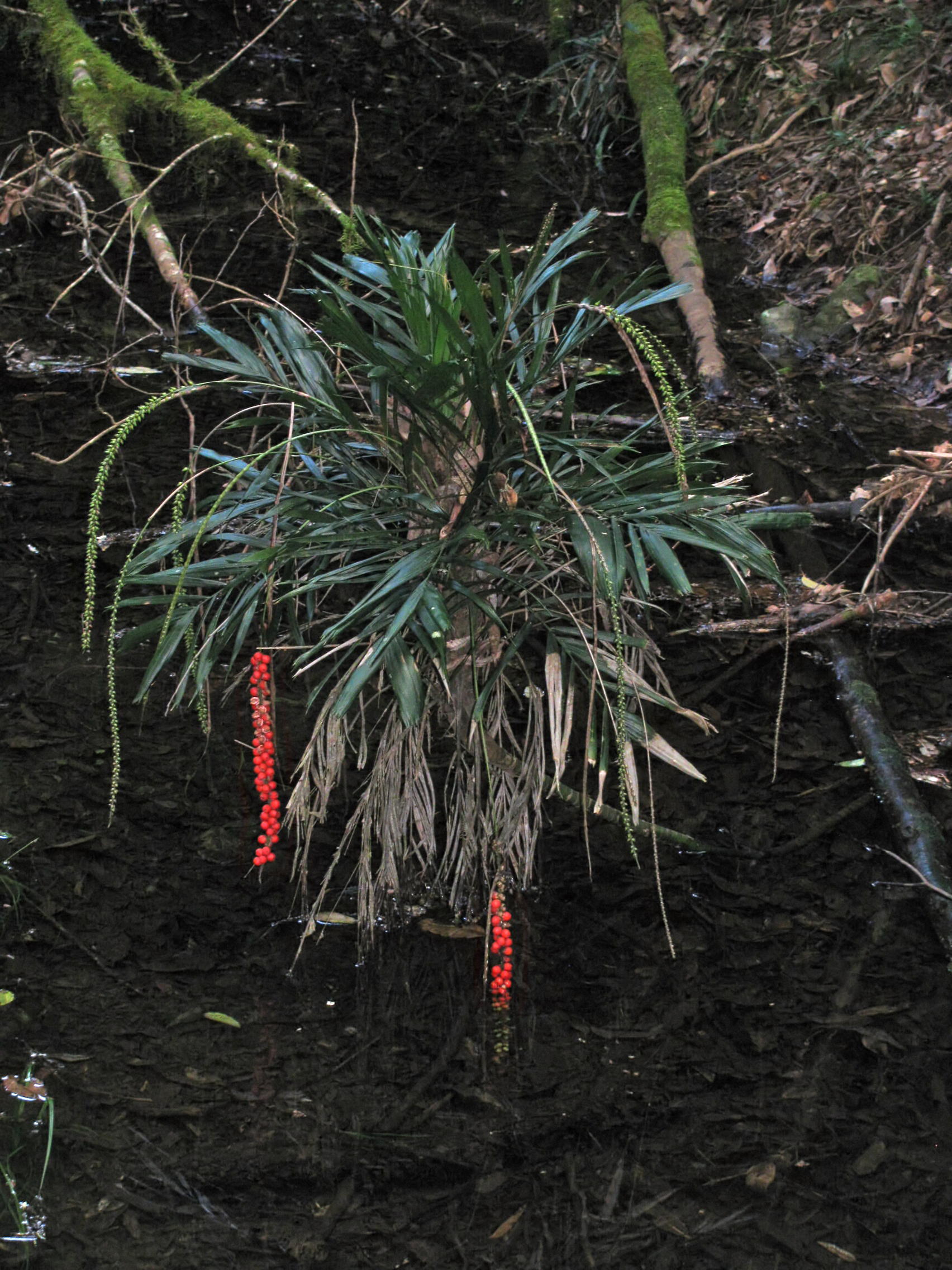
This walking stick palm was growing in water, though it is possible that the stream is quite intermittent, there had been rain recently.
At this time of year the seeds were red and mature.
Photo: Don Hitchcock, April 2015
At the crest the vegetation opens out into a grassy glade surrounded by tall Eucalyptus.
Photo: Don Hitchcock, April 2015
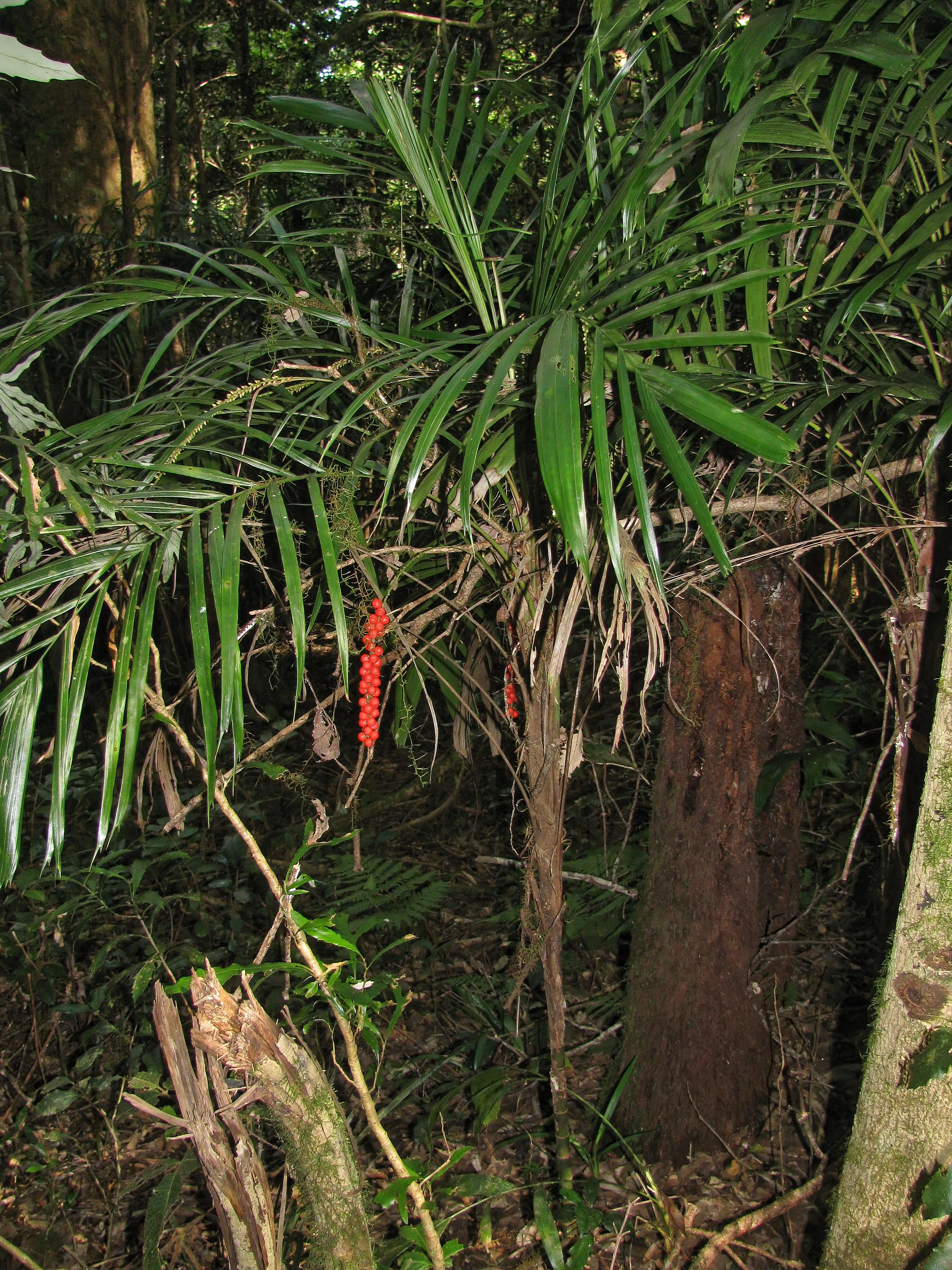
This was a superb specimen of walking stick palm, at a point where the vegetation had again changed to rainforest.
The mature red fruit was accompanied on this palm by fresh shoots bearing pale yellow flower buds for the next season's crop.
Photo: Don Hitchcock, April 2015
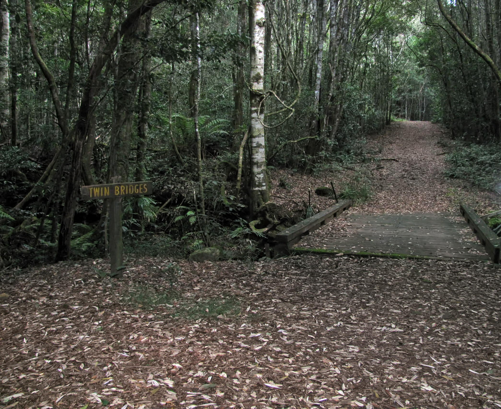
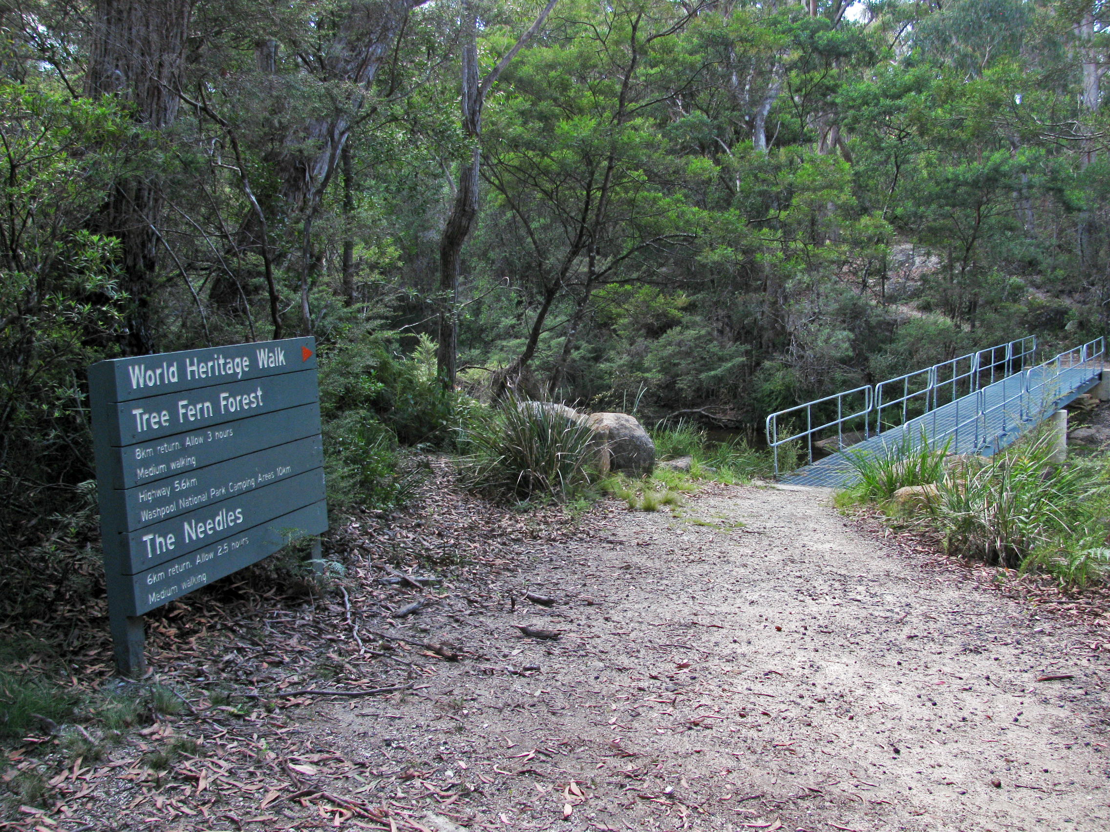
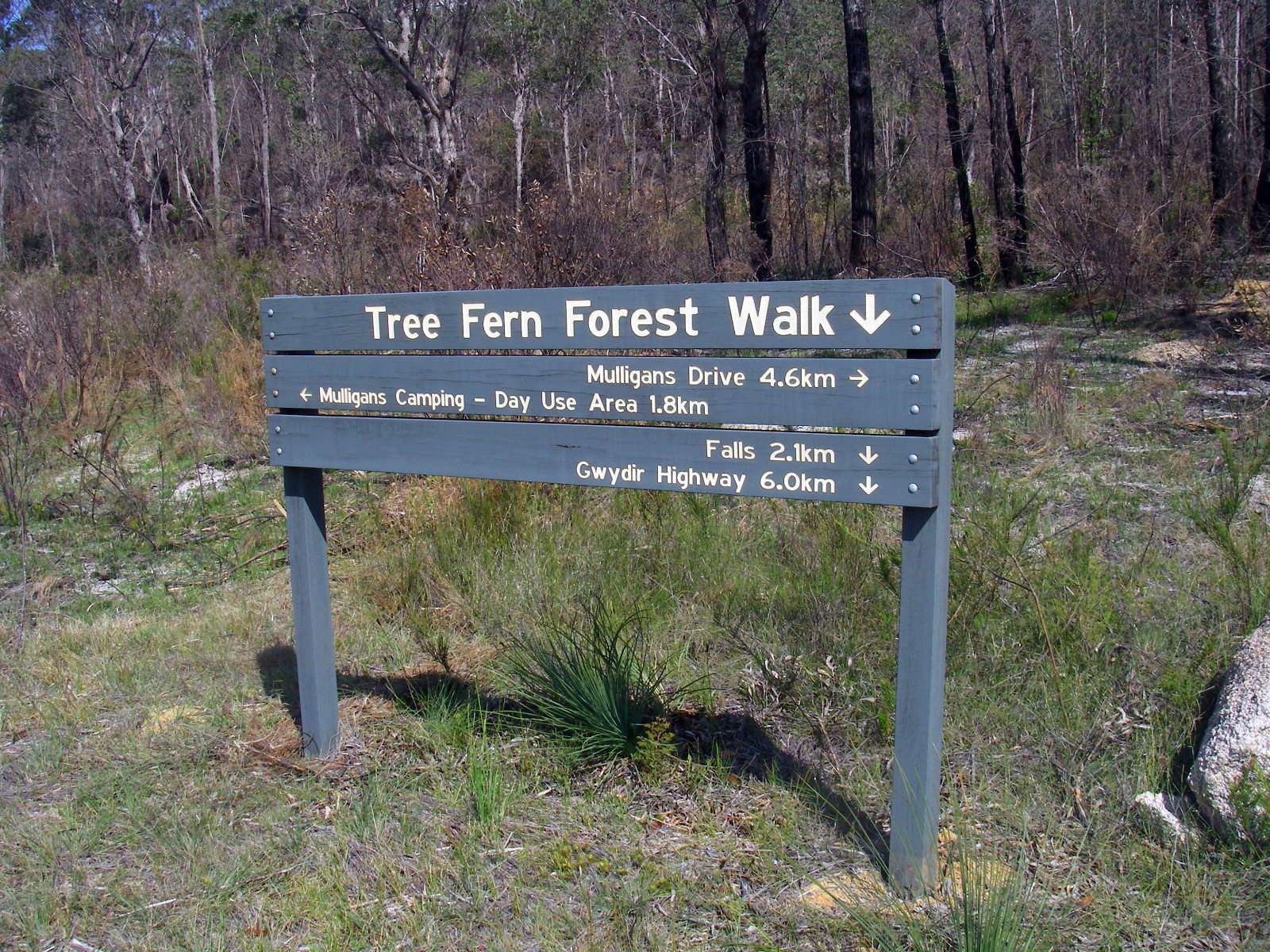
This is the turn off to the Tree Fern Walk, a delightful journey, with a return loop to Mulligans Hut.
Photo: Don Hitchcock, April 2015
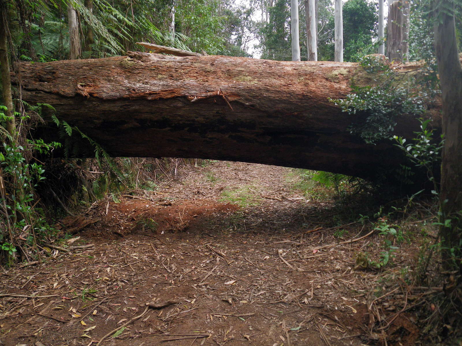
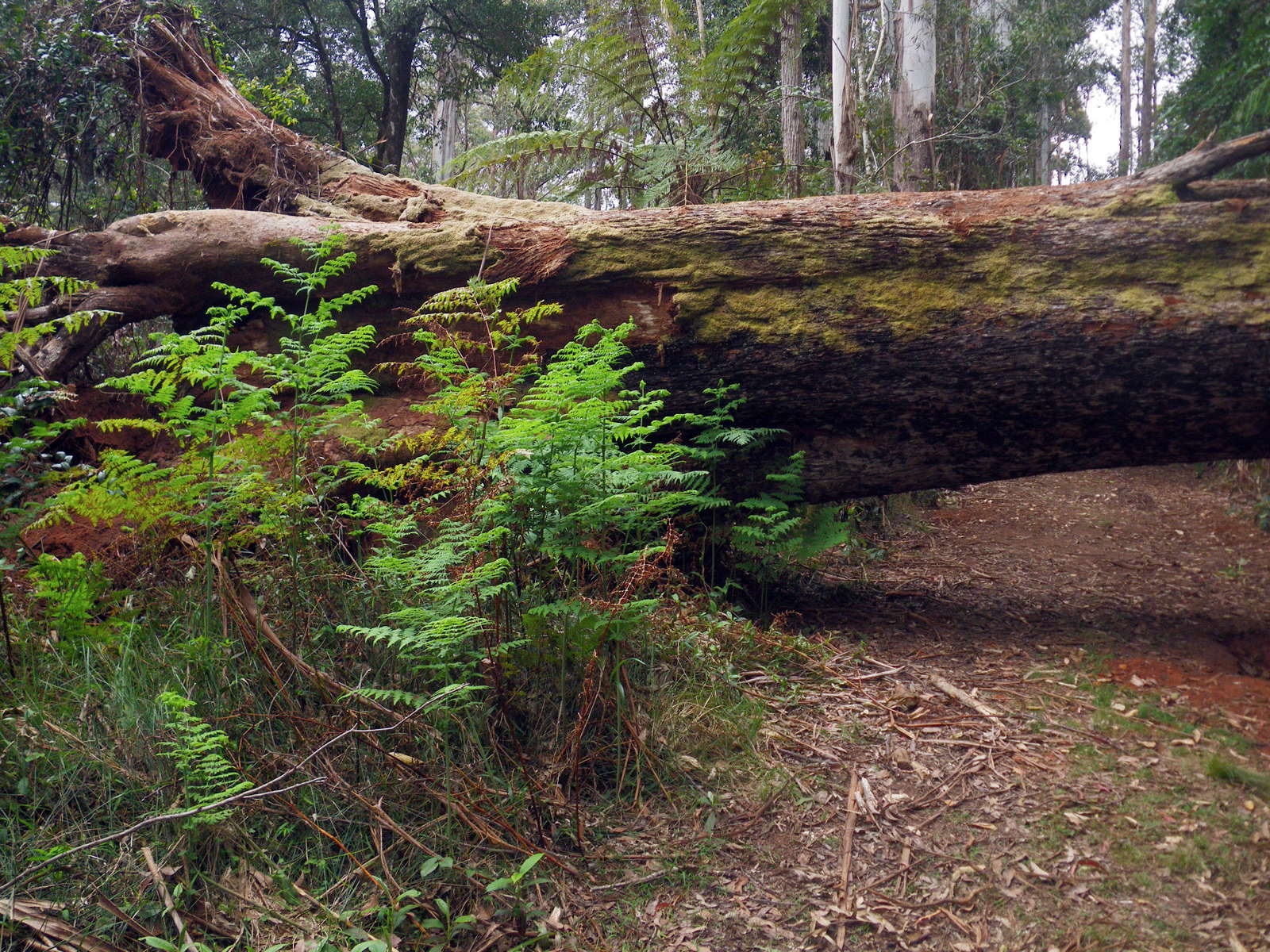
This huge tree toppled over the track some time ago at a time of very high winds.
It was cleared away by 2015, since the track acts as a fire trail.
Photo: Don Hitchcock, November 2011
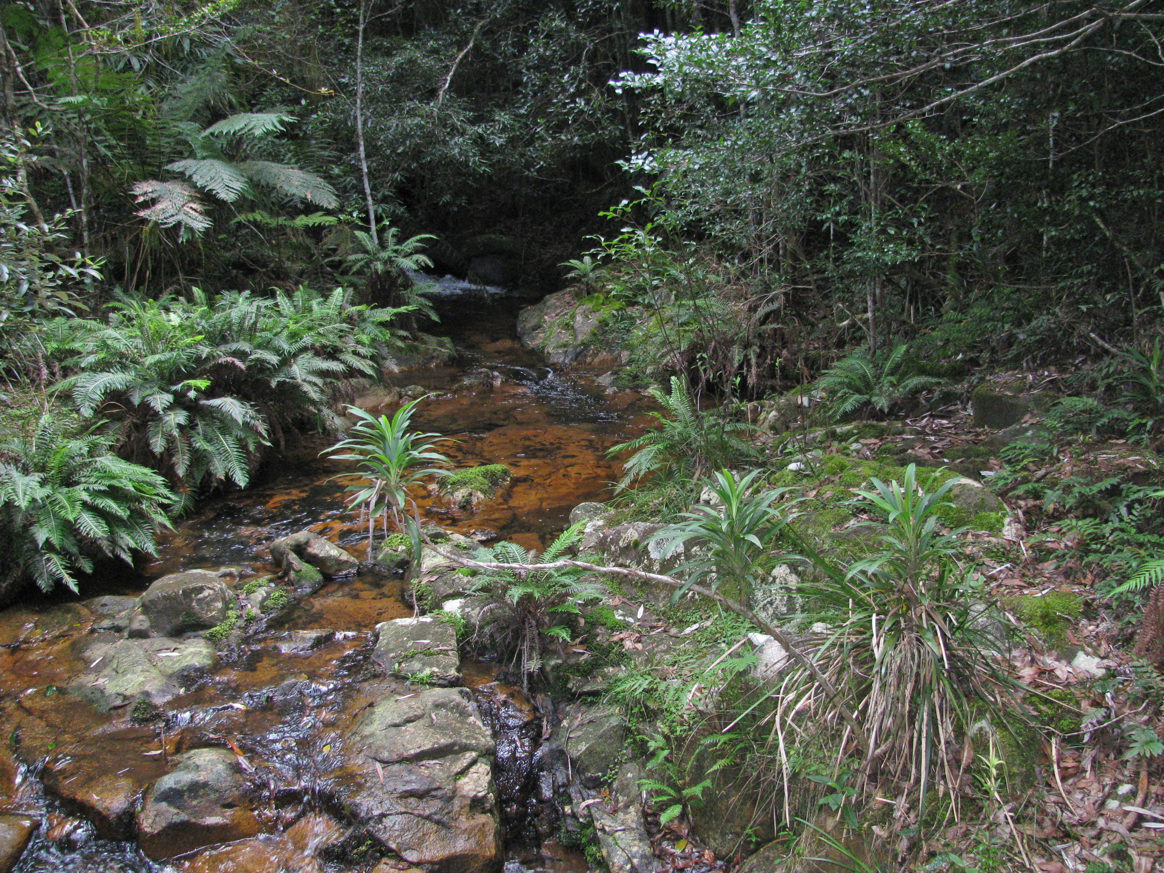
One of the branches of Dandahra Creek which feed the Twin Bridges.
Photo: Don Hitchcock, April 2015
There is a complex network of creeks in the region of Twin Bridges, and there are twenty identified species of ferns in the area.
Photo: Don Hitchcock, April 2015
Olearia gravis, or Large Daisy Bush, a shrub to 1.6 metres high, which flowers from August to November.
Photo: Don Hitchcock, November 2011
There is another 'you are here' map at the junction of Pidcocks Trail which then heads towards Mulligans Hut, and the side track to the Needles.
Photo: Don Hitchcock, November 2011
Looking towards the junction of Pidcocks Trail and the turn to Mulligans Hut from a viewpoint standing on the Needles track.
Photo: Don Hitchcock, April 2015
The original bridge over Dandahra Creek, which leads to the Mulligans Hut Camping Area close by.
Photo: Don Hitchcock, November 2011

This is the new bridge over Dandahra Creek.
Photo: Don Hitchcock, April 2015
Dandahra Creek from the viewpoint of the new bridge.
Photo: Don Hitchcock, April 2015
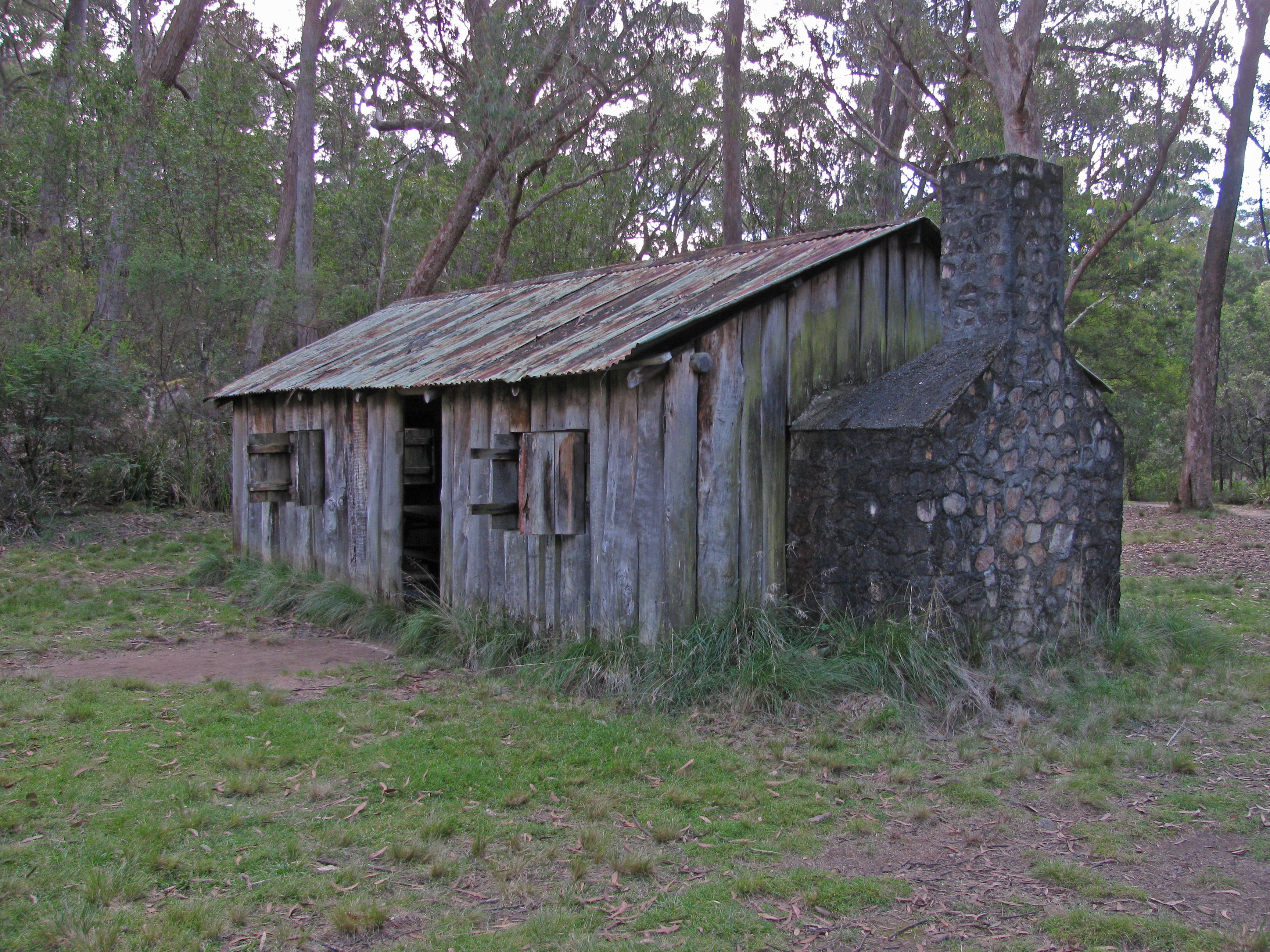
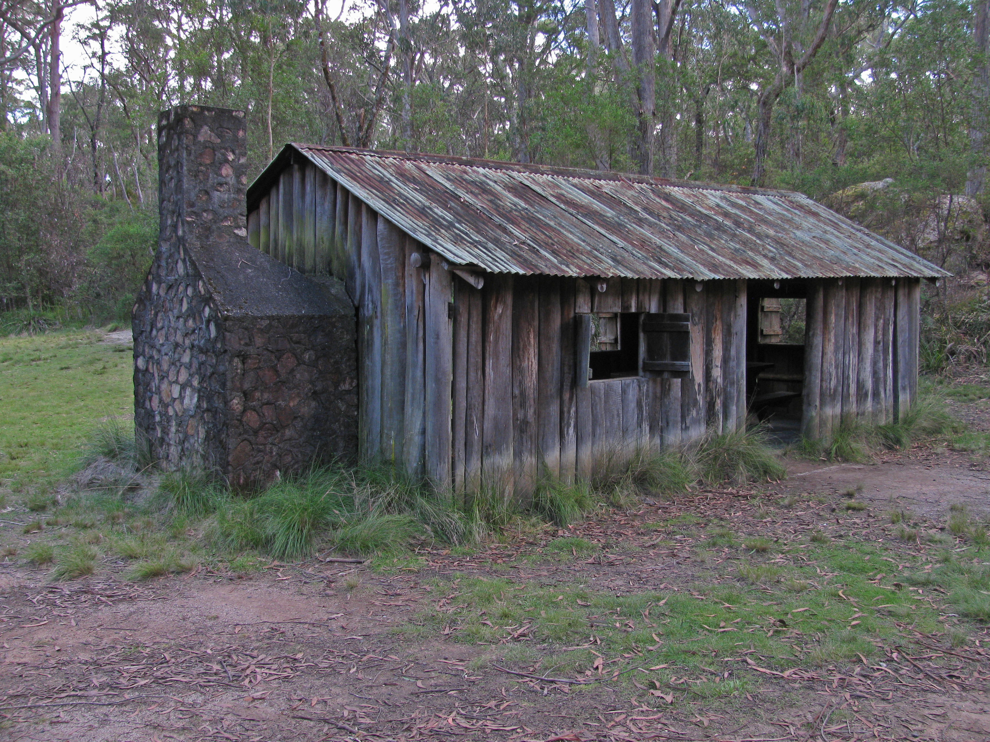
Mulligans Hut. This is a replica, built in the 1960s after the original was damaged in a bushfire, used as a daytime shelter for picnickers.
Photo: Don Hitchcock, April 2015
A stone fireplace was added to the original design. There is plenty of camping in this area.
The hut is located in Mulligans Hut Picnic Area next to Dandahra Creek, which is suitable for swimming.
Photo: Don Hitchcock, April 2015
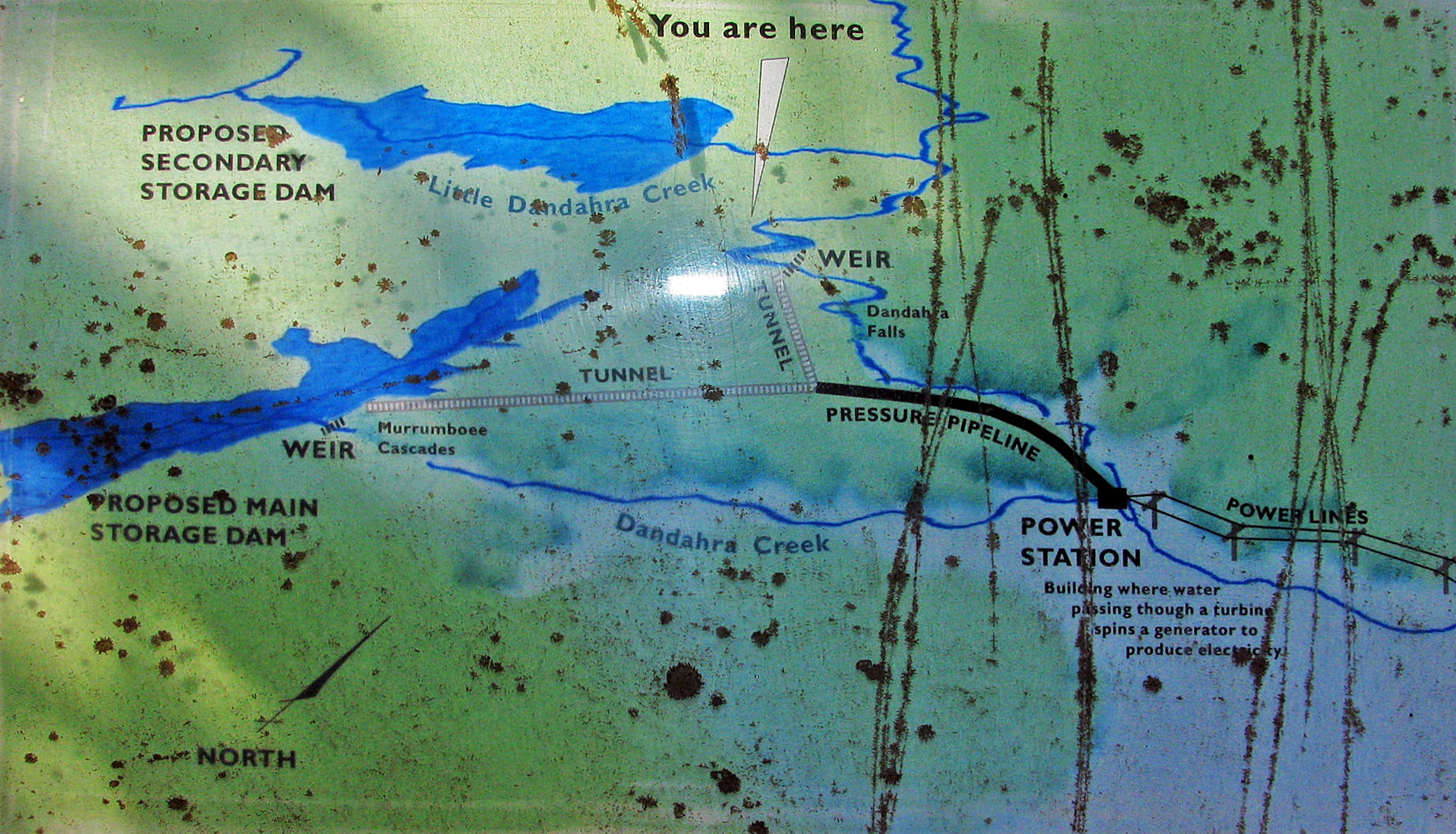
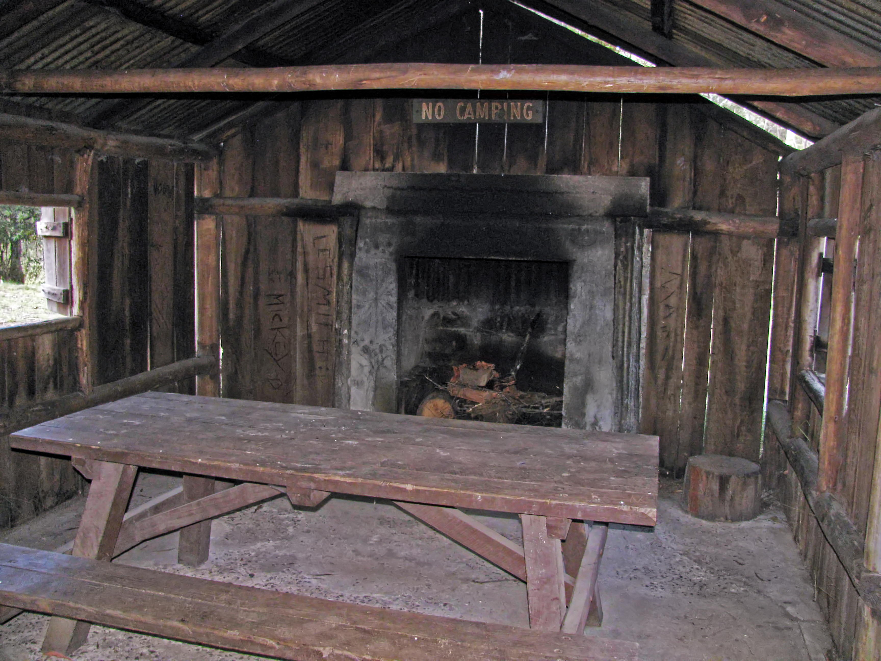
William Mulligan and the Dandahra Hydroelectric Scheme
This area is named after William Mulligan (1862 - 1953) who knew it well. Born of a local grazing family, he became a prominent citizen and mining engineer. He devoted his energy and vision to local development projects. He proposed a hydroelectric scheme for this area, but it was not built.
It was here that William Mulligan and partners proposed to dam the north and south arms of Dandahra Creek and send water 600 metres over the escarpment to a hydroelectric power station. To measure the water flow, they built two concrete weirs in the 1920s that you can see today.
In 1942 the partners approached the Minister for Mines for a loan to reopen a copper mine in the foothills below here at Cangai (pronounced Cang-ghee). They were not funded because the geologists and an independent engineer were not optimistic about the venture. As well, the necessary capital and equipment were not available during the war years. So when the partners' leases expired in 1952, the Dandahara Hydroelectric Scheme was not built.
William Mulligan built two slab-walled huts here, each with a bark roof and a dirt floor. A 1960s fire destroyed the smaller hut and damaged the other. The NPWS rebuilt the larger hut in 1968.
So the simple hut in front of you is where William Mulligan planned a grand hydroelectric scheme - a scheme that finally didn't happen.
Photo: Don Hitchcock, April 2015
Text and map: Notice Board at the site
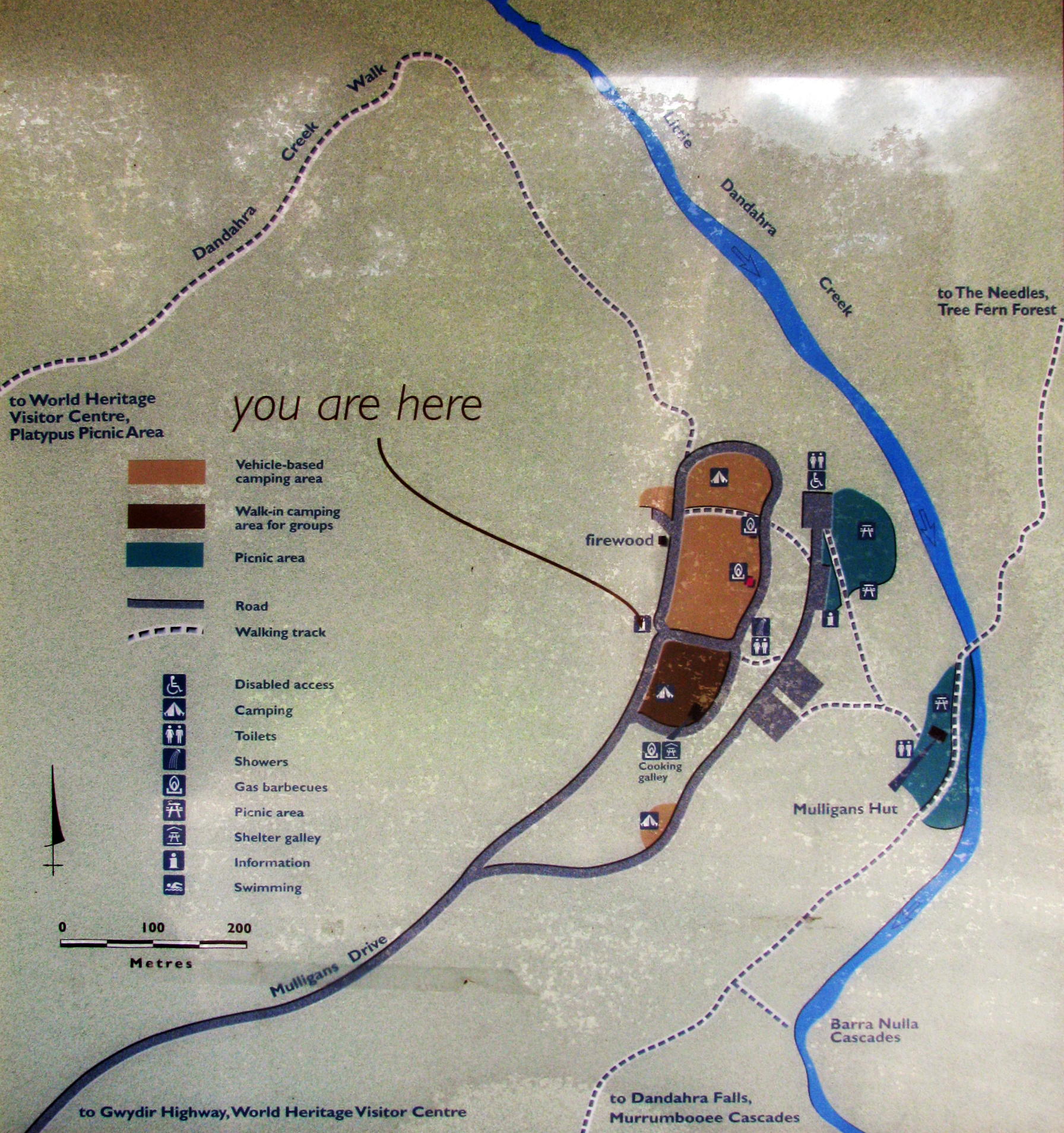
Map of the area.
Photo: Don Hitchcock, April 2015
Source: Notice Board at the site
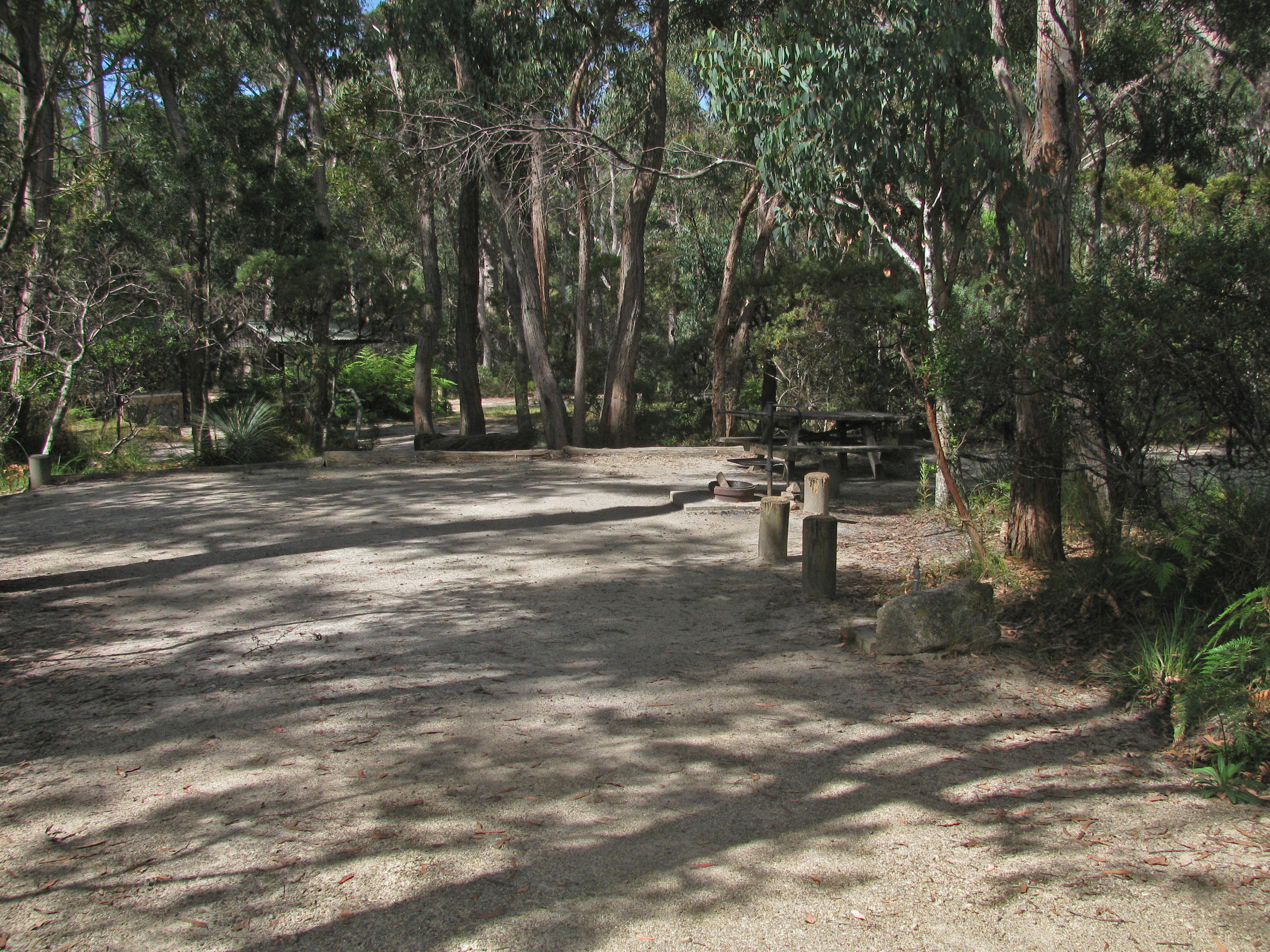
The area is well set up for car and caravan camping.
Photo: Don Hitchcock, April 2015
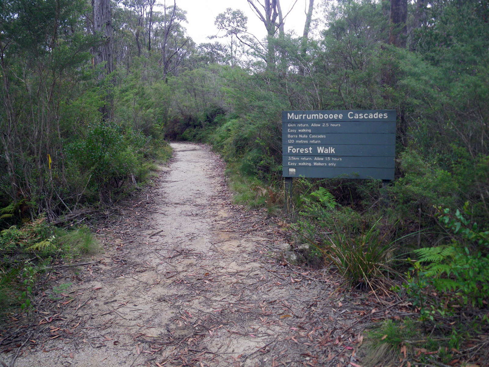
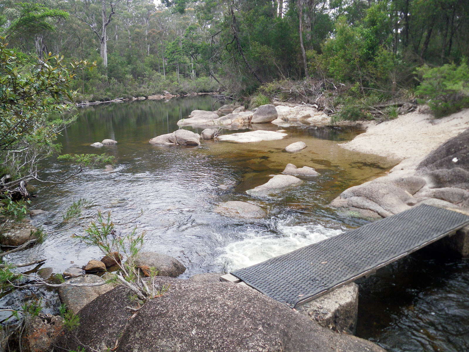
The Barra Nulla Cascades are not far down this track, which itself is not far from Mulligan's Hut above. The Cascades would be a good place to cool off on a hot day.
Photo: Don Hitchcock, November 2011
The Tree Fern Loop Walk
This walk may be taken as part of a circuit including Mulligans Hut, or may be used as a short cut from Pidcocks Trail to the Little Dundahra Creek Trail, bypassing Mulligans Hut.
This is the turn off to the Tree Fern Walk, from Pidcocks Trail.
Photo: Don Hitchcock, April 2015, January 2012
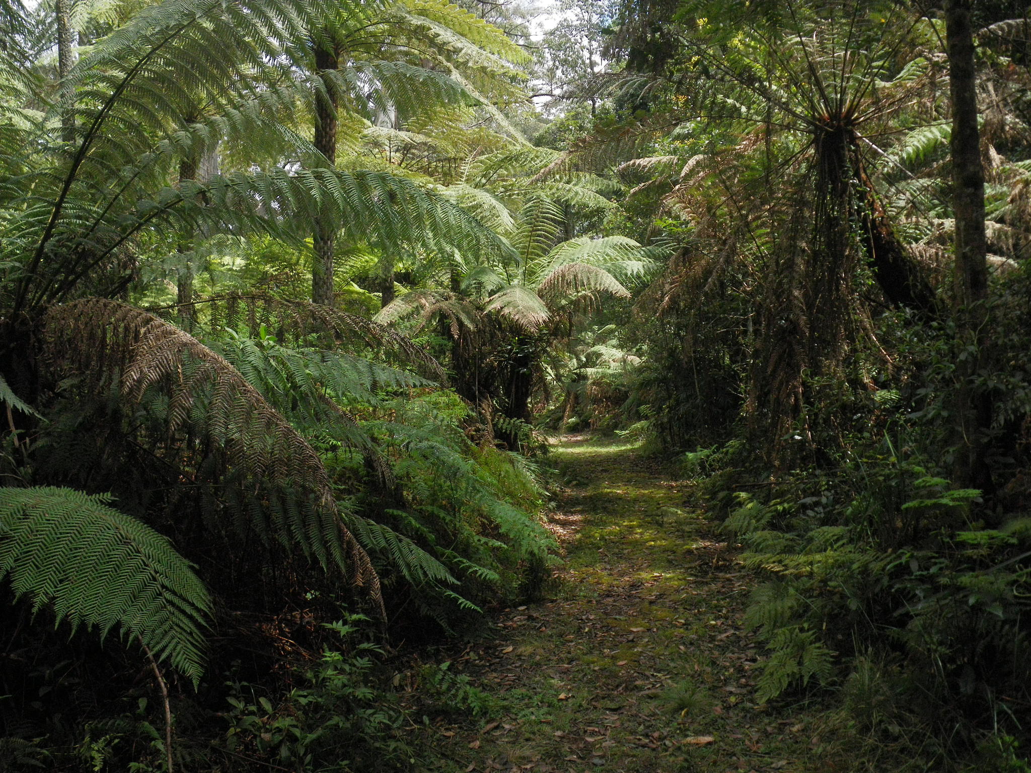
Not far down the track, the first tree ferns appear.
Photo: Don Hitchcock, October 2013
Tree ferns are often an indication of rainforest margins, wet sclerophyll vegetation, in Australia.
Photo: Don Hitchcock, January 2012
It is a magical place.
Photo: Don Hitchcock, January 2012
There are other palms besides the Tree Ferns.
I have been unable to identify them. If any reader can give me genus or species, I would be grateful.
Photo: Don Hitchcock, January 2012
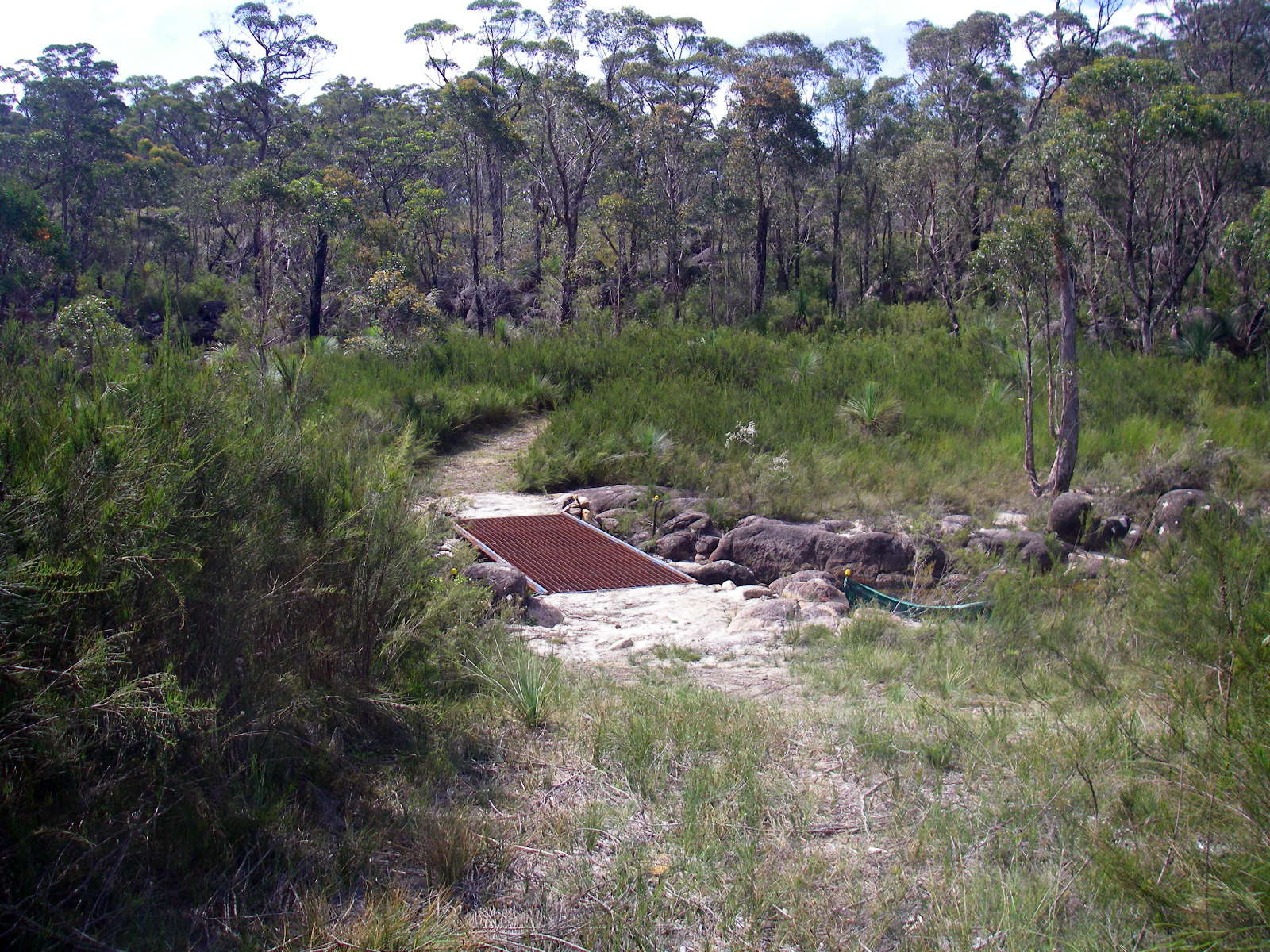
A small bridge has been put in over a creek, a tributary of Little Dundahra Creek, which runs through the tree fern forest. Good water is available at this point.
Photo: Don Hitchcock, January 2012
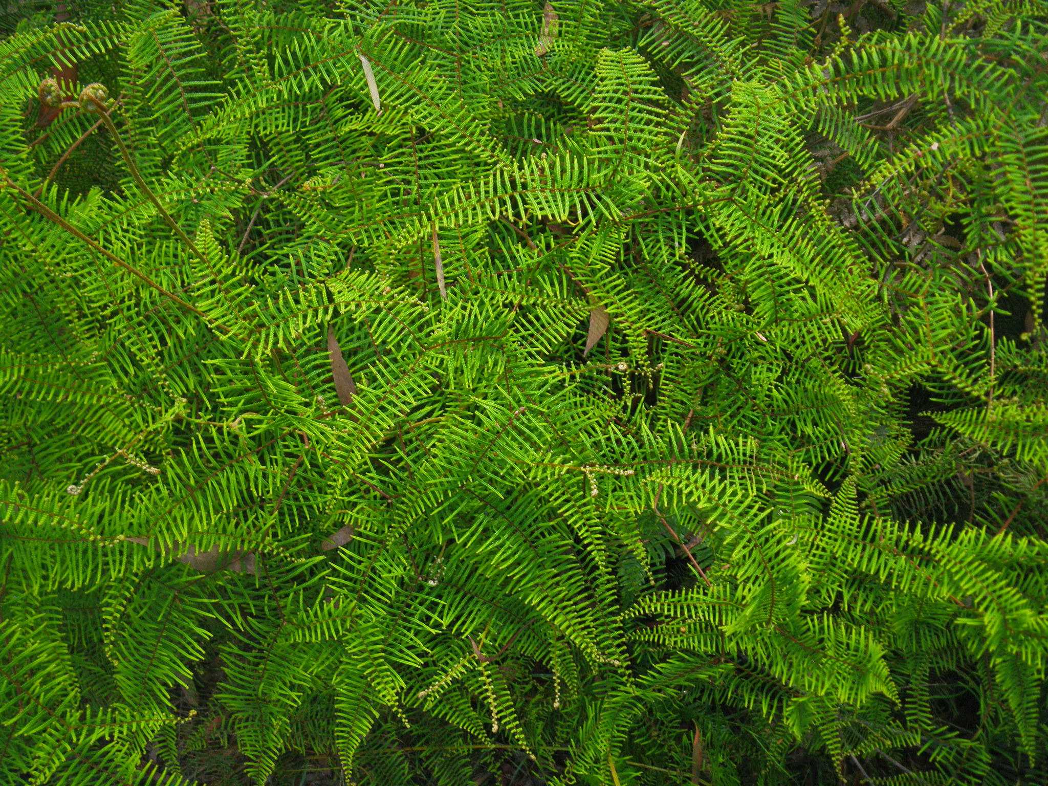
At the margins of the Treefern Forest, Coral Fern was growing in profusion.
Photo: Don Hitchcock, January 2012
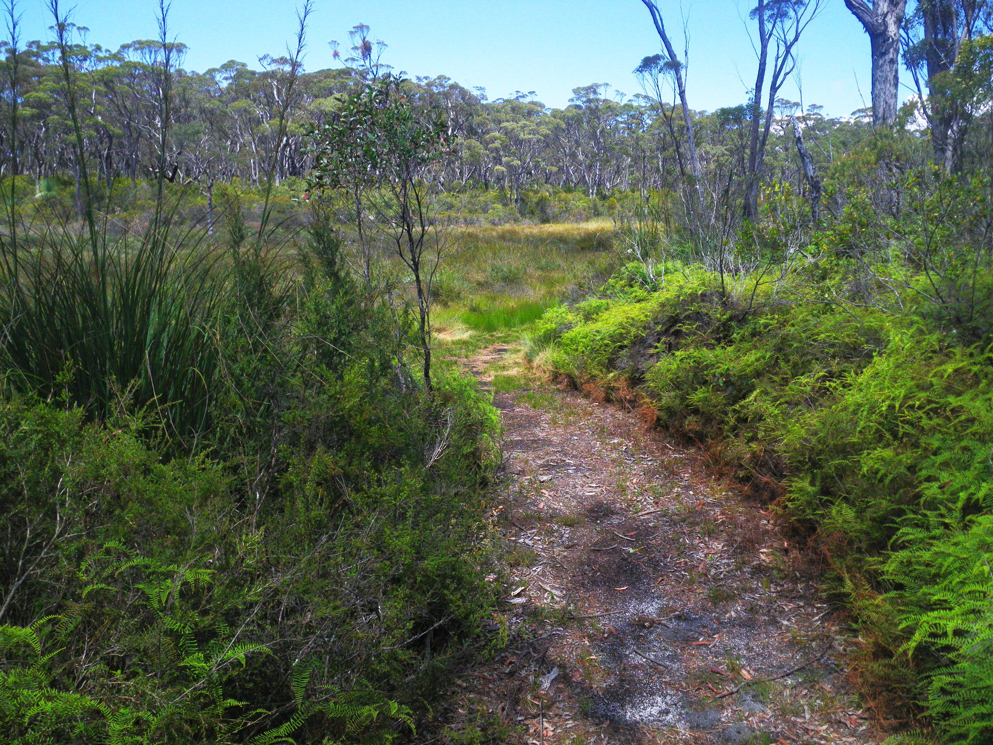
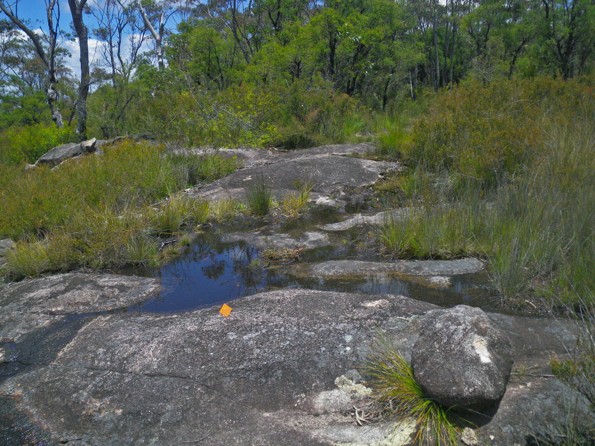
The change in the ecosystem was very marked, as the walker leaves the treefern forest and enters an area of swamp, with dry sclerophyll Eucalyptus forest on the comparatively arid ridge behind that.
Photo: Don Hitchcock, January 2012
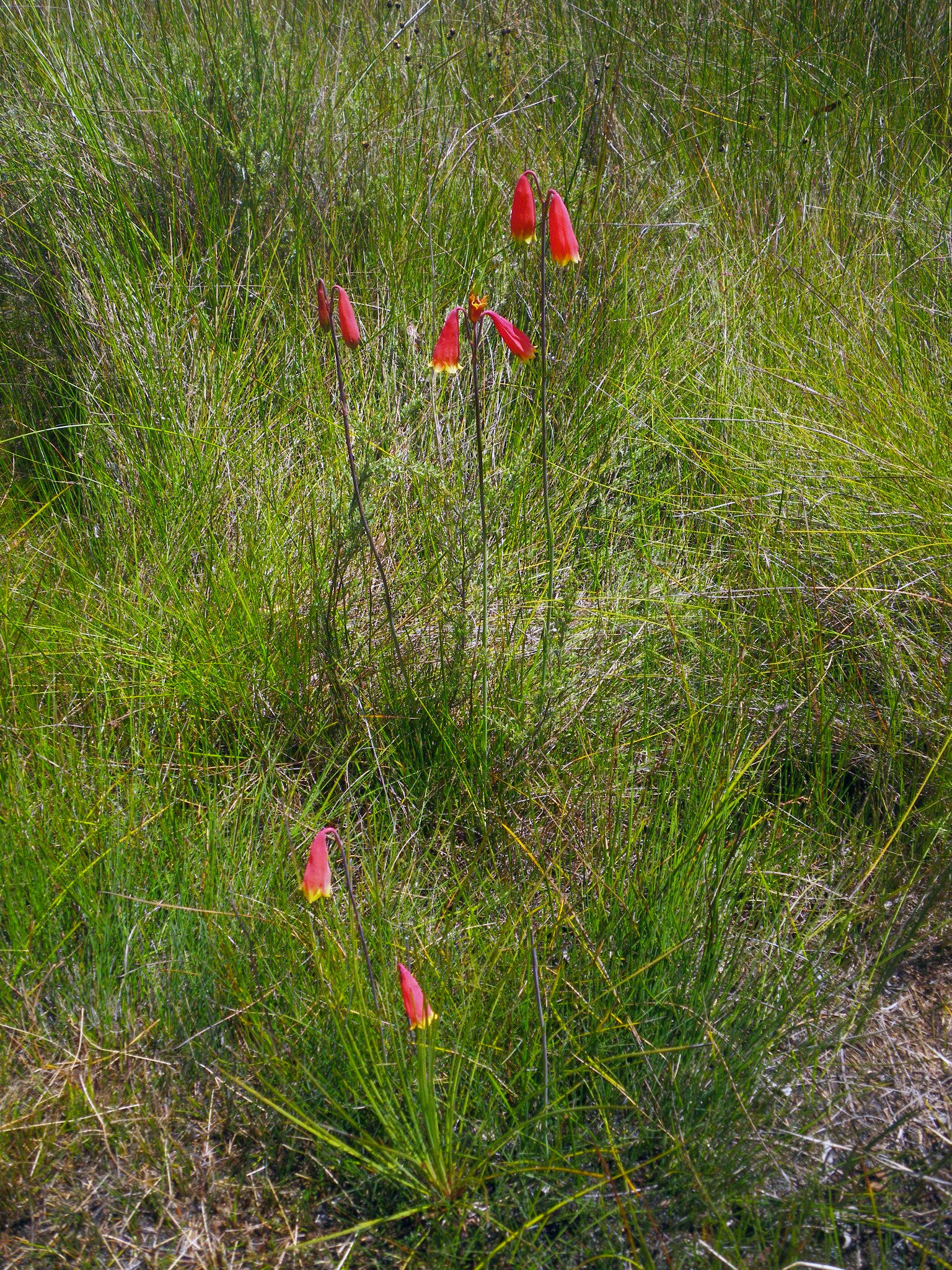
Christmas Bells growing in the swampy area.
Photo: Don Hitchcock, January 2012
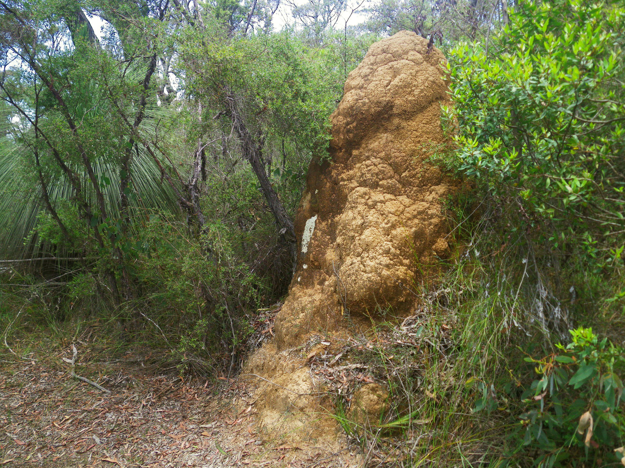
Termite nest situated on the drier ridge past the swamp.
Photo: Don Hitchcock, January 2012
The soils were shallow and poor, overlying granite close to the surface. This type of impoverished environment in Australia often gives rise to low growing shrubs bearing beautiful wildflowers.
Photo: Don Hitchcock, January 2012
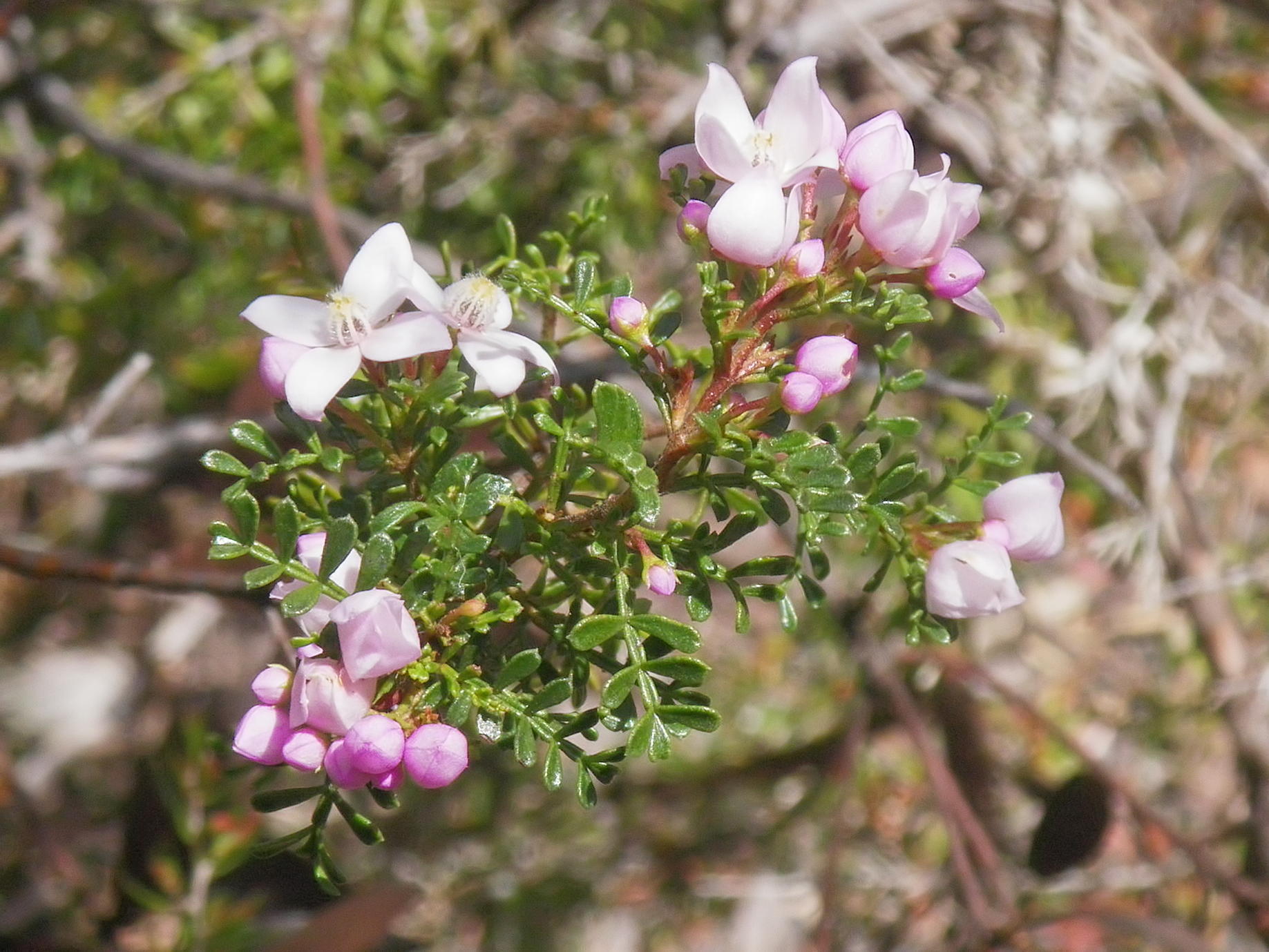
The small leaved Boronia, Boronia microphylla is a beautiful small shrub in the Rutaceae family, up to one metre in height, found in moist, protected areas.
The flowers are 10 mm across, have four petals, and are pink in colour.
Photo: Don Hitchcock, October 2013
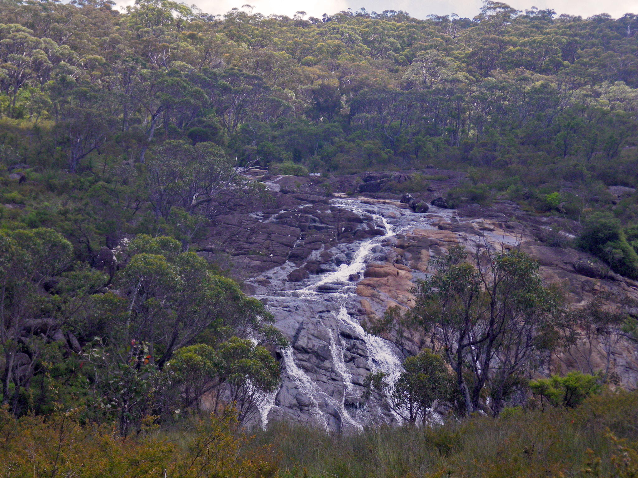
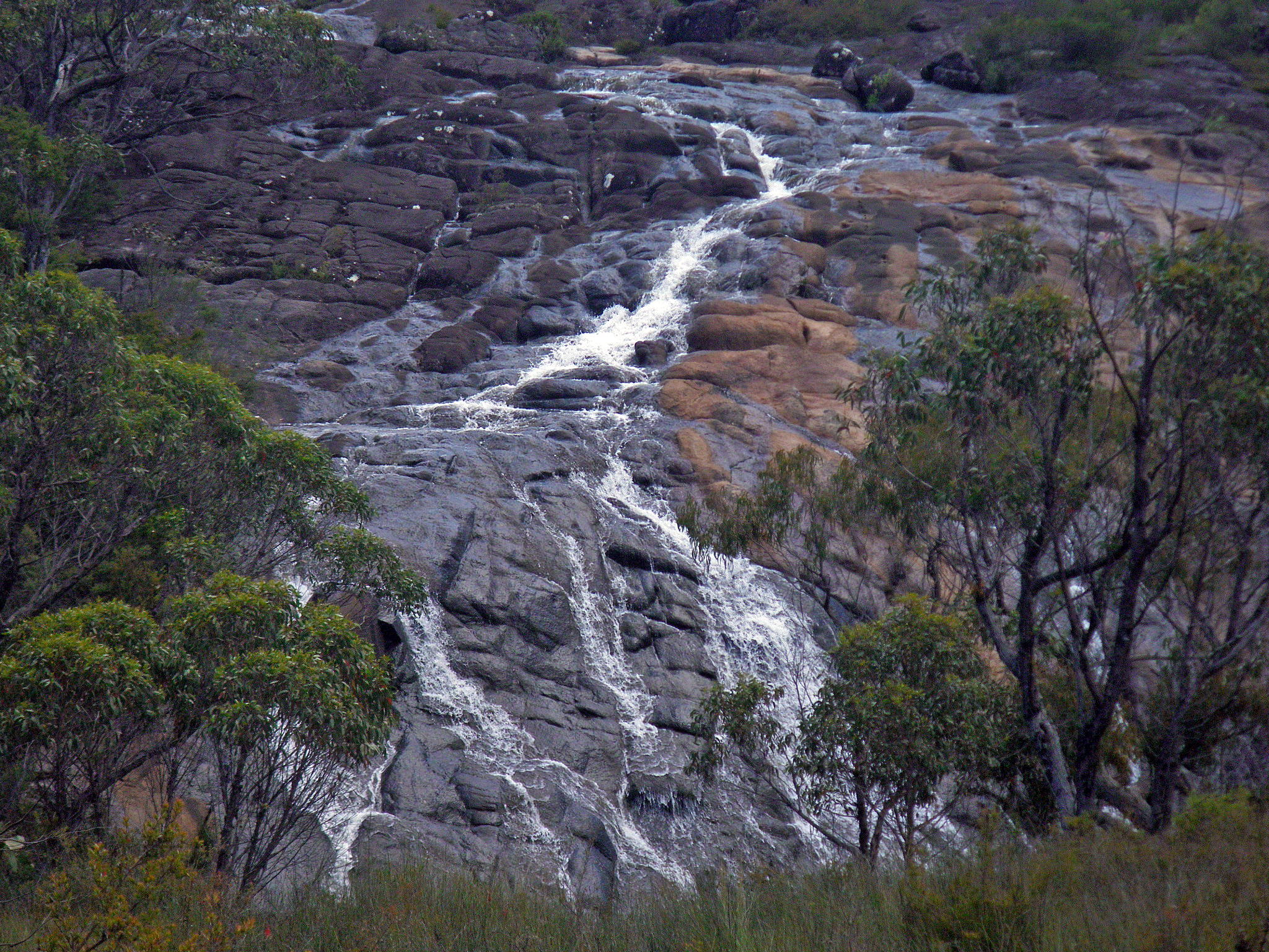
Cascades down a sloping rock platform, across the creek valley.
Photo: Don Hitchcock, January 2012
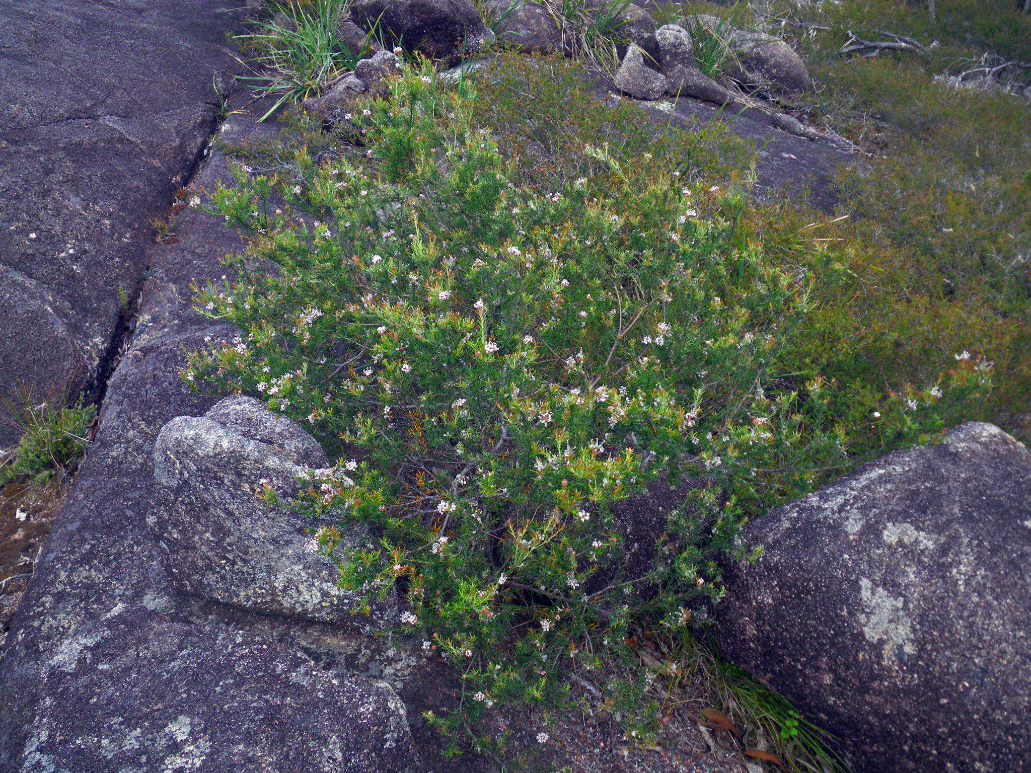
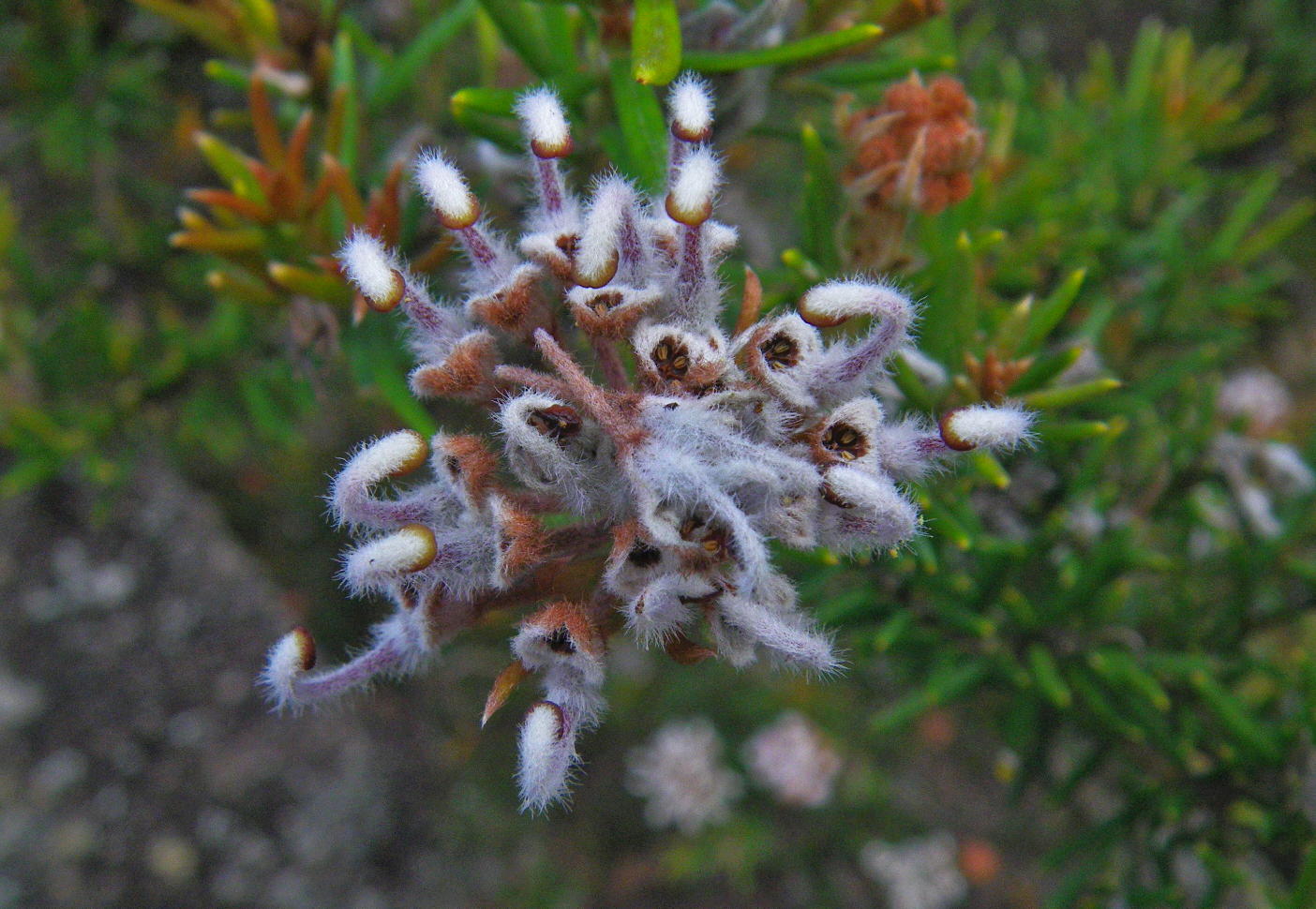
The Grey Spider Flower, Grevillea acerata, closely related to Grevillea sphacelata and Grevillea buxifolia, growing amongst granite boulders on a granite platform.
Photo: Don Hitchcock, January 2012
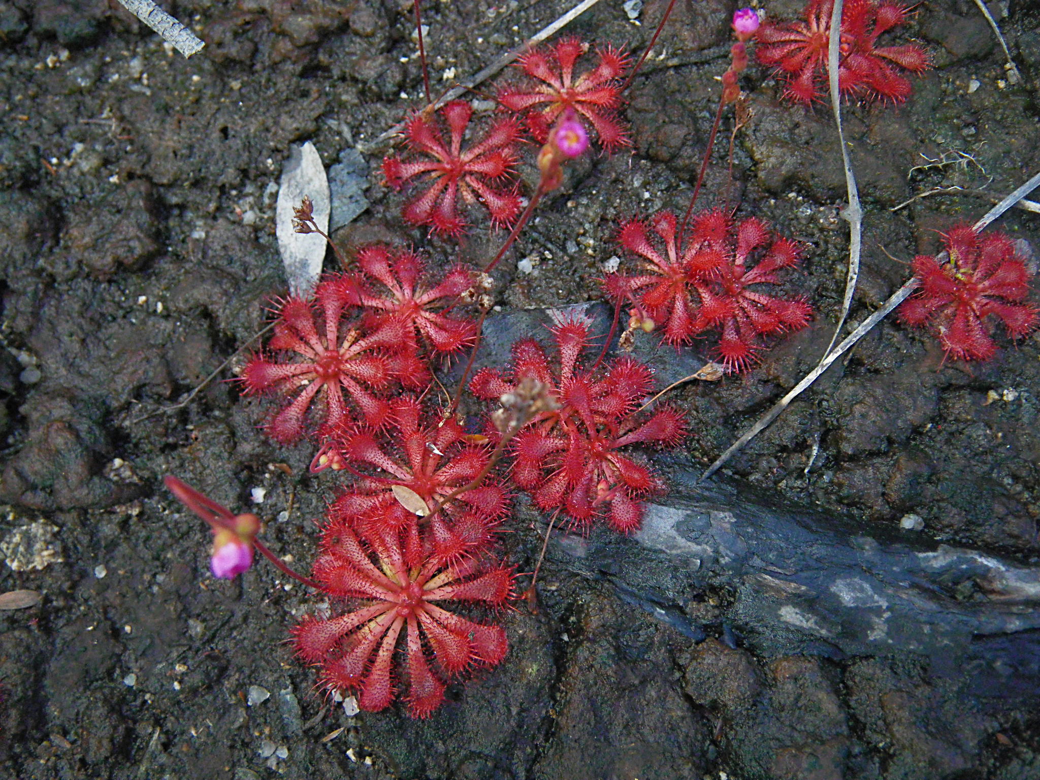
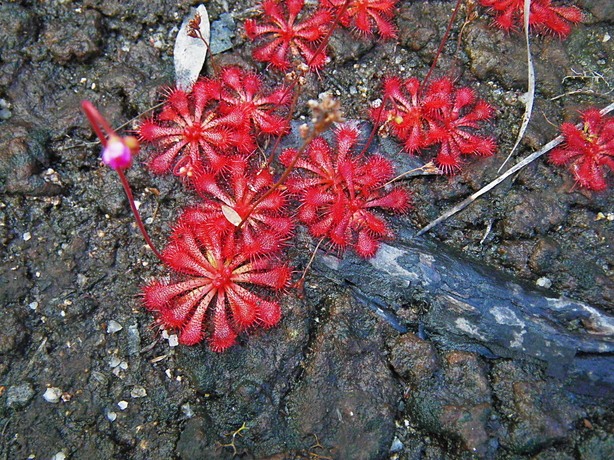
Drosera spatulata, Red Honeydew and flower buds.
Sundews (Drosera sp.) are insect-eating plants, found in swamps and marshes in much of Australia. Their leaves have sticky hairs that hold drops of protein-dissolving enzymes.
When an insect sticks to a leaf, the enzymes break the insect's protein down to amino acids, and this stimulates the leaf to curl over, slowly, bringing more hairs into contact with the insect, holding it better and dissolving it more. The process generally takes several hours.
Photo: Don Hitchcock, January 2012
Text: Adapted from http://oldblockwriter.blogspot.com.au/2012/04/sundews.html
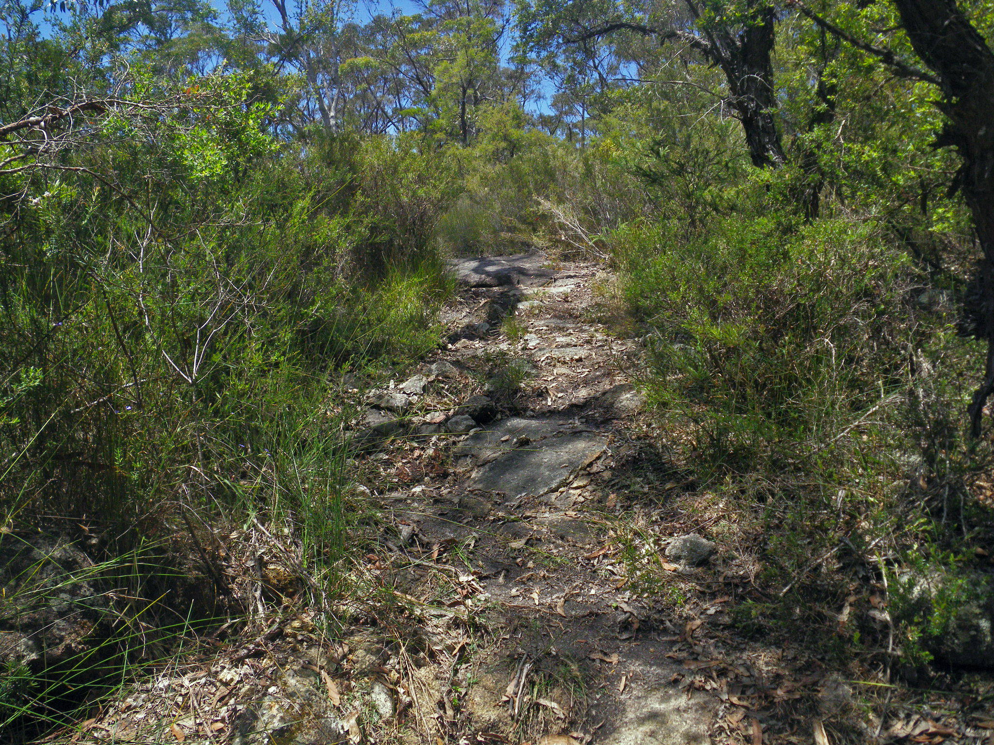
Since the way leads across a granite pavement, the NPWS have put in yellow markers where necessary so that walkers know where the track is.
Photo: Don Hitchcock, January 2012
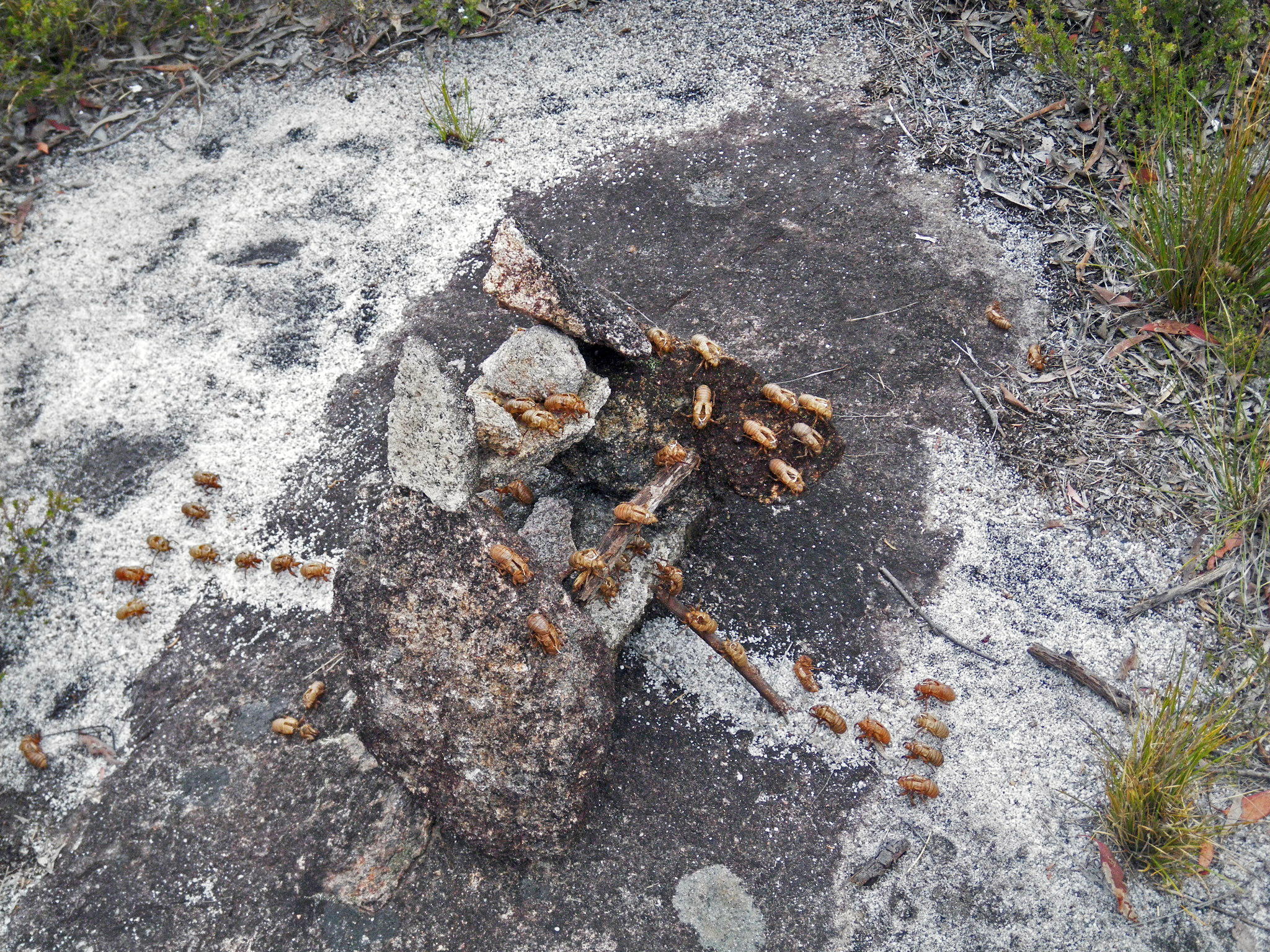
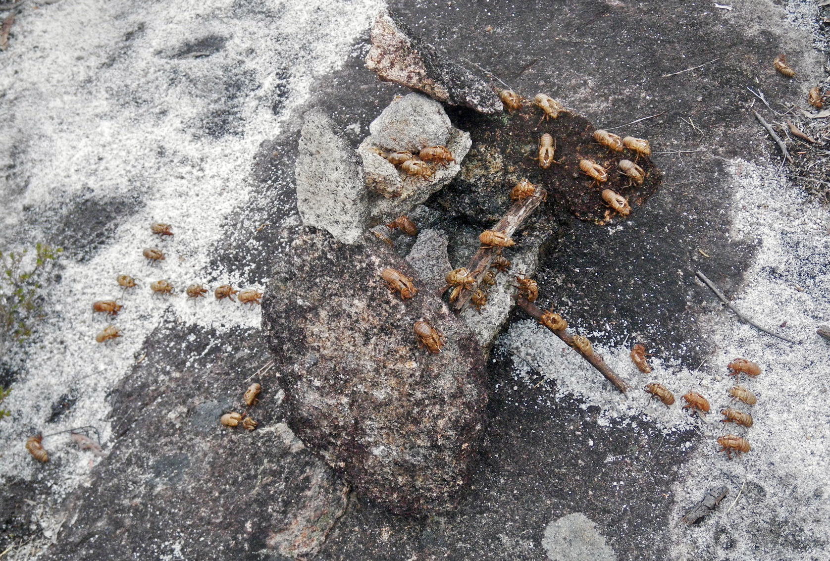
This was a delightful diorama created from the rocks around, sand, sticks, and discarded cicada shells.
It depicts the attack of a citadel by a cicada army, and its defence.
Photo: Don Hitchcock, October 2013
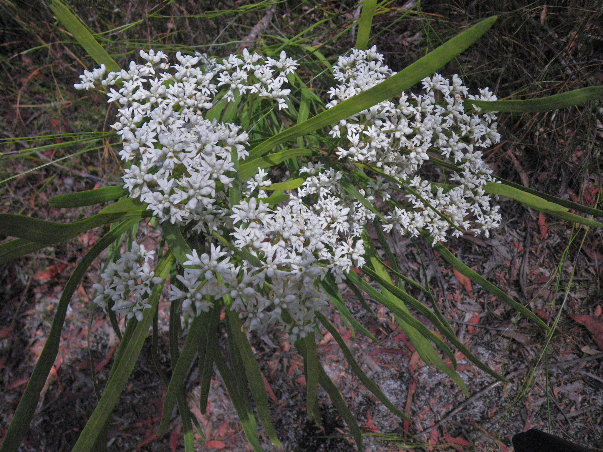
Conospermum burgessiorum, a beautiful orchid like plant with white flowers and strappy leaves. It is a member of the Proteaceae family in company with Banksias, Grevilleas and Hakeas.
Conospermum burgessiorum is a medium, upright to spreading shrub. The leaves are linear and range in length form 10 to 25 centimetres. Individual flowers are about one centimetre long, cream to white in colour and carried in dense clusters near the ends of branches.
It is classified as a rare but not threatened Australian plant. The species has limited distribution but is protected in Gibraltar Range National Park in New South Wales and Girraween National Park in Queensland.
Photo: Don Hitchcock, October 2013
Text: Adapted from http://www.yallaroo.com.au/Conospermum_burgessiorum.htm
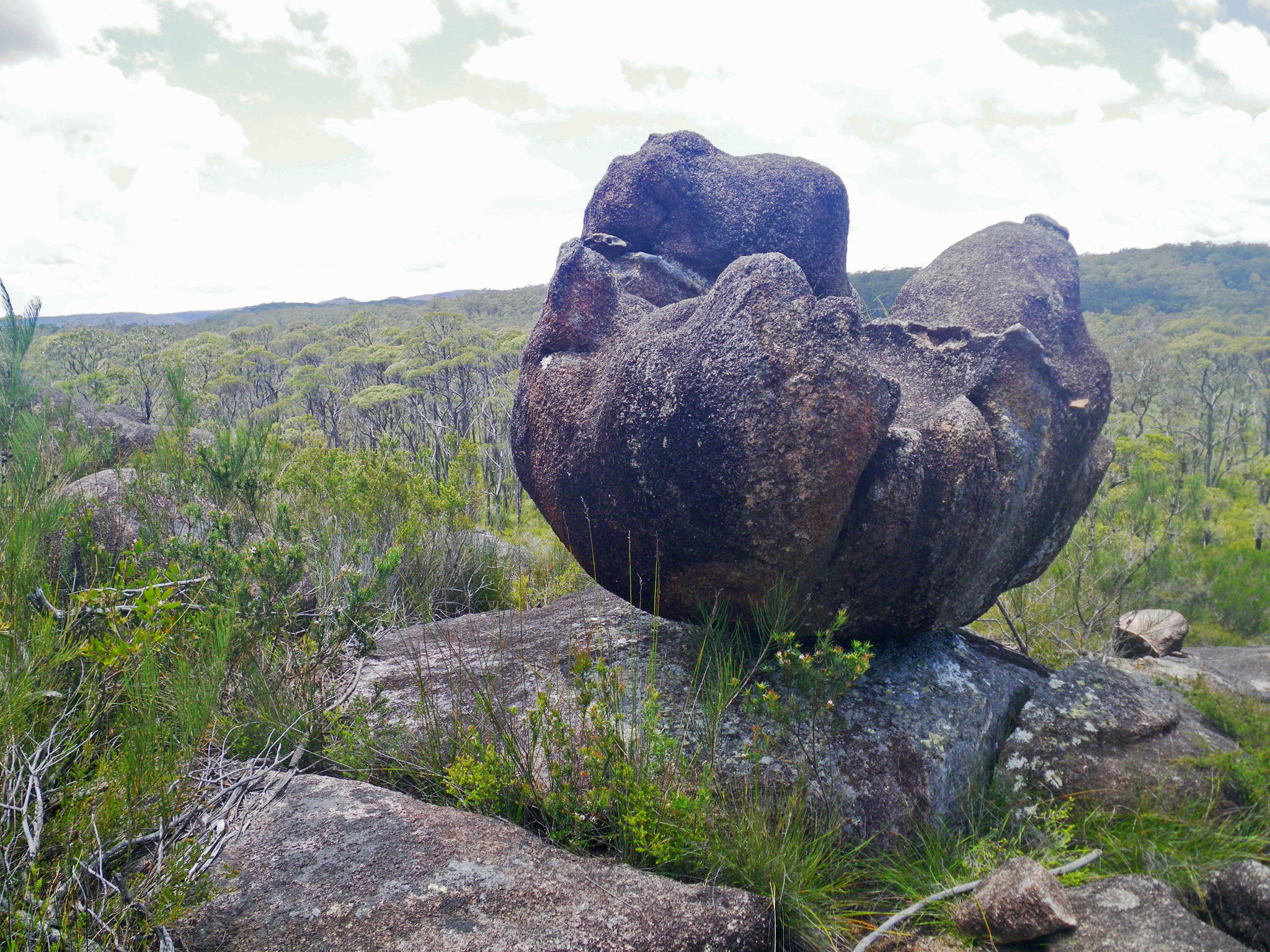
The view opens up once you get over the crest of the ridge, and this balancing rock, looking like a giant stone flower, appears.
Photo: Don Hitchcock, January 2012
Text: Adapted from http://oldblockwriter.blogspot.com.au/2012/04/sundews.html
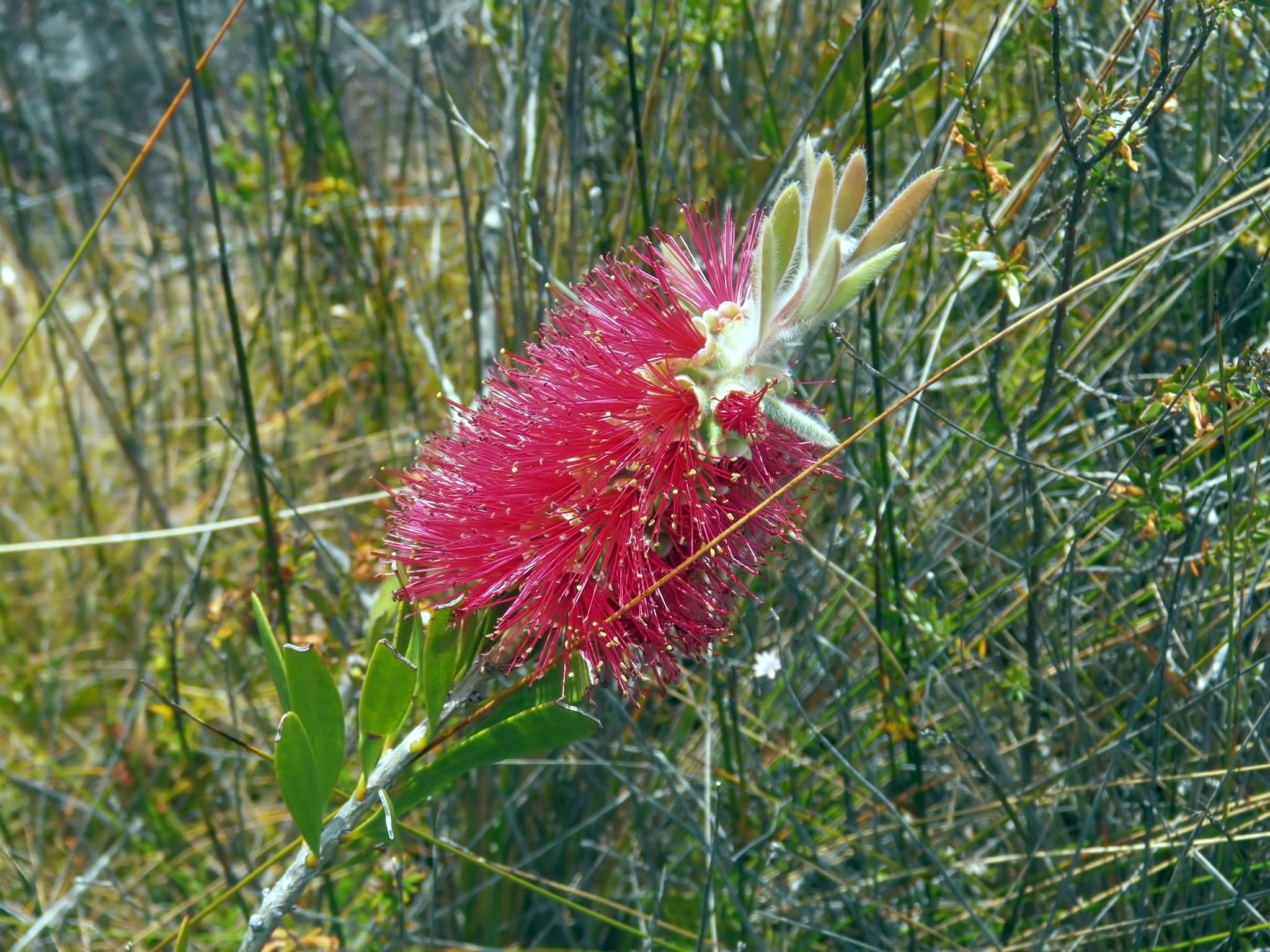
A red flowered callistemon growing in splendid isolation in heathland.
Photo: Don Hitchcock, October 2013
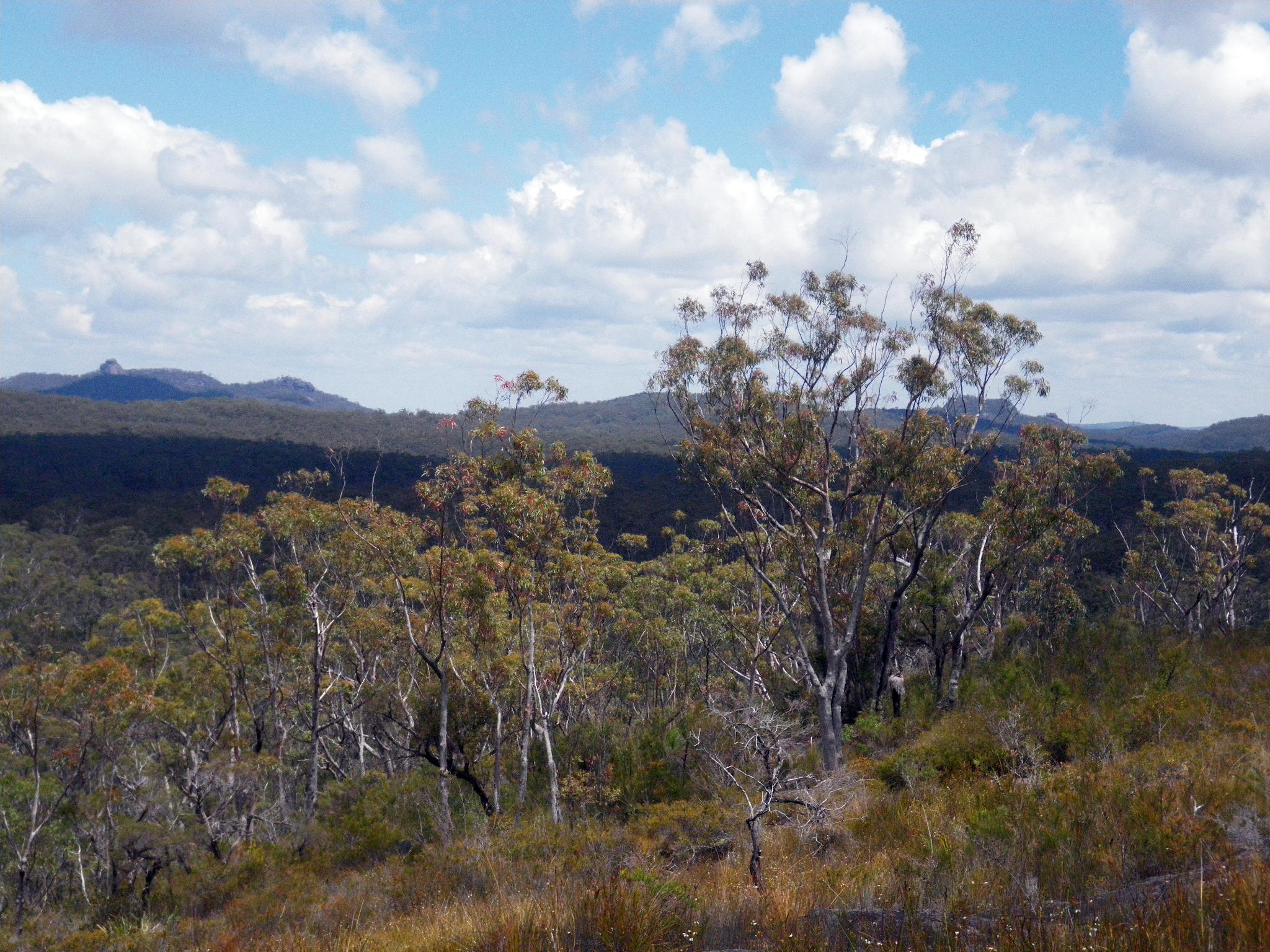
A beautiful vista from the top of the ridge.
Photo: Don Hitchcock, October 2013
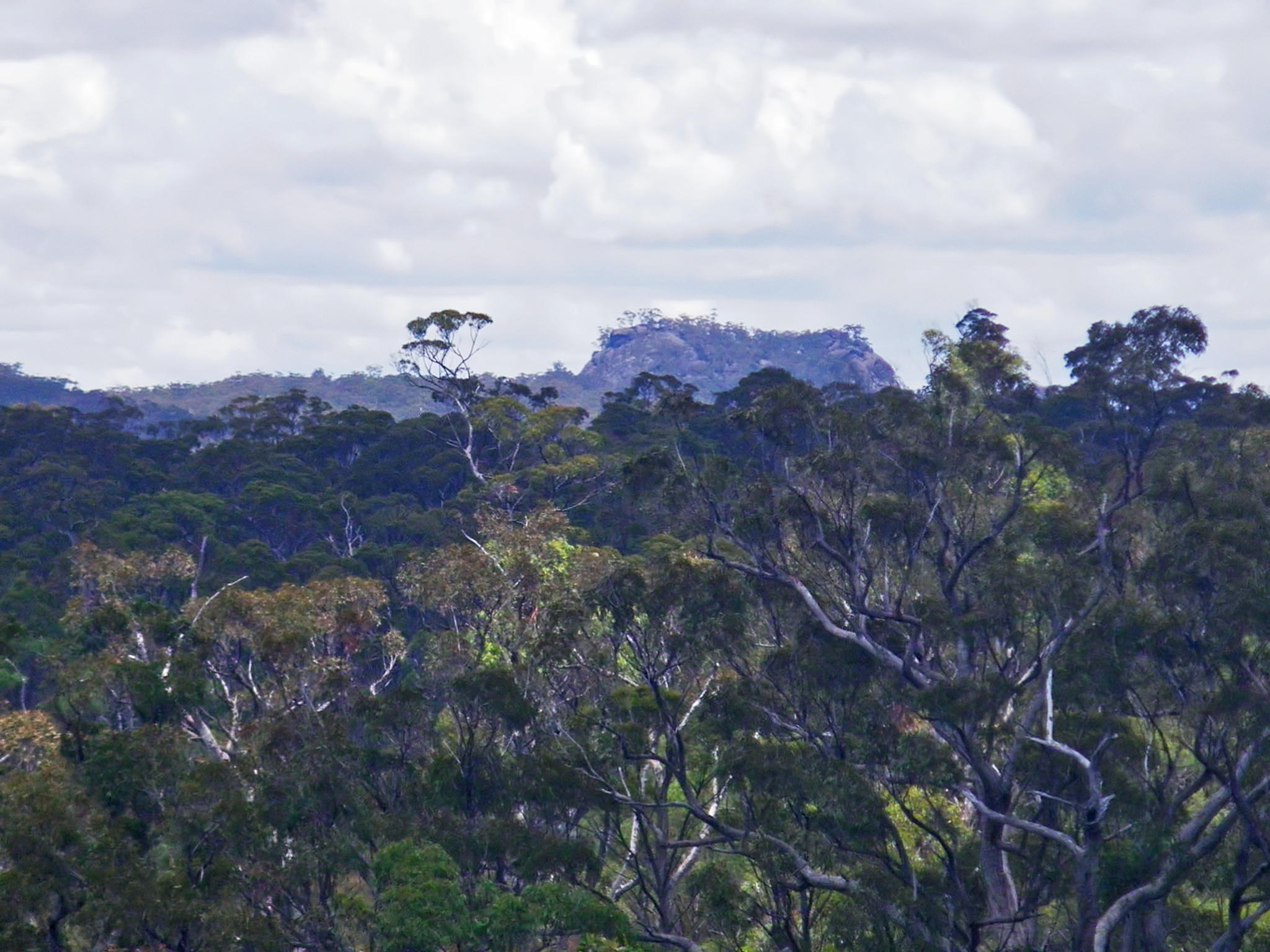
Dandahra Crags on the horizon.
Photo: Don Hitchcock, January 2012
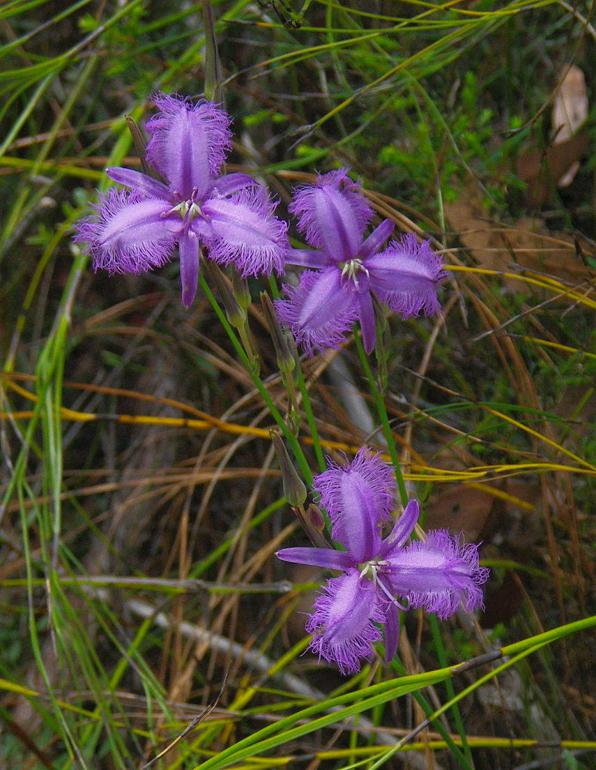
The common Fringe-lily, Thysanotus tuberosus
The leaves are linear in shape, and round at cross section towards the top. The plant grows from 20 cm to 60 cm tall.
It grows in a wide variety of situations, from semi-arid parts of south eastern Australia to coastal areas receiving more than 1300 mm of rain per year. They are often found in open country, heathlands or in dry sclerophyll woodland.
Photo: Don Hitchcock, January 2012
Text: Adapted from Wikipedia
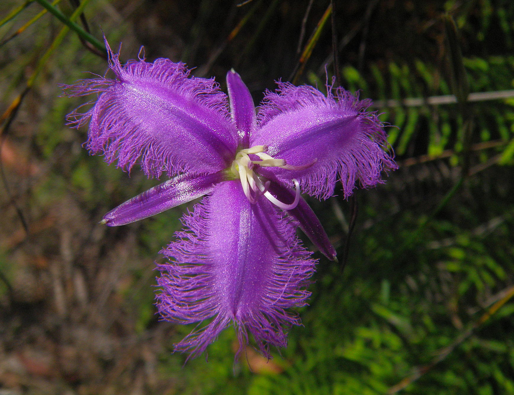
Flowers form from September to April. The three petaled flowers are purple, with frilly edges, and only last for one day. They are among the more colourful wildflowers in south eastern Australia.
Photo: Don Hitchcock, January 2012
Text: Adapted from Wikipedia
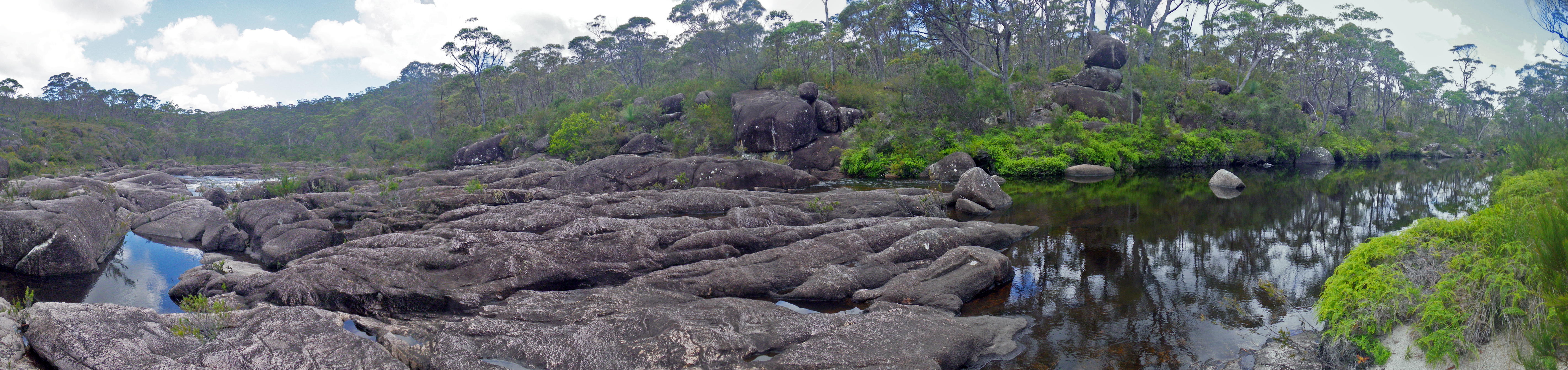
The track eventually reaches Little Dandahra Creek
Photo: Don Hitchcock, January 2012
The track then follows it for a short way to the bridge.
Photo: Don Hitchcock, October 2013
Little Dandahra Creek from the bridge.
Photo: Don Hitchcock, January 2012
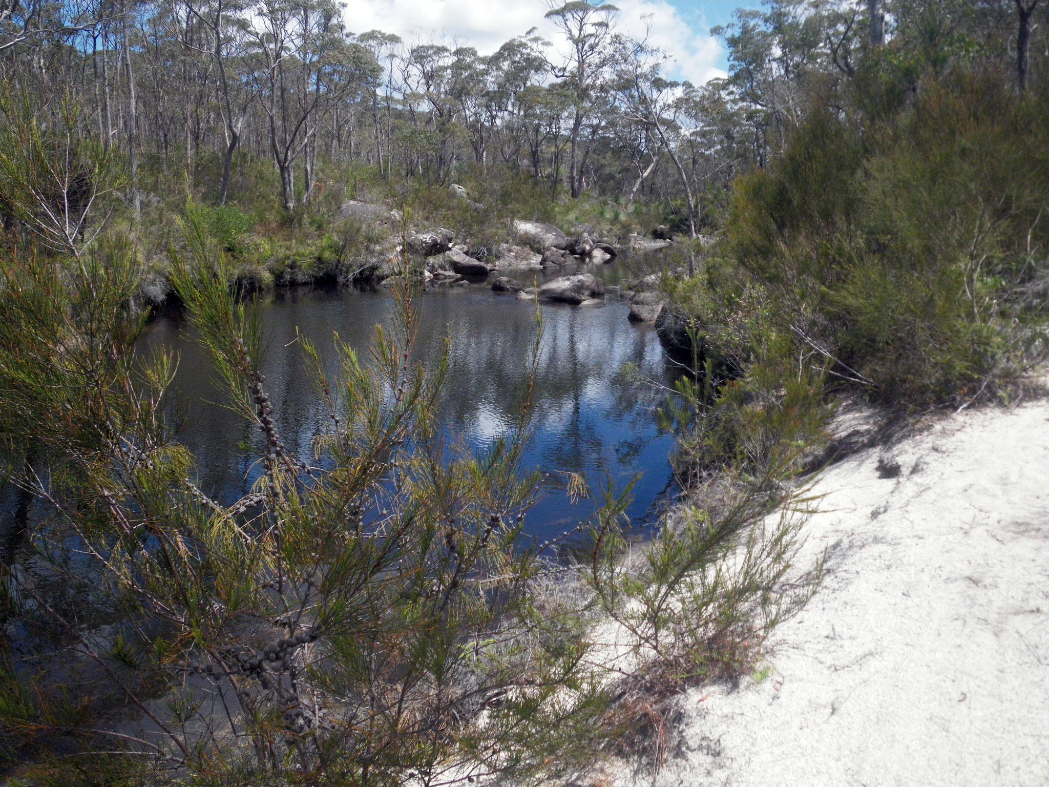
From the other side of the bridge you can either take the track to Mulligans Hut Campgrounds, or continue down the Little Dundahra Creek Trail, which leads to Mulligans Drive and Boundary Creek Falls Campground.
Photo: Don Hitchcock, November 2009
Bushwalking Index
The walk from Boundary Creek to Grassy Creek via Duffers Falls and the Haystack
The walk from Mulligans Hut to Boundary Creek via Surveyors Creek and Dandahra Crags