Back to Don's Maps
 Bushwalking Index
 Bushwalking, Hiking and Tramping in New Zealand
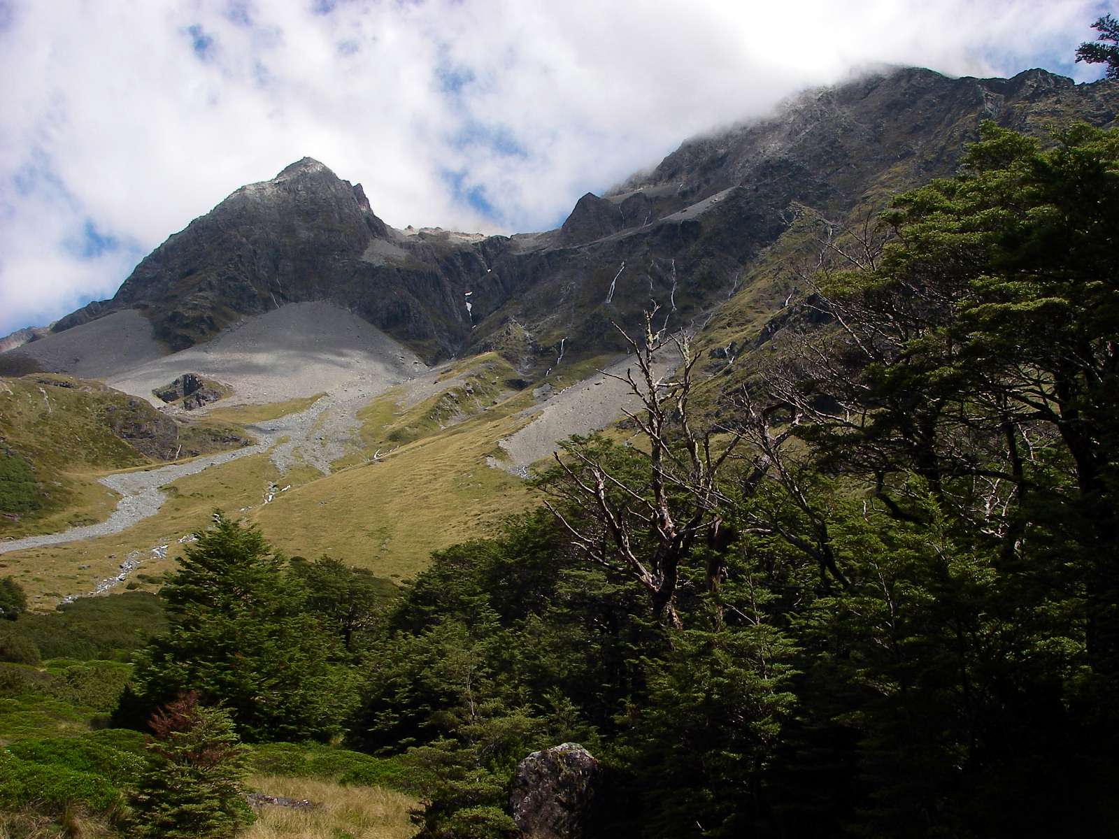
 Day Four of the Travers Sabine Circuit in New Zealand - John Tait Hut to West Sabine Hut over the Travers Saddle. It is a steady climb to Upper Travers Hut, but the view of Mount Travers from the valley bottom is spectacular. Travers Falls is a beautiful little 20 metre high waterfall. From Upper Travers Hut the way leads up the Saddle, with some steep sections. There are many beautiful alpine plants such as Hebe, Celmisia, Gentiana, Helichrysum, Coprosma, vegetable sheep and New Zealand flax on the eastern side of the saddle. On the saddle itself there are some beautiful large tarns, but the area is exposed and often windy and cold. The track drops down into the East Branch of the Sabine, via a steep scree slope. The area is subject to avalanches after heavy snow.
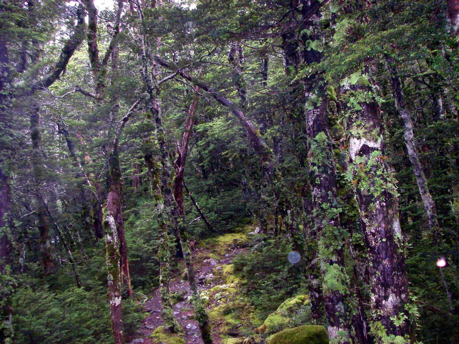
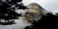 Day Six of the Travers Sabine Circuit in New Zealand - Blue Lake to Lake Rotoroa. The East and West Sabine rivers drain each side of the Mount Franklin massif, and the West Sabine drains Lake Constance and Blue Lake. They join at Sabine Forks, and the Sabine then flows into Lake Rotoroa, in the Nelson Lakes National Park. It is a beautiful stream bordered by beech forest, with lichens and fungi under the trees. A tramping track runs along the river and forms the western branch of the Travers-Sabine tramping circuit. It connects Lake Constance and Blue Lake with Lake Rotoroa and Lake Rotoiti. Three tramping huts are located in the Sabine Valley: Sabine Hut, West Sabine Hut, and Blue Lake Hut. Lake Rotoroa is fed by the D'Urville and Sabine Rivers. A track follows the north east side of the lake, and another track leads back via Speargrass Hut to St Arnaud. A water taxi can ferry trampers to and from the head of the lake. The lake has trout, and attracts recreational fishermen.
Day Five of the Travers Sabine Circuit in New Zealand - West Sabine Hut to Blue Lake
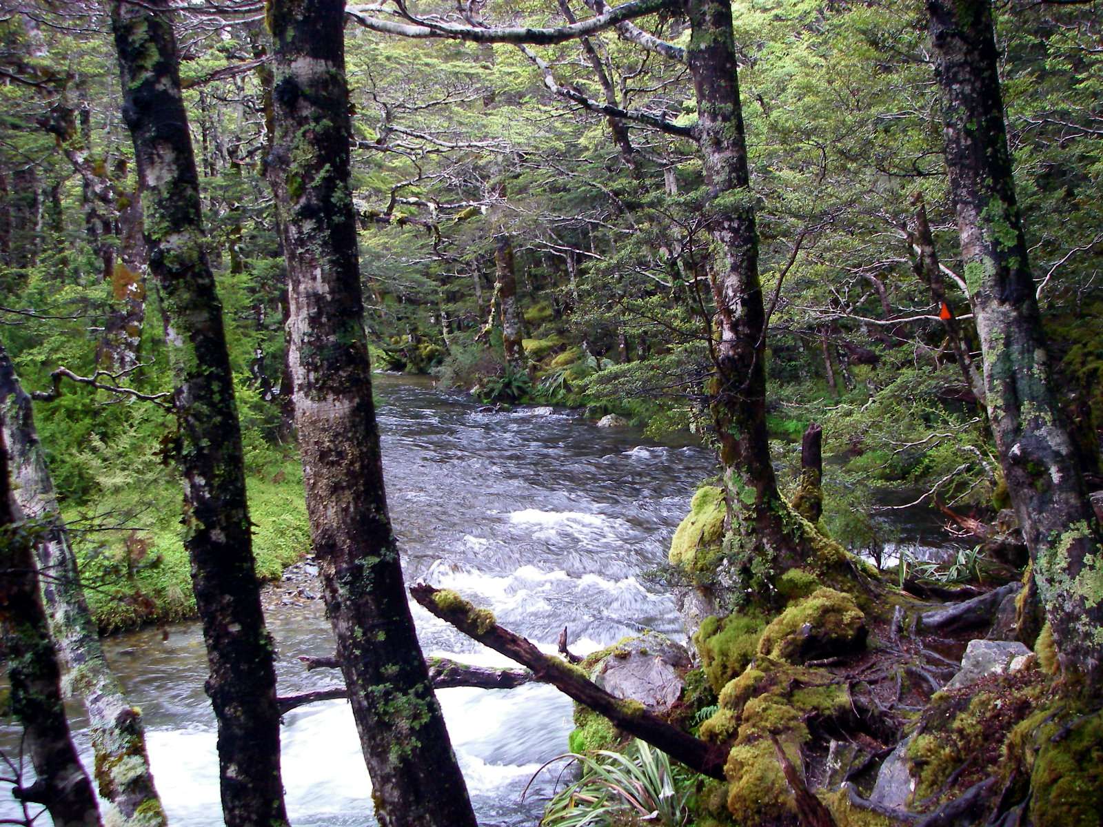
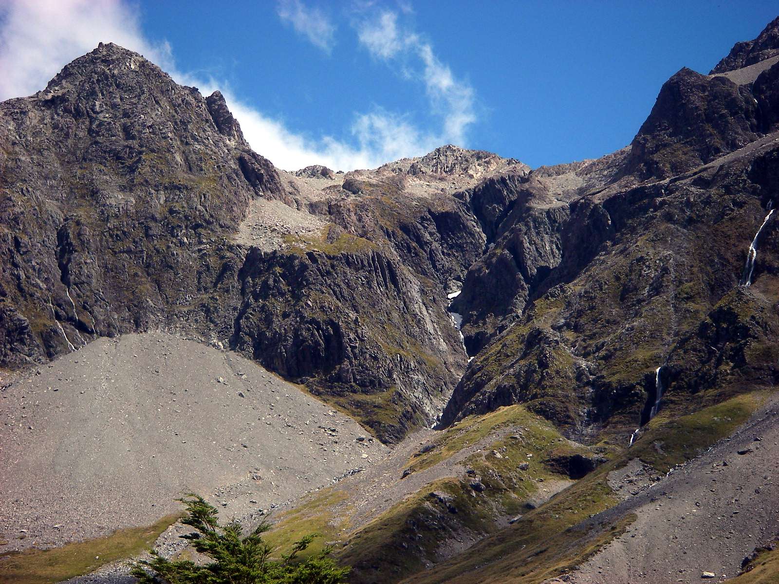
The West Sabine drains Lake Constance and Blue Lake, high in the catchment of the West Sabine. It joins the East Sabine at Sabine Forks, and the Sabine then flows into Lake Rotoroa, in the Nelson Lakes National Park. Apart from the upper reaches, which is open tussock and scrub, the river is set within unmodified beech forest. The West Sabine River is in a superb gorge, with many streams coursing down the flanks of the valley walls. After heavy rain, crossing sidestreams can be a very wet experience, and care must be taken.
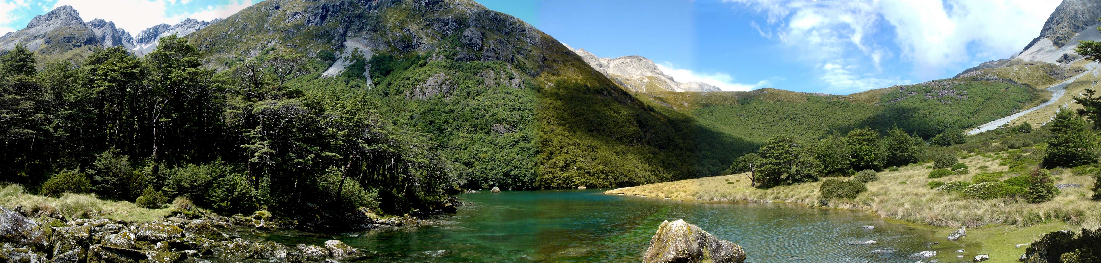
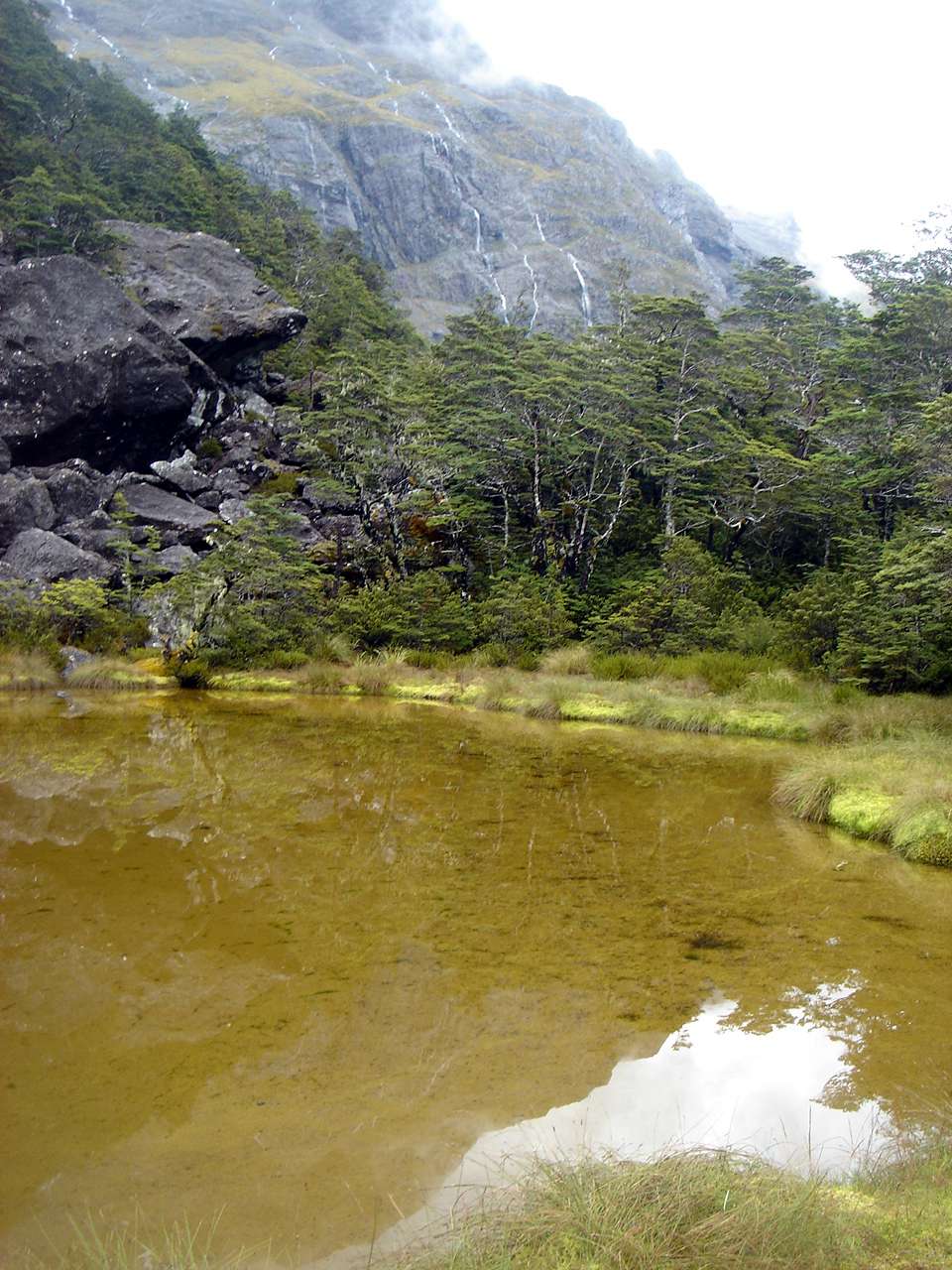
Blue Lake, high in the catchment of the West Sabine River.
Photo: Panorama stitched by Don Hitchcock, from six originals taken in portrait mode to capture the distant mountains by B., 1st February 2007
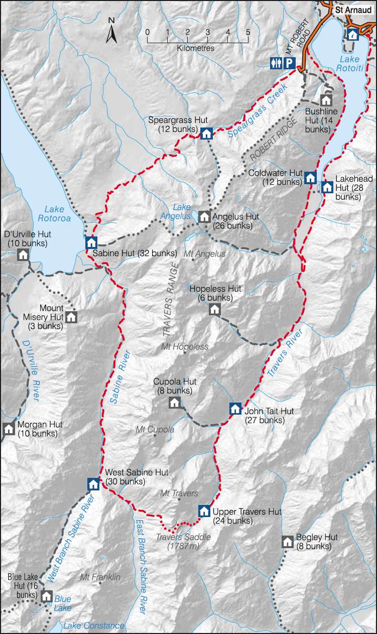
This is a very useful sketch map of the Travers Sabine Circuit in Nelson Lakes National Park from the New Zealand Government site. The NZ Government has worked really hard to make it easy for tourists to find information, and to book travel and accommodation. I believe they have the best such system in the world.
Photo: http://www.doc.govt.nz
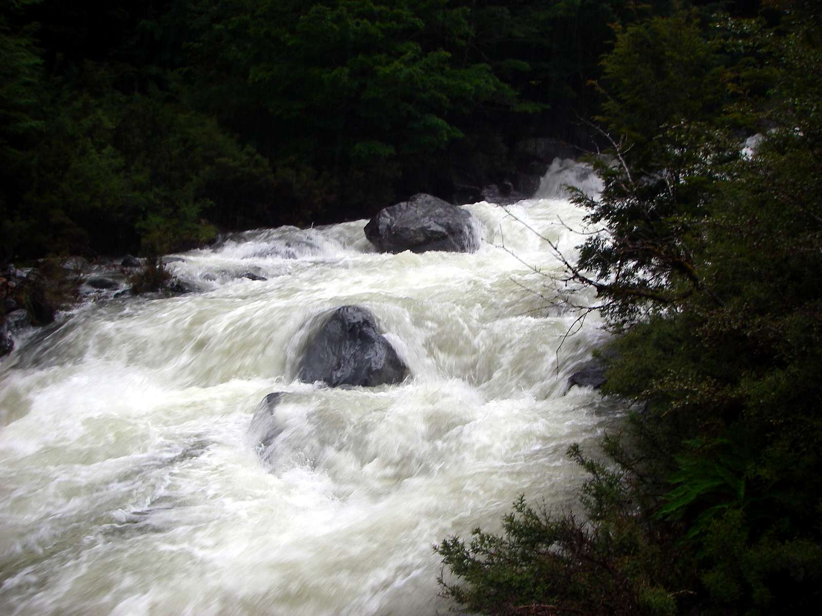
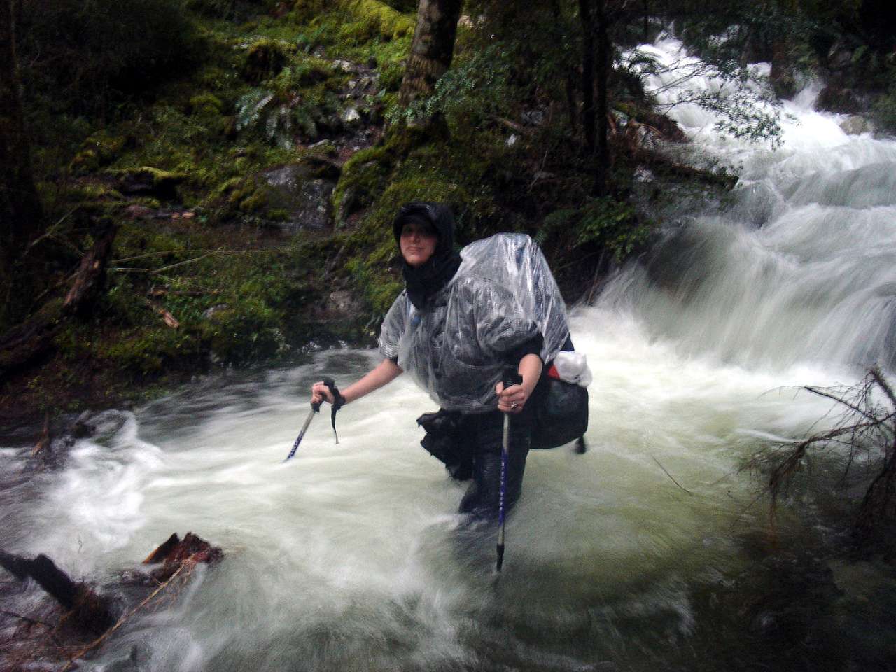
After spending the night in West Sabine Hut lulled to sleep by the heavy rain on the roof, we left early the next morning, and walked into very heavy rain, on our way to Blue Lake. We soon encountered the results of the overnight and present heavy rain. Every sidestream (such as this one!) was running a banker, and sometimes great care had to be taken to get across safely.
Photo: Don Hitchcock, 1st February 2007
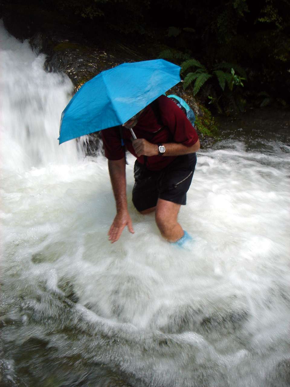
I used an umbrella for most of my nine weeks in New Zealand. I found this fold up umbrella in Karamea, on the west coast after doing the Abel Tasman and the Heaphy, and had to have it - it matched the blue of the rest of my silnylon gear! I patched it and repaired it a number of times, it came in for some very vigourous maltreatment, but it served me well.
I carried spare Silnylon and Silnet™ silicone seam sealer, the only glue that works on this product, as well as several needles and thread. I needed the repair kit a number of times.
The grey line on my shorts is the strap of my waterproof camera, connected by an invisible (in this shot) black loop connected to my belt. I moused most of my essential equipment in this way, and it worked well. The camera was a Pentax Optio WP3, and I would not use anything else for bushwalking.
Photo: B., 1st February 2007
The side streams were never-ending, one after the other.
Photo: Don Hitchcock, B.'s camera, 1st February 2007
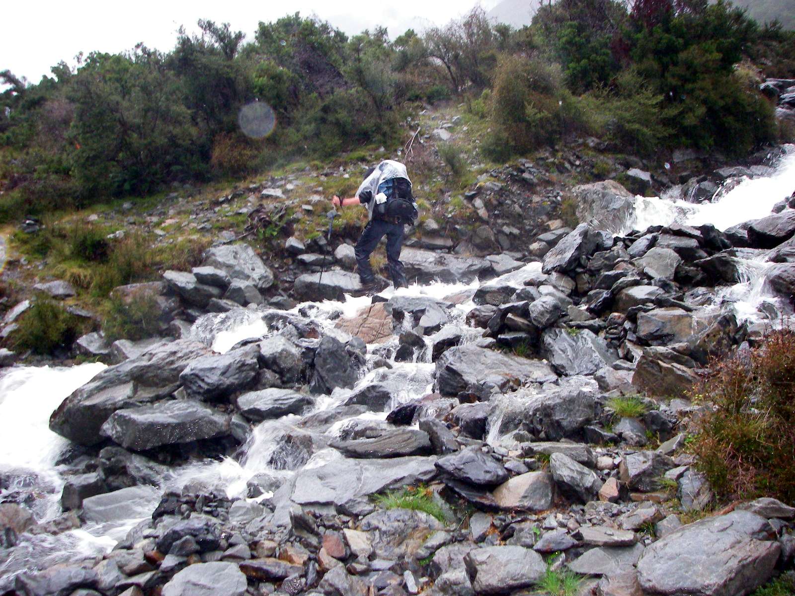
And another crossing, not so difficult this time.
There was still light rain at this stage, but it was beginning to ease off at last.
Photo: Don Hitchcock, 1st February 2007
The rain had stopped by this time, but the side creeks continued unabated.
Photo: B., 1st February 2007
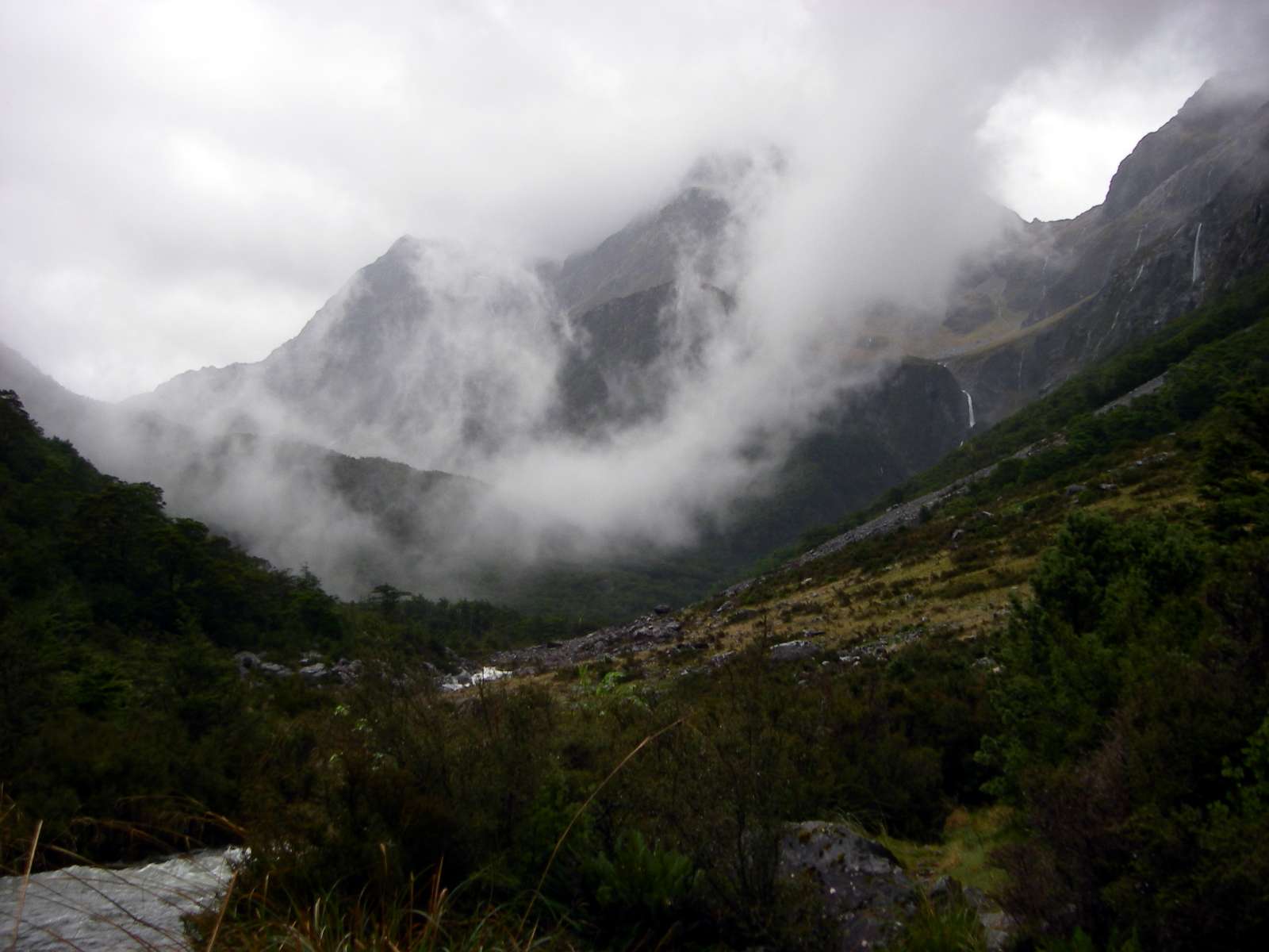
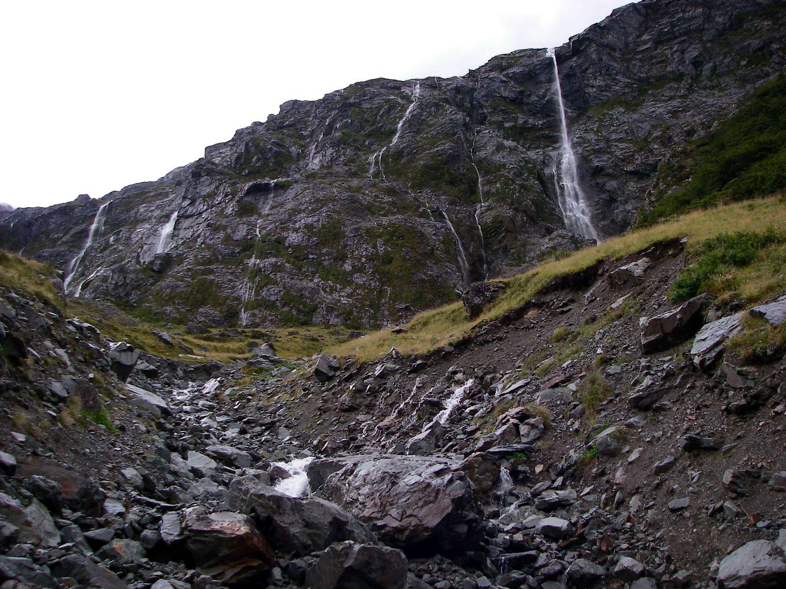
The West Sabine River is in a superb gorge, with many streams coursing down the flanks of the valley walls.
Photo: Don Hitchcock, 1st February 2007
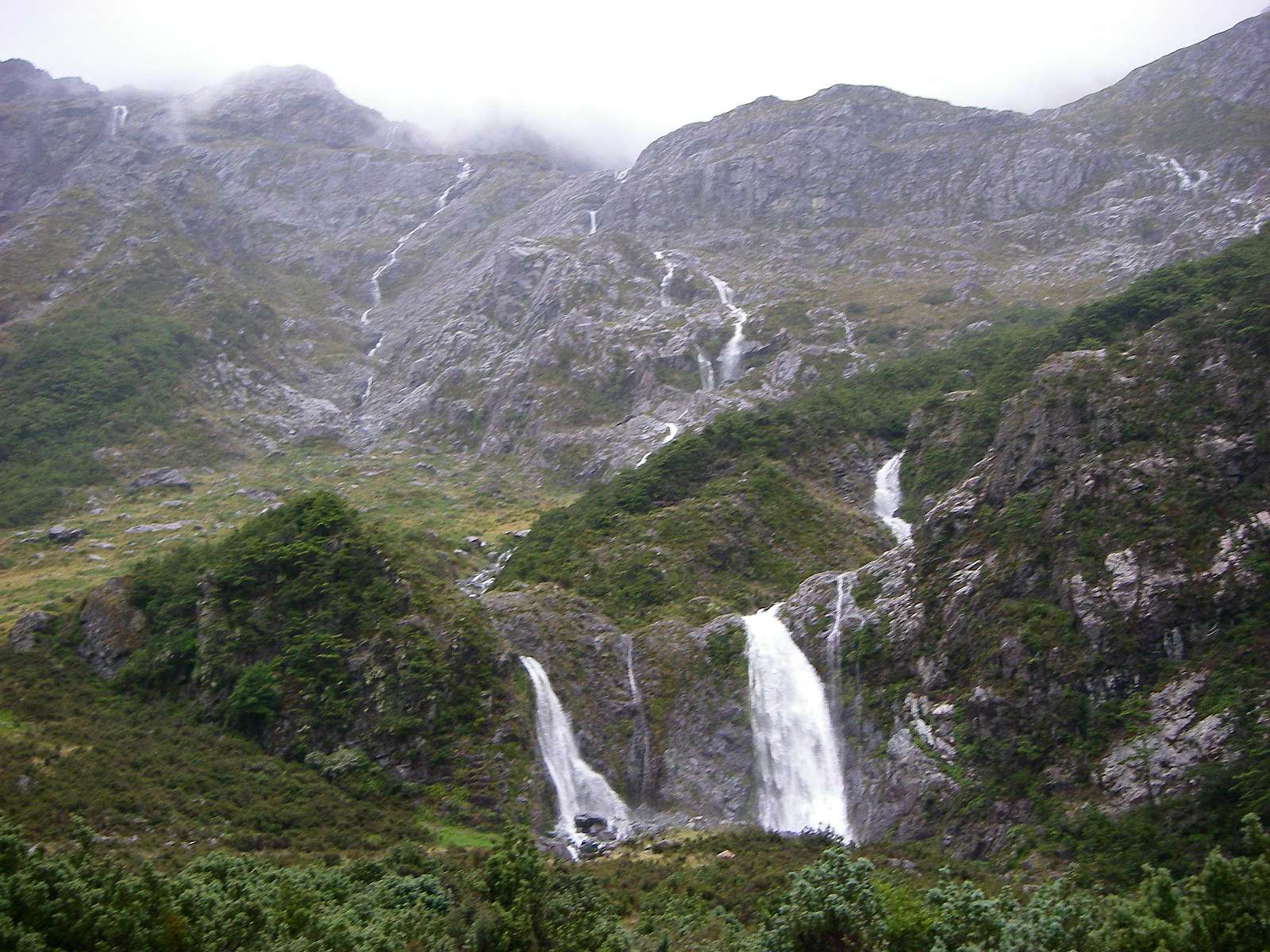
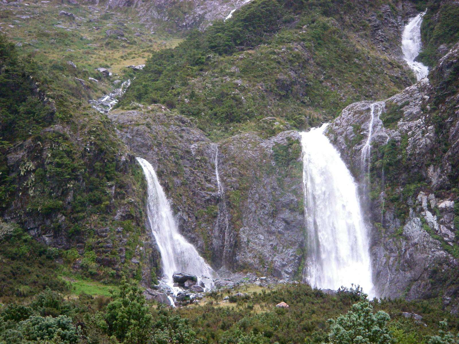
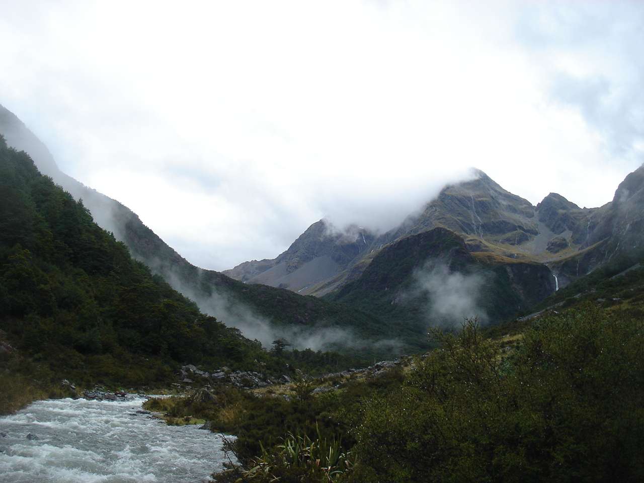
Despite the difficult conditions, it was wonderful to see so many side streams entering the system.
Photo: Don Hitchcock, 1st February 2007
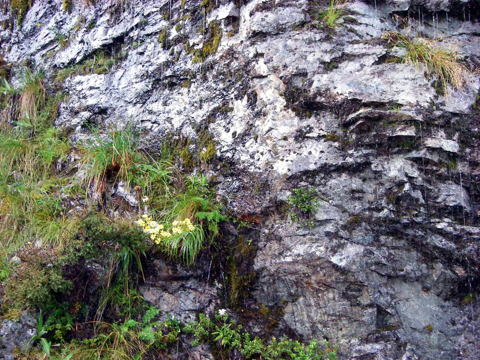
This "weeping wall" was host to many alpine plants, though I was unable to get close enough to photograph or identify them individually.
Photo: Don Hitchcock, 1st February 2007
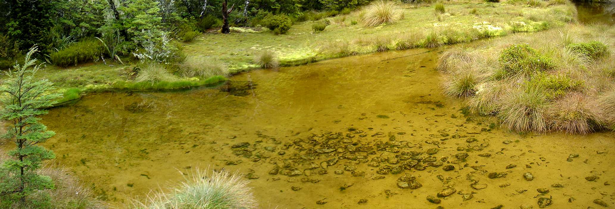
A lovely little shallow pond
Photo: Panorama stitched by Don Hitchcock, from two originals by B., 1st February 2007
The pond was in a superb setting.
Photo: B., 1st February 2007
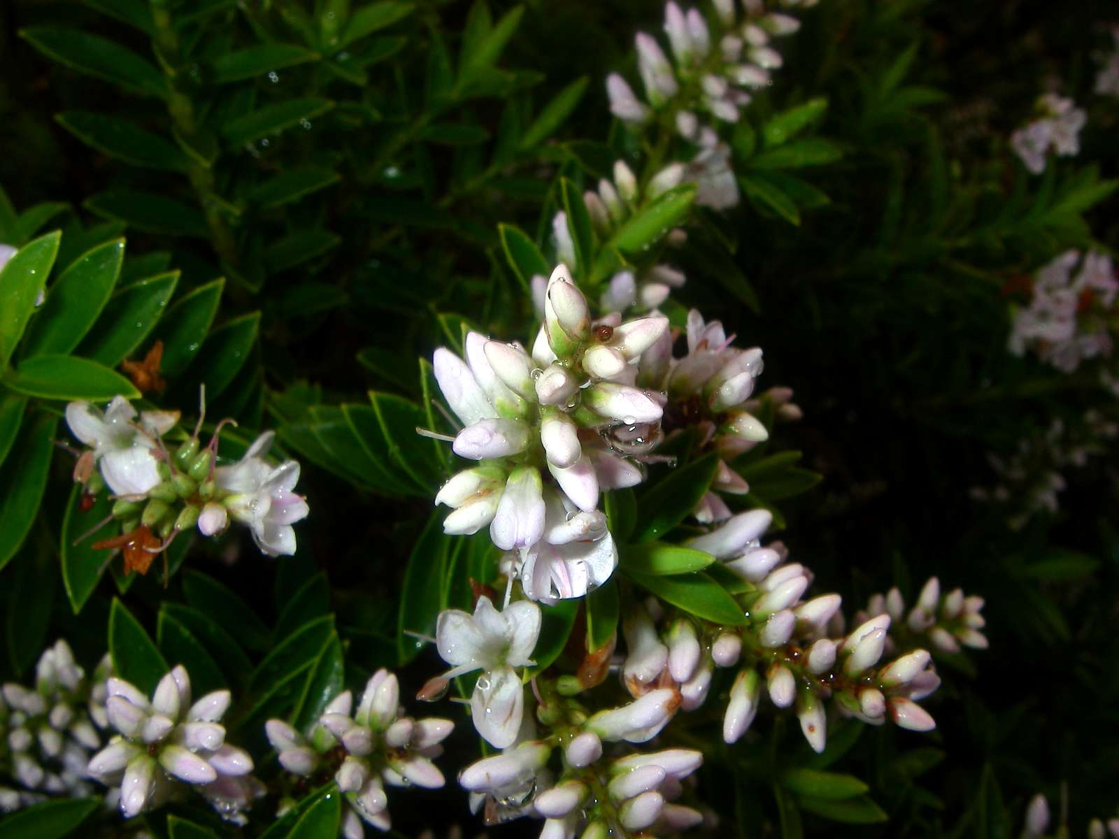
Hebe sp.
Photo: Don Hitchcock, 1st February 2007
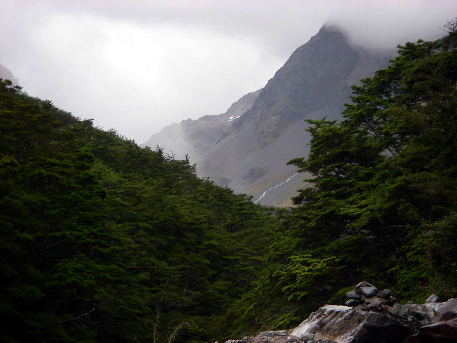
In this environment erosion gullies are an ever present phenomenon.
Photo: Don Hitchcock, 1st February 2007
The forest as we approached Blue Lake was wet underfoot, and dripping from above.
Photo: Don Hitchcock, 1st February 2007
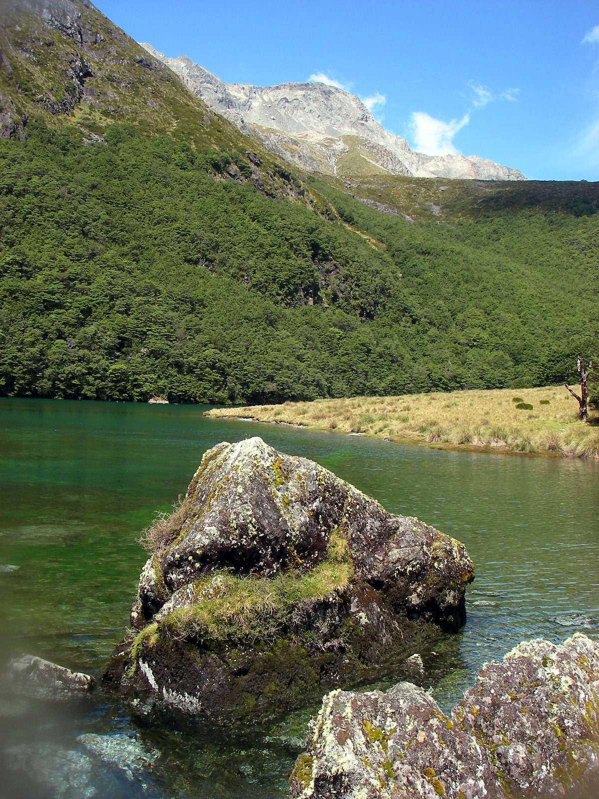
The exit stream from Blue Lake was remarkably uniform in its bed, giving a distinct "man made" look to the start of the West Sabine.
Photo: Don Hitchcock, 1st February 2007
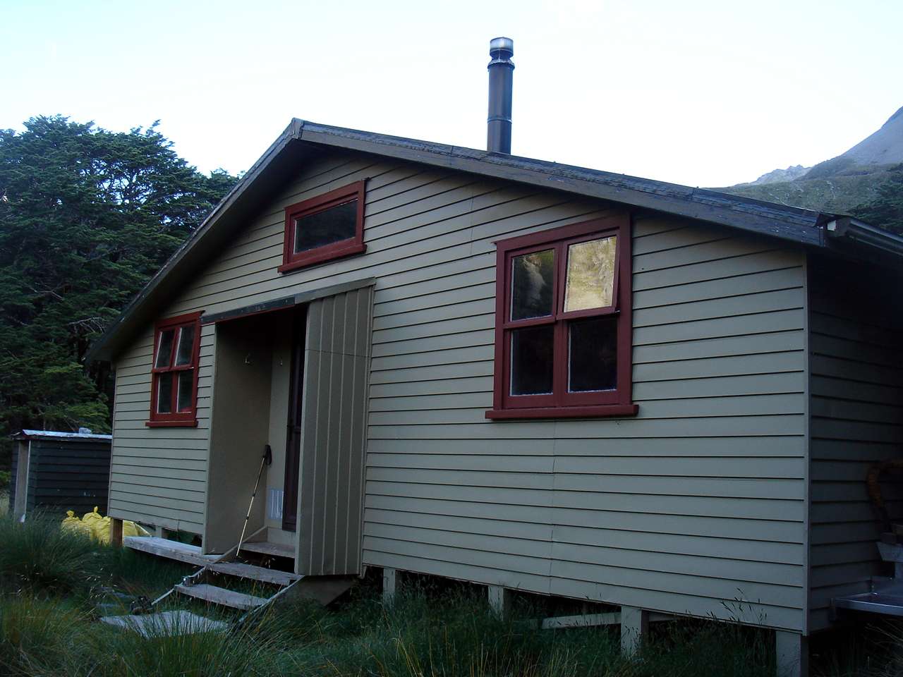
Blue Lake Hut, photographed here towards evening, was comfortable and cosy.
The small wooden structure on the left contained wood and an axe for getting a fire started, and coal in yellow sacks was stacked in front of it and under the hut to keep the fire going. This is the normal fuel arrangement at most New Zealand backcountry huts, and it works well.
Photo: B., 1st February 2007

Someone had left behind a nearly full container of mustard, which I added to my mid day meal. Lunch is one of the most difficult meals of the day to cater for, and these days I mostly make do with a nut bar and a cup of coffee. New Zealand nut bars are delicious and satisfying, and I have since found an equivalent in Australia.
Photo: Don Hitchcock, 1st February 2007
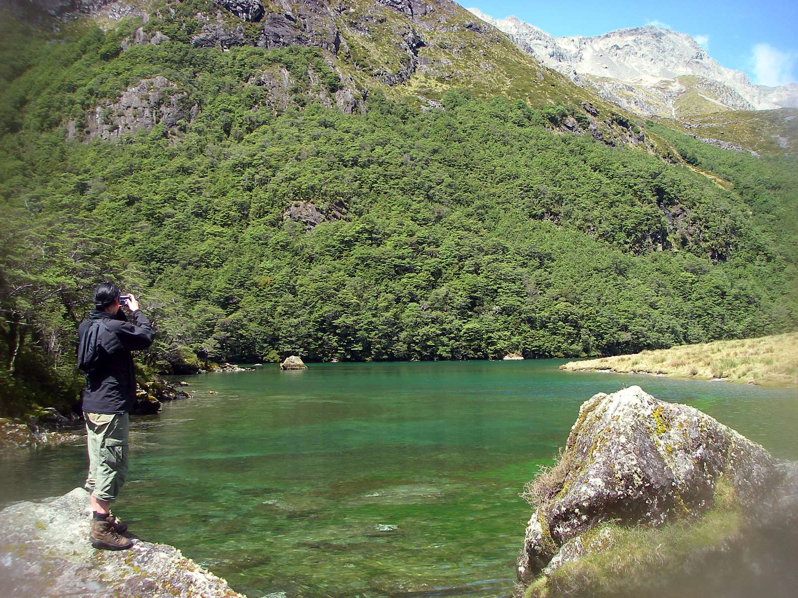
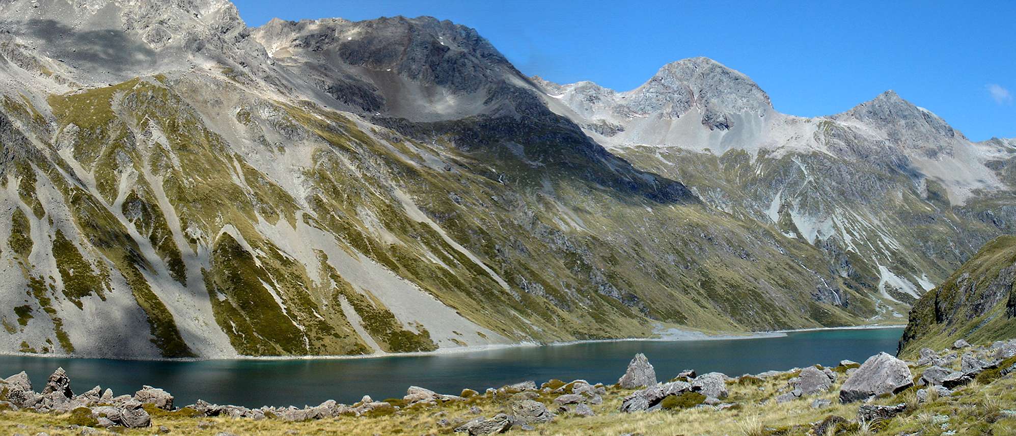
Blue Lake is in an exquisite setting high in the mountains.
Photo: Don Hitchcock, 1st February 2007
The lake is shallow but cold, and very inviting for a dip on a hot day. By now the sun was out, and it had turned into a beautiful day.
Photo: Don Hitchcock, 1st February 2007
This is the general area for the path to Lake Constance, an even bigger and higher lake, further up the valley.
Photo: Don Hitchcock, 1st February 2007
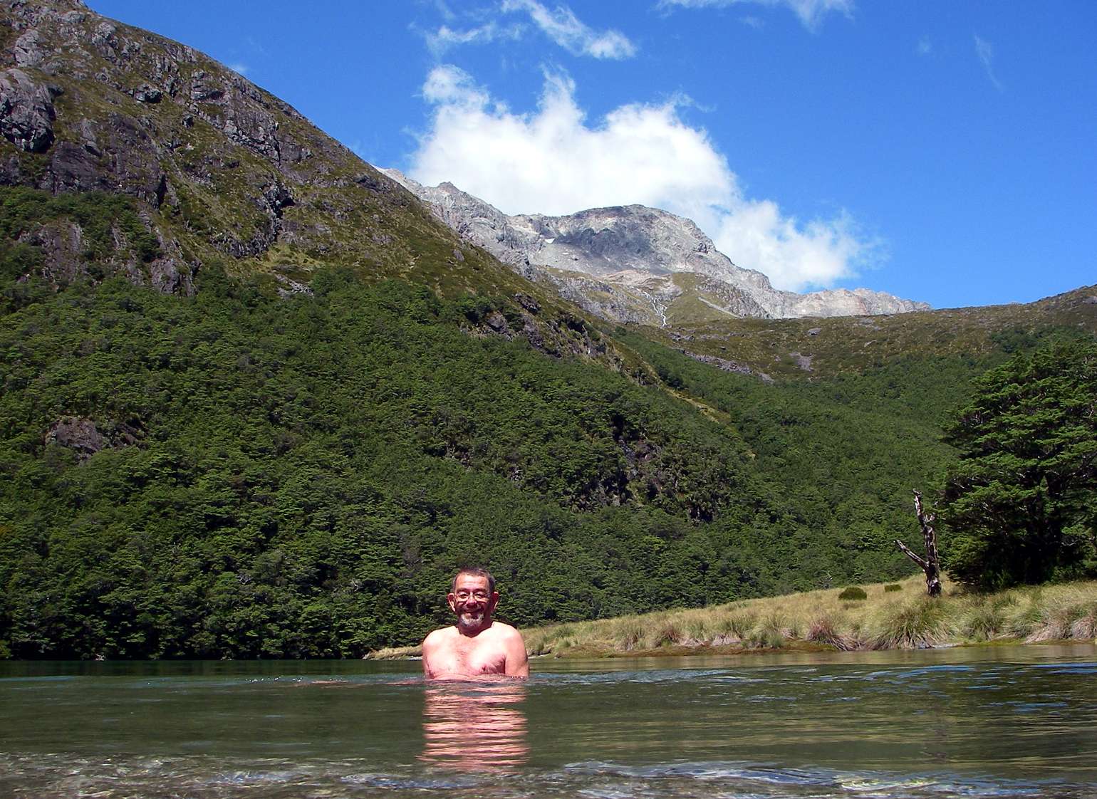
B. decided to make the trip to Lake Constance, but a rest and a dip after the rigours of the trip here was what I wanted.
I suspect that an awful lot of people have had a swim, or at least a wallow, in these waters, which the sun had warmed up in the shallow areas.
Photo: Don Hitchcock, 1st February 2007
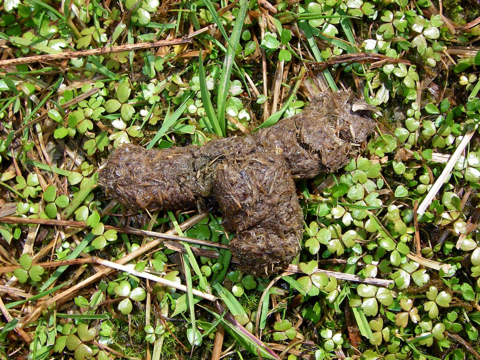
After my dip I found this scat on the side of the lake. It looked like Possum poo, and that later turned out to be correct. New Zealand has millions of them, imported from Australia for the fur trade, but they have reached plague proportions. Feral animals are a real problem in the nation's national parks.
Photo: Don Hitchcock, 1st February 2007
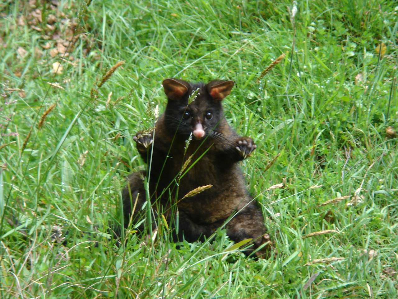
The culprit turned up later. There are many millions of feral Australian possums in New Zealand, introduced for the fur trade.
Photo: B., 2nd February 2007
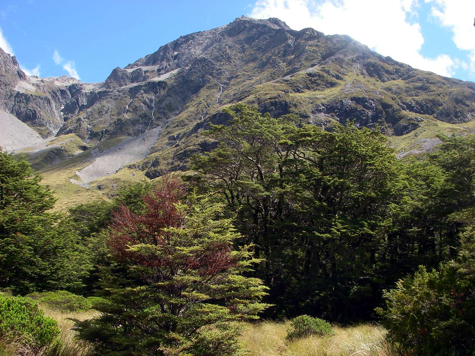
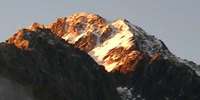
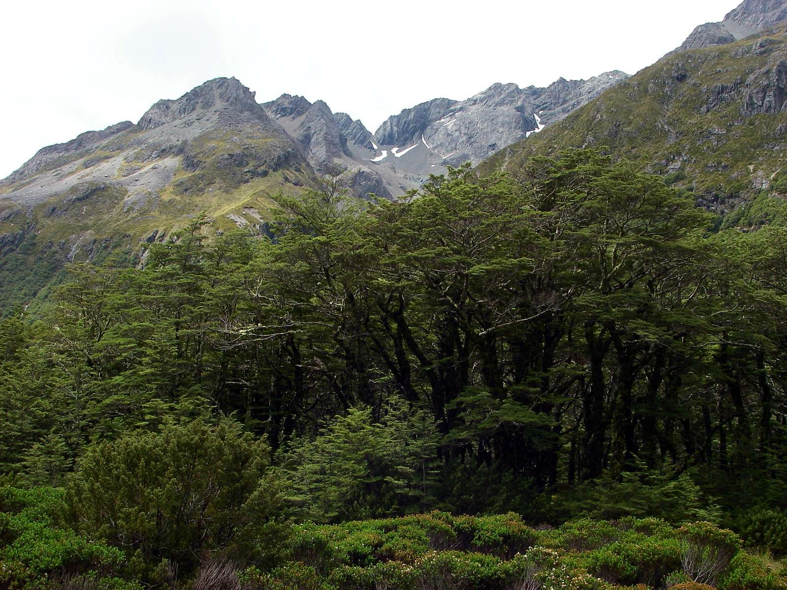
New Zealand has some of the most beautiful scenery on earth.
Photo: Don Hitchcock, 1st February 2007
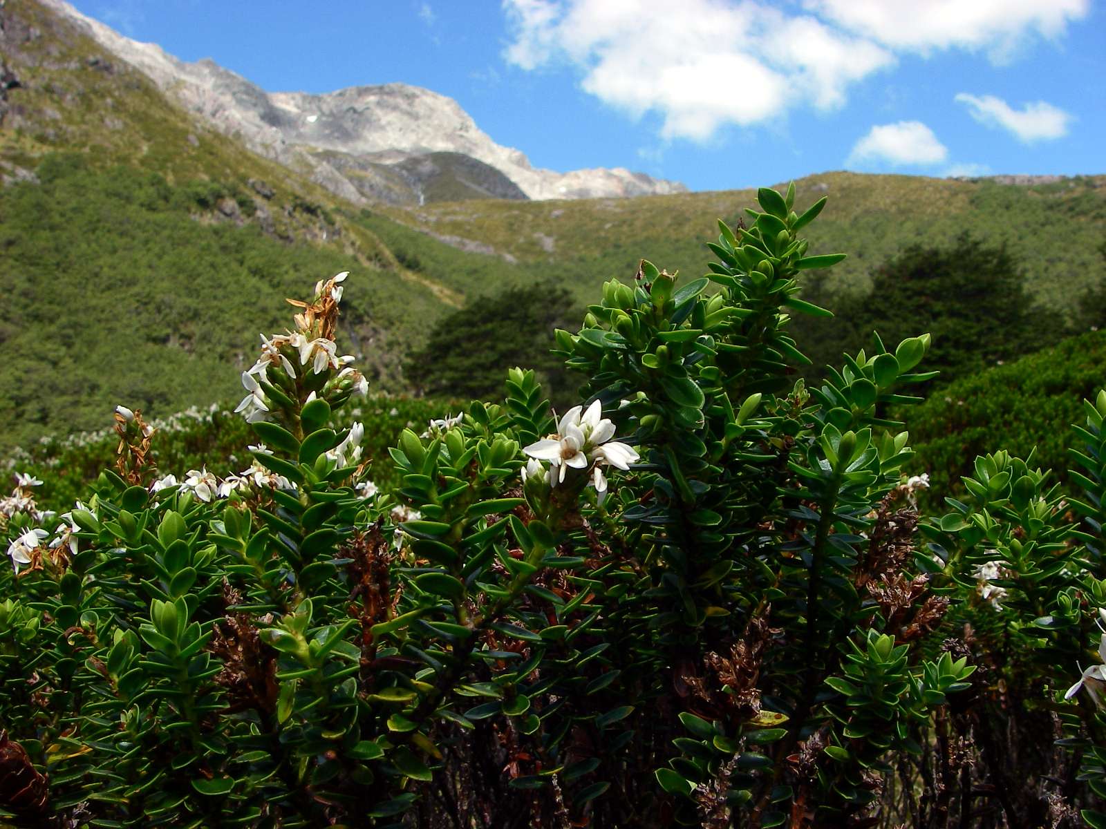
Hebe sp.
Photo: Don Hitchcock, 1st February 2007

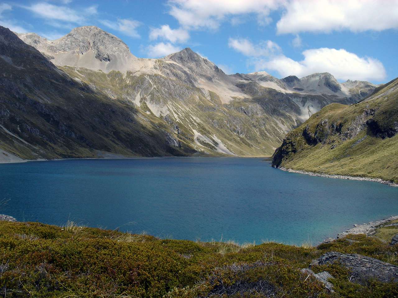
Blue Lake, just below the tree line, seen from the track up to Lake Constance.
Photo: Panorama stitched by Don Hitchcock, from four originals taken in portrait mode by B., 1st February 2007
Lake Constance is above the tree line, and is an ancient glacial lake left over from the last ice age,
when a glacier gouged out the bed, and as it retreated about 10 000 years ago dammed the lake with a rock and gravel moraine.
Photo: Panorama stitched by Don Hitchcock, from two originals by B., 1st February 2007
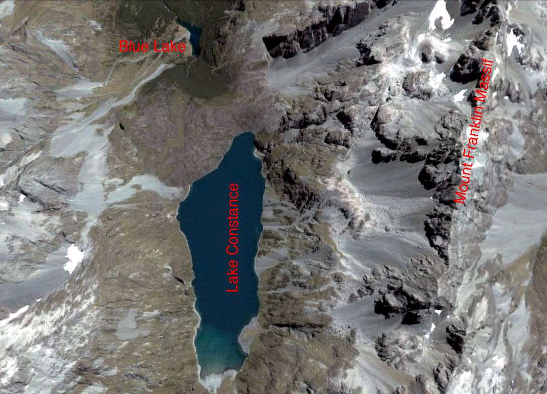
Lake Constance and Blue Lake.
Photo: Google Earth
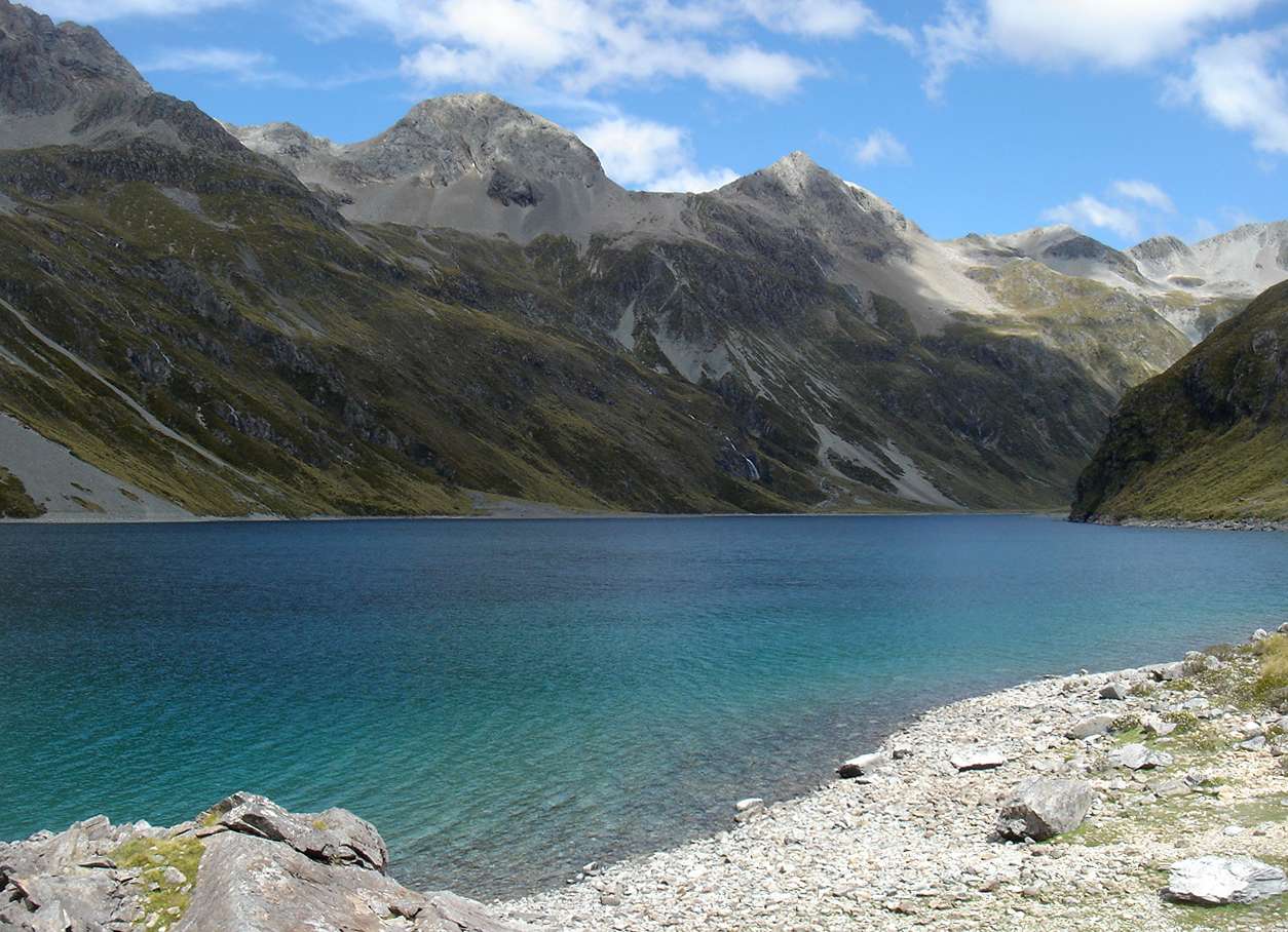
Lake Constance
Photo: B., 1st February 2007
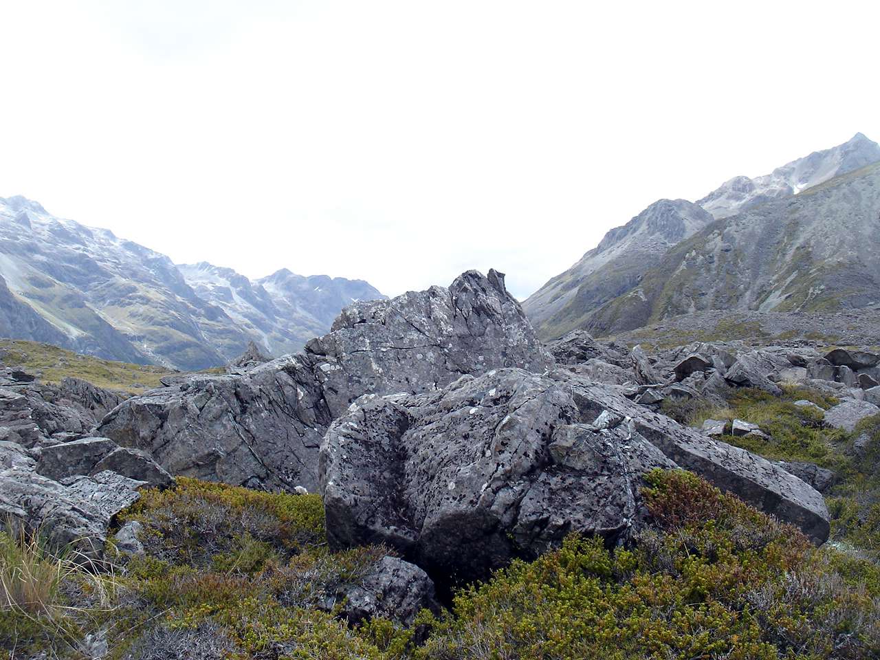
On the way back to Blue Lake from Lake Constance.
It is sobering to realise that these rocks, far from the surrounding cliffs, were deposited as part of a terminal moraine of the glacier which formed Lake Constance, and have been sitting in this position for ten thousand years.
Photo: B., 1st February 2007
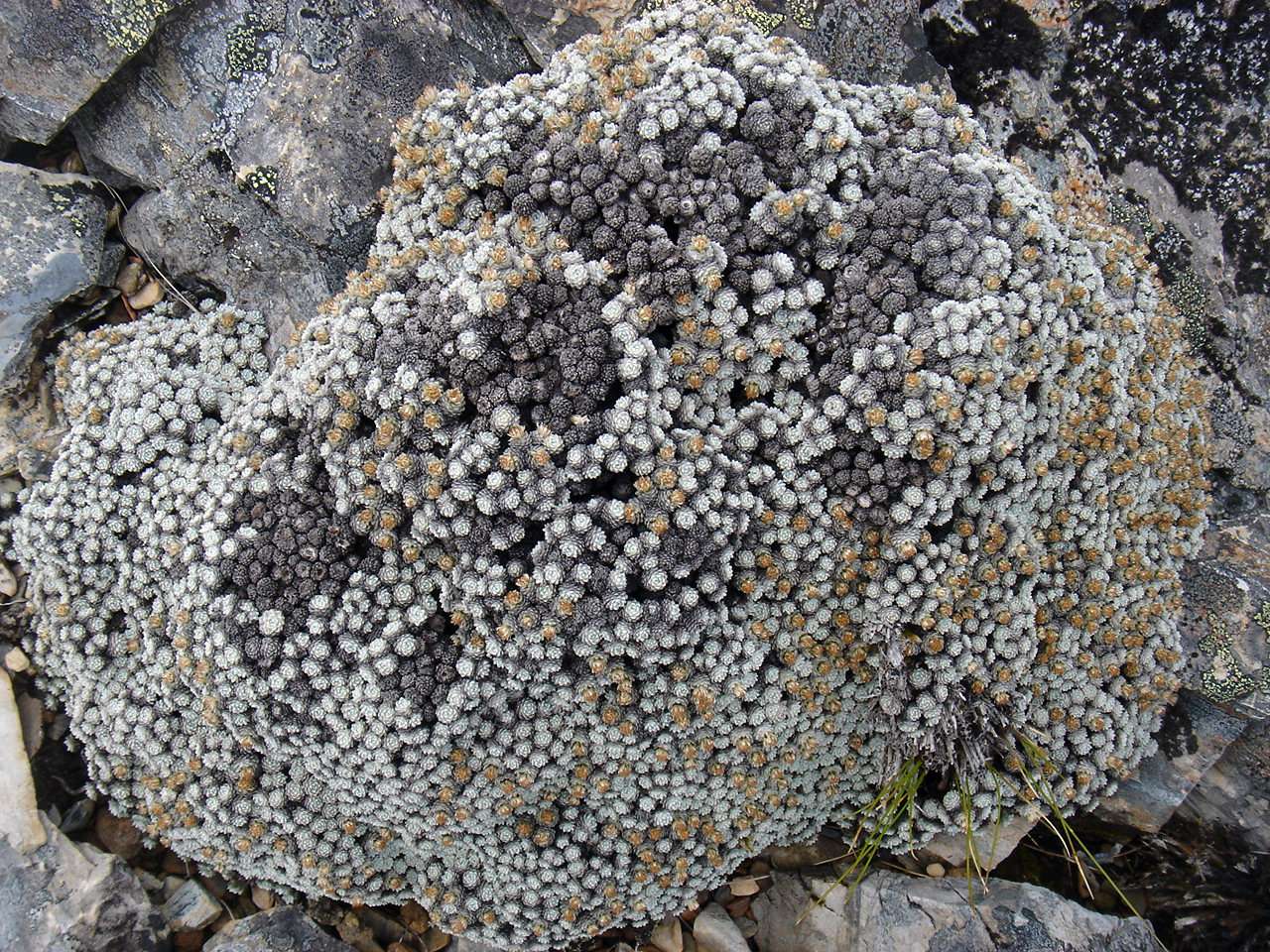
Vegetable sheep on the way back from Lake Constance to Blue Lake. I have been unable to identify it even to genus.
It looks a bit like Raoulia loganii, but that is, I think, a nursery hybrid between Leucogenes and Raoulia bryoides.
I would be grateful for a positive identification.
Photo: B., 1st February 2007
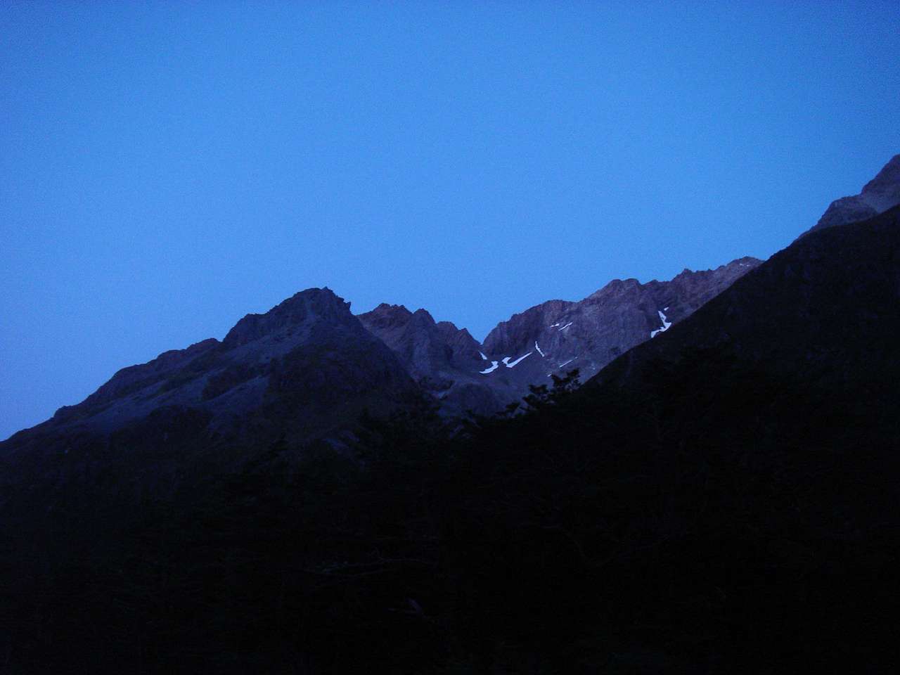
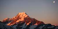
The sky at nightfall was clear of all clouds. Tomorrow looked like being a beautiful day.
Photo: B., 1st February 2007
Bushwalking, Hiking and Tramping in New Zealand
Bushwalking Index
Anyone (e.g. students, teachers, libraries, government agencies such as tourist bureaus, the general public) may use, print and publish the photographs taken by me and presented on this bushwalking file for any legitimate non-commercial purpose, at no cost, and without asking permission. However a note such as "Photo: Don Hitchcock, donsmaps.com" somewhere in the document would be appreciated if it is to be published.