Back to Don's Maps
 Bushwalking Index
 Bushwalking, Hiking and Tramping in New Zealand
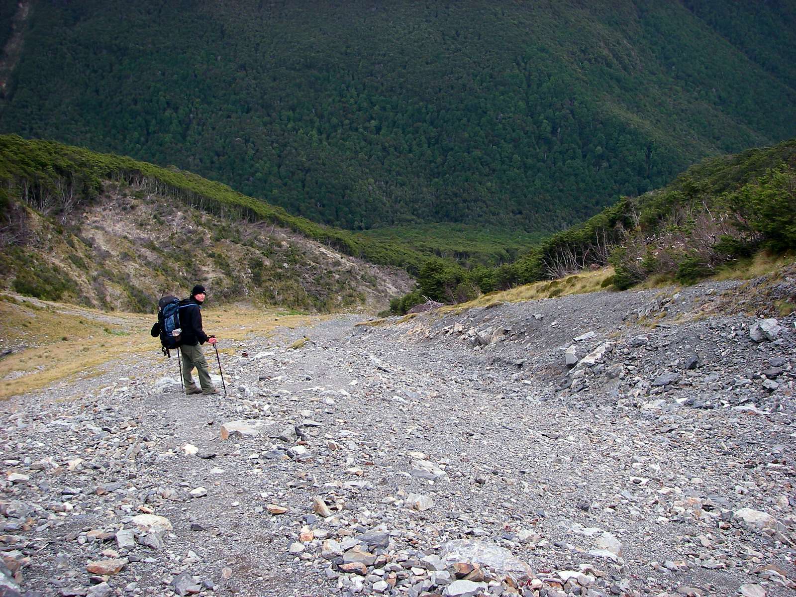
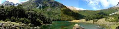 Day Five of the Travers Sabine Circuit in New Zealand - West Sabine Hut to Blue Lake. The West Sabine drains Lake Constance and Blue Lake, high in the catchment of the West Sabine. It joins the East Sabine at Sabine Forks, and the Sabine then flows into Lake Rotoroa, in the Nelson Lakes National Park. Apart from the upper reaches, which is open tussock and scrub, the river is set within unmodified beech forest. The West Sabine River is in a superb gorge, with many streams coursing down the flanks of the valley walls. After heavy rain, crossing sidestreams can be a very wet experience, and care must be taken.
 Day Four of the Travers Sabine Circuit in New Zealand - John Tait Hut to West Sabine Hut over the Travers Saddle
Day Four of the Travers Sabine Circuit in New Zealand - John Tait Hut to West Sabine Hut over the Travers Saddle. It is a steady climb to Upper Travers Hut, but the view of Mount Travers from the valley bottom is spectacular. Travers Falls is a beautiful little 20 metre high waterfall. From Upper Travers Hut the way leads up the Saddle, with some steep sections. There are many beautiful alpine plants such as Hebe, Celmisia, Gentiana, Helichrysum, Coprosma, vegetable sheep and New Zealand flax on the eastern side of the saddle. On the saddle itself there are some beautiful large tarns, but the area is exposed and often windy and cold. The track drops down into the East Branch of the Sabine, via a steep scree slope. The area is subject to avalanches after heavy snow.
Day Four
John Tait Hut to West Sabine Hut over the Travers Saddle
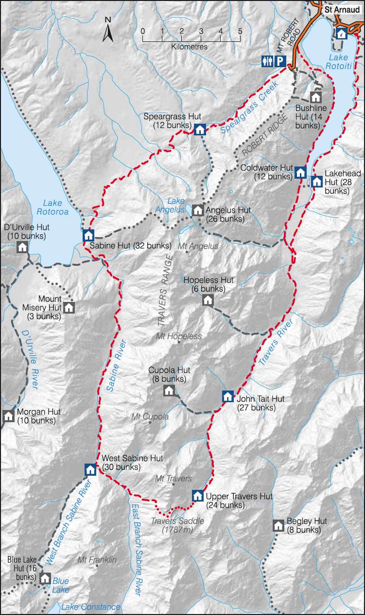
This is a very useful sketch map of the Travers Sabine Circuit in Nelson Lakes National Park from the New Zealand Government site. The NZ Government has worked really hard to make it easy for tourists to find information, and to book travel and accommodation. I believe they have the best such system in the world.
Photo: http://www.doc.govt.nz

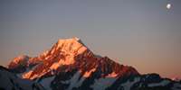
Mount Travers in the early morning. We had rain again overnight, but the next day was glorious, and it looked as though we might be able to go over the saddle if the fine weather continued, so we got moving. The trip to Upper Travers Hut took me three hours.
Photo: Don Hitchcock, 31st January 2007
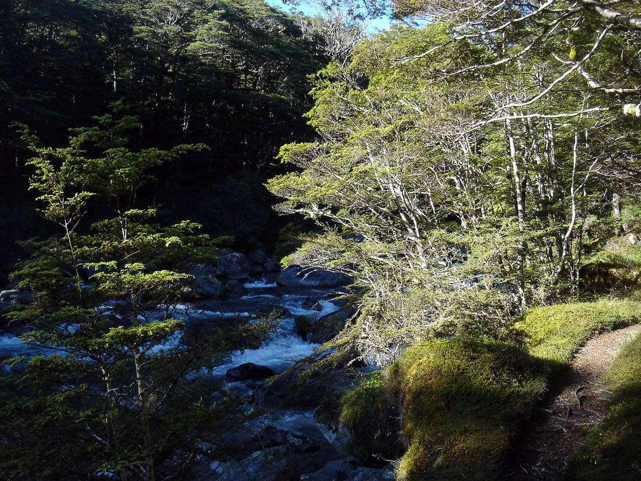
Setting off in the early morning, beside the Travers River. The tracks through beech forest often gave the impression of being manicured, with vegetation to the edge of a soft, springy, beech leaf covered track.
Photo: B., 31st January 2007
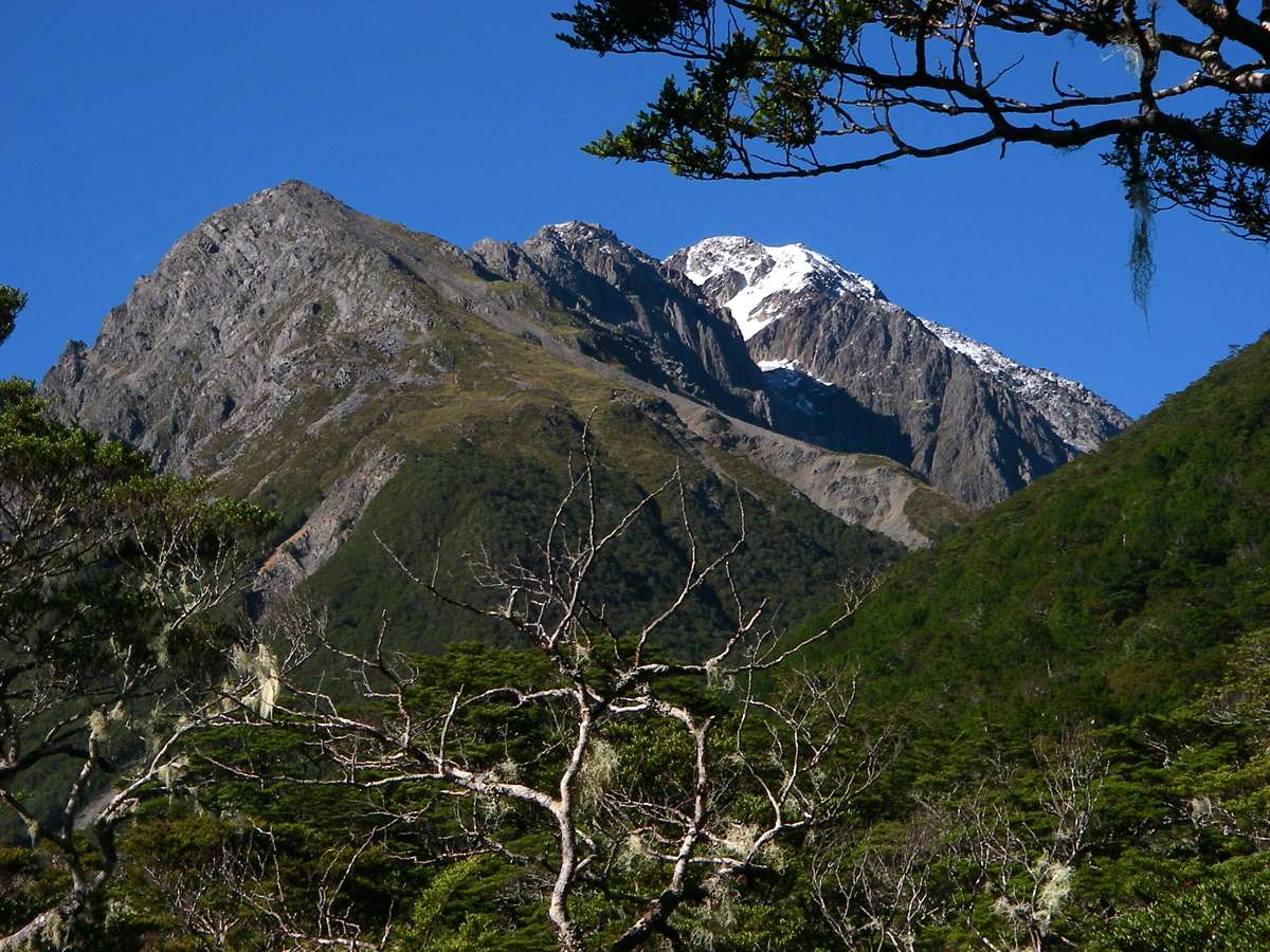
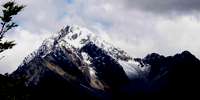
It was a steady climb to Upper Travers Hut, but the view of Mount Travers from the valley bottom was spectacular.
Photo: Don Hitchcock, 31st January 2007
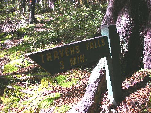
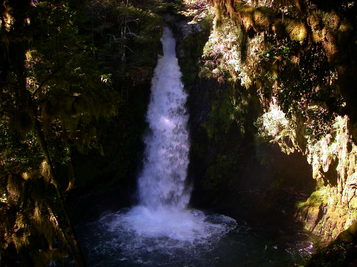
Travers Falls is a beautiful little 20 metre high waterfall, well signposted, and is only a three minute walk off the track.
Photo: Don Hitchcock, 31st January 2007
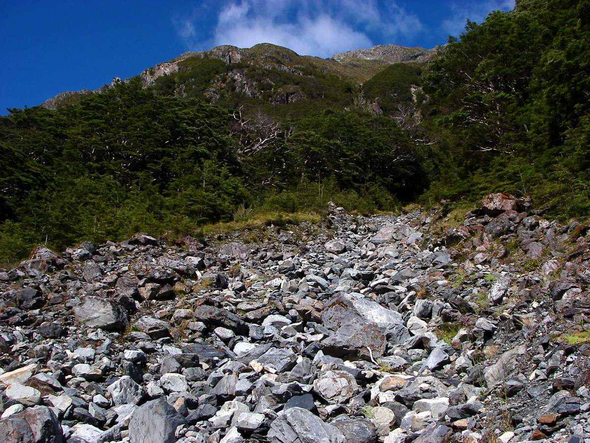
There were active scree slopes to be crossed.
Photo: Don Hitchcock, 31st January 2007
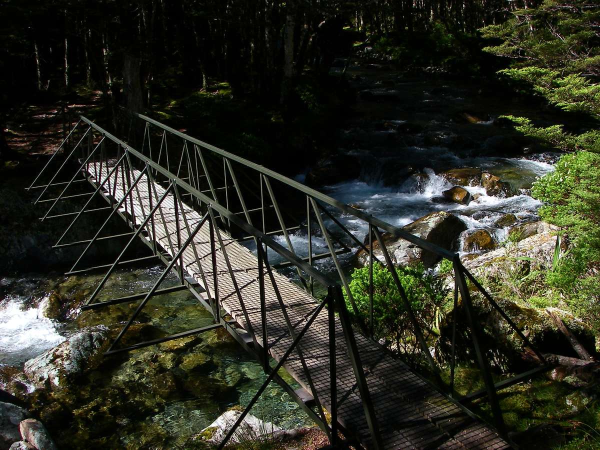
The bridge crosses the Travers River, much reduced in size, to the true right of the stream. As always, the bridges are well constructed and maintained.
Photo: Don Hitchcock, 31st January 2007
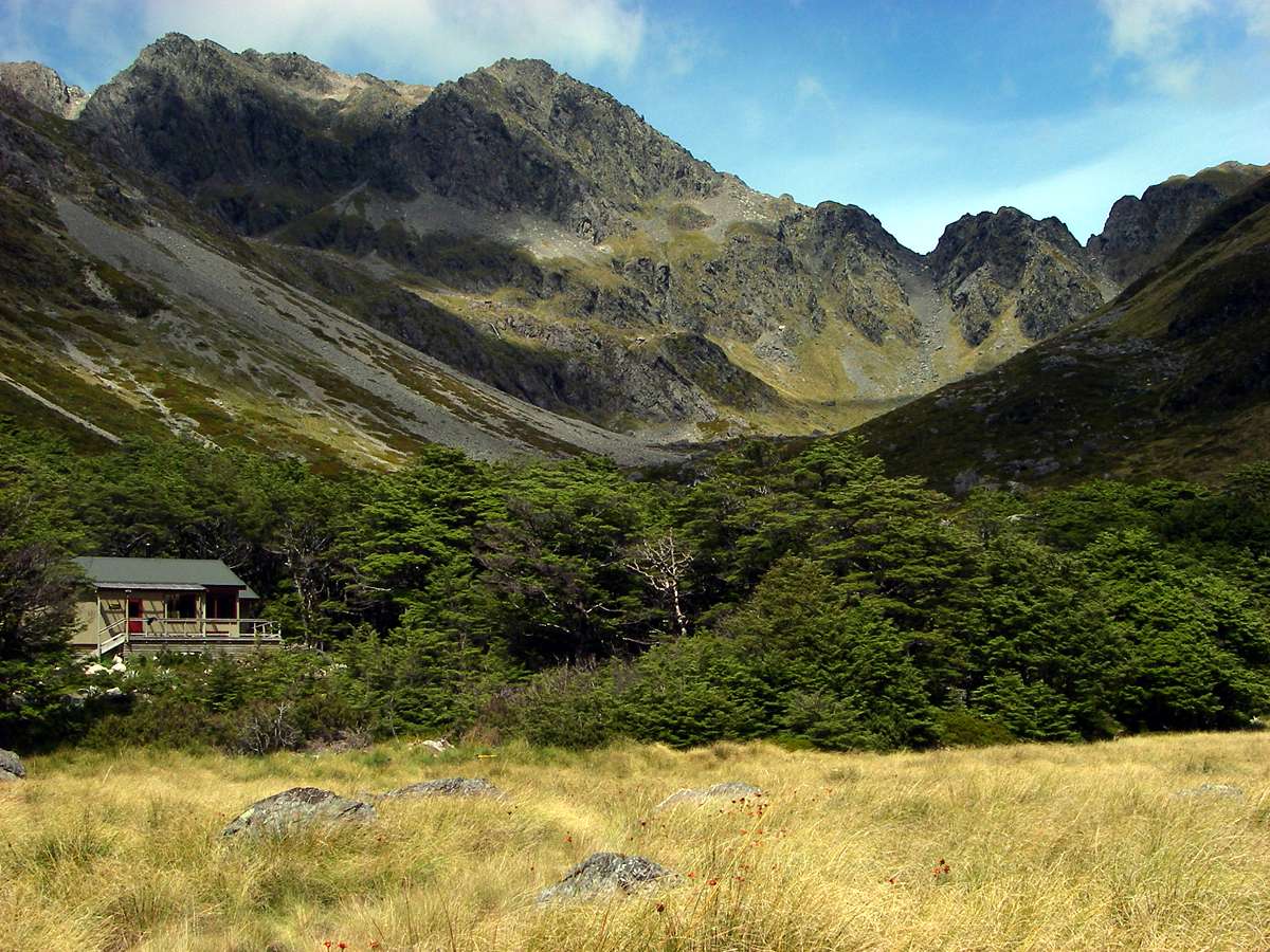
It was about an hour from the bridge to the Upper Travers Hut, set in the last belt of trees before the ascent of the Travers Saddle. We decided to continue over the saddle, taking advantage of the superb weather. Conditions can be wet, cold, miserable and dangerous at any time in this region.
We had a quick and early lunch on the verandah of the well appointed hut and pressed on.
It was beginning to cloud over a little, but based on what I had seen so far in New Zealand of weather conditions, I thought that we had at least three hours of reasonable weather ahead.
This would be enough to get us over the saddle and an hour down the other side, into the safety of the trees.
This turned out to be a very good decision - we got four hours of reasonable weather, which allowed us to get up and over the saddle, down the scree slope on the other side, and well into the East Sabine valley and the protection of its forest before the rain started.
The following day was very wet indeed on the trip from West Sabine Hut to Blue Lake.
Photo: Don Hitchcock, 31st January 2007
The sign warns that this is the start of the avalanche area, and great care should be taken after heavy snow. The saddle is flanked by rocky peaks.
Photo: B., 31st January 2007
The Travers River is by this time a small stream, and the approaches to the Saddle are beautiful. The track gets steeper after this flat area, shown from the bridge over the Travers not long after leaving the hut.
Photo: Don Hitchcock, 31st January 2007
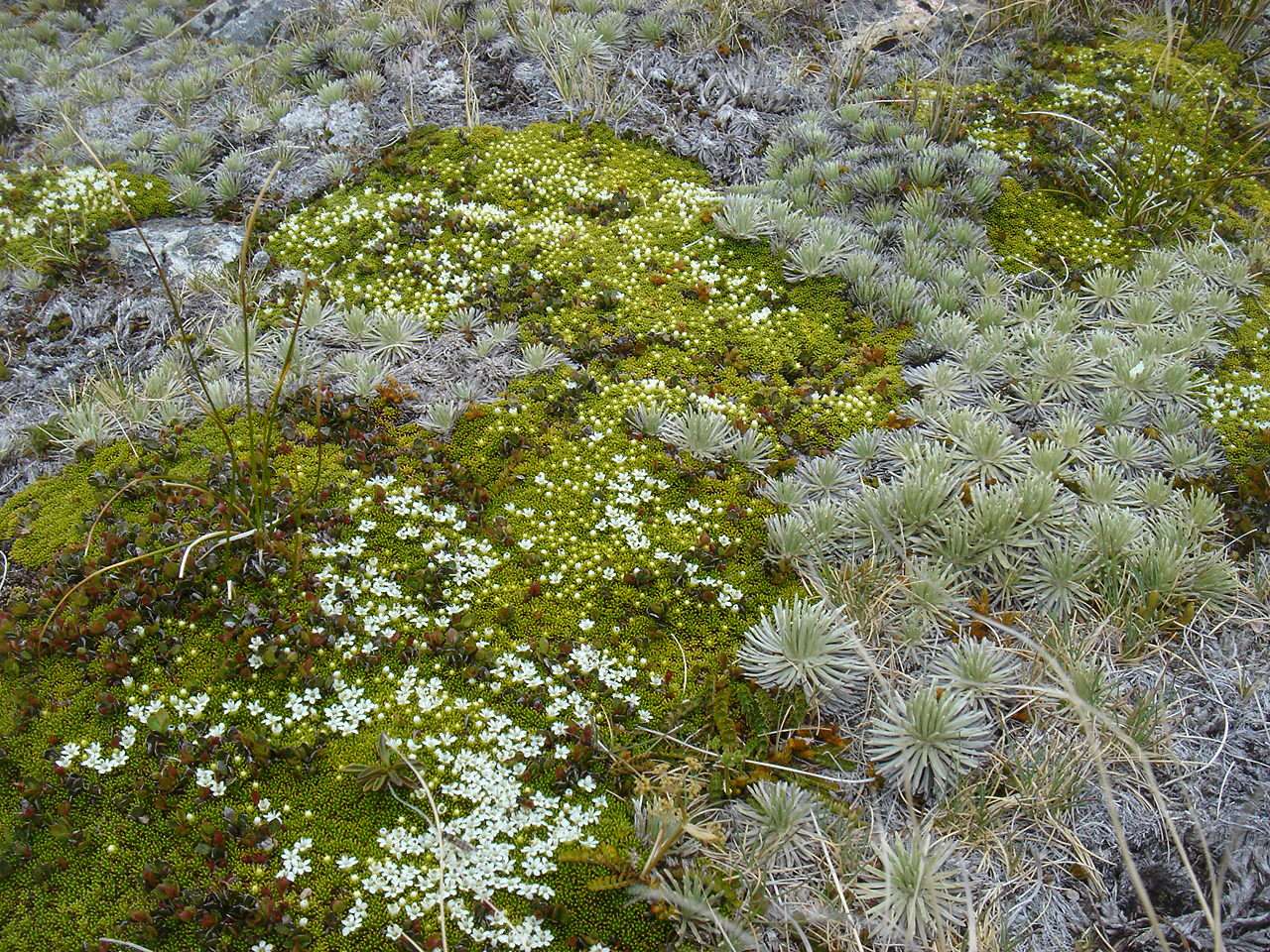
Hebe epacridea, found only on the South Island, at altitudes from 1200 m to 2100 m, on scree and loose rocky debris or crevices in fellfield.
This variant does not have the recurved petals evident in the specimen I found on Day Two of this trip, on Robert Ridge.
A curious thing is that the flora on the southern side, which you would expect would get most of the bad weather, was quite varied and interesting, but on the other side it was almost nonexistent in terms of alpine flowers.
Photo: Don Hitchcock, 31st January 2007
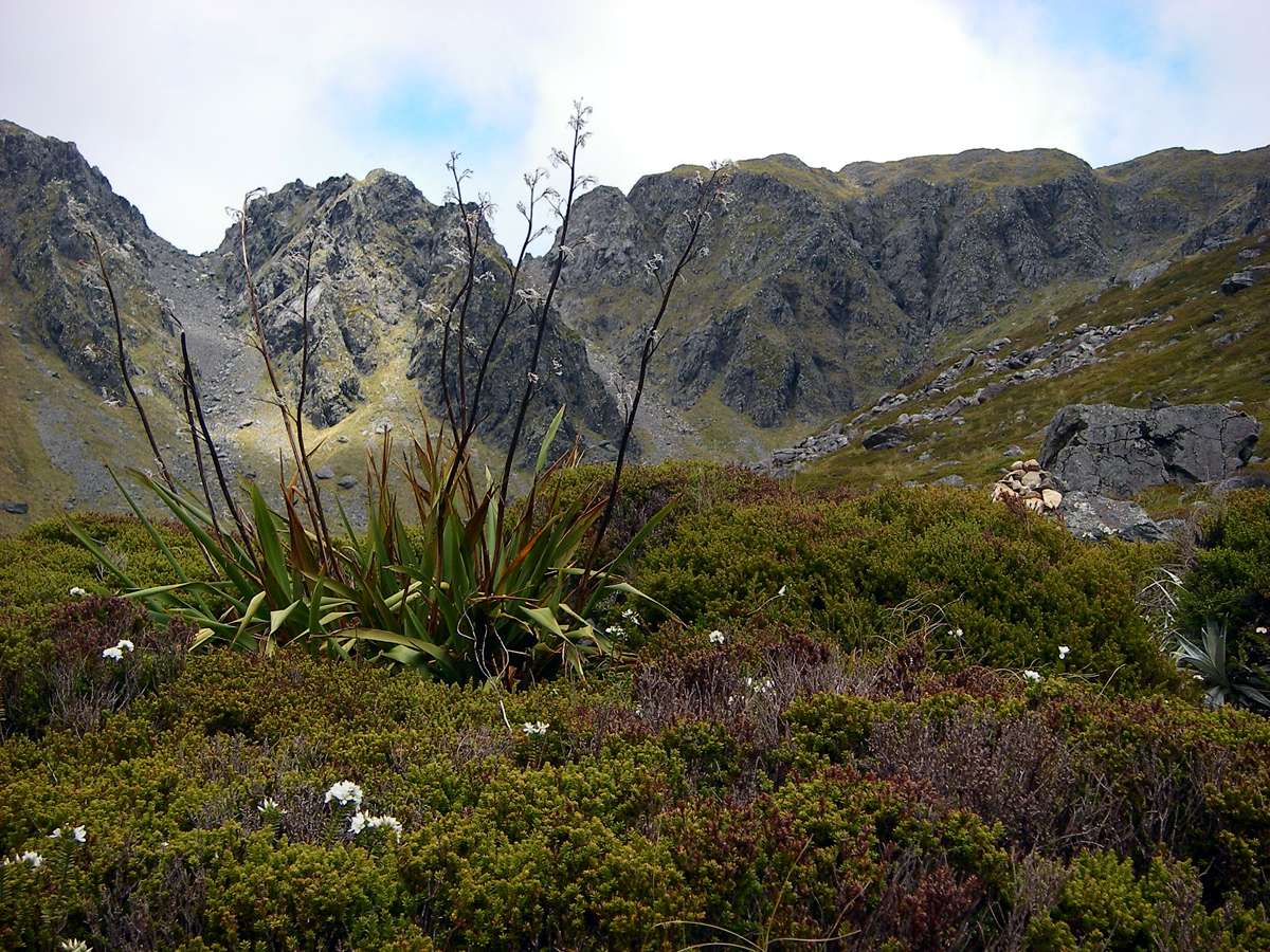
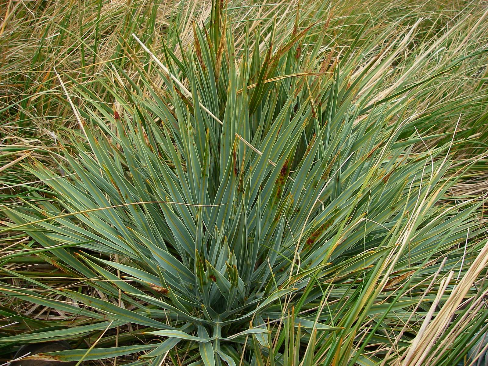
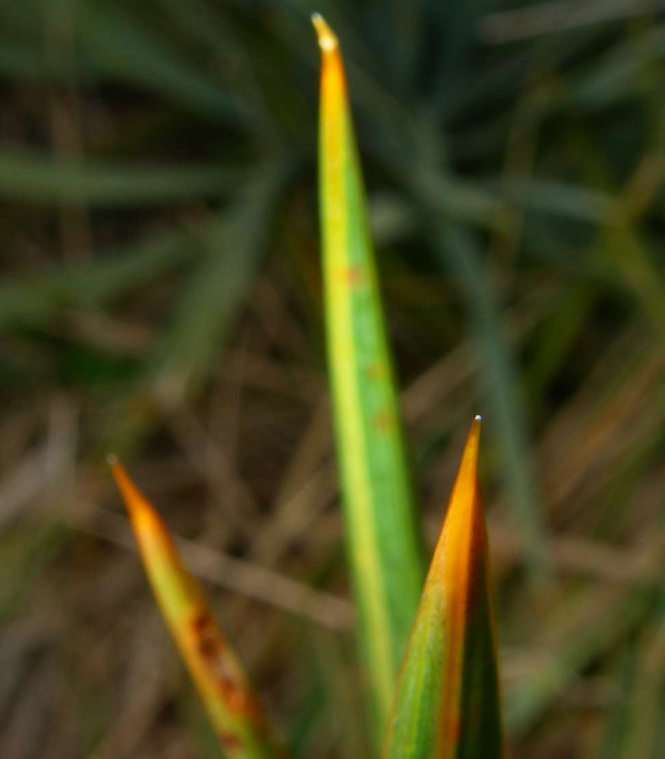
Phormium tenax, New Zealand Flax, Harakeke.
It flowers in November, so the flowers were long gone by this time. The large quantities of nectar attract birds such as the Tui (Prosthemadera novaeseelandiae) and insects.
The plant produces long leaf fibres that have played an important role in the culture, history, and economy of New Zealand. The naturalist Jacques Labillardière collected indigenous flax plants when French ships visited the far north of the North Island of New Zealand in 1793. He had noted the many uses the Māori had put the plant to and in 1803 gave it the scientific name Phormium, meaning "basket" or "wickerwork", and tenax meaning "tenacity" or "holding fast".
As Captain Cook wrote: “Of the leaves of these plants, with very little preparation, they (the Māori) make all their common apparel; and of these they make also their strings, lines and cordage …”.
Frayed ends of flax leaves were fashioned into torches and lights for use at night. The dried flower stalks, which are extremely light, were bound together with flax twine to make river rafts called Mokihi.
Photo: Don Hitchcock, 31st January 2007
Text: Adapted from Wikipedia
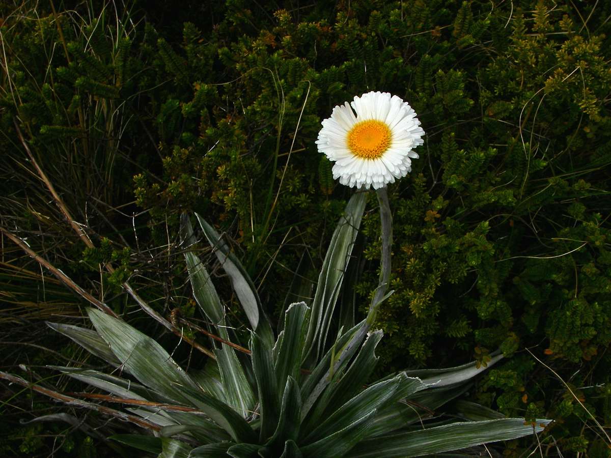
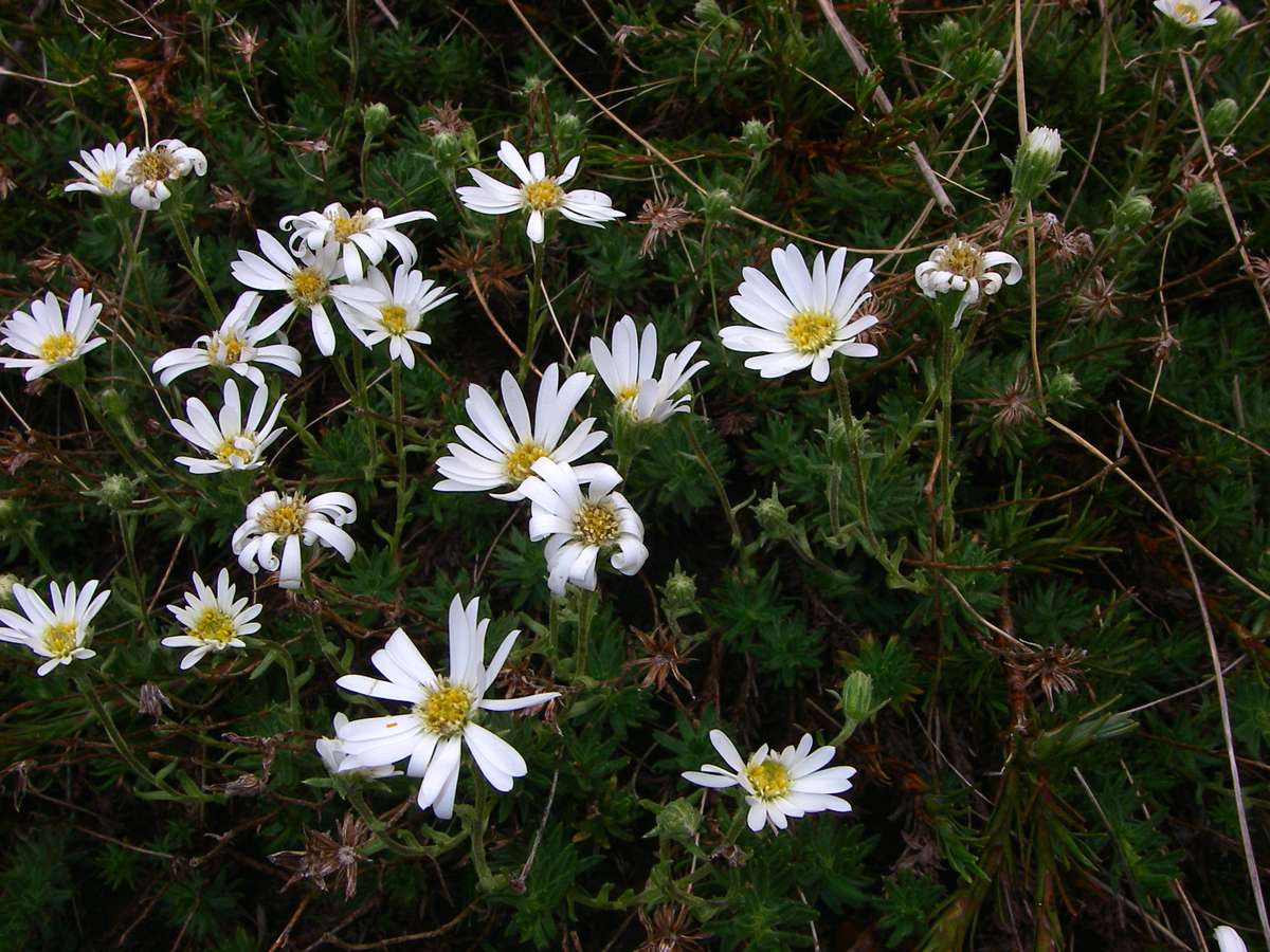
Celmisia semicordata
Tikumu are large-leaved mountain daisies. They belong to a large and complex group in the genus Celmisia that are widespread and often abundant in New Zealand mountain grasslands and herbfields. In the South Island, Tikumu usually refers to Celmisia semicordata, but is used for Celmisia spectabilis also.
Photo: Don Hitchcock, 31st January 2007
Text: http://www.landcareresearch.co.nz/research/biosystematics/plants/weaving/tikumu.asp
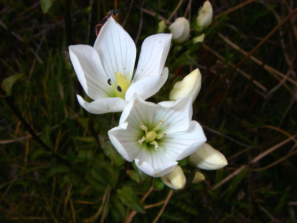
Gentiana montana
Photo: Don Hitchcock, 31st January 2007
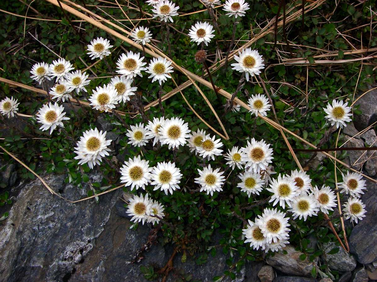
Helichrysum bellidioides
The New Zealand everlasting daisy.
Photo: Don Hitchcock, 31st January 2007
Possibly Celmisia bellidoides.
Photo: Don Hitchcock, 31st January 2007
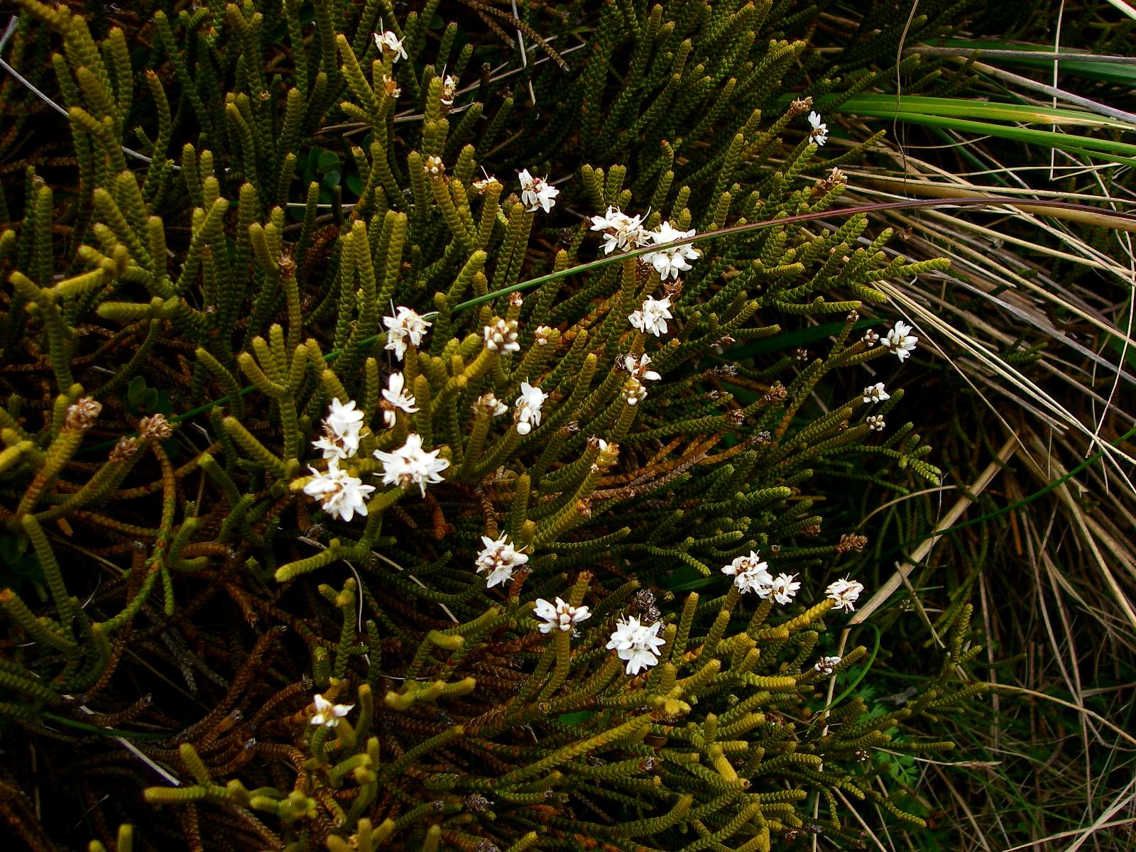
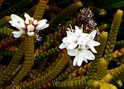
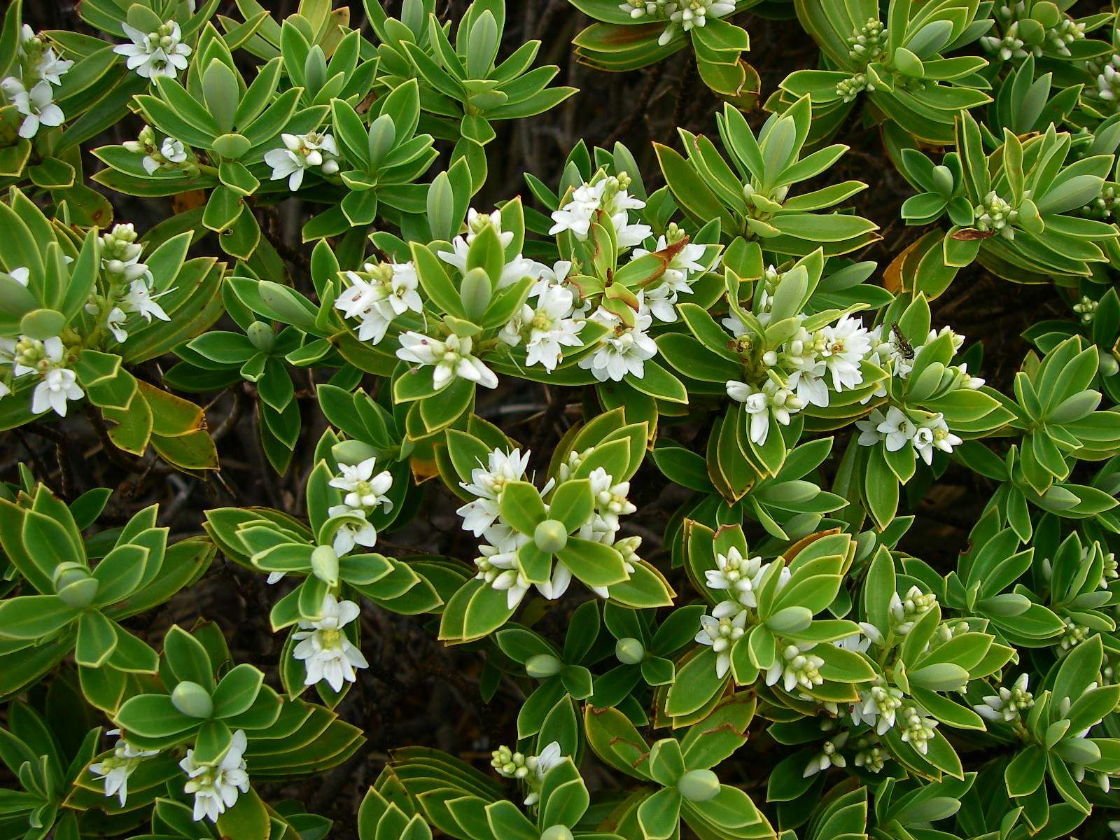
Hebe tumida (Tumida means swollen, referring to the leaves.)
A trailing or straggling highly branched shrub on the South Island of New Zealand that forms rather compact low patches 10 - 50 cm across.
Photo: Don Hitchcock, 31st January 2007
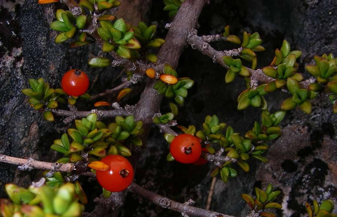
Coprosma depressa
A low growing (from which comes the species name, depressa) or prostrate shrub with leaves narrowed towards the petiole and to the rather blunt tip. Fruits are uniformly blood red.
Occurs in the North, South and Stewart Islands, on well-drained or rocky sites, often trailing over or around boulders, as in this photo.
Photo: Don Hitchcock, 31st January 2007
Text: New Zealand Alpine Plants, A.F. Mark and Nancy M. Adams, 1973.
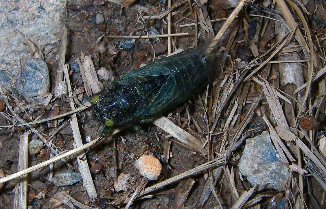
I found very few insects in New Zealand, apart from the sand flies, which certainly found me, so I was pleased to come across this blue-black cicada with green eyes.
This is the Western Subnival (under snow) Cicada, Maoricicada nigra.
Certainly it would have to be able to survive under snow, given its location near the top of the Travers Saddle!
There is an interesting image gallery of New Zealand cicadas at
http://www.landcareresearch.co.nz/research/biosystematics/invertebrates/hemiptera/cicada/gallery.asp
Photo: Don Hitchcock, 31st January 2007
Looking back down the Travers valley from which I'd come.
The path is steep, but not so steep as the other side. This is the easiest direction to cross the saddle. It took me two hours to get to the top of the saddle.
Photo: Don Hitchcock, 31st January 2007
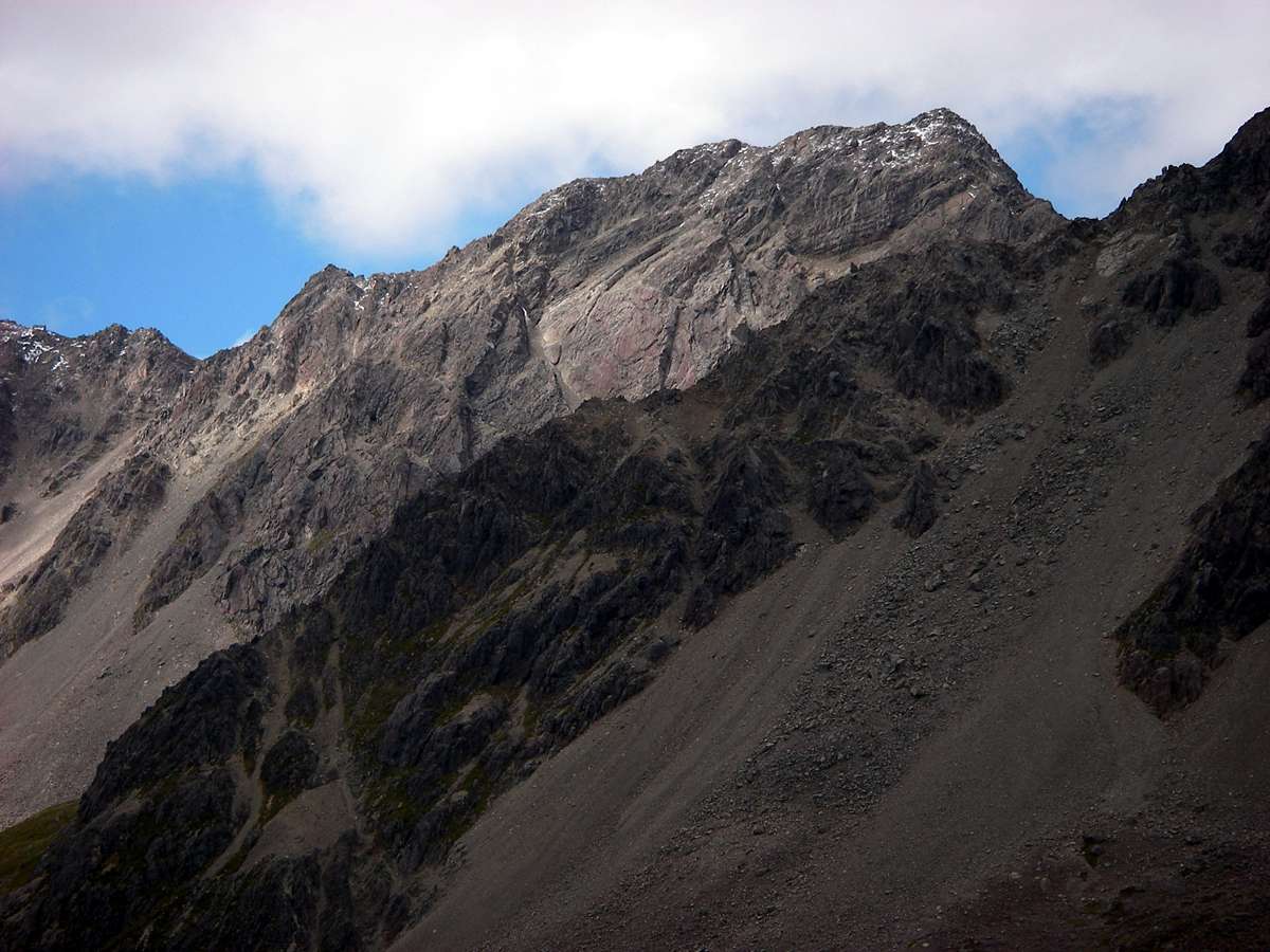
A couple of zoomed in shots of the range in the photo above, five and fifteen minutes further up the track.
Photo: Don Hitchcock, 31st January 2007
Looking back down the Travers Valley.
Photo: Don Hitchcock, 31st January 2007
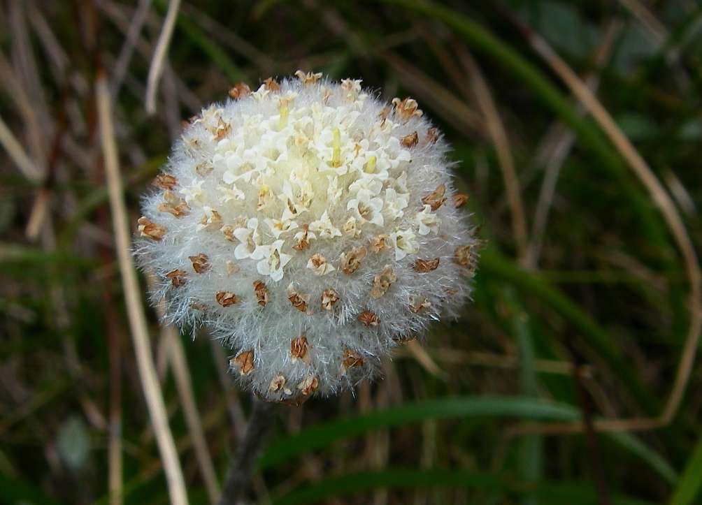
I have been unable to identify this plant.
Photo: Don Hitchcock, 31st January 2007
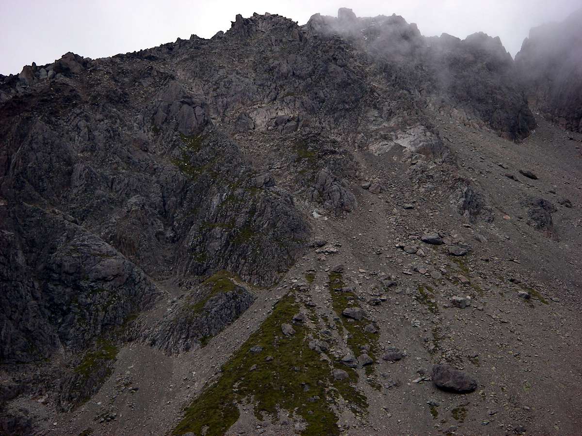
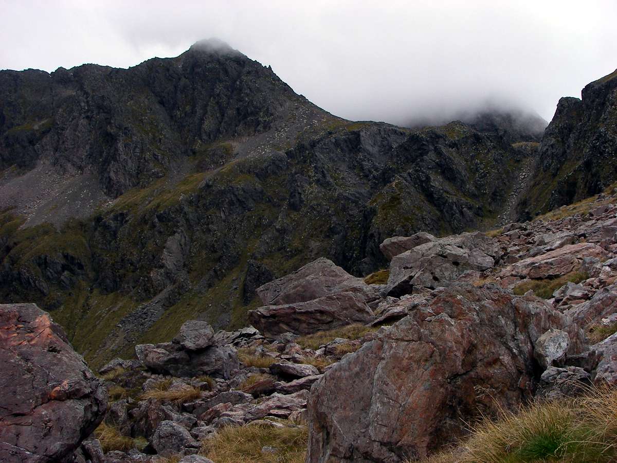
The slopes of Mount Travers were obscured by fog.
Photo: Don Hitchcock, 31st January 2007
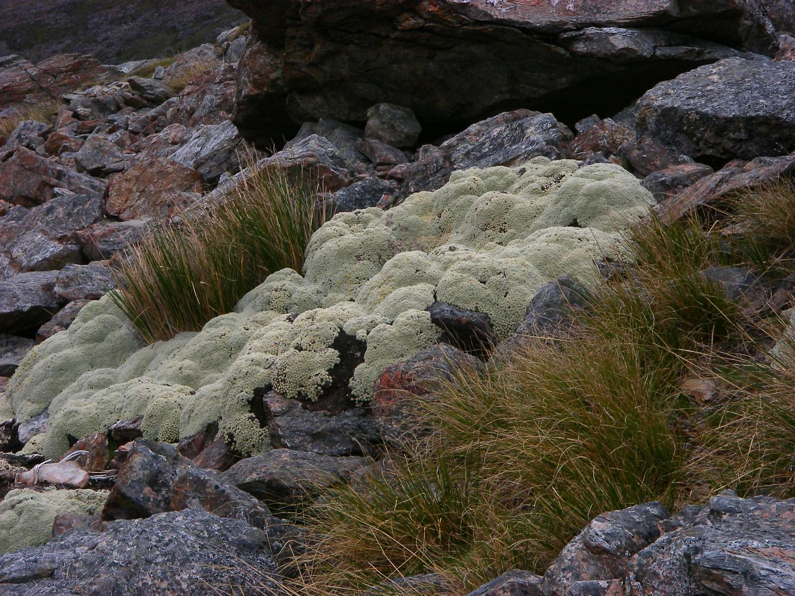
Vegetable sheep, Haastia pulvinaris, which occurs in alpine areas between 1300 m and 1900 m, on shattered rock outcrops or on stable scree, as in this example. They are a variety of daisy.
Photo: Don Hitchcock, 31st January 2007
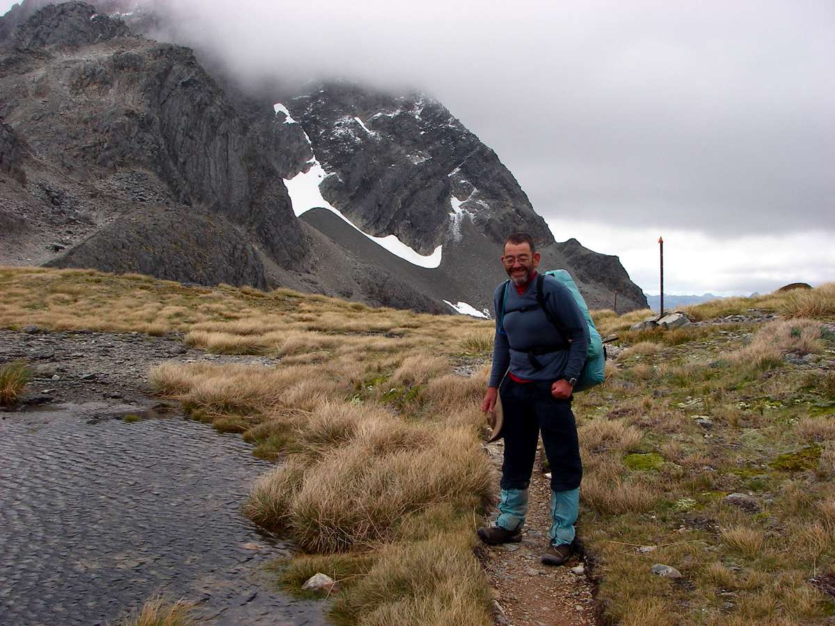
My walking companion, B., had gone on ahead while I was busy with photography, and took only an hour or so to get up to the top of the saddle, half the time it took me. Partly it was the photography which held me up, but most of the difference in time was because of age differences.
As you age, your mitochondria, the organelles in cells which produce ATP, the energy source for your body, becomes less efficient, which is why people get slower as they age. Exercise helps, but it is an inexorable process of decay. I often call on my mitochondria to do their thing when climbing a ridge, but they don't seem to hear me!
And, of course, the older I get the better I used to be!
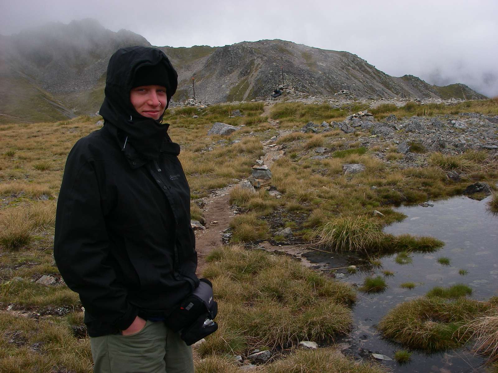
It was cold, windy and miserable on top, B. was chilled from standing around waiting for me, so we did not stay long once I had caught up.
Photo: Don Hitchcock, 31st January 2007
Looking back down the track towards the Travers River and the Upper Travers Hut, beside a large tarn on the saddle. I put my raincoat on after this shot, for protection from the wind, whose effects can be seen in the ripples on the tarn.
I used it very seldom in nine weeks tramping in New Zealand, I used a small umbrella instead. The humidity in New Zealand means that a raincoat has limited usefulness. I sweat a lot, and a raincoat often means that I am wetter from condensation inside the jacket than I would be without a raincoat.
I made the raincoat from silnylon, and four years later it is still waterproof and in good condition, but an umbrella is more useful where there is a track, as there is for most New Zealand tramping. My raincoat gets more use in Australia, where I am often off track and scrub bashing.
I use silnylon to make my own tents, gaiters, backpacks and ditty bags, since it is less than 50 grams per m2, strong and totally waterproof.
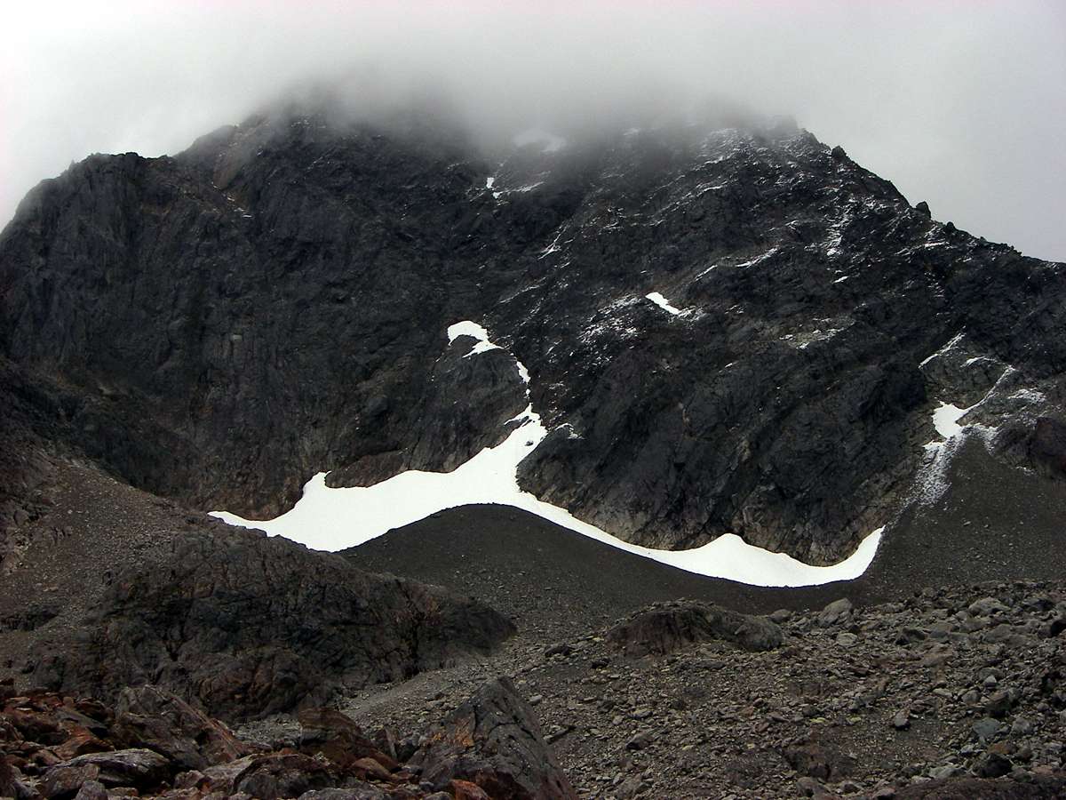
Even in January there was still some winter snow left in south facing pockets.
Photo: Don Hitchcock, 31st January 2007
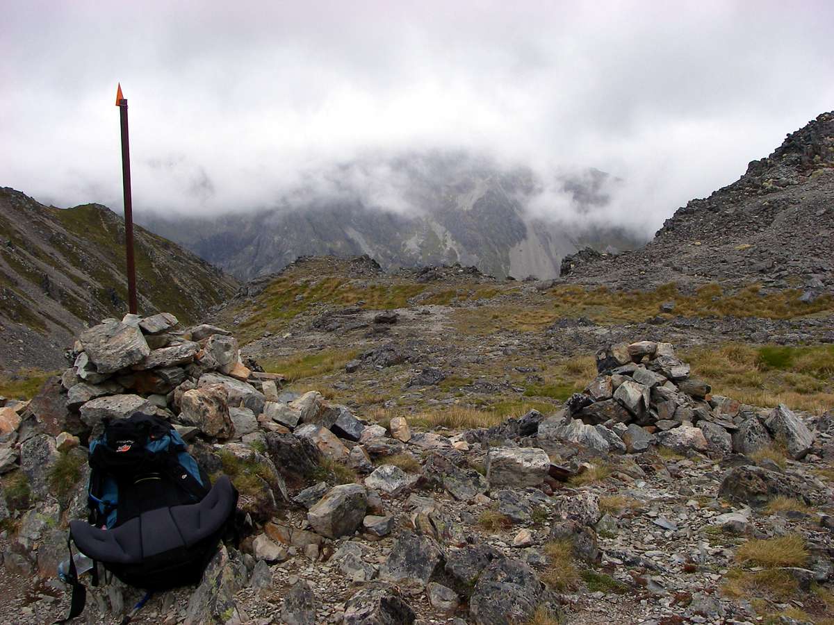
The cairn and snow pole at the official top of the Travers Saddle.
Mount Franklin was obscured by fog.
Photo: Don Hitchcock, 31st January 2007
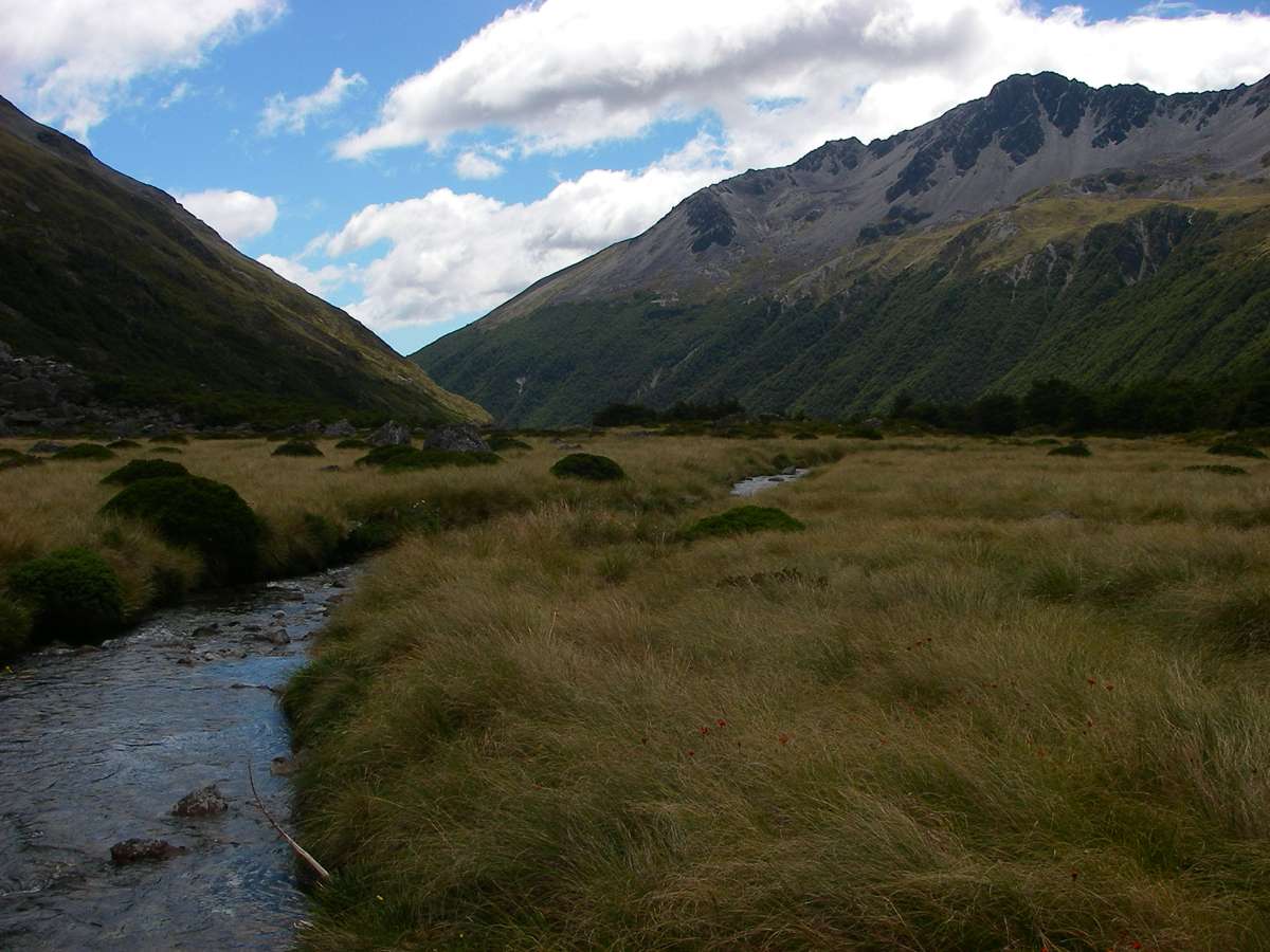
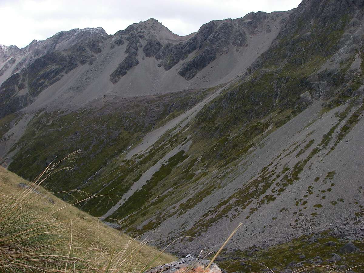
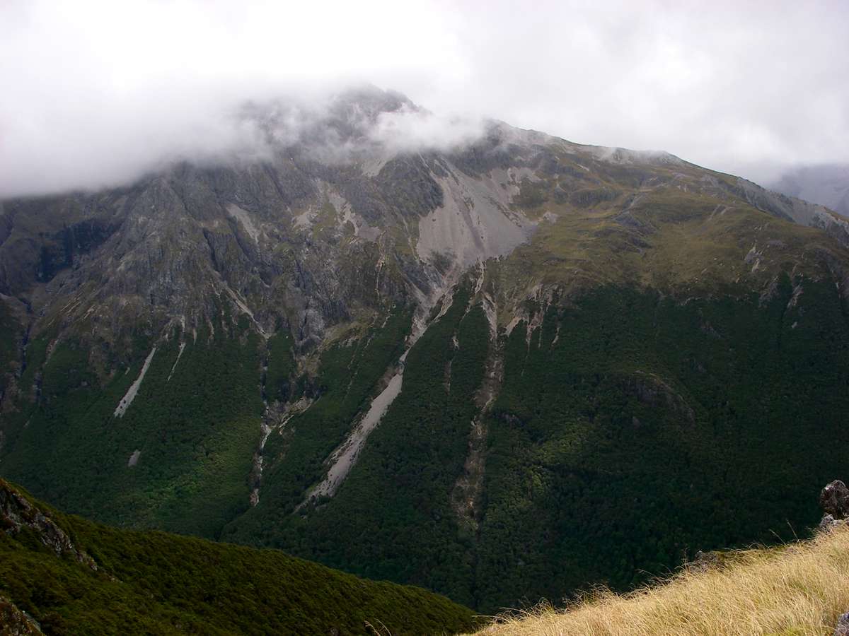
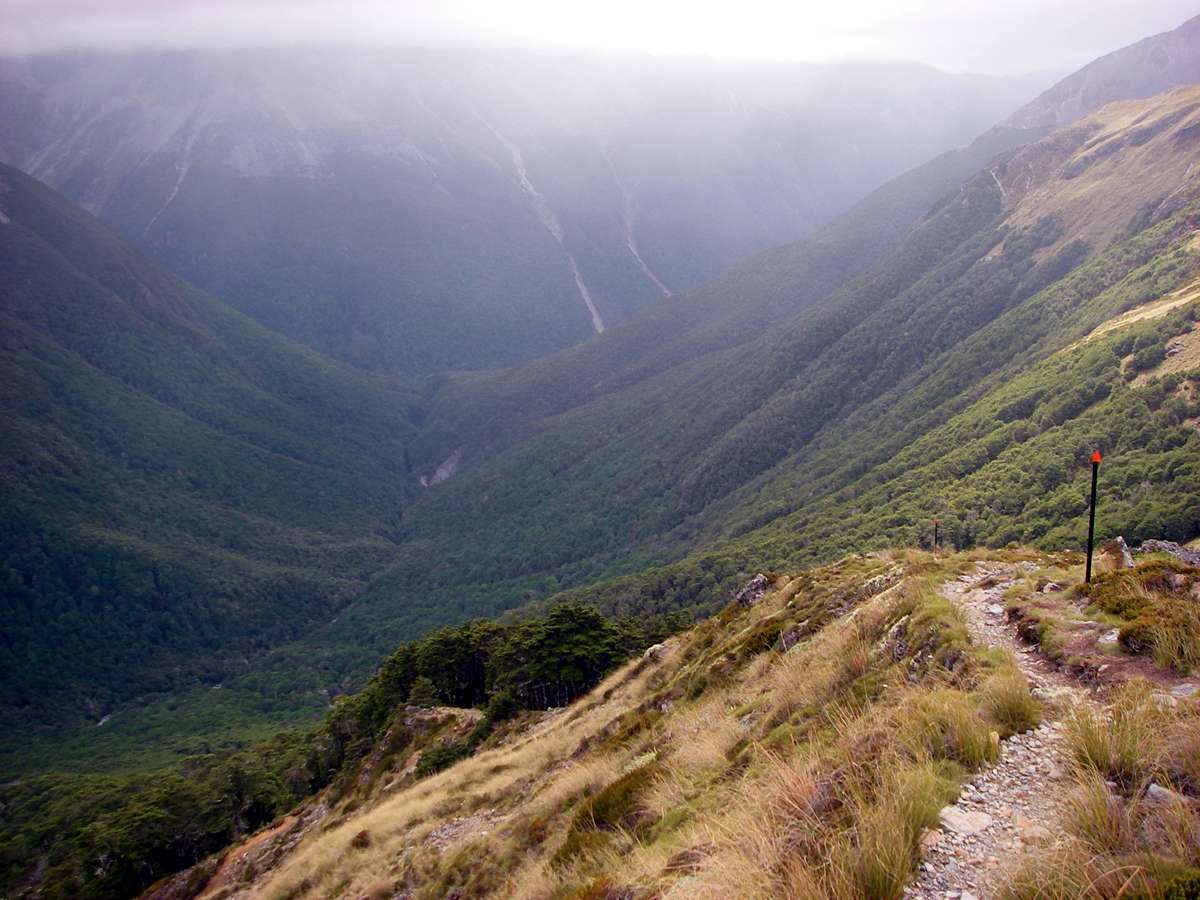
Looking into the East Branch of the Sabine Valley, with Mount Franklin on the left dividing the East Branch from the West Branch, which is on the other side of Mount Franklin.
The main Sabine Valley is in the distance, leading down to the right.
Photo: Don Hitchcock, 31st January 2007
Spear Grass, Aciphylla sp., and a closeup of one of the viciously sharp points.
Photo: Don Hitchcock, 31st January 2007
Hebe odora on the Travers Saddle.
Photo: Don Hitchcock, 31st January 2007
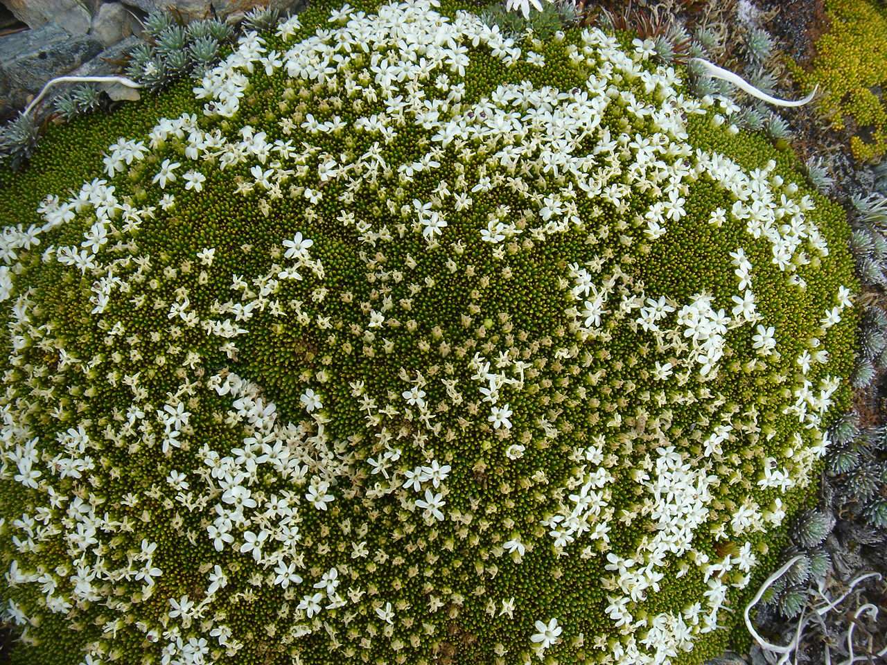
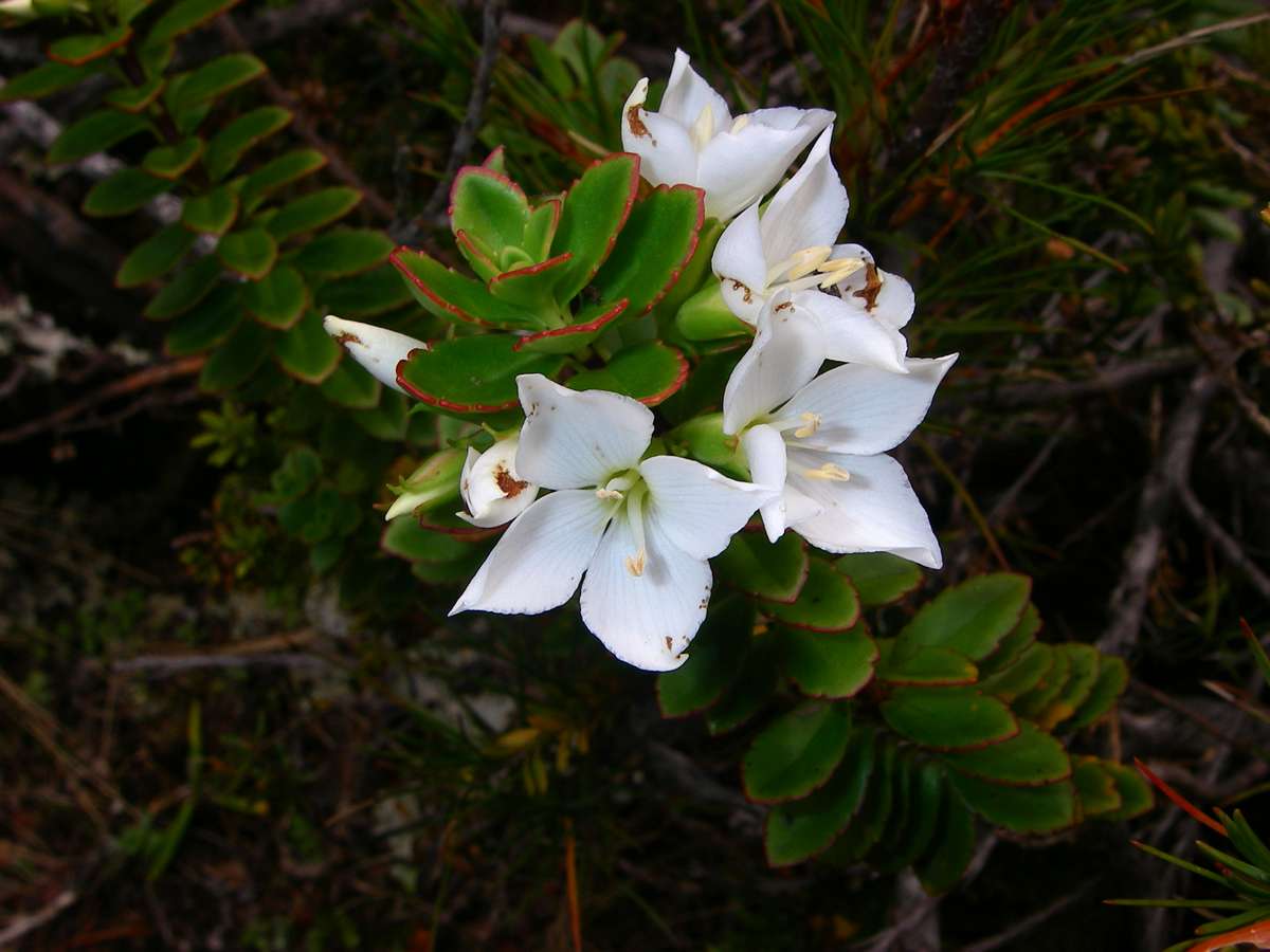
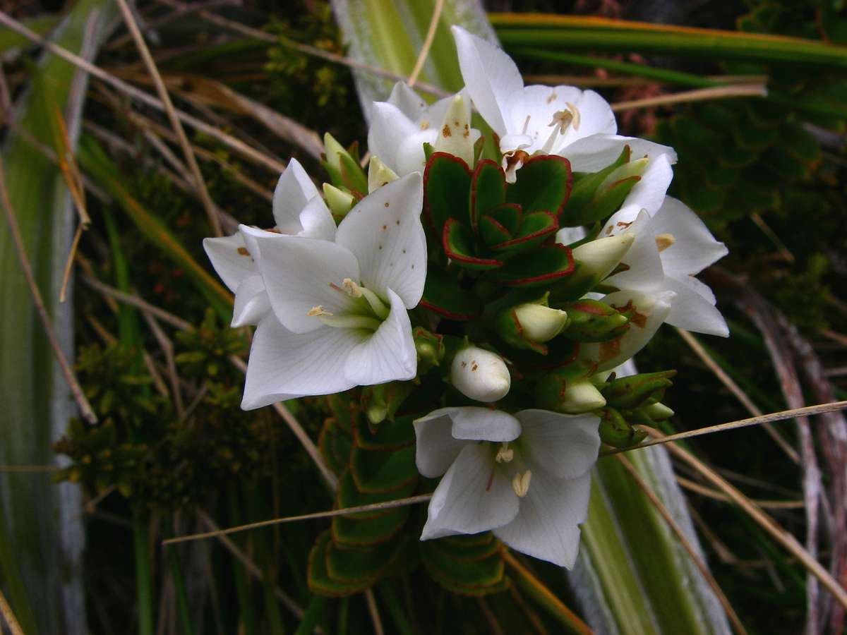
Phyllachne colensoi, Yellow Cushionplant, Rock Cushion.
This cushion plant forms bright green cushions up to 50 cm across, with small white flowers with five spreading lobes and a prominent central column of the two stamens.
It is widespread in New Zealand at altitudes from 900 to 1900 metres. Flowers and fruits are produced from December to March.
Photo: B., 31st January 2007
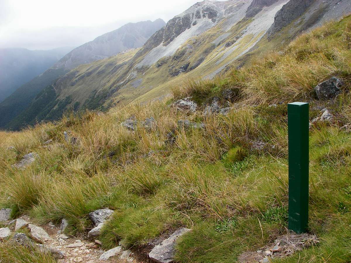
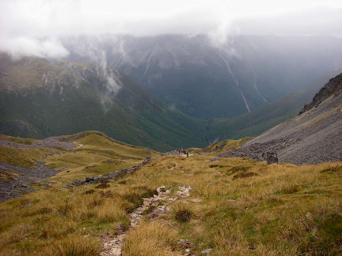
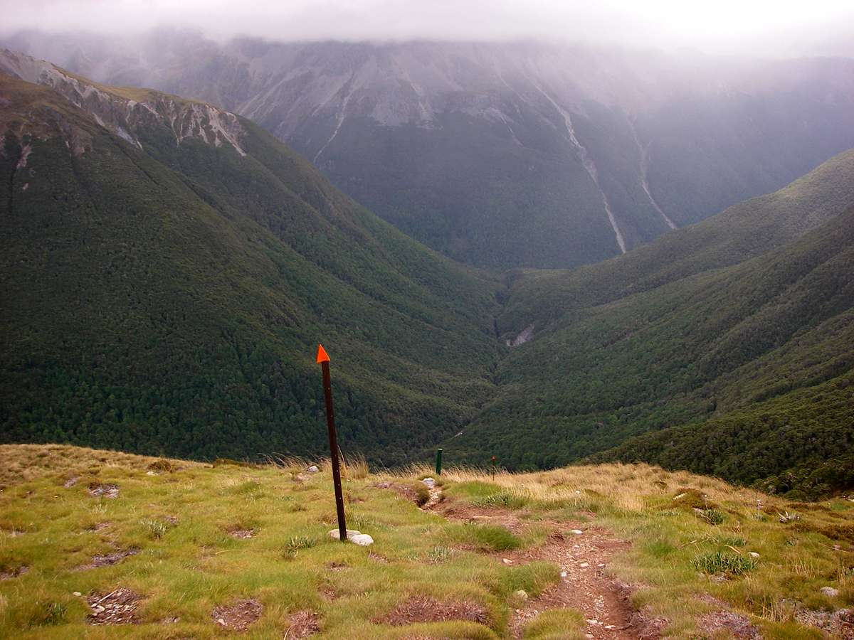
The track now plunged into the East Sabine valley. I believe the post is there to mark the danger zones for avalanches during the snow season.
Photo: Don Hitchcock, 31st January 2007
Mount Franklin wreathed in fog. The tree line is well marked, and is split in places by scree chutes.
Photo: Don Hitchcock, 31st January 2007
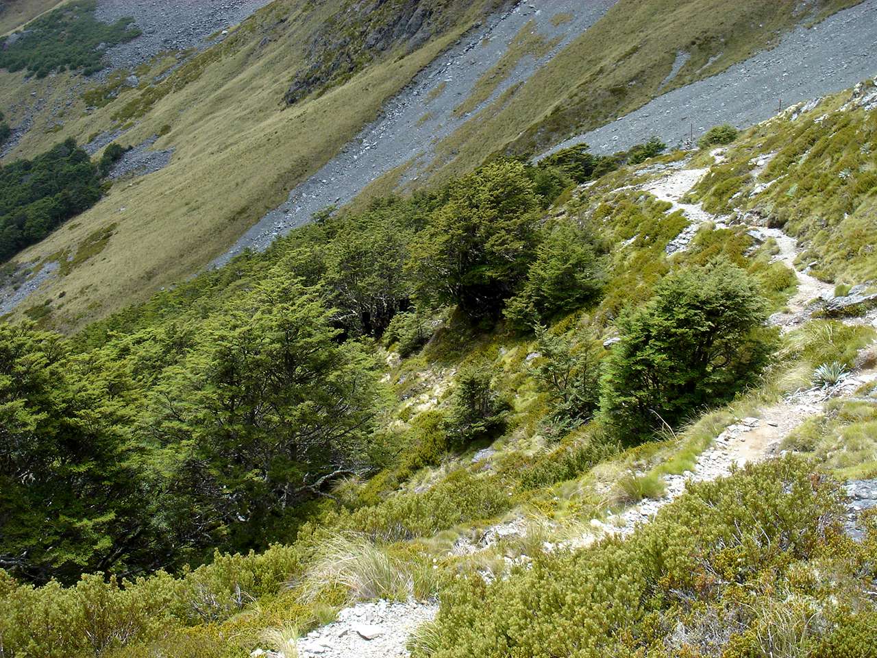
The track got steeper, before plunging into a belt of trees at the treeline.
Photo: Don Hitchcock, 31st January 2007
The scree slope we were heading towards on the other side of the beech forest was obviously steep and unstable.
Photo: B., 31st January 2007
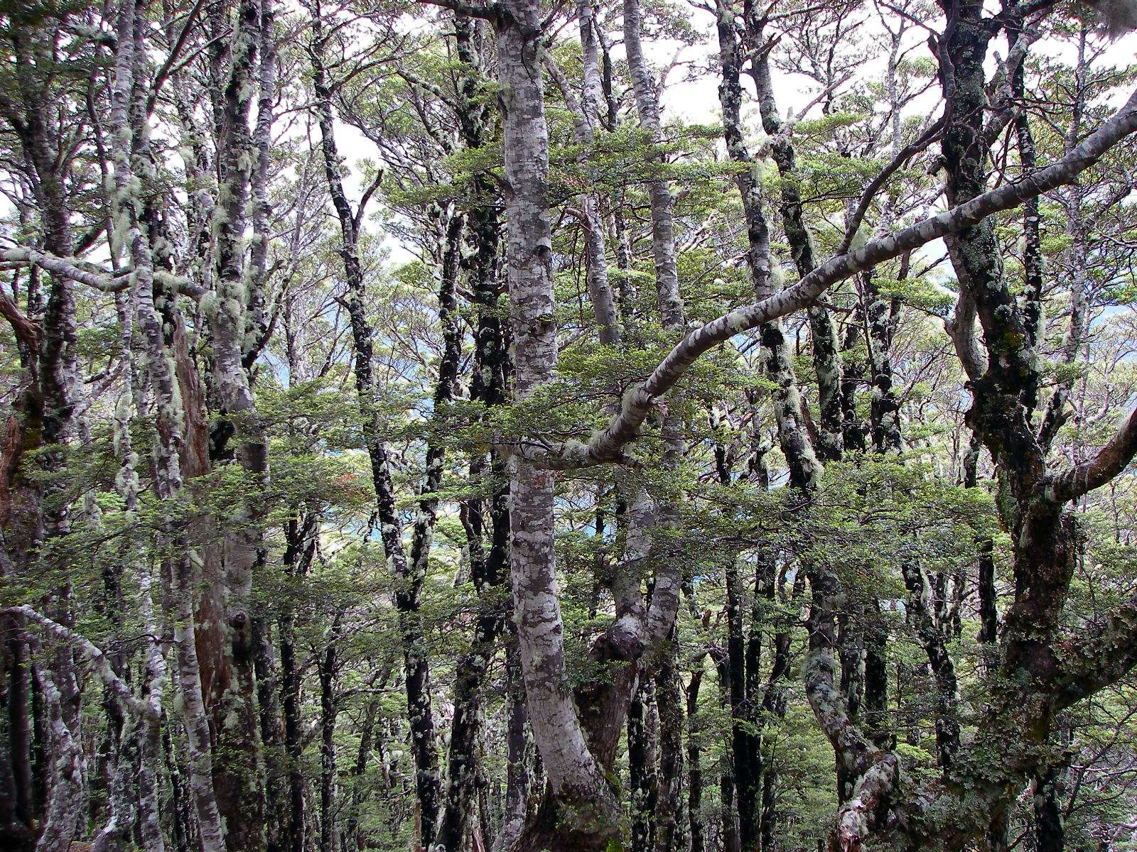
The beech forests of New Zealand seem caught in prehistoric time.
Photo: Don Hitchcock, 31st January 2007
You exit from the relatively thin belt of trees onto this scree slope. It is steeper than it appears in this photo, and great care must be taken.
Photo: Don Hitchcock, 31st January 2007
The scree slope was unmarked by the safety blanket of orange triangles, just rock cairns. I guess the scree slope moves too much, but a humungous orange triangle at the bottom would have been comforting. The scree slope was quite uninteresting botanically because it is very mobile.
The track notes said it was a six and a half to nine hour trip from the Upper Travers Hut, and we had already done an extra three hours from John Tait to Upper Travers, so it was looking like a long day.
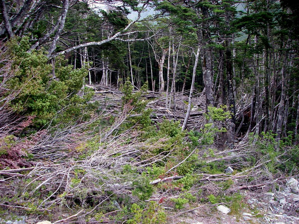
Further down where the slope gets less steep, this forest partially flattened by what may have been a wind storm, but more likely a snow avalanche, appears beside the track.
Photo: Don Hitchcock, 31st January 2007
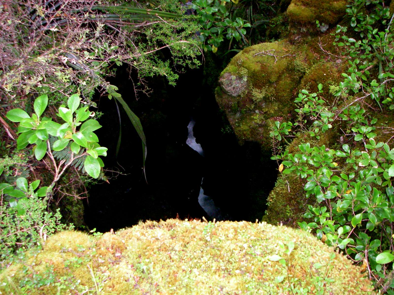
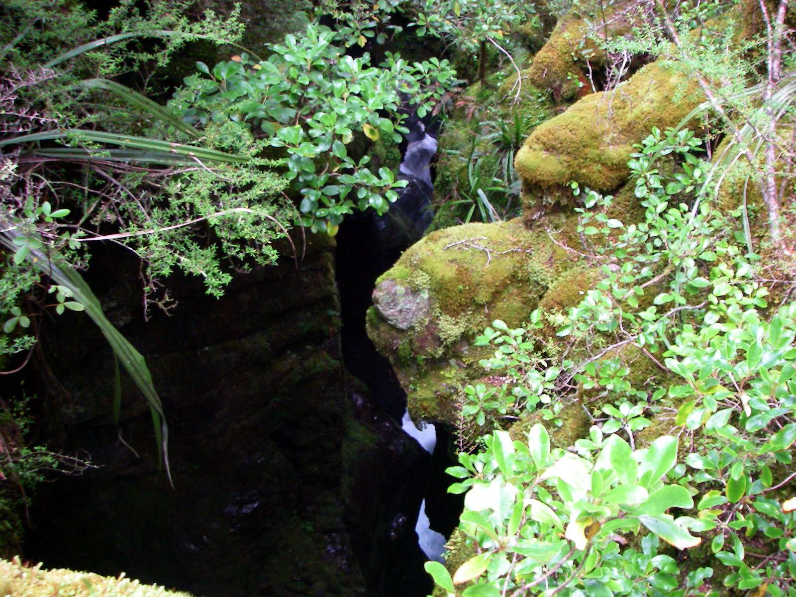
The short bridge over the East Sabine branch is ten or fifteen metres above the stream, which is down a narrow walled, dark gorge.
Photo: Don Hitchcock, 31st January 2007
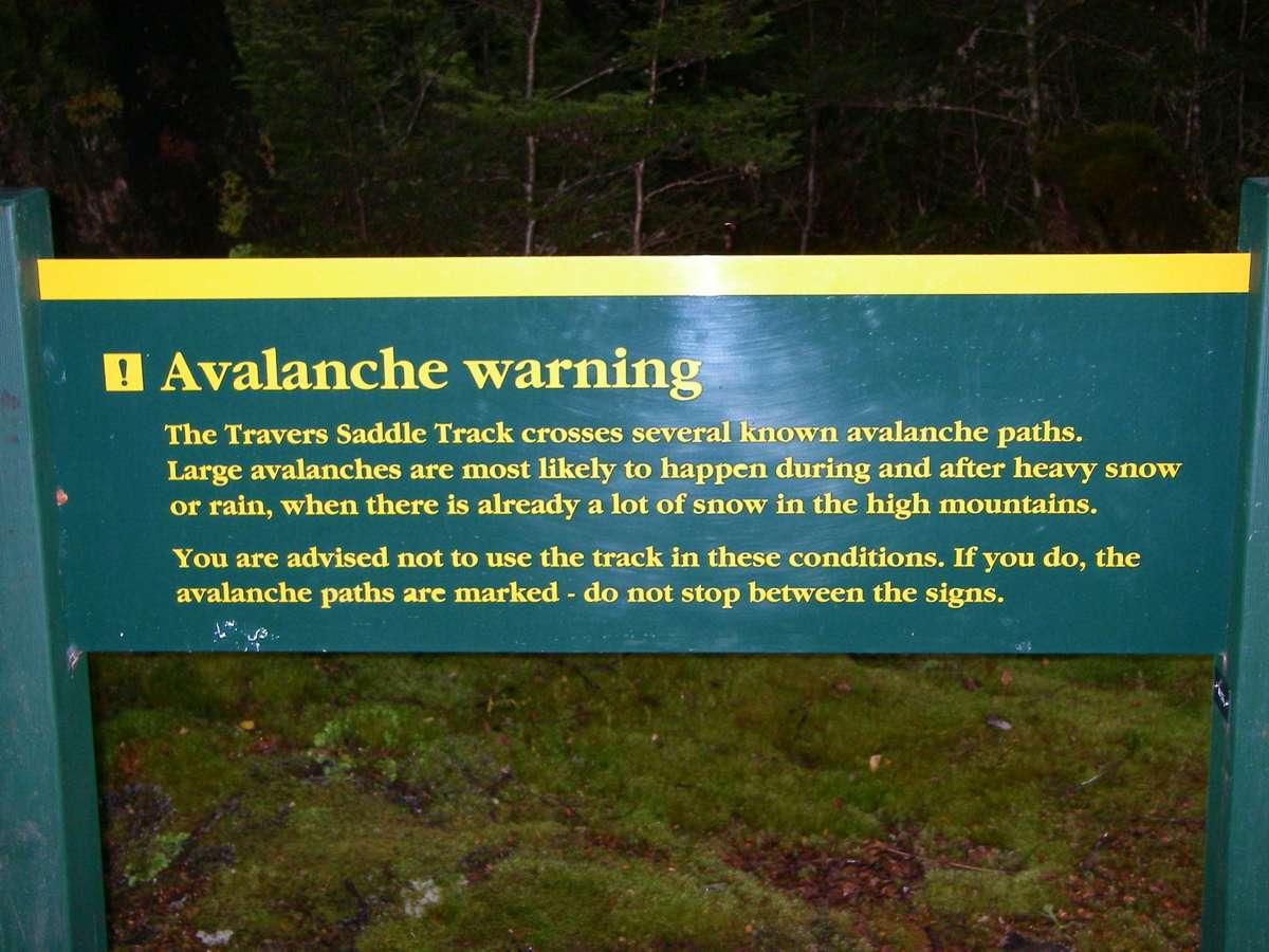
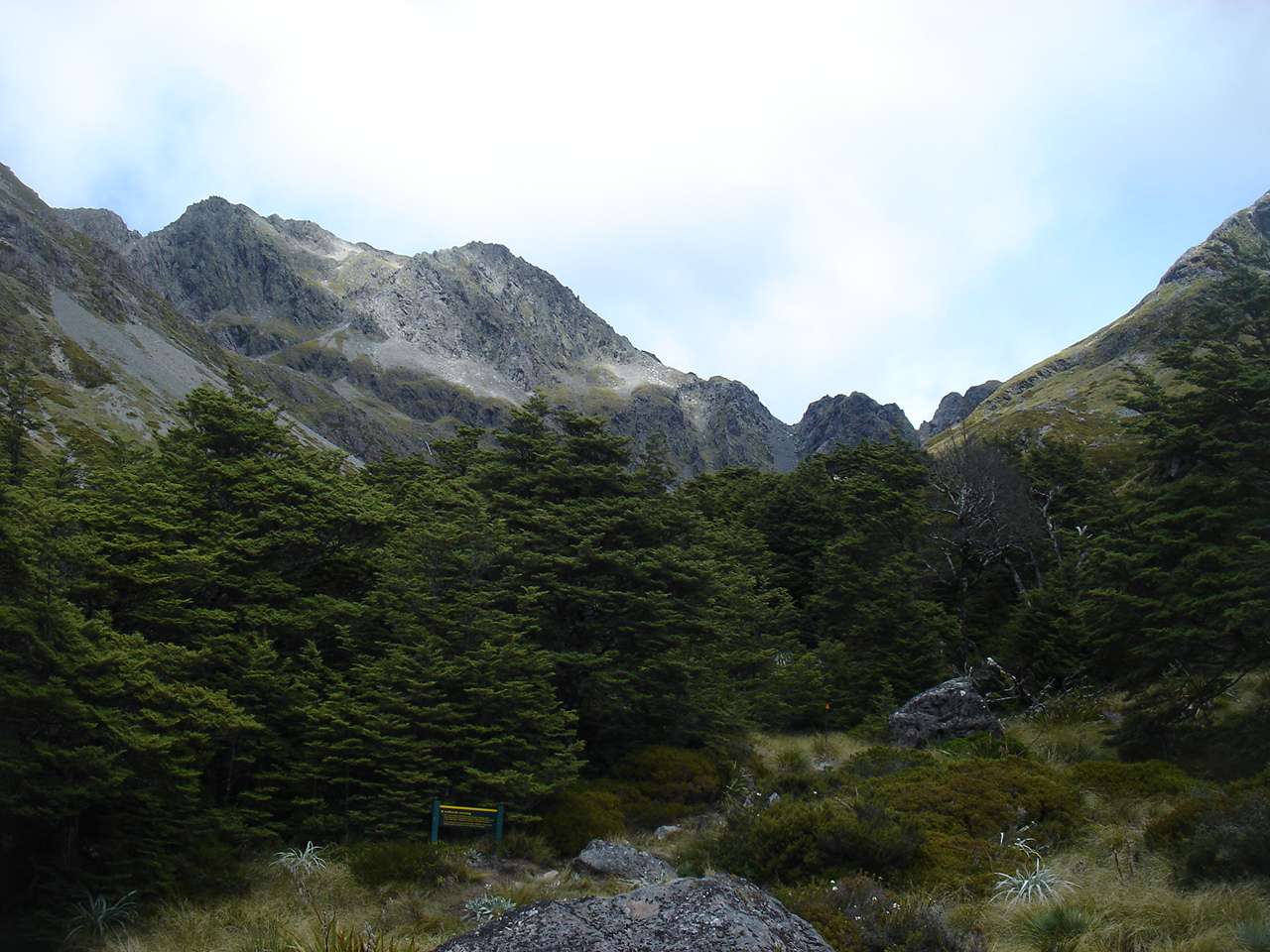
This sign is meant for those travelling over the Travers Saddle from the West Sabine Hut. There was a similar sign on the Upper Travers Hut side.
Photo: Don Hitchcock, 31st January 2007
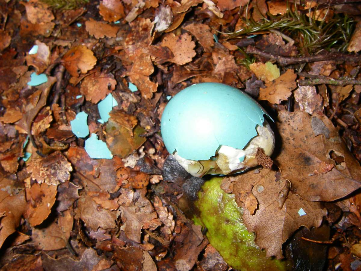
A bird's egg dropped from the nest, presumably because it did not develop normally, or possibly by a cuckoo.
Photo: Don Hitchcock, 31st January 2007
A drizzle began, followed by rain, but in the forest there was, thankfully, no wind. The track was not easy to find in the wet conditions, and it was sometimes difficult to see the orange triangles marking it. I backtracked a few times to the previous marker to get my bearings.
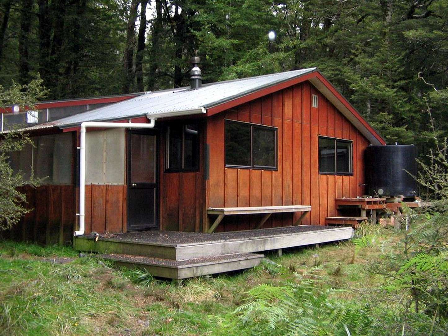
The welcome sight of the dry and warm West Sabine Hut.
It had taken six hours all up, plus the three from John Tait, but we were both very glad to be there. B. had been way ahead of me after we got off the scree, but had got lost for ten or fifteen minutes when she missed the track. I try always to have an orange triangle in view, but it is easy to lose concentration on a long trip.
I was pleased that my tramping speed had improved to the point where I was doing at least as well as track notes and signs said so far as times for tramping, despite my years. At first my times were a lot slower than the posted versions, but by the end of nine weeks tramping in NZ, down in Stewart Island, I was doing very much better than the advised times.
Photo: http://tramper.co.nz/?5403
Photo credit: wingman
I figured at the bottom of the climb from Upper Travers that looking at the sky we could count on three hours of good weather, which would get us up and over the saddle, the dangerous bit in terms of weather, and an hour down the scree slope and into the safety of the trees. In fact we got four hours, and the weather was only steady rain by this time.
We left early the next morning, after heavy rain overnight, and walked into very heavy rain, on our way to Blue Lake hut.
Bushwalking, Hiking and Tramping in New Zealand
Bushwalking Index
Anyone (e.g. students, teachers, libraries, government agencies such as tourist bureaus, the general public) may use, print and publish the photographs taken by me and presented on this bushwalking file for any legitimate non-commercial purpose, at no cost, and without asking permission. However a note such as "Photo: Don Hitchcock, donsmaps.com" somewhere in the document would be appreciated if it is to be published.