Back to Don's Maps
 Bushwalking Index
 Wollomombi and Chandler Falls walking and climbing
These photos and accompanying text are for the interest of armchair travellers only, and do not constitute comprehensive instructions for bushwalkers.
The Chandler River Gorge is for very fit, very experienced and well prepared bushwalkers only. There is no track, it is very strenuous, and bush craft, topographical maps and compass are required. Sufficient water and food and survival equipment should be carried. One or more overnight camps are usually necessary, for which sufficient appropriate equipment should be carried. Always carry a Personal Locator Beacon, and tell reliable people where you are going and how long your party will be away. Mobile phones do not work anywhere in the gorges for sure, and almost never even on top of the cliff line. In addition, this page is only to give information for rock climbers who may be interested in climbing in this area, and should not be construed as being for an ordinary walker. Only highly experienced, fit and well-equipped rock climbers should attempt climbing or abseiling in this area. The rock is often rotten, and climbing in this area is highly dangerous.
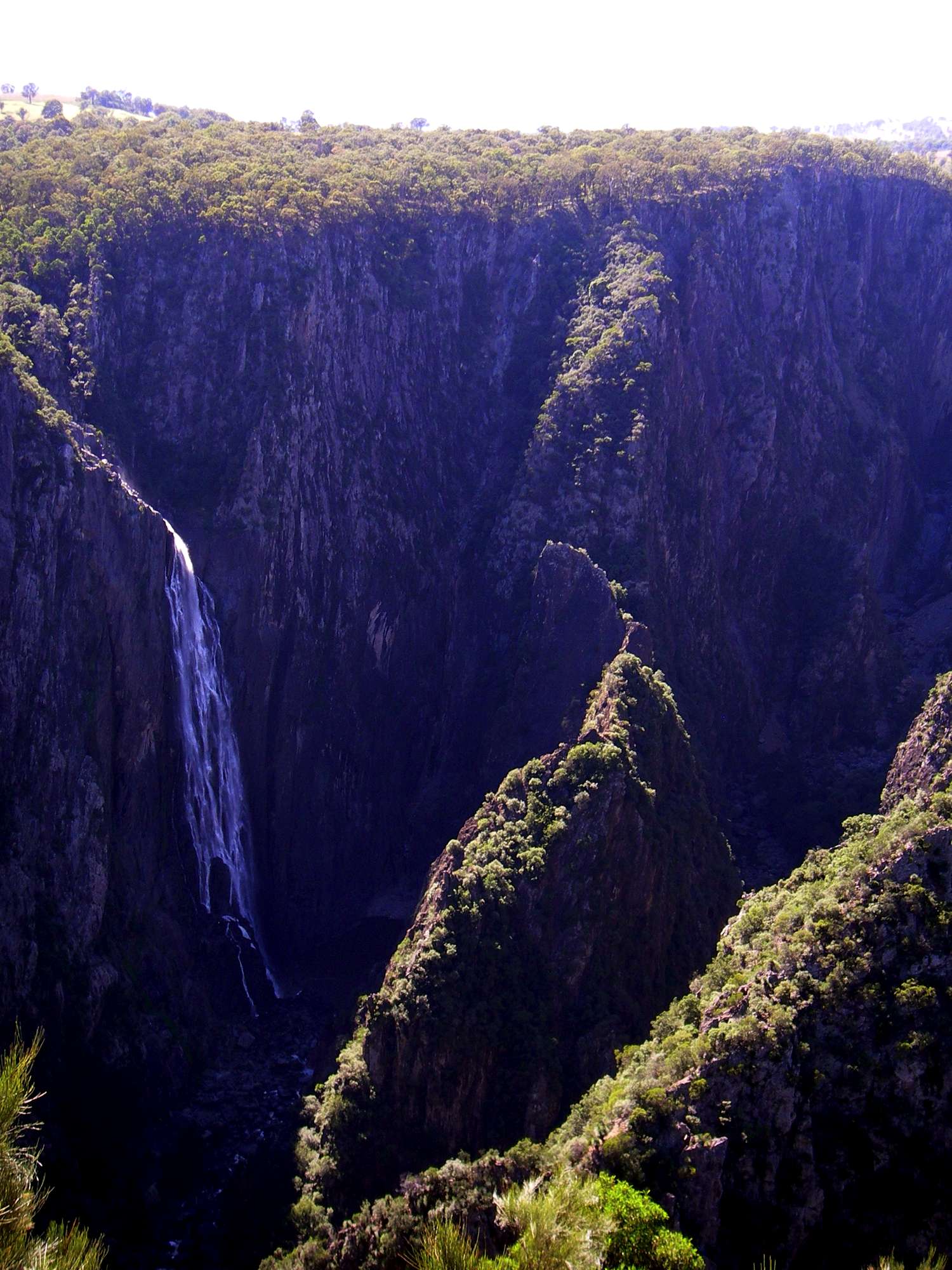
Wollomombi Falls. There is a narrow ridge in sunlight in this photo which divides the Wollomombi River from the Chandler. It is composed of rotten rock, and rockclimbers have had a few scares on it. You cannot walk to the bottom of the falls, it is accessible only by rope.
Photo: Don Hitchcock April 2006
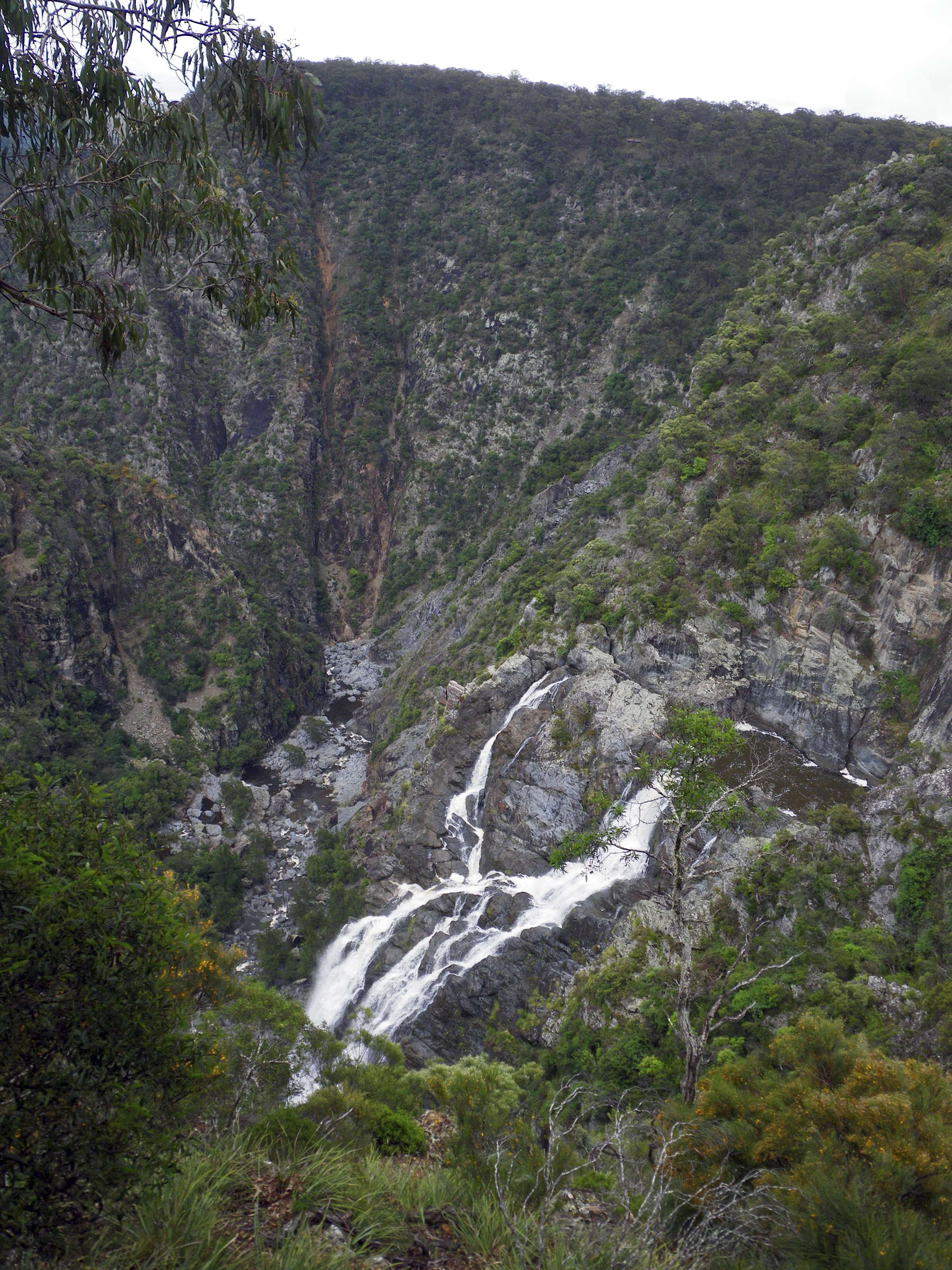
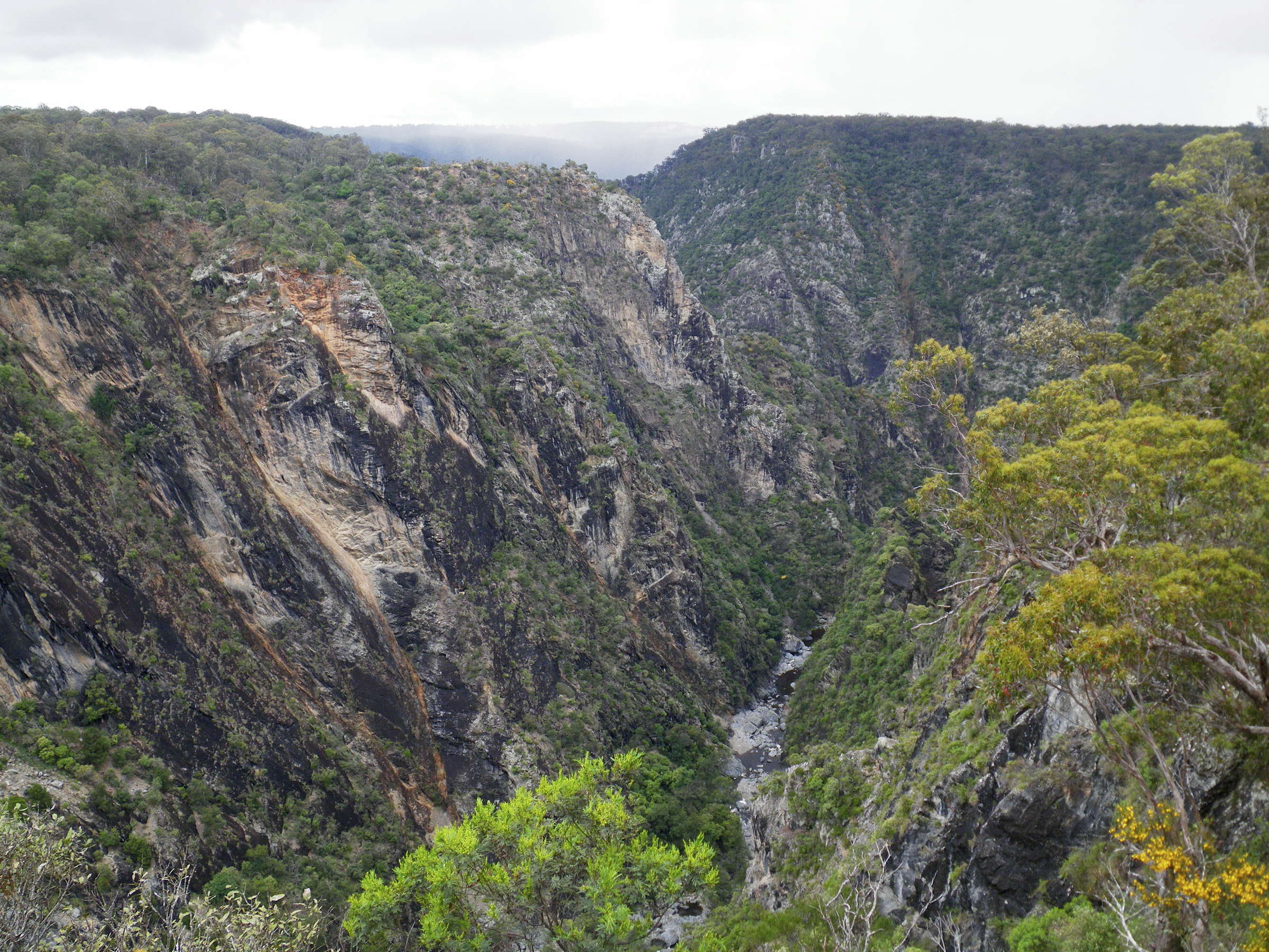
Chandler Gorge.
Wollomombi Falls just visible at the head of the gorge, Chandler Falls to its right behind a ridge.
This section of the gorge is not accessible to bushwalkers, and provides a challenge for fit, agile and experienced rock climbers.
Photo: Don Hitchcock Chandler Lookout, March 2008
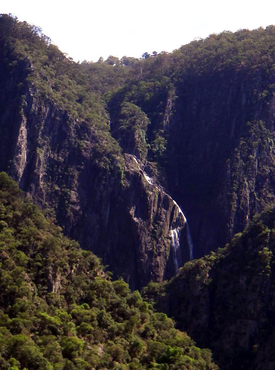
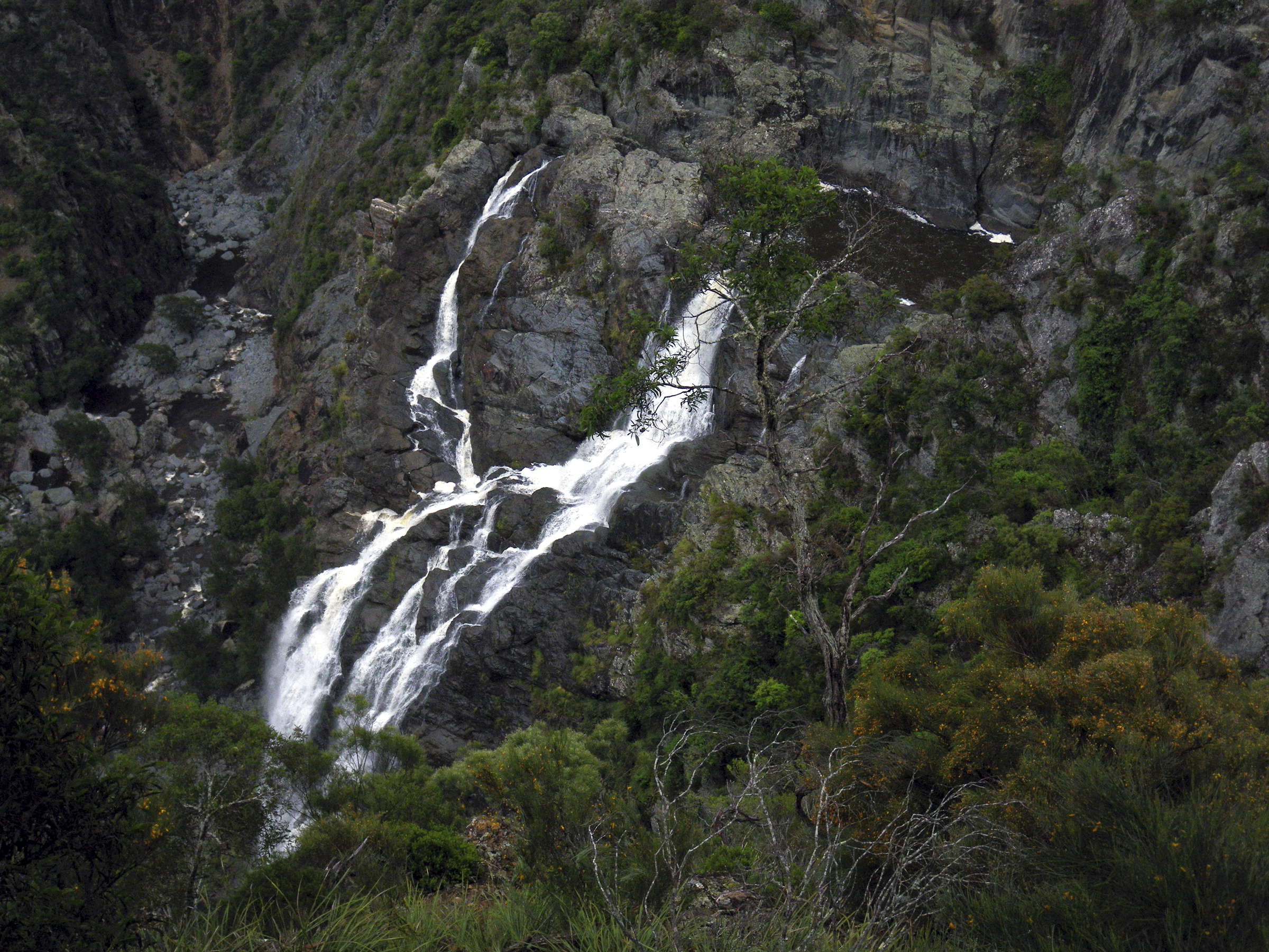
Wollomombi Falls zoomed in from the same vantage point.
Photo: Don Hitchcock November 2008
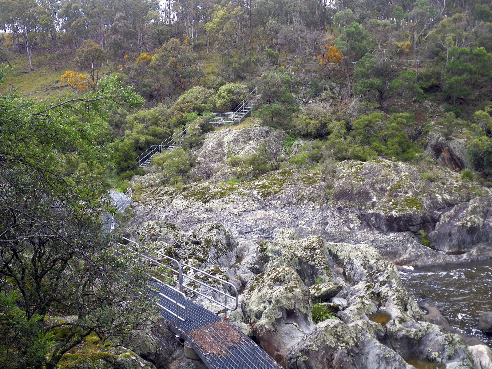
Going up the Chandler River from the stairs towards the Falls
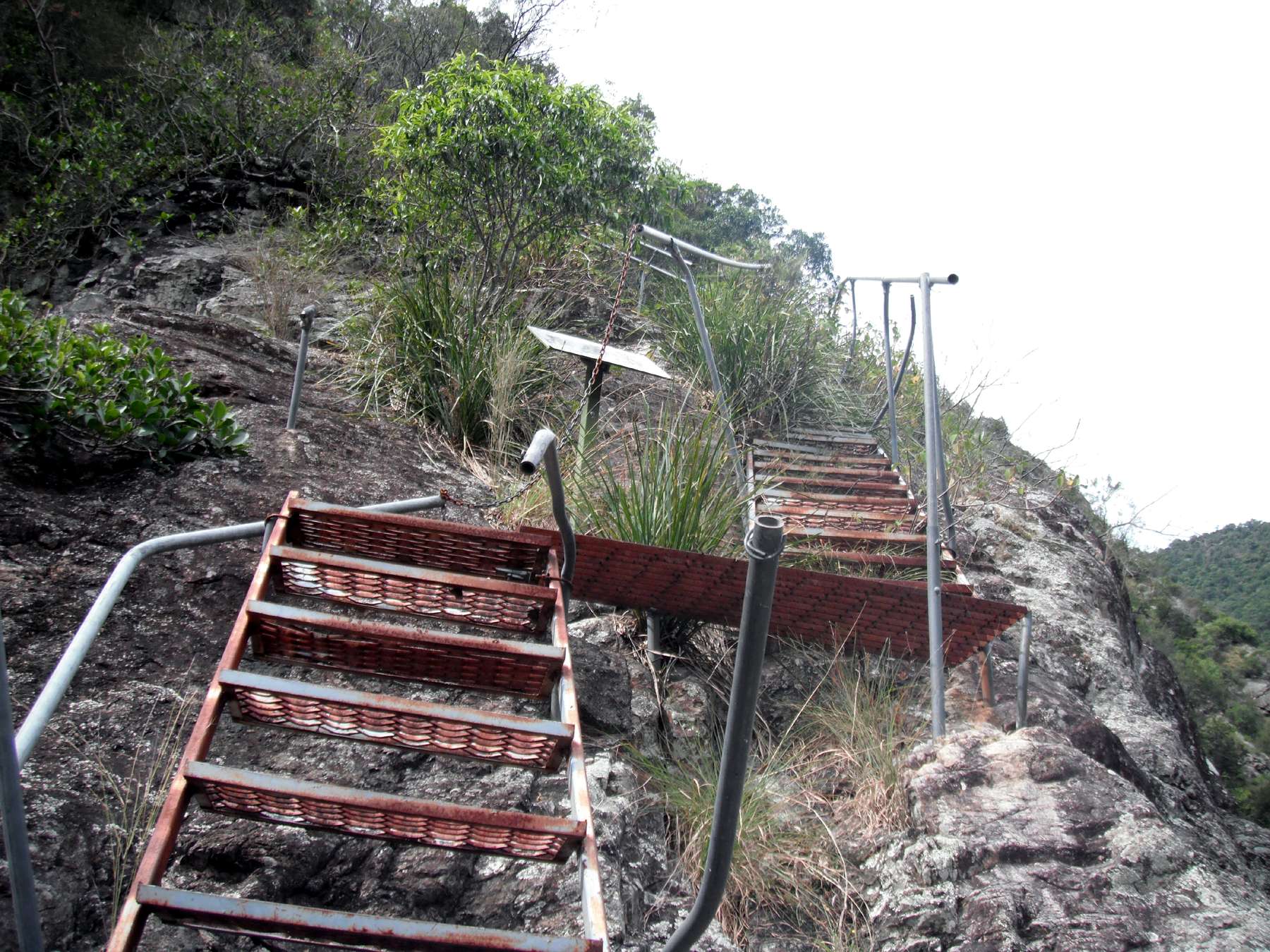
The stairs at the bottom of the closed track from the Wollomombi Falls carpark are in bad condition. The NPWS does not have the funds to fix them up, nor to maintain the track from the Wollomombi Falls carpark. They were damaged by floods in 2002 and have been going steadily downhill in condition ever since.
Photo: Nic Kerr 2011
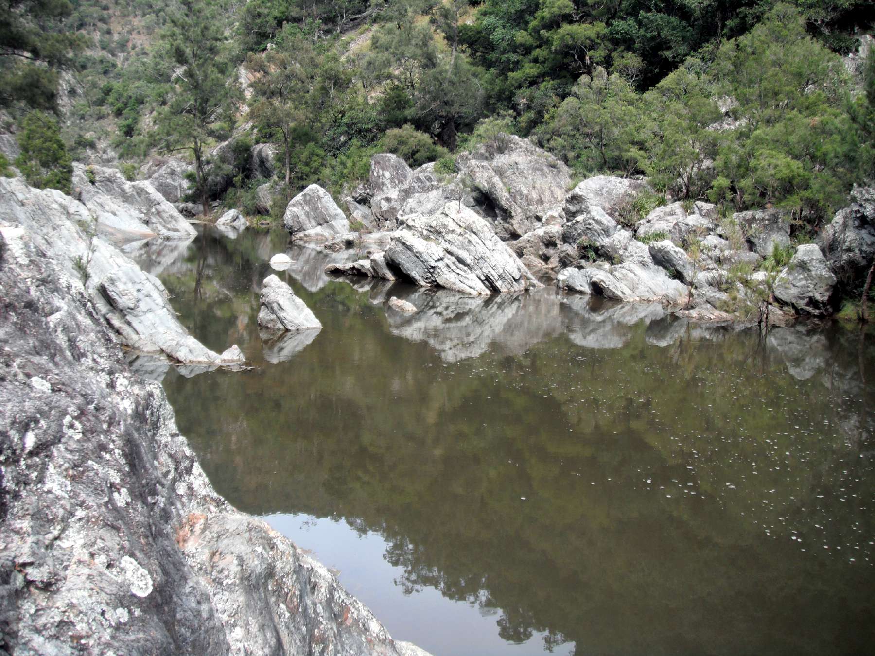
Looking up the river from the stairs. To progress further upstream it is best to head downstream and cross the creek further down and then come back up on the far side.
Photo: Nic Kerr 2011
The point where the creek may be crossed.
Photo: Nic Kerr 2011
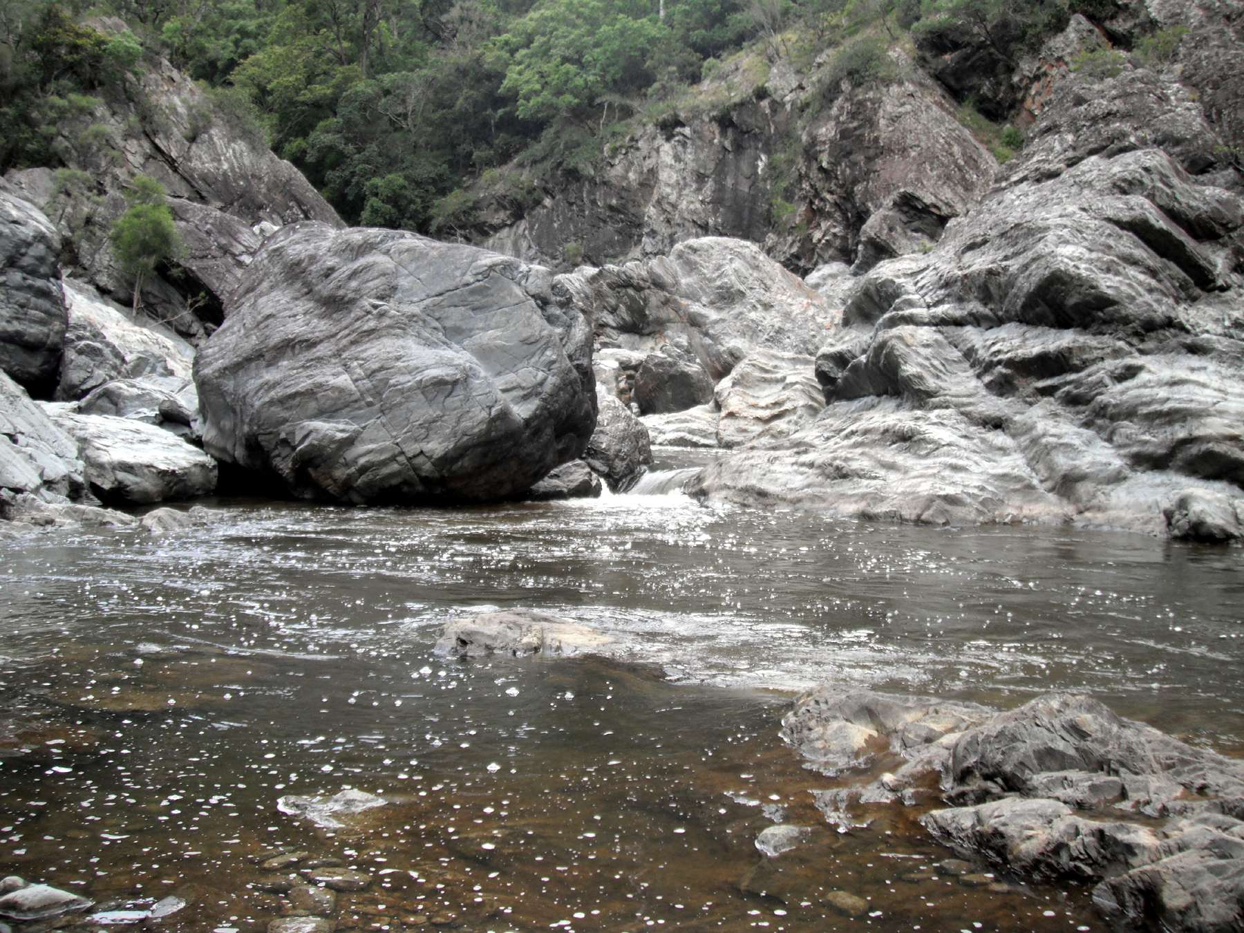
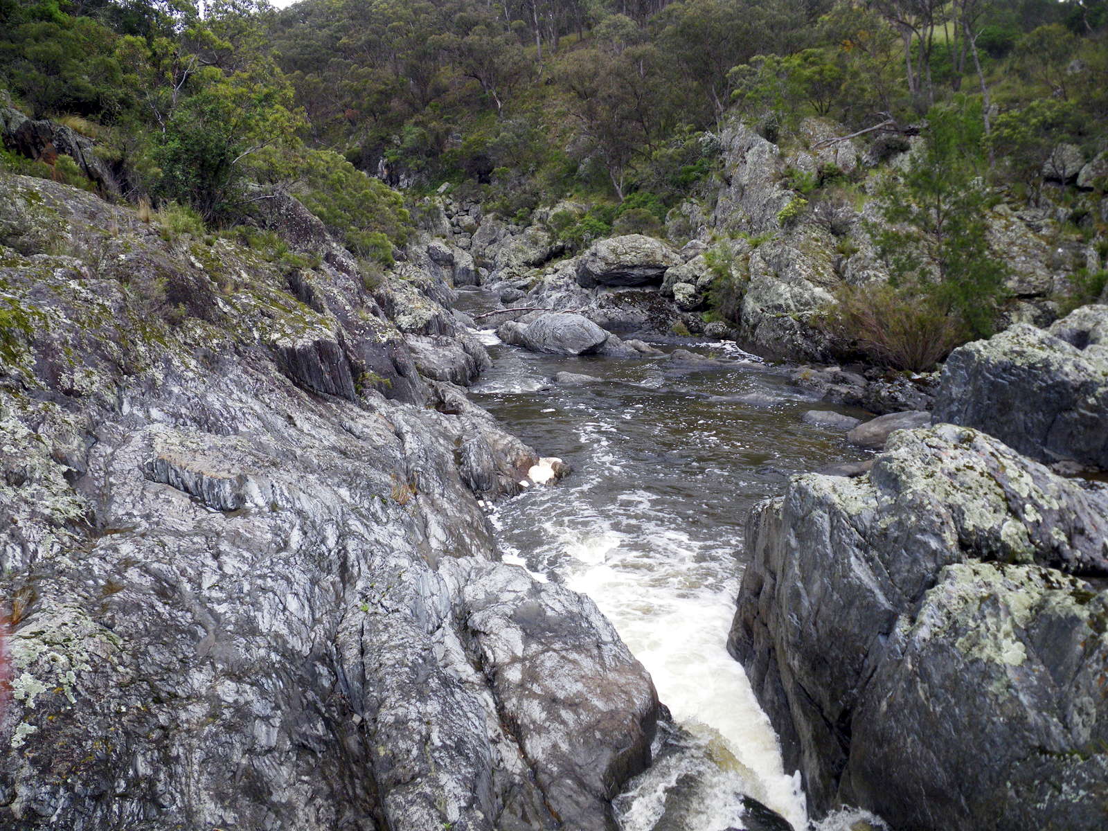
One of the falls which must be negotiated. Any trip like this needs to be done in summer during drought. The water is too cold in winter, hypothermia is always a danger at that time, and there is too much water in the bottom of the gorges unless conditions are very dry.
Photo: Nic Kerr 2011
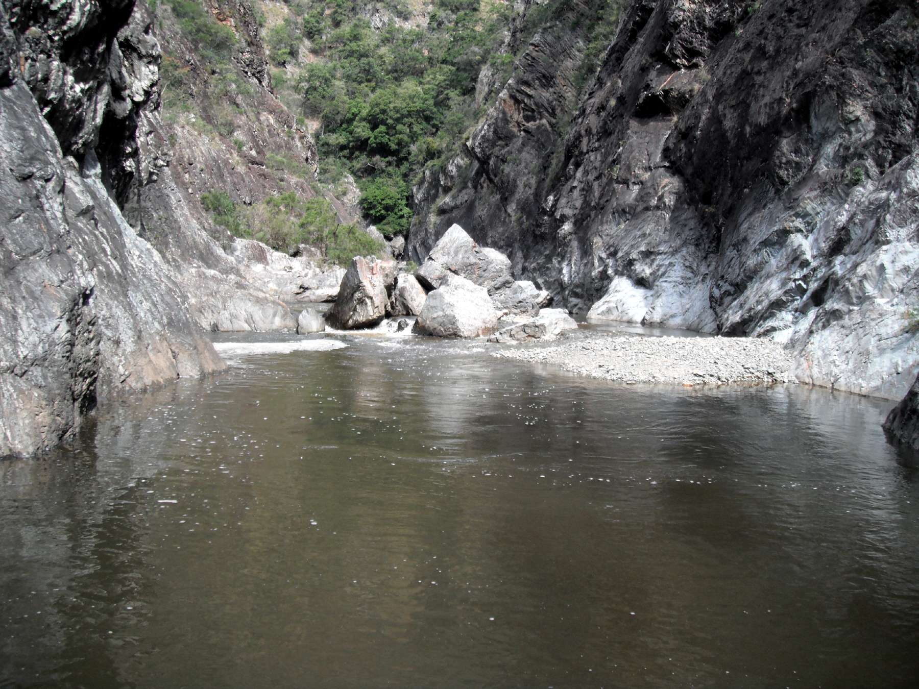
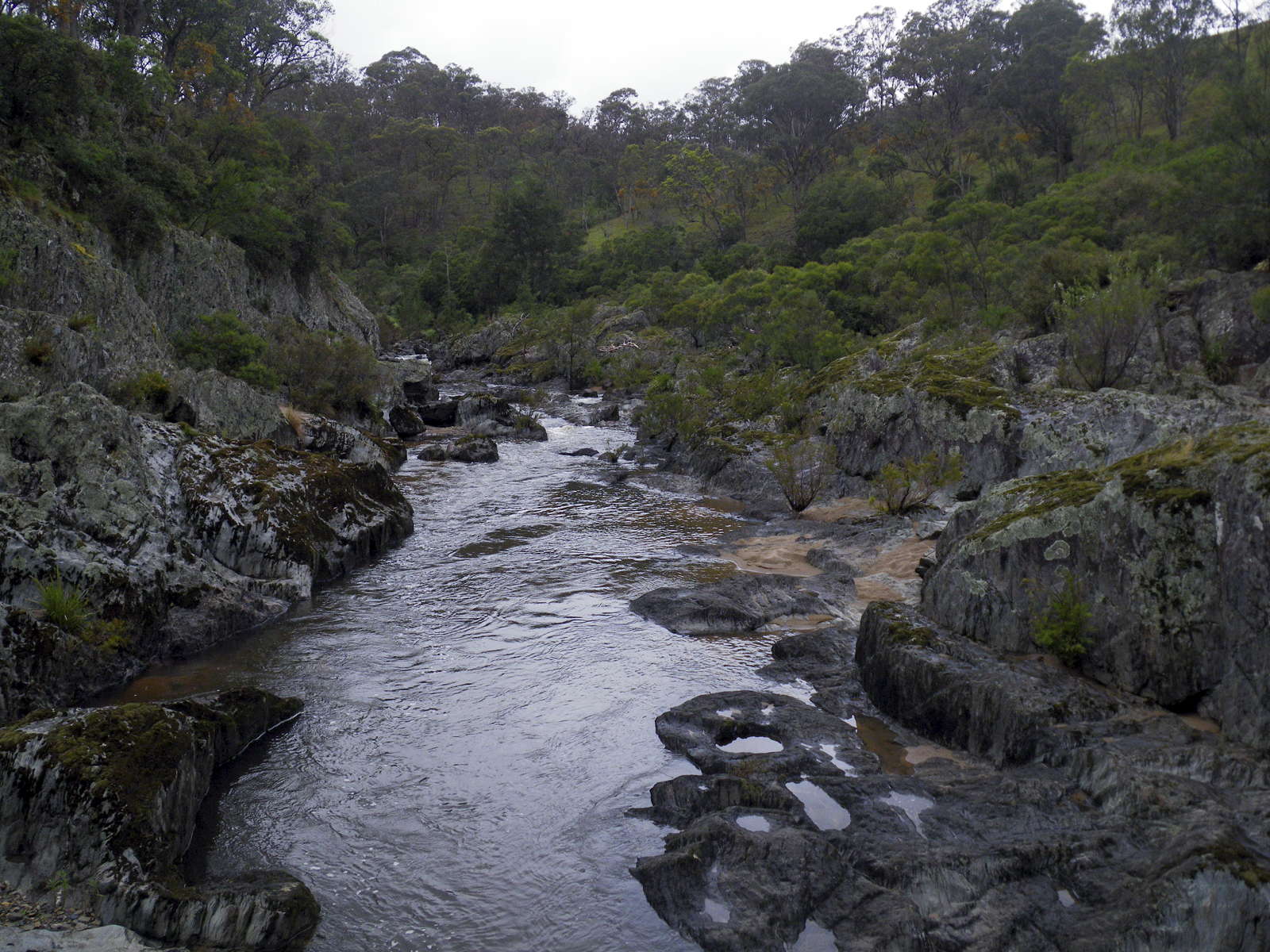
When you get past the falls, this large fast flowing body of water appears. Nic stopped at this point, being alone and in any case unequipped for further progress. Other writers have described a sheer rock face with a waterfall further up.
Photo: Nic Kerr 2011
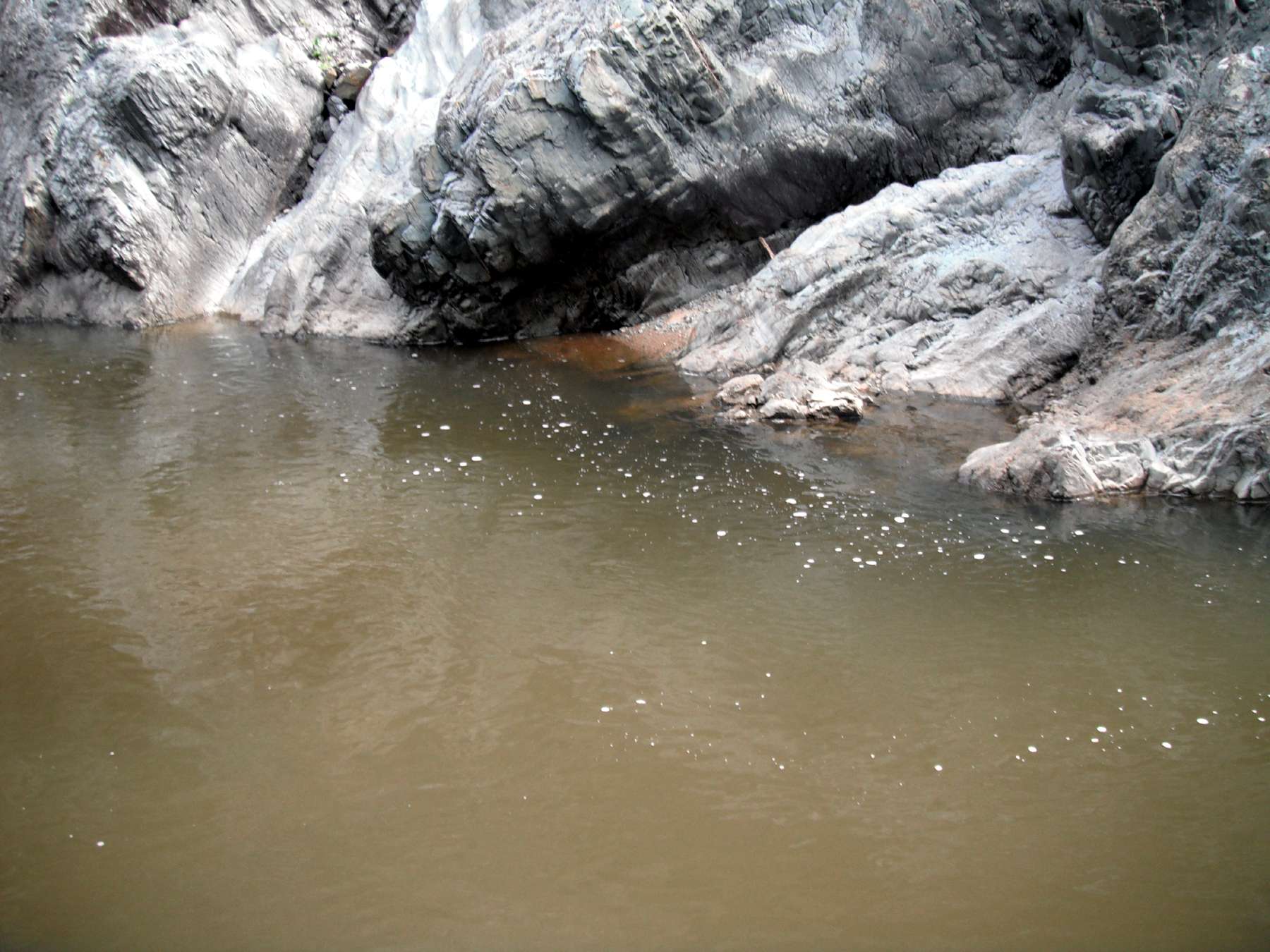
The wall on the other side of the pool.
Photo: Nic Kerr 2011
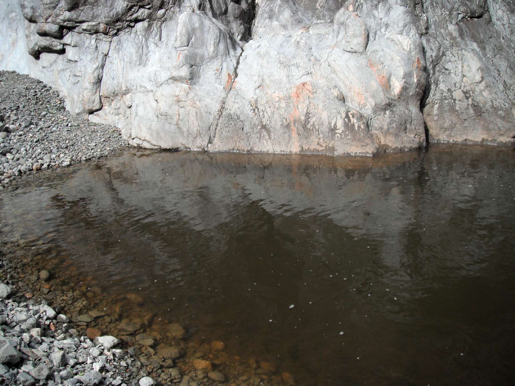
Left hand wall at the turn around point.
Photo: Nic Kerr 2011
The top of Wollomombi and Chandler Falls
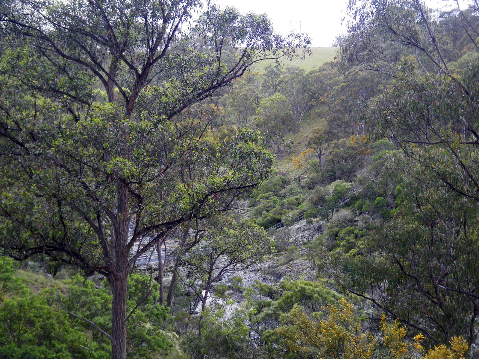
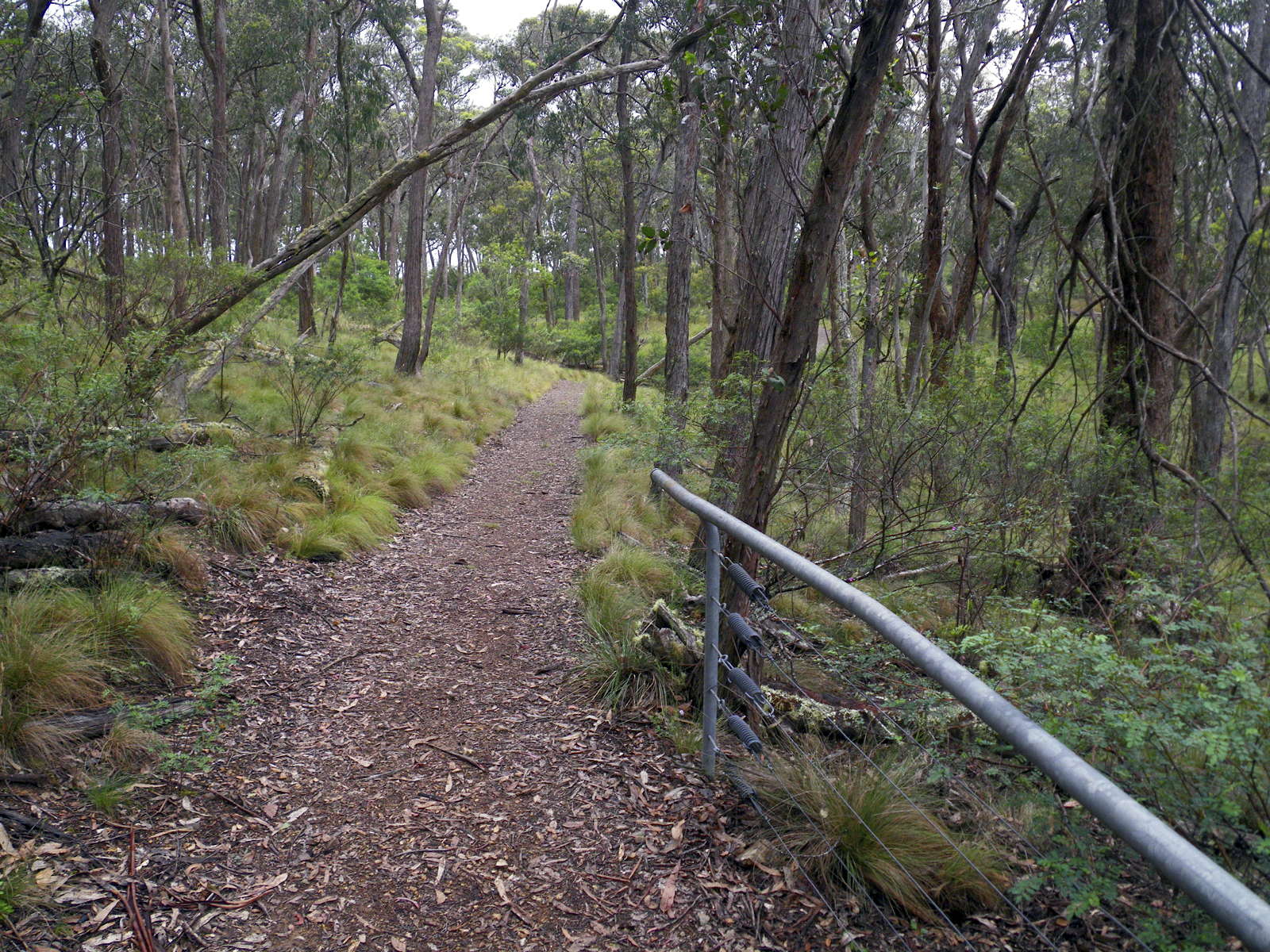
From the carpark at the top of Wollomombi Falls, a well made track leads to views of the falls from the top, and the upper reaches of the Wollomombi and Chandler Rivers.
Photo: Don Hitchcock December 2010
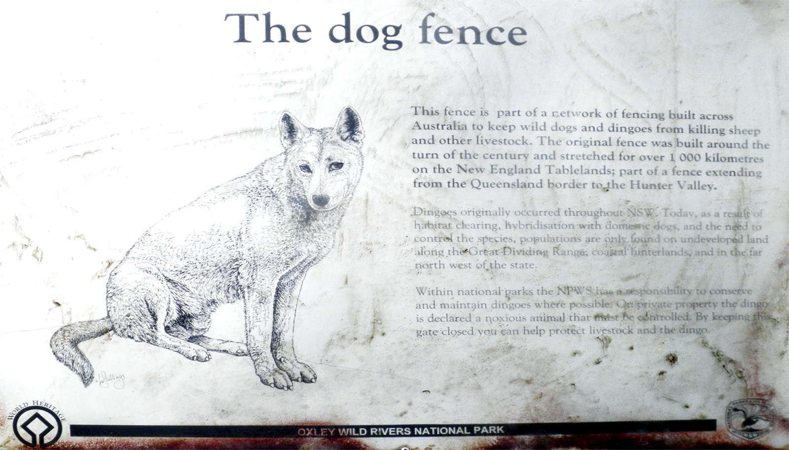
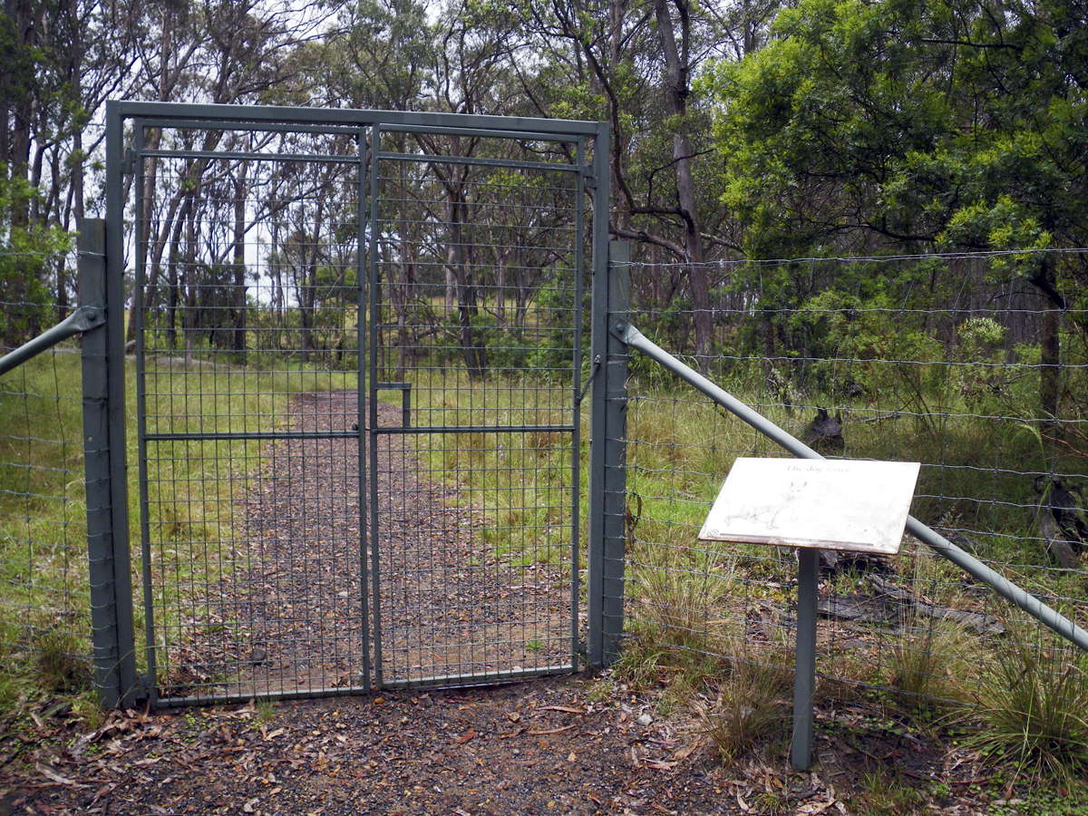
The dog fence is to keep dingoes confined to the gorge areas. I often hear dingoes in the gorges on moonlit nights or very early mornings, or see their tracks during the day. Baits are also used to keep their numbers down in grazing areas.
Photo: Don Hitchcock December 2010
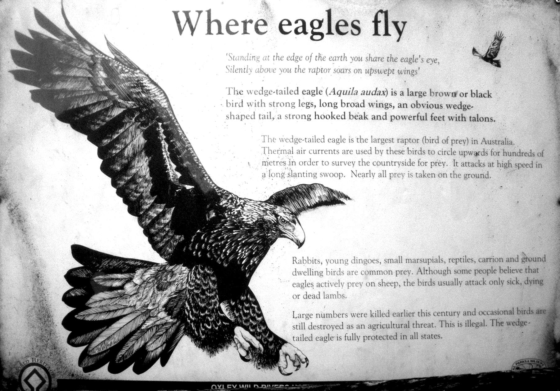
The Wedge-tailed Eagle, or 'Wedgie', Aquila audax, is a large brown or black bird with strong legs, long broad wings, an obvious wedge-shaped tail, a strong hooked beak, and powerful feet with talons. It is the largest raptor or bird of prey in Australia. Thermal air currents are used by these birds to circle upwards for hundreds of metres in order to survey the countryside for prey. It attacks at high speed in a long slanting swoop. Nearly all prey is taken on the ground.
Rabbits, young dingoes, small marsupials, reptiles, carrion and ground dwelling birds are common prey. Although some people believe that eagles actively prey on sheep, the birds usually attack only sick, dying or dead lambs. Large numbers were killed earlier this century and occasional birds are still destroyed when seen as an agricultural threat. This is illegal. The Wedge-tailed Eagle is fully protected in all states.
Photo: Don Hitchcock December 2010
Text: adapted from the sign in the photo at left.
The track soon gives breathtaking views of the gorge into which the Chandler and the Wollomombi flow via waterfalls.
Photo: Don Hitchcock December 2010
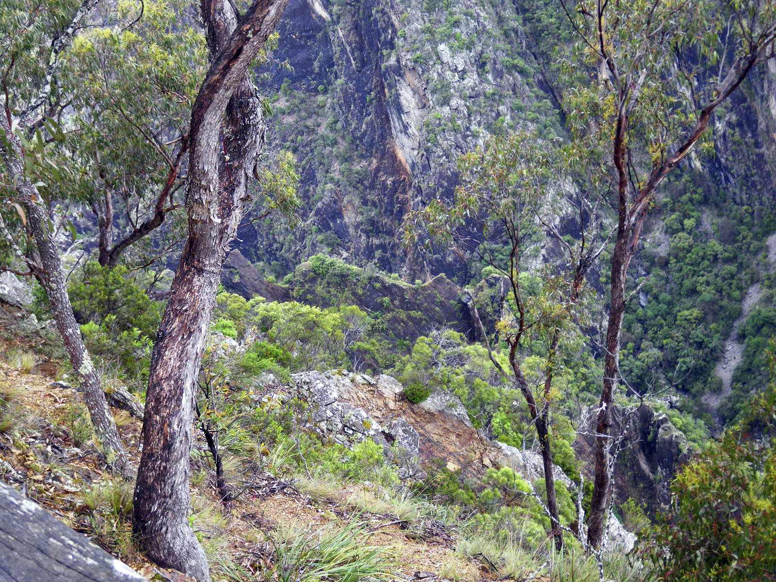
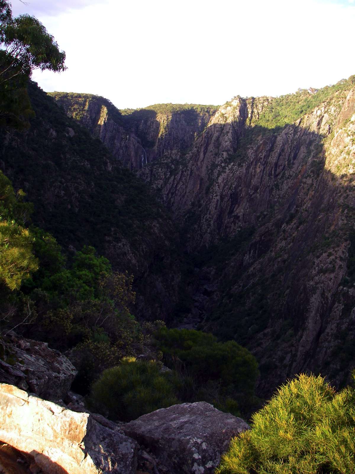
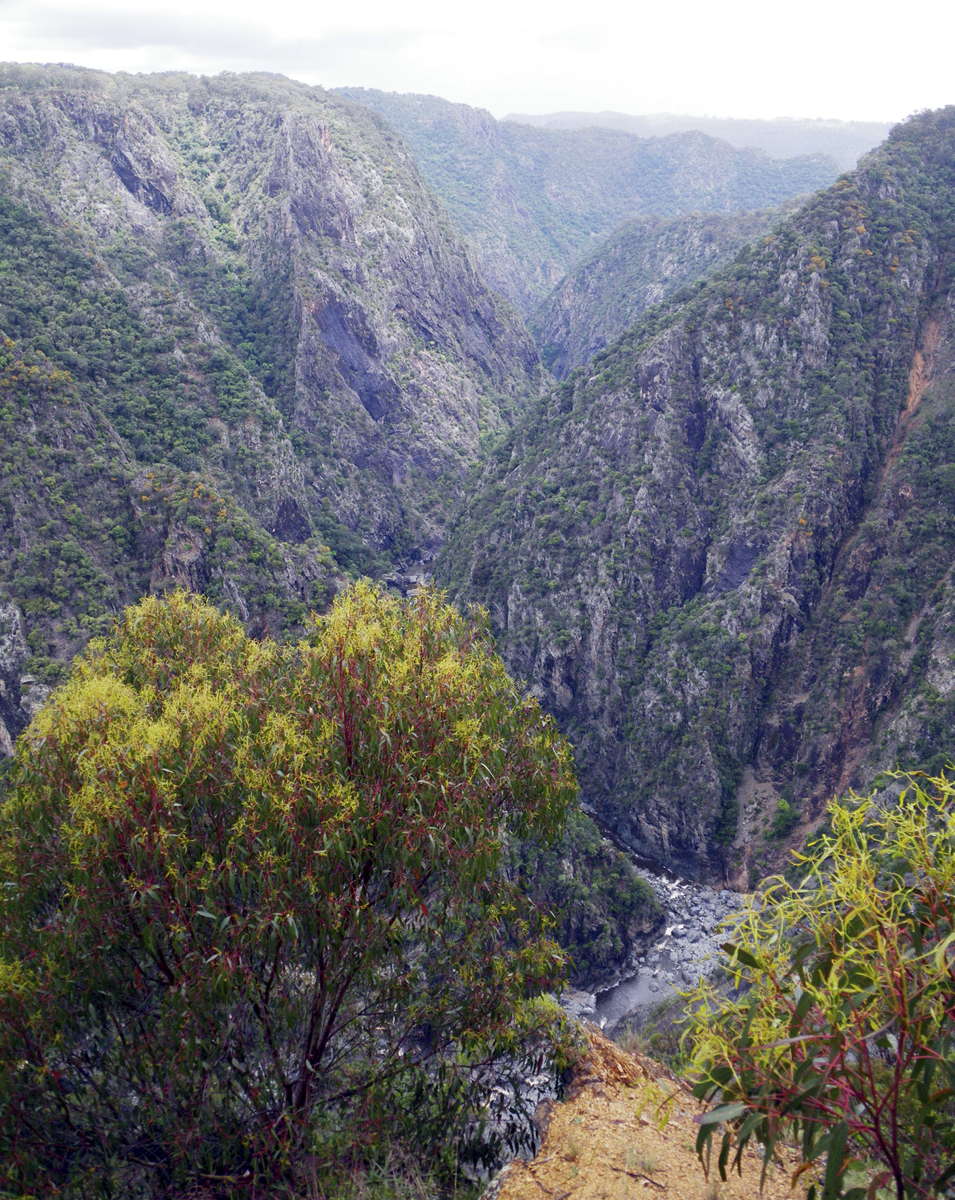
First view of the razor back ridge between the Wollomombi and the Chandler.
The Wollomombi River is on this side of the ridge, the Chandler on the other. They merge at the downstream end of this ridge to become the Chandler River, which eventually flows into the Macleay at Long Point.
Photo: Don Hitchcock December 2010
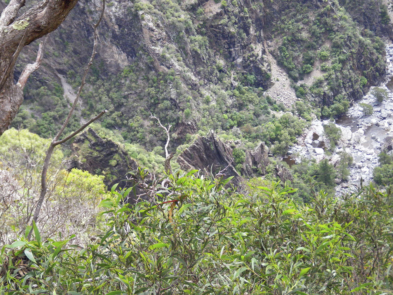
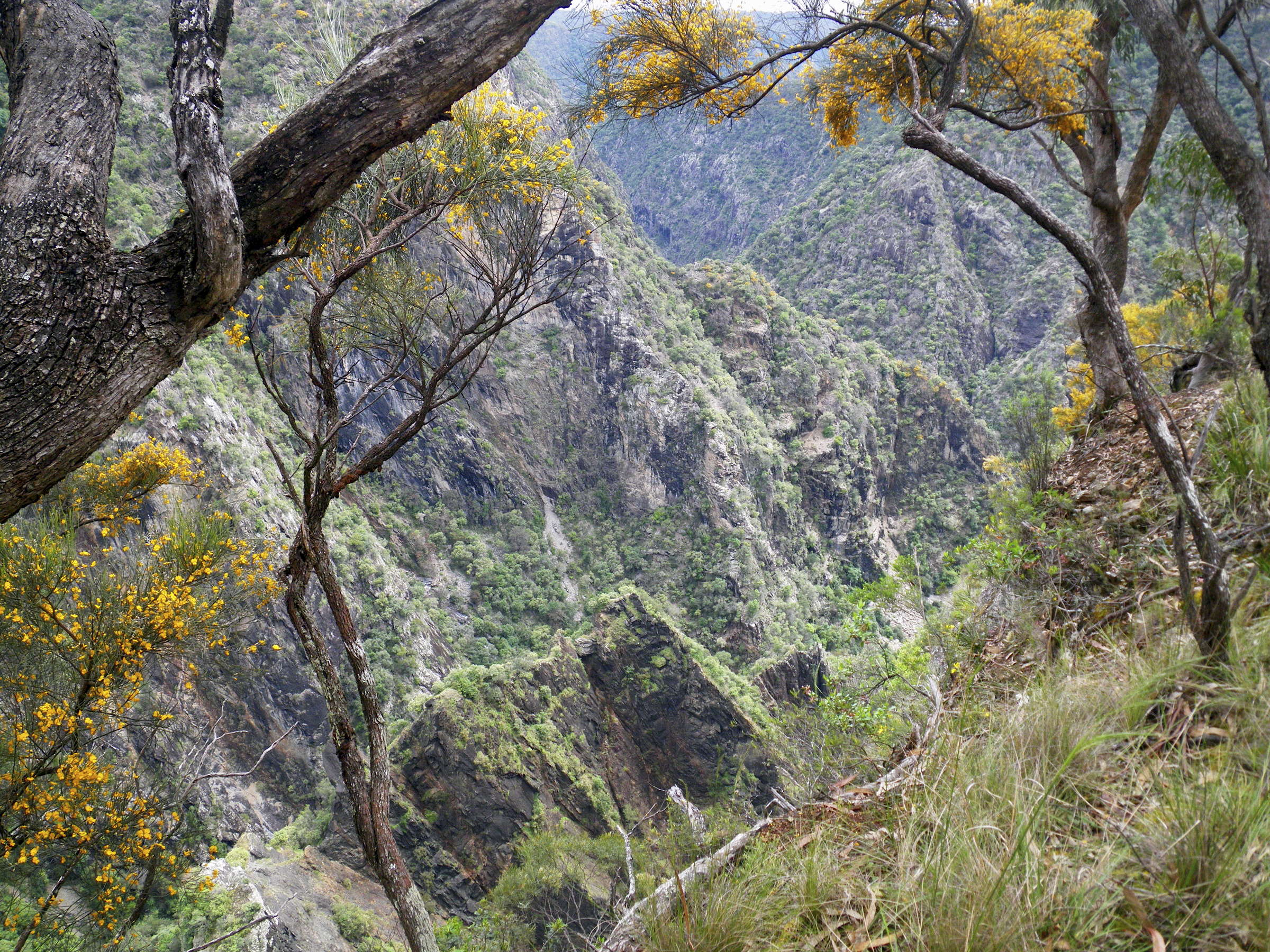
The razor back ridge between the Wollomombi and the Chandler.
I have included multiple views of this ridge below.
The ridge is a classic climb, but a dangerous and very difficult one.
Photo: Don Hitchcock December 2010
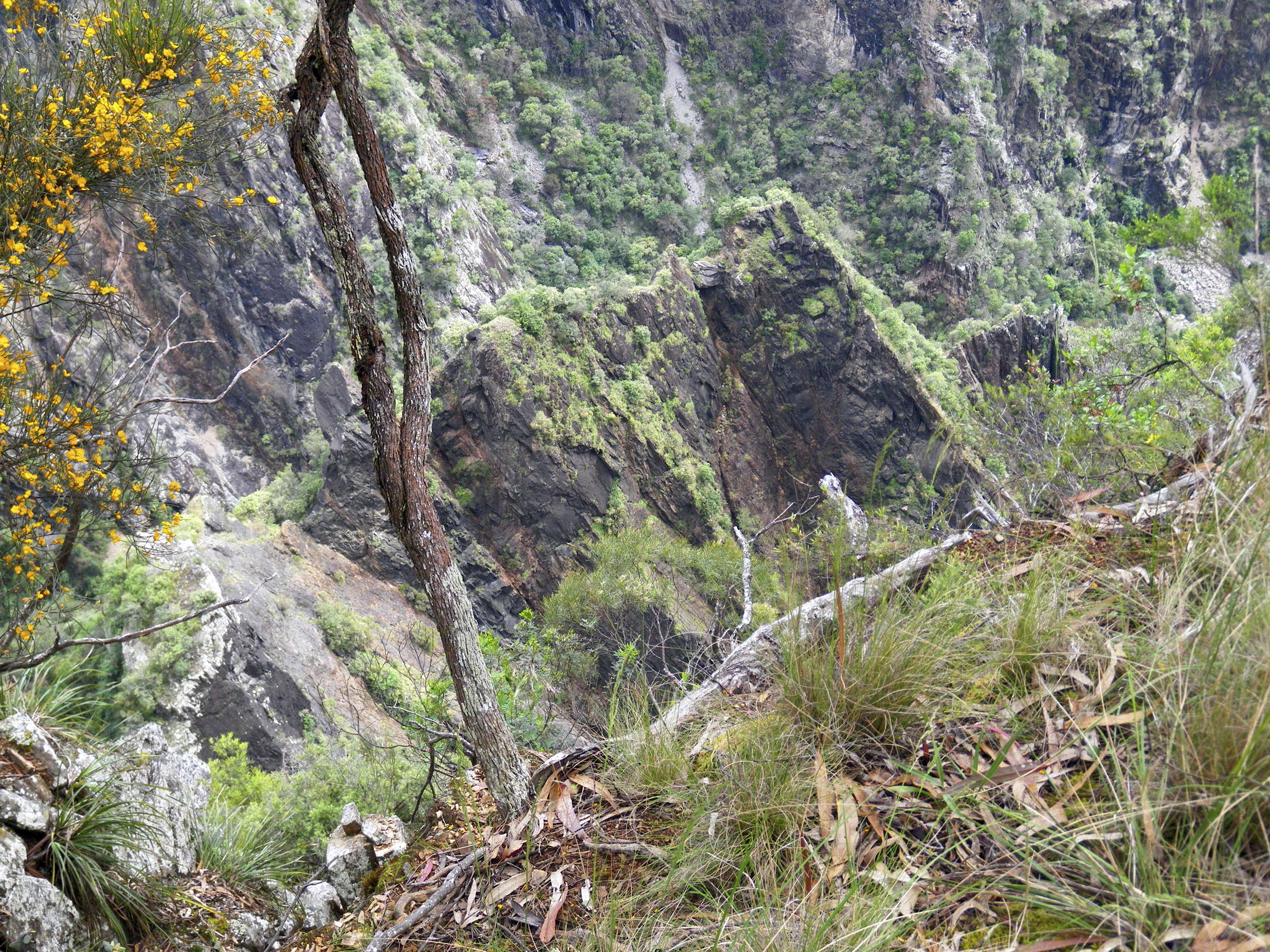
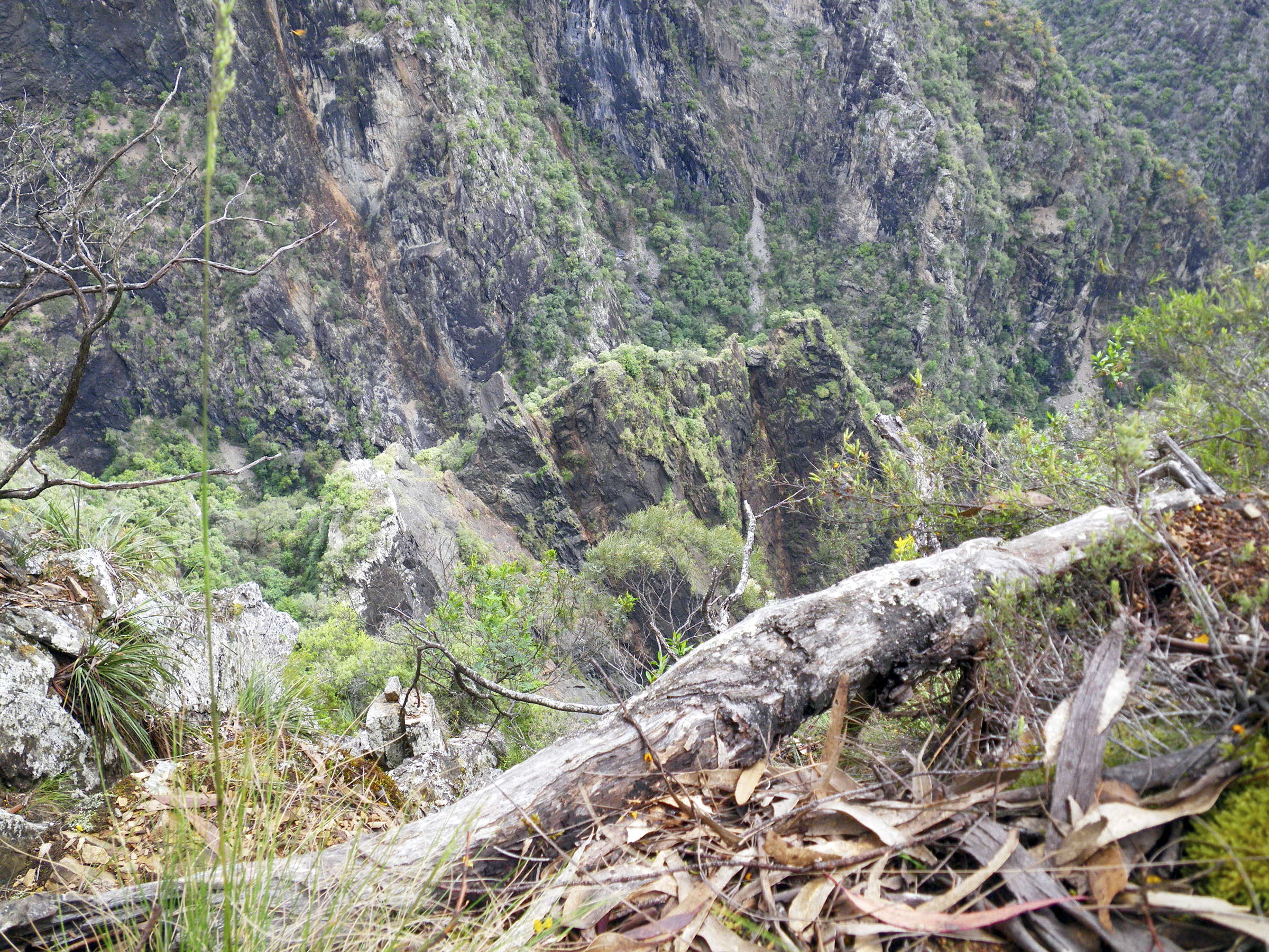
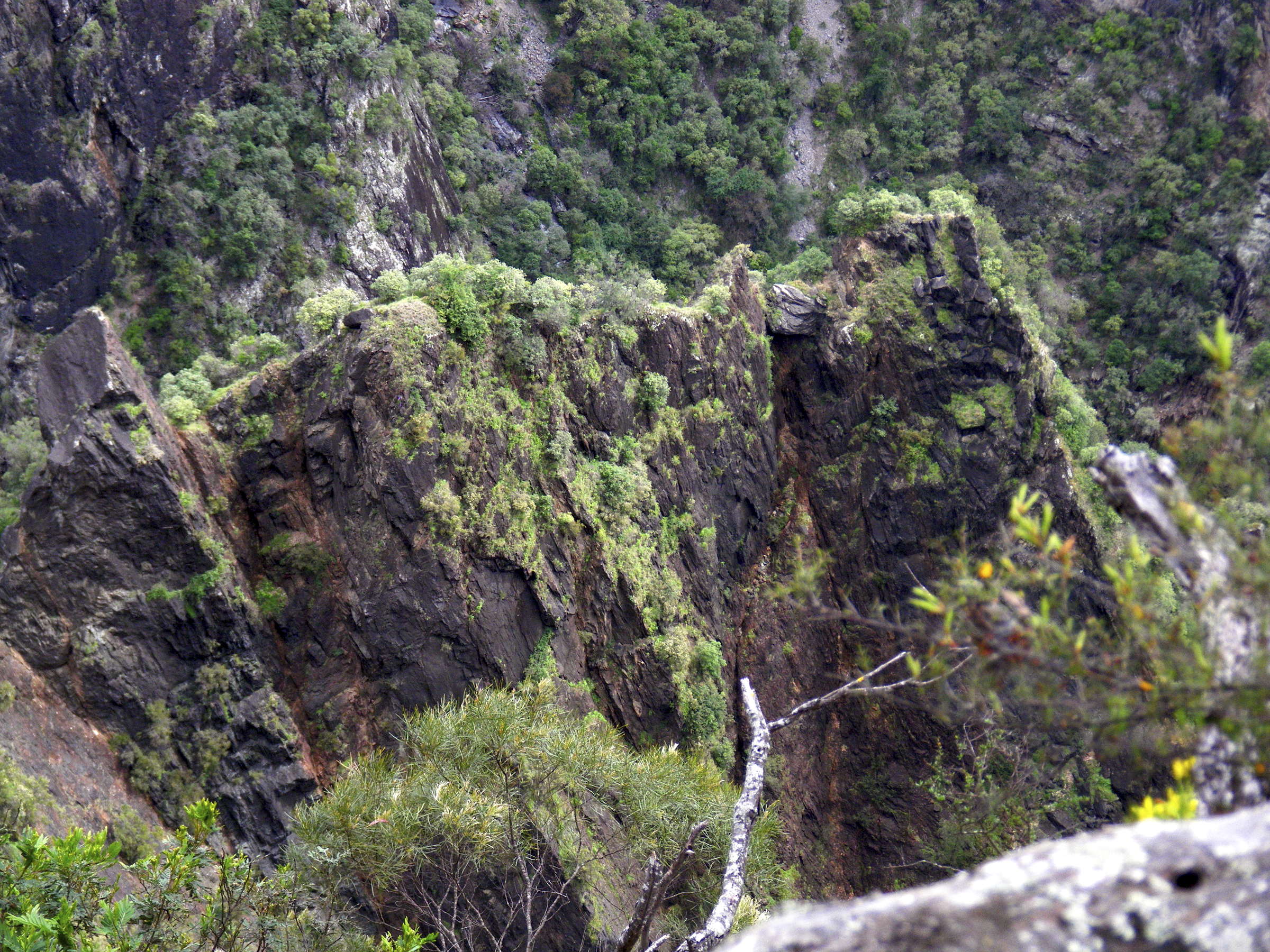
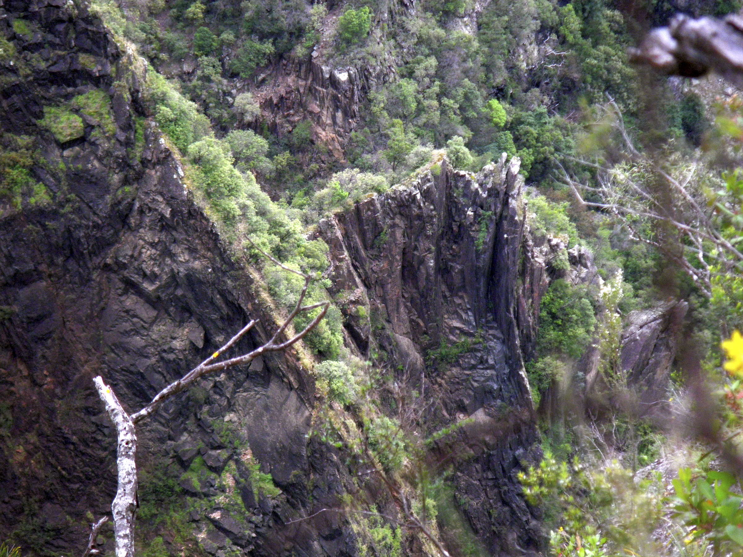
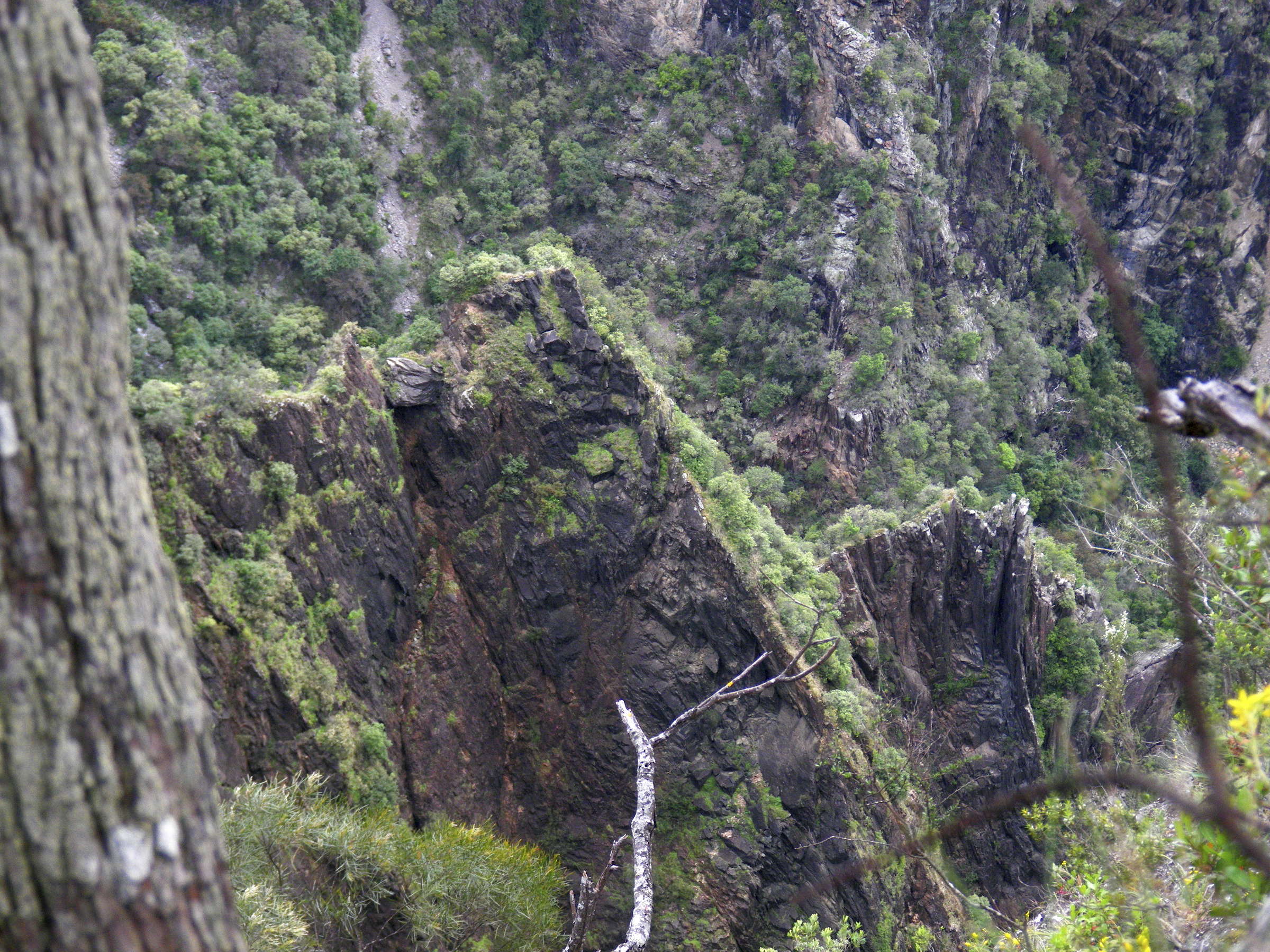
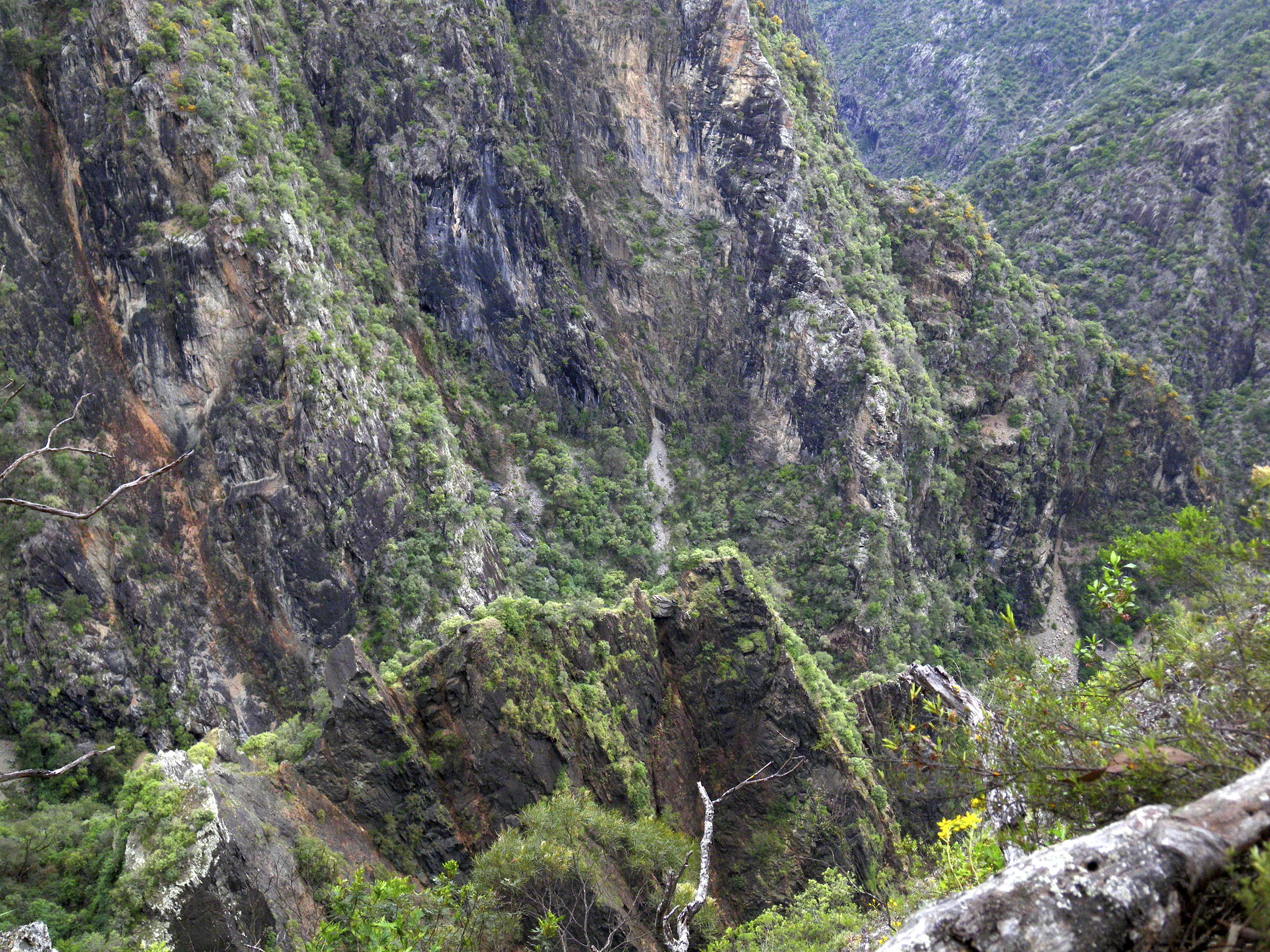
I have included all the photos of the razor back ridge so that climbers can form a good idea of the difficulty of ascent. Obviously it is only for highly experienced and well equipped rock climbers.
Photo: Don Hitchcock December 2010
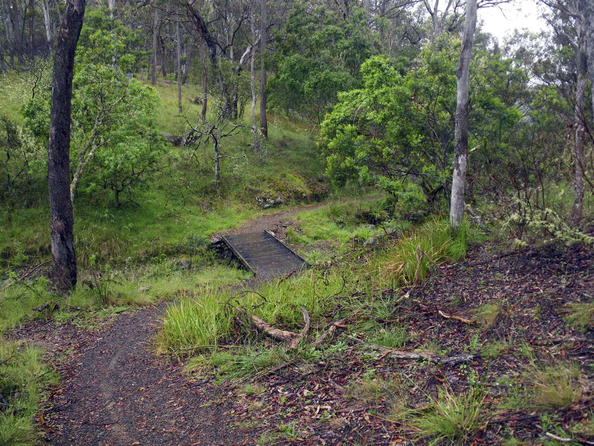
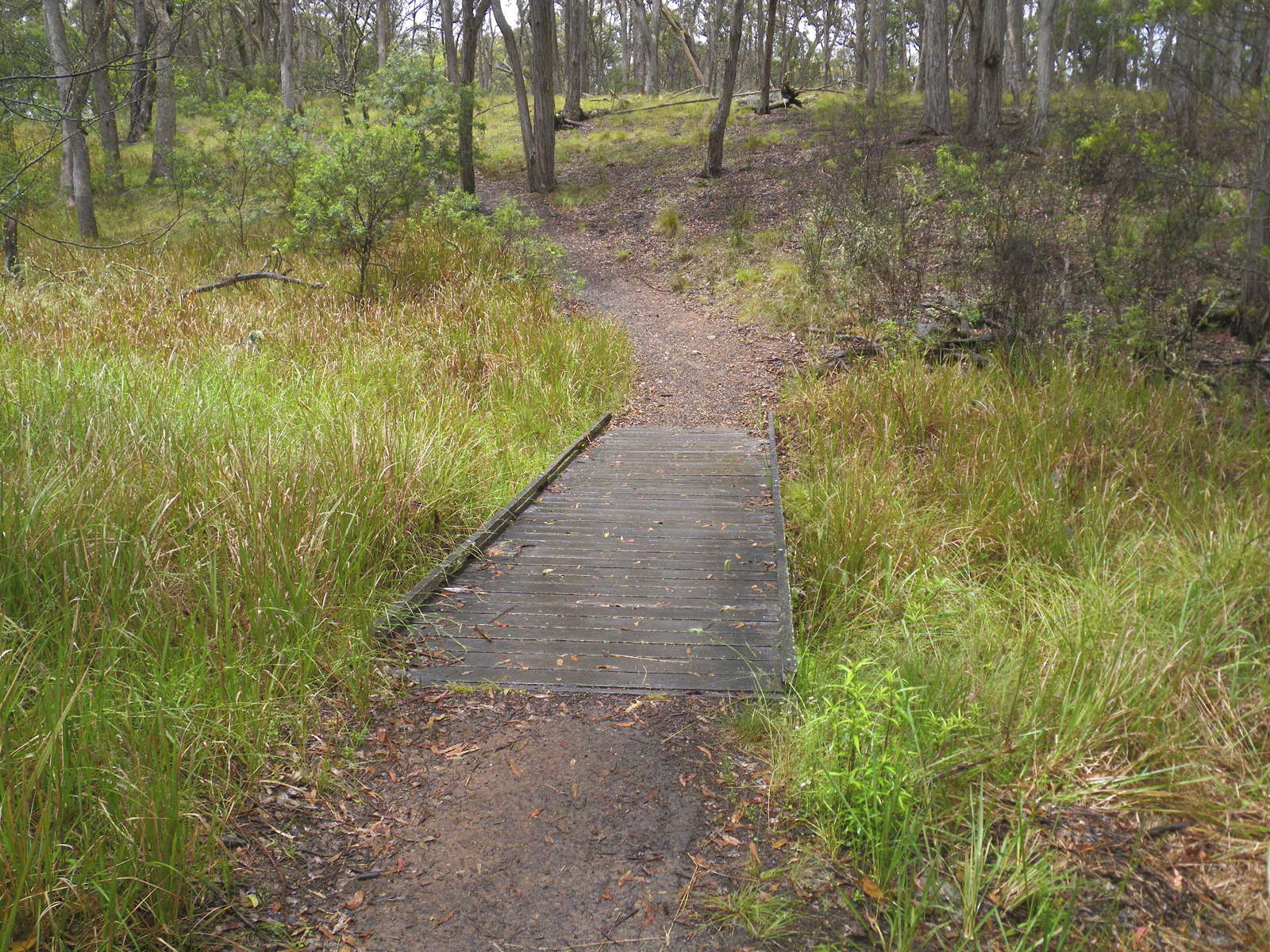
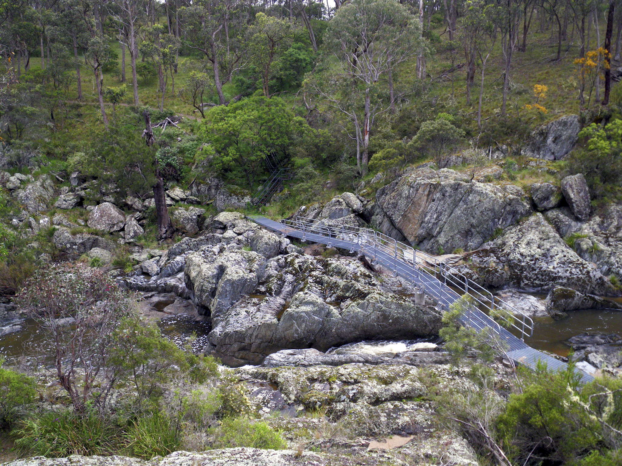
Looking down on the Wollomombi River (above the waterfall) and the bridge over it.
This bridge is impassable during periods of high runoff.
Photo: Don Hitchcock December 2010
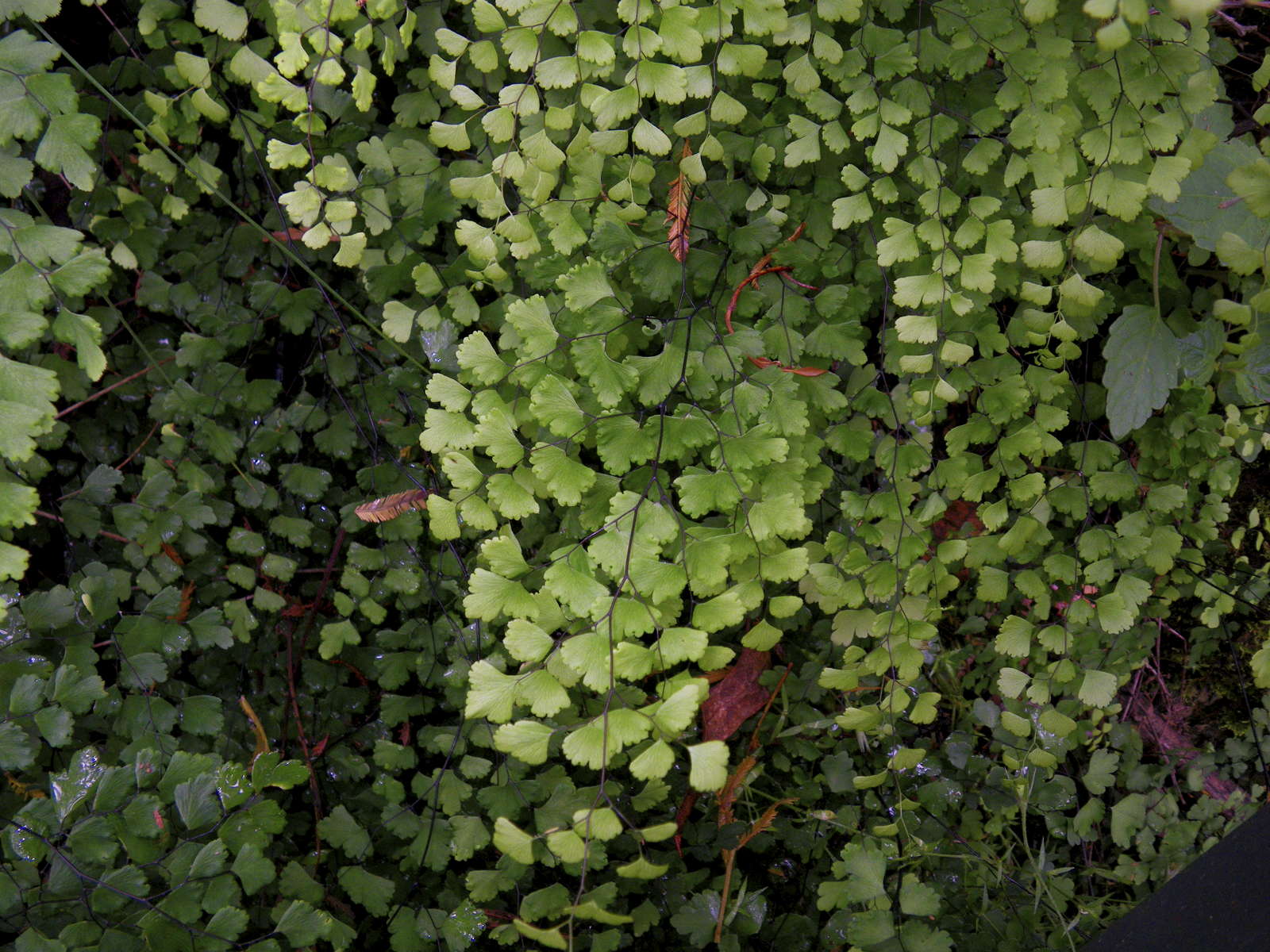
Maiden Hair fern growing in a shady, sheltered, well watered spot beside the stairs leading down to the bridge over the Wollomombi.
Photo: Don Hitchcock December 2010
Looking up (left) and down (right) the Wollomombi River (above the waterfall) from the bridge.
Photo: Don Hitchcock December 2010
Looking back at the bridge on the track to the Chandler. Note the flood debris, a brown band of vegetation, on the far side of the bridge, at the end of the hand rails.
Photo: Don Hitchcock December 2010
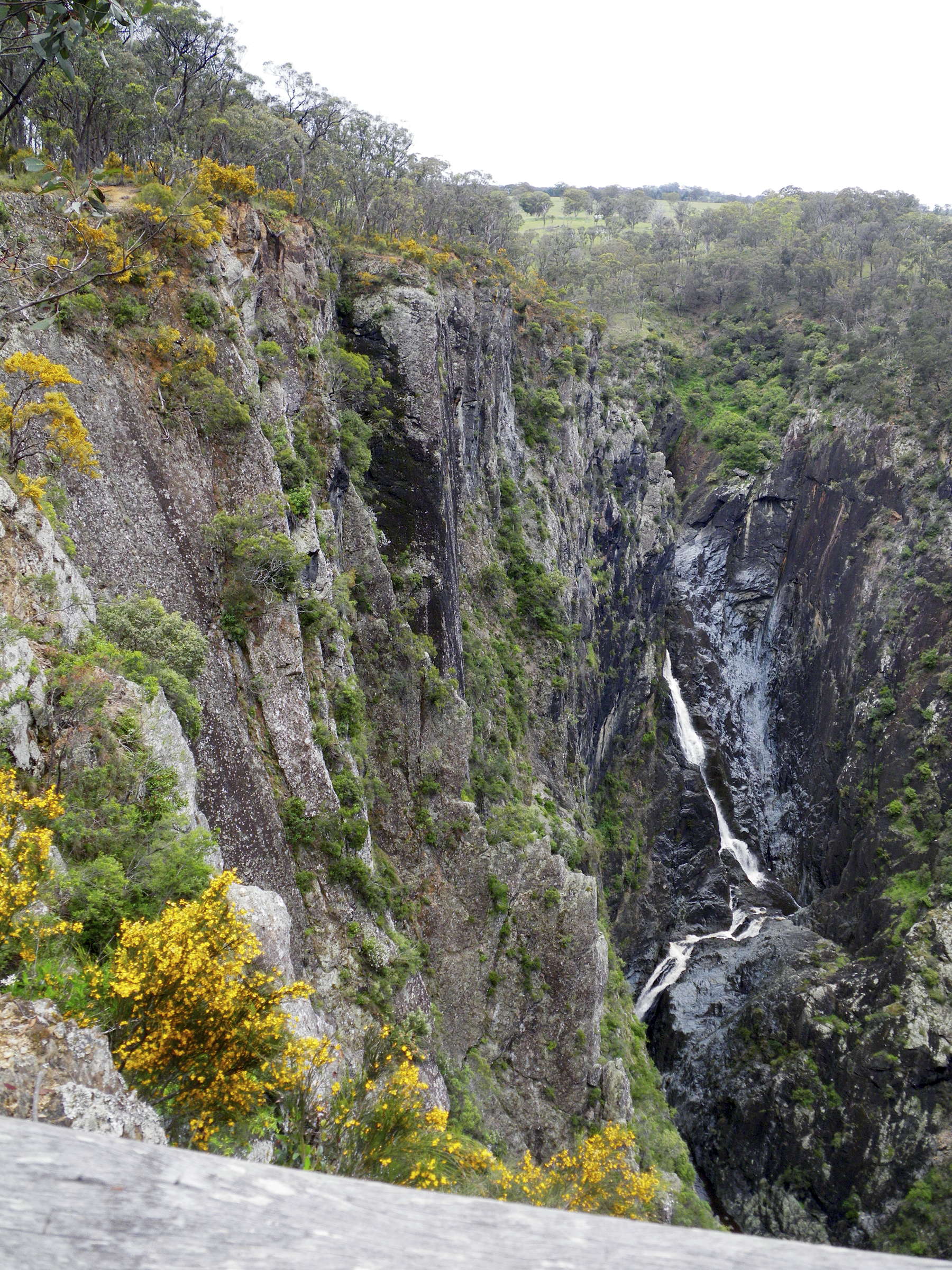
From the track which then goes out around the front of a buttress ridge, the top of Wollomombi Falls can be seen.
Photo: Don Hitchcock December 2010
The well made track then continues on to a viewpoint above the Chandler.
Photo: Don Hitchcock December 2010
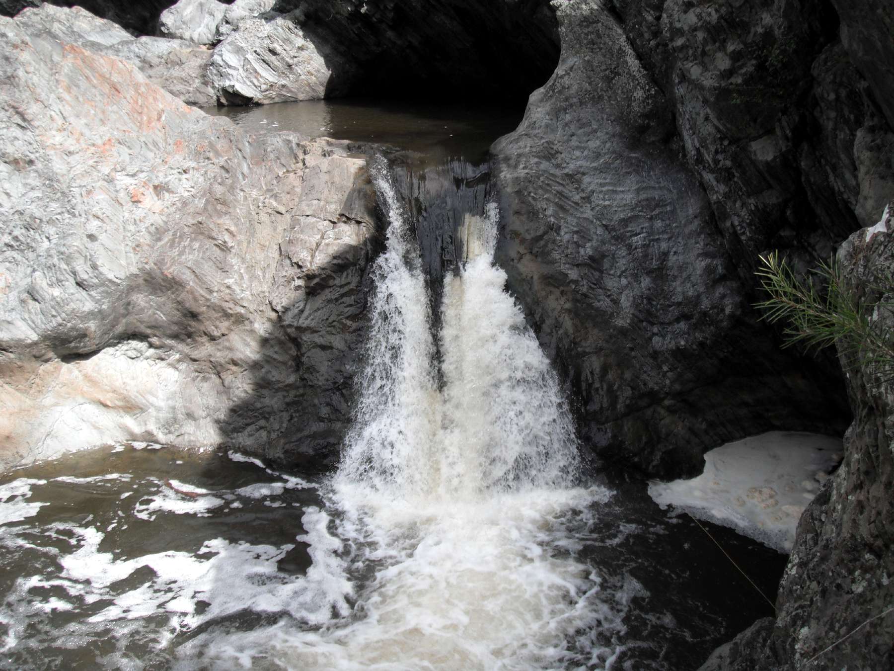
Looking down into the gorge of the upper Chandler, below the falls.
Photo: Don Hitchcock December 2010
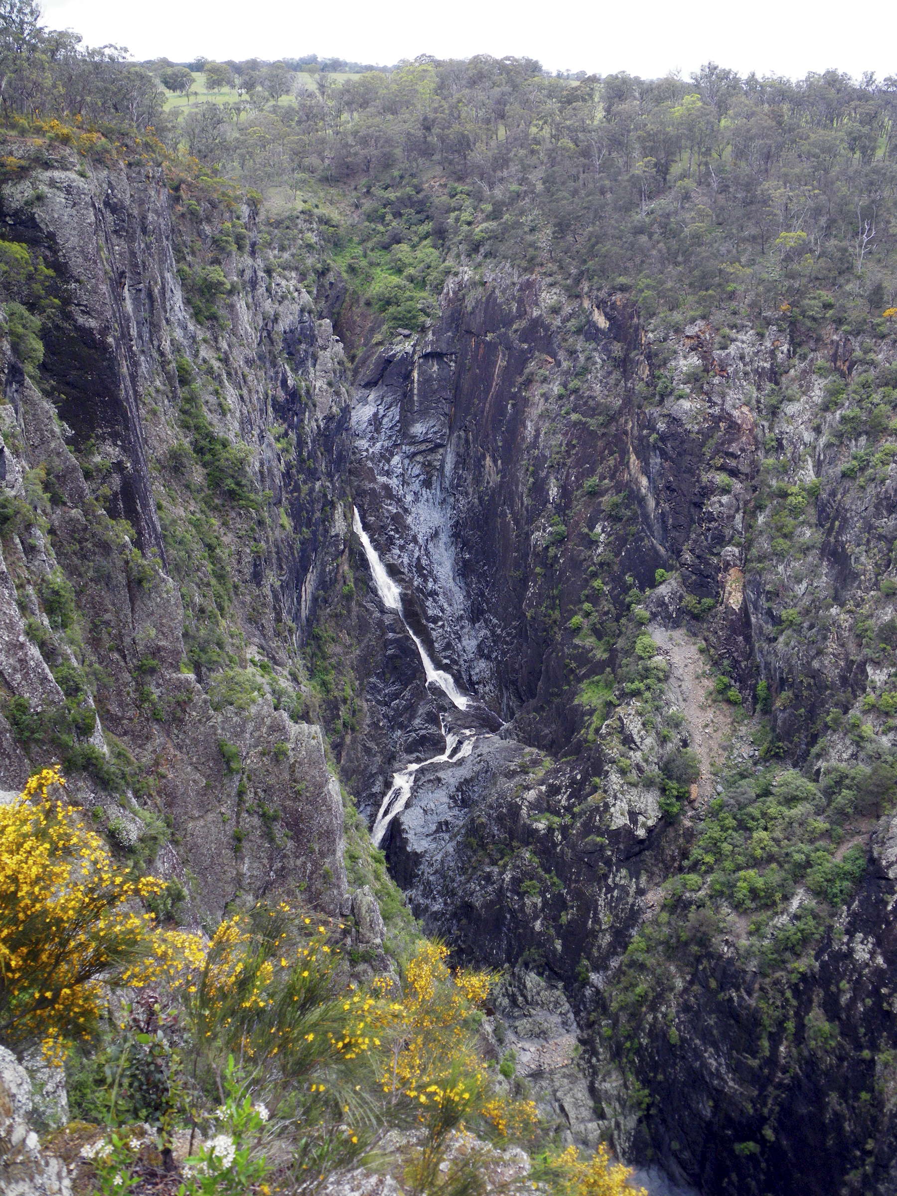
Chandler Falls
Photo: Don Hitchcock December 2010
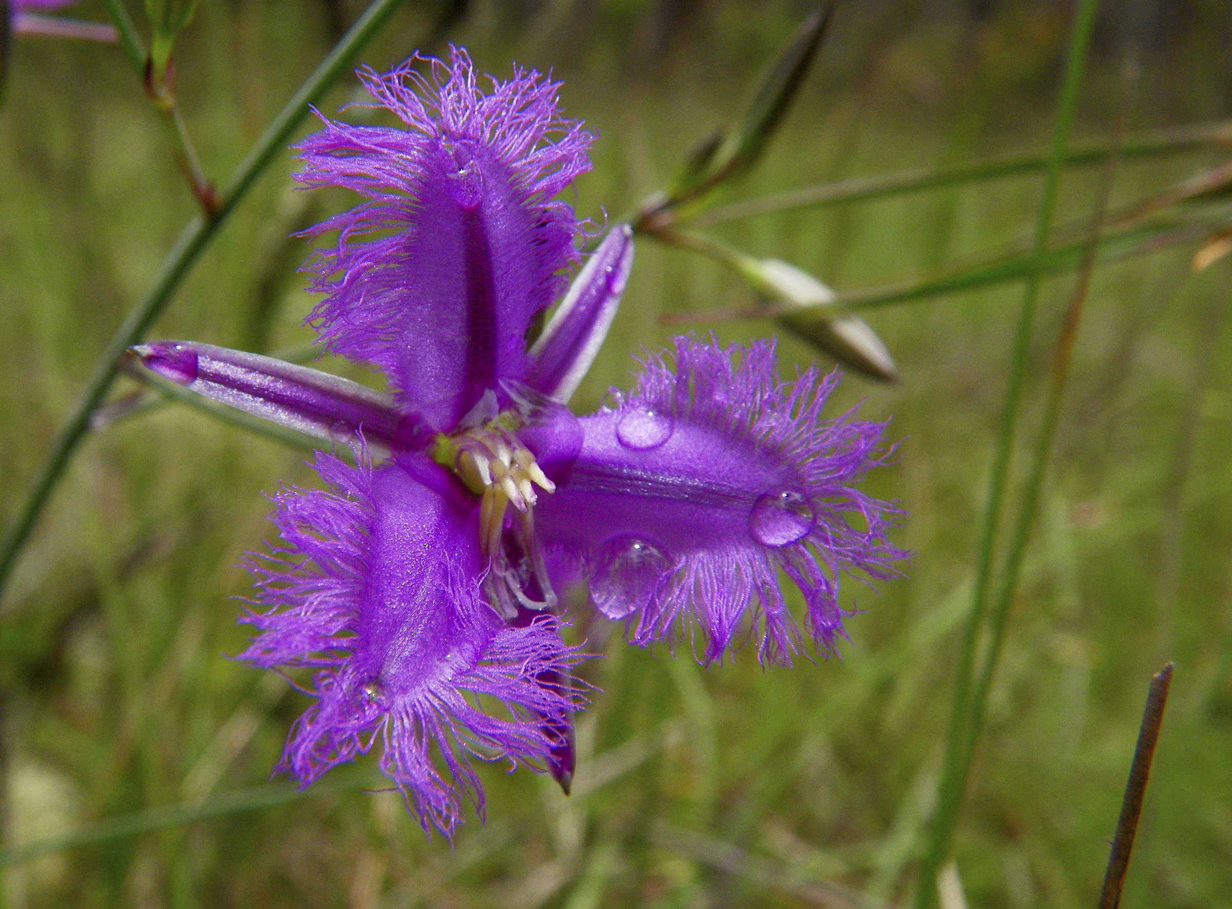
The beautiful Fringed Lily, Thysanotus tuberosus, growing beside the track.
Photo: Don Hitchcock December 2010
Bushwalking Index Anyone (e.g. students, libraries, government agencies such as tourist bureaus, the general public) may use, print and publish the photographs taken by me and presented on this bushwalking file for any legitimate non-commercial purpose, at no cost, and without asking permission. However a note such as "Photo: Don Hitchcock" somewhere in the document would be appreciated if it is to be published.