Back to Don's Maps
 Back to Archaeological Sites
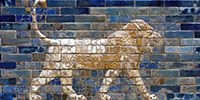 The Ishtar Gate at Babylon
 The Neo-Assyrian Empire
Ancient Mesopotamia
King Lists and Artefacts from Ancient Mesopotamia
The historical region of Mesopotamia included present-day Iraq and parts of present-day Iran, Kuwait, Syria and Turkey
Mesopotamia is the site of the earliest developments of the Neolithic Revolution from around 10 000 BC. It has been identified as having inspired some of the most important developments in human history, including the invention of the wheel, the planting of the first cereal crops, and the development of cursive script, mathematics, astronomy, and agriculture. It is recognised as the cradle of some of the world's earliest civilisations.Sumer is the earliest known civilisation in the historical region of southern Mesopotamia (south-central Iraq), emerging during the Chalcolithic (Copper) and early Bronze Ages between the sixth and fifth millennium BC. It is one of the cradles of civilisation in the world. Living along the valleys of the Tigris and Euphrates rivers, Sumerian farmers grew an abundance of grain and other crops, the surplus from which enabled them to form urban settlements. Proto-writing dates back before 3 000 BC. The earliest texts come from the cities of Uruk and Jemdet Nasr, and date to between 3 500 BC and 3 000 BC.
The Sumerian language was the first to be recorded on clay tablets, with the words being recorded as syllables rather than using an alphabet. Sumerian did not survive, but the cuneiform script was taken up by other groups, and continued to develop after the Sumerians disappeared.
In particular the Assyrians, who used the Akkadian language, also used cuneiform script on clay tablets, and their language formed part of many other languages which either descended from it, or borrowed words from Akkadian.
The Sumerians and Akkadians (including the Assyrians and Babylonians) originating from different areas in present-day Iraq, dominated Mesopotamia from the beginning of written history (circa 3 100 BC) to the fall of Babylon in 539 BC, when it was conquered by the Achaemenid Empire, also known as the First Persian Empire.
The Achaemenid Empire was founded by Cyrus the Great in 550 BC , and stretched from Eastern Macedon, Thrace, Libya and Northern Egypt in the west, to Central Asia and the Indus Valley to the east. It occupied an area of 5.5 million square kilometres, and was the largest empire the world had ever seen up to that time,
Mesopotamia is the site of the earliest developments of the Neolithic Revolution from around 10 000 BC. It has been identified as having inspired some of the most important developments in human history, including the invention of the wheel, the planting of the first cereal crops, and the development of cursive script, mathematics, astronomy, and agriculture. It is recognised as the cradle of some of the world's earliest civilisations.
Text above: adapted from Wikipedia
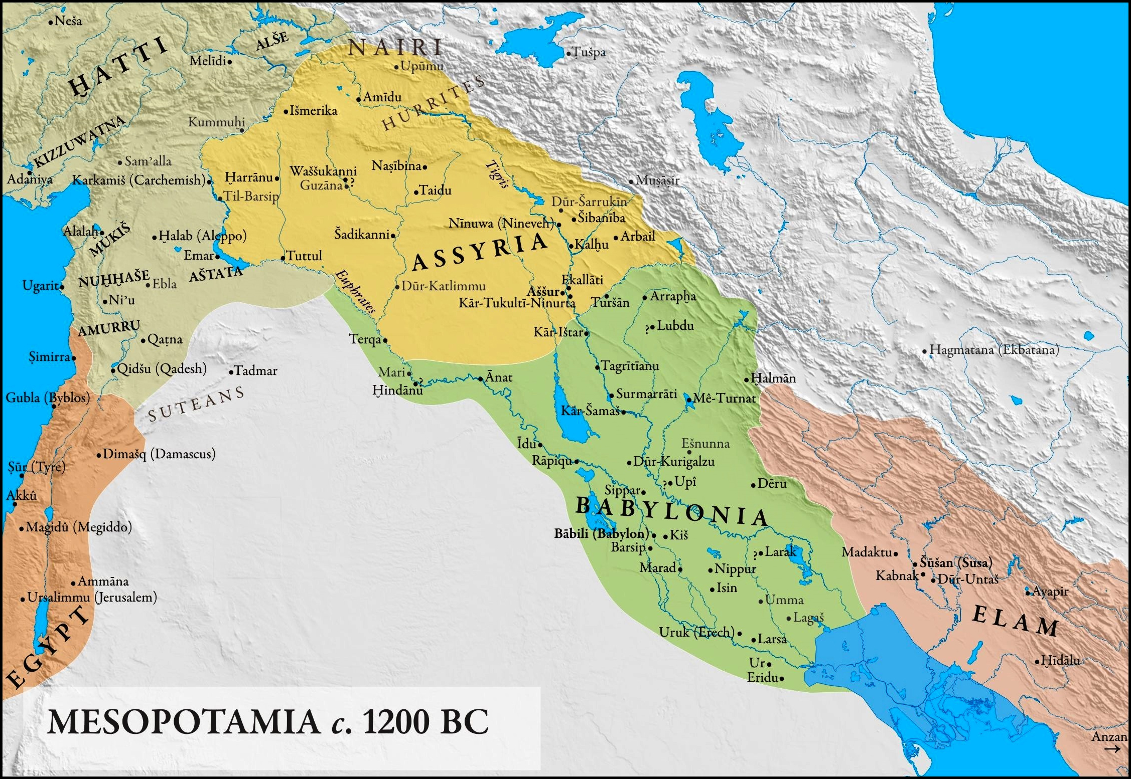
Map of Mesopotamia, circa 1 200 BC.
This date of 1 200 BC corresponds to the start of the Late Bronze Age Collapse, when the Hittite Empire of Anatolia and the Levant (shown as Hatti on this map) collapsed, while states such as the Middle Assyrian Empire in Mesopotamia and the New Kingdom of Egypt survived but were weakened.
Note that the large area coloured in blue was under water in 1200 BC, part of the Persian Gulf at that time. Siltation from the Tigris/Euphrates created the modern coastline.
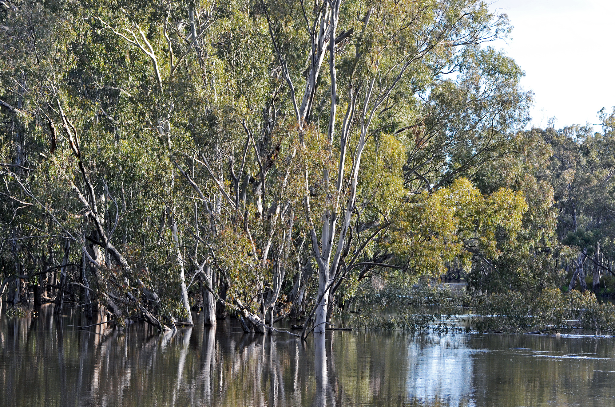
Ur was originally a major port on the Euphrates, very close to the Persian Gulf, which extended much farther inland than today, and the city controlled much of the trade into Mesopotamia. At around 2 100 BC, when it was at its height, it was home to perhaps 12 000 people. It is the traditional birthplace of Abraham, patriarch of Christianity, Judaism and Islam. Imports to Ur came from many parts of the world: precious metals such as gold and silver, and semi-precious stones, namely lapis lazuli and carnelian. By the time of Cyrus the Great it was already decadent, and the changing course of the Euphrates sealed its fate. Without irrigation the previously fertile fields became desert, and by 400 BC it was abandoned.
The Elamites (in modern-day Iran, approximately equivalent to the modern region of Khūzestān) were important neighbours to both Babylonia and Assyria in the Bronze Age.
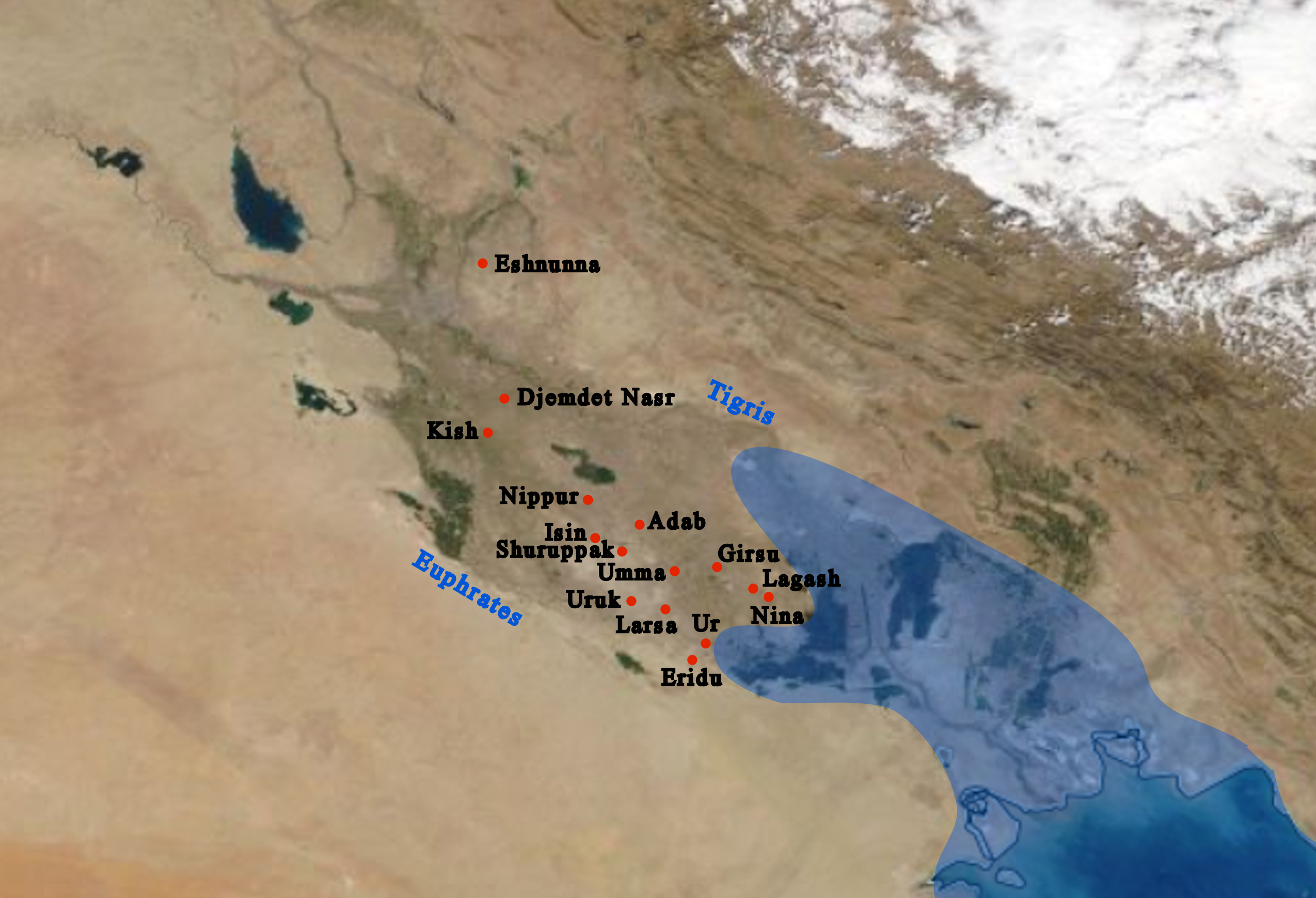
Ancient Sumer, extant from 6 000 BC to 1 750 BC, lay between the Tigris and Euphrates Rivers, and stretched from Kish (Kiš) to Ur. Kiš was 25 km from the site of Babylon. Babylon was established around 1 200 BC as a small religious and cultural centre.
Photo: FDRMRZUSA
Permission: Creative Commons Attribution-Share Alike 4.0 International license.
Proximate source: Wikimedia
Text: Don Hitchcock, Wikipedia, factsanddetails.com
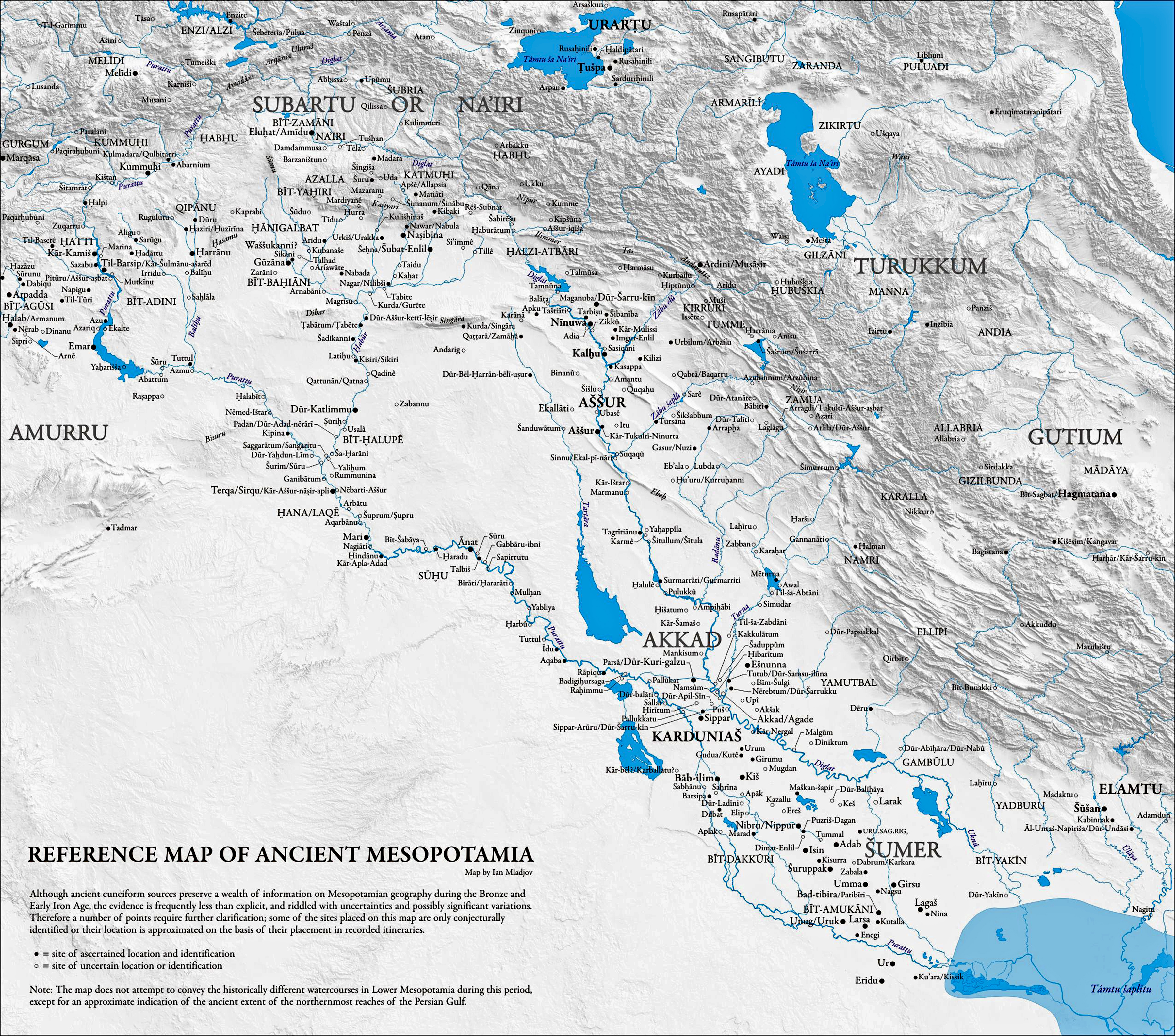
A more detailed map of Mesopotamia.
( As always, click on the small thumbnail above to see the full size image - Don )
Source: sites.google.com/a/umich.edu/imladjov/maps
Map © Ian Mladjov
Permission: Courtesy Ian Mladjov

Map of Mesopotamia below Babylon, showing the changing coastline between 2 000 BC and 1 850 AD in the Persian/Arabian Gulf as a result of deposition of silt from the Tigris-Euphrates river system.
Photo: Varoujan et al. (2020)
This is a useful timeline for the development of Mesopotamian cultures:
www.faculty.umb.edu/gary_zabel/Courses/Phil%20281b/Philosophy%20of%20Magic/Dante.%20etc/Philosophers/Idea/www.wsu.edu_8080/~dee/MESO/TIMELINE.HTM
Sumer
The region which eventually became Sumer was the site of the first civilisation in the history of the world.
Sumer, in Mesopotamia, was mostly between, or within reach of, the lower reaches of the two rivers, the Euphrates and the Tigris, and was the first fully fledged civilisation in both greater Mesopotamia, and the world.
Before that, all we had was hunter gatherers, all over the inhabited world. It is important to realise what civilisation was replacing, and how that happened.
Hunter gatherers practised various forms of birth control in order to keep their numbers low, with a good margin if conditions got bad for food gathering - both hunting and gathering of vegetable matter.
This is why, if you look at the human population from the time of the first humans, it is a flat line until the rise of the planting and harvesting of crops.
This is in marked contrast to the numbers of predators/carnivores and their prey. One example is shown here:

The wolves and moose of Isle Royale have been studied for more than five decades. This research represents the longest continuous study of any predator-prey system in the world.
When the respective populations of predators and prey are not controlled, we get a boom-bust cycle, as shown here for the populations of wolves and moose.
The effect is complicated by random effects of weather, parasites and disease.
Source: Vucetich & Peterson (2012)
If the humans of the Palaeolithic had not taken an active part in regulating their numbers, we would see a similar cycle for human populations.
Instead, the populations of Palaeolithic humans remained at a steady state for tens of thousands of years. This was not an accident.
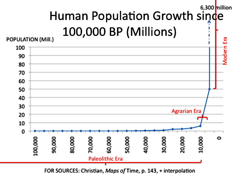
That flat line for human population was not because there was not enough food, there was plenty of food. But for limited numbers of people.
This is borne out by the fact that the hunter gatherers of what is now Europe and the near east were taller and better fed than the farmers who followed them. More on that later.
There was not the rise of populations when times were good, and the fall when times were bad, such as you see in animal predator/prey numbers.
So long as your numbers matched the productive capacity of the land that you and your local tribes defended, life was good.
The methods they used to control their numbers were many, and varied between tribes and cultures.
By far the most important factor in keeping the numbers low was that hunter-gatherers, were, in the main, nomadic. A hunter - gatherer mother who is shifting camp can carry only one child, along with her few possessions. She cannot afford to bear her next child until the previous toddler can walk fast enough to keep up with the tribe, and not hold it back.
In practice, nomadic hunter-gatherers space their children about four years apart by means of lactational amenorrhea (extended nursing), sexual abstinence, infanticide, and abortion.
By contrast, sedentary people, unconstrained by problems of carrying young children on treks, can bear and raise as many children as they can feed. The birth interval for many farm peoples is around two years, half that of hunter-gatherers. That higher birthrate of food producers, together with their ability to feed more people per hectare, lets them achieve much higher population densities than hunter-gatherers.
In summary, hunter-gatherers use the following methods of keeping their numbers within check:
• Prolonged nursing of newborns
with the resulting lack of fertility for at least two years or more.
• Sexual abstention
Apart from the strains of abstaining from sex within an existing relationship, this is easier than it sounds - all that is necessary is for fertile women to be denied a husband, and vice versa, for a significant period of their reproductive lives. Historically that was achieved by women not being allowed to marry until they had reached a certain age, and/or until a suitable partner was found, thus truncating their possible reproductive life. There are various mechanisms to achieve this goal, and the systems can be very complex.
• Food taboos
to reduce protein, carbohydrates and fat intake for women who were likely to become pregnant, rendering them infertile. In modern times, elite female athletes may experience a loss of menstruation and thus fertility because of low fat levels, low body weight, and the effects of exercise related hormones.
• Infanticide
This could take the form of abandonment/exposure, suffocation, or ritual sacrifice, all methods which have been used in the times before agriculture. Neglect and intentional malnourishment may also have occurred. Even after agriculture was adopted, exposure of newborns was widely practiced in ancient Greece. It may have been that female children were more likely to be the objects of infanticide, further lowering the birth rate. As with present hunter/gatherer societies, they knew perfectly well how many people they could feed, and in times of shortage would have abandoned or killed unwanted children.
• Abandonment of older people who had become a drag on the economy of the tribe.
• Regular territorial wars (with deadly weapons) at the boundaries of the various tribes and groups of tribes.
There are many instances of burials of hunter gatherers with healed wounds that could only have come from malice aforethought.
• Famine in a particular region because of climatic and other factors, and the need to find other, more productive regions to inhabit.
The Requirements for a Civilisation
For civilisations to begin to exist, starting from a hunter gatherer lifestyle, the most important things are twofold:
1. Agriculture - this is by far the most important prerequisite.
2. Domesticated animals - this follows, as night the day, after agriculture is adopted.
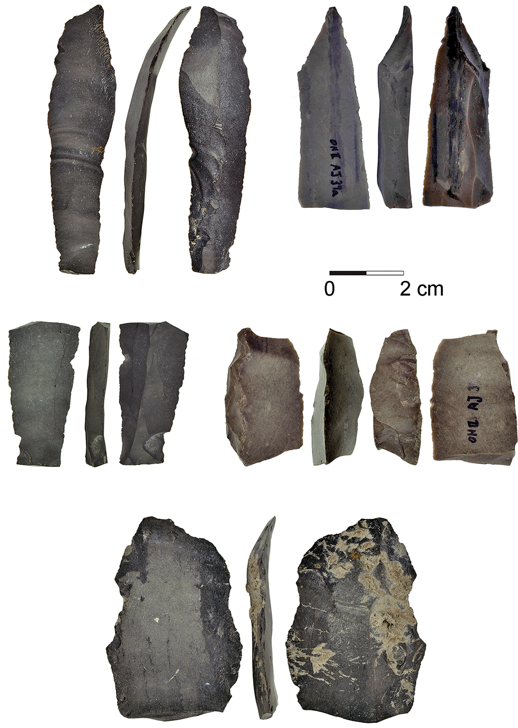
Flint blade for cereal harvesting.
A blade used as a sickle for cereal harvesting, 23 000 years old, from Ohalo II, Israel.
Click on this image to see a full size image showing a number of other blades.
The beginnings of agriculture were long before the development of fully fledged civilisations. Literally, the ground had to be prepared. There was a long period of learning and experimentation before people could became sedentary farmers.
Groman-Yaroslavski et al. (2016) write:
Use-wear analysis of five glossed flint blades found at Ohalo II, a 23 000 years old fisher-hunter-gatherers’ camp on the shore of the Sea of Galilee, Northern Israel, provides the earliest evidence for the use of composite cereal harvesting tools.
The wear traces indicate that tools were used for harvesting near-ripe semi-green wild cereals, shortly before grains are ripe and disperse naturally.
The studied tools were not used intensively, and they reflect two harvesting modes: flint knives held by hand and inserts hafted in a handle. The finds shed new light on cereal harvesting techniques some 8 000 years before the Natufian and 12 000 years before the establishment of sedentary farming communities in the Near East. Furthermore, the new finds accord well with evidence for the earliest ever cereal cultivation at the site and the use of stone-made grinding implements.
Photo: Iris Groman-Yaroslavski , Ehud Weiss, Dani Nadel
Permission: Creative Commons Attribution 2.5 Generic licence
Source: Groman-Yaroslavski et al. (2016)
Proximate Source: Wikipedia

Ancient Egypt
Fifth Dynasty: 2 494 BC - 2 345 BC.
li-nefret
Plowing the field and sowing. By this time, domesticated animals were fully integrated into the production of grains, and had increased production tremendously.
The scene takes place in front of the tomb owner on the right. In front of him appears the head of his lands with two writing reeds (drawing of the tomb relief pictured above).
( the writing reeds referred to appear to be poked into his hair - Don )
To the left of him an overseer drives the ox team pulling the hooked plow by shouting ( and apparently using a cane on their rumps! - Don ).
Behind the plowman guiding the plow the sower scatters seed, and the shepherds control a herd of sheep that trample the seed into the ground. The sheep not only push the seed into the moist earth to germinate successfully, they bury the seed out of reach of birds.
Photo : Don Hitchcock 2018
Source: Original, Badisches Landesmuseum Karlsruhe Germany
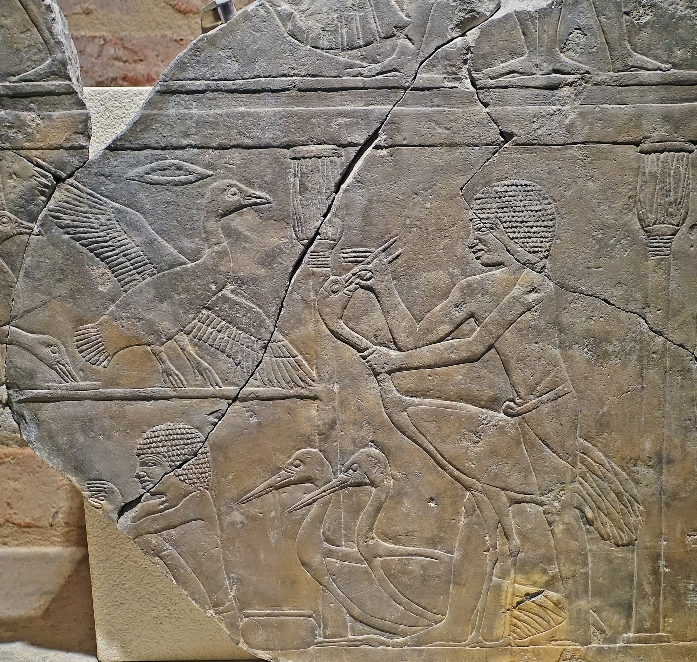
Ancient Egypt
Fifth Dynasty: 2 494 BC - 2 345 BC.
Tomb relief: force feeding of cranes.
This is an important record of the domestication (and attempted domestication) of animals in Egypt. There was much trial and error, even thousands of years after the first easily domesticable animals were fully domesticated.
Sheep, goats, cattle, pigs and geese were raised from earliest times in Egypt, and supplied milk, wool, meat, eggs, leather, skins, horn and fat. Even the dung had its uses as fertiliser in the fields. There is little evidence that mutton was consumed, while domesticated pigs were eaten at least since the beginning of the 4th millennium BC, but pork had no place in religious ceremonies.
Goat meat on the other hand was acceptable even to upper class Egyptians. Goat skins served as water containers and floating devices.
The Egyptian farmers, in their early experimental phase, also tried to domesticate other animals such as hyenas, gazelles and cranes, but abandoned these attempts after the Old Kingdom. Here they are shown force feeding cranes, as part of the failed attempt at domestication of these birds.
Catalog: Saqqara, Mastaba of Sopduhotep, limestone, ÄM 14642
Photo: Don Hitchcock 2018
Source: Original, Staatliche Museen zu Berlin, Neues Museum, Germany
Text: © Card at the Staatliche Museen zu Berlin, (CC BY-NC-SA 3.0 DE)
Additional text: http://www.reshafim.org.il/ad/egypt/timelines/topics/domesticated_animals.htm
Sumer and the beginning of civilisation:
I define a civilisation in apparently self-contradictory terms:
You have a civilisation you must first have agriculture, domesticated animals, but there are many other requirements which need to be met:
You also need (or at least will soon have, whether you like it or not!):
• at least two kings with palaces, servants, and slaves, who are at war with each other a lot of the time.
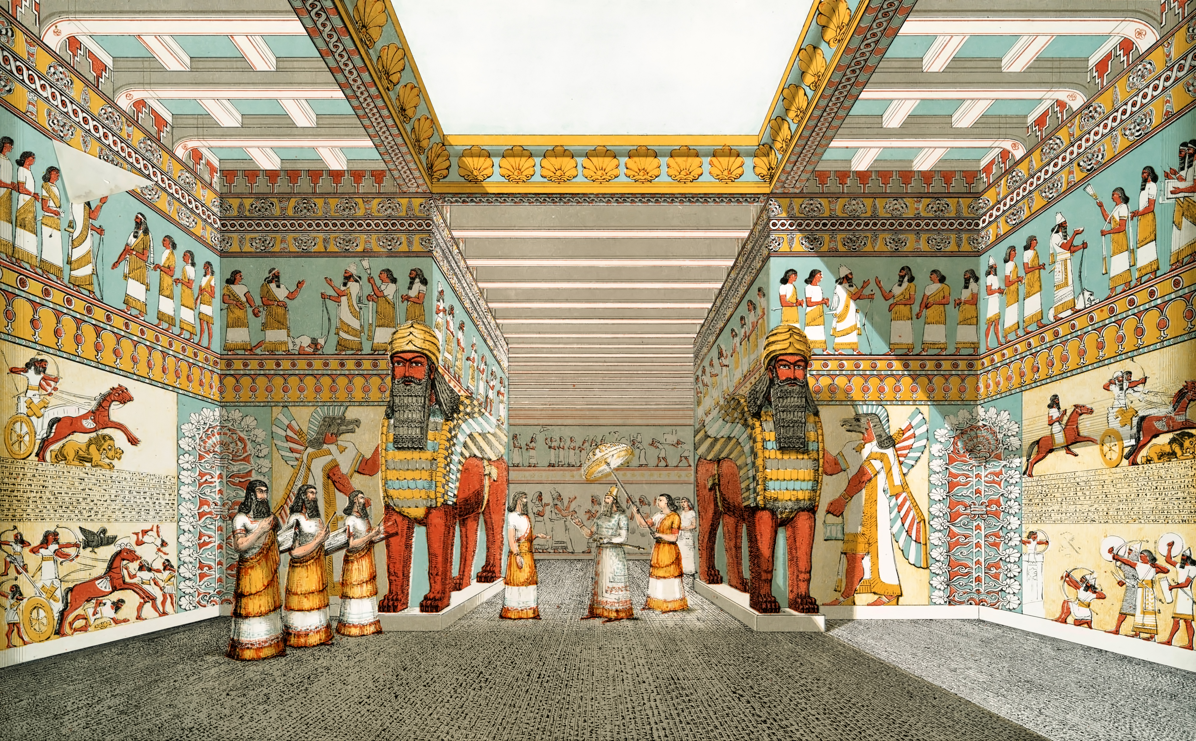
Restoration of a hall in an Assyrian Palace.
Photo: Layard (1849)
Proximal source: New York Public Library
• a very high wall around the palace and associated structures.
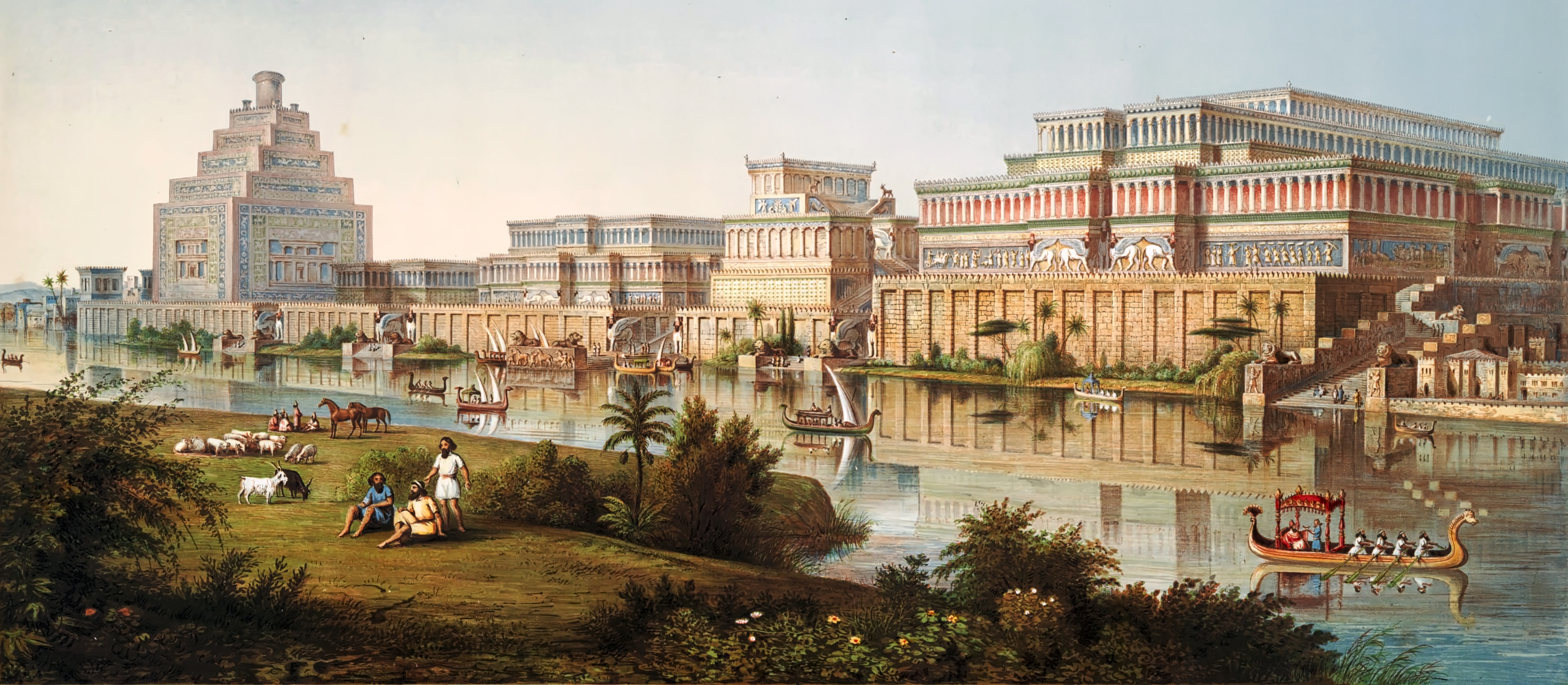
Assyrian Palaces
Artist’s impression of Assyrian palaces from The Monuments of Nineveh by Sir Austen Henry Layard, 1853.
Nineveh, also known in early modern times as Kouyunjik, was an ancient Assyrian city of Upper Mesopotamia, located in the modern-day city of Mosul in northern Iraq. It is located on the eastern bank of the Tigris River and was the capital and largest city of the Neo-Assyrian Empire, as well as the largest city in the world for several decades. Today, it is a common name for the half of Mosul that lies on the eastern bank of the Tigris, and the country's Nineveh Governorate takes its name from it.
It was the largest city in the world for approximately fifty years until the year 612 BC when, after a bitter period of civil war in Assyria, it was sacked by a coalition of its former subject peoples including the Babylonians, Medes, Persians, Scythians and Cimmerians. The city was never again a political or administrative centre, but by Late Antiquity it was the seat of a Christian bishop. It declined relative to Mosul during the Middle Ages and was mostly abandoned by the 13th century AD.
Its ruins lie across the river from the historical city center of Mosul, in Iraq's Nineveh Governorate. The two main tells, or mound-ruins, within the walls are Tell Kuyunjiq and Tell Nabī Yūnus, site of a shrine to Jonah, the prophet who preached to Nineveh. Large amounts of Assyrian sculpture and other artifacts have been excavated there, and are now located in museums around the world.
Photo: Layard (1853) from a sketch by James Fergusson (1808–1886)
Proximal source: New York Public Library
Text: Wikipedia
• a permanent, well armed, paid army, whose only job is to be part of the army, to be in training a lot of the time, and to be making raids or full scale wars the rest of the time.
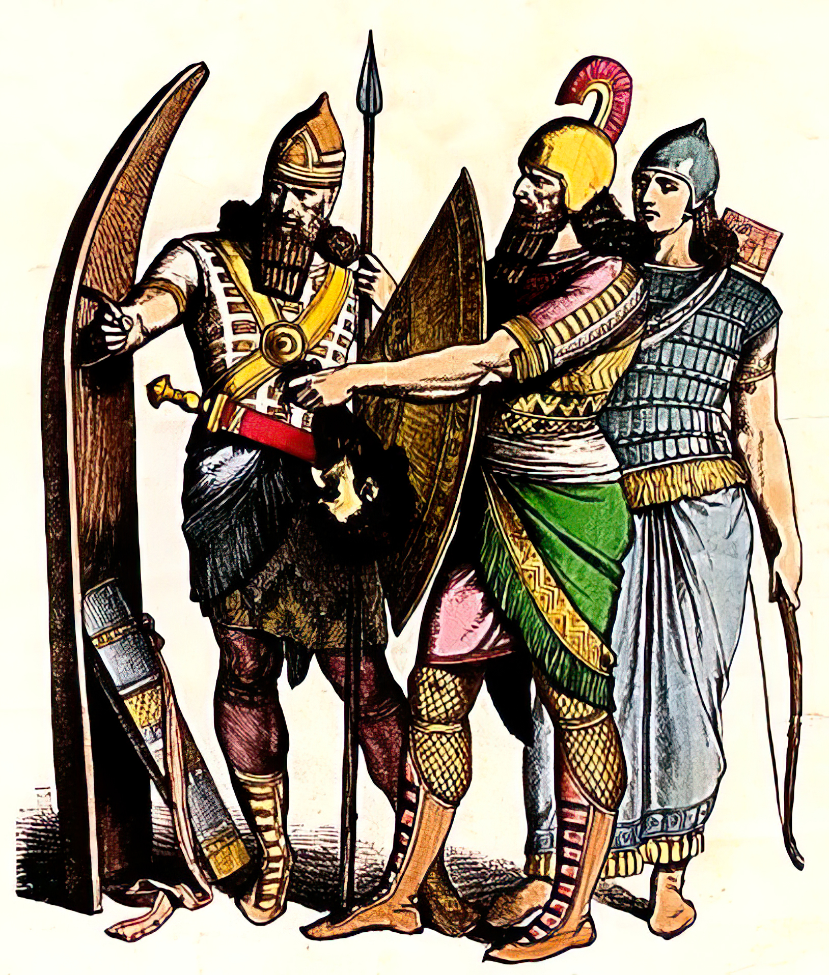
This image shows an Assyrian soldier at left with a full size standing shield, a soldier with the smaller, more ubiquitous circular shield, and an archer on the right.
The standing shield was designed to rest on the ground, with the archer having much more protection than from a handheld small round shield, yet from a very mobile and relatively light device.
The standing shield was a two person device, one to hold the shield upright, and move it as necessary, and the other, an archer, to use it as protection while shooting arrows.
( This particular design (there are others) combines stiffness, strength and light weight by its curved but thin construction, perhaps achieved by the steaming of a suitable plank of wood. - Don )
Photo: Braun & Schneider (circa 1861 - 1880)
Permission: Public Domain
Proximal Source: Wikimedia Commons
• a caste of priests.
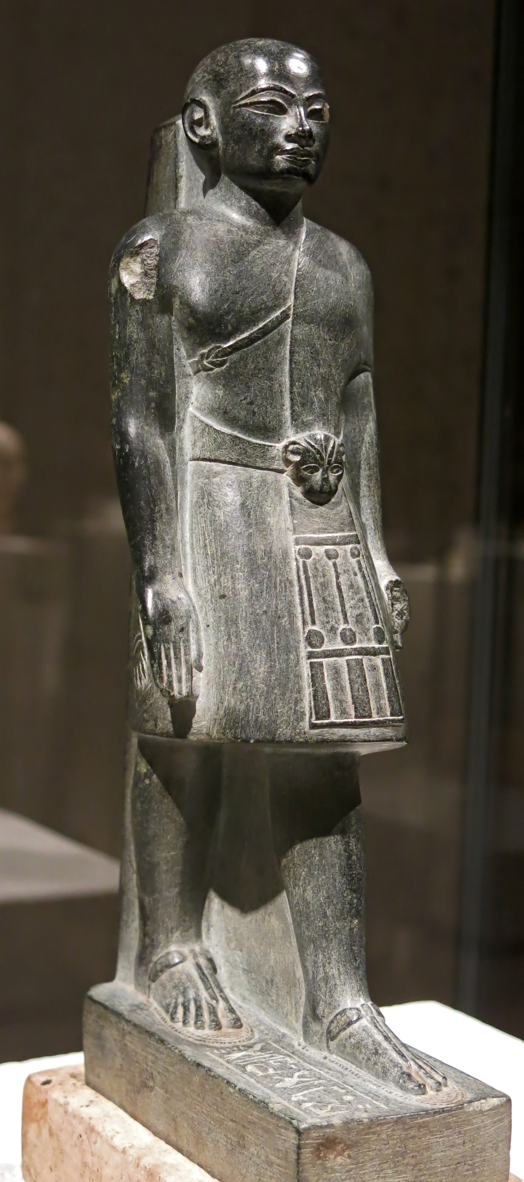
Ancient Egypt
Eighteenth Dynasty: 1 550 BC - 1 292 BC
Taitai
Standing-striding figure of the priest and astronomer Taitai, or Tchaichi.
Circa 1 323 BC -1 319 BC
Priests in ancient civilisations were, by definition, learned men or women, usually with many talents apart from their knowledge of religion.
They often filled important administrative roles.
Tchaichi is wearing a short robe, as well as the priestly leopard fur, whose head rests on the front of the belt. Below is a pocket for an instrument, which identifies the wearer as an astronomer.
275 x 80 mm.
Catalog: Greywacke, Limestone, ÄM 17021
Photo: Don Hitchcock 2015, 2018
Source: Original, Staatliche Museen zu Berlin, Neues Museum, Germany
Text: © Card at the Staatliche Museen zu Berlin, (CC BY-NC-SA 3.0 DE)
Additional text: http://www.jenseits-des-horizonts.de/downloads/pressebilder/
• a caste of scribes with a functioning writing system, or at least people who can keep tabs on how much is in the granaries and the herds, and how much will be needed, on at least a yearly basis.
Inscribed baked clay nail of King Ipik-ishtar (Ipiq-Ishtar) of Malgium, circa 1 770 BC.
The ancient city of Malgium is now known to be located at modern Tell Yassir.
These Sumerian clay nails or foundation pegs with cuneiform inscriptions were used by the Sumerians and other Mesopotamian cultures 4 000 years ago.
They were engraved by a scribe, baked, and then inserted into the mud-brick walls to serve as evidence that the temple or building was the divine property of the god to whom it was dedicated.
Photo: Don Hitchcock 2015
Source and text: Pergamon Museum, Berlin, recherche.smb.museum
Additional text: joyofmuseums.com
This is not a definitive list, but it does include the basics.
Why Sumer?
Why not France or Spain for the beginnings of agriculture?
Let me count the ways....
First, the bad news:
Most plant and animal species are useless to us as food, for one or more of the following reasons:
1. They are indigestible
- like the bark of trees and shrubs, or to give just one example, the leaves of Eucalyptus sp. shown here.
I live in Australia. Koalas use the caecum (at the beginning of the large intestine) to digest Eucalyptus leaves, and their caecum is 2 metres long, ours is only a few centimetres long.
This image is of the distinctive rock formations seen when heading upstream along the Chandler River gorge, from Slaughter House Gully, in the superb 'gorge country' east of Armidale NSW.
There is little that is edible in this image, most of the trees are Eucalyptus sp.
However at certain times of the year, the Casuarina cunninghamiana seeds from the trees right beside the river may be gathered (a tedious task, most are out of reach, and the seeds are small), roasted and eaten. These seeds are however an important food source for red and yellow tailed black cockatoos.
Photo: Don Hitchcock 2007
2. They are poisonous
- Such as deadly nightshade, a Solanum, as well as most other members of the Solanum family (the potato being an honourable exception, though it was selected for non-poisonous characteristics by the South Americans of the Andes Mountains), many wild mushrooms and so on.

A white flowered plant growing on the side of the radweg, from the poisonous Datura genus, known as Thorn apple, which grows widely across the world as a weed. From the Solanaceae or Solanum family.
This plant was growing beside the Donau radweg (Danube cycle path) near the town of Sap in Slovakia.
The entire plant, but especially the foliage and seeds, is toxic due to its content of tropane alkaloids.
Photo: Maria Hitchcock 2008
3. They are low in nutritional values - jellyfish for example.

Sea Nettle Jelly, Jellyfish, Monterey Bay Aquarium, California.
Photo: Fred Hsu
Permission: Released under the GNU Free Documentation License.
Proximate source: Wikipedia
4. They are tedious to prepare - nuts or seeds which are small and sparse in numbers in the wild.
These trees are River Red Gums, Eucalyptus camaldulensis, Edward River Crossing, the Riverina, NSW.
Though edible, the seed is typically 1 to 1.5 mm long, is difficult to gather in any significant quantities.
Speaking from personal experience (my wife is a botanist, I am taller than she, so I get the job) the woody pods containing the seeds of most Eucalyptus sp. are often out of reach of someone standing on the ground beside them, and ingenuity is required to make the job of procuring specimens a successful endeavour.
Photo: MargaretRDonald
Permission: Creative Commons Attribution-Share Alike 4.0 International license.
Proximate source: Wikipedia
5. They are difficult to gather in the wild (larvae of most insects).
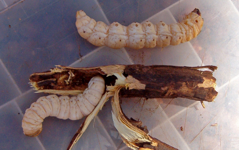
Witchetty grubs are a sought after food in Australia, but typically there is only one grub per hole in one tree, and the grub often has to be hooked out after cutting away some of the tree with a knife or small axe to expose the hole properly.
I have very occasionally found one in semi-rotted wood while cutting firewood on our bush block, though I have never plucked up enough courage to eat one.
... And our witchetty grubs are very much smaller than those shown here.
Photo: Sputnikcccp
Permission: Creative Commons Attribution-Share Alike 3.0 Unported license
Proximate source: Wikipedia
6. They are dangerous to hunt - Rhinos and Hippos. Hippos kill about 500 people per year.

Rhinoceros in a national park in South Africa.
Photo: Komencanto, modified by ArtMechanic
Permission: This work has been released into the public domain
Proximate source: Wikipedia
So what did Sumer have going for it so far as agriculture is concerned?
Sumer had a warm climate, suitable for the growing of grains and other vegetables. Although it only received about 25 mm of rain in a year, this was more than made up for by the yearly flooding of the Tigris and Euphrates rivers, which brought not only water, but left nutrient rich muds which were available for growing annual crops when the the floods receded.With irrigation canals, the yearly flooding could be made to water a large area of highly fertile soil.
Nasiriyah near the remains of the ancient city of Ur, has an average annual high of 32.3 °C (90.1 °F) and an average annual low of 17.8 °C (64.0 °F).
The basic crop for the beginning of agriculture is a grain of some kind.
But not just any grain. First it has to exist in the region where agriculture is going to start. That knocks out France and Spain straight away.
As it turns out, the grains available and suitable 'as is' for agriculture were barley, wheat, and peas, and they grew wild in the fertile crescent.
Sumer had grains which were eminently suitable for domestication.
The Sumerians had the ancestors of what would become beans, peas, wheat, and barley. These do not need to be planted individually, and they grow by broadcasting their seeds onto the ground where they grow. These plants initially had disadvantages such as small size, and their seedheads and seedpods shattered early, but by selecting the biggest grains, and harvesting from the plants which happened to keep their seedheads intact for longer, their harvests gradually improved to the point where it was possible to grow enough grains to allow sedentary farming.
Most grains have the huge advantage that they remain viable and edible for years, so long as they are kept in dry conditions, such as in caves or in vessels such as ceramic jars, or in silos or in houses, so long as they are protected from rodent attack.
In addition, there were animals in the area such as wild cattle, pigs, goats, sheep and donkeys, which were amenable to domestication - that is, they became docile in captivity, and were able to be penned and herded.
Cattle were able to be harnessed to carts, as were donkeys, and pigs and sheep and goats provided meat and leather, and sheep provided wool for spinning into useful yarns for weaving clothing.
Wild wheat, Triticum turgidum subsp. dicoccoides, growing in a stand of mustard.
Photo: Davidbena
Permission: Creative Commons Attribution-Share Alike 4.0 International license
Proximal source and text: Wikipedia

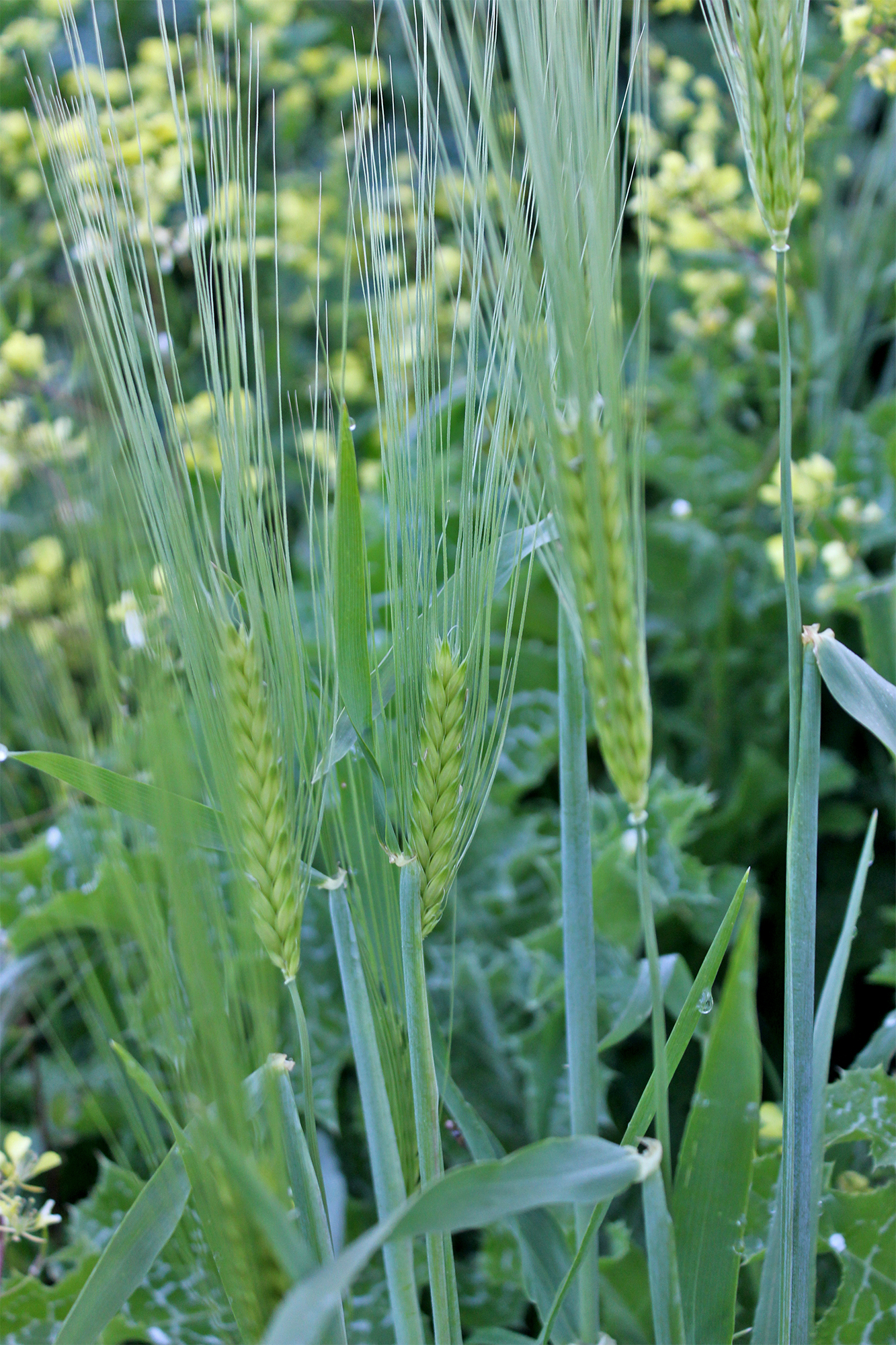
Common Barley, Hordeum distichon.
Hordeum distichon., the common barley or two-rowed barley, is a cultigen of barley, family Poaceae. It is native to Iraq, and is widely grown throughout temperate regions of the world.
Barley, a member of the grass family, is a major cereal grain grown in temperate climates globally. It was one of the first cultivated grains, particularly in Eurasia as early as 10 000 years ago.
Globally 70% of barley production is used as animal fodder, while 30% as a source of fermentable material for beer and certain distilled beverages, and as a component of various foods. It is used in soups and stews, and in barley bread of various cultures. Barley grains are commonly made into malt in a traditional and ancient method of preparation.
In 2017, barley was ranked fourth among grains in quantity produced (149 million tonnes or 330 billion pounds) behind maize, rice and wheat.
Photo: Prof. Dr. Otto Wilhelm Thomé Flora von Deutschland, Österreich und der Schweiz 1885, Gera, Germany
Permission: This work has been released into the public domain
Proximal source: www.biolib.de
Text: Wikipedia
If we select just a few species of animals and plants that we can eat, so that for example they form 90% of the biomass on a hectare of land rather than 0.1%, the productivity of the land (so far as we are concerned) increases astronomically.
Thus, one hectare can feed 10 or 100 times more farmers and herders than it can for hunter gatherers.
But which species of plants (the most important food producing item, at least at first, before animals get domesticated, and are at least partially fed on the plants we grow) are the best?
The plants which were able to be domesticated in the Fertile Crescent, which includes Sumer, were barley, einkorn and emmer wheat, oat, rye, chickpea, lentil and pea.
Domestication can be a difficult process, and some foods (zebras and gazelles for example) cannot be domesticated.
With grains and legumes, the wild varieties do all sorts of bad things if you let them have half a chance - they have small grain sizes, are sometimes bitter, they shed and scatter their seed too quickly before they can be harvested, the seeds do not all reach maturity at the same time, they are not compact in size, and they have a low yield in terms of kilograms/tons per hectare.
These unwanted traits were selected out, not by careful scientific breeding, but by what you might call 'natural selection'. The farmers could not harvest the grains which shed their seeds too soon, so they got the ones which stayed to be harvested, and the resulting seed that they saved and planted next year, and the year after that, had an increasing tendency to remain on the stalk until harvesting. In addition, the farmers would have chosen the largest and least bitter seeds, and planted those in the next season, collected the ones which matured at the same time, and so on.
Sumer
Circa 4 500 - 1 900 BC
Map of Ancient Sumer
Circa 4 500 - 1 900 BC.
The general location on a modern map, and main cities of Sumer with ancient coastline. The coastline was very near Ur in ancient times, and Ur was an important port, with the Euphrates River on the city's western side.
Sumer was bounded by the Tigris and Euphrates rivers, and extended as far north as Kiš (Kish) and Djemdet Nasr. North of this, and to the east of the lower Tigris and to the west of the lower Euphrates was the Akkadian Empire.
Photo: NASA
Permission: This file is in the public domain in the United States because it was solely created by NASA.
Proximate source: Wikipedia
Sumer is the earliest known civilisation in the historical region of southern Mesopotamia (south-central Iraq), emerging during the Chalcolithic (Copper) and early Bronze Ages between the sixth and fifth millennium BC. It is one of the cradles of civilisation in the world. Living along the valleys of the Tigris and Euphrates rivers, Sumerian farmers grew an abundance of grain and other crops, the surplus from which enabled them to form urban settlements. Proto-writing dates back before 3 000 BC. The earliest texts come from the cities of Uruk and Jemdet Nasr, and date to between 3 500 BC and 3 000 BC.
Ancient Sumer, extant from 6 000 BC to 1 750 BC, lay between the Tigris and Euphrates Rivers, and stretched from Kish (Kiš) to Ur. Kiš was 25 km from the site of Babylon. Babylon was established around 1 200 BC as a small religious and cultural centre.
This is an excellent resource, particularly for Ancient Mesopotamian Warfare in Sumer and Akkad, as well as the first Sargon, known as Sargon the great and Sargon of Akkad:
www.youtube.com/watch?v=10Kc7NmPpME
The First Dynasty of Ur was a 2 600 BC to 2 400 BC dynasty of rulers of the city of Ur in ancient Sumer. It is part of the Early Dynastic period III of the history of Mesopotamia. It was preceded by the earlier First Dynasty of Kish and the First Dynasty of Uruk.
According to the Sumerian King List, the final ruler of the First Dynasty of Uruk Lugal-kitun was overthrown by Mesannepada of Ur. There were then four kings in the First Dynasty of Ur: Mesannepada, Mes-kiagnuna, Elulu, and Balulu. Two other kings earlier than Mes-Anepada are known from other sources, namely Mes-kalam-du and A-Kalam-du. It would seem that Mes-Anepada was the son of Mes-kalam-du, according to the inscription found on a bead in Mari, and Mes-kalam-du was the founder of the dynasty. A probable Queen Puabi is also known from her lavish tomb at the Royal Cemetery at Ur. The First Dynasty of Ur had extensive influence over the area of Sumer, and apparently led a union of south Mesopotamian polities.
Ethnicity and language
Like other Sumerians, the people of Ur were a non-Semitic people who may have come from the east circa 3300 BC, and spoke a language isolate. Sumer was conquered by the Semitic-speaking kings of the Akkadian Empire around 2270 BC (short chronology), but Sumerian continued as a sacred language. Native Sumerian rule re-emerged for about a century in the Third Dynasty of Ur at approximately 2100–2 000 BC, but the Akkadian language also remained in use.
Text above: adapted from Wikipedia.
In the late Uruk Period, shortly before the end of the 4th millennium BC (circa 3 700 BC - 3 0001 BC), statues of great plasticity and expressiveness were created to depict both humans and animals. The 3rd millenium BC ( 3 000 BC - 2 001 BC) witnessed the appearance of a new statue type that represented a standing worshipper; the repertory was further enriched by the addition of seated figures and groups. Naturalistic representations make their first appearance during the Akkadian Period and the Third Dynasty of Ur, at the end of the 3rd millenium.
Stone, metal, and combinations of various materials were used to make statues which ranged from a few cm in height to lifesized figures. The perishability of wood is responsible for the rare attestation of statuary in that material.
Text above: Pergamon Museum, Berlin, recherche.smb.museum
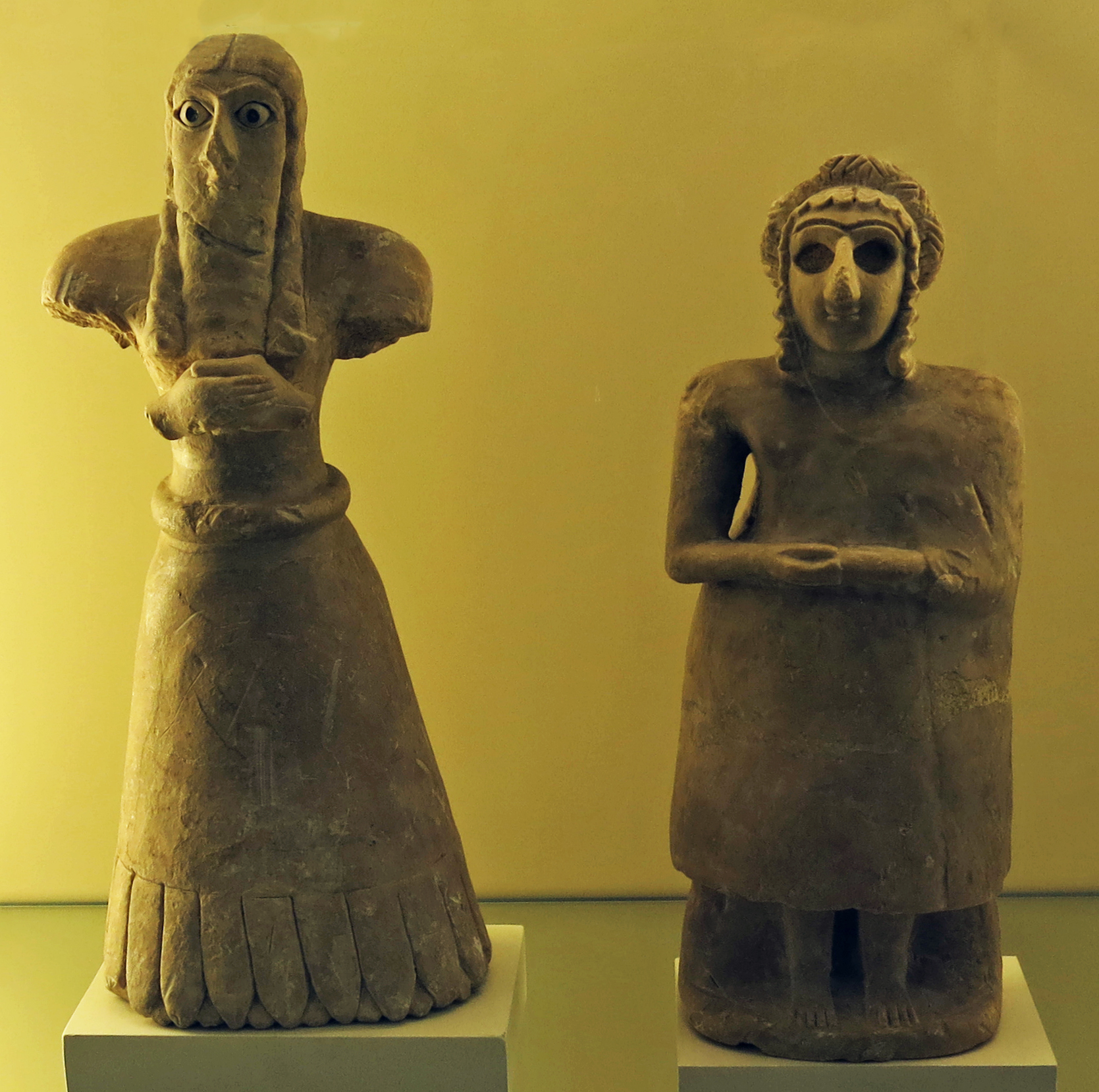
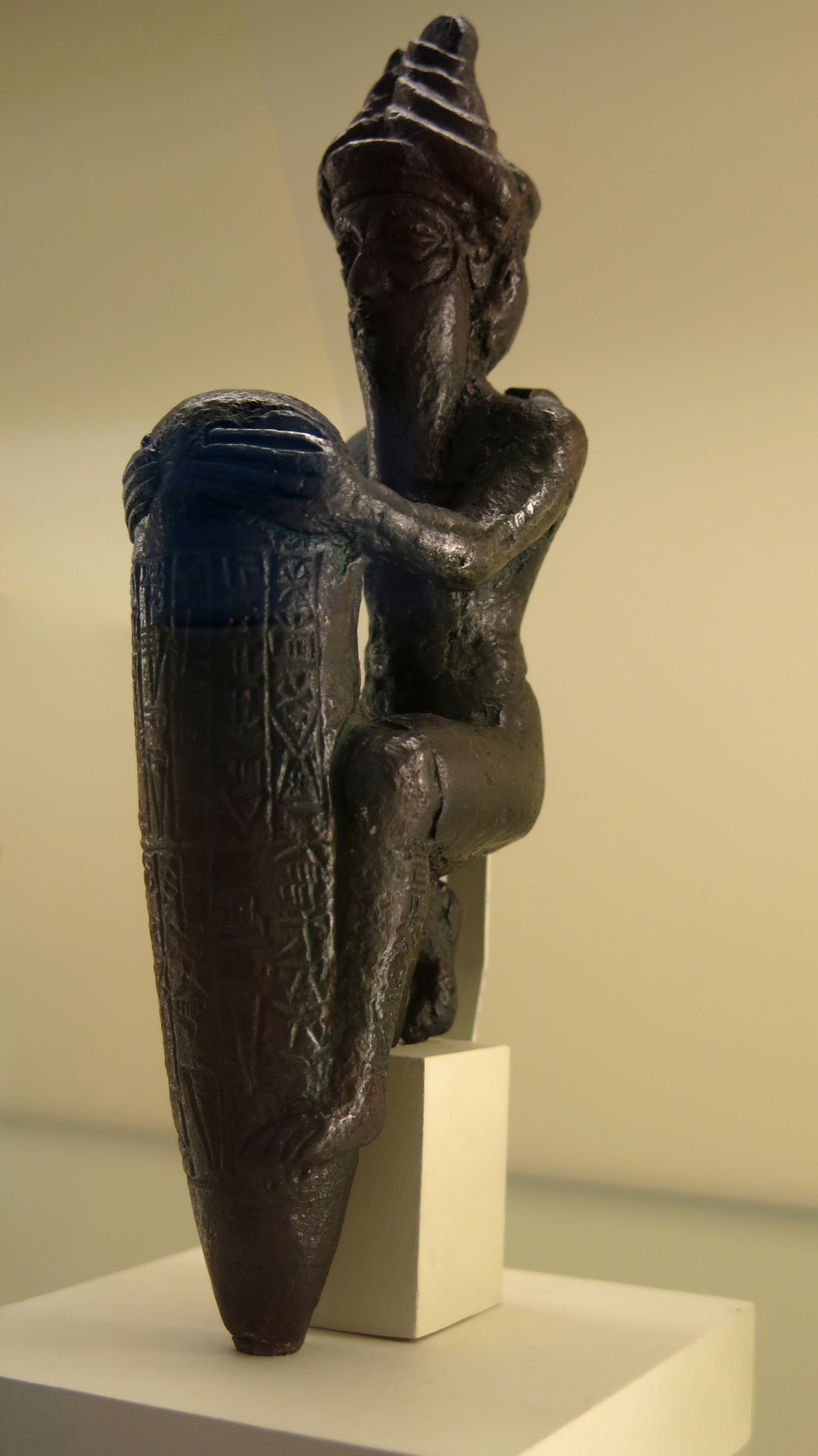
Statuettes of a woman and a man in prayer positions, circa 2 600 BC
These statuettes show the believers in the typical prayer position with their hands folded over their stomachs. In the archaic Ishtar temples, statuettes of worshipers stood on pedestals along the walls. They were supposed to represent the founder and remained in the temple as ancestral images after his death.
The large eyes in Sumerian sculptures like these signified wisdom and knowledge.
Catalog: Location unknown, alabaster.
Photo: Don Hitchcock 2015
Source and text: Pergamon Museum, Berlin, recherche.smb.museum
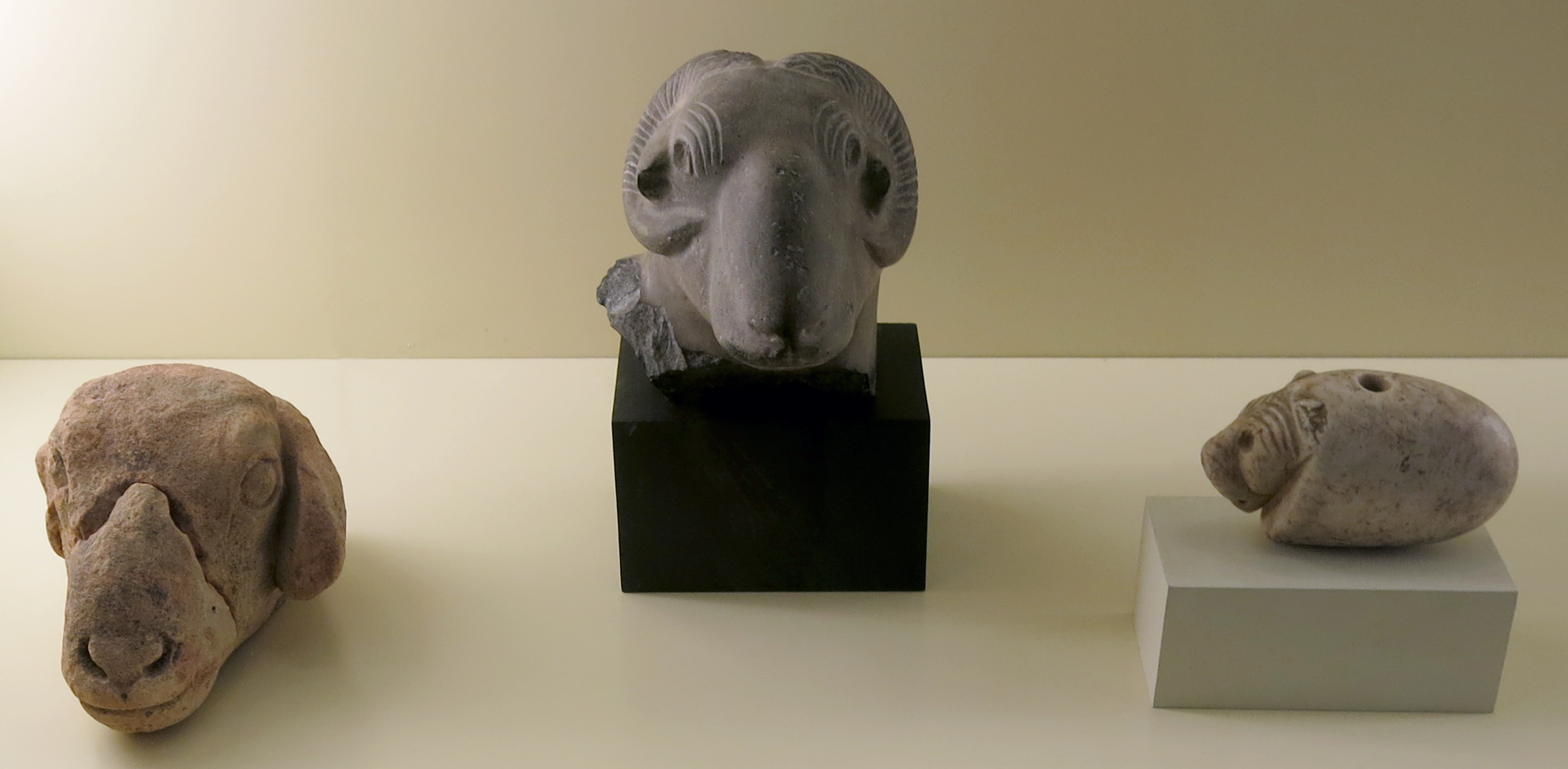
Animal heads, circa 3 000 BC
Left: Ram's head, sandstone, Uruk.
Catalog: VA 14570
Height 75 mm, width 146 mm, thickness 111 mm.
Permalink: id.smb.museum/object/2107547/kopf-eines-schafes
Centre: Fragment of a ram's head, limestone
Circa 2 800 - 2 700 BC.
Period: Djemdet-Nasr Period
Height 126 mm, width 95 mm, thickness 145 mm, weight 2120 gm (2570 gm with base)
Catalog: VA 13354
Permalink: id.smb.museum/object/1743405/bruchst%C3%BCck-eines-widderkopfs
Right: Lion's head, marble, unknown origin.
Photo: Don Hitchcock 2015
Source and text: Pergamon Museum, Berlin, recherche.smb.museum
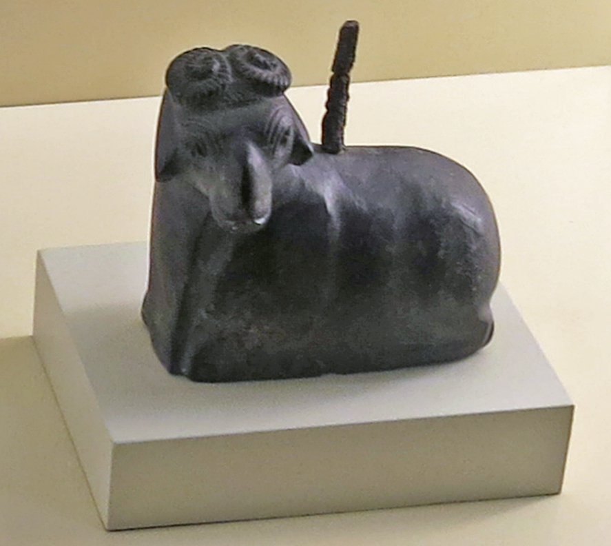
Reclining ram with silver staff
Circa 2 800 - 2 700 BC.
Height 107 mm, width 42 mm, length 97 mm, weight 669 gm.
Period: Djemdet-Nasr
Catalog: Bituminous limestone, silver, VA 11025
Location: Oe 16-3, collective find
Permalink: id.smb.museum/object/1744367/liegender-widder-mit-silberstab
Photo: Don Hitchcock 2015
Source and text: Pergamon Museum, Berlin, recherche.smb.museum
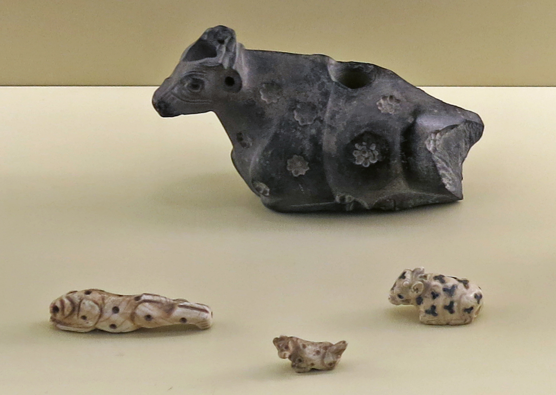
Animals, circa 3 000 - 2 500 BC.
Front left: Figure representing a leaping lion
Circa 2 800 - 2 700 BC.
Height 22 mm, width 13 mm, length 85 mm, weight 40 gm.
Catalog: VA 09871
Permalink: id.smb.museum/object/1743403/fig%C3%BCrliche-darstellung-eines-springenden-l%C3%B6wen
Front centre: Lying dog, limestone, Uruk?
Beginning of the 3rd millennium
Front right: lying bull with inlays - Uruk
Beginning of the 3rd millennium
Back centre: lying calf with inlaid recesses in marble - Uruk
Statuette of a lying calf with cloverleaf-shaped inlays made of lapis lazuli. The drill hole on the underside suggests an attachment, for example for its use as a handle for a cylinder seal.
Circa 2 800 BC - 2 700 BC.
Period: Djemdet-Nasr Period
Height 26 mm, length 52 mm, depth 23 mm, weight 38 gm.
Catalog: Marble, inlays of lapis lazuli, find quadrant Pa XVI 2, VA 14536
Location detail: Collection find from the room of the smokehouse III, in front of the Zikurrat +19m, in the courtyard of the building.
Permalink: id.smb.museum/object/1744371/liegendes-rind
Photo: Don Hitchcock 2015
Source and text: Pergamon Museum, Berlin, recherche.smb.museum
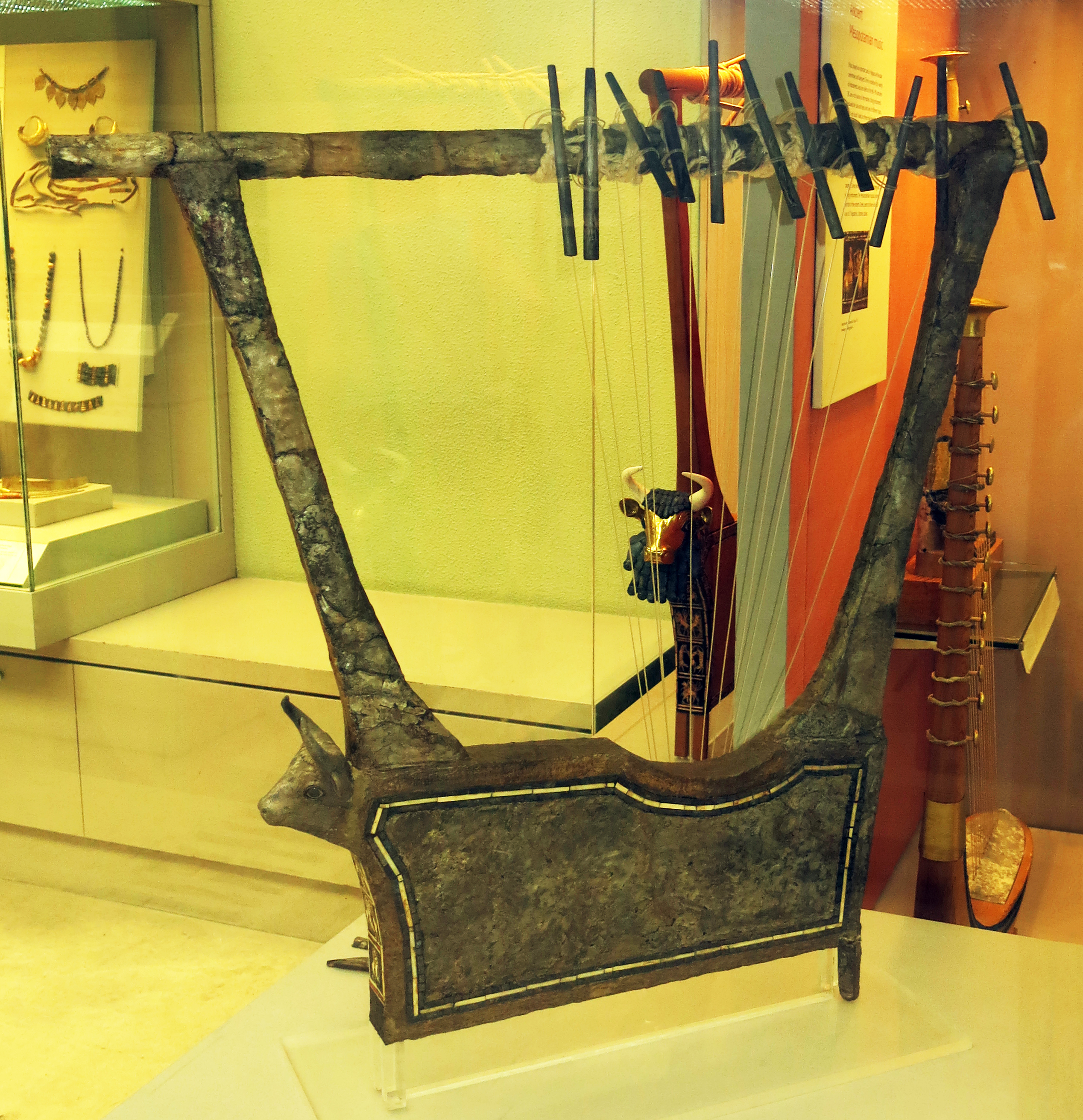
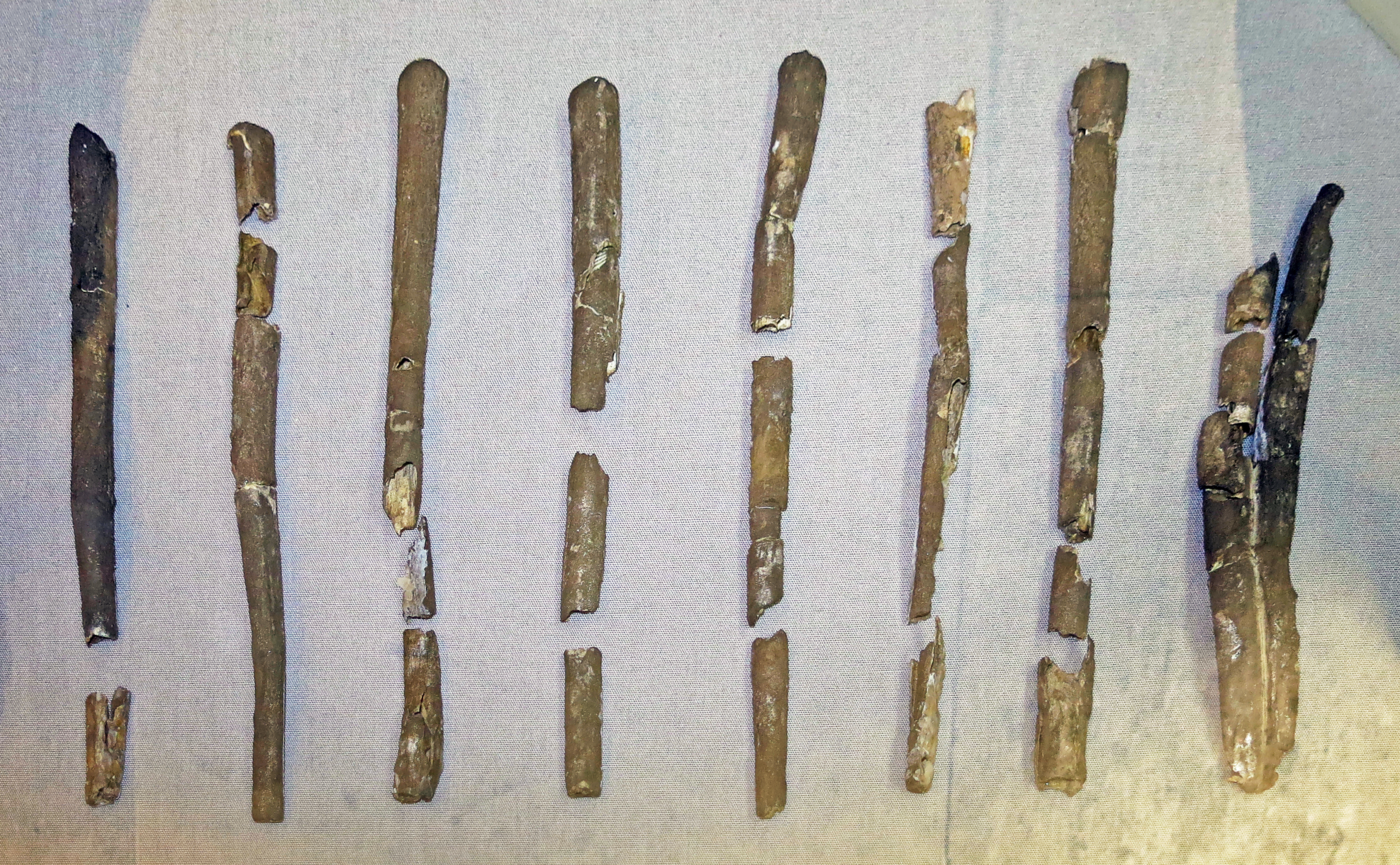
Games and Musical Instruments
Music played an important part in religious and secular ceremonies and banquets. There is evidence for a variety of instruments. Assyrian reliefs of the 9th - 7th centuries BC are a rich source of information. String instruments including the lute and harps and lyres of different types. Bulls' and ducks' heads on these may have been an indication of their pitch. There were also many wind instruments such as flutes and pipes, as well as a range of percussion, including drums, cymbals, bells, and rattles.
The occasions when music was used are well-documented on cuneiform tablets. Hymns were written down and so were lists of musical instruments arranged according to category. Some texts provide information for tuning and playing instruments. The Mesopotamian musical system, like that of the ancient Greeks, seems to have included a set of 7 heptatonic, diatonic scales. A heptatonic scale has seven tones per octave, such as C major, CDEFGABC, and the relative minor, ABCDEFGA.
Text above: © Poster on display at the British Museum, © Trustees of the British Museum, CC BY-NC-SA 4.0, as well as extra information on scales from Wikipedia.
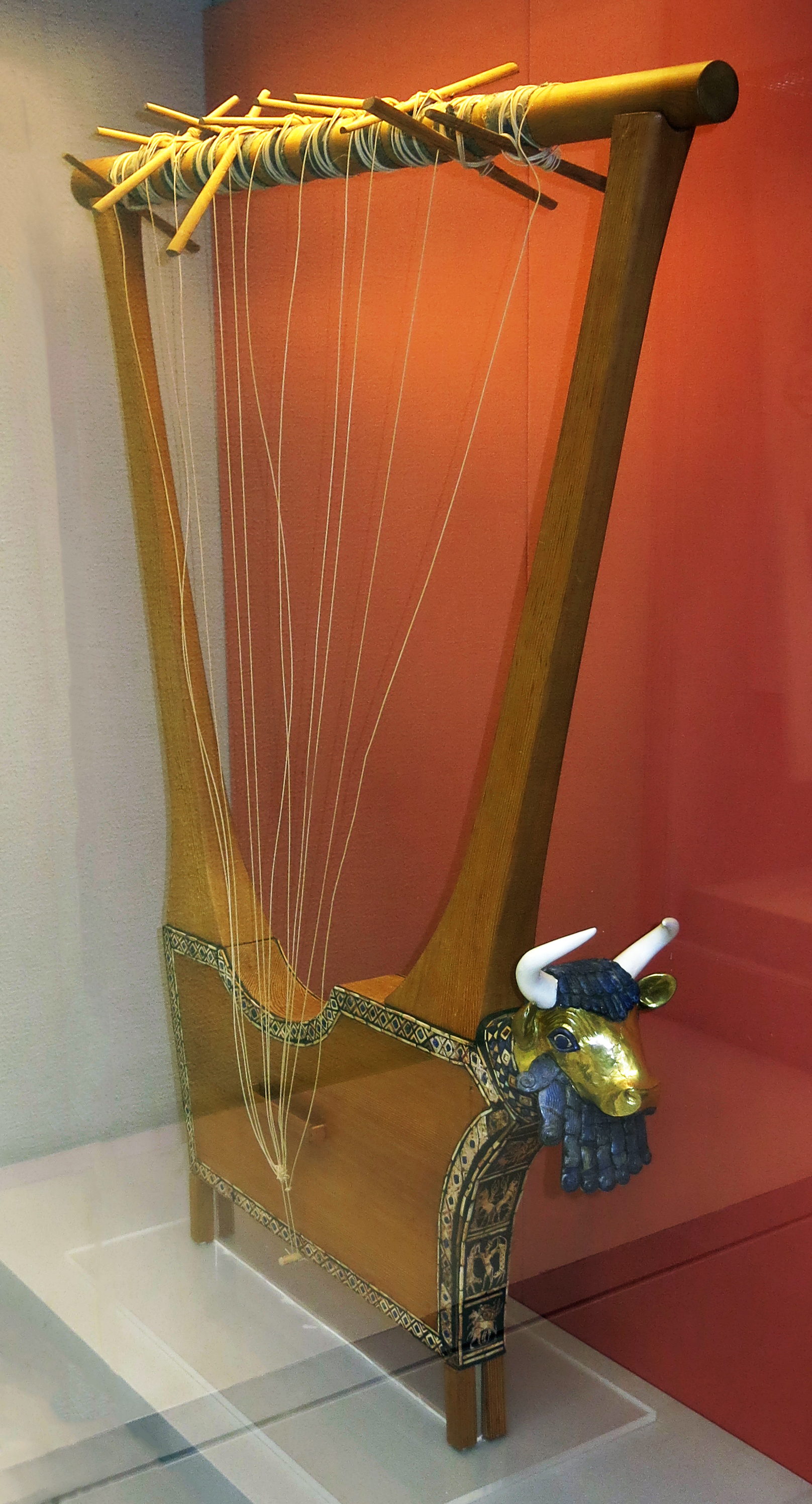
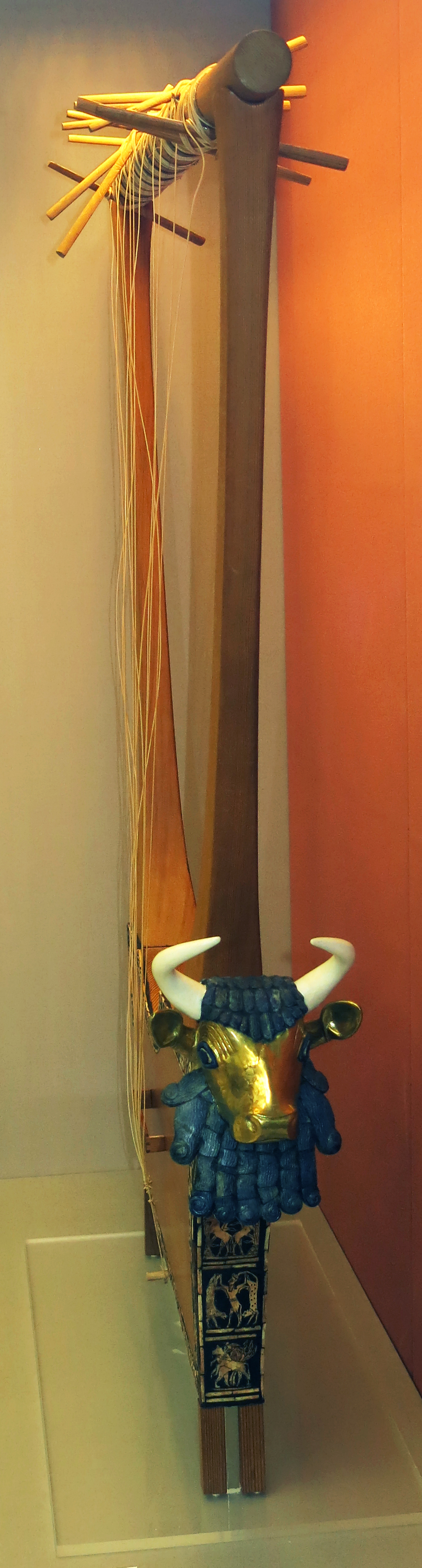
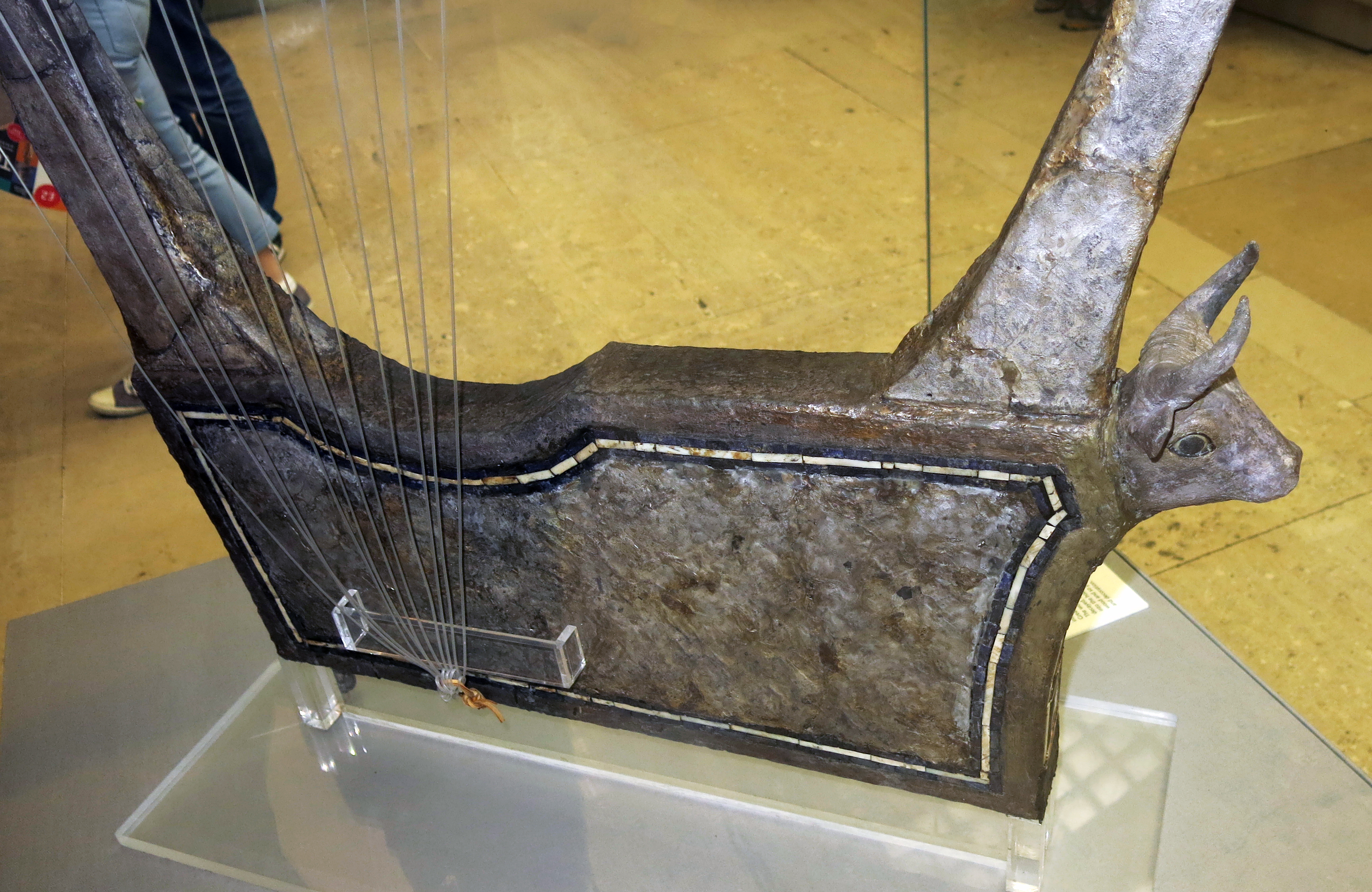
The Queen's Lyre
This lyre was found in the tomb of Queen Puabi. The lapis lazuli, shell and red limestone decoration and the head of the bull are original. The wooden parts, pegs and strings and bull horns are modern reconstructions.
The bull's head is covered with gold. The eyes are lapis lazuli and shell, and the hair an beard are lapis lazuli. The scenes on the front of the lyre show a lion-headed eagle between gazelles, bulls with plants on the hills, a bull-man between leopards and a lion attacking a bull.
Queen's Lyre. Wooden parts, pegs and string are modern. Lapis lazuli, shell and red limestone mosaic decoration, set in bitumen and the head (but not the horns) of the bull are ancient. The bull's head in front of the sound box is covered with gold, the eyes are lapis lazuli and shell and the hair and beard are lapis lazuli.
The significance of the beard is not known. The panel on front depicts a lion-headed eagle between gazelles, bulls with plants on hills, a bull-man between leopards and a lion attacking a bull. The edges of the sound-box are decorated with inlaid bands. There are eleven gold-headed pegs for the strings.
Circa 2 600 BC - 2 400 BC
Height 125 mm, length 180 mm (pins), length 955 mm (top bar), total length 730 mm, width 70 mm (body).
The original paraffin wax of the field reconstruction is partially melted, with the detachment of the beard, following an intense buildup of heat in the relevant gallery on 1 July 1961 (Report to Trustees, 8 July 1961). The object was consolidated, and apparently reconstructed in 1971/72 from part of Woolley's harp-lyre, 121198.
Catalog: lapis lazuli, limestone (red), bitumen, gold, shell, 121198A
Findspot: Royal Cemetery (Ur)
Photo: Don Hitchcock 2015
Source: Original, British Museum
Text: © Card with the display at the British Museum, © Trustees of the British Museum, CC BY-NC-SA 4.0.
Silver lyre; the silver which covers this lyre and its bull's head, and the shell, lapis lazuli and red limestone inlay decoration are ancient, but the frame, the pegs, strings and bridge are modern; the original silver pegs are exhibited separately; the panel on the front of the lyre depicts fallow deer and a tree on a hill, lions attacking a goat, and a lion attacking a gazelle.
Circa 2 600 BC
Leonard Woolley discovered several lyres in graves of the Royal Cemetery at Ur. This was one of four musical instruments that he found in the Great Death Pit. The wood of the instruments had decayed, but Wooley poured plaster into the holes left by the vanished wood and so preserved their shapes and decoration.
The silver which covers this lyre and its bull's head are original. It is almost certain that the soundboard was made only with sheet silver, but it is now supported on a wooden frame.
The shell, lapis lazuli and red limestone inlay decoration is also ancient, but the strings and pegs are modern.
Height: 155 mm (shell decoration), height 975 mm, length 1030 mm (bar), length 180 mm (pin) length 690 mm.
Width: 55 mm (body)
Wood fragments from 'paddles' (tuning pegs?) identified by Caroline Carwright as Buxus sempervirens, Boxwood 2/11/15.
Catalog: silver, shell, limestone (red), lapis lazuli, wood, Grave PG 1237, The Great Death Pit, Ur, ME 121199
Findspot: Royal Cemetery (Ur)
Photo: Don Hitchcock 2015
Source: Original, British Museum
Text: © Card with the display at the British Museum, www.britishmuseum.org, © Trustees of the British Museum, CC BY-NC-SA 4.0.
These are the original silver pegs from the silver lyre shown above.
Circa 2 600 BC
Catalog: silver, Grave PG 1237, The Great Death Pit, Ur, ME 121199
Findspot: Royal Cemetery (Ur)
Photo: Don Hitchcock 2015
Source: Original, British Museum
Text: © Card with the display at the British Museum, www.britishmuseum.org, © Trustees of the British Museum, CC BY-NC-SA 4.0.
Left: Harp.
Reconstructed boat-shaped harp.
Original from the Royal Cemetery (Ur).
Curator's comments:
This object was reconstructed in 1971-1972. It has often been referred to as a lyre but is more accurately described as a boat-shaped harp and is labelled as such in the 'Early Mesopotamia' gallery where it is displayed.
Catalog: both 121198b and 121198c are given in the BM online catalog for this piece, though it is probably 121198c.
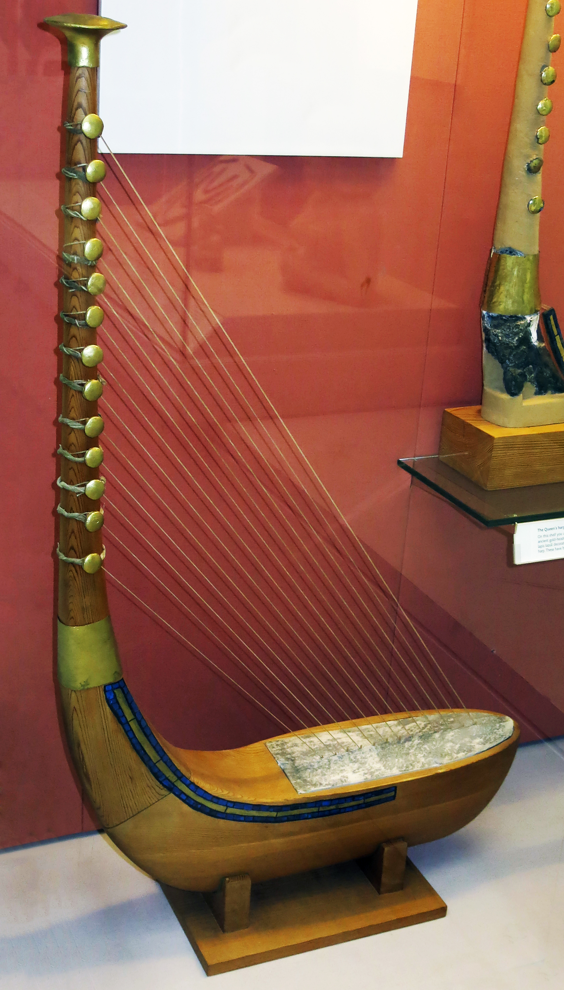
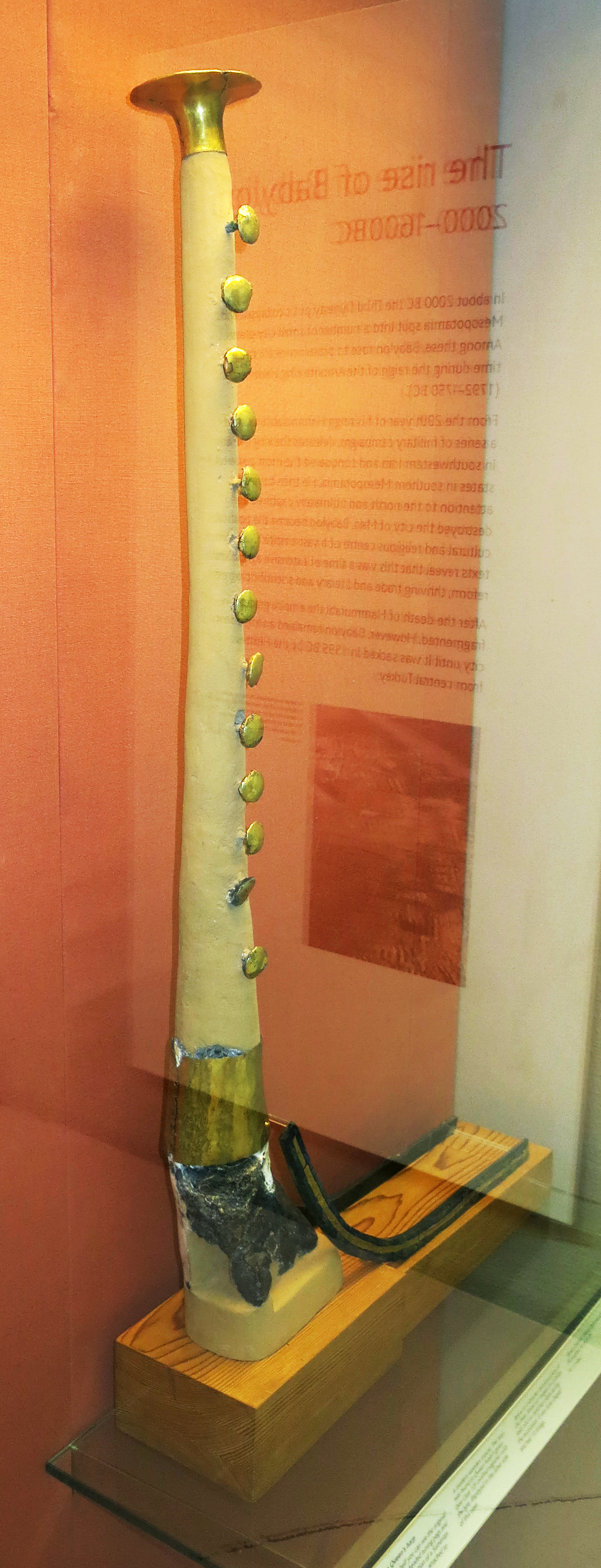
Right: Queen's Harp
Reconstruction of a boat-shaped harp with 13 strings; on the left are the actual remains of the gold headed tuning pegs and lapis lazuli decoration of the harp; the shape of the instrument was reconstructed on the basis of representations of the instrument on seals, and on sketches made at the time of excavation.
Circa 2 600 BC
Height, Total as shown here 1085 mm, height 810 mm (top of cap to bottom), length 650 mm as shown here, width 150 mm as shown here.
Curator's comments:
Reconstructed in 1971-2 from part of Woolley's harp-lyre 121198; harp had eleven strings prior to July 1955; when under repair another pin was found and an additional string was fitted; during reconstruction in 1971-2 x-ray photographs indicated a further pin buried in Woolley's plaster which was removed and fitted on the upright.
Findspot: Royal Cemetery (Ur)
Catalog: Gold, lapis lazuli, wood, 121198,b
Photo: Don Hitchcock 2015
Source: Original, British Museum
Text: © Card with the display at the British Museum, www.britishmuseum.org, © Trustees of the British Museum, CC BY-NC-SA 4.0.
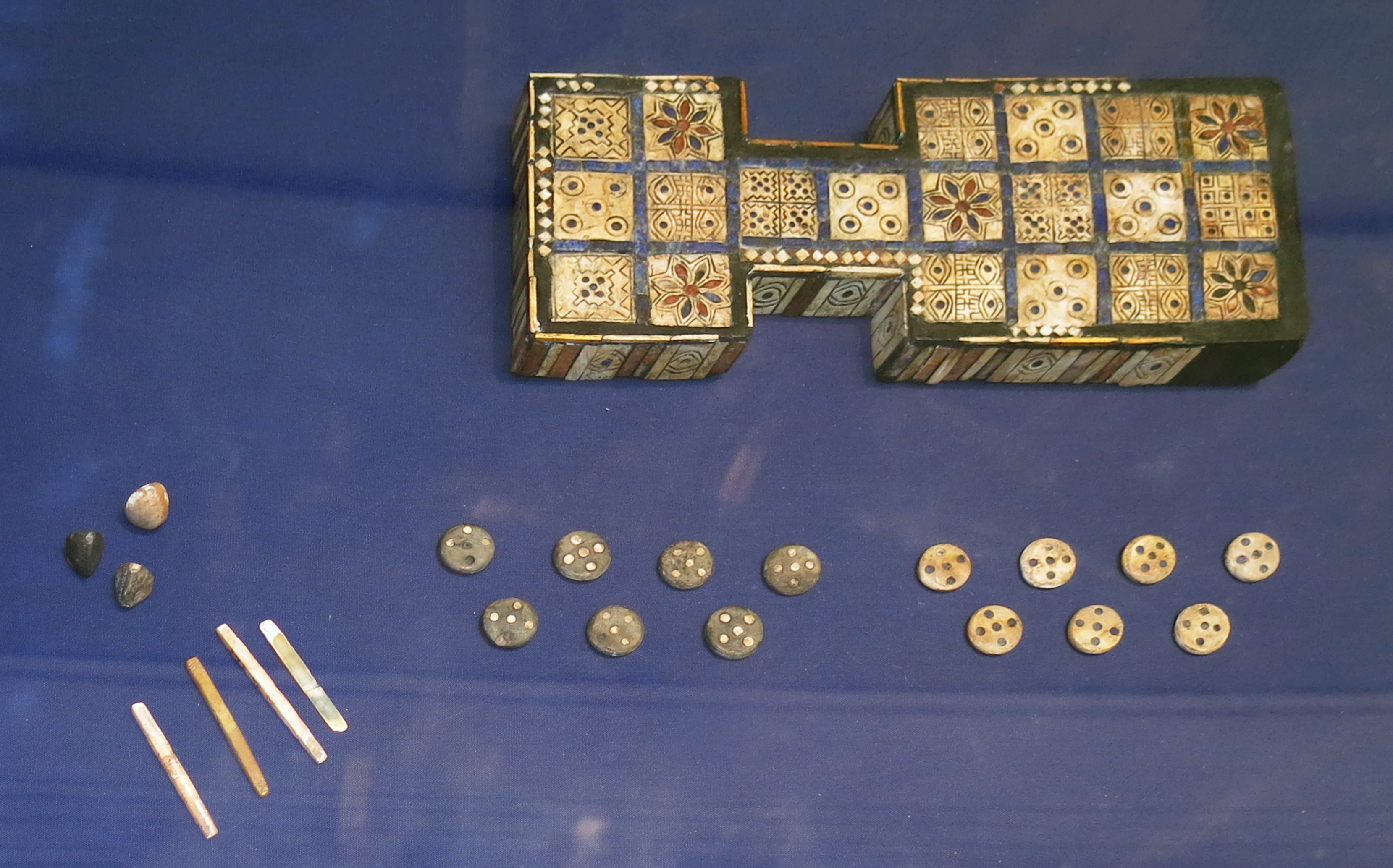
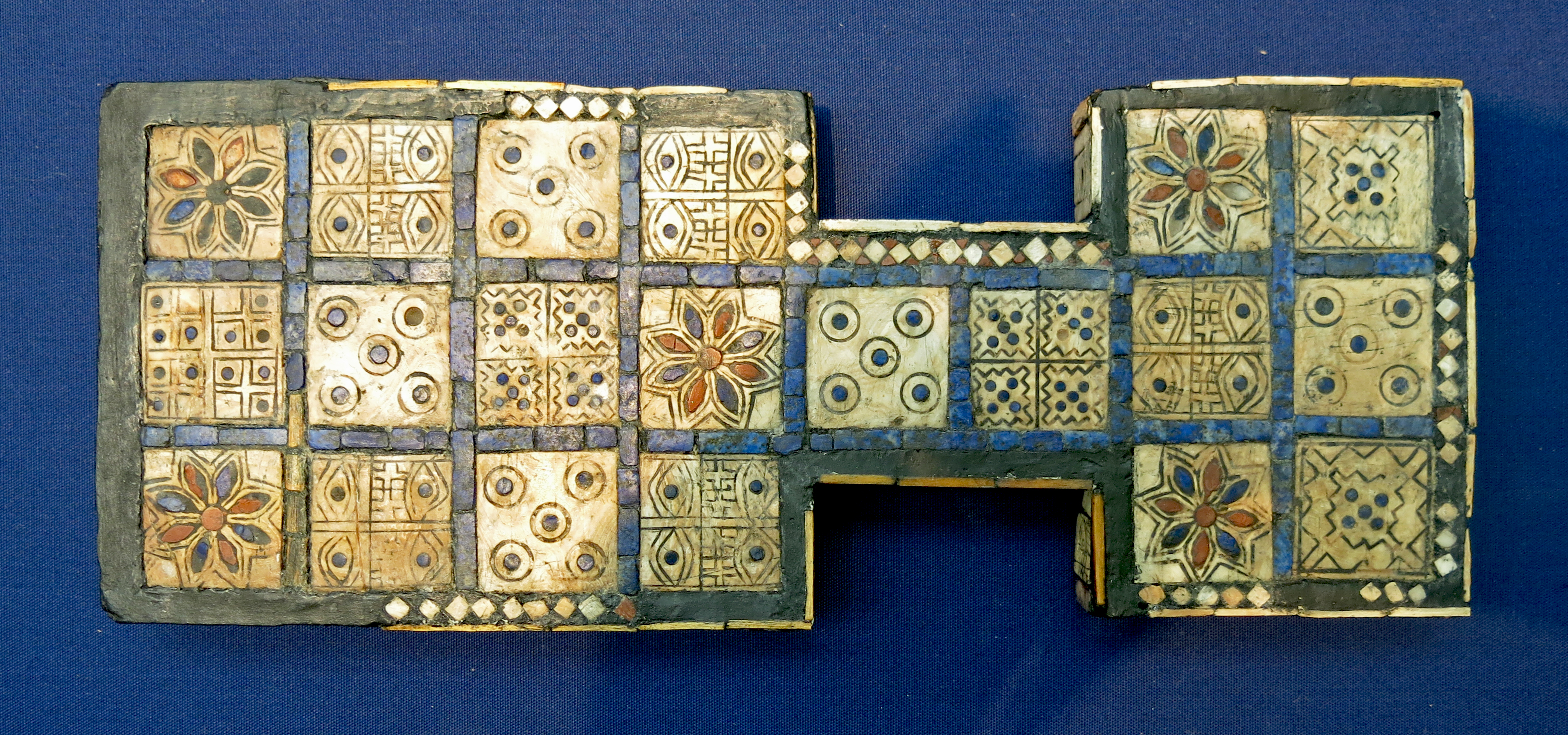
The Royal Game of Ur
( Personal note: I bought a replica of this game board from the British Museum, and my wife and I play three games every night, right after our card game "Game of 30" (using the standard 52 cards plus two jokers, we play ten hands, and keep score.
The Game of Ur uses four pyramidal dice, with seven tokens for each player, the object being to remove all tokens one by one from the board to win. The game seems to have some strategies that are useful, but mostly it is a game of luck. It is entirely possible to have five tokens left, all to be removed, playing against just one, and still win the game despite this huge disadvantage. The rules are shown below. The board from the BM is expensive, but cheaper versions are available online. )
At least six graves in the Royal Cemetery contained a wooden game board inlaid with shell, red limestone and lapis lazuli for the game now known as the Royal Game of Ur.
This is an early example of a game that was played all over the ancient Near East for about 3 000 years.
Early Dynastic III, 2 600 - 2 300 BC from grave PG 513, Ur.
This wooden game board was originally hollow, with the top covered with 20 inlaid square shell plaques. The edges were made of small plaques and strips, some sculpted with an eye and some with rosettes. On the back are three lines of triangular shell ornamental inlays set as part of the modern reconstruction.
Height 24 mm, length 301 mm, width 57 mm (narrow part of b), width 110 mm.
Curator's comments:
Circumstances of discovery and consolidation in the field described by Woolley (and quoted by Grunfeld) as follows:
'The board lay face upwards in the soil. With the decay of the wood the whole of the encrustation of the upper surface had sunk down into the void so left, while the strip-work along the sides remained sticking up above it; this collapse had this collapse had resulted in the dislocation of much of the fine mosaic border, and the regularity of the surface was disturbed, the shell squares often lying at an angle and the lapis strips overlapping them
Further, the end of the larger section had been broken and the three last plaques (all except the corner of that on the left, which was still attached) and the right-hand plaque of the next row lay separated from each other and half an inch or more away from the main board, and the border and edging here had been scattered. It was this broken end that we found first and probably some pieces of the strip edging were overlooked by us; when the presence of the object was recognised we worked along it a square or so at a time, pouring hot wax over it as we went, and finally the whole was secured with waxed cloth and lifted. It has not been taken to pieces and remade. The inside was cleaned and covered with waxed muslin and the cloth and wax removed from the face and then it was placed face downwards on a sheet of glass and by applying heat we were able to push the component parts down into their places.
The three loose plaques were replaced in the order in which they were found, but nothing was done to restore the missing part of the border and edging. The red and blue spots inlaid in the shell plaques and petals of the flowers were loose in their sockets when found, but were fixed by the wax poured over them and very few of them have been disturbed and replaced. The object was reconstructed by the WAA conservator I G Tremayne following sagging through a build-up of intense heat in the gallery (Report to Trustees 5 July 1961).
An important point to note, often forgotten, is that this was a hollow box and not a solid board: it was therefore a much more delicate item than the present reconstruction suggests and the interior of the box contained the pieces and the dice, just as a silver version did when excavated in another grave. Moreover, there are several other boxed sets for this game found in this Cemetery.
The others are in the Iraq Museum in Baghdad and on display. Another version carved entirely of wood was excavated in a grave at Shahr-i Sokhta in eastern Iran, and inlaid versions of a yet different style excavated in the 'Royal Cemetery' at Gonur depe in present-day southern Turkmenistan. The origins of all are thought to lie in the Indus valley.
Catalog: Wood, shell, Grave PG 513, Royal Cemetery (Ur), ME 120834
Photo: Don Hitchcock 2015
Source: Original, British Museum
Text: © Card with the display at the British Museum, www.britishmuseum.org, © Trustees of the British Museum, CC BY-NC-SA 4.0.
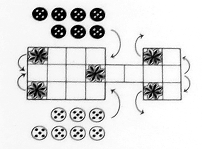
The Royal Game of Ur
The Game and Route
The game is a race for two players using dice with seven identical pieces each. All playing squares are decorated, but on later boards only the 'rosette' squares are marked.
The likely route is suggested on the diagram above. Pieces are 'at war' along the central path, but turn off to their own side to exit.
Counters
Playing pieces were simple discs of shell or lapis lazuli. Sometimes these were plain, but usually they were inlaid with five points.
Square pieces have also been found, some plain and others decorated with a 'good luck' eye or animal motif.
Dice: White pieces
Players at Ur had two kinds of dice. Here, the white player has very unusual four sided (tetrahedral) dice, in which two corners were marked with contrasting inlay.
Each player had four or six dice. To move around the board they threw the dice and the number of marked corners told them how far they could go.
ME 120839: Grey-black stone tetrahedral dice; depression in top; small spot of white inlay in two of the corners.
ME 1935,0113.847: Stone tetrahedral dice.
Height 13 mm, length 16 mm (side of base).
Dice: Black pieces
Here, the black player has four-sided stick dice. A player's score told them how far they could move. Scores of 1, 2, and 3 were shown by concentric circles and 4 by cross-hatching.
Similar dice are found at Indus Valley sites of the 3rd millenium BC and are still used in India today.
ME 1930,1213.534: Stick die of bone, inlay pattern on one narrow side, length 57 mm, width 5 mm
ME 1935,0113.848: Stick die of bone, length 68 mm, width 6 mm, depth 4 mm.
ME 1929,1017.438: Stick die of mother-of-pearl, traces of engraving on one edge, length 33 mm, width 6 mm.
Rephotography: Don Hitchcock 2015
Source: Poster, British Museum
Text: © Text on the poster at the British Museum, www.britishmuseum.org, © Trustees of the British Museum, CC BY-NC-SA 4.0.
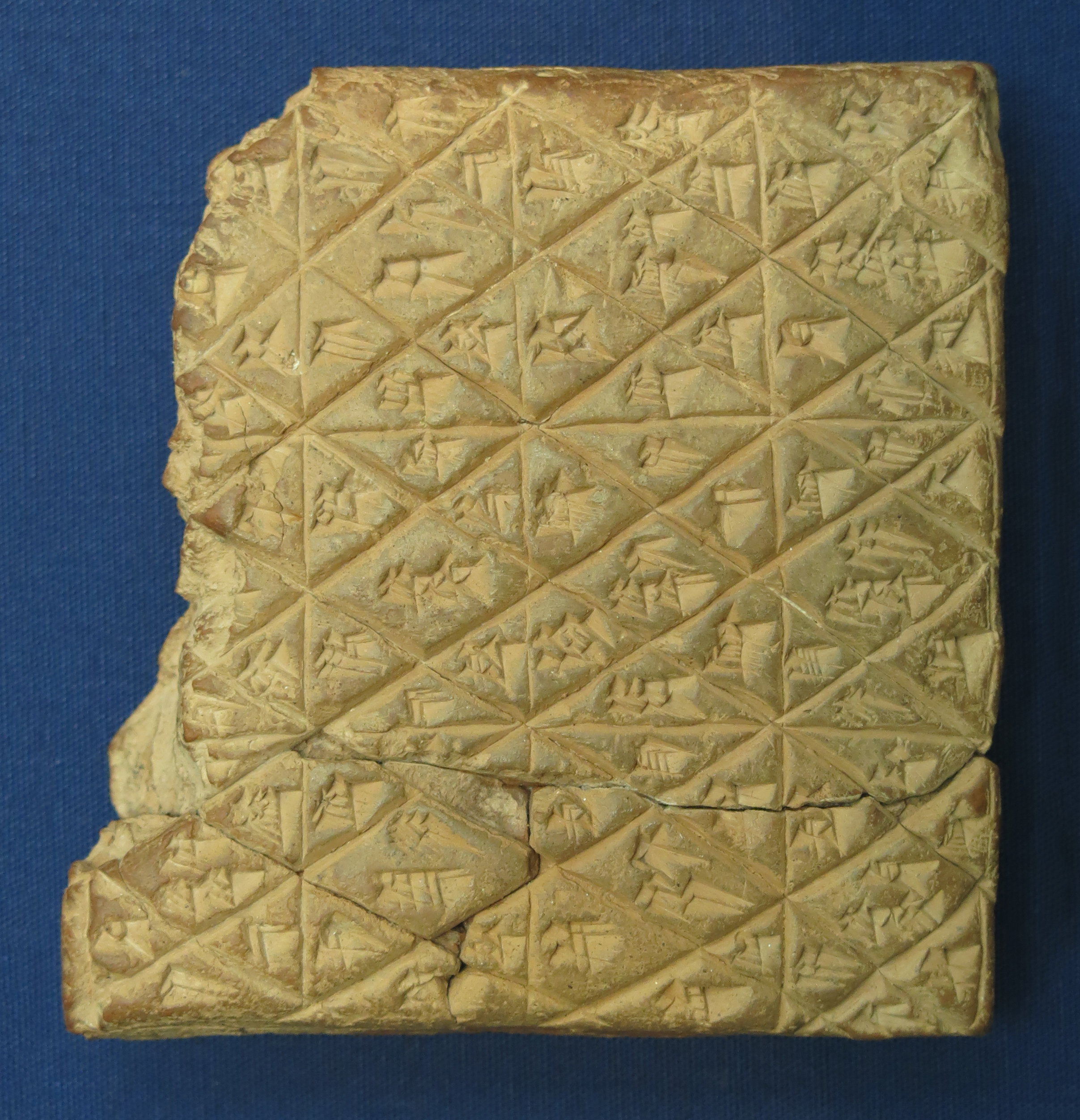
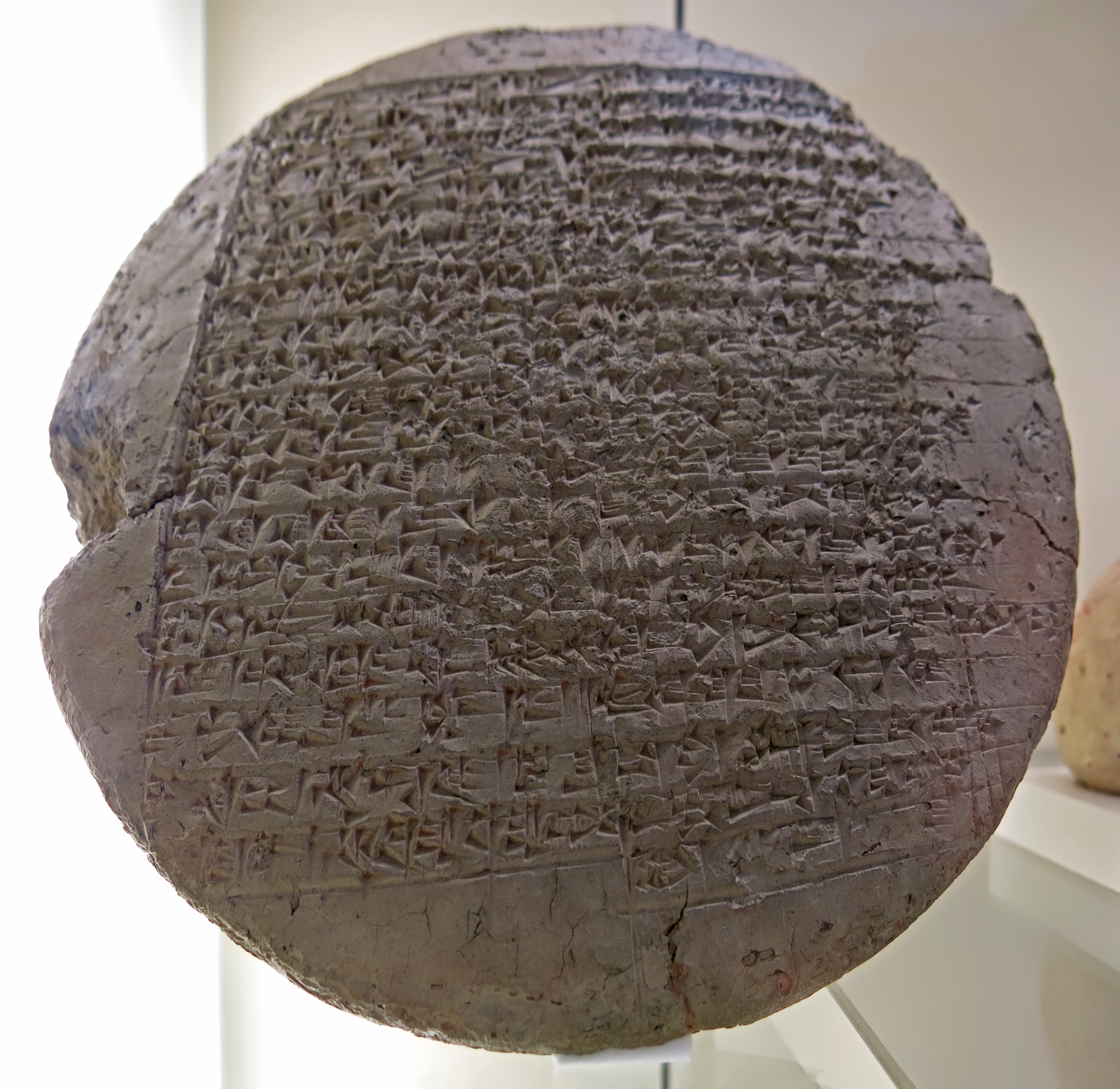
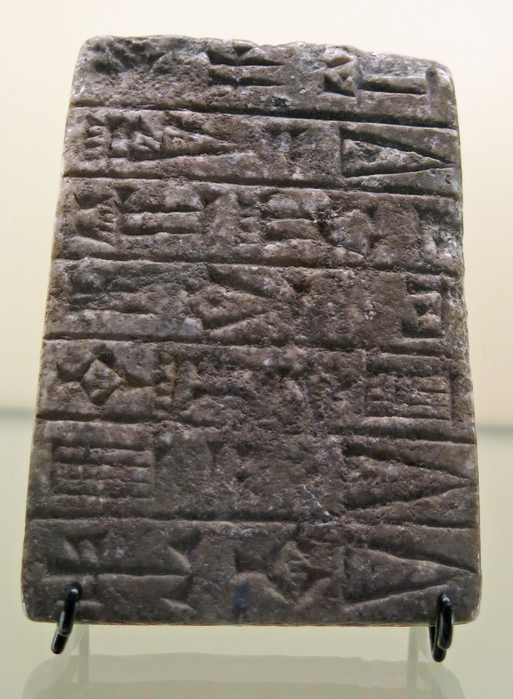
The Rules Tablet for the Royal Game of Ur
This cuneiform tablet contains the world's oldest known rules for a board game, written by a Babylonian astronomer in 177 BC. The original game had evolved and was now played for bets with five different pieces per player. The front of the tablet shown here shows that the central squares were also used for fortune telling.
Based on this tablet and the shape of the gameboard, British Museum curator Irving Finkel reconstructed the basic rules of how the game might have been played. The object of the game is to run the course of the board and bear all one's pieces off before one's opponent. Like modern backgammon, the game combines elements of both strategy and luck.
(
Irving Finkel is one of this world's treasures. He can read cuneiform as easily as you and I can read a newspaper. His knowledge of the ancient world and his ability to make it available in an hilarious (sic) and highly interesting way to the rest of us is worthy of the highest honours this world can bestow. He is not only a scholar, but an entertainer par excellence - Don )
Clay cuneiform tablet; explanatory diagram and rules for playing the game of 20 squares (Royal Game of Ur). Colophon of Itti-Marduk-balatu.
Ruler: Seleucus IV Philopator
Regnal date 135/8/3 (day ?) (day ?)
Height 100 mm, width 94 mm, depth 28 mm.
Inscription language: Akkadian
Inscription script: cuneiform
Catalog: clay, ME 33333,b
Photo: Don Hitchcock 2015
Source: Original, British Museum
Text: © Card with the display at the British Museum, www.britishmuseum.org, © Trustees of the British Museum, CC BY-NC-SA 4.0.
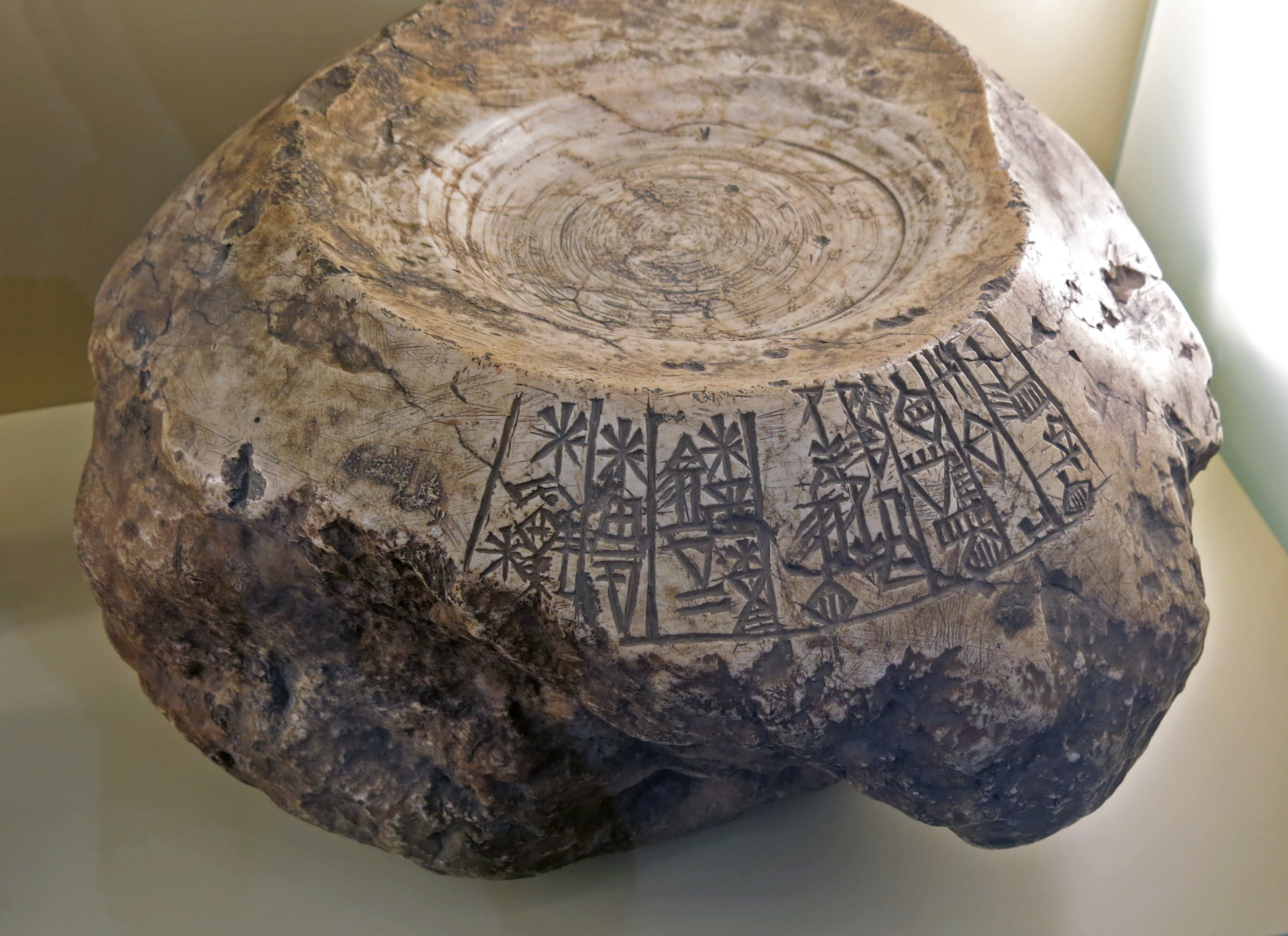
Early Dynastic Period
Founding figure which originally supported an inscribed alabaster plate in brick form, from Lagash, circa 2 430 BC.
Height: 250 mm, width 55 mm, thickness 37 mm, weight 77 gm.
Significant buildings have been erected since the 3rd millennium BC. Founding documents were laid down in the 1st century BC, which had a wide variety of shapes and sizes and were mostly hidden in the structure. They state the purpose of the building, its name and often the reason for the construction work. Names, location information and mentions of deities are of great value, as this makes it possible to identify the finding and more precisely date it.
The metal figure with a stone plate is a special form. It consists of the composition of a nail-shaped deity (recognisable by the pair of horns) who wears a 'brick' on the head. The main inscription of the builder is on its underside. In Sumerian it names twelve buildings that the prince En-ME.TE-na of Lagash had built.mentions of deities are of great value, as this makes it possible to identify the finding and more precisely date it.
The figure that anchors the stone in the masonry like a nail bears a short version of the same inscription. The spiritual effect of the text can therefore be seen as a concentration from the stone via the figure into the masonry, which does not require visibility. The writing clearly refers to the shape of the cuneiform on clay documents: the characters are partly scratched with wedge-shaped attachments. However, the archaic character of early Mesopotamian stone inscriptions is preserved. [Joachim Marzahn]
Catalog: Bronze figure, VA 03024
Permalink: id.smb.museum/object/1744356/gr%C3%BCndungsfigur-und-beschriftete-alabasterplatte-in-ziegelform
Photo: Don Hitchcock 2015
Source and text: Pergamon Museum, Berlin, recherche.smb.museum
Early Dynastic Period
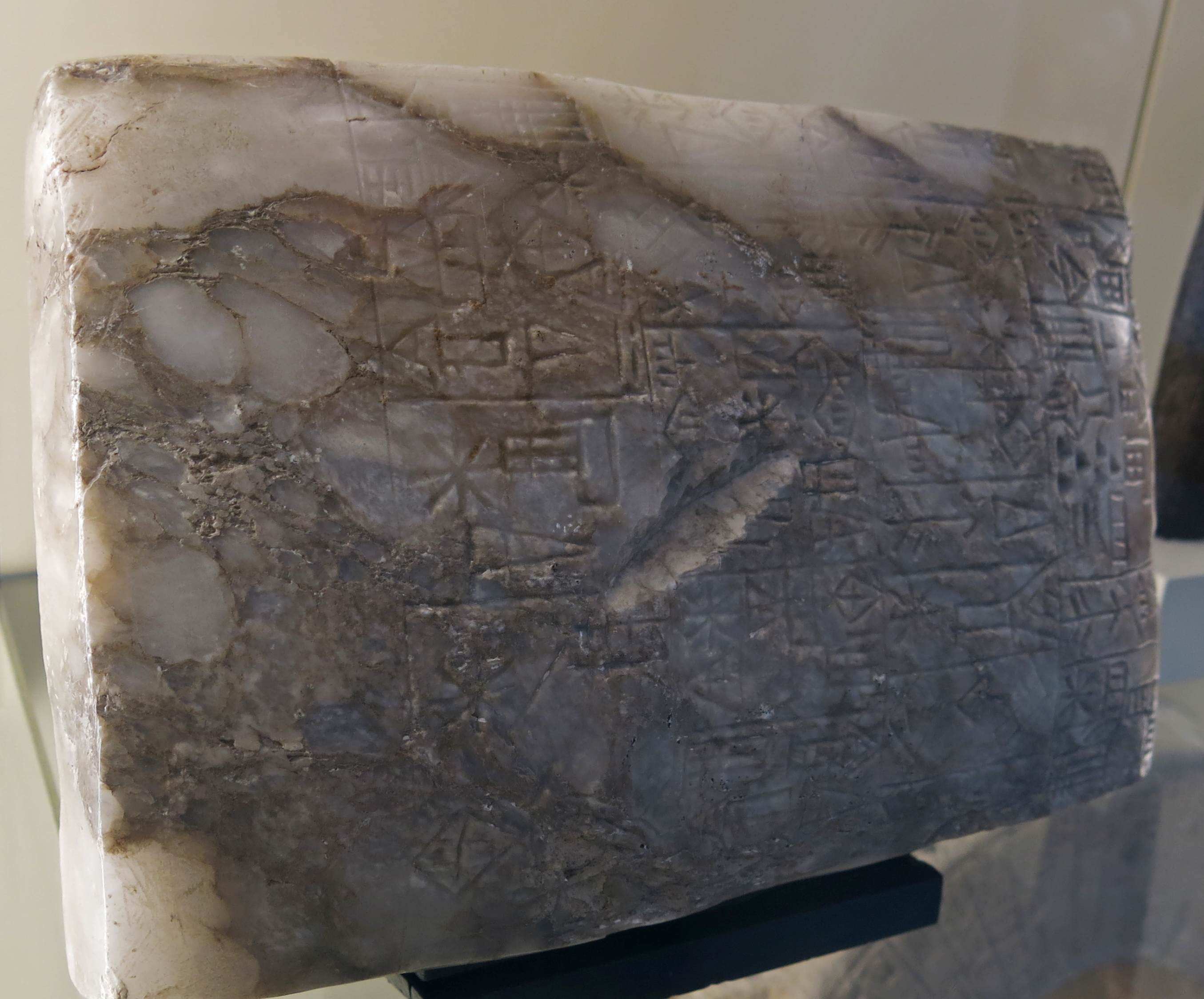
Inscribed alabaster plate in brick form, originally on top of the bronze founding figure above, from Lagash, circa 2 430 BC.
Alabaster plate: height 250 mm, width 55 mm, thickness 37 mm, weight 77 gm.
Catalog: Alabaster plate, VA 03095
Permalink: id.smb.museum/object/1744356/gr%C3%BCndungsfigur-und-beschriftete-alabasterplatte-in-ziegelform
Photo: Don Hitchcock 2015
Source and text: Pergamon Museum, Berlin, recherche.smb.museum
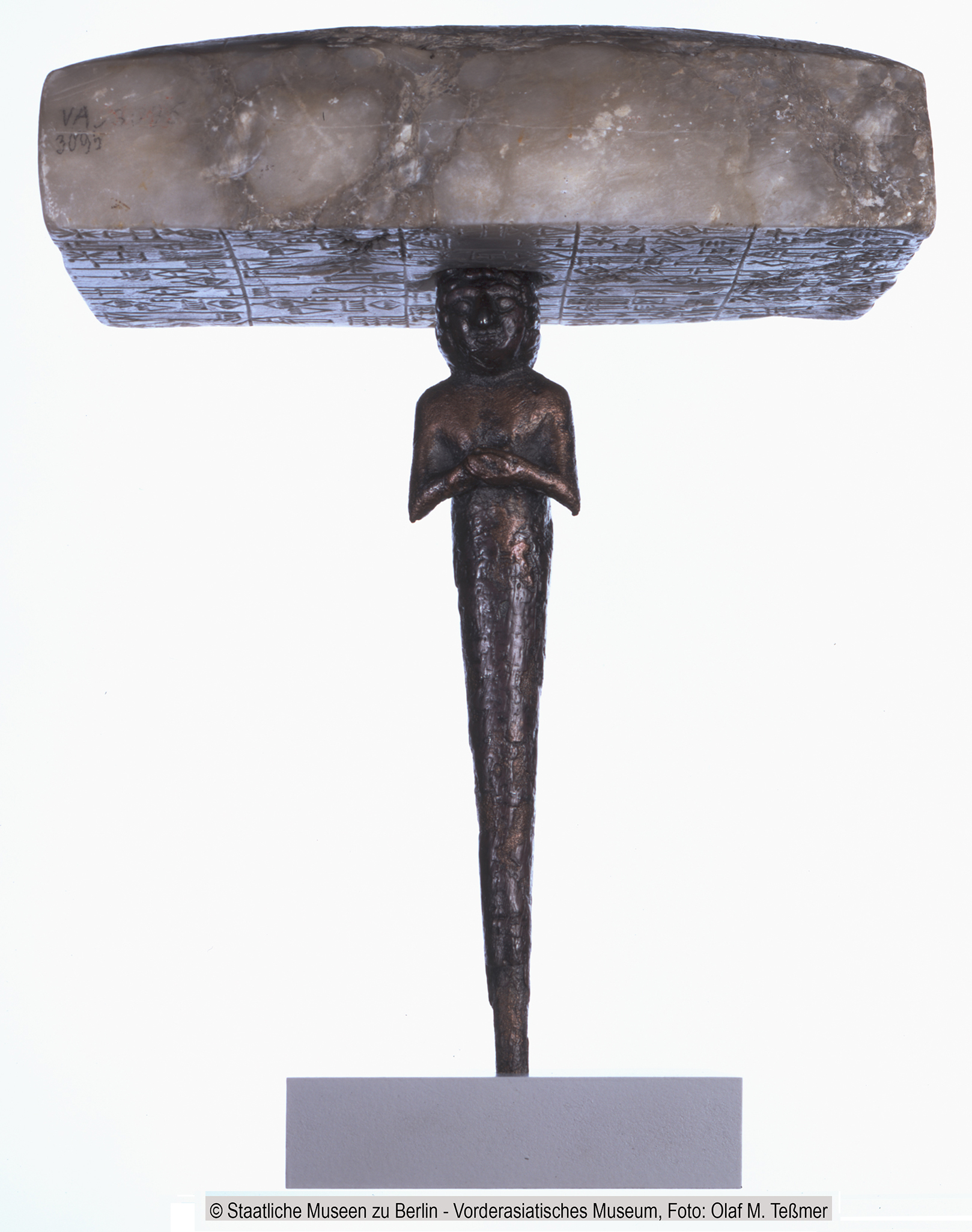
Early Dynastic Period
Founding figure and inscribed alabaster plate in brick form, from Lagash, circa 2 430 BC.
Figure as originally assembled.
Catalog: Bronze figure, VA 03024, alabaster plate, VA 03095
Permalink: id.smb.museum/object/1744356/gr%C3%BCndungsfigur-und-beschriftete-alabasterplatte-in-ziegelform
Photo: Staatliche Museen zu Berlin, Vorderasiatisches Museum / Olaf M. Teßmer CC BY-SA 4.0

Early Dynastic Period
Babylonian bronze bull's head , circa 2 600 BC.
The origin of this bronze bull's head is uncertain, but based on stylistic peculiarities, identifying characteristics can be identified that lead to a classification. Upon closer inspection, the sculpture differs noticeably from the model of a living animal.
The basic shape is taken from nature, but the horn bulge appears to be set too high, the ears protrude inorganically from the head and form trowel-shaped shells, and the nose area also has a more decorative character due to the formation of the nostrils into volutes. Some of this can certainly be attributed to the casting and assembly technology, as the ears are pinned to the head and the inserted horns require manageable attachment points.
Nevertheless, the head is subject to its own design principles, which also use the casting technique for their style-forming purposes.
Bull protomes shaped in the same and similar way are known from several places. They were used as wall decorations or adorned the sound boxes of harps or lyres, as examples from Ur show. The head shown can also be placed in this series of comparison pieces. Its intended decorative effect was enhanced by coloured inlaid eyes, of which only a remnant remains today. This piece is rightly regarded as evidence of the masterful mastery of metallurgical processes. [Joachim Marzahn]
Height 207 mm, width 187 mm, depth 105 mm, weight 1480 gm.
Permalink: id.smb.museum/object/1744282/kopf-eines-stieres
Photo: Don Hitchcock 2015
Source and text: Pergamon Museum, Berlin, recherche.smb.museum
Second Dynasty of Uruk
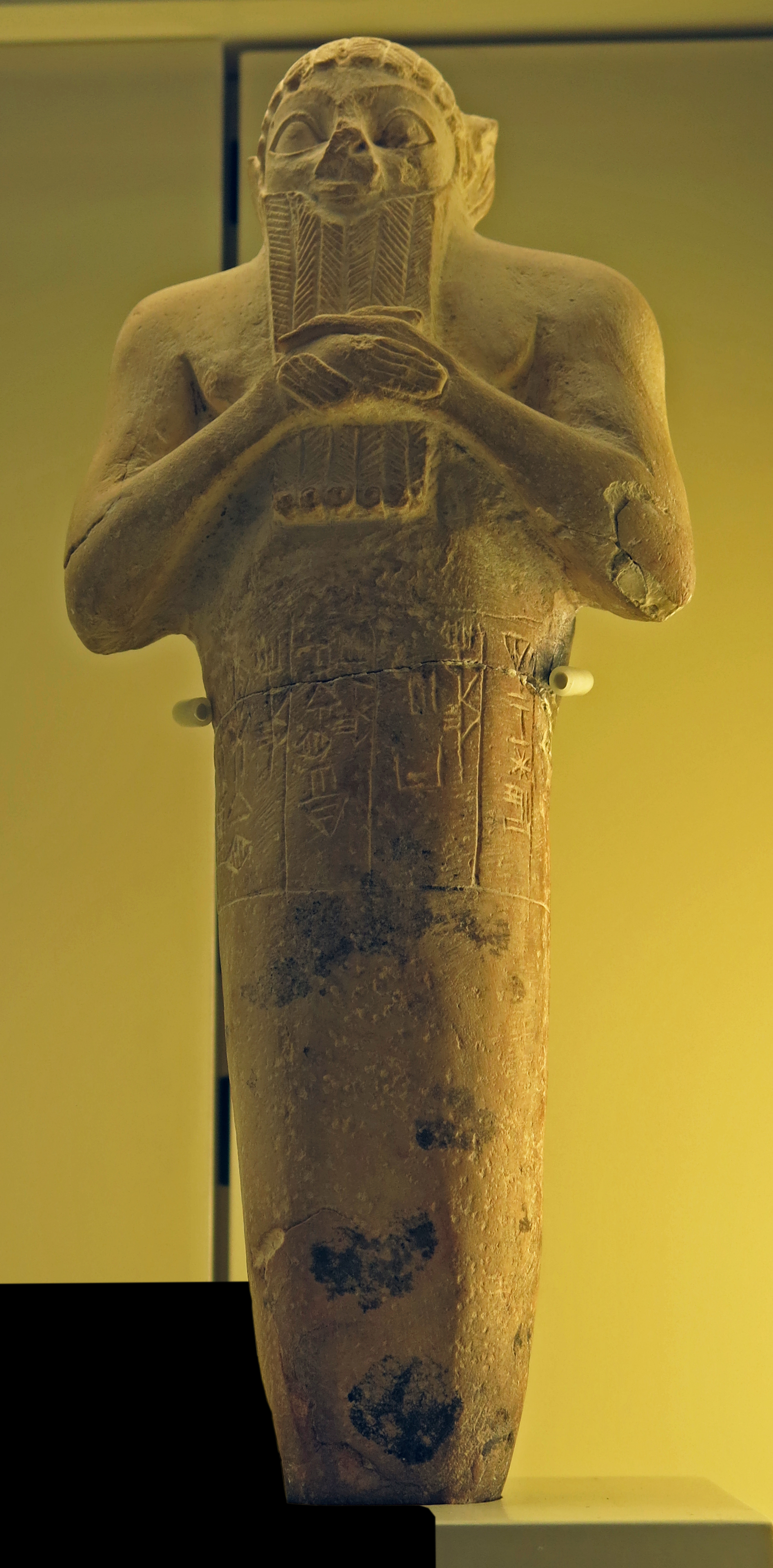
Limestone nail figurine with a dedication inscription by King Lugal-kisalsi of Uruk for a temple of the goddess Namma, circa 2 380 BC.
Limestone foundation peg of King Lugal-kisalsi, from Uruk, Iraq, circa 2 380 BC. Pergamon Museum VA 04855. The inscription reads 'For (goddess) Namma, wife of (the god) An, Lugalkisalsi, King of Uruk, King of Ur, erected this temple of Namma'.
Reign: circa 2 400 BC.
Predecessor: Lugal-kinishe-dudu.
Successor: Enshakushanna.
Height 245 mm, width 100 mm, depth 58 mm, weight 1040 gm.
Catalog: VA 04855
Permalink: id.smb.museum/object/1744366/gr%C3%BCndungsurkunde-in-form-einer-statuette-mit-inschrift-des-k%C3%B6nigs-lugalkisalsi
Photo: Don Hitchcock 2015
Source and text: Pergamon Museum, Berlin, recherche.smb.museum
Door hinge stone with an inscription of King En-METE-na of Lagash, circa 2 340 BC
Photo: Don Hitchcock 2015
Source: Pergamon Museum, Berlin, recherche.smb.museum
Text: Adapted from Wikipedia
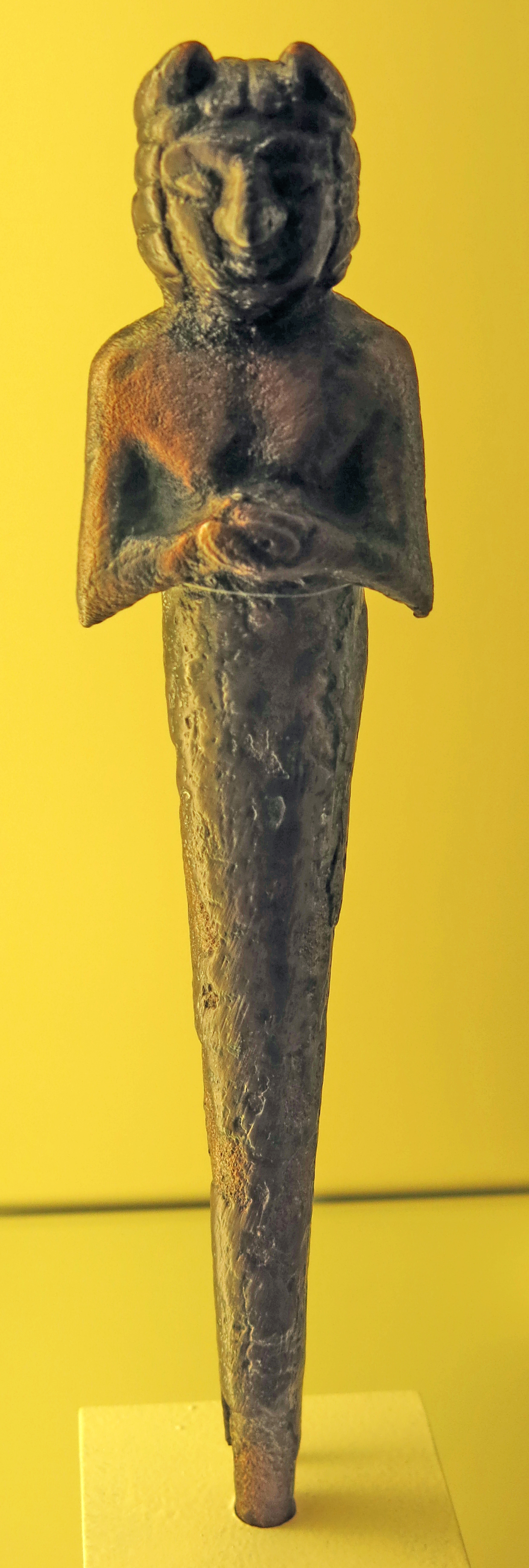
Kneeling god wearing a horned crown, with a dedication inscription of Gudea, holding a foundation peg, bronze.
2 144 BC - 2 124 BC
Height 174 mm, width 52 mm, weight 730 gm.
Catalog: Bronze, VA 03023
Permanent link: id.smb.museum/object/1744283/kniender-gott-mit-gr%C3%BCndungsnagel
Photo: Don Hitchcock 2015
Source and text: Pergamon Museum, Berlin, recherche.smb.museum
Baked clay nail with inscription of Prince Gudea of Lagash, circa 2 140 BC
Baked clay cones and nails were inscribed in the name of a ruler of a Mesopotamian city-state to commemorate an act of building or rebuilding, often of a temple for a specific deity. Deposited in the walls or under the foundations of these structures, the words of the texts were directed at the gods but would be found by later restorers.
Photo: Don Hitchcock 2015
Source and text: Pergamon Museum, Berlin, recherche.smb.museum
Additional text: art.thewalters.org
Alabaster tablet with an inscription of Gudea of Lagas dedicated to the god Pabilsang, circa 2 140 BC.
Gudea was a ruler (ensi) of the state of Lagash in Southern Mesopotamia, who ruled circa 2 144 - 2 124 BC (middle chronology). He probably did not come from the city, but had married Ninalla, daughter of the ruler Ur-Baba (2 164 BC – 2 144 BC) of Lagash, thus gaining entrance to the royal house of Lagash. He was succeeded by his son Ur-Ningirsu. Gudea ruled at a time when the centre of Sumer was ruled by the Gutian dynasty, and when Ishtup-Ilum ruled to the north in Mari. Under Gudea, Lagash had a golden age, and seemed to enjoy a high level of independence from the Gutians.
Gudea Ensi Lagashki, 'Gudea, Governor of Lagash', may be seen in the inscription.
Gudea chose the title of énsi (town-king or governor), not the more exalted lugal (Akkadian šarrum). Gudea did not style himself 'god of Lagash' as he was not deified during his own lifetime, this title must have been given to him posthumously, in accordance with Mesopotamian traditions for all rulers except Naram-Sin of Akkad and some of the Ur III kings.
The 20 years of his reign are all known by name; the main military exploit seems to have occurred in his Year 6, called the 'Year when Anshan was smitten with weapons'.
Although Gudea claimed to have conquered Elam and Anshan, most of his inscriptions emphasise the building of irrigation channels and temples, and the creation of precious gifts to the gods.
Materials for his buildings and statues were brought from all parts of western Asia: cedar wood from the Amanus mountains, quarried stones from Lebanon, copper from northern Arabia, gold and precious stones from the desert between Canaan and Egypt, diorite from Magan (Oman), and timber from Dilmun (Bahrain).
Photo: Don Hitchcock 2015
Source and text: Pergamon Museum, Berlin, recherche.smb.museum
Additional text: Wikipedia
( Note that there was only one identification for both these objects, and I was unable to find either in the online catalog - Don )
Stone tablet with a dedication inscription of Gudea of Lagash for the Baba temple.
Baba was the patron goddess of Girsu and the city-state of Lagaš. Beginning in 2 000 BC she became known as a healing goddess.
Photo: Don Hitchcock 2015
Source and text: Pergamon Museum, Berlin, recherche.smb.museum
Additional text: oracc.museum.upenn.edu
( Note that Ur and Uruk are not the same, although they seem to be used interchangeably in many sources, and I have found disentangling these reports quite difficult, a task I have not yet completed. They were both located in Lower Mesopotamia, but they were separate city-states. Uruk was the larger city-state and was founded around 4 500 BC, while Ur, which is located nearer to the Persian Gulf, was constructed around 3 800 BC, and was continuously inhabited until 450 BC - Don )
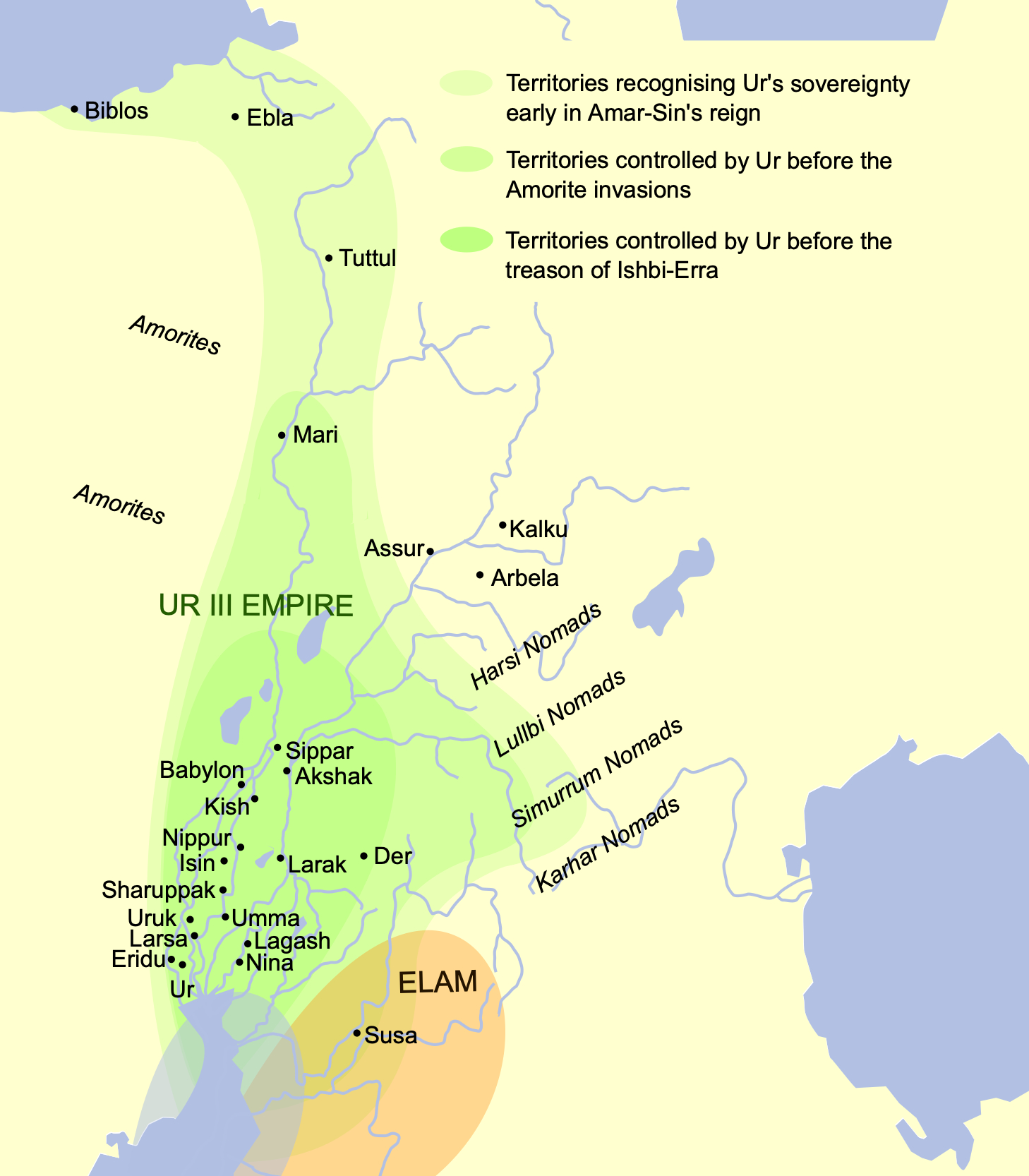
This map shows the extent of the Ur III Empire in Mesopotamia circa the 22nd century BC, i.e. between 2 200 BC and 2 101 BC.
The map is based on Garelli, Paul: 'El Imperio de Ur y su herencia', en El Próximo Oriente asiático. Barcelona: Labor 1974. ISBN 8433593102.
Map from File:Ciudades del antiguo Oriente Medio.svg.
Photo and text: Wikimedia Commons
Shu-Sin, Penultimate ruler of the Third Dynasty of Ur, also known as the Neo-Sumerian Empire
Shu-Suen or Shu-Sin was the penultimate ruler of the 3rd dynasty of Ur, reigning in 2 037 - 2 030 BC. (middle chronology), son of Shulgi and brother of Amar-Suena.
The kingdom of the Third Dynasty of Ur, which experienced its greatest prosperity during the reign of Shulgi (2096-2048 B.C.), was constantly on the defensive from the beginning of Shu-Suen's reign. First, from the north and north-east, tribes of nomadic Amorites broke away from other peripheral areas, then peacefully entered the interior of the country in smaller or larger groups, creating a problem for the royal administration.
Unable to cope with the invaders militarily, they tried to deal with them in various ways. Land and pastures were allocated to the newcomers for temporary use, in an attempt to stimulate their assimilation, or sometimes entire tribes and families were enlisted into the royal army, sometimes successfully using them to fight the newly arriving, more aggressive kinsmen. This created a very delicate and potentially dangerous situation of dependence not only on the defense but also on the internal cohesion of the state on the loyalty of the not fully assimilated, new subjects of the King of Ur.
The system could probably function for some time, provided that the borders and military prestige of the royal army were maintained. Meanwhile, already in the 4th year of the reign of Shu-Suen, building somewhere on the outskirts of Sumero-Akkad itself a large belt of fortifications called the 'wall against the Amorites' (sum. bad3 MAR.TU), he finally came to terms with the loss of the vast areas of northern and central Mesopotamia, which provided huge tributes. This had an impact on the country's already weakening economy.
Text above from the Polish language version of Wikipedia.
Third Dynasty of Ur
On this inscribed stone ring from a fountain, the name of the Ur III king Shu-Sin appears. circa 2 030 BC, from Iraq.
Shu-Sin was king of Sumer and Akkad, and was the penultimate king of the Ur III dynasty. He succeeded his father Amar-Sin, and reigned circa 1 973 BC – 1 964 BC .
Following an open revolt of his Amorite subjects, he directed the construction of a fortified wall between the Euphrates and the Tigris rivers in his fourth year, intending it to hold off any further Amorite attacks. He was succeeded by his son Ibbi-Sin.
An erotic poem addressed to Shu-Sin by a female speaker is preserved in a cuneiform tablet. The poem's speaker expresses her strong desires and longings for the king.
An inscription states that he gave his daughter in marriage to the ruler of Simanum. Simanum, Habura, and the surrounding districts then rebelled against the king, and they chased his daughter away from her residence. Shu-Sin subsequently conquered Simanum and restored his daughter there.
The year names for the reign of Shu-sin, or Szu-Sin, are all known and give information about the events of his reign. The most important ones are:
1: Year Szu-Sin became king
2: Year Szu-Sin the king of Ur made / caulked the boat of Enki (called the) 'ibex of the abzu'
3: Year Szu-Sin the king of Ur destroyed Simanum
4: Year Szu-Sin the king of Ur built the amurru wall (called) 'muriq-tidnim / holding back the Tidanum'
6: Year Szu-Sin the king of Ur erected a magnificent stele for Enlil and Ninlil
7: Year Szu-Sin, the king of Ur, king of the four quarters, destroyed the land of Zabszali
9: Year Szu-Sin the king of Ur built the temple of Szara in Umma
Photo: Don Hitchcock 2015
Source: Pergamon Museum, Berlin, recherche.smb.museum
Text: Adapted from Wikipedia
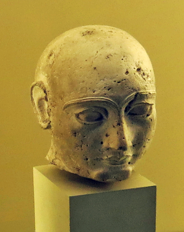
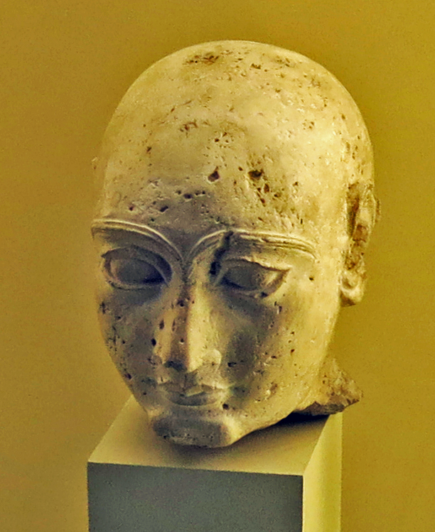
Third Dynasty of Uruk
Head of a man statuette, circa 2000 BC
Height 2140 mm, width 100 mm, thickness 145 mm, weight 2560 gm.
Although it comes from an unknown discovery context, the dating of the approximately half life sized head to the so-called Neo-Sumerian period (around 2 150 - 2 000 BC) is certain. The iconographic similarity to depictions of the priest-prince of the city-state of Lagash-Girsu, Gudea, limits the time period of the head to the early phase of the Neo-Sumerian period, in which a large number of outstanding round sculptural works were created. The man's head with a clean-shaven skull may be one of the numerous surviving Gudea sculptures. The baldness is not only a feature of the period, but also an indication that the statuette represents a priest - a function that the ruler held at the same time as his role as secular leader.
The independent stylistic features that characterise the sculptures of the early Neo-Sumerian period are characterised by a certain naturalism, which, however, cannot quite reach the quality of the Akkadian period (around 2 350 – 2 150 BC). Despite its small size, the limestone head proves to be a masterpiece of sculpture. This is evident not only in the canon of proportions, but also in the finely cut facial features with a gently moving surface. The appeal of the little head is based not least on the alternation between the areas of the face that are emphasised by their special plasticity - ears, large eyes with strongly arching eyebrows, prominent chin - and the delicate and softly modelled cheek areas. The man's very personal characteristics are particularly emphasised in the lower half of the face with the narrow nose and the mouth with almost sensual lips, whereby the artist's creative power can be experienced in the profile view. [Ralf-Bernhard Wartke]
Catalog: Limestone, VA 02910
Permalink: id.smb.museum/object/1743396/kopf-einer-m%C3%A4nnerstatuette
Photo: Don Hitchcock 2015
Source and text: Pergamon Museum, Berlin, recherche.smb.museum
Cult Relief, 2 000 BC - 1 500 BC
Height 1360 mm, width 930 mm, thickness 240 mm, weight 450 kg.
This is a representation of the god Assur, as identified by Karen Radner, LMU Munich and University College London, an expert on Assyria.
Assur was a mountain god, and the whole small city called Assur was regarded as the god Assur incarnate.
Catalog: Gypsum, Assur, Find quadrant i B 3 IV, in the well of the Assur Temple, VA Ass 01358
Permalink: id.smb.museum/object/1742862/kultrelief
Photo: Don Hitchcock 2015
Source and text: Pergamon Museum, Berlin, recherche.smb.museum
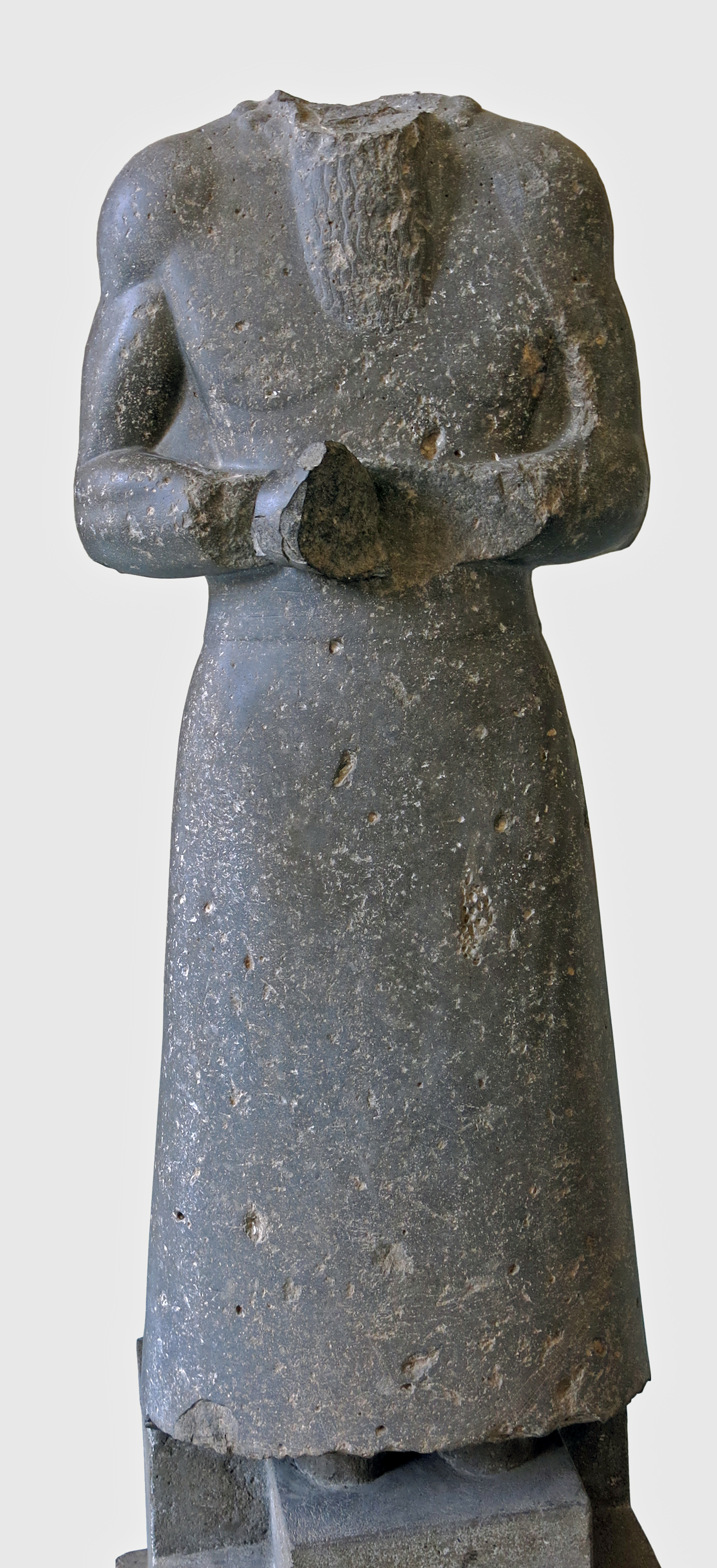
Statue of a ruler Circa 2 000 BC
This statue probably originates from the Younger Ishtar Temple which was partly refurbished by a local governor called Zariqum who was loyal to Amar-Sin, king of Ur. It is possible that the statue in fact represents this local ruler. He wears a fringed robe. The garment and the posture are identical with works of art from that period.
Catalog: Alabaster, Ashur
Photo: Don Hitchcock 2015
Source and text: Pergamon Museum, Berlin
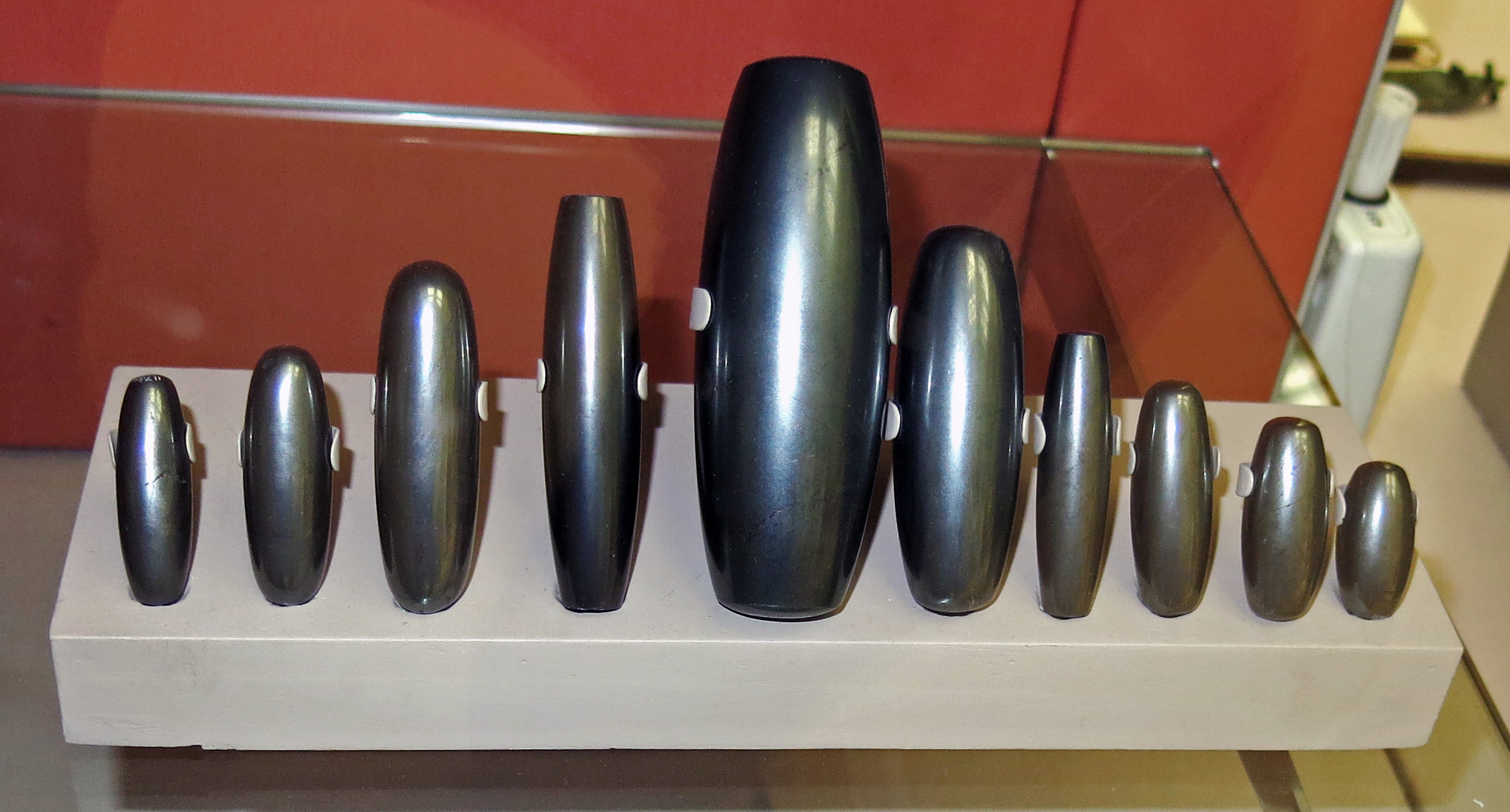
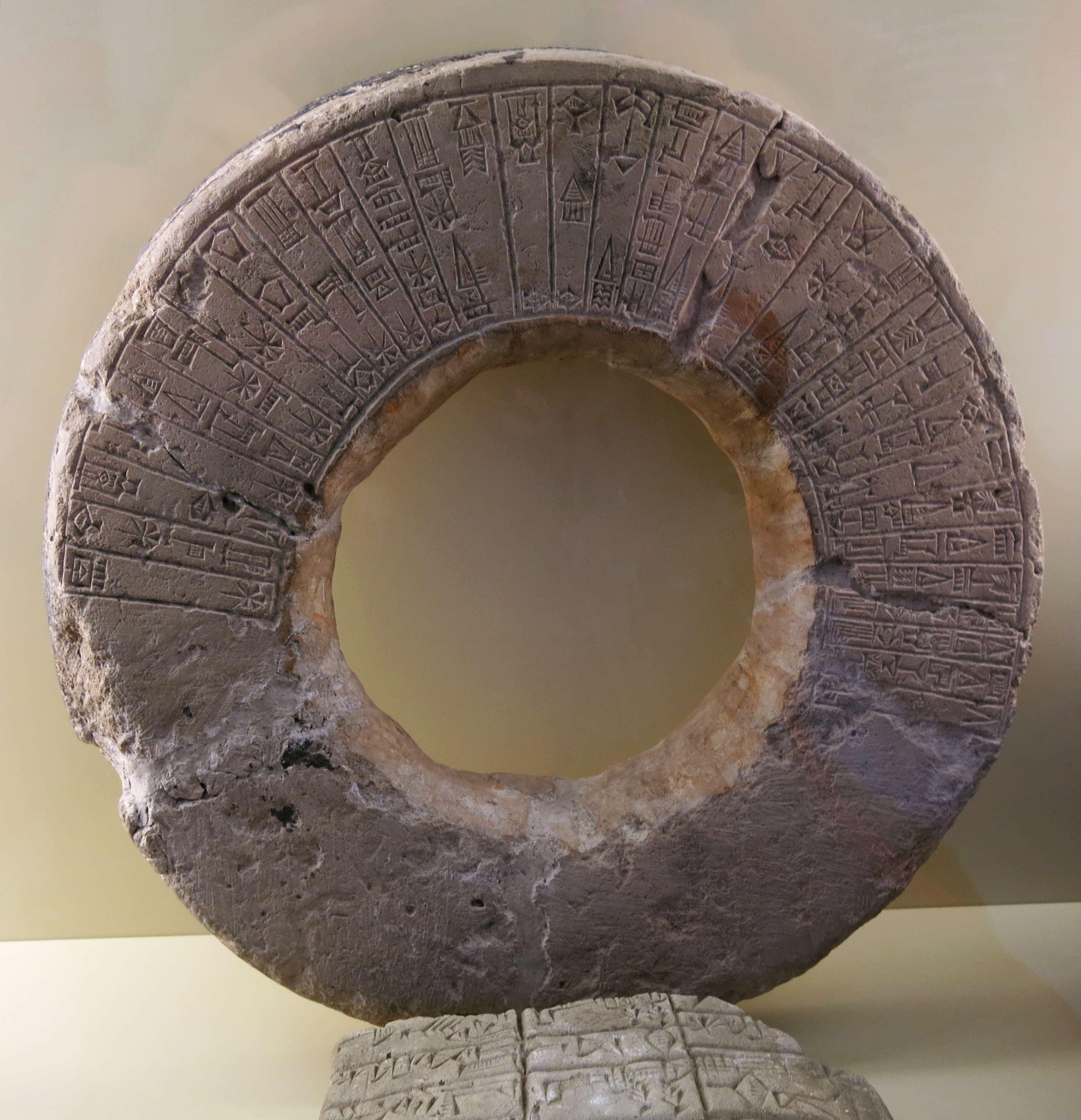
Haematite weights, circa 2 000 BC - 1 600 BC.
Haematite is an iron ore found in Syria and Turkey. Weights of this shape were first introduced during the Old Babylonian period.
The weights are cylindrical, with almost square ends. The examples shown range from a full mina, about 500 gm, down to 3 shekels, about 25 gm.
For ME 117900, the diameter is 13 mm, length is 44 mm, weight is 25.6 gm.
For ME 117891, the diameter is 25 mm, length is 114 mm, weight is 496 gm.
Catalog: Haematite, ME 117891 - ME 117900.
Photo: Don Hitchcock 2015
Source: Original, British Museum
Text: © Card with the display at the British Museum, www.britishmuseum.org, © Trustees of the British Museum, CC BY-NC-SA 4.0.
Baked clay cone with inscription of King Sin-iddinam of Larsa, 1 849 BC - 1 843 BC
Photo: Don Hitchcock 2015
Source and text: Pergamon Museum, Berlin, recherche.smb.museum
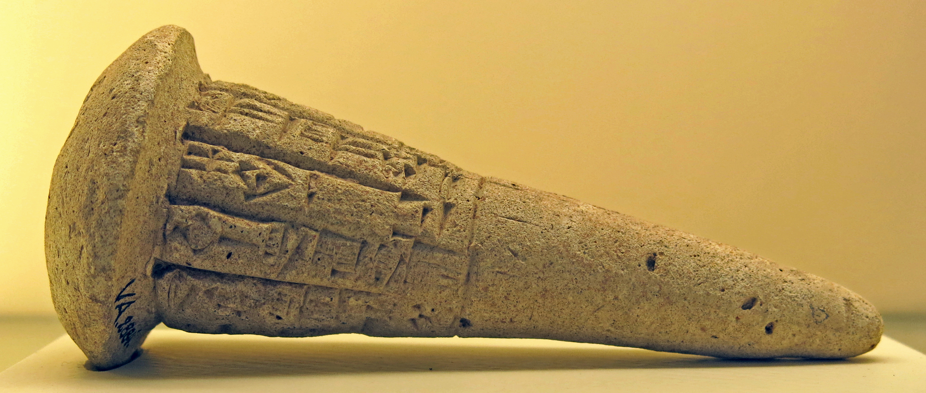
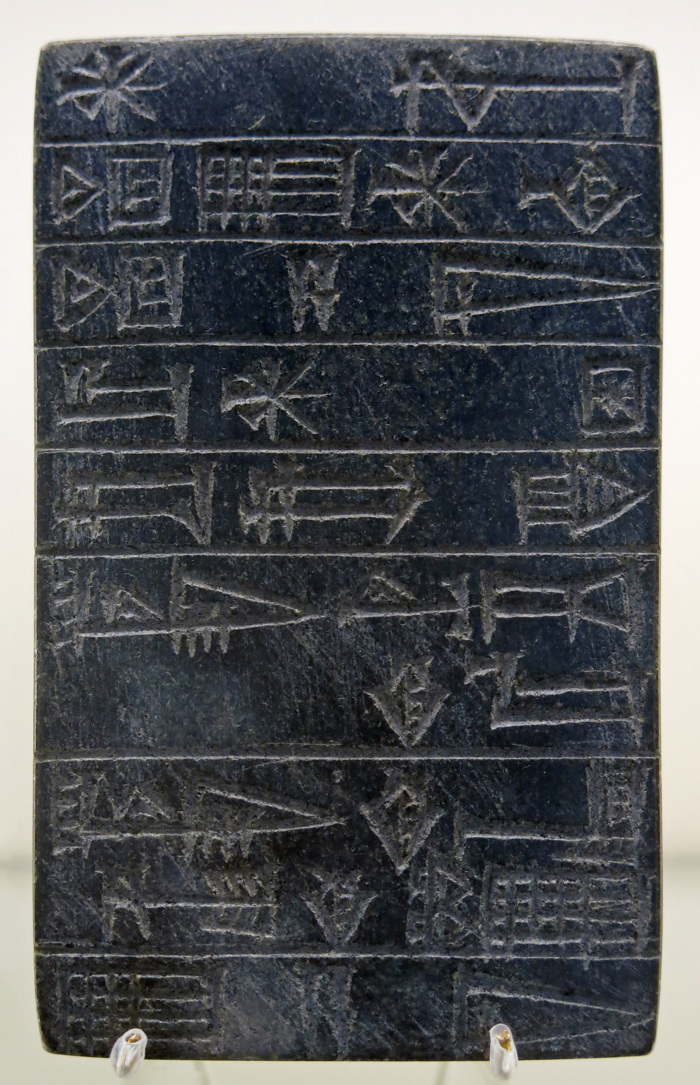
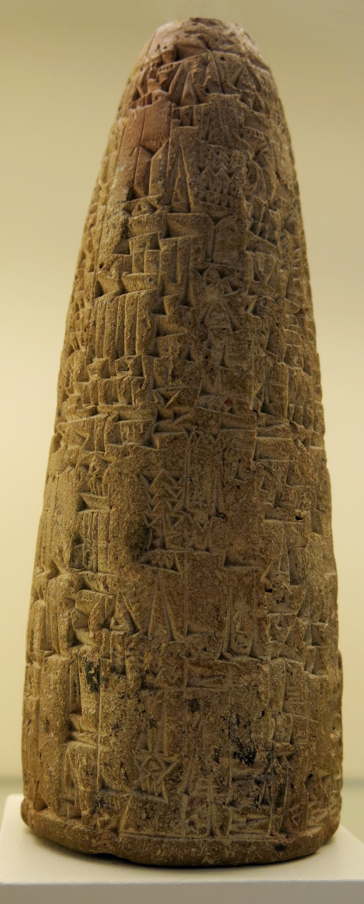
Inscribed baked clay nail of King Ipik-ishtar (Ipiq-Ishtar) of Malgium, circa 1 770 BC.
The ancient city of Malgium is now known to be located at modern Tell Yassir.
These Sumerian clay nails or foundation pegs with cuneiform inscriptions were used by the Sumerians and other Mesopotamian cultures 4 000 years ago.
They were engraved, baked, and then inserted into the mud-brick walls to serve as evidence that the temple or building was the divine property of the god to whom it was dedicated.
Photo: Don Hitchcock 2015
Source and text: Pergamon Museum, Berlin, recherche.smb.museum
Additional text: joyofmuseums.com
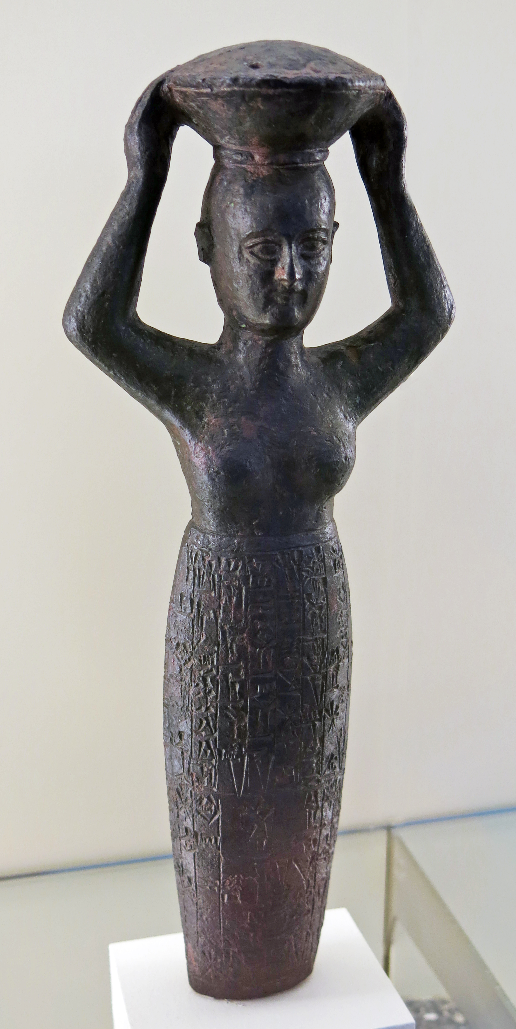
Founding figure of the Kudur-Mabuk (1 770 BC) in the form of a basket-carrier, Pergamonmuseum, Berlin.
Kudur-Mabuk ( Akkadian Ku-du-ur-ma-bu-uk ) was the father of sons Rim-Sin I and Warad-Sin and daughter En-ane-du, who according to ancient tradition was born in 1 764 BC, and who became an Entu priestess in Ur. He himself was the son of Simti-Silhak. The Elamite name as title Adda/Abu Ja-Emutbala (father of Jamutbal) and the self-identification as Adda KUR Martu (father of the Amurrite land) lead historians to make two assumptions about his origins.
According to more recent views, Dietz-Otto Edzard, for example, assumes that Kudur-Mabuk's father was an Amurrite military leader who later came into Elamite service and for this reason took on an Elamite name, without, however, denying his origins as an Amurrite. In the older versions the thesis of a complete origin from an Elamite ruling house is presented.
Kudur-Mabuk installed his sons Warad-Sin and Rim-Sin I as kings in Larsa, but personally renounced the title of king there.
Photo: Don Hitchcock 2015
Source and text: Pergamon Museum, Berlin, recherche.smb.museum, Wikipedia
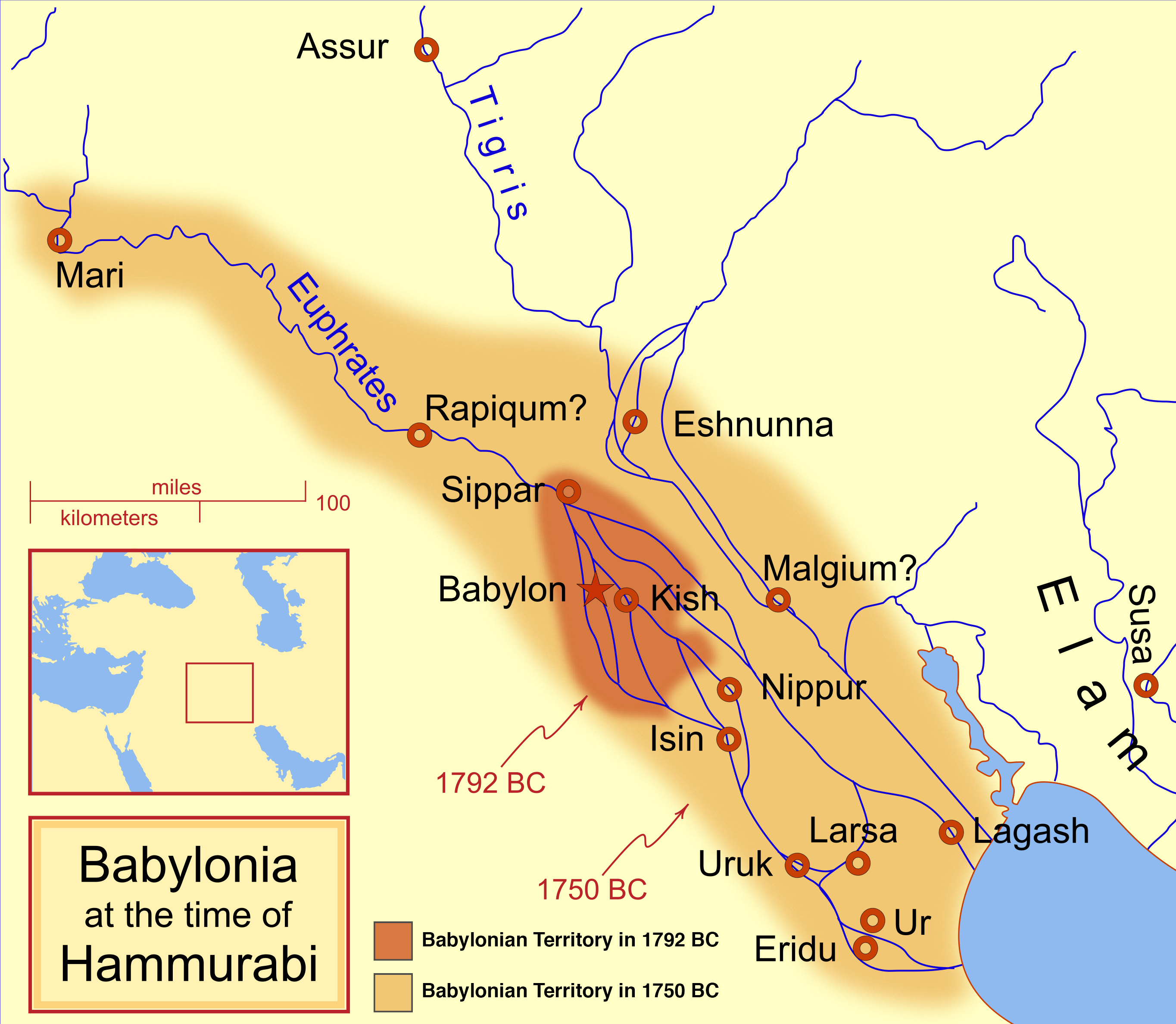
Hammurabi's Babylonia, showing the Babylonian territory upon his ascension in 1 792 BC and upon his death in 1 750 BC. The river courses and coastline are those of that time period.
The assumed position of Malgium is shown, circa 100 km east of Kish.
Photo and text: MapMaster
Permission: GNU Free Documentation License, Version 1.2 or any later version
Uruk, in Sumer
In myth and literature, Uruk was famous as the capital city of Gilgamesh, hero of the Epic of Gilgamesh. Scholars identify Uruk as the biblical Erech (Genesis 10:10), the second city founded by Nimrod in Shinar.Text above: Wikipedia
Uruk was an ancient city in Mesopotamia, located in modern-day Iraq. It was one of the most important cities in ancient Sumer and is considered one of the earliest cities in the world. Uruk was first settled around 4 500 BC and became a major center of trade and culture by around 3 000 BC. It was home to some of the earliest examples of writing, including the famous Epic of Gilgamesh, which tells the story of a king who seeks immortality.
The city of Uruk was surrounded by a massive wall that was over 6 metres thick in some places and stood over 12 metres tall. The wall had several gates that were guarded by soldiers, and the city was home to several temples and palaces. The most famous of these was the Temple of Inanna, the goddess of love and war. The temple was decorated with elaborate mosaics and reliefs and was the center of religious life in Uruk.
Uruk had an advanced irrigation system, which allowed the city to produce a surplus of food. This surplus allowed for the growth of a complex social hierarchy, with priests, merchants, and warriors at the top of society. Uruk's wealth and power declined over time, and the city was abandoned around 300 BC.
Map of Uruk
Photo: Don Hitchcock 2015
Source and text: Adapted after a poster, Pergamon Museum, Berlin, recherche.smb.museum
An Uruk settlement
3 500 BC - 3 000 BC
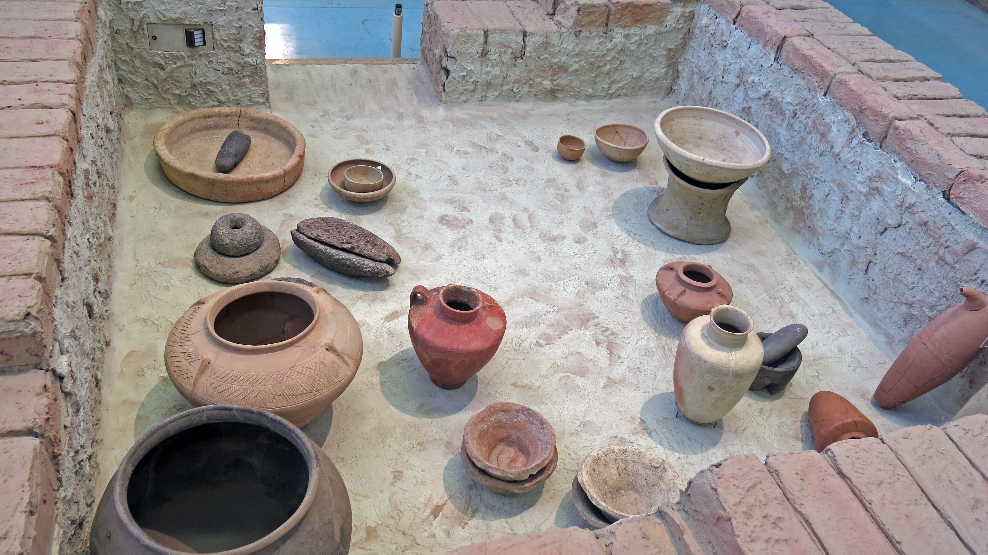
Reconstruction of a room with household goods
Habuba Kabira-South, which was on the banks of the Euphrates, about 100 km east of the modern town of Aleppo.
Late 4th millennium BC, circa 3 500 BC - 3 000 BC.
Habuba Kabira (also Hubaba Kabire) at Tell Qanas is the site of an Uruk settlement along the Euphrates in Syria, founded during the later part of the Uruk period. It was about 1 300 km from the city of Uruk. The site is now mostly underwater due to the Tabqa Dam project. It consists of Habuba Kabira South, which is protoliterate, and Habuba Kabira North, which is protoliterate, Middle Bronze Age, Late Bronze Age, and Roman.
This reconstructed adjoining room of a house is intended to give an impression of the clay architecture and the equipment and vessels used for storing and preparing food. In addition to ceramic vessels such as spout bottles, four-eyelet vessels, bottles and bowls, saddle mills (grinding stones) as well as stone mortars and pestles can be seen. The shoulder vessels with red smoothed coating, cord eyelets,
Mock spouts and small handles may have served prestige purposes rather than utilitarian ones.
The houses of the late Turkic settlement were built close together. The basic type was the so-called central hall house, which was characterised by a central room in the middle and side rooms. The passages of the strictly symmetrically structured central hall always faced each other, while the side rooms were accessible through doors on the long sides.
In the late Turkic period, air-dried bricks with an almost square cross-section of 10 x 10 cm and a length of 25 cm were used. The clay extracted on site was very calcareous and had reddish areas. Lintels and doors were made of wood, the interior walls were whitewashed or covered with reed mats.
Photo: Don Hitchcock 2015
Source and text: Pergamon Museum, Berlin, recherche.smb.museum
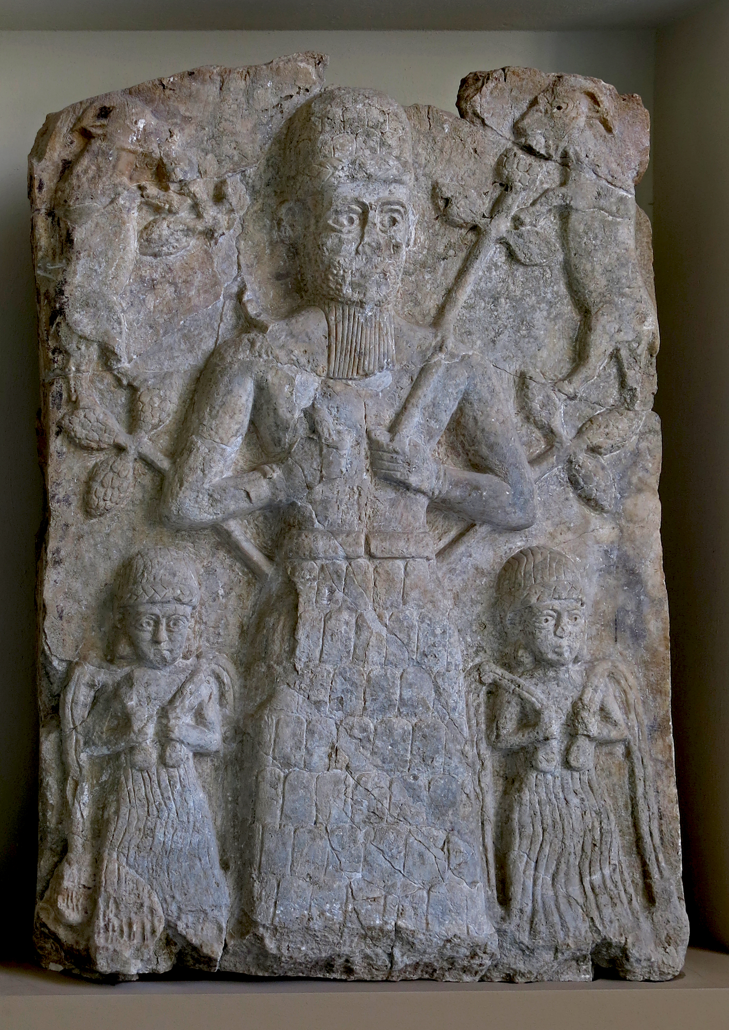
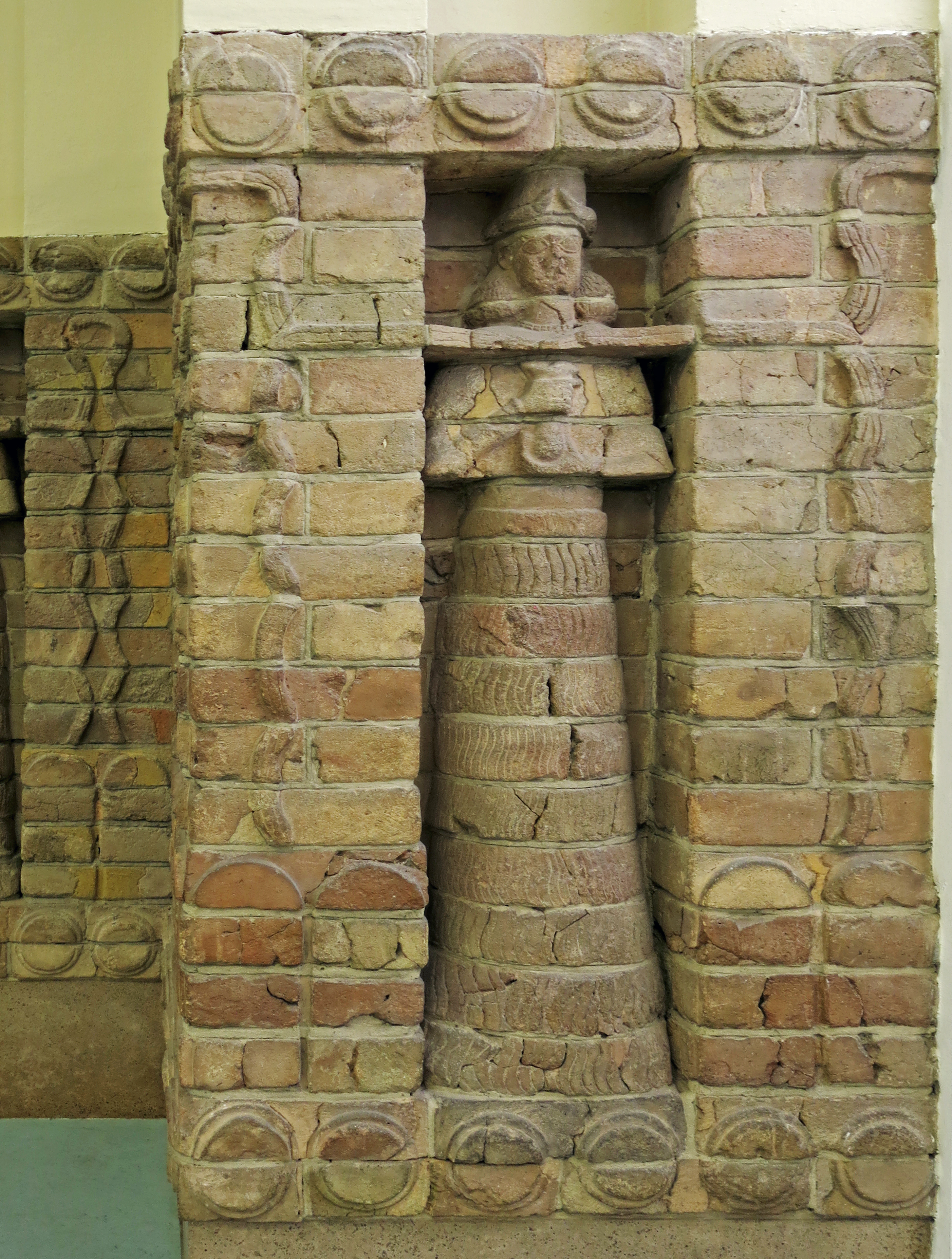
The Inanna Temple at Uruk
1 450 BC - 1 400 BC
Moulded bricks from the facade of the Inanna Temple, in the Eanna District of Uruk.
During excavations in the precinct of the temple of Eanna at Uruk (southern Iraq), archaeologists discovered the remains of an isolated temple dedicated to the Sumerian goddess Inanna (Ishtar). From the evidence of a brick inscription, its construction can be dated to the reign of the Kassite ruler Kara-indash. The outer façade of the rectangular building, measuring 22.5 m by 17.5 m, stood until the Seleucid period (4th - 3rd centuries BC), and was articulated with niches. Fragments of moulded bricks found in the temple precinct were identified as belonging to the base of the edifice.
(left, lower) Head of a female water deity from the Karaindash facade.
Height 10cm, width 30 cm, depth 20 cm.
Catalog: Ceramic, Kassite period, VA 16740
Permalink: id.smb.museum/object/1744496/kopf-einer-weiblichen-wassergottheit-aus-der-sog--karaindasch-fassade
(right, upper)
Head of a male mountain deity from the Karaindash facade.
Height 10cm, width 30 cm, depth 20 cm.
Catalog: Ceramic, Kassite period, VA 16741
Permalink: id.smb.museum/object/1744497/kopf-einer-m%C3%A4nnlichen-berggottheit-aus-der-sog--karaindasch-fassade
Late 15th century BC, circa 1 450 BC - 1 400 BC.
Photo: Don Hitchcock 2015
Source and text: Pergamon Museum, Berlin, recherche.smb.museum
Additional text: artsandculture.google.com
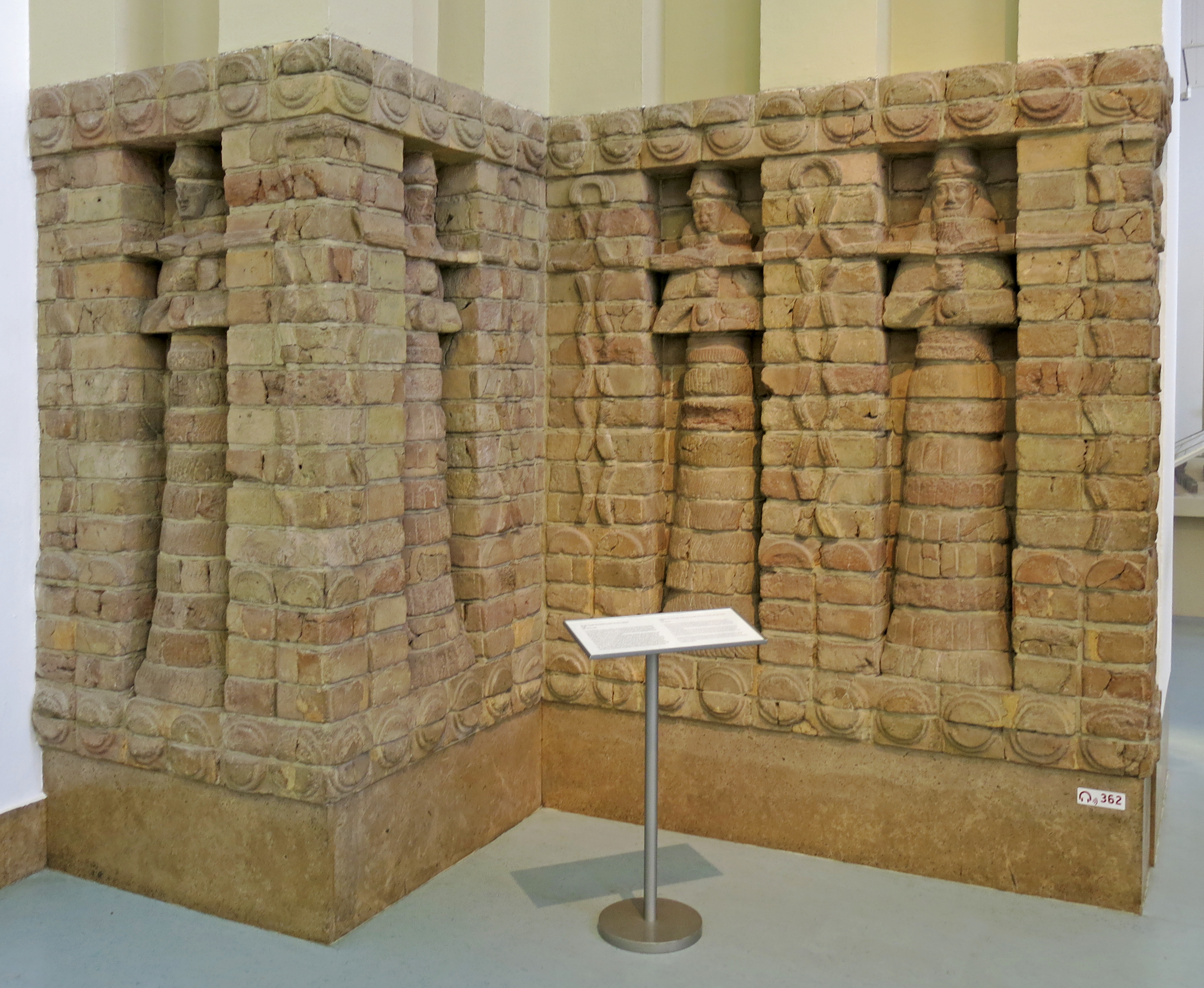
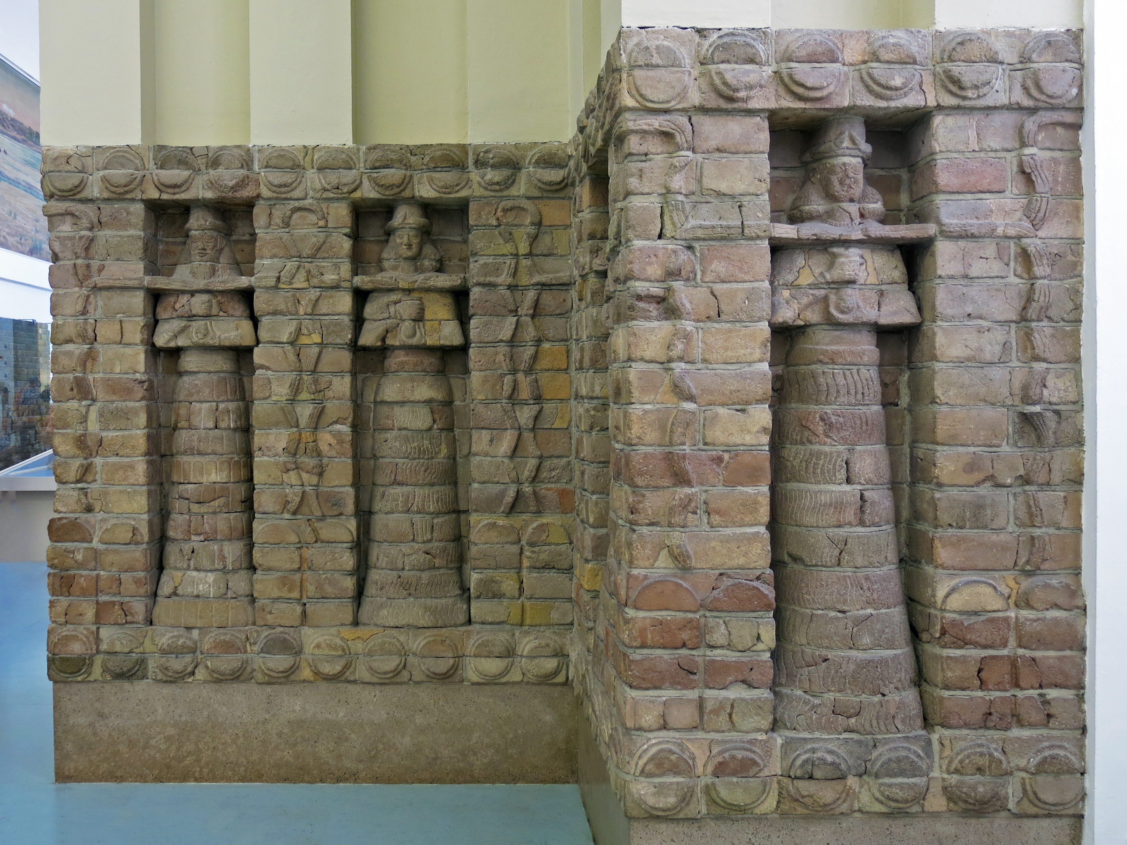
Segments from the facade of the Inanna Temple built by the Kassite ruler
Kara-indash, Uruk, circa 1 413 BC.
In the northeast corner of the wall surrounding the Eanna Precinct at Uruk, archaeologists unearthed the remains of a small temple with a strictly symmetrical plan. There were bastion-like towers at all four corners of the building which stood on a platform measuring 22.5m x 17.Sm. The niched facade was made
of moulded, fired bricks.
The segment of it reconstructed in the museum incorporates a great many fragments of original bricks.
Standing male and female deities alternate in the niches. Life-giving water pours forth onto the earth from the vessels in their hands. The hump-like symbols on the projecting elements of the niched fa~de and on the garments of the male divinities refer to the mountainous region where the Kassites originated. An
inscription on the bricks names the Kassite ruler Kara-indash as the person who commissioned the structure.
The Kassites came into Mesopotamia from the mountains to the east, probably beginning about 2 000 BC.
By the mid-second millennium, they had achieved hegemony over Babylonia. 1he Kassites' worship of Inanna/Ishtar in proximity to the ancient Eanna Temple at Uruk documents their adoption and continuation of Babylonian traditions.
Inanna was an ancient Mesopotamian goddess of love, beauty, war, and fertility. She is also associated with sex, divine law, and political power. She was originally worshipped in Sumer under the name 'Inanna', and later by the Akkadians, Babylonians, and Assyrians under the name Ishtar.
She was known as 'the Queen of Heaven' and was the patron goddess of the Eanna temple at the city of Uruk, which was her early main cult centre. She was associated with the planet Venus and her most prominent symbols included the lion and the eight-pointed star.
Her husband was the god Dumuzid (later known as Tammuz) and her sukkal, or personal attendant, was the goddess Ninshubur (who later became conflated with the male deities Ilabrat and Papsukkal).
Text above: Wikipedia
Photo: Don Hitchcock 2015
Source and text: Pergamon Museum, Berlin, recherche.smb.museum
Additional text: Wikipedia
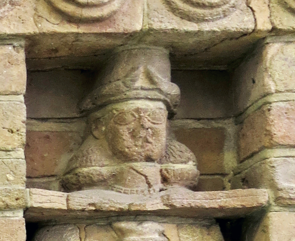
Note the horned crowns of the deities. This convention was still in use in Neo-Assyrian gypsum alabaster bas-reliefs commissioned by King Ashurnasirpal II (883 BC - 859 BC), more than 500 years later. However the convention by then had became a marker of tiered status.
In the Neo-Assyrian, one pair of horns as shown here was for minor deities, but two or three indicated increasingly superior status with the number of pairs of horns.
Photo and text: Don Hitchcock 2015
Source: Pergamon Museum, Berlin, recherche.smb.museum
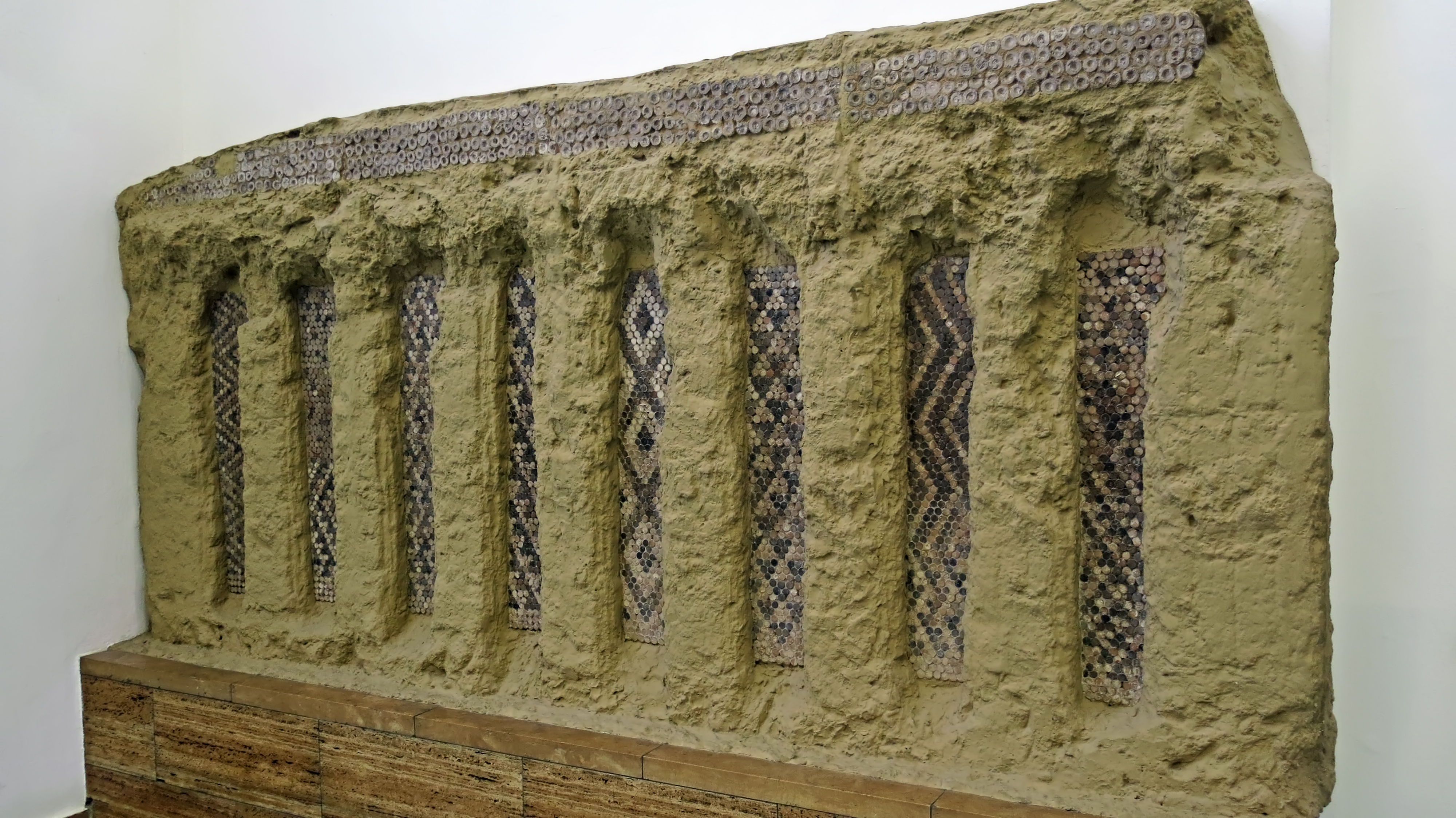
Part of a cone mosaic panel from a podium facade in the courtyard of the Eanna Temple, circa 3 000 BC.
Several large cult buildings were discovered during excavations to the south-east and south-west of the ziggurat of King Ur-Nammu in the temple district of Eanna in Uruk. The architectural remains of these can be assigned to strata group VI-IV, one on top of the other. These relics of great architectural creations already characterise the period that can be equated with layers VI-IV as a high point of one of the oldest urban cultures in Mesopotamia. Also belonging to the late Uruk period, with its remarkable monumental architecture, was the invention of a writing system in connection with administrative accounting, which used numerals and pictograms and was written on clay tablets.
Part of a multi-tiered cult complex in Eanna, the temple precinct of the city goddess Inanna, is a rectangular courtyard flanked on the SW and NW sides by higher terraces. On the so-called pillar terrace in the NW rose an open transverse hall with four pairs of massive round pillars and four semi-round pillars. In the axis of the third *intercolumnium, the terrace had been extended to form a platform from which the courtyard could be reached via two side staircases (layer IVb). This platform façade emphasises the middle of the north-western side of the courtyard and is richly structured between the stairs to the courtyard. The front side is dominated by double stepped niches, the pillars in between were each decorated with two vertical incised lines. Cone mosaics fill the niche surface with colourful geometric patterns. The upper end of the platform façade is formed by four continuous rows of uncoloured clay cones with decorative shallow cupped heads, in dimensions significantly larger than the usual format (diameter 3 cm).
*intercolumnium: the proportional spacing between columns in a colonnade
The decorative patterns of the eight different cone mosaic fields in the niches are probably modelled on a wickerwork technique. The excavation finds are followed, starting from the left, by the surface-filling patterns zigzag (in horizontal orientation), rhombuses (beginning below as triangles), triangles, triangles, rhombuses, triangles, zigzag (in vertical orientation, beginning as triangles below) and rhombuses. The compositional rules of the decoration, the sequence and the alternation of statically and dynamically perceived patterns can be regarded as preliminary stages to the cone mosaic decoration of the younger pillared hall in Uruk (stage IVa). [Ralf Bernhard Wartke]
Height 150 cm, width 315 cm.
( Note that in German language descriptions of these walls, the cones are usually referred to as 'pins'. Pin is German for Pine tree, so 'drawing a long bow', it may be an alternate word for cones, as in the english expression 'pine cones'. Also, 'pin' in German can also mean 'peg' or 'plug', a more likely explanation. To further complicate matters, machine translation often changes the German 'stift' to the English 'pen' instead of 'peg' which is a better translation in this case - Don )
Catalog: Ceramics, plaster, VA 10997
Photo: Don Hitchcock 2015
Source: Pergamon Museum, Berlin, recherche.smb.museum
Text: Google Arts and Culture, Ralf Bernhard Wartke
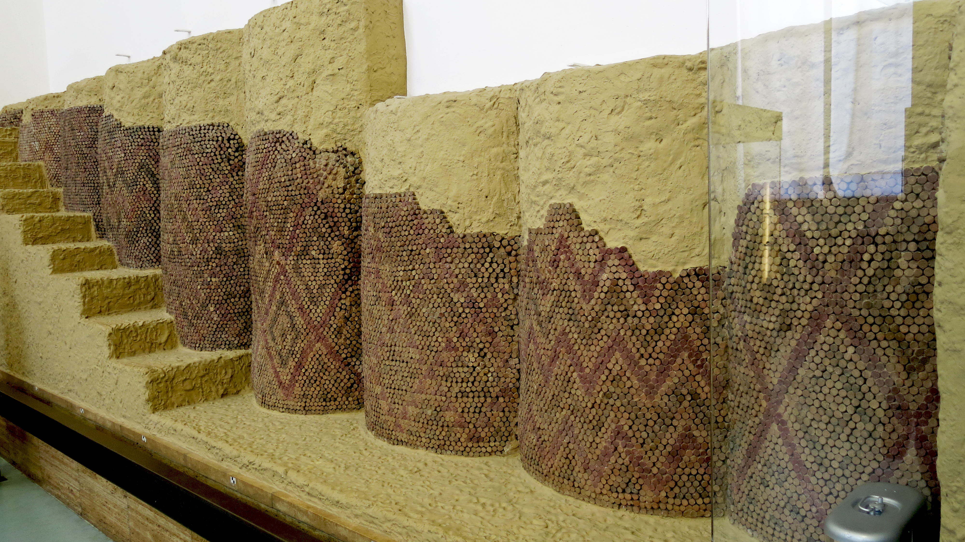
Cone mosaic panel from Eanna Temple, circa 3 000 BC.
Cone mosaic in the temple precinct Eanna of the city goddess Inanna of Uruk.
In the late 4th millennium BC The construction of the sacred precinct Eanna in Uruk reached its peak. In addition to cult houses, round pillar halls with cone mosaics, bathing facilities and a so-called 'reception palace', a large courtyard with terraces was used for the cult worship of the goddess Inanna. On the north-west terrace, which was reached by two side flights of stairs on a dais-shaped extension, rose an open transverse hall with four pairs of massive round pillars and four semi-round pillars.
From the middle of the 4th millennium BC The cone-mosaic technique became a characteristic architectural element in the cult and representational buildings of the Eanna district. 10 cm long cones made of fired clay or plaster were pressed close together into the thick clay plaster of the walls. The heads of the cones were mostly painted black, red and white. In some cases, larger uncoloured ceramic or stone pins were also used. The resulting decorative patterns show rhombuses, triangles as well as band and zigzag shapes. Apparently, the design was based on models from wickerwork and textile production. In addition to the decorative effect, the cladding of the adobe walls with cone mosaics also had a structural function. The outer wall areas and pillars designed in this way were protected from weathering by wind or water thanks to the material strength of the cones.
Height 175 cm, length 1100 cm (11 metres), depth 100 cm.
Catalog: Ceramics, plaster, VA 11000
Photo: Don Hitchcock 2015
Source: Pergamon Museum, Berlin, recherche.smb.museum
Text: Google Arts and Culture, Ralf Bernhard Wartke
Three footed marble bowl, Uruk.
Circa 3 500 - 3 000 BC.
Photo: Don Hitchcock 2015
Source and text: Museum Card, Pergamon Museum, Berlin, recherche.smb.museum
Fragment of a vessel depicting the goddess Nisaba (?) and an inscription of Entemena, ruler of Lagash.
Circa 2 430 BC - 2 375 BC.
Height 251 mm, width 186 mm, thickness 40 mm, weight 3310 gm.
Unfortunately, only the fragment shown has survived from a stone vessel that was once more than 40 cm in diameter. Nevertheless, this piece is both an example of the advanced processing technique of objects made of hard rock and of a special type of relief. In accordance with the sequence of moving pictorial narratives that predominated in relief art, figures in profile were usually preferred. The figure preserved here, on the other hand, is at least partially clearly depicted en face, a relatively rare occurrence in Mesopotamian flat art. However, only the upper part of the body is turned toward the viewer, as can be seen from the rest of a seat that was formally pushed into the figure on the left edge of the fragment. The image of the woman initially appears stocky and disproportionate, unless the sitting position explains the gross stoop.
The overall picture in terms of posture and equipment shows a typical goddess representation with a short-sleeved undergarment and a cloak lying over the shoulder. While the facial cut remains within the bounds of the usual, the rich headdress, both natural and artificial, catches the eye. The goddess wears a cap befitting her dignity with a pair of horns, in addition with a mouthless face mask, also horned, and fitted with feathers. The overflowing hair is braided into four visible pigtails that end in curls. As is often the case with such representations, symbols that can be interpreted as poppies grow out of the shoulders. In her right hand she carries a bunch of dates. Designated in this way as a deity of vegetation, the symbolism alone does not allow any statement about her name. The inscription visible on the edge of the vessel and on both sides of the shoulders does not provide any certainty either, since it has only been preserved in fragments. The most common interpretation of the depiction as a depiction of the grain goddess Nisaba is ultimately not provable, but not improbable. There is no doubt that the vessel is a sacred object, for which the image of the goddess and the rest of the dedicatory inscription stand. From comparisons with other inscriptions of this period, only Entemena of Lagash can be considered as the donor, since the surviving section largely coincides with his inscriptions, especially for the establishment of a brewery for the city god Ningirsu. A connection between the depiction of a grain goddess with bunches of dates - an important part of beer production - and the brewery of Ningirsu, which is documented by inscriptions and in which the vessel could have been used for ritual purposes, can only be assumed. [Joachim Marzahn].
Catalog: Basalt, unknown provenance, VA 07248
Photo: Don Hitchcock 2015
Source and text: Museum Card, Pergamon Museum, Berlin, recherche.smb.museum, CC BY-NC-SA @ Vorderasiatisches Museum
Bowl with a notched edge, of calcareous sinter, from Uruk, presented on a modern ivory coloured support.
Calcareous sinter is a freshwater calcium carbonate deposit, also known as calc-sinter. Deposits are characterised by low porosity and well-developed lamination, often forming crusts or sedimentary rock layers.
Circa 4 000 - 3 000 BC.
Height 34 mm, diameter 97 mm (mouth), 35 mm (bottom), thickness 8 mm, weight 130 gm.
Catalog: Calcareous sinter, Uruk, VA 14524
Photo: Don Hitchcock 2015
Source and text: Museum Card, Pergamon Museum, Berlin, recherche.smb.museum, CC BY-NC-SA @ Vorderasiatisches Museum
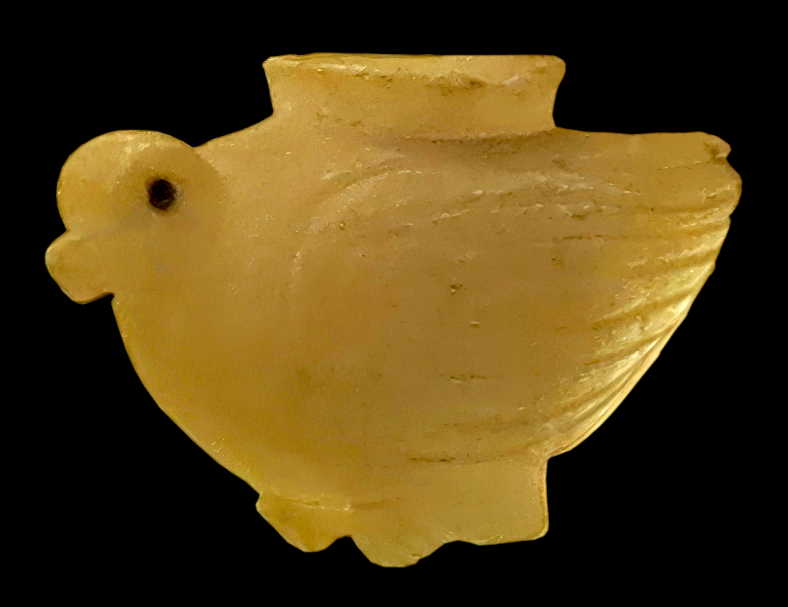
Vessel in the shape of a dove.
This small alabaster vessel has the shape of a seated dove. The base of the bottle consists of the two wedge-shaped feet of the dove. The vessel opens at the top and has a short, circular neck that could be closed with a stopper. The lip of the bottle is irregular in shape and slightly curved outwards.
The inner cavity of the vessel was created by chiseling out the stone. The bird's wings consist of several horizontal incised lines that were worked into the side of the vessel's belly.
The head of the dove was carved in a rounded, plastic, manner in contrast to the tapered tail feathers.
The remains of bitumen preserved in the eye sockets are evidence of former deposits. The bottle was probably used to store oils or ointments.
Height 40 mm, length 65 mm, diameter (mouth) 25 mm, weight 80 gm.
Circa 3 500 - 3 000 BC.
Catalog: Alabaster, Uruk, Quadrant K 17, on the floor of the White Temple, in the south stairwell between the north-east wall and the stair stringer (support for the treads and risers), VA 10357
Photo: Don Hitchcock 2015
Source and text: Museum Card, Pergamon Museum, Berlin, recherche.smb.museum, CC BY-NC-SA @ Vorderasiatisches Museum
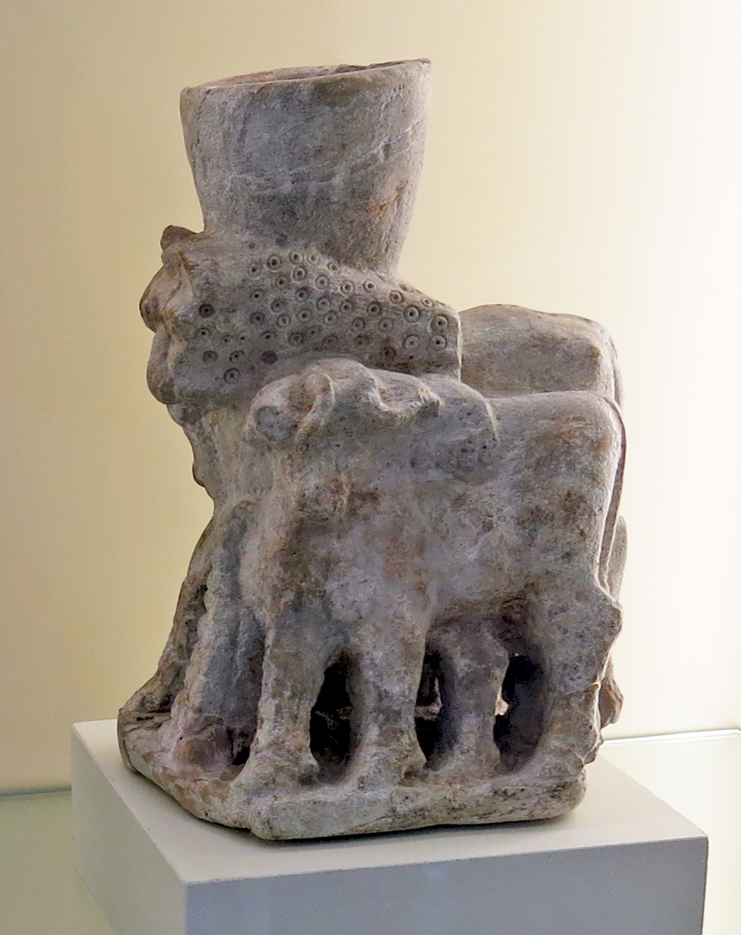
Skulpturbecher, circa 3 000 BC.
Literally 'sculpture mug', these objects survive in modern times as objects such as British 'toby mugs'.
The animals are difficult to identify, but there may be two lions and a sheep.
Photo: Don Hitchcock 2015
Catalog: Soapstone sculpture mug, unknown provenance.
Source and text: Museum Card, Pergamon Museum, Berlin, recherche.smb.museum, CC BY-NC-SA @ Vorderasiatisches Museum
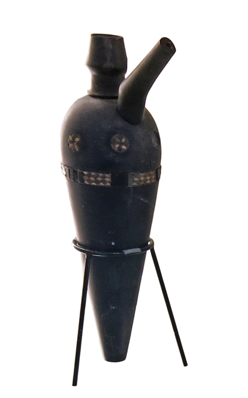
Spouted libation vessel in bituminous limestone, with mosaic inlays, circa 3 500 BC - 3 000 BC.
Jemdet Nasr/Early Dynastic Period.
The Jemdet Nasr Period is an archaeological culture in southern Mesopotamia (modern-day Iraq). It is generally dated from 3 100 BC to 2 900 BC. It is named after the type site Tell Jemdet Nasr, where the assemblage typical for this period was first recognised. Its geographical distribution is limited to south-central Iraq. The culture of the proto-historical Jemdet Nasr period is a local development out of the preceding Uruk period and continues into the Early Dynastic I period.
Bituminous limestone is limestone impregnated and sometimes deeply coloured with bituminous matter derived from the decomposition of animal and plant remains entombed within the mass or in its vicinity.
Height 215 mm, diameter 63 mm (max.), diameter 14 mm (bottom), thickness 8 mm, weight 250 gm.
From the Eanna ziggurat, Oe 16-3, located in front of the south-western façade of the ziggurat.
Photo: Don Hitchcock 2015
Catalog: Bituminous limestone, Uruk, VA 11055
Source and text: Museum Card, Pergamon Museum, Berlin, recherche.smb.museum, CC BY-NC-SA @ Vorderasiatisches Museum
Additional text: van Ess & Fassbinder (2019), Wikipedia
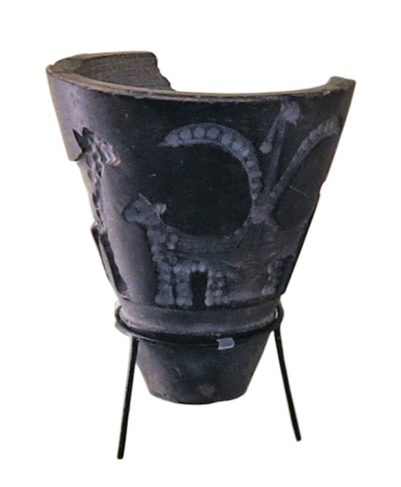
Fragment of a jar with mosaic inlays, place of discovery unknown.
( The mosaics appear to include images of fanciful cats - Don )
Circa 2 000 - 2 500 BC.
Photo: Don Hitchcock 2015
Source and text: Museum Card, Pergamon Museum, Berlin, recherche.smb.museum, CC BY-NC-SA @ Vorderasiatisches Museum
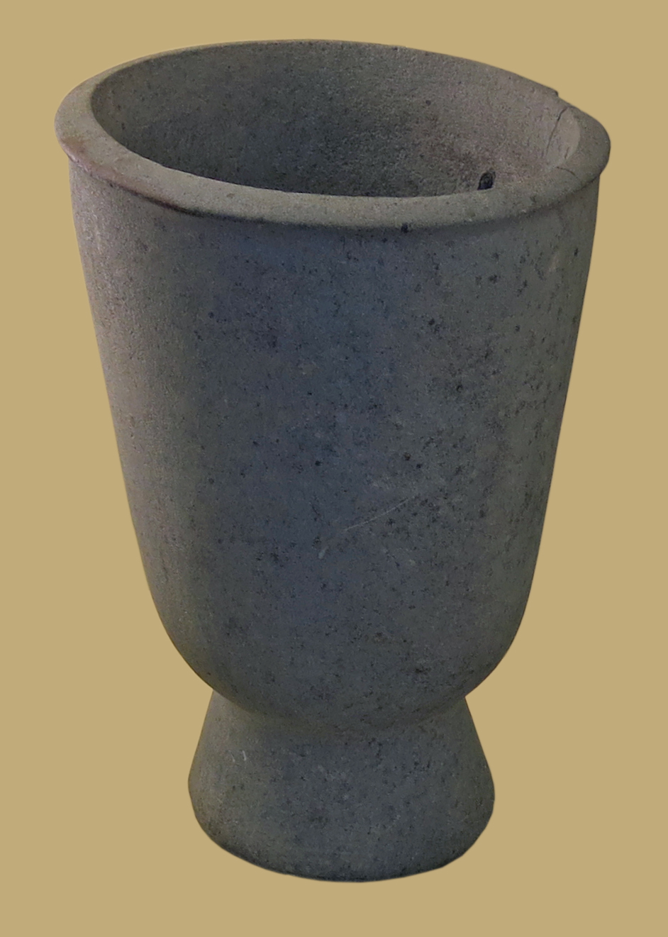
Footed cup in diabase, an intrusive igneous rock with the same mineral composition as basalt. Diabase cools moderately quickly under basaltic volcanoes, like those at mid-oceanic ridges, when magma moves up into fractures and weak zones below a volcano.
Jemdet Nasr/Early Dynastic Period.
Circa 3 300 - 2 700 BC.
Height 220 mm, diameter of mouth 180 mm, diameter of foot 120 mm, thickness 10 mm.
Catalog: Diabase, Uruk, quadrant Pa 16-2, VA 11061
Photo: Don Hitchcock 2015
Source and text: Museum Card, Pergamon Museum, Berlin, recherche.smb.museum, CC BY-NC-SA @ Vorderasiatisches Museum
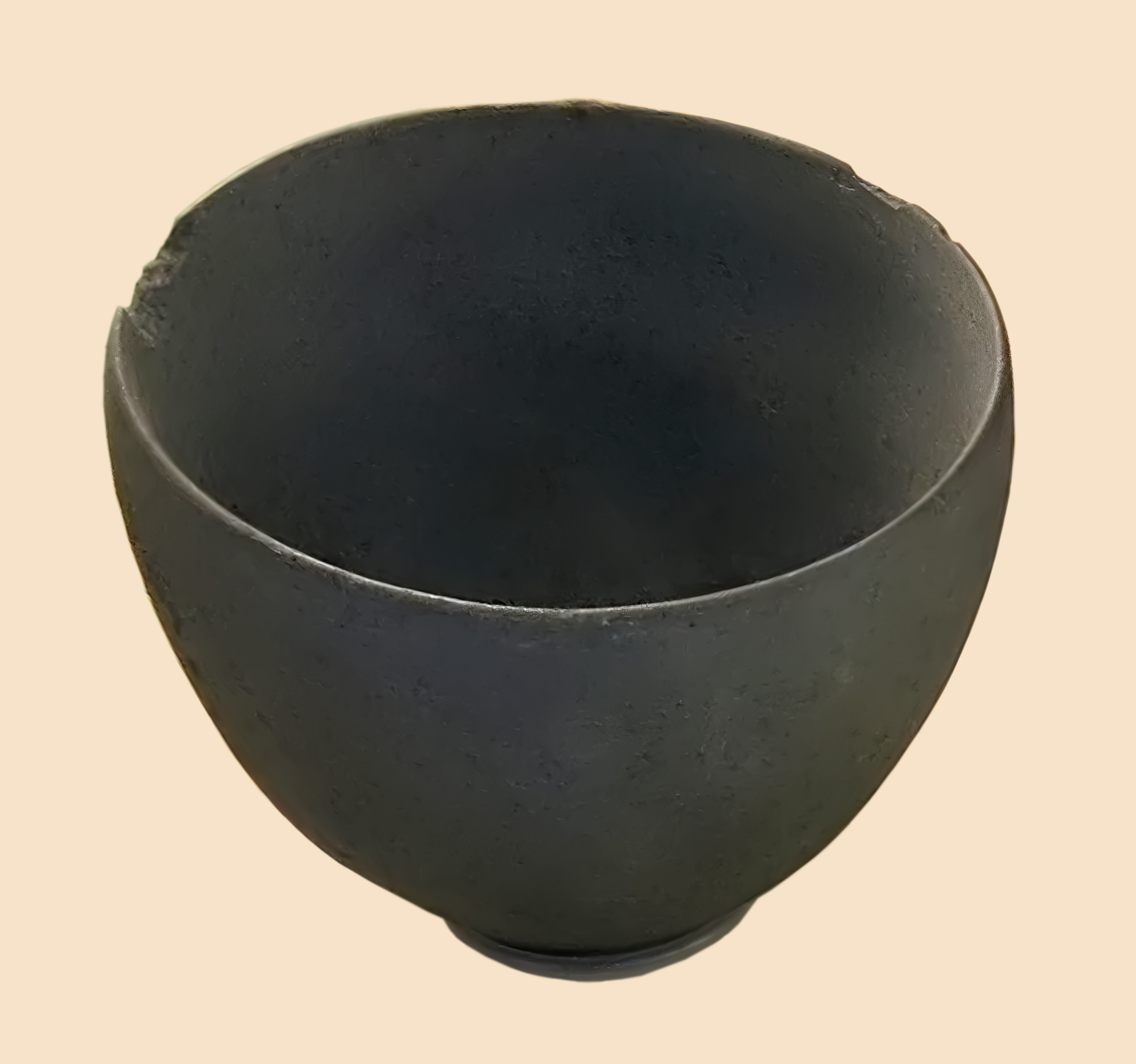
Stone bowl in diabase, resting on a modern support.
Circa 4 900 BC - 3 100 BC.
Height 95 mm, diameter mouth 116 mm, diameter base 42 mm, thickness 10 mm, weight 660 gm.
Catalog: Abu Ğidah (?) southeast of Uruk, direction Larsa, VA 14523
Photo: Don Hitchcock 2015
Source and text: Museum Card, Pergamon Museum, Berlin, recherche.smb.museum, CC BY-NC-SA @ Vorderasiatisches Museum
Lenticular drill
These drills used either high speed or high pressure to grind out the inside of a solid jar.
Circa 3 000 BC.
The grinding object was a lens shaped piece of hard quartzite, with two depressions, one on each side of the stone. These provided a purchase for the ends of a double arced wooden centrepiece, which was either rotated quickly back and forth by a bow and cord, or more slowly by hand with two fairly heavy stones attached to the handle, as shown.
Photo: Don Hitchcock 2015
Source and text: Museum Card, Pergamon Museum, Berlin, recherche.smb.museum, CC BY-NC-SA @ Vorderasiatisches Museum
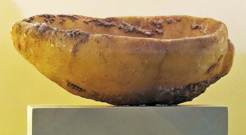
Alabaster bowl in the form of a snail.
Circa 2 500 BC - 2 000 BC.
Found at Tell Fara, ancient Shuruppak. Shuruppak, 'the healing place', was an ancient Sumerian city situated about 55 km south of Nippur on the banks of the Euphrates in Iraq's Al-Qādisiyyah Governorate. Shuruppak was dedicated to Ninlil, also called Sud, the goddess of grain and the air.
The site extends about a kilometre from north to south. The total area is about 120 hectares, with about 35 hectares of the mound being more than 3 metres above the surrounding plain, with a maximum of 9 metres.
Shuruppak became a grain storage and distribution city and had more silos than any other Sumerian city. The earliest excavated levels at Shuruppak date to the Jemdet Nasr period about 3 000 BC; it was abandoned shortly after 2 000 BC. Erich Schmidt found one Isin-Larsa cylinder seal and several pottery plaques which may date to early in the second millennium BC. Surface finds are predominantly Early Dynastic.
Height 65 mm, length 170 mm, width 94 mm, weight 850 gm.
Catalog: Alabaster, Tell Fara, VA 09921
Photo: Don Hitchcock 2015
Source and text: Museum Card, Pergamon Museum, Berlin, recherche.smb.museum, CC BY-NC-SA @ Vorderasiatisches Museum
Additional text: Wikipedia
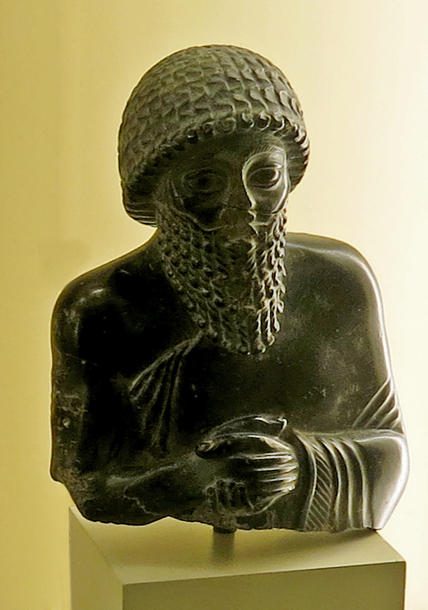
Statuette of Ur-ningirsu
Circa 2 120 BC, Ur III period, from Lagash.
This small statuette of a bearded man is identified by the cuneiform inscription on the back: 'Dedicated to the god Ningizzida, his god, by Ur-ningirsu, priest-prince of Lagash, son of Gudea, priest-prince of Lagash.'
The text indicates that it was the ruler who dedicated this portrait of himself to the temple - in continual worship of Ningizzida, a Sumerian divinity with chthonic attributes. (He is the god of the underworld and also guardian of the gate of heaven.)
The upper body is all that survives of the statuette, and the nose and the mouth amid the long beard look as if they have been deliberately damaged. Ur-ningirsu wears a smooth garment with decorated braid trimming which leaves the right shoulder bare. He has his hands clasped in prayer.
The statuette has the formal qualities of Neo-Sumerian sculpture. Characteristic here are the ample hair and its stereotypical representation in individual locks, the strong eyebrows with their hatched rendering, and the schematic folds of the robe; equally characteristic are the lively modelling of the face and the gentle rounding of the limbs and torso. The play of light on the carefully polished surface of the hard stone emphasises the statuette's plastic qualities.
Width 125 mm, height 180 mm, depth 75 mm, weight 1850 gm.
Catalog: Diorite, Lagash, VA 08790, ISIL no.: DE-MUS-815718
Photo: Don Hitchcock 2015
Source: Pergamon Museum, Berlin, recherche.smb.museum, CC BY-NC-SA @ Vorderasiatisches Museum
Text: Google Arts and culture ( apparently adapted from the comments of the curator, Ralf B. Wartke - Don )
The Royal Cemetery of Ur, circa 3 000 BC - 2 000 BC
The Royal Cemetery of Ur, in one of the most important Southern Mesopotamian cities, provides us with an insight into royal afterlife. Sixteen burials of immense wealth transmit a general idea of the ritual following death.
The deceased were buried together with their attendants, soldiers, musicians and ass-drawn chariots as well as precious grave goods, all considered necessary provisions for the netherworld gods and the deceased's own needs in the afterlife.
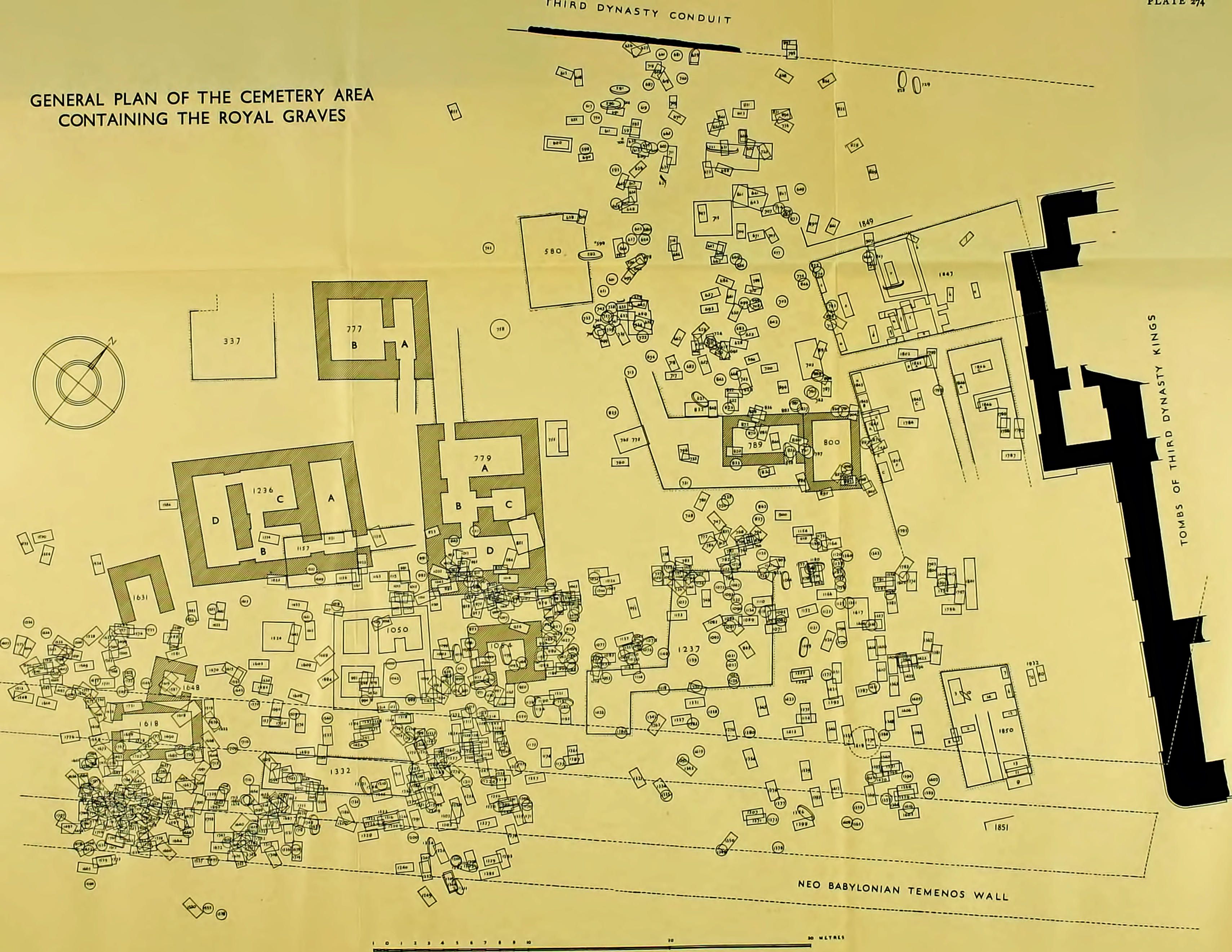
Photo: Woolley (1934)
Source: archive.org/details/urexcavations191319join/page/n551/mode/1up?view=theater)
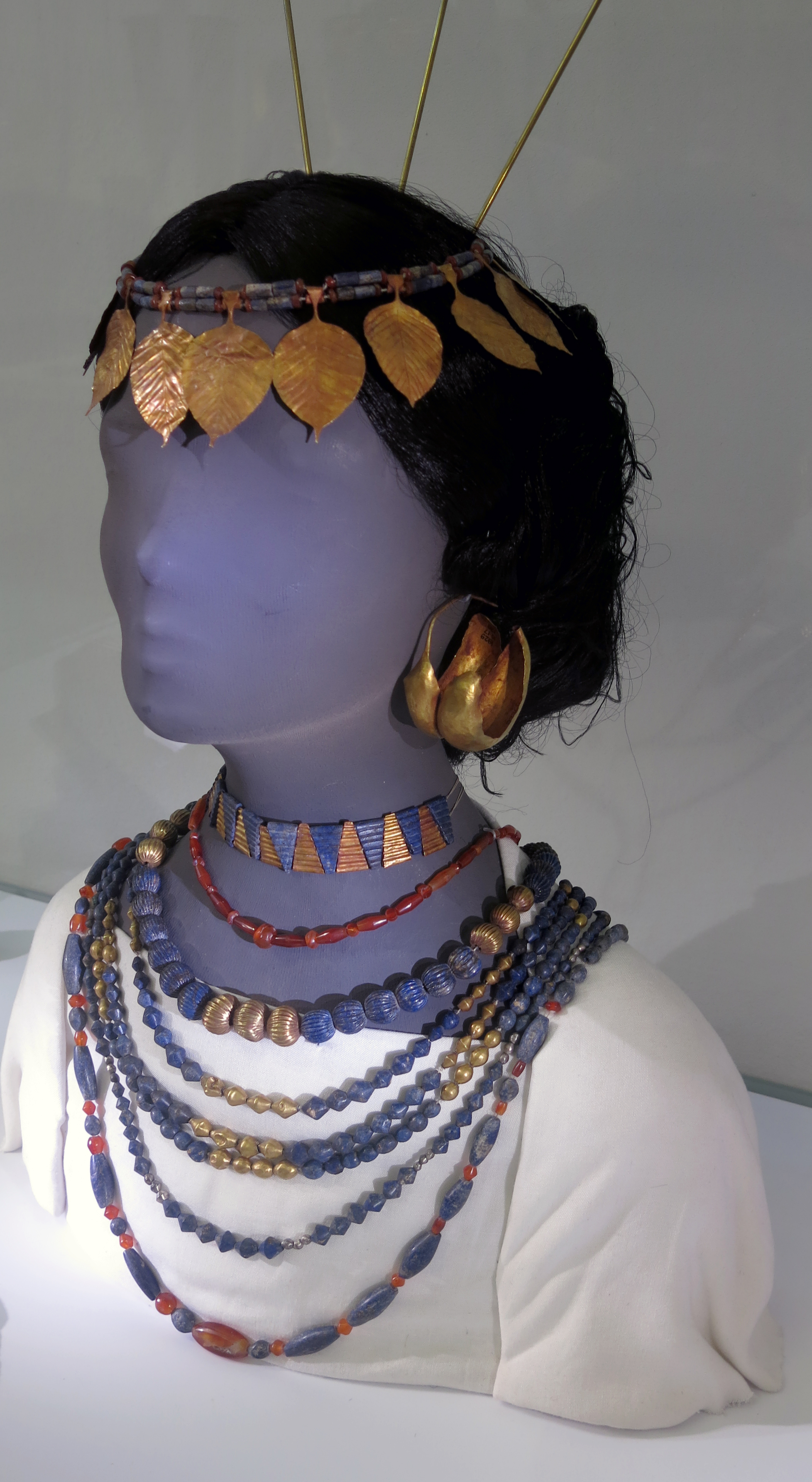
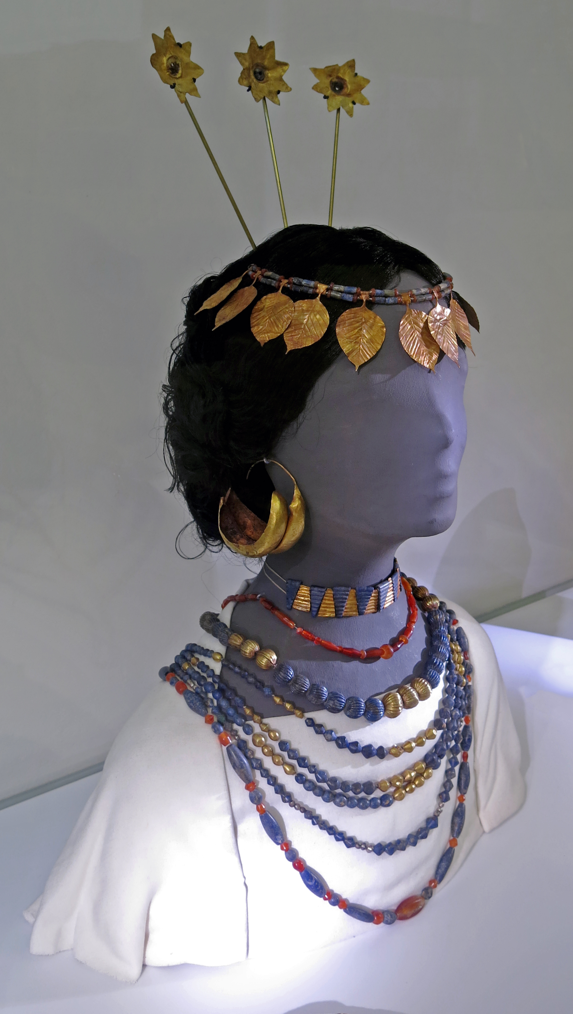
Arrangement of Jewellery
This bust suggests the original arrangement of the jewellery worn by female attendants buried in the royal graves. The headdress consists of two gold ribbons, a diadem of gold leaves with lapis lazuli and carnelian beads and three gold rosettes on modern mounts.
The jewellery around the neck consists of a collar of gold and lapis lazuli triangular spacer beads. Necklaces and beads of carnelian, gold, silver and lapis lazuli in different shapes complete the outfit. A silver pin with a lapis lazuli head could have helped to secure the cloak.
( The two large double 'boat' shaped gold ear-rings on this bust, diameter 73 mm, BM 122341, are superbly made, and display not just the technical ability of the goldsmith, but their artistry. I feel sure the owner valued the original earrings highly - Don )
Catalog: Ur/Tell el-Muqajjir (Iraq) Graves PG 55, PG 1237 ('Great Death Pit'), PG 1402, about 2 600 - 2 400 BC. London, British Museum, Department of the Middle East, on long-term loan.
Photo: Don Hitchcock 2015
Source and text: Pergamon Museum, Berlin, recherche.smb.museum
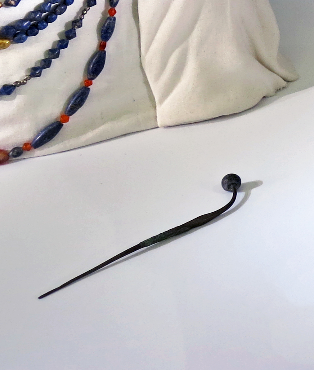
Arrangement of Jewellery
This silver pin with a lapis lazuli head could have helped to secure the cloak in the bust shown above.
Catalog: Ur/Tell el-Muqajjir (Iraq) Graves PG 55, PG 1237 ('Great Death Pit'), PG 1402, circa 2 600 BC - 2 400 BC. London, British Museum, Department of the Middle East, on long-term loan.
Photo: Don Hitchcock 2015
Source and text: Pergamon Museum, Berlin, recherche.smb.museum
Arrangement of Jewellery
These two gold ribbons are part of the headdress of the bust above.
One of the ribbons has the number 122339 painted on it, which is the British Museum Big Number for the find, which enables us to gain a little more information:
There are three such ribbons listed in the find from the BM, but it would appear that B and C were originally one ribbon, since the overall length of one of the ribbons is given as 87 cm, the sum of B and C's length:
A: Length 162 cm, width 9 mm, thickness 1 to two mm, weight 31.7 gm.
B: Length 52 cm, width 8 mm, thickness 1 to two mm, weight 11.3 gm.
C: Length 35 cm, width 8 mm, thickness 1 to two mm, weight 8.1 gm.
Catalog: Ur/Tell el-Muqajjir (Iraq) Graves PG 55, PG 1237 ('Great Death Pit'), PG 1402, about 2 600 - 2 400 BC. London, British Museum, Department of the Middle East, on long-term loan.
Photo and additional text: Don Hitchcock 2015
Source and text: Pergamon Museum, Berlin, recherche.smb.museum
Text from the British Museum: http://www.britishmuseum.org/, © Trustees of the British Museum, CC BY-NC-SA 4.0
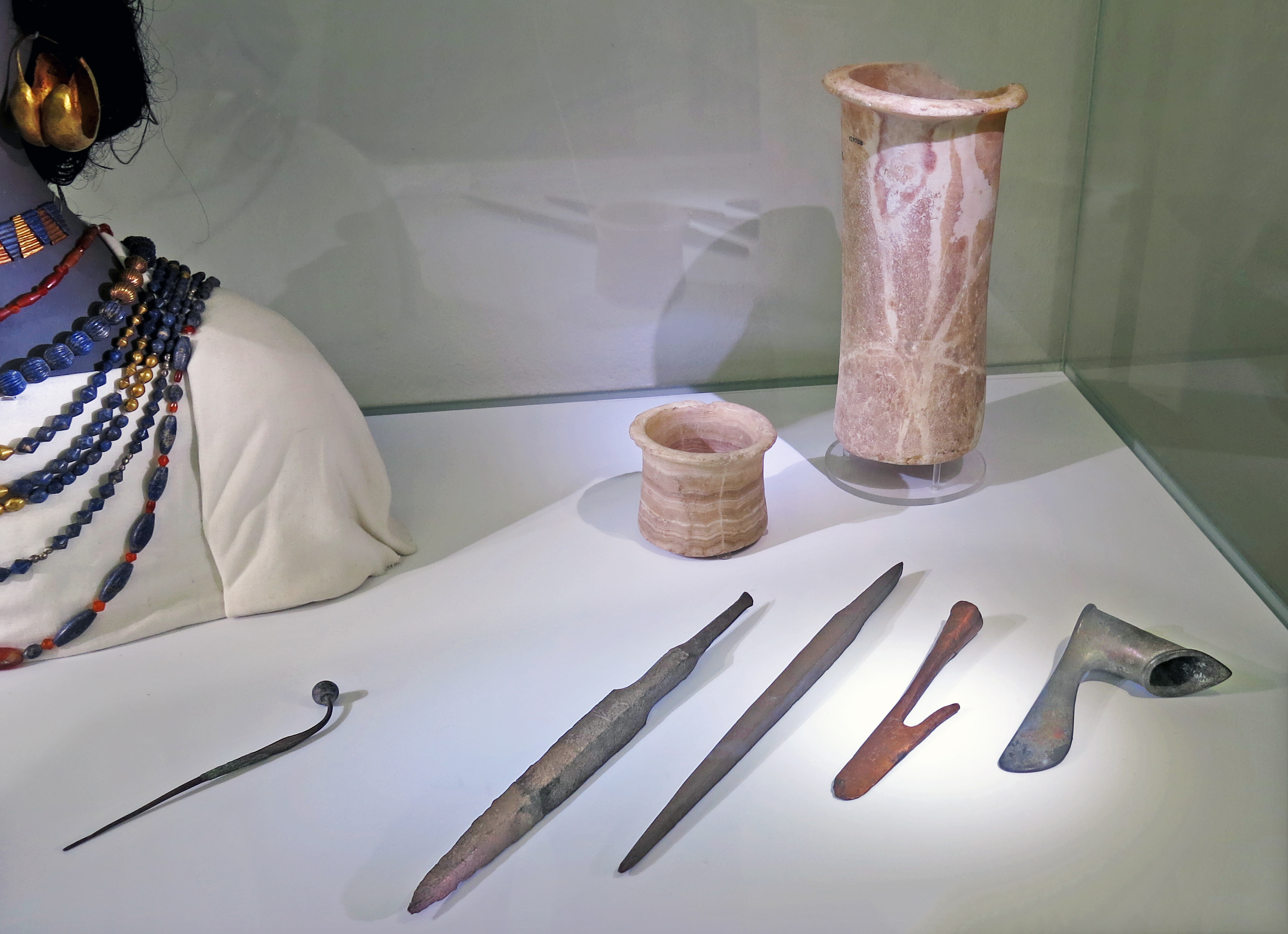
Cylindrical stone jars
Bowl, vase, circa 2 600 - 2 400 BC
Silver pin with a lapis lazuli head.
Weapons:
Copper alloy spearhead engraved with a bull-leg symbol, four-sided, length 40 cm.
Copper alloy spearhead with tang.
Harpoon head with a long barb and a tubular base.
( Note that sumerianshakespeare.com observes that while Woolley called them harpoons, their blunt points suggest a different purpose. They were perhaps used as pole weapons. The blunt ends could be used to push against the enemy's shields, without becoming embedded in them, to push back their lines. The barbed end of the weapon could be used to hook onto the rim of an enemy's shield and pull it down, thus leaving him unprotected, to be finished off with a sword. - Don )
Copper alloy axe head, cast with a vertically curved blade.
Catalog: Calcite, copper alloy, silver, lapis lazuli, Ur/Tell el-Muqejjir, (Iraq), Royal Cemetery, long-term loan from the British Museum, Department of the Middle East.
Photo: Don Hitchcock 2015
Source and text: Pergamon Museum, Berlin, recherche.smb.museum
Additional text: sumerianshakespeare.com/117701/118301.html
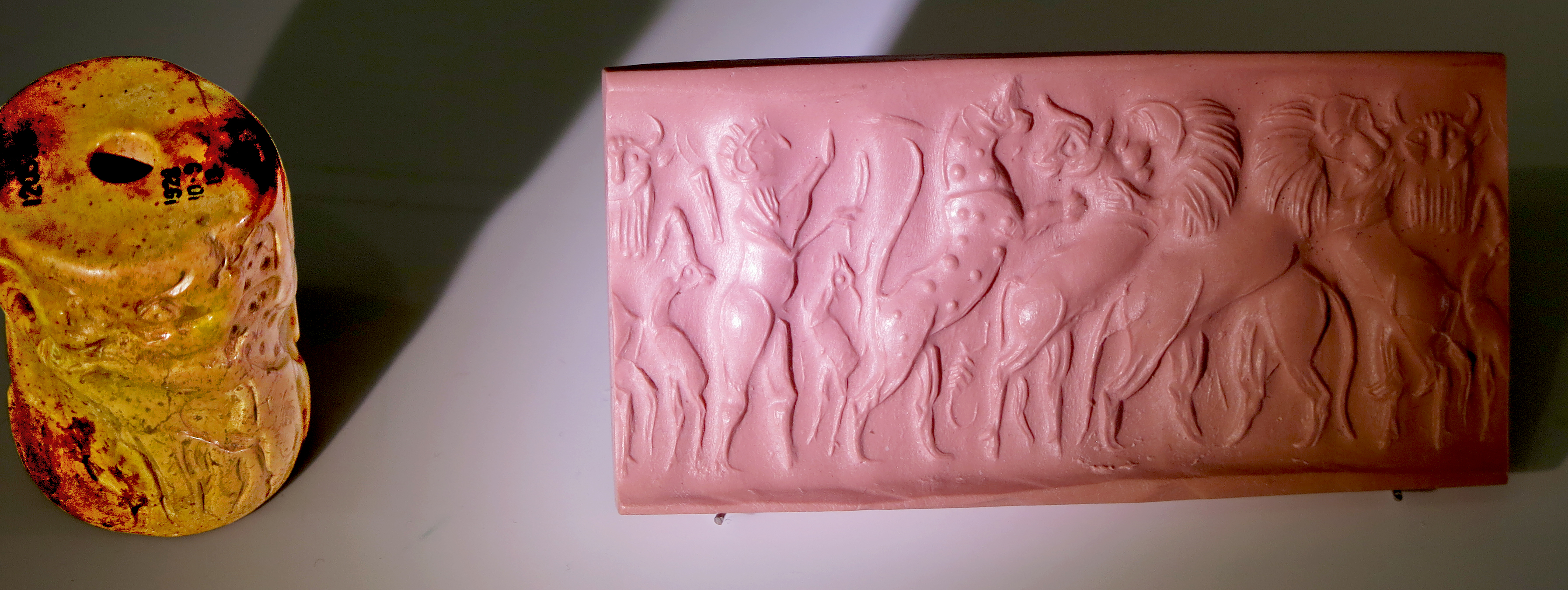
Cylinder seal and modern impression
Circa 2 600 BC - 2 400 BC.
White stone.
Contest scene with a hero and a leopard attacking a bull fought by a lion. Another lion fights a bull-man. In the field are a goat, scorpion and antelope.
BM description:
Large, cream marble or shell cylinder seal with patches of yellow/brown and grey/green; contest frieze; hero with stick and knife before leopard which attacks bull which is also being fought by lion. Another lion (crossed) fights bull-man. In field: goat, scorpion, antelope.
Diameter 32 mm, height 43 mm.
Catalog: Ur/Tell el-Muqajjir (Iraq) Grave PG 43, circa 2 600 BC - 2 400 BC.
Catalog BM: Marble? Shell ? BM/Big number 120530
Photo and additional text: Don Hitchcock 2015
Proximal source and text: Pergamon Museum, Berlin, recherche.smb.museum
Source: London, British Museum, Department of the Middle East, on long-term loan.
Text from the British Museum: http://www.britishmuseum.org/, © Trustees of the British Museum, CC BY-NC-SA 4.0
Purpose and Use of Cylinder Seals
Authentication and Identity: Cylinder seals often bore the unique mark of their owner, functioning as a form of personal identification. They were used to stamp an individual’s or official’s mark onto documents, which helped authenticate the seal's owner and their authority.
Administrative and Legal Functions: In administrative contexts, seals were used to impress official documents, such as contracts, decrees, and legal agreements. This served as a means of verifying the document’s legitimacy and the authority behind it.
Personal and Decorative Use: Besides their administrative function, cylinder seals were also used for personal and decorative purposes. They could be intricately carved with images and symbols that reflected the owner’s status, beliefs, or achievements.
Securing Containers: Seals were also used to secure containers, such as jars or boxes. Impressions from the seal on the clay used to close the container served as a deterrent against tampering and indicated whether the container had been opened.
How They Worked: Cylinder seals were rolled over soft clay to create a continuous impression. The designs could include detailed images, inscriptions, and symbols. When the seal was rolled over the clay, it created a raised or engraved pattern that could be used for various purposes as described. These seals were crucial in administrative and legal systems in ancient Mesopotamia, playing a key role in the daily functioning of their complex societies.
Babylon
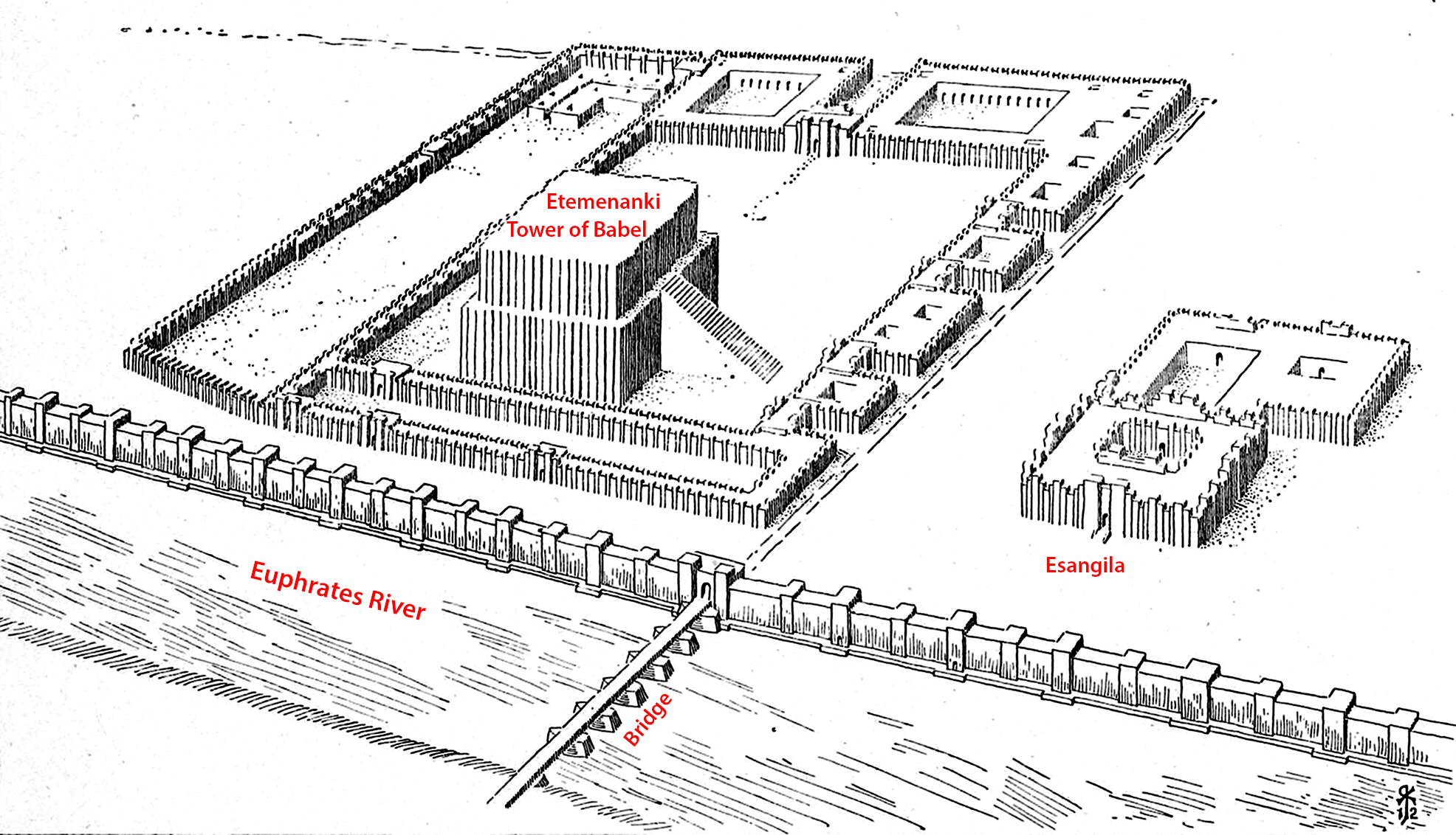
Esagila (house of the main elevation), the ground level Marduk temple, is shown here to the right of the street from the bridge over the Euphrates.
Etemenanki (House of the Foundation of Heaven and Earth), the approx. 92 m high step tower.
The small high temple on the tower is said to have housed a bed and table for Marduk. The model of the tower follows the reconstruction proposal by W. Andrae / G. Martiny
State at the beginning of the 6th century BC
Koldewey directed the excavation of Babylon from 1899 through 1914, using comparatively modern archaeological techniques. The site had been identified a century earlier by Claudius James Rich.
More than 200 people worked on the site daily, year round, for fifteen years.
Photo and text: Koldewey (1914)
Additional text: Wikipedia
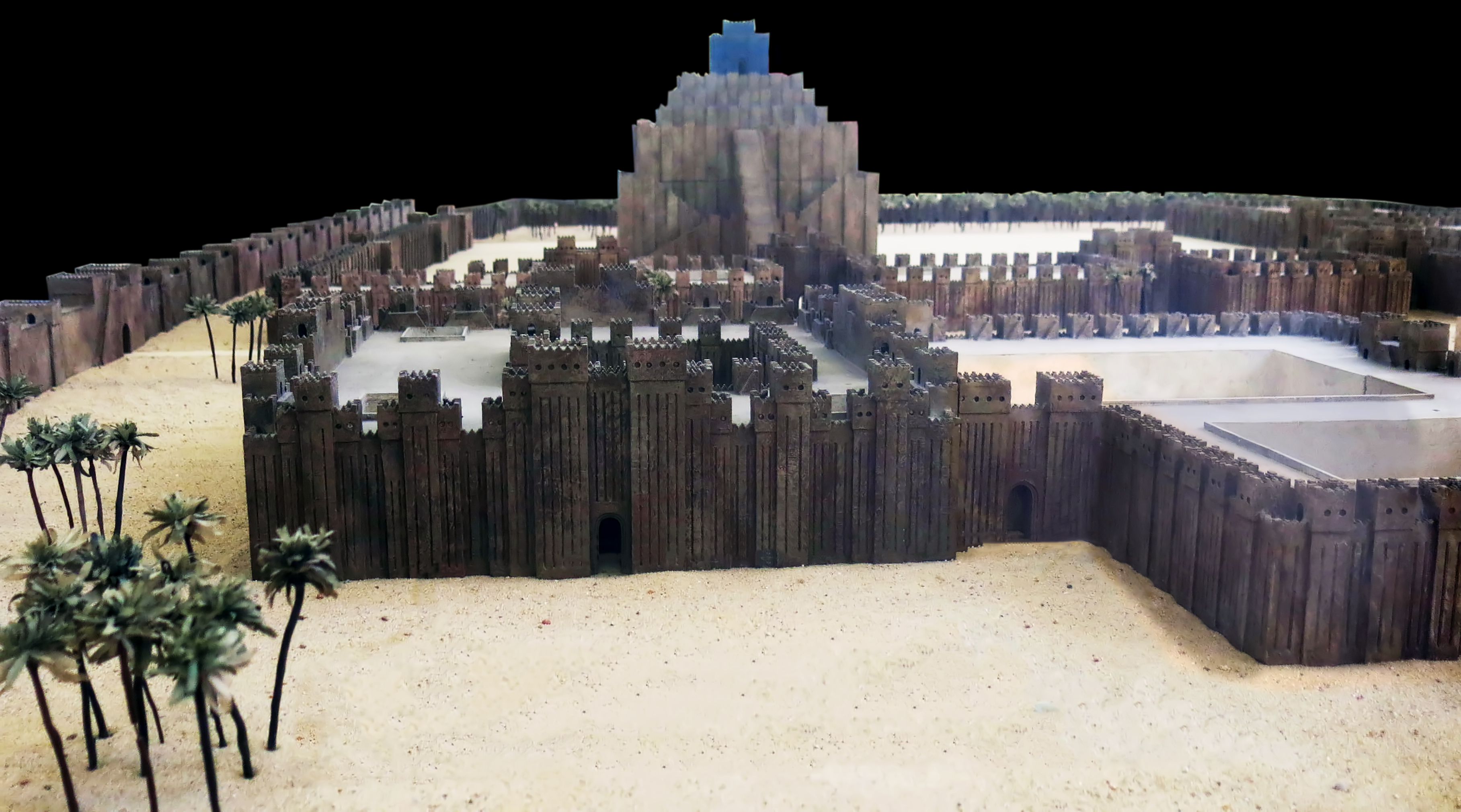
This view of the model of Babylon shows the interior of the peribolos, defined as a court enclosed by a wall, especially one surrounding a sacred area such as a temple, shrine, or altar.
The Esagila, a 'ground level' temple dedicated to Marduk, the protector god of Babylon, is in the foreground, with the Etemenanki, the Tower of Babel, in the background.
Etemenanki was a ziggurat dedicated to Marduk. It is now in ruins, and is located about 90 kilometres south of Baghdad, Iraq.
Photo: Don Hitchcock 2015
Source: Pergamon Museum, Berlin, recherche.smb.museum
Additional text: Wikipedia
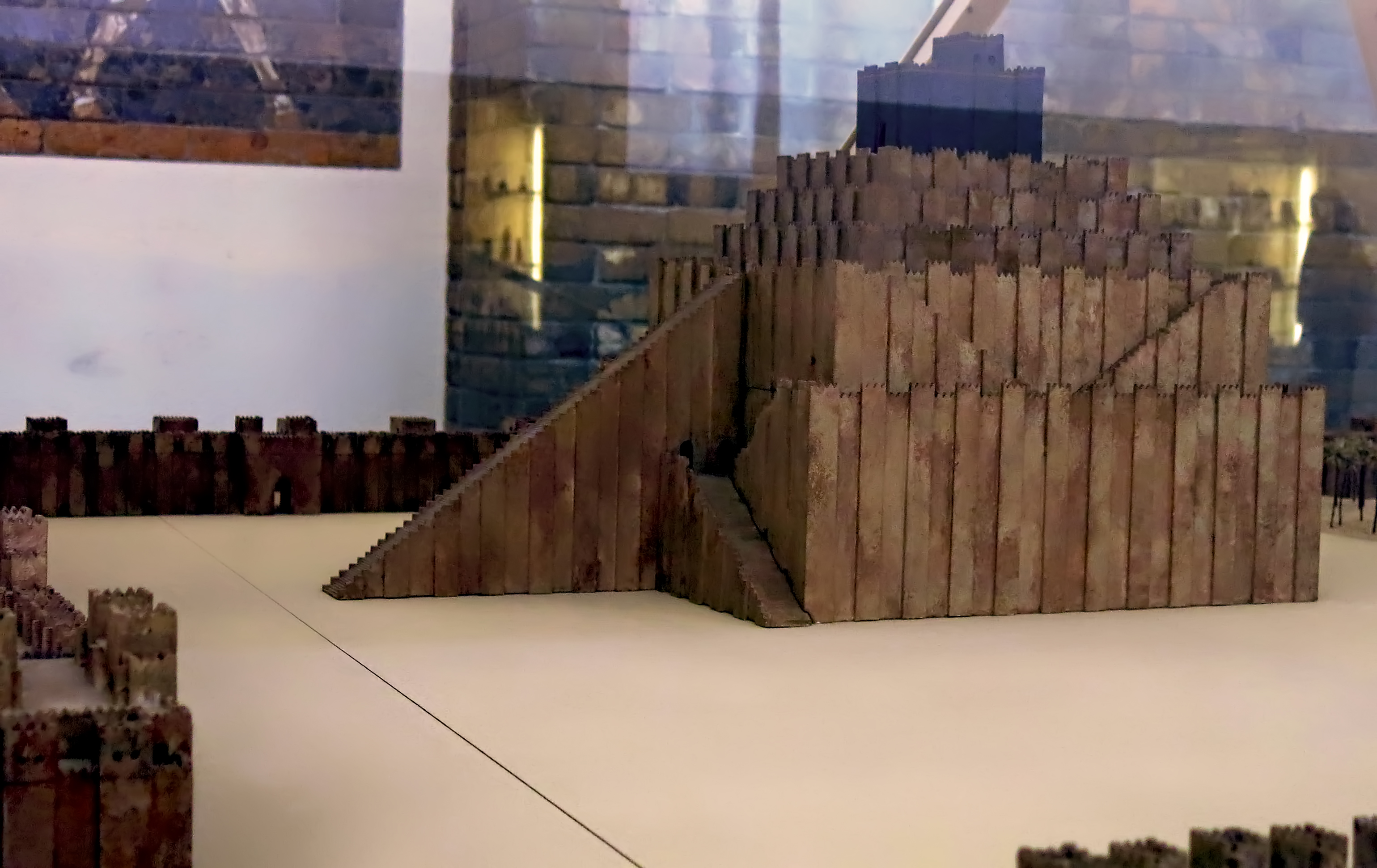
Model of Etemenanki, the Marduk temple in Babylon, also known as the Tower of Babel.
Babylon was destroyed in 689 BC by Sennacherib, who claims to have destroyed the Etemenanki. It took 88 years to restore the city. Work was started by the Assyrian king Esarhaddon, and continued under Nabopolassar, followed by his son Nebuchadnezzar II who rebuilt the ziggurat.
The city's central feature was the temple of Marduk (Esagila), with which this Etemenanki ziggurat was associated.
Photo: Don Hitchcock 2015
Source: Pergamon Museum, Berlin, recherche.smb.museum
Text: Wikipedia
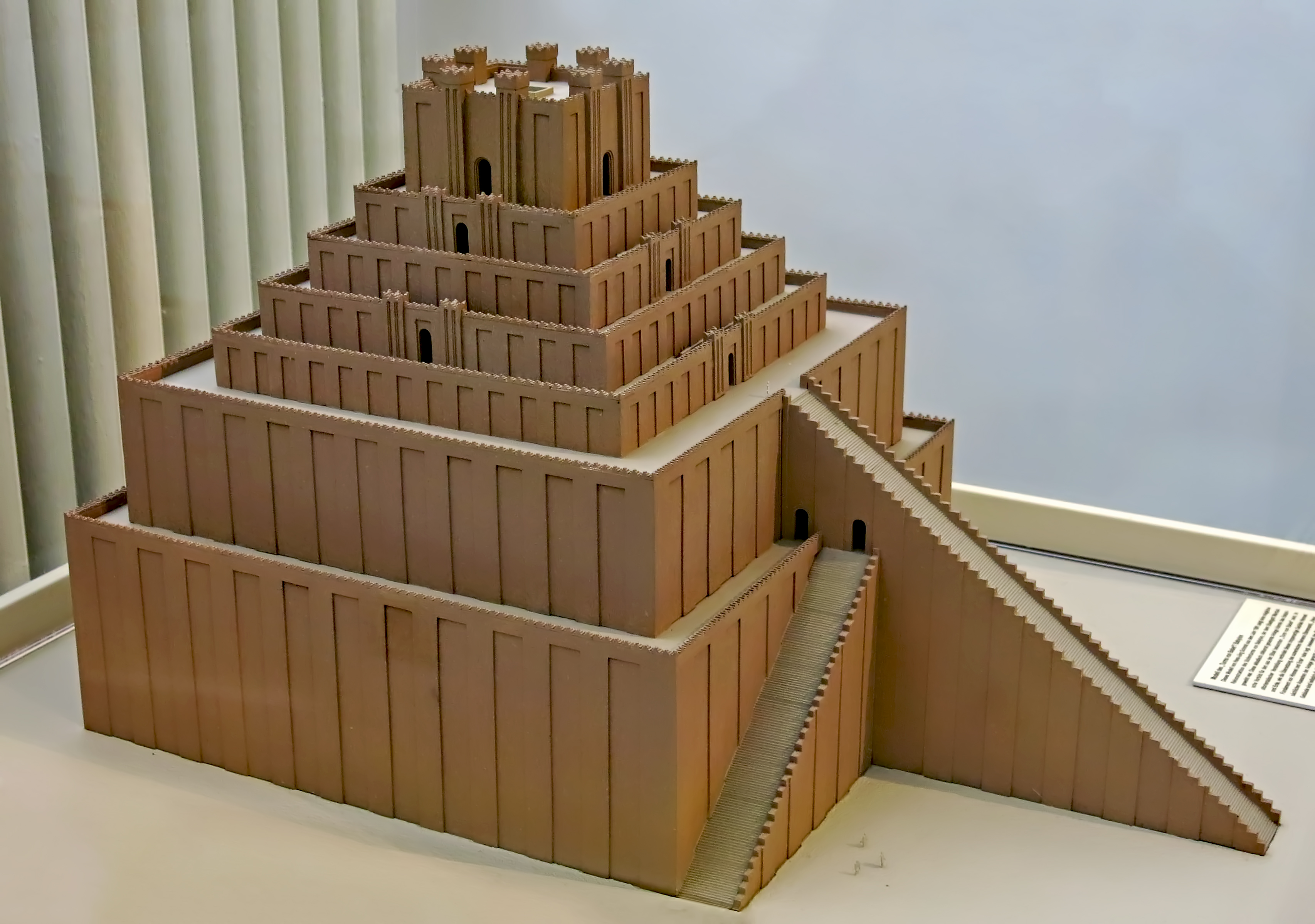
Another, more detailed version of Etemenanki.
The stepped tower of Babylon was dedicated to the city god Marduk. The model was made by Hans-Jörg Schmid in 1991. This building, in Akkadian called zikkurrat, might be the historical background for the biblical story of the 'Tower of Babel'.
In ancient Near Eastern thought, this stair-like structure connected heaven and earth, as the translation of the Sumerian name Etemenanki, 'House, foundation of heaven and earth' suggests.
To what extent the model represents the correct appearance of the building is debatable, as only the foundations of this building are preserved.
Catalog: VAG 01284
Photo: Don Hitchcock 2015
Artist: Hans-Jörg Schmid, 1991.
Source and text: Pergamon Museum, Berlin, recherche.smb.museum
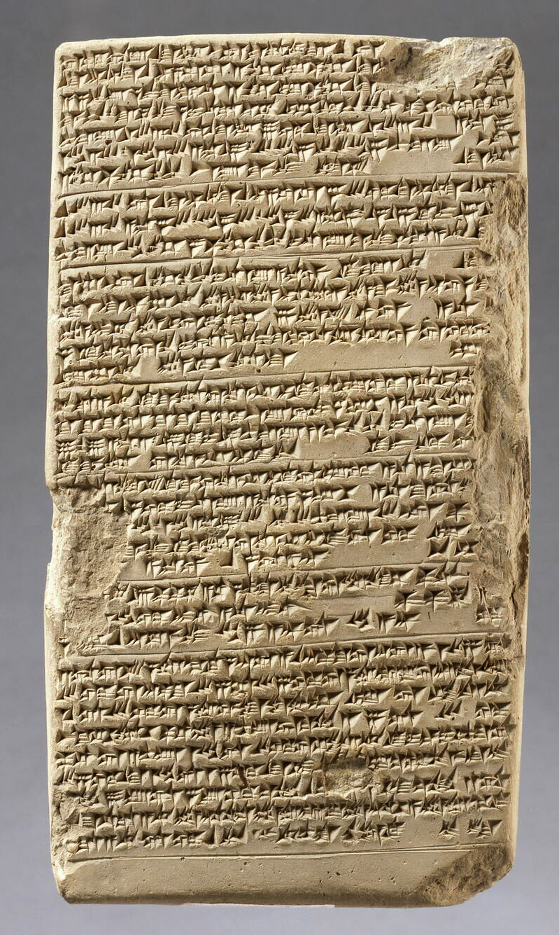
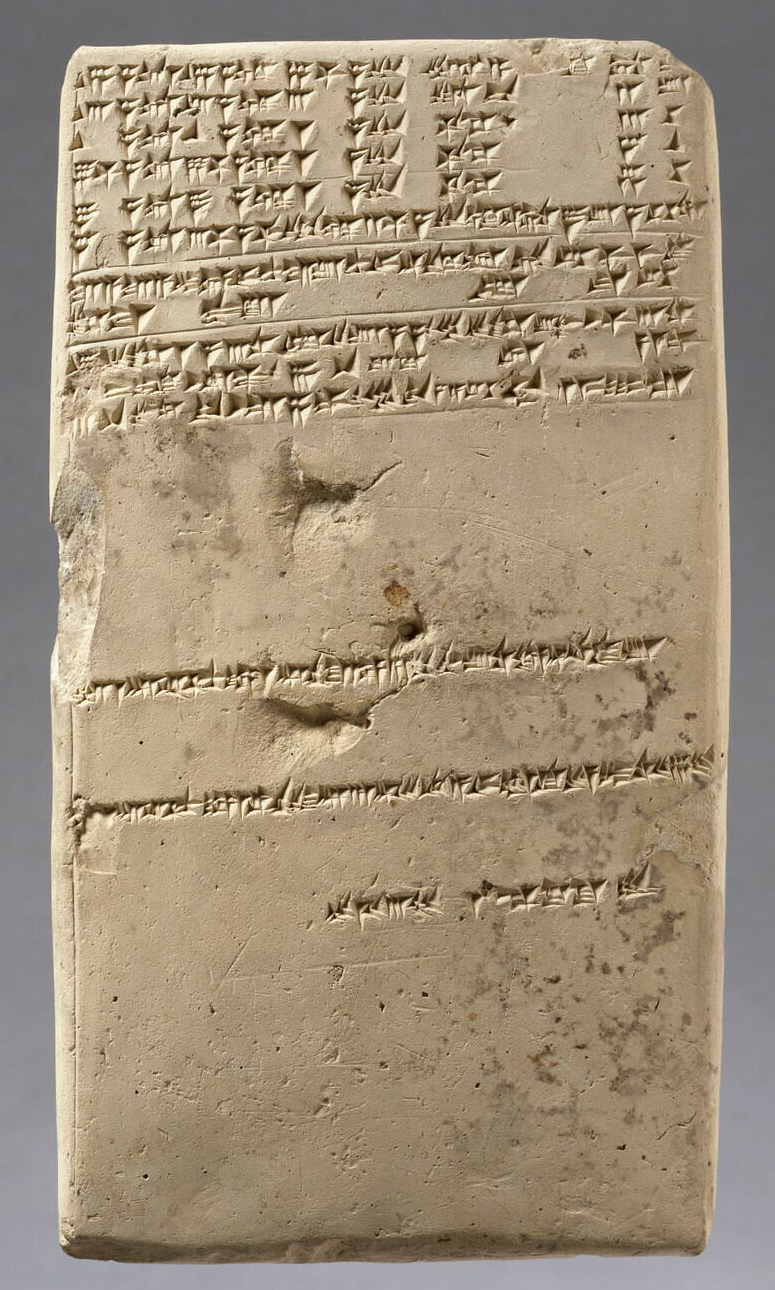
The 'Esagila' tablet
( This gives the height of Etemenanki as 91 metres, now believed to be no more than 66 metres, see below - Don )
Copy of a neo-Babylonian document written in Uruk from an original by Borsippa, Tablet of Esagila.
Inscription: Measurements of the Esagil and the Etemenanki.
Height 181 mm, width 100 mm, thickness 24 mm.
Date of the original tablet: Neo-Babylonian (Borsippa) (604 BC - 539 BC)
Date of creation / manufacture of this copy: Seleucid: Seleucos I (around 229 BC; year 83 of the Seleucids) (305 BC - 281 BC)
Provenance: Uruk archives of Eanna
Text above: © Louvre Museum, Paris, France, https://collections.louvre.fr/
Photo: © Raphaël Chipault, Louvre Museum, Paris, France, https://collections.louvre.fr/
Source: Original, Louvre Museum, Paris, France, https://collections.louvre.fr/
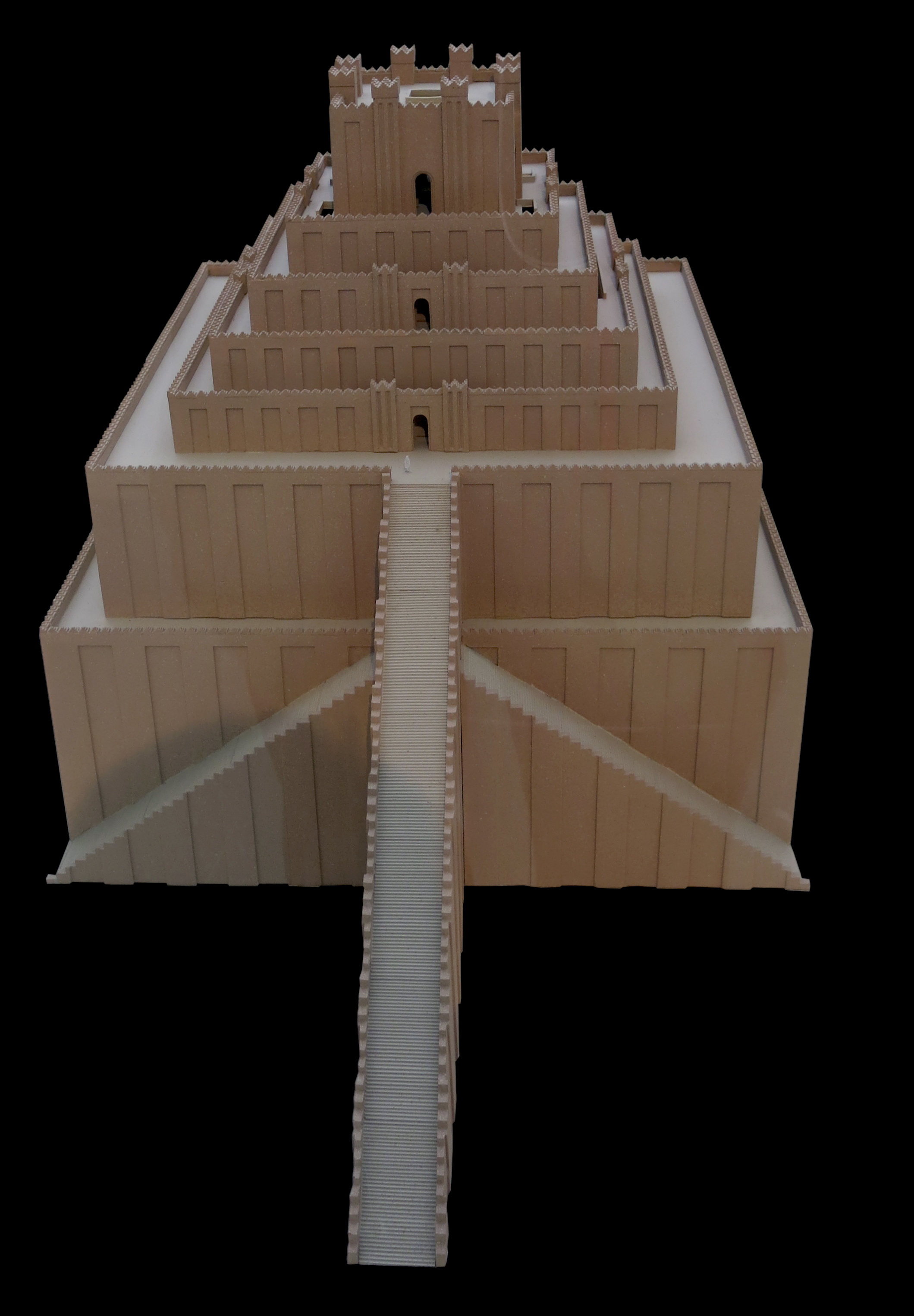
Modern scholars dispute the claim by the ancient Babylonian source (the 'Esagila' tablet) that the Etemenanki was 91 metres tall. 'The modern interpretation of the text of the Esagila tablet raises a serious technical problem: the excessive height of the first two terraces of the ziggurat and the total height of the building defy the laws of statics and compressive strength of a material such as raw earth brick.
Even allowing variation in the design of a six-level terraced structure, at that height, the compression stress on the structure would be somewhere around two to three times as much as comparable structures of the same time period. Fenollós J. et al. (2005) propose that, assuming the structure did indeed use a six-level terrace design as depicted in the Tower of Babel stele, the ziggurat was probably closer to 54 metres tall.
The temple at the top contributed another 12 metres in height, for a total height of 66 metres.
Photo: Don Hitchcock 2015
Artist: Hans-Jörg Schmid, 1991.
Text: Wikipedia
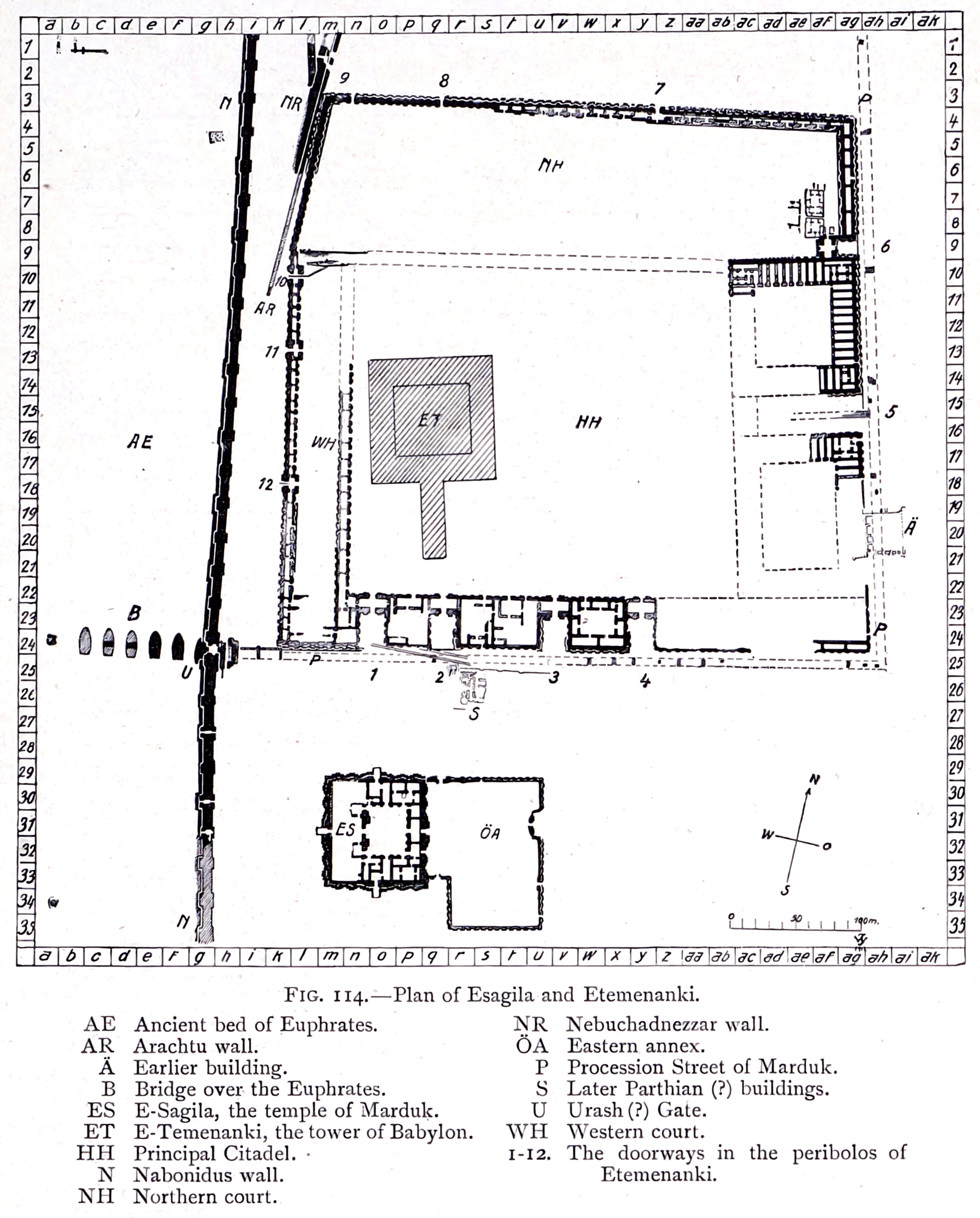
Plan of Esagila and Etemenanki.
Photo and text: Koldewey (1914)
Plan of the ruins of the city of Babylon
Photo: Koldewey (1914)
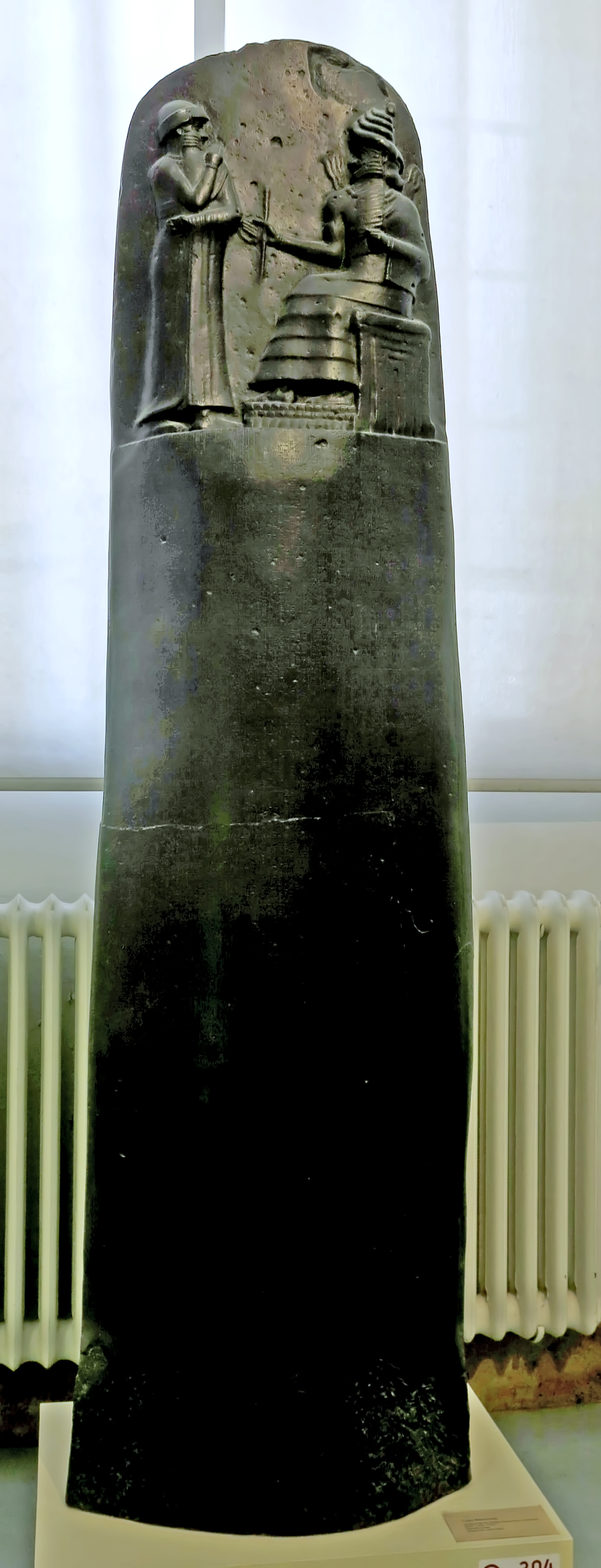
Codex Hammurabi
Stele of the Law of King Hammurabi of Babylon, 1 792 BC - 1 750 BC.
The code of Hammurabi is a Babylonian legal text composed circa 1 75 5– 1 750 BC. It is the longest, best-organised, and best-preserved legal text from the ancient Near East. It is written in the Old Babylonian dialect of Akkadian, purportedly by Hammurabi, sixth king of the First Dynasty of Babylon. The primary copy of the text is inscribed on a basalt or diorite stele 225 cm tall. The stele was discovered in 1901, at the site of Susa in present-day Iran, where it had been taken as plunder six hundred years after its creation. The text itself was copied and studied by Mesopotamian scribes for over a millennium. The stele now resides in the Louvre Museum.
The top of the stele features an image in relief of Hammurabi with Shamash, the Babylonian sun god and god of justice. Below the relief are about 4,130 lines of cuneiform text: one fifth contains a prologue and epilogue in poetic style, while the remaining four fifths contain what are generally called the laws. In the prologue, Hammurabi claims to have been granted his rule by the gods "to prevent the strong from oppressing the weak". The laws are casuistic, expressed as 'if ... then' conditional sentences. Their scope is broad, including, for example, criminal law, family law, property law, and commercial law.
Modern scholars responded to the Code with admiration, at its perceived fairness and respect for the rule of law, and at the complexity of Old Babylonian society. There was also much discussion of its influence on the Mosaic Law. Scholars quickly identified lex talionis, the "eye for an eye" principle, as underlying the two collections. Debate among Assyriologists has since centred around several aspects of the Code: its purpose, its underlying principles, its language, and its relation to earlier and later law collections.
Despite the uncertainty surrounding these issues, Hammurabi is regarded outside Assyriology as an important figure in the history of law, and the document as a true legal code. The U.S. Capitol has a relief portrait of Hammurabi alongside those of other lawgivers, and there are replicas of the stele in numerous institutions, including the headquarters of the United Nations in New York City and the Pergamon Museum in Berlin.
Photo: Don Hitchcock 2015
Source and text: Facsimile, Pergamon Museum, Berlin, recherche.smb.museum
Additional text: Wikipedia
Original is in the Louvre Museum, Paris
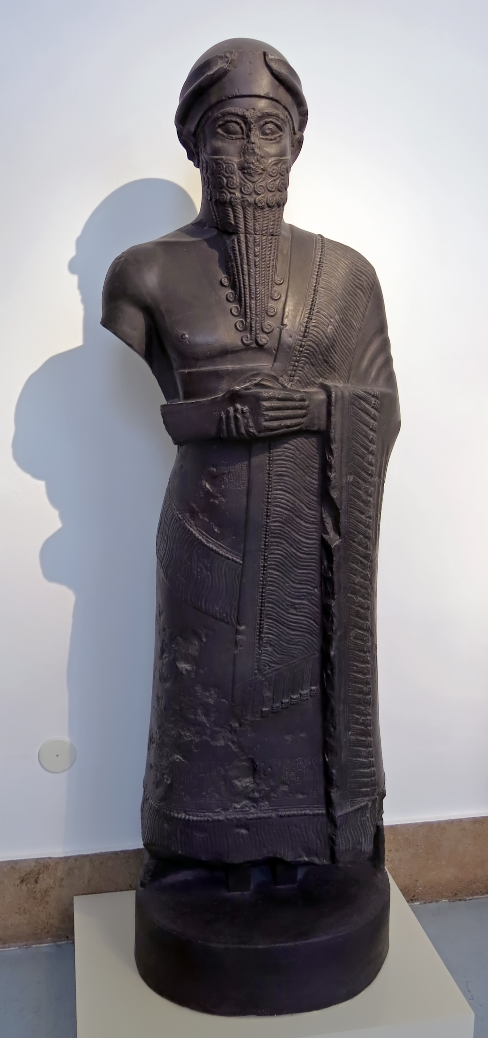
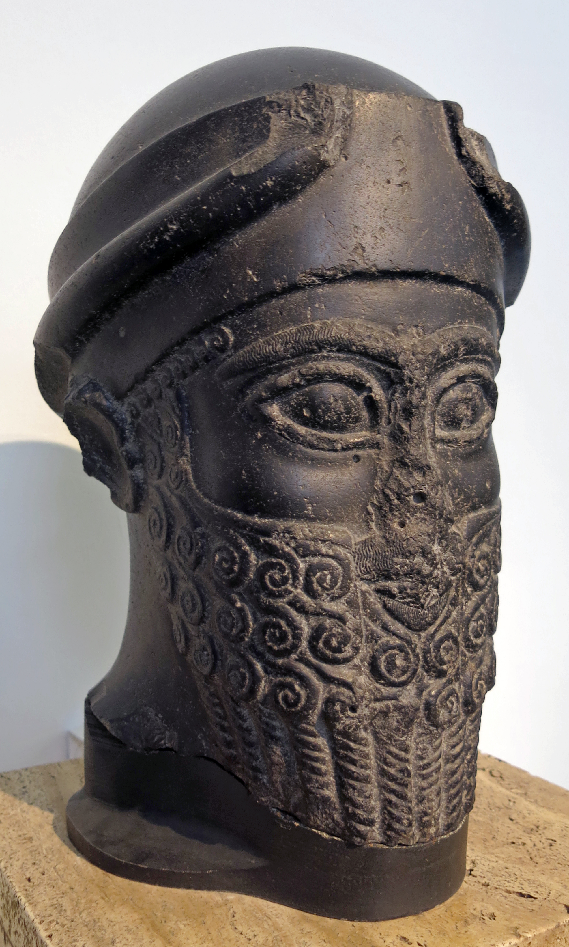
Votive statue dedicated by Prince Puzur-Eshtar / Puzur-Ishtar of Mari, taken as booty to Babylon.
Left: complete reassembled replica.
Right: original of the head.
Circa 1 950 BC.
This replica consists of casts of the diorite head (in Berlin) and of the body and base (Archaeological Museum, Istanbul).
Complete height 193 cm
This over-lifesized statue is one of the few large sculptures preserved from the ancient Near East. The head was broken from the body in an act of vandalism in antiquity.
Though separated, both pieces fortuitously survived so that the statue is nearly complete. The head was acquired by purchase for the collection before 1899 while the body came to light during excavations at Babylon and eventually reached Istanbul. Thanks to an exchange of casts, both museums can exhibit the complete sculpture.
According to the inscriptions below the right hand and above the hem of the garment, the sculpture was made as a votive gift. The name Puzur-Eshtar, Prince of Mari, is mentioned twice, but since the figure's headgear is the horned cap of a deity, the statue
cannot depict the mortal prince. The clasped hands of the figure and the text make it certain that the statue once belonged to the inventory of a temple, but where the temple stood is not known, despite the mention of Mari in the title of the prince. Like many
other monuments, the statue will have been looted from its original site and carried off as booty to Babylon in antiquity.
Photo: Don Hitchcock 2015
Source and text: Pergamon Museum, Berlin, recherche.smb.museum
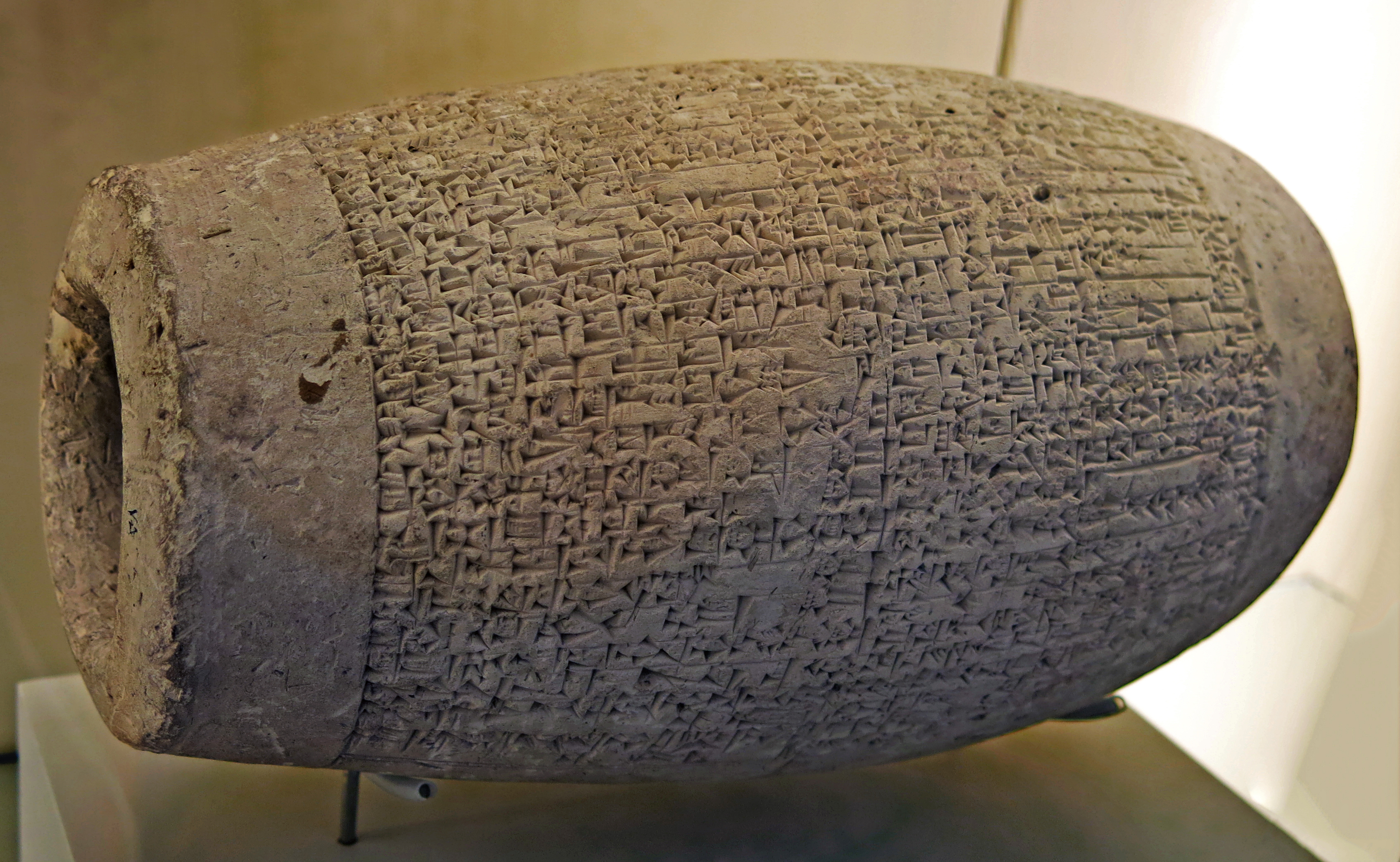
Clay cylinder building deed with an inscription mentioning King Warad-Sin of Larsa. Isin-Larsa period, 1834 BC - 1823 BC, from Babylon.
At this time, from 2000 BC to 1800 BC, southern Mesopotamia was dominated by the cities of Isin and Larsa.
Photo: Don Hitchcock 2015
Source and text: Pergamon Museum, Berlin, recherche.smb.museum
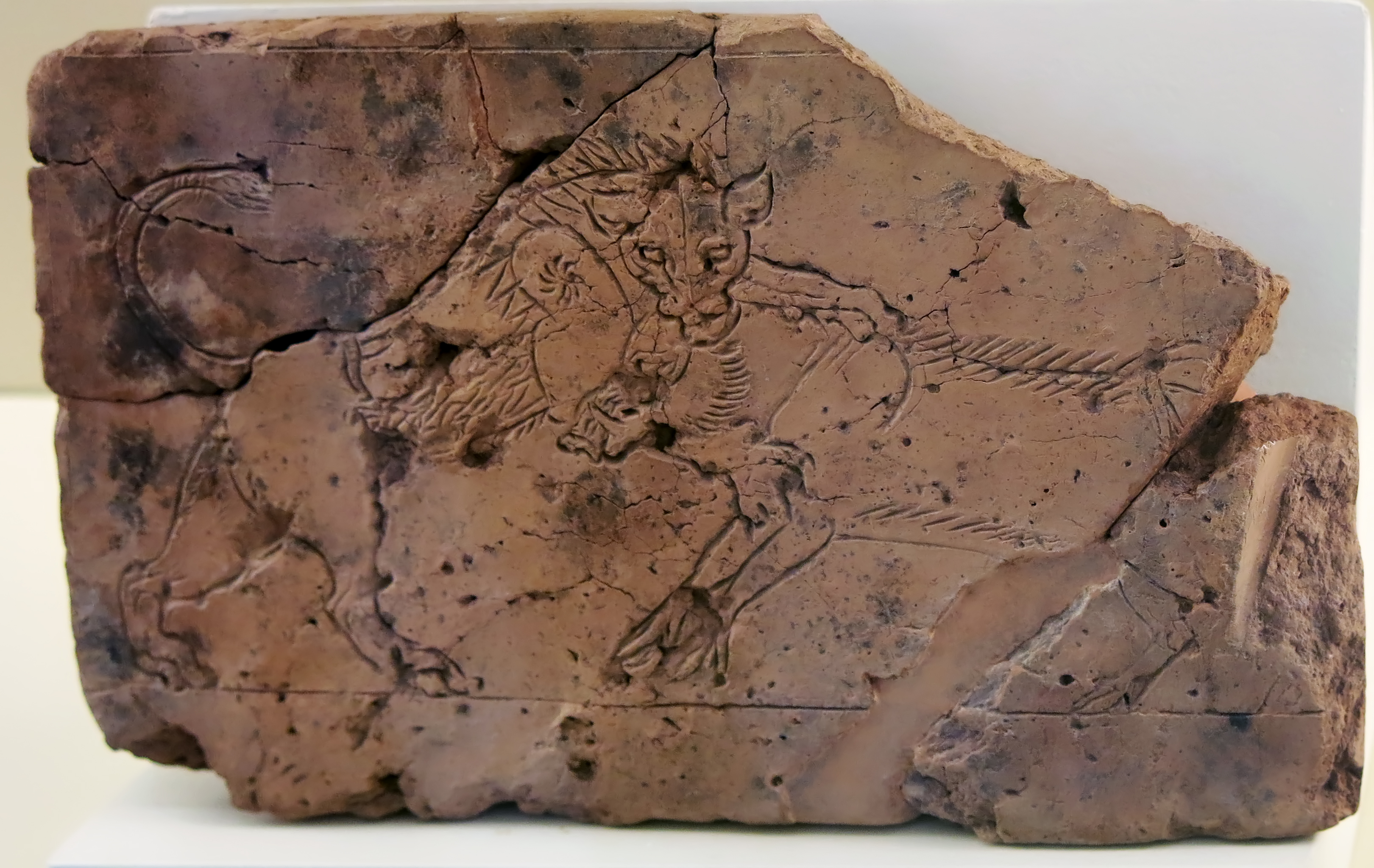
Incised drawing of a lion attacking a wild boar.
Babylon, Kassite period.
2nd half of 2nd millennium BC
Photo: Don Hitchcock 2015
Source and text: Pergamon Museum, Berlin, recherche.smb.museum
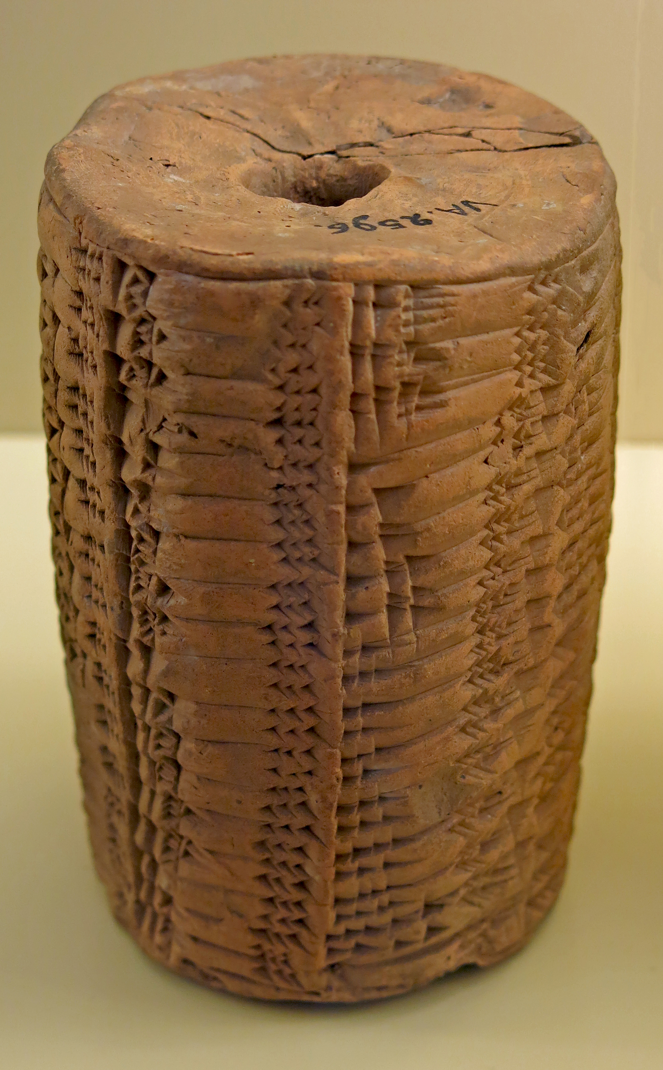
Old Babylonian baked clay cylinder.
The Akkadian cuneiform inscription mentions a capacity table. 18th-16th century BC.
Photo: Don Hitchcock 2015
Source: Pergamon Museum, Berlin, http://www.smb-digital.de/
Text: Wikipedia
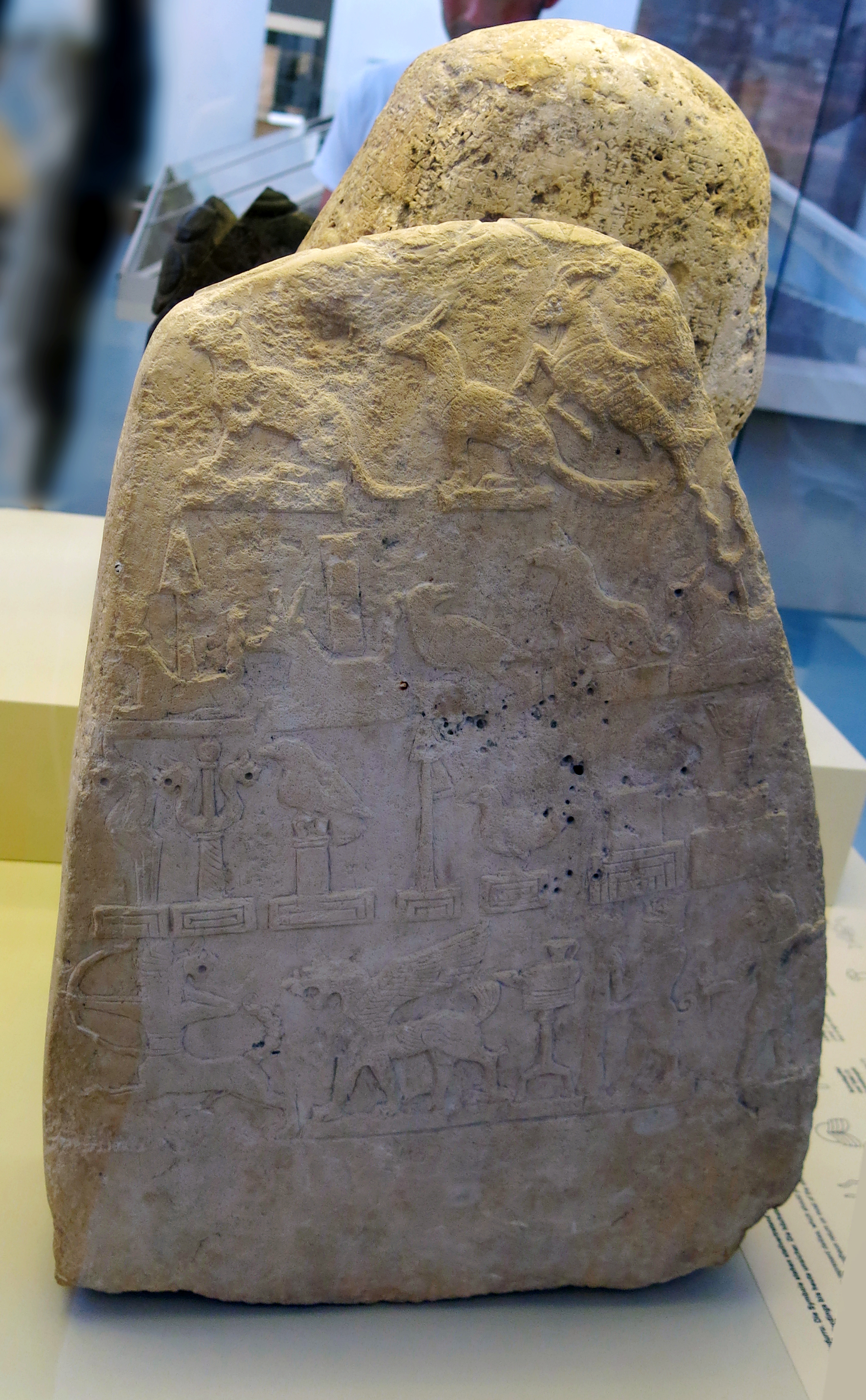
Stele, or kudurru, protecting a royal land grant, from Babylon.
Found in a stela workshop, the deity symbols are partly unfinished, and there is no inscription.
Middle 12th century BC.
The kudurru is from Babylon, Merkes 26 g 2, + 3.00 m. In a room where there is also 'a quantity of
of semi-precious stone pieces and shells together with finished beads of the same
material ..... The room was apparently the workshop of a stone cutter'.
Yellowish grey limestone. Height 50cm, breadth 20-36 cm, thickness 9 cm.
Plate-shaped stone without inscription. Relief images on the upper rim and in four registers on one broadside.
On the upper rim are astral images.
In the uppermost register are a big cat and a jackal(?), both squatting on low smooth pedestals, and a goatfish.
In the second register is a serpent-dragon with spade, a second with stylus, a bird with head turned back, a dog and a calf with a bundle of lightning, all on low, smooth pedestals.
In the third register are a lion staff, a double lion's club, a bird on pole, a triangular standard with pennant, a bird, a smooth rectangle, all standing on small decorated plinths, and a recumbent rectangle with a 'bundle' on a smooth pedestal.
In the lowest register a bow-shooting centaur, a standing lion dragon, a stand with a lamp, a bull-man with a standard, and
a lion-man. Some of the symbols have remained unfinished. There is no inscription.
Photo (left): Don Hitchcock 2015
Photo (right): Seidl (1989)
Source and text: Pergamon Museum, Berlin, recherche.smb.museum
Additional text: Seidl (1989)
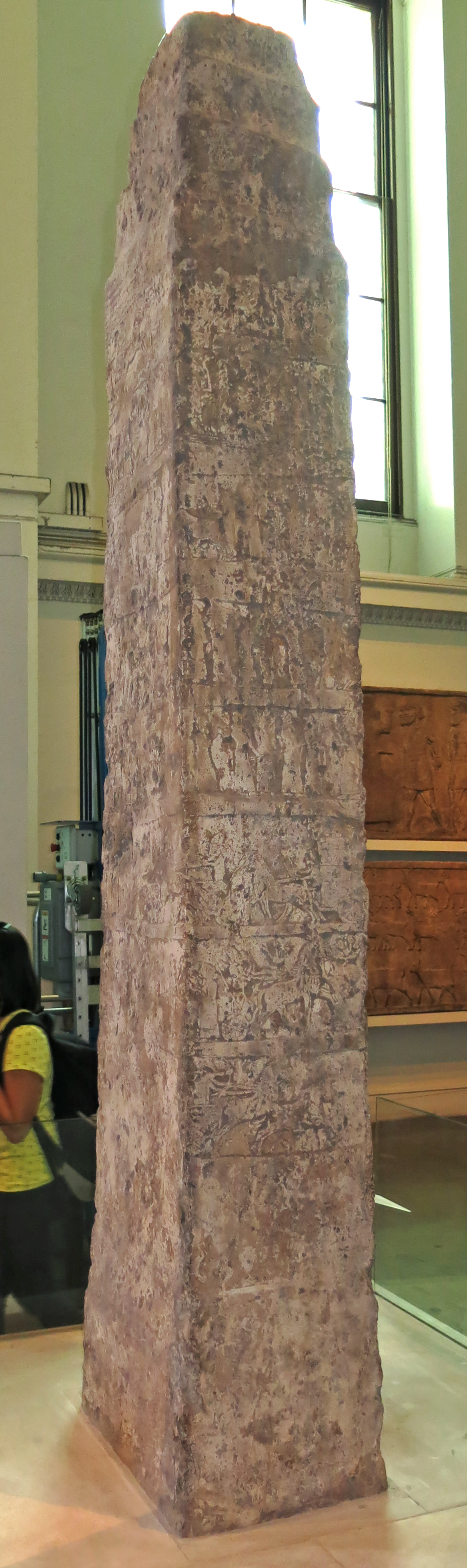
Reign of King Ashurnasirpal I, 1049 BC - 1031 BC.
The White Obelisk
Assyrian, probably about 1 050 BC. From Nineveh, between Sennacherib's Palace and the Ishtar Temple.
This limestone stela was excavated in 1853. The incomplete inscription names Ashurnasirpal, probably Ashurnasirpal I (1 049 BC - 1 031 BC). He is shown in his chariot, fighting (at the top) and hunting (bottom), and taking part in ritual scenes. The middle scenes show booty and tribute being brought, but their order is uncertain. This is an early example of Assyrian narrative relief that developed into the palace reliefs of later reigns.
Rectangular limestone obelisk, slightly tapering, with a stepped apex. Decorated with eight registers carved in low relief, representing scenes of warfare, hunts, processions of tributaries and ceremonial occasions associated with an Assyrian king best identified as Ashurnasirpal I.
There is a cuneiform inscription on two sides (A and D); ancient saw marks near the base, and the condition of the stone implies that the lowermost 35 cm was formerly inserted into a socket. The surfaces are now considerably weathered and damaged.
Findspot: Kouyunjik
Height 2850 mm, width 705 mm, depth 425 mm.
This gives a tentative translation by Sollberger, followed by Reade (1975) with restored passages within square brackets.
Inscription translation from Akkadian: Side A ll. 1-4: [In the first year of my reign, when] I sat in glory [on the throne], I moved my chariotry and numerous troops. I conquered inaccessible forts all round. I received contributions in horses from the land of Gilzanu; ..., I es[tablished] as regular dues. ll. 4-6: [Because] they did not (continue to) s[en]d the horses hither, I be[came angry and] marched against the city of Harira (and) the city of Halhalaush, (cities) of [cri]minal [lo]rds.
ll. 7-8: These (!) I conquered in the eponymy of Ashurnasirpal: I took out their goods, their captives, their possessions, their herds, (and) carried them to Ashur, my city; ll. 9-11: their great ... city, together with its population, I presented to Ashur, my god, my master Side D ll. 12-18: [...] of [...] I reached. The lords [...] whom [I had pursued] into the land of Shupria, trusted [great]ly in [their] massed troops and [...] ... [...] ... [...] they occupied. ll. 18-23: At the command of Ashur, [the Great Mountain,] the great lord, my master, I moved the chariotry [(and) ...] of my army: I conquered the city. [The enemy] abandoned the city, [...] the horses, oxen, [...] ...; he made (his) chariotry take up positions. ll. 23-25: [I reacted] fiercely: I raised a torch, crossed [quickly] on foot into the Kashiari range (and) marched against those cities. ll. 26-29: [...]
During the night I invested their cities [and ...] by sunrise I fought against numerous chariots and troops (and) made them suffer heavy losses. ll. 30-33: I conquered the city of Amlattu, the city of Shaburam, the city of Ruzidak, the city of Bugu, the city of Ustu, rebel cities of the land of Dannuna, set them on fire, (took out) their captives, their possessions, their riches ...
SIDE A (caption) ll. 1-2: The 'Bit-nathi' of the city of Nineveh: I performed the wine (libation) and sacrifice of the temple of the august goddess.
It was discovered at Kuyunjik by Rassam in July 1853 'about two hundred feet to the northeast of Sennacherib's palace' at a depth of some fifteen feet below the surface of the mound; it was found lying on its side and the findspot corresponds to an open area between the outer court of Sennacherib's palace at Nineveh and the Ishtar temple. This findspot is recorded on W. Boutcher's plan reproduced by Rassam in the 'Transactions of the Society of Biblical Archaeology' VIII (1882), opp. p.37 with contemporary drawings by C. Hodder as Or.Dr.VI,xl (general view), xli (faces C-D), xlii (faces A-B). It was shipped from Basra to Bombay on the Acbar in March 1854 and from Bombay to London on the Merchantman, arriving London February 1855.
Catalog: Limestone, Kouyunjik, 118807
Photo: Don Hitchcock 2015
Text: Card with the display at the British Museum, www.britishmuseum.org/, © Trustees of the British Museum, CC BY-NC-SA 4.0
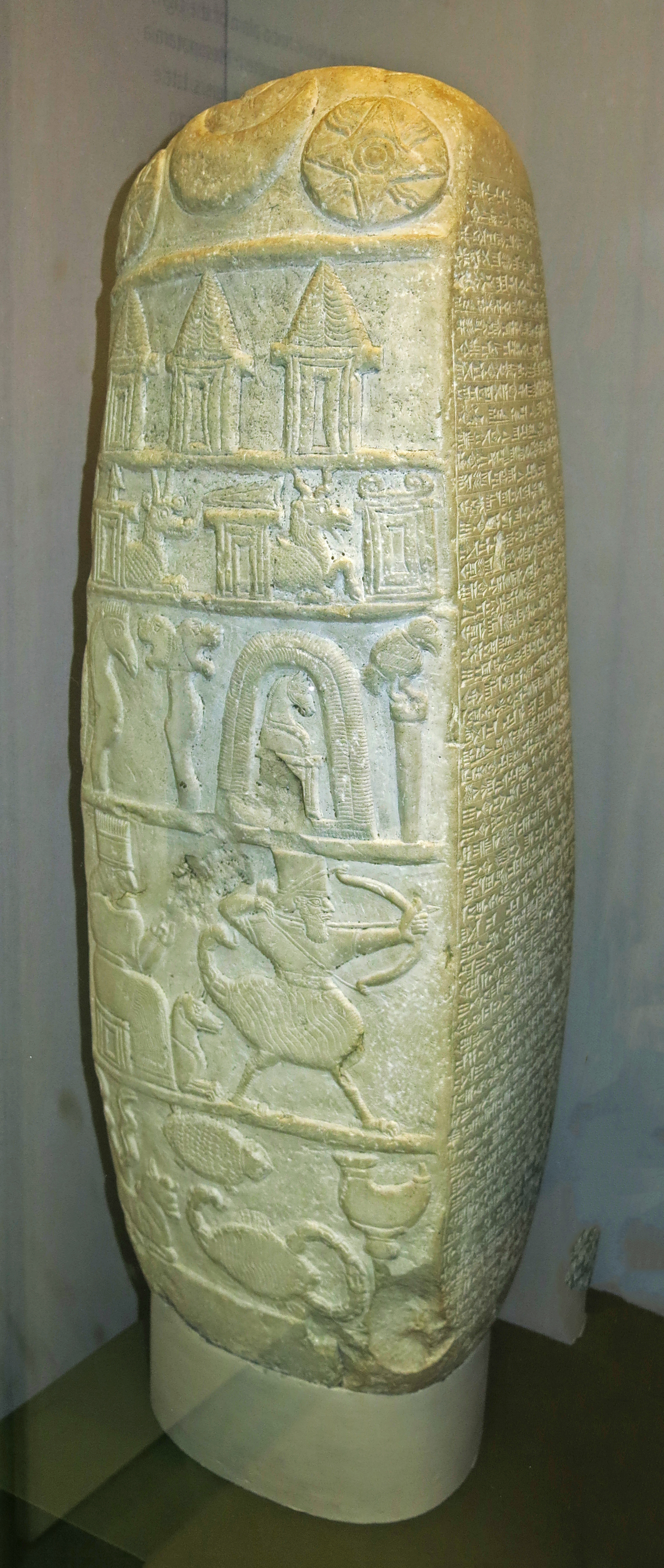
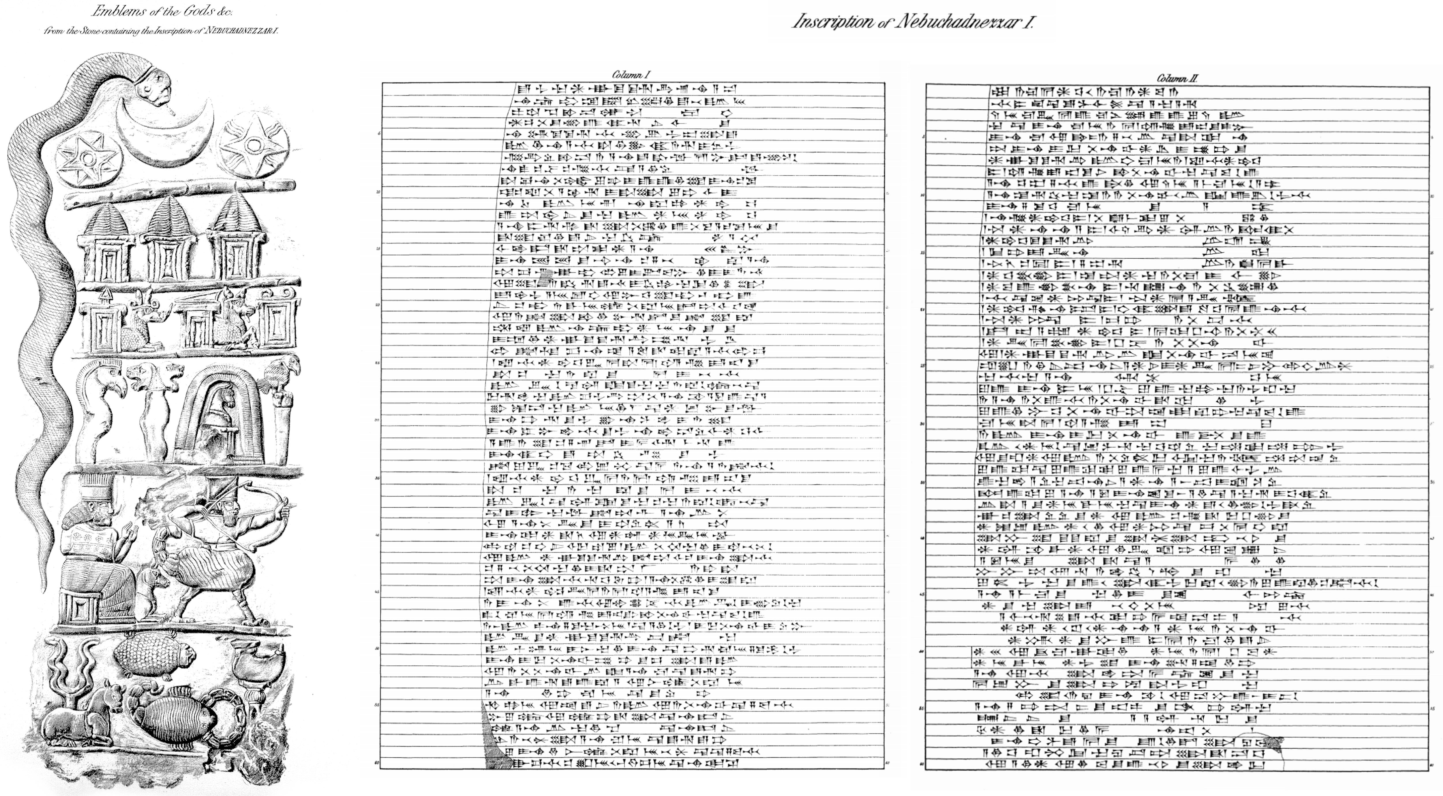
( As with all my images, click on the smaller image on the page to see the full size photo - Don )
Middle Babylonian Kudurru, Reign of Nebuchadnezzar I
Reign of Nebuchadnezzar I, 1 121 BC - 1 100 BC
Predecessor Ninurta-nādin-šumi
Successor Enlil-nādin-apli
House 2nd Dynasty of Isin
Limestone stela in the form of a boundary-stone: consisting of a block of calcareous limestone, shaped and prepared on four sides to take sculptures and inscriptions. It is now mounted on a stone plinth.
Carved in high relief, height 640 mm, length 210 mm, width 180 mm.
Face A has been sculptured in comparatively high relief with symbols, arranged in six registers:
First register: (1) Eight-pointed star ; (2) Crescent; (3) Solar disc.
Second register : (4) Horned headdress upon a shrine; (5) A second horned headdress upon a shrine; (6) A third horned headdress upon a shrine.
Third register : (7) Spear-head upon a shrine, beside which appears the fore-part of a horned dragon ; (8) Wedge upon a shrine, beside which appears the fore-part of a horned dragon, or composite monster ; (9) Yoke reversed, upon a shrine.
Fourth register: (10) Eagle-headed mace, or standard; (11) Twin-lion-headed mace, or standard ; (12) Horse's head, with neck and shoulders, upon a shrine, standing within a double arch upon a raised base, possibly intended to represent a shrine; (13) Bird on perch.
Fifth register: (14) The goddess Gula seated upon a shrine, with a dog lying beside her ; (15) Scorpion-man, wearing a cylindrical headdress, and shooting with a bow. The Scorpion-man has the head, arms and torso of a man, and below his girdle he has the body and tail of a scorpion, and the legs and claws of a bird.
Sixth register: (16) Lightning-fork, supported by a bull, couchant; (17) Turtle: (18) Scorpion; (19) Lamp on pedestal; and (20) Serpent, extending from the centre of the stone at the top, down the left-hand side of the first five registers.
Faces B and C each bear a single column of inscription, the lines running the full width of the stone. The top of the stone and Face D have been left blank, except for the serpent, which has been carved to the left of the emblems on Face A. Inscribed with a Charter from the reign of Nebuchadnezzar I.
Inscription note: The text of the Charter falls naturally into the following five sections:
I. Col. I, ll. 1-43 : Historical introduction, setting forth the services rendered by Ritti-Marduk to Nebuchadnezzar during a campaign in Elam, undertaken "to avenge Akkad" (l. 13), that is to say, in retaliation for Elamite raids in Northern Babylonia. The campaign was conducted from the frontier city of Der, and, being carried out in the summer, the Babylonian army suffered considerably from the heat and from lack of water (ll. 14-21). Ritti-Marduk, the Captain of the chariots, did considerable service to the king, both by encouraging the troops on the march (ll. 22-27) and by leading the attack against the Elamite Confederation during the battle which was subsequently fought on the banks of the Eulaeus (ll. 28-43).
II. Col. I, ll. 44-51 : Record of the granting of the Charter by Nebuchadnezzar to Ritti-Marduk, in reward for his services, freeing the towns or villages of Bit-Karziabku, of which he was the head-man, from the jurisdiction of the neighbouring city of Namar.
III. Col. I,l. 51-Col. II, l. 10 : Recital of the terms of the Charter, (i) Conferring on the towns freedom from all taxation, dues, or confiscations on the part of the king's officers or the officials of Namar (ll. 51-60); (ii) Securing the freedom of the towns from the corvee for public works (Col. II, ll. 1-2); (iii) Freeing the inhabitants from liability to arrest by imperial soldiers stationed in the towns or villages (Col. II, ll. 3-5) ; and (iv) Preventing the billeting of such soldiers on the towns by providing for their maintenance by Namar (Col. II, ll. 9-10).
IV. Col. II, ll. 11-25: Enumeration of the names and titles of thirteen high officials, who were present at the granting of the Charter (ll. 11-24), and the name of the engraver of the record (l. 25).
V. Col. II, ll. 26-60 : Imprecations intended to prevent any violation of the Charter, or any injury to the record.
Inscription translation Column 1:
(1) When Nebuchadnezzar, the exalted and noble prince, (2) the offspring of Babylon, the ruler of kings, (3) the valiant patesi, the governor of Eridu, (4) the Sun of his land, who makes his people to prosper, (5) who protects boundary-stones, who holds fast the boundaries, (6) the king of justice, who pronounces a righteous judgment, (7) the strong hero, whose might is devoted to waging war, (8) who bears a terrible bow, who fears not the battle, (9) who overthrew the mighty Lullubi with the sword, (10) the conqueror of the Amorites, the despoiler of the Kassites, (11) the appointer of kings, the prince beloved of Marduk, (12) - when the king of the gods, Marduk, sent him forth, (13) he raised his weapons to avenge Akkad. (14) From Der, the city of Anu, (15) he marched for thirty double hours. (16) In the month of Tammuz he undertook the campaign. (17) . . . . . the axe burned like fire, (18) and the . . . . . of the roads scorched like flame. (19) There was no water in the wells (?), and the drinking supply was cut off. (20) The splendour of the great horses failed, (21) and the legs of the strong man turned aside. (22) The noble king advances, the gods supporting him. (23) Nebuchadnezzar marches on, he has no rival, (24) he fears not the difficult country, he urges on (?) the yoked horses. (25) Ritti-Marduk, the head of the House of Bit-Karziabku, (26) the captain of his chariots, whose place was at the right hand (27) of the king, his lord, did not . . . . . him, and drove on his chariot. (28) The mighty king hastened, and he came to the bank of the Eulaeus. (29) The kings took their stand round about, and offered battle. (30) In their midst fire was kindled, (31) by their dust was the face of the sun darkened ; (32) the hurricane sweeps along, the storm rages. (33) In the storm of their battle (34) the warrior in the chariot perceives not - the companion at his side. (35) Ritti-Marduk, the head of the House of Bit-Karziabku, (36) the captain of his chariots, whose place was at the right hand (37) of the king, his lord, did not . . . . . him, and drove on his chariot. (38) He feared not the battle, he went down against the enemy, (39) and among the enemies of his lord he valiantly forced a way in.. (40) By the command of Ishtar and Adad, the gods who are arbiters of battle, (41) he turned evil against the king of Elam, and destruction overtook him. (42) And King Nebuchadnezzar triumphed, (43) he captured the land of Elam, he plundered its possessions. (44) When he had returned to Akkad in triumph and with joy of heart, (45) Ritti-Marduk, the head of the House of Bit-Karziabku, (46) whom the king, his lord, had beheld among the enemies and warriors, (47) concerning the towns of Bit-Karziabku, in the district of Namar, all that there are, (48) which under a former king had been freed, but through enemies had, contrary to their laws, come under the jurisdiction of Namar, (49) informed the king his lord, Nebuchadnezzar, (50) and the king enquired of the judges, and (to) the towns, as in days of old, (he gave) their freedom (51) from the whole jurisdiction of Namar, (decreeing) that officers of the king, (52) and the governor of Namar, and the commandant are not to enter a town; (53) that the master of the horse is not to bring stallions or mares (54) into the towns; (55) that revenue in cattle or sheep is not to be taken for the king or for the governor of Namar; (56) that a . . . . . or a homer of cypress is not to be rendered; (57) that a homer is not to be given to the tax-gatherer ; (58) that the master of the riding horses is not to enter the towns, (59) nor to take therefrom mares as riding horses; (60) that the fences (?) of the plantations and the date-palm groves no man is to cut down;
Inscription translation Column 2:
(1) that they shall not fortify Bit-Shamash nor Shanbasha, (2) nor build a bridge, nor bank up a road ; (3) that soldiers of Nippur or Babylon, or such soldiers of the king (4) as are quartered in the towns of Bit-Karziabku, (5) are not to cause the arrest of any man, whether in town or country ;— (6) from all jurisdiction of Namar whatsoever (7) Nebuchadnezzar, the king of hosts, freed the towns of Ritti-Marduk, (8) the son of Karziabku, in the district of Namar, all that there are, (9) for ever, and the soldiers quartered in those towns (10) he appointed for special maintenance by the governor of Namar and the commandant. (11) At (the declaration of) the freedom of those towns there are present (12) Nazi-Marduk, the son of Shaddakme, the priest of Akkad, (13) Arad-Nana, theson of Mudammik-Adad, the administrator of the land, (14) Marduk-kudurri-usur, the minister of Bel, (15) Tubia-enna, the officer, (16) Mukkut-issakh, the son of Sapri, the official of the Palace Gate, (17) Shamash-nadin-shumi, the son of Atta-iluma, the governor of Ishin, (18) Bau-shum-iddina, the son of Khunna, the governor of Babylon, (19) Uballitsu-Gula, the son of Arad-Ea, the provincial governor, (20) Marduk-mukin-apli, the son of Tabu-mile, the keeper of the treasure-house, (21) Arad-Gula, the son of Kalbi, the governor of Ushti, (22) Tab-ashab-Marduk, the son of Esagil-zeru, the governor of Khalman, (23) Enlil-nadin-shumi, the son of Khabban, the governor of Namar, (24) and Nabu-kudurri-usur, the commandant of Namar. (25) The scribe, who has written this memorial-stone, is Enlil-tabni-bullit, the seer. (26) Whenever in after time (27) one of the sons of Khabban, or any other man, (28) who may be appointed as governor of Namar, (29) or as prefect of Namar, be he small or great, whoever he may be, (30) with regard to the cities of Bit-Karziabku, (31) which the king has freed from the jurisdiction of Namar, (32) shall not fear the king or his gods, and shall again place them under (its) jurisdiction, (33) or shall obliterate the name of a god or of the king, which is inscribed (hereon), and shall write another (in the place thereof), (34) or shall employ a fool, or a deaf man, or a blind man, or a knave, (35) and shall smash this memorial with a stone, (36) or burn it in the fire, or put it in the river, or hide it in a field where it cannot be seen, (37) may all the great gods, whose names are mentioned in heaven and earth, (38) curse that man in wrath! May god and king look upon him in anger! (39) May Ninib, the king of heaven and earth, and Gula, the bride of Esharra, (40) destroy his boundary-stone and obliterate his seed! (41) May Adad, the ruler of heaven and earth, the lord of springs and rain, (42) fill his canals with mud! (43) May he set. hunger and want upon him, (44) and may oppression, ruin, and adversity be bound day and night at his side! (45) May ruin fasten its grip upon the inhabitants of his city! (46) May Shumalia, the lady of the bright mountains, (47) who dwells upon the summits, who treads beside the springs, (48) Adad, Nergal and Nana, the gods of Namar, (49) Siru, the bright god, the son of the temple of Der, (50) Sin and the Lady of Akkad, the gods of Bit-Khabban, (51) may these great gods in the anger of their hearts (52) contrive evil against him! (53) May another possess the house which he has built! (54) With a dagger in his neck, and a poniard in his eye, (55) may he cast himself upon his face before his captor, (56) and may he spurn his pleading, (57) and swiftly cut off his life! (58) Through the downfall of his house may his hands enter the mire! (59) As long as he lives may he drag sorrow along with him, (60) and, as long as heaven and earth remain may his seed perish!
Curator's comments:
Though the stele is inscribed with a charter of privileges, the form of the stone and the presence of symbols justify its classification among the kudurru-texts.
The kudurru of Gula-eresh 1907,1014.1 (BM 102485), if classified among the dated kudurrus, would be placed between the charter of Nebuchadezzar I and the kudurrus of Marduk-nadin-akhe's time, since it may be assigned to about the period of Enlil-nadin-aplu.
Subjects:
planet/constellation, sun/moon, headgear/hairstyle, shrine, arms/armour, dragon, mythical figure/creature, flag/pennant(?), dog, bird, deity, storm, reptile, arachnid, lamp/candle, serpent, horse/ass
Named in inscription:
Nebuchadnezzar I, Ninib, named & portrayed: Gula, Adad, Shumalia, Nergal, Siru, Sin, Marduk, An, Ishtar
Places named in inscription: Babylon, Elam, Eridu, Tell Aqar (historic), River Ulai, Nippur
Findspot: Abu Habba (Sippar)
Catalog: Limestone, ME 90858
Photo: Don Hitchcock 2015
Source: Original, British Museum
Text: © Card with the display at the British Museum, www.britishmuseum.org, © Trustees of the British Museum, CC BY-NC-SA 4.0.
Additional text: Wikipedia
Drawn image and inscription: Theophilus Goldridge Pinches M.R.A.S., 1905
Permission: Public Domain
Proximal source: Wikipedia
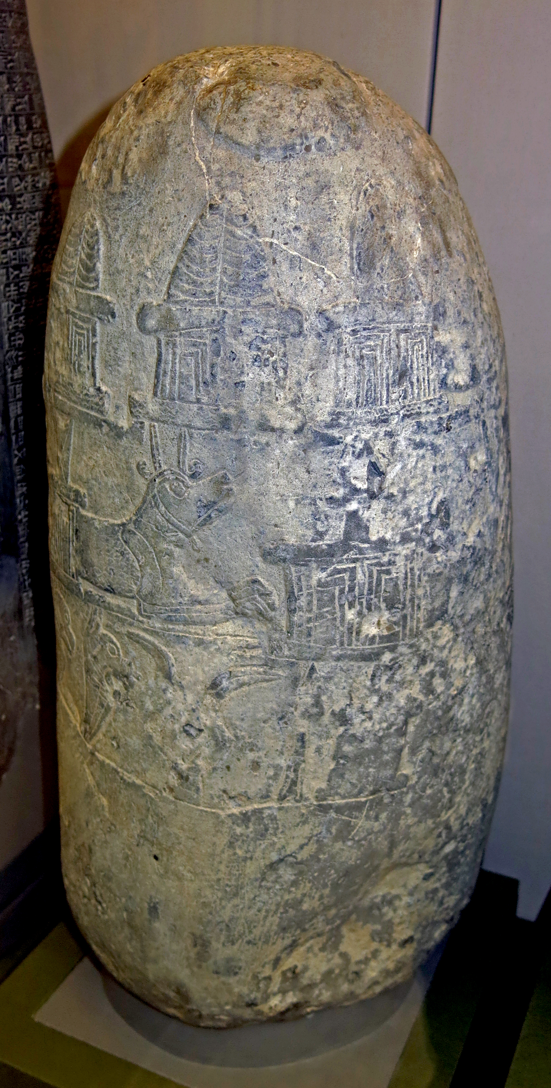
Babylonian Kudurru, 1 100 BC - 1 000 BC
The inscription on this conical limestone kudurru has been laboriously erased, an indication that the precautionary writing of curses on such stones was not without reason. There are divine emblems on one face, with 14 emblems and 3 discs in the field of the upper register and a serpent on the left side of the register and along the top.
Height 406 mm, length 203 mm, width 197 mm.
Findspot: Sawosat
Catalog: Limestone, ME 108835
Photo: Don Hitchcock 2015
Source: Original, British Museum
Text: © Card with the display at the British Museum, © Trustees of the British Museum, CC BY-NC-SA 4.0.
Stele, or kudurru, protecting a royal land grant, from Babylon.
Found in a stela workshop, the deity symbols are partly unfinished, and there is no inscription.
Middle 12th century BC.
The kudurru is from Babylon, Merkes 26 g 2, + 3.00 m. In a room where there is also 'a quantity of
of semi-precious stone pieces and shells together with finished beads of the same
material ..... The room was apparently the workshop of a stone cutter'.
Yellowish grey limestone. Height 50cm, breadth 20-36 cm, thickness 9 cm.
Plate-shaped stone without inscription. Relief images on the upper rim and in four registers on one broadside.
On the upper rim are astral images.
In the uppermost register are a big cat and a jackal(?), both squatting on low smooth pedestals, and a goatfish.
In the second register is a serpent-dragon with spade, a second with stylus, a bird with head turned back, a dog and a calf with a bundle of lightning, all on low, smooth pedestals.
In the third register are a lion staff, a double lion's club, a bird on pole, a triangular standard with pennant, a bird, a smooth rectangle, all standing on small decorated plinths, and a recumbent rectangle with a 'bundle' on a smooth pedestal.
In the lowest register a bow-shooting centaur, a standing lion dragon, a stand with a lamp, a bull-man with a standard, and
a lion-man. Some of the symbols have remained unfinished. There is no inscription.
Photo (left): Don Hitchcock 2015
Photo (right): Seidl (1989)
Source and text: Pergamon Museum, Berlin, recherche.smb.museum
Additional text: Seidl (1989)
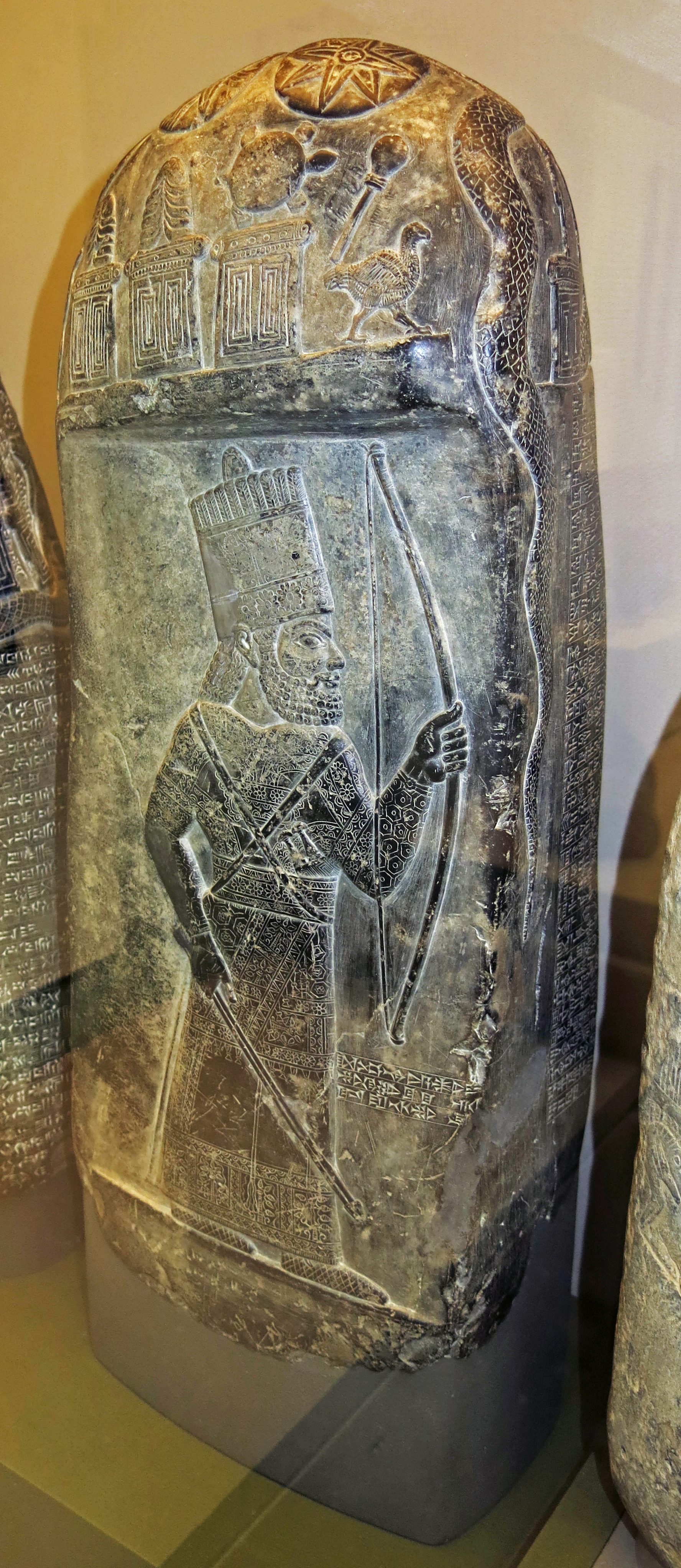
Babylonian Kudurru, 1 100 BC - 1 000 BC
Limestone kudurru from the reign of Marduk-nadin-ahhe: the boundary stone consists of a block of black limestone, which has been shaped and rubbed down to take sculptures and inscriptions.
The rounded top of the stone is sculptured on all four sides and on the top with emblems:
Diameter 133 mm - 152 mm, width 222 mm - 248 mm, height 654 mm.
Face A: (1) Lunar disc, (2) Solar disc, (3) Eight-pointed star, (4) Horned headdress upon shrine, (5) Horned headdress upon shrine, (6) Turtle upon shrine, (7) Battle-mace, and (8) Walking bird.
Face B: (9) Spear-head upon shrine, beside which appears a horned dragon, and (10) Twin-lion-headed mace.
Face C: (11) Wedge upon shrine, beside which appears a horned dragon, (12) Scorpion, and (13) Yoke reversed.
Face D: (14) Sitting dog, (15) Lamp, (16) Arrow, (17) Bird on perch, and (18) Lightning-fork.
Top of stone and Face B: (19) Serpent. Below the symbols on Face A is the figure of a Babylonian king wearing an elaborately embroidered robe and carrying a bow and two arrows. The greater part of Face A, with the exception of 127 mm at the top has been rubbed down so that it affords a flat surface for the royal figure.
Faces B, C, and D are rounded at the corners, and the two columns of inscription are engraved around these three sides, Col. I occupying parts of Faces B and C, and Col. II parts of Faces C and D. In consequence of the curved surface of the stone the end of each column of text is nearly at right angles to the beginning.
The text contains a deed recording the purchase of five 'gur' of corn-land by Marduk-nasir, the king's officer, from Amel-Enlil, the son of Khanbi. The land is described as situated on the Bad-dar Canal in Bit-Khanbi, and the name of the surveyor is stated. The purchase-price consisted of a chariot, saddles, two asses, an ox, grain, oil, and certain garments, the items being separately valued and making a total of seven hundred and sixteen shekels of silver.
Inscription translation for the lower part of Face A to right of royal figure:
(1) The name of this memorial-stone is (2) 'The Establisher of the Boundary (3) for ever.'
Inscription translation for column one:
(1) Five 'gur' of corn-land, a gan, measured by the great cubit, being reckoned at thirty 'ka' of seed, (2) on the bank of the Bad-dar Canal, in Bit-Khanbi, (3) the upper length to the north, adjoining Bit-Khanbi; (4) the lower length to the south, (5) adjoining Bit-Imbiati; (6) the upper width to the west, (7) adjoining Bit-Khanbi; (8) the lower width to the east, (9) adjoining the bank of the Bad-dar Canal, (10) which from the hand of Amel-Enlil, (11) the son of Khanbi, Marduk-nasir, the king's officer, (12) has received by purchase. (13) Shapiku, the son of Itti-Marduk-balatu, (14) the son of Arad-Ea, was the surveyor of the land. (15) One chariot with its furnishings (?), valued at one hundred (shekels of) silver, (16) six horse-saddles (?), valued at three hundred (shekels of) silver, (17) one western ass, valued at thirty (shekels of) silver, (18) two saddles (?) for the western ass, valued at fifty (shekels of) silver (19) one ass . . . . . , valued at fifteen (shekels of) silver, (20) one ox . . . . . , valued at thirty (shekels of) silver, (21) thirty-four 'gur' and eighty 'ka' of corn, measured by the twelve-'ka' measure, valued at one hundred and thirty-seven (shekels of) silver (22) one hundred and sixty 'ka' of oil, measured by the four-'ka' measure, valued at sixteen (shekels of) silver, (23) two upper garments . . . . . , valued at twelve (shekels of) silver, (24) nine mantles, valued at eighteen (shekels of) silver, one under-garment (?) valued at one (shekel of) silver, (25) one . . . . . -garment, valued at one (shekel of) silver, (26) one . . . . . -garment, valued at six (shekels of) silver, (27) in all seven hundred and sixteen (shekels of) silver, (28) which Amel-Enlil, the son of Khanbi, (29) from the hand of Marduk-nasir, the king's officer, (30) has received as the price of the five 'gur' of corn-land. (31) Whensoever in later days an agent, (32) or a governor, or a prefect, or a superintendent, (33) or an inspector, or any official whatsoever, who shall rise up and (34) be set over Bit-Khanbi, (35) shall direct his mind to take away these lands, (36) or shall lay claim to them, or cause a claim to be made, (37) or shall take them away or cause them to be taken away...
Inscription translation for column two:
(1) ...or shall side with evil (2) and shall return those lands to their province, (3) or shall present them to a god, or to the king, or to the representative of the king, (4) or to the representative of the governor, or to the representative of his council, (5) or to any other man, (6) or shall cause curtailment or diminution, (7) or shall say, "The lands were not the gift of the king," (8) or because of the curse shall cause another to take them, (9) or shall send a fool, or a man who is deaf, or one who is feeble-minded, or a vagabond, or one who is without intelligence, (10) and he shall cause him to remove this memorial-stone, or shall cast it into a river, (11) or put it in a well, or destroy it with a stone, or burn it in the fire, (12) or hide it in the earth, or hide it in a place where it cannot be seen, (13) upon that man may Anu, Enlil, Ea, and Nin-makh, (14) the great gods, look with anger, (15) and may they curse him with an evil curse that cannot be loosened! (16) May Sin, the light of the bright heavens, with leprosy that never departs (17) clothe his whole body, so that he may not be clean till the day of his death, (18) but must lie down like a wild ass at the outer wall of his city! (19) May Shamash, the judge of heaven and earth, smite his countenance, (20) so that his bright day may turn to darkness for him ! (21) May Ishtar, the lady, the princess among the gods, send a curse (?) upon him, (22) and in misery (?), her message of anger, (23) may he multiply his words day and night, (24) and like a dog may he pass the night in the open place of his city! (25) May Marduk, the king of heaven and earth, with dropsy, the bond of which (26) cannot be loosened, fill his body! (27) May Ninib, the lord of the boundary and the boundary-stone, tear out his boundary-stone, (28) tread down his boundary, and change his holding! (29) May Gula, the mighty physician, the great lady, (30) put a grievous sickness in his body, (31) so that he may pass light and dark blood like water! (32) May Adad, the ruler of heaven and earth, overwhelm his fields, (33) so that there may spring up abundantly weeds in place of green herbs and thorns in place of grain! (34) May Nabu, the exalted minister, appoint him days of scarcity and drought (35) as his destiny! (36) May all the great gods, whose names are mentioned on this memorial-stone, (37) drive him into evil and unhappiness! (38) His name, his seed, his offspring, (and) his posterity (39) may they destroy in the mouth of widespread peoples! (40) The name of this memorial-stone is "The Establisher of the Boundary for ever."
Curator's comments:
This records the purchase of land by a royal officer, Marduk-nasir; the value is given in silver but the land was paid for in the form of a chariot, clothes, animals and food; there are curses on anyone who attempts to invalidate the sale or damage the stone; the stone is named 'the establisher of the boundary forever' (carved just to the right of the figure of the King). No date is mentioned, but there is not lacking evidence of the period to which the monument should be assigned.
Koldewey has pointed out the close resemblance of the royal figure on this stone to that on the boundary-stone discovered by him at the end of 1900 in Tell ʿAmran ibn-ʿAli at Babylon. The headdress and garments of each figure are practically identical, not only in form but in minute details of decoration, the treatment of the hair is the same, and the style and workmanship are very similar. There is little doubt that the figures represent the same king, in whose reign the two deeds were drawn up. Moreover, in the fragment of text preserved on the stone from Tell ʿAmran, there occurs the name of [Tab-asha]b-Marduk, the son of Ina-Esagila-zeru, who was a high official in the reigns of Nebuchadnezzar I and Marduk-nadin-akhe. Hincke would provisionally identify both figures with Nebuchadnezzar I, but it should be noted that on the Warwick kudurru, which in shape resembles 1863,0826.1 (BM 90841), Marduk-nadin-akhe is represented by a similar figure "holding a bow in the left hand and two arrows in the right". The traditional identification with Marduk-nadin-akhe is therefore to be preferred.
Subjects:
sun/moon, moon, planet/constellation, headgear/hairstyle, shrine, reptile, arms/armour, bird, dragon, arachnid, dog, lamp/candle, storm, serpent, king/queen, cattle
Associated names:
Marduk-nadin-ahhe, Marduk-nasir (Purchaser of land), An, Enlil, Ea, Ishtar, Sin, Shamash, Marduk, Ninib, Gula, Nabu
Findspot: Babylon
Catalog: Black limestone, ME 90841
Photo: Don Hitchcock 2015
Source: Original, British Museum
Text: © Card with the display at the British Museum, © Trustees of the British Museum, CC BY-NC-SA 4.0.
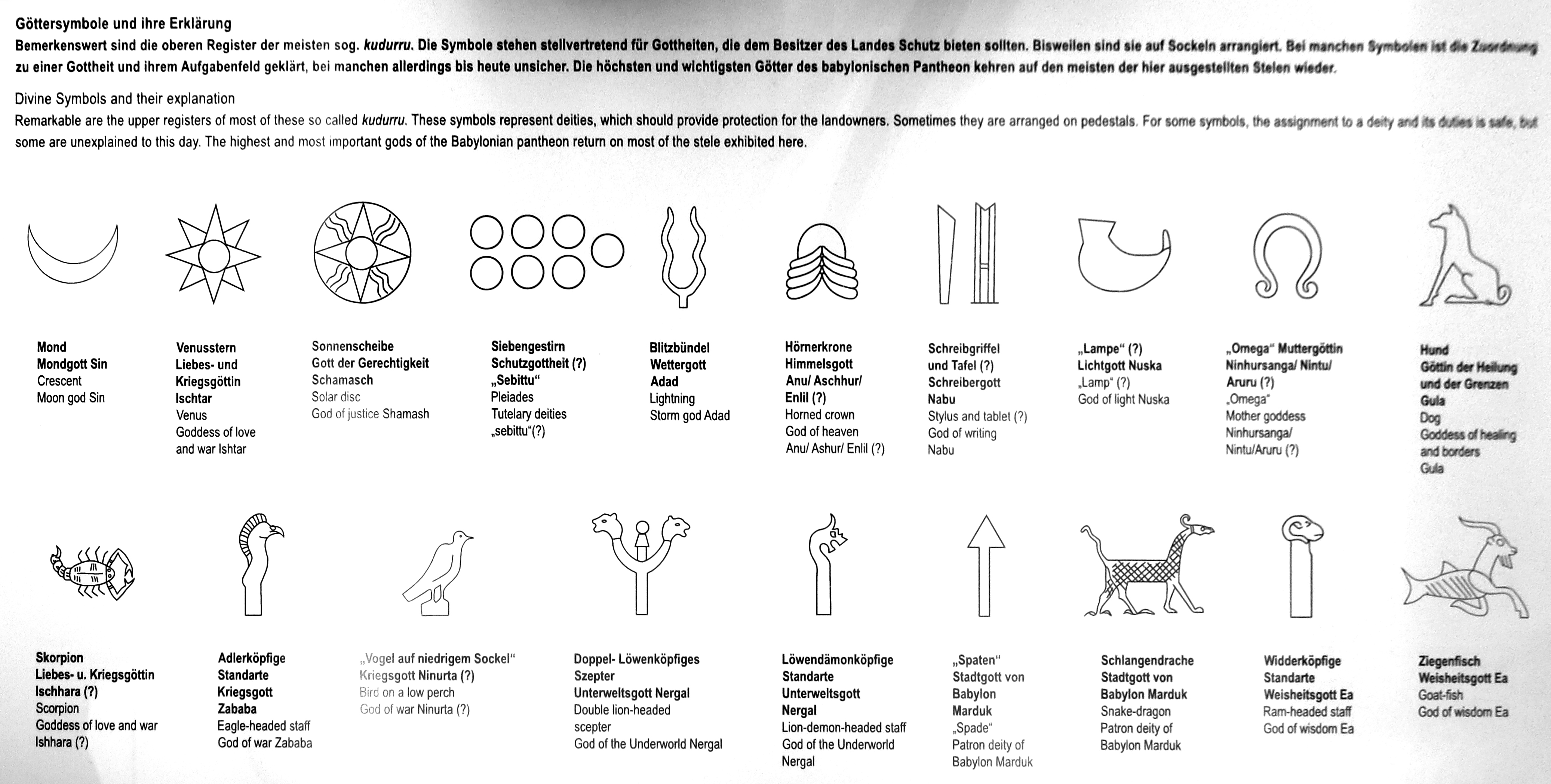
Divine symbols and their explanation.
The upper registers of these Kudurru, a type of stone document used as a boundary stone and as a record of land grants to vassals by the Kassites in ancient Babylonia between the 16th and 12th centuries BC, are remarkable.
The symbols on them represent deities, which were believed to protect the landowners.
Photo: Don Hitchcock 2015
Source and text: Pergamon Museum, Berlin, recherche.smb.museum
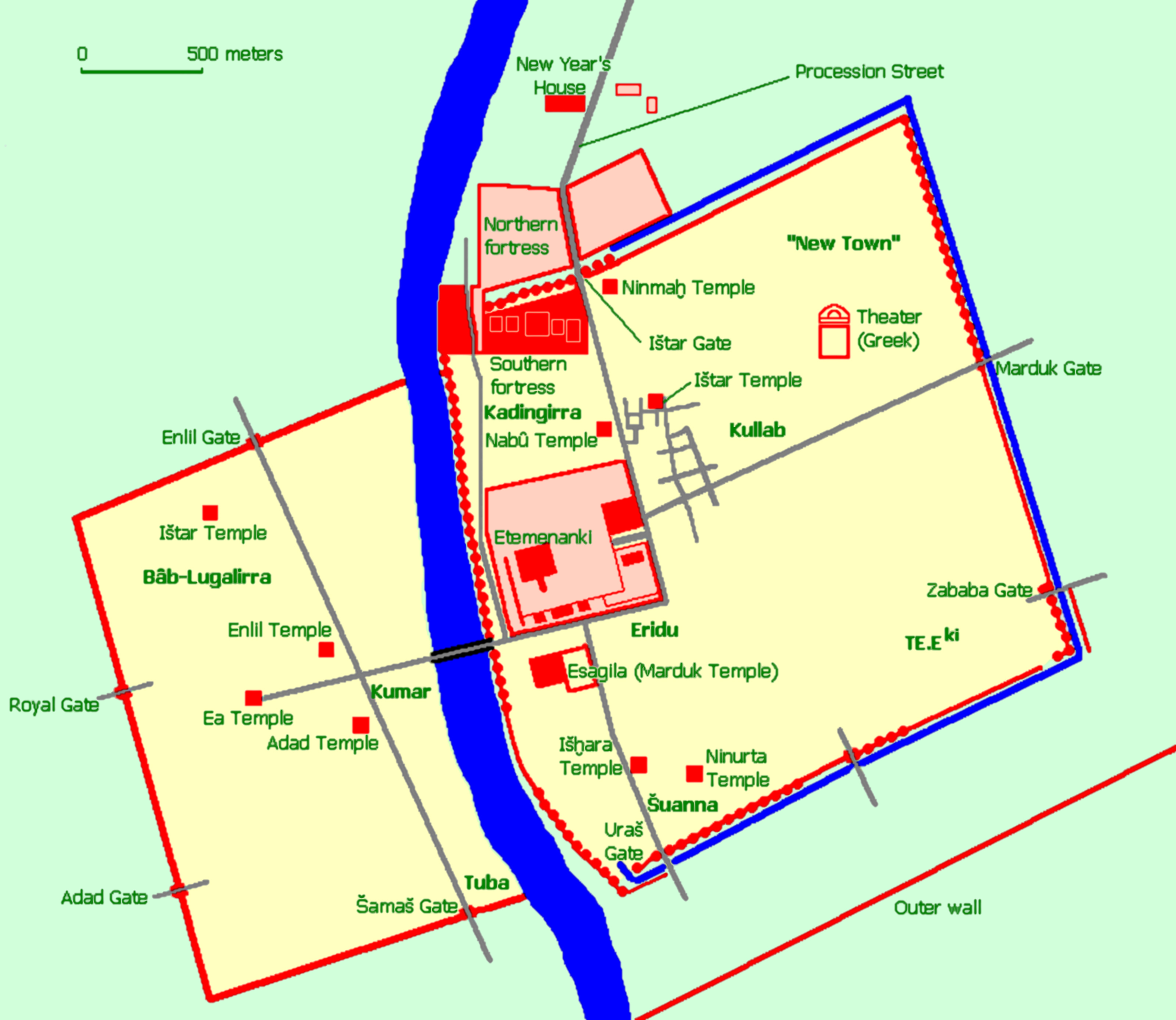
Map of Babylon
Photo: Jona Lendering
Permission: CC0 1.0 Universal
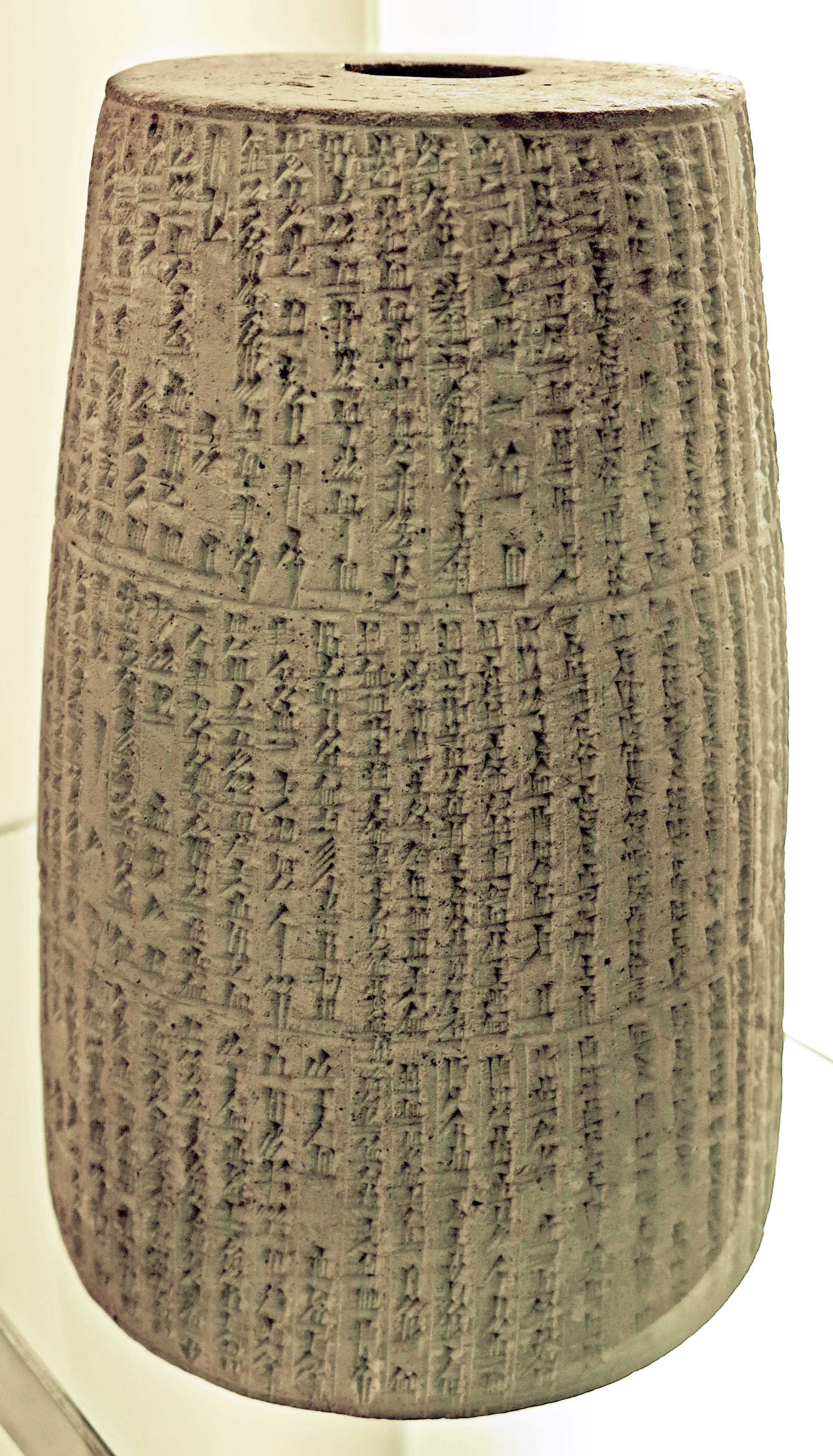
Nebuchadnezzar II's building deed for the renovation of the temple of the city god of Marad in the form of a truncated cone, ca 620 BC.
Since ancient times, the laying of the foundation stone has been part of the construction of a building. Today it usually takes the form of a ceremonial act in which capsules containing evidence of the present are laid in the foundation.
The laying of foundations can be traced back to ancient Egypt, the classical Mediterranean world and the ancient Orient, as well as to the Old Testament tradition. However, they were religiously based and much more elaborate than today. In Mesopotamia, this tradition began in the middle of the 3rd millennium BC and continued well into the 1st millennium BC.
The construction as well as the frequent renovation, repair or extension of palaces, temples, city walls and gates, which in Mesopotamia were always built of mud bricks that were not very durable, were among the most important tasks. The ruler was not only the builder, but also the one who ceremonially laid the first brick.
According to the myth of the creation of the world, the gods themselves built their residences and instructed the king in dreams to build. Once the site had been determined, it was a matter of carefully purifying it ritualistically. The blood of animals, honey, milk, wine, beer and oil had to be brought into the foundation trenches as offerings. In addition, cult personnel such as exorcists, lament singers, musicians and soothsayers had to be called in.
In contrast, nothing has come down to us about master builders and architects. If a renovation was to be carried out or if the ground plan was to be changed or the building moved, the approval of the gods had to be obtained. Above all, however, the inscriptions inserted into the building by predecessors had to be recovered, read and acted upon according to the instructions contained therein.
Photo: Don Hitchcock 2015
Source: Pergamon Museum, Berlin, recherche.smb.museum
The hollow truncated cone presented here, made as a body on the potter's wheel, is an outstanding example of such a foundation inscription. It was donated to the collection of the Museum of the Ancient Near East in 1890; its exact origin is therefore not certain.
But the inscription itself provides information about the place where it was found. According to the inscription, the object comes from the ancient city of Marad, a place about 70 km southeast of Babylon that can be traced back to the 3rd millennium BC. The existence of Marad has so far only been shown by such inscriptions. Here was the sanctuary of Lugal - Marada, the city god, who appears in cuneiform texts as a sword god and in his essence as a warlike underworld god. The text is written in cuneiform, that since the 2nd half of the 4th millennium BC.
In this case, it is a literary work in Akkadian, the oldest verifiable north-eastern Semitic language, whose two main dialects were Babylonian and Assyrian. The writing technique is the same as on thousands of clay tablets: the characters composed of individual wedge elements were written in the moist clay with a reed pen.
The text is divided into three columns of 45 to 50 lines each and shows the calligraphic effort to adapt the different character density of the lines to the given column width. The cone was then fired.
According to the inscription, the builder was Nebuchadnezzar II (605 BC - 562 BC), King of Babylon, who had the dilapidated sanctuary of Lugal-Marada in Marad renovated, about which he reports in this document:
At that time for Lugal-Marada, my lord, his temple in the midst of Marad - his founding document, which no one had seen since far away, I searched in its foundation and looked at it.
Over the foundation deed of Naram-Sîn, the king, my ancestor, I founded his foundation [anew.] A deed of my name I made and placed in it.
According to this, the temple had existed since the 23rd century BC, When the ancient kingdom of Akkadian was ruled by King Naram-Sîn (2272-2219 B.C.). Nebuchadnezzar II took the renewal of the building as an opportunity to now, in turn, place a foundation charter in the foundation. Apart from the quoted passage, the inscription is essentially identical to other comparable charters of the king. It is a literary building report which, after the introduction and titulature of Nebuchadnezzar, mentions his vocation as preserver of the cities and renewer of the temples and reports on his work on the buildings of Babylon and Borsippa.
The end of the inscription again follows literary patterns through the use of blessings and curses: 'O Lugal - Marada, Lord of all, you hero, look kindly on the work of my hands [...] Smash the adversaries, break their weapons, destroy the entire land of the enemies, overwhelm them insects! [...] Before Marduk, king of heaven and earth, make my deeds welcome, speak in my favour!'
Text: all of the text above referring to the building deed is by Prof. Dr. Joachim Marzahn, head curator at the Museum of the Ancient Near East.
Source: https://www.museumsportal-berlin.de/pl/magazin/blickfange/ein-grundstein-aus-der-zeit-nebukadnezars/
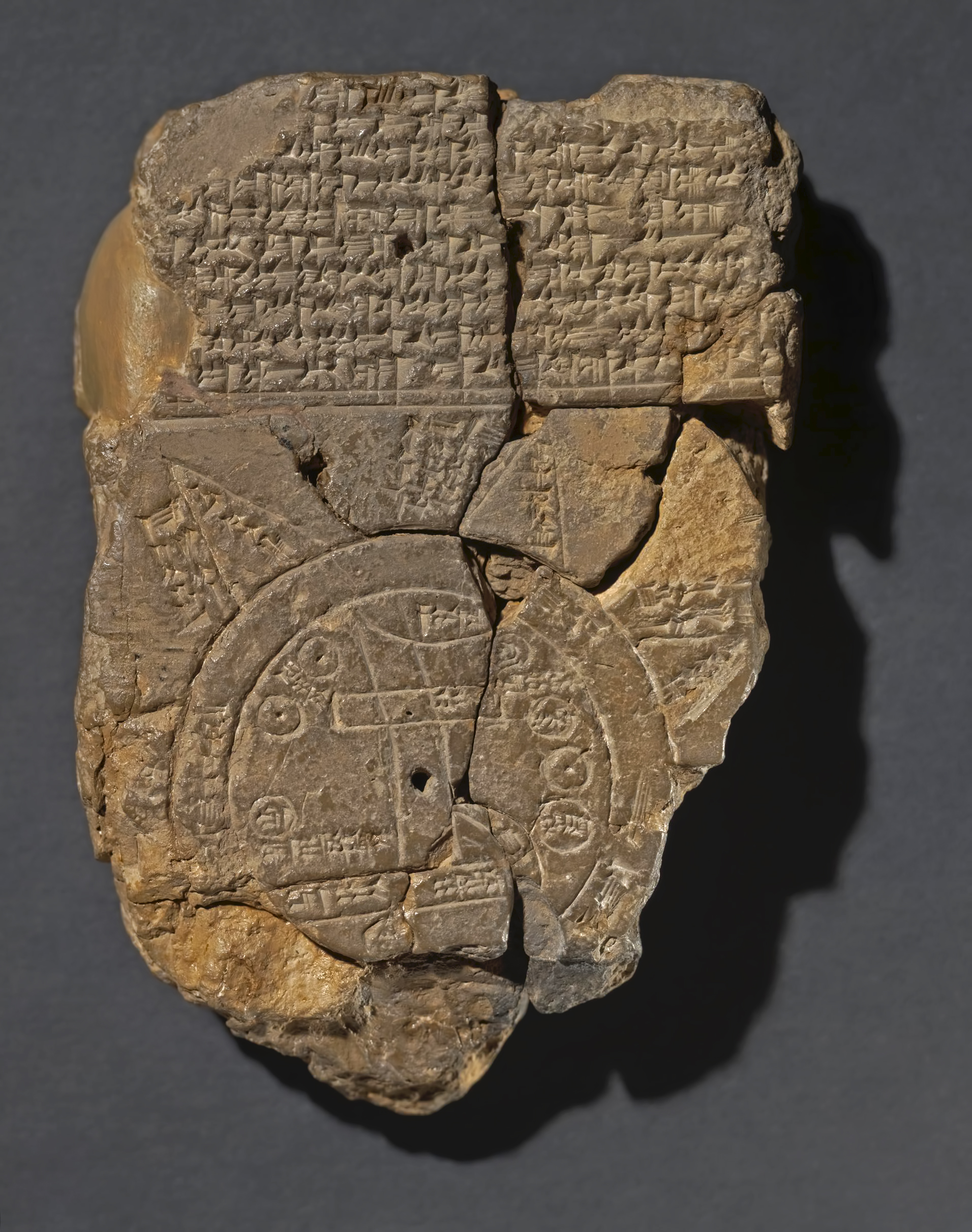
Map of the World
Circa 600 BC - 500 BC.
This clay tablet represents a map of the world. It shows the world as a disc, surrounded by a ring of water called the 'Bitter River'. 'Babylon' is marked as a rectangle at the right end of the Euphrates although the city actually occupied both banks of the river during most of its history. The river Euphrates flows south to a horizontal band, of which the right end is marked 'marsh' and the left end is marked 'outflow', thus the marshes at the head of the Gulf and either the Shatt al-Arab or where the river meets the cosmic 'Bitter River'.
To the right of the 'marsh' is a double curving line with a broken and unintelligible inscription. Small circles are used to indicate cities or districts, and two of which are identified as 'Assyria' and 'Der'. Three other geographical areas are marked, namely Bit-Yakin, the territory of an Aramaean tribal group around the southern Euphrates, is placed above its 'outflow'. Habban, the homeland of a Kassite tribal group around Kermanshah in western Iran, is placed quite wrongly to the west of Babylon. Urartu, an independent kingdom around the modern borders of Iran, Turkey and Russia, is placed relatively correctly to the north of Assyria.
Beyond the circular 'Bitter River' are placed the eight outlying regions (nagu). These are each marked, na-gu-u, and beside each is written the note '6 (or 7) beru (twelve or forteen hours in between' The beru is a Babylonian unit of time and linear measurement.
Danna (Sumerian) or Beru (Akkadian) is a word denoting a unit of time consisting of two hours. There were twelve Danna or Beru in a day. Danna were first used around 2 400 BC.
In addition, beside the north-eastern 'region' is written 'Where Shamash is not seen'. This reflects the fact that the sun rises in the east, crosses the heavens, sets in the west, and then returns to the east (as the Babylonians thought) through the underworld or the underworld waters, never passing through the northern (or southern) regions of the world or underworld.
On the reverse of this tablet these eight 'regions' are described in eight broken and largely unintelligible paragraphs, each beginning 'To the first (second, etc) region to which you go (the distance is) seven beru'. This, like the notes on the map, seems to indicate the distance between the different 'regions' around the edge of the world. It is not clear why the map twice gives the distance as six beru while the text, so far as preserved, consistently gives seven beru.
A final paragraph summarises, 'In all eight 'regions' of the four shores (kibrati) of the ea[rth ...], their interior no-one knows'. The 'four shores' (corresponding to the four quarters of the compass) is a regular Mesopotamian expression for the entire inhabited world.
The word nagu, which in historical and geographical texts simply means 'region', seems to have a special cosmic or mythological significance on this tablet and in the Flood story of the Epic of Gilgamesh (Tablet 11). There, as the flood waters subsided, Ut-Napishtim, the Babylonian Noah, 'looked about for the shores (kibrati), the boundaries of the sea. In each of twelve (directions) there emerged a nagu'. This and the triangular shape of the nagu on the map lead to the idea that the nagu may have been imagined as mountains.
The text at the beginning of the obverse of the tablet appears to be a description of the inhabitants, divine, human, animal or monstrous, of the areas beyond the earth, whether the eight 'regions' or the 'Bitter River' or maybe the underworld or underworld waters. Two or three lines may be missing at the beginning.
'... ruined cities ...
... whom Marduk watches ...
... the ruined gods who ... in the midst of the sea
... serpent, great dragon, between Anzu, scorpion-man
... mountain-goat, gazelle, zebu, leopard, bison
... lion, wolf, stag and hyaena
... the animal which Marduk created upon the rolling sea
... Ut-Napishtim, Sargon and Nur-Dagan king of
... their interior no-one knows'.
In the Epic of Gilgamesh (Tablet 10) the hero Gilgamesh goes to visit Ut-Napishtim in a land beyond the sea and beyond the Waters of Death. This suggests that the whole of this text is concerned with the inhabitants of the outer regions. The clause at the end of the text, 'their interior no-one knows' also ends the descriptions of the 'regions' on the reverse of the tablet.
Sargon, king of Akkad (ca 2 334 - 2 279 BC), established a short-lived empire spreading far to the north and west of the normal limits of Babylonia and became the subject of several legendary tales. One of these concerns a campaign against Nur-Dagan, king of Purush-handa (a city in central Turkey). As heroes of legend these two may well have been imagined as inhabiting a 'region' with Ut-Napishtim.
The 'ruined' gods are gods whose statues have become dilapidated and are in need of repair. The gods themselves were thought to have gone down to the underworld (via the Waters of Death), and the broken clause, 'who ... in the midst of the sea', probably refers to this underworld abode. The reference to 'ruined cities' may be to the gods of these cities.
In the Epic of Creation the serpent, great dragon, scorpion-man and bison are among the monsters created by Tiamat ('Sea') to do battle with the god Marduk. Anzu, the lion-headed bird, is the opponent of the god Ninurta in another Babylonian epic, and in other contexts is listed with Tiamat's monsters. All of these monsters may have been imagined as inhabiting the underworld or underworld waters.
The Babylonian author Berossus also recounts a story of strange monsters, some half-human, being created in the primeval waters before the creation of the world and being ruled over by Tiamat. The zebu or humped bull (apsasu) is referred to in Sumerian texts of about 2 000 BC. Later the name seems to be applied to a mythical monster, perhaps a sphinx. The remaining animals in the list would have been known to the Babylonians in the 1st millennium BC but would probably have been regarded as wild, strange or exotic. So they would have been suitable inhabitants of the outer 'regions'. The sea-animal created by Marduk is perhaps a whale.
The hole at the centre of the tablet is a so-called 'firing hole', deliberately made by the scribe. Similar holes appear in the middle of the text above the map and at two points on the reverse. The function of the so-called ‘firing hole' is unclear. Generally, it is considered that a ‘firing hole' had nothing to do with the baking of a tablet. However, ‘firing holes' certainly helped a tablet to dry out faster and more evenly.
Excavated by Hormuzd Rassam at Abu Habba, Sippar.
Height 122 mm, width 82 mm.
Inscription language: Akkadian, written in cuneiform.
A note at the end of the tablet states that it was copied from an earlier document but the inclusion of Assyria, Bit-Yakin, Habban and Urartu indicates that it was composed no earlier than the 9th century BC, circa 900 - 800 BC
Catalog: Clay tablet, 92687
Photo and text: www.britishmuseum.org, © Trustees of the British Museum, CC BY-NC-SA 4.0
Additional text: cdli.mpiwg-berlin.mpg.de/articles/cdln/2016-1
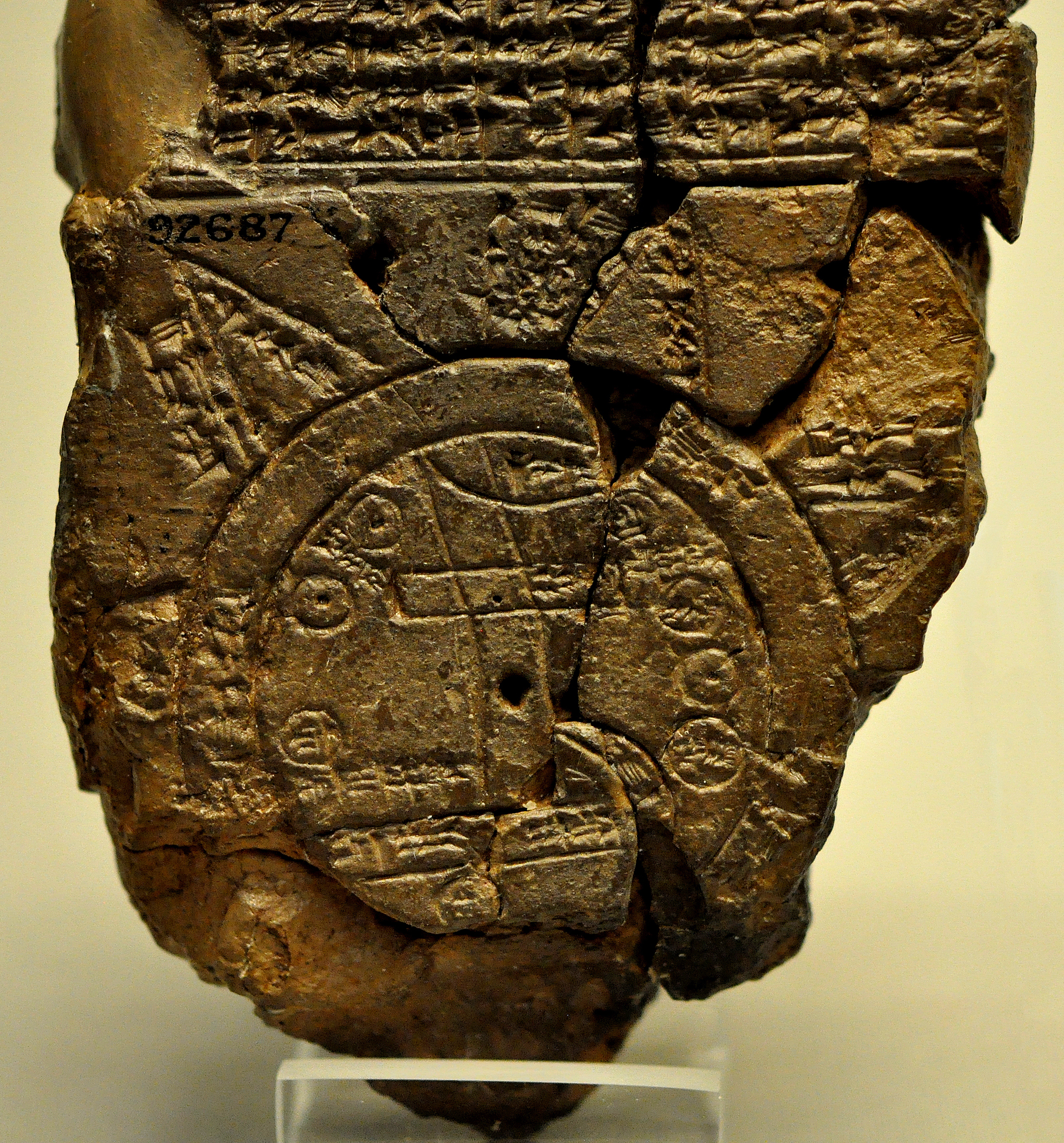
A close-up view of the Babylonian map of the World. This partially broken clay tablet contains both cuneiform inscriptions and a unique map of the Mesopotamian world. Probably from Sippar, Mesopotamia, Iraq.
700 BC - 500 BC.
Photo: Osama Shukir Muhammed Amin FRCP(Glasg) 2014
Source: The British Museum

Clay cylinder building deed.
The Akkadian cuneiform text mentions the name of the last great Assyrian king Assurbanipal, 668 - 626 BC, whose elder brother Shamash-shum-ukin became king of Babylon, and also mentions one of the double walls of Babylon, Nemet-Enlil, which had a total length of eight kilometres, and was further protected by a fifty metre wide moat, connected at both ends to the Euphrates.
Photo: Don Hitchcock 2015
Source and text: Pergamon Museum, Berlin, recherche.smb.museum
Additional text: Wikipedia
Small amphora for cosmetics or fragrance oil.
6th - 5th century BC.
Height 69 mm, diameter 44 mm, diameter opening and edge 25 mm, diameter opening 9 mm.
Catalog: Glass, Babylon, VA Bab 03073
Photo: Don Hitchcock 2015
Source and text: Pergamon Museum, Berlin, http://www.smb-digital.de/
God Seal
Engraved cylinder seal.
Dated to Esarhaddon (680 BC – 669 BC)
Height 125 mm, diameter 32 mm, weight 300 gm.
Catalog: Lapis Lazuli, VA Bab 00647
Photo: Don Hitchcock 2015
Source and text: Pergamon Museum, Berlin, recherche.smb.museum
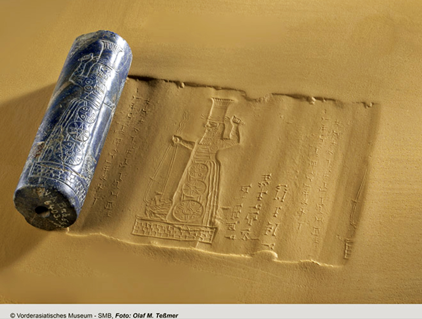
God Seal
Engraved cylinder seal.
Dated to Esarhaddon (680 BC – 669 BC)
This massive lapis lazuli cylinder was found together with beads, scarabs and precious ornaments mixed up with raw material, carefully hidden by the last owner, probably a Parthian manufacturer of beads, beneath the floor of his house.
The storm god Adad, standing on a stylized pedestal, is shown with bolts of lightning in his hands, a lion-dragon on a leash lying at his feet. His garment is decorated with the image of a ziggurat and three star-discs one below the other, which are depicting gold or silver pendants.
The initial Neo-Babylonian inscription, 'Seal of the god Adad', was supplemented at first by the addition 'Property of the god Marduk … of Esangila'.
The second Assyrian dedication 'To the god Marduk, great lord, his lord, Esarhaddon, king of the universe, king of Assyria, has given [the seal] for his life' suggests that the seal was at one point misappropriated from the treasury of Esangila and that it was Esarhaddon (680-669 B.C.) who reversed the sacrilege.
The technique - positive carved inscriptions, raised relief - substantiates that the cylinder was never used for sealing, although very few impressions of god's seals are known. [Nadja Cholidis]
Height 125 mm, diameter 32 mm, weight 300 gm.
Catalog: Lapis Lazuli, VA Bab 00647
Photo credit: Staatliche Museen zu Berlin, Vorderasiatisches Museum / Olaf M. Teßmer CC BY-NC-SA 4.0
Source and text: Pergamon Museum, Berlin, recherche.smb.museum
Family Crypt
During excavations at Ashur, a sounding below a Middle Assyrian house uncovered a family crypt of the 13th Century BC where ten persons were interred. Numerous pieces of burial equipment (cylinder seals, jewellery made of gold and semi-precious stones, ivory objects, pottey and alabaster vessels) were associated with the last two skeletons in the crypt.
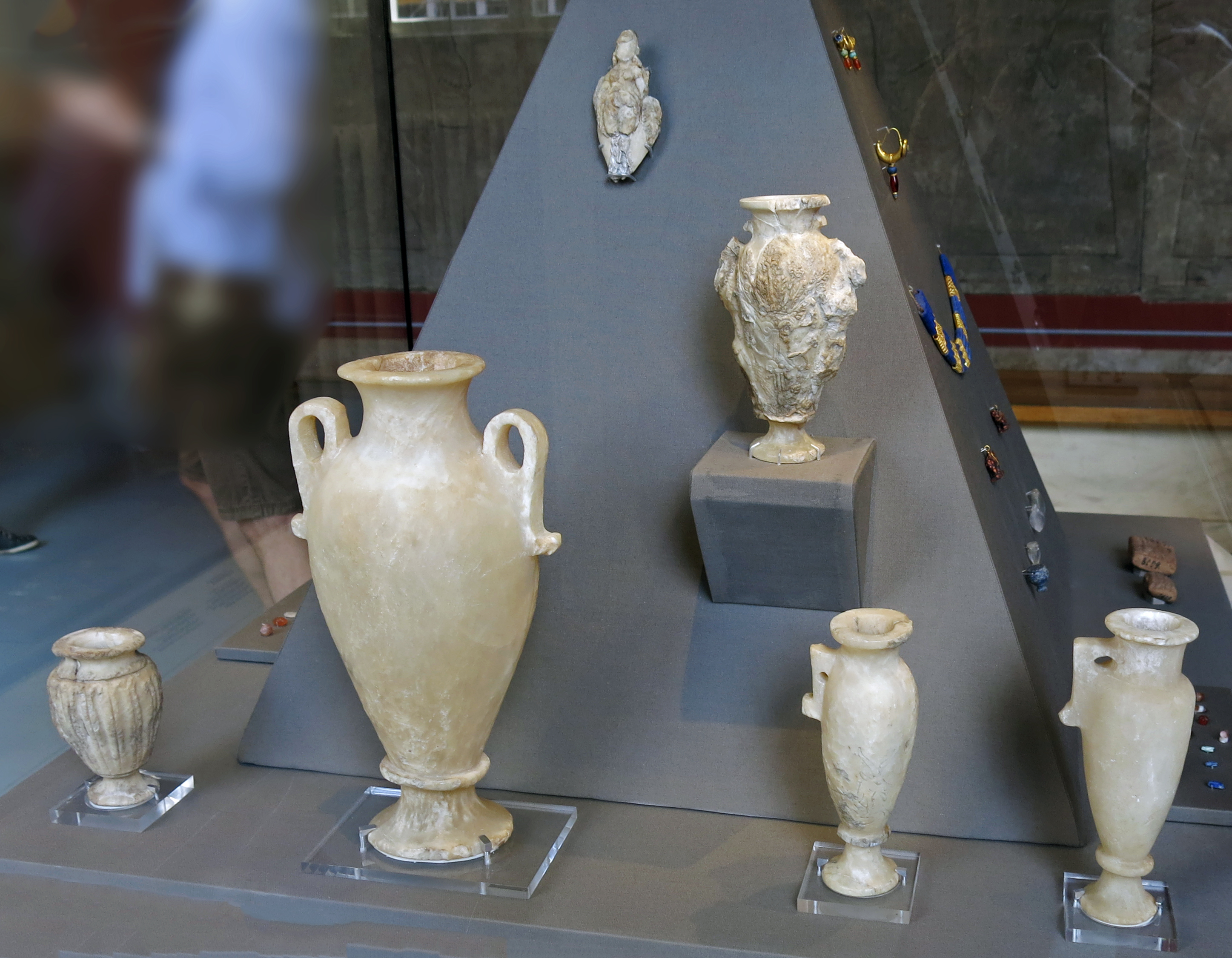
Alabaster vessels from the family crypt referred to above.
Photo: Don Hitchcock 2015
Source and text: Pergamon Museum, Berlin, recherche.smb.museum
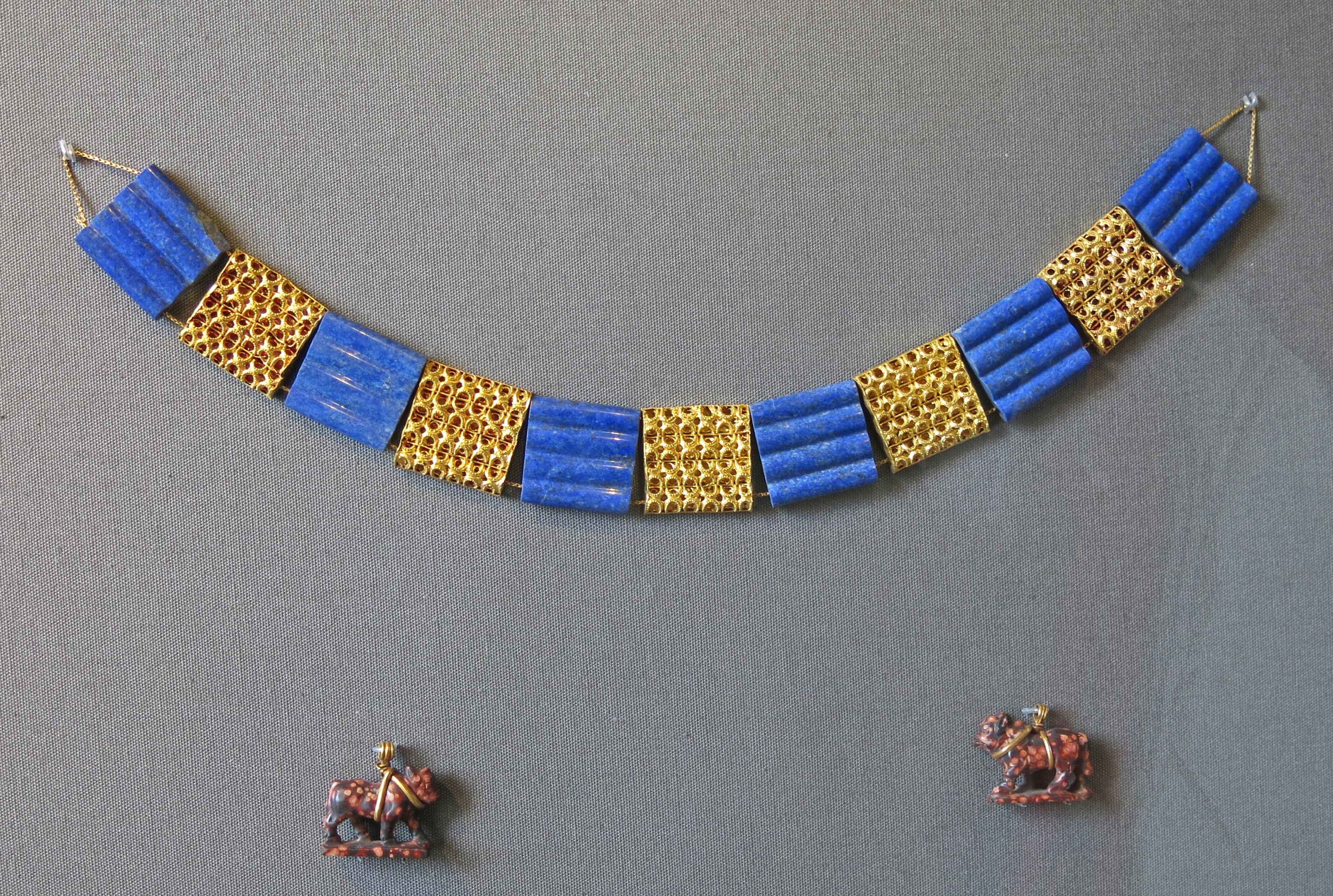
Lapis lazuli and gold sections of a plate necklace
Assur, 1 400 BC - 1 200 BC.
Length 275 mm
From the family crypt referred to above.
In 1908, German excavators discovered an untouched brick crypt with the remains of several burials and exceptionally rich grave goods in a search trench. The additions include pottery, various alabaster vessels and various ivory objects.
The jewellery items in particular testify to the high social status of the two deceased, to whom the body jewellery could be attributed as the last to be buried. In addition to some jewellery ensembles arranged randomly into headdresses and necklaces, the function of the eleven square plates made of gold and lapis lazuli is confirmed by their location as part of a necklace.
The individual elements made of semi-precious stone and gold are largely uniform in their basic shape and the longitudinal structure of the surface. The effect of the collar comes primarily from the colour change and the alternating smooth and delicately perforated surfaces.
The five golden decorative links provide insights into the goldsmith's technique: perforated half-cylinders are soldered onto a base surface, with the openings being emphasised with a turned-up edge and folded-over granulation.
It is not certain that the two stone pendants in the shape of humpback calves with gold loops belong to the plate collar. [Ralf B. Wartke]
Catalog: VA Ass 01008
Permalink: id.smb.museum/object/1744294/lapisschieber-eines-plattenhalsbands
Photo: Don Hitchcock 2015
Source and text: Pergamon Museum, Berlin, recherche.smb.museum
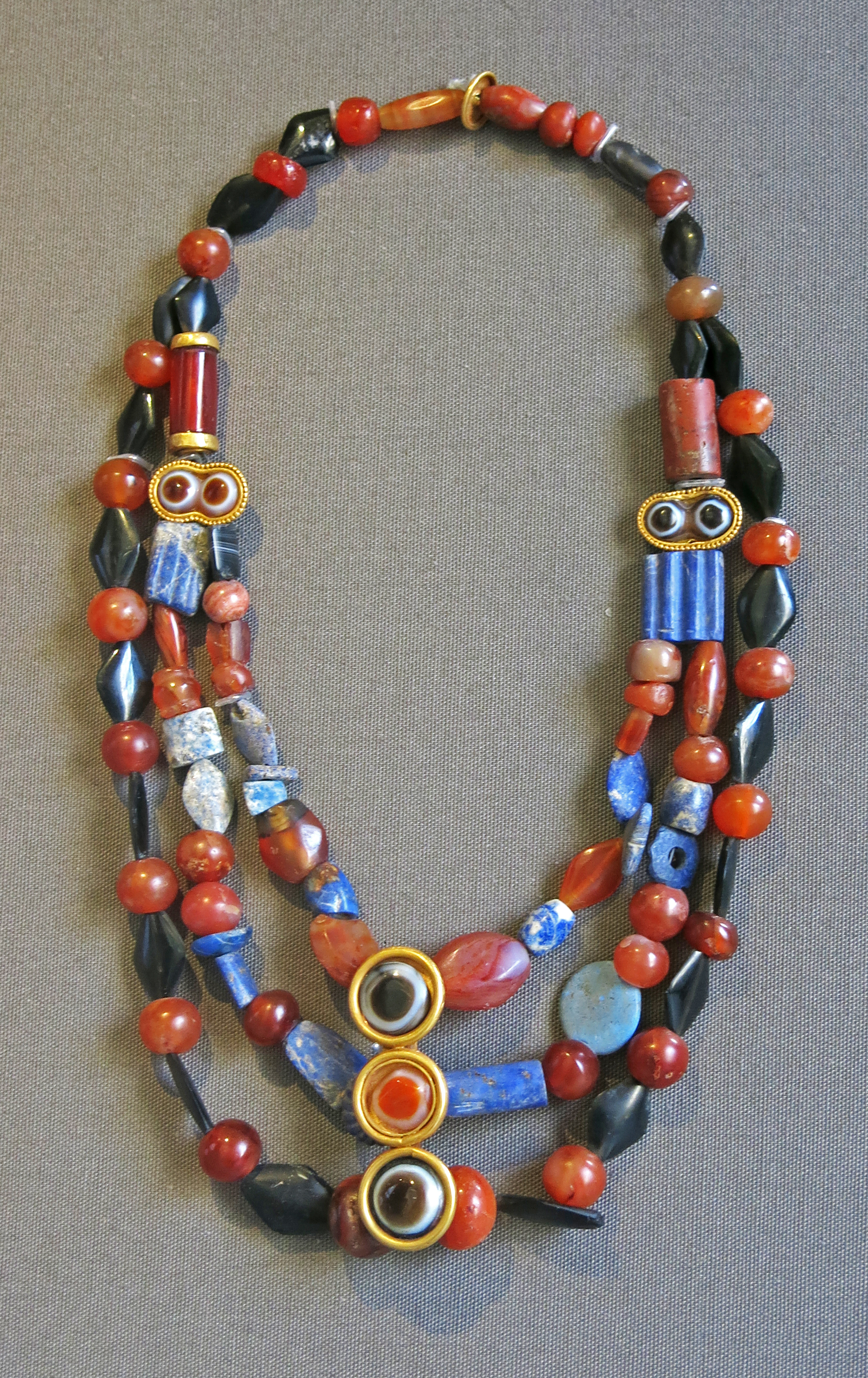
Multi-link necklace
From the family crypt referred to above.
Carnelian, lapis lazuli and obsidian beads have been used, as well as onyx beads cut and polished to resemble eyes, and surrounded by gold.
This necklace is attested by the museum card as being from the same crypt as the necklace above, and the same fluted blue lapis lazuli square beads in each necklace are further confirmation of this.
( This item appears not to be in the online catalog - Don )
Photo: Don Hitchcock 2015
Source: Pergamon Museum, Berlin
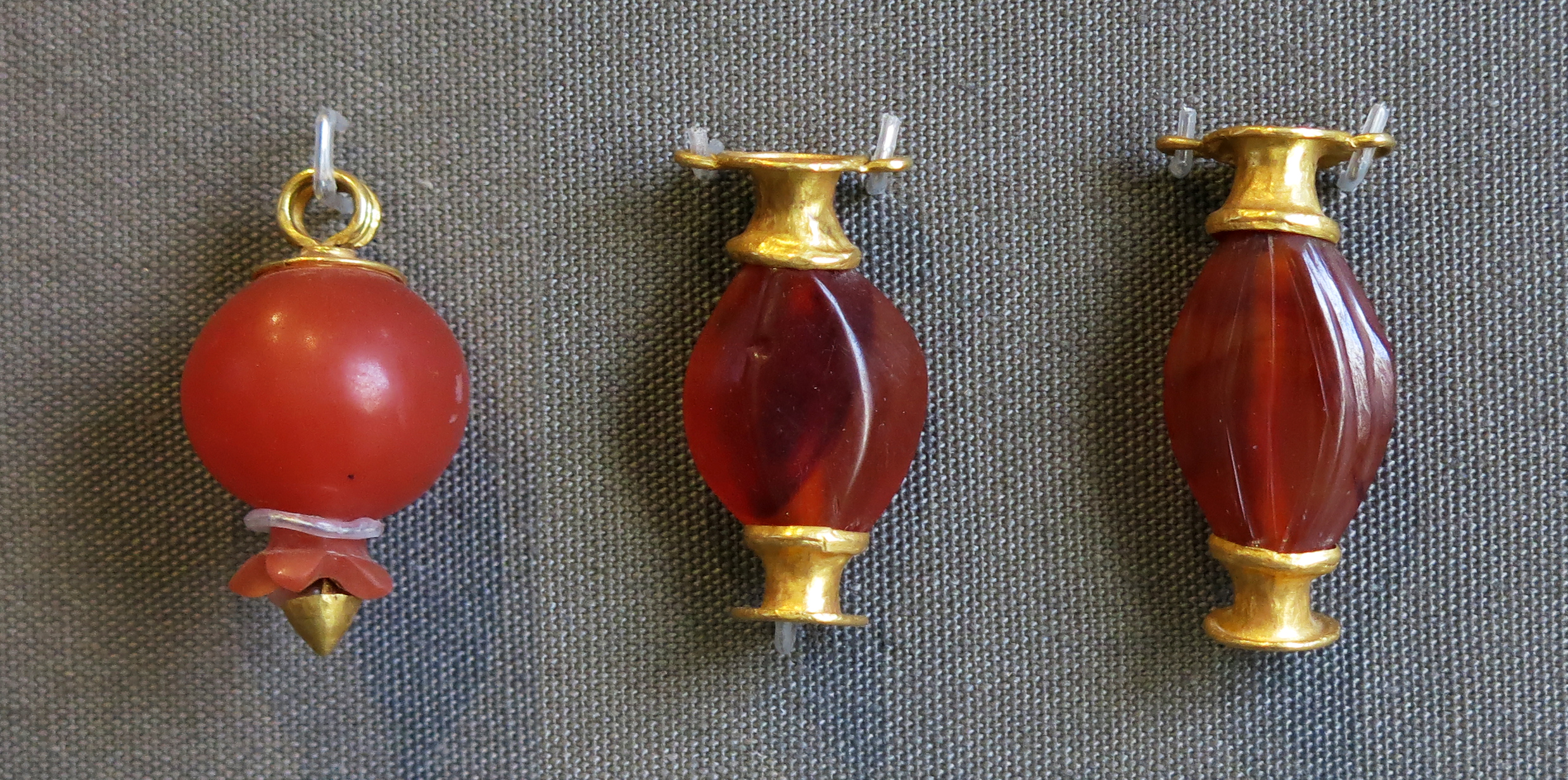
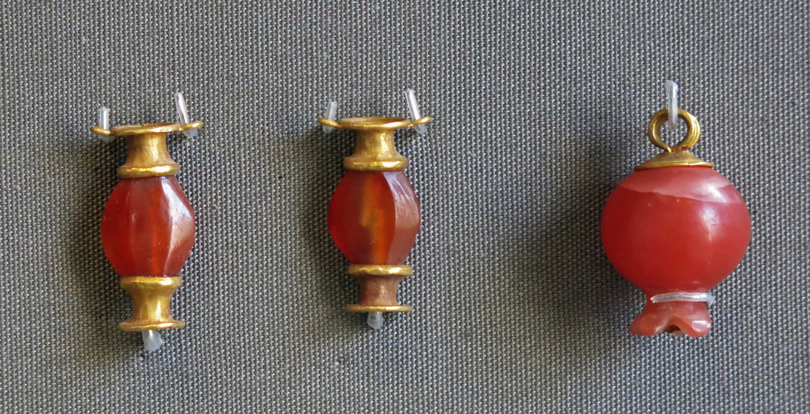
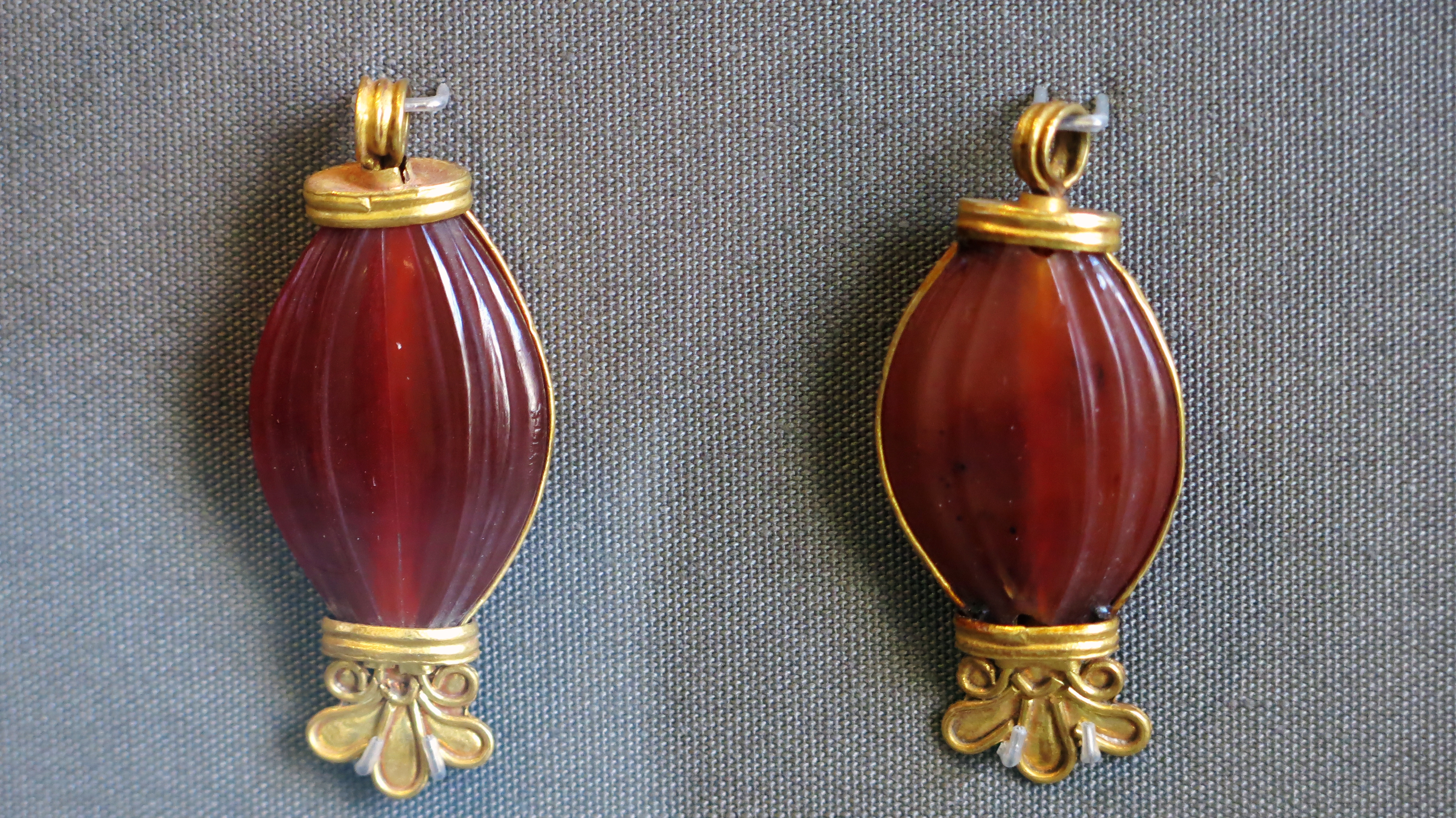
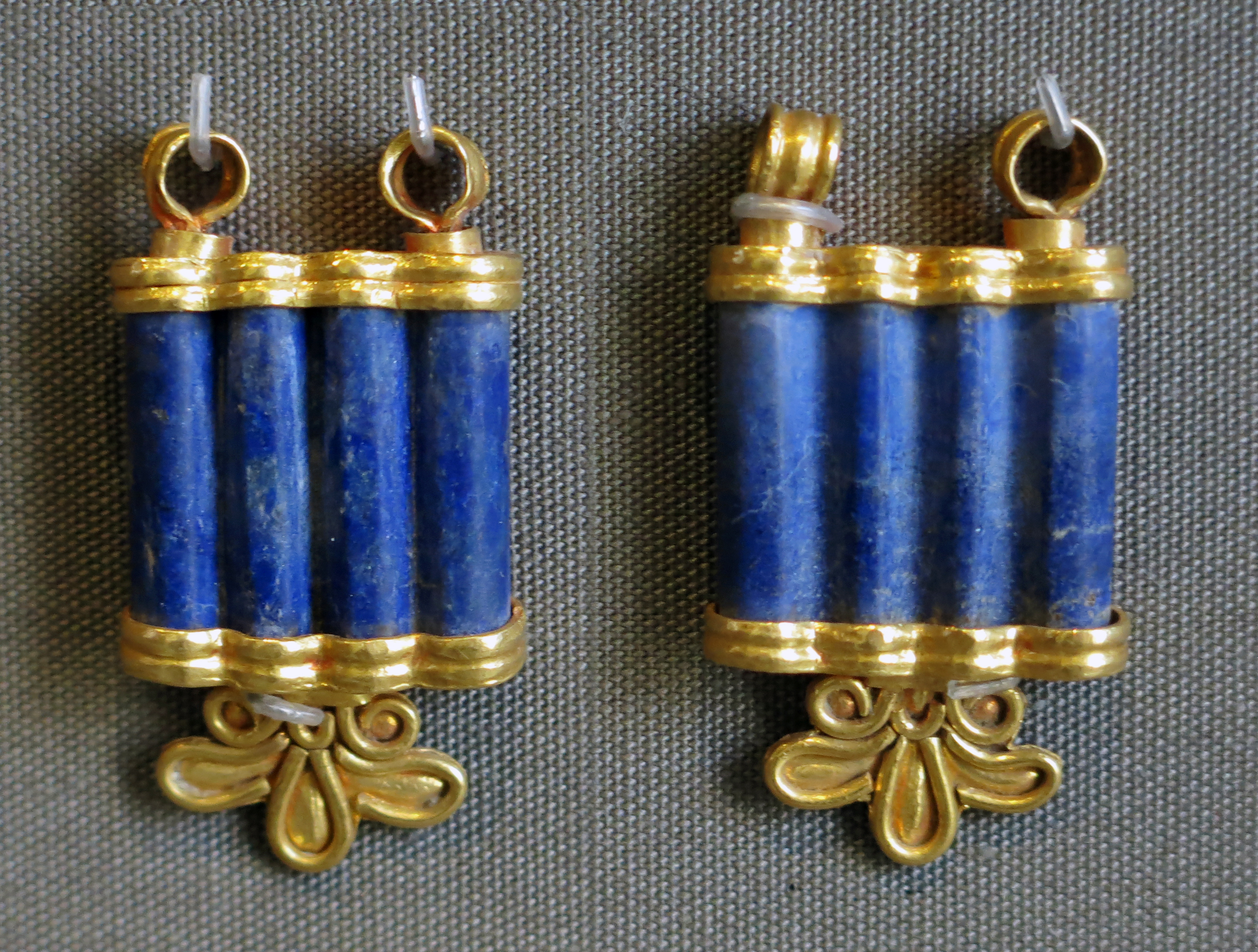
Jewellery
From the family crypt referred to above.
Photo: Don Hitchcock 2015
Source: Pergamon Museum, Berlin
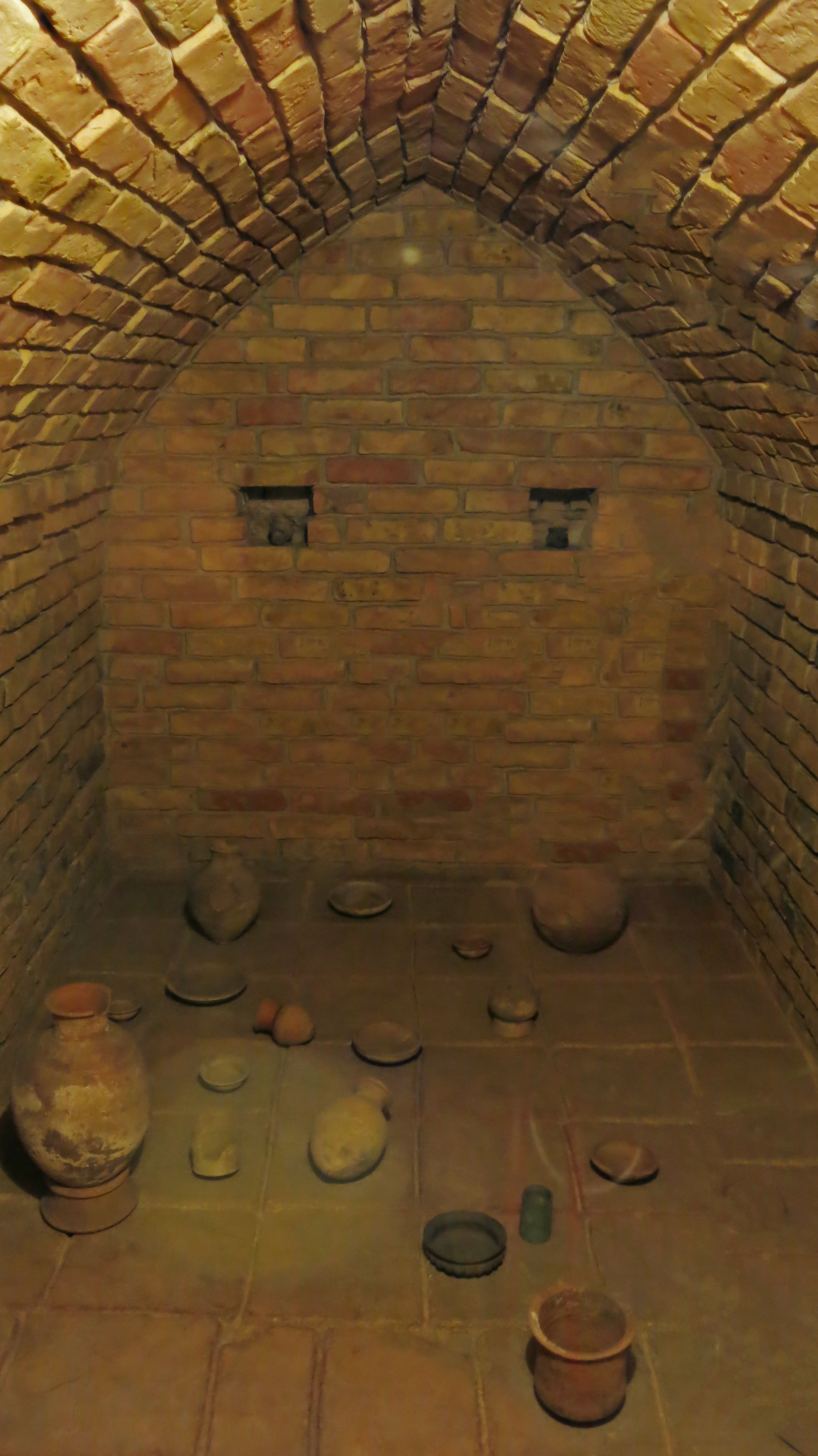
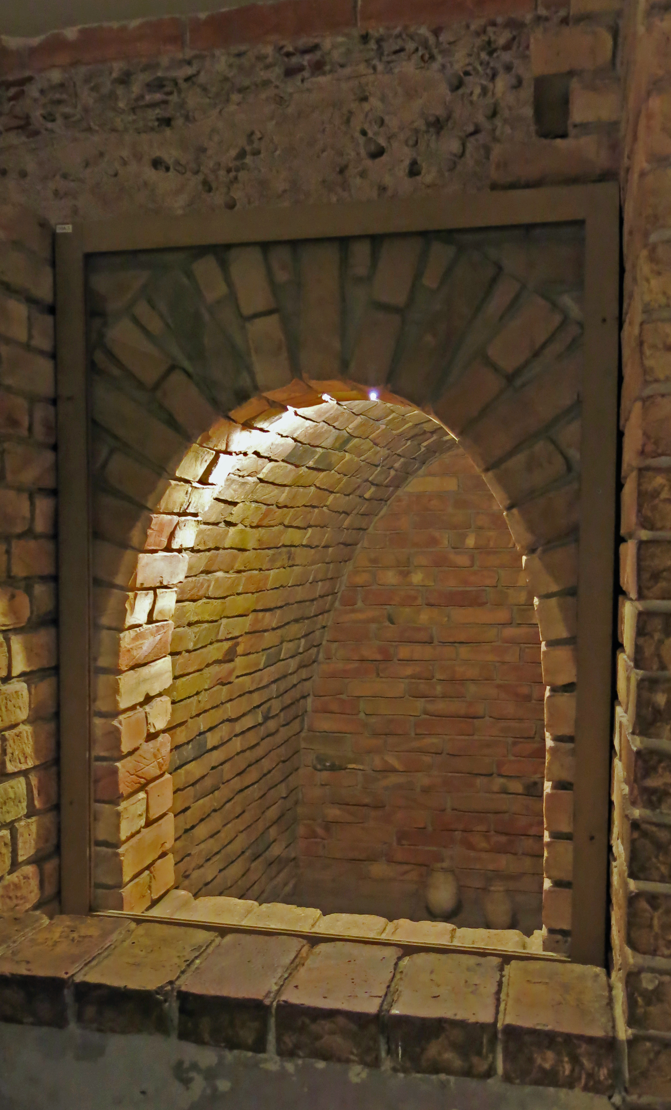
The associated text for these crypts reads:
Assyrian Crypts
There were different burial rituals in the old Near East, which depended on the respective epoch and the specific region as well as on the rank and wealth of the deceased and his family.
In Assur a number of crypts were excavated under residential buildings of the living. The replicas of two examples are in this museum, containing some of the original finds.
The right crypt was formed by a radial layer vault and contained a number of burials with a substantial time interval between them. In addition to the original vessels on display here, the burials were rich in jewellery and cosmetics (see display in room 12, showcase 40). The crypt was in use during the second half of the second century BC. The left crypt has a pointed arch vault and was dated back to ~ 900 BC.
The deceased were thought to live on in the underworld and the grave goods and offerings were attributed to them. In case of failure the ghosts of the deceased were feared because they could still harm the living.
See for example Irving Finkel's presentation The First Ghosts: www.youtube.com/watch?v=sVsA2ySbhIg
Text and translation by courtesy of Michael Hess
Photo: Don Hitchcock 2015
Source: Pergamon Museum, Berlin, recherche.smb.museum
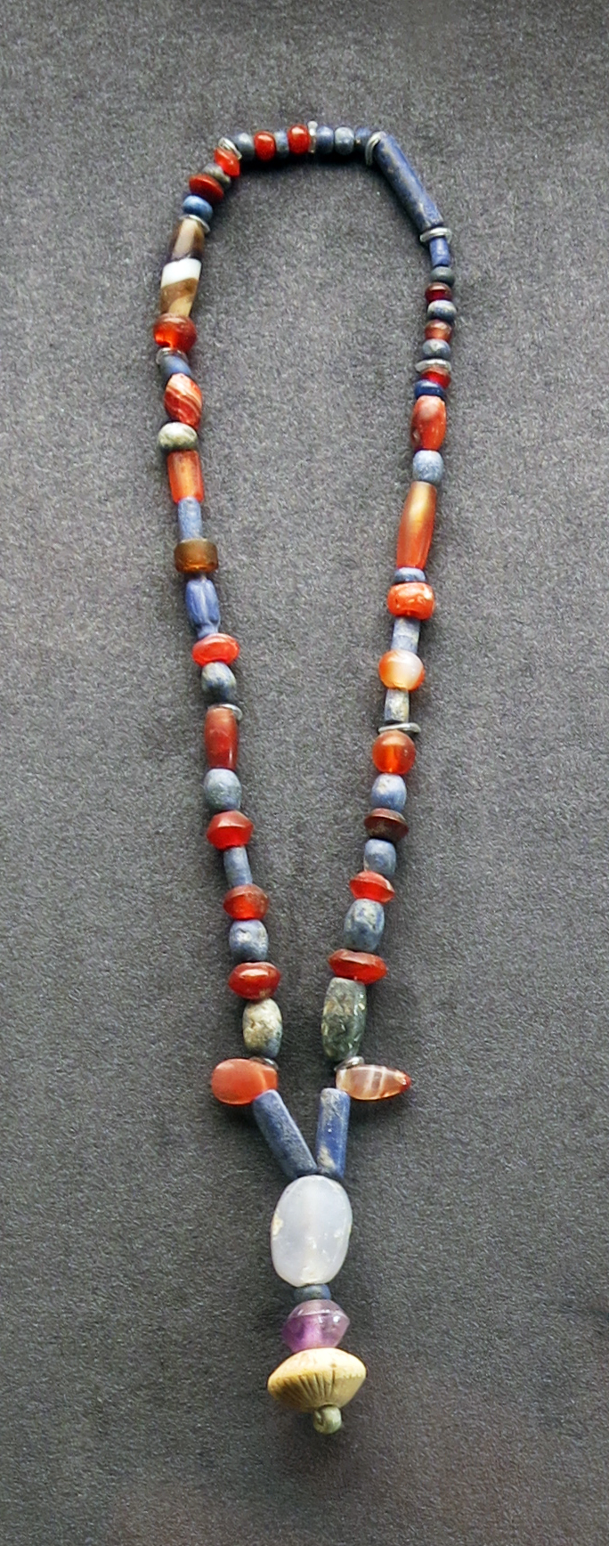
Necklace made of various semi-precious stones
Assur, 1 000 BC - 612 BC.
Stones include carnelian, agate, lapis, turquoise, and amethyst.
Length 390 mm, weight 30 gm.
Catalog: Assur, Qal'at Scherqat, find quadrant d B 6 III, Crypt 069, VA Ass 05975
Permalink: id.smb.museum/object/1744738/kette-aus-diversen-halbedelsteinen
Photo: Don Hitchcock 2015
Source and text: Pergamon Museum, Berlin, recherche.smb.museum
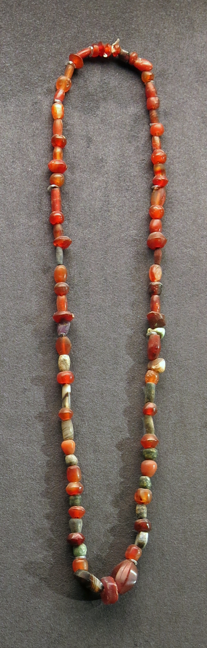
Necklace made of various semi-precious stones, probably from Assur
( This necklace is similar to the one above, was beside it in the vitrine display, and may be from the same place and even find quadrant, but I can find no record of it in the online catalog. It has a high proportion of carnelian beads, as well as a few beads made of agate - Don )
Photo: Don Hitchcock 2015
Source: Pergamon Museum, Berlin, recherche.smb.museum
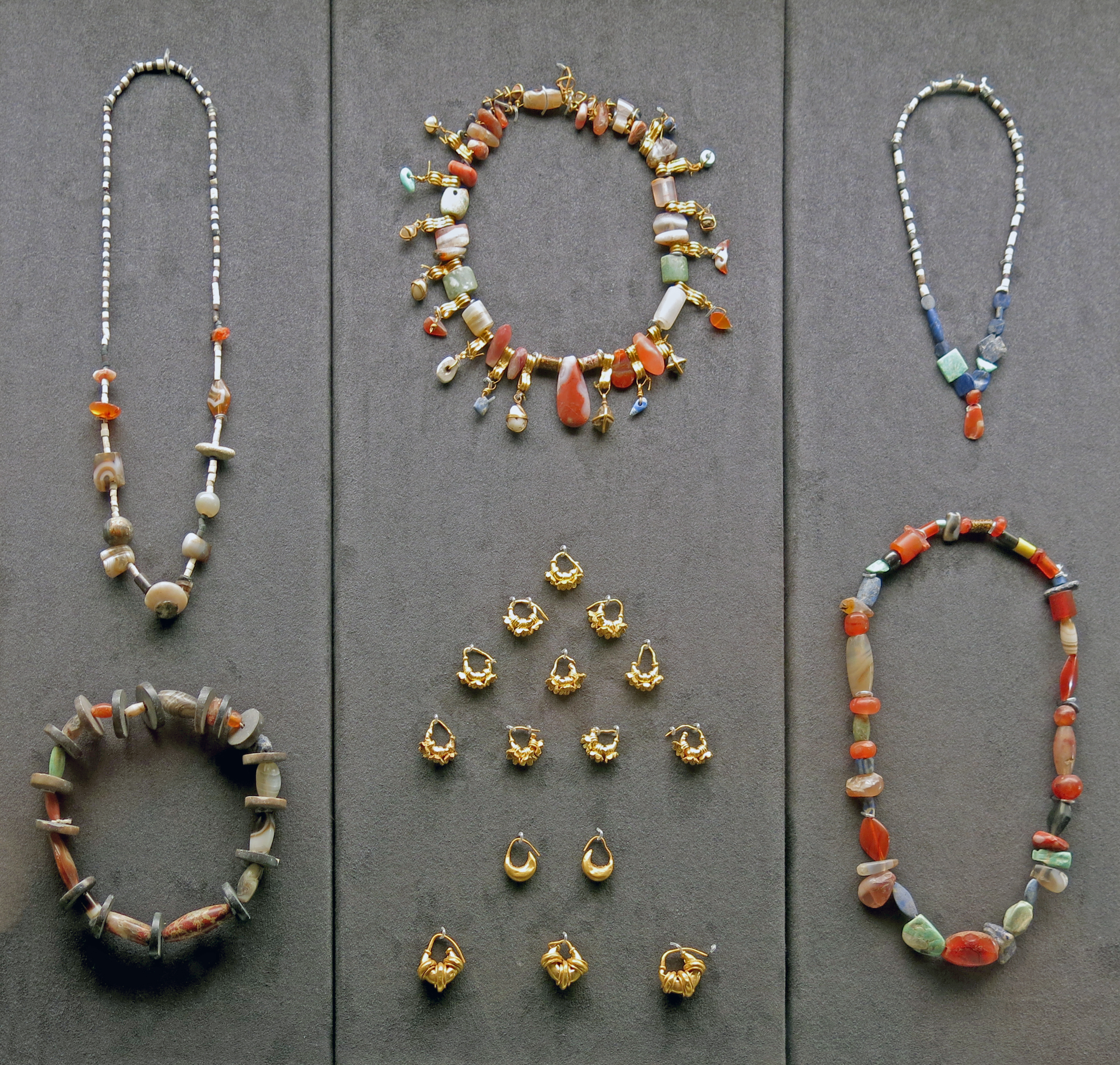
Necklaces made of various semi-precious stones, and gold earrings
( None of these items appear to be in the online catalog, and appear to be from different sub-cultures, though I think that they are from Assur - Don )
Photo: Don Hitchcock 2015
Source: Pergamon Museum, Berlin, recherche.smb.museum
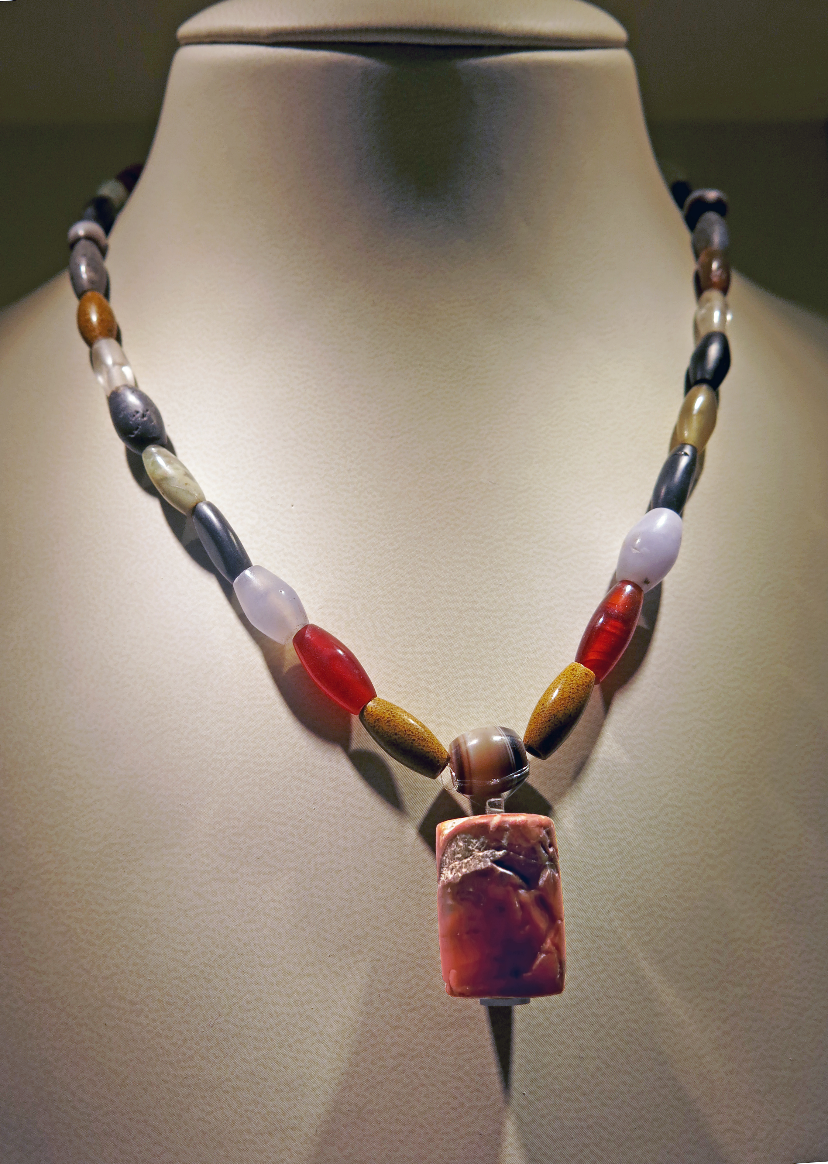
Necklace made of 38 different gemstones.
Cylinder seals are of great importance in business and administration for notarising processes and identifying property. In addition, a seal also represents a valuable amulet and piece of jewellery for its owner, to which positive, apotropaic properties (the power to avert evil influences or bad luck) were attributed due to the material or colour used.
It offered its owner divine protection against diseases and other everyday dangers through mythical representations, magical symbols and inscriptions such as prayers. The valuable coloured stones also made seals attractive pieces of jewellery, which were also attached to necklaces, for example (bust left). The seal could be worn on the robe in combination with a pin (bust on the right).
Necklace made of 38 different gemstones
Stones: agate and carnelian, Crystal, Granite.
7th century BC, Neo-Babylonian
Length 45 cm, weight 24.8 gm, weight with seal 33.6 gm.
Catalog: Necklace, Babylon, VA Bab 01486.01
Catalog: Cylinder seal VA 529, chalcedony, 6th/5th century BC
Photo: Don Hitchcock 2015
Source and text: Pergamon Museum, Berlin, recherche.smb.museum
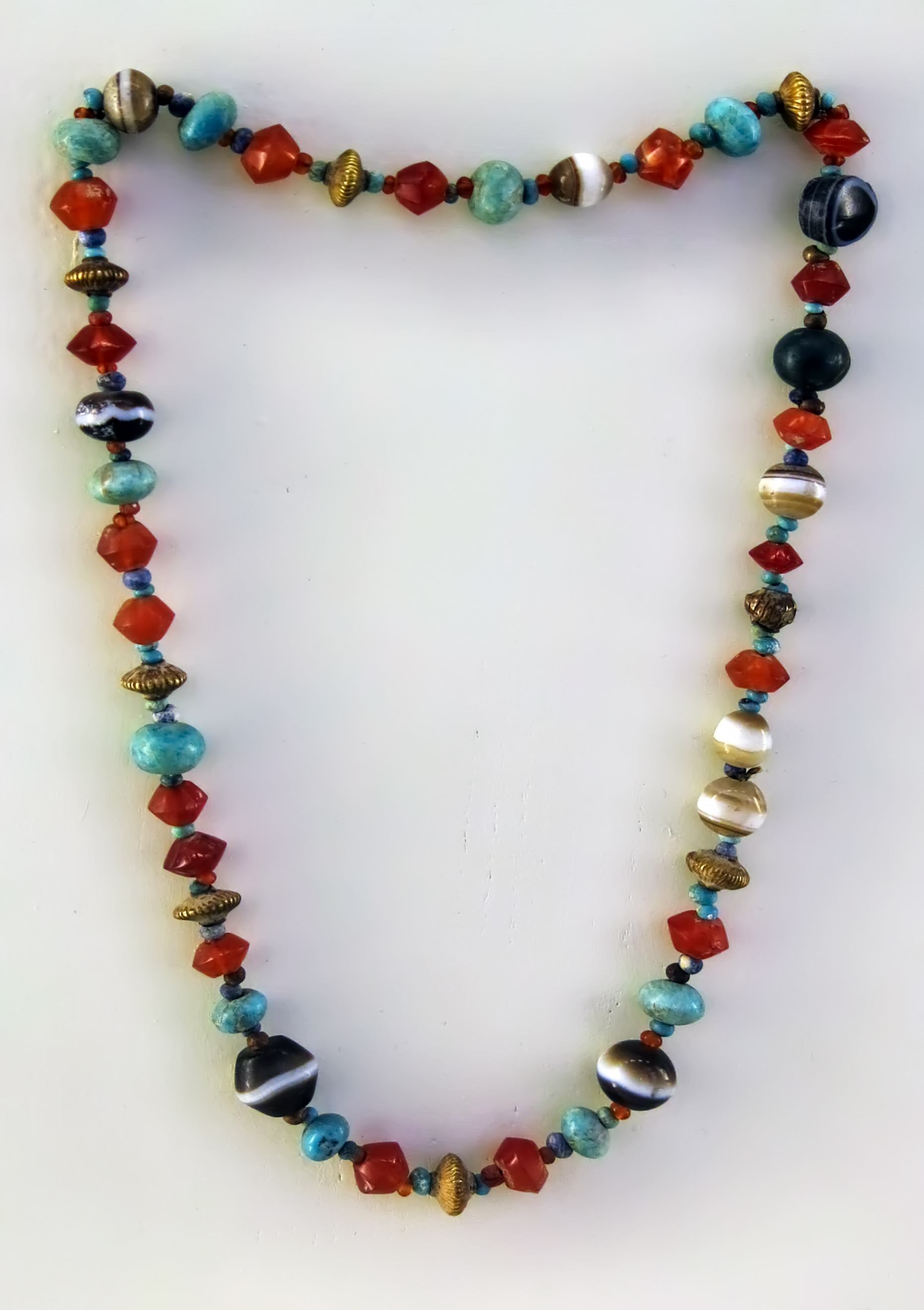
Neo-Babylonian, first half of the 1st millennium BC
Necklace made of semi-precious stones, gold, Babylon.
Diameter 15 cm.
Thickness 7 mm.
Weight 30 gm.
Catalog: Semi-precious stones, gold, VA Bab 02550
Photo: Don Hitchcock 2015
Source and text: Pergamon Museum, Berlin, http://www.smb-digital.de/
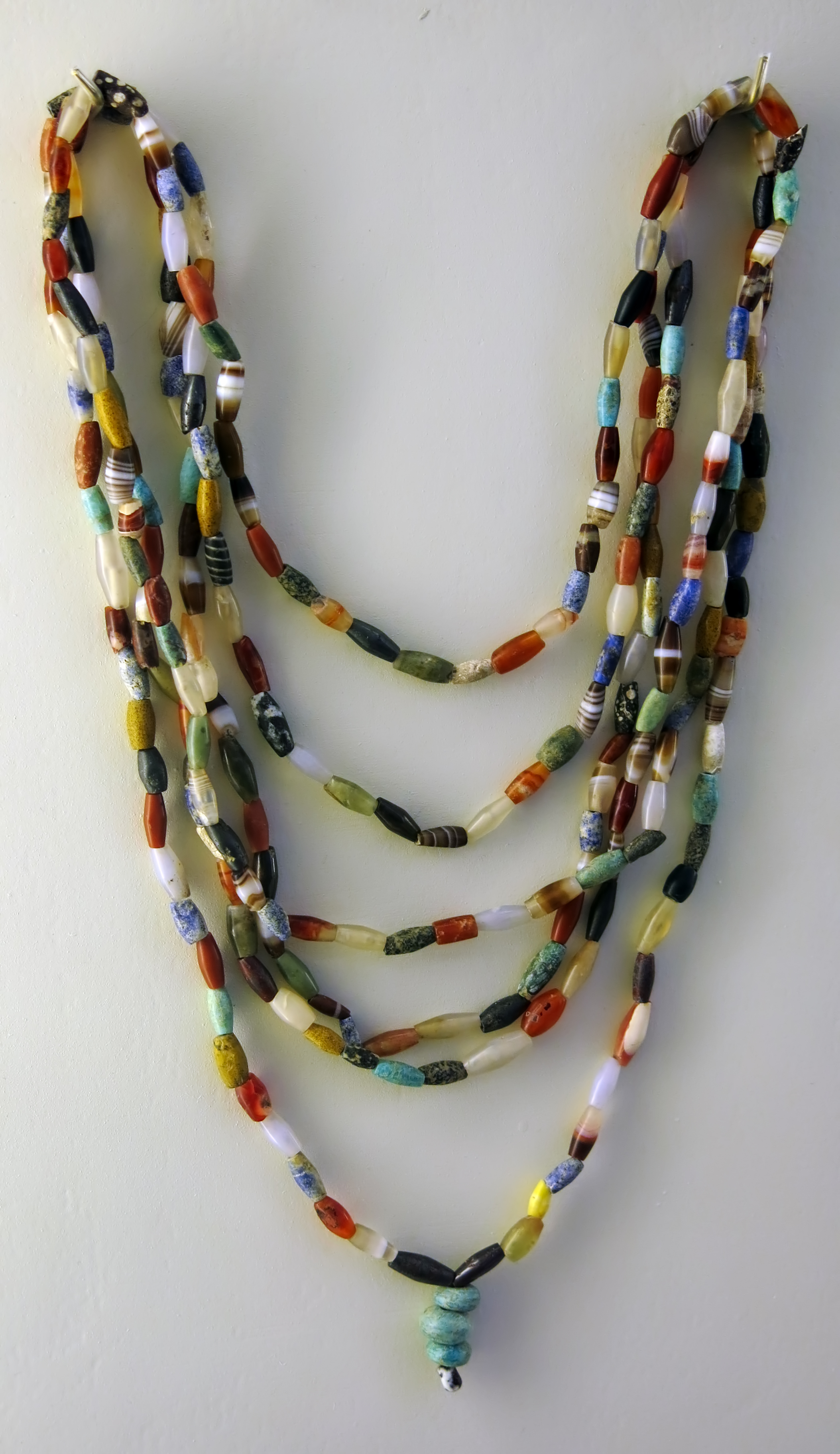
Necklace made of gemstones (grave goods), Babylon, 1st half of the 1st millennium BC.
Length 70 cm, weight 67 gm.
Catalog: Semi-precious stones, Merkes, from a stool coffin (Grave 124),
quadrant 25 n 2, 4.24m, VA Bab 01487
Photo: Don Hitchcock 2015
Source and text: Pergamon Museum, Berlin, http://www.smb-digital.de/
Assur and Babylon
Assur, or Ashur, whose modern site name is Qala'at Sherqat, is situated on the West Bank of the Tigris in Northern Iraq. The site already began to attract the interest of archaeologists during the middle of the 19th century.In 1903 the Royal Museums of Berlin and the Deutsche Orient-Gesellschaft began to carry out systematic excavations under the direction of Walter Andrae which were continued until 1914. Research in this area is still being carried out today. At the side of the Archaic Ishtar Temples, urban development was traced back as early as the first half of the third millenium BC. During the excavations, a number of representative religious and palace buildings from various periods were unearthed.
The Old Palace of the Assyrian ruler Shamshi-Adad I and important parts of the temple of the city and state god Ashur date to the first half of the second millenium BC. In between these two buildings, the ruins of the Ziggurat are located. They are still 30 metres high and clearly visible from a distance. The Ziggurat was originally consecrated to the god Enlil, but later on dedicated to Ashur.
A twin sanctuary belonging to the moon god Sin and the sun god Shamash dates back to the 15th century BC. The extension of the city as a residence reached its peak during the reigns of the Middle Assyrian kings Tukulti-Ninurta I (1244 BC - 1208 BC) and Tiglath-pileser I (1115 BC - 1077 BC). During this period a temple was built, dedicated to the goddess Ishtar, and another royal palace as well as the Anu-Adad Temple were erected.
From the 9th century onwards, Ashur began to loose its importance as the political capital of the Assyrian Empire. But its religious significance remained high and great efforts were taken by the Neo-Assyrian kings to preserve, restore, and build new temples, like the Nabu Temple. After the destruction of Ashur by the Medes in 614 BC, the city flourished once again during the Parthian period (2nd century BC - 3rd century AD). A palace was built in the southern sector of the city, one of its facades is reconstructed here opposite the Babylonian Ishtar Gate.
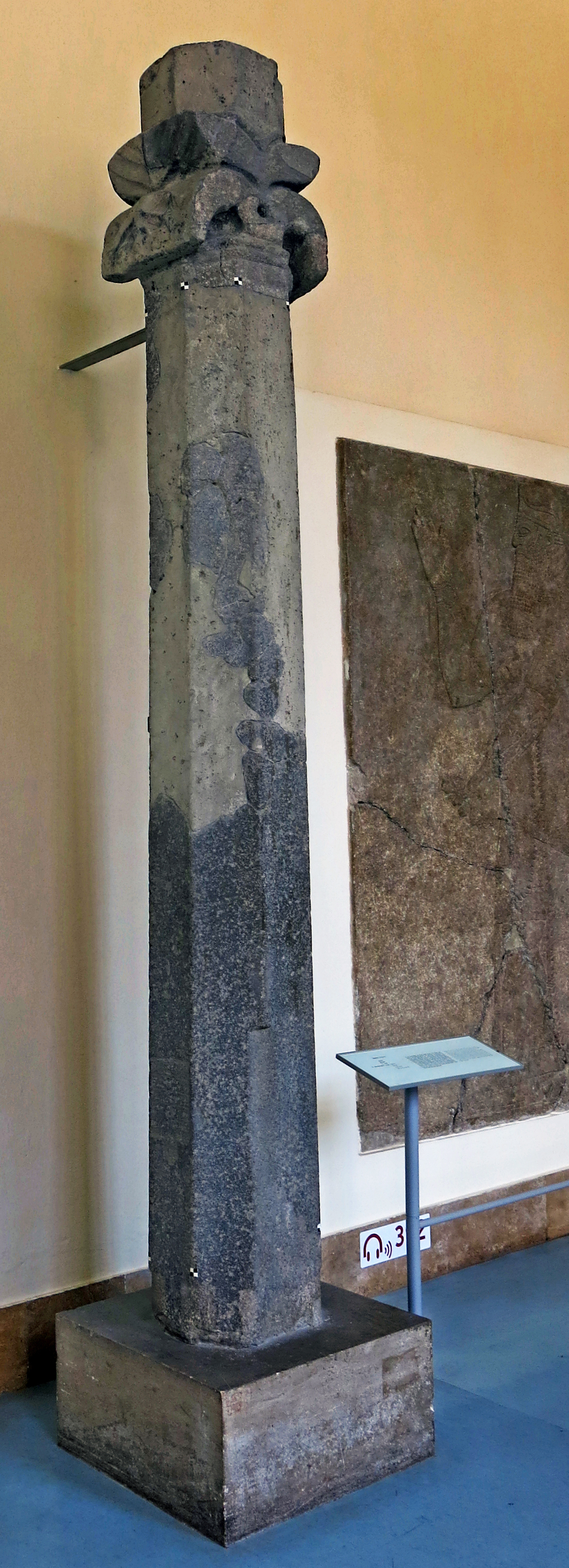
Among the row of Stelae at Assur, a number of columns and column fragments which apparently had been brought to the city as part of an important booty were discovered.
The inscription on the original basalt column with leaf capital reads:
'Monument of Shamshi-Adad, king of Assyria, son of Tiglath-pileser, king of Assyria'.
(
This apparently refers to Shamshi-Adad IV, who reigned circa 1051 BC - 1048 BC, and was probably fairly elderly by the time he seized the throne from his brother.
Note that accepted spelling is just as problematical and diverse for cuneiform as it is for hieroglyphics, as Tiglath-pileser is also rendered as Tukultī-apil-Ešarra - Don )
Photo: Don Hitchcock 2015
Source and text: Pergamon Museum, Berlin, http://www.smb-digital.de/
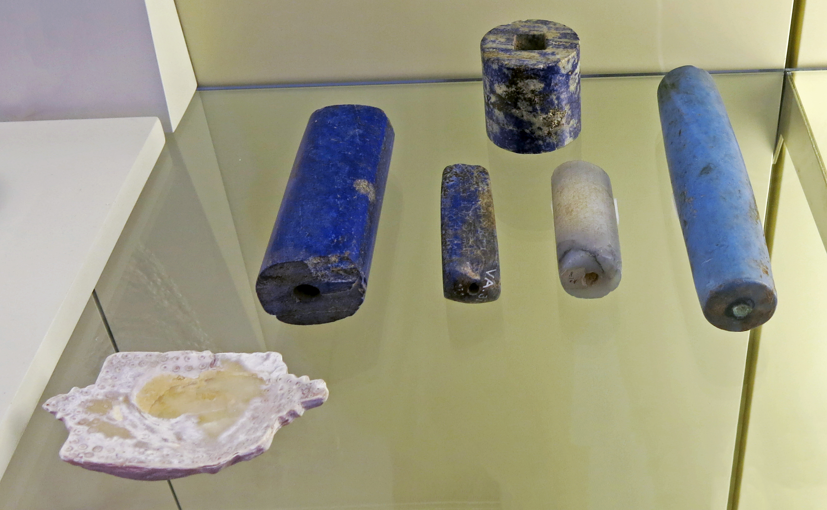
Votive offerings, partly with dedication inscriptions, first half of the 1st millennium BC.
At left foreground, a shallow bowl of mollusk shell, 1st millennium BC.
Height 18 mm, width 63 mm, length 43 mm, weight 60 gm.
This flat shell made of mother-of-pearl is rectangular in shape and has a stepped extension on each of the narrow, opposite sides as a small handle. Numerous rings arranged in two rows on the edge are scratched into the top.
Catalog for shallow bowl: Tell Amran ibn Ali, VA Bab 04795
Catalog for cylinders: Chalcedony, lapis lazuli, 'Egyptian blue', Babylon
Photo: Don Hitchcock 2015
Source and text: Pergamon Museum, Berlin, http://www.smb-digital.de/
Because Mesopotamia lacked most raw materials, objects made of anything other than clay or pottery were highly valued, whether they were put to daily use of intended as burial equipment.
Luxury goods were prized not only on account of the materials from which they were made (e.g. gold and silver, semiprecious stones and man-made media such as glass). The function of objects (like the gaming board of rock crystal) and the craftmanship evident in design and workmanship also contributed to their value.
When it came to votive gifts for the gods (sceptres, mace heads, onyx 'eyes', cylinders of lapis lazuli) the symbolism inherent in the object was enhanced by the value of the material from which it is made.
Text above: Card, Pergamon Museum, Berlin
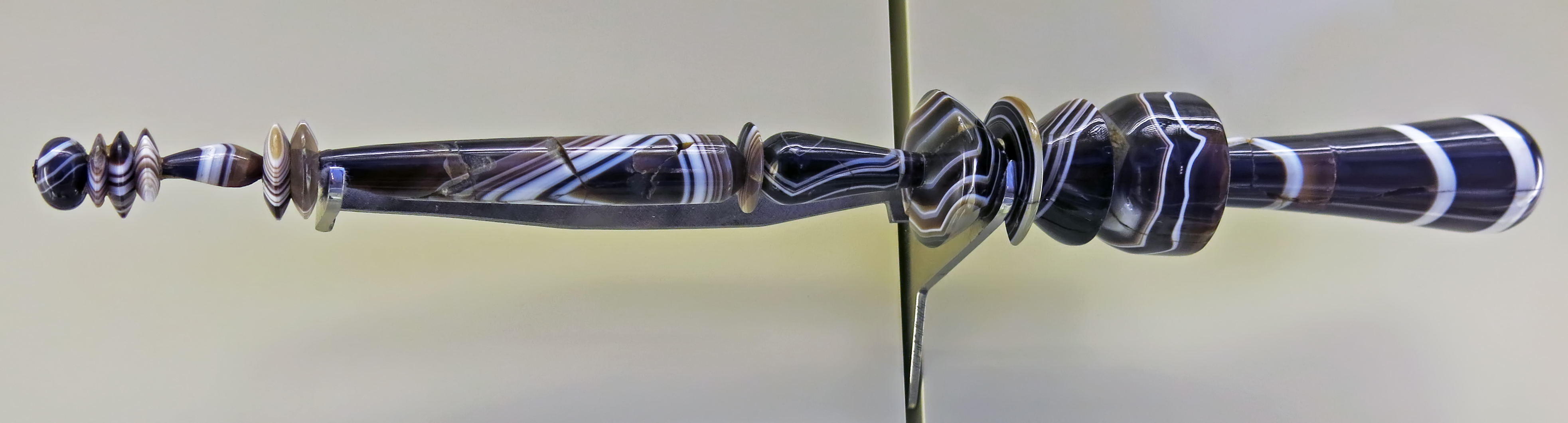
Onyx sceptre or spindle from Babylon.
6th century BC
Length 389 mm, diameter 45 mm (max.)
Weight: calculated 400 gm.
Catalog: VA Bab 01625
Photo: Don Hitchcock 2015
Source and text: Pergamon Museum, Berlin, http://www.smb-digital.de/
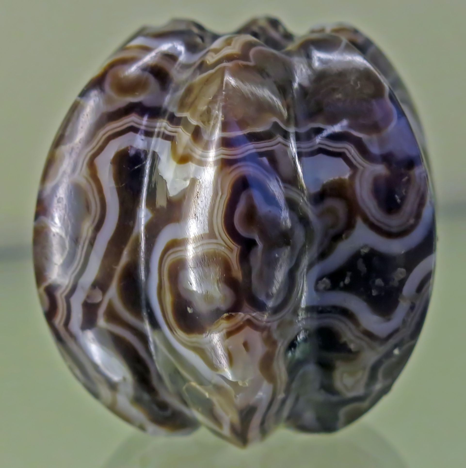
Onyx mace head from Babylon, 6th century BC
Height 57 mm, diameter 55 mm, weight 170 gm.
Catalog: Onyx, the Omran mound, Tell Amran ibn Ali, VA Bab 01625
Photo: Don Hitchcock 2015
Source and text: Pergamon Museum, Berlin, http://www.smb-digital.de/
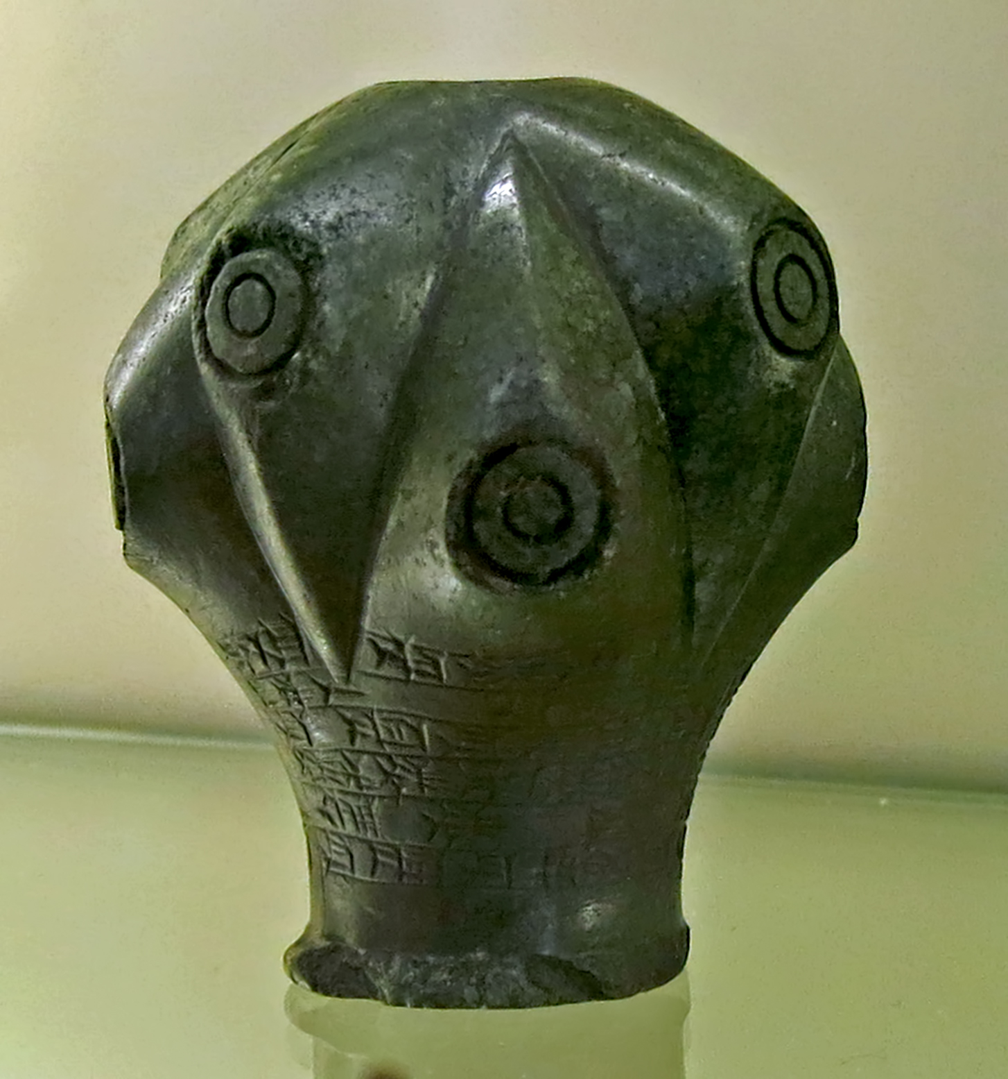
Serpentine club head with the inscription of Prince Ulaburariasch, 2nd half of the 16th century BC.
Height 63 mm, diameter 63 mm, height 72 mm, weight 330 gm.
The club head, to be mounted on a shaft, was found near the Marduk temple Esagila. It was one of the stone materials kept in baskets, including God's seals and the remains of a sceptre. This context of finds from the Nebuchadnezzar period (6th century BC) could point to the remains of a temple treasure.
This interpretation is possibly supported by the inscription on the piece, according to which the founder was Ulaburariasch, a prince from the Kassite dynasty, later 'King of the Sealands'.
The knowledge of the age of this offering as well as the observance of the curse formula used here for the removal of the name should have been one reason for the storage of this magnificent weapon for a period of almost a thousand years. The admiration for the careful stone-cutting work certainly contributed to this.
Catalog: Serpentine, Babylon, VA Bab 00645
Photo: Don Hitchcock 2015
Source and text: Pergamon Museum, Berlin, http://www.smb-digital.de/
Glass bottle from Babylon, 8th/7th century BC.
Height 87 mm, diameter 68 mm, weight 134 gm.
Catalog: Glass, VA 08449
Photo: Don Hitchcock 2015
Source and text: Pergamon Museum, Berlin, http://www.smb-digital.de/
Miniature vessel from Babylon, 1st millennium BC.
Height 77 mm, diameter 55 mm, weight 90 gm.
Catalog: Stone, VA Bab 04432
Photo: Don Hitchcock 2015
Source and text: Pergamon Museum, Berlin, http://www.smb-digital.de/
Miniature vessel from Babylon, 6th century BC.
Height 68 mm, diameter 60 mm, weight 100 gm.
Catalog: Glazed ceramic, Merkes, from an oval sarcophagus, VA 08452
Photo: Don Hitchcock 2015
Source and text: Pergamon Museum, Berlin, http://www.smb-digital.de/
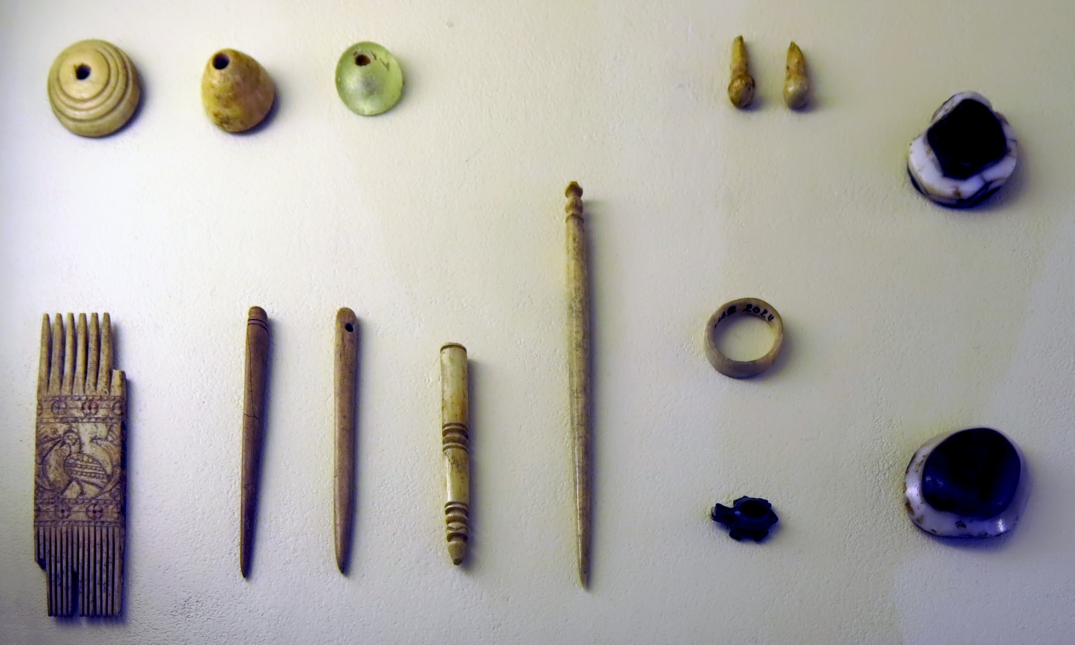
Objects of everyday life, Babylon.
Decorated comb, needles, spindle whorls, pins.
Ivory, bone, glass.
1st millennium B.C.
Photo: Don Hitchcock 2015
Source and text: Pergamon Museum, Berlin, http://www.smb-digital.de/
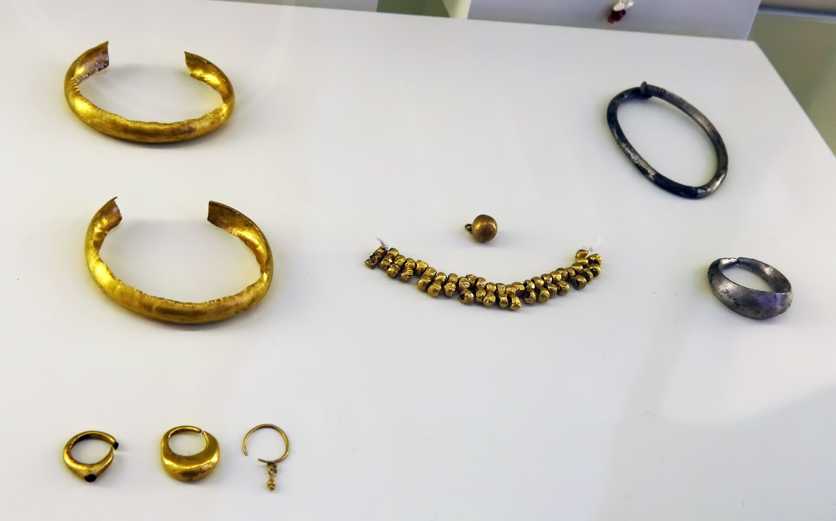
Jewellery, all from Babylon.
____________
Left: Gold bangles.
Both have a thickness of 12 mm and a diameter of 55 mm.
Circa 10th century BC.
Catalog: VA Bab 02542.01, VA Bab 02549.2
____________
Centre ring of the three rings: Gold boat-shaped earring.
1st half of the 1st millennium BC.
Height 18 mm, width 16 mm, thickness 5 mm.
Catalog: Merkes, 26 o 1, + 2.50m (grave) VA Bab 02542.01
____________
Right ring of the three rings: Gold earring with a pomegranate pendant.
1st half of the 1st millennium BC.
Height 23 mm, width 13 mm, thickness 2 mm.
Spherical pendant (ball shaped with extra small circlet)
Catalog: VA Bab 02398
____________
Small spherical pendant just above the hollow gold beads.
1st half of 1st millennium BC Chr.
Diameter 8 mm.
Catalog: Merkes, 27 n 1, + 8.00m, VA Bab 02403
____________
Photo: Don Hitchcock 2015
Source and text: Pergamon Museum, Berlin, http://www.smb-digital.de/
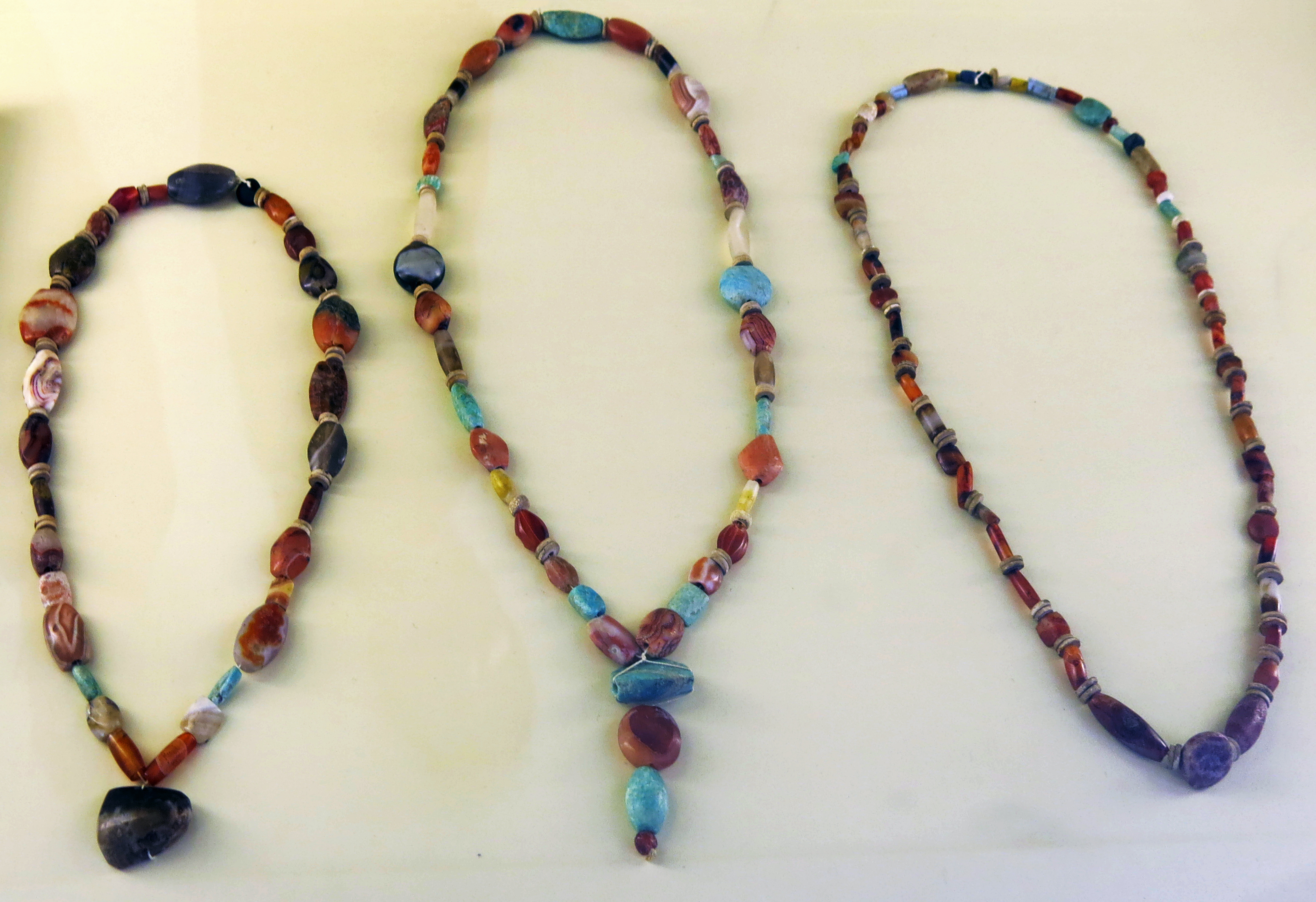
____________
Left:
Necklace made of semi-precious stones (grave goods), Babylon, 13th - 12th century BC.
Period: Kassite
Length 46 cm (chain closed), diameter 1 cm (widest part)
Catalog: Merkes, Crypt 32 , quadrant 26 f 1, +1.95m, VA Bab 01377.01
____________
Centre:
Necklace of semi-precious stones with turquoise pendant (grave goods), Babylon, 13th-12th century BC.
Period: Kassite
Length 61 cm (chain closed), diameter 8 mm (widest part)
Catalog: Merkes, Crypt 32 , quadrant 26 f 1, +1.95m,VA Bab 01377.02
____________
Right:
Necklace made of semi-precious stones and gold(?) (grave goods) Babylon, 13th-12th century.
Period: Kassite
Length 35 cm
Catalog: Semi-precious stones and gold, Merkes, Crypt 32 , quadrant 26 f 1, +1.95m, VA Bab 01377.03
____________
The Kassites were people of the ancient Near East, who controlled Babylonia after the fall of the Old Babylonian Empire circa 1 595 BC and until circa 1 155 BC (middle chronology).
They gained control of Babylonia after the Hittite sack of the city in 1 595 BC (i.e. 1 531 BC per the short chronology), and established a dynasty based first in Babylon and later in Dur-Kurigalzu.
The Kassites were members of a small military aristocracy but were efficient rulers and locally popular, and their 500-year reign laid an essential groundwork for the development of subsequent Babylonian culture. The chariot and the horse, which the Kassites worshipped, first came into use in Babylonia at this time.
____________
Photo: Don Hitchcock 2015
Source and text: Pergamon Museum, Berlin, http://www.smb-digital.de/
Additional text: Wikipedia
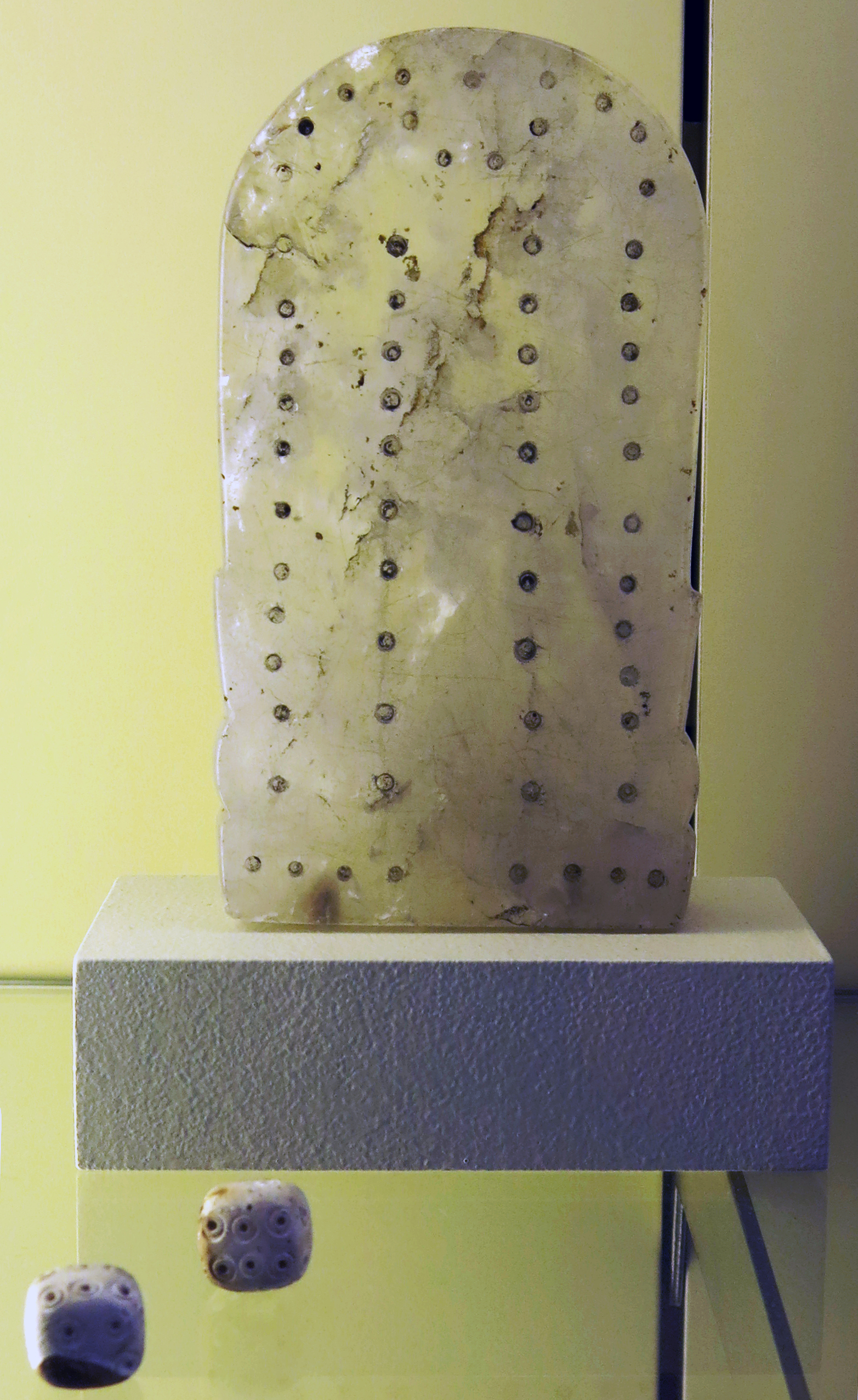
Game board and dice made of rock crystal and glass.
First half of the first millennium BC.
Game board of rock crystal.
Height 146 mm, width 80 mm, thickness 27 mm, weight 870 gm.
Catalog: Tell Amran ibn Ali (so-called treasure find), VA Bab 00665
_________________
Two glass dice, first half of the 1st millennium BC.
Dimensions 17 mm x 17 mm x 17 mm.
Weight 70 gm.
Catalog: Merkes, 27 m 2, +9.50m, VA 07577
Photo: Don Hitchcock 2015
Source and text: Pergamon Museum, Berlin, http://www.smb-digital.de/
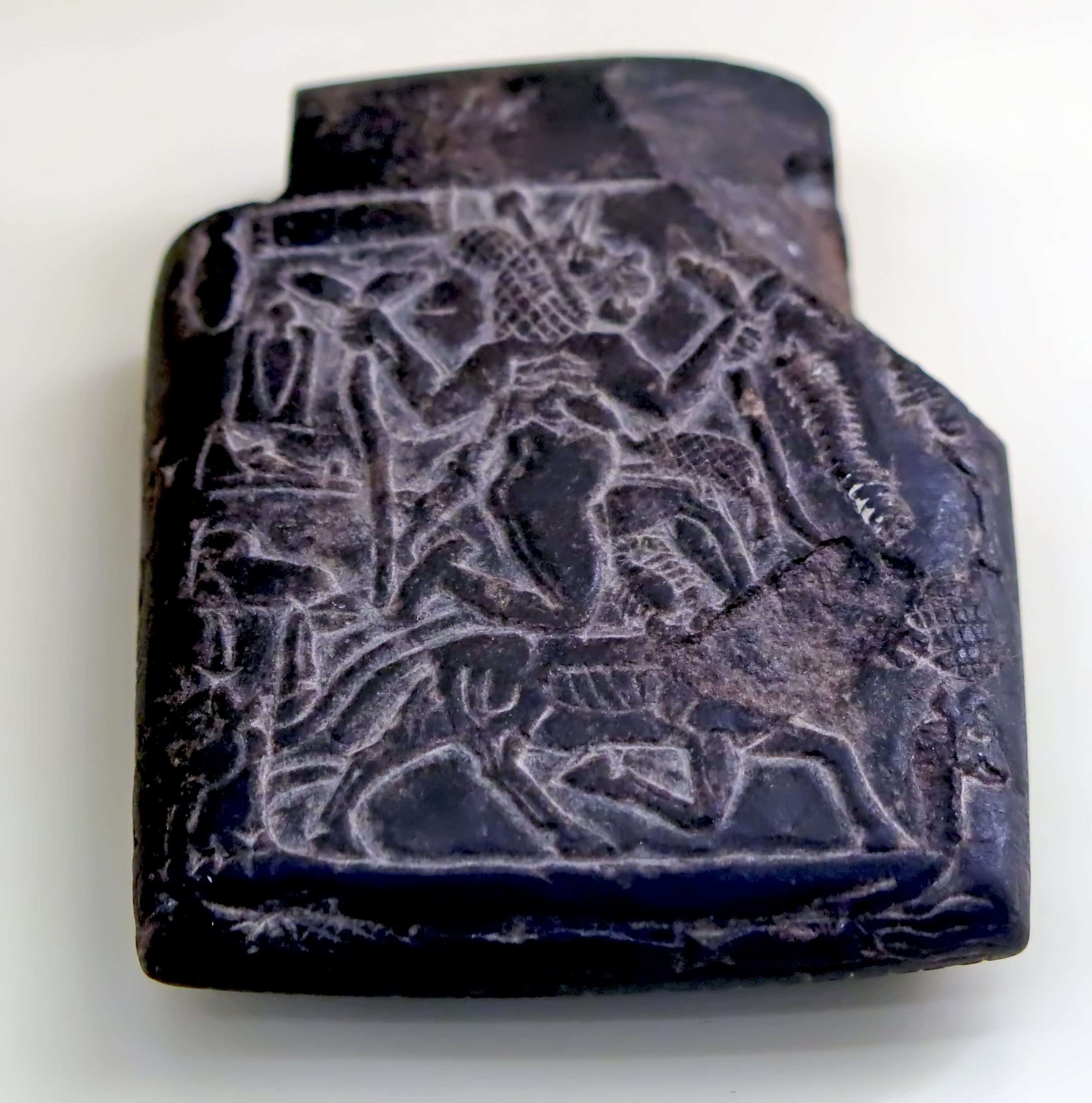
Babylonian Amulet against the demoness Lamashtu.
In Mesopotamian mythology, Lamashtu was a female demon, monster, malevolent goddess or demigoddess who menaced women during childbirth and, if possible, kidnapped their children while they were breastfeeding. She would gnaw on their bones and suck their blood, as well as being charged with a number of other evil deeds. She was a daughter of the Sky God Anu.
Lamashtu is depicted as a mythological hybrid, with a hairy body, a lioness' head with donkey's teeth and ears, long fingers and fingernails, and the feet of a bird with sharp talons. She is often shown standing or kneeling on a donkey, nursing a pig and a dog, and holding snakes. She thus bears some functions and resemblance to the demon Lilith in Jewish mythology.
Limestone, height 69 mm, width 54 mm, depth 20 mm, weight 110 gm.
Collection: Museum of the Ancient Near East
First half of the 1st millennium BC.
Catalog: VA 03477
Photo: Don Hitchcock 2015
Source and text: Pergamon Museum, Berlin, http://www.smb-digital.de/
Additional text: Wikipedia

Babylonian Amulet to protect young mothers and babies from dangers and diseases associated with the demon Lamashtu.
First half of the first millennium BC.
Limestone, height 95 mm, width 68 mm, thickness 25 mm, weight 280 gm.
Catalog: VA 06959
Photo: Don Hitchcock 2015
Source and text: Pergamon Museum, Berlin, http://www.smb-digital.de/
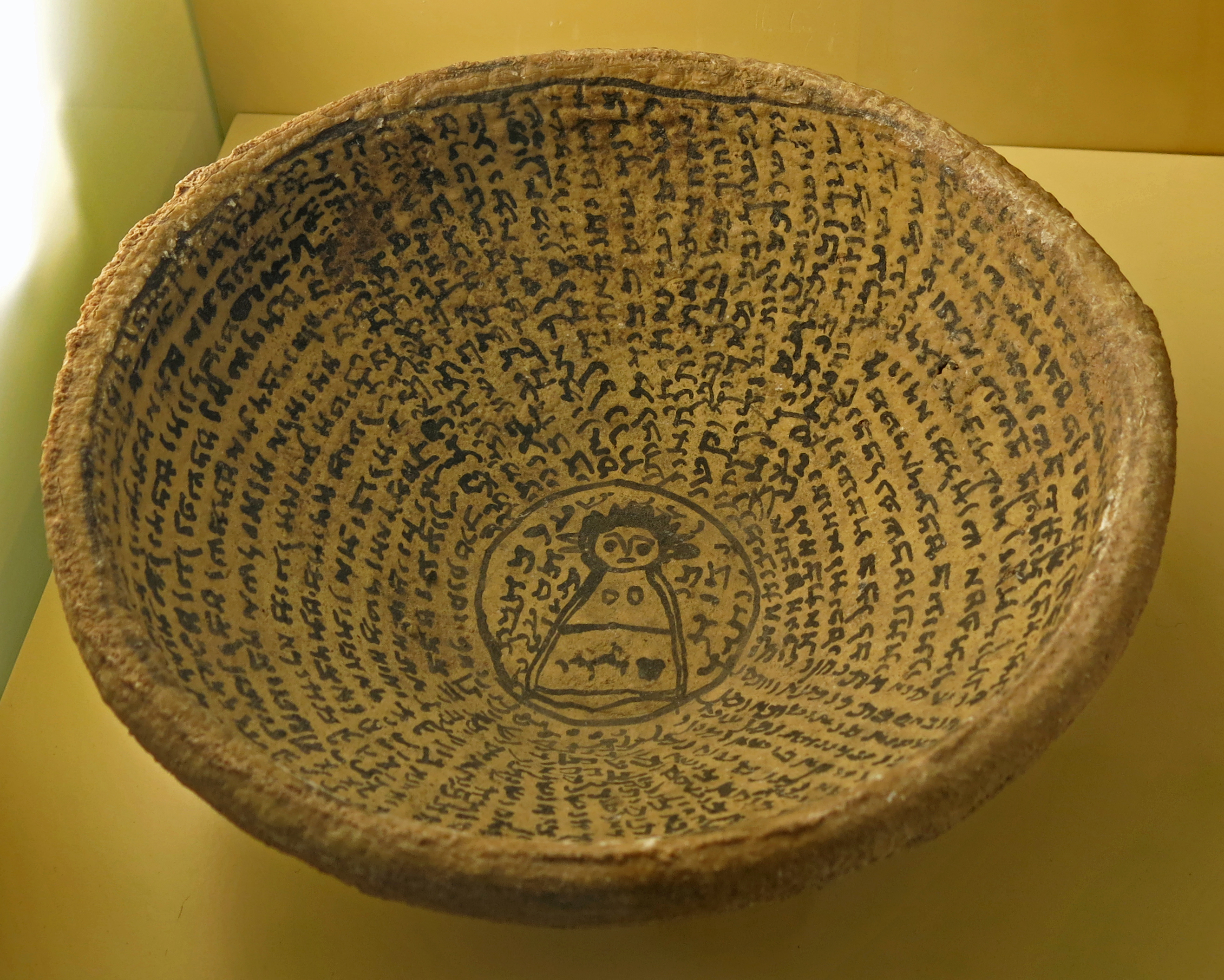
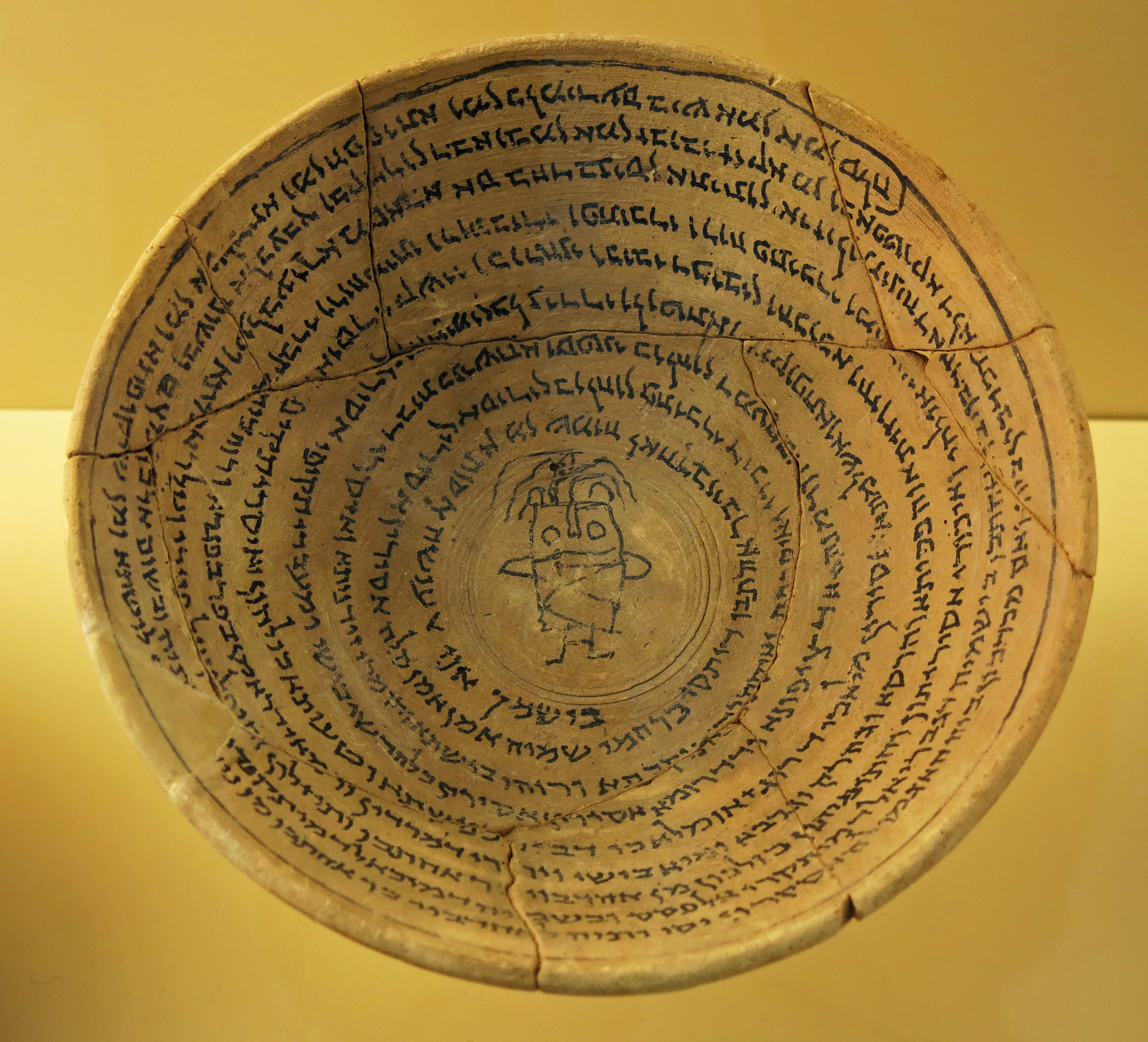
Clay bowls with Aramaic incantations against demons spreading diseases or other evils in the house, one of them quoting the Hebraic confessional text 'Shema Yisrael', 4th to 7th century AD.
The text of the incantation bowls was written in Jewish Babylonian Aramaic.
Text below: Dan Levene, Jewish Aramaic Incantation Bowls, jnjr.div.ed.ac.uk/primary-sources/biblical/jewish-aramaic-incantation-bowls/
Aramaic incantation bowls, also known as magic bowls, are types of amulets that consists of an incantation written on common domestic earthenware. This kind of object is particular to the Sasanian period (3rd – 7th Century CE), is distinctively Mesopotamian, and is found in central and southern regions of what is known today as modern Iraq. The evidence suggests that this type of amulet stopped being made during the early period of the Islamic conquest.Photo: Don Hitchcock 2015
Incantation bowls were used by the various Aramaic speaking communities that lived in late antique Sasanian Mesopotamia. Consequently, they offer insights into aspects of cultural collaboration, interchange, and overlap that are largely absent in other sources that are available from this period, like the Babylonian Talmud, the writings of Mani, and Zoroastrian literature, which have more commonly been studied in relation to the particular communities, by disciplines that evolved to deal with their respective languages and religious philosophies.
A parallel body of magical amulets, though much smaller in number, that were produced by the Jews that lived within the Roman sphere of influence, in Palestine and the eastern Mediterranean basin, exists in the form of incantations inscribed on thin sheets of silver, or very occasionally copper alloy. The fact that the magical products of these two communities that lived under the influence of the two rival political and cultural forces of that age are different, is of great significance, and is an aid to the study of the differences and tensions that existed between these two distinct Jewish communities.
There are known to exist at least 2000 bowls in both museums and private collections, of which less than 25% have been published. The great majority is written in Aramaic dialects, a hand-full in Pahlavi, and there are two in Arabic. There are also a significant number of texts that are written in pseudo-scripts. The types of Aramaic represented in order of prevalence are: Aramaic square script (about 60%), Mandaic script (just under 25%), and Syriac scripts (under 15%). The square script is generally considered to be Jewish, the Mandaean script belongs to the Mandaeans, and the Syriac to Manichaeans, other unidentified Gnostic and/or pagan groups, and, in a few cases, to Christians.
An interesting aspect of the incantation bowls is the way in which the text is laid out upon the surface of the bowls in different ways. The most common is the spiral, starting in the middle of the concave side of the bowl and working its way in a clockwise fashion to its outer edge. The skill displayed by these scribes is suggestive of those needed to produce manuscripts on more conventional types of material, such as parchment. However, the bowls are the only Aramaic manuscripts from the period that are known to have survived in the square, Mandaean, and Manichaean Syriac scripts.
The Aramaic incantation bowl texts are overwhelmingly apotropaic, and claim to protect their owners from a variety of misfortunes that include difficulty in child birth and rearing, illness, poverty as well as afflictions caused by supernatural and human foes. Aramaic incantation bowl texts contain adjurations of supernatural entities to curb other such entities that were considered in late antiquity to be the causes of adversity. The fact that this characterises bowls of all dialects and faith groups implies a world in which it was commonly believed that the supernatural plays an active part in human welfare, and that the interaction with it can be effective. The potency of such amulets was thought to have been determined by knowledge of words of power, such as those believed to have been spoken by the deity as part of the act of creation. Notions regarding the power of words can also be observed in the mystical literature of the period.
Source and text: Pergamon Museum, Berlin, http://www.smb-digital.de/
Additional text: Dan Levene, jnjr.div.ed.ac.uk/primary-sources/biblical/jewish-aramaic-incantation-bowls/
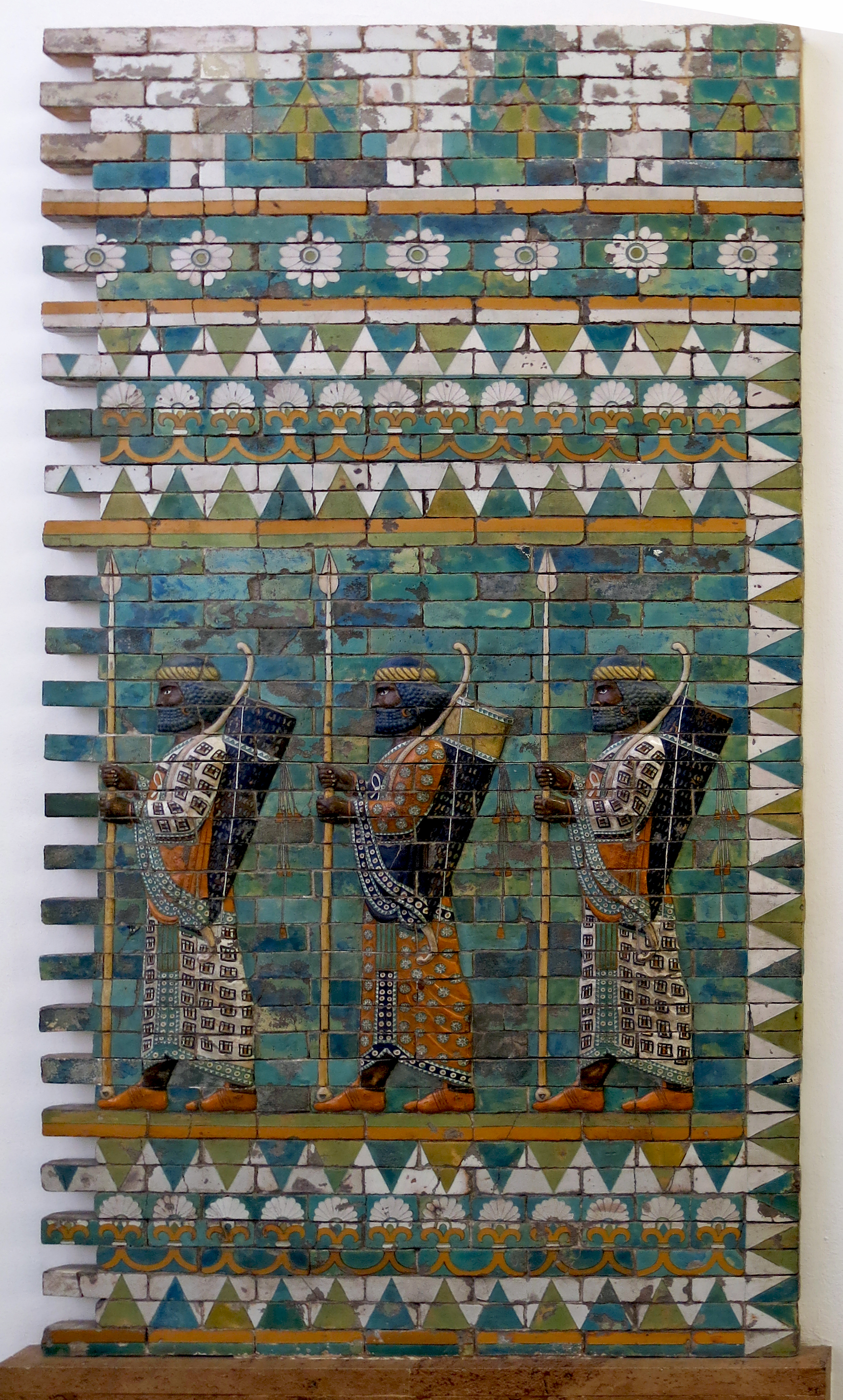
Darius I, 521 BC - 486 BC
Relief showing a royal bodyguard.
Susa, from the palace of Darius I.
Coarse-grained vitreous material with coloured glaze
Photo: Don Hitchcock 2015
Source and text: Pergamon Museum, Berlin,
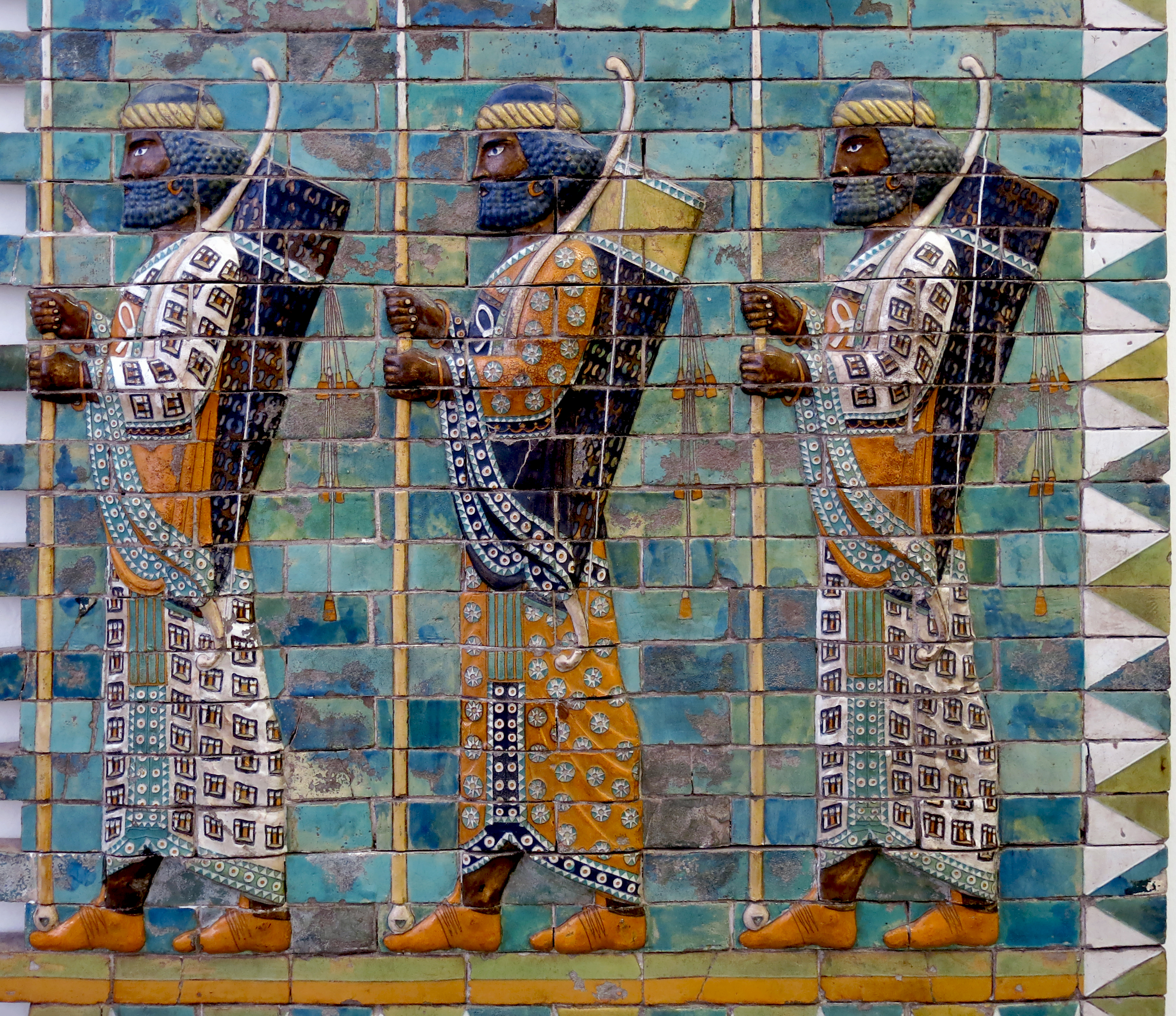
Darius I, 521 BC - 486 BC
Close up of the three bodyguards.
Each carries a spear in both hands, with a bow slung across the left shoulder, but the large quivers do not show any arrow fletches. It may be that while travelling or performing ceremonial duties, others carried bundles of arrows should the necessity arise.
Palaces at Susa and Persepolis, the residential cities of the Achaemenid kings, are noteworthy
for their elaborate wall decoration which can be considered exemplary of art at
the royal court. The walls of Darius's palace at Susa were embellished with colourful reliefs
made of glazed bricks on the Babylonian model. It is not certain which room (or rooms)
of the palace with its audience hall (apadana) was decorated with representations of a
procession of royal bodyguards, dressed in their splendid costumes. (A reconstruction on
reduced scale beside the doorway to the next gallery gives visitors an impression of how
these figures were arranged in a long frieze.)
Photo: Don Hitchcock 2015
Source and text: Pergamon Museum, Berlin
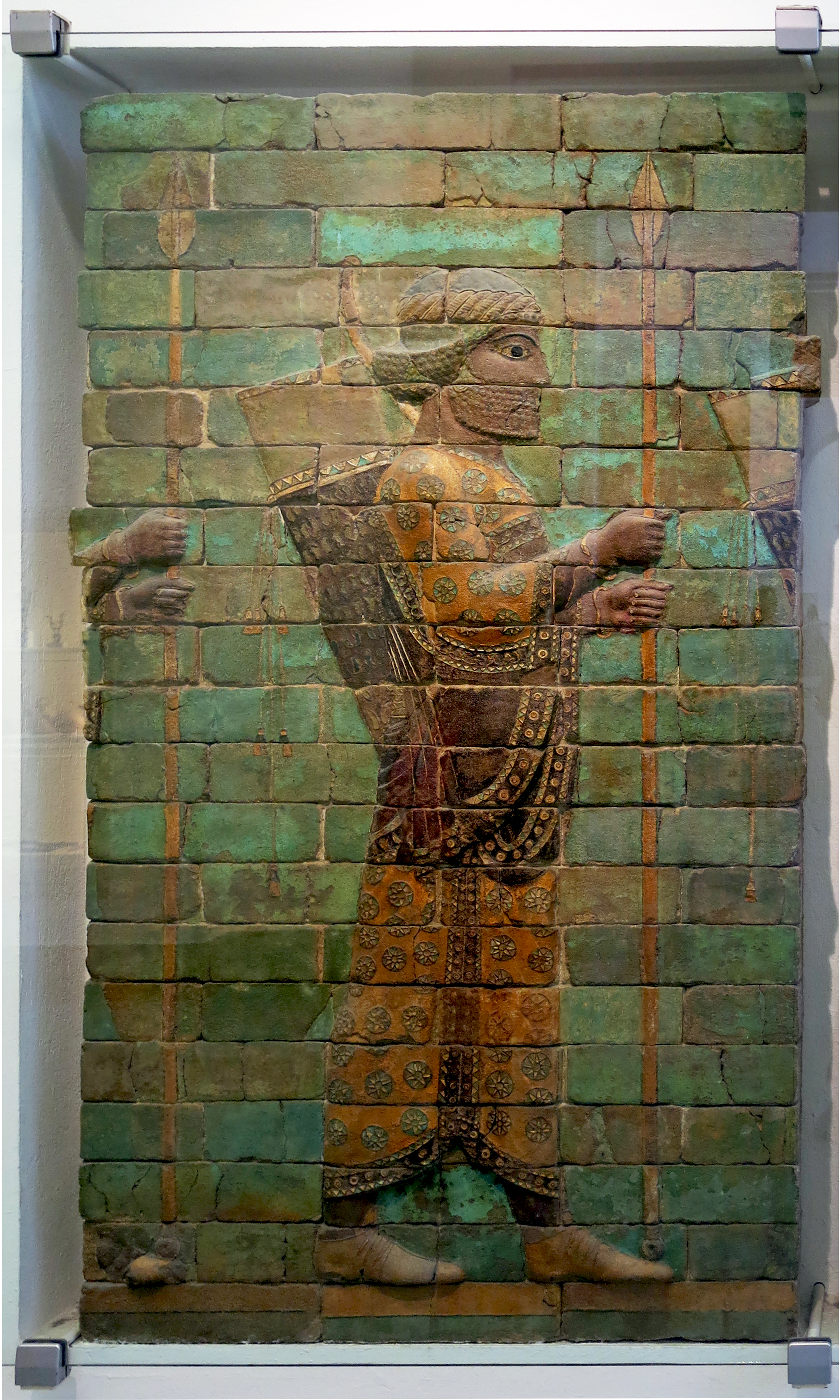
Darius I, 521 BC - 486 BC
A single spearman and archer.
His bow is slung on the left shoulder, which seems to be standard procedure, and is partially obscured.
Photo and text: Don Hitchcock 2015
Source: Pergamon Museum, Berlin
Artaxerxes III, 425 BC - 338 BC
Servant with tray.
Height 450 mm, width 350 mm, depth 100 mm, weight 55 kg.
Catalog: Limestone relief, VA 00212
Photo: Don Hitchcock 2015
Source: Pergamon Museum, Berlin, www.smb-digital.de/
Permalink id.smb.museum/object/1744370/diener-mit-tablett
Two Thracian gift bringers, each with spear and shield, 600 BC - 400 BC
Height 590 mm, width 520 mm, depth 100 mm, weight 110 kg.
Catalog: Limestone relief, Persepolis, VA 02987
Photo: Don Hitchcock 2015
Source: Pergamon Museum, Berlin, www.smb-digital.de/
Permalink: id.smb.museum/object/1744368/zwei-thrakische-gabenbringer-mit-speer-und-schild
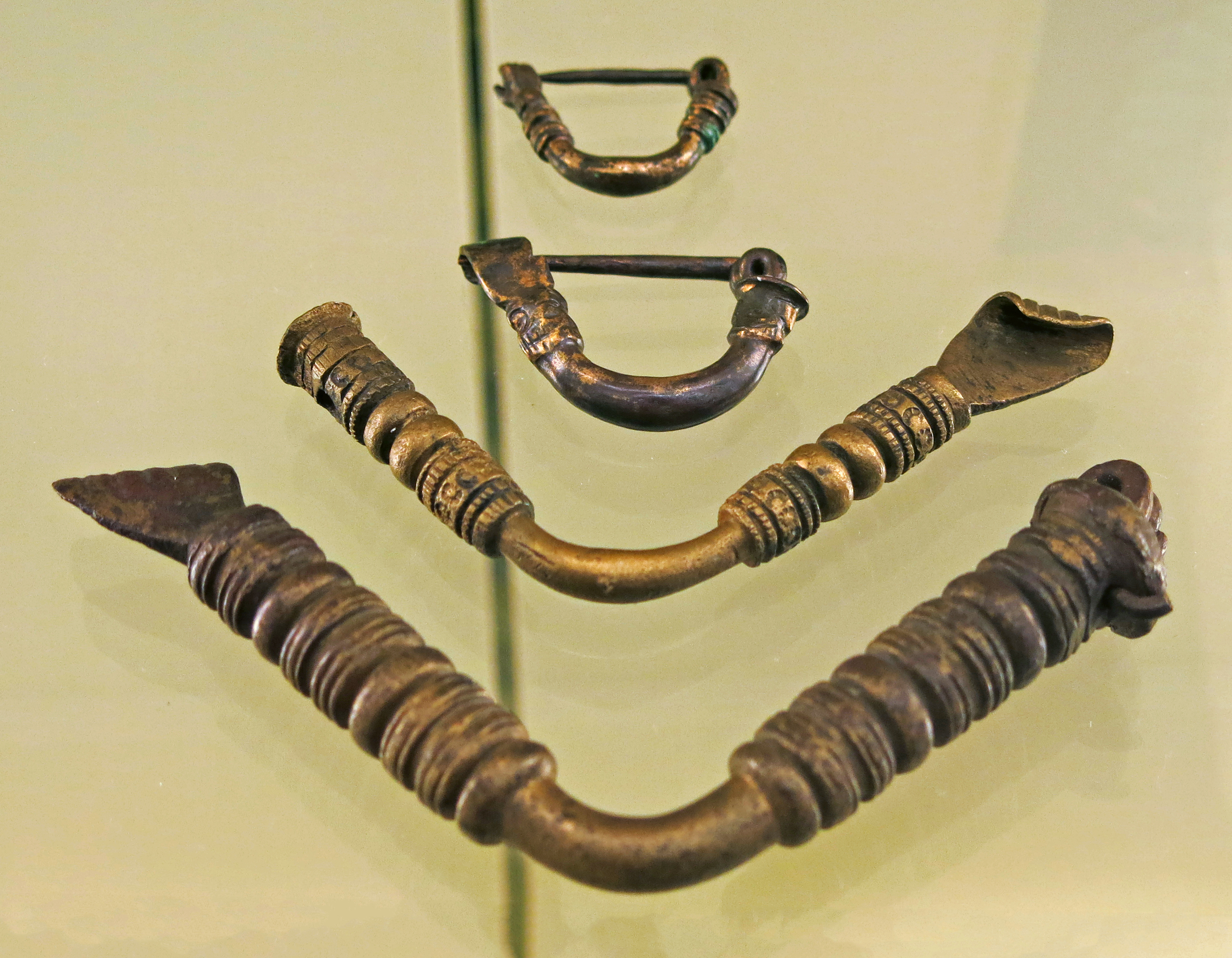
Bronze robe pins, Babylon, 600 BC - 400 BC
Photo: Don Hitchcock 2015
Source and text: Pergamon Museum, Berlin
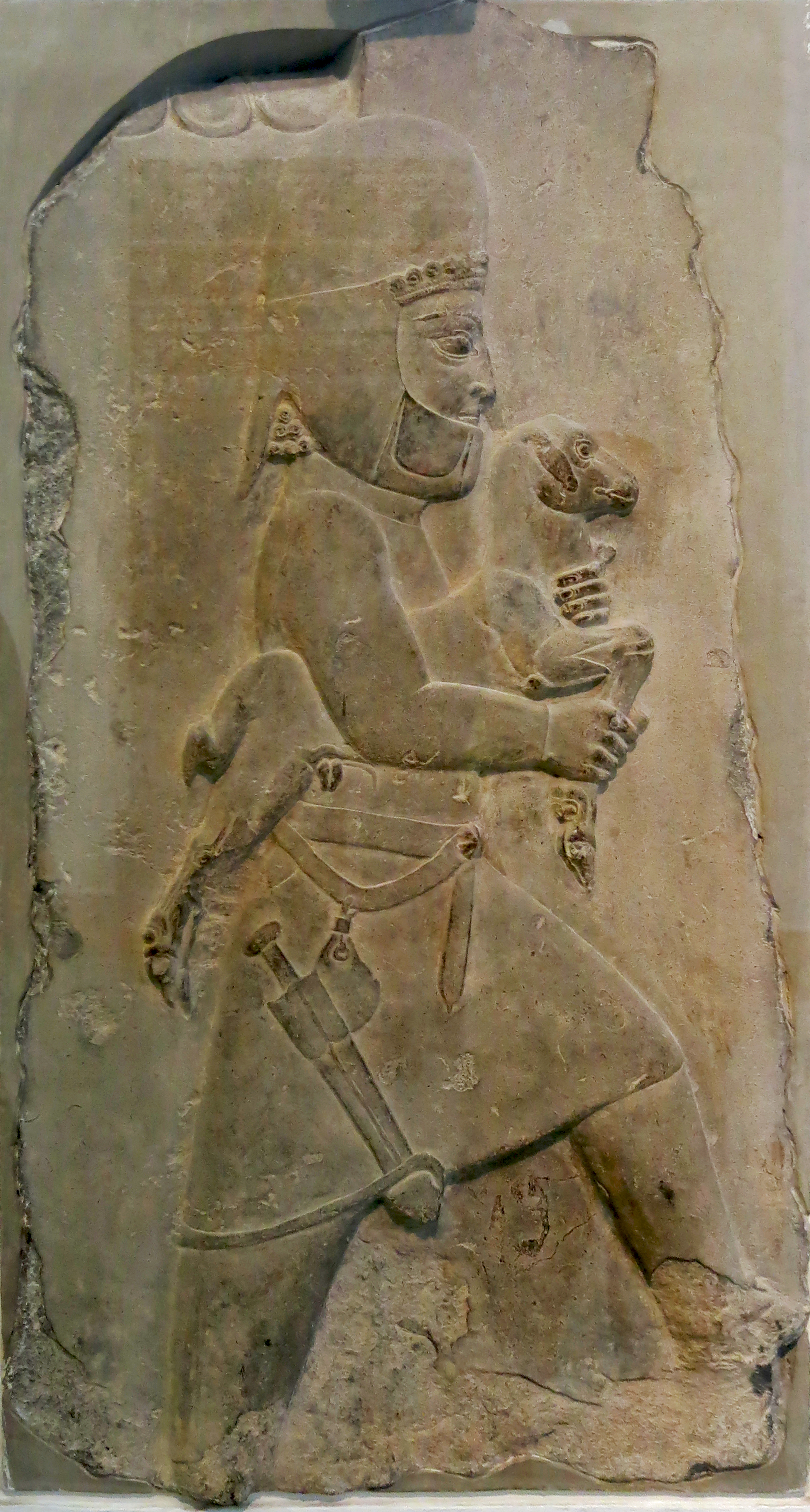
Xerxes I, 485 BC - 465 BC
Tribute bringer. The clothing of the man carrying the lamb identifies him as a Mede.
Height 680 mm, width 320 mm, depth 100 mm, weight 80 kg.
Catalog: Limestone relief, Persepolis, VA 08799
Photo: Don Hitchcock 2015
Source: Pergamon Museum, Berlin, www.smb-digital.de/
Permalink: id.smb.museum/object/1744369/flachrelief-mit-tributbringer
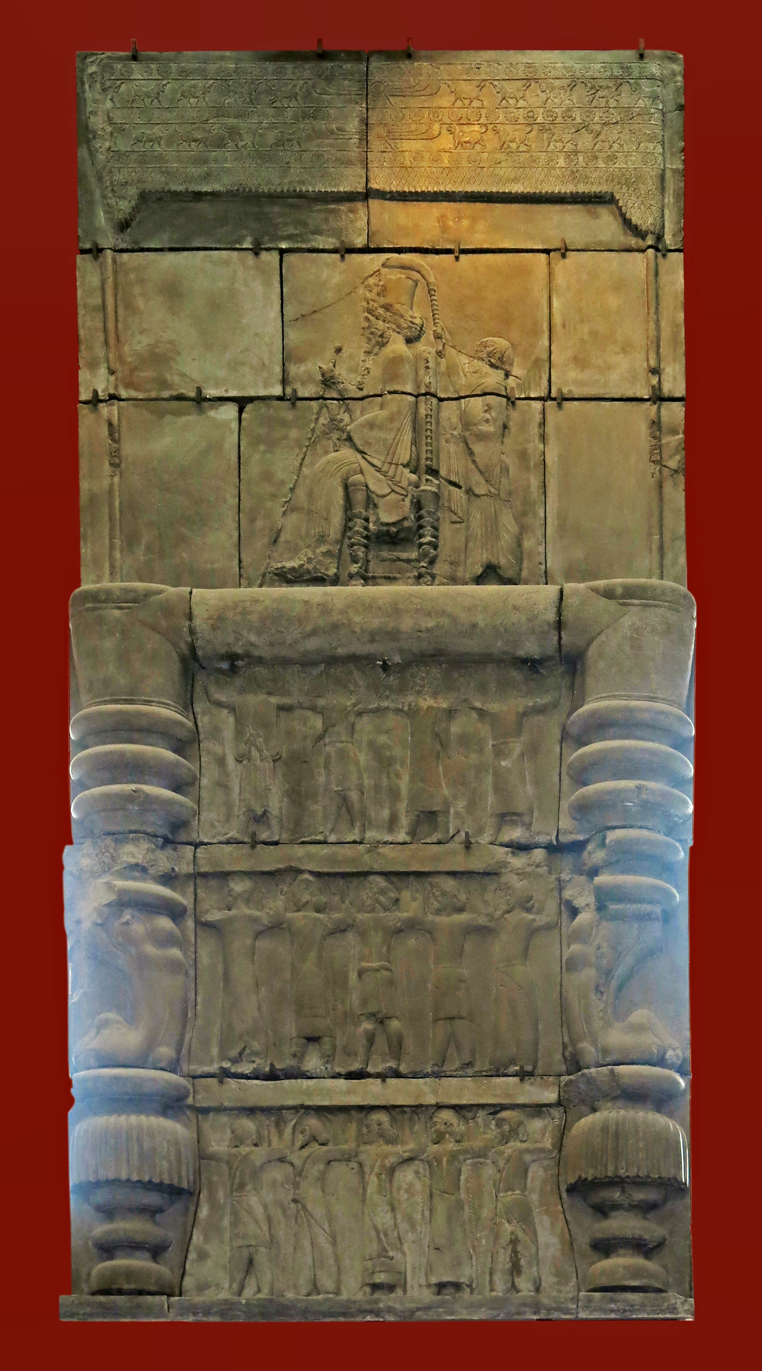
Xerxes I, 485 BC - 465 BC
Plaster cast of a relief sculpture of the enthroned figure of Xerxes.
The king is sitting on a throne, holding a sceptre and a lotus flower. Behind the king stands an attendant and above them is a richly decorated canopy. The throne is supported by a huge platform with lion's paws and three rows of figures. The figures wear different costumes from across the Persian Empire.
The cast is made from the inside of a doorway at the Palace of Darius at Persepolis, Iran. Persepolis was a seat of Iranian Kings of Persia between 518 BC and 330 BC. Each scene shows a royal hero wearing a loose-fitting Persian robe, stabbing a monster.
Lorenzo Giuntini accompanied Herbert Weld to Persepolis in 1892 where he created the moulds. On his return to London he made this plaster cast.
Original from the One Hundred Column Hall, Fars (province) Southern Iran.
Catalog: C.225.14
Photo: Don Hitchcock 2015
Text: Card at the British Museum, www.britishmuseum.org/, © Trustees of the British Museum, CC BY-NC-SA 4.0
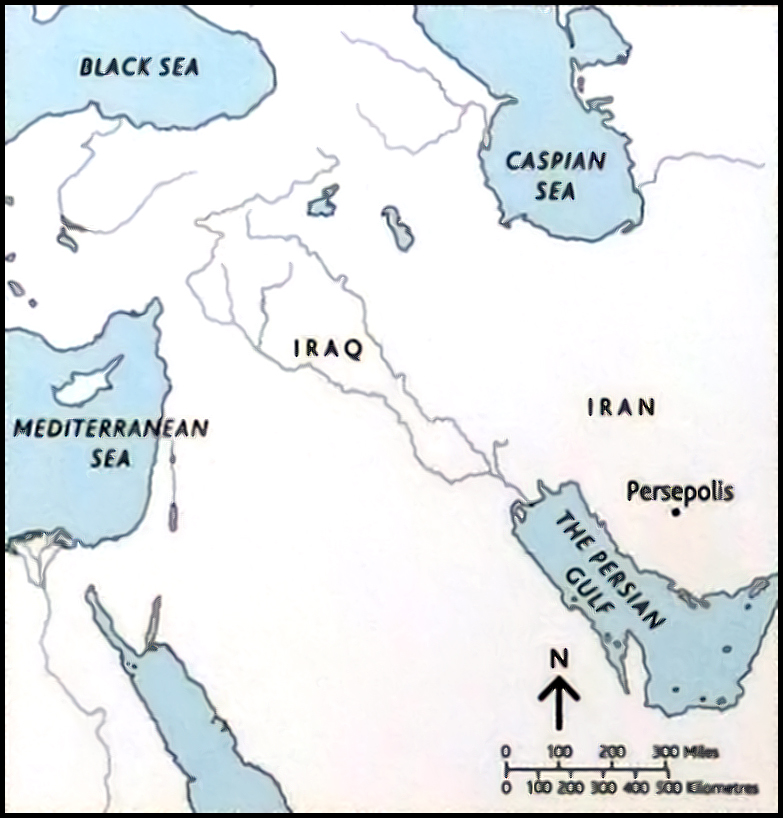
Map showing the position of Persepolis, Iran.
Rephotography: Don Hitchcock 2015
Source and text: poster at the British Museum, www.britishmuseum.org/, © Trustees of the British Museum, CC BY-NC-SA 4.0
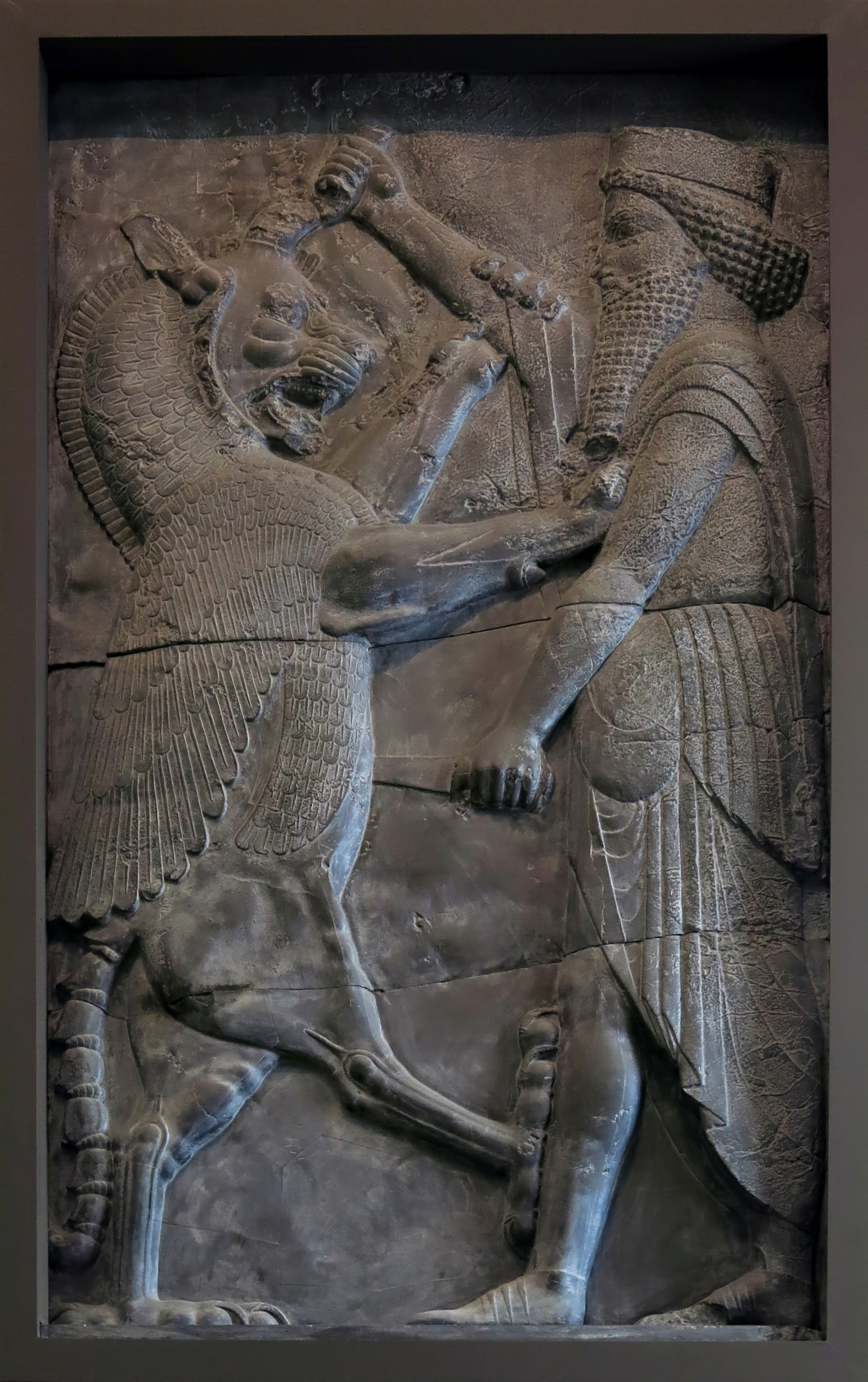
Royal Hero, 490 BC - 470 BC
The cast is made from the inside of a doorway at the Palace of Darius at Persepolis, Iran. Persepolis was a seat of Iranian Kings of Persia between 518 BC and 330 BC. Each scene shows a royal hero wearing a loose-fitting Persian robe, stabbing a monster.
This design belongs to an ancient Middle Eastern tradition of combat scenes and may have symbolised the triumph of a king over his enemies. Their inclusion on doorways may have reinforced the feeling of protection given to the king and courtiers.
Lorenzo Giuntini accompanied Herbert Weld to Persepolis in 1892 where he created the moulds. On his return to London he made this plaster cast.
Catalog: ME225
Photo: Don Hitchcock 2015
Text: Card at the British Museum, www.britishmuseum.org/, © Trustees of the British Museum, CC BY-NC-SA 4.0
Pilgrim bottle, Parthian Period, 100 BC - 200 AD
Height 138 mm, width (belly) 115 mm, thickness 59 mm, weight 284 gm.
Catalog: Glazed ceramic, Assur (Qal'at Scherqat) Find quadrant i B 3 IV, in the well of the Assur Temple, VA Ass 04163 a
Permalink: id.smb.museum/object/1744476/pilgerflasche
Photo: Don Hitchcock 2015
Source and text: Pergamon Museum, Berlin, recherche.smb.museum
The dates presented here are drawn from multiple sources, many of which differ significantly between two or more otherwise apparently reliable sources, or contradict one another (or are even self contradictory!). I have attempted to bring some order to this confusion, but in certain cases establishing reliable dates is simply not possible. Many or perhaps most of the dates given in the table below are at best very approximate. Treat the dates with great caution. Caveat emptor.
| Mesopotamian Chronology | |||
|---|---|---|---|
| Southern Mesopotamia | |||
Early Dynastic Period
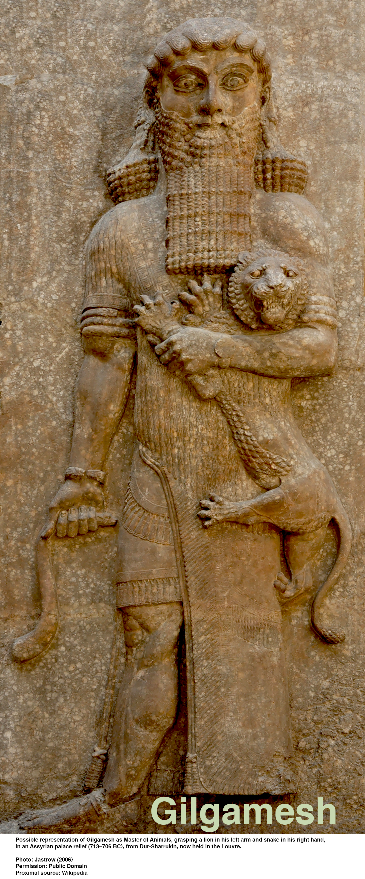
|
|||
| Gilgamesh of Uruk | 2700 BC | Gilgamesh was likely a historical king of Uruk who reigned around the early 3rd millennium BC. Inscriptions credit him with building the great walls of Uruk. He was the protagonist of the Epic of Gilgamesh, the oldest known epic poem. | |
| Mesanepada of Ur | 2450 BC | Mesannepada was the first king listed for the First Dynasty of Ur on the Sumerian king list. He is recorded as having ruled for 80 years, after overthrowing Lugal-kitun of Uruk. In one of his seals, found in the Royal Cemetery at Ur, he is also described as king of Kish. | |
| Eannatum of Lagash | 2455 BC | Eannatum was a king of Lagash (now Tell al Hiba) around the mid-25th century BC (ca. 2455–2425 BC), renowned for establishing the first significant Mesopotamian empire by expanding his city-state's power through conquest, particularly against its rival, the city of Umma, and extending Lagash's influence as far as Elam and the Persian Gulf. His reign is documented by monuments like the Stele of the Vultures, which depicts his military triumphs and the brutal policy he employed against enemies. | |
| Enannatum of Lagash | 2425 BC | Enannatum I, son of Akurgal, succeeded his brother Eannatum as Ensi (ruler, king) of Lagash. He fought off several attacks by the Kingdom of Umma, an important Sumerian city-state in southern Mesopotamia. | |
| Urukagina of Lagash | 2340 BC | Urukagina (Uruk-Agina, Uruinimgina) was the first known social reformer of the ancient world. He was the last independent king of Lagash. The series of reforms he effected as king in Lagash were intended to correct economic abuses perpetrated on the general population by those of the priestly class. His reforms are known from inscriptions left on three clay cones and an oval-shaped plaque found at the site of ancient Lagash in 1878. The prefix Uruk was derived from the city Uruk, one of the world's first major cities, which had became a significant urban centre by 3200 BC, and after which he was named. | |
| Lugalzagesi of Umma | 2350 BC | Lugalzagesi of Umma (died ca 2334 BC) was the last Sumerian king before the conquest of Sumer by Sargon of Akkad and the rise of the Akkadian Empire, and was considered as the only king of the third dynasty of Uruk, according to the Sumerian King List. Initially, as king of Umma, he led the final victory of Umma in the generation-long conflict with the city-state Lagash for the fertile plain of Gu-Edin. Following up on this success, he then united Sumer briefly as a single kingdom. | |
Dynasty of Lagash
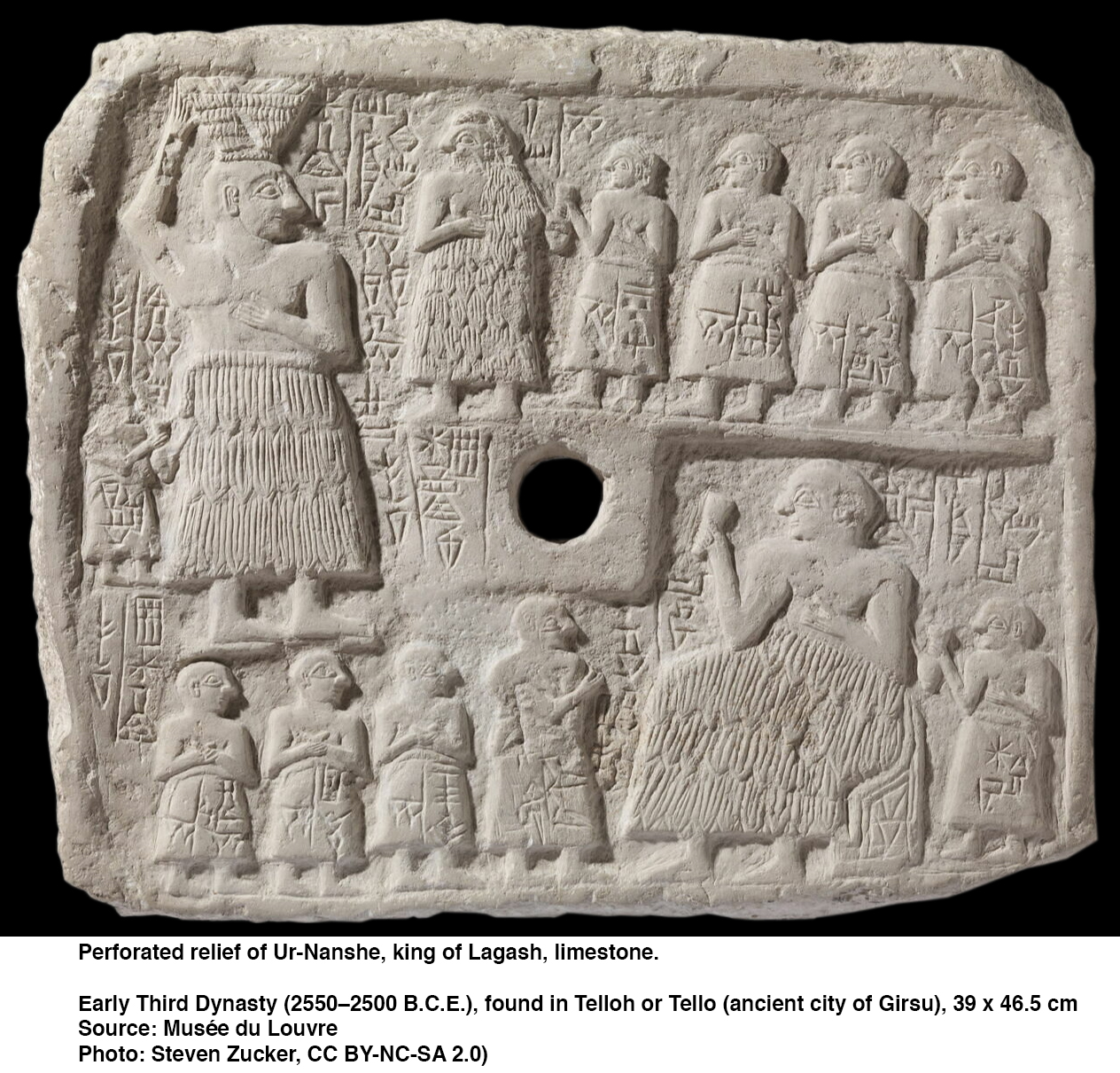
|
|||
| Ur-Nanshe | 2520 BC - 2500 BC | Ur-Nanshe was the first king of the First Dynasty of Lagash in the Sumerian Early Dynastic Period III. He is known through inscriptions to have commissioned many building projects, including canals and temples, and defending Lagash from its rival state Umma. He was probably not from royal lineage. He was the father of Akurgal, who succeeded him, and grandfather of Eannatum. | |
| Akurgal | 2460 BC | During Akurgal's reign, a border conflict pitted Lagash against Umma. These borders between Umma and Lagash had been fixed in ancient times by Mesilim, king of Kish, who had drawn the borders between the two states in accordance with the oracle of Ishtaran, invoked as intercessor between the two cities. He had two sons, who both became important rulers of Lagash after him, Eannatum and Enannatum I, and successfully repelled Umma's encroachment. | |
| Eannatum | 2450 BC | Eannatum established one of the first verifiable empires in history, subduing Elam and destroying the city of Susa, and extending his domain over the rest of Sumer and Akkad. One inscription found on a boulder states that Eannatum was his Sumerian name, while his 'Tidnu' (Amorite) name was Lumma. He conquered all of Sumer, including Ur, Nippur, Akshak (controlled by Zuzu), Larsa, and Uruk. He entered into conflict with Umma, waging a war over the fertile plain of Gu-Edin. He personally commanded an army to subjugate the city-state, and vanquished Ush, the ruler of Umma, finally making a boundary treaty with Enakalle, successor of Ush, as described in the Stele of the Vultures and in the Cone of Entemena. Enannatum had a son named Meannesi, who is known for dedicating a statue for the life of his father and mother. He has two other sons, Lummatur and Entemena, the latter succeeding him to the throne. His wife was named Ashumen. | |
| Enannatum I | 2425 BC - 2410 BC | Enannatum I, son of Akurgal, succeeded his brother Eannatum as Ensi (ruler, king) of Lagash. During his rule, Umma once more asserted independence under its ensi Ur-Lumma, who attacked Lagash unsuccessfully. After several battles, Enannatum I finally defeated Ur-Lumma. Ur-Lumma was replaced by a priest-king, Il, who also attacked Lagash. Enannatum I of Lagash was succeeded by his son Entemena around 2400 BC. Entemena re-established the power of Lagash by defeating the ruler of Umma, Il, following the struggles of his father's reign. Enannatum I likely died or was mortally wounded in battle against the city of Umma, leaving Entemena to finish the conflict. Entemena ruled for at least 19 years and restored the prestige of the First Dynasty of Lagash. | |
| Entemena | 2404 BC - 2391 BC | Enannatum I of Lagash was succeeded by his son Entemena. Entemena re-established the power of Lagash by defeating the ruler of Umma, Il, following the struggles of his father's reign. Enannatum I likely died or was mortally wounded in battle against the city of Umma, leaving Entemena to finish the conflict. Entemena ruled for at least 19 years and restored the prestige of the First Dynasty of Lagash. | |
| Enannatum II | 2391 BC – 2376 BC | Entemena, the ruler (Ensi) of Lagash, was succeeded by his son Enannatum II. Enannatum II was the last known ruler of the first dynasty of Lagash before its decline and eventual fall to the city of Umma. Enannatum II was the final ruler of the direct line of Ur-Nanshe, after which the influence of Lagash weakened. Enannatum II, the last member of the house of Ur-Nanshe to rule Lagash, was succeeded by a priest named Enentarzi. Enentarzi took the throne following the decline of the dynasty's power. He was later succeeded by either Enlitarzi or Lugalanda. | |
| Enentarzi | 2376 BC – 2372 BC | Enentarzi was an Ensi (governor) of Lagash. He was originally a chief-priest of Lagash for the god Ningirsu. He succeed Enannatum II who only had a short reign and was the last representative of the house of Ur-Nanshe. It seems that the power of Lagash waned at this point, and that other territories such as Umma ('Gishban') and Kish prevailed. Enentarzi probably ruled for at least 4 years. An inscription records that 600 Elamites came to plunder Lagash during the rule of Enentarzi, but that they were repelled. He was succeeded by either a priest named Enlitarzi, or his son Lugalanda. | |
| Lugalanda | 2372 BC – 2370 BC | Lugalanda succeeded Enentarzi as the ruler of Lagash. As the son of Enentarzi, Lugalanda took over as a high priest and king (known as an ensi) during the Early Dynastic III period, though he is primarily noted for his corrupt rule. All documents mentioning the reign of Lugalanda describe him as a wealthy but corrupt king. They state his reign was a time of great corruption and injustice against the weak. Inscriptions state that the king confiscated approximately 650 Morgen (around 6.5 sq km) of land. Lugalanda appointed officials unjustly, widely overtaxed civilians and misused properties all for the sake of his personal gain. | |
| Urukagina | 2370 BC – 2360 BC | Urukagina was a Sumerian king who ruled the city-state of Lagash during the 24th century BC He was the last ruler of the 1st Dynasty of Lagash and is renowned for implementing some of the earliest recorded legal reforms, aiming to reduce corruption and social inequality. He ruled for approximately seven years. He assumed power following the reign of Lugalanda, who continued to live for 4 or 5 years after Urukagina's ascension. His reforms, often called the 'Code of Urukagina' or 'Reforms of Urukagina' addressed high taxes, abuse of power by officials, and protected the poor, widows, and orphans. The reforms are often celebrated as the first, albeit indirect, examples of government reforms in written history. | |
Dynasty of Akkad (Agade)
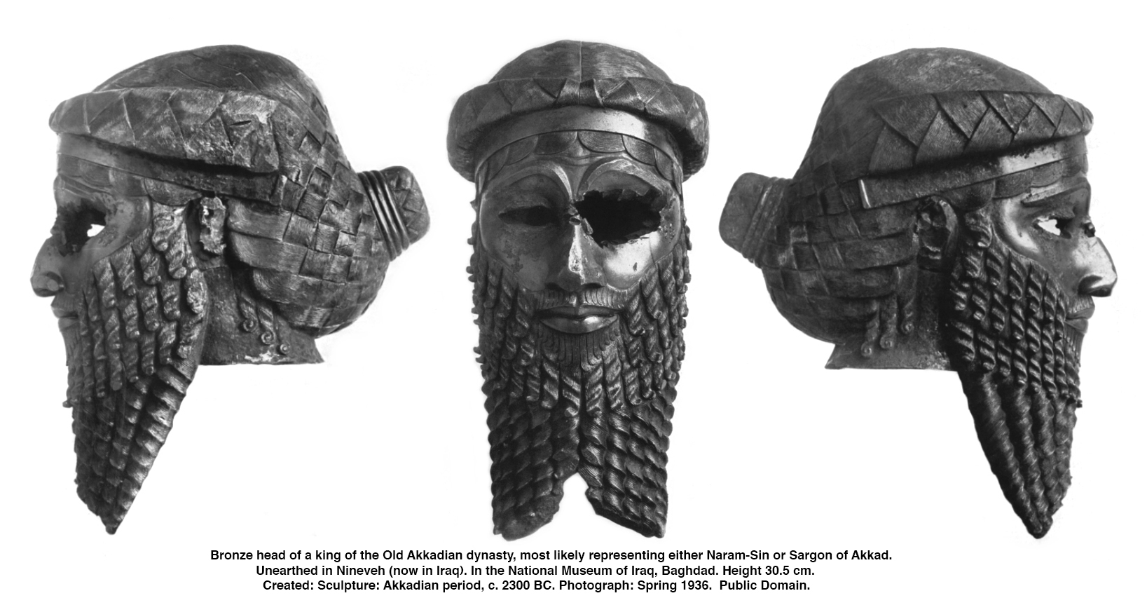
|
|||
| Sargon | 2340 BC - 2285 BC | Sargon of Akkad (died ca 2279 BC), also known as Sargon the Great, was the first ruler of the Akkadian Empire, known for his conquests of the Sumerian city-states in the 24th to 23rd centuries BC. He is sometimes identified as the first person in recorded history to rule over an empire. He was the founder of the Sargonic or Old Akkadian dynasty, which ruled for about a century after his death until the Gutian conquest of Sumer. The Sumerian King List makes him the cup-bearer to King Ur-Zababa of Kish before becoming king himself. His empire, which he ruled from his archaeologically capital, Akkad, is thought to have included most of Mesopotamia and parts of the Levant, Hurrian and Elamite territory. Akkad was a region and a capital city in ancient Mesopotamia, located in modern-day central Iraq, in the general confluence area of the Tigris and Euphrates Rivers. While the precise location of the city of Akkad has never been confirmed by archaeological evidence, it is generally thought to be east of Babylon. | |
| Rimush | 2384 BC - 2275 BC | Rimush was the second king of the Akkadian Empire. He was the son of Sargon of Akkad. According to the Sumerian King List, his reign lasted nine years (though variant copies read seven or fifteen years). To some extent, his reign was typical of a ruler of Mesopotamia with proper attention paid to the various deities and their temples. A number of his votive offerings have been found in excavated temples in several Mesopotamian cities including Ur, Sippar, Khafajah, and Brak. After the conquest of Elam, he dedicated 30 mana (a mana was about a half kilogram) of gold, 3 600 mana of copper, and 360 slaves to Enlil, the chief deity of Nippur. Most of his short reign was taken up consolidating the empire created by his father, Sargon, first ruler of the Akkadian Empire. This empire stretched in the west to Syria in places like Tell Brak and Tell Leilan, to the east in Elam and associated polities in that region, to southern Anatolia in the north, and to the 'lower sea' in the south encompassing all the traditional Sumerian powers like Uruk, Ur, and Lagash. All of these political entities had long histories as independent powers and would periodically re-assert their interests throughout the lifetime of the Akkadian Empire. | |
| Manishtushu | 2270 BC - 2255 BC | Manishtushu was the third king of the Akkadian Empire, reigning 15 years ca. 2270 BC until his death ca 2255 BC. He was the son of Sargon the Great, the founder of the Akkadian Empire, and he was succeeded by his son, Naram-Sin. He became king after the death of his brother Rimush. Manishtushu, freed of the rebellions of his brother's reign, led campaigns to distant lands. According to a passage from one of his inscriptions, he led a fleet down the Persian Gulf where 32 kings allied to fight him. Manishtushu was victorious and consequently looted their cities and silver mines, along with other expeditions to kingdoms along the Persian Gulf. He also sailed a fleet up the Tigris River that eventually traded with 37 other nations, conquered the city of Anshan in Elam, and rebuilt the destroyed temple of Inanna in Nineveh ca 2260 BC. | |
| Naram-Sin | 2255 BC - 2218 BC | Naram-Sin was the grandson of King Sargon of Akkad. Under Naram-Sin, the kingdom reached its maximum extent. He was the first Mesopotamian king known to have claimed divinity for himself, taking the title 'God of Akkad'. His military strength was strong as he crushed revolts and expanded the kingdom to places like Turkey and Iran. During his reign Naram-Sin increased direct royal control of its city-states. He maintained control over the various city-states by the simple expedient of appointing some of his many sons as key provincial governors, and his daughters as high priestesses. He also reformed the scribal system. | |
| Shar-kali-sharri | 2218 BC - 2193 BC | Shar-Kali-Sharri succeeded his father Naram-Sin. At the time, one of the primary duties of the ruler of Mesopotamia was the maintenance of the Ekur temple of the chief god Enlil. Work on the temple, initiated by Naram-Sin, was completed by Shar-Kali-Shari. So important was this process that it was featured in seven of his year names, even naming the general appointed to lead the task, Puzur-Eshtar. Inscribed bricks of Shar-Kali-Shari were found during the excavation of Nippur. According to the Sumerian King List and later literary compositions, after Shar-Kali-Sharri's death in ca 2193 BC., the region fell into anarchy, with no king able to achieve dominance for long. The king list states: 'Then who was king? Who was not the king? Igigi, Imi, Nanum, Ilulu: four of them ruled for only 3 years.' Akkad then resumed some resemblance of order for a time with the 21-year reign of Dudu followed by the 15-year reign of Shu-turul. | |
| Dudu | 2189 BC - 2168 BC | Dudu was a 22nd-century BC king of Akkad. He became king after a period of apparent anarchy that had followed the death of Shar-Kali-Sharri. The king list mentions four other figures who had been competing for the throne during a three-year period after Sharkalisharri's death. There are no other surviving records referencing any of these competitors, but a few artefacts with inscriptions confirming Dudu's rule over a reduced Akkadian Empire. Given activity at Umma and Girsu, and at Apiak whose location is unknown but which lay near the Tigris river to the East of Nippur, the Akkadian Empire maintained some level of control to the south at least. The find of a seal at Adab, lying further East that Apiak, of a servant of Dudu supports this view. His inscriptions present him simply as 'King of Akkad' and was described as 'Dudu the mighty, king of Agade: Amar-šuba the scribe (is) his servant. This was a seal inscription of Amar-šuba found at Bismaya. He also seems to have campaigned against former Akkadian subjects to the south, including Girsu, Umma (where the governor of Lagash appointed by Shar-Kali-Sharri, Puzer-Mama, had declared independence at the end of that rule) and possibly Elam. | |
| Shu-turul | 2168 BC - 2154 BC | Shu-turul held sway over a greatly reduced Akkadian territory that included Kish, Tutub, Nippur, and Eshnunna. The Diyala River also bore the name 'Shu-durul' at the time. A few inscriptions in his name are known. One, on an administrative clay sealing found at Kish reads: 'Šu-Turul the mighty, king of Agade' The king list asserts that Akkad was then conquered, the Akkadian Empire collapsed, and the hegemony returned to Uruk following his reign. With Akkad's collapse, the Gutians, who had established their capital at Adab, became the regional power, though several of the southern city-states such as Uruk, Ur, and Lagash also declared independence around this time. | |
Third Dynasty of Ur
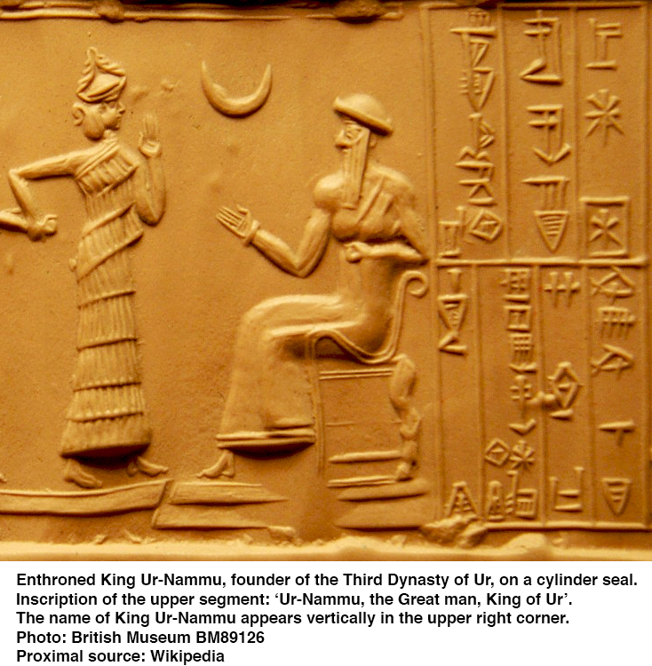
|
|||
| Ur-Nammu | 2112 BC - 2094 BC | Ur-Nammu founded the Sumerian Third Dynasty of Ur, in southern Mesopotamia, following several centuries of Akkadian and Gutian rule. Though he built many temples and canals his main achievement was building the core of the Ur III Empire via military conquest, and Ur-Nammu is chiefly remembered today for his legal code, the Code of Ur-Nammu, the oldest known surviving example in the world. Note, however, that the code is now believed to have been created by his son Shulgi, though it is still known as the Code of Ur-Nammu. He held the titles of 'King of Ur, and King of Sumer and Akkad'. Among his military exploits were the conquest of Lagash and the defeat of his former masters at Uruk. He was eventually recognised as a significant regional ruler of Ur, Eridu, and Uruk at a coronation in Nippur, and is believed to have constructed buildings at Nippur, Larsa, Kish, Adab, and Umma. He was known for restoring the roads and general order after the Gutian period. Ur-Nammu was also responsible for ordering the construction of a number of ziggurats, including the Great Ziggurat of Ur. It has been suggested, based on a much later literary composition, that he was killed in battle after he had been abandoned by his army. | |
| Shulgi | 2094 BC - 2046 BC | Shulgi of Ur was the second king of the Third Dynasty of Ur. He reigned for 48 years. His accomplishments include the completion of construction of the Great Ziggurat of Ur, begun by his father Ur-Nammu. On his inscriptions, he took the titles 'King of Ur', 'King of Sumer and Akkad', adding 'King of the four corners of the universe' in the second half of his reign. Shulgi was the son of Ur-Nammu king of Ur and his queen consort Watartum. Shulgi led a major modernisation of the Third Dynasty of Ur. He improved communications, reorganised the army, reformed the writing system and weight and measures, unified the tax system, and created a strong bureaucracy. He also wrote a law code, now known as the Code of Ur-Nammu because it was originally thought to have been authored by Ur-Nammu. He also built or rebuilt numerous temples throughout the empire. Shulgi is best known for his extensive revision of the scribal school's curriculum. Although it is unclear how much he actually wrote, there are numerous praise poems written by and directed towards this ruler. He had proclaimed himself a god by his 21st regnal year, and was recognised as such by the whole of Sumer and Akkad. | |
| Amar-Sin | 2046 BC - 2038 BC | Amar-Sin, King of the Neo-Sumerian Empire, was the third ruler of the Ur III Dynasty. He succeeded his father Shulgi. His name may be translated as 'bull calf of the moon-god'. Amar-Sin is known to have campaigned against Elamite rulers such as Arwilukpi of Marhashi, and the Ur Empire under his reign extended as far as the northern provinces of Lullubi and Hamazi, with their own governors. He also ruled over Assur through the Akkadian governor Zariqum, as confirmed by his monumental inscription. Amar-Sin's reign is notable for his attempt at regenerating the ancient sites of Sumer. He apparently worked on the unfinished ziggurat at Eridu. The administrative documentation from Amar-Sin's reign suggests that in his final years, he was confronted with some internal strife, and it is likely that his brother, Shu-Sin, was behind an effort to ovethrow him. It is unclear if Amar-Sin was assassinated during this period, or if he died of natural causes. | |
| Shu-Sin | 2037 BC - 2029 BC | Shu-Sin was the brother of the previous king, and also reigned for nine years. He reinstated members of families ousted by his predecessor as governors, which is another indication of the tensions running through the top of the state. He, in turn, had to assert his authority in the northern and eastern peripheries (Shimanum, Zabshali, Shimashki). The tribute collected from these regions seems to arrive less regularly, a sign of a weakening of the King of Ur's influence. The most threatening danger came from the northwest, due to the incursions of Amorite groups. To counter this, Shu-Sîn reinforced the defensive system established by Shulgi by building a new wall. During the latter part of the reign, much of the power appears to have been in the hands of Chancellor Aradmu. | |
| Ibbi-Sin | 2028 BC - 2004 BC | Ibbi-Sin was probably the son of Shu-Sin, and reigned for twenty-four years during which the kingdom disintegrated. The archives of the major administrative centres of the central regions dried up from the beginning of his reign (after the third year). Several military campaigns were conducted against the political entities located on the eastern margins of the kingdom (Anshan, Huhnur, Susa) which had taken their autonomy, but they were few in number and ceased after his fourteenth year of reign. Subsequently, the provinces close to the centre also became independent: this is well known for Eshnunna and especially Isin under the leadership of Ishbi-Erra, a renegade governor. The incursions of the Amorite tribes are increasingly violent, while a situation of food shortage broke out. | |
Dynasty of Isin
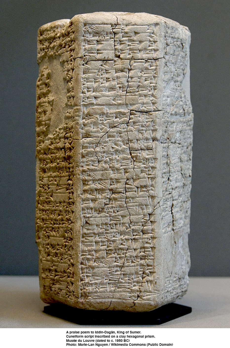
|
|||
| Ishbi-Erra | 2018 BC - 1985 BC | The Dynasty of Isin was the final ruling dynasty listed on the Sumerian King List (SKL). The dynasty was situated within the ancient city of Isin. The Dynasty of Isin is often associated with the nearby and contemporary dynasty of Larsa. While in many ways this dynasty emulated that of the preceding one, its language was Akkadian as the Sumerian language had become moribund in the latter stages of the Third Dynasty of Ur. At the outset of his career, Ishbi-Erra was an official working for Ibbi-Sin, the last king of the Third Dynasty of Ur. He went on to win decisive victories against the Amorites in his 8th year and the Elamites in his 16th years. He founded fortresses and installed city walls, but only one royal inscription is extant. | |
| Shu-ilishu | 1984 BC - 1975 BC | Shu-Ilishu rebuilt the walls of his capital city Isin. He was a great benefactor of Ur (beginning the restoration which was to continue through his successors Iddin-Dagān and Išme-Dagan). Shu-Ilishu built a monumental gateway and recovered an idol representing Ur's patron deity (Nanna, god of the moon) which had been expropriated by the Elamites when they sacked the city. | |
| Iddin-Dagan | 1974 BC - 1954 BC | Iddin-Dagan is best known for his participation in the sacred marriage rite and the sexually explicit hymn that described it. The continued fecundity of the land was ensured by the annual performance of the sacred marriage ritual in which the king impersonated the god Dumuzi-Ama-ušumgal-ana and a priestess played the role of Inanna. A hymn describing Iddin-Dagan's performance of this ritual in ten sections (Kiruḡu) indicates that this ceremony involved a procession of: male prostitutes, wise women, drummers, priestesses, and priests bloodletting with swords to the accompaniment of music, followed by offerings and sacrifices for the goddess Inanna, or Ninegala. The ceremony reached its climax with the copulation of the king and priestess. | |
| Ishme-Dagan | 1953 BC - 1933 BC | Ishme-Dagan, the fourth ruler of the First Dynasty of Isin succeeded his father Iddin-Dagan during a period of increasing regional instability. His rule marked a shift from the expansions of his predecessor's era toward defensive measures against internal and external threats, as Isin's control over Sumer began to wane amid rivalries with emerging powers like Larsa. Early in his reign, Ishme-Dagan faced significant rebellions in key cities, particularly Isin and Nippur, where local unrest challenged the dynasty's authority. He successfully suppressed these uprisings through military campaigns, restoring order and reaffirming Isin's dominance over its core territories in central Mesopotamia. These efforts were crucial for maintaining loyalty among the priesthood and elites in Nippur, the religious heartland, though they strained resources and highlighted the dynasty's vulnerabilities. A notable cultural response was the composition of the Nippur Lament, which invoked divine favor and legitimated his rule amid the city's distress. To counterbalance these tensions, Ishme-Dagan actively patronised scribes and sponsored elaborate religious festivals, such as those dedicated to the god Enlil, aiming to foster cultural unity and bolster allegiance to the Isin throne. Year names from his reign record generous offerings and temple restorations, which helped legitimise his rule by aligning it with traditional Sumerian piety. This cultural sponsorship was particularly evident in the promotion of literary works and scribal education, reflecting a deliberate strategy to reinforce ideological ties during a time of political flux. Ishme-Dagan's reign also saw escalating conflicts with the rival dynasty of Larsa under King Gungunum, who launched aggressive campaigns against Isin, though major territorial losses occurred later in the dynasty's history. | |
| Lipit-Ishtar | 1934 BC - 1924 BC | Lipit-Ishtar reigned during a period regarded as the zenith of the dynasty's power and influence in southern Mesopotamia. Succeeding his father Ishme-Dagan, who had quelled significant rebellions, Lipit-Ishtar focused on administrative and cultural consolidation, earning titles such as 'king of Sumer and Akkad' and 'pious shepherd of Nippur.' His rule emphasised justice and order, as proclaimed in royal inscriptions that depict him as divinely appointed by Enlil to eradicate enmity and ensure well-being across the land. A hallmark of Lipit-Ishtar's reign was the promulgation of the Code of Lipit-Ishtar, one of the oldest surviving legal compilations from ancient Mesopotamia, inscribed in Sumerian on clay tablets primarily excavated from Nippur's temple library. Lipit-Ishtar's reign also featured ambitious construction efforts, particularly in Nippur, the religious heart of Sumer, where he enhanced the Ekur temple complex dedicated to the god Enlil. As the 'humble shepherd of Nippur,' he undertook projects symbolising his devotion, including repairs and expansions to sacred structures that reinforced Isin's spiritual authority. In Isin itself, he dug a grand moat around the city, as detailed in a reconstructed foundation cone inscription, to protect and glorify his capital while underscoring his role in maintaining regional stability. Under Lipit-Ishtar, the Dynasty of Isin achieved its maximum territorial extent, with suzerainty extending over vital southern cities including Umma, Uruk, Ur, Nippur, and Eridu. However, toward the end of his reign, around 1924 BC, Larsa under Gungunum conquered Ur, marking the beginning of significant territorial losses. This peak influence allowed him to impose corvée labour, a form of unpaid, forced, and intermittent labor imposed by states or landlords on peasants and subjects (e.g., 70 days annually from households) for public works and to liberate dependent regions from subjugation, thereby solidifying Isin's dominance before the dynasty's later challenges. | |
| Ur-Ninurta | 1923 BC - 1896 BC | Ur-Ninurta ushered in a period of intensified military focus amid growing external pressures. His reign represented a departure from the previous rulers' lineage, as ancient king lists do not identify him as Lipit-Ishtar's direct son, suggesting the establishment of a new royal branch. This era inherited the legal and administrative frameworks from Lipit-Ishtar but shifted emphasis toward defensive fortifications. Throughout his rule, Ur-Ninurta faced escalating conflicts with the rival kingdom of Larsa, particularly under its king Sumu-El, involving disputes over water resources and southern Mesopotamian cities. These wars resulted in significant territorial losses for Isin, including the city of Ur, which fell under Larsa control early in his reign, and the temporary seizure of Kisurra by local forces. Ur-Ninurta managed to reconquer Kisurra briefly, but the polity soon emerged as an independent entity under an Amorite tribal leader, Itūr-Šamaš, highlighting the penetration of non-Sumerian elements into the region's political landscape. Signs of mounting instability are evident in contemporary omen literature and chronicles, which include prophetic allusions to royal downfall and divine disfavour amid conflicts, foreshadowing Isin's weakening position. His death, recorded in year names from nearby cities like Babylon and Kisurra, likely occurred in battle against Larsa forces, marking a pivotal moment in the dynasty's transition to decline. | |
| Bur-Suen | 1895 BC - 1874 BC | Bur-Suen's reign occurred during a period of intensifying rivalry with the neighbouring kingdom of Larsa, building on the ongoing conflicts inherited from his predecessor Ur-Ninurta. A prominent feature of Bur-Suen's rule was his emphasis on religious dedications, particularly to Enlil, the chief deity associated with the city of Nippur. In one year-name formula, he is described as 'obedient to Enlil' and credited with crafting emblems of gold and silver for the god, underscoring his efforts to secure divine approval. Bur-Suen undertook restorations at Nippur's Ekur temple complex, the primary sanctuary of Enlil, as evidenced by stamped bricks bearing his dedicatory inscription found in the area. These building efforts, typical of Mesopotamian rulers seeking to legitimise their authority through temple maintenance, reflect a strategic invocation of Enlil's favor to bolster Isin's position. | |
| Lipit-Enlil | 1873 BC - 1869 BC | Reign of Lipit-Enlil Lipit-Enlil, son of Bur-Suen reigned for a period of 5 years marked by escalating pressures from rival states. His rule was characterised by continued rivalry with the kingdom of Larsa, particularly under its king Sumuel, as Isin faced defeats that further undermined its dominance in southern Mesopotamia. Larsa aggressively expanded its influence through conquests and control over vital waterways. In response to these territorial erosions, Lipit-Enlil initiated efforts to fortify Isin itself, strengthening its defences against further incursions, while simultaneously appealing to northern allies—such as powers in Eshnunna and possibly Elam—for military and diplomatic support to counter Larsa's advances. Surviving inscriptions from Lipit-Enlil's era, including year names and dedicatory texts, poignantly lament the contraction of Isin's domain and invoke divine aid amid these crises, reflecting the king's struggle to maintain sovereignty. | |
| Erra-imitti | 1868 BC - 1861 BC | Erra-imitti's reign occurred amid the intensifying rivalry between Isin and Larsa, with the latter under the long rule of Rim-Sin I exerting continued territorial and political pressures on Isin's domains. The most striking episode associated with Erra-imitti's rule is preserved in an Old Babylonian omen text excerpted in the Chronicle of Early Kings. In this account, Erra-imitti, fearing a dire omen portending the king's death — possibly linked to an eclipse or other celestial event — instituted the substitute king ritual by enthroning Enlil-bani, described as his gardener or a lowly cook. The text states: 'Erra-imitti, the king, installed Enlil-bani, the gardener, as substitute king on his throne. He placed the royal tiara on his head. Erra-imitti [died] in the palace while drinking hot broth. Enlil-bani, the substitute king, assumed the throne permanently — he ruled for 24 years.' This narrative, drawn from extispicy (liver divination) traditions, highlights the Mesopotamian practice of using commoners as temporary proxies to absorb predicted misfortunes, thereby protecting the true monarch. Divination texts like this one serve as rare primary sources for Erra-imitti's era, blending factual kingship details with interpretive prophecy to convey moral and astrological lessons. While year names and administrative documents from Isin attest to routine governance under his rule, such as building activities and economic records, the omen anecdote provides the only vivid, if dramatised, insight into a pivotal succession event. Scholars interpret this story as reflecting genuine ritual practices documented across Mesopotamian history, underscoring the precariousness of royal authority amid omens and interstate conflicts. | |
| Enlil-bani | 1860 BC - 1837 BC | Enlil-bani's reign marked a period of relative stability amid the dynasty's decline, characterised by efforts to bolster Isin's religious and administrative infrastructure. Enlil-bani's ascension was unusual, originating from humble beginnings as a gardener (or in some accounts, a cook or tavern-keeper) installed as a substitute king (šar pūḫi) during the reign of his predecessor, Erra-imitti, to avert ill omens such as a predicted eclipse. According to an Old Babylonian omen text preserved in the 'Chronicle of Early Kings', the ritual substitute unexpectedly became the legitimate ruler when Erra-imitti died while eating porridge, allowing Enlil-bani to seize the throne by divine order. This narrative, while possibly legendary, underscores the role of apotropaic rituals (those having the power to avert evil influences or bad luck) in Mesopotamian kingship and highlights Enlil-bani's non-royal background. To rally support and legitimise his rule, Enlil-bani focused on building projects and religious dedications. He restored the city of Nippur, a key religious centre, and constructed or refurbished temples such as the E-me-zi-da for Enki in Eridu; he also dug major canals, including the Enlil-bani canal from the Zuzagum corridor to the sea, enhancing irrigation and economic ties. Votive offerings, like golden thrones for deities including Utu, Nanna, and Ninlil, further emphasised piety toward Enlil and other gods central to Isin's identity. These initiatives provided administrative relief, such as tax exemptions and corvée (indentured labour) releases for Isin's citizens, fostering loyalty during a time of external pressures. Militarily, Enlil-bani achieved minor victories in skirmishes against neighbouring threats, including defensive actions that temporarily secured Isin's borders, though no major conquests are attested in surviving inscriptions. However, his reign saw increasing isolation for Isin as the rival kingdom of Larsa, under expanding rulers like Warad-Sin and Rim-Sin I, dominated southern Mesopotamia through territorial gains and control over key trade routes and water resources. This shift reduced Isin's influence, setting the stage for further dynastic weakening. | |
| Zambiya | 1836 BC - 1834 BC | Zambiya's short reign followed the relative stability achieved under Enlil-bani and was marked by intensified pressures on Isin's territorial control and alliances. During Zambiya's rule, the dynasty experienced accelerated weakening through betrayals by vassals and aggressive encroachments from Larsa. In one notable event around the mid-19th century BC, forces associated with Isin allied with Elamite forces to confront cities like Uruk and Kazallu, aiming to reassert Isin's influence over southern Mesopotamia. However, this coalition proved short-lived, as Larsa's king Sîn-iqīšam claimed victory in his fifth regnal year over 'Uruk, Kazallu, the land of Elam, Zambija the king of Isin', signaling the defection of key allies like Uruk and the direct military subjugation of Isin territories by Larsa. These losses fragmented Isin's vassal network, with former dependents increasingly aligning with Larsa amid the dynasty's declining power. Zambiya sought to uphold the religious prestige of Nippur, the traditional centre of Sumerian cultic authority, by continuing Isin's role as its patron. Inscriptions from his reign, including foundation cones, record dedications and building activities that reinforced Isin's legitimacy as successors to the Ur III dynasty through patronage of Enlil's temple complex. Despite these efforts, the political instability limited their impact. Evidence of economic strain appears in administrative inscriptions and year formulae from Zambiya's era, which highlight resource-intensive projects like the rebuilding of Isin's defensive walls amid ongoing conflicts. One year name commemorates the construction of a wall named 'Zambiya is the beloved of the goddess Ištar', reflecting attempts to bolster fortifications while diverting labour and materials from other needs during a period of territorial contraction. Such endeavours underscore the fiscal pressures faced by the court as Larsa's advances eroded Isin's economic base in the surrounding irrigation-dependent regions. | |
| Iter-pisha | 1833 BC - 1830 BC | Iter-pisha's rule is one of the most poorly attested in the dynasty, with no known royal inscriptions or dedicatory texts attributed to him, reflecting the broader scarcity of records for late Isin kings amid mounting external pressures. The limited surviving evidence consists primarily of administrative documents dated to his regnal years, such as legal tablets from Nippur recording transactions like the sale of priestly offices in temples dedicated to deities including Nininsina and Ningiszida. These texts invoke oaths by the king to validate contracts, indicating ongoing bureaucratic and religious administration under his authority, but they offer no insight into major political or military initiatives. The absence of monumental or historical inscriptions suggests a period of diminished royal activity, possibly focused on defensive maintenance rather than expansion, as Isin faced increasing rivalry from the rising kingdom of Larsa. Iter-pīša's reign likely occurred during a phase of territorial contraction and potential internal challenges, with Larsa under kings like Warad-Sîn exerting pressure, though direct evidence is lacking. This shadowy interlude transitioned to the even more obscure rules of his successors, Ur-dukuga and Sîn-māgir, as Isin's power waned further under Larsite encroachment. | |
| Ur-du-kuga | 1829 BC - 1824 BC | Ur-du-kuga ruled during a period of intensifying decline for the dynasty. His reign coincided with the growing dominance of the rival kingdom of Larsa under Warad-Sîn, which exerted hegemony over much of southern Mesopotamia, including key cities like Ur and Nippur. By this time, Isin's authority was largely nominal, confined to the core area around the city of Isin itself, with administrative tablets from Nippur indicating that Larsa's king was more frequently acknowledged as sovereign. This territorial contraction marked a stark reversal from earlier Isin kings, reflecting the dynasty's struggle to maintain control amid Amorite incursions and regional power shifts. Despite these losses, Ur-du-kuga continued the dynasty's tradition of religious patronage through temple offerings and dedications, emphasising piety as a source of legitimacy. His year names record significant acts such as the fashioning of two large golden emblems for the moon-god Nanna of Ur and the sun-god Utu of Larsa, deities associated with cities under Larsa hegemony, possibly as symbolic assertions of cultural ties or diplomatic gestures. Other dedications included offerings to goddesses like Inanna and Nanaya, as well as the construction of a temple for the god Dagan, underscoring ongoing support for cult centres even as political power waned. These activities align with Isin's historical role as a guardian of Sumerian religious institutions, including the Apsu temple of Enki in Isin, though specific offerings to Enki during his reign are not directly attested in surviving records. Ur-du-kuga's royal ideology represented one of the final expressions of Sumerian traditionalism within the dynasty, adhering to linguistic and stylistic conventions inherited from the Third Dynasty of Ur. Inscriptions and year formulas employed Sumerian language and formats that linked the king to major cult centres like Nippur and Uruk, despite their de facto loss to Larsa, thereby invoking continuity with ancient Sumerian heritage amid encroaching Amorite influences. This focus on religious and cultural continuity, rather than military reconquest, highlighted the 'last gasps' of Isin's Sumerian-oriented worldview as the dynasty approached its end. | |
| Sîn-māgir | 1823 BC - 1813 BC | The primary challenge of Sîn-māgir's rule was the aggressive expansion of Larsa under Rim-Sin I (r. 1822–1763 BC), which led to repeated battles along Isin's southern borders. These conflicts resulted in the loss of key territories, including Uruk and Ur, and culminated in the strategic encirclement of Isin by Larsite forces around 1820 BC, severing vital supply routes and isolating the city-state. In response, Sîn-māgir focused on defensive fortifications, such as the wall at Dunnum built to counter Larsa's advances, as recorded in his royal inscriptions. His year names reflect this strain, including one commemorating the building of a fortress named 'Sîn-māgir-enlarges-the-land', a symbolic assertion of strength amid territorial contraction, and others invoking victories over enemies at Isin's gates, underscoring the kingdom's precarious position. Inscriptions from bricks and votives, such as those dedicating structures to protective deities like Enlil, further highlight these futile efforts to bolster defences and legitimacy. | |
| Damiq-ilishu | 1812 BC - 1790 BC | The rule of Damiq-ilīšu, son of Sîn-māgir, occurred amid intensifying rivalries between Isin and the rising power of Larsa under Rim-Sin I, compounded by pressures from Babylon. Administrative records and inscriptions from his early years document efforts to bolster defences, including the fortification of the city of Dunnum with a wall named 'Sîn-māgir makes the foundations of his land firm.' By the mid-point of his reign, Isin faced significant military setbacks. In circa 1796 BC, corresponding to the seventeenth year of Sîn-muballiṭ of Babylon, Isin suffered an assault that further eroded its territorial control. This vulnerability culminated in Rim-Sin I's decisive campaigns against Isin. In his twenty-ninth regnal year (circa 1794 BC), Rim-Sin captured Dunnum, seizing its fortifications and prisoners, which critically weakened Isin's northern defenses. The following year, Rim-Sin's thirtieth year (c. 1793 BC), marked the fall of Isin itself, ending the First Dynasty. The conquest is commemorated in Rim-Sin's year name: 'Year in which the true shepherd Rīm-Sîn, with the mighty aid of An, Enlil, and Enki, seized Isin, the royal city, together with its numerous settlements; he spared the lives of its vast population and perpetuated the glory of its kingship forever.' Following the conquest, Larsa annexed Isin's territories, integrating them into its domain and shifting administrative control, including over key religious centers like Nippur.[40] Year-name records from Rim-Sin's subsequent reigns employed an era system counting "after the seizure of Isin," underscoring the event's significance and the permanence of Larsa's dominance.[40] (Sigrist 1990: 61–90). The fate of Damiq-ilīšu and his royal family remains sparsely documented in primary sources, with evidence suggesting absorption into Larsa's administrative or cultic structures rather than outright exile; indirect attestations include Isin royal women continuing roles in priesthoods at Ur.[40] Some later traditions hint at shadowy continuations of Isin lineage, as seen in claims by rulers of the remote Sealand Dynasty, but these lack direct corroboration from contemporary inscriptions. Damiq-ilīšu was the 15th and final king of Isin. | |
Dynasty of Larsa
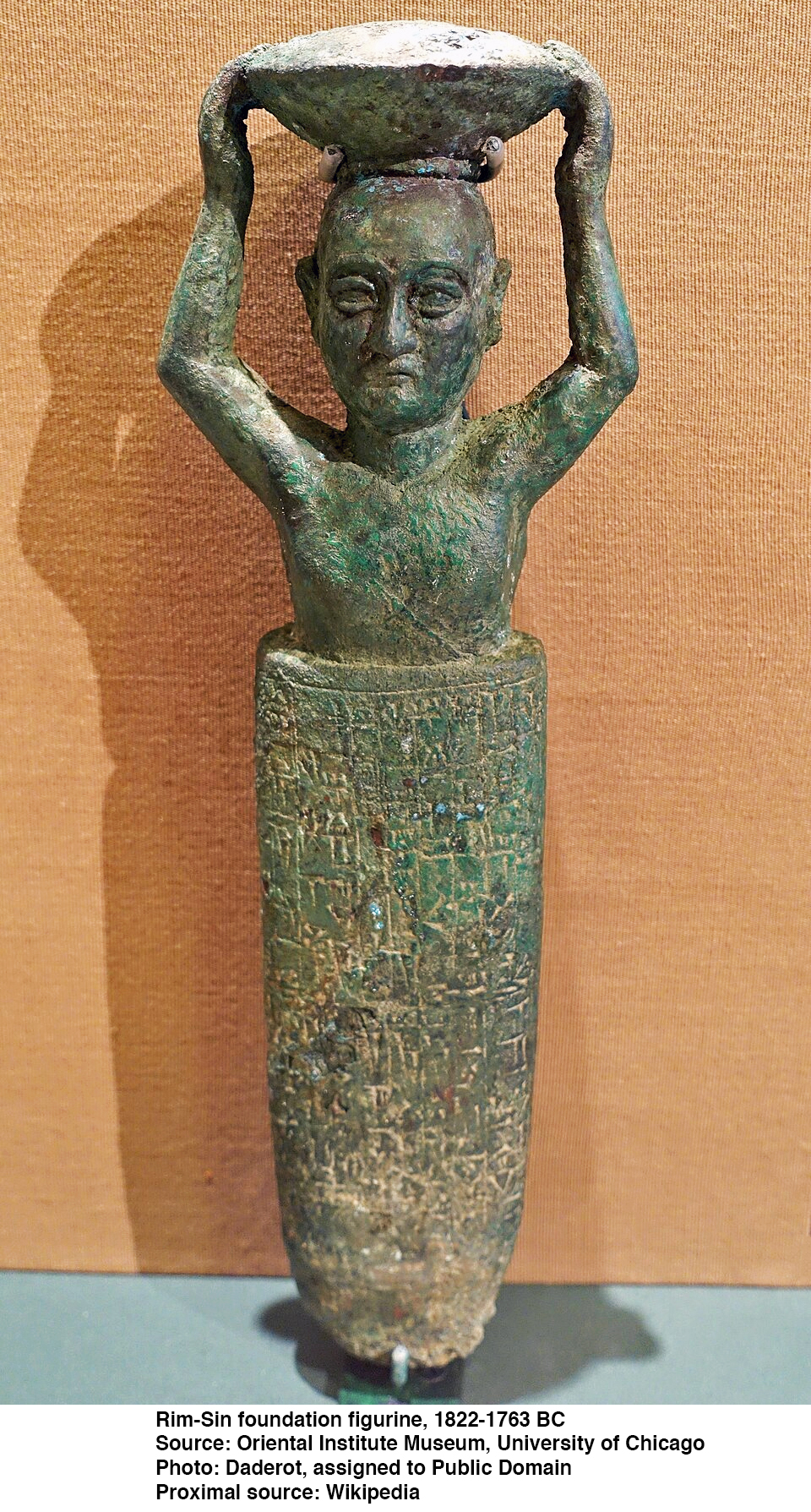
|
|||
| Naplanum | 2025 BC - 2004 BC | Naplanum was the founder of the ruling dynasty of Larsa. He may not originally have been a king but possibly a local official or governor. During the weakening of Ur III authority, he established independent control over Larsa. His background was likely Amorite, reflecting the growing influence of Amorite groups in Mesopotamia at the time. | |
| Emisum | 2004 BC - 1997 BC | Emisum or Iemsium governed the city of Larsa. He was an Amorite. Historical records about him are limited, but he appears in Sumerian king lists and year-name inscriptions. His reign occurred during a time of political fragmentation after the decline of the Third Dynasty of Ur. | |
| Samium | 1976 BC - 1942 BC | Samium (also written Samuʾum) reigned during a time of political rivalry among Mesopotamian city-states after the fall of the Third Dynasty of Ur. Samium was likely an Amorite ruler, part of the growing Amorite influence in Mesopotamia. His reign helped consolidate the authority of Larsa as an independent kingdom. Samium continued Larsa’s resistance to Isin’s claims of supremacy. | |
| Zabaia | 1941 BC - 1933 BC | Zabaia was the son of Samium, and the first to call himself 'king'. Isin had initially claimed supremacy over southern Mesopotamia, but Larsa was steadily strengthening. Zabaia’s reign represents the period just before Larsa began a major territorial expansion. He honoured the sun god Shamash, the chief deity of Larsa. Zabaia’s reign appears to have been relatively stable and served as a bridge between early consolidation and later expansion. | |
| Gungunum | 1932 BC - 1906 BC | Gungunum was a powerful king of Larsa whose reign marked the beginning of Larsa’s major rise to regional power. By the time he came to the throne, Larsa was already independent but not yet dominant. He transformed Larsa from a secondary power into a major political force. Gungunum is best known for his military successes, especially against Isin. His major achievement was the capture of Ur, , one of the most important religious and economic centres in Mesopotamia in 1924 BC. Control of Ur gave Larsa access to major trade routes and religious prestige. He also extended influence over parts of southern Sumer and possibly areas toward Elam. He honoured the moon god Nanna (chief deity of Ur) after conquering the city. His control of Ur strengthened his legitimacy as a ruler of Sumerian lands. By controlling Ur, Gungunum gained access to Gulf trade routes. The resulting increased wealth strengthened Larsa’s economy. | |
| Abisare | 1905 BC - 1895 BC | Abisare continued Larsa’s expansion and consolidation of power, and inherited a strengthened and expanding kingdom. He continued the conflict with Isin, and reportedly defeated Isin in battle, further weakening its political power. Abisare honoured important deities, especially the moon god Nanna of Ur and the sun god Shamash of Larsa. Religious devotion was closely tied to royal legitimacy. He maintained irrigation systems essential for agriculture and preserved control over trade routes gained during previous reigns. | |
| Sumu-ilu | 1894 BC - 1866 BC | Sumu-ilu's reign marked a phase of continued military pressure and territorial consolidation following the expansion under earlier kings like Gungunum and Abisare. (also written Sumuel) Sumu-ilu (also written Sumuel) inherited a strong and expanding kingdom. Larsa was already a major power in southern Mesopotamia, rivaling Isin. Sumu-ilu continued the conflict with Isin, and reportedly captured several cities previously controlled by Isin. He built defensive walls around strategic cities to secure his gains. Although he did not completely destroy Isin, he significantly weakened it. During his reign, Larsa strengthened control over Ur and Uruk. These cities were religious and economic centres, making Larsa one of the dominant powers in Sumer. Sumu-ilu supported the cult of Shamash (sun god of Larsa) and maintained the cult of Nanna in Ur. He maintained irrigation systems essential for agriculture and protected trade routes connected to the Persian Gulf. He strengthened city defences through construction projects, and his reign was characterised by administrative stability. His reign marked a high point of Larsa’s territorial consolidation. | |
| Nur-Adad | 1865 BC - 1850 BC | Nur-Adad's reign marked a shift from aggressive expansion to internal consolidation and religious rebuilding. He inherited a powerful kingdom controlling major southern cities such as Ur and Uruk. Larsa was one of the dominant powers in southern Mesopotamia at this time. Conflict with Isin continued, though less aggressively than under Sumu-ilu. Nur-Adad focused more on maintaining territories rather than expanding them dramatically. He worked to stabilise Larsa after decades of warfare. Nur-Adad is especially known for his construction and restoration activities. He rebuilt temples in Larsa and possibly in Ur, strengthened city walls, supported the cult of Shamash (sun god of Larsa) and continued honouring Nanna, the moon god of Ur. In Mesopotamian kingship, temple restoration was both a religious duty and a political statement of legitimacy. He maintained irrigation canals and agricultural systems, preserved trade routes linking southern Mesopotamia to the Persian Gulf and ensured administrative continuity after earlier military campaigns. | |
| Sin-iddinam | 1849 BC - 1843 BC | Sin-iddinam was the son and successor of Nur-Adad and continued efforts to maintain Larsa’s power in southern Mesopotamia. He inherited a strong but politically pressured kingdom. Larsa controlled major southern cities, still including: Ur and Uruk. However, rival powers were rising in the region. Conflict with Isin continued. New regional powers, including Babylon, were beginning to gain strength. Sin-iddinam worked to defend Larsa’s territories and maintain influence. Although not as expansionist as earlier rulers, he aimed to preserve Larsa’s dominance. Sin-iddinam is known from inscriptions that highlight restoration and dedication of temples, support of Shamash (sun god of Larsa) and continued patronage of Nanna (moon god of Ur). His reign appears relatively stable but short. | |
| Sin-iribam | 1842 BC - 1841 BC | Sin-iribam's short reign suggests possible internal political instability or dynastic tension. Larsa at this time was still a major power but facing increasing regional challenges. Rivalries with Isin continued, though Isin’s power had declined. Other regional states, including Babylon, were rising. Larsa may have been experiencing internal political strain during this time. Due to the brevity of his rule, no major military conquests are clearly recorded. | |
| Sin-iqisham | 1840 BC - 1836 BC | Sin-iqisham continued military pressure against neighbouring cities, strengthened defensive walls and irrigation systems and maintained control over major southern cities such as Ur and Uruk.His reign was more stable than that of his predecessor. | |
| Silli-Adad | 1835 BC | Silli-Adad's reign was very short and is often seen as part of a period of political instability. He may not have belonged to the main ruling line of Nur-Adad’s family. His short rule suggests either internal conflict or external pressure. Very few inscriptions survive from his reign. He was soon replaced by a stronger ruler, Warad-Sin, who restored dynastic stability. | |
| Warad-Sin | 1834 BC - 1823 BC | Warad-Sin was a major stabilising figure in Larsa’s history. He was the brother of Rim-Sin I and the son of Kudur-Mabuk, an influential Amorite leader. Warad-Sin came to power after the unstable reign of Silli-Adad. His father, Kudur-Mabuk, an Amorite ruler from the region near Elam, likely played a decisive role in securing the throne. This marked the beginning of a new and powerful ruling house in Larsa. Warad-Sin worked to consolidate control over southern Mesopotamia. He maintained authority over Ur and Uruk, and engaged in regional conflicts to preserve Larsa’s dominance. He is well known for temple restorations in Ur and Larsa and his devotion to the moon god Nanna (Ur) and the sun god Shamash (Larsa). His inscriptions show strong emphasis on divine support for his rule. | |
| Rim-Sin I | 1822 BC - 1763 BC | Rim-Sin I was the most powerful and longest-reigning kings of Larsa. Under his rule, Larsa reached its political and economic peak during the Isin–Larsa period of Mesopotamian history. He was the brother of Warad-Sin and son of Kudur-Mabuk. He inherited a stable and expanding kingdom. His greatest victory was the final defeat of Isin. Around 1794 BCE, Rim-Sin captured Isin after more than a century of rivalry between Isin and Larsa. This event ended the long Isin–Larsa conflict and made Larsa the dominant power in southern Mesopotamia, which greatly increased his prestige. At its height under Rim-Sin I, Larsa controlled major cities including , Ur, Uruk and Lagash, as well as Nippur (at times). He became the most powerful ruler in southern Mesopotamia. Rim-Sin I restored major temples in Ur and Larsa, honoured Nanna (moon god of Ur) and Shamash (sun god of Larsa), built canals and improved irrigation systems. He used year names to celebrate achievements, especially the conquest of Isin. Temple building reinforced his legitimacy as ruler of Sumer. He controlled important agricultural lands, managed trade routes connected to the Persian Gulf, maintained large irrigation networks and strengthened administrative systems. Larsa became wealthy and stable during much of his reign. During Rim-Sin’s reign, a new power, Babylon, ruled by Hammurabi was rising in the north. At first, Rim-Sin was stronger than Babylon. However Hammurabi gradually expanded his kingdom. In 1763 BCE, Hammurabi defeated Rim-Sin and captured Larsa. Rim-Sin was deposed, and Larsa was incorporated into the Babylonian kingdom. This marked the end of Larsa as an independent power. Rim-Sin I is important because he ruled for about 60 years — one of the longest reigns in Mesopotamian history. He ended the Isin–Larsa rivalry and made Larsa the dominant southern power. His defeat by Hammurabi paved the way for Babylonian unification of Mesopotamia. | |
| Dynasty I (Amorite, 1894–1595 BC): Founded by Sumu-abum, famous for Hammurabi. Dynasty II (First Sealand, c. 1725–1475 BC. Based in the southern marshlands.) Dynasty III (Kassite, c. 1595–1155 BC): Longest-ruling dynasty, establishing lasting Babylonian culture. Dynasty IV (Second Isin, 1153–1022 BC): Native Babylonian rulers after the Kassite fall. Dynasty V (Second Sealand, 1021–1001 BC): Short-lived dynasty. Dynasty VI (Bazi, 1000–981 BC): Named after a town on the Tigris. Dynasty VII (Elamite, 980–975 BC): A brief period of foreign rule. Dynasty VIII (E, 974–732 BC): A period of instability, sometimes called "Intermediate Period". Dynasty IX (Assyrian, 732–626 BC): Ruled directly by the Neo-Assyrian Empire. Dynasty X (Chaldean/Neo-Babylonian, 626–539 BC): Founded by Nabopolassar, including Nebuchadnezzar II. Naming Conventions Geographic/Ethnic Origin: Dynasties were often identified by the regional background of their leaders, such as the Kassites or Chaldeans. City of Origin: Some, like the Second Dynasty of Isin, were named after the city from which the kings originated. King Lists: Modern scholars and ancient scribes used sequential numbers (I-X) to organize the dynasties. Reign Identification: Within these periods, years were not numbered consecutively but were named after major events during a king's reign. 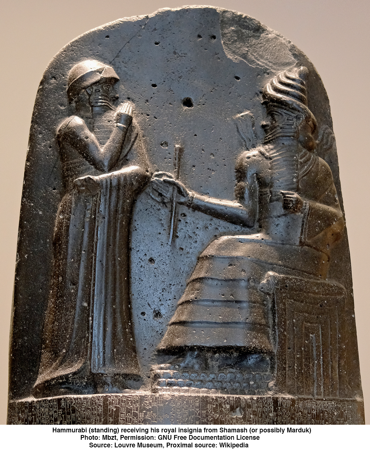
|
|||
| Sumu-abum | 1894 BC - 1881 BC | The Old Babylonian Dynasty (circa 1894 BC – 1595 BC) marked the rise of Babylon from a small city-state to a dominant Mesopotamian power. The founder of the dynasty was Sumu-abum who established Babylon as an independent city-state after the decline of the Ur III Empire. He consolidated control over nearby cities and laid the political foundation for Babylon’s future expansion. He did not yet control a vast empire, but he began the Amorite dynasty that would eventually dominate southern Mesopotamia. | |
| Sumu-la-El | 1880 BC - 1845 BC | Sumu-la-El was an early consolidator who strengthened Babylon’s defences with city walls. He expanded territory by conquering nearby rival cities and improved irrigation systems and temple construction. Under his rule, Babylon became a more significant regional power. | |
| Sabium | 1844 BC - 1831 BC | Sabium continued territorial expansion. He reinforced political control over surrounding cities and maintained stability during a competitive period among Mesopotamian city-states. | |
| Apil-Sin | 1830 BC - 1813 BC | Apil-Sin strengthened city fortifications. and engaged in regional conflicts, particularly with neighbouring city-states such as Isin and Larsa, and helped prepare the kingdom for later expansion. | |
| Sin-Muballit | 1812 BC - 1793 BC | Sin-Muballit expanded Babylon’s territory further and launched campaigns against rival cities including Larsa. His reign set the stage for Babylon’s greatest expansion. He abdicated in favour of his son, Hammurabi (possibly due to illness). | |
| Hammurabi | 1792 BC - 1750 BC | Hammurabi was the most famous ruler of the dynasty. He conquered major Mesopotamian cities including Larsa, Eshnunna, Mari, and eventually Assyria. He united much of Mesopotamia under Babylonian rule. He issued the Code of Hammurabi, one of the earliest and most complete written legal codes up till that point. He promoted large scale irrigation projects and temple construction. Under Hammurabi, Babylon became the dominant political and cultural centre of Mesopotamia. | |
| Samsu-iluna | 1749 BC - 1712 BC | Samsu-iluna faced widespread revolts after Hammurabi’s death. He struggled to maintain control over southern Mesopotamia and lost significant territories, weakening Babylon’s dominance. His reign marked the beginning of the empire’s gradual decline. | |
| Abi-Eshuh | 1711 BC - 1684 BC | Abi-Eshuh attempted to suppress rebellions and recover lost territories. and built defensive works and attempted to control the Tigris River to undermine enemies but he had limited success restoring Babylon to its former strength. He was defeated by Damqi-ilishu of the Babylonian Dynasty II, the Sealanders, from the marshes south of Babylon. | |
| Ammi-Ditana | 1683 BC - 1647 BC | Ammi-Ditana presided over a period of relative stability, and focused on religious dedications and temple restorations, as well as promoting economic and administrative continuity. | |
| Ammi-Saduqa | 1646 BC - 1626 BC | Ammi-Saduqa issued decrees aimed at economic justice and debt relief, and continued religious and administrative traditions. But he was best known for the 'Venus Tablets', which were astronomical observations of Venus. The Venus Tablet of Ammisaduqa (part of the Enuma Anu Enlil series) is a crucial 17th-century BC Babylonian cuneiform text recording 21 years of observations of Venus's rising and setting (heliacal risings/settings). It is one of the oldest known astronomical texts, used to date Mesopotamian chronology. It records the first and last visibility of Venus, defining its synodic period. The synodic period of Venus is the time it takes for Venus to return to the same position relative to the Sun as seen from Earth. It is approximately 584 days (or roughly 1.6 years). This cycle, known as the Venusian synodic cycle, includes periods as both a morning and evening star and is characterised by a 5:8 ratio with the Earth's orbit, completing a full cycle of positions every 8 years. Besides tracking Venus, the tablet also contains omens linking celestial movements to floods, food availability, and war outcomes. These tablets demonstrate that Babylonian astronomers accurately tracked planetary motion, with some researchers suggesting they even recorded the atmospheric effects of the Thera (Santorini) volcanic eruption. The tablets were found in the library of Nineveh (Kouyunjik) and are now housed in the British Museum and the Iraqi Museum. | |
| Samsu-Ditana | 1625 BC - 1595 BC | Samsu-Ditana was the last ruler of the dynasty. He reigned during a period of significant weakness. Babylon was sacked around 1595 BC by the Hittite king Mursili I. The fall of Babylon ended the Old Babylonian Dynasty. After this event, the Kassites eventually rose to power in Babylon. | |
| First Sealand Dynasty, circa 1732–1475 BC. Based in the southern marshlands. The dynasty, which had broken free of the Old Babylonian Empire, was named for the province in the far south of Mesopotamia, a swampy region bereft of large settlements which gradually expanded southwards with the silting up of the mouths of the Tigris and Euphrates rivers (the region known as mat Kaldi 'Chaldaea' in the Iron Age). Sealand pottery has been found at Girsu, Uruk, and Lagash but in no site north of that. 
|
|||
| Ilum-ma-ili | 1732 BC - 1725 BC | Ilum-ma-ili was born in the Sealand region of southern Mesopotamia, and he founded the First Sealand dynasty after rebelling against the Amorite rulers of Babylon in 1732 BC. Ilum-ma-ili battled the Amorite kings Samsu-iluna and Abi-Eshuh, he conquered Nippur and used the terrain to counter Abi-Eshuh's efforts to dam the Tigris and flush Ilum-ma-ili and his Sealanders out of their homeland. He died in 1725 BC and was succeeded by his son Itti-ili-nibi. | |
| Itti-ili-nibi | circa 1700 BC | Itti-ili-nibi was a king of the First Sealand Dynasty in the region south of Babylon. He is considered the second ruler of this dynasty, succeeding the founder, Ilum-ma-ili. The Sealand Dynasty was characterised by its efforts to maintain independence in southern Mesopotamia against the Amorite rulers of Babylon (such as Abi-Eshuh). He ruled during a period of instability following the decline of the First Babylonian Dynasty (Amorite dynasty). He was succeeded by Damqi-ilishu. He was a contemporary of King Bel-bani of Assyria and Pharaoh Merdjefare in Egypt. | |
| Damqi-ilishu | circa 1677 BC | Damqi-ilishu or Damqi-ilishu II likely ruled for 26 years, during a period when the Sealand Dynasty overlapped with the First Dynasty of Babylon. The Sealand Dynasty was a contemporaneous, independent dynasty, not a successor to the Old Babylonian (Amorite) Dynasty in the city of Babylon itself. He is noted for defeating Abi-Eshuh, a successor to Samsu-iluna of the First Dynasty of Babylon, in an attempt to control the region.
It is important not to confuse him with the 15th and final king of the Kingdom of Isin, named Damiq-ilishu, who died around 1792 BC |
|
| Iškibal | circa 1650 BC | There are no known monumental inscriptions or detailed royal narratives about his reign. Like other Sealand kings, he probably ruled from a marshland capital (possibly Dur-Enlil or another southern city), nanaged trade routes linking Mesopotamia with the Persian Gulf and maintained regional autonomy during a politically unstable period. Iškibal is typically credited with a reign of approximately 15 years. He was succeeded by his brother Shushi. | |
| Shushi | 1625 BC - 1602 BC | Shushi was the fifth king of the Sealand dynasty. He is known only from later king lists. According to these lists, he reigned for 24 years. The name Shushi is problematic but is possibly Akkadian. According to the Babylonian King List, Šušši was the brother of Iškibal. Šušši is recorded as reigning for 24 years. | |
| Gulkishar | 1602 BC - 1563 BC | Gulkishar was the sixth king from the First Sealand dynasty. He reigned over a part of Lower Mesopotamia around 1595 BCE, contemporarily with the end of the reign of Samsu-Ditana, the final ruler from the First Dynasty of Babylon. The full territorial extent of his kingdom remains uncertain, though it is assumed that it encompassed the shore of the Persian Gulf, the lower Tigris and Euphrates, as well as part of central Babylonia. It remains a subject of debate among researchers whether he ever controlled Babylon itself. In contrast with many other members of his dynasty, who are only known from king lists, he continued to be referenced in various genres of texts up to the first millennium BCE. The best-known example is an epic portraying his conflict with Samsu-Ditana, in which he is aided by the goddess Ishtar. It can be established that he must have already been in power circa 1595 BC. According to the Babylonian King List A his reign lasted 55 years. However, it is possible that this source slightly exaggerates the lengths of reigns of the individual kings of the Sealand. It has been suggested that its compilers rounded them up to numbers ending in 0 or 5 when no detailed records were available to them, though this remains speculative. Gulkishar has been characterised by Assyriologists as an ambitious ruler. During his reign the Sealand state consolidated power across Mesopotamia in the aftermath of the sack of Babylon by Mursili I and his Hittite forces. The full extent of the kingdom of Sealand remains uncertain, though it can be assumed that it encompassed the lower Tigris and Euphrates, and that it reached up to the shore of the Persian Gulf in the south[e] and possibly up to central Babylonia in the north. It is uncertain if Nippur was a part of it, despite the importance of deities associated with it in the official pantheon. | |
| Peshgaldaramesh | 1599 BC - 1549 BC | Peshgaldaramesh reigned for approximately 50 years. He was the son of Gulkishar, who was a significant ruler of the First Sealand Dynasty, having reigned for 55 years. Peshgaldaramesh is one of the better-attested kings in the later part of this dynasty, which, despite the lack of extensive, detailed records, is documented in the King List. He was followed by his son, Ayadaragalama, who reigned from 1548 BC to 1520 BC. | |
| Ayadaragalama | 1548 BC - 1520 BC | Ayadaragalama is recorded as one of the better-documented rulers of this dynasty through cuneiform texts. This places him in the Middle Bronze Age period of Mesopotamian history. In ancient Mesopotamia, years were often named after major events; around fourteen such year names are associated with his reign, with mentions of religious acts and conflicts. Some year-names mention repelling enemies and building defensive works, likely against Kassite and Elamite groups. Texts note offerings and rituals to gods like Enlil and Ea. Texts and Archives: Many of the surviving texts with his name come from cuneiform archives (e.g., the Schøyen Collection). Scholars have examined a hymn attributed to Ayadaragalama, which praises the gods of Nippur and provides cultural and religious context for his reign. He was known for expanding his control into central Babylonia. | |
| Akurduana | 1519 BC - 1493 BC | Akurduana (c. 1519–1493 BC). Akurduana ruled the region south of Babylon during a period of overlap with the Old Babylonian and Kassite periods. Known from the Synchronistic Kinglist, he was a contemporary of Assyrian King Puzur-Ashur III and Egyptian Pharaoh Thutmose I. He ruled for approximately 26 years as part of the Sealand Dynasty. His reign occurred after the fall of the First Babylonian Dynasty to the Hittites, during a time when the Sealand kings held power in southern Mesopotamia. | |
| Melamkurkurra | 1492 BC - 1485 BC | Melamkurkurra reigned for approximately 7 years, he succeeded Akurduana and was followed by Ea-gamil, who may have been his son. His reign occurred during a period of complex, shifting power dynamics in the region. Key Details About Melamkurkurra: Timeline: c. 1492–1485 BC or 1491–1484 BC. He ruled the southern region of Mesopotamia (the 'Sealand') rather than Babylon itself, while the region experienced turmoil and the end of the Amorite dynasty. Succession: Succeeded by Ea-gamil, hia son, the final king of the dynasty | |
| Ea-gamil | 1484 BC - 1475 BC | Ea-gamil, the last king of the dynasty and was the son of Melamkurkurra. He ruled briefly before fleeing to Elam following an invasion by the Kassite king Ulam-Buriash, brother of the Babylonian king Kashtiliash III. Ulam-Buriash conquered the Sealand which ended the dynasty and allowed the Kassites to take control of the region. Rather than facing defeat, Ea-gamil fled to Elam. He had a distinctly Sumerian name. | |
Note that there are significant gaps in the kings list, and there is significant doubt about the dates given for all members of this dynasty. 
|
|||
| Gandash | 1595 BC - 1594? BC | The Kassite Dynasty ruled Babylon for over 500 years, with 36 kings traditionally listed. They brought long-term stability and adopted Babylonian culture, while early kings like Gandash and Agum II established their rule, and later kings like Kurigalzu I/II and Burnaburiash II engaged in international diplomacy. Gandash (circa 16th century BC) is traditionally considered the founder of Kassite rule in Babylon. He may not have ruled all of Babylonia, but he established the Kassite political presence. Little direct evidence survives. | |
| Agum II | 1594 BC - 1573 BC | Agum II is identified as one of the early kings of the Kassite Dynasty, which took control of Babylon after it was sacked by the Hittite king Mursilis I in 1595 BC (middle chronology). According to tradition (specifically the 'Agum-kakrime Inscription'), he is noted for recovering the statue of the god Marduk that had been stolen by the Hittites, suggesting a reign roughly 24 years after the statue was originally taken. He is considered the king who firmly established the Kassite Dynasty in Babylon. | |
| Burnaburiash I | 1570 BC - 1550 BC | Burnaburiash I strengthened Kassite control over Babylonia following the dynasty’s rise after the fall of the Old Babylonian Empire. He helped stabilise political authority during the early Kassite period. He secured the Kassite royal line and passed the throne to his successor, likely his son Kashtiliash III (according to king lists, though early Kassite succession is somewhat uncertain). He continued traditional Babylonian religious practices and supported major temples, especially in Babylon, reinforcing legitimacy by honouring Babylonian deities. | |
| Kashtiliash III | 1550 BC - 1530 BC | Kashtiliash III is generally placed immediately after Burnaburiash I in the early Kassite dynasty (mid-16th century BCE, though the exact dates are uncertain). As with much of early Kassite history, the sequence comes from later king lists and is not perfectly secure, but Kashtiliash III is the standard successor in modern reconstructions. | |
| Ulamburiash | 1530 BC - 1500 BC | Ulamburiash was a Kassite king who expanded Kassite control, particularly into the Sealand region of southern Mesopotamia. He is considered one of the early rulers who helped consolidate Kassite authority over Babylonia. | |
| Agum III | 1465 BC - 1436 BC | Agum III, son of Kaštiliyåš, appears to have been one of the successors to Burna-Buriyåš I, because he is mentioned in the Chronicle of Early Kings after Ulam-Buriyåš, who was a son of Burnaburiash I. Although this source does not give him a royal title, it is inconsistent in this regard and does say he called up his own army, ummānšu idkēma. Little is known about the king, with the only Babylonian reference to him from an expedition he led against 'the Sealand', a region synonymous with Sumer, ca. 1465 BC, which is described in the Chronicle of Early Kings. His invasion followed that of his uncle, Ulam-Buriyåš, described in the preceding lines of the chronicle, who had previously made himself 'master of the land', i.e. Sealand. Whether the campaign was against a competing Kassite kingdom, a restive province or a resurgent Sealand dynasty is not disclosed. He reputedly conquered the city of Dur-Enlil which is otherwise unknown and destroyed its temple of Egalgašešna, leaving him in control of all of southern Mesopotamia. | |
| Kadashman-Sah | 1435 BC - 1415 BC | King of Babylon from 1435 to 1415 BC, succeeding Agum III and preceding Karaindash. | |
| Karaindash | 1415 BC - 1400 BC | Karaindash built temples in Uruk, established diplomatic relations with Egypt, and promoted architectural development. | |
| Kadashman-Harbe I | 1400 BC - 1387 BC | Kadashman-Harbe I was a King of Babylon during the Kassite dynasty who reigned in the early 14th century BC, specifically cited as ruling from roughly 1400 to 1387 BC. He was the son of Karaindash, campaigned against the Suteans, and is recognised as a contemporary of the Elamite king Tepti Ahar. He was the 16th King of the Kassite (3rd) Dynasty of Babylon. He campaigned against the Suteans near the Euphrates. Contemporary Rulers were Tepti Ahar of Elam and Amenhotep II of Egypt. | |
| Kurigalzu I | 1386 BC - 1375 BC | Kurigalzu I founded a new capital city, Dur-Kurigalzu (near modern Baghdad). He constructed monumental temples and a large ziggurat. He strengthened royal authority. | |
| Kadashman-Enlil I | 1374 BC - 1360 BC | Kadashman-Enlil I is known to have been a contemporary of Amenhotep III of Egypt, with whom he corresponded (Amarna letters). This places him securely to the first half of the 14th century BC by most standard chronologies. Kadashman-Enlil I was one of the most prominent Kassite kings of Babylon during the Late Bronze Age international era. His reign fell during a time when Babylonia was part of a network of powerful states that included Egypt, Mitanni, the Hittites, and Assyria. | |
| Burnaburiash II | 1359 BC - 1333 BC | Burnaburiash II engaged in extensive diplomatic correspondence with Egypt (recorded in the Amarna Letters). He maintained international relations with major powers including Egypt, Mitanni, and the Hittites and oversaw a period of prosperity and trade. | |
| Kurigalzu II | 1332 BC - 1308 BC | Kurigalzu II made war with Assyria. He maintained Kassite authority in Babylonia despite growing Assyrian power. | |
| Nazi-Maruttaš | 1307 BC - 1282 BC | Nazi-Maruttaš was the 23rd king of the dynasty, succeeding his father, Kurigalzu II. He ruled during the Middle Babylonian period and is known for his role as a 'King of the World'. His reign is associated with the Nazimaruttaš kudurru stone, a boundary stone now in the Louvre Museum. He appears in literary texts that were copied well after his reign, indicating a significant historical footprint compared to other Kassite rulers. | |
| Kadašman-Turgu | 1281 BC - 1264 BC | Kadašman-Turgu was the 24th king of the Kassite Dynasty or 3rd dynasty of Babylon. He succeeded his father, Nazi-Maruttaš, continuing the tradition of proclaiming himself 'king of the world' and went on to reign for eighteen years. He was a contemporary of the Hittite king Ḫattušili III, with whom he concluded a formal treaty of friendship and mutual assistance, and also Ramesses II with whom he consequently severed diplomatic relations. Kadašman-Turgu reigned during momentous times, but seems to have played only a peripheral role. Ḫattušili III, in a letter to his son and successor Kadašman-Enlil II, said of him, 'they used to call [your father] a king who prepares for war but then stays at home'. His personal seal included suckling animals in two registers, allegorically symbolising his care for his subjects. The continued employment of the extinct Sumerian language in royal votive inscriptions was in decline and the Babylonian calendar was under revision with the introduction of the Akkadian term: Šanat rēš šarrūti, 'accession year'. Early in his reign, he brokered a treaty with the Assyrian king Adad-Nīrāri. Kadašman-Turgu’s father, Nazi-Maruttaš had been engaged in a protracted war with both Adad-Nīrāri and his father Arik-den-ili which had reached its dénouement in a battle at Kār-Ištar of Ugarsallu. This settlement perhaps explains why there were no reports of any conflict between the Babylonians and Assyrians during this time. It also freed the Assyrians to turn their attention to conquering their westerly neighbour and former overlord the Mitanni. | |
| Kadashman-Enlil II | 1263 BC - 1255 BC | Kadashman-Enlil II succeeded his brother, Kadashman-Turgu, and was followed by Kudur-Enlil. He is known for corresponding with the Hittite king Hattusili III and taking a hardline stance against them while managing relations with Assyria. | |
| Kudur-Enlil | 1254 BC - 1246 BC | Kudur-Enlil was the 26th king of the 3rd or Kassite dynasty of Babylon. He reigned into his ninth year, as attested in contemporary economic tablets. He was possibly the first Kassite king to have a wholly Babylonian name. Nippur experienced explosive growth under Kudur-Enlil and his successor, with the city expanding almost to its Ur III extent. Kudur-Enlil extensively refurbished the Enlil Temple in Nippur. The later period of construction is witnessed by his stamped brick inscriptions which describe him as a benefactor of the temple. A brick of Kudur-Enlil bearing a twelve-line Sumerian inscription which was found inside the temple states that he built the supporting wall with bitumen and baked bricks. | |
| Shagarakti-Shuriash | 1245 BC - 1233 BC | Shagarakti-Shuriash was the twenty seventh king of the Third or Kassite dynasty of Babylon. The earliest extant economic text is dated to the 5th day of Nisan in his accession year, corresponding to his predecessor’s year 9, suggesting the succession occurred very early in the year as this month was the first in the Babylonian calendar.[1] He ruled for thirteen years and was succeeded by his son, Kaštiliašu IV. | |
| Adad-shuma-iddina | 1222 BC - 1217 BC | Adad-shuma-iddina reigned briefly before Adad-shuma-usur took the throne, marking a period of instability following Assyrian interference in Babylonia, specifically by Tukulti-Ninurta I. | |
| Adad-shuma-usur | 1216 BC - 1187 BC | Adad-shuma-usur restored Babylonian independence after Assyrian control and reasserted Kassite authority. He is known for diplomatic letters criticising Assyrian rule. | |
| Meli-Šipak II | 1186 BC - 1172 BC | Meli-Šipak II, was the 33rd king of the Kassite or 3rd Dynasty of Babylon and ruled for 15 years. His reign marks the critical synchronisation point in the chronology of the Ancient Near East. He is recorded as the son of Adad-šuma-uṣur, his predecessor, on a kudurru (boundary stone). Elsewhere he seemed reluctant to name himself in his royal inscriptions, despite Adad-shuma-usur’s apparent renown as restorer of Kassite independence, which has been the subject of much speculation amongst historians. He was the last king to bear a wholly Kassite name. Meli means servant or slave, Šipak was a moon god, but Šiḫu was possibly one of the Kassite names for Marduk. Meli-Shipak's rule is understood to have been peaceful. Not so for the edges of his kingdom, where the catastrophic collapse at the end of the Bronze Age was starting to dramatically unfold with many of the cities of the Levant experiencing destruction. | |
| Marduk-apla-iddina I | 1171 BC - 1159 BC | Marduk-apla-iddina I was likely the son of Meli-Šipak II. He is described as the 'servant' of Meli-Šipak II on a kudurru, a boundary stone recording a land grant, and is believed to be his son. He claimed, like his father, descent from Kurigalzu and evidently kept court in Dūr-Kurigalzu itself because tablets found in the burnt ruins of the Tell-el-Abyad quarter which marked the later Elamite destruction of the city, are dated in the first two years of his reign. These include lists of garments received or distributed for the New Year, or akitu, festival and indicate a normal economic relationship with Babylonia's western and eastern neighbours, the Subarians and Elamites respectively, whose singers apparently entertained the royal household. Documents surviving from his reign include mention of his repair of the E-zida temple at Borsippa, where he credited the god Enlil with raising him to kingship despite recording this in an inscription wholly dedicated to Marduk. There is evidence of thriving commerce in woolen garments with Assyrian traders, and numerous royal land grants in northern and especially northeastern Babylonia. | |
| Zababa-shuma-iddin | 1158 BC | Zababa-šuma-iddina was the 35th and next to last king of the Kassite dynasty, who reigned for just one year, circa 1158 BC. He was without apparent ties to the royal family and there is uncertainty concerning the circumstances of his coming to power. His short unhappy reign was subjected to invasions on two different fronts. One of these was where Assyrian forces under the leadership of Aššur-dan I annexed the region lying between the Lower Zab and the Adhaim, or Al Uzaym River, seizing control of Zaban, Irriya and Urgarsallu, and carrying off much plunder. | |
| Enlil-nadin-ahi | 1158 BC - 1155 BC | Enlil-nadin-ahi followed Zababa-shuma-iddin as the king of Babylon, serving as the final ruler of the Kassite dynasty. Zababa-shuma-iddin was defeated and his reign ended by Elamite invaders, after which Enlil-nadin-ahi briefly took the throne. Both kings ruled during the collapse of the Kassite dynasty, which was ultimately conquered by the Elamites under Shutruk-Nahhunte. Enlil-nadin-ahi was defeated and taken to Susa by the Elamites. | |
The Second Dynasty of Isin (c. 1153–1022 BC) is identical to the Fourth Dynasty of Babylon. This dynasty was established by Marduk-kabit-ahheshu after defeating the Elamites, bringing native Akkadian-speaking rule back to Babylon. While the kings originated from or were associated with the city of Isin, they ruled from Babylon, which is why it is listed as the Fourth Dynasty in the Babylonian King List. 
|
|||
| Marduk-kabit-ahheshu | 1153 BC - 1136 BC | Marduk-kabit-ahheshu was the founder of the 2nd Dynasty of Isin, which was to rule Babylon until around 1022 BC. He followed Enlil-nadin-ahi as king of Babylon, marking the transition from the end of the Kassite dynasty (circa 1155 BC) to the start of the Second Dynasty of Isin. Marduk-kabit-aḫḫēšu apparently acceded to the throne in the aftermath of the Elamite overthrow of the Kassite Dynasty. His name and length of reign are most clearly ascertained from the Babylonian King List which gives 18 years for his rule. The dynasty marks the ascendance of the cult of Marduk, since 6 of the 11 kings of the dynasty were to include his name as a theophoric element, and he was to become entrenched as the supreme deity of the pantheon. He was succeeded by his son, Itti-Marduk-balāṭu. | |
| Itti-Marduk-balāṭu | 1135 BC - 1128 BC | Itti-Marduk-balāṭu was the second king of the 2nd Dynasty of Isin that ruled over Babylon, and he was the son of its founder, Marduk-kabit-aḫḫēšu. He is thought to be the first of the dynasty actually to rule from the city of Babylon. He was followed by his son Marduk-nadin-ahhe. Like his father before him, he made incursions into Assyria. The Elamites, under their king Shilhak-Inshushinak, the brother of Kutir-Nahhunte, raided repeatedly into Mesopotamia up to the Tigris and as far north as Nuzi around this period. It is believed that he was one of the richest citizens and kings of Babylon, with estimated income of 10 babylonian shekels/month, which would be circa 14 400€/month today, considering prices of silver, used in currency and median inflation rate. | |
| Ninurta-nādin-šumi | 1127 BC - 1122 BC | Ninurta-nādin-šumi was the 3rd king of the 2nd dynasty of Isin and 4th dynasty of Babylon. He reigned for seven years, contemporaneously with Aššur-reš-iši, circa 1133 BC to 1115 BC, the Assyrian king with whom he clashed. He may be the author of a rather condescending letter to Aššur-reš-iši, preserved in two pieces, in which he chastises the Assyrian king for failing to keep an appointment in the border town of Zaqqa, 'If only you had waited one day for me in the city of Zaqqa!' He was primarily remembered in antiquity as the father of his successor, the celebrated king Nebuchadnezzar I. His descendants continued to reign through three more generations until the seventh king of the dynasty, Marduk-šāpik-zēri. | |
| Nebuchadnezzar I | 1121 BC - 1104 BC |
Nebuchadnezzar I was the most prominent monarch of the Fourth Dynasty of Babylon (Second Dynasty of Isin). He was a warrior-king renowned for defeating the Elamites, recovering the stolen idol of the god Marduk, and defending Babylon from Assyrian advances. He ruled for approximately 22 years, stabilising Babylon after the collapse of the Kassite dynasty. His greatest achievement was a campaign against Elam, which was, at the time, occupying part of Babylonia. He recovered the statue of Marduk, the patron deity of Babylon, which had been taken by the Elamites, and returned it to the city, boosting his legitimacy. He successfully fought against Assyrian incursions into his territory.
Note: Nebuchadnezzar I is distinct from the later, more famous Nebuchadnezzar II (605 BC – 562 BC) of the Neo-Babylonian Empire who appears in the Bible. |
|
| Enlil-nādin-apli | 1103 BC - 1095 BC | Enlil-nādin-apli, was the 5th king of the 2nd dynasty of Isin, and the 4th dynasty of Babylon. He was the son and successor of Nebuchadnezzar I and was toppled by a revolt led by his uncle, Marduk-nādin-aḫḫē. He was followed by his brother, Marduk-nādin-aḫḫē, and later his nephew, Marduk-šāpik-zēri. These rulers dealt with continued conflicts with Assyria. | |
| Marduk-nadin-ahhe | 1095 BC - 1078 BC | Marduk-nadin-ahhe reigned as a monarch of Babylon following the era of Elamite disruption. He was the sixth king of the Second Dynasty of Isin. He is best known for his restoration of the Eganunmaḫ in Ur and the famines and droughts that accompanied his reign. His relationship with his Assyrian counterpart, Tukultī-apil-Ešarra, was antagonistic and he launched a raid early in his reign into Assyria, capturing the cultic idols of Adad and Šala from Ekallāte, a town only around thirty miles from Assur. | |
| Marduk-shapik-zeri | 1077 BC - 1065 BC |
Marduk-shapik-zeri ruled after the Aramaean crises that heavily impacted the previous king, Marduk-nadin-ahhe. He was the 7th king of the 2nd dynasty of Isin. He succeeded Marduk-nadin-aḫḫē, who may possibly have been his father or brother, during a time when the Arameans, driven by famine, were engaged in attacking the Assyrians under Tukultī-apil-Ešarra during his latter years.
(The Aramean crises refer primarily to a series of geopolitical upheavals between 1200 and 700 BCE, during which Aramean tribes migrated, established independent city-states in the Levant, and fought for dominance against the Neo-Assyrian Empire. These crises included the initial collapse of Late Bronze Age powers, the rise of Aramean states, and their eventual conquest and deportation by Assyria.) |
|
| Adad-apla-iddina | 1064 BC - 1043 BC | Adad-apla-iddina was the 8th king of the 2nd Dynasty of Isin. He was a contemporary of the Assyrian King Ashur-bel-kala who raided Babylonia early in his reign. His reign was apparently also marked by an invasion of Arameans led by a usurper. Following the death of Marduk-shapik-zeri, the Assyrian king Ashur-bel-kala intervened, deposing a potential intermediate ruler Kadašman-Buriaš, and installing Adad-apla-iddina on the throne as his vassal. | |
| Marduk-aḫḫe-eriba | 1042 BC | The brief reign of Marduk-aḫḫe-eriba and the devastating Aramean and Sutean invasions represent a critical tipping point for the Second Dynasty of Isin. Marduk-aḫḫe-eriba was the 9th king of the Second Dynasty of Isin and is identified as a younger son of Adad-apla-iddina. He ruled for just six months. He may have come to power only because his older brothers predeceased him. Historical evidence suggests he remained a vassal of the Assyrian Empire under king Ashur-bel-kala. His reign was defined by catastrophic incursions by West Semitic nomadic tribes. The Arameans and Suteans sacked the land of the Sumerians and the Akkadians, specifically targeting religious centres like Nippur and Sippar. These invaders are recorded as having leveled all the temples and carried off the property of the god Enlil. The Epic of Erra was later composed to explain these disasters. It attributes the chaos to the god Marduk temporarily leaving his seat in Babylon, allowing the plague-god Erra to wreak havoc. Because the Babylonian kings were too weak to stem these migrations, the Arameans permanently occupied large portions of eastern and central Babylonia, while the Suteans settled in the western deserts. | |
| Marduk-zer-X | 1041 BC - 1030 BC | Marduk-zer-X was the 10th and penultimate king of the 2nd Dynasty of Isin. He was succeeded by Nabû-šuma-libūr, whose relationship to him is uncertain. | |
| Nabû-šumu-libūr | 1029 BC - 1022 BC | Nabû-šumu-libūr was the 11th and last king of the 2nd Dynasty of Isin. He ruled during a period of instability due to incursions of Aramean nomadic tribesmen in Northwest Babylonia. | |
The Second Dynasty of Sealand (or Dynasty V) followed the Second Dynasty of Isin (Dynasty IV) in Babylonia during a period of instability that followed the reign of kings like Nebuchadnezzar. The Second Dynasty of the Sealand, circa 1025 BC – 1004 BC, also known as the Fifth Dynasty of Babylon, was a short-lived, 3-king dynasty in southern Mesopotamia during a chaotic 'Dark Age'. 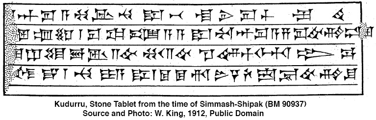
|
|||
| Simbar-Shipak | 1021 BC - 1004 BC | Simbar-Shipak, (also known as Simbar-Shiḫu) was a Babylonian king who founded the 2nd Dynasty of the Sealand, Babylon’s 5th Dynasty. He conducted a program of restoration of a number of temples that had been destroyed earlier by the marauding Arameans and the Sutû. Simbar-Šiḫu BM 90937, held in the British Museum, is a Babylonian boundary stone (kudurru) from the reign of King Simbar-Shihu (also known as Simmash-Shipak), who reigned approximately 1025–1008 BC Simbar-Šipak lived during turbulent times, where crop failures and almost constant conflicts with semi-nomadic migrants caused the Babylonian government of the preceding 2nd Dynasty of Isin to fall. As a soldier from the southern region of Mesopotamia, he emerged to stabilise the situation. He reigned for 18 years according to the King List A, 17 years according to the Dynastic Chronicle which names him Simbar-Šiḫu, 'knight of the Sealand', son of Eriba-Sin, an individual otherwise unknown, and soldier of the dynasty of Damiq-ilišu/ The dynasty ruled during a period of significant disruption, where Aramaean and Sutian tribes were migrating into Babylonia from the west and looting religious sites. The dynasty consisted of three kings, including founder Simbar-Shipak (c. 1020–1003 BCE) and a short-lived usurper named Zeri, who reigned for only three months. It was the first of four dynasties (including Bazi and Elamite) that controlled Babylon after the Second Dynasty of Isin. Founded by Simbar-Shipak, a Kassite leader, this dynasty emerged amid Aramean and Sutian invasions to defend holy sites, but quickly collapsed due to instability, replaced by a second Kassite Dynasty (Dynasty VI) The dynasty was replaced by a second Kassite Dynasty (Dynasty VI) around 1003 BC. | |
| Ea-mukin-zēri | 1004 BC | Ea-mukin-zēri succeeded Simbar-Shipak as king of Babylon. He was likely the assassin who ended Simbar-Shipak's reign and took the throne, initiating a brief period of instability. Ea-mukin-zēri, son of Hašmar was the second king of the second Sealand or 5th Dynasty of Babylon, but only for 3 months, according to the Dynastic Chronicle, 5 months according to the Kinglist A. The Dynastic Chronicle notes that 'he was buried in the swamp of Bit-Hašmar' presumably an ancestral homeland and possibly Darband-i-Ḫān, where the Diyala breaks through the Bazian range, at the northeast boundary of Namri according to Levine or southern Babylonia according to Brinkman The practice of interring Mesopotamian kings in wetlands, 'close to the abode of Enki' was a common practice at the time. After Ea-mukin-zēri's short reign of a few months, Kashu-nadin-ahhe took the throne. | |
| Kashu-nadin-ahhe | 1003 BC - 1001 BC | Kashu-nadin-ahhe was the third and final king of the second Sealand Dynasty of Babylon. His brief three-year reign was marked by distressed times. There was a famine so severe that it caused the suspension of the regular food and drink offerings at the Ebabbar, or white house, temple of Šamaš in Sippar. Although the Dynastic Chronicle records he was interred in a palace, its name is not preserved. | |
The Bazi or Bῑt-Bazi dynasty (c. 1004–985 BC) was a short-lived ruling house in Babylon, following the Second Dynasty of Sealand during the early 1st millennium BC, comprised of three kings: Eulmash-shakin-shumi, Ninurta-kudurri-usur I, and Shirikti-Shuqamuna. It represents a period of political instability and decline following the Second Dynasty of Isin, characterised by Kassite-related names and brief, unremarkable reigns. The period was defined by the breakdown of central authority, increased invasions by nomadic groups like the Aramaeans, and a general decline in the power of the Babylonian state. 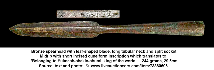
|
|||
| Eulmash-shakin-shumi | 1004 BC - 985 BC | Eulmash-shakin-shumi was the founder of the 6th Dynasty of Babylon, known as the Bῑt-Bazi Dynasty, after the Kassite tribal group from which its leaders were drawn. A small settlement near the Tigris in the 23rd century had been adopted by a minor Kassite clan by the 14th century, the name being co-opted as the ancestor figure for the tribe. In the midst of the turmoil inflicted by the Aramean migrations and the famines that drove them, Eulmaš-šākin-šumi seems to have seized the throne and possibly moved his capital to Kar-Marduk, a hitherto unknown location presumed to be less vulnerable to invasions of semi-nomads than Babylon. The Sun God Tablet of Nabu-apla-iddina relates that Ekur-šum-ušabši, the priest and seer appointed during the time of Simbar-šipak, complained that due to the “stress and famine under Kaššu-nādin-aḫi,” an intermediate monarch, "the temple offerings of Šamaš (had) ceased," prompting Eulmaš-šākin-šumi to divert flour and sesame wine from that allocated to the god Bel and a garden in the new city district of Babylon for ongoing provisions. The Dynastic Chronicle reports that 'he was buried in the palace of Kar-Marduk'. | |
| Ninurta-kudurri-usur I | 983 BC - 981 BC | Ninurta-kudurrῑ-uṣur I was the second king of the Bῑt-Bazi or 6th Dynasty of Babylon and he reigned for three years, according to the King List A. This was during an era of economic and political retrenchment. The Bīt-Abi-Rattaš kudurru from the reign of Nabû-mukin-apli, circa 974 BC – 939 BC, begins with a recollection of an earlier legal document from Kār-Marduk, which may have been his capital, dated to his second year. It concerns a manslaughter settlement, where one Arad-Sibitti has killed the female slave of Buruša the bow-maker, ironically with an arrow. The king pronounced judgement and commanded Arad-Sibitta to give the plaintiff seven slaves in compensation and this was witnessed by seven high-ranking witnesses, of whom three were of Kassite origin and one, Ammenna, the officer, a Hurrian. He may be represented by the eleventh king in the Prophecy A whose rule likewise endures for three years. This describes the apocalyptic events of the king’s reign with cities being destroyed, rebellion, hostility against Akkad, disconnection from the rites at the Ekur and Nippur, and fragmentary but ominous events involving the Amurru and weapons. He was succeeded by his brother Širikti-Šuqamuna. | |
| Shirikti-Shuqamuna | 981 BC | Shirikti-Shuqamuna succeeded his fellow 'son of Bazi' Ninurta-kudurrῑ-uṣur I, as 3rd king of the Bῑt-Bazi or 6th Dynasty of Babylon and exercised the kingship for just 3 months, an insufficient time to merit an official regnal year. He was the last monarch of the Bīt-Bazi dynasty, which had reigned for 20 years 3 months according to the King List A, and a contemporary of the Assyrian king Aššur-rabi II, 1012 BC – 971 BC. He was named for the Kassite god of war and of the chase, Šuqamuna, one of the two (with Šumalia) associated with the investiture of kings. The Dynastic Chronicle records that he was interred in a palace. | |
Elamite, 980–975 BC: A brief period of foreign rule. The Seventh Dynasty of Babylon, also known as the Elamite Dynasty, was a short-lived ruling line in the early 10th century BC (circa 980 BC). It consisted of a single ruler, Mār-bīti-apla-uṣur, who was of Elamite origin. 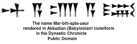
|
|||
| Mar-biti-apla-usur | 980 BC - 975 BC | The circumstances surrounding the fall of the previous Bazi dynasty and the ascendancy of Mar-biti-apla-usur are unknown. His name was wholly Akkadian and he was described as a remote descendant of Elam. There are no known rulers of Elam bearing Akkadian titles, but his reign coincides with a blank period in Elamite political history. He was a contemporary of Assyrian king Aššur-reš-iši II. His rule endured for six years and he was buried in the palace of Sargon suggesting an interment suitable for a rightful king. | |
The Eighth Dynasty of Babylon, 974 BC – 732 BC, often referred to in historical context as the Dynasty of E, was a period of relative instability and obscurity in the 8th century BC, following the Dynasty of Bazi and preceding the Ninth Dynasty (or Assyrian domination). It was characterised by weak native rule and the continued infiltration of Aramean and Chaldean tribes. 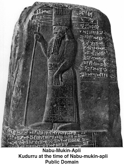
|
|||
| Nabu-Mukin-Apli | 974 BC - 939 BC | Nabu-Mukin-Apli founded Babylon’s 8th dynasty, the so-called Dynasty of E, and ruled for thirty-six years. The chronology of the Eighth Dynasty is fragmented, as primary sources like King List A are incomplete for this period. This era represents a low point in Babylonian history when the city was frequently under foreign influence or threat, particularly from Assyria and new West Semitic settlers. It serves as a transitionary period between the earlier, chaotic Kassite-influenced eras and the later, more powerful Neo-Babylonian Empire. The Synchronistic Kinglist records Nabu-Mukin-Apli as a contemporary of the Assyrian king Tiglath-Pileser II. His reign was plagued by Aramean invasions, resulting in Babylon being cut off from its agricultural hinterland for several years and consequently being unable to celebrate the new year festival. His reign falls in the midst of the Babylonian dark age and consequently his ancient sources are meagre. He is mentioned in the The Akitu festival, or New Year’s festival of Marduk and Nabû, was interrupted several times, indeed for a stretch of nine straight years, because the 'Aramaeans were belligerent'. While records are incomplete, Nabû-mukin-apli (ruled 36 years) is the best-documented king, known for stabilising the realm despite these threats. His younger son, Rīmūt-ilī, acted as šatam ekurrāti, overseer of the temples. He was succeeded by his other sons, firstly Ninurta-kudurri-uṣur II, for 8 months, and then Mar-biti-aḫḫe-idinna for an as yet undetermined period. | |
| Ninurta-kudurri-usur II | 939 BC | Ninurta-kudurrῑ-uṣur II, was the second king of the Dynasty of E, a sequence of mixed dynasties, of Babylon; he reigned for 8 months 12 days, according to the King List A. No contemporary documents survive for his reign or that of his successor, his younger brother, Mār-bῑti-aḫḫē-idinna. The Religious Chronicle may have been written during his reign, as it ends with events relating to the reign of his father although the only copy that we have is written in the Neo-Babylonian script and is consequently late. His reign was possibly too insignificant to warrant mention in the Eclectic Chronicle. | |
| Mar-biti-ahhe-iddina | 939 BC - 920 BC | Mar-biti-ahhe-iddina, the third of the sons of Nabu-mukin-apli, is known only from king lists, a brief mention in a chronicle and as a witness on a kudurru from his father. He took the throne after the death of his elder brother Ninurta-kudurri-utsur II, is almost completely unknown. He was first recorded as a witness to a property title in a kudurru inscription along with the signatures of his brothers Ninurta-kudurri-utsur II and Rimut-ili, a temple administrator, in the 25th year of the reign of his father Nabu-mukin-apli, more than ten years before his accession to the throne. The Synchronic History records him, like his father and elder brother, as contemporaries of the Assyrian king Tiglath-pileser II , which is consistent with the modern chronology of the time. However, we have no idea of the length and extent of his reign, and we do not know whether his successors to the throne were related to him. The reign of Mar-biti-ahhe-iddina may have ended considerably earlier than 920 BC, but it must be taken into account that the next king, Shamash-mudammik, somewhere around 905 BC, waged war with the Assyrian king Adad-nirari II, who came to the throne around 912 BC, and that no intermediate ruler is known between Mar-biti-ahhe-iddina and Shamash-mudammik. | |
| Shamash-mudammiq | 914 BC - 901 BC | Shamash-mudammiq succeeded Mar-biti-ahhe-iddina as the King of Babylon around 914 BC or by some accounts shortly after 920 BC. He ruled during a period of conflict with the Assyrian Empire. He was the 4th king of Babylon in a sequence designated as the Dynasty of E and ruled during the latter part of the 10th century BC. He was contemporary with the Assyrian king Adad-Nārāri II with whom he sparred. Of unknown ancestry, the duration of his reign is equally uncertain. That he followed Mār-bῑti-áḫḫē-idinna is indicated by the sequence on the Assyrian Synchronistic King List, but Assyrian contact was scanty and this may merely record those rulers who had interacted, omitting those who did not. His rule marks the resumption of contacts characterised as 'battles, alliances, shifting of borders, and (later) diplomatic marriages that seem to have bound the two countries together. He was defeated by the Assyrian king Adad-nirari II around 901 BC, which is the main fixed chronological reference for his reign. | |
| Nabu-shuma-ukin I | 900 BC - 887 BC | Nabû-šuma-ukin I, was the 5th king listed in the sequence of the so-called dynasty of E, possibly a mixed series of dynasties, that ruled over Babylon during the early Iron Age. His rule marks a temporary resurgence in the fortunes of Babylonia, which was to last on through his son and successor, Nabû-apla-iddina’s reign and the two kings who followed in this four-generation dynasty. The circumstances of his ascendancy and his relationship with his predecessor are not known. The beginning of his reign was marked by war with Assyria when Adad-Nārāri II swept down on his second campaign and supposedly defeated him according to the Assyrian version, apparently sacking several cities and hauling their 'vast booty' back home. The outcome may not have been quite so one-sided as described as the Assyro-Babylonian border was pushed back north to the basin of the Lesser Zab. His relations for the remainder of Adad-Nārāri’s time and with the next Assyrian monarch, Tukulti-Ninurta II, in contrast were good, and he made an entente cordiale and exchanged daughters in marriage with one of them, the Synchronistic Chronicle being too fragmentary here to be sure which one, auguring in an extended period of peaceful relations. | |
| Nabu-apla-iddina | 886 BC - 853 BC | Nabu-apla-iddina was the sixth king of the Dynasty E of Babylon and he reigned for at least thirty-two years. During much of Nabû-apla-iddina's reign Babylon faced a significant rival in Assyria under the rule of Ashurnasirpal II. Nabû-apla-iddina was able to avoid both outright war and significant loss of territory. There was some low level conflict, including a case where he sent a party of troops led by his brother to aid rebels in Suhu. Later in his reign Nabu-apla-iddina agreed to a treaty with Ashurnasirpal II’s successor Shalmaneser III. Internally Nabu-apla-iddina worked on the reconstruction of temples and something of a literary revival took place during his reign with many older works being recopied. The 9th century BC was marked by a recovery of sorts after the terrible instability of the preceding hundred and fifty years when Aramaean tribes had wantonly raided into Mesopotamia. He was the second of four successive generations of a single family to rule. His father, Nabû-šuma-ukin I, had preceded him and he was to be succeeded by his son, Marduk-zakir-šumi I. The Synchronistic Kinglist gives his Assyrian contemporary as Aššur-nāṣir-apli II although his reign extended on into that of Šulmānu-ašarēdu III. He provided troops to the state of Suḫu in the middle Euphrates valley as part of its 878 BC revolt against Aššur-nāṣir-apli II. Kudurru, the governor of the fortress of Suru had defiantly refused to pay the Assyrians tribute, provoking their wrath. Nabû-apla-iddina's own brother Zabdanu and the diviner Bel-apli-iddina led the army of 3000 and following their defeat were taken prisoner. Although Aššur-nāṣir-apli claimed to have conquered the border fortresses Hirimmu and Harutu in his own inscriptions, this may be a restatement of his father, Tukulti-Ninurta II’s campaigns. His reign marks the last time a governor of Isin was to appear as a prominent official in a legal document, and the roles of Kassites were to be central to the monarchy, occupying high positions at court. The province of Chaldea in southern Babylonia was first mentioned and the šakin temi begins to serve as regional governor. There was a shift in fashion, where, for example, the feathered crown is replaced by a peaked dome as a headdress of the king. His inscriptions adorn perhaps five kudurrus, a possession inscription of his eldest son, and he is referenced in three Assyrian kinglists and two chronicles. Towards the end of his reign he concluded a treaty with Šulmānu-ašarēdu III which was to prove instrumental in stabilising his successor Marduk-zakir-šumi I’s rule, following the revolt of his brother, Marduk-bēl-ušati. His reign is mentioned in a later copy of an offering list of aromatics used in the cult of Marduk in the Esagila at Babylon, and in a contemporary temple ordinance tablet distributing meats in the Eanna temple in Uruk. There is some evidence for a literary revival, with fresh editions of the Utukkū Lemnūtu series and the Sakikkū texts prepared, and for the sharing of a scribe between the Babylonian and Assyrian courts. Kabti-ilani-Marduk’s work, the Epic of the plague god Erra, is sometimes dated to his reign and is certainly of this period. | |
| Marduk-zakir-shumi I | 853 BC - 819 BC | Marduk-zakir-shumi I was a contemporary of the Assyrian kings, Salmānu-ašarēdu III (commonly known as Shalmaneser III) (859–824 BC) and Šamši-Adad V (824–811 BC) with whom he was allied. There are few contemporary inscriptions bearing witness to his reign. During his campaign, Salmānu-ašarēdu captured the city of Baqani, extracting tribute from Adini of Bit-Dakkuri, also from Mušallim-Marduk of the Amukani and the leader of the Yakin tribes, the earliest attestation of these Chaldean groups, and made a pilgrimage to Babylon where he recounted 'I ascended to Esagila, the palace of the gods, the abode of the king of all'. He practiced his religious devotions at other cultic shrines as his Black Obelisk recalls 'I went to the great urban centres. I made sacrifices in Babylon, Borsippa and Kutha'. A relief from the front of his throne base depicts him gripping Marduk-zâkir-šumi’s hand in a public display of Assyro-Babylonian friendship. The kings are flanked by beardless youths identified as the crown princes and presumed to be Šamši-Adad V and Marduk-balāssu-iqbi, who would eventually come to conflict. | |
| Marduk-balassu-iqbi I | 818 BC - 813 BC | Marduk-balassu-iqbi I was the 8th king of the Dynasty of E of Babylon. He was the successor of his father, Marduk-zākir-šumi I, and was the 4th and final generation of Nabû-šuma-ukin I's family to reign. He was contemporary with his father's former ally, Šamši-Adad V of Assyria, who may have been his brother-in-law, who was possibly married to his (Marduk's) sister Šammu-ramat, the legendary Semiramis, and who was to become his nemesis. He was recorded as a witness on a kudurru dated to his father's 2nd year, 25 years before he ascended the throne, suggesting he was fairly elderly when he assumed power. He seems to have made his capital at Gannanāti, a town on the Diyāla River. He engaged in construction activity in Seleucia, and exerted control over territory encompassing both Dēr and Nippur. His officials, like him, seem to have received their positions through inheritance, such as Enlil-apla-uṣur, the šandabakku or governor of Nippur, and the sons of Tuballiṭ-Ešdar, the sukkallus (court personnel) and šākin ṭēmi (a regional governor), suggesting weak central authority and some local autonomy in the provinces. | |
| Baba-aha-iddina | 812 BC | Baba-aha-iddina was the successor to Marduk-balassu-iqbi, the king of Babylon. Following the defeat and capture of Marduk-balassu-iqbi by the Assyrian king Shamshi-Adad V in 813 BCE, Baba-aha-iddina took the throne for a brief period before he was also captured during subsequent Assyrian campaigns. He was captured in 813 BCE by Shamshi-Adad V of Assyria. Šamši-Adad V encircled the city and he himself took it. He took Bāba-aḫa-iddina with his wealth and palace treasures to Assyria. He went up to Cutha, Babylon and Borsippa an) performed the sacred services. He went down to Chaldea. In Chaldea he received the tribute of its kings. His officers collected gifts from Karduniaš. Together they established a permanent boundary line. Šamši-Adad made no attempt to annex Babylonia which remained independent, though kingless for a period, but returned to Assyria where he spent his last year. | |
| 'Ninurta-apla-X' | Before 790 BC | Baba-aha-iddina was succeeded by a period of chaos, often termed an interregnum or represented by, in this case, the placeholder 'Ninurta-apla-X'. Placeholders are used by scholars, and have been for thousands of years. For example, ancient Egyptian scribes used specific placeholder names, 'Hudjefa' or 'Sedjes', which literally mean 'erased' or 'missing', to designate older pharaohs in king lists whose names had been lost. During the interregnum there was no king for several years. The only records of events during this period come from the chronicles of the Assyrian eponym dating system. The successor to 'Ninurta-apla-X' (whoever that might have been, and whatever his actual name might have been) was the similarly obscure king, Marduk-bēl-zēri. 'Ninurta-apla-X' is a placeholder used by Assyriologists to represent an incomplete ancient Mesopotamian royal or official name, typically from the Neo-Assyrian period. It indicates a name beginning with the god Ninurta (the deity of agriculture, war, and hunting) followed by 'apla' (son) and an unknown or missing final element, designated as 'X'. We still use placeholders now for things which we do not know the proper names for, like geographical/site names - many cultures are named after the modern village, mountain, or site where their remains were first excavated. Examples include Göbekli Tepe (Turkey) or Hopewell (Ohio), which refer to archaeological sites rather than the original name of the people. Also, cultures are often identified by their artefacts, such as the Bell Beaker Culture or Linear Pottery Culture. | |
| Marduk-bel-zeri | 790 BC - 780 BC | Marduk-bel-zeri was one of the kings of Babylon during the turmoil following the Assyrian invasions of Šamši-Adad V. He is identified on a Synchronistic King List fragment as Marduk-[bēl]-x, which gives his place in the sequence and reigned around the beginning of the 8th century BC. He was a rather obscure monarch and the penultimate predecessor of Erība-Marduk who was to restore order after years of chaos. He is known from a single economic text from the southern city of Udāni dated to his accession year. This city was a satellite cultic center to Uruk, of uncertain location but possibly near Marad, later to be known as Udannu. He is tentatively restored to the Dynastic Chronicle where he is described as a soldier but his circumstances are otherwise unknown. His successor was Marduk-apla-uṣur. | |
| Marduk-apla-usur | 780 BC - 769 BC | Marduk-apla-usur was an 8th century BC Chaldean tribal leader who ruled as King of Babylon after the reign of Marduk-bēl-zēri. He is known only from three inscriptions and ruled during a period of chaos. He should not be confused with the Marduk-apla-uṣur who ruled Suḫi on the middle Euphrates and paid tribute to Salmānu-ašarēdu III a generation or so earlier. His Assyrian contemporaries were probably Salmānu-ašarēdu IV (783 - 773 BC) and/or Ashur-dan III (773 - 755 BC) and the latter is known to have campaigned in northern Babylonia on three occasions: 771 BC (against Gannanāti), 770 BC (against Marad) and 767 BC (against Gannanāti again). Into the vacuum created by the devastation, the southern Chaldeans were able to rise to power and he seems to have been the first member of the tribal group to have made pretensions to the Babylonian throne. His place in the sequence of kings is known from a Synchronistic King List fragment. His length of reign and dynastic affiliation are unknown, as he was recorded as belonging to a separate affiliation from his predecessor and successor, but the Dynastic Chronicle records that 'the dynasty of Chaldea was terminated. Its kingship was transferred to the Sealand' and, as his successor was Erība-Marduk, the archetypal ancestor figure of the later Chaldean monarchs, it is surmised his origins were with a different Chaldean group than that of Erība-Marduk's Bīt-Yakin tribe. He is mentioned in a fragmentary Neo-Babylonian narrative text from Uruk ('The Crimes and Sacrileges of Nabu-šuma-iškun') which provides no further enlightenment about his time apart from a passing observation that 'forced labor and corvée (unpaid labour owed by a vassal to his feudal lord) were imposed'. His successor was Erība-Marduk. | |
| Erība-Marduk | 769 BC - 761 BC | Erība-Marduk was the king of Babylon, very speculatively during circa 769 BC – 761 BC. He was one of three Chaldaean tribal leaders to occupy the Babylonian throne during the course of the 8th century and would be looked back on as the ancestor figure during future reigns of members of this group. A member of the Bīt-Yakin tribe, who was later to be given the title 're-establisher of the foundations of the land', was credited with restoring stability to the country after years of turmoil. He participated in the Akītu, or new year festival, first in the beginning of the second year of his reign, as his rule extended into northern Babylonia and he suppressed the incursions of nomads around Babylon and Borsippa, restoring fields and orchards to their former owners. An inscription of Esarhaddon of Assyria (681 BC – 669 BC), relates how part of the temple of Ištar in the Eanna at Uruk, the shrine of the goddess Nanaya originally built by Nazi-Maruttaš in the 13th century, had been restored by Erība-Marduk. Not all restorations, however, were to the liking of his successors. According to the Harran stele of Nabonidus (555 BC –539 BC), his reign witnessed a sacrilegious reform of the cult of Ištar (bēltu ša Uruk, 'lady of Uruk'), when the people of Uruk replaced her statue with an unsuitable one, unyoking its team of lions and removing its shrine. This may have been part of a program of suppressing the licentious cults of the goddesses in southern Babylonia. His successor was Nabû-šuma-iškun | |
| Nabu-shuma-ishkun | 761 BC - 748 BC | Nabu-shuma-ishkun was king of Babylon, speculatively circa 761 – 748 BC , and ruled during a time of great civil unrest. He came from the Bīt-Dakkūri tribe, a Chaldean group apparently unrelated to that of his immediate predecessor, Erība-Marduk. An inscription of the governor of Borsippa, Nabû-šuma-imbi highlights his weakness and the autonomy of his regional officials. A barrel cylinder records the struggle over the control of their fields in the face of the incursions of marauders from Babylon and Dilbat, as well as Chaldeans and Arameans. At night, the city streets and its temple area were transformed into a battleground. During the fifth and sixth years of the king, the strife was so great that the cultic idol of Nabû was prevented from participating in the Akītu, or new year festival in Babylon. The coincidental recording of years five and six of a no longer legible ruler in the Chronicle of the Market Prices has led this reference to be assigned to him. In the king’s eighth year, Nabû-šuma-imbi was able to install a certain Nabû-mutakkil as a temple official[i 1] and repair the Ezida temple of Nabû storehouses. He is the main subject of a chronicle,[i 7] "The Crimes and Sacrileges of Nabu-šuma-iškun", uncovered in Uruk in a Seleucid era dwelling belonging to the exorcist Anu-ikṣur on the Parthian mound southeast of the Eanna complex, whose underlying theme is his violation of all moral and legal principles and consequentially – and his ignominious demise. His crimes included 'burning alive sixteen Cutheans at Zababa's gate in the heart of Babylon' and 'he committed insult and unspeakable slander' of a certain Iltagal-il of the town Dur-ša-Karbi, and 'a leek, a thing forbidden in the Ezida, he brought to the temple of Nabû and gave to eat to the one 'entering the temple'(i.e. the priest)' apparently an unforgivable act. Unfortunately the Chronicle was damaged in antiquity so how he met his comeuppance is not preserved. The length of his reign is uncertain, as it is not preserved in chronicle or king list references, but his reign is known to have ended in 748 BC as the chronology is fixed from the reign of Nabû-Nasir onward, and there is a legal text recording the sale of a plot of land, and a grain receipt dated to his tenth year, and two economic texts to his thirteenth year. His successor was Nabû-Nasir. | |
| Nabonassar | 747 BC - 734 BC | Nabonassar deposed a foreign Chaldean usurper named Nabu-shuma-ishkun, bringing native rule back to Babylon after twenty-three years of Chaldean rule. His reign saw the beginning of a new era characterised by the systematic maintenance of chronologically precise historical records. Both the Babylonian Chronicle and the Ptolemaic Canon begin with his accession to the throne. He was contemporary with the Assyrian kings Aššur-nirarī V (755 BC – 745 BC) and Tiglath-Pileser III (745 BC – 727 BC), under the latter of whom he became a vassal, and the Elamite kings Humban-Tahrah I (reigned until 743 BC) and Humban-Nikaš I (742 BC – 717 BC). Nothing is known of his provenance or origin, although it appears he was a native Mesopotamian. His three predecessors were from the migrant Chaldean tribes settled in the far south east of Babylonia since the 9th century BC. The Dynastic Chronicle may have been composed during his reign as it records the succession of kings from the antediluvian era down to his immediate predecessor, Nabû-šuma-iškun. It records that the 'dynasty of Chaldea was terminated' (with Nabû-šuma-iškun) and 'its kingship was transferred', but the remainder is lost. He may also have commissioned a vituperative chronicle which vilifies his predecessor for his sacrilegious actions and the Chronicle of the Market Prices which mentions the volatile costs of various commodities in reigns up until that of his predecessor. His name appears in the Eclectic Chronicle but the context has not been preserved. His reign marks the reform of the Babylonian calendar, introducing regular calculated intercalary months, the eighteen-year cycle texts (the 223-month Saros Cycle, named for Edmund Halley’s misreading of a passage in Pliny) and perhaps even the zodiac. Berossus of Kos reported, in an account preserved by Syncellus, that it was from the reign of Nabû-nāṣir onward that the movements and duration of the stars were recorded. He noted in his work Babyloniaca that: 'He gathered the records of his predecessors and destroyed them, thus ensuring that the history of the Chaldean kings began with him.' According to Claudius Ptolemy in his work Almagest, this gave rise to an era beginning at noon on 26 February 747 BC, when the Anno Nabonassari began, but prior to the Hellenistic period there is no trace of this era. The Babylonian Chronicle, covering the years 747 BC to 668 BC, the best preserved exemplar of this genre, was possibly collated from Babylonian astronomical diaries, although the earliest exemplar of these dates to 652 BC. The lists of celestial phenomena started with the lunar eclipse of 747 BC – 746 BC (6 February 747 BC), a spectacular conjunction of the moon and the planets which may have inspired the commencement of recording of accurate astronomical observations. The country regained from Nabû-šuma-iškun was one riven by internal divisions and conflicts with the immigrant tribes of Arameans and Chaldeans, where the central authority was greatly diminished. In Nabû-nāṣir's third year, the Assyrian general Tukultī-apil-Ešarra, better known under the Hebraic rendition 'Tiglath-Pileser III', came to power in the Neo-Assyrian Empire, overthrowing the existing regime, and in the first of two campaigns to secure his southern and eastern frontiers invaded Babylonia. During the first of these (745 BC) he sacked Rabbilu and Hamranu, abducted the gods of Šapazza, subjugated the numerous Aramean and Chaldean tribes, and destroyed the capital of the Chaldean tribe the Bit-Shilani, Sarrabanu, impaling its leader, Nabû-ušabši. His forces skirted the metropolitan areas of Dur-Kurigalzu and Sippar and may have reached as far as the region of Nippur. Whether or not he actually solicited military aid from the Assyrians, Nabû-nāṣir seems to have been the main beneficiary of these actions as his regime was stabilised and he was subsequently able to put down a revolt in Borsippa. His hold over Uruk remained tenuous, as two local dignitaries complained of the neglect of the Akītu temple in their inscription[i 7] commemorating their own restorations, usurping monarchic privilege. Twenty-three tablets survive dealing with agricultural production, animal husbandry, weaving and sales from his first to his fourteenth year and these seem to represent a recovery in economic activity. A letter archive excavated in 1973 in Nippur contains the correspondence between Kudurru the šandabakku, or governor, of Nippur and an individual of this name who is greeted as 'brother', which may be him. He is recorded as having succumbed to illness and died in his palace during the fourteenth year of his reign. He was succeeded by his son, Nabû-nādin-zēri, the only known hereditary succession in Babylonia in a period from 810 BC to the rise of the Neo-Babylonian Empire in 626 BC. His successor was Nabû-nādin-zēri. | |
| Nabu-nadin-zeri | 733 BC - 732 BC | Nabu-nadin-zeri's accession followed shortly after the first incursions of the newly emboldened Neo-Assyrian state. He was one of the kings who were contemporary with Tukultī-apil-Ešarra III, the Assyrian king who would later (729 BC) go on to conquer Babylon. In the second year of his reign, he was toppled and killed in an insurrection led by a provincial official named Nabû-šuma-ukīn, who in turn was to retain the throne for little more than one month. There are no known texts from his reign. The overthrow of his dynasty and its replacement by a usurper may have provided Tukultī-apil-Ešarra with the excuse to invade. His successor was Nabû-šuma-ukīn II. | |
| Nabu-suma-ukin II | 732 BC | Nabu-suma-ukin II is only known from the Kinglist A, was a usurper and briefly king of Babylon for one month and two days during 732 BC before he was swept aside by his successor, Nabû-mukin-zēri. His reign was so fleeting he was omitted from the Ptolemaic Canon. His Assyrian contemporary was Tukultī-apil-Ešarra III who was too distracted campaigning in Syria to react to political events. He came to power as a disaffected former provincial governor leading a rebellion against Nabû-nādin-zēri, the son and successor of Nabû-Nasir. He was deposed and replaced by the Chaldean chief, Nabû-mukin-zēri, of the Bīt-Amukani tribe. | |
/ Dynasty IX (Assyrian) The Ninth Dynasty of Babylon, or Dynasty IX (Assyrian) refers to a specific period in the Babylonian King List rather than a dynasty based in the Assyrian heartland itself. This period, which spanned roughly from 732 BC to 626 BC, represents the time when Babylon was under direct Assyrian control, domination, or vassalage during the Neo-Assyrian Empire. The first king was Nabu-mukin-zeri. 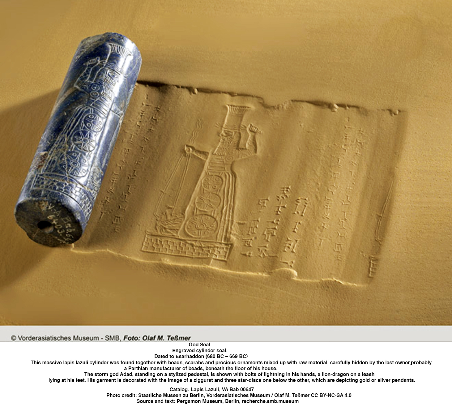
|
|||
| Nabu-mukin-zeri | 732 BC - 729 BC | Nabû-mukin-zēri was king of Babylon 732–729 BC. His reign was brought to its eventual end by the capture of the stronghold of Šapia by the forces of the Assyrian king Tukultī-apil-Ešarra III (Tiglath-Pileser III) (745–727 BC). The chief of the Chaldean Amukanu tribe in southern Babylonia, he took advantage of the instability which attended the revolt against Nabû-nādin-zēri and deposed its leader, Nabû-šuma-ukîn II. The fortuitous discovery in 1952 of a cache of diplomatic correspondence in the chancery offices of the Northwest Palace in a room designated as ZT 4 at Kalhu, modern Nimrud, by archaeologists led by Max Mallowan, has shed much light on events of the Mukin-zēri rebellion. Of the more than three hundred tablets uncovered, a group of more than twenty letters and fragments concerned the events in Babylonia which led to Assyrian intervention and subsequent annexation of the region around 730 BC. They paint a picture of Babylonia riven by splits and rivalries among the various Aramaic, Babylonian and Chaldean factions. Soon after the Amukanite removed his predecessor from the throne and seized it for himself, Tukultī-apil-Ešarra directed his efforts to the removal of the usurper using all available means at his disposal. A letter describes the outcome of a mission to Babylon to win over the support of the city's elders. The Assyrian delegation of two officers, Šamaš-bunaya and Nabû-namir, was forced to conduct its diplomacy outside the gates of the city, in full view of Nabû-mukin-zēri's representative, Asinu. 'Why do you act in a hostile manner towards us for their sake? They belong among the Chaldeans! It is the Assyrian king who can show favours towards Babylon, maintaining your civic privileges!' Tukultī-apil-Ešarra's invasion of 731 BC caused Nabû-mukin-zēri to flee Babylon for Šapia, his stronghold in the south, where he remained holed up while the Assyrian forces devastated its surroundings and felled its date palms. The Chronicle on the Reigns from Nabû-Nasir to Šamaš-šuma-ukin describes the final outcome: 'In the third year, the Assyrian king having come down to Akkad, he ravaged Bīt-Amukanu and captured Nabû-mukin-zeri. He subsequently ascended the throne in Babylon himself. | |
| Tiglath-Pileser III | 729 BC - 727 BC | Tiglath-Pileser III, the King of Assyria, succeeded Nabu-mukin-zeri as King of Babylon in 729 BC. After conquering Babylon and defeating Nabu-mukin-zeri, who was a Chaldean warlord, Tiglath-Pileser III assumed direct control, uniting the thrones of Assyria and Babylon until his death in 727 BC. Tiglath-Pileser III was one of the most prominent and historically significant Assyrian rulers. He ended a period of Assyrian stagnation, introduced numerous political and military reforms, and doubled the lands under Assyrian control. Because of the massive expansion and centralisation of Assyrian territory and the establishment of a standing army, some researchers consider Tiglath-Pileser's reign to mark the actual transition of Assyria into an empire. The reforms and methods of control introduced under Tiglath-Pileser laid the groundwork for policies enacted not only by later Assyrian kings but also by later empires for millennia after his death. After Tiglath-Pileser III's short reign, he was succeeded by his son, Shalmaneser V. | |
| Shalmaneser V | 727 BC - 722 BC | Shalmaneser V's brief reign is poorly known from contemporary sources, he remains known for the conquest of Samaria and the fall of the Kingdom of Israel, though the conclusion of that campaign is sometimes attributed to his successor, Sargon II, instead. Shalmaneser V is known to have campaigned extensively in the lands west of the Assyrian heartland, warring not only against the Israelites, but also against the Phoenician city-states and against kingdoms in Anatolia. Though he successfully annexed some lands to the Assyrian Empire, his campaigns resulted in long and drawn-out sieges lasting several years, some being unresolved at the end of his reign. The circumstances of his deposition and death are not clear, though they were likely violent, and it is unlikely that Sargon II was his legitimate heir. It is possible that Sargon II was entirely unrelated, which would make Shalmaneser V the final king of the Adaside dynasty, which had ruled Assyria for almost a thousand years. Shalmaneser V was deposed in 722 BC and replaced as king by Sargon II. The exact circumstances surrounding the struggle for the throne are not clear, but were likely violent. An awkward succession is clearly indicated by the fact that out of all of Sargon's numerous preserved inscriptions, only a single one mentions Shalmaneser V's fate in any detail, recording him as a godless tyrant who robbed Assur, Assyria's ceremonial centre, of its traditional rights and privileges. | |
| Sargon II | 722 BC - 705 BC | Sargon II is generally believed to have become king after overthrowing Shalmaneser V (r. 727–722), probably his brother. He is typically considered the founder of the Sargonid dynasty. Modelling his reign on the legends of the ancient rulers Sargon of Akkad, from whom Sargon II likely took his regnal name, and Gilgamesh, Sargon aspired to conquer the known world, initiate a golden age and a new world order, and be remembered and revered by future generations. Over the course of his seventeen-year reign, Sargon substantially expanded Assyrian territory and enacted important political and military reforms. An accomplished warrior-king and military strategist, Sargon personally led his troops into battle. By the end of his reign, all of his major enemies and rivals had been either defeated or pacified. Among Sargon's greatest accomplishments were the stabilisation of Assyrian control over the Levant, the weakening of the northern kingdom of Urartu, and the reconquest of Babylonia. From 717 BC to 707 BC, Sargon constructed a new Assyrian capital named after himself, Dur-Sharrukin ('Fort Sargon'), which he made his official residence in 706 BC. Sargon considered himself divinely mandated to maintain justice. Like other Assyrian kings, Sargon at times enacted brutal punishments against his enemies, but there are no known cases of atrocities against civilians from his reign. He worked to assimilate and integrate conquered foreign peoples into the empire and to extend to them the same rights and obligations as native Assyrians. He forgave defeated enemies on several occasions and maintained good relations with foreign kings and with the ruling classes of the lands he conquered. Sargon also increased the influence and status of both women and scribes at the royal court. Sargon embarked on his final campaign, against Tabal in Anatolia, in 705. He was killed in battle, and the Assyrian army was unable to retrieve his body, preventing a traditional burial. According to ancient Mesopotamian religion, he was cursed to remain a restless ghost for eternity. Sargon's fate was a major psychological blow for the Assyrians and damaged his legacy. Sargon's son Sennacherib was deeply disturbed by his father's death and believed that he must have committed some grave sin. As a result, Sennacherib distanced himself from Sargon. Sargon was barely mentioned in later ancient literature and nearly completely forgotten until the ruins of Dur-Sharrukin were discovered in the 19th century. He was not fully accepted in Assyriology as a real king until the 1860s. Due to his conquests and reforms, Sargon is today considered one of the most important Assyrian kings. | |
| Sennacherib | 705 BC - 681 BC | Following Sargon II's death in battle in 705 BC, Sennacherib assumed the throne, moved the capital to Nineveh, and reigned during a period of significant expansion and military campaigns, including campaigns against Judah. Immediately upon taking power, he abandoned his father's capital city, Dur-Sharrukin, and moved the royal residence to Nineveh, separating himself from his father's legacy. The second king of the Sargonid dynasty, Sennacherib is one of the most famous Assyrian kings for the role he plays in the Hebrew Bible, which describes his campaign in the Levant. Other events of his reign include his destruction of the city of Babylon in 689 BC and his renovation and expansion of the last great Assyrian capital, Nineveh. After the Babylonians and Elamites captured and executed Sennacherib's eldest son Aššur-nādin-šumi, whom Sennacherib had proclaimed as his new vassal king in Babylon, Sennacherib campaigned in both regions, subduing Elam. Because Babylon, well within his own territory, had been the target of most of his military campaigns and had caused the death of his son, he destroyed the city in 689 BC. Sennacherib transferred the capital of Assyria to Nineveh, where he had spent most of his time as crown prince. To transform Nineveh into a capital worthy of his empire, he launched one of the most ambitious building projects in ancient history. He expanded the size of the city and constructed great city walls, numerous temples and a royal garden. His most famous work in the city is the Southwest Palace, which Sennacherib named his 'Palace without Rival'. In 681 BC, Arda-Mulissu and his brother Nabu-shar-usur murdered Sennacherib, hoping to seize power for themselves. Babylonia and the Levant welcomed his death as divine punishment, while the Assyrian heartland probably reacted with resentment and horror. Arda-Mulissu's coronation was postponed, and Esarhaddon raised an army and seized Nineveh, installing himself as king as intended by Sennacherib. | |
| Esarhaddon | 680 BC - 669 BC | Esarhaddon was the third king of the Sargonid dynasty, and is most famous for his conquest of Egypt in 671 BC, which made his empire the largest the world had ever seen, and for his reconstruction of Babylon, which had been destroyed by his father. Esarhaddon's rise to the throne was difficult, he first had to defeat his brothers in a six-week-long civil war. His brothers' attempted coup had been unexpected and troublesome for Esarhaddon, and he would be plagued by paranoia and mistrust for his officials, governors and male family members until the end of his reign. As a result of this paranoia, most of the palaces used by Esarhaddon were high-security fortifications located outside of the major population centers of the cities. Also perhaps resulting from his mistrust for his male relatives, Esarhaddon's female relatives, such as his mother Naqiʾa and his daughter Šērūʾa-ēṭirat, were allowed to wield considerably more influence and political power during his reign than women had been allowed in any previous period of Assyrian history, with the possible exception of Sammuramat in the 9th century BC. Despite a relatively short and difficult reign, and being plagued by paranoia, depression and constant illness, Esarhaddon remains recognised as one of the greatest and most successful Assyrian kings. He quickly defeated his brothers in 681, completed ambitious and large-scale building projects in both Assyria and Babylonia, successfully campaigned in Media, Persia, Elam, the Arabian Peninsula, Anatolia, the Caucasus, and the Levant, defeated the Kushite Empire and conquered Egypt and Libya, enforced a vassal treaty upon the Medes and Persians and ensured a peaceful transition of power to his two sons and heirs Ashurbanipal as ruler of the empire and Šamaš-šuma-ukin as king of Babylonia after his death. | |
| Ashurbanipal | 668 BC - 631 BC | Ashurbanipal succeeded his father Esarhaddon as the king of the Neo-Assyrian Empire, reigning from 668 BC to roughly 631 BC. To avoid succession disputes, Esarhaddon appointed Ashurbanipal as king of Assyria, while his brother, Shamash-shum-ukin, was appointed king of Babylon. Ashurbanipal is generally remembered as the last great king of Assyria. He inherited the throne as his father Esarhaddon‘s favored heir. His 38-year reign was among the longest of any Assyrian king. Though sometimes regarded as the apogee of ancient Assyria, his reign also marked the last time Assyrian armies waged war throughout the ancient Near East and the beginning of the end of Assyrian dominion over the region. Ashurbanipal is chiefly remembered today for his cultural efforts. A patron of artwork and literature, Ashurbanipal was deeply interested in the ancient literary culture of Mesopotamia. Over the course of his long reign, Ashurbanipal utilised the massive resources at his disposal to construct the Library of Ashurbanipal, a collection of texts and documents of various different genres. Perhaps comprising over 100 000 texts at its height, the Library of Ashurbanipal was not surpassed until the construction of the Library of Alexandria, several centuries later. The more than 30 000 cuneiform texts that have survived from the library are a highly important source on ancient Mesopotamian language, religion, literature and science. Artwork produced under Ashurbanipal was innovative in style and motifs and is regarded to possess an 'epic quality' otherwise absent from much of the art produced under previous kings. Ashurbanipal is recognised as one of the most brutal Assyrian kings. He was one of the few rulers to boast of his gory massacres of rebellious civilians. His extensive destruction of Elam has been described as a genocide. The Assyrians won many battles under Ashurbanipal, campaigning further from the Assyrian heartland than ever before, but several of his campaigns achieved little strategic advantage. Ashurbanipal failed to maintain control of Egypt, and his wars in Arabia cost time and resources without establishing longterm Assyrian control. His extensive sack of Babylon after defeating Shamash-shum-ukin weakened the resources of the empire and fanned anti-Assyrian sentiment in southern Mesopotamia, perhaps contributing to the rise of the Neo-Babylonian Empire five years after Ashurbanipal's death. Whether Ashurbanipal's policies led to the fall of the Assyrian Empire only two decades after his death is disputed in modern Assyriology. | |
| Ashur-etil-ilani | 631 BC - 627 BC | Under Ashur-etil-ilani's rule, the empire quickly began to decline, with Ashur-etil-ilani's reign marking the start of a period of instability leading to the collapse of the empire. Aššur-etil-ilāni is an obscure figure with a brief reign from which few inscriptions survive. Because of this lack of sources, very little concrete information about the king and his reign can be deduced. It is possible that Aššur-etil-ilāni was a weak ruler as there are no records of the king ever undertaking a military campaign or going on a hunt, activities previous Assyrian kings would famously do very often; this, in turn, may have helped to entice some of Assyria's vassals, such as the Kingdom of Judah, to break free from Assyrian control and begin to act independently. Aššur-etil-ilāni was succeeded by his brother Sîn-šar-iškun under uncertain, though not necessarily violent, circumstances. The spread of inscriptions by Aššur-etil-ilāni in Babylonia suggest that he exercised the same amount of control in the southern provinces as his father Ashurbanipal had, having a vassal king (Kandalanu) but exercising actual political and military power there himself. His inscriptions are known from all the major cities, including Babylon, Dilbat, Sippar and Nippur. Too few inscriptions of Aššur-etil-ilāni survive to make any certain assumptions about his character. Excavations of his palace at Kalhu, one of the more important cities in the empire and a former capital, may indicate that he was less boastful than his father as it had no reliefs or statues similar to those that his predecessors had used to illustrate their strength and success. The lack of such depictions may partly be because there are no records of Aššur-etil-ilāni ever conducting a military campaign or going on a hunt. His Kalhu palace was quite small with unusually small rooms by Assyrian royal standards. It is possible that some of Assyria's vassals used the reign of what they perceived to be a weak ruler to break free of Assyrian control and even attack Assyrian outposts. | |
| Sinsharishkun | 627 BC - 612 BC | Sinsharishkun was the penultimate king of the Neo-Assyrian Empire. Succeeding his brother in uncertain, possibly violent circumstances, Sîn-šar-iškun was immediately faced by the revolt of one of his brother's chief generals, Sîn-šumu-līšir, who attempted to usurp the throne for himself and briefly took over much of Babylonia. Sîn-šumu-līšir was defeated relatively quickly. The Neo-Babylonian Empire, and the Median ruler Cyaxares, technically still a vassal of Assyria, then invaded the Assyrian heartland. In 614 BCE, the Medes captured and sacked Assur, the ceremonial and religious heart of the Assyrian Empire while much of the Assyrian army was occupied fighting the Babylonians, and in 612 BCE their combined armies attacked, brutally sacked, and razed Nineveh, the Assyrian capital. Sîn-šar-iškun's fate is unknown, but it is assumed that he died in the defence of his capital. He was succeeded as king only by Aššur-uballiṭ II, possibly his son, who fought his way out of Nineveh and rallied what remained of the Assyrian army at the city of Harran Despite the catastrophic fall of Assyria during his time as king, there is nothing to suggest that Sîn-šar-iškun was any less competent than his successful warrior-king predecessors who had dominated Western Asia for centuries. He employed the same tactics as his predecessors and appears to have utilised his forces rationally and strategically, fighting entirely in line with traditional Assyrian warfare. What doomed the Assyrian Empire might instead have been a combination of the weakening of Assyrian military power caused by internal revolts, the lack of an effective defensive plan for the Assyrian heartland, which had not been successfully invaded in over eight hundred years, over expansion of the Assyrian empire leading its military to be spread too thinly, combined with having to face multiple enemies in large numbers which aimed to outright destroy Assyria rather than simply conquer it. His successor was Aššur-uballiṭ II. | |
| Ashur-uballit II | 612 BC - 609 BC | Assur-uballit II was the final ruler of Assyria, ruling from his predecessor Sîn-šar-iškun's death at the Fall of Nineveh in 612 BC to his own defeat at Harran in 609 BC and failure to retake the city in 608 BC. He was possibly the son of Sîn-šar-iškun and likely the same person as a crown prince mentioned in inscriptions at the Assyrian capital of Nineveh in 626 and 623 BC. Over the course of Sîn-šar-iškun's reign, the Neo-Assyrian Empire had been irreversibly weakened by war between rival claimants to the throne. A revolt in 626–620 BC in Babylonia had seen the loss of the empire's southern provinces which would go on to form the Neo-Babylonian Empire, war against its king Nabopolassar and the Medes and attacks on its northern territories by Scythians proved disastrous for Assyria, leading to sacks and destructions of the important cities of Assur, Kalhu, Arbela, Arrapha and Nineveh between 614 BC and 612 BC. After the loss of these cities and the death of Sîn-šar-iškun, Aššur-uballiṭ II rallied what remained of the Assyrian army at Harran where, bolstered by an alliance with Egypt (former vassals of Assyria), he ruled for three years, and may have continued to fight on after the loss of all Assyrian cities. His identification as 'king of Assyria' comes from Babylonian sources. Contemporary Assyrian inscriptions suggest that the Assyrians saw Aššur-uballiṭ as their legitimate ruler, but continued to refer to him as 'crown prince' seeing as he could not undergo the traditional Assyrian coronation ceremony at Assur and thus had not formally been bestowed with the kingship by the Assyrian chief deity, Ashur. His rule at Harran came to an end when the city was seized by Medo-Babylonian forces in 610 BC. Aššur-uballiṭ's attempt at retaking it in 609 BC was repulsed whereafter he is no longer mentioned in contemporary chronicles, signalling the end of the ancient Assyrian monarchy. | |
/ Chaldean dynasty The Neo-Babylonian Empire, led by Nabopolassar and later Nebuchadnezzar II, lasting from 626 BC to 539 BC, overlapping to some extent the Ninth Dynasty of Babylon, Dynasty IX of the Neo-Assyrian empire, became the dominant power in the region, effectively acting as the successor to Assyrian authority. 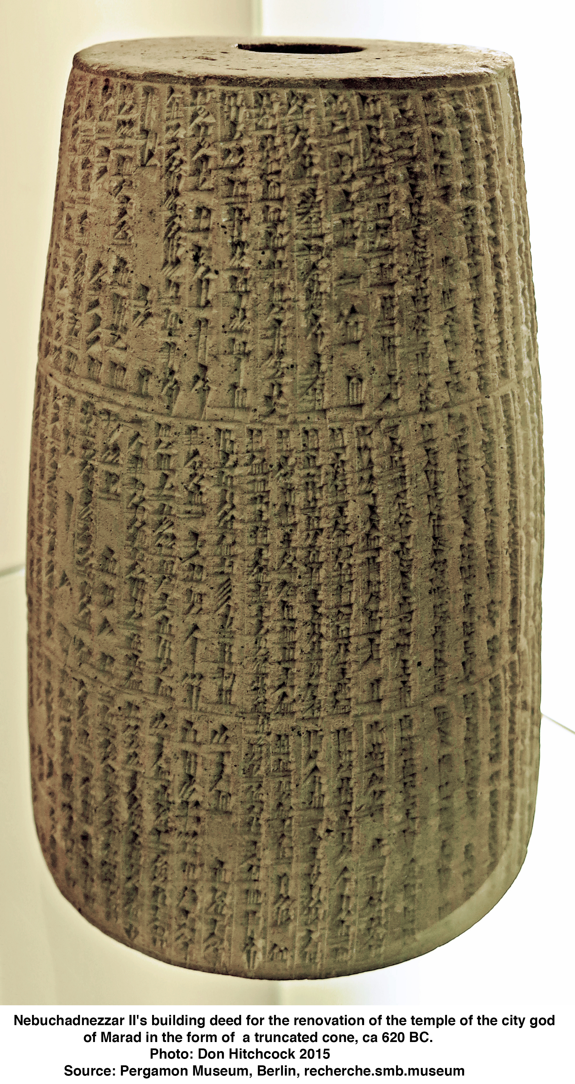
|
|||
| Nabopolassar | 626 BC - 605 BC | Nabopolassar was the founder and first king of the Neo-Babylonian Empire, and ruled from his coronation as king of Babylon in 626 BC to his death in 605 BC. Though initially only aimed at restoring and securing the independence of Babylonia, Nabopolassar's uprising against the Neo-Assyrian Empire, which had ruled Babylonia for more than a century, eventually led to the complete destruction of the Assyrian Empire and the rise of the Neo-Babylonian Empire in its place. Of unclear, possibly Chaldean origin and potentially connected to a powerful political family in the southern city of Uruk, Nabopolassar revolted against the Neo-Assyrian king Sinsharishkun at an opportune moment when Babylonia was already plagued by political instability. Though the advantage shifted back and forth dramatically several times, Nabopolassar managed to decisively push the Assyrians out of Babylonia after nearly ten years of fighting. Subsequent campaigns were intended to hinder the possibility of an Assyrian campaign directed at Babylonia through securing the border, but the intervention of the eastern Median Empire under Cyaxares in Nabopolassar's favor shifted the goals and the possibilities of the war. In 614 BC, the Medes brutally sacked the city of Assur, the religious and ceremonial heart of Assyria, and in 612 BC the Medes and Babylonians assaulted Nineveh, Assyria's capital. As with Assur before it, Nineveh was brutally sacked, with its inhabitants, including children, slaughtered en masse and the entire city being burned to the ground. Sinsharishkun probably died in its defense. Other Assyrian cities, such as Nimrud, were also assaulted and sacked much in the same way. The brutality of the Medes, including their habit of sacking even the religious temples, was so excessive that it shocked the Babylonians; contemporary Babylonian chronicles, otherwise hostile to the Assyrians, lament the sackings with sorrow and remorse. Nabopolassar's own attitude towards Assyria is unclear; in some inscriptions he is careful to ascribe his victory and its aftermath to divine intervention to rid himself of the blame, while in others he openly boasts of the destruction. The Neo-Babylonian Empire's claim to succeed the Neo-Assyrian Empire was immediately challenged by Egypt under Pharaoh Necho II, who fought for several years to restore the Assyrians, whom he was allied to, until he was defeated at the Battle of Carchemish in 605 BC. Upon his death that same year, Nabopolassar was succeeded by his son Nebuchadnezzar II. As the founder of the Neo-Babylonian Empire, Nabopolassar was long remembered by the Babylonians after his death, even beyond the fall of his empire less than a century later. In the Hellenistic period, several centuries later, Nabopolassar's legend was still remembered, with Babylonian authors casting him as a champion ordered by Marduk, Babylon's chief deity, to avenge their homeland, and as a symbol against the domination of foreign empires over Babylon. | |
| Nebuchadnezzar II | 605 BC - 562 BC | Nebuchadnezzar II was the second king of the Neo-Babylonian Empire, ruling from the death of his father Nabopolassar in 605 BC to his own death in 562 BC. Often titled Nebuchadnezzar the Great, he is regarded as the empire's greatest king, famous for his military campaigns in the Levant and their role in Jewish history, and for his construction projects in his capital of Babylon. Ruling for 43 years, Nebuchadnezzar was the longest-reigning king in the history of the Babylonian dynasty. By the time of his death, he was among the most powerful rulers in the world. Possibly named after his grandfather of the same name or after Nebuchadnezzar I, one of Babylon's greatest warrior-kings, Nebuchadnezzar II had already secured renown for himself during his father's reign, leading armies in the Medo-Babylonian conquest of the Assyrian Empire. At the Battle of Carchemish in 605 BC, Nebuchadnezzar inflicted a crushing defeat on an Egyptian army led by Pharaoh Necho II and ensured that the Neo-Babylonian Empire would succeed the Neo-Assyrian Empire as the dominant power in the ancient Near East. Shortly after this victory, Nabopolassar died and Nebuchadnezzar became king. Despite his successful military career during his father's reign, Nebuchadnezzar's early reign saw few achievements and witnessed a disastrous failed invasion of Egypt. This performance led some of Babylon's vassals to doubt Babylon's power and was the cause of brewing rebellion across his empire. After first putting down some insurrections in the east, Nebuchadnezzar turned his attention to the Levant and engaged in a string of campaigns against his rebellious vassal states. In 587 BC Nebuchadnezzar besieged Jerusalem and destroyed it and the Kingdom of Judah, deporting much of its population in what became known as the Babylonian captivity. This episode earned Nebuchadnezzar a position of notoriety in Jewish history. Through this conquest, the subsequent capture of the Phoenician city of Tyre, and other campaigns in the Levant, Nebuchadnezzar restored the Neo-Babylonian Empire's fortunes in the ancient Near East. Beyond his military campaigns, Nebuchadnezzar is remembered as a great builder who erected many of Babylon's religious buildings, including the Esagila and Etemenanki, embellished its palaces and beautified its ceremonial centre through renovations to the city's processional street and the Ishtar Gate. As most of Nebuchadnezzar's inscriptions deal with his building projects rather than military accomplishments, he was for a time seen by historians mostly as a builder rather than a warrior. | |
| Amel-Marduk | 562 BC - 560 BC | Amel-Marduk was the third emperor of the Neo-Babylonian Empire, ruling from 562 BC until his overthrow and murder in 560 BC. On account of the small number of surviving cuneiform sources, little is known of Amel-Marduk's reign and his actions as king. Amel-Marduk, originally named Nabu-shum-ukin, was not Nebuchadnezzar's eldest son nor the oldest living son at his appointment as crown prince and heir. It is not clear why Amel-Marduk was appointed by his father as successor, mainly since there appear to have been altercations between the two, possibly involving an attempt by Amel-Marduk to take the throne while his father was still alive. After the conspiracy, Amel-Marduk was imprisoned, possibly together with Jeconiah, the captured king of Judah. Nabu-shum-ukin changed his name to Amel-Marduk upon his release, possibly in reverence for the god Marduk. Amel-Marduk is remembered mainly for releasing Jeconiah after 37 years of imprisonment. Amēl-Marduk is also known to have conducted some building work in Babylon, and possibly elsewhere, though the extent of his projects is unclear. The Babylonians appear to have resented his rule, as Babylonian sources after his reign describe him as incompetent. In 560 BCE, he was overthrown and murdered by his brother-in-law Neriglissar, who thereafter ruled as king. | |
| Neriglissar | 560 BC - 556 BC | Neriglissar was the fourth king of the Neo-Babylonian Empire, ruling from his usurpation of the throne in 560 BC to his death in 556 BC. Though unrelated to previous Babylonian kings, possibly being of Aramean ancestry, Neriglissar was a prominent official and general in the reign of Nebuchadnezzar II (r. 605–562 BC) and became even more influential through marrying one of Nebuchadnezzar's daughters, possibly Kashshaya. Nebuchadnezzar was initially succeeded by his son, Amel-Marduk, but Amel-Marduk's reign only lasted for two years before Neriglissar usurped the Babylonian throne and put him to death. Through his marriage to Nebuchadnezzar's daughter, possibly significantly older than any of the old king's sons, Neriglissar might have represented a less legitimate but more wealthy and well-established faction of the royal family, even if he himself was not part of this family. The most well documented event of Neriglissar's reign is his successful 557 BC – 556 BC campaign in Anatolia against Appuwashu, king of a small kingdom in Cilicia. Neriglissar successfully captured Appuwashu's capital, Ura, as well as another city, Kirshu, before conducting an amphibious attack against a nearby island and then laying waste to mountain passes on the western border to Lydia. Shortly after returning home to Babylonia victorious, Neriglissar died in April 556 BC. He was succeeded as king by his son, Labashi-Marduk, whose reign would only last for two or three months before being deposed and killed in favour of Nabonidus. | |
| Labashi-Marduk | 556 BC | Labashi-Marduk was the fifth and penultimate king of the Neo-Babylonian Empire, ruling in 556 BC. He was the son and successor of Neriglissar. Though classical authors such as Berossus wrote that Labashi-Marduk was just a child when he became king, Babylonian documents indicate that he had been in charge of his own affairs before his rise to the throne, suggesting he was an adult, though possibly still relatively young. Labashi-Marduk's reign was very short, lasting only one to three months, with the last evidence of Neriglissar's life dating in April 556 BC and documents dated to Labashi-Marduk's successor, Nabonidus, appearing in May that same year and becoming widespread in Babylonia by the end of June. Nabonidus's son Belshazzar led a coup against the king, deposing and killing Labashi-Marduk and proclaiming Nabonidus as king. The reason for Labashi-Marduk's deposition is unknown, Berossus simply describes the justification as Labashi-Marduk having indulged in 'evil ways'. One possible explanation is that whereas Neriglissar derived his claim to the throne from having married a daughter of Nebuchadnezzar II, a previous king, Labashi-Marduk may have been wholly unconnected to the Babylonian ruling dynasty, as a result of being the son of another wife. | |
| Nabonidus | 556 BC - 539 BC | Nabonidus was the last king of the Neo-Babylonian Empire, ruling from 556 BC to the fall of Babylon to the Achaemenian Empire under Cyrus the Great in 539 BC. Nabonidus was the last native ruler of ancient Mesopotamia, the end of his reign marking the end of thousands of years of Sumero-Akkadian states, kingdoms and empires. He was also the last independent king of Babylon. Regarded as one of the most vibrant and individualistic rulers of his time, Nabonidus is characterised by some scholars as an unorthodox religious reformer and as the first archaeologist. The origins of Nabonidus, his connection to previous royalty, and subsequently what claim he had to the throne remain unclear, given that Nabonidus made no genealogical claims of kinship to previous kings. This suggests that he was neither related nor connected to the Chaldean dynasty of Babylonian rulers. However, he is known to have had a prominent career of some kind before he became king. It is possible that he was connected to the Chaldean kings via marriage, possibly having married a daughter of Nebuchadnezzar II (r. 605–562 BC). Nabonidus's mother, Adad-guppi, was of Assyrian ancestry. His father, Nabu-balatsu-iqbi, of whom little is known, may also have been either Assyrian or Babylonian. Some historians have speculated that either Adad-guppi or Nabu-balatsu-iqbi were members of the Sargonid dynasty, rulers of the Neo-Assyrian Empire until its fall in 609 BC. Nabonidus was, to his own apparent surprise, proclaimed king after the deposition and murder of Labashi-Marduk (reigned 556 BC) in a plot likely led by Nabonidus's son Belshazzar. Throughout his reign, inscriptions and later sources suggest that Nabonidus worked to increase the status of the moon god Sîn and decrease the status of Babylon's traditional national deity Marduk. Nabonidus was in self-imposed exile in Tayma, Arabia from 552 BC to 542 BC. The reason for this is unknown, though it might have been due to disagreements with the Babylonian clergy and oligarchy. Belshazzar acted as regent in Babylonia during this period, while Nabonidus continued to be recognised as the king. When Nabonidus returned to Babylonia in 543/542 BC, he escalated his religious efforts and rebuilt the Eḫulḫul, the temple dedicated to Sîn in the major northern city of Harran. Nabonidus's reign came to an abrupt end with the quick victory over his empire by Cyrus the Great in 539 BC. After the decisive battle of Opis, the Persians entered Babylon without a fight. Several sources state that Nabonidus was captured but spared, and possibly allowed leave to the region of Carmania. He may have been alive in exile as late as the reign of Darius the Great (reigned 522 BC – 486 BC). | |
The Achaemenid Persian Empire (559 BC to 330 BC) conquered Babylon in 539 BC. Led by Cyrus the Great, the Achaemenids ended the Chaldean dynasty and took control of Mesopotamia, marking the end of Babylon as an independent power and its integration into the Persian Empire. 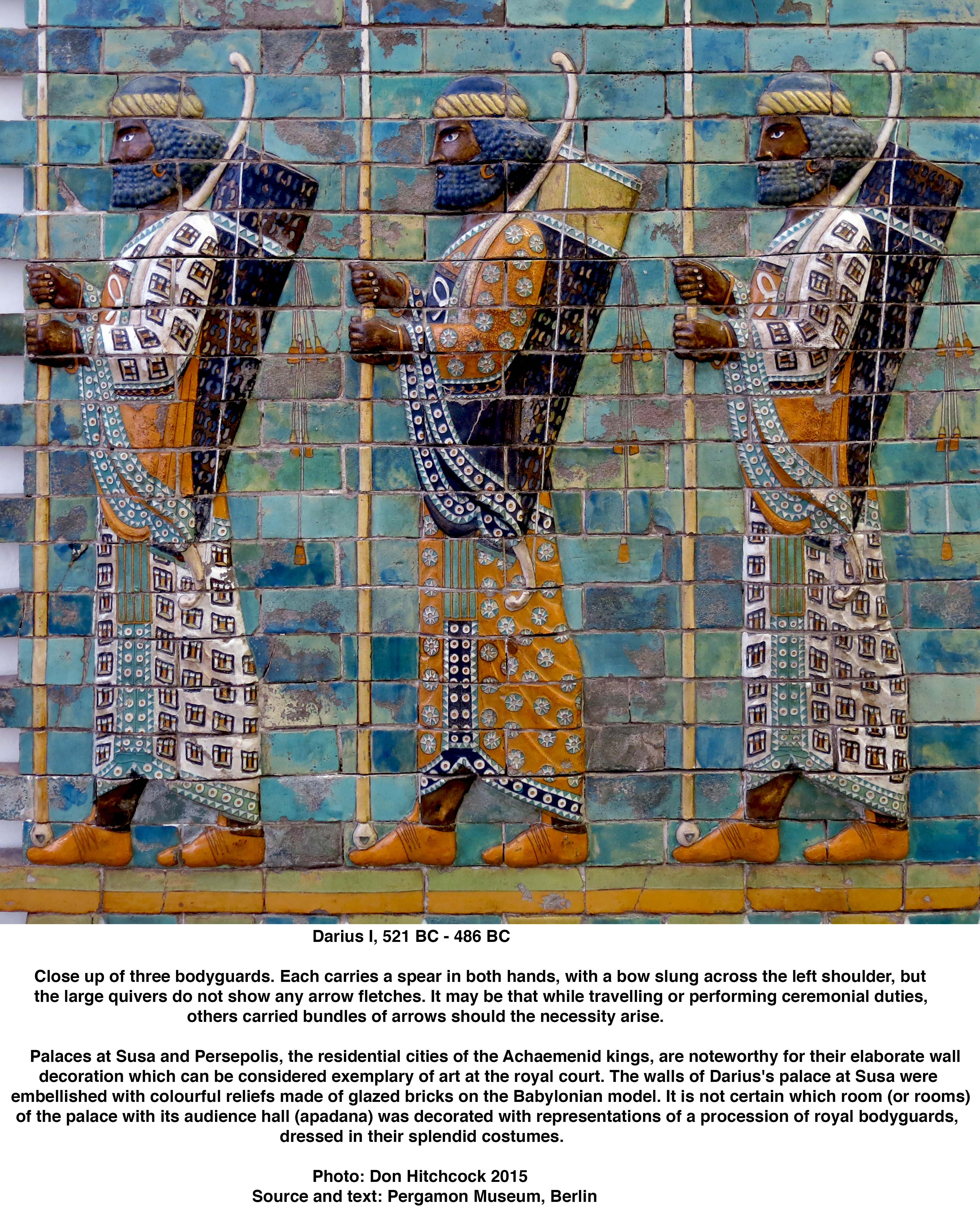
|
|||
| Cyrus the Great | 559 BC - 530 BC | Cyrus the Great is recognised as the founder of the Achaemenid Empire. Born in Persis, he brought the Achaemenid dynasty to power by defeating the Median Empire and embracing all of the previous civilised states of the ancient Near East, expanding vastly across most of West Asia and much of Central Asia to create what would soon become the largest empire in history at the time. The Achaemenid Empire's greatest territorial extent was achieved under Darius the Great, whose rule stretched from Southeast Europe and Northeast Africa in the west to the Indus Valley in the east. The beginnings of the Achaemenid Empire were, however, originally created by nomadic Persians. The Persians were Iranian people who arrived in what is today Iran circa 1000 BC and settled a region including north-western Iran, the Zagros Mountains and Persis, alongside the native Elamites. The Persians were originally nomadic pastoralists in the western Iranian Plateau. The Achaemenid Empire may not have been the first Iranian empire, as the Medes, another group of Iranian people, possibly established a short-lived empire when they played a major role in overthrowing the Assyrians. The Achaemenids were initially rulers of the Elamite city of Anshan, which is considered to be the origin of one of the world's oldest known civilisations. It was occupied continuously from before 4000 BC to 1000 BC and was politically tied to the Elamites at Susa, as well as the Mesopotamians. Cyrus the Great was from Anshan. He was born around 590–580 BC. After absorbing the Median Empire, Cyrus conquered Lydia and eventually the Neo-Babylonian Empire, granting him control of Anatolia and the Fertile Crescent, respectively. He also led a major expedition into Central Asia, where his army 'brought into subjection every nation without exception' before he allegedly died in battle with the Massagetae, a nomadic Eastern Iranian people, along the Syr Darya in December 530 BC. However, according to Xenophon of Athens, Cyrus did not die fighting and had instead returned to the capital city of Pasargadae. Regardless of the date of his death, he was succeeded by his son Cambyses II, whose campaigns led to the conquests of Egypt, Nubia, and Cyrenaica during his short reign. To the Greeks, he was known as Cyrus the Elder and was particularly renowned among contemporary scholars because of his habitual policy of tolerance for peoples' customs and religions in the lands that he conquered. Similarly, he is exalted in Judaism for his role in freeing the Jewish people from the Babylonian captivity by issuing the Edict of Restoration following the Persian conquest of Babylon. This event is described in the Hebrew Bible as the return to Zion, whereby displaced Jews were repatriated to what had been the Kingdom of Judah, thus enabling the resurgence of Jewish sovereignty in the Land of Israel. Cyrus also facilitated Jewish aspirations for a new Temple in Jerusalem in the Achaemenid Empire's Province of Judah, where the original Solomon's Temple had once stood before being destroyed during the Babylonian siege of Jerusalem. His efforts resulted in the completion of the Second Temple, which marked the beginning of the Second Temple period and Second Temple Judaism. According to the Book of Isaiah, he was anointed by Yahweh and explicitly designated 'messiah' for this task. Cyrus is the only non-Jewish figure to be revered in this capacity. In addition to his influence on traditions in both the East and the West, Cyrus is recognised for his achievements in politics and military strategy. He was influential in developing the system of a central administration at his capital city to govern the Achaemenid Empire's satraps, who worked for the profit of both rulers and subjects. Satraps in this case were provincial governors in the ancient Median and Achaemenid (Persian) Empires, acting as viceroys with significant autonomy to manage taxation, internal security, and military levies within their assigned territories (satrapies). Appointed by the king, they were usually Persian nobility who maintained order and collected taxes for the empire. His realm's prestige in the ancient world would gradually reach as far west as Athens, where upper-class Greeks adopted aspects of the culture of the ruling Persian class as their own. Likewise, Cyrus's reign played a crucial role in defining the history of Iran for well over a millennium, as future Persian empires often viewed the Achaemenid era with deference and as the ideal example to emulate. His dynasty was also instrumental in allowing Zoroastrianism to develop and spread as far east as China. To this end, he remains a cult figure in modern Iran, with his Pasargadae tomb serving as a spot of reverence for millions of the country's citizens. His successor was his eldest son, Cambyses II. | |
| Cambyses II | 530 BC - 522 BC | Cambyses II was the second King of Kings of the Achaemenid Empire.. He was the eldest son of and successor to Cyrus the Great. His relatively brief reign was marked by his conquests in North Africa, notably Egypt, which he took by defeating pharaoh Psamtik III (reigned 526 BC – 525 BC) at the Battle of Pelusium in 525 BC. After his victory in Egypt, he expanded the empire's holdings in Africa by taking Cyrenaica, the coastal region of eastern Libya. In the spring of 522 BC, Cambyses had to leave Egypt hastily to put down a revolt in Persia. En route to Syria (Eber-Nari), Cambyses somehow received a thigh wound; it soon became gangreneous. Cambyses died three weeks later in Agbatana, likely the modern city of Hama. He died childless, and was thus succeeded by his younger brother Bardiya. Bardiya ruled for a short time, and was then overthrown by Darius the Great (r. 522–486 BC), who went on to increase the power of the Achaemenids further. Before his accession, Cambyses was governor of northern Babylonia under his father Cyrus from April to December 538 BC. He held positions in Babylon and Sippar. In 530 BC, his father made him co-ruler. Cyrus then set off on an expedition against the Massagetae of Central Asia, where he met his end. Cambyses thus became the sole ruler of the vast Achaemenid Empire. According to chroniclers, he faced no opposition. | |
| Bardiya | 522 BC - 522 BC | Bardiya or Smerdis was a son of Cyrus the Great and the younger brother of Cambyses II, both Persian kings. There are sharply divided views on his life. Bardiya either ruled the Achaemenid Empire for a few months in 522 BCE, or was impersonated by a magus called Gaumata until he was toppled by Darius the Great. Bardiya was the younger son of Cyrus the Great and a full or half-brother of Cambyses II. According to Ctesias, on his deathbed Cyrus appointed Bardiya as satrap (governor) of some of the far-eastern provinces. According to Darius the Great, Cambyses II, after becoming king of Persia but before setting out for Egypt, killed Bardiya and kept this secret. However, according to Herodotus (who gives two detailed stories), Bardiya went to Egypt with Cambyses and was there for some time but later Cambyses sent him back to Susa out of envy, because 'Bardiya alone could draw the bow brought from the Ethiopian king'. Herodotus then states that 'Cambyses had a dream in which he saw his brother sitting on the royal throne. As a result of this dream Cambyses sent his trusted counsellor Prexaspes from Egypt to Susa with the order to kill Smerdis (Bardiya)'. Bardiya's death was not known to the people, and so in the spring of 522 BC, a usurper pretended to be him and proclaimed himself king on a mountain near the Persian town of Paishiyauvada. Darius claimed that the real name of the usurper was Gaumata, a Magian priest from Media; this name has been preserved by Justin but given to his brother (called Patizeithes by Herodotus), who is said to have been the real promoter of the intrigue. According to Herodotus, the name of the Magian usurper was Oropastes. The despotic rule of Cambyses, coupled with his long absence in Egypt, contributed to the fact that 'the whole people, Persians, Medes and all the other nations' acknowledged the usurper, especially as he granted a tax relief for three years. Cambyses began to march against him, but died in the spring of 522 BC. Before his death he confessed to the murder of his brother, and publicly explained the whole fraud, but this was not generally believed. Nobody had the courage to oppose the new king, who ruled for seven months over the whole empire. The new king transferred the seat of government to Media. A number of Persian nobles discovered that their new ruler was an impostor, and a group of seven nobles formed a plot to kill him. In September 522 BC they surprised him at a castle in Nisa (on the Nisaean plain) and stabbed him to death. One of the seven, Darius, was proclaimed as ruler shortly after. | |
| Darius the Great | 521 BC - 486 BC | Darius I, commonly known as Darius the Great, was the third King of Kings of the Achaemenid Empire, reigning from 522 BC until his death in 486 BC. He ruled the empire at its territorial peak, when it included much of West Asia, parts of the Balkans (Thrace–Macedonia and Paeonia) and the Caucasus, most of the Black Sea's coastal regions, Central Asia, the Indus Valley in the far east, and portions of North Africa and Northeast Africa including Egypt (Mudrâya), eastern Libya, and coastal Sudan. Darius ascended the throne after overthrowing the Achaemenid monarch Bardiya (or Smerdis), who he claimed was in fact an imposter named Gaumata. The new king met with rebellions throughout the empire but quelled each of them; a major event of Darius's career described in Greek historiography was his punitive expedition against Athens and Eretria for their participation in the Ionian Revolt. Darius organised the empire by dividing it into administrative provinces, each governed by a satrap. He organised Achaemenid coinage as a new uniform monetary system, and he made Aramaic a co-official language of the empire alongside Old Persian. He also put the empire in better standing by improving roads and introducing standard weights and measures. Through these changes, the Achaemenid Empire became centralised and unified. Darius undertook other construction projects throughout his realm, primarily focusing on Susa, Pasargadae, Persepolis, Babylon, and Egypt. He had an inscription carved upon a cliff face of Mount Behistun to record his conquests, which would later become important evidence of the Old Persian language. He was succeeded by his son, Xerxes I in 486 BC. | |
| Xerxes I | 486 BC - 465 BC | Xerxes I reigned as the fourth King of Kings of the Achaemenid Empire, reigning from 486 BC until his assassination in 465 BC. He was the son of Darius the Great and Atossa, a daughter of Cyrus the Great. In Western history, Xerxes is best known for his invasion of Greece in 480 BC, which ended in Persian defeat. Xerxes was made successor by Darius over his elder brother Artobarzan and inherited a large, multi-ethnic empire upon his father's death. He consolidated power by crushing revolts in Egypt and Babylon, and renewed his father's campaign to subjugate Greece and punish Athens and its allies for their interference in the Ionian Revolt. In 480 BC, Xerxes led a large army and crossed the Hellespont into Europe. He achieved victories at Thermopylae and Artemisium before capturing and razing Athens. His forces gained control of mainland Greece north of the Isthmus of Corinth until their defeat at the Battle of Salamis. Fearing that the Greeks might trap him in Europe, Xerxes retreated with the greater part of his army back to Asia, leaving behind Mardonius to continue his campaign. Mardonius was defeated at Plataea the following year, ending the Persian invasion. After returning to Persia, Xerxes dedicated himself to large construction projects, many of which had been left unfinished by his father. He oversaw the completion of the Gate of All Nations, the Apadana and the Tachara at Persepolis, and continued the construction of the Palace of Darius at Susa. He also maintained the Royal Road built by his father. In 465 BC, Xerxes and his heir Darius were assassinated by Artabanus, the commander of the royal bodyguard. He was succeeded by his third son, who took the throne as Artaxerxes I. | |
| Artaxerxes I | 465 BC - 424 BC | Artaxerxes I was the fifth King of Kings of the Achaemenid Empire. He was the third son of Xerxes I. In Greek sources he is also surnamed 'Long-handed' allegedly because his right hand was longer than his left. Josephus and several ancient traditions identify him as King Ahasuerus, from the Book of Esther. Artaxerxes was probably born in the reign of his grandfather Darius I, to the emperor's son and heir, Xerxes I. In 465 BC, Xerxes I was murdered by Hazarapat Artabanus, the commander of the royal bodyguard and the most powerful official in the Persian court, with the help of a eunuch, Aspamitres. Greek historians give contradicting accounts of these events. Artaxerxes had to face a revolt in Egypt in 460 BC – 454 BC led by Inaros II, who was the son of a Libyan prince named Psamtik, presumably descended from the Twenty-sixth Dynasty of Egypt. In 460 BC, Inaros II revolted against the Persians with the help of his Athenian allies, and defeated the Persian army commanded by the satrap Achaemenes. The Persians retreated to Memphis, and the Athenians were finally defeated in 454 BC, by the Persian army led by Megabyzus, after a two-year siege. Inaros was captured and carried away to Susa. After the Achaemenid Empire had been defeated at the Battle of the Eurymedon in 469 BC, military action between Greece and Persia was at a standstill. When Artaxerxes I took power, he introduced a new Persian strategy of weakening the Athenians by funding their enemies in Greece. This indirectly caused the Athenians to move the treasury of the Delian League from the island of Delos to the Athenian acropolis. This funding practice inevitably prompted renewed fighting in 450 BC, where the Greeks attacked at the Battle of Cyprus. After Cimon's failure to attain much in this expedition, hostilities ceased. Later sources argue that the purported Peace of Callias was agreed among Athens, Argos and Persia in 449 BC. However, the existence of a formal treaty between the Greek States and Persia is disputed. The rebuilding of the Jewish community in Jerusalem had begun under Cyrus the Great, who had permitted Jews held captive in Babylon to return to Jerusalem and rebuild Solomon's Temple. Consequently, a number of Jews returned to Jerusalem in 538 BC, and the foundation of this 'Second Temple' was laid in 536 BC, in the second year of their return. After a period of strife, the temple was finally completed in the sixth year of Darius, 516 BC. In Artaxerxes' twentieth year, Nehemiah, the king's cup-bearer, apparently was also a friend of the king, as in that year Artaxerxes inquired after Nehemiah's sadness. Nehemiah related to him the plight of the Jewish people and that the city of Jerusalem was undefended. The king sent Nehemiah to Jerusalem with letters of safe passage to the governors in Trans-Euphrates, and to Asaph, keeper of the royal forests, to make beams for the citadel by the Temple and to rebuild the city walls. Artaxerxes I was immediately succeeded by his only legitimate son, Xerxes II, in 424 BC. Xerxes II reigned for only 45 days before being assassinated by his half-brother, Sogdianus, who then seized the throne. Sogdianus reigned for six months and fifteen days before being overthrown and killed by another half-brother, Darius II, who secured the throne. | |
| Darius II | 424 BC - 404 BC | Following the death of Artaxerxes I, in 424 BC there was a struggle for power between his sons. The victor, Ochus, adopted the name Darius (Greek sources often call him Darius Nothos, 'Bastard'), in reference to his unattested lineage. His reign was marked by a series of revolts by various satraps and involvement in the Greek Peloponnesian War. It seems that Darius II was quite dependent on his wife Parysatis. In excerpts from Ctesias, some harem intrigues are recorded, in which he played a disreputable part. After Darius took power, he arranged diplomatic marriages between his own family and that of Hydarnes in Armenia. As long as the power of Athens remained intact Darius did not meddle in Greek affairs. In 424 BC, Darius and the Athenian emissary Epilycus confirmed the peace between Persia and Athens, either through a new agreement or a renewal of the Peace of Callias. When in 413 BC, Athens supported the rebel Amorges in Caria, Darius II would not have responded had not the Athenian power been broken in the same year at Syracuse. As a result of that event, Darius II gave orders to his satraps in Asia Minor, Tissaphernes and Pharnabazus, to send in the overdue tribute of the Greek towns and to begin a war with Athens. To support the war with Athens, the Persian satraps entered into an alliance with Sparta. In 408 BC he sent his son Cyrus to Asia Minor, to carry on the war with greater energy. Darius is said to have received the visit of Greek athlete and Olympic champion Polydamas of Skotoussa, who made a demonstration of his strength by killing three Immortals (the name given by the Greek historian Herodotus to a 10 000 strong unit of elite heavy infantry in the Achaemenid army) in front of the Persian ruler. A sculpture representing the scene is visible in the Museum of the History of the Olympic Games of antiquity. Darius II was followed as Persian king by his son, Artaxerxes II. | |
| Artaxerxes II | 404 BC - 359 BC | Soon after his accession, Artaxerxes II faced opposition from his younger brother Cyrus the Younger, who assembled an army composed of troops from his Lydian and Ionian satrapies as well as Greek mercenaries in his bid for the throne. The forces of the brothers clashed at Cunaxa in 401 BC, which resulted in the defeat and death of Cyrus. Following this, Artaxerxes II had to contend with several other revolts; a revolt by Evagoras I in Cyprus between 391–380 BC, by the Phoenicians in 380 BC, and most importantly, the revolts by the western satraps (known as the Great Satraps' Revolt) in the 360s and 350s BC, led by distinguished figures such as Datames, Ariobarzanes, and Autophradates. Artaxerxes became involved in a war with Persia's erstwhile allies, the Spartans, during the Corinthian War (395–387 BC). The Spartans under their king Agesilaus II had started by invading Asia Minor in 396–395 BC. To redirect the Spartans' attention to Greek affairs, Artaxerxes subsidised their enemies through his envoy Timocrates of Rhodes. In particular, the Athenians, Thebans, and Corinthians received massive subsidies. Tens of thousands of darics (a high-purity gold coin, weighing approximately 8.4 grams) were used to bribe these Greek states to start a war against Sparta. According to Plutarch, the Spartan king Agesilaus II said, upon leaving Asia Minor, 'I have been driven out by ten thousand Persian archers' alluding to the archer depicted on Persian coins. The Achaemenids, allied with Athens, managed to utterly destroy the Spartan fleet at the Battle of Cnidus (394 BC). After that, the Achaemenid satrap of Hellespontine Phrygia, Pharnabazus II, together with former Athenian admiral Conon, raided the coasts of Peloponnesia, putting increased pressure on the Spartans. The King's Peace, promulgated by Artaxerxes II in 387 BC, put an end to the Corinthian War under the guarantee of the Achaemenid Empire. In 386 BC, Artaxerxes II betrayed his allies and came to an arrangement with Sparta, and in the Treaty of Antalcidas, he forced his erstwhile allies to come to terms. This treaty restored control of the Greek cities of Ionia and Aeolis on the Anatolian coast to the Persians, while giving Sparta dominance on the Greek mainland. In 385 BC, Artaxerxes campaigned against the Cadusians. The rulers of the Parthian Empire notably considered Artaxerxes II their progenitor. Greek authors gave Artaxerxes II the epithet 'Mnemon', meaning having a good memory. Artaxerxes II was succeeded by his son, Artaxerxes III, who reigned from 358 to 338 BC. | |
| Artaxerxes III | 358 BC - 338 BC | Artaxerxes III was the son and successor of Artaxerxes II. Before ascending the throne Artaxerxes was a satrap and commander of his father's army. Artaxerxes came to power after one of his brothers was executed, another committed suicide, the last murdered and his father, Artaxerxes II died. Soon after becoming king, Artaxerxes murdered all of the royal family to secure his place as king. He started two major campaigns against Egypt. The first campaign failed, and was followed up by rebellions throughout the western part of his empire. During the second invasion, Artaxerxes finally defeated Nectanebo II, the Pharaoh of Egypt, bringing the country back into the Persian fold after six decades. In Artaxerxes's later years, Philip II of Macedon's power was increasing in Greece, where he tried to convince the Greeks to revolt against the Achaemenid Empire. His activities were opposed by Artaxerxes, and with his support, the city of Perinthus resisted a Macedonian siege. There is evidence for a renewed building policy at Persepolis in his later life, where Artaxerxes erected a new palace and built his own tomb, and began long-term projects such as the Unfinished Gate. His assassination and the instability which followed put an end to any hopes of a Persian revival and the empire would soon after fall to the invading armies of Alexander the Great. | |
| Artaxerxes IV | 338 BC - 336 BC | Artaxerxes IV (originally called Arses) ascended the throne after his father, Artaxerxes III, was poisoned by the eunuch Bagoas. The latter put Artaxerxes IV on the throne with the expectation of being able to control him. With the weakening of the Achaemenid Empire from the assassination of Artaxerxes III and the succession of Artaxerxes IV , the Greek league sent troops into Asia in 336 BC. Artaxerxes IV , in an attempt to free himself from Bagoas' influences, tried to have the eunuch poisoned; but this attempt did not succeed. Instead he succumbed to poison himself at the orders of Bagoas. Bagoas put Artaxerxes IV's cousin Darius III on the throne after him. Around the same period, most of the Greek city-states had joined the Greek league under the leadership of the Macedonian king Philip II, who took advantage of the events in Persia by demanding compensation from the country for helping the town of Perinthus during the reign of Artaxerxes III. Artaxerxes IV declined, and as a result, a Greek expedition was started with Philip II as general, who sent 10 000 Macedonian soldiers into Asia in 336 BC. Macedonian propaganda, made in order to legitimise the conquests of Alexander the Great a few years later, accused Darius III of playing a key role in the murder of Artaxerxes IV, who was portrayed as the last king of the Achaemenid royal house. He was succeeded by Darius III. | |
| Darius III | 336 BC - 330 BC | Darius III was the thirteenth and last Achaemenid King of Kings of Persia. Contrary to his predecessor Artaxerxes IV (Arses), Darius was a distant member of the Achaemenid dynasty. During his early career, he was reportedly an obscure figure among his peers and first rose to prominence during the Cadusian expedition of Artaxerxes III in the 350s BC. As a reward for his bravery, he was given the Satrapy of Armenia. Around 340 BC, he was placed in charge of the royal 'postal service', a high-ranking position. In 336 BC Philip II of Macedon was authorised by the League of Corinth as its Hegemon to initiate a sacred war of vengeance against the Persians for desecrating and burning the Athenian temples during the Second Persian War, over a century before. He sent an advance force into Asia Minor under the command of his generals Parmenion and Attalus to liberate the Greeks living under Persian control. After they took the Greek cities of Asia from Troy to the Maiandros river, Philip was assassinated and his campaign was suspended while his heir consolidated his control of Macedonia and the rest of Greece. In 334 BC, Alexander the Great began his invasion of the Persian Empire and subsequently defeated the Persians in several battles before looting and destroying their capital, Persepolis, by fire in 330 BC. With the Persian Empire now effectively under Alexander's control, Alexander then decided to pursue Darius. Before Alexander reached him, however, Darius was killed by his relative Bessus, who was also the satrap of Bactria. | |
Adapted from the Met Museum, Department of Ancient Near Eastern Art, © 2000–2020 The Metropolitan Museum of Art, as well as Wikipedia, Grokipedia, historica.fandom.com and various other sources
References
- Diamond J. , 2005: Guns, Germs and Steel, Norton & Company, New York, London, revised HB edition from the original of 1997.
- Fenollós J. et al., 2005: Etemenanki: nuova ipotesi di ricostruzione dello ziggurat di Nabucodonosor II nella cittá di Babilonia, (PDF). ISIMU: Revista sobre Oriente Próximo y Egipto en la antigüedad: 201–216.
-
Groman-Yaroslavski I. et al., 2016: Composite Sickles and Cereal Harvesting Methods at 23,000-Years-Old Ohalo II, Israel, PLOS ONE, November 23, 2016, doi.org/10.1371/journal.pone.0167151
- Hall H., 1930: A Season's Work at Ur, Al-'Ubaid, Abu Shahrain-Eridu-and Elsewhere Being an Unofficial Account of the British Museum Archaeological Mission to Babylonia, 1919, ISBN 9781138817838
- King L., 1919: A History of Babylon, from the Foundation of the Monarchy to the Persian Conquest, History of Babylonia vol. 2
- Koldewey R., 1914: The excavations at Babylon, Publisher London : Macmillan and Co.
- Seidl U., 1989: Die babylonischen Kudurru-Reliefs: Symbole mesopotamischer Gottheiten, Zurich Open Repository and Archive, University of Zurich Main Library
- van Ess M., Fassbinder J., 2019: Uruk-Warka, Archaeological Research 2016 – 2018, Preliminary Report, Sumer, Vol. LXV 2019
- Vucetich, J., Peterson R., 2012: The population biology of Isle Royale wolves and moose: an overview., isleroyalewolf.org/data/data/home.html
- Varoujan D. et al., 2020: Sea Level Changes in the Mesopotamian Plain and Limits of the Arabian Gulf: A Critical ReviewJournal of Earth Sciences and Geotechnical Engineering, Vol.10, No.4, 2020, 87-110ISSN: 1792-9040 (print version), 1792-9660 (online)Scientific Press International Limited
- Woolley C., 1934: Ur Excavations Volume II, The Royal Cemetery, British Museum and University of Pennsylvania
Woolley (1934)
Back to Don's Maps
Back to Archaeological Sites