Back to Don's Maps
 Back to Lake Mungo index
Mungo Plants
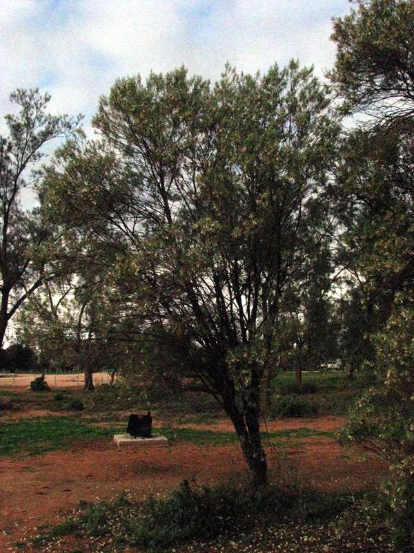
This Eremophila sp. is a small tree in the main camping ground at Lake Mungo.
Photo: Don Hitchcock 2009
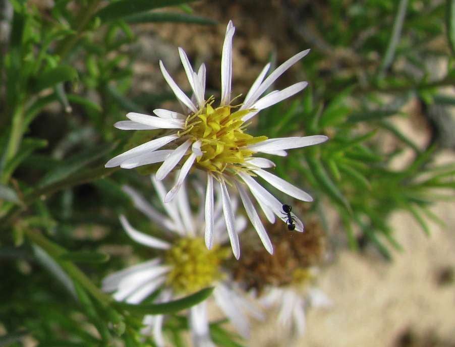
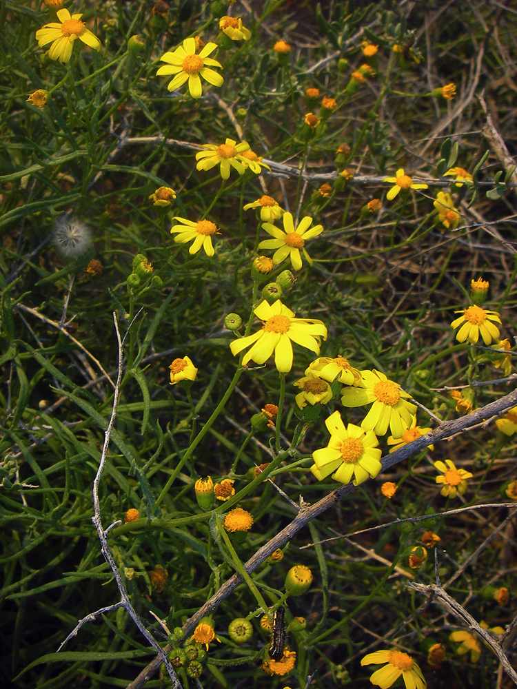
Daisy growing as a low herb, Walls of China area.
Photo: Don Hitchcock 2009
These Pittosporum sp. were one of the few instances where it seemed that the lunette was being actively invaded by native species, helping to control erosion. Elsewhere, there is continued degradation of the landscape, even though feral pests are being controlled.
Photo: Don Hitchcock 2009
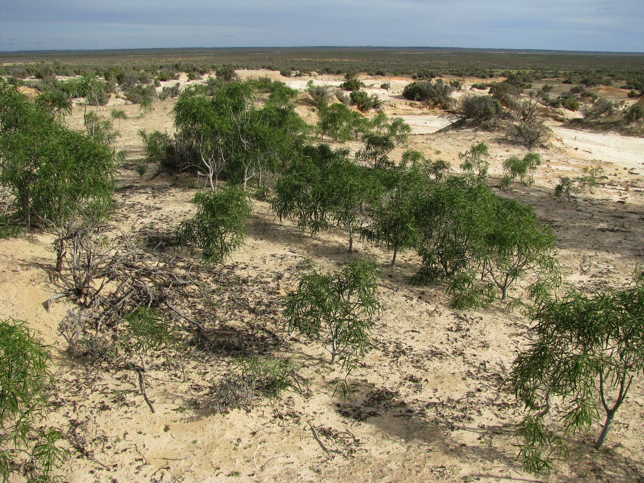
Driving across the lake bed and over the lunette at the start of the loop road
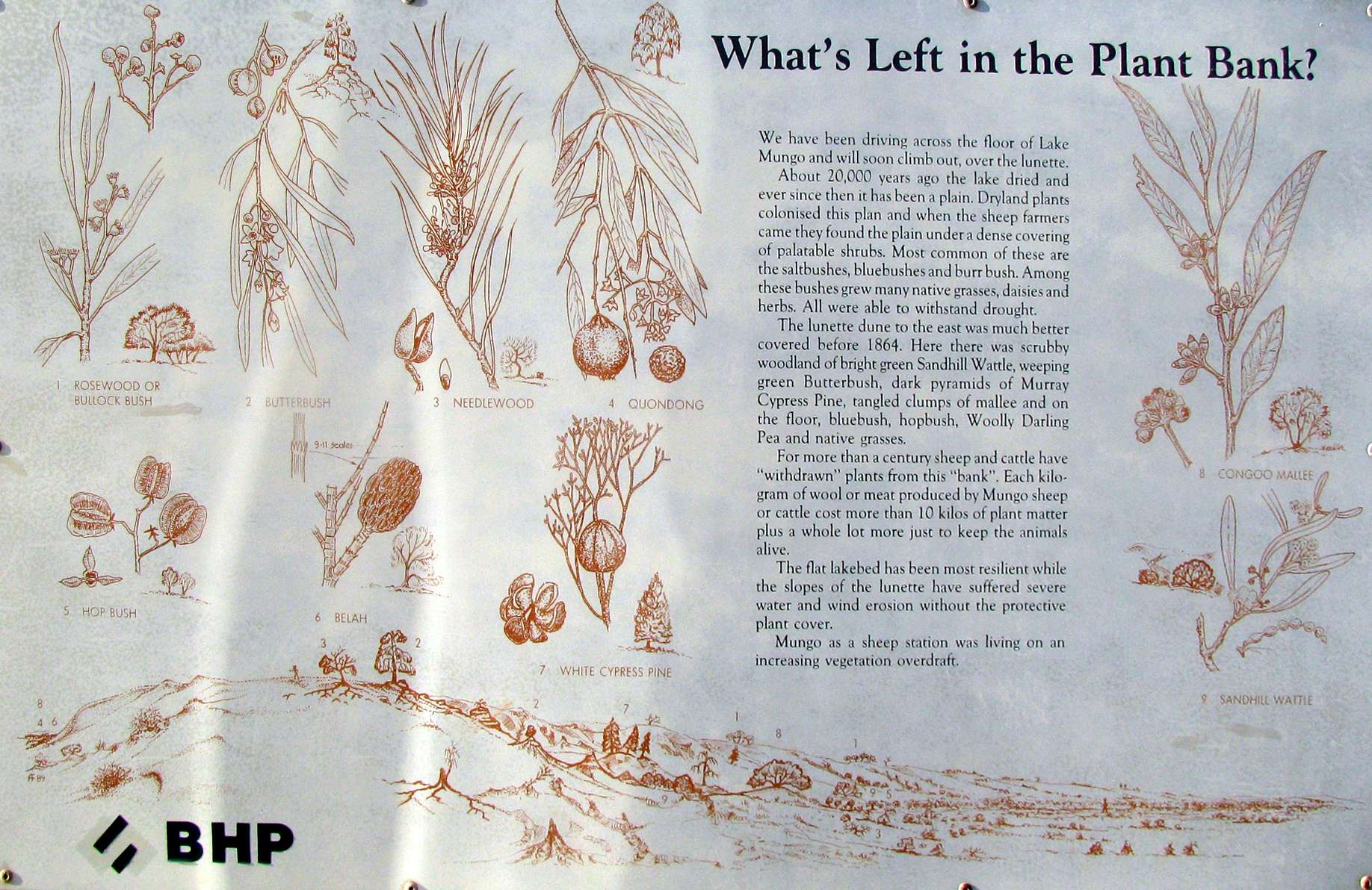
Interpretation sign sponsored by BHP, a large iron and steel company in Australia.
The text reads:
What's Left in the Plant Bank?
We have been driving across the floor of Lake Mungo and will soon climb out, over the lunette.
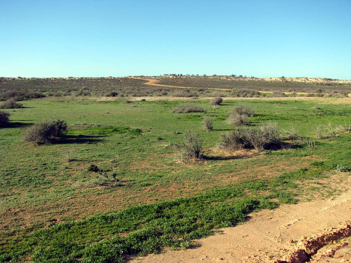
About 20 000 years ago the lake dried and ever since then it has been a plain. Dryland plants colonised this plain, and when the sheep farmers came they found the plain under a dense covering of palatable shrubs. Most common of thee are the saltbushes, bluebushes and burr bush. Among these bushes grew many native grasses, daisies and herbs. All were able to withstand drought.
The lunette dune to the east was much better covered before 1864. Here there was scrubby woodland of bright green Sandhill Wattle, weeping green Butterbush, dark pyramids of Murray Cypress Pine, tangled clumps of mallee and on the floor, bluebush, hopbush, Woolly Darling Pea and native grasses.
For more than a century sheep and cattle have "withdrawn" plants from this "bank". Each kilogram of wool or meat produced by Mungo sheep or cattle cost more than ten kilos of plant matter plus a whole lot more just to keep the animals alive.
The flat lake bed has been most resilient while the slopes of the lunette have suffered severe water and wind erosion without the protective plant cover.
Mungo as a sheep station was living on an increasing vegetation overdraft.
Photo: Don Hitchcock 2009
Source: Sign, Lake Mungo NP
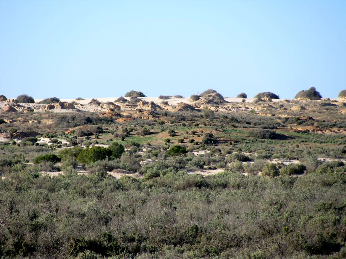
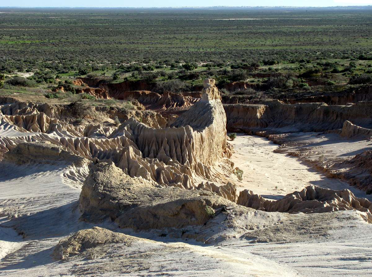
Here we can see the sudden transition from well covered dry lake bed to increasingly eroded lunette. A lunette is a half-moon shaped lens of clay and sand, heaped up as deposits on the far bank, left by the wind when it swept across the lake bed at times when the lake dried out. This has happened many, many times in the last 60 000 years. The lake was last filled about 18 000 years ago.
Photo: Don Hitchcock 2009
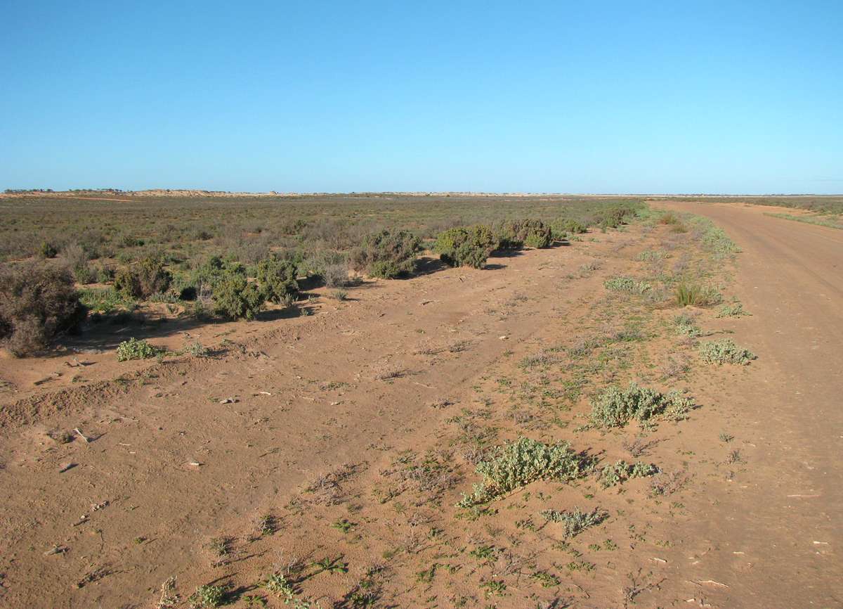
The road has to have large drains at either side, with the excavated sand and clay heaped up as the road bed so that the road is elevated above the general lake surface, and is passable at most times. With wet weather, the road is often closed, not only within the park, but even the roads from the main highway to Mungo. It is advisable to check on road closures in the area before travelling to Mungo to avoid disappointment and wasted time and fuel.
Photo: Don Hitchcock 2009
Saltbush is a plant which is nutritious for stock, and can withstand drought and salty soils. There are a number of species of saltbush, and the leaves usually taste salty, since the plant gets rid of the toxic salt by excreting it through the leaves.
Photo: Don Hitchcock 2009
The single lane one way loop road follows the edge of the lake for some distance, then curves over the lunette, allowing travellers to inspect the top of the lunette, with its associated ancient deposits laid out to see. There is a safe pull off and parking area for cars just over the top of the rise.
Photo: Don Hitchcock 2009
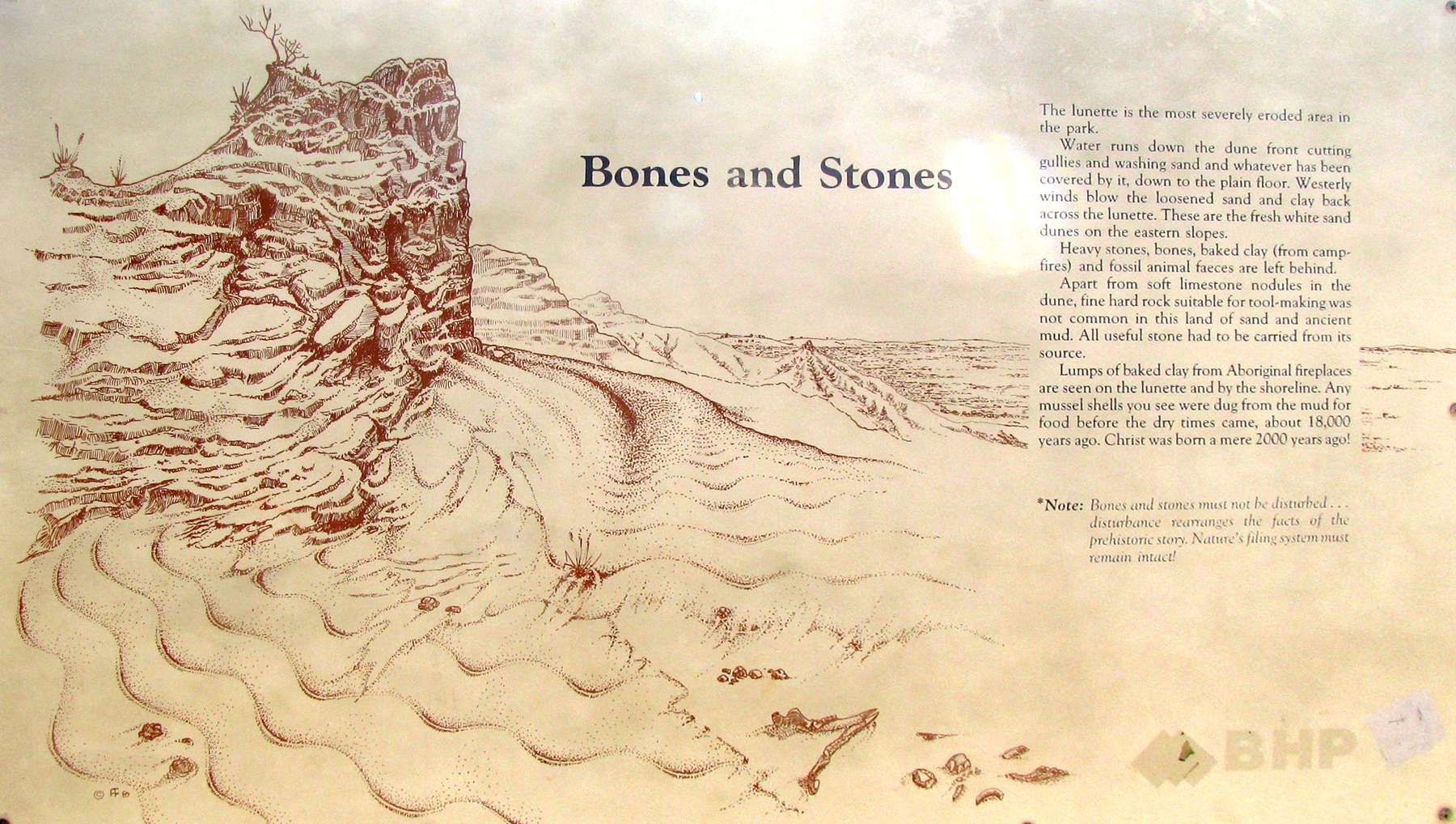
Text of this information sign:
Bones and stones
The lunette is the most severely eroded area in the park. Water runs down the dune front, cutting gullies and washing sand and whatever has been covered by it, down to the plain floor. Westerly winds blow the loosened sand and clay back across the lunette. These are the fresh white sand dunes on the eastern slopes.
Heavy stones, bones, baked clay from camp fires and hearths, and fossil animal faeces are left behind.
Apart from soft limestone nodules in the dune, fine hard rock suitable for tool making was not common in this land of sand and ancient mud. All useful stone had to be carried from its source.
Lumps of baked clay from First Nations people fireplaces are seen on the lunette and by the shoreline. Any mussel shells you see were dug from the mud for food before the dry times came, about 18 000 years ago. Christ was born a mere 2000 years ago!
*Note: Bones and stones must not be disturbed... disturbance rearranges the facts of prehistoric history. Nature's filing system must remain intact!
Photo: Don Hitchcock 2009
Source: Sign, Lake Mungo NP
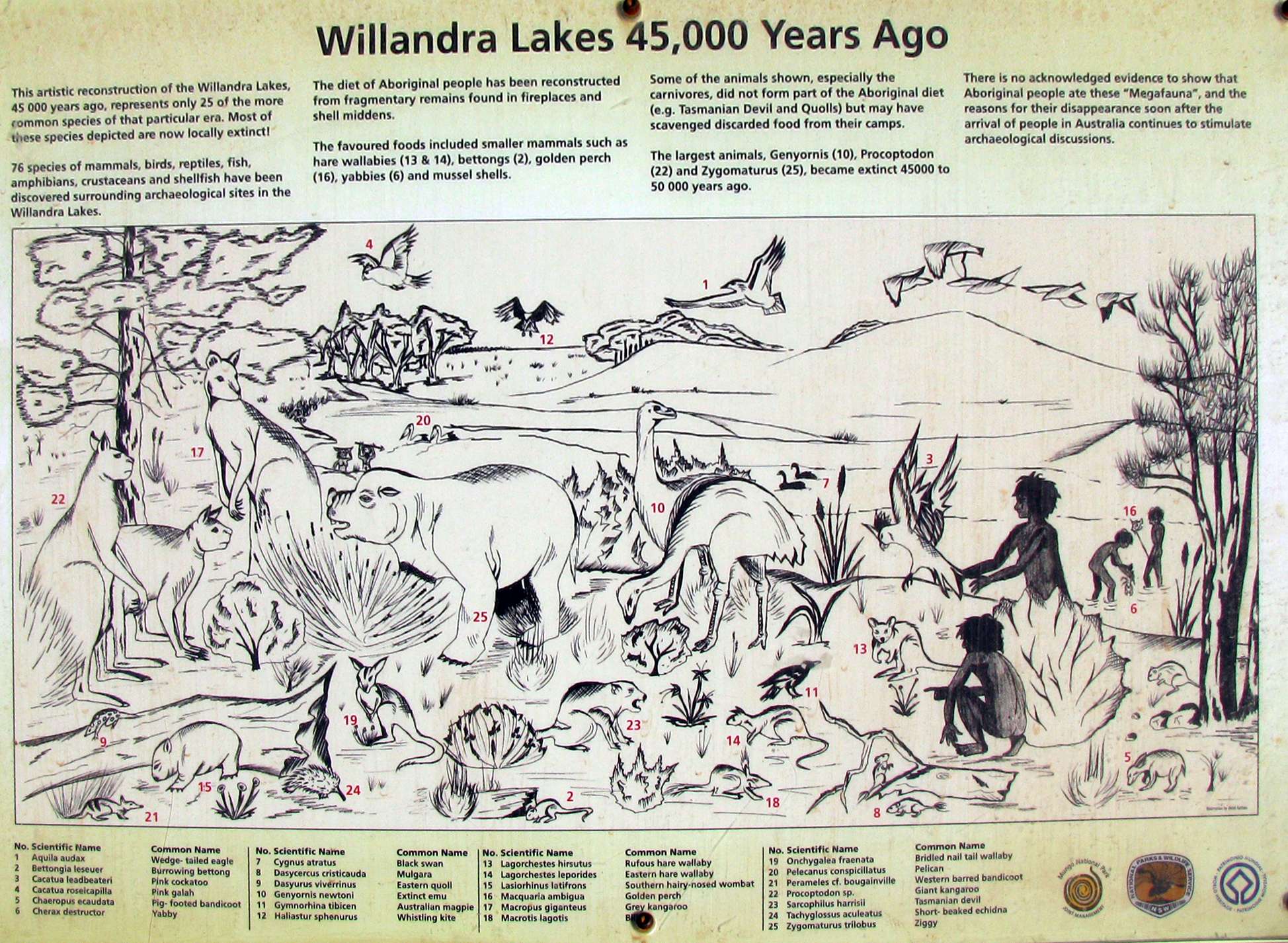
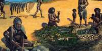
Willandra Lakes 45 000 years ago
This artistic reconstruction of the Willandra Lakes 45 000 years ago, represents only 25 of the more common species of that particular area. Most of these species are now locally extinct!
76 species of mammals, birds, reptiles, fish, amphibians, crustaceans and shellfish have been discovered surrounding archaeological sites in the Willandra Lakes.
The diet of the First Nations people has been reconstructed from fragmentary remains found in fireplaces and shell middens.
The favoured foods included smaller mammals such as hare wallabies (13 & 14), Bettongs (2) Golden Perch (16) Yabbies (6) and mussel shells.
Some of the animals shown, especially the carnivores, did not form part of the First Nations peoples' diet (e.g. Tasmanian Devil and Quolls) but may have scavenged discarded food from their camps.
The largest animals, Genyornis (10), Procoptodon (22) and Zygomaturus (25) became extinct 45 000 to 50 000 years ago.
Photo: Don Hitchcock 2009
Source: Sign, Lake Mungo NP
| No. | Scientific Name | Common Name |
| 1 | Aquila audax | Wedge-tailed Eagle |
| 2 | Bettongia leseuer | Burrowing Bettong |
| 3 | Cacatua leadbeateri | Pink Cockatoo |
| 4 | Cacatua riseucapilla | Pink Galah |
| 5 | Chaeropus ecaudata | Pig-footed Bandicoot |
| 6 | Cherax destructor | Yabby |
| 7 | Cygnus atratus | Black Swan |
| 8 | Dasycercus cristicauda | Mulgara |
| 9 | Dasyurus viverrinus | Eastern Quoll |
| 10 | Genyornis newtoni | Extinct Emu |
| 11 | Gymnorhina tibicen | Australian Magpie |
| 12 | Haliastur sphenurus | Whistling Kite |
| 13 | Lagorchestes hirsutus | Rufous Hare Wallaby |
| 14 | Lagorchestes leporides | Eastern Hare Wallaby |
| 15 | Lasiorhinus latifrons | Southern Hairy-Nosed Wombat |
| 16 | Macquaria ambigua | Golden Perch |
| 17 | Macropus giganteus | Grey Kangaroo |
| 18 | Macrotis lagotis | Bilby |
| 19 | Onchygalea fraenata | Bridled Nail Tail Wallaby |
| 20 | Pelecanus conspicillatus | Pelican |
| 21 | Perameles cf. bougainville | Western Barred Bandicoot |
| 22 | Procoptodon sp. | Giant Kangaroo |
| 23 | Sarcophilius harrisii | Tasmanian Devil |
| 24 | Tachyglossus aculeatus | Short-Beaked Echidna |
| 25 | Zygomaturus trilobus | Ziggy |
Source: Sign, Lake Mungo NP
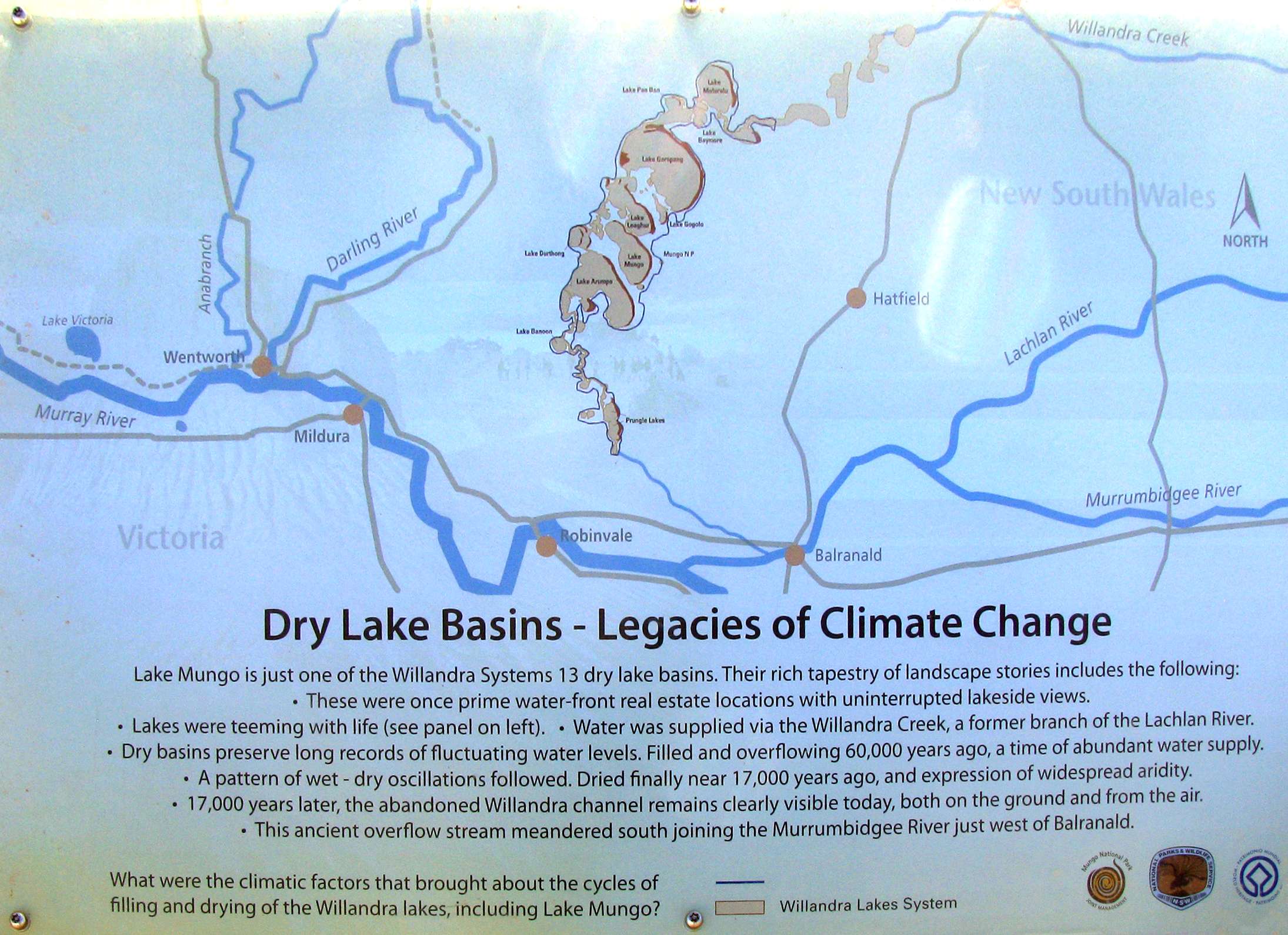
Dry Lake Basins - Legacies of Climate Change
Lake Mungo is just one of the Willandra System's 13 dry lake basins. Their rich tapestry of landscape stories includes the following:
- These were once prime water front real estate locations with uninterrupted lakeside views.
- Lakes were teeming with life
- Water was supplied via Willandra Creek, a former branch of the Lachlan River.
- Dry basins preserve long records of fluctuating water levels. Filled and overflowing 60 000 years ago, a time of abundant water supply.
- A pattern of wet-dry oscillations followed. Dried finally nearly 17 000 years ago, and the expression of widespread aridity.
- 17 000 years later, the abandoned Willandra Channel remains clearly visible today, both on the ground and from the air.
- This ancient overflow stream meandered south joining the Murrumbidgee River just west of Balranald.
Photo: Don Hitchcock 2009
Source: Sign, Lake Mungo NP
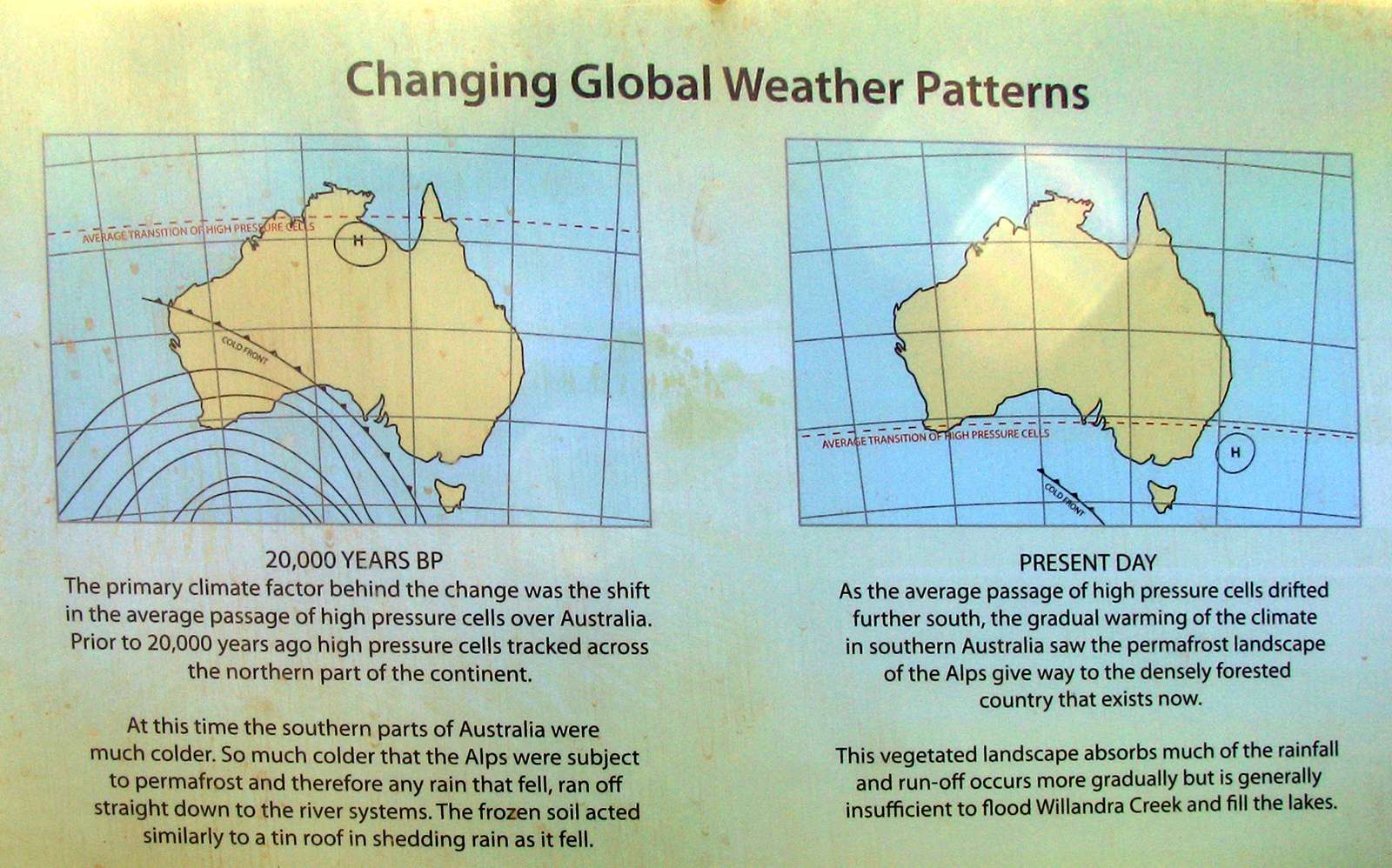
Changing Global Weather Patterns
20 000 years BP
The primary climate factor behind the change was the shift in the average passage of high pressure cells over Australia.
Prior to 20 000 years ago, high pressure cells tracked across the northern part of the continent.
At this time the southern parts of Australia were much colder. So much colder that the Alps were subject to permafrost and therefore any rain that fell, ran off straight down the river systems. The frozen soil acted similarly to a tin roof in shedding rain as it fell.
Present Day
As the average passage of high pressure cells drifted further south, the gradual warming of the climate in southern Australia saw the permafrost landscape of the Alps give way to the densely forested country that exists now.
This vegetated landscape absorbs much of the rainfall and run-off occurs more gradually but is generally insufficient to flood Willandra Creek and fill the lakes.
Photo: Don Hitchcock 2009
Source: Sign, Lake Mungo NP
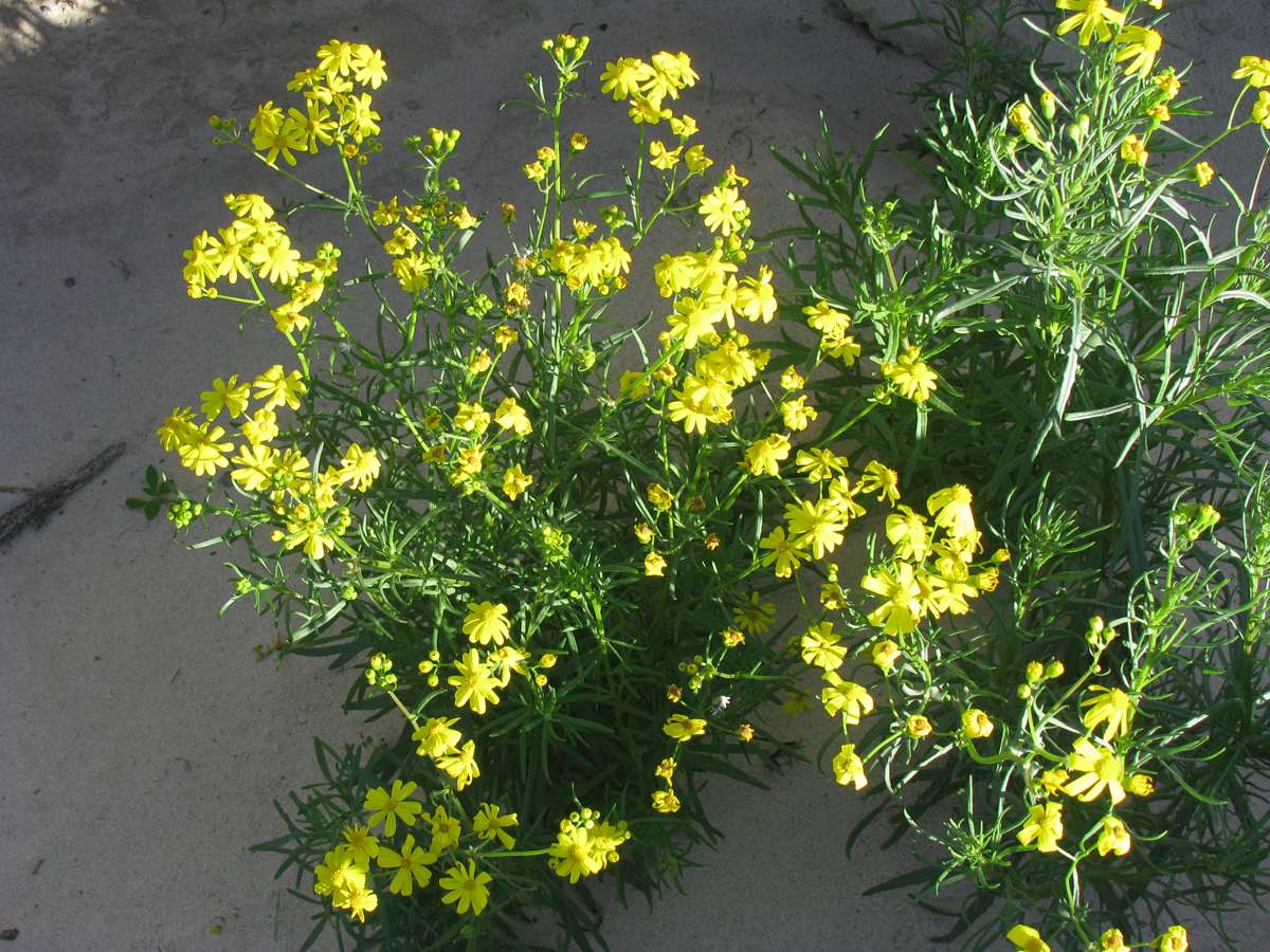
Senecio lautus at the board walk where the road crosses the top of the lunette on the loop road.
Photo: Don Hitchcock 2009
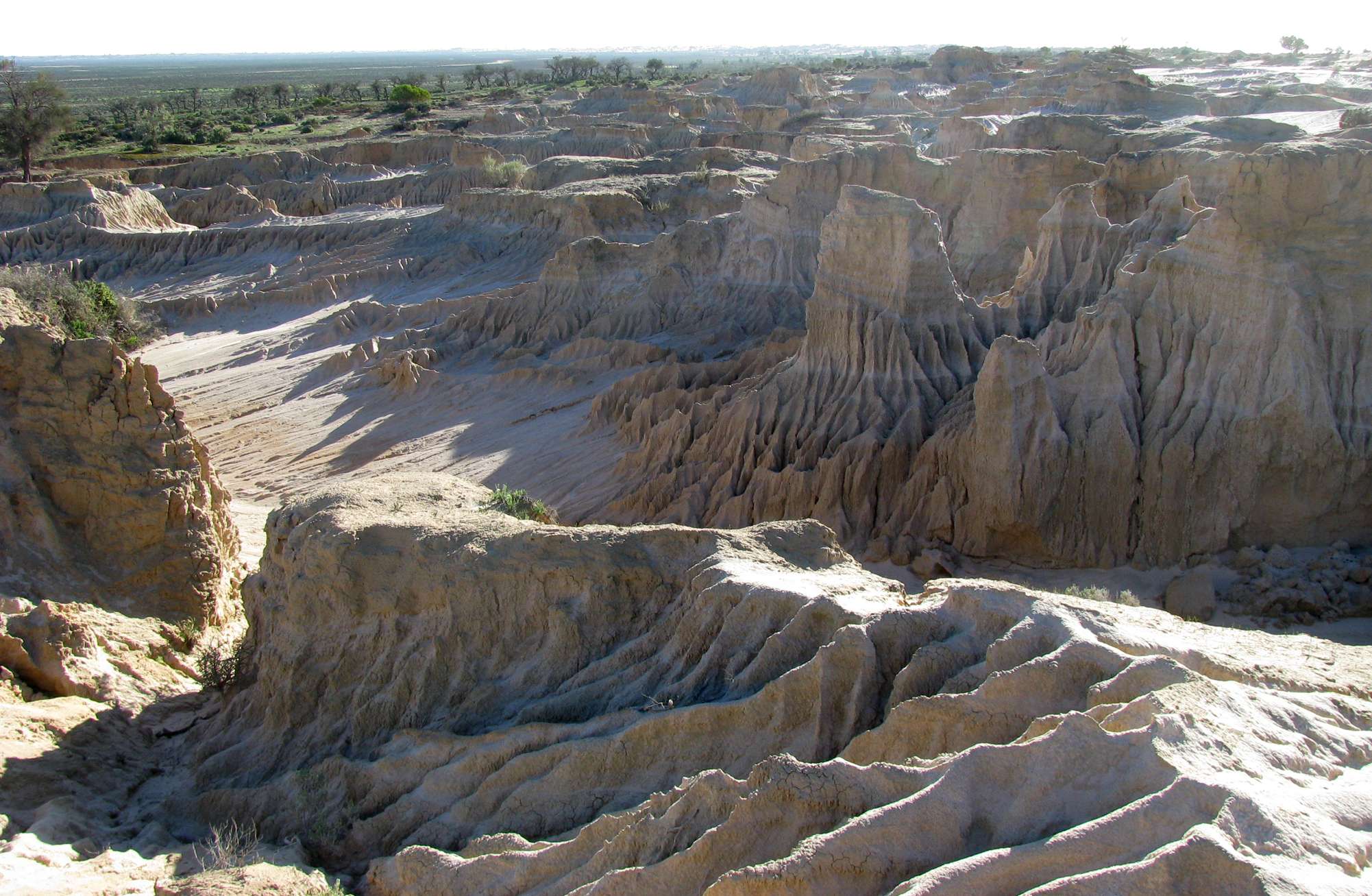
The area at the top of the lunette demonstrates the effect that removal of vegetation by over grazing and feral animals has had on the ecology of the area. Most of the erosion appears to be due to water rather than wind, which is surprising in such an arid environment.
Wind is responsible, however, for the mobile white sand dunes in other places, notably at Vigars Well.
Photo: Don Hitchcock 2009
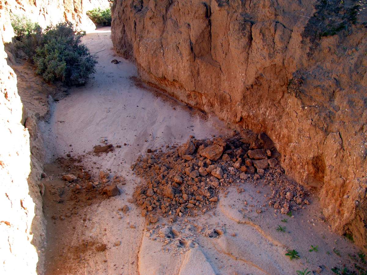
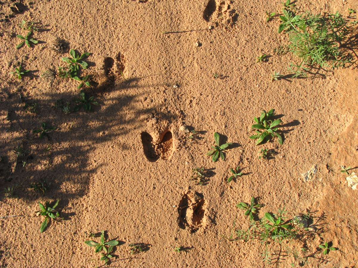
In the channels carved by run off it is often possible, as here, to see the "shadow" of the old lake shore, marked by white pebbles. Occasionally one can also see hearths exposed in these channels as well. The First Nations peoples used stone and clay balls to hold the heat of the fire, and then covered over the stones and clay to make a covered oven which cooked their meat.
In this case we can also see the footprints of a goat in both photographs. Feral animals are still contributing their share to the degradation of the landscape, despite efforts at eradication.
Photo: Don Hitchcock 2009
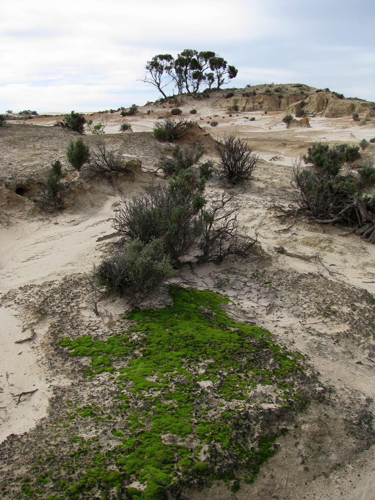
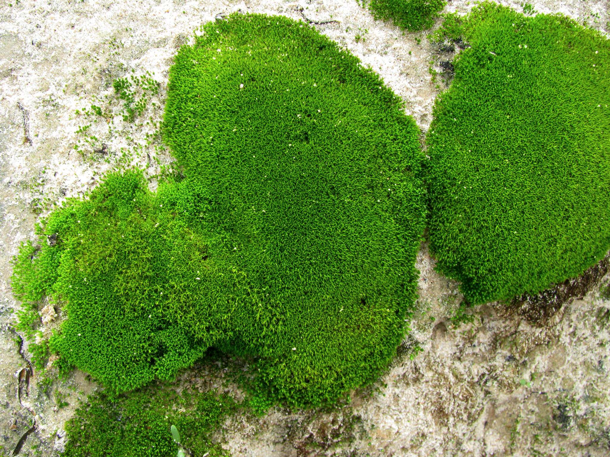
It was surprising to see that moss could survive and even thrive in this semi-desert. The winter of 2009 was wet and miserable, but at least the moss plants seemed to like it!
Photo: Don Hitchcock 2009
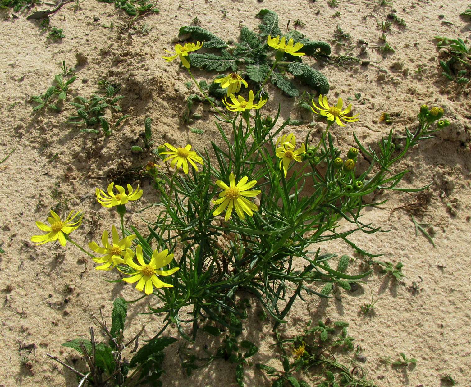
Senecio lautus, or variable groundsel, seems to do very well in this region, it was ubiquitous.
Photo: Don Hitchcock 2009
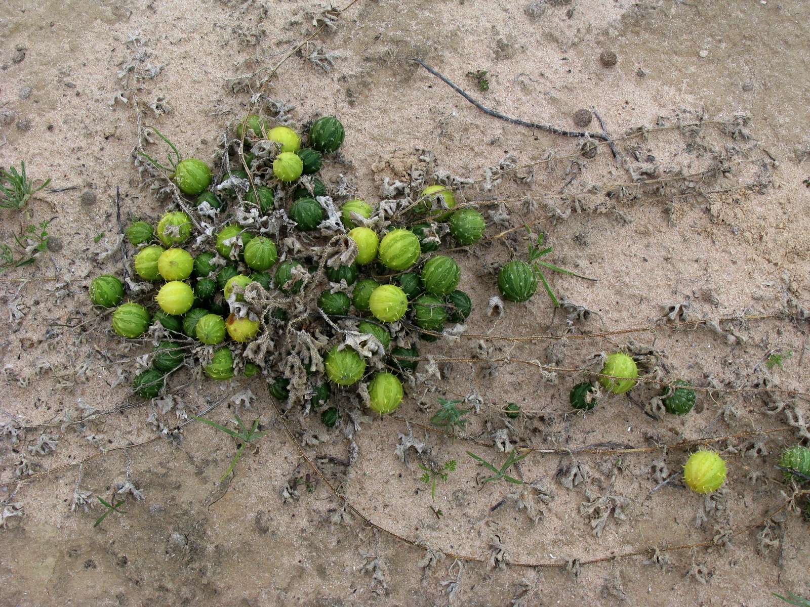
The Paddy Melon, or Cucumis myriocarpus, flowers in summer and autumn. The fruit and leaves are harmful to stock. They are often found in sandy soils and disturbed areas.
Photo: Don Hitchcock 2009
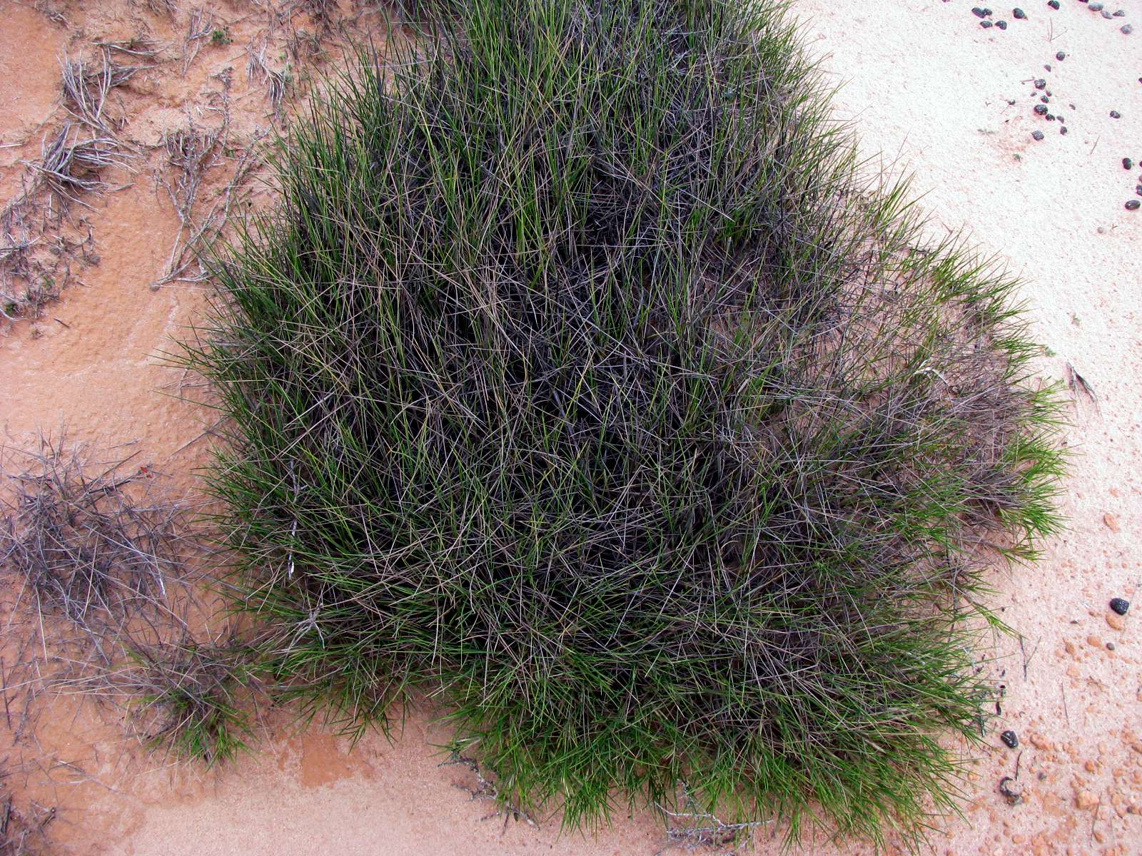
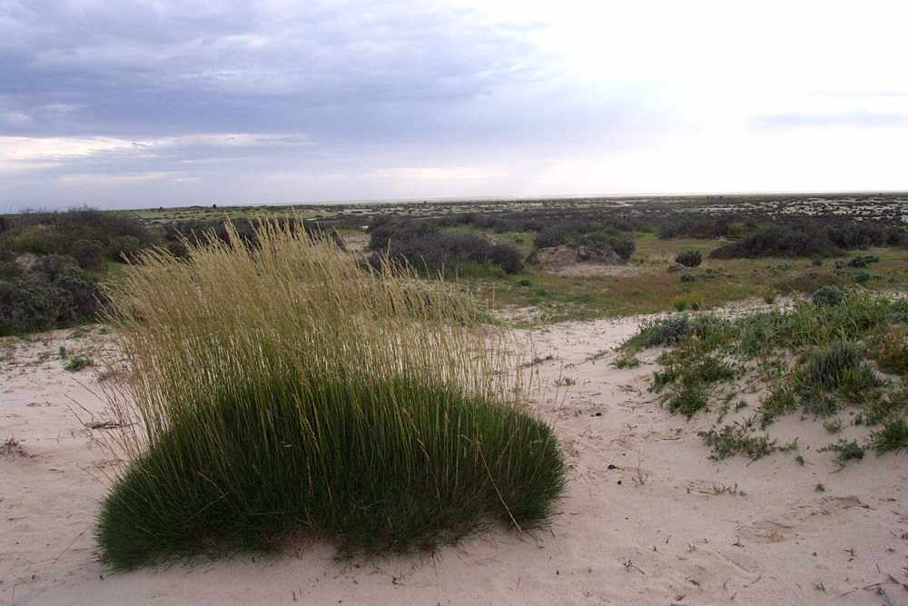
The Mungo area is dry enough for Spinifex to grow. Spinifex was an important source for gum used to glue tools to handles, as well as a general purpose "plastic" to make objects of any shape which did not have much tension on them, as for example the mouth piece of the local form of the didjeridoo.
Photo: Don Hitchcock 2009
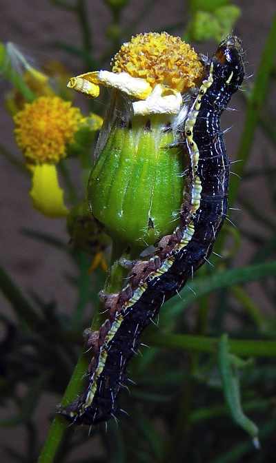
One of the millions of a single species of caterpillar in the area at the time the photographs were taken, this one can be seen demolishing a Senecio sp. flower.
Photo: Don Hitchcock 2005
Senecio sp. flowers on which the caterpillars were feasting.
Photo: Don Hitchcock 2005
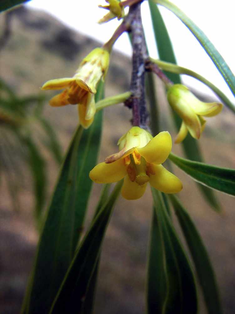
Flowers of the Wilga tree.
Photo: Don Hitchcock 2005
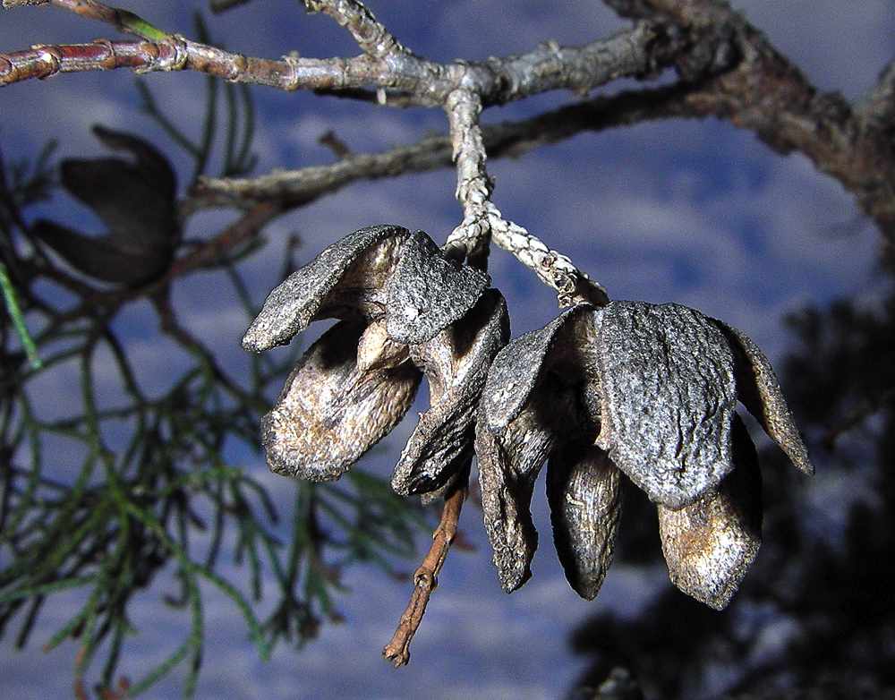
Cypress Pine seed cones, opened to release the seeds.
Photo: Don Hitchcock 2005
Pea flower. There are many native peas in Australia, a large proportion of which are poisonous to stock.
Photo: Don Hitchcock 2005
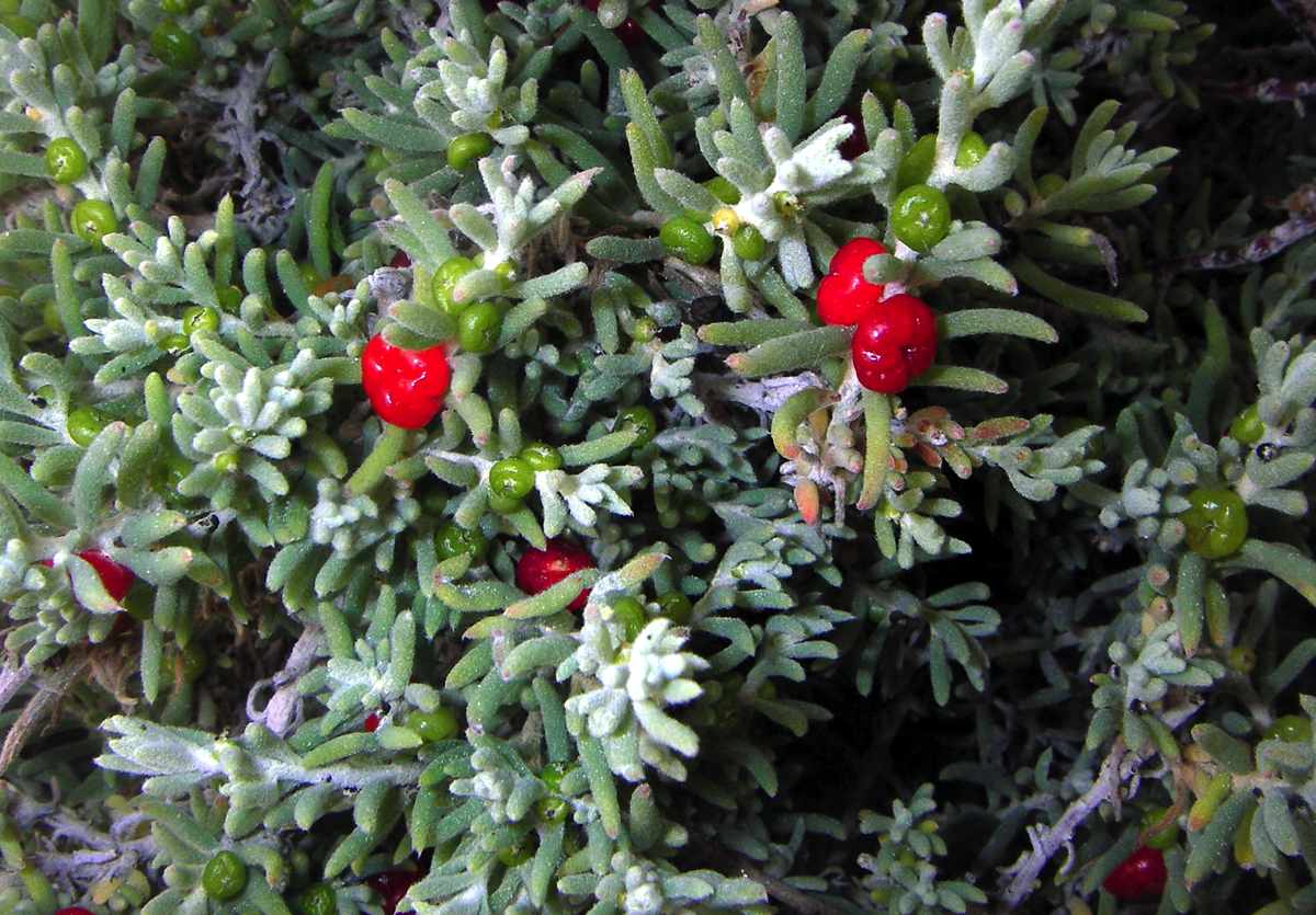
Ruby saltbush. The berries are edible, but the taste is never going to set the world on fire.
Photo: Don Hitchcock 2005
Unidentified flower on a tree.
Photo: Don Hitchcock 2005
Unidentified flower on a bush.
Photo: Don Hitchcock 2005
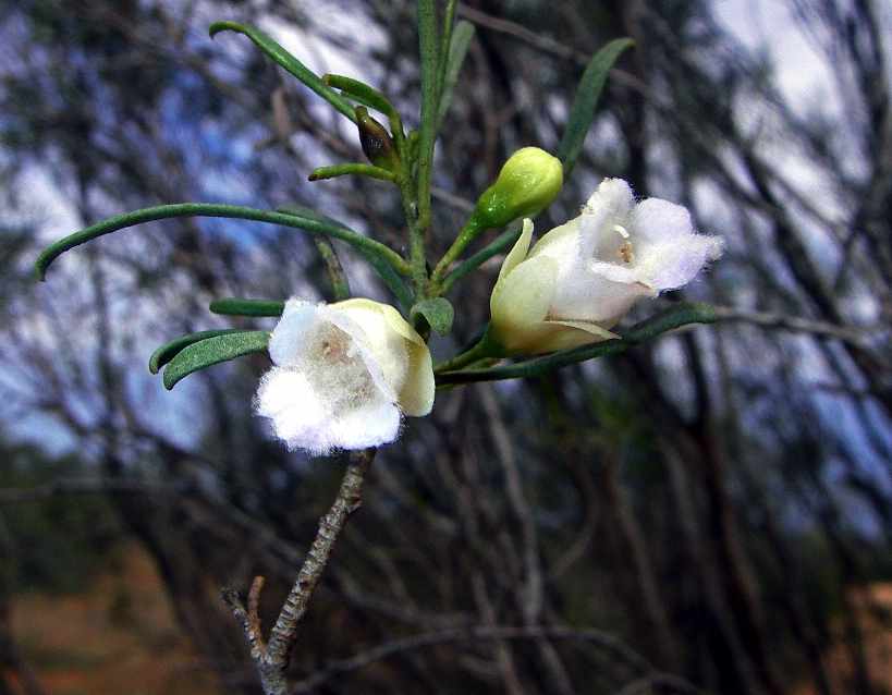
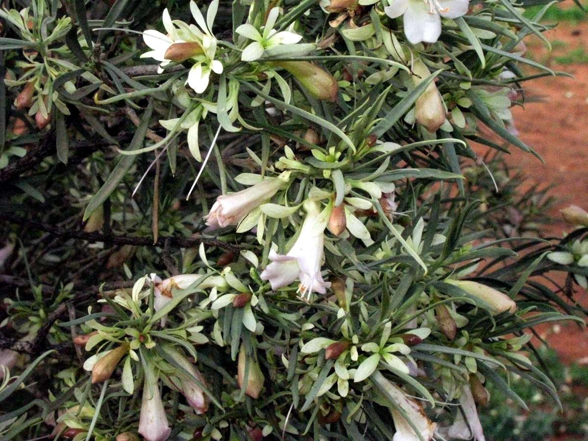
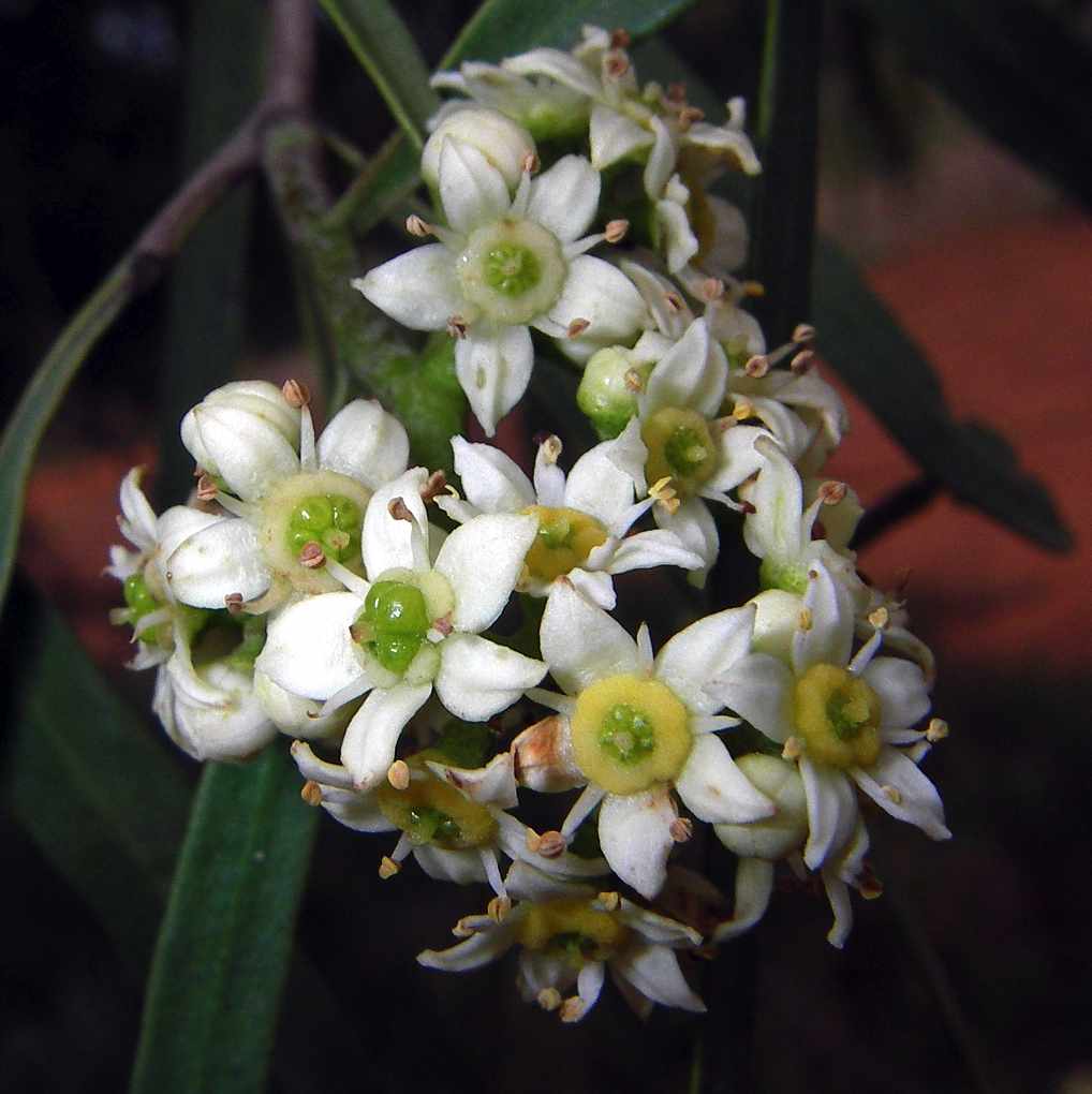
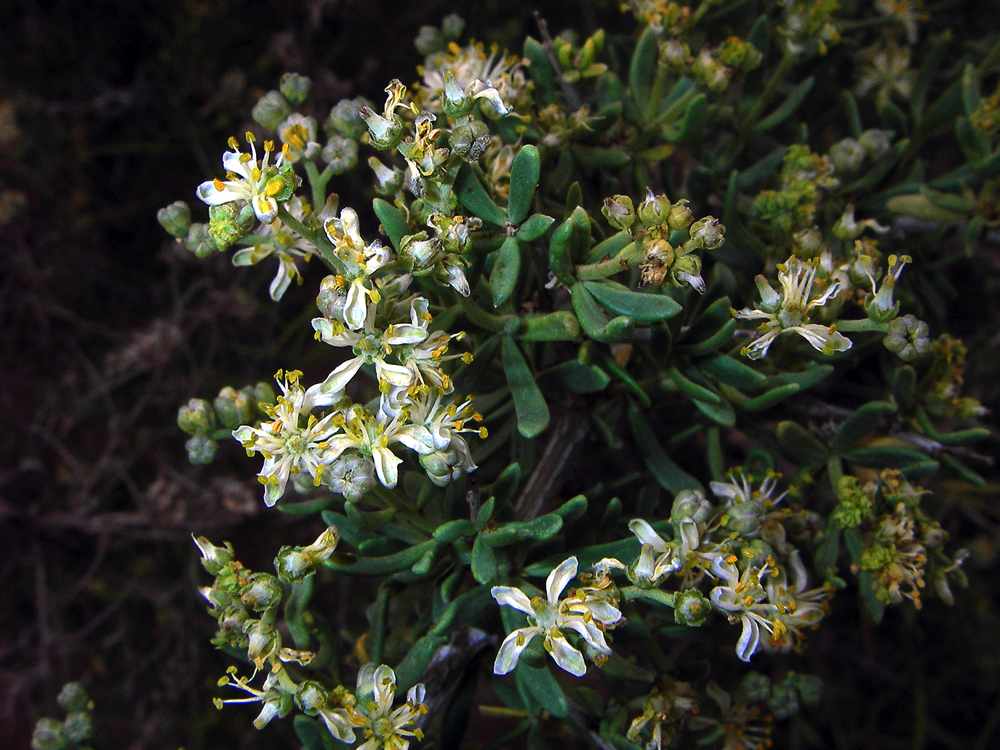
A very hairy white flowered Eremophila sp. growing on the eastern side of the lunette on the tourist drive.
Photo: Don Hitchcock 2005
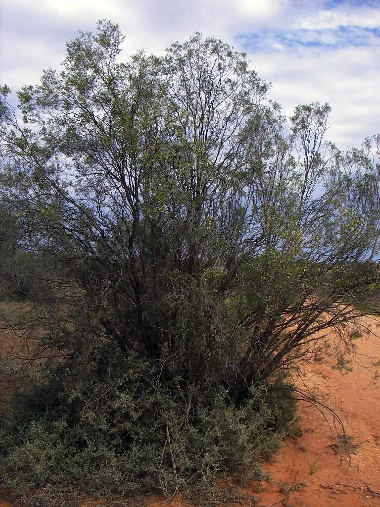
The white flowered Eremophila sp. bush shown in close up above, growing on the eastern side of the lunette on the tourist drive.
Photo: Don Hitchcock 2005
Photo: Don Hitchcock 2005
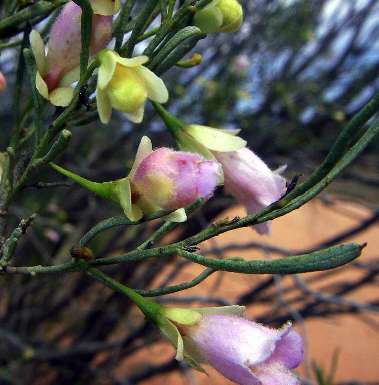
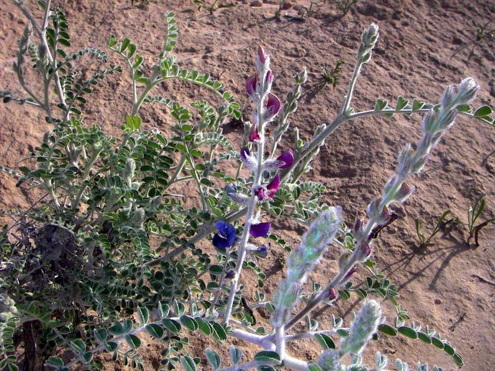
A very hairy purple flowered Eremophila sp. growing on the eastern side of the lunette on the tourist drive.
Photo: Don Hitchcock 2005
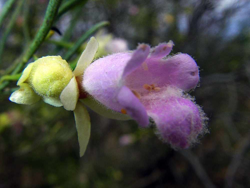
A very hairy purple flowered Eremophila sp. growing on the eastern side of the lunette on the tourist drive.
Photo: Don Hitchcock 2005
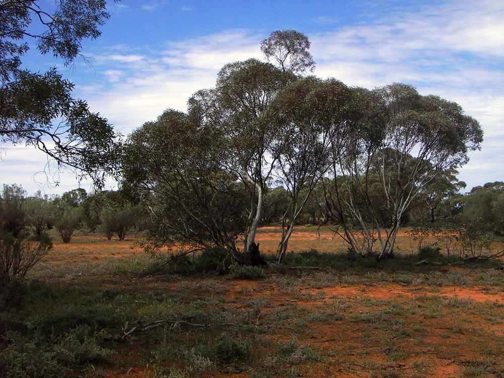
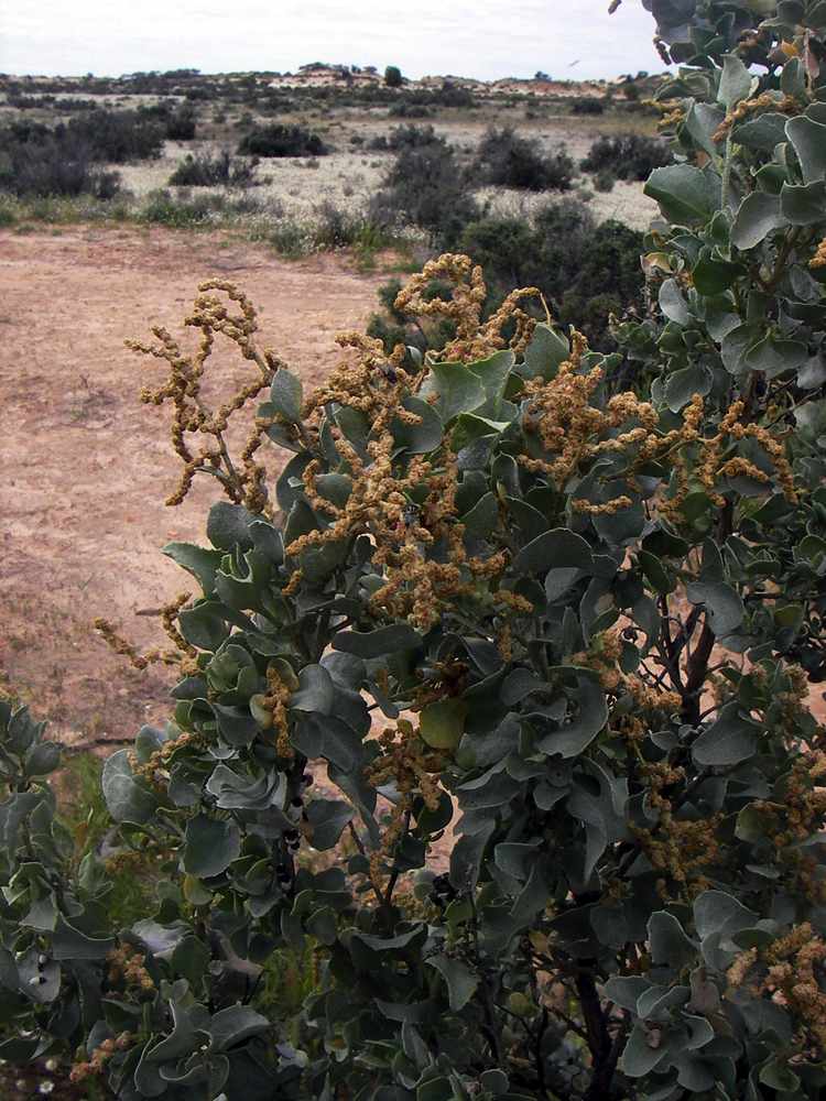
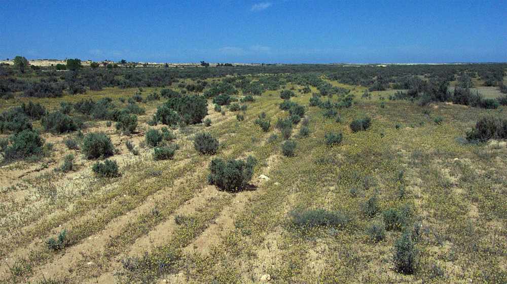
A Eucalyptus - salt bush community on the eastern side of the lunette.
Photo: Don Hitchcock 2005
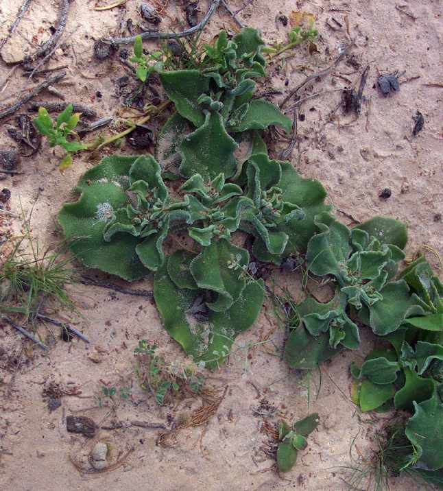
A succulent flower on the eastern side of the lunette near Vigars Well.
Photo: Don Hitchcock 2005
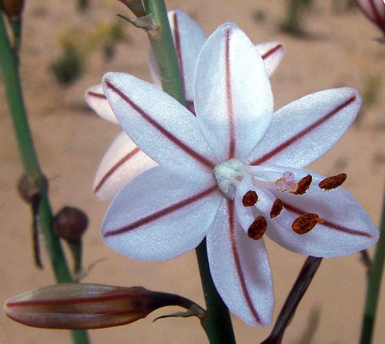
Lily.
Photo: Don Hitchcock 2005
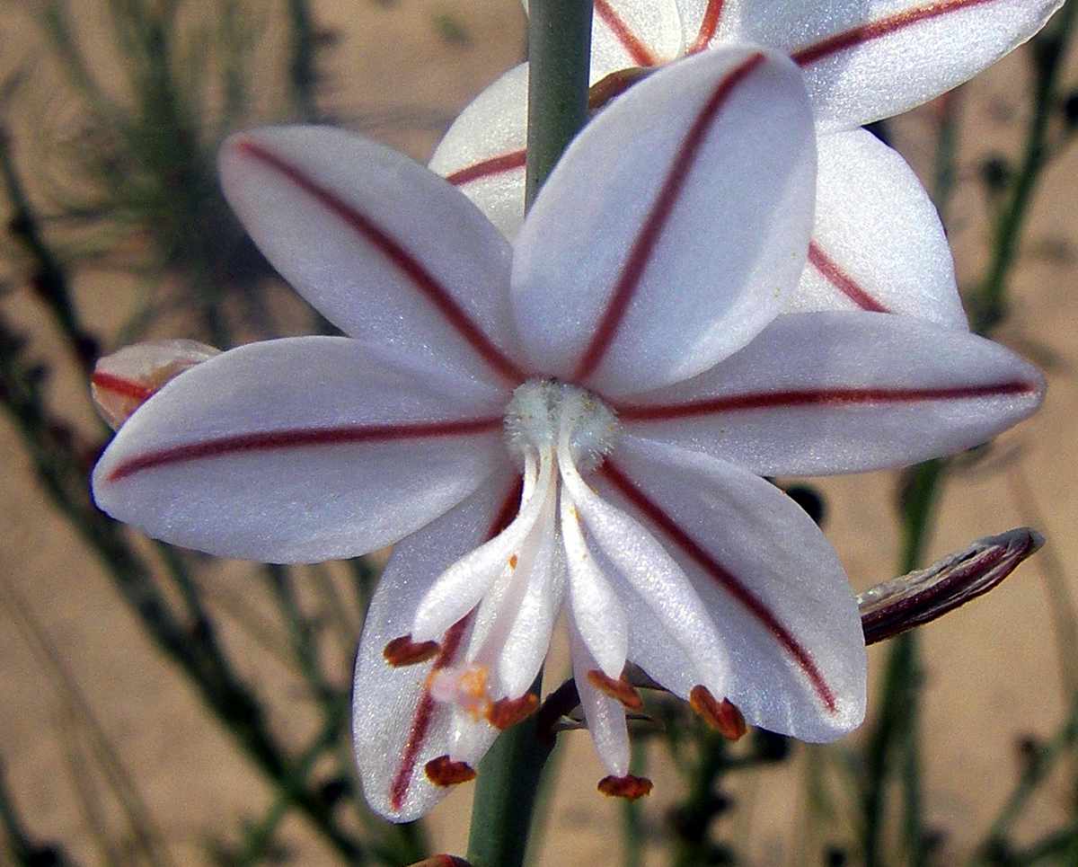
Lily.
Photo: Don Hitchcock 2005
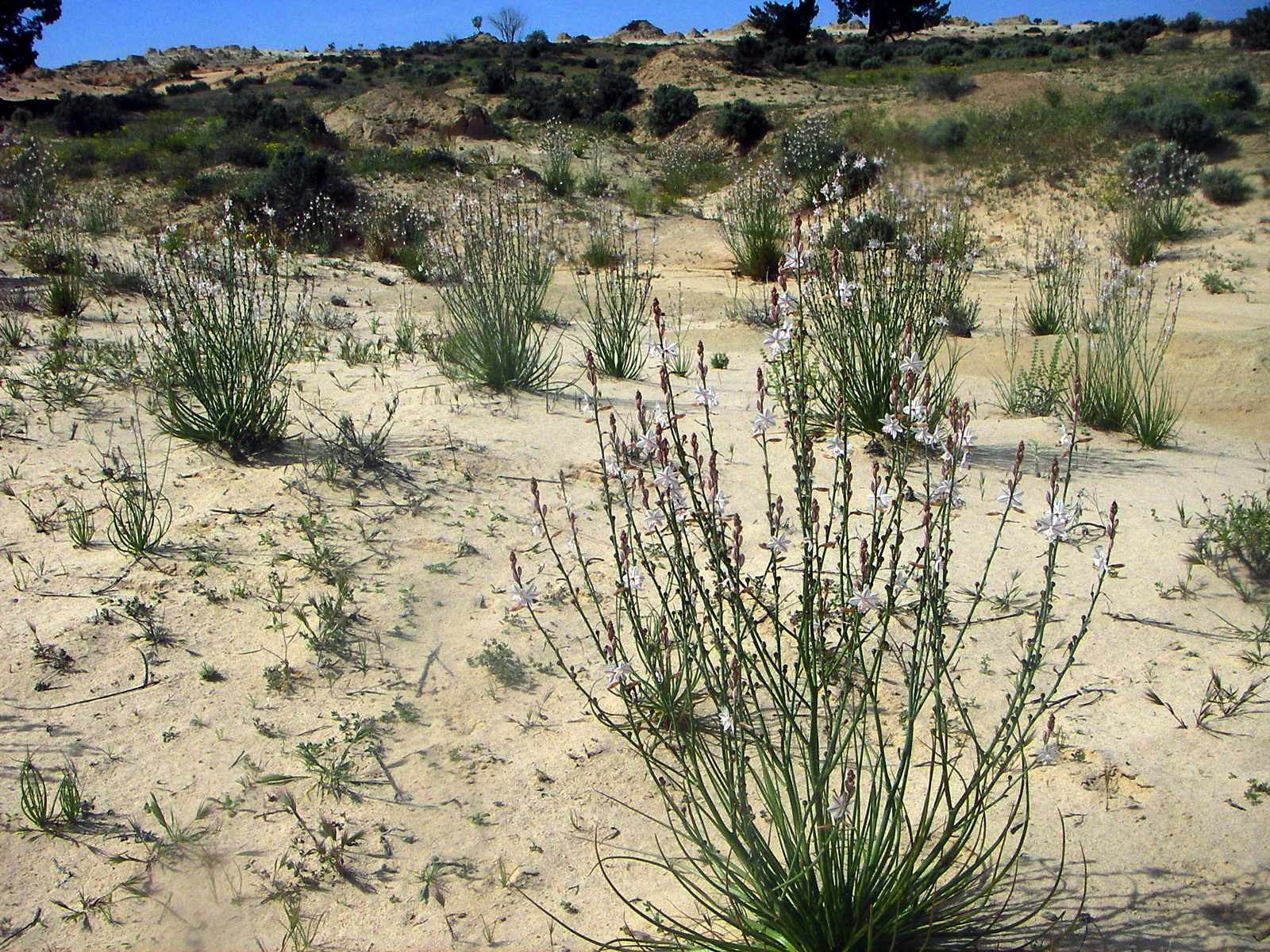
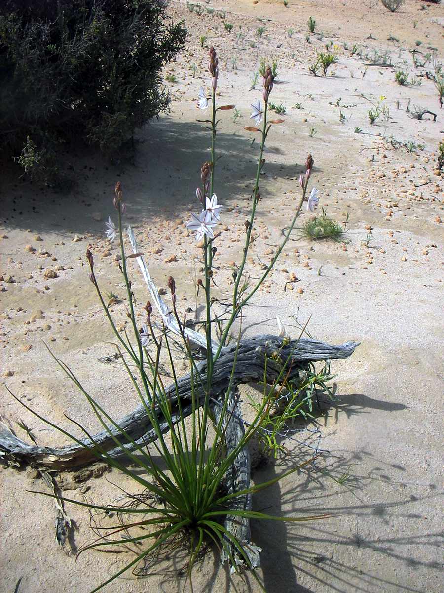
Field of Lilies.
Photo: Don Hitchcock 2005
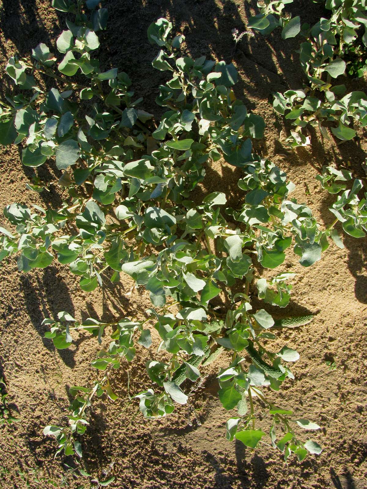
Botany Bay Greens. These were used by Captain Cook to combat scurvy when he landed in Australia. In contrast to most Australian native plants used for bush tucker, these are quite palatable without any special treatment.
Photo: Don Hitchcock 2005
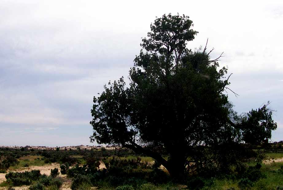
Cypress Pine on the shores of Lake Mungo
Photo: Don Hitchcock 2005
Flowering spinifex
Photo: Don Hitchcock 2005
Lichen on the ground beneath these mallees helps to keep the soil from blowing or washing away, even though there is little other ground cover.
Photo: Don Hitchcock 2005
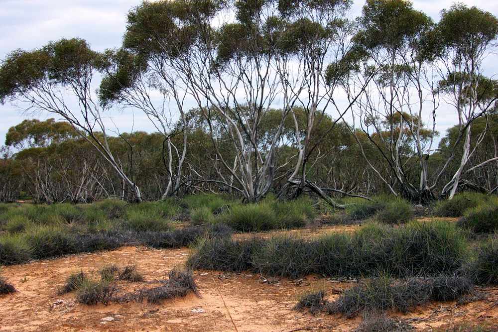
The environment here is dry enough to support the growth of spinifex grass beneath the eucalyptus trees.
Photo: Don Hitchcock 2005
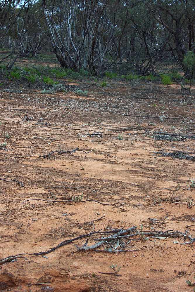
This area has been ripped in order to destroy rabbit warrens, and is now in the process of recovery. The natural vegetation has begun to recolonise the area.
Photo: Don Hitchcock 2005
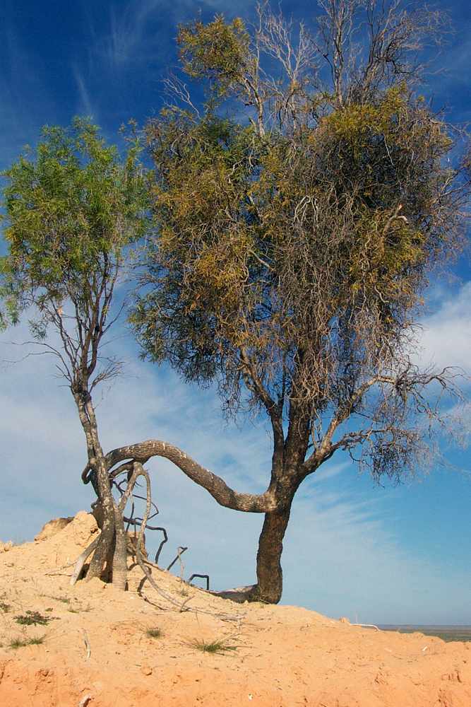
Two trees joined. Perhaps one is a sucker from the other, and the connecting root is now exposed by erosion of the sediments in which the trees grew originally.
Photo: Don Hitchcock 2005
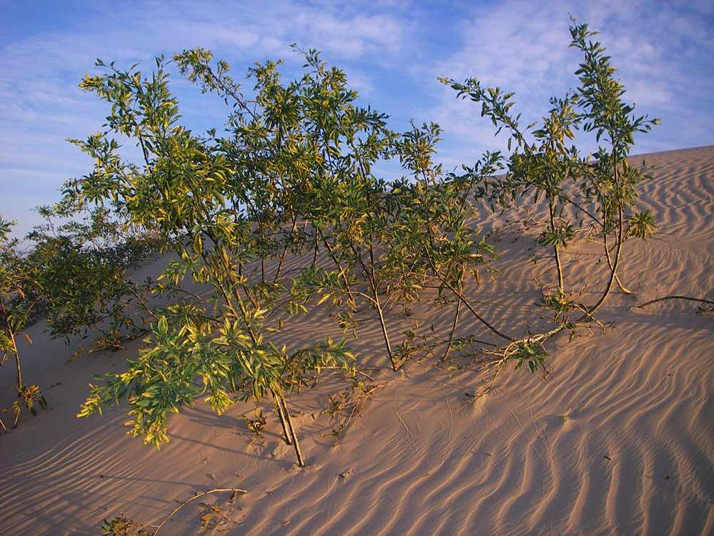
Nicotiana (an exotic weed of the tobacco family) being buried by mobile sand on the back of the walls of china lunette, the eastern lee side.
Photo: Don Hitchcock 2005
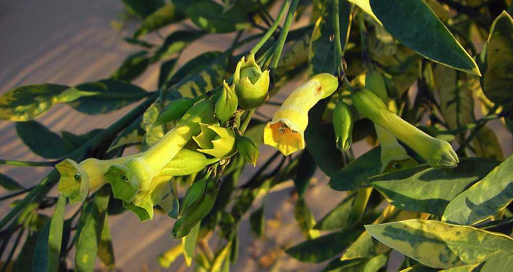
Nicotiana flowers
Photo: Don Hitchcock 2005