Back to Don's Maps
 Bushwalking Index
 Bushwalking, Hiking and Tramping in New Zealand
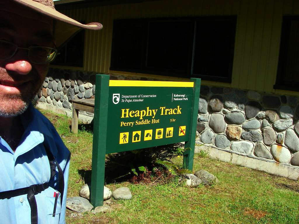
The Heaphy Track in New Zealand
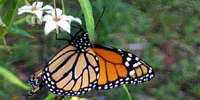
The Heaphy Track in New Zealand, 80 km long, has a wide variety of landscapes. It crosses the Southern Alps, taking the walker from the east to the west coast, through beech forests, alpine moors, mossy, very wet forests reminiscent of Lord of the Rings, a large and beautiful estuary at the entrance of the Heaphy River to the sea, then a superb walk along rocky and sandy ocean beaches, through groves of Nikau palms.
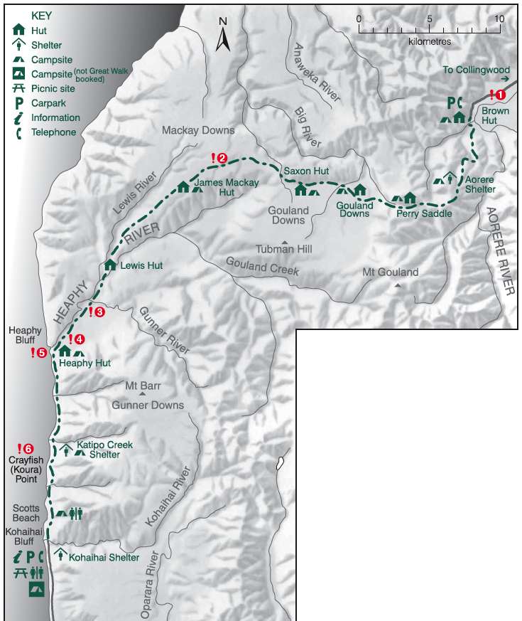
This is an excellent sketch map of the Heaphy Track from the New Zealand Government site. The NZ Government has worked really hard to make it easy for tourists to find information, and to book travel and accommodation. I believe they have the best such system in the world.
Photo: http://www.doc.govt.nz
Brown Hut at the start of the track. I got here about 10:30 a.m., and had a coffee and something to eat before setting off about 11 a.m.
It is a long way to the first hut, Perry Saddle Hut, and it is uphill (a climb of 800 metres) all the way. I got to the next hut with plenty of time, but I think if I were to do it again, I would stay at Brown Hut overnight and set out early in the morning.
Photo: Don Hitchcock January 2007
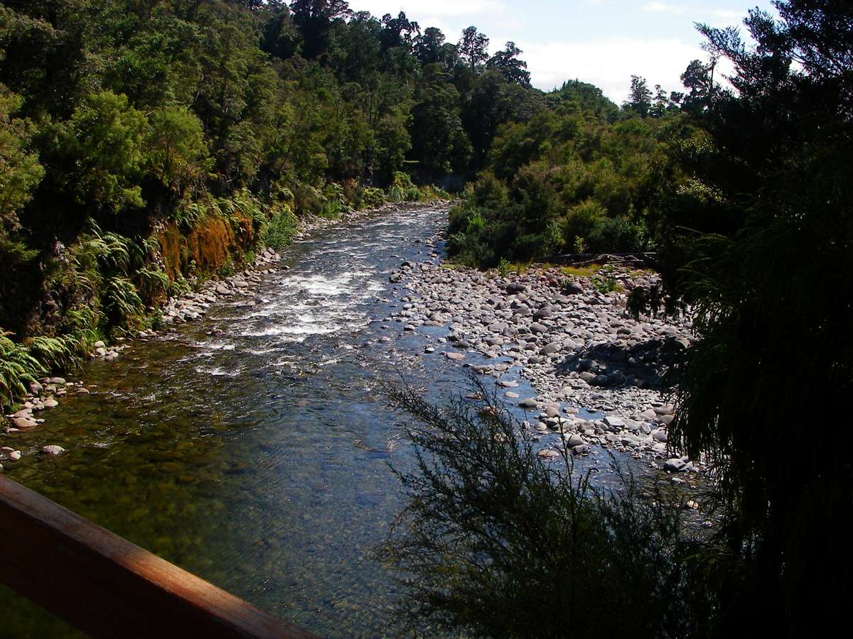
Crossing the Brown River bridge, shortly after leaving Brown Hut. The track up to Aorere Shelter follows the line of a surveyed old road, so the slope is remarkably uniform.
Photo: Don Hitchcock January 2007
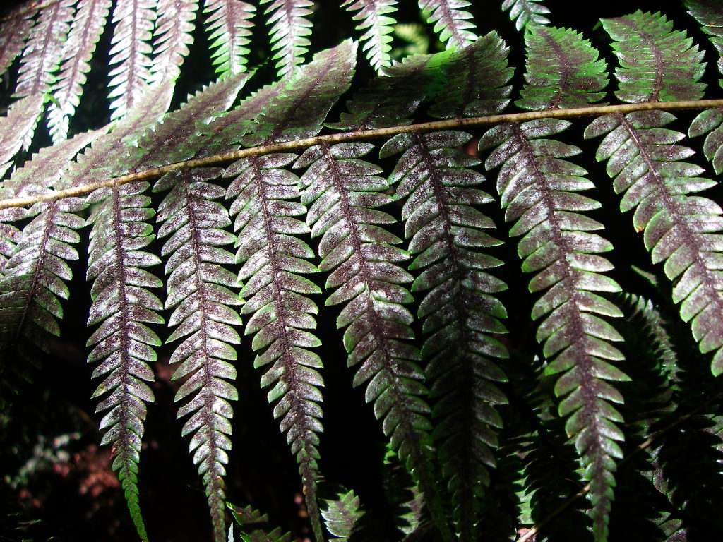
It becomes very obvious after a while, the reason for the use of a fern leaf as the symbol for New Zealand!
Photo: Don Hitchcock January 2007
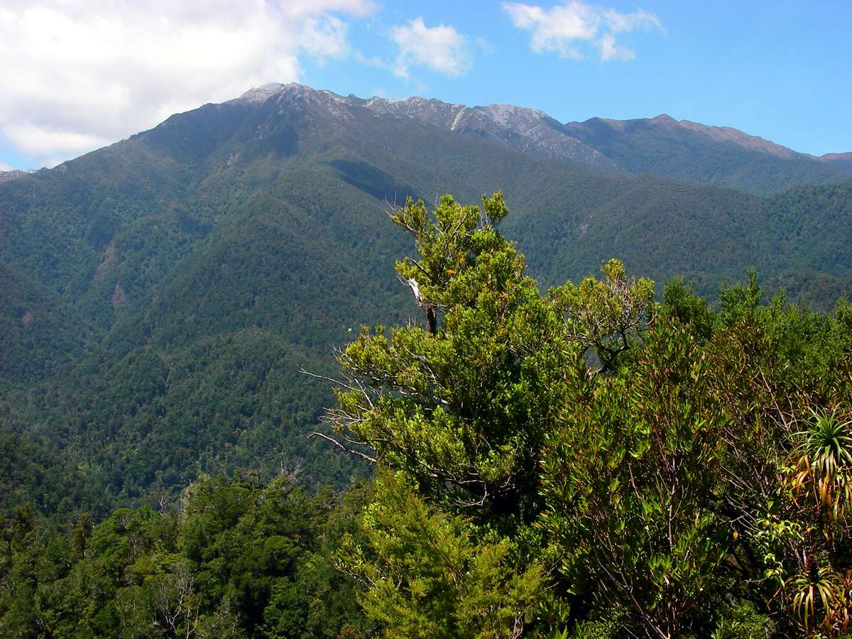
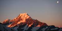
My first sight of some real mountains in New Zealand. These are probably not even named, but they would be something spectacular if seen in Australia!
Photo: Don Hitchcock January 2007
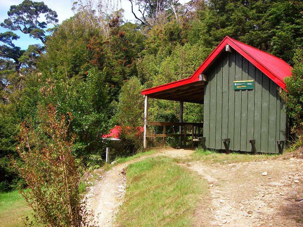
Aorere shelter. I got here just after four p.m., had another cup of coffee and considered staying here overnight, but decided to press on, and left about 4:30. It was the best decision, as there was still plenty of daylight, and the weather was excellent.
Photo: Don Hitchcock January 2007
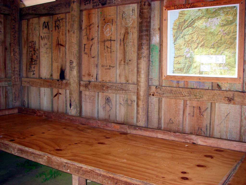
The Aorere shelter provides basic protection from the worst of the weather, with an awning and an open sleeping area, but there are no cooking facilities. I always carry alcohol as a fuel, and a range of stoves and pans, not least to maintain my caffeine habit. There is nothing like enjoying a superb view with a cup of freshly brewed turkish coffee in your hand.
Photo: Don Hitchcock January 2007
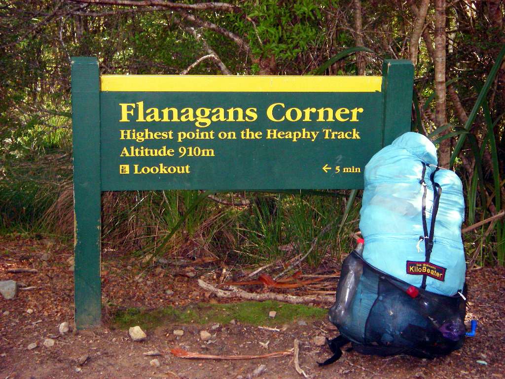
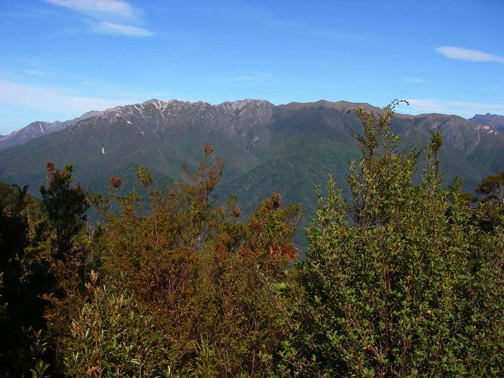
Flanagan's Corner is the highest point on the track, and the Perry Saddle Hut is just thirty minutes away. The view of the range across the valley from the lookout is superb. I got to Flanagan's Corner at around 5:30 pm.
This was my first attempt at making a backpack, and it was working very well, weighing about 400 grams all up. I have made gradual improvements since to the harness and to the volume of gear it will take, and there have been two completely new versions since, but this Mark One version worked well for the nine week tramping trip to the South Island.
Photo: Don Hitchcock January 2007
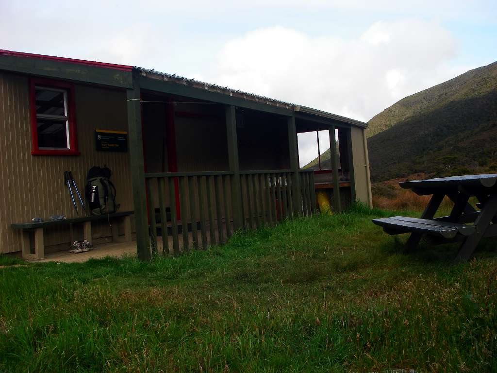
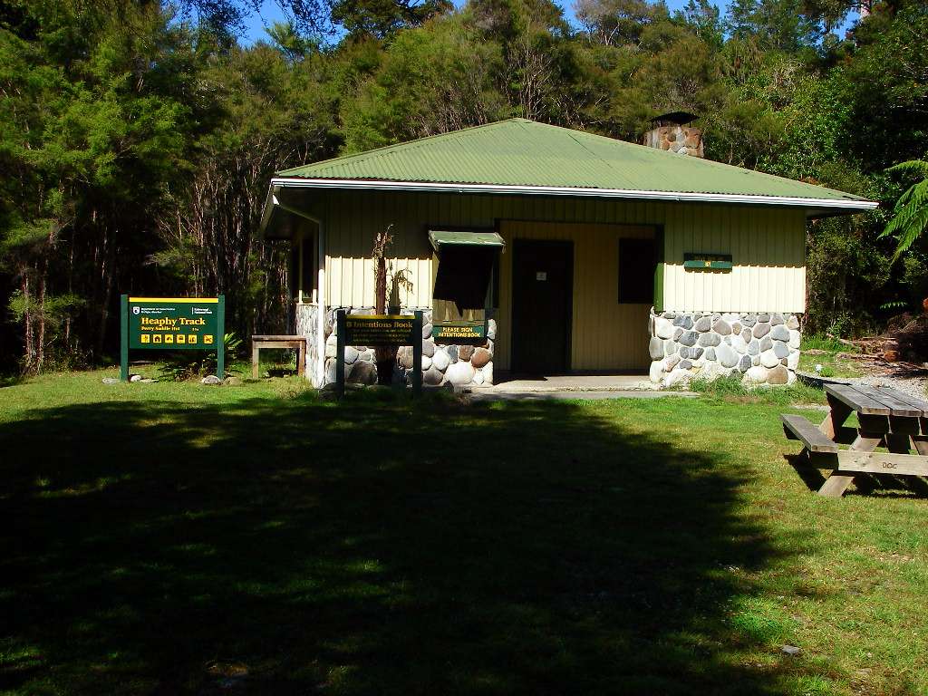
Perry Saddle Hut. All the huts are well set up with cooking facilities and sleeping benches provided with covered foam pads. These are set on their edge when you vacate the hut to allow ventilation of the pads and the benches. The system works well.
Occasionally a ranger will call to check that the tickets of the walkers are in order. They sometimes have to make adjustments in the way huts are organised with respect to sleeping arrangements for when people fall ill, or when the track is flooded.
Photo: Don Hitchcock January 2007
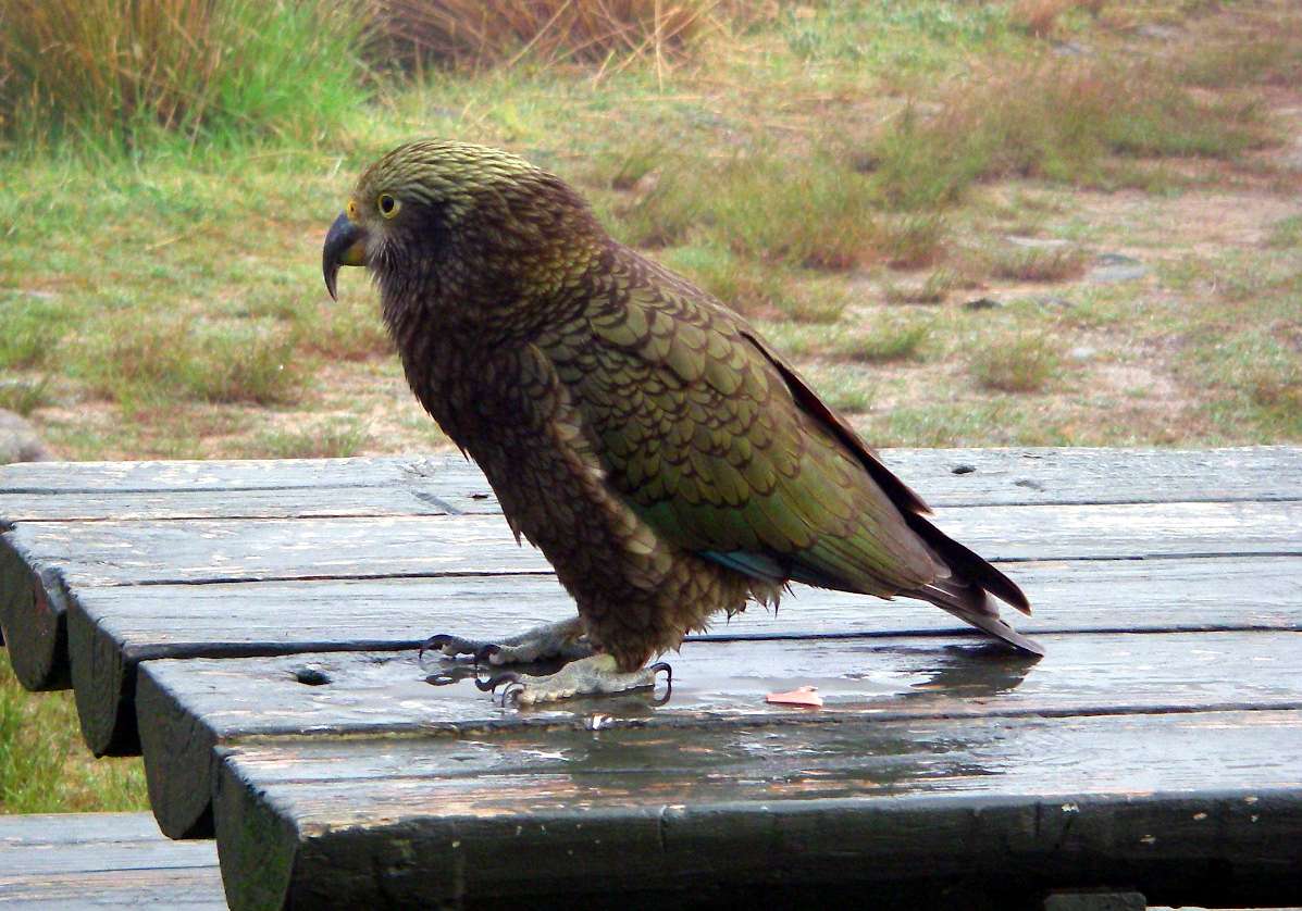
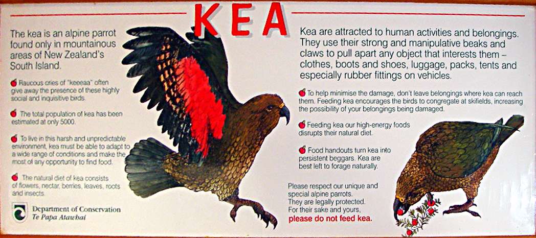
Keas are mountain parrots found only in the South Island of New Zealand. One of my abiding memories is that of a Kea making off with a packet of potato crisps, crisps trailing after it, after it had raided an open tramper's pack on top of Avalanche Peak.
Photo: Don Hitchcock January 2007
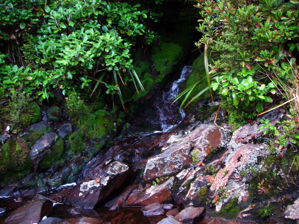
A beautiful little stream crossing the track about ten minutes after leaving the hut.
Photo: Don Hitchcock January 2007
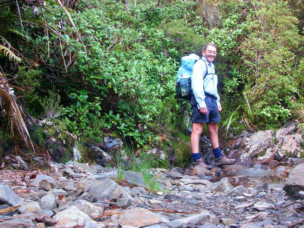
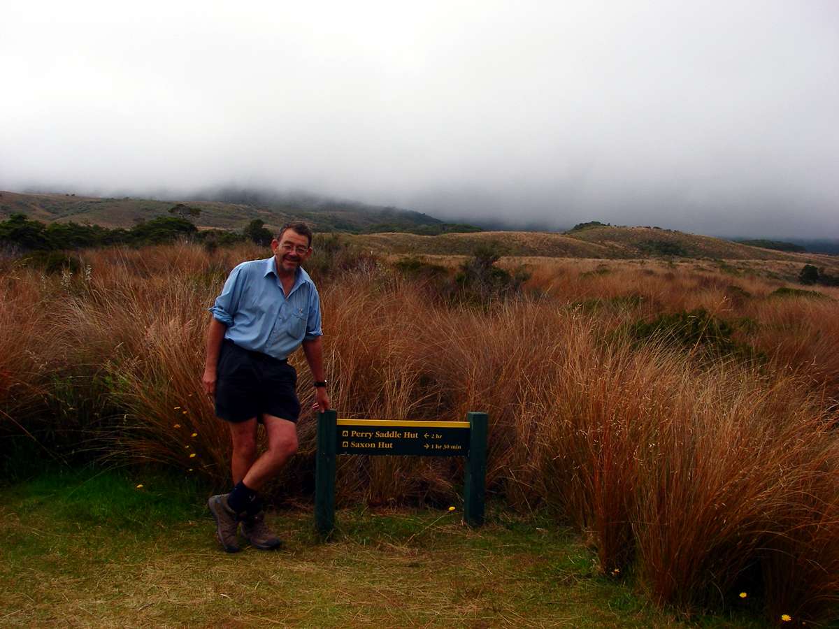
The author. I was much happier on the Heaphy track after putting some home made inners made of four layers of motorcycle inner tube into my boots at Takaka after the originals had packed it in, and being on broken ground and soft tracks after the flat, hard packed trail on the Abel Tasman Track.
Photo: Don Hitchcock January 2007
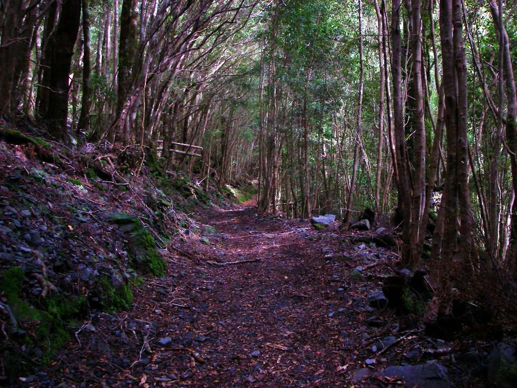
Good weather, a leaf littered track, and all the time in the world. Bliss.
Photo: Don Hitchcock January 2007
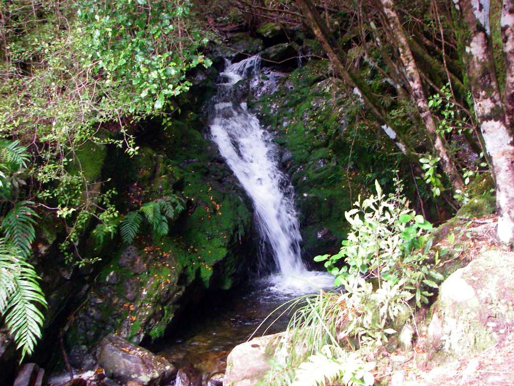
I never got used to the amount of water in New Zealand. Another beautiful little waterfall.
Photo: Don Hitchcock January 2007
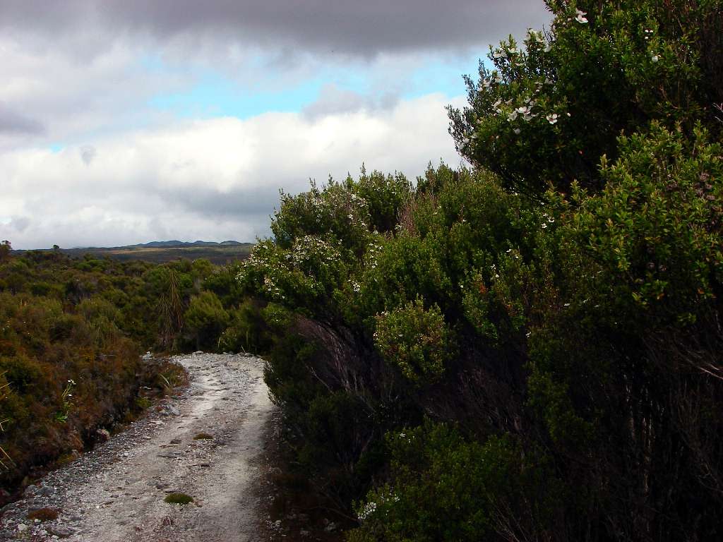
Leaving the forest behind, and entering the plains.
Leptospermum scoparium, the Australian teatree, is widespread in this area.
Photo: Don Hitchcock January 2007
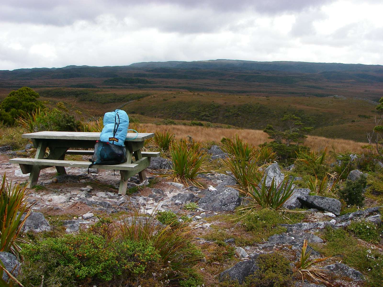
Gouland Downs stretching out before the walker, to the horizon. A lovely place to brew up a cup of coffee.
Photo: Don Hitchcock January 2007
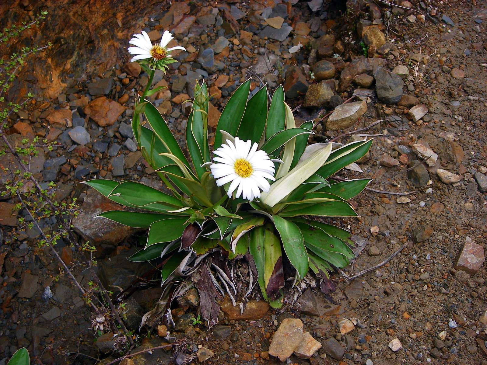
A member of the daisy family. I was disappointed in the number of flowers (and, for that matter, insects, birds, frogs and other native animals) in New Zealand. It appears to be a real Gondwanaland flora, with few flowering plants.
This looks like the New Zealand Daisy, Celmisia verbascifolia.
Photo: Don Hitchcock January 2007
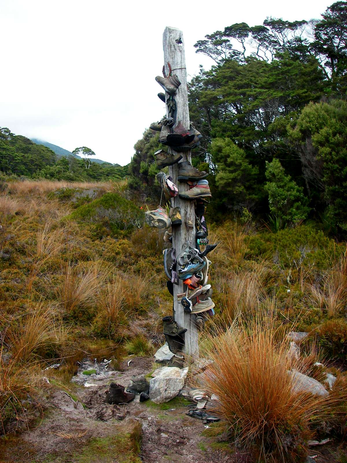
The boot tree!
This is near Cave Brook, on the Gouland Downs.
Photo: Don Hitchcock January 2007
Ten minutes later, Gouland Downs hut appears to view.
Gouland Downs Hut is the oldest hut on the Heaphy track, and although it is small, it is well appointed. It was built in 1920, and has had several upgrades since then.
Photo: Don Hitchcock January 2007
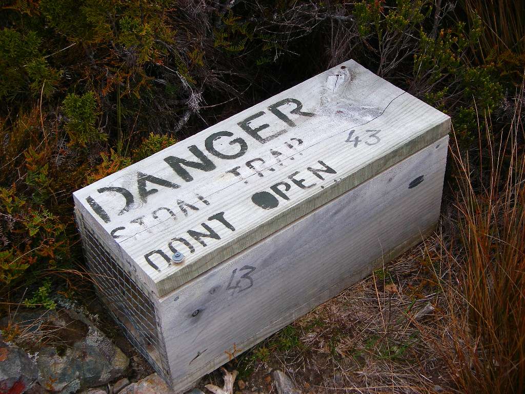
This was the first trap I had seen. I was to see many, many more along the tracks on my way through the South Island parks. Feral animals such as stoats and weasels are a real problem in New Zealand, and the National Parks are doing everything they can to get rid of them.
Photo: Don Hitchcock January 2007
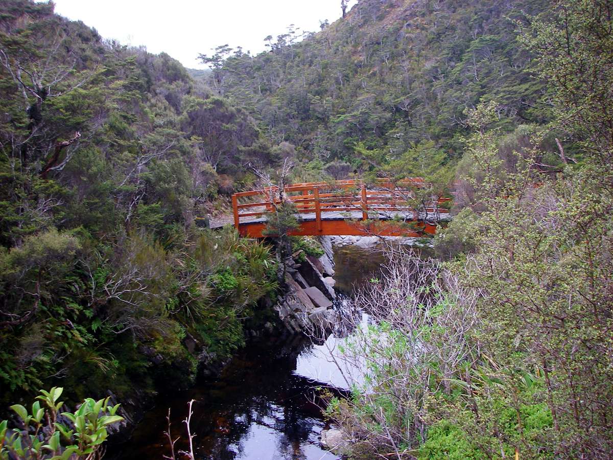
The bridge over Cave Brook is beautifully made, evoking the look of a Japanese garden.
Photo: Don Hitchcock January 2007
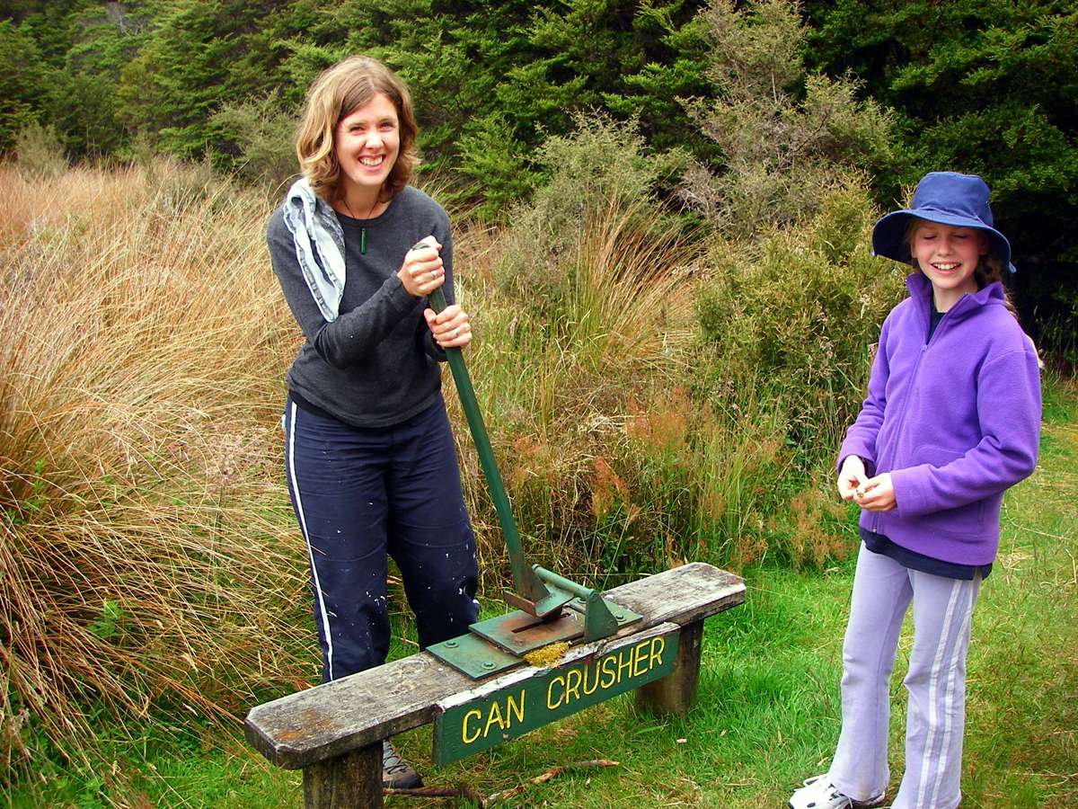
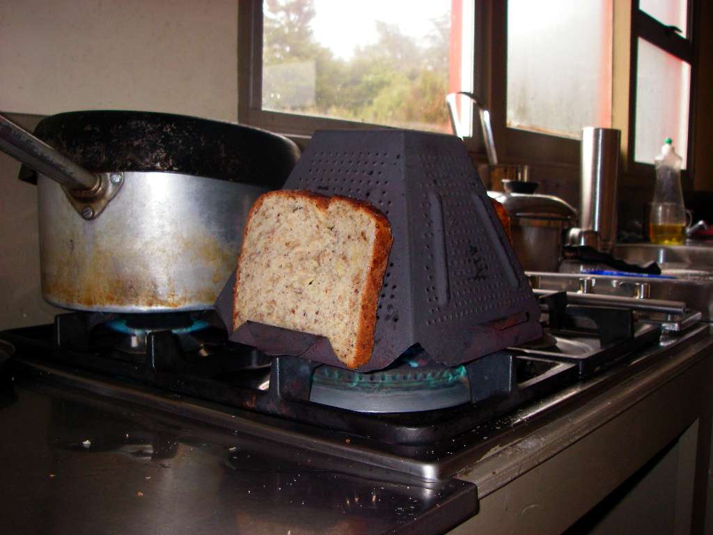
I had lunch at Gouland Hut, and found an example of the way bushwalkers used to provision themselves before freeze dried and other lightweight meals became widely available.
This can crusher (obligingly demonstrated for me by some other walkers staying at the hut!) meant that the cans could occupy less space in the pack after being emptied of their contents and washed. When I first started bushwalking fifty years ago, we would "burn, bash and bury" cans, but now you are expected to carry them out, and the corresponding tag is
"The tins you carry on your back are lighter on the journey back!"
Photo: Don Hitchcock January 2007
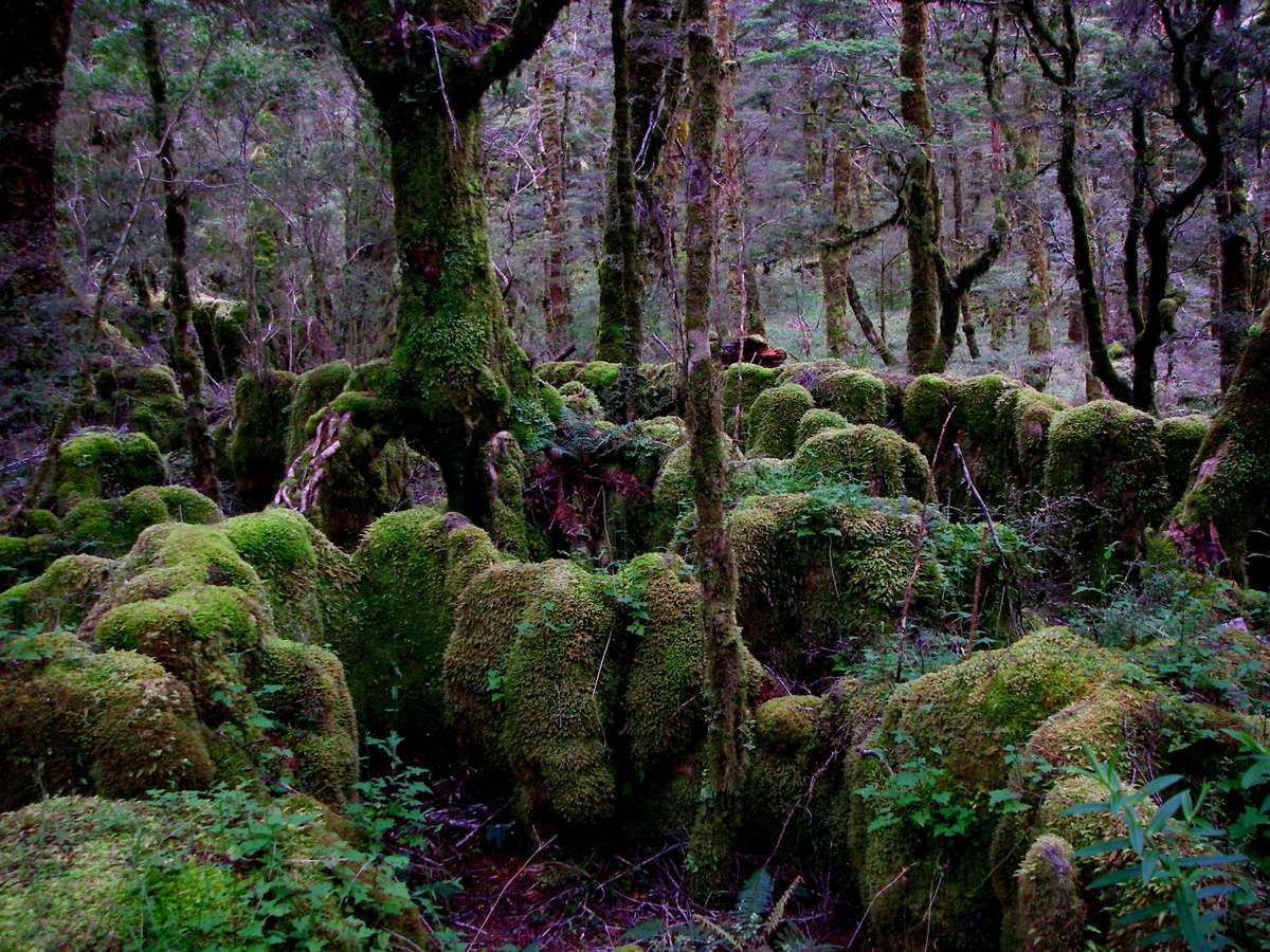
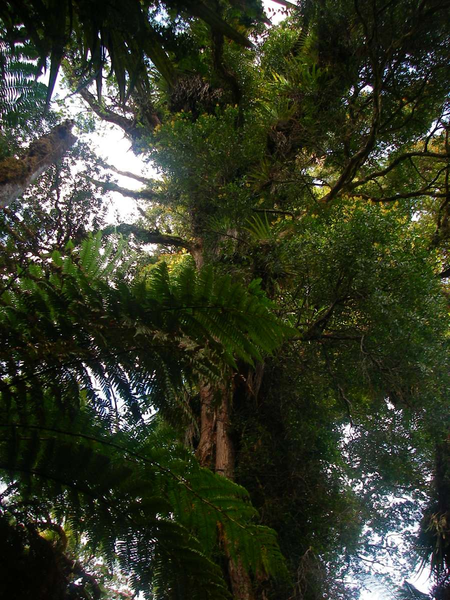
New Zealand rainforest looks an awful lot like the Lord of the Rings. As you might expect.
Photo: Don Hitchcock January 2007
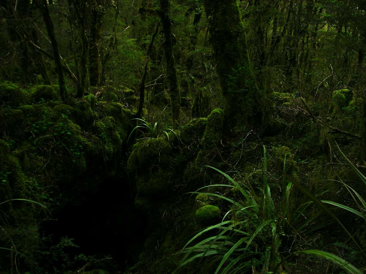
I called this the Moss Forest.
Fangorn, the forest of the Ents, must have looked a lot like this, I reckon.
I half expected Treebeard to appear around the next turn of the track.
Photo: Don Hitchcock January 2007
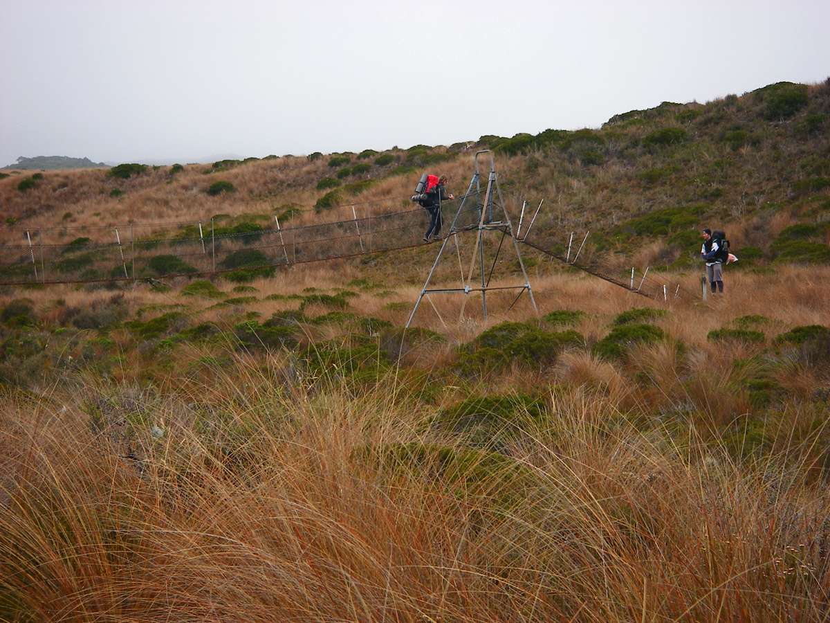
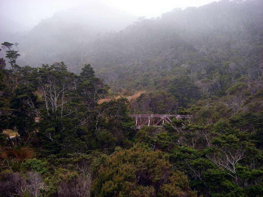
I was very impressed with the bridges across the rivers and creeks. They were well constructed, and elegant in design. They had minimal impact on the local ecology, but were stable, safe, and would last for a long time with very little maintenance.
Photo: Don Hitchcock January 2007
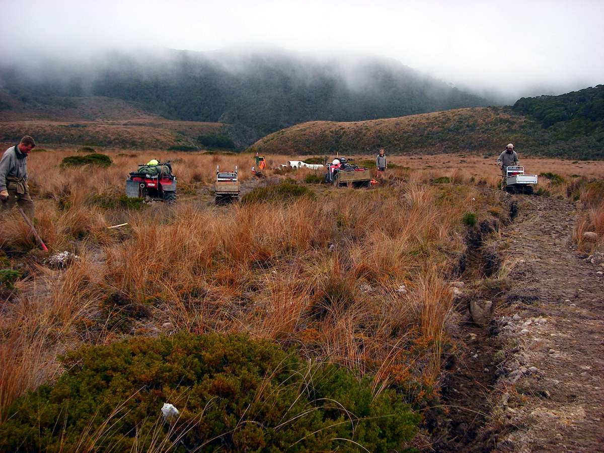
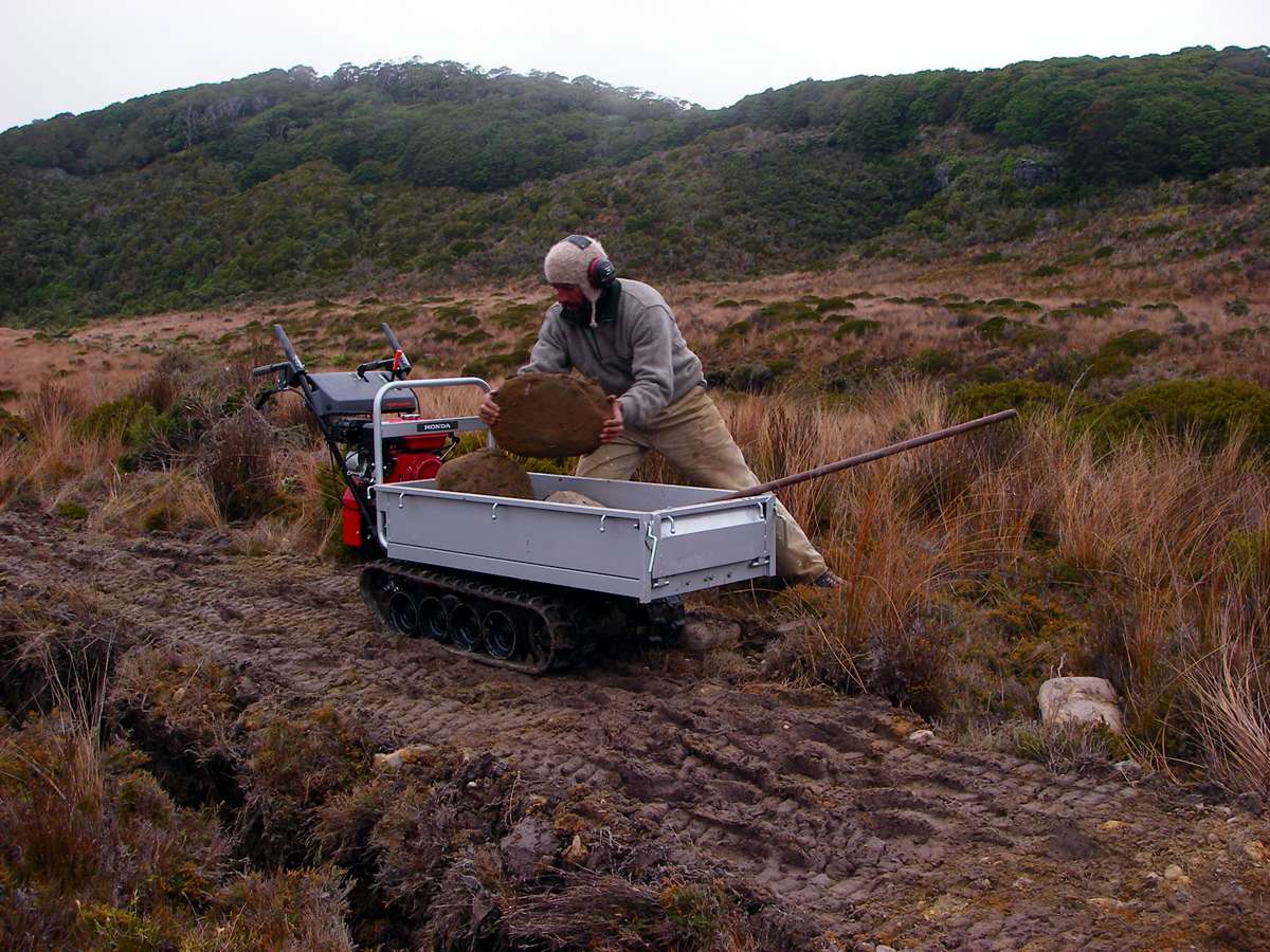
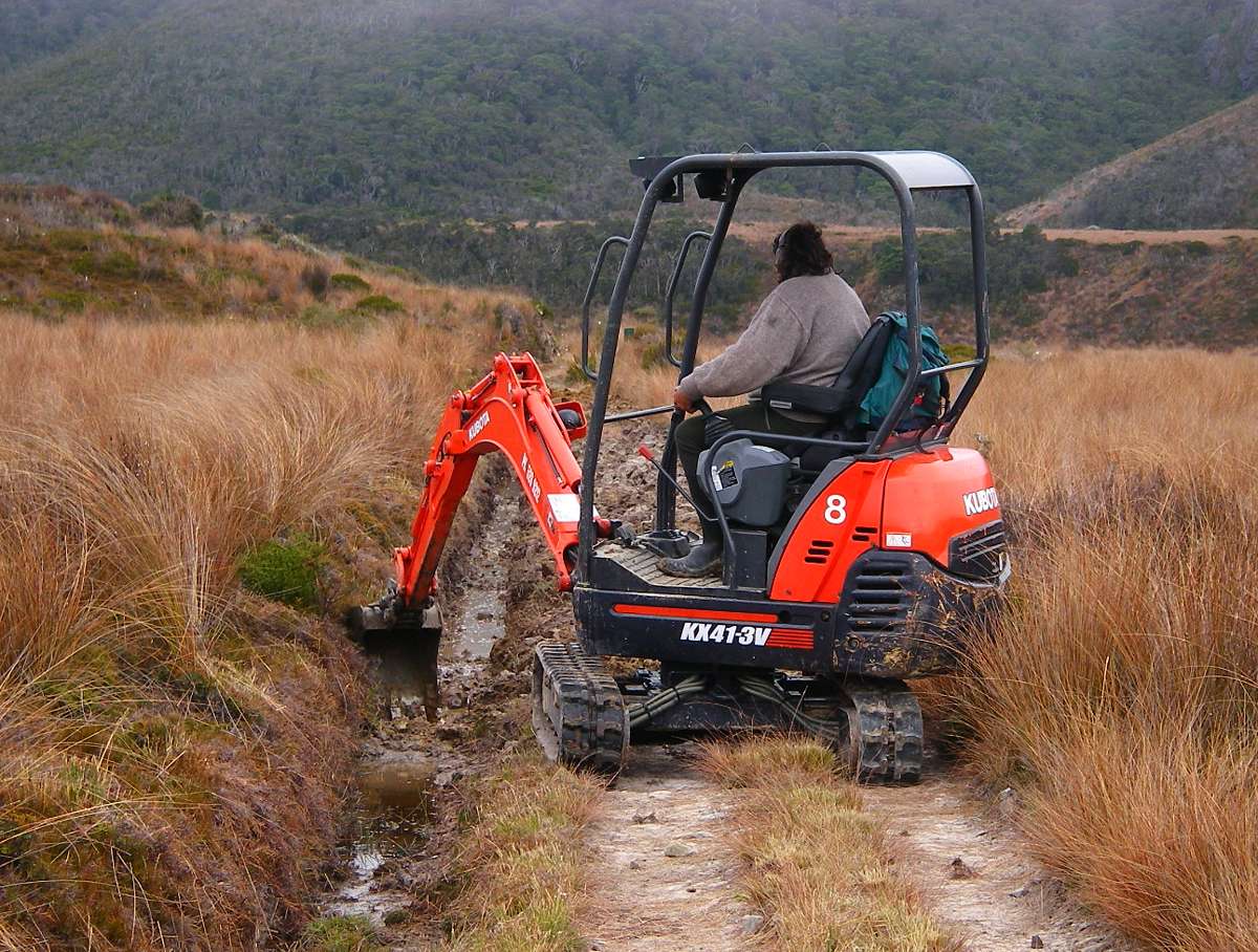
Track work is necessary throughout the summer to maintain a good standard. The NZ Government is to be congratulated on the investment they have made in track safety and a high standard of utility of the track system.
Although the number of walkers is probably not economic for the amount of money they have ploughed into the system, the fact that it exists is enough to attract many hundreds of thousands of tourists to New Zealand, most of whom never get to the beautiful parts only accessible to fit walkers, but they can dream....
Photo: Don Hitchcock January 2007
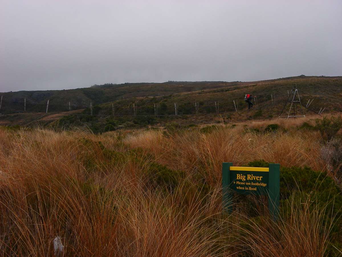
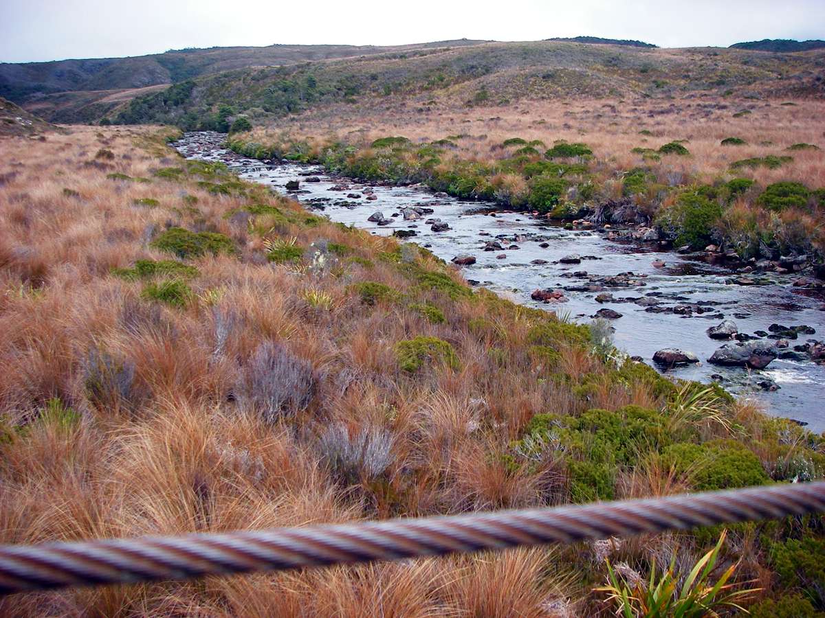
Big River is a major crossing point.
Photo: Don Hitchcock January 2007
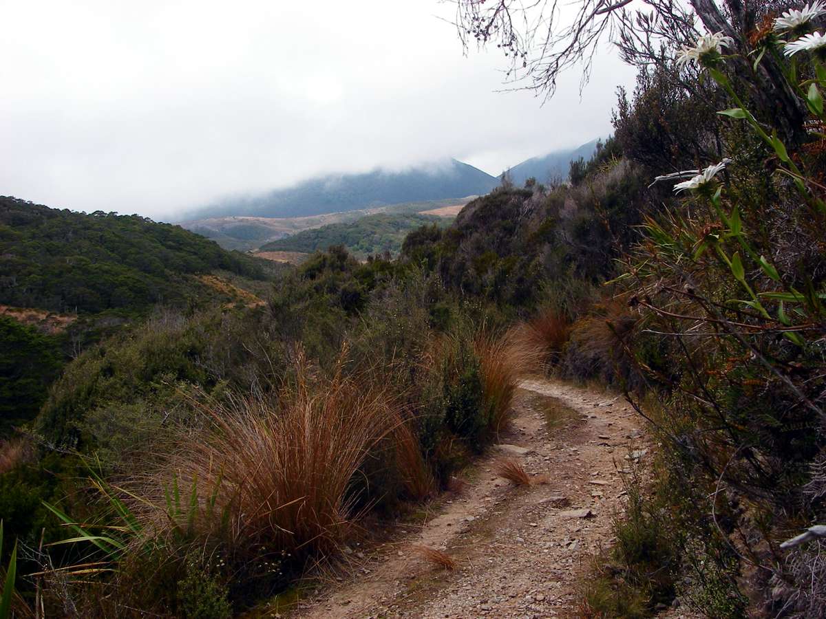
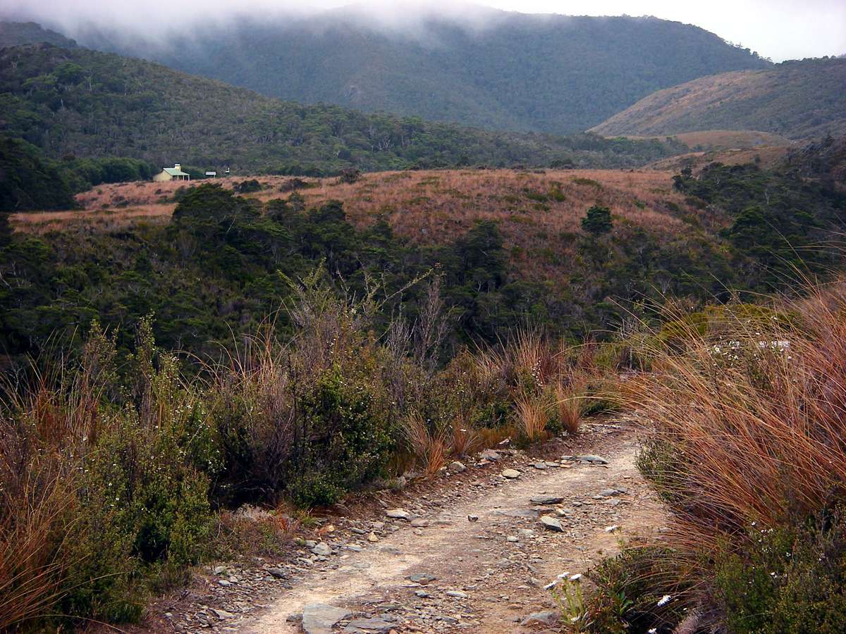
Fifteen minutes later, the track takes a turn downhill, towards Saxon Hut.
Photo: Don Hitchcock January 2007
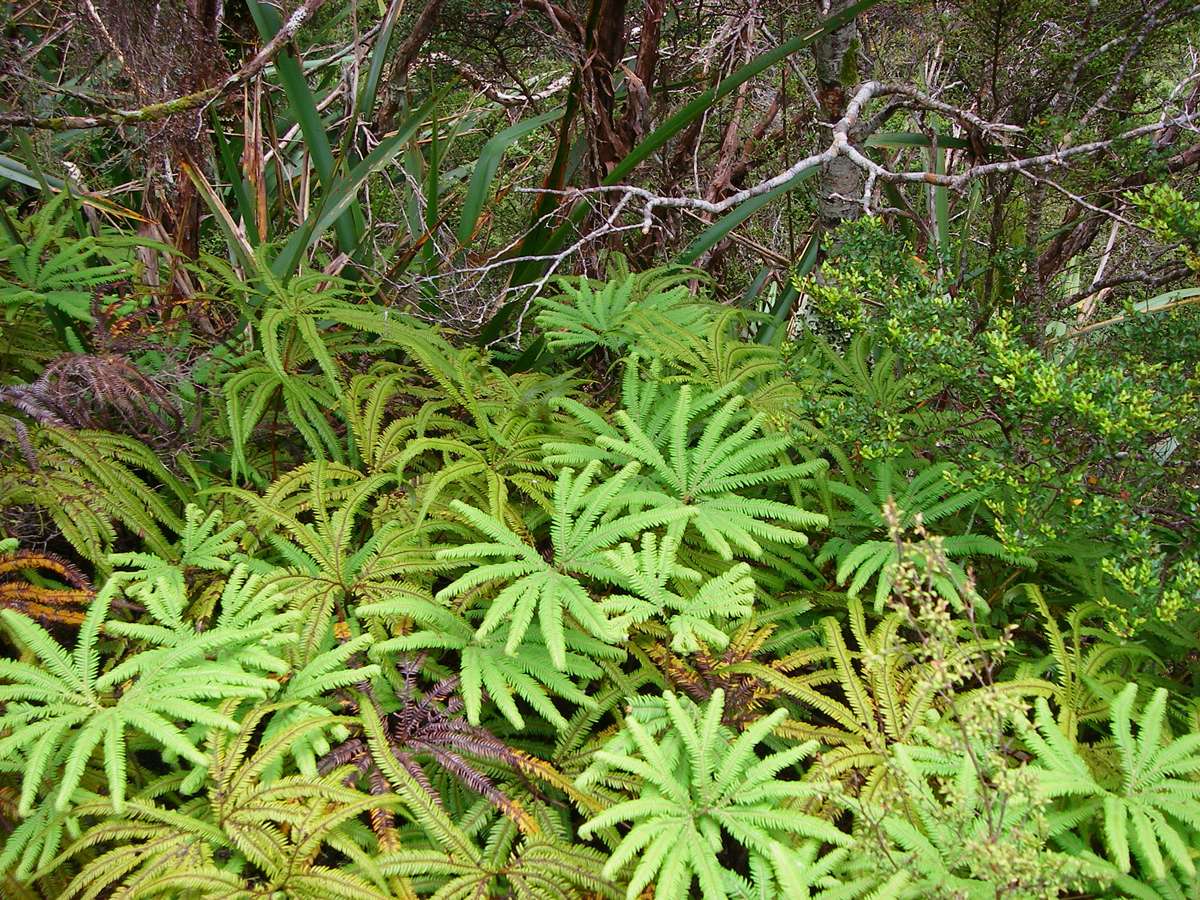
They've got an awful lot of ferns in NZ. We would call this five fingered fern in Australia, but this common name seems to apply to a large number of species. It looks like an Adiantum sp., one of the Maidenhair group of ferns.
Photo: Don Hitchcock January 2007
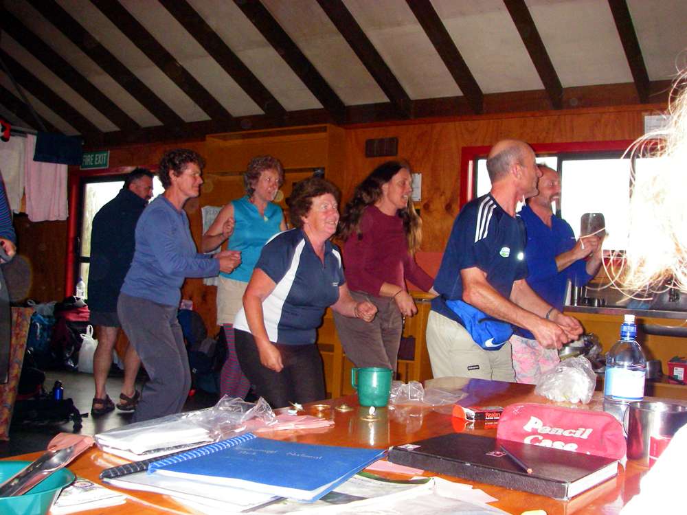
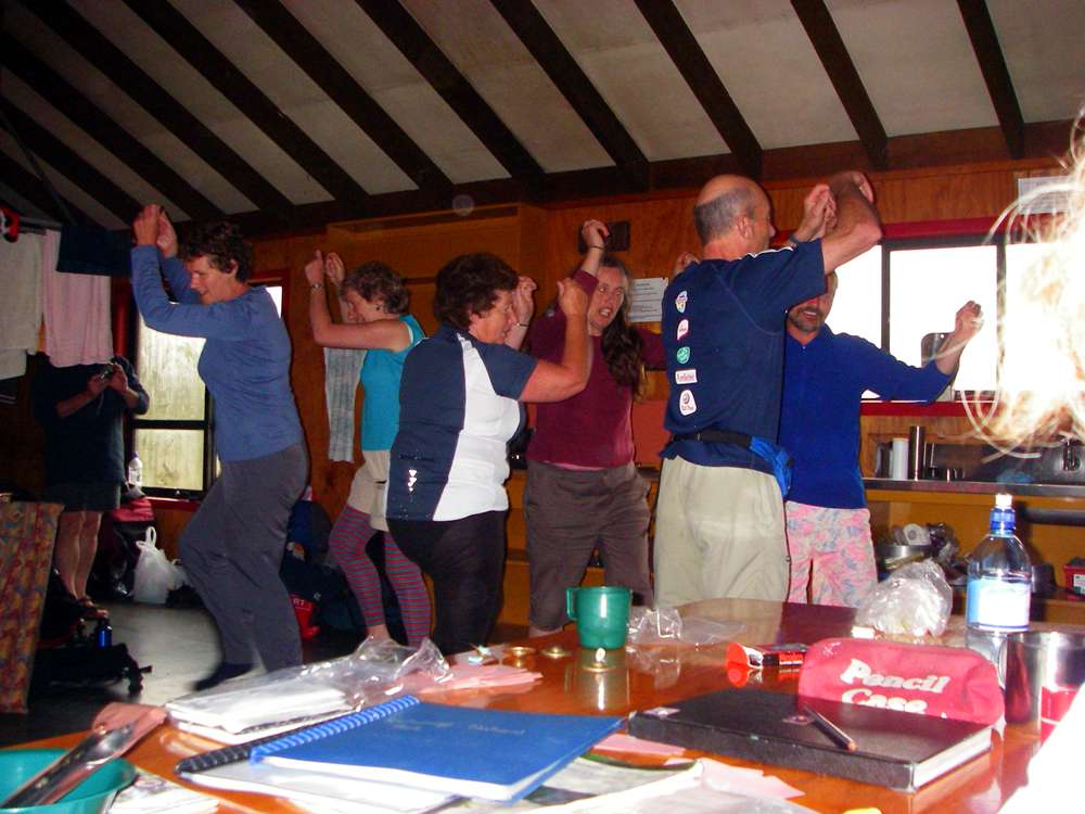
At Saxon hut, we were treated to an impromptu performance by some Morris Dancers! It was a great evening.
Around one a.m. I heard my first and only Kiwi call. They are very hard to spot, and certainly so from the comfort of your sleeping bag, inside a hut!
Photo: Don Hitchcock January 2007
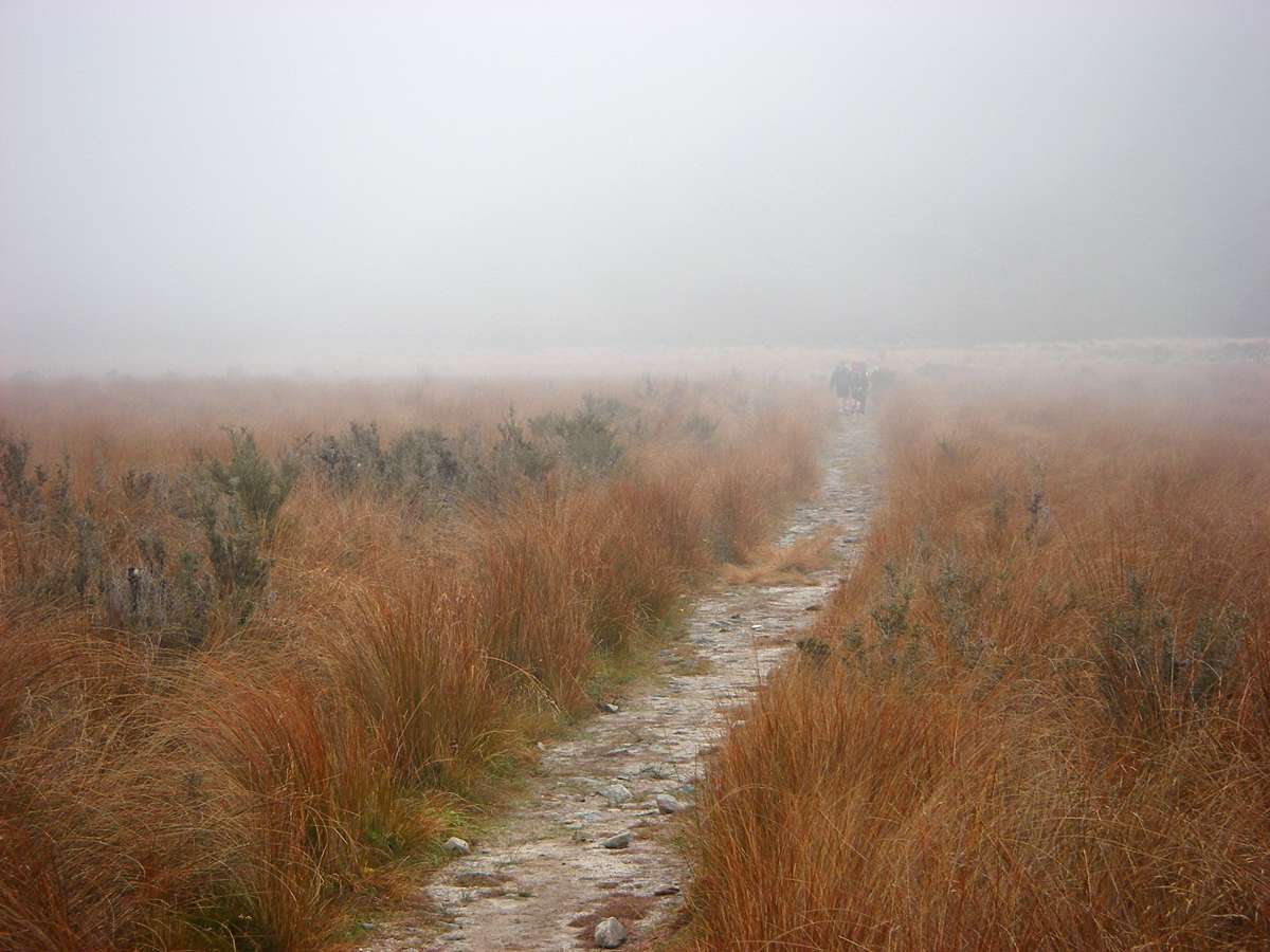
Next morning I set off for James Mackay hut. The weather was misty with a drizzle of rain at first. It was rare to get a day without some rain or at least heavy cloud and "scotch mist" on this trip.
Photo: Don Hitchcock January 2007
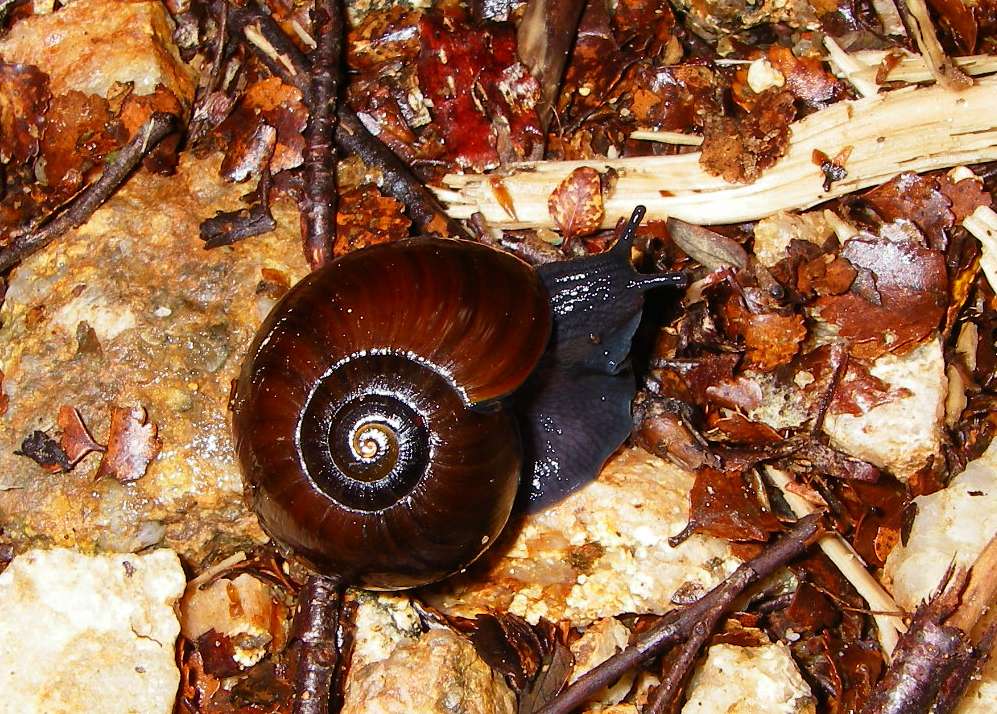
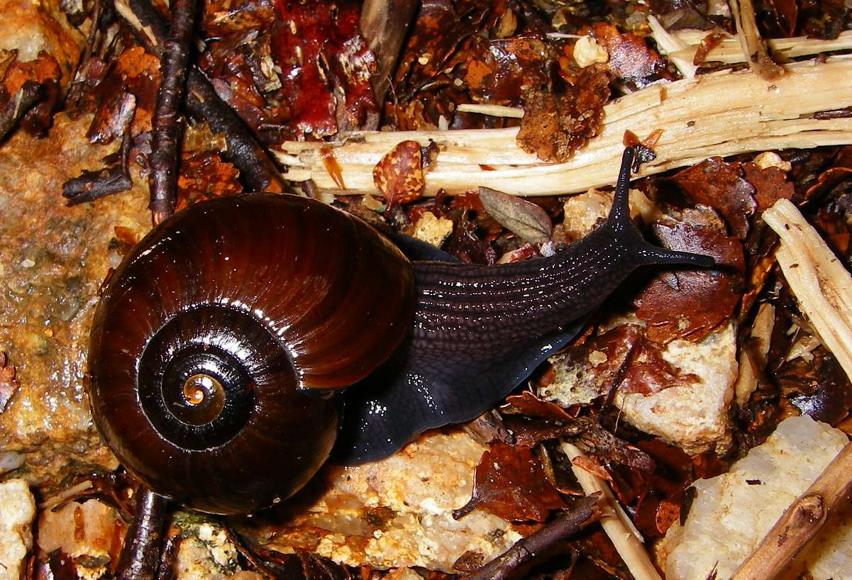
New Zealand land snail. According to a NZ government site, they are voracious meat eaters, sucking up earthworms as though they were spaghetti, and are mostly nocturnal. They also eat slugs and smaller snails.
Photo: Don Hitchcock January 2007
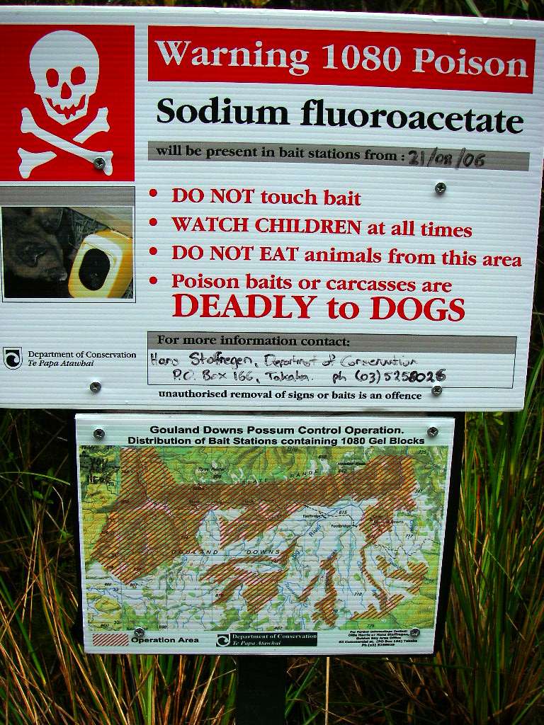
The New Zealand Department of Conservation fights a never ending battle against the feral possum from Australia. Introduced for the fur trade, they quickly became a pest, and there are many millions of possums in New Zealand. The pelts and fur are made into various items, and I bought a very warm hat to bring home to my wife. 1080 is a poison bait used in Australia to control foxes and wild dogs, but here it is being used against possums. Possums form most of the roadkill on NZ roads.
Photo: Don Hitchcock January 2007
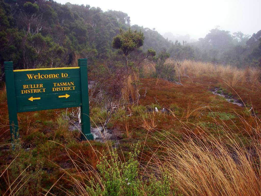
The area reminded me strongly of Tasmania, with similar vegetation, and the same moist, clean, beautiful environment.
And soggy underfoot!
Photo: Don Hitchcock January 2007
Yet another beautifully made bridge.
Photo: Don Hitchcock January 2007
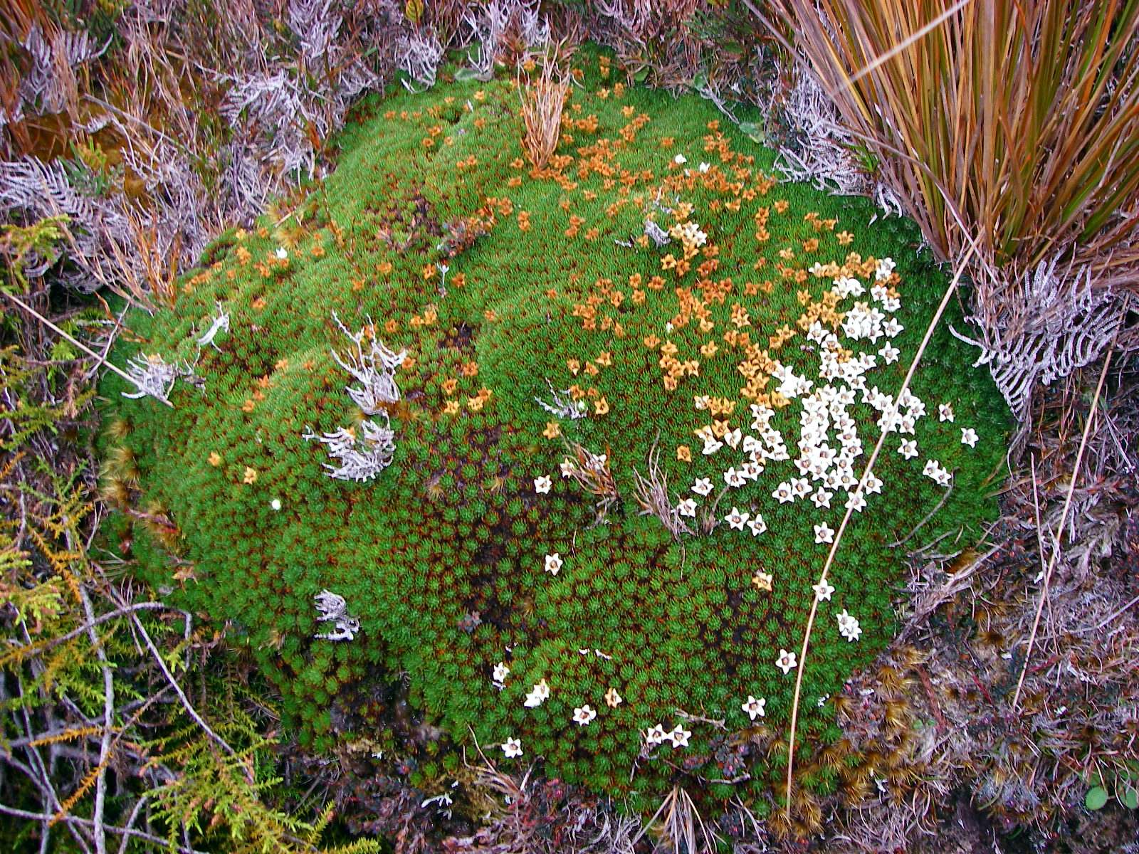
Veronica (formerly Chionohebe and before that formerly Pygmea) sp.
This is a cushion plant which grows in sub-alpine to alpine environments, in exposed sites.
Photo: Don Hitchcock January 2007
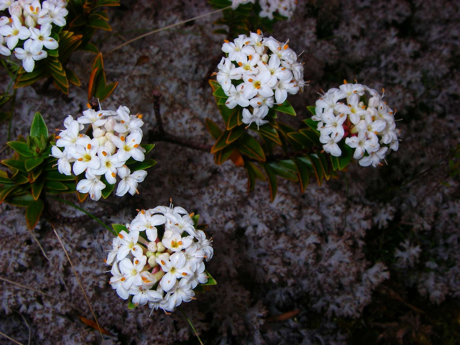
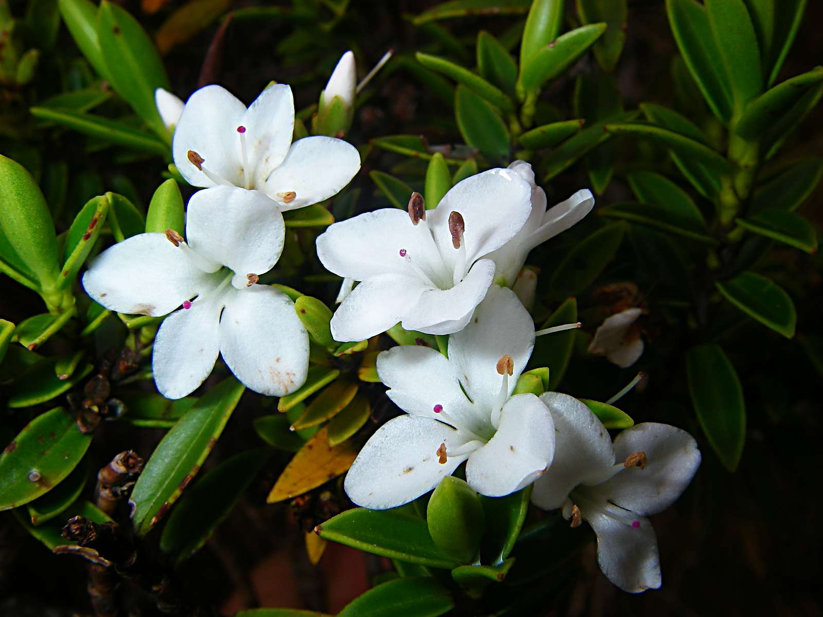
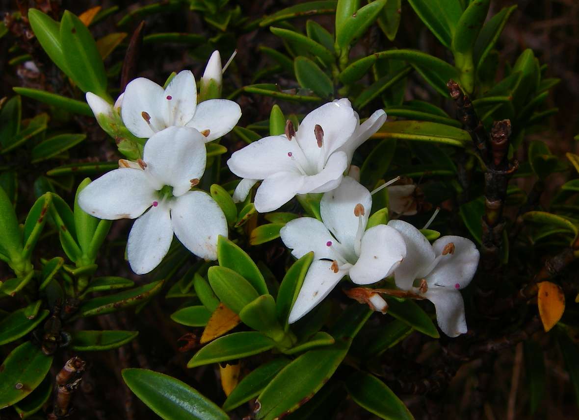
Pimelea sp.
Photo: Don Hitchcock January 2007
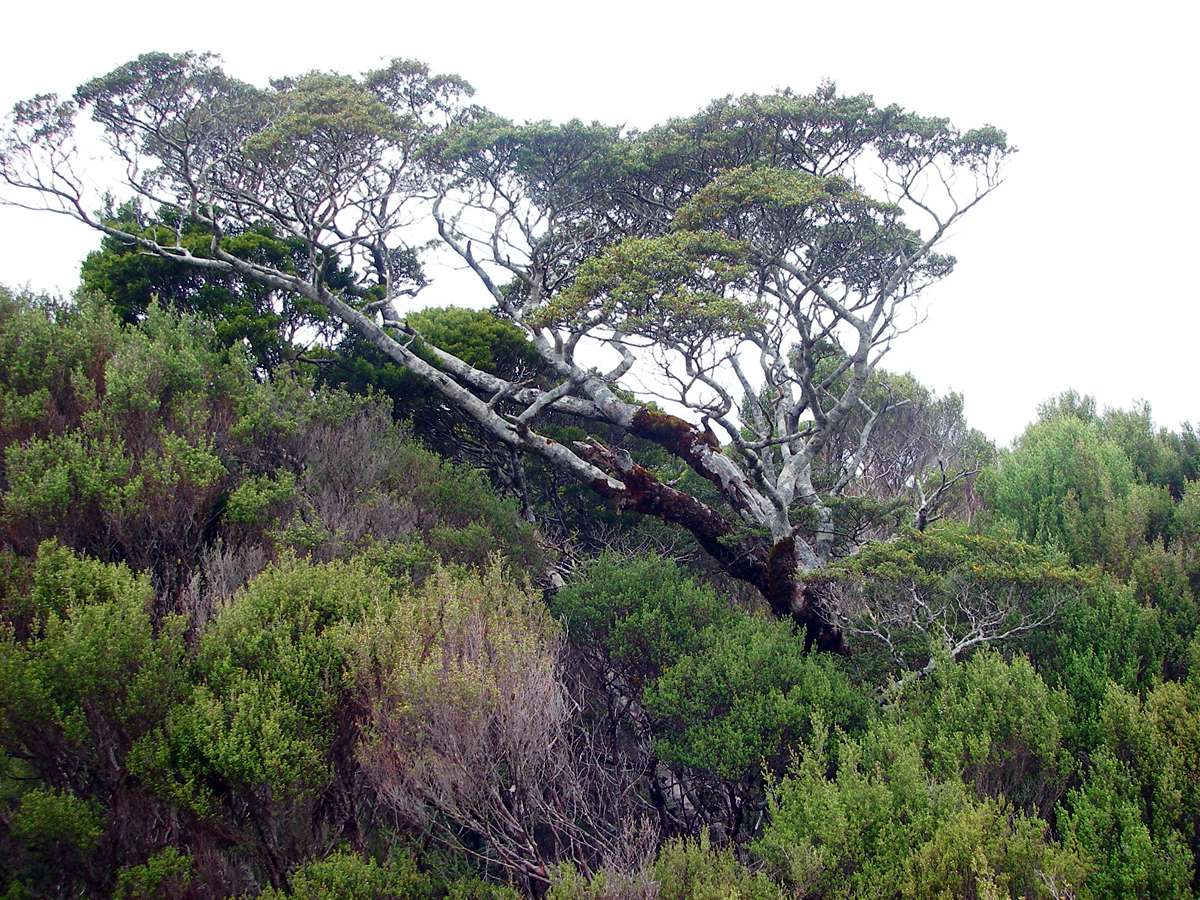
The wind swept nature of this area is attested to by the shape adopted by this tree.
Photo: Don Hitchcock January 2007
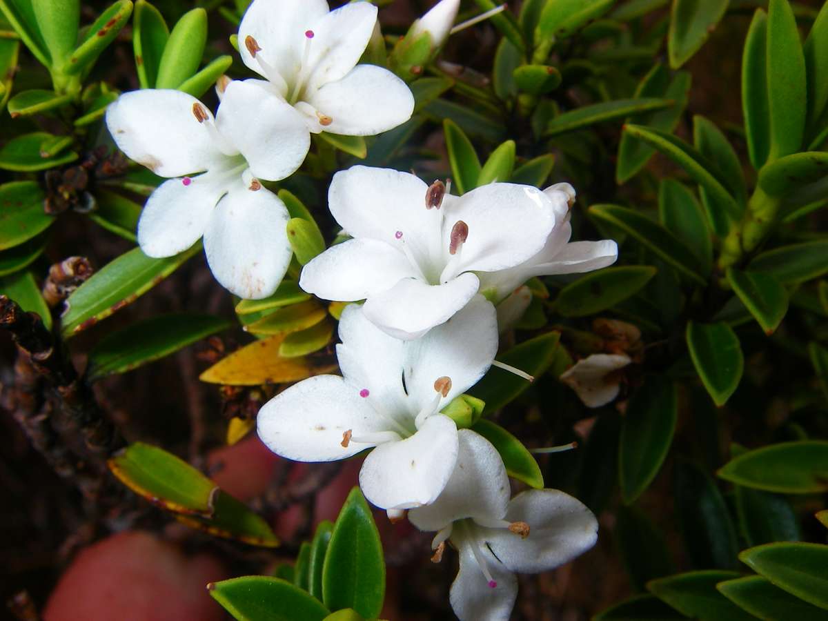
Hebe cockayniana
A sub-alpine to low-alpine plant in the high rainfall regions of the South Island of New Zealand.
Photo: Don Hitchcock January 2007
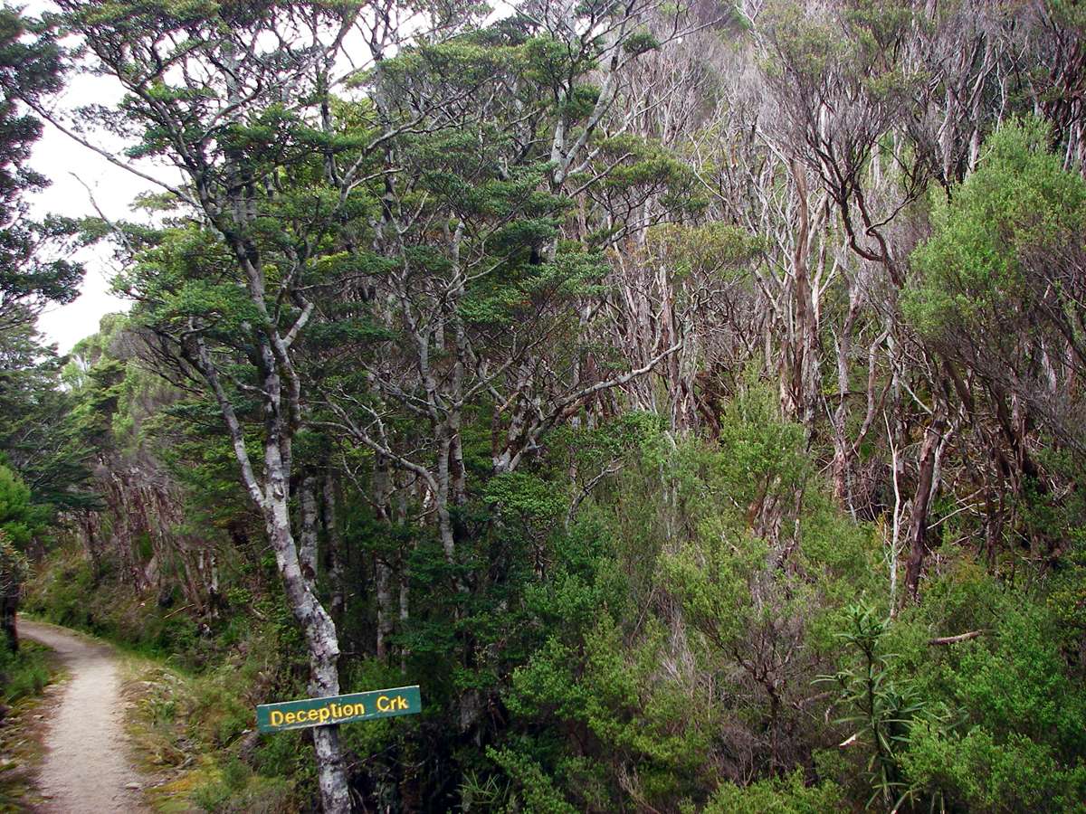
Deception Creek crossing, not far from James Mackay hut.
Photo: Don Hitchcock January 2007
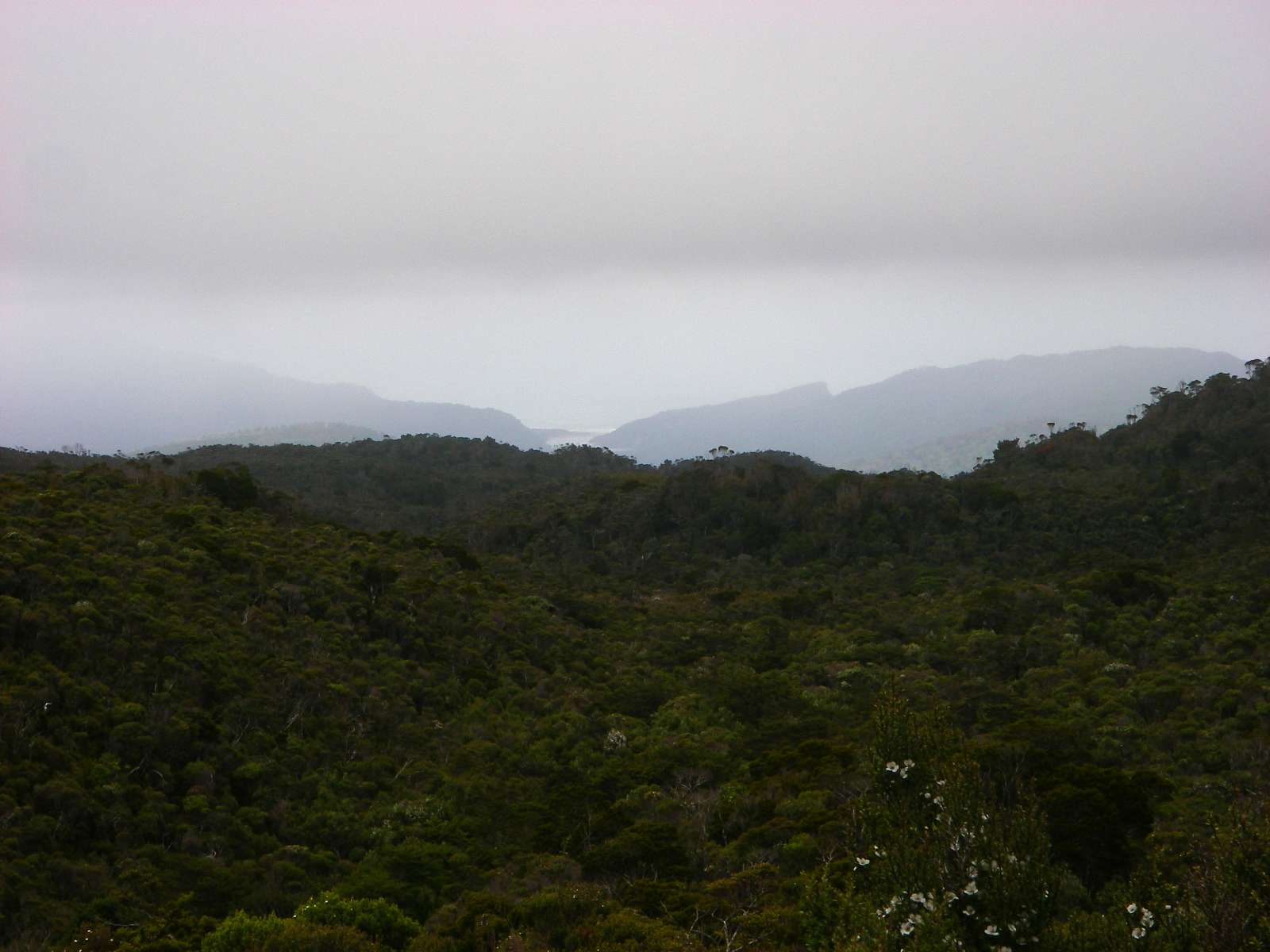
From this vantage point outside James Mackay hut, you can see the ocean, and the estuary of the Heaphy River.
Photo: Don Hitchcock January 2007
A weka outside the hut early in the morning, not long before I left James Mackay hut to go to Heaphy hut.
Photo: Don Hitchcock January 2007
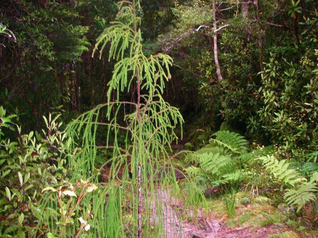
On the way to Heaphy hut, this conifer (?) with a weeping habit stood out as unusual. It was the only one I saw on the trip.
Photo: Don Hitchcock January 2007
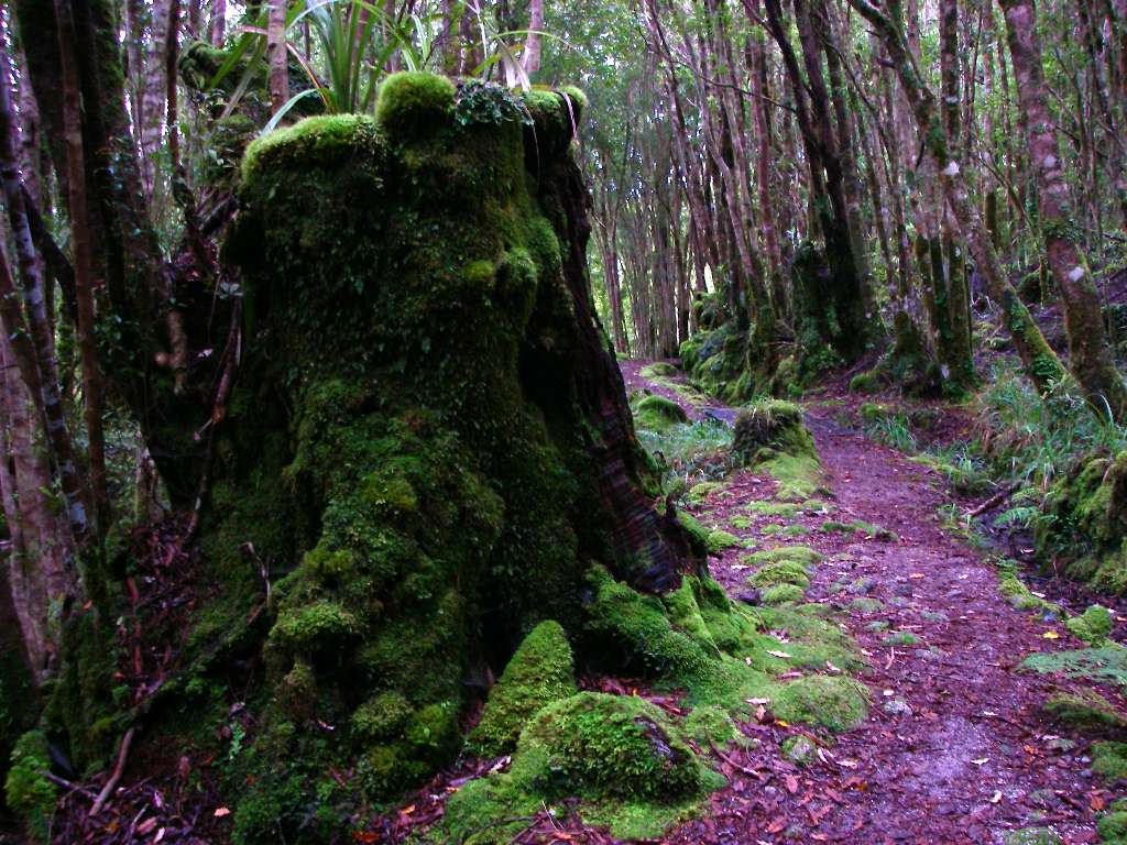
This ancient stump covered in moss may be the remnants of a previously logged forest. The other trees look like regrowth.
This sort of sheltered, soft underfoot track with interesting vegetation is a joy to walk on.
Photo: Don Hitchcock January 2007
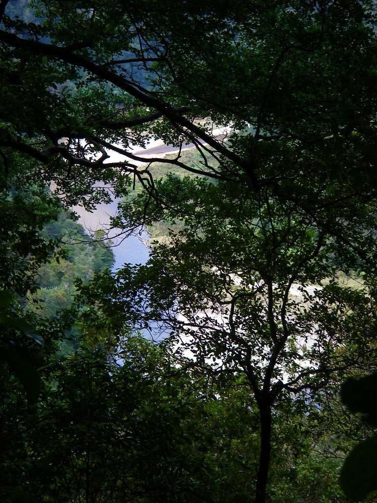
Looking straight down at the Heaphy River.
Photo: Don Hitchcock January 2007
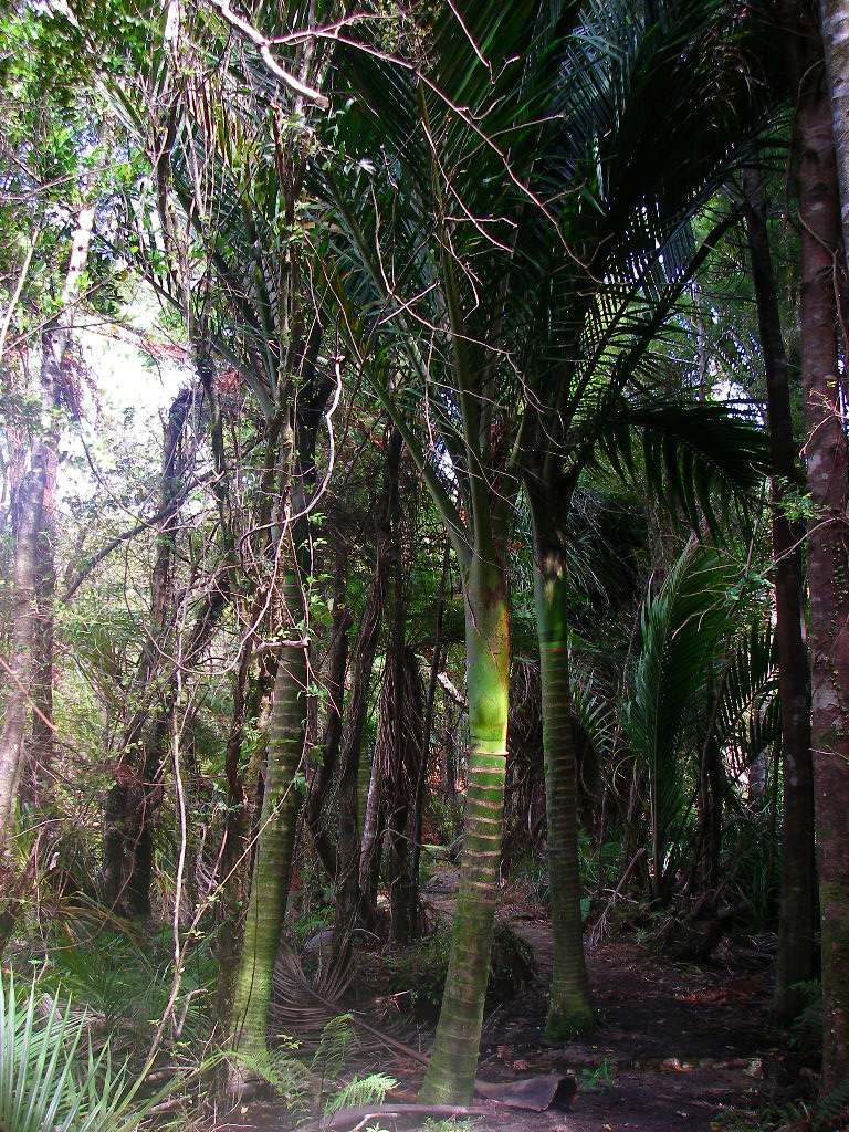
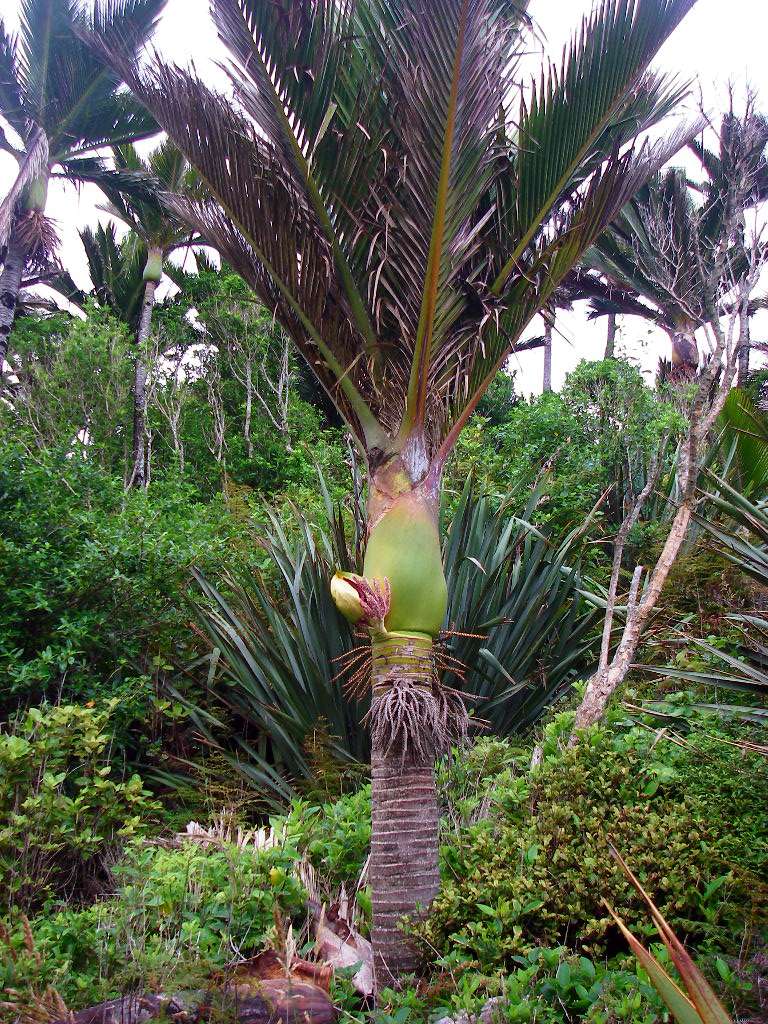
My first sight of the Nikau palms which are a signature species on the coastal part of the Heaphy track.
The Nikau palm (Rhopalostylis sapida) is endemic to New Zealand.
Photo: Don Hitchcock January 2007
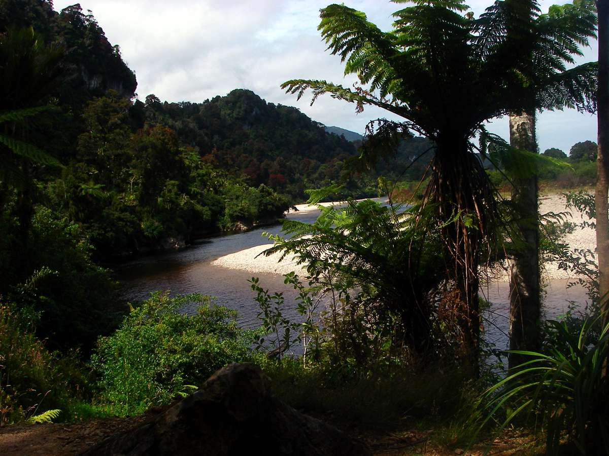
By the banks of the Heaphy.
Photo: Don Hitchcock January 2007
Two other walkers happy to be at the coast. The weather was starting to warm up, and the sun was out.
Photo: Don Hitchcock January 2007
Epiphytes on trees.
Photo: Don Hitchcock January 2007
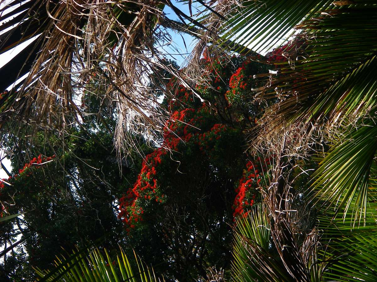
The red flowers of the Pohutukawa or Metrosideros excelsa were most striking. The name Pohutukawa is a Maori word meaning ‘drenched with mist’. It can grow to 25 m.
Photo: Don Hitchcock January 2007
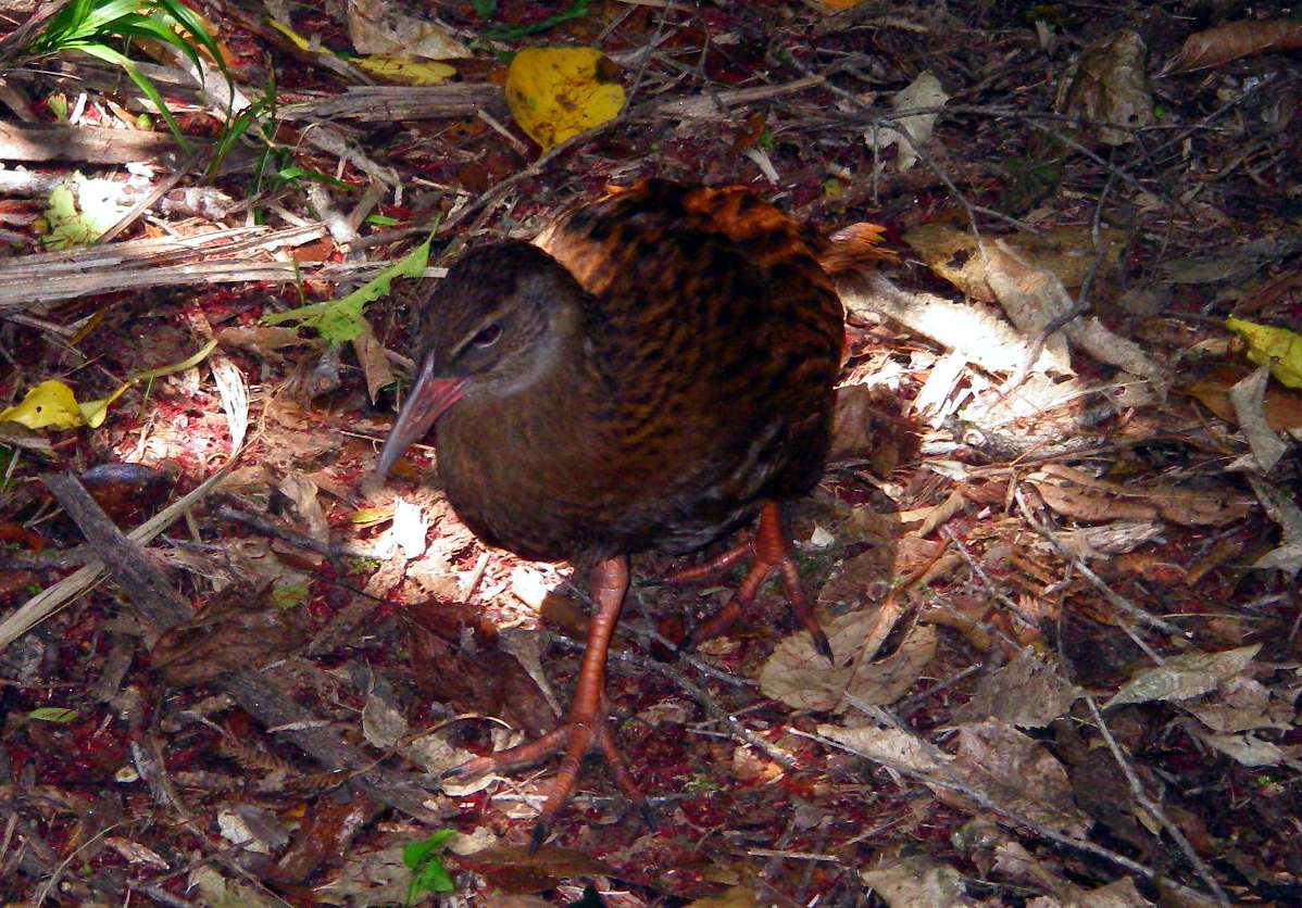
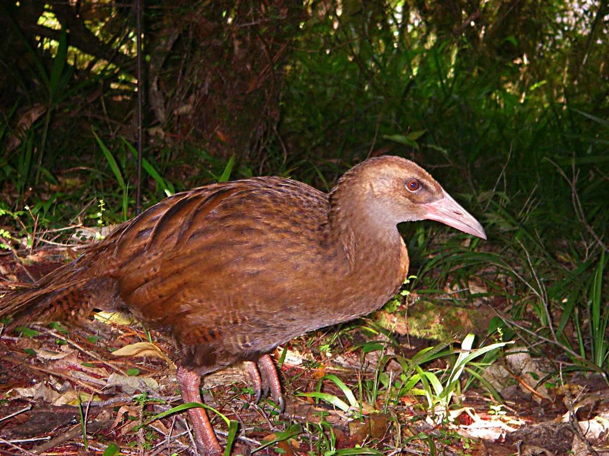
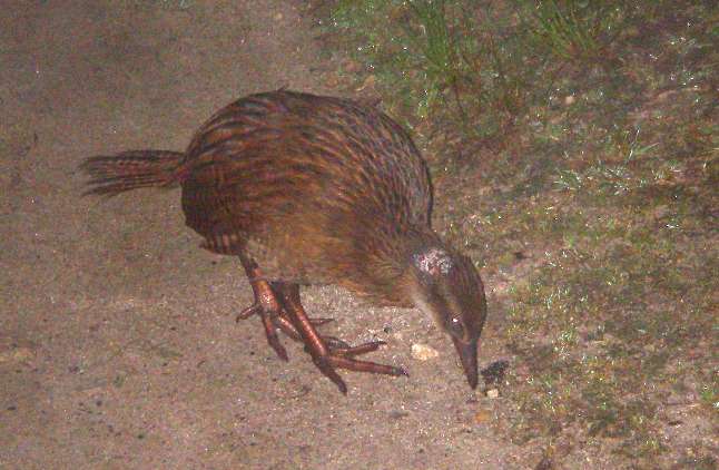
At last I got some reasonable shots of a Weka, Gallirallus australis, the ground dwelling bird of New Zealand. It is a member of the rail family of birds. This is the western subspecies of the Weka.
Photo: Don Hitchcock January 2007
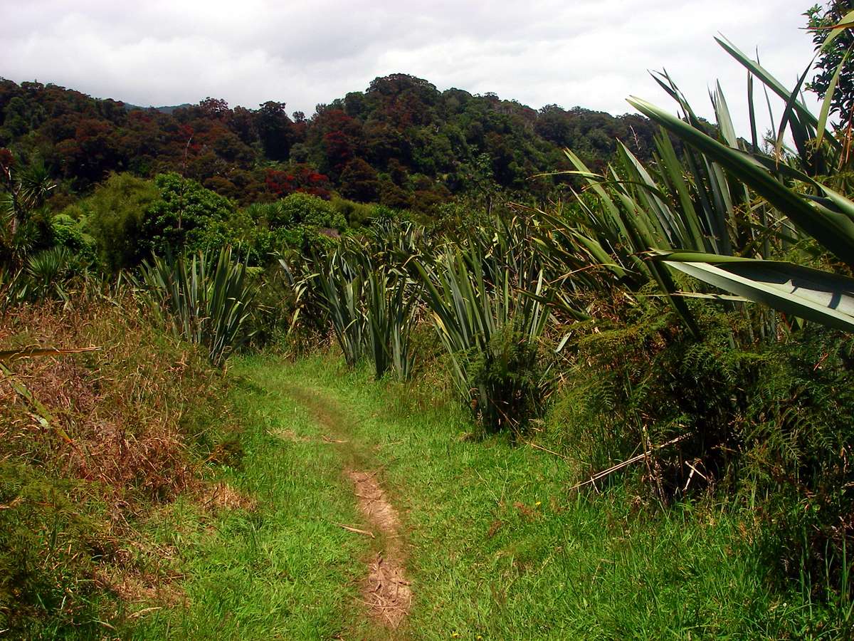
Approaching Heaphy hut, the track seemed to be going through patches of degraded areas, where grazing had occurred in the past, with some encroachment of exotic species including grasses. The landscape looked to some extent man made.
Photo: Don Hitchcock January 2007
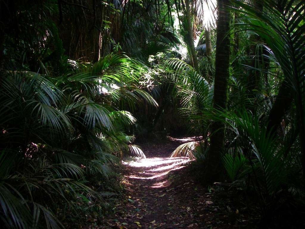
At this point, the environment was much more natural.
Photo: Don Hitchcock January 2007
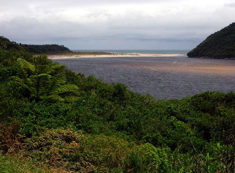
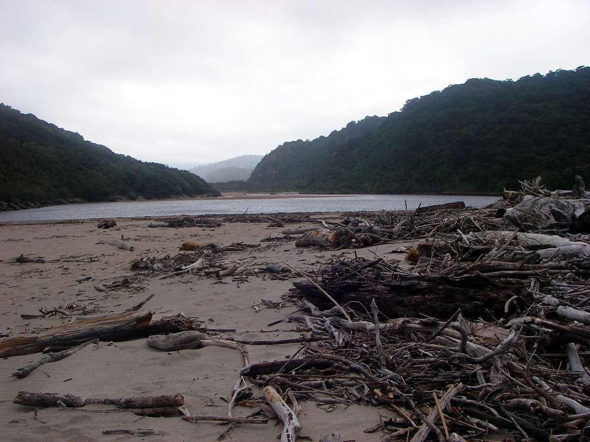
The end of this section of the track was in sight. This is the entrance of the estuary to the sea.
Photo: Don Hitchcock January 2007
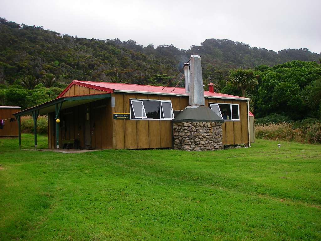
Heaphy hut is in a delightful setting. It would be a lovely place to spend a few days, relaxing, swimming in the estuary, eating, drinking and talking.
Photo: Don Hitchcock January 2007
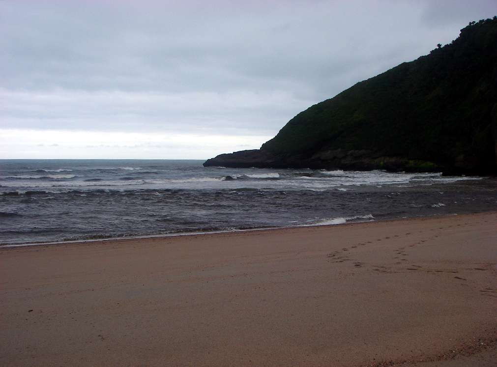
Depending on the tide, it is sometimes reasonably safe to swim in the estuary, provided caution is taken, upstream of Heaphy hut.
It is never safe to swim in the sea at this point. It is a turbulent, very dangerous place to be, with rips, large waves, and very strong and unpredictable currents, and entering the water is something which should never be attempted.
Photo: Don Hitchcock January 2007
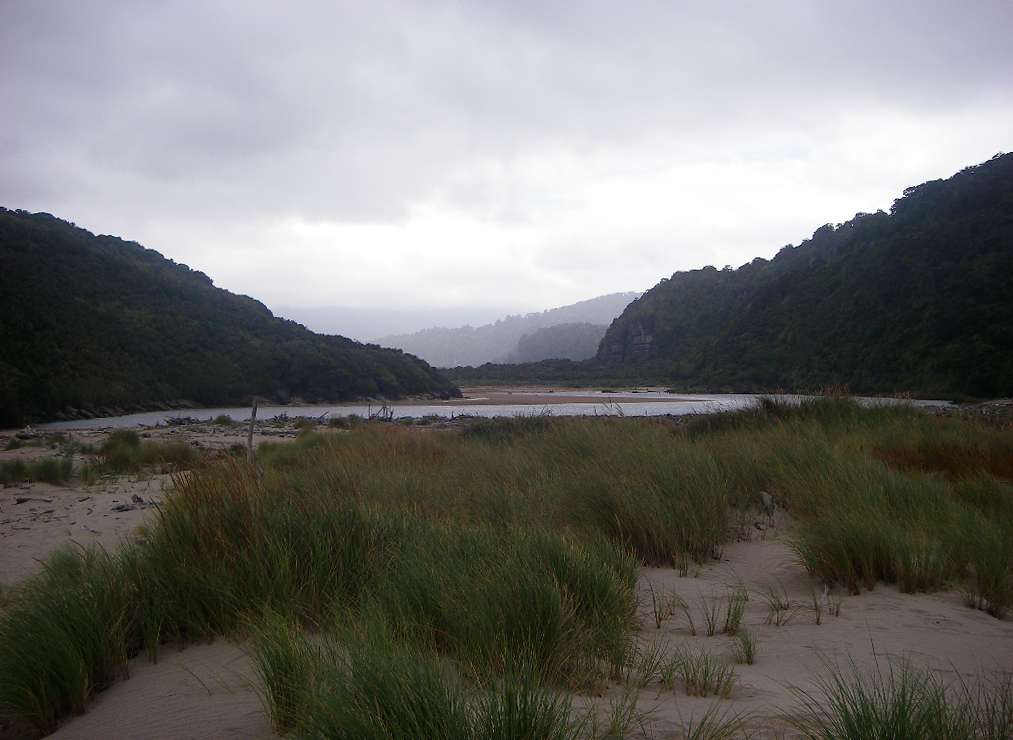
Looking upstream from the estuary, to the highlands where the Heaphy River rises. Originally, Heaphy hut would have had a wood fire, using driftwood brought down by the river, but now heating and cooking are done on a coal fire, which is the case in all the huts I visited, apart from those which had gas cylinders.
Photo: Don Hitchcock January 2007
This part of the coast, like all the western side of the South Island, gets very wild weather, with large waves crashing on shore at times. When I was there it was possible to get mobile phone reception in this area, by choosing the highest spot on a sand dune, and holding your tongue just right.
When I was there, in 2007, I found it was cheaper to buy a phone in New Zealand than to use my Australian phone. Now (2020) this is usually not the case, since most providers offer reasonable cost international roaming.
Photo: Don Hitchcock January 2007
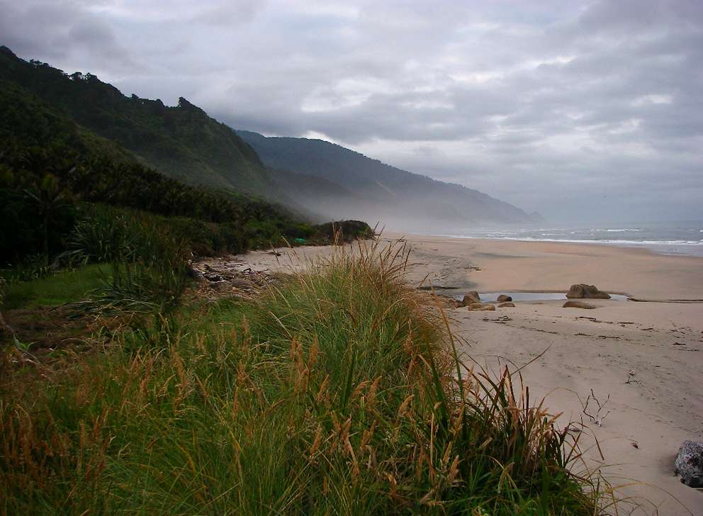
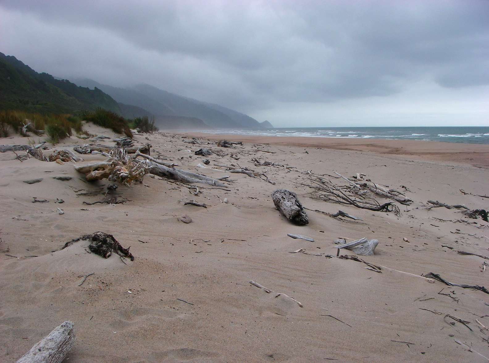
Heaphy Beach. I set off early the next morning on the final leg of the journey, along the beautiful coast. The track sometimes follows inside the fringing forest, and sometimes uses the beach. In some places caution must be exercised if there is a high tide and bad weather, it may be necessary to wait for a few hours until the tide goes down and conditions improve.
Photo: Don Hitchcock January 2007
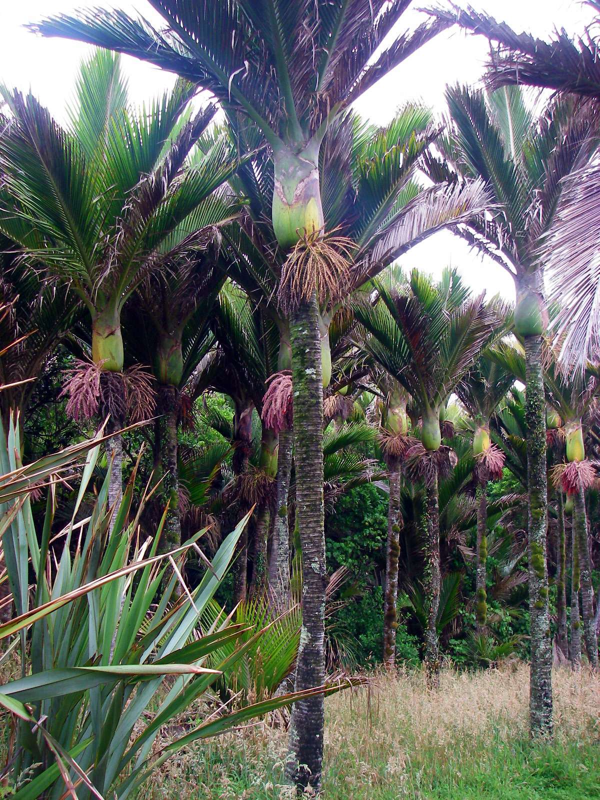
The Nikau palms were flowering at this time. They have the property of dropping old fronds, which means that they always look neat and tidy. New Zealand flax may also be seen growing in these photographs.
Photo: Don Hitchcock January 2007
Heaphy Beach. I found it interesting that parts of the shore are rocky, and parts are sandy. This presumably reflects the tide and wave regime on particular beaches, with the sand being continuously removed from the rocky parts of the coast, and deposited on the sandy beaches, where there is less wave action.
It should be remembered that you are at about the latitude of Bass Strait at this point, with a large section of the Tasman Sea and the Southern Ocean before you, so it is not surprising that there are often large swells from Antarctic storms washing up on these shores.
Photo: Don Hitchcock January 2007
This almost dry creek, Wekakura Creek, crossed by a bridge, comes down from the highlands and would be a rushing torrent in wetter weather. Many trampers have lost their lives trying to cross streams like this when in flood.
Photo: Don Hitchcock January 2007
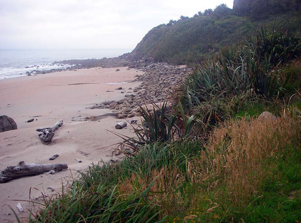
Twenty Minute Beach. Sand has been deposited on the rocky shore behind the protection of the small headland. A different set of wave and wind conditions could easily move this sand further along the coast. The presence of uncovered rocks at the shore line gives mute evidence that the presence of sand here is ephemeral.
Photo: Don Hitchcock January 2007
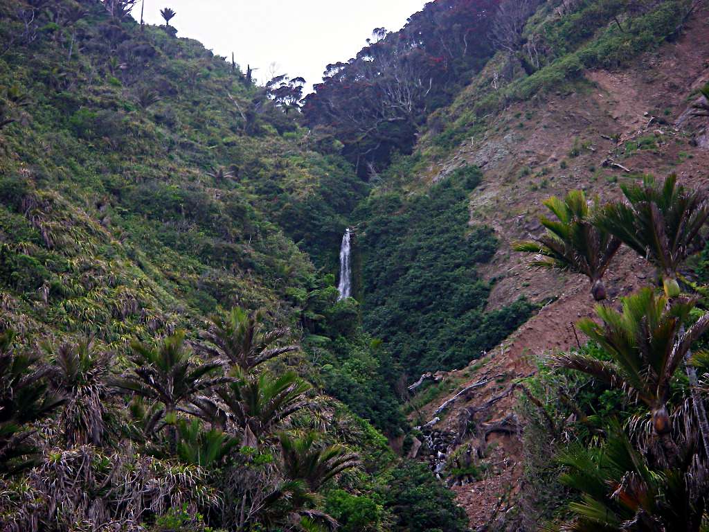
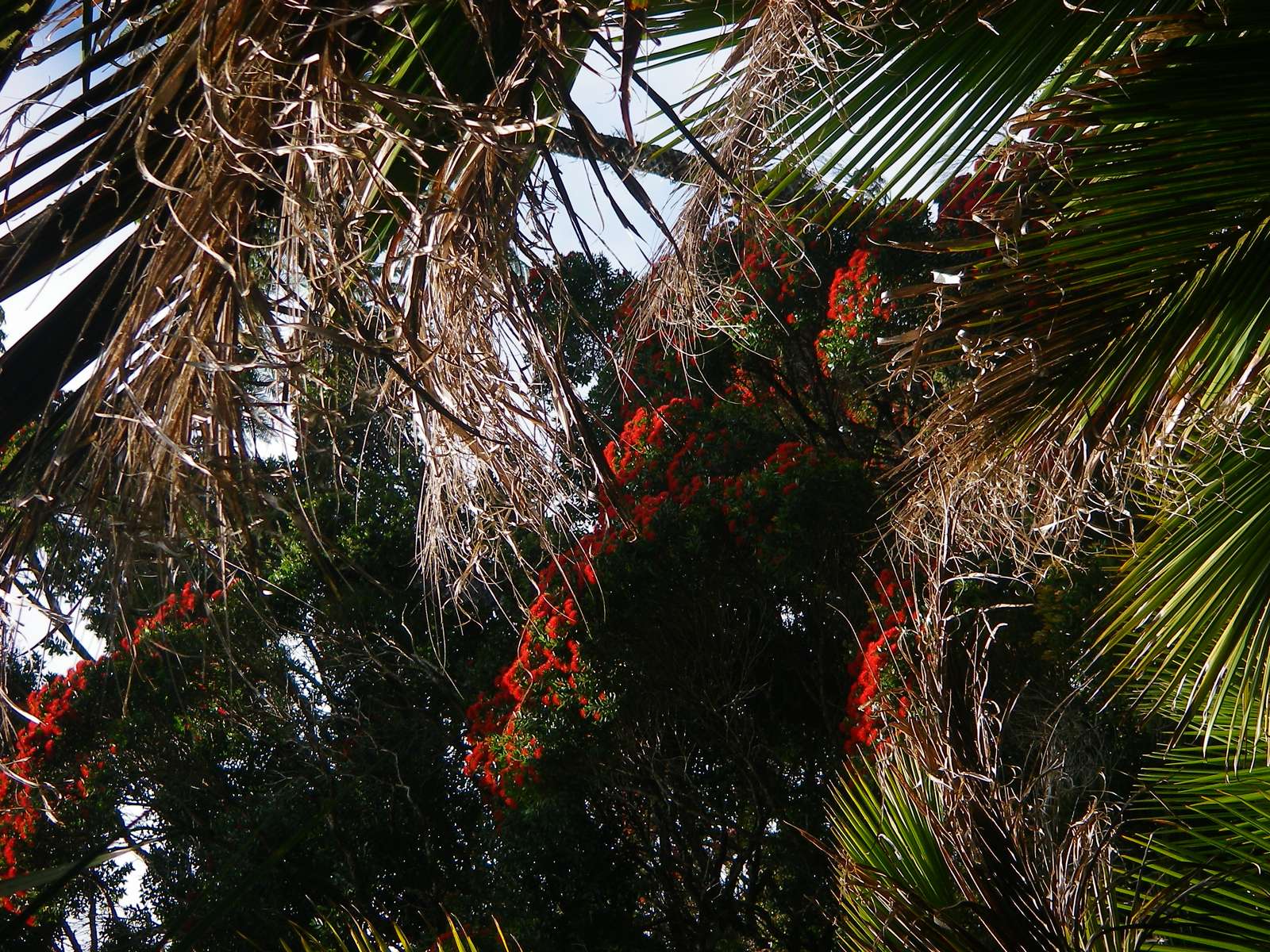
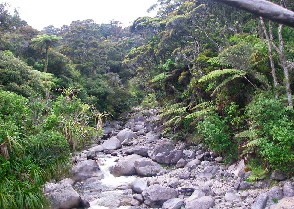
This beautiful little valley with a waterfall was flanked by Nikau palms, with red flowering Pohutukawa trees at its head far above.
Photo: Don Hitchcock January 2007
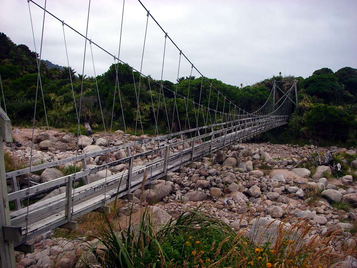
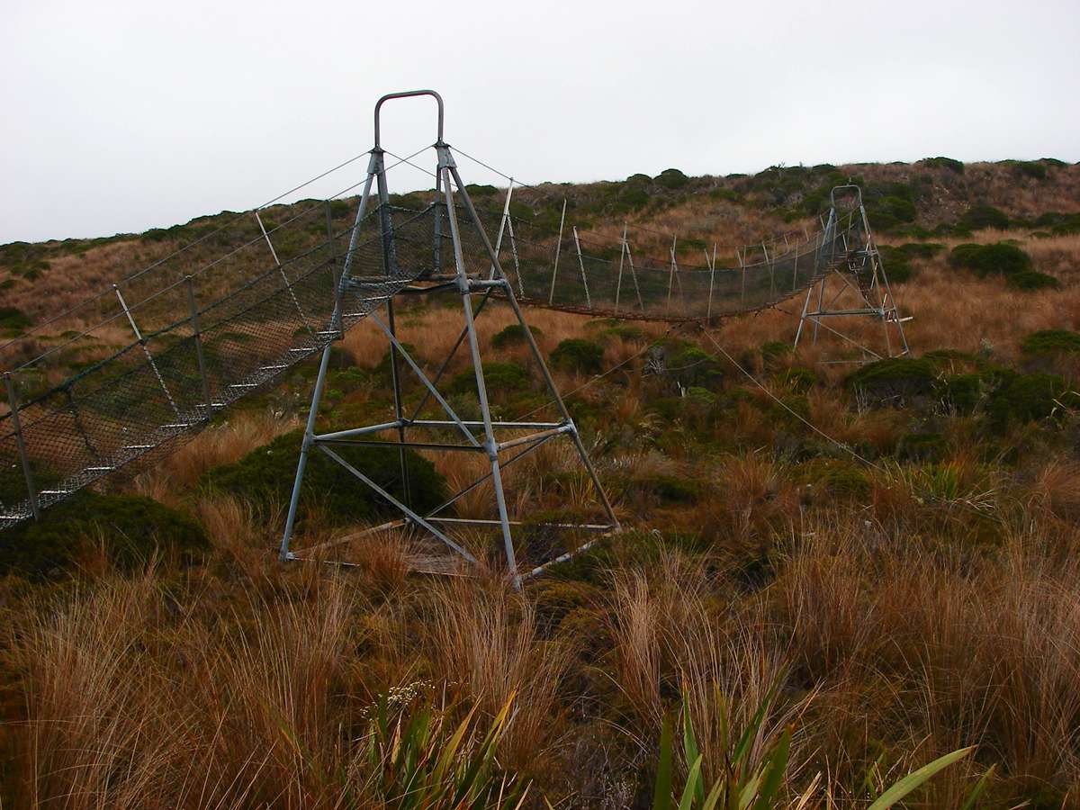
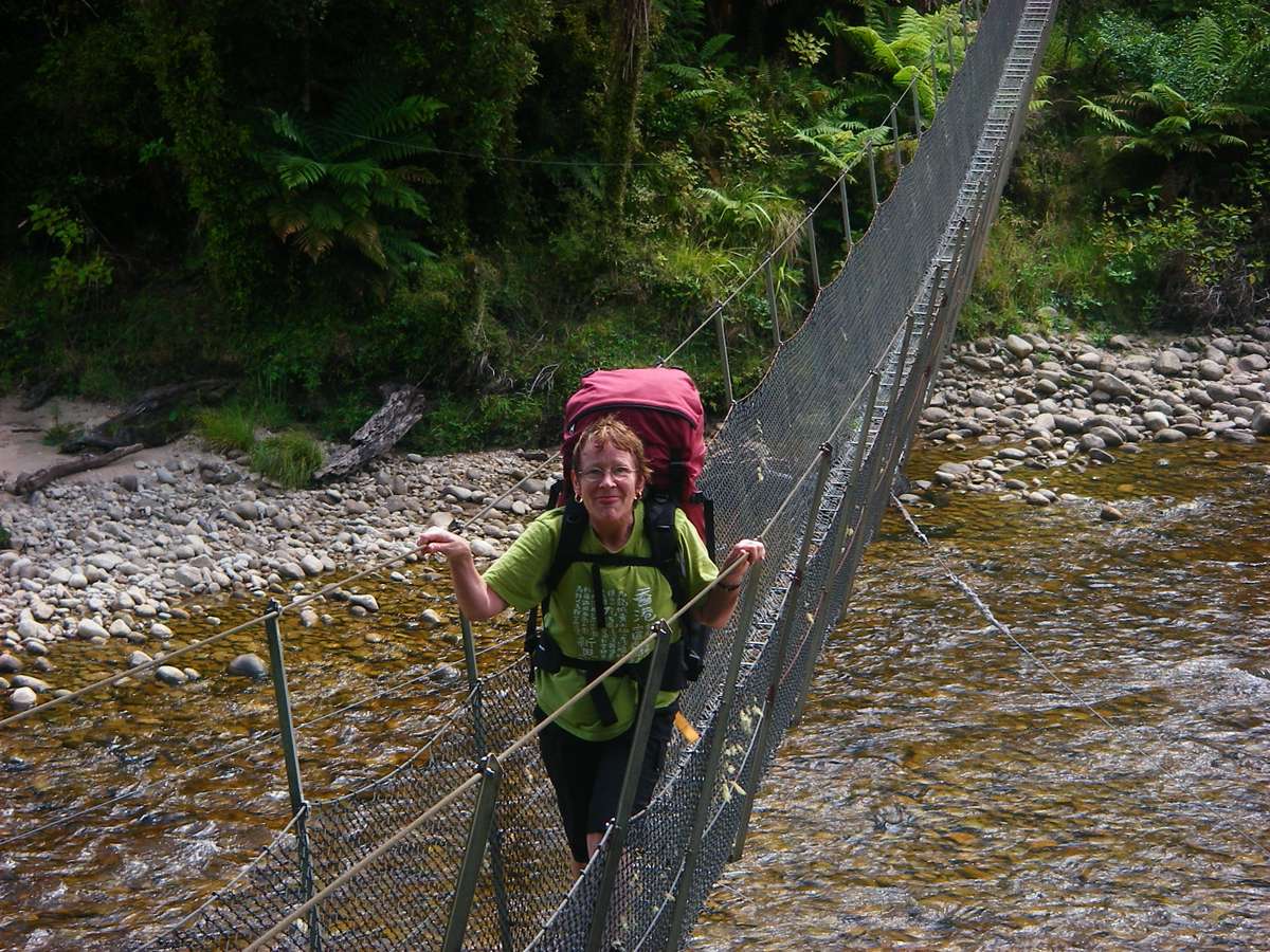
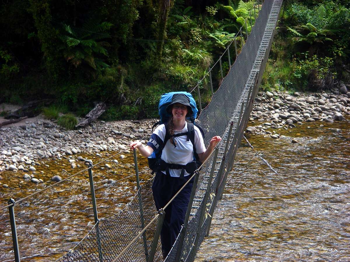
Katipo Bridge, the half way point between Heaphy hut and the end of the walk at Kohaihai shelter. This bridge was perhaps the best footbridge I had seen. The walkway is solid timber, and the elaborate system of wire supports and stays meant that the bridge was amazingly stable for such a tension structure.
The river it is crossing would be a major obstacle in flood times without the bridge.
Photo: Don Hitchcock January 2007
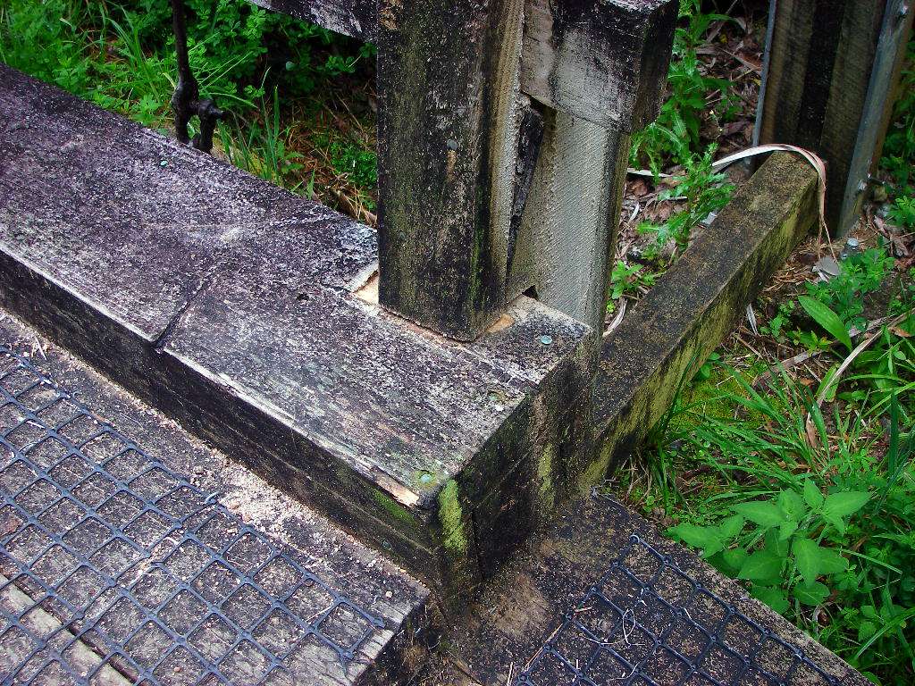
The bridge was beautifully engineered, as shown by this system which allows for movement of the walkway in high winds or when a number of walkers pass over. The amount of movement is shown by the clean wood exposed as the two surfaces rub against one another, but the amount of wear is insignificant.
Photo: Don Hitchcock January 2007
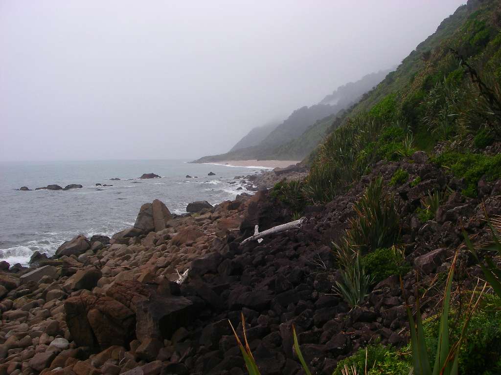
Twin Beach, looking towards Crayfish Point.
It was now evident that the only way forward was along the beach. Although the tide was up, there was plenty of room to walk safely along the shore line.
Photo: Don Hitchcock January 2007
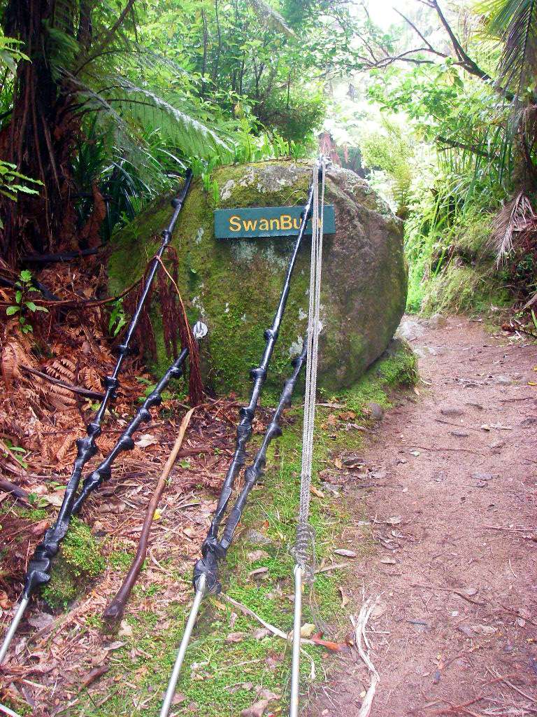
Supports for the bridge across the Swan Burn.
Photo: Don Hitchcock January 2007
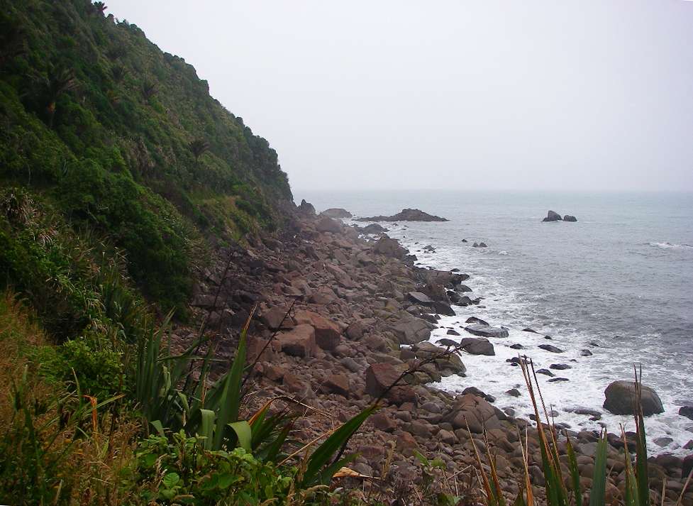
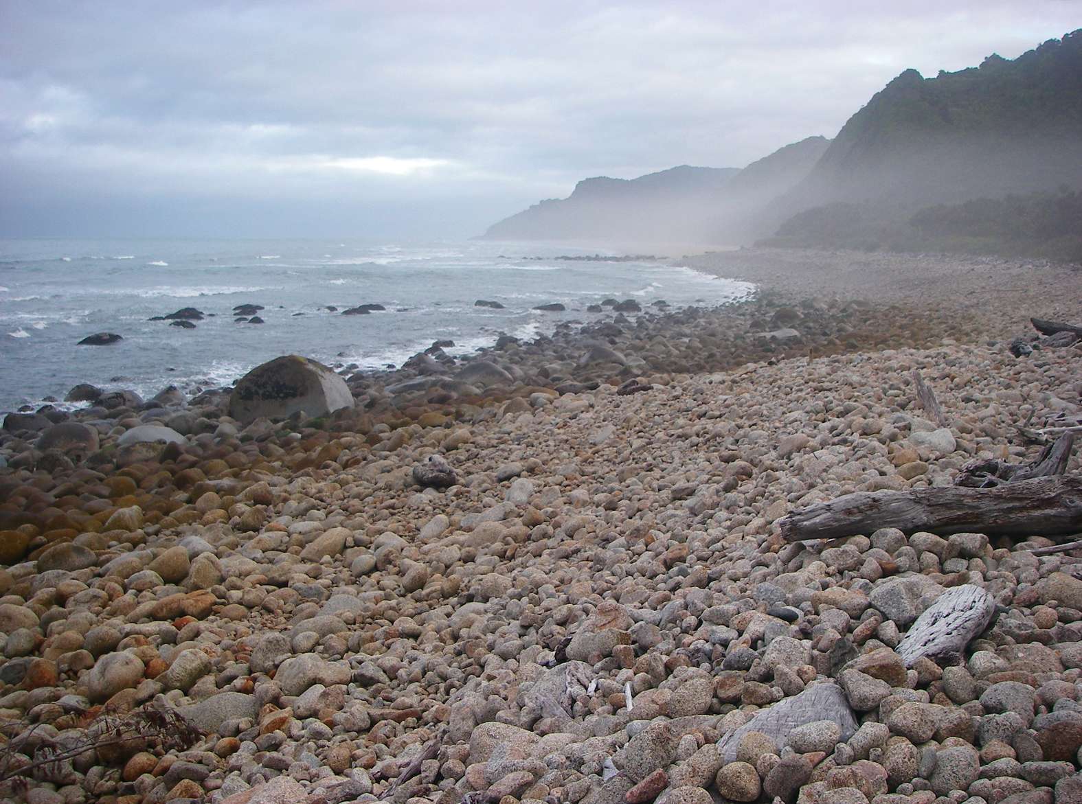
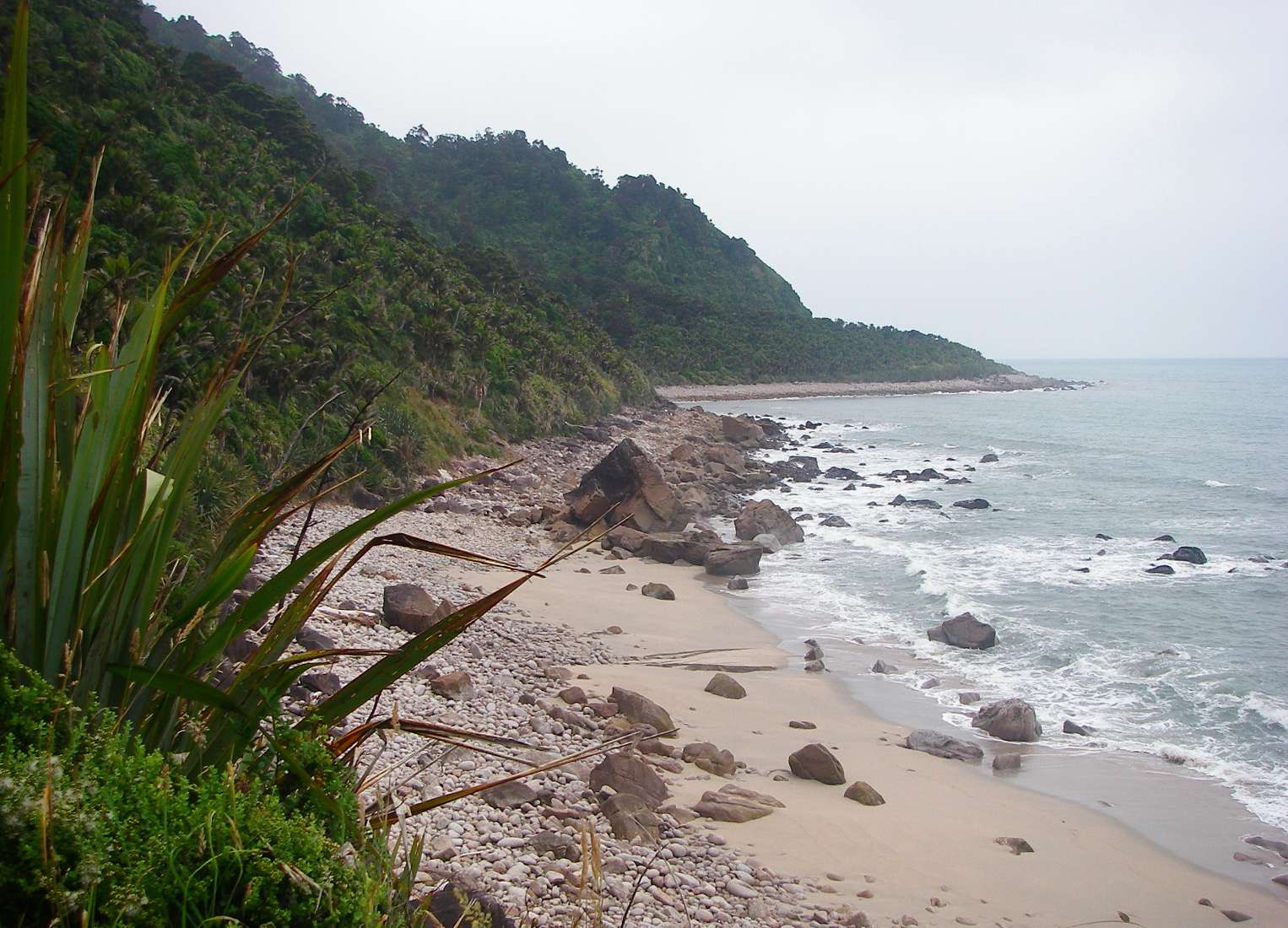
Big Rock Beach, looking forward and back. It is obvious that big seas hit this area at times.
Photo: Don Hitchcock January 2007
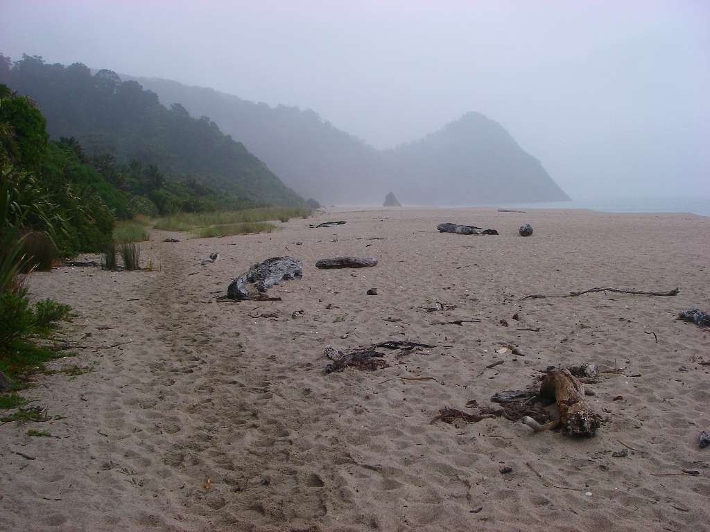
Scotts Beach, with Kohaihai Bluff, the end of the walk, shrouded by mist. At Kohaihai shelter, I and some other walkers phoned for a shuttle bus to come and pick us up, and take us to Karamea. The system worked well.
Photo: Don Hitchcock January 2007
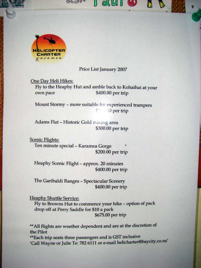
There are ways around the long drive from one end to the other of this track. One option is to leave your car at Brown's hut, do the walk, and take a helicopter back, as shown on this brochure.
One family I met included a marathon runner, and when the party got to Kohaihai, she started running back to the car at Brown's hut, and expected to get there in a day, sleep there overnight, and drive back to pick up the rest of the family. I met her just before Wekakura Creek, at about 8 a.m. I was envious of her fitness.
Photo: Don Hitchcock January 2007
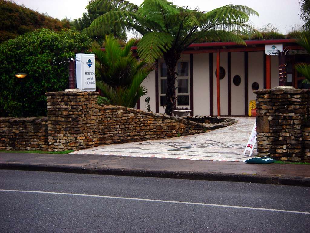
I stayed at The Last Resort, and I can highly recommend it. There was a range of accommodation options, and my budget room was comfortable, clean and quiet. The food was excellent. I stayed there overnight. The staff could not have been more helpful, and organised a car and driver for the morning to take me to the start of the Wangapeka Track.
While I was there, I made a start on extensions to the pack, putting in an extra pocket on the back since the netting pockets were not standing up to the rigours of the track. I had brought silnylon, needle and thread, small scissors and seam sealer for just such contingencies.
Photo: Don Hitchcock January 2007
In Karamea I stocked up on more food at a large supermarket, the Karamea Four Square Supermarket, for the next part of my walking tour, the Wangapecka Track. It was open on Sundays, which I was grateful for, and there was a wide range of choices.
While I was in Karamea, a Sunday, I found a post office agency (!) that was open, sent off some postcards, and on browsing through their goods on sale, I found some rubber thongs made in Indonesia, about 1.5 cm thick. They looked like they would be perfect for the purpose of replacing my (four layered) motor cycle tube inners in my shoes, and so it proved.
They were soft, but resilient, and after I cut them to size, and inserted them in my shoes, I had no further problem with my feet, which had suffered a lot on the hard track of the Abel Tasman track, when the original inners had collapsed. The rubber did not have a mark on it, and had not compressed at all by the time I threw the boots and inners out on the return to Australia. The boots had looked like good value, and a compromise between the high quality (and expensive) but uncomfortable boots I had at home, which did not have enough padding in the inners, and joggers.
I will never wear boots again for bushwalking, I will stick to my trusty 'New Balance' joggers, which have better traction on wet or dry rocks, and are supremely comfortable for walking. Boots are only of use in mud, so far as I am concerned. Apart from anything else, it is like walking with flat boards tied to your feet, and once they are wet, they take a week to dry, and in the meantime you are dragging around heavy blocks of cement. My joggers lose most of their water content and consequent extra weight after crossing a creek in a few minutes, and are almost dry at the end of the day if the rest of the walk is on a dry track.
Not only that, my joggers have positive bouyancy, and help me to float when swimming across rivers. "Proper" bushwalking boots can make it almost impossible to swim because of their weight when wet. I regard them as life threatening in such situations.
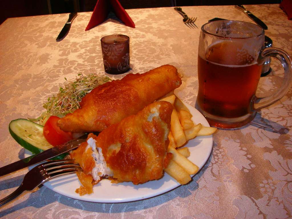
I enjoyed my meal of fish and chips at "The Last Resort". New Zealand has wonderful fish and chips, and it was my staple meal when coming out of a walk - in most places on the west coast at least, you need to order what sort of fish you want, instead of the generic "flake" or shark, usually served at Australian fish and chips shops.
Photo: Don Hitchcock January 2007
Bushwalking, Hiking and Tramping in New Zealand
Bushwalking Index