Back to Don's Maps
Maps and other information about Ayla and the Earth Children
 Inconsistencies in the EC books. Amy McDonald has found an inconsistency between the fifth and sixth books concerning Matigan, apprentice to Jondalar.
Last updated Tuesday 25 March 2025

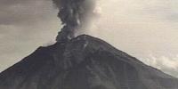
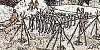
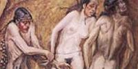
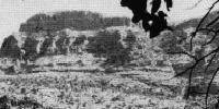
The Dordogne - scene for Book 5, Shelters of Stone. Scenes from the Dordogne, cooking Clan style - preparation of ptarmigan, and using a firestone to make a fire. Photos courtesy Sharon Rogers/walkhound
Geology for Earth Children fans
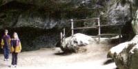
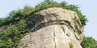
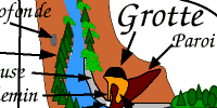
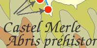
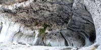 Amelana's Cave
 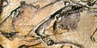 First Cave (South), the Most Ancient Sacred Site, Chapter 27 - 28 Land of Painted Caves
Now called Chauvet Cave, in the valley of the Ardèche River in France, it is filled with paintings, engravings and drawings created more than 30 000 years ago, of cave lions, mammoths, rhinos, bison, cave bears and horses. It contains the earliest known cave paintings, as well as other evidence of Upper Paleolithic life. A later occupation left little but a child's footprints, the charred remains of ancient hearths and carbon smoke stains from torches that lit the caves. After the child's visit to the cave 26 000 years ago, evidence suggests that the cave had been untouched until discovered in 1994. The footprints may be the oldest human footprints that can be dated accurately
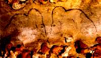
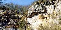
 Fourth Cave South, Chapter 20 Land of Painted Caves
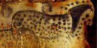 Seventh Cave South, Chapter 21 Land of Painted Caves
Now called Pech Merle, this is one of the few prehistoric cave painting sites in France which remain open to the general public. Extending for more than a mile from the entrance are caverns the walls of which are painted with dramatic murals from 25 000 years ago. The walls of seven of the chambers at Pech Merle have fresh, lifelike images of a woolly mammoth, spotted horses, bovids, reindeer, handprints, and some human figures. Footprints of children, preserved in what was once clay, have been found more than a kilometre underground.
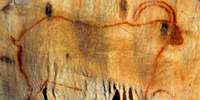
 Mammoth Cave Chapter 14 Land of Painted Caves
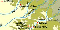

La Madeleine. This is known as 'River Front' in the EC books.
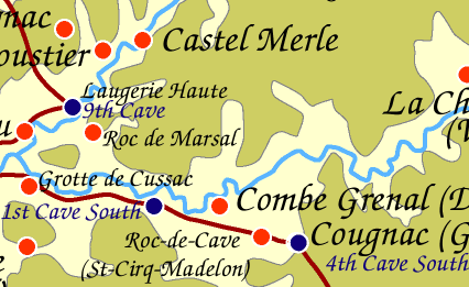
Laugerie Haute, known in the EC books as The Ninth Cave - Arts and Crafts
L'Abri des Marseilles, between Laugerie Haute and Laugerie Basse
The Dordogne - scene for Book 5, Shelters of Stone. Scenes from the Dordogne, cooking Clan style - preparation of ptarmigan, and using a firestone to make a fire.
Laugerie Basse, known in the EC books as Down River - Projects
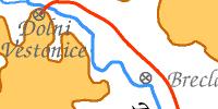
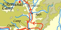
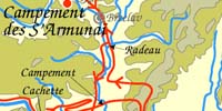
Dolni Vestonice. EC fans know this as the place of the S'Armunai, where Attaroa set herself up as despotic leader of the group.
Font de Gaume in the French Dordogne. In the EC books, this is known as The Deep of Fountain Rocks, where the headland looks like the face of the Mother.
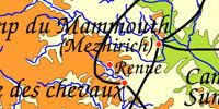
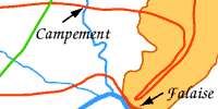
Mezhirich. This is known as Mammoth Camp in the EC series.
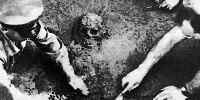
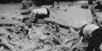
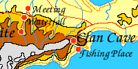
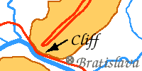
Shanidar Cave in Iraq. The Clan Cave in the EC series is located on the Crimean Peninsula, but the original was located hundreds of kilometres away in Iraq, and is a very important Neanderthal site. The skeletons corresponding to Creb and Iza are from there.
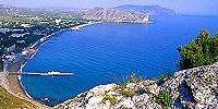
The Clan Fishing site - Sudak on the Crimean coast
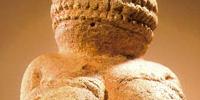
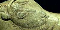
The Venus of Willendorf. This is Jondalar's sculpture of the mother.
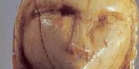
The Venus of Brassempouy. This is the sculpture of Ayla.
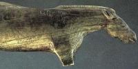
Sculpture of 'Whinney', Ayla's horse.
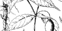
The Sacred Root -
The sacred root is not Datura, however there is reason for thinking that Jean used at least the physical form and growth habits of mandrake when she created her "sacred root". The effects, however, are closer those of the iboga plant.
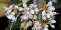
Golden Thread - Ayla's contraceptive.
Geology for Earth Children fans
Go to the map of all of Ayla's journeys
All of Ayla's journeys are on this map, up to Shelters of Stone. Jondalar and Thonolan pretty much followed the same course when going east, except that after the time with the Sharamudoi they took a boat down the river to the delta. Then after leaving the delta and Willow Camp they would have followed pretty much the same path as Jon and Ayla did on the journey to the Zelandonii, and finished up at the Valley of horses.
Go to the clickable map of all of Ayla's journeys - click on the camera icon and see the particular area .
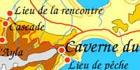
Go to the map of Journeys in Clan of the Cave Bear
Allez à la carte des trajets de la Caverne du Clan en français
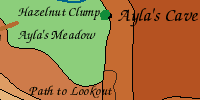
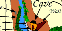
Go to the map of the local area around the cave in Clan of the Cave Bear
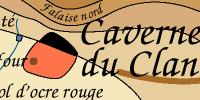
Allez à la carte de la Caverne du Clan en français
Go to the map of the Valley of Horses
Allez à la carte de la vallée des chevaux en français
Go to the map of The Mammoth Hunters, in Ukraine
This includes Ayla's journeys in Clan of the Cave Bear, Valley of Horses, Mammoth Hunters, and the first part of the journey in Plains of Passage
Allez à la carte de Ukraine en français
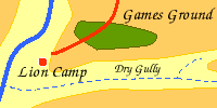
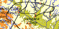
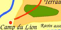
Go to the map of The Mammoth Hunters Lion Camp local area
Allez à la carte des chasseurs de mammouths en français
Go to the map of the Donau Mouth to First Snow from the Plains of Passage
Allez à la carte en français « de l'embouchure du Danube à première neige » d'après Le Grand Voyage
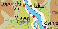
Go to the Iron Gates contour maps
This includes the Sharamudoi journeys, as well as a map for Archeology students without Ayla's journeys.
Go to the local map of the Sharamudoi / Iron Gates
Allez à la carte des Sharamudoi en français
Go to the map of First Snow to the Mammoths from the Plains of Passage
Allez à la carte en français de la première neige aux mammouths d'après le Grand Voyage
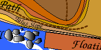
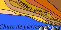
Go to the map of the Encounter with the S'Armunai
Allez à la carte en français de la rencontre avec les S'Armunaï
Go to the map of the Shelters of Stone - Zelandonii Territory
Allez à la carte de la Territoire des Zelandoni en français
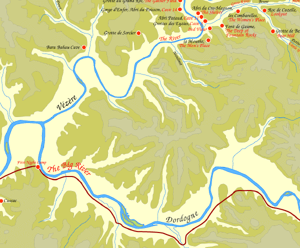
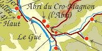
Go to the map of the Vézère Valley for students of archaeology

Cartes dessinées à l’ordinateur