Back to Don's Maps
Cycling down the Danube
Day 19, 23rd September 2008
Bratislava - Čunovo - Sap - Medvedov - Číčov - Klížska Nemá - Malé Kosihy - Zlatná na Ostrove
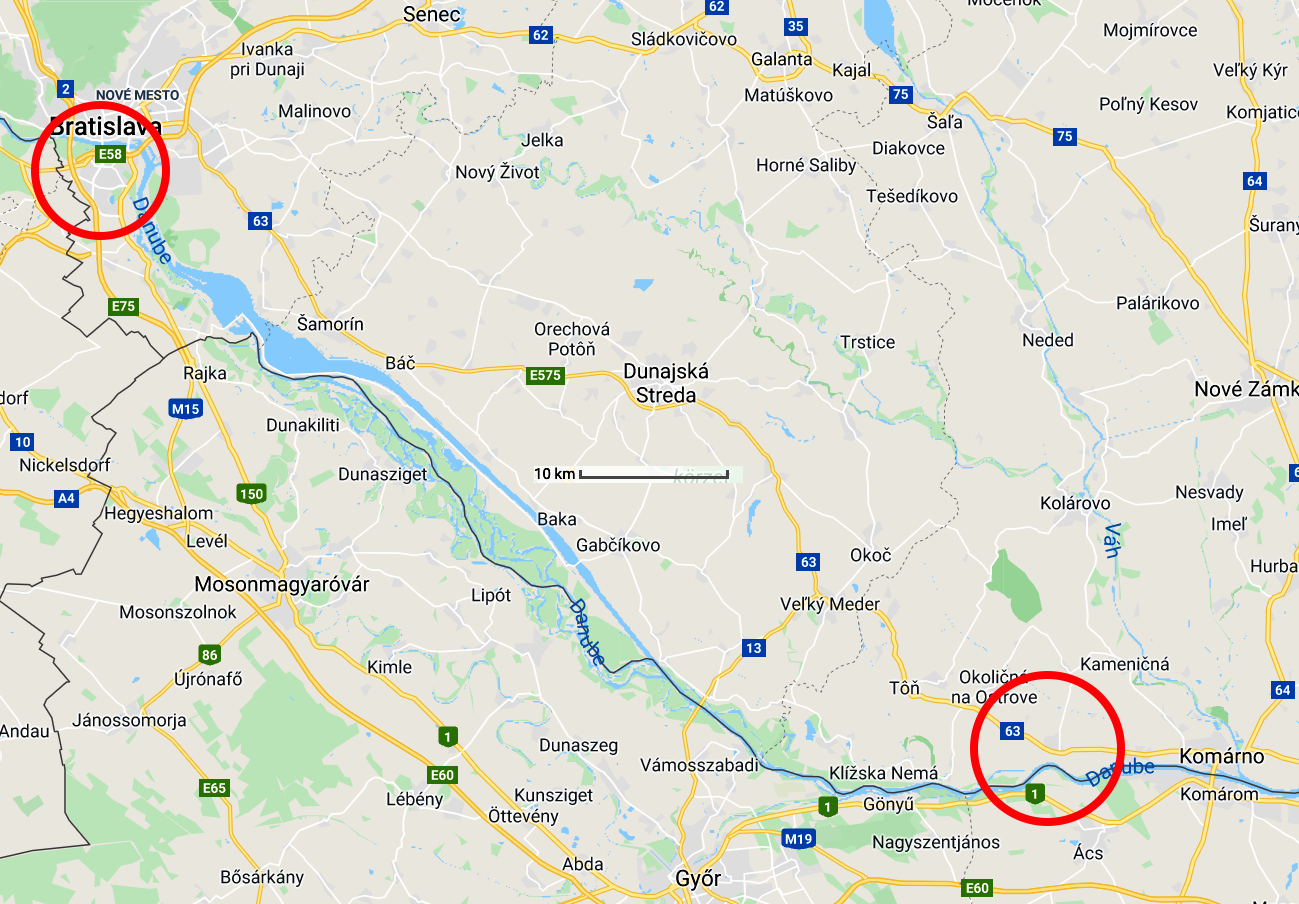
From Bratislava to Zlatná na Ostrove - 102 km (1076.0 km from start)
Photo: Google maps
From Maria's Diary:
Bratislava to Zlatná na Ostrove
Cool, cloudy, some sun in the afternoon. We packed early and left the hotel at around 7 am. We stayed on the right bank for quite a distance, passing many industrial installations - the area looked a bit run down.
At Čunovo we went into the town and bought supplies at a hole in the wall supermarket. We had breakfast at a closed Bierstub then continued on across the bridge onto what appears to be an island but isn't. Here we had a magic bike trail beside the river for many kilometres.
We avoided the deviations into villages along the way but hugged the right bank the whole way to the Stauwehr Kraftwerk. We crossed then swung around to the track on the other side (met a party of Americans coming the other way) We rode for many km on the Radweg (a former road) had lunch along the way then passed Sap and Medvedov (?) By this stage Don wanted to look for a room. We tried in Cicov with non success but much frustration. Decided to continue on to Komorano. Took the inland track to Klížska Nemá, then a very poor (gravelly) track to Malé Kosihy - decided to go north and pick up the highway into Komárno - had good shoulders wide enough for bikes.
Found an expensive hotel, Penzion Zlata Ryba, on the outskirts of Komárno at the village of Zlatná na Ostrove - didn't care - had a room and a meal.
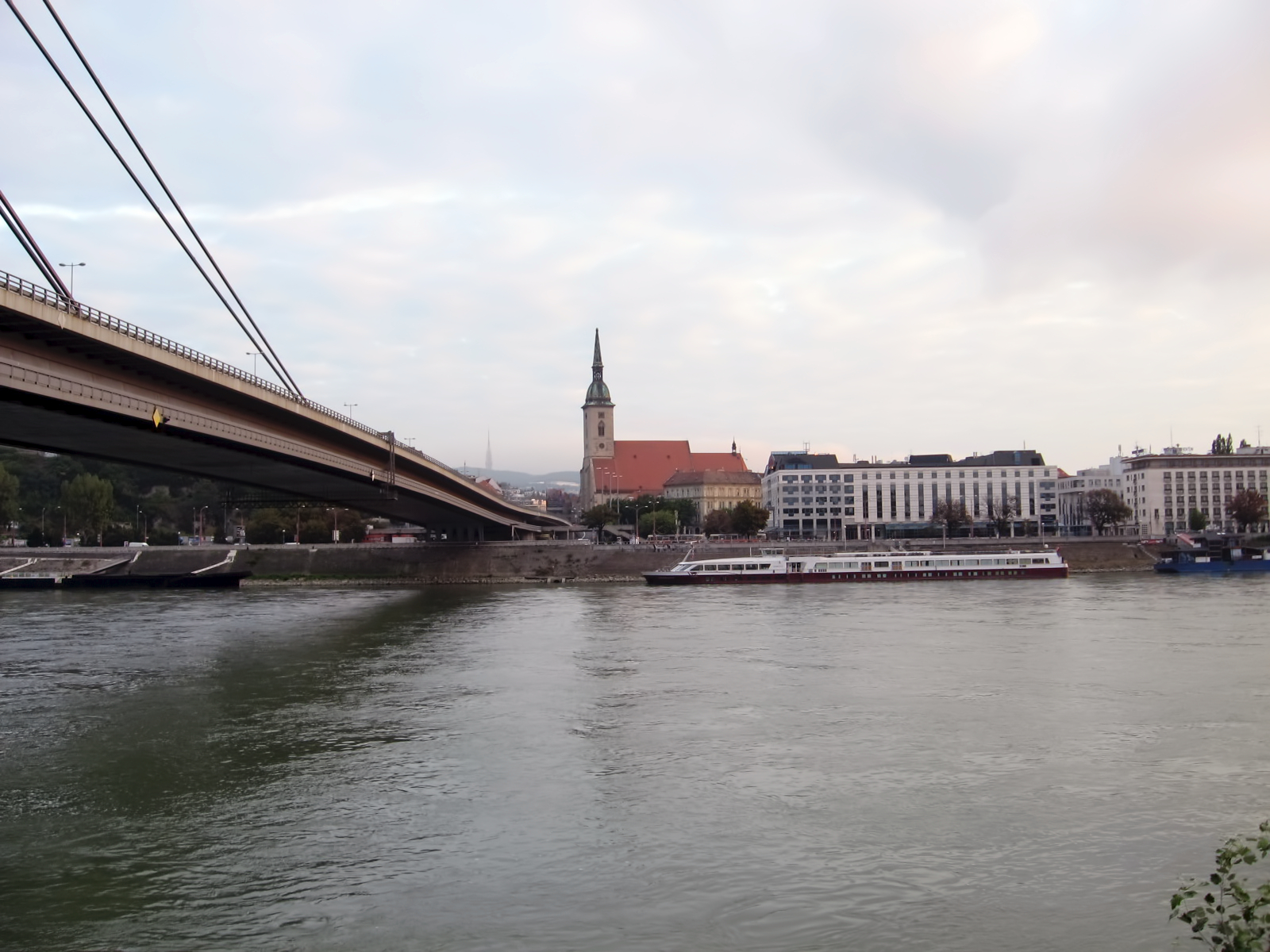
Looking back at Bratislava and St. Martin's Cathedral.
Photo: Don & Maria Hitchcock 23rd September 2008
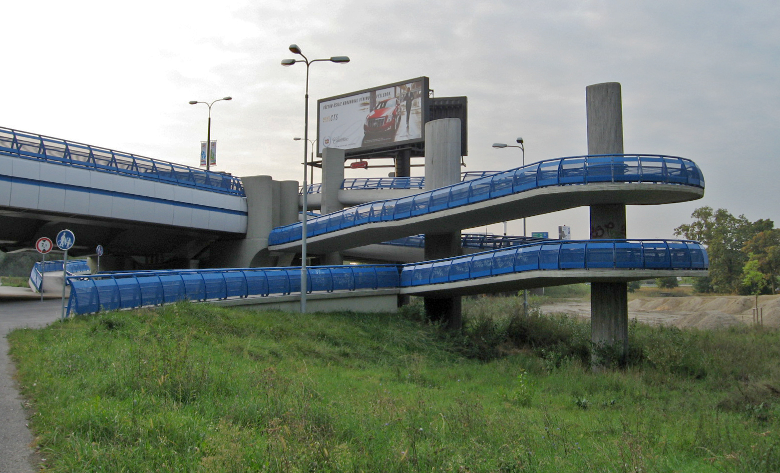
We stayed on the right bank for quite a distance passing many industrial installations which looked a bit run down.
Although much of this area looked seedy, a great deal of money had been spent on overpasses for cyclists across busy roads.
Photo: Don & Maria Hitchcock 23rd September 2008
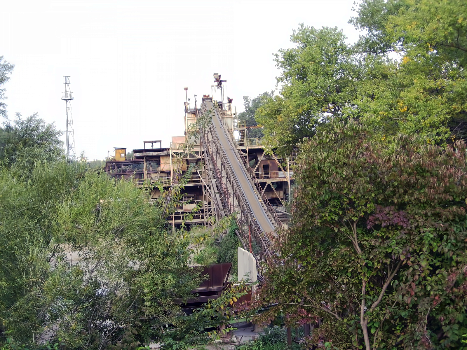
This looked like an abandoned factory.
Photo: Don & Maria Hitchcock 23rd September 2008<
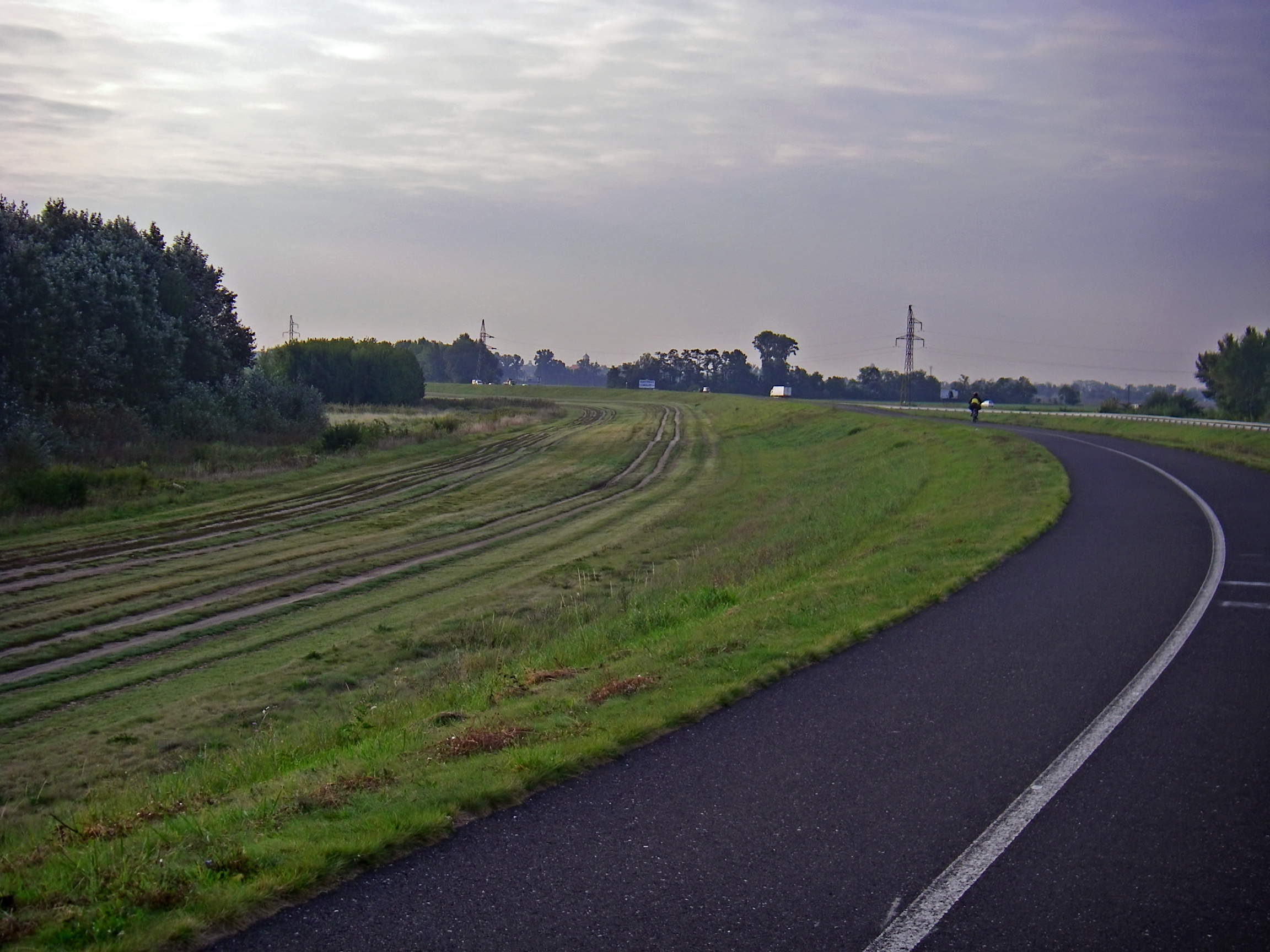
We left the industrial area behind, and the radweg continued to be in excellent condition. The Donau was nowhere to be seen at this point.
Photo: Don & Maria Hitchcock 23rd September 2008
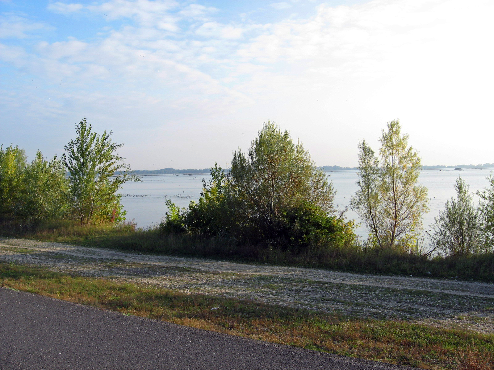
By 30 minutes later, the Donau reappeared, increased dramatically in width. Further downstream are the Čunovo and Gabčíkovo–Nagymaros Dams, which have raised water levels significantly.
Photo: Don & Maria Hitchcock 23rd September 2008
We needed supplies every day, since we did not have much space to store food, so at Cunovo we went into the town looking for sustenance for the day, and bought supplies at this place which Maria immediately christened a 'hole in the wall supermarket'.
At the time we thought it was strange, because of its lack of advertising and complete utilitarianism, but we did not realise that this was but a portent of things to come. In the former soviet union, it would appear that no hint of capitalism had yet appeared.
Photo: Don & Maria Hitchcock 23rd September 2008
A little further on, we found this closed Bierstub, and had a late breakfast there. It was still cool, and breakfast was great.
As well as my obligatory turkish coffee, I also enjoyed milk to drink along the way, to keep hydrated.
Photo: Don & Maria Hitchcock 23rd September 2008
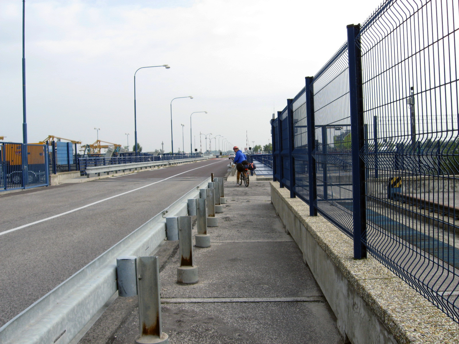
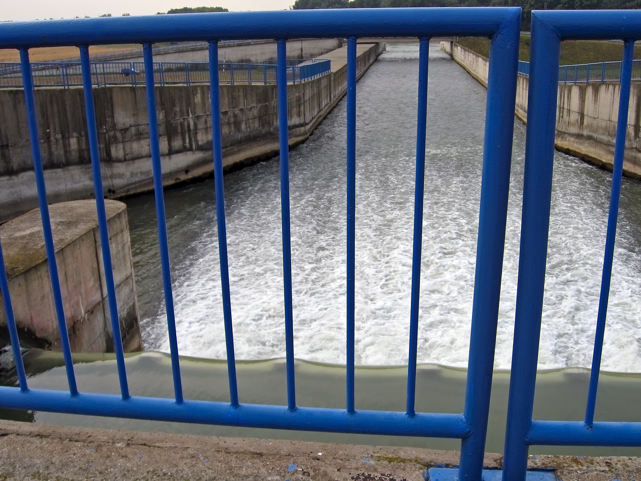
A short distance further on, we crossed this barrage just past Cunovo.
At this point the main shipping route and the Donau parted company, with the Donau continuing to the right and south of what was now a canal. The Donau proper rejoined the canal eight kilometres downstream of the Gabčíkovo–Nagymaros Dam, opposite the town of Sap, in Slovakia.
Interestingly this barrage only went about 2/3 across the width of the water channel.
This was however, enough to raise the water level under most conditions of normal flow, to allow a modest hydroelectricity Kraftwerk, while still allowing normal river traffic but without the need for locks.
Photo: Don & Maria Hitchcock 23rd September 2008
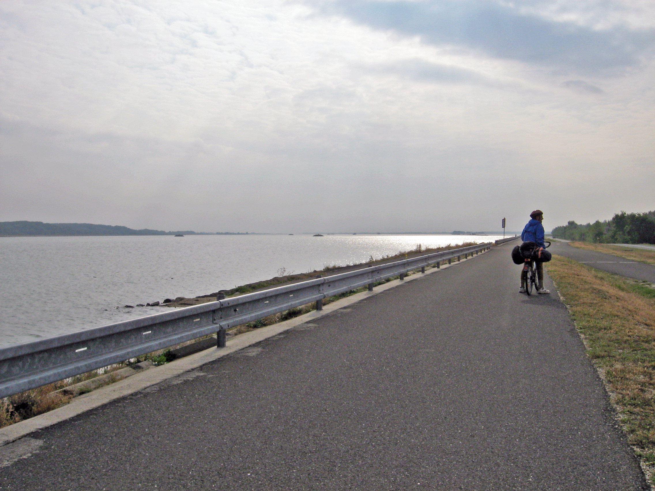
The huge expanse of water in this image is not defined as the Donau. The river which is designated the Donau, and forms the border between Slovakia and Hungary, is to the right of the radweg at this point. A new and straighter and deeper channel has been dug by Slovakia for shipping, the map shows the 'old' Donau winding through swamps to the right.
This was a beautifully made and maintained radweg, still on the right of what is effectively the Donau, if not in name, for some kilometres.
The water was quite shallow inshore, and in the distance may be seen the stone cairns above the water, with beacons which allow ships to navigate safely in the deeper water of the dredged channel.
Photo: Don & Maria Hitchcock 23rd September 2008
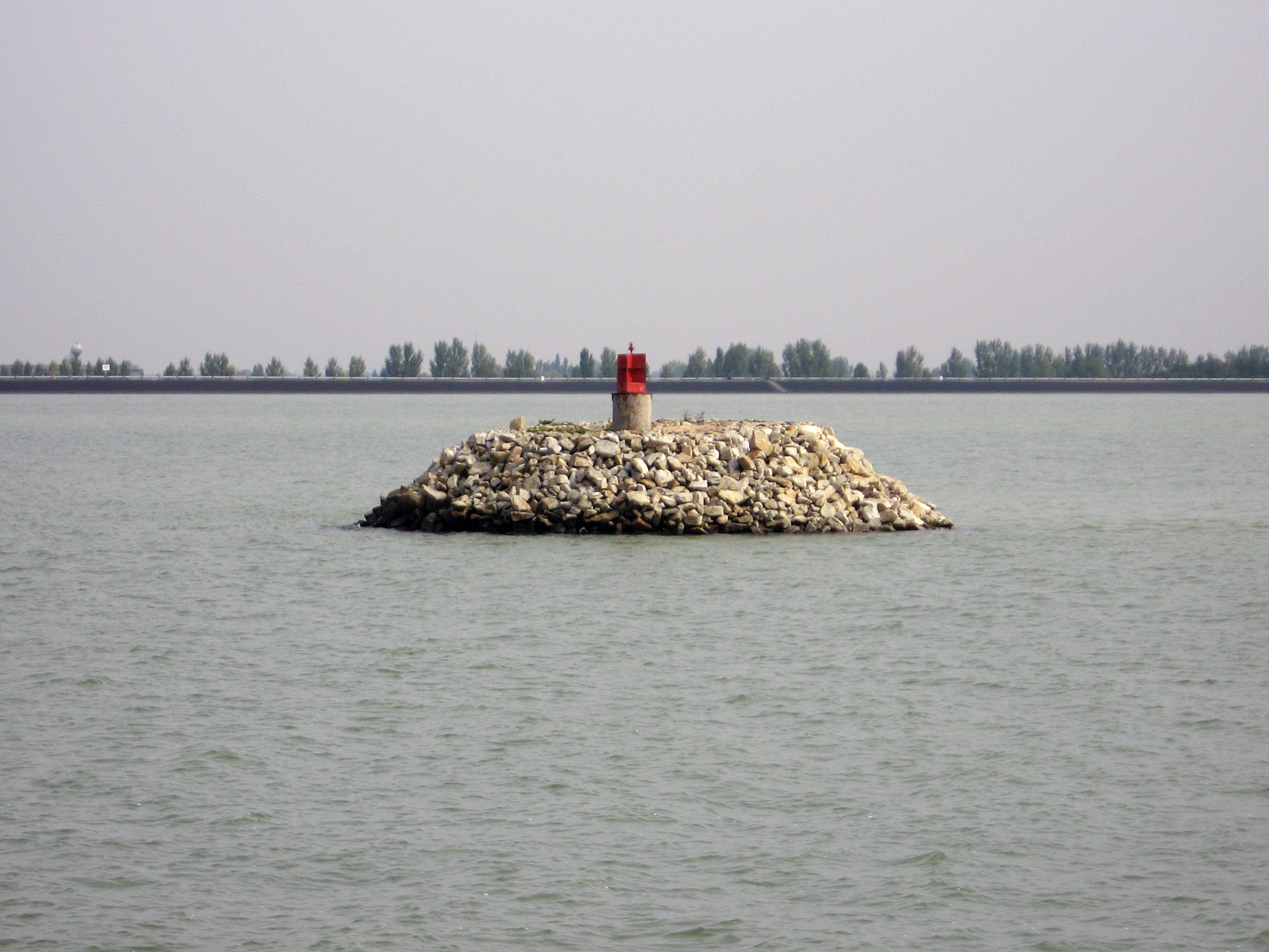
The stone cairns providing a support for the shipping beacons do not need to be very high out of the water, because the water level is controlled within strict limits by a full barrage for a major Kraftwerk across the canal not very far downstream at the Gabčíkovo–Nagymaros Dam.
Photo: Don & Maria Hitchcock 23rd September 2008
At this point, I need to explain how this huge expanse of water came to be.
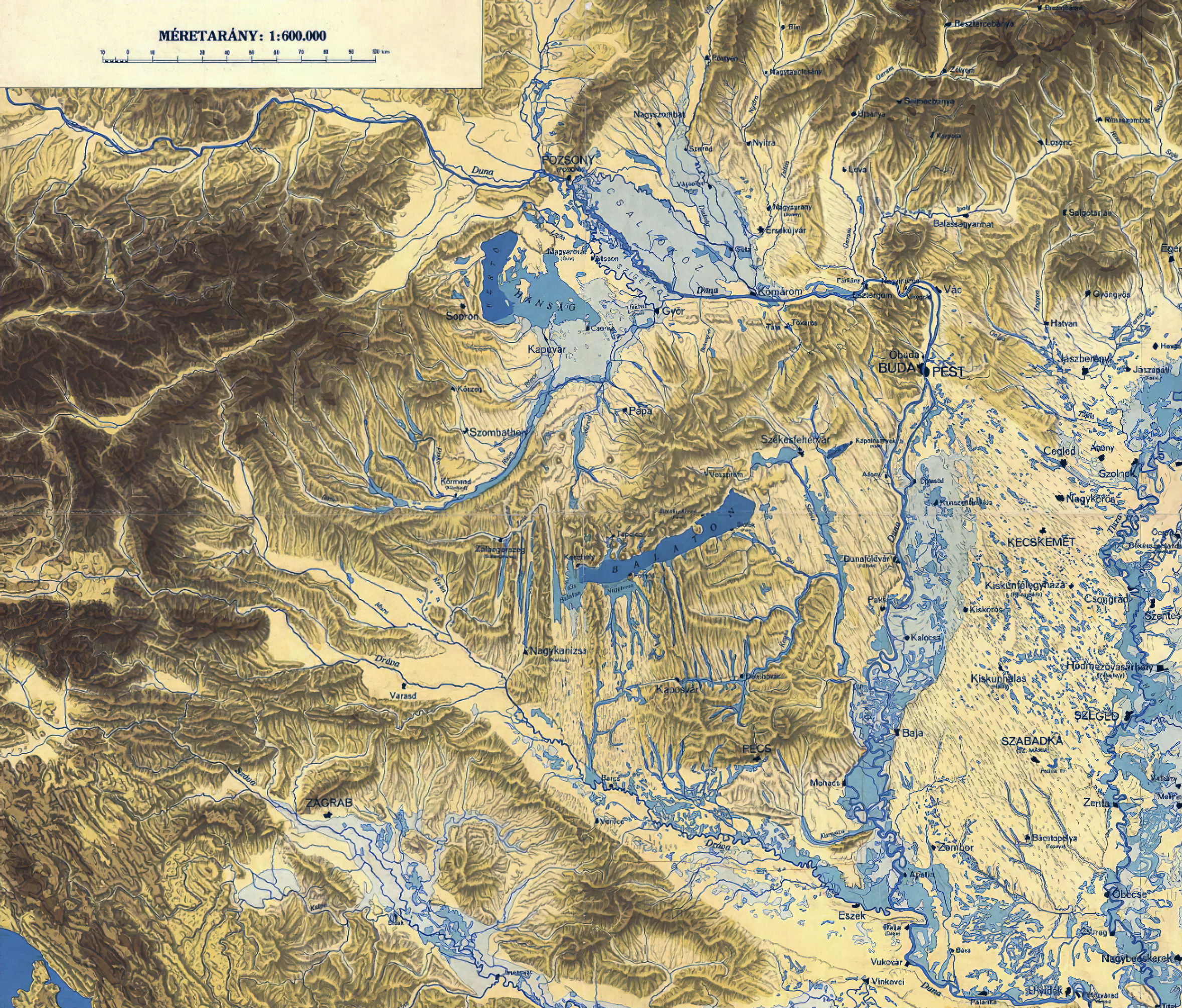
Originally (or at least before 1992, when excavation of the 'Variant C' canal, shown in the photos above, began) the Donau formed the northern border of the Szigetköz, a huge 'island' bordered by the Donau to the north, and the Mosoni Donau to the south. Its borders are the Danube and its branches; with a length of 52.5 kilometres, an average width of 6 to 8 kilometres, and with an area of 375 square kilometres, it is a very important wetland.
Note also that this whole area is very, very flat, as evidenced by the course of the 'Maly Donau' or 'Little Danube' to the north of the Donau, as shown on this map, as well as the Mosoni Donau to the south of the Donau. Moson is an ancient town, pre 1030 AD, now (after 1939) part of the city of Mosonmagyaróvár. The name Moson itself means 'mossy'.
Photo: United Nations, 11 August 2017
Source: Gabčíkovo-Nagymaros Project (Hungary/Slovakia), Judgment, I.C.J. Reports 1997, p.7
Permission: Public domain
Text: Don Hitchcock, Gabčíkovo-Nagymaros Project (Hungary/Slovakia), Judgment, I.C.J. Reports 1997, Wikipedia
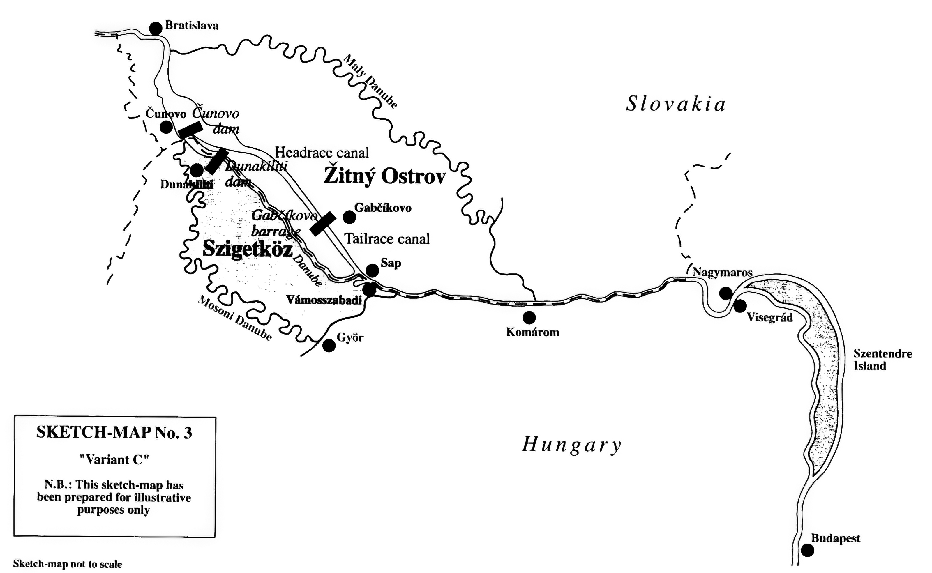
This map shows the final implementation of Variant C, which was undertaken unilaterally by Slovakia, and primarily on its own land, over the objections of Hungary. In order to mitigate the detrimental environmental effects, Hungary decided to go ahead with the Dunakiliti Dam, while abandoning the construction of the Nagymaros Dam. The full story is far more complicated than this precis.
Photo: United Nations, 11 August 2017
Source: Gabčíkovo-Nagymaros Project (Hungary/Slovakia), Judgment, I.C.J. Reports 1997, p.7
Permission: Public domain
Text: Don Hitchcock, Gabčíkovo-Nagymaros Project (Hungary/Slovakia), Judgment, I.C.J. Reports 1997, Wikipedia
The flooded areas of Hungary and adjoining countries prior to the commencement of drainage works.
Bratislava was mostly known in English by its German name, Pressburg, until 1919, since after 1526 it was dominated mostly by the Habsburg Monarchy and the city had an ethnic-German population. It became known officially as Bratislava only in 1919.
The city's Hungarian name was Pozsony, as marked on this map.
At first sight, it would seem that much of the land shown around the course of the Duna or Donau or Danube is either flooded or marshy, as indicated by the light blue shading. However there are many towns and villages shown in these areas, as for example the village of Vojka nad Dunajom whose name was first recorded in 1186.
Guta, now known as Kolárovo after 1948 was first mentioned in records from 1268 but is marked on the map in the light blue area.
The legend says:
Light blue: Areas flooded with water for longer or shorter periods.
Darker Blue: Areas under water permanently or most of the year.
Dark blue: Current lakes.
It would seem that the pale blue merely indicates low-lying land which occasionally becomes flooded or waterlogged unless special provisions are made, and towns and villages would have had to take precautions against flooding, and dig drainage trenches and so on to protect fields and habitations at times of high rainfall, as well as have roads built up above the general level of low-lying land they passed through.
Photo and text: Hydrographic Institute of the Hungarian Royal Ministry of Agriculture Ny. M. Kir. HTI, Budapest, 1938
Source: Adapted from: https://hu.wikipedia.org/wiki/F%C3%A1jl:Karpat-medence_vizrajz.png
Permission: Public Domain
Additional text: Don Hitchcock, Wikipedia
At the time we came through in 2008, this was just an overflow mechanism from the canal to the left side river branch system of the Donau, about ten km downstream from the Cunovo barrage, on the right side of the canal. It maintained water levels and helped the ecological health of the much diminished original river system.
In 2011, a power station, MVE Dobrohošť was completed here to supply clean, renewable electricity, as had been planned from the beginning when this gate was put in. The difference in exploitable levels is about 8.7 metres.
Photo: Don & Maria Hitchcock 23rd September 2008
Additional text: Wikipedia
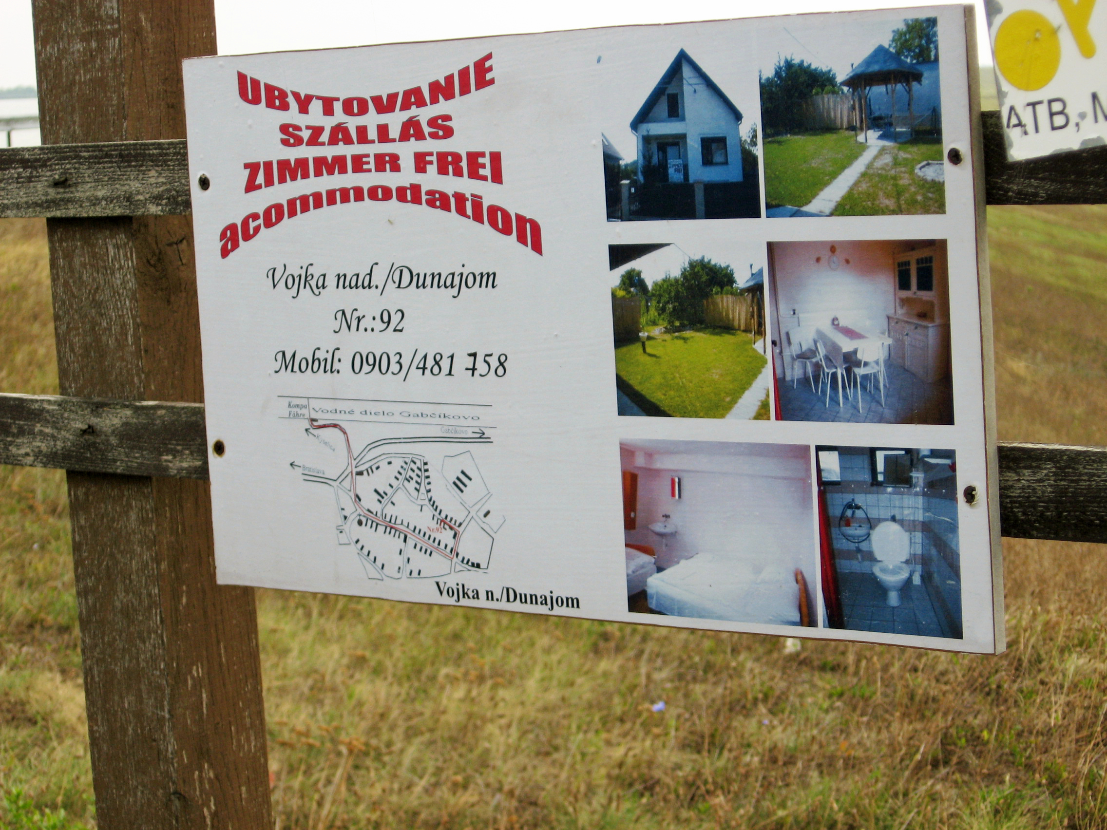
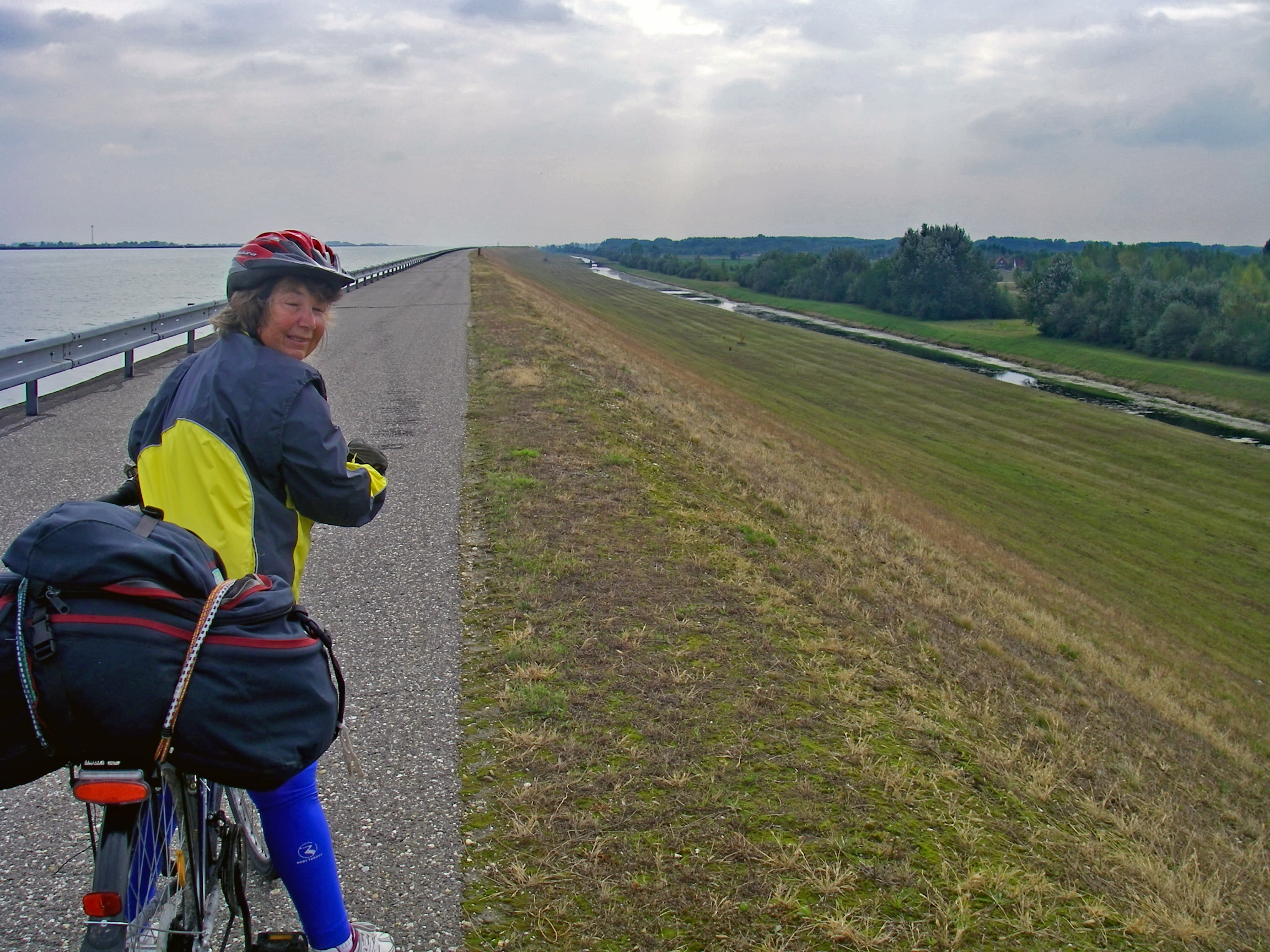
These 'Zimmer Frei' (room available) signs were often very welcome, though in this case we planned to continue past this 'Zimmer Frei' at Vojka nad Dunajom on the way to Komárno.
It was still morning, about 10.45 am, we had kilometres to cover, and pressed on.
Photo: Don & Maria Hitchcock 23rd September 2008
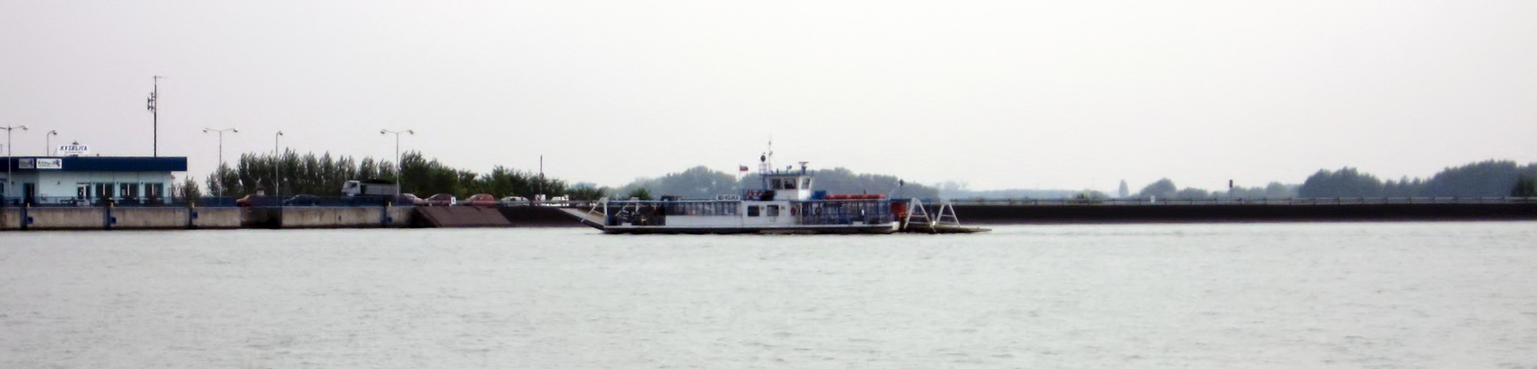
This free car ferry operates from Vojka nad Dunajom to Kyselica, since the barrage at Cunovo does not go right across the canal, and there is thus no road between the two banks of the canal.
Here it is arriving at Kyselica on the other side of the canal.
Photo: Don & Maria Hitchcock 23rd September 2008
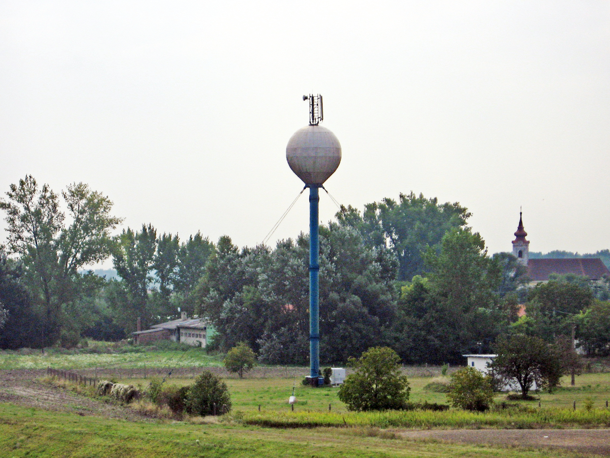
Because the river banks beside the canal and in the much reduced in volume Donau river system are so low lying in many places, it is necessary to build water tanks such as this one to supply water pressure to each village. A height of 15 metres is sufficient for a domestic supply, and this looks to be at least that, if not more.
Water is normally pumped to the tank continuously in a steady slow stream, but it can supply a large amount of water in a short time at adequate pressure when required.
In addition, the water tower provides a ready made place at a convenient height to put communications devices such as mobile phone receivers/transmitters.
The church in the distance is the Rímskokatolícky kostol, at Vojka nad Dunajom.
Photo: Don & Maria Hitchcock 23rd September 2008
We stayed on the radweg beside the canal and were travelling faster than we could normally expect because of this good surface on a flat road. By this time it was about 11.15 am.
The narrow and shallow 'canal' on the right appears to have been dug to collect surplus water, either from rain and snow or from seepage. It is very long, running alongside the radweg, starting about eight kilometres below the Cunovo barrage, where it does not connect to any source of water, to just past the Gabčíkovo–Nagymaros Dam, where it enters the canal at the Pristav Gabčíkovo.
The true Donau is a kilometre or two to the right in this image, hidden behind vegetation.
Photo: Don & Maria Hitchcock 23rd September 2008
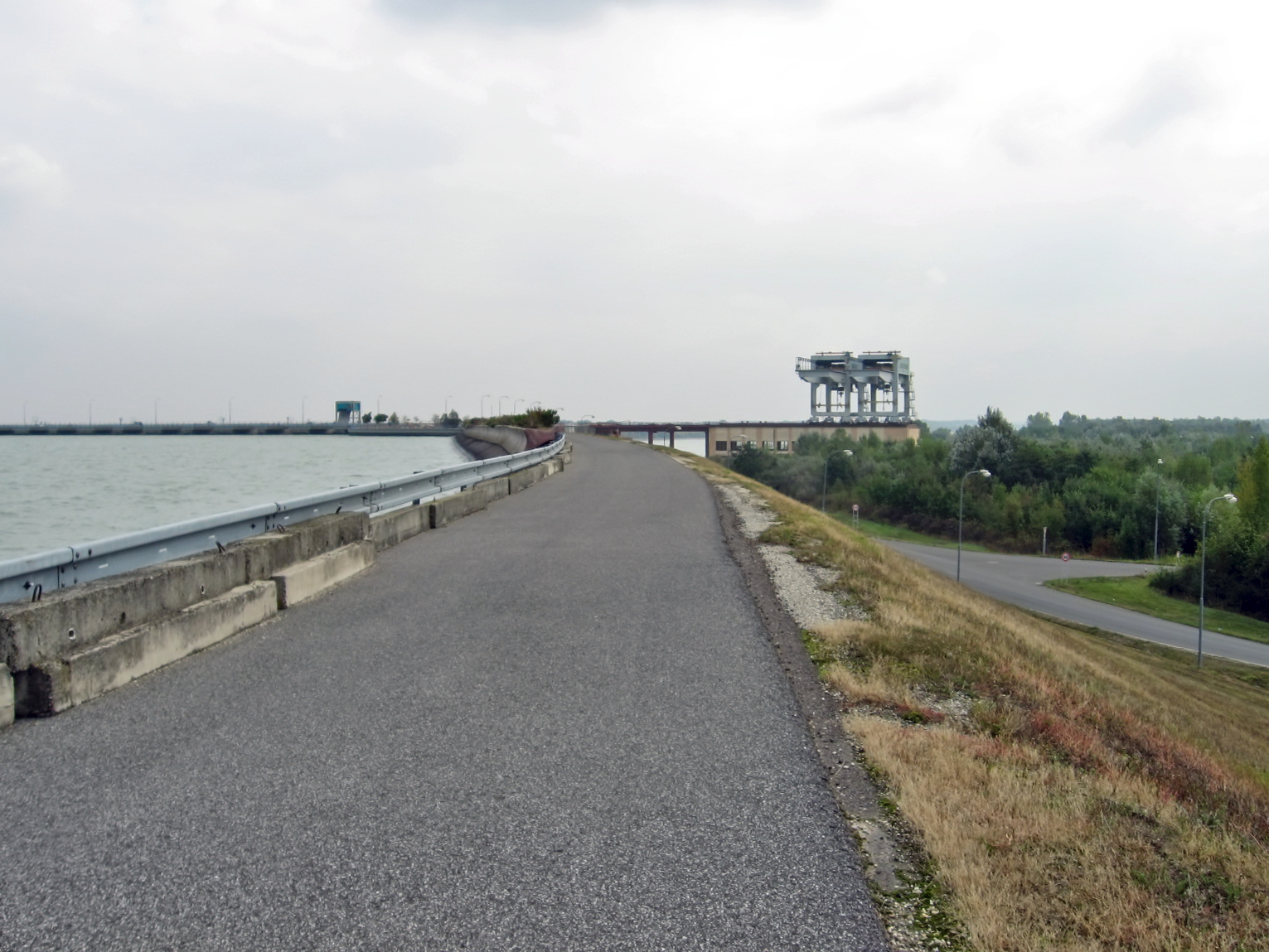
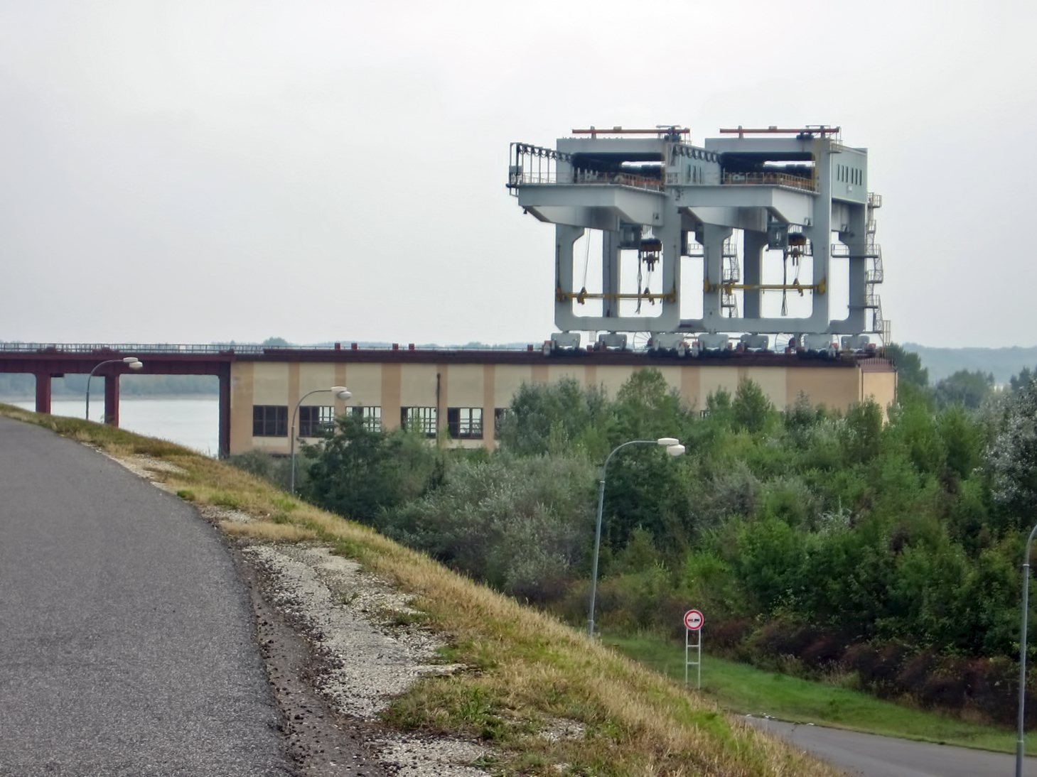
We did not take any of the side trips to the villages recommended by the maps book, and we came to the Gabčíkovo–Nagymaros Dam at about noon.
These giant structures on the end of the dam wall appeared to me to be purpose built gantries or cranes probably resting on the equivalent of very heavy duty train tracks, and used to lift the giant turbines and motors into place after the dam was built. They were now unused most of the time, but could be pressed into service when maintenance on the machinery was needed.
Photo and text: Don & Maria Hitchcock 23rd September 2008
This road provides access to towns and villages such as Bodíky and Vojka nad Dunajom which lie between the canal and the true Donau, and across the dam wall to the towns north of the canal.
Photo: Don & Maria Hitchcock 23rd September 2008
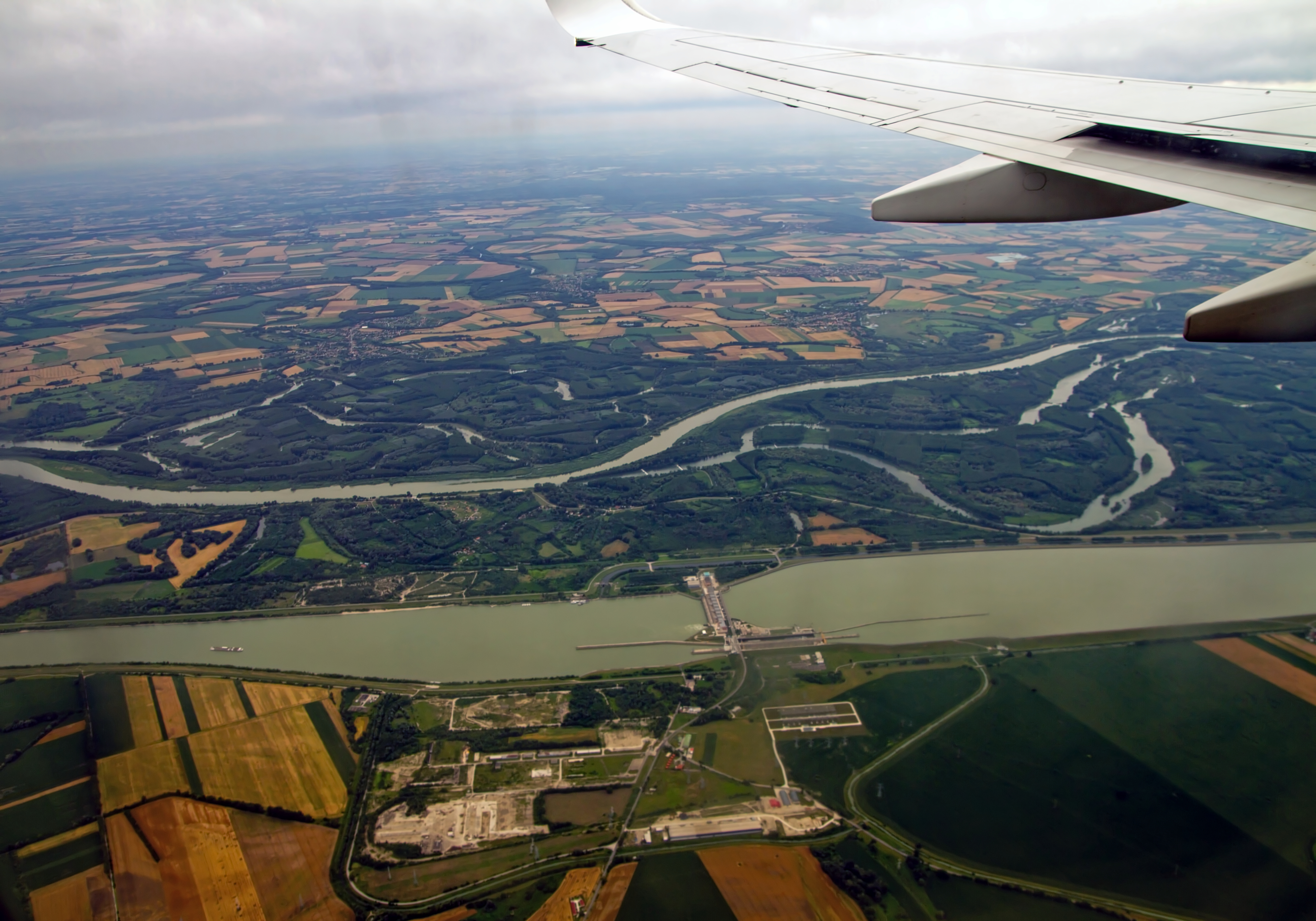
This aerial view of the Gabčíkovo–Nagymaros Dam provides a good overview of the dam, the canal, and the Donau wetlands behind it.
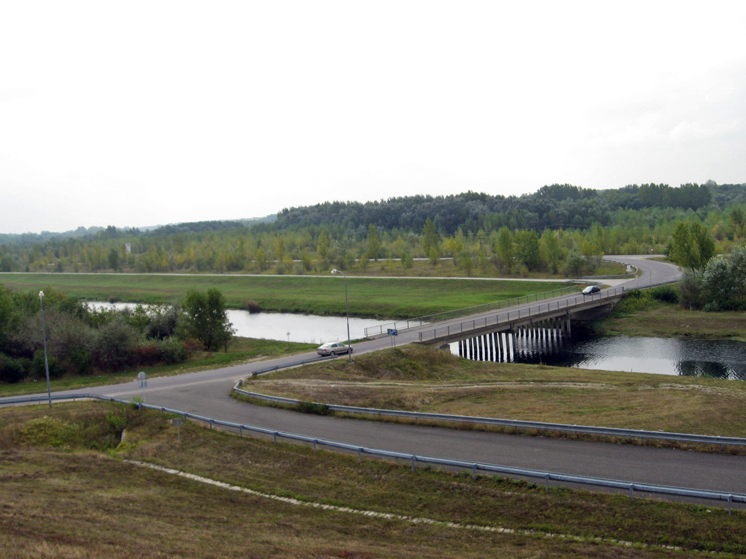
We crossed to the other side of the dam on the road built on its wall after a journey at that point of about 50 km, and continued on the radweg, still in Slovakia, towards the town of Sap.
Photo: Maksym Kozlenko
Permission: Creative Commons Attribution-Share Alike 4.0 International license.
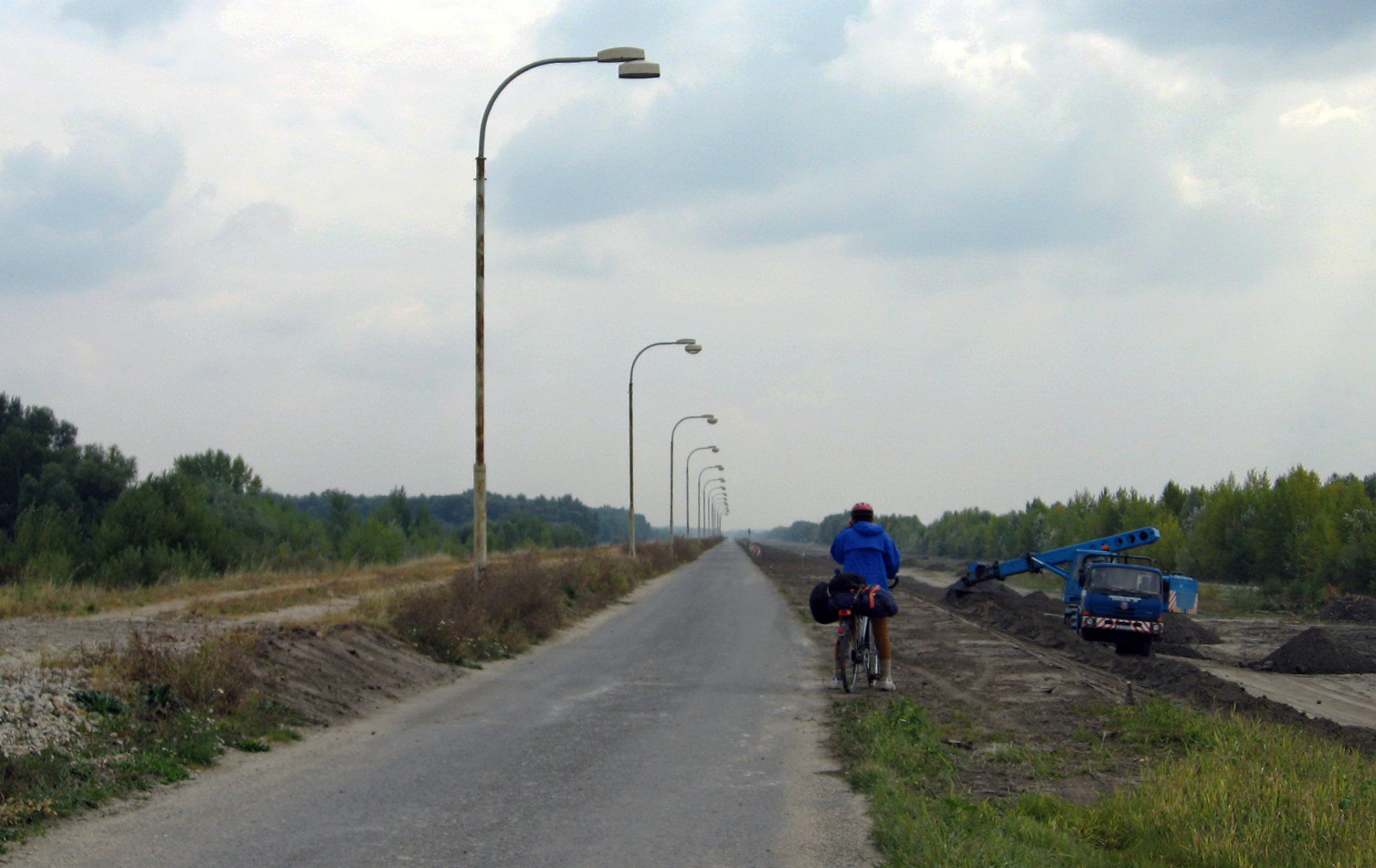
The radweg soon became this old single lane road, complete with street lights, which looked as though it was being upgraded.
Photo: Don & Maria Hitchcock 23rd September 2008
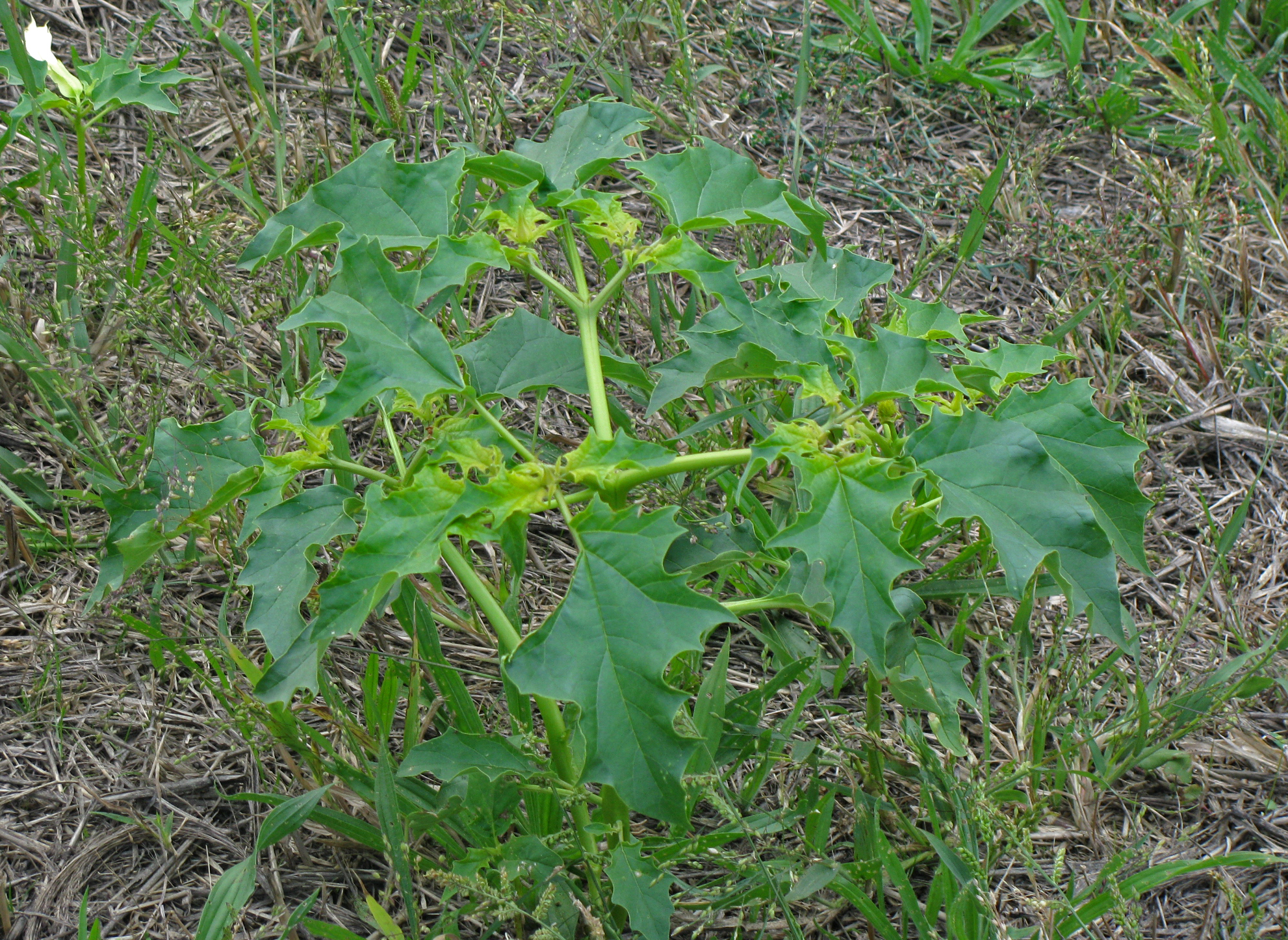
A white flowered plant growing on the side of the radweg, from the poisonous Datura genus, known as Thorn apple, which grows widely across the world as a weed.
Photo: Don & Maria Hitchcock 23rd September 2008
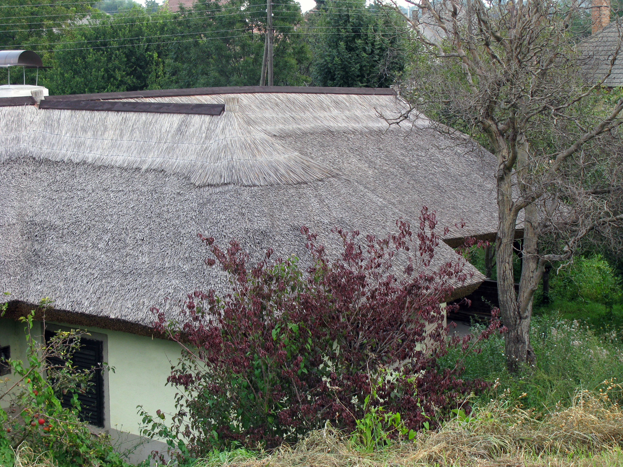
This was a beautifully made thatched roof on the outskirts of the town Sap, made probably from local reeds or sedges by a craftsman, superbly finished.
Thatched roofs last about as long as any other roof, about 40 to 50 years, but the block ridge on the top of the roof shown here needs replacement every ten years or so, needs to be of higher quality material, and is often made of winter wheat straw.
Photo: Don & Maria Hitchcock 23rd September 2008
Additional text: https://www.thatchco.com/thatchpg/faq.htm
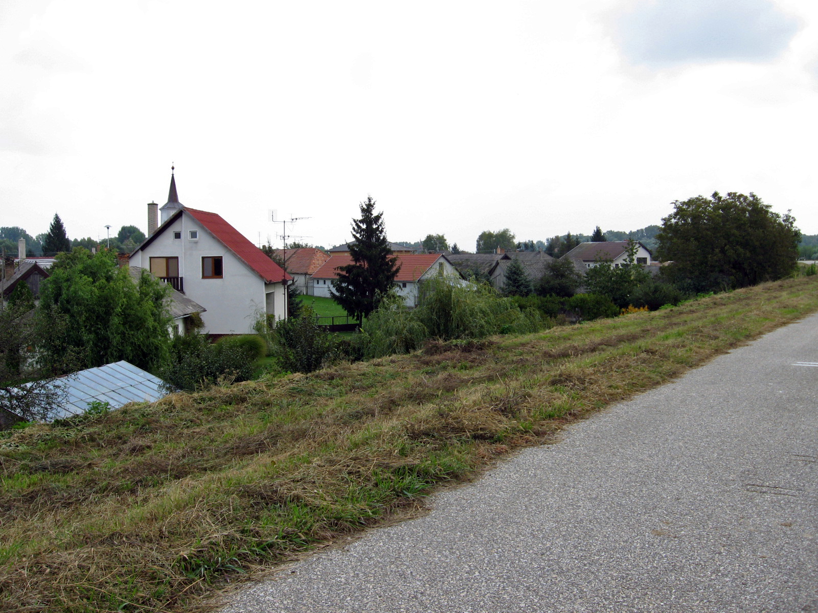
The Donau enters the canal (or vice versa) at the village of Sap, first recorded in 1255 as Zap. It now has a population of 550. Most of its population is Hungarian rather than Slovak.
Peeking over one of the roofs in this image we can see the steeple of the Chapel of Sap, Kaplnka Sap.
Photo: Don & Maria Hitchcock 23rd September 2008
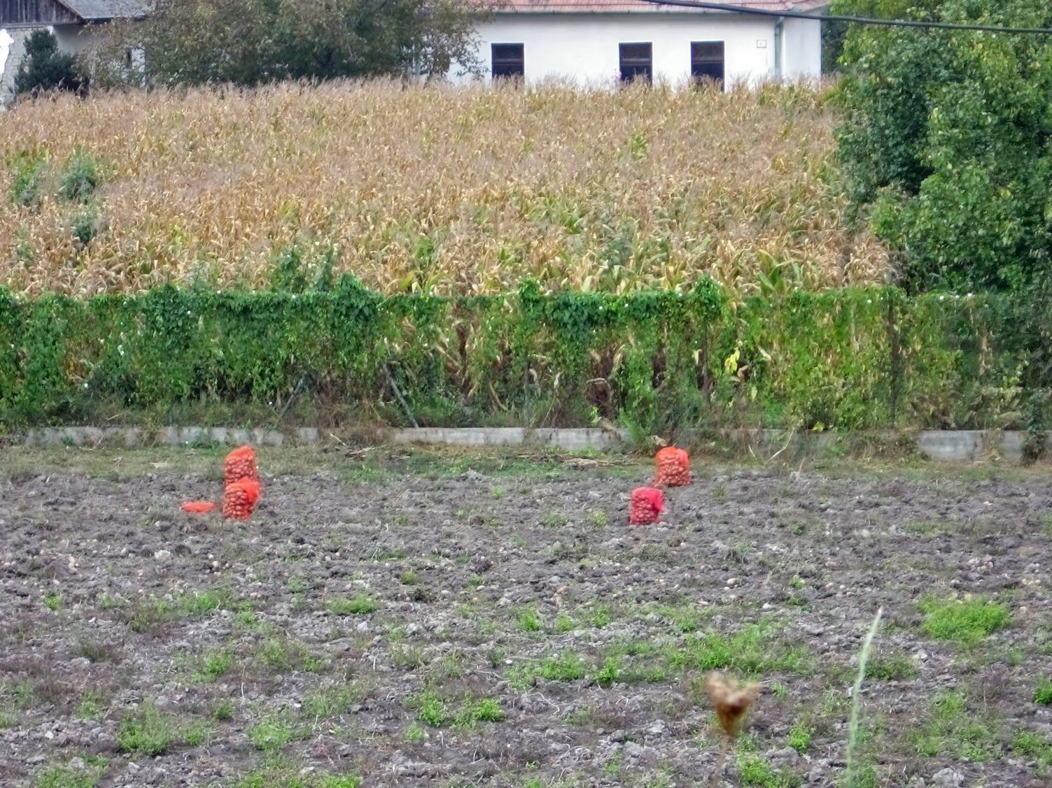
Twenty minutes later, at 1400, we passed by the village of Medvedov, with a harvest of potatoes collected in bags on the fields.
Photo: Don & Maria Hitchcock 23rd September 2008
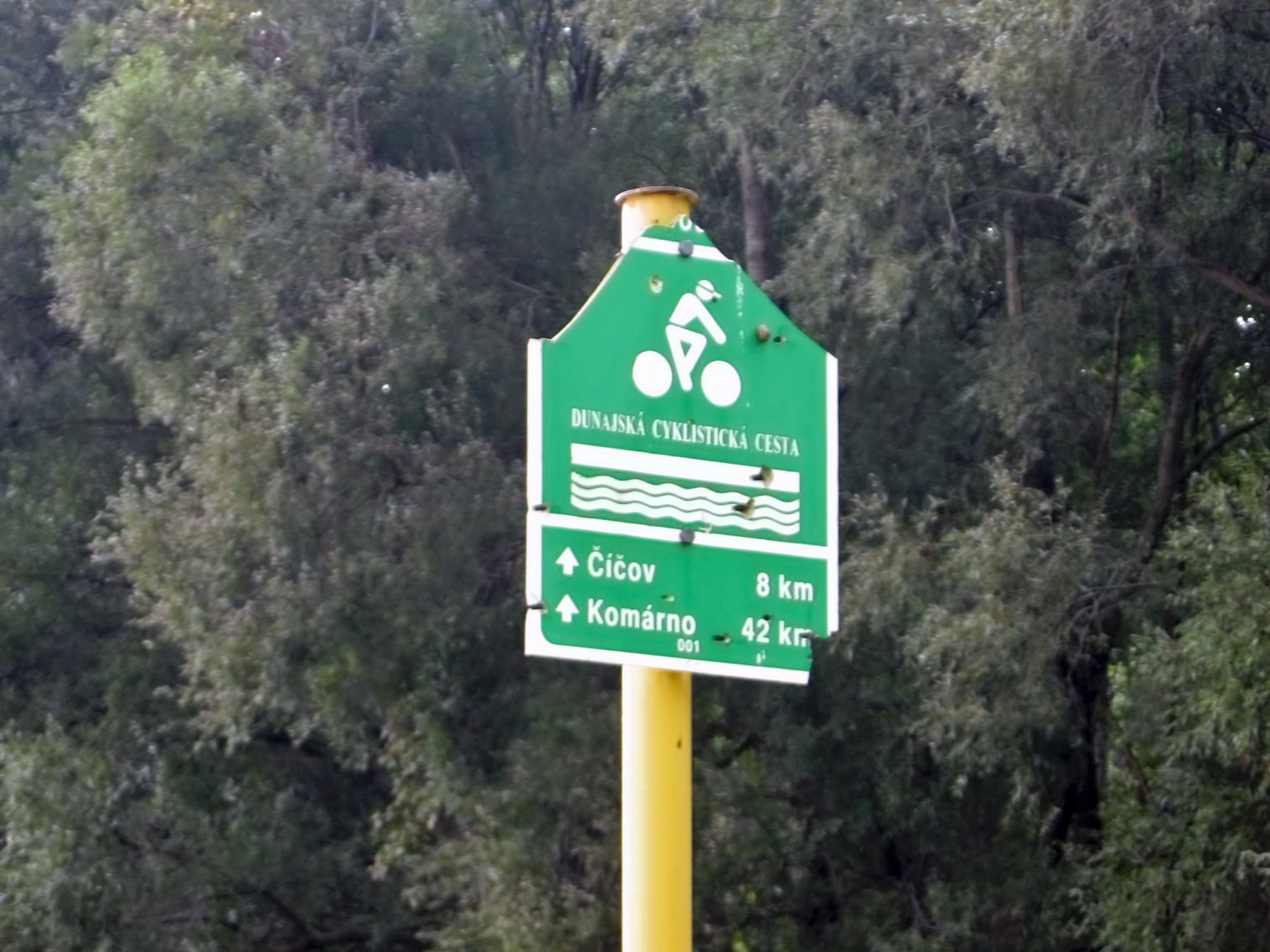
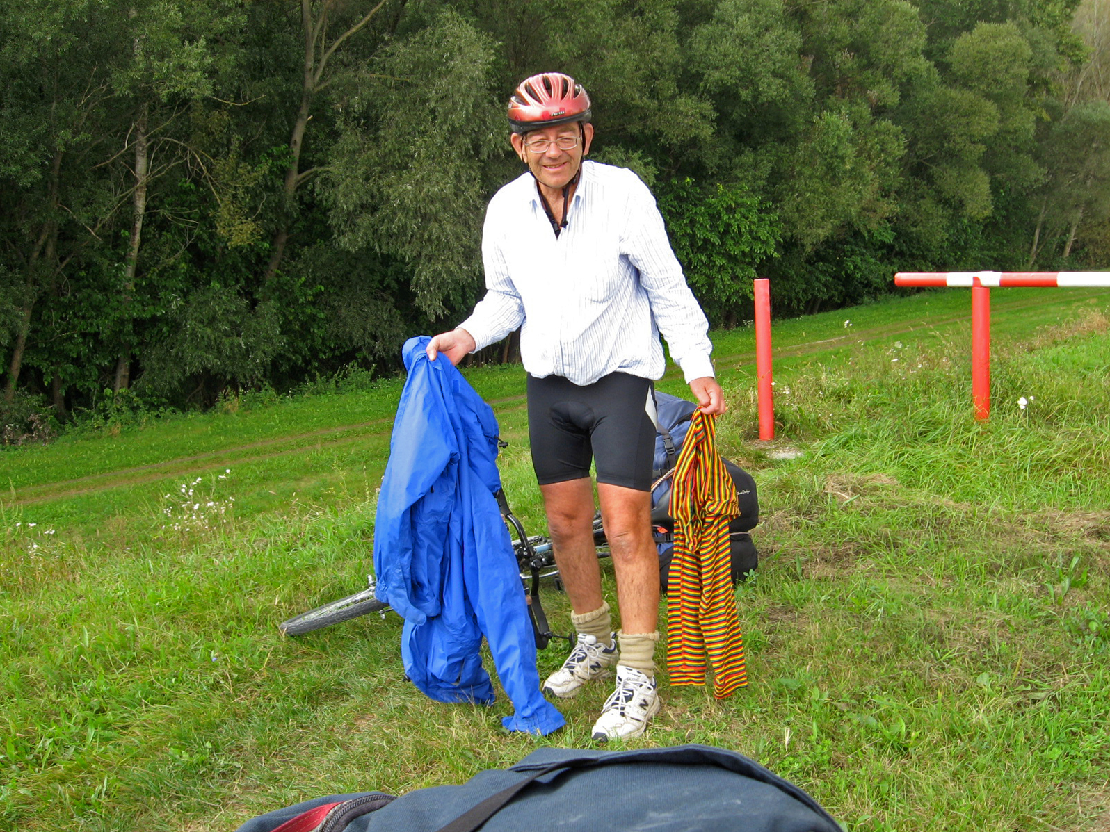
We had a rest stop a few kilometres outside of Medvedov at a sign post, and since it was becoming warmer, I was able to remove my coat and leggings.
I have always found that although cycling shorts ('nicks') are ideal for cycling, since there is no chafing, I much prefer cheap business shirts to the lycra version. They are light, cool, protect your arms from sunburn, and wash and dry well.
We had been riding for seven and a half hours, and I thought we should start looking for a room or campsite. We tried for a room in Cicov, but it was a frustrating and unsuccessful experience.
Photo: Don & Maria Hitchcock 23rd September 2008
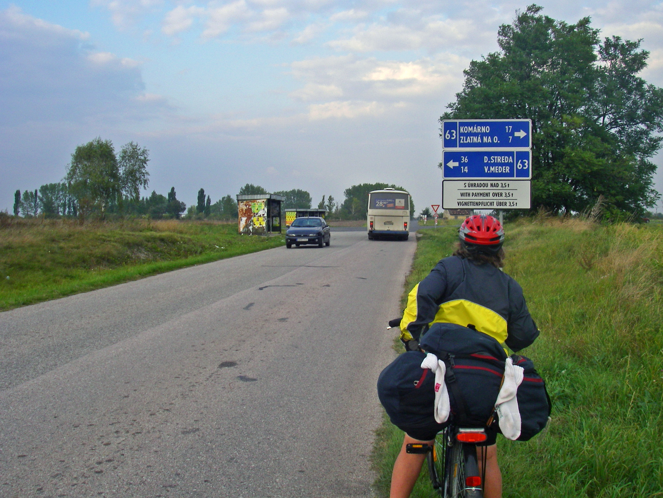
We decided to continue on to Komárno, and took the inland track to Klížska Nemá, then a very poor (gravelly) track to Malé Kosihy. We decided to go north and pick up the highway into Komárno, and reached the crossroads at 1709.
We turned down the road to Komorano, which fortunately had good shoulders, wide enough for bikes to travel safely.
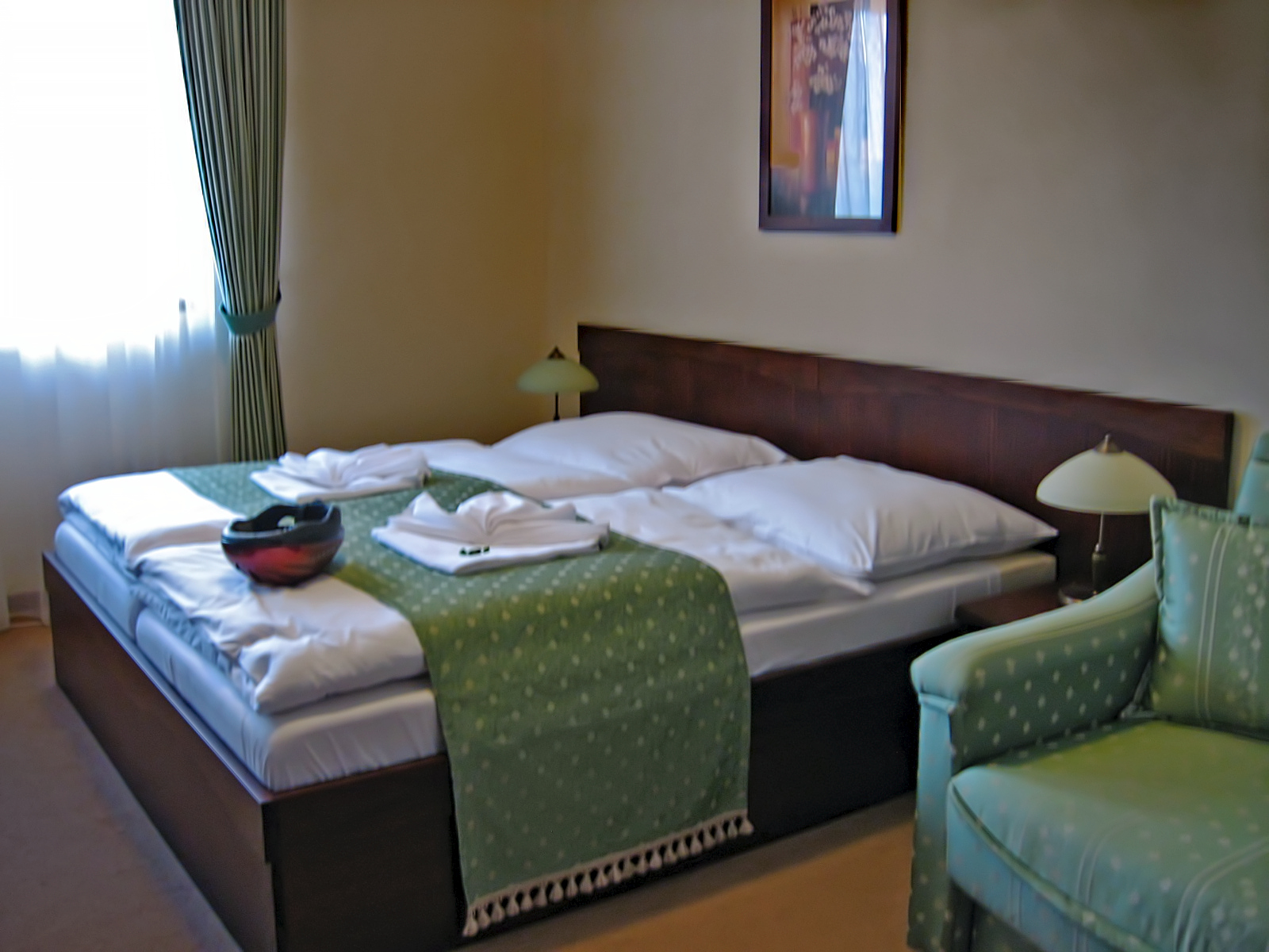
We finally found an expensive hotel, Penzion Zlata Ryba, at Zlatná na Ostrove, before Komárno, and were glad to have the room. It had been a long day, from 7 in the morning until 6 at night, and the meal in the hotel dining room and then a good night's sleep was much appreciated.
Photo: Don & Maria Hitchcock 23rd September 2008