Back to Don's Maps
Cycling down the Danube
Day 4, 4th September 2008
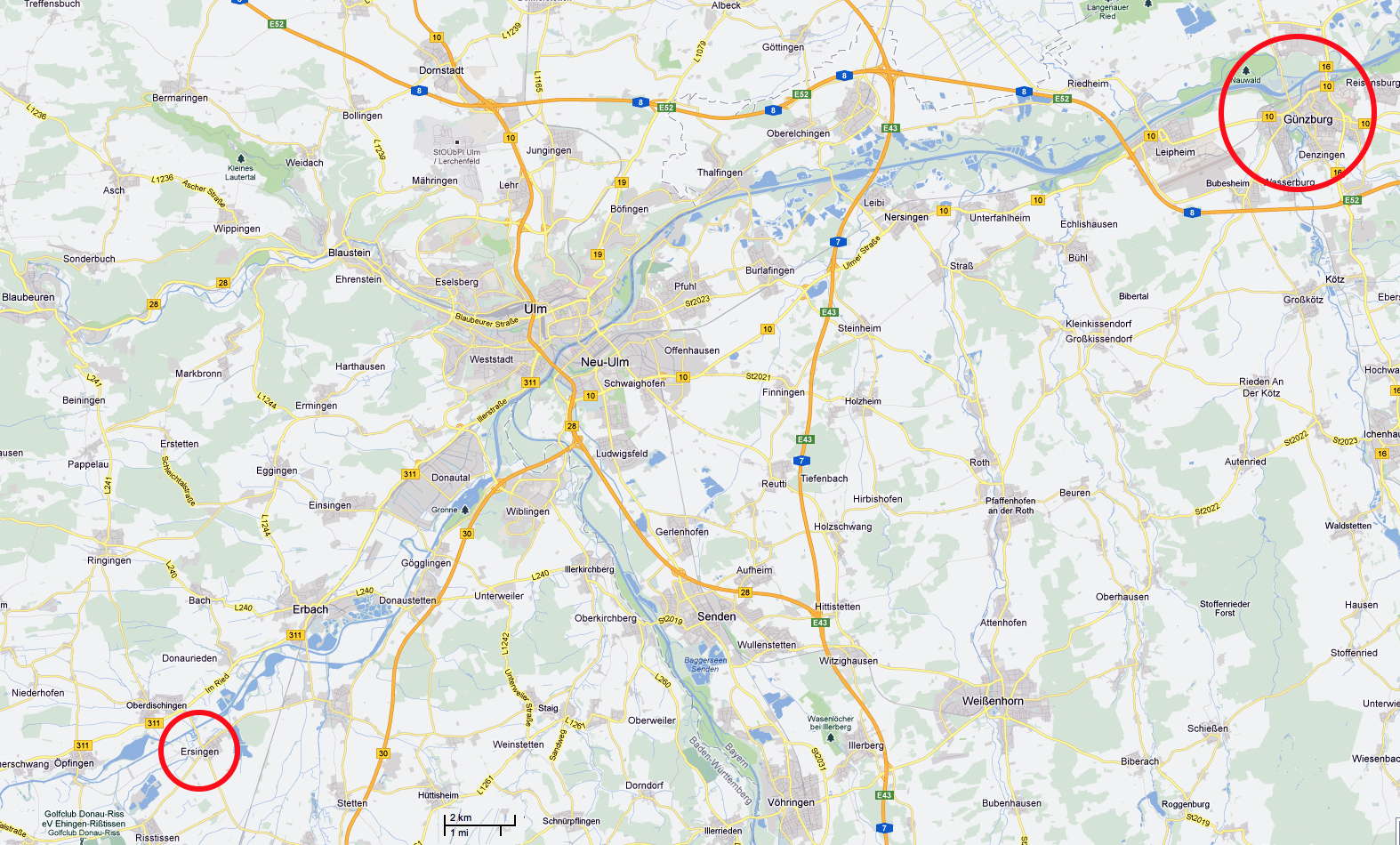
From Ursingen to Günzburg 47.3 Km (220 Km from start)
Photo: Google maps
From Maria's Diary:
It rained during the night and continued on for most of the day today. Out came the arm and leg warmers and the cycle raincoat did good service today. The weather was cool with the rain but we warmed up a bit cycling. Everything in our packs was contained in large plastic bags so we were confident we would have dry clothes at the end of the day. We left a bit later than normal after taking everything under shelter next to the rescue services building. Don replaced the tape on his rear carrier while I cycled into the village to get some breakfast rolls. he had originally put paper masking tape over the tentpegs which were used to strengthen the carrier and replaced this with leucoplast. In the second photo you can see Don boiling up water for tea. He had made a very lightweight stove with the base of a beer can. In this he poured a little alcohol. Around this he placed a support/windbreak made of the walls of two beer cans. The 'stove' worked very fast, boiling a cup of water in 3 minutes. After breakfast we set off.
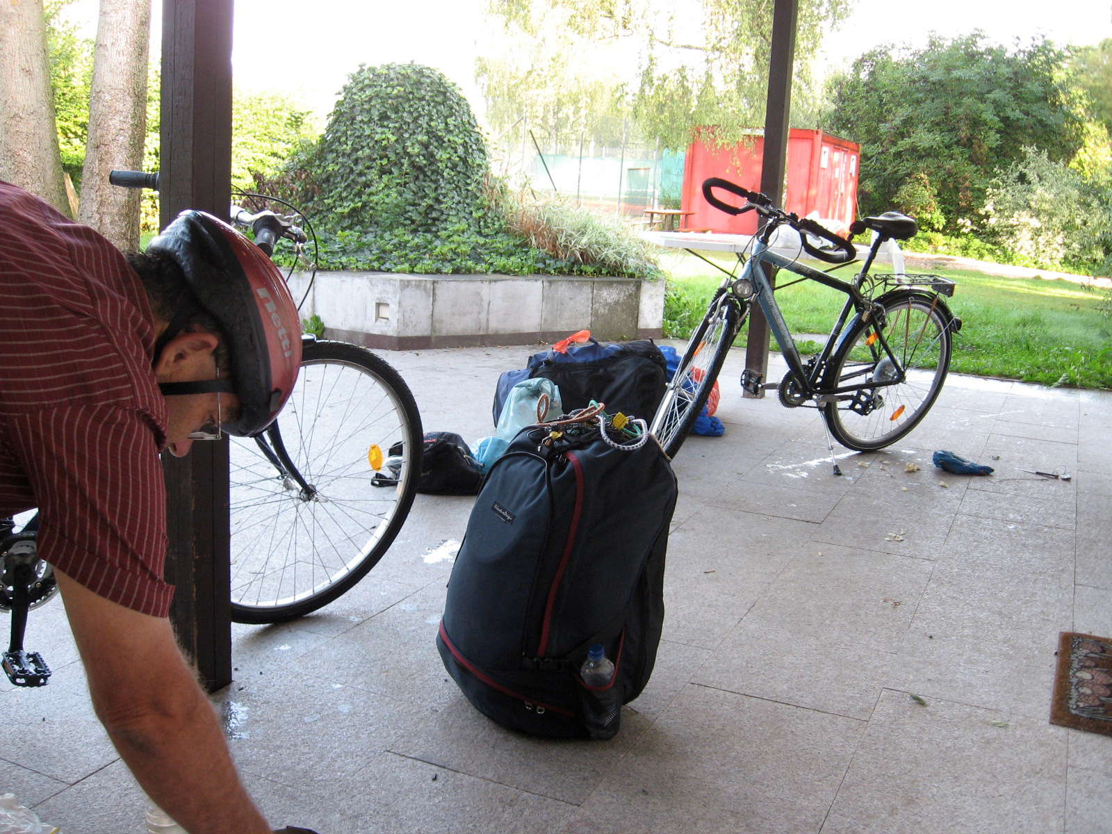
The masking tape holding on the tent pegs strengthening the rear carrier was showing signs of not coping with the wet conditions, so I decided to replace it with leucoplast. Here I took a break from the nearly completed task to get tea and coffee ready in the shelter near the campsite.
In the background is the red shipping container which was set up as the toilets and showers for this campground.
Photo: Don & Maria Hitchcock 4th September 2008
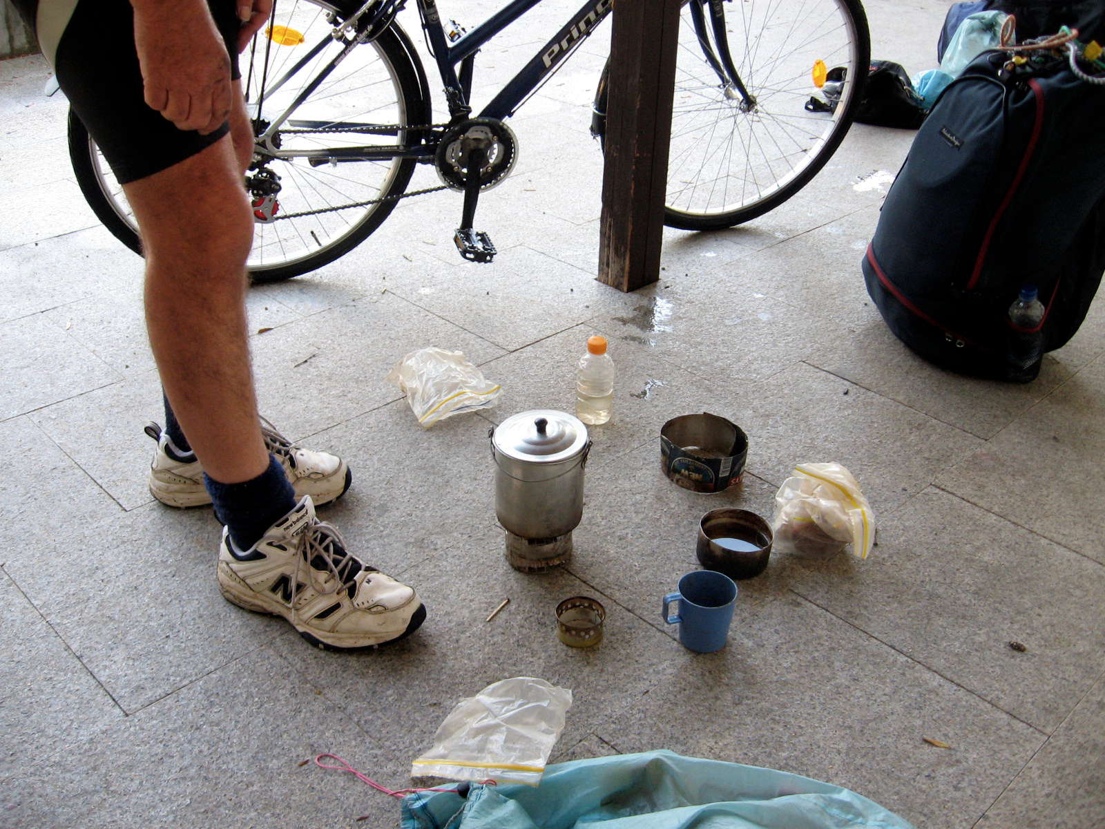
I am a very keen bushwalker (hiker) and make nearly all my own gear such as tents, backpacks, sleeping bags, stoves and so on, in order to make them as light and efficient as possible. I have made about 35 different sorts of stove, but this one is the best so far, consisting of the bottom inch or so of a beer can, with a wire mesh pot support and beer can windshield. It works very well, is easy to set up and pack away, and runs on alcohol.
At this point I was making tea for Maria, boiling water in the billy kept for Maria's tea and general water boiling before boiling up my own turkish coffee in the cut down billy on the pavers.
Photo: Don & Maria Hitchcock 4th September 2008
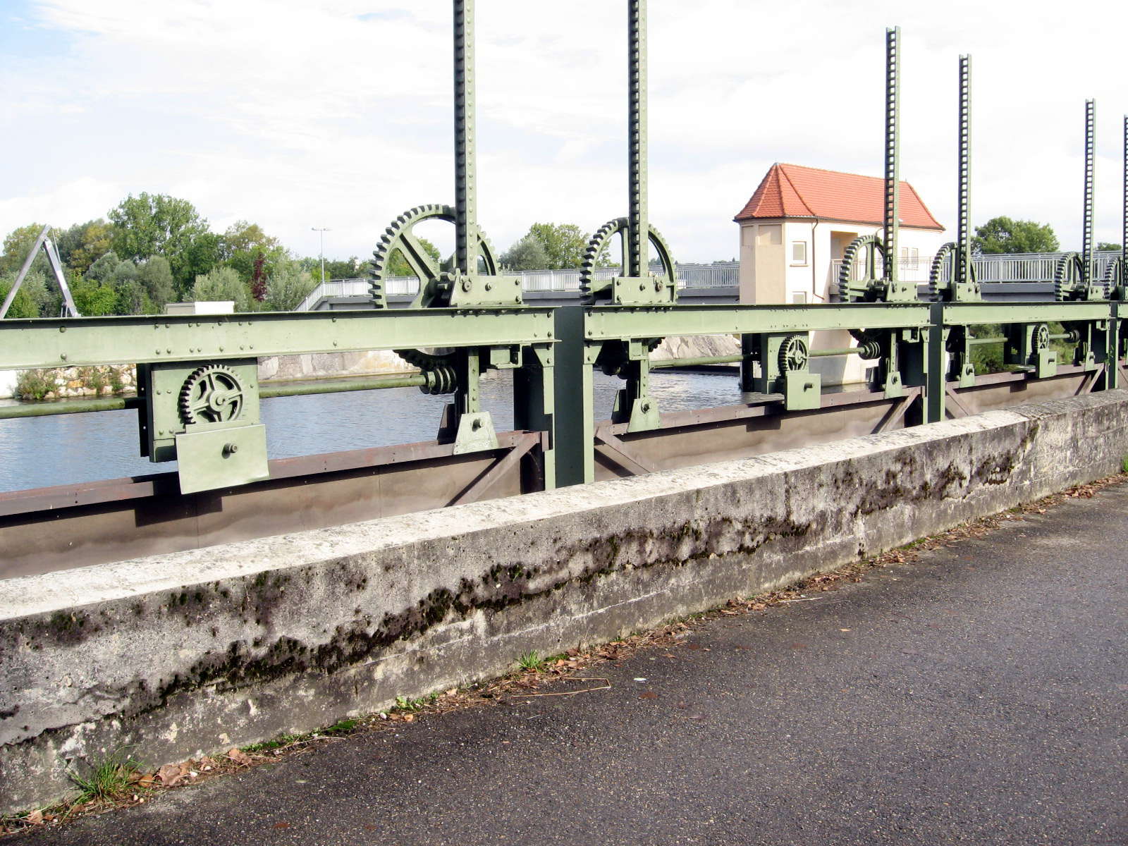
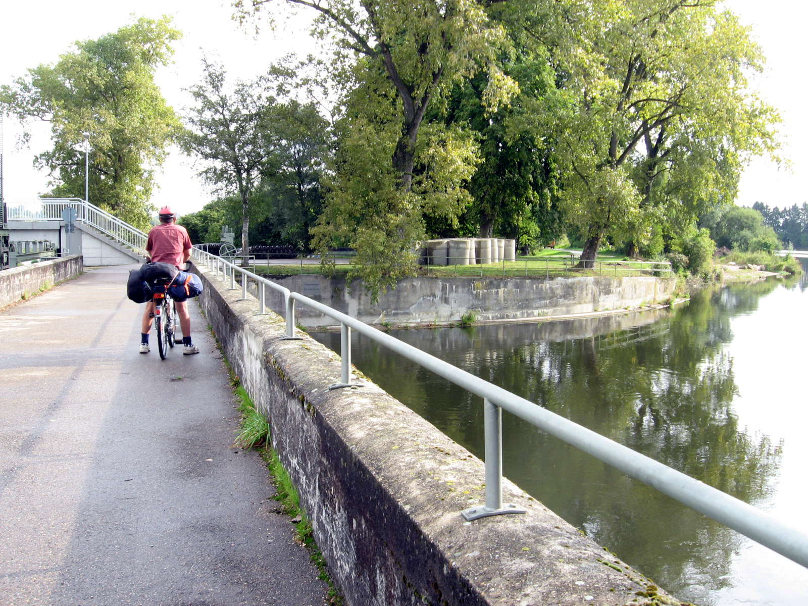
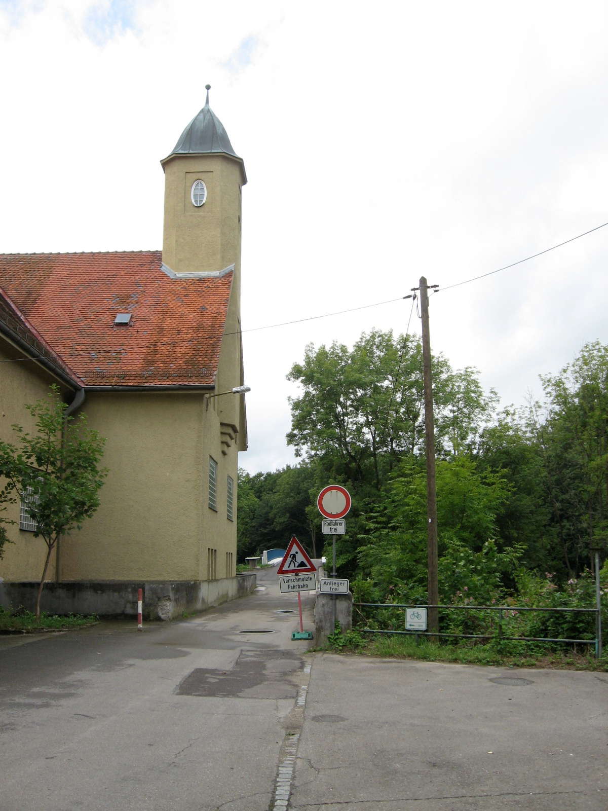
We soon crossed the river again to the left bank at this Kraftwerk just outside of Ersingen, about 800 metres from our campsite.
Photo: Don & Maria Hitchcock 4th September 2008
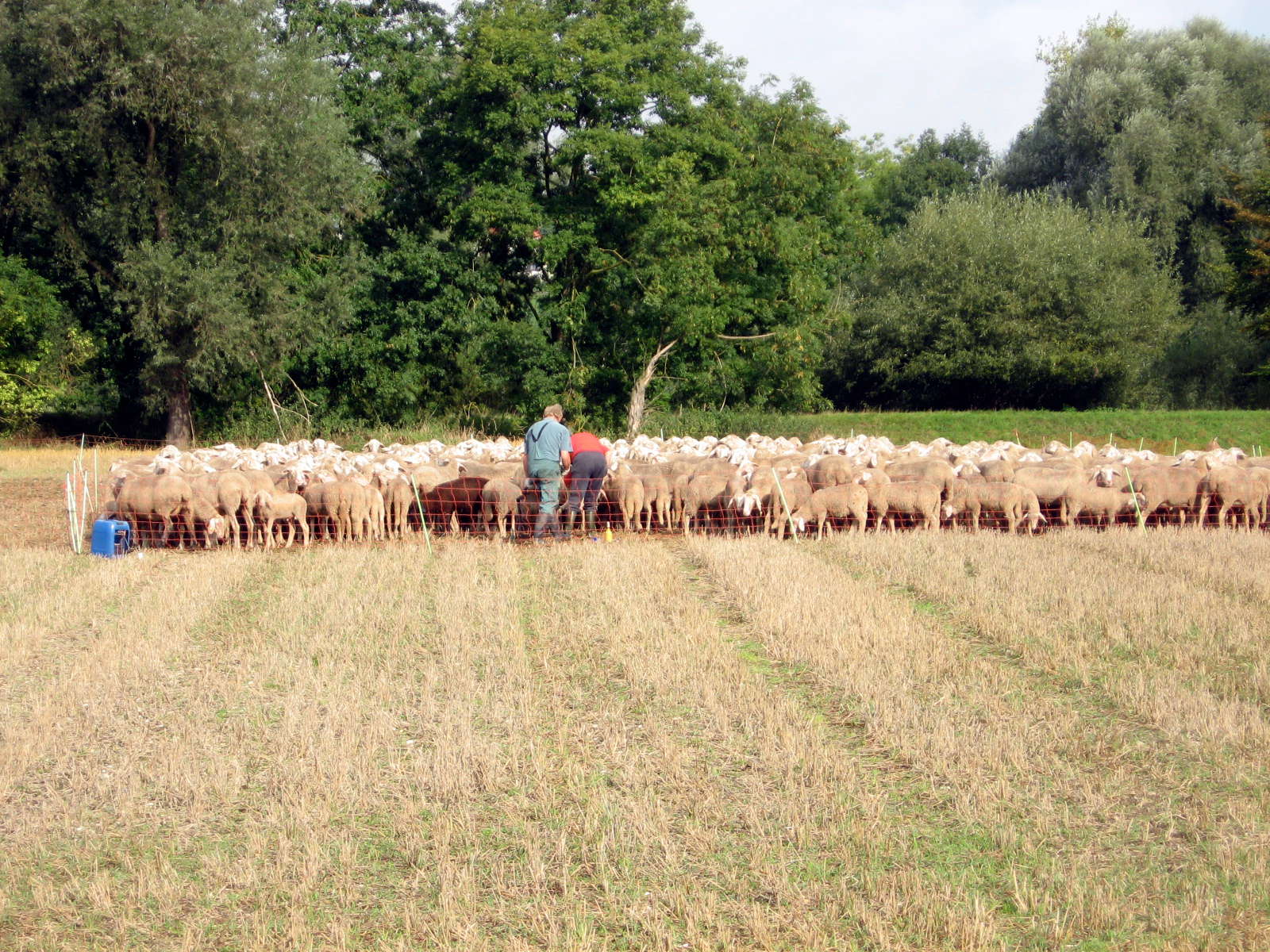
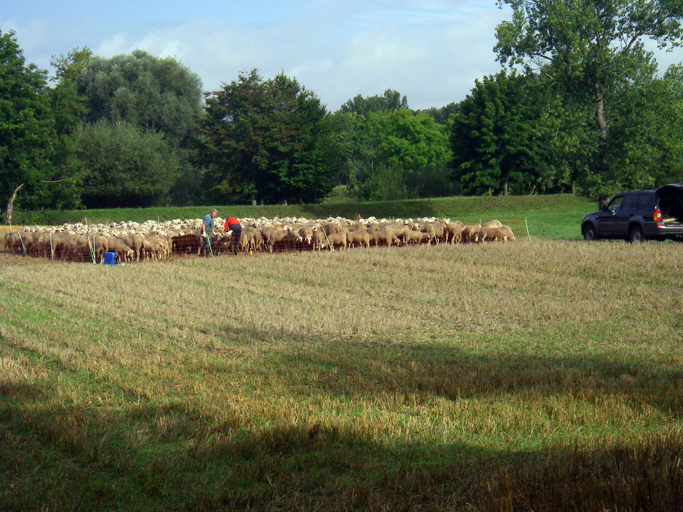
A few minutes later we came across a man and woman inspecting their long-eared sheep in a temporary enclosure of netting and a few poles.
We saw very few permanent fences in Germany. Most were electric fences, put up and taken down as necessary.
Photo: Don & Maria Hitchcock 4th September 2008
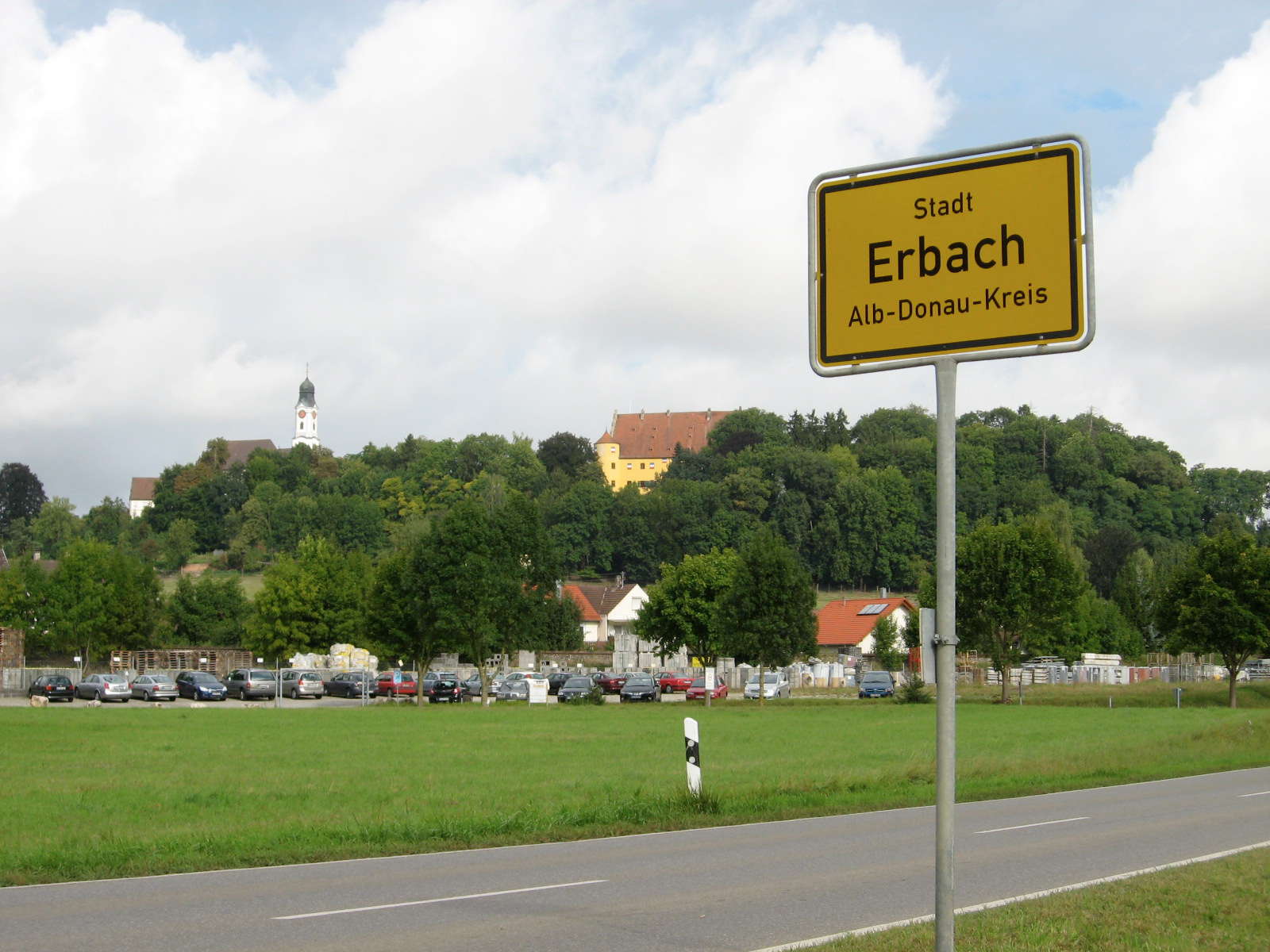
Bypassing Erbach.
Photo: Don & Maria Hitchcock 4th September 2008
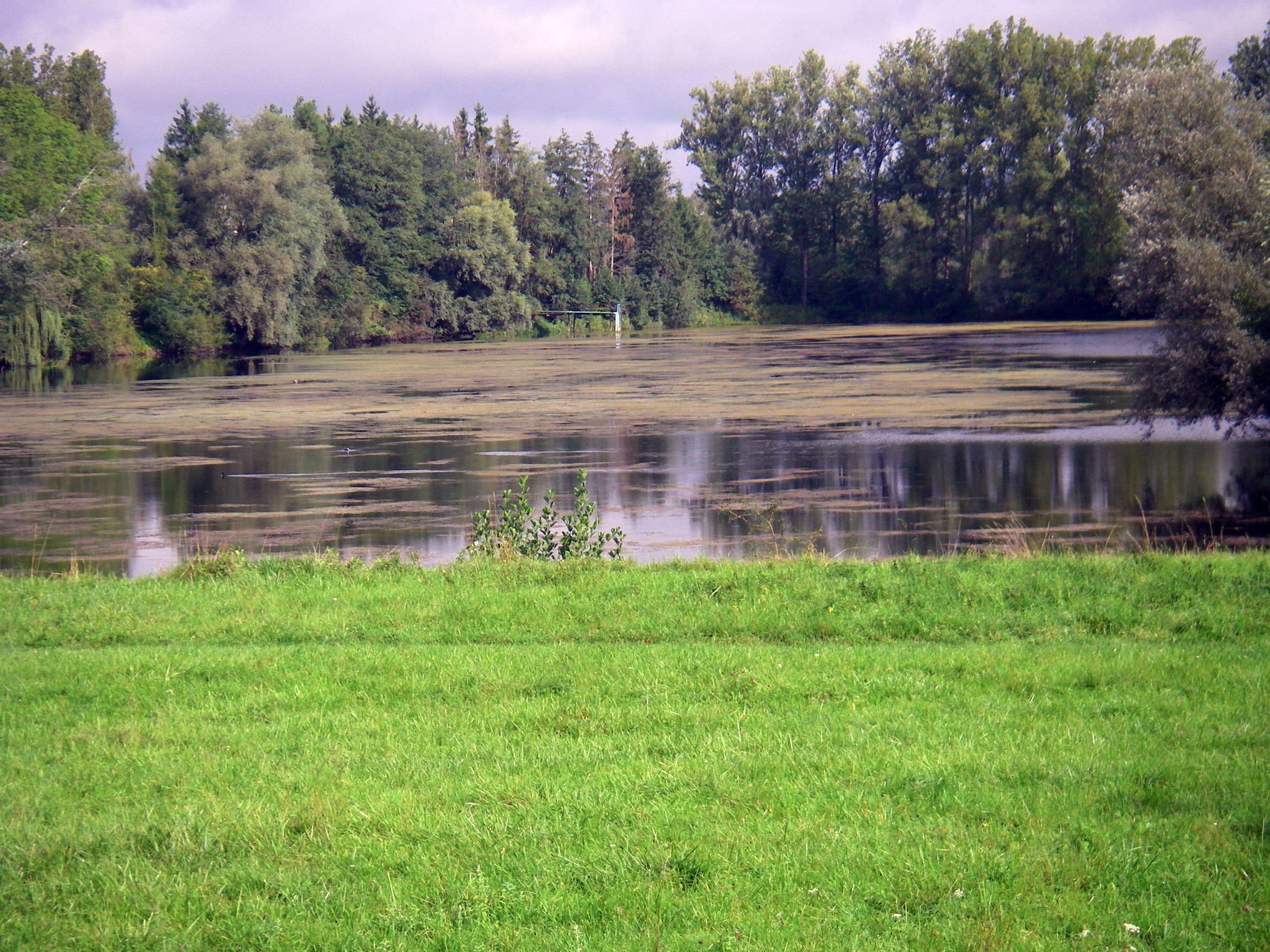
Ten minutes later we came across this small pond which had a small jetty jutting out above the surface, with apparently a pipeline and a walkway to inspect the water and take samples as necessary.
Photo: Don & Maria Hitchcock 4th September 2008
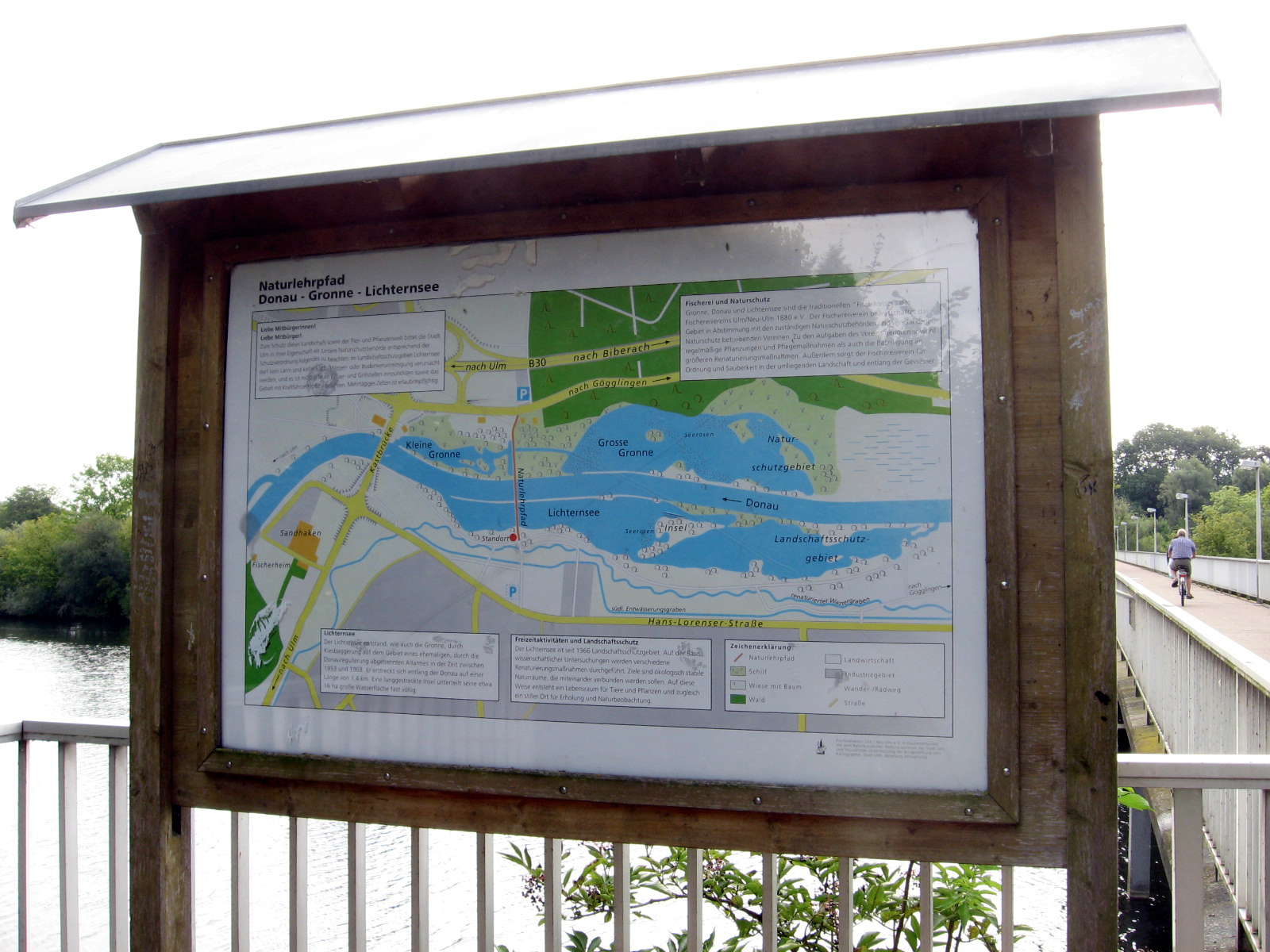
This map shows with a red dot and 'Standort' where you are standing.
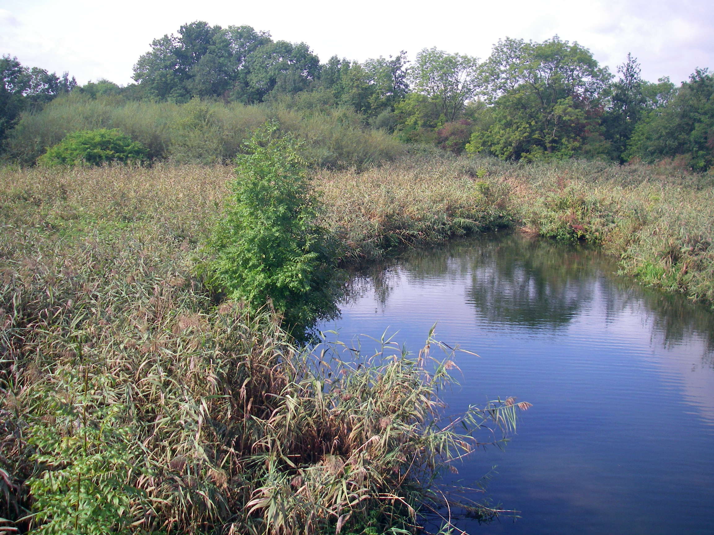
At this point we were an hour past the bridge over the Donau at the Ersingen Kraftwerk in the photos above, on the left bank of the Donau, and about to pass over to the right bank and continue downstream past the Kleine Gronne, or 'Little Green', presumably meaning a small area of green wetlands. This map shows the way that the authorities in charge of the Donau have tried to preserve wetlands and wildlife habitat as much as possible, with periodic flooding inundating the reserves beside the Donau without damage, and preserving a wonderful environment.
Photo: Don & Maria Hitchcock 4th September 2008
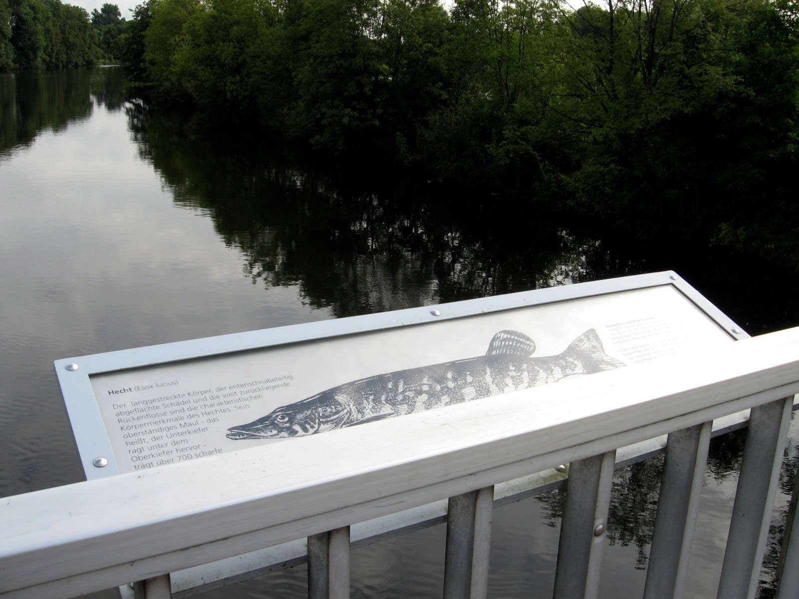
Pike (Esox lucius) live in the river. The characteristic physical features of the pike are the elongated body, the duck bill-like flattened skull and the dorsal fin set far back on the body.
The upper jaw carries over 700 sharp teeth. The lower jaw protrudes from the upper jaw and carries a smaller number of thicker teeth.
Photo: Don & Maria Hitchcock 4th September 2008
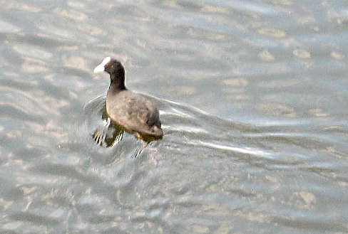
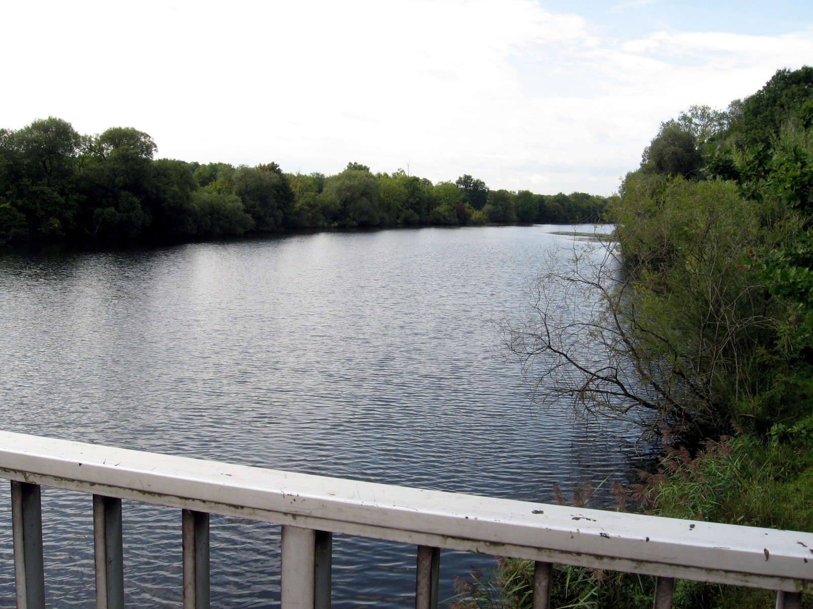
It was great to see so much birdlife. Left, Eurasian Coot, right, ducks on the river, seen from the bridge.
Photo: Don & Maria Hitchcock 4th September 2008
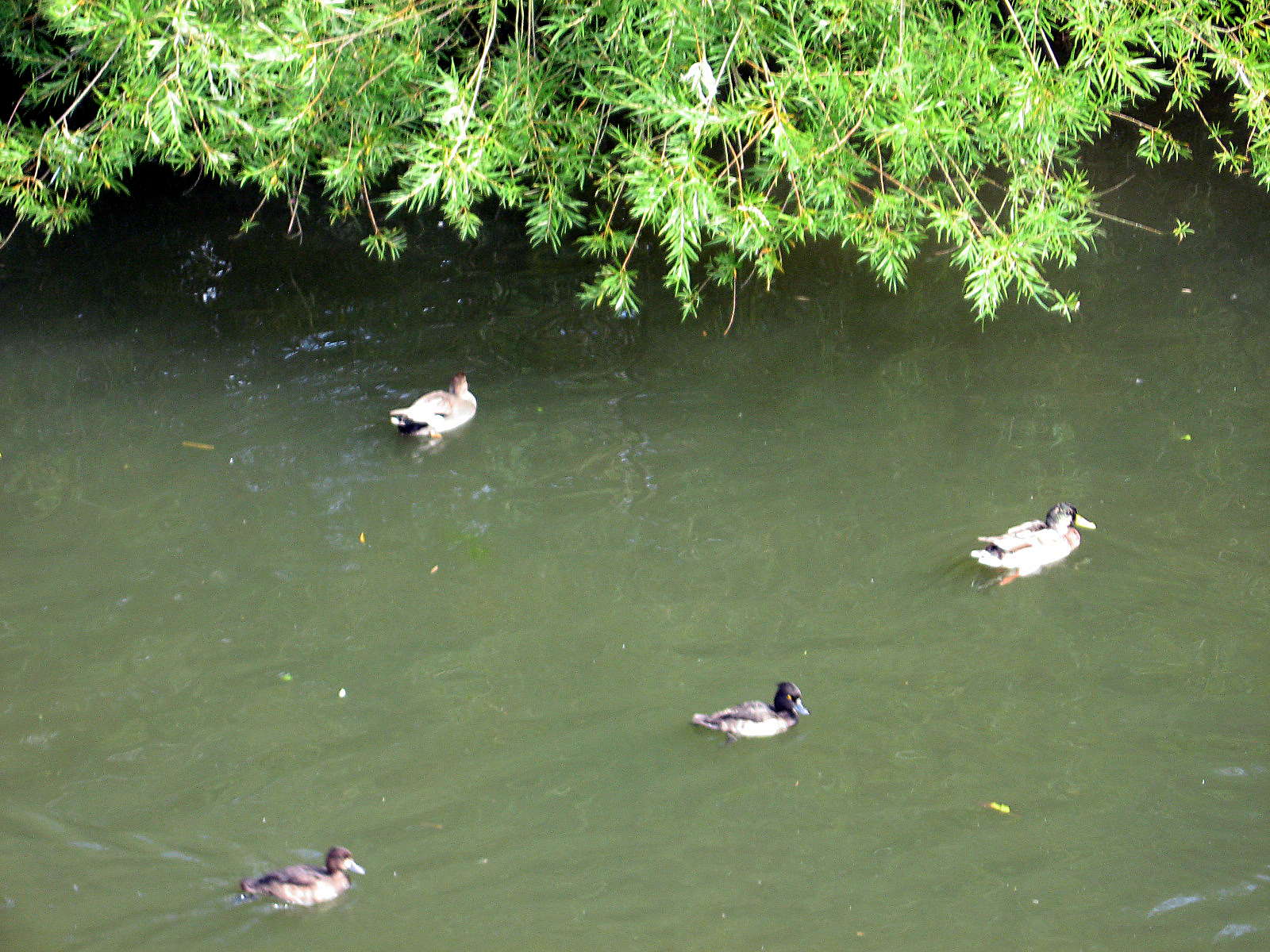
From the bridge we could see many ponds on the flats beside the river itself, some large, some quite small, but all very important to maintain a healthy ecology for the river. Wetlands like this do a wonderful job of cleaning the water of the Danube of many pollutants, and act as superb habitat for birds, fish, small animals and invertebrates.
The water was crystal clear.
Photo: Don & Maria Hitchcock 4th September 2008
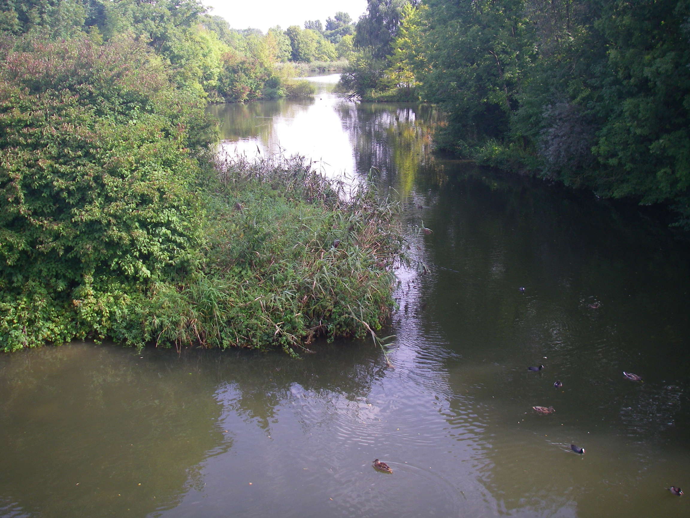
The birds with white face and black body are Eurasian Coots.
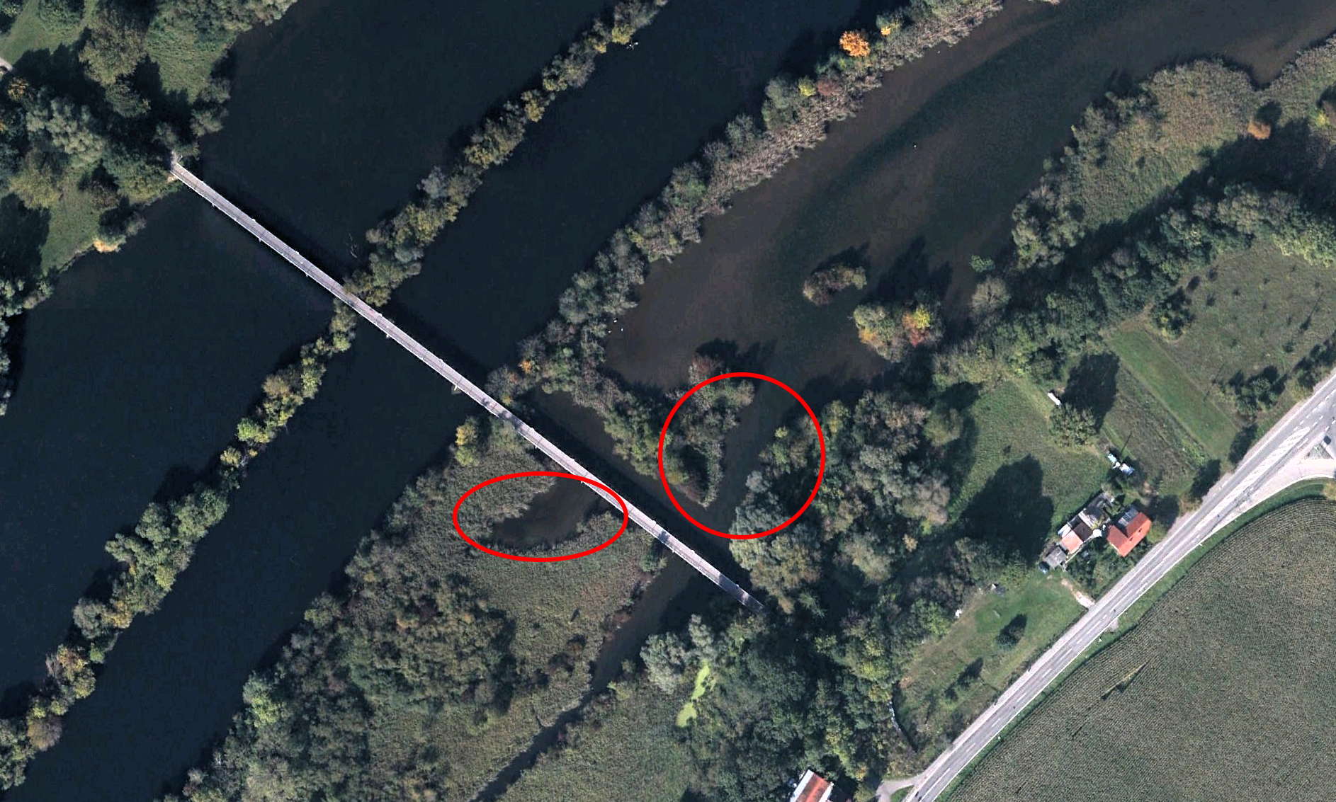
The areas covered by this photo and the one above can be seen on the left hand image, from Google Earth.
Photo: Don & Maria Hitchcock 4th September 2008
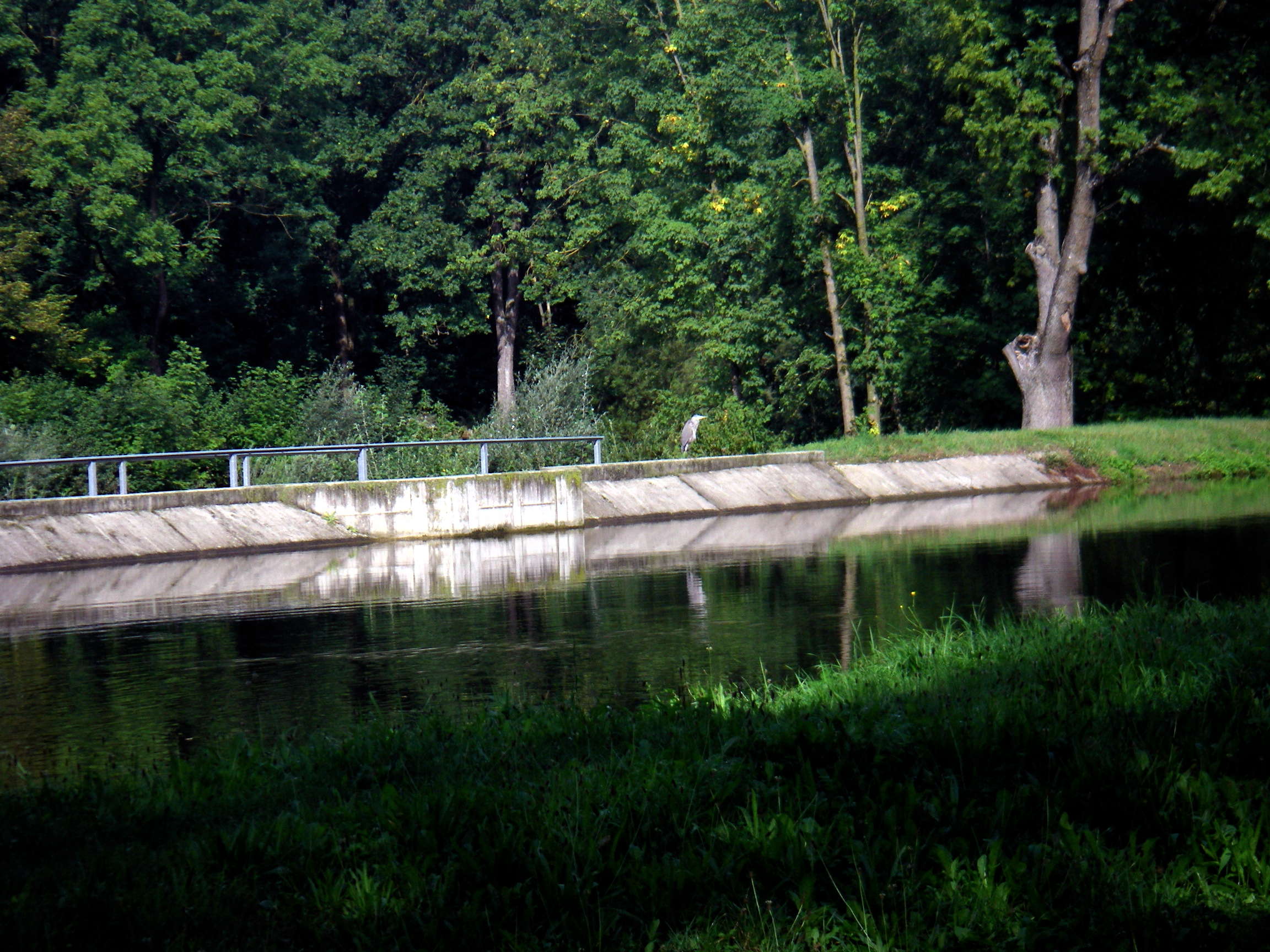
Ten minutes later we came across this large Grey Heron on a concrete wall, the start of a canal leading to a Kraftwerk, which bypasses the main part of the Donau, which is shallow and has little water flowing in it. The canal flows swiftly down to the hydro electric station in a manmade channel, after which it rejoins the Donau. The Donauweg has been built on the right bank of the canal.
Photo: Don & Maria Hitchcock 4th September 2008
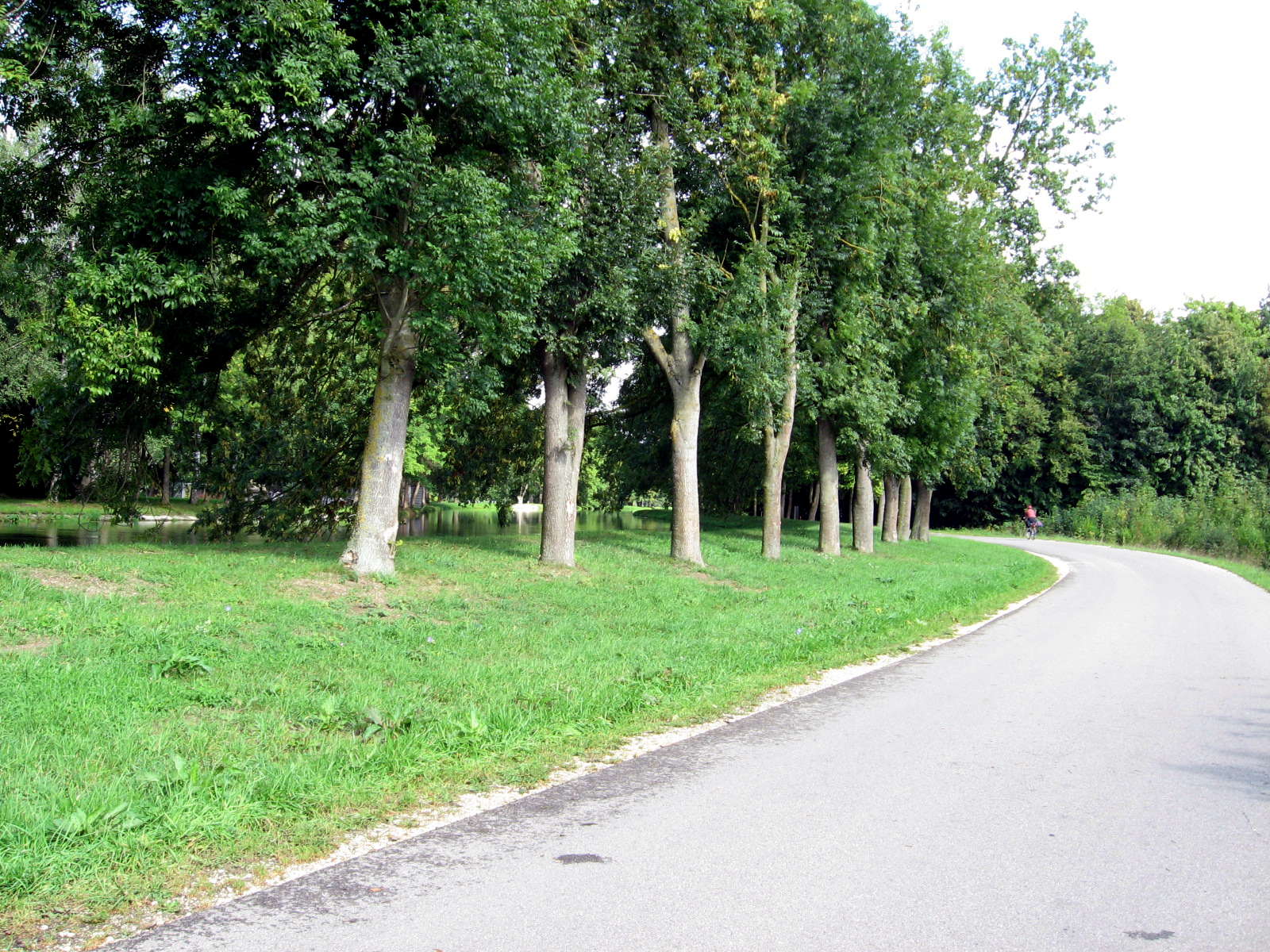
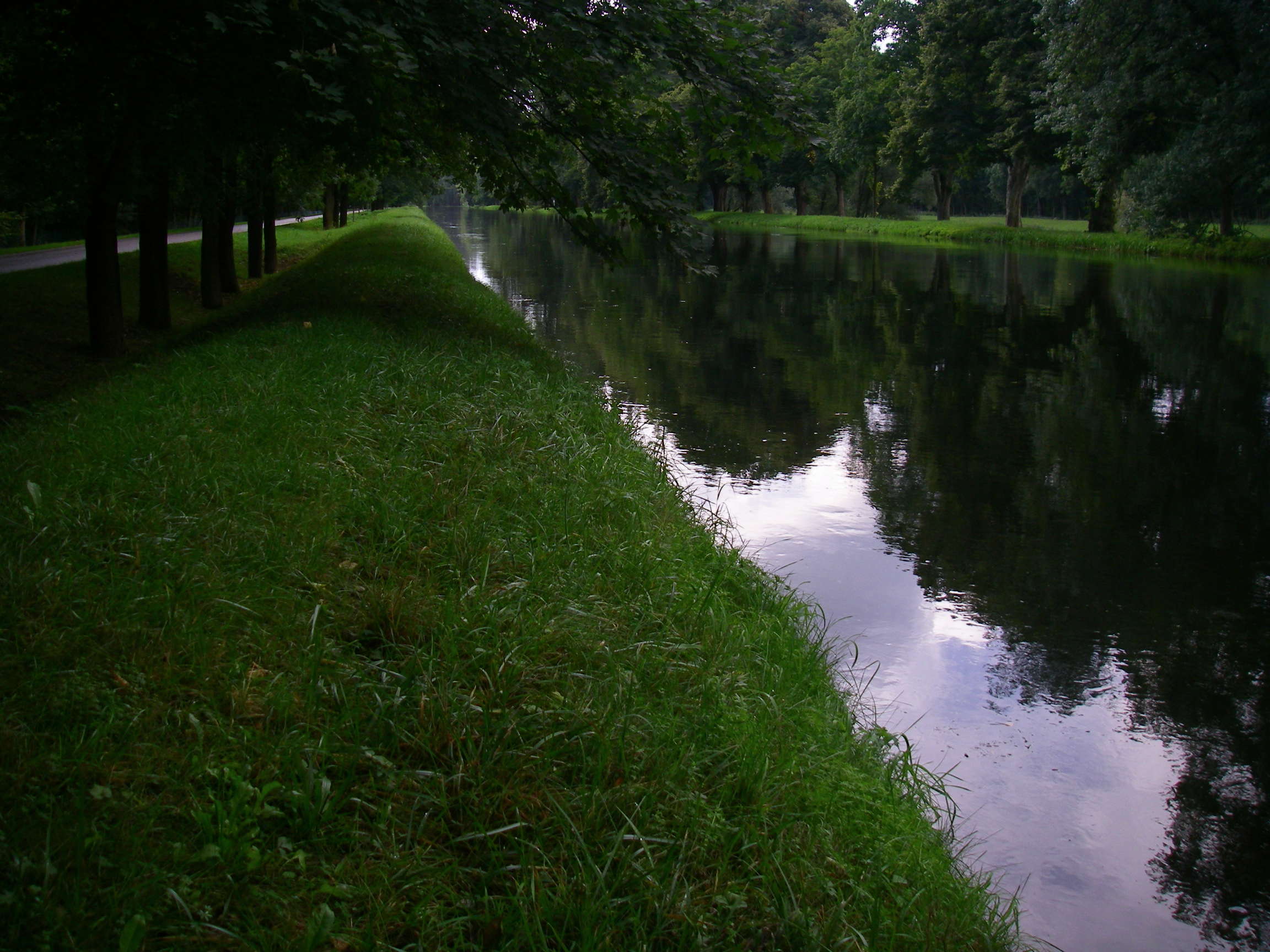
The Donauweg at this point was superbly designed, maintained and landscaped.
Left, looking downstream, right, looking upstream.
Photo: Don & Maria Hitchcock 4th September 2008
Ten minutes later we crossed the Donau at the Kraftwerk.
Photo: Don & Maria Hitchcock 4th September 2008
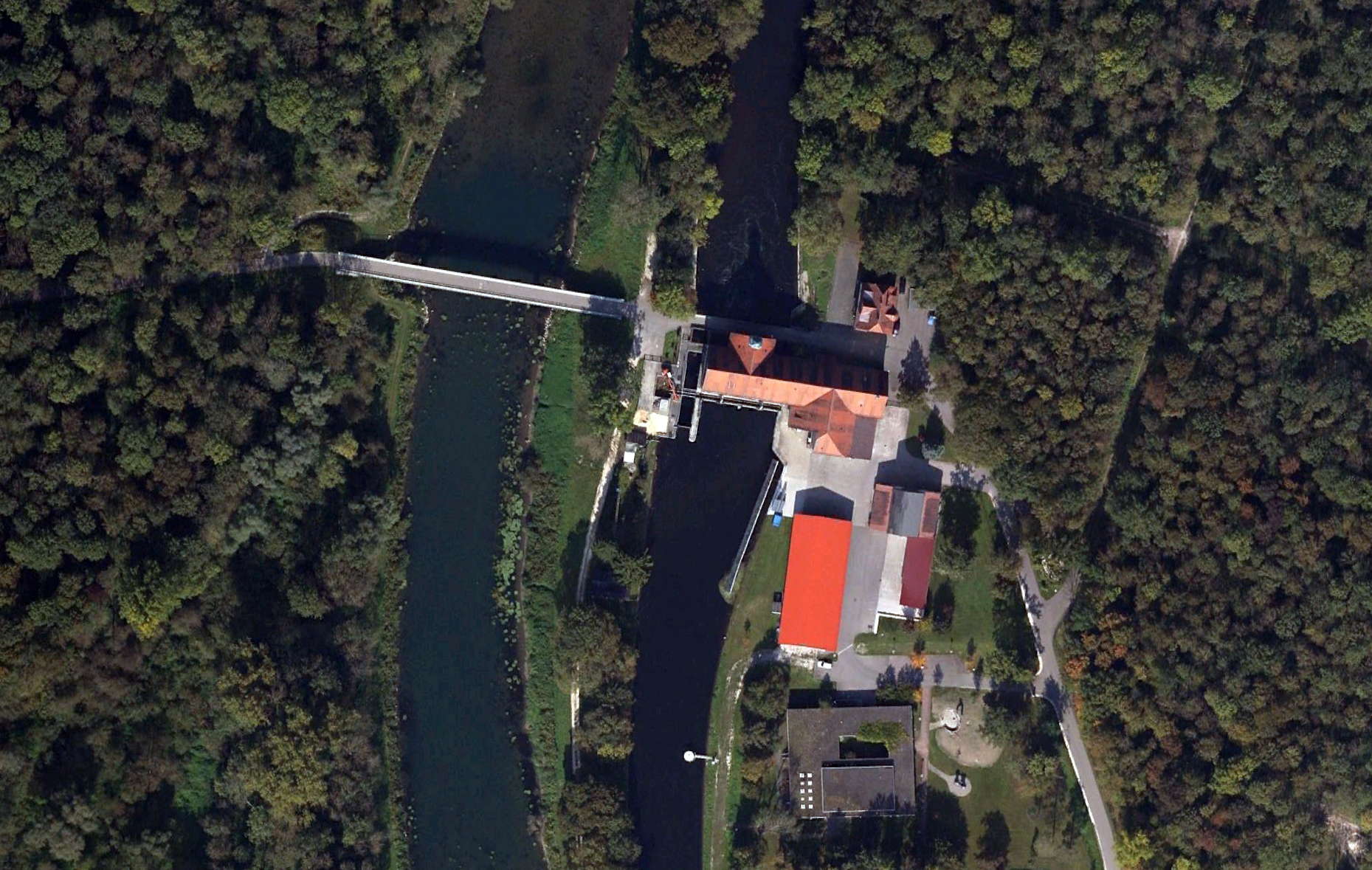
This is a great image from Google Earth showing the Donauweg which we were following beside the canal on the right, the Kraftwerk and its small tower, and the bridge which crosses both the canal and the Donau itself.
We passed over the bridge to the left bank of the Donau.
Photo: Google Earth
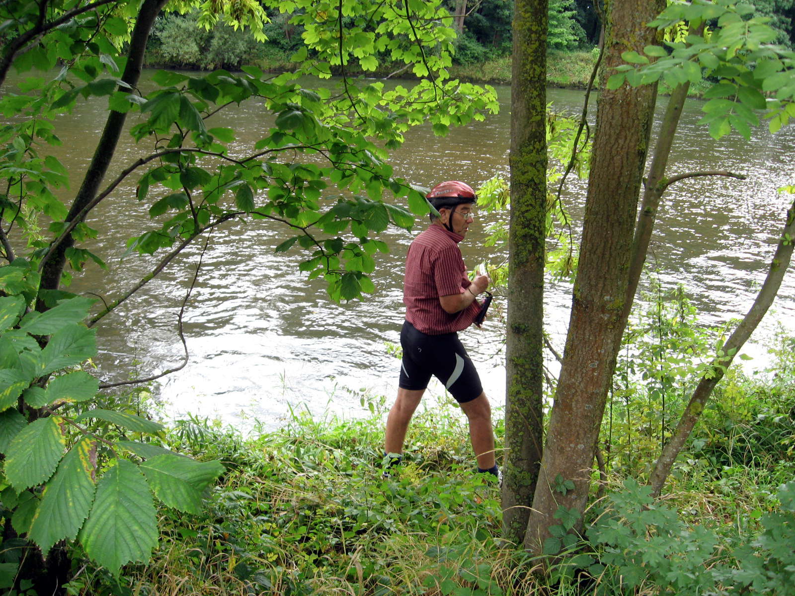
…. and ten minutes after the crossing I took this shot of the river, after the canal to the Kraftwerk and the Donau had merged again, and the tributary of the Iller River had entered the Donau.
The Iller is 147 km long, and rises in the Upper Allgäu. It has a flow of 70.9 m³ / s when it enters the Donau, whereas the Donau at their confluence is only 53 m³ / s , so in this sense the Donau could be considered a tributary of the Iller!
It was certainly wider and deeper at this stage, though there were still occasional islands of vegetation in the stream.
Photo: Don & Maria Hitchcock 4th September 2008
Text: Data adapted from Wikipedia
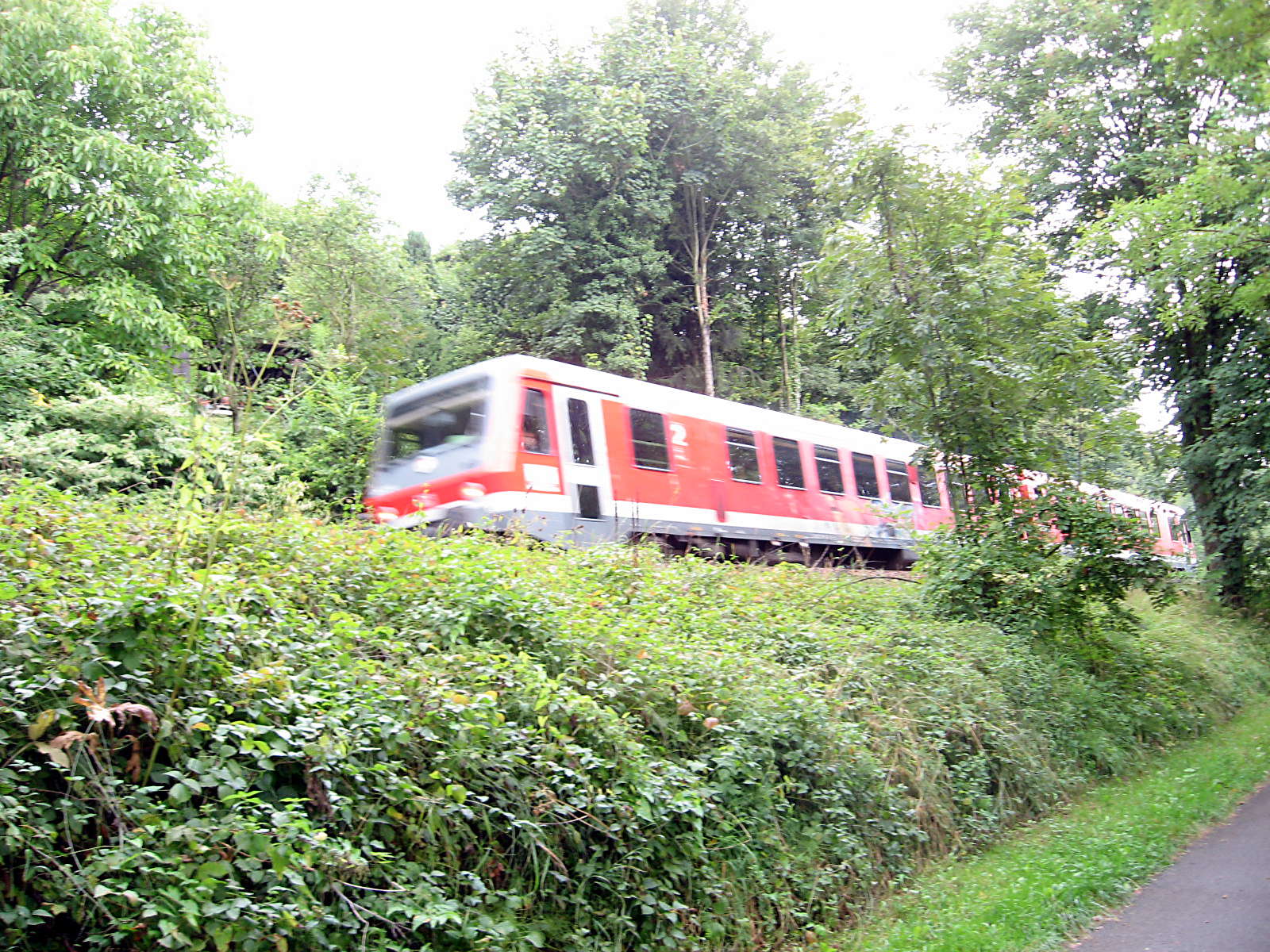
As I was taking the shot of the river, Maria photographed this train which had left Ulm and was going to Donaueschingen, where we had started our bicycle ride. It is on the single track Danube Valley Railway (Donautalbahn or Donaubahn) which runs along the Danube for 164 Km. It is mostly not electrified.
The line is famous especially for its charming course through the Upper Danube Nature Park (Naturpark Obere Donau), and is particularly attractive to bicycle tourists.
The Royal Württemberg State Railways and the Grand Duchy of Baden State Railways built the line as part of the railway projects undertaken between 1865 and 1890. The construction of the section between Tuttlingen and Inzigkofen was pushed through by the German general staff, for whom the Danube Valley Railway was seen as a strategic railway in case of another war with France.
Since 1901, the Danube Valley Railway, together with the Höllentalbahn (Schwarzwald), form part of the pan-regional railway link from Ulm to Freiburg im Breisgau.
Photo: Don & Maria Hitchcock 4th September 2008
Text: Adapted from Wikipedia
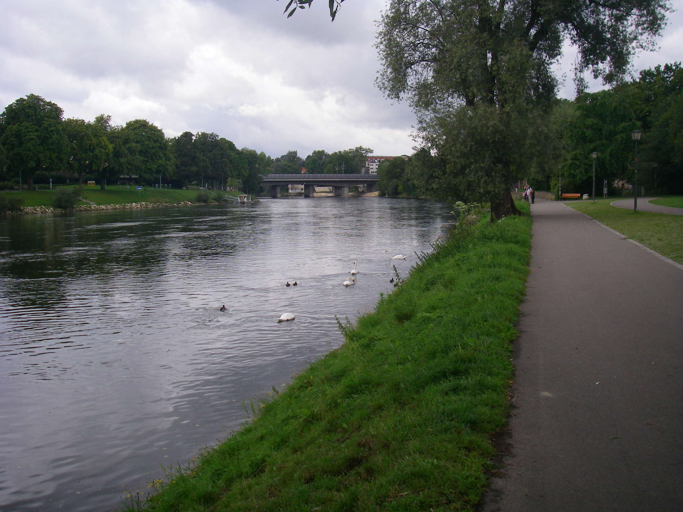
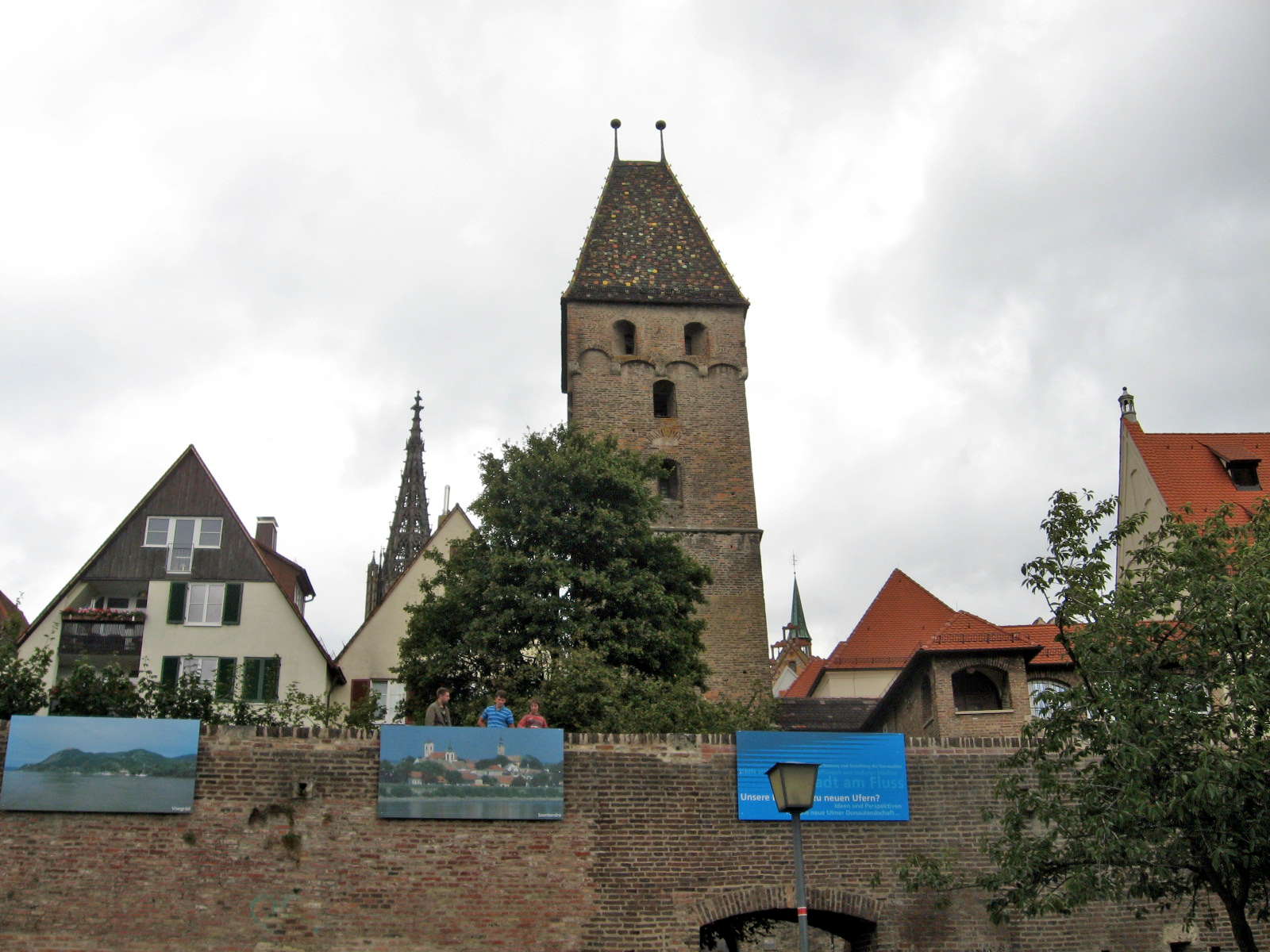
Ten minutes later we were approaching the old part of Ulm, with its ancient city walls.
Looking upstream there were white swans on the water. The Donauweg was a delight to ride on at this point.
The large bridge carries Federal Highway 28 into Ulm.
Photo: Don & Maria Hitchcock 4th September 2008
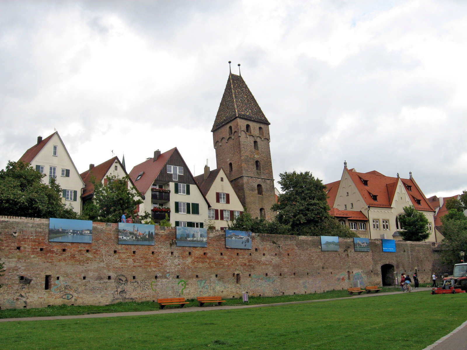
This shows the walls of Ulm with photos hung from the top as part of a festival of Ulm.
The Butchers Tower or Metzgerturm could now be seen above the walls, with its distinctive multicoloured tiles and twin projections above the roof.
There was a large mower on the grass, keeping it well clipped.
Photo: Don & Maria Hitchcock 4th September 2008
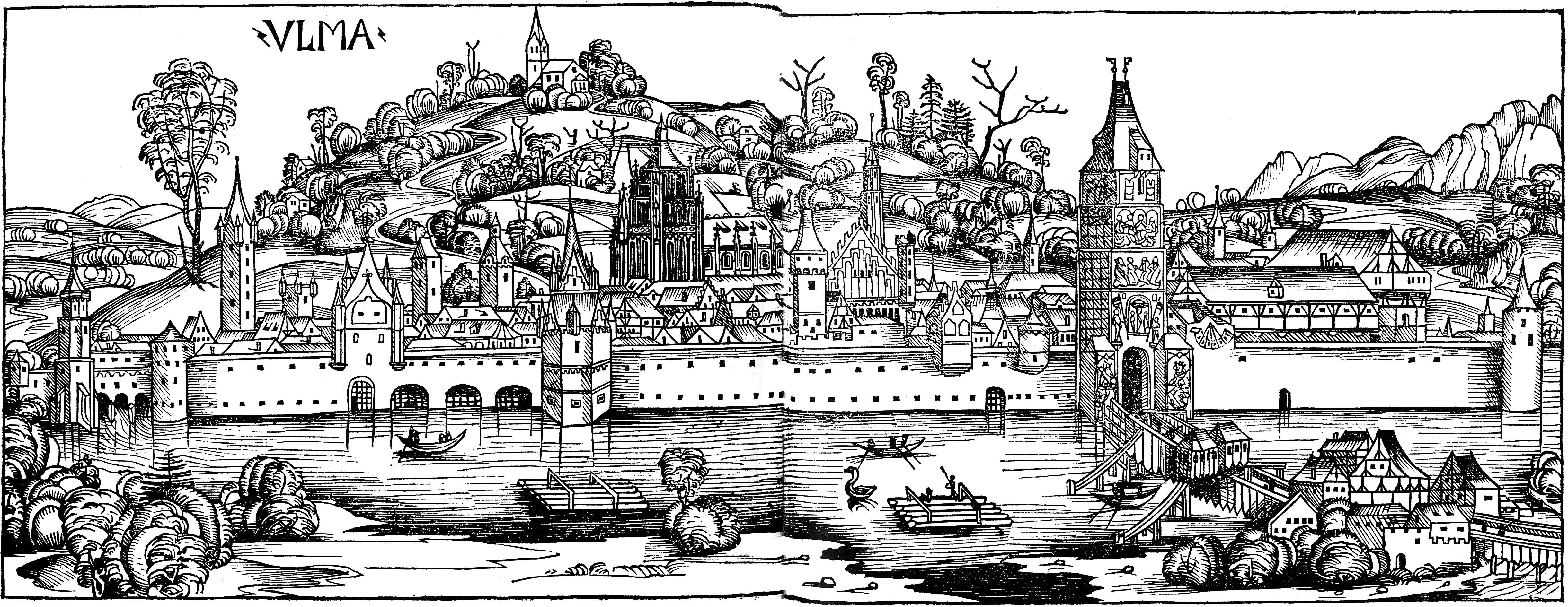
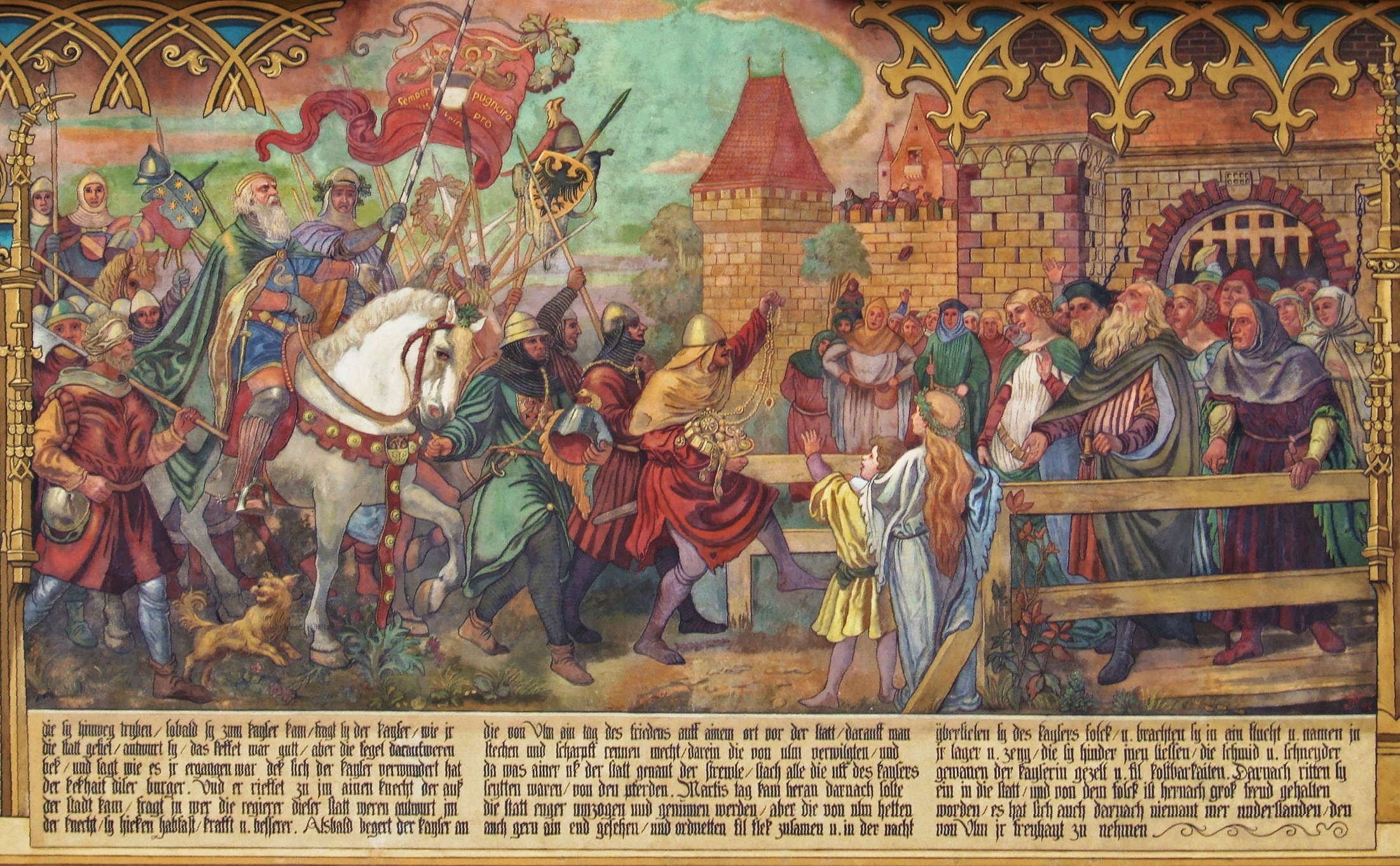
This view of Ulm was drawn around 1490. Here we can see the city wall, and a wooden bridge, with rafts, small boats and a swan on the water.
It is a woodcut from Hartmann Schedel's World Chronicle (Nuremberg, 1493), fol. cxc verso and CXCI recto . This is one of the famous realistic town views from Schedel's work.
Here we can see a former decorated wooden tower over the city entrance at the end of the bridge, both of which have now disappeared, as well as the Metzgerturm in front of the Rathaus, the Cathedral, and the city walls themselves, all apparently little changed.
Photo: Public Domain
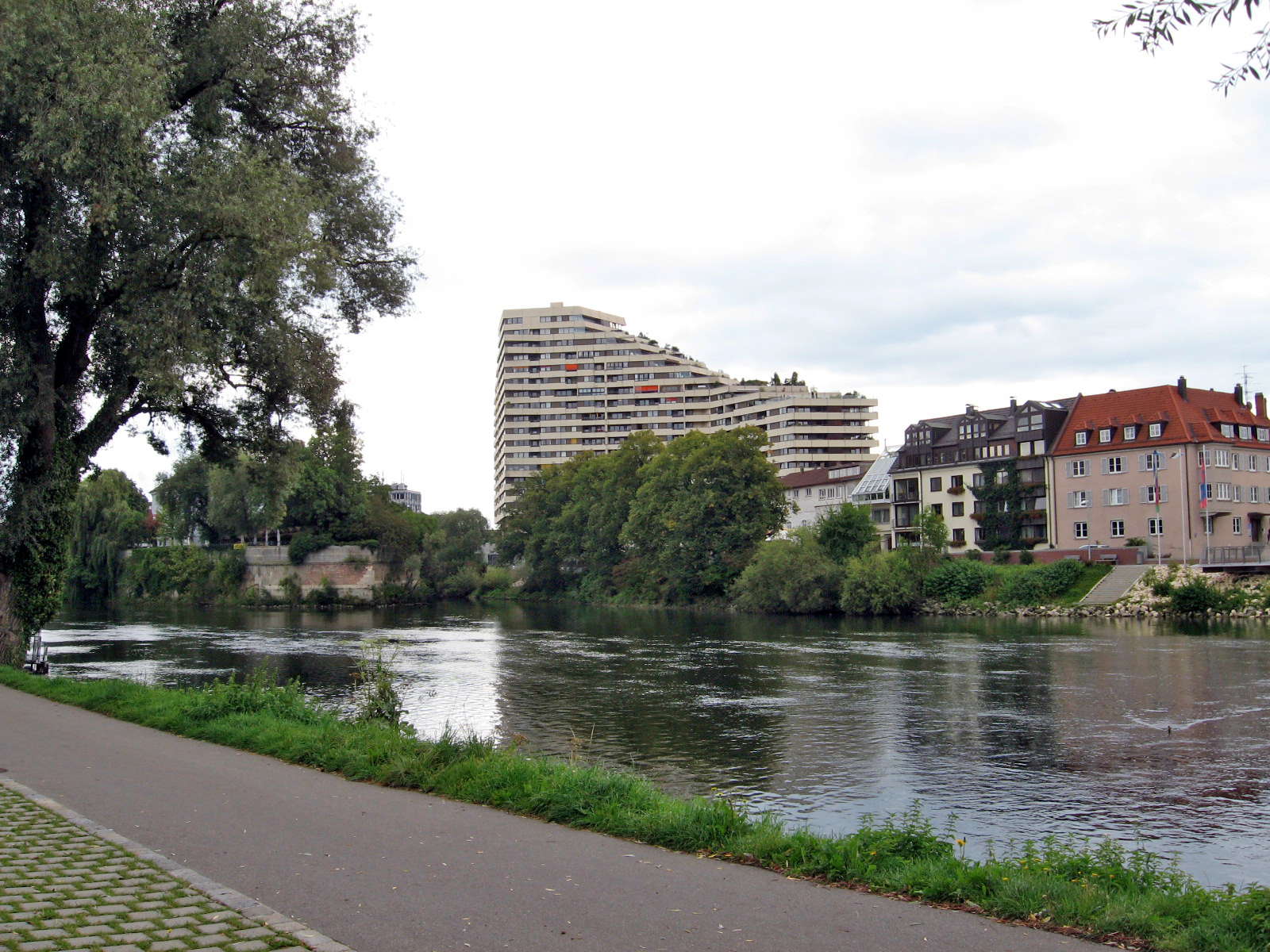
Neu-Ulm or New Ulm across the river in Bavaria had many more modern buildings.
The large white multistory building is the Donaucenter, a high-rise apartment building.
Photo: Don & Maria Hitchcock 4th September 2008
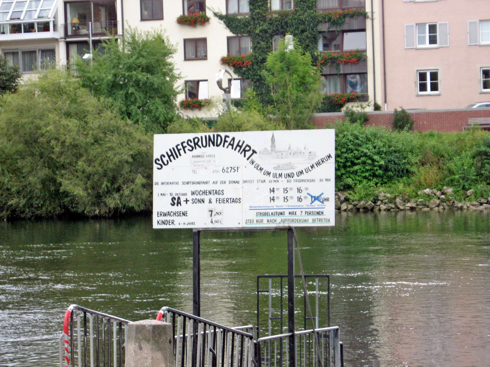
As often in a place like this, one could take boat tours on the river, and in this case the boats are quite small and shallow draughted to suit the width and depth of the river at this point.
Photo: Don & Maria Hitchcock 4th September 2008
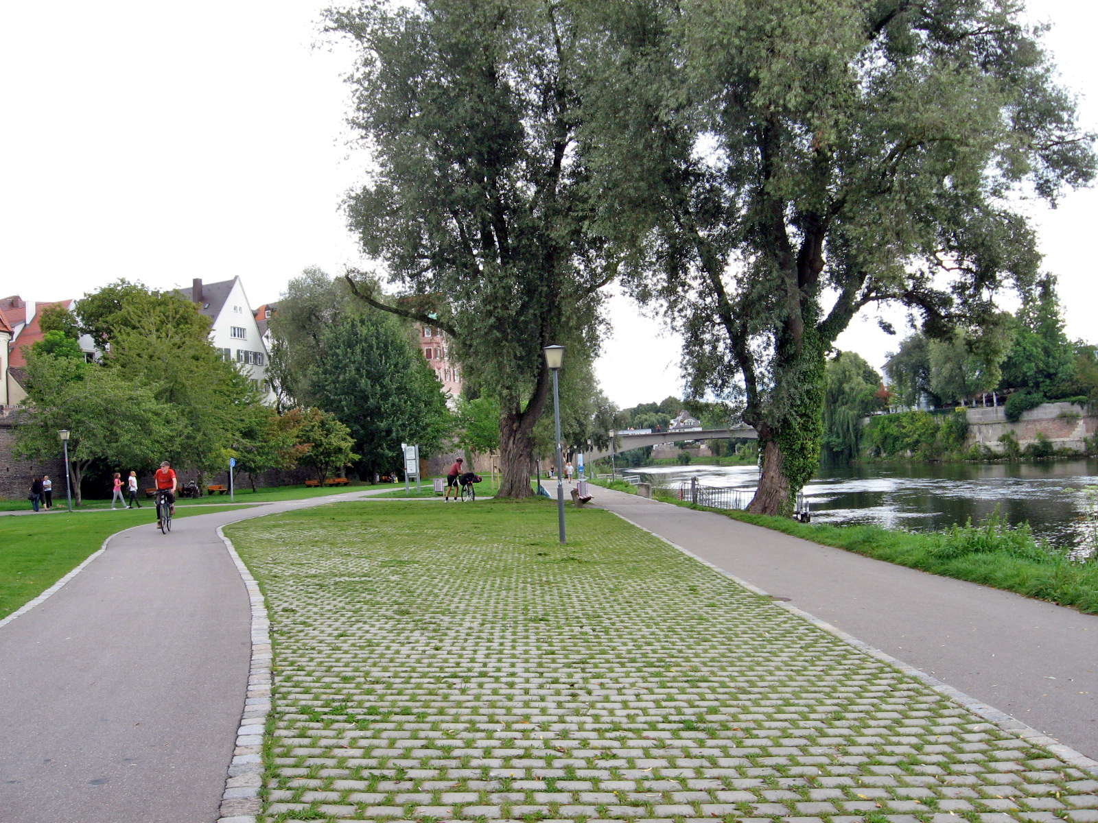
We decided to stop off at Ulm and look at the centre of the old city.
I've never yet seen a semi-paved area like this, with pavers separated by gaps for grass to grow through, that works well.
All are ugly, as this one is, even though it is in an ideal location, and superbly maintained.
If the Germans can't get it to look good, nobody can.
Photo: Don & Maria Hitchcock 4th September 2008
I felt like some coffee and cake, preferably with ice cream, and we pushed our bicycles through the gate in the old wall, then through the gate in the Metzgerturm behind. and up the steep cobbled street to the city square, with the steeples of the Ulm Cathedral dominating the skyline.
In 1349 the 'Metzgerturm' was integrated into Ulm's fortifications. The 'leaning tower of Ulm' is 36 metres high and leans 2.05 metres in a north-westerly direction. This is not quite so much as its 'big brother', the leaning tower of Pisa (this slopes by 5.1°, the Metzgerturm by only 3.3°), but it is nonetheless quite considerable.
Photo: Don & Maria Hitchcock 4th September 2008
Text: http://tourismus.ulm.de/tourismus/en/sehenswert/altstadt_city/an_der_donau/metzgerturm.php
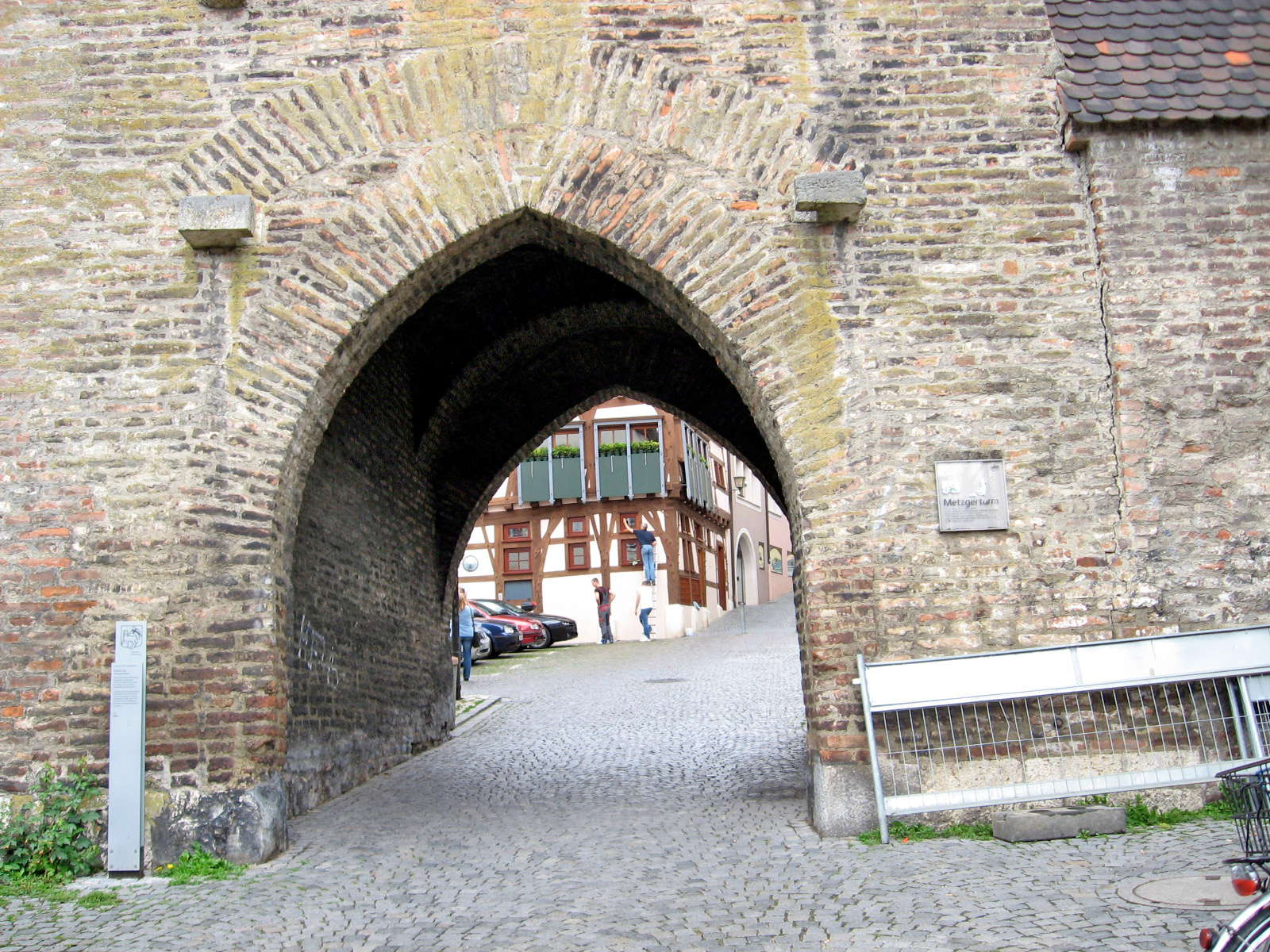
This is the gate below the Metzgerturm or Butchers Tower which leads to the city centre.
According to legend, the tower got its name from some butchers in Ulm, who used sawdust in their sausages. When the customers found this out, they locked them in the tower. When the angry Mayor entered the tower to deliver his verdict, the corpulent butchers cowered in one corner of the tower, causing it to lean over.
In actual fact, the tower is leaning because it is built on ground that was originally a swamp.
Photo: Don & Maria Hitchcock 4th September 2008
Text: http://tourismus.ulm.de/tourismus/en/sehenswert/altstadt_city/an_der_donau/metzgerturm.php
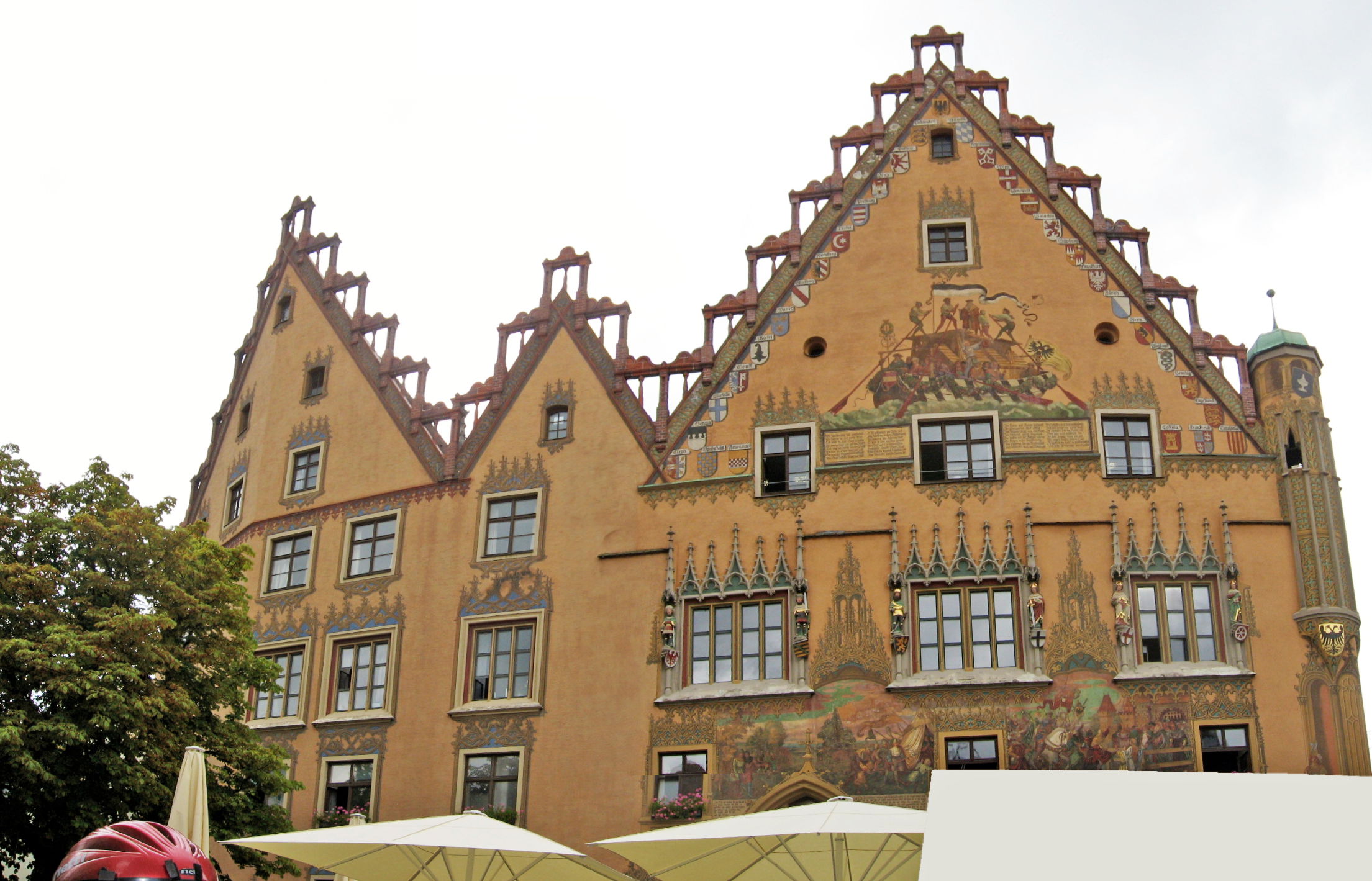
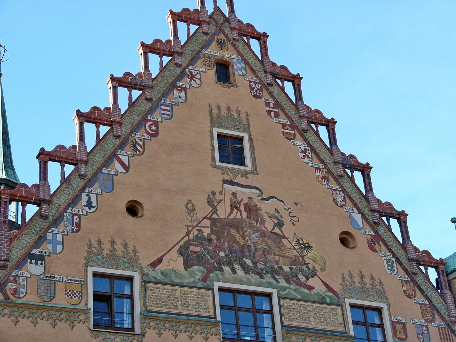
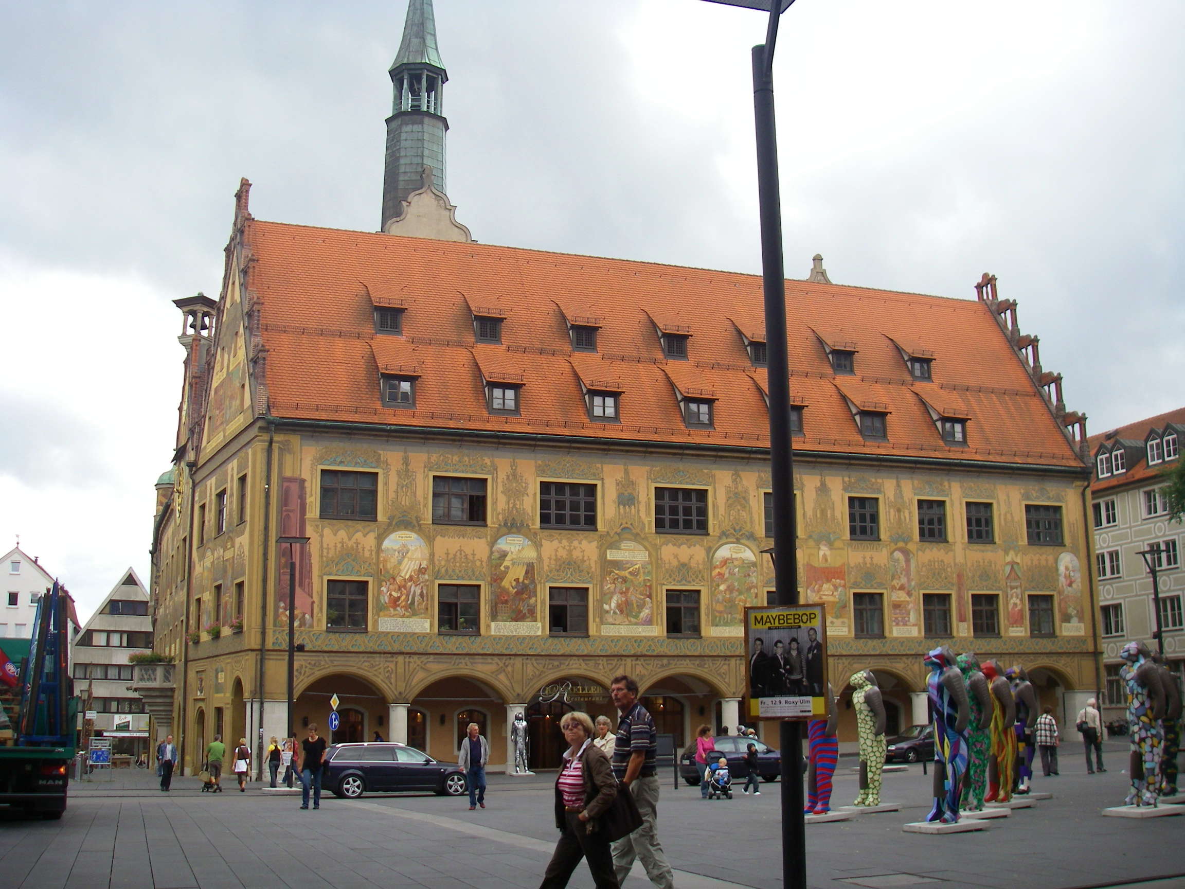
The southern side of the Rathaus of Ulm, with a painting depicting trade relations in the middle ages.
Photo: (left) Don & Maria Hitchcock 4th September 2008
Photo: (right) Bastian Steinhauer (DAS Phantom), Public Domain
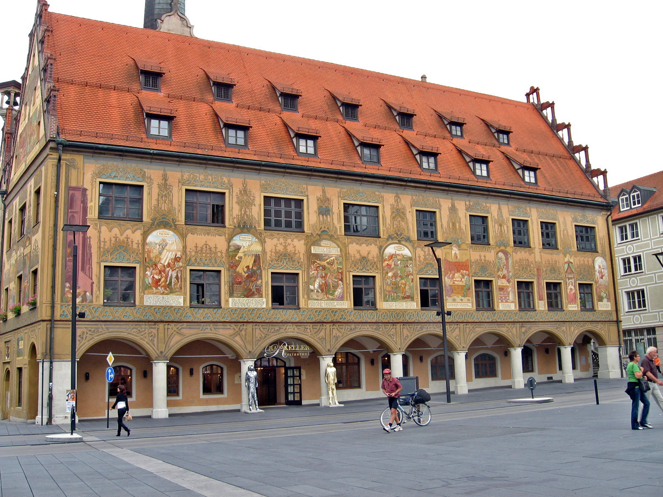
Ulm Rathaus from the north, frescoes by Martin Schaffner, 1540.
I parked my bicycle temporarily while I got out my camera to take photos of the display of Lowenmensch in the market square.
The paintings on the walls of the Rathaus are superb.
Photo: Don & Maria Hitchcock 4th September 2008
Mural on the south side of the Rathaus by Martin Schaffner,1540.
Photo: Joachim Köhler
Permission: GNU Free Documentation License , Version 1.2 or later.
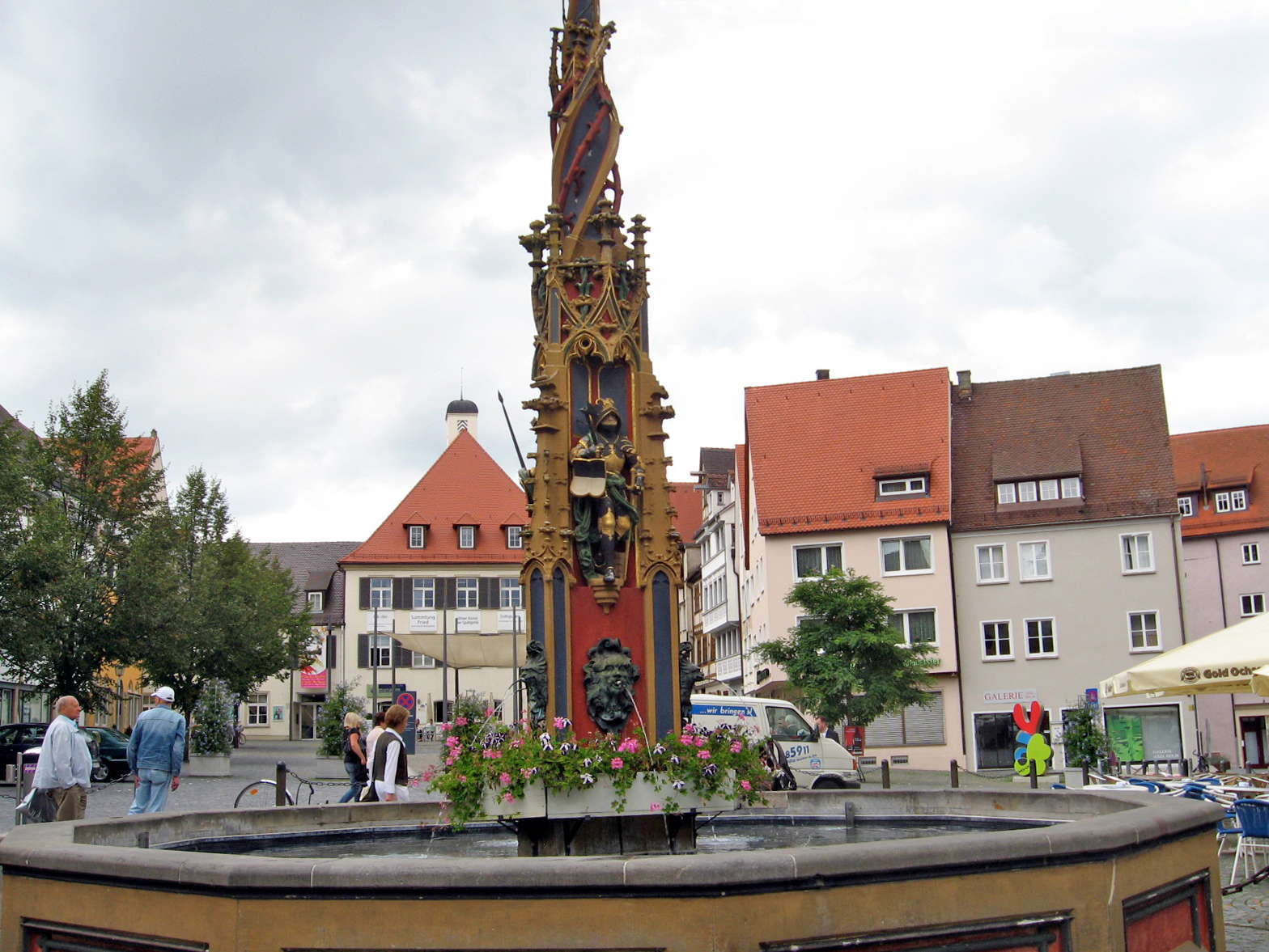
This is the beautiful 'Fischkasten' fountain in the square in front of the Rathaus.
Also called the 'Syrlin fountain' after its sculptor, it is the oldest preserved fountain in Ulm. The name 'Fischkasten' originates from the use of the fountain by the fishermen of Ulm, who sold their freshly caught fish here.
Photo: Don & Maria Hitchcock 4th September 2008
Text: Adapted from http://tourismus.ulm.de/tourismus/en/sehenswert/brunnen/fischkasten/fischkasten.php
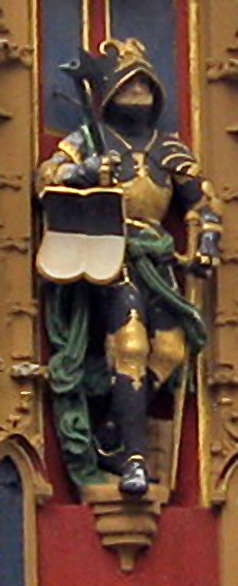
The pinnacle within the twelve-sided basin is a masterpiece of late gothic decorative artwork. The (replica) sculpture work of the pinnacle, with its exposed branch work and the figures of the knights with their coats of arms, the imperial eagle and the shield of Ulm are well worth seeing.
The master sculptor who built the fountain, Jörg Syrlin the elder, of Ulm, engraved his full name, his signature, and the year, 1482, above one of the knights. The three original figurines of the knights can be seen in Ulm Museum.
Photo: Don & Maria Hitchcock 4th September 2008
Text: Adapted from http://tourismus.ulm.de/tourismus/en/sehenswert/brunnen/fischkasten/fischkasten.php
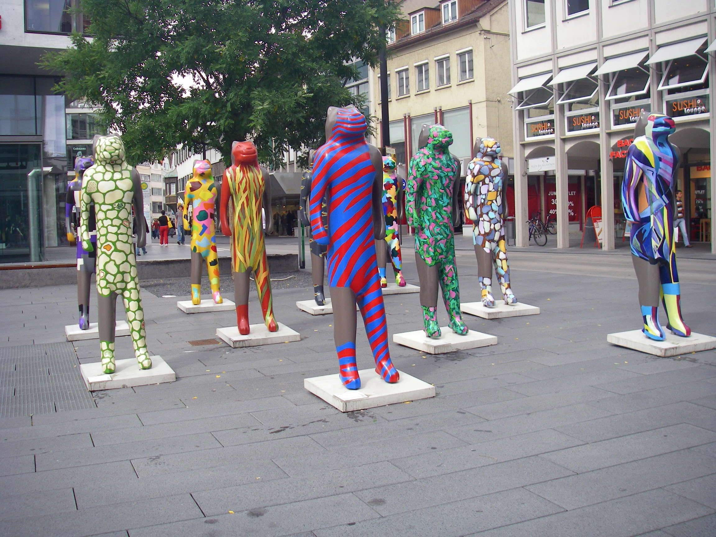
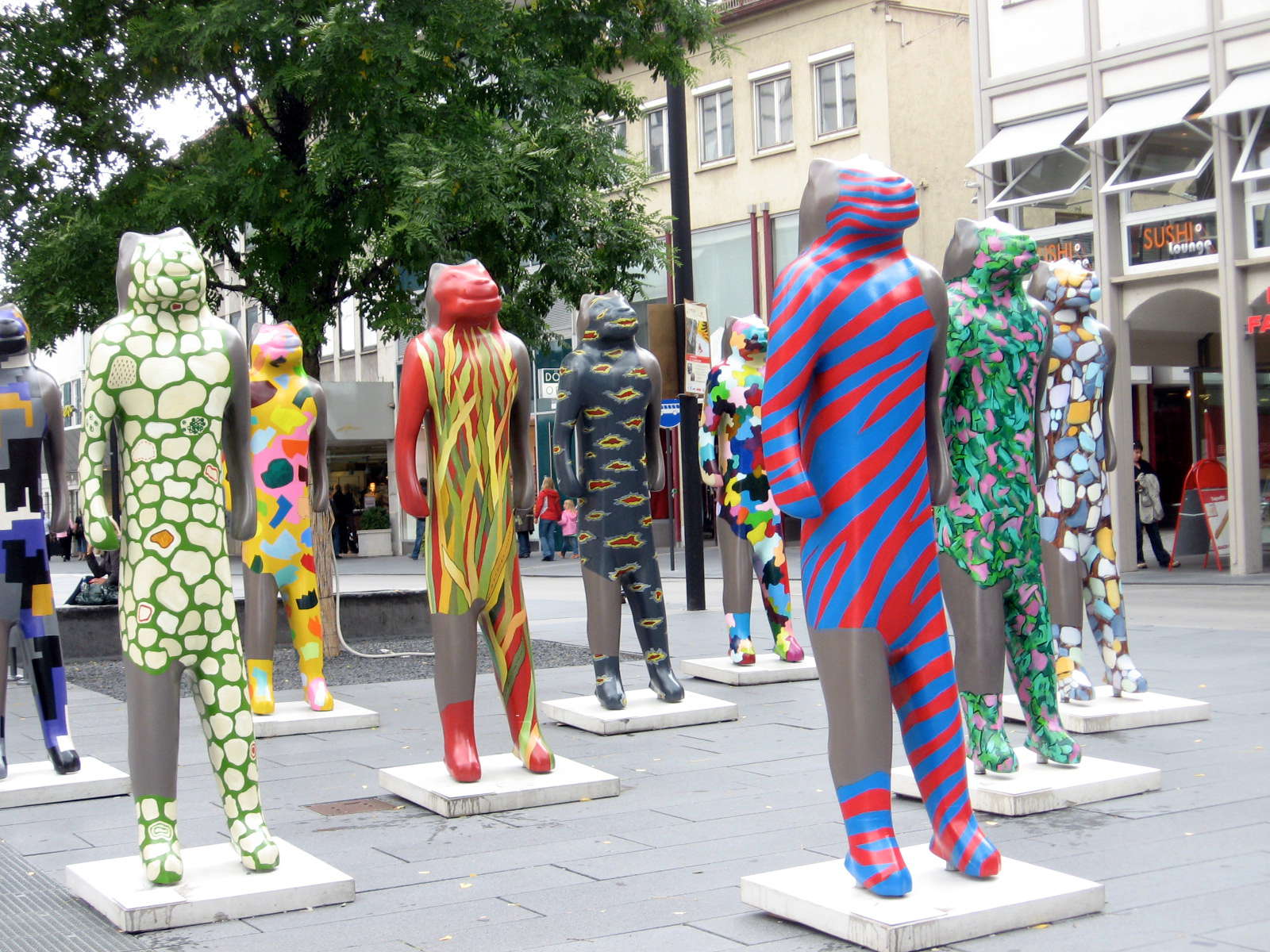
As we entered the main town square, I laughed out loud - there was a sea of Löwenmenschen in the square, painted in colours like that of a technicolor dream - or nightmare!
The surprise of seeing in multiple, large versions something I had thought of as a little known artefact of the Ice Age had me grinning and shaking my head in disbelief as I looked over them from the cafe window (out of frame to the right in this photo) as I had my coffee and cake (no ice cream was available!).
It made my day, though every day of that trip was enjoyable and memorable.
Photo: Don & Maria Hitchcock 4th September 2008
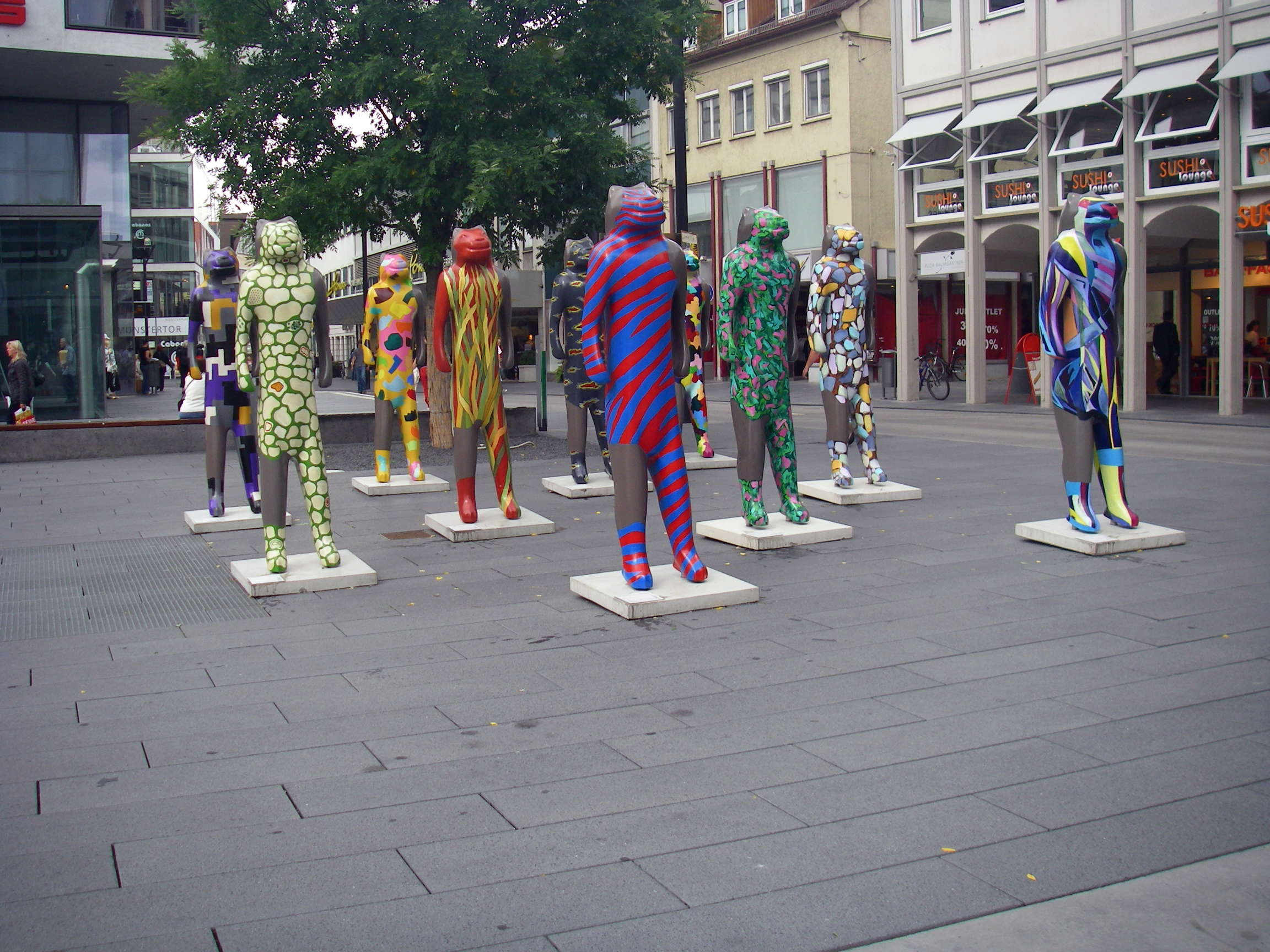
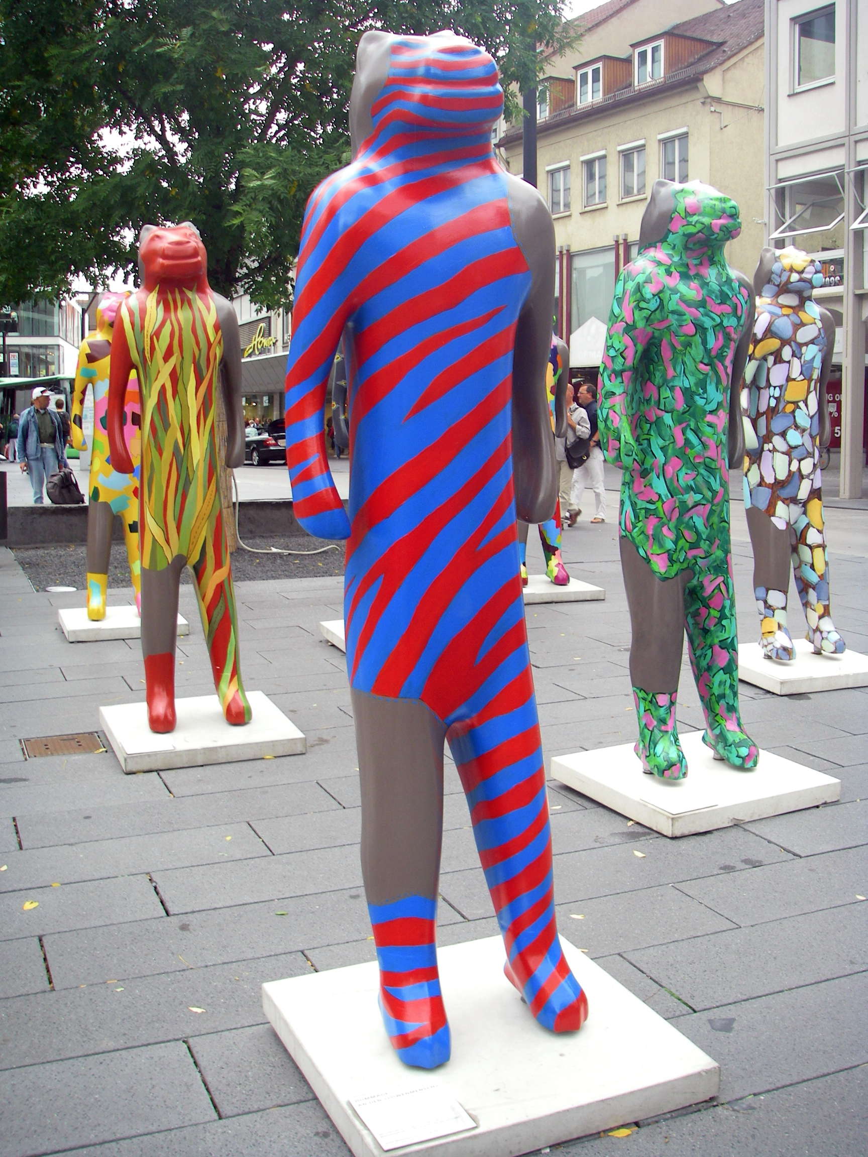
The force of the installation lay in the fact that there were so many, so similar yet so different, each expressing the imagination of the particular artist.
Photo: Don & Maria Hitchcock 4th September 2008
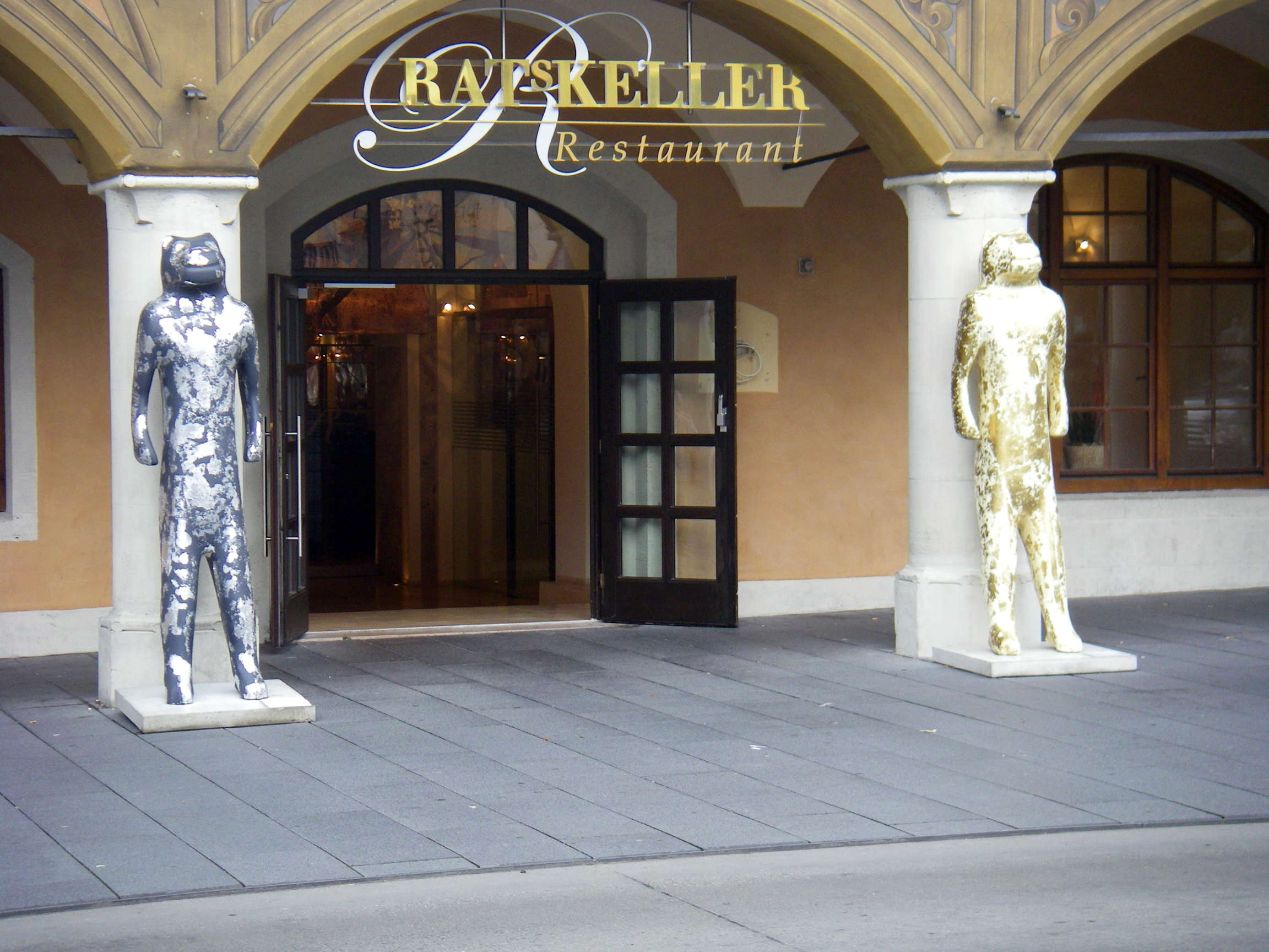
These two had obviously been carefully chosen to be suitable for the entrance to an upmarket restaurant on the ground floor of the Rathaus.
Photo: Don & Maria Hitchcock 4th September 2008
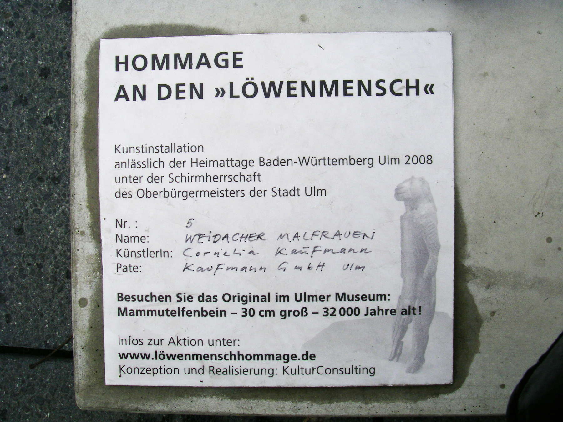
Each of the fibreglass or plastic figures had been decorated by a different artist, and there was an identifying tag on each of them, which said in part:
Homage to the Lion Man
Art installation
On the occasion of the Festival of Ulm, Baden-Württemburg 2008
under the auspices of the Lord Mayor of the city of Ulm.
Photo: Don & Maria Hitchcock 4th September 2008
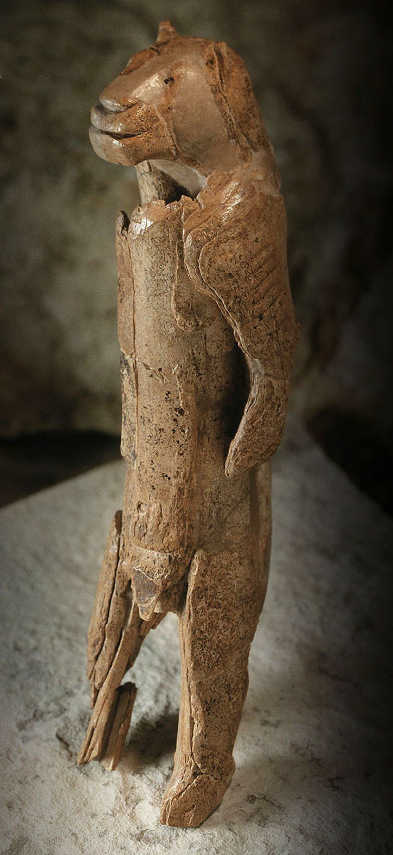
The Löwenmensch from Hohlenstein-Stadel. Height 28 cm, about 6 cm diameter. Made of mammoth ivory. Found in the cave of Hohlenstein-Stadel in the Valley of Lone, Baden-Wurttemberg (Germany), in 1931. Dated as Aurignacian, in a 32 000 year old level.
Although this is known in some places as the lion lady, it is by no means certain that it is female. It is known as both Die Lowenfrau and Der Lowenmensch.
The arms bear striations carved into the ivory. Years after the initial discovery the museum officials were presented with an ivory lion muzzle found in the cave. It was a perfect fit. Today it is pieced together from more than 200 tiny pieces. This 'venus' may be an attempt to capture the power of the lion.
Dimensions: height 281 mm, width 63 mm, thickness 59 mm.
Photo: http://www.loewenmensch.de/lion_man.html
Carved from mammoth ivory, it is 28 cm high and 6 cm in diameter. It was found in the Stadelhöhle am Hohenstein, a rocky cliff in the Lonetal valley above Asselfingen, Baden-Wurttemberg (Germany), in 1931, dated as Aurignacian, in a 32 000 year old level. Although this is known in some places as the lion lady, it is by no means certain that it is female. The arms bear striations carved into the ivory. It is pieced together from more than 200 tiny pieces. This 'venus' may be an attempt to capture the power of the lion.
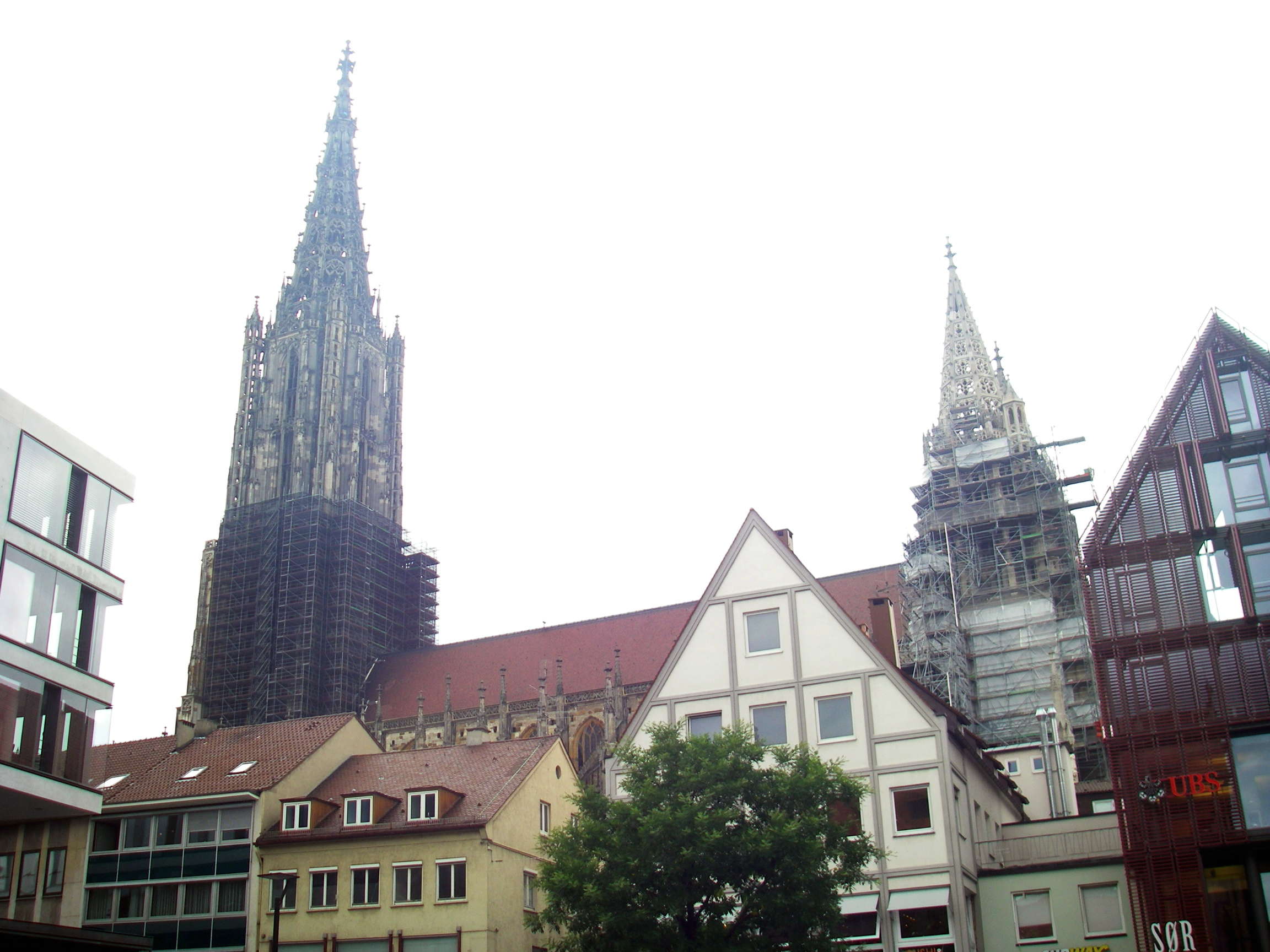
Ulm Cathedral, seen from the market square had scaffolding around the towers, either for repairs or cleaning.
Photo: Don & Maria Hitchcock 4th September 2008
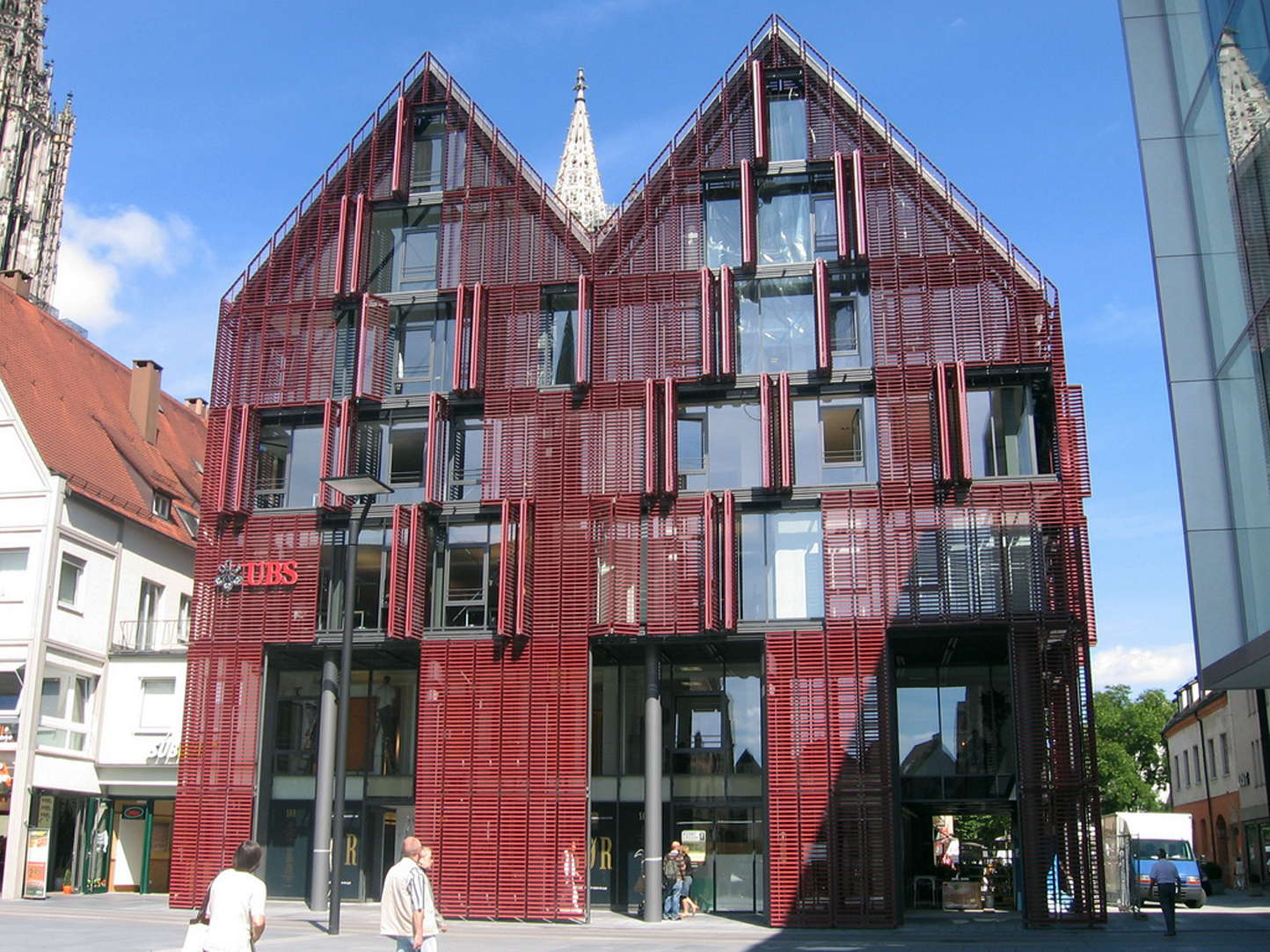
We had our superb coffee and cake in a cafe on the right hand side of this UBS building, with our bikes leaning against the inside of the louvres, looking out at the Market Square and the Lowenmensch through the floor to ceiling plate glass windows. It was magic.
Photo: © Daniel Sparing
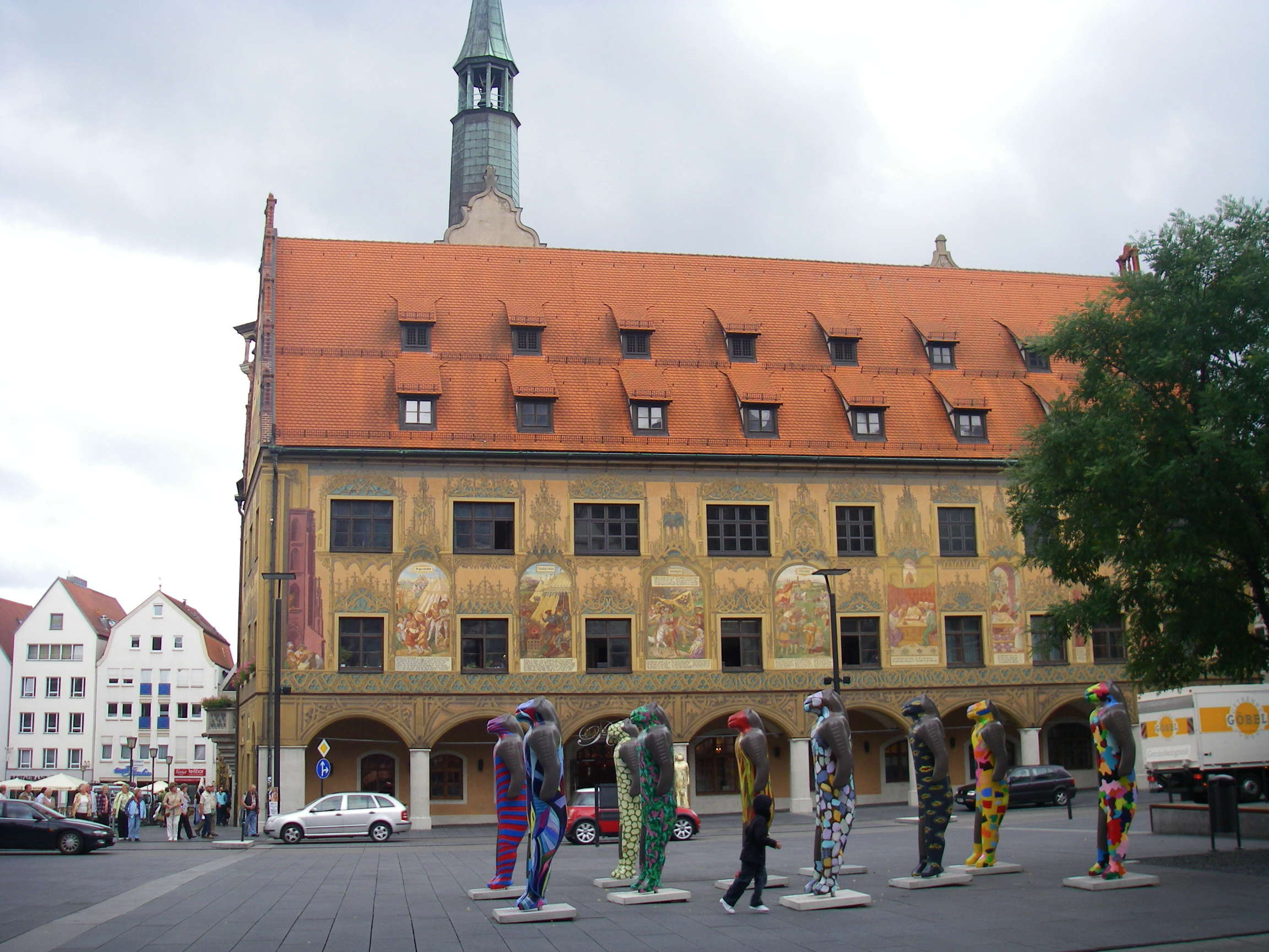
When we finished our coffee and cake, I stepped outside the cafe and took these shots of the löwenmenschen in the market square.
I was still grinning from ear to ear as we pushed our bicycles back down the cobbled street to the Donauweg again, and saddled up for the next part of our ride.
Photo: Don & Maria Hitchcock 4th September 2008
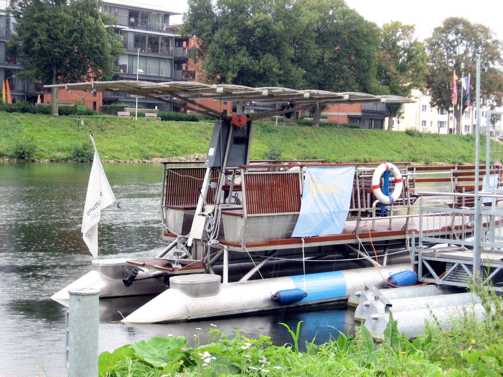
We started downstream again, and found this solar powered boat, which takes tourists on rides up and down the river.
For a place with very little sunshine, the Germans are very keen on solar power! They are far ahead of Australia in this regard. There were solar panels on roofs wherever we went.
Photo: Don & Maria Hitchcock 4th September 2008
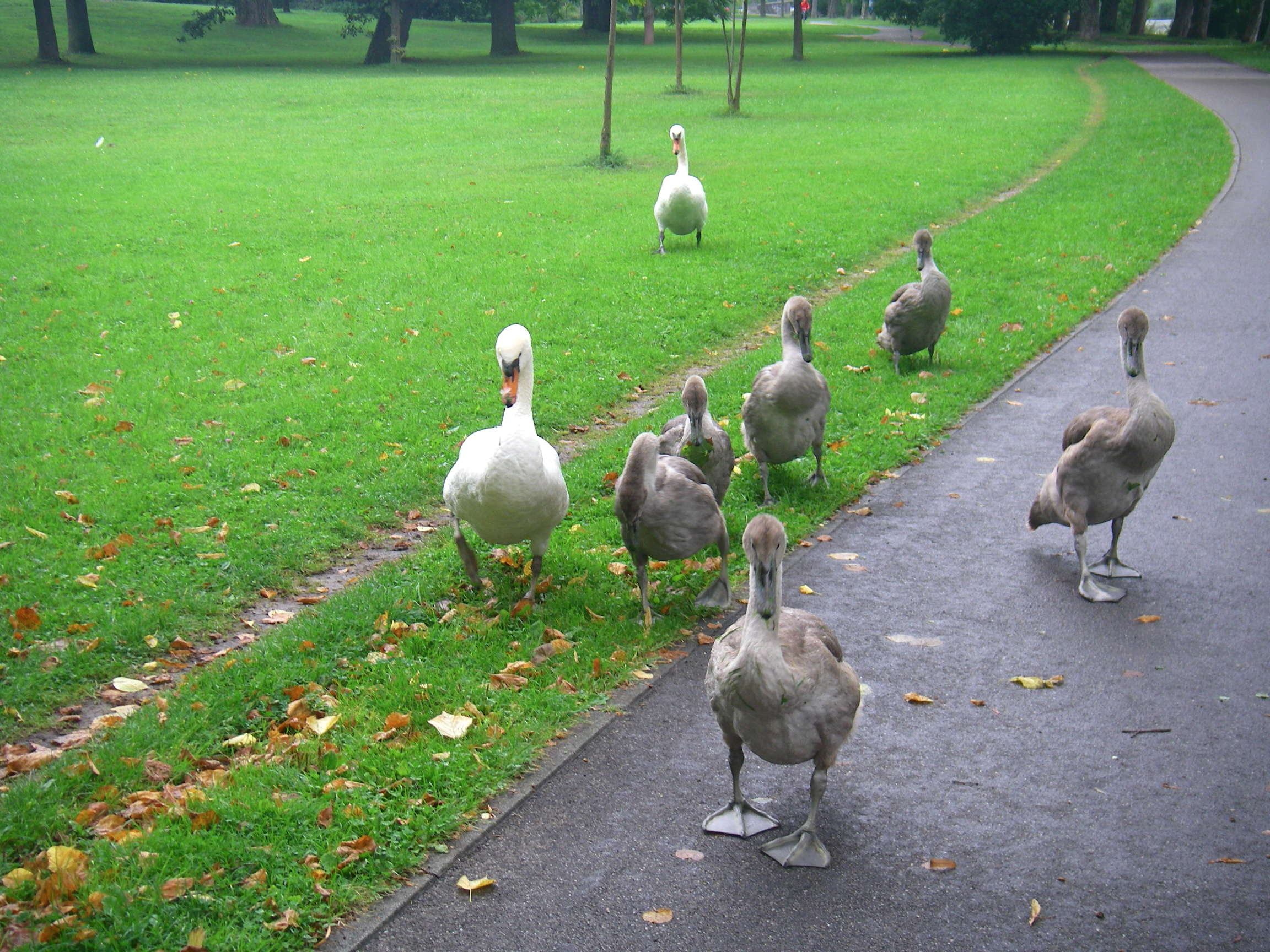
These swans on the Donauweg were quite aggressive, and we were glad to leave them behind.
Photo: Don & Maria Hitchcock 4th September 2008
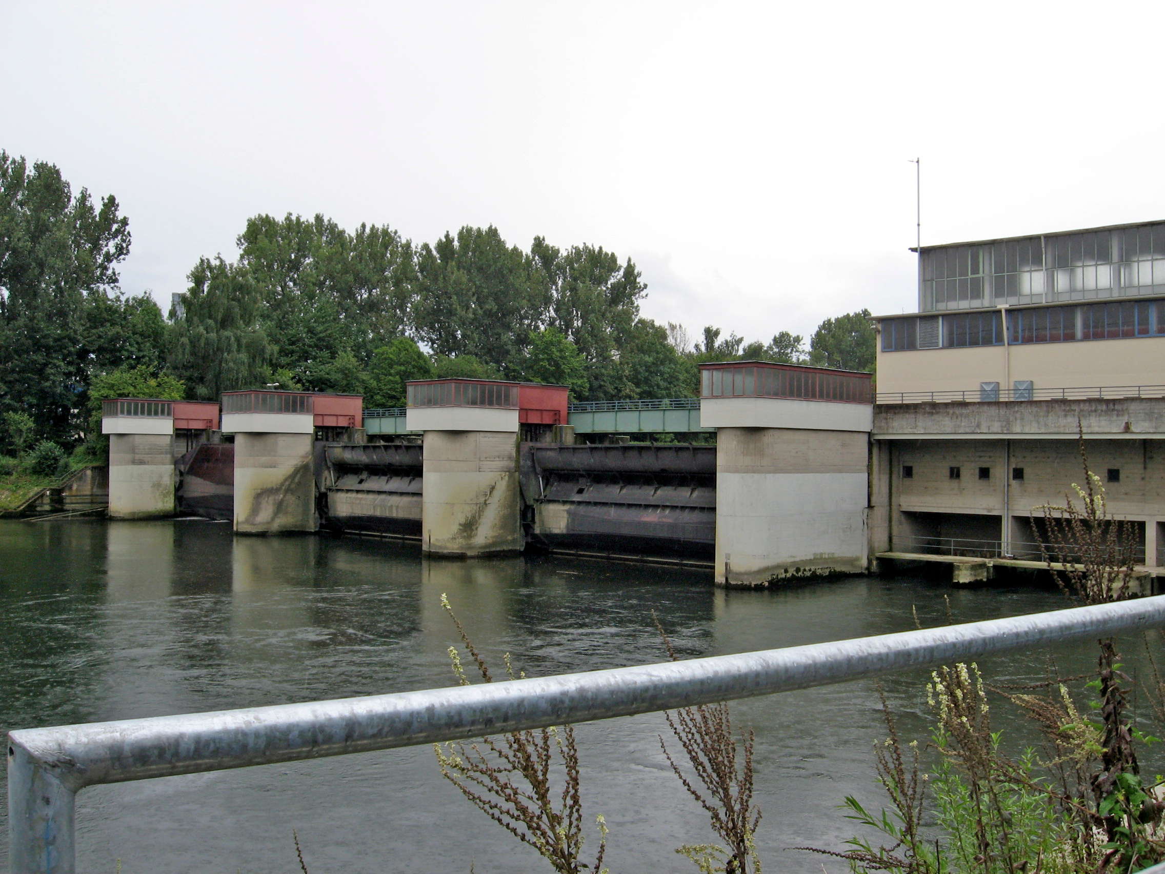
This is the Kraftwerk Böfinger Halde near Böfinger, built in 1953. The Danube has many such hydroelectric stations along its length.
Photo: Don & Maria Hitchcock 4th September 2008
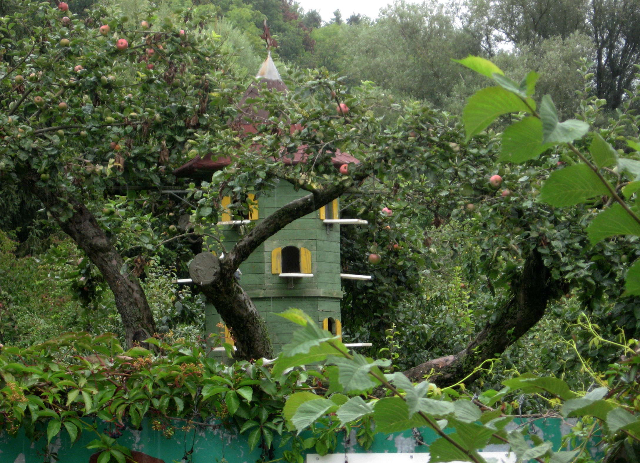
We began to see more apple trees, which grow very well in this part of Germany. Here was a small garden with an apple tree and a small pigeon house. The pigeon house had a weather vane of a witch riding a broom handle, a common motif for weather vanes apart from roosters - though the variety is never-ending.
Photo: Don & Maria Hitchcock 4th September 2008
From Maria's diary:
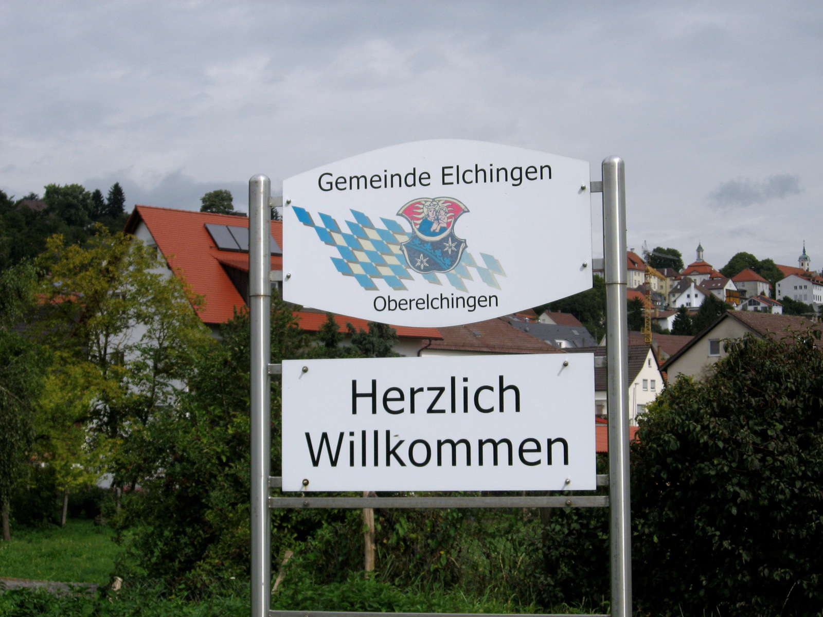
We then followed the railway line closely on the left bank deviating through Thalfingen, Oberelchingen and into Elchingen. It was now lunch time and we needed to find a bakery. We left the track and went into the town but couldn't find anything. When we finally spotted the bakery, it was closed for lunch. Many shops and businesses close for lunch in these parts so that the employees can go home and have a hot lunch - their main meal of the day. We got directions to a supermarket and rode through an industrial section till we found the Lidl store. Here we stocked up, packed in the shelter of a doorway and continued riding. It was raining fairly heavily at this stage and we were sopping wet. I realised that I needed to get a basket for my bicycle as it was too hard to pack away food supplies without them getting all squashed.
Photo: Don & Maria Hitchcock 4th September 2008
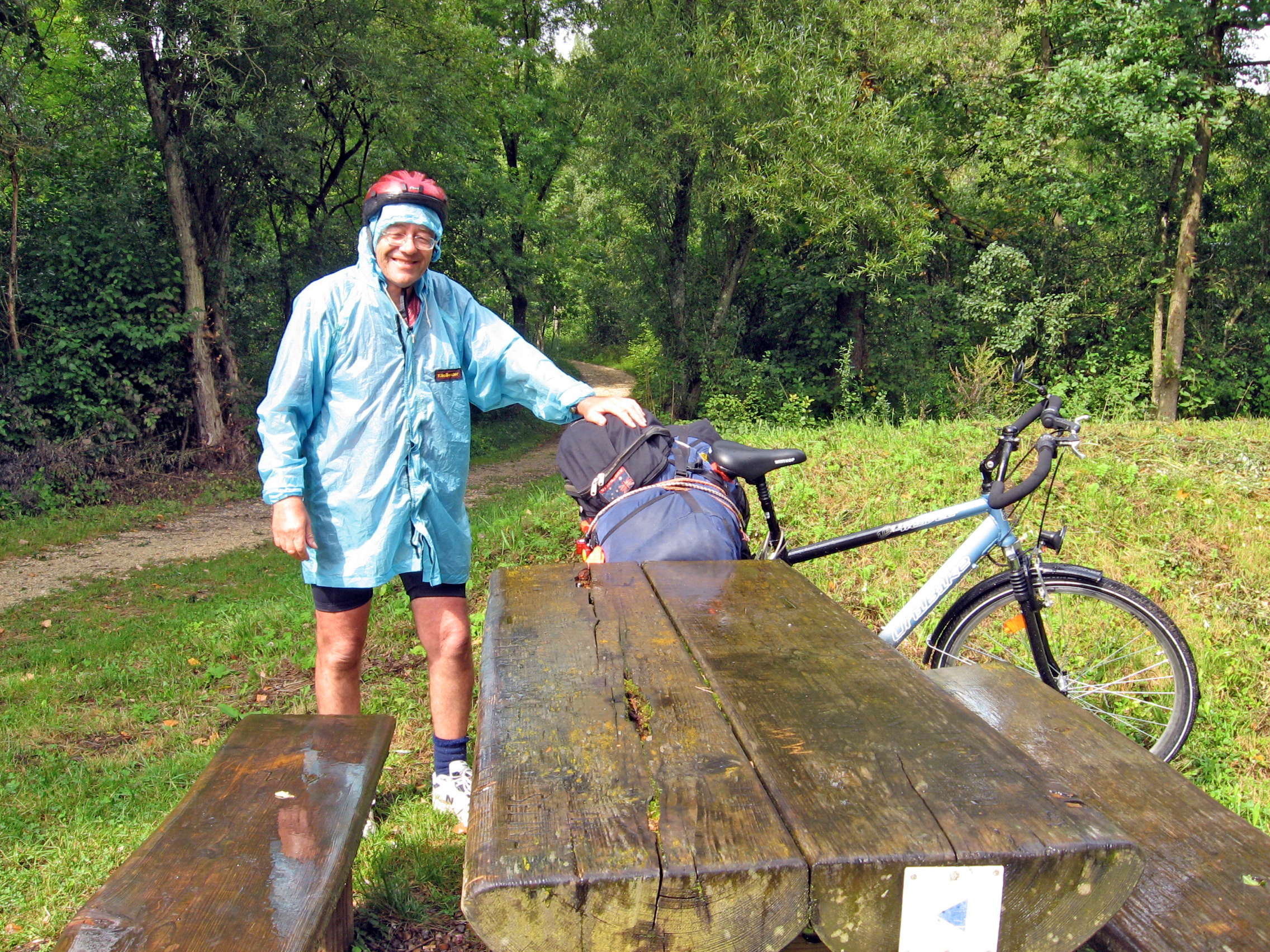
We followed the Donauweg across country through fields, under the autobahn, and into Weissingen. Then we had a long forest ride through the Donauwald where we stopped during a dry spell to have lunch.
I had taken to milk for rehydration, I found that it was better than water on a trip like this, though I still carried water as well.
My home made raincoat, very light and waterproof, packing away into an integral bag the size of a fist, was a boon in the wet conditions.
Photo: Don & Maria Hitchcock 4th September 2008
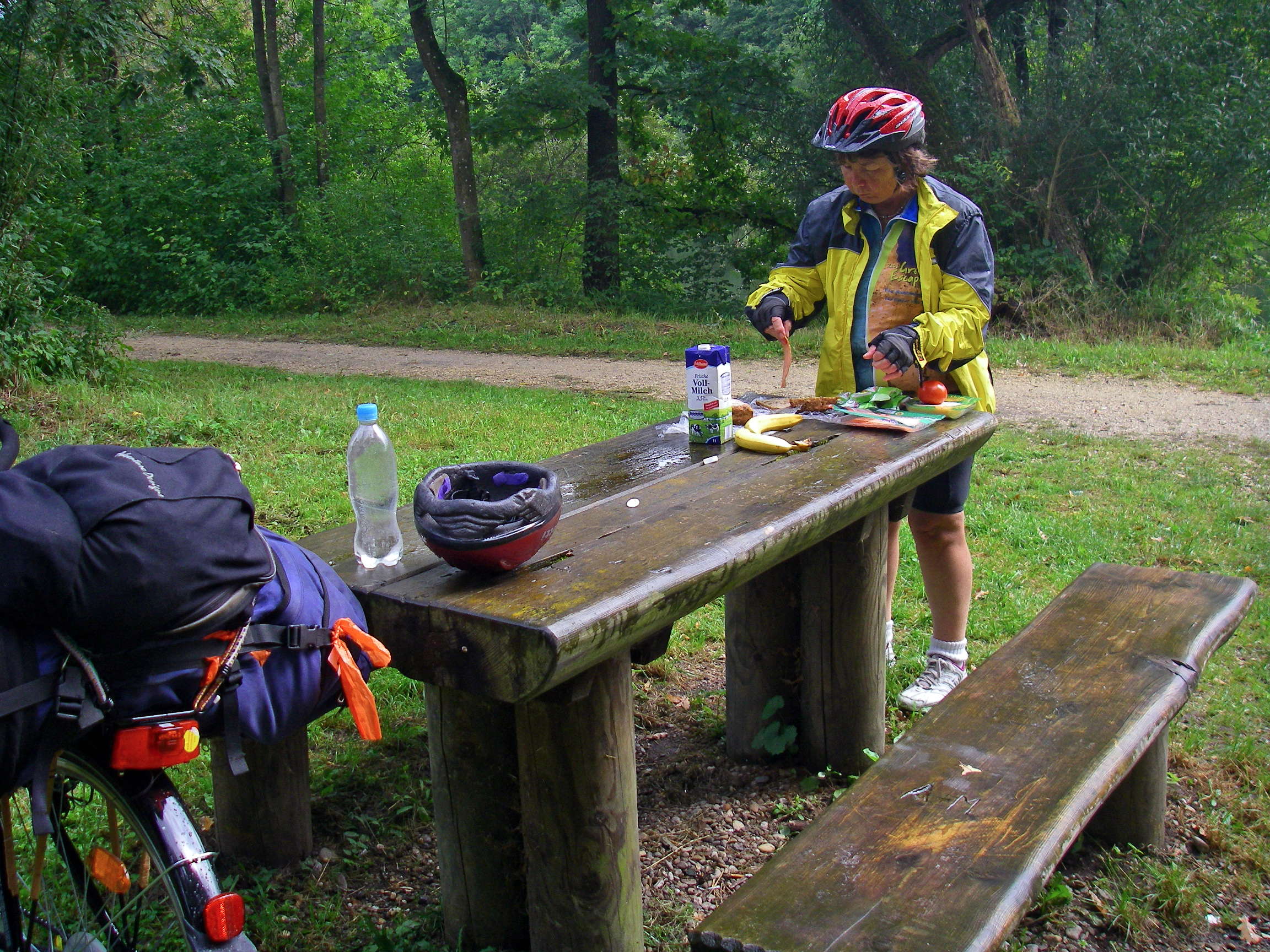
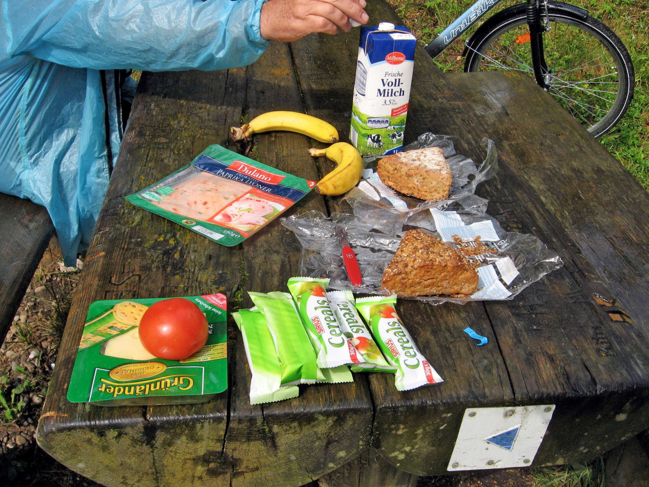
Maria did her daily miracle, conjuring great lunches from what we could find in supermarkets along the way. Because the Donauweg is often away from towns, getting supplies for the day was not always easy, and we sometimes had to deviate through a town or village simply to stock up on food, as we had today at a Lidl store in Elchingen, Lidl being a supermarket chain started by the Schwarz family, a discount supermarket chain similar to the Aldi group.
The name Lidl was the surname of a former business partner of Josef Schwarz's, Ludwig Lidl, a retired schoolteacher, and Josef's son Dieter Schwarz bought the rights to the name from him for 1 000 marks, as he could not use the name Schwarz Markt which, as 'Schwarzmarkt' means 'black market', which would have had negative connotations.
Photo: Don & Maria Hitchcock 4th September 2008
Text: Partly adapted from Wikipedia
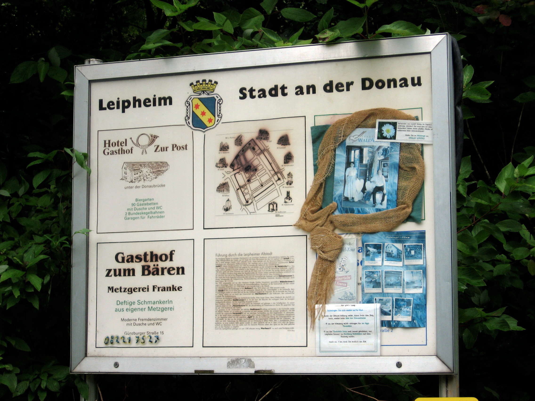
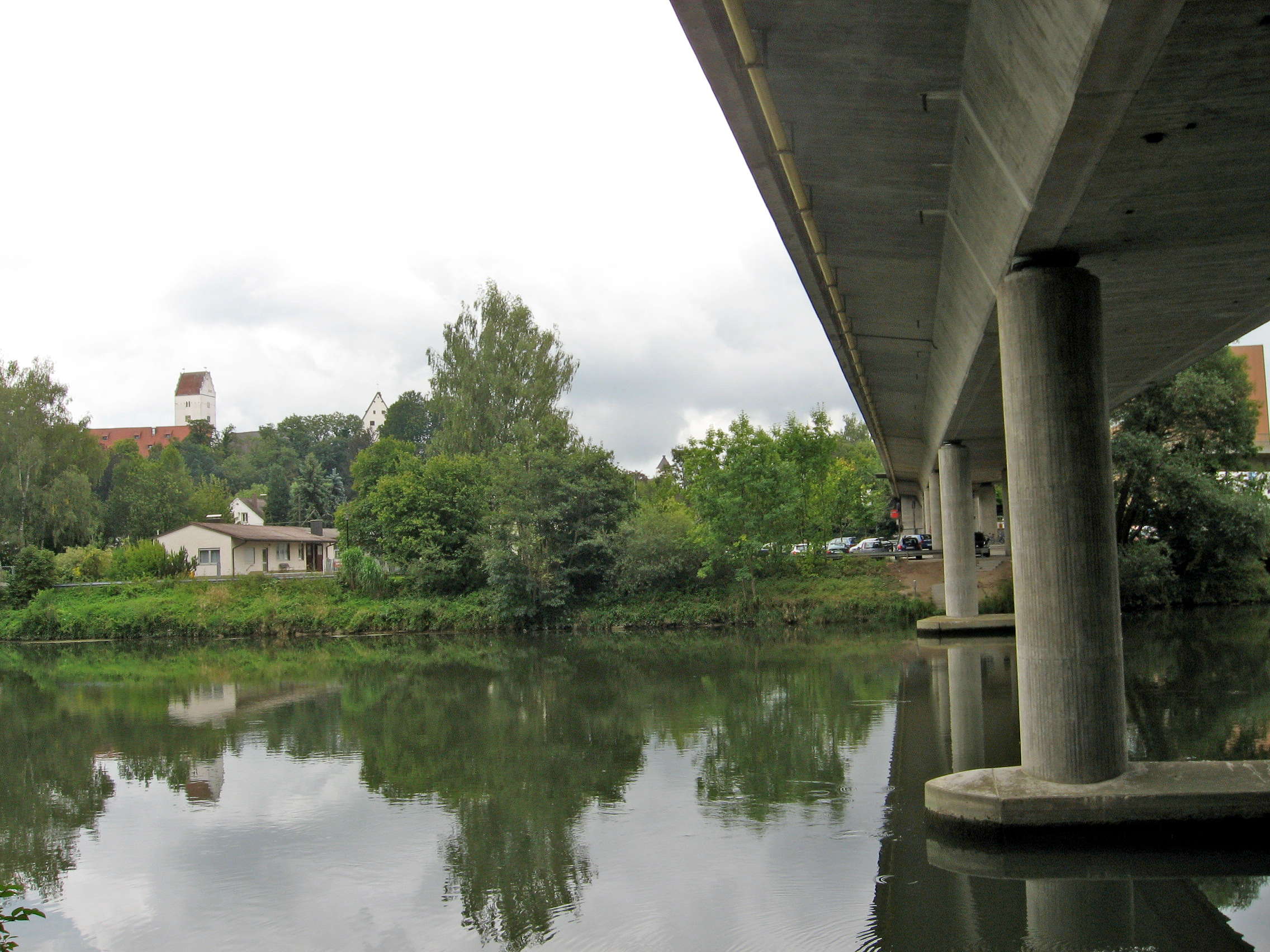
We decided not to go into Leipheim, but stayed on the left bank, passing beneath the large bridge. We had not realised before starting this trip that the Donauweg is not just one single path, but many, and usually there is at least one path on either side of the Donau, sometimes more.
There are often many bicycle paths that can be used to get to your destination more quickly or to avoid going through towns and villages, which inevitably slow your progress. Built up areas are often very hard to navigate through, with the signs for the Radweg not always obvious, and often you must share the road with vehicles.
Photo: Don & Maria Hitchcock 4th September 2008
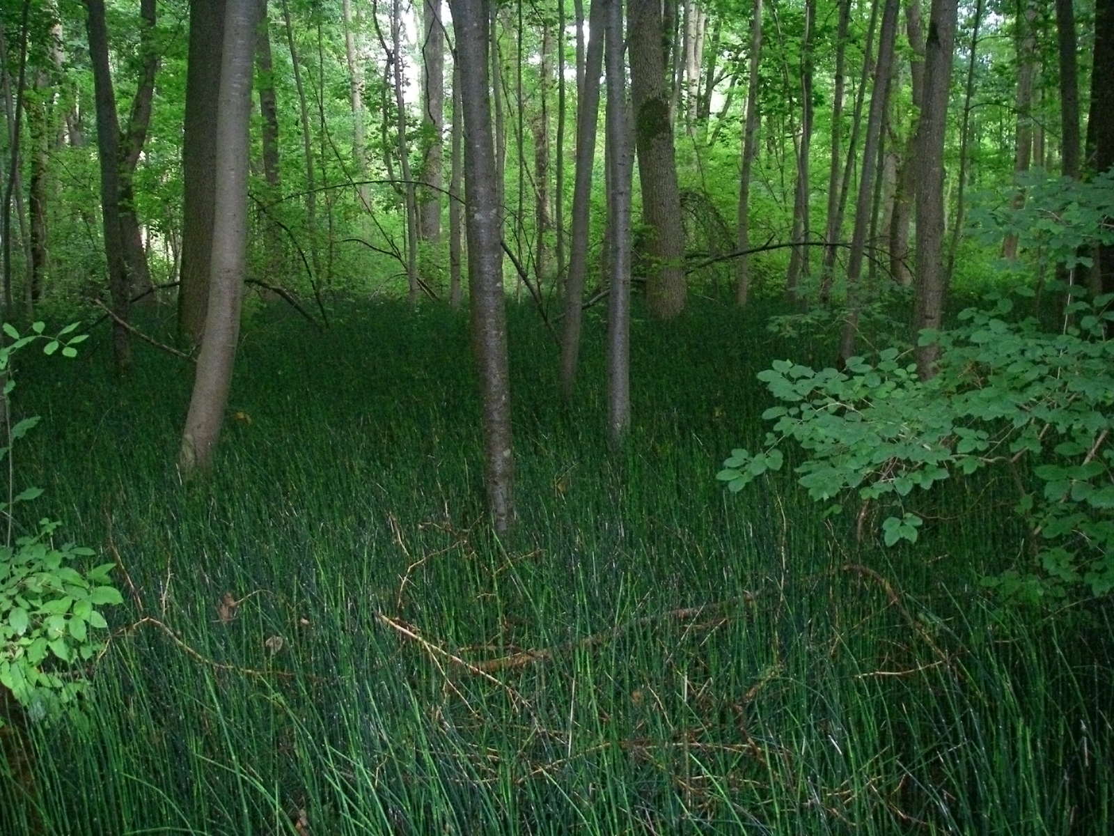
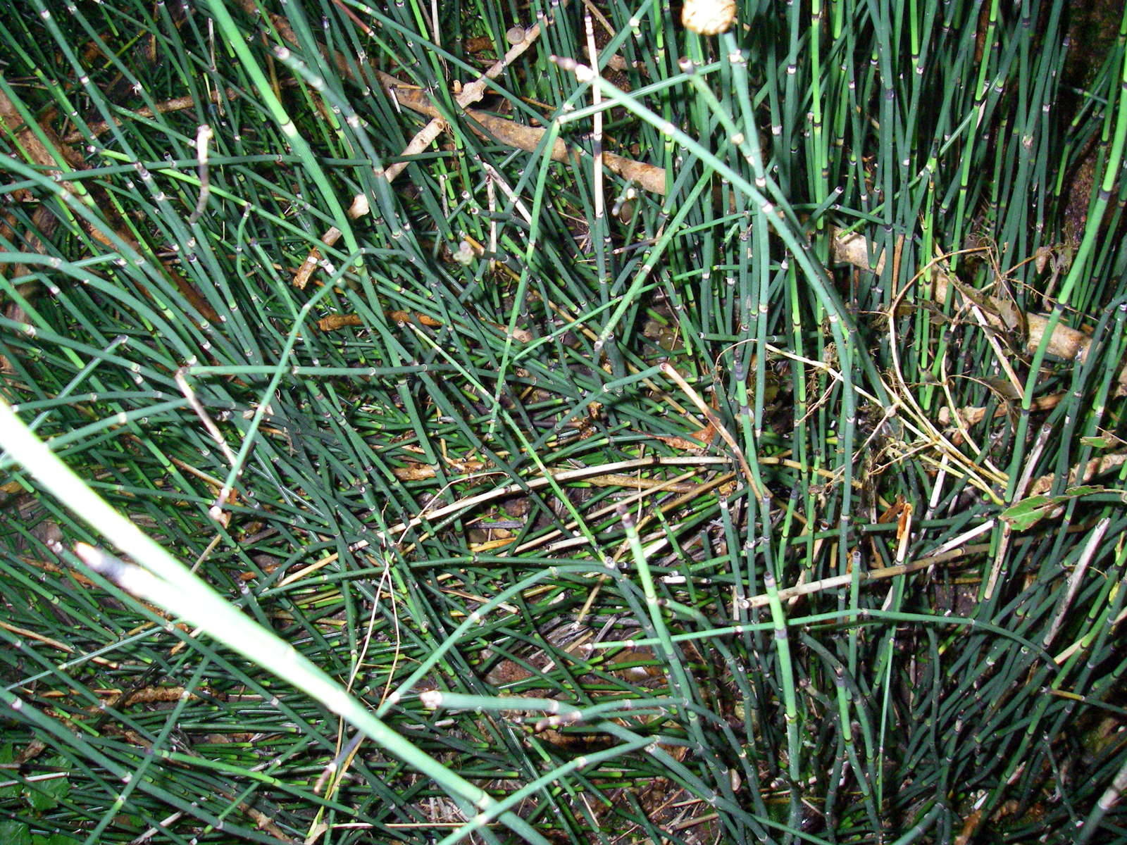
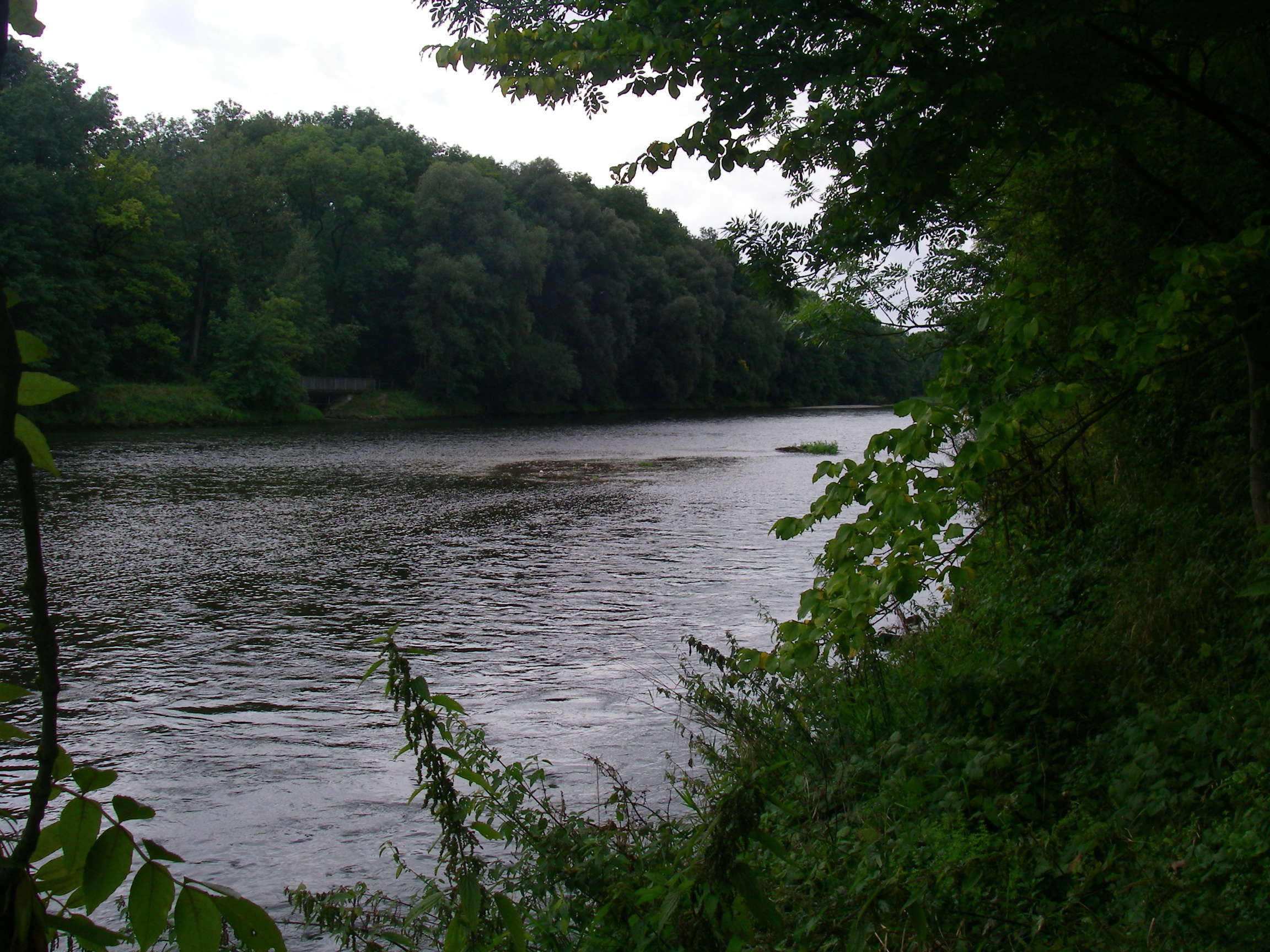
We cycled through this wet floored forest, where the permanently swampy conditions favoured the growth of these rushes, with trees able to withstand wet feet creating a wonderful dark atmosphere.
Photo: Don & Maria Hitchcock 4th September 2008
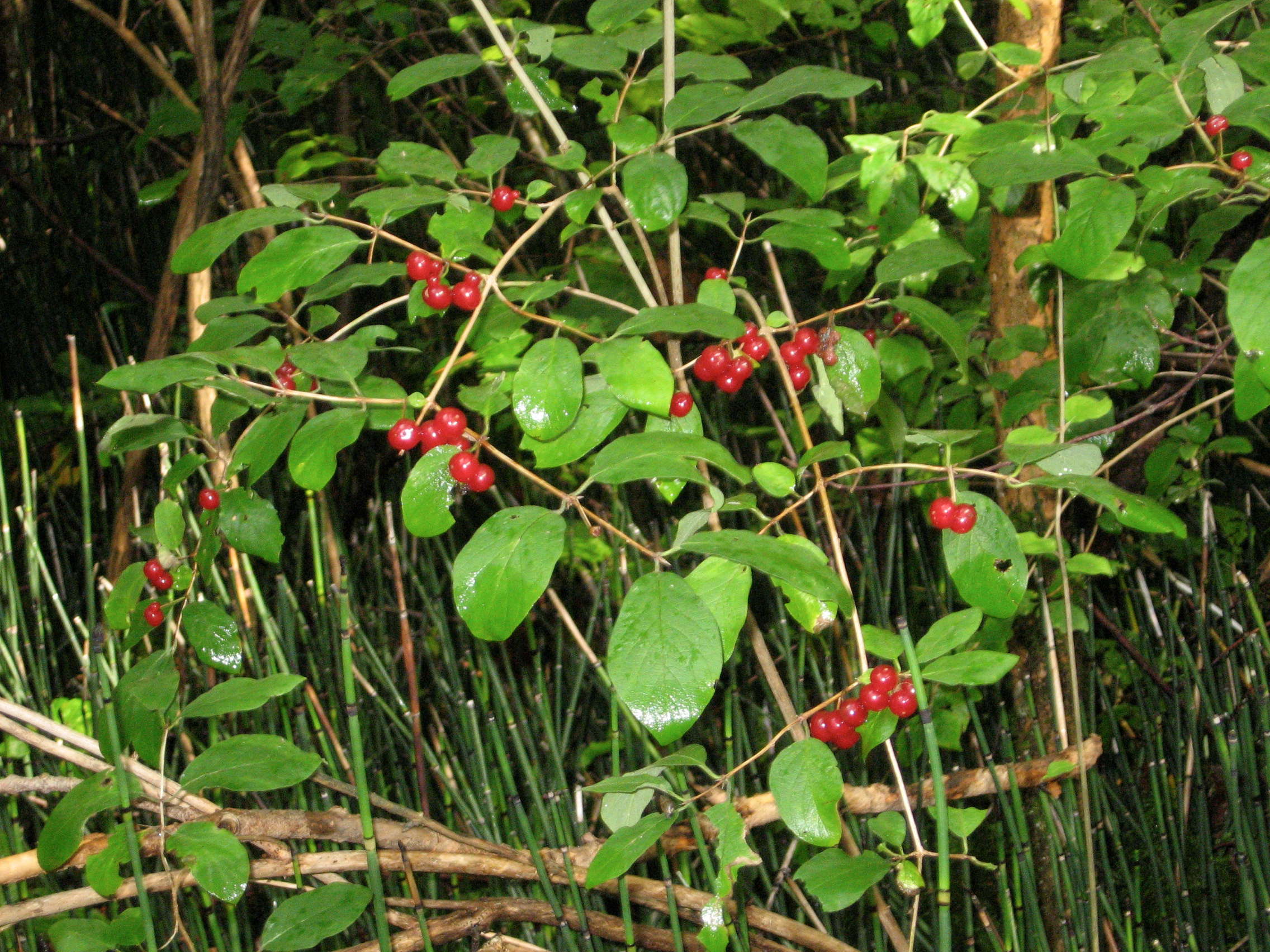
Growing in the boggy conditions were these red berries.
Photo: Don & Maria Hitchcock 4th September 2008
From Maria's diary:
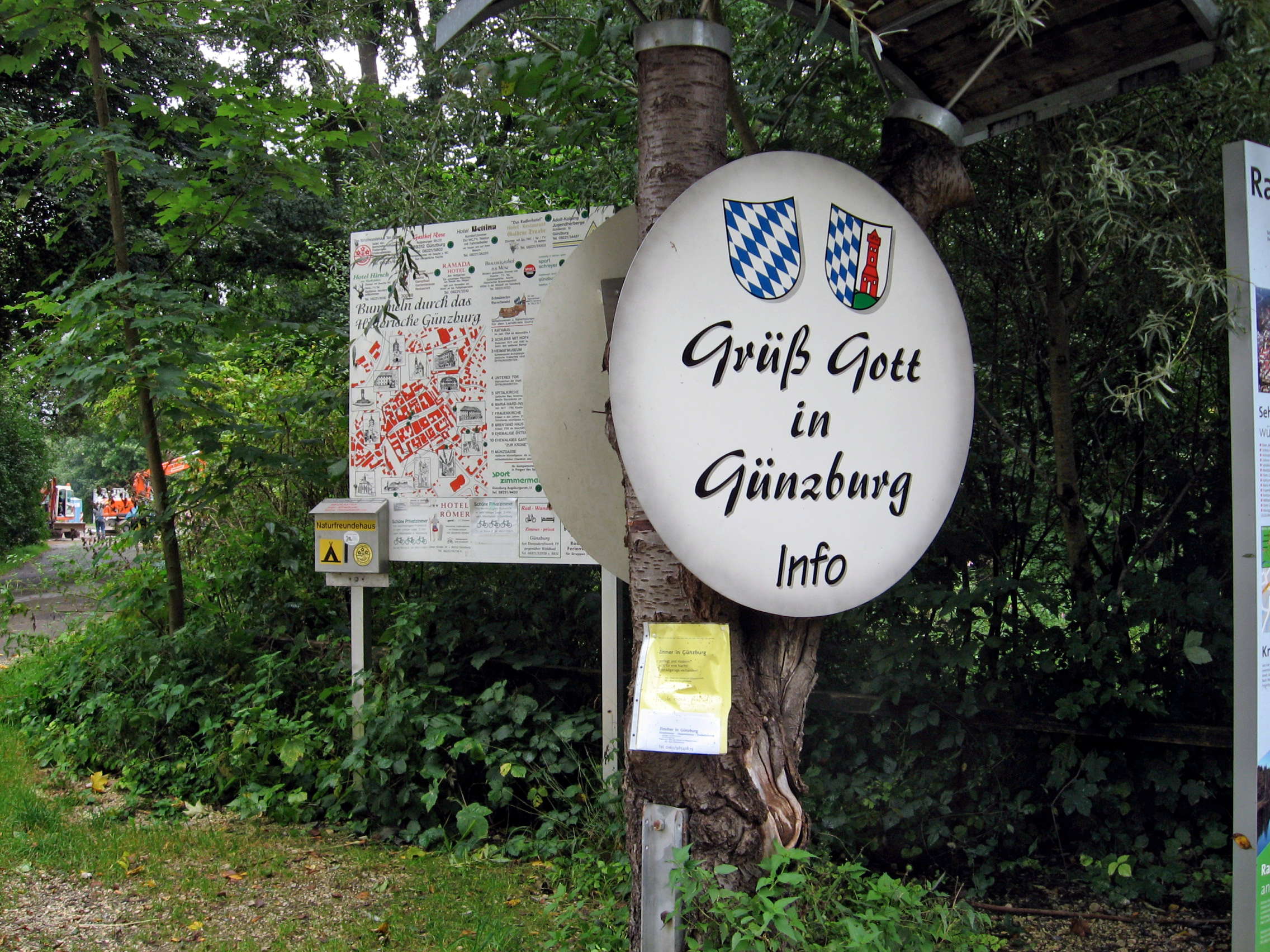
We avoided going into Leipheim but stayed on the left bank riding through more forest then crossing the river into Guenzburg.
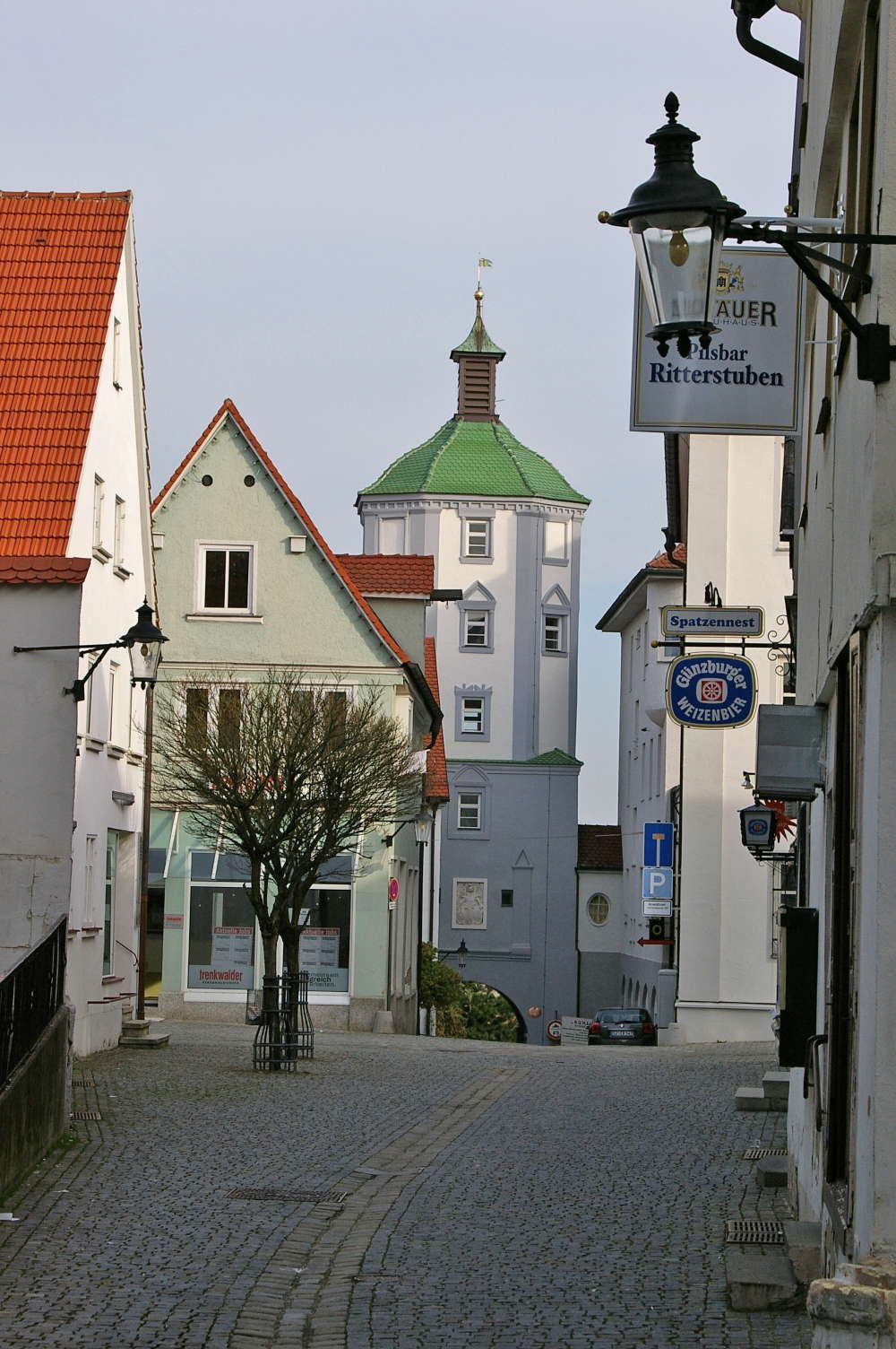
Günzburg is a very quaint Bavarian town. As we cycled through the town we saw a sign for the Youth Hostel and decided to stay there for the night. Fortunately they had a room free. At the hostel we met up with a large group of Kiwis (New Zealanders) who were on a supported ride. They were doing the full trip too but had a van and driver to take luggage. They spent most nights in hostels and had pre-booked.
Photo: Don & Maria Hitchcock 4th September 2008
From Maria's diary:
We were taking our chances with accommodation as we didn't know where we would be on any day. Don and I walked into town and found a lovely Bavarian restaurant where I had Spaetzle (a specialty of South Germany) and Don had Schnitzel. Dry clothes and a warm bed - we both slept very well.
Photo: KlausF, Günzburg, Kühturm in der Altstadt.
Permission: GNU Free Documentation License, Version 1.2 or later.